Work Package 2 - Department of the Environment
Work Package 2 - Department of the Environment
Work Package 2 - Department of the Environment

Create successful ePaper yourself
Turn your PDF publications into a flip-book with our unique Google optimized e-Paper software.
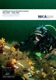
STRANGFORD LOUGH ECOLOGICAL CHANGE INVESTIGATION<br />
QUEEN’S UNIVERSITY BELFAST<br />
<strong>Work</strong> <strong>Package</strong> 2 – The current status <strong>of</strong><br />
Strangford Modiolus. KA 2.1: Diving Survey<br />
2003<br />
Dr D Roberts, School <strong>of</strong> Biology and Biochemistry, Queen’s University,<br />
Belfast (Principal Investigator, SLECI)<br />
Queen’s University Belfast<br />
INTERIM REPORT: DECEMBER 2003
Executive Summary<br />
Strangford Lough is currently on <strong>the</strong> UK list for designation as a Special Area<br />
<strong>of</strong> Conservation (SAC) under <strong>the</strong> EC Habitats Directive (92/43/EEC). A major<br />
feature for this candidacy is <strong>the</strong> sublittoral Modiolus modiolus biogenic reefs.<br />
Government <strong>Department</strong>s/Agencies and non-government organisations<br />
(NGOs) have expressed concern about <strong>the</strong> state <strong>of</strong> <strong>the</strong>se reefs (EHS, 2002).<br />
The Strangford Lough Ecological Change Investigation (SLECI),<br />
commissioned by <strong>Environment</strong> & Heritage Service, aims to identify <strong>the</strong> current<br />
conservation status <strong>of</strong> <strong>the</strong> Lough and any factors which may have contributed<br />
to change. This investigation involves assessing possible current/historical<br />
impacts <strong>of</strong> fishing or aquaculture, boating, change in climate, pollution,<br />
dredging and shore works, algal blooms, diseases and parasites, and alien<br />
species on <strong>the</strong> ecology <strong>of</strong> <strong>the</strong> Lough.<br />
All biological field-work as planned in <strong>the</strong> original tender has been completed.<br />
A total <strong>of</strong> 86 dive sites have been surveyed, some with repeat dives. Eighteen<br />
intertidal sites have been surveyed. In both sets <strong>of</strong> surveys differences have<br />
been noted between <strong>the</strong> present and earlier surveys. Analysis <strong>of</strong> biological<br />
samples is nearly complete and data analysis, including analysis <strong>of</strong> over 30<br />
hours <strong>of</strong> video records, has started.<br />
The investigation is scheduled to be completed by December 2003 and will<br />
report in full at <strong>the</strong> end <strong>of</strong> February 2004. However, <strong>the</strong> terms <strong>of</strong> <strong>the</strong> contract<br />
allow for publication <strong>of</strong> parts <strong>of</strong> <strong>the</strong> investigation as <strong>the</strong>y are completed. This is<br />
a position report from work package 2 which is to investigate <strong>the</strong> current<br />
extent and condition <strong>of</strong> <strong>the</strong> Modiolus communities in <strong>the</strong> Lough. This involved<br />
a comprehensive diving survey undertaken in July and August and additional<br />
dive surveys in October this year.<br />
Detailed analysis <strong>of</strong> <strong>the</strong> underwater video footage and quadrat samples is not<br />
yet complete, but <strong>the</strong> important issue is that this part <strong>of</strong> <strong>the</strong> study already<br />
provides evidence <strong>of</strong> <strong>the</strong> extent <strong>of</strong> change in <strong>the</strong> Modiolus communities which<br />
supports earlier studies. The Biogenic Modiolus reef feature in Strangford<br />
Lough is no longer in ‘Favourable Conservation Status’ as compared to <strong>the</strong><br />
mid 1980’s and urgent management action to protect <strong>the</strong> few remaining<br />
Modiolus beds within Strangford Lough should be considered by <strong>the</strong><br />
competent authorities.<br />
SLECI INTERIM REPORT: DECEMBER 2003 2
Conclusions<br />
1. The present study demonstrates that Modiolus reefs are no longer in<br />
‘Favorable Conservation Status’ (The condition in which <strong>the</strong> habitat or<br />
species is capable <strong>of</strong> sustaining itself on a long-term basis [Anon,<br />
1997]) in Strangford Lough.<br />
2. There was a 3.7km 2 reduction in clumped Modiolus communities<br />
between 1993 and 2000.<br />
3. Comparison <strong>of</strong> <strong>the</strong> current with earlier diving surveys confirms this<br />
decline in Modiolus communities and suggests it is continuing.<br />
4. There is no evidence to suggest recovery <strong>of</strong> Modiolus communities in<br />
Strangford Lough has been taking place since <strong>the</strong> conservation<br />
measures, involving legislation to manage fishing activity, were<br />
introduced in 1993 to protect <strong>the</strong>m.<br />
5. There is <strong>the</strong>refore an urgency to protect remaining Modiolus<br />
communities in Strangford Lough.<br />
6. More detailed mapping, to determine <strong>the</strong> precise extent and condition<br />
<strong>of</strong> <strong>the</strong> Modiolus communities using techniques developed by SLECI<br />
and elsewhere are needed after <strong>the</strong> final SLECI report is completed.<br />
7. The use <strong>of</strong> mobile bottom fishing gear poses <strong>the</strong> most immediate threat<br />
to <strong>the</strong> few remaining clumped Modiolus communities within <strong>the</strong><br />
confines <strong>of</strong> Strangford Lough cSAC. Notwithstanding that Modiolus<br />
recruitment is still occurring in Strangford Lough, <strong>the</strong> continued use <strong>of</strong><br />
mobile bottom fishing gear is likely to hinder natural recovery.<br />
Fishermen trying to develop alternative, sustainable practices should<br />
<strong>the</strong>refore be encouraged.<br />
8. To build on <strong>the</strong> facts that Modiolus populations are similar in structure<br />
to samples taken in <strong>the</strong> 1970s and recruitment appears to be still<br />
occurring, a programme for <strong>the</strong> restoration <strong>of</strong> Modiolus biogenic reefs<br />
in Strangford Lough should be considered; this should be underpinned<br />
using state-<strong>of</strong>-<strong>the</strong>-art techniques to monitor physiological and shell<br />
indicators <strong>of</strong> stress in Modiolus to ensure success.<br />
SLECI INTERIM REPORT: DECEMBER 2003 3
Introduction<br />
Modiolus modiolus communities form biogenic (i.e. produced by <strong>the</strong> actions<br />
<strong>of</strong> living organisms) reefs that are a major selection feature <strong>of</strong> interest for <strong>the</strong><br />
Strangford Lough SAC (SAC Annex 1 selection feature ‘Reefs’). These beds<br />
have been documented in <strong>the</strong> Lough since <strong>the</strong> mid 1800’s (Dickie,1857). In<br />
<strong>the</strong> 1970s <strong>the</strong> Modiolus beds were known to be extensive (Erwin, 1978) and ‘<br />
<strong>the</strong> bed situated amongst <strong>the</strong> numerous small islands <strong>of</strong>f Killyleagh at depths<br />
<strong>of</strong> 6 to 9 fathoms which were sampled regularly during this investigation,<br />
appears to be well over one square mile in extent’ (Seed & Brown, 1977).<br />
The full extent <strong>of</strong> <strong>the</strong> beds was not reported in detail until <strong>the</strong> early 1990s by<br />
which time certain areas, particularly those occupied by <strong>the</strong> M. modiolus/<br />
Chlamys varia community [JNCC biotope classification SCR.ModCvar.], were<br />
heavily impacted by trawling for queen scallops, (Service & Magorrian, 1997).<br />
It is now well established that trawling and dredging can damage biogenic<br />
reefs, seabed communities and emergent epifauna (see for example: Watling<br />
& Norse, 1998; Cranfield et al., 2003). As a result <strong>of</strong> recommendations by <strong>the</strong><br />
<strong>the</strong>n <strong>Department</strong> <strong>of</strong> Agriculture for Nor<strong>the</strong>rn Ireland (DANI now <strong>Department</strong> <strong>of</strong><br />
Agriculture and Rural Development [DARD]), a number <strong>of</strong> legislative<br />
measures were introduced in 1993 to manage fishing activity (Service &<br />
Magorrian, 1997).<br />
The most recent broadscale acoustic survey, prior to SLECI, reported a<br />
3.7km 2 reduction in area <strong>of</strong> clumped Modiolus between 1993 and 2000<br />
(Mitchell et al. 2002). A repeat acoustic survey was conducted in 2003 and<br />
will, following analysis and ground-truthing, be reported at a later date as part<br />
<strong>of</strong> <strong>the</strong> present investigation.<br />
One <strong>of</strong> <strong>the</strong> main aims <strong>of</strong> <strong>the</strong> current survey is to ascertain <strong>the</strong> current extent<br />
and condition <strong>of</strong> Modiolus reefs as compared to diving surveys conducted by<br />
<strong>the</strong> Ulster Museum during <strong>the</strong> 1970’s and 80’s.<br />
Strangford Lough can be divided into two main basins north and south <strong>of</strong> Long<br />
Sheelah (Appendix 1). The water in <strong>the</strong> sou<strong>the</strong>rn basin mixes quite freely with<br />
<strong>the</strong> Irish Sea, whilst <strong>the</strong> water in <strong>the</strong> nor<strong>the</strong>rn basin is retained within <strong>the</strong> lough<br />
for longer periods (Boyd, 1973).<br />
Modiolus beds in <strong>the</strong> North Basin are characterised by Modiolus modiolus<br />
co-dominant with Chlamys varia with abundant Queen scallops (Aequipecten<br />
opercularis) and occur between 10m and 35m depth. This community was<br />
described as a distinct biotope in <strong>the</strong> 1996 JNCC biotope classification with<br />
coding SCR.ModCvar. The biotope is only known within Strangford Lough<br />
and possibly Loch Creran in SW Scotland. It may represent a fine balance <strong>of</strong><br />
climatic conditions between suitability for Modiolus modiolus which has a<br />
predominantly cold-water distribution and Chlamys varia which has a<br />
SLECI INTERIM REPORT: DECEMBER 2003 4
predominantly temperate-water distribution. The large numbers <strong>of</strong> queen<br />
scallops (queenies), were formerly <strong>the</strong> basis <strong>of</strong> a commercial fishery in<br />
Strangford Lough.<br />
Modiolus beds in <strong>the</strong> South Basin have few Chlamys or Aequipecten but<br />
more hydroids and brittlestars (biotope code: SCR.ModHAs) and are less<br />
diverse than <strong>the</strong> Modiolus/Chlamys biotope. They have few Chlamys or<br />
Aequipecten and so have not been subjected to trawling for queenies,<br />
although <strong>the</strong>y are in <strong>the</strong> dredging zone for King scallops. Beds like <strong>the</strong>se are<br />
also found on <strong>the</strong> coast <strong>of</strong> <strong>the</strong> Ards peninsula and o<strong>the</strong>r places outside<br />
Strangford Lough.<br />
Both types <strong>of</strong> reefs are a major feature <strong>of</strong> <strong>the</strong> Lough justifying its status as a<br />
candidate Special Area <strong>of</strong> Conservation (cSAC) and as a Marine Nature<br />
Reserve.<br />
In <strong>the</strong>ir 1997 paper, Service and Magorrian indicated that management <strong>of</strong><br />
fishing activity in <strong>the</strong> Lough, toge<strong>the</strong>r with <strong>the</strong> establishment <strong>of</strong> Strangford<br />
Lough as a Marine nature reserve, would allow future assessment <strong>of</strong> recovery<br />
<strong>of</strong> areas formerly impacted by mobile bottom gear.<br />
This preliminary report provides <strong>the</strong> most recent information on <strong>the</strong> current<br />
extent and condition <strong>of</strong> <strong>the</strong> Modiolus communities in <strong>the</strong> Lough based on a<br />
comprehensive diving survey undertaken in July and August and additional<br />
dive surveys in October this year. The findings presented here will be<br />
integrated in <strong>the</strong> final report with detailed RoxAnn surveys <strong>of</strong> <strong>the</strong> Lough<br />
undertaken this year and with o<strong>the</strong>r surveys carried out since <strong>the</strong> mid 1990s<br />
by DARD.<br />
Methods<br />
Dive Survey<br />
Divers working in pairs carried out direct observations and sampling <strong>of</strong> <strong>the</strong><br />
seabed. A total <strong>of</strong> 86 dive sites (Appendix 2) were visited during July August<br />
and October 2003. Some <strong>of</strong> <strong>the</strong>se were chosen to be as close as possible to<br />
<strong>the</strong> Modiolus dominated sites found in <strong>the</strong> earlier Nor<strong>the</strong>rn Ireland Sublittoral<br />
Survey/Ulster Museum between 1975 and 1985. O<strong>the</strong>r dive sites were in<br />
different habitats and were chosen to investigate possible changes in <strong>the</strong>se<br />
o<strong>the</strong>r habitats.<br />
Modiolus habitat condition was assessed at a number <strong>of</strong> sites using 100m<br />
transect lines marked at 1m intervals using <strong>the</strong> method reported by Brown<br />
(1989). In <strong>the</strong> present study, observations were supported by underwater<br />
video footage shot on 3-chip digital video cameras in underwater housings.<br />
Processing <strong>of</strong> samples and video is still in progress.<br />
Population and community studies<br />
Modiolus modiolus was collected from three areas identified as having<br />
relatively dense areas <strong>of</strong> Modiolus biotopes:<br />
SLECI INTERIM REPORT: DECEMBER 2003 5
1. North <strong>of</strong> <strong>the</strong> Long Sheelah,<br />
2. The raised area to <strong>the</strong> west <strong>of</strong> Round Island<br />
3. The area known as <strong>the</strong> Black Rock beds.<br />
In <strong>the</strong>se areas, 0.25m 2 quadrats were taken at random points along a 100m<br />
transect laid on <strong>the</strong> seabed. The samples were transferred into mesh onion<br />
bags, attached to a lifting bag and raised to <strong>the</strong> surface boat where <strong>the</strong>y were<br />
placed in buckets <strong>of</strong> seawater. In <strong>the</strong> laboratory <strong>the</strong> samples were washed<br />
through a 1mm sieve and live Modiolus were removed from <strong>the</strong> sample. Shell<br />
length, height and width were measured to <strong>the</strong> nearest 0.1mm using callipers.<br />
The Modiolus were <strong>the</strong>n placed in holding tanks for subsequent experiments.<br />
The remainder <strong>of</strong> <strong>the</strong> quadrat samples were preserved in 70% alcohol for<br />
fur<strong>the</strong>r community analysis.<br />
SLECI INTERIM REPORT: DECEMBER 2003 6
Results<br />
Dive survey<br />
Modiolus beds in Strangford Lough as reported by Ulster Museum divers<br />
between 1975 and 1985 are shown in Appendix 1. The beds were<br />
widespread below <strong>the</strong> 10 m contour and largely undisturbed during this<br />
period; beds were characterised by biotope SCR.ModCvar. (Figures 1a,b) in<br />
<strong>the</strong> north basin, where <strong>the</strong> majority <strong>of</strong> dive sites had Modiolus, and biotope<br />
SCR.ModHAs. (Figutre 1c,d) in <strong>the</strong> south basin.<br />
Current situation<br />
In <strong>the</strong> present study (2003) intact, clumped Modiolus beds were located at<br />
only six out <strong>of</strong> a total <strong>of</strong> 44 field-sampling sites in a small area in <strong>the</strong> North<br />
Basin and eight out <strong>of</strong> a total <strong>of</strong> 41 sites in four widely spaced areas in <strong>the</strong><br />
South Basin (Appendix 2).<br />
North Basin [SCR.ModCvar]<br />
In <strong>the</strong> North Basin <strong>the</strong> Modiolus beds appear to be very much reduced in<br />
extent. Only six field-sampling sites in a small area in <strong>the</strong> North Basin are <strong>the</strong><br />
classic Modiolus with Chlamys community or biotope (SCR.ModCvar)<br />
(Figures 1a,b). These are located at <strong>the</strong> side <strong>of</strong> this basin and <strong>the</strong>se may no<br />
longer be in pristine condition (dive sites 11, 36, 37 48, 63 and 77 in Appendix<br />
2) as indicated by <strong>the</strong> decline in some key species <strong>of</strong> sponges and<br />
echinoderms. By contrast, <strong>the</strong> majority <strong>of</strong> sites in <strong>the</strong> north basin surveyed by<br />
divers between 1975 and 1985, had clumped Modiolus communities.<br />
At <strong>the</strong> centre <strong>of</strong> <strong>the</strong> North Basin, which was formerly <strong>the</strong> main area for <strong>the</strong><br />
classic Modiolus with Chlamys biotope but was also zoned for trawling <strong>of</strong><br />
queenies, no clumped Modiolus remain at any site visited; this area now<br />
has extensive areas <strong>of</strong> dead shell with occasional live Modiolus individuals.<br />
(Figures 1e,f). Very few queen scallops were observed at any site within <strong>the</strong><br />
North Basin.<br />
South Basin [SCR.ModHAs]<br />
Modiolus beds (biotope SCR.ModHAs) were historically present in several<br />
areas in <strong>the</strong> south basin, East <strong>of</strong> Black Rock, East <strong>of</strong> Taggart Island and at<br />
various places between <strong>the</strong> Limestone Rock and <strong>the</strong> Long Sheelah. Three <strong>of</strong><br />
<strong>the</strong>se areas were surveyed during <strong>the</strong> present study.<br />
Black Rock beds<br />
They are currently mostly intact, though areas adjacent to <strong>the</strong>m are in poor<br />
condition, with many Modiolus almost completely buried in muddy sediment<br />
which appears to be recently accumulated.<br />
Area to west <strong>of</strong> Round Island<br />
This area had not been surveyed previously by diving. It was found to have<br />
clumped Modiolus beds from 10m to 30m depth. The beds were more<br />
disrupted in deeper water but o<strong>the</strong>rwise showed little sign <strong>of</strong> disturbance.<br />
SLECI INTERIM REPORT: DECEMBER 2003 7
Channel East <strong>of</strong> Selk Rock, Taggart Island<br />
The bottom here was reported to have a dense bed <strong>of</strong> Modiolus modiolus in<br />
1976 by Ulster Museum divers. It now consists <strong>of</strong> mostly dead shells, with a<br />
scattering <strong>of</strong> live Modiolus. At this site areas <strong>of</strong> dense dead shell alternated<br />
with bare mud.<br />
SLECI INTERIM REPORT: DECEMBER 2003 8
a) Modiolus clump in intact bed -<br />
Modiolus/Chlamys biotope, Ophiothrix<br />
brittlestars<br />
c) Modiolus clump from south basin,<br />
with hydroids and Antedon<br />
e) Area <strong>of</strong> dead Modiolus shell - main channel,<br />
North basin<br />
Figure 1. Stills images from video footage<br />
b) Modiolus/Chlamys clump, Chlamys varia<br />
feeding and showing mantles<br />
d) Modiolus showing “clean” appearance <strong>of</strong><br />
south basin mussels<br />
f) Area <strong>of</strong> mud with shell, adjacent to Fig. 2e.<br />
SLECI INTERIM REPORT: DECEMBER 2003 9
Preliminary Population studies<br />
Data from <strong>the</strong> current population census were grouped by area and sorted<br />
into 5mm size classes. Size frequency histograms were constructed for <strong>the</strong>se<br />
three areas and compared to data taken by Brown between 1973 and 1976<br />
(Brown, 1976) (Figure 2).<br />
20 . 0<br />
18 . 0<br />
16 . 0<br />
14 . 0 n = 1006<br />
25.0<br />
20.0<br />
n = 54<br />
%<br />
12 . 0<br />
10 . 0<br />
8.0<br />
15.0 %<br />
%<br />
6.0<br />
4.0<br />
2.0<br />
0.0<br />
30 .0<br />
25 .0<br />
20 .0<br />
15 .0<br />
10 .0<br />
5.0<br />
0.0<br />
0 to 5<br />
0-4.9<br />
5 to 10<br />
5.0-9.9<br />
a) South Basin (Brown 1974)<br />
10 to 15<br />
15 to 20<br />
20 to 25<br />
25 to 30<br />
30 to 35<br />
35 to 40<br />
40 to 45<br />
45 to 50<br />
50 to 55<br />
55 to 60<br />
60 to 65<br />
Size Class (mm)<br />
c) Area B South Basin<br />
(Present study 2003)<br />
n = 136<br />
10.0-14.9<br />
15.0-19.9<br />
20.0-24.9<br />
25.0-29.9<br />
30.0-34.9<br />
35.0-39.9<br />
40.0-44.9<br />
45.0-49.9<br />
50.0-54.9<br />
55.0-59.9<br />
65 to 70<br />
60.0-64.9<br />
70 to 75<br />
65.0-69.9<br />
Size Category (mm)<br />
75 to 80<br />
70.0-74.9<br />
80 to 85<br />
75.0-79.9<br />
85 to 90<br />
80.0-84.9<br />
90 to 95<br />
85.0-89.9<br />
95 to 100<br />
90.0-94.9<br />
100 to 105<br />
95.0-99.9<br />
105 to 110<br />
100.0-1 04.9<br />
110 to 115<br />
105.0-1 09.9<br />
110.0-1 14.9<br />
115.0-1 19.9<br />
SLECI INTERIM REPORT: DECEMBER 2003 10<br />
30.0<br />
10.0<br />
5.0<br />
0.0<br />
30.0<br />
25.0<br />
20.0<br />
15.0<br />
10.0<br />
0-4.9<br />
5. 0<br />
0. 0<br />
0-4.9<br />
5.0-9.9<br />
5. 0- 9. 9<br />
10.0-1 4.9<br />
10.0-14.9<br />
15.0-1 9.9<br />
15.0-19.9<br />
20.0-2 4.9<br />
20.0-24.9<br />
25.0-2 9.9<br />
25.0-29.9<br />
30.0-3 4.9<br />
30.0-34.9<br />
35.0-3 9.9<br />
35.0-39.9<br />
40.0-4 4.9<br />
40.0-44.9<br />
45.0-4 9.9<br />
45.0-49.9<br />
50.0-5 4.9<br />
55.0-5 9.9<br />
60.0-6 4.9<br />
65.0-6 9.9<br />
Size Category (mm)<br />
50.0-54.9<br />
55.0-59.9<br />
60.0-64.9<br />
65.0-69.9<br />
Size Category (mm)<br />
Figure 2. Comparison <strong>of</strong> <strong>the</strong> population pr<strong>of</strong>iles <strong>of</strong> Modiolus modiolus<br />
(% size frequencies) in Strangford Lough for 1974,and 2003 (Areas A, B<br />
& C).<br />
Earlier samples (Figure 2a) showed a skewed population modality<br />
characteristic <strong>of</strong> populations dominated by older individuals and typical <strong>of</strong><br />
many Modiolus populations (see e.g. Brown & Seed, 1978; Rees et al., 2001).<br />
Population samples taken during <strong>the</strong> present study (Figure 2b-d) were similar<br />
in structure to samples taken in <strong>the</strong> 1970s and showed little evidence <strong>of</strong><br />
change with <strong>the</strong> possible exception <strong>of</strong> <strong>the</strong> sample from Area A which showed<br />
an absence <strong>of</strong> individuals from <strong>the</strong> size classes from 15.0mm to 44.9mm.<br />
However, <strong>the</strong> sample from this site was small; in addition at this site and <strong>the</strong><br />
o<strong>the</strong>r sites <strong>the</strong>re are individuals as small as 5mm which suggests that<br />
recruitment is still occurring.<br />
%<br />
b) Area A, South Basin<br />
(Present Study 2003)<br />
d) Area C North Basin<br />
(Present study 2003)<br />
n = 218<br />
70.0-7 4.9<br />
70.0-74.9<br />
75.0-7 9.9<br />
75.0-79.9<br />
80.0-8 4.9<br />
80.0-84.9<br />
85.0-8 9.9<br />
85.0-89.9<br />
90.0-94.9<br />
90.0-9 4.9<br />
95.0-99.9<br />
95.0-9 9.9<br />
100.0-104.9<br />
100.0-1 04.9<br />
105.0-109.9<br />
105.0-1 09.9<br />
110.0-114.9<br />
110.0-1 14.9<br />
115.0-119.9<br />
115.0-1 19.9
Summary <strong>of</strong> findings<br />
A full discussion <strong>of</strong> <strong>the</strong> findings will be provided in <strong>the</strong> final report at <strong>the</strong> end <strong>of</strong><br />
<strong>the</strong> investigation scheduled for <strong>the</strong> end <strong>of</strong> February 2004. The intention <strong>of</strong> this<br />
interim report is to alert EHS to <strong>the</strong> current status <strong>of</strong> <strong>the</strong> Modiolus reefs based<br />
on findings <strong>of</strong> <strong>the</strong> dive survey.<br />
1. In <strong>the</strong> 1970s & 80s Modiolus beds were known to be extensive in<br />
Strangford Lough (Seed & Brown, 1977; Erwin, 1978, Erwin et al,<br />
1990).<br />
2. The full extent <strong>of</strong> <strong>the</strong> beds was not reported in detail until <strong>the</strong> early<br />
1990s by which time certain areas, particularly those occupied by <strong>the</strong><br />
M. modiolus/ Chlamys varia community, were heavily impacted by<br />
mobile fishing gear (Service & Magorrian, 1997).<br />
3. Trawling and dredging are known to damage biogenic reefs and<br />
seabed communities (Watling & Norse, 1998; Cranfield et al. 2003).<br />
Within Strangford Lough trawling has been reported as removing<br />
emergent epifauna (Service & Magorrian, 1997).<br />
4. As a result <strong>of</strong> recommendations by <strong>the</strong> <strong>the</strong>n <strong>Department</strong> <strong>of</strong> Agriculture<br />
for Nor<strong>the</strong>rn Ireland (DANI now <strong>Department</strong> <strong>of</strong> Agriculture and Rural<br />
Development [DARD]), a number <strong>of</strong> legislative measures were<br />
introduced in 1993 to manage fishing activity.<br />
5. The most recent survey, prior to SLECI, reported a 3.7km 2 reduction in<br />
area <strong>of</strong> clumped Modiolus between 1993 and 2000 (Mitchell et al.<br />
2002).<br />
6. Comparison <strong>of</strong> <strong>the</strong> current with earlier diving surveys confirms <strong>the</strong><br />
decline in:<br />
• North basin Modiolus communities (SCR.ModCvar.) which are now<br />
very much reduced in extent and may no longer be in pristine condition<br />
• South basin Modiolus communities (SCR.ModHAs.).Although <strong>the</strong>se<br />
are more widely distributed than communities in <strong>the</strong> North basin and<br />
several beds remain, a number <strong>of</strong> <strong>the</strong>se, show greater or lesser signs<br />
<strong>of</strong> disruption.<br />
7. In sites where it was possible to collect population samples, population<br />
structure showed little differences from samples taken in <strong>the</strong> 1970s as<br />
a wide range <strong>of</strong> sizes were present and, <strong>the</strong>re were individuals as small<br />
as 5mm which suggests that recruitment is still occurring.<br />
SLECI INTERIM REPORT: DECEMBER 2003 11
Conclusions<br />
1. The present study demonstrates that Modiolus reefs are no longer in<br />
‘Favorable Conservation Status’ (The condition in which <strong>the</strong> habitat or<br />
species is capable <strong>of</strong> sustaining itself on a long-term basis [Anon,<br />
1997]) in Strangford Lough.<br />
2. There was a 3.7km 2 reduction in clumped Modiolus communities<br />
between 1993 and 2000.<br />
3. Comparison <strong>of</strong> <strong>the</strong> current with earlier diving surveys confirms this<br />
decline in Modiolus communities and suggests it is continuing.<br />
4. There is no evidence to suggest recovery <strong>of</strong> Modiolus communities in<br />
Strangford Lough has been taking place since <strong>the</strong> conservation<br />
measures, involving legislation to manage fishing activity, were<br />
introduced in 1993 to protect <strong>the</strong>m.<br />
5. There is <strong>the</strong>refore an urgency to protect remaining Modiolus<br />
communities in Strangford Lough.<br />
6. More detailed mapping, to determine <strong>the</strong> precise extent and condition<br />
<strong>of</strong> <strong>the</strong> Modiolus communities using techniques developed by SLECI<br />
and elsewhere are needed after <strong>the</strong> final SLECI report is completed.<br />
7. The use <strong>of</strong> mobile bottom fishing gear poses <strong>the</strong> most immediate threat<br />
to <strong>the</strong> few remaining clumped Modiolus communities within <strong>the</strong><br />
confines <strong>of</strong> Strangford Lough cSAC Notwithstanding that Modiolus<br />
recruitment is still occurring in Strangford Lough, <strong>the</strong> continued use <strong>of</strong><br />
mobile bottom fishing gear is likely to hinder natural recovery.<br />
Fishermen trying to develop sustainable practices should <strong>the</strong>refore be<br />
encouraged.<br />
8. To build on <strong>the</strong> facts that Modiolus populations are similar in structure<br />
to samples taken in <strong>the</strong> 1970s and recruitment appears to be still<br />
occurring, a programme for <strong>the</strong> restoration <strong>of</strong> Modiolus biogenic reefs<br />
in Strangford Lough should be considered; this should be underpinned<br />
using state-<strong>of</strong>-<strong>the</strong>-art techniques to monitor physiological and shell<br />
indicators <strong>of</strong> stress in Modiolus to ensure success.<br />
SLECI INTERIM REPORT: DECEMBER 2003 12
References<br />
Anon 1997. Natura 2000: European marine sites, an introduction to management.<br />
SNH, EN, EHS (DOE(NI)), JNCC, CCW. Perth, SNH,17pp.<br />
Boyd, R.J. 1973. The relation <strong>of</strong> <strong>the</strong> plankton to <strong>the</strong> physical, chemical and biological<br />
features <strong>of</strong> Strangford Lough, Co. Down. Proceedings <strong>of</strong> <strong>the</strong> Royal Irish Academy,<br />
73B, 317-353.<br />
Brown, R. A. 1976. The Ecology <strong>of</strong> Modiolus modiolus (L) and Cerastoderma<br />
(=Cardium) edule (L) in Strangford Lough, N. Ireland. PhD Thesis, Queen’s<br />
University <strong>of</strong> Belfast<br />
Brown, R.A., 1989. Bottom trawling in Strangford Lough: Problems and policies.<br />
North Sea Conference, Rotterdam.<br />
Brown, R.A. & Seed, R., 1978. Modiolus modiolus (L.) – an autecological study. In:<br />
Biology <strong>of</strong> Benthic Organisms. B.F. Keegan et al. eds. Pergammon Press, Oxford. pp<br />
93-100.<br />
Cranfield H.J., Manighetti, B., Mitchell K.P. & Hill A. 2003. Effects <strong>of</strong> oyster dredging<br />
on <strong>the</strong> distribution <strong>of</strong> bryozoan biogenic reefs and associated sediments in Foveaux<br />
Strait, sou<strong>the</strong>rn New Zealand. Continental Shelf Research 23, 1337-1357.<br />
Dickie, G., 1857. Report on <strong>the</strong> Marine Zoology <strong>of</strong> Strangford Lough. Report British.<br />
Association, 1857.<br />
EHS, 2002. Report on <strong>the</strong> Modiolus community in Strangford Lough: formal advice to<br />
<strong>the</strong> minister for <strong>the</strong> environment from <strong>Environment</strong> and Heritage Service. 9pp.<br />
Erwin, D. G. 1978. A diving survey <strong>of</strong> Strangford Lough: <strong>the</strong> benthic communities and<br />
<strong>the</strong>ir relation to substrate – a preliminary account. In: Biology <strong>of</strong> Benthic Organisms.<br />
B.F. Keegan et al. eds. Pergammon Press, Oxford. pp 215-224.<br />
Erwin, D.G., Picton. B.E., Connor, D.W., Howson, C.W., Gilleece, P. and Bogues,<br />
M.J. 1990. Inshore Marine Life <strong>of</strong> Nor<strong>the</strong>rn Ireland. A Report for <strong>the</strong> <strong>Department</strong> Of<br />
<strong>Environment</strong>- Nor<strong>the</strong>rn Ireland. Ulster Museum, HMSO, 148 pp.<br />
Mitchell, A., Wall, C & Service, M. 2002. Strangford Lough Broadscale subtidal<br />
habitat mapping project: Interim report. EHS. 22pp.<br />
Rees, E.I.S. 2001. Section 3.3. Introduction and history <strong>of</strong> work on <strong>the</strong> Pen Llyn<br />
Modiolus reef . In: The establishment <strong>of</strong> a programme <strong>of</strong> surveillance and monitoring<br />
for judging <strong>the</strong> condition and features <strong>of</strong> Pen Llyn a’r sarnau cSAC: 1. Progress to<br />
March 2001. W.G. Sanderson et al. eds. Bangor, CCW Contract Science Report No<br />
380 (U.K Marine SACs Project), 400pp.<br />
Seed, R. & Brown, R.A. 1977. A comparison <strong>of</strong> <strong>the</strong> reproductive cycles <strong>of</strong> Modiolus<br />
modiolus (L.) Cerastoderma (=Cardium) edule (L.) and Mytilus edulis L. in Strangford<br />
Lough, Nor<strong>the</strong>rn Ireland. Oecologia (Berl.) 30,173-188.<br />
SLECI INTERIM REPORT: DECEMBER 2003 13
Service, M & Magorrian, B.H. 1997. The extent and temporal variation <strong>of</strong> disturbance<br />
to epibenthic communities in strangford Lough, Nor<strong>the</strong>rn Ireland. Journal <strong>of</strong> <strong>the</strong><br />
Marine Biological Association, U.K. 77, 1151-1164.<br />
Watling, L. & Norse, A.E. 1998. Disturbance <strong>of</strong> <strong>the</strong> seabed by mobile fishing gear: A<br />
comparison with forest clear-cutting. Conservation Biology 12, 1180-1197.<br />
SLECI INTERIM REPORT: DECEMBER 2003 14
Appendix 1. Ulster Museum sites. Line illustrates approximate division <strong>of</strong><br />
north and south basins<br />
NISS & Ulster Museum divesite positions1975-85<br />
Legend<br />
1975-85 sites<br />
O<strong>the</strong>r communities<br />
Modiolus beds<br />
Sparse Modiolus<br />
Nephrops ground<br />
Coastline<br />
Islands<br />
10mContour<br />
SLECI INTERIM REPORT: DECEMBER 2003 15
Appendix 2 – SLECI dive-site details. Sites marked green have intact<br />
Modiolus/Chamys ,[SCR.ModCvar.], those marked blue have intact<br />
Modiolus/hydroids[SCR.ModHAs.]. N – North basin; S – South basin<br />
Field<br />
Site No<br />
DiveNo Description<br />
1 030702/03 S Bare muddy seabed with scattered shells<br />
2 030702/04 S Scattered dead Modiolus shell, some live Modiolus clumps partially buried in mud<br />
3 030703/01 N Scattered dead Modiolus shell<br />
4 030703/02 N Mud with dead shell, some Modiolus/Chlamys clumps<br />
5 030703/03 N Mud with dead shell, occasional boulder with lots <strong>of</strong> hydroids<br />
6 030703/04 N Fine mud, Sagartiogeton laceratus<br />
7 030704/01 S Boulders on gravel & sand, vast quantities <strong>of</strong> Ciona intestinalis<br />
8 030704/02 S Gravelly mud dead shell, cobbles<br />
9 030704/03 S Virgularia<br />
10 030704/04 S Gravelly mud dead shell, cobbles, Cerianthus, Virgularia<br />
11 030707/01 N Continuous live Modiolus modiolus<br />
12 030707/02 N Dead shell with Hydrallmania<br />
13 030707/03 N Mud with broken shell, large no's <strong>of</strong> Pandalus montagui<br />
14 030707/04 N Mud with dead shell, frequent Suberites carnosus<br />
15 030708/01 N Featureless mud very few Nephrops, Hydrallmania<br />
16 030708/02 S Scattered live Modiolus modiolus and broken dead shell<br />
17 030708/03 S Muddy Sand/ Amphiura<br />
18 030708/04 S Cobbles and coarse gravel Neopentadactyla<br />
19 030709/01 S Mud w. shell/Gravel becoming boulders covered with Ascidiella<br />
20 030709/02 S Gravel & cobbles with Ophiocomina and lots <strong>of</strong> hydriods<br />
21 030709/03 S Virgularia/ firm mud<br />
22 030709/04 S Virgularia<br />
23 030721/01 S Modiolus modiolus clumps covered with sediment<br />
24 030721/03 S Mud with Scattered broken shell & Alcyonium/Sagartia elegans<br />
25 030721/04 S Dense dead Modiolus shell<br />
26 030722/01 N Scattered dead Modiolus shell<br />
27 030722/02 N Scattered dead Modiolus shell<br />
28 030722/03 N Few live Modiolus/Chlamys becoming scattered dead Modiolus shell<br />
29 030722/04 N Scattered dead Modiolus shell <strong>the</strong>n Nephrops<br />
30 030722/05 N Cobbles, shell, lots <strong>of</strong> Ophiocomina<br />
31 030724/01 N Mud with dead shell<br />
32 030724/02 N Scattered Sagartia, lots <strong>of</strong> Epizoanthus, Mud with scattered broken shell<br />
33 030724/03 N Mud with dead shell<br />
34 030724/04 N Mud with dead shell, lots <strong>of</strong> Asterias in feeding clumps<br />
35 030725/01 N Shelly mud, large no's <strong>of</strong> Ostrea edulis and Pandulus montagui<br />
36 030725/02 & 3 N Continuous live Modiolus modiolus<br />
37 030728/01 & 02 N Continuous live Modiolus modiolus<br />
38 030728/03 N Oyster bed<br />
39 030729/01 N Scattered live <strong>the</strong>n dead Modiolus modiolus shell<br />
40 030729/02 N Scattered dead Modiolus shell<br />
41 030729/03 & 04 N Scattered dead Modiolus shell<br />
42 030730/01 S Nephrops bed/Sagartiogeton laceratus<br />
43 030730/02 S Nephrops bed<br />
44 030730/03 N Mud with dead shell<br />
45 030730/04 N Nephrops bed<br />
46 030731/01 N Featureless mud<br />
47 030731/02 N Mud with dead shell<br />
SLECI INTERIM REPORT: DECEMBER 2003 16
48 030731/03 N Continuous live Modiolus modiolus<br />
49 030731/04 S Modiolus modiolus clumps covered with sediment<br />
50 & 51 030801/01 & 02 S Modiolus modiolus clumps<br />
52 030801/03 S Ascidiella on boulders<br />
53 030801/04 S Nephrops bed/Sagartiogeton laceratus<br />
54 030811/01 S S<strong>of</strong>t mud w dead Modiolus shell<br />
55 030811/02 S Fine Sand/Mud w well mixed small fragments <strong>of</strong> shell. Clusters <strong>of</strong> large unbroken shell.<br />
56 030811/03 N S<strong>of</strong>t mud w anoxic layer 1" below surface<br />
57 030811/04 S Nephrops/Sagartiogeton laceratus<br />
58 030812/01 N Fine s<strong>of</strong>t mud littered w Modiolus, Venerupis & Chlamys shells<br />
59 030812/02 N Mud with dead shell<br />
60 030812/03 N Fine mud w well mixed small shell, some areas <strong>of</strong> intact shell, some mud w Goneplax<br />
burrows, In shallower water boulders on muddy substrate<br />
61 030812/04 N Dead shell, mud, Antedon, Hydrallmania, Thyone roscovita<br />
62 030812/05 N Fine mud, burrows<br />
63 030813/01,02,03,0<br />
4 N<br />
Continuous live Modiolus modiolus/ Some clumps<br />
64 030813/05 S Dead Maerl gravel w Laminarians in shallow water, Then covered w whole dead<br />
Modiolus shell<br />
65 030813/06 S Scattered dead Modiolus shell, scattered large living Modiolus<br />
66 030814/01 N Scattered dead modiolus shell<br />
67 030814/02 N Scattered dead modiolus shell, occasional boulders in deepest part <strong>of</strong> dive<br />
68 030814/03 N Nephrops bed<br />
69 030814/04,05,06 S Modiolus modiolus clumps<br />
70 030815/01 S Cobbles with Ophiocomina, Hydroids, Boulders and gravel<br />
71 030815/02 S Muddy substrate<br />
72 030815/03 S Scattered Modiolus modiolus clumps becoming mud with cobbles in deeper water<br />
73 030815/04 S Gravel, Urticina felina<br />
74 030815/05 S Boulders /cobbles/pebbles on gravelly sand covered w red algae<br />
75 031016/01 S M. modiolus clumps<br />
76 031016/02 S Thick dead Modiolus shell<br />
77 031016/03 N Continuous live M. modiolus<br />
78 031016/04 N Some clumped M. modiolus, much dead shell<br />
79 031016/05 S Dead M. modiolus shell, small boulders in shallow water<br />
80 031016/06 S Cobbles, pebbles, boulders covered in red algae, hydroids and sponges<br />
81 031017/01 S Boulders covered in hydroids and ascidians<br />
82 031017/02 S Medium density M. modiolus clumps<br />
83 031017/03 S NA<br />
84 031017/04 N Fine mud with lots <strong>of</strong> dead oyster shell, some dead M. modiolus<br />
85 031017/05 N Muddy sand<br />
86 031017/06 S NA<br />
SLECI INTERIM REPORT: DECEMBER 2003 17