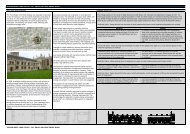
West End AAP volume 2 - Oxford City Council
West End AAP volume 2 - Oxford City Council
West End AAP volume 2 - Oxford City Council

You also want an ePaper? Increase the reach of your titles
YUMPU automatically turns print PDFs into web optimized ePapers that Google loves.
E C : E C 8/6/07 13:20 P 1<br />
<strong>West</strong> <strong>End</strong> Area Action Plan<br />
Submission document<br />
2007-2016<br />
Volume 2 - Appendices<br />
JUNE 2007
E C : E C 8/6/07 13:20 P 2
E C : E C 8/6/07 13:20 P 3<br />
CONTENTS<br />
Appendix 1:<br />
LOCAL DEVELOPMENT FRAMEWORK . . . . . . . . . . .i<br />
Appendix 2:<br />
SITES AND APPROPRIATE USES . . . . . . . . . . .ii-iii<br />
Appendix 3:<br />
WEST END DESIGN CODE . . . . . . . . . . . . . . . .iv<br />
Contents............................................01<br />
Preface.............................................02<br />
Introduction .........................................04<br />
UsingtheCode .......................................09<br />
Section A: Street Mesh and Regulating Plan ..................13<br />
Section B: Street and Route Types .........................19<br />
Section C: Coding for Variety: The Street Segment Plans .........43<br />
Section D: StreetDesign ................................49<br />
Section E: Building and Architectural Design .................53<br />
Glossary ............................................58<br />
References ..........................................60<br />
Acknowledgements.....................................60<br />
Regulating Plan .......................................61<br />
Appendix 4:<br />
PARKING STANDARDS . . . . . . . . . . . . . . . .62-63<br />
Appendix 5:<br />
STRATEGIC FLOOD RISK ASSESSMENT . . . . . . .64-65<br />
Appendix 6:<br />
CASTLE MILL STREAM . . . . . . . . . . . . . . . .66-67<br />
Appendix 7:<br />
TEMPLATE FOR DESIGN<br />
AND ACCESS STATEMENT . . . . . . . . . . . . . .68-69<br />
Appendix 8:<br />
STREAMLINED CONTRIBUTIONS . . . . . . . . . . . .70<br />
Appendix 9:<br />
MONITORING FRAMEWORK . . . . . . . . . . . . .71-73
E C : E C 8/6/07 13:20 P 4<br />
<strong>West</strong> <strong>End</strong> <strong>AAP</strong> Submission June 2007
E C : E C 8/6/07 13:20 P 1<br />
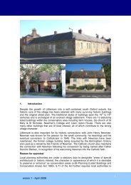
Appendix 1:<br />
LOCAL DEVELOPMENT<br />
FRAMEWORK<br />
The <strong>West</strong> <strong>End</strong> Area Action Plan is a Development Plan Document that forms part of the Local<br />
Development Framework for <strong>Oxford</strong>. This status means that it will be used in the<br />
determination of planning applications under Section 38(6) of the Planning and Compulsory<br />
Purchase Act 2004. The diagram below illustrates the relationships between the various parts<br />
of the Local Development Framework:<br />
Local Development Framework<br />
Development Plan Documents (DPDs)<br />
Core Strategy<br />
<strong>West</strong> <strong>End</strong> <strong>AAP</strong><br />
Other DPDs<br />
Supplementary Planning Documents (SPDs)<br />
Local Development Scheme (LDS)<br />
Statement of Community Involvement (SCI)<br />
Annual Monitoring Report (AMR)<br />
In the production of the <strong>West</strong> <strong>End</strong> Area Action Plan a number of the policies in the <strong>Oxford</strong> Local<br />
Plan 2001 – 2016, have been superseded.<br />
Superseded policies:<br />
• DS.1 Abbey Place Car Park ..........................Mixed-Use Development<br />
• DS.3 Albion Place Car Park and Magistrates Courts ..........Mixed-Use Development<br />
• DS.14 CastleSite .................................Mixed-Use Development<br />
• DS.16 <strong>Oxford</strong> & Cherwell College, Oxpens Road . . . ..........Mixed-Use Development<br />
• DS.17 Cooper Callas Site, Paradise Street .................Mixed-Use Development<br />
• DS.30 Gloucester Green Bus Station ...........................Transport Use<br />
• DS.35 Hythe Bridge Street and Park <strong>End</strong> Street . . ...........Mixed-Use Development<br />
• DS.54 OdeonCinema,GeorgeStreet .....................Mixed-Use Development<br />
• DS.56 Osney Warehouse, Osney Lane ....................Mixed-Use Development<br />
• DS.61 <strong>Oxford</strong> Station, Botley Road and Becket Street Car Park . . .Mixed-Use Development<br />
• DS.62 Oxpens Road Site . ............................Mixed-Use Development<br />
• DS.63 Paradise Street Workshops ......................University of <strong>Oxford</strong> Use<br />
• DS.68 Rewley Road ................................Mixed-Use Development<br />
• DS.76 Telephone Exchange, Speedwell Street Site ............Mixed-Use Development<br />
• DS.77 Land to the <strong>West</strong> of St Aldate’s and South of Queen Street . . .Mixed-Use Development<br />
• DS.78 StAldate’s.....................................Regeneration Zone<br />
• DS.79 St Aldate’s Police Station and Land to the Rear ........Mixed-Use Development<br />
• DS.88 <strong>West</strong>gate Shopping Centre . ......................Mixed-Use Development<br />
• DS.91 WorcesterStreetCarPark........................Mixed-Use Development<br />
i
E C : E C 8/6/07 13:20 P 2<br />
ii<br />
<strong>West</strong> <strong>End</strong> <strong>AAP</strong> Submission June 2007<br />
Appendix 2:<br />
SITES AND<br />
APPROPRIATE USES<br />
The <strong>AAP</strong> has been written to address the <strong>West</strong> <strong>End</strong> as a whole instead of considering a series<br />
of individual sites. However, a simple quick- reference guide to the identified development<br />
sites and their appropriate uses would be helpful.<br />
In line with Policy WE20 the <strong>City</strong> <strong>Council</strong> will require all developments on sites of 0.2 hectares<br />
or more to comprise more than one use.<br />
It is important to recognise that the list of sites is not exhaustive. As the renaissance of the<br />
<strong>West</strong> <strong>End</strong> builds up momentum more sites are expected to come forward for development as<br />
landowners and developers grasp the potential of this project.<br />
Identified development sites map<br />
1<br />
8<br />
3<br />
2<br />
17<br />
15<br />
4<br />
18<br />
9<br />
16<br />
19<br />
5<br />
11<br />
10<br />
20<br />
6<br />
12<br />
20<br />
7<br />
21<br />
13<br />
23<br />
22<br />
14<br />
24
E C : E C 8/6/07 13:20 P 3<br />
The following categories have been used<br />
to indicate appropriate uses:<br />
• P – Priority use: the main use or uses<br />
for the site<br />
• S – Secondary use: other uses that<br />
would be appropriate<br />
• M – Minor element: other uses that<br />
would be appropriate as minor elements<br />
of a scheme.<br />
1. <strong>Oxford</strong> Railway Station S P<br />
2. Fire Station, Rewley Road S M S S M S<br />
3. Beaver House, Hythe Bridge Street P<br />
4. Island site (Park <strong>End</strong> St/Hythe Bridge St) S S S M S S S<br />
5. Worcester Street Car Park S P S S S S<br />
6. Odeon Cinema, George Street M M P<br />
7. New Theatre, George Street P<br />
8. Becket Street Car Park P M M S P<br />
9. Ocean and Collins, Hythe Bridge Street S S<br />
10. Macclesfield House, New Road S M P S S<br />
11. Cooper Callas Site, Paradise Street S S S S<br />
12. County Hall, New Road S S S S S<br />
13. St Aldate's/ Queen Street S S S P S<br />
14. Town Hall, St Aldate’s S S S P<br />
15. Nursery, Osney Lane S S S<br />
16. Osney Warehouse, Osney Lane P<br />
Town houses<br />
Flats<br />
Public space<br />
Community energy<br />
17. Oxpens P M P P S S P M S P P P<br />
18. OCVC remainder P M S M<br />
19. <strong>Oxford</strong> and Cherwell Valley College S P<br />
20. <strong>West</strong>gate Shopping Centre S S P S<br />
21. Albion Place and Magistrates’ Courts S S S S<br />
22. Speedwell House, Speedwell Street S S<br />
Student accommodation<br />
Amenities for housing<br />
Offices<br />
Public offices<br />
Retail<br />
Food and drink<br />
23. Telephone Exchange, Speedwell Street S S S S<br />
Museums<br />
Arts/other cultural uses<br />
Hotels<br />
Conference<br />
Leisure<br />
Education<br />
Transport<br />
iii
E C : E C 8/6/07 13:20 P 4<br />
iv<br />
<strong>West</strong> <strong>End</strong> <strong>AAP</strong> Submission June 2007<br />
Appendix 3:<br />
WEST END DESIGN CODE
E C : E C 8/6/07 13:20 P 4<br />
iv<br />
<strong>West</strong> <strong>End</strong> <strong>AAP</strong> Submission June 2007<br />
Appendix 3:<br />
WEST END DESIGN CODE
E C : E C 8/6/07 13:20 P 4<br />
iv<br />
<strong>West</strong> <strong>End</strong> <strong>AAP</strong> Submission June 2007<br />
Appendix 3:<br />
WEST END DESIGN CODE
E C : E C 8/6/07 13:20 P 4<br />
iv<br />
<strong>West</strong> <strong>End</strong> <strong>AAP</strong> Submission June 2007<br />
Appendix 3:<br />
WEST END DESIGN CODE
E C : E C 8/6/07 13:20 P 4<br />
iv<br />
<strong>West</strong> <strong>End</strong> <strong>AAP</strong> Submission June 2007<br />
Appendix 3:<br />
WEST END DESIGN CODE
E C : E C 8/6/07 13:20 P 4<br />
iv<br />
<strong>West</strong> <strong>End</strong> <strong>AAP</strong> Submission June 2007<br />
Appendix 3:<br />
WEST END DESIGN CODE
E C : E C 8/6/07 13:20 P 4<br />
iv<br />
<strong>West</strong> <strong>End</strong> <strong>AAP</strong> Submission June 2007<br />
Appendix 3:<br />
WEST END DESIGN CODE
E C : E C 8/6/07 13:20 P 4<br />
iv<br />
<strong>West</strong> <strong>End</strong> <strong>AAP</strong> Submission June 2007<br />
Appendix 3:<br />
WEST END DESIGN CODE
E C : E C 8/6/07 13:20 P 4<br />
iv<br />
<strong>West</strong> <strong>End</strong> <strong>AAP</strong> Submission June 2007<br />
Appendix 3:<br />
WEST END DESIGN CODE
E C : E C 8/6/07 13:20 P 4<br />
iv<br />
<strong>West</strong> <strong>End</strong> <strong>AAP</strong> Submission June 2007<br />
Appendix 3:<br />
WEST END DESIGN CODE
E C : E C 8/6/07 13:20 P 4<br />
iv<br />
<strong>West</strong> <strong>End</strong> <strong>AAP</strong> Submission June 2007<br />
Appendix 3:<br />
WEST END DESIGN CODE
E C : E C 8/6/07 13:20 P 4<br />
iv<br />
<strong>West</strong> <strong>End</strong> <strong>AAP</strong> Submission June 2007<br />
Appendix 3:<br />
WEST END DESIGN CODE
E C : E C 8/6/07 13:20 P 4<br />
iv<br />
<strong>West</strong> <strong>End</strong> <strong>AAP</strong> Submission June 2007<br />
Appendix 3:<br />
WEST END DESIGN CODE
E C : E C 8/6/07 13:20 P 4<br />
iv<br />
<strong>West</strong> <strong>End</strong> <strong>AAP</strong> Submission June 2007<br />
Appendix 3:<br />
WEST END DESIGN CODE
E C : E C 8/6/07 13:20 P 4<br />
iv<br />
<strong>West</strong> <strong>End</strong> <strong>AAP</strong> Submission June 2007<br />
Appendix 3:<br />
WEST END DESIGN CODE
E C : E C 8/6/07 13:20 P 4<br />
iv<br />
<strong>West</strong> <strong>End</strong> <strong>AAP</strong> Submission June 2007<br />
Appendix 3:<br />
WEST END DESIGN CODE
E C : E C 8/6/07 13:20 P 4<br />
iv<br />
<strong>West</strong> <strong>End</strong> <strong>AAP</strong> Submission June 2007<br />
Appendix 3:<br />
WEST END DESIGN CODE
E C : E C 8/6/07 13:20 P 4<br />
iv<br />
<strong>West</strong> <strong>End</strong> <strong>AAP</strong> Submission June 2007<br />
Appendix 3:<br />
WEST END DESIGN CODE
E C : E C 8/6/07 13:20 P 4<br />
iv<br />
<strong>West</strong> <strong>End</strong> <strong>AAP</strong> Submission June 2007<br />
Appendix 3:<br />
WEST END DESIGN CODE
E C : E C 8/6/07 13:20 P 4<br />
iv<br />
<strong>West</strong> <strong>End</strong> <strong>AAP</strong> Submission June 2007<br />
Appendix 3:<br />
WEST END DESIGN CODE
E C : E C 8/6/07 13:20 P 4<br />
iv<br />
<strong>West</strong> <strong>End</strong> <strong>AAP</strong> Submission June 2007<br />
Appendix 3:<br />
WEST END DESIGN CODE
E C : E C 8/6/07 13:20 P 4<br />
iv<br />
<strong>West</strong> <strong>End</strong> <strong>AAP</strong> Submission June 2007<br />
Appendix 3:<br />
WEST END DESIGN CODE
E C : E C 8/6/07 13:20 P 4<br />
iv<br />
<strong>West</strong> <strong>End</strong> <strong>AAP</strong> Submission June 2007<br />
Appendix 3:<br />
WEST END DESIGN CODE
E C : E C 8/6/07 13:20 P 4<br />
iv<br />
<strong>West</strong> <strong>End</strong> <strong>AAP</strong> Submission June 2007<br />
Appendix 3:<br />
WEST END DESIGN CODE
E C : E C 8/6/07 13:20 P 4<br />
iv<br />
<strong>West</strong> <strong>End</strong> <strong>AAP</strong> Submission June 2007<br />
Appendix 3:<br />
WEST END DESIGN CODE
E C : E C 8/6/07 13:20 P 4<br />
iv<br />
<strong>West</strong> <strong>End</strong> <strong>AAP</strong> Submission June 2007<br />
Appendix 3:<br />
WEST END DESIGN CODE
E C : E C 8/6/07 13:20 P 4<br />
iv<br />
<strong>West</strong> <strong>End</strong> <strong>AAP</strong> Submission June 2007<br />
Appendix 3:<br />
WEST END DESIGN CODE
E C : E C 8/6/07 13:20 P 4<br />
iv<br />
<strong>West</strong> <strong>End</strong> <strong>AAP</strong> Submission June 2007<br />
Appendix 3:<br />
WEST END DESIGN CODE
E C : E C 8/6/07 13:20 P 4<br />
iv<br />
<strong>West</strong> <strong>End</strong> <strong>AAP</strong> Submission June 2007<br />
Appendix 3:<br />
WEST END DESIGN CODE
E C : E C 8/6/07 13:20 P 4<br />
iv<br />
<strong>West</strong> <strong>End</strong> <strong>AAP</strong> Submission June 2007<br />
Appendix 3:<br />
WEST END DESIGN CODE
E C : E C 8/6/07 13:20 P 4<br />
iv<br />
<strong>West</strong> <strong>End</strong> <strong>AAP</strong> Submission June 2007<br />
Appendix 3:<br />
WEST END DESIGN CODE
E C : E C 8/6/07 13:20 P 4<br />
iv<br />
<strong>West</strong> <strong>End</strong> <strong>AAP</strong> Submission June 2007<br />
Appendix 3:<br />
WEST END DESIGN CODE
E C : E C 8/6/07 13:20 P 4<br />
iv<br />
<strong>West</strong> <strong>End</strong> <strong>AAP</strong> Submission June 2007<br />
Appendix 3:<br />
WEST END DESIGN CODE
E C : E C 8/6/07 13:20 P 4<br />
iv<br />
<strong>West</strong> <strong>End</strong> <strong>AAP</strong> Submission June 2007<br />
Appendix 3:<br />
WEST END DESIGN CODE
E C : E C 8/6/07 13:20 P 4<br />
iv<br />
<strong>West</strong> <strong>End</strong> <strong>AAP</strong> Submission June 2007<br />
Appendix 3:<br />
WEST END DESIGN CODE
E C : E C 8/6/07 13:20 P 4<br />
iv<br />
<strong>West</strong> <strong>End</strong> <strong>AAP</strong> Submission June 2007<br />
Appendix 3:<br />
WEST END DESIGN CODE
E C : E C 8/6/07 13:20 P 4<br />
iv<br />
<strong>West</strong> <strong>End</strong> <strong>AAP</strong> Submission June 2007<br />
Appendix 3:<br />
WEST END DESIGN CODE
E C : E C 8/6/07 13:20 P 4<br />
iv<br />
<strong>West</strong> <strong>End</strong> <strong>AAP</strong> Submission June 2007<br />
Appendix 3:<br />
WEST END DESIGN CODE
E C : E C 8/6/07 13:20 P 4<br />
iv<br />
<strong>West</strong> <strong>End</strong> <strong>AAP</strong> Submission June 2007<br />
Appendix 3:<br />
WEST END DESIGN CODE
E C : E C 8/6/07 13:20 P 4<br />
iv<br />
<strong>West</strong> <strong>End</strong> <strong>AAP</strong> Submission June 2007<br />
Appendix 3:<br />
WEST END DESIGN CODE
E C : E C 8/6/07 13:20 P 4<br />
iv<br />
<strong>West</strong> <strong>End</strong> <strong>AAP</strong> Submission June 2007<br />
Appendix 3:<br />
WEST END DESIGN CODE
E C : E C 8/6/07 13:20 P 4<br />
iv<br />
<strong>West</strong> <strong>End</strong> <strong>AAP</strong> Submission June 2007<br />
Appendix 3:<br />
WEST END DESIGN CODE
E C : E C 8/6/07 13:20 P 4<br />
iv<br />
<strong>West</strong> <strong>End</strong> <strong>AAP</strong> Submission June 2007<br />
Appendix 3:<br />
WEST END DESIGN CODE
E C : E C 8/6/07 13:20 P 4<br />
iv<br />
<strong>West</strong> <strong>End</strong> <strong>AAP</strong> Submission June 2007<br />
Appendix 3:<br />
WEST END DESIGN CODE
E C : E C 8/6/07 13:20 P 4<br />
iv<br />
<strong>West</strong> <strong>End</strong> <strong>AAP</strong> Submission June 2007<br />
Appendix 3:<br />
WEST END DESIGN CODE
E C : E C 8/6/07 13:20 P 4<br />
iv<br />
<strong>West</strong> <strong>End</strong> <strong>AAP</strong> Submission June 2007<br />
Appendix 3:<br />
WEST END DESIGN CODE
E C : E C 8/6/07 13:20 P 4<br />
iv<br />
<strong>West</strong> <strong>End</strong> <strong>AAP</strong> Submission June 2007<br />
Appendix 3:<br />
WEST END DESIGN CODE
E C : E C 8/6/07 13:20 P 4<br />
iv<br />
<strong>West</strong> <strong>End</strong> <strong>AAP</strong> Submission June 2007<br />
Appendix 3:<br />
WEST END DESIGN CODE
E C : E C 8/6/07 13:20 P 4<br />
iv<br />
<strong>West</strong> <strong>End</strong> <strong>AAP</strong> Submission June 2007<br />
Appendix 3:<br />
WEST END DESIGN CODE
E C : E C 8/6/07 13:20 P 4<br />
iv<br />
<strong>West</strong> <strong>End</strong> <strong>AAP</strong> Submission June 2007<br />
Appendix 3:<br />
WEST END DESIGN CODE
E C : E C 8/6/07 13:20 P 4<br />
iv<br />
<strong>West</strong> <strong>End</strong> <strong>AAP</strong> Submission June 2007<br />
Appendix 3:<br />
WEST END DESIGN CODE
E C : E C 8/6/07 13:20 P 4<br />
iv<br />
<strong>West</strong> <strong>End</strong> <strong>AAP</strong> Submission June 2007<br />
Appendix 3:<br />
WEST END DESIGN CODE
E C : E C 8/6/07 13:20 P 4<br />
iv<br />
<strong>West</strong> <strong>End</strong> <strong>AAP</strong> Submission June 2007<br />
Appendix 3:<br />
WEST END DESIGN CODE
E C : E C 8/6/07 13:20 P 4<br />
iv<br />
<strong>West</strong> <strong>End</strong> <strong>AAP</strong> Submission June 2007<br />
Appendix 3:<br />
WEST END DESIGN CODE
E C : E C 8/6/07 13:20 P 4<br />
iv<br />
<strong>West</strong> <strong>End</strong> <strong>AAP</strong> Submission June 2007<br />
Appendix 3:<br />
WEST END DESIGN CODE
E C : E C 8/6/07 13:20 P 4<br />
iv<br />
<strong>West</strong> <strong>End</strong> <strong>AAP</strong> Submission June 2007<br />
Appendix 3:<br />
WEST END DESIGN CODE
E C : E C 8/6/07 13:20 P 4<br />
iv<br />
<strong>West</strong> <strong>End</strong> <strong>AAP</strong> Submission June 2007<br />
Appendix 3:<br />
WEST END DESIGN CODE
E C : E C 8/6/07 13:20 P 4<br />
iv<br />
<strong>West</strong> <strong>End</strong> <strong>AAP</strong> Submission June 2007<br />
Appendix 3:<br />
WEST END DESIGN CODE
E C : E C 8/6/07 13:20 P 4<br />
iv<br />
<strong>West</strong> <strong>End</strong> <strong>AAP</strong> Submission June 2007<br />
Appendix 3:<br />
WEST END DESIGN CODE
E C : E C 8/6/07 13:20 P 4<br />
iv<br />
<strong>West</strong> <strong>End</strong> <strong>AAP</strong> Submission June 2007<br />
Appendix 3:<br />
WEST END DESIGN CODE
E C : E C 8/6/07 13:20 P 4<br />
iv<br />
<strong>West</strong> <strong>End</strong> <strong>AAP</strong> Submission June 2007<br />
Appendix 3:<br />
WEST END DESIGN CODE
<strong>West</strong> <strong>End</strong> Consultation APPend Fix:<strong>West</strong> <strong>End</strong> Consultation appendix 12/6/07 11:26 Page 6<br />
v<br />
<strong>West</strong> <strong>End</strong> <strong>AAP</strong> Submission June 2007<br />
Appendix 4:<br />
PARKING STANDARDS<br />
The parking standards for the <strong>West</strong> <strong>End</strong> are based on those set out in the Local Plan. The<br />
adopted Transport Assessment and Travel Plans Supplementary Planning Document provides<br />
more details on parking.<br />
The Local Plan established the principle of little or no parking provision in the <strong>City</strong><br />
centre. By managing parking, be it public, private or residential, unnecessary car trips to the<br />
<strong>West</strong> <strong>End</strong> can be discouraged and efficient use of land can be made. The <strong>West</strong> <strong>End</strong> is in an<br />
exceptionally sustainable location and is particularly suitable for car free development and<br />
it is appropriate to restrict the amount of parking provision.<br />
In the Transport Central Area (TCA), which includes the <strong>West</strong> <strong>End</strong>, the Local Plan states that<br />
no general parking provision will be acceptable for non-residential development, although some<br />
limited provision to meet operational requirements may be permitted.<br />
For residential development in the Transport Central Area the Local Plan has a maximum<br />
standard of one space per unit. Development of houses of 3 bedrooms or more in the <strong>West</strong> <strong>End</strong> is<br />
likely to be aimed at families and it is appropriate that the Local Plan maximum standard is<br />
maintained.<br />
It is not expected that there will be a high demand for car ownership from 1 or 2 bedroom<br />
flats as the <strong>West</strong> <strong>End</strong> is so close to shops, services and public transport links. Most <strong>City</strong> centre<br />
flatted developments in recent years have had no parking provision, suggesting little demand.<br />
Because of the advantages of efficient use of land and the need not to increase car usage, there<br />
should be no dedicated parking for flats in the <strong>West</strong> <strong>End</strong>.<br />
It is expected that car clubs will be set up in the area. Car clubs are a good way of allowing<br />
people to have easy access to a car at times when they may need it. Car clubs can help to support<br />
car free residential developments and also work places with no parking provision.<br />
In all developments that are car-free or of low parking provision it is important that parking<br />
for disabled people and service or delivery vehicles is considered and this may be required by the<br />
<strong>City</strong> <strong>Council</strong>. Parking for powered two-wheelers may also be considered acceptable.<br />
Car parking standards<br />
Residential development MAXIMUM parking standard<br />
• Houses .............................................1space per unit<br />
• Flats ...........................................Disabled parking only<br />
Non-self-contained residential development<br />
and all non-residential development MAXIMUM parking standard<br />
• Non-self-contained residential and<br />
all non-residential development ..............Disabled and operational parking only<br />
Parking standards for powered two-wheelers<br />
Parking for powered two-wheelers will be sought on the following basis:<br />
Development Powered two-wheelers parking standard<br />
• Office space (including ancillary offices) ............1space per 400m2 up to 200m2 .........................................1space per 1000m2 thereafter<br />
• Other ............................................1space per 1000m2
<strong>West</strong> <strong>End</strong> Consultation APPend Fix:<strong>West</strong> <strong>End</strong> Consultation appendix 12/6/07 11:26 Page 7<br />
Cycle-parking standards<br />
The cycle parking standards are based on those found in the Local Plan. These standards are<br />
minimum requirements. As stated in the Local Plan, the standards may be relaxed in the Transport<br />
Central Area because of the proximity to public transport. However, cycle parking is seen as very<br />
desirable and will be sought in the <strong>West</strong> <strong>End</strong>. Shower facilities will also be sought in the <strong>West</strong> <strong>End</strong>,<br />
as set out in the Local Plan.<br />
Development MINIMUM cycle parking standard<br />
• Residential dwellings ...........................2spaces per residential unit<br />
• Studentaccommodation. ......................1space per 2 resident students<br />
........................................Plus 1 space per resident staff<br />
• Hotels/Guest houses ............1space per 5 non-resident staff (or other people)<br />
........................................Plus 1 space per resident staff<br />
• Shops (A1) other than non-food retail warehouses (see below),<br />
finance and professional services (A2) ......................1space per 113m 2<br />
• Businesses (B1) ..........1space per 35m 2 or 1 space per 5 staff (or other people)<br />
........................................plus visitor parking provision<br />
....................................1space per 40m 2 public floorspace<br />
................................Plus 1 space per 5 staff (or other people)<br />
• Food and drink (A3-5) .....................1space per 40m 2 pubic floor space<br />
................................Plus 1 space per 5 staff (or other people)<br />
• Non-food retail warehouses including garden centres (A1) ........1space per 400m 2<br />
• General industry (B2) warehousing/distributions (B8)/ traders’ merchants (A1) ......<br />
..........................AsB1upto235m 2 , 1 space per 500m 2 thereafter;<br />
.................................or1space per 5 staff (or other people)<br />
• Places of assembly including cinemas, theatre,<br />
stadiums and concert halls. ..............1space per 10 seats up to 1,000 seats;<br />
......................................1space per 100 seats thereafter<br />
• Places of worship/community centres/<br />
public halls ...................1space per 20m 2 of seating/assembly floorspace.<br />
• Libraries ..........................................1space per 200m 2<br />
• Medical clinics/dentists .........................1space per treatment room<br />
................................Plus 1 space per 5 staff (or other people)<br />
• Hospitals .............................1space per 5 staff (or other people)<br />
• Public sports facilities ....................1space per 5 staff (or other people)<br />
...........................plus additional provision to be determined on its<br />
.......................merits with the following guideline; 1 space per 35m 2<br />
• Primary/junior schools ..............................1space per 15 pupils<br />
................................Plus 1 space per 5 staff (or other people)<br />
• Secondary/senior schools .............................1space per 5 pupils<br />
................................Plus 1 space per 5 staff (or other people)<br />
• Non-residential higher/further education .................1space per 2 students<br />
..........(based on anticipated peak number of students on-site at any one time)<br />
............................................Plus 1 space per 5 staff<br />
• Other developments ...................Tobetreated on their individual merits,<br />
......................guided by the general principle of 1 space per 5-people<br />
vi
<strong>West</strong> <strong>End</strong> Consultation APPend Fix:<strong>West</strong> <strong>End</strong> Consultation appendix 12/6/07 11:26 Page 8<br />
vii<br />
Extract of the <strong>West</strong><br />
<strong>End</strong> Strategic Flood<br />
Risk Assessment,<br />
published separately<br />
as a background<br />
paper.<br />
<strong>West</strong> <strong>End</strong> <strong>AAP</strong> Submission June 2007<br />
Appendix 5: STRATEGIC FLOO<br />
D
O<br />
<strong>West</strong> <strong>End</strong> Consultation APPend Fix:<strong>West</strong> <strong>End</strong> Consultation appendix 12/6/07 11:26 Page 9<br />
D RISK ASSESSMENT<br />
viii
<strong>West</strong> <strong>End</strong> Consultation APPend Fix:<strong>West</strong> <strong>End</strong> Consultation appendix 12/6/07 11:26 Page 10<br />
ix<br />
<strong>West</strong> <strong>End</strong> <strong>AAP</strong> Submission June 2007<br />
Appendix 6:<br />
CASTLE MILL STREAM<br />
The guidelines in this appendix are intended to ensure that as developments come forward<br />
along the stream, the improvements implemented are consistent and will create an attractive<br />
streamside park with enhanced landscaping, biodiversity and access.<br />
More detail is provided in a background paper that should also be referred to. The<br />
background paper describes existing footpaths, vegetation, wildlife habitats and species<br />
present. It identifies broadly the improvements that should be made to these features.<br />
The aims for the streamside park are:<br />
• To create an attractive, safe, and sustainable corridor linking the network of open spaces.<br />
• Ensure new development proposals enhance and are appropriate to their surroundings.<br />
• Ensure a co-ordinated approach to the development and enhancement of the corridor.<br />
• To join and enhance the existing footpath network.<br />
The following general principles and design guidelines have been identified to help<br />
achieve these aims. Please refer to the background paper for more detailed guidance. A<br />
maintenance plan should also be submitted as part of any plans for the streamside park.<br />
Complete North/South Footpath Network<br />
Introduce new, fully accessible, waterside footways using sympathetic materials, and where<br />
possible provide secondary connections with the surrounding area.<br />
Encourage informal recreation<br />
Encourage more use of the waterside by introducing, for example:<br />
• new leisure activities;<br />
• public art;<br />
• directional signage and information boards; and<br />
• footway lighting.<br />
Improve habitats<br />
Creating a buffer zone of 8 to 10 metres helps to protect the watercourse, encourages habitation<br />
of the banks and allows the migration of species along the stream corridor.<br />
The creation of lower gently shelving banks in certain places along the Castle Mill Stream, and<br />
removal of concrete banks, increases habitat diversity and offers sanctuary, especially for juvenile<br />
fish.<br />
Encourage new wildlife<br />
Encourage new wildlife into the area and strengthen existing habitats, for example by:<br />
• bankside treatment;<br />
• creation of new water channels;<br />
• control of Japanese Knotweed.<br />
• planting of native trees, shrubs, hedges and small copses, creating and maintaining ’green’<br />
links between habitats. The use of suitable native trees and shrubs is encouraged,<br />
preferably from British grown ‘local’ stock. The following tables show the species that<br />
have been identified as particularly suitable.
<strong>West</strong> <strong>End</strong> Consultation APPend Fix:<strong>West</strong> <strong>End</strong> Consultation appendix 12/6/07 11:26 Page 11<br />
Trees<br />
Latin name .............................................Common name<br />
• Acer campestre ............................................FieldMaple<br />
• Alnus glutinosa .................................Alder (for damp locations)<br />
• Betula pendula ............................................Silver Birch<br />
• Betula pubescens ...........................Downy Birch (for damp locations)<br />
• Carpinus betulus ............................................Hornbeam<br />
• Fagus sylvatica ...............................................Beech<br />
• Fraxinus excelsior ...............................................Ash<br />
• Ilex aquifolium ................................................Holly<br />
• Malus sylvetsris ............................................CrabApple<br />
• Populus nigra ............................................Black Poplar<br />
• Populus tremula ...................Aspen (avoid building foundations and drains)<br />
• Prunus avium .............................................Wild Cherry<br />
• Prunus padus .............................................Bird Cherry<br />
• Quercus robur . . .......................................Pedunculate Oak<br />
• Quercus petraea ...........................................Sessile Oak<br />
• Salix alba ..............................................White Willow<br />
• Salix fragilis .............................................CrackWillow<br />
• Sorbus aucuparia ..............................................Rowan<br />
• Sorbus torminalis ......................................Wild Service Tree<br />
• Taxus baccata ..................................................Yew<br />
• Tilia cordata .........................................Smallleaved lime<br />
• Ulmus glabra ..............................................Wych Elm<br />
Shrubs<br />
Latin name .............................................Common name<br />
• Acer campestre ............................................FieldMaple<br />
• Cornus sanguinea ............................................Dogwood<br />
• Corylus avellana ...............................................Hazel<br />
• Crataegus laevigata ....................................Midland Hawthorn<br />
• Crataegus monogyna .........................................Hawthorn<br />
• Cytisus scoparius ..............................................Broom<br />
• Euonymus europaeus ...........................................Spindle<br />
• Hedera helix ...................................................Ivy<br />
• Ilex aquifolium ................................................Holly<br />
• Ligustrum vulgare ..........................................Wild Privet<br />
• Lonicera periclymenum ......................................Honeysuckle<br />
• Malus sylvestris ............................................CrabApple<br />
• Prunus spinosa ............................................Blackthorn<br />
• Rhamnus cathartica .........................................Buckthorn<br />
• Rosa canina ...............................................Dog Rose<br />
• Salix caprea .............................................Goat Willow<br />
• Salix cinerea .............................................GreyWillow<br />
• Salix purpurea ...........................................Purple Willow<br />
• Salix viminalis ..........................................Common Osier<br />
• Sambucus nigra ................................................Elder<br />
• Ulex europaeus ................................................Gorse<br />
• Viburnum lantana ........................................Wayfaring Tree<br />
• Viburnum opulus .........................................Guelder Rose<br />
x
<strong>West</strong> <strong>End</strong> Consultation APPend Fix:<strong>West</strong> <strong>End</strong> Consultation appendix 12/6/07 11:26 Page 12<br />
xi<br />
<strong>West</strong> <strong>End</strong> <strong>AAP</strong> Submission June 2007<br />
Appendix 7:<br />
TEMPLATE FOR DESIGN<br />
AND ACCESS STATEMENT<br />
This template for a Design and Access Statement should be completed for all schemes. A<br />
Design and Access Statement provides an opportunity to explain how the design has come<br />
about and what it is trying to achieve. It is most important that the design is based on a<br />
good understanding of local character and circumstances and that the final design is<br />
informed by wider context of the site.<br />
The statement is an opportunity to show how the development approach has taken account of<br />
guidance in the Design Code, historic environment appraisal, and relevant policies, particularly in<br />
the <strong>West</strong> <strong>End</strong> Area Action Plan. The template is based on the CABE publication: Design and access<br />
statements – how to write read and use them. Further guidance can be found in that document.<br />
ASSESSMENT: it is important to start the design process with an assessment of the site<br />
context and the surroundings. This section does not need to be too detailed, but should<br />
include:<br />
1. Physical context – meaning the character derived from existing buildings, landscape features<br />
and movement routes. This should reference any listed buildings in proximity, and note<br />
whether a development is in The Conservation Area. Background paper x showing the appraisal<br />
of the historic environment should be referred to and any relevance to the site noted. Parts of<br />
the Design Code relevant to the site should also be noted.<br />
2. Social context – an explanation of how local people will be affected by the development, now<br />
and in the future.<br />
3. Economic context – an explanation of the effect the development will have on the local<br />
economy<br />
4. Planning policy context – highlighting any relevant policies of the LDF and South East Plan.<br />
INVOLVEMENT: Community involvement, and consultation when carried out at the earliest<br />
possible stage and continuing that involvement will help to reduce issues and achieve<br />
consensus.<br />
5. Show the type of involvement there has been with groups and people, whilst discussing the<br />
scheme. Explain how consultation and community involvement has influenced the decision<br />
process, in the development of the scheme (refer to SCI for more information).<br />
DESIGN: at this stage you should start to design the scheme based on the information<br />
collected and the evaluation of it. There are many aspects to design and the statement<br />
should address the following issues (cross references to the information gathered in the<br />
earlier stages will be useful, such as relevant aspects of the Design Code):<br />
6. Use:<br />
• What will the uses be?<br />
• How is this justified in terms of policy?<br />
• How is this informed by existing uses/how will the chosen uses work together to create a<br />
mixed and vibrant community.<br />
• How will the design allow for inclusive access and meet the access needs of that use?<br />
7. Amount:<br />
• Show how the amount of development planned is suitable for the site, taking into account<br />
the site analysis and aims of good urban design.<br />
• For major developments, explain how the amount of development will change the<br />
neighbourhood, for example by adding services or supporting local businesses.<br />
8. Layout:<br />
• Explain why the layout has been chosen and how it will fit in with its surroundings.<br />
• Demonstrate that public spaces will be practical, safe, overlooked, inclusive and reduce<br />
the opportunity for crime.<br />
• Demonstrate the microclimatic impacts of buildings on public space.
<strong>West</strong> <strong>End</strong> Consultation APPend Fix:<strong>West</strong> <strong>End</strong> Consultation appendix 12/6/07 11:26 Page 13<br />
9. Scale:<br />
• Explain why sizes are right for the site, will the building/s sit comfortably with the<br />
surroundings and be comfortable for people?<br />
• Explain how the design considers the balance of features such as doors and windows.<br />
• If pictures are used they should place the viewer where people would really be, and offer<br />
a realistic interpretation of the scale of open space and buildings.<br />
10. Landscaping:<br />
• Explain the principles that will be/have been used to draw up landscape details –<br />
including the use of native trees / potential to increase biodiversity.<br />
11. Appearance:<br />
• Explain what you want the development to look like and why. The overall effect of the<br />
chosen layout, scale and landscaping should be explained as well as the chosen<br />
architectural style.<br />
ACCESS: the following points should be explained in the Design and Access Statement.<br />
12. Explain policy adopted in relation to access and how relevant policies in the Local<br />
Development Framework have been taken into account<br />
13. Explain how any consultation undertaken in relation to access has informed the development<br />
proposal.<br />
14. Explain why you have chosen the particular access points and routes.<br />
15. Explain how it is safe and easy for everyone to move around, bringing inclusive access.<br />
Please note that the inclusion of an access statement with a planning application does not<br />
remove the need for a further access statement to inform buildings regulations.<br />
xii
<strong>West</strong> <strong>End</strong> Consultation APPend Fix:<strong>West</strong> <strong>End</strong> Consultation appendix 12/6/07 11:26 Page 14<br />
xiii<br />
<strong>West</strong> <strong>End</strong> <strong>AAP</strong> Submission June 2007<br />
Appendix 8 :<br />
STREAMLINED<br />
CONTRIBUTIONS<br />
Policy WE.30 deals with streamlined contributions. This streamlined procedure for calculating<br />
planning obligations has been established to ensure certainty, fairness and speed, and to<br />
ensure that the infrastructure needs created by development in the <strong>West</strong> <strong>End</strong> are met. The<br />
table below sets out the global sum that will be applied as the appropriate starting point. The<br />
amount in later years will be set out in a Supplementary Planning Document.<br />
Use<br />
1-bed residential unit<br />
2-bed residential unit<br />
3-bed residential unit<br />
4-bed residential unit<br />
Student Accommodation<br />
Non-residential floorspace (per 100m 2 )<br />
applied pro rata<br />
Standard contributions plus <strong>West</strong> <strong>End</strong><br />
specific project<br />
£11,000<br />
£13,500<br />
£22,000<br />
£30,000<br />
£5,500<br />
£12,000<br />
In relation to the table, please note:<br />
• The figures shown are in addition to the affordable housing provision required (from<br />
residential and non-residential developments).<br />
• The sum is accurate as at April 2007, and will be increased to reflect inflation at the<br />
point of determining a planning application.<br />
• The Global Sum will not be applied to either of the two museums planned for the <strong>West</strong> <strong>End</strong>.<br />
This SPD does not cover every possible circumstance that may need to be taken into account<br />
in a planning obligation. Contributions towards youth services, CCTV cameras, social and health care<br />
will be decided by negotiation. Other measures may also be negotiated in particular circumstances.<br />
The levels of contributions shown in the table above are based on identified needs for the <strong>West</strong><br />
<strong>End</strong>. The Planning Obligations SPD is the basis for most of the calculations. Most standard<br />
contributions are as relevant to the <strong>West</strong> <strong>End</strong> as the rest of the <strong>City</strong>. In some cases small changes<br />
have been made based on a particular need in the <strong>West</strong> <strong>End</strong>. However, the Area Action Plan has<br />
identified a particularly great need for public realm and transport improvements, so <strong>West</strong> <strong>End</strong><br />
specific contributions to these improvements have been calculated. Improvements to the public<br />
realm and transport infrastructure will be essential for the success of the renaissance, and will help<br />
raise the profile and value of developments in the area.<br />
The Area Action Plan does not contain detailed schemes for public realm and transport, but it<br />
does outline where improvements are needed and the sorts of changes that should take place. This<br />
means there is enough information to make some basic estimates of cost. Costs will vary depending<br />
on the exact design of the scheme, but carriageway and pavement widths have been measured and<br />
costs of other public realm improvements in the <strong>City</strong> of a standard similar to that likely to be<br />
required in the <strong>West</strong> <strong>End</strong> have been applied. The main transport improvements that will be needed<br />
have also been costed.<br />
The level of contribution set out in the table will not cover all the costs. Public realm costings<br />
have only been carried out for the major streets in the <strong>West</strong> <strong>End</strong> that are identified as being most<br />
in need of improvements. Other sources of funding will be sought, and in some cases have been<br />
secured, as outlined in the Delivery and Implementation section.<br />
Contained within the Area Action Plan are maximum permissible amounts of some uses, for<br />
example offices and student accommodation, and expected amounts of other uses. The total of<br />
expected additional floorspace of all new uses in the <strong>West</strong> <strong>End</strong> can therefore be calculated, and<br />
this has been used to divide the estimated costs of public realm and transport improvements<br />
amongst different uses.
<strong>West</strong> <strong>End</strong> Consultation APPend Fix:<strong>West</strong> <strong>End</strong> Consultation appendix 12/6/07 11:26 Page 15<br />
Appendix 9:<br />
MONITORING<br />
FRAMEWORK<br />
The <strong>City</strong> <strong>Council</strong> will monitor the implementation of the Area Action Plan, and performance<br />
against the plan’s objectives. This section sets out a series of indicators and where possible<br />
targets, against which the progress will be monitored. These are then linked (where possible)<br />
to the core, local and contextual indicators of the <strong>City</strong> <strong>Council</strong>’s Annual Monitoring Report<br />
(AMR) where the monitoring will be reported.<br />
The monitoring framework expands on the preliminary work done as part of the Sustainability<br />
Appraisal for the <strong>West</strong> <strong>End</strong> Area Action Plan. It links the relevant targets and indicators to the plan<br />
objectives.<br />
The relevant indicators are grouped under the Area Action Plan’s 4 key areas:<br />
• An attractive network of streets and spaces;<br />
• A high quality built environment;<br />
• A strong and balanced community;<br />
• A vibrant and successful <strong>West</strong> <strong>End</strong>.<br />
Plan Objective 1:<br />
An Attractive Network of Streets and Spaces<br />
Policy Area Streets<br />
Target to be met in <strong>West</strong> <strong>End</strong><br />
• New bridge over Thames between Oxpens site and Osney Mead<br />
• New links created through the following sites:<br />
- Oxpens - <strong>Oxford</strong> and Cherwell Valley College<br />
• Improvements to the street environment to completed at the following locations:<br />
- Pedestrianisation of Queen Street - Extension of the current bus priority route down Oxpens Road<br />
- Simplification of Frideswide Square<br />
Policy Area Parking<br />
Indicators<br />
• Parking provision within the <strong>West</strong> <strong>End</strong><br />
(Indicators 37, 38, 39)<br />
Policy Area Public Spaces<br />
Target to be met in <strong>West</strong> <strong>End</strong><br />
• New public spaces created at the following locations:<br />
- Oxpens Square - Thames Square<br />
• Improvements made to following public spaces at the following locations:<br />
- Bonn Square - Carfax - Frideswide Square<br />
- Gloucester Green - Worcester Street Car Park<br />
• Improvements made to Railway Station and forecourt.<br />
Policy Area Green Spaces<br />
Indicators<br />
To assess the richness of local biodiversity and the<br />
impact of habitat enhancement measures by<br />
monitoring:<br />
• The distribution and status of water voles<br />
• The condition of SSSIs<br />
• The distribution and status of farmland birds<br />
• Distribution and status of garden butterflies<br />
(Indicator 33)<br />
Target to be met in <strong>West</strong> <strong>End</strong><br />
• Maintain number of public parking spaces<br />
available within the <strong>West</strong> <strong>End</strong><br />
Target to be met in <strong>West</strong> <strong>End</strong><br />
• Implementation of enhancements to Castle Mill<br />
Stream to create a streamside park.<br />
• Provision of Improvements made to Oxpens Field<br />
• Implementation of schemes to improve the<br />
quality of riverside spaces.<br />
xiv
<strong>West</strong> <strong>End</strong> Consultation APPend Fix:<strong>West</strong> <strong>End</strong> Consultation appendix 12/6/07 11:26 Page 16<br />
xv<br />
Plan Objective 2: A High Quality Built Environment<br />
Policy Area Resource Efficiency<br />
Indicators<br />
Renewable Energy capacity (in mega watts) installed<br />
by type (Indicator 35)<br />
Policy Area Flooding<br />
Indicators<br />
• Number of permissions granted contrary to the<br />
advice of the Environment Agency on either flood<br />
defence grounds or water quality (Indicator 34)<br />
• Number of developments in the flood zones<br />
approved:<br />
a. with flood risk management measures<br />
b. without flood risk management measures<br />
<strong>West</strong> <strong>End</strong> <strong>AAP</strong> Submission June 2007<br />
Plan Objective 3: A Strong and Balanced Community<br />
Policy Area Housing<br />
Indicators<br />
• Total number of new homes completed<br />
(Indicators1&2)<br />
• Mix of housing completed by house in respect of<br />
market housing (Local Indicator 8)<br />
Policy Area Affordable Housing<br />
Indicators<br />
• Number of affordable housing completions<br />
(Indicators 4, 7&9)<br />
• Cash contribution received during monitoring<br />
period from commercial development (Local<br />
Indicator 6)<br />
Policy Area Student Accommodation<br />
Indicators<br />
• Number of purpose built student accommodation (by<br />
institution) completed (Local Indicators 10 & 11)<br />
Policy Area Amenities to support housing<br />
Indicators<br />
• Amount of new residential development within 30<br />
minutes public transport time of a GP, hospital,<br />
primary and secondary school, areas of employment<br />
and a major retail centre (Indicator 36)<br />
Target to be met in <strong>West</strong> <strong>End</strong><br />
• Increase capacity in <strong>West</strong> <strong>End</strong><br />
Target to be met in <strong>West</strong> <strong>End</strong><br />
• Reduce<br />
• All<br />
• None<br />
Target to be met in <strong>West</strong> <strong>End</strong><br />
• To provide approximately 700 new homes across the<br />
<strong>West</strong> <strong>End</strong><br />
• Minimum of 35% Townhouses (3, 4, 5 bed) across the<br />
<strong>West</strong> <strong>End</strong><br />
Target to be met in <strong>West</strong> <strong>End</strong><br />
• To achieve 50% affordable housing provision on all<br />
qualifying sites.<br />
• % of Affordable housing in relation to commercial<br />
floorspace (or workers)<br />
Target to be met in <strong>West</strong> <strong>End</strong><br />
• Not to exceed 350 units (or more than half the number<br />
of residential units)<br />
Target to be met in <strong>West</strong> <strong>End</strong><br />
• Provide new amenity facilities close to new housing
<strong>West</strong> <strong>End</strong> Consultation APPend Fix:<strong>West</strong> <strong>End</strong> Consultation appendix 12/6/07 11:26 Page 17<br />
Plan Objective 4: A Vibrant and Successful <strong>West</strong> <strong>End</strong><br />
Policy Area Creating activity<br />
Indicators<br />
• Health check assessments to include:<br />
i) Market indicators (vacancy rates) ii) Vitality indicators (diversity of uses) (Indicator 28)<br />
Policy Area Office Accommodation<br />
Indicators<br />
• Amount of floorspace developed for employment by<br />
type (Indicators 14,15,16,20,21)<br />
Policy Area Retail<br />
Indicators<br />
• Amount of completed retail, office and<br />
leisure development (Indicators 25 & 26)<br />
Policy Area Cultural Attractions<br />
Indicators<br />
• Number and type of new facilities/<br />
attractions completed (new build, extensions<br />
and changes of use) (Local Indicator 30)<br />
Policy Area Hotel Accommodation<br />
Indicators<br />
• Number, type and location of new short-stay<br />
accommodation, hotels, guest houses and<br />
dual use, to include number of bedspaces<br />
(Local Indicator 29)<br />
Target to be met in <strong>West</strong> <strong>End</strong><br />
• B1 Offices: 15,000m 2 private sector; and 20,000m 2<br />
public sector<br />
Target to be met in <strong>West</strong> <strong>End</strong><br />
• To provide 37,000m 2 gross additional A1 retail<br />
floorspace for comparison goods (includes <strong>West</strong>gate<br />
and St Aldate’s)<br />
Target to be met in <strong>West</strong> <strong>End</strong><br />
• To increase the floorspace of cultural and tourism<br />
uses in the <strong>West</strong> <strong>End</strong><br />
Target to be met in <strong>West</strong> <strong>End</strong><br />
• To increase the number of hotel and guest house<br />
rooms in the <strong>West</strong> <strong>End</strong><br />
xvi
<strong>West</strong> <strong>End</strong> Consultation APPend Fix:<strong>West</strong> <strong>End</strong> Consultation appendix 12/6/07 11:26 Page 18<br />
Planning Policy Team<br />
<strong>Oxford</strong> <strong>City</strong> <strong>Council</strong><br />
Ramsay House<br />
10 St Ebbe’s Street<br />
<strong>Oxford</strong> OX1 1PT<br />
www.oxford.gov.uk<br />
E: planningpolicy@oxford.gov.uk<br />
T: 01865 252847 F: 01865 252144<br />
If you would like a copy of this leaflet in a<br />
different language or in large print or would<br />
like further information, please contact the<br />
Planning Policy Team.<br />
Translations available<br />
<strong>West</strong> <strong>End</strong> <strong>AAP</strong> Submission June 2007