

Soils Wildlife Technical Monograph TM-1
Soils Wildlife Technical Monograph TM-1
Soils Wildlife Technical Monograph TM-1

Create successful ePaper yourself
Turn your PDF publications into a flip-book with our unique Google optimized e-Paper software.
4d{ilr,iwurW rv" 'ibi v<br />
Ministry of Environment<br />
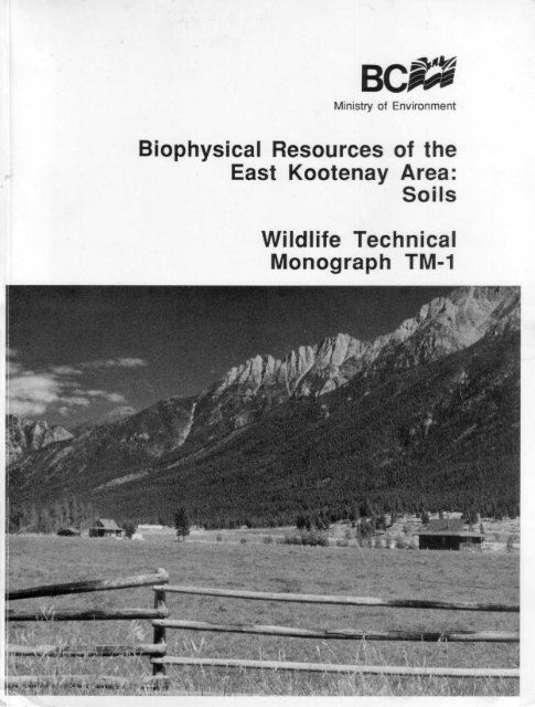
Biophysical Resources of the<br />
East Kootenay Area :<br />
<strong>Soils</strong><br />
<strong>Wildlife</strong> <strong>Technical</strong><br />
<strong>Monograph</strong> <strong>TM</strong>-1
BCC<br />
Ministry of Environment<br />
<strong>Wildlife</strong><br />
<strong>Technical</strong> <strong>Monograph</strong> <strong>TM</strong>-1<br />
BIOPHYSICAL RESOURCES<br />
OF THE<br />
EAST KOOTENAY AREA : SOILS<br />
Report No . 20<br />
British Columbia Soil Survey<br />
L.E .H . Lacelle, R.P.F .<br />
<strong>Wildlife</strong> Branch, Habitat Inventory Section<br />
Victoria, B.C .<br />
March 1990
"<strong>Wildlife</strong> <strong>Technical</strong> <strong>Monograph</strong>s contain results of investigations, studies and<br />
surveys of direct relevance to management of wildlife in British Columbia .<br />
Manuscripts submitted for publication in this form receive external peer review<br />
and, as such, are considered formal publications . Copies may be obtained,<br />
depending on supply, from the <strong>Wildlife</strong> Branch, Ministry of Environment,<br />
Parliament Buildings, Victoria, B.C . V8V 1X5."<br />
Canadian Cataloguing in Publication Data<br />
Lacelle, L.<br />
Biophysical resources of the East Kootenay area<br />
(<strong>Wildlife</strong> technical monograph, ISSN 1181-6686 ;<br />
<strong>TM</strong>-1) (British Columbia soil survey, ISSN 0375-5886<br />
report no . 20)<br />
ISBN 0-7726-1170-X<br />
1 . <strong>Soils</strong> - British Columbia - East Kootenay Region .<br />
I . British Columbia . Habitat Inventory Section . II . Title .<br />
III . Series : <strong>Wildlife</strong> technical monograph (Victoria, B.C .) ;<br />
<strong>TM</strong>-1 . IV . Series .<br />
S599 .1 .1371_32 1990 631 .4771165 C90-092205-2
ABSTRACT<br />
This report and accompanying soil maps describe the soils that occur in the East Kootenay region of British<br />
Columbia . One hundred and thirty-eight biophysical soil associations were identified . These have been field checked,<br />
mapped, sampled, analyzed for physical and chemical properties, and classified according to the Canadian System of<br />
Soil Classification . They have been evaluated for a variety of land use interpretations.<br />
The soil mapping is reconnaissance in nature . It was compiled at 1 :50 000 scale and is presented at 1 :100<br />
000 scale on the enclosed maps . The report and map are mainly intended for resource planning and management at a<br />
regional level . Mapping is based upon air photo interpretation, supplemented by two field seasons of field traverses to<br />
verify, or refine, preliminary boundary locations, as well as to determine and record specific soil information .
PREFACE<br />
This report is one in a series that describe and analyze the biophysical resources of the East Kootenay region .<br />
Individual reports (with maps) focus on the terrain (surficial geology), soils, climate, vegetation, wildlife, aquatics, and<br />
outdoor recreation resources .<br />
The study of the East Kootenay region was initiated in response to increasing pressure on biophysical<br />
resources and the development of land use conflicts. Forestry, mining, ranching, farming and tourism are all major<br />
contributors to the economic well-being of the region . General population growth and maintenance of these industries<br />
require that land be allocated for urban and industrial expansion and transportation corridors, and yet at the same time,<br />
areas be preserved for wildlife and recreational purposes .<br />
The data, analyses, and interpretations that are contained in the various reports and maps will assist in the<br />
development and implementation of rational resource management policies for the area . In addition, information<br />
presented in these publications provides a basic understanding of the physical and biological components of regional<br />
land and water systems .<br />
It is anticipated that careful utilization of these data bases will ultimately aid in the maintenance of a high<br />
quality environment in this part of British Columbia .<br />
ACKNOWLEDGMENTS<br />
The author wishes to gratefully acknowledge the assistance and encouragement provided by H .A . Luttmerding<br />
whose thorough technical editing and field correlation have greatly strengthened this report . The contribution of R.H .<br />
Louie and E . Kenk, also members of the editorial committee, are also gratefully acknowledged .<br />
Field assistance in soil mapping and classification was provided by V. Hignett, M. Fenger, R. Beale-Kuurne<br />
and T. Rollerson. Thanks are also extended to the seasonal employees who assisted in field mapping . T.Lea, J . Ryder,<br />
D. Demarchi and R. Chilton provided valuable information for correlation with vegetation, terrain, wildlife and climate<br />
mapping, respectively. J . Jungen and U . Wittneben provided information and assistance in correlation with soil surveys<br />
to the west of the study area .<br />
R . Blaney, M. Botting, and their staff, are acknowledged for preparing the manuscript soil maps . R . Thomas<br />
prepared the report graphics . The preparation and publication of the enclosed 1 :100 000 scale soil maps (color)<br />
by the staff of the Cartography Section, Land Resource Research Institute, Agriculture Canada, Ottawa, is also gratefully<br />
acknowledged . Financial assistance for the publication of this report was provided in part by the B.C . Ministry of Forests,<br />
Nelson Forest Region .<br />
Appreciation is extended to V. Osborne (ret .), H. Chuah and staff for laboratory analysis and for their technical<br />
advice . Acknowledged also are Parks Canada and British Columbia Ministry of Parks for permitting access and sampling<br />
in Kootenay National park and Mount Assiniboine Provincial Park, respectively .
The description of the soils, the environment in which they occur, and their suitability, or limitations, for specific<br />
uses are presented in the soil report. The soil maps show the areal distribution of the various soils with the specific<br />
soils in each map delineation identified by unique symbols . As well, symbols signifying the slope classes of the map<br />
delineations, the components of the soil associations, and the relative proportion of each soil association in a map<br />
delineation are also given . The legend attached to the side of the soil map identifies the symbols used on the maps and<br />
summarizes important soil association characteristics affecting both soil classification and management. The 1 :100 000<br />
scale soil maps should be used in combination with this report at all times .<br />
The report consists of five chapters .<br />
HOW TO USE THE SOIL REPORT AND MAPS<br />
Chapter One briefly describes the overall environmental and social characteristics of the East Kootenays .<br />
Chapter Two describes the field work methodology, as well as explaining how the soil associations, soil association<br />
components, soil legends and soil maps were derived .<br />
Chapter Three discusses the general characteristics and classification of East Kootenay soils and surficial materials,<br />
and describes their regional distribution .<br />
Chapter Four describes in detail the characteristics of the individual soil associations identified and mapped in the<br />
East Kootenays .<br />
Chapter Five describes the methodology for Interpreting the soils for various land uses, and provides the results of<br />
these interpretations .<br />
Users of the soil maps and report should first locate the area of interest on the soil map and determine the<br />
symbols in the map delineations . The symbols are defined in the map legend and indicate the topography (slope) of the<br />
delineation, the soil associations present, as well as some generalized information regarding soil parent material and<br />
forest zones and subzones . For more detailed information, including definition of the soil association components, the<br />
user should refer to the soil association descriptions in Chapter Four. For information regarding<br />
suitability/limitations/capability of the identified soils for specified purposes, the user is directed to Chapter Five .<br />
Users can also develop their own interpretations using the soil descriptions in Chapter Four and the laboratory<br />
analyses available from the B.C. Soil Information System . it must be remembered, however, that the soil maps<br />
accompanying this report represent a reconnaissance level of mapping and the information is intended for overview<br />
planning and general management decisions . Not all soil map delineations have been field checked, and even in those<br />
that were checked, other soil associations than those described in the soil map delineation symbol, may exist . Site<br />
specific applications require onsite inspections to determine precisely which soil association component is present at the<br />
particular site of interest, and to determine whether inclusions of other soil association (that could not be depicted at the<br />
scale of mapping) are present .<br />
For general, or more specific information regarding terrain, vegetation, wildlife, aquatics, recreation, and climate<br />
of the East Kootenay area, refer to the appropriate publication in the East Kootenay report series . Detailed soil profile<br />
descriptions and laboratory data are not included with this report, but are available upon request from : the B.C . Soil<br />
Information System, Waste Management Branch, B.C . Ministry of Environment, Parliament Buildings, Victoria, B.C . V8V<br />
1 X5 .
ix<br />
TABLE OF CONTENTS<br />
ABSTRACT . . . . . . . . . . . . . . .. . . . . . . . . . . . . . . . . . . . . . . . . . . .. . . . . . . . . . . . . . . . . . . . . . .. . . . . . . . . . . . . . . . . . . . . . . . . . . . . . . . . . . . . . . . .. . . . . . . . . . . . . . . . . . . . . . . . . . . .. . . . . . . . . . . . . . . . . . . . . . . . . . . ..<br />
PREFACE . . . . . . . . . . . .. . . . . . . .. . . . . . . . . . . . . . . . . . . .. . . . . . . . . . . . . . . . . . . . . . . . . . . .. . . . . . . . . . . . . . . . . . . . . . . . . . . . . . . . . . . . . . . . .. . . . . . . . . . . . . . . . . . . . . . . . . . . . . . . . . . . . . . . . . . . . . . . . . . .. . . . . .<br />
ACKNOWLEDGEMENTS . . . . . . . . .. . . . . . . . . . .. . . . . . . . .. . . . . . . . . . . . . . . . . . . . . . . . . . . . . . . . . . . . . . . . . . . . . . . . . . . . . . . . . . . . . . . . . . . . . . . . . . . . . . . . . . . . . . . . . . . . . . . . . . . . . . . . . . . . . . . . . . .<br />
HOW TO USE THE SOIL REPORT AND MAPS . . . . . . . . . . . . . . . . . . . . . . . . . . . . . . . . . . . . . . . . . . . . . . . . . . . . . . . . . . . . . . . . . . . . . . . . . . . . . . . . . . . . . . . . . . . . . . . . . . . . . . .<br />
TABLE OF CONTENTS . .. . .. . .. . . . . . . .. . .. . . . . . . . .. . . . . . . . . . . . . . . . . . . .. . .. . . . . .. . . . . . . . . . . .. . . . . . . . . . . . . . . . . . . .. . .. . . . . . . . . . . . . . . . .. . . . . .. . . . .. . . . . . . . .. . . . . . . . . . . . . . .<br />
LIST OF FIGURES . . . . . . . . . . . . . . . . . . . . . . . .. . . . . . . . . . . . . . . . . . . . . . . . . . . . . . . .. . . . . . . . . . . . . . . . . . . . . . . . . . . . . . . . . . . . . . . . .. . . . . . . . . . . . . . . . . . . . . . . . . . . . . . . . . . . . . . . . . . . . . . . . . . . . . . .<br />
LIST OF TABLES . .. . . . . . . . . . . . . . . . . . . . . . . . . . . .. . . . . . . . . . . . . . . . .. . . . . . . . . . . . . . . . . . . . . . . .. . . . . . . . . . . . . . . . . . . . . . . . . . . . . . . . . . . . . . . . . . . . . . . . . . . . . . . . . . . . . . . . . . . . . . . . . . . . . . . . . . .<br />
LIST OF PLATES . .. . . . . . . . . . . . . . . . . . . . . . . . . . . .. . . . . . . . . . . . . . . . .. . . . . . . . . . . . . . . . . . . . . . . .. . . . . . . . . . . . . . . . . . . . . . .. . . . . . . . . . . . . . . . . . . . . . . . . . . . . . . . . . . . . . . . . . . . . .. . . . . . . . . . . . . .<br />
iii<br />
v<br />
v<br />
vii<br />
ix<br />
xiii<br />
x111<br />
AV<br />
CHAPTER ONE INTRODUCTION . . . .. . . . . . . . . . . . . . . . . . . . . . . . . . . . . . . . . . . . . . . . .. . . . . . . . . . . .. . . . . . . . . . . . . . . . . . . .. . . . . . . . .. . . . .. . . . . . . . . . . . . . .. . .. . . . . . . . . . . . . . . . 1<br />
1 .1 General Description of the East Kootenay Area . . . . . . . . . . . . . . . . . . . . . . . . . . . . . . . . . . . . . . . . . . . . . . . . . . . . . . . . . . . . . . . .. . . . .. . . . . . 1<br />
1 .2 Objectives of the Soil Survey . . . . . . . . . . . . . . . . . . .. . . . . . . . . . . . . . . . . . . . . . . . . . . . . . . . . . . . . . . . . . . . . . . . . . . . . . . . . . . . . . . . . . .. . . . . . . . . . . . . . . . . . . 12<br />
CHAPTER TWO SOIL MAPPING METHODOLOGY, DEFINITION OF SOIL ASSOCIATIONS, AND LEGEND AND<br />
MAP PREPARATION . . . . . . . . .. . . .. . . . . . . . .. . .. . . . . . . . . . . . . . . . . . . .. . . . . . . . . . . .. . . . . .. . . . . .. . . . . . . . . . . . . . . . .. . . . . . . . . . . . . . . . . . . . . . . . . . . . . . . 13<br />
2.1 Fieldwork Methodology . . . . . . . . . . . . . .. . .. . . . . . . . . . . . . . . . . .. . . . . . . . . . . . . . . . . .. . . . . .. . . . . . . . . . . . . . . . . . . . . . . . . . . . . . . . . . . . . . . .. . . . . . . . . . . . . . . . 13<br />
2.2 Criteria for Defining Soil Associations .. . . . . . . . . . . . . . . . . . . . . . . .. . . . . . . . . . . .. . . . . . . . . . . . . . . . . . . . . . . . . . . . . . . . . . . . . . . . . . . . . . . . . . . . . . 13<br />
2.2.1 Soil Association Components . . . . . . . . . . . . . . . . . . . . . . . . . . . . . . . .. . . . . . . . . . . . . . . . . . . . . . . . . . . . . . . . . . . . . . . . . . . . . . . . . . . . . . . . . 18<br />
2.2 .2 Soil Seepage Phases . . .. . . . . . . . . . . . . . . . . . . . . . . . . . . . . . . . . . . . . . . . . . . . . . . . . . . . . . . . . . . . . . . . . . . . . . . . . . . . . . . . . . . . . . . . . . . . . . . . . . . 20<br />
2.3 Soil Legend .. . . . . . . . . . . .. . . . . . . . .. . .. . . . . .. . .. . .. . .. . . . . . . . .. . . . . . . . . . . . . . . . . . . . . . . . . . . . . . . . . . . . . . . . . . . . .. . . . . . . . . . . . . . . . . . . . . . . . . . . . . . . . . . . . . . . 22<br />
2.4 Soil Map Preparation . . . . . . . . . . . . . . . . . . . . . . . . .. . . . . . . . . . . . . . . . . .. . . . . . . . . . . . . . . . . . . . . . . . . . . . . . . . . . . . . . . . . . . . . . . . . . . . . . . . . . .. . . . . . . . . . . . . . . . 22<br />
CHAPTER THREE CLASSIFICATION OF EAST KOOTENAY SOILS AND SURFICIAL MATERIALS, THEIR<br />
GENERAL CHARACTERISTICS AND DISTRIBUTION . . . . . . . . . . . . . . . . . . . . . . . . . . . . . . . . . . .. . .. . . . . . . . . . . 23<br />
3.1 Soil Classification System . . . . . . .. . .. . . . . .. . . . . .. . . .. .. . .. . . . . . . . . . . .. . .. . . . . . . . .. . . . . . . . . . . .. . . . . . . . . . . . . . . . . . . .. . . . . . . . . . . . . . . . . . . . . . . . 23<br />
3.2 Dominant Soil Forming Processes in the East Kootenays . . . . . . . . . . . . . . . . . . . . . . . . . . . . . . . . . . . . . . . . . . . . . . . . . . . . . . . . . . . 24<br />
3.3 General Characteristics of the Soil Orders Identified in the East Kootenays . . . . . . . . . . . . . . . . . . . . . . . . . . . . . . 24<br />
3.3 .1 Chernozemic Order . . . . . . . . . . . . . . . . . . . . . . . . . . . . . . . . . . . . . . . . . . . . .. . .. . . . . . . . . . . . . . . . . . . . . . . . . . . . . . . . . . . . . . . . . . . . . . . . . . . . . . . . . 24<br />
3.3 .2 Solonetzic Order . . . . . . . . . . . . . . . . . . . . . . . . . . . . .. . . . . . . . . . . . . . . . . . . . . . . . . . . . . . . . . . . .. . . . . . . . . . . . . . . . . . . . . . . . . . . . . . . . . . . . . . . . .. . . . 25<br />
3.3.3 Brunisolic Order . . . . . . . . . . . . . . . . . . . . . . . . . . . . . .. . . . . . . . . . . . . . . . . . . . . . . . . . . . . . . . . . . .. . . . . . . . . . . . . . . . . . . . . . . . . . . . . . . . . . . . . . . . . . . . . 25<br />
3.3.4 Luvisolic Order . . . . . . . . . . . . . . . . . . . . . . . .. . . . . . . . . . . .. . . . . . . . . . . . . . . . . . . . . . . .. . . . . . . . . . . . . . . . . . . . . . . . . . . . . . . . . . . . . . . . . . . . . . . . . . . . . 26<br />
3.3 .5 Podzolic Order . . . . . . . . . . . . . . . . . . . . . . . . . . . . . . . . . . . . . . . . . . . . . . . . . . . . . . . . . . . . . . . . . . . . . . . . . . . . . . . . . . . . . . . . . . . . . . . . . . . . . . . . . . . . . . . . . 26<br />
3.3.6 Regosolic Order . . . .. . . . . . . . .. . . . . . . . .. . . . . . . . . . . . . . . . . . . . . . . . . . . . . . . . . . . .. . . . . . . . . . . . . . . . . . . . . . . . . . . . . . . . . . . . . . . . . . . . . . . . . . . . . 27<br />
3.3.7 Gleysolic Order . . . . . . . . . . . . . . .. . .. . . . . . . . . . . . . . . . . . . . . . . . . . . . . . . . . . . . . . . . . . . . . . . . . . . . . . . . . . . . . . . . . . . . . . . . . . . . . . . . . . . . . . . . . . . . . . 27<br />
3.3 .8 Organic Order . . . . . . . . . . . . . . . . . . . . . . . . .. . . . . . . . . . . . . . . . . . . . . . . . . . . . . . . . . . . . . . . . . . . . . . . . . . . . . . . . . . . . . . . . . . . . . . . . . . . . . . . . . . . . . . . . . 28<br />
3.4 Regional Descriptions of Surficial Materials and <strong>Soils</strong> . . . . . . . . . . . . . . . . . . . . . . . . . . . . . . . . . . . . . . . . . . . . . . . . . . . . . . . . . . . . . . . . . 28<br />
3 .4 .1 The Rocky Mountain Trench . . . . . . . . . . . .. . . . . . . . . . . .. . . . . . . . . . . . . . . . . . . . . . . . . . . . . . . . . . . . . . . . . . . . . . . . . . . . . . . . . . . . . . . . .. . 29<br />
3.4.2 The Limestone - Dolomite Areas of the Rocky Mountains . . . . . . . . . . . . . . . . . . . . . .. . . . . . . . . . . .. . . . . . . . . 30<br />
3.4.3 The Fernie and Flathead Basins . . . . . . . . . . . . . . . . . . . . . . . .. . . . . . . . . . . . . . . .. . . . . . . . . . . . . . . . . . . .. . . . . . . . . . . . . . . . . . . . . . 31<br />
3.4 .4 The Upper Kootenay and White River Valleys . . . . . . . . .. . . . . . . . .. . . . . . . . .. . . . . . . . . . . . . . . . . . . . . . .. . . . . . . . . . . . 33<br />
3.4.5 The Purcell Mountains . . .. . . . . .. . . . . . . . . . . . . . . . . .. . . . . . . . . . . . . . . . . . . . . . . . . . . . . . . . . . . .. . . . . . . . . . . . . . . . . . . . . . . . . . . . . . . . . . . . . 34<br />
CHAPTER FOUR DESCRIPTION OF THE SOIL ASSOCIATIONS . . . . . . . . . . . . . . . . . . . . . . . . . . . . . . . . . . . . . . . . . . . . . . . .. . . . . . . . . . . . . . . . . . . . . . . . . . . 53<br />
4.1 Parameters Described for each Soil Association .. . . . . . . . . . . . . . . . . .. . . . . . . . . . . . . . . . . . . . . . . . . . . . . . . . . . . . . . . . .. . . . . . . . . . . . . . 53<br />
4.2 Detailed Soil Association Descriptions .. . . . . . . . . . . . . . . . . . . . . . . . . . . . . . . . . . . . . . . . . . . . . . . . . . . . . . . . . . . . . . . . . . . . . . . . . . . . . . . . . . . . . . . . . . 53<br />
Abruzzi (AZ) Soil Association . . .. . . . . . . . . . . . . . . . . . . . . . . .. . . . . . . . . . . .. . . . . . . . . . . . . . . . . . . . . . . . . . . . . . . . . . . . . . . . .. . . . . . . . . 54<br />
Avis (AV) Soil Association . . . . . . . .. . . . . . . . . . . . . . . . . . . . . . . . . . . . . . . . . . . .. . . . . . . . . . . . . . . . . . . . . . . . . . . . . . . . . . . . . . . . .. . . . . . . . . 55<br />
Badshot (BS) Soil Association . .. . . . . . . . . . . . . . . . . . . . . . . . . . . . . . . . . . . . . . . . . . . . . . . . . . . . . . . . . . . . . . . . . . . . . . . . . . . . . . . . . . . . . . 57<br />
Beatrice (BC) Soil Association . . . . . . . . .. . . . . . . . . . . . . . . . . . . . . . . . . . . . . . . . . . . . . . . . . . . . . . . . . . . . . . . . . . . . . . . . . . . . . . . . . . . . .. . 59<br />
Big Fish (BF) Soil Association . . . .. . . . . . . . .. . . . . . . . . . . . . . . . . . . . . . . . . . . . . . . . . . . . . . . . . . . . . . . . . . . . . . . . . . . . . . . . . . . . . . . . . . . 61<br />
Bohan Creek (BK) Soil Association . . . . . . . . . . . . . . . . . . . . . . . . . . . . . . . . . . . . . . . . . . . . . . . . . . . . . . . . . . . . . . . . . . . . . . . . . . . . . . . . 63<br />
Bonner (BO) Soil Association . . . . . . . . . . . . . . . . . . . . . . . . . . . . . . .. . . . . . . . . . . . . . . . . . . . . . . . . . . . . . . . . . . . . . . . .. . . . . . . . . . . . . . . . . 65<br />
Brennan (BB) Soil Association . . . . . . . . . . . . . . . . .. . . . . . . . . . . . . . . . .. . .. . . . . . . . . . . . . . . . . . . . .. . . . . . . . . . . . . . . . . . . .. . . . . . . . . 67<br />
Buhl Creek (BH) Soil Association . . . . . . . . . . . . . . . . . . . . . . . .. . . . . . . . . . . .. . . . . . . . . . . . . . . . . . . . . . . . . . . . . . . .. . . . . . . . . . . . . . . 69<br />
Bunyon (BP) Soil Association . . . . . . . . . . . . . . . . . . . . . . . . . . . . . . . . . . . . . . . . . . . . . . . . . . . . . . . . . . . . . . . . . . . . . . . . . . . . . . . . . . . . . . . . . 71<br />
Burtontown (BN) Soil Association . . . .. . . . . . . . . . . . . . . . . . . . . . . . . . . . . . . . . . . . . . . . .. . . . . . . . . . . . . . . . . . . . . . . . . . . . . . . . . . . . . . 73<br />
Cadorna (CA) Soil Association .. . . . . . . . . . . . . . . . . . . . . . . . . . . . . . . . . . . . . . . . . . . . . . . . . . . . . . . .. . . . . . . . . . . . . . . . . . . . . . . . . . . . . . 75<br />
Caithness (CAI) Soil Association . . . . . . . . .. . . . . . . . .. . . . . . . . . . . . . . . . . . . . . . . . . . . . . . . . . . . . . . . . . . . . . . . . . . . . . . . . . . . . . . . . . . . 76<br />
Calamity (CL) Soil Association . . . . . . . . . . . . . . . . . . . . . . . . . . . . .. . . . . . . . . . . . . . . . . . . . . . . . . . . .. . . . . . . . . . . . . . . . . . . . . . . . . . . . . . 77
Calderol (CJ) Soil Association . . . . . . . . . . . . . . . . . . . . . . . . . .. . . . . . . . . . . . . . . . . . . . . . . . . . . . . . . . . . . . . . . . . . . . . . . . . . . . . . . . . . . . . . 79<br />
Cayuse (CE) Soil Association . . . . . .. . . . . . . . . . . . . . . . . . . . . . . . . . . . . . . . . . . . . . . . . . . . . . . . . . . . . . . . . . . . . . . . . . . . . . . . . . . . .. . . . . . 81<br />
Cedrus (CD) Soil Association . . . . . . . . . . . . . . . . . . . . . . . . . . . . . . . . . . . . . . . . . . . . . . . . . . . . . . . . . . . . . . . . . . . . . . . . . . . . . . . . . . . . . . . . . 83<br />
Cervil (CR) Soil Association .. . . . . . . . . . . . . . . . . . . . . . . . . . . . . . . . . . . . . . . . . . . . . . . . . . . . . . . . . . . . . . . . . . . . . . . . . . . . . . . . . . . . . . . . . . . 85<br />
Champion (CH) Soil Association . . . . . . . . . . . . . . . . . . . . . . . . . . . . . . . . . . . . . . . . . . . . . . . . . . . . . . . . . .. . . . . . . . . . . . . . . . . . . . . . . . . . 87<br />
Clifty (CF) Soil Association . . . . . . . . . . . . . . . . . . . . . . . . . . . . . . . . . . . . . . . . . . . . . . . . . . . . . . . . . . . . . . . . . . . . . . . . . . . . . . . . . . . . . . . . . . . . . 89<br />
Coal Creek (CC) Soil Association . . . . . . . . . . . . . . . . . . . . . . . . . . . . . . . . . . . . . . . . . . . . . . . . . . . . . . . . . . . . . . . . . . . . . . . . . . . . . . . . . . 90<br />
Cochras (CK) Soil Association . . . . . . . . . . . . . . . . . . . . . . . . . . . . . . . . . . . . . . . . . . . . . . . . . . . . . . . . . . . . . . . . . . . . . . . . . . . . . . . . . . . . . . . . 91<br />
Cokato (CO) Soil Association .. . . . . . . . . . . . . . . . . .. . . . . . . . . . . .. . . . . . . . . . . . . . . . . . . . . . . .. . . . . . . . . . . . . . . . . . . . . . . . . . . . . . . . . . 92<br />
Cold Creek (CLD) Soil Association . . . . .. . . . . . . . . . . .. . . . . . . . . . . . . . . . . . . . . . . .. . . . . . . . . . . . . . . . . . . . . . . . . . . . . . . . . . . . . . . 94<br />
Colin Creek (COL) Soil Association . . . .. . . . . . . . . . . . . . . . . . . . . . . . . . . . . . . . . . . . . . . . . . . . . . . . . . . . . . . . . . . . . . . . . . . . . . . . . . . 96<br />
Columbine (CM) Soil Association . . . . . . . . . . . . . . . . . . . . . . . . . . . . . . . . . . . . . . . . . . . . . . . . . . . . . . . . . . . . . . . . . . . . . . . . . . . . . . . . . . . 97<br />
Connor (CZ) Soil Association . . . . . . . . . . . . . . . . . . . . . . . . . . . . . . . . . . . . . . . . . . . . . . . . . . . . . . .. . . . . . . . . . . . . . . . . . . . . . . . . . . . . . . . . . 99<br />
Conrad (CI) Soil Association . . . .. . . . . . . . . . . . . . . . . . . . . . . .. . . . . . . . . . . . . . . . . . . . . . . . . . . . . . . . . . . . . . . . . . . . . . . . . . . . . . . . . . . . . . . 101<br />
Cooper (CP) Soil Association . . . . . . . . . . . . . . . . . . . . . . . . . . . . . . . . . . . . . . . . . . . . . . . . . . . . . . . . . . . . . . . . . . . . . . . . . . . . . . . . . . . . . . . . . 103<br />
Corbin (CX) Soil Association . . . . . . . . . . . . . . . . . . . . . . . . . . . . . . . . . . . . . . . . . . . . . . . . . . . . . . . .. . . . . . . . . . . . . . . . . . . . . . . . . . . . . . . . . . 105<br />
Cornwell (COR) Soil Association . . . . . . . . . . . . . . . . . . . . . . . . . . . . .. . . . . . . . . . . . . . . . . . . . . . . . . . . . . . . . . . . . . . . . . . . . . . . . . . . . . . . 107<br />
Corrigan (CQ) Soil Association .. . . . . . . . . . . . . . . . . . . . . . . . . . . . . . . . . . . .. . . . . . . . . . . . . . . . . . . . . . . . . . . . . . . . . . . . . . . . . . . . . . . . . . 108<br />
Coubrey (CB) Soil Association . . . . . . . . . . . . . . . . . . . . . . . . . . . . . . . . . . . . . . . . . . . . . . . . . . . . . . . . . . . . . . . . . . . . . . . . . . . . . . . . . . . . . . . 110<br />
Couldrey (CY) Soil Association . . . . . . . . . . .. . . . . . . . . . . . . . . . . . . . . . . . . . . . . . . . . . . . . . . . . . . . . . . . . . . . . . . . . . . . . . . . . . . . . . . . . . . . 112<br />
Couldron (CW) Soil Association . . .. . . . . . . . . . . .. . . . . . . . . . . . . . . . . . . .. . .. . . . . . . . .. . . . . . . . . . . . . . . . . . . .. . . . . . . .. . . . . . . . .. 114<br />
Coulotte (CU) Soil Association . . . . . . . . . . . . . . . . . . . . . . . . . . . . . . . . . . . . . . . . . . . . . . . . . . . . . . . . . . . . . . . . . . . . . . . . . . . . . . . . . . . . . . . 116<br />
Courcellete (CT) Soil Association . . . . . . . . . . . . . . . . . . . . . . . . . . . . . . . . .. . . . . . . . . . . . . . . . . . . . . . . . . 118<br />
Coyote Creek (COY) Soil Association . . . . . . . . . . . . . . . . . . . . . . . . . . . . . . . . . . . . . . . . . . . . . . . . . . . . . . . . . . . . . . . . . . . . . . . . . . . . 120<br />
Crossing (CS) Soil Association . . . . . . . . . . . . . . . . . . . . . . . .. . . . . . . . . . . . . . . . . . . . . . . . . . . . . . . . . . . . . . . . . . . . . . . . . . . . . . . . . . . . . . . 122<br />
Crowsnest (CN) Soil Association . . . . . . . . . . . . . . . . . . . . . . . . . . . . . . . . . . . . . . . . . . . . . . . . . . . . . . . . . . . . . . . . . . . . . . . . . . . . . . . . . . . . 124<br />
Cummings (CG) Soil Association . . . . . . . . . . . . . . . . . . . . . . . . . . . . . . . . . . . . . . . . .. . . . . . . . . . . . . . . . . . . . . . . . . . . .. . . . . . . . . . . . . . 126<br />
Elko (E) Soil Association . . . . . . . . . . . . . . . . . . . . . . . . . . . . . . . . . . . . . . . . . . . . . . . . . . . . . . . . . . . . . . . . . . . . . . . . . . . . . . . . . . . . . . . . . . . . . . . . 127<br />
Fadeway (FD) Soil Association . . . . . . . . . . . . . . . . . . . . . . . . . . . . . . . . . . . . . . . . . . . . . . . . . . . . . . . . . . . . . . . . . . . . . . . . . . . . . . . . . . . . . . . 128<br />
Fenwick (FP) Soil Association . . . . . . . . . . . . . . . . . . . . . . . . . . . . . . . . . . . . . . . . . . . . . . . . . . . . . . . . . . . . . . . . . . . . . . . . . . . . . . . . . . . . . . . . 130<br />
Ferster (FE) Soil Association . . . . . . . . . . . . . . . . . . . . . . . . . . . . . . . . . . . . . . . . . . . . . . . . . . . . . . . . . . . . . . . . . . . . . . . . . . . . . . . . . . . . . . . . . . 132<br />
Festubert (FV) Soil Association . . . . . . . . . . . . . . . . . . . . . . . . . . . . . . . . . . . . . . . . . . . . . . . . . . . . . . . . . . . . . . . . . . . . . . . . . . . . . . . . . . . . . . 134<br />
Fire Mountain (FJ) Soil Association . . . . . . . . . . . . . . . . . . . . . . . . . . . . . . . . . . . . . . . . . . . . . . . . . . . . . . . . . . . . . . . . . . . . . . . . . . . . . . . 136<br />
Fireweed (FF) Soil Association . . . . . . . . . . . . . . . . . . . . . . . . . . . . . . . . . . . . . . . . . . . . . . . . . . . . . . . . . . . . . . . . . . . . . . . . . . . . . . . . . . . . . . . 138<br />
Fishertown (FX) Soil Association . . . . . . . . . . . . . . . . . . . . . . . . . . . . . . . . . . . . . . . . . . . . . . . . . . . . . . . . . . . . . . . . . . . . . . . . . . . . . . . . . . . . 140<br />
Flagstone (F) Soil Association . . . . . . . . . . . . . . . . .. . . . . . . . . . . . . . . . . . . . . . . . . . . . . . . . . . . . . . . . . . . . . . . . . . . . . . . . . . . . . . . . . . . . . . . 141<br />
Flatbow (FL) Soil Association . . . . . . . . . . . . . . . . . . . . . . . . . . . . . . . . . . . . . . . . . . . . . . . . .. . . . . . . . . . . . . . . . . . . . . . . . . . . . . . . . . . . . . . . . 142<br />
Fletcher (FR) Soil Association . . . . . . . . . . . . . . . . . . . . . . . . . . . . . .. . . . . . . . . . . . . . . . . . . . . . . . . . . . . . . . . . . . . . . . . . . . . . . . . . . . . . . . . . 144<br />
Follock (FA) Soil Association . . . . . . . . . . . . . . . . . . .. . . . . . . . . . . . . . . . . . . . . . . . . . . . . . . . . . . . . . . . . . . . . . . . . . . . . . . . . . . . . . . . . . . . . . . 146<br />
'Font Creek (FK) Soil Association . . . . . . . . . . . .. . . . . . . . . . . . . . . . . . . . . . . . . . . . . . . . . . . . . . . . . . . . . . . . . . . . . . . . . . . . . . . . . . . . . . . 148<br />
Fort Steele (FS) Soil Association . . . . . . . . . . . . . . . . . . . .. . . . . . . . . . . . . . . . . . . . . . . . . . . . . . . . . . . . . . . . . . . . . . . . . . . . . . . . . . . . . . . 150<br />
Forum Mountain (FQ) Soil Association . . . . . . . . . . .. . . . . . . . . . . . . . . . . . . . . . . . . . . . . . . . . . . . .. . . . . . . . . . . . . .. . . . . . . . . . . . 152<br />
Four Points (FU) Soil Association . . . . . . . . . . . . . . . . . . . . . . . . . . . . . . . . . . . . . . . . . . . . . . . . . . . . . . . . . . . . . . . . . . . . . . . . . . . . . . . . . . 154<br />
Fox Lake (FZ) Soil Association . . . . . . . . . . . . . . . . . . . . . . . . . . . . . . . . . . . . . . . . . . . . . . . . . . . . . . . . . . . . . . . . . . . . . . . . . . . . . . . . . . . . . . 157<br />
Frayn Mountain (FM) Soil Association . . . . . . . . . . . . . . . . . . . . . . . . . . . . . . . . . . . . . . . .. . . . . . . . . . . . . . . . . . . . . . . . . . . . . . . . . . . 159<br />
Frontal (FO) Soil Association . . . . . . . . . . .. . . . . . . . . . . . . . . . . . . . . . . . . . . . . . . . . . . . . . . . . . . . . . . . . . . . . . . . . . . . . . . . . . . . . . . . . . . . . . . 161<br />
Fruitvale (FT) Soil Association . . . . . . . . . . . . . . . . . . . . . . . . . . . . . . . . . . . . . . . . . . . . . . . . . . . . . . . . . . . . . . . . . . . . . . . . . . . . . . . . . . . . . . . . 163<br />
Gagnebin (GB) Soil Association . . . . . . . . . . . . . . . . . . . . . . . . . . . . . . . . . . . . . . . . . . . . . . . . . . . . . . . . . . . . . . . . . . . . . . . . . . . . . . . . . . . . . 165<br />
Galton (GT) Soil Association . . . . . . . . . . . . . . . . . . . . . . . . . . . . . . . . . . . . . . . . . . . . . . . . . . . . . . . . . . . . . . . . . . . . . . . . . . . . . . . . . . . . . . . . . . 167<br />
George (GE) Soil Association . . . . . . . . . . . . . . .. . . . . . . . . . . . . . . . . . . . . . . . . . . . . . . . . . . . . . . . . . . . . . . . . . . . . . . . . . . . . . . . . . . . . . . . . . 169<br />
Glencairn (GN) Soil Association .. . . . . . . . . . . . . . . . . . . . . . . . . . . . . . . . . . . . . . . . . . . . . . . . . . . . . . . . . . . . . . . . . . . . . . . . . . . . . . . . . . . . 171<br />
173<br />
Glenlily (GY) Soil Association . . . . . . . . . .. . . . . . . . . . . . . . . . . . . . . . .. . . . . . . . . . . . . . . . . . . . . . . . . . . . . . . . . . . . . . . . . . . . . . . . . . . . . . . .<br />
Gold Creek (GL) Soil Association . . . . . . . . . . . . . . . . . . . . . . . . . . . . . . . . . . . . . . . . . . . . . . . . . . . .. . . . . . . . . . . . . . . . . . . . . . . . . . . . . . 175<br />
Goodum (GD) Soil Association . . . . . . . . . . . . . . . . . . . . . . . . . . . . . . . . . . . . . . . . .. . . . . . . . . . . . . . . . . . . . . . . . . . . .. . . . . . . . . . . . . . . . . . 177<br />
Grizzly (GZ) Soil Association . . . . . . . . . . . . . . . . . . . . . . . . . . . . . . . . . . . . . . . . . . . . . . . . . . . . . . . . . . . . . . . . . . . . . . . . . . . . . . . . . . . . . . . . . . 179<br />
Grundle (GR) Soil Association . . . . . . . . . . . . . . . . . . . . . . . . . . . . . . . . . . . . . . . . . . . . . . . . . . . . . . . . . . . . . . . . . . . . . . . . . . . . . . . . . . . . . . . . 181<br />
Gydosic (GC) Soil Association . . . . . . . . . . . . . . . . . . . . . . . . . . . . . . . . . . . . . . . . . . . . . . . . . . . . . . . . . . . . . .. . . . . . . . . . . . . . . . . . . . . . . . . . 181<br />
Hyak (H) Soil Association . . . .. . . . . . . . . . . . . . . . .. . . . . . . . . . . . . . . . . . . . . . . . . . . . . . . . . . . . . . . . . . . . . . . . . . . . . . . . . . . . . . . . . . . . . . . . . . 184<br />
185<br />
Kaslo (KA) Soil Association . . . . . . . . . . . . . . . . . .. . . . . . . . . . . . . . . . . . . . . . . . . . . . . . . . . . . . . . . . . . . . . . . . . . . . . . . . . . . . . . . . . . . . . . . . . .<br />
Kayook (KY) Soil Association . . . . . . . . . . . . . . .. . . . . . . . . . . . . . . . . . . . . . . . . . . . . . . . . . . . . . . . . . . . . . . . . . . . . . . . . . . . . . . . . . . . . . . . . . 187<br />
Keeney (KE) Soil Association . . . . . . .. . . . . . . . . . . . . . . . . . . . . . . . . . . . . . . .. . . . . . . . . . . . . . . . . . . . . . . . . . . . . . . . . . . . . . . . . . . . . . . . . . 188<br />
Kinbasket (K) Soil Association . . . . . . . . . . . . . . . . . . . . . . . . . . . . . . . . . .. . . . . . . . . . . . . . . . . . . . . . . . . . . . . . . . . . . . . . . . . . . . . . . . . . . . . . 189<br />
Kinert (KR) Soil Association .. . . . . .. . . . . .. . . . . . . . . . . .. . . . . . . . . . . . . . . . . . . .. . .. . . . . .. . . . . . . .. . . . . . . . . . . . . .. . . . . .. . . . . . . .. 191<br />
Kingcome (KG) Soil Association . . . . . . . . . .. . .. . . . . . . . . . . . . . . . . . . . . . . . . . . . . . . . . . . . . . . . . . . . . .. . . . . . . . . . . . . . . . . . . . . . . . . . 193
Xi<br />
TABLE OF CONTENTS (CONTINUED)<br />
Kokum (KO) Soil Association . . . . . . . . . . . . . . . . . . . . . . . . . . . . . . . . . . .. . . . . . . . . . . . . . . . . . . . . . . . .. . . . . . . . . . . . . . . . . . . . . . . . . . . .. 195<br />
Lakit (L) Soil Association . . .. . .. . . . . . . . . . . . . . . . . . . .. . . . . . . . . . . . . . . . . . . . . . . . . . . . . . . . . . . . . . . . . . . . . . . . . . . . . . . . . . . . . . . . . . . . . . 197<br />
Lancaster (LN) Soil Association . . . . . . . . . . . . . . . . . . . . . . . . . . . . . . . . .. . . . . .. . . . . . . . . . . . . . . . .. . . . . . . . . . .. . . . .. . . . . . . . . . . . . . 199<br />
Lawley (LY) Soil Association . . . . . . . . . . . . . . . . . . . .. . . . . . . . . . . . . . . . . . . . . . . . . . . .. . . . . . . . . . . . . . . . . . . . . . . . . . . . . . . . .. . . . . . . . . 201<br />
Linten (LL) Soil Association . .. . . . . . . . . . . .. . . . . . . . . . . . . . . . . . . . . . . . . . . . . . . . . . . . . . . . . . . . . . . . . . . . . . . . . . . . . . . . . . . . . . . . . .. . .. 203<br />
Madias (MA) Soil Association . . . . . . . . . . . . . . . . . .. . .. . . . . .. . . . . . . . . . . . . . . . . . . . . . . . . . . . . . . . . . . . . . . . . . . . . . . . . . . . . . . . . . . . . . 205<br />
Maguire (MR) Soil Association .. . .. . . . . . . . . . . . . . . . . . . . .. . . . . . . . . . . . . . . . . . . . . . . . . . . . . . . . . . . . . . . . . . . . . . . .. . . . . . . . . . . . . . 207<br />
Maiyuk (MU) Soil Association . . .. . . . . . . . . . . . . . . . . . . . . . . . . . . . . . . .. . . . . . . . . . . . . . . . . . . . . . . . . . . . . . . . . . . . .. . . . . . . . . . . . . . . . . 209<br />
Malpass (MS) Soil Association . . . . . . . . .. . . . . . . . . . . . . . . . . . . .. . . . . . . . . . . . . . . . . . . . . . . . . . . . . . . . . . . . . . . . . . . . . . . . . . . . . .. . . . 211<br />
Mansfield (MF) Soil Association . . . . . . .. . . . . . . . . . . . . . . . . . . . . . . . . . . . . . . . . . . . . . . . . . . . . . . . . . . . . . . . . . . . . . . .. . . . . . . . . . . . . . 213<br />
Marconi (MC) Soil Association . . . . . . . . . . . . . . . . .. . . . . . . . . . . . . . . . . . . . . . . . . . . . . . . .. . . . . . . .. . . . . . . . . . . . . . . . . . . . . . . . . . . . . . . 214<br />
Marmalade (MD) Soil Association . . . . . . . . . . . . . . . . . . . . . . . . . . . . . . . . . . . . . . . . . . . . . . . . . . . . . . . . . . . . . . . . . . . .. . . . . . . . . . . . . . 216<br />
Matkin (MK) Soil Association . . .. . . . . . . . . . . . . . . . . . . . . . . . . . . . . . . . .. . . . . . . . . . . . . . . . . . . . . . . . . . . . . . . . . . . . . . . . . . . . . . . . . . . . . . 218<br />
Mayook (M) Soil Association . . . . . . . . . . . .. . . . . . . . . . . . . . . . . . . . . . .. . . . . . . . . . . . . . . . . . . . . . . . . . . . . . . . . . . . . . . . . . . . . .. . . . . . . . . . 220<br />
McCom (ML) Soil Association . . . . . . . . . . . . . . . . . . . . . . . . . . . . . . . . . . . . . . . . . . . . . . . . . . . . . . . . . . . . . . . . . . . . . . . . . .. . . . . . . . . . . . . . 222<br />
McKay Mountain (MX) Soil Association . . . . . . . . . . . . . . . . . .. . . . . . . . . . . . . . . . . . . . . . . . . . . . . . . . . . . . . . . . . . . . . . . . . . . . . . . 224<br />
McLatchie (MT) Soil Association . . . . . . . . . . . . . . . . . . . . . . . . . . . . . . . . . . . . . . . . . . . . . . . . . . . . . . . . . . . . . . . . . . . . . .. . . . . . . . . . . . . . 226<br />
McQuaigly (MG) Soil Association . . . . . . . . . . . . . . . . . . . . . . . . . . . . . . . . . . . . . . . . . . . . . . . . . . . . . . . . . . . . .. . . . . . . . . . . . . . . . . . . . . . 228<br />
Melbert (ME) Soil Association . . . . . . . . . .. . . . . . . . . . . . . . . . . .. . . . . . . . . . . . . . . . . . . . . . . . . . . . . . . . . . . . . . . . . . . . . . . . . . . . . . . . . . . . 230<br />
Michel (MY) Soil Association . . .. . . . . . . . . . . . . . . . . . . . . . . . . . . . . . . . . . . . . . . . . . . . . . . . . . . . . . . . . . . . . . . . .. . . . . . . . . . . . . . . . . . . . . . 232<br />
Minitown (MN) Soil Association . . . . . . . . . . . . . . . . . . . . . . . . . . . . . . . . . . . . . . . . .. . . . . . . . . . . . . . . . . . . . . . . . . . . . . . . . . . . . . . . . . . . . . 234<br />
Morrissette (MO) Soil Association . . . . . . . .. . . . . . . . . . . . . . . . . . . . . . . . . . . . . . . . . . . . . . . . . . . . . . . . . . . . . . . . . . . . . . . . . . . . . .. . . . 236<br />
Morro Mountain (MP) Soil Association . . . . . . . . . . . . . . . . . . . . . . . . . . . . . . . . . . . . . . . . . . . . . . . . . . . . . . . . . . . . . . . . . . . . . . . . . . . 238<br />
Moscliffe (MW) Soil Association . . . . . . . . . . . . . . . . . . . . . . . . . . . . . . . . . . . . . . . . . . . . . . . . . . . . . . . . . . . . . . .. . . . . . . . . . . . . . . . . . . . . . 240<br />
Mount Mike (MM) Soil Association . . . . . . . . . . . . . . . . . . . . . . . . . . . . . . . . . . . . . . . . . . . . . . . . . . . . . . . . . . . . . .. . . . . . . . . . . . . . . . . . . 242<br />
Murdock (MZ) Soil Association . . .. . . . . . . . . . . . . . . . . . . . . . . . . . . . . . . . . . . . . . . . . . . . . . . . . . . . . . . . . . . . . . . . . . . . . . . . . . . . . . . . . .. . 244<br />
Nowitka (NW) Soil Association . . . . . . . . . . .. . . . . . . . . . . . . . . . . . . . . . . . . . . . . . . . . . . . . . . . . . . . . . . . . . . . . . . . . . . . . . . . . . . . . . . . . . . . 245<br />
Odlumby (OD) Soil Association . . . . . . . . . . . . . . . . . . . . . . . . . . . . . . . . . . . . . . . . . . . . . . . . . . . . . . . .. . . . . . . . . . . . . . . . . . . . . . . . . . . . . . 246<br />
Olivia (OL) Soil Association . . . . . . . . . . . . . . . . . . . . . . . . . . . . . . . . . . . . . . .. . . . . . . . . . . . . . . . . . . . . . . . . . . . . . . . . . . . . . . . . . . . . . . . . . . . . 247<br />
Olsonhe (OS) Soil Association .. . . . . . . . . . . . . . . . . . . . . . . . . . . . . . . . . . . . . . . . . . . . . . . . . . . . . . . . . . . . . . . . . . . . . . . . . . . . . . . . . . . . . . . 248<br />
O'Neill (ON) Soil Association . . . . . . . . . . . . . . . . . . . . . . . . . . . . . . . . . . . . . . . . . . . .. . .. . . . . . . . . . . . . . . . . . . . . . . . . . . . . . . . . . . . . . . . . . . 249<br />
Plumbob (P) Soil Association . . . . . . .. . . . . . . . . . . .. . . . . . . . . . . . . . . . . . . . . . . . . . . . . . . . . . . . . . . . . . . . . . . . . . . . . . . . . . . . . . . . . . . . . . 250<br />
Racehorse (RR) Soil Association . . . . . . . . . . . . . . . . . . . . . . . . .. . . . . . . . . . . . . . . . . . . . . . . . . . . . . . . . . . . . . . . . . . . . . . . . . . . . . . . . . . 252<br />
Radium (RA) Soil Association . . . . . . .. . .. . . . . . . . . . . . . . . . . . . . .. . . . . . . . . . . . . . . . . . . . . . . . . . . . . . . . . . . . . . . . . . . . . . . . . . . . . . . . . . 254<br />
Rainbowl (RG) Soil Association . . . . . . . . . . . . . . . . . . . . . . . . . . . . . .. . . . . . . . .. . .. . . . . . . . . . . . . . . . . . . . . . . . .. . . . . . . . . . . . . . . . . . 256<br />
Ridge Range (RD) Soil Association . . . . . . . . . . . . . . . . . . . . . . . . . . . . . . .. . . . . . . . . . . . . . . . . . . . . . . . . . . . . . . . . . . . . . . . . . . . . . . . 258<br />
River Run (RI) Soil Association . . . . . . . . . . . .. . . . . . . . . . . . . . . . . . . . . . . . . . . . . . . . . . . . . . . . . . . . . . . . . . . . . . . . . . . . . . . . . . . . . . . . . . 260<br />
Robert Creek (RC) Soil Association . . . .. . . . . . . . . . . . . . . . . . . . . . . .. . . . . . . . . . . . . . . . . . . . . . . . . . . . . . . . . . . . . . . . . . . . . . . . . . . 262<br />
Roche Mountain (RH) Soil Association . . . . . . .. . . . . . . . . . . . . . . . . . . . . . . . . . . . . . . . . . . . . . . . . . . . . . . . . . . . . . . . . . . . . . . . . . . 264<br />
Rockbluff (RB) Soil Association . . . . . . . . . . . . . . . . . . . . . . . . . . . . . . . . . . . . . . . . . . . . . . . . . . . . . . . . . . . . . . . . . . . . . . . . . . . . . . . . . . . . . . 266<br />
Rock Cleft (RE) Soil Association . . . . . . . . . . . . . . . . . . . . . . . . . . . . . . . . .. . . . . . . . . . . . . . . . . . . . . . . . . . . . . . . . . . . . . . . . . . . . . . . . . . . 268<br />
Rock Lake (RJ) Soil Association .. . . . . . . . . . . . . . . . . . . . . . . . . . . . . . . . . . . . . . . . . . . . . . . . . . . . . . . . . . . . . . . . . . . . . . . . .. . . . . . . . . . 270<br />
Rocky Ridge (RK) Soil Association . . . . . . . . . . . . . . . . . . . . . . . . . . . . . . . . . . . . . . . . . . . . . . . . . . . . . . . . . . . . . . . . . . . . . . . . . . . . . . . . 272<br />
Rosen Lake (RS) Soil Association . .. . . . . . . . . . . .. . . . . . . . . . . . . . . . . . . . . . . . . . . . .. . . . . . . . . . . . . . . . . . . . . . . . . . . . . . . . . . . . . . 274<br />
Roth Creek (RN) Soil Association . . . . . . . . . . . . . . . . . . . . . . . . . . . . . . . . . . . . . . . . . . . . . . . . . . . . . . .. . . . . . . . . . . . . . . . .. . . . . . . . . . 276<br />
Round Prairie (RP) Soil Association . . . . . . . . . . . . . . . . . . . . . . . . . . . . . . . . . . . . . . . . . . . . . . . . . . . . . . . . . . . . . . . . . . . . . . . . . . . . . . 278<br />
Rourke (RF) Soil Association . . .. . . . . . . . . . . . . . . . . . . . . . . . . . . . . . . . . . . . . . . . . . . . . . . . . . . . . . . .. . . . . . . . . . . . . . . . . . . . . . . . . . . . . . . 280<br />
Ruault (RT) Soil Association . . . . . . . . . . . . . . . . . . . .. . . . . . . . . . . .. . . . . . . . . . . . . . . . . . . . . . . . . . . . . . . . . . . . . . . . . . . . . . . . . . . . . . . . . . . 282<br />
Russette (RU) Soil Association . . . . . . . . . . . . . . . . . . . .. . . . . . . . . . . . . . . . . . . . . . . . . . . . . . . . . . . . . . . . . . . . . . . . . . . . . . . . . . . . .. . .. . . 284<br />
Ryanier (RY) Soil Association . . . . . . . . . . . . . . . . . . . . . . . . . . . . . . . . . . . . . . . . . . . . . . . . . . . . . . . . . . . . . . .. . . . . . . . . . . . . . . . . . . . . . . . . . 286<br />
Saha (SA) Soil Association . . . . . . . . . . . . . . . . . . . . . . . . . . . . . . . . . . . . . . .. . . . . . . . . . . . . . . . . . . . . . . . . . . . . . . . . . . . . . . . . . . . . . . . . . . . . . 288<br />
Salishan (S) Soil Association . . . . . . . . . . . . . . . . . . . . . . . . . . . . . . . . . . . . . . . . . . . . . . . . . . . . . . . . . . . . . . . . . . . . . . . . . . . . . . . . . . . . . . . . . . 290<br />
Sandon (SN) Soil Association . . . . . . . . . .. . . . . . . . . . . .. . . . . . . . . . . . . . . . . . . . . . . . . . . . . . . . . . . . . . . . . . . . . . . . . . . . . . . . . . . . . . . . . . 292<br />
Sentinel (SL) Soil Association . . . . . . . . . . . . . . . . . . . . . . . . . . . . . . . . . . . . . . . . . . . . . . . . . . . . . . . . . . . . . . .. . . . . . . . . . . . . . . . . . . . . . . . . 294<br />
Shields (SS) Soil Association . . .. . . . . . . . . . . .. . . . . . . . . . . . . . . . . . . . . . . . . . . . . . . . . . . . . . . . . . . . . . . . . . . . . . . . . . . . . . . . . . . . . . . . . . 296<br />
Skelly (SY) Soil Association . . . . . . . . . . . . .. . . . . . . . . . . .. . . . . . . . . . . . . . . . . . . . . . . . . . . . . . . . . . . . . . . . . . . . . . . . . . . . . . . . . . . . . . . . . . 298<br />
Spillimacheen (SP) Soil Association . . . . . . . . . . . . . . . . . . . . . . . . . . . . . . . . . . . . . . . . . . . . . . . . . . . . .. . . . . . . . . . . . . . . . . . . . . . . . . . 300<br />
Wyciiffe (W) Soil Association . . . . . . . .. . .. . . . . . . . . . . . . . . . . . . . . . . . . . . . . . . . . . . . . . . . . . . . . . . . . . . . . . . . . . . . .. . . . . . . . . . . . . . . . . . 302<br />
Yahk Creek (YK) Soil Association . . . . .. .. . . . . . . . . . . . . . . . . . . . . . . . . . . . . . . . . . . . . . . . . . . . . . . . . . . . . . . . . . . . . .. . . . .. . . . . . . . 304<br />
Ymir (YR) Soil Association . . . . . . . . . . . . . . . . . . . . . . . . . . . . . . . . . . . . . . . . . . . . . . . . . . . . . . .. . . . . . . . . . . . . . . . . . . . . . . . . . . . . . . . .. . . . . 305
TABLE OF CONTENTS (CONTINUED)<br />
4.3 Miscellaneous Land Types . . . . . . . . . . . . . . . . . . . . . . . . . . . . . . . . . . . . . . . . . . . . . . . . . . . . . . . . . . . . . . . . . . . . . . . . . . . . . . . . . . . . . . . . . . .. . . . . . . . . . . . . 306<br />
Anthropogenic (A) . . . . . . . . . . . . . . . . . . . . . . . . . . . . . . . . . . . . . . . . . . . . . . . . . . . . . . . . . . . . . . . . . . .. . . . . . . . . . . .. . . . . . . . . . . . . . . . . . . . . . . . . . . . . 306<br />
Ice (I) .. . . . . . . . .. . . . . . . . . . . . . . . . . . . . . . . . . . . . . . . . . . . . . . . . . . .. . . . . . . . . . . . . . . . . . . . . . . . . . . . . . . . . . . . . . . . . . . . . . . . . . . . . . . . . . .. . . . . . . . . . . . . . . 306 _<br />
Rock Outcrop (RO) . . . . . . . . . . . . . . .. . . . . . . . . . . . . . . . . . . . . . . . . . . . . . . . .. . .. . . . . . . . .. . . . . . . . . . . . . . . . . . . . . . . . . . . . . . . .. . . . .. . . . . . . . 306<br />
CHAPTER FIVE METHODOLOGY AND INTERPRETATIONS FOR SPECIFIC LAND USES . .. . . . . . . . . . . . . . . . . . . . . . . . 307<br />
5.1 Introduction . . . . . . . . . . . . . . . . . .. . . . . . . . . . . . . . . .. . . . . . . . . . . . . . . . . . . . . . . . . . . . . . . . .. . . . . . . . . . . . . . . . . . . . . . . . . . . . . . . . . . . . . . . . . . . . . . . . . . . . . . . . . . . . . . 307<br />
307<br />
5.2 Terrain Capability for Residential Settlements . . . . . . . . . . . . . . . . . . . . . . . . . . . . . . . . . . . . . . . . . . . . ., . . . . . . . . . . . . . . . . . . . . . . . . . . ..<br />
5.2 .1 Conditions for Septic Tank Absorption Fields . . . . . . . . . . . . . . . . . . . . . . . . . . . . . . . . . . . . . . . . . . . . .. . . . . . . . . . . . . . . . . . . 308<br />
5.2 .2 Foundation Conditions for Low Rise Buildings . . .. . . . . . . . . . . . . . . . . . . .. . . . . . . . . . . . . . . . . . . . . . . . . . . . . . . . . . . . . . . 308<br />
5.2 .3 Subgrade for Local Roads and Streets . . . . . . . . . . . . . . . . . . .. . . . . . . . . . . . . . . . . . . . . . . . . . . . . . . . . . . . . . . . . . . . . . . . . . . . . . . 308<br />
5.2 .4 Ease of Excavating Materials to a Shallow Depth . . . . . . . . . . . . . . . . . . . . . . . . . . . . . ., . . . . . . . . .. . . . . . . . . . . . . . . . 309<br />
5.2 .5 Potential Sand and Gravel Sources . . . . . . . . . . . . . . . . . . . . . . . . . . . . . . . . . . . . . . . . . . . . . . . . . . . . . . . . . . . . . . . . . . . . . . . . .. . . . . . 309<br />
5.2 .6 Capability for Solid Waste Disposal (Landfill) . . . . . . . . . . . . . . . . . . . . . . . . . . . . . . . . . . . . . . . . . . . . . . . . . . . . . . . . . . . . . . . . 309<br />
5.2 .7 Potential as a Source of Topsoil .. . . . . . . . . . . . . . . . . . . . . . . . . . . . . . . . . . . .. . . . . . . . . . . . . . . . . . . . . . . . . . . .. . . . . . . . . . . . . . . . . . . 309<br />
5.3 Geological Hazards . . . . . . . . . . . . . . . . . . . . . . . . . . . .. . . . . . . . . . . . . . . . . . . . . . . . . . . . . . . . . . . . . . . . .. . . . . . . . . . . . . . . . . . . .. . . . . . . . . . . . . . . . . . . . . . . . . . . 313<br />
313<br />
5.4 Climate and Soil Capability for Agriculture . . . . . . . . . . . . . . . . . . . . . . . . . . . . . . . . . . . . . . . . . . . . . . . . . . . . . . .. . . . . . . . . . . . . . . . . . . . . . . .<br />
5.4 .1 Climate Capability for Agriculture . . . . . . . .. . . . . . . . .. . . . . . . . . . . . . . . . . . . . . . . . . . . . . . . .. . . . . . . . . . . . . . . . . . . . . . . . . . . . . . . . . . 313<br />
5.4 .2 Soil Capability for Agriculture . . . . . . . . .. . . . . .. . . . . . . . . . . .. . . . . . . . . . . . . . . . . . . . . . . . . . . . .. . . . . . . . . . . . . . . . . . . . . . . . . . . . . . . . . . 313<br />
5.5 Interpretations for Forestry . . . .. . . . . . . . . . . . . . . . . . . . . . . . . . . . . . . . . . . . . .. . . . . . . . . . . . . . . . . . . . . . .. . . . . . . . . . . . . . . . . . . . . . . . . . . . . . . . . . . . . . . . 314<br />
315<br />
5.5 .1 Land Capability Classification for Forestry . . . . . . . . . . . . . . . . . . . . . . . . . . . . . . . . . . . . . . . . . .. . . . . . . . . . . . . . . . . . . . . . . . . . .<br />
5.5 .2 Natural Regeneration Potential . . . . . . . . .. . . . . . . . . . . . . . . . .. . . . . . . . . . . . . . . . . . . . . . . . . . . . . . . . . . . . . . . . . . . . . . . . . . . . . . . . . . . . . 316<br />
5.5 .3 Windthrow Hazard . . . . . .. . . . . . . . . . . . . . . . . . . . . . . . . . . . . . . .. . . . . . . . .. . .. . . . . . . . . . . . . . . . . . . .. . . . .. . . . . . . . . . . . . . . . . . . . . . . . . . . . . . . . 316<br />
5.5 .4 Soil Susceptibility to Damage by Disturbance . . . . . . . . . . . . . . . . . . . . . . . . . . . . . . . . . . . . . . . . . . . . . . . .. . . . . . . . . . . . . . . 316<br />
5.6 Soil Interpretations for Recreation . . . . . . . . . . . . . . . . . . . . . . . . . . . . . . . . . . . . . . . . . . . . . . . .. . . . . . . . . . . . . . . . . . . . . . . . . . . . . . . . . . . . . . . . . . . . .<br />
317<br />
5.6.1 Physical Carrying Capacity for Outdoor Recreation . . . . . . . . . . . . . . . . . . . . . . . . . . . . . . . . . . . . . . . . . . . . . . . . . . . . . . 317<br />
5.6 .2 Soil Limitations for Campsite and Picnic Areas . . .. . . . . . . . . . . . . . . . . . . . . . . . . . . . . . . . . . . . . . . . . . . . . . . . . . . . . . . . . . 317<br />
5.6.3 Soil Limitations for Playgrounds . .. . . . . . . . . . . . . . . . . . . . . . . . . . . . . . . . . . . . . . . . .. . . . . . . . . . . . . . . . . . . . . . . . . . . . . . . . . . . . . . . . . . 318<br />
5.6.4 Soil Limitations for Paths and Trails . . . . . . . . . . . . . . . . . . . . . . . . . . . . . . . . . . . . . . . . . . . . . . . . . . . . . . . . . . . . . . . . . . . . . . . . . . . . . . 318<br />
5.7 . Soil Interpretations for <strong>Wildlife</strong> . . . . . . . . . . . . . .. . . . . . . . . . . . . . . . . . . . . . . . . . . . . . . .. . . . . . . . . . . . . . . . . . . . . . .. . . . .. . . . . . . . . . . . . . . . . . . . . . . . . 318<br />
5.7 .1 <strong>Wildlife</strong> Capability Classification . . . . . . . . . . . . . . .. . . . . . . . . . . . . . . . .. . . . . . . . . . . . . . . . . . . . . . . . . . . . .. . . . . . . . . . . . . . . . . . . . . . . . .<br />
318<br />
SELECTED BIBLIOGRAPHY . . . . . . . . . . . . . . . . . . . . . . . . . . . . . . . . . . . . .. . . . . . . . . . . . . . . . . . . . . . . . . . . . . . . .. . . . . . . . . . . . . . . . . . . . . . . . . . . . . . . . . . . . . . . . . . . . . . . . . . . . . . . . . . . . . . . . . . . 337<br />
GLOSSARY .. . . . . . . . . . . . . . . . . . . . . . . . .. . .. . . . . . . . . . . . . . . . . . . .. . . . . . . . . . . . . . . . . . . . . . . . . . . . . . . . . . . . . . . . .. . . . . . . . . . . . . . . . . . . . . . . . . . . . . . . . . . . . . . . . . . . . . . . . . . . . . . . . . . . . . . . . . . . . . . . . . 343<br />
APPENDIX A - Analytical Methods . . . . . . . . . . . . . . . . . . . . . . . . . . . . . . . . . . . . . . . . . .. . . . . . . . . . . . . . . . . . . . . . . . . . . . . . . . . . . . . . . . . . . . . . . . . . . . . . . . . . . .. . . . . . . . . . . . . . . 353<br />
APPENDIX B - Soil Correlation between the Current Survey and Previous Surveys in, or<br />
Adjacent to, the East Kootenay Area . . . . . . . . . . . . . . . . . . . . . . . . . . . . . . . . . . . . . . . . . .. . . . . . . . . . . . . . . . . . . . . . . . . . . . . . . . . . . . . . . . . . . . . 355
LIST OF FIGURES<br />
1 .1 Location of the East Kootenay area. The boundaries and names of the individual soil<br />
maps are also shown . . . . . . . . . . . . . . . . . . . . . . . . . . . . . . . . . . . . . . . . . . . . . . . . . . . .. . . . . . . . . . . . . . . . . . . . . . . . . . . . . . . . . . . . . . . . . . . . . .. . . . .. . . . . . . . . . . . . . . . . . . . . . . . . . . . . . 2<br />
1 .2 Physiographic regions of the East Kootenay area . . . . . . . . . . . . . . . . . . . . . . . . . . . . . . . . . . . . . . . . . . . . . . . . . . . . . . . . . . . . . . . . . . . . . . . . . . . . . . . . . . . . . . . 5<br />
1 .3 Generalized bedrock geology of the East Kootenay area . . . . . . . . . . . . . . .. . . . . . . . . . . . . . . . . . . . . . . . . . . . . . . . . . . . . . . . . . . . . . . . . . . . . . . . . . . . 6<br />
1 .4 Generalized forest regions, zones and subzones of the East Kootenay area . . . . . . . . . . . . . . . . . . .. . . . . . . . . . . . . . . . . . . . . . . .<br />
1 .5 Generalized soil subgroup distribution in the East Kootenay area . . . . . . . . . . . . . . . . . . . . . . . . . . . . . . . . . . . . .. . . . . . . . . . . . . . . . . . . . . . . . 11<br />
2.1 Relative accessibility in the East Kootenay area .. . . . . . . . . . . . . . . . . .. . . . . . . . . . . . . . . . . . . . . . . . . . . . . . . . . . . . . . . . . . . . . . . . . . . . . . . . . . . . . . . . . . . . . . 14<br />
2.2 Example of the hierarchial system for defining soil associations in the East Kootenay<br />
area . . . . . . . . . . . . . . . . . . . . . . . . . . . . . . . . . .. . . . . . . . . . . . . . . . . . . . . . . . . . .. . . . . . . . . . . .. . . . . .. . . . . . . . . . . . . . . . . . . . . . . . . . . . . . . . . . . . . . . . . . . . . . . . . . . . . . . . . . . . . . . . . . . . . . . . . . . . . . . . . 15<br />
2.3 Schematic diagram depicting the relationship between components of the Mount Mike<br />
(MM) soil association . . . . . . . . . . . . . . . . . . . . . . . . . . . . . . . . . . . . .. . . . . . . . . . . . . . . . . . . . . . . . . . . . . . . . . . . .. . . . . . . . . . . . . . . . . . . . . . . . . . . . . . . . . . . . . . . . . . . . . . . . . . . . . . . . . . . . 19<br />
2.4 Schematic diagram depicting the relationship between soil seepage phases in the<br />
Marconi (MC) soil association . . . . . . . . . . . . . . . . . . . . . . . . . . . . . . . . . . . . . . . . . . . . . . . . . . . . . . . . . . .. . . . . . . . . . . . . . . . . . . . . . . . . . . .. . . . . . . . . . . . . . . . . . . . . . . . . . . . . . . . 21<br />
3.1 Schematic X-section of the Rocky Mountain Trench near Columbia Lake showing the<br />
relationship between soil associations in the Interior Rocky Mountain Douglas-fir<br />
Forest Zone . . .. . . . . . . . . . . . . . . . . . . . . . .. . . . . . . . . . . . . . . . . . . . . . .. . . . . . . . . . . . . . . . . . . . . . . . . . . . . . . . . . . .. . . . . . . . . . . . . . . . . . . . . . . . . . . . . . . . . . . . . . . . . . . . . . . . . . . . . . . . . . . . . . . 37<br />
3.2 Schematic X-section of limestone-dolomite areas in the Rocky Mountains showing the<br />
relationship between soil associations in the Subalpine-Engelmann spruce - alpine<br />
fir Forest Zone . . . . . . .. . . . . . . . . . . . . . . . . . . . . . . . . . . . . . . . . . . . . . . . .. . . . . . . . . . . .. . . . . . . . . . . . . . . . . . . . . . . . . . . . . . . . . . . . . . . . . . . . . . . . . . . . . . . . . . . . . . . .. . . . . . . . . . . . . . . . . . 38<br />
3.3 Schematic X-section of shale areas in the Rocky Mountains showing the relationship<br />
between soil associations in the Subalpine Engelmann spruce - alpine fir Forest<br />
Zone . . . . . . . . . . . .. . . . .. . . . . . . . . . . . . . . . . . . . . . . . . . . . . . . .. . . . . . . . . . . . . . . . . . . . . . . . . . .. . . . . . . . . . . . . . . . . .. . . . . . . . . . . .. . . . . . . . . . . . . . . . . . . . . . . . . . . . . . . . . . . . . . . . . . . . . . . . . . . . . . 39<br />
3.4 Schematic X-section of sandstone areas in the Rocky Mountains showing the relationship<br />
between soil associations in the Rocky Mountain Douglas-fir Forest Zone . . . . . . . . . . . . . . . . . . . . . . . . . . . . . . . . . . . . . . . 40<br />
3.5 Schematic X-section of phyllitic bedrock areas in the White and Kootenay River valleys<br />
showing the relationship between soil associations in the Subalpine Engelmann<br />
spruce - alpine fir Forest Zone . . . . . . . . . . . . . . . . . . .. . . . . . . . . . . .. . . . . . . . . . . . . . . . . .. . .. . . . . . . . . . . . . . . . . . . . . . . . . . . . . . . . . . . . . . . . . . . . . . . . . . . . . . . . . . . . .. . . . 41<br />
3.6 Schematic X-section of the Purcell Mountains showing the relationship between soil<br />
associations in the Interior western hemlock - western redcedar Forest Zone . . . . . . . . . . . . . . . . .. . . . . . . . . . . . . . . . . . . . . . . . . 42<br />
3.7 Schematic X-section of the Elk River Valley near Sparwood showing the relationship<br />
between soil associations in the Rocky Mountain Douglas-fir Forest Zone . . . . . . . . . . . . . . . . . . . . . . . . . . . . . . . . . . . . . . . . . . . . . . . 43<br />
3.8 Schematic X-section of the Flathead Basin showing the relationship between soil<br />
associations in the Subalpine Engelmann spruce - alpine fir Forest Zone . . . . . . . . . . . . . . . . . . . . . . . . . . . . . . . . . . . .. . . . . . . . . . . . 44<br />
LIST OF TABLES<br />
2.1 Soil subgroup, soil phase, forest zonation, surficial material, and soil texture symbols<br />
used in figures and tables in the report . . . . . . . . . . . . . . . . . . . . . . . . . . . . . . . . . . . . . . . . . . . . . . . . . . . . . . . . . . . . . . . . . . . . . . . . . . . . . . . . . . . . . . . . . . . . . . . . . . . . . . . 16<br />
5.1 Geological Hazards and Terrain Capability for Residential Settlement . . . . . . . . . . . . . . . . . . . . . . . . . . . . . . . . . . . . . . . . . . . . . . . . . . . . . . . 310<br />
5.2 Agriculture and Forestry Interpretations . . . . . . . . . . . . . . . . . . . . . . . . . . . . . . . . . . . . . . . . . . . . . . . . . . . . . . . . . . . . . . . . . . . . . . . . . . . . . . . . . . . . . . . . . . . . . . . . . . . . . . . . 319<br />
5.3 Soil Interpretations for Recreation . . . . . . . .. . . . . . . . . . . .. . . . . . . . . . . . . . . . . . . . . . . . . . . . . . . . . . . . . . . . . . . . . . . . . . . . . . . . . . . . . . . . . . . . . . . . . . . . . . . . . . . . . . . . . . . . . 327<br />
5.4 Ungulate Biophysical Capability of the Soil Associations . . . . . . . . . . . . . . . . . . . . . . . . . . . . . . . . . . . . . . . . . . . . . .. . . . . . . . . . . . . . . . . . . . . . . . . . . . . . 330<br />
B.1 Soil Correlation between the current survey and previous surveys in, or adjacent to,<br />
the East Kootenay area . . . . . . . . . . . . . . . . . . . . . . . .. . . . . . . . . . . . . . . . .. . . . . .. . . . . . . . . . . . . . . . . . . . . . . . . . . . . . . . . . . . . . . . . . . . . . . . . . . . . . . . . . . . . . . . . . . . . . . . . . . . . . . . . . 356
AV<br />
LIST OF PLATES<br />
3 .1 <strong>Soils</strong> on the floor of the Rocky Mountain Trench at St . Mary's Prairie . . . . . . . . . . . . . . . . . . . . . . . . . . . . . . . . . . . . . . . . . . . . . . . . . . . . . . 45<br />
3.2 <strong>Soils</strong> on the floor of the Rocky Mountain Trench at Premier Lake . . . . . . . . . . . . . . . . . . . . . . . . . . . . . . . . . . . . . . . . . . . . . . . . . . . . . . . . . . . . 46<br />
3.3 <strong>Soils</strong> in the Whiteswan Lake area . . . . . . . . . . . . . . . . . . . . . . . . . . . . . . . . . . . . . . .. . . . . . . . . . . . . . . . . . . . . . . . . . . . . . . . . . . . . . . . . . . . . . . . . . . . . . . . . . . . . . . . . . . .. . . . . 47<br />
48<br />
3.4 <strong>Soils</strong> in the Elk River Valley at Hosmer . . .. . . . . . . . . . . . . . . . . . . . . . . . . . . . . . . . . . . . . . . . . . . . . . . . . . . . . . . . . . . . . . . . . . . . . . . . . . . . . . . . . . . . . . . . . . . . . . . . . . .<br />
49<br />
3.5 <strong>Soils</strong> in the Fernie Basin, vicinity of Michel Creek . . . . . . . . . . . . . . . . . . . . . . . . . . . . . . . . . . .. . . . . . . . . . . . . . . . . . . . . . . . . . . . . . . .. . . . . . . . . . . . . . . . . . .<br />
50<br />
3.6 <strong>Soils</strong> in the White River Valley, near Colin Creek . . . . . . . . . . . . . . . . . . . . . . . . . . . . . . . . . . . . . . . . . . . . . . . . . . . . . . . . . . . . . . . . . . . . . . . . . . . . . . . . . . . . . . .<br />
51<br />
3.7 <strong>Soils</strong> in the Gold Creek area, Purcell Mountains . . . . . . . . . . . . . . . . . . . . . . . . . . . . . . . . . . . . . . . . . . . . . . . . . . . . . .. . . . . . . . . . . . . . . . . . . . . . . . . . . . . . . . . . .<br />
80<br />
4.1 <strong>Soils</strong> of the Wigwam River Valley . . . . . . . . . . . . . .. . . . . . . . . . . .. . .. . . . . .. . . . . . . . . . . .. . . . . . . . . . . . . . . . . . . . . . . . . . . . . . . . . . . . . . . . . . . . . . . . . . . . . . . . . . . . . . . . . .<br />
98<br />
4.2 <strong>Soils</strong> in the Tangle Creek area, Rocky Mountains . . . . . . . . . . . . . . . . . . . . . . . . . . . . . . . . . . . . . . . . . . . . . . . . . . . . . . . . . . . . . . . . . . . . . . . .. . . . . . . . . . . . . . .<br />
102<br />
4.3 <strong>Soils</strong> in the Sparwood Ridge-Fir Creek area .. . .. . . . . . . . . . . . .. . . . . . . . . . . . . . . . . . . . . . . . . . . . . . . . . . . .. . . . . . . . . . . . . . . . . . . . . . . . . . . . . . . . . . . . . . . . . . .<br />
106<br />
4.4 <strong>Soils</strong> in the Cabin Creek area, Flathead Basin . . . . . . . . . . . . . . . . . . . . . . . . .. . . . . . . . . . . . . . . . . . . . . . . .. . . . . . . . . . . . . . . . . . . . . . . . . . . . . . . . . . . . . . . . . . .<br />
115<br />
4.5 <strong>Soils</strong> in the Galbraith Creek area, Bull River Valley<br />
of .Settlers',.Road . .. . . . . . . . . . . . . . . . . . . . . . . . . . . . . . .. . . . . . . . . . . . . . . . . 119<br />
4.6 <strong>Soils</strong> in the upper Kootenay River valley, in the vicinity<br />
4.7 <strong>Soils</strong> in the Palliser River valley, Rocky Mountains .. . . . . . . . . . . . . . . . . . . . . . . .. . . . . . . . . . . . . . . . .. . . . . . . . . . . . . . . . . . . . . . . . . . . . . . . . . . . . . . . . . . . 156<br />
156<br />
4.8 <strong>Soils</strong> in the Elk River valley, near Forsyth Creek . . . . . . . . . . . . . . . . . . . . . . . . . . . . . . . . . . . . . . . . . . . . . . . . . . . . . . . . . . . . . . . . . . . . . . . . . . . . . . . . . . . . . . . .<br />
162<br />
4.9 <strong>Soils</strong> in the Harvey Pass area, Flathead Basin . . . . . . . . . . . .. . .. . . . . . . . . . . . . . . . . .. . . . . . . . . . . . . . . . . . . . . . . . . . . . . . . . . . . . . . . . . . . . . . . . . . . . . . . . . .<br />
183<br />
4.10 <strong>Soils</strong> in the upper Elk River valley, near Elk Lakes Provincial Park . . . . . . . . . . . . . . . . . . . . . . . . . . . . . . . . . . . . . . . . . . . . . . . . . . . . . . . . . .<br />
4.11 <strong>Soils</strong> in the Yearling Creek area, Kootenay National Park . . . . . . . . . . . . . . . . . . . . . . . . . . . . . . . . . . . . . . . . . . . . . . . . . . . . . . . . . . . . . . . . . . . . . . . . . . 206<br />
208<br />
4.12 <strong>Soils</strong> in the McEvoy Creek area, Flathead Basin . . . . . . . . . . . . . . . . .. . . . . . . . . . . . . . . . . . . . . . . . . . . . . . . . . . . . . . . . .. . . . . . . . . . . . . . . . . . . . . . . . . . . . . .<br />
215<br />
4.13 <strong>Soils</strong> in the Quarde Creek-Forsyth Creek area, Rocky Mountains . . . . . . . . . . . . .. . . . . . . . . . . . . . . . . . . . . . . . . . . . . . . . . . . . . . . . . . . . . . . .<br />
229<br />
4.14 <strong>Soils</strong> in the upper Elk River valley<br />
237<br />
4.15 <strong>Soils</strong> in the Elk River valley at Cokato . . . . . . . . . . . . . . . . . . . . . . . . . . . . . . . . . .. . . . . . . . . . . . . . . . . . . .. . . . . . . . . . . . . . . . . . . . . . . . . . . . . . . . . . . . . . . . . . . . . . . . . . .<br />
251<br />
4.16 Chernozemic soils near Roosville . . . . . . . .. . . . . . . . . . . .. . . . . . . . . . . . . . . . . . . . . . . . . . . . . . . . . . . . . . . . . . . . . . . . . .. . .. . . . . . . . . . . . . . . . . . . . . . . . . . . . . . . . . . . . . . . .<br />
271<br />
4.17 Krummholz and alpine soils, vicinity of Tangle Peak . . . . . . . . . . .. . . . . . . . . . . . . . . . . . . . . . . . . . . . . . . . . . . . . . . . .. . . . . . . . . . . . . . . . . . . . . . . . . . . . . . .<br />
275<br />
4.18 <strong>Soils</strong> in the Rocky Mountain Trench near Norbury Lake . . . . . . . . . . . . . . . . . . . . . . .. . . . . . . . . . . . . . . . . . . . . . . . . . . . . . . . . . . . . . . . . . . . . . . . . . . . . .<br />
301<br />
4.19 <strong>Soils</strong> in the Lussier River valley
1 .1 GENERAL DESCRIPTION OF THE EAST KOOTENAY AREA<br />
CHAPTER ONE<br />
INTRODUCTION<br />
The areas described and evaluated by this report and accompanying soil maps includes the majority<br />
of the lands generally referred to as the East Kootenays . The project area boundaries are 116 0 west<br />
longitude on the west, the British Columbia - Alberta border to the east and north, and the Canada -<br />
Unites States of America border on the south (Figure 1 .1) .<br />
Portions of two major physiographic subdivisions occur in the project area . These are the Columbia<br />
Mountain system, represented by the Purcell Mountains on the west, and the Rocky Mountain system,<br />
composed of the Kootenay, Park, Front, Galton, MacDonald and Clark ranges, and the Fernie and Flathead<br />
basins which lies to the east (Figure 1 .2) . The Rocky Mountain Trench lies between, and separates, the<br />
two mountain systems . In the project area, the Rocky Mountains are characterized by steep walled,<br />
rugged, glacially carved, rocky peaks aligned in parallel ridges trending southeast to northwest . Broad<br />
valleys occupied by incised, or meandering rivers and streams lie between ridges . The portion of the<br />
Purcell Mountains in the project area has relatively more subdued peaks in comparison to those of the<br />
Rockies .<br />
Extensive areas in the Rocky Mountains are characterized by limestone and dolomite bedrock (Figure<br />
1 .3) . Large areas of quartzite and argillite also occur . In the Fernie and Flathead basins, shale,<br />
sandstone, conglomerate, coal, mudstone and siltstone outcrop, with calcareous bedrocks being less<br />
common . The broad, flat floored upper Kootenay and White river valleys are eroded into extensive areas<br />
of phyllite . Bedrocks in the Purcells are varied, but commonly include argillite, quartzite and lesser<br />
amounts of limestone .<br />
In an elevational sequence for a typical, broad East Kootenay valley, surficial materials generally<br />
consist of gravelly floodplain on the valley floor, with adjacent gravelly fluvial or fluvioglacial<br />
terraces and fans at slightly higher levels . Remnants of glaciolacustrine terraces may also be present .<br />
Silty morainal (glacial till) materials commonly occur on hills and lower valley slopes . Lower to<br />
middle valley slopes are often mantled by blankets of deep, rubbly colluvial materials, while higher on<br />
the slopes, colluvial veneers predominate, with rock outcroppings above them . Physiographic sub-<br />
divisions, types of bedrock and surficial materials are more fully discussed in Ryder, 1981 .<br />
Moisture laden air masses from the Pacific Ocean dominate the climate of the East Kootenays . Heavy<br />
rains and snowfalls occur on the western slopes of the Purcell Mountain, while the eastern slopes and<br />
the Rocky Mountain Trench are in a rainshadow . Precipitation again increases eastward on the western<br />
slopes of the Rocky Mountains, up to the Contintental Divide at the British Columbia - Alberta border .<br />
Precipitation maxima occur in December or January and June, minima in April and July . Approximately<br />
one-third of the total precipitation falls as snow . In the winter, cold, continental air from the north<br />
readily enters the area via the southeast to northwest trending valleys . Similarly, in the summer, hot,<br />
dry air enters the East Kootenay area from the dry interior plateaus of Idaho and Montana . In valley<br />
bottoms, frosts are common in the late spring, early fall and even occasionally in summer, as cold air<br />
may intrude into the area in any season . Compared to other semiarid valleys in southern British<br />
Columbia, the East Kootenay valleys have shorter freeze-free periods .<br />
The majority of the East Kootenay area falls in the Dry Interior Forest Region, an area<br />
characterized by the Interior Rocky Mountain Douglas-fir Forest Zone at lower elevations and the<br />
Engelmann spruce - alpine fir Forest Zone at higher elevations (Figure 1 .4) . Areas of krummholz and<br />
alpine vegetation are limited in extent due to the steepness and rockiness of the high elevation<br />
mountain peaks .
Figure 1 .1 . Location of the East Kootenay area. The boundaries and names of the individual soil maps are also shown .
The southwest portion of the project area includes parts of the Interior Wet Belt Forest Region,<br />
with its characteristic western hemlock - western red cedar Forest Zone at lower elevations and<br />
Engelmann spruce - alpine fir Forest Zone at higher elevations . Vegetation parameters are more fully<br />
discussed in Lea, 1984 .<br />
The most common soils in the Rocky Mountain Trench and at lower and middle elevations in the Rocky<br />
Mountains are Orthic Eutric Brunisols (Canada Soil Survey Committee, 1978) developed in calcareous<br />
parent material (Figure 1 .5) . Brunisolic Gray Luvisols are also common at the middle elevations where<br />
parent materials are somewhat finer textured, while in areas on noncalcarous bedrocks, Orthic Dystric<br />
Brunisols are common . At higher elevations, Orthic Humo-Ferric Podzols and Podzolic Gray Luvisols<br />
dominate, along with exposed bedrock . In the Purcell Mountains, soils are predominantely Orthic Dystric<br />
Brunisols and Brunisolic Gray Luvisols at lower elevations and Orthic Humo-Ferric Podzols in wetter<br />
areas at higher elevations . Regional distribution of soil subgroups are more fully discussed in Chapter<br />
Three .<br />
Water bodies of major significance are found only in the Rocky Mountain Trench and include<br />
Windermere Lake, Columbia Lake and Lake Koocanusa . The latter is part of the man-made reservoir behind<br />
the Libby Dam located in Montana (Figure 1.1) . Major river systems include the south flowing Kootenay<br />
River, its major tributary, the Elk River, the headwaters of the Flathead River, the Moyie River and the<br />
northwest flowing headwaters of the Columbia River .<br />
Settlement in the East Kootenays is primarily centered in the Rocky Mountain Trench and the Elk<br />
River valley . Cranbrook is the main service centre for the area while the nearby cities of Kimberley<br />
and Fernie primarily serve mining interests . In the northern part of the area, settlement is less dense<br />
and characterized by small towns such as Canal Flats which serves the forest industry, and Windermere, a<br />
popular recreation centre .<br />
Agriculture in the East Kootenays is largely centered around the ranching industry . Forages are<br />
the main commercial crops grown . A small, commercial mixed vegetable farm exists near Cranbrook and<br />
limited portions of Saint Mary's Prairie area are, or have been, dry farmed for cereal crops . In<br />
addition, limited areas are utilized for pasturing dairy cattle . Nearly all of the agricultural lands<br />
are located in the Rocky Mountain Trench, or in the Elk River Valley downstream from Elkford . Except<br />
for the limited dry farming on Saint Mary's Prairie, and areas naturally subirrigated, virtually all<br />
land being cropped in the East Kootenays is irrigated .<br />
Forests are an important resource in the East Kootenays, and logging in the Rocky and Purcell<br />
mountains supports several sawmills and a pulp mill .<br />
Mining is another very important industry in the East Kootenays, with major mines at Kimberley and<br />
in the Elk Valley . Coal and lead/zinc are the main minerals being extracted .<br />
The mountainous topography of the East Kootenays, coupled with favourable climate, attractive lakes<br />
and rivers, variety in vegetative cover and impressive scenery, results in the area having a high<br />
significance for recreational activities . Hiking, camping, picnicking, skiing, swimming and boating are<br />
all popular recreational activities . The area is within a 2 to 3 hour drive of Calgary, and, in its<br />
northern portion especially, serves as a popular recreation area for Calgarians . The area also contains<br />
two large parks, Kootenay National Park and Assiniboine Provincial Park, as well as several other<br />
smaller, but highly attractive, high elevation provincial parks . Recreation in the East Kootenays is<br />
more fully discussed in Collins, 1981 .<br />
An abundance of winter range areas in open and semi-open forests in the main valleys, and large<br />
areas of wooded, relatively isolated summer ranges, makes the East Kootenays a prime area for wildlife<br />
such as deer and elk . <strong>Wildlife</strong> of the East Kootenays is fully discussed in Demarchi, 1986 .
Vermilion Pass,<br />
\~ \ 1<br />
'mount~`<br />
Aee"No"<br />
! 3618<br />
\rov P Rerk<br />
` - .<br />
cr.I~ 11 X- .11<br />
1<br />
1<br />
Mount<br />
Fitzpatr<br />
Mount<br />
S DDouglas<br />
km 10 5 0 10 20 30 40<br />
i H I<br />
Foosville<br />
Figure 1 .2 Physiographic regions of the East Kootenay area (after Holland, 1976) .<br />
Physiographic Regions<br />
a.
Vermilion Pass<br />
5e ssiniboine<br />
3 6~Mount<br />
Sir Douglas<br />
D<br />
Figure 1 .3 . Generalized bedrock geology of the East Kootenay area.<br />
Bedrock Geology<br />
km lo s ao
LEGEND<br />
QUATERNARY AND RECENT (present to 2 .5 million yr B .P .)<br />
D. Glacial and post-glacial deposits<br />
TERTIARY (2.5 to 65 m.y .)<br />
0<br />
CRETACEOUS (65 to 136 m.y .)<br />
0<br />
JURASSIC-CRETACEOUS (190 to 65 m.y .)<br />
0<br />
JURASSIC (136 to 190 m.y.)<br />
DEVONIAN to TRIASSIC (395 to 190 m.y .)<br />
DT<br />
CAMBRIAN to DEVONIAN (570 to 345 m.y .)<br />
ED<br />
CAMBRIAN (570 to 500 m.y .)<br />
E<br />
PROTEROZOIC (> 570 m.y .)<br />
Hq<br />
HJ<br />
Sandstone, conglomerate<br />
Sandstone, shale<br />
Quartz monzonite, granite<br />
Sandstone, shale, coal conglomerate<br />
Sandstone, siltstone, shale, coal conglomerate<br />
(Kootenay Formation)<br />
Shale, siltstone, sandstone, limestone<br />
(Fernie Group)<br />
Limestone, shale, dolomite, sandstone<br />
Limestone, shale, dolomite<br />
Quartzite, limestone, phyllite, argillite<br />
Sandstone, conglomerate, limestone<br />
Quartzite, argillite, dolomite, siltstone<br />
Limestone, argillite, quartzite, andesitebreccia, tuff<br />
Limestone, dolomite, quartzite, argillite<br />
Thrust faults<br />
Normal faults
164<br />
Stl<br />
NAL<br />
~t ~aôd~k;<br />
~9687<br />
r 7,<br />
9P50<br />
10150<br />
9as0<br />
hem<br />
t<br />
03.<br />
10i28<br />
avrogavc , .<br />
875C<br />
~5yllimacheen<br />
r-<br />
M,Con<br />
Mt Nelson<br />
10807<br />
8930.<br />
i<br />
i<br />
z<br />
î,-MYTe~yple r~<br />
1l626<br />
J At..,u,nr,~ .<br />
Mt Brewer<br />
9146<br />
Doppercrown Mount Aber.<br />
Mtn'10218 9010<br />
9350<br />
.9350<br />
9422<br />
_y~. . _ , 8650<br />
(5f( t ~,f l , ~,., z<br />
1DAH( ,<br />
.8850<br />
,9010<br />
r . Mtn<br />
S, Al.,<br />
Lak"<br />
Mount Eoans<br />
'8951 ,<br />
9<<br />
$O O.VeR .Ve R<br />
Grassy Mtn<br />
Radi<br />
8658<br />
Edgewater<br />
Lake W Oerm,.<br />
In.me<br />
.8736<br />
8774 41<br />
IG'hueeta,l L1~,<br />
7150<br />
Lalr<br />
-<br />
333~<br />
a<br />
9950<br />
'mderm<br />
" Laka<br />
8558 ` .,^r ~r9s Ile .<br />
W<br />
.4<br />
s<br />
a\<br />
T'4 Ta Ci-k"<br />
:'llee,<br />
p8'vdlf(eY<br />
I~~<br />
WHK<br />
Cab .n<br />
R<br />
NI<br />
1V1 JvG<br />
a<br />
~t S<br />
C<br />
6 4<br />
Skooku<br />
\ 20<br />
\1\ vt<br />
41r<br />
v<br />
r<br />
4<br />
.Mount e<br />
710> pome<br />
f<br />
9<br />
153 . r~<br />
3hW~,1 '<br />
ta<br />
r.<br />
Resources of the East Kootenay Area<br />
Generalized Forest Regions, Zones and Subzones<br />
71<br />
b IRLeU1n<br />
r<br />
h<br />
_<br />
f<br />
5 ,a<br />
L<br />
22é<br />
6f<br />
iW~tuwaa 1<br />
4<br />
95<br />
h<br />
450<br />
4~ ' ,~<br />
9 2<br />
2<br />
s<br />
Iaff~v..A--~+-~'<br />
.<br />
.<br />
Y,h<br />
. 0<br />
6411'<br />
Rib<br />
l r~<br />
\C<br />
Ci G~<br />
~~<br />
~,f 3<br />
Mo Gain<br />
.<br />
4C ,~ ,<br />
ai<br />
tI<br />
1~- ain<br />
.<br />
C<br />
47324<br />
RIMISH . l_U<br />
s<br />
Lower".<br />
Kananaskia ,<br />
11pp-<br />
Kanapwk' ,,<br />
. 'L<br />
a_<br />
i` _ I I MI Ab,<br />
3 -<br />
10<br />
d<br />
5<br />
c<br />
O<br />
Bavncs<br />
Lak .<br />
aldo<br />
50<br />
4<br />
ernie .<br />
2<br />
Q717<br />
6<br />
6<br />
1 V,<br />
r<br />
Y<br />
a<br />
v<br />
4~<<br />
a!<br />
w<br />
Ô Spar<br />
ou<br />
0<br />
ELI<br />
:9450<br />
\ Teau~bekle<br />
i<br />
w<br />
,<br />
V8 . 4<br />
ataF -<br />
Ir v<br />
Dry Interior Region<br />
INTERIOR ROCKY MOUNTAIN DOUGLAS-FIR ZONE<br />
lodgepole pine subzone<br />
ponderosa pine subzone<br />
western larch - ponderosa pine subzone<br />
SUBALPINE ENGELMANN SPRUCE - ALPINE FIR ZONE<br />
lodgepole pine - whitebark pine subzone<br />
Rocky Mountain Douglas-fir - lodgepole pine subzone<br />
krummholz subzone and ALPINE TUNDRA ZONE<br />
Interior Wet Belt Region<br />
INTERIOR WESTERN HEMLOCK - WESTERN RED CEDAR ZONE<br />
Rocky Mountain Douglas-fir - lodgepole pine -<br />
western larch subzone<br />
lodgepole pine - Engelmann spruce -<br />
alpine fir subzone<br />
SUBALPINE ENGELMANN SPRUCE - ALPINE FIR ZONE<br />
INTERIOR WESTERN RED CEDAR ZONE<br />
t<br />
1<br />
V<br />
E.<br />
In<br />
~65<br />
8056<br />
4<br />
50<br />
8020'<br />
884<br />
10<br />
.Tornad'<br />
Mountaion 8253 I<br />
10167 L7<br />
FlAhad<br />
7750 1 ;<br />
_6<br />
Pacl eak ~<br />
350 -<br />
9320<br />
Gould Dome<br />
O utrh.<br />
Biophysical Forest<br />
Region Boundary<br />
Biophysical Forest<br />
Zone Boundary<br />
Biophysical Forést<br />
Subzone Boundary<br />
SCALE<br />
0 10<br />
V<br />
Kilometres<br />
,Creek~ . .<br />
C171 19<br />
(w<br />
11 V_~~<br />
2<br />
C-1 a -- . -<br />
eharsr ",~ , Thunder<br />
1<br />
Coleman<br />
.7009<br />
Blairmore<br />
[rank<br />
Hillcresn<br />
Mmes<br />
Htilcrest<br />
Mountain'<br />
7088<br />
~,Bellevue<br />
Mount Haig<br />
8565 ,<br />
V.<br />
4225<br />
{ Bea.er, .4,nes~e~--;<br />
5944<br />
o à<br />
cs<br />
863; _<br />
f<br />
595.0<br />
5975<br />
5750 .<br />
a4o<br />
Glen<br />
Jr~<br />
s<br />
d<br />
4 ( 8850 .<br />
W<br />
A~ , . _ t 4<br />
20<br />
t<br />
Victoria Peak .<br />
8460<br />
30<br />
loaf<br />
Mount
YermflipnPass<br />
A<br />
Aesin~6oine<br />
368 °° '<br />
ovpark pD<br />
-Assinlboine<br />
3406AN1ount<br />
Sir Dou0lae<br />
Figure 1 .5 . Generalized soil subgroup distribution in the East Kootenay area .<br />
4<br />
6<br />
8<br />
9<br />
Soil Subgroups<br />
Orthic Eutric Brunisol<br />
Orthic Eutric Brunisol<br />
-Orthic Dark Brown Chernozem<br />
Orthic Eutric Brunisol<br />
-Orthic Gray Luvisol<br />
Orthic Eutric Brunisol<br />
-Brunisolic Gray Luvisol<br />
Brunisolic Gray Luvisol<br />
-Orthic Eutric Brunisol<br />
Brunisolic Gray Luvisol<br />
-Orthic Dystric Brunisol<br />
Orthic Dystric Brunisol<br />
-Brunisolic Gray Luvisol<br />
Orthic Humo-Ferric Podzol<br />
Orthic Humo-Ferric Podzol<br />
-Podzolic Gray Luvisol<br />
-Luvisolic Humo-Ferric Podzol<br />
kon io 5<br />
F-rt<br />
a0
1.2 OBJECTIVES OF THE SOIL SURVEY<br />
1 2<br />
The sail survey of the East Kootenay area was undertaken during 1975 as part of a program to map<br />
the soil resources of the province of British Columbia at a reconnaissance map scale . Specific<br />
objectives included :<br />
- Identification and description of the soil associations that occur and their characterization<br />
with regard to properties, forest zonation (vegetation cover), surficial (parent) materials,<br />
bedrock type and climatic conditions ;<br />
- Mapping of the identified soil associations to show their distribution in the landscape,<br />
including determining the relative proportions of each soil association component in the soil<br />
map delineations (polygons) ; and<br />
- Prediction of soil and surficial material suitability (or limitations) and behaviour for<br />
specific land uses and activities .
1 3<br />
CHAPTER TWO<br />
SOIL MAPPING METHODOLOGY, DEFINITION OF SOIL<br />
ASSOCIATIONS, AND LEGEND AND MAP PREPARATION<br />
This chapter describes the fieldwork methodology utilized in the East Kootenay soil survey, as<br />
well as explaining how soil associations, soil association components, soil legends and soil maps were<br />
derived .<br />
2.1 FIELDWORK METHODOLOGY<br />
Prior to the field season, all pertinent background information dealing with adjacent and/or<br />
previous soil surveys, bedrock geology, terrain (surficial geology), physiography, and forest zonation<br />
was assembled and analyzed in order to conceptualize the framework for developing and mapping soil<br />
associations . In areas where terrain (surficial material) mapping was not already available,<br />
preliminary terrain delineations were stereoscopically plotted on 1:63 360 scale black and white aerial<br />
photographs . The preliminary delineations were later field verified (and modified, if needed) . All<br />
road access was utilized while horseback, foot and helicopter transects were made across areas lacking<br />
road access . The relative degree of access is depicted in Figure 2 .1 .<br />
After the preliminary Terrain mapping had been verified and where terrain mapping had been<br />
previously completed, soils fieldwork consisted of soil description, soil sampling and ancillary data<br />
collection within the framework of the pre-mapped terrain delineations . Where access permitted, at<br />
least one soil data collection site was investigated in each map delineation . Data from these sites<br />
were annotated on the aerial photographs, or on 1:50 000 terrain maps, and entered on standard soil<br />
description forms . Data routinely recorded included taxonomic soil development, soil texture, soil<br />
drainage class, slope, forest subzone, bedrock type and surficial (parent) material . Later, when the<br />
soil map was being compiled, this data was utilized to determine the appropriate soil association<br />
component(s) applied to the individual map delineations .<br />
One hundred and nineteen soil profiles were described in detail and sampled for chemical and<br />
physical analysis and include all of the more important soil associations defined . Summaries of data<br />
collected for each soil association are given in the soil association descriptions in Chapter Four . All<br />
the detailed soil profile descriptions, and the results of the physical and chemical analyses are stored<br />
in the B .C . Sail Information System . During the field program, many 'grab-samples' were collected for<br />
specific analysis, in order to quantify chemical and physical estimates made in the field .<br />
2 .2 CRITERIA FOR DEFINING SOIL ASSOCIATIONS<br />
By definition, biophysical soil associations (hereafter referred to as soil associations) are<br />
composed of related soil subgroups developed on similar soil parent material under similar climatic<br />
conditions (as expressed by forest zonation), but having unlike characteristics due to variations in<br />
topographic position, soil drainage, alkalinity, depth to bedrock, salinity and age .<br />
The hierarchy for differentiating soil associations in the East Kootenays is depicted in Figure<br />
2 .2 . The first subdivision is based on major physiographic regions (Holland, 1976) . Within these<br />
natural regions, erosional and depositional processes, patterns and types of bedrocks and geologic<br />
history are similar, thus providing a basic regional framework for soil association definition .<br />
The next subdivision in the hierarchy is based on forest zonation (both zones and subzones) . The<br />
zonation is a surrogate for defining regional climatic differences and helps determine the geographical<br />
extent of the soil associations . Forest zones are defined on the basis of climatic climax tree species,
Figure 2.1 . Relative accessibility in the East Kootenay area .<br />
14
PHYSIOGRAPHIC FOREST BEDROCK SURFICAL SUBGROUP SOIL SOIL<br />
SUBDIVISION SUBZONATION MATERIALS DEVELOPMENT ASSOCIATION<br />
SYMBOL SYMBOL<br />
ROCKY-,<br />
MOUNTAINS<br />
DI a<br />
SAeS-alF<br />
a<br />
O .HFP<br />
MORAINE<br />
~-~ PZ .G L<br />
LIMESTONE<br />
PHYLLITE<br />
-LIMESTONE-1<br />
MARCONI (MC)<br />
Figure 2.2. Example of the hierarchial system for defining soil associations in the East Kootenay area. ' Forest subzonation and soil subgroup symbols<br />
are defined in Table 2 .1 .<br />
McKAY MOUNTAINS (MX)<br />
FLUVIOGLACIAL-Oom> O.HFP KINGCOME (KG)<br />
MORAINE-~ PZ .G L MELBERT (ME)<br />
FLUVIOGLACIAL-1PZ .G L GEORGE (GE)<br />
^-1 MORAINE<br />
O.EB SPILLIMACHEEN (SP)<br />
BR .G L MOUNT MIKE (MM)<br />
Dl L-, FLUVIOGLACIAL->O .EB --1 GAGNEBIN (GB)<br />
SAeS-a lF<br />
c r-> MORAINE ---1BR.G L MOSCLIFFE (MW)<br />
L- PHYLLITE<br />
FLUVIOGLACIAIr-. BR.GL- FENWICK (FP)
1 6<br />
Table 2 .1 Soil subgroup, soil phase, forest zonation, surficial material and soil texture symbols used<br />
in figures and tables in the report .<br />
Soil<br />
Subgroup<br />
Symbol Soil Subgroup<br />
Forest<br />
Zonation<br />
Symbol Forest Reg on, Zone and Subzone<br />
0 . MB Orthic Melanic Brunisol DI Dry Interior Region : Interior Rocky Mountain<br />
E .MB Eluviated Melanie Brunisol ID Douglas-fir zone : lodgepole pine subzone<br />
0.EB Orthic Eutric Brunisol a<br />
E .EB Eluviated Eutric Brunisol<br />
0.SB Orthic Sombric Brunisol DI Dry Interior Region : Interior Rocky Mountain<br />
O.DYB Orthic Dystric Brunisol ID Douglas-fir zone : ponderosa pine subzone<br />
O .DB Orthic Dark Brown b<br />
CA .DB Calcareous Dark Brown<br />
R.HG Rego Humic Gleysol DI Dry Interior Region : Interior Rocky Mountain<br />
O .G Orthic Gleysol ID Douglas-fir zone : western larch - ponderosa<br />
R .G Rego Gleysol c pine subzone<br />
O .GL Orthic Gray Luvisol<br />
BR .G L Brunisolic Gray Luvisol DI Dry Interior Region : Subalpine Engelmann<br />
PZ .G L Podzolic Gray Luvisol SAes-a1F spruce - alpine fir zone : lodgepole pine -<br />
TY. F Typic Fibrisol a whitebark pine subzone<br />
TY .M Typic Mesisol<br />
GL.HFP Gleyed Humo-Ferric Podzol DI Dry Interior Region : Subalpine Engelmann<br />
O.HFP Orthic Humo-Ferric Podzol SAes-a1F spruce - alpine fir zone : krunmholz subzone<br />
S .HFP Sombric Humo-Ferric Podzol b<br />
LU.HFP Luvisolic Huno-Ferric Podzol<br />
CL . HFP Gleyed Humo-Ferric Podzol DI Dry Interior Region : Subalpine Engelmann<br />
O.FHP Gleyed Ferro-Humic Podzol SAes-a1F spruce - alpine fir zone : . Rocky Mountain<br />
S .FHP Sombric Ferro-Humic Podzol c Douglas-fir - lodgepole pine subzone<br />
O.R Orthic Regosol<br />
CU . R Cumulic Regosol DI Dry Interior Region : Alpine tundra zone<br />
GLCU .R Gleyed Cumulic Regosol At (subzones not determined)<br />
O .HR Orthic Humic Regosol<br />
CU . HR Cumulic Humic Regosol IWB Interior Wet Belt Region : interior western<br />
DB .SZ Dark Brown Solonetz IwH-WC hemlock - western red cedar zone : Rocky<br />
a Mountain Douglas-fir - lodgepole pine -<br />
western larch subzone<br />
Soil Phases IWB Interior Wet Belt Region : Interior western<br />
IwH-WC hemlock - western red cedar zone : lodgepole<br />
:ce calcareous phase b pine - Engelmann spruce - alpine fir subzone<br />
:shli shallow lithic phase<br />
:vsli very shallow lithic phase IWB Interior Wet Belt Region : Subalpine Engelmann<br />
:esli extremely shallow lithic phase SAes-a1F spruce - alpine fir zone (subzones not deter-<br />
:fh ferro-humic phase a mined)
IIIIIIIIIII<br />
1 7<br />
Table 2 .1 (Cont'd) Soil subgroup, soil phase, forest zonation, surficial material and soil texture<br />
symbols used in figures and tables in the report .<br />
Surficial Material<br />
- moraine (glacial till) C --°-°-° ° .- - glaciolacustrine<br />
- colluvial blanket, apron !IIIIIIIIIIIIIIIIIIIIII - organic<br />
- colluvial veneer - fluvial fans<br />
- fluvioglacial terraces, fans fluvial terraces<br />
- floodplain<br />
Soil Texture<br />
s - sand cl - clay loam<br />
is - loamy sand m - mesic organic<br />
sl - sandy loam f - fibric organic<br />
fsl - fine sandy loam g - modifier indicating<br />
sil - sil gravelly fragments<br />
20 to 50%<br />
sicl - silty clay loam vg - modifier indicating 50 to 90%<br />
gravelly fragments
1 8<br />
while subzones are characterized by commonly occurring climax, or seral, species . Forest zonation in<br />
the East Kootenays is fully documented in Lea, 1984 .<br />
Bedrock group (bedrocks having similar physical and chemical characteristics) is the next stratifi-<br />
cation in the hierarchial system . East Kootenay soils often have distinctive textural and alkalinity<br />
characteristics, depending on the type of bedrock from which the parent material was derived . Even<br />
transported surficial materials such as morainal or fluvioglacial deposits often closely reflect the<br />
bedrock of the area in terms of their coarse fragment, sand, silt and clay content . Specific bedrock<br />
groups recognized in the East Kootenay area include 1) limestone and dolomite, 2) sandstone, quartzite<br />
and conglomerate, 3) shale, 4) siltstone, mudstone and argillite, and 5) phyllite . More generalized<br />
groups, (ie . medium to fine grained, non-calcareous bedrock) are employed where one of the previous<br />
groups does not dominate, or where a variety of bedrocks are closely intermixed . Characteristics of the<br />
bedrocks and the surficial materials derived from them are more fully discussed in Ryder, 1981 .<br />
Surficial material (soil parent material) is the next hierarchial category used to define soil<br />
associations . Surficial material groups used in the East Kootenays include 1) moraine (till), 2)<br />
colluvium (>1 m deep), 3) colluvial veneer (Q m deep), 4) fluvioglacial deposits, fluvial terraces,<br />
fluvial fans, 5) floodplain deposits, 6) glaciolacustine deposits, and 7) organic materials . Each of<br />
these have distinctive properties that result in soils with consistent patterns of soil developments and<br />
physical, chemical and engineering characteristics .<br />
The final category for<br />
taxonomic soil development at<br />
have distinctive and readily<br />
tion, interpretation, and/or<br />
described in Chapter Four .<br />
distinguishing soil associations in the hierarchial classification is<br />
the soil subgroup level, or a phase thereof . At the subgroup level, soils<br />
identifiable sequences of soil horizons that are important in classifica-<br />
management . Commonly identified soil subgroups in the East Kootenays are<br />
In summary, a soil association consists of a group of soils occurring in a physiographic region,<br />
with specified climatic characteristics (as exhibited by forest zones and subzones), developed on<br />
specified surficial deposits (parent materials) derived from defined bedrock groups and, in general,<br />
having similar taxonomic development .<br />
2 .2.1 Soil Association Components<br />
Individual soil associations are subdivided into soil association components based on the<br />
distribution of soil subgroup profiles that vary from the 'most common soil' (modal soil) subgroup in<br />
the association (Figure 2 .3) . The main soil developments that vary from the most common soil are<br />
referred to as the 'less common soil(s)' of that association . The most common soil consists of one<br />
subgroup and is the most commonly occurring soil subgroup in the soil association . For most components<br />
of a soil association, the most common soil occupies a greatest proportion of the area. The less common<br />
soil of one association may be the most common soil of another association - these relationships are<br />
highlighted in the individual soil association descriptions in Chapter Four .<br />
Soil association components are identified by a numerical subscript following the soil association<br />
symbol (eg . MC1) . Each subscript is consistently applied in the following manner :<br />
Component 1 - consists of only the most common soil . No less common soil is identified . It<br />
generally occurs on deep materials that are well to moderately well drained and is the central<br />
(modal) soil in the soil association .<br />
Component 2 - similar to component 1, but also includes a less common soil(s) characteristic of<br />
climatically or edaphically drier environments, but still in the same forest zone and subzone<br />
(Figure 2 .3) .
Climatically or Edaphically Drier<br />
MM2<br />
Morainal Materials<br />
i /-<br />
Limestone Bedrock<br />
areas of disturbed soils<br />
(logging landings, mine<br />
exploration etc .)<br />
Figure 2 .3 . Schematic diagram depicting the relationship between components of the Mount Mike (MM) soil association .<br />
Soil association components are fully described in Chapter 4 . " Soil subgroup symbols are defined in Table 2 .1 .<br />
Soil<br />
Association Most Common Less Common<br />
Component Soil Soil<br />
MM* BR.GL+*<br />
M M 2<br />
MM3<br />
M M<br />
M M<br />
4<br />
M M<br />
5<br />
M M<br />
7<br />
8<br />
BR.GL<br />
BR.GL<br />
BR.GL<br />
BR.GL<br />
BR .G L<br />
BR .G L<br />
O.GL<br />
PZ .G L<br />
O.EB,O.HFP<br />
BR.GL :shli<br />
O.R :ca<br />
CU.HR:ca
20<br />
Component 3 - similar to component 1, but also includes a less common soil(s) characteristic of<br />
climatically or edaphically wetter environments, but still in the same forest zone and subzone .<br />
Component 4 - consists of the most common soil, but also includes a less common soil(s) of a<br />
different soil order . Both have developed under similar climatic environments . In the East<br />
Kootenays, such intermixtures of soil orders generally occur due to localized variations in soil<br />
texture .<br />
Components 5 and 6 - are utilized where soil depths to underlying bedrock vary . Component 5<br />
consists of the most common soil (usually deeper than 1 m over bedrock) with a less common soil<br />
that is between 50 and 100 cm deep over bedrock . In cases where the most common soil is 50 to 100<br />
cm deep over rock, the less common soil is between 10 and 50 cm deep . Component 6 is the reverse<br />
of component 5, ie . the shallower soil is most common .<br />
Component 7 - consists of the most common soil and a less common soil(s) which is regosolic.<br />
Component 7 is usually utilized where active fluvial or colluvial processes, or severe disturbances<br />
due to mining, logging or construction affect a significant portion of the landscape .<br />
Component 8 - consists of the most common soil and a less common soils) which is typical of<br />
avalanche tracks and runout zones .<br />
Components above 8 - consist of the most common soil and a less common soil(s) which identify<br />
non-typical, relatively uncommon soil conditions . The less common soil is defined as required in<br />
each individual soil association .<br />
Note that a number of East Kootenay soil associations also occur in the adjacent Nelson and Lardeau<br />
map areas (Jungen, 1980, Wittneben, 1980) . Component numbers are not consistent between the map areas,<br />
as a standardized component numbering system was not employed in earlier surveys . The user is therefore<br />
cautioned to consult the respective legends and reports when using maps from different project areas .<br />
2 .2 .2 Soil Seepage Phases<br />
Lower case letters are attached to soil association components to indicate those areas where<br />
localized seepage may be of importance for engineering or site capability assessment . In areas where a<br />
minor, but significant, proportion of a soil association component is affected by soil water seepage, a<br />
"v" is placed after the soil association component number (Figure 2 .4) . Where a dominant proportion of<br />
the soil association component is affected, a "w" is placed after the component number. Under these<br />
conditions, the seepage is insufficient to have a visible effect on soil profile development (ie .<br />
gleying/mottling is not evident) allowing the soil subgroup to remain unchanged. The soil seepage phase<br />
symbol "x" is utilized in soil association components which contain minor, but significant, areas<br />
characterized by imperfect to poor soil drainage and the presence of gleyed soils . The symbol "y" is<br />
placed after the soil association component number where gleyed soils are dominant . The soil seepage<br />
phases were employed to avoid having to define a considerable number of new soil association components<br />
to account for localized situations where the effects of seepage are significant .
IMPEDED<br />
DRAINAGE<br />
SIGNIFICANT<br />
Figure 2.4 . Schematic diagram depicting the relationship between soil seepage phases in the Marconi (MC) soil<br />
association .
2 .3 SOIL LEGEND<br />
22<br />
The basic steps involved in defining soil association with a hierarchy based on physiographic<br />
subdivision, forest zonation, bedrock group, surficial material and soil subgroup, have been discussed<br />
in Section 2 .2 . Each individual soil association identified in the soil legend is characterized by a<br />
specific combination of these factors .<br />
Final compilation of field data and laboratory analyses resulted in a considerable number of soil<br />
association additions to, or deletions from, the preliminary versions of the soil legend . The resul-<br />
tant, distinctive, readily identifiable and consistently recurring soil associations were then organized<br />
into a finalized soil legend which, for each association, depicts forest zonation, soil parent material,<br />
most common soil textures, most common soil subgroup, and most common soil drainage . The components of<br />
each soil association are not described in the legend because of complexity and size limitations . They<br />
are however described in detail for each association in the report .<br />
The generalized needs of soil map users will usually be met by the legend attached to each soil<br />
map . Those requiring more detailed information should use the legend in concert with the detailed soil<br />
association descriptions in the report .<br />
2 .4 SOIL MAP PREPARATION<br />
The first step in compiling the soil maps involved transferring the terrain (surficial geology)<br />
delineations from mapped aerial photographs to 1 ;50 000 scale topographic base maps . Forest zonation<br />
boundaries were then superimposed to produce unique surficial materials - forest zone map polygons .<br />
Terrain boundaries were sometimes subdivided by forest zonation boundaries where the two did not readily<br />
coincide . One or more soil associations (up to three, occasionally four) at the component level was<br />
then assigned to each map polygon . Definition of how soil associations are determined is discussed in<br />
Section 2 .2 .<br />
Each soil association is designated by a unique, one, two or occasionally three letter, capitalized<br />
soil association symbol . The symbol WY, for example, represents the Wycliffe soil association . Soil<br />
association components are indicated by numerical subscripts following the soil association symbol .<br />
Thus, the symbol WY2 designates the climatically or edaphically drier component of the Wycliffe soil<br />
association . The presence of water seepage (where applicable) is indicated by one of the letters 'v',<br />
'w', 'x or 'y' following the soil association component number . The symbol WY2v therefore designates<br />
that the climatically or edaphically drier component of the Wycliffe soil association has a minor, but<br />
significant proportion which is affected by seepage . The relative proportion of each soil association<br />
component in a soil map delineation is indicated by a superscript number from 1 to 9 following the soil<br />
association symbol . The number represents the proportion (out of 10) of the polygon occupied by that<br />
soil association component . Thus, WY16 -K24 indicates that component 1 of the Wycliffe soil association<br />
occupies approximately 60% of the soil map polygon, while component 2 of the Kinbasket association<br />
occupies about 40% . Up to three soil association components are generally indicated in a soil polygon.<br />
Occasionally four are depicted where the soils are strongly contrasting and important in terms of land<br />
use . The topography of the soil polygon is depicted by one or more upper or lower case letters in the<br />
denominator of the soil map symbol . The letter A represents depressional to nearly level slopes while H<br />
indicates extreme slopes . The classes are more adequately defined in the soil map legend .
3 .1 SOIL CLASSIFICATION SYSTEM<br />
23<br />
CHAPTER THREE<br />
CLASSIFICATION OF EAST KOOTENAY SOILS<br />
AND SURFICIAL MATERIALS, THEIR GENERAL<br />
CHARACTERISTICS AND DISTRIBUTION<br />
This chapter discusses the characteristics and classification of East Kootenay soils and surficial<br />
materials, and describes their regional distribution .<br />
Soil is the naturally occurring, unconsolidated material on the surface of the earth . It is the<br />
result of surf icial geologic deposits (soil parent material), climate (moisture and temperature), macroand<br />
micro-organisms, and relief, all reacting with each other over a period of time . The resultant soil<br />
differs from the parent material in many physical, chemical, mineralogical, biological and morphological<br />
properties .<br />
In the 1978 edition of the Canadian System of Soil Classification, the classification system<br />
utilized in this report, the Soil Order is the most generalized level of soil classification . All soils<br />
within one order have one or more basic soil profile characteristic in common . Eight of the Canadian<br />
soil orders occur in the East Kootenay area . Briefly summarized these are :<br />
1 . Chernozemic Order - grassland soils .<br />
2 . Solonetzic Order - saline soils with prismatic or columnar structure<br />
3 . Brunsolic Order - soils with weakly developed horizons .<br />
4 . Luvisolic Order - soils that have clay accumulation in the subsoil .<br />
5 . Podzolic Order - soils of the humid forest regions high in amorphous iron, aluminum and/or humus .<br />
6 . Regosolic Order - young soils with little horizon development .<br />
7 . Gleysolic Order - groundwater saturated soils .<br />
8 . Organic Order - soils composed primarily of organic plant material .<br />
Soil orders are subdivided into two or more Soil Great Groups, each of which have certain<br />
morphological features in common and reflect a similar environment for soil development (pedogenic<br />
environment) . The great groups are further subdivided into Soil Subgroups which are distinguished<br />
according to the arrangement of horizons within the soil profile .<br />
Soil subgroups are the usual level of soil classification in the East Kootenays . A further<br />
subdivision or modifier, Soil Phases, is sometimes utilized in situations where the soil subgroup<br />
categories do not adequately describe the soils as they exist in nature . Commonly utilized phases<br />
include calcareous phase (soils having typical soil subgroup development, but are calcareous to the<br />
surface), and shallow lithic phase (soils having typical subgroup soil development, but are only 50 to<br />
100 cm thick over bedrock) . Other phases utilized are identified in Table 2 .1 .<br />
<strong>Soils</strong> are classified to the soil subgroup (and phase) level so that distinct, recurring and<br />
recognizable soil development (horizon) sequences can be consistently identified . The relationship
24<br />
between various soil developments in the landscape is one of the basic criteria for defining soil<br />
associations .<br />
3 .2 DOMINANT SOIL FORMING PROCESSES IN THE EAST KOOTENAYS<br />
The high level of calcium carbonate in many East Kootenay soil parent materials, in combination<br />
with low precipitation, tends to retard the development of soil horizons . <strong>Soils</strong> developed on these<br />
materials generally have shallow solums (
of Chernozemic soils to soils of other orders, as well as the horizon sequence in a typical soil<br />
profile, are depicted in Figure 3.1 .<br />
3 .3.2 Solenetizic Order<br />
3 .3 .3 Bruneolic Order<br />
25<br />
Solonetizic soils are of very minor occurrence in the East Kootenays . They are only found on the<br />
fringes of saline-alkaline ponds or lakes in the valley bottoms of major valleys . Evaporation,<br />
accompanied by shrinkage of the saline-alkaline water bodies, has exposed the saline parent materials in<br />
which there soils have developed . The relatively low precipitation in the semiarid valley bottoms is<br />
insufficient to leach the salts from the solum .<br />
The soils are tentatively classified as Dark Brown Solonetz on the basis of a dark coloured,<br />
organic matter enriched, surface soil horizon (Ahk) underlain by a saline horizon with strong, columnar<br />
soil structure (Bnt) . No solonetzic soil associations were established due to their very limited and<br />
sporadic occurrence . They do occur, however, as the less common soil in a few soil association<br />
components .<br />
<strong>Soils</strong> of the Brunisolic order have developed under a variety of climatic (forest zone and sibzone)<br />
conditions . Their main distinguishing feature is a weakly developed solum in which the horizons are<br />
mostly Bm'a . They most commonly occur in the semiarid to sibhumid soil moisture regimes of valley<br />
floors and lower to middle mountain slopes, but are also found at higher elevations on relatively<br />
youthful soil parent materials . In an elevational sequence, Brunisols fall between the grassland<br />
Chernozems of the valley bottoms and the Podzols of higher, or more humid areas .<br />
The highly calcareous parent materials so common in the Rocky mountains and in the Rocky Mountain<br />
Trench, combined with a relatively dry climate, has resulted in many Brunisolic soils having shallow,<br />
profiles with only limited eluviation of carbonates for the solum . These generally belong to the Orthic<br />
Eutric Brunisol soil subgroup . In areas of non-to-weakly calcareous parent materials, Brunisolic soils<br />
have more strongly developed horizonation, often much deeper solums, and are more acidic in the upper<br />
parts . They are generally identified as Orthic Dystric Brunisols and bear a strong resemblance to<br />
Podzols but do not meet the chemical criteria. Many East Kootenay Dystric Brunisols only marginally<br />
meet the pH criteria (pH
26<br />
with subhumid soil moisture regimes, Orthic Eutric Brunisols or Orthic Dystric Brunisols (on non-cal-<br />
careous parent materials) most commonly occur on mediun to moderately coarse textured soil parent<br />
materials . Finer textured soils commonly feature Luvisolic soil developments . At higher elevations, or<br />
in more humid areas (Interior Wet Belt), Brunsolic soils are confined to relatively youthful soils, or<br />
to areas subject to summer drought . At these locations mature soils generally belong to the Podzolic<br />
order .<br />
General areas where Brunisolic soils occur is shown in Figure 1 .5 . The landscape relationships of<br />
Brunisolic soils to soils of other orders, as well as typical horizon sequences are depicted in Figures<br />
3.1, 3 .4, 3 .6, 3 .7 and 3 .8 .<br />
3.3 .4 Luvisolic Order<br />
<strong>Soils</strong> of the Luvisolic order are fairly common in the East Kootenays (Figure 1 .5) . This is mainly<br />
due to the occurrence of large areas of medium and moderately fine (silty) textured soil parent<br />
materials derived from relatively fine grained bedrocks .<br />
Luvisolic soils in the East Kootenays often only marginally meet the criteria for the Luvisolic<br />
order due to the relatively low percentages of clays in the soil parent materials . They have eluvial<br />
(leached) horizons (Ae), and illuvial (accumulation) horizons, that strongly resemble those of typical<br />
Luvisolic soils . The illuvial horizons, however, consist primarily of silt, rather than clay sized<br />
particles . <strong>Soils</strong> not meeting the criteria for the Luvisolic order are classified as Brunisols .<br />
In more humid areas in the East Kootenays, horizons characteristic of the Brunisolic order (Bm), or<br />
Podzolic order (Bf), have developed in the eluviated horizons of Luvisols . Luvisolic subgroups listed<br />
in order from semiarid to humid moisture regimes are, Orthic Gray Luvisol, Brunisolic Gray Luvisol and<br />
Podzolic Gray Luvisol . Similarily, soil temperature regimes for the three subgroups range from cool to<br />
very cold . Brunisolic Gray Luvisol is the second most commonly occurring soil subgroup in the East<br />
Kootenays .<br />
Where calcareous parent materials predominate, the solum depths are commonly relatively shallow<br />
(
27<br />
iron and aluminum accumulation . They also have well developed organic surface horizons (LFH) . Solum<br />
depths are often shallow (50 cm) to the illuviated (Bt) horizon . Podzols near mountain<br />
summits often have organic enriched surface horizons (Ah) . These are classified as Sombric Humo-Ferric<br />
Podzols, or if substantial organic matter incorporation in the subsurface has also occurred, Sombric<br />
Ferro-Humic Podzols .<br />
The landscape relationships of Podzolic soils to soils of other orders, as well as typical horizon<br />
sequences, are depicted in Figures 3 .2, 3 .3, 3 .5, and 3 .6 .<br />
3.3 .6 Regosolic Order<br />
<strong>Soils</strong> of the Regosolic order are found throughout the East Kootenays where recent disturbances by<br />
nature, or man, has resulted in youthful soils without well developed soil horizons .<br />
One of the two main processes producing Regosolic soils in the East Kootenays are colluvial<br />
processes which involve the downslope movement of materials in response to gravity . Active colluviation<br />
results in unweathered surficial (soil parent) materials at the earth's surface ; talus, scree, avalanche<br />
tracks and deep and shallow colluviam are all included. The other dominant process is fluvial<br />
deposition, either as overbank flooding, or as fluvial fan formation .<br />
Regosols containing buried organic matter enriched horizons are classified as Cumulic Regosols .<br />
Areas where the surface soils have been severely disturbed by man's activities are classified as<br />
Regosolic soils but on the soil maps are identified as Pnthropogenic (man made, or man disturbed) .<br />
Two great groups of Regosolic soils occur in the East Kootenays . The Regosol great group is common<br />
in colluvial, fluvial and disturbed situations, while the Humic Regosoi great group occurs in avalanche<br />
areas. The specific subgroups (and phases) in colluvial and fluvial situations are usually Cumulic<br />
Regosol ; calcareous phase or Cumulic Regosol (on non-calcareous materials) . Where buried surfaces are<br />
not evident, soils are classified as Orthic Regosols . Cumulic Humic Regosols are usual on avalanche<br />
tracks and runout zones that have soil horizons sequences restricted to organic matter enriched surface<br />
and buried horizons . On floodplains with imperfect soil drainage, Gleyed Cumulic Regosols are common<br />
and grade to the Gleysolic order when drainage becomes sufficiently restricted .<br />
The landscape relationships of fluvial Regosolic soils to soils of other orders, as well as typical<br />
horizon sequences, are depicted in Figures 3 .3 to 3.8 inclusive .<br />
3.3 .7 Gleysolic Order<br />
In the East Kootenays, soils of the Gleysolic order are common on floodplains and also occupy<br />
depressional, moisture collecting sites in areas of morainal and fluvioglacial surficial material . Soil<br />
drainage ranges from poor to very poor due to water tables at or near the soil surface for long periods .<br />
The presence of excess water and anerobic condition results in permanent, or periodic reducing condi-<br />
tions and causes the characteristic gray or bluish-gray subsurface soil colours and reddish mottles .<br />
Sedges and mosses are characteristic vegetation on soils with peraquic and aquic soil moisture regimes,<br />
whereas alder, cottonwood and willow are common in areas where the water table recedes somewhat for a<br />
significant portion of the year .
28<br />
Gleysolic soils in the East Kootenays usually consist of calcareous, strongly gleyed surficial<br />
(soil parent) materials with little or no horizon development . These are classified as Rego Gleysol :<br />
calcareous phase. Areas where organic matter enriched mineral surfaces occur are classified as Rego<br />
Humic Gleysols . Areas where peaty surfaces have accumulated are classified as peaty phases of the<br />
appropriate Gleysolic subgroup .<br />
Gleysolic soils occur only as components of other soil associations ; no Gleysolic soil associations<br />
have been defined . The landscape relationships between Gleysolic soils and soils of other orders, as<br />
well as a typical horizon sequence, is depicted in Figure 3 .1 .<br />
3 .3.8 Organic Order<br />
<strong>Soils</strong> of the Organic order occur where decay of organic residues is slower than the rate of<br />
accumulation. Decay in is inhibited by lack of oxygen due to water saturation for all, or most, of the<br />
year. Soil moisture regime is peraquic and soil drainage is very poor .<br />
In the East Kootenays, Organic soils have developed primarily in fens and bogs and consist of<br />
layers of organic matter is various stages of decomposition. They commonly occur in water accumulating<br />
depressions characterized by underlying surficial materials with low permeabilities . Except in flat<br />
floored, large valleys at higher elevations, Organic soils commonly occur only as small pockets, and are<br />
generally mapped as less common soils in map delineations composed of soils developed in moraine,<br />
glaciolacustrine or floodplain surficial materials .<br />
Organic soils with partly decomposed (mesic) middle tiers (40-120 cm depth) are by far the most<br />
common organic development and are classified as Typic Mesisols . On floodplains, Rego Gleysols, or<br />
peaty phases of Rego Gleysols commonly occur at the edges of areas of Organic soils .<br />
The landscape relationships of Organic soils with soils of other orders, as well as typical horizon<br />
sequences are depicted in Figure 3 .1, 3 .2, 3.7 and 3 .8 .<br />
3 .4 REGIONAL DESCRIPTIONS OF SURFICIAL MATERIALS AND SOILS<br />
Broad areas of the East Kootenays are characterized by distinctive types of bedrock (Figure 1 .3)<br />
surficial materials (Ryder, 1981) and soil development (Figure 1 .5) . In this section, surficial<br />
materials, the soils formed on them, and their constraints or capabilities for various land uses are<br />
generally described in the context of :<br />
1) the Rocky Mountain Trench,<br />
2) the limestone-dolomite areas of the Rocky Mountains,<br />
3) the Fernie and Flathead basins,<br />
4) the Upper Kootenay and White river valleys, and<br />
5) the Purcell Mountains .<br />
In the following discussion, when intensive land use in mentioned, it refers to development that<br />
considerably alters the local environment . Such developments include urban settlement, roads,<br />
construction of recreational facilities such as playgrounds, and bringing land into agricultural<br />
production . Extensive land uses include those where the local environment is not altered significantly,<br />
or permanently, or where use is periodic rather than continuous . Logging and associated forest<br />
management activities, extensive recreational activities such as hiking and wildlife viewing, are<br />
considered to be extensive land uses .
3 .4.1 The Rocky Mountain Trench<br />
29<br />
The floor of the Rocky Mountain Trench (Figure 1 .2) includes extensive areas of gravelly fluvio-<br />
glacio and fluvial terraces and fans, as well as large areas of gravelly silty and silty morainal<br />
deposits (Figure 3 .1) . The Kootenay and Columbia rivers are flanked by extensive silty glaciolacustrine<br />
terraces commonly characterized by incised gullies and unstable escarpments . Rubbly, deep and shallow<br />
colluvial deposits are relatively limited, except on the mountain slopes flanking the Trench where deep<br />
colluvium commonly blankets the lower slopes and colluviai veneers cover the upper slopes (Figure 3 .1) .<br />
The extensive floodplains of the Kootenay and Columbia rivers are mostly silty, although gravelly<br />
deposits occur along the Kootenay River south of Canal Flats . Surficial materials in the Rocky Mountain<br />
Trench are usually calcareous .<br />
The fluvioglacial and fluvial terraces and fans are often capped by silty to sandy eolian or<br />
fluvial veneers (eg ., Elko soil association) . Land surfaces are generally undulating to level with<br />
relatively frequent gully dissection, while the terrace escarpments are steep and unstable . Some<br />
coarser textured fans and terraces lack surface veneers (eg . Fishertown soil association) and<br />
consequently, have droughty soils containing considerable quantities of coarse fragments . These latter<br />
soils are highly suited for urban settlement, intensive recreational development and forest management<br />
activities . They have, however, severe constraints that limit their use for septic tank drainage fields<br />
(eg . coarse textures) . Forest growth is limited due to soil droughtiness and their potential for<br />
agriculture is also limited, both by stoniness and droughtiness . <strong>Soils</strong> developed on fans and terraces<br />
with fluvial or eolian veneers (Saha, Hyak, Elko and Keeney soil associations) are as suitable as the<br />
coarser textured non-veneered soils for settlement and intensive recreational development, while being<br />
somewhat superior for agriculture (especially if irrigated), forest growth and wildlife winter range,<br />
due primarily to improved soil moisture retention characteristics .<br />
Topography of morainal soil parent materials on the valley floor varies from undulating (slopes<br />
commonly 25%), while at the edges of the Trench, the morainal<br />
deposits blanket irregular bedrock surfaces (slopes commonly >25%) . Some morainal materials contain<br />
considerable quantities of incorporated coarse fragments . <strong>Soils</strong> developed from the morainal materials<br />
(Plumbob, Wycliffe and Marmalade soil associations) are, if the topography is not too steep, moderately<br />
suited for settlement, intensive recreational development and forest management activities . Bearing<br />
strengths, coarse fragment contents, soil drainage and depth are moderately favourable for construction<br />
of dwellings and roads, while the somewhat restricted permeability does not unduly hinder septic tank<br />
drainage fields . Topography and stoniness commonly limit agricultural uses while the semiarid to<br />
sub-humid soil moisture regime limits forest growth .<br />
Large areas of the floor of the Rocky Mountain Trench are characterized by morainal materials with<br />
somewhat finer textures and lower coarse fragment contents than those mentioned above . <strong>Soils</strong> developed<br />
on these deposits (Kinbasket and Flatbow soil associations) have somewhat more severe constraints that<br />
limit their use for residential settlement, septic tank drainage fields, recreational development, and<br />
forest management activities . They are also somewhat more readily eroded if disturbed and are less<br />
permeable .<br />
Silty glaciolacustrine materials are common in the Rocky Mountain Trench and have topography that<br />
varies from nearly level (slopes commonly
30<br />
surface and subsurface erosion and mass movement processes, consequently, they are unsuitable for any<br />
intensive land uses .<br />
<strong>Soils</strong> developed in the deep, rubbly colluvial deposits characteristic of the mountainsides (Colin<br />
Creek, Cervil and Caithness soil associations) generally have their suitability for settlement<br />
development, recreational development and forest management activities severely constrained by steep<br />
topography and potential surface erosion and mass movement . The soils are generally unsuited for<br />
agricultural uses and have only limited potential for forest growth, due to the semiarid soil moisture<br />
regime . <strong>Soils</strong> developed in colluvial veneers (Rockbluff, Big Fish and Rosen Lake soil associations) are<br />
even less suited in terms of capability or land use than are soils developed in the deeper colluvial<br />
deposits .<br />
The floodplains of the Kootenay and Columbia rivers and their major tributaries have mostly silty,<br />
gleyed soils (Salishan and Nowitka soil associations) which are imperfectly to poorly drained and<br />
frequently flooded. Consequently, they are unsuited for urban settlement, intensive recreational<br />
development and agriculture (unless dyked and drained) . Where imperfectly drained, they are locally<br />
suited for growth of deciduous tree species . Some areas have high value for wildlife winter range .<br />
3.4 .2 The Limestone - Dolomite Areas Of The Rocky Mountains<br />
Steep mountain slopes composed of resistant limestone and dolomite are common throughout the Rocky<br />
Mountains . For general discussion, included are those parts of the Galton, MacDonald and Clark ranges<br />
in the project area ; excluded are the Fernie and Flathead basins, and the Upper Kootenay and White River<br />
valleys (Figure 1 .2) . The surficial deposits are characterized by silty, calcareous morainal and deep,<br />
rubbly colluvial deposits on the lower mountain slopes and by shallow, rubbly colluvial veneers and<br />
exposed bedrock at the higher elevations (Figure 3 .2) . Valleys between mountain ridges tend to be broad<br />
and relatively flat-floored and often contain wide floodplains that are flanked by deep deposits of<br />
morainal and fluvioglacial materials .<br />
The morainal deposits in the limestone - dolomite areas are most commonly blankets over hummocky,<br />
irregular bedrock surfaces . Slopes usually range between 25 and 70% . <strong>Soils</strong> developed in morainal<br />
deposits containing high proportions of sands and gravels include the Marmalade, Spillimacheen and<br />
Marconi soil associations. Primarily because of steep topography, these soils generally have moderate<br />
constraints limiting their uses for settlement development, intensive recreational development and<br />
forest management activities . Capability for agriculture is generally low due to adverse topography and<br />
stoniness, but in some areas, such as the more humid soil moisture regimes of higher elevations, forest<br />
capabilities are relatively high .<br />
Large extents of somewhat more silt-and-clay-rich morainal deposits also occur in the limestone-<br />
dolomite areas of the Rockies . <strong>Soils</strong> developed on these deposits commonly have silty textures and<br />
relatively low coarse fragment contents (Flatbow, Mount Mike, and McKay Mountain soil associations) .<br />
Where topography and soil drainage are favourable, these soils are also rated as having moderate<br />
constraints for the above mentioned activities . However, on steeper slopes, in wet areas, and where<br />
surface soil erosion or mass movement is evident, they are rated as having severe constraints .<br />
The deep, calcareous blankets of rubbly colluvial deposits on lower slopes in the limestone-<br />
dolomite areas generally have severe constraints for settlement and recreational development, and forest<br />
management activities .<br />
They tend to be susceptible to surface erosion and mass movement processes when<br />
disturbed. The shallow solum soils that have developed on these materials (Cervil, Couldron and<br />
Columbine soil associations) are generally unsuited for agriculture due to the steep topography and<br />
excessive coarse fragments . However, forest productivity may be relatively high, especially in seepage<br />
receiving, lower slope positions, and in the humid soil moisture regimes of higher elevations .
3.4 .3 The Fernie and Flathead Basins<br />
3 1<br />
Soil developed in rubbly colluvial veneers (Badshot, Big Fish and Ruault soil associations) have<br />
more severe constraints limiting their use for development, forest management or agriculture, than do<br />
the soils formed in deep colluvium . Forest growth is limited due to the rapid soil drainage and shallow<br />
rooting depth . Both deep and shallow colluvium have only moderate value as summer range of wildlife,<br />
due to usually closed forest canopies .<br />
Gravelly fluvioglacial and fluvial fans and terraces in the main valleys of the limestone-dolomite<br />
areas commonly have sandy or silty fluvial or eolian cappings . <strong>Soils</strong> developed in these materials<br />
(Keeney, Gagnebin and Kingcome soil associations) are generally well suited for settlement or<br />
recreational development, forest management activities or agriculture (especially if irrigated) .<br />
Subsoil textures are too coarse to effectively filter septic tank effluent and, in areas where the<br />
fluvial or eolian capping is absent, coarse texture and high coarse fragement content limits the<br />
agriculture capability . Forest productivity is also generally limited although, in localized seepage<br />
areas and in the humid soil moisture regimes at higher elevations, it is relatively high .<br />
Floodplains are commonly characterized by gravelly, calcareous, moderately well to imperfectly<br />
drained soils subject to widely fluctuating water tables (Fireweed, Four Points and Festubert soil<br />
associations) . These soils are unsuitable for settlemnt development due to regular flooding, but have<br />
some potential for extensive recreational activities, forestry, and wildlife winter range . Agricultural<br />
potential for extensive recreational activities, forestry, and wildlife winter range . Agricultural<br />
potential is limited by excessive soil water, flooding and coarse fragments, but forest capability may<br />
be quite high, especially for water tolerant deciduous species .<br />
<strong>Soils</strong> derived from glaciolacustrine deposits (Abruzzi, Lancaster and Linten soil associations) are<br />
limited in extent . They are usually strongly dissected and often occur in seepage receiving positions<br />
and are consequently subject to surface erosion and mass movement processes, especially if disturbed .<br />
These soils generally have severe constraints for settlement, recreational and forest management<br />
activities . Where seepage is present, forest productivity is high, while areas with level to undulating<br />
topography have moderate agriculture capability .<br />
The Fernie and Flathead basins (Figure 1 .2) are characterized by a wide variety of often readily<br />
weathered bedrocks, which has produced a somewhat subdued topography (Figure 3 .3) . Areas where friable<br />
whales, mudstone, siltstone and coal occur have generally undulating to hummocky topography with slopes<br />
mostly between 15 and 50% . Areas where more resistant sandstone, quarzite and conglomerate outcrop<br />
feature steeper topography and slopes in excess of 50% are common (Figure 3 .4) .<br />
Morinal materials are derived from a mixture of bedrock types in some valleys in the Fernie and<br />
Flathead basins . <strong>Soils</strong> developed in these deposits have textures, topography, sutiability for<br />
settlement and intensive or extensive recreational development, forest management constraints, and<br />
forestry, agriculture and wildlife capabilities that are similar to those for soils developed in silty<br />
morainal materials in the limestone-dolomite areas of the Rockies . <strong>Soils</strong> developed in these dark<br />
coloured morainal deposits include the Murdock, McLatchie and McQuaigly soil association .<br />
Where extensive shale, mudstone or siltstone occurs, the soils developed in morainal materials<br />
(Cokato, Morrissette, Matkin, Melbert and Maguire soil associations) have moderately fine textures<br />
(silty clay loam) and relatively few coarse fragments . These soils are more highly susceptible to<br />
environmental damage from settlement development, recreational use, and forest management activities<br />
than are any of the previously discussed soils . Agricultural and forest capability are relatively high,<br />
due to the subdued relief, favourable soil moisture retention properties and relatively low coarse<br />
fragment contents .
32<br />
<strong>Soils</strong> developed in sandstone, quartzite and conglomerate derived morainal deposits are commonly<br />
medium textured (gravelly sandy loam), occur on steeper topography and contain large proportions of<br />
coarse fragments (Mansfield, Maiyuk and Minitown soil associations) . These coarser textured soils, if<br />
not excessively steep or wet, have the least constraints of any morainal derived soil for land uses such<br />
as settlement and recreation development and forest management . Forest productivity is limited,<br />
however, by relatively low soil moisture retention capacities, while agricultural capability is low due<br />
to steep topography, high coarse fragment contents and relatively coarse textures .<br />
<strong>Soils</strong> developed in deep, shaly, colluvial deposits (Coal Creek, _Corbin and Crossing soil<br />
associations) are even more fragile than soils derived from shaly morainal materials . Topography is<br />
somewhat subdued when compared to limestone-dolomite derived colluvium, due to rapid weathering of the<br />
shale bedrock . Slopes below 50% are common, but even on gentler slopes, evidence of surface soil<br />
erosion, gullying and mass movement processes is apparent . Constraints on intensive land uses are<br />
severe, although forest productivity values may be relatively high .<br />
<strong>Soils</strong> developed in rubbly colluviam derived from sandstone, conglomerate or quartzite (Cummings,<br />
Coubrey and Conrad soil associations) are much less fragile than shaly colluviums but, due to excessive<br />
steepness and high proportion of coarse fragments, still have severe constraints for settlement and<br />
recreational development, and agriculture . Constraints for forest management and extensive recreational<br />
uses are less severe, due to relatively coarse textures and well drained soils .<br />
<strong>Soils</strong> developed in shaly colluvial veneers (Rock Cleft, Racehorse and Roth Creek soil associations)<br />
are even more severely constrained for both intensive and extensive land uses than are soils weathered<br />
from deep, shaly colluvium . Soil developed in sandstone, quartzite or conglomerate derived colluvial<br />
veneers (Round Prairie, Brennan and Bunyon soil associations) are less fragile than soils developed in<br />
shaly colluvial veneers, but due to steep slopes, shallowness to bedrock, high coarse fragment contents<br />
and droughtiness, have constraints that severely limit their use for settlement and recreational<br />
development, forest management activities and agriculture . However, forest productivity is usually<br />
moderate, especially at the higher elevations where the soil moisture regime is moderate .<br />
Weathering and erosion from shale outcroppings along the margins of major valleys in the Fernie and<br />
Flathead basins has resulted in relatively shallow, silt-and-clay-rich fluvial fans on the surfaces of<br />
gravelly fluvioglacial and fluvial terraces and fans in the valleys . <strong>Soils</strong> developed in these fans<br />
(Cadorna, Follock and Grizzly soil associations) are, despite their gentle topography (slopes
constraints for settlement or recreational development, forest management and agriculture. Although<br />
soils developed on floodplains consisting of surficial materials derived from sandstone, conglomerate or<br />
quartzite (Follock and Font Creek soil associations) are coarser textured and less fragile than shale<br />
derived floodplain soils, they are still rated as having severe constraints for most land uses .<br />
However, both shale and sandstone derived floodplain soils commonly have relatively high forest<br />
capability and moderate capability for wildlife winter range .<br />
3.4 .4 . The Upper Kootenay and White River Valleys<br />
33<br />
The areas considered include the Kootenay River valley above its confluence with the White River<br />
and the valleys of the various forks of the White River and its tributaries (Figure 1 .1) . These valleys<br />
are incised into extensive areas of very friable, erodable phyllitic bedrock (Figure 1 .3) whose rapid<br />
weathering has resulted in a generally subdued, hummocky or level topography on the valley floors<br />
(Figure 3.5) . The valleys are generally flanked by steep walled, limestone-dolomite peaks, the<br />
surficial deposits and soils of which have been discussed previously .<br />
Morainal deposits are generally relatively coarse fragment free and contain a high proportion of<br />
silt . The silt is relatively noncohesive and when subjected to loading is prone to structure<br />
deformation, collapse and flow . Even in areas of subdued relief, soils developed in these silty<br />
morainal surficial materials (Cedrus, Moscliffe and Melbert soil associations) have moderate constraints<br />
for settlement and recreational development, and forest management activities . However, agricultural<br />
capability and forest productivity values may be fairly high due to favourable topography, lack of<br />
coarse fragments and favourable soil moisture retention properties .<br />
Deep<br />
(commonly<br />
colluvium derived from phyllitic bedrock is characterized by relatively gentle slopes<br />
less than 50%), relatively low coarse fragment contents and frequent evidence of surface<br />
erosion, gullying and mass movement.<br />
Connor soil associations) have severe<br />
forest management .<br />
topography, but<br />
<strong>Soils</strong> developed in these materials (Cochras, Courcelette and<br />
constraints for settlement and recreational development, and<br />
Agricultural capability is low due to the relatively steep slopes and dissected<br />
forest capability is quite high, a reflection of favourable soil moisture retention and<br />
the relatively common occurrence of seepage .<br />
Soil weathered from phyllitic colluvial veneers (River Run, Russette and Rocky Ridge soil<br />
associations) (Figure 3.5) are even more fragile and severely limited for both intensive and extensive<br />
land uses than are soils developed in deep deposits of phyllitic colluvium . These soils still have,<br />
however, fairly high forestry capabilities since tree roots readily penetrate the underlying friable,<br />
platy phyllitic bedrock .<br />
Weathering and erosion of phyllite along the margins of valleys has resulted in relatively shallow<br />
fans of silty, largely coarse-fragment-free materials capping gravelly fluvioglacial terraces and fans .<br />
Soil developed in these materials (Madias, Fenwick and George soil associations) are fragile if subject<br />
to loading or disturbance, especially when wet . Despite almost level topography, these soils have<br />
moderate constraints for settlement and recreational development, extensive recreational activities, and<br />
forest management activities . Agriculture and forest capabilities are relatively high, however, due to<br />
favourable topography, lack of coarse fragments, favourable soil moisture retention and relatively<br />
common subsoil seepage .<br />
Floodplain soils developed in surficial materials primarily derived from phyllitic bedrock (Fadeway<br />
and Fire Mountain soil associations) have severe constraints for most land uses as they are subject to<br />
high water tables, inundation and restricted soil drainage .
3 .4.5 The Purcell Mountains<br />
34<br />
The topography of the Purcell Mountains (Figure 1 .2) in the project area is more subdued than that<br />
of most of the Rocky Mountains . Intermountain valleys tend to be large and occupied by streams and<br />
rivers with relatively gentle gradients . Valley floors have relatively large floodplains, generally<br />
flanked by extensive areas of gravelly fluvioglacial terraces and fans and, occasionally, by dissected<br />
glaciolacustrine terraces (Figure 3 .6) . Areas of silty sandy, or silty clayey morainal materials are<br />
common on valley floors and lower mountain sides . Deep colluvium is also common on lower slopes while<br />
shallow colluvial veneers are usual on the upper slopes . Exposed bedrock is less common than in the<br />
Rockies and surficial materials are usually noncalcareous .<br />
In the Purcell Mountains, the morainal surficial materials are commonly blanketed over irregular,<br />
hummocky bedrock surfaces with slopes of 25 to 70% being common. <strong>Soils</strong> weathered from silt or silt-clay<br />
rich morainal materials (Malpass, Skelly, Shields and Sandon soil associations) generally have moderate<br />
constraints for settlement and recreational development and forest management activities . The Sentinel<br />
(SL) soil association, developed in sandier morainal materials, is less susceptible to surface erosion<br />
and mass movement, and is less severely constrained for intensive or extensive land uses . Agricultural<br />
capability is low for soils derived from morainal materials, due primarily to steep topography, but<br />
forest capability is relatively high, especially in the Interior Wet Belt (Figure 1 .4) . <strong>Wildlife</strong><br />
capability is limited to medium value summer range on most Purcell Mountain soils due to relatively<br />
dense forest stands that cover nearly all slopes and valleys .<br />
<strong>Soils</strong> developed in deep deposits of rubbly coluvium in the Purcells (Cold Creek, cayuse, Calamity,<br />
Champion, Cooper and Clifty soil associations) generally have severe constraints for settlement and<br />
recreational development, forest management activities and agriculture . Slopes are commonly greater<br />
than 60%, coarse fragment contents are high, and hazards from surface erosion or mass movement are<br />
moderate . On seepage receiving, lower slopes and in the Interior Wet Belt, forest producivity is high .<br />
<strong>Soils</strong> developed in colluvial vaneers (Ryanier, Burtontown, Bohan Creek, Bonner, Buhl Creek and<br />
Beatrice soil associations) (Figure 3 .6) are severely constrained for either intensive or extensive land<br />
uses . They are shallow to bedrock, have steep slopes and high coarse fragment contents and have<br />
moderate surface erosion and mass movement hazards . Forests grow more slowly than on deep colluvial<br />
soils because of less favourable soil moisture retention properties .<br />
Gravelly fluvioglacial and fluvial fans and terraces in the Purcells usually have relatively flat<br />
or subdued topography_ on their surfaces, with steep, unstable escarpments and steep, eroded gullies .<br />
The silty to sandy eolian or fluvial cappings which are common on these materials in the Rocky<br />
Mountains, are less prevalent in the Purcells . <strong>Soils</strong> developed on these deposits (Glen Cairn, Kinert,<br />
Glenlily, Kaslo, Fletcher and Fruitvale soil associations) contain considerable coarse fragments and<br />
generally are too coarse textured to have high agricultural capability values or to be well suited for<br />
septic tank drainage fields . Forest capability and wildlife summer range values are also relatively<br />
low, due primarily to the soil droughtiness . Except along gullies and escarpments, these soils have few<br />
constraints limiting settlement development .<br />
<strong>Soils</strong> developed on floodplains in the Purcells (Avis soil association) have severe constraints for<br />
settlement and recreational development, and agriculture, primarily because they are frequently<br />
inundated. Less intensive activities such as forest management or extensive recreational activities,<br />
are less constrained, if limited to non-flood periods . Forest capability and wildlife capability for<br />
winter range are relatively high, except on poorly to very poorly drained areas .<br />
<strong>Soils</strong> developed on organic fens and bogs (Odlumby, Olivia, Olsonite, and O-Neill soil<br />
associations), are relatively limited in extent in the East Kootenays . Because of very poor drainage
35<br />
and very low bearing capabilities these soils have severe constraints for any intensive or extensive<br />
land uses . An exception is that they often have significant value as wildlife winter range .
Cm L-F<br />
H<br />
r0<br />
Ah<br />
-10 Bm<br />
Bmk<br />
BCk<br />
-20<br />
Ck1<br />
-30 Cca<br />
WYCLIFFE (WY1)<br />
Orthic Eutric<br />
Brunisol<br />
well drained<br />
L-F<br />
Ah<br />
Bm<br />
Bm<br />
BC<br />
Ck<br />
/~iiii/~//~i<br />
MAYOOK (M 2 )<br />
Othic Dark<br />
Brown<br />
well drained<br />
Of<br />
OLIVIA (01-1) NOWITKA (NW 3) ELKO (El) COLIN CREEK (COL 1) ROCK BLUFF (RB 1 )<br />
Typic Mesisol Rego Gleysol ; Orthic Eutric Orthic Eutric Orthic Eutric Brunisol ;<br />
very poorly calcareous Brunisol Brunisol shallow lithic phase<br />
drained phase well drained well drained rapidly drained<br />
poorly drained<br />
Cgik1<br />
Ahkb<br />
Cgk2<br />
Ma,a<br />
RIVER<br />
1<br />
L-F<br />
H<br />
Ah-<br />
Bm-<br />
Bmk<br />
BCk<br />
I[Ck<br />
IrCca<br />
I[Ck<br />
L-F<br />
H-<br />
Bm-<br />
Bmk<br />
L-F<br />
H-<br />
Bm-<br />
Bmk<br />
BCk+ fl I BCk<br />
Figure 3 .1 Schematic X-section of the Rocky Mountain Trench near Columbia Lake showing the relationship between soil associations in the<br />
Interior Rocky Mountain Douglas-fir Forest Zone (see Table 2 .1) . 'Soil horizon symbols as in CSSC, 1978 .<br />
Ck<br />
Ck
LIMESTONE<br />
BEDROCK<br />
McKAY MTN . (MX 1) LINTEN (LL 1 ) FESTUBERT (FV 1 ) ODLUMBY (OD 1) KINGCOME (KG 1 ) COLUMBINE (CM 1 ) RUAULT (RT1 )<br />
Podzolic Gray Othic Humo- Gleyed Cumulic Typic Mesisol Orthic Humo- Orthic Humo-Ferric<br />
Orthic Humo-Ferric<br />
Luvisol Ferric Podzol Regosol ; very poorly Ferric Podzol Podzol<br />
Pozol ; shallow<br />
moderately well moderately calcareous phase drained well drained well drained<br />
lithic phase<br />
drained well drained imperfectly drained rapidly drained<br />
ww<br />
www o `<br />
WWWWWWWWWWWWy<br />
WWWWWWWWWWW WWWWWWWWWW'<br />
.<br />
~WWWWWWWWW . .<br />
WWWWwWWW wWywWWv wWWw<br />
wwv ~ wv<br />
i w WWWWW WWV i<br />
Figure 3.2 Schematic X-section of limestone - dolomite areas in the Rocky Mountains showing the relationships between soil associations in the<br />
Subalpine Engelmann spruce - alpine fir Forest Zone (see Table 2.1) *Soil horizon symbols as in CSSC, 1978 .<br />
Ae<br />
w<br />
m
Cm<br />
-0<br />
-10<br />
-20<br />
-30<br />
-40<br />
50<br />
60<br />
-70<br />
-80<br />
L-F*<br />
H<br />
Ae 1<br />
-90 BC-<br />
-100<br />
L-1 10<br />
C_<br />
McCORN (ML1 ) FORUM MTN . (FQ 1 ) GRIZZLY (GZ 1) CROSSING (CS 1 ) ROTH CREEK (RN 1 )<br />
Luvisolic Humo- Gleyed Cumulic Luvisolic Humo-Ferric Orthic Humo-Ferric Podzol Orthic Humo-Ferric Podzol ;<br />
Ferric Podzol Regosol Podzol moderately well drained shallow lithic phase<br />
moderately well drained imperfectly drained moderately well drained well drained<br />
L-F<br />
A<br />
Cgli<br />
Ahb<br />
Cgj2<br />
L-F<br />
H<br />
Bf<br />
Bt<br />
BC<br />
Figure 3.3 Schematic X-section of shale areas in the Rocky Mountains showing the relationship between soil associations in the Subalpine<br />
Engelmann spruce-alpine fir Forest Zone (see Table 2.1) . *Soil horizon symbols as in CSSC, 1978 .<br />
L-F<br />
H<br />
Ae<br />
Bf<br />
Btj<br />
BC<br />
L-F<br />
H<br />
Ae<br />
Bf<br />
gaol-all<br />
O<br />
Bm 4<br />
BC<br />
C<br />
b.<br />
gall -<br />
`l~<br />
'-'rock<br />
01<br />
SHALE<br />
BEDROCK
SANDSTONE<br />
BEDROCK<br />
ROUND PRAIRIE (RP 1 )<br />
Orithic Dystric Brunisol ;<br />
shallow lithic phase<br />
rapidly drained<br />
c.~ l-vc~l<br />
I ~II h1<br />
SPIN<br />
~~ Illl oil<br />
CUMMINGS (CG 1 )<br />
Orthic Dystric Brunisol<br />
well drained<br />
v<br />
i<br />
-<br />
CROWSNEST (CN 1 )<br />
Cumulic Regosol ;<br />
calcareous phase<br />
moderately well drained<br />
GRUNDLE (GR 1 )<br />
Orthic Dystric<br />
Brunisol<br />
well drained<br />
MANSFIELD (MF 1 )<br />
Orthic Dystric<br />
Brunisol<br />
well drained<br />
i11w-<br />
Figure 3 .4 Schematic X-section of sandstone areas in the Rocky Mountains showing the relationship between soil associations in the Rocky Mountain<br />
Douglas-fir Forest Zone (see Table 2.1) . "Soil horizon symbols as in CSSC, 1978 .<br />
i
Cm<br />
r0<br />
10<br />
20<br />
LHF*<br />
Ae<br />
Bf<br />
30 B t<br />
40 Btk<br />
50 BCk<br />
60 Ck<br />
70<br />
MELBERT (ME 1 ) FIRE MOUNTAIN (FJ 1 ) GEORGE (GE 1 )<br />
Podzolic Gray Luvisol Gleyed Cumulic Regosol ; Podzolic Gray<br />
moderately well calcareous phase Luvisol<br />
drained imperfectly drained moderately well<br />
drained<br />
L-F<br />
Ahk<br />
Cgjk1<br />
Ahkb<br />
Cgjk2<br />
Bf .<br />
Bm<br />
Ae2<br />
IL Ck<br />
0_.40~m<br />
PHYLLITE<br />
BEDROCK GE1 IvIE1<br />
\<br />
www . .<br />
v v w<br />
v<br />
wvwvwv<br />
ww W<br />
v<br />
ww wW<br />
w<br />
www<br />
w<br />
www<br />
wv<br />
wwww ww<br />
wwwwwwwwwww<br />
wwwwwwwwwv<br />
w wwwv<br />
L-F<br />
H<br />
L-F<br />
H<br />
Ae<br />
Bf<br />
CONNOR (CZ 1)<br />
Orthic Humo-Ferric<br />
ROCKY RIDGE (RK 1 )<br />
Orthic Humo-Ferric Podzol ;<br />
Podzol shallow lithic phase<br />
moderately well<br />
drained<br />
well drained<br />
Figure 3 .5 Schematic X-section of phyilitic bedrock areas in the White and Kootenay River valleys showing the relationship between soil<br />
associations in the Subalpine Engelmann spruce-alpine fir Forest Zone (see Table 2.1) . ' Soil horizon symbols as in CSSC, 1978 .<br />
L-F<br />
H<br />
Ae<br />
Bf<br />
Bm<br />
Btj<br />
BC<br />
Pra &N<br />
lffi=~N
CM<br />
r0<br />
-20<br />
-60<br />
-70<br />
SILTSTONE<br />
BEDROCK<br />
80<br />
90<br />
100<br />
L-F_*<br />
H<br />
Ae<br />
Bf<br />
I-30 Bm1<br />
Bt<br />
BC<br />
C<br />
SHIELDS (SS 1 ) KASLO (KA1) AVIS (AS 1 ) FRUITVALE (FT 1 ) CALAMITY (CL 1<br />
Luvisolic Humo- Orthic Dystric Cumulic Regosol Orthic Dystric Orthic Dystric<br />
Ferric Podzol Brunisol moderately well Brunisol Brunisol<br />
moderately well well drained drained moderately well to well drained<br />
drained well drained<br />
L- F<br />
H<br />
BC<br />
L-F<br />
Ah<br />
C<br />
Ahb<br />
sI<br />
L-F<br />
H<br />
L-F<br />
H<br />
BC BC<br />
Figure 3 .6 Schematic X-section of the Purcell Mountains showing the relationship between soil associations in the Interior western hemlockwestern<br />
red cedar Forest Zone (see Table 2 .1) .<br />
K A-1<br />
) BUHL CREEK (BH 1 )<br />
Orthic Dystric<br />
Brunisol ;<br />
shallow lithic phase<br />
rapidly drained<br />
L-F<br />
H<br />
~sl-r~ls<br />
BM - D<br />
D<br />
p<br />
A<br />
D<br />
BC<br />
cy_I-cll_,,
CM<br />
r0<br />
10<br />
20<br />
30<br />
40<br />
50<br />
60<br />
70<br />
80<br />
90<br />
ROBERT CREEK (RC y) CORNWELL (COR 1 ) MURDOCK (MZ y ) ABRUZZI (AZ 1 ) MICHEL (MY j ) CROWSNEST (CN 1) OLSONITE (OS 1 )<br />
Orthic Eutric Brunisol ; Orthic Eutric Orthic Gray Orthic Gray Orthic Eutric Cumulic Regosol ; Typic Mesisol<br />
shallow lithic phase Brunisol Luvisol Luvisol Brunisol calcareous phase very poorly<br />
rapidly drained well drained well drained well drained well drained moderately well drained<br />
drained<br />
AND SANDSTONE<br />
BEDROCKS<br />
Figure 3 .7 Schematic X-section of the Elk River valley, near Sparwood, showing the relationship between soil associations in the Rocky Mountain Douglas-fir<br />
Forest Zone (see Table 2 .1) . * Soil horizon symbols as in CSSC, 1978 .<br />
w
Cm<br />
-0<br />
ROCHE MTN . (RH 1 )<br />
Orthic Dystric<br />
Brunisol ;<br />
shallow lithic phase<br />
rapidly drained<br />
CALDEROL (CJ 1 ) O'NEILL (ON 1 ) FOLLOCK (FA 1 ) GALTON (GT1 ) MATKIN (MK 1 )<br />
Orthic Dystric Typic Mesisol Cumulic Regosol Orthic Dystric Brunisolic Gray<br />
Brunisol very poorly drained moderately well Brunisol Luvisol<br />
well drained drained well drained moderately well<br />
drained<br />
Figure 3 .8 Schematic X-section of the Flathead Basin showing the relationship between soil associations in the Subalpine Engelmann spruce-alpine fir<br />
Forest Zone (see Table 2 .1) . ' Soil horizon symbols as in CssC, 1978 .<br />
Ae1<br />
Bm<br />
SILTSTONE, ARGILLITE<br />
AND MUDSTONE<br />
BEDROCKS
Plate 3 . 1 . <strong>Soils</strong> on the floor of the Rocky Mountain Trench at St. Mary's Prairie
F.11'r<br />
Plate 3 .2 . <strong>Soils</strong> on the floor of the Rocky Mountain Trench at Premier Lake<br />
46
Plate 3 .3. <strong>Soils</strong> in the Whiteman Lake area<br />
47
Plate 3 .4 . <strong>Soils</strong> in the Elk River Valley at Hosmer
Plate 3.5. <strong>Soils</strong> in the Fernie Basin, vicinity of Michel Creek
Plate 3 .6. <strong>Soils</strong> in the White River Valley, near Colin Creek<br />
50
Plate 3 .7 . <strong>Soils</strong> in the Gold Creek area, Purcell Mountains
53<br />
CHAPTER FOUR<br />
DESCRIPTION OF THE SOIL ASSOCIATIONS<br />
Chapter Four describes of the 138 biophysical soil associations identified and mapped in the East<br />
Kootenay project area .<br />
4 .1 PARAMETERS DESCRIBED FOR EACH SOIL ASSOCIATION<br />
The soil associations are arranged in alphabetical order by soil association name .<br />
Described for each association are physiographic region(s), and Forest Zone and Subzone in which it<br />
occurs . Also given is the surficial material in which the soil association has developed and the<br />
associated bedrock group . The topography (slope) of the association and its elevational range is also<br />
indicated .<br />
The soil association is more specifically described with regard to soil drainage, perviousness and<br />
texture, and coarse fragment content . The most common soil in the association is also described in<br />
terms of soil profile characteristics (i .e . horizons and thickness, color, structure and consistence,<br />
reaction and calcareousness) . Also given is the most common taxonomic classification .<br />
The soil association components are also indicated and described in terms of most, and less common<br />
soil(s), their taxonomic classification and soil drainage . Also given are comments which indicate how,<br />
and why, the components differ from the most common soil .<br />
The availability in the B.C . Soil Information System of detailed soil profile descriptions, with<br />
chemical and physical analysis, is also indicated .<br />
4 .2 DETAILED SOIL ASSOCIATION DESCRIPTIONS<br />
Description of the individual soil associations follow .
54<br />
* ABRUZZI Soil Association - AZ<br />
Abruzzi soils occur in the Rocky Mountain Trench and on the floors of larger valleys in the Purcell<br />
and Rocky mountains under open forest within the lodgepole pine subzone of the Interior Rocky Mountain<br />
Douglas-fir Forest Zone . They have developed in silty glaciolacustrine terraces and plains where the<br />
materials are usually deep, but in a few places may be as shallow as 50 cm over till (Figure 3 .7 ; Plates<br />
3 .1, 3.4) . Slopes range between 5 and 30%, although escarpments and gully walls are much steeper .<br />
Elevations range between 1050 and 1350 m asl .<br />
Abruzzi soils are generally well drained and slowly to moderately pervious . Texture is most<br />
commonly silt loam, but may range to silty clay loam . Coarse fragments are usually not present . A<br />
fibrimor forest floor layer up to 6 cm thick usually occurs at the soil surface and overlies a 5 to<br />
10 am thick, very pale brown (dry), very strongly to strongly acid, friable, leached mineral horizon<br />
(Ae) . It, in turn, is underlain by a 10 to 15 cm thick clay accumulation zone (Bt) which is very pale<br />
brown to light yellowish brown (dry), and strong angular blocky . Neutral to mildly alkaline subsoil<br />
horizons resembling the clay accumulation horizon (Btk, BCk, Ck) occur at depths below 15 to 25 cm . The<br />
usual classification is Orthic Gray Luvisol .<br />
Soil Most Common Soil Less Common Soil<br />
Assoc .<br />
Component Classification Drainage Classification Drainage<br />
AZ1 Orthic Gray well<br />
Luvisol<br />
AZ2 Orthic Gray well Orthic Eutric well<br />
Luvisol Brunisol<br />
AZ3 Orthic Gray well Brunisolic Gray well to<br />
Luvisol Luvisol moderately<br />
Comments<br />
Consists dominantly of the most<br />
common soil as described above .<br />
Less common soil lacks a well<br />
developed clay accumulation<br />
horizon . It has a light yellow-<br />
ish to yellowish-brown, slightly<br />
acid, less intensely leached and<br />
weathered solum due to its<br />
occurrence in climatically or<br />
edephically drier locations . It<br />
is equivalent to the Mayook 1<br />
soil association component .<br />
Less common soil has a light<br />
yellowish brown, surface horizon<br />
(Bm) over a clay accumulation<br />
horizon . It occurs in climati-<br />
cally or edaphically wetter<br />
locations and is equivalent to<br />
the Lancaster 1 soil association<br />
component .<br />
Less common soil lacks soil<br />
development due to recent<br />
disturbance and/or deposition .<br />
A detailed soil profile description, together with physical and chemical analyses, is available in<br />
the B .C . Soil Information System .<br />
well<br />
AZ7 Orthic Gray well Orthic Regosol ; well<br />
Luvisol<br />
calcareous phase
55<br />
* AVIS Soil Association - AS<br />
Avis soils occur in the Purcell Mountains, within the Rocky Mountain Douglas-fir - lodgepole pine<br />
subzone of the Interior western hemlock - western red cedar Forest Zone . They have developed in silty<br />
sandy fluvial veneers overlying gravelly floodplain deposits derived from primarily non-calcareous<br />
bedrocks (Figure 3 .6) . Slopes are usually
56<br />
t AVIS Soil Association - AS (Continued)<br />
Soil Most Common Soil Less Common Soil<br />
Assoc .<br />
Component Classification Drainage Classification Drainage Comments<br />
AS11 Gleyed Cumulic imperfect Cumulic Regosol moderately Must common soils have gleyed<br />
Regosol, to poor well horizons (Cgj, Cg) and a few<br />
Rego Gleysol may have peaty surfaces
57<br />
* BADSHOT Soil Association - BS<br />
Badshot soils occur in both the Rocky and Purcell mountains, within the Rocky Mountain Douglas-fir<br />
lodgepole pine subzone of the Subalpine Engelmann spruce - alpine fir Forest Zone . They have developed<br />
in rubbly colluvial materials usually
58<br />
* BADSHOT Soil Association - BS (Continued)<br />
Soil Most Common Soil Less Common Soil<br />
Assoc .<br />
Component Classifi catio n Drainage Classification Drainage<br />
B55 Orthic Eutric rapid Orthic Eutric rapid<br />
Brunisol ; Brunisol ; very<br />
shallow lithic shallow lithic<br />
phase<br />
Comments<br />
Less common soil is 20 to 50 cm<br />
thick over bedrock .<br />
Most common soil is 20 to 50 cm<br />
thick over bedrock . Less common<br />
soil is as described for Badshot<br />
soils .<br />
Less common soil lacks soil<br />
development due to recent<br />
disturbance or deposition .<br />
Less common soils occur on<br />
avalanche_ tracks and run-out<br />
zones . They may have organic<br />
matter enriched surface and<br />
subsurface horizons, but other-<br />
wise are weakly developed due to<br />
recent erosion or deposition .<br />
A detailed soil profile description, together with physical and chemical analyses, is available in<br />
the B .C . Soil Information System .<br />
phase<br />
BS6 Orthic Eutric rapid Orthic Eutric rapid<br />
Brunisol ; very Brunisol ;<br />
shallow lithic<br />
phase<br />
shallow lithic<br />
phase<br />
BS7 Orthic Eutric rapid Orthic Regosol ; rapid<br />
Bruniso l ; calcareous,<br />
shallow lithic<br />
phase<br />
shallow lithic<br />
phase<br />
BSB Orthic Eutric rapid Cumulic Humic moderately<br />
Brunisol ; Regosol ; cal- well<br />
shallow lithic<br />
careous, shallow<br />
phase<br />
lithic phase,<br />
Orthic Regosol ;<br />
calcareous,<br />
shallow lithic<br />
phase
Beatrice soils occur at the higher elevations in the Purcell Mountains, within the forested subzone<br />
of the Subalpine Engelmann spruce - alpine fir Forest Zone . They have developed in rubbly colluvial<br />
materials mostly
60<br />
BEATRICE Soil Association - BC (Continued)<br />
Soil Most Common Soil Less Common Soil<br />
Assoc .<br />
Component Classification Drainage Classification Drainage Comments<br />
BC7 Orthic Humo- rapid Orthic Regosol ; rapid Less common soil lacks soil<br />
lithic phase otherwise are weakly developed<br />
due to recent deposition or<br />
erosion .<br />
The Beatrice soil association was not described in detail or sampled for the current study . It was<br />
described, sampled and analyzed, however, for the bulletins : Soil Resources of the Nelson Map Area and<br />
Soil Resources for the Lardeau Map Area, and that data is available from the B .C . Soil Information<br />
System .<br />
Ferric Podzol ; shallow lithic development due to recent<br />
shallow lithic phase disturbance or deposition .<br />
phase<br />
BC8 Orthic Humo- rapid Cumulic Humic moderately Less common soils occur on<br />
Ferric Podzol ; Regosol ; well avalanche tracks and run-out<br />
shallow lithic shallow lithic zones . They may have organic<br />
phase phase, Orthic matter enriched surface and<br />
Regosol ; shallow subsurface horizons, but
si<br />
* BIG FISH Soil Association - BF<br />
Big Fish soils occur in both the Rocky and Purcell mountains, and in the Rocky Mountain Trench,<br />
within the lodgepole pine subzone of the Interior Rocky Mountain Douglas-fir Forest Zone . They have<br />
developed in rubbly colluvial materials derived from calcareous bedrocks . The deposits are usually
62<br />
* BIG FISH Soil Association - BF (Continued)<br />
Soil Most Common Soil Less Common Soil<br />
Assoc .<br />
Component Classification Drainage Classification Drainage<br />
BF5 Orthic Eutric rapid Orthic Eutric rapid<br />
Brunisol ; Brunisol ; very<br />
shallow lithic<br />
shallow lithic<br />
phase<br />
phase<br />
BF6 Orthic Eutric rapid Orthic Eutric rapid<br />
Brunisol ; very Brunisol ;<br />
shallow lithic<br />
phase<br />
Comments<br />
Less common soil is 20 to 50 cm<br />
thick over bedrock .<br />
Most common soil is 20 to 50 cm<br />
thick to over bedrock . Less<br />
common soil is as described for<br />
Big Fish soils .<br />
Less common soil lacks soil<br />
development due to recent<br />
disturbance or deposition .<br />
A detailed soil profile description, together with physical and chemical analyses, is available in<br />
the B .C . Soil Information System .<br />
shallow lithic<br />
phase<br />
BF7 Orthic Eutric rapid Orthic Regosol ; rapid<br />
Brunisol ;<br />
calcareous,<br />
shallow lithic shallow lithic<br />
phase<br />
phase
63<br />
BOHAN CREEK Soil Association - BK<br />
Bohan Creek soils occupy limited areas in the Purcell Mountains, within the lodgepole pine -<br />
Engelmann spruce - alpine fir subzone of the Interior western hemlock - western red cedar Forest Zone<br />
(Plate 3 .7) . They have developed in rubbly colluvial materials derived from fine to medium grained,<br />
non-calcareous bedrocks . The colluvial materials are usually
64<br />
BOHAN CREEK Soil Association - BK (Continued)<br />
Soil Most Common Soil Less Common Soil<br />
Assoc .<br />
Component Classification Drainage Classification Drainage<br />
BK5 Orthic Dystric rapid Orthic Dystric rapid<br />
Brunisol ; Brunisol ; very<br />
shallow lithic<br />
shallow lithic<br />
phase<br />
phase<br />
BK6 Orthic Dystric rapid Orthic Dystric rapid<br />
Brunisol ; very Brunisol ;<br />
shallow lithic<br />
phase<br />
shallow lithic<br />
phase<br />
BK7 Orthic Dystric rapid Orthic Regosol ; rapid<br />
Brunisol ;<br />
shallow lithic<br />
phase<br />
shallow lithic<br />
phase<br />
BK8 Orthic Dystric rapid Cumulic Humic moderately<br />
Brunisol ; Regosol ; well<br />
shallow lithic<br />
phase<br />
shallow lithic<br />
phase, Orthic<br />
Regosol ; shallow<br />
lithic phase<br />
Comments<br />
Less common soil is 20 to 50 cm<br />
thick over bedrock .<br />
Most common soil is 20 to 50 cm<br />
thick over bedrock . Less common<br />
soil is as described for Bohan<br />
Creek soils .<br />
Less common soil lacks soil<br />
development due to recent<br />
disturbance or deposition .<br />
Less common soils occur in<br />
avalanche tracks and run-out<br />
zones . They may contain organic<br />
matter enriched surface and<br />
subsurface horizons, but<br />
otherwise are weakly developed<br />
due to recent erosion or<br />
deposition .<br />
The Bohan Creek soil association was not described in detail or sampled . A soil with similar morphology<br />
that was described, sampled and analyzed is the Bonner soil association .
65<br />
* BONNER Soil Association - BO<br />
Banner soils occupy limited areas at higher elevations in the Purcell Mountains within the forested<br />
subzone of the Subalpine Engelmann spruce - alpine fir Forest Zone . They have developed in rubbly<br />
colluvial materials which are mostly
66<br />
{ BONNER Soil Association - BO (Continued)<br />
Soil Most Common Soil Less Common Soil<br />
Assoc .<br />
Component Classification Drainage Classification Drainage Comments<br />
B05 Orthic Humo- rapid Orthic Humo- rapid Less common soil is 20 to 50 cm<br />
Ferric Podzol ; Ferric Podzol ; thick over bedrock .<br />
shallow lithic very shallow<br />
phase lithic phase<br />
B06 Orthic Humo- rapid Orthic Humo- rapid Most common soil is 20 to 50 cm<br />
Ferric Podzol ; Ferric Podzol ; thick over bedrock . Less common<br />
very shallow shallow lithic soil is as described for Bonner<br />
lithic phase phase soils .<br />
B07 Orthic Humo- rapid Orthic Regosol ; rapid Less common soil lacks soil<br />
Ferric Podzol ; shallow lithic development due to recent<br />
shallow lithic phase disturbance or deposition .<br />
phase<br />
BOB Orthic Humo- rapid Cumulic Humic moderately Less common soils occur on<br />
Ferric Podzol ; Regosol ; well avalanche tracks and run-out<br />
shallow lithic shallow lithic zones . They may have organic<br />
phase phase, Orthic matter enriched surface and<br />
Regosol ; subsurface horizons, but other-<br />
shallow lithic wise are weakly developed due to<br />
phase<br />
recent erosion or deposition .<br />
* A detailed soil profile description, together with physical and chemical analyses, is available in<br />
the B .C . Soil Information System .
67<br />
* BRENNAN Soil Association - BB<br />
Brennan soils occur in the Fernie and Flathead basins, within the Rocky Mountain Douglas-fir -<br />
lodgepole pine subzone of the Subalpine Engelmann spruce - alpine fir Forest Zone . They have developed<br />
in blocky and rubbly sandy colluvial materials, generally
68<br />
} BRENNAN Soil Association - BB (Continued)<br />
Soil Most Common Soil Less Common Soil<br />
Assoc .<br />
Com ponent Classification Drainage Classification Drainage<br />
BB5 Orthic Dystric rapid Orthic Dystric rapid<br />
Brunisol ; Brunisol ; very<br />
shallow lithic<br />
shallow lithic<br />
phase phase<br />
BB6 Orthic Dystric rapid Orthic Dystric rapid<br />
Brunisol ; very Brunisol ;<br />
shallow lithic<br />
phase<br />
shallow lithic<br />
phase<br />
BB7 Orthic Dystric rapid Orthic Regosol ; rapid<br />
Brunisol ; shallow lithic<br />
shallow lithic phase<br />
phase<br />
BB8 Orthic Dystric rapid Cumulic Humic moderately<br />
Brunsiol ; Regosol ; well<br />
shallow lithic<br />
shallow lithic<br />
phase<br />
phase, Orthic<br />
Regosol ; shallow<br />
lithic phase<br />
Comments<br />
Less common soil is 20 to 50 cm<br />
thick over bedrock .<br />
Most common soil is 20 to 50 cm<br />
thick over bedrock . Less common<br />
soil is as described for Brennan<br />
soils .<br />
Less common soil lacks soil<br />
development due to recent<br />
disturbance or deposition .<br />
Less common soils occur on<br />
avalanche tracks and run-out<br />
zones . They may have organic<br />
matter enriched surface and<br />
subsurface horizons, but other-<br />
wise are weakly developed due to<br />
recent deposition or erosion .<br />
A detailed soil profile description, together with physical and chemical analyses, is available in<br />
the B .C . Soil Information System .
69<br />
BUHL CREEK Soil Association - BH<br />
Buhl Creek soils occupy limited areas in the Purcell Mountains, within the lodgepole pine -<br />
Engelmann spruce - alpine fir subzone of the Interior western hemlock - western red cedar Forest Zone<br />
(Figure 3 .6) . They have developed in rubbly colluvial materials that are mostly
70<br />
BUHL CREEK Soil Association - BH (Continued)<br />
Soil Most Common Soil Less Common Soil<br />
Assoc .<br />
Component Classifi catio n Drainage Classification Drainage Comments<br />
BH6 Orthic Dystric rapid Orthic Dystric rapid Most common soil is 20 to 50 cm<br />
Regosol ;<br />
shallow lithic<br />
phase<br />
The Buhl Creek soil association was not described in detail or sampled in the current study . It was<br />
described, sampled and analyzed, however, for the bulletins : Soil Resources of the Nelson Map Area and<br />
Soil Resources of the Lardeau Map Area, and that data is available from the B .C . Soil Information<br />
System .<br />
Brunisol ; very Brunisol ; thick over bedrock . Less common<br />
shallow lithic shallow lithic soil is as described for Buhl<br />
phase phase Creek soils .<br />
BH7 Orthic Dystric rapid Orthic Regosol ; rapid Less common soil lacks soil<br />
Bruniso .l ; shallow lithic development due to recent<br />
shallow lithic phase disturbance or deposition .<br />
phase<br />
BNB Orthic Dystric rapid Cumulic Humic rapid Less common soils occur on<br />
Brunisol ; Regosol ; avalanche tracks and run-out<br />
shallow lithic shallow lithic zones . They may have organic<br />
phase phase, Orthic matter enriched surface or<br />
subsurface horizons, but other-<br />
wise are weakly developed due to<br />
recent erosion or deposition .
7 1<br />
* BUNYON Soil Association - BP<br />
Bunyon soils occupy limited areas at higher elevations in the Fernie Basin, within the lodgepole<br />
pine - whitebark pine subzone of the Subalpine Engelmann spruce - alpine fir Forest Zone . They have<br />
developed in rubbly sandy colluvial materials which are generally
72<br />
* BUNYON Soil Association - BP (Continued)<br />
Soil Most Common Soil Less Common Soil<br />
Assoc .<br />
Component Classification Drainag e Classification Drainage<br />
BP4 Orthic Humo- rapid Podzolic Gray rapid<br />
Ferric Podzol ; Luvisol ; shallow<br />
shallow lithic lithic phase,<br />
phase<br />
Comments<br />
Less common soils contain a clay<br />
enriched subsurface horizon (Bt)<br />
due to slightly finer textures .<br />
Less common soil is 20 to 50 cm<br />
thick over bedrock .<br />
Most common soil is 20 to 50 cm<br />
thick over bedrock . Less common<br />
soil is as described for Bunyon<br />
soils .<br />
Less common soil lacks soil<br />
development due to recent<br />
disturbance or deposition .<br />
Less common soils occur on<br />
avalanche tracks and run-out<br />
zones . They may have organic<br />
matter enriched surface and<br />
subsurface horizons, but other-<br />
wise are weakly developed due to<br />
recent deposition or erosion .<br />
* A detailed soil profile description, together with physical and chemical analyses, is available in<br />
the B.C . Soil Information System .<br />
Luvisolic Humo-<br />
Ferric Podzol ;<br />
shallow lithic<br />
phase<br />
BP5 Orthic Humo- rapid Orthic Humo- rapid<br />
Ferric Podzol ; Ferric Podzol ;<br />
shallow lithic<br />
very shallow<br />
phase<br />
lithic phase<br />
BP6 Orthic Humo- rapid Orthic Humo- rapid<br />
Ferric Podzol ; Ferric Podzol ;<br />
very shallow<br />
lithic phase phase<br />
shallow lithic<br />
BP7 Orthic Humo- rapid Orthic Regosol ; rapid<br />
Ferric Podzol ; shallow lithic<br />
shallow lithic<br />
phase<br />
phase<br />
BP8 Orthic Humo- rapid Cumulic Humic moderately<br />
Ferric Podzol ; Regosol ; well<br />
shallow lithic<br />
shallow lithic<br />
phase<br />
phase, Orthic<br />
Regosol ;<br />
shallow lithic<br />
phase
Burtontown soils occupy limited areas in the Purcell Mountains, within the Rocky Mountain Douglas-<br />
fir - lodgepole pine - western larch subzone of the Interior western hemlock - western red cedar Forest<br />
Zone . They have developed in rubbly colluvial materials derived from medium grained, non-calcareous<br />
bedrocks, are usually
74<br />
* BURTONTOWN Soil Association - BN (Continued)<br />
Soil Most Common Soil Less Common Soil<br />
Assoc .<br />
Component Classification Drainage Classific ation Drainage<br />
BN5 Orthic Dystric rapid Orthic Dystric rapid<br />
Brunisol ; Brunisol ; very<br />
shallow lithic shallow lithic<br />
phase phase<br />
BN6 Orthic Dystric rapid Orthic Dystric rapid<br />
Brunisol ; very Brunisol ;<br />
shallow lithic shallow lithic<br />
phase phase<br />
BN7 Orthic Dystric rapid Orthic Regosol ; rapid<br />
Brunisol ; shallow lithic<br />
shallow lithic phase<br />
phase<br />
BNB Orthic Dystric rapid Cumulic Humic moderately<br />
Brunisol ; Regosol ; well<br />
shallow lithic shallow lithic<br />
phase<br />
phase, Orthic<br />
Regosol ; shallow<br />
lithic phase<br />
Comments<br />
Less common soil is 20 to 50 cm<br />
thick over bedrock .<br />
Most common soil is 20 to 50 cm<br />
thick over bedrock . Less common<br />
soil is as described for Burton-<br />
town soils .<br />
Less common soil lacks soil<br />
development due to recent<br />
disturbance or deposition .<br />
Less common soils occur in<br />
avalanche tracks and run-out<br />
zones . They may have organic<br />
matter enriched surface and<br />
subsurface horizons, but other-<br />
wise are weakly developed due to<br />
recent erosion or deposition .<br />
A detailed soil profile description, together with physical and chemical analyses, is available in<br />
the B.C . Soil Information System .
75<br />
CADORNA Soil Association - CA<br />
Cadorna soils occur in the Fernie Basin, within the lodgepole pine subzone of the Interior Rocky<br />
Mountain Douglas-fir Forest Zone . They have developed in silty clayey fluvial fans and veneers derived<br />
from predominantly dark coloured shale . They overlie gravelly fluvioglacial or fluvial terraces .<br />
Slopes are usually gentle but may range up to 15% . Elevations vary between 1050 and 1350 m asl .<br />
Cadorna soils are mostly moderately well drained and moderately to slowly pervious . Silty clay<br />
loam is the most common texture, but silt loam also occurs . The subsoil fluvioglacial and fluvial<br />
deposits range from gravelly loam to very gravelly loamy sand. Coarse fragment content in the surface<br />
usually consists of up to 20% shaly gravels, while the subsoil may contain up to 80% rounded gravels and<br />
cobbles . A fibrimor forest floor layer up to 5 cm thick overlies a 20 to 25 cm thick, light gray, very<br />
strongly to strongly acid, very friable, leached eluvial horizon (Ae) which, in turn, is underlain by a<br />
25 to 40 cm thick clay accumulation zone (Bt) which is brown in colour and strong angular blocky . The<br />
Bt grades (BC) to medium or slightly acid parent material (C), resembling the clay accumulation horizon<br />
at depths below 65 cm . The gravelly subsoil (IIC) is encountered at about 90 to 100 cm depth . The<br />
usual classification is Orthic Gray Luvisol .<br />
Soil Most Common Soil Less Common Soil<br />
Assoc .<br />
Component Classification Drainage Classification Drainag e<br />
CA1 Orthic Gray moderately<br />
Luvisol well<br />
CA2 Orthic Gray moderately Orthic Eutric well<br />
Luvisol well Brunisol<br />
CA3 Orthic Gray moderately Brunisolic Gray moderately<br />
Luvisol well Luvisol well<br />
CA4 Orthic Gray moderately Orthic Dystric moderately<br />
Luvisol well Brunisol well<br />
CA7 Orthic Gray moderately Orthic Regosol moderately<br />
Luvisol well well<br />
- Comments<br />
Consists dominantly of the most<br />
common soil as described above .<br />
Less common soil lacks a well<br />
developed clay accumulation<br />
horizon . It has a medium acid,<br />
very pale brown, less intensely<br />
weathered and leached solum (Bm<br />
or Btj) due to its occurrence in<br />
climatically or edaphically<br />
drier locations, or on more<br />
basic parent materials .<br />
Less common soil has a pale<br />
brown, brunisolic surface<br />
horizon (Bm) due to its occur-<br />
rence in climatically or<br />
edaphically wetter locations .<br />
Less common soil lacks a well<br />
developed clay accumulation<br />
horizon due to somewhat coarser<br />
than usual textures .<br />
Less common soil lacks soil<br />
development due to recent<br />
disturbance and/or deposition .<br />
The Cadorna soil association was not described in detail, or sampled . A soil with similar morphology<br />
that was described, sampled and analyzed is the Frontal soil association .
76<br />
* CAITHNESS Soil Association - CAI<br />
Caithness soils occur at lower elevations in major valleys of the Rocky Mountains and in the Rocky<br />
Mountain Trench, within the lodgepole pine subzone of the Interior Rocky Mountain Douglas-fir Forest<br />
Zone . They have developed in blocky and rubbly silty to sandy colluvial materials mostly >1 m thick<br />
derived from non-calcareous bedrocks (Plate 4.18) . The steep slopes are usually well in excess of 30% .<br />
Elevations range between 1050 and 1350 m asl .<br />
Caithness soils are generally well drained and, depending upon coarse fragment content, are either<br />
moderately or rapidly pervious . Textures range from gravelly silt loam (most common) to very gravelly<br />
sandy loam . Coarse fragment contents range from 30 to 80% and consist of slaty gravels, cobbles and<br />
stones . A fibrimor forest floor layer up to 4 cm thick usually occurs at the soil surface . It overlies<br />
a 10 to 35 cam thick, light yellowish brown, strongly to medium acid horizon (Bm) which grades (BC) to<br />
relatively unweathered, medium to slightly acid parent material (C) at about 50 cm depth . The usual<br />
classification is Orthic Eutric Brunisol .<br />
Soil Most Common Soil Less Common Soil<br />
Assoc .<br />
Component Classification Drainage Classification Drainage<br />
CAI1 Orthic Eutric well<br />
Brunisol<br />
CAI2 Orthic Eutric well Orthic Dark well<br />
Brunisol Brown, Orthic<br />
Comments<br />
Consists dominantly of the most<br />
common soil as described above .<br />
Less common soils occur in<br />
climatically or edaphically<br />
drier locations under grassy<br />
vegetation and have organic<br />
matter enriched surface<br />
horizons (Ah) .<br />
Less common soil occurs in<br />
climatically or edaphically<br />
wetter locations or on less<br />
calcareous parent materials and<br />
has a yellowish brown, strongly<br />
acid upper (Bm) horizon . It is<br />
equivalent to the Calderol 1<br />
soil association component .<br />
Less common soils contain a<br />
clay enriched subsurface<br />
horizon (Bt) due to somewhat<br />
finer textures . On drier sites<br />
they may lack a Bm surface<br />
horizon .<br />
Less common soil lacks soil<br />
development due to recent<br />
disturbance or deposition .<br />
A detailed soil profile description, together with physical and chemical analyses, is available in<br />
the B .C . Soil Information System .<br />
Melanic Brunisol<br />
CAI3 Orthic Eutric well Orthic Dystric well<br />
Brunisol<br />
Brunisol<br />
CAI4 Orthic Eutric well Brunisolic well<br />
Brunisol Gray Luvisol,<br />
Orthic Gray<br />
Luvisol<br />
CAI7 Orthic Eutric well Orthic Regosol well<br />
Brunisol
Calamity soils occupy limited areas in the Purcell Mountains, within the lodgepole pine -<br />
Engelmann spruce - alpine fir subzone of the Interior western hemlock - western red cedar Forest Zone<br />
(Figure 3.6) . They have developed in rubbly colluvial materials derived from fine to medium grained,<br />
non-calcareous bedrocks . The colluvial materials are usually >1 m thick and occur on 30 to 100% slopes .<br />
Elevations range from 1350 to 1650 m asl .<br />
77<br />
* CALAMITY Soil Association - CL<br />
Calamity soils are generally well drained and moderately to rapidly pervious . Textures range from<br />
gravelly silt loam (most common) to very gravelly sandy loam . Coarse fragment contents vary from 30 to<br />
80% and consist of angular gravels, cobbles and stones . A fibrimor forest floor layer up to 10 cm thick<br />
usually occurs at the soil surface . It overlies a 30 to 70 cm thick, yellowish-brown (dry), strongly to<br />
extremely acid horizon (Bm) which grades (BC) to relatively unweathered, moderately to slightly acid<br />
parent material (C) at about 90 cm depth . The usual classification is Orthic Dystric Brunisol .<br />
Soil Most Common Soil Less Common Soil<br />
Assoc .<br />
Component Classification Drainage Classification Drainag e<br />
CL1 Orthic Dystric well<br />
Brunisol<br />
CL2 Orthic Dystric well Orthic Eutric well<br />
Brunisol Brunisol<br />
CL3 Orthic Dystric well Orthic Humo- well<br />
Brunisol Ferric Podzol<br />
CL4 Orthic Dystric well Brunisolic well<br />
Brunisol Gray Luvisol<br />
CU Orthic Dystric well Orthic Regosol well<br />
Brunisol<br />
Comments<br />
Consists dominantly of the most<br />
common soil as described above .<br />
Less common soil occurs in<br />
climatically or edaphically<br />
drier locations, or on somewhat<br />
less acidic parent materials .<br />
It has a thinner, light yellow-<br />
ish brown, medium to slightly<br />
acid upper horizons (Bm), and is<br />
equivalent to the Cold Creek 1<br />
soil association component .<br />
Less common soil occurs in<br />
climatically or edaphically<br />
wetter locations . It contains<br />
a podzolized, dark yellowish<br />
brown (dry), very strongly acid<br />
upper horizon (Bf) and is<br />
equivalent to the Clifty 1 soil<br />
association component .<br />
Less common soil contains a<br />
clay enriched subsurface horizon<br />
(Bt) due to slightly finer<br />
textures .<br />
Less common soil lacks soil<br />
development due to recent<br />
disturbance or deposition .
78<br />
*CALAMITY Soil Association - CL (Continued)<br />
Soil Most Common Soil Less Common Soil<br />
Assoc .<br />
Component Classification Drainage Classification Drainage Comments<br />
CL8 Orthic Dystric well Cumulic Humic moderately Less common soils occur on<br />
Brunisol Regosol, well avalanche tracks and run-out<br />
and subsurface horizons, but<br />
otherwise are weakly developed<br />
due to recent erosion or<br />
deposition .<br />
* A detailed soil profile description, together with physical and chemical analyses, is available in<br />
the B .C . Soil Information System .<br />
Orthic Regosol zones . They may contain<br />
organic matter enriched surface
79<br />
* CALDEROL Soil Association - CJ<br />
Calderol soils occur in the Rocky Mountains, within the Douglas-fir - lodgepole pine subzone of<br />
the Subalpine Engelmann spruce - alpine fir Forest Zone (Figure 3.8 ; Plates 4.1, 4.18) . They have<br />
developed in rubbly colluvial materials generally >1 m thick and derived from non-calcareous, mediun to<br />
fine grained bedrocks . The steep slopes are usually well in excess of 30% . Elevations range from 1350<br />
to 1800 m asl .<br />
Calderol soils are generally well drained and moderately to rapidly pervious . Textures vary from<br />
gravelly silt loam (most common) to very gravelly sandy loam . Coarse fragment contents range between 30<br />
and 80% and consist of slaty gravels, cobbles and stones . A fibrimor forest floor layer up to 6 cm<br />
thick usually occurs at the soil surface . It overlies a 25 to 35 cm thick, light yellowish brown, very<br />
strongly to strongly acid horizon (Bm), which grades (BC) to relatively unweathered, very strongly to<br />
strongly acid parent material (C) at about 50 cm . The usual classification is Orthic Dystric<br />
Brunisol .<br />
Soil<br />
Assoc .<br />
Component<br />
Most Common<br />
Classification<br />
Soil<br />
Drainaqe<br />
CJ1 Orthic Dystric well<br />
Brunisol<br />
Less Common<br />
Classification<br />
Soil<br />
CJ2 Orthic Dystric well Orthic Eutric well<br />
Brunisol Brunisol<br />
CJ3 Orthic Dystric well Orthic well<br />
Brunisol Humo-Ferric<br />
Podzol<br />
C34 Orthic Dystric well Brunisolic well<br />
Brunisol Gray Luvisol<br />
CJ7 Orthic Dystric well Orthic Regosol well<br />
Br un iso 1<br />
Drainage<br />
Comments<br />
Consists dominantly of the most<br />
common soil as described above .<br />
Less common soil occurs in<br />
climatically or edaphically<br />
drier locations, or on somewhat<br />
less acidic parent materials .<br />
It has a thinner, medium acid to<br />
neutral, upper horizon (Bm) .<br />
Less common soil occurs in<br />
climatically or edaphically<br />
wetter locations and has a<br />
podzolized, strong brown, very<br />
strongly acid upper (Bf)<br />
horizon .<br />
Less common soil contains a<br />
clay enriched subsurface<br />
horizon (Bt) due to slightly<br />
finer textures .<br />
Less common soil lacks soil<br />
development due to recent<br />
disturbance or deposition .
and subsurface horizons, but<br />
otherwise are weakly developed<br />
due to recent deposition or<br />
erosion .<br />
* A detailed soil profile description, together with physical and chemical analyses, is available in<br />
the B .C . Soil Information System .<br />
Plate 4.1 <strong>Soils</strong> of the Wigwam River Valley (see text for explanation of symbols) .<br />
80<br />
* CALDEROL Soil Association - CJ (Continued)<br />
Soil Most Common Soil Less Common Soil<br />
Assoc .<br />
Component Classification Dra inage Classification Drainage Comments<br />
CJ8 Orthic Dystric well Cumulic Humic moderately Less common soils occur on<br />
Brunisol Regosol, well avalanche tracks and run-out<br />
Orthic Regosol zones . They may contain<br />
organic matter enriched surface
si<br />
* CAYUSE Soil Association - CE<br />
Cayuse soils occupy limited areas in the Purcell Mountains, within the Rocky Mountain Douglas-fir<br />
- lodgepole pine - western larch subzone of the Interior western hemlock - western red cedar Forest<br />
Zone . They have developed in rubbly colluvial materials derived from medium grained, nor-calcareous<br />
bedrocks . The colluvial materials are usually >1 m thick and occur on slopes that vary between 30 and<br />
100% . Elevations range from 1200 to 1350 m asl .<br />
Cayuse soils are generally well drained and moderately to rapidly pervious . Textures range widely<br />
from gravelly silty clay loam to very gravelly sandy loam, but gravelly silt loam is most common .<br />
Coarse fragment contents range between 30 and 80% and consist of angular gravels, cobbles and stones .<br />
A fibrimor forest floor layer up to 10 cm thick usually occurs at the soil surface . It overlies a 40 to<br />
60 cm thick, brownish-yellow (dry), extremely to strongly acid horizon (Bm) which grades (BC) to<br />
relatively unweathered, extremely acid parent material (C) at about 70 cm . The usual classification is<br />
Orthic Dystric Brunisol .<br />
Soil Most Common Soil Less Common Soil<br />
Assoc .<br />
Component Classification Drainage Classification Drainage Comments<br />
CE1 Orthic Dystric well Consists dominantly of the most<br />
Brunisol common soil as described above .<br />
CE2 Orthic Dystric well Orthic Eutric well Less common soil occurs in<br />
Brunisol Brunisol climatically or edaphically<br />
drier locations, or on somewhat<br />
less acidic parent materials .<br />
It has a thinner, mediun to<br />
slightly acid Bm horizon and is<br />
equivalent to the Cold Creek 1<br />
soil association component .<br />
CE3 Orthic Dystric well Orthic Humo- well Less common soil occurs in<br />
Brunisol Ferric Podzol climatically or edaphically<br />
wetter locations and contains a<br />
podzolized, yellowish-brown,<br />
extremely to very strongly acid<br />
upper horizon (Bf) . It is<br />
equivalent to the Champion 1<br />
soil association component .<br />
CE4 Orthic Dystric well Brunisolic well Less common soil contains a<br />
Brunisol Gray Luvisol clay enriched subsurface<br />
horizon (Bt) due to slightly<br />
finer textures .<br />
CE7 Orthic Dystric well Orthic Regosol well Less common soil lacks soil<br />
Brunisol development due to recent<br />
disturbance or deposition .
Soil<br />
Assoc .<br />
Most Common<br />
* CAYUSE<br />
Soil<br />
82<br />
matter enriched surface and<br />
subsurface horizons, but other-<br />
wise are weakly developed due<br />
to recent erosion or deposition .<br />
* A detailed soil profile description, together with physical and chemical analyses, is available in<br />
the B .C . Soil Information System .<br />
Soil Association - CE<br />
Less Common<br />
Soil<br />
(Continued)<br />
Component Classification Drainage Classification Drainage Comments<br />
CE8 Orthic Dystric well Cumulic Humic moderately Less common soils occur on<br />
Brunisol Regosol, well avalanche tracks and run-out<br />
Orthic Regosol zones . They may have organic
83<br />
* CEDRUS Soil Association - CD<br />
Cedrus soils occur in the White River and upper Kootenay River drainages of the Rocky Mountains,<br />
within the lodgepole pine subzone of the Interior Rocky Mountain Douglas-fir Forest Zone . They have<br />
developed in silty morainal materials (till) derived from phyllitic bedrocks (Plate 4.6) . The till<br />
deposits are generally >1 m thick and mostly occur on valley floors and lower valley sides . Slopes<br />
usually vary between 10 and 60%, while elevations range between 1050 and 1350 m asl .<br />
Cedrus soils are generally well drained and moderately to slowly pervious . Textures are silt loam<br />
(most common), gravelly silt loam, or occasionally, very gravelly silt loan . Coarse fragment contents<br />
are mostly less than 25%, but locally range as high as 60% and consist mostly of slaty gravels . A<br />
fibrimor forest floor layer up to 10 cm thick usually occurs at the soil surface and overlies a 5 to<br />
20 cm thick, light yellowish brown (dry), medium to slightly acid horizon (Bm) . A weakly developed clay<br />
accumulation horizon (Btj) may be present, and grades (BCk) to relatively unweathered, mildly to<br />
moderately alkaline parent material (Ck) at about 40 to 50 cm depth . Cedrus soils are transitional to<br />
Luvisols, but lacking well developed clay accumulation horizons in the subsurface, are classified as<br />
Orthic Eutric Brunisol .<br />
Soil Most Common Soil Less Common Soil<br />
Assoc .<br />
Component Classification Drainaqe Classification Drainage<br />
CD1 Orthic Eutric well<br />
Brunisol<br />
CD2 Orthic Eutric well Orthic Eutric well<br />
Brunisol Brunisol ; cal-<br />
careous phase<br />
CD3 Orthic Eutric well Orthic Dystric well<br />
Brunisol Brunisol<br />
CD4 Orthic Eutric well Brunisolic well<br />
Brunisol Gray Luvisol,<br />
Orthic Gray<br />
Luvisol<br />
CD5 Orthic Eutric well Orthic Eutric rapid<br />
Brunisol Brunisol ;<br />
shallow lithic<br />
phase<br />
Comments<br />
Consists dominantly of the most<br />
common soil as described above .<br />
Less common soil occurs in<br />
climatically or edaphically<br />
drier locations . It is<br />
generally alkaline to the<br />
surface, but otherwise resembles<br />
the most common soil .<br />
Less common soil occurs in<br />
climatically or edaphically<br />
wetter areas, or on less basic<br />
parent materials . It has a<br />
thicker, dark yellowish brown,<br />
very strongly to strongly acid<br />
upper horizon (Bm) .<br />
Less common soils contain a clay<br />
enriched subsurface horizon (Bt)<br />
due to slightly finer textures .<br />
On drier sites they may lack an<br />
upper Bm horizon .<br />
Less common soil is 50 to 100 cm<br />
thick over bedrock .
84<br />
* CEDRUS Soil Association - CD (Continued)<br />
Soil Most Common Soil Less Common Soil<br />
Assoc .<br />
Component Classification Drai nage Classification Drainage Comments<br />
CD7 Orthic Eutric well Orthic Regosol ; well Less common soil lacks soil<br />
Brunisol calcareous development due to recent<br />
phase disturbance or deposition .<br />
* A detailed soil profile description, together with physical and chemical analyses, is available in<br />
the B .C . Soil Information System .
85<br />
* CERVIL Soil Association - CR<br />
Cervil soils occur in both the Rocky and Purcell mountains, and in the Rocky Mountain Trench,<br />
within the lodgepole pine subzone of the Interior Rocky Mountain Douglas-fir Forest Zone (Plate 3 .2) .<br />
They have developed in rubbly colluvial materials derived from calcareous bedrocks that are usually >lm<br />
deep and occur on 30 to 100% slopes . Elevations range between 1050 and 1350 m asl .<br />
Cervil soils are generally well drained and moderately to rapidly pervious . Textures range between<br />
gravelly silt loam and very gravelly loemy sand . Gravelly silt loam is most common, however . Coarse<br />
fragment contents vary between 30 and 80% and consist of angular gravels, cobbles and stones . A<br />
fibrimor forest floor layer up to 6 cm thick usually occurs at the soil surface . It overlies a 5 to<br />
10 cm thick, dark yellowish brown to strong brown, medium acid to neutral horizon (Bm) which grades<br />
(Bmk, BCk) to a moderately alkaline, carbonate enriched subsoil (Cca, Ck) at about 50 cm . The<br />
carbonates occur as white accumulations on the undersides of coarse fragments . The usual classification<br />
is Orthic Eutric Brunisol .<br />
Soil Most Common Soil Less Common Soil<br />
Assoc .<br />
Component Classification Drainage Classification Drainage<br />
CR1 Orthic Eutric well<br />
Brunisol<br />
CR2 Orthic Eutric well Orthic Dark well<br />
Brunisol Brown<br />
CR3 Orthic Eutric well Orthic Dystric well<br />
Brunisol Brunisol<br />
CR4 Orthic Eutric well Brunisolic well<br />
Brunisol<br />
Gray Luvisol,<br />
Orthic Gray<br />
Luvisol<br />
Comments<br />
Consists dominantly of the most<br />
common soil as described above .<br />
Less common soil has a well<br />
developed, organic matter<br />
enriched surface horizon (Ah)<br />
due to its occurrence in<br />
climatically or edaphically<br />
drier locations dominated by<br />
grassy vegetation .<br />
Less common soil has a thicker,<br />
dark yellowish brown, extremely<br />
to strongly acid upper horizon<br />
(Bm) due to its occurrence in<br />
climatically or edaphically<br />
moister locations, or has<br />
developed in somewhat less<br />
calcareous parent material .<br />
Less common soils contain a<br />
clay enriched subsurface<br />
horizon (Bt) due to slightly<br />
finer textures . On drier sites<br />
they may lack an upper Bm<br />
horizon .
86<br />
* CERVIL Soil Association - CR (Continued)<br />
Soil Most Common Soil Less Common Soil<br />
Assoc.<br />
Compone nt Classification Drainage Classification Drainage Comments<br />
CR7 Orthic Eutric well Orthic well Less common soil lacks soil<br />
Brunisol Regosol ; development due to recent<br />
calcareous disturbance or deposition .<br />
phase<br />
* A detailed soil profile description, together with physical and chemical analyses, is available in<br />
the B .C . Soil Information System .
87<br />
CHAMPION Soil Association - CH<br />
Champion soils occupy limited areas at higher elevations in the Purcell Mountains, within the<br />
forested subzone of the Subalpine Engelmann spruce - alpine fir Forest Zone . They have developed in<br />
rubbly colluvial materials which are mostly >1 m thick and derived from medium grained, non-calcareous<br />
bedrocks . Topography is typical of mountain summits with slopes ranging from 30 to 100% . Elevations<br />
vary between 1500 and 2300 m asl .<br />
Champion soils are generally well drained and moderately to rapidly pervious . Textures vary from<br />
gravelly silt loam (most common) to very gravelly sandy loam, while coarse fragment contents range<br />
between 30 and 80% and consist of angular gravels, cobbles and stones . A fibrimor forest floor layer<br />
up to 12 am thick usually occurs at the soil surface . It overlies a
88<br />
CHAMPION Soil Association - CH (Continued)<br />
Soil Most Common Soil Less Common Soil<br />
Assoc .<br />
Component_ Classi ficat ion Drainage Classification Drainage<br />
CH8 Orthic Humo- well Cumulic Humic moderately<br />
Ferric Podzol Regosol, well<br />
Orthic Regosol<br />
- - Comments<br />
Less common soils occur on<br />
avalanche tracks and run-out<br />
zones . They may have organic<br />
matter enriched surface and<br />
subsurface horizons, but other-<br />
wise are weakly developed due<br />
to recent erosion or deposition .<br />
The Champion soil association was not described in detail or sampled . A soil with similar morphology<br />
that was described, sampled and analyzed is the Cayuse soil association .
89<br />
CLIFTY Soil Association - CF<br />
Clifty soils occupy limited areas at the higher elevations in the Purcell Mountains, within the<br />
forested subzone of the Subalpine Engelmann spruce - alpine fir Forest Zone . They have developed in<br />
rubbly colluvial materials mostly >1 m thick derived from medium to coarse grained, nor-calcareous<br />
bedrocks . The topography is typical of mountain summits ; slopes vary from 30 to 100%, while elevations<br />
range between 1500 and 2300 m asl .<br />
Clifty soils are mostly well drained and are moderately to rapidly pervious . Textures range from<br />
gravelly sandy loam (most common) to very gravelly loamy sand . Between 30 and 80% coarse fragments<br />
occur and consist of angular gravels, cobbles and stones . A fibrimor forest floor layer up to 12 cm<br />
thick usually occurs at the soil surface . It overlies a
Coal Creek soils occupy limited areas at lower elevations in the Fernie Basin, within the lodge-<br />
pole pine subzone of the Interior Rocky Mountain Douglas-fir Forest Zone . They have developed in<br />
rubbly fine colluvial materials generally >1 m thick and derived from friable, usually non-calcareous<br />
shale (Plate 3.4) . Slopes vary between 30 and 100%, while elevations range from 1050 to 1350 m asl .<br />
Coal Creek soils are mostly well drained, and moderately to slowly pervious . Textures range from<br />
silty clay loam (most common) to clay loam and locally are sometimes gravelly . Coarse fragment contents<br />
are usually less than 20% but, occasionally, may range to 80% and consist mostly of shaly gravels . A<br />
fibrimor forest floor layer up to 6 cm thick usually occurs at the soil surface and overlies a 20 to<br />
40 cm thick, light yellowish brown, strongly to medium acid horizon (Bm) . A weakly developed, clay<br />
enriched horizon (Btj) is often present, grading (BC) to brown or dark brown, medium acid to mildly<br />
alkaline parent material (C, Ck) at about 60 cm depth . The soil often resembles a Brunisolic Gray<br />
Luvisol, but lacks sufficient clay enrichment in the subsurface and is classified as a Orthic Eutric<br />
Brunisol .<br />
90<br />
COAL CREEK Soil Association - CC<br />
Soil Most Common Soil Less Common Soil<br />
Assoc .<br />
Component Cl assif icatio n Drainage Classification Drainage<br />
CC1 Orthic Eutric well<br />
Brunisol<br />
CC2 Orthic Eutric well Orthic Eutric well<br />
Brunisol Brunisol ;<br />
calcareous<br />
phase, Orthic<br />
Melanic<br />
Br un iso 1<br />
CC3 Orthic Eutric well Orthic Dystric well<br />
Brunisol Brunisol<br />
CC4 Orthic Eutric well Brunisolic well<br />
Brunisol Gray Luvisol<br />
CC7 Orthic Eutric well Orthic Regosol well<br />
Brunisol<br />
Comments<br />
Consists dominantly of the most<br />
common soil as described above .<br />
Less common soils occur in<br />
climatically or edaphically<br />
drier locations, or have<br />
developed on calcareous shales .<br />
They may be calcareous to the<br />
surface or may, under grassy<br />
vegetation have an organic<br />
matter enriched upper horizon<br />
(Ah) .<br />
Less common soil occurs in<br />
climatically or edaphically<br />
wetter locations and has an<br />
extremely to strongly acid upper<br />
(Bm) horizon . It is equivalent<br />
to the Corbin 1 soil association<br />
component .<br />
Less common soil contains a<br />
clay enriched subsurface (Bt)<br />
horizon .<br />
Less common soil lacks soil<br />
development due to recent<br />
disturbance or deposition .<br />
The Coal Creek soil association was not described in detail, or sampled . A soil with similar morphology<br />
that was described, sampled and analyzed is the Corbin soil association .
9 1<br />
* COCHRAS Soil Association - CK<br />
Cochras soils occur in the White River and upper Kootenay River drainages of the Rocky Mountains,<br />
within the lodgepole pine subzone of the Interior Rocky Mountain Douglas-fir Forest Zone . They have<br />
developed in slaty silty colluvium derived from phyllitic bedrocks (Plate 4 .11) . The deposits are<br />
generally >1 m thick and occur on slopes between 30 and 100% . Elevations range between 1050 and<br />
1350 m asl .<br />
Cochras soils are generally well drained and moderately pervious . Textures are silt loan (most<br />
common), gravelly silt loan, or occasionally, very gravelly silt loan . Coarse fragment contents are<br />
mostly less than 25%, but locally range as high as 80% and consist mostly of slaty gravels . A fibrimor<br />
forest floor layer up to 6 cm thick usually occurs at the soil surface and overlies a 5 to 20 cm thick,<br />
light yellowish brown, medium acid to neutral horizon (Bm) . A weakly developed clay accumulation<br />
horizon (Btj) may be present, and grades (BC) to relatively unweathered, medium acid to neutral parent<br />
material (C, Ck) at about 40 to 50 cm depth . The Cochras soils are transitional to Luvisols, but<br />
lacking well developed clay accumulation horizons in the subsurface, are classified as Orthic Eutric<br />
Brunisol .<br />
Soil Most Common Soil Less Common Soil<br />
Assoc .<br />
Component Classification Drainage Classification _ Drainage<br />
CK1 Orthic Eutric well<br />
Brunisol<br />
CK3 Orthic Eutric well Orthic Dystric well<br />
Brunisol<br />
Brunisol<br />
CK4 Orthic Eutric well Brunisolic well<br />
Brunisol Gray Luvisol,<br />
Orthic Gray<br />
Luvisol<br />
CK7 Orthic Eutric well Orthic Regosol well<br />
Brunisol<br />
Comments<br />
Consists dominantly of the most<br />
common soil as described above .<br />
Less common soil occurs in<br />
climatically or edaphically<br />
wetter areas, or on less<br />
alkaline parent materials . It<br />
has a thicker, dark yellowish<br />
brown, very strongly to strongly<br />
acid upper horizon (Bm) and is<br />
equivalent to the Courcellette 1<br />
soil association component .<br />
Less common soils contain a<br />
clay enriched subsurface<br />
horizon (Bt) cue to slightly<br />
finer textures .<br />
they may<br />
horizon .<br />
disturbance or deposition .<br />
A detailed soil profile description, together with physical and chemical analyses, is available in<br />
the B .C . Soil Information System .<br />
On<br />
lack an<br />
drier sites<br />
upper Bm<br />
Less common soil lacks soil<br />
development due to recent
92<br />
COKATO Soil Association - CO<br />
Cokato soils occupy limited areas at lower elevations in the Fernie and Flathead Basins, within the<br />
lodgepole pine subzone of the Interior Rocky Mountain Douglas-fir Forest Zone . They have developed in<br />
rubbly fine morainal deposits on valley floors and lower valley walls (Plate 3.4) . The till is<br />
generally >1 m thick and derived'from friable, usually non-calcareous shale . Slopes vary between 10 and<br />
60%, while elevations range from 1050 to 1350 m asl .<br />
Cokato soils are mostly well drained, and slowly to moderately pervious . Textures range from silty<br />
clay loam (most common) to silt loam and, locally, are sometimes gravelly . Coarse fragment contents are<br />
usually less than 20% but, occasionally, may range to 60% and consist mostly of shaly gravels . A<br />
fibrimor forest floor layer up to 10 cm thick usually occurs at the soil surface and overlies a 20 to<br />
40 cm thick, pale brown to yellowish-brown (dry), very strongly to strongly acid horizon (Bm) . A 5 to<br />
30 cm thick, weakly developed, clay enriched horizon (Btj) is often present under this which grades (BC)<br />
to brown or dark brown, medium acid to mildly alkaline parent material (C, Ck) at about 50 cm depth .<br />
The soil often resembles a Brunisolic Gray Luvisol, but lacks sufficient clay enrichment in the<br />
subsurface, and is classified as a Orthic Dystric Brunisol .<br />
Soil Most Common Soil Less Common Soil<br />
Assoc .<br />
Componen t Classification Drainage Classification Drainage<br />
Col Orthic Dystric well<br />
Brunisol<br />
C02 Orthic Dystric well Orthic Eutric well<br />
Brunisol<br />
Brunisol<br />
C03 Orthic Dystric well Orthic Humo- well<br />
Brunisol Ferric Podzol<br />
C04 Orthic Dystric well Brunisolic well<br />
Brunisol<br />
Gray Luvisol,<br />
Orthic Gray<br />
Luvisol<br />
C05 Orthic Dystric well Orthic Dystric well to<br />
Brunisol Brunisol ; rapid<br />
shallow lithic<br />
phase<br />
Comments<br />
Consists dominantly of the most<br />
common soil as described above .<br />
Less common soil occurs in<br />
climatically or edaphically<br />
drier locations, or has<br />
developed on calcareous shales .<br />
It has a shallower, medium acid<br />
to mildly alkaline solum .<br />
Less common soil occurs in<br />
climatically or edaphically<br />
wetter locations and has a<br />
podzolized, upper horizon (Bf)<br />
>10 cm thick .<br />
Less common soils contain a<br />
well developed clay enriched<br />
horizon due to slightly finer<br />
textures . On drier sites they<br />
may lack an upper Bm horizon.<br />
The first listed is equivalent<br />
to the Morrissette 1 soil<br />
association component .<br />
Less common soil is 50 to 100 cm<br />
thick over bedrock .
93<br />
COKATO Soil Association - CO (Continued)<br />
Soil Most Common Soil Less Common Soil<br />
Assoc .<br />
Component Classification Drainage Classification Drainage Comments<br />
C07 Orthic Dystric well Orthic Regosol well Less common soil lacks soil<br />
Brunisol development due to recent<br />
disturbance or deposition .<br />
The Cokato soil association was not described in detail, or sampled . A soil with similar morphology<br />
that was described, sampled and analyzed is the Morrissette soil association .
94<br />
* COLD CREEK Soil Association - CLD<br />
Cold Creek soils occur in the drier portions of the Purcell Mountains, within the lodgepole pine<br />
subzone of the Interior Rocky Mountain Douglas-fir Forest Zone . They have developed in rubbly colluvial<br />
materials derived from fine to medium grained, non-calcareous bedrocks . The materials are usually >1 m<br />
deep and occur on 30 to 100% slopes . Elevations range from 1050 to 1350 m asl .<br />
Cold Creek soils are mainly well drained and moderately pervious . Textures vary from gravelly<br />
silt loam (most common) to very gravelly sandy loam . Coarse fragment contents range between 30 and 80%<br />
and consist mainly of angular gravels with some cobbles and stones . A fibrimor forest floor layer up to<br />
6 cm thick usually occurs at the soil surface . Under this is a
95<br />
* COLD CREEK Soil Association - CLD (Continued)<br />
Soil Most Common Soil Less Common Soil<br />
Assoc .<br />
Component Classification Drainage Classification Drainage Comments<br />
CLD7 Orthic Eutric well Orthic Regosol well Less common soil lacks soil<br />
Brunisol development due to recent<br />
deposition or erosion .<br />
* A detailed soil profile description, together with physical and chemical analyses, is available in<br />
the B.C . Soil Information System .
96<br />
* COLIN CREEK Soil Association - COL<br />
Colin Creek soils occur in the Rocky Mountain Trench and in a few adjacent valleys in the Rocky and<br />
Purcell mountains, within the ponderosa pine subzone of the Interior Rocky Mountain Douglas-fir Forest<br />
Zone (Figure 3 .1) . They have developed in rubbly colluvial materials derived from calcareous bedrocks .<br />
The colluvial materials are usually >1 m deep and occur on 30 to 100% slopes . Elevations range between<br />
700 and 1050 m asl .<br />
Colin Creek soils are generally well drained and moderately to rapidly pervious . Textures are<br />
variable and range from gravelly silt loan (most common) to very gravelly loamy sand . Coarse fragment<br />
contents vary between 30 and 80% and consist of angular gravels, cobbles and stones . A fibrimor forest<br />
floor layer up to 6 cm thick usually occurs at the soil surface . It overlies a 5 to 15 cm thick, light<br />
yellowish brown to brown (dry), medium acid to neutral horizon (Bm) which grades (Bmk, BCk) to<br />
moderately alkaline, carbonate enriched subsoil horizons (Cca, Ck) at about 40 cm depth . The carbonates<br />
occur as white coatings on the undersides of coarse fragments . The usual classification is Orthic<br />
Eutric Brunisol .<br />
Soil Most Common Soil Less Common Soil<br />
Assoc .<br />
Component Classification Drainage Classification Drainage Comments<br />
COL1 Orthic Eutric well Consists dominantly of the most<br />
Brunisol<br />
COL7 Orthic Eutric well Orthic well Less common soil lacks soil<br />
Brunisol<br />
Regosol ;<br />
development due to recent<br />
calcareous<br />
disturbance or deposition .<br />
phase<br />
A detailed soil profile description, together with physical and chemical analyses, is available in<br />
the B .C . Soil Information System .<br />
common soil as described above .<br />
COL2 Orthic Eutric well Orthic Dark rapid Less common soils have a well<br />
Brunisol Brown, Orthic to developed, organic matter<br />
Melanic well enriched surface horizon (Ah)<br />
Brunisol due to their occurrence in<br />
climatically or edaphically<br />
drier locations dominated by<br />
grassy vegetation .<br />
COL4 Orthic Eutric well Orthic Gray well Less common soil contains a<br />
Bruniso l Luv iso l subsurface clay accumulation<br />
horizon (Bt) due to slightly<br />
finer textures .
97<br />
COLUMBINE Soil Association - CM<br />
Columbine soils occur at the rugged, upper elevations of the Rocky Mountains and portions of the<br />
Purcell Mountains (Figure 3 .2), within the lodgepole pine - whitebark pine subzone of the Subalpine<br />
Engelmann spruce - alpine fir Forest Zone . They have developed in rubbly colluvial deposits usually<br />
>1 m deep and derived from calcareous bedrocks (Plates 4.2, 4.9, 4.13) . The mountain summit topography<br />
h a s slopes between 30 and 100% . Elevations range between 1800 and 2300 m asl .<br />
Columbine soils are generally well drained and moderately to rapidly pervious . Textures are<br />
variable and range from gravelly silt loan to very gravelly loamy sand . Gravelly silt loam is most<br />
common, however . Coarse fragment contents vary between 30 and 80% and consist of angular gravels,<br />
cobbles and stones . A fibrimor forest floor layer up to 10 cm thick normally occurs at the soil surface<br />
and overlies a thin, discontinuous, grayish, leached horizon (Ae) . These overlie a 10 to 20 cm thick,<br />
strong brown, medium acid, podzolized horizon (Bf) which grades (Bm, Bmk, BCk) to neutral or mildly<br />
alkaline, carbonate enriched subsoil horizons (Cca, Ck) at about 30 to 40 cm depth . The carbonates<br />
occur as white coatings on the undersides of coarse fragments . The usual classification is Orthic<br />
Himo-Ferric Podzol .<br />
Soil Most Common Soil Less Common Soil<br />
Assoc .<br />
Component Classification Drainage Classification Drainage<br />
CM1 Orthic Humo- well<br />
Ferric Podzol<br />
CM2 orthic Humo- well Orthic Eutric well<br />
Ferric Podzol Brunisol<br />
CM3 Orthic Humo- well Orthic Ferro- moderately<br />
Ferric Podzol Humic Podzol, well<br />
Sombric Humo-<br />
Ferric Podzol<br />
CM4 Orthic Humo- well Podzolic Gray well<br />
Ferric Podzol Luvisol,<br />
Luvisolic Humo-<br />
Ferric Podzol<br />
CM7 Orthic Humo- well Orthic well<br />
Ferric Podzol Regosol ;<br />
calcareous<br />
phase<br />
Comments<br />
Consists dominantly of the most<br />
common soil as described above .<br />
Less common soil occurs in<br />
climatically or edaphically<br />
drier locations, or on more<br />
highly calcareous parent mater-<br />
ials . It has a thin, light<br />
yellowish brown, medium acid to<br />
neutral surface horizon (Bm) and<br />
is equivalent to the Couldron 1<br />
soil association component .<br />
Less common soils occur in<br />
climatically or edaphically<br />
wetter locations . They have<br />
organic matter enriched upper<br />
horizons (Bhf, Ah) .<br />
Less common soils contain a<br />
clay enriched subsurface<br />
horizon (Bt) due to slightly<br />
finer textures .<br />
Less common soil lacks soil<br />
development due to recent<br />
erosion or deposition .
Soil<br />
Assoc .<br />
98<br />
Comments<br />
ss common soils occur on<br />
alanche tracks and run-out<br />
nes . They may have organic<br />
tter enriched surface and<br />
bsurface horizons, but<br />
herwise are weakly developed<br />
e to recent erosion or<br />
deposition .<br />
The Columbine soil association was not described in detail or sampled . A soil with similar morphology<br />
that was described, sampled and analyzed is the Couldron soil association .<br />
Plate 4 .2<br />
Most Common<br />
COLUMBINE<br />
Soil<br />
Soil Association -<br />
Less Common<br />
CM (Continued)<br />
Soil<br />
Component Classification Drainage Classification Drainage<br />
CMS Orthic Humo- well Cumulic Humic moderately L<br />
Ferric Podzol Regosol ; well a<br />
calcareous<br />
z<br />
phase, Orthic m<br />
Regosol ;<br />
calcareous<br />
phase<br />
<strong>Soils</strong> in the Tangle Creek area, Rocky Mountains (see text for explanation of symbols) .<br />
s<br />
o<br />
d
99<br />
CONNOR Soil Association - CZ<br />
Connor soils occupy limited areas in the White River - upper Kootenay River drainages of the Rocky<br />
Mountains, within the lodgepole pine - whitebark pine subzone of the Subalpine Engelmann spruce -<br />
alpine fir Forest Zone (Figure 3 .5) . They have developed in slaty silty colluvial deposits derived from<br />
phyllitic bedrocks (Plate 3.6) . The deposits are usually >1 m thick and occur on 30 to 100% slopes .<br />
Elevations range between 1800 and 2300 m asl .<br />
Connor soils are moderately well to well drained and moderately pervious . Textures vary from silt<br />
loam (most common) to very gravelly silt loan . Coarse fragment contents can range up to 80% but are<br />
mostly
Soil<br />
Assoc.<br />
Most Common<br />
CONNOR Soil<br />
Soil<br />
100<br />
Association - CZ<br />
Less Common<br />
(Continued)<br />
Component Classification_ Drainage Classification Drainage Comments<br />
CZ8 Orthic Humo- moderately Cumulic Humic moderately Less common soils occur on<br />
Ferric Podzol well Regosol, well avalanche tracks and run-out<br />
acid to neutral surface horizon<br />
(Bm), due to development on<br />
calcareous parent material .<br />
The Connor soil association was not described in detail or sampled . A soil with similar morphology that<br />
Soil<br />
was described, sampled and analyzed is the Courcelette soil association .<br />
Orthic Regosol zones . The may have organic<br />
matter enriched surface and<br />
subsurface horizons, but other-<br />
wise are weakly developed due<br />
to recent erosion or deposition .<br />
CZ9 Orthic Humo- moderately Orthic Eutric well Less common soil has a thin,<br />
Ferric Podzol well Brunisol light yellowish brown, mediun
* CONRAD Soil Association - Cl<br />
Conrad soils occupy limited areas at the higher elevations in the Flathead and Fernie basins,<br />
within the lodgepole pine - whitebark pine subzone of the Subalpine Engelmann spruce - alpine fir Forest<br />
Zone . They have developed in rubbly sandy colluvial materials which are generally >1 m thick and<br />
derived from non-calcareous, coarse grained sandstone, quartzite and conglomerate (Plates 3.5, 4.3,<br />
4.13) . Slopes are usually well in excess of 30% in the steep mountain summit topography . Elevations<br />
range from 1800 to 2300 m asl .<br />
Conrad soils are generally well to rapidly drained and rapidly pervious . Textures range from<br />
gravelly loam to very gravelly loamy sand, with gravelly sandy loam being the most common . Coarse<br />
fragment contents vary between 30 and 80% and consist of angular gravels, cobbles and stones . A<br />
fibrimor forest floor layer up to 10 cm thick usually occurs at the soil surface . It overlies a
102<br />
* CONRAD Soil Association - CI (Continued)<br />
Soil Most Common Soil Less Common Soil<br />
Assoc .<br />
Component Classification Drainage Classification Drainage Comments<br />
CI8 Orthic Humo- well Cumulic Humic moderately Less common soils occur on<br />
Ferric Podzol Regosol, well avalanche tracks anrun-ouOrthic d t<br />
Regosol zones . They may have organic<br />
matter enriched surface or<br />
subsurface horizons, but other<br />
wise are weakly developed due<br />
to recent deposition or<br />
erosion .<br />
* A detailed soil profile description, together with physical and chemical analyses, is available in<br />
the B .C . Soil Information System .<br />
Plate 4 .3 <strong>Soils</strong> in the Sparwood Ridge-Fir Creek area (see text for explanation of symbols) .
103<br />
COOPER Soil Association - CP<br />
Cooper soils occupy limited areas in the Purcell Mountains, within the lodgepole pine - Engelmann<br />
spruce - alpine fir subzone of the Interior western hemlock - western red cedar Forest Zone . They have<br />
developed in rubbly colluvial materials that are mostly >1 m thick and derived from medium to coarse<br />
grained, non-calcareous bedrocks . Slopes are steep, usually well in excess of 30% . Elevations range<br />
between 1350 and 1650 m asl .<br />
Cooper soils are generally well to rapidly drained and rapidly to moderately pervious . Textures<br />
range from gravelly sandy loam (most common) to very gravelly loamy sand . Coarse fragment contents vary<br />
between 30 and 80% and consist mostly of angular gravels with some cobbles and stones . A fibrimor<br />
forest floor layer up to 10 cm thick usually occurs at the soil surface . It overlies a 40 to 60 cm<br />
thick, light yellowish brown (dry), very strongly to strongly acid horizon (Bm) that grades (BC) to<br />
relatively unweathered, moderately to slightly acid parent materials (C) at about 80 cm depth . The<br />
usual classification is Orthic Dystric Brunisol .<br />
Soil Most Common Soil Less Common Soil<br />
Assoc .<br />
Component Classification Drainag e Classification Drainage<br />
CP1 Orthic Dystric well<br />
Brunisol<br />
CP2 Orthic Dystric well Orthic Eutric well to<br />
Brunisol Brunisol rapid<br />
CP3 Orthic Dystric well Orthic Humo- well<br />
Brunisol Ferric Podzol<br />
CP4 Orthic Dystric well Brunisolic well<br />
Brunisol Gray Luvisol<br />
CP7 Orthic Dystric well Orthic Regosol well<br />
Bruniso 1<br />
Comments<br />
Consists dominantly of the most<br />
common soil as described above .<br />
Less common soil has a thinner,<br />
medium to slightly acid upper<br />
horizon (Bm) due to occurrence<br />
in climatically or edaphically<br />
drier locations, or on less<br />
acidic parent materials . It is<br />
equivalent to the Cold Creek 1<br />
soil association component .<br />
Less common soil has a<br />
yellowish-brown (dry), very<br />
strongly to extremely acid,<br />
podzolized upper horizon (Bf)<br />
due to occurrence in<br />
climatically or edaphically<br />
wetter locations .<br />
Less common soil contains a<br />
clay enriched subsurface<br />
horizon (Bt) due to slightly<br />
finer textures .<br />
Less common soil lacks soil<br />
development due to recent<br />
disturbance or deposition .
104<br />
COOPER Soil Association - CP (Continued)<br />
Soil Most Common Soil Less Common Soil<br />
Assoc .<br />
Component Classification Drainage Classification Dra<br />
nage Comments<br />
CP8 Orthic Dystric well Cumulic Humic mod rately Less common soils occur on<br />
Brunisol Regosol, well avalanche tracks and run-out<br />
Orthic Regosol<br />
zones . They may have organic<br />
matter enriched surface or<br />
subsurface horizons, but other-<br />
wise are weakly developed due<br />
to recent erosion or deposition .<br />
The Cooper soil association was not described in detail or sampled . A soil with similar morphology that<br />
was described, sampled and analyzed is the Calamity soil association .
105<br />
* CORBIN Soil Association - CX<br />
Corbin soils occupy limited areas in the Fernie and Flathead basins, within the Rocky Mountain<br />
Douglas-fir - lodgepole pine subzone of the Subalpine Engelmann spruce - alpine fir Forest Zone . They<br />
have developed in rubbly fine colluvial materials derived from friable, usually non-calcareous shale<br />
(Plates 4.4, 4 .9) . The colluvium is mostly >1 m thick and occurs on 30 to 100% slopes . Elevations<br />
range from 1350 to 1800 m asl .<br />
Corbin soils are mostly moderately well drained and slowly to moderately pervious . Textures range<br />
from silty clay loam (most common) to clay loam which, locally, may be very gravelly . Coarse fragment<br />
contents are usually less than 20% but, occasionally, increase to 80% and consist of mostly gravel<br />
sized, shaly fragments . A fibrimor forest floor layer up to 8 cm thick generally occurs at the soil<br />
surface and overlies a 10 to 30 cm thick, dark yellowish brown, extremely to strongly acid horizon (Bm) .<br />
Under this, a weakly developed clay accumulation horizon (Btj) is often present, which grades (BC) to<br />
very dark brown, strongly acid to neutral parent material (C) at about 60 to 70 cm depth . The soil<br />
often resembles a Brunisolic Gray Luvisol, but lacks sufficient clay enrichment in the subsurface and is<br />
classified as an Orthic Dystric Brunisol .<br />
Soil Most Common Soil Less Common Soil<br />
Assoc .<br />
Component Classification Drainage Classification Drainage<br />
CX1 Orthic Dystric moderately<br />
Brunisol well<br />
CX2 Orthic Dystric moderately Orthic Eutric well<br />
Brunisol well Brunisol<br />
CX3 Orthic Dystric moderately Orthic Humo- moderately<br />
Brunisol well Ferric Podzol well<br />
CX4 Orthic Dystric moderately Brunisolic moderately<br />
Brunisol well Gray Luvisol well<br />
CX7 Orthic Dystric moderately Orthic Regosol moderately<br />
Brunisol well well<br />
Comments<br />
Consists dominantly of the most<br />
common soil as described above .<br />
Less common soil has thinner,<br />
medium acid to neutral upper<br />
horizons (Bm) due to occurrence<br />
in climatically or edaphically<br />
drier locations, or on less<br />
acidic parent material .<br />
Less common soil has a podzo-<br />
lized upper horizon (Bf) due<br />
to occurrence in climatically or<br />
edephically wetter locations .<br />
It is equivalent to the Crossing<br />
1 soil association component .<br />
Less common soil contains a<br />
clay enriched subsurface<br />
horizon (Bt) .<br />
Less common soil lacks soil<br />
development due to recent<br />
disturbance or deposition .
Soil<br />
Most Common<br />
106<br />
matter enriched surface and sub-<br />
surface horizons, but otherwise<br />
are weakly developed due to<br />
recent erosion or deposition .<br />
* A detailed soil profile description, together with physical and chemical analyses, is available in<br />
the B .C . Soil Information System .<br />
* CORBIN Soil<br />
Soil<br />
Association - CX<br />
Less Common<br />
(Continued)<br />
Assoc .<br />
Component Classification Drainage Classification Drainage Comments<br />
CXS Orthic Dystric moderately Cumulic Humic moderately Less common soils occur on<br />
Brunisol well Regosol, well avalanche tracks and run-out<br />
FLATHEAD RIVF<br />
Plate 4 .4 <strong>Soils</strong> in the Cabin Creek area, Flathead Basin (see text for explanation of symbols) .<br />
Soil<br />
Orthic Regosol zones . They may have organic
10 7<br />
CORNWELL Soil Association - COR<br />
Cornwall soils occupy limited areas in the Elk and Flathead river drainages of the Rocky Mountains,<br />
within the lodgepole pine subzone of the Interior Rocky Mountain Douglas-fir Forest Zone (Figure 3 .7) .<br />
They have developed in rubbly sandy colluvial materials usually >1 m thick and derived from calcareous<br />
sandstone or mixed sandstone and limestone . Slopes are steep, usually well in excess of 30% .<br />
Elevations range from 1050 to 1350 m asl .<br />
Cornwall soils are generally well drained and moderately to rapidly pervious . Textures range from<br />
gravelly loam to very gravelly loamy sand with gravelly sandy loam being the most common . Coarse<br />
fragment contents vary between 30 and 80% and consist of mainly angular gravels with lesser amounts of<br />
cobbles and stones . A fibrimor forest floor layer up to 6 cm thick usually occurs at the soil surface .<br />
It overlies a 5 to 20 cm thick, light yellowish brown (dry), medium acid to neutral horizon (Bm), that<br />
grades (Bmk, BCk) to moderately alkaline, carbonate enriched subsoil horizons (Cca, Ck) at about 60 cm<br />
depth . The subsoil horizons are characterized by white carbonate coatings on the undersides of coarse<br />
fragments . The usual classification is Orthic Eutric Brunisol .<br />
Soil Most Common Soil Less Common Soil<br />
Assoc .<br />
Component Classification Drainage Classification Drainage<br />
COR1 Orthic Eutric well<br />
Brunisol<br />
COR2 Orthic Eutric well Orthic Melanie rapid<br />
Brunisol Brunisol to<br />
Comments<br />
Consists dominantly of the most<br />
common soil as described above .<br />
Less common soil has a well<br />
developed, organic matter<br />
enriched surface horizon (Ah),<br />
due to occurrence in climati-<br />
cally or edaphically drier<br />
locations dominated by grassy<br />
vegetation .<br />
Less common soil has a deeper,<br />
yellowish-brown, very strongly<br />
to strongly acid upper horizon<br />
(Bm) due to occurrence in<br />
climatically or edaphically<br />
wetter locations, or on less<br />
alkaline parent materials .<br />
Less common soils contain a<br />
clay enriched subsurface<br />
horizon (Bt) due to slightly<br />
finer textures . On drier sites<br />
they may lack an upper Bm<br />
horizon .<br />
Less common soil lacks soil<br />
development due to recent<br />
disturbance or deposition .<br />
The Cornwall soil association was not described in detail or sampled . A soil with similar morphology<br />
well<br />
COR3 Orthic Eutric well Orthic Dystric well<br />
Brunisol Brunisol<br />
COR4 Orthic Eutric well Brunisolic well<br />
Brunisol Gray Luvisol,<br />
Orthic Gray<br />
Luvisol<br />
COR7 Orthic Eutric well Orthic well<br />
Brunisol Regosol ;<br />
calcareous phase<br />
that was described, sampled and analyzed is the Coulotte soil association .
108<br />
Corrigan soils are generally well drained and moderately to rapidly pervious . Textures range<br />
between gravelly loam and very gravelly loamy sand with gravelly sandy loam being the most common .<br />
Coarse fragment contents vary between 30 and 80% and consist of angular gravels with lesser cobbles and<br />
stones . A fibrimor forest floor layer up to 10 cm thick usually occurs at the soil surface and overlies<br />
a thin, discontinuous, grayish, leached horizon (Ae) . These overlie a 10 to 20 cm thick, yellowish-<br />
brown (dry), strongly to medium acid, podzolized horizon (Bf) that grades (Bm, Bmk, BCk) to a carbonate<br />
enriched, moderately alkaline subsoil (Cca, Ck) at about 60 cm depth . The carbonates occur as white<br />
coatings on the undersides of coarse fragments . The usual classification is Orthic Humo-Ferric<br />
Podzol .<br />
CORRIGAN Soil Association - CQ<br />
Corrigan soils only occur in limited areas at higher elevations in the Elk and Flathead river<br />
drainages, within the lodgepole pine - whitebark pine subzone of the Subalpine Engelmann spruce -<br />
alpine fir Forest Zone. They have developed in rubbly sandy colluvial materials which are usually >1 m<br />
deep and derived from calcareous sandstone or mixed sandstone and limestone (Plates 4.10, 4.14) . Slopes<br />
are steep, generally well in excess of 30% . Elevations range from 1800 to 2300 m asl .<br />
Soil Most Common Soil Less Common Soil<br />
Assoc .<br />
Component Classification Drainage Classification Drainaqe<br />
CQ1 Orthic Humo- well<br />
Ferric Podzol<br />
CQ2 Orthic Humo- well Orthic Eutric well<br />
Ferric Podzol Brunisol<br />
CQ3 Orthic Humo- well Orthic Ferro- moderately<br />
Ferric Podzol Humic Podzol, well<br />
Sombric Humo-<br />
Ferric Podzol<br />
CQ4 Orthic Humo- well Podzolic Gray well<br />
Ferric Podzol Luvisol<br />
CQ7 Orthic Humo- well Orthic well<br />
Ferric Podzol<br />
Regosol ;<br />
calcareous<br />
phase<br />
Comments<br />
Consists dominantly of the most<br />
common soil as described above .<br />
Less common soil has a less<br />
intensively weathered, light<br />
yellowish brown, medium acid to<br />
neutral upper horizon (Bm), due<br />
to occurrence in climatically or<br />
edaphically drier locations . It<br />
is equivalent to the Coulotte 1<br />
soil association component .<br />
Less common soils have organic<br />
matter enriched upper horizons<br />
(Bhf, Ah) due to occurrence in<br />
climatically or edaphically<br />
wetter locations .<br />
Less common soil contains a<br />
clay enriched subsurface horizon,<br />
(Bt) due to slightly finer<br />
textures .<br />
Less common soil lacks soil<br />
development due to recent<br />
erosion or deposition .
109<br />
CORRIGAN Sail Association - CQ (Continued)<br />
Soil Most Common Soil Less Common Soil<br />
Assoc .<br />
Component Classification Drainage Classification Drainage Comments<br />
CQ8 Orthic Humo- well Cumulic Humic moderately Less common soils occur on<br />
Ferric Podzol Regosol ; well avalanche tracks and run-out<br />
calcareous zones . They may have organic<br />
phase ; Orthic matter enriched surface and<br />
Regosol ; subsurface horizons, but<br />
calcareous otherwise are weakly developed<br />
phase due to recent erosion or<br />
deposition .<br />
The Corrigan soil association was not described in detail or sampled . A soil with similar morphology<br />
that was described, sampled and analyzed is the Coulotte soil association .
COUBREY Soil Association - CB<br />
Coubrey soils occur in the Fernie and Flathead basins, within the Rocky Mountain Douglas-fir-<br />
lodgepole pine subzone of the Subalpine Engelmann spruce - alpine fir Forest Zone . They have developed<br />
in blocky and rubbly sandy colluvial materials, generally >1 m thick and derived from non-calcareous<br />
sandstone, quartzite and conglomerate (Plates 3.5, 4.3) . Slopes are steep, usually well in excess of<br />
30% . Elevations vary between 1350 and 1800 m asl .<br />
Coubrey soils are generally well drained and rapidly pervious . Textures range from gravelly loam<br />
to very gravelly loamy sand with gravelly sandy loam being the most common . Coarse fragment contents<br />
vary between 30 and 80%, and consist mainly of angular gravels with lesser cobbles and stones . A<br />
fibrimor forest floor layer up to 6 cm thick usually occurs at the soil surface . It overlies a 10 to<br />
30 cm thick, light to dark yellowish brown (dry), very strongly to strongly acid horizon (Bm) which<br />
grades (BC) to relatively unweathered, medium to slightly acid horizon material (C) at depths between 30<br />
and 60 cm . The usual classification is Orthic Dystric Brunisol .<br />
Soil Most Common Soil Less Common Soil<br />
Assoc .<br />
Component Classification Drainage Classification Drainage<br />
CB1 Orthic Dystric well<br />
Brunisol<br />
CB2 Orthic Dystric well Orthic Eutric well<br />
Brunisol Brunisol<br />
CB3 Orthic Dystric well Orthic Humo- well<br />
Brunisol Ferric Podzol<br />
CB4 Orthic Dystric well Brunisolic well<br />
Brunisol Gray Luvisol<br />
CB7 Orthic Dystric well Orthic Regosol well<br />
Bruniso 1<br />
Comments<br />
Consists dominantly of the most<br />
common soil as described above .<br />
Less common soil occurs in<br />
climatically or edaphically<br />
drier location or on less acidic<br />
parent material and has a<br />
thinner, medium to slightly acid<br />
upper horizon (Bm) .<br />
Less common soil occurs in<br />
climatically or edaphically<br />
wetter locations and has a<br />
strong brown, podzolized, upper<br />
horizon (Bf) . It is equivalent<br />
to the Conrad 1 soil association<br />
component .<br />
Less common soil contains a<br />
clay enriched subsurface horizon<br />
(Bt) due to slightly finer<br />
textures .<br />
Less common soil lacks soil<br />
development due to recent<br />
disturbance or deposition .
COUBREY Soil Association - CB (Continued)<br />
Soil Most Common Soil Less Common Soil<br />
Assoc .<br />
Component Classification Drainage Classification DrainaTe Comments<br />
CB8 Orthic Dystric well Cumulic Humic moderately Less common soils occur on<br />
Brunisol Regosol, well avalanche tracks and run-out<br />
matter enriched surface and<br />
subsurface horizons, but<br />
otherwise are weakly developed<br />
due to recent deposition or<br />
erosion .<br />
The Coubrey soil association was not described in detail or sampled . A soil with similar morphology<br />
that was described, sampled and analyzed is the Conrad soil association .<br />
Orthic Regosol zones . They may have organic
COULDREY Soil Association - CY<br />
Couldrey soils occur in the Rocky Mountains, within the lodgepole pine - whitebark pine subzone of<br />
the Subalpine Engelmann spruce - alpine fir Forest Zone . They have developed in rubbly colluvial<br />
materials usually >1 m thick and derived from fine to medium grained, . non-calcareous bedrocks . Slopes<br />
are steep, generally well in excess of 30% . Elevations range between 1800 and 2300 m asl .<br />
Couldrey soils are generally moderately well drained and moderately to rapidly pervious . Textures<br />
range from gravelly silt loam (most common) to very gravelly sandy loam . Coarse fragment contents vary<br />
between 30 and 80% and consist mostly of slaty gravels with lesser cobbles and stones . A fibrimor<br />
forest floor layer up to 10 cm thick occurs at the soil surface under which a grayish, leached horizon<br />
(Ae) may be present . These overlie a 25 to 35 cm thick, yellowish brown (dry), very strongly to<br />
strongly acid, podzolized horizon (Bf), which grades (Bm, BC) to relatively unweathered, very strongly<br />
to strongly acid parent material (C) at about 50 cm depth . The usual classification is Orthic<br />
Humo-Ferric Podzol .<br />
Soil Most Common Soil Less Common Soil<br />
Assoc .<br />
Component Classification Drainage Classification Drainage<br />
CY1 Orthic Humo- moderately<br />
Ferric Podzol well<br />
CY2 Orthic Humo- moderately Orthic Dystric well<br />
Ferric Podzol well Brunisol<br />
CY3 Orthic Humo- moderately Orthic Ferro- moderately<br />
Ferric Podzol well Humic Podzol, well<br />
Sombric Humo-<br />
Ferric Podzol<br />
CY4 Orthic Humo- moderately Podzolic Gray moderately<br />
Ferric Podzol well Luvisol, well<br />
Luvisolic Humo-<br />
Ferric Podzol<br />
CY7 Orthic Humo- moderately Orthic Regosol moderately<br />
Ferric Podzol well well<br />
Comments<br />
Consists dominantly of the most<br />
common soil as described above .<br />
Less common soil has a less<br />
intensively weathered, thinner,<br />
light yellowish brown, upper<br />
horizon (Bm) due to occurrence<br />
in climatically or edaphically<br />
drier locations . It is<br />
equivalent to the Calderol 1<br />
soil association component .<br />
Less common soils have organic<br />
matter enriched upper horizons<br />
(Bhf, Ah) due to development in<br />
climatically or edaphically<br />
wetter locations .<br />
Less common soils contain a<br />
clay enriched subsurface<br />
horizon (Bt) due to slightly<br />
finer textures .<br />
Less common soil lacks soil<br />
development due to recent<br />
disturbance or deposition .
inclusions of calcareous parent<br />
material (siltstone) .<br />
The Couldrey soil association was not described in detail or sampled . A soil with similar morphology<br />
that was sampled is the Calderol soil association .<br />
COULDREY Soil Association - CY (Continued)<br />
Soil Most Common Soil Less Common Soil<br />
Assoc .<br />
Component Classification Drainage Classification Drainage Comments<br />
CY8 Orthic Humo- moderately Cumulic Humic moderately Less common soils occur on<br />
Ferric Podzol well Regosol, well avalanche tracks and run-out<br />
Orthic Regosol zones . They may have organic<br />
matter enriched surface or<br />
subsurface horizons but other-<br />
wise are weakly developed due<br />
to recent erosion or deposition .<br />
CY9 Orthic Humo- moderately Orthic Eutric well Less common soil has a thin,<br />
Ferric Podzol well Brunisol light yellowish brown, medium<br />
acid to neutral upper horizon<br />
(Bm) due to development on
* COULDRON Soil Association - Cil<br />
Couldron soils occur in both the Rocky and Purcell mountains, within the Rocky Mountain Douglas-<br />
fir - lodgepole pine subzone of the Subalpine Engelmann spruce - alpine fir Forest Zone . They have<br />
developed in rubbly colluvial materials usually >1 m in depth and derived from a variety of calcareous<br />
bedrocks (Plates 3 .3, 4.5, 4 .7) . Slopes are generally in excess of 30% . Elevations range between 1350<br />
and 1800 m asl .<br />
Couldron soils are generally well drained and moderately to rapidly pervious . Textures range<br />
between gravelly silt loan and very gravelly loamy sand . Gravelly silt loam is most common, however .<br />
Coarse fragment contents vary between 30 and 80% and consist mainly of angular gravels with lesser<br />
cobbles and stones . A fibrimor forest floor layer up to 8 cm thick usually occurs at the soil surface .<br />
It overlies a 5 to 15 cm thick, dark yellowish brown to strong brown, medium acid to neutral horizon<br />
(Bm) which grades (Bmk, BCk) to a mildly or moderately alkaline, carbonate enriched subsoil (Cca, Ck) at<br />
about 25 cm depth . The carbonates are characterized by white accumulations on the undersides of coarse<br />
fragments . The usual classification is Orthic Eutric Brunisol .<br />
Soil Most Common Soil Less Common Soil<br />
Assoc .<br />
Component Classifica tion Drainage Classification Drainage Comments<br />
CW1 Orthic Eutric well Consists dominantly of the most<br />
Brunisol<br />
common soil as described above .<br />
CW2 Orthic Eutric well Orthic Melanie rapid Less common soil has a well<br />
Brunisol Brunisol to developed, organic matter<br />
well enriched surface horizon (Ah)<br />
due to occurrence in<br />
climatically or edaphically<br />
drier locations dominated by<br />
grassy vegetation .<br />
CW3 Orthic Eutric well Orthic Dystric well Less common soil has a thicker,<br />
Brunisol Brunisol very strongly to strongly acid<br />
upper horizon (Bm) due to<br />
occurrence in climatically or<br />
edaphically wetter locations, or<br />
on less alkaline parent<br />
material .<br />
CW4 Orthic Eutric well Brunisolic well Less common soil contains a clay<br />
Brunisol Gray Luvisol enriched subsurface horizon (Bt)<br />
due to slightly finer soil<br />
textures .<br />
CW7 Orthic'Eutric well Orthic well Less common soil lacks soil<br />
Brunisol<br />
Regosol ;<br />
development due to recent<br />
calcareous phase<br />
disturbance or deposition .
* COULDRON Soil Association - CW (Continued)<br />
Soil Most Common Soil Less Common Soil<br />
Assoc .<br />
Component Classification Drainage Classification Drainage Comments<br />
CW8 Orthic Eutric well Cumulic Humic moderately Less common soils occur on<br />
Brunisol Regosol ; well avalanche tracks and run-out<br />
calcareous zones . They may have organic<br />
phase, Orthic matter enriched surface and<br />
Regosol ; subsurface horizons, but<br />
calcareous phase otherwise are weakly developed<br />
due to recent erosion or<br />
deposition .<br />
A detailed soil profile description, together with physical and chemical analyses, is available in<br />
the B .C . Soil Information System .<br />
Plate 4.5 <strong>Soils</strong> in the Galbraith Creek area, Bull River valley (see text for explanation of symbols) .
* COULOTTE Soil Association - CU<br />
Coulotte soils occupy limited areas in the Elk and Flathead river drainages of the Rocky Mountains,<br />
within the Rocky Mountain Douglas-fir - lodgepole pine subzone of the Subalpine Engelmann spruce -<br />
alpine fir Forest Zone . They have developed in rubbly sandy colluvial materials, usually >1 m thick and<br />
derived from calcareous sandstone, or mixed sandstone and limestone (Plate 4.8) . Slopes are usually<br />
well in excess of 30% .<br />
Elevations range between 1350 and 1800 m asl .<br />
Coulotte soils are generally well drained and moderately to rapidly pervious . Textures range<br />
between gravelly loam and very gravelly loamy sand with gravelly sandy loam being the most common .<br />
Coarse fragment contents vary from 30 to 80% and consist mainly of angular gravels with lesser cobbles<br />
and stones . A fibrimor forest floor layer up to 6 cm thick usually occurs at the soil surface . It<br />
overlies a 10 to 40 am thick, dark yellowish brown to light yellowish brown, medium acid to neutral<br />
horizon (Bm), that grades (Bmk, BCk) to moderately alkaline, carbonate enriched parent material (Cca,<br />
Ck) at about 40 to 60 cm depth . The carbonates occur as white coatings on the undersides of coarse<br />
fragments . The usual classification is Orthic Eutric Brunisol .<br />
Soil , Most Common Soil Less Common Soil<br />
Assoc .<br />
Component_ Classification Drainage Classification Drainage<br />
CUl Orthic Eutric well<br />
Brunisol<br />
CU2 Orthic Eutric well Orthic Melanic well to<br />
Brunisol Brunisol rapid<br />
CU3 Orthic Eutric well Orthic Dystric well<br />
Brunisol<br />
Brunisol,<br />
Orthic Humo-<br />
Ferric Podzol<br />
CU4 Orthic Eutric well Brunisolic well<br />
Brunisol<br />
Gray Luvisol<br />
CU7 Orthic Eutric well Orthic well<br />
Brunisol<br />
Regosol ;<br />
calcareous phase<br />
Comments<br />
Consists dominantly of the most<br />
common soil as described above .<br />
Less common soil has a well<br />
developed, matter enriched<br />
surface horizon (Ah) due to<br />
occurrence in climatically or<br />
edaphically drier locations<br />
dominated by grassy vegetation .<br />
Less common soils have thicker,<br />
strongly to medium acid upper<br />
horizons (Bm, Bf) due to<br />
occurrence in climatically or<br />
edaphically wetter locations .<br />
The podzolic soil is equivalent<br />
to the Corriqan 1 soil<br />
association component .<br />
Less common soil contains a clay<br />
enriched subsurface horizon<br />
(Bt) due to slightly finer<br />
textures .<br />
Less common soil lacks soil<br />
development due to recent<br />
disturbance or deposition .
Soil Most Common<br />
Assoc .<br />
* COULOTTE<br />
Soil<br />
phase, matter enriched surface and<br />
Orthic Regosol ; subsurface horizons, but other<br />
calcareous phase wise lack soil development due<br />
to recent erosion or deposition .<br />
* A detailed soil profile description, together with physical and chemical analyses, is available in<br />
the B.C . Soil Information System .<br />
Soil Association - CU (Continued)<br />
Less Common Soil<br />
Component Classification Drainage Classification Drainage -- Comments<br />
CU8 Orthic Eutric well Cumulic Humic moderately Less common soils occur on<br />
Brunisol Regosol ; well avalanche tracks and run-out<br />
calcareous zones . They may have organic
Courcelette soils occupy limited areas in the White and upper Kootenay river drainages of the<br />
Rocky Mountains, within the Rocky Mountain Douglas-fir - lodgepole pine subzone of the Subalpine<br />
Engelmann spruce - alpine fir Forest Zone . They have developed in slaty silty colluvium usually >1 m<br />
deep and derived from phyllitic bedrocks (Plates 3 .6, 4 .2, 4.6) . Slopes range from 30 to 100% while<br />
elevations vary between 1350 and 1800 m asl .<br />
* COURCELETTE Soil Association - CT<br />
Courcelette soils are mostly moderately well drained and moderately pervious . Textures are silt<br />
loam, gravelly silt loam (most common), or occasionally, very gravelly silt loam . Coarse fragment<br />
contents are usually less than 30% but locally may increase to 80% and consist of slaty, mostly gravel<br />
sized fragments . A fibrimor forest floor layer up to 6 cm thick usually occurs at the soil surface . It<br />
overlies a 10 to 20 cm thick, strong brown to dark yellowish brown, very strongly to strongly acid<br />
horizon (Bm) . A weakly developed clay accumulation horizon (Btj) is often present under the Bm and<br />
grades (BC) to relatively unweathered, weakly acid parent material (C) at about 50 em depth .<br />
Courcelette soils are transitional to Luvisols, but lacking well developed clay accumulation horizons in<br />
the subsurface, are classified as Orthic Dystric Brunisol .<br />
Soil Most Common Soil Less Common Soil<br />
Assoc .<br />
Component Classification Drainage Classification Drainage<br />
CU Orthic Dystric moderately<br />
Brunisol well<br />
CT2 Orthic Dystric moderately Orthic Eutric well<br />
Brunisol well Brunisol<br />
CT3 Orthic Dystric moderately Orthic Humo- moderately<br />
Brunisol well Ferric Podzol well<br />
CT4 Orthic Dystric moderately Brunisolic moderately<br />
Brunisol well Gray Luvisol well<br />
CT7 Orthic Dystric moderately Orthic Regosol moderately<br />
Brunisol well well<br />
Comments<br />
Consists dominantly of the most<br />
common soil as described above .<br />
Less common soil has a thinner,<br />
light yellowish brown, medium<br />
acid to neutral upper horizon<br />
(Bm) due to occurrence in<br />
climatically or edaphically<br />
drier locations . It is<br />
equivalent to the Cochras 1 soil<br />
association component .<br />
Less common soil has a podzoled<br />
upper horizon (Bf) due to<br />
occurrence in climatically or<br />
edaphically wetter locations .<br />
It is equivalent to the Connor 1<br />
soil association component .<br />
Less common soil contains a<br />
clay enriched subsurface horizon<br />
(Bt) due to slightly finer<br />
textures .<br />
Less common soil lacks soil<br />
development due to recent<br />
disturbance or deposition .
* COURCELETTE Soil Association - CT (Continued)<br />
Soil Most Common Soil Less Common Soil<br />
Assoc .<br />
Component Classification Drainage Classification Drainage Comments<br />
CTS Orthic Dystric moderately Cumulic Humic moderately Less common soils occur on<br />
Brunisol well Regosol, well avalanche tracks and run-out<br />
Orthic Regosol zones . They may have organic<br />
matter enriched surface and<br />
subsurface horizons, but other-<br />
wise are weakly developed, due<br />
to recent erosion or deposition .<br />
* A detailed soil profile description, together with physical and chemical analyses, is available in<br />
the B .C . Soil Information System .<br />
Plate 4 .6 <strong>Soils</strong> in the upper Kootenay River valley, in the vicinity of Settlers' Road (see text for explanation of symbols) .
Coyote Creek soils occur in both the Rocky and Purcell mountains, within the krummholz subzone of<br />
the Subalpine Engelmann spruce - alpine fir Forest Zone (Plate 3 .3) . They have developed in rubbly<br />
colluvial materials usually >1 m thick derived from a variety of calcareous bedrocks . Slopes in the<br />
rugged mountain topography vary from 60 to 100%, while elevations range between 2300 and 2450 m asl .<br />
Active nivation, solifluction and cryoturbation are locally evident .<br />
120<br />
* COYOTE CREEK Soil Association - COY<br />
Coyote Creek soils are mostly moderately well drained, but locally soil drainage can vary from<br />
well to imperfect . They are usually moderately to rapidly pervious . The most common textures are<br />
gravelly or very gravelly silt loam, but locally, can sometimes be as coarse as very gravelly loamy<br />
sand . Coarse fragment contents range from 30 to 80% and consist of mostly angular gravels with lesser<br />
cobbles and stones . A fibrimor forest floor layer up to 15 cm thick is usually present at the soil<br />
surface in the krummholz forest areas . Under this is a 10 to 20 cm thick, dark brown, extremely to<br />
moderately acid, organic matter enriched and podzolized horizon (Bhf) . This, in turn, is usually<br />
underlain by a relatively thin Bf or Bm horizon that grades (Bmk, BCk) to neutral or moderately<br />
alkaline, relatively unweathered parent material (Ck) at about 50 cm . The most commonly occurring soil<br />
development is Orthic Ferro-Humic Podzol, but at these high elevat<br />
soils .<br />
Soil Most Common Soil Less Common Soil<br />
Assoc .<br />
Component- Classif ication Drainage Classification Drainage<br />
COY1 Orthic Ferro- moderately<br />
Humic Podzol well<br />
COY2 Orthic Ferro- moderately Orthic Humo- well<br />
Humic Podzol well Ferric Podzol<br />
COY3 Orthic Ferro- moderately Sombric Ferro- moderately<br />
Humic Podzol well Humic Podzol, well to<br />
Sombric Humo- imperfect<br />
Ferric Podzol<br />
COY4 Orthic Ferro- moderately Podzolic Gray moderately<br />
Humic Podzol well Luvisol well<br />
COY7 Orthic Ferro- moderately Orthic moderately<br />
Humic Podzol well Regosol ; well<br />
calcareous<br />
phase<br />
ons, there is a great diversity of<br />
Comments<br />
Consists dominantly of the most<br />
common soil as described above .<br />
Less common soil lacks organic<br />
matter enriched upper horizons<br />
due to occurrence in<br />
climatically or edaphically<br />
drier locations . It is<br />
equivalent to the Columbine 1<br />
soil association component .<br />
Less common soils have well<br />
developed, organic matter<br />
enriched surface horizons (Ah)<br />
due to to occurrence in moist<br />
meadows between clumps of<br />
krummholz trees .<br />
Less common soil contains a<br />
clay enriched subsurface horizon<br />
(Bt) due to slightly finer<br />
textures .<br />
Less common soil lacks soil<br />
development due to recent<br />
disturbance or deposition .
Orthic Sombric matter enriched surface horizons<br />
Brunisol (Ah) developed under grassy<br />
vegetative cover . Subsurface<br />
horizons (Bm) are weakly<br />
developed .<br />
A detailed soil profile description, together with physical and chemical analyses, is available in<br />
the B .C . Soil Information System .<br />
{ COYOTE CREEK Soil Association - COY (Continued)<br />
Soil Most Common Soil Less Common Soil<br />
Assoc .<br />
Component Classification Drainage Classification Drainag e Comments<br />
COY8 Orthic Ferro- moderately Cumulic Humic moderately Less common soils occur on<br />
Humic Podzol well Regosol ; well to avalanche tracks and run-out<br />
calcareous imperfect zones . They may have organic<br />
phase, Orthic matter enriched surface and<br />
Regosol ; calcar- subsurface horizons, but<br />
eous phase otherwise are weakly developed<br />
due to recent erosion or<br />
deposition .<br />
COY9 Orthic Ferro- moderately Orthic Eutric moderately Less common soils have weak<br />
Humic Podzol well Brunisol, well to solum development (Bm) due to<br />
Orthic Dystric well relatively recent erosion or<br />
Brunisol deposition .<br />
COY10 Orthic Ferro- well Orthic Melanic well Less common soils have well<br />
Humic Podzol Brunisol, developed, turfy, organic
122<br />
* CROSSING Soil Association - CS<br />
Crossing soils occupy limited areas at higher elevations in the Fernie and Flathead basins, within<br />
the lodgepole pine - whitebark pine subzone of the Subalpine Engelmann spruce - alpine fir Forest Zone<br />
(Figure 3 .3) . They have developed in rubbly fine colluvial materials derived from friable, usually<br />
non-calcareous shale . The deposits are mostly >1 m thick and occur on 30 to 100% slopes . Elevations<br />
range from 1800 to 2300 m asl .<br />
Crossing soils are generally moderately well drained and slowly to moderately pervious . Textures<br />
vary from silty clay loam (most common) to clay loam . and locally, are sometimes very gravelly . Coarse<br />
fragment contents are usually less than 20% but locally can range to 80% and consist of mostly gravel<br />
sized, shaly fragments . A fibrimor forest floor layer up to 10 cm thick occurs at the soil surface . It<br />
overlies a 10 to 20 cm thick, strong brown, extremely to strongly acid, podzolized horizon (Bf) which is<br />
usually underlain by a 10 to 20 cm thick, less strongly weathered brunisolic (Bm) horizon . A weakly<br />
developed, clay enriched subsurface horizon (Btj) is also commonly present and grades (BC) to very dark<br />
brown, extremely to strongly acid parent material (C) below about 50 cm . The soil resembles a Podzolic<br />
Gray Luvisol, but lacking sufficient clay enrichment in the subsurface, is classified as an Orthic<br />
Humo-Ferric Podzol .<br />
Soil Most Common Soil Less Common Soil<br />
Assoc .<br />
Component Classification Drainage Classification Drainage<br />
CS1 Orthic Humo- moderately<br />
Ferric Podzol well<br />
CS2 Orthic Humo- moderately Orthic Dystric well<br />
Ferric Podzol well Brunisol<br />
C53 Orthic Humo- moderately Orthic Ferro- moderately<br />
Ferric Podzol well Humic Podzol, well<br />
Sombric Humo-<br />
Ferric Podzol<br />
CS4 Orthic Humo- moderately Podzolic Gray moderately<br />
Ferric Podzol well Luvisol, well<br />
Luvisolic Humo-<br />
Ferric Podzol<br />
CS7 Orthiç Humo- moderately Orthic Regosol moderately<br />
Ferric Podzol well well<br />
Comments<br />
Consists dominantly of the most<br />
common soil as described above .<br />
Less common soil contains a<br />
thinner, yellowish-brown upper<br />
horizon (Bm) due to occurrence<br />
in climatically or edaphically<br />
drier locations . It is<br />
equivalent to the Corbin 1 soil<br />
association component .<br />
Less common soils have organic<br />
matter enriched upper horizons<br />
(Bhf, Ah) due to development in<br />
climatically or edaphically<br />
wetter locations .<br />
Less common soils contain a<br />
well developed clay accumulation<br />
horizon (Bt) in the subsurface .<br />
Less common soil lacks soil<br />
development due to recent<br />
disturbance or deposition .
123<br />
due to development on inclusions<br />
of parent material derived from<br />
calcareous shales .<br />
A detailed soil profile description, together with physical and chemical analyses, is available in<br />
the B . C . Soil Information System .<br />
} CROSSING Soil Association - CS (Continued)<br />
Soil Most Common Soil Less Common Soil<br />
Assoc .<br />
Component Classification Drainage Classification Drainage Comments<br />
CSS Orthic Humo- moderately Cumulic Humic moderately Less common soils occur on<br />
Ferric Podzol well Regosol, well avalanche tracks and run-out<br />
Orthic Regosol zones . They may have organic<br />
matter enriched surface and<br />
subsurface horizons, but other-<br />
wise are weakly developed due<br />
to recent erosion or deposition .<br />
CS9 Orthic Humo- moderately Orthic Eutric well Less common soil has a thin,<br />
Ferric Podzol well Brunisol yellowish brown, medium acid<br />
to neutral upper horizon (Bm)
124<br />
* CROWSNEST Soil Association - CN<br />
Crowsnest soils occur in the Fernie Basin, within the lodgepole pine subzone of the Interior Rocky<br />
Mountain Douglas-fir Forest Zone . They have developed . in silty sandy and sandy fluvial veneers over-<br />
lying gravelly sandy floodplain deposits derived from areas characterized by mainly limestone, dolomite,<br />
sandstone, shale and coal (Figures 3 .4, 3.7 ; Plates 3.4, 4 .15) . Slopes are usually
125<br />
* CROWSNEST Soil Association - (Continued)<br />
Soil Most Common Soil Less Common Soil<br />
Assoc .<br />
Component Classification Drainage Classification Drains<br />
CN11 Rego Gleysol ; very poor Cumulic moderately<br />
calcareous to poor Regosol ; well<br />
phase, Terric calcareous<br />
Mesisol phase<br />
- Comments<br />
Most common soils have strongly<br />
gleyed mineral soil horizons<br />
(Cgk) and may also have organic<br />
surface horizons (0m) up to<br />
160 cm thick . They occupy the<br />
lowest, wettest positions in the<br />
floodplain landscape . The less<br />
common soil is as described for<br />
Crowsnest soils .<br />
'* A detailed soil profile description, together with physical and chemical analyses, is available in<br />
the B .C . Soil Information System .
126<br />
CUMMINGS Soil Association - CG<br />
Cummings soils occupy limited areas at lower elevations in the Fernie Basin, within the lodgepole<br />
pine subzone of the Interior Rocky Mountain Douglas-fir Forest Zone (Figure 3 .4) . They have developed<br />
in rubbly sandy colluvial materials generally >1 m thick and derived from non-calcareous, coarse grained<br />
sandstone, quartzite and conglomerate . Slopes vary from 30 to 100%, while elevations range between 1050<br />
and 1350 m asl .<br />
Cummings soils are well to rapidly drained and rapidly pervious . Textures vary between gravelly<br />
loam and very gravelly loamy sand, with gravelly sandy loam being most common . Coarse fragment contents<br />
range from 30 to 80% and consist of angular gravels, cobbles and stones .<br />
A fibrimor forest floor layer<br />
up to 6 cm thick usually occurs at the soil surface and overlies a 20 to 40 cm thick, light yellowish<br />
brown horizon (Bm) that is extremely to strongly acid . This horizon grades (BC) into strongly to<br />
slightly acid, relatively unweathered parent material (C) below about 50 cm . The usual classification<br />
is Qrthic Dystric Brunisol .<br />
Soil Most Common Soil Less Common Soil<br />
Assoc .<br />
Component Classification Drainage Classification Drainage Comments<br />
CG1 Orthic Dystric well to Consists dominantly of the most<br />
Brunisol rapid common soil as described above .<br />
CG2 Orthic Dystric well to Orthic Eutric well to Less common soil occurs in<br />
Brunisol rapid Brunisol rapid climatically or edaphically<br />
drier locations, or on less<br />
acidic parent material . It<br />
has a thinner, less acidic upper<br />
horizon (Bm) .<br />
CG3 Orthic Dystric well to Orthic Numo- well Less common soil occurs in<br />
Brunisol rapid Ferric Podzol climatically or edephically<br />
wetter locations . It has a<br />
strong brown, podzolized (Bf)<br />
upper horizon and is equivalent<br />
to the Conrad 1 soil association<br />
component .<br />
CG7 Orthic Dystric well to Orthic Regosol well Less common soil lacks soil<br />
Brunisol rapid development due to recent<br />
disturbance or deposition .<br />
The Cummings soil association was not described in detail or sampled . A soil with similar morphology<br />
that was described, sampled and analyzed is the Conrad soil association .
12 7<br />
* ELKO Soil Association - E<br />
Elko soils occur in the Rocky Mountain Trench under open forests and grasslands in the ponderosa-<br />
pine subzone of the Interior Rocky Mountain Douglas-fir Forest Zone . They have developed in silty sand<br />
fluvial or aeolian veneers overlying gravelly fluvioglacial outwash plains, terraces and fans that have<br />
been derived from areas of predominantly limestone and dolomite (Figure 3 .1 ; Plate 3.2) . Slopes are<br />
usually gentle but can range up to 30% . Elevations range between 700 and 1050 m asl .<br />
Elko soils are well drained and moderately pervious . Textures usually range from fine sandy loam<br />
(most common) to silt loam in the surface horizons and from very gravelly silt loam to very gravelly<br />
loamy sand in the subsoil (gravelly sandy loam most common) . Coarse fragment content of the subsoil is<br />
high (up to 80% rounded gravels and cobbles) . A thin, raw moder consisting of forest litter overlying<br />
an organic matter enriched surface horizon (Ah) less than 4 cm thick may be present . Under this is a<br />
solum (Bm, Bmk, BCk), that is 20 to 30 cm thick, pale brown, slightly acid in the upper part and mildly<br />
alkaline with depth . Carbonate cemented, moderately alkaline subsoil layers (IICk, IICca) characterized<br />
by white carbonate coatings on the undersides of coarse fragments extend from the base of the solum to<br />
depths in excess of 1 m . The usual classification is Orthic Eutric Brunisol .<br />
Soil Most Common Soil Less Common Soil<br />
Assoc .<br />
Component Classification Drainage Classification Drainage<br />
El Orthic Eutric well<br />
Brunisol<br />
E2 Orthic Eutric well Orthic Dark well to<br />
Brunisol Brown, Cal- rapid<br />
Comments<br />
Consists dominantly of the most<br />
common soil as described above .<br />
Less common soils, developed<br />
under grassy vegetation, have a<br />
well developed, organic matter<br />
enriched surface horizon (Ah) .<br />
Some may be mildly alkaline to<br />
the surface (Ahk) . They are<br />
equivalent to the Saha 10 soil<br />
association component .<br />
Less common soils contain a clay<br />
accumulation horizon (Bt) due to<br />
somewhat finer textured parent<br />
materials . On drier sites they<br />
may lack an upper Bm horizon .<br />
Less common soil is mildly<br />
alkaline to the surface (Bmk),<br />
but otherwise resembles the most<br />
common soil .<br />
A detailed soil profile description, together with physical and chemical analyses, is available in<br />
the B .C . Soil Information System .<br />
careous Dark<br />
Brown<br />
E4 Orthic Eutric well Orthic Gray well<br />
Brunisol Luvisol,<br />
Brunisolic Gray<br />
Luv isol<br />
E10 Orthic Eutric well Orthic Eutric well<br />
Brunisol Brunisol ;<br />
calcareous phase
128<br />
* FADEWAY Soil Association - FD<br />
Fadeway soils occur in the White and Kootenay river drainages of the Rocky Mountains, within the<br />
Douglas-fir - lodgepole pine subzone of the Subalpine Engelmann spruce - alpine fir Forest Zone . They<br />
have developed in silty gravelly floodplain deposits derived from areas characterized by phyllite,<br />
limestone and dolomite (Plate 3 .6) . Slopes are usually
129<br />
* FADEWAY Soil Association - FD (Continued)<br />
Soil Most Common Soil Less Common Soil<br />
Assoc .<br />
Component Classification Drainage Classi fication Drainage Comments<br />
FDll Rego Gleysol ; very poor Cumulic moderately Most common soils have strongly<br />
calcareous phase, to poor Regosol ; well gleyed mineral soil horizons<br />
Terric Mesisol calcareous (Cgk) and may also have organic<br />
phase surface horizons (0m) up to<br />
160 cm thick . They occupy the<br />
lowest, wettest positions in<br />
the floodplain landscape . Less<br />
common soil is as described for<br />
Fadeway soils .<br />
* A detailed soil profile description, together with physical and chemical analyses, is available in<br />
the B .C . Soil Information System .
130<br />
* FENWICK Soil Association - FP<br />
Fenwick soils occur in the White and Kootenay river drainages of the Rocky Mountains, within the<br />
Rocky Mountain Douglas-fir - lodgepole pine subzone of the Subalpine Engelmann spruce - alpine fir<br />
Forest Zone . They have developed in silty sandy fans or veneers which overlie gravelly fluvioglacial or<br />
fluvial terrace (Plates 3 .3, 3 .6) . The soil parent materials have been derived from areas of phyllite,<br />
limestone and dolomite . Slopes usually vary between 2 and 15%, while elevations range from 1350 to<br />
1800 m asl .<br />
Fenwick soils are mostly moderately well drained and moderately to slowly pervious . Textures range<br />
from silt loam (most common) to fine sandy loam in the surface horizons, while the subsurface clay<br />
accumulation horizon is usually silty clay loam . The subsoil fluvioglacial and fluvial materials vary<br />
from very gravelly loam to very gravelly loamy sand and contain between 50 and 80% coarse fragments,<br />
mostly rounded or slaty gravels, and some cobbles . A fibrimor forest floor layer up to 6 cm thick<br />
usually overlies up to 5 cm of light gray, leached mineral material (Ae) . This is underlain by a 15 to<br />
25 cm thick, light yellowish brown, extremely acid, very friable soil horizon (Bm) which, in turn, is<br />
underlain by a 10 to 15 cm thick slightly acid, stong angular blocky clay accumulation horizon (Bt) .<br />
Mildly alkaline parent material, resembling the clay accumulation horizon, occurs at depths below 45 cm<br />
(Ck) . The gravelly subsoil is usually encountered at about 80 to 120 cm . The usual classification<br />
is Brunisolic Gray Luvisol.<br />
Soil Most Common Soil Less Common Soil<br />
Assoc .<br />
Component Classification Drainage Classification Drainage<br />
FP1 Brunisolic moderately<br />
Gray Luvisol<br />
well<br />
FP2 Brunisolic moderately Orthic Gray well<br />
Gray Luvisol well Luvisol<br />
FP3 Brunisolic moderately Podzolic Gray moderately<br />
Gray Luvisol well Luvisol. well<br />
FP4 Brunisolic moderately Orthic Dystric well to<br />
Gray Luvisol well Brunisol, moderately<br />
Orthic Humo- well<br />
Ferric Podzol<br />
Comments<br />
Consists dominantly of the most<br />
common soil as described above .<br />
Less common soil occurs in<br />
climatically or edaphically<br />
drier locations . It is less<br />
intensively leached and<br />
weathered (lacks a Bm horizon)<br />
and is equivalent to the Madias<br />
1 soil association component .<br />
Less common soil occurs in<br />
climatically or edaphically<br />
wetter locations . It has a<br />
yellowish-brown, podzolized Bf<br />
horizon, indicating more intense<br />
weathering and leaching, and is<br />
equivalent to the George 1 soil<br />
association component .<br />
Less common soils lack a clay<br />
accumulation horizon due to<br />
somewhat coarser textures .<br />
Some are strongly podzolized .
* FENNICK Soil Association - FP (Continued)<br />
Soil Most Common Soil Less Common Soil<br />
Assoc .<br />
Component Classification Drainage Classification Drain age<br />
FP7 Brunisolic moderately Orthic Regosol ; moderately<br />
Gray Luvisol well calcareous well<br />
-- Comments<br />
Less common soil lacks soil<br />
development due to recent<br />
disturbance and/or deposition .<br />
Less common soils occur in<br />
avalanche run-out zones. They<br />
may have organic matter enriched<br />
surface and subsurface horizons,<br />
but otherwise are weakly<br />
developed due to recent erosion<br />
or deposition .<br />
A detailed soil profile description, together with physical and chemical analyses, is available in<br />
the B .C . Soil Information System .<br />
phase<br />
FP8 Brunisolic moderately Cumulic Humic moderately<br />
Gray Luvisol well Regosol ; cal- well<br />
careous phase,<br />
Orthic Regosol ;<br />
calcareous phase
132<br />
FERSTER Soil Association - FE<br />
Ferster soils occur in the Fernie and Flathead basins, within the lodgepole pine - whitebark pine<br />
subzone of the Subalpine Engelmann spruce - alpine fir Forest Zone . They have developed in gravelly<br />
sandy floodplain deposits derived from areas of mixed limestone, dolomite, sandstone, shale and . coal<br />
(Plates 4 .10, 4 .14) . Slopes are usually
133<br />
FERSTER Soil Association - FE (Continued)<br />
Soil Most Common Soil Less Common Soil<br />
Assoc .<br />
Component Classification Drainage Classification Dra<br />
FE11 Rego Gleysol ; poor to Gleyed Cumulic imp<br />
calcareous very poor Regosol ; calphase,<br />
Terric careous phase<br />
Mesisol<br />
nage Comments<br />
rfect Most common soils have strongly<br />
gleyed mineral horizons (Cgk)<br />
and also may have organic<br />
surface horizons (0m) up to<br />
160 cm thick . They occupy the<br />
lowest, wettest positions in the<br />
floodplain landscape . The less<br />
common soil is as described for<br />
Ferster soils .<br />
The Ferster soil association was not described in detail or sampled for physical and chemical analyses .<br />
A soil with similar morphology that was described, sampled and analyzed is the Fox Lake association .
134<br />
FESTUBERT Soil Association - FV<br />
Festubert soils occur throughout the Rocky Mountains, within the lodgepole pine - whitebark pine<br />
subzone of the Subalpine Engelmann spruce - alpine fir Forest Zone . They have developed in gravelly<br />
sandy floodplain deposits derived from areas of predominantly limestone and dolomite (Figure 3.2 ; Plate<br />
4.8) . Slopes are usually
135<br />
FESTUBERT Soil Association - FV (Continued)<br />
Soil Most Common Soil Less Common Soil<br />
Assoc.<br />
Component Classification Drainage Classification Drainage<br />
Comments<br />
FVll Rego Gleysol ; poor to Gleyed Cumulic<br />
rfect The most common soils have<br />
strongly gleyed mineral horizons<br />
(Cgk) and may also have organic<br />
Mesisol surface horizons (0m) uto p<br />
160<br />
cm thick . They occupy the<br />
lowest, wettest positions in the<br />
floodplain landscape . The less<br />
common soil is as described<br />
for Festubert soils.<br />
The Festubert soil association was not described in detail or sampled for physical and chemical<br />
analysis . A soil with similar morphology that was described, sampled and analyzed is the Four Points<br />
association .<br />
very poor Regosol ; cal-<br />
phase, Terric careous phase<br />
impecalcareous
136<br />
FIRE MOUNTAIN Soil Association - FJ<br />
Fire Mountain soils occur in the White and Kootenay river drainages of the Rocky Mountains, within<br />
the lodgepole pine - whitebark pine subzone of the Subalpine Engelmann spruce - alpine fir Forest Zone .<br />
They have developed in silty gravelly floodplain deposits derived from areas characterized by phyllite,<br />
limestone and dolomite (Figure 3.5) . Slopes are usually
137<br />
FIRE MOUNTAIN Soil Association - FJ (Continued)<br />
Soil Most Common Soil Less Common Soil<br />
Assoc .<br />
Component Classification Drainage Classification Drainage Comments<br />
FJll Rego Gleysol ; poor to Gleyed Cumulic imperfect Most common soils have strongly<br />
calcareous very poor Regosol ; cal- gleyed mineral horizons (Cgk)<br />
phase, Terric careous phase and may also have organic<br />
Mesisol surface horizons (0m) up to 160<br />
cm thick . They occupy the<br />
lowest, wettest positions in the<br />
floodplain landscape . The less<br />
common soil is as described<br />
for Fire Mountain soils .<br />
The Fire Mountain soil association was not described in detail or sampled for physical and chemical<br />
analysis . A soil with similar morphology that was described, sampled and analyzed is the Fadeway soil<br />
association .
138<br />
* FIREWEED Soil Association - FF<br />
Fireweed soils occur throughout the Rocky Mountains, within the lodgepole pine subzone of the<br />
Interior Rocky Mountain Douglas-fir Forest Zone . They have developed in gravelly sandy floodplain<br />
deposits derived from areas of limestone and dolomite (Plate 4.19) . Slopes are usually
139<br />
* FIREWEED Soil Association - FF (Continued)<br />
Soil Most Common Soil Less Common Soil<br />
Assoc .<br />
Component Classification Drainage Classificatio n Drainage Comments<br />
FF11 Rego Gleysol ; very poor Cumulic moderately Most common soils have strongly<br />
calcareous to poor Regosol ; cal- well gleyed mineral horizons (Cgk)<br />
phase, Terric careous phase and may also have organic<br />
Mesisol surface horizons (0m) up to 160<br />
cm thick . They occupy the<br />
lowest, wettest positions in the<br />
floodplain landscape . The less<br />
common soil is as described for<br />
Fireweed soils .<br />
* A detailed soil profile description, together with physical and chemical analyses, is available in<br />
the B .C . Soil Information System .
14 0<br />
* FISHERTOWN Soil Association - FX<br />
Fishertown soils occur on the floor of the Rocky Mountain Trench, within the Ponderosa pine<br />
subzone of the Interior Rocky Mountain Douglas-fir Forest Zone . They have developed under open forests<br />
and grassland on gravelly fluvioglacial outwash plains, terraces and fans derived from predominantly<br />
limestone and dolomite areas (Plate 3 .2) . Slopes are usually gentle, but a few range up to 30%, while<br />
elevations vary between 700 and 1050 m asl .<br />
Fishertown soils are rapidly drained and rapidly pervious . Textures range from very gravelly silt<br />
loem to very gravelly loamy sand, although gravelly sandy loam is most common . Coarse fragment content<br />
is high in all horizons - up to 80% - and consists mainly of rounded gravels and cobbles . A thin, raw<br />
moder consisting of forest litter and up to 4 cm of organic matter enriched mineral material (Ah) are<br />
present at the soil surface . These overlie a solum which is between 20 to 30 cm thick, pale brown, and<br />
slightly acid to mildly alkaline (Bm, Bmk, BCk) . Carbonate cemented, moderately alkaline subsoil<br />
horizons (Ck, Cca) characterized by white carbonate coatings on the undersides of coarse fragments,<br />
extend from the base of the solum to depths of 1 m or more . The usual classification is Orthic Eutric<br />
Brunisol .<br />
Soil Most Common Soil Less Common Soil<br />
Assoc .<br />
Component Classification Drainage Classi fication Drainage<br />
FX1 Orthic Eutric rapid<br />
Brunisol<br />
FX2 Orthic Eutric rapid Orthic Dark rapid<br />
Brunisol<br />
Comments<br />
Consists dominantly of the most<br />
common soil as described above .<br />
Less common soils have developed<br />
under grassy vegetation and have<br />
well developed, organic matter<br />
enriched surface (Ah) horizons .<br />
Some may be mildly alkaline to<br />
the surface (Ahk) . They are<br />
equivalent to the soils of the<br />
Saha 10 soil association<br />
component .<br />
Less common soil is mildly<br />
alkaline to the surface (Bmk),<br />
but otherwise resembles the most<br />
common soil described above .<br />
A detailed soil profile description, together with physical and chemical analyses, is available in<br />
the B .C . Soil Information System .<br />
Brown, Calcare-<br />
careous Dark<br />
Brown<br />
FX9 Orthic Eutric rapid Orthic Eutric rapid<br />
Brunisol Brunisol ; calcareous<br />
phase
* FLAGSTONE Soil Association - F<br />
Flagstone soils occur on the floor of the Rocky Mountain Trench, within the ponderosa pine subzone<br />
of the Interior Rocky Mountain Douglas-fir Forest Zone . They have developed in sandy fluvioglacial and<br />
glaciolaustrine beach deposits that have been reworked by aeolian processes in some areas . Slopes<br />
usually vary between 9 and 30%, while elevations range between 700 and 1050 m asl .<br />
Flagstone soils are rapidly drained and rapidly pervious . Soil textures vary from sand to fine<br />
sandy loam ; loamy sand is most common . Coarse fragments are not usually present . A fibrimor forest<br />
floor layer up to 6 cm thick usually occurs at the soil surface and overlies a 20 to 30 cm thick solum<br />
(Bm, Bmk, BCk) that is pale brown and slightly acid to mildly alkaline . Subsoils are mildly to<br />
moderately alkaline and carbonate cemented (Cck) . The usual classification is Orthic Eutric<br />
Brunisol .<br />
Soil Most Common Soil Less Common Soil<br />
Assoc .<br />
Component Classification Drainage Classifica tion Drainage<br />
F1 Orthic Eutric rapid<br />
Brunisol<br />
F2 Orthic Eutric rapid Orthic Dark rapid<br />
Brunisol Brown, Cal-<br />
Comments<br />
Consists dominantly of the most<br />
common soil as described above .<br />
Less common soils have developed<br />
under grassy vegetation and have<br />
well developed, organic matter<br />
enriched surface horizons (Ah)<br />
and may be mildly to moderately<br />
alkaline to the surface (Ahk) .<br />
Less common soil is mildly to<br />
moderately alkaline to the<br />
surface (Bmk), but otherwise<br />
resembles the most common soil<br />
described above .<br />
* A detailed soil profile description, together with physical and chemical analyses, is available in<br />
the B .C . Soil Information System .<br />
careous Dark<br />
Brown<br />
F9 Orthic Eutric rapid Orthic Eutric rapid<br />
Brunisol Brunisol ; calcareous<br />
phase
142<br />
* FLATBOK Soil Association - FL<br />
Flatbow soils are relatively common in the moister areas of the lodgepole pine subzone of the<br />
Interior Rocky Mountain Douglas-fir Forest Zone in the Rocky Mountain Trench. They have developed in<br />
gravelly silty morainal materials (till) located on the floor and lower valley sides (Plate 3 .1) . The<br />
till is generally >1 m deep and derived from areas of calcareous bedrocks . Slopes vary between 10 and<br />
60%, while elevations range from 1050 to 1350 m asl .<br />
Flatbow soils are mostly well drained and moderately to slowly pervious . Texture is usually<br />
silt loam or gravelly silt loam, but locally, may be very gravelly . Coarse fragment contents range<br />
between 20 and 60% and consist of subangular and subrounded gravels, cobbles and stones . A fibrimor<br />
forest floor layer up to 4 cm thick usually occurs on the soil surface and overlies a 5 to 25 cm thick,<br />
light yellowish brown (dry), medium to slightly acid horizon (Bm) . This horizon is underlain by a 15 to<br />
30 cm thick, strong angular blocky, clay accumulation horizon (Bt), which grades to mildly or moderately<br />
alkaline parent material (Cca, Ck) at about 60 cm depth . The parent material is characterized by<br />
accumulations of white carbonates on the undersides of coarse fragments . The usual classification is<br />
Brunisolic Gray Luvisol .<br />
Soil Most Common Soil Less Common Soil<br />
Assoc .<br />
Component Classification Drainage Classification Drainage<br />
FL1 Brunisolic Gray well<br />
Luvisol<br />
FL2 Brunisolic Gray well Orthic Gray well<br />
Luvisol<br />
Luvisol<br />
FU Brunisolic Gray well Podzolic Gray well to<br />
Luvisol Luvisol moderately<br />
well<br />
FL4 Brunisolic Gray well Orthic Eutric well<br />
Luvisol Brunisol<br />
FL5 Brunisolic Gray well Brunisolic Gray well<br />
Luvisol Luvisol ; shallow to rapid<br />
lithic phase<br />
Comments<br />
Consists dominantly of the most<br />
common soil described above .<br />
Less common soil occurs in<br />
climatically or edaphically<br />
drier locations . It is characterized<br />
by a pale brown (dry),<br />
leached surface horizon (Ae) and<br />
is equivalent to the Kinbasket 1<br />
soil association component .<br />
Less common soil occurs in<br />
climatically or edaphically<br />
wetter locations, and has a<br />
yellowish-brown (dry), podzol-<br />
ized (Bf) upper horizon . It is<br />
equivalent to the McKay Mountain<br />
1 soil association component .<br />
Less common soil lacks a clay<br />
accumulation horizon due to<br />
slightly coarser textures . It<br />
is equivalent to the Spillima-<br />
cheen 1 soil association<br />
component .<br />
Less common soil is 50 to 100 cm<br />
thick over bedrock .
143<br />
* FLATBOW Soil Association - FL (Continued)<br />
Soil Most Common Soil Less Common Soil<br />
Assoc .<br />
Component Classification Drainage Classification Drainage Comments<br />
FL7 Brunisolic Gray well Orthic Regosol ; well Less common soil lacks soil<br />
Luvisol calcareous phase development due to recent<br />
disturbance or erosion .<br />
* A detailed soil profile description, together with physical and chemical analyses, is available in<br />
the B .C . Soil Information System .
144<br />
FLETCHER Soil Association - FR<br />
Fletcher soils occur in the drier portions of the Purcell Mountains, within the Rocky Mountain<br />
Douglas-fir - lodgepole pine - western larch subzone of the Interior western hemlock - western red<br />
cedar Forest Zone . They have developed in gravelly fans derived from primarily non-calcareous bedrock<br />
areas . Slopes vary between 2 and 15%, while elevations range from 1200 to 1350 m asl .<br />
Fletcher soils are generally moderately well to well drained and moderately to rapidly pervious .<br />
Textures are variable, ranging from silt loam to gravelly sand, due to the various depositional and<br />
erosional forces that have affected the fans . The most common texture, however, is gravelly sandy loam .<br />
Coarse fragment content in the subsoil ranges from 50 to 70% and consists of rounded gravels and<br />
cobbles ; contents are often much less in the surface . A fibrimor forest floor layer up to 6 cm thick<br />
occurs at the soil surface . It is underlain by a light yellowish brown, very strongly acid solum (Bm,<br />
BC), that is between 40 and 80 cm thick . Relatively unweathered parent material (C) occurs below this<br />
depth. The usual classification is Orthic Dystric Brunisol .<br />
Soil Most Common Soil Less Common Soil<br />
Assoc .<br />
Component . Classification Drainag e Classification Drama Comments<br />
FR1 Orthic Dystric moderately Consists dominantly of the most<br />
Brunisol well to well common soil as described above .<br />
FR2 Orthic Dystric moderately Orthic Eutric well Less common soil occurs in<br />
Brunisol well to Brunisol climatically or edaphically<br />
well drier locations or on more basic<br />
parent material . It has a<br />
medium acid, shallower solum<br />
and is equivalent to the<br />
Glencairn 1 soil association<br />
component .<br />
FR3 Orthic Dystric moderately Orthic Humo- moderately Less common soil occurs in<br />
Brunisol well to Ferric Podzol well to climatically or edaphically<br />
well well wetter locations and has a<br />
yellowish-brown, strongly to<br />
extremely acid, strongly<br />
podzolized, upper solum (Bf) .<br />
FR4 Orthic Dystric moderately Brunisolic moderately Less common soil contains a<br />
Brunisol well to Gray Luvisol well clay accumulation (Bt) horizon<br />
well due to somewhat finer textures .<br />
FR7 Orthic Dystric moderately Orthic Regosol moderately Less common soil lacks soil<br />
Brunisol well to well to development due to recent<br />
well well disturbance or deposition .
14 5<br />
FLETCHER Soil Association - FR (Continued)<br />
Soil Most Common Soil Less Common Soil<br />
Assoc .<br />
Component Classification Drainage Classification Drainag e Comments<br />
FR10 Orthic Dystric moderately Cumulic moderately Less common soils occupy the<br />
Brunisol well to Regosol, Gleyed well to active channel portions of the<br />
well Cumulic Regosol imperfect fans and lack soil development .<br />
The Fletcher soil association was not described in detail or sampled. A soil with similar morphology<br />
that was described, sampled, and analyzed is the Fruitval e soil association .
* FOLLOCK Soil Association - FA<br />
Follock soils are mostly moderately well drained and rapidly pervious . Textures vary from<br />
gravelly loam to very gravelly sand ; gravelly sandy loam is most common, however . Coarse fragment<br />
contents range between 20 and 80% and consist of rounded gravels with lesser cobbles . Coarse-fragment<br />
free surface horizons sometimes occur . Thin layers and lenses of varying textures, often organic matter<br />
enriched, are common in the subsoil . Soil colours are dark (eg . dark yellowish-brown) due to the dark<br />
colour of the soil parent material . Mottles are not usually evident .<br />
Follock soils have either weak or insignificant soil development due to periodic flooding and<br />
surface additions of new material . A rhizomull layer up to 6 cm thick consisting of plant litter<br />
overlying a thin, organic matter enriched surface horizon (Ah) is usually present at the soil surface .<br />
These overlie slightly to very strongly acid subsurface horizon (C) . The usual classification is<br />
Cumulic Regosol .<br />
146<br />
Follock soils occur in the Fernie and Flathead basins, within the Rocky Mountain Douglas-fir-<br />
lodgepole pine subzone of the Subalpine Engelmann Spruce - alpine fir Forest Zone . They have developed<br />
in gravelly sandy floodplain deposits derived from areas of predominantly non-calcareous sandstone,<br />
siltstone, argillite, shale and coal (Figure 3 .8) . Slopes are usually
147<br />
* FOIIOCK Soil Association - FA (Continued)<br />
Soil Most Common Soil Less Common Soil<br />
Assoc .<br />
Component Classification Drainage Classificatio n Drainage Comments<br />
FAll Rego Gleysol, very poor Cumulic Regosol moderately Most common soils have strongly<br />
Terric Mesisol to poor well gleyed mineral horizons (Cg) and<br />
plain landscape. The less<br />
common soil is as described<br />
for Follock soils .<br />
A detailed soil profile description, together with physical and chemical analyses, is available in<br />
the B.C . Soil Information System .<br />
may also have organic surface<br />
horizons (0m) up to 160 cm<br />
thick . They occupy the lowest,<br />
wettest positions in the flood-
148<br />
FONT CREEK Soil Association - FK<br />
Font Creek soils occur in the Fernie and Flathead basins, within the lodgepole pine - whitebark<br />
pine subzone of the Subalpine Engelmann spruce - alpine fir Forest Zone . They have developed in<br />
gravelly sandy floodplain deposits derived from areas where non-calcareous sandstone, siltstone,<br />
argillite, shale and coal predominate . Slopes are usually
149<br />
FONT CREEK Soil Association - FK (Continued)<br />
Soil Most Common Soil Less Common Soil<br />
Assoc .<br />
Component Classification Drainage Classification Dra<br />
FKll Rego Gleysol, poor to Gleyed Cumulic imp<br />
Terric Mesisol very poor Regosol<br />
nage Comments<br />
rfect Most common soils have strongly<br />
gleyed mineral horizons (Cg) and<br />
may also have organic surface<br />
horizons (0m) up to 160 cm<br />
thick . They occupy the lowest,<br />
wettest positions in the flood-<br />
plain landscape . The less<br />
common soil is as described<br />
for Font Creek soils .<br />
The Font Creek soil association was not described in detail or sampled . A soil with similar morphology<br />
that was described, sampled, and analyzed is the Follock soil association .
* FORT STEELE Soil Association - FS<br />
Fort Steele soils occur on the floor of the Rocky Mountain Trench, within the ponderosa pine<br />
subzone of the Interior Rocky Mountain Douglas-fir Forest Zone . They have developed in gravelly sandy<br />
floodplain deposits derived from areas of predominantly limestone and dolomite (Plate 3 .2) . Slopes are<br />
usually
* FORT STEELE Soil Association - FS (Continued)<br />
Soil Most Common Soil Less Common Soil<br />
Assoc .<br />
Component Classification Drainage Classifica tion Drainage Comments<br />
FS11 Rego Gleysol ; very poor Cumulic moderately Most common soils have strongly<br />
calcareous to poor Regosol ; cal- well gleyed mineral horizons (Cgk)<br />
phase, Terric careous phase and may also have organic<br />
Mesisol surface horizons (0m) up to 160<br />
cm thick . They occupy the<br />
lowest, wettest positions in the<br />
floodplain landscape . The less<br />
common soil is as described<br />
for Fort Steele soils .<br />
A detailed soil profile description, together with physical and chemical analyses, is available in<br />
the B .C . Soil Information System .
152<br />
FORUM MOUNTAIN Soil Association - FQ<br />
Forum Mountain soils occur in the Fernie and Flathead basins, within the lodgepole pine -<br />
whitebark pine subzone of the Subalpine Engelmann spruce - alpine fir Forest Zone . They have developed<br />
in clayey silty to gravelly sandy floodplain deposits derived from areas of predominantly nor-calcareous<br />
shale (Figure 3 .3) . Slopes are usually
153<br />
FORUM FOUNTAIN Soil Association - FQ (Continued)<br />
Soil Most Common Soil Less Common Soil<br />
Assoc .<br />
Component Classification Drainage Classification Dra<br />
FQ11 Rego Gleysol, poor to Gleyed Cumulic imp<br />
Terric Mesisol very poor Regosol<br />
nage Comments<br />
rfect Most common soils have strongly<br />
gleyed mineral horizons (Cg) and<br />
may also have organic surface<br />
horizons (0m) up to 160 cm<br />
thick . They occupy the lowest,<br />
wettest positions in the flood-<br />
plain landscape . The less<br />
common soil is as described<br />
for Forum Mountain soils .<br />
Forum Mountain soils were not described in detail or sampled . A soil with similar morphology that was<br />
described, sampled and analyzed is the Fray n Mountain association .
Four Points soils occur throughout the Rocky Mountains, within the Rocky Mountain Douglas-fir -<br />
lodgepole pine subzone of the Subalpine Engelmann spruce - alpine fir Forest Zone . They have developed<br />
in gravelly sandy floodplain deposits derived from areas where limestone and dolomite predominate<br />
(Plates 4 .5, 4.7) . Slopes are usually
155<br />
* FOUR POINTS Soil Association - FU (Continued)<br />
Soil Most Common Soil Less Common Soil<br />
Assoc .<br />
Component Classification Drainage Classification Drainage Comments<br />
FUll Rego Gleysol ; very poor Cumulic moderately Most common soils have strongly<br />
calcareous to poor Regosol ; cal- well gleyed mineral horizons (Cgk)<br />
phase, Terric careous phase and may also have organic<br />
Mesisol surface horizons (0m) up to 160<br />
cm thick . They occupy the<br />
lowest lying, wettest positions<br />
in the floodplain landscape .<br />
The less common soil is as<br />
described for Four Points<br />
soils .<br />
* A detailed soil profile description, together with physical and chemical analyses, is available in<br />
the B .C . Soil Information System .
Plate 4 .7 <strong>Soils</strong> in the Palliser River valley, Rocky Mountains (see text for explanation of symbols) .<br />
Plate 4 .8 <strong>Soils</strong> in the Elk River valley, near Forsyth Creek (see text for explanation of symbols) .
157<br />
* FOX LAKE Soil Association - FZ<br />
Fox Lake soils occur in the Fernie and Flathead basins, within the Rocky Mountain Douglas-fir -<br />
lodgepole pine subzone of the Subalpine Engelmann Spruce - alpine fir Forest Zone . They have developed<br />
in gravelly sandy floodplain deposits derived from areas characterized by limestone, dolomite, sand<br />
stone, shale and coal (Plates 3 .5, 4.8) . Slopes are usually
158<br />
* FOX LAKE Soil Association - FZ (Continued)<br />
Soil Most Common Soil Less Common Soil<br />
Assoc .<br />
Component Classification Drainage Classification Drainage Comments<br />
FZ11 Rego Gleysol ; very poor Cumulic moderately Most common soils have strongly<br />
calcareous to poor Regosol ; cal- well gleyed mineral horizons (Cgk)<br />
phase, Terric careous phase and may also have organic<br />
Mesisol surface horizons (0m) up to 160<br />
cm thick . They occupy the<br />
lowest lying, wettest positions<br />
in the floodplain landscape .<br />
The less common soil is as<br />
described for Fox Lake soils .<br />
A detailed soil profile description, together with physical and chemical analyses, is available in<br />
the B .C . Soil Information System .
159<br />
* FRAYN MOUNTAIN Soil Association - FM<br />
Frayn Mountain soils occur in the Fernie and Flathead basins, within the Rocky Mountain Douglas-<br />
fir - lodgepole pine subzone of the Subalpine Engelmann spruce - alpine fir Forest Zone . They have<br />
developed in clayey silty to gravelly sandy floodplain deposits derived from areas of predominantly<br />
non-calcareous shale (Plate 4.9) . Slopes are usually
16 0<br />
* FRAYN MOUNTAIN Soil Association - FM (Continued)<br />
Soil Most Common Soil Less Common Soil<br />
Assoc .<br />
Comment Classification Drainage Classification Drainage<br />
FMll Rego Gleysol, very poor Cumulic Regosol moderately<br />
Terric Mesisol to poor well<br />
Comments<br />
The most common soils have<br />
strongly gleyed mineral horizons<br />
(Cg) and may also have organic<br />
surface horizons (0m) up to 160<br />
cm thick . They occupy the<br />
lowest, wettest positions in the<br />
floodplain landscape . The less<br />
common soil is as described for<br />
Frayn Mountain soils .<br />
A detailed soils profile description, together with physical and chemical analyses, is available in<br />
the B .C . Soil Information System .
* FRONTAL Soil Association - FO<br />
Frontal soils occur in the Fernie and Flathead basins, within the Rocky Mountain Douglas-fir -<br />
lodgepole pine subzone of the Subalpine Engelmann spruce - alpine fir Forest Zone . They have developed<br />
in clayey silty fans or veneers overlying gravelly fluvioglacial or fluvial terraces (Plate 4 .9) . The<br />
parent materials are mainly derived from areas of dark coloured, acidic shale . Slopes usually range<br />
between 2 and 15%, while elevations vary from 1350 to 1800 m asl .<br />
Frontal soils are mostly moderately well drained and moderately to slowly pervious . Textures are<br />
silty clay loam (most common) or clay loam in the upper soil and vary between gravelly loam and very<br />
gravelly loamy sand in the subsoil . Coarse fragment content in the upper part of the soil is usually<br />
162<br />
* FRONTAL Soil Association - FO (Continued)<br />
Soil Most Common Soil Less Common Soil<br />
Assoc .<br />
Component Classification Drainage Classification Drainage<br />
F08 Brunisolic Gray moderately Cumulic Humic moderately<br />
Luvisol well Regosol, well<br />
Comments<br />
Less common soils occur on<br />
avalanche run-out zones .<br />
They may have organic matter<br />
enriched surface and subsurface<br />
horizons but otherwise are<br />
weakly developed due to recent<br />
erosion and/or deposition .<br />
Less common soil lacks a clay<br />
accumulation horizon, and has a<br />
neutral to medium acid solum .<br />
The parent material is mildly<br />
to moderately alkaline .<br />
A detailed soil profile description, together with physical and chemical anaylses, is available in<br />
the B .C . Soil Information System .<br />
Orthic Regosol<br />
F09 Brunisolic Gray moderately Orthic Eutric well<br />
Luvisol well Brunisol<br />
Plate 4 .9 <strong>Soils</strong> in the Harvey Pass area, Flathead Basin (see text for explanation of symbols) .
163<br />
* FRUITVALE Soil Association - FT<br />
Fruitvale soils occur in the wetter parts of the Purcell Mountains, within the lodgepole pine-<br />
Engelmann spruce - alpine fir subzone of the Interior western hemlock - western red cedar Forest Zone .<br />
They have developed in gravelly fans composed of materials derived from areas of non-calcareous bedrocks<br />
(Figure 3.6) . Slopes usually vary between 2 and 15% and elevations range from 1200 to 1350 m asl .<br />
Fruitvale soils are generally moderately well to well drained and moderately to rapidly pervious .<br />
Textures are variable and range from silt loam to gravelly sand ; gravelly sandy loam is most common,<br />
however . Coarse fragment contents range from 50 to 70% in the subsoil and consist of rounded gravels<br />
and cobbles ; contents in the upper horizons are usually much less . A fibrimor forest floor layer up to<br />
6 cm thick occurs at the soil surface. It is underlain by a 40 to 80 cm thick solum (Bm, BC) that is<br />
yellowish-brown and very strongly acid . Relatively unweathered parent material (IIC) occurs below these<br />
depths . The usual classification is Orthic Dystric Brunisol .<br />
Soil Most Common Soil Less Common Soil<br />
Assoc .<br />
Component Classification Drainaqe Classificat ion_ Drainage<br />
FU Orthic Dystric moderately<br />
Brunisol well to well<br />
FT2 Orthic Dystric moderately Orthic Eutric well<br />
Brunisol well to Brunisol<br />
well<br />
FT3 Orthic Dystric moderately Orthic Humo- moderately<br />
Brunisol well to Ferric Podzol well to<br />
well well<br />
FT7 Orthic Dystric moderately Orthic Regosol moderately<br />
Brunisol well to well to<br />
well well<br />
FT8 Orthic Dystric moderately Cumulic Humic moderately<br />
Brunisol well to Regosol, Orthic well to<br />
well Regosol well<br />
Comments<br />
Consists dominantly of the most<br />
common soil as described above .<br />
Less common soil occurs in<br />
climatically or edaphically<br />
drier locations and has a<br />
shallower, median acid, light<br />
yellowish brown solum . It is<br />
equivalent to the Glencairn 1<br />
soil association component .<br />
Less common soil occurs in<br />
climatically or edaphically<br />
wetter locations and has a<br />
strongly podzolized, strongly<br />
to extremely acid upper solum<br />
(Bf) .<br />
Less common soil lacks soil<br />
development due to recent<br />
disturbance or deposition .<br />
Less common soils occur on<br />
avalanche run-out zones . They<br />
may have organic matter enriched<br />
surface and subsurface horizons,<br />
but otherwise are weakly<br />
developed due to recent<br />
deposition or erosion .
164<br />
* FRUITVALE Soil Association - FT (Continued)<br />
Soil Most Common Soil Less Common Soil<br />
Assoc .<br />
Comp nent Classification Drainage Classification Drainage<br />
FT10 Orthic Dystric moderately Cumulic Regosol, moderately<br />
Brunisol well to Gleyed Cumulic well to<br />
Comments<br />
Less common soils occur in<br />
active channel portions of the<br />
fans and lack soil development<br />
(other than thin organic matter<br />
enriched bands in the subsoil) .<br />
-* A detailed soil profile description, together with physical and chemical analyses, is available in<br />
the B .C . Soil Information System .<br />
well Regosol imperfect
165<br />
* GAGNEBIN Soil Association - GB<br />
Gagnebin soils occur throughout the Rocky Mountain Douglas-fir - lodgepole pine subzone of the<br />
Subalpine - Engelmann spruce - alpine fir Forest Zone . They have developed in silty sandy fluvial or<br />
aeolian veneers overlying gravelly fluvioglacial outwash plains, terraces and fans derived from areas of<br />
limestone and dolomite (Plate 3.3, 4 .5, 4.7) . Slopes range between 5 and 30%, while elevations vary<br />
from 1350 to 1800 m asl .<br />
Gagnebin soils are generally well drained and are moderately pervious . Textures range from silt<br />
loam (most common) to fine sandy loam in the surface and subsurface horizons and from very gravelly loam<br />
to very gravelly loamy sand in the fluvioglacial subsoil . Coarse fragment contents in the subsoil vary<br />
from 50 to 80% and consist of rounded gravels and cobbles . A fibrimor forest floor layer up to 6 cm<br />
thick is present at the soil surface and overlies an intermittent,
166<br />
* GAGNEBIN Soil Association - GB (Continued)<br />
Soil Most Common Soil Less Common Soil<br />
Assoc .<br />
Component Classification Drainage Classification Drainage Comments<br />
GB8 Orthic Eutric well Cumulic Humic moderately Less common soils occupy<br />
Brunisol Regosol ; cal- well avalanche run-out zones . They<br />
careous phase, may have organic matter enriched<br />
Orthic Regosol ; surface and subsurface<br />
calcareous horizons, but otherwise are<br />
phase weakly developed due to recent<br />
erosion or deposition .<br />
A detailed soil profile description, together with physical and chemical analyses, is available in<br />
the B.C . Soil Information System .
167<br />
* GALTON Soil Association - GT<br />
Galton soils occur in the Fernie and Flathead basins, within the Rocky Mountain Douglas-fir -<br />
lodgepole pine subzone of the Subalpine Engelmann spruce - alpine fir Forest Zone . They have developed<br />
in gravelly fluvioglacial terraces and fans composed of materials derived from areas of non-calcareous<br />
sandstone, siltstone, argillite, shale and coal (Figure 3 .8 ; Plates 3 .5, 4.1) . Slopes usually vary<br />
between 5 and 30% and elevations range from 1350 to 1800 m asl .<br />
fragment contents usually range between 60 and 90% and consist mostly of rounded gravels and cobbles . A<br />
fibrimor forest floor layer up to 6 cm thick is present at the soil surface and overlies an intermit-<br />
tant,
168<br />
* GALTON Soil Association - GT (Continued)<br />
Soil Most Common Soil Less Common Soil<br />
Assoc .<br />
Component Classification Drainage Classification Drainage<br />
GT8 Orthic Dystric well Cumulic Himic moderately<br />
Brunisol Regosol, well<br />
Comments<br />
Less common soils occur on<br />
avalanche run-out zones . They<br />
may have organic matter enriched<br />
surface and subsurface horizons,<br />
but otherwise are weakly<br />
developed due to recent erosion<br />
or deposition .<br />
A detailed soil profile description, together with physical and chemical analyses, is available in<br />
the B .C . Soil Information System .<br />
Orthic Regosol
169<br />
GEORGE Soil Association - GE<br />
George soils occur in the White and Kootenay river drainages of the Rocky Mountains, within the<br />
lodgepole pine - whitebark pine subzone of the Subalpine Engelmann spruce - alpine fir Forest Zone .<br />
They have developed in sandy silty fans or veneers overlying gravelly fluvioglacial or fluvial terraces<br />
(Figure 3 .5), derived from areas of phyllite, limestone and dolomite . Slopes range up to 15%, while<br />
elevations vary between 1800 and 2300 m asl .<br />
George soils are usually moderately well drained and moderately to slowly pervious . Textures in<br />
the surface horizons range between silt loam (most common) and fine sandy loam, while the subsurface<br />
clay accumulation horizon is usually silty clay loam . The underlying fluvioglacial deposits range from<br />
very gravelly loam to very gravelly loamy sand and contain 50 to 80% coarse fragments consisting of<br />
slaty and rounded gravels with lesser cobbles . A fibrimor forest floor layer up to 10 cm thick overlies<br />
a
170<br />
GEORGE Soil Association - GE (Continued)<br />
Soil Most Common Soil Less Common Soil<br />
Assoc.<br />
Component Classification Drainage Classification Drainage Comments<br />
GE7 Podzolic Gray moderately Orthic Regosol ; moderately Less common soil lacks soil<br />
Luvisol well calcareous well development due to recent<br />
Luvisol well Regosol ; cal- well avalanche run-out zones . They<br />
careous phase,<br />
may have organic matter enriched<br />
Orthic Regosol ; surface and subsurface<br />
calcareous horizons, but otherwise are<br />
phase weakly developed due to recent<br />
erosion or deposition .<br />
George soils were not described in detail or sampled . A soil with similar morphology that was<br />
described, sampled and analyzed is the Fenwick soil association .<br />
phase disturbance or deposition and<br />
is mildly alkaline to the<br />
surface .<br />
GE8 Podzolic Gray moderately Cumulic Humic moderately Less common soils occur on
* GLENCAIRN Soil Association - GN<br />
Glencairn soils are common on the floor of larger valleys leading from the Purcell Mountains into<br />
the Rocky Mountain Trench . They occur in the lodgepole pine subzone of the Interior Rocky Mountain<br />
Douglas-fir Forest Zone. Their parent materials are sandy gravelly fluvioglacial outwash derived from<br />
areas of mixed calcareous and non--calcareous bedrock, and deposited as plains, terraces and fans (Plate<br />
3 .7) . Slopes most commonly range between 5 and 30%, but are steeper on local escarpments, kame hunmocks<br />
and kettles . Elevations range between 1050 and 1350 m asl .<br />
Glenceirn soils are well drained and rapidly to moderately pervious . Textures vary from gravelly<br />
loam to very gravelly loamy sand ; gravelly sandy loam is most common, however . Coarse fragments<br />
consisting of gravels and cobbles, occupy between 10 and 50% of the upper soil and increase to between<br />
40 and 70% in the subsoil . A fibrimor forest floor layer up to 5 cm thick occurs at the soil surface.<br />
It is underlain by a light yellowish-brown, medium acid solum (Bm, BC), usually between 20 and 50 cm<br />
thick . Relatively unweathered, slightly acid to neutral parent material (IIC) is encountered at depths<br />
between 30 and 60 cm . The usual classification is Orthic Eutric B<br />
Soil Most Common Soil Less Common Soil<br />
Assoc .<br />
Component Classification Drainage Classificatio n Drainage<br />
GN1 Orthic Eutric well<br />
Brunisol<br />
GN2 Orthic Eutric well Orthic Melanic well<br />
Brunisol Brunisol, Orthic<br />
Dark Brown<br />
GN3 Orthic Eutric well Orthic Dystric well<br />
Brunisol Brunisol,<br />
Orthic Humo-<br />
Ferric Podzol<br />
GN4 Orthic Eutric well Brunisolic well<br />
Brunisol Gray Luvisol<br />
unisol .<br />
Comments<br />
Consists dominantly of the most<br />
common soil as described above .<br />
Less common soils occur in<br />
climatically or edaphically<br />
drier locations dominated by<br />
grassy vegetation . They have<br />
well developed, organic matter<br />
enriched surface horizons (Ah)<br />
and are equivalent to the Hyak 3<br />
soil association component .<br />
Less common soils occur in<br />
climatically or edaphically<br />
wetter locations and have<br />
yellowish-brown, moderately to<br />
strongly podzolized, strongly<br />
to extremely acid solums (Bm,<br />
Bf) . They are equivalent to the<br />
Kinert 3 soil association<br />
component .<br />
Less common soil contains a<br />
clay accumulation horizon (Bt)<br />
due to somewhat finer textures .
172<br />
* GLENCAIRN Soil Association - GN (Continued)<br />
Soil Most Common Soil Less Common Soil<br />
Assoc .<br />
Component Classification Drainage Classification Drainage Comments<br />
GN10 Orthic Eutric well Cumulic moderately Less common soils have weak<br />
Brunisol Regosol, well to soil development due to recent<br />
* A detailed soil profile description, together with physical and chemical analyses, is available in<br />
the B .C . Soil Information System .<br />
Gleyed Cumulic . imperfect deposition or erosion on<br />
Regosol<br />
floodplains .
173<br />
GLENLILY Soil Association - GY<br />
Glenlily soils occur on the floors of larger valleys in the Purcell Mountains, within the Rocky<br />
Mountain Douglas-fir - lodgepole pine - western larch subzone of the Interior western hemlock - western<br />
red cedar Forest Zone . They have developed in gravelly fluvioglacial outwash derived from areas of non<br />
calcareous bedrocks and deposited as plains, terraces and fens . Slopes generally range between 5 and<br />
30% but locally may be steeper . Elevations vary between 1200 and 1350 m asl .<br />
Glenlily soils are well drained and rapidly to moderately pervious . Textures usually range<br />
between gravelly sandy loam (most common) and very gravelly sand . Coarse fragments, usually consisting<br />
of rounded grovels and cobbles, occupy between 40 and 70% of the subsoil, but are often substantially<br />
less at the surface . A fibrimor forest floor layer up to 5 cm thick occurs at the soil surface . It is<br />
underlain by a light yellowish brown, medium to very strongly acid solum (Bm, BC) extending to depths<br />
between 30 and 60 cm below which moderately to slightly acid parent material (C) begins . The usual<br />
classification is Orthic Dystric Brunisol .<br />
Soil Most Common Soil Less Common Soil<br />
Assoc .<br />
Component Classification Drainage Classifi cation Drainage Comments<br />
GY1 Orthic Dystric well Consists dominantly of the most<br />
Brunisol common soil as described above .<br />
GY2 Orthic Dystric well Orthic Eutric well Less common soil occurs in<br />
Brunisol Brunisol climatically or edaphically<br />
drier locations and has a<br />
medium acid, shallower solum .<br />
(Bm, BC) . It is equivalent to<br />
the Glencairn 1 soil association<br />
component .<br />
GY3 Orthic Dystric well Orthic Himo- well to Less common soil occurs in<br />
Brunisol Ferric Podzol moderately climatically or edaphically<br />
well wetter locations and has a<br />
podzolized, yellowish-brown,<br />
strongly to extremely acid<br />
upper solum Of) .<br />
GY4 Orthic Dystric well Brunisolic well Less common soil contains a<br />
Brunisol Gray Luvisol clay accumulation horizon (Bt)<br />
due to somewhat finer soil<br />
textures .<br />
GY7 Orthic Dystric well Orthic Regosol well Less common soil lacks soil<br />
Brunisol development due to recent<br />
disturbance or deposition .
174<br />
GLENLILY Soil Association - GY (Continued)<br />
Soil Most Common Soil Less Common Soil<br />
Assoc .<br />
Component Classification Drainage Classification Dra<br />
GY8 Orthic Dystric well Cumulic Humic well<br />
Brunisol Regosol,<br />
Orthic Regosol<br />
nage Comments<br />
Less common soils occur in<br />
avalanche run-out zones . They<br />
may have organic matter enriched<br />
surface and subsurface horizons,<br />
but are otherwise weakly<br />
developed due to recent erosion<br />
or deposition .<br />
Glenlily soils were not described in detail or sampled . A soil with similar morphology that was<br />
described, sampled and analyzed is the Glencairn soil association .
175<br />
GOLD CREEK Soil Association - GL<br />
Gold Creek soils occur in the Fernie and Flathead basins, within the lodgepole pine - whitebark<br />
pine subzone of the Subalpine Engelmann spruce - alpine fir Forest Zone . They have developed in<br />
gravelly fluvioglacial outwash derived from areas of non-calcareous sandstone, siltstone, argillite,<br />
shale and coal and deposited as plains, terraces and fans . Slopes generally vary between 5 and 30%,<br />
while elevations range between 1800 and 2300 m asl .<br />
Gold Creek soils are well to moderately well drained and rapidly pervious . Textures range from<br />
gravelly loam to very gravelly loamy sand with very gravelly sandy loam most common . Coarse fragment<br />
contents usually range between 50 and 90% and consist of rounded gravels and cobbles . In a few<br />
locations, a thin, coarse-fragment-free, silt loam to fine sandy loam capping may overlie the gravels .<br />
A fibrimor forest floor layer up to 10 cm thick usually overlies a
176<br />
GOLD CREEK Soil Association - GL (Continued)<br />
Soil Most Common Soil Less Common Soil<br />
Assoc .<br />
Component Classification Drainage Classification Drainage<br />
GL8 Orthic Mimo- well Cumulic Mimic moderately<br />
Ferric Podzol Regosol, well<br />
Orthic Regosol<br />
Comments<br />
Less common- soils occur in<br />
avalanche run-out zones . They<br />
may have organic matter enriched<br />
surface and subsurface horizons,<br />
but otherwise are weakly<br />
developed due to recent erosion<br />
or deposition .<br />
Gold Creek soils were not described in detail or sampled . A soil with similar morphology that was<br />
described, sampled, and analyzed is the Galton soil association .
177<br />
* GOODUM Soil Association - GD<br />
Goodum soils occur in the Fernie and Flathead basins, within the Rocky Mountain Douglas-fir -<br />
lodgepole pine subzone of the Subelpine Engelmann spruce - alpine fir Forest Zone . They have developed<br />
in silty sandy fluvial or aeolian veneers that overlie gravelly fluvioglacial terraces and fans derived<br />
from areas where limestone, dolomite, sandstone, shale and coal predominate (Plates 3.5, 4.4) . The<br />
materials are usually dark coloured and alkaline. Slopes generally range between 5 and 30%, while<br />
elevations vary from 1350 to 1800 m asl .<br />
Goodum soils are mostly well drained and moderately pervious . Textures range from silt loam to<br />
fine sandy loam (most common) in the upper part and between very gravelly loan and very gravelly loony<br />
sand in the fluvioglacial subsoil . Coarse fragment contents in the subsoils range from 50 to 80% and<br />
consist of rounded gravels and cobbles . Contents in the upper soil are generally low . A fibrimor<br />
forest floor layer up to 6 cm thick is usually present at the soil surface. An intermittent,
178<br />
careous phase, may have organic matter<br />
Orthic Regosol ; enriched surface and subsurface<br />
' calcareous horizons, but otherwise are<br />
phase weakly developed due to recent<br />
erosion or deposition .<br />
* A detailed soil profile description, together with physical and chemical analysis, is available in<br />
the B .C . Soil Information System .<br />
* GOODUM Soil Association - GD (Continued)<br />
Soil Most Common Soil Less Common Soil<br />
Assoc .<br />
Component Classification Drainage Classification Drainage Comments<br />
G07 Orthic Eutric well Orthic Regosol ; well Less common soil lacks soil<br />
Brunisol calcareous development due to recent<br />
phase disturbance or deposition .<br />
GD8 Orthic Eutric well Cumulic Himic moderatelly Less common soils occur in<br />
Brunisol Regosol ; cal- well avalanche run-out zones . They
179<br />
* GRIZZLY Soil Association - GZ<br />
Grizzly soils occur in the Fernie and Flathead basins, within the lodgepole pine - whitebark pine<br />
subzone of the Subalpine Engelmann spruce - alpine fir Forest Zone . They have developed in clayey silty<br />
fans and veneers overlying gravelly fluvioglacial or fluvial outwash (Figure 3 .3) . The parent<br />
materials, derived from areas of shale, are dark coloured and acidic . Slopes are usually gentle, but<br />
may range up to 15% . Elevations vary between 1800 and 2300 m asl .<br />
Grizzly soils are mostly moderately well drained and moderately to slowly pervious . Textures in<br />
the upper soil are usually silt loam or silty clay loam (most common) while the fluvioglacial and<br />
fluvial subsoils range from gravelly loan to very gravelly loamy sand . Coarse fragment content in the<br />
upper soil is generally less than 20% and consists of shaly gravels, while contents in the subsoil<br />
vary between 40 and 60% . A fibrimor forest floor layer up to 10 cm thick overlies a
180<br />
* GRIZZLY Soil Association - GZ (Continued)<br />
Soil Most Common Soil Less Common Soil<br />
Assoc .<br />
Component Classification Drainage Classification Drainage<br />
GZB Luvisolic Fbmo- moderately Cumulic Humic moderately<br />
Ferric Podzol well Regosol, well<br />
Comments<br />
Less common soils occur in<br />
avalanche run-out zones . They<br />
may have organic matter enriched<br />
surface and subsurface horizons,<br />
but otherwise are weakly<br />
developed due to recent erosion<br />
or deposition .<br />
Less common soil lacks podzol-<br />
ized and clay accumulation<br />
horizons, and has a shallower,<br />
more basic solum due to relative<br />
youth or the influence of<br />
localized, calcareous parent<br />
material .<br />
* A detailed soil profile description, together with physical and chemical analyses, is available in<br />
the B .C . Soil Information System .<br />
Orthic Regosol<br />
GZ9 Luvisolic Flimo- moderately Orthic Eutric well<br />
Ferric Podzol well Brunisol
GRUNDLE Soil Association - GR<br />
Grundle soils occur in the Fernie Basin, within the lodgepole pine subzone of the Interior Rocky<br />
Mountain Douglas-fir Forest Zone . They have developed in gravelly, dark colored, acidic, fluvioglacial<br />
or fluvial terraces and fans (Figure 3 .4), derived from areas of nor-calcareous sandstone, siltstone,<br />
argillite, shale and coal . Slopes are mostly C5 %, but locally, range up to 30% . Elevations vary<br />
between 1050 and 1350 m asl .<br />
Grundle soils are generally well drained and rapidly pervious . Textures range from very gravelly<br />
loam to very gravelly loamy sand with very gravelly sandy loam being most common . Coarse fragment<br />
contents vary from 60 to 80% and consist mostly of rounded gravels and cobbles . In a few locations, a<br />
thin, coarse-fragment-free fluvial or aeolian surface veneer is present . A fibrimor forest floor layer<br />
up to 6 cm thick occurs on the soil surface . It overlies a 20 to 30 cm thick, yellowish-brown to strong<br />
brown, very strongly to strongly acid solum (Bm, BC) that grades to relatively unweathered, acidic<br />
parent material below depths of 30 to 50 cm . The usual classification is Drthic Dystric Brunisol .<br />
Soil Most Common Soil Less Common Soil<br />
Assoc .<br />
Component Classification Drainage Classif ication Drainage Comments<br />
GR1 Orthic Dystric well Consists dominantly of the most<br />
Brunisol common soil as described above .<br />
GR2 Orthic Dystric well Orthic Eutric well Less common soil occurs in<br />
Brunisol Brunisol climatically or edaphically<br />
disturbance or deposition .<br />
Grundle soils were not described in detail or sampled. A soil with similar morphology that was<br />
described, sampled, and analyzed is the Galton soil association .<br />
drier locations and has<br />
shallower, medium acid solum .<br />
GR3 Orthic Dystric well Orthic Humo- well to Less common soil occurs in<br />
Brunisol Ferric Podzol moderately climatically or edaphically<br />
well wetter locations and has<br />
podzolized upper horizons (Bf) .<br />
It is equivalent to the Gold<br />
Creek 1 soil association<br />
component .<br />
GR4 Orthic Dystric well Brunisolic well Less common soil contains a<br />
Brunisol Gray Luvisol clay accumulation horizon (Bt)<br />
due to somewhat finer textures .<br />
GR7 Orthic Dystric well Orthic Regosol well Less common soil lacks soil<br />
Brunisol development due to recent
182<br />
* GYDOSIC Soil Association - GC<br />
Gydosic soils occur in the Fernie and Flathead basins, within the lodgepole pine - whitebark pine<br />
subzone of the Subalpine Engelmann spruce - alpine fir Forest Zone . They have developed in gravelly,<br />
dark colored, alkaline, fluvioglacial outwash plains, terraces and fans derived from areas of limestone,<br />
sandstone, shale and coal (Plate 4 .10) . Slopes usually vary between 5 and 30%, while elevations range<br />
between 1800 and 2300 m asl .<br />
Gydosic soils are generally well drained and rapidly pervious . Textures range between very<br />
gravelly loam and very gravelly sand, with very gravelly sandy loam being most common . Coarse fragment<br />
contents are high, usually between 50 and 80% and consist mostly of rounded gravels and cobbles . In<br />
some locations, a thin, coarse-fragment-free, silt loam to fine sandy loam, fluvial or aeolian veneer<br />
overlies the gravels . A fibrimor forest floor layer up to 10 cm thick usually occurs at the soil<br />
surface . It overlies a
* GYDOSIC Soil Association - GC (Continued)<br />
Soil Most Common Soil Less Common Soil<br />
Assoc .<br />
Component Classification Drainage Classification Drainage<br />
GC8 Orthic Humo- well Cumulic Flumic moderately<br />
183<br />
Ferric Podzol Regosol ; cal- well<br />
careous phase,<br />
Orthic Regosol ;<br />
calcareous<br />
phase<br />
Comments<br />
Less common soils occur in<br />
avalanche run-out zones . They<br />
may have organic matter enriched<br />
surface and subsurface horizons,<br />
but otherwise are weakly<br />
weakly developed due to recent<br />
erosion or deposition .<br />
* A detailed soil profile description, together with physical and chemical analyses, is available in<br />
the B .C . Soil Information System .<br />
Plate 4 . 1 0 <strong>Soils</strong> in the upper Elk River valley, near Elk Lakes Provincial Park (see text for explanation of symbols) .<br />
z
Hyak soils occur in the drier portions of the Rocky Mountain Trench, adjacent to the Purcell<br />
Mountains . They occupy open grasslands and some cultivated areas in the ponderosa pine subzone of the<br />
Interior Rocky Mountain Douglas-fir Forest Zone. They have developed in silty sandy fluvial or Aeolian<br />
veneers overlying gravelly fluvioglacial outwash plains, terraces and fans derived from areas of non-<br />
calcareous bedrocks in the Purcell Mountains (Plate 3 .1) . Slopes are usually gentle, but locally, range<br />
up to 15% ; elevations vary from 820 to 1000 m asl .<br />
184<br />
* HYAK Soil Association - H<br />
Hyak soils are well to rapidly drained and are moderately to rapidly pervious . Textures are either<br />
silt loam or fine sandy loam (most common) in the upper soil and grade to very gravelly silt loam to<br />
very gravelly loamy sand in the subsoil . Coarse fragment contents, consisting of rounded .gravels and<br />
cobbles, are less than 15% in the surface, but increase to between 50 and 80% in the subsoil . A very<br />
dark grayish-brown, organic matter enriched surface horizon (Ah) extends to depths of 10 to 20 cm<br />
(sometimes deeper, if cultivated) . It is underlain by a 50 to 70 cm thick, dark yellowish brown, medium<br />
to slightly acid solum (Bm, BC) . Relatively unweathered, gravelly parent materials (IIC) occur below<br />
the solum . The usual classification is Orthic Dark Brown.<br />
Soil Most Common Soil Less Common Soil<br />
Assoc .<br />
Component Classification Drainage Classification Drainage<br />
H1 Orthic Dark well to<br />
Brown rapid<br />
H3 Orthic Dark well to Orthic Eutric well to<br />
Brown rapid Brunisol, rapid<br />
Comments<br />
Consists dominantly of the most<br />
common soil as described above .<br />
Less common soils have thinner,<br />
less well developed organic<br />
matter enriched surface soil<br />
horizons, but otherwise resemble<br />
the most common soil .<br />
Less common soils lack soil<br />
development due to occurrence in<br />
the active floodplain portions<br />
of Hyak map units .<br />
A detailed soil profile description, together with physical and chemical analyses, is available in<br />
the B .C . Soil Information System .<br />
Orthic Melanic<br />
Brunisol<br />
H7 Orthic Dark well to Cumulic moderately<br />
Brown rapid Regosol, well to<br />
Orthic Regosol imperfect
185<br />
* KASLO Soil Association - KA<br />
Kaslo soils occur in the larger valleys of the Purcell Mountains, within the lodgepole pine-<br />
Engelmann spruce - alpine fir subzone of the Interior western hemlock - western red cedar Forest Zone .<br />
They have developed in gravelly fluvioglacial outwash plains, terraces and fans derived from areas of<br />
fine to coarse grained, non-calcareous bedrocks (Figure 3.6) . Slopes usually vary between 5 and 30%,<br />
while elevations range between 1250 and 1650 m asl .<br />
Kaslo soils are generally well drained and rapidly to moderately pervious . Soil textures range<br />
between gravelly loam and very gravelly loamy sand, with gravelly sandy loam being most common . Coarse<br />
fragments consisting of rounded gravels and cobbles occupy from 60 to 80% of the subsoil, but are often<br />
less in the upper soil . A fibrimor forest floor layer up to 4 cm thick occurs at the soil surface . It<br />
is underlain by a
186<br />
KASLO Soil Association - KA (Continued)<br />
Soil Most Common Soil Less Common Soil<br />
Assoc .<br />
Component Classification Drainage Classification Drainage<br />
KAB Orthic Dystric well Cumulic Humic moderately<br />
- Comments<br />
Less common soils occur in<br />
Brunisol Regosol, well avalanche run-out zones . They<br />
Orthic Regosol may have organic matter<br />
enriched surface and subsurface<br />
horizons, but otherwise are<br />
weakly developed due to recent<br />
erosion or deposition .<br />
A detailed soil profile description, together with physical and chemical analyses, is available in<br />
the B.C . Soil Information System .
187<br />
* KAYOOK Soil Association - KY<br />
Kayook soils occur under open forests on the floor of the Rocky Mountain Trench, within the<br />
ponderosa pine subzone of the Interior Rocky Mountain Douglas-fir Forest Zone . They have developed in<br />
silty, calcareous, aeolian veneers overlying calcareous, gravelly fluvioglacial, and occasionally,<br />
morainal (till) deposits . Slopes mostly vary from 2 to 30%, while elevations range between 700 and<br />
1050 m asl .<br />
Kayook soils are mainly well drained and moderately to rapidly pervious . Texture of the upper soil<br />
(aeolian veneer) is most commonly silt loam, while the subsoils range from very gravelly loam to very<br />
gravelly loamy sand . Coarse fragment content of the subsoils is between 50 and 70% and consists mainly<br />
of rounded gravels and cobbles . A raw moder layer up to 5 cm thick consisting of forest litter under-<br />
lain by a thin, organic matter enriched surface horizon (Ah), is usually present at the soil surface.<br />
They overlie a 20 to 30 cm thick, grayish-brown, slightly acid to mildly alkaline solum (Bm, Bmk, BCk) .<br />
Under this is a carbonate enriched, moderately alkaline layer (Cca, Ck) that extends to depths between<br />
70 and 100 cm . It then changes to relatively unweathered, gravelly, calcareous material (IICk) . The<br />
usual classification is Orthic Eutric Brunisol .<br />
Soil Most Common Soil Less Common Soil<br />
Assoc.<br />
Component Classification Drainage Classification Drainage<br />
KY1 Orthic Eutric well<br />
Brunisol<br />
KY2 Orthic Eutric well Orthic Dark rapid<br />
Brunisol Brown, Cal-<br />
Comments<br />
Consists dominantly of the most<br />
common soil as described above .<br />
Less common soils have well<br />
developed organic matter<br />
enriched surface horizons and<br />
may be mildly alkaline to the<br />
soil surface. They occur under<br />
dominantly grassy vegetation .<br />
Less common soils contain a well<br />
developed subsurface clay<br />
accumulation horizon (Bt) due to<br />
somewhat finer textures .<br />
Less common soil is mildly<br />
alkaline to the soil surface,<br />
but otherwise resembles the most<br />
common soil .<br />
* A detailed soil profile description, together with physical and chemical analyses, is available in<br />
the B .C . Soil Information System .<br />
careous Dark<br />
Brown<br />
KY4 Orthic Eutric well Orthic Gray well<br />
Brunisol Luvisol,<br />
Brunisolic<br />
Gray Luvisol<br />
KY9 Orthic Eutric well Orthic Eutric<br />
Brunisol Brunsiol ; calcareous<br />
phase
188<br />
* KEENEY Soil Association - KE<br />
Keeney soils occur in the Rocky Mountain Trench and larger valleys in the Rocky and Purcell<br />
mountains, within the lodgepole pine subzone of the Interior Rocky Mountain Douglas-fir Forest Zone .<br />
They have developed in silty sandy fluvial or aeolian veneers overlying gravelly fluvioglacial outwash<br />
plains, terraces and fans derived from areas of predominantly limestone and dolomite (Plate 4.19) .<br />
Slopes are usually gentle, but locally, range up to 30% . Elevations vary between 1050 and 1350 m asl .<br />
Keeney soils are well drained and moderately pervious . Textures are silt loam or fine sandy loam<br />
(most common) in the upper soil and vary from very gravelly loam to very gravelly loamy sand in the<br />
fluvioglacial subsoil . Coarse fragment contents in the subsoil range up to 80% and consist mainly of<br />
rounded gravels and cobbles . Contents in the upper soil are low . A fibrimor forest floor layer up to<br />
4 cm thick usually occurs on the soil surface and, in more open areas, overlies a thin organic matter<br />
enriched horizon (Ah) . These, in turn, overlie a 10 to 30 cm thick, pale brown, slightly acid to mildly<br />
alkaline solum (Bm, Bmk, BCk) . Carbonate cemented, mildly to moderately alkaline subsoil horizons<br />
characterized by white carbonate coatings on the undersides of coarse fragments, extend from the base<br />
of the solum to depths that may exceed 1 m (Cca, Ck) . The usual classification is Orthic Eutric<br />
Brunisol .<br />
Soil Most Common Soil Less Common Soil<br />
Assoc .<br />
Component Classification Drainage Classification Drainage<br />
KE1 Orthic Eutric well<br />
Brunisol<br />
KE2 Orthic Eutric well Orthic Melanic well to<br />
Brunisol Brunisol, rapid<br />
Comments<br />
Consists dominantly of the most<br />
common soil as described above .<br />
Less common soils have developed<br />
under grassy vegetation and have<br />
well developed organic matter<br />
enriched surface horizons .<br />
Less common soil occurs in<br />
climatically or edaphically<br />
wetter locations, or on more<br />
acidic parent materials . It has<br />
a light yellowish brown solum<br />
Bm, BC) that is very strongly<br />
acid in the upper part .<br />
Less common soil contains a<br />
subsurface clay accumulation<br />
horizon (Bt) due to somewhat<br />
finer textures .<br />
Less common soil lacks soil<br />
development due to recent<br />
disturbance or additions . It<br />
is alkaline to the surface .<br />
A detailed soil profile description, together with physical and chemical analyses, is available in<br />
the B .C . Soil Information System .<br />
Orthic Dark<br />
Brown<br />
KE3 Orthic Eutric well Orthic Dystric well<br />
Brunisol<br />
Brunisol<br />
KE4 Orthic Eutric well Brunisolic well<br />
Brunisol<br />
Gray Luvisol<br />
KE7 Orthic Eutric well Orthic well<br />
Brunisol Regosol ; cal-<br />
careous phase
189<br />
* KINBASKET Soil Association - K<br />
Kinbasket soils occupy limited areas in the Rocky Mountain Trench, within the western larch -<br />
ponderosa pine subzone of the Interior Rocky Mountain Douglas-fir Forest Zone . They have developed in<br />
gravelly silty morainal (till) materials located on the floor of the Trench (Plate 3.1) . The till is<br />
generally >1 m deep and derived from calcareous bedrocks . Slopes usually range between 10 and 60 %,<br />
while elevations vary between 700 and 1050 m asi .<br />
Kinbasket soils are mostly well drained and moderately to slowly pervious . Texture is usually<br />
silt loam, but locally can vary to very gravelly silt loam . Coarse fragment contents range between 20<br />
and 60% and consist of subangular and subrounded gravels, cobbles and stones . A fibrimor forest floor<br />
layer up to 4 cm thick usually occurs at the soil surface and overlies a 5 to 25 em thick, pale brown<br />
(dry), medium to slightly acid, leached horizon (Ae) . The leached horizon grades to a 15 to 20 cm<br />
thick, slightly acid, strong, angular blocky clay accumulation horizon (B) which, in turn, grades (BCk)<br />
to mildly to moderately alkaline parent material (Cca, Ck) at about 40 cm depth . The parent material is<br />
characterized by white carbonate coatings on the undersides of coarse fragments . The usual classification<br />
is Orthic Gray Luvisol.<br />
Soil Most Common Soil Less Common Soil<br />
Assoc .<br />
Component Classification Drainage Classification Drainag e<br />
Kl Orthic Gray well<br />
Luvisol<br />
K2 Orthic Gray well Orthic Eutric well to<br />
Luvisol Brunisol ; rapid<br />
Orthic Dark<br />
Brown<br />
K3 Orthic Gray well Brunisolic Gray well<br />
Luvisol Luvisol<br />
K5 Orthic Gray well Orthic Gray well to<br />
Luvisol Luvisol ; rapid<br />
shallow lithic<br />
phase<br />
Comments<br />
Consists dominantly of the most<br />
common soil as described above .<br />
Less common soils occur in<br />
edaphically or climatically<br />
drier locations and lack a clay<br />
accumulation horizon (Bt) .<br />
Under grassy vegetation they<br />
have a well developed, organic<br />
matter enriched surface horizon<br />
(Ah) . Both are characterized by<br />
pale brown to brown, slightly<br />
acid brunisolic (Bm) horizons<br />
and respectively are equivalent<br />
to the Wycliffe 1 and Plumbob 1<br />
soil association components .<br />
Less common soil occurs in<br />
climatically or edaphically<br />
wetter locations and has a light<br />
yellowish brown, medium acid<br />
brunisolic (Bm) upper horizon .<br />
It is equivalent to the Flatbow<br />
1 soil association component .<br />
Less common soil is 50 to 100 cm<br />
thick over bedrock .
Soil Most Common Soil Less Common Soil<br />
Assoc .<br />
Component Classification Drainage Classification Drainage Comments<br />
190<br />
* KINBASKET Soil Association - K (Continued)<br />
K7 Orthic Gray well Orthic Regosol ; well Less common soil lacks soil<br />
Luvisol calcareous phase development due to recent<br />
disturbance or deposition .<br />
* A detailed soil profile description, together with physical and chemical analyses, is available in<br />
the B .C . Soil Information System .
KINERT Soil Association - KR<br />
Kinert soils occur in the larger valleys of the Purcell Mountains, within the Rocky Mountain<br />
Douglas-fir - lodgepole pine - western larch subzone of the Interior western hemlock - western red cedar<br />
Forest Zone . They have developed in gravelly fluvioglacial outwash plains, terraces and fans derived<br />
from areas of relatively coarse grained, non-calcareous bedrocks . Slopes vary from 5 to 30%, while<br />
elevations range between 1200 and 1350 m asl .<br />
Kinert soils are well drained and moderately to rapidly pervious . Textures range from gravelly<br />
loam to very gravelly sand ; the upper horizons are usually gravelly sandy loam . Coarse fragment<br />
contents consisting of gravels and cobbles, vary between 60 and 80% in the subsoil, but are usually<br />
substantially less in the upper soil . A fibrimor forest floor layer up to 4 cm thick occurs at the soil<br />
surface . It is underlain by a light yellowish brown, very strongly to strongly acid solum (Bm, BC) that<br />
is 40 to 60 cm thick . It, in turn, is underlain by relatively unweathered, acidic soil parent material<br />
(C) at depths below 60 cm . The usual classification is Orthic Dystric Brunisol .<br />
Soil Most Common Soil Less Common Soil<br />
Assoc .<br />
Component Classification Drainage Classification Drainage Comments<br />
KR1 Orthic Dystric well Consists dominantly of the most<br />
Brunisol common soil as described above .<br />
KR2 Orthic Dystric well Orthic Eutric well Less common soil occurs in<br />
Brunisol Brunisol climatically or edaphically<br />
drier locations and has a<br />
medium acid, shallower solum .<br />
It is equivalent to the<br />
Glencairn 1 soil association<br />
component .<br />
KR3 Orthic Dystric well Orthic Humo- well to Less common soil occurs in<br />
Brunisol Ferric Podzol moderately climatically or edaphically<br />
well wetter locations and has a<br />
podzolized, yellowish-brown,<br />
strongly to extremely acid<br />
upper horizon (Bf) .<br />
KR4 Orthic Dystric well Brunisolic well Less common soil has a<br />
Brunisol Gray Luvisol subsurface clay accumulation<br />
horizon (Bt) due to somewhat<br />
finer textures .<br />
KR7 Orthic Dystric well Orthic Regosol well Less common soil lacks soil<br />
Brunisol development due to recent<br />
disturbance or deposition .
Soil Most Common<br />
Assoc .<br />
Soil<br />
KINERT Soil<br />
192<br />
Association - KR<br />
Less Common<br />
(Continued)<br />
Comments<br />
Less common soils occur on<br />
avalanche run-out zones . They<br />
may have organic matter enriched<br />
surface and. subsurface horizons,<br />
but otherwise are weakly<br />
developed due to recent erosion<br />
or deposition .<br />
Kinert soils were not described in detail or sampled . A soil with similar morphology that was<br />
described, sampled and analyzed is the Kaslo soil association .<br />
Soil<br />
Component Classification Drainage Classification Drainage<br />
KR8 Orthic Dystric well Cumulic Himic moderately<br />
Brunisol Regosol, well<br />
Orthic Regosol
193<br />
KINGCOME Soil Association - KG<br />
Kingeome soils occur in the Rocky Mountains and parts of the Purcell Mountains, within the<br />
lodgepole pine - whitebark pine subzone of the Subalpine Engelmann spruce - alpine fir Forest Zone .<br />
They have developed in gravelly fluvioglacial outwash plains, terraces and fans derived from areas of<br />
predominantly limestone and dolomite (Figure 3 .2 ; Plate 4 .8) . Slopes vary between 5 and 30% while<br />
elevations range From 1800 to 2300 m asl .<br />
Kingeome soils are generally well drained and moderately to rapidly pervious . Textures range<br />
between very gravelly loam and very gravelly loamy sand, with very gravelly sandy loam being most<br />
common . Coarse fragment contents vary between 50 and 80% and consist of mostly rounded gravels and<br />
cobbles . In localized areas, a thin, coarse-fragment-free, silt loam to fine sandy loam veneer may<br />
overlie the gravels . A fibrimor forest floor layer up to 12 cm thick and a
194<br />
KINGCOME Soil Association - KG (Continued)<br />
Soil Most Common Soil Less Common Soil<br />
Assoc .<br />
Component Classification Drainage Classification Drainage<br />
KG7 Orthic Himo- well Orthic Regosol ; well<br />
Ferric Podzol calcareous<br />
phase<br />
KG8 Orthic Himo- well Cumulic Himic moderately<br />
Ferric Podzol Regosol ; cal- well<br />
careous phase,<br />
Orthic Regosol ;<br />
calcareous<br />
phase<br />
Comments<br />
Less common soil lacks soil<br />
development due to recent<br />
disturbance or deposition and<br />
is alkaline to the surface .<br />
Less common soils occur on<br />
avalanche run-out zones . They<br />
may have organic matter enriched<br />
surface and subsurface horizons,<br />
but, otherwise are weakly<br />
developed due to recent erosion<br />
or deposition .<br />
Kingcome soils were not described in detail or sampled . A soil with similar morphology that was<br />
described, sampled and analyzed is the Gagnebin soil association .
195<br />
KOKUM Soil Association - KO<br />
Kokum soils occur in the Rocky Mountain Trench under open forests within the ponderosa pine subzone<br />
of the Interior Rocky Mountain Douglas-fir Forest Zone . They have developed in sandy fluvial and<br />
fluvioglacial deposits derived from areas of non-calcareous bedrocks in the Purcell Mountains . Slopes<br />
are usually
196<br />
KOKUM Soil Association - KO (Continued)<br />
Soil Most Common Soil Less Common Soil<br />
Assoc .<br />
Component Classification Drainage Classification Dra<br />
KO11 Rego Gleysol poor to Orthic Eutric well<br />
very poor Brunisol<br />
nage Comments<br />
host common soil occurs on<br />
lowest lying, floodplain<br />
portions of Kokum map units and<br />
is strongly gleyed (Cg) due to<br />
flooding or saturation for most<br />
of the year . The less common<br />
soil is as described for Kokum<br />
soils .<br />
Kokum soils were not described in detail or sampled . A soil with similar morphology that was described,<br />
sampled and analyzed is the Lakit soil association .
19 7<br />
* LAKIT Soil Association - L<br />
Lakit soils occur in the Rocky Mountain Trench, under open forests within the ponderosa pine<br />
sibzone of the Interior Rocky Mountain Douglas-fir Forest Zone . They have developed in shallow, silty<br />
sandy aeolian or fluvial veneers that overlie gravelly fluvial terraces derived from areas of non<br />
calcareous bedrocks in the Purcell Mountains (Plate 3 .1) . Slopes are usually
198<br />
* LAKIT Soil Association - L (Continued)<br />
Soil Most Common Soil Less Common Soil<br />
Assoc .<br />
Component Classification Drainaqe Classification Dra<br />
L11 Rego Gleysol poor to Orthic Eutric well<br />
nage Comments<br />
Most common soil occurs on the<br />
lowest lying floodplain portions<br />
of Lakit map units and is<br />
strongly gleyed (Cg) due to<br />
flooding or saturation for most<br />
of the year . The less common<br />
soil is as described for Lakit<br />
soils .<br />
A detailed soil profile description, together with physical and chemical analyses, is available in<br />
the B.C . Soil Information System .<br />
very poor Brunisol
199<br />
* LANCASTER Soil Association - LN<br />
Lancaster soils occupy limited areas in a few of the larger valleys in the Rocky Mountains, within<br />
the Rocky Mountain Douglas-fir - lodgepole pine subzone of the Subalpine Engelmann spruce - alpin fir<br />
Forest Zone . They have developed on silty glaciolacustrine terraces or plains that are usually deep,<br />
but locally, may be shallow over till (Plate 3 .5) . Slopes mostly range between 5 and 30%, but are much<br />
steeper in gullies and on escarpments . Elevations vary between 1350 and 1800 m asl .<br />
Lancaster soils are generally moderately well drained and slowly pervious . Texture is mostly silt<br />
loan, but may range to silty clay loam . Coarse fragments are not usually present . A fibrimor forest<br />
floor layer up to 8 cm thick usually occurs at the soil surface and overlies a
200<br />
* LANCASTER Soil Association - LN (Continued)<br />
Soil Most Common Soil Less Common Soil<br />
Assoc .<br />
Component Classification Drainage Classification Drainage<br />
LN8 Brunisolic Gray moderately Cumulic Humic moderately<br />
Luvisol well Regosol ; cal- well<br />
Comments<br />
Less common soils occur on<br />
avalanche run-out zones . They<br />
may have organic matter enriched<br />
surface and subsurface horizons,<br />
but otherwise are weakly<br />
developed due to recent erosion<br />
or deposition .<br />
* A detailed soil profile description, together with physical and chemical analyses, is available in<br />
the B .C . Soil Information System .<br />
careous phase,<br />
Orthic Regosol ;<br />
calcareous<br />
phase
20 1<br />
* LAWLEY Soil Association - LY<br />
Lawley soils occupy limited areas in a few larger valleys of the Purcell Mountains, within the<br />
Rocky Mountain Douglas-fir - lodgepole pine - western larch subzone of the Interior western hemlock -<br />
western red cedar Forest Zone . They have developed on silty glaciolacustrine terraces and plains that<br />
are usually deep, but locally, may be shallow over till . Slopes usually range between 5 and 30%, but in<br />
gullies and on escarpments may be much steeper . Elevations vary between 1200 and 1350 m asl .<br />
Lawley soils are generally moderately well drained and slowly pervious . Textures range from silty<br />
clay loam to silt loam (most common) . Coarse fragments are not usually present . A fibrimor forest<br />
floor layer up to 8 cm thick usually occurs at the soil surface . It overlies a 10 to 20 cm thick, light<br />
yellowish brown, strongly acid horizon (Bm) which grades to a 25 to 35 cm thick, strong angular blocky<br />
clay accumulation horizon (Bt) . The clay accumulation horizon is underlain by neutral to mildly<br />
alkaline subsoil horizons (BCk, Ck) at about 60 cm depth . The usual classification is Brunisolic Gray<br />
Luvisol .<br />
Soil Most Common Soil Less Common Soil<br />
Assoc .<br />
Component Classification Drainage Classification Drainaqe Comments<br />
LY1 Brunisolic Gray moderately Consists dominantly of the most<br />
Luvisol well common soil as described above .<br />
LY2 Brunisolic Gray moderately Orthic Gray well to Less common soil occurs in<br />
Luvisol well Luvisol moderately climatically or edaphically<br />
well drier locations and lacks a<br />
light yellowish brown upper<br />
horizon (Bm) .<br />
LY3 Brunisolic Gray moderately Podzolic Gray moderately Less common soil occurs in<br />
Luvisol well Luvisol well climatically or edaphically<br />
wetter locations and has a<br />
yellowish-brown, podzolized<br />
upper horizon (Bf) .<br />
LY4 Brunisolic Gray moderately Orthic Dystric well to Less common soil has very<br />
Luvisol well Brunisol moderately strongly to strongly acid upper<br />
well horizons but lacks a clay<br />
accumulation horizon (Bt), due<br />
to somewhat coarser textures .<br />
LY7 Brunisolic Gray moderately Orthic Regosol moderately Less common soil lacks soil<br />
Luvisol well well development due to recent<br />
disturbance or deposition .
202<br />
* LAWLEY Soil Association - LY (Continued)<br />
Soil Most Common Soil Less Common Soil<br />
Assoc .<br />
Component Classificati on Drainage Classification Drainage Comments<br />
LYB Brunisolic Gray moderately Cumulic Himic moderately Less common soils occur on<br />
Luvisol well Regosol, Orthic well avalanche run-out zones .<br />
Regosol They may have organic matter<br />
enriched surface and subsurface<br />
horizons, but otherwise are<br />
weakly developed due to recent<br />
erosion or deposition .<br />
* A detailed soil profile description, together with physical and chemical analyses, is available in<br />
the B .C . Soil Information System .
203<br />
LINTEN Soil Association - LL<br />
Linten soils occupy limited areas in a few larger valleys of the Rocky Mountains, within the<br />
lodgepole pine - whitebark pine subzone of the Subalpine Engelmann spruce - alpine fir Forest Zone.<br />
They have developed in silty glaciolacustrine terraces and plains that are usually deep, but locally,<br />
may be shallow over till (Figure 3.2 ; Plate 4.8) . Slopes are mostly between 5 and 30%, but are much<br />
steeper in gullies and on escarpments . Elevations range between 1800 and 2300 m asl .<br />
Linten soils are generally moderately well drained and slowly pervious . Texture is most commonly<br />
silt loam but may range to silty clay loam . Coarse fragments are not usually present . A fibrimor<br />
forest floor layer up to 10 cm thick usually occurs at the soil surface and overlies a thin, discontin<br />
uous, light gray, leached horizon (Ae) . It, in turn, overlies a 10 to 20 cm thick, yellowish-brown,<br />
very strongly acid, podzolized horizon (Bf) underlain by a strongly acid Bm horizon about 10 cm thick .<br />
Under this are mildly alkaline, subsoil horizons (Bmk, BCk), which grade to alkaline parent material<br />
(Ck) at about 50 cm depth . In some locations, a weakly developed clay accumulation horizon (Btj) may<br />
underlie the brunisolic (Bm) horizon. Linten soils are transitional in development between luvisolic<br />
and podzolic soils but, because well developed Bt horizons are not consistently present, have been<br />
classified as Orthic Humo-Ferric Podzol .<br />
Soil Most Common Soil Less Common Soil<br />
Assoc .<br />
Component Classification Drainage Classification Drainage Comments<br />
LL1 Orthic Humo- moderately Consists dominantly of the most<br />
Ferric Podzot well common soil as described above .<br />
LL2 Orthic Humo- moderately Orthic Eutric well Less common soil occurs in<br />
Ferric Podzol well Brunisol climatically or edaphicelly<br />
drier locations or is<br />
comparatively younger. It has<br />
thin, light yellowish brown,<br />
slightly acid upper horizons<br />
LB Orthic Humo- moderately Orthic Ferro- moderately Less common soils occur in<br />
Ferric Podzol well Humic Podzol, well climatically or edaphicelly<br />
Sombric Humo- wetter locations . They have<br />
Ferric Podzol organic matter enriched upper<br />
(Bm) .<br />
horizons (Bhf, Ah) .<br />
LL4 Orthic Humo- moderately Podzolic Gray moderately Less common soil has a well<br />
Ferric Podzol well Luvisol well developed clay accumulation<br />
horizon (Bt) due to slightly<br />
finer textures .<br />
LL7 Orthic Humo- moderately Orthic Regosol ; moderately Less common soil lacks soil<br />
Ferric Podzol well calcareous well development due to recent<br />
phase disturbance or deposition .
204<br />
LINTEN Soil Association - LL (Continued)<br />
Soil Most Common Soil Less Common Soil<br />
Assoc .<br />
Component Classif ication Drainage Classification Drainage<br />
LL8 Orthic Fhmo- moderately Cumulic Humic moderately<br />
Ferric Podzol well Regosol ; cal- well<br />
careous phase,<br />
Orthic Regosol ;<br />
calcareous phase<br />
Comments<br />
Less common soils occur on<br />
avalanche run-out zones . They<br />
may have organic matter enriched<br />
surface and subsurface horizons,<br />
but otherwise are weakly<br />
developed due to recent erosion<br />
or deposition .<br />
The Linten soil association was not described in detail or sampled . A soil with similar morphology that<br />
was described, sampled and analyzed is the Lancaster soil association .
205<br />
* MADIAS Soil Association - MA<br />
Madias soils occur in the Kootenay and White river drainages of the Rocky Mountains, within the<br />
lodgepole pine subzone of the Interior Rocky Mountain Douglas-fir Forest Zone . They have developed in<br />
silty sandy fans or veneers which overlie gravelly fluvioglacial and fluvial terraces derived from areas<br />
of phyllite, limestone and dolomite (Plates 4.6, 4.11) . Slopes are usually gentle but locally, may<br />
range up to 15% . Elevations vary between 1050 and 1350 m asl .<br />
Madias soils are mostly moderately well drained and moderately to slowly pervious . Texture of the<br />
surface horizons is usually silt loam, but may also be fine sandy loam . The subsurface clay accumula-<br />
tion horizon is usually silty clay loam . The subsoils vary from very gravelly loan to very gravelly<br />
loamy sand. Coarse fragment content in the upper soil is usually less than 20% and consists of slaty<br />
gravels . The contents in the subsoils are between 60 and 90%, composed mainly of rounded and slaty<br />
gravels and some cobbles . A fibrimor forest floor layer up to 6 cm thick is usually present at the soil<br />
surface and overlies a 15 to 25 cm thick horizon (Ae) that is light gray, medium acid, friable and<br />
leached . This, in turn, is underlain by a 10 to 15 cm thick, light gray, slightly acid, strong<br />
subangular blocky clay accumulation zone (Bt), which grades to mildly alkaline parent material (Ck)<br />
below approximately 40 cm depth . The underlying gravelly materials (IICk) begin at about 1 m . The<br />
usual classification is Orthic Gray Luvisol .<br />
Soil Most Common Soil Less Common Soil<br />
Assoc.<br />
Component Classification Drainage Classification Drainage<br />
MAI Orthic Gray moderately<br />
Luvisol well<br />
MA2 Orthic Gray moderately Orthic Eutric well<br />
Luvisol well Brunisol,<br />
Orthic Eutric<br />
Brunisol ; cal-<br />
careous phase<br />
MA3 Orthic Gray moderately Brunisolic moderately<br />
Luvisol well Gray Luvisol well<br />
MA7 Orthic Gray moderately Orthic Regosol ; moderately<br />
Luvisol well calcareous well<br />
phase<br />
Comments<br />
Consists dominantly of the most<br />
common soil as described above .<br />
Less common soils lack a clay<br />
accumulation horizon and have a<br />
very pale brown, mediun acid to<br />
mildly alkaline surface horizon<br />
(Bm, Bmk) indicating less<br />
intensive weathering and leaching<br />
due to climatically or<br />
edaphically drier conditions .<br />
Less common soil has a pale<br />
brown, weakly podzolized<br />
surface horizon (Bm) indicating<br />
more intense weathering due to<br />
climatically or edaphically<br />
wetter conditions .<br />
Less common soil lacks soil<br />
development due to recent<br />
disturbance or deposition and<br />
is alkaline to the surface .
206<br />
* MADIAS Soil Association - MA (Continued)<br />
Soil Most Common Soil Less Common Soil<br />
Assoc .<br />
Component Classification Drainage Classification Drainage<br />
MA10 Orthic Gray moderately Rego Gleysol ; poor to<br />
Luvisol well calcareous very poor<br />
phase<br />
Comments<br />
Less common soil is strongly<br />
gleyed due to submergence or<br />
saturation for most of the<br />
year . It is mildly alkaline to<br />
the soil surface (Cgk) .<br />
* A detailed soil profile description, together with physical and chemical analyses, is available in<br />
the B .C . Soil Information System .<br />
Plate 4 . 1 1 <strong>Soils</strong> in the Yearling Creek area, Kootenay National Park (see text for explanation of symbols) .
Maguire soils occupy limited areas in the Fernie and Flathead basins of the Rocky Mountains, within<br />
the lodgepole pine - whitebark pine subzone of the Subalpine Engelmann spruce - alpine fir Forest Zone .<br />
They have developed in fine to rubbly fine morainal (till) deposits that occupy valley floor, lower<br />
valley side, and to a lesser extent, mountain summit locations (Plate 4.12) . The till deposits are<br />
usually >1 m thick and are derived from fine to medium grained, non-calcareous bedrocks . Slopes mostly<br />
range between 10 and 60%, while elevations vary between 1800 and 2300 m asl .<br />
Maguire soils are generally moderately well drained and moderately to slowly pervious . Textures<br />
are usually silty clay loam (most common) or silt loam, but locally, may be gravelly with up to 50%<br />
coarse fragment content composed mostly of slaty gravels, with lesser cobbles and stones . A fibrimor<br />
forest floor layer up to 12 cm thick usually occurs at the soil surface . It overlies a
FLATHEAD RIVER R ®<br />
208<br />
* MAGUIRE Soil Association - MR (Continued)<br />
Soil Most Common Soil Less Common Soil<br />
Assoc .<br />
Component Classification Drainage Classification Drainage Comments<br />
MR7 Luvisolic Humo- moderately Orthic Regosol moderately Less common soil lacks soil<br />
Ferric Podzol well well development due to recent<br />
disturbance or deposition .<br />
MR8 Luvisolic Humo- moderately Cumulic Humic moderately Less common soils occur on<br />
Ferric Podzol well Regosol, well avalanche tracks and run-out<br />
otherwise are weakly developed<br />
due to recent erosion or<br />
deposition .<br />
A detailed soil profile description, together with physical and chemical analyses, is available in<br />
the B .C . Soil Information System .<br />
Orthic Regosol zones . They may have organic<br />
Plate 4 . 1 2 <strong>Soils</strong> in the McEvoy Creek area, Flathead Basin (see text for explanation of symbols) .<br />
matter enriched surface or<br />
subsurface horizons but
209<br />
MAIYUK Soil Association - MU<br />
Maiyuk soils occur in the Fernie and Flathead basins, within the Rocky Mountain Douglas-fir -<br />
lodgepole pine subzone of the Subalpine Engelmann spruce - alpine fir Forest Zone . They have developed<br />
in gravelly sandy morainal (till) deposits on valley floors and lower valley sides (Plate 4 .3) . The<br />
till is generally >1 m thick and derived from non-calcareous, sandstone, quartzite and conglomerate .<br />
Slopes vary between 10 and 60%, while elevations range between 1350 and 1800 m asl .<br />
Maiyuk soils are generally well drained and moderately pervious . Textures range from gravelly loam<br />
to very gravelly loamy sand, with gravelly sandy loam being most common . Coarse fragment contents very<br />
between 20 and 60%, and consist mainly of subangular and subrounded gravels with lesser cobbles and<br />
stones . A fibrimor forest floor layer up to 10 cm thick usually occurs at the soil surface and overlies<br />
a
21 0<br />
MAIYUK Soil Association - MU (Continued)<br />
Soil Most Common Soil Less Common Soil<br />
Assoc .<br />
Comment Classific ation Drainage C lassification Drainage Comments<br />
MU7 Orthic Dystric well Orthic Regosol well Less common soil lacks soil<br />
Brunisol development due to recent<br />
disturbance or deposition .<br />
MUB Orthic Dystric well Cumulic Humic moderately Less common soils occur on<br />
Brunsiol Regosol ; well avalanche tracks and run-out<br />
Orthic Regosol zones . They may have organic<br />
matter enriched surface and<br />
subsurface horizons, but other-<br />
wise are weakly developed due to<br />
recent deposition or erosion .<br />
The Maiyuk soil association was not described in detail or sampled . A soil with similar morphology that<br />
was described, sampled and analyzed is the Minitown soil association .
* MALPASS Soil Association - MS<br />
Malpass soils occur in the drier portions of the Purcell Mountains, within the lodgepole pine<br />
subzone of the Interior Rocky Mountain Douglas-fir Forest Zone. They have developed in gravelly silty<br />
morainal (till) deposits derived from fine to mediun grained, non-calcareous bedrock (Plate 3 .7) . The<br />
materials are usually >1 m deep and occur on valley floors and lower valley walls . Slopes range between<br />
10 and 60%, while elevations vary from 1050 to 1350 m asl .<br />
Malpass soils are dominantly well drained and moderately to slowly pervious . Texture is usually<br />
silt loam with variation to very gravelly silt loam in some areas . Coarse fragment contents range<br />
between 20 and 60% and consist mainly of subangular and subrounded gravels with some cobbles and stones .<br />
A fibrimor forest floor layer up to 4 cm thick usually occurs at the soil surface and overlies a 20 to<br />
30 cm thick, pale brown (dry) horizon (Bm) that is medium to slightly acid . Under this is usually a 20<br />
to 30 cm thick, weakly developed clay accumulation horizon (Btj) that grades (BC) to similar<br />
appearing, medium acid parent material (C) at about 60 cm depth . Malpass soils are transitional to<br />
Brunisolic Gray Luvisols, but lacking well developed clay accumulation horizons (Bt), are classified<br />
as Orthic Eutric Brunisol .<br />
Soil Most Common Soil Less Common Soil<br />
Assoc .<br />
Component Classification Drainage Classification Drainage<br />
MS1 Orthic Eutric well<br />
Brunisol<br />
MS2 Orthic Eutric well Orthic Melanie well<br />
Brunisol Brunisol<br />
MS3 Orthic Eutric well Orthic Dystric well<br />
Brunisol Brunisol,<br />
Orthic Humo-<br />
Ferric Podzol<br />
MS4 Orthic Eutric well Brunisol Gray well<br />
Brunisol Luvisol<br />
MS5 Orthic Eutric well Orthic Eutric well to<br />
Brunisol Brunisol ; rapid<br />
shallow lithic<br />
phase<br />
Comments<br />
Consists dominantly of the most<br />
common soil as described above .<br />
Less common soil has developed<br />
under grassy vegetation in<br />
climatically or edaphically<br />
drier locations . It is charao-<br />
terized by a well developed,<br />
dark coloured, organic matter<br />
enriched surface horizon (Ah) .<br />
Less common soils occur in<br />
climatically or edaphically<br />
wetter locations, or on more<br />
acidic parent materials . They<br />
have deeper, yellowish-brown<br />
(dry), extremely to strongly<br />
acid upper horizons (Bm, Bf) .<br />
Less common soil contains a clay<br />
enriched subsurface horizon<br />
(Bt) .<br />
Less common soil is 50 to 100 cm<br />
thick over bedrock .
21 2<br />
* MALPASS Soil Association - MS (Continued)<br />
Soil Most Common Soil Less Common Soil<br />
Assoc .<br />
Component Classification Drainage Classification_ Drainage Comments<br />
MS7 Orthic Eutric well Orthic Regosol well Less common soil lacks soil<br />
Brunisol development due to recent<br />
disturbance or erosion .<br />
A detailed soil profile description, together with physical and chemical analyses, is available in<br />
the B.C . Soil Information System .
21 3<br />
MANSFIELD Soil Association - MF<br />
Mansfield soils occupy limited areas at lower elevations in the Fernie Basin within the lodgepole<br />
pine subzone of the Interior Rocky Mountain Douglas-fir Forest Zone (Figure 3.4) . They have developed<br />
in gravelly sandy morainal (till) deposits on valley floors and on lower valley sides . The till is<br />
generally >1 m thick and derived from non-calcareous sandstone, quartzite and conglomerate . Slopes vary<br />
from 10 to 60%, while elevations range between 1050 and 1350 m ssl .<br />
Mansfield soils are well drained and moderately to rapidly pervious . Textures vary between<br />
gravelly loam and very gravelly loamy sand, with gravelly sandy loam being most common. Coarse fragment<br />
contents range from 20 to 60% and consist of subangular and subrounded gravels, cobbles and stones . A<br />
fibrimor forest floor layer up to 10 cm thick usually occurs at the soil surface and overlies a 20 to<br />
40 cm thick, brownish-yellow (dry) horizon (Bm) that is extremely to strongly acid . This horizon grades<br />
(BC) to strongly to slightly acid, relatively unweathered parent material (C) below about 50 cm . The<br />
usual classification is Orthic Dystric Brunisol.<br />
Soil Most Common Soil Less Common Soil<br />
Assoc.<br />
Component Classification Drainage Classification Drainage<br />
MF1 Orthic Dystric well<br />
Brunisol<br />
MF2 Orthic Dystric well Orthic Eutric well<br />
Brunisol Brunisol<br />
MF3 Orthic Dystric well Orthic Humo- well<br />
Brunisol<br />
Ferric Podzol<br />
MF5 Orthic Dystric well Orthic Dystric well to<br />
Brunisol Brunisol ; rapid<br />
shallow lithic<br />
phase<br />
MF7 Orthic Dystric well Orthic Regosol well<br />
Brunisol<br />
Comments<br />
Consists dominantly of the most<br />
common soil as described above .<br />
Less common soil occurs in<br />
climatically or edaphically<br />
drier locations, or on less<br />
acidic parent materials . It has<br />
a thinner, light yellowish<br />
brown, medium acid to neutral<br />
solum (Bm, BC) .<br />
Less common soil occurs in<br />
climatically or edaphically<br />
wetter locations . It has a<br />
yellowish-brown, more deeply<br />
weathered, podzolized upper<br />
horizon (Bf) and is equivalent<br />
to the Minitown 1 soil associa-<br />
tion component .<br />
Less common soil is dominantly<br />
50 to 100 cm thick over bed-<br />
rock .<br />
Less common soil lacks soil<br />
development due to recent<br />
disturbance or deposition .<br />
The Mansfield soil association was not described in detail or sampled . A soil with similar morphology<br />
that was described, sampled and analyzed is the Minitown soil association .
Marconi soils occur at the upper elevations of the Rocky Mountains and portions of the Purcell<br />
Mountains, within the lodgepole pine - whitebark pine subzone of the Subalpine Engelmann spruce - alpine<br />
fir Forest Zone . They have developed in gravelly silty morainal (till) deposits usually >1 m deep<br />
derived from calcareous bedrocks (Plates 4 .8, 4 .13) . They occupy valley floors and sides and, in the<br />
mountain summit topography, have slopes between 10 and 60% . Elevations range between 1800 and<br />
2300 m asl .<br />
Marconi soils are generally moderately well drained and moderately pervious . Textures are variable<br />
and range from gravelly silt loam (most common) to very gravelly sandy loam . Coarse fragment contents<br />
range between 30 and 60% and consist of subangular and subrounded gravels, cobbles and stones . A<br />
fibrimor forest floor layer up to 10 cm thick normally occurs at the soil surface and overlies a light<br />
gray (dry), leached horizon (Ae), usually
215<br />
* MARCONI Soil Association - MC (Continued)<br />
Soil Most Common Soil Less Common Soil<br />
Assoc .<br />
Component Classification Drainage Classification Drainage Comments<br />
MC7 Orthic Himo- moderately Orthic Regosol ; moderately Less common soil lacks soil<br />
Ferric Podzol well calcareous well development due to recent<br />
phase erosion or deposition .<br />
MC8 Orthic Fimo- moderately Cumulic Himic moderately Less common soils occur in<br />
Ferric Podzol well Regosol ; cal- well avalanche tracks and run-out<br />
Orthic Regosol ; matter enriched surface and<br />
calcareous phase subsurface horizons, but otherwise<br />
are weakly developed due to<br />
recent erosion or deposition .<br />
* A detailed soil profile description, together with physical and chemical analyses, is available in<br />
the B .C . Soil Information System .<br />
careous phase, zones . They may have organic<br />
Plate 4 . 13 <strong>Soils</strong> in the Quarrie Creek-Forsyth Creek area, Rocky Mountains (see text for explanation of symbols) .
216<br />
* MARMALADE Soil Association - MD<br />
Marmalade soils occur in both the Rocky and Purcell mountains, and in the Rocky Mountain Trench,<br />
within the lodgepole pine subzone of the Interior Rocky Mountain Douglas-fir Forest Zone . They have<br />
developed in gravelly silty morainal (till) deposits derived from calcareous bedrocks . The till is<br />
usually >1 m deep and occurs on valley floors and on lower valley sides . Slopes are usually 10 to 60%,<br />
while elevations range between 1050 and 1350 m asl .<br />
Marmalade soils are generally well drained and moderately pervious . Textures range between<br />
gravelly silt loam (most common) and very gravelly sandy loan . Coarse fragment contents vary between 20<br />
and 60% and consist of subangular and subrounded gravels, cobbles and stones . A fibrimor forest floor<br />
layer up to 6 cm thick usually occurs at the soil surface. It overlies a 5 to 10 cm thick, yellowish-<br />
brown, medium acid to neutral horizon (Bm) which grades (Bmk, BCk) to moderately alkaline, carbonate<br />
enriched and cemented subsurface horizons (Cca, Ck) at about 25 cm . The carbonates are present as white<br />
accumulations on the undersides of coarse fragments . The usual classification is Drthic Eutric<br />
Brunisol .<br />
Soil<br />
Most Common Soil Less Common Soil<br />
Assoc .<br />
Can~onent Classification_ Drainage Classification Drainage Comments<br />
MD1 Orthic Eutric well Consists dominantly of the most<br />
Brunisol<br />
common soil as described above .<br />
MD2 Orthic Eutric well Orthic Dark well to Less common soils have well<br />
Brunisol Brown, Orthic rapid developed, organic matter<br />
Melanic Brunisol enriched horizons (Ah) due to<br />
occurrence in climatically or<br />
edaphically drier locations<br />
dominated by grassy vegetation .<br />
The first is equivalent to the<br />
Plumbob 1 soil association<br />
component .<br />
MD3 Orthic Eutric well Orthic Dystric well Less common soil has a deeper,<br />
Brunisol Brunisol dark yellowish brown, extremely<br />
to strongly acid upper horizon<br />
(Bm) due to development in<br />
climatically or edaphically<br />
moister locations, or on some-<br />
what more acidic parent<br />
materials .<br />
MD4 Orthic Eutric well Brunisolic well Less common soils contain a clay<br />
Brunisol Gray Luvisol, enriched subsurface horizon (Bt)<br />
Orthic Gray due to slightly finer textures .<br />
Luvisol On drier sites they may lack a<br />
Bm horizon . They are<br />
respectively equivalent to the<br />
Flatbow 1 and Kinbasket 1 soil<br />
association components .
21 7<br />
* MARMALADE Soil Association - MD (Continued)<br />
Soil Most Common Soil Less Common Soil<br />
Assoc .<br />
Component Classification Drainage Classification Drainage Comments<br />
MD5 Orthic Eutric well Orthic Eutric well to Less common soil is 50 to 100 cm<br />
Brunisol Brunisol ; rapid thick over bedrock .<br />
shallow lithic<br />
phase disturbance or deposition .<br />
* A detailed soil profile description, together with physical and chemical analyses, is available in<br />
the B .C . Soil Information System .<br />
phase<br />
MD7 Orthic Eutric well Orthic Regosol ; well Less common soil lacks soil<br />
Brunisol calcareous development due to recent
21 8<br />
MATKIN Soil Association - MK<br />
Matkin soils occur in the Fernie and Flathead basins, within the Douglas-fir - lodgepole pine<br />
subzone of the Subalpine Engelmann spruce - alpine fir Forest Zone (Figure 3 .8) . They have developed in<br />
fine to rubbly fine morainal (till) deposits on valley floors and lower valley sides (Plate 3..5) . The<br />
till is generally >1 m thick and derived from non-calcareous, medium to fine grained bedrocks . Slopes<br />
range between 10 and 60%, while elevations vary from 1350 to 1800 m asl .<br />
Matkin soils are mostly moderately well drained and moderately to slowly pervious . Textures vary<br />
from silty clay loam (most common) to gravelly silt loam . Coarse fragment content is usually<br />
substantially less than 50% and consists of slaty gravels, with lesser cobbles and stones . A fibrimor<br />
forest floor layer up to 10 cm thick usually occurs at the soil surface and overlies a
21 9<br />
MATKIN Soil Association - MK (Continued)<br />
Soil Most Common Soil Less Common Soil<br />
Assoc .<br />
Component Classification Drainage Classificati on Drainage Comments<br />
MK7 Brunisolic Gray moderately Orthic Regosol moderately Less common soil lacks soil<br />
Luvisol well well development due to recent<br />
disturbance or deposition .<br />
MKS Brunisolic Gray moderately Cumulic Himic moderately Less common soils occur in<br />
Luvisol well Regosol, well avalanche tracks and run-out<br />
Orthic Regosol zones . They may contain organic<br />
matter enriched surface and<br />
subsurface horizons, but other-<br />
wise are weakly developed due to<br />
recent deposition or erosion .<br />
The Matkin soil association was not described in detail or sampled . A soil with similar morphology that<br />
was described, sampled and analyzed is the Maguire soil association .
Mayook soils occur in the Rocky Mountain Trench and on the floors of adjacent larger valleys in the<br />
Rocky and Purcell mountains . They occur under mixed open forest and grassland within the ponderosa pine<br />
subzone of the Interior Rocky Mountain Douglas-fir Forest Zone . They have developed on silty<br />
glaciolacustrine terraces and plains (Figure 3 .1 ; Plate 3.1) in which the glaciolacustrine materials are<br />
usually deep, but, in places, may be as shallow as 1 m over till. Slopes are usually between 2 and 30%,<br />
except on escarpments and in gullies where they are much steeper. Elevations range between 700 and<br />
900 m asl .<br />
Mayook soils are well drained and moderately pervious . Texture is usually silt loan, but may range<br />
to silty clay loan . Coarse fragments are not present . A rhizomull forest floor layer up to 6 cm thick<br />
consisting of plant litter overlying a thin organic matter enriched surface horizon (Ah) occurs at the<br />
soil surface. These<br />
slightly acid horizon<br />
horizons (Bmk, BCk) .<br />
At some locations,<br />
usual classification<br />
a<br />
220<br />
* MAYOOK Soil Association - M<br />
are underlain by a 5 to 20 cm thick, light yellowish brown to pale brown (dry),<br />
(Bm) . At 10 to 20 cm depth, the Bm grades to neutral to moderately alkaline<br />
Unweathered parent material (Ck) is encountered at depths between 30 and 40 cm .<br />
weakly developed clay accumulation horizon (Btj) may occur beneath the 8m . The<br />
is Orthic Eutric Brunisol .<br />
soil Most Common Soil Less Common Soil<br />
Assoc .<br />
Component Classification Drainage Classification Drainage<br />
M1 Orthic Eutric well<br />
Brunisol<br />
M2 Orthic Eutric well Orthic Dark well<br />
Brun iso 1 Brown, Calcare-<br />
ous Dark Brown<br />
M4 Orthic Eutric well Orthic Gray well<br />
Brunisol Luv iso 1,<br />
Brunisolic<br />
Gray Luvisol<br />
M7 Orthic Eutric well Orthic Regosol ; well<br />
Brunisol calcareous<br />
phase<br />
Comments<br />
Consists dominantly of the most<br />
common soil as described above .<br />
Less common soils have well<br />
developed organic matter enrich-<br />
surface horizons (Ah, Ahk) due<br />
to development under grassy<br />
vegetation .<br />
Less common soils have a well<br />
developed subsurface clay<br />
accumulation horizon (Bt) . They<br />
are respectively equivalent to<br />
the Abruzzi 1 and Lancaster 1<br />
soil association components .<br />
Less common soil lacks soil<br />
development due to recent<br />
disturbance and/or deposition .
22 1<br />
* MAYOOK Soil Association - M (Continued)<br />
Soil Most Common Soil Less Common Soil<br />
Assoc.<br />
Component Classification Drainage Classification Drainage Comments<br />
M10 Orthic Eutric well Calcareous Dark moderately Less common soil occurs on<br />
Brunisol Brown ; saline well seepage receiving, lower slopes<br />
phase and in depressions, under grassy<br />
vegetation . It is saline and<br />
calcareous to the surface and<br />
has a well developed organic<br />
matter enriched surface horizon<br />
(Ahks) .<br />
* A detailed soil profile description, together with physical and chemical analyses, is available in<br />
the B.C . Soil Information System .
22 2<br />
* McCORN Soil Association - ML<br />
McCorn soils occupy limited areas at higher elevations in the Fernie and Flathead basins, within<br />
the lodgepole pine - whitebark pine subzone of the Subalpine Engelmann spruce - alpine fir Forest Zone<br />
(Figure 3.3) . They have developed in fine to rubbly fine morainal (till) materials derived from<br />
friable, usually non-calcareous shale . The till deposits are usually >1 m thick and occur on valley<br />
floors, valley walls and, to a lesser extent, in mountain summit topography . Slopes vary between 10 and<br />
60%, while elevations range between 1800 and 2300 m asl .<br />
McCorn soils are generally moderately well drained and slowly pervious . Textures vary from silty<br />
clay loam (most common) to silt loam and locally, are sometimes gravelly . Coarse fragment contents are<br />
usually less than 20% but locally can range to 50% and consist of mostly gravel sized, shaly fragments .<br />
A fibrimor forest floor layer up to 10 cm thick occurs at the soil surface and overlies a
223<br />
* McCORN Soil Association - ML (Continued)<br />
Soil Most Common Soil Less Common Soil<br />
Assoc .<br />
Component Classification Drainage Classification Drainage - - Comments<br />
MO Luvisolic Wmo- moderately Orthic Regosol moderately Less common soil lacks soil<br />
Ferric Podzol well well development due to recent<br />
Orthic Regosol zones . They may have organic<br />
matter enriched surface and<br />
subsurface horizons, but other-<br />
wise are weakly developed due to<br />
recent erosion or deposition .<br />
* A detailed soil profile description, together with physical and chemical analyses, is available in<br />
the B .C . Soil Information System .<br />
disturbance or deposition .<br />
ML8 Luvisolic Himo- moderately Cumulic Humic moderately Less common soils occur on<br />
Ferric Podzol well Regosol, well avalanche tracks and run-out
McKay Mountain soils occur in the Rocky Mountains, within the lodgepole pine - whitebark pine<br />
subzone of the Subalpine Engelmann spruce - alpine fir Forest Zone (Figure 3 .2) . They have developed in<br />
gravelly silty morainal (till) materials derived from calcareous bedrocks . The till is usually >1 m<br />
thick and occurs on valley floors and walls, and in mountain summit topography . Slopes vary between 10<br />
to 60%, while elevations range between 1800 and 2300 m asl .<br />
McKay Mountain soils are mostly moderately well drained and moderately to slowly pervious . Texture<br />
is most commonly gravelly silt loam, but in many locations may be either silt loom or very gravelly silt<br />
loam . Coarse fragment contents usually range between 20 and 60% and are composed of subangular and<br />
subrounded gravels, cobbles and stones . A fibrimor forest floor layer up to 6 cm thick usually occurs<br />
at the soil surface and is underlain by a
22 5<br />
McKAY MOUNTAIN Soil Association - MX (Continued)<br />
Soil Most Common Soil Less Common Soil<br />
Assoc .<br />
Component Classification Drainage Classification Drainage Comments<br />
MX5 Podzolic Gray moderately Podzolic Gray well Less common soil is 50 to 100 cm<br />
Luvisol well Luvisol ; thick over bedrock .<br />
shallow lithic<br />
phase<br />
MX7 Podzolic Gray moderately Orthic Regosol ; moderately Less common soil lacks soil<br />
Luvisol well calcarous phase well development due to recent<br />
disturbance or deposition .<br />
MX8 Podzolic Gray moderately Cumulic Himic moderately Less common soils occur on<br />
Luvisol well Regosol ; cal- well avalanche tracks and run-out<br />
careous phase, zones . They may have organic<br />
Orthic Regosol ; matter enriched surface and<br />
calcareous subsurface horizons, but other<br />
phase wise are weakly developed due to<br />
recent erosion or deposition .<br />
The McKay Mountain soil association was not described in detail or sampled . A soil with similar<br />
morphology that was described, sampled and analyzed is the Mount Mike soil association .
22 6<br />
* McLATCHIE Soil Association - HT<br />
McLatchie soils occupy limited areas in the Elk and Flathead river drainages of the Rocky<br />
Mountains, within the Rocky Mountain Douglas-fir - lodgepole pine subzone of the Subalpine Engelmann<br />
spruce - alpine fir Forest Zone . They have developed in silty to gravelly silty morainal (till)<br />
materials derived from calcareous sandstone or mixed sandstone and limestone . The till is usually >1 m<br />
thick and occurs on valley floors and lower valley sides . Slopes usually vary between 10 and 600, while<br />
elevations range between 1350 and 1800 m asl .<br />
McLatchie soils are dominantly moderately well drained and moderately to slowly pervious . Texture<br />
is usually silt loam, although gravelly or very gravelly silt loam is also common . Coarse fragment<br />
contents range from 20 to 60% and consist of subangular and subrounded gravels, cobbles and stones . A<br />
fibrimor forest floor layer up to 4 cm thick usually occurs at the soil surface and is underlain by a<br />
227<br />
* McLATCMIE Soil Association - MT (Continued)<br />
Soil Most Common Soil Less Common Soil<br />
Assoc .<br />
Component Classification Drainage Classification Drainage Comments<br />
MT5 Brunisolic Gray moderately Brunisolic Gray moderately Less common soils are 50 to 100<br />
Luvisol well Luvisol ; shallow well to cm thick over bedrock .<br />
lithic phase well<br />
MT7 Brunisolic Gray moderately Orthic Regosol ; moderately Less common soil lacks soil<br />
Luvisol well calcareous well development due to recent<br />
phase disturbance or deposition .<br />
MT8 Brunisolic Gray moderately Cumulic Humic moderately Less common soils occur on<br />
Luvisol well Regosol ; cal- well avalanche tracks and run-out<br />
careous phase, zones . They may have organic<br />
Orthic Regosol ;<br />
matter enriched surface and<br />
calcareous phase subsurface horizons, but other-<br />
wise lack soil development due<br />
to recent erosion or deposition .<br />
A detailed soil profile description, together with physical and chemical analyses, is available in<br />
the B .C . Soil Information System .
McQuaigly soils occupy limited areas at the higher elevations in the Elk and Flathead river<br />
drainages, within the lodgepole pine - whïtebark pine subzone of the Subalpine Engelmann spruce - alpine<br />
fir Forest Zone . They have developed in gravelly silty morainal deposits on valley floors, valley<br />
sides and, to a lesser extent, in mountain summit topography (Plates 4 .10, 4.14) . The till is usually<br />
>1 m deep and derived from calcareous sandstone, or mixed sandstone and limestone bedrocks . Slopes vary<br />
from 10 to 60%, while elevations range between 1800 and 2300 m asl .<br />
McQuaigly soils are generally moderately well drained and moderately to slowly pervious . The<br />
texture is usually silt loam, but locally can vary to gravelly silt loam or very gravelly silt loam .<br />
Coarse fragment contents lie between 20 and 60% and consist of subangular and subrounded gravels with<br />
lesser cobbles and stones . A fibrimor forest floor layer up to 8 cm thick usually occurs at the soil<br />
surface and overlies a
229<br />
* McQUAIGLY Soil Association - MG (Continued)<br />
Soil Most Common Soil Less Common Soil<br />
Assoc .<br />
Component Classification Drainage Classification Drainage - Comments<br />
MG5 Podzolic Gray moderately Podzolic Grey moderately Less common soils are 50 to 100<br />
Luvisol well Luvisol ; well to cm thick over bedrock .<br />
shallow lithic well<br />
phase<br />
MG7 Podzolic Gray moderately Orthic Regosol ; moderately Less common soil lacks soil<br />
Luvisol well calcareous well development due to recent<br />
phase<br />
Orthic Regosol ; matter enriched surface or<br />
calcareous subsurface horizons, but other<br />
phase wise are weakly developed due to<br />
recent erosion or deposition .<br />
* A detailed soil profile description, together with physical and chemical analyses, is available in<br />
the B .C . Soil Information System .<br />
Plate 4 . 14 <strong>Soils</strong> in the upper Elk River valley (see text for explanation of symbols) .<br />
disturbance or deposition .<br />
MG8 Podzolic Gray moderately Cumulic Humic moderately Less common soils occur on<br />
Luvisol well Regosol ; cal- well avalanche tracks and run-out<br />
careous phase ; zones . They may have organic
230<br />
MELBERT Soil Association - HE<br />
Melbert soils occupy limited areas in the White River and upper Kootenay River drainages of the<br />
Rocky Mountains, . within the lodgepole pine - whitebark pine subzone of the Subalpine Engelmann spruce -<br />
alpine fir Forest Zone (Figure 3 .5) . They have developed in silty to slaty silty morainal (till)<br />
deposits derived from phyllitic bedrock (Plate 3 .6) . The tills are usually >1 m thick and occur on<br />
valley floors, valley walls and, to a lesser extent, in mountain summit topography . Slopes usually vary<br />
between 10 and 60%, while elevations range from 1800 to 2300 m asl .<br />
Melbert soils are mostly moderately well drained and moderately to slowly pervious . Texture is<br />
usually silt loam, but locally, can be very gravelly . Coarse fragment contents are mostly less than 20%<br />
but can range to 60% and consist of mostly slaty gravels . A fibrimor forest floor layer up to 12 cm<br />
thick usually occurs at the soil surface and overlies a
23 1<br />
MELBERT Soil Association - ME (Continued)<br />
Soil Most Common Soil Less Common Soil<br />
Assoc .<br />
Component Classificatio n Drainage Classification Drainage Comments<br />
ME5 Podzolic Gray moderately Podzolic Gray moderately Less common soils are 50 to 100<br />
Luvisol well Luvisol ; shallow well to cm thick over bedrock .<br />
lithic phase well<br />
ME7 Podzolic Gray moderately Orthic Regosol moderately Less common soil lacks soil<br />
Luvisol well well development due to recent<br />
matter enriched surface and<br />
subsurface horizons, but other-<br />
wise are weakly developed due to<br />
recent erosion or deposition .<br />
The Melbert soil association was not described in detail or sampled . A soil with similar morphology<br />
that was described, sampled and analyzed is the Moscliffe soil association .<br />
disturbance or deposition .<br />
ME8 Podzolic Gray moderately Cumulic FUmic moderately Less common soils occur on<br />
Luvisol well Regosol ; well avalanche tracks and run-out<br />
Orthic Regosol zones . They may have organic
Michel soils occur in the Fernie Basin, within the lodgepole pine subzone of the Interior Rocky<br />
Mountain Douglas-fir Forest Zone . They have developed in silty sandy fluvial or aeolian veneers that<br />
overlie gravelly fluvioglacial and fluvial terraces and fans (Figure 3 .7 ; Plates 3 .4, 4 .15), derived<br />
from areas of limestone, dolomite, sandstone, shale and coal . The parent materials are dark coloured<br />
and alkaline . Slopes are usually gentle but locally range up to 30%, while elevations vary between 1050<br />
and 1350 m esl .<br />
Michel soils are generally well drained and moderately pervious . Textures range between silt loam<br />
and fine sandy loam (most common) in the upper soil and from very gravelly loam to very gravelly loamy<br />
sand in the subsoil . Coarse fragment contents are low near the surface, but increase to as much as 80%<br />
in the subsoil, composed mostly of rounded gravels and cobbles . A fibrimor forest floor layer up to<br />
5 cm thick is usually present at the soil surface and overlies a 15 to 30 cm thick solum (Bm, Bmk, BCk)<br />
that is strong brown and slightly acid to mildly alkaline . The carbonate enriched, mildly alkaline<br />
subsoil (IICk,IICca), beginning at about 30 cm, is characterized by white carbonate coatings on the<br />
undersides of coarse fragments and extends to depths that may exceed 1 m . The usual classification is<br />
Orthic Eutric Brunisol .<br />
23 2<br />
* MICHEL Soil Association - MY<br />
Soil Most Common Soil Less Common Soil<br />
Assoc .<br />
Component Classification Drainage Classification Drainage<br />
MY1 Orthic Eutric well<br />
Brunisol<br />
MY2 Orthic Eutric well Orthic Melanie well to<br />
Brunisol Brunisol, rapid<br />
Orthic Eutric<br />
Brunisol ; cal-<br />
careous phase<br />
MY3 Orthic Eutric well Orthic Dystric well<br />
Brunisol<br />
Brunisol<br />
MY4 Orthic Eutric well Brunisolic well<br />
Brunisol<br />
Gray Luvisol<br />
Comments<br />
Consists dominantly of the most<br />
common soil as described above .<br />
Less common soils occur in<br />
climatically or edaphically<br />
drier locations . They have<br />
well developed organic matter<br />
enriched surface horizons (Ah)<br />
developed under greasy vegeta-<br />
tion, or are mildly alkaline to<br />
the surface .<br />
Less common soil occurs in<br />
climatically or edaphically<br />
wetter locations, or on more<br />
acidic parent materials . It is<br />
strongly acid in the upper<br />
solum .<br />
Less common soil contains a<br />
subsurface clay accumulation<br />
horizon (Bt) due to somewhat<br />
finer textures .
23 3<br />
* MICHEL Soil Association - MY (Contimed)<br />
Soil Most Common Soil Less Common Soil<br />
Assoc .<br />
Component Classification Drainage Classification Drainage Comments<br />
MY7 Orthic Eutric well Orthic Regosol ; well Less common soil lacks soil<br />
Brunisol calcareous development due to recent<br />
phase disturbance or deposition and is<br />
alkaline to the surface .<br />
A detailed soil profile description, together with physical and chemical analyses, is available in<br />
the B.C . Soil Information System .
234<br />
* MINITOIIN Soil Association - MN<br />
Minitown soils occupy limited areas at the higher elevations in the Flathead and Fernie basins,<br />
within the lodgepole pine - whitebark pine subzone of the Subalpine Engelmann spruce - alpine fir Forest<br />
Zone . They have developed in gravelly sandy morainal (till) materials which occur on valley floors,<br />
valley sides and, to a lesser extent, in rugged mountain summit locations (Plates 3 .5, 4.3) . The till<br />
is generally >1 m thick and derived from non-calcareous sandstone, quartzite and conglomerate . Slopes<br />
usually vary between 10 and 60% and elevations range from 1800 to 2300 m asl .<br />
Minitown soils are generally moderately well drained and moderately pervious . Textures range from<br />
gravelly loam to very gravelly loamy sand, although gravelly sandy loam is most common . Coarse fragment<br />
contents vary between 30 and 60%, and consist of subangular and subrounded gravels, cobbles and stones .<br />
A fibrimor forest floor layer up to 12 cm thick usually occurs at the soil surface . It overlies a
Soil<br />
Assoc .<br />
Most Common Soil<br />
* MINITOWN<br />
235<br />
Soil Association -<br />
Less Common<br />
MN (Continued)<br />
Component Classification Drainage Classificatio n Drainage Comments<br />
MNB Orthic Fijmo- moderately Cumulic Wmic moderately Less common soils occur on<br />
Ferric Podzol well Regosol, Orthic well avalanche tracks and run-out<br />
Regosol zones . They may have organic<br />
matter enriched surface or<br />
subsurface horizons, but other-<br />
wise are weekly developed due to<br />
recent deposition or erosion .<br />
A detailed soil profile description, together with physical and chemical analyses, is available in<br />
the B .C . Soil Information System .<br />
Soil
236<br />
* MORRISSETTE Soil Association - MO<br />
Morrissette soils occupy limited areas in the Fernie and Flathead basins, within the Rocky Mountain<br />
Douglas-fir - lodgepole pine subzone of the Subalpine Engelmann spruce - alpine fir Forest Zone . They<br />
have developed in fine to rubbly fine morainal (till) materials derived from friable, usually non<br />
calcareous shale (Plates 3 .4, 4.4, 4.15) . The till is usually >1 m thick and occurs on valley floors<br />
and valley sides . Slopes vary between 10 and 60%, while elevations range between 1350 and 1800 m asl .<br />
Morrissette soils are mostly moderately well drained and slowly to moderately pervious . Textures<br />
range from silty clay loam (most common) to silt loam which, locally, may be gravelly . Coarse fragment<br />
contents are usually less than 20% but, occasionally, increase to 50% and consist of mostly gravel<br />
sized, shaly fragments . A fibrimor forest floor layer up to 10 cm thick generally occurs at the soil<br />
surface and overlies a
237<br />
* MORRISSETTE Soil Association - MO (Continued)<br />
Soil Most Common Soil Less Common Soil<br />
Assoc .<br />
Component Classification Drainage Classification Drainage Comments<br />
M05 Brunisolic Gray moderately Brunisolic Gray well to Less common soil is 50 to 100 cm<br />
Luvisol well Luvisol ; moderately thick over bedrock .<br />
shallow lithic well<br />
phase<br />
M07 Brunisolic Gray moderately Orthic Regosol moderately Less common soil lacks soil<br />
Luvisol well well development due to recent<br />
disturbance or deposition .<br />
M08 Brunisolic Gray moderately Cumulic Himic moderately Less common soils occur on<br />
Luvisol well Regosol, well avalanche tracks and run-out<br />
Orthic Regosol zones . They may have organic<br />
subsurface horizons, but other-<br />
wise are weakly developed due to<br />
recent erosion or deposition .<br />
A detailed soil profile description, together with physical and chemical analyses, is available in<br />
the B .C . Soil Information System .<br />
Plate 4 . 1 5 <strong>Soils</strong> in the Elk River valley at Cokato (see text for explanation of symbols) .<br />
matter enriched surface and
238<br />
* MORRO MOUNTAIN Soil Association - MP<br />
Marro Mountain soils occur at the rugged, upper elevations of the Rocky and Purcell mountains,<br />
within the krummholz subzone of the Subalpine Engelmann spruce - alpine fir Forest Zone . They have<br />
developed in rubbly silty morainal (till) deposits in high elevation valleys . The till is generally<br />
>1 m thick and has been derived from predominantly calcareous bedrocks . Slopes vary widely and range<br />
from 10 to 100%, while elevations fall between 2300 and 2450 m asl . Active nivation, solifluction and<br />
cryoturbation are locally evident .<br />
Morro Mountain soils are mostly moderately well drained, but locally vary from well to imperfect .<br />
Perviousness varies from moderate to rapid, depending on the amounts of coarse fragments present .<br />
Textures are variable, ranging from gravelly silt loam (most common) to very gravelly loamy sand in<br />
localized areas . Coarse fragment contents vary from 30 to 70%, and consist of angular and subangular<br />
gravels, cobbles and stones . A fibrimor forest floor layer up to 15 cm thick is usually present at the<br />
soil surface . Under this is a 10 to 20 em thick, yellowish-brown, extremely to moderately acid, organic<br />
matter enriched and podzolized horizon (Bhf) . This, in turn, is usually underlain by a relatively thin<br />
Bf or Bm horizon that grades (BCk) to neutral or moderately alkaline, relatively unweathered parent<br />
material (Ck) at about 50 cm . The usual classification is Orthic Ferro-Knnic Podzol .<br />
Soil Most Common Soil Less Common Soil<br />
Assoc .<br />
Component Classification Drainage Classification Drainage<br />
MPl Orthic Ferro- moderately<br />
Humic Podzol well<br />
MP2 Orthic Ferro- moderately Orthic Fhmo- moderately<br />
Humic Podzol well Ferric Podzol well to<br />
well<br />
MP3 Orthic Ferro- moderately Sombric Ferro- moderately<br />
Humic Podzol well Humic Podzol, well to<br />
Sombric Fhmo- imperfect<br />
Ferric Podzol<br />
MP4 Orthic Ferro- moderately Podzolic Gray moderately<br />
Humic Podzol well Luvisol well<br />
MP5 Orthic Ferro- moderately Orthic Humo- moderately<br />
Humic Podzol well Ferric Podzol ; well to<br />
shallow lithic well<br />
phase<br />
Comments<br />
Consists dominantly of the most<br />
common soil as described above .<br />
Less common soil lacks organic<br />
matter enriched upper horizons<br />
due to occurrence in climati-<br />
cally or edaphically drier<br />
locations . It is equivalent to<br />
the Marconi 1 soil association<br />
component .<br />
Less common soils have well<br />
developed, organic matter<br />
enriched surface horizons (Ah)<br />
due to occurrence in moist<br />
meadows between krummholz tree<br />
patches .<br />
Less common soil contains a clay<br />
enriched subsurface horizon (Bt)<br />
due to slightly finer textures .<br />
It is equivalent to the McKay<br />
Mountain 1 soil association<br />
component .<br />
Less common soil is 50 to 100 cm<br />
thick over bedrock .
239<br />
* MORRO MOUNTAIN Soil Association - MP (Continued)<br />
Soil Most Common Soil Less Common Soil<br />
Assoc .<br />
Component Classification Drains Classification Drainage Comments<br />
MP7 Orthic Ferro- moderately Orthic Regosol ; moderately Less common soil lacks soil<br />
Himic Podzol well calcareous well development due to recent<br />
phase disturbance or deposition .<br />
MP8 Orthic Ferro- moderately Cumulic Humic moderately Less common soils occur on<br />
FLmic Podzol well Regosol ; cal- well to avalanche tracks and run-out<br />
careous phase, imperfect zones . They may have organic<br />
Orthic Regosol ; matter enriched surface and<br />
calcareous subsurface horizons, but otherphase<br />
wise are weakly developed due to<br />
recent erosion or deposition .<br />
MP9 Orthic Ferro- moderately Orthic Eutric moderately Less common soils have weak<br />
Fiimic Podzol well to Brunisol, well to solum development (Bm) due to<br />
well Orthic Dystric well relatively recent erosion or<br />
Brunisol deposition .<br />
MP10 Orthic Ferro- moderately Orthic Melanic well to Less common soils have turfy,<br />
Himic Podzol well Brunisol, rapid organic matter enriched surface<br />
Orthic Sombric horizons (Ah) developed under<br />
Brunisol grassy vegetative cover .<br />
Subsurface horizons (Bm) are<br />
weakly developed .<br />
* A detailed soil profile description, together with physical and chemical analyses, is available in<br />
the B .C . Soil Information System .
Moscliffe soils occupy limited areas in the White and upper Kootenay river drainages of the Rocky<br />
Mountains, within the Rocky Mountain Douglas-fir - lodgepole pine subzone of the Subalpine Engelmann<br />
spruce - alpine fir Forest Zone . They have developed in silty to slaty silty morainal (till) deposits<br />
derived from phyllitic bedrock (Plates 3.6, 4 .6) . The till is usually >1 m thick and most commonly<br />
occurs on valley floors and lower valley sides . Slopes vary between 10 and 60%, while elevations range<br />
between 1350 and 1800 m asl .<br />
240<br />
a MOSCLIFFE Soil Association - M11<br />
Moscliffe soils are mostly moderately well drained and moderately to slowly pervious . Texture is<br />
usually silt loan, but locally can be very gravelly . Coarse fragment contents are mostly less than 20%,<br />
but sometimes increase to 60% and consist of slaty, mostly gravel sized fragments . A fibrimor forest<br />
floor layer up to 10 cm thick usually occurs at the soil surface and overlies a
24 1<br />
* MOSCLIFFE Soil Association - MW (Continued)<br />
Soil Most Common Soil Less Common Soil<br />
Assoc .<br />
Component Classification Drainage Classification Drainage Comments<br />
MW7 Brunisolic Gray moderately Orthic Regosol moderately Less common soil lacks soil<br />
Luvisol well well development due to recent<br />
disturbance or deposition.<br />
MW8 Brunisolic Gray moderately Cumulic Humic moderately Less common soils occur on<br />
Luvisol well Regosol, well avalanche tracks and run-out<br />
Orthic Regosol zones . They may have organic<br />
matter enriched surface and<br />
subsurface horizons, but other-<br />
wise are weakly developed, due<br />
to recent erosion or deposition .<br />
* A detailed soil profile description, together with physical and chemical analyses, is available in<br />
the B .C . Soil Information System .
* MOUNT NIKE Soil Association - MM<br />
Mount Mike soils are relatively common in the Rocky and Purcell mountains, within the Rocky<br />
Mountain Douglas-fir - lodgepole pine subzone of the Subalpine Engelmann spruce - alpine fir Forest<br />
Zone. They have developed in gravelly silty morainal (till) materials occupying the floors and sides of<br />
mountain valleys (Plates 3.3, 4.4) . The till is usually >1 m deep and derived from calcareous bedro.cks .<br />
Slopes vary between 10 and 60%, while elevations range between 1350 and 1800 m asl .<br />
Mount Mike soils are mostly moderately well drained and moderately to slowly pervious . Texture is<br />
most commonly silt loam, but locally may be gravelly to very gravelly . Coarse fragment contents range<br />
between 20 and 60% and consist of mostly subangular and subrounded gravels, with some cobbles and<br />
stones . A fibrimor forest floor layer up to 4 cm thick usually occurs at the soil surface and overlies<br />
a
24 3<br />
* MOUNT NIKE Soil Association - MN (Continued)<br />
Soil Most Common Soil Less Common Soil<br />
Assoc .<br />
Component Classification Drainage Classification Drainage -- Comments<br />
MM4 Brunisolic Gray moderately Orthic Eutric moderately Less common soils lack a clay<br />
Luvisol well Brunisol, well to accumulation horizon due to<br />
Orthic Humo- well slightly coarser textures . On<br />
Ferric Podzol wetter, cooler sites they are<br />
characterized by yellowish-<br />
brown, podzolic upper horizons<br />
(Bf) . They ar respectively<br />
equivalent to the Spillimacheen<br />
_1 and Marconi 1 soil association<br />
components .<br />
MM5 Brunisolic Gray moderately Brunisolic Gray moderately Less common soil is 50 to 100 cm<br />
Luvisol well Luvisol ; shallow well to thick over bedrock .<br />
lithic phase well<br />
MM7 Brunisolic Gray moderately Orthic Regosol ; moderately Less common soil lacks soil<br />
Luvisol well calcareous phase well development due to recent<br />
disturbance and/or deposition .<br />
MM8 Brunisolic Gray moderately Cumulic Humic moderately Less common soils occur on<br />
Luvisol well Regosol ; cal- well avalanche tracks and run-out<br />
careous phase, zones . They may have organic<br />
Orthic Regosol ;<br />
matter enriched surface and<br />
calcareous phase subsurface horizons, but other-<br />
wise are weakly developed due to<br />
recent erosion or deposition .<br />
*' A detailed soil profile description, together with physical and chemical analyses, is available in<br />
the B .C . Soil Information System .
244<br />
* MURDOCK Soil Association - MZ<br />
Murdock soils occupy limited areas in the Elk and Flathead river drainages of the Rocky Mountains .<br />
They occur within the lodgepole pine subzone of the Interior Rocky Mountain Douglas-fir Forest Zone and<br />
have developed in gravelly silty morainal (till) deposits on valley floors and sides (Figure 3.7) . The<br />
till is usually >1 m thick and is derived from calcareous, often dark coloured, sandstone or intermixed<br />
sandstone and limestone . Slopes usually vary between 10 and 60%, while elevations range from 1050 to<br />
1350 m asl .<br />
Murdock soils are mostly well drained and moderately to slowly pervious . The usual texture is<br />
gravelly or very gravelly silt loam . Coarse fragment contents range between 20 and 60%, and consist of<br />
mostly subangular and subrounded gravels with lesser cobbles and stones . A fibrimor forest floor layer<br />
up to 4 cm thick occurs at the soil surface . It overlies a 20 to 30 cm thick, pale brown (dry), medium<br />
to slightly acid, leached (Ae) horizon, that grades (AB) to a 20 to 40 cm thick, strong, angular blocky,<br />
clay accumulation horizon (Bt) . It, in turn, grades (Bmk) to mildly or moderately alkaline parent<br />
material (Cca, Ck) at about 70 cm depth . The parent material is characterized by white carbonate<br />
coatings on the undersides of coarse fragments . The usual classification is Orthic Gray Luvisol .<br />
Soil Most Common Soil Less Common Soil<br />
Assoc .<br />
Component Classi fication Drainage Classification Drainage Comments<br />
MZ1 Orthic Gray well Consists dominantly of the most<br />
Luvisol<br />
common soil as described above .<br />
MZ2 Orthic Gray well Orthic Eutric well to Less common soil has a light<br />
Luvisol Brunisol rapid light yellowish brown (dry),<br />
medium to slightly acid surface<br />
Luvisol calcareous phase development due to recent<br />
disturbance or deposition .<br />
A detailed soil profile description, together with physical and chemical analyses, is available in<br />
the B.C . Soil Information System .<br />
horizon (Bm), but lacks a clay<br />
accumulation horizon . It occurs<br />
in climatically or edaphically<br />
drier locations .<br />
MZ3 Orthic Gray well Brunisolic moderately Less common soil has a yellowish<br />
Luvisol Gray Luvisol well brown (dry), surface horizon<br />
(Bm), and occurs in climatically<br />
or edaphically wetter locations .<br />
It is equivalent to the<br />
McLatchie 1 soil association<br />
component .<br />
MZ5 Orthic Gray well Orthic Gray well to Less common soil is 50 to 100 cm<br />
Luvisol Luvisol ; rapid thick over bedrock .<br />
shallow lithic<br />
phase<br />
MV Orthic Gray well Orthic Regosol ; well Less common soil lacks soil
Nowitka soils occur on the floor of the Rocky Mountain Trench, within the lodgepole pine subzone<br />
of the Interior Rocky Mountain Douglas-fir Forest Zone . They have developed in silty sand to sandy<br />
floodplain deposits derived from areas where phyllite, limestone and dolomite predominate (Figure 3 .1) .<br />
Slopes are usually
246<br />
* ODUMBY Soil Association - OD<br />
Odlumby soils occupy wet, depressional areas throughout the Rocky and Purcell mountains, within the<br />
lodgepole pine - whitebark pine subzone of the Subalpine Engelmann spruce - alpine fir Forest Zone .<br />
They have developed in deep organic accumulations, most often located on broad floodplains (Figure 3 .2 ;<br />
Plate 4.8) . The organic deposits are generally greater than 160 cm thick,, have level or gently sloping<br />
surfaces, and occur at elevations between 1800 and 2300 m asl .<br />
Odlumby soils are very poorly drained with the water table at, or near, the surface for most of the<br />
year . They are primarily mesic (partly decomposed) in the middle tier (40 to 120 cm depth), although<br />
thin fibric or humic layers, or thin mineral lenses are also often present . Odlumby soils most commonly<br />
consist of a 10 to 40 cm thick, relatively undecomposed upper layer composed of a mixture of moss, sedge<br />
and reed remains (Of), underlain by a 110 to 200+ cm thick zone of partially decomposed organic material<br />
(0m) . Colours are usually black to very dark brown (moist) but, particularly in the Of horizon, may<br />
grade to yellowish-brown (moist) . Reactions mostly vary from medium acid to neutral, but in calcareous<br />
bedrock areas, may range to mildly alkaline . The usual classification is Typic Mesisol.<br />
Soil Most Common Soil Less Common Soil<br />
Assoc .<br />
Component Classification Drainage Classification Drainage<br />
OD1 Typic Mesisol very poor<br />
OD10 Typic Mesisol very poor Typic Fibrisol very poor<br />
OD11 Typic Mesisol very poor Terric Mesisol, very poor<br />
Comments<br />
Consists dominantly of the most<br />
common soil as described above .<br />
Less common soil has a predomin-<br />
antly fibric middle tier (Of)<br />
(40 - 120 cm) .<br />
Less common soils have organic<br />
surface horizons (0m)
247<br />
* OLIVIA Soil Association - OL<br />
Olivia soils occur in wet depressional areas in the Rocky Mountain Trench and adjacent valleys in<br />
the Rocky and Purcell mountains, within the ponderosa pine subzone of the Interior Rocky Mountain<br />
Douglas-fir Forest Zone . They have developed in organic accunulations composed of sedge and reed (fen)<br />
vegetation which are sometimes located on floodplains (Figure 3.1 ; Plate 3 .7) . The deposits are<br />
generally >160 cm thick, have level to gently sloping surfaces and are limited to elevations between 700<br />
to 1050 m asl .<br />
Olivia soils are very poorly drained with the water table at, or near, the surface for most of the<br />
year. They are primarily mesic (partially decomposed) in their middle tier (40 - 120 cm), although thin<br />
fibric or humic layers, or thin mineral lenses are often evident . Olivia soils consist of a 10 to 40 cm<br />
thick, relatively undecomposed upper layer derived from sedges and reeds (Of) underlain by a 110 to 200+<br />
cm thick zone of partially decomposed (mesic) organic material (0m) . Soil colours are generally black<br />
to very dark brown (moist) but, particularly in the Of horizon, commonly grade to yellowish-brown<br />
(moist) .<br />
Soil<br />
Reaction is neutral<br />
Most Common<br />
or mildly<br />
Soil<br />
alkaline. The usual cl<br />
Less Common Soil<br />
Assoc .<br />
Componen t Classification Drainage Classification Dra<br />
OL1 Typic Mesisol very poor<br />
OLil Typic Mesisol very poor Terric Mesisol, very<br />
Rego Gleysol ;<br />
calcareous phase<br />
ssification is Typic Mesisol .<br />
nage<br />
poor<br />
Comments<br />
Consists dominantly of the most<br />
common soil as described above .<br />
Less common soils have organic<br />
surface horizons (0m)
248<br />
* OLSONITE Soil Association - OS<br />
Olsonite soils occur in wet, depressional areas in the Rocky Mountain Trench and adjacent valleys<br />
in the Rocky and Purcell mountains, within the lodgepole pine subzone of the Interior Rocky Mountain<br />
Douglas-fir Forest Zone . They have developed in organic deposits of sedge and reed origin occupying<br />
small fens or, sometimes, portions of floodplains (Figure 3.7) . The deposits are generally >160 cm<br />
thick, have level to gently sloping surfaces, and occur between 1050 and 1350 m asl .<br />
Olsonite soils are very poorly drained, with the water table at, or near, the surface for most of<br />
the year . They are primarily mesic (partially decomposed) in the middle tier (40 - 120 cm), although<br />
thin fibric or hunic layers, or thin mineral lenses are often evident . Olsonite soils usually consist<br />
of a 10 to 40 cm thick, relatively undecomposed (Of) upper layer of sedge and reed origin, underlain<br />
by a 110 to 200+ cm thick zone of partially decomposed (mesic) organic material (0m) . Soil colors are<br />
usually black to very dark brown (moist), but particularly in the Of horizon, may sometimes be<br />
yellowish-brown (moist) . Reactions mostly commonly range between medium acid and neutral, but on<br />
floodplains in calcareous bedrock areas, the reaction may be mildly alkaline. The usual classification<br />
is Typic Mesisol .<br />
Soil Most Common Soil Less Common Soil<br />
Assoc.<br />
Component Classification Drainage Classification Dra<br />
OS1 Typic Mesisol very poor<br />
0511 Typic Mesisol very poor Terric Mesisol, very<br />
Rego Gleysol ;<br />
calcareous phase<br />
nage<br />
poor<br />
Comments<br />
Consists dominantly of the most<br />
common soil as described above .<br />
Less common soils have organic<br />
surface horizons (0m)
249<br />
* OOtO:ILL Soil Association - ON<br />
O'Neill soils occupy wet, depressional areas throughout the Rocky and Purcell mountains, within the<br />
Rocky Mountain Douglas-fir - lodgepole pine subzone of the Subalpine Engelmann spruce - alpine fir<br />
Forest Zone. They have developed in organic fen deposits consisting of mostly sedge and reed remains,<br />
often located on broad floodplains (Figure 3 .8, Plates 3.6 ; 4.7) . The deposits are generally greater<br />
than 160 cm thick, have level to gently sloping surfaces, and occur at elevations between 1350 and<br />
1800 m asl .<br />
O'Neill soils are very poorly drained with the water table at, or near, the surface for most of the<br />
year . They are primarily mesic (partially decomposed) in the middle tier (40 - 120 cm), although<br />
relatively thin fibric or hunic layers, or thin, mineral lenses, are often evident . They most commonly<br />
consist of a 10 to 40 cm thick layer of relatively undecomposed sedge or reed remains (Of) at the soil<br />
surface, underlain by 110 to 200+ cm of partially decomposed (mesic) organic material (0m) . Soil<br />
colours are usually black to very dark brawn (moist), but particularly in the Of horizon, may grade to<br />
yellowish-brown (moist) . Reactions are usually medium acid to neutral, but on floodplains in calcareous<br />
bedrock areas, may range to mildly alkaline. The usual classification is Typic Mesisol .<br />
Soil Most Common Soil Less Common Soil<br />
Assoc .<br />
Component Classification Draine Classification Drainage<br />
ON1 Typic Mesisol very poor<br />
ON9 Typic Mesisol very poor Typic Fibrisol very poor<br />
ON11 Typic Mesisol very poor Terric Mesisol, very poor<br />
Rego Gleysol ;<br />
calcareous phase<br />
Comments<br />
Consists dominantly of the most<br />
common soil as described above .<br />
Less common soil has a predomin-<br />
antly fibric (Of) middle tier<br />
(40 - 120 cm) .<br />
Less common soils have organic<br />
surface horizons (0m)
Plumbob soils occur in the drier portions of the Rocky Mountain Trench, under grassland or culti-<br />
vated vegetative cover, within the ponderosa pine subzone of the Interior Rocky Mountain Douglas-fir -<br />
Forest Zone . They have developed in gravelly silty morainal materials (till) located on the valley<br />
floor (Plates 3.1, 4 .16) . The till is generally >1 m thick and has been derived from areas of calcare-<br />
ous bedrocks . Slopes usually vary between 10 and 60%, while elevations range between 700 and 1050<br />
m asl .<br />
250<br />
* PLUMBOB Soil Association - P<br />
Plumbob soils are well drained and moderately pervious . Texture is most commonly silt loam or<br />
gravelly silt loam, but may vary to as coarse as very gravelly loam . Coarse fragment contents range<br />
between 20 and 60% and consist of subrounded and subangular grovels with lesser cobbles and stones . A<br />
dark brown (dry), organic matter enriched surface horizon (Ah) extends to depths of 10 to 25 cm or<br />
deeper if cultivated . It is underlain by a 5 to 15 cm thick, brown, slightly acid brunisolic horizon<br />
(Bm) . A carbonate enriched and cemented, mildly to moderately alkaline subsoil (Cca, Ck), characterized<br />
by white coatings on the undersides of coarse fragments, extends from the base of the solum to depths in<br />
excess of 1 m . The usual classification is Orthic Dark Brown .<br />
Soil Most Common Soil Less Common Soil<br />
Assoc .<br />
Component Classification Drainage Classification Drainage<br />
P1 Orthic Dark well<br />
Brown<br />
P3 Orthic Dark well Orthic Eutric well<br />
Brown Brunisol,<br />
Orthic Melanic<br />
Brunisol<br />
P4 Orthic Dark well Orthic Gray well<br />
Brown Luvisol<br />
P5 Orthic Dark well Orthic Dark well to<br />
Brown Brown ; shallow rapid<br />
lithic phase<br />
P7 Orthic Dark well Orthic Regosol ; well<br />
Brown calcareous<br />
phase<br />
Comments<br />
Consists dominantly of the most<br />
common soil as described above .<br />
Less common soils have less well<br />
developed organic matter enriched<br />
surface soil horizons, but<br />
otherwise resemble the most<br />
common soil . Those in which the<br />
organic matter enriched surface<br />
is
251<br />
* PLUMBOB Soil Association - P (Continued)<br />
Soil Most Common Soil Less Common Soil<br />
Assoc.<br />
Component Classification Drainage Classification Drainage Comments<br />
P9 Orthic Dark well Orthic Eutric well Less common soil lacks a well<br />
Brown Brunisol ; cal- developed organic matter<br />
careous phase enriched surface horizon and is<br />
alkaline to the surface .<br />
1310 Orthic Dark well Calcareous Dark well Less common soil is alkaline<br />
Brown Brown throughout, but otherwise<br />
resembles the most common soil .<br />
1311 Orthic Dark well Orthic Dark well to Less common soils are saline and<br />
Brown Brown ; saline moderately some contain organic matter<br />
phase, Dark well stained, hard subsurface<br />
Brown Solonetz columnar peds (Bnt) .<br />
A detailed soil profile description, together with physical and chemical analyses, is available in<br />
the B .C . Soil Information System .<br />
Plate 4 . 1 6 Chernozemic soils near Roosville (see text for explanation of symbols) .
252<br />
* RACEHDRSE Soil Association - RR<br />
Racehorse soils occupy limited areas in the Fernie and Flathead basins, within the Rocky Mountain<br />
Douglas-fir - lodgepole pine subzone of the Subalpine Engelmann spruce - alpine fir Forest Zone . They<br />
have developed in rubbly fine colluvial materials derived from friable, usually non-calcareous shale<br />
(Plates 3.4, 4.4) . The colluvium is usually
253<br />
* RACEFDRSE Soil Association - RR (Continued)<br />
Soil Most Common Soil Less Common Soil<br />
Assoc .<br />
Component Classification Drainage Classif ication Drainage Comments<br />
RR6 Orthic Dystric rapid Orthic Dystric well Most common soil is 20 to 50 cm<br />
Brunisol ; very Brunisol ; thick over bedrock . The less<br />
shallow lithic shallow lithic common soil is as described for<br />
phase phase Racehorse soils .<br />
RR7 Orthic Dystric well Orthic Regosol ; well Less common soil lacks soil<br />
Brunisol ; shallow lithic development due to recent<br />
shallow lithic phase disturbance or deposition .<br />
phase<br />
RR8 Orthic Dystric well Cumulic liimic moderately Less common soils occur on<br />
Brunisol ; Regosol ; well avalanche tracks and run-out<br />
shallow lithic shallow lithic zones . They may have organic<br />
phase phase, Orthic matter enriched surface and<br />
Regosol ; shallow subsurface horizons, but other<br />
lithic phase wise are weakly developed due to<br />
recent erosion or deposition .<br />
A detailed soil profile description, together with physical and chemical analyses, is available in<br />
the B.C . Soil Information System .
Radium soils occur in both the Rocky and Purcell mountains, within the krummholz subzone of the<br />
Subalpine Engelmann spruce - alpine fir Forest Zone . They have developed in rubbly colluvial materials<br />
usually
25 5<br />
* A detailed soil profile description, together with physical and chemical analyses, is available in<br />
the B.C . Soil Information System .<br />
* RADIUM Soil Association - RA (Continued)<br />
Soil Most Common Soil Less Common Soil<br />
Assoc .<br />
Component Classification Drainage Classific ation Drainage -<br />
Comments<br />
RA7 Sombric Himo- well Orthic Regosol ; moderately Less common soil lacks soil<br />
Ferric Podzol ; calcareous, well development due to recent<br />
shallow lithic shallow lithic disturbance or deposition .<br />
phase phase<br />
RS8 Sombric Fhmo- well Cumulic Himic moderately Less common soils occur on<br />
Ferric Podzol ; Regosol ; well avalanche tracks and run-out<br />
shallow lithic calcareous, zones . They may have organic<br />
phase shallow lithic matter enriched surface and<br />
phase, Orthic subsurface horizons, but other-<br />
Regosol ; calcar- wise are weakly developed due to<br />
eous, shallow recent erosion or deposition .<br />
lithic phase<br />
RS9 Sombric Himo- well Orthic Eutric well Less common soils have weak<br />
Ferric Podzol ; Brunisol ; solum development (Bm) due to<br />
shallow lithic shallow lithic relatively recent erosion or<br />
phase phase, Orthic deposition .<br />
Dystric Brunisol ;<br />
shallow lithic<br />
phase<br />
RA10 Sombric Humo- well Orthic Melanic well to less common soils have well<br />
Ferric Podzol ; Brunisol ; imperfect developed, turfy, organic matter<br />
shallow lithic shallow lithic enriched surface horizons (Ah)<br />
phase phase, Orthic developed under grassy vegeta-<br />
Sombric Brunisol ; tive cover . Subsurface horizons<br />
shallow lithic are weakly developed .<br />
phase
256<br />
+ RAINBOW Soil Association - RG<br />
Rainbowl soils occur in the Rocky Mountains, within the lodgepole pine - whitebark pine subzone of<br />
the Subalpine Engelmann spruce - alpine fir Forest Zone . They have developed in rubbly colluvial<br />
materials usually
257<br />
* RAINBOWL Soil Association - RG (Continued)<br />
Soil Most Common Soil Less Common Soil<br />
Assoc .<br />
Component Classification Drainage Classification Draina ge<br />
RG6 Orthic lijmo- rapid Orthic Hlmo- rapid<br />
Ferric Podzol ; Ferric Podzol ;<br />
very shallow shallow lithic<br />
lithic phase phase<br />
RG7 Orthic Himo- rapid Orthic Regosol ; rapid<br />
Ferric Podzol ;<br />
shallow lithic phase<br />
phase<br />
shallow lithic<br />
RGB Orthic Himo- rapid Cumulic Himic moderately<br />
Ferric Podzol ; Regosol ; well<br />
shallow lithic shallow lithic<br />
phase phase, Orthic<br />
Regosol ; shallow<br />
lithic phase<br />
-Comments<br />
Most common soil is 20 to 50 cm<br />
thick over bedrock . Less common<br />
soil is as described for<br />
Rainbowl soils .<br />
Less common soil lacks soil<br />
development due to recent<br />
disturbance or deposition .<br />
Less common soils occur on<br />
avalanche tracks or in run-out<br />
zones . They may have organic<br />
matter enriched surface or<br />
subsurface horizons, but other-<br />
wise are weakly developed due to<br />
recent erosion or deposition .<br />
* A detailed soil profile description, together with physical and chemical analyses, is available in<br />
the B .C . Soil Information System .
258<br />
* RIDGE RANGE Soil Association - RD<br />
Ridge Range soils occupy limited areas in the Elk and Flathead river drainages of the Rocky<br />
Mountains, within the . Rocky Mountain Douglas-fir - lodgepole pine subzone of the Subalpine Engelmann<br />
spruce - alpine fir Forest Zone . They have developed in rubbly sandy colluvial materials, usually
259<br />
* RIDGE RANGE Soil Association - RD (Continued)<br />
Soil Most Common Soil Less Common Soil<br />
Assoc .<br />
Component Classification Drainage Classification Drainage<br />
RD5 Orthic Eutric rapid Orthic Eutric rapid<br />
Brunisol ; Brunisol ; very<br />
shallow lithic shallow lithic<br />
phase phase<br />
RD6 Orthic Eutric rapid Orthic Eutric rapid<br />
Brunisol ; very Brunisol ;<br />
shallow lithic shallow lithic<br />
phase phase<br />
RD7 Orthic Eutric rapid Orthic Regosol ; rapid<br />
Brunisol ; calcareous,<br />
shallow lithic shallow lithic<br />
phase phase<br />
RD8 Orthic Eutric rapid Cumulic Himic moderately<br />
Brunisol ; Regosol ; cal- well<br />
shallow lithic careous, shallow<br />
phase lithic phase,<br />
Comments<br />
Less common soil is 20 to 50 cm<br />
thick over bedrock .<br />
Most common soil is 20 to 50 cm<br />
thick over bedrock . The most<br />
common soil is as described for<br />
Ridge Range soils .<br />
Less common soil lacks soil<br />
development due to recent<br />
disturbance or deposition .<br />
Less common soils occur on<br />
avalanche tracks and run-out<br />
zones . They may have organic<br />
matter enriched surface and<br />
subsurface horizons, but other-<br />
wise lack soil development due<br />
to recent erosion or deposition .<br />
A detailed soil description, together with physical and chemical analyses, is available in the B .C .<br />
Soil Information System .<br />
Orthic Regosol ;<br />
calcareous,<br />
shallow lithic<br />
phase
260<br />
* RIVER RUN Soil Association - RI<br />
River Run soils occur in the White and upper Kootenay river drainages of the Rocky Mountains within<br />
the lodgepole pine subzone of the Interior Rocky Mountain Douglas-fir Forest Zone . They have developed<br />
in slaty silty colluvium derived from phyllitic bedrock (Plate 4.11) . The materials are generally
26 1<br />
* RIVER RUN Soil Association - RI (Continued)<br />
Soil Most Common Soil Less Common Soil<br />
Assoc .<br />
Component Classificat ion Drainage Classification Drainage<br />
R15 Orthic Eutric well Orthic Eutric rapid to<br />
Brunisol ; Brunisol ; very well<br />
shallow lithic shallow lithic<br />
phase phase<br />
R16 Orthic Eutric rapid to Orthie Eutric well<br />
Brunisol ; very well Brunisol ;<br />
shallow lithic shallow lithic<br />
phase phase<br />
R17 Orthic Eutric well Orthic Regosol ; well<br />
Brunisol ; shallow lithic<br />
shallow lithic phase<br />
phase<br />
- Comments<br />
Less common soil is 20 to 50 em<br />
thick over bedrock .<br />
Most common soil is 20 to 50 cm<br />
thick over bedrock . Less common<br />
soil is as described for River<br />
Run soils .<br />
Less common soil lacks soil<br />
development due to recent<br />
disturbance or deposition .<br />
* A detailed soil profile description, together with physical and chemical analyses, is available in<br />
the B .C . Soil Information System .
262<br />
ROBERT CREEK Soil Association - RC<br />
Robert Creek soils occupy limited areas in the Elk and Flathead river drainages of the Rocky<br />
Mountains, within the lodgepole pine subzone of the Interior Rocky Mountain Douglas-fir Forest Zone<br />
(Figure 3.7) . They have developed in rubbly sandy colluvial materials usually
263<br />
ROBERT CREEK Soil Association - RC (Continued)<br />
Soil Most Common Soil Less Common Soil<br />
Assoc .<br />
Component Classification Drainage Classification Drainage Comments<br />
RC5 Orthic Eutric rapid Orthic Eutric rapid Less common soil is 20 to 50 cm<br />
Brunisol ; Brunisol ; very thick over bedrock .<br />
shallow lithic<br />
shallow lithic<br />
phase phase<br />
RC6 Orthic Eutric rapid Orthic Eutric rapid Most common soil is 20 to 50 cm<br />
Brunisol ; very Brunisol ; thick over bedrock . Less common<br />
shallow lithic shallow lithic soil is as described for Robert<br />
phase phase Creek soils .<br />
RC7 Orthic Eutric rapid Orthic Regosol ; rapid Less common soil lacks soil<br />
Brunisol ; calcareous, development due to recent<br />
shallow lithic shallow lithic disturbance or deposition .<br />
phase phase<br />
The Robert Creek soil association was not described in detail or sampled . A soil with similar<br />
morphology that was described, sampled and analyzed is the Ridge Range soil association .
Roche Mountain soils occur in the Rocky Mountains, within the Douglas-fir - lodgepole pine subzone<br />
of the Subalpine Engelmann spruce - alpine fir Forest Zone (Figure 3 .8) . They have developed in rubbly<br />
colluvial materials generally
265<br />
* ROCHE MOUNTAIN Soil Association - RH (Continued)<br />
Soil Most Common Soil Less Common Soil<br />
Assoc .<br />
Component Classifica tion Drainage Classification Drainage - Comments<br />
R HS Orthic Dystric rapid Orthic Dystric rapid Most common soil is 20 to 50 cm<br />
Brunisol ; very Brunisol ; thick over bedrock . The less<br />
shallow lithic shallow lithic common soil is as described for<br />
phase phase Roche Mountain soils .<br />
R H7 Orthic Dystric rapid Orthic Regosol ; rapid Less common soil lacks soil<br />
Brunisol ; shallow lithic development due to recent<br />
shallow lithic phase disturbance or deposition .<br />
phase<br />
R H3 Orthic Dystric rapid Cumulic Mimic moderately Less common soils occur on<br />
Brunisol ; Regosol ; well avalanche tracks and run-out<br />
shallow lithic shallow lithic zones . They may contain organic<br />
phase phase, Orthic matter enriched surface and<br />
Regosol ; shallow subsurface horizons, but other<br />
lithic phase wise are weakly developed due to<br />
recent deposition or erosion .<br />
A detailed soil profile description, together with physical and chemical analyses, is available in<br />
the B .C . Soil Information System .
266<br />
* ROCKBLUFF Soil Association - RO<br />
Rockbluff soils occur in the Rocky Mountain Trench and in a few adjacent valleys in the Rocky and<br />
Purcell mountains, within the ponderoza pine subzone of the Interior Rocky Mountain Douglas-fir Forest<br />
Zone (Figure 3 .1 ; Plate 3 .1) . They have developed in rubbly colluvial materials derived from calcareous<br />
bedrocks . The colluvial materials are usually
Soil Most Common<br />
Assoc .<br />
* ROCKBLUFF<br />
Soil<br />
267<br />
* A detailed soil profile description, together with physical and chemical analyses, is available in<br />
the B.C . Soil Information System .<br />
Soil Association -<br />
Less Common<br />
RB (Continued)<br />
Can onent Classification Drainage Classification Drainage Comments<br />
RB7 Orthic Eutric rapid Orthic Regosol ; well Less common soil lacks soil<br />
Brunisol ; calcareous, development due to recent<br />
shallow lithic shallow lithic disturbance or deposition .<br />
phase phase<br />
Soil
268<br />
* ROCK CLEFT Soil Association - RE<br />
Rock Cleft soils occupy limited areas at lower elevations in the Fernie Basin, within the lodgepole<br />
pine subzone of the Interior Rocky Mountain Douglas-fir - Forest Zone . They have developed in rubbly<br />
fine colluvial materials generally
26 9<br />
* ROCK CLEFT Soil Association - RE (Continued)<br />
Soil Most Common Soil Less Common Soil<br />
Assoc .<br />
Component Classification Drainage Classification Drainage Comments<br />
RE6 Orthic Eutric rapid Orthic Eutric well Most common soil is 20 to 50 cm<br />
Brunisol ; very Brunisol ; thick over bedrock . Less common<br />
shallow lithic shallow lithic soil is as described for Rock<br />
phase phase Cleft soils .<br />
RE7 Orthic Eutric well Orthic Regosol ; well Less common soil lacks soil<br />
Brunisol ; shallow lithic development due to recent<br />
shallow lithic phase disturbance or deposition .<br />
phase<br />
* A detailed soil profile description, together with physical and chemical analyses, is available in<br />
the B .C . Soil Information System .
270<br />
* ROCK LAKE Soil Association - RJ<br />
Rock Lake soils occur in alpine meadows in the Rocky Mountains, within the Alpine tundra Forest<br />
Zone . They have developed in rubbly colluvial veneers usually
271<br />
* ROCK LAKE Soil Association - RJ (Continued)<br />
Soil Most Common Soil Less Common Soil<br />
Assoc .<br />
Component Classi fication Drainage Classification Drainage Comments<br />
RJ6 Orthic Melanic rapid Orthic Melanic well Most common soil is
Rocky Ridge soils occupy limited areas in the White River - upper Kootenay River drainages of the<br />
Rocky Mountains, within the lodgepole pine - whitebark pine subzone of the Subalpine Engelmann spruce -<br />
alpine fir Forest Zone (Figure 3.5) . They have developed in slaty silty colluvial deposits derived<br />
from phyllitic bedrock (Plate 3 .6) . The deposits are usually
27 3<br />
ROCKY RIDGE Soil Association - RK (Continued)<br />
Soil Most Common Soil Less Common Soil<br />
Assoc .<br />
Component Classification Drainage Classification Drainage<br />
RK5 Orthic Himo- well Orthic Himo- rapid to<br />
Ferric Podzol ; Ferric Podzol ; well<br />
shallow lithic<br />
very shallow<br />
phase lithic phase<br />
RK6 Orthic Himo- rapid to Orthic Himo- well<br />
Ferric Podzol ; well Ferric Podzol ;<br />
very shallow<br />
shallow lithic<br />
lithic phase<br />
phase<br />
RK7 Orthic Humo- well Orthic Regosol ; well<br />
Ferric Podzol ; shallow lithic<br />
shallow lithic phase<br />
phase<br />
RK8 Orthic Himo- well Cumulic Himic moderately<br />
Ferric Podzol ; Regosol ; well<br />
shallow lithic shallow lithic<br />
phase phase, Orthic<br />
Regosol ; shallow<br />
lithic phase<br />
Comments<br />
Less common soils are 20 to<br />
50 cm thick over bedrock .<br />
Most common soil is 20 to 50 cm<br />
thick over bedrock . Less common<br />
soil is as described for Rocky<br />
Ridge soils .<br />
Less common soil lacks soil<br />
development due to recent<br />
disturbance or deposition .<br />
Less common soils occur on<br />
avalanche tracks and run-out<br />
zones . They may have organic<br />
matter enriched surface and<br />
subsurface horizons, but other-<br />
wise are weakly developed due to<br />
recent erosion or deposition .<br />
The Rocky Ridge soil association was not described in detail or sampled . A soil with similar morphology<br />
that was described, sampled and analyzed is the Russette soil association .
RSl<br />
27 4<br />
ROSEN LAKE Soil Association - RS<br />
Rosen Lake soils occur at lower elevations in the Rocky Mountain Trench and larger valleys in the<br />
Rocky Mountains, within the lodgepole pine subzone of the Interior Rocky Mountain Douglas-fir Forest<br />
Zone . They have developed in blocky and rubbly silty to sandy colluvial materials mostly
275<br />
ROSEN LAKE Soil Association - RS (Continued)<br />
Soil Most Common Soil Less Common Soil<br />
Assoc .<br />
Component Classi fication Drainage Classification Drainage Comments<br />
RS5 Orthic Eutric rapid Orthic Eutric rapid Less common soil is 20 to 50 cm<br />
Brunisol ; Brunisol ; very thick over bedrock .<br />
shallow lithic shallow lithic<br />
phase phase<br />
RS6 Orthic Eutric rapid Orthic Eutric rapid Most common soil is 20 to 50 cm<br />
Brunisol ; very Brunisol ; thick over bedrock . Less common<br />
shallow lithic shallow lithic soil is as described for Rosen<br />
phase phase Lake soils .<br />
RS7 Orthic Euitric rapid Orthic Regosol ; rapid Less common soil lacks soil<br />
Brunisol ; shallow lithic development due to recent<br />
shallow lithic phase disturbance or deposition .<br />
phase<br />
The Rosen Lake soil association was not described in detail or sampled . A soil with similar morphology<br />
that was described, sampled and analyzed is the Roche Mountain soil association .<br />
Plate 4. 1 8 <strong>Soils</strong> in the Rocky Mountain Trench near Norbury Lake (see text for explanation of symbols) .
276<br />
* ROTH CREEK Soil Association - RN<br />
Roth Creek soils occupy limited areas at higher elevations in the Fernie and Flathead basins,<br />
within the lodgepole pine - whitebark pine subzone of the Subalpine Engelmenn spruce - alpine fir Forest<br />
zone (Figure 3.3) . They have developed in rubbly fine colluvial materials derived from friable, usually<br />
non-calcareous shale . The materials are usually
277<br />
Regosol ; shallow subsurface horizons, but other<br />
lithic phase wise are weakly developed due to<br />
recent erosion or deposition .<br />
A detailed soil profile description, together with physical and chemical analyses, is available in<br />
the B .C . Soil Information System .<br />
* ROTH CREEK Soil Association - RN (Continued)<br />
Soil Host Common Soil Less Common Soil<br />
Assoc .<br />
Component Classification Drainage Classification Drainage Comments<br />
RN6 Orthic Himo- rapid Orthic Hjmo- well Most common soil is 20 to 50 cm<br />
Ferric Podzol ; Ferric Podzol ; thick over bedrock . Less common<br />
very shallow shallow lithic soil is as described for Roth<br />
lithic phase phase Creek soils .<br />
RN7 Orthic Himo- well Orthic Regosol ; well Less common soil lacks soil<br />
Ferric Podzol ; shallow lithic development due to recent<br />
shallow lithic phase disturbance or deposition .<br />
phase<br />
RN8 Orthic Himo- well Cumulic Humic moderately Less common soils occur on<br />
Ferric Podzol ; Regosol ; well avalanche tracks and run-out<br />
shallow lithic shallow lithic zones . They may have organic<br />
phase phase, Orthic matter enriched surface and
278<br />
ROM PRAIRIE Soil Association - RP<br />
Round Prairie soils occupy limited areas at lower elevations in the Fernie Basin within the<br />
lodgepole pine subzone of the Interior Rocky Mountain Douglas-fir Forest Zone (Figure 3.4) . They have<br />
developed in rubbiy sandy colluvial materials generally
Soil<br />
Assoc .<br />
Most Common<br />
R(M)ND PRAIRIE<br />
Soil<br />
27 9<br />
Soil Association<br />
Less Common<br />
The Round Prairie soil association was not described in detail or sampled . A soil with similar<br />
morphology that was described, sampled and analyzed is the Brennan soil association .<br />
- RP<br />
Soil<br />
(Continued)<br />
Component Classification Drainage Classification Drainage Comments<br />
RP7 Orthic Dystric rapid Orthic Regosol ; rapid Less common soil lacks soil<br />
Brunisol ; shallow lithic development due to recent<br />
shallow lithic phase disturbance or deposition .<br />
phase
28 0<br />
RAME Soil Association - RF<br />
Rourke soils only occupy limited areas at higher elevations in the Elk and Flathead river drainages,<br />
within the lodgepole pine - whitebark pine subzone of the Subalpine Englemann spruce - alpine fir<br />
Forest Zone . They have developed in rubbly sandy colluvial materials which are usually
Soil Most Common<br />
Assoc.<br />
Soil<br />
ROURKE Soil<br />
28 1<br />
Association - RF<br />
Orthic Regosol ; subsurface horizons, but othercalcareous,<br />
wise are weakly developed due<br />
shallow lithic to recent erosion or deposition .<br />
phase<br />
Less Common<br />
(Continued)<br />
Component Classif ication Drainage Classification Drainage Comments<br />
RF5 Orthic Himo- rapid Orthic Himo- rapid Less common soil is 20 to 50 cm<br />
Ferric Podzol ; Ferric Podzol ; thick over bedrock .<br />
shallow lithic<br />
phase<br />
very shallow<br />
lithic phase<br />
RF6 Orthic Himo- rapid Orthic Fiimo- rapid Most common soil is 20 to 50 cm<br />
Ferric Podzol ; Ferric Podzol ; thick over bedrock . Less common<br />
very shallow shallow lithic soil is as described for Rourke<br />
The Rourke soil association was not described in detail or sampled. A soil with similar morphology that<br />
was described, sampled and analyzed is the Ridge Range soil association .<br />
Soil<br />
lithic phase phase soils .<br />
RF7 Orthic Himo- rapid Orthic Regosol ; rapid Less common soil lacks soil<br />
Ferric Podzol ; calcareous, development due to recent<br />
shallow lithic shallow lithic erosion or deposition .<br />
phase phase<br />
RF8 Orthic Himo- rapid Cumulic Himic moderately Less common soils occur on<br />
Ferric Podzol ; Regosol ; cal- well avalanche tracks and run-out<br />
shallow lithic careous, shallow zones . They may have organic<br />
phase lithic phase, matter enriched surface or
Ruault soils occur at the rugged, upper elevations of the Rocky Mountains and portions of the<br />
Purcell Mountains (Figure 3.2), within the lodgepole pine - whitebark pine subzone of the Subalpine<br />
Engelmann spruce - alpine fir Forest Zone . They have developed in rubbly colluvial deposits usually<br />
283<br />
phase lithic phase, matter enriched surface and<br />
Orthic Regosol ; subsurface horizons, but other-<br />
calcareous, wise are weakly developed due to<br />
shallow lithic recent erosion or deposition .<br />
phase<br />
A detailed soil profile description, together with physical and chemical analyses, is available in<br />
the B .C . Soil Information System .<br />
* RUAULT Soil Association - RT (Continued)<br />
Soil Most Common Soil Less Common Soil<br />
Assoc .<br />
Component Classification Drainage Classification Drainage Comments<br />
RT5 Orthic Himo- rapid Orthic Himo- rapid Less common soil is 20 to 50 cm<br />
Ferric Podzol ; Ferric Podzol ; thick over bedrock .<br />
shallow lithic very shallow<br />
phase lithic phase<br />
RT6 Orthic Himo- rapid Orthic Fhmo- rapid Most common soil is 20 to 50 cm<br />
Ferric Podzol ; Ferric Podzol ; thick over bedrock . Less common<br />
very shallow shallow lithic soil is as described for Rusult<br />
lithic phase phase soils .<br />
R T7 Orthic Himo- rapid Orthic Regosol ; rapid Less common soil lacks soil<br />
Ferric Podzol ; calcareous, development due to recent<br />
shallow lithic shallow lithic erosion or deposition .<br />
phase<br />
phase<br />
RT8 Orthic Himo- rapid Cumulic Himic moderately Less common soils occur on<br />
Ferric Podzol ; Regosol ; cal- well avalanche tracks and run-out<br />
shallow lithic careous, shallow zones . They may have organic
284<br />
* RUSSETTE Soil Association - RU<br />
Russette soils occupy limited areas in the White and upper Kootenay river drainages of the Rocky<br />
Mountains, within the Rocky Mountain Douglas fir - lodgepole pine subzone of the Subalpine Engelmann<br />
spruce - alpine fir Forest Zone . They have developed in slaty silty colluvium usually
28 5<br />
* RUSSETTE Soil Association - RU (Continued)<br />
Soil Most Common Soil Less Common Soil<br />
Assoc .<br />
Component Classification Drainage Classi fication Drainage<br />
RU5 Orthic Dystric well Orthic Dystric rapid<br />
Brunisol ; Brunisol ; very<br />
shallow lithic shallow lithic<br />
phase phase<br />
RU6 Orthic Dystric rapid Orthic Dystric well<br />
Brunisol ; very Brunisol ;<br />
shallow lithic shallow lithic<br />
phase phase<br />
RU7 Orthic Dystric we 11 Orthic Regosol ; well<br />
Brunisol ; shallow lithic<br />
shallow lithic phase<br />
phase<br />
RUB Orthic Dystric well Cumulic Himic moderately<br />
Brunisol ; Regosol ; well<br />
shallow lithic shallow lithic<br />
phase phase, Orthic<br />
Comments<br />
Less common soil is 20 to 50 cm<br />
thick over bedrock .<br />
Most common soil is 20 to 50 cm<br />
thick over bedrock . Less common<br />
soil is as described for<br />
Russette soils .<br />
Less common soil lacks soil<br />
development due to recent<br />
disturbance or deposition .<br />
Less common soils occur on<br />
avalanche tracks and run-out<br />
zones . They may have organic<br />
matter enriched surface and<br />
subsurface horizons, but other-<br />
wise are weakly developed, due<br />
to recent erosion or deposition .<br />
* A detailed soil profile description, together with physical and chemical analyses, is available in<br />
the B .C . Soil Information System .<br />
Regosol ; shallow<br />
lithic phase
Ryanier soils occur in the drier portions of the Purcell Mountains, within the lodgepole pine<br />
subzone of the Interior Rocky Mountain Douglas-fir Forest Zone . They have developed in rubbly colluvial<br />
materials derived from fine to medium grained, non-calcareous bedrocks . The materials are usually < lm<br />
deep and occur on 30 to 100% slopes . Elevations range from 1050 to 1350 m asl .<br />
Ryanier soils are mainly rapidly drained and rapidly pervious . Textures vary from gravelly silt<br />
loam (most common) to very gravelly sandy loam . Coarse fragment contents range between 30 and 80% and<br />
consist mainly of angular gravels with some cobbles and stones . A fibrimor forest floor layer up to<br />
5 cm thick usually occurs at the soil surface . Under this is a 10 to 30 cm thick, yellowish-brown,<br />
medium to slightly acid horizon (Bm) which grades (BC) to relatively unweathered, slightly acid to<br />
neutral parent material (C, Ck) at about 50 cm depth . Bedrock occurs at depths between 50 and 100 cm .<br />
The usual classification is Orthic Eutric Brunisol ; shallow lithic phase .<br />
286<br />
* RYANIER Soil Association - RY<br />
Soil Most Common Soil Less Common Soil<br />
Assoc .<br />
Component Classification Drainage Classification Drainage<br />
RY1 Orthic Eutric rapid<br />
Brunisol ;<br />
shallow lithic<br />
phase<br />
RY2 Orthic Eutric rapid Orthiic Melanic rapid<br />
Brunisol ; Brunisol ;<br />
shallow lithic shallow lithic<br />
phase<br />
phase<br />
RY3 Orthic Eutric rapid Orthic Dystric well<br />
Brunisol ; Brunisol ;<br />
shallow lithic shallow lithic<br />
phase phase, Orthic<br />
Humo-Ferric<br />
Podzol ; shallow<br />
lithic phase<br />
RY4 Orthic Eutric rapid Brunisolic rapid<br />
Brunisol ;<br />
Gray Luvisol ;<br />
shallow lithic shallow lithic<br />
phase phase, Orthic<br />
Gray Luvisol ;<br />
shallow lithic<br />
phase<br />
Comments<br />
Consists dominantly of the most<br />
common soil as described above .<br />
Less common soil occurs in<br />
climaticallly or edaphically<br />
drier locations, and is charact-<br />
erized by a well developed, dark<br />
coloured, organic matter<br />
enriched surface horizon (Ah)<br />
developed under dominantly<br />
grassy vegetation .<br />
Less common soils occur in<br />
climatically or edaphically<br />
wetter locations, or on more<br />
acidic parent materials . They<br />
have deeper, yellowish-brown<br />
(dry), extremely to strongly<br />
acid upper horizons (Bm, Bf) and<br />
are respectively equivalent to<br />
Bohan Creek 1 and Bonner 1 soil<br />
association components .<br />
Less common soils contain a clay<br />
enriched subsurface horizon (Bt)<br />
due to slightly finer textures .<br />
In drier locations they may lack<br />
an upper Bm horizon .
28 7<br />
* A detailed soil profile description, together with physical and chemical analyses, is available in<br />
the B .C . Soil Information System .<br />
* RYANIER Soil Association - RY (Continued)<br />
Soil Most Common Soil Less Common Soil<br />
Assoc .<br />
Component Classification Drainage Classification Drainage Comments<br />
RY5 Orthic Eutric rapid Orthic Eutric rapid Less common soil is 20 to 50 cm<br />
Brunisol ; Brunisol ; very thick over bedrock .<br />
shallow lithic<br />
shallow lithic<br />
phase phase<br />
RY6 Orthic Eutric rapid Orthic Eutric rapid Most common soil is 20 to 50 cm<br />
Brunisol ; very Brunisol ; thick over bedrock . Less common<br />
shallow lithic shallow lithic soil is as described for Ryanier<br />
phase phase soils .<br />
RY7 Orthic Eutric rapid Orthic Regosol ; rapid Less common soil lacks soil<br />
Brunisol ; shallow lithic development due to recent<br />
shallow lithic phase deposition or erosion .<br />
phase
Saha soils occur in the drier portions of the Rocky Mountain Trench, under grassland or cultivated<br />
vegetative cover within the ponderosa pine subzone of the Interior Rocky Mountain Douglas-fir Forest<br />
Zone . They have developed in silty sandy fluvial or aeolian veneers overlying gravelly fluvioglacial<br />
outwash plains, terraces and fans derived from areas of predominantly limestone and dolomite (Plates<br />
3.1, 3 .2, 4.16, 4 .18) . Slopes are usually gentle but locally range up to 30% . Elevations lie between<br />
700 and 1050 m asl .<br />
288<br />
* SARA Soil Association - SA<br />
Seha soils are well drained and moderately pervious . Textures vary from silt loam to fine sandy<br />
loam (most common) in the upper soil and range from very gravelly silt loam to very gravelly loamy sand<br />
in the subsoil . Coarse fragment contents of the subsoil are high, usually between 50 and 90% and<br />
consist of rounded gravels and cobbles . Contents in the upper soil are low . A very dark brown, organic<br />
matter enriched surface horizon (Ah) extends to depths of 10 to 20 cm (or deeper if cultivated) . It is<br />
underlain by a 10 to 30 cm thick, yellowish-brown, slightly acid to mildly alkaline solum (Bm, Bmk,<br />
BCO . Carbonate enriched and cemented, mildly to moderately alkaline subsoil horizons (IICk, IICca)<br />
characterized by white carbonate coatings on the undersides of coarse fragments extend from the base of<br />
the solum to depths that may exceed 1 m . The usual classification is<br />
Soil Most Common Soil Less Common Soil<br />
Assoc.<br />
Component Classification Drainage Classification Drainage<br />
SA1 Orthic Dark well<br />
Brown<br />
SO Orthic Dark well Orthic Eutric well<br />
Brown Brun iso 1,<br />
Orthic Melanic<br />
Brunisol<br />
S A9 Orthic Dark well Orthic Eutric well<br />
Brown Brunisol ; cal-<br />
careous phase<br />
SAN Orthic Dark well Calcareous well<br />
Brown Dark Brown<br />
Orthic Dark Brown .<br />
Comments<br />
Consists dominantly of the most<br />
common soil as described above .<br />
Less common soils have less well<br />
developed organic matter<br />
enriched surface soil horizons,<br />
but otherwise resemble the most<br />
common soil . Those in which<br />
the organic matter enriched<br />
surface is
28 9<br />
* SARA Soil Aeaociation - SA (Continued)<br />
Soil Most Common Soil Less Common Soil<br />
Assoc .<br />
Component Classification Drainag e Classification Drainage Comments<br />
SAM Orthic Dark well Orthic Dark well to Less common soils are saline<br />
Brown Brown ; saline moderately and some contain organic matter<br />
phase, Dark well stained, hard, columnar peds<br />
* A detailed soil profile description, together with physical and chemical analyses, is available in<br />
the B .C . Soil Information System .<br />
Brown Solonetz<br />
(Ont) .
290<br />
* SALISHAN Soil Association - S<br />
Salishan soils occur on the floor of the Rocky Mountain Trench, within the ponderosa pine subzone<br />
of the Interior Rocky Mountain Douglas-fir Forest Zone. They have developed in silty clay to silty<br />
sand floodplain deposits derived from areas of limestone, dolomite and phyllite (Plate 3.2) . Slopes are<br />
usually
Soil Most Common<br />
Assoc .<br />
* SALISHAN<br />
Soil<br />
29 1<br />
common soil is as described<br />
for Salishan soils .<br />
* A detailed soil profile description, together with physical and chemical analyses, is available in<br />
the B .C . Soil Information System .<br />
Soil Association - S (Continued)<br />
Less Common<br />
Component Classification Drainage Classification Drainage Comments<br />
511 Rego Gleysol ; very poor Gleyed Cumulic imperfect Most common soils have strongly<br />
calcareous to poor Regosol ; cal- gleyed mineral horizons (Cgk)<br />
phase, Terric careous phase and may also have organic<br />
Mesisol surfaces (0m) up to 160 cm<br />
Soil<br />
thick . They occupy the lowest,<br />
wettest positions in the<br />
floodplain landscape . The less
* SA DON Soil Association - SN<br />
Sandon soils occupy limited areas at higher elevations in the Purcell Mountains, within the<br />
forested subzone of the Subalpine Engelmann spruce - alpine fir Forest Zone . They have developed in<br />
gravelly silty morainal (till) deposits which are mostly >1 m thick and derived from medium grained,<br />
non-calcareous bedrocks (Plate 3.7) . Topography is typical of high elevation valleys and mountain<br />
summits with slopes ranging from 30 to 100% . Elevations vary between 1500 and 2300 m asl .<br />
292<br />
Sandon soils are generally moderately well drained and moderately pervious . Texture is usually<br />
silt loam or gravelly silt loon while coarse fragment contents range between 20 and 60% and consist of<br />
subangular and subrounded gravels, cobbles and stones . A fibrimor forest floor layer up to 10 cm thick<br />
usually occurs at the soil surface . It overlies a
Soil Most Common<br />
Assoc .<br />
293<br />
matter enriched surface and<br />
subsurface horizons, but other-<br />
wise are weakly developed due to<br />
recent erosion or deposition.<br />
* A detailed soil profile description, together with physical and chemical analyses, is available in<br />
the B .C . Soil Information System .<br />
* SANDON Soil<br />
Soil<br />
Association - SN<br />
Less Common<br />
Soil<br />
(Continued)<br />
Component Classific ation Drainage Classification Grainage Comments<br />
SN8 Orthic Himo- moderately Cumulic mimic moderately Less common soils occur on<br />
Ferric Podzol well Regosol, well avalanche tracks and run-out<br />
Orthic Regosol zones . They may have organic
Sentinel soils occupy limited areas in the Purcell Mountains, within the lodgepole pine - Engelmann<br />
spruce - alpine fir subzone of the Interior western hemlock - western red cedar Forest Zone . They have<br />
developed in gravelly sandy morainal (till) deposits that are mostly >1 m thick and derived from medium<br />
to coarse grained, non-calcareous bedrocks . They occur on valley floors, valley walls and in rugged<br />
mountain summit topography . Slopes are variable, ranging from 10 to 60%, while elevations range between<br />
1350 and 1650 m asl .<br />
294<br />
* SENTINEL Soil Association - SL<br />
Sentinel soils are generally well to rapidly drained and rapidly to moderately pervious . Textures<br />
range from gravelly sandy loam (most common) to very gravelly loamy sand . Coarse fragment contents vary<br />
between 20 and 60% and consist mostly of subangular and subrounded gravels with some cobbles and stones .<br />
A fibrimor forest floor layer up to 10 cm thick usually occurs at the soil surface and overlies a
295<br />
matter enriched surface or<br />
subsurface horizons, but other-<br />
wise are weakly developed due to<br />
recent erosion or deposition .<br />
A detailed soil profile description, together with physical and chemical analyses, is available in<br />
the B.C . Soil Information System .<br />
* SENTINEL Soil Association - SL (Continued)<br />
Soil Most Common Soil Less Common Soil<br />
Assoc.<br />
Component Classification Drainage Classification Drainage Comments<br />
SL5 Orthic Dystric well Orthic Dystric rapid to Less common soil is 50 to 100 cm<br />
Brunisol Brunisol ; well thick over bedrock .<br />
shallow lithic<br />
phase<br />
SL7 Orthic Dystric well Orthic Regosol well Less common soil lacks soil<br />
Brunisol development due to recent<br />
disturbance or deposition .<br />
SL8 Orthic Dystric well Cumulic Fbmic moderately Less common soils occur on<br />
Brunisol Regosol, well avalanche tracks and run-out<br />
Orthic Regosol zones . They may have organic
Shields soils occupy limited areas in the Purcell Mountains, within the lodgepole pine - Engelmann<br />
spruce - alpine fir subzone of the Interior western hemlock - western red cedar Forest Zone (Figure<br />
3.6) . They have developed in gravelly silty morainal (till) deposits derived from fine to medium<br />
grained, non-calcareous bedrocks . The till is usually >1 m thick and occurs on valley floors and valley<br />
sides . Slopes vary between 10 and 60%, while elevations range between 1350 and 1650 m asl .<br />
296 .<br />
* SHIELDS Soil Association - SS<br />
Shields soils are mostly moderately well drained and moderately to slowly pervious . Textures range<br />
between gravelly silty clay loan and very gravelly silt loam, with gravelly silt loam being the most<br />
common . Coarse fragment content varies from 20 to 60% and consists of subangular and subrounded<br />
gravels, cobbles and stones . A fibrimor forest floor layer up to 10 cm thick usually occurs at the soil<br />
surface and overlies a sometimes discontinuous, grayish, leached horizon (Ae), usually
297<br />
Ferric Podzol well Regosol, well avalanche tracks and run-out<br />
Orthic Regosol zones . They may contain organic<br />
matter enriched surface and<br />
subsurface horizons, but other-<br />
wise are weakly developed due to<br />
recent erosion or deposition .<br />
* A detailed soil profile description, together with physical and chemical analyses, is available in<br />
the B.C . Soil Information System .<br />
* SKELDS Soil Association - SS (Continued)<br />
Soil Most Common Soil Less Common Soil<br />
Assoc .<br />
Component Classi fication Drainage Classification Drainage Comments<br />
SS7 Luvisolic Himo- moderately Orthic Regosol moderately Less common soil lacks soil<br />
Ferric Podzol well well development due to recent<br />
disturbance or deposition .<br />
SSS Luvisolic Himo- moderately Cumulic Himic moderately Less common soils occur on
Skelly soils occur in limited areas in the Purcell Mountains, within the Rocky Mountain Douglas-<br />
fir - lodgepole pine - western larch subzone of the Interior western hemlock - western red cedar Forest<br />
Zone . They have developed in silty to gravelly silty morainal (till) deposits derived from medium<br />
grained, non-calcareous bedrocks (Plate 3.7) . The till is usually >1 m thick and most commonly occurs<br />
on valley floors and sides . Slopes vary between 10 and 60%, while elevations range between 1200 and<br />
1350 m asl .<br />
Skelly soils are mostly well drained and moderately to slowly pervious . Texture is usually<br />
silt loam, although gravelly silt loam or very gravelly silt loam are also common . Coarse fragment<br />
content varies between 20 and 60% and consists of mostly subangular and subrounded gravels, with lesser<br />
cobbles and stones . A fibrimor forest floor layer up to 4 cm thick usually occurs at the soil surface<br />
and overlies a
299<br />
* SKELLY Soil Association - SY (Continued)<br />
Soil Most Common Soil Less Common Soil<br />
Assoc .<br />
Component Classific ation Drainage Classification Drainage<br />
SY7 Brunisolic Gray well Orthic Regosol well<br />
Luvisol<br />
SY8 Brunisolic Gray well Cumulic Flimic moderately<br />
Luvisol Regosol, well<br />
Orthic Regosol<br />
SY9 Brunisolic Gray well Orthic Eutric well<br />
Luvisol Brunisol<br />
Comments<br />
Less common soil lacks soil<br />
development due to recent<br />
disturbance or deposition .<br />
Less common soils occur on<br />
avalanche tracks and run-out<br />
zones . They may have organic<br />
matter enriched surface and<br />
subsurface horizons, but other-<br />
wise are weakly developed due to<br />
recent erosion or deposition .<br />
Less common soil has developed<br />
on localized, calcareous parent<br />
materials . It has a relatively<br />
thin, pale brown, slightly acid<br />
surface horizon (Bm) that grades<br />
(BCk) to mildly or moderately<br />
alkaline parent material (Ck) .<br />
It is equivalent to the W cliffe<br />
1 soil association component .<br />
* A detailed soil profile description, together with physical and chemical analyses, is available in<br />
the B.C . Soil Information System .
300<br />
* SPILLINACHEEN Soil Association - SP<br />
Spillimacheen soils occur in both the Rocky and Purcell mountains, within the Rocky Mountain<br />
Douglas-fir - lodgepole pine subzone of the Subalpine Engelmann spruce - alpine fir Forest Zone . They<br />
have developed in gravelly silty morainal (till) materials usually >1 m in depth and derived from a<br />
variety of calcareous bedrocks (Plate 4 .19) . The tills most commonly occur on valley floors and lower<br />
valley sides . Slopes are generally in excess of 30%, while elevations range from between 1350 and<br />
1800 m asl .<br />
Spillimacheen soils are generally well drained and moderately pervious . Textures range between<br />
gravelly silt loam (most common) and very gravelly sandy loam . Coarse fragment contents vary between 30<br />
and 60% and consist mainly of subangular and subrounded gravels with lesser cobbles and stones . A<br />
fibrimor forest floor layer up to 6 cm thick usually occurs at the soil surface and overlies a
301<br />
* SPILLIMACHEEN Soil Association - SP (Continued)<br />
Soil Most Common Soil Less Common Soil<br />
Assoc.<br />
Component Classification Drainage Classification Drainage Comments<br />
SP5 Orthic Eutric well Orthic Eutric well to Less common soil is 50 to 100 cm<br />
Brunisol Brunisol ; rapid thick over bedrock .<br />
shallow lithic<br />
phase<br />
SP7 Orthic Eutric well Orthic Regosol ; well Less common soil lacks soil<br />
Brunisol calcareous development due to recent<br />
phase<br />
phase, Orthic matter enriched surface and<br />
Regosol ; cal- subsurface horizons, but other<br />
careous phase wise are weakly developed due to<br />
recent erosion or deposition .<br />
A detailed soil profile description, together with physical and chemical analyses, is available in<br />
the B.C . Soil Information System .<br />
Plate 4 . 19 <strong>Soils</strong> in the Lussier River valley (see text for explanation of symbols) .<br />
disturbance or deposition .<br />
SP8 Orthic Eutric well Cumulic Wmic moderately Less common soils occur on<br />
Brunisol Regosol ; well avalanche tracks or run-out<br />
calcareous zones . They may have organic
Wycliffe soils occur in the Rocky Mountain Trench and in a few adjacent valleys in the Rocky and<br />
Purcell mountains, within the ponderosa pine subzone of the Interior Rocky Mountain Douglas-fir - Forest<br />
Zone (Figure 3.1) . They have developed in gravelly silty morainal (till) materials derived from cal<br />
careous bedrocks (Plates 3.1, 3 .2) . The till deposits are usually >1 m deep and occur on valley floors<br />
and lower valley sides . Slopes vary between 10 and 60% while elevations range between 700 and<br />
1050 m asl .<br />
Wycliffe soils are generally well drained and moderately pervious . Textures range from gravelly<br />
silt loam (most common) to very gravelly loan . Coarse fragment contents vary between 20 and 60% and<br />
consist of subangular and subrounded gravels, cobbles and stones . A fibrimor forest floor layer up to<br />
4 cm thick usually occurs at the soil surface . It overlies a 5 to 15 cm thick, pale brown (dry),<br />
slightly acid horizon (Bm), which grades (Bmk) to moderately alkaline, carbonate enriched parent<br />
material (Cca, Ck) at about 30 cm depth . The parent material is characterized by white carbonate<br />
coatings on the undersides of coarse fragments . The usual classification is Orthic Eutric Brunisol .<br />
302<br />
* WYCLIFFE Soil Association - WY<br />
Soil Most Common Soil Less Common Soil<br />
Assoc .<br />
Component Classification Drainage Classification Drainage<br />
WY1 Orthic Eutric well<br />
Brunisol<br />
WY2 Orthic Eutric well Orthic Dark well<br />
Brunisol Brown, Orthic<br />
Melanic<br />
Brunisol<br />
WY4 Orthic Eutric well Orthic Gray well<br />
Brunisol Luvisol,<br />
Brunisolic<br />
Gray Luvisol<br />
WY5 Orthic Eutric well Orthic Eutric well to<br />
Brunisol Brunisol ; rapid<br />
shallow lithic<br />
phase<br />
Comments<br />
Consists dominantly of the most<br />
common soil as described above .<br />
Less common soils have a well<br />
developed, organic matter<br />
enriched surface horizon (Ah),<br />
due to their occurrence in<br />
climatically or edaphically<br />
drier locations dominantly by<br />
grassy vegetation. The first is<br />
equivalent to the Plumbob 1 soil<br />
association component .<br />
Less common soils contain a clay<br />
accumulation horizon (Bt) due to<br />
slightly finer textures . On<br />
drier sites they may lack bruni-<br />
solic upper horizons (Bm) . They<br />
are respectively equivalent to<br />
the Kinbasket 1 and Flatbow 1<br />
soil association components .<br />
Less common soil is 50 to 100 cm<br />
thick over bedrock .
303<br />
* WYCLIFFE Soil Association - WY (Continued)<br />
Soil Most Common Soil Less Common Soil<br />
Assoc .<br />
Component Classification Drainage Classification Drainage Comments<br />
WY7 Orthic Eutric well Orthic Regosol ; well Less common soil lacks soil<br />
Brunisol calcareous phase development due to recent<br />
disturbance or deposition .<br />
A detailed soil profile description, together with physical and chemical analyses, is available in<br />
the B .C . Soil Information System .
30 4<br />
YANK CREEK Soil Association - YK<br />
Yahk Creek soils occur on, and at the base of steep mountain slopes throughout the Rocky and<br />
Purcell Mountains in all forest zones . They have developed in unstable blocky and rubbly talus deposits<br />
most commonly derived from calcareous bedrock (Plates 3 .3, 4.2, 4 .7) . The talus is generally deep and<br />
forms segments of cones or aprons with 60 to 100% slopes . Elevations mostly range between 1800 and<br />
2300 m eal . Most Yahk soil areas are either unvegetated, or only sparsely vegetated .<br />
Yahk Creek soils are usually rapidly drained and rapidly pervious . Textures range between very<br />
gravelly silt loam and very gravelly sandy loam (most common) . Coarse fragment contents vary from 70 to<br />
90% and consist of angular gravels, cobbles, stones and boulders . The solum is mostly undeveloped and<br />
the usual classification is Cumlic Regosol, although Orthic Regoso<br />
Soil Most Common Soil Less Common Soil<br />
Assoc .<br />
Component Classification Drainage Classification Drainage<br />
YK1 Cumulic Regosol rapid<br />
YK9 Cumulic Regosol rapid Orthic Eutric rapid<br />
Brunisol,<br />
Orthic Dystric<br />
Brunisol<br />
YK10 Cumulic Regosol rapid Orthic Himo- well<br />
Ferric Podzol<br />
YK11 Cumulic Regosol rapid Orthic Ferro- well to<br />
Humic Podzol, moderately<br />
Sombric Humo- well<br />
Ferric Podzol<br />
The Yahk Creek soil association was not described in detail or sampled .<br />
s are also common .<br />
Comments<br />
Consists dominantly of the most<br />
common soil as described above .<br />
Less common soils have weakly<br />
developed upper horizons (Bm)<br />
and occur on stabilized areas<br />
of talus .<br />
Less common soil has a podzol-<br />
ized upper horizon (Bf) and<br />
occurs on stabilized areas of<br />
talus .<br />
Less common soils have organic<br />
matter enriched upper horizons<br />
(Bhf, Ah) due to occurrence in<br />
wetter, stabilized areas of<br />
talus .
305<br />
YMIR Soil Association - YR<br />
Ymir soils occur on, and at the base of steep mountain slopes in the Purcell Mountains in all<br />
forest zones . They have developed in unstable, blocky, and rubbly talus deposits derived from<br />
non-calcareous bedrocks . The talus is generally deep and forms segments of cones or aprons with 60 to<br />
100% slopes . Elevations usually range between 1500 and 2300 m asl . Most Ymir soil areas are either<br />
unvegetated or only sparsely vegetated .<br />
Ymir soils are rapidly drained and rapidly pervious . Textures range between very gravelly silt<br />
loam and very gravelly sandy loam (most common) . Coarse fragment content is 70 to 90% and consists of<br />
angular gravels, cobbles, stones and boulders . The solum is generally undeveloped and the usual classification<br />
is Cumulic Regosol, although Orthic Regosols are also common .<br />
Soil<br />
Assoc .<br />
Most Common<br />
Soil<br />
Less Common<br />
Soil<br />
Component Classification Drainage Classification Drainage<br />
YR1 Cumulic Regosol rapid<br />
YR9 Cumulic Regosol rapid Orthic Himo- rapid to<br />
Ferric Podzol well<br />
The Ymir soil association was not described in detail or sampled .<br />
Comments<br />
Consists dominantly of the most<br />
common soil as described above .<br />
Less common soil has a podzol-<br />
ized upper horizon (Bf) and<br />
occurs on stabilized areas of<br />
talus .
4.3 MISCELLANEOUS LAND TYPES<br />
306<br />
ANTHROPOGENIC - A<br />
Anthropogenic Land Type consists of severely man-modified materials such as mine tailings, open-pit<br />
mines, overburden dumps, gravel pits, etc .<br />
ICE - I<br />
The Ice Land Type consists of glaciers and permanent snow fields .<br />
ROCK OUTCROP - RO<br />
The Rock Outcrop Land Type is composed of consolidated bedrock exposed at, or occurring within<br />
10 cm of the land surface .
5.1 INTRODUCTION<br />
30 7<br />
CHAPTER FIVE<br />
METHODOLOGY AND INTERPRETATIONS<br />
FOR SPECIFIC LAND USES<br />
Soil associations identified and described for the East Kootenays have been interpreted for a<br />
variety of land uses . Interpretations for forestry, agriculture, recreation, wildlife and residential<br />
settlement are presented . Methodologies for deriving the interpretations are summarized ; fuller<br />
explanations are contained in the annoted references .<br />
Soil interpretations supply resource information to aid in land use planning and management . The<br />
interpretations provide a relative prediction of soil behaviour, or performance under specific uses .<br />
Those presented in this report are intended to serve as inputs into the planning process and not as<br />
recommendations for site specific land use.<br />
The reliability of soil interpretations depends both the reliability of the base data and on the<br />
interpretive methodology used . The methodologies applied in this report are based either on the Canada<br />
Land Inventory System or on procedures developed by the Surveys and Resource Analysis Branch, British<br />
Columbia Ministry of Environment .<br />
The reliability of soil interpretations also depends upon the homogeniety of the soils within a<br />
soil map delineation. Some map delineations are much more complex then others . In addition,<br />
delineations with good access have generally been more intensively field inspected, consequently, inter<br />
pretative classifications applied to these delineations will likely be more accurate then for those not<br />
field checked. Figure 2.1 depicts the level of access into different portions of the project area . Map<br />
delineations may also contain localized inclusions which are too small to identify at the scale of<br />
mapping ; these may be substantially different from the soils indicated by the map symbol .<br />
Soil associations that are rated as having severe limitations, or very low capability for a<br />
particular use should generally be considered as unsuitable for that use . However, it does not imply<br />
that the soil or landscape cannot be modified to remove, or correct, the limitations, assuming<br />
sufficient technical and financial inputs .<br />
5 .2 . TERRAIN CAPABILITY FOR RESIDENTIAL SETTLEMENTS<br />
Certain areas of the East Kootenays have, or are experiencing rapid growth and as a result,<br />
settlement suitability studies have been conducted for townsite expansion at Invermere/Windermere,<br />
Cranbrook, Fernie, Elkford, Sparwood and a proposed townsite location at Forsyth Creek (Howell Jones,<br />
1981, 1980, and Resource Analysis Branch, 1977, 1977a, 1977b, 1977c, respectively) . Individuals<br />
interested in these areas should refer to these reports and folios since they were mapped at a 1:20 000<br />
scale, and are based upon considerably more intensive field investigations and analysis than are the<br />
Terrain Capability for Residential Settlement ratings provided in Table 5 .1 of this report .<br />
This section summarizes the methodology for rating the capability for residential settlement of the<br />
soil associations described in Chapter Four . The methodology is according to the Resource Analysis<br />
Branch's manual "Terrain Capability for Residential Settlements" (Maynard, 1979) . "Terrain" as utilized<br />
in the title of the manual, implies the use of both pedological (soils) and geological information and<br />
data .<br />
Residential land uses considered in the ratings include foundation support for dwellings and<br />
roads, septic tank absorption fields, shallow excavations for basements and underground utilities, sand
308<br />
and gravel sources, landfill sites and sources of topsoil . These specific uses generally affect, or are<br />
affected by, conditions of the ground within the upper three meters . It includes the solum (soil), the<br />
unweathered surficial material underlying the solum (soil parent material), and where the surficial<br />
material is relatively shallow, the bedrock . In the project area, samples to determine soil engineering<br />
characteristics were generally collected one to three meters below the soil surface in the unweathered<br />
soil parent materials . Analysis were performed to define the Unified soil texture, plastic limits and<br />
liquid limits . These data and information recorded in the description of soil physical properties, such<br />
as slope, depth to impermeable layers, bedrock and water table, percentage of coarse fragments, soil<br />
drainage class., stoniness, soil texture and perviousness, and presence of seepage, were utilized in<br />
rating the Terrain Capability for Residential Settlement (Table 5.1) .<br />
Physical requirements and limitations for the various residential development uses are described in<br />
Maynard, 1979 . The interpretive rating involves assessment of the total number of potentially<br />
troublesome or unacceptable conditions limiting development, and applying a subjective constraint class .<br />
This latter value (slight, moderate or severe) is then recorded for the Terrain Capability for<br />
Residential Settlement interpretations in Table 5 .1 . Slight constraints present only minor limitations,<br />
whereas severe constraints seriously limit conventional residential development .<br />
5.2 .1 Conditions for Seotic Tank Absorotion Fields<br />
A septic tank field is an absorption system for sewage effluent disposal. It consists of sub-<br />
surface tiles or perforated pipes (usually about 0.6 m below the ground surface) that distribute<br />
effluent from a septic tank uniformly into soil and underlying surficial materials . The absorption cap-<br />
acity of the soil is governed by properties which influence the rate at which effluent moves through the<br />
seepage field . The effluent must be absorbed and filtered by the soil materials, otherwise untreated<br />
material may reach the surface or contaminate groundwater . Criteria evaluated include : soil drainage,<br />
depth to water table, depth to impermeable layer or bedrock, presence of surface runoff, slope, soil<br />
texture and permeability and presence/absence of permafrost and periglacial processes .<br />
5.2 .2 Foundation Conditions for Low Rise Buildings<br />
Only single family dwellings or other structures with similar foundation requirements are<br />
considered in this rating . Buildings with more than three storeys and other buildings with foundation<br />
loads in excess of that of a three-storey dwelling are not included . The emphasis in assessing<br />
foundation conditions is on the properties which affect bearing capacity and compressibility, potential<br />
volume change and frost action, and the hydrologic conditions affecting drainage . Slope and depth to<br />
bedrock which affect the ease of excavating basements are also considered in Section 5.2 .4 .<br />
5.2 .3 Subgrade For Local Roads and Streets<br />
Subgrade refers to surficial materials over which roads and streets, consisting of paved surfaces<br />
on gravel bases, are built . Conventional provisions for drainage are assumed. An evaluation of soil<br />
characteristics for these uses assumes that the roads are built mainly from material at hand and that<br />
cuts and fills are usually limited to depths of less than 2 metres . Main highways are excluded from the<br />
evaluation. Soil properties that affect design and construction are those which affect the load<br />
supporting capacity and stability of the subgrade (texture, shrink-swell and frost action potential,<br />
soil drainage and permeability), and those which affect the workability and amount of cut and fill<br />
needed (slope, depth to bedrock, texture, and hydrologic conditions) .
5.2 .4 Ease of Excavating Materials to a Shallow Depth<br />
Ease of excavation pertains to the ability to remove materials through excavating or trenching to a<br />
depth of 2 to 3 meters using light machinery . Shallow excavations are necessary for basements of<br />
residential dwellings, for cemeteries, and for underground utilities such as storm sewers and water<br />
mains . Most surficial materials can be fairly easily removed with light equipment such as a backhoe .<br />
Hard bedrock generally requires blasting . Factors which hinder excavation include high water tables,<br />
bedrock, adverse topography, large boulders, and materials with poor workability and low sidewall<br />
stability .<br />
5 .2.5 Potential Sand and Gravel Sources<br />
309<br />
Determining good sand and gravel sources depends on the specific uses for the aggregate . Because<br />
these vary from construction cement, where gravel is subject to strict specifications, to local road<br />
fill, where most gravel is acceptable, it is difficult to evaluate aggregate deposits on the basis of<br />
general characteristics .<br />
Users must ultimately by responsible for evaluating the potential of the de-<br />
posit within their own requirements. The main purpose of these ratings is to guide report users to<br />
local sources . Criteria used in determining potential source areas for sand or gravel include soil<br />
texture and drainage, depth to water table or bedrock, depth of unsuitable overburden, and flood hazard .<br />
5.2 .6 Capability for Solid Waste Disposal (Landfill)<br />
Assessing terrain capability for solid waste disposal should be based on those conditions which<br />
affect the possibility of pollution occurring from a potential landfill site. Some of the important<br />
aspects include groundwater conditions, permeability and absorption capacity of the surficial and soil<br />
materials, bedrock conditions, and distance to the nearest point of water use . Not all of these can be<br />
fully evaluated by studying only soil and surficial conditions . Detailed subsurface investigations of<br />
geologic and hydrologic conditions are also usually necessary to determine an acceptable area for waste<br />
disposal .<br />
Zaporozec and Hole (1976) present criteria which may be used for assessing terrain capability for a<br />
sanitary landfill site . These include slope, deposit thickness above impermeable layers, presence of<br />
bedrock or watertables, and proximity of waterbodies . These are general guidelines for preliminary<br />
assessment only . Every site investigation will reveal special problems and special conditions which may<br />
be exceptions to these generalized criteria and which must be dealt with in a site-specific context .<br />
5.2 .7 Potential as a Source of Topsoil<br />
Topsoil is often added when existing soil conditions need to be improved for establishing and<br />
maintaining adopted vegetation, lawns, and gardens in a residential development . Properties considered<br />
in evaluating the suitability of topsoil are texture, soil drainage, salinity, thickness, stoneiness,<br />
slope, and fertility . Considered also are damage to the borrow area and to features (eg . slope,<br />
wetness, thickness of suitable materials) that determine the ease or difficulty of removing the soil<br />
(United States Department of Agriculture, 1971) .
Table 5.1 Geological Hazards and Terrain Capability for Residential Settlement<br />
Constraints Affecting Use For*<br />
Soil Parent Material Soil Association Components Septic Tank Foundations Road and Ease of Sites for Source of Source of Geological Hazards**<br />
Groups Disposal for Low Rise Street Excavation Sanitary Topsoil Sand and<br />
Fields Dwellings Subgrade Landfill Gravel<br />
Floodplain deposits AS1,9-11 ; CN1,3; FA1,3 ; severe severe severe moderate severe moderate moderate inindation ;shifting<br />
(Regosolic soils) FD1,2; FE1,2 ; FF1,3; FJ1,2 ;<br />
channels;bank erosion<br />
FK1,2; FM1,3,9 ; FQ1,2 ; FRIO ;<br />
FS1,3; FT10 ; FU1,3 ; FV1,2;<br />
FZ1,3; GN10 ; KO10 ; LIO ;NW1,2 ;<br />
S1,2<br />
Floodplain deposits AS3,11,12, CNIO,11 ; FA10,11 ; severe severe severe severe severe severe severe inundation ;ahifting<br />
(Gleysolic <strong>Soils</strong>) FD10,11 ; FE10,11; FF10,11 ;<br />
channenls;bank<br />
FJ10,11; FK10,11 ; FM10,11 ;<br />
erosion<br />
FQ10,11 ; FS10,11 ; FU10,11;<br />
FV10,11 ; FZ10,11 ; KO11 ; Lll ;<br />
MA10 ; NW3,11 ; S3,10,11<br />
Fluvial fens CAI-4 ; FOI-4,9 ; FP1-4 ; moderate moderate moderate slight moderate slight moderate inunation;ahifting<br />
(relatively fine GE1-4; GZ1-4 ; MA1-3 channels ;bank erosion ;<br />
texture)<br />
debris, mud or earth<br />
flows.<br />
Fluvial fans FR1-4; FT1-3 moderate slight slight slight severe moderate slight inundation ;ahifting<br />
(relatively coarse<br />
channels;bank erosion;<br />
texture)<br />
debris, mud or earth<br />
flows.<br />
Fluvial terraces and FX1,2,9 ; GB1-4 ; GC1-4 ; severe slight slight slight moderate moderate slight -<br />
fluvioglacial GL1-4; GN1-4; GR1-4; GTI-4 ;<br />
terraces, plains and GY1-4; KA1-4 ; KG1-4; KR1-4<br />
fans (coarse texture)<br />
Fluvial, fluvio- E1,2,4,9 ; F1,2,9 ; GD1-4; severe slight slight slight moderate slight slight wind erosion<br />
glacial and eolien H1,3 : KE1-4; KO1-4 ; Ll-3 ;<br />
deposits (sandy MY1-4 ; SA1,3,9,10<br />
surface texture)
Table 5.1 (Continued) Geological Hazards and Terrain Capability for Residential Settlement<br />
Constraints Affecting Use For*<br />
Soil Parent Material Soil Association Components Septic Tank Foundations Road and Ease of Sites for Source of Source of Geological Hazards**<br />
Groups Disposal for Low Rise Street Excavation Sanitary Topsoil Sand and<br />
Fields Dwellings Subgrade Landfill Gravel<br />
Eolian deposits KY1-2,4,9 slight slight slight slight slight slight moderate wind erosion<br />
(silty texture)<br />
Glaciolacustrine AZ1-3 ; LLI-4; LNI-4 ; LY1-4 ; moderate moderate moderate slight slight slight severe failing; piping ;<br />
terraces and plains M1,2,4 gullying<br />
(relatively fine<br />
texture)<br />
Organic deposits OD1,10,11 ; OL1,11 ; ON1,9,11 ; severe severe severe severe severe severe severe<br />
OSI,ll<br />
Deep colluvium CC1-4 ; CK1,3,4; CS1,4,9; severe severe severe moderate severe moderate severe rockslide ; rockfall<br />
(relatively fine CT1-4; CX1-4 ; CZ1-4,9<br />
texture)<br />
Deep colluvium CAI1-4 ; CBI-4; CE1-4 ; CF1,3; severe severe severe moderate severe severe severe rockslide ; rockfall<br />
(relatively coarse CG1-3 ; CH1-4 ; CI1-4 ; CJ1-4 ;<br />
texture) CL1-4; CLD1-4 ; CM1-4 ;<br />
COL1,2,4 ; COR1-4 ;<br />
COYl-4,9,10 ; CP1-4; Ca104 ;<br />
CR1-4 ; CU1-4 ; CW1-4 ; CY1-4,9<br />
Shallow colluvion BB1-6 ; Br-1-6 ; BFI-6 ; BH1-6; severe severe severe severe severe severe severe rockslide; rockfall<br />
(
Table 5.1 (Continued) Geological Hazards and Terrain Capability for Residential Settlement<br />
Constraints Affecting Use For*<br />
Soil Parent Material Soil Association Components Septic Tank Foundations Road and Ease of Sites for Source of Source of Geological Hazards**<br />
Groups Disposal for Low Rise Street Excavation Sanitary Topsoil Sand and<br />
Fields Dwellings Subgrade Landfill Gravel<br />
Deep glacial till C01-4 ; MK1-4 ; ML1-4; MO1-4 ; moderate moderate moderate moderate moderate moderate severe<br />
(relatively fine MR1-4 to to to<br />
texture) severe severe severe<br />
Deep glacial till CD1-4 ; FL1-4; K1-4 ; MC1-4 ; moderate moderate moderate moderate moderate moderate severe -<br />
(medium texture) MD1-4 ; ME1-4 ; MG1-4 ; MM1-4;<br />
MPl-4,9,10 ; MS1-4; MT1-4 ;<br />
MW1-4 ; MX1-4 ; MZ1-3;<br />
P1,3-4,9,10 ; SN1-4 ; SP1-4;<br />
SS1-4 ; SY1-4; WY1-4<br />
Deep glacial till MF1-4 ; MN1-4 ; MUl-4 ;2 ; SL1-4 slight slight slight slight moderate moderate moderate<br />
(relatively coarse to<br />
texture) severe<br />
Shallow glacial till All 05 soil association severe severe severe moderate severe moderate severe -<br />
(Qm over bedrock) components for till derived<br />
soils; (eg. C05, CD5, MF5 . .)<br />
Avalanche tracks and All 08 soil association severe severe severe moderate severe moderate severe avalanching ; debris,<br />
run-out zones (all components (eg ., BB8 ; CC8 . .) to mud or earth flow;<br />
deposits) severe rock slide ; rock fall<br />
Eroded or failing All //7 soil association severe severe severe severe severe moderate severe failing ; gullying<br />
deposits (Regosolic components (eg., CD7 ; RE7 . .) to<br />
soils) severe<br />
Saline/alkaline M10 ; Pll; SAll moderate slight slight slight slight moderate slight -<br />
deposits to to to to to to<br />
severe moderate moderate moderate severe severe<br />
* Constraint classes and interpretative methodology in Maynard, 1979 . **Geological hazard classification in Ryder, 1981 .
5.3 GEOLOGICAL HAZARDS<br />
31 3<br />
Geological hazards are geomorphic processes which can cause catastrophic destruction and are<br />
usually impossible, or unfeasible, to prevent . The most effective way of minimizing risk is by<br />
avoidance of these hazards . The system used to rate geological hazards in the East Kootenays is fully<br />
explained in Ryder, 1981 and is only briefly summarized here.<br />
Ryder, 1981 lists potential hazards that might be encountered in the East Kootenays and suggests<br />
criteria useful in their detection in the field . Field examination however, is not intended as a<br />
substitute for proper engineering analysis . Symbols on the terrain map in Ryder, 1981 may be evaluated<br />
to identify geologic processes such as :l) rock slides, debris slides, 2) rock falls, 3) mudlflows, slope<br />
failure in colluvium, 4) avalanches, debris avalanche, 5) gullying, 6) wind erosion, 7) inundation,<br />
shifting channels or bank erosion related to flooding, 8) slumps, falling blocks, piping or failing<br />
slopes in glaciolacustrine or, 9) karat solution. These may then be interpreted as presenting potential<br />
geologic hazards, depending on the land uses under consideration .<br />
Potential geologic hazards, extracted from Ryder, 1981, are included in Table 5 .1 .<br />
5 .4 CLIMATE AND SOIL CAPABILITY FOR AGRICULTURE<br />
5 .4.1 Climate Capability for Agriculture<br />
Climate constitutes the basic limitation for agricultural land uses regardless of soil conditions .<br />
Thus, it forms the basis for soil capability for agriculture ratings . The East Kootenay area, due to<br />
its mountainous terrain, includes a wide variety of climates . These have been categorized into Climate<br />
Capability for Agriculture classes on the basis of freeze free period, number of growing degree days<br />
above 50C, climatic moisture deficit (or surplus) and typical crop ranges . The classes are defined in<br />
Climate Division (1978) .<br />
Climate Capability for Agriculture ratings are given in Table 5 .2 for each soil association .<br />
The climate data used to determine the ratings was derived from 'Lands of the East Kootenay' (Runka,<br />
1969) .<br />
Climate Class One is not present in the East Kootenays . However, fairly extensive areas of Class 2<br />
occur on the floor of both the Rocky Mountain Trench and the Elk Valley below Sparwood . Raspberries,<br />
strawberries and warm season vegetables such as lettuce, carrots, beets, radishes and turnips (but not<br />
corn, tomatoes or onions), can be successfully grown in the 75 to 89 day freeze free period. Class 3<br />
climates also occur on valley floors, but further into the mountains and at slightly higher elevations .<br />
Typical crops that can be grown in the 60 to 74 day freeze free period include cool season vegetables<br />
such as potatoes, lettuce, peas, spinach, cauliflower and cabbage . The shorter (50 to 59 days) freeze<br />
free period of Class 4 permits only the cultivation of hardy varieties of cool season vegetables and<br />
forage crops . Only forage crops can be produced in a Class 5 climate (
314<br />
assumed, but distance to markets, kind of roads, location, size of farms, characteristics of land owner-<br />
ship, cultural patterns and the skill or resources of individual farmers are not criteria for capability<br />
ratings . The classification groups soils into 7 classes with Class 1 having no limitations for<br />
production of regionally adapted crops and Class 7 having no capability for arable agriculture or<br />
natural grazing .<br />
Soil capability for Agriculture mapping was not conducted during the current East Kootenay soil<br />
survey project as the mapping had been previously completed and published (Canada Land Inventory, . 1970,<br />
1970s, 1970b, 1971, 1972d) . Results reported in Table 5.2 for each soil association are summarized from<br />
the above mentioned maps, from 'Lands of the East Kootenay' (Runka, 1969) and from field observations<br />
during the soil mapping field program . Classification methodology utilized in preparing the published<br />
maps was Soil Capability Classification for Agriculture (Canada Land Inventory, 1965) .<br />
The generally mountainous topography of the East Kootenays places a wide range of both climatic and<br />
soil limitations on the land capability for agriculture . Class 1 and 2 Capability do not occur in the<br />
area, primarily because of marginal climate (Canada Land Inventory 1970, 1970x, 1970b, 1971, 1972d) .<br />
Classes 3 and 4 only occur on the floors of the Rocky Mountain trench and the Elk River Valley on stone-<br />
free, relatively fine to medium textured soils developed on fluvial fans, floodplains and glacio-<br />
lacustrine terraces with favourable topography . Class 5 Soil Capability for Agriculture occurs on the<br />
floors of larger valleys in the mountains (where climate is dominantly limiting), as well as in the<br />
Trench and Elk River Valley where soil limitations dominate . Class 5 soils occur primarily on<br />
floodplains (inundation and soil wetness limitations), fluvial fans and fluvioglacial terraces (low soil<br />
moisture holding capacity and stoniness limitations) and on some basal till deposits (stoniness and<br />
adverse topography limitations) . Class 6 and 7 soils occur throughout the mountainous areas,<br />
particularly on soils derived from colluvial deposits (stoniness, adverse topography, shallowness to<br />
bedrock and low soil moisture holding limitations) and on morainal materials (stoniness, adverse<br />
topography and shallowness to bedrock limitations) .<br />
Soil Capability for Agriculture classes and subclasses are more fully described in Canada Land<br />
Inventory (1965) .<br />
5.5 INTERPRETATIONS FOR FORESTRY<br />
<strong>Soils</strong> data and mapping represent significant inputs into forestry planning and management . To<br />
achieve this several soil based, forestry related interpretations are provided in Table 5.2 for each<br />
soil association identified in the East Kootenay project area . These include Canada Land Capability<br />
for Forestry productivity ratings, potential for Forest Regeneration, Windthrow Hazard, and Soil<br />
Susceptibility to Damage by Disturbance. The methodology described by McCormack (1967) was employed for<br />
the Land Capability for Forestry ratings while the other forestry interpretations were modified from<br />
Kowall (1974) .<br />
Forest management practices, as well as environmental factors are highly significant in determining<br />
the success of forest regeneration, growth and harvesting . In this report, only environmental factors<br />
are considered in the interpretations (ie ., physical and chemical soil data, climate, terrain and<br />
vegetation information described for each soil association) . The generalized ratings given are not<br />
intended to replace interpretations based upon comprehensive analysis of site specific information ; they<br />
are intended to provide a link between soil report data and forest management in general terms .
5.5 .1 Land Capability Classification for Forestrv<br />
31 5<br />
As with Soil Capability for Agriculture, Land Capability for Forestry classification for the East<br />
Kootenays has been previously compiled and published (Canada Land Inventory, 1972, 1972a, 1972b, 1972c,<br />
1973 .) Consequently, new mapping was not undertaken during the East Kootenay soil survey program . A<br />
limited number of plots were measured, however, to strengthen areas where earlier mapping was felt to be<br />
weak . Plots in deciduous species were measured on floodplains and Gleysolic soils (only coniferous<br />
species had been measured previously) and in coniferous, high elevation forest that were not accessible<br />
by road during the previous forest capability mapping program . Results reported in Table 5.2 for each<br />
soil association are summarized from the previously published maps, the newly measured plots, end from<br />
information contained in Runks (1969) .<br />
The Land Capability for Forestry classification consists of groups of soils that have the same<br />
inherent ability to produce commercial timber . The classes are defined in terms of growth expressed in<br />
m 3 /he/yr . Class 1 lands have mean annual increments between 7.8 and 9 .1 m3/he/yr while Class 7 lands<br />
have increments less than 0.7 m3/he/yr . Classes 2 to 6 are uniformly distributed between these<br />
extremes . The symbols consist of the class rating with letter subscripts indicating the soil or land<br />
characteristic(s) limiting productivity to the indicated class .<br />
Some of the important factors on which the classification is based include :<br />
1 . Each soil association in assigned to a class on the basis of all known or inferred information<br />
about the soil, including depth, moisture, fertility, landform, climate and vegetation .<br />
2 . Each capability class is defined by a productivity range based on the mean annual increment<br />
expressed in m 3 /he/yr of gross merchantable wood to a minimum tree diameter of 10 cm .<br />
Thinnings, bark and branches are not included. The productivity is determined in "normal",<br />
IS ., fully-stocked natural stands .<br />
3 . The following are not considered : location, access, distance to markets, size of units, owner-<br />
ship, present state of special crops such as Christmas trees .<br />
4 . The classes are based on the lands natural state without improvement such as fertilization,<br />
drainage or amelioration practices .<br />
5 . Tree species best adapted for particular sites and which appear most productive, are identified<br />
in the capability symbol . For a more precise guidelines on species suitability, Utzig et al .<br />
(1978) should be consulted and used in conjunction with the soils and forestry capability<br />
information .<br />
Land Capability for Forestry Class 1 occurs in the East Kootenays on naturally subirrigated soils<br />
on floodplains and on relatively fine textured fluvial fans (Canada Land Inventory, 1972, 1972a, 1972b,<br />
1972c, 1973) . Class 2 also occurs on floodplain soils (with soil moisture excess and inundation limits<br />
tions), and on relatively fine to medium textured fluvial fans, colluvial, basal till and glacio-<br />
lacustrine deposits (several minor soil limitations on each) . Class 3 soils are common at higher eleva-<br />
tions on medium to relatively fine textured colluvial deposits, gravelly fluvioglacial deposits (soil<br />
moisture deficiency and stoniness limitations) and on basal tills (colder climate limitation) . Class 4<br />
is common on soils derived from colluvial and gravelly fluvioglacial deposits (both with stoniness and<br />
soil moisture deficiency limitations) and on basal tills (colder climate and subsurface restriction to<br />
rooting limitations) . Class 5 Land Capability for Forestry commonly occurs on soils derived from<br />
shallow colluviam (soil moisture deficiency, shallowness to bedrock and stoniness limitations), and on<br />
fluvioglacial, fluvial, glaciolacustrine and eolian deposits on drier sites (aridity limitation) . Class
6 occurs on soils under primarily grassy vegetation (aridity), in the krummbolz subzone (cold<br />
temperature limitation), in alpine areas (cold climate limitation) and on talus (stoniness and soil<br />
moisture McCormack (1967) .<br />
5.5.2 Natural Regeneration Potential<br />
31 6<br />
Forest regeneration, especially natural regeneration, is often limited by various environmental<br />
factors . Major environmental factors affecting forest regeneration include ; soil drainage and texture,<br />
depth to bedrock, soil temperature and fertility, plasticity, bulk density, alkalinity, salinity and<br />
available water storage capacity . These factors were evaluated for each soil association to determine<br />
its potential to regenerate to an acceptable level of natural stocking . Factors much as the condition<br />
of the seed bed, distance from, and presence of adequate seed sources, and the shade requirements of<br />
various tree seedings, although important, are not evaluated in the ratings . The ratings do not<br />
consider management inputs, and are not intended as predictors of likelihood of success of forest<br />
regeneration management practices . The ratings are confined, as are all other ratings for subsequent<br />
interpretations, to evaluations based upon environmental constraints, or hazards . For soils with a Low<br />
Natural Regeneration Potential, major natural regeneration problems may be expected and artificial<br />
regeneration will likely be required. A high potential indicates that natural regeneration problems are<br />
not likely .<br />
5 .5.3 1lindthrow Hazard<br />
Ratings for windthrow hazard consider only those environmental factors that potentially limit the<br />
likelihood of a forest stand remaining windfirm until harvested . Forest management practices such as<br />
species planted, or characteristics of the stand edge are not considered. Environmental factors<br />
influential in determining hazards of windthrow include ; soil depth, topographic position, soil texture,<br />
soil compaction, soil alkalinity or salinity, drainage and depth to water table .<br />
Other factors important in windthrow hazard assessment, but not considered in the ratings are ;<br />
rooting characteristics of individual tree species, the age and general condition of the stand,<br />
exposure to wind, extent of exposed forest edge, and stand density .<br />
<strong>Soils</strong> with a Low windthrow hazard are generally deep, moderately coarse to coarse textured,<br />
well-drained and on subdued slopes . High hazard soils are generally shallow to bedrock and steep .<br />
5 .5.4 Soil Susceptability to Damage by Disturbance<br />
Soil damage by disturbance considers only the deterioration of soil structure, soil compaction<br />
(increase in bulk density) and puddling which may occur during logging, and road and skid trail<br />
construction . Soil compaction is especially important<br />
considered . Damage usually occurs when the soils are wet . When wet, plastic soils are disturbed by<br />
logging or other traffic, the pore space and sine can be so reduced that the soil becomes practically<br />
impervious to air and water . When these soils dry, they usually become hard and dense . Soil factors<br />
influential in determining soil susceptibility to damage include ; soil wetness, soil texture, coarse<br />
fragment content, plasticity and slope .<br />
when plant growth and productivity are<br />
<strong>Soils</strong> with a Low susceptibility to damage by disturbance are generally moderately coarse or coarse<br />
textured, well to rapidly drained and on gentle topography . <strong>Soils</strong> likely to incur major damage are<br />
rated as having a High susceptibility and generally include those that are fine textured and wet .
5.6 SOIL INTERPRETATIONS FOR RECREATION<br />
31 7<br />
Soil data and soil maps can provide significant inputs into recreational planning and development .<br />
In order to summarize some of the data from the East Kootenay soil survey for recreational purposes,<br />
interpretations of capability for, or constraints limiting, various recreational uses are given in Table<br />
5 .3 for each soil association component. Interpretations include ; Physical Carrying Capacity for<br />
Outdoor Recreation, and Limitations for Campsite and Picnic Areas, Playgrounds, and Paths and Trails .<br />
The methodology described in Block and Hignett (1977) was employed in evaluating Physical Carrying<br />
Capacity for Outdoor Recreation interpretations while interpretations of Limitations for Campsite and<br />
Picnic Areas, Playgrounds, and Paths and Trails, were adapted from interpretative tables in Montgomery<br />
and Edminister (1966) .<br />
The Physical Carrying Capacity for Outdoor Recreation interpretation is generally applied to groups<br />
of soils having similar soil and landform characteristics and can be effectively utilized for extensive<br />
evaluations for recreational land uses . The interpretations for Campsites and Picnic Areas,<br />
Playgrounds, and Paths and Trails, are more specific in referring to particular soil conditions and are<br />
primarily intended for more specific or intensive recreational land uses . The ratings for these latter<br />
interpretations are not intended, however, to be substitutes for decisions based upon site specific<br />
engineering data .<br />
The recreation features and the physical capacity of the land to accommodate recreational<br />
activities are fully discussed in Collins (1981) .<br />
5 .6.1 Physical Carryinc; Capacity for Outdoor Recreation<br />
The most significant physical parameters involved in determining the Physical Carrying Capacity for<br />
Outdoor Recreation (Block and Hignett, 1977) are soil, terrain and topographic characteristics, all of<br />
which are included in the soil association descriptions in Chapter Four . The parameters include soil<br />
texture, wetness and depth, and topography (slope) and geological hazards . In order to link the East<br />
Kootenay recreation and soil reports, the Physical Carrying Capacity for Outdoor Recreation of each soil<br />
association component is recorded in Table 5 .3 .<br />
5.6 .2 Soil Limitations for Campsite and Picnic Areas<br />
Campsite and picnic areas are often subject to very heavy usage at peak periods . Heavy use may, in<br />
fact, coincide with rainy weather which can result in considerable mud, soil compaction and puddling,<br />
and inconvenience for the facility users . The main soil criteria involved in determining the<br />
limitations of soils for campsites and picnic areas are soil texture and drainage, permeability, soil<br />
depth and geological hazards .<br />
<strong>Soils</strong> with a High capability for campsite and picnic areas are generally well drained and<br />
permeable, relatively coarse texture, deep and not subject to flooding . Low capability soils are<br />
generally poorly drained, slowly permeable, relating fine textured, stony and have bedrock at, or near,<br />
the surface .
5.6.3 Soil Limitations for Playgrounds<br />
Playgrounds generally include sporting activity fields and, consequently, slope is important in<br />
determining the suitability of soils for this use. Other significant soil criteria for determining soil<br />
suitability for playgrounds include ; soil drainage, texture, permeability, soil depth, and geological<br />
hazards .<br />
<strong>Soils</strong> with High capabilities for playgrounds are generally relatively level, well drained,<br />
permeable, relatively coarse textured (but without coarse fragments), deep, and not subject to<br />
geological hazards such as flooding . Low capability soils include those that have one or more of the<br />
following limitations: poor drainage, low permeability, fine texture, high coarse fragrant content,<br />
shallow depth to bedrock, steep slopes, and are subject to flooding .<br />
5.6 .4 Soil Limitations for Paths and Trails<br />
The trafficability, or ability of the soil to withstand wear is of prime concern when evaluating<br />
potential routes for paths and trails . Soil criteria considered include ; soil drainage, depth to water<br />
table, soil texture, coarse fragment content, depth to bedrock and geological hazards .<br />
<strong>Soils</strong> with few limitations for paths and trails are generally well drained, relatively coarse<br />
textured, deep to both bedrock and water table, have subdued topography, and are not subject to<br />
geological hazards . <strong>Soils</strong> with severe limitations have poor drainage, fine textures, shallow depths to<br />
bedrock and/or water table, steep slopes and are subject to geologic hazards .<br />
5.7 SOIL INTERPRETATIONS FOR WILDLIFE<br />
5 .7.1 <strong>Wildlife</strong> Capability Classification<br />
31 8<br />
Soil and terrain data and maps (including data in the soil association descriptions in Chapter<br />
Four) were utilized in wildlife capability mapping in the East Kootenays . In order to link the East<br />
Kootenay wildlife and soil reports, wildlife capability interpretations for each soil association are<br />
presented in Table 5 .4 Methodology utilized in determining the wildlife capability interpretations is<br />
according to Demarchi et al . (1983) . Information on the wildlife resource in the East Kootenays and<br />
capability of the land to accommodate wildlife is fully documented in Demarchi (1986) .<br />
Environmental data described for the soil associations of this report constitute part of the data<br />
required for <strong>Wildlife</strong> Capability Classification. Factors considered include ; soil drainage, soil<br />
alkalinity or salinity, topography and geological hazards . The Ungulate Biophysical Capability of the<br />
soil associations is shown in Table 5.4 .<br />
<strong>Wildlife</strong> (Ungulate) Capability Ratings are given for elk (E), mule (M) and whitetail (W) deer,<br />
moose (X), mountain sheep (S), and mountain goat (G) . Capability classes are be superscripted to the<br />
letter symbol of the assigned species (to indicate winter range) or subscripted (summer range), eg . E 3 =<br />
Class 3 winter range for elk . A number of ratings may be given for one ungulate species in view of the<br />
fact that highly significant environmental conditions (eg ., climate, vegetative cover and man's<br />
influences), affect the ratings .<br />
Soil associations with Class 1 <strong>Wildlife</strong> Capability have a very high capability to support the<br />
assigned ungulate species, whereas a Class 6 rating indicates no capability .
Table 5.2 Agriculture and Forestry Interpretations*<br />
Agriculture Forestry<br />
Soil Association Climate Capability Soil Capability Land Capability Natural Forest Windthrow Hazard Relative Susceptability of <strong>Soils</strong><br />
Component(s) for Agriculture for Agriculture for Forestry Regeneration to Damage by Disturbance<br />
Potential<br />
AS1,3,9,10 3G 5IP 25 high low low<br />
AS11,12 3G 6WI 6WI low moderate low<br />
AZ1-3 3GF 4X 2S high moderate high<br />
AV 3GF 6ED 3ED high moderate high<br />
BB1-6 6G 7TR 6ER moderate high high<br />
887,8 6G 7ER 7ER low high high<br />
BC1-6 ; BO1-6 ; BPI-6;<br />
RF1-6 ; RG1-6; RT1-6 6GH 7TR 5HR moderate high moderate<br />
BC7 ; 807 ; BP7; RF7 6GH 7ER 6ER moderate high moderate<br />
BC8 ; B08 ; BP8 ; RF8 ;<br />
RG8 ; RT8 6GH 7ER 7ER low high moderate<br />
BFI-6 ; RC1-6 ; RP1-6;<br />
R51-6 5G 7TR 5MR moderate high moderate<br />
BF7 ; RC7 ; RP7 ; R97 5G 7ER 6ER low high moderate<br />
BH1-6 ; BK1-6; RS8 6G 7TR 5HR moderate high moderate<br />
BH7; BK7 6G 7ER 6ER low high moderate<br />
BH8; BK8 6G 7ER 7ER low high moderate<br />
BK - see BH<br />
BN1-6 5G 7TR 5R moderate high moderate<br />
BN7 5G 7ER 6ER low high moderate<br />
BNB 5G 7ER 7ER low high moderate<br />
BO - see BC<br />
BP - see BC<br />
BS1-6; RH1-6 6G 7TR 5R moderate high moderate<br />
BS7; RH7 6G 7ER 6ER low high moderate<br />
BSS; RHB 6G 7ER 7ER low high moderate<br />
CA1-4 3GF 3C 1 high high high<br />
CA7 3GF 5TE 2ED moderate high high<br />
CAII-4 ; CE1-4 5G 6T 4M high low low<br />
CAI7 ; CE7 5G 6TE ME moderate low low<br />
CBI-4; CW1-4 6G 6T 4M high low low<br />
CB7; CW7 6G 6TE 5ME moderate low low<br />
CBS ; CW8 6G 6TE 7E low low low<br />
CC1-4 5G 6T 25 high high high<br />
CC7 5G 6TE 3ED moderate high high<br />
CD1-4 3G 4TD 2S high high high<br />
CD5 3G 5TR 3RD high high high<br />
CD7 3G 5TE 3ED moderate high high<br />
CE - see CAI<br />
CE8 5G 6TE 7E low low low
Table 5.2 (Continued) Agriculture and Forestry Interpretations*<br />
Agriculture Forestry<br />
Soil Association Climate Capability Soil Capability Land Capability Natural Forest Windthrow Hazard Relative Susceptability of <strong>Soils</strong><br />
Component(s) for Agriculture for Agriculture for Forestry Regeneration to Damage by Disturbance<br />
Potential<br />
CF1,3 6GH 7T 4H high low low<br />
CG1-3 ; CRI-4 5G 6T 4M high low low<br />
CG7 ; CR7 5G 6TE 5ME moderate low low<br />
CH1-4 ; CIl-4; CM1-4 ;<br />
CQI-4; CYI-4,9 6GH 7T 4H high low low<br />
CH7 ; CI7 ; CM7; CQ7 ;<br />
CY7 6GH 7TE 5HE moderate low low<br />
CHB ; CI8 ; CM8; CQ8 ;<br />
CY8 6GH WE 7EH low low low<br />
CI-see CH<br />
CJ1-4; CUI-4 6G 7T 4M high low low<br />
CJ7; CU7 6G 7TE 5ME moderate low low<br />
CJ8 ; CUB 6G 7TE 7E low low low<br />
CKI,3,4 5G 6T 3S high high high<br />
CK7 5G 6TE 4ED moderate high high<br />
CL1-4 6G 7T 4H high low low<br />
CO 6G 7TE 5HE moderate low low<br />
CLB 6G WE 7EH low low low<br />
CLD1-4 ; COR1-4 5G 6T 4M high low low<br />
CLD7 ; COR7 5G 6TE 5ME moderate low low<br />
CM - see CH<br />
CN1,3,10 2G 5FI 1 high low low<br />
CNII 2G 6WI 6WI low moderate low<br />
C01-4 3G 4TD 2S high high high<br />
C05 3G 4TR 3RD high high high<br />
C07 3G 5TE 3ED moderate high high<br />
COL1,2,4 2G 6T 4AM moderate low low<br />
COL7 2G 6TE 5ME moderate low low<br />
COR - see CLD<br />
COY1-4,9,10 6GH 7T 6HP low moderate high<br />
COY7,8 6GH 7TE 7HE low moderate low<br />
CPI-4 5G 6T 4H high low low<br />
CP7 5G 6TE 5HE moderate low low<br />
CP8 5G 6TE 7E low low low<br />
CQ - see CH<br />
CR - see CG<br />
CS1,4,9 ; CZI-4,9 6GH 7T 3S high high high<br />
CS7 ; CZ7 6GH 7TE 4EH moderate high high<br />
CS8; CZB 6GH 7TE 7EH low high high
Table 5.2 (Continued) Agriculture and Forestry Interpretations*<br />
Agriculture Forestry<br />
Soil Association Climate Capability Soil Capability Land Capability Natural Forest Windthrow Hazard Relative Susceptability of <strong>Soils</strong><br />
Component(s) for Agriculture for Agriculture for Forestry Regeneration to Damage by Disturbance<br />
Potential<br />
CT1-4; CX1-4 6G 7T 3S high high high<br />
CT7 ; CX7 6G 7TE 4ED moderate high high<br />
CTS; CX8 6G WE 7ED low high high<br />
CU - see CJ<br />
CW - see CB<br />
CX - see CT<br />
CY - see CH<br />
CZ - see CS<br />
E1,2,4,10 2GF 4M 5M moderate low low<br />
F1,2,9 2GF 5M 4MA moderate low low<br />
FA1,3,10 ; FD1,3,10 ;<br />
FZ1,3,10 5GH 5CP 2S high low low<br />
FAll ; FD11 ; FUll ;<br />
FZ11 5GH 6CW 6WI low moderate low<br />
FD - see FA<br />
FE1,2,10 ; FJ1,2,10 ;<br />
FK1,2,10 ; FV1,2,10 6GF 6C 2S high low low<br />
FE11 ; FJ11 ; FKII 6GF 6CW 6WI low low low<br />
FV11 5G 6T 4M high low low<br />
FF1,3,10 5G 5CP 2S high low low<br />
FF11 5G 6CW 6WI low low low<br />
FJ - see FE<br />
FK - see FE<br />
FL1-4 3G 5TD 4MD high moderate moderate<br />
FL5 3G 5TR 5MR high high moderate<br />
FL7 3G 6TE 5ME moderate high moderate<br />
FM1,3,9,10 5GH 5C 2S high low moderate<br />
FM11 5GH 6CW 6WI low moderate moderate<br />
FOI-4,9 ; FP1-4 5GF 5C 2S high high high<br />
F07; FP7 5GF 6TE 3ED moderate high high<br />
F08; FP8 5GF 6TE 7E low high high<br />
FP - see FO<br />
FQ1,2,10 6GF 6C 2S high low moderate<br />
FQ11 6GF 6CW 6WI low moderate moderate<br />
FR1-4 5GF 5C 3PM high low low<br />
FR7 5GF 5TP 4EM moderate low low<br />
FRB 5GF 6TE 7E low low low<br />
FRIO 5GF 6WI 5WI low moderate low<br />
FS1,3 2GF 4PI 1 high low low<br />
FS10 2GF 5WI 1 high low low
Table 5.2 (Continued) Agriculture and Forestry Interpretations}<br />
Agriculture Forestry<br />
Soil Association Climate Capability Soil Capability Land Capability Natural Forest Windthrow Hazard Relative Susceptability of <strong>Soils</strong><br />
Component(s) for Agriculture for Agriculture for Forestry Regeneration<br />
to Damage by Disturbance<br />
Potential<br />
FS11 2GF 5WI 6WI low moderate low<br />
FT1-3 5GF 5C 4PM high low<br />
low<br />
FT7 5GF 6TP 5EM moderate low low<br />
FT8 5GF 6TP 7E low moderate low<br />
FT10 5GF 6WI 5WI low moderate low<br />
FU - see FA<br />
FV - see FE<br />
FX1,2,9 2GF 5PM 5PM moderate low low<br />
FZ - see FA<br />
GB1-4 ; GD1-4 5G 5C 3M high low low<br />
GB7 ; GD7 5G WE 5EM moderate low low<br />
GBB ; GD8 5G 7TE 7E low low low<br />
GC1-4; GL1-4 6GH 6CP 3PM high low low<br />
GC7; GL7 6GH 7TE 5EM moderate low low<br />
GCB; GL8 6GH 7TE 7E<br />
low low low<br />
GD - see GB<br />
GE1-4 6GF 6C 3S high high high<br />
GE7 6GF 6TE 4EH moderate high high<br />
GEB 6GF 6TE 7E low high high<br />
GL - see GC<br />
GN1-4 3GF 5PM 4MP moderate low low<br />
GN10 3GF 5PI 2S high low low<br />
GR1-4; GY1-4 ; KR1-4 5G 6PM 4PM moderate low low<br />
GR7 ; GY7 ; KR7 5G 7TE 5EM moderate low low<br />
GY8; KR8 5G 7TE 7E low low low<br />
GT1-4 5G 6PM 3PM moderate low low<br />
GT7 5G 7TE 5EM moderate low low<br />
GTS<br />
GY - see GR<br />
5G 7TE 7E low low low<br />
GZ1.4,9 6GF 6C 3S high high high<br />
GZ7 6GF 7TC 4EH moderate high high<br />
GZ8 6GF 7TC 7EH low high high<br />
H1,3 2G 4M 6M low low low<br />
2G 4MI 6M low low low<br />
K1-4 2G 5TD 5AD moderate moderate moderate<br />
K5 2G 5TR 6RA moderate high moderate<br />
K7 2G 6TE 6AE moderate moderate moderate<br />
KA1-4 5G 6PM 5PM moderate low low<br />
KA7 5G 7TE 5EM moderate low low
Table 5.2 (Continued) Agriculture and Forestry Interpretations*<br />
Agriculture<br />
Forestry<br />
Soil Association Climate Capability Soil Capability Land Capability Natural Forest Windthrow Hazard Relative Susceptability of <strong>Soils</strong><br />
Component(s) for Agriculture for Agriculture for Forestry Regeneration to Damage by Disturbance<br />
Potential<br />
KA8 5G 7TE 7E low low low<br />
KE1-4 3G 5MP 4PM moderate low low<br />
KE7 3G 7TE 5EM moderate low low<br />
KG1-4 6GH 6CP 3PM high low low<br />
KG7 6GH 7TE 4EM moderate low low<br />
KG8 6GH 7TE 7E low low low<br />
K01-4 2GF 5M 5MA moderate low low<br />
K010 2GF 5WI 1 high low low<br />
Kall 2GF 6WI 6WI low moderate low<br />
KR - see GR<br />
KY1,2,4,9 2GF 3M 5A moderate low low<br />
L1-3 2GF 3M 5MA moderate low low<br />
L10 2GF 5WI 1 high low low<br />
Lll 2GF 6WI 6WI low moderate low<br />
LL1-4 6GH 6C 2S high moderate high<br />
LL7 6GH 7ED 3EH moderate moderate high<br />
LL8 6GH 7ED 7EH low moderate high<br />
LN1-4 ;LY1-4 5G 5C 2S high moderate high<br />
LN7 ; LY7 5G 6ED 3ED moderate moderate high<br />
LN8 ; LY8 5G 6ED 7E low moderate high<br />
LY - see LN<br />
M1 .2,4 2GF 4X 5DA moderate moderate high<br />
M7 2GF 6ED 5DE moderate moderate high<br />
MID 2GF 6ND 6DN low moderate high<br />
MAI-3 3GF 3C 2S high moderate high<br />
MA7 3GF 5TE 3ED moderate moderate high<br />
MA10 3GF 6WI 6WI low moderate high<br />
MC1-4 6GH 6C 3S high low low<br />
MC5 6GH 6TR 4HR high moderate low<br />
MC7 6GH 6TE 4EH moderate low low<br />
MC6 6GH 6TE 7EH low low low<br />
MD1-4 3G 5TP 4PM high low low<br />
MD5 3G 5TR 5RM high moderate low<br />
MD7 3G 6ET 5EM moderate high low<br />
ME1-4 6GF 6TD 3S high high high<br />
ME5 6GF 6TR 4RH high high high<br />
ME7 6GF 6TE 4EH moderate high high<br />
ME8 6GF 6TE 7EH low high high<br />
MF1-4 3G 5<strong>TM</strong> 4PM high low low
Table 5.2 (Continued) Agriculture and Forestry Interpretations*<br />
Agriculture Forestry<br />
Soil Association Climate Capability Soil Capability Land Capability Natural Forest Windthrow Hazard Relative Susceptability of <strong>Soils</strong><br />
Component(s) for Agriculture for Agriculture for Forestry Regeneration to Damage by Disturbance<br />
Potential<br />
MF5 3G 5RM 5MR high moderate low<br />
MF7 3G 6ET 5EM moderate low low<br />
MG1-4 ; MX1-4 6GH 6C 3S high low moderate<br />
MG5 ; MX5 6GH 6TR 4HR high moderate moderate<br />
MG7 ; MX7 6GH 6TE 4EH moderate low moderate<br />
MG8 ; MXB 6GH 6TE 7EH low low moderate<br />
MK1-4 ; MO1-4; MT1-4 ;<br />
MW1-4 5G 6TD 2S high high high<br />
MK5 ; M05 ; MT5 ; MW5 5G 6TR 3RD high high high<br />
MK7; M07 ; MT7 ; MW7 5G 6TE 3ED moderate high high<br />
MK8; MOB ; MT8 ; MW8 5G 6TE 7ED Low high high<br />
ML1-4; MR1-4 6GF 6C 3S high high high<br />
ML5; MRS 6GF 7CR 4RH high high high<br />
ML7 ; MR7 6GF 7TE 4EH moderate high high<br />
ML8; MR8 6GF 7TE 7EH low high high<br />
MM1-4; SY1-4 5G 6TD 35 high low moderate<br />
MM5; SY5 5G 6TR 4RD high moderate moderate<br />
MM7 ; SY7 5G 6TE 4ED moderate low moderate<br />
MMB; SY8 5G 6TE 7ED low low moderate<br />
MN1-4 6GH 6CT 4HM high low low<br />
MN5 6GH 6TR 5HR high moderate low<br />
MN7 6GH 6TE 5EH moderate low low<br />
MNB 6GH 6TE 7EH low low low<br />
MO - see 1-6C<br />
MP1-4 6GH 7CT 7H low high low<br />
MP5 6GH 7CR 7HR low high low<br />
MP7 6GH 7EC 7EH low high low<br />
MP8 6GH 7EC 7EH low high low<br />
MR - see ML<br />
MSl-4 3G 5T 4M high low moderate<br />
M55 3G 5TR 5MR moderate moderate moderate<br />
MS7 3G 6TE 5EM moderate low moderate<br />
MT - see MK<br />
MU1-4 5G 6<strong>TM</strong> 4PM high low low<br />
MU5 5G 6TR 5MR high low low<br />
MU7 5G 6ET 5EM moderate low low<br />
MUB 5G 6ET 7EM low low low<br />
MW - see MK<br />
MX - see MG
Table 5.2 (Continued) Agriculture and Forestry Interpretations*<br />
Agriculture<br />
Soil Association Climate Capability Soil Capability Land Capability Natural Forest Windthrow Hazard Relative Susceptability of <strong>Soils</strong><br />
Forestry<br />
Component(s) for Agriculture for Agriculture for Forestry Regeneration to Damage by Disturbance<br />
Potential<br />
MYl-4 3GF 5M 3M high low low<br />
MY7 3GF 7TE 4EM moderate low low<br />
MZ1-3 3G 5T 2S high low moderate<br />
MZ5 3G 5TR 4MR high moderate moderate<br />
MZ7 3G 6TE 4EM moderate low moderate<br />
NW1,2 ; S1,2 2GF 3WI 1 high low moderate<br />
NW3 ; 53,10 2GF 6WI 1 high low moderate<br />
NW11 ; 511 2GF 6WI 6WI low moderate moderate<br />
001,10,11 6GF 6WI 7WI low high low<br />
OL1,11 2GF 6WI 7WI low high low<br />
ON1,9,11 5GF 6WI 7WI low high low<br />
051,11 3GF 6WI 7WI low high law<br />
P1,3,9,10 2G 5<strong>TM</strong> 6A low low low<br />
P5 2G 6TR 6AR low moderate low<br />
P7 2G 6TE 6AE low low low<br />
P11 2G 6TN 6AN low low low<br />
RAl-3,5,6,9,10 6X 7TR 7RH low high high<br />
RJ1-3,5,6<br />
RA7 ; RJ7 6X 7ER 7ER low high high<br />
RAB ; RJ8 6X 7ER 7ER low high high<br />
RBl-6 2G 7TR 5MR moderate high moderate<br />
RB7 2G 7ER 6ER moderate high moderate<br />
RC - see BF<br />
RD1-6 6G 7TR 5MR moderate high moderate<br />
RD7 6G 7ER 6ER low high moderate<br />
RDB 6G 7ER 7ER low high moderate<br />
RE1-6 ; RI1-6 5G 7TR 4MR moderate high high<br />
RE7 ; RI7 5G 7ER 5ER moderate high high<br />
RF - see BC<br />
RG - see BC<br />
RH - see BS<br />
RI - see RE<br />
RJ - see RA<br />
RK1-6 ; RN1-6 6GH 7TR 5RH moderate high high<br />
RK7 ; RN7 6GH 7ER 6ER moderate high high<br />
RKB ; RNS 6GH 7ER 7ER low high high<br />
RN - see RK<br />
RP - see BF<br />
RR1-6 6GH 7TR 4R moderate high high<br />
RR7 6GH 7ER 5ER moderate high high
Table 5.2 (Continued) Agriculture and forestry Interpretations*<br />
Agriculture Forestry<br />
Soil Association Climate Capability Soil Capability Land Capability Natural Forest Windthrow Hazard Relative Susceptability of <strong>Soils</strong><br />
Component(s) for Agriculture for Agriculture for Forestry Regeneration to Damage by Disturbance<br />
Potential<br />
RR8 6GH 7ER 7ER low high high<br />
RS - see BF<br />
RT - see BC<br />
RU1-6 6G 7TR 4R moderate high high<br />
RU7 6G 7ER 5ER moderate high high<br />
RU8 6G 7ER 7ER low high high<br />
RY1-6 3G 7TR 5MR moderate high moderate<br />
RY7 3G 7ER 6ER low high moderate<br />
SA1,3,9,10 2GF 5M 6MA low low low<br />
SAll 2GF 5MF 7AN low low low<br />
SL1-4 5G 6<strong>TM</strong> 3S high low low<br />
SL5 5G 6TR 4RM high moderate low<br />
SO 5G 6ET 4EM moderate low low<br />
SL8 5G 6ET 7EM low low low<br />
SN1-4 6GH 6C 2S high low low<br />
SN5 6GH 6CR 3RH high moderate low<br />
SN7 6GH 6CE 3EH moderate low low<br />
SN8 6GH 6CE 7EH low low low<br />
SP1-4 5G 6TP 4PM high low low<br />
SP5 5G 6TR 5RM high low low<br />
SP7 5G 7TE 5EM moderate low low<br />
SP8 5G 7TE 7EM low low low<br />
SS1-4 6GF 6TD 35 high moderate moderate<br />
SS5 6GF 6TR 4RH high high moderate<br />
557 6GF 6TE 4EH moderate moderate moderate<br />
SSB 6GF 6TE 7EH low moderate moderate<br />
SY - see MM<br />
WY1,2,4 3G 5TP SAM moderate low low<br />
WY5 3G 5TR 5AR moderate moderate low<br />
WY7 3G 6ET 6EA low low low<br />
YK1,9-11 ; YR1,9 6GH 7TP 7EP low low low<br />
YR - see YK<br />
* Class and subclass symbols for Climate Capability for Agriculture, Soil Capability for Agriculture and Land Capability for Forestry are defined in Climate<br />
Division (1978), Canada Land Inventory (1965) and McCormack (1967), respectively . Forestry interpretative classes and methodologies are defined in Kowall<br />
(1974) .
Table 5 .3 Soil Interpretations for Recreation*<br />
Soil Parent Material Soil Association Components Physical Carrying Soil Limitations For<br />
Groups<br />
Capacity for<br />
Outdoor Recreation Campsite and Picnic Playgrounds Paths and Trails<br />
Floodplain deposits FDl ; KO10 ; L10 ; MA10 ; NW1,2 S1,2 3 Hi Sf Sw severe severe moderate<br />
(relatively fine<br />
texture) FJ1,2 ; FQ1,2 4 Hi Sf Sw severe severe moderate<br />
FD3,10,11 ; FJ10,11 ; FQ10,11 ; 5 Hi Sw severe severe severe<br />
NW3,11 ; S3,10,11<br />
Floodplain deposits AS1,3,9-11 ; CN1,3 ; FA1,3 ; 3 Hi Sc Sw severe severe moderate<br />
(relatively coarse FE1,2 ; FF1,3 ; FKl,2 ; FM1,3,9 ;<br />
texture) FT10 ; FS1,3 ; FR10 ; FV1,3 ; FZ1,3 ;<br />
GNIO<br />
AS12, CN10, FA10,11 ; FE10,11 ; 5 Hi Sw severe severe severe<br />
FF10,11 ; FK10,11 ; FM10,11 ;<br />
FS10,11 ; FU10,11 ; FV10,11 ;<br />
FZ10,ll<br />
Fluvial fans CA1-4 ; FOI-4,9 ; FP1-4 ; GE1-4 ; 2 Sf moderate moderate moderate<br />
(relatively fine MA1-3<br />
texture)<br />
GZ1,4,9 3 Sf Tu moderate moderate moderate<br />
fluvial fans FR1-4 ; FT1-3 2 Sc slight moderate slight<br />
(relatively coarse<br />
texture)<br />
_ Fluvial and E1,2,4,9 ; FX1,2,9 ; GB1-4 ; GC1-4 ; 2 Sc slight slight<br />
slight<br />
fluvioglacial GD1-4 ; GL1-4 ; GNI-4 ; GR1-4 ;<br />
terraces, plains and GT1-4 ; GCl-4 ; H1,3 ; KE1-4 ;<br />
fans (relatively KO1-3 ; KR1-4 ; Ll-3 ; MY1-4 ;<br />
coarse texture) SAl-3,9-11<br />
Eolian deposits Fl,2,9 2 Sc slight moderate slight<br />
K1-4 3 Tu Sf moderate moderate slight<br />
Gleciolacustrine AZ1-3 ; LL1-4 ; LN1-4 ; LY1-4 ; 3 Sf Tu moderate moderate moderate<br />
terraces and plains M1,2,4,10<br />
(relatively fine<br />
texture)<br />
Areas
Table 5.3 (Continued) Soil Interpretations for Recreation*<br />
Soil Parent Material Soil Association Components Physical Carrying Soil Limitations For<br />
Groups Capacity for<br />
Outdoor Recreation Campsite and Picnic Playgrounds Paths and Trails<br />
Area<br />
Organic deposits OD1,10,11 ; OL1,11 ; ON1,9,11 ; 5 So Sw severe severe' severe<br />
OSi,ll<br />
Deep colluvial CCl-4 ; CK1,3,4 ; CSI-4,9 ; CTI-4 ; 4 Sf Ts severe severe moderate<br />
deposits (relatively) CZ1-4,9<br />
fine texture)<br />
Deep Colluvial CAI1-4 ; CBI-4 ; CE1-4 ; CF1,3 ; 3 Ts Sb severe severe moderate<br />
deposits (relatively CG1-3 ; CH1-4 ; CI1-4 ; CJ1-4 ;<br />
coarse texture) CLI-4 ; CLDI-4 ; CM1-4 ; COL1,2,4 ;<br />
COR1-4 ; CPl-4 ; CQ1-4 ; CRI-4 ;<br />
CUI-4 ; CW1-4 ; CY1-4,9<br />
COY1-4,9,10 5 Ts Lg Lf severe severe severe<br />
Shallow colluvial RE1-6 ; RI1-6 ; RK1-6 ; RN1-6 ; 5 Sk Sf Ts severe severe severe<br />
deposits (relatively RR1-6 ; RU1-6<br />
fine texture)<br />
Shallow colluvial BBI-6 ; BC1-6 ; BF1-6 ; BH1-6 ; 4 Sk Ts severe severe moderate<br />
deposits (relatively BK1-6 ; BNI-6 ; BOI-6 ; BPI-6 ;<br />
coarse texture) BS1-6 ; RB1-6 ; RC1-6 ; RD1-6 ;<br />
RF1-6 ; RG1-6 ; RH1-6 ; RP1-6 ;<br />
RS1-6 ; RT1-6 ; RY1-6<br />
RAl-3,5,6,9,10 ; RJ1-3,5,6 5 Sk Ts severe severe severe<br />
Talus, scree YK1,9-11 ; YR1,9 5 Sb Ts severe severe severe<br />
Deep glacial till CO1-4 ; MK1-4 ; ML1-4 ; MOI-4 ; 3 Sf Tu moderate to moderate to moderate to<br />
(relatively fine MR1-4 severe severe severe<br />
texture)<br />
Deep glacial till CDl-4 ; FL1-4 ; KI-4 ; MC1-4 ; 3 Sf Tu moderate moderate moderate<br />
(median texture) ME1-4 ; MG1-4 ; MM1-4 ; MPI-4 ;<br />
MSI-4 ; MT1-4 ; MW1-4 ; MXI-4 ;<br />
MZ1-4 ; Pl-4 ; SN1-4 ; SS1-4 ;<br />
SY1-4<br />
MD1-4 ; SP1-4 ; WY1-4 2 Tu moderate moderate moderate
Table 5 .3 (Continued) Soil Interpretations for Recreation*<br />
Soil Parent Materiel Soil Association Components Physical Carrying Soil Limitations For<br />
Groups<br />
Capacity for<br />
Outdoor Recreation Campsite and Picnic<br />
Area<br />
Playgrounds Paths and Trails<br />
Deep glacial till MF1-4; MN1-4 ; MU1-4; SL1-4 2 Tu alight moderate slic}ct<br />
(relatively coarse<br />
texture)<br />
Shallow glacial till All 05 soil association com- 3 or 4 Sk Tu moderate moderate to alight to<br />
ponents of till derived soils, severe moderate<br />
eg . CD5, FL5 . . . . . . . . . . . . . . . . .<br />
Avalanche tracks All 08 soil association 5 (occ .4) La Ta severe severe severe<br />
and run-out zones (all components, eg . BBB, CAN . . . . . .<br />
deposits)<br />
Eroded or failing All fl7 soil association 5 (occ .4) Lg severe severe severe<br />
deposits (Regosolic components, eg . CD7, RE7 . . . . . . . Lf Ts<br />
soils)<br />
Saline/Alkaline M10; P11 3 Sf Tu moderate severe moderate<br />
deposits<br />
SAll 2 Sc moderate moderate moderate<br />
Phyical Carrying Capacity for Recreation classes end subclasses are described in Block and Mignett, 1977 . Limitation interpretations<br />
end methodology are described in Montgomery and Edminister, 1966 .
Table 5.4 Ungulate Biophysical Capability of the Soil Associations*<br />
Ungulate Biophysical Capability For<br />
Soil Association Elk (E)* Mule Deer (M) Whitetail Moose (X) Mountain Mountain Caribou (C)<br />
Deer (W) Sheep (5) Goat (G)<br />
AS (Avis) E3 E4 M4 W4 X3 X2<br />
AZ (Abruzzi) E3 E3 E4 E4 M3 M4<br />
W3 W4 W5 X4 X3<br />
BB (Brerman) E4 ES E3 E3 M4 XS S S<br />
BC (Beatrice) E4 E5 M4 MS X 5<br />
BF (Big Fish) E4 E4 M4 fA3 W5 S5<br />
BH (Buhl Creek) E4 I X5<br />
OK (Bohan Creek) E4<br />
BN (Burtontown) E4 M4<br />
M4<br />
W5<br />
BO (Bonner) E4 M4 X4 XS C4<br />
BP (Bunyon) E4 E5 M4 MS X5 G5<br />
BS (Badshot) E4 E5 M4 M5 S S 54 G5 G4<br />
CA (Cadorna) E3 M3 M WS<br />
CAI (Caithness) E3 E2 Ml Mfg W3 W4 WS<br />
CB (Coubrey) E4 E3 M4 W4 W5 X 5<br />
CC (Coal Creek) E3 E4<br />
CD (Cedrus) E3 E 4 ~i4 '~+ MZ<br />
M, W4 X4<br />
XS<br />
X XS<br />
X3 X 4<br />
W4 W5 W3 X4 X4 X5<br />
CE (Cayuse) E4 M4 W4 W5 X5<br />
CF (Clifty) E4 M4 W4 X4<br />
CG (Cummings) El E2 M2 ~4<br />
W4 S2<br />
CH (Champion) E4 M4 W5 X4<br />
S3<br />
C5
Table 5.4 (Continued) Ungulate Biophysical Capability of the Soil Associations*<br />
Ungulate Biophysical Capability for<br />
Soil Association Elk (E)* Mule Deer (M) Whitetail MDose (X) Mountain Mountain Caribou (C)<br />
Deer (W) Sheep (S) Goat (G)<br />
CI (Conrad) E4 M 4 M5 XS<br />
CJ (Celderol) E4 M 4<br />
CK (Cochras) E3 E4 E 4 M4 W W4 W3 W5 X5 X4<br />
CL (Calamity) E 4<br />
CLD (Cold Creek) E 4<br />
M 4<br />
M4 M5<br />
WS XS S4 G4 G5<br />
W5 W4 X4 X5 C4<br />
CM (Columbine) E4 E3 ES M4 M5 X5 S4 SS GS G4<br />
CN (Crowsnest) E3 E2 E3 E4 M4 M3<br />
WS W4<br />
W3 W4<br />
CO (Cokato) E 4 E2 M4 M3 W4 W5<br />
COL (Colin Creek) E3 E 4<br />
COR (Cornwell) E4 E3 N M3 W4 W5<br />
X S X4<br />
X4 X2<br />
X4 X5 X3<br />
M2 b43 M+ W4 W5 X5 S4 S5 Sl G4<br />
X 5 X4 X3<br />
COY (Coyote Creek) E3 E 4 ES M4 M5 S3 S5 G3<br />
CP (Cooper) E4 M 4 W5 W4 X 4 X5 C4<br />
CO (Corrigan) E4 E3 M4 X5 X4 S4 S5 GS<br />
CR (Cervil) E2 E3 E4 E5 M2 M4 M5<br />
CS (Crossing) E4 M 4 W5<br />
CT (Courcelette) E4 E3 E3 M4 "4 M3<br />
W4 W5 W2<br />
54<br />
S SL+<br />
G5<br />
S2 G5<br />
X5 X4 55 G5<br />
WS W4 X5 X4 S4 S4 G5<br />
CW (Couldron) E4 M4 M5 WS X4 X5 S5 G5<br />
CX (Corbin) E4 E3 M4 M3 W4 W S<br />
CY (Couldrey) E4 M4 X5 SS GS G4<br />
CZ (Connor) E 4 E5 E3 M 4 M~a<br />
W5 W4<br />
X 5 X4<br />
X5 X4
Table 5 .4 (Continued) Ungulate Biophysical Capability of the Soil Associationse<br />
Ungulate Biophysical Capability for<br />
Soil Association Elk (E)* Mule Deer (M) Whitetail MDose (X) Mountain Mountain Caribou (C)<br />
Deer (W) Sheep (S) Goat (G)<br />
E (Elko) E2 El E3<br />
143 M2 M4<br />
F (Flagstone) El M1 143 M4 W2 W3<br />
FA (Follock) E2 E3 E4 ?J, 0 W4 W3 W 5<br />
FD (Fadeway) E3 E4 E'+<br />
FE (Ferster) E3 E 4 E3 M 4<br />
FF (Firewood) E3<br />
E<br />
3<br />
E2 El E4<br />
W2 W3 W1 W3 X3 X4<br />
X2 X3 X4<br />
M4 143 W4 W5 X4 X4 X5<br />
W5 W3 W3 X3 X2 X4<br />
M4 wo N2 W 5 W4 W2 X4 X3 X5<br />
FJ (Fire , Mountain) E4 E3 E4 M4 M3 W5 X4 X5<br />
FK (Font Creek) E4 E4 M 4<br />
W5 X4 X5 X3<br />
FL (Fletbow) E3 E4 E2 El M4 M3 M2 W5 W4 W2 W3 X5 X4<br />
FM (Frayn Mountain) E3 E2 M 4<br />
W3<br />
W4 W3 W5<br />
X3 X2<br />
FO (Frontal) E3 E4 E2 E3 M4 W5 W4 X3 X4 X4<br />
FP (Fenwick) E4 E3 E4 M 4 M3 W5 W4 X5 X4<br />
FQ (Forum Mountain) E4 E4 M4 W4 X4<br />
FR (Fletcher) E4 E3<br />
FS (Fort Steele) E2 El E3<br />
FT (Fruitvale) E 4 M4 M3<br />
M4<br />
M5<br />
W5 W4 X4 X3<br />
W1 W3 W3 X 5 X4 X3<br />
W4 W5 X3 )~ +<br />
FU (Four Points) E3 E4 Mi+ M3 W4 W3 W5 X3 X4<br />
FV (Festibert) E4 E3 M 4<br />
W 5 W4 X 5 X4 X3<br />
FX (Fishertown) E2 El E3 M4 M S M3 W3 W2 W1 W3
Table 5.4 (Continued) Ungulate Biophysical Capability of the Soil Associations*<br />
Ungulate Biophysical Capability for<br />
Soil Association Elk (E)* Mule Deer (M) Whitetail Moose (X) Mountain Mountain Caribou (C)<br />
Deer (W) Sheep (S) Goat (G)<br />
FZ (Fox Lake) E3 E4 E2<br />
GB (Gegnebin) E3 E4 E3 Mi+<br />
~4 M3<br />
W4 WS W3 X3 X4 X2<br />
W5 W4 X4 X3 X4<br />
GC (Gydosic) E4 E3 N Ir W5 W4 X4 X3<br />
GO (Goodim) E3 É+ E2<br />
M4 Nt3<br />
GE (George) E4 E3 M4 M3<br />
GL (Gold Creek) E4 E4 E3 M4<br />
W4 W3 W5 X3 X2 X4<br />
W5 W4 X5 X4 X4<br />
W5<br />
X3 )(5 X4<br />
GN (Glenceirn) E4 E3 E3 M3 M+ M3 M2 W4 W5 X3 X2 X3 X4<br />
GR (Grundle) E3 E2 M2 M+<br />
GT (Galton) E2 E3 M~ M3 h(*<br />
GY (Glenlily) E4 E3<br />
GZ (Grizzly)<br />
E4<br />
H (Hyak) E2 E3<br />
M4 M3<br />
H+<br />
W4 W5<br />
X3<br />
W4 W3 W5 X2 X3 XS<br />
W4 W3<br />
W4 W5<br />
~+ M 5 Ml W3 W3<br />
X3 X4<br />
X4 X3<br />
K (Kinbasket) El E3 E2 M3 M2 M3 W3 W4 W2 X5 X4<br />
KA (Kaslo) E4 E3 M4 M3<br />
KE (Keeney) E2 E3 E4<br />
KG (Kingcome) E4 M4<br />
KO (Kok un) E3 El E3 E2<br />
KR (Kinert) E4 E3<br />
144<br />
W4 W5 X4<br />
M3 M2 W4 W2 X4 X5<br />
W5<br />
ms M1 W3 W1 W3 X5 X4 X3<br />
MN M3<br />
KY (Kayook) El E2 E3 Ml M3 N4 W1 W3<br />
L (Lakit) E3 El E3 E2 N15 Ml M4<br />
W5<br />
X5<br />
W4 X4<br />
W3 Wl W3 X5 X4 X3
Table 5 .4 (Continued) Ungulate Biophysical Capability of the Soil Associations*<br />
Ungulate Biophysical Capability for<br />
Soil Association Elk (E)* Mule Deer (M) Whitetail Moose (X) Mountain Mountain<br />
Deer (W) Sheep (S) Goat (G)<br />
LL (Linten)<br />
LN (Lancaster) E 3 E 2 El M4 M3<br />
LY (Lawley)<br />
E3<br />
E3 E4<br />
M (Mayook) E3 El E2 M3 M l M 2 W2 Wl W3<br />
MA (Madias) E 3 E 2<br />
MC (Marconi) E 4 E 5 M4 %<br />
MD (Marmalade) E3 E2<br />
ME (Melbert)<br />
MF (Mansfield)<br />
E3 M3 M2<br />
WS<br />
E4 E5 M4 M5 W5<br />
E3 E3<br />
MG (Mcqusigly) E 4 E 5 M4 1%<br />
MK (Matkin)<br />
ML (McCorn)<br />
X 4 X 3<br />
W4 W5 X3 X4<br />
W5 W4 X4 X3<br />
W3 W4 X4<br />
X 5<br />
W3 W 4 W S X4 X3<br />
W4<br />
E4 E3 W5<br />
MM (Mount Mike) E 4 W5<br />
MN (Minitown)<br />
MD (Morrissette)<br />
E4 E3 WS<br />
E4 E3 L++ E2 M3<br />
W4 WS<br />
W5 W4<br />
X 5 X 4<br />
X 4<br />
X 5 X 4<br />
X 5 X 4<br />
X4 X3<br />
S 5 S 4<br />
S 5<br />
X S X 4 55 54<br />
X 5 X 4<br />
X 5 X 4<br />
X 5 X 4 X4 X3<br />
MP (Morro Mountain) S4 G 4<br />
MR (Maguire) E 4 W5<br />
MS (Malpass) E4 E3 M4 M3<br />
MT (McLatchie)<br />
MU (Maiyuk)<br />
E3 E2 E4<br />
E3<br />
L++<br />
WS W4 W3<br />
X 5 X 4<br />
X 4 X S<br />
W5 W4 W XS X3 X4<br />
W5<br />
X S X 4<br />
S S<br />
S 4<br />
S 5 S 4<br />
G 5<br />
G 4<br />
G 4<br />
G 5<br />
G S<br />
Caribou (C)
Table 5 .4 (Continued) Ungulate Biophysical Capability of the Soil Association*<br />
Ungulate Biophysical Capability for<br />
Soil Association Elk (E)* Mule Deer (M) Whitetail Moose (X) Mountain Mountain Caribou (C)<br />
MW (Moscliffe) E 4 E3 E4<br />
MX (McKay Mountain) E 4<br />
MY (Michel) E3 El E 4 M4<br />
M4<br />
F4 M3<br />
Deer (W) Sheep (S) Goat (G)<br />
W5 X5<br />
M4 X5 SS G5 G4<br />
W4 W3 X4 X3<br />
MZ (Murdock) E3 El E4 M4 M2 W4 W3 W5 X4 X5 X3<br />
NW (Nowitka) E 2 E3 El MS M4<br />
OD (Odlumby) E4 E3 M4 W5 W4<br />
OL (Olivia) E3 E2 M3<br />
ON (O'Neill) E3 E4 E4 M4 W4 W5<br />
OS (Olsonite) E 2 E3<br />
Wl W3 W3 X3 X4 X5<br />
W3<br />
X3<br />
X3<br />
M4 M3 W5 W2 W3 X3<br />
P (Plumbob) E2 El M3 tA4 W3 W2 W4 W3<br />
RA (Radiun) E5 E3 E4 M5 M4 S5 S4 S3 G3 G4 G3<br />
RB (Rockbluff) El E2 E3 M2 M3 44<br />
RC (Robert Creek) E 4<br />
RD (Ridge Range) E4 E5 M4 M5 W5<br />
W3 W2 W4<br />
X3 X4<br />
M4 W5 X5 S4<br />
RE (Rock Cleft) E 4 E3 M4 M3 W5 W4 X5 X4<br />
RF (Rourke) E 4<br />
M 4 M5<br />
RG (Rainbowl) E4 ES M4 113<br />
X5<br />
Sl S2 S3<br />
S3<br />
G4<br />
X4 G4 G5 G3<br />
S5 S4 G5 G4<br />
RH (Roche Mountain) E4 E5 M4 M5 S4 G4<br />
RI (River Run) E4 E3 M4 M+ W5 W4 XS X4<br />
RJ (Rock Lake) S4 G4
Table 5.4 (Continued) Ungulate Biophysical Capability of the Soil Associations*<br />
Ungulate Biophysical Capability for<br />
Soil Association Elk (E)* Mule Deer (M) Whitetail Moose (X) Mountain Mountain Caribou (C)<br />
Deer (W) Sheep (S) Goat (G)<br />
RK (Rocky Ridge) E 4 E5 E 3 M4 M5<br />
X5 G4 G3<br />
RN (Roth Creek) E4 M4 X 5 X4 G5<br />
RP (Round Prairie) E4 El<br />
RR (Racehorse) E4 E3 E4<br />
M4 Ml<br />
* Capabililty classes were derived by overlaying ungulate biophysical capability end soil maps . Capability classes for<br />
winter range are superscripts to the ungulate species symbol, while summer range classes are subscripts .<br />
W5<br />
14 + M 3 W5<br />
W3 Sl<br />
x5 X4 X4<br />
RS (Rosen Lake) E3 E4 M2 t43 Mi W5 W4 S3 S5<br />
RT (Ruault) E4 E5<br />
RU (Russette) E4 E5 E3<br />
RY (Ryanier) E4 ES E3<br />
S (Salishan) E2 E3 El<br />
SA (Saha) E2 El E3<br />
M4 M5<br />
M4 It<br />
S4 S5 G4 GS<br />
h4 W5 X 5 X4 G5<br />
M14 W4 W5 x4 X5<br />
MS Mi+<br />
M4 144 W2 W3 Wl W4<br />
Wl W3 W3 X3 X4 X5<br />
SL (Sentinel) E 4 ES M4 It W4 X4 X5 C4<br />
SN (Sandon) E4 M 4<br />
SP (Spillimacheen) E4 E3 E5<br />
SS (Shields) E4 E5<br />
SY (Skelly) E4<br />
M4 W4 WS<br />
W4 X4 X5<br />
WY (Wycliffe) El E3 E2 M4 M3 M2 W3 W2 W3 W4<br />
YK (Yahk Creek) E5<br />
YR (Ymir) E 5<br />
X 4 X5 S5 G5<br />
M4 W4 X4 X5 C4<br />
M4 W4 W5 x4 X5 C5<br />
M5 S4 S5 G4<br />
h5 G5<br />
C4 C5
337<br />
SELECTED BIBLIOGRAPHY<br />
Alley, N.F ., and B . Thomson . 1978. Aspects of Environmental Geology, Parts of Graham Island, Queen<br />
Charlotte Islands . Bulletin No . 2, Resource Analysis Branch, Ministry of Environment, Province of<br />
British Columbia, Victoria, B.C .<br />
American Geological Institute. 1962 . Dictionary of Geological Terms . Dolphin Books, Doubleday and<br />
Company Inc ., Garden City, New York .<br />
American Society for Testing Materials Committee D18 . 1964 . Procedures for Testing <strong>Soils</strong> . 4th<br />
Edition . Philadelphia, Pa .<br />
Armson, K.A . 1977 . Forest <strong>Soils</strong>: Properties and Processes . University of Toronto Press, Toronto,<br />
Ont .<br />
Atkinson, H.J ., G.R . Giles, A.J . MacLean and J .R . Wright (ads .) . 1958 . Chemical Methods of Soil<br />
Analysis . Contribution No . 159, Chemistry Division - Science Service, Canada Department of<br />
Agriculture, Ottawa, Ont .<br />
Black, C.A . (ad .) . 1965 . Methods of Soil Analysis . Agronomy No . 9, American Society for Agronomy<br />
Incorporated, Madison, Wisconsin .<br />
Block, J., and V . Hignett . 1977 . Recreation Capability Inventory . Resource Analysis Unit, Environment<br />
and Land Use Committee Secretariat, Victoria, B .C .<br />
Bremner, J.M . 1960 . Determination of Nitrogen in the Soil by the Kjeldahl Method. Journal of Agricultural<br />
Science, Vol . 55, No . 1, 11-33 .<br />
British Columbia Land Inventory (CLI) . 1972 . Climate Capability Classification for Agriculture .<br />
Climatology Report No . 1, Second Edition . Department of Agriculture, Parliament Buildings,<br />
Victoria, B.C .<br />
Bureau of Land Management . Forest Engineering Handbook . Section 132. United States Department of the<br />
Interior, Oregon State Office .<br />
Canada Department of Agriculture. 1974. The System of Soil Classification for Canada. Publication<br />
1455 . Ottawa, Ont .<br />
Canada Land Inventory . 1965 . Soil Capability Classification for Agriculture . Report No . 2 . Depart-<br />
ment of Regional Economic Expansion, Ottawa, Ont .<br />
Canada Land Inventory . 1970 . Soil Capability for Agriculture, Canal Flats, 82J/SW, SE . Department of<br />
Regional Economic Expansion, Ottawa, Ont . 1 :125 000 scale map .<br />
Canada Land Inventory . 1970x . Soil Capability for Agriculture, Cranbrook, 82G/NW, NE . Department of<br />
Regional Economic Expansion, Ottawa, Ont . 1 :125 000 scale map .<br />
Canada Land Inventory . 1970b . Soil Capability for Agriculture, Elko, 82G/SW . Department of Regional<br />
Economic Expansion, Ottawa, Ont . 1 :125 000 scale map .<br />
Canada Land Inventory . 1971. Soil Capability for Agriculture, Flathead, 82G/SE . Deparbnent of<br />
Regional Economic Expansion, Ottawa, Ont . 1 :125 000 scale map .
338<br />
Canada Land Inventory . 1972 . Land Capability for Forestry, Canal Flats, 82J/SW, SE . Department of<br />
Regional Economic Expansion, Ottawa, Ont . 1 :25 000 scale map .<br />
Canada Land Inventory . 1972a . Land Capability for Forestry, Cranbrook, 82G/NW, NE . Department of<br />
Regional Economic Expansion, Ottawa, Ont . 1 :125 000 scale map .<br />
Canada Land Inventory . 1972b . Land Capability for Forestry, Elko, 82G/SW . Department of Regional<br />
Economic Expansion, Ottawa, Ont . 1 :125 000 scale map .<br />
Canada Land Inventory . 1972c . Land Capability for Forestry, Flathead, 82G/SE . Department of Regional<br />
Economic Expansion, Ottawa, Ont . 1 :125 000 scale map .<br />
Canada Land Inventory . 1972d . Soil Capability for Agriculture, Mountain Assiniboine, 82J/NW, NE .<br />
Department of Regional Economic Expansion, Ottawa, Ont . 1 :25 000 scale map .<br />
Canada Land Inventory . 1973 . Land Capability for Forestry, Mountain Assiniboine, 823/NW, NE ; 820/SW .<br />
Environment Canada, Ottawa . 1 :125 000 scale map .<br />
Canada Soil Survey Committee, Subcommittee on Soil Classification . 1978 . The Canadian System of Soil<br />
Classification. Canada Department of Agriculture Publication 1646 . Supply and Services, Ottawa,<br />
Ont .<br />
Chilton, R . (in process) . Biophysical Resources of the East Kootenay Area : Climate. Surveys and<br />
Resource Mapping Branch, Ministry of Environment, Province of British Columbia, Victoria, B .C .<br />
Climate Division . 1978 . Climate Capability Classification for British Columbia . Resource Analysis<br />
Branch <strong>Technical</strong> Paper 1 . Resource Analysis Branch, Ministry of Environment, Province of British<br />
Columbia, Victoria, B .C .<br />
Collins, B . 1981 . Biophysical Resources of the East Kootenay Area : Recreation . Bulletin No . 8 .<br />
Assessment and Planning Division, Ministry of Environment, Province of British Columbia, Victoria,<br />
B .C .<br />
Demarchi, D.A ., B . Fuhr, B .A . Pendergast and A .C . Stewart . 1983 . <strong>Wildlife</strong> Capacity Classification for<br />
British Columbia : An Ecological (Biophysical) Approach . MOE Manual 4 . Ministry of Environment,<br />
Province of British Columbia, Victoria, B .C .<br />
Demarchi, D.A . 1986 . Biophysical Resources of the East Kootenay Area : <strong>Wildlife</strong> . MOE <strong>Technical</strong> Report<br />
22 . Ministry of Environment, Province of British Columbia, Victoria, B .C .<br />
Dumanski, J . (ad .) . 1978 . The Canadian Soil Information System (CANSIS) Manual for Describing <strong>Soils</strong> in<br />
the Field . Land Resource Research Institute, Agriculture Canada, Ottawa, Ont .<br />
Environment and Land Use Committee Secretariat . 1976 . Terrain Classification System . Province of<br />
British Columbia, Victoria, B .C .<br />
Grewelling, T . and M . Peech . 1960 . Soil Chemical Tests . Bulletin 960 . Cornell University Agri-<br />
cultural Experiment Station, New York State College of Agriculture, Ithica, New York .<br />
Holland, S.S . 1976 . Landforms of British Columbia, A Physiographic Outline. Bulletin 48 . British<br />
Columbia Department of Mines and Petroleum Resources, Victoria, B .C .
33 9<br />
Howell Jones, G .I . (ed .) . 1980 . Settlement Suitability in the Cranbrook Area . (working report and map<br />
folio) . Assessment and Planning Division, Ministry of Environment, Province of British Columbia,<br />
Victoria, B .C .<br />
Howell Jones, G .I . (ed .) . 1981 . Settlement Suitability in the Invermere-Windermere Area . (working<br />
report and map folio) . Assessment and Planning Division. Ministry of Environment, Province of<br />
British Columbia, Victoria, B .C .<br />
John, M .K . 1963 . Soil Analysis Procedure in Use in Kelowna for Determination of Available Phosphorous .<br />
British Columbia Department of Agriculture, 4 pp ., mimeo .<br />
John, M .K . 1970 . Colorimetric Determination of Phosphorous in Soil and Plant Materials with Ascorbic<br />
Acid . Soil Science, Vol . 109, No . 4, 214-220 .<br />
Jungen, J .R . 1980 . Soil Resources of the Nelson Map Area . RAB Bulletin 20, and Report No . 28 of the<br />
British Columbia Soil Survey . Resource Analysis Branch, Ministry of Environment, Province of<br />
British Columbia, Kelowna, B .C .<br />
Kelley, C .C ., and W.D Holland, 1961 . Soil Survey of the Upper Columbia River Valley . Report No . 7 of<br />
the British Columbia Soil Survey . British Columbia Department of Agriculture - Canada Department<br />
of Agriculture, Ottawa, Ont .<br />
Kelley, C .C., and P.N . Sprout . 1956 . Soil Survey of the Upper Kootenay and Elk River Valleys . Report<br />
No . 5 of the British Columbia Soil Survey . British Columbia Department of Agriculture - Canada<br />
Department of Agriculture, Ottawa, Ont .<br />
Kenk, E., and I . Cotic. 1983 . Land Capability Classification for Agriculture in British Columbia.<br />
Ministry of Environment and Ministry of Agriculture and Food, Province of British Columbia,<br />
Kelowna, B .C .<br />
Kowall, R.C . 1974 . Landform and Terrain Interpretations in Relation to Forest Management Impacts .<br />
<strong>Soils</strong> Branch, British Columbia Department of Agriculture, Kelowna, B .C .<br />
Lambe, T.W . 1967 . Soil Testing for Engineers . Series in Soil Engineering . John Wiley and Sons Inc .,<br />
New York, 29-42 .<br />
Laverty, J.C . 1961 . The Illinois Method (Bray PI) for Determining Available Phosphorous in Soil .<br />
Department of Agronomy, University of Illinois, Urbana, Illinois .<br />
Lea, E.C . 1984 . Biophysical Resources of the East Kootenay Area : Vegetation. Volume 1, MOE <strong>Technical</strong><br />
Report 5 . Surveys Resource Analysis Branch, Ministry of Environment, Province of British Columbia,<br />
Kelowna, B .C .<br />
Maynard, D . 1979 . Terrain Capability for Residential Settlements : Summary Report . Provisional<br />
Working Report . Resource Analysis Branch, Ministry of the Environment, Province of British<br />
Columbia, Victoria, B.C .<br />
McCormack, R.J . 1967 . Land Capability for Forestry . The Canada Land Inventory, Report Number 4 .<br />
Department of Forestry and Rural Development, Ottawa, Ont .<br />
McKeague, J .A . (ed .) . 1976 . Manual on Soil Sampling and Methods of Analysis . Canada Soil Survey<br />
Sub-Committee on Methods of Analysis, Soil Research Institute, Canada Department of Agriculture,<br />
Ottawa, Ont .
340<br />
Montgomery, P.H .,end F .C . Edminister. 1966 . Use of Soil Surveys in Planning for Recreation. In L.J .<br />
Bartelli et al ., Soil Surveys and Land Use Planning . Soil Science Society of America, and American<br />
Society of Agronomy, 104-112 .<br />
Research Branch, Canada Department of Agriculture . 1976 . Glossary of Terms in Soil Science.<br />
Publication 1459 . Ottawa, Ont .<br />
Resource Analysis Branch . 1977 . Resource Analysis for Urban Suitability - Fernie. (Folio - 8 maps<br />
with interpretations .) . Ministry of Environment, Province of British Columbia, Victoria, B .C .<br />
Resource Analysis Branch . 1977x . Resource Analysis for Urban Suitability - Elkford. (Folio - 7 maps<br />
with interpretations) . Ministry of Environment, Province of british Columbia, Victoria, B .C .<br />
Resource Analysis Branch . 1977b . Resource Analysis for Urban Suitability - Sparwood. (Folio - 8 maps<br />
with interpretations) . Ministry of Environment, Resource Analysis Branch, Province of British<br />
Columbia, Victoria, B.C .<br />
Resource Analysis Branch . 1977c . Resource Analysis for Urban Suitability - Forsyth Creek . (Folio - 7<br />
maps with interpretations) . Ministry of Environment, Province of British Columbia .<br />
Resource Analysis Branch . 1977d . Biophysical Evaluation of Transportation Corridors : South East<br />
Kootenay Region . (Folio - 9 maps with interpretations .) Ministry of Environment, Province of<br />
British Columbia, Victoria, B.C .<br />
Runka, G.G . (ed .) . 1969 . Lands of the East Kootenay . British Columbia Department of Agriculture,<br />
Kelowna, B .C .<br />
Runka, G.G . 1973 . Methodology for Land Capability for Agriculture, British Columbia Land Inventory<br />
(Canada Land Inventory) . Soil Survey Division, British Columbia Department of Agriculture,<br />
Kelowna, B .C .<br />
Ryder, J.M . 1981 . Biophysical Resources of the East Kootenay Area: Terrain. APD Bulletin No . 7 .<br />
Assessment and Planning Division, Ministry' of Environment, Province of British Columbia, Victoria,<br />
B . C .<br />
Shera, W .P . (in process) . Biophysical Resources of the East Kootenay Area : Aquatics. Surveys and<br />
Resource Analysis Branch, Ministry of Environment, Province of British Columbia, Victoria, B.C .<br />
Soil Survey Staff . 1951 . Soil Survey Manual . Bureau of Plant Industry, <strong>Soils</strong> and Agricultural<br />
Engineering, United States Department of Agriculture, Washington, D.C .<br />
United States Department of Agriculture. 1971 . Guide for Interpreting Engineering Uses of <strong>Soils</strong> .<br />
Soil Conservation Service, Washington, O.C .<br />
Utzig, G ., and L . Herring . 1975 . Forest Harvesting Impacts at High Elevations - Five Case Studies .<br />
Research Note No . 72 . Research Division, British Columbia Forest Service, Victoria, B.C .<br />
v<br />
Utzig, G .F . 1978 . Classification and Detailed Mapping of Soil and Terrain Features in Two Mountainous<br />
Watersheds in Southeastern British Columbia . Master of Science Thesis, University of British<br />
Columbia, Vancouver, B .C .<br />
Utzig, G ., D . MacDonald and P . Comeau . 1978 . Ecological Classification for the Nelson Forest District .<br />
2nd Approximation .<br />
Ministry of Forests, Province of British Columbia, Victoria, B.C .
34 1<br />
Valentine, K .W .G ., P .N . Sprout, T .E . Baker and L.M . Lavkulich (ads .) . 1978 . The Soil Landscapes of<br />
British Columbia . Resource Analysis Branch, Ministry of the Environment, Victoria, B.C .<br />
Vold, T . (ed .) . 1982 . Proceedings of the B.C . Soil Survey Workshop on Soil Interpretations for<br />
Forestry . APD <strong>Technical</strong> Paper 6, Ministry of Environment, and Land Management Report No . 10,<br />
Ministry of Forests . Victoria, B .C .<br />
Walmsley, M., G . Utzig, T . Vold, D . Moon and J . van Berneveld (ads .) . 1980 . Describing Ecosystems in<br />
the Field. RAB <strong>Technical</strong> Paper 2 . Resource Analysis Branch, Ministry of Environment and Research<br />
Branch, Ministry of Forests, Province of British Columbia, Victoria, B.C .<br />
Wittneben, U . 1980 . Soil Resources of the Lardeau Map Area . RAB Bulletin 15, and Report No . 27 of the<br />
British Columbia Soil Survey . Resource Analysis Branch, Ministry of Environment, Province of<br />
British Columbia, Kelowna, B.C .<br />
Zaporezec, A ., and F .D . Hole . 1976, Resource Suitability Analysis in Regional Planning - with Special<br />
Reference to Wisconsin, U .S .A . Geoforum, Volume 7, Number 1, 13-22 .
34 3<br />
GLOSSARY<br />
Aggregate - The mineral material such as sand, gravel, shells, slag, or broken stone, or combinations<br />
thereof, with which cement, or bituminous material is mixed to from a mortar or concrete .<br />
Alkaline Soil - Any soil that has a pH greater than 7 .0 .<br />
Anthropogenic - Man made, or man modified materials, including those associated with mineral exploita-<br />
tion and waste disposal .<br />
Apron - A relatively gentle slope at the foot of a steeper slope, and formed by materials derived from<br />
the steeper upper slope .<br />
Aspect - A measure of the orientation of a slope (in relation to north) by means of compass points .<br />
Atterberg Limits (Plastic Limits) - The range of water content over which a soil exhibits plastic<br />
behavior. The value for the Lower Atterberg Limit is the water content at which the soil is not<br />
plastic when worked and crumbles on application of pressure . The Upper Atterberg Limit is the<br />
water content at which the soil changes from plastic and begins to flow .<br />
Available Water Storage Capacity - The portion of water in a soil that can be readily absorbed by<br />
plant roots ; generally considered to be that water held in the soil against a pressure of up to<br />
approximately 15 atmosphere .<br />
Avalanche - A large mass of snow or ice, sometimes accompanied by other material, moving rapidly down a<br />
mountain slope .<br />
Basal Till - See Moraine .<br />
Base Saturation - The extent to which the absorption complex of a soil is saturated with exchangeable<br />
cations other than hydrogen and aluminum .<br />
Bearing Capacity - The average load, per unit area, that is required to rupture a supporting soil mass .<br />
Bedrock - Outcrop, and rock covered by a thin layer (GO cm thick) of unconsolidated materials .<br />
Biophysical Soil Association - See Soil Association .<br />
Blanket - A mantle of unconsolidated materials thick enough to mask minor irregularities in the under-<br />
lying material (usually bedrock), but which still conforms to be general underlying topography .<br />
Bog - An area covered, or filled with, peat material which generally consists of undecomposed to mod-<br />
erately decomposed sphagunum mosses .<br />
Bulk Density - The weight of ovendry soil (1050 C) divided by its' volume at field moisture conditions,<br />
expressed in grams per cubic centimeter.<br />
Calcareous Phase, Calcareous Soil - Soil containing sufficient calcium carbonate (often with magnesium<br />
carbonate) to effervesce visibly in all horizons when treated with 0 .1 N hydrochloric acid .<br />
Capability Class - A rating that indicates the suitability of the land for a specified use(s) . It is<br />
commonly a grouping of subclasses that have the same relative degree of limitation, or hazard .<br />
The limitation or hazard becomes progressively greater from Class 1 upwards .
Carbonate - Compounds containing the radical CO3 (i .e . calcium carbonate, magnesium carbonate) .<br />
344<br />
Carbon-Nitrogen Ratio (C/N Ration) - The ratio of the weight of organic carbon to the weight of total<br />
nitrogen in a soil or in an organic material .<br />
Cation Exchange Capacity - A measure of the total amount of exchangeable cations that can be held by a<br />
soil . Expressed in milliequivalents per 100 g of soil .<br />
Channelled - Surfaces crossed by a series of channels .<br />
Clay - As a soil separate, the mineral soil particles less than 0.002 mm in diameter and usually con<br />
sisting largely of clay minerals . As a soil textural class, soil materials that contain 40 or more<br />
percent clay, less than 45 percent sand and less than 40 percent silt .<br />
Climatic Moisture Deficit - The negative difference between precipitation and potential evapotrans-<br />
piration from May 1st to September 30th .<br />
Climatic Moisture Surplus -The positive difference between precipitation and potential evapotrans-<br />
piration from May let to September 30th .<br />
Coarse Fragments - Rock or mineral particles larger than 2mm in diameter.<br />
Colluvium - Product of mass wasting ; materials that have reached their present position by direct,<br />
gravity induced movement .<br />
Consistence - The mutual attraction of the particles in a soil mass, or their resistance to separation<br />
or deformation .<br />
Creep (Soil Creep) - An imperceptibly slow, more or less downward and outward movement of soil or rock<br />
on slopes . The movement is essentially viscous, under shear stresses sufficient to produce permanent<br />
deformation but too small to produce shear failure, as in a landslide .<br />
Debris Avalanche - Very rapid downslope movement of saturated surficial materials, weathered rock and<br />
plant debris.<br />
Debris Slide - Rapid downslope movement of weathered and/or incoherent regolith, where movement is by<br />
sliding or rolling .<br />
Eluvial Horizon - A soil horizon from which material has been removed in solution or in water suspension<br />
.<br />
Eolinn - Materials transported and deposited by wind action .<br />
Erosion - The group of processes whereby surficial or rock materials are loosened or dissolved, and<br />
removed from any part of the earth's surface . It includes the processes of weathering, solution,<br />
corrosion and transportation.<br />
Edephic - 1) Pertaining to the soil . 2) Resulting from, or influenced by, factors inherent in the<br />
soil or other substrate rather than by climatic factors .<br />
Escarpment - A steep face abruptly terminating highlands .<br />
Failing - Modification of surfaces by the formation of tension fractures, or by large consolidated or<br />
unconsolidated masses moving slowly downslope .
34 5<br />
Fan - A fan-shaped form that can be likened to the segment of a cone, and possessing a perceptible<br />
gradient from apex to toe .<br />
Fen - An area covered by, or filled with, peat material which generally consists of well to moderately<br />
decomposed sedge and reed species .<br />
Floodplain - The portion of a river valley, adjacent to the river channel, which is built of sediments<br />
during the present regimen of the stream and which is covered with water when the river overflows<br />
its banks at flood stages .<br />
Fluvial - Materials transported and deposited by streams and rivers .<br />
Fluvioglacial - Fluvial materials transported and deposited by running water in close proximity to<br />
glacier ice .<br />
Forest Region - An area of the landscape displaying consistent patterns of forest zones and subzones<br />
that are a reflection of regional climate .<br />
Forest Subzone - A subdivision of a forest zone defined on the basis of climate related, successional<br />
trends of the dominant vegetation on representative sites, or on the basis of climate related<br />
differences in growth form of the dominant vegetation .<br />
Forest Zone - An area of the landscape in which sites with similar soil and topographic conditions,<br />
have identical dominant (actual or potential) vegetation in the climax stands . Zones are usually<br />
characterized by climatic climax vegetation .<br />
Freeze Free Period - The number of consecutive days in a calendar year free of a temperature of 0° C or<br />
less .<br />
Friable - A consistence term pertaining to the ease of crumbling of soils .<br />
Frost Heave - The raising of a surface, caused by ice in the underlying soil .<br />
Genetic Materials - See Surficial Materials .<br />
Glacial Till - See Moraine .<br />
Glaciolacustrine - Lacustrine materials that show clear evidence of having been transported and<br />
deposited in close proximity to glacier ice.<br />
Gleyed Soil - An imperfectly or poorly drained soil in which the material has been modified by reduction<br />
or alternating reduction and oxidation. The soil has lower chrome, or more prominent mottling,<br />
or both, in some horizons than does the associated well drained soil .<br />
Growing Degree Days - The accumulated difference between the mean daily temperature and the standard<br />
base temperature of 50 C . The first/last day of any consecutive five day period when the mean<br />
daily temperature is equal to, or greater than 50 C is defined as the start/end of the period of<br />
accumulation .<br />
Gullied - Surfaces in both consolidated and unconsolidated materials modified by fluvial erosion, re-<br />
sulting in parallel and subparallel, steep sided and narrow ravines .
346<br />
Hnmnocky - Steep sided hillocks and hollows with multidirectional slopes dominantly between 100 and 350<br />
(in unconsolidated materials) and steeper (in consolidated materials), and with local relief<br />
greater than 1 metre .<br />
Iluvial Fbrizon - A soil horizon in which material carried from an overlying layer has been percipitated<br />
from solution or deposited from suspension . A layer of accumulation .<br />
Inclusion - <strong>Soils</strong> or miscellaneous land types, included within a soil map delineation, but not identi-<br />
fied in the map symbol because of the inclusions' limited areal extent .<br />
Indurated - A soil layer that has become hardened, generally by cementation of soil particles .<br />
Infiltration - The downward entry of water into the soil .<br />
Karst Modified - Modification of limestone and other rocks by the process of solution, and of over-<br />
lying, unconsolidated materials by collapse resulting from that solution .<br />
Krummholz - High elevation areas in which, due to severe and fluctuating climatic conditions, tree<br />
species occur in stunted and layered forms as scattered individuals, in clumps, or in discontinuous<br />
coverage with non-treed areas .<br />
Lacustrine - Sediments that have settled from suspension in bodies of standing fresh water, or that<br />
have accumulated at their margins through wave action .<br />
Landform - The various shapes of the land surface resulting from a variety of actions such as deposi-<br />
tion or sedimentation (eskers, lacustrine basins), erosion (gullying, canyons) and earth crustal<br />
movements (mountains) .<br />
Leaching - The removal from the soil of materials in solution .<br />
Level - A flat, or very gently sloping (
347<br />
Modifying Processes - Terms which describe those geological processes that have modified, or are<br />
currently modifying genetic materials and their surface expression .<br />
Mor - Fimus forms on well to imperfectly drained sites and consisting of organic horizons sharply de-<br />
lineated from the mineral soil .<br />
Moraine (Till, Glacial Till, Basal Till) - The materials transported beneath, beside, on, within and in<br />
front of a glacier ; deposited directly from the glacier and not modified by any intermediate agent .<br />
Most Common Soil - The most commonly occurring soil in a given soil association .<br />
Mottles - Spots or blotches of different colour or shades of colour interspersed within the dominant<br />
colour . They are described in order of abundance (few, common, many), size (fine, medium, coarse),<br />
and contrast (faint, distinct, prominent) . Mottling in soils indicates poor aeration and lack of<br />
good drainage .<br />
Mull - Himus forms on well to imperfectly drained sites with rapid, extensive decomposition of organic<br />
material and intimate association of colloidal organic matter with mineral soil ; diagnostic organic<br />
horizons are lacking .<br />
Nivated - Surfaces modified by frost action, erosion and mass wasting beneath and around a snowbank, so<br />
as to produce transverse, longitudinal and circular hollows .<br />
Outwash - Sediments "washed out" by flowing water beyond a glacier and laid down in thin, foreset beds<br />
as stratified drift . Particle size may range from boulders to silt .<br />
Parent Material (Soil Parent Material) - The unconsolidated and more or less chemically unweathered<br />
mineral, or organic, material in which the solum of a soil has developed by pedogenic processes .<br />
Percolation (Soil Percolation) - The downward movement of water through the soil .<br />
Permeability - The ease with which water and air pass through a bulk mass of soil or a layer of soil,<br />
based on measurements using standard techniques .<br />
Perviousness - The potential of a soil to transmit water internally, as inferred from soil characteri-<br />
stics .<br />
pH - The negative of the hydrogen-ion activity, indicating the intensity of acidity or alkalinity of a<br />
soil . See also Soil Reaction .<br />
Phyllite - An argillaceous rock intermediate in metamorphic grade between slate and schist .<br />
Physiographic Subdivision (Physiographic Region) - Natural regions with similar erosional and depositional<br />
processes, patterns and types of bedrocks and geologic history .<br />
Piping - Surfaces modified by small hollows, commonly aligned along routes of subsurface drainage, and<br />
resulting from the subsurface removal of particulate matter in unconsolidated materials .<br />
Plastic Limit - 1) The water content corresponding to an arbitrary limit between the plastic and<br />
semisolid state of consistence . 2) Water content at which a soil will just begin to crumble when<br />
rolled into a thread approximately 3 mm in diameter .
348<br />
Plasticity Index - The numerical difference between the liquid limit and the plastic limit . The<br />
plasticity index gives the range of moisture contents within which a soil exhibits plastic<br />
properties .<br />
Pyrophosphate Index - Based upon the colour of chromatographic paper dipped in organic material ex-<br />
tracted with sodium pyrophosphate . The index is obtained by subtracting chrome from value .<br />
Regosolic soil - <strong>Soils</strong> lacking well defined pedogenic soil horizons ; usually an indication of young<br />
soils .<br />
Rolling - Elongate or linear, parallel or subparallel hills, or ridges with slopes generally less than<br />
15° and local relief of greater than 1 m .<br />
Rubbed Fibre Content - Volume of dried organic material expressed as a percentage of the original<br />
material after the material has been rubbed between thumb and forefinger under flowing water until<br />
the water runs clear .<br />
Runout Zone - The lower boundary of an avalanche path .<br />
Saline Phase, Saline Soil - A soil characterized by 1) presence of exchangeable sodium (>15%) and other<br />
soluble salts . 2) conductivity >4mmhos/cm 250 C .<br />
Sand - Soil particles between 0.05 and 2.0 mm in diameter .<br />
Scree - Ses Talus .<br />
Sedge - Coarse, grass like plants characterized by triangular stems and usually found in wet habitats .<br />
Seepage - 1) The escape of water downward through the soil . 2) The emergence of water from the soil<br />
along an extensive line of surface in contrast to a spring where the water emerges from a localized<br />
area .<br />
Silt - Soil particles between 0.05 and 0 .002 mm in equivalent diameter .<br />
Site - 1) In ecology, an area described or defined by its biotic, climatic and soil conditions in re-<br />
lation to its capacity to produce vegetation . 2) An area sufficiently uniform in biotic, climatic,<br />
and soil conditions to produce a particular kind of vegetation .<br />
Slope, Slope Class - See Topography .<br />
Slump - A deep-seated, slow moving rotational failure occurring in plastic materials resulting in<br />
vertical and lateral displacement .<br />
Soil - That part of the unconsolidated matter at the earth's surface which has been altered by climatic<br />
factors (including temperature and moisture), macro-and-micro-organisms, topography and moisture,<br />
all acting over a period of time .<br />
Soil Association - A group of related soils that have developed on similar parent material and under<br />
similar climate conditions (expressed in this bulletin by forest subzone) but having unlike chara-<br />
cteristics because of variations in topographic position and drainage .<br />
Soil Association Component - Two or more soils in a soil association which consistently occur in close<br />
relation to each other . The most common soil in the component is also usually the most common soil<br />
in the association, the less common soil is usually specific for the component .
34 9<br />
Soil Classification - The systematic arrangement of soils into categories and classes on the basis of<br />
their characteristics . Broad groupings are made on the basis of general characteristics and sub-<br />
divisions on the basis of more detailed differences in specific properties .<br />
Soil Colour - The colour of the soil when compared with a Munsell colour chart . The Munsell system<br />
specifies the relative degrees of the three simple variables of colour ; hue, value and chrome .<br />
Soil Development - The sequence of soil horizons characterizing a particular classification of a soil .<br />
Soil Drainage - 1) The rapidity and extent of water removal from the soil by surface runoff and down-<br />
ward flow through the soil . 2) As a condition of the soil, it refers to the frequency and duration<br />
of periods when the soil is free of saturation . Soil Drainage Classes are defined in terms of very<br />
rapidly drained, rapidly drained, well drained, moderately well drained, imperfectly drained,<br />
poorly drained, and very poorly drained .<br />
Soil fertility - The status of a soil with relation to the amount and availability of elements necessary<br />
for plant growth .<br />
Soil Great Group - A taxonomic group of soils in a similar pedogenic environment having certain morpho-<br />
logical features in common .<br />
Soil ~brizon - A layer in the soil profile approximately parallel 'to the land surface with more or less<br />
well defined characteristics that have been produced through the operation of soil forming<br />
processes .<br />
Soil Legend - An explanation of the symbols utilized on soil maps .<br />
Soil Map - A map depicting the distribution of soils in an area .<br />
Soil Map Delineation - An area delineated on a soil map that consists of one or more defined soils (or<br />
miscellaneous land types) .<br />
Soil Moisture Regime Subclasses - A classification for describing regional soil moisture conditions .<br />
Subclasses include Peraquic, Aquic, Subaquic, Perhumid, Humic, Subhumic, Semiarid, Subarid, Arid .<br />
Soil Order - The highest category in the taxonomic classification system for characterizing Canadian<br />
soils . <strong>Soils</strong> in each of the nine orders have one or more basic soil profile characteristics in<br />
common .<br />
Soil Phase - A subdivision of a unit of soil classification based on characteristics that affect the<br />
use and management of the soil . The phase characteristics are not a category of the classifi-<br />
cation .<br />
Soil Profile - A vertical section of the soil through all its horizons and extending into the soil<br />
parent material .<br />
Soil Reaction - The degree of acidity of alkalinity of a soil, usually expressed as a pH value .<br />
Classes include :<br />
extremely acid pW4 .5<br />
very strongly acid<br />
4 .6 - 5 .0<br />
strongly acid 5 .1 - 5 .6<br />
medium acid<br />
5 .6 - 6.0<br />
slightly acid 6 .1 - 6.5<br />
neutral<br />
6 .6 - 7.3
neutral 6 .6 - 7 .3<br />
mildly alkaline 7.4 - 7 .8<br />
moderately alkaline 7.9 - 8 .4<br />
strongly alkaline pH>8 .5<br />
350<br />
Soil Structure - The combination or arrangement of primary soil particles into secondary aggregates<br />
which are separated from adjoining aggregates by surfaces of weakness . Aggregates differ in grade<br />
(distinctness), class (size) and type (shape) . By convention, structure is described in the order<br />
or grade, class, and type .<br />
Soil Subgroup - A subdivision of a Soil Great Group which is distinguished according to the arrangement<br />
of soil horizons within the profile .<br />
Soil Survey - The systematic examination, description, classification and mapping of soils in an area .<br />
Soil Temperature Regime Subclasses A classification for describing regional soil temperature condi-<br />
tions . Subclasses include extremely cold, very cold, cold, cool, mild .<br />
Soil Texture - The relative proportion of sands, silt and clay in a soil, as defined by classes of soil<br />
texture . Soil textures are grouped into five classes as follows :<br />
Coarse textured - sand, loamy sand .<br />
Moderately coarse textured - sandy loam, fine sandy loam .<br />
Medium textured - very fine sandy loam, loam, silt loam, sandy clay loam .<br />
Moderately fine textured - clay loam, silty clay loam, sandy clay loam .<br />
fine textured - sandy clay, silty clay, clay, heavy clay .<br />
Soil Water Molding Capacity - The ability of a soil to retain water . Usually considered to be low in<br />
sandy soils and high in clayey soils .<br />
Soliflucted - Surfaces modified by slow, gravitational, downslope movement of saturated, nonfrozen<br />
earth material behaving as a viscous mass over a surface of frozen ground .<br />
Solum - The upper horizons of a soil in which the parent material has been modified and within which<br />
most plant roots are confined . It usually consists of the A and B horizons .<br />
Steep - Erosional slopes generally greater than 350 on both consolidated and unconsolidated materials .<br />
Stoniness - Percentage of the soil surface occupied by rock fragments greater than 15 cm in diameter .<br />
Subdued - Linear, or nonlinear forms with slopes ranging up to 100 and with local relief greater than<br />
1 m .<br />
Surface Erosion - The wearing away of the land surface by running water, wind, ice or other geological<br />
agents .<br />
Surface Expression - The form of genetic materials (assemblages of slopes), and pattern of forms .<br />
Surficial Materials (Genetic Materials) - Unconsolidated materials occurring on the earth's surface and<br />
classified according to the specific processes of erosion, transportation, deposition, mass wasting<br />
and weathering that created the deposit, as well as by it's texture and surface expression .
Talus (Scree) - Sharp, angular rock fragments produced by frost action from an exposed bedrock slope .<br />
Terrace - A relatively flat, horizontal, or gently inclined surface, sometimes long and narrow, bounded<br />
by a steep, ascending slope on one side and a steep, descending slope on the other .<br />
Terrain Mapping - Delineating on a map the recurring patterns of surficial landforms, and describing<br />
their genetic materials, textures, modifying processes and surface expressions .<br />
Terrain Texture - The size, roundness and sorting of particles in unconsolidated elastic sediments, and<br />
the proportional fibre content of unconsolidated organic sediments . Size classes of the various<br />
separates are as follows :<br />
boulders<br />
cobbles<br />
>25 .6 cm<br />
6 .4 - 25 cm<br />
pebbles 2.0 mm - 6 .4 cm<br />
sand 0.062 mm - 2 .0 mm<br />
silt<br />
clay<br />
0.0039 mm - 0 .062 mm<br />
353<br />
APPENDIX A<br />
ANALYTICAL METHODS<br />
Measurements of pH were made using a combination electrode on 1:1 soil-water suspensions for<br />
mineral soils and 1 :5 soil-water suspensions for organic soils (McKeague, 1976) . Also determined was pH<br />
using a 1:5 soil-O .1M CaCl2 solution (McKeague, 1976) . Soil organic matter was determined by the wet<br />
combustion method as described by Grewelling and Peech (1960) . Total nitrogen was determined according<br />
to the method described by Bremner (1960) . Laverty's (1961) method, modified by John (1963), was used<br />
to determine acid soluble and available phosphorous ; colour development was according to John's (1970)<br />
procedure . Exchange capacity was determined using the method described by McKeague (1976) . The<br />
ammonium acetate extract was analyzed for exchangeable cations (calciun, magnesium, sodiun, potassium)<br />
using a Techtron A.A .4 atomic absorption spectrophotometer . Sodium pyrophosphate soluble iron and<br />
aluminum were determined following procedures described in McKeague (1976) .<br />
Bulk densities were determined by the volumeasure method in the field with excavated samples oven-<br />
dried in the laboratory . Sieve analysis and calculation of Atterbereg Limits for determination of<br />
Unified soil textures were according to Lambe (1967), and American Society for Testing Materials<br />
Committee D18 (1964) . Pipette analysis to determine percent sand, silt and clay was according to<br />
McKeegue (1976) . Clay minerology was determined using x-ray diffraction analysis (McKeague, 1976) .<br />
Moisture status (water retention analysis) was accomplished by use of a porous plate extractor according<br />
to methodology in McKeague (1976) .<br />
Organic samples were analyzed for fibre content, sodiun pyrophosphate extract and von Post scale of<br />
decomposition according to methodologies in MrKeague (1976) .<br />
Detailed soil profile descriptions of soil associations sampled in the East Kootenay area,<br />
together with physical and chemical analyses, are stored in (and available from) the B.C . Soil<br />
Information System .
35 5<br />
APPENDIX B<br />
SOIL CORRELATION BETWEEN THE CURRENT SURVEY<br />
AND PREVIOUS SURVEYS IN, OR ADJACENT TO,<br />
THE EAST KOOTENAY AREA<br />
Several soil surveys have been conducted, in or adjacent to, the East Kootenay project area . These<br />
were undertaken at various times in the past using the classification systems then available. Classifi-<br />
cation systems are periodically revised and upgraded resulting in changes in nomenclature and parameters<br />
measured and described . Table B.1 provides the correlation in terms of nomenclature between the current<br />
and previous surveys . The previous surveys include Soil Survey of the upper Kootenay and Elk River<br />
Valleys (Kelley and Sprout, 1956), Soil Survey of the Upper Columbia Valley (Kelley and Holland, 1961),<br />
Soil Resources of the Nelson Map Area (Jungen, 1980), and<br />
(Wittneben, 1980) . Only soils that are common between one<br />
current East Kootenay survey are included in Table B .1 . Not<br />
current survey .<br />
Soil Resources of the Lardeau Map Area<br />
or more of the previous surveys and the<br />
included are those that occur only in the<br />
In "<strong>Soils</strong> of the Nelson Map Area", laboratory analysis to determine podzolic B horizons involved<br />
iron and aluminum extraction by oxalate. This method was subsequently shorn to give excessively high<br />
values for soil containing volcanic ash (as is the case with many West and East Kootenay soils) and the<br />
procedure was changed to extraction with sodium pyrophosphate. Thu3, in "<strong>Soils</strong> of the Lardeau Map Area"<br />
and in the current report, analysis for iron and aluminum in B horizons has been carried out using the<br />
pyrophosphate method (McKeague, 1976) . As a consequence, a number of soils classified as Podzol in<br />
"<strong>Soils</strong> of the Nelson Map Area" are classified as Brunisolic in "<strong>Soils</strong> of the Lardeau Map Area" and in<br />
this report . In addition, in the East Kootenay project area, Regosolic soils developed on floodplains<br />
and colluvium, have been classified as Cumulic Regosols (based on the cumulic nature of their deposi-<br />
tion) . In "<strong>Soils</strong> of the Nelson Map Area" and "<strong>Soils</strong> of the Lardeau Map Area" these soils have been<br />
classified as Orthic Regosols .<br />
The method of establishing soil association components has been revised since the soil legends for<br />
the Nelson and Lardeau map areas were prepared . Consequently, soils indicated in Table B .1 as occurring<br />
in either the Nelson or Lardeau areas, as well as in the East Kootenays, may not have identical soil<br />
association components defined in the soil association descriptions . Thus, it is important for persons<br />
consulting soil maps from different project area, to utilize the appropriate soil legends .
Table B.1 Soil correlation between the current survey and previous surveys in, or adjacent to, the East Kootenay Area<br />
Biophysical Resources<br />
Kootenay Area : <strong>Soils</strong><br />
of the East<br />
(Lacelle, 1989)<br />
Soil Survey of The Upper Kootenay and<br />
Elk River Valleys (Kelley and Sprout,<br />
1956) ; Soil Survey of the Upper<br />
Columbia Valley (Kelley and Holland,<br />
1961)<br />
Soil Resources of the Lardeeu Map<br />
Area (Wittneben, 1980) .<br />
Soil Resources of the Nelson Map<br />
Area (Jungen, 1980)<br />
Soil Soil Soil Soil Soil Soil Soil Soil Soil Soil Soil Soil<br />
Assoc . Association Classif .* Series Series Classification Assoc . Association Classif .* Assoc . Association ClassiF .*<br />
Symbol Name Symbol Name Symbol Name Symbol Name<br />
AS Avis CU.R AS Avis O.R AS Avis O.R<br />
AZ Abruzzi O .GL A Abruzzi Grey Wooded<br />
BB Brennan O .DYB shli BB Brennan O.DYB BB Brennan O.HFP<br />
BC Beatrice O .HFP ahli BC Beatrice O.HFP BC Beatrice O .HFP<br />
BF Bigfish O .EB shli BF Bigfish O.EB<br />
BH Buhl Creek O .DYB shli BH Buhl Creek O .DYB BH Buhl Creek O .HFP<br />
OK Bohan Creek O.DYB shli OK Bohan Creek O .DYB OK Bohan Creek O.HFP<br />
BN Burtontown O .DYB shli BN Burtontown O.DYB<br />
BO Bonner O .HFP shli BO Bonner O .HFP BO Bonner O.HFP<br />
BP Bunyon O .HFP shli BP Bunyon O .HFP BP Bunyon O.HFP<br />
BS Badshot O .EB shli BS Badshot O .EB<br />
CB Coubrey O .DYB CB Coubrey O .DYB<br />
CD Cedrus O .EB Cd Cedrus Grey Wooded<br />
CE Cayuse O .DYB CE Cayuse O .DYB<br />
CF Clifty O .HFP CF Clifty O .HFP CF Clifty O.HFP<br />
CH Champion O .HFP CH Champion O .HFP CH Champion O.HFP<br />
CI Conrad O .HFP CN Conrad O .HFP<br />
Calamity O .DYB CL Calamity O .DYB CL Calamity O .HFP<br />
CN Crowsnest CU.R ca Cn Crowsnest Groundwater soil<br />
CO Cokato O .DYB Co Cokato Brown Podzolic<br />
CP Cooper O .DYB CP Cooper O .DYB CP Cooper O.HFP<br />
CR Cervil O .EB CR Cervil O .EB<br />
CW Couldron O .EB CW Couldron O .EB
Table B.1 (continued) Soil correlation between the current survey and previous surveys in, or adjacent to, the East Kootenay Area<br />
Biophysical Resources of the East<br />
Kootenay Area : <strong>Soils</strong> (Lacelle, 1989)<br />
Soil Survey of The Upper Kootenay and<br />
Elk River Valleys (Kelley and Sprout,<br />
1956) ; Soil Survey of the Upper<br />
Columbia Valley (Kelley and Holland,<br />
1961)<br />
Soil Resources of the Lardeau Map<br />
Area (Wittneben, 1980) .<br />
Soil<br />
Area<br />
Resources of the Nelson Map<br />
(Jungen, 1980)<br />
Soil Soil Soil Soil Soil Soil Soil Soil Soil Soil Soil Soil<br />
Assoc. Association C1-assif.* Series Series Classification Assoc . Association Clessif.* Assoc. Association Classif .*<br />
Symbol Name Symbol Name Symbol Name Symbol Name<br />
E Elko O.EB E Elko Brown Wooded<br />
F Flagstone O .EB F Flagstone Brown Wooded<br />
FL Flatbow BR .G L Fl Flatbow Podzolized Gray<br />
Wooded<br />
FR Fletcher O.DYB FR Fletcher O.DYB<br />
FT Fruitvale O.DYB FT Fruitvale O .DYB FT Frultvale O .HFP<br />
GR Grundle O.DYB Wd Wardrop Brown Podzolic<br />
GY Glenlily O.DYB GY Glenlily O .DYB<br />
H Hyak O.DB H Hyak Dark Brown<br />
K Kinbasket O.GL K Kinbasket Brown Wooded KB Kinbasket O .GL<br />
KA Kaslo O.DYB KO Kaslo O.DYB KO Kaslo O.HFP<br />
KE Keeney O.EB KE Keeney O.EB<br />
KG Kingcome O.HFP KG Kingcome O .HFP<br />
KO Kokun O.EB Ko Kokun Brown Wooded<br />
KR Kinert O.DYB KR Kinert O.DYB<br />
KY Kayook O.EB Ky Kayook Brown Wooded<br />
L Lakit O.EB L Lakit Brown Wooded<br />
LL Linten O.HFP LI Linten O .HFP<br />
LY Lawley BR .GL LY Lawley BR .GL LY Lawley BR .GL<br />
M Mayook O.EB M Mayook Brown Wooded MY Mayook O .EB<br />
MA Madias O.GL Ma Madias Grey Wooded<br />
MY Michel O.EB Mi Michel Brown Wooded ,<br />
Mz Murdock O.GL Hs Hosmer Grey Wooded
Table 6.1 (continued) Soil correlation between the current survey and previous surveys in, or adjacent to, the East Kootenay Arm<br />
Biophysical Resources of the East<br />
Kootenay Area : <strong>Soils</strong> (Lacelle, 1989)<br />
* Soil<br />
subgroup and phase symbols are defined in Table 2 .1 .<br />
Soil Survey of The Upper Kootenay and<br />
Elk River Valleys (Kelley and Sprout,<br />
1956) ; Soil Survey of the Upper<br />
Columbia Valley (Kelley and Holland,<br />
1961)<br />
Soil Resources of the Lardeau Map<br />
Area (Wittneben, 1980) .<br />
Soil<br />
Area<br />
Resources of the Nelson Map<br />
(Jungen, 1980)<br />
Soil Soil Soil Soil Soil Soil Soil Soil Soil Soil Soil Soil<br />
Assoc. Association Classif .* Series Series Classification Assoc. Association Classif .* Assoc. Association Classif .*<br />
Symbol Name Symbol Name Symbol Name Symbol Name<br />
NW Nowitka GL .CUR ca Nt Nowitka Regosol NW Nowitka O .R<br />
P Plumbob O .OB P Plumbob Dark Brown<br />
RA Radium SM .HFP shli RA Radian E. MB<br />
S Salishan GL .CUR ca S Salishan Groundwater Soil<br />
SL Sentinel O .DYB SL Sentinel O .DYB SL Sentinel O .HFP<br />
SN Sandon O .HFP SA Sandon O.HFP SA Sandon O .HFP<br />
SP Spillimacheen O .EB SP Spillimacheen O.EB<br />
SS Shields LU .HFP SS Shields LU .HFP<br />
SY Skelly BR .G L SY Skelly BR .GL<br />
WY Wycliffe O .EB W Wycliffe Brown Wooded WY Wycliffe O.EB<br />
YK Yahk Creek CU .R YK Yahk Creek O.R KO Kaslo O.HFP<br />
YR Ymir CU .R YR Ymir O.R YR Ymir O.R


