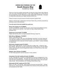
Hayfield MTB Route1 - National Trails
Hayfield MTB Route1 - National Trails
Hayfield MTB Route1 - National Trails

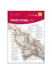
Create successful ePaper yourself
Turn your PDF publications into a flip-book with our unique Google optimized e-Paper software.
PBW<br />
Grit & gravel<br />
G 2<br />
290 310<br />
It's steep,<br />
but not too long PBW Grit & sand<br />
3<br />
Earth, part stony<br />
A rare bit of flat!<br />
230<br />
Turn through gate at 13<br />
Ford<br />
Farm<br />
sign for Bridleway Too slow here and you 14<br />
260 could be swimming!<br />
Tarmac 2<br />
300<br />
Harthill Farm<br />
230<br />
PBW<br />
1<br />
Bullshaw<br />
ROWARTH Farm Blackshaw<br />
1<br />
Farm<br />
Little<br />
200<br />
Mill Inn Farm<br />
WALL<br />
Bashed to bits!<br />
Gritty<br />
1 Grass<br />
Farm<br />
Rocky<br />
Stony H<br />
3 Stony<br />
12<br />
Grit &<br />
The last little<br />
300<br />
345<br />
some stones<br />
climb before<br />
<strong>Hayfield</strong>!<br />
PBW<br />
Gritty<br />
250<br />
300<br />
325<br />
NEW<br />
MILLS<br />
l l l ll l l l l l l l l l l<br />
l l ll l l l l l l l l l l l l l<br />
A6<br />
200<br />
ASPENSHAW RD<br />
Sett Valley Trail<br />
old railway line<br />
185<br />
10<br />
FURNESS<br />
VALE<br />
A5004<br />
WHALEY<br />
BRIDGE<br />
B6062<br />
225<br />
175<br />
A6<br />
250<br />
11<br />
A6015<br />
200<br />
1<br />
275<br />
Straight on<br />
(ignore path off to left)<br />
Farm<br />
Wide Track<br />
SITCH LANE<br />
1<br />
2<br />
F<br />
260<br />
PBW<br />
165<br />
1<br />
Sycamore<br />
Inn<br />
Ind Est<br />
N<br />
W E<br />
S<br />
RAILWAY<br />
225<br />
275<br />
300<br />
ll l<br />
325<br />
BIRCH<br />
VALE<br />
Lantern<br />
Pike<br />
250<br />
PBW<br />
PBW<br />
230<br />
PBW<br />
180<br />
Caution!<br />
Grouse<br />
Pub<br />
9<br />
Broken<br />
Tarmac<br />
275<br />
7<br />
250<br />
WALL<br />
Stones,<br />
mounds<br />
300<br />
180<br />
16<br />
Bumpy<br />
fun<br />
350<br />
15<br />
A6015<br />
Test those brakes!<br />
8<br />
You've got to burn those<br />
energy bars<br />
off some how! 3<br />
Stony<br />
Tarmac<br />
Grassy<br />
Brief<br />
respite<br />
375<br />
330<br />
400 400<br />
400<br />
3<br />
Curse that<br />
false top!<br />
A624<br />
430<br />
Chinley Station<br />
HAYFIELD<br />
200<br />
l l l l<br />
l<br />
l l<br />
l<br />
l<br />
l l<br />
Shops St Mary's Church<br />
l l l<br />
ll l l<br />
BUXWORTH<br />
Sett Valley Trail<br />
old railway line<br />
Ollersett<br />
Moor<br />
New<br />
Allotments<br />
3<br />
WALL<br />
<strong>Hayfield</strong><br />
Visitor Centre<br />
START P A<br />
access from A6015 Toll House<br />
(Antiques)<br />
Farm<br />
WALL<br />
400<br />
Hard work just about done.<br />
Keep wall<br />
on left<br />
Throstle Bank<br />
Farm<br />
WALL<br />
Peaty, boggy<br />
when wet<br />
2<br />
Phoside<br />
Farm<br />
Gritty ruts<br />
WALL<br />
Short stony<br />
section<br />
6<br />
350<br />
Chinley<br />
Churn<br />
Gritty<br />
Camp<br />
Site<br />
PBW PBW<br />
VALLEY RD 2 1 3<br />
Time to work!<br />
300<br />
A624<br />
Hills Farm<br />
STUBBINS LA<br />
1 D<br />
210<br />
STATION RD<br />
Old Hall Inn<br />
Oddfellows<br />
<strong>Hayfield</strong> Highs<br />
A circular Mountain Bike Route around <strong>Hayfield</strong>, Chinley & Rowarth<br />
that includes sections on the Pennine Bridleway <strong>National</strong> Trail<br />
This map is part of a series that can be downloaded free from www.nationaltrail.co.uk/penninebridleway<br />
E<br />
PBW<br />
i<br />
Technical Difficulty<br />
Easy: Generally a hard smoothish surface<br />
Moderate: A more uneven surface<br />
Technical: Rough, uneven going. Difficult!<br />
Generalisations only. Allowance for weather also required.<br />
'Off Road' Path Type<br />
Bridleways (a black edging to a technical grade)<br />
Byways & other 'Off Roads' (no edging)<br />
Bridleways are for cyclists, walkers and horseriders and are generally<br />
well signposted. In particular the Pennine Bridleway is often<br />
signposted PBW. Mountain bikers must give way to people on foot<br />
or horseback.<br />
Uphill Indicator<br />
Shown along the marked route. It’s subjective but at least an<br />
indication of what is in store!<br />
Points Uphill<br />
Gradients / Heights<br />
310<br />
Church<br />
HIGHGATE RD<br />
Along the Route General<br />
1 Leg Warmer 2 Pulse Racer 3 Lungbuster<br />
275<br />
Spot heights (in metres) marked along the route<br />
Contours (25 metre intervals)<br />
Surface Descriptions<br />
As annotated on the map - generalisations only. Allowance for<br />
weather also required.<br />
'Off Road' Downhills<br />
Note : Long arrow in downhill direction<br />
250<br />
B6062<br />
2<br />
360<br />
CHINLEY<br />
WHITEHOUGH<br />
5<br />
1<br />
300<br />
215<br />
1<br />
280<br />
PBW<br />
3<br />
No pain<br />
without gain!<br />
PBW 1<br />
Gravel<br />
Bedrock<br />
& Stones<br />
A624<br />
l ll<br />
ROUTE LENGTH<br />
17 miles<br />
27km<br />
Stony<br />
380<br />
2<br />
250<br />
440<br />
Well done, a nice bit of<br />
flat & then a tiny uphill<br />
before time to descend.<br />
275<br />
l ll<br />
l ll l l<br />
A6<br />
Gritty<br />
B<br />
300<br />
ll l<br />
l l l<br />
325<br />
A624<br />
Solid track<br />
Gritty<br />
Grassy & gravely<br />
PBW<br />
Crown & Mitre<br />
Mount<br />
Famine<br />
375<br />
350<br />
400<br />
425<br />
Watery Eyes<br />
Gritty<br />
Beet Farm<br />
The representation on this map of roads, tracks and paths<br />
is no evidence of the existence of a right of way.<br />
© Crown copyright. All rights reserved Natural<br />
England 100046223 2008<br />
This map has been designed and produced by Active<br />
Maps Ltd and includes original survey ©Active Maps Ltd<br />
For other mountain bike maps produced by Active Maps<br />
please visit www.bikemaps.co.uk/peak_district.htm<br />
ll<br />
PBW<br />
3<br />
Speed control!<br />
460<br />
South<br />
Head<br />
CHAPEL<br />
MILTON<br />
PB<br />
400<br />
Rocky<br />
BEET LANE<br />
4<br />
CHAPEL-EN-LE-FRITH<br />
P<br />
i<br />
5<br />
A<br />
Other Byways & Bridleways<br />
Very Narrow Road:<br />
surface may be in poor condition<br />
Minor Road 2: often single track<br />
Minor Road 1<br />
Main Road: ‘A’ and ‘B’ Roads<br />
This route guide includes subjective elements such as gradings,<br />
and generalisations such as surface descriptions (both these may<br />
change over time & will be affected by the weather). Maps and<br />
routes are for guidance only. It is up to you the cyclist to judge<br />
your own cycling competence, be aware of the conditions on the<br />
ground and be in control of your bicycle at all times. Whilst every<br />
effort has been made to ensure all the information presented is<br />
accurate we can not guarantee it is error free. In no event will any<br />
party involved in the making of this route guide be liable for any<br />
special, direct, indirect or consequential damages out of the use<br />
or inability to use the route guide.<br />
O 1 mile<br />
O 1 km<br />
ROUTE<br />
DIRECTION<br />
Pennine Bridleway <strong>National</strong> Trail<br />
Gate<br />
Wall<br />
Footpath<br />
Car park<br />
Tourist / Visitor Information Centre<br />
Public House<br />
Cafe<br />
Miles from the Start<br />
Reference markers for text description (see over)<br />
425<br />
Stones<br />
417<br />
Grit & Stones<br />
RAILWAY<br />
C<br />
Rocky<br />
l l l l ll l l l l<br />
450<br />
Watch out for<br />
Beet Lane<br />
signpost<br />
PBW<br />
475<br />
450 450<br />
400<br />
350<br />
Roych<br />
Clough<br />
Pennine Bridleway
METRES<br />
500<br />
This is a "full-on" mountain biking route where hopefully the wonderful memories will last longer than the tired legs!<br />
It has uphills to test the fittest and varied downhills that on occasion may test your nerves!<br />
The ride is a great mixture of bridleways & byways connected by short sections of lanes and roads. Scenery is ever<br />
changing plus there are good choices for refreshment stops with several pubs and a cafe on-route.<br />
There is an obvious short cut option at Birch Vale, taking the Sett Valley Trail straight back to <strong>Hayfield</strong> (see map).<br />
This would reduce the route to about 10.5 miles<br />
A<br />
B<br />
C<br />
D<br />
400<br />
<strong>Hayfield</strong> Highs<br />
Route length: 17 miles / 27km. Rough Time 31 /2 - 61 Mountain Bike Route<br />
/2 hours.<br />
START: <strong>Hayfield</strong> Village Car Park, which is also the car park for the Sett<br />
Valley Trail & is next to the Visitor Centre (it is signposted when at <strong>Hayfield</strong>).<br />
For navigation please note from The Start up to 'Point C' and from 'Point G'<br />
to The Finish you are on the Pennine Bridleway <strong>National</strong> Trail which is<br />
generally well signposted as the name or 'PBW'.<br />
The points below are referenced on the map<br />
From the car park, head into <strong>Hayfield</strong> village over the traffic light<br />
crossing (opposite the visitor centre) to come out by the church.<br />
TR, climb up street, passing The George Pub.<br />
TL by Antiques Shop (opposite Fishers Bridge Road), then immediate<br />
TL onto Valley Road. Follow road, keeping river on left. Road ends.<br />
Carry straight on, on the wide path.<br />
By stone pillars bear right & through gate. Climb through & out<br />
of the wood.<br />
Through gate then small dip to join tarmac lane.<br />
TR then immediate TR onto track that climbs (to South Head).<br />
Climb to top & then through 2 gates in quick succession.<br />
TL after next gate onto wide track (to South Head) & climb gradually.<br />
The track looks like it goes through a gate straight ahead of you<br />
but bears left immediately before it & through a gate system.<br />
Through next gate into <strong>National</strong> Trust 'South Head'. A bit of flat<br />
before a small rocky climb then a stony descent to a gate.<br />
100 metres after the gate TR onto the track that drops down (Beet<br />
Lane).<br />
Follow as it descends steeply, eventually turning to tarmac. Keep<br />
going all the way to come out at main road by the Crown & Mitre<br />
pub.<br />
TL (to go under bridge) then at T-junction TR to Chinley.<br />
In Chinley pass St Marys Church (on left). Turn next right onto<br />
road signed 'Unsuitable for HGVs'.<br />
At T-junction TL onto Stubbins Lane. Keep on this lane as it climbs<br />
- follow all the way to top by Throstle Bank Farm.<br />
TR up bridleway track immediately after the farm driveway.<br />
Follow up, through several gates (keep wall on the left).<br />
At path crossroads (wooden signposts) continue straight on.<br />
After next gate TL, so that broken wall is on your left. Head straight<br />
down, eventually reaching a wall on your right.<br />
Keep straight on (wall on your right) and descend to reach a gate.<br />
Route Profile<br />
South<br />
Head<br />
460m<br />
C<br />
Beet Lane<br />
300<br />
200m<br />
200 A<br />
<strong>Hayfield</strong> <strong>Hayfield</strong><br />
B<br />
©Active Maps Limited<br />
D<br />
Chinley 200m<br />
Throstle<br />
Bank Farm<br />
E<br />
Birch Vale<br />
Birch Vale<br />
Travelling to the Area by Train<br />
Chinley Station, conveniently situated for the mountain bike route, is on<br />
the Sheffield-Manchester Line & the Manchester-Rose Hill & Chinley Line.<br />
A possible Sunday Itinerary* that should leave time for rests and a lunch<br />
stop:<br />
From Sheffield: Depart 9.30am • Arrive Chinley at 10.11am<br />
Depart Chinley 16.46pm • Arrive Sheffield 17.31pm<br />
From Manchester Piccadilly: Depart 9.35am • Arrive Chinley at 10.14am<br />
Depart Chinley 16.25pm • Arrive Manchester 17.11pm<br />
* please note this is for guidance only. Time taken on route will vary with individuals & train<br />
times may change. Please check with <strong>National</strong> Rail Enquiries for full service details (Tel: 08457<br />
48 49 50 or www.nationalrail.co.uk). There is space for two bikes on the train and more at the<br />
conductor's discretion, on a first come first serve basis (no booking required).<br />
430m<br />
E<br />
F<br />
G<br />
H<br />
Ollersett<br />
Moor<br />
Though the gate then straight down the broken tarmac lane.<br />
The lane ends by coming out on a main road, so caution required<br />
to stop in good time.<br />
When at the road junction go straight across. Follow road down<br />
then start gradual climb.<br />
Pass Sycamore Inn, then after a minute or two TR (sharp turn)<br />
onto narrow Sitch Lane (well signed) and climb all the way to the<br />
top (you will see lake down on the right).<br />
TL onto wide track. Keep on this track. It will climb gradually. At<br />
top, keep wall on left (ignoring path off to the right) & start<br />
bumpy descent. It then levels before a very rocky descent brings<br />
you out onto tarmac.<br />
Follow straight down and past Little Mill Inn. Take next road<br />
turning on right, signed Rowarth.<br />
Pass straight through Rowarth and onto steep tarmac climb.<br />
After about 400 metres TR though the gate signed for Bridleway<br />
onto path. Drop down, over a ford then up and through gate.<br />
Follow straight up the steep lane.<br />
Before top TR onto track signed Pennine Bridleway. Up then<br />
through gate.<br />
Soon after next gate the path splits, bear right.<br />
Follow along then up slight incline. At top go through gate on<br />
right signed for Bridleway. Then with your back to gate head off<br />
in 10 o' clock direction on faint grassy track, slightly uphill.<br />
Over brow & you will see a gate with stony track beyond it.<br />
Through gate and up short steep climb. Follow as it levels then<br />
descends.<br />
Through gate and the track soon turns to tarmac. Keep descending.<br />
At road junction (by 'Cyclists Dismount' sign) TR, then immediate<br />
TL (signed for bridleway).<br />
Descend to hairpin bend and head straight on onto the path<br />
through the gate.<br />
Descend all the way to road. Turn left.<br />
Turn left through gate immediately after Industrial Estate and<br />
follow path back to <strong>Hayfield</strong> car park.<br />
160m<br />
200m Rowarth<br />
5 MILES<br />
10 15<br />
F<br />
300m<br />
To pick up the route from the station<br />
TL out of the station. Proceed to T-junction & TL.<br />
Turn first left. Then as from the start of point D<br />
To return to the station<br />
Follow directions to <strong>Hayfield</strong> then back round to<br />
Chinley. Once in Chinley pass St Mary's Church<br />
and then take the second right turn (Station Road).<br />
G<br />
Refreshments<br />
<strong>Hayfield</strong> has a good selection<br />
of pubs which serve food, a<br />
chippie and convenience<br />
stores and there are several<br />
pubs on route (see map).<br />
If waiting in Chinley for the<br />
train then there are two pubs<br />
a short ride away at<br />
Whitehough. Chinley also has<br />
a couple of shops.<br />
There is also The Special<br />
Touch Cafe at Birch Vale<br />
(selected opening hours,<br />
phone 01663 746157 for<br />
information).<br />
Cycle Hire/Maintenance:<br />
The Bike Factory (Whaley Bridge) Tel: 01663 735020<br />
(please note: it is always a good idea to arrange hire in advance)<br />
350m<br />
H<br />
Lantern<br />
Pike<br />
160m<br />
Birch Vale <strong>Hayfield</strong>