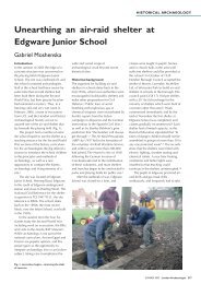
Work at the Palaeolithic site at Rookery Farm, Lower Kingswood ...
Work at the Palaeolithic site at Rookery Farm, Lower Kingswood ...
Work at the Palaeolithic site at Rookery Farm, Lower Kingswood ...

You also want an ePaper? Increase the reach of your titles
YUMPU automatically turns print PDFs into web optimized ePapers that Google loves.
Surrey Archaeological Collections, 92, 231–244, 2005<br />
<strong>Work</strong> <strong>at</strong> <strong>the</strong> <strong>Palaeolithic</strong> <strong>site</strong> <strong>at</strong><br />
<strong>Rookery</strong> <strong>Farm</strong>, <strong>Lower</strong> <strong>Kingswood</strong>, 2001–5<br />
PETER HARP<br />
This article outlines <strong>the</strong> results of fieldwork undertaken between 2001 and 2005 <strong>at</strong> <strong>the</strong> <strong>Palaeolithic</strong> <strong>site</strong> of<br />
<strong>Rookery</strong> <strong>Farm</strong>, <strong>Lower</strong> <strong>Kingswood</strong> by <strong>the</strong> Pl<strong>at</strong>eau Archaeology Group under <strong>the</strong> direction of <strong>the</strong> author. The<br />
work comprised annual fieldwalking with test pitting in summer 2002 followed by excav<strong>at</strong>ion in September<br />
2003–February 2004. The work produced nearly 400 flint artefacts of <strong>Lower</strong> and Middle <strong>Palaeolithic</strong> d<strong>at</strong>e.<br />
These artefacts mainly comprise handaxes and waste flakes (débitage), and it is suggested th<strong>at</strong> although <strong>the</strong><br />
majority of <strong>the</strong> artefacts resemble m<strong>at</strong>erial recovered from earlier investig<strong>at</strong>ions of <strong>the</strong> <strong>site</strong> which have been<br />
compared with Farnham Terrace B m<strong>at</strong>erial, artefacts are also present which are distinctive in both technology<br />
and post-depositional we<strong>at</strong>hering and are comparable to Farnham Terrace A and Terrace C m<strong>at</strong>erial.<br />
Excav<strong>at</strong>ion demonstr<strong>at</strong>ed th<strong>at</strong> those artefacts not within <strong>the</strong> plough-soil exist within a loessy clay layer under<br />
<strong>the</strong> plough-soil and resting on Clay-with-flints, and it is concluded th<strong>at</strong> <strong>the</strong>re is evidence for multi-period<br />
deposition on <strong>the</strong> <strong>site</strong> during <strong>the</strong> <strong>Palaeolithic</strong>. There is also a brief summary of recently recovered <strong>Palaeolithic</strong><br />
finds from <strong>the</strong> general area, and some comments on previous work <strong>at</strong> <strong>the</strong> <strong>site</strong>.<br />
Introduction<br />
This article presents <strong>the</strong> initial conclusions from an ongoing programme of intensive<br />
fieldwalking and test-pit excav<strong>at</strong>ion <strong>at</strong> <strong>the</strong> <strong>Palaeolithic</strong> <strong>site</strong> <strong>at</strong> <strong>Lower</strong> <strong>Kingswood</strong>, Surrey which<br />
began in autumn 2001 under <strong>the</strong> aegis of <strong>the</strong> Pl<strong>at</strong>eau Archaeology Group of <strong>the</strong> Surrey<br />
Archaeological Society. So far, nearly 400 <strong>Palaeolithic</strong> struck flints have been recorded. The<br />
<strong>site</strong> covers 400,000m2 on geology mapped as Clay-with-flints, and contains four previously<br />
identified sub-<strong>site</strong>s: Carpenter’s floor, and Walls’ Sites A, B and C (see below). The respective<br />
heights of Sites A, B and C are 172, 185 and192m OD. The r<strong>at</strong>ionale for re-examining this<br />
<strong>site</strong> was to record accur<strong>at</strong>ely <strong>the</strong> surface spread of <strong>Palaeolithic</strong> m<strong>at</strong>erial, to investig<strong>at</strong>e any<br />
str<strong>at</strong>igraphy in rel<strong>at</strong>ion to <strong>the</strong> geological deposits, and to reassess previous work. The <strong>site</strong> has<br />
been widely referred to in n<strong>at</strong>ional and regional studies (eg Wymer 1968, 272; 1999, 88;<br />
Sumbler et al 1996, 130–2; Scott-Jackson 2000, 47–50; Winton 2004, 4). The particular<br />
significance of <strong>site</strong>s such as this on <strong>the</strong> Clay-with-flints is th<strong>at</strong> <strong>the</strong>y are regarded as being<br />
essentially in situ within <strong>the</strong> landscape as opposed to artefacts recovered from <strong>site</strong>s in derived<br />
deposits such as those on <strong>the</strong> Farnham terraces. The artefacts are usually in a sharp condition,<br />
but have been subjected to severe <strong>the</strong>rmal and chemical we<strong>at</strong>hering resulting in cracking,<br />
fragment<strong>at</strong>ion and recortic<strong>at</strong>ion (p<strong>at</strong>in<strong>at</strong>ion). The integrity of <strong>the</strong>se <strong>site</strong>s is currently under<br />
deb<strong>at</strong>e (Ashton 2001 and pers comm), and <strong>the</strong> following is presented as a contribution to<br />
this discussion. The term ‘handaxe’ r<strong>at</strong>her than ‘biface’ has been used below as not all <strong>the</strong><br />
handaxes are bifacially worked but <strong>the</strong>ir form suggests similarity of function; under current<br />
practice <strong>the</strong>y would be grouped as ‘cutting tools’.<br />
Background<br />
Much of <strong>the</strong> background to this <strong>site</strong> has already been published (Walls & Cotton 1980; Cotton<br />
1985) but new research has led to a number of points of additional inform<strong>at</strong>ion which should<br />
be considered with <strong>the</strong> above public<strong>at</strong>ions.<br />
PALAEOLITHS FROM THE NORTH DOWNS PLATEAU<br />
The North Downs pl<strong>at</strong>eau around <strong>Kingswood</strong>, Walton on <strong>the</strong> Hill and Banstead (fig 1B) has<br />
been identified as one of <strong>the</strong> main concentr<strong>at</strong>ions of <strong>Palaeolithic</strong> artefacts in Surrey (Wymer
232 PETER HARP
WORK AT THE PALAEOLITHIC SITE AT ROOKERY FARM, LOWER KINGSWOOD, 2001–5 233<br />
1987, 24–5) and a summary of finds from <strong>the</strong> area was given by Walls & Cotton (1980, 32–5).<br />
To <strong>the</strong>se can be added a handaxe collected from Banstead by William Wright around 1900<br />
which is now in <strong>the</strong> British Museum (Harp 1999a, 35), possibly from <strong>the</strong> Canons <strong>Farm</strong> area,<br />
where several <strong>Palaeolithic</strong> artefacts (which are now in Bourne Hall Museum, Ewell) were<br />
recovered in <strong>the</strong> 1970s by Tom Walls and more recently by <strong>the</strong> author (Harp 2000; 2002).<br />
Walls & Cotton (1980, 33) also refer to some <strong>Palaeolithic</strong> implements found on Banstead<br />
He<strong>at</strong>h Gallops by a Mrs Easton. Her collection of struck flints has been recovered but<br />
contained no <strong>Palaeolithic</strong> m<strong>at</strong>erial, comprising post-glacial artefacts apparently rejected by<br />
L W Carpenter. It has also come to light th<strong>at</strong> Carpenter carried out an excav<strong>at</strong>ion around<br />
a small pond in a probable doline (solution hollow) fe<strong>at</strong>ure – where <strong>the</strong> acidic Clay-withflints<br />
has led to uneven solution of <strong>the</strong> underlying chalk (eg Darwin 1904, 128–9) – on<br />
Banstead He<strong>at</strong>h Gallops (TQ 2345 5437) where he collected Clactonian-type artefacts,<br />
although it is unclear whe<strong>the</strong>r <strong>the</strong>se were actually <strong>Palaeolithic</strong> (John Wymer, pers comm,<br />
who vi<strong>site</strong>d <strong>the</strong> excav<strong>at</strong>ion). These might be comparable with <strong>the</strong> Clactonian-type artefacts<br />
recovered by Tom Walls, which are now in Bourne Hall Museum, Ewell, from <strong>the</strong> same area<br />
(Harp 1999a, 13). Similar m<strong>at</strong>erial also occurs <strong>at</strong> <strong>the</strong> Canons <strong>Farm</strong> <strong>site</strong> (along with Acheulian<br />
m<strong>at</strong>erial), and has also been collected by Martin Green on <strong>the</strong> Clay-with-flints <strong>at</strong> Cranborne<br />
Chase in Dorset (Martin Green, pers comm). It is still unclear whe<strong>the</strong>r any of <strong>the</strong> Clactoniantype<br />
artefacts from <strong>the</strong> Clay-with-flints, characterised by hard-hammer percussion and a light<br />
ochreous staining, are actually <strong>Palaeolithic</strong>. More recently, <strong>Palaeolithic</strong> artefacts have been<br />
recorded from Tangier Wood and T<strong>at</strong>tenham Way allotments <strong>at</strong> Burgh He<strong>at</strong>h (Harp 1999b;<br />
1999c; Cotton 2004, 21, fig 2.2).<br />
Earlier work <strong>at</strong> <strong>Rookery</strong> <strong>Farm</strong><br />
LESLIE W CARPENTER<br />
Carpenter began <strong>the</strong> surface collection of palaeoliths from Banstead and Walton He<strong>at</strong>hs in<br />
<strong>the</strong> 1950s, culmin<strong>at</strong>ing with his recording of a ‘<strong>Palaeolithic</strong> floor’ with 94 pieces of struck<br />
flint (containing six handaxes, two cores, a chopper, a scraper, a retouched flake and 83<br />
unretouched flakes) <strong>at</strong> <strong>Rookery</strong> <strong>Farm</strong> in 1959 when plough-soil was being stripped from a<br />
dry valley as part of an encroaching landfill (Carpenter 1956; 1957; 1960; 1963). Although<br />
<strong>the</strong>se artefacts are currently lost, it is now possible to add some clarific<strong>at</strong>ion: <strong>the</strong> loc<strong>at</strong>ion of<br />
this deposit which was published somewh<strong>at</strong> vaguely as ‘in <strong>the</strong> S.W. corner of <strong>the</strong> cleared area<br />
and just above <strong>the</strong> 550ft contour line’ (Carpenter 1960, 99) and subsequently suggested as<br />
being in <strong>the</strong> vicinity of TQ 245 543 (Walls & Cotton 1980, fig 2) was l<strong>at</strong>er identified by an<br />
oper<strong>at</strong>ive <strong>at</strong> <strong>the</strong> landfill as being by a grubbed-out hedge corner, placing it <strong>at</strong> TQ 2444 5401.<br />
For <strong>the</strong> artefacts to have survived <strong>at</strong> this loc<strong>at</strong>ion on a steep slope, <strong>the</strong>y were probably<br />
contained within a doline, possibly deliber<strong>at</strong>ely used to provide ei<strong>the</strong>r w<strong>at</strong>er or hunting cover<br />
– <strong>the</strong> presence of <strong>Palaeolithic</strong> artefacts in dolines or small ponds on Clay-with-flints <strong>site</strong>s has<br />
been discussed by Smith (1894, 164–5; 1916, 63, 68), C<strong>at</strong>t et al (1978, 139–43), White (1997,<br />
927–30) and recently Cotton (2004, 21), although it is also possible th<strong>at</strong> <strong>the</strong> doline post-d<strong>at</strong>es<br />
<strong>the</strong> <strong>Palaeolithic</strong> occup<strong>at</strong>ion and has merely preserved earlier m<strong>at</strong>erial. Carpenter identified<br />
his <strong>Palaeolithic</strong> artefacts both by typology and condition, suggesting th<strong>at</strong> extensive white<br />
recortic<strong>at</strong>ion (p<strong>at</strong>in<strong>at</strong>ion) on artefacts from Clay-with-flints was a near requi<strong>site</strong> for <strong>the</strong><br />
acceptance of artefacts as being pre-glacial in d<strong>at</strong>e, arguing th<strong>at</strong> <strong>the</strong> white or cream<br />
recortic<strong>at</strong>ion was due to exposure to glacial or periglacial cold. However, Smith, working on<br />
similar geology on <strong>the</strong> Chilterns, had argued more accur<strong>at</strong>ely th<strong>at</strong> it was due to ‘<strong>the</strong><br />
decomposition of <strong>the</strong> surface of <strong>the</strong> flint brought about by w<strong>at</strong>er and <strong>the</strong> m<strong>at</strong>rix in which <strong>the</strong><br />
Fig 1 (oppo<strong>site</strong>) <strong>Rookery</strong> <strong>Farm</strong>, <strong>Lower</strong> <strong>Kingswood</strong>. Loc<strong>at</strong>ion of <strong>site</strong> and o<strong>the</strong>r <strong>Palaeolithic</strong> <strong>site</strong>s on <strong>the</strong> North Downs<br />
pl<strong>at</strong>eau. Fig 1C is based on a detail from Walls & Cotton (1980, fig 2) with minor alter<strong>at</strong>ions. (© Crown<br />
copyright and/or d<strong>at</strong>abase right. All rights reserved. Licence number 100014198)
234 PETER HARP<br />
Fig 2 <strong>Rookery</strong> <strong>Farm</strong>, <strong>Lower</strong> <strong>Kingswood</strong>. Map of Site A, showing recent finds from south-eastern part of<br />
<strong>Palaeolithic</strong> sc<strong>at</strong>ter originally discovered by Walls. Note th<strong>at</strong> <strong>the</strong> previous work by Carpenter and Pemberton<br />
is now plotted more accur<strong>at</strong>ely, and th<strong>at</strong> <strong>the</strong> alignment of <strong>the</strong> gas pipeline shown by Walls & Cotton (1980)<br />
has been corrected. Banstead He<strong>at</strong>h has been enlarged, and now covers much of Site A. (© Crown copyright<br />
and/or d<strong>at</strong>abase right. All rights reserved. Licence number 100014198)
tools happen to have been embedded’ (Smith 1894, 109–10)). It has now been suggested th<strong>at</strong><br />
this color<strong>at</strong>ion, which is common to <strong>Palaeolithic</strong> artefacts recovered from Clay-with-flints in<br />
sou<strong>the</strong>rn Britain except for <strong>the</strong> ochreous m<strong>at</strong>erial discussed below, is caused by <strong>the</strong><br />
desilicific<strong>at</strong>ion of <strong>the</strong> flint surface rel<strong>at</strong>ed to temporary alkalinity resulting from periglacial<br />
loess deposition during <strong>the</strong> Devensian or earlier, and th<strong>at</strong> <strong>the</strong> recortic<strong>at</strong>ion has limited effect<br />
on l<strong>at</strong>er artefacts as <strong>the</strong> loess had largely decalcified by <strong>the</strong> Mesolithic (Harp 2004, 16–25;<br />
2005). On <strong>the</strong>se grounds, <strong>the</strong> less heavily recortic<strong>at</strong>ed condition of <strong>the</strong> two cores and <strong>the</strong> flake<br />
chopper found by Carpenter (1960, 101, ‘6’, ‘7’ and ‘9’) may suggest a Mesolithic r<strong>at</strong>her than<br />
<strong>Palaeolithic</strong> d<strong>at</strong>e. These pieces are also <strong>at</strong>ypical of <strong>the</strong> o<strong>the</strong>r <strong>Palaeolithic</strong> artefacts recorded<br />
from <strong>the</strong> <strong>site</strong>.<br />
TOM WALLS<br />
WORK AT THE PALAEOLITHIC SITE AT ROOKERY FARM, LOWER KINGSWOOD, 2001–5 235<br />
Although Walls fieldwalked <strong>the</strong> <strong>site</strong> for about twenty years from <strong>the</strong> 1960s to 80s and<br />
recovered approxim<strong>at</strong>ely 107 <strong>Palaeolithic</strong> struck flints, mostly from Site A including 59<br />
handaxe or handaxe fragments, recent re-analysis has shown th<strong>at</strong> <strong>the</strong> majority of <strong>the</strong> d<strong>at</strong>ed<br />
artefacts (handaxes were usually d<strong>at</strong>ed but not <strong>the</strong> débitage) were found in 1969 during <strong>the</strong><br />
first season after <strong>the</strong> initial deep ploughing of Site A (Harp 2002, 5). The st<strong>at</strong>istical analysis<br />
of <strong>the</strong> recovery r<strong>at</strong>e demonstr<strong>at</strong>es th<strong>at</strong> <strong>the</strong> artefacts were essentially absent from <strong>the</strong> ploughsoil<br />
prior to <strong>the</strong> deep ploughing of 1969, and Pemberton has confirmed (pers comm) th<strong>at</strong><br />
<strong>the</strong> artefacts were only visible in <strong>the</strong> field in those areas where <strong>the</strong> Clay-with-flints subsoil<br />
had been inverted onto <strong>the</strong> surface. With a gap of ten years between <strong>the</strong> bulk of <strong>the</strong> collection<br />
and its public<strong>at</strong>ion, this raises some questions over <strong>the</strong> accuracy of <strong>the</strong> distribution map (fig<br />
1C), although Walls is credited as st<strong>at</strong>ing th<strong>at</strong> <strong>the</strong> map was only an approxim<strong>at</strong>ion since<br />
accur<strong>at</strong>e records had not been kept <strong>at</strong> <strong>the</strong> time ( Jon Cotton, pers comm). Walls identified<br />
three <strong>site</strong>s <strong>at</strong> <strong>Rookery</strong> <strong>Farm</strong> (A, B and C), although nearly all his 107 artefacts were from<br />
Site A, <strong>the</strong> field on <strong>the</strong> pl<strong>at</strong>eau adjacent and west of Carpenter’s floor. Site A was shown as<br />
forming two parallel sc<strong>at</strong>ters (fig 1C) but which artefacts came from which sc<strong>at</strong>ter was not<br />
recorded. The artefacts were generally white, recortic<strong>at</strong>ed and <strong>the</strong> handaxes pointed, except<br />
for a very small number of abraded cord<strong>at</strong>e, sub-cord<strong>at</strong>e and ov<strong>at</strong>e handaxes stained ei<strong>the</strong>r<br />
ochreous or pink. By <strong>the</strong> 1980s Walls believed he had recovered all <strong>the</strong> <strong>Palaeolithic</strong> m<strong>at</strong>erial<br />
in <strong>the</strong> plough-soil from <strong>the</strong> <strong>site</strong> ( Jon Cotton, pers comm).<br />
FRANK PEMBERTON<br />
Pemberton directed an excav<strong>at</strong>ion for <strong>the</strong> Nonsuch Antiquarian Society <strong>at</strong> <strong>the</strong> <strong>site</strong> from 1969<br />
to 1970 (Pemberton 1971), excav<strong>at</strong>ing three parallel trenches (<strong>at</strong> TQ 2437 5404) just inside<br />
<strong>the</strong> ploughed field recently walked by Walls (fig 1C), positioned adjacent to <strong>the</strong> shed housing<br />
<strong>the</strong> landfill equipment and mid-way between Carpenter’s ‘floor’ and <strong>the</strong> suggested densest<br />
concentr<strong>at</strong>ion of Walls’ finds <strong>at</strong> Site A (Frank Pemberton and local residents, pers comm).<br />
The trenches were each 2 yards by 1 yard in size while three fur<strong>the</strong>r 1 yard square sondages<br />
were also excav<strong>at</strong>ed to <strong>the</strong> south in <strong>the</strong> dry valley prior to <strong>the</strong> extension of <strong>the</strong> landfill (Frank<br />
Pemberton, pers comm). The trenches were not, apparently, excav<strong>at</strong>ed very deeply – ‘none<br />
of <strong>the</strong>m achieved a depth of more than a few inches’ – and on occasion just one excav<strong>at</strong>or<br />
worked on <strong>the</strong> <strong>site</strong>, sometimes assisted by pupils from Epsom College (Vivien Ettlinger, pers<br />
comm), although Pemberton st<strong>at</strong>es (pers comm) th<strong>at</strong> <strong>the</strong> trenches went down to <strong>the</strong> ‘n<strong>at</strong>ural<br />
Clay-with-flints’. Environmental samples were analysed but proved uninform<strong>at</strong>ive (Frank<br />
Pemberton, pers comm) and regrettably <strong>the</strong> paper archive has been lost although<br />
Pemberton, in his short note, recorded th<strong>at</strong> <strong>the</strong>re were <strong>Palaeolithic</strong> ‘primary flakes occurring<br />
in section’. The only <strong>Palaeolithic</strong> artefacts in <strong>the</strong> archive, now <strong>at</strong> Bourne Hall Museum, Ewell,<br />
are a handaxe collected on <strong>the</strong> surface by Bob Webber during fieldwalking in July 1969 prior<br />
to <strong>the</strong> excav<strong>at</strong>ion in <strong>the</strong> area where <strong>the</strong> trenches were l<strong>at</strong>er placed (Vivien Ettlinger, pers<br />
comm) and a large secondary flake. The flake is labelled ‘Field N/W of coombe’. The
236 PETER HARP<br />
artefacts, mainly Mesolithic and Bronze Age worked flint, are a mixture of surface-collected<br />
and excav<strong>at</strong>ed m<strong>at</strong>erial, and it is not possible to st<strong>at</strong>e whe<strong>the</strong>r <strong>the</strong> only <strong>Palaeolithic</strong> flake came<br />
from an excav<strong>at</strong>ed context. The primary flakes referred to by Pemberton were seen only when<br />
<strong>the</strong> north sections of <strong>the</strong> trenches were being cleaned for drawing and were left in place when<br />
<strong>the</strong> trenches were backfilled (Frank Pemberton, pers comm). The fact th<strong>at</strong>, <strong>at</strong> most, only one<br />
<strong>Palaeolithic</strong> flake was recovered from <strong>the</strong> trenches, and th<strong>at</strong> <strong>the</strong> primary flakes were only<br />
identified as such while remaining in section, suggests th<strong>at</strong> <strong>the</strong> primary flakes, which were<br />
not removed from <strong>the</strong> sections and so cannot now be studied, should be tre<strong>at</strong>ed with caution.<br />
Also, <strong>the</strong>re is much <strong>the</strong>rmally sh<strong>at</strong>tered flint on <strong>the</strong> <strong>site</strong> which could be easily mistaken<br />
for worked flint. It appears th<strong>at</strong> Pemberton unintentionally placed his trenches in a<br />
filled tributary gully to <strong>the</strong> valley used as a landfill, containing soliflucted ochreous deposits,<br />
which might explain <strong>the</strong> lack of white recortic<strong>at</strong>ed palaeoliths which had ei<strong>the</strong>r been eroded<br />
or were bene<strong>at</strong>h <strong>the</strong> depth of <strong>the</strong> excav<strong>at</strong>ion. If, as postul<strong>at</strong>ed above, Carpenter’s floor was<br />
situ<strong>at</strong>ed in a doline fe<strong>at</strong>ure on a steep slope, it explains <strong>the</strong> inability to loc<strong>at</strong>e any fur<strong>the</strong>r extent<br />
of <strong>the</strong> ‘floor’ in Pemberton’s sondages as any surviving deposits would have been highly<br />
localised.<br />
Fieldwalking 2001–2004/5<br />
In order to assess Walls’ claim th<strong>at</strong> he had recovered all <strong>the</strong> surface <strong>Palaeolithic</strong> m<strong>at</strong>erial,<br />
and with <strong>the</strong> aim of more accur<strong>at</strong>e recording of any finds and particular emphasis on<br />
recovering débitage, which was under-represented in Walls’ collection, <strong>the</strong> Pl<strong>at</strong>eau Group<br />
has been carrying out intensive fieldwalking of <strong>the</strong> area surrounding <strong>the</strong> landfill. Cultiv<strong>at</strong>ion<br />
restrictions have resulted in only part of Site A being accessible for fieldwalking as <strong>the</strong> western<br />
sc<strong>at</strong>ter identified by Walls and some of <strong>the</strong> eastern sc<strong>at</strong>ter is now under permanent pasture<br />
as part of Banstead He<strong>at</strong>h. Site B is also not currently cultiv<strong>at</strong>ed although some <strong>Palaeolithic</strong><br />
m<strong>at</strong>erial has been recovered slightly to <strong>the</strong> north in <strong>the</strong> adjacent field. The surface of <strong>the</strong><br />
restored landfill has also been checked for <strong>Palaeolithic</strong> m<strong>at</strong>erial replaced on it, but only a<br />
Neolithic ground axe fragment was found in this area.<br />
Fieldwalking has been carried out so far after four ploughings, and <strong>the</strong> intensity of <strong>the</strong><br />
fieldwalking is such th<strong>at</strong> a team of six people can walk an area of about 50 x 100m in a day.<br />
The cultiv<strong>at</strong>ed part of Site A comprises around 60,000m2 (representing 25% of Walls’ Site<br />
A), <strong>the</strong> total area fieldwalked comprises around 400,000m2 . Those areas between <strong>the</strong> known<br />
<strong>site</strong>s have been walked less intensively than <strong>the</strong> known <strong>site</strong>s, which are covered several times<br />
during each season to allow for artefacts to be recovered after we<strong>at</strong>hering of <strong>the</strong> tilth and in<br />
different light conditions. The artefacts recovered during <strong>the</strong> first season were recorded by<br />
hand-held global positioning system (GPS), but <strong>the</strong> accuracy was found to be only about 11m,<br />
<strong>the</strong>refore all subsequent surface finds have been loc<strong>at</strong>ed by both GPS and tape-measure<br />
triangul<strong>at</strong>ion, <strong>the</strong>oretically to an accuracy of 0.1m.<br />
So far, from <strong>the</strong> field containing part of Walls’ Site A, 44 handaxes or handaxe fragments,<br />
three scrapers, one utilised piece, two ‘bashed lumps’, two blades (fig 3, no 5), three Levallois<br />
flake cores (fig 3, no 3) and 147 flakes have been recorded (fig 2). This includes a small number<br />
of abraded, soft-hammer ochreous flakes and a partial soft-hammer abraded ochreous ov<strong>at</strong>e<br />
handaxe (fig 3, no 4). The majority of <strong>the</strong> m<strong>at</strong>erial is, however, sharp, heavily recortic<strong>at</strong>ed<br />
white or cream with frequent indigo manganese staining and cold-<strong>the</strong>rmal fracturing, and<br />
of <strong>the</strong> same Middle Acheulian Tradition (MAT) small pointed-industry described by Walls<br />
& Cotton (1980, fig 3.2). The post-glacial flint has generally been unrecorded and left in situ,<br />
although several Mesolithic axes, two ground Neolithic axe fragments and two<br />
Neolithic/Bronze Age arrowheads have been recorded.<br />
The distribution suggests th<strong>at</strong> this is <strong>the</strong> sou<strong>the</strong>rn half of <strong>the</strong> Walls & Cotton eastern sc<strong>at</strong>ter<br />
<strong>at</strong> Site A, approxim<strong>at</strong>ely 100m south of where previously published (accepting th<strong>at</strong> <strong>the</strong> earlier<br />
public<strong>at</strong>ion was only an approxim<strong>at</strong>ion of <strong>the</strong> position of <strong>the</strong> sc<strong>at</strong>ter), and th<strong>at</strong> <strong>the</strong> ploughsoil<br />
sc<strong>at</strong>ter comprises dense localised concentr<strong>at</strong>ions. The concentr<strong>at</strong>ions, although indic<strong>at</strong>ive
WORK AT THE PALAEOLITHIC SITE AT ROOKERY FARM, LOWER KINGSWOOD, 2001–5 237<br />
of levels of artefacts and suggestive of small knapping or butchery areas, are also a reflection<br />
of <strong>the</strong> depth of <strong>the</strong> interface between <strong>the</strong> implementiferous deposits and <strong>the</strong> overlying soil,<br />
and show where ploughing has cut into <strong>the</strong> undul<strong>at</strong>ing <strong>Palaeolithic</strong> deposit, a similar situ<strong>at</strong>ion<br />
to th<strong>at</strong> <strong>at</strong> <strong>the</strong> <strong>site</strong> <strong>at</strong> West Cliffe, Kent (Keith Parfitt, pers comm). It appears th<strong>at</strong> although<br />
most of <strong>the</strong> m<strong>at</strong>erial is technologically uniform, with some handaxes being so similar as to<br />
suggest <strong>the</strong>y are possibly <strong>the</strong> work of <strong>the</strong> same cultural group or even <strong>the</strong> same individual,<br />
<strong>the</strong>re are elements th<strong>at</strong> point to multi-period deposition in <strong>the</strong> <strong>Palaeolithic</strong>. This is apparent<br />
from <strong>the</strong> ochreous abraded m<strong>at</strong>erial which represents a soft-hammer, primarily ov<strong>at</strong>e,<br />
industry (fig 3, no 4) and has probably been soliflucted onto <strong>the</strong> <strong>site</strong> from higher up <strong>the</strong> dipslope<br />
with <strong>the</strong> ochreous flint deposit which covers part of <strong>the</strong> <strong>site</strong> and into which Pemberton<br />
carried out his excav<strong>at</strong>ions. Of particular interest are <strong>the</strong> small number of pieces from <strong>the</strong><br />
extreme nor<strong>the</strong>rn end of Site A which represent a crude, triangular handaxe assemblage in<br />
cherty flint (fig 3, no 1) and have parallels with Farnham Terrace A m<strong>at</strong>erial (Oakley 1939,<br />
Fig 3 <strong>Rookery</strong> <strong>Farm</strong>, <strong>Lower</strong> <strong>Kingswood</strong>. <strong>Palaeolithic</strong> artefacts: 1 – crude, cherty handaxe, Site A; 2 – typical<br />
Middle Acheulian Tradition pointed handaxe, Site A; 3 – crude Levallois-type flake core, Site A; 4 – ochreous<br />
handaxe fragment, Site A; 5 – blade, Site A (black dot indic<strong>at</strong>es loc<strong>at</strong>ion and presence of bulb of percussion);<br />
6 – plano-convex handaxe, Site C.
238 PETER HARP<br />
29), unlike <strong>the</strong> majority of finds from Site A which are technologically parallel with Farnham<br />
Terrace B artefacts (Wymer 1987, 24). It is deb<strong>at</strong>able whe<strong>the</strong>r <strong>the</strong> cherty n<strong>at</strong>ure of <strong>the</strong> flint<br />
itself has necessit<strong>at</strong>ed <strong>the</strong> crude knapping, but Oakley comments th<strong>at</strong> <strong>the</strong> Farnham Terrace<br />
A m<strong>at</strong>erial is not only crudely knapped but is in a similarly yellow, cherty flint (Oakley 1939,<br />
29).<br />
Walls’ Site B is currently under permanent pasture, although a single flake was recovered<br />
from <strong>the</strong> adjacent field. Site C is <strong>the</strong> loc<strong>at</strong>ion of Walls’ first surface find from <strong>the</strong> area, an<br />
ochreous sub-cord<strong>at</strong>e handaxe found in 1966 (Walls & Cotton 1980, 17) and a Levallois flake<br />
core was found nearby, but in <strong>the</strong> bottom of <strong>the</strong> dry valley, in <strong>the</strong> 1970s by Ken Lansdowne<br />
<strong>at</strong> TQ 2440 5425 (Cotton 2004, fig 2.3, 2). Two seasons of fieldwalking <strong>at</strong> Site C have recently<br />
been carried out, and one plano-convex slightly ochreous pointed handaxe (fig 3, no 6), two<br />
handaxe fragments, seven flakes and three prepared-pl<strong>at</strong>form (Levallois) flakes have been<br />
recovered, as well as a crude pointed handaxe from <strong>the</strong> adjacent field. The plano-convex<br />
handaxe and <strong>the</strong> Levallois flakes d<strong>at</strong>e from <strong>the</strong> Middle <strong>Palaeolithic</strong>, although probably not<br />
directly contemporary (Nick Ashton, pers comm) and of similar d<strong>at</strong>e to Farnham Terrace C<br />
artefacts. No prepared-pl<strong>at</strong>form flakes have yet been recorded from ei<strong>the</strong>r Site A or B. There<br />
is a very large doline fe<strong>at</strong>ure in <strong>the</strong> field (which <strong>at</strong>tracted Mesolithic activity), as well as a<br />
circular pond – possibly in ano<strong>the</strong>r doline. The only o<strong>the</strong>r archaeology apparent from<br />
fieldwalking, apart from post-glacial struck flint, is a dense spread of iron slag and fragments<br />
of furnace structure <strong>at</strong> TQ 2426 5333, d<strong>at</strong>ing to medieval or earlier periods ( Jeremy<br />
Hodgkinson, pers comm).<br />
Excav<strong>at</strong>ion<br />
TEST PITS 2002<br />
From 14 to 22 September 2002, under <strong>the</strong> direction of <strong>the</strong> author, five test pits were excav<strong>at</strong>ed<br />
<strong>at</strong> Site A (fig 2). Test Pit 4 (T4) was dug by a team from <strong>the</strong> PADMAC (<strong>Palaeolithic</strong> Artefacts<br />
and Deposits Mapped as Clay-with-flints) Unit of <strong>the</strong> University of Oxford, led by Julie Scott-<br />
Jackson. The loc<strong>at</strong>ion of <strong>the</strong> test pits was based on fieldwalking collection from <strong>the</strong> winter of<br />
2001–2, although <strong>the</strong> loc<strong>at</strong>ion of T4 was also governed by <strong>the</strong> evidence for a filled doline<br />
fe<strong>at</strong>ure derived from a 64-point resistivity survey carried out in August 2002. This Tigre 64probe<br />
array gives inform<strong>at</strong>ion to a depth of 16m.<br />
The five test pits were set out on an approxim<strong>at</strong>ely north–south grid, <strong>at</strong> a spacing of 20m.<br />
Following <strong>the</strong> methodology of Scott-Jackson (2000), <strong>the</strong> plough-soil was opened in each trench<br />
to a size of 3 x 4m, which resulted in <strong>the</strong> ability to cre<strong>at</strong>e a 1m-wide clean working area around<br />
each test pit of 2 x 1m. All <strong>the</strong> plough-soil from T1, T2 and T4 was hand-sieved through<br />
10mm sieves and any artefacts collected. This took twenty people three days, and in order<br />
to acceler<strong>at</strong>e <strong>the</strong> process, it was agreed th<strong>at</strong> for <strong>the</strong> ensuing test pits, T3 and T5, only <strong>the</strong><br />
central 2 x 1m of plough-soil would be sieved as a sample, and th<strong>at</strong> <strong>the</strong> 1m buffer zone would<br />
be removed and replaced upon reinst<strong>at</strong>ement. Although <strong>the</strong> size of <strong>the</strong> test pits in T1 and<br />
T4 were started <strong>at</strong> 1 x 2m, again in order to expedite <strong>the</strong> excav<strong>at</strong>ion, it was decided to limit<br />
<strong>the</strong>se pits, and <strong>the</strong> l<strong>at</strong>er pits, to 1m 2 . After removal of plough-soil, <strong>the</strong> test pits were excav<strong>at</strong>ed<br />
by planum spits, each 50mm in thickness after an initial levelling spit. Each square metre<br />
was denoted as ei<strong>the</strong>r ‘a’ or ‘b’. Only in T4 was n<strong>at</strong>ural deemed to have been reached, and<br />
this only by <strong>the</strong> use of a sondage. In <strong>the</strong> o<strong>the</strong>r trenches, only between 50 and 250mm of subsoil<br />
was excav<strong>at</strong>ed.<br />
Twenty-two pieces of <strong>Palaeolithic</strong> struck flint were recovered from <strong>the</strong> test pits (table 1),<br />
mainly from plough-soil, while four fur<strong>the</strong>r artefacts were picked up as casual surface finds<br />
during <strong>the</strong> course of <strong>the</strong> excav<strong>at</strong>ion. Of <strong>the</strong> pieces recorded from <strong>the</strong> excav<strong>at</strong>ion itself, a small<br />
number are likely to be elimin<strong>at</strong>ed from being <strong>Palaeolithic</strong> on final analysis. At <strong>the</strong> time of<br />
excav<strong>at</strong>ion no <strong>Palaeolithic</strong> finds were recorded from Trench 4 (<strong>the</strong> PADMAC test pit placed<br />
over a doline).
WORK AT THE PALAEOLITHIC SITE AT ROOKERY FARM, LOWER KINGSWOOD, 2001–5 239<br />
Table 1 <strong>Palaeolithic</strong> worked flint recovered from <strong>the</strong> 2002 test pits<br />
Test Pit 1 Test Pit 2 Test Pit 3 Test Pit 4 Test Pit 5<br />
Plough-soil 8 débitage; 3 débitage – – 4 débitage<br />
1 possible<br />
handaxe butt<br />
Spit 1 – – 2 débitage (1 each – 1 débitage<br />
from ‘a’ & ‘b’) from ‘a’<br />
Spits 2–4 – – – – –<br />
Spit 5 2 débitage 1 débitage<br />
from ‘a’ from ‘a’<br />
Surface finds (outside excav<strong>at</strong>ion area): three débitage and one crude pick-like handaxe. A<br />
quantity of post-glacial struck flint was recorded, but is not detailed here.<br />
TRENCHES 2003–4<br />
Between September 2003 and February 2004 two trenches, each 4 x 4m, and 11m apart,<br />
were excav<strong>at</strong>ed under <strong>the</strong> direction of <strong>the</strong> author over <strong>the</strong> densest plough-soil concentr<strong>at</strong>ions<br />
of <strong>Palaeolithic</strong> artefacts. There were insufficient resources to excav<strong>at</strong>e Trench 2 beyond about<br />
40% of <strong>the</strong> plough-soil, and approxim<strong>at</strong>ely 24 pieces of <strong>Palaeolithic</strong> débitage were recovered<br />
from hand-sieving through 10mm sieves. Trench 1, however, was excav<strong>at</strong>ed to a depth of<br />
0.8m, with a number of sondages within <strong>the</strong> trench taking <strong>the</strong> final excav<strong>at</strong>ed depth to 1.6m<br />
(fig 4). Methodology largely followed th<strong>at</strong> set out in Scott-Jackson (2000, 79–84), involving<br />
sieving <strong>the</strong> plough-soil, followed by reducing <strong>the</strong> surface to a uniform fl<strong>at</strong> d<strong>at</strong>um by removal<br />
of a levelling spit and <strong>the</strong>n by removal of 50mm-thick spits. Geological deposits were mapped<br />
and sampled <strong>at</strong> each spit, and all artefacts below plough-soil recorded as special finds, with<br />
<strong>the</strong> orient<strong>at</strong>ion of <strong>the</strong> larger artefacts also recorded to illustr<strong>at</strong>e any soil movement. Gre<strong>at</strong><br />
care was taken not to dislodge <strong>the</strong> artefacts bene<strong>at</strong>h <strong>the</strong> plough-soil until <strong>the</strong>y could be<br />
recorded in situ.<br />
Approxim<strong>at</strong>ely fourteen pieces of <strong>Palaeolithic</strong> débitage and one handaxe tip were<br />
recovered from <strong>the</strong> plough-soil, with approxim<strong>at</strong>ely ano<strong>the</strong>r 122 pieces of débitage (all flakes<br />
or fragmentary m<strong>at</strong>erial with one large-blade core) and four possible scrapers recovered from<br />
bene<strong>at</strong>h <strong>the</strong> plough-soil. The numbers given are approxim<strong>at</strong>e as some of <strong>the</strong> flakes may be<br />
n<strong>at</strong>ural <strong>the</strong>rmally fractured m<strong>at</strong>erial, and also a small quantity of <strong>the</strong> m<strong>at</strong>erial, including <strong>the</strong><br />
four possible scrapers, are recortic<strong>at</strong>ed a brighter white colour than <strong>the</strong> bulk of <strong>the</strong> m<strong>at</strong>erial<br />
and may represent Upper <strong>Palaeolithic</strong> or Mesolithic artefacts. The densest concentr<strong>at</strong>ion of<br />
artefacts was found to be around 0.5m bene<strong>at</strong>h <strong>the</strong> surface, and most of those artefacts not<br />
in <strong>the</strong> plough-soil were loc<strong>at</strong>ed within a loessy clay layer bene<strong>at</strong>h areas of loess (of Devensian<br />
or earlier d<strong>at</strong>e) and overlying <strong>the</strong> Clay-with-flints. Post-glacial flint artefacts were also recorded<br />
within <strong>the</strong> plough-soil, and a shallow circular pit filled with a charcoal deposit was recorded<br />
in <strong>the</strong> south-east corner of <strong>the</strong> trench, probably associ<strong>at</strong>ed with l<strong>at</strong>e prehistoric activity.<br />
Results of <strong>the</strong> analysis of <strong>the</strong> <strong>Palaeolithic</strong> artefacts are currently awaited from Vicky Winton<br />
of <strong>the</strong> PADMAC Unit, who are also analysing <strong>the</strong> soil samples on behalf of <strong>the</strong> Society.<br />
Conclusions<br />
The work to d<strong>at</strong>e by <strong>the</strong> Pl<strong>at</strong>eau Group has recovered 206 <strong>Palaeolithic</strong> artefacts from surface<br />
collection <strong>at</strong> Site A, one from near Site B, and fourteen from Site C. In addition,<br />
approxim<strong>at</strong>ely 187 pieces of <strong>Palaeolithic</strong> struck flint have come from excav<strong>at</strong>ed contexts <strong>at</strong><br />
Site A. Among <strong>the</strong>se 393 artefacts, 58 (20%) are tool or tool fragments (nearly all handaxes).<br />
To put <strong>the</strong> <strong>site</strong> into context within <strong>the</strong> county, around 500–600 <strong>Palaeolithic</strong> artefacts are<br />
recorded each from Farnham and Limpsfield (Roe 1968, 283–90, Field et al 1999, 12–13) ,
240 PETER HARP<br />
Fig 4 <strong>Rookery</strong> <strong>Farm</strong>, <strong>Lower</strong> <strong>Kingswood</strong>. Trench 1, 2003/4, north section. Most of <strong>the</strong> <strong>Palaeolithic</strong> artefacts came<br />
from <strong>the</strong> loessy clay layer.<br />
and <strong>the</strong> recent finds <strong>at</strong> <strong>Kingswood</strong> bring this <strong>site</strong> up to a similar figure of about 600 artefacts,<br />
although <strong>the</strong> Farnham and Limpsfield groupings represent collection from a large number<br />
of individual <strong>site</strong>s, and allowance must be made for <strong>the</strong> large number of artefacts recovered<br />
from Farnham which are now dispersed without record (eg Wymer 1992–3; 52–7).<br />
The only excav<strong>at</strong>ion carried out to significant depth has shown <strong>the</strong> gre<strong>at</strong>est concentr<strong>at</strong>ion<br />
of artefacts <strong>at</strong> 0.5m, though it might have been expected th<strong>at</strong> since this excav<strong>at</strong>ion was placed<br />
over one of <strong>the</strong> densest concentr<strong>at</strong>ions of m<strong>at</strong>erial in <strong>the</strong> plough-soil <strong>the</strong> <strong>Palaeolithic</strong> deposit<br />
<strong>at</strong> this point was rel<strong>at</strong>ively shallow. The inference from this is th<strong>at</strong> it is likely th<strong>at</strong> very large<br />
quantities of m<strong>at</strong>erial remain buried on <strong>the</strong> <strong>site</strong>, following <strong>the</strong> undul<strong>at</strong>ing remnant <strong>Palaeolithic</strong><br />
land surface and, in places, depo<strong>site</strong>d <strong>at</strong> depth within doline fe<strong>at</strong>ures. It may be th<strong>at</strong> those<br />
areas with least m<strong>at</strong>erial in <strong>the</strong> plough-soil contain <strong>the</strong> best-preserved, deeper deposits – which<br />
has serious implic<strong>at</strong>ions for any large-scale evalu<strong>at</strong>ion of <strong>the</strong> <strong>site</strong>. Although <strong>the</strong> artefacts, where<br />
not brought into <strong>the</strong> plough-soil by deep ploughing, are contained within an implementiferous<br />
zone of loessy clay resting on <strong>the</strong> Clay-with-flints, it would be simplistic to refer to this as a<br />
‘floor’ since it appears to represent artefacts from a wide timespan in <strong>the</strong> <strong>Palaeolithic</strong> th<strong>at</strong><br />
has been heavily turb<strong>at</strong>ed while remaining generally distinct from l<strong>at</strong>e prehistoric struck flint.<br />
With <strong>the</strong> exception of <strong>the</strong> abraded ochreous m<strong>at</strong>erial, this movement, whe<strong>the</strong>r <strong>the</strong> result of<br />
bioturb<strong>at</strong>ion or freeze-thaw processes, is unlikely to have moved artefacts far within <strong>the</strong><br />
landscape but artefacts cannot be regarded as being truly in situ. Fur<strong>the</strong>r work on refitting<br />
will give an indic<strong>at</strong>ion of <strong>the</strong> integrity of <strong>the</strong> <strong>site</strong>.<br />
The excav<strong>at</strong>ed loessy deposits appear to have decalcified to an extent th<strong>at</strong> no faunal<br />
remains have survived; however, thicker loess deposits in some of <strong>the</strong> dolines may not have<br />
totally decalcified. Faunal remains recovered from <strong>the</strong> neighbouring valley system deposits,<br />
including mammoth (Elephas primigenius), gre<strong>at</strong> hippopotamus (Rhinococeros leptorhinus), horse<br />
(Equus caballus), aurochs (Bos primigenius) and reindeer (Rangifer tarandus), may indic<strong>at</strong>e fauna<br />
originally present on <strong>the</strong> <strong>site</strong> (Dines & Edmunds 1933, 166).<br />
Site A appears to contain <strong>at</strong> least three typologies of <strong>Palaeolithic</strong> artefacts, and although
WORK AT THE PALAEOLITHIC SITE AT ROOKERY FARM, LOWER KINGSWOOD, 2001–5 241<br />
<strong>the</strong> Levallois cores and blades might represent additional Middle and Upper <strong>Palaeolithic</strong><br />
activity, <strong>the</strong> crudity of <strong>the</strong> cores and low numbers of blades do not preclude <strong>the</strong>m from being<br />
coincidental with <strong>the</strong> bulk of <strong>the</strong> MAT artefacts (M<strong>at</strong>t Pope, pers comm).<br />
Handaxes are generally small, and size/morphology may be a result of <strong>the</strong> raw m<strong>at</strong>erial<br />
available (Shaw & White 2003, 311–12; Hopkinson & White 2005, 22–3) although <strong>at</strong> <strong>the</strong><br />
<strong>site</strong> <strong>at</strong> Red Barns, Hampshire, where <strong>the</strong> flint was of poor quality, it has been argued th<strong>at</strong><br />
o<strong>the</strong>r factors such as sexual selection, cultural repertoire and <strong>the</strong> immedi<strong>at</strong>e intended function<br />
of <strong>the</strong> tool also heavily influence handaxe morphology (Wenban-Smith 2000, 248). The Claywith-flints<br />
<strong>at</strong> Site A is generally about 13m in depth, and considerably deeper over <strong>the</strong> dolines<br />
and it would not normally be expected to find large flint nodules in <strong>the</strong> upper part of such<br />
a depth of Clay-with-flints. However, <strong>the</strong> excav<strong>at</strong>ion revealed a significant quantity of large<br />
flint nodules which suggests th<strong>at</strong> <strong>the</strong> upper part of <strong>the</strong> Clay-with-flints on <strong>site</strong> has been derived<br />
from a deposit fur<strong>the</strong>r up <strong>the</strong> dip-slope th<strong>at</strong> has sludged down prior to <strong>the</strong> period of<br />
<strong>Palaeolithic</strong> activity ( John C<strong>at</strong>t, pers comm). (The geology of <strong>the</strong> <strong>site</strong> cannot strictly be termed<br />
Clay-with-flints and has been identified by John (1980, 110) as Pl<strong>at</strong>eau Drift.) The scrapers,<br />
like those collected by Carpenter, are generally less recortic<strong>at</strong>ed than <strong>the</strong> handaxes and may<br />
be post-<strong>Palaeolithic</strong> or <strong>at</strong> least more recent than <strong>the</strong> handaxes.<br />
It is likely th<strong>at</strong> <strong>the</strong> ochreous m<strong>at</strong>erial, containing ov<strong>at</strong>e handaxes, represents more recent<br />
artefacts as ov<strong>at</strong>es first appear in Farnham Terrace C m<strong>at</strong>erial in Surrey, but <strong>the</strong>re is no<br />
technological reason why <strong>the</strong> ochreous artefacts might not be earlier than <strong>the</strong> white pointedhandaxe<br />
industry; clearly this is an area for fur<strong>the</strong>r work. A variety of artefacts of different<br />
technologies and staining or recortic<strong>at</strong>ion is not unusual on Clay-with-flints <strong>site</strong>s, such as<br />
Smith’s classific<strong>at</strong>ion of his artefacts <strong>at</strong> Caddington into ‘ochreous implements’, ‘white,<br />
lustrous, sharp-edged implements’ and ‘grey or indigo-varieg<strong>at</strong>ed sharp-edged implements’<br />
(Smith 1894, 96–119) and as <strong>the</strong> differences in surface condition must be a reflection of both<br />
geology (including both type of flint used and its geological medium) and environmental<br />
factors, it is possible th<strong>at</strong> surface condition of <strong>the</strong> artefacts may help in distinguishing <strong>the</strong><br />
industries present on <strong>the</strong> <strong>site</strong>. It certainly seems relevant th<strong>at</strong> all <strong>the</strong> ov<strong>at</strong>e or ov<strong>at</strong>e-tending<br />
handaxes on <strong>the</strong> North Downs pl<strong>at</strong>eau around Banstead, Walton on <strong>the</strong> Hill and <strong>Kingswood</strong><br />
are ochreous, although <strong>at</strong> Canons <strong>Farm</strong>, while <strong>the</strong>re is an ochreous ov<strong>at</strong>e present, <strong>the</strong> pointedindustry<br />
handaxes become more ochreous as <strong>the</strong> sc<strong>at</strong>ter moves up-slope, possibly indic<strong>at</strong>ive<br />
of some overlying deposit only partially covering <strong>the</strong> <strong>site</strong>. In Hampshire, similarly, while <strong>the</strong><br />
Clay-with-flints contains <strong>the</strong> white recortic<strong>at</strong>ed flint typical of Surrey, <strong>the</strong>re are also small<br />
p<strong>at</strong>ches of ochreous flint deposits containing an ochreous ov<strong>at</strong>e <strong>Palaeolithic</strong> flint industry<br />
(Willis 1947, 254–5).<br />
Although it has not been possible to conduct any work on Site B so far, <strong>the</strong> recovery of a<br />
single débitage flake from <strong>the</strong> adjacent field <strong>at</strong> least confirms activity in <strong>the</strong> area. At Site C,<br />
<strong>the</strong> collection of a plano-convex handaxe, several prepared-pl<strong>at</strong>form flakes (probably<br />
Levalloisian) and <strong>the</strong> crude ‘proto-Levalloisian’ core (Roe 1981, 191) found by Lansdowne<br />
point to <strong>the</strong> strong possibility of <strong>the</strong> <strong>site</strong> being of Middle <strong>Palaeolithic</strong> d<strong>at</strong>e. Although <strong>the</strong><br />
artefacts are both white and ochreous, none of <strong>the</strong> ochreous artefacts show <strong>the</strong> degree of<br />
staining or abrasion evident on <strong>the</strong> ochreous artefacts recovered from Site A.<br />
The work <strong>at</strong> <strong>the</strong> <strong>site</strong> has raised a number of issues th<strong>at</strong> require fur<strong>the</strong>r research:<br />
1 The topographic context of <strong>the</strong> <strong>site</strong>. Wh<strong>at</strong> role do <strong>the</strong> solution hollows (dolines) play ei<strong>the</strong>r in<br />
<strong>the</strong> use of <strong>the</strong> <strong>site</strong> by hominids (if <strong>the</strong> hollows existed during <strong>the</strong> <strong>Palaeolithic</strong>) such as w<strong>at</strong>er<br />
supplies, shelter, hunting cover, faunal/floral resources or providing flint for knapping, or<br />
as fe<strong>at</strong>ures which have preserved evidence of pre-existing hominid occup<strong>at</strong>ion? Is <strong>the</strong><br />
presence of <strong>the</strong> <strong>site</strong> on high ground between two valleys a coincidence of its preserv<strong>at</strong>ion<br />
or was <strong>the</strong> <strong>site</strong> specifically used because of its vantage point into <strong>the</strong> valleys to hunt game?<br />
Have <strong>the</strong> <strong>site</strong>s fur<strong>the</strong>r to <strong>the</strong> edge of <strong>the</strong> pl<strong>at</strong>eau been lost through erosion, and could <strong>the</strong>re<br />
be a significant number of <strong>site</strong>s th<strong>at</strong> are still buried <strong>at</strong> depth on <strong>the</strong> pl<strong>at</strong>eau which have<br />
not been revealed by processes such as soil erosion or deep ploughing?
242 PETER HARP<br />
2 Intra-<strong>site</strong> chronology and distribution of activity. Do <strong>the</strong> artefacts within <strong>the</strong> sc<strong>at</strong>ter represent an<br />
accumul<strong>at</strong>ion of occup<strong>at</strong>ion debris over a large period of time or a mixture of activities<br />
over a short period? Is it possible to draw conclusions from <strong>the</strong> densities of plough-soil<br />
artefacts about <strong>the</strong> distribution of activity if plough-soil artefact concentr<strong>at</strong>ions are heavily<br />
dependent on <strong>the</strong> post-depositional processes which have influenced artefact preserv<strong>at</strong>ion<br />
and visibility? Can <strong>the</strong> variable condition of <strong>the</strong> flint artefacts be used to distinguish<br />
artefacts from different periods as an indic<strong>at</strong>ion of post-depositional geological and<br />
environmental conditions?<br />
3 Raw m<strong>at</strong>erial procurement. Was <strong>the</strong> flint used in knapping collected from <strong>the</strong> Clay-with-flints,<br />
from local chalk outcrops or from deposits in <strong>the</strong> base of <strong>the</strong> dry valleys? How has <strong>the</strong><br />
quality of <strong>the</strong> flint affected artefact production, size, morphology and technology? Is it<br />
possible to determine <strong>the</strong> quality of <strong>the</strong> flint in use on <strong>site</strong> in <strong>the</strong> <strong>Palaeolithic</strong> considering<br />
th<strong>at</strong> <strong>the</strong> flint now visible has been subjected to subsequent glaci<strong>at</strong>ion(s)?<br />
4 Hominid behaviour on <strong>site</strong>. Does <strong>the</strong> predominance of handaxes suggest th<strong>at</strong> <strong>the</strong> <strong>site</strong> was<br />
mainly used for butchery, and can <strong>the</strong> variable density of handaxes and débitage indic<strong>at</strong>e<br />
areas of knapping discrete from butchery areas? Is it possible to distinguish tools made by<br />
social groups or individuals?<br />
5 Faunal and floral evidence. Are <strong>the</strong>re surviving loess deposits contained in <strong>the</strong> dolines which<br />
have not decalcified, so preserving floral/faunal evidence, and is it possible to rel<strong>at</strong>e <strong>the</strong><br />
faunal evidence th<strong>at</strong> has been recovered in <strong>the</strong> past from <strong>the</strong> dry valley systems?<br />
6 Inter-<strong>site</strong> comparisons. How do <strong>the</strong> <strong>Kingswood</strong> <strong>site</strong>s rel<strong>at</strong>e to <strong>the</strong> neighbouring <strong>site</strong>s on <strong>the</strong><br />
Banstead/Walton on <strong>the</strong> Hill pl<strong>at</strong>eau, and to o<strong>the</strong>r <strong>site</strong>s on Clay-with-flints such as those<br />
on <strong>the</strong> Chilterns, <strong>the</strong> Dover hinterland or <strong>the</strong> Argile à Silex deposits in nor<strong>the</strong>rn France?<br />
Can <strong>the</strong> Clay-with-flints <strong>site</strong>s be compared with <strong>the</strong> <strong>Palaeolithic</strong> <strong>site</strong>s on Head deposits<br />
around Limpsfield, and to <strong>the</strong> terrace deposits, such as those of <strong>the</strong> Thames, Mole, Wey<br />
and Arun? How valid is it to use <strong>the</strong> artefact typological sequences on <strong>the</strong> Farnham terraces<br />
to d<strong>at</strong>e <strong>the</strong> North Downs high-level <strong>site</strong>s? Can <strong>the</strong> soliflucted ochreous <strong>Palaeolithic</strong> artefacts<br />
on <strong>the</strong> Clay-with-flints be associ<strong>at</strong>ed with a specific period of geomorphological activity?<br />
7 Investig<strong>at</strong>ion methodology. How can <strong>the</strong> investig<strong>at</strong>ion of <strong>the</strong>se <strong>site</strong>s be made more efficient in<br />
terms of labour and cost, bearing in mind <strong>the</strong> difficulty in recognising <strong>the</strong> artefacts<br />
(particularly <strong>the</strong> débitage when mixed with n<strong>at</strong>urally occurring <strong>the</strong>rmal sh<strong>at</strong>tered flint),<br />
<strong>the</strong> variable <strong>site</strong> visibility and <strong>the</strong> potential extensive area of each <strong>site</strong>?<br />
It is hoped th<strong>at</strong> future work on this <strong>site</strong>, and similar <strong>site</strong>s, may address some of <strong>the</strong>se<br />
questions.<br />
ACKNOWLEDGEMENTS<br />
The author would particularly like to thank <strong>the</strong> large number of people who have endured<br />
<strong>the</strong> harsh we<strong>at</strong>her conditions of <strong>the</strong> North Downs during <strong>the</strong> periods of recent fieldwork,<br />
especially Stella Hill, Robin Tanner, Dave Tidy and Nigel Wilson. The following are also<br />
thanked for <strong>the</strong>ir advice and assistance: Nick Ashton, John C<strong>at</strong>t, Jon Cotton, Vivien Ettlinger,<br />
Martin Green, Jeremy Hodgkinson, Julie Scott-Jackson and William Scott-Jackson, Keith<br />
Parfitt, Frank Pemberton, M<strong>at</strong>t Pope, Mark White, Vicky Winton and John Wymer. Thanks<br />
are due to Surrey Archaeological Society for providing grants and also insurance cover, and<br />
to <strong>the</strong> PADMAC Unit (Pitt Rivers Museum, University of Oxford) for carrying out a deepresistivity<br />
survey of <strong>the</strong> <strong>site</strong> and who are undertaking artefact and environmental analysis on<br />
behalf of <strong>the</strong> Society. Finally, I am indebted to <strong>the</strong> landowner, Surrey County Council, and<br />
Richard Kent, <strong>the</strong> tenant farmer, for giving <strong>the</strong> Pl<strong>at</strong>eau Group exclusive permission to carry<br />
out <strong>the</strong> work, and <strong>the</strong> Banstead Commons Conserv<strong>at</strong>ors and Reig<strong>at</strong>e & Banstead Borough<br />
Council for helping with <strong>the</strong> logistics of <strong>the</strong> excav<strong>at</strong>ions and giving permission for <strong>the</strong> Group<br />
to carry out fieldwork on <strong>the</strong> adjoining land. All artefacts removed and soil samples taken<br />
remain <strong>the</strong> property of Surrey County Council; all <strong>the</strong> soil samples, and <strong>the</strong> artefacts from
WORK AT THE PALAEOLITHIC SITE AT ROOKERY FARM, LOWER KINGSWOOD, 2001–5 243<br />
Test Pit 4, are currently on loan to <strong>the</strong> PADMAC Unit, and all <strong>the</strong> artefacts will be stored<br />
eventually <strong>at</strong> <strong>the</strong> British Museum where Tom Walls’ <strong>Palaeolithic</strong> finds from <strong>the</strong> <strong>site</strong> are housed.<br />
BIBLIOGRAPHY<br />
Ashton, N, 2001 <strong>Lower</strong> and Middle <strong>Palaeolithic</strong> artefacts from deposits mapped as Clay-with-flints, by J E Scott-<br />
Jackson (book review), in Lithics, 22, Lithics Stud Soc, 66–8<br />
Carpenter, L W, 1956 The palaeoliths of Walton and Banstead He<strong>at</strong>hs, Proc Le<strong>at</strong>herhead Dist Local Hist Soc, 1.10,<br />
6–10<br />
––––, 1957 Two palaeoliths from Tadworth, Proc Le<strong>at</strong>herhead Dist Local Hist Soc, 2.1, facing 2<br />
––––, 1960 A palaeolithic floor <strong>at</strong> <strong>Lower</strong> <strong>Kingswood</strong>, Proc Le<strong>at</strong>herhead Dist Local Hist Soc, 2.4, 99–101<br />
––––, 1963 More palaeoliths from Walton He<strong>at</strong>h, Proc Le<strong>at</strong>herhead Dist Local Hist Soc, 2.7, 202–3<br />
C<strong>at</strong>t, J A, Hubbard, R N L B, & Sampson, C G, 1978 Summary and conclusions, in C G Sampson, Palaeoecology<br />
and archaeology of an Acheulian <strong>site</strong> <strong>at</strong> Caddington, England, Dallas: Department of Anthropology, Sou<strong>the</strong>rn<br />
Methodist University, 139–49<br />
Cotton, J, 1985 Palaeoliths from <strong>the</strong> North Downs <strong>at</strong> <strong>Lower</strong> <strong>Kingswood</strong>: some new finds, SyAC, 76, 105–7<br />
––––, 2004 Surrey’s early past: a survey of recent work, in J Cotton, G Crocker, & A Graham (eds), Aspects of<br />
archaeology and history in Surrey: towards a research framework for <strong>the</strong> county, Guildford: SyAS, 19–38<br />
Darwin, C, 1904 The form<strong>at</strong>ion of vegetable mould through <strong>the</strong> action of worms: with observ<strong>at</strong>ions on <strong>the</strong>ir habits, London: John<br />
Murray<br />
Dines, H G, & Edmunds, F H, 1933 The geology of <strong>the</strong> country around Reig<strong>at</strong>e and Dorking, Mem Geol Survey England<br />
Wales: Explan<strong>at</strong>ion of Sheet 286, London: HMSO<br />
Field, D, Nicolaysen, P, & Cotton, J, 1999 The <strong>Palaeolithic</strong> <strong>site</strong>s <strong>at</strong> Limpsfield, Surrey: an analysis of <strong>the</strong> artefacts<br />
collected by A M Bell, SyAC, 86, 1–32<br />
Harp, P, 1999a In <strong>the</strong> footsteps of William Wright: a reappraisal of prehistoric flintwork in <strong>the</strong> Banstead region of Surrey, Occas<br />
Pap, 2, Pl<strong>at</strong>eau Archaeol Grp<br />
––––, 1999b Palaeolith from Tangier Wood, Burgh He<strong>at</strong>h, Pl<strong>at</strong>eau Archaeol Grp Bull, 1, 2<br />
––––, 1999c The Banstead research <strong>site</strong>, Pl<strong>at</strong>eau Archaeol Grp Bull, 1, 3–5<br />
––––, 2000 More palaeoliths from Banstead, Pl<strong>at</strong>eau Archaeol Grp Bull, 2, 2<br />
––––, 2002 Fur<strong>the</strong>r work on two <strong>Lower</strong> <strong>Palaeolithic</strong> <strong>site</strong>s on <strong>the</strong> North Downs in Surrey: <strong>Rookery</strong> <strong>Farm</strong>, <strong>Lower</strong><br />
<strong>Kingswood</strong> and Canons <strong>Farm</strong>, Banstead, Pl<strong>at</strong>eau Archaeol Grp Bull, 3, 4–24<br />
––––, 2004 The d<strong>at</strong>ing of <strong>Lower</strong> and Middle <strong>Palaeolithic</strong> artefacts from high-level acidic deposits in sou<strong>the</strong>rn<br />
England by <strong>the</strong>ir condition as an indic<strong>at</strong>or of post-depositional environmental factors, particularly <strong>the</strong><br />
influence of periglacial loess, unpublished BSc <strong>the</strong>sis, University of Surrey<br />
––––, 2005 The role of periglacial loess deposition in <strong>the</strong> understanding of palaeoliths from Clay-with-flints, paper<br />
presented <strong>at</strong> <strong>the</strong> <strong>Palaeolithic</strong>-Mesolithic Day Meeting, 10 March 2005, British Museum<br />
Hopkinson, T, & White, M J, 2005 The Acheulian and <strong>the</strong> handaxe: structure and agency in <strong>the</strong> <strong>Palaeolithic</strong>, in<br />
C Gamble & M Porr (eds), The hominid individual in context: archaeological investig<strong>at</strong>ions of <strong>Lower</strong> and Middle <strong>Palaeolithic</strong><br />
landscapes, locales and artefacts, Abingdon: Routledge, 13–28<br />
John, D T, 1980 The soils and superficial deposits on <strong>the</strong> North Downs of Surrey, in D K C Jones (ed), The shaping<br />
of sou<strong>the</strong>rn England, Inst Brit Geography Spec Pub, 11, 101–30<br />
Oakley, K P, 1939 Geology and <strong>Palaeolithic</strong> Studies, in K P Oakley, W F Rankine & A W G Low<strong>the</strong>r (eds), A<br />
survey of <strong>the</strong> prehistory of <strong>the</strong> Farnham district, Guildford: SyAS, 3–58<br />
Pemberton, F, 1971 <strong>Lower</strong> <strong>Kingswood</strong> excav<strong>at</strong>ion <strong>at</strong> <strong>Rookery</strong> <strong>Farm</strong> (TQ 234537–TQ 244541), SyAC, 68, 190<br />
Roe, D, 1968 A gazetteer of British <strong>Lower</strong> & Middle <strong>Palaeolithic</strong> Sites, CBA Res Rep, 8<br />
––––, 1981 The <strong>Lower</strong> and Middle <strong>Palaeolithic</strong> periods in Britain, London: Routledge & Kegan Paul<br />
Scott-Jackson, J E, 2000 <strong>Lower</strong> and Middle <strong>Palaeolithic</strong> artefacts from deposits mapped as Clay-with-flints: a new syn<strong>the</strong>sis with<br />
significant implic<strong>at</strong>ions for <strong>the</strong> earliest occup<strong>at</strong>ion of Britain, Oxford: Oxbow Books<br />
Shaw, A D, & White, M J, 2003 Ano<strong>the</strong>r look <strong>at</strong> <strong>the</strong> Cuxton handaxe assemblage, Proc Prehist Soc, 69, 305–13<br />
Smith, W G, 1894 Man <strong>the</strong> primeval savage: his haunts and relics from <strong>the</strong> hilltops of Bedfordshire to Blackwall, London:<br />
Stanford<br />
––––, 1916 Notes on <strong>the</strong> <strong>Palaeolithic</strong> floor near Caddington, Archaeologia, 67, 49–74<br />
Sumbler, M G, Bridgland, D R, Wymer, J J, & Balson, P S, 1996 Qu<strong>at</strong>ernary, in M G Sumbler (ed), British regional<br />
geology: London and <strong>the</strong> Thames Valley Brit Geol Survey, London: HMSO, 110–36<br />
Walls, T, & Cotton, J, 1980 Palaeoliths from <strong>the</strong> North Downs <strong>at</strong> <strong>Lower</strong> <strong>Kingswood</strong>, SyAC, 72, 15–36<br />
Wenban-Smith, F F, 2000 Typology and technology, in F Wenban-Smith, C Gamble & A ApSimon, The<br />
<strong>Palaeolithic</strong> <strong>site</strong> <strong>at</strong> Red Barns, Portchester, Hampshire: bifacial technology, raw m<strong>at</strong>erial quality, and <strong>the</strong><br />
organis<strong>at</strong>ion of archaic behaviour, Proc Prehist Soc, 66, 209–55<br />
White, M J, 1997 The earlier <strong>Palaeolithic</strong> occup<strong>at</strong>ion of <strong>the</strong> Chilterns (sou<strong>the</strong>rn England): re-assessing <strong>the</strong> <strong>site</strong>s<br />
of Worthington G Smith, Antiquity, 71, 912–31<br />
Willis, G W, 1947 Hampshire palaeoliths and <strong>the</strong> Clay-with-flints, Proc Hampshire Fld Club Archaeol Soc, 16.3, 253–6<br />
Winton, V, 2004 A study of <strong>Palaeolithic</strong> artefacts from selected <strong>site</strong>s on deposits mapped as Clay-with-flints of sou<strong>the</strong>rn England<br />
with particular reference to handaxe manufacture, BAR Brit Ser, 360
244 PETER HARP<br />
Wymer, J J, 1968 <strong>Lower</strong> <strong>Palaeolithic</strong> archaeology in Britain as represented by <strong>the</strong> Thames Valley, London: John Baker<br />
––––, 1987 The <strong>Palaeolithic</strong> period in Surrey, in J Bird & D G Bird (eds), The archaeology of Surrey to 1540, Guildford:<br />
SyAS, 17–30<br />
––––, 1992–3 The Sou<strong>the</strong>rn Rivers <strong>Palaeolithic</strong> project. Report no 2. 1992–1993. The south-west and south of <strong>the</strong> Thames,<br />
Salisbury: Wessex Archaeology<br />
––––, 1999 The <strong>Lower</strong> <strong>Palaeolithic</strong> occup<strong>at</strong>ion of Britain, volume 1: text, Salisbury: Wessex Archaeology and English<br />
Heritage