2.4 Standard Classification adopted for SOIL TYPES with digital ...
2.4 Standard Classification adopted for SOIL TYPES with digital ...
2.4 Standard Classification adopted for SOIL TYPES with digital ...
You also want an ePaper? Increase the reach of your titles
YUMPU automatically turns print PDFs into web optimized ePapers that Google loves.
LRISD,NIC(Hqrs) <strong>Standard</strong> <strong>Classification</strong> <strong>adopted</strong> <strong>for</strong> <strong>SOIL</strong> <strong>TYPES</strong><br />
<strong>2.4</strong> <strong>Standard</strong> <strong>Classification</strong> <strong>adopted</strong> <strong>for</strong> <strong>SOIL</strong> <strong>TYPES</strong> <strong>with</strong> <strong>digital</strong><br />
coding scheme.<br />
<strong>2.4</strong>.1 Objective: Integrate/attempt and determine the soil classification to be used<br />
<strong>for</strong> Land Records Computerisation and organize the data “Soil Type” <strong>for</strong> MIS/DSS<br />
<strong>2.4</strong>.2 Scope:<br />
The soil data is being collected by patwari/village accountants at parcel level. This<br />
ground level data could provide soil in<strong>for</strong>mation which could be integrated at<br />
1:50000/1:250000 scale soil maps as prepared by national level organizations like<br />
Department of Space/NBSS & LUP/ AISLUS.<br />
<strong>2.4</strong>.3 Existing System:<br />
<strong>2.4</strong>.4 Survey and Settlement Department<br />
Land revenue registers are available in all the States. This database has the soil data as<br />
collected by the patwari in local terms. The electronic <strong>for</strong>m of the same data is also<br />
available in the database and is collected under the computerization of land records<br />
project.<br />
<strong>2.4</strong>.5 Disadvantages:<br />
1.The soil data as available in the land records database is collected by using<br />
conventional approaches. The data is collected by the Patwari and he is not a soil expert.<br />
2. There is a clear cut gap between the data collected by the Patwari and the data<br />
collected by different agencies in a scientific way.<br />
3. The data as collected by the patwari is in more of land use and land revenue sense then<br />
the soil composition and physical characteristics.<br />
4. There is no scientific correlation between the soil nomenclature as followed by the<br />
patwari and the soil code made by the various national level agencies.<br />
NIC,DIT,MCIT,GOI 1
LRISD,NIC(Hqrs) <strong>Standard</strong> <strong>Classification</strong> <strong>adopted</strong> <strong>for</strong> <strong>SOIL</strong> <strong>TYPES</strong><br />
Soil type is captured in the Land Records Database in the states of Andaman and<br />
Nicobar, Himachal Pradesh, Haryana, Rajasthan, Madhya Pradesh, Chattisgarh,<br />
Karnataka, Sikkim and Puducherry.<br />
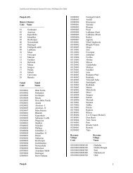
Table <strong>2.4</strong>.1- Codes <strong>for</strong> Soil types in Land Records<br />
Soil Code Soil Name<br />
01000 Chaahi/Kaali (Black Cotton/Black)<br />
01001 Chaahi Nahari<br />
01002 Chaahi Mustar<br />
01003 Chaahi Baraani<br />
01004 Chaahi Aabi<br />
01005 Chaahi Safeda<br />
01006 Kaali I<br />
01007 Kaali II<br />
01008 Kaali A<br />
01009 Kaali B<br />
01010 Kaali C<br />
01011 Kaali D<br />
02000 Nahari (Alluvial)<br />
02001 Alluvial Clay(Soil Class-I)<br />
02002 Alluvial Loam (Soil Class-II)<br />
03000 Sewaj<br />
04000 Talaabi Peta/Kheda/Peta<br />
04001 Kheda I<br />
04002 Kheda II<br />
04003 Kheda III<br />
04004 Kheda A<br />
04005 Kheda B<br />
05000 Kachaar<br />
05001 Kachaar I<br />
05002 Kachaar II<br />
05003 Kachaar III<br />
05004 Kachaar IV<br />
06000 Baarani<br />
06001 Baarani Safeda<br />
06002 Baarani Jalodak<br />
06003 Baarani Keekar<br />
06004 Baarani Baag<br />
07000 Banjar/Banjad/Padath/Banjar<br />
Dom/Banjo(Wasteland)<br />
07001 Banjar Kadim Charaaha<br />
07002 Banjar Jadeed<br />
07003 Banjar Kadim<br />
07004 Banjar Avval<br />
08000 Beed<br />
NIC,DIT,MCIT,GOI 2
LRISD,NIC(Hqrs) <strong>Standard</strong> <strong>Classification</strong> <strong>adopted</strong> <strong>for</strong> <strong>SOIL</strong> <strong>TYPES</strong><br />
09000 Baag/Bagicha/Bagiche(Garden)<br />
09001 Baag Aabi<br />
09002 Baag Nahari<br />
09003 Baag Chaahi<br />
09004 Baag Beri<br />
10000 Pahaadi(Hilly)<br />
10001 Pahaadi A<br />
10002 Pahaadi B<br />
11000 Rocky<br />
12000 Kullahu/Kool(Sand)<br />
12001 Regar Sand containing not more than<br />
1/3 clay(Soil Class-V)<br />
12002 Red Sand, or gravel, containing not<br />
more than 1/3 clay(Soil Class-VIII)<br />
13000 Aabi(Loam)<br />
13001 Regar loam containing from 1/3 to 2/3<br />
clay(Soil Class-IV)<br />
13002 Red loam containing from 1/3 to 2/3<br />
clay(Soil Class-VII)<br />
13003 Aabi I<br />
13004 Aabi II<br />
13005 Aabi III<br />
13006 Aabi IV<br />
13007 Aabi Sarkari<br />
13008 Aabi A<br />
13009 Aabi B<br />
14000 Sailabi/Khadin(Silt)<br />
15000 Taink(Clay)<br />
15001 Regar Clay containing upwards of 2/3<br />
of clay(Soil Class-III)<br />
15002 Red Clay containing upwards of 2/3<br />
clay(Soil Class-VI)<br />
16000 Laal(Red)<br />
16001 Laal A<br />
16002 Laal B<br />
17000 Mixed<br />
17001 Black Mix<br />
17002 Red Mix<br />
18000 Dumat<br />
18001 Dumat I<br />
18002 Dumat II<br />
18003 Dumat III<br />
19000 Padba<br />
19001 Padba I<br />
19002 Padba II<br />
NIC,DIT,MCIT,GOI 3
LRISD,NIC(Hqrs) <strong>Standard</strong> <strong>Classification</strong> <strong>adopted</strong> <strong>for</strong> <strong>SOIL</strong> <strong>TYPES</strong><br />
19003 Padba III<br />
20000 Maar<br />
20001 Maar I<br />
20002 Maar II<br />
20003 Maar III<br />
21000 Gohan<br />
21001 Gohan I<br />
21002 Gohan I(14)<br />
21003 Gohan II<br />
21004 Gohan III<br />
21005 Gohan IV<br />
22000 Kaabar<br />
22001 Kaabar I<br />
22002 Kaabar II<br />
22003 Kaabar III<br />
23000 Aapasi<br />
23001 Aapasi I<br />
23002 Aapasi II<br />
23003 Aapasi III<br />
23004 Aapasi IV<br />
24000 Daanda<br />
24001 Daanda I<br />
24002 Daanda II<br />
25000 Behad<br />
25001 Behad I<br />
25002 Behad II<br />
26000 Raakad<br />
26001 Raakad I<br />
26002 Raakad II<br />
26003 Raakad III<br />
27000 Khor<br />
27001 Khor I<br />
27002 Khor II<br />
27003 Khor III<br />
27004 Khor IV<br />
28000 Booda<br />
28001 Booda I<br />
28002 Booda II<br />
29000 Theer<br />
29001 Theer I<br />
29002 Theer II<br />
29003 Theer III<br />
29004 Theer IV<br />
30000 Jor<br />
30001 Jor I<br />
NIC,DIT,MCIT,GOI 4
LRISD,NIC(Hqrs) <strong>Standard</strong> <strong>Classification</strong> <strong>adopted</strong> <strong>for</strong> <strong>SOIL</strong> <strong>TYPES</strong><br />
30002 Jor II<br />
30003 Jor III<br />
30004 Jor IV<br />
31000 Seka<br />
31001 Seka I<br />
31002 Seka II<br />
31003 Seka III<br />
31004 Seka IV<br />
32000 Jalodak/Nadi/River<br />
32001 Jalodak Safeda<br />
32002 Jalodak A<br />
32003 Jalodak B<br />
32004 Jalodak C<br />
33000 Sinchai<br />
33001 Sinchaai A<br />
33002 Sinchaai B<br />
33003 Sinchaai C<br />
34000 Dor<br />
34001 Dor 1<br />
34002 Dor 2<br />
35000 Baada<br />
35001 Baada 1<br />
35002 Baada 2<br />
35003 Baada 3<br />
36000 Dussali<br />
36001 Dussali 1<br />
36002 Dussali 2<br />
37000 Patrua<br />
37001 Patrua 1<br />
37002 Patrua 2<br />
38000 Adaan<br />
38001 Adaan 1<br />
38002 Adaan 2<br />
39000 Gadda<br />
39001 Gadda 1<br />
39002 Gadda 2<br />
39003 Gadda 3<br />
40000 Fardia<br />
41000 Chaah Nehanchi<br />
42000 Aa Kaakand<br />
43000 Bhaalu<br />
99000 Others(Digar/Anya Mitti)<br />
99001 Niyaayi<br />
99002 Namayi<br />
99003 Dahari<br />
NIC,DIT,MCIT,GOI 5
LRISD,NIC(Hqrs) <strong>Standard</strong> <strong>Classification</strong> <strong>adopted</strong> <strong>for</strong> <strong>SOIL</strong> <strong>TYPES</strong><br />
99004 Same<br />
99005 Thoor<br />
99006 Matyaar<br />
99007 Rosli<br />
99008 Bood<br />
99009 Chirmot<br />
99010 Chiknot<br />
99011 Maagda<br />
99012 Chow<br />
99013 Kamaj Marla<br />
99014 Dakar<br />
99015 Jakheera Darakhthaan<br />
99016 P-I<br />
99017 P-II<br />
99018 P-III<br />
99019 C-I<br />
99020 C-II<br />
99021 C-III<br />
<strong>2.4</strong>.6 Metadata elements <strong>for</strong> Soils<br />
<br />
<br />
<br />
<br />
<br />
<br />
<br />
<br />
<br />
<br />
<br />
<br />
<strong>2.4</strong>.7 Sixteen Major Types of Soil<br />
Soils are diverse and differ from area to area. Sixteen major types of soils have been<br />
recognized. These are listed below:<br />
<strong>2.4</strong>.7.1 Red loamy soils (Eastern Himalayas, eastern ghats, Tamil Nadu uplands),<br />
<strong>2.4</strong>.7.2 Red and lateritic soils (eastern plateau, north-eastern hills, western ghats),<br />
<strong>2.4</strong>.7.3 Red and yellow soils (eastern plateau adjoining central highlands),<br />
NIC,DIT,MCIT,GOI 6
LRISD,NIC(Hqrs) <strong>Standard</strong> <strong>Classification</strong> <strong>adopted</strong> <strong>for</strong> <strong>SOIL</strong> <strong>TYPES</strong><br />
<strong>2.4</strong>.7.4 Shallow and medium black soils (Deccan plateau, central Maharashtra and<br />
Karnataka plateau),<br />
<strong>2.4</strong>.7.5 Medium and deep black soils (central highlands, Narmada Valley, Malwa<br />
plateau, Bundelkhand and Kathiawar peninsula),<br />
<strong>2.4</strong>.7.6 Mixed red and black soils (parts of Deccan plateau, Telangana, Bellary and<br />
Anantpur regions of Karnataka plateau),<br />
<strong>2.4</strong>.7.7 Coastal alluvium - derived soils (eastern and western coastal plains),<br />
<strong>2.4</strong>.7.8 alluvium - derived soils (western, northern and eastern plains),<br />
<strong>2.4</strong>.7.9 Desert soils (southwestern Punjab, Haryana plains, Rajasthan, Marusthali and<br />
Kachchh peninsula),<br />
<strong>2.4</strong>.7.10 Tarai soils (foothills of central and western Himalaya),<br />
<strong>2.4</strong>.7.11 Brown and red hill soils (eastern Himalaya),<br />
<strong>2.4</strong>.7.12 Saline and alkali soils (Kathiawar peninsula, alluvial plains of Uttar Pradesh,<br />
Haryana, Punjab and Rajasthan),<br />
<strong>2.4</strong>.7.13 Shallow and skeletal soils (Ladakh and Kashmir).<br />
<strong>2.4</strong>.7.14 Grey brown soils (foothills of Aravallis),<br />
<strong>2.4</strong>.7.15 Brown <strong>for</strong>est and podzolic soil (north-western Himalaya),<br />
<strong>2.4</strong>.7.16 Sandy and littoral soils (Lakshadweep and coastal areas of Andaman and<br />
Nicobar islands).<br />
(Source:http://www.fao.org/ag/AGP/AGPC/doc/Counprof/India.htm)<br />
<strong>2.4</strong>.8 National Level Ef<strong>for</strong>ts <strong>for</strong> Soil Mapping<br />
It is observed that various national level organizations like NBSS & LUP, All India Soil<br />
and Land Use Survey, NNRMS Division of Department of Space are involved in<br />
preparation of soil map of the country in scales like 1:50000 and 1:250000. For this<br />
purpose the Maps of Survey of India and Satellite Maps are being used. These agencies<br />
use soil taxonomic classification which is strictly hierarchical in nature and is divided<br />
into six groups namely order, sub-order, great-order, great-group, family and series. They<br />
have identified 29 soil characteristics <strong>for</strong> classification of soil.<br />
NIC,DIT,MCIT,GOI 7
LRISD,NIC(Hqrs) <strong>Standard</strong> <strong>Classification</strong> <strong>adopted</strong> <strong>for</strong> <strong>SOIL</strong> <strong>TYPES</strong><br />
A sample classification of the soil code is shown below:<br />
<strong>SOIL</strong>-CODE<br />
CODING SCHEME FOR <strong>SOIL</strong>S UPTO SUB-GROUP LEVEL<br />
Coding scheme <strong>for</strong> soil layer AA- BB- CC- DD- EEFFGG-HH (16 digits)<br />
AA – Order (Two digits)<br />
BB – Sub-Order (Two digits)<br />
CC- Grate Group (Two digits)<br />
DD- Sub-group (Two digits)<br />
EE- Family, Texture (Two digits)<br />
FF- Family, Mineralogy (Two digits)<br />
GG-Family, Temperature (Two digits)<br />
HH- Series (Two digits)<br />
Level Level-1 Level-2 Level-3<br />
Detail Sub-Group Family Series<br />
Scale 1:1Million 1:2,50,000 1:50,000<br />
Code AABBCCDD AABBCCDDEEFFGG AABBCCDDEEFFGGHH<br />
(Source : Keys to Soil Taxonomy, Sixth Edition, 1994 USDA, Soil Conservation Service)<br />
<strong>2.4</strong>.9 Proposed System<br />
As soil series in<strong>for</strong>mation is collected by different agencies in a scientific way by various<br />
State and District level agencies, there is a need of updating this scientific soil<br />
in<strong>for</strong>mation in land records registers.<br />
When the soil data as collected in a scientific way is incorporated into land records<br />
registers, the uni<strong>for</strong>m codification of soils will be automatically taken into account.<br />
NIC,DIT,MCIT,GOI 8


