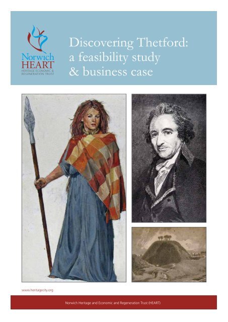
Discovering Thetford: a feasibility study & business case - Breckland ...
Discovering Thetford: a feasibility study & business case - Breckland ...
Discovering Thetford: a feasibility study & business case - Breckland ...

You also want an ePaper? Increase the reach of your titles
YUMPU automatically turns print PDFs into web optimized ePapers that Google loves.
www.heritagecity.org<br />
<strong>Discovering</strong> <strong>Thetford</strong>:<br />
a <strong>feasibility</strong> <strong>study</strong><br />
& <strong>business</strong> <strong>case</strong><br />
Norwich Heritage and Economic and Regeneration Trust (HEART)
Preface<br />
This report has been prepared by the Heritage Economic &<br />
Regeneration Trust (HEART) for <strong>Thetford</strong> Town Council/the<br />
‘Moving <strong>Thetford</strong> Forward (Growth Point) Thematic Group for<br />
Heritage, Culture & Tourism with the aid of funding support<br />
from the East of England Development Agency (EEDA). Any<br />
views expressed are not necessarily those of EEDA.<br />
All information, analysis and recommendations made for the<br />
client by HEART are made in good faith and represent the<br />
consultant’s professional judgement based upon information<br />
obtained from a range of sources. Since the contents of<br />
the report are based upon third party information and are<br />
therefore conditioned by factors outside the control of<br />
HEART, HEART cannot accept liability for the accuracy of such<br />
information and the consequent conclusions drawn from it.<br />
Norwich Heritage Economic & Regeneration Trust (HEART)<br />
PO Box 3130, Norwich, NR2 1XR<br />
T: 01603 305575<br />
F: 01603 305498<br />
E: michaelloveday@heritagecity.org<br />
W: www.heritagecity.org<br />
Norwich HEART is a company registered in England with company number 5083002, registered charity number 1109662 and<br />
VAT registration number 875807283.<br />
© Norwich Heritage Economic & Regeneration Trust (HEART) 2010
<strong>Discovering</strong> <strong>Thetford</strong><br />
A Feasibility Study & Business Case<br />
Contents<br />
Table of Images<br />
Executive Summary<br />
Background<br />
Audit of Themes<br />
Period 1: <strong>Thetford</strong> in the Age of Boudica<br />
Period 2: The Viking Age<br />
Period 3: The Norman Age<br />
Period 4: The Age of Medieval Devotion<br />
Period 5: The Mercantile Age<br />
Period 6: The Golden Age of the Tudors and Jacobeans<br />
Period 7: The Civil War and Restoration<br />
Period 8: The Age of Reason<br />
Period 9: The Age of Industrial Innovation<br />
Period 10: The Age of Empire<br />
Period 11: The Age of Municipal Democracy<br />
Period 12: The Age of Global Wars<br />
Period 13: Town Expansion and Migration<br />
Confirmation of Core Assets<br />
Hub and Spoke<br />
Preliminary Baseline<br />
Promotional Framework<br />
Access Framework<br />
Educational Framework<br />
Community Framework<br />
Core Building Projects<br />
Business Model<br />
Key Delivery Projects<br />
Appendix<br />
Norfolk Record Office – Further Research<br />
Probate Inventories<br />
1<br />
2<br />
5<br />
10<br />
15<br />
28<br />
42<br />
54<br />
46<br />
60<br />
67<br />
73<br />
79<br />
84<br />
87<br />
94<br />
101<br />
105<br />
106<br />
110<br />
114<br />
116<br />
119<br />
121<br />
123<br />
134<br />
138<br />
142<br />
163
Table of Images<br />
CAPTION PICTURE CREDIT PAGE NUMBER<br />
Abbey Farm, c. 1970 Abbey Farm Estate Greater London Council 101 & 109<br />
Ancient House Museum of <strong>Thetford</strong> Life Ancient House Museum, Norfolk Museums 5, 54 & 109<br />
and Archaeology Service<br />
Anglo-Saxon coins made in Ancient House Museum, Norfolk Museums 28<br />
<strong>Thetford</strong> by Estmund and Archaeology Service<br />
Artist’s impression of Boudica Ivan Lapper, Norfolk Museums 15<br />
and Archaeology Service<br />
Burrell’s workshop Ancient House Museum, Norfolk Museums 79 & 108<br />
and Archaeology Service<br />
Captain Mainwaring statue PentneySam 94 & 109<br />
Cluniac Priory Cluniac Priory 46 & 107<br />
Community Workshop David Indge 121<br />
Dad’s Army memorabilia 94<br />
Dr Allan Glaisyer Minns, Mayor of Norfolk Record Office, BOL 6/36, 742X7 87<br />
<strong>Thetford</strong> 1904 – 1906<br />
Duleep Singh statue Duleep Singh statue 84<br />
Elizabeth I Ancient House Museum, Norfolk Museums 5 & 60<br />
and Archaeology Service<br />
2
CAPTION PICTURE CREDIT PAGE NUMBER<br />
Home page of the Norwich 12 website 114<br />
Interior of Elveden Hall Picture Norfolk, Norfolk County Council 84<br />
King’s House King’s House<br />
Maharajah Duleep Singh Ancient House Museum, Norfolk Museums 84<br />
and Archaeology Service<br />
Map of <strong>Thetford</strong> by Thomas Martin Ancient House Museum, Norfolk Museums 73<br />
and Archaeology Service<br />
Medieval fair 130<br />
Medieval mount in the shape Ancient House Museum, Norfolk Museums 46<br />
of a mermaid and Archaeology Service<br />
Mr Symonds painting Ancient House Museum, Norfolk Museums 10<br />
and Archaeology Service<br />
Oliver Cromwell Shizhoa 108<br />
Oliver Cromwell imprisons Carolus 67<br />
King Charles I<br />
Plate from the Bell Inn Ancient House Museum, Norfolk Museums 54 & 107<br />
and Archaeology Service<br />
Replicas of the <strong>Thetford</strong> Treasure Ancient House Museum, Norfolk Museums 15 & 106<br />
and Archaeology Service<br />
St Peters St Peter’s Church 28 & 106<br />
The Castle mound (1) Ancient House Museum, Norfolk Museums 42 & 106<br />
and Archaeology Service<br />
3
CAPTION PICTURE CREDIT PAGE NUMBER<br />
The Castle mound (2) The Castle mound 42<br />
<strong>Thetford</strong> Patent Pulp Ware advert Ancient House Museum, Norfolk Museums 79<br />
and Archaeology Service<br />
<strong>Thetford</strong> postcard Ancient House Museum, Norfolk Museums 87<br />
and Archaeology Service<br />
<strong>Thetford</strong> Pulp Mill Ancient House Museum, Norfolk Museums 79<br />
and Archaeology Service<br />
Thomas Paine’s death mask Ancient House Museum, Norfolk Museums 73<br />
and Archaeology Service<br />
Thomas Paine from a print by Romney Ancient House Museum, Norfolk Museums 108<br />
and Archaeology Service<br />
Thomas Paine statue 73<br />
Turners, Borers and Drillers at Charles Ancient House Museum, Norfolk Museums 10<br />
Burrell’s & Sons Ltd, 1906 and Archaeology Service<br />
Tudors re-enactors Ivan Lappor, Norfolk Museums 60 & 107<br />
and Archaelogy Service<br />
Virtual reality model of 116<br />
Norwich Cathedral, 1450<br />
Year 7 students participating in a David Indge 119<br />
historical embroidery workshop<br />
4
Executive Summary<br />
Context<br />
The <strong>Thetford</strong> Town Council/the Moving <strong>Thetford</strong> Forward Thematic Group for Heritage,<br />
Culture & Tourism have asked the Heritage Economic & Regeneration Trust (HEART) to<br />
undertake an outline Business Case for developing and promoting a family of heritage assets<br />
in <strong>Thetford</strong> as a driver for the local economy and a beacon for civic pride and community<br />
identity. In parallel a Feasibility Study would identify how the project could be delivered and<br />
potentially resourced. This Executive Summary provides a synopsis of a significant research<br />
and development <strong>study</strong>.<br />
Elizabeth I Ancient House Museum of<br />
<strong>Thetford</strong> life<br />
5
What’s the Heritage Product?<br />
HEART’s first task was to answer the question: ‘Does <strong>Thetford</strong> have a sufficient heritage<br />
provenance to act as a tourism draw and a focus for civic pride?’ This question was not just<br />
addressed by auditing local heritage sites but rather by researching deeply the key stories<br />
associated with the town’s history and the people, sites and artefacts associated with them. The<br />
answer to the question is ‘indisputably yes’. <strong>Thetford</strong> is a model of the history of England over<br />
the last two millennia and features some of the key national players during that period.<br />
• <strong>Thetford</strong> was a key power centre of the Iceni tribe during<br />
the Iron Age, and is closely associated with Boudica, one<br />
of the most iconic figures in English history. The Iron Age<br />
site at Fison Way is unique in the UK.<br />
• From the Roman period the <strong>Thetford</strong> Treasure, a hoard<br />
of gold and silver objects found in the 1970s, and is one<br />
of the most significant Roman hoards found in Britain.<br />
• During the Saxon period <strong>Thetford</strong> became the seat<br />
of the bishopric of East Anglia until the late eleventh<br />
century and a major centre for pottery production.<br />
• <strong>Thetford</strong> was centre of Danish occupation at a time<br />
when East Anglia was part of the Kingdom of Denmark.<br />
• After the Norman Conquest, the Priory and the castle<br />
- with the largest motte in England - were founded by<br />
Roger Bigod, a close friend of William the Conqueror<br />
• During the medieval period <strong>Thetford</strong> saw an explosion<br />
in the development of ecclesiastical buildings<br />
including priories, friaries, a nunnery, hospitals and<br />
churches, representing some of the most economically<br />
powerful institutions in the region fuelled by<br />
‘the pilgrimage <strong>business</strong>’.<br />
• In the 16th century the town was a successful<br />
mercantile centre, reflected in the surviving merchant<br />
houses and associations with major figures such as John<br />
of Gaunt.<br />
• The Tudor and Jacobean period saw the town develop<br />
further driven by associations with the Dukes of<br />
Norfolk, the Cleres, the Fulmerstons and with James I.<br />
6<br />
• The town sided with Parliament during the Civil War but<br />
faired well at the Restoration with one of its prominent<br />
Parliamentarians donating the Civic Regalia.<br />
• Thomas Paine, referred to by Thomas Alva Edison as ‘our<br />
greatest political thinker’, was born and educated in the<br />
town and his probable birthplace and school still survive.<br />
• 19th century industrial innovation included the largest<br />
manufacturers of traction engines in the world as well<br />
as <strong>Thetford</strong> Pulpware and the founding of the Fison<br />
fertiliser empire.<br />
• The last Maharajah of the Punjab purchased the Elveden<br />
estate in the 19th century and his son became a patron<br />
for the town’s heritage.<br />
• Britain’s first black mayor was elected to the council<br />
in 1904<br />
• The area had significant connections to events in both<br />
World Wars including the first field trials for the tank<br />
taking place just outside the town, the Desert Rats<br />
training nearby and the presence of 17 mainly USAAF<br />
airfields within a small radius. In the 1970’s the TV series<br />
Dad’s Army was filmed in and around <strong>Thetford</strong>.<br />
• From the 1950’s <strong>Thetford</strong> became an ‘overspill town’<br />
and, taking new populations from London, grew at a<br />
faster rate than any other English town. More recently<br />
there has been significant immigration from Portugal<br />
and Eastern Europe.
The Need<br />
So the obvious question arises, ‘If <strong>Thetford</strong> is that good,<br />
why do we need to do anything?’ The answer is complex<br />
but essentially it is about co-ordination and promotion.<br />
The ‘products’ and institutions responsible for them are<br />
fragmented, the resources are largely unknown and there is<br />
a prejudicial view of the place as small and insignificant: If<br />
the town’s heritage is seen then it is seen as a few crumbling<br />
ruins and not as the most famous woman in English history<br />
or one of the world’s greatest democrats. Additionally there<br />
has been a failure to connect the potentially compelling<br />
products with potentially interested audiences and a lost<br />
opportunity to capitalise on the needs of various target<br />
groups – There is without a doubt a very significant amount<br />
of light but it is currently well hidden under a bushel.<br />
Objective<br />
Work with partners to develop a support infrastructure to<br />
deliver a co-dependent family of iconic cultural heritage<br />
assets as a collective destination to act as a regionally<br />
important show<strong>case</strong> of English urban and cultural<br />
development over the last 2000 years.<br />
7<br />
The Product<br />
The product would be a 2000 year story focussing on 13<br />
historic periods (e.g. the Age of Boudica) with a single site<br />
acting as a ‘hub’ for each era but connecting to a range of<br />
other, relevant sites.<br />
How Badly Are We Doing?<br />
To know whether we are making progress we have to<br />
know where we are coming from. A preliminary ‘Baseline<br />
Assessment’ has looked at accessibility to key sites,<br />
marketing and promotion, community linkages, learning<br />
and education, signage and interpretation and strategic<br />
management and has found in all but a few notable<br />
exceptions (Ancient House and Dad’s Army Museum)<br />
performance is principally bad (red) or at best mediocre<br />
(amber). The <strong>study</strong> proposes a full baseline <strong>study</strong> to be<br />
repeated regularly to chart progress.
A Business Plan – Key Thematic Actions<br />
The <strong>study</strong> proposes focussed activity in the short, medium and long term through the areas of<br />
Promotion, Access, Education and Community Engagement. The principal components include:<br />
Promotion<br />
• SHORT TERM: Brand definition, guidelines and strap line;<br />
graphic device (timeline); promotional leaflet; web site.<br />
• MEDIUM TERM: Quality guide book covering all 13 eras<br />
and sites; very rich web sites for each of the thematic<br />
sites (e.g. the Burrell Museum); an annual festival.<br />
Access<br />
• SHORT TERM: preliminary steps in a long term<br />
programme of Virtual Reality models;<br />
• MEDIUM TERM: produce Signage strategy; deliver<br />
information totems with Bluetooth at each site;<br />
deliver pedestrian signage; instigate Conservation<br />
Management Plans for each site; produce self guided<br />
trails; deploy visual media (plasma screens, mobile<br />
devices); produce foreign language media; develop<br />
ambitious Heritage Open Days programme.<br />
• LONG TERM: create ‘hub/portal’ for the whole project<br />
to act as a ‘receiving centre’ for <strong>Thetford</strong>; regenerate<br />
individual sites; create a Passport Scheme; develop art<br />
initiatives; develop <strong>Thetford</strong> Heroes competition.<br />
8<br />
Education<br />
• SHORT TERM: Establish Teacher/Education Network;<br />
Undertake educational/historical audits of sites<br />
with volunteers.<br />
• MEDIUM TERM: develop partnerships with bodies like<br />
the UEA; produce education packs; develop teacher<br />
INSET training; introduce Family Learning Days; develop<br />
an archive course; establish ‘researchers in residence’.<br />
• LONG TERM: establish on-line learning space.<br />
Community<br />
• SHORT TERM: Annual community photographic<br />
competition; establish volunteer bureau; establish<br />
volunteer access team.<br />
• MEDIUM TERM: develop oral history project; implement<br />
Ambassador Scheme; develop on-line virtual museum<br />
with community content; encourage community<br />
events/use of sites.<br />
• LONG TERM: work with socially excluded groups.
A Business Plan – Ideas for Sites<br />
Additional to cross cutting ideas for ‘the set’, the <strong>study</strong> has suggested a range of ideas for sites<br />
associated with specific eras. These include:<br />
• Age of Boudica / Gallows Hil<br />
• Norman Age / Castle Mound<br />
• Age of Medieval Devotion / Cluniac Priory with Abbey Barns<br />
• Mercantile Age / The Bell Inn<br />
• Golden Age of the Tudors and Jacobeans / The Nunnery<br />
• Civil War and Restoration / Guildhall<br />
• Age of Reason /Thomas Paine Hotel<br />
• Age of Industrial Innovation / Charles Burrell Museum<br />
• Age of Empire / Ancient House Museum<br />
• Age of Municipal Democracy / King’s House<br />
• Age of Global Wars / Dad’s Army Museum<br />
• Town Expansion and Migration / <strong>Thetford</strong> Library<br />
A Business Plan – the delivery model<br />
To facilitate the projects outlined above the <strong>study</strong> suggests that the following infrastructure<br />
needs to be put into place:<br />
• Either establish a company/charity to deliver the project or contract with an<br />
existing heritage charity to deliver it on <strong>Thetford</strong>’s behalf<br />
• Establish a governance structure (Management Board)<br />
• Establish a project governance champion (Chair of Board)<br />
• Establish project delivery champion (Head of delivery body)<br />
• Establish dedicated Project Delivery Officer<br />
• Establish Project Delivery support structure (Comms, HR, Finance etc)<br />
Paying for it<br />
The <strong>study</strong> costs the project work and support infrastructure at approximately £1M over 3 years.<br />
While this appears to be a large sum, in reality a proportion has already been committed and<br />
the residue would come from a relatively broad range of sources as follows:<br />
• MTF or successor<br />
• EEDA<br />
• <strong>Thetford</strong> partner contributions<br />
• <strong>Breckland</strong><br />
• Norfolk CC<br />
• Government Depts<br />
• Knowledge Catalyst<br />
• Heritage Lottery Fund<br />
9<br />
• ERDF<br />
• Developer obligations<br />
• Developer contributions<br />
• Revenue generating initiatives (products to sell)<br />
• Sponsors<br />
• Local charities<br />
• National charities
Background<br />
In March 2010 <strong>Thetford</strong> Town Council/the Moving <strong>Thetford</strong> Forward Thematic Group for<br />
Heritage, Culture & Tourism asked the Heritage Economic & Regeneration Trust (HEART)<br />
to undertake a scoping <strong>study</strong> to assist <strong>Thetford</strong> to better market and exploit its considerable<br />
heritage assets.<br />
The work was funded by EEDA and completed by the end of April. The Thematic Group<br />
endorsed the Scoping Study in May and asked HEART to undertake some follow up work which<br />
would produce an outline Business Case for developing a family of heritage assets in <strong>Thetford</strong><br />
and a parallel Feasibility Study which would identify how the project could be delivered and<br />
potentially resourced.<br />
Turners, Borers and Drillers at Charles Burrell’s & Sons Ltd, 1906<br />
10<br />
Mr Symonds painting
The Need<br />
The previous Scoping Study revealed that <strong>Thetford</strong> possesses a remarkable set of both<br />
tangible and intangible heritage assets – an Iron Age site of national and probably international<br />
importance with probable connections to an iconic British figure and another of great<br />
significance; very important Viking Age remnants; major Norman and medieval assets; one of<br />
the world’s great democratic thinkers; important milestones in the cosmopolitan development<br />
of England; industrial revolution pioneers; landmark events associated with both World<br />
Wars and major social migration programmes. <strong>Thetford</strong> is indeed a microcosm of English<br />
development over two millennia.<br />
However a series of hurdles have combined to prevent the town from exploiting fully its rich<br />
resources and being viewed as a visitor destination famed for its heritage resources.<br />
These include:<br />
• Fragmentation: this applies to both the product and the<br />
institutions responsible for it. The ethos has been to<br />
develop individual, ‘one off’ projects which sometimes<br />
even compete with each other rather than a unified set<br />
of co-dependent products.<br />
• Duplication: agencies have all pursued their separate<br />
agendas usually marketing their products separately,<br />
undertaking their own initiatives, pricing competitively,<br />
developing their separate events with only very limited<br />
attempts at collaboration.<br />
• Recognition & Profile: as a result of the product being<br />
fragmented the value of the whole offer is never seen or<br />
appreciated by potential audiences and therefore remains<br />
unexploited as a tourism or educational resource.<br />
• Resource Starvation: because the agencies are not<br />
organised there has never been an attempt (until now)<br />
to first understand then address the overall resourcing<br />
needs of ‘the set’.<br />
• Concentration v. Dispersal: the funding analogy applies<br />
equally to visitation rates, with the principal institutions<br />
attracting most of the visitors and the remainder<br />
attracting only a trickle.<br />
• Building Bias: funding and development to date,<br />
where it has taken place, has focussed on physical<br />
infrastructure rather than operational systems.<br />
11<br />
• Failure to Engage: currently the institutions are able to<br />
marshal, to a limited degree, groups of enthusiasts who<br />
are willing to assist with initiatives but because there<br />
is as yet no unified offer, these ‘friends’ are generally<br />
unable to deploy their talents on other institutions and<br />
those who may be interested to supporting ‘the set’ are<br />
an untapped resource.<br />
• Unsatisfied Need: the astonishing success of Heritage<br />
Open Days initially in Norwich, and now in the wider<br />
Norfolk area, demonstrated a huge ‘thirst’ from local<br />
people to gain greater access to and knowledge of their<br />
heritage. A co-ordinated approach to management<br />
and marketing of the events raised visitation rates<br />
from a previous annual average of 5000 to well over<br />
100,000. The user feedback provided a very clear<br />
message that people wanted more access, more often<br />
and further information and events relating to the<br />
heritage destinations. It is reasonable to extrapolate<br />
this experience to <strong>Thetford</strong>, where Heritage Open Days<br />
have, in the past, been relatively successful but where<br />
events such as the recent very successful Dad’s Army<br />
weekend demonstrate that there is a huge amount of<br />
untapped potential.
These issues relating to the need for the project can therefore be summarised as follows:<br />
• Institutions responsible for the principal sites need<br />
to overcome duplication and competition to achieve<br />
benefits of co-ordinated management and delivery and<br />
therefore better access and performance.<br />
• Local population generally need a coherent response to<br />
their need to access more heritage more often.<br />
• Target Groups/New Audiences not normally able to<br />
access cultural heritage either because of physical or<br />
intellectual barriers (people with walking difficulties,<br />
blind people, elderly people, excluded communities,<br />
recent immigrants) or people who might not normally<br />
be ‘captivated’ by heritage (football fans, young people)<br />
need to have the opportunity to engage with heritage<br />
resources from which they are currently excluded.<br />
• Volunteers with heritage skills need to be able to apply<br />
The Response<br />
12<br />
them and have them channelled and developed as a<br />
structured learning/teaching process.<br />
• People in a variety of formal and informal education<br />
situations need the ability to access and ‘harvest’ the<br />
Town’s rich heritage resources as part of their courses<br />
• Visitors represent an enormous, untapped heritage.<br />
audience for the region and with the 2012 hosting of<br />
the Olympics in the UK it is vitally important to develop<br />
new, supplementary tourism offers that can extend<br />
visitor stay and spend.<br />
• The sub regional economy remains relatively buoyant<br />
despite the recession and it provides an anchor for the<br />
wider region. However, to sustain this buoyancy the<br />
economy needs to develop new audiences and new, high<br />
profile heritage products could help to achieve this.<br />
Responding to the needs outlined above, the Heritage Economic & Regeneration Trust (HEART) suggests that there is a need<br />
to work with partners to develop a support infrastructure to deliver a unified heritage product of regional stature and wider<br />
profile. Adopting the techniques applied to initiatives such as the Independence National Heritage Park in Philadelphia, the<br />
Draft Business Case/Feasibility Study assesses, in some detail, the potential of <strong>Thetford</strong> to formulate a heritage development<br />
and promotion product. It is proposed that the strategic objectives for the project should be as follows:
Key Objective<br />
To develop a co-dependent family of iconic cultural<br />
heritage assets as a collective destination to act as a<br />
regionally important show<strong>case</strong> of English urban and cultural<br />
development over the last 2000 years.<br />
Subordinate Objectives<br />
• To establish mechanisms to facilitate collaborative<br />
management and promotion to develop a collective<br />
cultural heritage visitor destination of regional stature,<br />
to have the infrastructure in place, tested and operating<br />
within a 5 year period and thus to support the<br />
development of the regional and local visitor economies.<br />
• To develop an integrated approach to radically raise<br />
awareness of, and improve virtual and physical access<br />
to, this unique set of heritage assets particularly for the<br />
benefit of currently excluded local people.<br />
• To develop a collective engagement process so<br />
that the skills of local people are utilised to actively<br />
engage in achieving greater access and interpretation<br />
of these buildings to overcome social exclusion<br />
barriers and contribute to greater citizenship and<br />
community ownership.<br />
13<br />
• To work with full time and further education bodies<br />
and Life Long Learning institutions to ensure that these<br />
sites and their stories can support and develop national<br />
curriculum and other education strands.<br />
• To pilot the use of a range of innovative ICT techniques<br />
to make cultural heritage more accessible and appealing<br />
to local people and visitors.<br />
• To develop means of measuring the benefits of the<br />
process to establish a better understanding of the<br />
tangible social and economic benefits of cultural heritage.<br />
• To establish a transferable model, applicable in<br />
other situations.
To meet these objectives, the Draft Business Case/Feasibility Study proposes a series of<br />
practical work packages which will, together, produce a strategic model and delivery framework<br />
which will both set a clear and integrated direction for further work as well as a co-ordinated<br />
context for decision making. This last point is particularly important and should ensure that<br />
individual decisions which are seeking to respond to funding availability – should we erect some<br />
signs? should we produce some leaflets? should we invest in this building? – are made in a way<br />
that will be mutually supporting and reinforce a strategic vision for the town’s heritage. The<br />
packages will include:<br />
1 A detailed audit of the provisional 13 themes identified<br />
by the Scoping Study to secure a focussed and<br />
comprehensive appreciation of the range and breadth<br />
of material available.<br />
2 A review of the 13, including discussions with key local<br />
stakeholders (to be defined by the Thematic Group),<br />
to achieve confirmation of the core assets and well as<br />
where and how they should be interpreted.<br />
3 An assessment of how the 13 might link to offers in<br />
the wider area effectively providing a ‘hub and spoke’<br />
attraction for the town (e.g. cycle loops to the Brecks).<br />
4 An Outline Baseline Study of each of the Core Assets<br />
to determine how it is performing now on a basket<br />
of measures ranging from the level of interpretation<br />
provided to the number of people accessing it.<br />
5 Development of a Promotional Framework defining<br />
some key products directly relevant to the <strong>Thetford</strong><br />
offer, either corporately or individually, that could be<br />
developed from a promotional perspective (e.g. web<br />
site; book;).<br />
6 Development of an Access Framework defining some key<br />
products that could be developed to address physical or<br />
intellectual accessibility issues for the set or for individual<br />
elements (e.g. trails; events; virtual models).<br />
14<br />
7 Development of an Educational Framework defining<br />
how the set might be developed potentially to work with<br />
schools, further and higher education or adult education<br />
initiatives (e.g. schools packs; events, courses).<br />
8 Development of Community Engagement Guidelines<br />
which can help to demonstrate both how the existing<br />
community might be engaged in the project (oral<br />
histories, education, volunteering) and how new<br />
communities former part of the emerging Growth Point<br />
might be helped to identify with and feel ownership of<br />
<strong>Thetford</strong>’s rich heritage (road naming, outreach projects).<br />
9 Business model: a definition of core costs (staff/admin)<br />
and particular development products leading to the<br />
derivation of an income/expenditure model; outputs/<br />
outcomes of the project; risk analysis; identification of<br />
potential funding sources for specific elements; detailed<br />
proposals for a delivery and governance structure.<br />
10 Development of a resource auditing framework for<br />
mapping how resources are currently deployed and how<br />
a new approach can release efficiencies.<br />
11 Establishment of a performance monitoring framework<br />
to measure the economic regeneration, social inclusion,<br />
cultural renaissance and environmental sustainability<br />
benefits.
Audit of Themes<br />
Period 1: The Age of Boudica<br />
Summary<br />
In the Iron Age <strong>Thetford</strong> was a major centre of the Iceni tribe, with key sites at both Castle<br />
Hill and Fison Way. Two important Roman hoards have been found in <strong>Thetford</strong>, and recent<br />
excavations have found evidence of Roman domestic and agricultural activity.<br />
Replicas of the <strong>Thetford</strong> Treasure<br />
15<br />
Artist’s impression of Boudica.
From Hunters and Gatherers to the Bronze Age<br />
The light soils around <strong>Thetford</strong> were a focus of prehistoric<br />
activity, and the area was rich in flint, both on the surface<br />
and mined on an industrial scale at Grimes Graves. In<br />
the late nineteenth century and the earlier half of the<br />
twentieth century, archaeologists and antiquarians such as<br />
Hewitt, Hayward and Group Captain Knocker, recovered<br />
large amounts of worked flints from the heaths around<br />
<strong>Thetford</strong> which dated back to the earliest period of human<br />
occupation. In <strong>Thetford</strong> itself, to the east of Castle Hill, a pair<br />
of Palaeolithic handaxes were found and the site at Gallows<br />
Hill has also yielded up many worked flints. For thousands of<br />
years the people who lived and hunted around <strong>Thetford</strong> left<br />
very little trace other than these small worked stones.<br />
There is little evidence for humans settling in the area on a<br />
permanent basis until the later Neolithic period. However,<br />
there is evidence that of tree clearance and at around 1,700<br />
BC the first signs for more permanent settlement emerge,<br />
with Beakers and pottery fragments found alongside<br />
worked flints at Castle Hill and Red Castle, and a Neolithic<br />
handaxe found by Nuns Bridges. Possibly the most visible<br />
sign of human activity during the Neolithic period is the<br />
Icknield Way, a long distance trackway some archaeologists<br />
The Iron Age – Boudica and the Iceni<br />
Iron Age <strong>Thetford</strong> is most famously associated with the<br />
tribe of the Iceni, and Boudica who led a rebellion against<br />
the Roman Empire. Many Iron Age and Iceni artefacts have<br />
been found in <strong>Thetford</strong>, some of which are on display in the<br />
Ancient House Museum. However, the most impressive and<br />
16<br />
have suggested linked Norfolk with the Neolithic cultures<br />
responsible for the ritual monuments constructed in the<br />
south and west, across Wiltshire and the South Downs.<br />
There has been academic disagreement over the likely route<br />
of the Icknield Way, which may have divided at <strong>Thetford</strong><br />
with an eastern branch running toward the centre of Norfolk<br />
and a northern route leading up to the Wash. The route<br />
crossed the rivers Thet and the Little Ouse at a ford on the<br />
site of Nuns Bridge, and it is widely believed that the rivers<br />
have been forded there for thousands of years. More recent<br />
academic research has cast doubt on the existence of the<br />
Icknield Way, and the fragmentary nature of the evidence for<br />
its existence has been the subject of much discussion.<br />
A large amount of pottery found around <strong>Thetford</strong> has been<br />
dated to the late Neolithic or Early Bronze Age. It is possible<br />
that two small mounds on Gallows Hill (NHER 5744 & 5745)<br />
are Bronze Age in origin but less attention has been focused<br />
on these than on the treasures discovered around them (see<br />
below). At Ancient House a number of Bronze Age artefacts<br />
are on display in the drawers of the Collector’s Room,<br />
including a blade, spear-head, axe, and a sword, the latter<br />
dated between 900 and 650BC.<br />
valuable remains in the town are two very different sites: at<br />
Castle Hill the ramparts raised by the Iceni still tower over<br />
the landscape, now eclipsed by the Norman motte, while at<br />
Gallows Hill, the flat land hides the remains of an impressive<br />
but mysterious Iron Age site.
Castle Hill (NHER 5747)<br />
The earthworks at Castle Hill have been dated to a number<br />
of periods, and local folklore even links it to the Devil. The<br />
site is one of only six Iron Age hill-forts in Norfolk, only two<br />
of which are accessible to the public: Castle Hill in <strong>Thetford</strong>,<br />
and Warham in north Norfolk.<br />
In 1962 Roy Rainbird Clarke, who had previously suggested<br />
an Iron Age date for the ramparts immediately north of<br />
the Norman motte, directed an excavation at the site. The<br />
results definitively proved the existence of Iron Age activity<br />
on the site, and showed with reasonable certainty that the<br />
bivallate (double-ditched) ramparts were raised during the<br />
Iron Age. However, scholars differ on when the earthworks<br />
were modified. Clarke suggested that later in the Iron Age<br />
the ramparts were enlarged, especially the outer ditch,<br />
before being modified in the Norman period probably in<br />
connection with the construction of the motte. John Davies<br />
has suggested that after the ramparts were raised in the<br />
17<br />
Iron Age, they were largely untampered with until being<br />
enlarged in the Norman era and then altered again later in<br />
the medieval period.<br />
The hill fort was a statement of power, and such<br />
monuments required a significant commitment of resources<br />
in both manpower and materials for their construction and<br />
maintenance. The extent of the ramparts that we see today<br />
may not tell the full scale of the site. Excavations undertaken<br />
by John Davies in the 1980s did not uncover a continuation<br />
of the ramparts underneath Ford Street and Old Market<br />
Street where Clarke had suggested they would be. In one of<br />
the trenches the excavators found cremated remains which<br />
may date to the Iron Age. It may be that the ramparts did<br />
not in fact encircle the site in its entirety: the river could have<br />
been acted as a natural boundary.
Gallows Hill – Fison Way<br />
The Iron Age site on Gallows Hill was identified in 1980<br />
from an aerial photograph by Bob Carr, which revealed a<br />
triple-ditch enclosure over an area of 5 hectares. At the<br />
time the site was scheduled for construction work, and<br />
given the obvious importance of the cropmarks, the Icenian<br />
connections that <strong>Thetford</strong> already boasted, along with the<br />
fact that it lay immediately north of the area where the<br />
<strong>Thetford</strong> Treasure was unearthed, the decision was taken to<br />
excavate the entirety of the site.<br />
The excavations were carried out by Tony Gregory, and<br />
unearthed a complex system of enclosures, pits and ditches<br />
that spanned a considerable period of human activity. The<br />
most ancient finds were dated to the Neolithic and Bronze<br />
Age, including pottery sherds, flints, and three Bronze Age<br />
urn cremations, as well as evidence for a small structure.<br />
However, it was clear that the Iron Age represented the most<br />
importance period of activity on the site. At first there seem<br />
to have been a number of rectilinear and curved enclosures,<br />
including a 0.5 hectare enclosure in the north-west of the<br />
site, and another small enclosure containing a grave-like<br />
feature. A number of brooches and two coins were linked<br />
to this period of occupation, which overall probably lasted<br />
between the fourth century BC and the beginning of the<br />
first century AD. In the early first century AD, significant<br />
changes were made to the layout of the site. A large central<br />
enclosure was constructed, surrounded by a ditch, while to<br />
the east, another smaller rectangular enclosure was built,<br />
possibly one for funerary rituals. Both were largely open<br />
spaces, the largest enclosure only containing one large,<br />
possibly two-storied building, with a 6m central round<br />
‘tower’ over a wider round hut. Each enclosure had a single<br />
entrance facing the likely route of the Icknield Way. Around<br />
these large enclosures, especially to the east, were a number<br />
of smaller enclosures, both circular and linear, some with<br />
post-holes, which often contained features tentatively<br />
identified as graves. Only a little later, maybe 20 years or so,<br />
the entire site was again redeveloped. The central enclosure<br />
was lengthened in the direction of the entrance, and twostory<br />
building was retained, but around them a doubleditched<br />
enclosure was constructed, removing the previous<br />
18<br />
‘funerary’ enclosure and the other ‘grave’ enclosures.<br />
Between the inner and outer ditches post-holes were found<br />
in rows up to nine deep. Assuming that these posts were<br />
consistently placed around the site, this would constitute<br />
around 70 miles of posts! On either side of the central hut<br />
two new circular buildings were constructed, although these<br />
were probably only one storey high, with double doors. In<br />
front of these circular buildings other features with postholes<br />
were found. Gregory suggested that these were not<br />
huts, but circular walled enclosures, with entrances leading<br />
through them to the two new buildings. A ceremonial<br />
gateway was erected at the entrance to the inner enclosure,<br />
consisting of four large posts.<br />
This is a complex site, the function of which is unknown.<br />
A lack of metal artefacts associated with votive offerings<br />
means that this may not have been a ‘shrine’ in the Celtic<br />
sense, and the absence of domestic goods suggests that it<br />
was not a site of elite occupation, or a ‘palace’. The nine<br />
rows of fencing have been suggested as an attempt to<br />
create an artificial grove, and Celtic religion was closely<br />
linked to places such as forest clearings. Reconstructions<br />
of the central buildings also bear similarities to Romano-<br />
Celtic temples. Some of the artefacts found are high-status<br />
and in the second phase of the site there is evidence of<br />
the existence of a mint on the site. The buildings and<br />
enclosures constructed on the site are suggestive of a great<br />
commitment of time and resources, especially given that it<br />
was extensively rebuilt over a short period of time.<br />
By 70AD the site had been largely abandoned, and was<br />
in fact cleared in a short space of time; the posts were<br />
wrenched out of place often before they had rotted, and<br />
metal fittings associated with Roman soldiers have been<br />
found on the site. Boudica’s rebellion against the Romans<br />
took place in 60AD, so the site fell out of use after the<br />
failure of the rebellion. After the site was abandoned there<br />
is little evidence for further occupation until the end of the<br />
Roman period, with sporadic coin finds but little evidence for<br />
settlement on the site that had once been one of the most<br />
important local centres for the Iceni.
The Roman Invasion<br />
In 43 AD, under the Emperor Claudius, the Romans invaded<br />
Britain for a second time. They fought their way up the<br />
country from southern England, sometimes coming to an<br />
agreement with local kings whereby the ruler could keep<br />
his land and people free from attack in return for loyalty to<br />
Rome and payments of tribute.<br />
These ‘client kingdoms’ included the Iceni, whose<br />
king, Prasutagus, surrendered to Roman sovereignty at<br />
Camulodunum (modern Colchester) along with other tribal<br />
chiefs. It was during this period that the Iceni site on Gallows<br />
Hill was being extensively re-built. Finds of Gallo-Belgic<br />
pottery and Roman metalwork suggests that the Iceni lived<br />
quite comfortably with their new arrangement, trading with<br />
the Roman Empire.<br />
19<br />
In 47AD there was an uprising against Roman rule, in which<br />
the Iceni participated. Although it is not known when<br />
Iron Age activity at Castle Hill ceased (probably sometime<br />
between the Roman invasion and Boudica’s revolt), the<br />
Gallows Hill site continued to grow in size, a reflection of<br />
the wealth and prosperity of the tribe. The Romans typically<br />
allowed the natives to continue the use of their elite sites.<br />
The Iceni tribe clearly did not suffer from the invasion, and<br />
the archaeological evidence suggests that they prospered<br />
from trade with the Romans, and the relative peace and<br />
protection that they brought with them. At this point the<br />
Icknield Way may have been superseded by the Roman<br />
construction of the Peddar’s Way, but it probably remained<br />
in use with local people. However, the relative peace was<br />
shattered in 60 AD with the death of Prasutagus.
Boudica’s Rebellion<br />
Prasutagus left his kingdom to be divided between his two<br />
daughters and the Roman Emperor Nero. Typically, when<br />
a client king died the Roman Empire would annexe the<br />
kingdom and it would become another Roman province.<br />
However, in this <strong>case</strong>, the result of the Romans attempting<br />
to assert themselves over the Iceni proved catastrophic.<br />
The Roman historian Tacitus describes the uprising and<br />
the events surrounding it at length in his Annals, and it is<br />
from this source that historians and archaeologists have<br />
established a narrative of the Boudican Revolt.<br />
The Romans raped Prasutagus’ daughters and flogged his<br />
widow, Boudica, while the other Icenian chiefs had their<br />
property taken from them. Incensed at these actions, and<br />
probably fearful of further Roman insults, Boudica rallied her<br />
people, who were soon joined by other native tribes such<br />
as the Trinobantes. The Roman governor, Gaius Suetonius<br />
Paulinus, was away with the Roman legions at the Isle of<br />
Anglesey, quelling the last remnants of the Celtic Druids,<br />
and so much of England was largely undefended. First to be<br />
put to the sword was the town of Camulodumun, modern<br />
Colchester. Only two hundred men had been sent to defend<br />
it, and no proper defence was organised, with the result<br />
that when Boudica’s army fell upon the town, it was ravaged<br />
and the Temple of the Divine Claudius, a symbol of Roman<br />
Imperial might and cultural superiority, was razed to the<br />
ground, and the townspeople cowering within were either<br />
burnt alive or killed as they tried to escape.<br />
Suetonius, still making his way back from Wales, headed<br />
for Londinium (London) with some of his troops, while<br />
a force from the 9th Legion was sent to intercept the<br />
rebels. However, they were ambushed and overwhelmed<br />
by the Britons in the Valley of the Stour, with every Roman<br />
infantryman being cut down, while their commander barely<br />
escaped with his cavalry. By this point, Suetonius knew that<br />
he could not defend Londinium without more men. He<br />
gave the order to abandon the city, but those that were left<br />
behind: the young, the old, the infirm and the stubborn, were<br />
slaughtered by Boudica’s forces when they reached the city.<br />
20<br />
Boudica’s army pressed on, wreaking the same terrible<br />
destruction upon Verulamium (St Albans in Hertfordshire).<br />
Tacitus wrote of how the eager the Britons were to ‘cutthroats,<br />
hang, burn and crucify’ and recorded that over<br />
seventy thousand people died during Boudica’s onslaught.<br />
However, after Verulamium fell, Suetonius finally united his<br />
armies. With both his legionaries and auxiliaries Suetonius<br />
boasted a force of 10,000 men. The size of Boudica’s army<br />
is unknown, but it is clear that it greatly outnumbered that<br />
of Suetonius. However, Suetonius had two advantages:<br />
he chose where to fight, and his men were seasoned,<br />
professional soldiers who could be relied on to do their<br />
duty. Suetonius knew that Boudica had a larger force, so<br />
he ensured that he could not be outflanked by placing his<br />
force with its back to the woods and its sides guarded by<br />
hills. Meanwhile, Boudica’s army, buoyed by their victories,<br />
had brought along their families to watch the battle, lining<br />
them up on wagons behind their own lines. Tacitus wrote<br />
that before the battle, Suetonius assured his men that they<br />
were facing a foe whose line contained ‘more women than<br />
men’, whilst Boudica reminded the Celts of the indignities<br />
she and they had suffered under Roman rule, and of their<br />
‘lost freedom’.<br />
The battle which raged put a swift and final end to Celtic<br />
resistance to Roman rule. Those Britons which were not<br />
killed by Roman soldiers during the battle, and who turned<br />
and ran, found themselves hemmed in by the wagons<br />
that their families had used to watch the battle. Warriors,<br />
women, children and baggage animals were all slain by the<br />
Romans that day, reputedly over 80,000 people. Boudica,<br />
meanwhile escaped the slaughter and poisoned herself to<br />
escape capture and humiliation at Roman hands.
Roman <strong>Thetford</strong><br />
After the failure of Boudica’s rebellion, the Roman army<br />
set about avenging the shattered towns of Verulamium,<br />
Londinium and Camulodunum. At Gallows Hill, the<br />
ceremonial site was demolished in its entirety, and the<br />
metal fittings of Roman soldiers found among the layer of<br />
destruction.<br />
In the area around Brandon Road and the A11 excavations<br />
have revealed Roman agricultural activity. Evidence of<br />
Roman field systems has been found in the area around<br />
Alpha Business Park, and an excavation near Brandon Road<br />
in 2002 uncovered the remains of a Roman field system, and<br />
aisled barns which appear to have been used for livestock.<br />
A Roman farmstead with corn driers, a possible granary<br />
and other structures, was excavated near St Nicholas’ Street<br />
prior to development in 1990. At Red Castle an excavation<br />
in the 1980s revealed some evidence of Roman domestic<br />
occupation, including a single circular building and several<br />
ditches and pits.<br />
One of the two mounds on Gallows Hill, originally both<br />
thought to be Bronze Age round barrows, was dated to<br />
the Roman period after an excavation in the 1970s. In late<br />
1979 a metal-detectorist searching in the evening gloom in<br />
the area around Gallows Hill discovered a hoard of 72 silver<br />
and gold items of jewellery, along with precious stones and<br />
a small shale box. The events surrounding the discovery<br />
of the hoard are unclear as the find was not reported to<br />
archaeologists until six months after the initial discovery,<br />
by which point the shale box had suffered greatly from an<br />
attempt at restoration. A copy of the box can be seen in<br />
21<br />
Ancient House Museum. The jewellery items were apparently<br />
unused at the time of their deposition, and some argue that<br />
some of the artefacts were in fact, unfinished. The jewellery<br />
appeared to have been made by Gallic craftsmen, possibly<br />
even being manufactured abroad, and the 33 silver spoons<br />
carried inscriptions to the Roman god Faunus. It had been<br />
suggested that the spoons at least were deposited by a<br />
guild as part of a Roman ritual. The jewellery, and possibly<br />
also the spoons, have been suggested as being part of a<br />
merchants stock, and were buried sometime in the last two<br />
decades of the 4th century AD, possibly in a container. The<br />
circumstances of the find were such that no contextual<br />
evidence concerning their deposition exists, and it is possible<br />
that the hoard was not reclaimed in its entirety. However,<br />
subsequent building work has made further archaeological<br />
investigation of the find site impossible. It is possible that<br />
the timber building identified close to the find site during<br />
subsequent excavations was related to their deposition, but<br />
it is impossible to tell.<br />
Just south of the site where the <strong>Thetford</strong> Treasure was<br />
unearthed, near southernmost of the possibly Bronze Age<br />
mounds (NHER 5744 & NHER 5745) a Roman coin hoard<br />
was found in 1978. This hoard consisted of forty seven silver<br />
coins dated between 355 & 388 AD which were found on<br />
the south side of the mound. Probably related to this hoard,<br />
on the eastern side of the mound a further twety siliquae<br />
with the same date range were recovered in 1981. Along<br />
with other coins discovered in the area, it appears that a<br />
large hoard was originally deposited by the mound and was<br />
dispersed by subsequent human activity.
Areas of Special Interest: Note<br />
The ramparts at Castle Hill are one of only a handful of Iron<br />
Age hill-forts in the county. The enclosures at Gallows Hill<br />
were thoroughly excavated, revealing a site that was in use<br />
for several centuries as some kind of focus for the local elite,<br />
probably ceremonial and ritual in nature but not necessarily<br />
religious. It cannot be described, as was the <strong>case</strong> in the press<br />
when first unearthed, as ‘Boudica’s Palace’ but a link with<br />
Boudica would not require too great a leap of imagination.<br />
The drawn reconstructions of the site illustrate the impact of<br />
the site on the landscape, and on individuals passing by on<br />
the Icknield Way.<br />
Roman <strong>Thetford</strong> is thrown into light by two very distinct<br />
hoards, both buried within decades, if not years, of one<br />
another. There is a great deal of mystery concerning both:<br />
why were they put there, who put them there, why those<br />
objects at that time? The possibility of linking the <strong>Thetford</strong><br />
Treasure to an obscure Roman religious ritual has been<br />
suggested by experts. Being of national importance, the<br />
<strong>Thetford</strong> Treasure is currently in the British Museum. The<br />
coin hoard, a slightly less remarkable find in light of the<br />
Treasure, still raises questions about Roman activity in the<br />
area. Both of these must be set within the wider context<br />
of a declining Empire, beset by problems on all sides, the<br />
departure of Roman troops increasingly imminent as civil<br />
war, mass migration and a ruined economy conspire to<br />
cause Rome’s downfall.<br />
Sources<br />
Clarke, W. (1924) The Icknield Way: Suggested Norfolk Course<br />
Harrison, S. (2003) ‘The Icknield Way, Some Queries’ in Archaeological Journal, vol 160.<br />
22<br />
In this draft the spelling Boudica is used, since it is the more<br />
accepted version in much of the material used to compile<br />
this report. Boudicca may be a more accurate spelling<br />
from the original source material, while some writers have<br />
referred to her as Boadicea. Equally Roman place names<br />
are used to describe Colchester (Camulodunum) London<br />
(Londinium) and St. Albans (Verulamium), but it may be<br />
preferable to use the modern place-names instead.<br />
Atkins, R. & Connor, A. (2003) Cambridgeshire County Council Report No. PXA 42. Prehistoric, Roman and Anglo-Saxon<br />
remains at Land off Brandon Road, <strong>Thetford</strong>: Post-Excavation Assessment.<br />
Andrews, P. and Penn, K. (1999) Excavations in <strong>Thetford</strong>, North of the River, 1989-90, East Anglian Archaeology Vol 87.<br />
Lawson, A.J. and Le Hegarat, R. (1986) The Excavation of a Mound on Gallows Hill, <strong>Thetford</strong>, 1978-9, East Anglian<br />
Archaeology vol. 29.
The Norfolk Historic Environment Record (NHER) holds detailed information on a number<br />
of Iron Age and Roman sites and finds, including those listed below.<br />
NHER 5747:<br />
NHER 5853:<br />
NHER 24822:<br />
NHER 37158:<br />
NHER 24849:<br />
NHER 1134:<br />
NHER 30258:<br />
NHER 5746:<br />
NHER 5738:<br />
NHER 5744:<br />
NHER 32349:<br />
NHER 31897:<br />
NHER 1398:<br />
NHER 28728:<br />
NHER 2755:<br />
NHER 24847:<br />
NHER 5730:<br />
NHER 29317:<br />
NHER 5683:<br />
NHER 17396:<br />
<strong>Thetford</strong> Castle: Iron Age hillfort and medieval motte and bailey castle.<br />
The <strong>Thetford</strong> Treasure and Roman temple, Fison Way.<br />
Prehistoric, Roman, Early Saxon, Middle Saxon, Late Saxon and medieval remains, Redcastle Furze.<br />
Prehistoric flint-working site and crouched inhumation, Roman farmstead, Early Saxon settlement and<br />
Middle Saxon industrial site, Brandon Road.<br />
Upper Palaeolithic, Roman, Early Saxon and Middle Saxon activity, Brandon Road.<br />
Mesolithic findspot, Roman farmstead or settlement, Late Saxon inhumation and medieval to post<br />
medieval occupation debris.<br />
Roman field system and kiln, prehistoric, Roman, medieval and post medieval finds, Alpha Business Park.<br />
Red Castle, <strong>Thetford</strong>.<br />
Mesolithic and Early Neolithic flint working, Iron Age/Roman occupation, Roman pottery kilns and Early<br />
Saxon features.<br />
Roman mound (possibly a barrow) and post medieval gallows, Gallows Hill.<br />
Roman coin hoard and multi period pottery sherds and finds.<br />
Roman ditches containing pottery and armlets, The Warrener.<br />
The Icknield Way.<br />
Roman coins, Middle Saxon brooch, medieval Papal bull and other metalwork finds.<br />
Prehistoric pot boilers and Roman pottery and coins, Barrow Hill.<br />
Roman and post-Roman finds, <strong>Thetford</strong> bypass.<br />
Roman kiln and pottery sherds, Two Mile Bottom.<br />
Prehistoric flints and Iron Age, Roman and medieval pottery sherds.<br />
Possible Roman building remains, Roman coin and medieval metalwork.<br />
Roman facemask and multi period coins.<br />
23
NHER 23105<br />
NHER 16462<br />
NHER 17523<br />
NHER 17362<br />
NHER 5745<br />
NHER 24856<br />
NHER 14825<br />
NHER 23766<br />
NHER 5721<br />
NHER 18081<br />
NHER 5831<br />
NHER 34488<br />
NHER 24848<br />
NHER 17397<br />
NHER 5733<br />
NHER 13265<br />
NHER 22445<br />
NHER 19193<br />
NHER 24853<br />
NHER 5850<br />
NHER 22209<br />
NHER 5680<br />
NHER 31807<br />
NHER 5732<br />
NHER 18453<br />
Roman, medieval and post medieval metal artefacts, Abbey Meadow.<br />
Roman coin hoard.<br />
Roman coins, Early Saxon brooch and post medieval coin.<br />
Roman coins and multi-period pottery sherds.<br />
Site of possible Bronze Age round barrow, Gallows.<br />
Iron Age to Roman brooch fragments and unidentified objects, <strong>Thetford</strong> Bypass.<br />
Roman coin hoard.<br />
Roman coins, pottery sherds and pin, in large area of clear-felled forestry.<br />
Neolithic macehead and Roman pottery sherds, Little Ouse.<br />
Roman, Late Saxon, and medieval pottery sherds.<br />
Roman coins.<br />
Roman belt fitting and medieval coin.<br />
Roman and medieval pottery sherds, <strong>Thetford</strong> Bypass.<br />
Iron Age and Roman coins.<br />
Roman artefacts, Two Mile Bottom.<br />
Neolithic axehead, Iron Age and Roman pottery sherds.<br />
Roman/medieval copper alloy lozenge plate, ‘<strong>Thetford</strong> area’.<br />
Roman copper alloy pendant.<br />
Roman brooch and undated nails, <strong>Thetford</strong> Bypass.<br />
Roman coin hoard.<br />
Roman brooch, near River Thet.<br />
Roman ceramic finds, near to St Helen’s Well.<br />
Roman Hod Hill brooch.<br />
Roman jars, Two Mile Bottom.<br />
Roman Hod Hill brooch.<br />
24
NHER 5845<br />
NHER 28661<br />
NHER 5731<br />
NHER 19559<br />
NHER 17524<br />
NHER 31944<br />
NHER 5839<br />
NHER 21161<br />
NHER 29350<br />
NHER 38084<br />
NHER 31401<br />
NHER 11437<br />
NHER 17970<br />
NHER 16463<br />
NHER 19354<br />
NHER 5682<br />
NHER 21159<br />
NHER 19248<br />
NHER 35336<br />
NHER 21160<br />
NHER 35788<br />
NHER 2758<br />
NHER 5835<br />
NHER 5831<br />
NHER 5876<br />
Roman pottery sherds, Brandon Road<br />
Roman coins, Barnham Cross Common.<br />
Roman pottery sherd.<br />
Roman coins and nail cleaner, ‘<strong>Thetford</strong> area’.<br />
Roman coins.<br />
Roman coin.<br />
Roman lamp and Early Saxon beads, ‘The Red Mount’.<br />
Roman coins.<br />
Roman coin.<br />
Roman coins.<br />
Roman coin, Mundford Road Allotments.<br />
Roman or medieval pottery sherd.<br />
Roman coin, Barnham Cross Common.<br />
Iron Age Iceni coins.<br />
Roman brooch collection, ‘<strong>Thetford</strong> area’.<br />
Roman coin.<br />
Roman coin, former Fison’s Works.<br />
Roman bodkin and hair comb.<br />
Roman coins and Saxon brooch.<br />
Roman coin.<br />
Iron Age and Roman coins.<br />
Probable Roman pottery sherds, <strong>Thetford</strong> Warren.<br />
Roman coin from Cottage Hospital, Earles’ Street.<br />
Roman jar from the Electric Power Station, St Nicholas Street.<br />
Roman pottery sherd and Saxon lamp base, St Mary’s Crescent.<br />
25
NHER 5824<br />
NHER 39435<br />
NHER 2756<br />
NHER 5879<br />
NHER 23746<br />
NHER 5852<br />
NHER 5836<br />
NHER 25112<br />
NHER 5838<br />
NHER 35337<br />
NHER 13266<br />
NHER 5833<br />
NHER 33340<br />
NHER 5844<br />
NHER 5729<br />
NHER 5849<br />
NHER 5837<br />
NHER 4834<br />
NHER 5843<br />
NHER 5681<br />
NHER 5840<br />
NHER 5735<br />
NHER 5842<br />
NHER 51709<br />
NHER 5832<br />
Bronze Age or post medieval copper alloy spearhead.<br />
Roman coin.<br />
Roman objects, <strong>Thetford</strong> Warren.<br />
Roman or Saxon pottery sherds, Newtown.<br />
Roman figurine.<br />
Roman tessellated floor/hypocaust.<br />
Roman quern stone.<br />
Roman and medieval coins, from <strong>Thetford</strong> Area.<br />
Roman brooches.<br />
Roman coins.<br />
Roman quernstone, King Street.<br />
Roman copper alloy figurines.<br />
Roman mortarium.<br />
Roman coin, Newtown.<br />
Roman pottery sherds and animal bones, Two Mile Bottom railway siding.<br />
Roman coin, Green Lane.<br />
Roman coin, White Hart Street.<br />
Roman tweezers, Norwich Road.<br />
Roman pottery sherds, <strong>Thetford</strong> Abbey Heath.<br />
Roman cremation urn, near St Helen’s Well.<br />
Roman jar.<br />
Possible Roman skeletal remains, Two Mile Bottom.<br />
Roman coin, Melford Common and Melford Bridge Heath.<br />
Undated flint mine.<br />
Roman pottery sherds.<br />
26
NHER 5846<br />
NHER 5841<br />
NHER 5756<br />
NHER 25154<br />
NHER 5679<br />
NHER 5830<br />
NHER 35788<br />
NHER 16463<br />
NHER 19335<br />
NHER 19336<br />
NHER 39514<br />
Roman coins, Magdalen Street.<br />
Roman pottery sherd, Barnham Cross Common.<br />
Prehistoric pits, Iron Age settlements, Saxon town area, and medieval industrial activity.<br />
Neolithic hearth, Iron Age ditch and Early Saxon inhumation cemetery, Brunel Way.<br />
Prehistoric pot boilers and Iron Age pottery sherds.<br />
Iron Age coin.<br />
Iron Age and Roman coins.<br />
Iron Age Iceni coins.<br />
Iron Age gold coin, ‘near <strong>Thetford</strong>’.<br />
Iron Age Iceni silver coin.<br />
Iron Age Iceni coin.<br />
27
Period 2: The Viking Age<br />
Summary<br />
During this period <strong>Thetford</strong> suffered a number of Viking raids, but later developed into a<br />
thriving urban centre, with a focus on pottery production and other craftworking, and has been<br />
considered to be the capital of East Anglia. The Late Saxon and Viking town was mainly to<br />
the south of the river, and extensive archaeological excavations have revealed much about the<br />
layout of the town, and the daily lives of its inhabitants.<br />
St Peter’s Church Anglo-Saxon coins made in <strong>Thetford</strong><br />
by Estmund<br />
28
The Early Saxon Period<br />
During the fifth and sixth centuries the focus of settlement<br />
in <strong>Thetford</strong> was in the area between Brandon Road and<br />
Red Castle. Excavation has revealed several settlement sites<br />
from this period. The first, in the area around Red Castle,<br />
developed next to the river in the 6th century (NHER 24822).<br />
Excavations here in the late 1980s revealed the remains<br />
of nine sunken-featured buildings and several other pits<br />
and ditches. One of the buildings contained a number of<br />
loomweights, a spindle whorl and other finds associated<br />
with the production of textiles, and others contained hearths<br />
used for cooking. This settlement covered a large area,<br />
extending 200 metres to the east, and it may also have<br />
extended to the south and the west. An outlying portion of<br />
this settlement was excavated in the 1960s on the Grammar<br />
School playing fields (NHER 5756). This area of settlement<br />
was abandoned by the 7th century, and there is little<br />
evidence for Middle Saxon occupation in this area.<br />
29<br />
The construction of the A11 around <strong>Thetford</strong> in the late<br />
1980s revealed the presence of an Early and Middle Saxon<br />
settlement to the west of the present town (NHER 24849).<br />
Further evidence for Early Saxon occupation close to the A11<br />
was discovered during an excavation on Brandon Road in<br />
1999, when an Early Saxon building was found. One of the<br />
finds recovered from this site was a rare piece of a decorated<br />
glass vessel dating from the fifth or sixth centuries (NHER<br />
33812). Another excavation near Brandon Road and the A11<br />
in 2002 revealed a further area of Early Saxon settlement,<br />
with evidence of smithing found in one building (NHER<br />
24849). A small Early Saxon cemetery was excavated in the<br />
late 1980s on Brunel Way on higher ground overlooking the<br />
Little Ouse, a typical position for cemeteries of this date. At<br />
least thirteen burials with grave goods were found; these<br />
finds included brooches, beads, knives, spearheads, and, in a<br />
few <strong>case</strong>s, traces of textile remains.
The Vikings<br />
During the Middle and Late Saxon period <strong>Thetford</strong><br />
developed into a large town, and during the tenth century<br />
it may have been the same size, or larger, than Norwich.<br />
<strong>Thetford</strong>’s prosperity is usually associated with the Viking<br />
occupation of the late ninth century, but it is likely that<br />
the town was already of some importance, otherwise it<br />
may not have been such an attractive base for the Vikings.<br />
<strong>Thetford</strong>’s position significant; situated on a navigable river<br />
and an important ford, its location made it a key centre for<br />
connecting trade routes within East Anglia.<br />
In the ninth and tenth centuries <strong>Thetford</strong> was attacked by<br />
the Vikings several times. The town was within the area of<br />
the Danelaw, the parts of England under Viking rule, which<br />
included much of the east coast of England. The Anglo<br />
Saxon Chronicle is a key source for our knowledge of events<br />
in <strong>Thetford</strong> during this period.<br />
In 869 the Chronicle recorded that:<br />
“This year the [Viking] army rode over Mercia into<br />
East-Anglia, and there fixed their winter-quarters at<br />
<strong>Thetford</strong>. And in the winter King Edmund fought<br />
with them; but the Danes gained the victory, and slew<br />
the king; whereupon they overran all that land, and<br />
destroyed all the monasteries to which they came.<br />
The names of the leaders who slew the king were<br />
Hingwar and Hubba”.<br />
“The battle between King Edmund’s army and the<br />
Vikings took place somewhere near <strong>Thetford</strong>, but the<br />
exact location remains unknown. Not long after the<br />
battle took place, legends grew up about the death of<br />
Edmund, recorded in the late tenth century by Abbo<br />
of Fleury. King Edmund is reputed to have been tied<br />
to a tree by the Vikings, whipped and then shot with<br />
arrows before being decapitated. His body, and head,<br />
were later buried in Bury St Edmunds, and Edmund<br />
became venerated as a saint throughout the medieval<br />
period, and the Abbey at Bury St Edmunds became a<br />
centre of pilgrimage”.<br />
30<br />
The Vikings returned to <strong>Thetford</strong> in 1004 under the<br />
command of Sweyn Forkbeard, but this time with important<br />
consequences for the town itself:<br />
“This year came Sweyne with his fleet to Norwich,<br />
plundering and burning the whole town. Then<br />
Ulfkytel agreed with the council in East-Anglia, that<br />
it were better to purchase peace with the enemy,<br />
ere they did too much harm on the land; for that<br />
they had come unawares, and he had not had<br />
time to gather his force. Then, under the truce that<br />
should have been between them, stole the army up<br />
from their ships, and bent their course to <strong>Thetford</strong>.<br />
When Ulfkytel understood that, then sent he an<br />
order to hew the ships in pieces; but they frustrated<br />
his design. Then he gathered his forces, as secretly<br />
as he could. The enemy came to <strong>Thetford</strong> within<br />
three weeks after they had plundered Norwich;<br />
and, remaining there one night, they spoiled and<br />
burned the town; but, in the morning, as they were<br />
proceeding to their ships, came Ulfkytel with his army,<br />
and said that they must there come to close quarters.<br />
And, accordingly, the two armies met together; and<br />
much slaughter was made on both sides”.
In 1010 <strong>Thetford</strong> was subjected to another Viking raid:<br />
The Danes remained masters of the field of slaughter. There<br />
were they horsed; and afterwards took possession of East-<br />
Anglia, where they plundered and burned three months;<br />
and then proceeded further into the wild fens, slaying both<br />
men and cattle, and burning throughout the fens. <strong>Thetford</strong><br />
also they burned, and Cambridge.<br />
After this raid on <strong>Thetford</strong> the East Anglian army, led by<br />
Ulfketel Snelling, was defeated at a battle to the north<br />
of <strong>Thetford</strong>, probably near Ringmere in Wretham. Sweyn<br />
Forkbeard, who led the Viking raids against <strong>Thetford</strong>, was a<br />
powerful Viking leader who ruled over much of Norway in<br />
around 1000. He was involved in raids in England from 1002<br />
onwards, and during 1013 he led his forces in a sustained<br />
campaign across England. This culminated on Christmas<br />
Day 1013, when Sweyn was declared King of England after<br />
King Ethelred went into exile. Sweyn died early in 1014,<br />
only weeks after becoming King, but his sons, Cnut, Harold<br />
Harefoot and Harthacnut went on to rule England for nearly<br />
thirty years.<br />
31<br />
In archaeological terms, there is some evidence from the<br />
earlier part of this period. There was a large Middle Saxon<br />
settlement at <strong>Thetford</strong>, and metal detecting, field walking<br />
and excavation have recovered a number of Middle Saxon<br />
finds including pottery, metalwork, coins and brooches. An<br />
excavation near the A11 in 2002 demonstrated that the<br />
Early Saxon settlement on the site was replaced by fields in<br />
the Middle Saxon period, before being replaced by a large<br />
enclosure with a timber building and a number of ovens<br />
(NHER 24849). This can be associated with further evidence<br />
of Middle Saxon settlement in this area (NHER 24849). The<br />
archaeological evidence for these sites suggests that they<br />
went out of use during the 9th century, perhaps as a result<br />
of the defeat of King Edmund in 869 and the subsequent<br />
Viking occupation (NHER 37151).
The Late Saxon town<br />
Despite the destruction unleashed by the Vikings in the<br />
early eleventh century, <strong>Thetford</strong> became one of the most<br />
important towns in East Anglia in the Late Saxon period,<br />
and the area of the town is now a Scheduled Ancient<br />
Monument. The prosperous town developed to the south<br />
of the Little Ouse, near the Grammar School, the New Town<br />
estate and the London Road cemetery. Several intensive<br />
excavations have been carried out within the area of the<br />
Saxon town, which have revealed the scale and density of<br />
settlement and industry in Saxon <strong>Thetford</strong>.<br />
Like many Late Saxon towns, <strong>Thetford</strong> was surrounded by<br />
a defensive ditch and bank, measuring about twenty feet<br />
across. The course of the bank can still be traced today<br />
by a linear earthwork along the course of the Late Saxon<br />
defences. This earthwork has been dated to the postmedieval<br />
period, but overlies the original Saxon ditch, which<br />
ran through the Red Castle area, and then turned southeast<br />
towards London Road and along the eastern edge of<br />
the cemetery. Other portions have been excavated at Red<br />
Castle, on the site of the Library extension and on the site<br />
of <strong>Thetford</strong> Workhouse (later St Barnabas’ Hospital) off<br />
Brandon Road. (NHER 5886, NHER 1092, NHER 32339). The<br />
town defences do not appear to have been maintained, and<br />
archaeological evidence shows that the town soon spread<br />
over the top of the infilled defensive ditch.<br />
32<br />
The town covered an area of around 150 acres on the south<br />
side of the river, stretching from Red Castle Furze to Nuns<br />
Bridges. On the north side of the Little Ouse was a further<br />
area of occupation which was focussed on the crossroads<br />
of White Hart Street, King Street, Minstergate and Bridge<br />
Street. To the south of the river, some of the modern road<br />
pattern may date back to this period, including the routes of<br />
London Road, Brandon Road, Star Lane and Bury Road. The<br />
use of the word ‘gate’, the Danish word for ‘street’ suggests<br />
that streets whose names contain this element may date<br />
back to the pre-Conquest period; Bridge Street used to be<br />
known as Bridgegate for example. The excavations carried<br />
out on the area of the Late Saxon town have revealed other<br />
roads dating from this period.
Excavations within the defended area of the town were<br />
carried out from the late 1940s onwards. Although both<br />
Danish and Saxon people must have lived side by side<br />
in <strong>Thetford</strong> at this time, it is difficult to distinguish any<br />
difference in industrial or domestic occupation. They<br />
revealed dense Late Saxon occupation, including the<br />
remains of a number of buildings, pottery kilns and roads.<br />
The production of a type of wheel-thrown pottery called<br />
<strong>Thetford</strong> ware was a particularly important trade within the<br />
town. Further excavations have also revealed evidence for<br />
iron smelting, lead and bronze working and other industrial<br />
activity. In the area around Fulmerston Road most of the<br />
evidence dates from the early tenth century until the mid<br />
eleventh century, and the nature of the settlement, with a<br />
dense pattern of buildings and industrial activity suggests<br />
that this have been a poorer area of the Saxon town, or<br />
one focused on industrial production. The school grounds<br />
on Hilary Road have also been excavated, revealing roads<br />
and buildings from the Late Saxon period (NHER 5758). The<br />
finds from these buildings suggest that they were homes,<br />
rather than industrial buildings and workshops. A number of<br />
inhumations have also been found on this site, including one<br />
associated with a Late Saxon sword. In the tenth century the<br />
area along Brandon Road (NHER 5756 – the site of an earlier<br />
Saxon settlement) developed into a small area of settlement<br />
which ran along a road parallel to the modern Brandon<br />
Road. Within this area of settlement were a number of<br />
pottery kilns producing <strong>Thetford</strong> Ware. Nineteenth-century<br />
maps also record the location of St John’s Churchyard in this<br />
area, a church which dates back to the pre-Conquest period<br />
33<br />
and which may have been contemporary with the settlement<br />
activity here. In the early eleventh century the area around<br />
Red Castle Furze also developed, and excavations have<br />
revealed a gravelled street, lined with buildings and<br />
enclosures (NHER 24822). In 1961 a number of inhumations<br />
were found close to the river to the north of Red Castle<br />
(NHER 5895).<br />
On the far side of Bury Road, in the area around St Michael’s<br />
Close (NHER 5759) an area of intensive Late Saxon industrial<br />
activity was discovered through excavation. This excavation<br />
also revealed a Late Saxon timber church constructed in<br />
the mid eleventh century and subsequently rebuilt in stone.<br />
This church was originally thought to be the remains of St<br />
Michaels, but further research has established that it is not<br />
(St Michael’s remained in use until the fourteenth century),<br />
and the original dedication of this church is unknown.<br />
Further excavations in this area on this side of Bury Road<br />
have revealed more Late Saxon buildings, as well as a coin<br />
die – clear archaeological evidence for the presence of a<br />
mint in <strong>Thetford</strong> during this period (NHER 1022). At least<br />
six moneyers were producing coins in <strong>Thetford</strong> during the<br />
mid eleventh century. An excavation near Bury Road in<br />
2006 found a number of pits dating to this period, which<br />
contained a large quantity of butchered animal bone<br />
suggesting that the site may have functioned as a ‘butchery<br />
quarter’ for the Late Saxon town (NHER 35808). A further<br />
site on Bury Road, excavated in 1999, appears to have<br />
been a Late Saxon metal working site, as a high density of<br />
iron working debris was recovered (NHER 34450). Another<br />
metal working site has also been excavated on Bridge Street,<br />
and finds included a glass and pewter brooch and a Viking<br />
arrowhead (NHER 40942).
Religious life in Late Saxon <strong>Thetford</strong><br />
A number of <strong>Thetford</strong>’s churches were founded in the period<br />
before the Norman Conquest. Many of them are no longer<br />
in existence, but Thomas Martin described some of the<br />
remains still visible in the eighteenth century. St Mary the<br />
Great, St Martin’s, St John’s, St Margaret, St Peters and St<br />
Helens are all recorded in the Domesday Book, and can be<br />
identified as pre-Conquest churches with some confidence.<br />
After the Conquest St Mary the Great became a cathedral<br />
and the seat of the Bishop of East Anglia, who was then<br />
Bishop Herfast. After 1094 the see was transferred to<br />
Norwich, and St Mary’s ceased to be a cathedral, and was<br />
initially used as a Cluniac priory before the monks moved<br />
across the river to the site of the present priory. St Mary then<br />
became a Dominican Friary, known as Domus Dei. The site<br />
was excavated by Time Team in 1998 but no Late Saxon<br />
or Norman remains were found. The foundations of a mid<br />
eleventh century timber church, which was later rebuilt in<br />
stone, were discovered during excavations in St Michael’s<br />
Close. This church was initially thought to be St Michael’s,<br />
but documentary research established that St Michael’s<br />
continued in use until the fourteenth century, by which time<br />
this church had been abandoned. It may be St Martin’s, St<br />
Benet’s, or is a previously unrecorded church. The possible<br />
site of St John’s Church has been suggested as the Grammar<br />
School playing fields since the nineteenth century when it<br />
appears on maps of the town. However, excavation has not<br />
revealed the remains of any buildings on the site, although<br />
34<br />
Late Saxon burials have been found in the area, suggesting<br />
that a church may have been nearby. However, documentary<br />
research has suggested that this may be the site of St<br />
Lawrence’s Church, another pre-Conquest church which<br />
is known to have been in this part of <strong>Thetford</strong>. St Martin’s<br />
Church (5746) an excavation in 1957 uncovered the remains<br />
of a church to the west of the castle earthworks at Redcastle<br />
Furze. The church may have started life as a timber framed<br />
building in the Middle Saxon period, before being replaced<br />
with a building made of clunch in the 1030s. A number of<br />
burials were found around the church building, dating from<br />
the Middle Saxon period to the 1200s when the church<br />
was demolished. It has been suggested that this church was<br />
probably dedicated to St Martin. St Peter’s was founded in<br />
the Late Saxon period, and is mentioned in Domesday, but<br />
there is no visible Late Saxon or Norman work in the building<br />
which was substantially rebuilt in the fourteenth century. The<br />
church of St Margaret was recorded in the Domesday Book<br />
as a daughter church of St Mary the Great, and later became<br />
a chapel to a leper hospital. The chapel and hospital were<br />
dissolved during the Reformation, and the site now appears<br />
as an earthwork mound in the London Road cemetery. St<br />
Helen’s Church, at Two Mile Bottom, lay at some distance<br />
from <strong>Thetford</strong>, but was recorded with the other town<br />
churches in the Domesday Book. The remains of the church,<br />
and the earthworks around it, date to the early twelfth<br />
century, and a tenth or eleventh century grave marker has<br />
been found on the site.
The origins of other churches in <strong>Thetford</strong> are less certain,<br />
but a number may date back to the Late Saxon period. St<br />
George’s Church, on Nuns’ Bridges Road, is believed to be<br />
the church mentioned in Domesday Book as belonging to<br />
the Abbey of Bury St Edmunds. The church may have started<br />
life as a parish church, before becoming linked with a small<br />
community of monks from Bury founded in <strong>Thetford</strong> in<br />
1016. St George’s later became a Benedictine nunnery and<br />
there are no visible remains of the Late Saxon church. St<br />
Etheldreda’s Church, also sometimes known as St Audrey’s,<br />
may date back to the pre-Conquest period.<br />
Blomefield noted that the building was demolished during<br />
the Reformation to prevent pilgrims from visiting to see<br />
St Audrey’s smock, a relic which was supposed to cure<br />
toothache and sore throats. By the late eighteenth century<br />
there were no longer any visible remains of the church<br />
buildings. St Mary the Less is not mentioned in Domesday<br />
Book, but retains some visible early elements, including a<br />
Norman doorway and stonework in the wall of the nave.<br />
In 1957 the foundations of a large church was found next<br />
to Bury Road. The Ordnance Survey six inch map, published<br />
in the 1880s, shows this location as the site of St Edmund’s<br />
church which may have been founded in the Late Saxon<br />
35<br />
period. St Giles’ Church stood on the corner of King Street<br />
and St Giles Lane, and dated back to before the Conquest.<br />
A late eighteenth-century drawing by Thomas Martin shows<br />
the church in use as a wheelwrights shop. There are now no<br />
remains of the church building, but the wall of the nearby<br />
Halifax incorporates some limestone blocks which may<br />
have come from St Giles. St Mary Magdalen, which may<br />
have stood between Magdalen Street and Castle Street, is<br />
thought to have had its origins in the Late Saxon period.<br />
There are no visible remains on the site. An excavation at the<br />
ruins of the Priory of the Holy Sepulchre in 1969 revealed<br />
the footings of a much earlier substantial structure, which<br />
may be the remains of an unidentified Late Saxon church.<br />
The only two standing parish churches in <strong>Thetford</strong> with links<br />
to this period, therefore, are St Mary the Less, which is no<br />
longer is use, and St Peter’s Church which was mentioned in<br />
the Domesday Book.<br />
The material available on Late Saxon <strong>Thetford</strong> is complex,<br />
but also in depth and wide ranging. Of particular interest for<br />
future research is the plan of the Late Saxon town and the<br />
everyday life of its inhabitants.
Sources<br />
The Norfolk Historic Environment Record holds extensive records on the sites and finds<br />
mentioned above.<br />
Bale, A. (2009) St Edmund, King and Martyr: Changing Images of a Medieval Saint, Woodbridge.<br />
Batcock, N. (1991) The Ruined and Disused Churches of Norfolk, East Anglian Archaeology 51.<br />
Bates, S. (1994) NAU Report No. 97. Report on Archaeological Evaluation at Saxon Place, <strong>Thetford</strong>.<br />
Boyle, M. (2008) NAU Archaeology Report No.1672a. An Archaeological Excavation at Jubilee Close, <strong>Thetford</strong>.<br />
Brennand, M. (1999) NAU Report No. 382. Report on an Archaeological Evaluation at Brandon Road, <strong>Thetford</strong>.<br />
Cutler, K. (eds) (1961) ‘Abbo of Fleury’s Life of St Edmund, King of East Anglia before 870’ in Sweet (ed) Anglo Saxon Primer,<br />
Oxford, 81-7.<br />
Davison, B.K. (1967) ‘The Late Saxon Town of <strong>Thetford</strong>’ in Medieval Archaeology, vol. 11, 186-208.<br />
Dunmore, S. and Carr, R. (1976) The Late Saxon Town of <strong>Thetford</strong>: An archaeological and historical survey, East Anglian<br />
Archaeology 4.<br />
Emery, P. (2001) NAU Report No. 624. Report on an Archaeological Watching Brief at St Martin’s Way, off London Road, <strong>Thetford</strong>.<br />
Knocker, G.M. (1967) ‘Excavations at Red Castle, <strong>Thetford</strong>’ in Norfolk Archaeology, vol 34, 119-186.<br />
Longman, T. (1990) NAU Report. <strong>Thetford</strong>, Brandon Road, Archaeological Evaluation, July 1990.<br />
Penn, K.( 1994) Report on an Archaeological Watching Brief at Redcastle Furze Middle School, London Road, <strong>Thetford</strong>,<br />
February 24th 1994.<br />
Penn, K. and Andrews, P. (2000) ‘An Early Saxon Cemetery at Brunel Way, <strong>Thetford</strong>’ in Norfolk Archaeology, vol. 43, 415-439.<br />
Penn, K. and Hutcheson, A. (2007) NAU Archaeology Report no 1250. An Archaeological Desk Based Survey of a proposed<br />
development site at Jubilee Close, <strong>Thetford</strong>.<br />
Wallis, H. (2006) NAU Archaeology Report no. 1186. Excavations at 3 Minstergate, <strong>Thetford</strong>, Norfolk.<br />
Williamson, T. (1993) The Origins of Norfolk, Manchester University Press, Manchester.<br />
36
Archaeological sites and finds (recorded in the Norfolk Historic Environment Record (NHER)<br />
NHER 5756<br />
NHER 5847<br />
NHER 24822<br />
NHER 5759<br />
NHER 5940<br />
NHER 1022<br />
NHER 37158<br />
NHER 5758<br />
NHER 24849<br />
NHER 1134<br />
NHER 35808<br />
NHER 5755<br />
NHER 5746<br />
NHER 5749<br />
NHER 33812<br />
NHER 25154<br />
NHER 37356<br />
NHER 1092<br />
NHER 5738<br />
Prehistoric pits, Iron Age settlement, Saxon town area and medieval industrial activity.<br />
Area of Saxon town with occupation and pottery/metalwork production sites, St Mary’s Estate.<br />
Prehistoric, Roman, Early Saxon, Middle Saxon, Late Saxon and medieval remains, Redcastle Furze.<br />
Site of Late Saxon occupation, Late Saxon to medieval church, and medieval buildings, St Michael’s Close, <strong>Thetford</strong>.<br />
Iron Age features, Saxon bone working site and medieval occupation site at Ford Place.<br />
Site of St Ethelreda’s Church and Saxon occupation site, part of Scheduled Saxon town area.<br />
Prehistoric flint-working site and crouched inhumation, Roman farmstead, Early Saxon settlement and<br />
Middle Saxon industrial site, Brandon Road.<br />
Site of Saxon Town on the Primary School Grounds, Hilary Road.<br />
Upper Palaeolithic, Roman, Early Saxon and Middle Saxon activity, Brandon Road.<br />
Mesolithic findspot, Roman farmstead or settlement, Late Saxon inhumation and medieval to post medieval<br />
occupation debris.<br />
Late Saxon butchery site.<br />
Possible site of St John’s Church or St Lawrence’s Church, <strong>Thetford</strong>.<br />
Red Castle, <strong>Thetford</strong>.<br />
Ruins of the Priory of the Holy Sepulchre, Late Saxon occupation debris and possible site of Late Saxon or<br />
early medieval church.<br />
Early Saxon settlement and multi period finds, Brandon Road.<br />
Neolithic hearth, Iron Age ditch and Early Saxon inhumation cemetery, Brunel Way.<br />
Prehistoci burial and Saxon/medieval occupation at 3 Minstergate.<br />
Late Saxon defensive ditch and settlement and post medieval features, St Barnabas’ Hospital, Bury Road.<br />
Mesolithic and Early Neolithic flint working, Iron Age/Roman occupation, Roman pottery kilns and Early<br />
Site of St Nicholas’ Church.<br />
37
NHER 39595<br />
NHER 5886<br />
NHER 5868<br />
NHER 5913<br />
NHER 34450<br />
NHER 20982<br />
NHER 40942<br />
NHER 5828<br />
NHER 42573<br />
NHER 5761<br />
NHER 50547<br />
NHER 43129<br />
NHER 34338<br />
NHER 32339<br />
NHER 25350<br />
NHER 32785<br />
NHER 5895<br />
NHER 49110<br />
NHER 5762<br />
NHER 5865<br />
NHER 28728<br />
NHER 38137<br />
NHER 41646<br />
NHER 24861<br />
NHER 5860<br />
Saxon features.<br />
Saxon pits and medieval to post medieval building remnants, White Hart Street.<br />
Late Saxon town ditch and post medieval bank.<br />
Possible site of St Edmund’s Church.<br />
Saxon metal working site with medieval pits and inhumations, 64 Bury Road.<br />
Late Saxon to medieval burials, pottery sherds and small finds, Williamson Crescent.<br />
Neolithic flints, Late Saxon occupation and metalworking site, 30 Bridge Street.<br />
Bronze Age barrow and Saxon inhumations at London Hill, <strong>Thetford</strong> Cemetery on London Road.<br />
Neolithic to Bronze Age worked flint and Saxon to post medieval finds, London Road playing fields.<br />
Late Saxon to medieval pits and early medieval ditch.<br />
Possible site of St Edmund’s Church, Late Saxon occupation and inhumations, and undated finds.<br />
Possible Late Saxon to medieval quarry pits, late medieval rubbish pit, and post medieval features.<br />
Neolithic and Saxon to post medieval artefact accumulation, river edge.<br />
Saxon defensive ditch, medieval pits and post medieval cellars, Library Site.<br />
Prehistoric, Saxon and medieval pottery sherds and finds, London Road Cemetery.<br />
Prehistoric flints, medieval seal matrix and Saxon finger ring.<br />
Saxon burials and medieval features, area of Saxon town north of Redcastle.<br />
Late Saxon inhumations and later substantial walls.<br />
Site of post medieval buildings and possible site of Late Saxon town, car park north of Anchor Hotel.<br />
Late Saxon road, ditches and pits, School Plain.<br />
Roman coins, Middle Saxon brooch, medieval Papal bull and other metalwork finds.<br />
Prehistoric flint, Saxon to medieval pottery, and post medieval clay pipe, Redcastle Furze Ballpark.<br />
Late Saxon, medieval and post medieval pits and medieval wall behind the Ancient House Museum.<br />
Saxon and medieval coins and post medieval cloth seal, <strong>Thetford</strong> Bypass.<br />
Early Saxon inhumation, London Road Cemetery.<br />
38
NHER 21070<br />
NHER 17523<br />
NHER 17210<br />
NHER 24862<br />
NHER 20983<br />
NHER 5929<br />
NHER 14192<br />
NHER 5887<br />
NHER 14344<br />
NHER 50106<br />
NHER 17270<br />
NHER 2757<br />
NHER 39257<br />
NHER 34380<br />
NHER 5932<br />
NHER 18081<br />
NHER 5866<br />
NHER 14193<br />
NHER 5888<br />
NHER 5883<br />
NHER 5921<br />
NHER 32004<br />
NHER 5869<br />
NHER 29443<br />
NHER 19800<br />
Saxon and medieval metal objects, St Margaret’s Cemetery.<br />
Roman coins, Early Saxon brooch and post medieval coin.<br />
Saxon and medieval pottery sherds.<br />
Early Saxon brooch and medieval buckle and coin, <strong>Thetford</strong> Bypass.<br />
Saxon floor surface, hearth and pottery sherds, 7 Newtown.<br />
Late Saxon road.<br />
Saxon and medieval pottery sherds.<br />
Late Saxon finger ring and eel spear, St Mary’s Row.<br />
Undated skull and millstone and Saxon to medieval pottery sherds.<br />
Saxon horse harness mount.<br />
Middle Saxon, Late Saxon and medieval coins.<br />
Early Saxon inhumation, <strong>Thetford</strong> Warren.<br />
Late Saxon pit and post medieval cobbled surface, land off St Mary’s Court.<br />
Late Saxon brooch and medieval buckle, Cloverfield Estate.<br />
Late Saxon pottery sherds and medieval key.<br />
Roman, Late Saxon, and medieval pottery sherds.<br />
Late Saxon rubbish pit, London Road.<br />
Saxon and medieval pottery sherds.<br />
Late Saxon and medieval pottery sherds, Icknield Way and London Road.<br />
Late Saxon pottery vessel, No. 1 Newtown.<br />
Late Saxon and medieval human remains.<br />
Middle Saxon brooch.<br />
Late Saxon and medieval pottery sherds and animal bone.<br />
Late Saxon brooch or casket mount, 12 Almond Grove.<br />
Late Saxon coin weight/trial piece.<br />
39
NHER 18436<br />
NHER 28612<br />
NHER 50118<br />
NHER 24895<br />
NHER 17643<br />
NHER 5839<br />
NHER 21073<br />
NHER 29444<br />
NHER 21075<br />
NHER 34558<br />
NHER 15410<br />
NHER 5856<br />
NHER 5874<br />
NHER 5905<br />
NHER 35336<br />
NHER 17971<br />
NHER 15905<br />
NHER 5861<br />
NHER 28287<br />
NHER 5876<br />
NHER 5933<br />
NHER 24073<br />
NHER 5877<br />
NHER 5881<br />
NHER 35335<br />
Late Saxon disc brooch.<br />
Middle Saxon or Late Saxon copper alloy tweezers.<br />
Early Saxon brooch.<br />
Late Saxon coin, <strong>Thetford</strong> Bypass.<br />
Late Saxon pottery sherds.<br />
Roman lamp and Early Saxon beads, ‘The Red Mount’.<br />
Late Saxon disc brooch, London Road.<br />
Late Saxon bridle cheek-piece.<br />
Late Saxon/medieval ritual object.<br />
Late Saxon key, Barnham Cross Common.<br />
Saxon and medieval pottery sherds.<br />
Middle/Late Saxon copper alloy pin, River Ouse.<br />
Late Saxon and medieval coin mints.<br />
Late Saxon and medieval finds.<br />
Roman coins and Saxon brooch.<br />
Saxon pottery sherd.<br />
Late Saxon coin.<br />
Early Saxon pottery sherds, Abbey Heath<br />
Saxon pottery sherd, 28-30 Bridge Street.<br />
Roman pottery sherd and Saxon lamp base, St Mary’s Crescent.<br />
Late Saxon pottery sherds.<br />
Late Saxon penny.<br />
Late Saxon pottery sherd, 77 Bury Road.<br />
Late Saxon gold finger ring.<br />
Late Saxon disc brooch..<br />
40
NHER 16628<br />
NHER 5879<br />
NHER 29446<br />
NHER 14345<br />
NHER 24850<br />
NHER 5889<br />
NHER 5857<br />
NHER 5871<br />
NHER 5884<br />
NHER 5862<br />
NHER 5858<br />
NHER 29116<br />
NHER 33736<br />
NHER 5859<br />
NHER 5875<br />
NHER 5870<br />
NHER 5882<br />
NHER 5872<br />
NHER 5854<br />
NHER 5880<br />
NHER 5878<br />
NHER 5873<br />
NHER 5863<br />
Late Saxon pottery sherd.<br />
Roman or Saxon pottery sherds, Newtown.<br />
Late Saxon copper alloy finger ring.<br />
Saxon pottery sherd.<br />
Saxon coins, possibly from <strong>Thetford</strong> Bypass.<br />
Late Saxon coffin slab.<br />
Early Saxon cremation urn.<br />
Late Saxon shears.<br />
Late Saxon disc brooch, Newtown.<br />
Early Saxon beads.<br />
Late Saxon cresset lamp.<br />
Early Saxon small-long brooch.<br />
Saxon or medieval silver pin.<br />
Early Saxon knives and bead.<br />
Late Saxon finger ring.<br />
Late Saxon inhumation and iron spearhead.<br />
Late Saxon pottery sherds, Guildhall Street.<br />
Possible Late Saxon skull, London Road.<br />
Early Saxon pottery bowl.<br />
Late Saxon pottery sherds, London Road.<br />
Late Saxon pottery sherd, Newtown (London Road).<br />
Late Saxon iron spearhead, Barnham Cross Common.<br />
Early Saxon iron knife.<br />
41
Period 3: The Norman Age<br />
Summary<br />
During the eleventh and twelfth centuries the town of <strong>Thetford</strong> itself faced a period of<br />
economic decline after its Late Saxon heyday. However, the conquest of 1066 and the Norman<br />
dynasty founded by William the Conqueror had an important impact in <strong>Thetford</strong>; the town’s<br />
largest and most impressive medieval sites were created by the Normans.<br />
The Castle mound (1) The Castle mound (2)<br />
42
<strong>Thetford</strong> in the time of Domesday<br />
The Domesday survey of 1086 recorded nearly 1000<br />
burgesses living in <strong>Thetford</strong>, and although it is very difficult<br />
to accurately extrapolate population figures from Domesday<br />
data, it has been suggested that the population of <strong>Thetford</strong><br />
at the Conquest may have been around 4,500 people. This<br />
meant that <strong>Thetford</strong> was one of a handful of similar towns<br />
in England, on a par with Norwich, Oxford, Lincoln and York.<br />
In 1071 the Bishop of East Anglia, Herfast, who had been<br />
newly appointed by William I, moved the see of East Anglia<br />
to <strong>Thetford</strong>, using the existing church of St Mary the Great<br />
as a cathedral. Herfast built a new parish church, Holy Trinity,<br />
to replace St Mary. Herfast began to acquire wealthy manors<br />
and estates for the bishopric, and Domesday Book records<br />
the Bishop of <strong>Thetford</strong>, then William Beaufo, as holding over<br />
seventy manors across Norfolk. In 1094 the diocese was<br />
moved to Norwich, and the new bishop Herbert de Losinga,<br />
began the construction of Norwich Cathedral.<br />
Three major landowners were recorded in the Domesday<br />
Book in <strong>Thetford</strong>; the king, William the Conqueror, the<br />
Bishop, William Beaufo, and Roger Bigod. The survey<br />
recorded 34 acres of meadow and pasture within the<br />
borough, and enough arable land for ten plough teams,<br />
43<br />
and a number of mills for corn. The population recorded<br />
in 1065 was around 4,500, but the Domesday survey<br />
suggests that by 1086 there were only 3,600 people living in<br />
<strong>Thetford</strong>; a decline of nearly a thousand people in the space<br />
of just twenty years.<br />
The town in the Late Saxon period was focussed on the<br />
south side of the rivers, with only some occupation on the<br />
north banks. During the Norman period the focus of the<br />
town switched to the north bank, and the southern area<br />
was gradually abandoned. One of the reasons behind this<br />
decline was the concurrent rise in the fortunes of Bury St<br />
Edmunds, where the Abbot was granted extensive privileges<br />
over the surrounding area, including the suppression of<br />
markets outside Bury. Kings Lynn was also growing more<br />
prosperous during this period, so the importance of <strong>Thetford</strong><br />
as a river port diminished.<br />
It may be worth exploring the information available in<br />
Domesday Book in more depth, although as a source it is<br />
notoriously difficult to interpret with regards to the townscape<br />
of <strong>Thetford</strong>, it may add more depth to this period.
<strong>Thetford</strong> and Roger Bigod<br />
Roger Bigod was to have a profound influence on the<br />
landscape of <strong>Thetford</strong>. He arrived in England with William<br />
the Conqueror, and may have fought at the Battle of<br />
Hastings. The Domesday Book records that he owned a large<br />
amount of land in East Anglia, and he chose to make his<br />
base at <strong>Thetford</strong>.<br />
In 1067-9 a castle was constructed in the ramparts of the<br />
Iron Age hill fort. The ramparts themselves were probably<br />
strengthened at the same time to form a bailey and a<br />
motte was constructed at one end. The scale of the motte<br />
is enormous, at eighty metres high it is one of the largest in<br />
England. The size of the earthworks suggests that the castle<br />
was always intended to be a base of some importance in a<br />
strategically important urban centre. An excavation in the<br />
1960s demonstrated that there were no buildings on top<br />
of the motte, and the castle was abandoned for military<br />
purposes after the twelfth century. The origins of the castle<br />
unclear; it may have been constructed by Ralph Guader,<br />
who was Earl of East Anglia until his unsuccessful uprising<br />
in 1075, or it may have been raised by Roger Bigod who<br />
was created Earl after Guader. Bigod also constructed large<br />
castles at Bungay and Framlingham, both in Suffolk, and he<br />
may also have been responsible for <strong>Thetford</strong>.<br />
The Anarchy of Stephen’s Reign<br />
In 1135, after the death of Henry II, a civil war broke out<br />
between his successor, King Stephen, who was Henry’s<br />
nephew, and Matilda, Henry’s daughter, who also claimed<br />
the throne.<br />
This period, usually referred to by historians as the<br />
Anarchy, was characterised by political instability, violent<br />
confrontations between the supporters of the two<br />
claimants. In <strong>Thetford</strong>, the ringwork castle at Red Castle was<br />
44<br />
Bigod also founded the Priory of St Mary in 1104, which<br />
became the largest and most important religious house<br />
in <strong>Thetford</strong>. The house was a Cluniac monastery, and the<br />
first monks came from Lewes in Sussex. The original site<br />
of the priory was south of the river at St Mary the Great<br />
(the former cathedral), but by 1107 the growing size of the<br />
community (then 20 monks) made a move to a larger site<br />
necessary, and the priory moved to its current site north<br />
of the river. Roger Bigod laid the foundation stone on the<br />
new site himself, but died a week later. He had wanted<br />
to be buried in the priory at <strong>Thetford</strong>, but the Bishop of<br />
East Anglia made sure that his body was taken to Norwich<br />
Cathedral instead.<br />
Some of the Priory buildings date to the twelfth century,<br />
although many later additions were made to the complex.<br />
The Priory is important as one of only three Cluniac<br />
foundations in Norfolk, and the scale and layout of the site<br />
is very similar to the contemporary priory at Castle Acre. The<br />
substantial remains of St Mary’s Priory, like Castle Acre, is<br />
managed by English Heritage and is open to the public.<br />
constructed in around 1146, during the Anarchy. Excavations<br />
on the castle revealed that the site has a long history of<br />
occupation dating back to the Roman period, and they also<br />
demonstrated the existence of a small bailey to the east of<br />
the ringwork. The castle was raised on top of the Late Saxon<br />
town defences and the site of a Late Saxon church, which<br />
may have been already disused by the mid twelfth century.<br />
Red Castle was sited to control the entrance to the town<br />
from the west, and the ford across the river at that location.
Key sites<br />
There are three key sites dating from this period which illustrate the Norman Age in <strong>Thetford</strong>:<br />
<strong>Thetford</strong> Priory – founded by Roger Bigod and with substantial visible remains open to the public.<br />
<strong>Thetford</strong> Castle – May have been built by Bigod, and also has impressive earthworks open to the public.<br />
Red Castle – Earthworks of the ringwork castle are still visible.<br />
<strong>Thetford</strong> Priory is the most well documented of these sites, however the documentary evidence is<br />
more focussed towards the later medieval period, and is worth exploring in more depth.<br />
However, this may be a better fit with the Age of Medieval Devotion than with the Normans.<br />
Sources<br />
Cushion, B. and Davison, A. 2003, Earthworks of Norfolk (Dereham: East Anglian Archaeology 104)<br />
Andrews, Phil, 1995, Excavations at Redcastle Furze, <strong>Thetford</strong>, 1988-9 (Dereham: East Anglian Archaeology 75)<br />
Blomefield, Francis, 1805, ‘<strong>Thetford</strong>, chapter 5: Of <strong>Thetford</strong>-Hill the situation of the city at that time, and of its first<br />
destruction by the Danes’, An Essay towards a Topographical History of the County of Norfolk: vol2<br />
Martin, T. 1779, The History of the Town of <strong>Thetford</strong> in the Counties of Norfolk and Suffolk from the earliest accounts to the<br />
present time<br />
Knocker, G.M. 1967, ‘Excavations at Red Castle, <strong>Thetford</strong>’ Norfolk Archaeology Vol34 p119-186<br />
45
Period 4: The Age of Medieval Devotion<br />
Period 4: The Age of Medieval Devotion<br />
Summary<br />
The landscape and history of <strong>Thetford</strong> during the medieval period was dominated by the<br />
religious houses and churches founded within the town. Some of these foundations had their<br />
roots in the pre Conquest period, but rose to greater prominence in the medieval period.<br />
All the religious houses in <strong>Thetford</strong> were dissolved during the Reformation in the sixteenth<br />
century. This aspect of their history, and the later fate of the buildings, is discussed in Period 6:<br />
The Golden Age of the Tudors and Jacobeans.<br />
Cluniac Priory<br />
46<br />
Medieval mount in the shape of<br />
a mermaid.
<strong>Thetford</strong>’s Religious Houses<br />
The Priory of St Mary was founded in 1004 by Roger Bigod,<br />
the priory of St Mary became the largest and most important<br />
religious house in <strong>Thetford</strong>. Bigod was a close friend of<br />
William the Conqueror and may have founded the Priory<br />
instead of making a pilgrimage to the Holy Land.<br />
The house was a Cluniac monastery, and the first twelve<br />
monks came from Lewes in Sussex, which was the first<br />
Cluniac house to be founded in England. The original site<br />
of the Priory was south of the river at St Mary’s Church<br />
(the former cathedral), but by 1107 the growing size of the<br />
community (then 20 monks) made a move to a larger site<br />
necessary, and the Priory moved to its current site north<br />
of the river. Roger Bigod laid the foundation stone on the<br />
new site himself, but died a week later. He had wanted to<br />
be buried in the priory at <strong>Thetford</strong>, but the bishop made<br />
sure that his body was taken to Norwich Cathedral instead.<br />
Roger’s son, Hugh Bigod, became Earl of Norfolk, and the<br />
Priory retained close links with the Earls, and later the Dukes<br />
of Norfolk, until after the Dissolution. These patrons meant<br />
that the Priory built up a very large landed estate, and in<br />
the sixteenth century it was one of the wealthiest religious<br />
houses in England, although at its largest the community<br />
probably numbered around 24 monks. Although this may<br />
seem like a small number, the monks would have been<br />
supported by a much larger community of novices, school<br />
boys, servants and other employees. The priory buildings,<br />
including the church and cloisters, were constructed over<br />
the course of the twelfth century, and continued to be<br />
added to and altered during the thirteenth century. As a<br />
Cluniac house, the Priory was regularly inspected by officials<br />
from the mother house of Cluny in France, and later by the<br />
Archbishop of Canterbury. In addition to these reports other<br />
documentary sources, such as the Register of the Priory,<br />
give a clear picture of daily life during the medieval period.<br />
In the thirteenth century a statue of the Virgin Mary, which<br />
had stood in St Mary’s Church, the Late Saxon cathedral was<br />
found to have miraculous properties. The Priory therefore<br />
became a centre of pilgrimage during the medieval period.<br />
The income that this generated allowed the monks to<br />
construct a large new Lady Chapel and to extend the size of<br />
the choir in the church.<br />
47<br />
The precinct of the Priory covered an area of about fifteen<br />
acres, and was enclosed by a wall. In the fourteenth century<br />
a large and imposing gatehouse was built at the main<br />
entrance into the precinct. This still stands in the garden to<br />
the rear of Abbey House and is open to the public. The three<br />
storied gatehouse was built of flint with polygonal towers on<br />
the south façade. In the south-east tower contains a spiral<br />
stair<strong>case</strong>, whilst that to the south-west contains a garderobe<br />
at first floor level. In the walls of both the first and second<br />
floor rooms are fireplaces. The rest of the priory buildings<br />
were laid out on a typical Cluniac plan, similar to that of<br />
Castle Acre which was founded at around the same time. The<br />
church had two west towers, a central tower, north and south<br />
aisles, transepts with apsidal chapels on the east walls, and a<br />
large Lady Chapel on the north side of the chancel added in<br />
the thirteenth century. There are substantial standing remains<br />
at the Priory, and most of the main buildings are visible above<br />
ground with walls of varying heights. The Priory Register<br />
records an ongoing programme of maintenance on the<br />
church buildings, including repairs to the windows, re-leading<br />
the roofs, inserting new stained glass, repainting the doors,<br />
and constructing new tombs for members of the local elite<br />
who were buried within the church.<br />
The domestic buildings outside the church included the<br />
monks’ dormitory and refectory in the cloister, and the<br />
kitchens, brewhouse and bakehouse which were housed<br />
in separate buildings. Elsewhere in the precinct were<br />
agricultural buildings, including barns, granaries and stables.<br />
The timber framed buildings at Abbey Farm, close to the<br />
gatehouse, were first built in the late thirteenth century. Part<br />
of this building is thought to have been an aisled hall. In<br />
the nineteenth century these buildings were converted into<br />
farm buildings and were given a flint and brick outer skin,<br />
and a number of doorways were inserted. Another timberframed<br />
building at Abbey Farm was built in the fifteenth<br />
century, and was also altered and partially rebuilt in the<br />
nineteenth century. The Prior himself lived in a large building<br />
to the west of the cloister and church, the shell of which<br />
is still standing. This was built in the fourteenth century<br />
and was later extended to link it with the west end of the<br />
priory church and cloister. The main block of the Prior’s<br />
Lodging contains a twelfth century arch which was reused<br />
from elsewhere in the Priory, as well as various fifteenth and<br />
sixteenth century windows. The building contained a hall,<br />
parlour, chapel and latrine, and a new porch was added in<br />
the early sixteenth century.
In the mid thirteenth century the Prior was a man called<br />
Stephen, who came from the Savoy region of France. He may<br />
have been a relative of the queen, Eleanor of Provence, who<br />
also came from Savoy and who brought a large household<br />
with her on her marriage to Henry III. In 1248 Stephen<br />
invited his two brothers to <strong>Thetford</strong>, where they drank and<br />
reputedly ignored the religious aspects of life within the Priory.<br />
One monk attempted to remonstrate with Stephen about<br />
their behaviour but was threatened with expulsion from the<br />
Priory. The monk stabbed Stephen in front of the west door<br />
of the church and the Prior died of his wounds. The monk,<br />
whose name is not recorded, was imprisoned in Norwich<br />
Castle. Later, in the early fourteenth century four monks<br />
were accused of murdering a servant. In 1279 the Priory was<br />
described as being ‘beautiful and good’, but by 1315 the<br />
report noted that the monks were ‘temporally and spiritually<br />
destitute’. This change in the fortunes of the Priory resulted<br />
from an attack on the buildings and monks by an angry mob<br />
in 1313, when several people sheltered at the high alter in the<br />
church were killed.<br />
In the early sixteenth century the Prior was called William<br />
Burden or Ixworth, who had been a monk at the Priory since<br />
1504 and became Prior in 1518. The Priory records show that<br />
he travelled quite often, visiting the Duke of Norfolk and the<br />
Bishop of Norwich. He also refurbished the Prior’s Lodgings,<br />
spending a considerable sum of money on the purchase of<br />
wall hangings, cushions, curtains, feather beds and gold<br />
and silver plate, which suggests a very high level of domestic<br />
comfort. Ixworth entertained a number of important figures<br />
at <strong>Thetford</strong> Priory, including the Dukes of Norfolk and Suffolk,<br />
and Cardinal Wolsey in 1527. A number of payments in the<br />
sixteenth century were made to minstrels and other travelling<br />
musicians and actors to entertain the monks and other<br />
members of the community, and the records show that on six<br />
occasions during the 1520s the monks were entertained by<br />
the king’s juggler or jester.<br />
The Priory owned a substantial estate which generated part<br />
of their income. Roger Bigod has endowed the Priory with a<br />
number of valuable manors, including the manor of Halwick<br />
on the site of Abbey Farm. Other patrons gave more land to<br />
the Priory, and by the end of the thirteenth century the Priory<br />
held land in sixty different parishes across East Anglia. In the<br />
early sixteenth century the monks managed a flock of over<br />
7000 sheep on the foldcourses around <strong>Thetford</strong>. In <strong>Thetford</strong><br />
they owned an inn called The Angel, which was renovated in<br />
the 1520s to provide better accommodation for guests. The<br />
estate also included a number of rabbit warrens, which were<br />
48<br />
an important part of the economy of medieval <strong>Breckland</strong>. The<br />
warrens produced large numbers of rabbits on a commercial<br />
scale, both for their meat, but also for their fur. Each warren<br />
was overseen by a warrener, who lived in a house or lodge.<br />
One of the best surviving examples is <strong>Thetford</strong> Warren Lodge,<br />
which dates to the early fifteenth century. Built of flint, it is a<br />
substantial and semi-defensive structure, which originally had<br />
a first floor hall heated by a brick and tile fireplace.<br />
As mentioned above the Priory had a close relationship with<br />
the Dukes of Norfolk, and in 1483 John Howard was created<br />
Duke of Norfolk by Richard III. In 1524 the Duke built a new<br />
residence at Kenninghall, only twelve miles from <strong>Thetford</strong>,<br />
and a number of members of the Howard family were buried<br />
at the Priory. In 1524 the funeral of Thomas Howard, the<br />
7th Duke of Norfolk took place in the Priory. The funeral<br />
procession started at Framlingham Castle, in Suffolk, and 900<br />
mourners accompanied the Duke’s body on its journey to<br />
<strong>Thetford</strong>. At the Priory, his body was placed on a metal hearse<br />
hung with heraldic banners, other hangings and 700 candles.<br />
A knight in full armour, and holding the Duke’s battle axe<br />
downwards, rode down the nave of the church on horseback,<br />
and the officers of the Duke’s household broke their staves<br />
of offices and threw them into the open grave. A large stone<br />
tomb was placed on top of the grave, with an effigy of the<br />
Duke, which was destroyed during the Dissolution.<br />
Several excavations have been carried out on the site of the<br />
Priory. In the 1950s a number of inhumations and a stone<br />
coffin lid were found in the chapter house. In 1991 an<br />
excavation near the courtyard of Abbey Farm uncovered a<br />
number of medieval bell pits, and various medieval pottery<br />
sherds and architectural fragments have also been recovered<br />
from the Priory site.
The Benedictine nunnery of St George is one of the oldest<br />
of <strong>Thetford</strong>’s religious houses. It was originally a monastery,<br />
founded in 1016 during the reign of Cnut as a daughter<br />
house of the monastery at Bury St Edmunds. William<br />
Camden, the Elizabethan antiquarian and writer, suggested<br />
that the monastery was founded by the Abbot of Bury St<br />
Edmunds in memory of the battle fought near <strong>Thetford</strong><br />
between King Edmund and the Vikings (King Edmund<br />
was buried in the abbey at Bury). The early history of the<br />
house is unclear, St George’s is mentioned as a church in<br />
the Domesday Book as belonging to the Abbot of Bury<br />
St Edmunds and may have been a separate parish church<br />
which was later merged with the monastic house. In the<br />
1150s Hugh, the Abbot of Bury St Edmunds, recorded only<br />
a monastery here, and does not mention a separate parish<br />
church. Hugh also described how the monastery only had<br />
two monks, called Folcard and Andrew, who were living in<br />
extreme poverty. In 1160 Hugh granted the monastery to a<br />
group of nuns from Lyng, in Norfolk, and St George’s was<br />
converted into a nunnery. The nuns received bread, ale and<br />
other produce from the Abbey in Bury every week, but in<br />
1397 the nuns petitioned the Abbot if they could receive<br />
the provisions as wheat or money instead, as their servants<br />
and carts who were sent to collect the produce from Bury St<br />
Edmunds every week were frequently murdered or robbed on<br />
the roads. The nunnery held the churches of St Benedict or St<br />
Bennet and All Saints, and the nuns retained close links with<br />
the abbey at Bury St Edmunds. The nunnery was dissolved<br />
in 1540, and Thomas Martin recorded that the nunnery<br />
buildings remained largely intact after the Dissolution when<br />
the buildings were converted into a large house.<br />
The current buildings on the site incorporate several remains<br />
of the medieval nunnery. The barn in the grounds of Nunnery<br />
Place House is the remains of the nunnery church, and the<br />
walls of the nave, the south transept and part of the chancel<br />
have survived. In the south wall of the former transept is a<br />
twelfth-century pilaster and a fragment of a barrel vaulted<br />
roof, and inside the barn is a large archway with scalloped<br />
capitals. The garages near the barn are on the site of the<br />
49<br />
former chapter house, and in the west wall is a large blocked<br />
medieval archway. Another ruined building near the present<br />
house date to the late medieval period, and may have been<br />
the nunnery hospital. The walls stand to the height of the<br />
first storey, and has two blocked stone windows and an<br />
arched late medieval doorway. Some of walls near Nunnery<br />
Cottages incorporate reused carved stone blocks dating from<br />
the twelfth century. An excavation in 1988 and 1989 near<br />
the barn revealed the base of a large crossing pier from the<br />
original church, as well as a fourteenth or fifteenth-century<br />
tiled floor laid with yellow and green tiles. Some of the<br />
buildings have now been converted into offices, and are the<br />
headquarters of the British Trust for Ornithology.<br />
The Priory of the Canons of the Holy Sepulchre was an<br />
Augustinian house, found in 1148 by William of Warenne<br />
on the south bank of the river, opposite the site of St Mary’s<br />
Priory. Excavation on the site of the priory has revealed that<br />
it was constructed over part of the Late Saxon town, and<br />
that the buildings were laid out over former buildings and<br />
streets. The priory was endowed with lands by Warenne and<br />
by King Stephen, and the possession of a holy relic, the comb<br />
of Thomas Becket, ensured that the priory became a focus<br />
for medieval pilgrims. In 1338 a survey of the estate of the<br />
Canons recorded that they owned several hundred acres of<br />
pasture and arable fields around the site of the priory and<br />
a number of houses and other properties within the town.<br />
In addition, the canons had the right to use some of the<br />
foldcourses around <strong>Thetford</strong> for a flock of almost 1000 sheep.<br />
Foldcourses were a key part of the medieval economy of<br />
<strong>Breckland</strong> – sheep were grazed on pasture during the day and<br />
then ‘folded’ or ‘tathed’ on the arable fields during the night.<br />
The survey also noted the gardens within the priory precinct,<br />
which after the produce grown for the canons kitchen, was<br />
worth thirteen shillings. The canons also held a number of<br />
<strong>Thetford</strong>’s parish churches which were served by canons from<br />
the priory; St Cuthbert, St Andrew, St Giles, St Edmund, St<br />
Lawrence and Holy Trinity. The total value of the Priory estate<br />
in 1338 was £62, a considerable sum of money.
Later in the fourteenth and fifteenth centuries the Priory<br />
was endowed with more land, so that by the sixteenth<br />
century their estate amounted to over 1000 acres of arable<br />
and pasture land, foldcourses and other property. The ruins<br />
of the Priory church are now open to the public, although<br />
compared to St Mary’s Priory, little remains on the site. The<br />
visible ruins on the site are the walls of the nave of the Priory<br />
church. Most of the openings have been blocked, and large<br />
doorways were inserted in the eighteenth century when the<br />
Priory buildings were converted to farm buildings. The<br />
doorway in the north-west corner of the ruins has been dated<br />
to the fourteenth century, it would originally have led from<br />
the church into the cloister. In 1969 an excavation on the site<br />
of the Priory found the original foundations of the church.<br />
Underneath these foundations were the footings of another<br />
large building which predated the medieval Priory. This<br />
building may have been a temporary church built whilst the<br />
more permanent Priory buildings were being constructed, or it<br />
may be a previously unknown church, possibly dating back to<br />
the Late Saxon period.<br />
The Dominican Priory of Blackfriars was founded in 1335<br />
by Henry, Duke of Lancaster. It was located on the site of<br />
the church of St Mary, the former cathedral which was also<br />
briefly the site of St Mary’s Priory. The new foundation also<br />
incorporated an earlier hospital, called Domus Dei, which had<br />
been founded on the site in the thirteenth century. In 1370<br />
the friars bought all the houses and properties between the<br />
priory and Bridge Street, and were granted permission by the<br />
king to demolish the houses and expand the priory. Blackfriars<br />
was located on the current site of <strong>Thetford</strong> Grammar School.<br />
Two brick and flint walls of the church are still standing on<br />
the site, with two blocked archways. Within the school library<br />
(itself built in 1575) the crossing tower of the medieval church<br />
is incorporated into the fabric of the current building, and a<br />
50<br />
mid fourteenth-century arch is visible inside. Excavations in<br />
the 1950s uncovered the foundations of buildings within the<br />
monastic precinct, as well as human remains and other finds<br />
from the medieval period. In 1998 the site was excavated<br />
by Time Team, and some of the medieval buildings were<br />
uncovered. A geophysical survey revealed the plan of the<br />
cloisters. No evidence of the earlier, Late Saxon church<br />
or other early medieval occupation was found. In 2005 a<br />
number of burials were discovered during an excavation.<br />
An Augustinian Priory was founded by John of Gaunt, the<br />
lord of the manor, in 1387 at the eastern end of the medieval<br />
market place. Despite this key location on the market place,<br />
the priory never grew large, and at the Dissolution it was<br />
reported as being impoverished: ‘there is no earthly thing<br />
here at all but trash and baggage’. In 1408 a licence was<br />
granted to enlarge the church by demolishing a house at<br />
the west end of the church. A hermitage was then built<br />
close to the street, where the friars could receive alms from<br />
people passing the precinct. The house never seems to have<br />
had more than six brothers, or a large landed estate like<br />
the other religious houses in <strong>Thetford</strong>. After the Dissolution<br />
the monastic buildings survived for some time, and in the<br />
eighteenth century the foundations of the church were<br />
sketched by Thomas Martin. These foundations were removed<br />
in 1807, when the burials of Lady Margaret Tuddenham and<br />
her daughter, Lady Elizabeth Hengrave, were discovered. Both<br />
had been buried in the church in the early fifteenth century.<br />
Their remains were reburied and a monument placed over<br />
the original graves. The exact layout of the Priory is unknown,<br />
but a number of medieval finds and architectural fragments<br />
have been found in the gardens of Ford Place. In the 1980s an<br />
excavation at Ford Place revealed medieval pits and fragments<br />
of pottery, leading to the suggestion that this area was in the<br />
grounds of the Priory.
As well as the monasteries and the nunnery, medieval<br />
<strong>Thetford</strong> also contained a number of hospitals, which, in the<br />
medieval period, were small religious communities.<br />
The Hospital of St Mary Magdalen was founded in 1232 by<br />
John de Warenne, and was originally located close to the<br />
pre-existing parish church called St Mary Magdalen, which<br />
stood between Magdalen Street and Castle Street. As the<br />
hospital accommodated lepers, the townspeople objected to<br />
its location, and by 1272 the hospital had been moved to a<br />
new site at a greater distance from the medieval town centre.<br />
The new site was on the modern Norwich Road, close to the<br />
Deer’s Leap public house. John de Warenne endowed the<br />
hospital with a considerable landed estate of almost 1,000<br />
acres. The hospital was dissolved in 1550, and there are no<br />
visible remains on the site.<br />
The origins of the Hospital of Domus Dei are obscure. It was<br />
certainly in existence by 1296, and Martin suggests that<br />
it may have been founded when the nearby church of St<br />
Marys was the Cathedral, but there is little evidence for its<br />
foundation. In 1335 it was granted to the priors and canons<br />
of Blackfriars, the Dominican Priory which was founded on<br />
the site (see above). However, it was never fully absorbed into<br />
the priory, and continued to act as a hospital run by canons<br />
from Blackfriars until the Dissolution. There are now no visible<br />
51<br />
remains of the hospital. The Hospital of St Mary and St Julian<br />
was located on the north bank of the river, between the<br />
Bell Inn and Town Bridge. It was founded by Henry I in the<br />
early twelfth century to serve travellers and pilgrims visiting<br />
<strong>Thetford</strong>. It must have been dissolved in the sixteenth century,<br />
although the exact date is unknown. The ruins of the hospital<br />
buildings remained until the eighteenth century when they<br />
were declared to be a public nuisance and demolished. St<br />
John the Baptist’s Hospital was founded for lepers at some<br />
point in the twelfth century. It was located on the site of 3<br />
and 4 Market Place, which incorporates a fourteenth century<br />
undercroft, although this is probably connected to a later<br />
building. The hospital is thought to have been merged with<br />
St Mary Magdalen by the end of the thirteenth century,<br />
although Thomas Martin notes that it was the gild of St John<br />
the Baptist which was moved, and that the hospital continued<br />
to function into the sixteenth century. St Margaret’s Church<br />
was also converted into a leper hospital during the medieval<br />
period, and it is referred to as such by 1304. The church itself<br />
had its origins in the pre-Conquest period, and was probably<br />
converted into a hospital as a result of depopulation within<br />
<strong>Thetford</strong>, which meant that it was no longer needed as a parish<br />
church. The hospital was dissolved in 1552, and is now visible<br />
as a low earthwork mound within the London Road cemetery.
<strong>Thetford</strong>’s Parish Churches<br />
<strong>Thetford</strong> already had fifteen parish churches by 1100, and<br />
more were founded during the later medieval period. St<br />
Mary the Great, the former cathedral, was incorporated in<br />
the Cluniac priory, and later the Dominican Priory. St Mary<br />
the Less was founded on the south bank of the river, and<br />
remained in use until relatively recently. St Nicholas’, St<br />
Giles and St Andrew were all founded in the early medieval<br />
period, but little remains of them. By 1500 nine of the<br />
twenty medieval churches were still in use. This process of<br />
abandonment had started in the fourteenth century; some<br />
parish churches had been absorbed into the monasteries,<br />
others had always been small, poor foundations with tiny<br />
congregations.<br />
St Peter’s stands in a central location on White Hart Street.<br />
It was founded in the Late Saxon period, and is mentioned<br />
in the Domesday Book. The visible fabric of the church<br />
dates to the fourteenth and fifteenth centuries. The original<br />
building was enlarged in the fifteenth century with the<br />
addition of a north aisle and chapels, and the west tower<br />
was rebuilt in 1789. The church is no longer in use, but is in<br />
a central location within the town centre. St Mary the Less<br />
was founded in the eleventh century, and is mentioned in<br />
the Domesday Book. The church retains a twelfth century<br />
Norman north doorway, but is substantially fourteenth<br />
century in date, with a fifteenth-century west tower. Further<br />
repairs were carried out in the sixteenth century, and the<br />
large tomb of Sir Richard Fulmerston was built in 1567.<br />
During the Civil War parliamentarian forces used St Mary<br />
the Less as a stable. In the eighteenth century Thomas<br />
Martin noted that the church had a thatched roof which<br />
was replaced by a slate roof in the nineteenth century. The<br />
chancel was rebuilt in the nineteenth century and a number<br />
of windows were replaced, and a new nave roof and font<br />
inserted. The church is still standing, but is no longer in<br />
use and is currently for sale. St Cuthbert’s on King Street<br />
dates dates back to the thirteenth century, and has a late<br />
thirteenth-century piscina. The eleventh century font may<br />
have come from St Mary the Less. The west tower was<br />
52<br />
rebuilt after the original collapsed in 1851 and the fabric<br />
of the church incorporates many nineteenth and early<br />
twentieth-century alterations. St Cuthbert’s occupies a<br />
prominent position on King Street.<br />
Other medieval churches in <strong>Thetford</strong> have now vanished.<br />
St Nicholas’ was first mentioned in the documentary record<br />
in 1291, but had been demolished by 1547, although the<br />
west tower survived as a ruin into the eighteenth century.<br />
Some remains of the church have been incorporated into<br />
the walls of St Nicholas’ House, but there are no visible,<br />
accessible remains. St Andrews’ Church had fallen out of<br />
use by 1546. The foundations of the church were removed<br />
in the early nineteenth century and incorporated into a<br />
garden called The Wilderness. The reused stonework from<br />
the church building is still visible in the garden walls. St<br />
Giles may have had its origins in the Late Saxon period. It<br />
became a hermitage in 1509, and was still standing in the<br />
early nineteenth century. There are no longer any standing<br />
remains, but some large limestone blocks which may have<br />
come from the church buildings have been incorporated into<br />
the wall of the Halifax.<br />
St Edmund’s was a pre-Conquest church, which remained<br />
in use throughout the thirteenth and fourteenth centuries.<br />
The building was demolished during the Reformation.<br />
The probable foundations of the building were excavated<br />
in 1957, but there are no standing remains on the site.<br />
St Etheldreda, also known as St Audrey’s, was also a<br />
Late Saxon foundation which was demolished at the<br />
Reformation. During the medieval period the church had a<br />
holy relic, a smock which had belonged to St Etheldreda,<br />
which attracted pilgrims. Burials from the churchyard have<br />
been found during excavations. The approximate location<br />
of the Late Saxon church dedicated to St John is shown<br />
on nineteenth-century maps, but excavations have not<br />
established its exact location. As noted above, St Margaret’s<br />
and St Mary Magdalen were both medieval parish churches<br />
which later become leper hospitals.
Key Sites<br />
Ruins of the Priory of St Mary (managed by English Heritage and open to the public).<br />
Ruins of the Priory of Holy Sepulchre (open to the public).<br />
Remains of the Nunnery of St George (private offices).<br />
<strong>Thetford</strong> Warren Lodge (managed by English Heritage and open to the public).<br />
Abbey Farm.<br />
Blackfriars, <strong>Thetford</strong> Grammar School (private school grounds).<br />
St Mary the Less, Bury Road.<br />
St Peter, White Hart Street.<br />
St Cuthbert, King Street<br />
Bibliography<br />
Hare, J.N. (1979) ‘The Priory of the Holy Sepulchre, <strong>Thetford</strong>’ in Norfolk Archaeology, vol. 37, 190-200.<br />
Batcock, N. (1991) The Ruined and Disused Churches of Norfolk, East Anglian Archaeology 51.<br />
Davies, J. (1992) ‘Excavations at Ford Place 1985-6’ in The Iron Age Forts of Norfolk, East Anglian Archaeology, vol. 54, 17-27.<br />
Bates, S. (2000) NAU Report No. 522. Report on an Archaeological Evaluation and Watching Brief at the Walled<br />
Garden, Nunnery Place, <strong>Thetford</strong>.<br />
Peachey, M. (2005) APS Report No. 47/05. Archaeological Evaluation at St George’s Nunnery, <strong>Thetford</strong>, Norfolk.<br />
Emery, G. (2007) NAU Archaeology Report No. 1139. Archaeological Programme of Works in Advance of a New Sixth-Form<br />
Building at <strong>Thetford</strong> Grammar School, <strong>Thetford</strong>. Assessment Report and Updated Project Design.<br />
53
Period 5: The Mercantile Age<br />
Summary<br />
During this period, <strong>Thetford</strong>, like many towns in East Anglia, had a prominent market and a<br />
large number of wealthy merchants and burgesses. The best surviving example of a merchant’s<br />
house from this period is the Ancient House on White Hart Street.<br />
Ancient House Museum of <strong>Thetford</strong> Life<br />
54<br />
Plate from the Bell Inn
Governing <strong>Thetford</strong><br />
Due to the fragmentary nature of the surviving documents,<br />
little is known of how <strong>Thetford</strong> was governed in the late<br />
medieval period. The town must have been granted a royal<br />
charter in the early medieval period, as the town enjoyed<br />
legal privileges which could only be granted by such a<br />
charter, such as an exemption from tolls and customs.<br />
<strong>Thetford</strong> was also the location of the Assize Court, along<br />
with Norwich, which gave it an important role in the<br />
jurisdiction of the county.<br />
The manor of <strong>Thetford</strong> was held by the Duchy of Lancaster,<br />
and administered by a provost or bailiff. In the fourteenth<br />
century the manor was therefore held by John of Gaunt,<br />
whose son became Henry IV. <strong>Thetford</strong> therefore became<br />
a royal manor until the mid sixteenth century. The manor<br />
house was on the site of the King’s House, and its ground<br />
probably extended up to Earls Lane. John of Gaunt and<br />
the subsequent royal holders of the manor were not<br />
normally in residence in <strong>Thetford</strong>, and the manor house was<br />
probably lived in by the manorial steward who administered<br />
the property in their absence. Another smaller manor in<br />
<strong>Thetford</strong>, the manor of Halewyk, was held by the priory of<br />
St Mary until the priory was dissolved in the 1540s when the<br />
manor passed to the Duke of Norfolk.<br />
Merchant Houses<br />
The medieval core of the town was around the crossroads<br />
where Minstergate, White Hart Street, King Street and<br />
Bridge Street met. It seems likely that this pattern of roads<br />
dates back to the Late Saxon period. The major entrance<br />
to the town was across the Saxon defences at the top of<br />
White Hart Street, but the town was never enclosed by a<br />
wall, like Norwich. Another entrance was at the far end of<br />
King Street, on the present marketplace. Mundford Road<br />
may have been part of the Walsingham Way, a major pilgrim<br />
route to the shrine at Walsinghan.<br />
A planned medieval suburb was established between the<br />
core of the town and the Castle and market place. This<br />
suburb was within the area between Pike Lane, Guildhall<br />
Street, Raymond Lane and Nether Row. The development of<br />
such areas was relatively common in medieval townscapes<br />
55<br />
The local coroner, appointed by the Crown, also had a<br />
significant role in the administration of the town. These men<br />
were not necessarily from <strong>Thetford</strong>, or even from Norfolk,<br />
but the townspeople had their own representative in the<br />
form of the Mayor. The earliest record of a mayor is from<br />
1272, when the office was held by John le Forester, but there<br />
were probably earlier mayors whose names are now lost.<br />
In 1373 John of Gaunt, the lord of the Manor and Duke of<br />
Lancaster, reorganised the administration of the town, so<br />
that the Mayor became the most important officer, with the<br />
bailiff and the coroner reporting to him. The town appears to<br />
have been independent of the counties of both Norfolk and<br />
Suffolk, with its own courts, coroner and other legal officials.<br />
The town did not achieve full autonomy until 1574, when<br />
Elizabeth I granted the Charter of Incorporation, and during<br />
the medieval period taxes were collected by the Crown’s<br />
officers, who were deeply unpopular within the town.<br />
The Mayor was supported by a body of burgesses, or<br />
aldermen, who were usually drawn from the principal<br />
families of the town, and a number of other councillors,<br />
who were of a slightly lower social standing. <strong>Thetford</strong><br />
was responsible for raising its own militia, and for sending<br />
soldiers and supplies to the King when needed. In the 1330s<br />
<strong>Thetford</strong> paid for the cost of one archer and two horsemen<br />
to send with the royal army to Scotland.<br />
between 1100 and 1400, and was often accompanied by<br />
the royal grant of a market charter, and the creation of this<br />
suburb probably accompanied the creation of the market<br />
place near the Castle. However, the suburb and market<br />
never really thrived, perhaps due to their location, squeezed<br />
between the existing town and the Castle, which meant that<br />
the site never had room to expand.<br />
A number of important merchants built new houses during<br />
this period, some of which survive. The best example is the<br />
Ancient House, and the Bell Inn is also a prominent building<br />
from this period which has a complex architectural history,<br />
and is referred to in an indenture of 1493.<br />
.
The economy of medieval <strong>Thetford</strong><br />
The Mayor and burgesses of <strong>Thetford</strong> had the right to<br />
hold markets on Wednesdays and Saturdays, and four fairs<br />
throughout the year:<br />
• The Feast of the Invention of the Cross 3 May<br />
• The Feast of St Mary Magdalen 22 July<br />
• The Feast of St John the Baptist 29 August<br />
• The Exultation of the Cross 14 September.<br />
The fortunes of <strong>Thetford</strong> were shaped by the religious<br />
houses which dominated the built environment of the town.<br />
The monks regularly purchased goods and services from the<br />
townspeople, and the monasteries attracted travellers and<br />
pilgrims into the town.<br />
The medieval market place was located between the Castle<br />
and the River Thet, on the site of Market Street and Bailey<br />
End. The market place was in position by 1290, and seems<br />
to have never had many buildings around it. This market<br />
is probably later than the Grassmarket, and may not have<br />
been established until the Castle had been abandoned in<br />
the 1170s. In the 16th century there is more documentary<br />
evidence for the market, which was divided into a number<br />
of specialist sections. These included a fish market (fish<br />
could also be sold from the corner of the Bell Inn) which<br />
was first recorded in 1462, as well as a cheese market, a<br />
timber market, a meat market, a corn market, and other<br />
goods and produce including hay and leather. By the late<br />
14th century the market place was clearly subdivided into<br />
these separate sections with permanent stalls, much like<br />
the modern market in Norwich. The stalls were arranged in<br />
parallel rows with narrow lanes inbetween the stalls. The<br />
market was administered by the clerk of the market, a role<br />
which became the responsibility of the Mayor after 1574.<br />
The weights and measures of the traders were checked<br />
regularly to make sure that they were selling the correct<br />
weights to their customers, and weights and prices were<br />
closely regulated. People were often fined for using false<br />
weights, and for buying goods outside the market and<br />
then reselling them for a higher price on their own stalls.<br />
The administration of the market was conducted from the<br />
Toll House, which appears to have been located in a former<br />
shop near the prison, which was probably on the site of the<br />
nineteenth-century prison.<br />
56<br />
<strong>Thetford</strong> had a second market, the Grassmarket, which was<br />
near St Cuthbert’s Church and the junction with Guildhall<br />
Street. The origins of this market may date back to the<br />
Saxon period, and it is referred to in medieval deeds dating<br />
from 1379 onwards.<br />
The Gild of St Mary was founded in the 13th century by<br />
members of <strong>Thetford</strong>’s social elite. The Gild built a chapel,<br />
dedicated to St Mary, which stood in the market place near<br />
the Castle. The gild purchased land and property for the<br />
chapel and it soon became an important landlord, with<br />
properties in the Grassmarket and shops in the market<br />
place. The gild also owned the medieval Guildhall, which<br />
was on the site of the present Guildhall. One the gild’s most<br />
generous benefactors was Lady Isabella Galion who gave<br />
the chapel over 1,000 acres of land, and who was buried in<br />
the chapel. The gild was part religious society, part <strong>business</strong><br />
and social club, and many prominent members of <strong>Thetford</strong>’s<br />
society were members, including the Mayor and most of<br />
the burgesses. In the late medieval period the gild wielded<br />
considerable political power in the town.
During the 14th century <strong>Thetford</strong> was competing with both<br />
Norwich and Kings Lynn, but the dominance of Norwich as<br />
a urban centre soon outpaced all other towns in the county.<br />
<strong>Thetford</strong> experienced a period of relative prosperity from<br />
the 1490s into the 1520s, a period when the rest of East<br />
Anglia was also benefiting from the trade in wool. Although<br />
<strong>Thetford</strong> declined in its importance compared to other towns<br />
in Norfolk, it remained very important in the local area as<br />
the main market town and judicial centre in <strong>Breckland</strong> and<br />
south-west Norfolk. The wool industry in <strong>Thetford</strong> was also<br />
supported by the monks of the priory of St Mary who were<br />
actively involved in sheep farming.<br />
There are documentary references to various stages of the<br />
cloth industry, including a deed of 1347 which mentions<br />
Richard de Fuller. Fulling was a stage in the processing of<br />
unfinished cloth. In 1573 the Castle Mill was referred to<br />
as a ‘fulling mill’. Other deeds from this period refer to<br />
‘tenters’ in the area between Castle Street and the river<br />
Thet, which were wooden frames on which the cloth was<br />
stretched. As well as the production of cloth itself, some<br />
people in <strong>Thetford</strong> were also involved in trading with the<br />
finished product and a number of drapers and a hatter<br />
were recorded in the town in the sixteenth century. Like<br />
many towns in East Anglia, <strong>Thetford</strong> had a small community<br />
of Flemish weavers, and the census of 1586 lists nine<br />
households.<br />
As well as wool, the importance of sheep in <strong>Breckland</strong> also<br />
meant that leather and tanning became important local<br />
industries. Tanning leather required a constant water supply,<br />
and in <strong>Thetford</strong> the tanneries were mostly located on the<br />
north bank of the River Thet, including the area around<br />
Tanner Street. Brewing was also a key trade in the town, as<br />
well as the existence of inns and ale houses. The licensing<br />
of alehouses was under the control of the Corporation,<br />
and in 1682 there were no less that 51 licenses granted to<br />
premises, although there was also a significant amount of<br />
unlicensed sale of ale.<br />
57<br />
Trade within the town was strictly controlled by the<br />
Corporation, who were themselves mostly wealthy<br />
merchants. Only freemen of the borough could sells<br />
goods in <strong>Thetford</strong>, and the creation of freemen was the<br />
responsibility of the Corporation. Freemen were usually<br />
the sons of freemen or apprentices, but the control of who<br />
was allowed to trade in <strong>Thetford</strong> was completely under the<br />
control of the Corporation.<br />
Although there are no accurate population records until<br />
the nineteenth century, it seems clear that the population<br />
of <strong>Thetford</strong> was in decline during the medieval period. A<br />
partial census of 1549 suggests a population of about 1500<br />
people. The people of <strong>Thetford</strong> no doubt suffered during<br />
the Black Death of the mid 14th century, which was a period<br />
of wider political and economic instability. In 1331 a group<br />
attacked the priory of St Mary and killed some of the monks.<br />
During the Peasant’s Revolt in 1381 the town was occupied<br />
by rebels, who had to be paid by the Mayor in return for not<br />
burning the town.
Sources<br />
There are relatively few original records about <strong>Thetford</strong> in this period. The borough records appear to be have been almost all<br />
lost, and only a handful of medieval deeds and other documents survive. For the slightly period, there are a number of wills<br />
and probate inventories in the Norfolk Record Office which could shed more light on the daily life of <strong>Thetford</strong>’s inhabitants,<br />
particularly some of the wealthier merchants.<br />
58
Listed Buildings<br />
The Bell Hotel<br />
A late fifteenth-century coaching inn with a complex architectural history. The main block of the building along King Street<br />
dates to the mid fifteenth-century, and is timber-framed on a brick plinth with a deep first floor jetty. To the south is a<br />
seventeenth-century wing. Inside there is a former open gallery which gave access from the courtyard to the first floor rooms,<br />
which was walled in during the nineteenth century. One of the first floor rooms contains a sixteenth-century wall painting<br />
depicting a number of arches.<br />
Ancient House Museum, 21 White Hart Street<br />
A late fifteenth-century timber framed merchant’s house with a jettied first floor and an exposed timber frame. To the rear<br />
is a seventeenth-century wing. The house is well-known for the survival of high-quality carved beams in the interior. In the<br />
fifteenth century the house has a cross passage plan, with doors opening from the passage into the service rooms and<br />
the hall. Most of these features, and others, survive, although with some later alterations. The house was converted into a<br />
museum in the 1920s.<br />
1A Castle Street<br />
A mid sixteenth-century timber-framed building with a first floor jetty and various later alterations.<br />
1, 3 and 5 Castle Street<br />
These three buildings were originally one late-medieval timber-framed house. Numbers 3 and 5 Castle Street are the earliest<br />
part of the building, dating to the fifteenth century. Number 1 was built in the sixteenth century as the service wing of the<br />
house, and was connected to 3 and 5 with two service doorways which are now blocked. a sixteenth-century timber framed<br />
house with a deep jetty on the first floor. 3 and 5 contains a crown-post roof, with octagonal posts, moulded capitals and<br />
pierced tracery. The buildings were restored in the 1980s and an Elizabethan coin hoard was discovered behind a wall, as well<br />
as a mummified cat underneath the doorstep which was placed there to ward off evil spirits and witches.<br />
19 Guildhall Street<br />
A late fifteenth-century timber framed building with a later brick façade. The rear wing of the building contain a fifteenthcentury<br />
crown-post roof.<br />
51 King Street<br />
A fifteenth-century shop and hall-house, with a number of later alterations. The core of the building is timber framed, and<br />
was rebuilt in the sixteenth century before being remodelled in the early nineteenth century. The rear wing of the building<br />
contains some late sixteenth-century moulded bridging beams.<br />
3 and 4 Market Place<br />
A sixteenth-century timber framed building over an earlier fourteenth-century stone undercroft. Substantially rebuilt in the<br />
early eighteenth century and restored following a fire in 1991.<br />
23 Old Market Street<br />
A late sixteenth-century timber-framed house refaced in brick in the early twentieth century.<br />
51 and 53 Old Market Street<br />
A sixteenth-century public house, formerly known as The Good Woman. A brick and timber-framed building with a jettied<br />
first floor.<br />
13A Tanner Street<br />
An early sixteenth-century timber-framed house with a number of later alterations.<br />
59
Period 6: The Golden Age of the<br />
Tudors and Jacobeans<br />
Summary<br />
The Dissolution affected many aspects of life in <strong>Thetford</strong>, religious life, economy and trade<br />
and the landscape of the town were substantially altered by the loss of the monastic houses<br />
which has so characterised the medieval period. The town was incorporated in the late 16th<br />
century, which shaped the way that <strong>Thetford</strong> was governed for the rest of the post medieval<br />
period. In addition, <strong>Thetford</strong> also enjoyed close connections with nobility and royalty during<br />
this period, particularly the visit of Elizabeth I in 1578.<br />
Tudors re-enactors Elizabeth I<br />
King’s House<br />
60
<strong>Thetford</strong> and the Dissolution<br />
The dissolution of the monasteries in the 1530s and 1540s<br />
had a profound impact on <strong>Thetford</strong>; then a small rural<br />
town with a high proportion of religious houses. In 1539<br />
the Mayor and burgesses complained to Thomas Cromwell<br />
that the town had been partly dependant on the number<br />
of pilgrims passing through the town, and that since the<br />
monastic houses had ceased to function a number of the<br />
town’s inhabitants were in danger of being brought into<br />
‘extreme beggary’. The dissolution of the monasteries also<br />
provided the authorities with the opportunity to rationalise<br />
the parish structure of the town, and by 1550 there were only<br />
three functioning parish churches compared to the high point<br />
of the medieval period when there had been 20. Two people<br />
benefitted in particular from the Dissolution; Thomas Howard,<br />
the third Duke of Norfolk and Sir Richard Fulmerston.<br />
The Cluniac Priory was dissolved in 1540 and the site,<br />
as well as its substantial landed estate were granted to<br />
Thomas Howard, the Duke of Norfolk, many of whose<br />
ancestors were buried in the Priory church. The last prior<br />
was William Ixworth, who surrendered the priory to the<br />
crown, along with the thirteen remaining monks. Howard<br />
left the monastic buildings largely intact, although some of<br />
the Howard family burials were removed from the church,<br />
as well as the body of Henry Fitzroy, the illegitimate son of<br />
Henry VIII, who had died aged 17 in 1536 and was buried<br />
in <strong>Thetford</strong> Priory. Howard was a religious conservative,<br />
and many of the former monasteries which came into his<br />
possession, which also included the Cluniac Priory of Castle<br />
Acre, were never wholly dismantled, and the Prior’s Lodging<br />
was converted into a house which was occupied until the<br />
early eighteenth century. There are still substantial medieval<br />
ruins on the site of the Priory, which are open to the public.<br />
61<br />
The nunnery of St George was dissolved in 1537, and the<br />
buildings and land was granted to Sir Richard Fulmerston.<br />
The last prioress was Elizabeth Heath, who was awarded<br />
£5 a year as a pension and moved to Norwich, where she<br />
reputedly lived to be over 100. The buildings were converted<br />
in a house, but in the early seventeenth century a new<br />
house was built, known as The Place, and the church was<br />
converted into a barn. There are still several extant buildings<br />
from the nunnery itself, and also Nunnery Place, the early<br />
seventeenth century house built on the site, and the arched<br />
gateway associated with the farm, which stands isolated on<br />
Nunnery Drive on a small area of open ground. The gateway<br />
is stylistically typical of a late sixteenth or early seventeenth<br />
century garden feature, similar to those at Holdenby in<br />
Northamptonshire, for example. Thomas Martin noted that<br />
the owners of Place Farm, Sir Edward Clere and his wife<br />
Frances (the only daughter of Sir Richard Fulmerston), made<br />
many alterations to the house including the planting of<br />
an avenue, as well as the presence of walled gardens with<br />
a gateway; the only surviving part of the formal gardens<br />
therefore, may be the gateway on Nunnery Drive.<br />
The Priory of the Holy Sepulchre was dissolved in 1536 and<br />
was also granted to Fulmerston. Excavations on the site in<br />
1969 showed that the walls of the priory church had been<br />
robbed out. Thomas Martin The site was later used as a farm,<br />
and the ruins of the nave and the barn are still standing.<br />
In 1538 Fulmerston also gained control of the site of the<br />
Augustinian Friary. In the early 18th century the foundations<br />
of the buildings were still visible, but have since been<br />
completely demolished. Excavation on the site of the Friary<br />
uncovered a number of medieval pits and finds of pottery but<br />
the extent of the Friary buildings and precinct is unknown.
In 1539 the Dominican Friary housed the Prior, Richard Cley,<br />
and just five friars and after the dissolution it was granted to<br />
Sir Richard Fulmerston. When he died in 1556 he left money<br />
to establish a school on the site of the friary for 30 boys,<br />
as well as the establishment of a hospital or almshouses on<br />
Old Bury Road for four people. The almshouses were built<br />
in 1610, and have a plaque commemorating Fulmerston. A<br />
school house was built on the site of Blackfriars in the late<br />
16th century, and all freemen of the Borough of <strong>Thetford</strong><br />
had the right to have their sons educated there. James I<br />
passed an act of Parliament which protected the existence<br />
of the school which was to be governed by the Corporation.<br />
The 16th century school building incorporates part of the<br />
church of the Dominican Friary and is still is use by <strong>Thetford</strong><br />
Grammar School, and former pupils included the architect<br />
and courtier Roger North as well as Thomas Paine.<br />
The post-dissolution history of <strong>Thetford</strong>’s monastic sites is<br />
dominated by the figures of Thomas Howard and Sir Richard<br />
Fulmerston. In 1546 Howard was imprisoned in the Tower<br />
of London by Henry VIII and was found guilty of treason.<br />
Henry’s death in January 1547 saved Howard from being<br />
beheaded, although he remained in the Tower throughout<br />
Edward VI’s reign and was released by Queen Mary. On his<br />
arrest the Howard estates had been seized, and the estate<br />
of <strong>Thetford</strong> Priory was granted to Sir Richard Fulmerston,<br />
thus giving him control over all the former monastic sites<br />
in <strong>Thetford</strong>. On Howard’s release, Fulmerston returned his<br />
estate, and Fulmerston’s heirs subsequently sold most of<br />
their former monastic lands to the Howard family.<br />
62<br />
The effect of the Dissolution on the economy of the<br />
town itself must have been considerable. Although the<br />
number of monks and nuns living in <strong>Thetford</strong>’s religious<br />
houses was relatively small, they were supported by large<br />
numbers of servants and other employees, as well as<br />
purchasing produces and other goods and services from<br />
the townspeople. The removal of these communities must<br />
have left a large number of <strong>Thetford</strong>’s inhabitants without<br />
employment. In addition, the town had benefitted from<br />
the trade brought by medieval pilgrims, both those visiting<br />
<strong>Thetford</strong>’s own religious houses and holy relics, but also by<br />
those passing through <strong>Thetford</strong> on their way to the shrines<br />
at Walsingham and other places.
The town in the sixteenth century<br />
In 1527 Henry VIII sent a Commission to <strong>Thetford</strong> to<br />
investigate the condition of the town which was described<br />
as being in a state of ‘great ruin and decay’.<br />
The Commission was led by Sir Thomas Boleyn, the father<br />
of Anne Boleyn, who owned estates in Norfolk including<br />
Blickling Hall, and also included John Judy, the Mayor of<br />
<strong>Thetford</strong>. The instructions to the Commission mentioned<br />
that a number of houses and buildings within the town<br />
had been allowed to fall down, and also accused the<br />
burgesses of <strong>Thetford</strong> of taking rents and other dues which<br />
belonged to the King. The officers of the Commission,<br />
William Wotton, William Elys, William Walwyn and Robert<br />
Heneage, called the mayor, burgesses and other residents<br />
of <strong>Thetford</strong> as witnesses, and after much debate, created a<br />
series of ordinances to try and resolve the situation. These<br />
included a clearer declaration of the way in which the Mayor<br />
of <strong>Thetford</strong> was to be elected, after disputes between the<br />
burgesses and the commoners of the town, and that there<br />
should always be one mayor and ten burgesses.<br />
Royal Connections<br />
In August 1578 Queen Elizabeth I visited <strong>Thetford</strong> on her<br />
summer progress. Elizabeth had granted the Charter of<br />
Incorporation only four years earlier, and the Corporation<br />
was eager to show the queen <strong>Thetford</strong> at its best.<br />
They ordered that the main streets, houses and shops should<br />
be repaired, and the civic regalia were also overhauled with<br />
a new scabbard and a new mace. The members of the<br />
Corporation purchased new scarlet robes to wear on the<br />
queen’s visit, and a gilt cup to give to Elizabeth as a gift.<br />
There was some concern over the cost of these preparations,<br />
and two burgesses who complained, Richard Evans and<br />
Thomas Alyn, were stripped of their office. On 27th August<br />
1578 Elizabeth arrived in <strong>Thetford</strong>, and held a meeting of<br />
the Privy Council at Place House, where she also stayed for<br />
the night. Place House was then the residence of Sir Edward<br />
Clere, and was on the site of the dissolved nunnery of St<br />
George. The house she stayed in has now been replaced by<br />
Nunnery Place.<br />
63<br />
Until the late 16th century <strong>Thetford</strong> had a mayor and<br />
burgesses, but was not a free borough. In 1574 Elizabeth<br />
I granted a Charter of Incorporation to the town, which<br />
outlined the rights and responsibilities of the new<br />
Corporation to govern <strong>Thetford</strong>. The new body was to<br />
be made up of the Mayor, ten burgesses and twenty<br />
commoners, and their meetings were to be held in the<br />
Guildhall.<br />
The dissolution of the monastic houses removed one of<br />
the main ways in which the poor received alms and charity,<br />
and in the later sixteenth century the Corporation became<br />
concerned at the number of poor people in the town. They<br />
ordered that nobody living within the town should shelter<br />
strangers, and in 1578 resolved that no strangers could live<br />
in the town without the permission of the Corporation. In<br />
1621 the Corporation appointed <strong>Thetford</strong>’s first beadle,<br />
who arrested beggars and sent them to the Bridewell. In<br />
the 1630s the beadle, Ralph Steggle, converted part of the<br />
Bridewell into a workhouse, but this was later moved to a<br />
room in the Guildhall.<br />
The King’s House was originally a late medieval house, which<br />
was rebuilt during the reign of Elizabeth I and was used as<br />
a hunting lodge by James I who later granted to Sir Philip<br />
Wodehouse. The Wodehouse family were a prominent local<br />
landowning family, whose main seat was at Kimberley near<br />
Wymondham. The Wodehouse arms were placed over the<br />
gate at the King’s House and were later incorporated into<br />
the wall of the building when it was rebuilt in the 18th<br />
century. A late 18th century sketch of the King’s House<br />
shows a multi-gabled building with walled courts and an<br />
ornate gateway, which were removed when the house was<br />
rebuilt in the 18th century.
<strong>Thetford</strong> Priory<br />
NHER 5748<br />
NHER 46386<br />
NHER 46506<br />
Site of Cluniac Priory – substantial remains of priory buildings including the impressive 14th century gatehouse.<br />
Abbey Farm Cottages – late 13th century timber framed outbuildings of the priory, later converted into<br />
farm buildings.<br />
Nunnery of St George<br />
NHER 5892<br />
NHER 51707<br />
NHER 46388<br />
NHER 46387<br />
NHER 51708<br />
NHER 46328<br />
NHER 46329<br />
NHER 48871<br />
Abbey Farm outbuilding – a mid 15th century outbuilding of the priory, which is partly timber framed and<br />
now clad in 19th century flint rubble walling.<br />
Site of St George’s Nunnery.<br />
Nunnery Chapel – remains of the nunnery church dating back to the 12th century.<br />
Nunnery Cottages – dating back to the 16th century and part of the original monastic precinct.<br />
Nunnery Gateway – a red brick gateway in broadly Classical style, built in around 1600 for the country<br />
house which was built on the site of the nunnery after the dissolution.<br />
Nunnery Place – an early 17th century house built within the precinct of the nunnery.<br />
Chapter House – incorporating some 12th century remains of the nunnery chapter house, but now 19th<br />
century and converted into offices standing immediately south of Abbey barns.<br />
Remains of late medieval building within the grounds of Nunnery Place, which was much altered in the<br />
17th century but which may be the ruins of the medieval infirmary.<br />
The garden walls around Nunnery Cottages incorporate lots of medieval masonry from the ruins of the nunnery.<br />
64
Dominican Friary/<strong>Thetford</strong> Grammar School<br />
NHER 5750<br />
NHER 46351<br />
Site of Dominican Friary (Blackfriars), now the Grammar School.<br />
<strong>Thetford</strong> Grammar School library – built in 1575 and rebuilt in the late 19th century.<br />
Canons of the Holy Sepelchre<br />
NHER 5479<br />
Augustinian Friary<br />
NHER 5912<br />
Sources<br />
Site of the Priory of the Holy Seplchre with ruins of nave and barn.<br />
Site of the Augustinian Friary.<br />
Archival material in Norfolk Record Office relating to the Corporation, wills, probate inventories<br />
Norfolk Historic Environment Record (NHER) – resources and archival material on historic sites, listed buildings and finds.<br />
65
Listed Buildings<br />
1 Castle Street<br />
A timber framed sixteenth century building with a deep jetty on the first floor.<br />
3 and 5 Castle Street<br />
Late 15th century timber framed building, once part of 1 Castle Street (which formed the service end of the building). Interior<br />
has crown post roof and two blocked service doorways once leading in 1 Castle Street.<br />
1a Castle Street<br />
A mid 16th century timber framed house with a jettied first floor.<br />
Kings House<br />
Rebuilt in 1763 but reputed to have early 17th century origins as a royal hunting lodge.<br />
Nunnery Cottages<br />
All late 16th century but substantially remodelled in 1857.<br />
Nunnery Place House<br />
Early 17th century with later alterations.<br />
Fulmerston’s Almhouses,<br />
Old Bury Road – range of almshouses dating to 1610, funding by Sir Richard Fulmerston with a plaque commemorating their<br />
construction.<br />
51 and 53 Old Market Street<br />
Formerly the Good Woman public house, a 16th century timber framed and brick house with a jettied first floor.<br />
13a Tanner Street<br />
Early 16th century timber framed house restored in the 1990s.<br />
10 White Hart Street<br />
Late 16th century flint house with a 19th century façade.<br />
2-6a White Hart Street<br />
Early 17th century timber framed, formerly the White Hart Inn, with later alterations and now in use as offices.<br />
The Chantry 22 White Hart Street<br />
Early 17th century timber framed house with later alterations and some original internal features including a late 17th<br />
century stair<strong>case</strong> and panelling.<br />
5 and 5a White Hart Street<br />
Originally a 16th century building but almost completely rebuilt in the early 19th century.<br />
8 White Hart Street<br />
Originally a 16th century building but now mostly 19th century.<br />
66
Period 7: The Civil War and Restoration<br />
Summary<br />
During the Civil War the town supported Parliament, but after the Restoration in 1660<br />
a number of important and influential figures in the court of Charles II rose to<br />
national prominence.<br />
Oliver Cromwell imprisons King Charles I<br />
67
The Civil War<br />
In the early seventeenth century <strong>Thetford</strong> was represented<br />
by parliament by Sir Framlingham Gawdy, who owned a<br />
substantial estate in West Harling. Gawdy also served as<br />
<strong>Thetford</strong>’s MP during the early years of the Civil War, and<br />
kept a diary of events during 1641 and 1642.<br />
Although Gawdy supported Parliament, he was a moderate<br />
and did not play a major role after the execution of Charles<br />
I. Sir Robert Cotton was elected to Parliament for <strong>Thetford</strong><br />
in 1625 and his opposition to the King and the Court meant<br />
that his library was confiscated and he was accused of<br />
68<br />
concealing treasonous pamphlets. During the Civil War the<br />
Corporation of <strong>Thetford</strong> was staunchly parliamentarian, and<br />
two Mayors of <strong>Thetford</strong>, Henry Kettle and Thomas Lincoln,<br />
as well as the town’s MPs, sat on the Norfolk Committee of<br />
the Eastern Association to help organise funding for men<br />
and supplies for the Parliamentary army. During the Civil<br />
War Norfolk was relatively quiet in terms of military action,<br />
although <strong>Thetford</strong>’s position meant that it was an important<br />
staging post for Parliamentary troops, who reputedly stabled<br />
their horses in St Mary the Less.
The Restoration<br />
After the Restoration of Charles II in 1660, the political<br />
situation in <strong>Thetford</strong> became more unstable than it had been<br />
during the Civil War. The Corporation of <strong>Thetford</strong> in this<br />
period was divided along sharp political lines between the<br />
Whig Dissenters and Anglican Tories.<br />
The Charter of 1574 was withdrawn and reissued several<br />
times, and in 1682 the new charter gave the King the<br />
right to appoint the mayor and other members of the<br />
Corporation. This resulted in a turbulent period for the<br />
Corporation; some of the official records appear to have<br />
been deliberately destroyed, but those which survive suggest<br />
violent disputes between members of the Corporation.<br />
After a disastrous mayoral election in 1688 the Corporation<br />
effectively split into two factions, each with its own mayor<br />
and other officers, and each trying to enjoy the benefits of<br />
being the Corporation. The situation was partially resolved in<br />
1693 when William and Mary reissued the town’s Charter of<br />
1574, and giving the Whig faction their support, although<br />
the Tory faction continued to claim that the Charter was<br />
invalid into the early eighteenth century.<br />
During this period <strong>Thetford</strong> was closely associated with a<br />
number of men who had distinguished careers in Parliament<br />
and in the government. The two key figures were Sir Joseph<br />
Williamson and Sir Henry Bennet, but also included Sir Allen<br />
Apsley and Sir William Harbord.<br />
Sir Joseph Williamson (1633-1701) first represented <strong>Thetford</strong><br />
in Parliament in 1669, and was re-elected several times until<br />
his death in 1701. Williamson had pursued an academic<br />
career at Queen’s College in Oxford, but at the Restoration<br />
he became under-secretary of state and quickly became a<br />
69<br />
key figure in the government. He was also effectively the<br />
head of the intelligence services, which were responsible<br />
for opening mail and tracking and interrogating potential<br />
spies and informers. In 1674 he became Secretary of State<br />
(after the retirement of his predecessor Sir Henry Bennet,<br />
see below), although he lost this position during the Popish<br />
Plot in 1679. Despite this fall from royal favour, Williamson<br />
continued to serve as MP for <strong>Thetford</strong>, and donated the<br />
Sword of State and the Great Mace to the town, which are<br />
still in use as part of the civic regalia. He was a generous<br />
benefactor to the town, and gave money and books to the<br />
Grammar School, as well as funding the building of a new<br />
courtroom in the Guildhall. Williamson died in 1701, leaving<br />
the town of <strong>Thetford</strong> £2,000 in his will, roughly equivalent<br />
to around £300,000 today. The Corporation used some of<br />
the money to purchase a small landed estate, the revenues<br />
of which were to be used to fund apprenticeships for poor<br />
children.<br />
Another prominent local politician was Sir Henry Bennet<br />
(1618-1685), a Royalist who was appointed as Secretary<br />
of State in 1662. This position gave Bennet close access to<br />
Charles II, and he became an influential policy-maker and<br />
was created Baron Arlington in 1665 and Earl of Arlington<br />
and Viscount <strong>Thetford</strong> in 1672. In 1666 Bennet purchased<br />
the Euston estate near <strong>Thetford</strong>, building a new house and,<br />
with the help of John Evelyn, laying out extensive formal<br />
gardens at the cutting edge of architectural and landscape<br />
design. Charles II visited Euston several times, and Bennet<br />
enjoyed a reputation as an excellent host. Bennet promoted<br />
the careers of a number of his under-secretaries, among<br />
them Sir Joseph Williamson, discussed above.
Sir William Harbord (1635-1692) was elected an MP for<br />
<strong>Thetford</strong> in 1679, and again in 1681. Harbord was from<br />
a Norfolk family, but his own estate was at Grafton in<br />
Northamptonshire. He was an active politician, particularly<br />
when it came to promoting measures against Roman<br />
Catholicism, and he was often critical of the government.<br />
In 1681 the Mayor of <strong>Thetford</strong>, John Mendham, reported<br />
Harbord for allegedly plotting to seize the King, and he<br />
gained a reputation for being dangerous to the government.<br />
In 1685 James II became king and Harbord fled to the<br />
Netherlands where he remained until the Glorious<br />
Revolution of 1688 when he accompanied William of<br />
Orange to England. In 1691 William appointed Harbord<br />
ambassador to Turkey, but Harbord died on the journey in<br />
1692. Like his fellow MP, Sir Joseph Williamson, Harbord<br />
was also a benefactor of <strong>Thetford</strong>, funding the construction<br />
of a Harbord’s Almshouses on Magdalen Street for six old<br />
men, with money provided for a blue gown for each man.<br />
<strong>Thetford</strong> also had another prominent MP in the figure of Sir<br />
Allen Apsley (1616-1683), who had fought with the Royalist<br />
forces during the Civil War. In 1645 he was appointed as<br />
governor of Barnstaple in Devon, but eventually had to<br />
surrender the town to Parliamentary forces in April 1646.<br />
There is little evidence to suggest that Apsley was involved<br />
in Royalist conspiracies during the 1650s, but shortly before<br />
the Restoration he visited the future Charles II at The Hague.<br />
70<br />
In 1661 he was elected as MP for <strong>Thetford</strong> and became of<br />
member of the household of James, the Duke of York and<br />
later James II. In 1666 Apsley’s behaviour in the House of<br />
Commons was mentioned by Samuel Pepys in his diary;<br />
“He did tell me, and so did Sir W. Batten, how Sir<br />
Allen Brodericke and Sir Allen Apsly did come drunk<br />
the other day into the House, and did both speak<br />
for half an hour together, and could not be either<br />
laughed, or pulled, or bid to sit down and hold their<br />
peace, to the great contempt of the King’s servants<br />
and cause; which I am grieved at with all my heart<br />
(Wednesday 19th December 1666)”.<br />
Apsley died in 1683 and was buried in Westminster Abbey.<br />
<strong>Thetford</strong>’s connection with these ministers of state sheds<br />
light on wider political events of national significance, such<br />
as the Restoration and the Glorious Revolution. However,<br />
none of these figures were from <strong>Thetford</strong> itself, and it is<br />
unclear whether they actually lived in <strong>Thetford</strong>, or how<br />
much time they spent in the town – an issue which could be<br />
resolved with further research. The dissent and rivalry within<br />
the Corporation itself is a complex story, and one which<br />
would repay more detailed archival research to add a more<br />
human element to the two factions.
Listed Buildings<br />
<strong>Thetford</strong> has a number of listed buildings dating from this period. However, the majority are<br />
private houses or offices.<br />
Melford Bridge, Castle Street<br />
Built in 1697 and funded by Sir John Wodehouse. Wodehouse arms on plaque.<br />
Harbord’s Almshouses, Magdalen Street.<br />
Built in 1680.<br />
Nunnery Place House, Nuns Bridges Road<br />
Built in the early seventeenth century.<br />
Fulmerstons Almshouses, Old Bury Road<br />
Built in 1610 after a bequest in the will of Sir Roger Fulmerston, with original plaques bearing Hebrew biblical inscription.<br />
The Dolphin Inn, Old Market Street<br />
Built in 1694.<br />
2-6A White Hart Street.<br />
Formerly the White Hart Inn – a seventeenth century structure although much rebuilt in the nineteenth century.<br />
The Chantry, 22 White Hart Street<br />
Early seventeenth century with later seventeenth century alterations (some original interior work surviving).<br />
9-11 White Hart Street<br />
A seventeenth century house which was reroofed and given a new façade in the eighteenth and nineteenth centuries.<br />
71
Key Artefacts/Objects<br />
The civic regalia donated by Sir Joseph Williamson.<br />
Sources<br />
Original archive material<br />
British Library – correspondence of Sir Henry Bennet and Sir Joseph Williamson, some personal records of<br />
Gawdy family.<br />
Norfolk Record Office – records of the Corporation from the late 1600s, Gawdy and Wodehouse family and<br />
estate records.<br />
Secondary material<br />
Ketton-Cremer, R. (1969) Norfolk in the Civil War: a portrait of a society in conflict, Faber, London.<br />
Coates, W.H., Young, A.S., and Snow, V.F. (eds) (1982-92) Private Journals of the Long Parliament, Yale University Press,<br />
New Haven and London.<br />
Marshall, A. (2004) ‘Bennet, Henry, first earl of Arlington (bap. 1618, d. 1685)’ in Oxford Dictionary of National Biography,<br />
Oxford University Press, online edition.<br />
Marshall, A. (2004) ‘Williamson, Sir Joseph (1633–1701)’ in Oxford Dictionary of National Biography, Oxford University Press,<br />
online edition.<br />
Kyle, C.R. (2004) ‘Gawdy, Framlingham (1589–1655)’ in Oxford Dictionary of National Biography, Oxford University Press,<br />
online edition.www.measuringworth.com<br />
Links to other historic sites<br />
Euston Hall, Suffolk<br />
The home of Sir Henry Bennet, open to the public between June and September. www.eustonhall.co.uk<br />
72
Period 8: The Age of Reason<br />
Summary<br />
Thomas Paine, whose writings had a key influence on the American and French Revolutions,<br />
was born and educated in <strong>Thetford</strong>. Also in this period the common land around the town was<br />
enclosed, and there was an attempt to turn <strong>Thetford</strong> into a fashionable spa for tourists.<br />
Thomas Paine statue Thomas Paine’s death mask<br />
Map of <strong>Thetford</strong> by Thomas Martin<br />
73
Thomas Paine (1737-1809)<br />
Thomas Paine was born in 1737 in a house on White Hart<br />
Street, one of four eighteenth century houses which stood<br />
on the site now occupied by the Thomas Paine Hotel. His<br />
father was a farmer and stay-maker, and his mother was the<br />
daughter of <strong>Thetford</strong>’s town clerk. He was pupil at <strong>Thetford</strong><br />
Grammar School until the age of 12, when he began an<br />
apprenticeship with his father.<br />
After a brief spell when he worked in London and Dover and<br />
enlisted on several privateer ships, Paine returned to <strong>Thetford</strong><br />
briefly in the 1760s following the death of his wife. He had a<br />
varied career in these years, working as a stay-maker in Diss, a<br />
teacher in London and an excise officer in Lewes. It was here<br />
that he wrote his first political pamphlet in 1772, presenting<br />
the <strong>case</strong> for better pay and conditions for excise officers.<br />
In 1774 Paine was dismissed by the Board of Excise for<br />
neglecting his <strong>business</strong> and running up large debts, and in the<br />
same year separated from his second wife. Carrying a letter<br />
of introduction from Benjamin Franklin he boarded a ship for<br />
Philadelphia in October 1774, only just surviving the voyage<br />
after attacks of acute seasickness and fever.<br />
Paine found work in America writing for the Pennsylvania<br />
Magazine and this brought him into contact with various<br />
political activists. At a time when the relationship between<br />
America and Britain was rapidly deteriorating, Paine was<br />
encouraged to write a pamphlet putting the <strong>case</strong> for<br />
American independence. This was published in 1776 under<br />
the title of Common Sense and widely distributed in the lead<br />
up to the Declaration of Independence in July 1776. Paine<br />
is believed to be the first person to have used the term ‘the<br />
United States of America’. When the War of Independence<br />
ended in 1783 Paine received a large sum of money from<br />
congress for his services, and bought a farm in New Jersey<br />
where he devoted his time to projects such as designing a<br />
single-span iron bridge.<br />
In 1787, feeling that he was not sufficiently appreciated in<br />
his adopted homeland, Paine travelled to France, a country<br />
on the brink of its own revolution. While in Europe he also<br />
returned to Britain, visiting his mother in <strong>Thetford</strong> and<br />
engaging a Yorkshire ironworks to build his bridge design.<br />
In 1791 Paine wrote Rights of Man, a response to Edmund<br />
Burke’s criticism of the French Revolution. It quickly went<br />
through several reprints and was widely circulated. Dividing<br />
his time between France and England, Paine continued to<br />
promote the benefits of the American and French revolutions.<br />
74<br />
This brought him some support from radicals in England, but<br />
also led to him being convicted of ‘seditious libel’.<br />
In August 1792 Paine was given honorary French citizenship<br />
in recognition of his support for the Revolution, and elected<br />
as a member of the new National Convention (despite<br />
speaking little French). Though in favour of bringing Louis XVI<br />
to trial, Paine argued against execution, instead suggesting<br />
banishment to America. He came increasingly into conflict<br />
with powerful interests in the National Convention, and in<br />
1793 was arrested and forced to hand over all his papers.<br />
He continued to write while in prison, and was eventually<br />
released after 11 months without facing trial.<br />
Before his arrest Paine had been finishing The Age of Reason,<br />
an attack on formal religion and religious structures which<br />
aroused strong criticism both during his lifetime and after<br />
his death. This was followed in 1796 by Agrarian Justice,<br />
which advocated a fairer society in which increasing wealth<br />
benefited the masses and not just a privileged elite. A year<br />
later Paine is believed to have met with Napoleon Bonaparte<br />
to discuss a potential invasion of England, a subject on<br />
which he later published several essays. In 1802 Paine finally<br />
returned to America at the invitation of President Thomas<br />
Jefferson.<br />
Paine received a mixed reception, but continued to write,<br />
and to press for financial recognition of his role in the war<br />
of independence. His health began to decline rapidly from<br />
1806 onwards, and he died in Greenwich Village, New York<br />
in 1809. His obituary in the New York Citizen stated that ‘He<br />
had lived long, done some good and much harm’. Paine was<br />
buried on his farm in New Rochelle, though his bones were<br />
later dug up and brought to England by William Cobbett<br />
(they subsequently disappeared).<br />
Views of Paine have varied since his death. He has been<br />
criticised for his vanity, drunkenness, sense of self importance<br />
and lack of restraint. Others have emphasised the key role<br />
he played in shaping ideas about democracy, freedom and<br />
revolution, and his effectiveness as a witty and direct writer of<br />
popular pamphlets. His controversial reputation was in evidence<br />
in the 1964 in <strong>Thetford</strong>, when some opposed the erection of his<br />
statue outside King’s House. This was a gift from the Thomas<br />
Paine Foundation in the United States, and the controversy<br />
led to the foundation of a UK based Thomas Paine Society to<br />
promote a better understanding of the man and his work.
<strong>Thetford</strong> Spa and the Spring Walk<br />
The meadows between the Thet and Little Ouse, close to<br />
Nuns Bridges, contained a spring of mineral rich water. The<br />
health benefits of this were promoted in 1746 by Matthew<br />
Manning in An Account of the Mineral Waters at <strong>Thetford</strong><br />
but no attempt to commercially exploit the spring was made<br />
until the nineteenth century.<br />
Hoping to emulate the popularity of other spa towns such<br />
as Bath, Cheltenham and Harrogate, a pump room was<br />
constructed over the spring in 1819. The ‘<strong>Thetford</strong> Mineral<br />
Spring Company’ was formed, and the mayor paid for a<br />
new gravel path to be laid out along the bank of the river,<br />
known as the Spring Walk. The waters were promoted as a<br />
miracle cure, and for a brief period the pump room attracted<br />
large numbers of visitors. In 1819 Dr Accum’s Guide to the<br />
Mineral Spring of <strong>Thetford</strong> described the ‘healing virtues<br />
inestimable’ of ‘this fountain of health’. However, the<br />
popularity of <strong>Thetford</strong>’s spa was short lived and by 1838<br />
the pump room had closed, though Spring House and the<br />
Spring Walk survive today.<br />
King’s House<br />
In 1763 Thomas Wright acquired the building, which had<br />
earlier been used as a hunting lodge. A drawing by Thomas<br />
Martin shows a central range with two projecting wings.<br />
Wright had these wings demolished, and added a new brick<br />
frontage. The old entrance to the north was blocked, and a<br />
new courtyard and entrance added to the south.<br />
75<br />
‘By the 1820s and 1830s the prospect of<br />
drinking iron waters in a damp meadow in a<br />
remote corner of Norfolk was not enough to<br />
establish a flourishing resort’<br />
(Crosby 1986, 88).
Parliamentary Enclosure<br />
In the late eighteenth and early nineteenth centuries<br />
many areas of open common heathland in <strong>Breckland</strong><br />
were enclosed by Act of Parliament, privatising the land<br />
and leaving it in the hands of a small number of powerful<br />
landowners. This process had a profound impact on both<br />
the appearance of the landscape and on the lives of those<br />
who lost out when land was reallotted and common rights<br />
extinguished.<br />
An enclosure act for <strong>Thetford</strong> was passed in 1804 with the<br />
backing of three major landowners: Shelford Bidwell, Sir<br />
Robert Buxton and Lord Petre. Between 1804 and 1806<br />
negotiations took place between interested parties, and<br />
the new layout of roads and boundaries was planned. The<br />
enclosure dealt with 5,616 acres of land, most of it open<br />
heathland, and led to the closure of numerous roads and<br />
footpaths. The heaths were divided up between 1806<br />
and 1809, bringing and end to public access and rights of<br />
commoners to graze their animals. Several small heathland<br />
commons did survive though, and were set aside to allow<br />
limited grazing and the collection of heather, gorse and<br />
bracken. These survivals included Barnham Cross and<br />
Melford Bridge commons. Many areas of enclosed heath<br />
also remained relatively unchanged, due to the expense of<br />
improving them for arable farming. Most continued to be<br />
used for grazing sheep or as rabbit warrens.<br />
76<br />
Thomas Martin<br />
Thomas Martin was born at St Mary’s Free School house<br />
in <strong>Thetford</strong> in 1697 and educated at the same free school,<br />
where for long periods he was the only pupil. From an early<br />
age he took a keen interest in the history of <strong>Thetford</strong>, and<br />
at the age of 13 was recommended to the President of the<br />
Society of Antiquaries as the most knowledgeable guide<br />
to the town’s historic sites. Though he lived for most of his<br />
life at Palgrave in Suffolk, Martin amassed a large amount<br />
of material relating to <strong>Thetford</strong>, some of which is now in<br />
the Norfolk Record Office. Martin did not publish any work<br />
during his lifetime but made important contributions to<br />
numerous works, including Francis Blomefield’s History of<br />
Norfolk. His History of the Town of <strong>Thetford</strong> was published<br />
in 1779, eight years after his death, and based on a<br />
collection of his papers that had been purchased and edited<br />
by Richard Gough.
Other notable events in this period<br />
1786 – The last remaining traders at the old market site, to the south of the Castle, were given permission to relocate to the<br />
Guildhall yard.<br />
1789 – St Peter’s Church restored.<br />
1798 - Admiral Nelson was granted the freedom of the borough<br />
1824 – Three men were hanged for sheep stealing, the last executions to take place in <strong>Thetford</strong>.<br />
1833 – The Lent Assizes were moved from <strong>Thetford</strong> to Norwich.<br />
Listed Buildings and Other Significant Sites<br />
Thomas Paine Hotel (reopening 2010?)<br />
Thomas Pain Statue<br />
Grammar School (Paine connection)<br />
Spring House<br />
Spring Walk<br />
King’s House<br />
77
Key Artefacts/Objects<br />
Thomas Paine collection in Ancient House<br />
Sources<br />
Original archive material<br />
Norfolk Record Office – <strong>Thetford</strong> Enclosure Commissioners papers, several contemporary maps, papers relating to<br />
Thomas Martin.<br />
Thomas Paine collection in <strong>Thetford</strong> library<br />
Secondary material<br />
Collins, P. (2006) The trouble with Tom: the strange afterlife and times of Thomas Paine, Bloomsbury, London.<br />
Crosby, A. (1986) A History of <strong>Thetford</strong>, Phillimore, Chichester.<br />
Martin, T. (1779) The History of the Town of <strong>Thetford</strong> in the Counties of Norfolk and Suffolk, from the Earliest Accounts to<br />
the Present Time, London.<br />
Nelson, C. (2006) Thomas Paine: Enlightenment, Revolution, and the Birth of Modern Nations, Viking, New York.<br />
Philp, M. (2008) ‘Paine, Thomas (1737–1809)’, in Oxford Dictionary of National Biography, Oxford University Press,<br />
online edition.<br />
Stoker, D. (2004) ‘Martin, Thomas (1697-1771)’, in Oxford Dictionary of National Biography, Oxford University Press,<br />
online edition.<br />
78
Period 9: The Age of Industrial Innovation<br />
Summary<br />
The town was transformed by the development of various industries in the 19th century.<br />
Companies such as Burrells, Fisons and Bidwells employed hundreds of people and changed<br />
the face of <strong>Thetford</strong> with new industrial buildings.<br />
Burrell’s workshop <strong>Thetford</strong> Patent Pulp Ware advert<br />
<strong>Thetford</strong> Pulp Mill<br />
79
Burrell’s<br />
In the 1770s Joseph Burrell established a forge to make and<br />
repair farming implements near the ruins of St Nicholas’<br />
church. By the 1790s the <strong>business</strong> had expanded into the<br />
production of agricultural machinery, with patents obtained<br />
for new seed-drilling and threshing machines. Under the<br />
direction of Joseph, and his brothers William and James,<br />
Burrell’s continued to grow with the establishment of brass<br />
and iron foundries to produce parts for the new machines<br />
Charles Burrell took on the family <strong>business</strong> in 1836, aged<br />
19, and continued to develop and expand. Burrell’s success<br />
was founded on the company’s ability to adapt industrial<br />
steam engines for agricultural uses such as threshing and<br />
ploughing. From the 1850s onwards Burrell’s were at the<br />
forefront of the development of traction engines and went<br />
on to manufacture and assemble over 4,000 engines in<br />
<strong>Thetford</strong>. In the last decades of the 1800s production had<br />
diversified to include steam driven fairground rides, marine<br />
engines, trams and small steamboats.<br />
At its height the St Nicholas Works in Minstergate employed<br />
350 people and covered 3 acres. It included iron and<br />
brass foundries, an erecting shed, a turnery, a boiler shop,<br />
carpentry, pattern-making and paint sheds as well as stores<br />
and offices. The ingenuity of Burrell family allowed a heavy<br />
engineering <strong>business</strong> to develop in an area which had few<br />
advantages for such an industry – <strong>Thetford</strong> was in a fairly<br />
remote location in terms of the supply of raw materials and<br />
the proximity of other centres of industry.<br />
Burrell’s last period of prosperity came during the First<br />
World War when they produced shells and gun mountings.<br />
However, steam engines were no longer at the cutting edge<br />
of industry and in the 1920s Burrell’s underwent a sharp<br />
decline, finally closing the <strong>Thetford</strong> works in June 1928.<br />
This resulted in almost one quarter of the male workforce of<br />
<strong>Thetford</strong> becoming unemployed.<br />
80<br />
Bidwells<br />
In the 19th century Bidwell’s was one of the most important<br />
breweries in East Anglia. Members of the Bidwell family held<br />
numerous important civic positions in <strong>Thetford</strong>. Their wealth<br />
and success is reflected in the impressive mid-19th century<br />
flint and brick brewery on Old Market Street.<br />
In 1868 Bidwell’s owned several malthouses and public<br />
houses in <strong>Thetford</strong> (as well as the brewery) and had 20 other<br />
pubs in Norfolk, two in Suffolk and four in Cambridgeshire.<br />
The estate was valued at £30,000 in 1868, but by 1889 this<br />
had risen to £68,000 (equivalent to around £5 million today).<br />
Eustace Cuthbert Quilter bought the company in 1905,<br />
eventually selling it to Bullards of Norwich in 1924.<br />
N.B. There is a large amount of material relating to the<br />
Bidwell family in <strong>Thetford</strong> in the Norfolk Record Office.
Fisons<br />
James Fison started a malting and corn trading <strong>business</strong><br />
in 1789, expanding into Stowmarket and <strong>Thetford</strong>. In<br />
1809 Fison established a new <strong>business</strong> at <strong>Thetford</strong> which<br />
used the navigation (see ‘Communication Links’ below) to<br />
export wool, corn and seeds and import cattle cake and oil<br />
seed. He also began dealing in manure, which led to the<br />
foundation of a successful fertilizer <strong>business</strong>. The Fison’s<br />
were the richest family in <strong>Thetford</strong>, but never fitted into the<br />
town’s establishment due to their radical non-conformism.<br />
In the 1840s the company began to develop and produce<br />
new chemical fertilizers, and the headquarters was moved to<br />
Ipswich. <strong>Thetford</strong> chemical works was at Two Mile Bottom,<br />
between the river and the railway. In the 20th century Fisons<br />
was a leading British producer of pharmaceuticals, scientific<br />
instruments and horticultural chemicals.<br />
81<br />
Patent Pulp works<br />
In 1879 the Patent Pulp Manufacturing Company was<br />
founded at Bishop’s Mill (also known as St Audrey’s Mill). It<br />
became a significant local industry and exported products<br />
around the world. Between 1873 and 1879 the mill had<br />
housed a hat felting <strong>business</strong>, and prior to that had been a<br />
paper mill. The mill burnt down in 1897, but was rebuilt and<br />
continued to produce pulp ware until the 1950s.
Communication links<br />
The <strong>Thetford</strong> Navigation ran westwards along the Little<br />
Ouse from <strong>Thetford</strong> to Brandon, providing an important link<br />
with the port at Kings Lynn. In 1669 an Act of Parliament<br />
was passed which authorised the improvement of the<br />
river from Whitehouse near Brandon to <strong>Thetford</strong>, with<br />
the aim of boosting trade. The <strong>Thetford</strong> Corporation<br />
passed responsibility for the project to Henry Bennett of<br />
Euston Hall, who organised the dredging of the river and<br />
the construction of two new cuts to straighten its course<br />
between 1675 and 1677. In the early eighteenth century a<br />
series of lock gates, known as ‘staunches’ were constructed<br />
along the navigation.<br />
From 1696 onwards the Corporation leased the<br />
management of the navigation to a tenant who was<br />
allowed to keep all profits and income from it (a toll of 6d<br />
per ton was charged to all vessels). The condition of the<br />
navigation worsened however, as tenants refused to spend<br />
the required amount to maintain it. In 1827 an investigation<br />
was launched into the poor state of the river and a new<br />
Navigation Committee established to manage future<br />
improvements and maintenance. In 1834 the Corporation<br />
received £955 in Navigation tolls – more than three times as<br />
much as it previously earned from renting them out.<br />
River transport was much cheaper than road transport for<br />
bulky goods, and so the Navigation allowed coal to be<br />
brought inland from the port at Kings Lynn, while grain<br />
could be transported the other way. Numerous maltings<br />
were established alongside the river in <strong>Thetford</strong>, processing<br />
grain for the brewing industry. The Navigation managed<br />
to maintain a steady, though declining, trade even after<br />
<strong>Thetford</strong> gained a rail link in the 1840s, but by 1904 the<br />
Navigation was bankrupt and ceased to function as a<br />
commercial waterway.<br />
82<br />
In the early nineteenth century <strong>Thetford</strong> was well connected<br />
by road to surrounding towns, and to London. By the 1820s<br />
there daily coaches travelling to London, Norwich, Bury St<br />
Edmunds and Cambridge. Partly as a result of increased<br />
road traffic, the wooden Town Bridge, on the main London<br />
to Norwich road at the time, was replaced in 1829 with an<br />
impressive cast iron structure.<br />
In 1845 a railway line from Norwich to Bishops Stortford via<br />
<strong>Thetford</strong> was opened, completing the first rail link between<br />
Norwich and London. By January of the following year the<br />
last road coach between the two cities had been withdrawn.<br />
Initially <strong>Thetford</strong> was to be linked only via a branch line<br />
(ending in the Priory ruins), but the route was changed to<br />
incorporate <strong>Thetford</strong> on the main line. The result of this<br />
was the large curving section of track which now forms the<br />
Norwich to Cambridge line – had it followed the original<br />
plan of going through Croxton it would have been much<br />
straighter. By the 1870s there were also lines from <strong>Thetford</strong><br />
to Swaffham and Bury St Edmunds.
Other notes for this period<br />
1836 – Workhouse erected on Weaver’s Close at a cost of £5,000.<br />
1837 – Browne’s map of <strong>Thetford</strong> published.<br />
1845 – Large fire at the Bell Hotel<br />
1845 – Gas works established on Bury Road<br />
Population of <strong>Thetford</strong> grew from 2,246 in 1801 to 4,247 in 1891.<br />
Listed Buildings and Other Significant Sites<br />
Bidwell’s Brewery on Old Market Street<br />
Burrells former paint shop now the Burrells Museum<br />
Burrells St Nicholas Works<br />
Ford Place – home to the Fison family in the 19th century<br />
Sources<br />
Norfolk Record Office, BR 161/20, Contract of Sale for Bidwell’s Brewery Estate, 1905.<br />
Goodwin, C. (1985) ‘<strong>Thetford</strong> pulp ware’ in Journal of the Norfolk Industrial Archaeology Society, vol.III no. 5, 164-168.<br />
Lane, M.R. (1994) The story of the St Nicholas Works: a history of Charles Burrell & Sons Ltd, Unicorn, Stowmarket.<br />
83
Period 10: The Age of Empire<br />
Summary<br />
<strong>Thetford</strong> has a close connection with Duleep Singh, and with his son Prince Frederick. The<br />
family lived at Elveden Hall, which is located near <strong>Thetford</strong>. Duleep Singh was the last<br />
Maharajah of the Punjab, and became the first Sikh to settle in Britain. The Koh-i-Noor<br />
diamond, now part of the British Crown Jewels, was Singh’s before he gave up his sovereign<br />
and property rights to the British. Frederick, Duleep Singh’s second son, was one of <strong>Thetford</strong>’s<br />
most prominent benefactors, giving the town Ancient House as well as his personal collections.<br />
Duleep Singh statue<br />
Maharajah Duleep Singh Interior of Elveden Hall<br />
84
Duleep Singh<br />
Duleep Singh was the last Maharajah of the Punjab, and<br />
became the first Sikh to settle in Britain at the age of eleven.<br />
He spent the first years of his life in the Punjab, but after the<br />
defeat of the Sikh army in 1847 the young prince was taken<br />
in guardianship by the British. In 1849 Britain annexed the<br />
Punjab, ostensibly in the name of Duleep Singh. However,<br />
Duleep gave up his sovereign rights and his property to the<br />
British, including the famous diamond known as the Koh-i-<br />
Noor, which is now part of the British Crown Jewels.<br />
Duleep came to live in Britain, and became a favourite<br />
of Queen Victoria and the aristocratic elite. In 1863 he<br />
purchased the estate of Elveden in Suffolk, and close to<br />
<strong>Thetford</strong>, where he pursued the leisured life of an English<br />
country gentleman, including shooting and hunting over the<br />
17,000 acre estate. The Prince of Wales attended hunting<br />
parties at Elveden. The house itself was enlarged during the<br />
1860s, including many alterations in a palatial Moghul style.<br />
Duleep lived at Elveden with his first wife, Bamba Muller,<br />
and their six children, three girls and three boys, including<br />
Prince Frederick who was born in 1868.<br />
Duleep’s relations with the British government became<br />
strained in the 1880s, particularly over the issue of his<br />
pension. He announced his intention of returning to India,<br />
and left Elveden to live in Paris and, later, in Russia. He<br />
hoped that foreign governments would lend him military<br />
support to regain control of the Punjab region. In Paris, after<br />
the death of his first wife, Duleep married his second wife,<br />
Ada, a former chambermaid and his mistress.<br />
In 1890 Duleep suffered a stroke which left him paralysed.<br />
He asked to visit Queen Victoria, and was granted a royal<br />
pardon. In 1893 he returned to England for the last time,<br />
and died in October 1893. Prince Frederick buried his father<br />
at Elveden, along with his first wife and their youngest son.<br />
A 74cm high marble bust of Duleep Singh by sculptor John<br />
Gibson sold at auction for £1.7million in 2007, having been<br />
expected to fetch around £30,000.<br />
85<br />
Prince Frederick<br />
Frederick was Duleep Singh’s second son, and was the<br />
godson of Queen Victoria. After his education at Eton and<br />
Cambridge he served in the army, and fought in World<br />
War One. He was particularly interested in the history and<br />
archaeology of Norfolk, and wrote several articles on the<br />
subject. He also collected paintings and other objects of local<br />
interest. He lived at Old Buckenham Hall, and later bought<br />
the moated manor house at Blo Norton in south Norfolk.<br />
Frederick was one of <strong>Thetford</strong>’s most prominent benefactors.<br />
In 1921 he purchased the Ancient House in White Hart<br />
Street and gave it to the town to be turned into a museum.<br />
After his death, he left <strong>Thetford</strong> his collection of portraits,<br />
and his books relating to East Anglia.
Key sites<br />
Elveden Hall, Suffolk<br />
Still a private estate, but not open to the public. The church and churchyard, where Duleep Singh is buried, is publicly accessible.<br />
Statue of Duleep Singh, <strong>Thetford</strong><br />
Bronze statue unveiled in 1998.<br />
Ancient House Museum, <strong>Thetford</strong><br />
Donated to the town by Prince Frederick.<br />
Sources<br />
Alexander, M. (2001) Queen Victoria’s Maharajah<br />
Bance, P. (2004) The Duleep Singhs; the photographic album of Queen Victoria’s Maharajah<br />
Campbell, C. (2000) The Maharajah’s box<br />
Chakrabarty, R.R. (1988) Duleep Singh<br />
86
Period 11: The Age of Municipal Democracy<br />
Summary<br />
During the nineteenth and early twentieth centuries <strong>Thetford</strong> developed many of the public<br />
services which are familiar today, including a fire brigade, police service and local schools. In<br />
1904 <strong>Thetford</strong> became the first town in Britain to elect a black Mayor; Dr Allan Glaisyer Minns<br />
was also a prominent local doctor, and acted as medical officer in the local workhouse and<br />
cottage hospital.<br />
<strong>Thetford</strong> 1900s<br />
87<br />
Dr Allan Glaisyer Minns,<br />
Mayor of <strong>Thetford</strong> 1904 – 1906.<br />
<strong>Thetford</strong> postcard
Governing <strong>Thetford</strong><br />
In 1835 the old Corporation of <strong>Thetford</strong> was abolished by<br />
the Municipal Corporations Act, and a new Corporation was<br />
created which was, for the first time, democratically elected.<br />
The new Corporation was led by the Mayor, with four<br />
aldermen and twelve councillors. The body had few duties<br />
in the 1830s, including the organisation of the market, the<br />
Navigation and the Police. More responsibility was added<br />
during the 19th century, including provision for services like<br />
gas and water.<br />
For most of the nineteenth century the town MPs were<br />
from the families of either the Duke of Grafton or Lord<br />
Ashburton, and the elections were rarely contested. The<br />
Norwich Mercury reported that <strong>Thetford</strong>’s elections had<br />
become well known for their corruption. Until 1868<br />
88<br />
<strong>Thetford</strong> had been represented by two members of<br />
Parliament. However, an extra seat was needed in Scotland,<br />
so the town lost its second seat and the borough of <strong>Thetford</strong><br />
was absorbed into the Western Division of Norfolk for<br />
parliamentary elections.<br />
In 1904 Dr Allan Glaisyer Minns became Mayor, the first<br />
black mayor in Britain. Minns was a doctor, and had been<br />
the medical officer at <strong>Thetford</strong> Workhouse, and at the<br />
Cottage Hospital.
Local Services<br />
The <strong>Thetford</strong> Borough Police Force was established in 1836,<br />
with six volunteer constables and one paid chief constable<br />
who was also responsible for the prison. A new Quarter<br />
Sessions court was granted in 1839, and at the same time<br />
the prison was upgraded, with new cells and a separate<br />
building to house the treadmill. At first the Corporation<br />
opposed the creation of Norfolk County Constabulary, and<br />
hung on to their tiny police force. However, the cost of<br />
running a separate police force became prohibitive, and in<br />
1857 the Corporation joined the County Constabulary.<br />
In 1880 the <strong>Thetford</strong> Fire Brigade was founded, with 20<br />
volunteers and a new manual engine. In 1903 the premises<br />
of A & C Catchpole in White Hart Street were destroyed<br />
by fire, with the brigade unable to put out the flames, but<br />
other fires were dealt with successfully. In 1905 a steam<br />
engine was purchased for the Brigade, an event which was<br />
celebrated on Castle Meadow with a demonstration and a<br />
concert. This engine remained in use until the Second World<br />
War.<br />
As well as public safety, the new Corporation also became<br />
involved in the supply of services to the town, including<br />
gas, electricity and water. The <strong>Thetford</strong> Gas Company<br />
was founded in 1838, but collapsed a year later. In 1844<br />
a new Company was established, and six members of<br />
the Corporation were major shareholders. The <strong>Thetford</strong><br />
Gasworks opened in 1845 on Bury Road, and in 1848 the<br />
Company signed a contract to provide gas street lighting to<br />
the town. This caused some controversy, because the rate<br />
levied to pay for the supply was also made upon the parts of<br />
the town with no street lighting.<br />
89<br />
It was not until 1877 that a piped water supply became<br />
available, after several epidemics in the 1850s and 1860s<br />
prompted calls for a clean, safe water supply. Most of the<br />
polluted wells were stopped up, and the new reservoir on<br />
Gallows Hill used a steam engine to pump fresh water into<br />
the town.<br />
In 1916 Burrells began to run a private generator to provide<br />
a limited electricity supply. In 1929 the Anglian Electricity<br />
Supply Company undertook to supply the majority of the<br />
town with electricity, the same year that Burrell’s closed and<br />
their generator ceased to work. After a debate within the<br />
Corporation about the use of mains or overhead cables,<br />
<strong>Thetford</strong>’s electricity supply became available in 1933.
Public Health<br />
Until the late 19th century <strong>Thetford</strong> was poorly provided<br />
for in terms of public health and sanitation. In 1847 the<br />
local surgeon, Henry Best, complained of the overcrowded<br />
state of some of the town churchyards, which he saw as<br />
a danger to people’s health. In 1855 the <strong>Thetford</strong> Burial<br />
Board laid out a new cemetery called St Margaret’s, and<br />
the churchyards were closed to new burials. In 1866 the<br />
Corporation established the <strong>Thetford</strong> Local Board of Health,<br />
but very little was done to improve public health. In 1868<br />
the Medical Department of the Privy Council sent the Chief<br />
Medical Officer, Henry Stevens, to investigate accusations<br />
that the Corporation were failing the inhabitants of the<br />
town. His report was damming, listing the open cesspools,<br />
land contaminated with sewage, the dirty water, the piles<br />
of rubbish and manure on the streets, and the crowded<br />
conditions in some houses. He also listed the epidemics<br />
which had ravaged <strong>Thetford</strong> during the 1860s; cholera,<br />
diarrhoea, smallpox, typhoid and measles, as well as a<br />
continuously high rate of tuberculosis. He calculated that the<br />
mortality rate in <strong>Thetford</strong> was higher than that in the slums<br />
of Whitechapel in London.<br />
The Corporation accepted the recommendations made in<br />
the report, but progress was painfully slow. A survey for<br />
a new drainage and sewage system in 1870 was rejected<br />
as being too expensive, and in 1873 another typhoid<br />
epidemic claimed more lives. In 1877 a new water supply<br />
was established from a reservoir on Gallows Hill driven by<br />
a steam engine. This supply of clean, fresh water meant<br />
that the high mortality rates began to drop significantly.<br />
90<br />
After an initial burst of enthusiasm from the Corporation,<br />
complacency set in, and in the 1890s the mortality rate rose<br />
again, with epidemics of smallpox, typhoid and diphtheria.<br />
In 1908 the Medical Officer inspected every house in the<br />
Borough and catalogued a long list of problems that could<br />
only be solved with the installation of a proper sewage<br />
system. In 1909 a proposal for such a system was rejected<br />
by the Corporation as being too expensive. It was not until<br />
1949 that a sewage system was installed in the town, and<br />
most properties were connected by 1952.<br />
In 1836 a workhouse was built between Bury Road and<br />
the Little Ouse, near what is now St Barnabas’ Close. The<br />
workhouse housed 300 paupers and had a chapel dedicated<br />
to St Barnabas. The workhouse was abolished in 1929,<br />
but the buildings continued to be used as an unofficial<br />
workhouse until the 1950s, and then as a hospital until<br />
1973 when the building was demolished.
Housing<br />
There was some slum clearance in the town in the late<br />
nineteenth century. After 1895 a number of properties in<br />
Pike Lane, Star Lane and St Mary’s Lane were demolished or<br />
repaired.<br />
These clearances meant that the families needed to be rehoused,<br />
so in 1911 the Corporation purchased a site on Bury<br />
Road for 50 council houses which were built between 1912<br />
and 1914. The Newtown estate off London Road was built<br />
between 1920 and 1923. These two estates represented<br />
the first significant expansion of <strong>Thetford</strong> in almost one<br />
thousand years; most earlier development had been<br />
within the existing area of the town, building on available<br />
open space and subdividing larger buildings which led to<br />
overcrowded and insanitary conditions.<br />
91<br />
Education<br />
Apart from the Grammar School and some small, privately<br />
run schools, there was no formal educational provision in<br />
<strong>Thetford</strong> until 1870, when the Education Act made infant<br />
education compulsory. In 1876 the <strong>Thetford</strong> United School<br />
Board was established, and built a new infant and junior<br />
school of Norwich Road which opened in 1879, and in the<br />
same year a Roman Catholic Church School also opened.
Key Buildings<br />
The King’s House is now the offices of <strong>Thetford</strong> Borough Council.<br />
<strong>Thetford</strong> Grammar School<br />
The School House on Bridge Street was built in 1880 in flint and red brick.<br />
Croxton Road Almshouses<br />
A terrace of four red brick almshouses built in 1885 by George and Sarah Tyrell.<br />
Baptist Chapel, Kings Street<br />
Built in 1859 with an impressive brick façade.<br />
The Guildhall<br />
Built in 1901 on the site of the earlier guildhall. Designed by H.J. Green with large round-headed windows and Venetian<br />
windows with two polygonal cupolas.<br />
Shambles Shopping Arcade, Market Place<br />
A cast iron and brick structure of about 1900 which is now subdivided and enclosed into four shops.<br />
<strong>Thetford</strong> Mechanics Institute, Market Place<br />
Built as a mechanics institute in 1887, and later converted into a public library. A single storey building with a pilastered<br />
frontage to the Market Place, with an elaborate cartouche above the entrance.<br />
92
Sources<br />
There are several collections of document in the <strong>Thetford</strong> Borough Council archives in the<br />
Record Office, which will repay further research into this period.<br />
BR 35/2/87/13 1907-8 Architectural plans of <strong>Thetford</strong> Cottage Hospital (including gardens) from the office of H.C. Boardman.<br />
T/TC 6/36 1921-3 Correspondence about <strong>Thetford</strong> Cottage Hospital.<br />
T/TC 5/14 1868 Case for the expense of maintaining prisoners from <strong>Thetford</strong> workhouse in the county goal.<br />
T/SB 1875-1902 Papers of <strong>Thetford</strong> School Board.<br />
C/ED 3/201 1898-1903 Minutes of the <strong>Thetford</strong> School Board.<br />
T/BB 1850s-1977 Papers of <strong>Thetford</strong> Burial Board (including maps and plans of the cemetaries).<br />
T/JH 1902 – 1935 Records of <strong>Thetford</strong> Isolation Hospital (including register of smallpox <strong>case</strong>s).<br />
T/MH 1873-1947 Records of <strong>Thetford</strong> Medical Officer (including correspondence, reports and papers on<br />
infectious diseases)<br />
T/S 1865-1917 Papers of the Surveyor and Sanitary Inspector (including reports on sewerage systems,<br />
recommendations about preventing the spread of smallpox).<br />
T/WW Records of <strong>Thetford</strong> Water Works.<br />
The census data for this period (from 1840 to 1911) contains lots of interesting information, particularly about individual<br />
families living in cramped conditions in cramped conditions in the town centre, and about trade and <strong>business</strong>es in the town<br />
Other material<br />
Blaydon, G.R. (1935) A Survey of Local Government in <strong>Thetford</strong> in the past and the methods by which the borough<br />
discharges its functions today, <strong>Thetford</strong>.<br />
Crosby, A. (1989) A History of <strong>Thetford</strong>, Chichester.<br />
Pike, W.T. (1911) Norfolk and Suffolk in East Anglia: Contemporary Local Biographies<br />
Millington, F.H. (1902) The History of the Guildhall in <strong>Thetford</strong>, <strong>Thetford</strong>.<br />
Appeal for Funds for the Enlargement and Improvement of the grammar schools (1901)<br />
Queen’s Diamond Jubilee: List of subscribers to the <strong>Thetford</strong> Cottage Hospital and Festivities funds (1897).<br />
93
Period 12: The Age of Global Wars<br />
Summary<br />
During the First World War over one hundred <strong>Thetford</strong> men were killed in action, and the<br />
Royal Flying Corps established an air base at nearby Snarehill and Burrell’s began manufacturing<br />
munitions to help the war effort. The Second World War saw <strong>Thetford</strong> and the surrounding area<br />
become a key area for training troops, and in particular the ‘Desert Rats’ who were stationed in<br />
<strong>Thetford</strong> Forest whilst training for the D-Day landings in 1944. During the 1960s and 1970s the<br />
BBC comedy ‘Dad’s Army’ was filmed in and around <strong>Thetford</strong>.<br />
<strong>Thetford</strong> 1920s<br />
94<br />
Dad’s Army memorabilia<br />
Captain<br />
Mainwaring statue
The 4th Norfolk Rifle Volunteers<br />
‘G’ Company of the 4th Norfolk Rifle Volunteers was formed<br />
entirely of young men from <strong>Thetford</strong>, who not only trained<br />
for battle at the base at Snarehill, but who also participated<br />
in civic ceremonies, adding an air of militarism to events at<br />
a time when the Great Powers of Europe were embroiled in<br />
an escalating arms race. In 1908, following on from lessons<br />
learned in the Boer War, the old volunteer services were<br />
scrapped in favour of a new Territorial Army.<br />
95
The Town in World War One<br />
England’s entry into the Great War was ostensibly due to<br />
Germany’s invasion of Britain. In <strong>Thetford</strong>, pictures taken at<br />
the beginning of the war show bunting hanging from the<br />
main street and the townspeople cheering the declaration<br />
of war. As the men were gradually siphoned off into the<br />
army, at first in the ‘Pal’s Battalions’ at the start of the war<br />
– so called because men of the same town or district were<br />
encouraged to sign up en-masse, creating units drawn<br />
from a single geographical location – and then through<br />
conscription, which was introduced in 1916 and called on<br />
every healthy man to join the army. The pal’s battalions,<br />
poorly trained compared to the regular army, were largely<br />
wiped out in the great offensives of 1915-1916, the<br />
bloodbaths of the Somme and Ypres.<br />
The war memorial at <strong>Thetford</strong> bears the names of many of<br />
the men who, in a rush of patriotic fervour, joined the war<br />
in its early months utterly unaware of the horrors they were<br />
to face. In <strong>Thetford</strong>, as in a many towns, villages and cities<br />
around the country, an entire generation of young working<br />
men were killed, maimed and scarred. Conscription took<br />
many of the remaining men who had not joined in the first<br />
heady days of the war, or who volunteered since (those<br />
who would not otherwise have joined the army before<br />
the introduction of conscription were often compelled by<br />
a mixture of government advertisements – famously the<br />
‘Daddy, what did YOU do in the Great War?’ and peerpressure.<br />
This left <strong>Thetford</strong> devoid of working age men at a<br />
time when its population had only just begun to grow again<br />
after a protracted decline dating back to the Middle Ages. In<br />
all, around 700 hundred young men from the town left to<br />
fight, over a hundred of their number never returning.<br />
The Royal Flying Corps re-established their airbase at<br />
Snarehill, while a sea of tents was erected by Barnham<br />
Cross Common, before giving way to more permanent and<br />
comfortable huts off the London Road.<br />
96<br />
As a result of the exodus of young men, many women<br />
took jobs previously held exclusively by men, such as Flossie<br />
Clarke who replaced her father John as town crier, while<br />
the workforce at establishments such as Burrell’s was<br />
transformed by the hiring of female labour. The tractor plant<br />
was turned to the war effort, producing gun emplacements<br />
and shells. Women volunteered at the Red Cross, while<br />
others made clothes for troops at the front line. A picture<br />
taken in spring 1918, at a time when the German Army<br />
was making its last great offensive, capturing swathes of<br />
the front line, shows a man touring <strong>Thetford</strong> encouraging<br />
people to buy up National War Bonds, as the country’s<br />
exchequer was drained by the continuing cost of the war. A<br />
‘Boom’ week in May 1918 saw the townspeople give over<br />
£57,000.<br />
On the 11th day of the 11th month 1918, an armistice<br />
was signed between Germany and the Allies, halting<br />
hostilities. In <strong>Thetford</strong>, as in many other places around the<br />
country, church bells rang and people took to the streets in<br />
celebration, as Florrie Clarke announce the end of four years<br />
of bloodshed. In a few months, thousands of demobilised<br />
troops revisited the town on their way back to their homes<br />
in Norfolk, Suffolk and Cambridgeshire, while <strong>Thetford</strong>’s<br />
servicemen formed a veteran’s association, each year<br />
parading at the date of the armistice. The Old Comrades<br />
Band, formed by Harold Bowes, often joined them.<br />
The war memorial erected in 1921 bears the names of over<br />
a hundred men who lost their lives in the Great War, while a<br />
total of almost 700 men left their town to fight for King and<br />
Country. The world they returned to was utterly changed<br />
from the one they left. Even though the war had been won<br />
and Britain and her allies stood victorious over the Kaiser’s<br />
once proud army, the country as a whole was economically<br />
stretched to the limit, and the Edwardian prosperity that had<br />
once reigned was gone forever.
The Military Bases<br />
Driving around <strong>Thetford</strong>, even today, you cannot help but<br />
notice the signs around the <strong>Breckland</strong> Scrub attesting to the<br />
military training sites, which were purchased from the Town<br />
Corporation before and during the wars. During World War<br />
One, both tanks and aeroplanes were tested and worked over<br />
on these sites – tanks in secret at a base near Elveden, planes<br />
at the Snarehill aerodrome - at a time when the former was<br />
unheard of and the latter was new technology of unproven<br />
value in war. Thus the army base in <strong>Breckland</strong> was a place<br />
where some of the major innovations in twentieth century<br />
warfare took place.<br />
In 1911, elements of the Territorial Army took part in<br />
manoeuvres across <strong>Breckland</strong>, with troops stationed around<br />
<strong>Thetford</strong>. Around 8,000 men took part in these exercises.<br />
During this, Bidwell’s Brewery is known to have provided<br />
sustenance to a number of soldiers! The experience must<br />
have been memorable, as a song was soon created specifically<br />
for the <strong>Thetford</strong> Camp – a song not entirely complementary<br />
about the conditions the young men had to endure.<br />
In 1912, two years before World War One erupted across<br />
Europe, a series of military manoeuvres were held outside<br />
of <strong>Thetford</strong> on the heath land. It was during the 1912<br />
exercises that the British Army tested aircraft for the newly<br />
formed Royal Flying Corps, predecessor to the RAF. It was<br />
at Snarehill that aircraft were first tested during military<br />
exercises. At the end of August and until the 14th of<br />
97<br />
September, vast exercises were held throughout the region,<br />
commanded by Lt. General Sir Douglas Haig at his base<br />
at Abbey Farm, Snarehill. 30,000 troops took part in the<br />
exercises, along with 120 field guns and thousands of<br />
horses. Airships too took to the skies, although they were of<br />
far less interest to the locals than the newly arrived biplanes.<br />
Postcards and memorabilia were sold by the townspeople,<br />
spotting a chance to take advantage of the new arrivals.<br />
After war between Britain and Germany was declared on the<br />
4th of August 1914, large numbers of soldiers passed through<br />
and arrayed at <strong>Thetford</strong> on their way to the front line. The 4th<br />
Northamptonshire Regiment was billeted at the town after<br />
the start of hostilities, the first of many to pass through the<br />
winding streets on their way to the Western Front.
The Inter-War Years<br />
During the Inter-war period the town saw a slow but<br />
protracted decline in industry and population, especially<br />
following the start of the Great Depression in 1929.<br />
Following the end of the Great War, the army’s huts and<br />
aerodrome of the RAF were dismantled, a few remaining as<br />
a centre for the veteran’s group. Burrell’s works were slowly<br />
wound down as the steam industry was being supplanted by<br />
newer forms of power.<br />
In 1920, the owners amalgamated the <strong>business</strong> with a<br />
number of others, in an effort to prevent closure. However,<br />
the fact remained that the <strong>business</strong> had in previous years<br />
failed to modernise in the face of developing technologies<br />
and was already obsolete. The amalgamation failed to<br />
halt the failure of the <strong>business</strong> and in 1928 the plant was<br />
closed, laying off a full quarter of the town’s workforce.<br />
The brewery trade too suffered, despite the fact that it had<br />
prospered in the years leading up to 1914.<br />
With the resultant local unemployment, the population<br />
again began to fall following a slow rise in the pre-war<br />
period. The Newton Council estate was built in this period,<br />
providing cheap homes, but there were too few employment<br />
opportunities in and around <strong>Thetford</strong> to prevent those<br />
that had the means and ability from leaving to find work<br />
elsewhere. A jobs scheme created by the Corporation in<br />
the early twenties kept some people in employment, and,<br />
although intended as only a temporary measure, continued<br />
for a number of years as the worldwide depression took<br />
hold of Britain.<br />
98<br />
<strong>Thetford</strong> Forest, now a major attraction in the area, has<br />
its beginnings following the end of the War. The Forestry<br />
Commission bought up vast tracts of land, including heath<br />
and sheepfolds alongside already existing woodland, with<br />
the result that the 80 square miles of forest which now<br />
takes the name of the town, was slowly brought into being.<br />
While the planting and maintenance of trees did for a time<br />
lend the town some jobs for able-bodies men, the work was<br />
sporadic and there were not enough jobs to prevent the<br />
overall depression in the town.<br />
<strong>Thetford</strong> was not alone amongst the town of Britain to<br />
suffer great hardship after the end of the war, but for a<br />
place that had already endured long periods of decline,<br />
disease and famine, this new wave of tribulation was doubly<br />
unwelcome. It would only be with the advent of another<br />
World War and the following changes in society that the<br />
town would slowly be reinvigorated.
The Town in World War Two<br />
Notable in no small part because the comedy series ‘Dad’s<br />
Army’ was filmed in the town, <strong>Thetford</strong>’s real World War<br />
Two experience was very much that of many small English<br />
Towns. Passed over by the bombers of the Blitz, the<br />
townspeople prepared to fight off any German Invasion.<br />
In the darkest days of the war - after France had fallen and<br />
before either the USSR or the USA entered the fray - teenage<br />
boys and older men, and others who were unable to serve in<br />
the regular army, were called up to defend the nation.<br />
Across the country these men were organised into first the<br />
Local Defence Volunteers, then the Home Guard, irregular<br />
troops designed to stall any German advance. Despite their<br />
media portrayal, and the fact that these people were not<br />
trained solders – although some of the older men had served<br />
in previous years – in some instances the Home Guard<br />
proved remarkably ingenious, improvising unlikely weapons<br />
and tactics to use against Hitler’s Wermacht.<br />
This time there was little heavy industry in the town to<br />
contribute to the war-effort, and for the first three years<br />
of the War, Britain stood braced against the possibility of<br />
German invasion, the Battle of Britain raging in the skies<br />
above. At the start of the war in 1939, 2,000 evacuees<br />
arrived at <strong>Thetford</strong> and were housed throughout the town,<br />
safely sheltered from the oncoming Blitz.<br />
As the threat receded, Hitler’s panzers re-deployed against<br />
the Russian Bear, the military base near <strong>Thetford</strong> was<br />
inundated with American Servicemen as well as British<br />
troops, preparing for the re-capture of mainland Europe<br />
from Nazi hegemony.<br />
99<br />
The 1945 election gave power not to Churchill, whose hand<br />
had helped guide Britain through its darkest years, but to<br />
Clement Atlee and the Labour Party, who promised the<br />
biggest social reforms the country had ever seen. It was this<br />
government that began the enormous task of re-building<br />
a war-ravaged and practically bankrupt country, shedding<br />
the colonies of the Empire, and demobilising the army and<br />
navy that had fought so valiantly against the German war<br />
machine. One particular result of this was that <strong>Thetford</strong><br />
was earmarked as one of the town that could provide<br />
an over-spill for the population of London. Along with<br />
others such as Milton Keynes, tens of thousands of homes<br />
were constructed there to house new residents, and the<br />
population ballooned. The <strong>Thetford</strong> that was to emerge<br />
after the Second World War would be utterly different,<br />
almost unrecognisably so, from that which left the First.<br />
An interesting account, found in David Osborne’s <strong>Thetford</strong><br />
Gleanings comes from ‘Jack’ Whalebelly, who worked as<br />
a policeman throughout the war, and recounts the many<br />
memorable events that occurred during wartime, often linked<br />
to the large numbers of service personnel billeted there.
Analysis<br />
<strong>Thetford</strong> during the wars poses an interesting <strong>study</strong>,<br />
although one where an emphasis must be chosen.<br />
Conversely the overall theme of the inter-war period seems<br />
straightforward, a slow decline following what had been<br />
rising fortunes. The military base outside of <strong>Thetford</strong> is<br />
notable since it provided the testing grounds for machines<br />
which were to revolutionise warfare in the 20th century.<br />
Bibliography:<br />
Crosby, A. (1986) A History of <strong>Thetford</strong> Chichester, Phillimore & Co.<br />
Osborne, D. (1984) A View of <strong>Thetford</strong> Past <strong>Thetford</strong>, W. Boughton & Sons<br />
Osborne, D. (1985) A View of <strong>Thetford</strong> Past II <strong>Thetford</strong>, W. Boughton & Sons<br />
Osborne, D. (1996) <strong>Thetford</strong>, a Century Remembered <strong>Thetford</strong>, D. Osborne<br />
Osborne, D. (2003) <strong>Thetford</strong> Gleanings <strong>Thetford</strong>, D. Osborne<br />
100<br />
The story of the First World War is a familiar one, of lost<br />
generations of men and a town left in grief. The Second<br />
World war is perhaps less poignant, but a more personal<br />
story of people trying to continue their lives at a time when<br />
the outside world was crumbling, people were reduced to<br />
rations, and once flourishing <strong>business</strong>es struggled against<br />
the privations of an island under siege.
Period 13: Town Expansion and Migration<br />
Summary<br />
During the last fifty years <strong>Thetford</strong> has undergone more radical change than perhaps at<br />
any other point in its history. After World War Two the size of the town grew enormously,<br />
including development on the south bank of the river on the location of the Late Saxon town.<br />
This growth was achieved, in part, by the Borough Council who took the lead in a number of<br />
key planning decisions which affected the future of the town.<br />
<strong>Thetford</strong> 1950s<br />
101<br />
Abbey Farm, c. 1970
The Town Expansion Scheme – housing<br />
The Newtown estate, built in the 1920s, was expanded after<br />
the Second World War, and the Council also began building<br />
St Mary’s Estate between 1946 and 1948, where forty new<br />
houses were built. However, these smaller projects were<br />
dwarfed by the impact of the Town Expansion Scheme on<br />
<strong>Thetford</strong>. This scheme allowed families from large cities to<br />
move into smaller country towns, with new houses, industrial<br />
development and community amenities to accommodate<br />
them. In 1953 the Borough Council approached London<br />
County Council to become part of the scheme, and <strong>Thetford</strong><br />
may have been the first town to do so.<br />
In 1957 <strong>Thetford</strong> Borough Council and London County<br />
Council signed the agreement that was to transform the<br />
town. 5,000 Londoners were to move to <strong>Thetford</strong>, with<br />
1,500 new houses on estates covering an area of nearly<br />
three hundred acres of land to the south of the existing<br />
town. As well as the new houses, shops, schools, roads and<br />
a new industrial estate would also be built. Work began<br />
on the new estates in 1958, focussed on two areas near<br />
London Road and Redcastle Furze, and the first tenants<br />
moved in in 1959. The new houses in Redcastle Furze were<br />
grouped around communal open spaces and linked by<br />
pathways which also allowed pedestrian access to the town<br />
centre, based on the ‘Radburn principle’ which encouraged<br />
the separation of pedestrian and vehicular traffic.<br />
In 1960 a further agreement was signed to accommodate<br />
another 5,000 Londoners, a move which was designed<br />
to increase the population of <strong>Thetford</strong> to about 17,000<br />
people. This phase of development first saw the building<br />
of an additional 1,500 houses by 1965, and then the focus<br />
shifted to the Abbey Farm estate to the north of the river.<br />
Construction of the Abbey Farm estate began in 1967,<br />
with 1,000 houses, public open spaces and footpaths. The<br />
Borough Council also planned additional estates to the north<br />
of the town, which would have expanded the population of<br />
<strong>Thetford</strong> to around 40,000 people. These plans caused some<br />
controversy from residents from both the original town, and<br />
the other new estates, and were never implemented.<br />
102<br />
In the early 1970s there were 25,000 families on the<br />
waiting list to move to the towns expanded under the<br />
scheme, including <strong>Thetford</strong>.New residents to the town were<br />
welcomed with a letter from the Mayor and a welcome pack<br />
of information about the town and the area.<br />
By the late 1980s the population of <strong>Thetford</strong> was around<br />
21,000 people, this enormous increase in population meant<br />
that <strong>Thetford</strong> had grown much faster than any other town<br />
in Norfolk, and indeed in the whole country.<br />
The new estates constructed in <strong>Thetford</strong> are typical of their<br />
period, and were in some ways innovative example of estate<br />
design characteristic of the 1960s and 1970s. This is an<br />
area which has been relatively neglected by historians, but<br />
these estates are part of the fabric of <strong>Thetford</strong>’s historic<br />
landscape, and can be treated as such in terms of research<br />
and interpretation. The social and cultural norms that are<br />
embedded within architecture and landscape design can be<br />
‘read’ from the landscape of the new estates in the same<br />
way that we can ‘read’ the medieval landscape of <strong>Thetford</strong>.<br />
In other towns and cities, such suburban development<br />
often perpetuated some of the structures of earlier<br />
historic landscapes (such as roads and field boundaries<br />
for example). In <strong>Thetford</strong>, the new estates cut across the<br />
pre-existing landscape and were laid out with little regard<br />
for the earlier landscape. This had a very negative impact<br />
on the archaeology of <strong>Thetford</strong>, as much of the evidence<br />
for the Late Saxon town, and earlier periods, was destroyed<br />
during the construction of these estates. However, their<br />
modern layout and design is in itself a strong statement of<br />
ideological significance in the context of the ‘new towns’<br />
and other similar developments of the post-war period.
The Town Expansion<br />
Scheme – industry<br />
Along with the residential development, <strong>Thetford</strong> was also<br />
transformed by industrial change. As the new estates were<br />
built, many companies moved to the town, creating new<br />
jobs for both pre-existing and incoming residents. Four<br />
industrial estates were created around the town, with<br />
well-known companies such as Thermos, Jeyes, Danepak<br />
and Conran. By the end of the 1960s some 9,000 new jobs<br />
had been created. During the 1960s and 1970s a number<br />
of new factories were built, including ‘advance factories’<br />
constructed to attract small manufacturing <strong>business</strong>es who<br />
could not afford to purchase a factory outright.<br />
103<br />
The Town Expansion<br />
Scheme – amenities<br />
Under the original town expansion scheme, a new shopping<br />
area was planned for the town centre, along with new<br />
roads into the town for enhanced access. These plans were<br />
opposed by many local people as it would have meant<br />
demolishing many of the historic buildings in <strong>Thetford</strong> town<br />
centre, so the initial plans were modified and scaled down.<br />
From 1965 onwards several new developments were built<br />
in the town, including the Riverside shopping area and the<br />
extension to the Bell Hotel. A further shopping precinct was<br />
built between King Street and Tanner Street. During the<br />
1960s and 1970s this development attracted many new<br />
independant shops, including Savage’s, Adderley’s, Dubock’s,<br />
Siddall’s and Doran’s Corner. In 1971 the turnover of retail<br />
shops in <strong>Thetford</strong> was £4 million. As well as redeveloping<br />
the town centre, the Borough Council also laid out new<br />
public open spaces and a new bus station on the south side<br />
of the river.
Key sites<br />
The original Town Expansion Scheme estates (Abbey Farm, Redcastle Furze and others).<br />
The Riverside Walk shopping area.<br />
Sources<br />
<strong>Breckland</strong> District Council (1979) <strong>Thetford</strong> Town Centre Plan Review<br />
Crosby, A. (1986) A History of <strong>Thetford</strong><br />
Greater London Town Council (1973) Expanding Towns – <strong>Thetford</strong><br />
Maxwell, R.I. (1965) <strong>Thetford</strong> Town Expansion – the first 500 families<br />
104
Confirmation of Core Assets<br />
It is essential that each era is attached to a ‘core’ site, which will be responsible for ‘telling<br />
the story’ of the particular era via interpretation and community and educational initiatives.<br />
Attaching eras to sites is important because it helps people make sense of the history, and<br />
provides a permanent place where histories can be accessed.<br />
The following sites have been chosen because their history, or location, has a strong connection with the era. It is appreciated<br />
that several of the sites are contenders for more than one era (for example, as a merchant house, Ancient House Museum<br />
could have been chosen to portray the Mercantile Age). However, assigning one site to two or more eras is not an option, as<br />
this would dilute the message, and make it more difficult for the public to access, and engage with, each era.<br />
PERIOD CHARACTER LOCATION<br />
The Age of Boudica Boudica Gallows Hill<br />
The Viking Age Sweyn Forkbeard St Peter’s Church<br />
The Norman Age Roger Bigod Castle Mound<br />
The Age of Medieval Devotion Stephen Cluniac Priory with Abbey Barns<br />
The Mercantile Age John of Gaunt or merchant who The Bell Inn<br />
has been well-documented e.g.<br />
a market stall holder<br />
The Golden Age of the Tudors and James I Nunnery of St George –now the<br />
Stuarts British Trust for Ornithology<br />
The Age of Civil War and Restoration Williamson Guildhall<br />
The Age of Reason Thomas Paine Thomas Paine Hotel<br />
The Age of Industrial Innovation Charles Burrell and James Fison Charles Burrell Museum<br />
The Age of Empire Maharajah Duleep Singh Ancient House Museum<br />
The Age of Municipal Reform Dr Allan Glaisyer Minns King’s House<br />
The Age of Global Wars Home Guard Dad’s Army Museum<br />
The Age of Town Expansion and Newcomers <strong>Thetford</strong> Library<br />
Migration<br />
105
Hub and Spoke<br />
Although thirteen core sites have been chosen to represent the thirteen eras, it is not the<br />
intention of the project to ignore other interesting historic sites in the town and its environs.<br />
Indeed, the core sites (the hub) would partially be responsible for signposting people to<br />
connecting sites (the spokes). This approach ensures the project captures a wide range of sites<br />
without diluting the central message.<br />
Period 1:<br />
The Age of Boudica<br />
Gallows Hill<br />
Castle Mound<br />
Ancient House Museum<br />
Grimes Graves<br />
Period 2:<br />
The Viking Age<br />
St Peter’s Church<br />
Priory of the Canons of the Holy Sepulchre (site of an<br />
earlier Saxon church)<br />
<strong>Thetford</strong> Grammar School<br />
Nuns Bridge<br />
River Ouse<br />
Period 3:<br />
The Norman Age<br />
Castle Mound<br />
Cluniac Priory<br />
Red Castle<br />
106<br />
Replicas of the <strong>Thetford</strong> Treasure<br />
St Peter’s Church<br />
The Castle Mound (1)
Period 4:<br />
The Age of<br />
Medieval Devotion<br />
Cluniac Priory with Abbey Barns<br />
Nunnery of St George (now the Headquarters of the<br />
British Trust for Ornithology)<br />
Priory of the Canons of the Holy Sepulchre<br />
St Cuthbert’s Church<br />
St Peter’s Church<br />
<strong>Thetford</strong> Warren Lodge<br />
<strong>Thetford</strong> Grammar School<br />
St Mary the Less Church<br />
Period 5:<br />
The Mercantile Age<br />
The Bell Inn<br />
Ancient House Museum<br />
King’s House<br />
Guildhall<br />
Euston Hall<br />
The Dolphin Inn<br />
Period 6:<br />
The Golden Age of the<br />
Tudors & Jacobeans<br />
Nunnery of St George (which was dissolved in 1537) –<br />
now the British Trust for Ornithology<br />
St Cuthbert’s Church (which stood at the centre of<br />
the Tudor town)<br />
King’s House<br />
<strong>Thetford</strong> Grammar School<br />
Priory of the Canons of the Holy Sepulchre<br />
107<br />
Cluniac Priory<br />
Plate from the Bell Inn<br />
Tudor re-enactors
Period 7:<br />
The Civil War & Restoration<br />
Guildhall<br />
King’s House (Civic Regalia)<br />
Sites of Almshouses<br />
<strong>Thetford</strong> Grammar School<br />
St. Mary-the-Less Church<br />
Period 8:<br />
The Age of Reason<br />
Thomas Paine Hotel<br />
<strong>Thetford</strong> Grammar School<br />
Thomas Paine Hotel<br />
Thomas Paine statue<br />
Spring House<br />
Spring Walk<br />
King’s House<br />
River Ouse<br />
Period 9:<br />
The Age of<br />
Industrial Innovation<br />
Charles Burrell Museum<br />
<strong>Thetford</strong> railway station<br />
Ford Place and the Forgotten Garden<br />
Bishop’s Mill<br />
Iron Bridge<br />
River Ouse<br />
Bidwell’s Brewery<br />
Bridge station site<br />
108<br />
Oliver Cromwell<br />
Thomas Paine from a print by Romney<br />
Burrell’s workshop
Period 10:<br />
The Age of Empire<br />
Ancient House Museum<br />
Duleep Singh statue<br />
<strong>Thetford</strong> Warren Lodge<br />
Guildhall<br />
Period 11:<br />
The Age of<br />
Municipal Democracy<br />
Elveden HallKing’s House (now the offices of <strong>Thetford</strong><br />
Borough Council)<br />
Prison<br />
<strong>Thetford</strong> Grammar School<br />
Croxton Road Almshouses<br />
Baptist Chapel, Kings Street<br />
Guildhall<br />
Period 12:<br />
The Age of Global Wars<br />
Dad’s Army Museum<br />
<strong>Thetford</strong> Forest (Desert Rats and Cromwell IV)<br />
Charles Burrell Museum<br />
RAF Snarehill<br />
Bridge Station site<br />
Period 13:<br />
Town Expansion<br />
& Migration<br />
<strong>Thetford</strong> Library<br />
Riverside Walk shopping area<br />
Abbey Farm Estate<br />
Redcastle Furze Estate<br />
109<br />
Ancient House Museum of <strong>Thetford</strong> Life<br />
King’s House<br />
Captain Mainwaring statue<br />
Abbey Farm, c. 1970
Preliminary Baseline<br />
The strategic management of <strong>Thetford</strong> 13 buildings should ensure their financial and physical<br />
long term viability supported by a Conservation Management Plan (or similar strategy<br />
appropriate to the standards of a particular country). It should also incorporate environmental<br />
best practice, as well as proactive partnership working.<br />
1. BUILDING ACCESSIBILITY<br />
<strong>Thetford</strong> 13 should be financially, physically and culturally accessible to a wide demographic of people, including residents of<br />
Norwich and tourists.<br />
2. MARKETING AND PROMOTION<br />
<strong>Thetford</strong> 13 should have an effective marketing and promotion strategy linked to the heritage of the building and<br />
appropriate to its key purpose in order to meet the objectives of the project.<br />
3. COMMUNITY LINKAGES<br />
<strong>Thetford</strong> 13 should organise and/or participate in, either individual or joint projects and events which include an element of<br />
community engagement. They should have an active volunteer programme in place, as well as fully trained volunteers.<br />
4. LEARNING AND EDUCATION CONNECTIONS<br />
<strong>Thetford</strong> 13 partners should provide access to appropriate educational material and participate in and/or organize learning<br />
opportunities for young people or adults that facilitate engagement with the building, its heritage and culture or its key facilities.<br />
5. SIGNAGE AND INTERPRETATION<br />
<strong>Thetford</strong> 13 buildings should have a good blend of intellectually accessible and engaging physical and/or virtual signage and<br />
displays to both sign post visitors to and around the building and to interpret the interior and exterior of the site.<br />
6. STRATEGIC MANAGEMENT AND SUSTAINABILITY<br />
The strategic management of <strong>Thetford</strong> 13 buildings should ensure their financial and physical long term viability supported<br />
by a Conservation Management Plan (or similar strategy appropriate to the standards of a particular country). It should also<br />
incorporate environmental best practice, as well as proactive partnership working.<br />
110
Strategic<br />
Management &<br />
Sustainability<br />
Signage &<br />
Interpretation<br />
Connections<br />
Learning &<br />
Education<br />
Community<br />
Linkages<br />
Building Accessibility Marketing &<br />
Promotion<br />
Self-assessment TBC<br />
Gallows Hill<br />
St Peter’s Church*<br />
Self-assessment TBC<br />
Castle Mound<br />
Self-assessment TBC<br />
Cluniac Priory with<br />
Abbey Barns<br />
Self-assessment TBC<br />
The Bell Inn<br />
Self-assessment TBC<br />
The Nunnery of St<br />
George - BTO<br />
111<br />
Self-assessment TBC<br />
Guildhall<br />
Self-assessment TBC<br />
Thomas Paine Hotel<br />
Self-assessment TBC<br />
Charles Burrell<br />
Museum<br />
Self-assessment TBC<br />
Ancient House<br />
Museum<br />
Self-assessment TBC<br />
King’s House<br />
Self-assessment TBC<br />
Dad’s Army Museum<br />
Self-assessment TBC<br />
<strong>Thetford</strong> Library
* Please note that this building has recently<br />
been acquired for the town, and the following<br />
changes are expected:<br />
Accessibility: The building is currently not open to the<br />
public but hopefully in the New Year the Arts Centre will<br />
transfer from upstairs in the Guildhall to St Peters. There<br />
will be no cost for entry and arts centre volunteers will<br />
be on hand to serve teas etc. David Brooks is also lined<br />
up to move the TIC desk down there. The building is not<br />
wheelchair accessible. <strong>Thetford</strong> Town Council may use some<br />
growth point money to install disabled access and disabled<br />
toilets. There is no interpretation at present.<br />
Marketing: No website or promotion at present. When the<br />
Arts Centre moves in, this should change.<br />
Community: The Arts Centre uses volunteers and the<br />
building will be available for other community groups to hire<br />
Learning: Arts activities will be offered by the Arts Centre<br />
and it is hoped that the Ancient House Museum will use the<br />
facility as extra space for some of their activities.<br />
Signage: No signage at present. A <strong>business</strong> plan is being<br />
written to hopefully secure money for this.<br />
Strategy: A development plan will be worked up over the<br />
next few months with a view to securing funding.<br />
Each of the suggested core buildings has been assessed<br />
on six key components relating to heritage sites. The<br />
components have been chosen as they represent the wide<br />
range of standards which a 21st heritage site should meet in<br />
order to engage with the public in an accessible, meaningful<br />
way, and to ensure their long-term future.<br />
A standard traffic-light system has been used to grade the<br />
buildings red, yellow or green to show to what extent each<br />
component has been met, where red = the building does<br />
not meet the requirements of the component at all, yellow =<br />
the building part meets the requirements of the component,<br />
and green = the building meets all the requirements of the<br />
component. Where boxes have been split and filled with two<br />
colours, it is felt they score somewhere between both colours.<br />
112<br />
When assessing each building, the author has considered<br />
the potential of each building compared to its present state.<br />
Low scores should not be perceived entirely negatively, as<br />
they signify that buildings have the potential to make much<br />
more of themselves.<br />
Assessing the buildings in this way gives MTF, HEART<br />
and building owners/managers a baseline measurement<br />
for all the buildings. It is expected that future practical<br />
work packages as part of a funded-project would aim to<br />
fill the ‘gaps’ which have been identified by this baseline<br />
assessment. Repeating this exercise at the end of the project<br />
should show a marked increase of the baseline scores.<br />
Requirements which are encompassed under each<br />
component have been listed below. An early part of the<br />
baseline delivery would be to prepare a detailed baseline<br />
which would put ‘flesh on the bones’ of the outline above.<br />
Smaller baseline assessments could also be completed for<br />
‘spoke’ buildings, as identified in section four.<br />
It must be noted that an in-depth baseline assessment<br />
of each building should be carried out at the start of the<br />
project. The baseline audits should be carried out after<br />
discussions with the owners/managers of sites, to ensure<br />
information in them is up-to-date. These in-depth baselines<br />
should include visitor analysis (e.g. MOSAIC).<br />
Building Accessibility: How often is the building open<br />
to the public?; Can visitors access customer service staff<br />
upon arrival at the building?; How much does it cost<br />
to visit the building?; Is the building fully accessible to<br />
people with a wide range of disabilities and needs?; Is the<br />
building’s website DDA compliant?; Does the building offer<br />
interpretation in languages other than English?<br />
Marketing and Promotion: Does the building have a<br />
website?; Is the building well-promoted via promotional<br />
materials such as leaflets?; Is the building well-promoted via<br />
public events?<br />
Community Linkages: Does the building have an active<br />
programme of community projects/events?; Does the<br />
building regularly participate in public projects?; Does the<br />
building have links to local <strong>business</strong>es?; Does the building<br />
use volunteers?
Learning and Education Connections: Does the building<br />
have a specialist website linked to learning?: Does the<br />
building have learning materials for formal and informal<br />
audiences of all ages?; Are learning materials wellpromoted?;<br />
Does the building have a regular programme of<br />
formal and informal learning activities for all ages?; Does the<br />
building have good links with local learning providers?<br />
Signage and Interpretation: Does the building have good<br />
signage in place to orientate visitors?; Does the building<br />
contain a wide palette of interpretive techniques?; Does<br />
the building have staff who can answer visitors’ questions?;<br />
Does the building have good quality interpretive displays?<br />
Strategic Management and Sustainability: Does<br />
the building have a long-term strategy for financial<br />
sustainability?; Does the building have a Conservation<br />
Management Plan?; Does the building have an<br />
environmental policy?; Does the building engage in partner<br />
projects which aid financial sustainability?<br />
113
Promotional Framework<br />
Creating a Promotional Framework is<br />
essentially about awareness. First it is<br />
necessary to establish what it is that we<br />
might want to make visitors and local people<br />
aware off. It is not sufficient just to say that<br />
<strong>Thetford</strong> has a lot of historic assets or even<br />
remarkable historic assets. The assets need<br />
to be packaged in a way which is relevant<br />
to, and captures the imagination of, the<br />
potential user and it needs to be ‘digestible’.<br />
People are barraged with a huge range of<br />
competing products seeking to attract their<br />
money and time so they are more likely to<br />
‘get’ and therefore acquire a product which<br />
is elegantly simple – something encapsulated<br />
in a phrase rather than 500 words. Having<br />
defined the product, and then potentially<br />
some sub products, it is necessary to establish<br />
a range of media that can disseminate the<br />
products to both a wide audience and to a<br />
range of different audiences with varying<br />
needs and tastes. These media should, ideally,<br />
be interconnected and self supporting and<br />
this can be achieved by casting them within<br />
the context of a Communications Strategy.<br />
The following paragraphs set out the kinds of<br />
media that should be deployed in the short,<br />
medium and long terms within such a strategy.<br />
114<br />
Home page of the Norwich 12 website<br />
Short term (up to 6 months)<br />
1 Define a brand for the set: It is recommended that<br />
a specialist branding consultant is commissioned to<br />
develop a name for the set, a strap line and a logo. This<br />
will be the first critical step in making what <strong>Thetford</strong> has<br />
to offer feel like a single, coherent, integrated product<br />
rather than a confusing or even competing array of<br />
disconnected bits. These three devices will be supported<br />
by a set of brand values and guidelines for how to use<br />
them. They are normally derived by the brand specialist<br />
running a workshop with all of the key players. In this<br />
way, partners feel ownership of the created brand and<br />
this provides buy in for its subsequent use. Cost £5000.<br />
2 Create a device that ‘tells the story’ in a simple way:<br />
HEART has already developed a timeline that places the<br />
key events in <strong>Thetford</strong>’s history within the context of<br />
the key events in England’s history. This is a graphically<br />
simple, but at the same time interesting and engaging,<br />
device that not only gives <strong>Thetford</strong> celebrity by<br />
association – one of the most famous women in English<br />
history was in <strong>Thetford</strong> during the Iron Age – but it also<br />
gives order to chaos. This is particularly important for<br />
people who don’t ‘get’ history because it not only puts<br />
Vikings, Normans Tudors, Georgians and so on in the<br />
right order, but also gives shape to all of the historic
assets scattered around the town while highlighting<br />
those that rather partly or even wholly over looked.<br />
While HEART’s timeline has been produced initially as<br />
a temporary mural to adorn the hoarding around a<br />
development site adjacent to the bus station, thereby<br />
making a very public statement about <strong>Thetford</strong>’s historic<br />
assets, there is a significant range of other applications<br />
that can be exploited in the short to medium term. These<br />
could include smaller versions reproduced in vacant<br />
shop windows around the town, reproduction on a<br />
post card for sale, use on a wall chart for integration<br />
with educational products, an inter active version on the<br />
web site and even a calendar. In the longer term, more<br />
ambitious applications could include painted or projected<br />
murals and even bus art. Cost £5000 for first design and<br />
mural, £5-10,000 for subsequent applications.<br />
3 Leaflet: A single leaflet, making the statement that the<br />
collection is an integrated set, and produced in large<br />
numbers. This will make a distinctive statement about<br />
the <strong>Thetford</strong> offer and inspire visitors to come and<br />
‘do the <strong>Thetford</strong> experience’. Something like ‘taking<br />
a journey through the history of England’ is rather<br />
more compelling than the archetypal guide to almost<br />
any English country town that rams every feature into<br />
a chaotic booklet, sprinkled with a few adverts, and<br />
leaves the reader to pick the wheat from the chaff.<br />
Visitors and tourists like things made easy for them. This<br />
is why venues like Disney, which package the product<br />
to the extreme and lead the visitor almost by the nose,<br />
are massively successful and places that don’t bother<br />
don’t get visited. Such a leaflet would be distributed<br />
throughout the East of England by an organisation like<br />
Leisure Target but we would also focus on specific local<br />
venues such as Centre Parcs and USAAF bases. Cost<br />
£11,000 for design, print and distribution.<br />
4 Web Site: This should start in the first 6 months to<br />
establish a presence but the majority of the work will be<br />
undertaken during the medium term. The site should<br />
start with an overview of the set and separate sections for<br />
the component parts. An early ‘win’ would be an events<br />
diary which could be expanded over time. Ultimately,<br />
virtually all of the initiatives associated with the project<br />
can be featured on the web site making it THE destination<br />
to discover the project. Cost £15000 but increasing as<br />
new elements are added and need to include an annual<br />
maintenance fee (approximately £600 p/a).<br />
115<br />
Medium Term (6 months to 2 years)<br />
1 Quality Publication: While the web site is very<br />
important indeed, large numbers of people are still<br />
not computer literate and there is still a very large<br />
constituency that likes books. A quality printed product<br />
that you pay for bestows a certain weight and authority<br />
on the subject matter so if a book appears saying ‘this<br />
set of unified historic assets is remarkable in national<br />
terms’ people are more likely to recognise then visit<br />
them. The treasured souvenir purchase is also likely<br />
to be shown to friends and colleagues or loaned<br />
out to associates visiting the area, thereby creating<br />
more interest. An element of intrigue out mystery –<br />
‘Discover……..’ – will add to the appeal. Cost £10,000<br />
2 Very rich Site Web Sites: This involves the<br />
development of content rich sites for each of the<br />
components of the set, standing alone but linked to<br />
the ‘mother’ site. These would include very detailed<br />
histories, including access to scanned archive material,<br />
and virtual reality models to enable exploration of the<br />
site at different periods during its history. There is also<br />
potential to link these sites to community initiatives<br />
such as oral history projects. Cost: £25,000 per site<br />
3 Thematic Festival: As indicated in the introduction,<br />
festival type events such as Heritage Open Days, or the<br />
recent Dads Army weekend in <strong>Thetford</strong>, have had a<br />
major beneficial impact of profile raising and visitation<br />
rates. Equally, places like Hay on Wye, with its Book<br />
Festival, and Ghent, with its year round festivals have not<br />
only hugely increased visitor numbers but charged entirely<br />
the public perception of these destinations. It is therefore<br />
suggested that in the medium term a modest festival is<br />
planned and delivered regularly but in the longer term, this<br />
is expanded to something more ambitious.
Access Framework<br />
To a degree, developing an Access Framework<br />
has close synergies with promotion.<br />
It represents the next step from converting<br />
awareness to experience. Clearly it is, most<br />
obviously, about the physical act of getting<br />
into things – Is it the wrong side of a busy<br />
road? (particularly relevant in <strong>Thetford</strong>) Is it<br />
open? Does it have a lot of steps to negotiate?<br />
However, it is much more complex than just<br />
delivering a few wheelchair ramps. In physical<br />
terms, it’s about finding the site before you<br />
can decide whether you can get in. More<br />
crucially, though, it’s about intellectual access.<br />
At one level this is helping people to see that<br />
a rather dull field or a few grassy humps are<br />
in fact astonishing Iron Age sites. At another<br />
it’s about helping young people or disengaged<br />
communities or recent immigrants to see that<br />
apparently obscure historical assets have some<br />
meaning to them.<br />
116<br />
Virtual reality model of Norwich Cathedral, 1450<br />
Short Term (up to 6 months)<br />
1 Instigate a long term programme of Virtual Reality<br />
Modelling: The VR models developed in Norwich over<br />
the last 5 years have made an enormous contribution<br />
to a wide range of initiatives developed by HEART but<br />
most critically they have helped people to see what is<br />
physically difficult to access (beneath ground features)<br />
as well elements that are intellectually cloaked in<br />
mystery such as what did a Georgian Assembly House<br />
look like in the medieval period or how did monastic<br />
institutions appear before the Reformation. This will<br />
be an even more powerful device in <strong>Thetford</strong> where<br />
many of the potentially evocative sites (Gallows Hill,<br />
the Castle and even the Priory) are hard to visualise in<br />
their original form, particularly for the lay observer. VR<br />
models could support conventional interpretive signs,<br />
publications and trails, IT applications and a host of<br />
other opportunities. Some short term but spectacular<br />
models could do much to achieve ‘quick wins’ in terms<br />
of profile raising. Cost: £5000-£10,000 per site.
Medium Term (6 months to 2 years)<br />
1 Implement a Signage Strategy: Each component<br />
site should, close to its entrance but within the public<br />
realm, have a ‘beacon’ interpretive totem of common<br />
design, detailing ‘the set’ on one side, with a map, and<br />
the attributes of the specific site on the other. The text<br />
should be limited in length just to making an impact<br />
not attempting to ‘tell the whole story’ and be DDA<br />
compliant. The totem should incorporate a Bluetooth<br />
device to disseminate significant amounts of text,<br />
images, audio and video to phones and other mobile<br />
devices. The main function of these level one signs is to<br />
say here is something significant, it is part of an even<br />
more significant set and it will provide you with a large<br />
amount of additional information free.<br />
2 These main totems could be augmented by very brief<br />
wall plaques on related sites. So various sub sets could<br />
be developed around the hub of the main site for<br />
instance with the priory barns as the hub for medieval<br />
devotion and a range of other ecclesiastical sites being<br />
linked by smaller plaques.<br />
3 There should be an integrated pedestrian waymarking<br />
system identifying the components of the main set,<br />
as well as other key destinations. Unless specific site<br />
car parks exist, vehicles should not be signed to the<br />
destinations but rather to car parks closest to the<br />
destinations. The pedestrian waymarking system should<br />
then take over at these car parks and lead the arriving<br />
visitors to their destinations on foot. At the next level,<br />
some form of remote, announcement signing should<br />
be developed to catch the attention of ‘passing trade’<br />
particularly on the by pass. One possibility could be<br />
‘Brown & White’ tourist signs signalling either the set<br />
or the components. The problem with these is twofold.<br />
Firstly they are notoriously difficult to gain approval<br />
for from the Department for Transport. Secondly,<br />
and unlike the excellent and distinctive brown and<br />
white signs in France, they are dull and stereo typical.<br />
Its not possible, for instance, to have a sign that<br />
symbolises ‘your castle’ since there is only one castle<br />
symbol permitted. As with the present <strong>Thetford</strong> Brown<br />
& White sign, an indication that ‘an historic town’<br />
awaits, supported by the symbol of a duck or a wagon<br />
wheel, is less likely to have passing traffic diverting than<br />
a representation of some remarkable and distinctive<br />
historic asset. Remote signing is vital but the precise<br />
nature of the sign needs to be considered carefully and<br />
117<br />
creatively if it is to be effective. Finally there may be a<br />
<strong>case</strong> for more remote signalling. People arriving at ports<br />
or airports or stopping at key service areas possibly need<br />
to be alerted to the presence of an important heritage<br />
destination in the relatively close proximity.<br />
4 Instigate Conservation Management Plans: A<br />
Conservation Management Plan identifies what is<br />
special, in historic and architectural terms, about a site<br />
and then sets out proposals for how the site should be<br />
managed to both conserve those valuable features and<br />
make them accessible to a wide public. These plans<br />
will provide an agenda for physical works to the sites<br />
which could range from something very simple such as<br />
a disability access ramp to a full regeneration plan for a<br />
site like the Priory Barns. Cost: likely range of £10,000<br />
to £40,000 per site<br />
5 Trails: Some already commendable leaflets exist with<br />
walking trails in <strong>Thetford</strong>. It is now necessary to build<br />
upon this by developing products which are branded,<br />
support the new set and each other, provide more<br />
depth and move towards something that adds value<br />
for the user, such a pocket trail books. Conventional<br />
printed media could be augmented by IT applications<br />
for phones and digital media. Bicycle trails, which<br />
would enable people to go further-afield to places such<br />
as <strong>Thetford</strong> Forest and the Desert Rats site, should be<br />
commissioned. These should be informed by existing<br />
<strong>Thetford</strong> Loops. Costumed trails, which would help<br />
interpret eras in an accessible way, and help to uncover<br />
hidden histories, would make an interesting addition<br />
to the trail set. For example, a Viking trail would help<br />
people to understand what the Viking town looked like,<br />
which, at present, is not obvious given that the majority<br />
of buildings from that era no longer exist. Walking and<br />
bicycle trails should be promoted to local people, as<br />
well as visitors, as they fit well with <strong>Thetford</strong>’s ‘Healthy<br />
Town’ status and the town’s desire to encourage the<br />
people of <strong>Thetford</strong> to get active. In the longer term,<br />
the trail series could be built on by asking members of<br />
the community to produce their own, personal trails<br />
of <strong>Thetford</strong>. This could be run as a competition, and<br />
the best could be put online for people to download.<br />
Some could also be made into podcasts for people to<br />
download onto MP3 players. A podcast ‘library’ could<br />
also be extended to include ‘character-led’ podcasts, for<br />
example, Roger Bigod conducting a tour of the Priory<br />
site. Podcasts also help to make buildings accessible for<br />
people with physical and visual disabilities.
6 Visual Media: An ultimate aim should be, by the end<br />
of year 2, to either have something like a large plasma<br />
screen at each appropriate site or to enable self accessed<br />
media (mobile phone apps) at sites not then capable of<br />
accepting a screen, such as Gallows Hill. During this period<br />
the project should be developing material to run on these<br />
media ranging from a single umbrella film about the set<br />
– preferably sourced from young, local film makers – to a<br />
separate film for each site. This can be augmented by VR<br />
material referred to elsewhere.<br />
7 Produce interpretive materials in different languages,<br />
particularly those spoken by recent immigrants to<br />
<strong>Thetford</strong>, such as Polish and Portuguese. <strong>Thetford</strong> is more<br />
ethnically diverse than any other place in Norfolk, with<br />
5.8% of the population describing themselves as ‘Other<br />
White’ and 3.4% of the population describing themselves<br />
as ‘Non-White’, in contrast to levels in the rest of the<br />
county – 2.3% and 1.5% respectively. Making histories<br />
accessible to new residents of the town will help them<br />
integrate, and gain a sense of pride in their new home<br />
town. Cost: £4000 for translation and printing.<br />
8 Ensure <strong>Thetford</strong> has an exciting and diverse Heritage<br />
Open Days programme, which is marketed to a diverse<br />
audience. Free, or cheap, entrance to buildings is<br />
important in <strong>Thetford</strong>, as wages in the town are relatively<br />
low compared with national and regional averages.<br />
Create a project hub/portal: This can interpret and<br />
promote the entire set as a portal for a rich and<br />
connected range of experiences. The Priory Barns<br />
would be an ideal device to do this, while also majoring<br />
on medieval devotion, but in the shorter term, the<br />
more modest deployment of the most central church<br />
along with its use as a TIC and art gallery might be an<br />
appropriate interim measure.<br />
118<br />
Longer Term (beyond 2 years)<br />
1 Individual site regenerations: by year 3 <strong>Thetford</strong><br />
should be moving to a position where not only do all<br />
sites have conservation management plans but where<br />
they are each representing effective destinations in their<br />
own right. It is envisaged that a menu of appropriate<br />
devices will be developed – interpretation, visual media,<br />
guides, visitor management infrastructure – and that all<br />
sites will be developing some of these to a greater or<br />
lesser extent<br />
2 Passport: develop a Passport or ‘Citycard’ system<br />
providing access to all sites (and others). While, as a<br />
basic, this should be a plastic card system, it should<br />
also make provision for digital management (i.e. the<br />
‘passport’ is held on i phones and other mobile devices).<br />
3 There is strong evidence to suggest that the arts play a<br />
vital part in social and economic regeneration. A piece<br />
of art at each of the thirteen core sites would help<br />
interpret the history in an exciting, accessible way. Trails<br />
could be created around the artwork. This might be a<br />
temporary project over a summer, after which artwork<br />
could be placed in a central building. This project could<br />
be run as a competition to help promote the initiative to<br />
artists and the public.<br />
Cost: £20,000 for artists’ time and promotion.<br />
4 When in-depth research relating to historic <strong>Thetford</strong><br />
has been carried out, a ‘<strong>Thetford</strong> Heroes’ competition<br />
could be launched. The idea of the competition would<br />
be for the public to vote for inspirational <strong>Thetford</strong>ians.<br />
The list could include famous people from the<br />
town, as well as ‘ordinary’ citizens. The competition<br />
could be run through the dedicated website, and a<br />
temporary exhibition about the top ten <strong>Thetford</strong>ians<br />
could be erected in one or more of the core buildings.<br />
Information and images about the top ten could also<br />
be placed on the website as a permanent legacy. Cost<br />
£3000 for promotion, exhibition panels and printing.
Educational Framework<br />
Creating an educational framework is essential<br />
as it provides a focus for future educational<br />
activity that is cost-effective, engaging, and<br />
diverse enough to reach formal and informal<br />
learners of all ages and abilities.<br />
Education, in its broadest sense, is at the heart of heritage.<br />
Appropriate and innovative educational initiatives and<br />
projects help to ensure that people of all ages can access<br />
and engage with heritage in a meaningful way. Active<br />
educational engagement helps people make sense of<br />
heritage, improves skills, knowledge, understanding,<br />
awareness, values, ideas and feelings, and leaves people<br />
with the desire to learn more.<br />
It is vital that education in this context is not seen as<br />
something which only takes place in classrooms, and is only<br />
accessible to people of a certain ability level. Indeed, heritage<br />
education is about inclusion; helping people understand the<br />
past by making it relevant, accessible and stimulating.<br />
The following paragraphs set out the kind of educational projects that should<br />
be deployed in the short, medium and long term.<br />
Short term (up to 6 months)<br />
1 Teacher and Educator Network: This would be open<br />
to local teachers of formal and informal education.<br />
Developing such a network would allow the Project<br />
Officer and building contacts to find out about current<br />
educational developments, and would also provide a<br />
ready-made ‘focus group’ who can test educational<br />
activities and an immediate audience to whom new<br />
educational initiatives can be promoted. Cost: £500 for<br />
promotion.<br />
2 Historical and Educational Audits: Work with<br />
volunteer Education and History students, staff at<br />
the University of East Anglia and current teachers to<br />
research the thirteen eras and buildings in terms of their<br />
history and their educational potential e.g. detailed<br />
links to the National Curriculum. The exercise should<br />
produce thirteen detailed electronic packs for the<br />
central project team and building contacts. Cost: £200<br />
for travel expenses and promotion.<br />
119<br />
Year 7 students participating in a<br />
historical embroidery workshop<br />
Medium term (6 months to 2 years)<br />
1 HE Partnership: Develop a partnership with the<br />
University of East Anglia with the following beneficial<br />
outputs – Bursary of £3,500 (approximate course fee)<br />
for a Masters student who is writing a dissertation<br />
about the history and/or landscape archaeology of<br />
<strong>Thetford</strong>; opportunities to provide student placements<br />
for Year 3 undergraduate students <strong>study</strong>ing ‘History,<br />
Heritage and New Media’, a module that teaches<br />
students practical heritage skills; opportunities to<br />
work with academics to provide research visits to<br />
<strong>Thetford</strong> for students <strong>study</strong>ing relevant topics e.g. ‘The<br />
Norman Conquest’. Cost: £3,700 for the bursary and<br />
promotion. (Please note: It might be possible to obtain<br />
bursary funding from an additional pot. Heritage Link<br />
can provide a list of possible funders).<br />
2 Education Packs: Develop thematic education packs<br />
which concentrate on each of the thirteen eras, but<br />
bring in all of the relevant buildings. In order to make<br />
the packs relevant for a wide range of students, it
would be useful for each pack to contain introductory<br />
teachers’ notes and at least one lesson plan for Key<br />
Stages 1 to 5. The education packs should not just<br />
teach History, but use the curriculum in innovative<br />
ways to include subjects such as Science, Mathematics,<br />
Design & Technology, Art & Design and Music. In order<br />
to make the packs relevant to teachers of different<br />
subjects (which will be an issue at Key Stage 3 onwards),<br />
packs should contain ‘Topic Webs’ – one page mindmaps,<br />
which show how topics can be weaved into a<br />
variety of subjects. The packs should be trialled before<br />
being released. Cost: Up to £3000 per pack. However,<br />
costs can be kept down by working with student<br />
teachers (many PGCE teachers have to do professional<br />
placements as part of their course), and money could<br />
also be sourced from funding for educational initiatives,<br />
such as ‘Learning Links’.<br />
3 Teacher INSET: Promoting education programmes<br />
to teachers is notoriously difficult. One of the most<br />
effective ways to get teachers engaged in outside the<br />
classroom learning is to hold regular INSET workshops,<br />
which help to promote the service, whilst providing<br />
much sought-after CPD opportunities for teachers.<br />
The workshops should be connected to the curriculum<br />
and should be carefully crafted so they are relevant for<br />
teachers of different Key Stages. (A one-fits-all approach<br />
will not work here, as teachers are looking for tailored<br />
CPD). Each workshop should include skills-learning and<br />
should demonstrate to teachers how they can use the<br />
<strong>Thetford</strong> 13 project (or an aspect of the project) in the<br />
classroom. For example, a session for Key Stage 3 History<br />
teachers might include a tour of Norman <strong>Thetford</strong>, and<br />
a podcasting workshop with a view to teachers working<br />
with their students to create podcasts about Norman<br />
<strong>Thetford</strong>. Cost: Up to £2000 per session, but sessions will<br />
be income-generating (£50-200 per teacher, depending<br />
on the content and length of the session)<br />
4 Family Learning Days: Engaging families not only<br />
helps take the message to a wider audience, but<br />
also encourages families to work together to learn<br />
and develop skills and demonstrate to whole families<br />
that learning is enjoyable. A series of themed family<br />
learning days around the thirteen eras will allow<br />
families to discover <strong>Thetford</strong>’s history together in a<br />
non-threatening, informal environment. Cost: Up to<br />
£2000 per event, although this is entirely dependent on<br />
content and staffing.<br />
120<br />
5 Archive Course: It is essential that local history<br />
enthusiasts are catered for, as they are a core audience.<br />
An archive course at <strong>Thetford</strong> Library run in partnership<br />
with the Norfolk Record Office and the thirteen core<br />
sites would allow enthusiasts to learn more about the<br />
history of the core sites and eras through <strong>study</strong>ing<br />
original documents, attending lectures and going<br />
on tours of the buildings. In order to try to engage<br />
a wide audience, the course should be promoted to<br />
FE and HE History students via their institutions as an<br />
opportunity to learn how to use original documents,<br />
which is something that all History students will have to<br />
learn during their course. Individual components of the<br />
course could be delivered as ‘one-off’ lectures and/or<br />
workshops if they prove popular. Cost: £1500 in staff<br />
time, although the course could be income-generating<br />
(£50-100). Student discounts could be offered to try to<br />
attract a wide audience.<br />
6 Researchers-in-Residence: Promote research<br />
opportunities relating to each of the core buildings to<br />
local professional and amateur historians and students.<br />
A room in one of the buildings – potentially <strong>Thetford</strong><br />
Library – should be turned into a dedicated research<br />
space with access to a printer, scanner, photocopier<br />
and reference materials (books, articles, microfiche etc).<br />
Researchers-in-residence could be set specific research<br />
projects which buildings would find useful, or could be<br />
allowed to pursue their own research on the grounds<br />
that anything they produce can be used by the buildings<br />
and the central team. Cost: £1500 for promotion and<br />
creating a research space.<br />
Longer term (beyond 2 years)<br />
1 Online Learning Space: This project would involve<br />
creating a website about the history of <strong>Thetford</strong> and the<br />
core buildings for a young audience. Content would<br />
include podcasts, films, online games and other digital<br />
interpretation (such as interactive maps), which tell the<br />
story of <strong>Thetford</strong> in an engaging way. In order to ensure<br />
the website is appealing to young people, a panel of<br />
young people should be involved in the design, and<br />
should also help to create content such as podcasts and<br />
films. It would be useful to also work with local teachers<br />
to ensure that some content is relevant to the national<br />
curriculum, and that teachers signpost their students to<br />
the site. Cost: Up to £30,000.
Community Framework<br />
Developing an effective Community<br />
Framework for the project is essential for two<br />
very practical reasons. Projects like this need<br />
continual and enthusiastic support emotionally,<br />
through the community so that they are seen,<br />
particularly by politicians and funding agencies,<br />
as something central to community life and<br />
values. They also need the practical support<br />
of local people who are prepared to give their<br />
time free to make the projects work. What the<br />
project needs, therefore, is a developing range<br />
of initiatives that will generate that ‘community<br />
passion’ but, in the longer term, a structured<br />
approach to enthusing, engaging and training<br />
willing and talented supporters and advocates.<br />
Short Term (up to 6 months)<br />
1 Develop plans for an annual community<br />
photographic competition: People across the<br />
community are asked to use photographic media to<br />
express their feeling about their heritage. The products<br />
are promoted through the local media, through a major<br />
exhibition somewhere in <strong>Thetford</strong>, through touring<br />
exhibitions and, if the Norwich model is replicated,<br />
the winning entries could be made into post cards.<br />
There is, of course, potential to create sub strands for<br />
groups such as school children. Longer term there is a<br />
possibility to convert the photographs to art works to<br />
reinforce the distinctiveness of the area.<br />
2 Recruit a team of volunteers who represent a diverse<br />
section of the local community. It would be useful to<br />
work with voluntary agencies, such as Voluntary Norfolk<br />
and Vinvolved, to help with recruitment. In the longer<br />
term, volunteers can be set to work on a variety of<br />
121<br />
Community Workshop<br />
projects, such as research, putting together and running<br />
guided tours, helping plan events and interpretation,<br />
and running educational initiatives. Volunteers should<br />
be fully-trained via a dedicated 1-2 day volunteer<br />
course, which will also help increase the skills of<br />
local people. A volunteer initiative will help to meet<br />
the ‘Sustainable Community Strategy for <strong>Breckland</strong><br />
2008-2011’ aim to, “Increase the participation and<br />
engagement of local people in community activities”.<br />
Cost: £1000 for promotion and skills training.<br />
3 Create a voluntary access group who can advise on<br />
access issues at each of the thirteen core sites. The<br />
group should include representatives with varying<br />
disabilities, in order to ensure that a range of access<br />
solutions are put forward. This group could become a<br />
useful permanent network who could advise on future<br />
projects and plans. Cost: £500 for promotion and<br />
networking. (This cost is much cheaper than paying a<br />
consultant to carry out access audits on each site).
Medium Term (6 months to 2 years)<br />
1 Oral History Project: This would involve the recording<br />
of community memories for use, at one level, through<br />
media such as the web site but also in development<br />
projects such as the Barns. An effective oral history<br />
programme, augmented by the work of volunteer<br />
researchers could provide a real community impetus<br />
for the development of distinctive identities for new<br />
development areas as part of the Growth Point work –<br />
at a very simple level, the names of new roads, schools,<br />
community centre, shopping centres and localities could<br />
flow from what local people consider to be special<br />
rather than from the random deliberations of housing<br />
developers while, more imaginatively, local input can<br />
influence the use of art, lighting, landform, landscape,<br />
street furniture and streetscapes to develop special<br />
localities with local meaning.<br />
2 Ambassadors: This would involve the training of,<br />
initially, those people that make first contact with<br />
visitors (taxi drivers, hotel staff, workers at museums<br />
and visitor sites, shop workers) but ultimately a much<br />
wider constituency including ordinary people in<br />
the street. The object is to enthuse the community<br />
of <strong>Thetford</strong> about what they possess so that the<br />
community as a whole becomes the greatest advocate<br />
for the town.<br />
3 The ‘Very Rich Web Site’ could be complemented<br />
by the addition of a ‘Virtual Museum’. This part of<br />
the website should act as a community resource, to<br />
which local people can upload written memories and<br />
images which tell their personal stories of <strong>Thetford</strong>.<br />
The Virtual Museum space could also act as a public<br />
forum, allowing the site administrator to ask questions<br />
to the public in the form of polls and ask for opinions<br />
about future projects. Cost: £8000 on top of the cost of<br />
building the main website, plus annual hosting fee.<br />
4 Encourage community use of the buildings by promoting<br />
‘community partnerships’. These partnerships would see<br />
local community groups creating working relationships<br />
with the main project team and, where relevant, other<br />
building contacts, and offering ideas for how their<br />
groups could utilize the buildings. For example, a creative<br />
group might want to hire a room in the Guildhall on<br />
a weekly basis for group meetings. Cost: £500 for<br />
promotion and network building.<br />
122<br />
Longer Term (beyond 2 years)<br />
1 Respond to the prevalence of limited education<br />
attainment and ambition in <strong>Thetford</strong> by working<br />
with local socially excluded people via <strong>Thetford</strong> 13<br />
internships. Interns should be taught specialist skills,<br />
such as conservation and retail, whilst also being taught<br />
basic numeracy and literacy skills. Interns would help the<br />
core buildings make money, whilst also extending their<br />
workforce. The initiative would also help tackle local<br />
unemployment. A similar scheme at the Museum of<br />
East Anglian Life has been highly praised, and has helped<br />
participants get back into the workforce. Cost: £20,000
Core Building Projects<br />
As well as co-ordinating projects, such as VR modelling, that<br />
run across all thirteen eras and core buildings, it is essential<br />
that each core building also co-ordinates individual projects<br />
which help enhance and promote the era to which it has<br />
been assigned, in order to keep the overall offer fresh and<br />
dynamic. Such projects could be funded via applications<br />
from individual buildings to the <strong>Thetford</strong> 13 ‘pot’, or via<br />
other relevant funding sources.<br />
It is important that building managers/owners have ownership<br />
of these projects, but that they are supported by the designated<br />
<strong>Thetford</strong> 13 Project Officer and wider project team.<br />
The Age of Boudica / Gallows Hill<br />
1 Work with an artist, and potentially community groups,<br />
to design a striking Boudica mural which would be<br />
placed on the side of Jeyes.<br />
2 Commission the production of an interpretation, access<br />
and management strategy for the Gallows Hill site<br />
(effectively a Conservation Management Plan).<br />
3 Loan the <strong>Thetford</strong> Treasure from the British Museum<br />
for display at Ancient House Museum. This project may<br />
be helped by a long-term strategic partnership which<br />
Norfolk Museums and Archaeology Service (NMAS) is<br />
hoping to broker with the British Museum.<br />
4 Co-ordinate a family learning activity led by a<br />
community artist in which local people are asked to<br />
re-create the <strong>Thetford</strong> Treasure. This would work<br />
particularly well in conjunction with the loan suggested<br />
in idea 3.<br />
123<br />
Below is a flavour of how access, community and education<br />
elements could be utilised to enhance individual buildings,<br />
and promote each era, within the overall project. The<br />
<strong>business</strong> plan delivery would involve working with building<br />
contacts to put together more detailed plans of action for<br />
each building.<br />
Under each era, potential partnerships have been suggested.<br />
Partnership working is becoming increasingly important as to<br />
way to achieve stronger advocacy, financial sustainability and<br />
knowledge exchange and transfer.<br />
Please note that ideas 1 and 2 were recently discussed at a<br />
Thematic Group meeting, and may go ahead using secured<br />
funding to enhance the Gallows Hill site.<br />
5 Produce a strategy-based educational game which<br />
aims to teach children about Boudica and the Romans,<br />
in which players take on the role of the Iceni or the<br />
Romans.<br />
6 Secure appropriate approvals then instigate community<br />
archaeological digs. This project could tie into the<br />
BBC’s ‘Story of England’, which will be broadcasting<br />
in 2012. Funding for community projects related to<br />
the BBC’s project could possibly be sourced from the<br />
HLF, which might be ring-fencing funding for related<br />
projects.<br />
7 Linkage to wider Boudica initiatives such as the Boudica<br />
Way footpath.<br />
8 Potential partnership working with Norwich Castle and,<br />
via NMAS/Ancient House Museum, the British Museum<br />
and the Norfolk Archaeology Unit.
The Viking Age / St Peter’s Church<br />
1<br />
2<br />
3<br />
1<br />
2<br />
3<br />
4<br />
Revitalize traditional <strong>Thetford</strong> skills by running pottery<br />
workshops. Preserving and promoting intangible<br />
heritage is important as it gives communities a direct<br />
link to their heritage by encouraging people to learn<br />
the same skills as their ancestors.<br />
Work with local archaeologists, specialists from the UEA<br />
and others to co-ordinate a public talks series about the<br />
Viking archaeology of <strong>Thetford</strong>.<br />
Create an exhibition about the Late Saxon church of<br />
St Peter’s, which once stood on the same site as the<br />
more recent church. The exhibition could also include<br />
information about religion in the Viking Age.<br />
The Norman Age / Castle Mound<br />
Develop a phone app which allows people to look at<br />
the mound through their phone and see what it would<br />
have been like during the Norman Age utilising virtual<br />
reality models. Include information about events at the<br />
Castle, and how the site has changed over time.<br />
Develop a workshop for Year 7 students (11-12 year<br />
olds) about the Norman town, including Bigod, the<br />
Castle and the Priory of St Mary. This subject fits<br />
perfectly with the Year 7 History curriculum, and very<br />
few Learning Outside The Classroom opportunities exist<br />
about this topic.<br />
Create a Norman trail, which takes people to the<br />
key sites, and gives more information about Norman<br />
<strong>Thetford</strong>.<br />
Fund a student bursary on <strong>Thetford</strong> and Domesday,<br />
a subject which has not been exploited to its full<br />
potential.<br />
Potential partnership working with The Centre of East<br />
Anglian Studies (which might be commencing a project<br />
about Domesday) and the Norfolk Archaeology Unit.<br />
4<br />
5<br />
6<br />
124<br />
Work with a local storyteller to co-ordinate Viking<br />
storytelling events. This approach also gives a nod to<br />
the Viking saga tradition.<br />
Longer term, consider a costumed interpretation event<br />
Potential partnership working with NMAS, Norfolk<br />
Archaeology Unit and academics such as Professor<br />
Julian Richards of The University of York, who<br />
completed a long-term AHRC-funded research project<br />
entitled, “Viking and Anglo-Saxon Landscape and<br />
Economy (VASLE)”.
The Age of Medieval Devotion /<br />
Cluniac Priory with Abbey Barns<br />
1<br />
2<br />
3<br />
Develop a podcast featuring a tour of the Cluniac<br />
Priory. The podcast could be made free to download<br />
from a website so potential visitors can download it<br />
onto their MP3 players.<br />
Create an website featuring VR models, information<br />
about the Priory and Abbey Barns and archives – such<br />
as financial accounts from the Priory – which students<br />
and the general public can use to learn more about the<br />
buildings and the people who lived in them.<br />
Take part in Art Alive! In Norfolk, an initiative which<br />
involves using churches as galleries to show<strong>case</strong><br />
artwork or traditional crafts. As well as static art, live<br />
demonstrations - for example, stained glass making -<br />
also take place. As part of the <strong>Thetford</strong> 13 project, local<br />
artists could be asked to submit work which has been<br />
inspired by the Age of Medieval Devotion as a whole.<br />
The work could be show<strong>case</strong>d in surviving medieval<br />
and pre-medieval churches in the town, and launched<br />
during Art Alive!<br />
The Mercantile Age / The Bell Inn<br />
1<br />
2<br />
3<br />
4<br />
Create a dedicated volunteer research group who<br />
can research merchant’s wills and probate inventories<br />
at Norfolk Record Office, with a view to creating a<br />
knowledge database.<br />
Co-ordinate a themed medieval market event with<br />
costumed stall holders selling traditional goods.<br />
Co-ordinate an informal adult learning event in which<br />
participants learn about <strong>Thetford</strong>’s Mercantile Age, and<br />
then enjoy a medieval feast.<br />
Develop an exhibition about <strong>Thetford</strong>’s textile history.<br />
The exhibition could be complemented by a series of<br />
demonstrations from relevant craft workers, such as<br />
weavers.<br />
4<br />
5<br />
5<br />
6<br />
125<br />
Co-ordinate a series of medieval concerts with known<br />
players and choirs in the surviving churches. This would<br />
be particularly special in the lead up to Christmas, if<br />
churches were decorated with medieval Christmas<br />
decorations and hangings.<br />
Potential partnership working with Hungate Medieval<br />
Art, a Norwich-based interpretation centre for medieval<br />
art, the Cluniac Priory in Lewes (which has its own<br />
research website), Castle Acre Priory (English Heritage),<br />
Cluny Abbey in Burgundy and the Fédération des Sites<br />
Clunisiens.<br />
Develop a lighting strategy for White Hart Street .<br />
Potential partnership working with Norfolk Record<br />
Office, The Clothworkers’ Guild, Stad Gent (John of<br />
Gaunt link) and The British Library (which contains lots<br />
of documents relating to John of Gaunt).
The Golden Age of the Tudors and Jacobeans /<br />
The Nunnery of St George –<br />
now the British Trust for Ornithology<br />
1<br />
2<br />
3<br />
Develop a Tudor trail around key sites in <strong>Thetford</strong>.<br />
Launch the trail by hosting the trail led by costumed<br />
interpreters<br />
Develop a workshop for Key Stage 2 and 3 students (7-<br />
14) about the Dissolution and how it affected <strong>Thetford</strong>.<br />
Create an exhibition about the leisure time of<br />
Monarchs, including information about James I’s<br />
hunting lodge, which was on the site of King’s House.<br />
The Civil War and Restoration / Guildhall<br />
1<br />
2<br />
Serialise Gawdy’s diary online to allow people to get<br />
in an insight into his life and the context of the Civil<br />
War. Supplement the diary with information about life<br />
in <strong>Thetford</strong> during this time, the Civil War itself, and<br />
primary sources showing other views to Gawdy’s.<br />
Develop an outreach session, education pack, or online<br />
game for Key Stage 3 (11-14) Citizenship students,<br />
in which they have to be Joseph Williamson MP for<br />
a day. Allow students to make the sort of decisions<br />
Williamson would have done as MP for <strong>Thetford</strong> and<br />
head of intelligence services, a role which would have<br />
involved tracking and interrogating potential spies and<br />
informers. Students could be asked to compare this<br />
with modern-day government.<br />
4<br />
5<br />
3<br />
4<br />
5<br />
126<br />
Host a Tudor and Jacobean themed day with costumed<br />
interpreters, entertainment and stalls.<br />
Potential partnership working with Historic Royal<br />
Palaces, which welcomes community partners, and the<br />
National Archives.<br />
Create an award named after Williamson which funds<br />
an annual apprenticeship for a young person from a<br />
deprived ward in <strong>Thetford</strong>.<br />
Develop an exhibition about the era using the Civic<br />
Regalia and archives from the Norfolk Record Office.<br />
Potential partnership working with Norfolk Record Office,<br />
UK Parliament Education Service, Westminster Abbey<br />
and the British Library (which holds correspondence of<br />
Sir Henry Bennet and Sir Joseph Williamson and some<br />
personal records of the Gawdy family).
The Age of Reason / Thomas Paine Hotel<br />
1<br />
2<br />
3<br />
Develop a Thomas Paine Virtual Museum, featuring<br />
images, documents, images of artefacts, maps, articles<br />
and information about Paine, his <strong>Thetford</strong> connection<br />
and his life.<br />
Work with local schools, FE colleges and Sixth Forms<br />
to create debating societies for Key Stage 4 and 5<br />
students (15-18). Students who are in UEA’s Debating<br />
Society could be approached to help run the societies<br />
on a voluntary basis.<br />
Develop a dedicated river trail, which takes in Spring<br />
House. Launch the trail as part of <strong>Thetford</strong> Healthy<br />
Town to show attitudes to health through time (e.g.<br />
historic spas).<br />
The Age of Industrial Innovation /<br />
Charles Burrell Museum<br />
1<br />
2<br />
3<br />
4<br />
5<br />
participants learn about the brewing history of<br />
<strong>Thetford</strong>, and how to make their own ales.<br />
Co-ordinate seasonal boat trips down the river with<br />
a guide giving explanations about <strong>Thetford</strong>’s historic<br />
industries, and showing where maltings and mills<br />
would have stood augmented with virtual reality<br />
images.<br />
Work with costumed interpreters to develop open<br />
days at Charles Burrell Museum, in which people get<br />
to ‘meet’ members of the Burrell, Fison and Bidwell<br />
families.<br />
Develop touch-screen interactives at the Charles Burrell<br />
Museum which tell the story of <strong>Thetford</strong> in the Age of<br />
Industrial Innovation.<br />
Potential partnership working with the European Route<br />
of Industrial Heritage (ERIH), Norfolk Record Office and<br />
the Association for Industrial Archaeology.<br />
4<br />
5<br />
6<br />
127<br />
Co-ordinate a split-site event, in which participants visit<br />
the Thomas Paine Collection in <strong>Thetford</strong> Library, before<br />
attending a talk about Paine at the Grammar School,<br />
and a meal at the Thomas Paine Hotel.<br />
Open up the river, and bring it to people’s attentions by<br />
creating a tour of <strong>Thetford</strong> on the river, taking in sites<br />
such as Spring House.<br />
Potential partnership working with the US and UK<br />
Thomas Paine Societies, Norfolk Record Office (Thomas<br />
Martin material), Thomas Paine National Historical<br />
Association (New York) and UEA Debating Society.<br />
Co-ordinate a home brewing course, in which
The Age of Empire / Ancient House Museum<br />
1<br />
2<br />
3<br />
4<br />
1<br />
2<br />
3<br />
4<br />
5<br />
Develop an outreach box for schools and community<br />
groups which tells the story of Duleep Singh and his<br />
family, and the wider story of the British Empire.<br />
Create an annual essay award named after Prince<br />
Frederick for students and the public who write the<br />
best article on the history and/or archaeology of<br />
<strong>Thetford</strong> in the Age of Empire.<br />
Co-ordinate a Duleep Singh evening event for children<br />
as part of the national Museums at Night campaign.<br />
This could include object handling, Bhangra dance<br />
demonstrations, workshops etc.<br />
Develop a session for Key Stage 3 (11-14) History<br />
students about Empire, attitudes to Empire, and<br />
<strong>Thetford</strong>’s role in the ‘Age of Empire’.<br />
5<br />
6<br />
128<br />
Work with the Tower of London to develop a project<br />
about the Kohinoor Diamond. A replica of the<br />
diamond could also be sought from the Natural History<br />
Museum, which owns a plaster cast of the original<br />
stone, and recreated it for a diamonds exhibition at the<br />
museum in 2005.<br />
Potential partnership working with Anglo-Sikh Heritage<br />
Trail, British Sikh Council, British Sikh Consultative Forum,<br />
British Organisation of Sikh Students, Elveden Parish<br />
Church, Historic Royal Palaces and the University of<br />
Cambridge, Tower of London, Natural History Museum.<br />
The Age of Municipal Democracy / King’s House<br />
Create an exhibition about Dr Allan Glaisyer Minns<br />
which could go on permanent display at King’s House.<br />
Fund a Masters student bursary to do more research<br />
about this era in <strong>Thetford</strong> as a dissertation. The student<br />
could make use of original documents in the Norfolk<br />
Record Office.<br />
Develop a <strong>study</strong> pack for Key Stage 4 (GCSE) students<br />
<strong>study</strong>ing EDEXCEL’s ‘Medicine Through Time’ with<br />
copies of original documents and information about<br />
public health in <strong>Thetford</strong> during the Age of Municipal<br />
Democracy.<br />
Work with students from <strong>Thetford</strong> Grammar School and<br />
The <strong>Thetford</strong> Academy to develop learning resources<br />
about <strong>Thetford</strong> during the ‘Age of Municipal Democracy’<br />
which are suitable for Key Stage 3 and 4 students (11-<br />
16) <strong>study</strong>ing History, Citizenship and Geography.<br />
Potential partnership working with Norfolk Black History<br />
Month Steering Committee (which welcomes new<br />
members), EDEXCEL, Norfolk Constabulary and UEA.
The Age of Global Wars / Dad’s Army Museum<br />
1<br />
2<br />
3<br />
4<br />
5<br />
1<br />
2<br />
3<br />
Set up a Twitter page for Florrie Clarke, who can tell<br />
the daily story of <strong>Thetford</strong> during World War One using<br />
140 characters each day.<br />
Create an ‘Age of Global Wars’ bicycle trail which takes<br />
in key sites, including <strong>Thetford</strong> Forest.<br />
Co-ordinate a World War Two themed event for young<br />
people (18-25) with a bar serving popular drinks of the<br />
1940s, such as Sloe Gin Fizz, dancing 1940s clothing<br />
and make-up etc. Encourage attendees to visit key<br />
sites, such as the Dad’s Army Museum, by offering<br />
incentives at the event.<br />
Commission research on 359th Fighter Group, with a<br />
view to publication.<br />
Co-ordinate with the US tourism initiative being<br />
developed by Norfolk County Council and other partners.<br />
6<br />
7<br />
8<br />
4<br />
5<br />
129<br />
Commission research on tank development in <strong>Thetford</strong>,<br />
with a view to producing a leaflet for enthusiasts.<br />
Work with archive centres and family history centres<br />
in the United States of America to get in touch with<br />
people whose relatives were stationed in <strong>Thetford</strong><br />
during World War Two. Relatives can be encouraged to<br />
visit <strong>Thetford</strong> and to donate to the project. (This could<br />
be extended, so that relatives of people who have lived<br />
and/or worked in <strong>Thetford</strong> throughout history could be<br />
contacted).<br />
Potential partnership working with 2nd Air Division<br />
Memorial Library at The Forum in Norwich, Imperial<br />
War Museum Duxford, US Air Force Historical Studies<br />
Office, The Dad’s Army Appreciation Society, the BBC,<br />
The Wartime Memories Project, WW2 Society and<br />
The Great War Society.<br />
Town Expansion and Migration / <strong>Thetford</strong> Library<br />
Co-ordinate an intergenerational oral history project<br />
in which young people from immigrant families in<br />
<strong>Thetford</strong> interview people who first came to <strong>Thetford</strong><br />
during the 1950s and 60s as part of the town<br />
expansion, and vice versa. Oral histories could be<br />
put in the East Anglian Sound Archive and online.<br />
Interpretation, such as an exhibition, could be created<br />
using materials gathered during interviews.<br />
Work with UEA Landscape History academics to coordinate<br />
a public lecture about the new estates and<br />
how to ‘read’ them.<br />
Work with the <strong>Thetford</strong> Inspiring Communities project<br />
(which is committed to providing media training to<br />
local people, as well as many other benefits) and local<br />
people to create a film about town expansion in the<br />
1950s and 60s, and the modern-day estates.<br />
Co-ordinate a Pop Art workshop (perhaps to coincide<br />
with national Big Draw campaign) in which participants<br />
have to create historic and current images of <strong>Thetford</strong>.<br />
Potential partnership working with the Bishopsgate<br />
Institute and other towns that were expanded in the<br />
1950s/60s, such as St Neots, Haverhill, Huntingdon,<br />
King’s Lynn, Long Melford, Mildenhall and Sudbury.
Benefits<br />
Philosophy<br />
There is a danger that heritage can be regarded<br />
as a marginal add on, a non-mainstream,<br />
discretionary perk for people that like history<br />
or, worse still, an elitist thing without relevance<br />
to the bulk of the population – ‘its not like real<br />
industry and therefore not a serious part of the<br />
economy’.<br />
In the 21st century, people who still cling to this view have<br />
missed the point about economic and social reality and are in<br />
danger of consigning the only ‘real’ economic assets that some<br />
places retain, to oblivion. In a post industrial Britain, places that<br />
don’t have large components of the new economic activity,<br />
such as knowledge based industries, need other drivers to<br />
create jobs and wealth. In towns like <strong>Thetford</strong>, the best hope<br />
for the future is to develop a unique and compelling offer<br />
underpinned by cultural heritage. If doubts linger, the following<br />
headlines should make a compelling <strong>case</strong> about the economic<br />
potency of heritage:<br />
• Last year, heritage formed the central plank of a £114<br />
Billion visitor economy for the UK<br />
• Heritage tourism supports more jobs than the car<br />
industry, the film industry or the advertising industry<br />
• Tourism is Norfolk’s biggest industry worth £2.4 billion,<br />
supporting 35,000 jobs and attracting 30 million visitors<br />
130<br />
Medieval fair
Economic Potential<br />
There is every probability that the proposals<br />
set out in this report can generate benefits for<br />
<strong>Thetford</strong> and help the town to share in the<br />
tourism successes of the UK and Norfolk.<br />
Firstly, the techniques proposed are tried and tested and<br />
have been applied successfully elsewhere. HEART has used<br />
the philosophy promoted in the report to deliver quite<br />
remarkable benefits in Norwich, for instance. HEART’s Local<br />
Distinctiveness work in a small section of the City Centre was<br />
assessed independently by the New Economic Foundation<br />
who calculated that for an investment of £500,000, a value<br />
of £17M would be created in the local economy by sustaining<br />
existing <strong>business</strong>es, promoting new ones, generating new<br />
jobs and encouraging additional spend.<br />
At a wider level, cities like Philadelphia, whose Independence<br />
National Historical Park was the inspiration for the Norwich<br />
12, have seen recent visitor numbers soar to over 4 million<br />
annually. ‘But <strong>Thetford</strong> isn’t Philadelphia or even Norwich’<br />
the sceptics will claim. Stratford on Avon, with broadly the<br />
same population as <strong>Thetford</strong>, manages to be one of the UK’s<br />
principal visitor destinations by its alleged association with<br />
the world’s alleged greatest literary figure and not much else<br />
– <strong>Thetford</strong> has probably the most famous woman in English<br />
history and probably the world’s most respected democratic,<br />
plus a good deal more. Hay on Wye, with barely 2000<br />
residents, has moved from virtual obscurity to become a key<br />
literary centre with huge visitor numbers in just 4 decades.<br />
The second point is that when <strong>Thetford</strong> has delivered a<br />
focussed initiative, such as the recent unveiling of the Dad’s<br />
Army statue, it has created significant visitor numbers.<br />
131
Economic Outputs & Outcomes<br />
Looking at the direct experience of similar<br />
projects in Norwich, the outputs of the<br />
project are likely to generate the following<br />
direct benefits:<br />
• Directly employed staff (new jobs and support for<br />
existing jobs)<br />
• Leveraged jobs (in Norwich a variety of schemes have<br />
created jobs for recently graduated interns to work on<br />
projects)<br />
• Support for local <strong>business</strong>es (graphic designers,<br />
publishers, printers, sign makers, IT/web development<br />
companies, etc) making products for the project<br />
• Construction jobs for people installing infrastructure.<br />
Secondary impacts are likely to include:<br />
• Greater number of visitors at venues forming part of the<br />
project and therefore greater income through turnstiles,<br />
venue shops, cafes etc<br />
• Investment in participating venues and therefore more<br />
of the level one outputs described above<br />
• Return visits and therefore additional spend<br />
• Internet expenditure<br />
• Potentially additional employment at participating<br />
venues<br />
Tertiary benefits are likely to include:<br />
• Overall improvement in visitation rates to the Town<br />
therefore higher car park revenues, benefit to taxi/bus<br />
companies<br />
• Enhanced spend in retail and catering venues<br />
• Potential additional bed nights at hotels/B & B’s<br />
• Increased demand for venue use for events and<br />
therefore <strong>business</strong> benefits (caterers)<br />
• Potential investment in local <strong>business</strong>es responding to<br />
increased demand (shops etc) creating demand and jobs<br />
for other <strong>business</strong>es (builders)<br />
132<br />
• Creation of new <strong>business</strong>es utilising vacant premises<br />
and also creating additional demand for local services<br />
• Increase in recognition/profile/stature of the Town<br />
and therefore a positive impact not only on the visitor<br />
market but on investment resulting in potentially higher<br />
level of regeneration<br />
• Housing market uplift
Social Outputs and Outcomes<br />
Social benefits, and their economic value,<br />
are more difficult to express and tend to<br />
be significantly more complex to quantify<br />
compared with, for instance, more jobs.<br />
However, they can range from enhanced<br />
access to improved educational media leading<br />
ultimately to greater employability to a<br />
reduction in social exclusion and therefore a<br />
reduction in the costs associated with policing<br />
crime and anti social behaviour.<br />
Even more ethereal benefits, such as an increase in<br />
volunteering leading to a greater feeling of civic pride and<br />
community ownership can have economic benefits as local<br />
people present a much more welcoming and informative<br />
face to visitors, encouraging them to stay longer, spend<br />
more and come back.<br />
Another Norwich example, illustrating the complex nature of<br />
the issue, was the Dragon Festival where, over just 3 weeks<br />
in February 2009, 55,000 visits were made by predominantly<br />
young people (and their parents) to a range of essentially<br />
educationally based events. At the very first level this meant<br />
that a lot of people had a lot of fun. More subversively it<br />
meant that while having fun, a lot of people who may have<br />
been normally disinterested in heritage, became engaged<br />
with it and learned a lot about it – this will have included<br />
a high proportion of generally disengaged or excluded<br />
groups. At the next level, the Castle Museum (one of the<br />
key participating venues) had the most successful February<br />
in its history, in terms of visitor numbers, so at one level<br />
augmenting the Castle’s turnstile, café and shop income but<br />
at another revealing the asset to people who weren’t core<br />
visitors but now may be returning visitors.<br />
133<br />
Other studies of event impact have demonstrated that when<br />
people take part in such activities, their impact on the wider<br />
economy (shops, restaurants etc) is significant – 42% of<br />
people interviewed at the French Market in Norwich, for<br />
instance, said that they had only come into the City because<br />
of the Market event and normally wouldn’t have come in.<br />
75% of those people then went on to spend money in<br />
local shops. In summary terms then, social benefits can be<br />
articulated as:<br />
• Greater physical and intellectual access to facilities and<br />
knowledge, for enjoyment and learning, by groups<br />
and individuals who may, for a variety of reasons<br />
(physical or mental disability, social, ethnic, geographical<br />
impediment), be otherwise excluded<br />
• Greater levels of educational engagement ranging<br />
from school based activity, through further and higher<br />
education and training to informal adult learning<br />
• A greater feeling of community identity and civic pride<br />
and therefore higher participation rates in volunteering<br />
• Improved quality of life for both visitors and local<br />
people who will feel engaged with an environment<br />
that is safe, intelligible, well managed, stimulating and<br />
comfortable and will therefore return to use it again<br />
and again.<br />
These latter points are particularly important for a place that<br />
is likely to experience relatively high levels of growth in the<br />
near future. It will be important for new <strong>Thetford</strong>ians, as<br />
well as recent arrivals, to feel a loyalty and empathy with<br />
the place and its traditions and for more long established<br />
residents to feel that the ‘new <strong>Thetford</strong>’ represents a<br />
relevant part of their lives and heritage.
Business Model<br />
This report suggests how a complex and<br />
major initiative could be developed to enhance<br />
considerably the way that the heritage offer of<br />
<strong>Thetford</strong> is perceived, managed and promoted.<br />
While a significant element of this work will<br />
need to be taken on by existing partners, as<br />
part of there core delivery role, it is suggested<br />
that the co-ordinating and ‘driving’ role cannot<br />
be ‘bolted on’ to existing institutions and<br />
processes. Essentially the project needs its<br />
own management infrastructure but this will<br />
necessarily operate under the governance of<br />
existing institutions, albeit possibly within new<br />
structures. In this context, it is proposed that the<br />
following components need to be established<br />
and resourced. An indication is provided below<br />
of how this might be achieved:<br />
• Either set up a new delivery company/charity, which<br />
should be VAT registered, to manage the project or<br />
contract with an existing charitable company (e.g.<br />
HEART) to provide the service. The former would have<br />
the advantages of independence but drawbacks of<br />
cost and delay (possibly 2 years to set up). A solution,<br />
if there is a clear desire for <strong>Thetford</strong> to have its own<br />
dedicated organisation ultimately, would be for<br />
HEART to manage the process and deliver the project<br />
in the short/medium term, ultimately setting up and<br />
transferring to an independent vehicle once one had<br />
been established. If the ‘start with new vehicle’ option is<br />
chosen, it would be necessary to resource the company<br />
set up either from existing partner resources (TTC) or by<br />
funding a project set up post, perhaps from MTF. The<br />
second alternative would also require funding, again<br />
possibly from MTF, but would be likely to be cheaper<br />
due to HEART’s experience and depth in specialised<br />
core staff. Recommendation: engage HEART (or similar<br />
agency) to develop project. If partners require HEART<br />
to develop a new company infrastructure ultimately, a<br />
specific quotation can be provided.<br />
• Set up governance structure including a project<br />
management board representing all partners. This<br />
could done by TTC co-ordinating partners or by HEART<br />
engaging with a range of appropriate institutions<br />
134<br />
and making recommendations for the composition<br />
and terms of reference of the governance structure.<br />
Recommendation: HEART (or similar agency) to develop<br />
governance infrastructure.<br />
• Establish project governance champion, who should be chair<br />
of the management board and supported unanimously by<br />
all partners. This process should be agreed between partners<br />
although HEART is able to assist if necessary.<br />
• Establish a project delivery champion, who should be<br />
a senior figure in the delivery agency. This effectively<br />
is a CEO role for the project and, working with the<br />
Chair/Governance Champion, the role would be<br />
responsible for driving strategic issues such as new<br />
project development, delivery milestones and funding<br />
opportunities. In the short term this could be a senior<br />
manager from HEART and in the longer term the<br />
CEO of <strong>Thetford</strong>’s delivery vehicle. An advantage of<br />
using HEART would be that the expertise of its CEO,<br />
Development Manager, Communications Manager and<br />
other senior specialists could be deployed to deliver this<br />
role. The cost of this option would be in the region of<br />
£10,000 annually. Recommendation: utilise a senior<br />
manager from HEART to be project delivery champion.<br />
• Establish a project delivery officer. This represents a<br />
dedicated project delivery officer responsible for driving<br />
forward all new projects in collaboration with partner<br />
bodies. This officer will be day to day project lead and<br />
contact person responsible for moving the project<br />
forward, responsible to the project delivery champion.<br />
The cost would be £30K annually including on costs.<br />
• Establish support staff providing project support,<br />
finance and admin (e.g. Board administration) back up,<br />
amounting to a cost of £30K annually (including on<br />
costs) as well as communications and graphic design<br />
support (£15K annually including on costs). While these<br />
services could be ‘bought in’ from specialist agencies or<br />
sought at low/no cost from partners, the most effective<br />
and, ultimately, cost efficient model is to provide<br />
services as an integral part of the delivery model. Again,<br />
HEART has extensive experience in depth in these areas<br />
and could provide added value.<br />
• Deliver the products set out in Table 1 (costs detailed in<br />
the table)
Paying For It<br />
With a total project budget of almost £1M over 3 years, it<br />
appears superficially daunting as to how the project might<br />
be funded. There are 3 mitigating factors, however, when<br />
developing the funding profile. Firstly, with the exception of<br />
the core, largely staffing related costs, the projects identified<br />
can be regarded as a ‘menu’ from which potential projects<br />
are selected as funding is earmarked then secured. The<br />
notional total budget, therefore, should be regarded as more<br />
aspirational than totally essential. That said, however, there<br />
is money already committed from Moving <strong>Thetford</strong> Forward,<br />
<strong>Breckland</strong> and EEDA so the project is by no means starting<br />
with a ‘clean slate’ in terms of securing funding. Thirdly,<br />
although national economic conditions are challenging,<br />
<strong>Thetford</strong> is in a relatively good position. The Growth Point<br />
is approved and there is a likelihood of further funding<br />
from that route to support the project. Major housing and<br />
other development is planned within the medium term<br />
and there will be opportunities through measures such<br />
as planning conditions, Section 106 Agreements and the<br />
Community Infrastructure Levy, as well as hopefully a degree<br />
of developer philanthropy, to secure more funding. Also,<br />
within the immediate future, the Heritage Lottery Fund will<br />
have more disposable resources and the <strong>Thetford</strong> project<br />
represents a good cause to attract such funding. In terms of<br />
specifics the following suggestions are made:<br />
Secured Funding: MTF has already committed resources to<br />
a notional package of interpretive measures and to public<br />
realm works in the centre during the current financial year. It<br />
is suggested that these interpretive funds could be deployed<br />
to support a range of interpretive measures identified in the<br />
immediate stages of the project and augment work already<br />
undertaken (Timeline) with the aid of <strong>Breckland</strong> funding.<br />
The public realm works could be developed in a way so as<br />
to incorporate devices (art, paving, street furniture) which<br />
reflect and promote the key themes of the project thus<br />
showcasing them in the town’s ‘living room’. Additionally<br />
EEDA have offered funding for visual media developments<br />
135<br />
and these could be matched to potential ERDF funding<br />
currently being secured by HEART for an archive film<br />
digitisation and promotion project. Further EEDA funding is<br />
likely to available for an initial <strong>feasibility</strong> <strong>study</strong> of the Abbey<br />
Barns which could form the basis for a subsequent HLF bid.<br />
Together, all of these funds represent in excess of £200k of<br />
secured, short term support for the project.<br />
Potential Government Dept & other agency support:<br />
The potential to exploit DEFRA support and weave<br />
agricultural land stewardship schemes (the current<br />
equivalent of ‘set aside’) have already been discussed in<br />
relation to Gallows Hill, but may have wider applications.<br />
Opportunities may also exist to support the community<br />
strands of the project through Dept of Health initiatives.<br />
Bidding: As well as the previously mentioned Heritage<br />
Lottery Fund potential, which could support the ‘Hub’<br />
concept, potentially at the Barns, as well as elements of<br />
some related ‘spokes’, there are a number of other bidding<br />
opportunities. The Knowledge Catalyst Programme has<br />
provided large scale support for HEART projects in Norwich<br />
and there may be an appetite from the funders to migrate<br />
this ‘best practice’ to other locations. The ERDF has already<br />
been mentioned and there could be potential to weave this<br />
project into a larger EU funding partnership.<br />
Developer Input: Local planning policies will require<br />
landowners and developers of specific sites to make<br />
contributions to safeguarding and interpreting heritage<br />
assets. Early dialogue with the local planning authority and,<br />
where appropriate, with the developers’ consultants, will<br />
ensure the appropriate incorporation of project elements<br />
into development schemes and indeed fund preliminary<br />
studies, such as a management and interpretation plan for<br />
Gallows Hill. There should, additionally, be early discussion<br />
with developers to determine how they might support the<br />
project in a broader sense.
Private Sector Support: There may be opportunities to<br />
secure support from local companies as either corporate<br />
sponsors for the whole project or as sponsors of particular<br />
events, publications or initiatives. A longer term opportunity<br />
to investigate may be the potential to establish a Business<br />
Improvement District (BID) whereby local companies agree to<br />
contribute a small proportion (usually 1%) of their rateable<br />
values to a fund to promote economic regeneration.<br />
Revenue Neutral/Revenue Generating: A relatively<br />
small number of the initiatives have the potential to cover<br />
their own costs or even generate a surplus. These include<br />
publications, events and training initiatives such as the<br />
Ambassador scheme or some educational projects<br />
Charities: Applications to charities generally but also those<br />
with a specific affinity with the <strong>Thetford</strong> themes could prove<br />
beneficial in supporting specific projects. Potential funders<br />
are Duleep Singh Centenary Trust, Architectural Heritage<br />
Fund, Association for Heritage Interpretation, J Paul Getty<br />
Jnr General Charitable Trust, Natural England and the<br />
Sainsbury Family Charitable Trust. Education projects could<br />
be funded by Esmee Fairbarn Foundation, Garfield Weston<br />
Foundation, Charles Hayward Foundation, Foyle Foundation,<br />
Dinbury Trust, Headley Trust, Manifold Trust, Wolfson<br />
Foundation, George John Livanos Trust and Joseph Strong<br />
Frazer Trust. Potential funders for specific projects can also<br />
be sourced via Heritage Link’s Funder Finder. A dedicated<br />
and focussed project team would be in a strong position to<br />
exploit such opportunities.<br />
Moving <strong>Thetford</strong> Forward & <strong>Thetford</strong> Partners:<br />
Essentially, this is a project to enhance the economic and<br />
social performance of <strong>Thetford</strong>’s principal cultural assets<br />
so any funding partners will be looking to MTF and other<br />
participating partners representing the sites in <strong>Thetford</strong> to be<br />
making tangible contributions to the project overall and to<br />
the specific project initiatives. This will often be in the form of<br />
matched funding and unless the local commitment is obvious,<br />
it will be difficult to leverage support from elsewhere.<br />
136
Notional Target Funding Breakdown (£000’s)<br />
ELEMENT<br />
Total<br />
SECURED<br />
MTF<br />
EEDA<br />
<strong>Breckland</strong><br />
TARGETED<br />
MTF<br />
<strong>Thetford</strong> Partners<br />
EEDA<br />
Govt Depts<br />
Bidding KC<br />
Bidding HLF<br />
ERDF<br />
Developer<br />
Obligations<br />
Developer<br />
Contributions<br />
Sponsorship<br />
Charities<br />
TOTAL<br />
1000<br />
120<br />
85<br />
05<br />
210<br />
90<br />
75<br />
50<br />
60<br />
100<br />
80<br />
80<br />
45<br />
45<br />
50<br />
YEAR 1<br />
290<br />
100<br />
85<br />
05<br />
30<br />
15<br />
10<br />
5<br />
137<br />
YEAR 2<br />
400<br />
85<br />
30<br />
75<br />
50<br />
30<br />
50<br />
40<br />
40<br />
15<br />
15<br />
25<br />
YEAR 3<br />
310<br />
85<br />
45<br />
30<br />
50<br />
30<br />
40<br />
30<br />
25<br />
25
Key Delivery Projects<br />
COMPONENT YEAR 1 YEAR 2 YEAR 3 FUNDING SOURCE SECURED<br />
STAFFING<br />
Delivery Champion 5,000 10,000 10,000 MTF N<br />
Project Delivery Officer 15,000 30,000 30,000 MTF N<br />
Project/Admin/Finanace Support 15,000 30,000 30,000 MTF N<br />
Comms/Graphic Support 7,000 15,000 15,000 MTF N<br />
PROJECT ELEMENTS<br />
Detailed Baseline 2,000 8,000 MTF N<br />
138<br />
Brand 5,000 MTF Y<br />
Timeline 5,000 <strong>Breckland</strong> Y<br />
Timeline Development 5,000 MTF Y<br />
Leaflet Design/Print 7,000 MTF Y<br />
Leaflet Distribution 4,000 MTF Y<br />
Web Devt/Maintenance 5,000 11,000 1,000 EEDA (devt) Y<br />
Publication 10,000 Part self funding<br />
Ind Web Sites 50,000 50,000 Knowledge Catalyst N<br />
Festival 2,000 10,000 10,000 TTC<br />
VR Models 10,000 10,000 10,000 EEDA partly
Signage Strategy 20,000 20,000 20,000 MTF partly<br />
Cons Mgnt Plans 10,000 30,000 30,000<br />
Trails 5,000 5,000 MTF/Part Self Funding<br />
Visual Media 20,000 20,000 20,000 EEDA/ERDF partly<br />
Interpretive materials in other lang 4,000 MTF N<br />
Focal Art/Public Realm Feature 30,000 70,000 MTF Y<br />
Project Hub 40,000 50,000 50,000 EEDA/HLF partly<br />
Project Spokes 30,000 50,000 50,000 HLF N<br />
Passport 50,000 ERDF N<br />
<strong>Thetford</strong> Heroes 3000<br />
139<br />
Teacher & Ed. Network 500 MTF N<br />
Hist. and Ed. Audits 200 MTF N<br />
HE Partnership 3,700<br />
Education Packs 15,000 15,000<br />
INSET Part Self Funding<br />
Family Learning Days 5,000 5,000 5,000<br />
Archive Course Part Self Funding<br />
Researchers-in-Residence 1,500<br />
Online Learning Space 30,000
Photo Comp 5,000<br />
Volunteer Programme 1,000<br />
Access Group 500<br />
Oral History 5,000 5,000<br />
Ambassadors 5,000 5,000 Recharge<br />
Virtual Museum 4,000 4,000<br />
Community Partnerships 500<br />
Internships/Social Enterprise 20,000<br />
Full Impact Study 20,000<br />
140
Appendix<br />
Norfolk Record Office – Further Research<br />
Historic Maps<br />
The Norfolk Record Office holds a number of historic maps and documents relating to the<br />
history of <strong>Thetford</strong>, which could be used for further original research.<br />
141 141
SF 259<br />
‘A Record for the People called Quakers in the County of NORFOLK of all their Burying Grounds, Meeting houses and Yearly<br />
Profits of Charitable gifts and Bequests to their Poor annually digested shewing By whom and when Purchased or Given, to<br />
whom and when since transferred in Trust and with whom the several Writings thereunto belonging are lodged.’<br />
Date: 1674-1937<br />
Includes numerous estates in Norfolk, including <strong>Thetford</strong>, 1696-1929.<br />
T/C 1/10(c)<br />
Plan of Mr Henry Cocksedge’s Inclosed Lands and Grounds in <strong>Thetford</strong> in Norfolk survey’d in April 1734, by Wm. Warren<br />
Date: Apr 1734<br />
Scale 40 perches to 3 ins<br />
DS 321<br />
<strong>Thetford</strong> estate map: estate of Henry Thomson<br />
Date: 1765<br />
Elevation drawings of windmill and church. Surveyor: J. Parker and John Kittle.<br />
T/C 1/10(h)<br />
Turnpike: a Plan of the road from <strong>Thetford</strong> to Watton and from <strong>Thetford</strong> to Swaffham Date: 4 Jan 1790<br />
Showing roads, principal buildings, parks, plantations etc.<br />
Scale (incomplete) 1 mile to 1.5 ins.<br />
Surveyed by James Parker.<br />
BR 276/1/791<br />
<strong>Thetford</strong><br />
Date: nd [c.1801]<br />
Scale: 10 chains to 1 inch.<br />
C/Sce 2/3/6<br />
<strong>Thetford</strong> St Peter, West Tofts, Weeting with Broomhill, Santon and Lynford<br />
Date: 1805<br />
Stoppage and diversion of Highways. Plan attached.<br />
Related Material Order of Justices, 15 January 1805, with plan attached, see C/Sce 1/9, pp. 100-103.<br />
FX 278/1<br />
Photocopy of map of the ancient town of <strong>Thetford</strong> with names of owners of properties and key (‘references’) to important<br />
sites<br />
Date: 1807<br />
Surveyed by G.B. Burrell. Copied at an unknown date.<br />
T/C 1/17/43<br />
Plan of <strong>Thetford</strong> drawn by Geo. B. Burrell showing buildings, roads, field boundaries and waterways; painted to differentiate<br />
properties in each of the three parishes<br />
Date: nd [c 1805]<br />
Description This may be a rough preliminary version of Burrell’s 1807 Map of <strong>Thetford</strong><br />
142
BR 276/1/325<br />
<strong>Thetford</strong><br />
Date: 25 Feb 1819<br />
Meadows showing situation of Chalybeate Spring; with table of mineral and gaseous content of the waters in grains per<br />
gallon and cubic inches respectively; printed notice of public meeting re <strong>Thetford</strong> Spa; evidence concerning ownership of<br />
watercourse in <strong>Thetford</strong>.<br />
MC 257/104/1-16, 714X9<br />
Various documents, including sales particulars and plan of <strong>Thetford</strong> Brewery 1837.<br />
BAR 95<br />
O.S. one inch (1838 edn.), Brandon, Watton, Swaffham<br />
Date: 1838<br />
Sheets joined together and marked with population figures for main settlements, including <strong>Thetford</strong> (in margin of map)<br />
BR 276/1/87<br />
<strong>Thetford</strong><br />
Date: 1843<br />
Description St Cuthbert and part of St Peter. ?Drawn up in connection with tithe commutation, showing streets, buildings in<br />
block, waterways (blue) and parish boundaries marked.<br />
BR 276/1/123<br />
<strong>Thetford</strong> St Peter<br />
Date: 1843<br />
Copy tithe. Scale: 8 chains to 1 inch.<br />
DN/TA 767<br />
<strong>Thetford</strong> St Peter and St Nicholas<br />
Date: 1843-1920<br />
Map 1843; Apportionment 1844 (attached); Altered Apportionment 1907; Altered Apportionment 1920 with plan; Tithe<br />
Redemption certificates 1921 (x2).<br />
680mm x 1350mm<br />
Copies Available on microfilms MF 752 [23-559] and MF 776 [23-559].<br />
DN/TA 872<br />
<strong>Thetford</strong> St Cuthbert<br />
Date: 1846-1935<br />
Map 1846; Apportionment 1846 (attached); Altered Apportionment 1935 with plan; Tithe Redemption certificates 1905,<br />
1920, 1936.<br />
870mm x 660mm<br />
UNFIT FOR PRODUCTION<br />
Copies Available on microfilms MF 752 [23-557] and MF 776 [23-557].<br />
143
NB There are a large number of maps relating to various railway lines through <strong>Thetford</strong><br />
(c.1850s-1860s), not listed here, but all in the catalogue.<br />
DN/TA 964<br />
<strong>Thetford</strong> St Mary<br />
Date: 1847-1921<br />
Map 1847; Apportionment 1850 (attached); Altered Apportionment 1921 with plan; Tithe Redemption certificate 1922.<br />
580mm x 940mm<br />
Copies Available on microfilms MF 752 [23-558] and MF 776 [23-558].<br />
T/BB 1/27i-ii<br />
Two maps on a roller (<strong>Thetford</strong>)<br />
Date: nd [? 1850s]-1874<br />
(i) Plan of the burial ground as laid out with occupied plots numbered, 16 feet to an inch, nd [? 1850s]. (ii) Plan of the<br />
cemetery by William Staff, surveyor, Attleborough, showing occupied plots, 1874.<br />
BR 276/1/502/12<br />
<strong>Thetford</strong><br />
Date: 10 Aug 1854<br />
<strong>Thetford</strong> Station, with table of reference naming pieces and giving occupiers and acreages. Scale: 2 chains to 1 inch.<br />
C/Sce 2/20/7<br />
<strong>Thetford</strong> St Peter<br />
Date: 1855<br />
Diversion of old Highway and new Highway proposed.<br />
Related Material Order of Justices, 4 July 1855, see C/Sce 1/11, pp. 491-493. Certificate of Justices as to completion, 17<br />
October 1855, see C/Sce 1/11, pp. 497-498.<br />
MC 53/1, 505X8<br />
Conveyance by the trustees under the will of Alexander Lord Ashburton to Henry Roberts Tyrrell<br />
Date: 1869-1901<br />
Description Of lands in the parishes of St Cuthbert and St Peter, <strong>Thetford</strong> including part of the Castle meadow, with plan, 1869.<br />
T/BB 1/41<br />
Plan of new ground consecrated and unconsecrated with the names of grave owners and plot numbers<br />
Date: 1897<br />
MC 84/55, 524X5<br />
Notes and proposed terms for lease of <strong>Thetford</strong> Castle Hill and Meadow by the Town Clerk’s Office to Lady William Cecil.<br />
Date: 1909<br />
With plan of Castle Hill Meadow, scale 2 chains to 1 inch, nd; and with part of 25 inch to 1 mile O.S. map (1905 edn.)<br />
showing Castle Hill area of <strong>Thetford</strong>.<br />
144
MC 84/229, 528X4<br />
Estate correspondence from Didlington Estate Office<br />
Date: 1915-1916<br />
Various documents (13) including letters re Castle Hill <strong>Thetford</strong> (with plan), 1916<br />
C/SR 4/3<br />
Brandon Road (<strong>Thetford</strong> St Mary) 1926, with correspondence 1926-1927 and 3 ed. O.S. Sheet 174, 1in.-1 mile, 1909.<br />
Date nd [c 1926]<br />
T/S 1/12<br />
Proposed drainage and sewerage disposal scheme for <strong>Thetford</strong> Army Camp<br />
Date: 1917<br />
Scale 1:2500.<br />
MC 1423/1, 812X3<br />
Plan from sale particulars of the <strong>Thetford</strong> Brewery, Oldman and Sons, Auctioneers and Valuers, <strong>Thetford</strong><br />
Date: 1924<br />
BR 143/241<br />
<strong>Thetford</strong><br />
Date 1934<br />
The Croxton Estate, The Canons, 14 acres; <strong>Thetford</strong> Warren Lodge, 28 acres; The Abbey House, 14 acres; 9 cottages and<br />
bungalow on Abbey Green; building in St Nicholas Street; 2 cottages in Water Lane; farm buildings, yard and tithe barn,<br />
Brandon Rd.<br />
FC 120/86<br />
Correspondence with Goddards Limited of <strong>Thetford</strong>, building contractors, re their development of land at the rear of Croxton<br />
Road and their proposal to alter the boundary fence between their land and the manse property with copy layout plan (scale<br />
1:500) of the site of proposed housing estate and access route to Croxton Road 1962.<br />
Date: 1962-1966<br />
Extent 7 papers<br />
C/SR 11/471<br />
<strong>Thetford</strong>: railway bridge on proposed new A143-A11 link road.<br />
Date 1965<br />
Site investigation for proposed <strong>Thetford</strong> by-pass by Le Grand ADSCO, with tendering documents. Includes three<br />
photographs, site plans and drawings. Ordnance Survey grid reference: TL 88411. Old bridge reference 3/3/269.<br />
BR 90/11/27<br />
Sketch of part of <strong>Thetford</strong> (not town centre)<br />
No date<br />
Showing owners’ names.<br />
145
BR 276/1/1144<br />
<strong>Thetford</strong> (plan of) ?Drawn up in connection with Inclosure?<br />
No date<br />
Other Documents<br />
BR 184/2008<br />
Devonshire House, 28 Station Road, <strong>Thetford</strong>. Sale by private treaty.<br />
Date?<br />
FX 323<br />
Photocopies of King family correspondence, including letters from James King, alias Warner, at sea and in Jamaica<br />
Date 1782-nd<br />
Comprises letters from James King to his family, describing his experiences on board the ‘Ruby’ and the ‘Ariell’, where he saw<br />
action at Gibraltar and off Barbados 1782-1783 and working as a book keeper and overseer on plantations in Jamaica (17<br />
letters) 1784-1797. With correspondence between two of James’ brothers investigating allegations that James’ property had<br />
been stolen after his death (5 letters) 1817 and other accompanying papers 1817-nd [c 1886].<br />
During the 1780s and 1790s, the King family lived in <strong>Thetford</strong>, opposite the Black Horse public house in Magdalen Street.<br />
James, son of James and Sarah King, seems to have run away to sea in 1782 and then enlisted as a sailor. He served on the<br />
‘Ruby’ and then the ‘Ariell’, seeing action at Gibraltar and off the coast of Barbados. Between 1784 and 1797, he worked as<br />
a book keeper and as an overseer on sugar plantations in Jamaica. By November 1785, he had changed his name to Warner,<br />
possibly because he appears to have absconded from his ship so that he could remain in Jamaica, where he hoped to make<br />
his fortune. He went into partnership in a coffee <strong>business</strong>, but died sometime in the late 1790s or early 1800s, apparently<br />
penniless. However, in 1817, allegations were made suggesting that King’s property had been stolen by William Payne, a<br />
native of <strong>Thetford</strong>, who had been a friend of King’s in Jamaica. Acquisition Received by the Norfolk Record Office on 12 May<br />
1966. List completed on 17 December 2001 (JR).<br />
FX 323/1<br />
Letters from James King to his parents, written at Portsmouth, at sea, in Barbados and Jamaica. Date 1782-1797 Description<br />
Includes descriptions of sailing to relieve Gibraltar on the ‘Ruby’ and engagements with the French and Spanish (28 Oct 1782<br />
and 2 Dec 1782); voyage to the West Indies and another encounter with the French off Barbados (2 Dec 1782); voyages<br />
in the ‘Ariell’ to Madeira, Barbados and Antigua and his prize money for taking ‘Le Solitaire’ (12 Oct 1783); working in the<br />
planting <strong>business</strong> as a book keeper in Jamaica, his good prospects there and a hurricane of 1 Aug 1784 which had badly<br />
damaged the sugar canes (31 Aug 1784); bad luck in <strong>business</strong>, his discovery that money was not so easily made as he first<br />
thought and an entertainment given by Governor Clark, who expected to be replaced if parliament emancipated the slaves<br />
(15 Dec 1789); his loss of almost £200 ‘in negroes and horses’ (31 Jan 1791); meeting William Payne, a native of <strong>Thetford</strong><br />
who was also living in Jamaica (19 Jul 1791); the situation in St Domingo where the slaves had revolted, most of the estates<br />
had been burnt and those of mixed black/white marriages were claiming the same rights under the new French constitution<br />
as the whites enjoyed,with a declaration that the Jamaican militia were ready, should the French and Spanish land or the<br />
blacks revolt (30 Apr 1792); reporting that Payne and he had each appointed the other as his executor, stating that there<br />
were many openings in Jamaica for carpenters and masons and with advice on the experience that his brothers should obtain<br />
before they came out to Jamaica (14 May 1794 and 30 Sep 1794); and giving his opinion that the Jamaican negroes were in<br />
a better position than the poor in Norfolk (30 Sep 1794). With a copy of his will dated 7 Aug 1795 and enclosing note 1797.<br />
Letters FX 323/1/7, 9 and 14 are incomplete; small sections were also missing from from FX 323/1/8, 9, 12, 13, 16 and 17<br />
when the letters were copied<br />
146
MC 61<br />
Fragment of Coxford Priory Cartulary and other Manuscripts<br />
Date Late 13th century-[c ? 1793]<br />
Bifolium from the Coxford Priory Cartulary; account of bailiffs, rent collectors and farmers of the estate of the Bishopric of<br />
Norwich, and vol. 2 of MS History of <strong>Thetford</strong> by the Reverend Crofts. on Received by the Norfolk Record Office on 21 March<br />
and 11 July 1981 (MS 21695). AccessStatus Open CatalogueStatus Catalogued<br />
MC 67/35, 511X9<br />
Translated copy of a grant to Duke of Norfolk of possessions in <strong>Thetford</strong>, original grant made 9 July 1540.<br />
MC 186/97, 648X8<br />
Draft letter to O.K. Schram Re Feverton Field (related to Redcastle, <strong>Thetford</strong>, excavation).<br />
MC 365/173, PH1<br />
<strong>Thetford</strong> from the air photographic print<br />
MC 500/38, 761X9<br />
The Norfolk and Norwich Gentleman’s Memorandum Book, 1800, with manuscript entries by Sir Robert Buxton, Bart. (1752-<br />
1839, MP for <strong>Thetford</strong>)<br />
1800-nd [? c 1839]<br />
MC 965/1, 801X4<br />
Book of extracts compiled by George Burrell from the <strong>Thetford</strong> borough assembly books covering the period 1568 to 1811.<br />
Relate mainly to references to the school and hospital but they include much miscellaneous material including details of<br />
mayoral elections etc.. Loose in the volume are tax compounding certificates for Leonard Shelford Bidwell, 1819-1822.<br />
MC 985<br />
Collection of MS Notes by A. Leigh-Hunt, historian of <strong>Thetford</strong><br />
MC 1360/1, 809X8<br />
Typescript and printed papers concerning Elizabeth Pulley of <strong>Thetford</strong> and her husband Anthony Rope and Susannah Holmes<br />
of Thurlton and her husband Henry Cabell [aka Kable], transported by the 1st fleet sailing to Botany Bay in 1786 [1787?],<br />
and their descendants.<br />
SO 260/9, 978X4<br />
Posters to promote <strong>Thetford</strong> Peace Group and their campaign for disarmament and their links with similar groups in<br />
Spijkenisse and Hurth. 6 items<br />
147
T/C 1/15<br />
G. Burrell, ‘An Account of the gifts and legacies that have been given and bequeathed to charitable and public uses in the<br />
borough of <strong>Thetford</strong> … also a chronological account of the most remarkable events which have occurred in <strong>Thetford</strong> from<br />
the earliest period … ‘ [1809] title page missing. 1743-nd [1809]<br />
The text has been bound into a larger volume which also contains copies of Thomas Martin’s correspondence, mainly with<br />
Dr Andrew Ducarel of the society of Antiquaries, principally on antiquarian matters. Transcribed by Burrell, 1743-1770. Also<br />
Journal of Mary Gooch describing the journey from Buxhall, Suffolk to Castle Upton, Antrim.<br />
T/C 1/17/18<br />
Miscellaneous notes by Thomas Martin re the friaries of <strong>Thetford</strong>.<br />
T/C 1/17/25<br />
Small copy of engraving of <strong>Thetford</strong> Priory by Wenceslas Hollar.<br />
T/C 1/6<br />
Volume 6 ‘The Town Book’<br />
1528-1630<br />
Volume is a 17th century compilation containing notes on history and constitution of <strong>Thetford</strong>; its boundaries; forms of<br />
oath; officer’s fees; transcription of assembly orders and charter of Elizabeth. Petition concerning Richard Fulmerston’s<br />
charitable bequests, 1608. St Mary’s churchwarden’s accounts, 1594, 1599. Poor rate assessment for St Peter’s parish, nd<br />
[c 1600]. Chamberlains’ account, 1599. Assize of bread and ale. 1598. List of town rents, nd [c 1600] and stall rents, 1570.<br />
Assessment for subsidy, 1592-1593, warrant for subsidy, 1621. List of property of dissolved religious houses in <strong>Thetford</strong><br />
drawn up by order of the Court of First Fruits and Tenths, 1534. Assembly proceedings, 1622, quarter sessions, 1623. Court of<br />
record proceedings, 1622-1623. Mayors memoranda of events, 1622-1623, 1629-1630. Also pasted into the volume are coroner’s<br />
writs, 1541, 1560, enrolments of apprentices, 1528, 1531; receipts for farm of leet and frankpledge, nd [c 1580]-1590.<br />
T/C 1/17/20<br />
Copy by Thomas Martin of accounts of Richard Fulmerston re the Augustinian and Dominican friary lands in <strong>Thetford</strong> and<br />
Barnham, Suffolk Date 1546-1547<br />
NAS 1/1/20/128<br />
Extent in Sir Edward Clere’s hand of his <strong>Thetford</strong> manor noted ‘after 1574’<br />
T/NS 31<br />
Award of arbitrators in a dispute between <strong>Thetford</strong> Corporation and Richard Fulmerston over property, tolls and tithes<br />
in Croxton and <strong>Thetford</strong> formerly belonging to dissolved religious houses, with copy of 1778. Also bond of John Gooch,<br />
one of the parties to the above, that he will not acquit the heirs, executors and assignees to Richard Fulmerston from their<br />
obligation, 1572.<br />
FX 30/2<br />
Microfilm of a printed brief licencing Hugh Euance, maltster, of <strong>Thetford</strong>, a sufferer by fire to receive alms.<br />
1591<br />
Copies: Use microfilm MF/RO 520/4 and MF/RO 521<br />
148
PD 552/17<br />
Bond of Thomas Drapar of <strong>Thetford</strong>, bellfounder to Thomas Sporle and James Plowman (alias Can) to repair the great bell<br />
and maintain it for one year.<br />
1597<br />
PD 552/18<br />
Bond of Thomas Drapar and John Drapar both of <strong>Thetford</strong>, bellfounders to Daniell Reve, clerk, to cast a new tenor bell and<br />
maintain it for one year<br />
1597<br />
NAS 1/1/20/132<br />
Copy petition of the mayor, burgesses and commonalty of <strong>Thetford</strong> for an Act for the foundation of a hospital and grammar<br />
school and the maintenance of a preacher, in accordance with the will of Sir Richard Fulmerston.<br />
17th century copy; the will was dated 1566.<br />
T/C 1/10<br />
‘<strong>Thetford</strong> MS’ Date 17th century<br />
Contains 17th century copies of deeds and documents of title relating to the estates of Sir Richard Fulmerston, a benefactor<br />
of the town, including estates of the former religious houses. The volume was acquired by George Bird Burrell in 1810 and he<br />
added an index (superseding an 18th century table of contents). Bird also replaced the original foliation by his own pagination.<br />
PTR 1/141, 747X1<br />
Title of Thomas, Duke of Norfolk, to Abbey Farm [the site of the dissolved monastery in <strong>Thetford</strong>], the manor of Hallwick,<br />
various sheepwalks, Castle Hill or Castle Yard, a parcel of ground called Aldercarr, a meadow by Milford Bridge, and the site<br />
of the late Austin friars, all in <strong>Thetford</strong> Date 1607-1719 Description In 1607, Castle Hill Yard, the Aldercarr and the meadow<br />
by Milford Bridge were sold by Sir Edward Clere to John Holland of Kenninghall. In 1638, these properties and the Abbey<br />
site and the manor of Halwick were leased for 99 years by the Right Hon. Thomas, Earl of Arundel and Surrey and others<br />
to Thomas Marsham. The lease then passed Marsham/Kendall/Kerrington until, in 1718, Roger Kerrington’s widow and<br />
executrix of his will assigned the remainder of the term of 99 years over to the freehold owner, then the Duke of Norfolk.<br />
PHI 509, 578X2<br />
Borough of <strong>Thetford</strong> in Norfolk and Suffolk: Appointment of Peter Sponer, gent., coroner, and Edward Eden, gent., and<br />
Robert Snelling, burgesses, as receivers, for term of three years for the Croxton estate assigned to the maintenance of a<br />
hospital and free grammar school.<br />
29 Sep 1610<br />
NAS 1/1/20/6<br />
Account of Robert Kinge of money collected in Shropham and Guiltcross Hundreds for building the town house (?at<br />
Hockham) including expenditure on brick from Banham and cawke (chalk) stones from <strong>Thetford</strong>. With note by Kinge denying<br />
peculation.<br />
1629<br />
PD 52/21<br />
Agreement with Edward Chapman of <strong>Thetford</strong>, glazier, to keep the church windows glased for 50s. a year.<br />
1636<br />
149
KIM 6/6<br />
Appointment by Charles I of Sir Thomas Wodehouse and others as royal gamekeepers for the area around <strong>Thetford</strong><br />
1638<br />
NAS 1/1/20/135<br />
Manuscript ‘The Antiquities of <strong>Thetford</strong>’ noted by Le Neve as by Thomas Wright of Downham, Suff. (i.e. Santon Downham).<br />
In reverse end of a book containing theological notes; a register of promised contributions for the purchase of the site for<br />
‘two faire and spacious Buildings….with a large Court’ as an extension to Caius College, Cambridge, 1638-1639; and an<br />
account of corn issued including ‘to Breckles’ and for Sir Thomas Hare’s horse, 1693.<br />
1638-1693<br />
MC 342/1 713X5<br />
Autographs and letters of prominent East Anglians, with newspaper cuttings, and biographical sketches about the same.<br />
Contains items relating to various people, including:<br />
Maharajah Dhuleep Singh (1838-1893) of Elveden Hall nr. <strong>Thetford</strong><br />
Letter, 1881; autograph, nd.; and newspaper cuttings re the Maharajah, including pictures of the same, 1846, 1856, 1864,<br />
1886, 1893.<br />
BL/GT 12<br />
Reasons against renewing the charter of <strong>Thetford</strong> Date<br />
c 1670<br />
SF 374/2-3, 305X2<br />
Letter from the Quakers to the Judges of Assize, <strong>Thetford</strong>.<br />
26 Feb 1661, 8 Mar 1661<br />
Description Re their sufferings. And copy.<br />
MC 183/1-2, 629X2<br />
Warrant signed by the Earl of Desmond to the constables of <strong>Thetford</strong> to search Edmund Johnson’s house for guns, nets etc.<br />
as he was accused of destroying the King’s game<br />
1662<br />
With transcript. Applied armorial seal.<br />
MC 1601/39, 862X8<br />
‘M.M.’ Date 10 May 1664 Description Enclosing a statement by Revd Andrew Doughty of Cranwich alleging John Jermy of Tofts<br />
had said that Horatio was only Lord Lieutenant because Howard had refused the position and that Horatio should only hold it<br />
until Howard would accept it; maintaining that if <strong>Thetford</strong> had a new charter the Howard interest would triumph over Horatio’s;<br />
reporting that a petition of a dozen <strong>Thetford</strong> inhabitants re alehouse licensing had resulted in them being bound over and called<br />
‘saucye’ and ‘impudent’; explaining difficulty in ascertaining if letters had been taken out of the <strong>Thetford</strong> post bag.<br />
T/C 1/19<br />
Laws, statutes and ordinances for the better government, rule and maintenance of the Borough of <strong>Thetford</strong>.<br />
1668<br />
150
MC 834/31, 797X2<br />
Extract from the ‘London Gazette’ of 28 April-2 May 1670 including a reference to a Brief for the relief of persons having<br />
suffered from fire in the Town of <strong>Thetford</strong> being forged by ‘a somewhat cross-eyed’ impostor.<br />
Date 28 Apr 1670-2 May 1670<br />
T/C 2<br />
Title Assembly Minute Books<br />
Date 1682-1945<br />
Some of the minutes are preserved in more than one copy; sometimes the draft minutes were the signed copy and<br />
sometimes the fair copy. Despite the setting up, during the 19th century, of, successively, a board of health, urban sanitary<br />
authority and urban district council for the area within <strong>Thetford</strong> borough, the borough council continued to meet quarterly<br />
to exercise its traditional control over elections, admissions of freemen, the gaol, court of record, charities administration,<br />
management of corporate estates, the watch and police, the navigation and the borough fund.<br />
NAS C3/2/11/6<br />
Miscellaneous notes and papers of Martin<br />
Date 18th century<br />
Description Including engraving of Martin and proposal for printing a history of <strong>Thetford</strong> from his papers by John Worth, n<br />
d; pen and ink drawing of Laurence Koster of Haarlem, ‘inventor of printing’; page from ? journal by Martin with intimate<br />
observations on the person of the Duke of Grafton, 1751; copy by Martin of part of inventory of Sir Thomas Gresham’s<br />
possessions in 1580; index to Peter Le Neve’s Ped[igre]es; copy of will of Margery, widow of Sir John Fodenham, 15<br />
September 1411, with drawing of seals (Latin); copy grant by John de Warenne, earl of Surrey, to the canons of St Sepulchre,<br />
<strong>Thetford</strong>, of the advowson of Gresham, ?2 Edw. II (French), etc.<br />
RYE MS 123<br />
Martin, Thomas. Notebook, began 29 May 1720.<br />
A notebook of “Honest Tom Martin” of <strong>Thetford</strong>, containing notes and sketches relating to 40 places, chiefly in East Anglia.<br />
BR 161/6<br />
Bargain and sale by Commissioners of bankruptcy of Isaac Knott to James Nasmith of the White Hart, <strong>Thetford</strong> 30th<br />
November 1741, with earlier title deeds and mortgages re the property.<br />
1718-1741<br />
MC 303<br />
Title Deeds and related papers to properties in <strong>Thetford</strong> and in Norwich at one time owned by Fisons Ltd.<br />
Date 1770-1899<br />
T/MSC 8<br />
<strong>Thetford</strong> Races: Accounts, 1773-1781; lists of horses, proprietors, riders and colours, 1774-1782; handbill advertising races,<br />
1778; ‘The Cambridge Chronicle and Journal’, May 1776; ‘The Ipswich Journa’l, May 1775 and June 1777; ‘The Racing<br />
Calendar’, May 1776, May 1778, May 1779 and April 1780; and other items.<br />
151
BL/EV 1/2<br />
Agreement for lease of the Duke’s Head for 10 years, 1) Samuel Browne of King’s Lynn, merchant, to 2) Samuel Horncastle of<br />
Fleet St, London, William Say of Downham Market, Richard Saffory of <strong>Thetford</strong>, Edmund Saffory and Richard Carter, both of<br />
Downham Market [AA185]<br />
Date 27 Feb 1773<br />
T/C 1/17<br />
T. Martin, ‘The history of the town of <strong>Thetford</strong>, in the counties of Norfolk and Suffolk, from the earliest accounts to the<br />
present time 1779’<br />
Date 1779<br />
Annotated by G.B. Burrell and L.S. Bidwell.<br />
RYE MS 142<br />
Martin, Thomas. ‘History of the town of <strong>Thetford</strong>’ (London)<br />
Date 1779<br />
With index of names by Walter Rye.<br />
BR 6/3<br />
Title deeds of Bidwell’s Brewery of <strong>Thetford</strong><br />
Spread Eagle, Old Market Street, <strong>Thetford</strong><br />
1780-1913<br />
MC 61/3, 507X6<br />
Vol. 2 of MS History of <strong>Thetford</strong> by Revd Crofts<br />
Date nd [c ? 1793]<br />
Description Comprising chapter 22 ‘Of ye Authors born or inhabiting this Town’, chapter 23 ‘Of the School and Hospital’,<br />
Chapter 24 ‘Of the Mint’, Chapter 25 ‘Of the Corporation’, and then numerous addenda from Thomas Martin’s History of<br />
<strong>Thetford</strong>, with plans of <strong>Thetford</strong> Priory and the Austin Friars. Added at back, list of members of <strong>Thetford</strong> Corporation, with<br />
their occupations, 1793. At front, signatures of G.B. Burrell, 1791 and Robert Smallwood Sherring, 1836, 1843, with notes<br />
of death dates of members of the Sherring family, 1828-1836.<br />
T/C 1/17/12<br />
Receipt for 22 cwt of old sheet lead received by George Burrell from John Rolfe; note that the lead had covered the old<br />
market cross at <strong>Thetford</strong><br />
Date 18 Feb 1786<br />
T/C 1/10(j)<br />
Orders of <strong>Thetford</strong> justices for stopping up and diverting roads in <strong>Thetford</strong><br />
1789-1790<br />
COL 8/102<br />
Fenn’s account as sheriff, including description of <strong>Thetford</strong> Assizes<br />
Date 1791<br />
152
MC 565<br />
History of <strong>Thetford</strong> and Letter from Johnson Jex<br />
Date [1795]-1821<br />
HMN 4/391, 737X8<br />
The Corporation of <strong>Thetford</strong> (Henry Thompson mayor) thanking Hamond for help ‘in resisting the ungenerous Attempts that<br />
are making to remove the Lent Assizes from <strong>Thetford</strong> to Norwich’<br />
Date 1796<br />
HMN 4/392-393, 737X8<br />
Henry Thompson, <strong>Thetford</strong>, on assize <strong>business</strong>, wheels for chaff engines supplied by Burrell and the price of rabbit skins<br />
Date 1796, 1801<br />
MC 362/13, 713X7<br />
Lithograph of the baths at <strong>Thetford</strong><br />
Date nd [early 19th century]<br />
MC 565/1, 778X4<br />
Brief MS history of <strong>Thetford</strong><br />
Date nd [? early 19th century]<br />
Description Including main events in the town’s history down to the reign of James I, listing streets and lanes under<br />
their ancient names, and listing and locating churches, hospitals and religious houses with some detail of their histories.<br />
Earthworks and field monuments and a few archaeological discoveries are referred to, and there are drawings of a bone<br />
comb and <strong>Thetford</strong> Priory seal. No author named; c early 19th century (after 1795).<br />
MC 2213/121. 941X7<br />
Inclosure Act Date 1803-1804<br />
Parishes of <strong>Thetford</strong> St Peter, <strong>Thetford</strong> St Cuthbert and <strong>Thetford</strong> St Mary<br />
T/C 1/10(l)<br />
10 Jun 1803<br />
A Plan of Lands in Fornham All Saints Belonging to the Poor of <strong>Thetford</strong>, as Alloted by the Acts of Inclosure, surveyed by<br />
William Warren<br />
MS 18623/112-113, 365X6<br />
1804, 1806<br />
Enclosure act, 1804, and extracts from award re roads, public allotments etc., 1806 Printed.<br />
C/Sce 2/3/6<br />
1805<br />
<strong>Thetford</strong> St Peter, West Tofts, Weeting with Broomhill, Santon and Lynford<br />
Stoppage and diversion of Highways. Plan attached.<br />
1 document, 1 plan<br />
Order of Justices, 15 January 1805, with plan attached, see C/Sce 1/9, pp. 100-103<br />
153
T/C 1/17/40<br />
1805<br />
Newspaper cutting re conviction for larceny and sentence of transportation made upon William Cock of <strong>Thetford</strong><br />
T/C 1/17/5<br />
1806<br />
Transcript of petition signed by 164 inhabitants of <strong>Thetford</strong> protesting to Lord Petre about his plan to close the footpath<br />
across Small Bridge Common under the 1804 Enclosure Act<br />
FC 34/111<br />
1807<br />
Copy memorandum of petition by <strong>Thetford</strong> Methodists to the <strong>Thetford</strong> Corporation<br />
Complaining of their difficulties in developing a piece of copyhold land (behind the White Horse Inn) acquired by exchange<br />
with the corporation for property near the town hall.<br />
FX 278/1<br />
1807<br />
Photocopy of map of the ancient town of <strong>Thetford</strong> with names of owners of properties and key (‘references’) to important<br />
sites<br />
Surveyed by G.B. Burrell. Copied at an unknown date.<br />
FX 278<br />
1807, 1837<br />
Copies of Maps of <strong>Thetford</strong> (x2)<br />
COL 9/110<br />
[1809], 1814<br />
George Burrell jun., ‘An Account of the Gifts and Legacies ... in the Borough of <strong>Thetford</strong>’ (1809), presented 1814<br />
T/C 1/17/38<br />
20 Jul 1812<br />
Newspaper cutting re fire at the Green Dragon, <strong>Thetford</strong><br />
NCC, will register, Andrews, 174 (Microfilm MF 100)<br />
1817<br />
Will of James Fison senior, gentleman, of <strong>Thetford</strong><br />
Make a note of the CatalogueRef and Date and use microfilm MF 100.<br />
BR 276/1/325<br />
25 Feb 1819<br />
Meadows showing situation of Chalybeate Spring; with table of mineral and gaseous content of the waters in grains per<br />
gallon and cubic inches respectively; printed notice of public meeting re <strong>Thetford</strong> Spa; evidence concerning ownership of<br />
watercourse in <strong>Thetford</strong>.<br />
154
T/MSC 10<br />
1824-1825<br />
Removal of Lent Assizes from <strong>Thetford</strong> to Norwich: ?extract from ‘London Gazette’, 1824; Vindex, ‘A Review of the Arguments<br />
for removing the Lent Assizes from <strong>Thetford</strong> to Norwich …’, 1824; ‘The Daily Courier’, February 1825; and other items<br />
T/TC 5/8b<br />
Castle Hill Meadow, <strong>Thetford</strong>: conveyanced to the Corporation by Lord William Cecil and Lord John Pakenham Joicey-Cecil,<br />
1921, and Bullard and Sons Ltd., 1925. Deeds and plans (inc. sale particulars of the <strong>Thetford</strong> Brewery, 1925), 1824-1931.<br />
BR 6/1<br />
1826<br />
Bidwells<br />
Brewery, seven public houses in <strong>Thetford</strong>; Cock, Botesdale; Swan, Garboldisham; Royal Oak, Bury; White Hart and land,<br />
Ashill; other land.<br />
Conveyance by executors of Shelford Bidwell to Leonard S. Bidwell.<br />
MC 1357<br />
<strong>Thetford</strong> Navigation Contracts<br />
1827-1831<br />
MC 1357/1-2, 809X8<br />
1827-1831<br />
Two contracts with specifications between Philip Beeton and the <strong>Thetford</strong> Corporation for the erection of sluices in Weeting<br />
(the Cross Gravel sluice having become decayed), 1827, and in Santon, 1831<br />
T/TC 1/1<br />
Volume containing copy of Reform Act, 1832 and parish electoral lists, Oct 1832, notes on constitutional matters, notes<br />
of population size, corporation members, accounts of the first reformed mayoral and parliamentary elections, 1832-1833;<br />
report of commission of enquiry into <strong>Thetford</strong> Corporation, Nov 1833; notes of Municipal Corporations Act, composition of<br />
council and committees, 1835-1836: compiled by H.W. Bailey, an alderman. Reports of meetings, Jan 1836-Nov 1838.<br />
Noted as Missing January 2009<br />
FX 278/2<br />
1837<br />
Photocopy of map of the Municipal Borough of <strong>Thetford</strong> in the counties of Norfolk and Suffolk with view of the south front<br />
of the Abbey Gate and plan of the Austin Friars church and monastery<br />
Scale: 4 chains to 1 inch. Surveyed by J.O. Browne. Copied at an unknown date.<br />
MC 114/4/34, 584X2<br />
1841<br />
Sale particulars for the estate of James Draper in <strong>Thetford</strong>, Croxton and Harling<br />
155
T/MSC 12<br />
1845-1829<br />
<strong>Thetford</strong> Gas Co.; extract of Deed Settlement, 1845; agreement for lighting part of the borough with gas, 1853; The<br />
Dewsbury and Batley Corporations Gas Act, 1873; papers re proposed purchase of the company by <strong>Thetford</strong> Corporation,<br />
1874-1875; sale particulars and shares in <strong>Thetford</strong> Gas Co., 1929<br />
BR 161/8<br />
1846<br />
Conveyance of granary, warehouse etc. in <strong>Thetford</strong> by Michael Frost to Leonard Shelford Bidwell 22nd January 1846, with<br />
supporting documents.<br />
Endorsed ‘adjoining the back part of the Green Dragon, <strong>Thetford</strong>’.<br />
T/MSC 17<br />
1846-1938<br />
Various printed items: ‘Signet Ring of Gold, found at <strong>Thetford</strong> in Norfolk’ (reprinted from ‘Archaeologia’, vol. 31, 1846);<br />
H. Harrold, ‘Observations on the History and Present State of <strong>Thetford</strong> Priory’ (reprinted from ‘Norfolk Archaeology’, vol.<br />
3, 1852); ‘Official Guides’, nd [1920s]’; W.G. Clarke, ‘Description of the Ancient House, <strong>Thetford</strong>’, [1924]; G.R. Blaydon,<br />
‘A Survey of Local Government in <strong>Thetford</strong> in the Past ….’, 1935; ‘Tales of Old Inns: The Bell’, nd [1930s]; E. Vale (comp),<br />
‘<strong>Thetford</strong>: Local Information’, 1938 (2 copies); Revd J.F. Williams, ‘A Bailiff’s Roll of <strong>Thetford</strong>, 1403-1404’ (in ‘Norfolk<br />
Archaeology’, vol. 24, 1930 pp. 7-12).<br />
FC 120/56<br />
1847<br />
Letter from Revd John Ashby resigning his pastorate of <strong>Thetford</strong>, complaining of his being ill-used over the preceding year<br />
and advising the church to exclude Mr Prentice.<br />
T/S 1/2<br />
1865-1876<br />
Reports and tenders of engineers with analyses concerning the proposed <strong>Thetford</strong> sewerage, drainage and water supply<br />
scheme, 1871, including a report on the drainage of Rio de Janeiro, 1865. Related correspondence, 1871-1876, including<br />
report on the drainage and water supply of <strong>Thetford</strong>, Dec 1870.<br />
T/N 1/27<br />
Transcripts of shorthand notes of proceedings at assizes, 1867, Common Pleas, 1867 and 1869, and of Exchequer of Pleas<br />
judgement, 1871; with suit papers of actions in those courts; papers mainly concerning the preparation of a special <strong>case</strong>,<br />
1871; copies of minutes of <strong>Thetford</strong> Navigation Defence Committee, 1870-1871; maps of the areas flooded; bills of costs,<br />
statements of accounts and receipts, 1867-1871.<br />
BR 161/13<br />
1868<br />
Conveyance by trustees under will of late Leonard Shelford Bidwell to Shelford Clarke Bidwell of Brewery, maltings, cottages<br />
and public houses in <strong>Thetford</strong>, and about 20 public houses and some pieces of land elsewhere in Norfolk. 30th December<br />
156
T/TC 5/35<br />
1868<br />
Printed report on the sanitary state of the town of <strong>Thetford</strong> by Dr Stevens<br />
T/S 1/1<br />
Booklet concerning precautions to be taken by local authorities towards preventing the spread of smallpox, 1871, and<br />
posters recommending re-vaccination. Correspondence with other authorities concerning provisions made during the<br />
epidemic, 1870-1872, including a report of the Metropolitan Asylum District. A report on domestic nuisances requiring<br />
attention in <strong>Thetford</strong>, 1872.<br />
T/TC 5/39<br />
1877<br />
Letter to J. Houchen, Town Clerk, enclosing newspaper cuttings re <strong>case</strong> of W.H. Mason of the Eagle Foundry, Ipswich, and<br />
expressing distaste that the <strong>Thetford</strong> engine contract is placed with ‘such a petty and devilish minded villain’<br />
BR 35/2/87/7<br />
<strong>Thetford</strong> Town Hall, additions<br />
1882, 1887<br />
6 plans<br />
BR 35/2/54/12<br />
1884, 1891<br />
Plans for a maltings in <strong>Thetford</strong> for Fison and Sons, by E. Boardman.<br />
BR 161/28<br />
1889<br />
Valuation of <strong>Thetford</strong> Brewery estate comprising Brewery in Old Market St. <strong>Thetford</strong> (utensils described), malthouse, 11<br />
cottages and about 80 public houses listed in schedule, and with inventory of furniture and effects in the Bell Hotel, <strong>Thetford</strong>,<br />
the whole property being valued by Spelmans at £68,052. 25th July 1889.<br />
MC 114/2/5, 583X5<br />
Draft deeds and correspondence relating to the lease of Abbey Farm to Arthur Vickris Pryor, 1897-1898<br />
Including two Ordnance Survey maps of <strong>Thetford</strong> St Peter, surveyed 1881-1882, showing farm, and plan showing 10<br />
cottages near Abbey Green. With correspondence concerning the lease of Two Mile Bottom to Fison and Son Ltd., chemical<br />
manure manufacturers.<br />
T/C 1/17/28<br />
Nd (c.1900)<br />
Notes by H.F. Killick re King’s House, <strong>Thetford</strong><br />
157
BOL 6/36, 742X7<br />
nd [c 1904]-1906<br />
Photographs (printed) of E[dward] Boardman, E. Tuttle, R. Nudd, A. Minns, mayors of Norwich, Lowestoft, Great Yarmouth<br />
and <strong>Thetford</strong> respectively and C. Lumsden, Sheriff of Norwich<br />
T/S 1/8<br />
1896<br />
Report of the surveyor and the sanitary inspector to the Urban Sanitary Committee on the <strong>Thetford</strong> slaughterhouses and the<br />
market place urinal.<br />
T/TC 5/23<br />
Correspondence of the Town Clerk with W.D. Mackenzie, J.P., members of the <strong>Thetford</strong> Commons and Footpaths<br />
Preservation Society and others on a proposal to exchange common land at Two Mile bottom for land near Newmarket road,<br />
in order to make a recreation ground<br />
May-Aug 1897<br />
BR 161/31<br />
1904<br />
Particulars of <strong>Thetford</strong> Brewery estate comprising Brewery (utensils described) and approx. 100 public houses.<br />
BR 161/19<br />
Contract for sale by trustees under will of Thomas Shelford Bidwell to Eustace Quilter.<br />
Property comprises messuage in Old Market St., <strong>Thetford</strong> adjoining Bidwell’s Brewery; 6 cottages adjoining Dolphin Malting,<br />
<strong>Thetford</strong>; 3 cottages adjoining Good Woman beerhouse, <strong>Thetford</strong>; house and slaughterhouse in Magdalen St., <strong>Thetford</strong>.<br />
17th May 1905.<br />
PT 12/109<br />
Leases, letters and papers, including leases of Mill Field (5a. 22p.), Carrs Allotment (2a.) and Frith Pasture (27a.,) all South<br />
Lopham 1919; clerk’s letter from tenants, trustees and builders 1919-1920; and notice from <strong>Thetford</strong> RDC re repairs to<br />
Workhouse Cottages 1919.<br />
PTR 1/10, 756X4<br />
Quitclaim by Claricia de Walpol, prioress of [St George’s] nunnery at <strong>Thetford</strong>, of all right to the tithes of corn arising from<br />
the water-mill in Buckenham Parva following a dispute concerning them with Richard de Hemesby, rector of that parish, and<br />
arbitration before the Bishop of Norwich’s official, Master H. de Saham. 1290.<br />
PTR 1/140, 757X1<br />
Feoffment and confirmation of bargain and sale from Sir Edward Clere and Thomas Clere to John and Thomas Holland of<br />
[unspecified] lands in <strong>Thetford</strong>, with attached warrant from John Holland to [his] cousin, Robert Brixton to receive the estate<br />
on behalf of the Hollands, and with affirmative reply from Brixton. 1606.<br />
158
PTR 1/141, 747X1<br />
Title of Thomas, Duke of Norfolk, to Abbey Farm [the site of the dissolved monastery in <strong>Thetford</strong>], the manor of Hallwick,<br />
various sheepwalks, Castle Hill or Castle Yard, a parcel of ground called Aldercarr, a meadow by Milford Bridge, and the site<br />
of the late Austin friars, all in <strong>Thetford</strong>.<br />
In 1607, Castle Hill Yard, the Aldercarr and the meadow by Milford Bridge were sold by Sir Edward Clere to John Holland<br />
of Kenninghall. In 1638, these properties and the Abbey site and the manor of Halwick were leased for 99 years by the<br />
Right Hon. Thomas, Earl of Arundel and Surrey and others to Thomas Marsham. The lease then passed Marsham/Kendall/<br />
Kerrington until, in 1718, Roger Kerrington’s widow and executrix of his will assigned the remainder of the term of 99 years<br />
over to the freehold owner, then the Duke of Norfolk. Documents include a covenant by John Kendall to keep the manor<br />
court of Halwicke Manor at the Abbey [Farm] in <strong>Thetford</strong> [during his tenancy] 1653, copy will of John Kendall of Linford<br />
House, gentleman (proved 1672) nd [18th century] and copy will (dated 1702) of Roger Kerrington of Rougham, Suffolk,<br />
gentleman 1719.<br />
PTR 1/142, 757X1<br />
Discharge from Henry Bedingfield of Oxborough, esq., to Henry, Earl of Arundel and Surrey of interest due from debt<br />
owed by Henry, Earl of Arundel to Sir Henry Bedingfield (and assigned to Henry Bedingfield esq.) in exchange for an annual<br />
payment of £200 from the rent due from the lease of Channon’s Farm in <strong>Thetford</strong> from Sir William Playters and Sir Richard<br />
Onslow [trustees for the Howard Family] to Wormley and Burrage Martin. 1651.<br />
PTR 1/143, 757X1<br />
Miscellaneous deeds to various properties in Theford, including those proving title of Robert Tyrell to a messuage called the<br />
Maidenhead or Leaden Hall, a messuage called the Crosskeys, another messuage, 4a.of pasture called Dove House Close,<br />
10½ a. arable in the North Field, 13a. arable in the Field of St. Mary’s and another 17a. in seven pieces of arable; and title<br />
of the trustees for James Birch to a third of a meadow pasture called The Spanish Close and a messuage with abuttals<br />
mentioning the paper mill, the Christopher Bridge and the highway leading from St. Mary’s church; and title of William<br />
Martin to a close called The Field Barn Yard (until recently a wind-demolished barn), and 2a. called Scott’s Piece; and title of<br />
Robert Martin to 5a. in Trinity Park, all in <strong>Thetford</strong>. 1718-1746.<br />
PTR 1/144, 757X2<br />
Title of George Beauchamp to two pieces of arable (18a. 31p.) in the Magdalen Field, of which one lies by the Folly<br />
Enclosures and the other lies by Church Acre. 1740-1802.<br />
John Tyrell mortgaged 43a. including the 18a. 31p. to Robert Martin in 1740 and the mortgage was assigned Martin/Motts/<br />
Peck/Mason and Clark (1748). In 1748, Tyrell sold the property to Thomas Bidwell and in 1801 the 18a. 31p. were sold to<br />
George Beauchamp. Documents include: copy will of Thomas Bidwell of <strong>Thetford</strong> devising four messuages in Magdalen<br />
Street, <strong>Thetford</strong> to grandson Woodward Bidwell and naming another grandson, Thomas Bidwell, executor 1748; pre-nuptial<br />
marriage settlement (Mr. Thomas Bidwell junior to Miss Bayfield) 1770; printed sale particulars with memorandum of sale<br />
from Bidwell to Beauchamp of lot 1. (18a. 31p.) 1802; and abstract of title of Mrs and Mr. Bidwell to various properties in<br />
<strong>Thetford</strong> (1730-1770) 1802.<br />
PTR 1/145, 757X2<br />
Covenant between Lord Petre and James Mingay for production of title deeds to a mansion house in <strong>Thetford</strong> formerly<br />
occupied by Henry Cocksedge, a cottage and small piece of ground and three other small pieces of ground, of which one<br />
contains 2r. 20p., another lies near a malting office and yet another lies in St. Andrew’s Church Yard and contains half an<br />
acre. Also includes a schedule (1789-1791) of the deeds. 1792.<br />
159
PTR 1/146, 757X2<br />
Title of Henry Cocksedge of <strong>Thetford</strong> esq. to various lands in <strong>Thetford</strong> including 3a. of infield arable in Gallow Hill Shift<br />
between Brick Kilnway to the east and the abbey lands to the west, 5a. of infield arable in Clay Pitt Hill abutting the Croxton<br />
Road to the east, 2a. of infield arable east of Brick Kiln Way, seven pieces (together 22a.) of infield arable in Magdalen Field,<br />
a piece of land called The Eighteen Acres in Magdalen Field, two other pieces of land (being 2½ acres) in Magdalen Field and<br />
three pieces of infield arable in Smithfield together 4a. 3r. 36p.; also title of John and Thomas Wright to a messuage called<br />
Blackne [Blakeney] Farm in Kilverstone and Croxton with a sheep walk for 800 ewes in Croxton called Blackne Sheep Walk, a<br />
messuage and limekiln in <strong>Thetford</strong> and several unspecified parcels of land also in <strong>Thetford</strong> 1726-1732. 1594-1732.<br />
PTR 1/147, 757X2<br />
Copy agreement between Thomas, Duke of Norfolk and Richard Fulmerston to share certain estates of the attaindered<br />
father of the then duke (Fulmerston being one of the original grantees of the old duke’s estates) with convenants to produce<br />
evidence and surety of title on both sides, the duke to have liberty of warren in a sheep pasture called Bowdisling, part of<br />
Westwycke Warren, <strong>Thetford</strong>, Suffolk, Halwick and Earleswethers sheep courses in <strong>Thetford</strong>, the manors of Croxton, Lynford,<br />
and Downham Mersies, Suffolk, the house and site of the priory in <strong>Thetford</strong>, the site of Halwick Manor, the house called<br />
The Dayrye House and other properties and lands in <strong>Thetford</strong>, Croxton, Santon, Stanford, Lynford, Norfolk and Downham in<br />
Suffolk, and Fulmerston to have the manor and advowson of Elvedon, Walters tenement in Elvedon, the manor of Stanes all<br />
in Suffolk, the manor and warren of Snareshill and various other properties [all described] in <strong>Thetford</strong>. 1558.<br />
PTR 1/159, 757X5<br />
Counterpart mortgage from Thomas, Duke of Norfolk to Henry, Lord Teynham, of the Manors of Banham, Earsham, Forncett,<br />
Fersfield, Framingham, Lopham, Kenninghall, and <strong>Thetford</strong>, Norfolk and of the Manor of Bungay, Suffolk, and of Worksop,<br />
Nottinghamshire, to secure the loan of £9,500. 25 May 1722.<br />
PTR 2/15, 758X1<br />
<strong>Thetford</strong>, Halwick in <strong>Thetford</strong> and Sibton in Croxton Manors, steward’s drafts and extracts from court meeting minutes.<br />
1690-1779.<br />
PTR 2/16, 758X1<br />
<strong>Thetford</strong>, Halwick in <strong>Thetford</strong> and Sibton in Croxton Manors, bailiff’s annual statements of account. Includes bailiff, Burrage<br />
Martin’s audit statements presented to the Duke of Norfolk’s Receiver-General at the Duke’s Palace in Norwich and receipts<br />
(including vouchers for carpenter’s work done on the Nuns’ Bridge and the butchers’ stalls in <strong>Thetford</strong> and at Croxton Park),<br />
Dec 1680/1, Sep 1684/5 and Sep 1685/6, and Michaelmas audit statements from bailiff and farmor, Thomas Drury, gent,<br />
1691/2 and 1692/3.<br />
PTR 2/17, 758X1<br />
<strong>Thetford</strong>, Halwick in <strong>Thetford</strong> and Sibton in Croxton Manors, quit-rentals and arrears accounts. Includes quit-rentals for the<br />
years, 1734-5, 1736, 1764, 1766-7, and 1768 (two rentals, one with additions up to 1774). They were organised under each<br />
manor alphabetically by the tenants’ surnames. Those for 1768 also include details of admission dates, actual occupiers, the<br />
holdings and their addresses in <strong>Thetford</strong>. That of 1734-5 also includes a rental of Forncett tenants, (T-Y names only).<br />
160
PTR 3/2, 758X1<br />
Copy estate particulars of individual farms from a survey undertaken for the Duke of Norfolk. 1720. Includes particulars of<br />
part of Channons Farm, of Abbey Farm, Croxton Park, and Norwich Farm, all in and around <strong>Thetford</strong>, Fairsfield (sic) Hall<br />
Farm, Kenninghall Place Farm, Shelfhanger Hall Farm, Boyland Hall Faom, White House Farm, and Fairsfield Lodge Farm.<br />
Also includes detailed notes of the commons and of stock-feeding and common rights on the brecks, lings and shifts for the<br />
inhabitants of the town of <strong>Thetford</strong>, of [Santon] Downham and for the several farms within the Duke’s estates.<br />
PTR 3/7, 758X1<br />
Bailiff’s memoranda re quit-rents, rents, updates re tenants, and repairs needed to [Howard] estate properties in the <strong>Thetford</strong> area.<br />
PTR 3/8, 758X1<br />
Receipts for annual fee-farm rents paid by Mrs Howard and, in 1770, by Lord Petre for the Priory of <strong>Thetford</strong> and for lands in<br />
Buckenham Parva.<br />
PTR 3/24, 758X2<br />
Counterpart lease for three years from Lord Petre to the Rev. John Robinson of Buckenham House and estate, the manors<br />
of Buckenham, Langford, Ickburgh (in part), Uphall, Collard and Games in Ashill, Cannon’s Farm, alias Halwick’s, Manor in<br />
<strong>Thetford</strong> St Mary, hunting, shooting and fishing rights, and Buckenham Mill Farm in Buckenham Parva. 1815.<br />
PTR 3/25, 758X2<br />
Rent accounts (fair copy), Kenninghall, Shelfhanger, Boyland, Lopham, Fersfield, Croxton, <strong>Thetford</strong>, Buckenham Parva estates.<br />
1767.<br />
PTR 3/28, 758X2<br />
Estate accounts and rental, Buckenham Parva, Croxton and <strong>Thetford</strong>. 1771-73.<br />
PTR 3/48, 758X4<br />
Valuations of the properties and leases on Lord Petre’s estate. Includes; particular of the closes in Croxton Park Farm, 1768,<br />
particulars and cultivation details of Thomas Deazley’s tenancy in Croxton, 1771, valuations of Langford Farm, 1773, 1806<br />
(copied in 1817), particular and valuation of Roger Jary’s farm in Ashill with state of cultivation, 1815, particulars and rent<br />
total of the Folly Inclosures, <strong>Thetford</strong>, nd, notes re general tenancy and husbandry clauses for leases granted by Lord Petre<br />
on his Norfolk estate, nd [c1815], and particulars of Lord Petre’s estates in Houghton and South Pickenham as shown on<br />
[unidentified] plan, nd [early 19th century].<br />
RYE MS 123<br />
Martin, Thomas. Notebook, began 29 May 1720. A notebook of “Honest Tom Martin” of <strong>Thetford</strong>, containing notes and<br />
sketches relating to 40 places, chiefly in East Anglia. With index.<br />
SF 374/2-3, 305X2<br />
Letter from the Quakers to the Judges of Assize, <strong>Thetford</strong>. 1661.<br />
161
SO 50/4/4, 545X4<br />
Bargain and sale, Henry Weavers of <strong>Thetford</strong> to Thomas Woodhouse Bt. of piece of land enclosed by stone wall in St Peter<br />
<strong>Thetford</strong> measuring 16 and five-sixths yards by 12.5 yards. 1636.<br />
SO 97<br />
Records of the Women’s Royal Voluntary Service, <strong>Thetford</strong> Branch. 1940-49/<br />
T/BB<br />
Board minutes; Burial registers; Graves registers; Burials Grants, Counterfoils of Certificates, etc.; Maps and Plans; Sexton’s<br />
notebooks containing details of burials; and Accounts. 1850-1977.<br />
162
Probate Inventories<br />
Jarmen, Thomas, of <strong>Thetford</strong> 1590 ANW 22/2/1<br />
Kepas, John, of <strong>Thetford</strong> 1590 ANW 22/2/9<br />
More, William, of <strong>Thetford</strong> 1590 ANW 22/2/9<br />
Jarmen, Thomas, of <strong>Thetford</strong> 1591 ANW 22/2/18<br />
Houghton, Edward, of <strong>Thetford</strong> 1591 ANW 22/2/26<br />
Pryse, Thomas, of <strong>Thetford</strong> 1591 ANW 22/2/27<br />
Cooper, William, of <strong>Thetford</strong> 1591 ANW 22/2/37<br />
Mobbes, Thomas, of <strong>Thetford</strong> 1592 ANW 22/2/43<br />
Sheringe, Francis, of <strong>Thetford</strong> 1592 ANW 22/2/47<br />
Bucke, Peter, of <strong>Thetford</strong> 1592 ANW 22/2/48<br />
Hillary, John, of <strong>Thetford</strong> 1593 ANW 22/2/54<br />
Sheringe, Francis, of <strong>Thetford</strong> 1593 ANW 22/2/54<br />
Howse, William, of <strong>Thetford</strong> 1593 ANW 22/2/56<br />
Newsam, Thomas, of <strong>Thetford</strong> 1595 ANW 22/2/84<br />
Fawkes, Thomas, of <strong>Thetford</strong> 1596 ANW 22/2/93<br />
Lynch, alias Clynch, Michael, of <strong>Thetford</strong> 1596 ANW 22/2/104<br />
Beare, Peter, of <strong>Thetford</strong> 1598 ANW 22/2/143<br />
Robertes, Anne, of <strong>Thetford</strong> 1599 ANW 22/2/161<br />
Jennynges, John, of <strong>Thetford</strong> 1600 ANW 22/2/165<br />
Jenninges, John, of <strong>Thetford</strong> 1600 ANW 22/2/168<br />
Hadnam, Edmund, of <strong>Thetford</strong> 1600 ANW 22/2/170<br />
Gyllowe, James, of <strong>Thetford</strong> 1601 ANW 22/2/179<br />
Smith, John, of <strong>Thetford</strong> 1601 ANW 22/2/179<br />
163
Kent, John, of <strong>Thetford</strong> 1634 ANW 22/4/34<br />
Clench, Francis, of <strong>Thetford</strong> 1637 ANW 22/4/100<br />
Kent, Paul, of <strong>Thetford</strong> 1637 ANW 22/4/100<br />
Thompson, Ambrose, of <strong>Thetford</strong> 1637 ANW 22/4/100<br />
Wade, Thomas, of <strong>Thetford</strong> 1637 ANW 22/4/100<br />
Garrod, Robert, of <strong>Thetford</strong>, Norfolk 1682 ANW 23/1/75<br />
Bidwell, Arthur, of <strong>Thetford</strong>, Norfolk 1674-1675 ANW 23/3/72<br />
Inman, Francis, of <strong>Thetford</strong>, Norfolk 1674-1675 ANW 23/3/185<br />
Cupis, Henry, of <strong>Thetford</strong>, Norfolk 1700-1702 ANW 23/5/11<br />
Squire, Jane, of <strong>Thetford</strong>, Norfolk, widow 1700-1702 ANW 23/5/101<br />
Thurston, John, miller, of <strong>Thetford</strong>, Norfolk 1700-1702 ANW 23/5/122<br />
Capp, Robert, warrener, of <strong>Thetford</strong>, Norfolk 1700-1702 ANW 23/5/155<br />
Russell, Edmund, of <strong>Thetford</strong>, Norfolk 1700-1702 ANW 23/5/271<br />
Miller, James, of <strong>Thetford</strong>, Norfolk 1707-1708 ANW 23/7/112<br />
Greengras, Osborne, wheelwright, of <strong>Thetford</strong>, Norfolk 1706-1707 ANW 23/6/46<br />
Sattin, Elizabeth, of <strong>Thetford</strong>, Norfolk, widow 1706-1707 ANW 23/6/63<br />
Bodger, John, of <strong>Thetford</strong>, Norfolk 1707-1708 ANW 23/7/5<br />
Woodward, Thomas, of <strong>Thetford</strong>, Norfolk 1707-1708 ANW 23/7/6<br />
Frost, John, waterman, of <strong>Thetford</strong>, Norfolk 1707-1708 ANW 23/7/7<br />
Hawes, John, of <strong>Thetford</strong>, Norfolk 1708-1709 ANW 23/8/139<br />
Simonds, Henry, woolcomber, of <strong>Thetford</strong>, Norfolk 1709-1710 ANW 23/9/10<br />
Cawdell, Roger, glazer and plumber, of <strong>Thetford</strong>, Norfolk 1709-1710 ANW 23/9/56<br />
Rossell, John, of <strong>Thetford</strong>, Norfolk 1711-1712 ANW 23/10/9<br />
Gorge, John, of <strong>Thetford</strong>, Norfolk 1711-1712 ANW 23/10/10<br />
Trayse, Robert, blacksmith, of <strong>Thetford</strong>, Norfolk 1712-1713 ANW 23/11/25<br />
164
Howes, Ann, of <strong>Thetford</strong>, Norfolk 1712-1713 ANW 23/12/13<br />
Candell, William, gent., of <strong>Thetford</strong>, Norfolk 1720-1721 ANW 23/14/38<br />
Rossell, William, waterman, of <strong>Thetford</strong>, Norfolk 1722-1723 ANW 23/15/7<br />
Newell, John, the elder, lime burner, of <strong>Thetford</strong>, Norfolk 1739-1743 ANW 23/23/27<br />
Salmon, Thomas, of <strong>Thetford</strong>, Norfolk 1739-1743 ANW 23/23/48<br />
Smith, Mathew, of <strong>Thetford</strong>, Norfolk 1754-1767 ANW 23/25/20<br />
Slapp, John, of <strong>Thetford</strong>, Norfolk 1767-1800 ANW 23/26/86<br />
Ellis, Henry, collar maker, of <strong>Thetford</strong>, Norfolk 1801-1825 ANW 23/27/4<br />
165