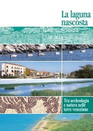
The hidden lagoon - Assessorato al Turismo della Provincia di ...
The hidden lagoon - Assessorato al Turismo della Provincia di ...
The hidden lagoon - Assessorato al Turismo della Provincia di ...

Create successful ePaper yourself
Turn your PDF publications into a flip-book with our unique Google optimized e-Paper software.
<strong>The</strong> <strong>hidden</strong><br />
<strong>lagoon</strong><br />
Between archaeology<br />
and nature across<br />
Venetian lands
<strong>The</strong> <strong>hidden</strong> <strong>lagoon</strong><br />
Between archaeology<br />
and nature across Venetian lands<br />
COMUNITÀ EUROPEA<br />
“Progetto cofi nanziato d<strong>al</strong>l’Unione Europea me<strong>di</strong>ante il Fondo Europeo <strong>di</strong> Sviluppo Region<strong>al</strong>e<br />
INIZIATIVA COMUNITARIA INTERREG III A It<strong>al</strong>ia/Slovenia 2000/2006 - PROGETTO “COAST<br />
TO COAST” sezione TURISTICO/AMBIENTALE E CULTURALE” (co<strong>di</strong>ce progetto BAVEN 222071)<br />
“Project co-fi nanced by the European Union through the Fondo Europeo <strong>di</strong> Sviluppo Region<strong>al</strong>e<br />
(Region<strong>al</strong> Development European Fund), COMMUNITY INITIATIVE INTERREG III A<br />
It<strong>al</strong>y/Slovenia 2000/2006 “COAST TO COAST” PROJECT, TOURISM/ENVIRONMENT<br />
AND CULTURE section (project code BAVEN 222071)<br />
“Projekt sofi nanciran s sredstvi Evropskega sklada za region<strong>al</strong>ni razvoj Evropske unije<br />
POBUDA SKUPNOSTI INTERREG III A It<strong>al</strong>ija/Slovenila 2000/2006 – PROJEKT “COAST<br />
TO COAST” TURISTIČNO/OKOLJSKA IN KULTURNA sekcija” (koda projekta BAVEN 222071)<br />
Comune <strong>di</strong><br />
Jesolo<br />
Comune <strong>di</strong><br />
Caorle<br />
Comune <strong>di</strong><br />
Eraclea<br />
PROVINCIA<br />
DI VENEZIA<br />
Comune <strong>di</strong><br />
Concor<strong>di</strong>a Sagittaria<br />
Comune <strong>di</strong><br />
Quarto d’Altino<br />
We wish to thank:<br />
Parco Region<strong>al</strong>e Veneto del Delta del Po, <strong>Provincia</strong> <strong>di</strong> Venezia e APT <strong>della</strong> <strong>Provincia</strong> <strong>di</strong> Venezia, Comune <strong>di</strong> Jesolo,<br />
Comune <strong>di</strong> Caorle, Comune <strong>di</strong> Eraclea, Comune <strong>di</strong> Concor<strong>di</strong>a Sagittaria, Comune <strong>di</strong> Quarto d’Altino
Venetian lands<br />
tReViso<br />
MestRe<br />
Sile<br />
QuARto<br />
D’AltiNo<br />
VeNeZiA<br />
Piave<br />
QuARto D’AltiNo<br />
toRCello<br />
• Hortus Altini<br />
• <strong>The</strong> <strong>lagoon</strong> and<br />
Trep<strong>al</strong>ade<br />
Nature Reserve<br />
CAVAlliNo<br />
sAN DoNÀ<br />
Di piAVe<br />
Livenza<br />
eRACleA<br />
liDo<br />
Di Jesolo<br />
Jesolo<br />
eRACleA<br />
Jesolo<br />
• Lagoon of Mort<br />
• W<strong>al</strong>king and<br />
scouting…<br />
in Eraclea<br />
eRACleA<br />
MARe<br />
• Jesolo and<br />
its <strong>lagoon</strong><br />
• <strong>The</strong> fi sh farms<br />
poRtoGRuARo<br />
CoNCoRDiA<br />
sAGittARiA<br />
CAoRle<br />
Tagliamento<br />
CoNCoRDiA sAGittARiA<br />
• From clay to ceramic<br />
• Vasa Rubra<br />
• Weapons and<br />
equipment in<br />
the roman world<br />
MAR<br />
ADRIATICO<br />
VeNeto<br />
CAoRle<br />
• V<strong>al</strong>levecchia<br />
• Fishing: boats and<br />
trades in the sea,<br />
the rivers and the<br />
<strong>lagoon</strong>s<br />
provincia<br />
<strong>di</strong> Venezia<br />
Veneto<br />
it<strong>al</strong>ia<br />
BiBioNe<br />
slovenija
Index<br />
Foreword 7<br />
<strong>The</strong> environment 8<br />
Jesolo 13<br />
Eraclea 19<br />
Caorle<br />
Quarto d’Altino 31<br />
Concor<strong>di</strong>a Sagittaria 37<br />
In the surroun<strong>di</strong>ng areas 42<br />
25<br />
Foreword<br />
It has been quite some time since Veneto Region is committed in supporting and promoting projects which<br />
develop the <strong>di</strong><strong>al</strong>ogue and collaboration among Institutions, with the purpose to v<strong>al</strong>orise environment<strong>al</strong>,<br />
historic<strong>al</strong>, and cultur<strong>al</strong> assets of the Countries that overlook High Adriatic in an integrated way.<br />
<strong>The</strong> “Coast to Coast” project, fi nanced with the community’s Initiative Program Interreg IIIA It<strong>al</strong>y-Slovenia<br />
(2000-2006), is suitable for this v<strong>al</strong>orisation, since it concerns the coast<strong>al</strong> areas and <strong>al</strong>so the near-by<br />
hinterland of Veneto, Friuli Venezia Giulia, and Slovenia, and aims at promoting the historic<strong>al</strong>-archaeologic<strong>al</strong><br />
and natur<strong>al</strong>istic aspects, by pointing out the particular and millenary relations of men with the environment,<br />
<strong>lagoon</strong>, water streams, and sea. This current publication, “La Laguna Nascosta (<strong>The</strong> Hidden Lagoon)”,<br />
highlights sceneries, places, and tra<strong>di</strong>tions of the eastern part of Veneto that only a few people, up to now,<br />
have the possibility and the luck to know and visit.<br />
At the same time, the coor<strong>di</strong>nating subject of the entire project, Ente Parco Region<strong>al</strong>e Veneto del Delta del<br />
Po (Veneto Del Delta del Po Region<strong>al</strong> Park Body), is committed in the development of relations - based<br />
on environment<strong>al</strong>, historic<strong>al</strong>, and tourist an<strong>al</strong>ogies - that strengthen more and more, the collaborations<br />
with the territories that overlook High Adriatic’s coasts. In particular, the cooperation with Slovenia,<br />
which involved SLOVENETA D.O.O., Komen, Capo<strong>di</strong>stria, Pirano, Portorose, and Izola municip<strong>al</strong>ities in the<br />
partner project, constitutes a further step towards the v<strong>al</strong>orisation and integrated promotion of Slovenian<br />
and Venetian territories.<br />
Wishing that the above mentioned project guidelines may fi nd further development and may <strong>al</strong>so be shared<br />
in the new 2007-2013 community’s programming cycle, together with the course of the collaboration with<br />
Slovenian and Friulan partners, I invite the readers to a pleasant re<strong>di</strong>scovery of our territories.<br />
This publication is the result of the EC project “Coast to Coast” within the INTERREG III A It<strong>al</strong>y-Slovenia<br />
program aiming to enhance the tourism, environment and cultur<strong>al</strong> offer in the areas stretching<br />
out between the delta of the river Po and the Slovenian side thus concerning the whole Province of Venice<br />
and the Venetian coast in particular. <strong>The</strong>se pages are the account of some less known aspects peculiar<br />
to such lands which can be of great interest due to their historic<strong>al</strong>, archaeologic<strong>al</strong> and natur<strong>al</strong>istic<br />
signifi cance.<br />
Our purpose is to highlight hereby the tourism related features accor<strong>di</strong>ng to a specifi c perspective such<br />
as the one resulting from a view of our territory as seen by young people. <strong>The</strong>se areas are in fact linked<br />
by a common history, starting before roman times up until the Middle Age, as well as by the environment<br />
<strong>di</strong>splaying similar features <strong>al</strong>so thanks to the presence of water streams, sea and <strong>lagoon</strong>s.<br />
This guide aims to introduce the gener<strong>al</strong> features peculiar to both the inland and the coast<strong>al</strong> areas of the<br />
Province of Venice, with speci<strong>al</strong> attention to those referring to settlements such as Jesolo, Eraclea, Caorle,<br />
Quarto d’Altino and Concor<strong>di</strong>a Sagittaria, <strong>al</strong>ong with every possible new fi n<strong>di</strong>ng. Some recommended<br />
activities are <strong>al</strong>so listed: nature w<strong>al</strong>ks, fl ower- and anim<strong>al</strong>-watching and going in search of history, of<br />
human interventions as well as of loc<strong>al</strong> tra<strong>di</strong>tions.<br />
So… enjoy your holidays!<br />
Councilman responsible for Tourism of Province of Venice<br />
Danilo Lunardelli<br />
Region<strong>al</strong> Councillor<br />
Economic<strong>al</strong> and Institution<strong>al</strong> Policies Department<br />
Attorney Fabio Gava<br />
President of Province of Venice<br />
Davide Zoggia<br />
6 7
<strong>The</strong> environment<br />
From coast to coast,<br />
where land meets the sea<br />
In ancient times the upper Adriatic coast was marked by a succession of <strong>lagoon</strong>s from<br />
Ravenna to Aquileia, interrupted only by the delta of the rivers Po, A<strong>di</strong>ge, Brenta,<br />
Piave and Tagliamento. It was therefore possible to sail <strong>al</strong>l the way from Ravenna to<br />
Altino through inner streams fl owing across the <strong>lagoon</strong>s.<br />
However the <strong>lagoon</strong> is not only a unique place from the natur<strong>al</strong>istic point of view: its<br />
uniqueness is <strong>al</strong>so due to the fact that here was built and fl ourished the city of Venice.<br />
History and nature connect Venice to <strong>al</strong>l the following centres – Jesolo, Caorle, Quarto<br />
d’Altino, eraclea and Concor<strong>di</strong>a sagittaria – whose speci<strong>al</strong> aspects we wish to ighlight<br />
hereby.<br />
<strong>The</strong> areas in subject were <strong>al</strong>ready inhabited during the pre-roman and roman periods,<br />
and they were important since representing the bond between land and water, north<br />
and south and between east and west…re<strong>al</strong> “colonisation” of the coasts, however,<br />
actu<strong>al</strong>ly took place due to the barbarian invasions (especi<strong>al</strong>ly the Huns led by Attila<br />
during the IV century a.C. as well as the Longobards during the VI cent.) that forced<br />
the inhabitants of Altino, Oderzo, <strong>al</strong>ong with the inland populations, to seek refuge in<br />
the islands of the <strong>lagoon</strong> which could have been better defended, as then happened for<br />
many centuries, from the incursions of the invaders.<br />
Caorle, Torcello, M<strong>al</strong>amocco, Chioggia, Grado and Meli<strong>di</strong>ssa (Eraclea) <strong>al</strong>ong with<br />
Ri<strong>al</strong>to and then Venice represented the core of the new “maritime Venice” and lived<br />
on tra<strong>di</strong>ng and fi shing, establishing strong links with the East. Over the time some<br />
geographic<strong>al</strong> features have changed, streams caused fl oods and then created sandbanks<br />
thus often turning islands into peninsulas and today into beach resorts…<br />
In the near inland, instead, there were large woods (plain forests) of which nowadays<br />
only sm<strong>al</strong>l parts have survived near the areas hereby mentioned.<br />
<strong>The</strong> Republic of Venice and its gradu<strong>al</strong> programme of drainage during the last few<br />
centuries rendered this land habitable and today the historic<strong>al</strong> and territori<strong>al</strong><br />
relationships of these centres, between nature and archaeology, are being brought to<br />
light <strong>al</strong>so thanks to the “Coast to Coast” project.<br />
<strong>The</strong> Lagoons<br />
Lagoons are humid areas where a regular exchange between earth and water takes<br />
place, they are located near river deltas and sh<strong>al</strong>low and sandy sea shores. <strong>The</strong> largest<br />
<strong>lagoon</strong> in It<strong>al</strong>y is the Venetian one <strong>di</strong>vided into North and South <strong>lagoon</strong>. To be<br />
mentioned are <strong>al</strong>so: Caorle and Bibione <strong>lagoon</strong> as well as that of Marano, in the Friuli<br />
region, and those at the delta of the river Po. <strong>The</strong> Venetian <strong>lagoon</strong> is a very speci<strong>al</strong> natur<strong>al</strong><br />
area that had a quite important role in history and art: the city of Venice in fact was built on<br />
the islands of the <strong>lagoon</strong>, where the inhabitants of the mainland had fl ed from barbarian<br />
invasions, from the IV to the VII century a.C. Lagoons are environments full of life, in constant<br />
evolution; furthermore, just like <strong>al</strong>l humid areas, they are very important on the ecologic<strong>al</strong><br />
point of view, due to the possibility to protect birds as well as to maintain a close relationship<br />
between sea and its shores.<br />
8 9
10<br />
<strong>The</strong>y feature sh<strong>al</strong>low and brackish waters<br />
that sometimes, depen<strong>di</strong>ng on tides, fl ood<br />
the sandy areas c<strong>al</strong>led barene and velme<br />
(marshes) while the upper areas are c<strong>al</strong>led<br />
motte. <strong>The</strong>y are crossed by sm<strong>al</strong>l inner water<br />
streams c<strong>al</strong>led ghebi; the sheets of water<br />
are c<strong>al</strong>led either v<strong>al</strong>li (v<strong>al</strong>leys) or ciari<br />
(clear). <strong>The</strong> area where the <strong>lagoon</strong> fl ows<br />
into the sea is c<strong>al</strong>led bocche (mouths).<br />
Sometimes <strong>lagoon</strong> areas involve <strong>di</strong>rect human<br />
intervention such as embankments or <strong>di</strong>gging, or simply the wedging in of bricole, wooden<br />
stakes driven in the bottom of the can<strong>al</strong>s in order to in<strong>di</strong>cate the inner navigable water ways,<br />
or sometimes involving only fi shing or hunting. Lagoons feature speci<strong>al</strong> vegetation that<br />
changes accor<strong>di</strong>ng to the water type: <strong>al</strong>ong the river mouths, where water is fresh, there<br />
are high reed thickets that become lower towards the area of the re<strong>al</strong> <strong>lagoon</strong>. In the middle<br />
marsh zones spots of lilac colour are due to s<strong>al</strong>t marsh grass (limonium) and sea lavender.<br />
In the areas that get fl ooded more often we can fi nd pickle-weed and eelgrass, low plants<br />
whose roots, however, consolidate the soil; in the less frequently fl ooded areas grows the<br />
cord grass. In the motte and on the islands we can fi nd tamarisks, sea wheat grass and<br />
santonica. <strong>The</strong> <strong>lagoon</strong> environment is inhabited by a great variety of anim<strong>al</strong>s: molluscs,<br />
insects, reptiles and sm<strong>al</strong>l mamm<strong>al</strong>s. Birds here can fi nd food quite easily either by “fi shing”<br />
in sh<strong>al</strong>low waters or by eating insects. Cormorants, fi shing birds, can be seen resting on the<br />
bricole <strong>al</strong>lowing their feathers to dry, as well as svassi (grebes), <strong>di</strong>ving ducks (where water<br />
is deeper) and <strong>di</strong>fferent kinds of herons, like the grey heron or the sm<strong>al</strong>ler white one c<strong>al</strong>led<br />
egret. Birds often nest or stop here while migrating elsewhere. For instance the more and<br />
more often in the <strong>lagoon</strong>s around Venice or Jesolo we can see pink fl amingos that, due to<br />
glob<strong>al</strong> warming, are forced to migrate north. Due to the <strong>lagoon</strong>’s sh<strong>al</strong>low waters sailing is<br />
performed by means of boats with a fl at bottom. Many parts of the <strong>lagoon</strong> area, about 15%,<br />
are devoted to fi sh-farms, where various types of fi sh are bred accor<strong>di</strong>ng to a “controlled”<br />
system and are afterwards caught to be brought to our tables.<br />
<strong>The</strong> Rivers<br />
Rivers are another <strong>di</strong>stinguishing element of the province of Venice and of its history.<br />
<strong>The</strong> most important historic<strong>al</strong> events took place near rivers or near their mouths, and<br />
nowadays their natur<strong>al</strong> and environment<strong>al</strong> aspects are quite interesting. Furthermore<br />
the history of the Province is strictly connected to rivers’ life <strong>al</strong>so due to the fact that<br />
the Republic of Venice has implemented, during the past centuries, many works in<br />
order to change the course of the rivers and to make life in the <strong>lagoon</strong> safer and<br />
he<strong>al</strong>thier. Over <strong>al</strong>l we wish to remind here the river piave, renowned for the battles that<br />
took place <strong>al</strong>ong its banks during World War I, which is a river fl owing <strong>al</strong>l the way to the<br />
Dolomites with an impetuous course and then fl owing into sea between Jesolo and<br />
Eraclea. Its course was deviated by the Republic of Venice in order to avoid coarser<br />
se<strong>di</strong>ments brought by the river to pile up off shore in the <strong>lagoon</strong>. <strong>The</strong>re is <strong>al</strong>so a completely<br />
<strong>di</strong>fferent and quieter river originating much more down below where the plain area starts<br />
and the water is surfacing: it’s the river sile, fl owing near Quarto d’Altino, which is the<br />
longest spring river in Europe. River lemene instead links Concor<strong>di</strong>a and Portogruaro to<br />
Caorle and its <strong>lagoon</strong>.<br />
11
12<br />
View of Jesolo Lido<br />
Jesolo<br />
A golden strip between<br />
fresh and brackish waters<br />
Jesolo is one of the most renowned seaside resorts in it<strong>al</strong>y: there are 15 km of soft<br />
sandy beach, hundreds of hotels and restaurants and thousands of amusements, of<br />
shopping and sport activities, in other words a great variety of ways to soci<strong>al</strong>ize.<br />
In ancient times the area where Jesolo is located used to be a <strong>lagoon</strong> with some<br />
scattered islands. <strong>The</strong> largest island was c<strong>al</strong>led equilium by the Romans: probably it<br />
owes its name to the horses that were <strong>al</strong>ready bred by loc<strong>al</strong> ancient inhabitants, the<br />
Venetians. This area has undergone a much<br />
faster development at the occasion of the<br />
arriv<strong>al</strong> of the refugees fl eeing to the islands<br />
due to the barbarian invasions. <strong>The</strong> ancient<br />
Christians <strong>al</strong>so built a church in Equilium,<br />
of which nowadays only some mosaics<br />
survive, and afterwards a basilica, to which<br />
churches and monasteries nearby were<br />
dependent. Its decadence was due to the<br />
rivers fl oo<strong>di</strong>ng the area (Sile and Piave)<br />
and rendering it uninhabitable as well<br />
Ruins of the ancient<br />
C<strong>al</strong>igo tower, me<strong>di</strong>ev<strong>al</strong> garrison.<br />
13
Swinging bridge<br />
on the river Sile - Jesolo<br />
View on the Sile - Piave Vecchia<br />
as causing the <strong>lagoon</strong> to be fi lled up by se<strong>di</strong>ments. During the latest centuries reclaiming<br />
works started in the whole area c<strong>al</strong>led Cavazuccherina. However in year ‘900 the area was<br />
completely drained: the beach was then linked to the mainland and therefore many hotels<br />
started to be built <strong>al</strong>ong with helio-therapeutic institutes for the sun therapy: sun and sand<br />
<strong>al</strong>ong with the io<strong>di</strong>ne of the sea breeze were deemed to have benefi ci<strong>al</strong> properties. <strong>The</strong><br />
ancient name “Jesolo” was reinstated. Nowadays there are many reasons to go to Jesolo:<br />
beach life, w<strong>al</strong>ks <strong>al</strong>ong the lively roads, but <strong>al</strong>so getting to know the nature and the <strong>lagoon</strong><br />
nearby as well as the <strong>di</strong>scovery of the historic<strong>al</strong> spots located in Jesolo Paese, such as those<br />
in the area of the “ancient w<strong>al</strong>ls”, and where most certainly were located the churches and<br />
the Cathedr<strong>al</strong> of st. Mary, or <strong>al</strong>so visiting the exhibition housed in the loc<strong>al</strong> Town H<strong>al</strong>l.<br />
in-depth<br />
Jesolo and its <strong>lagoon</strong><br />
<strong>The</strong> <strong>lagoon</strong> of Venice… extends down to Jesolo !! You may notice that the road to<br />
Jesolo runs <strong>al</strong>ong <strong>lagoon</strong> areas as well as <strong>al</strong>ong a very important can<strong>al</strong>, the idrovia<br />
Veneta, fl owing from the <strong>lagoon</strong> of Venice to the mouths of river Isonzo.<br />
Within the <strong>lagoon</strong> of Jesolo, as in others, are carried out very important economic<strong>al</strong><br />
activities: yet in the past fi shing and hunting were performed and s<strong>al</strong>t-pits were<br />
exploited. <strong>The</strong> fi sh-farms still exist and particularly important is Dragojesolo area as<br />
large as 1000 hectares. It is a matter of a “framed” <strong>lagoon</strong> hence supporting the<br />
bree<strong>di</strong>ng and fi shing of fi sh, seafood and molluscs, but it is <strong>al</strong>so a greatly important<br />
area due to the other types of fauna. Dragojesolo can be reached by simply taking a<br />
w<strong>al</strong>k from old Jesolo Paese <strong>al</strong>ong S<strong>al</strong>si Street towards Lio Maggiore, another <strong>lagoon</strong><br />
resort: evocative landscapes and great horizons. A few steps away, where the water is<br />
fresher, live turtles, tree-frogs and green toads, while on the lands above sea level<br />
hares and hedgehogs can be seen. However the largest community of anim<strong>al</strong>s is the<br />
birds related one: pink fl amingos transit here while migrating, there are sever<strong>al</strong> herons<br />
(the purple one as well as the egret), wild ducks, the fen-hawk and the kingfi sher.<br />
Many other types of birds are still to be <strong>di</strong>scovered.<br />
Dragojesolo fi sh farm, Northern Lagoon stretch between Jesolo old town centre and Jesolo Lido<br />
14 15
Hence the possibility of birdwatching. A good support to improve our knowledge in<br />
Jesolo is <strong>al</strong>so the Museum of Natur<strong>al</strong> History. Here many anim<strong>al</strong>s of this area and of the<br />
whole of Europe are <strong>di</strong>splayed: over 20.000 pieces with a great number of birds, in ad<strong>di</strong>tion<br />
to many tools used in daily life in the <strong>lagoon</strong> areas and in the fish-farms (therefore <strong>al</strong>so for<br />
fishing and hunting) as well as tools to look after birds in captivity such as cages, troughs,<br />
and instruments used to reproduce the birds singing.<br />
In ad<strong>di</strong>tion to this there is a p<strong>al</strong>aeontology related section with skeletons, images and<br />
full-size models of <strong>di</strong>nosaurs and of the fauna of the Mesozoic era. This section will be<br />
further enlarged and enriched in the next few years. Currently there are sever<strong>al</strong><br />
accurate models of land and sea mamm<strong>al</strong>s as well as of the great predators at the top of<br />
the food chain, living and non-living species, and of the fauna of the whole Veneto<br />
region and <strong>al</strong>most <strong>al</strong>l of the p<strong>al</strong>earctic are<strong>al</strong>.<br />
A natur<strong>al</strong>istic <strong>di</strong>dactic laboratory is available to let visitors experience the use of<br />
materi<strong>al</strong>s such as clay and papier-mache to create reproductions of the fauna peculiar<br />
to the region and to the <strong>lagoon</strong> of Venice.<br />
<strong>The</strong> lighthouse in Cav<strong>al</strong>lino<br />
curious facts<br />
<strong>The</strong> fish farms<br />
(We have mentioned Dragojesolo area but let’s have a look at some further details…)<br />
Lagoon is a landscape influenced by <strong>di</strong>rect human intervention: for instance bricole<br />
and peocere too, in other words the poles and nets used to breed mussels (peoci).<br />
This activity, however, is far more complex and it’s achieved especi<strong>al</strong>ly through the<br />
fish-farms c<strong>al</strong>led “v<strong>al</strong>leys”: in this case the word “v<strong>al</strong>ley” comes from the Latin v<strong>al</strong>lum<br />
which means w<strong>al</strong>l or barrier, since these are areas separated from the <strong>lagoon</strong> by sm<strong>al</strong>l<br />
embankments or screens built by humans as well as limited by dams c<strong>al</strong>led chiaviche.<br />
Fishing hut<br />
<strong>The</strong>se sheets of sh<strong>al</strong>low water rich in fish-<br />
food, are devoted to the bree<strong>di</strong>ng of some<br />
types of fish (sea breams, eels, mullets) in<br />
ad<strong>di</strong>tion to molluscs and seafood. Young<br />
fish are c<strong>al</strong>led avannotti or novellame: they<br />
go with the stream and the percentage of<br />
s<strong>al</strong>t in the water and they dwell in these<br />
“controlled” and protected areas. Young fish<br />
are often caught in the sea (for example by the fishermen in Caorle) and then<br />
transferred to the farms. When fish are grown up and able to go back to the open sea,<br />
they are enclosed in the lavorieri, a kind of triangle shaped enclosures, where they are<br />
then caught. In the past, life in the fish-farms was hard, with little food available and a lot of<br />
humi<strong>di</strong>ty: fishermen would often spend part of the year living in the Cason da pesca (fishing<br />
hut). <strong>The</strong>re were <strong>al</strong>so many Cason da caccia (hunting huts) and hunting barrels, but these<br />
were used mostly by the lords, the great land owners. <strong>The</strong>re were various occupations: a very<br />
important activity was the maintenance of the boat (kept in covered shelters c<strong>al</strong>led cavane)<br />
but <strong>al</strong>so the weaving of nets, cutting the reeds and preparing the nasse, sorts of baskets used<br />
to catch the eels. Reeds were used to manufacture various types of accessories (chairs etc.)<br />
<strong>al</strong>so for people living in the mainland. Some evidences regar<strong>di</strong>ng life in the fish-farms are on<br />
<strong>di</strong>splay in the Municip<strong>al</strong> Museum of Jesolo as well as in other exhibitions held in this area<br />
(Museum of Reclaiming Works of S. Donà, Nature Reserve of Averto fish-farm).<br />
info<br />
MuNiCipAlity of Jesolo<br />
www.comune.jesolo.ve.it<br />
library - tel. (+39)0421 359147 - biblioteca@jesolo.it<br />
Apt <strong>della</strong> provincia <strong>di</strong> Venezia (tourism promotion Agency) - iAt <strong>di</strong> Jesolo - Piazza Brescia, 13<br />
Lido <strong>di</strong> Jesolo - tel. (+39) 0421 370601 - info@aptjesoloeraclea.it - www.turismo.provincia.venezia.it<br />
Municip<strong>al</strong> Natur<strong>al</strong> History Museum - via Bafile, 172 - Lido <strong>di</strong> Jesolo - tel. (+39) 0421 382248<br />
16 17
18<br />
View on Eraclea Mare<br />
Eraclea<br />
<strong>The</strong> Doges’ pinewood<br />
today eraclea is a quiet and green coast<strong>al</strong> town. In ancient times the island of<br />
Meli<strong>di</strong>ssa (its ancient name), inhabited since the fi rst centuries of our era, became the<br />
more and more important due to the<br />
infl ux of populations from the mainland<br />
(especi<strong>al</strong>ly from Oderzo, where an important<br />
roman community had settled) seeking<br />
refuge in the islands from the barbarians.<br />
eraclea owes its name to the emperor of the<br />
Eastern Roman Empire with whom it had<br />
close relationships.<br />
During the VII-VIII centuries, <strong>al</strong>ong with<br />
other villages such as Torcello, Caorle,<br />
Chioggia and Grado, Eraclea became part<br />
of an important network of islands of the<br />
<strong>lagoon</strong> of the north Adriatic sea that<br />
represented the fi rst settlements of Venice.<br />
Achieving full defence from neighbours and<br />
Scenic view of the sea and of Eraclea Mare pinewood<br />
19
pirates, though, was very <strong>di</strong>ffi cult hence the decision to appoint a commander c<strong>al</strong>led “Doge”<br />
who was considered the fi rst Venetian governor.<br />
<strong>The</strong> town changed again name and was c<strong>al</strong>led Cittanova. Wars and fl oods taking place before<br />
year 1000 weakened Eraclea that rapidly declined.<br />
Only from year 1800 the area was drained thus being revived, afterwards the town was c<strong>al</strong>led<br />
Grisolera remin<strong>di</strong>ng the swamp reeds. During the past century the town took back its ancient<br />
and aristocratic name and the tourism sector started to develop. Vestiges of the past can still<br />
be seen in some areas and are partly housed in the loc<strong>al</strong> Museum of Reclaiming Works of<br />
s. Donà <strong>di</strong> piave.<br />
Reclaiming works Museum interiors in San Donà <strong>di</strong> Piave<br />
(Last but not least; here in the Piave area took place many cruci<strong>al</strong> battles of World War<br />
i, so many sites are full of memories <strong>al</strong>though they have been repeatedly destroyed).<br />
Lagoon of Mort<br />
in-depth<br />
Lagoon of Mort<br />
Waters often played games with Eraclea, a town enclosed between the <strong>lagoon</strong> and<br />
important rivers such as the tumultuous river Piave fl owing down from the Dolomites.<br />
<strong>The</strong> best example is undoubtedly the Lagoon of Mort, a sm<strong>al</strong>l <strong>lagoon</strong> thought to have<br />
formed about 70 years ago when the river Piave broke its banks and the fi n<strong>al</strong> part of its<br />
course has therefore undergone some changes. Thus the actu<strong>al</strong> sheet of water was<br />
formed: it is surrounded by sand and mud and its environment is ide<strong>al</strong> for both fauna<br />
and fl ora as well as for relaxing w<strong>al</strong>ks and bird- or plant-watching. In the inner area the<br />
“fossil dunes” (ie ancient dunes of sand that became stable thanks to the action of the plant<br />
roots and therefore wind can no longer interact) are covered with pine trees. Almost <strong>al</strong>l<br />
the luxuriant plants of the Adriatic area date back to the past century when these have been<br />
used to separate the cultivated areas of the inland and the marine areas. Nowadays these are<br />
quiet corners full of shade. At a not too far <strong>di</strong>stance a vegetation peculiar to the s<strong>al</strong>ty and<br />
sandy areas can be found such as marram grass. When w<strong>al</strong>king closer to the water we can<br />
see reed thickets, common reed (phragmites) and other <strong>lagoon</strong> plants such as the pickle-<br />
weed. To be mentioned are <strong>al</strong>so a couple of interesting plants growing here: the orchid<br />
(mountain and swamp types) and a steppe plant, the spear-leaved dogbane (Apocynum<br />
Venetum), thus proving that once weather here was similar to the steppe one, very windy<br />
and dry. <strong>The</strong> vegetation of the <strong>lagoon</strong> beds includes seagrass (Zostera marina) as well as<br />
20 21
sever<strong>al</strong> types of <strong>al</strong>gae. In the dune area live leverets, weasels and other sm<strong>al</strong>l mamm<strong>al</strong>s<br />
such as rodents in ad<strong>di</strong>tion to reptiles and amphibians. <strong>The</strong> whole area is populated by<br />
sever<strong>al</strong> types of migratory birds. Many <strong>di</strong>fferent types of birds either transit or make a<br />
stop here like wild ducks, te<strong>al</strong>s, garganeys, pintail ducks, whistle ducks, pochards as well<br />
as grebes and other birds of the ducks’ family. Birds like the Kentish plover, the river<br />
nighting<strong>al</strong>e, the zitting cisticola nest here and now and then the grey and purple herons, the<br />
egret and some birds of prey such as the buzzard or the honey buzzard stop here.<br />
Part of the <strong>lagoon</strong> related environment has been replicated at the environment<strong>al</strong><br />
education Centre. <strong>The</strong> Environment<strong>al</strong> Education Centre of Eraclea is housed in an old<br />
loc<strong>al</strong> buil<strong>di</strong>ng known as the ex-kiln. As a matter of fact it’s a drying-house where goods used<br />
to be dried out, amongst which fruits and vegetables for the It<strong>al</strong>ian troops during World<br />
War I. As many other sites in this area it’s a sample of “industri<strong>al</strong> archaeology”. Nowadays<br />
it lays deep in the greenery, a few meters from the sea and next to a natur<strong>al</strong> path crossing<br />
the pine-wood and the dunes.<br />
Environment<strong>al</strong> Education Territori<strong>al</strong> Centre near the old kiln – Eraclea Mare<br />
Martin Pescatore<br />
curious facts<br />
W<strong>al</strong>king and scouting…<br />
in Eraclea<br />
What’s birdwatching and what can be seen in the <strong>lagoon</strong>. Birdwatching consists of observing<br />
birds within their natur<strong>al</strong> habitat. It’s an ecologic<strong>al</strong> activity that started to develop in It<strong>al</strong>y<br />
only recently and that takes place mostly in areas rich in waters or in <strong>lagoon</strong>s: from the delta of<br />
the river Po to the <strong>lagoon</strong> of Venice, Jesolo and to the other fi sh-farm areas. Birds can be watched<br />
while w<strong>al</strong>king across the fi sh-farm area and reed thickets, by stopping in huts or watch-towers<br />
(<strong>al</strong>ong equipped paths) or while sailing on a boat. We would recommend the use of binoculars<br />
and cameras to enjoy better watching. More expert watchers can <strong>al</strong>so use binoculars with a<br />
tripod thus managing to watch more <strong>di</strong>stant birds. In order to perform a good watching session<br />
noticed since anim<strong>al</strong>s are quite frightened by visitors.<br />
info<br />
it is advisable to gather in sm<strong>al</strong>l groups,<br />
wear comfortable shoes, move with extreme<br />
care, avoid wearing gaudy colours (hence<br />
camoufl aging with surroun<strong>di</strong>ng nature)<br />
and use a good protection against insects<br />
and humi<strong>di</strong>ty…. Along the path, if possible<br />
guided by an expert escort, you will be able<br />
to spot some signs of the presence of birds:<br />
tracks, feathers, egg shells, tracks on the trees<br />
or <strong>al</strong>so their singing and rustling. the best<br />
seasons are springtime and f<strong>al</strong>l. However<br />
it is advisable to go watch birds very early in<br />
the morning: indeed it is during the early morning hours that birds living near the water fl y out<br />
to seek food. In ad<strong>di</strong>tion to this it would be useful to try and keep the sun behind own shoulders,<br />
so that birds can be in the light, as well as to w<strong>al</strong>k sideways: it’s important to try and avoid being<br />
MuNiCipAlity of eRACleA<br />
www.comune.eraclea.ve.it<br />
library - tel. (+39)0421 234330 - biblioteca@comune.eraclea.ve.it<br />
Apt <strong>della</strong> provincia <strong>di</strong> Venezia (tourism promotion Agency) - iAt <strong>di</strong> eraclea - via Marinella 56<br />
Eraclea Mare - tel. (+39) 0421 66024 - info@aptjesoloeraclea.it - www.turismo.provincia.venezia.it<br />
environment<strong>al</strong> education Centre of eraclea - via degli Abeti 2 - Eraclea Mare<br />
tel. (+39) 0421 66024<br />
limosa Cooperative - www.limosa.it - tel. (+39) 041 932003<br />
22 23
24<br />
Caorle<br />
Caorle<br />
Life at sea<br />
between history and nature<br />
Caorle is a coast<strong>al</strong> town offering to tourists not only nice beaches and amusements, but<br />
<strong>al</strong>so an interesting historic<strong>al</strong> centre and an large <strong>lagoon</strong> area where natur<strong>al</strong>istic areas<br />
with huts can be found. <strong>The</strong> historic<strong>al</strong> centre of Caorle reminds of the city of Venice and<br />
the island of Burano due to the lively c<strong>al</strong>li (streets) and campielli (sm<strong>al</strong>l squares) and to<br />
the multi-coloured houses overlooking the port. Furthermore an ancient bell tower, next<br />
to the cylindric<strong>al</strong> Cathedr<strong>al</strong> dating back to year 1000, stands out in the town centre.<br />
<strong>The</strong> town, in fact, has been an important centre for fi shing and trade since ancient times and<br />
especi<strong>al</strong>ly during the Middle Age.<br />
History is sometimes emerging from the sea: ancient boats, amphorae and other<br />
remains will soon be <strong>di</strong>splayed in the Museum of sea archaeology currently under<br />
preparation.<br />
If you fi nd yourself in the centre of Caorle, leaving from the typic<strong>al</strong> church of the<br />
Virgin of the Angel overlooking the waves, you will certainly enjoy w<strong>al</strong>king <strong>al</strong>ong the<br />
colourful narrow streets but <strong>al</strong>so <strong>al</strong>ong the seashore and the cliff. However surprises in<br />
this town are not over yet: if you get to the cliff <strong>al</strong>ong the sea you will notice that the<br />
rocks have been sculpted portraying various imaginary fi gures thus turning this place<br />
into an open air art g<strong>al</strong>lery to which every year new masterpieces are added during the<br />
25
Hut in F<strong>al</strong>conera <strong>di</strong> Caorle, located in front of the old house of Guar<strong>di</strong>a <strong>di</strong> Finanza<br />
Scogliera Viva festiv<strong>al</strong>. <strong>The</strong> <strong>lagoon</strong> of Caorle (linked to the Bibione one nearby) is a speci<strong>al</strong><br />
place: water from rivers such as the Lemene here meets with the sea thus creating a unique<br />
landscape. Here next to nature lay <strong>al</strong>so many signs of the life of humans, such as the<br />
fishermen huts, made of straw and reed, c<strong>al</strong>led casoni caorlotti slightly stan<strong>di</strong>ng out<br />
from the reed thickets on the sm<strong>al</strong>l islands connected to the mainland and creating a<br />
re<strong>al</strong>ly unique landscape. <strong>The</strong> <strong>lagoon</strong> is lapping on the sm<strong>al</strong>l town of S. Gaetano a little<br />
beyond the fish-farms such as V<strong>al</strong>le Zignago and V<strong>al</strong>le Grande.<br />
Out and… deep down the sea there is a very speci<strong>al</strong> environment rich in fish: the<br />
tegnue, a rocky sea bed where the fishermen’s nets used to get entangled (hence the<br />
name “tenute” ie held) located offshore in the upper Adriatic, especi<strong>al</strong>ly out of Caorle<br />
and Chiogga. Amongst these speci<strong>al</strong> rocks, formed by marine organisms such as <strong>al</strong>gae<br />
piling up on the sea bed for ages, there are <strong>di</strong>fferent kinds of marine life: sponges, sea<br />
anemones, shell fish (such as the lobster), and fish like the sm<strong>al</strong>l cods.<br />
in-depth<br />
V<strong>al</strong>levecchia<br />
If you manage to travel a few kilometres further on you will enjoy plunging in a<br />
unique environment surprisingly free from buil<strong>di</strong>ngs. Don’t miss Brussa and V<strong>al</strong>levecchia!<br />
V<strong>al</strong>levecchia is an extremely speci<strong>al</strong> place, a nature reserve where where it is possible to w<strong>al</strong>k<br />
for as long as 4 km on the sand in the pine-wood. It’s a matter of a large island overlooking the<br />
sea surrounded by can<strong>al</strong>s and rivers and linked to the mainland by a bridge. About a hundred<br />
years ago it used to be a fish-farm that has been afterwards drained. Currently many actions<br />
have been planned for this area in an attempt to bring it back to the origin<strong>al</strong> con<strong>di</strong>tions by<br />
restoring the wood, the field shrubs, the moist areas peculiar to the <strong>lagoon</strong> environment and<br />
managing to preserve the cultivated area accor<strong>di</strong>ng to ecologic<strong>al</strong> standards. <strong>The</strong>refore it’s<br />
a place enabling us to improve our knowledge (<strong>al</strong>so in the natur<strong>al</strong>istic education centre)<br />
and where it’s possible to take w<strong>al</strong>ks in the pine-wood as well as to swim….<strong>al</strong>so it’s worth<br />
<strong>di</strong>scovering the richness of the <strong>lagoon</strong> and of the open spaces, and to locate the <strong>hidden</strong> huts.<br />
V<strong>al</strong>levecchia is currently managed by Veneto Agricoltura and it’s a speci<strong>al</strong>ly protected<br />
zone (Zps) appointed as “site of communitarian importance” (siC), therefore this<br />
area is deemed important on the ecologic<strong>al</strong> point of view by Europe too.<br />
26 27<br />
V<strong>al</strong>levecchia
Parade Caorlina boat during<br />
the Madonna dell’Angelo feast<br />
that took place in Caorle on<br />
15.09.05. <strong>The</strong> Bishop of Venice<br />
curious facts<br />
Fishing: boats and trades in the<br />
sea, the rivers and the <strong>lagoon</strong>s<br />
In Caorle it is possible to practise fi shing-tourism: a day at sea on fi shermen’s boats<br />
going fi shing as well as enjoying eating the fi sh <strong>al</strong>ready caught. A coast<strong>al</strong> town has its own<br />
boats too. <strong>The</strong> Caorlina boat owes its name to Caorle, it’s a slender but spacious fi shing<br />
and cargo boat peculiar to the rivers and <strong>lagoon</strong>s and whose existence has been testifi ed<br />
since the XVI century. <strong>The</strong> main feature of the Caorlina refers to the shape of its fore and<br />
aft, which are stretching out high and are of the same length thus enabling rapid changes of<br />
<strong>di</strong>rection. It looks like a gondola and can have more than one rower. It can <strong>al</strong>so be dragged<br />
ashore (from the <strong>al</strong>zaie) when sailing across the can<strong>al</strong>s or in case of sailing to the sea sails<br />
could be used. However the Caorlina wasn’t and isn’t used only in Caorle: if needed it was<br />
operating as supporting boat for the fi shing activity both at sea or in the <strong>lagoon</strong> (mostly for<br />
fi shing with fi xed nets), however this boat was <strong>al</strong>so used in rivers. <strong>The</strong> greengrocers of<br />
the islands of Venice would sail on the Caorline early in the morning to go to the<br />
market in Ri<strong>al</strong>to and they would be racing with each other to get there fi rst and enjoy<br />
the privilege of being able to <strong>di</strong>splay own products in the best place. <strong>The</strong> shipyards for<br />
these boats, as well for the bigger boats such as the burci, are usu<strong>al</strong>ly located <strong>al</strong>ong the<br />
river Sile towards Treviso. Nowadays some of this coloured boats can be seen <strong>al</strong>ong the water<br />
streams of the province of Venice during sport competitions and festiv<strong>al</strong>s (p<strong>al</strong>ii remieri) or<br />
at the occasion of historic<strong>al</strong> celebrations (historic<strong>al</strong> regatta). fishing in the rivers, just<br />
like in can<strong>al</strong>s or <strong>di</strong>tches of the Venetian countryside, was a daily practise and quite popular<br />
amongst loc<strong>al</strong>s who where therefore able to secure what was often their sole source of<br />
nourishment. fish were caught by means of ru<strong>di</strong>ment<strong>al</strong> but effi cient tools whose<br />
manufacturing belongs to the cultur<strong>al</strong> legacy of the populations inhabiting the areas <strong>al</strong>ong<br />
the river. One of the most interesting tools that can still be seen in the <strong>lagoon</strong> areas is the<br />
bilancia (square fi shing net), a tool composed of a square net pulled by iron arches<br />
weighed at both ends by some lead b<strong>al</strong>lasts replacing the bamboo canes used in the<br />
Fishing square net<br />
on the river Livenza<br />
past. <strong>The</strong> sides of the square nets can measure one or more metres thus stretching out<br />
for the whole size of the river or can<strong>al</strong>. <strong>The</strong> net is then lowered in water from either the<br />
shores or a boat so to get it to lay on the river bed. After a certain lapse of time it gets<br />
quickly raised so to catch the fi sh transiting above the net and attracted by the baits<br />
arranged on this purpose. <strong>The</strong> pulling system is operated either by a pole to whose<br />
end a rope is tightly bound or by a pulley.<br />
Bunch of vine wood: this fi shing method implemented in rivers and in <strong>lagoon</strong>s was<br />
quite popular in the past when technology still <strong>di</strong>dn’t offer other <strong>al</strong>ternatives. Our<br />
grandfathers used to bind together some freshly cut vine-shoots thus obtaining large<br />
bundles, sometimes they would arrange baits inside the bundles.<br />
Placed in water the bunch would constitute a fake lair for eels and after a few days it<br />
would be quickly pulled out the water thus catching the eels that were trapped inside.<br />
To catch the fi sh a kind of funnel-shaped nets (once made of wicker) c<strong>al</strong>led nasse (or<br />
bertavelli) were <strong>al</strong>so used: once the fi sh was in, it was impossible to come out again<br />
and fi shermen were forced to release the fi sh by pulling them by the tail.<br />
info<br />
MuNiCipAlity of CAoRle<br />
www.comune.caorle.ve.it<br />
library - tel. (+39)0421 219255 - biblioteca@comune.caorle.ve.it<br />
Apt <strong>della</strong> provincia <strong>di</strong> Venezia (tourism promotion Agency) - iAt <strong>di</strong> Caorle<br />
C<strong>al</strong>le delle Liburniche 16 - Caorle - tel. (+39) 0421 81085<br />
info@caorleturismo.it - www.turismo.provincia.venezia.it<br />
Angelo Scola onboard<br />
28 the Caorlina.<br />
29
30<br />
Cycle path on the river Sile<br />
Polychrome glazed vessel<br />
Nation<strong>al</strong> Archaeologic<strong>al</strong><br />
Museum of Altino<br />
Quarto d’Altino<br />
A crossroads<br />
of history and nature<br />
In the heart of the upper Adriatic sea, a few kilometres far from Venice, is located the<br />
ancient Altinum, a roman town, whose utmost fl ourishing took place between the I and<br />
the II century a.C.<br />
Overlooking the <strong>lagoon</strong>, it enjoyed a privileged position: inner <strong>lagoon</strong> routes were<br />
setting courses across the Adriatic; a close network of roads connected the town to the<br />
major city centres of Venetia, while navigable water ways, such as rivers Sile and<br />
Piave, enabled to reach the piedmont areas.<br />
<strong>The</strong> town, built on natur<strong>al</strong> sm<strong>al</strong>l hills and crossed by sever<strong>al</strong><br />
can<strong>al</strong>s, was surrounded by a w<strong>al</strong>l and had an imposing door-<br />
berthing place on the northern side. <strong>The</strong>re were public<br />
buil<strong>di</strong>ngs and residenti<strong>al</strong> areas with domus embellished by<br />
mosaic fl oors. Along the roads hea<strong>di</strong>ng out of the town<br />
there were ample necropolis where over 2000 precious<br />
funerary dowries have been found. Nearby there were<br />
large villas, partly intended for the otium of the we<strong>al</strong>thy<br />
owners, and partly housing some production plants making<br />
them autonomous as well as prosperous.<br />
31
32<br />
Northern door-berthing place:<br />
a reconstruction assumption<br />
(watercolour by Elena DePoli)<br />
<strong>The</strong> village of Altino is currently composed of a sm<strong>al</strong>l settlement surrounded by cultivated<br />
areas, the actu<strong>al</strong> town centre instead, grown around Quarto d’Altino town, has been moved<br />
north. In 1960 the Nation<strong>al</strong> Archaeologic<strong>al</strong> Museum of Quarto d’Altino has been built<br />
on the ancient roman site housing a variety of fi nds from <strong>di</strong>gs of about 2000 tombs. <strong>The</strong> fi nds<br />
include stone sculptures such as monuments and funerary stele with inscriptions, heads<br />
depicting fem<strong>al</strong>e and m<strong>al</strong>e subjects <strong>al</strong>ong with funerary dowries inclu<strong>di</strong>ng both terra-cotta<br />
and glass pottery, adornment objects and coins. Furthermore some mosaics coming from<br />
the settlements are <strong>al</strong>so on <strong>di</strong>splay in the museum rooms. Two large archaeologic<strong>al</strong> sites<br />
open to public visits are located outside the Museum buil<strong>di</strong>ng. One of the two sites hosts a<br />
staircase enabling access to the berthing place on the can<strong>al</strong> as well as a stretch of road paved<br />
with trachytic basoli and lined with ruins of houses and mosaic fl oorings. <strong>The</strong> second site<br />
<strong>di</strong>splays the sandstone block foundations of the monument<strong>al</strong> door-berthing place with two<br />
square towers and a centr<strong>al</strong> courtyard that was once overlooking a water stream.<br />
Due to the extraor<strong>di</strong>nary we<strong>al</strong>th of fi nds housed in the Museum’s warehouse soon the<br />
Museum itself will be moved to two large buil<strong>di</strong>ngs nearby dating back to ‘800 which have<br />
been suitably restored and equipped for the new exhibition. Such a remarkable facility will<br />
<strong>al</strong>so house a variety of items inclu<strong>di</strong>ng sever<strong>al</strong> sm<strong>al</strong>l statues and bronze lamina recently<br />
found during some archaeologic<strong>al</strong> investigations carried out in the museum area where a<br />
shrine, dating from pre-roman and roman times, has been <strong>al</strong>so unearthed.<br />
in-depth<br />
Spanish broom<br />
(from G. Negri,<br />
Illustrated Herb<strong>al</strong>)<br />
Box-tree<br />
(from G. Negri,<br />
Illustrated Herb<strong>al</strong>)<br />
Hortus Altini.<br />
From veget<strong>al</strong> fi nds to restoration<br />
of the ancient environment.<br />
Ancient sources and data obtained as a result of the p<strong>al</strong>eo-botanic<strong>al</strong><br />
investigations carried out on sever<strong>al</strong> fi n<strong>di</strong>ngs from excavations,<br />
gave us an idea of loc<strong>al</strong> landscape during roman times. Towards<br />
north an expanse of woods of mainly oaks and hornbeams, with<br />
ash trees, elms, maple and beech trees, was stretching out to crops<br />
of cere<strong>al</strong>s, mile, barley and spelt. <strong>The</strong>re were fruit trees such as<br />
cherry and plum trees, peach and hazelnut trees as well as fi g trees.<br />
W<strong>al</strong>l-nut trees were grown both for their fruits and their v<strong>al</strong>uable<br />
wood; the vineyards supplied wine for the tables of Altino.<br />
Box-wood foot<br />
from a piece<br />
of furniture<br />
(I cent. A.C.)<br />
Towards south the landscape was<br />
characterized by marshes covered<br />
with fen-grass and fl owers where can<strong>al</strong>s, bordered with reed<br />
and carex thickets, once fl owed. Pine-trees were stan<strong>di</strong>ng out<br />
and were quite appreciated thanks to their sm<strong>al</strong>l and copious<br />
fruits, while the renowned brooms from Altino (Grazio’s <strong>al</strong>tinates<br />
genistae) are blots in the landscape with their colours. Around<br />
the town the necropolis looked like gardens with hedges of<br />
evergreen boxtrees and bushes of wild roses: ...ut... largius rosae<br />
et esc[ae]...ponerentur, hands down the stele of Lucius Ogius<br />
Patroclus from Altino who had made a donation thus granting<br />
plenty of roses to be spread on his grave.<br />
Sole of fem<strong>al</strong>e<br />
sand<strong>al</strong> made<br />
of box-wood<br />
(I cent. a.C.)<br />
Wild rose<br />
(from G. Negri,<br />
Illustrated Herb<strong>al</strong>)<br />
Oak-tree<br />
(from G. Negri,<br />
Illustrated<br />
Herb<strong>al</strong>)<br />
33
curious facts<br />
<strong>The</strong> <strong>lagoon</strong><br />
and Trep<strong>al</strong>ade nature reserve<br />
If w<strong>al</strong>king or cycling <strong>al</strong>ong the green paths <strong>al</strong>ong the water streams fl owing across<br />
Quarto d’Altino area towards the <strong>lagoon</strong>, we will meet trep<strong>al</strong>ade and portegran<strong>di</strong><br />
villages. Many of these areas are located in the natur<strong>al</strong> region<strong>al</strong> park of the river sile.<br />
<strong>The</strong> Sile is the longest spring river in Europe:<br />
it doesn’t originate in the mountains but<br />
in the belt area, near Treviso, between<br />
mountain and plain areas where, due to ground<br />
mo<strong>di</strong>fi cations and slant, water is surfacing<br />
thus creating for instance the fontanassi.<br />
<strong>The</strong> water stream is quiet and clear as well<br />
as easily navigable both with motorboats<br />
and canoes or kayaks.<br />
Trep<strong>al</strong>ade owes its name to the presence,<br />
in the past, of three poles used as a barrier<br />
for boats carrying goods to Venice and that<br />
were therefore compelled to pay a toll or a<br />
Birdwatching hut<br />
fee to pass. Nowadays in Trep<strong>al</strong>ade there is a natur<strong>al</strong>istic oasis: everything here has been kept<br />
the same and the ancient landscape, recently destroyed by agricultur<strong>al</strong> development, has been<br />
restored. A great variety of anim<strong>al</strong>s live here un<strong>di</strong>sturbed in the bushes or in the fen-reed area:<br />
Trep<strong>al</strong>ade nature reserve<br />
M<strong>al</strong>lard<br />
sever<strong>al</strong> birds of <strong>di</strong>fferent types manage to feed themselves with insects and with fruit of the<br />
hedges such as dog-roses and wild plums.<br />
You will be able to identify, both kept in cages or fl ying free, some of the birds peculiar to our<br />
areas such as the butcherbird, the blackcap, the blackbird, the red woodpecker, the great<br />
titmouse and the kingfi sher in ad<strong>di</strong>tion to <strong>al</strong>l those anim<strong>al</strong>s living by the water such as the<br />
egret, the wild duck, the sheldrake, <strong>al</strong>ong with frogs and turtles. <strong>The</strong> wood nearby hosts hares,<br />
hedgehogs and weasels.<br />
info<br />
MuNiCipAlity of QuARto D’AltiNo<br />
www.comune.quartod<strong>al</strong>tino.ve.it<br />
library - tel. (+39)0422 823769 - biblioteca@comunequartod<strong>al</strong>tino.it<br />
Apt <strong>della</strong> provincia <strong>di</strong> Venezia (tourism promotion Agency) - iAt <strong>di</strong> Venezia<br />
tel. (+39)041 5298711 - info@turismovenezia.it - www.turismo.provincia.venezia.it<br />
trep<strong>al</strong>ade Nature Reserve - tel. (+39) 0422 789041 - www.oasitrep<strong>al</strong>ade.com<br />
Nation<strong>al</strong> Archaeologic<strong>al</strong> Museum - via S. Eliodoro, 37 - Quarto d’Altino - tel. (+39) 0422 829008<br />
34 35
36<br />
Bishop P<strong>al</strong>ace<br />
Concor<strong>di</strong>a<br />
Sagittaria<br />
From roman memories<br />
to the routes across eastern Venice<br />
A typic<strong>al</strong> town located on the banks of the river lemene, fl owing fi rst to the <strong>lagoon</strong>s and<br />
then to sea, whose centre is rich in history. As a matter of fact it’s the site of the ancient Julia<br />
Concor<strong>di</strong>a, one of the most important sites of the Triveneto, located on the Annia road at<br />
the crossroads with Postumia. <strong>The</strong> town centre was built around a network of roads, whose<br />
decumanus maximus (the main road <strong>al</strong>ong the east-west axis crossing the cardo, ie the<br />
north to south hinge) can still be seen today, and was embellished with w<strong>al</strong>ls, doors and a<br />
theatre, both public and private spas and some rich domus. <strong>The</strong> town became a defensive<br />
bulwark under the Romans as well as quite renowned for the manufacturing of arrows (the<br />
word Sagittaria was added up to its name in the last century in order to rec<strong>al</strong>l this feature<br />
peculiar to the town). <strong>The</strong> town had <strong>al</strong>so a quite important role during the Christian period<br />
and by the end of the IV century it became the Bishop See. Between the V and VII century<br />
a.C. the inhabitants of Concor<strong>di</strong>a fl ed to Caorle due to barbarian invasions. Nowadays many<br />
evidences of the roman and late-ancient era are still to be seen such as the remains of streets,<br />
w<strong>al</strong>ls, door a bridge, spas and water wells, warehouses, a theatre as well as the military buri<strong>al</strong>-<br />
ground… Many fi nds, however, are on <strong>di</strong>splay in the Nation<strong>al</strong> Archaelogic<strong>al</strong> Museum<br />
of portogruaro (such as remains of mosaic fl ooring, inscriptions and funerary urns of the<br />
roman period), but there is <strong>al</strong>so a very interesting exhibition of fi nds (such as amphorae,<br />
pottery dating back to <strong>di</strong>fferent eras, pillars, ancient water pipes) at the Town H<strong>al</strong>l. Very<br />
37
interesting are <strong>al</strong>so the stratifications, dating back to <strong>di</strong>fferent ages, that follow one another<br />
in the town centre around s. stephen’s Cathedr<strong>al</strong> which is housing many paintings and<br />
ancient remains. To w<strong>al</strong>k down the stairs or a few metres ahead means stepping back in<br />
time. <strong>The</strong> whole p<strong>al</strong>eo-christian area (ie dating back to the early Christian age) was built<br />
above a large roman domus, dating from the I century a.C., in order to host the relics of<br />
the Apostles. Currently there are still some remains of the Trichora Martyrum dating back<br />
to 350 a.C. as well as of the Basilica, built a few decades later and housing some mosaics.<br />
<strong>The</strong> well-preserved baptistery<br />
(dating back to year 1100 ca.) is a<br />
typic<strong>al</strong> example of romanic-byzantine<br />
art with its ancient frescos depicting<br />
holy accounts. It is possible to follow<br />
an historic<strong>al</strong> itinerary starting from<br />
Car<strong>di</strong>n<strong>al</strong> Costantini Square (near the<br />
Cathedr<strong>al</strong>) and then hea<strong>di</strong>ng towards<br />
north <strong>al</strong>ong the roman w<strong>al</strong>ls to end up<br />
in the archaeologic<strong>al</strong> area de<strong>di</strong>cated to<br />
them as well as in the spa site. If we continue towards Mazzini Street and then Clau<strong>di</strong>a Street<br />
we will end up where the ancient town door and the car<strong>di</strong>ne road were.<br />
We can then either continue towards the roman bridge or turn onto the archaeologic<strong>al</strong> <strong>di</strong>gs<br />
where houses, water wells and a theatre have been found.<br />
S. Stephen Cathedr<strong>al</strong><br />
Cathedr<strong>al</strong> apse<br />
in-depth<br />
From clay to ceramic<br />
Clay, the raw materi<strong>al</strong> used to manufacture bricks, roofing tiles, pots, mugs, <strong>di</strong>shes, bowls<br />
and glasses, is a rock whose peculiar feature is “plasticity”: thanks to this feature the<br />
potter can easily mould clay when it’s still moist. Plasticity <strong>di</strong>sappears with cooking, thus<br />
delivering a product with good endurance qu<strong>al</strong>ities and with the desired shape.<br />
Once cooked, clay is c<strong>al</strong>led ceramic. <strong>The</strong> potter used to mould clay with his hands, giving<br />
it the shape of the object he wished to create: a <strong>di</strong>sh, a bowl and so on. This process c<strong>al</strong>led<br />
foggiatura (shaping) could be either handwork (in this case the technique was c<strong>al</strong>led a<br />
colombino - fig. 1) or achieved by means of a potter’s wheel, a tool composed by a bat, a<br />
flat <strong>di</strong>sc, revolving freely around a vertic<strong>al</strong> axe wedged in the ground. <strong>The</strong> potter would place<br />
a sm<strong>al</strong>l b<strong>al</strong>l of soft clay on the turntable that he was continuously turning while moul<strong>di</strong>ng the<br />
clay with his hands: at this stage the object would gradu<strong>al</strong>ly get its shape.<br />
Once the ware had been moulded it was <strong>al</strong>lowed to air dry for a few days and then duly<br />
cooked. <strong>The</strong> simplest technique to cook pottery was c<strong>al</strong>led a cumulo (heap - fig. 2): the<br />
dry and raw vessels were arranged in layers, one on top of the other, and then covered with<br />
earth. Fuel was then placed in the middle of the pile and around it and set on fire: in a very<br />
short time the temperature would reach 500° degrees and the vessels would cook thus<br />
hardening.<br />
A more advanced system was the one c<strong>al</strong>led a fornace (kiln - fig. 3): the kiln was a sm<strong>al</strong>l<br />
construction with thick w<strong>al</strong>ls, composed of two superimposed layers. Firewood was put<br />
in the lower one, holes in the ceiling would <strong>al</strong>low combustion smoke to blow towards the<br />
upper layer. <strong>The</strong> vessels to be cooked were then stacked and arranged on the upper layer.<br />
Within a few hours the inside temperature in the kiln would get to 800-900° degrees which<br />
were needed to cook the pottery, afterwards the cooling process would then start.<br />
fig. 1<br />
fig. 3<br />
fig. 4 fig. 5<br />
38 39<br />
fig. 2
fi g. 6<br />
Vasa Rubra: the se<strong>al</strong>ed earth<br />
Scholars were using the name “se<strong>al</strong>ed earth” to classify the production of fi ne ceramic for<br />
tableware in roman times, whose peculiar features were: a shiny surface and a mostly red-<br />
orange colour obtained through a speci<strong>al</strong> cooking process. <strong>The</strong> name “se<strong>al</strong>ed earth” has<br />
very ancient roots: sigillum, in Latin, is in fact short for signum whose meaning is “statue”.<br />
<strong>The</strong>refore the term “se<strong>al</strong>ed” includes, strictly speaking, <strong>al</strong>l the ceramics whose surface is<br />
decorated with “sm<strong>al</strong>l fi gures” created by using a matrix and are then imprinted in the<br />
negative or laid on (fi g. 6). However scholars nowadays include by convention in<br />
such a production <strong>al</strong>so ceramics featuring a smooth and glazed surface.<br />
<strong>The</strong> roman city of Arretium (Arezzo) was the most ancient and<br />
important production centre of “se<strong>al</strong>ed earth” : the ancient populations<br />
were yet using the defi nition vasa rubra (red vessels) for the ceramics<br />
manufactured in Arezzo, since these were featuring a shiny cor<strong>al</strong>-red clay<br />
coating. <strong>The</strong> potters from Arezzo used to emboss their name on ware as<br />
their brand, a kind of “stamp” that was guaranteeing the qu<strong>al</strong>ity of the product.<br />
Sometimes some symbols, such as sm<strong>al</strong>l p<strong>al</strong>ms, crowns, asterisks, were added to the<br />
name, but some other times these would replace the name itself. <strong>The</strong> embossed names were<br />
enclosed in a frame with a speci<strong>al</strong> shape (fi g. 4-5); rectangles with or without frame, circles,<br />
crescents. Extremely recurrent, especi<strong>al</strong>ly as from 15th a.C., was the footprint (planta pe<strong>di</strong>s)<br />
shape, the hand shaped frame (planta manus) instead was more rare to fi nd. Around the end<br />
of the I century b.C. the vessels from Arezzo had become so famous to be requested not only<br />
in the whole of the It<strong>al</strong>ian peninsula, but in G<strong>al</strong>lia (Gaul), Spain and Northern Africa too. Many<br />
productions were then launched imitating the se<strong>al</strong>ed earth of Arezzo. As a matter of fact a kind<br />
of se<strong>al</strong>ed earth, very similar to the one manufactured in Arezzo, and c<strong>al</strong>led nord it<strong>al</strong>ica (from<br />
northern It<strong>al</strong>y), was manufactured in the Padana area as from the end of the I century b.C. until<br />
the II century a.C. <strong>The</strong> production centres were many, but are <strong>di</strong>ffi cult to locate. Characterized by<br />
clear and dusty glazed clay this production is <strong>di</strong>vided into plain and decorated. Important is<br />
the production of vessels with two handles and a high edge, decorated in the lowest section<br />
(fi g. 7). <strong>The</strong>ir main manufacturer was Sarius, a potter<br />
of the Padana area, owner of an atelier where<br />
his slaves were in charge of decorating the<br />
vessels.From the I century a.C. G<strong>al</strong>lia and<br />
northern Africa, Tunisia in particular,<br />
achieved a production of vessels that spread<br />
<strong>al</strong>l over the roman world! So the circulation of<br />
ware was <strong>al</strong>ready lively at the time and its production<br />
started sprea<strong>di</strong>ng from It<strong>al</strong>y to other areas.<br />
fi g. 7<br />
curious facts<br />
Weapons and equipment<br />
in the roman world<br />
Arrows, c<strong>al</strong>led sagittae, were manufactured at Julia Concor<strong>di</strong>a, hence its name<br />
Sagittaria. Here iron coming from the north<br />
was used to manufacture sharp points for<br />
the arrows belonging to the equipment of<br />
the roman legions <strong>al</strong>ong with other weapons<br />
such as gla<strong>di</strong>us, a short sword, or pilum, a javelin.<br />
It should be noted that the manufacturing of<br />
weapons in the roman world was carefully<br />
organized. For instance the bow factories<br />
were located far away from the arrow<br />
factories thus preventing <strong>al</strong>l possible enemies from taking possession of the whole<br />
weapon, but only of parts of it that would be useless if separated from one another.<br />
<strong>The</strong> <strong>di</strong>gs have provided a great amount of ceramics dating from between the I and the<br />
VII century, mostly fragments of daily life tools. Since very ancient times men have<br />
used clay to manufacture bricks for the houses they were dwelling in as well as pottery<br />
used to cook with or eat food on. Pots were c<strong>al</strong>led olle, and were used to cook soups that could<br />
<strong>al</strong>so be preserved. <strong>The</strong>se were made of ceramic enriched with elements helping <strong>di</strong>ffuse the heat<br />
and cook food. Bread and fl at bread were cooked in large and low pans without handles, while<br />
frying pans were used for frying food or for omelettes just like nowadays.<br />
Ceramic objects are fragile and break easily, however their fragments scattered on the<br />
ground can last undamaged for many centuries: this is why the archaeologists usu<strong>al</strong>ly fi nd so<br />
many fragments while <strong>di</strong>gging. Ceramic fragments act as “leader fossils” helping establish<br />
the date of the layers that have been dug out. Some of the fi nds of Concor<strong>di</strong>a are peculiar and<br />
can be placed within the “se<strong>al</strong>ed earth” or the “red vessels” range: by examining them we can<br />
become acquainted with an interesting story.<br />
info<br />
MuNiCipAlity of CoNCoRDiA sAGittARiA<br />
Concor<strong>di</strong>a Municip<strong>al</strong> Archaeologic<strong>al</strong> Museum interiors<br />
www.input.ve.it/concor<strong>di</strong>a<br />
library - tel. (+39)0421 270442 - concords@provincia.venezia.it<br />
Apt <strong>della</strong> provincia <strong>di</strong> Venezia (tourism promotion Agency) - iAt <strong>di</strong> Caorle - C<strong>al</strong>le delle Liburniche 16<br />
Caorle - tel. (+39) 0421 81085 - info@caorleturismo.it - www.turismo.provincia.venezia.it<br />
Concor<strong>di</strong>a Municip<strong>al</strong> Archaeologic<strong>al</strong> Museum - Piazza Matteotti, 5 - Concor<strong>di</strong>a Sagittaria<br />
tel. (+39) 0421 275582<br />
40 41
In the<br />
surroun<strong>di</strong>ng areas<br />
<strong>The</strong> island and the city,<br />
under the sign of Venice<br />
Torcello<br />
<strong>The</strong> island of Torcello is extremely important for the history of Venice as it represents<br />
a connection through time and space… It was in this sm<strong>al</strong>l island of the <strong>lagoon</strong>, in fact, located<br />
near the mainland and the mouths of the river Sile that the inhabitants of Altino sought refuge<br />
from the VII to the VII century. Many buil<strong>di</strong>ngs in Torcello were built with stones c<strong>al</strong>led <strong>al</strong>tinelle<br />
coming from the abandoned town of Altino. <strong>The</strong> island was densely populated and houses,<br />
churches and cloisters were built, even if afterwards a settlement c<strong>al</strong>led Rivo<strong>al</strong>tus, the modern<br />
Ri<strong>al</strong>to in the centre of Venice, became more important.<br />
Nowadays it’s a peaceful and historic<strong>al</strong> site and some of<br />
its noteworthy attractions are: “Attila’s throne” (an<br />
ancient stone chair), the “devil’s bridge” (one of the<br />
few origin<strong>al</strong> bridges remained, ie without sp<strong>al</strong>lette or<br />
shelters), the church of santa fosca, the Museum of<br />
the province housing many archaeologic<strong>al</strong> remains<br />
and above <strong>al</strong>l the Cathedr<strong>al</strong>, founded in 639 and restored<br />
in 1000 ca., with its great mosaic depicting the<br />
last Judgement rec<strong>al</strong>ling the mosaics of Byzantium.<br />
Torcello<br />
Portogruaro<br />
Portogruaro is a typic<strong>al</strong> Venetian town, with its gothic and renaissance buil<strong>di</strong>ngs but<br />
<strong>al</strong>so with many peculiar features: the me<strong>di</strong>aev<strong>al</strong> crenellated town H<strong>al</strong>l, the water well<br />
with its ornament<strong>al</strong> pulleys, the w<strong>al</strong>ks <strong>al</strong>ong river Lemene to enjoy the view of the<br />
mills, the town museum. Furthermore noteworthy is <strong>al</strong>so the main collection of<br />
archaeologic<strong>al</strong> remains of the area and, especi<strong>al</strong>ly, of Concor<strong>di</strong>a which is hosting the<br />
Nation<strong>al</strong> Museum of Concor<strong>di</strong>a.<br />
Here mosaics, remains of stone monuments but <strong>al</strong>so coins, bronze artefacts, pottery, precious<br />
stones and amber ware can be seen.<br />
<strong>The</strong> museum’s shape rec<strong>al</strong>ls that of the ancient Christian basilicas in order to remind of the<br />
Basilica of Concor<strong>di</strong>a.<br />
In ad<strong>di</strong>tion to the above Portogruaro, like some other towns nearby, is a “wine town” due to the<br />
presence of many DOC vineyards in the countryside and in the lands around it. To be mentioned<br />
are <strong>al</strong>so many other loc<strong>al</strong> speci<strong>al</strong>ties.<br />
info<br />
toRCello<br />
Archaeologic<strong>al</strong> Museum - tel. (+39) 041 730761<br />
www.sbmp.provincia.venezia.it/mir/musei/torcello/home.htm<br />
MuNiCipAlity of poRtoGRuARo<br />
www.comune.portogruaro.ve.it<br />
iAt <strong>di</strong> portogruaro - Via Martiri <strong>della</strong> Libertà 19 - tel. (+39) 0421 73558<br />
www.turismo.provincia.venezia.it<br />
portogruaro Nation<strong>al</strong> Concor<strong>di</strong>ese Archaelogic<strong>al</strong> Museum - via del Seminario, 26<br />
Portogruaro - tel. (+39) 0421 72674<br />
We WisH to tHANK<br />
the project Management<br />
Giuseppe Zuccon<br />
publishing secretary and organization offi ce<br />
Anna Boscolo<br />
Paola Basso<br />
Word processing and documentary researches<br />
Maria Carla Furlan<br />
Graphic Design<br />
Achab Triveneto s.r.l.<br />
Cartography<br />
Berica E<strong>di</strong>trice s.n.c.<br />
MANy tHANKs Also to<br />
Soprintendenza Archeologica del Veneto<br />
Giovanna Sandrini e Francesca Ferrarini<br />
Francesca Veronese<br />
W<strong>al</strong>ter Coledan<br />
Roberta Manzi<br />
pHotoGRApHs<br />
Archivio APT <strong>della</strong> <strong>Provincia</strong> <strong>di</strong> Venezia<br />
Archivio del Museo Archeologico Nazion<strong>al</strong>e <strong>di</strong> Altino<br />
Archivio dell’Associazione Ornitologica Basso Piave Onlus<br />
Andrea Borrione<br />
Elio e Stefano Ciol<br />
Pierluigi Benetello<br />
MB Multime<strong>di</strong>a<br />
42 Portoguaro<br />
43
Free <strong>di</strong>stribution