Post-medieval Oxford - Oxford City Council
Post-medieval Oxford - Oxford City Council
Post-medieval Oxford - Oxford City Council

You also want an ePaper? Increase the reach of your titles
YUMPU automatically turns print PDFs into web optimized ePapers that Google loves.
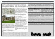
Gate chapels<br />
The chapel of Holy Trinity was located above the East Gate; little more is known. St<br />
Mary's Chapel at Smithgate was recorded in the 1890s. The octagonal building had<br />
two storeys at the time and was owned by the city and leased as a dwelling. Hurst<br />
made a plan of the site and recorded some details. The chapel, restored by T.G.<br />
Jackson, is now part of Hertford College (Hurst 1899: 133).<br />
Gate at Merton College<br />
Excavations in 1986 on the <strong>City</strong> Wall at Merton College revealed a possible blocked<br />
gateway, just west of Fellows Quadrangle (UAD 583). It appears to have existed from<br />
c.1675-1875 as it is not shown on historic maps. Another blocked postern in the<br />
Merton wall is still visible in the meadows. For other possible postern gates, see the<br />
Medieval Assessment.<br />
The Parliamentarian Siegeworks<br />
Headington Hill<br />
De Gomme’s plan of the defences also illustrates a defensive structure on<br />
Headington Hill. The hill was a highly sought after location by both sides during the<br />
war but it was the Parliamentarians who seized control in 1645 and built a series of<br />
substantial earthworks, called the Fairfax Lines (Figure 1), around the Royalist star<br />
work at St Clements (Chandler 1999: 5). The exact location of the Headington fort<br />
and the Parliamentarian defences are difficult to place, however. While de Gomme’s<br />
1644 map is accurate, inside the walls the east suburb is (understandably) not fully<br />
surveyed. It is thus almost impossible to reconcile it precisely with modern maps. A<br />
number of earthworks in South Parks could be related to the Parliamentarian lines<br />
and would benefit from detailed survey, while the reservoir on the crest is likely to<br />
represent the front of the rebels’ stronghold.<br />
Marston<br />
Nos 15-17 Mill Lane, Marston contain elements of the 17th century Manor House<br />
which is reputed to have been used as Fairfax’s headquarters during the siege and<br />
the site where the Treaty for the Surrender of <strong>Oxford</strong> was signed (see Listed Building<br />
description LB4/142).<br />
Miscellaneous finds<br />
A coin hoard from the Civil War period was recovered from Wolvercote (Sutherland<br />
1937). Burial recorded near Donnington Bridge may be related to the siege (OHER<br />
3651). A printed Civil War passport signed by Fairfax, allowing a Royalist soldier to<br />
leave the city after the siege in 1645, was found behind a chimney at 119 High Street<br />
during a building survey in 1993 (Munby 2000).<br />
OXFORD ARCHAEOLOGICAL RESOURCE ASSESSMENT- POST MEDIEVAL<br />
58