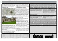
Post-medieval Oxford - Oxford City Council
Post-medieval Oxford - Oxford City Council
Post-medieval Oxford - Oxford City Council

Create successful ePaper yourself
Turn your PDF publications into a flip-book with our unique Google optimized e-Paper software.
At Magdalen College during the Civil War, it is likely that much of the garden layout<br />
was destroyed as the college became the headquarters of the royal ordnance. Not<br />
only were the fully assembled guns stored there, but also the raw materials for their<br />
manufacture and the associated workshops, forges and foundries (Steane 1998: 94).<br />
The Bell Tower was also fortified and used as an observation post. Marks on the 15th<br />
century boundary wall of the Grove is said to relate to Royalist target practice<br />
(Referenced required). A concealed strong room built in the 1630s, later used as a<br />
cess pit, was recorded at the Provosts Lodgings at Oriel College (Hassall 1987: 48).<br />
According to 17th century diarist and historian Anthony Wood, the mound in New<br />
College garden was used as a gun emplacement. Gloucester Hall (later refounded as<br />
Worcester College), was also used as a barracks and then occupied by squatters.<br />
Many of the buildings then fell into disrepair until 1662 when the principal of<br />
Gloucester Hall commissioned many of them to be restored, including the nearby<br />
former royal Beaumont Palace (Stevenson and Salter 1939).<br />
Guard posts<br />
When <strong>Oxford</strong> was fortified during the Civil War, a number of outer guard posts were<br />
constructed. One lay just north of the site of Rewley Abbey. It appears on de<br />
Gomme's map, but no other evidence has been found. Dovers Speare on Addison's<br />
Walk appears on De Gomme's map and there are signs of remains there on Taylor's<br />
Map and the 1st Edition OS map. Some earthworks are still extant (Latterly et al.<br />
1936). The Civil War fortifications around <strong>Oxford</strong> passed to the north of St Giles'<br />
church. De Gomme's map shows a guard post outside the fortifications in line with<br />
the modern Banbury Road. No further evidence has been found.<br />
The <strong>City</strong> Wall and Ditch<br />
By the end of the <strong>medieval</strong> period the <strong>City</strong> Wall had ceased its useful life and was<br />
rarely maintained except where it passed through the colleges which were compelled<br />
to maintain it in their foundation charters (Durham and Halpin 1983: 39). Agas’ map<br />
of 1578 shows vacant land beyond the town wall and not the ditch. However,<br />
excavations along the northern line of the ditch at 39 George Street, Hertford College<br />
and Longwall Street have indicated that the ditch was at least partially re-excavated<br />
during the Civil War period, before being filled in during the late 17th century and built<br />
over (Durham 1983: 39-40). A watching brief in 1984 at Exeter College and at the<br />
Clarendon Building in 2005, have produced further evidence for re-cutting of the ditch<br />
in the 17th century (UAD 484; Mumford 2010)<br />
There is limited evidence of rebuilding and repair to the <strong>medieval</strong> <strong>City</strong> Wall in the<br />
17th century, perhaps associated with the Civil War. Recent investigations at the<br />
Wesley Memorial Church on New Inn Hall Street recorded evidence of repair to the<br />
<strong>City</strong> Wall in the 17th or 18th century with the addition of an internal buttress to the<br />
east (Mumford 2010)<br />
The Castle<br />
The post-<strong>medieval</strong> history of the Castle precinct is summarised in Booth et al. (2003,<br />
367-8). By the 17th century, the castle interior as depicted on a map of c.1617, held<br />
at Christ Church, comprised a Sessions House, the Great Tower, St George’s Tower<br />
with a small gate nearby, at least two further towers and the fortified gate house to<br />
the south. A fortified house and garden called Bagwells house was also recorded<br />
within the complex. The Castle ditch had largely silted up and was bordered on<br />
almost all side by houses (Hassall 1976: 253). The Civil War resulted in the<br />
demolition of much of the surviving structures of the castle by first the Parliamentary<br />
forces and then the Royalist forces (<strong>Oxford</strong> Archaeological Unit 1994a: 4). An early<br />
excavation and survey was carried out by Harris on the Castle mound prior to the<br />
construction of the prison in the 18th century. The evidence, later published by King<br />
OXFORD ARCHAEOLOGICAL RESOURCE ASSESSMENT- POST MEDIEVAL<br />
56