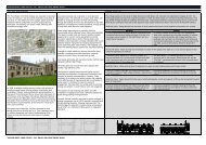
Post-medieval Oxford - Oxford City Council
Post-medieval Oxford - Oxford City Council
Post-medieval Oxford - Oxford City Council

You also want an ePaper? Increase the reach of your titles
YUMPU automatically turns print PDFs into web optimized ePapers that Google loves.
War earthworks on the site (Lattey et al. 1936). Later investigation on the site of the<br />
Geology Department Buildings in 1946 recorded a V shaped ditch and a substantial<br />
bank also thought to be part of the second phase of the defences (UAD 1283). Two<br />
further ditches were recorded in 1970 a short distance to the west in front of the<br />
museum, however, dating evidence was again limited (anon 1971). Investigations at<br />
the Pitt Rivers Museum in 2005 also recorded a substantial east-west aligned ditch<br />
approximately 6.8 metres wide and at least 1.3 metres deep (Leech 2005: 6). The fill<br />
of the ditch suggested deliberate back-filling and although dating evidence was<br />
limited, pottery indicated a date range of 1550-1725. Although the pottery could not<br />
provide a definitive dating for this feature, it was thought likely that it represented part<br />
of the second phase of defences (ibid.: 8). A short distance to the east, another part<br />
of the ditch was recorded during excavations at the University Science Area in 1959.<br />
Here, the ditch was over 8 metres wide and crossed the site on a west-south-west to<br />
east-north-east alignment. Again, dating evidence was limited with a single sherd of<br />
clay pipe recorded from the base of the ditch dated to 1640-1660 (Case and Sturdy<br />
1959: 1001; section published in Bradley and Charles 2005).<br />
Further to the south and east, the outer line of the defences have been decisively<br />
excavated at the Chemistry Research Laboratory site, 2-4 South Parks Road in 2001<br />
(Bradley et al. 2005). The outer ditch was approximately 11 metres wide and 2.4<br />
metres deep. Evidence was found implying the presence of a bank south of the ditch.<br />
Waterlogged plant remains from the lower ditch fills indicated that the ditch would<br />
have contained muddy water and was subject to slow episodic infilling. To the east of<br />
Parks Road, the Outer Line is better understood. One section of bank remains along<br />
the north side of Balliol College Sports Ground, east of Mansfield Road linking the<br />
inner and outer defensive line (Munby and Simons 2005: Fig 14). There are also<br />
signs of a Dovers Speare guard post in the north-east corner of Magdalen College<br />
Deer Park.<br />
To the north of <strong>Oxford</strong>, an earthwork located at the southern end of Port Meadow<br />
next to Binsey Lock has been suggested as either a possible defensive earthwork or<br />
an installation to allow the control of flooding to make the meadow impassable<br />
(Briscoe 2006).<br />
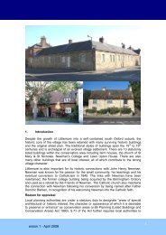
Holywell<br />
To the north-east of Holywell, the line of the first phase of the defences (UAD<br />
Monument No 439) appeared to deliberately exclude the suburb of Holywell following<br />
a dispute between the Crown and Merton College over the cost of enclosing it (Bell<br />
1996: 291). The second, more substantial phase as depicted on Logan’s 1675 map,<br />
included the church and surrounding settlement (UAD Monument 440). A third phase<br />
of the defences comprised a small extension around Holywell (UAD Monument 452).<br />
Evidence for the second phase of the defences at Holywell has been recorded at<br />
Holywell Mill and on St Cross Road. Cartographic and documentary evidence<br />
indicate the mill, as a prime strategic target, would have been heavily defended.<br />
Excavations at the mill recorded a substantial curving ditch back-filled in the 17th<br />
century that may have been part of the early Civil War defences (Bell 1996: 295).<br />
Excavations at New College Sports Ground on St Cross Road recorded a substantial<br />
ditch thought to be a bastion from the second phase of defences around Holywell,<br />
much of which has been preserved beneath the development (Dalton 1999: 4).<br />
Other observations of the outer line<br />
To the east a watching brief at Magdalen College Deer Park in 1983 noted large<br />
post-<strong>medieval</strong> features, probably ditches, but not on the projected alignment of the<br />
defences. The smaller ditch contained late 17th century rubbish. The ditches may be<br />
outliers from the Civil War defences (UAD 478). To the south of the city, aerial<br />
OXFORD ARCHAEOLOGICAL RESOURCE ASSESSMENT- POST MEDIEVAL<br />
54