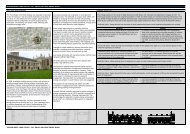
Post-medieval Oxford - Oxford City Council
Post-medieval Oxford - Oxford City Council
Post-medieval Oxford - Oxford City Council

You also want an ePaper? Increase the reach of your titles
YUMPU automatically turns print PDFs into web optimized ePapers that Google loves.
To the north-west, the inner line is poorly understood. A substantial ditch was<br />
recorded at St John’s College’s North Quad in the 1940s. The available finds suggest<br />
it may have been dug in the late 17th century, however, it does not fit well with de<br />
Gomme’s plan of the defences (anon 1943-4). At Keble College, excavations in 1967<br />
recorded a substantial east-west aligned ditch but no dating evidence was recovered.<br />
Later excavations some distance to the south in 1971 failed to record evidence for<br />
the defences along the projected line (anon 1972: 239, 248).<br />
East of Parks Road the inner line is better understood, with surviving stretches of<br />
bank and better cartographic sources. At Rhodes House, South Parks Road,<br />
investigations in 1979 noted several plough-soils at the bottom of a substantial bank<br />
but no conclusive dating evidence was recovered (UAD 542). The ditch of the inner<br />
defensive line was noted at Mansfield College in 1959 (UAD 1282) and subsequently<br />
in 1992 an excavation at Mansfield College recorded a large ditch at least 7 metres<br />
wide and 2 metres deep running parallel to the extant inner line Civil War bank (Bell<br />
1993d; Durham 1994; <strong>Oxford</strong> Archaeological Unit 1992). Sections were drawn of the<br />
ditch and rampart during a subsequent watching brief (Mumford 2006). The inner line<br />
was also decisively identified during further excavations at Mansfield College<br />
between 1998 and 1999 (Booth and Hayden 2000). The full dimensions of the ditch<br />
were not recorded. A parallel gull and line of post-holes may have formed part of an<br />
additional defensive barrier (ibid.: 306). A ditch recorded at the college in 2006 on the<br />
same alignment, a short distance to the south of this site may have been a<br />
continuation of the inner defences, however no dating evidence was recovered (Sims<br />
2006: 3).To the east of Mansfield Road, investigations at the University Clubhouse in<br />
2003 recorded a further 23 metre section of a substantial ditch some 5.8 metres wide<br />
and 1.35 metres deep on an east-west alignment with a parallel bank surviving as an<br />
earthwork on the south side (Brossler 2003: 4).<br />
Further east, a substantial ditch was recorded during the excavation of cellars at<br />
Jowett Walk in 1943-4 along the line of the first phase of the defences (Case and<br />
Sturdy 1960: 134). An evaluation at Balliol College Master's Field, Jowett Walk, in<br />
1994 recorded a large north-east-south-west ditch c.2 metres wide and 1.5 metres<br />
deep. Two sherds of 17th century pottery were found in the top of the fill. The<br />
alignment of the ditch does not conform to Logan’s or De Gomme’s plan of the<br />
defences, however it may form part of a bastion (Bell 1994: 7.1, 8.1).<br />
The outer line<br />
On the western side of town, a large ditch and parallel bank of a probable 17th<br />
century date (and shown on Loggan) was recorded in front of the <strong>Oxford</strong> Station in<br />
1999. Here, the watching brief recorded a 20 metre section of the ditch on a northsouth<br />
alignment, approximately 12 metres wide and at least 2 metres deep; it also<br />
had a bank on the interior west side (Grundon 2000). The western defences also<br />
incorporated the north and west arms of the moat around the site of Rewley Abbey.<br />
Trial trenching on the site of Rewley Abbey in 1994 uncovered a 5 metre wide ditch;<br />
a single course of roughly laid limestone pieces ran along the northern edge of the<br />
ditch; the feature may be associated with a sconce depicted on de Gomme's map<br />
(Munby et al. 2007: 31-3).<br />
To the north of the town, a large quarry pit on the site of Acland Hospital that<br />
produced 17th century finds has been suggested as a possible remnant of the outer<br />
defensive line (<strong>Oxford</strong> Archaeology 2009). To the east, excavations during<br />
construction of the Clarendon Laboratory in 1872 noted traces of a ditch about 9<br />
metres wide and 3 metres deep. A 1908 map shows three ditches below the<br />
Townsend Laboratory, with some sections. The central ditch is larger than the others.<br />
It is not certain whether the ditch seen in 1872 was one of those drawn (UAD 739).<br />
Building work at the University Museum 1855-60 noted the possible presence of Civil<br />
OXFORD ARCHAEOLOGICAL RESOURCE ASSESSMENT- POST MEDIEVAL<br />
53