Post-medieval Oxford - Oxford City Council
Post-medieval Oxford - Oxford City Council
Post-medieval Oxford - Oxford City Council

Create successful ePaper yourself
Turn your PDF publications into a flip-book with our unique Google optimized e-Paper software.
Raised causeways across the marshy areas of the district have been recorded at<br />
Cowley Marsh in 1605, and at Wolvercote Common (<strong>Oxford</strong> Archaeological Unit<br />
1998: 2). Botley Causeway was built in the 16th century to improve the western route<br />
into <strong>Oxford</strong>. Before then there was perhaps a proper road only as far as St<br />
Frideswide's Bridge. A stone causeway followed the line of Botley Road with timber<br />
bridges over the various streams and river channels (VCH iv). No archaeological<br />
evidence has been found to date for this early causeway (UAD 575). By the late 18th<br />
century, the road was in poor condition, and following its turnpiking, improvements<br />
were carried out. A stone bridge was built on the site of the modern St Frideswide's<br />
Bridge in 1674 althought it is unclear how the Osney ditch was crossed prior to this<br />
date. In the 18th century, after turnpiking, a seven-arched structure was erected<br />
(VCH iv). Some evidence of earlier structures was seen during work on the present<br />
bridge (UAD 383) and a stone vault, possibly from a bridge, was seen at West <strong>Oxford</strong><br />
Community Centre in 1999 (UAD 450).<br />
Turnpikes<br />
A number of turnpikes were created around <strong>Oxford</strong>, the most successful being St<br />
Clements. Much of the turnpike infrastructure has been demolished and only a few<br />
toll houses remain. Until the London Road Turnpike was opened in 1775, the original<br />
London Road followed a different alignment turning right at Cheney Lane and<br />
heading up the steep slope over Shotover Hill (Bloxham and Shatford 1996: 63). The<br />
historic route to Eynsham also went over Wytham Hill.<br />
Trust Road Date<br />
<strong>Oxford</strong> Mileway 1567<br />
Hinksey Road Hinksey Road, formerly Berkshire 1755<br />
Botley, Newlands 1767<br />
St Clements St Clements including Magdalen Bridge 1771<br />
London Road Through Headington 1775<br />
Table 5: Turnpike Trusts in <strong>Oxford</strong> District<br />
Toll Houses<br />
The Abingdon Road was turnpiked in 1756, and a toll house was erected on the<br />
south side of Folly Bridge, rebuilt in 1815-27. After the railway to Grandpont was<br />
opened in 1844, the toll house was moved to the north side where it still stands. The<br />
turnpike ended in 1867 (VCH iv). A turnpike for Botley Causeway was set up in 1767.<br />
The original toll house was demolished in 1850 when the railway line from Banbury<br />
was established. The new toll house, which operated until 1868, survives as part of<br />
the Old Gatehouse (later a public house) (VCH iv). In 1771, a toll house was built<br />
immediately west of the old St Clements Church at the Plain when the road was<br />
turnpiked under the Mileway Act. Gates extended across the roads from Headington<br />
and Cowley. The trust was wound up in 1868, but the toll house survived until 1899<br />
when the Victoria Fountain was built (VCH iv).<br />
Boundary stones<br />
The Local Board District Map of the 1880s marks 21 boundary stones around the<br />
district, and many of these survive. A 1562 reference to a boundary stone at<br />
Wolvercote suggests that some of the stones were established by the 16 th century, if<br />
not before. Milestones were also added following the ‘mileways’ ordered by Act of<br />
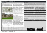
Parliament in 1576. Examples of a <strong>City</strong> Boundary Stone on Banbury Road and<br />
Mileway stone at Iffley are illustrated by Sturdy (2004: 128-9).<br />
OXFORD ARCHAEOLOGICAL RESOURCE ASSESSMENT- POST MEDIEVAL<br />
29