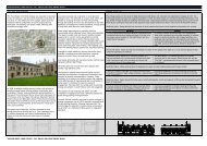
Post-medieval Oxford - Oxford City Council
Post-medieval Oxford - Oxford City Council
Post-medieval Oxford - Oxford City Council

You also want an ePaper? Increase the reach of your titles
YUMPU automatically turns print PDFs into web optimized ePapers that Google loves.
Transport and communication<br />
A system of <strong>medieval</strong> high roads ran through Carfax; the east-west route from<br />
London, <strong>Oxford</strong>, and on to Gloucester; and a north-south route from Southampton<br />
through Winchester, to <strong>Oxford</strong> and on to Banbury and the Midlands. There were<br />
other, earlier routes such as the Portway on the east side of the Cherwell and a<br />
network of lesser roads connecting the local market towns with <strong>Oxford</strong> (Rhodes<br />
2006). A number of improvements to the existing roads were undertaken under the<br />
Mileways Act of 1576. Stage coaches arrived in <strong>Oxford</strong> in the 1660s.<br />
Road transport was particularly important in the 16th century because of the poor<br />
quality of navigation along the Thames, which was not improved until the early 17th<br />
century. Consequently, Henley, not <strong>Oxford</strong>, remained the most significant river port<br />
for <strong>Oxford</strong>shire, exporting firewood, Chiltern timber, timber products, and malt to<br />
<strong>Oxford</strong> (Plot 1677). Recent studies suggest that imports and exports were transshipped<br />
from there to <strong>Oxford</strong>, by road or by river (Prior 1982; Peberdy 1996). The<br />
17 th improvements to navigation along the Thames to <strong>Oxford</strong> was important for the<br />
export of Headington Stone and the import of coal (Rhodes 2006). For example, the<br />
new telescopes for the Radcliffe Observatory were brought from London by water in<br />
1773. In 1790, the <strong>Oxford</strong> Canal was opened connecting with Coventry and London<br />
and remained important for the importing of coal and building materials and exporting<br />
agricultural and industrial product. The Thames remained as the onward link from the<br />
canal system to London. (Bloxham and Bond 1981; Hadfield 1970).<br />
The road network and bridges<br />
The insertion of New Road in 1769 was the first major alteration to the <strong>medieval</strong><br />
street plan undertaken in response to improvements along the new turnpike road<br />
from <strong>Oxford</strong> to Witney (Munby and Walton 1990: 123). It cut through the Castle<br />
precinct and the base of the motte. Pacey's Bridge was then constructed to continue<br />
the route westward. This was a single arched bridge over the Castle Mill Stream. It<br />
was widened in 1856 and rebuilt as a flat structure in 1922 (VCH iv). The original<br />
bridge was drawn by Malchair (Minn 1943-4).<br />
A number of changes to the urban and suburban street network, primarily through the<br />
actions of the colleges, are recorded in documentary sources. At St Aldates, the<br />
network of streets adjacent to the former St Frideswide’s was removed and a new<br />
street (now called Blue Boar Street) was built as a replacement while Kybald Street<br />
was gated by Corpus Christi in 1567, and the lane between Corpus and Christ<br />
Church closed by the former in 1606 (VCH iv: 85).<br />
Road Date<br />
Brasenose Lane 1579 Gated<br />
Road west of Smith Gate 1612 Blocked<br />
Kepeharm Lane 1606 Closed<br />
Turl Street 1551 Gate made in <strong>City</strong> Wall<br />
Broad Street 17th century Street developed<br />
George Street 17th century Street developed<br />
Table 4: Changes to the road network<br />
Magdalen Bridge was rebuilt in the late 18<br />
OXFORD ARCHAEOLOGICAL RESOURCE ASSESSMENT- POST MEDIEVAL 28<br />
th century as part of the improvements<br />
along the eastern road initiated by the Paving Commission of 1771. This involved the<br />
demolition of a substantial number of properties in St Clements to accommodate the<br />
new bridge structure. A bridge had been in this location since the <strong>medieval</strong> period at<br />
least, and past incarnations had included a wooded trestle construction, possibly<br />
similar in design to a drawbridge and a later stone bridge that collapsed in 1772<br />
(Jaine 1971: 9).