Post-medieval Oxford - Oxford City Council
Post-medieval Oxford - Oxford City Council
Post-medieval Oxford - Oxford City Council

Create successful ePaper yourself
Turn your PDF publications into a flip-book with our unique Google optimized e-Paper software.
however, the extent of modern disturbance made any further investigation into the<br />
site impossible.<br />
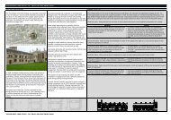
Nixon's Free Grammar School<br />
Nixon's Free Grammar School opened in 1659 behind the Guildhall (Loggan's Map of<br />
<strong>Oxford</strong> 1673). It was established by John Nixon, a former mayor. The school closed<br />
in 1894 (VCH iv). The building was demolished for the new Town Hall (UAD 148),<br />
although the gateway was moved to 94 Woodstock Road (UAD 1284).<br />
Legal and penal administration<br />
During the early post-<strong>medieval</strong> period, the centre of County Administration remained<br />
at the Castle, where the Sheriff held courts and the assizes met. The sheriff’s hall or<br />
shire hall was abandoned after an outbreak of gaol fever known as the ‘Black<br />
Assizes’ in 1577 when the courts were transferred to the <strong>Oxford</strong> Guildhall and the<br />
Castle site sold to Christ Church, with the agreement that it should remain in use as<br />
the prison. The ruins of the shire hall survived (and remained in use for the hustings<br />
at county elections); and parts of its structure may have been encountered during the<br />
1999-2005 Castle precinct excavations (Poore,Norton and Dodd 2009: 14). Following<br />
the demolition of the old gildhall in 1750, a joint town and shire hall was built in St<br />
Aldates. A separate County Hall was built in the Castle in 1841.<br />
Castle prison<br />
By the 14 th century, the Castle was already primarily used as a prison comprising of<br />
buildings in the western part of the precinct near St George’s Tower. Formalised by<br />
Act of Parliament in 1531, the Castle became the county gaol. Loggan’s map of 1675<br />
depicts several enclosed areas near the Tower. Conditions in the prison were<br />
sufficiently bad to warrant a major phase of rebuilding in the late 18 th century when<br />
the old structures were largely removed. The prison was almost completely rebuilt in<br />
the 1780s, to a three block pavilion plan designed by William Blackburn. The<br />
buildings were located to the south of the Castle motte comprising a central structure<br />
and two separate wings to the north-east, adjoining St George’s Tower and southwest<br />
enclosed by a wall with the gatehouse to the north (Brodie et al. 2002: 49-50).<br />
Archaeological investigations at Borehams Yard (UAD 378) recorded evidence for<br />
the foundations of the 18 th century prison wall (Booth et al. 2003). A section of the<br />
wall some 12 metres in length was exposed and recorded as truncating much of the<br />
earlier <strong>medieval</strong> deposits (ibid.: 391). Recent archaeological investigations at the<br />
Castle between 1999 and 2004 (Norton 2006a) have revealed evidence for the<br />
prison including a number of 16 th -18 th century inhumations within the castle ditch<br />
immediately east of the mound (ibid.: 12). The investigations recorded a total of 64<br />
post-<strong>medieval</strong> inhumations close to the location of the gallows, with evidence for their<br />
use by the university anatomists.<br />
The Bocardo Prison<br />
The town prison, known as the Bocardo, was located at the Northgate from at least<br />
13th century onwards and demolished in 1771. Foundations which are likely to<br />
belong to the structure were located during excavations in 1906 and 1998 (Salter<br />
1912; <strong>Oxford</strong> Archaeological Unit 2001c; Booth 1999). The gate and prison are<br />
depicted in a drawing by John Malchair in 1771 (UAD 63).<br />
<strong>City</strong> goal, Gloucester Green<br />
A new town prison was built at Gloucester Green c.1789, although this failed to<br />
maintain good conditions and various improvements were made in the mid-19 th<br />
century. The octagonal prison building was surrounded by a substantial 6 metre high<br />
wall, the remains of which were seen during a watching brief in 1987. The watching<br />
OXFORD ARCHAEOLOGICAL RESOURCE ASSESSMENT- POST MEDIEVAL<br />
26