CONSERVATION AREA STATEMENT - Stroud District Council
CONSERVATION AREA STATEMENT - Stroud District Council
CONSERVATION AREA STATEMENT - Stroud District Council

You also want an ePaper? Increase the reach of your titles
YUMPU automatically turns print PDFs into web optimized ePapers that Google loves.
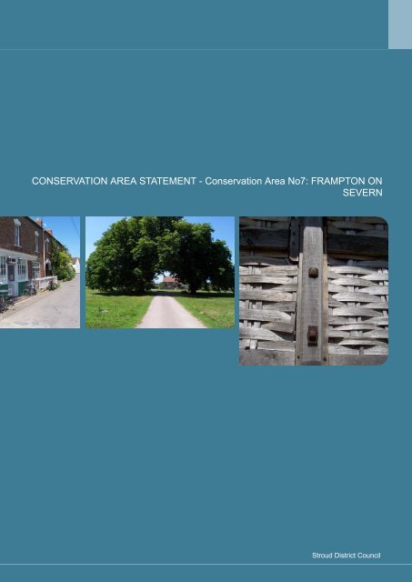
<strong>CONSERVATION</strong> <strong>AREA</strong> <strong>STATEMENT</strong> - Conservation Area No7: FRAMPTON ON<br />
SEVERN<br />
<strong>Stroud</strong> <strong>District</strong> <strong>Council</strong>
1<br />
2<br />
3<br />
<strong>CONSERVATION</strong> <strong>AREA</strong> <strong>STATEMENT</strong> - Conservation Area No7: FRAMPTON ON SEVERN<br />
PART I: INTRODUCTION<br />
What is a Conservation Area?<br />
Purpose of this document<br />
The Frampton on Severn Study Area<br />
PART II: ANALYSIS<br />
The Analysis of Character<br />
HISTORY OF FRAMPTON ON SEVERN<br />
Origins of the Settlement<br />
Expansion and development of Frampton on Severn<br />
FRAMPTON ON SEVERN IN ITS SETTING<br />
Geology<br />
Topography and landscape<br />
Approach routes and views<br />
THE BUILT ENVIRONMENT<br />
The Buildings<br />
The Spaces<br />
Sub Areas in Frampton on Severn Study Area<br />
SUB <strong>AREA</strong> 1: CHURCH END<br />
Origins and evolution of the built environment<br />
Uses<br />
The Buildings in Sub Area 1: Church End<br />
The Spaces in Sub Area 1: Church End<br />
SUB <strong>AREA</strong> 2: THE STREET<br />
Origins and evolution of the built environment<br />
Uses<br />
The Buildings in Sub Area 2: The Street<br />
The Spaces in Sub Area 2: The Street<br />
SUB <strong>AREA</strong> 3: THE GREEN<br />
Origins and evolution of the built environment<br />
Uses<br />
The Buildings in Sub Area 3: The Green<br />
The Spaces in Sub Area 3: The Green<br />
SUB <strong>AREA</strong> 4: THE OVAL<br />
Origins and evolution of the built environment<br />
The Buildings in Sub Area 4: The Oval<br />
The Spaces in Sub Area 4: The Oval<br />
SUB <strong>AREA</strong> 5: THE CANAL<br />
Origins and evolutions of the built<br />
The Buildings in Sub Area 5: The Canal<br />
The Spaces in Sub Area 5: The Canal<br />
THE CHARACTER OF FRAMPTON ON SEVERN: A SUMMARY<br />
Form and Spaces<br />
Setting, views and landscapes<br />
Materials, historical and architectural features<br />
5<br />
5<br />
5<br />
6<br />
7<br />
7<br />
8<br />
8<br />
8<br />
10<br />
11<br />
11<br />
13<br />
14<br />
15<br />
15<br />
16<br />
17<br />
17<br />
17<br />
17<br />
24<br />
26<br />
26<br />
27<br />
28<br />
31<br />
33<br />
33<br />
34<br />
35<br />
40<br />
43<br />
43<br />
44<br />
46<br />
47<br />
47<br />
48<br />
50<br />
52<br />
52<br />
53<br />
55<br />
<strong>Stroud</strong> <strong>District</strong> <strong>Council</strong>
<strong>CONSERVATION</strong> <strong>AREA</strong> <strong>STATEMENT</strong> - Conservation Area No7: FRAMPTON ON SEVERN<br />
4<br />
5<br />
PART III: STRATEGY<br />
A REVIEW OF THE <strong>CONSERVATION</strong> <strong>AREA</strong> BOUNDARY<br />
New additions<br />
PROPOSALS FOR THE PRESERVATION AND ENHANCEMENT OF THE <strong>CONSERVATION</strong><br />
<strong>AREA</strong><br />
Defining issues and pressures<br />
Policy and Design Guidance<br />
Buildings at Risk<br />
LISTED BUILDINGS<br />
TREES<br />
THE PROTECTION OF UNLISTED BUILDINGS<br />
BREACHES OF PLANNING CONTROL AND ENFORCEMENT<br />
MAPS<br />
Bibliography<br />
<strong>Stroud</strong> <strong>District</strong> <strong>Council</strong><br />
60<br />
60<br />
60<br />
60<br />
62<br />
63<br />
65<br />
66<br />
66<br />
66<br />
71<br />
72<br />
79
1 PART I: INTRODUCTION<br />
What is a Conservation Area?<br />
The legal definition of a Conservation Area is set out in Section 69 of the Planning (Listed Buildings and<br />
Conservation Areas) Act 1990 (herein after called ‘the Act’), as being:<br />
“an area of special architectural or historic interest, the character or appearance of which it is desirable to preserve<br />
or enhance”.<br />
Conservation Areas are primarily concerned with the built environment. They are not appropriate as a means of<br />
protecting landscape features, except where they form an integral part of the historic built environment.<br />
Purpose of this document<br />
<strong>CONSERVATION</strong> <strong>AREA</strong> <strong>STATEMENT</strong> - Conservation Area No7: FRAMPTON ON SEVERN<br />
The Act requires Planning Authorities to review their Conservation Areas from time to time. This is the main function<br />
of this document. Within <strong>Stroud</strong> <strong>District</strong>, there are 42 Conservation Areas, some of which were first designated over<br />
30 years ago, and the approach to designation has changed greatly in this time.<br />
Firstly, Planning Authorities are now required, in carrying out their planning functions, to “pay special<br />
attention to the desirability of preserving or enhancing the character or appearance of the Conservation<br />
Area” (Section 72 of the Act).<br />
Secondly, Planning Authorities should publish proposals for the preservation and enhancement of their<br />
Conservation Areas (Section 71 of the Act).<br />
In this review, we aim to identify what makes up the “special interest” of Frampton on Severn and to analyse and<br />
define its “character and appearance”. This will provide a firm basis for planning decisions within the Conservation<br />
Area, based on Development Plan policies.<br />
<strong>Stroud</strong> <strong>District</strong> <strong>Council</strong><br />
5
6<br />
<strong>CONSERVATION</strong> <strong>AREA</strong> <strong>STATEMENT</strong> - Conservation Area No7: FRAMPTON ON SEVERN<br />
It also provides the groundwork for the preparation of policies and proposals intended for the preservation or<br />
enhancement of the area. These policies may be aimed at specific sites within the Conservation Area, or more general<br />
guidance relevant to the whole Conservation Area, such as the use of appropriate materials.<br />
This Conservation Area Statement will become Supplementary Planning Advice (SPA) for <strong>Stroud</strong> <strong>District</strong> <strong>Council</strong>.<br />
As such, it will be used by the Planning Authority in conjunction with other Planning Policy and Guidance documents.<br />
Further policy information on the historic built environment can be found in:<br />
PPG15 (Planning Policy Guidance): Planning and the Historic Environment<br />
<strong>Stroud</strong> <strong>District</strong> Local Plan (As adopted November 2005)<br />
Guidance relating to sensitive, locally distinctive development can also be found in the <strong>Stroud</strong> <strong>District</strong> SPG Residential<br />
Design Guide (published November 2000).<br />
The Frampton on Severn Study Area<br />
Frampton on Severn Conservation Area (No. 7) was first designated in November 1975. In this review, we will be<br />
looking at the existing Conservation Area and the land immediately adjacent to it, to see if it is appropriate to amend<br />
the boundaries of the Conservation Area.<br />
The study area and the existing Conservation Area boundaries are shown on Map 1.<br />
<strong>Stroud</strong> <strong>District</strong> <strong>Council</strong>
2 PART II: ANALYSIS<br />
The Analysis of Character<br />
<strong>CONSERVATION</strong> <strong>AREA</strong> <strong>STATEMENT</strong> - Conservation Area No7: FRAMPTON ON SEVERN<br />
The aim of this section of the Conservation Area Statement is to define what makes up the special interest or<br />
‘character’ of the study area, in order that this may be preserved and enhanced. Although the character of an<br />
area may be very obvious in visual terms, it is about much more than just appearance. History, geography, use<br />
and appearance are usually intricately and inextricably linked in the evolution of any settlement, and in the<br />
creation of its character.<br />
The origins of a settlement and what has happened to it in the past are often still evident in its current state.<br />
Its history can tell us more than simply the date of its buildings: The changing economic fortunes of an<br />
area, important historical events and individual patrons or developers may have played a role in shaping<br />
tastes and styles, as well as influencing the extent of expansion.<br />
Current or former uses often have implications for the shapes, sizes and types of buildings that are created,<br />
and their massing and relationships to each other. Uses can also create distinctive sounds or smells, adding<br />
‘life’ to the built form.<br />
The origins and evolution of a settlement may frequently be dependent on its setting and location: these<br />
may have suggested a particular industrial, defensive or cultural role, for example. Furthermore, the location<br />
almost always dictates the types of materials and building traditions that prevail.<br />
The visual appearance of an area is often the cumulative effect of many influences. The appearance is<br />
frequently the aspect that most people relate to in terms of defining what is of special interest and worth<br />
preserving or enhancing. The appearance may be made up of locally typical buildings, or structures of<br />
great architectural importance.<br />
<strong>Stroud</strong> <strong>District</strong> <strong>Council</strong><br />
7
8<br />
<strong>CONSERVATION</strong> <strong>AREA</strong> <strong>STATEMENT</strong> - Conservation Area No7: FRAMPTON ON SEVERN<br />
HISTORY OF FRAMPTON ON SEVERN<br />
Origins of the Settlement<br />
It is probable that the position of the first settlement at Frampton on Severn was chosen because it was one of the<br />
few dry spots in the swampy meeting point of the rivers Severn, Cam and Frome.<br />
Evidence of prehistoric occupation, particularly during the Bronze Age, has been found in the fields and gravel pits<br />
around the village, and it is likely that people continued living there on through the Iron Age and well into the Roman<br />
period. Unfortunately, most of the archaeological evidence for the earlier phases of the settlement was lost during the<br />
extraction of the gravel on which they sat.<br />
The village of Frampton on Severn, as we know it, is ancient. It was already in existence by the Domesday survey of<br />
1086, when it was named ‘Frantone.’ By 1180, it had become ‘Framton’ and the ‘on Severn’ seems to have been in<br />
usage by 1279. The village is clearly medieval at heart, growing up from Church End, where dwellings clustered<br />
around the community’s focal points of the church (pre-dating the present St Mary’s, which was built in the 14th<br />
century), a farm and a manor house, which stood on the site into the 19th century. Scattered, outlying farmsteads<br />
surrounded the core hamlet. At this stage, Frampton was reached by a lane that ran from opposite the current<br />
Frocester junction on the A38, entering the village along what is now Vicarage Lane.<br />
Expansion and development of Frampton on Severn<br />
In pre- historic times, the inconvenience of living in the river marshes was almost certainly outweighed by the vital<br />
transport links provided by the nearby navigable waterways. The settlement’s proximity to the Frome and the Severn<br />
estuary placed it on far-flung trade and communication routes.<br />
Even though the earliest known actual record of maritime activity at Frampton was in 1377, when a Frampton ship<br />
was trading between Bristol and Ireland, it is likely that the rivers were used for transport and travel since the earliest<br />
times. Maritime links were a strong element in the community for many more centuries.<br />
A deep basin on the riverside, known as Frampton Pill (actually the mouth of the River Cam), allowed the mooring of<br />
quite large sea- going boats close to the village, but the Severn was often dangerous to navigate and treacherous for<br />
general shipping. In order to create safe, regular passage to the thriving inland port of Gloucester, the Gloucester and<br />
Berkeley Canal was constructed, running more or less parallel to the river: it opened in 1827.<br />
Frampton on Severn expanded and became home to many who plied their trades on the river and canal: there was<br />
a boatyard at Frampton Pill until the late 19th century.<br />
<strong>Stroud</strong> <strong>District</strong> <strong>Council</strong>
<strong>CONSERVATION</strong> <strong>AREA</strong> <strong>STATEMENT</strong> - Conservation Area No7: FRAMPTON ON SEVERN<br />
Historically, though, the majority of the population worked in agriculture. The flood- prone land around Frampton on<br />
Severn was best suited to the grazing of animals and the cultivation of orchards; however, arable crops were grown,<br />
too.<br />
At the beginning of the 16th century the main village industry, apart from agriculture, was connected with cloth<br />
manufacture. The manufacture of cloth has been an integral part of the <strong>Stroud</strong> area’s history and Frampton played<br />
its part. There was already a mill in Fromebridge at time of the Domesday survey, probably originally used for grinding<br />
corn, but evidence suggests that it was in use as a fulling mill by the mid 14th century.<br />
Frampton seems to have lost its place in the cloth industry before the (largely) boom times of the late 18th and 19th<br />
centuries; by 1775 Fromebridge Mill had become one of the biggest wire-works in the country, producing wire for use<br />
in carding and fishhooks. Where once weavers and cloth finishers featured prominently, the 19th century saw a greater<br />
part of the population, (excluding those employed on the river and in agriculture), supported by trade and other types<br />
of manufacture. The village was almost self-sufficient. Goods that could not be grown or made were generally bought<br />
at the twice-weekly canal borne outings to the market in Gloucester.<br />
Among the various trades and industries that flourished around Frampton, were those that exploited the natural<br />
resources of the area. Clay was extracted, chiefly for use in brick and tile manufacture. A brickyard and limekiln were<br />
in use in 1782, and Frampton brick-makers were recorded in the mid 19th century, although it is likely that the industry<br />
had been practiced for generations. In spite of the fact that the high proportion of salt in the clay made the bricks<br />
rather unsatisfactory and prone to failure, many of the buildings in Frampton were constructed using this most local<br />
of materials.<br />
The gravel on which the village sits was already being dug by 1646 and its extraction steadily increased throughout<br />
the 18th and 19th centuries to the point that, in 1879, the gravel pits could be described as being ‘ fairly large’. They<br />
were greatly extended in the early 20th century when much of the gravel was taken by canal to Avonmouth and used<br />
in the building of the docks.<br />
Extraction continues in the area, although on a much reduced scale. The railway that once took the gravel for shipment<br />
to Sharpness has long been dismantled and the gravel pits have flooded; some are now in use for water sports.<br />
A major employer came to Frampton in 1916, with the establishment of the Cadbury’s factory by the canal. Ground<br />
cocoa beans and sugar were blended with locally produced milk and then baked to form ‘chocolate crumb.’ This was<br />
put into sacks and taken by boat along the Gloucester- Sharpness, and Birmingham and Worcester canals to the<br />
main Cadbury works at Bournville for final processing into milk chocolate.<br />
The continuing employment ensured that the Frampton on Severn did not stagnate. The Rural <strong>District</strong> <strong>Council</strong> built<br />
200 new houses to the north of the Green in the mid 20th century and the village has continued to expand since, even<br />
after the closure of the Cadbury’s factory in 1983. (Its site is now occupied by several businesses).<br />
<strong>Stroud</strong> <strong>District</strong> <strong>Council</strong><br />
9
10<br />
<strong>CONSERVATION</strong> <strong>AREA</strong> <strong>STATEMENT</strong> - Conservation Area No7: FRAMPTON ON SEVERN<br />
In spite of the fact that the village has lost several shops in the last few decades, it retains a strong community identity<br />
in the face of an increase in visitor numbers.<br />
No history of Frampton on Severn is complete without the mention of one family in particular. The stories of the<br />
Cliffords and Frampton on Severn have now been entwined for over 900 years.<br />
Prior to the Norman Conquest, a Saxon, Ernesi, held the Frampton Estate, but by 1086, records show that it was held<br />
by a Norman, Drogo Fitz Pons, who was granted the estate by William the Conqueror, presumably as a reward for<br />
services rendered. Pons’ heir was Walter, the Lord of Clifford Castle in Herefordshire. Walter took the name ‘de<br />
Clifford’ and the Cliffords have remained custodians of the Estate ever since.<br />
The most illustrious member of the Clifford family was Walter de Clifford’s daughter, Jane, who was reputedly born<br />
at Manor Farmhouse in 1144. She was famed for her beauty and became long-time mistress to Henry II, the father<br />
of King Richard ‘the Lionheart’ and ‘Bad’ King John.<br />
Henry called Jane ‘Rosa Mundi’, ‘Rose of the World’; legend has since renamed her 'Fair Rosamund'. Many stories,<br />
some possibly true, have been woven around her.<br />
Unfortunately, the earliest part of Manor Farmhouse, ‘Rosamund’s Bower’, dates from no earlier than the 16th century,<br />
sadly precluding her being born there, but, even so, her links with Frampton have long been celebrated. Since 1651,<br />
the famous 22-acre, 1 ½ miles long, village green has been known as 'Rosamund's Green'.<br />
FRAMPTON ON SEVERN IN ITS SETTING<br />
The landscape and geology of the Frampton on Severn area has impacted on the character of the settlement in a<br />
number of ways, from the types of building materials most easily sourced, to the types of industries that developed.<br />
In visual terms, the surrounding landscape influences the first impressions gained on approach to the village, and the<br />
local topography forms a significant component of views and vistas into and out of the settlement.<br />
<strong>Stroud</strong> <strong>District</strong> <strong>Council</strong>
Geology<br />
Between 140 and 200 million years ago, in the Lower Jurassic period, the site of Frampton on Severn was submerged<br />
in a warm, shallow, muddy sea, home to millions of small creatures and micro- organisms. Slowly, over generations,<br />
the tiny shells and micro-skeletons of dead sea creatures fell to the bottom of the sea bed, piling up in layers among<br />
accumulated silt.<br />
As time went on, the climate changed and the sea receded. The layers, or strata, of shells and silt dried out, compacted<br />
and hardened, forming blue lias limestone.<br />
Prey to the strong tides of the Severn, and the changing courses of its tributary rivers, the newly exposed land was<br />
prone to successive, frequent flooding. With time, the stone was overlaid by clays and gravel shelves created from<br />
material swept downstream from the hills. It is these deposits that have had the most influence on the topography<br />
and, later, the settlement patterns of the Vale.<br />
Topography and landscape<br />
<strong>CONSERVATION</strong> <strong>AREA</strong> <strong>STATEMENT</strong> - Conservation Area No7: FRAMPTON ON SEVERN<br />
Frampton on Severn sits adjacent to a great looping bend of the River Severn. The relatively impermeable clay<br />
underlying the Severn Vale keeps groundwater on the surface and has not allowed the river’s tributaries to cut deep<br />
beds. As a result, the Vale has remained broad and shallow. The land immediately around the Frampton on Severn<br />
is largely flat and low-lying, dominated by the sky.<br />
Originally, Frampton would have been surrounded by extensive areas of marsh and scrubby woodland, however, the<br />
building of networks of drainage ditches, now edged with willow, elder bushes and alder trees, has made the flood<br />
prone land suitable for the grazing of cattle and sheep, and the raising of crops. It remains overwhelmingly rural.<br />
<strong>Stroud</strong> <strong>District</strong> <strong>Council</strong><br />
11
12<br />
<strong>CONSERVATION</strong> <strong>AREA</strong> <strong>STATEMENT</strong> - Conservation Area No7: FRAMPTON ON SEVERN<br />
The Enclosure Acts of the 18th century created a patchwork of meadows and small fields, yet there is little sense of<br />
constraint. Because of the lack of stone in the Vale, the fields are not divided by prominent walls, but rather by soft,<br />
low hedgerows, often hawthorn, punctuated by larger trees. Quiet, grass verged, lanes, tracks and paths, free from<br />
brash coloured signage and markings, often run alongside the historic field boundaries. The hedgerows give a strong<br />
shape and pattern to the landscape, but do not break up the wider views of the distant Cotswold escarpment, and,<br />
on the other side of the River Severn, the Forest of Dean and beyond.<br />
Trees are one of the most important elements in Frampton on Severn. The grand statement specimen trees in the<br />
manicured grounds of the Court’s parkland, echoed by artfully planted groupings on the Green, contrast with the many<br />
low key, naturalistic orchards. The tunnel of trees along the Perry Way makes the huge, open expanse of the Green<br />
all the more impressive. The chestnut avenue, known as the Narles, which leads through open ground and past<br />
orchards, to the church, is high among Frampton’s treasures.<br />
Water is another defining characteristic of the village. Rivers aside, much of the waterscape of Frampton on Severn<br />
is entirely manmade.<br />
Most famous are the three ponds on The Green, a result of extensive 18th century drainage works. Frampton Court's<br />
ornamental canal was created out of pure frivolity, whilst the Berkeley- Gloucester canal emerged out of necessity.<br />
The canal is strident in the landscape. It cuts a straight, highly engineered, line between the village and the river. At<br />
certain points it is raised on an embankment, and provides one of Frampton’s many quirky sights- boats floating along<br />
against the skyline.By contrast, over 40 hectares of the former gravel works have now been flooded into lakes, looking<br />
as though they have always been there.<br />
<strong>Stroud</strong> <strong>District</strong> <strong>Council</strong>
Approach routes and views<br />
<strong>CONSERVATION</strong> <strong>AREA</strong> <strong>STATEMENT</strong> - Conservation Area No7: FRAMPTON ON SEVERN<br />
Frampton on Severn, being set away from the main transport routes of the M5 and the A38, retains an air of timeless<br />
remoteness. The main approach route to the village is now the Perry Way, a lane that the Romans once marched<br />
along on their way to the Severn.<br />
The tree-lined road allows no long- range views into the village, therefore the sudden appearance of the imposing<br />
Bell Inn straight ahead is something of a surprise.<br />
It is a change in the quality of light, as much as anything, that takes the eye away from the road and towards the wideopen<br />
space of the Green. Its expansiveness is almost a shock after the constrained, high hedged, tree-lined Perry<br />
Way.<br />
The view down the Green is perhaps one of Frampton’s finest. At first, it is difficult to take in anything other than the<br />
field- like space, punctuated by groups of mature trees and, in the change of vegetation, the hint of the ponds. The<br />
road, being unmarked, scarcely intrudes on the view other than as vanishing line, almost like an artist's exercise in<br />
perspective.<br />
The start of the Street becomes clear in the distance and then the eye can begin to encompass the individual buildings<br />
that edge the Green.<br />
The view from the southern Street end perhaps allows a greater appreciation of the set- piece built environment. The<br />
grouping of Nastfield and Parks Cottages, and the walls of Frampton Court, with their elaborate gate piers, attract<br />
attention.<br />
<strong>Stroud</strong> <strong>District</strong> <strong>Council</strong><br />
13
14<br />
<strong>CONSERVATION</strong> <strong>AREA</strong> <strong>STATEMENT</strong> - Conservation Area No7: FRAMPTON ON SEVERN<br />
There is a fine network of footpaths around Frampton, including, notably, the Narles and the canal towpath. The<br />
footpaths encircle the village, and from them, one gets a clear appreciation of Frampton’s place in the landscape, and<br />
its self- contained nature. The delineation between the village and the surrounding countryside is soft, but clear; the<br />
linear garden plots back straight onto the fields and orchards.<br />
The low- lying nature of the land, and the general lack of tall walls and fences in the gardens, make the buildings<br />
prominent. There are obvious landmarks, such as the church from the canal and the Old House, isolated in the view<br />
from Watery Lane. Buckholt House is a clear punctuation in the view towards the village from the Narles.<br />
However, the majority of the views into the village from outside, comprise the rear elevations of the houses and<br />
cottages, with jumble of ancillary structures; privies, sheds and greenhouses, in their back gardens.<br />
Conversely , some equally important views, are actually those to be glimpsed out of the village from the inside. The<br />
gaps between the houses provide little ‘framed’ pictures of the gardens and countryside beyond.<br />
Perhaps one of the more iconic vistas from within the village out, is that from near Whittles Lane through to the Narles,<br />
with the quirky grouping of the lime trees, Buckholt Cottages, the telephone box and the lych gate in the foreground.<br />
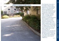
THE BUILT ENVIRONMENT<br />
The built environment of the Conservation Area can be very simply divided into two main elements, namely:-<br />
<strong>Stroud</strong> <strong>District</strong> <strong>Council</strong><br />
The buildings themselves<br />
The spaces adjacent to and surrounding the buildings.
The next part of this document uses these two basic headings to examine what makes up the “special architectural<br />
and historic interest” of the area.<br />
The Buildings<br />
Whilst some buildings may be individually important in a Conservation Area, it is the relationship of buildings<br />
one to another, their layout in relation to the streets and footpaths, and their density which so often define the<br />
character of the area.<br />
The architectural style and materials of the buildings will be important factors in determining what makes the<br />
Area “special”.<br />
Current and former uses often impact on the forms and styling of individual buildings, their relationships to others<br />
nearby and the levels of activity or motion in the area, all of which comprise significant components of the Area’s<br />
character as a whole.<br />
The Spaces<br />
<strong>CONSERVATION</strong> <strong>AREA</strong> <strong>STATEMENT</strong> - Conservation Area No7: FRAMPTON ON SEVERN<br />
The spaces around buildings in Frampton on Severn fall into a variety of types including lanes, streets, footpaths,<br />
gardens, parkland, fields, orchards and watercourses – the list goes on. Widths and alignments differ, some<br />
contain green features such as trees and grass, some are public and some are private spaces.<br />
<strong>Stroud</strong> <strong>District</strong> <strong>Council</strong><br />
15
16<br />
<strong>CONSERVATION</strong> <strong>AREA</strong> <strong>STATEMENT</strong> - Conservation Area No7: FRAMPTON ON SEVERN<br />
Sub Areas in Frampton on Severn Study Area<br />
Within a Conservation Area, it is sometimes possible to identify parts of the Area which differ in character. Key factors<br />
in defining where one part of the Conservation Area differs from another include the density of buildings, and their<br />
relationship to one another and to the roads and footpaths. Where clear differences do exist, these are identified as<br />
‘sub-areas’ and the Conservation Area is examined using those sub-areas.<br />
Five areas have been identified as being ‘sub-areas’ within the Frampton on Severn Study Area.<br />
To a large extent, these sub-divisions reflect the historical evolution of the village. Changing tastes, styles and technical<br />
capabilities influenced the plan forms and sizes of buildings, thereby creating a variety of scale that contributes greatly<br />
to the distinctive character of the village.<br />
<strong>Stroud</strong> <strong>District</strong> <strong>Council</strong><br />
Sub Area 1: Church End<br />
This sub- area encompasses Tanhouse and Denfurlong<br />
Farms, ending at the start of Vicarage Lane.<br />
Sub Area 2: The Street<br />
This sub- area incorporates part of Vicarage Lane and<br />
Whittles Lane. It finishes at Ward Court.<br />
Sub Area 3: The Green<br />
This sub- area encompasses the main open space and<br />
the gardens and backlands of the buildings that surround<br />
it.<br />
Sub Area 4: The Oval<br />
This sub area includes part of Lake Lane.<br />
Sub Area 5: The Canal<br />
This sub- area is linear, terminating with the enclaves of<br />
Splatt Bridge and Fretherne Bridge at either end, the latter<br />
taking in the former Cadbury factory.
SUB <strong>AREA</strong> 1: CHURCH END<br />
Origins and evolution of the built environment<br />
This is the site of the first recognizably cohesive settlement at Frampton on Severn, the historic cradle of the village,<br />
based around the medieval feudal core of church, manor house and farm.<br />
The heart of the former hamlet Church End is quite tight knit, with dwellings clustered closely. Some houses have<br />
been demolished – the original Denfurlong Cottages, a pair of cruck-framed cottages which stood opposite Oegrove<br />
Farm, were lost as late as 1966. Several new houses were built in gap sites throughout Church End in the mid -late<br />
20th century, and more recent times have seen the addition of Tanfield and the traditionally constructed Kaowen.<br />
However, the area as we see it today is mostly 17th and 18th century.<br />
Uses<br />
This part of the village was once a hub of industrial and agricultural activity, as well as being an important domestic<br />
settlement and the religious centre. Until recently, the spiritual tranquillity of the churchyard sat in close alliance with<br />
the very temporal bustle of the farmyard.<br />
Historically, the smells and sounds of some of the most anti-social manufacturing processes emanated from the area.<br />
In the 18th century, in addition to a dusty, fume- filled brickyard and limekiln virtually adjacent to the church, and a<br />
pungent malthouse for the brewing of beer nearby, there was also a tannery at Church End.<br />
The tannery, which was first mentioned in 1791, preserved leather by leaving it submerged for months in swampy,<br />
dank infusions of water and tannin-rich oak bark. It, and its associated bark- stripping mill, remained on the site until<br />
the late 19th century and gave its name to the much earlier Tanhouse Farm.<br />
The large barn, now part of Tanhouse Farm, was reputedly rebuilt in its present distinctive form after a violent storm<br />
in 17th century. Its predecessor was probably originally a tythe barn used for the storage of goods paid in lieu of<br />
money to the rector of the parish.<br />
The medieval heart of Frampton on Severn has seen a steady decline in activity and, to an extent, relative to its great<br />
historic importance, status. Denfurlong Farm remains in agricultural use and there is a group of industrial buildings<br />
near to the canal, however, following the conversion of many of the Tanhouse farm buildings into holiday lets, most<br />
of the hamlet is now a peacefully residential, quiet backwater, a full stop to the village.<br />
The Buildings in Sub Area 1: Church End<br />
Early buildings and materials<br />
<strong>CONSERVATION</strong> <strong>AREA</strong> <strong>STATEMENT</strong> - Conservation Area No7: FRAMPTON ON SEVERN<br />
In spite of the fact that the hamlet at Church End almost certainly dates from at least the 14th century, there is very<br />
little of the truly ancient settlement left. The methods of construction, the materials used, and change in the status<br />
and functions of buildings often made the early structures rather ephemeral and easily lost.<br />
The earliest building is the church of St Mary the Virgin. The present church dates largely from the beginning of the<br />
14th century, however it is highly likely that it replaced much earlier religious buildings on the site.<br />
<strong>Stroud</strong> <strong>District</strong> <strong>Council</strong><br />
17
18<br />
<strong>CONSERVATION</strong> <strong>AREA</strong> <strong>STATEMENT</strong> - Conservation Area No7: FRAMPTON ON SEVERN<br />
Externally, St Mary’s features roughcast render which is commonly used on buildings constructed from the crumbly,<br />
locally found, blue lias limestone, however, its principal elevations are un-rendered, built from Cotswold stone transported<br />
down from the hills. The roof too, is made of imported material, stone slates being generally uncommon in the Vale.<br />
Undoubtedly, the Cotswold stone was used because it was harder and more enduring than the local stone, and far<br />
more capable of being cut into finely produced ashlar blocks and mouldings, but the use of the stone was also a<br />
statement- the obviously imported, therefore more expensive, materials underlined the building’s great significance,<br />
setting it apart from the surrounding timber and clay buildings, thatched with straw.<br />
Church End retains many timber-framed buildings. The timber frame method of construction was the true vernacular<br />
style of Frampton on Severn, continuing from the earliest times, right up to the 18th century. Everything was built by<br />
local craftsmen with an intimate knowledge of the possibilities and limitations of local materials. Most early timber<br />
framed buildings were cruck framed, moving on to simple square-framing, infilled with “wattle-and-daub” panels. These<br />
were interwoven strips of wood – usually willow, sweet chestnut or oak – covered with a sticky mixture of dung, earth<br />
and straw.<br />
One such building was the manor house. Its last incarnation dated from the early 16th century; sadly it progressively<br />
declined in size and dignity throughout the 19th century, and was largely demolished in the 20th. A small part of the<br />
house seems to have survived and is now known as the Priest's House.<br />
Often as wattle and daub panels deteriorated, they were replaced with brick. After the 17th century, timber framing<br />
was generally phased out and building with brick became the normal method of construction. Thatch was replaced<br />
by clay tiles.<br />
The bricks used for the buildings were locally made in Frampton, very locally made in the case of Church End- a<br />
brickyard and limekiln lay just west of the church in 1782, and there was a later clay-pit further south. There is quite<br />
a high proportion of salt in the Frampton clay, which was deemed to make the bricks unsatisfactory. Certainly, they<br />
have an uneven shape and colour and a prone to cracking; however, they have lasted for hundreds of years and their<br />
multi- tones and texture contribute greatly to the character of the area.<br />
<strong>Stroud</strong> <strong>District</strong> <strong>Council</strong>
<strong>CONSERVATION</strong> <strong>AREA</strong> <strong>STATEMENT</strong> - Conservation Area No7: FRAMPTON ON SEVERN<br />
By the 18th century, the first ‘polite’, fashionable, rather homogenised, national style of architecture appeared in<br />
Church End, in the form of Church End House. Even though the design of the house could be found virtually anywhere<br />
in the country, the use of the soft, multi-coloured, local brick, rooted it firmly in Frampton on Severn.<br />
<strong>Stroud</strong> <strong>District</strong> <strong>Council</strong><br />
19
20<br />
<strong>CONSERVATION</strong> <strong>AREA</strong> <strong>STATEMENT</strong> - Conservation Area No7: FRAMPTON ON SEVERN<br />
Key buildings and focal points<br />
<strong>Stroud</strong> <strong>District</strong> <strong>Council</strong>
<strong>CONSERVATION</strong> <strong>AREA</strong> <strong>STATEMENT</strong> - Conservation Area No7: FRAMPTON ON SEVERN<br />
The key building in this sub-area is, of course, the church, yet from the lane leading into Church End, the dominant<br />
building is the huge 17th century barn, with its immense hipped roof, now part of the Tanhouse Farm complex. It is<br />
thought to have been built after a violent storm in 1688, possibly reusing earlier materials from an earlier barn on the<br />
site.<br />
Its brick walls, which sit on a stone plinth, are timber framed in typical regular square panels, however, unusually, the<br />
split pales used to infill the panels have not been covered with daub and plastered over. Its western end, a former<br />
cowshed, is of brick, featuring a simple banded decoration. The physical bulk of the barn, tight on the road edge,<br />
closes of views to the north.<br />
Oegrove Farm (at the junction between Church End and the Street) terminates the eastern view from Church End. It<br />
is a two-storey house, built in the early 17th century. It, too, is timber-framed in square panels, but is set apart from<br />
the norm by a Cotswold stone slate roof and its massive southern gable-end, built of rubble masonry.<br />
Church End House is conspicuous from the entrance to St Mary’s, although initially hidden by the blank gable end of<br />
a wing. This is one of Frampton’s quietly genteel houses, designed in the polite national style. It was built in the late<br />
18th century by the Barnard family, who owned a local brick making business. They used their own bricks in its<br />
construction, so, whilst the house with its simple classical influences, bears no relation to the vernacular architecture<br />
of the village, the materials from which it is constructed are entirely local and root it firmly in its surroundings.<br />
To its south- west is the brick- built former Malthouse. The building is probably largely contemporary with Church End<br />
House but possibly contains even earlier fabric. As the name suggests, it was used for the malting of barley for the<br />
local breweries.<br />
The historic buildings clustered around the church form a close knit group and are very much a focal point in themselves.<br />
<strong>Stroud</strong> <strong>District</strong> <strong>Council</strong><br />
21
22<br />
<strong>CONSERVATION</strong> <strong>AREA</strong> <strong>STATEMENT</strong> - Conservation Area No7: FRAMPTON ON SEVERN<br />
Modern infill buildings<br />
There are several modern buildings, built since the 1960s in Church End, but only one is truly successful. Going down<br />
the route of the traditional vernacular, rather than any progressive modern design, the new house on the corner, now<br />
known as Kaowen, correctly interprets the characteristics of Frampton on Severn’s local construction methods. It is<br />
built with sympathetic materials, and, very importantly, to an appropriate scale.<br />
The narrow, steep- roofed, lime- rendered, box- framed element to the building, allied with the lower, one and a half<br />
storey brick range, with its little dormers, is the right form for a locally found building. The further extension with its<br />
wood cladding appears truly subservient, a typical incremental addition. It is a fairly large cottage, but the proportions<br />
are all correct.<br />
Other new builds have attempted to replicate typical local features, such as the large external chimney stack, but<br />
without the building having been constructed to the correct proportions overall, and with insufficient detailing, such<br />
things will always appear mere token gestures and are better not attempted.<br />
Frampton bricks will never be available again, but many brick suppliers do make products that replicate the multi-tonal<br />
colours, and even the firing faults of historic examples. Those used for Kaowen have proved to be passable imitations.<br />
However, the wood stain used on the window frames and doors is non- traditional and for the sake of authenticity<br />
should not have been used.<br />
<strong>Stroud</strong> <strong>District</strong> <strong>Council</strong>
<strong>CONSERVATION</strong> <strong>AREA</strong> <strong>STATEMENT</strong> - Conservation Area No7: FRAMPTON ON SEVERN<br />
<strong>Stroud</strong> <strong>District</strong> <strong>Council</strong><br />
23
24<br />
<strong>CONSERVATION</strong> <strong>AREA</strong> <strong>STATEMENT</strong> - Conservation Area No7: FRAMPTON ON SEVERN<br />
The Spaces in Sub Area 1: Church End<br />
<strong>Stroud</strong> <strong>District</strong> <strong>Council</strong>
Open space takes seven main forms within this sub-area:<br />
The churchyard<br />
Private gardens<br />
Farmyards<br />
Roads and lanes<br />
‘islands’ of grass<br />
Fields and orchards<br />
‘scrubby’ ground<br />
<strong>CONSERVATION</strong> <strong>AREA</strong> <strong>STATEMENT</strong> - Conservation Area No7: FRAMPTON ON SEVERN<br />
In many respects Church End retains its medieval form, with the settlement clustered around the church. Even though<br />
there are modern farm, industrial and domestic buildings, this part of Frampton seems to be almost timeless.<br />
A significant contribution to this is the lack of any kind of road markings and a minimal amount of signage. The lack<br />
of highways intervention encourages pedestrians to wander along the road, rather than to keep to one side. Cars are<br />
few and far between, and easily spotted along the straight stretch to the canal or as they slow to come around the<br />
corner from The Street.<br />
The area immediately surrounding the church has a tidy appearance, though not municipally so, with well tended<br />
verges and islands of grass breaking up what is actually quite a wide road area. One of Frampton’s many orchards<br />
ensures that the natural environment comes into the manicured. The bench sited on one of the grassy islands outside<br />
Tanhouse Barn provides a place to stop and enjoy the sight of the sheep keeping the grass down in the fields.<br />
The jumble of gardens are demarcated by iron railings and hedges and brick walls of differing heights. In places, the<br />
taller brick walls and hedges are quite overbearing, creating very impermeable hard edges to lanes, narrowing the<br />
spaces down; at other points, the low walls and hedges allow open peeks into the cottage gardens, and into the<br />
orchards and meadows and even down to the canal. Church End is made up of the juxtaposition of open areas and<br />
constrictive bottlenecks.<br />
Unfortunately, some non-traditional, overly suburban, boundary treatments have begun to erode Church End’s<br />
character. However, the overall effect is still naturalistic; picture post card, without being twee.<br />
The two farmyards in the sub- area have very different appearances. Part of the Tanhouse Farm complex has been<br />
converted into residential accommodation and has been neatened up and ‘sanitised’. Denfurlong Farm, by contrast<br />
is still in agricultural use, its busy yard still fully employed. Workaday, no- frills, modern materials, such as corrugated<br />
iron roofing, have helped keep the old farmyard buildings fit for purpose. It is one of the few reminders of Church<br />
End’s functional past- the industrial units adjacent to Tanhouse Farm on the lane to Splatt Bridge, do not seem to<br />
make any similarly ‘gritty’ contribution to the area.<br />
One of the more important spaces within the sub- area is the wild piece of land at the bottom of The Street. This gap<br />
marks the separation between The Street and the enclave of Church End. The views afforded across to the back of<br />
Tanhouse Farm (formerly including the manor house) and the church are a glimpse into the very heart of medieval<br />
Frampton.<br />
<strong>Stroud</strong> <strong>District</strong> <strong>Council</strong><br />
25
26<br />
<strong>CONSERVATION</strong> <strong>AREA</strong> <strong>STATEMENT</strong> - Conservation Area No7: FRAMPTON ON SEVERN<br />
SUB <strong>AREA</strong> 2: THE STREET<br />
Origins and evolution of the built environment<br />
In the early 18th century Frampton on Severn was said to comprise two distinct parts, Church End and Frampton<br />
Green, but actually the village was not as nucleated as this sounds. Frampton on Severn then, as now, was essentially<br />
a long and narrow settlement with the airy, expansive Green to the north bottlenecking into The Street, which winds<br />
southwards to Church End.<br />
Traditionally the border between the two parts of the village was a stream running under the road, crossed by Buckel<br />
Bridge. The nearby Buckholt House, which, in the 19th century was known as ‘Buckel House’, took its name from the<br />
bridge.<br />
<strong>Stroud</strong> <strong>District</strong> <strong>Council</strong>
There were already houses lining the Street by the 15th century, the majority of which were north of the stream. One<br />
of the Street’s notable features is that, although most houses have been built parallel to the road, others are at right<br />
angles. It has been hypothesised that this is a throw back to medieval times, when the lord of the manor granted the<br />
inhabitants of Frampton strips of land, called ‘tenure strips’. It is believed that those who held wide plots of multiple<br />
strips preferred to build parallel to the road, whilst those who were constrained by a narrow, single strip plot could<br />
only build their houses end-on.<br />
This pattern of development has been preserved and perpetuated, as can be demonstrated by Falfield Cottage and<br />
Harts Cottages, among others.<br />
The Street now comprises a parade of generally modest- sized buildings that encompasses over 500 years of<br />
architectural evolution- the timber framing of the 15th century is juxtaposed with progressively modern design;<br />
vernacular 17th century brick cottages sit up against self-conscious 18th century elegance, which in turn rubs shoulders<br />
with 19th century workaday terraces and 20th century standard build.<br />
Uses<br />
<strong>CONSERVATION</strong> <strong>AREA</strong> <strong>STATEMENT</strong> - Conservation Area No7: FRAMPTON ON SEVERN<br />
The Street has always been predominately residential, however, once it also held several shops and businesses,<br />
including a bakery, a butcher’s, a blacksmith’s, a boot maker, and a candle maker, as well as a post office.<br />
The schoolhouse was also in The Street. This was the National School, built in 1842 for the Church of England from<br />
grants supplied by The National Society for the Education of the Poor in the Principles of the Established Church.<br />
The Vicarage was built close by.<br />
<strong>Stroud</strong> <strong>District</strong> <strong>Council</strong><br />
27
28<br />
<strong>CONSERVATION</strong> <strong>AREA</strong> <strong>STATEMENT</strong> - Conservation Area No7: FRAMPTON ON SEVERN<br />
The Buildings in Sub Area 2: The Street<br />
Early buildings and materials<br />
Some of the earliest surviving buildings in Frampton on Severn are to be found on The Street. Wildgoose Cottage,<br />
The Old Thatch, The Summerhouse and Greycroft date from the latter half of the 15th century and De Lacy Hall/The<br />
Old Cruck House was built in the early 16th century.<br />
These cottages are all of timber, cruck frame construction, an ancient method of building. Put simply, cruck framed<br />
buildings are generally rectangular and divided into sections, or ’bays’ by pairs of naturally curving timbers, ‘cruck<br />
blades’, cut from a single trees, usually oak or elm. These rise from a stone plinth, right up, and join together at the<br />
top to form the apex of the roof. Wooden struts, attached using wooden pegs, tie the timbers in place and the spaces<br />
between the timbers are infilled with wattle and daub, then plastered over.<br />
The original wattle and daub can be seen in the gable end of Greycroft and above the windows at De Lacy Cottage.<br />
These are relatively rare survivals as much was lost to later brick infilling.<br />
<strong>Stroud</strong> <strong>District</strong> <strong>Council</strong>
Owing to the limited size of the available timbers, it is likely that the cottages were originally single storey. Floors were<br />
generally inserted in the 16th century to make the cottages a storey and a half, with the attic room being tucked under<br />
the steeply sloping roof. This would have once been thatched. The attic rooms were probably unlit until dormer windows<br />
were brought in from the early 18th century onwards.<br />
When the cruck cottages were built, they would have been of high status with wealthy owners, today, they appear to<br />
be of the same humble scale as many of the later historic buildings on the Street, which tend to have been built for<br />
trades people and labourers.<br />
Key buildings and focal points<br />
<strong>CONSERVATION</strong> <strong>AREA</strong> <strong>STATEMENT</strong> - Conservation Area No7: FRAMPTON ON SEVERN<br />
There are many key buildings along the gently winding The Street. Some are instantly noticeable, such as the Arts<br />
and Crafts Village Hall; the ‘tudorbethan’ style schoolroom and the gracious Buckholt House. The delightful Buckholt<br />
Cottages, whose Neo-Classical architectural references are much grander than their status really warrants, sit in<br />
direct, striking, contrast to their opposite neighbour. The unusual, unadorned flat façade of Church Farm House creates<br />
a notable landmark corner on the turning into Whittles Lane.<br />
Sadly, the badly at risk grouping of De Lacy Cottage, the Olde Cruck House and Greycroft makes a very big impression<br />
for the wrong reasons, but they are also very show- stopping for the right reasons, being of great age and architectural<br />
interest. They, along with the jettied Tudor Cottage, and The Old Thatch also stand out by virtue of being black and<br />
white timber framed in generally plain- rendered or brick built surroundings.<br />
<strong>Stroud</strong> <strong>District</strong> <strong>Council</strong><br />
29
30<br />
<strong>CONSERVATION</strong> <strong>AREA</strong> <strong>STATEMENT</strong> - Conservation Area No7: FRAMPTON ON SEVERN<br />
Beehive Cottage, whose painted frontage belies its timber framing, is noticeable for two things in spite of its humble<br />
size; its very impressive stepped chimney stack, and the carving of the beehive above the front door. Decorative<br />
oddities of one kind or another are common in Frampton.<br />
Other buildings are equally important, but less obvious. There are many quite ordinary, small- scale houses and<br />
cottages in the sub- area, which make valuable contributions to its character, even if only by providing a good<br />
unobtrusive foil or context for more architecturally significant buildings. It is worth pointing out that some of the lesser,<br />
but still important historic buildings, have become prey to disfiguring replacement windows, both UPVc and stained<br />
timber. Such changes have proved to be highly detrimental to the character and appearance of the Conservation<br />
Area.<br />
Modern infill buildings<br />
Many cottages along The Street have been demolished. In their places, and in gap sites, the 19th, 20th and 21st<br />
centuries have seen the construction of buildings that perpetuate Frampton’s extraordinary architectural variations.<br />
Houses built over the last 50 years include humble bungalows, the innovative Bendles and the traditionally built Elgar<br />
House.<br />
The southern end of the Street contains the greatest concentration of mid- late 20th century buildings, of varying<br />
scale. The majority are fairly homogenous and of very little architectural interest, although perfectly innocuous. Apart<br />
from creating enclosure in the streetscape, the majority of modern buildings otherwise make very little contribution to<br />
the character, or the historic interest, of the Conservation Area. Sadly, with regard to some of the modern development,<br />
certain opportunities to enhance key views were missed.<br />
However, some newer buildings play a positive role in the Conservation Area. Edgar House was built very recently.<br />
Aside from a slightly over-large porch, this is a very good example of a simple building that takes its cues, both in<br />
design and materials, from the local vernacular and therefore looks very much at home in its surroundings.<br />
<strong>Stroud</strong> <strong>District</strong> <strong>Council</strong>
<strong>CONSERVATION</strong> <strong>AREA</strong> <strong>STATEMENT</strong> - Conservation Area No7: FRAMPTON ON SEVERN<br />
The unrepentantly modern design of Bendles, with its striking split level roof, owes nothing to the local architectural<br />
vernacular, but, being brick built, it does not jar in the street scene. Love it or loathe it, the house makes a highly<br />
interesting contribution to the continuing evolution of Frampton’s built environment.<br />
The Spaces in Sub Area 2: The Street<br />
Open space takes three main forms within this sub-area:<br />
Private gardens<br />
Roads, lanes and paths<br />
Backland fields and orchards<br />
As in the other sub-areas, a lot of The Street’s character derives from the fact that it has been left relatively untouched<br />
by highways intervention. Even though this is the main road through the village, it still feels very much like a lane. To<br />
an extent, the long, narrow, sinuous Street can be divided into two: the southern end between Vicarage Lane and the<br />
Lych gate, and the northern, from the Lych Gate up to Ward Court.<br />
To the south, between Church End and the Narles, the houses are generally more set back from the road, particularly<br />
on the western side. They are often well shielded by the hedges and foliage of their front gardens, which give both<br />
them, and the road, a soft, very green, sense of enclosure. Some houses stand very well back in their plots and have,<br />
in Frampton terms, long drives.<br />
<strong>Stroud</strong> <strong>District</strong> <strong>Council</strong><br />
31
32<br />
<strong>CONSERVATION</strong> <strong>AREA</strong> <strong>STATEMENT</strong> - Conservation Area No7: FRAMPTON ON SEVERN<br />
The eastern side of the Street, beyond the hard edging created by the old school room, is more open to view and<br />
much less constrained. The houses generally sit nearer to the road, but they still tend to have some form of front<br />
garden. Their boundaries are more often low walls and hedges or, a very common Frampton on Severn feature,<br />
decorative wrought iron fences. Unfortunately some boundaries have been removed and front gardens turned into<br />
parking spaces. This has resulted in an erosion of the characterful delineation between public and private space.<br />
The streetscape opens dramatically in the area around the lych gate. Whilst on the one side, the garden walls of<br />
Buckholt House provide a tall, hard edge to the road, on the other, the flat expanse of the Narles opens the up the<br />
view to the river. The Street itself, at the start of a sweeping curve, widens at this point, making a mini- village green<br />
with the important feature of the pollarded limes.<br />
Although the majority of the houses between Whittles Lane and The Green do have some private space to the front,<br />
it is generally the buildings, not the gardens, that come to the fore as the chief definers of space, particularly on the<br />
west side. Here, a very hard edge develops; the road is either hemmed in by front walls, or fairly blank gable ends.<br />
<strong>Stroud</strong> <strong>District</strong> <strong>Council</strong>
There are some notable exceptions to the small front garden rule: Greycroft, De Lacy Cottage/ Ye Old Cruck House,<br />
Bokara and Blenheim House all bring more extensive green breaks to the streetscape. The open space created by<br />
Tamaris’ garden is a vital soft transition between The Street and The Green.<br />
At all times, the narrow glimpses sideways, down footpaths, lanes, drives and past gardens, provide a hugely important<br />
link between the contained streetscape and the open fields and orchards beyond.<br />
SUB <strong>AREA</strong> 3: THE GREEN<br />
<strong>CONSERVATION</strong> <strong>AREA</strong> <strong>STATEMENT</strong> - Conservation Area No7: FRAMPTON ON SEVERN<br />
Origins and evolution of the built environment<br />
The Green and its surrounding buildings are often considered to be the jewels in Frampton on Severn’s crown,<br />
however, prior to 1731, although described as being ‘pleasant’, the Green was essentially a marsh.<br />
By the 15th century, a few well- scattered buildings were already standing around The Green, near to the Perry Way,<br />
which led from the Bristol- Gloucester Road to an ancient Severn crossing point at Arlingham.<br />
<strong>Stroud</strong> <strong>District</strong> <strong>Council</strong><br />
33
34<br />
<strong>CONSERVATION</strong> <strong>AREA</strong> <strong>STATEMENT</strong> - Conservation Area No7: FRAMPTON ON SEVERN<br />
The Gloucester- Bristol road, now the A38, follows the line of a Roman road, and it is likely that the Perry Way as we<br />
know it dates from the same time. It has carried its name since at least 1302.<br />
Perry Way was turnpiked from 1726 to 1874 by the same trust as the Gloucester- Bristol road. Shortly after it was<br />
turnpiked, Richard Clutterbuck, the then Lord of the Manor, instigated works to salvage dry land from the swampy<br />
Green, by the introduction of a series of drains and ponds. The road running along the Green was built at the same<br />
time, creating a straight link between the Street and the Perry Way .<br />
The draining of the Green meant a marked decrease in waterborne diseases and the atmosphere at this end of the<br />
village became much healthier. As a result, the 18th century onwards saw an increase in development, most of it high<br />
status.<br />
Uses<br />
Although in private ownership, The Green has been in village use for many centuries. In 1254 the Crown granted the<br />
Lord of the Manor, Hugh de Clifford, the right to hold a weekly market on Saturdays and a three-day fair beginning<br />
on 23 June. In 1311, this was replaced by a market on Thursday, and a five-day fair beginning on 14 August. Both<br />
these seem to have fizzled out by the 17th century, however a relic of the fair may have survived as a village feast,<br />
held on the Green on the Monday following the first Sunday after 15 August.<br />
Later, in the 17th century, there was a February fair, probably held in honour of Frampton’s adopted patron saint, St<br />
Blaise. This became known as the Frying Pan Fair and continued into the mid 19th century.<br />
Cricket has been played on the Green since about 1800, and the pitch outside the Bell, with its traditional pavilion,<br />
adds greatly to the impression that Frampton is very much a thriving community.<br />
<strong>Stroud</strong> <strong>District</strong> <strong>Council</strong>
The earliest developments around the Green were well-spaced farmsteads and it has long been used by villagers for<br />
the grazing of animals. In 1874 it was written that, ‘…sheep and donkeys roam unmolested at their own sweet will.’<br />
Now, on non- cricketing days, it is largely left to the waterfowl on the three ponds, and to the many dogs that are<br />
walked around it on a daily basis.<br />
In addition to the inhabitants, Frampton has a growing number of tourists, and the Green is a focal point: people linger<br />
and stroll. However, the additional influx has contributed to one of the least welcome uses of the Green -it now<br />
frequently acts as an overflow car park, much to its visual and ecological detriment.<br />
The problem of parking has been addressed by many residents who cycle to the post office, pubs and shops. Bicycles,<br />
(and indeed a motorised tricycle), are an integral part of Frampton on Severn’s street scene.<br />
The Buildings in Sub Area 3: The Green<br />
Early buildings and materials<br />
<strong>CONSERVATION</strong> <strong>AREA</strong> <strong>STATEMENT</strong> - Conservation Area No7: FRAMPTON ON SEVERN<br />
The earliest existing buildings around the Green: the Old House (formerly Advowson Farm), the Manor Farm and<br />
barn, and Manor Farm Cottages, all appear to date roughly from the 15th century. At heart, the Old House is one of<br />
Frampton’s several small cruck houses- the curving timbers can be seen from Watery Lane, but it has been altered<br />
and extended many times over the last three hundred years, and the humble scale of the original building has been<br />
lost.<br />
The Grade I listed house that has been known as Manor Farm for many, many, years, is an intriguing building that<br />
sits at the core of village legend, being the reputed birthplace of ‘Fair Rosamund’ Clifford. The house is finely built of<br />
stone and timber framing with later brick additions. It would have been a very expensive building at the time of<br />
construction.<br />
<strong>Stroud</strong> <strong>District</strong> <strong>Council</strong><br />
35
36<br />
<strong>CONSERVATION</strong> <strong>AREA</strong> <strong>STATEMENT</strong> - Conservation Area No7: FRAMPTON ON SEVERN<br />
The oldest part of Manor Farm is a two storied section to the back of the house -it may be a solar, a room built in the<br />
15th century for the personal private use of the owners, away from the bustle of the communal living prevalent at the<br />
time.<br />
To the south-east is a jettied gable-end; known as 'Rosamund's Bower’. This is meant to be the part of the house in<br />
which Fair Rosamund was born. Unfortunately the form of its timber frame seems to date it to no earlier than the<br />
beginning of the 16th century.<br />
The Manor Farm complex as a whole has some of the most interesting buildings in Frampton. The 16th century Manor<br />
Barn, formerly a wool warehouse, is of strikingly small squared box frame construction, with lathe and plaster infill<br />
panels. Restoration revealed secrets in its ashlar plinth- behind the stone’s plain exterior lies elaborate medieval<br />
religious carving of very high quality. The stone is reputed to have come from the 13th century Llanthony Priory in<br />
Gloucester, which was demolished in the wake of the Dissolution of the Monasteries.<br />
Manor Cottages probably originated as a hall house in the 15th century. The original timber frame and plaster building<br />
was extended in the 17th century with a brick wing.<br />
Manor Cottages’ thatched roofs have been lost to clay tiles, but Parks and Nastfield Cottages on the other side of<br />
The Green, dating from the early 17th century, have both retained theirs.<br />
Key buildings and focal points<br />
The Green features many of Frampton’s gems; indeed, walking along it is like having a mini- lesson in architectural<br />
history. By and large, it is the buildings towards the ’Top of The Green’, that are the grandest, and those to the south<br />
that are on a smaller scale.<br />
<strong>Stroud</strong> <strong>District</strong> <strong>Council</strong>
<strong>CONSERVATION</strong> <strong>AREA</strong> <strong>STATEMENT</strong> - Conservation Area No7: FRAMPTON ON SEVERN<br />
Frampton Court has long been at the heart of the village, and can just be glimpsed over its impressive walls. It is set<br />
apart from The Green, but is still an integral part of its character. The present Frampton Court stands on the site of a<br />
brick house built in 1651 by John Clifford. In 1731, Richard Clutterbuck began a complete rebuilding, this time in<br />
extremely fashionable (and expensive) Bath Stone.<br />
The new house is thought to have been designed by John Strahan, a notable architect from Bristol. The flamboyant<br />
Baroque- influenced front elevation features a grand stairway leading to the front door with its heavy Gibbs surround.<br />
The central pediment above, supported on square Ionic pilasters, displays the combined coats of arms of the Clutterbuck<br />
and Clifford families. The more austere influence of the Palladian movement can be seen in the garden elevation.<br />
One of Frampton’s greatest joys is the ‘delicious Gothick’ Orangery at Frampton Court. This stone wedding cake of<br />
a building was constructed in the late 1740s, also at the behest of Clutterbuck, ostensibly as a garden house, but<br />
additionally as a delightful termination to the view down his highly fashionable new Dutch canal. Happily, being sited<br />
only just behind the walls of the park, it can delight everyone else as well.<br />
Many of the other, mostly 18th century, buildings around The Green, have a smaller scaled grandeur. Some feature<br />
quirky details that set them apart from the ordinary. The early 18th century Russell House, for example, has a heavily<br />
elaborate 19th century porch; The Red House, which is otherwise handsome but unremarkable, is brought to the<br />
attention by the large wooden dovecote attached to its front elevation.<br />
Other simpler buildings, such as the Bell Inn, Frampton Lodge and the Post Office and stores, are among the most<br />
imposing presences on The Green. These are archetypal Georgian buildings, simply built of brick in the polite<br />
architectural style that spread country-wide.<br />
<strong>Stroud</strong> <strong>District</strong> <strong>Council</strong><br />
37
38<br />
<strong>CONSERVATION</strong> <strong>AREA</strong> <strong>STATEMENT</strong> - Conservation Area No7: FRAMPTON ON SEVERN<br />
On a humbler level, The Firs, also dating from the 18th century, but in contrast, typically Severn Vale vernacular,<br />
stands out, largely because of its relative isolation, being separated from the nearby Park and Nastfield Cottages by<br />
dense evergreen trees.<br />
The brick-built Firs has a plinth of slag block. This is by-product of the Forest of Dean copper-smelting industry can<br />
be found throughout the village. Being highly water resistant, it is generally used as damp proof foundation courses<br />
for brick or stone structures, but large irregular chunks can be seen incorporated into the top of the walls adjacent to<br />
the lych gate.<br />
The run of buildings between Ward Court and Manor Farm Cottages is a mixture of the good and bad. Sadly, owing<br />
to unsympathetic alterations, many of the individual buildings do not bear close inspection, but the row is generally<br />
eye- catching, terminating the long range view across The Green. It stands out, not only because of its contrast with<br />
its sparsely developed surroundings, but also because of its combination of brick and painted render.<br />
Among the row’s good buildings is a quiet, but fine, 19th century brick built terrace, featuring an arched carriageway<br />
at its centre and the very handsome, but down at heel, Kempsey House.<br />
<strong>Stroud</strong> <strong>District</strong> <strong>Council</strong>
The northern most edge of the Green, lining the Perry Way, has historic buildings dating from between the 17th and<br />
19th centuries, including the prettily thatched Elm Tree Cottage. Although largely architecturally unexceptional, they<br />
serve the very important role of completing the circle of one of England’s finest village scenes.<br />
Modern infill buildings<br />
<strong>CONSERVATION</strong> <strong>AREA</strong> <strong>STATEMENT</strong> - Conservation Area No7: FRAMPTON ON SEVERN<br />
The Green has seen very little in the way of 20th century development, largely because much of it has been preserved<br />
by the Clifford estate.<br />
Many of the buildings at the southern end have been greatly altered, both with extensions and replacement windows<br />
and so have lost something of their historic appearance. However it would appear that there is only one substantial<br />
modern intervention- Wigeon House. This building, which conforms to the scale of its surroundings and should not<br />
look too out of place, is badly let down by its construction materials and its detailing. The fact that this was identified<br />
as being one of the village’s bad points goes to show how important attention to detail and design are in high profile<br />
positions.<br />
<strong>Stroud</strong> <strong>District</strong> <strong>Council</strong><br />
39
40<br />
<strong>CONSERVATION</strong> <strong>AREA</strong> <strong>STATEMENT</strong> - Conservation Area No7: FRAMPTON ON SEVERN<br />
Other less substantial modern buildings, such as the timber workshops and garages tucked behind the street frontage<br />
at the south end of The Green, are honest of their type and add depth and a different, grittier, grain to the character<br />
of the Conservation Area.<br />
Old Carpenters Corner, the only new build on the northern part of The Green, replaces a previous building on the<br />
site. Good attempts were made to give the house textures and colours similar to one built of Frampton brick and tile,<br />
and it has nearly been a success. Unfortunately, though, with lesser attention to detail, and a slightly flimsy appearance<br />
imparted by modern building techniques, the Old Carpenters Corner suffers by its comparison with the Red House<br />
immediately next door.<br />
The Spaces in Sub Area 3: The Green<br />
Open space takes six main forms within this sub-area:<br />
The Green<br />
Private gardens<br />
Parkland<br />
Roads and lanes<br />
Backland fields and orchards<br />
Yards<br />
The Green itself is, of course, Frampton on Severn’s most famous open space. It has a pasture-like appearance, with<br />
a naturalistic feel to it. It is well kept, but in no way overly manicured.The artfully planted trees add points of interest,<br />
forming and framing key views. Some are rare, such as the black poplars, others are to be expected, such as the<br />
willows by the three ponds. A recent programme of tree planting will ensure that this highly important component of<br />
Frampton’s character will survive for many centuries more.<br />
<strong>Stroud</strong> <strong>District</strong> <strong>Council</strong>
<strong>CONSERVATION</strong> <strong>AREA</strong> <strong>STATEMENT</strong> - Conservation Area No7: FRAMPTON ON SEVERN<br />
One of the extraordinary aspects of The Green is the way that the road, which crosses the space as straight a die,<br />
becomes almost invisible from certain view points. Even though it is slightly raised up from what can still become a<br />
marsh, when viewed at an oblique angle it vanishes and leaves uninterrupted verdure. The narrow, single track lanes<br />
that loop off from The Green are similarly unobtrusive. Should any highways paraphernalia be introduced, the unspoiled<br />
character of The Green would be lost.<br />
As it stands, the overall effect of The Green is incredibly picturesque. Benches are provided in shady spots, and in<br />
places from which the scenery, including key elements such as the ponds, may best be enjoyed.<br />
<strong>Stroud</strong> <strong>District</strong> <strong>Council</strong><br />
41
42<br />
<strong>CONSERVATION</strong> <strong>AREA</strong> <strong>STATEMENT</strong> - Conservation Area No7: FRAMPTON ON SEVERN<br />
Yet, for all its expansiveness, The Green is very well contained. On its eastern side, the walls to Frampton Court,<br />
punctuated by their gate piers, provide a tall, hard- edged definition to its edges. This is echoed, to a lesser extent,<br />
on the opposite side, not just by the impressive walls of Manor Farm, but also by the lower brick walls marking the<br />
boundaries of the houses around.<br />
The majority of the older houses and cottages have well established front gardens, visible from the public realm.<br />
Sometimes, the houses block the view to the rear completely, however, it is possible in most places to see the farranging<br />
views through the fields and orchards and over beyond the river. Frampton Court is, of course in a league of<br />
its own and has its idyllic parkland as a backdrop.<br />
The pattern of development at the southern end of The Green, continues to be that of The Street, some buildings<br />
running parallel to the road, others gable- end on. Narrow alleys and paths run between the buildings, both public<br />
and private. There are elements of small- scale back land development, often buildings that served the past uses of<br />
those fronting the road, for example stables and storage sheds.<br />
<strong>Stroud</strong> <strong>District</strong> <strong>Council</strong>
Surprisingly, tucked away down one of the unassuming looking snickets, are the Congregational chapel and the<br />
charming Chapel House, both backing straight on to the open fields.<br />
Workaday yards containing small businesses are to be found to the sides and rear of the buildings at the bottom of<br />
The Green, adding a grittiness to the otherwise largely clean-cut village.<br />
SUB <strong>AREA</strong> 4: THE OVAL<br />
<strong>CONSERVATION</strong> <strong>AREA</strong> <strong>STATEMENT</strong> - Conservation Area No7: FRAMPTON ON SEVERN<br />
Origins and evolution of the built environment<br />
The parcel of land at Oatfield, on which Lake Lane and the Oval was built, began as part of one of Frampton’s principal<br />
open fields. It was certainly in common use by 1322, cultivated in strips by the inhabitants of the village. However,<br />
parts of Oatfield were already being enclosed during the last 15 years of the 16th century and the process seems to<br />
have continued throughout the 17th century and into the18th. By 1815, just before the Parliamentary Enclosure Acts,<br />
only 13 acres of the formerly extensive tract remained in shared common use. Although a few houses were built in<br />
the vicinity of Lake Lane by the 19th century, the land at Oatfield remained predominately in agricultural use until the<br />
middle of the 20th century.<br />
<strong>Stroud</strong> <strong>District</strong> <strong>Council</strong><br />
43
44<br />
<strong>CONSERVATION</strong> <strong>AREA</strong> <strong>STATEMENT</strong> - Conservation Area No7: FRAMPTON ON SEVERN<br />
After the First World War ended in 1918, housing shortages became a major country-wide crisis: there was an estimated<br />
overall deficiency of 600,000 thousand dwellings. In response, the provision of housing was made a primary<br />
consideration in town planning, but it was apparent that developments by private sector builders could not make up<br />
the shortage. The Housing and Town Planning Act (the Addison Act) was introduced in 1919 to help remedy the<br />
situation. The Act allowed the provision of state subsidies for local authorities to aid in the cost of slum clearance and<br />
the building of low cost housing.<br />
During the years of the First World War, Barry Parker and Raymond Unwin, who later became Chief Architect at the<br />
Ministry of Health, laid out ideas stemming from Ebeneezer Howard’s idealistic Garden City Movement, proposing a<br />
new standard of local authority working class housing. These recommendations created the blueprint for local authority<br />
housing for the next twenty years and more.<br />
They advocated not more than 30 houses per hectare, with their own gardens, built in small terraces or cul de sacs,<br />
in a well laid out estate, each house to have a large living room with a sunny aspect, a bathroom and indoor lavatory<br />
and a kitchen with a good sized larder.<br />
The Oval was built on the medieval Oatfield just before the Second World War by <strong>Stroud</strong> Rural <strong>District</strong> <strong>Council</strong>, utilizing<br />
the highly successful basic principles of Unwin’s ideas. The majority of the houses in the Oval have now passed out<br />
of local authority ownership following the ‘right to buy’ schemes of the 1980s.<br />
The Buildings in Sub Area 4: The Oval<br />
Buildings and materials<br />
<strong>Stroud</strong> <strong>District</strong> <strong>Council</strong>
<strong>CONSERVATION</strong> <strong>AREA</strong> <strong>STATEMENT</strong> - Conservation Area No7: FRAMPTON ON SEVERN<br />
The appearance of the Oval itself is entirely derived from the Garden City Movement’s romantic vision of estates full<br />
of cottagey buildings based on old English traditions. The design of the houses owes everything to the influence of<br />
Arts and Crafts architects, such as Lutyens and Voysey. Although very watered down and simplified, the Oval’s<br />
repeating gables, with their paired windows, the steep roof pitches and tall chimneys, are all typical Arts and Craft<br />
references, as are the arched heads of the passageways through to the gardens.<br />
The original Arts and Crafts and Garden City Movements had put emphasis on the high quality materials and good<br />
craftsmanship in their buildings. This ideology, of course, was prohibitively costly for local authorities, and the quality<br />
of the materials and methods of construction were downgraded to an extent.<br />
Economic crisis, spiralling inflation and resulting shortages in the 1920s, brought about changes in modern building<br />
techniques and necessary experiments with new materials, as well as a revival of traditional ones, such as unfired<br />
bricks. The era saw the widespread introduction of metal windows, designed by the firm of Francis and W.F. Crittall,<br />
as an alternative to hard to source wooden frames. These became standard in local authority housing.<br />
The 1930s’ Oval inherited the use of many of the new materials. Frampton on Severn is largely brick built, but the<br />
bricks of the Oval have nothing of the colour variations found in the locally made product, being a rather bright, uniform<br />
orangey-red. Allied with the plain tile roofs, this is very much a pleasantly rusty- coloured enclave.<br />
The Crittall windows have unfortunately for the appearance of the buildings, now been replaced with UPVc, which<br />
can in no way truly reflect the fine lines of the originals. However, the wholesale, single phase replacement of the<br />
windows by <strong>Stroud</strong> <strong>District</strong> <strong>Council</strong> has ensured that the uniform look of the terraces has been maintained, and the<br />
new windows have the benefit of being non- standard designs that still hint at something of the 1930’s vision.<br />
<strong>Stroud</strong> <strong>District</strong> <strong>Council</strong><br />
45
46<br />
<strong>CONSERVATION</strong> <strong>AREA</strong> <strong>STATEMENT</strong> - Conservation Area No7: FRAMPTON ON SEVERN<br />
Other local authority housing in the sub-area, fronting onto Bridge Road, has been rendered and painted.<br />
Key buildings and focal points.<br />
The key buildings in the sub- area are the crescents of the Oval itself. In spite of the estate being quite tucked away,<br />
they are actually quite prominent in the landscape and can clearly be seen from the top of The Green in long range<br />
views across the football pitch.<br />
Other historic buildings in the sub- area contribute to the legibility of the Oatfield’s evolution. These are to found both<br />
on Bridge Road and amongst the more modern development of Lake Lane. Chief among them is Lake House, situated<br />
on the prominent corner plot. This is a very handsome but understated 18th/19th century house, fronted in an imported<br />
brick that is too red to be true Frampton. However, the less showy elevations, and its highly typical side extension,<br />
are of much more local materials. This is the product of a prosperous, but not overly wealthy, owner building a cosy<br />
interpretation of the polite national style of architecture, a few notches above the village norm.<br />
The Spaces in Sub Area 4: The Oval<br />
Open space takes four main forms within this sub-area:<br />
Public green space<br />
Private gardens<br />
Roads and paths<br />
‘islands’ of grass<br />
<strong>Stroud</strong> <strong>District</strong> <strong>Council</strong>
The Oval and the surrounding local authority housing very much reflects the garden- city influences in the landscaping<br />
of inter-war estates. The low density houses are set in individual gardens, fronting varying road layouts culminating<br />
in the main cul de sac.<br />
The central area of The Oval itself is highly important, emphasising the generous open spaces that came with the<br />
early estates, giving the place an air of neatness. It has been eaten into for car parking, but, from most sides, it still<br />
appears as a green island with soft planting.<br />
It is likely that the gardens too, would have once had a soft appearance- hedges were the normal boundary treatment<br />
in such estates, however, these have now been replaced by a variety of treatments, including picket and chain link<br />
fencing, and low brick walls. Sadly, some front gardens have now been grubbed up to form hard standing for cars.<br />
The backs of the houses are invisible from within the Oval, however, the arched openings in the terraces afford some<br />
little framed glimpses houses through the houses, to the gardens beyond.<br />
Pedestrian links between the estate and the village are an important part of its integration. The pathway that runs<br />
through to the village from The Oval is sadly now down at heel, badly tarmaced, with scruffy boundary fencing of<br />
lapboard and chainlink doing nothing to improve its look, or to enhance the gardens on either side.<br />
SUB <strong>AREA</strong> 5: THE CANAL<br />
Origins and evolutions of the built<br />
<strong>CONSERVATION</strong> <strong>AREA</strong> <strong>STATEMENT</strong> - Conservation Area No7: FRAMPTON ON SEVERN<br />
The transport of goods up the Severn was a risky business. The river was capricious and safe passage for ships could<br />
not be guaranteed. A new canal was mooted, running parallel with the Severn, which would provide a reliable trade<br />
link between Berkeley and the inland port of Gloucester. The canal was promoted by a succession of Acts of Parliament<br />
in 1793. Now known as the Gloucester- Sharpness Canal, it was originally conceived as the 'Gloucester and Berkeley<br />
<strong>Stroud</strong> <strong>District</strong> <strong>Council</strong><br />
47
48<br />
<strong>CONSERVATION</strong> <strong>AREA</strong> <strong>STATEMENT</strong> - Conservation Area No7: FRAMPTON ON SEVERN<br />
Ship Canal'. A scheme was drawn up by the architect and civil engineer Robert Mylne, but he left the project after it<br />
ran into financial difficulties in 1798. At this point, the canal basin at Gloucester was complete, but only a quarter of<br />
the 18-mile canal to its original proposed junction with the Severn at Berkeley Pill was finished.<br />
The project dragged on for another 20 years until the world famous engineer Thomas Telford, was appointed to bring<br />
the scheme to completion. He abandoned the Berkeley idea and moved the southern terminus to Sharpness Point.<br />
After so much delay, the canal finally opened in April 1827.<br />
Two crossing points were provided at Frampton, with crossing keeper’s houses: Splatt Bridge, named after an ancient<br />
plot of waste ground close to Frampton Pill, carried the road from Church End into the fields.<br />
Fretherne Bridge carried the turnpiked Perry Way across to Fretherne and the ferry between Arlingham and Newnham.<br />
Frampton Wharf, now a small car park, was built nearby. This was much used after the opening of the Cadbury factory<br />
in 1916 and the zig- zag roofline of the original covered loading bays can still be seen. The factory expanded along<br />
the site until its closure in the early 1980s.<br />
The Buildings in Sub Area 5: The Canal<br />
Key buildings and focal points<br />
This sub- area features three highly striking buildings, which are stylistically a million miles away from the Frampton<br />
vernacular.<br />
The bridgekeepers’ lodges next to the bridges at Splatt and on the Fretherne road are more or less contemporary<br />
with the canal and were probably actually designed by Robert Mylne as part of his initial vision for the scheme.<br />
<strong>Stroud</strong> <strong>District</strong> <strong>Council</strong>
<strong>CONSERVATION</strong> <strong>AREA</strong> <strong>STATEMENT</strong> - Conservation Area No7: FRAMPTON ON SEVERN<br />
They present their best face to the canal, appearing as neat, white, single storey structures, but with a grandeur<br />
disproportionate to their size. Their Classical Greek fluted columns and pediments were the height of fashion at the<br />
time, and the buildings were intended to be a statement of the solidity and refinement of the canal company.<br />
Also making an architectural statement is the enormous concrete silo on the opposite bank to the Fretherne lodge,<br />
built by Cadbury's as a store for the ingredients of their chocolate crumb. This is a monument to the Art Deco movement,<br />
sitting in contrast to the older, also highly interesting, former Cadbury’s buildings surrounding it. As is typical of Art<br />
Deco, the silo is painted gleaming white, its angular form conspicuous against the sky. For the residents of the sleepy<br />
backwater Frampton in the 1930s, its stark modernism must have been almost shocking. It is a glamorous, although<br />
slightly unappreciated building, and still creates an impact.<br />
<strong>Stroud</strong> <strong>District</strong> <strong>Council</strong><br />
49
50<br />
<strong>CONSERVATION</strong> <strong>AREA</strong> <strong>STATEMENT</strong> - Conservation Area No7: FRAMPTON ON SEVERN<br />
The Spaces in Sub Area 5: The Canal<br />
Open space takes seven main forms within this sub-area:<br />
The Canal<br />
The ‘neat’ towpath adjacent to houseboat moorings<br />
The ’untamed’ towpath<br />
Roads<br />
Car parks<br />
Yards<br />
Manicured space<br />
Unsurprisingly, this is a very linear sub- area. The Gloucester- Sharpness canal is raised on a causeway and this<br />
slightly elevated position affords it fine views over the village to the east, but more particularly across the Severn to<br />
the western hills opposite.<br />
The water appears as a sharp, flat, highly engineered slice, cutting through the landscape, startling in its contrast with<br />
the natural environment. Although the canal is rigidly contained in its hard edged channel, its appearance is slightly<br />
softened by the grassy verges of its towpaths, and by the water- loving trees that line them.<br />
The Gloucester- Sharpness is still actively used, not only by walkers on the towpaths, but also close to the bridges,<br />
as moorings for houseboats. With their flower pots and bicycles, and neatly cut verges, they give their surroundings<br />
a quaintly and eccentrically domestic appearance and add a very picturesque element to the scene.<br />
At either end of the sub- area are wider pockets, containing the bridges and keepers’ houses, and, at Frampton wharf,<br />
the early industrial buildings of the former Cadbury’s factory.<br />
<strong>Stroud</strong> <strong>District</strong> <strong>Council</strong>
<strong>CONSERVATION</strong> <strong>AREA</strong> <strong>STATEMENT</strong> - Conservation Area No7: FRAMPTON ON SEVERN<br />
The Fretherne Bridge end of the sub- area still has a very functional feel to it: the opening bridge is in frequent use<br />
and the area swarms with activity. Boats, visitors and the adjacent industrial estate all contribute towards making this<br />
a busy hub. The bridge keeper’s cottage, however, sits sedately behind a hedge. Its little white painted picket gate is<br />
quaintly juxtaposed with the cottages columns and portico.<br />
The Splatt Bridge end however, is tranquil in comparison. The ground now used as a car park has a naturalistic,<br />
impermanent look about it which is suitable for this much quieter location.<br />
Here, everything is much sparser and more dominated by the landscape and sky, with only the cottage and the swing<br />
bridge making any structural contribution. The keeper’s cottage has the look of a temple in an18th century parkland;<br />
its garden, with its architectural pine tree, runs neatly down to the canal. The view of the grouping of the cottage, the<br />
bridge and the tower of St Mary’s is one of the most idyllic in the village.<br />
<strong>Stroud</strong> <strong>District</strong> <strong>Council</strong><br />
51
52<br />
<strong>CONSERVATION</strong> <strong>AREA</strong> <strong>STATEMENT</strong> - Conservation Area No7: FRAMPTON ON SEVERN<br />
3 THE CHARACTER OF FRAMPTON ON SEVERN: A SUMMARY<br />
Form and Spaces<br />
Frampton on Severn is essentially a long and narrow settlement with the airy, expansive Green to the north bottlenecking<br />
into The Street, which winds southwards to Church End.<br />
Most houses along The Street and the southern end of The Green have been built parallel to the road, others are at<br />
right angles, presenting gable- ends to public view.<br />
Narrow alleys and paths run between the buildings, both for public use and private. The gaps between the houses<br />
provide little ‘framed’ pictures of the gardens and countryside beyond. There are elements of small- scale back-land<br />
development, often buildings that served the past uses of those fronting the road, for example stables and storage<br />
sheds.<br />
Front gardens are demarcated by iron railings and hedges and brick walls of differing heights. In places, the taller<br />
brick walls and hedges are quite overbearing, creating very impermeable hard edges, at other points, the low walls<br />
and hedges allow open peeks into the cottage gardens, and through to the meadows and orchards beyond.<br />
<strong>Stroud</strong> <strong>District</strong> <strong>Council</strong>
Apart from The Green, the village contains many places where the public spaces widen to form well- tended green<br />
focal points within the built environment. These can be found at Church End, by the lych- gate, and in the middle of<br />
The Oval.<br />
Setting, views and landscapes<br />
<strong>CONSERVATION</strong> <strong>AREA</strong> <strong>STATEMENT</strong> - Conservation Area No7: FRAMPTON ON SEVERN<br />
The land immediately around the Frampton on Severn is largely flat and low-lying, dominated by the sky. The village<br />
sits adjacent to a looping bend of the River Severn. The construction of networks of drainage ditches, now edged with<br />
willow, elder bushes and alder trees, has made the flood prone land suitable for the grazing of cattle and sheep, and<br />
the raising of crops. It remains overwhelmingly rural.<br />
The surrounding fields are divided by soft, low hedgerows, often hawthorn, punctuated by larger trees. The hedgerows<br />
give a strong shape and pattern to the landscape, but do not break up the wider views of the distant Cotswold<br />
escarpment, and, on the other side of the River Severn, the Forest of Dean and beyond.<br />
The low- lying nature of the landscape, and the general lack of tall walls and fences in the gardens make the buildings<br />
prominent. The delineation between the village and the surrounding countryside is soft, but clear; the linear garden<br />
plots back straight onto the fields and orchards.<br />
<strong>Stroud</strong> <strong>District</strong> <strong>Council</strong><br />
53
54<br />
<strong>CONSERVATION</strong> <strong>AREA</strong> <strong>STATEMENT</strong> - Conservation Area No7: FRAMPTON ON SEVERN<br />
Trees are one of the most important elements in Frampton on Severn, be they the grand statement specimen trees<br />
in the manicured grounds of the Court’s parkland, the artfully planted groupings on the Green, or the many low key,<br />
naturalistic orchards. The chestnut avenue, known as the Narles, which leads through open ground and past orchards,<br />
to the church, is high among Frampton’s treasures.<br />
Water is another defining characteristic of the village. Rivers aside, much of the waterscape of Frampton on Severn<br />
is entirely manmade comprising ditches, ponds, canals and the flooded gravel pits.<br />
<strong>Stroud</strong> <strong>District</strong> <strong>Council</strong>
<strong>CONSERVATION</strong> <strong>AREA</strong> <strong>STATEMENT</strong> - Conservation Area No7: FRAMPTON ON SEVERN<br />
Materials, historical and architectural features<br />
The earliest buildings in Frampton on Severn are of timber frame, a few being of rare cruck construction but the<br />
majority being of simple square- framing.<br />
These would have originally been infilled with wattle and daub, though from the 17th century on, these were replaced<br />
with brick.<br />
Early brick was produced very locally and has distinct variation in colour and quality. Frampton brick was always<br />
deemed to be of poor quality. It is full of scorches, speckles, cracks and slumps but has lasted for centuries. Each<br />
brick features a range of colours from deep purple to vivid orange but overall the effect is a pinky- apricot. Brick is<br />
used not only for walling, both domestic and boundary, but also for chimney stacks (often quite tall in Frampton) and<br />
later additions.<br />
<strong>Stroud</strong> <strong>District</strong> <strong>Council</strong><br />
55
56<br />
<strong>CONSERVATION</strong> <strong>AREA</strong> <strong>STATEMENT</strong> - Conservation Area No7: FRAMPTON ON SEVERN<br />
Stone has been used rarely in Frampton, and then only on the very prestigious buildings; the church, the Court and<br />
the Manor Farm, and their associated buildings. The stone used is expensively imported, the local blue lias being too<br />
crumbly. Painted render is the widespread alternative to brick.<br />
The earlier cottages and smaller vernacular houses all tend to be rectangular in plan, generally one room deep, with<br />
single- storey lean- to extensions to the side or, more often, the rear, some with complete cat- slide roofs.<br />
By and large they are a storey and a half, with eaves dormers, some gabled, some with catslides. Thatched cottages<br />
also feature ‘eyebrow dormers’, a style in which the windows are incorporated within the roof covering.<br />
<strong>Stroud</strong> <strong>District</strong> <strong>Council</strong>
<strong>CONSERVATION</strong> <strong>AREA</strong> <strong>STATEMENT</strong> - Conservation Area No7: FRAMPTON ON SEVERN<br />
Most of the older cottages have a steep roof slope, usually around 40 degrees, reflecting the water shedding<br />
requirements of their original thatching. The steep pitches have also suited the needs of the clay tiles that were often<br />
superseded the thatch.<br />
Window frames in the timber framed buildings are now generally simple, straight- headed wooden casements, usually<br />
just four paned, though many with more. Some may be leaded.<br />
From the 18th century, timber framing and thatch was phased out and vernacular houses were largely brick built<br />
under clay tile roofs. A simple architectural style developed that lasted well into the 19th century. Like their<br />
predecessors, the later cottages generally have quite a wide frontage but are often only one room deep.<br />
<strong>Stroud</strong> <strong>District</strong> <strong>Council</strong><br />
57
58<br />
<strong>CONSERVATION</strong> <strong>AREA</strong> <strong>STATEMENT</strong> - Conservation Area No7: FRAMPTON ON SEVERN<br />
Detailing in buildings and structures of all statuses is very subtle but extremely important. Simple ornamentation such<br />
as dentil courses under the eaves are very common, usually just comprising projecting brick headers, although dogs<br />
tooth courses are also seen, where the bricks are laid to jut out at a zig-zag angle.<br />
Windows, and often doors, of the simpler houses have segmental arched heads picked out in one or two curving<br />
courses of bricks. These may be of a different colour or type of brick for contrast. In these buildings, painted wooden<br />
framed casements with narrow glazing bars are typical. The whole window frame, with integral sill, was simply slotted<br />
in with very little recess within the brick reveals.<br />
Sash windows, reflecting a move away from the pure vernacular building style to the more symmetrical, classically<br />
detailed ‘polite’ style, are to be found in buildings of the same date as those with casements. Rather than arched<br />
heads, they tend to be square headed with stepped vousoirs, essentially a flat arch, with a prominent key stone. There<br />
are examples where the vousoirs have been painted in alternating colours, usually back and white. If windows are<br />
the eyes of a building, these are definitely the eyelashes!<br />
In houses featuring sash windows, six or, later, four- panelled front doors are the norm, another move away from the<br />
local vernacular which typically had simple plank doors.<br />
<strong>Stroud</strong> <strong>District</strong> <strong>Council</strong>
<strong>CONSERVATION</strong> <strong>AREA</strong> <strong>STATEMENT</strong> - Conservation Area No7: FRAMPTON ON SEVERN<br />
Although square and rectangular windows are found, one of Frampton’s peculiarities is the use of round windows in<br />
gable ends. These port hole- like apertures may reflect the village’s long- time maritime links.<br />
<strong>Stroud</strong> <strong>District</strong> <strong>Council</strong><br />
59
60<br />
<strong>CONSERVATION</strong> <strong>AREA</strong> <strong>STATEMENT</strong> - Conservation Area No7: FRAMPTON ON SEVERN<br />
4 PART III: STRATEGY<br />
A REVIEW OF THE <strong>CONSERVATION</strong> <strong>AREA</strong> BOUNDARY<br />
The character appraisal has revealed that the boundary of the Frampton on Severn Conservation Area would benefit<br />
by some changes. The Planning Authority proposes to redefine the boundary to incorporate the modifications shown<br />
on Map 2.<br />
Some minor additions and deletions are necessary in terms of realignment of the boundary because of physical<br />
changes that have occurred, or because the original boundary was indecisive.<br />
However, some more substantial changes are also considered necessary.<br />
New additions<br />
1. The Conservation Area at Church End is to be slightly extended to include Denfurlong Farm.<br />
2. The Oval can now be considered a valid part of Frampton’s architectural history. Being part of a concerted<br />
movement to provide better local authority housing, thought was put into its design and construction. The<br />
Oval has largely retained its integrity and has a strong character that can easily be defined and preserved.<br />
3. The 'backlands' between to the rear of the properties on the west side of the Green and the canal are<br />
now to be included. This is to rationalize the arbitrary boundaries set at the time of designation.<br />
4. The Canal is an extremely important part of Frampton’s history, as is the Cadbury’s factory. Although this<br />
is a separate branch it is still to be included within the Frampton on Severn Conservation Area.<br />
PROPOSALS FOR THE PRESERVATION AND ENHANCEMENT OF THE <strong>CONSERVATION</strong><br />
<strong>AREA</strong><br />
It is the aim of the <strong>District</strong> <strong>Council</strong> that the existing character of the Frampton on Severn Conservation Area shall be<br />
preserved and / or enhanced. Proposals have been prepared which will enable this to be achieved.<br />
Preservation will be achieved by the refusal of permission for the demolition and / or alteration of any building or<br />
structure where this work would result in damage to the character or appearance of the area. Enhancement will be<br />
achieved by the use of Development Control powers and by design guidance to owners and occupiers in the area.<br />
As with all conservation areas in <strong>Stroud</strong> <strong>District</strong>, all propsals for development within or, in some cases, ajacent to the<br />
Frampton on Severn Conservation Area will be assessed against the following Development Plan policies.<br />
These are taken from the <strong>Stroud</strong> <strong>District</strong> Local Plan (As adopted November 2005):<br />
Policy BE4:<br />
Applications involving the demolition of an unlisted building, buildings or other structure or structures, within a<br />
Conservation Area, will only be permitted if either:<br />
1. (a) the structure to be demolished makes no positive contribution to the character or appearance of the<br />
area; or<br />
(b) the condition of the building or structure is such that the cost of repairing and maintaining it outweighs<br />
its importance, and the value derived from its continued use; and<br />
2. detailed proposals have been approved for the re-use of the site, including any replacement building or<br />
other structure that retain or make a greater contribution to the character or appearance of the area than<br />
the building or structure to be demolished.<br />
Policy BE5:<br />
<strong>Stroud</strong> <strong>District</strong> <strong>Council</strong>
<strong>CONSERVATION</strong> <strong>AREA</strong> <strong>STATEMENT</strong> - Conservation Area No7: FRAMPTON ON SEVERN<br />
Development within, or affecting the setting of a Conservation Area, will only be permitted if all the following criteria<br />
are met:<br />
1. the siting of the development respects existing open spaces, patterns of building layout, trees, and boundary<br />
treatment, and does not harm any positive contribution made to the character or appearance of the<br />
Conservation Area by any of these;<br />
2. the scale, design, proportions, detailing and materials used in the proposed development are sympathetic<br />
to the characteristic form in the area, and compatible with adjacent buildings and spaces;<br />
3. it does not cause the loss of features of historic or characteristic value; and<br />
4. important views within, into and out of the area are protected.<br />
Policy BE6:<br />
Proposals to alter or extend an unlisted building in a Conservation Area will only be permitted if the proposal is<br />
sympathetic in design, scale, materials, detailing, colour and landscaping to the rest of the building and to the<br />
Conservation Area.<br />
Policy BE7:<br />
A change of use of a building in a Conservation Area will be permitted if both the following criteria are met:<br />
1. the new use will not require any changes in the appearance or setting of the building, other than those<br />
which will preserve or enhance its contribution to the character or appearance of the area; and<br />
2. any traffic generation, vehicle parking or noise can be catered for in a way that preserves or enhances<br />
the character or appearance of the area.<br />
Policy BE13:<br />
Development will not be permitted where it would involve significant alteration or cause damage to nationally important<br />
archaeological remains (whether scheduled or not) or would have a significant impact on the setting of visible remains.<br />
Policy BE14:<br />
Development that affects detrimentally archaeological remains of other than national significance will not be permitted<br />
unless the importance of the development outweighs the value of the remains.<br />
The Frampton on Severn Conservation Area includes a great number of listed buildings, as is often the case in high<br />
quality historic environments. The following policies are used to assess development affecting a listed building or its<br />
setting, where that development requires planning permission.<br />
(It should be remembered that listed buildings are subject to specific development controls due to their statutory<br />
protection. When considering applications for listed building consent, the Planning Authority refers to government<br />
policy guidance in the form of PPG15: Planning and the Historic Environment, rather than to Local Plan policies).<br />
Policy BE8:<br />
Development involving the total demolition of a listed building will not be permitted unless there are very exceptional<br />
circumstances, where all the following criteria are met:<br />
1. the listed building concerned is a Grade II Listed Building;<br />
2. the condition of the building is such that the cost of repairing and maintaining the building outweigh its<br />
importance, and the value derived from its continued use:<br />
3. there is no other viable use for the building; and:<br />
4. the demolition of the building will not cause harm to the setting of any other listed building, the character<br />
of a Conservation Area, or the character of a street scene.<br />
Policy BE9:<br />
Development involving the partial demolition of a listed building, or the demolition of a curtilage listed building, will<br />
only be permitted where the demolition will achieve the preservation of the listed building and its setting.<br />
<strong>Stroud</strong> <strong>District</strong> <strong>Council</strong><br />
61
62<br />
<strong>CONSERVATION</strong> <strong>AREA</strong> <strong>STATEMENT</strong> - Conservation Area No7: FRAMPTON ON SEVERN<br />
Policy BE10:<br />
Development involving proposals to extend or alter a listed building, or any feature of special architectural or historic<br />
interest that contributes to the reasons for its listing, will not be permitted unless it would preserve the building, its<br />
setting, and any features of special architectural or historic interest the building possesses.<br />
Policy BE11:<br />
A change of use of all or part of a listed building will be permitted only if it would preserve the building, its setting, and<br />
any features of special architectural or historic interest the building possesses.<br />
Policy BE12:<br />
A proposal for development that affects the setting of a listed building will only be permitted where it preserves the<br />
setting of the affected listed building.<br />
Design and policy guidance relating specifically to the Frampton on Severn Conservation Area, and resulting from<br />
this Review, is presented over the following pages.<br />
Defining issues and pressures<br />
In order to formulate, and apply, effective conservation guidance, which will preserve and enhance the prevailing<br />
character of the Conservation Area, it is important to assess the sorts of pressures to which it is subject. Many of the<br />
common trends in development or use in an area can have negative implications for the retention of important aspects<br />
of character and architectural integrity.<br />
During this review, the following have been identified as the most pressing issues affecting the historic environment<br />
in the Frampton on Severn Conservation Area.<br />
1.<br />
The landscape immediately surrounding Frampton on Severn is an integral part of its character. The delineation<br />
between the village and its 'backland' is soft but clear. Further 'layers' of development added to the rear of the settlement<br />
would significantly erode this character and potentially damage key views into and out of the Conservation Area.<br />
2.<br />
One of the most important features that contributes to the timeless character of the Conservation Area is the lack of<br />
highway markings and signage.<br />
3.<br />
Trees are one of Frampton’s most important assets, be they the formal specimen types found on The Green and in<br />
the grounds of Frampton Court, or the many fruit trees to be found in gardens and the orchards surrounding the fields.<br />
4.<br />
The wirescape of the village is quite intrusive, particularly along The Street and at the southern end of The Green<br />
5.<br />
The increase in traffic has lead to parking on the roadside edges of The Green. This has lead to the erosion of the<br />
soft verges. However, another of the main contributors to the character of Frampton is the unspoiled nature of the<br />
Green, with its lack of paint, fencing and bollards.<br />
6.<br />
<strong>Stroud</strong> <strong>District</strong> <strong>Council</strong>
Frampton on Severn has seen the construction of some inappropriate new buildings and extensions to existing<br />
buildings in the 20th century. These do not properly respect the locally distinctive characteristics of the area and are<br />
often constructed using inappropriate materials.<br />
7.<br />
Spaces and gaps within the built environment are highly important. There are instances where inappropriate<br />
modern infill, consisting of poorly designed buildings, has damaged the prevailing building grain of the Conservation<br />
Area.<br />
8.<br />
Frampton on Severn's property boundaries are traditionally defined by brick walls, railings, or hedges. Inappropriate<br />
boundary treatments have been introduced throughout the Conservation Area.<br />
9.<br />
The creation of hardstandings and private parking, especially along The Street, is leading to the erosion of front<br />
enclosed areas and yards, the loss of gardens and their railings or walls. Many of the houses and cottages are slightly<br />
set back from the road, behind enclosed private areas. This is an important feature, bridging the division between<br />
public and private space.<br />
10.<br />
Incremental changes to buildings in the Conservation Area have eroded the character and appearance of some<br />
historic buildings. This is particularly true of the introduction of UPVc windows, but the introduction of new door and<br />
window openings, alterations to roofslopes, and the erection of minor additions such as porches have also led to<br />
cumulative harm to the character of the Conservation Area.<br />
Policy and Design Guidance<br />
The designation of the conservation area is not intended to prevent all changes. Change can be a positive force,<br />
especially where it would enhance the character of the area. As a general rule, however, it will be expected that works<br />
requiring Planning Permission will avoid detracting from the character and appearance of the Conservation Area and<br />
should, wherever possible, positively preserve or enhance those qualities. Under section 72 of the Planning (Listed<br />
Buildings and Conservation Areas) Act 1990, this requirement to pay special attention to preservation and enhancement<br />
extends to all powers under the Planning Acts, not only those which relate specifically to historic buildings.<br />
The Local Planning Authority will therefore refer to the following guidelines when applications for works requiring<br />
Planning Permission or Conservation Area Consent in the Frampton on Severn Conservation Area are considered.<br />
These have been compiled in direct response to the issues and pressures that have been identified as affecting the<br />
character or appearance of the Conservation Area. They are intended to act as additional guidance when applying<br />
the Development Plan policies set out on the preceding pages, to ensure that proposals either preserve or enhance<br />
the character or appearance of the Conservation Area.<br />
P1.<br />
Where development proposals or applications for change of use would result in harmful alterations to landscape<br />
features or a loss of agricultural qualities which contribute to the character or appearance of the Frampton on Severn<br />
Conservation Area, there will be a general presumption against the granting of permission<br />
P.2.<br />
<strong>CONSERVATION</strong> <strong>AREA</strong> <strong>STATEMENT</strong> - Conservation Area No7: FRAMPTON ON SEVERN<br />
<strong>Stroud</strong> <strong>District</strong> <strong>Council</strong><br />
63
64<br />
<strong>CONSERVATION</strong> <strong>AREA</strong> <strong>STATEMENT</strong> - Conservation Area No7: FRAMPTON ON SEVERN<br />
The introduction of paint on the highways, and the addition of extra road signage, will be extremely strongly resisted.<br />
This will largely be dependent upon the cooperation of the relevant service providers and statutory undertakers. For<br />
guidance, reference should be made to the English Heritage/ Department for Transport publication ‘Streets for All’<br />
(2005)<br />
P3.<br />
Trees are one of Frampton's greatest assets.<br />
The retention of existing trees should be encouraged, as should be replacement of any dead or dying specimens.<br />
The loss of orchard trees will be strongly resisted.<br />
The planting of trees alien to the Conservation Area, such as Leylandii will be discouraged and owners are urged to<br />
carefully consider the species of trees and shrubs that they intend to plant, and question whether they are appropriate<br />
to the character and appearance of the Conservation Area.<br />
P.4.<br />
Overhead wires are a particularly intrusive feature. The reduction or removal of overhead lines will be promoted. This<br />
will largely be dependent upon the cooperation of the relevant service providers and statutory undertakers.<br />
P.5<br />
Increased parking on The Green is leading to erosion of verges. The loss of soft grassy verges on roads and paths<br />
in order to resolve parking issues should be resisted.<br />
P.6<br />
New buildings or the extension of existing buildings will be required to observe locally distinctive detailing, proportions<br />
and scale and respect the existing pattern of development especially in terms of scale, proportion and massing, and<br />
in their relationship to the highways. Where new development is proposed, the use of standard house types and<br />
‘anywhere architecture’ will not be acceptable. Arbitrary detailing and cosmetic alterations to standard designs in an<br />
attempt to make them fit in will also usually be inappropriate.<br />
P.7<br />
Spaces and gaps in the built environment within the Conservation Area are highly important, and the impact of proposed<br />
new development in such spaces should be carefully considered.<br />
P.8<br />
Building materials should accord with the type and mix traditionally used in the area. Cement based mortars for<br />
re-pointing and re- rendering will be strongly resisted and traditional lime mortars recommended.<br />
P9<br />
Proposals to erect fences, railings or walls will only be allowed where they are incorporated in the development in a<br />
similar way to those already in existence and where they are sympathetic to the building on the site and its immediate<br />
surroundings.<br />
P.10<br />
The demolition of, or alteration to, existing railings, walls or fences, in or around the historic plots and other private<br />
spaces, will not normally be permitted. The creation of run-ins for parking and hardstandings will not normally be<br />
allowed where this involves the loss of enclosure around private front yards or gardens.<br />
<strong>Stroud</strong> <strong>District</strong> <strong>Council</strong>
P.11<br />
Proposals to erect railings, walls or fences will only be allowed where they are incorporated in a similar way to those<br />
already existing and where they are sympathetic to their site or surroundings. New development will be expected to<br />
make use of locally distinctive, high quality boundary treatments. Conspicuous use of alien materials such as concrete<br />
blocks, reconstituted stone and close boarded fence panels will not usually be permitted.<br />
P.12<br />
Incremental changes can be extremely harmful to the appearance of buildings in the Conservation Area. Replacement<br />
windows and doors should be constructed in traditional materials, detailing and design. The use of uPVC will be<br />
strongly resisted, along with the use of modern timber stains in contrasting and/or inappropriate colours.<br />
P.13<br />
The roofscape in a conservation area often makes a key contribution to its character. Any alterations to traditional<br />
shape, cladding and pitch, the demolition or rebuilding of chimneys using inappropriate materials and methods, and<br />
the unnecessary or unsympathetic additions of dormers or modern rooflights, will be resisted.<br />
P.14<br />
Proposals to erect porches will have to show that they are sympathetic to their host buildings, especially by way of<br />
their design, scale, materials and massing, and by their overall impact upon the existing features of the building and<br />
the site’s surroundings.<br />
P.15<br />
Door and window openings establish the character of an elevation. They should not normally be altered in their<br />
proportions or details. The formation of new openings for windows and doors should accord with the scale and style<br />
of the building.<br />
P.16<br />
The replacement of rainwater goods will only be permitted where it is proposed to use cast iron, or cast aluminium,<br />
painted in traditional colours.<br />
P.17<br />
Where appropriate Article 4 Directions will be placed on residential properties in order to prevent the cumulative harm<br />
caused by otherwise permitted development, e.g. unsympathetic window replacements, the addition of porches,<br />
cladding etc.<br />
Buildings at Risk<br />
<strong>CONSERVATION</strong> <strong>AREA</strong> <strong>STATEMENT</strong> - Conservation Area No7: FRAMPTON ON SEVERN<br />
There are buildings in Frampton on Severn which are characteristic of the CA and which make a positive contribution<br />
to it, may be considered currently ‘at risk’ from vacancy, under use or neglect. They continue to suffer from deterioration.<br />
Proposals for development which would ensure the preservation and future maintenance of these identified buildings<br />
will be welcomed by the <strong>Council</strong>, providing such proposals are generally sensitive to other Frampton on Severn<br />
Conservation Area issues, and do not breach any Policies that apply.<br />
Permission will not normally be granted for proposals to demolish any of these identified buildings, or for development<br />
which would compromise their viability, condition or future alternative uses, where these fall under normal planning<br />
controls.<br />
<strong>Stroud</strong> <strong>District</strong> <strong>Council</strong><br />
65
66<br />
<strong>CONSERVATION</strong> <strong>AREA</strong> <strong>STATEMENT</strong> - Conservation Area No7: FRAMPTON ON SEVERN<br />
De Lacy Cottage, The Street<br />
De Lacy Hall (Olde Cruck House), The Street<br />
Greystones, The Street<br />
LISTED BUILDINGS<br />
At present, there are approximately 50 buildings and structures (not including monuments) within the Frampton on<br />
Severn Conservation Area that have been listed by the Secretary of State for Culture, Media and Sport as being<br />
buildings of Special Architectural or Historic Interest . Some list entries cover a number of buildings within a single<br />
entry (for example in the case of terraces), so the number of distinct units or properties actually covered by listing is<br />
may be more than the number cited here.<br />
Once a building has been listed, Listed Building Consent is required for any works of demolition, alteration or extension<br />
which would affect its character. Any changes to these buildings should also be considered in relation to the effect<br />
they would have on the character and appearance of the Conservation Area.<br />
The entire building is listed and controls apply to all works, both internal and external and whether or not a particular<br />
feature is specifically mentioned in the list description. Consent is also required where routine repairs would involve<br />
alterations and consent may be required for the painting or repainting of the exterior or interior of a listed building.<br />
Additionally, the curtilage of a listed building is also considered to be part of the listed building. ‘Curtilage’ is normally<br />
considered to be the land, buildings and structures which go with and are subordinate to, the principal building and<br />
which would normally be conveyed as a single holding, or which may have an historical association. For example,<br />
the curtilage of a town house would normally include any later workshops or wash houses and the perimeter wall or<br />
fence of the garden. Any proposals to alter curtilage features would be subject to prior consent from the Local Planning<br />
Authority.<br />
TREES<br />
Any tree in a Conservation Area which has a trunk diameter of over 75mm, when measured at a point 1.5m above<br />
ground level, is protected.<br />
Anybody wishing to carry out works to a tree in a Conservation Area is required to give 6 weeks written notice to the<br />
<strong>Council</strong>. The <strong>Council</strong>’s standard application form can be used for this. The notice period is intended to give the <strong>Council</strong><br />
time to consult locally, and to consider the impact of those works on the tree and the setting of the Conservation Area.<br />
No works may be carried out within that period.<br />
If the <strong>Council</strong> has no objection to the proposed works, it will normally confirm this within the six week period. The<br />
works can then proceed. The <strong>Council</strong> cannot refuse works to trees in a Conservation Area. If the <strong>Council</strong> believes<br />
that the proposed works would be detrimental to the health of the tree, or the character and appearance of the<br />
Conservation Area, it will make a Tree Preservation Order (TPO). This would immediately bring the tree under the<br />
general control of the TPO system, which does require formal applications for proposed works.<br />
Some exemptions from the need to notify do exist, so it is always best to check with the <strong>Council</strong>’s Tree and Landscape<br />
Officer, prior to arranging any works.<br />
THE PROTECTION OF UNLISTED BUILDINGS<br />
There are a number of unlisted buildings and structures in the Conservation Area which are important contributors to<br />
its character and appearance.<br />
Conservation area controls: Demolitions<br />
<strong>Stroud</strong> <strong>District</strong> <strong>Council</strong>
Works for the demolition of an unlisted building that has a volume of over 115 cubic metres needs Conservation<br />
Area Consent (CAC). Demolition is defined as the total or substantial destruction of the building concerned. Many<br />
works which involve the destruction of only part of the building will not be classed as demolition and will not require<br />
consent.<br />
The total or substantial demolition of any wall or other means of enclosure which is more than one metre high where<br />
fronting a highway, and is more than two metres high in any other situation, will require Conservation Area Consent.<br />
In accordance with <strong>Stroud</strong> <strong>District</strong> Local Plan Policy, applications involving the demolition of an unlisted building<br />
or structure within the Conservation Area will only be permitted if either:<br />
The structure to be demolished makes no positive contribution to the character or appearance of the area;<br />
or<br />
The condition of the building or structure is such that the cost of repairing and maintaining it outweighs<br />
its importance and the value derived from its continued use; and<br />
Detailed proposals have been approved for the re-use of the site, including any replacement building or<br />
other structure that retains or makes a greater contribution to the character or appearance of the area<br />
than the building or structure to be demolished.<br />
Every proposal for demolition in a conservation area must be well supported by information which puts the case for<br />
demolition. Guidance notes are provided with the application forms for CAC.<br />
In contentious cases, where the building in question makes an important positive contribution to the character and<br />
appearance of the conservation area, the <strong>Council</strong> will expect applicants to address the considerations set out in the<br />
Government’s planning policy document PPG15 (Planning and the Historic Environment). The relevant requirements<br />
(particularly paragraphs 4.27 and 3.19) can be viewed online at http://www.communities.gov.uk (under the Planning<br />
pages of the website) or at the Planning Department.<br />
Permitted development<br />
The Town and Country Planning General Development Order (GDO 1988) requires planning applications for certain<br />
types of development in conservation areas which are elsewhere classified as ‘permitted development’. “These include<br />
various types of cladding; the insertion of dormer windows into roof slopes; the erection of satellite dishes on walls,<br />
roofs or chimneys fronting a highway; and the installation of radio masts, antennae or radio equipment housing with<br />
a volume in excess of two cubic metres (unless the development is carried out in an emergency). The size of the<br />
house and industrial extensions that may be carried out without specific planning permission is also more restricted”.<br />
[PPG15, 4.21]. The rules about permitted development for industrial and warehouse buildings are complex and you<br />
should always check with the planning department if you are unsure about alterations you wish to carry out.<br />
Offices, shops and buildings divided into flats do not have the ‘Permitted Development Rights’ of houses; hence<br />
planning permission may be required to carry out even minor alterations and works, including the replacement of<br />
windows.<br />
Article 4 Direction<br />
<strong>CONSERVATION</strong> <strong>AREA</strong> <strong>STATEMENT</strong> - Conservation Area No7: FRAMPTON ON SEVERN<br />
Although the Permitted Development Rights of houses (and buildings other than shops and flats) are restricted within<br />
a Conservation Area, as outlined above, the additional controls brought about by designation of the Conservation<br />
Area cannot sufficiently prevent many changes to these buildings. If unchecked, a successive number of such changes<br />
could damage the character of the Conservation Area.<br />
For this reason, the Local Authority proposes to establish an Article 4 (2) Direction. Article 4 Directions allow the<br />
Local Planning Authority to apply controls to works of alteration to dwellinghouses, which were previously allowed<br />
through Permitted Development Rights. As a consequence of an Article 4 Direction, certain works to certain specified<br />
properties require an application for Planning Permission.<br />
<strong>Stroud</strong> <strong>District</strong> <strong>Council</strong><br />
67
68<br />
<strong>CONSERVATION</strong> <strong>AREA</strong> <strong>STATEMENT</strong> - Conservation Area No7: FRAMPTON ON SEVERN<br />
In the case of an Article 4 (2) direction, the controls only apply in circumstances where the proposed works are on<br />
elevations which front a highway or public open space.<br />
The buildings detailed below and shown coloured red on the maps are those to be covered by the Direction. These<br />
are unlisted buildings, in use as dwellinghouses, and as such they currently have greater permitted development<br />
rights than other buildings in the Conservation Area.<br />
ARTICLE 4 DIRECTIONS FRAMPTON ON SEVERN<br />
Church End<br />
1. TANHOUSE FARM, FRAMPTON ON SEVERN, GL2 7EH<br />
2. CHURCHSIDE COTTAGE, WAR MEMORIAL LANE, FRAMPTON ON SEVERN, GL2 7EH<br />
3. CHURCH COURT COTTAGE, WAR MEMORIAL LANE, FRAMPTON ON SEVERN, GL2 7EH<br />
4. CLAIRE COTTAGE, FRAMPTON ON SEVERN, GL2 7EH<br />
5. AMBERLEY COTTAGE, FRAMPTON ON SEVERN, GL2 7EQ<br />
6. TULIP COTTAGE, FRAMPTON ON SEVERN, GL2 7EQ<br />
7. PROVIDENCE COTTAGE, FRAMPTON ON SEVERN, GL2 7EQ<br />
8. 1 SCHOOL ROW, FRAMPTON ON SEVERN, GL2 7EG<br />
9. 2 SCHOOL ROW, FRAMPTON ON SEVERN GL2 7EG<br />
10. 3 SCHOOL ROW, FRAMPTON ON SEVERN, GL2 7EG<br />
11. 4 SCHOOL ROW, FRAMPTON ON SEVERN, GL2 7EG<br />
Vicarage Lane<br />
12. 1 VICARAGE LANE, FRAMPTON ON SEVERN, GL27EE<br />
13. 2 VICARAGE LANE, FRAMPTON ON SEVERN, GL27EE<br />
14. 3 VICARAGE LANE, FRAMPTON ON SEVERN, GL27EE<br />
The Street<br />
15. EBENEEZER COTTAGE, THE STREET, FRAMPTON ON SEVERN, GL2 7ED<br />
16. THE TRUE HEART, THE STREET, FRAMPTON ON SEVERN, GL2 7ED<br />
17. YEW TREE HOUSE, THE STREET, FRAMPTON ON SEVERN, GL2 7ED<br />
18. LEYLAND, THE STREET, FRAMPTON ON SEVERN, GL2 7ED<br />
19. ROSEMONT, THE STREET, FRAMPTON ON SEVERN, GL2 7ED<br />
20. SPRINGFIELD, THE STREET, FRAMPTON ON SEVERN, GL2 7ED<br />
21. WARREN COTTAGE, THE STREET, FRAMPTON ON SEVERN, GL2 7ED<br />
<strong>Stroud</strong> <strong>District</strong> <strong>Council</strong>
<strong>CONSERVATION</strong> <strong>AREA</strong> <strong>STATEMENT</strong> - Conservation Area No7: FRAMPTON ON SEVERN<br />
22. ROSELEIGH, THE STREET, FRAMPTON ON SEVERN, GL2 7ED<br />
23. FERNDALE, THE STREET, FRAMPTON ON SEVERN, GL2 7ED<br />
24. THE SUMMER HOUSE, THE STREET, FRAMPTON ON SEVERN, GL2 7ED<br />
25. BROOKLYN, THE STREET, FRAMPTON ON SEVERN, GL2 7ED<br />
26. ELGAR HOUSE, THE STREET, FRAMPTON ON SEVERN, GL2 7ED<br />
27. NARLES HOUSE, THE STREET, FRAMPTON ON SEVERN, GL2 7ED<br />
28. HEART OF OAK, THE STREET, FRAMPTON ON SEVERN, GL2 7EA<br />
29. CARDIFF HOUSE, THE STREET, FRAMPTON ON SEVERN, GL2 7EA<br />
30. 1 HARTS COTTAGES, THE STREET, FRAMPTON ON SEVERN, GL2 7EA<br />
31. 2 HARTS COTTAGES, THE STREET, FRAMPTON ON SEVERN, GL2 7EA<br />
32. 3 HARTS COTTAGES, THE STREET, FRAMPTON ON SEVERN, GL2 7EA<br />
33. 4 HARTS COTTAGES, THE STREET, FRAMPTON ON SEVERN, GL2 7EA<br />
34. AD EXTREMUM, THE STREET, FRAMPTON ON SEVERN, GL2 7EA<br />
35. MARDA HOUSE, THE STREET, FRAMPTON ON SEVERN, GL2 7EA<br />
The Green<br />
36. FERNLEIGH, THE GREEN, FRAMPTON ON SEVERN, GL2 7DY<br />
37. PROSPECT COTTAGE, THE GREEN, FRAMPTON ON SEVERN, GL2 7DY<br />
38. KEMPSEY HOUSE, THE GREEN, FRAMPTON ON SEVERN, GL2 7DY<br />
39. CHAPEL HOUSE, THE GREEN, FRAMPTON ON SEVERN, GL2 7DY<br />
40. CANT LEAZE, THE GREEN, FRAMPTON ON SEVERN, GL2 7DY<br />
41. POOL HOUSE, THE GREEN, FRAMPTON ON SEVERN, GL2 7ET<br />
42. MALLARD COTTAGE, THE GREEN, FRAMPTON ON SEVERN, GL2 7ET<br />
43. RIDGEWOOD, THE GREEN, FRAMPTON ON SEVERN, GL2 7ET<br />
44. 1 PORTLAND PLACE, THE GREEN, FRAMPTON ON SEVERN, GL2 7ET<br />
45. 2 PORTLAND PLACE, THE GREEN, FRAMPTON ON SEVERN, GL2 7ET<br />
46. WHITE HOUSE SOUTH, THE GREEN, FRAMPTON ON SEVERN, GL2 7DU<br />
47. WHITE HOUSE NORTH, THE GREEN, FRAMPTON ON SEVERN, GL2 7DU<br />
48. MANOR COTTAGE, THE GREEN, FRAMPTON ON SEVERN, GL2 7DU<br />
49. OLD COFFEE HOUSE, THE GREEN, FRAMPTON ON SEVERN, GL2 7DU<br />
<strong>Stroud</strong> <strong>District</strong> <strong>Council</strong><br />
69
70<br />
<strong>CONSERVATION</strong> <strong>AREA</strong> <strong>STATEMENT</strong> - Conservation Area No7: FRAMPTON ON SEVERN<br />
Class A<br />
Class B<br />
Class C<br />
Class D<br />
Class H<br />
Class A<br />
Class C<br />
50. WONKEY COTTAGE, THE GREEN, FRAMPTON ON SEVERN, GL2 7DU<br />
51. FRAMPTON COTTAGE, THE GREEN, FRAMPTON ON SEVERN, GL2 7EX<br />
52. TOP OF THE GREEN, THE GREEN, FRAMPTON ON SEVERN, GL2 7EY<br />
53. CIDER PRESS HOUSE, THE GREEN, FRAMPTON ON SEVERN, GL2 7EZ<br />
Lake Lane<br />
54. LAKE HOUSE, LAKE LANE, FRAMPTON ON SEVERN, GL2 7HG<br />
Bridge Road<br />
56. WESTMONT, BRIDGE ROAD, FRAMPTON ON SEVERN, GL2 7HE<br />
57. ALEXANDRA COTTAGE, BRIDGE ROAD, FRAMPTON ON SEVERN, GL2 7HE<br />
Development within the cutilage of a dwellinghouse:<br />
The enlargement, improvement or other alteration of a dwellinghouse<br />
The enlargement of a dwellinghouse consisting of an addition of alteration to its roof<br />
Any other alteration to the roof of a dwelling house<br />
The erection or construction of a porch outside any external door of a dwellinghouse<br />
The installation, alteration or replacement of a satellite antenna on a dwellinghouse or within<br />
the curtilage of a dwellinghouse<br />
[the above being development comprised within Part 1, Classes A, B, C, D and H referred to in<br />
Schedule 2 of the Town and Country Planning (General Permitted Development) Order 1995,<br />
and not being development comprised within any other part]<br />
Minor Operations:<br />
The erection, construction, maintenance, improvement or alteration of a gate, fence, wall or<br />
other means of enclosure<br />
The painting of the exterior of any building or work<br />
[the above being development comprised within Part 2, Classes A and C, referred to in Schedule<br />
2 to the said Order (1995), and not being development comprised within any other part]<br />
Table 4.1 Works for which Planning Permission will be required, where a building has an Article 4 (2) Direction placed upon it<br />
Unoccupied buildings<br />
Buildings in a desperate state of repair, particularly those that are important to the character or appearance of a<br />
conservation area, may become cause for concern, either because their condition places them at risk, or they become<br />
a danger to public safety.<br />
In such cases, the Local Authority and members of the public may approach the Secretary of State for Culture, Media<br />
and Sport. If it appears to the Secretary of State that the preservation of an unoccupied building in a Conservation<br />
Area is important for maintaining the character or appearance of that Area, and if its condition is a cause of concern,<br />
powers may be exercised under Section 76 of the Planning (Listed Buildings and Conservation Areas) Act 1990.<br />
<strong>Stroud</strong> <strong>District</strong> <strong>Council</strong>
A notice can be served on the owner, to direct that urgent works be undertaken to prevent further deterioration of the<br />
building. The works are restricted to emergency repairs, keeping the building wind- and weatherproof and safe from<br />
collapse. However, if the owner fails to comply, the <strong>District</strong> <strong>Council</strong> itself may carry out the work and recover the costs<br />
from the owner.<br />
BREACHES OF PLANNING CONTROL AND ENFORCEMENT<br />
It is a criminal offence to execute, or cause to be executed, without first obtaining Listed Building Consent, any works<br />
for the demolition of a listed building, or any works of alteration or extension which would affect its special interest.<br />
This includes theft of architectural fixtures, for example chimney pieces, wall panelling, plastered ceilings, doors, etc.<br />
It is also an offence to fail to comply with the terms of any condition attached to a Consent.<br />
A survey of all the Listed Buildings in Frampton on Severn was carried out in early 1993. The purpose of this survey<br />
was to obtain the information necessary to analyse the condition of the Listed Buildings and to provide a register of<br />
those considered to be at risk. This is known as the Buildings at Risk Register, which is periodically updated and<br />
amended. In order to prevent the deterioration of poorly maintained listed buildings, the Local Planning Authority has<br />
powers to serve a Notice to carry out urgent repairs to an empty or partially occupied building, the cost of which can<br />
be recovered from the owner. In severe cases, it can serve a Repairs Notice requiring the owners to carry out suitable<br />
repairs, following which, if the notice is not complied with, it can compulsorily purchase the building from the owners.<br />
Similarly, it is a criminal offence to carry out demolition or works which would require Conservation Area Consent,<br />
without having obtained this.<br />
1<br />
<strong>CONSERVATION</strong> <strong>AREA</strong> <strong>STATEMENT</strong> - Conservation Area No7: FRAMPTON ON SEVERN<br />
For further information and advice, please contact:<br />
The Conservation Team<br />
Development Services<br />
<strong>Stroud</strong> <strong>District</strong> <strong>Council</strong> Offices, Ebley Mill,<br />
Westward Road, <strong>Stroud</strong>, Glos. GL5 4UB<br />
Telephone: 01453 766321<br />
www.stroud.gov.uk<br />
Planning Enquiries: 01453 754442<br />
<strong>Stroud</strong> <strong>District</strong> <strong>Council</strong><br />
71
72<br />
<strong>CONSERVATION</strong> <strong>AREA</strong> <strong>STATEMENT</strong> - Conservation Area No7: FRAMPTON ON SEVERN<br />
5 MAPS<br />
1.The Study Area and existing Conservation Area Boundaries<br />
2. Proposed Conservation Area Boundary<br />
3A: Sub Area 1- Church End<br />
3B: Sub Area 2- The Street<br />
3C: Sub Area 3- The Green<br />
3D: Sub Area 4- The Oval<br />
3E: Sub Area 5- The Canal<br />
Properties proposed for Article 4 Directions are coloured in red throughout.<br />
<strong>Stroud</strong> <strong>District</strong> <strong>Council</strong>
<strong>CONSERVATION</strong> <strong>AREA</strong> <strong>STATEMENT</strong> - Conservation Area No7: FRAMPTON ON SEVERN<br />
<strong>Stroud</strong> <strong>District</strong> <strong>Council</strong><br />
73
74<br />
<strong>CONSERVATION</strong> <strong>AREA</strong> <strong>STATEMENT</strong> - Conservation Area No7: FRAMPTON ON SEVERN<br />
<strong>Stroud</strong> <strong>District</strong> <strong>Council</strong>
<strong>CONSERVATION</strong> <strong>AREA</strong> <strong>STATEMENT</strong> - Conservation Area No7: FRAMPTON ON SEVERN<br />
<strong>Stroud</strong> <strong>District</strong> <strong>Council</strong><br />
75
76<br />
<strong>CONSERVATION</strong> <strong>AREA</strong> <strong>STATEMENT</strong> - Conservation Area No7: FRAMPTON ON SEVERN<br />
<strong>Stroud</strong> <strong>District</strong> <strong>Council</strong>
<strong>CONSERVATION</strong> <strong>AREA</strong> <strong>STATEMENT</strong> - Conservation Area No7: FRAMPTON ON SEVERN<br />
<strong>Stroud</strong> <strong>District</strong> <strong>Council</strong><br />
77
78<br />
<strong>CONSERVATION</strong> <strong>AREA</strong> <strong>STATEMENT</strong> - Conservation Area No7: FRAMPTON ON SEVERN<br />
<strong>Stroud</strong> <strong>District</strong> <strong>Council</strong>
Bibliography<br />
<strong>CONSERVATION</strong> <strong>AREA</strong> <strong>STATEMENT</strong> - Conservation Area No7: FRAMPTON ON SEVERN<br />
Further Reading<br />
<strong>Stroud</strong> <strong>District</strong> <strong>Council</strong><br />
79
80<br />
<strong>CONSERVATION</strong> <strong>AREA</strong> <strong>STATEMENT</strong> - Conservation Area No7: FRAMPTON ON SEVERN<br />
Spence R. ' Frampton on Severn, Portrait of a Victorian Village', Phillimore & Co, Guildford, Surrey, 2000<br />
W. St. C. Baddeley, ‘A Post-Roman Settlement near Frampton on Severn’<br />
1928,<br />
From the Transactions of the<br />
Bristol and Gloucestershire Archaeological Society Vol. 50, 123-133. © The Society and the Author(s)<br />
Tann J.’Gloucestershire Woollen Mills’, David & Charles Ltd, Newton Abbot, 1967<br />
Verey D, & Brooks A., 'The Buildings of Gloucestershire 2: The Vale and the Forest of Dean', Yale University Press,<br />
New Haven & London, 2002<br />
Other Publications:<br />
Frampton on Severn Parish Plan, 2003<br />
<strong>Stroud</strong> <strong>District</strong> <strong>Council</strong> Local Plan, as adopted November 2005<br />
<strong>Stroud</strong> <strong>District</strong> Landscape Assessment, Supplementary Planning Guidance, November 2000<br />
Planning ( Listed Buildings and Conservation Areas) Act, 1990<br />
PPG 15, ‘Planning and the Historic Environment’, 1994<br />
English Heritage, ‘Streets for All’, 2005<br />
Internet sources:<br />
List descriptions for Frampton on Severn can be found at:<br />
www.stroud.gov.uk/info/listed_buildings/frampton_on_severn.pdf<br />
www.english-heritage.org.uk<br />
www.communities.gov.uk<br />
www.british-history.ac.uk/<br />
www.gloucestershire.gov.uk/index.cfm?articleid=13687 The Archaeological Landscape of Frampton on Severn<br />
www.stroud.gov.uk/docs/community/parishes/frampton.asp?did=frampton<br />
www.glos.ac.uk/bgas/tbgas/v050/bg050123.pdf<br />
<strong>Stroud</strong> <strong>District</strong> <strong>Council</strong>