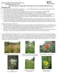
APPLICANT PACKET - Virginia Department of Conservation and ...
APPLICANT PACKET - Virginia Department of Conservation and ...
APPLICANT PACKET - Virginia Department of Conservation and ...

Create successful ePaper yourself
Turn your PDF publications into a flip-book with our unique Google optimized e-Paper software.
although once detached, the clay particles are easily transported. Clay also usually has poor infiltration,<br />
thus increasing run<strong>of</strong>f. An increase in organic matter reduces erodibility by improving structure <strong>and</strong> the<br />
stability <strong>of</strong> structure. Organic matter also improves permeability.<br />
To the RLD <strong>and</strong> inspector, who are likely to be laymen in the field <strong>of</strong> soils, a good indicator <strong>of</strong><br />
how badly a soil can be expected to erode is its erodibility factor (K). These soil erodibility factors were<br />
developed for an equation, the Universal Soil Loss Equation, that predicts soil loss. If the name <strong>of</strong> a<br />
particular soil is known, its erodibility factor can be researched in Appendix 6C <strong>of</strong> the 1992 <strong>Virginia</strong><br />
Erosion <strong>and</strong> Sediment Control H<strong>and</strong>book. The greater the K factor, the greater the soil’s erodibility. K<br />
factors are grouped into three ranges:<br />
1. 0.23 <strong>and</strong> lower – low erodibility<br />
2. 0.24 – 0.36 – moderate erodibility<br />
3. 0.37 <strong>and</strong> higher – higher erodibility<br />
It is a good idea to inventory the soils on a site before beginning construction to identify the areas<br />
with highly erodible areas. Assistance in soil identification is available from the local USDA Natural<br />
Resource <strong>Conservation</strong> Service <strong>of</strong>fice.<br />
Topography<br />
In the two topics discussed thus far, we have covered the causes <strong>of</strong> water erosion. We have been<br />
concerned with the power <strong>of</strong> rain to erode soil <strong>and</strong> the resistance or susceptibility <strong>of</strong> soil to water erosion.<br />
The remaining two topics, “Topography” <strong>and</strong> “Surface Cover,” discuss factors that may modify water<br />
erosion.<br />
In terms <strong>of</strong> erosion, slope characteristics are the most important part <strong>of</strong> site topography. These<br />
characteristics include steepness, length, contour, <strong>and</strong> slope direction. Slope length is the distance from<br />
the point where overl<strong>and</strong> flow begins to the point where it becomes a well-defined waterway (or soil<br />
deposition location) resulting from a reduction in slope grade. The longer the slope, the greater the run<strong>of</strong>f<br />
depth. As water descends a slope, its velocity <strong>and</strong> channel depth increases. As a general rule , erosion<br />
risk becomes critical when slope length exceeds the following values:<br />
Slope Gradient Slope Length<br />
0-7% 300 feet<br />
7-15% 150 feet<br />
15% <strong>and</strong> over 75 feet<br />
Slope steepness influences erosion in several ways. Steep slopes tend to increase the incidence <strong>of</strong><br />
downhill splash. Moreover, flow velocity <strong>and</strong> run<strong>of</strong>f increase proportionate to slope steepness. Slope<br />
gradients are grouped into three risk categories:<br />
0-7% Low Erosion Risk<br />
7-15% Moderate Erosion Risk<br />
15% & over High Erosion Risk<br />
Applicant Packet 15<br />
June 2001