APPLICANT PACKET - Virginia Department of Conservation and ...
APPLICANT PACKET - Virginia Department of Conservation and ...
APPLICANT PACKET - Virginia Department of Conservation and ...

Create successful ePaper yourself
Turn your PDF publications into a flip-book with our unique Google optimized e-Paper software.
VIRGINIA RESPONSIBLE LAND DISTURBER<br />
CERTIFICATE OF COMPETENCE PROGRAM<br />
<strong>APPLICANT</strong> <strong>PACKET</strong><br />
<strong>Virginia</strong> <strong>Department</strong> <strong>of</strong> <strong>Conservation</strong> <strong>and</strong> Recreation<br />
Division <strong>of</strong> Soil <strong>and</strong> Water <strong>Conservation</strong><br />
Urban Programs
How To Use The Applicant Packet:<br />
1. All <strong>of</strong> the information required to correctly answer the RLD<br />
Certification examination/test questions is contained within this<br />
packet.<br />
2. The applicant should become familiar with this information.<br />
3. The applicant is not expected to read or memorize all <strong>of</strong> this<br />
information. The exam is timed (1hour) <strong>and</strong> open book.<br />
4. The applicant should bind, tab, <strong>and</strong> highlight the 3 sections <strong>of</strong> the<br />
packet separately so correct information can be rapidly <strong>and</strong> easily<br />
located. The exam questions <strong>and</strong> packet are organized into these 3<br />
separate sections: Law <strong>and</strong> Regulations, Principles <strong>and</strong> Practices, <strong>and</strong><br />
ESC Specifications.<br />
5. The applicant should become very familiar with the table <strong>of</strong> contents<br />
<strong>and</strong> the ESC Specifications index so that correct information can be<br />
quickly located.<br />
Applicant Packet i<br />
June 2001
About the RLD Certification Exam/Test:<br />
1. The exam will consist <strong>of</strong> 25 multiple-choice questions.<br />
2. The exam is open book <strong>and</strong> timed (1 hour long).<br />
3. The exam will be administered over the internet through any<br />
computer (with printer) that has access to the DCR exam website.<br />
4. All <strong>of</strong> the information necessary to correctly answer the questions can<br />
be found in the Applicant Packet. The packet is available free <strong>of</strong><br />
charge from the DCR website.<br />
5. The exam <strong>and</strong> the packet are organized into 3 sections:<br />
Law <strong>and</strong> Regulations will have: 5 questions<br />
Principles <strong>and</strong> Practices will have: 5 questions<br />
ESC Specifications will have: 15 questions<br />
Total Exam Questions: 25 questions<br />
6. If the applicant answers 17 or more <strong>of</strong> the exam questions correctly he<br />
or she will receive their printed RLD Certificate <strong>and</strong> DCR website<br />
listing instantly.<br />
7. If the applicant answers 13 or more <strong>of</strong> the exam questions correctly<br />
but less than 17 questions correctly then a free retest will be available.<br />
The free retest will be 10 questions <strong>and</strong> 25 minutes long. The free<br />
retest will cover only those sections <strong>of</strong> the exam that the applicant<br />
answered less than 80% correct. Further directions on the free retest<br />
will be provided to those that qualify.<br />
8. If the applicant answers 12 or less questions correctly then he or she<br />
will be required to take the entire exam again at the full fee to obtain<br />
certification.<br />
9. No two exams are the same. All exams are composed <strong>of</strong> r<strong>and</strong>omly<br />
sorted questions from a database <strong>of</strong> over 1200 questions.<br />
Applicant Packet ii<br />
June 2001
10. The RLD certification application fee is $115 <strong>and</strong> the certification<br />
will be valid for 3 years beyond the date <strong>of</strong> issuance.<br />
11. Major credit cards will be accepted via the website. No cash or checks<br />
will be accepted by DCR.<br />
12. The certification exam is anticipated to be available 24 hours a<br />
day/seven days a week from any computer (with printer) that has<br />
internet access to the DCR website at www.dcr.state.va.us/sw/e&s.htm<br />
on or before June 27, 2001.<br />
Applicant Packet iii<br />
June 2001
TABLE OF CONTENTS<br />
INTRODUCTION ...............................................................................................................1<br />
LAW AND REGULATIONS SECTION.............................................................................2 - 6<br />
Definitions........................................................................................................................2<br />
Regulated L<strong>and</strong>-Disturbing Activity....................................................................................4<br />
Program Authority for Private <strong>and</strong> Public Projects..............................................................5<br />
Minimum St<strong>and</strong>ards ..........................................................................................................6<br />
PRINCIPLES AND PRACTICES SECTION.....................................................................10 - 20<br />
Guiding Principles .............................................................................................................10<br />
Geologic vs. Accelerated Erosion.......................................................................................11<br />
Five Types <strong>of</strong> Erosion .......................................................................................................11<br />
Factors Influencing Erosion ...............................................................................................12<br />
Implementation <strong>of</strong> Erosion <strong>and</strong> Sediment Controls ...............................................................16<br />
Project Inspection by the Responsible L<strong>and</strong> Disturber .........................................................19<br />
EROSION AND SEDIMENT CONTROL SPECIFICATIONS SECTION ..................21 - 143<br />
3.02 Construction Entrance...........................................................................................23<br />
3.03 Construction Road Stabilization..............................................................................26<br />
3.05 Silt Fence.............................................................................................................28<br />
3.07 Storm Drain Inlet Protection..................................................................................34<br />
3.08 Culvert Inlet Protection.........................................................................................47<br />
3.09 Temporary Diversion Dike ....................................................................................52<br />
3.10 Temporary Fill Diversion.......................................................................................54<br />
3.11 Temporary Right-<strong>of</strong>-Way Diversion.......................................................................56<br />
3.12 Diversion..............................................................................................................60<br />
3.13 Temporary Sediment Trap.....................................................................................63<br />
3.14 Temporary Sediment Basin....................................................................................67<br />
3.15 Temporary Slope Drain .........................................................................................74<br />
3.17 Stormwater Conveyance Channel..........................................................................77<br />
3.18 Outlet Protection...................................................................................................82<br />
3.19 Riprap..................................................................................................................84<br />
3.20 Rock Check Dams................................................................................................88<br />
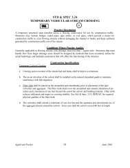
3.24 Temporary Vehicular Stream Crossing...................................................................92<br />
3.25 Utility Stream Crossing..........................................................................................95<br />
3.26 Dewatering Structure............................................................................................102<br />
3.29 Surface Roughening..............................................................................................107<br />
3.31 Temporary Seeding...............................................................................................110<br />
3.32 Permanent Seeding...............................................................................................115<br />
3.33 Sodding................................................................................................................129<br />
3.35 Mulching..............................................................................................................135<br />
3.36 Soil Stabilization Blankets <strong>and</strong> Matting....................................................................139<br />
Applicant Packet iv<br />
June 2001
INTRODUCTION<br />
The <strong>Virginia</strong> Erosion & Sediment Control Law (Title 10.1, Chapter 5, Article 4 <strong>of</strong> the Code <strong>of</strong><br />
<strong>Virginia</strong>) (Law) delineates the rights <strong>and</strong> responsibilities <strong>of</strong> the governments that administer the<br />
Commonwealth <strong>of</strong> <strong>Virginia</strong>’s Erosion <strong>and</strong> Sediment Control (ESC) Program <strong>and</strong> the property owners who<br />
must comply. The ESC Program is intended to control soil erosion, sediment deposition, <strong>and</strong><br />
nonagricultural run<strong>of</strong>f from regulated “l<strong>and</strong>-disturbing activities” to prevent degradation <strong>of</strong> property <strong>and</strong><br />
natural resources. A network <strong>of</strong> locally operated ESC Programs regulates most private projects that<br />
involve a l<strong>and</strong>-disturbing activity, while state agency projects are overseen by the <strong>Virginia</strong> <strong>Department</strong> <strong>of</strong><br />
<strong>Conservation</strong> <strong>and</strong> Recreation (DCR).<br />
The “Responsible L<strong>and</strong> Disturber (RLD) Certificate <strong>of</strong> Competence Program” was established as<br />
a component <strong>of</strong> the ESC Program by revisions to the Law that became effective on July 1, 2001.<br />
Beginning in July 2001, as a prerequisite for erosion <strong>and</strong> sediment control (ESC) plan approval, the<br />
person responsible for carrying out the plan must provide the name <strong>of</strong> an individual holding an RLD<br />
Certificate who will be in charge <strong>of</strong> <strong>and</strong> responsible for carrying out the regulated l<strong>and</strong>-disturbing activity.<br />
To meet this m<strong>and</strong>ate, DCR operates the RLD Certificate <strong>of</strong> Competence Program.<br />
The principal objectives <strong>of</strong> the RLD Certificate <strong>of</strong> Competence Program are:<br />
1. To present a wide array <strong>of</strong> educational material that promotes a baseline underst<strong>and</strong>ing <strong>of</strong> the Law,<br />
Regulations <strong>and</strong> Minimum St<strong>and</strong>ards, basic ESC principles <strong>and</strong> practices, <strong>and</strong> ESC specifications<br />
(measures) from the <strong>Virginia</strong> Erosion & Sediment Control H<strong>and</strong>book to those individuals<br />
responsible for l<strong>and</strong>-disturbing activities regulated in the Commonwealth,<br />
2. To issue a RLD Certificate <strong>of</strong> Competence to individuals who demonstrate ESC competence<br />
through an on-line or proctor assisted examination, <strong>and</strong><br />
3. To improve ESC compliance throughout the Commonwealth to ensure protection to property <strong>and</strong><br />
natural resources.<br />
This Applicant Packet is broken up into the following three Sections: (1) Law <strong>and</strong> Regulations;<br />
(2) Principles <strong>and</strong> Practices; <strong>and</strong> (3) ESC Specifications. This Applicant Packet highlights key technical,<br />
regulatory, <strong>and</strong> policy features <strong>of</strong> the ESC Program that are essential for effective <strong>and</strong> efficient on site<br />
ESC plan implementation.<br />
Further information on the RLD Certificate <strong>of</strong> Competence Program <strong>and</strong> copies <strong>of</strong> program<br />
publications are available through DCR’s website at www.dcr.state.va.us/sw/e&s.htm.<br />
Applicant Packet 1<br />
June 2001
LAW AND REGULATIONS SECTION<br />
LEARNING OBJECTIVES<br />
1. To become familiar with essential terminology in the <strong>Virginia</strong> Erosion & Sediment Control Law.<br />
2. To underst<strong>and</strong> the l<strong>and</strong>-disturbing activities that are regulated by the <strong>Virginia</strong> Erosion &<br />
Sediment Control Law.<br />
3. To underst<strong>and</strong> the regulatory authority for l<strong>and</strong>-disturbing activities on private, state, <strong>and</strong> federal<br />
l<strong>and</strong>s under the <strong>Virginia</strong> Erosion & Sediment Control Law<br />
4. To learn the 19 Minimum St<strong>and</strong>ards for erosion <strong>and</strong> sediment control m<strong>and</strong>ated by the <strong>Virginia</strong><br />
Erosion & Sediment Control Regulations.<br />
DEFINITIONS<br />
INSTRUCTIONAL ELEMENTS<br />
Below are the definitions <strong>of</strong> several terms that are essential to underst<strong>and</strong>ing the <strong>Virginia</strong> Erosion<br />
& Sediment Control Law (Law) <strong>and</strong> Erosion <strong>and</strong> Sediment Control (ESC) Program implementation.<br />
L<strong>and</strong>-Disturbing Activity means “any l<strong>and</strong> change which may result in soil erosion from water or wind<br />
<strong>and</strong> the movement <strong>of</strong> sediments into state waters or onto l<strong>and</strong>s in the Commonwealth, including, but not<br />
limited to, clearing, grading, excavating, <strong>and</strong> transporting, <strong>and</strong> filling <strong>of</strong> l<strong>and</strong>.” The Law is intended to<br />
regulate l<strong>and</strong>-disturbing activities exceeding 10,000 square feet in area; however, the thirteen activities<br />
briefly listed below are specifically exempt from the definition:<br />
1. Minor l<strong>and</strong>-disturbing activities <strong>and</strong> individual home l<strong>and</strong>scaping, repairs, <strong>and</strong> maintenance<br />
work;<br />
2. Individual service connections;<br />
3. Installation, maintenance, or repair <strong>of</strong> any underground public utility lines when such activity is<br />
confined to an existing hard surfaced road, street, or sidewalk;<br />
4. Septic tank lines or drainage fields unless included in an overall plan for l<strong>and</strong>-disturbing<br />
activity relating to construction <strong>of</strong> the building to be served by the septic tank system;<br />
5. Surface or deep mining;<br />
6. Exploration or drilling for oil <strong>and</strong> gas including the well site, roads, feeder lines <strong>and</strong> <strong>of</strong>f-site<br />
disposal areas;<br />
7. Tilling, planting, or harvesting <strong>of</strong> agricultural, horticultural, or forest crops, or livestock feedlot<br />
operations; including a specific list <strong>of</strong> engineering operations;<br />
8. Repair or rebuilding <strong>of</strong> the tracks, right-<strong>of</strong>-way, bridges, communication facilities <strong>and</strong> other<br />
related structures, <strong>and</strong> facilities <strong>of</strong> a railroad company;<br />
9. Agricultural engineering operations including but not limited to the construction <strong>of</strong> terraces,<br />
terrace outlets, check dams, desilting basins, dikes, ponds not required to comply with the<br />
provisions <strong>of</strong> the Dam Safety Act, ditches, strip cropping, lister furrowing, contour cultivating,<br />
contour furrowing, l<strong>and</strong> drainage, <strong>and</strong> l<strong>and</strong> irrigation;<br />
10. Disturbed l<strong>and</strong> areas <strong>of</strong> less than 10,000 square feet in size; however, the governing body <strong>of</strong> the<br />
local program authority may reduce this exception to a smaller area <strong>of</strong> disturbed l<strong>and</strong> or qualify<br />
the conditions under which this exception shall apply;<br />
11. Installation <strong>of</strong> fence, sign, telephone, electric, or other kinds <strong>of</strong> post or poles;<br />
Applicant Packet 2<br />
June 2001
12. Shore erosion control projects on tidal waters when the projects are approved by local wetl<strong>and</strong>s<br />
boards, the Marine Resources Commission or the United States Army Corps <strong>of</strong> Engineers; <strong>and</strong><br />
13. Emergency work to protect life, limb or property, <strong>and</strong> emergency repairs;<br />
Erosion <strong>and</strong> Sediment Control Program means the program administered by the Board, DCR, or a<br />
locality pursuant to the Law. The ESC Program includes an outline <strong>of</strong> the various methods employed by<br />
a program to regulate l<strong>and</strong>-disturbing activities <strong>and</strong> thereby minimize erosion <strong>and</strong> sedimentation in<br />
compliance with the Law. This may include such items as local ordinances, administrative policies <strong>and</strong><br />
guidelines, technical materials, plan review, inspection, <strong>and</strong> enforcement provisions.<br />
Erosion <strong>and</strong> Sediment Control Plan means a document containing material for the conservation <strong>of</strong> soil<br />
<strong>and</strong> water resources <strong>of</strong> a unit or group <strong>of</strong> units <strong>of</strong> l<strong>and</strong>. It may include appropriate maps, an appropriate<br />
soil <strong>and</strong> water plan inventory <strong>and</strong> management information with interpretations, <strong>and</strong> a record <strong>of</strong> decisions<br />
contributing to conservation treatment. The plan shall contain all ESC specifications (also referenced<br />
herein as “measures”) <strong>and</strong> major conservation decisions to assure that the entire unit or units <strong>of</strong> l<strong>and</strong> will<br />
be so treated to achieve the conservation objectives.<br />
Agreement in lieu <strong>of</strong> a plan means a contract between the plan-approving authority <strong>and</strong> the owner which<br />
specifies conservation specifications which must be implemented in the construction <strong>of</strong> a single-family<br />
residence; this contract may be executed by the plan-approving authority in lieu <strong>of</strong> a formal site plan.<br />
Owner means the owner or owners <strong>of</strong> the premises on which a regulated l<strong>and</strong>-disturbing activity is<br />
undertaken. The owner is responsible for the preparation, submission, approval, <strong>and</strong> implementation <strong>of</strong><br />
the ESC plan. The owner is further ultimately responsible for resolving any enforcement actions or<br />
damages associated with the activity.<br />
Applicant/Permittee means the applicant or permittee who may be the owner or an agent empowered by<br />
the owner to seek plan approval or obtain any required permits.<br />
Responsible L<strong>and</strong> Disturber (RLD) means an individual holding a certificate <strong>of</strong> competence issued by<br />
DCR who will be in charge <strong>of</strong> <strong>and</strong> responsible for carrying out the l<strong>and</strong>-disturbing activity in accordance<br />
with the approved plan. The RLD may be the owner, applicant, permittee, designer, superintendent,<br />
project manager, contractor, or any other project or development team member. The RLD must be<br />
designated on the plan or permit as a prerequisite for plan approval by the Plan-Approving Authority.<br />
Program Authority means an ESC Program operated by DCR, a district, or a locality that has been<br />
approved by the <strong>Virginia</strong> Soil <strong>and</strong> Water <strong>Conservation</strong> Board (Board). The Program Authority is<br />
responsible for overall administration <strong>of</strong> an ESC program, including provision <strong>of</strong> periodic site inspections<br />
<strong>and</strong> issuance <strong>of</strong> enforcement action to ensure proper plan implementation. The Plan-Approving Authority<br />
may assist the local program with project inspection.<br />
Plan-Approving Authority means the Board, Soil <strong>and</strong> Water <strong>Conservation</strong> District, Program Authority,<br />
or a department <strong>of</strong> a Program Authority, responsible for review <strong>and</strong> approval <strong>of</strong> plans <strong>and</strong> issuance <strong>of</strong><br />
required permits. The Plan-Approving Authority must ensure that an RLD has been properly designated<br />
prior to plan approval.<br />
Applicant Packet 3<br />
June 2001
DISCUSSION OF REGUALTED LAND-DISTURBING ACTIVITIES<br />
Below is clarification <strong>of</strong> the exempt status <strong>of</strong> certain types <strong>of</strong> l<strong>and</strong>-disturbing activities that have<br />
raised question in the past:<br />
1. Activities Disturbing Less Than 10,000 square feet: Activities that disturb less than 10,000<br />
square feet are exempt; however, this limit may be reduced by a locality. This threshold may<br />
not be increased. Resource areas designated under the Chesapeake Bay Preservation Act must<br />
regulate activities that exceed 2,500 square feet.<br />
2. Home L<strong>and</strong>scaping <strong>and</strong> Maintenance Work: This exemption refers only to “minor” l<strong>and</strong>disturbing<br />
activities associated with home ownership. However, it does not apply to clearing<br />
operations in excess <strong>of</strong> 10,000 square feet (or 2,500 square feet in Bay Act areas).<br />
3. Agricultural Activities: The only agricultural activities that are exempt involve the tilling,<br />
planting, or harvesting <strong>of</strong> agricultural, horiticultural, or forest crops, or feedlot operations,<br />
including a list <strong>of</strong> specific engineering operations that support these specific activities. Note<br />
that this exemption will not apply to harvesting or forest crops unless the area on which<br />
harvesting occurs is reforested artificially or naturally or is converted to bona fide agricultural<br />
or improved pasture use in accordance with the Forestry Code (Title 10, Chapter 11, Section<br />
1100 et. Seq.). The construction <strong>of</strong> farmhouses, barns, livestock/poultry houses, stables, silos,<br />
<strong>and</strong> green houses are not exempt. The construction <strong>of</strong> roads is exempt if the roads are deemed<br />
necessary for tilling, planting, or harvesting operations.<br />
4. Single Family Homes: The construction <strong>of</strong> homes on subdivision lots is not exempt even if the<br />
l<strong>and</strong> disturbance on the single lot is less than 10,000 square feet. The disturbance associated<br />
with the entire subdivision is considered in total. The Law states that localities may use an<br />
agreement in lieu <strong>of</strong> a plan in place <strong>of</strong> a formal erosion <strong>and</strong> sediment control plan for these lots.<br />
Agreements should not be used automatically for all single family construction. Site-specific<br />
conditions, such as critical slopes, highly erodible soils, <strong>and</strong> other parameters, may necessitate a<br />
full erosion <strong>and</strong> sediment control plan.<br />
5. Utilities: Utility activities that are exempt include: (1) individual service connections; (2)<br />
installation, maintenance, or repair <strong>of</strong> underground public utility lines when such activity<br />
occurs on an existing hard surfaced road, street or sidewalk if the activity is confined to the area<br />
<strong>of</strong> the road, street, or sidewalk; <strong>and</strong> (3) installation <strong>of</strong> telephone or electric post or poles.<br />
Construction, installation, <strong>and</strong> maintenance activities undertaken by private <strong>and</strong> public electric,<br />
communication, <strong>and</strong> natural gas entities are required to file general erosion <strong>and</strong> sediment<br />
control specifications annually with DCR for review <strong>and</strong> approval on behalf <strong>of</strong> the <strong>Virginia</strong> Soil<br />
<strong>and</strong> Water <strong>Conservation</strong> Board. Section 10.1-563D <strong>of</strong> the Law discusses this specifications<br />
requirement. Municipal water <strong>and</strong> sewer construction projects must seek approval <strong>of</strong> an<br />
erosion <strong>and</strong> sediment control plan from the local erosion <strong>and</strong> sediment control program.<br />
6. Railroads: Repair or rebuilding <strong>of</strong> the tracks, right-<strong>of</strong>-way, bridges, communication facilities,<br />
<strong>and</strong> other related structures, <strong>and</strong> facilities <strong>of</strong> a railroad are exempt from the Law. However,<br />
new construction <strong>of</strong> these same items must comply with the provisions <strong>of</strong> the Law by filing<br />
general erosion <strong>and</strong> sediment control specifications annually with the DCR for review <strong>and</strong><br />
Applicant Packet 4<br />
June 2001
approval on behalf <strong>of</strong> the <strong>Virginia</strong> Soil <strong>and</strong> Water <strong>Conservation</strong> Board. Section 10.1-563D <strong>of</strong><br />
the Law discusses this requirement.<br />
7. Mining <strong>and</strong> Drilling: The Law does not regulate surface or deep mining <strong>of</strong> coal or other mineral<br />
resources or exploration or drilling for gas or oil including the well site, roads, feeder lines, <strong>and</strong><br />
<strong>of</strong>f site disposal areas. These activities are subject to rules established under the <strong>Department</strong> <strong>of</strong><br />
Mines, Mineral, <strong>and</strong> Energy (DMME) <strong>and</strong> applicable federal regulations.<br />
8. Shore Erosion Control Projects: Shoreline erosion control projects in tidal waters are exempt<br />
provided they are approved by local wetl<strong>and</strong>s boards, the <strong>Virginia</strong> Marine Resources<br />
Commissions (VMRC), the <strong>Virginia</strong> <strong>Department</strong> <strong>of</strong> Environmental Quality (DEQ), or the U.S.<br />
Army Corp <strong>of</strong> Engineers. These projects must comply with any permit requirements for<br />
conserving natural resources issued by these regulating agencies. VMRC coordinates the Joint<br />
Permit Application process for projects operating in state waters <strong>and</strong> wetl<strong>and</strong>s.<br />
PROGRAM AUTHORITY FOR PRIVATE AND PUBLIC PROJECTS<br />
The Law indicates that the Program Authority for a specific l<strong>and</strong>-disturbing activity is dictated by<br />
who owns the l<strong>and</strong> on which an activity will be undertaken. The discussion below outlines the four basic<br />
types <strong>of</strong> projects <strong>and</strong> the government entity who serves as the regulatory authority.<br />
1. Private: L<strong>and</strong>-disturbing activities on private l<strong>and</strong>s must be covered by an ESC plan approved<br />
by the locally operated ESC Program in the jurisdiction in which activity is undertaken. As<br />
previously mentioned, municipal water <strong>and</strong> sewer construction projects are regulated at the<br />
local level. The local ESC Program is responsible for program administration, plan review <strong>and</strong><br />
approval, site inspection, complaint response, <strong>and</strong> enforcement on these projects.<br />
2. Multi-jurisdictional: L<strong>and</strong>-disturbing activities that cross local jurisdictions may be regulated at<br />
either the local or state level. The applicant has the option <strong>of</strong> submitting the ESC plan to each<br />
locality involved, or to DCR. Inspection <strong>and</strong> enforcement is generally carried out at the local<br />
level.<br />
3. State: Construction projects on state agency l<strong>and</strong> must be covered by an ESC plan or annual<br />
specifications approved by DCR. Plans must be consistent with local requirements that are<br />
more stringent than the state program. DCR is responsible for plan review <strong>and</strong> approval, site<br />
inspection, complaint response, <strong>and</strong> enforcement on these projects.<br />
4. Federal: Construction projects on federal l<strong>and</strong>s must comply with the Law <strong>and</strong> applicable<br />
federal nonpoint source pollution programs on all regulated l<strong>and</strong> disturbing activities in the<br />
Commonwealth. The Law gives the <strong>Virginia</strong> Soil <strong>and</strong> <strong>Conservation</strong> Board <strong>and</strong> local ESC<br />
programs the authority to cooperate <strong>and</strong> enter into agreements with federal agencies to facilitate<br />
ESC compliance. As with state projects, plans must be consistent with local requirements that<br />
may be more stringent than the state program. The federal agency is responsible for achieving<br />
compliance through separate agreements/contracts with on site developers, regular field<br />
inspection, prompt enforcement action against non-compliant projects, <strong>and</strong>/or other<br />
mechanisms consistent with agency policy.<br />
Applicant Packet 5<br />
June 2001
MINIMUM STANDARDS<br />
All regulated l<strong>and</strong>-disturbing activities must comply with the 19 Minimum St<strong>and</strong>ards (MS)<br />
specified in Section 4VAC50-30-40 <strong>of</strong> the <strong>Virginia</strong> Erosion <strong>and</strong> Sediment Control Regulations<br />
(Regulations) that are applicable to the specific project. All ESC Programs are required to confirm that<br />
projects are compliant with the criteria, techniques, <strong>and</strong> policies outlined in the Minimum St<strong>and</strong>ards. An<br />
ESC program may waive or modify any <strong>of</strong> the Minimum St<strong>and</strong>ards that are deemed inappropriate or too<br />
restrictive for site conditions by granting a written variance. The 19 Minimum St<strong>and</strong>ards are listed<br />
below:<br />
MS-1 Permanent or temporary soil stabilization shall be applied to denuded areas within seven<br />
days after final grade is reached on any portion <strong>of</strong> the site. Temporary soil stabilization<br />
shall be applied within 7 days to denuded areas that may not be at final grade but will<br />
remain dormant for longer than 30 days. Permanent stabilization shall be applied to areas<br />
that are to be left dormant for more than one year.<br />
MS-2 During construction <strong>of</strong> the project, soil stockpiles <strong>and</strong> borrow areas shall be stabilized or<br />
protected with sediment trapping measures. The applicant is responsible for the temporary<br />
protection <strong>and</strong> permanent stabilization <strong>of</strong> all soil stockpiles on site as well as borrow areas<br />
<strong>and</strong> soil intentionally transported from the project site.<br />
MS-3 A permanent vegetative cover shall be established on denuded areas not otherwise<br />
permanently stabilized. Permanent vegetation shall not be considered established until a<br />
ground cover is achieved that is uniform, mature enough to survive, <strong>and</strong> will inhibit<br />
erosion.<br />
MS-4 Sediment basins <strong>and</strong> traps, perimeter dikes, sediment barriers <strong>and</strong> other measures intended<br />
to trap sediment shall be constructed as a first step in l<strong>and</strong>-disturbing activity <strong>and</strong> shall be<br />
made functional before upslope l<strong>and</strong> disturbance takes place.<br />
MS-5 Stabilization measures shall be applied to earthen structures such as dams, dikes, <strong>and</strong><br />
diversions immediately after installation.<br />
MS-6 Sediment traps <strong>and</strong> sediment basins shall be designed <strong>and</strong> constructed based upon the total<br />
drainage area to be served by the trap or basin.<br />
a. The minimum storage capacity <strong>of</strong> a sediment trap shall be 134 cubic yards per acre <strong>of</strong><br />
drainage area, <strong>and</strong> the trap shall only control drainage areas less than three acres.<br />
b. Surface run<strong>of</strong>f from drainage areas greater than or equal to three acres shall be<br />
controlled by sediment basins. The minimum storage capacity for a sediment basin<br />
shall be 134 cubic yards per acre <strong>of</strong> drainage area. The outfall system shall, at a<br />
minimum, maintain the structural integrity <strong>of</strong> the basin during a twenty-five year storm<br />
<strong>of</strong> 24-hour duration. Run<strong>of</strong>f coefficients used in run<strong>of</strong>f calculations shall apply to a<br />
bare earth condition or those conditions expected to exist while the sediment basin is<br />
utilized.<br />
Applicant Packet 6<br />
June 2001
MS-7 Cut <strong>and</strong> fill slopes shall be designed <strong>and</strong> constructed in a manner that will minimize<br />
erosion. Slopes that are found to be eroding excessively within one year <strong>of</strong> permanent<br />
stabilization shall be provided with additional slope stabilizing measures until the problem<br />
is corrected.<br />
MS-8 Concentrated run<strong>of</strong>f shall not flow down cut or fill slopes unless contained within an<br />
adequate temporary or permanent channel, flume, or slope drain structure.<br />
MS-9 Whenever water seeps from a slope face, adequate drainage or other protection shall be<br />
provided.<br />
MS-10 All storm sewer inlets that are made operable during construction shall be protected so that<br />
sediment-laden water cannot enter the conveyance system without first being filtered or<br />
otherwise treated to remove sediment.<br />
MS-11 Before newly constructed stormwater conveyance channels or pipes are made operational,<br />
adequate outlet protection <strong>and</strong> any required temporary or permanent channel lining shall be<br />
installed in both the conveyance channel <strong>and</strong> receiving channel.<br />
MS-12 When work in a live watercourse is performed, precautions shall be taken to minimize<br />
encroachment, control sediment transport, <strong>and</strong> stabilize the work area to the greatest<br />
possible extent during construction. Non-erodible material shall be used for the<br />
construction <strong>of</strong> causeways <strong>and</strong> c<strong>of</strong>ferdams. Earthen fill may be used for these structures if<br />
armored by non-erodible cover materials.<br />
MS-13 When a live watercourse must be crossed by construction vehicles more than twice in any<br />
six-month period, a temporary vehicular stream crossing constructed <strong>of</strong> non-erodible<br />
material shall be provided.<br />
MS-14 All applicable federal, state, <strong>and</strong> local regulations pertaining to working in or crossing live<br />
watercourses shall be met.<br />
MS-15 The bed <strong>and</strong> banks <strong>of</strong> a watercourse shall be stabilized immediately after work in the<br />
watercourse is completed.<br />
MS-16 Underground utility lines shall be installed in accordance with the following st<strong>and</strong>ards in<br />
addition to other applicable criteria:<br />
a. No more than 500 linear feet <strong>of</strong> trench may be opened at one time.<br />
b. Excavated material shall be placed on the uphill side <strong>of</strong> trenches.<br />
c. Effluent from dewatering operations shall be filtered or passed through an approved<br />
sediment trapping device, or both, <strong>and</strong> discharged in a manner that does not adversely<br />
affect flowing streams or <strong>of</strong>f-site property.<br />
d. Material used for backfilling trenches shall be properly compacted in order to minimize<br />
erosion <strong>and</strong> promote stabilization.<br />
e. Re-stabilization shall be accomplished in accordance with these regulations.<br />
f. Applicable safety regulations shall be complied with.<br />
Applicant Packet 7<br />
June 2001
MS-17 Where construction vehicle access routes intersect paved or public roads, provisions shall<br />
be made to minimize the transport <strong>of</strong> sediment by vehicular tracking onto the paved<br />
surface. Where sediment is transported onto a paved or public road surface, the road<br />
surface shall be cleaned thoroughly at the end <strong>of</strong> each day. Street washing shall be allowed<br />
only after sediment is removed in this manner. This provision shall apply to individual<br />
development lots as well as to larger l<strong>and</strong>-disturbing activities.<br />
MS-18 All temporary erosion <strong>and</strong> sediment control measures shall be removed within 30 days after<br />
final site stabilization or after the temporary measures are no longer needed, unless<br />
otherwise authorized by the local program. Trapped sediment <strong>and</strong> disturbed soil areas<br />
resulting from the disposition <strong>of</strong> temporary measures shall be permanently stabilized to<br />
prevent further erosion <strong>and</strong> sedimentation.<br />
MS-19 Properties <strong>and</strong> waterways downstream from development sites shall be protected from<br />
sediment deposition, erosion, <strong>and</strong> damage due to increases in volume, velocity, <strong>and</strong> peak<br />
flow rate <strong>of</strong> stormwater run<strong>of</strong>f for the stated frequency storm <strong>of</strong> 24-hour duration in<br />
accordance with the following st<strong>and</strong>ards <strong>and</strong> criteria:<br />
a. Concentrated stormwater run<strong>of</strong>f leaving a development site shall be discharged directly<br />
into an adequate natural or man-made receiving channel, pipe, or storm sewer system.<br />
For those sites where run<strong>of</strong>f is discharged into a pipe or pipe system, downstream<br />
stability analyses at the outfall <strong>of</strong> the pipe or pipe system shall be performed.<br />
b. Adequacy <strong>of</strong> all channels <strong>and</strong> pipes shall be verified in the following manner:<br />
i. The applicant shall demonstrate that the total drainage area to the point <strong>of</strong> analysis<br />
within the channel is one hundred times greater than the contributing drainage area<br />
<strong>of</strong> the project in question; or<br />
ii. (a) Natural channels shall be analyzed by the use <strong>of</strong> a two-year storm to verify that<br />
stormwater will not overtop channel banks nor cause erosion <strong>of</strong> channel bed or<br />
banks; <strong>and</strong><br />
(b) All previously constructed man-made channels shall be analyzed by the use <strong>of</strong><br />
a ten-year storm to verify that stormwater will not overtop its banks <strong>and</strong> by the use<br />
<strong>of</strong> a two-year storm to demonstrate that stormwater will not cause erosion <strong>of</strong><br />
channel bed or banks; <strong>and</strong><br />
(c) Pipes <strong>and</strong> storm sewer systems shall be analyzed by the use <strong>of</strong> a ten-year storm<br />
to verify that stormwater will be contained within the pipe or system.<br />
c. If existing natural receiving channels or previously constructed man-made channels or<br />
pipes are not adequate, the applicant shall:<br />
i. Improve the channel to a condition where a ten-year storm will not overtop the<br />
banks <strong>and</strong> a two-year storm will not cause erosion to the channel bed or banks; or<br />
ii. Improve the pipe or pipe system to a condition where the ten-year storm is<br />
contained within the appurtenances; or<br />
iii. Develop a site design that will not cause the pre-development peak run<strong>of</strong>f rate from<br />
a two-year storm to increase when run<strong>of</strong>f outfalls into a natural channel, or will not<br />
cause the pre-development peak run<strong>of</strong>f rate from a ten-year storm to increase when<br />
run<strong>of</strong>f outfalls into a man-made channel; or<br />
iv. Provide a combination <strong>of</strong> channel improvement, stormwater detention, or other<br />
measures to prevent downstream erosion satisfactory to the plan-approving<br />
authority.<br />
d. The applicant shall provide evidence <strong>of</strong> permission to make the improvements.<br />
Applicant Packet 8<br />
June 2001
e. All hydrologic analyses shall be based on the existing watershed characteristics <strong>and</strong> the<br />
ultimate development <strong>of</strong> the subject project.<br />
f. If the applicant chooses an option that includes stormwater detention, he shall obtain<br />
approval from the locality <strong>of</strong> a plan for maintenance <strong>of</strong> the detention facilities. The<br />
plan shall set forth maintenance requirements <strong>of</strong> the facility <strong>and</strong> designate the person<br />
responsible for performing the maintenance.<br />
g. Outfall from a detention facility shall be discharged to a receiving channel, <strong>and</strong> energy<br />
dissipaters placed at the outfall <strong>of</strong> the detention facilities as necessary to provide a<br />
stable transition from the facility to the receiving channel.<br />
h. All on-site channels must be verified to be adequate.<br />
i. Increased volumes <strong>of</strong> sheet flows causing erosion or sedimentation on adjacent<br />
property shall be diverted to a stable outlet, adequate channel, pipe or pipe system, or to<br />
a detention facility.<br />
j. In applying these stormwater run<strong>of</strong>f criteria, individual lots or parcels in a residential,<br />
commercial, or industrial development shall not be considered to be separate<br />
development projects. Instead, the development as a whole shall be treated as a single<br />
project. Hydrologic parameters that reflect the ultimate development state shall be used<br />
in all engineering calculations.<br />
k. All measures used to protect properties <strong>and</strong> waterways shall be executed in a manner<br />
that minimizes the impact on the physical, chemical, <strong>and</strong> biological integrity <strong>of</strong> rivers,<br />
streams, <strong>and</strong> other state waters.<br />
Applicant Packet 9<br />
June 2001
PRINCIPLES AND PRACTICES SECTION<br />
LEARNING OBJECTIVE<br />
1. To underst<strong>and</strong> the basic principles <strong>of</strong> erosion <strong>and</strong> sedimentation.<br />
2. To underst<strong>and</strong> the seven practices that are essential to successful implementation <strong>of</strong> erosion <strong>and</strong><br />
sediment controls on construction sites.<br />
3. To underst<strong>and</strong> the inspection responsibilities <strong>of</strong> the RLD during active construction.<br />
GUIDING PRINCIPLES<br />
INSTRUCTIONAL ELEMENTS<br />
There are three overriding principles <strong>of</strong> erosion <strong>and</strong> sediment control (ESC) that provide the basis<br />
for all planning <strong>and</strong> design work. These should form the basis for each development project. The three<br />
principles are:<br />
1. Erosion control<br />
2. Sediment Control<br />
3. Coordination<br />
Erosion control is the first line <strong>of</strong> defense; if there is no erosion, there can be no sediment.<br />
Control at the source <strong>of</strong> material prevents both erosion damages <strong>and</strong> sediment damages. In some<br />
instances, this may be the only way to have an acceptable level <strong>of</strong> control <strong>of</strong> the very fine sediments. In<br />
many instances, in field situations, it will be impossible or impractical to impound water laden with this<br />
fine material for long enough periods for it to settle out.<br />
Sediment control is the second line <strong>of</strong> defense. It provides a backup when all possible erosion<br />
control measures have been utilized. Sediment should be filtered out <strong>of</strong> the run<strong>of</strong>f water or allowed to<br />
settle out before the run<strong>of</strong>f leaves the site. Care must be taken so that run<strong>of</strong>f released from the site will<br />
not cause channel erosion <strong>and</strong> sediment damage downstream.<br />
These lines <strong>of</strong> defense must be coordinated to achieve the most effective level <strong>of</strong> protection. This<br />
calls for coordination <strong>of</strong> erosion <strong>and</strong> sediment control operations <strong>and</strong> coordination <strong>of</strong> these with the<br />
overall plan for the development. Erosion control will seldom, if ever, be completely effective during<br />
construction. Adequate provisions for trapping sediment before it leaves the site must back up erosion<br />
control. To prevent downstream damages, an evaluation must be made to determine what is needed to<br />
counteract the higher run<strong>of</strong>f that will occur after development. Facilities should be provided to reduce the<br />
damages that might otherwise occur. Erosion <strong>and</strong> sediment control must be planned along with the total<br />
plan for the site. If this is not done during or along with the planning for the total development, the l<strong>and</strong><br />
developer will be left with limited, costly, <strong>and</strong> unsatisfactory options for erosion <strong>and</strong> sediment control.<br />
Applicant Packet 10<br />
June 2001
GEOLOGIC vs. ACCELERATED EROSION<br />
Soil erosion is usually defined as the wearing away <strong>of</strong> the l<strong>and</strong> surface by water, wind, ice, <strong>and</strong><br />
gravity. In <strong>Virginia</strong>, we are primarily concerned with erosion by water. For our purposes, we can define<br />
soil erosion as a process <strong>of</strong> detachment <strong>and</strong> transportation <strong>of</strong> soil materials by erosive agents.<br />
Erosion is not a recent phenomenon. It has been occurring since the beginning <strong>of</strong> time. Whole<br />
mountains have eroded away. Sediment deposits several miles thick have been formed. Features as<br />
spectacular as the Gr<strong>and</strong> Canyon have resulted from erosion. This natural process is called geologic<br />
erosion. It seldom is discernible to us. It usually continues as a slow natural process unless it is disturbed<br />
by the activities <strong>of</strong> man. Geologic erosion produces about 30% <strong>of</strong> the total sediment in the U.S.<br />
The erosion about which we are more concerned results from man’s use <strong>of</strong> the l<strong>and</strong>. This type is<br />
called accelerated erosion since the geologic rate is increased by the intervention <strong>of</strong> man. In this country,<br />
accelerated erosion began when the first settlers from Europe cleared sloping l<strong>and</strong> <strong>and</strong> planted soilexposing<br />
crops. Accelerated erosion accounts for about 70% <strong>of</strong> all the sediment produced in the U.S.<br />
Surface mining, forestry, agriculture, <strong>and</strong> construction are the major activities causing accelerated<br />
erosion. About 71% <strong>of</strong> the sediment generated by accelerated erosion comes from agricultural l<strong>and</strong>.<br />
Cropl<strong>and</strong> is the chief source <strong>of</strong> this sediment. Construction activities, surface mining, forestry, <strong>and</strong><br />
stream channel erosion account for the remaining 29%. Indirect effects <strong>of</strong> construction may be resulting<br />
in much higher sediment production than the direct activities. Stormwater run<strong>of</strong>f from impervious<br />
surfaces in urban areas is causing many streams that were relatively stable to suffer severe channel<br />
erosion.<br />
THE FIVE TYPES OF EROSION<br />
Raindrop erosion is the first effect <strong>of</strong> a rainstorm on the soil. Raindrop impact dislodges soil particles<br />
<strong>and</strong> splashes them into the air. These detached particles are then vulnerable to sheet erosion.<br />
Sheet erosion is the erosion caused by a shallow sheet <strong>of</strong> water as it runs <strong>of</strong>f the l<strong>and</strong>. These very<br />
shallow, moving sheets <strong>of</strong> water are seldom the detaching agent, but the flow transports soil particles that<br />
are detached by raindrop impact <strong>and</strong> splash. The shallow surface flow rarely moves as a uniform sheet<br />
for more than a few feet on l<strong>and</strong> surfaces before concentrating in surface irregularities.<br />
Rill erosion is the erosion that develops as the shallow surface flow begins to concentrate in the low spots<br />
<strong>of</strong> the irregular conformation <strong>of</strong> the surface. As the flow changes from shallow sheet flow to deeper flow<br />
in these low areas, the velocity <strong>and</strong> turbulence <strong>of</strong> flow increase. The energy <strong>of</strong> this concentrated flow is<br />
able to both detach <strong>and</strong> transport soil materials. This action begins to cut tiny channels <strong>of</strong> its own. Rills<br />
are small but well-defined channels that are, at the most, only a few inches deep. They are easily<br />
obliterated by harrowing or other surface treatments, <strong>and</strong> have no more than 1 square foot cross-section.<br />
Gully erosion occurs as the flow in rills comes together in larger <strong>and</strong> larger channels. The major<br />
difference between gully <strong>and</strong> rill erosion is size. Gullies are too large to be repaired with conventional<br />
tillage equipment <strong>and</strong> usually require heavy equipment <strong>and</strong> special techniques for stabilization.<br />
Channel erosion occurs as the volume <strong>and</strong> velocity <strong>of</strong> flow cause movement <strong>of</strong> the stream bed <strong>and</strong> bank<br />
materials.<br />
Applicant Packet 11<br />
June 2001
FACTORS INFLUENCING EROSION<br />
There are four major factors which have a direct influence on the detachment <strong>and</strong> transportation<br />
<strong>of</strong> soil materials. These are:<br />
1. Climate<br />
2. Soils<br />
3. Topography<br />
4. Vegetation (or surface cover)<br />
Climate<br />
We will first discuss climate since it is the source <strong>of</strong> the major erosive agent in the erosion<br />
process. When we talk about climate we are primarily concerned with rainfall, although temperature <strong>and</strong><br />
snow cover are also important. The discussion <strong>of</strong> rainfall can be divided into the effects <strong>of</strong> raindrops <strong>and</strong><br />
the effects <strong>of</strong> run<strong>of</strong>f.<br />
Raindrop erosion is the first step in the erosion process. The action <strong>of</strong> falling rain is responsible<br />
for 90% or more <strong>of</strong> total soil erosion. It produces two damaging effects: the detachment <strong>and</strong><br />
transportation <strong>of</strong> surface soil <strong>and</strong> the puddling or sealing <strong>of</strong> the soil surface. Neutralizing these two<br />
effects is the first <strong>and</strong> most important part <strong>of</strong> erosion control.<br />
How can rainfall be responsible for so much damage? Observations <strong>of</strong> a hard rain on bare soil<br />
confirm its destructive power. The drops hit the surface like tiny bombs. They shatter soil granules <strong>and</strong><br />
splash the detached material back <strong>and</strong> forth. Splashed particles may be moved more than two feet high<br />
<strong>and</strong> five feet horizontally. On level l<strong>and</strong>, this is self-canceling. On sloping l<strong>and</strong>, the net movement is<br />
downhill. On a 10% slope, 75% <strong>of</strong> the soil movement is downslope. More than 100 tons <strong>of</strong> soil per acre<br />
may be detached in a single rain.<br />
The erosive capacity <strong>of</strong> rainfall comes from the energy <strong>of</strong> its motion, or kinetic energy. It is<br />
dependent upon the amount <strong>and</strong> intensity <strong>of</strong> rainfall, raindrop diameter, <strong>and</strong> raindrop velocity.<br />
Drop size varies from the finest mist to drops which are 1/3 inch in diameter. Any rain will<br />
contain drops <strong>of</strong> various sizes. A hard rain has a much higher proportion <strong>of</strong> large drops.<br />
Raindrop velocity is tied very closely to drop size. Fine mists with droplets <strong>of</strong> about 1/100 inch<br />
diameter fall at a rate <strong>of</strong> about 1 inch per second. The largest drops attain a velocity <strong>of</strong> 30 feet per second.<br />
It is obvious from this that rain falling as large drops in a hard thunderstorm has many times more erosive<br />
capacity than that falling as fine drizzle over a longer period <strong>of</strong> time. The actual force <strong>of</strong> raindrop impact<br />
in a hard summer storm may be 2 or 3 hundred times the force <strong>of</strong> the surface run<strong>of</strong>f, even on steep slopes.<br />
The effects <strong>of</strong> splash erosion are easy to see in nature. Splashed soil particles can be seen<br />
clinging to the foundation <strong>of</strong> buildings that are adjacent to bare soil. Particles can be seen on stems <strong>and</strong><br />
leaves <strong>of</strong> plants that are growing in a partially vegetated field. Pedestals <strong>of</strong> soil, capped with protective<br />
stones, can be seen where raindrop splash carried away unprotected material.<br />
Another important aspect <strong>of</strong> rainfall is its distribution. The most erosive rains are not scattered<br />
evenly throughout the year. In <strong>Virginia</strong>, they are concentrated in the months <strong>of</strong> June through September.<br />
Applicant Packet 12<br />
June 2001
Unfortunately, this period <strong>of</strong> most erosive rain coincides with the most active part <strong>of</strong> the construction<br />
season.<br />
Table 1 indicates some significant differences between storms occurring during the spring <strong>and</strong><br />
summer <strong>and</strong> those occurring in the fall <strong>and</strong> winter.<br />
TABLE 1<br />
PRECIPITATION CHARACTERISTICS BY SEASON<br />
CHARACTERISTICS SEPT – APRIL MAY – AUGUST<br />
Form Rain <strong>and</strong> Snow Rain<br />
Intensity Low High<br />
Drop Size Small Large<br />
Duration <strong>of</strong> Storm Long Short<br />
Area <strong>of</strong> Storm Large Small<br />
So far we have concentrated on the force <strong>of</strong> falling rain <strong>and</strong> its capacity to detach <strong>and</strong> move soil<br />
material. Another damaging effect <strong>of</strong> raindrops is the compacting, puddling, <strong>and</strong> sealing <strong>of</strong> the soil<br />
surface. As mentioned before, large drops strike with tremendous impact, compacting the soil under the<br />
point <strong>of</strong> impact. Repeated strikes churn the surface into a slurry. As this semi-fluid mass attempts to<br />
infiltrate the soil, it does a very effective job <strong>of</strong> sealing the pore spaces against further entry <strong>of</strong> water. As<br />
drops continue to beat against the surface, they sort <strong>and</strong> compact the material until an almost complete<br />
seal is formed. Even on coarse s<strong>and</strong>s, this action reduces the intake <strong>of</strong> water.<br />
This brings us to the other damaging aspect <strong>of</strong> rainfall-run<strong>of</strong>f. Run<strong>of</strong>f begins when the rate <strong>of</strong><br />
rainfall exceeds the intake capacity <strong>of</strong> the soil. When a hard rainfall is unimpeded as it strikes the soil,<br />
run<strong>of</strong>f begins a few minutes after the start <strong>of</strong> the rain. In the early stages, its major potential for damage<br />
is as a transporting agent for soil dislodged by raindrop splash. As water begins to collect on the surface,<br />
it has no kinetic energy. It derives energy from its movement as it begins to run downslope. The amount<br />
<strong>of</strong> run<strong>of</strong>f depends on two things: the amount <strong>and</strong> intensity <strong>of</strong> the rainfall, <strong>and</strong> the nature <strong>of</strong> the soil or<br />
intervening surface that it falls upon. Run<strong>of</strong>f at first takes the form <strong>of</strong> a layer <strong>of</strong> water flowing more or<br />
less uniformly over the ground. Depth <strong>of</strong> this flow is usually very shallow. Flows <strong>of</strong> this sort have<br />
practically no capacity to detach soil, but they do have the capacity to transport particles that are detached<br />
<strong>and</strong> kept in suspension by raindrop impact. The result <strong>of</strong> this combination <strong>of</strong> the detaching capacity <strong>of</strong><br />
raindrops <strong>and</strong> the transporting capacity <strong>of</strong> sheet-flow run<strong>of</strong>f is sheet erosion. The effects <strong>of</strong> this type <strong>of</strong><br />
erosion occur on all parts <strong>of</strong> the l<strong>and</strong> surface except in rills <strong>and</strong> gullies. Because it removes soil in thin<br />
layers from 95% or more <strong>of</strong> the l<strong>and</strong> surface, it is difficult to observe, even though the total soil loss may<br />
be tremendous.<br />
Under normal field conditions, run<strong>of</strong>f occurs both as sheet flow <strong>and</strong> channel flow. As water<br />
moves downslope, it tends to follow the path <strong>of</strong> least resistance. The flow begins to concentrate in the<br />
depressions <strong>and</strong> irregularities <strong>of</strong> the l<strong>and</strong> surface. This is the beginning <strong>of</strong> channel flow. As the amount<br />
<strong>of</strong> water in these channels increases, the velocity <strong>and</strong> turbulence also increases. As the run<strong>of</strong>f<br />
concentrates first in tiny channels then combining into larger <strong>and</strong> larger ones, it gains the force to both<br />
detach <strong>and</strong> transport soil material. The erosive capacity <strong>of</strong> flowing water is based upon its velocity,<br />
turbulence, the amount <strong>and</strong> type <strong>of</strong> abrasive material flow, the roughness <strong>of</strong> the channel, <strong>and</strong> the slope<br />
gradient. As the length <strong>of</strong> slope increases, the depth, <strong>and</strong> hence the velocity, also increases.<br />
Applicant Packet 13<br />
June 2001
Detachment by flowing water is confined primarily to the areas <strong>of</strong> concentrated flow (rills <strong>and</strong><br />
gullies). Rolling, lifting, <strong>and</strong> abrasive actions influence the detachment <strong>of</strong> soil particles. The force is<br />
horizontal, in the direction <strong>of</strong> the flow. The flow force detaches particles by rolling or dragging them out<br />
<strong>of</strong> position. As velocity <strong>and</strong> turbulence increase, vertical currents <strong>and</strong> eddies occur. This upward<br />
movement <strong>of</strong> water lifts soil particles from their place <strong>and</strong> sets them in motion. As the particles <strong>of</strong> soil<br />
already transported by the flow strike or drag over other soil particles, they detach them <strong>and</strong> set them in<br />
motion. This is detachment by abrasive action. The amount <strong>and</strong> abrasiveness <strong>of</strong> the flow particles<br />
influences the amount <strong>of</strong> soil detached by abrasion.<br />
The same factors that determine detaching capacity act to determine the transporting capacity. As<br />
mentioned before, sheet flow has very little detaching capacity. It is effective in transporting soil<br />
materials because raindrop impact keeps the material in suspension. It has been observed that muddy<br />
water flowing across a parking lot leaves a deposit <strong>of</strong> mud under each car while the adjacent pavement is<br />
washed clean. In this case, the velocity <strong>and</strong> turbulence <strong>of</strong> flow alone is not enough to keep the material in<br />
suspension. The material detached by raindrops <strong>and</strong> transported by sheet flow is the more finely textured<br />
soil material.<br />
The flow in rills <strong>and</strong> gullies transports material by “surface creep,” “saltation,” <strong>and</strong> suspension.<br />
In surface creep, the particles roll or slide along the bottom <strong>of</strong> the rill or gully. The particles move by<br />
saltation when the uneven forces <strong>of</strong> turbulence lift <strong>and</strong> move them by jumps. Particles travel in<br />
suspension when the upward velocities <strong>of</strong> turbulent flow exceed the gravitational weight <strong>of</strong> the soil<br />
material. In general, larger particles are moved by surface creep <strong>and</strong> saltation while smaller particles are<br />
moved by suspension. Unless limited by the amount that can be detached, the total amount <strong>of</strong> material<br />
moved depends on the transportation capacity <strong>of</strong> the run<strong>of</strong>f <strong>and</strong> the transportability <strong>of</strong> the soil material.<br />
Soil<br />
The second major factor influencing erosion is the soil. When all other factors are held constant,<br />
different kinds <strong>of</strong> soil erode at different rates. Soil differences may cause more than a tenfold difference<br />
in erosion rates. The difference in erosion rates that is due to the properties <strong>of</strong> the soil itself is called soil<br />
erodibility.<br />
The soil properties that influence erodibility by water are: (1) those properties that affect the rate<br />
at which water enters the soil (infiltration rate), (2) properties that affect the rate at which water moves<br />
through the soil (permeability), (3) the total water volume, (4) factors affecting detachment by raindrop<br />
impact <strong>and</strong> detachment by rolling, lifting, <strong>and</strong> abrasion <strong>of</strong> flowing water, <strong>and</strong> (5) characteristics <strong>of</strong> the soil<br />
that allow it to resist the transporting forces <strong>of</strong> rainfall <strong>and</strong> run<strong>of</strong>f.<br />
Soil erodibility has been investigated intensively in development <strong>of</strong> the Universal Soil Loss<br />
Equation. The important properties are: (1) particle size <strong>and</strong> gradation, (2) percent <strong>of</strong> organic matter, (3)<br />
soil structure, <strong>and</strong> (4) soil permeability. There are several additional properties that influence soil<br />
erodibility, but the above account for approximately 85% <strong>of</strong> the variance in observed soil loss.<br />
There is a very good correlation between erodibility <strong>and</strong> an index derived from five soil<br />
parameters. Two <strong>of</strong> these reflect particle size <strong>and</strong> gradation while the other three are percent organic<br />
matter, soil structure, <strong>and</strong> soil permeability.<br />
Soil particle size distribution plays a major role in determining erodibility. Erodibility tends to<br />
increase with increased silt <strong>and</strong> very fine s<strong>and</strong> content; <strong>and</strong> to decrease with increased s<strong>and</strong>, clay, <strong>and</strong><br />
organic matter content. Soils with a high clay content are generally more resistant to detachment,<br />
Applicant Packet 14<br />
June 2001
although once detached, the clay particles are easily transported. Clay also usually has poor infiltration,<br />
thus increasing run<strong>of</strong>f. An increase in organic matter reduces erodibility by improving structure <strong>and</strong> the<br />
stability <strong>of</strong> structure. Organic matter also improves permeability.<br />
To the RLD <strong>and</strong> inspector, who are likely to be laymen in the field <strong>of</strong> soils, a good indicator <strong>of</strong><br />
how badly a soil can be expected to erode is its erodibility factor (K). These soil erodibility factors were<br />
developed for an equation, the Universal Soil Loss Equation, that predicts soil loss. If the name <strong>of</strong> a<br />
particular soil is known, its erodibility factor can be researched in Appendix 6C <strong>of</strong> the 1992 <strong>Virginia</strong><br />
Erosion <strong>and</strong> Sediment Control H<strong>and</strong>book. The greater the K factor, the greater the soil’s erodibility. K<br />
factors are grouped into three ranges:<br />
1. 0.23 <strong>and</strong> lower – low erodibility<br />
2. 0.24 – 0.36 – moderate erodibility<br />
3. 0.37 <strong>and</strong> higher – higher erodibility<br />
It is a good idea to inventory the soils on a site before beginning construction to identify the areas<br />
with highly erodible areas. Assistance in soil identification is available from the local USDA Natural<br />
Resource <strong>Conservation</strong> Service <strong>of</strong>fice.<br />
Topography<br />
In the two topics discussed thus far, we have covered the causes <strong>of</strong> water erosion. We have been<br />
concerned with the power <strong>of</strong> rain to erode soil <strong>and</strong> the resistance or susceptibility <strong>of</strong> soil to water erosion.<br />
The remaining two topics, “Topography” <strong>and</strong> “Surface Cover,” discuss factors that may modify water<br />
erosion.<br />
In terms <strong>of</strong> erosion, slope characteristics are the most important part <strong>of</strong> site topography. These<br />
characteristics include steepness, length, contour, <strong>and</strong> slope direction. Slope length is the distance from<br />
the point where overl<strong>and</strong> flow begins to the point where it becomes a well-defined waterway (or soil<br />
deposition location) resulting from a reduction in slope grade. The longer the slope, the greater the run<strong>of</strong>f<br />
depth. As water descends a slope, its velocity <strong>and</strong> channel depth increases. As a general rule , erosion<br />
risk becomes critical when slope length exceeds the following values:<br />
Slope Gradient Slope Length<br />
0-7% 300 feet<br />
7-15% 150 feet<br />
15% <strong>and</strong> over 75 feet<br />
Slope steepness influences erosion in several ways. Steep slopes tend to increase the incidence <strong>of</strong><br />
downhill splash. Moreover, flow velocity <strong>and</strong> run<strong>of</strong>f increase proportionate to slope steepness. Slope<br />
gradients are grouped into three risk categories:<br />
0-7% Low Erosion Risk<br />
7-15% Moderate Erosion Risk<br />
15% & over High Erosion Risk<br />
Applicant Packet 15<br />
June 2001
The shape <strong>of</strong> slopes can affect erosion. On convex slopes (slopes which steepen at the lower end)<br />
the erosion potential is greater. On concave slopes (slopes that flatten at the lower end) the erosion<br />
potential will be less.<br />
Direction <strong>of</strong> slope has an indirect effect simple because <strong>of</strong> the effect that exposure has on<br />
vegetation. South <strong>and</strong> southwest facing slopes are usually the hardest to vegetate <strong>and</strong> maintain when all<br />
other slope factors are considered to be equal.<br />
Surface Cover<br />
Surface cover is the last <strong>of</strong> the four factors influencing erosion. IT IS PERHAPS THE MOST<br />
IMPORTANT FACTOR FROM THE STANDPOINT OF CONTROL. Research has shown that the<br />
amount <strong>of</strong> erosion is proportionate to the amount <strong>of</strong> bare soil that is exposed to raindrop impact. The use<br />
<strong>of</strong> vegetation, mulches, <strong>and</strong> other surface covers <strong>of</strong>fers the greatest range <strong>of</strong> control alternatives.<br />
One further value <strong>of</strong> vegetation is its effect on run<strong>of</strong>f velocity. Certain types <strong>of</strong> vegetation are<br />
known to be very effective in reducing erosion caused by flowing water. Vegetation is frequently used to<br />
provide a protective lining in shallow waterways.<br />
IMPLEMENTATION OF EROSION AND SEDIMENT CONTROLS<br />
The following section breaks down the implementation <strong>of</strong> an erosion <strong>and</strong> sediment control plan<br />
into seven practices, primarily from the perspective <strong>of</strong> the Responsible L<strong>and</strong> Disturber (RLD). The seven<br />
practices are:<br />
1. Site Review<br />
2. Pre-Construction Conference<br />
3. Site Preparation<br />
4. Inspection <strong>and</strong> Maintenance<br />
5. Grading <strong>and</strong> Utilities Installation<br />
6. Building Construction<br />
7. Permanent Site Stabilization<br />
Site Review<br />
The RLD must be thoroughly familiar with both the existing conditions at the construction site<br />
<strong>and</strong> the approved ESC plan for the l<strong>and</strong>-disturbing activity.<br />
The RLD should note all existing critical areas indicated on the plan <strong>and</strong> then actually identify<br />
their location <strong>and</strong> extent on the ground. These should include stream channels <strong>and</strong> associated flood plain<br />
areas, drainage ways <strong>and</strong> outlets into streams, points where l<strong>and</strong>-disturbing activities are adjacent to or<br />
must cross steams <strong>and</strong> drainage ways, steep slopes <strong>and</strong> highly erodible soils, <strong>and</strong> run<strong>of</strong>f entering the site<br />
from adjacent areas. The RLD should note what practices are specified to protect these areas. Also, he or<br />
she should be aware <strong>of</strong> critical areas not specifically treated in the plan. These issues should be discussed<br />
at the pre-construction conference with the contractors, consultants, <strong>and</strong> other appropriate parties who<br />
will be operating on site.<br />
Next, the RLD should determine the location <strong>of</strong> all control measures <strong>and</strong> determine their<br />
appropriateness for existing site conditions <strong>and</strong> the planned project. The RLD should document any<br />
needed plan modifications <strong>and</strong> discuss these at the pre-construction conference.<br />
Applicant Packet 16<br />
June 2001
Further, the RLD should check the schedule for the installation <strong>of</strong> erosion <strong>and</strong> sediment control<br />
(ESC) <strong>and</strong> their relationship with l<strong>and</strong>-disturbing activities. The site must be protected as a first step<br />
before l<strong>and</strong>-disturbing activities are started. Major l<strong>and</strong>-disturbing activities should be phased in order to<br />
limit the size <strong>of</strong> denuded areas exposed at any time. The timing, sequence, <strong>and</strong> staging <strong>of</strong> control<br />
installations are important elements <strong>of</strong> the plan that should be assessed prior to the project initiation.<br />
Pre-Construction Conference<br />
Following review <strong>of</strong> the site, the RLD should set up a pre-construction conference <strong>and</strong> site review<br />
with on site contractors, consultants, <strong>and</strong> the inspector from the program authority. Attendance by the<br />
local inspector assigned to the site is essential to establish lines <strong>of</strong> communication early in the plan<br />
implementation process. Further, the site review will help all parties to fully underst<strong>and</strong> their<br />
responsibilities prior to, during, <strong>and</strong> following active construction. All aspects <strong>of</strong> the plan <strong>and</strong> any<br />
suggested modifications <strong>and</strong> questions should be discussed to ensure that the RLD <strong>and</strong> all parties are in<br />
agreement regarding the plan <strong>and</strong> scheduling. Special attention should be given to perimeter practices<br />
designed to prevent damage to critical areas, adjacent properties, <strong>and</strong>/or natural resources.<br />
The location <strong>of</strong> all measures should be carefully considered. If study <strong>of</strong> the plan indicates that<br />
adjustments in location are needed, these should be discussed with the RLD. The RLD may authorize<br />
minor adjustments, such as moving a diversion from a property line to a grading limit, or shifting an<br />
outlet to match a natural depression in the l<strong>and</strong>. However, major adjustments may require formal revision<br />
<strong>of</strong> the plan <strong>and</strong> should be approved by the plan-approving authority.<br />
The sequence <strong>and</strong> phasing <strong>of</strong> the installation <strong>of</strong> practices <strong>and</strong> l<strong>and</strong>-disturbing activities should<br />
also be discussed. The guidelines for ESC planning require that sediment basins <strong>and</strong> other appropriate<br />
measures be installed prior to, or as a first phase <strong>of</strong>, l<strong>and</strong> grading. Other appropriate measures include<br />
construction entrances, diversion dikes, interceptor dikes, perimeter dikes, gravel outlet structures, level<br />
spreaders, waterways or outlets, <strong>and</strong> grade stabilizing structures. The RLD must emphasize the<br />
importance <strong>of</strong> establishing these practices before grading begins.<br />
The Minimum St<strong>and</strong>ards should be checked to be sure that all applicable st<strong>and</strong>ards will be<br />
satisfied. A Minimum St<strong>and</strong>ards Checklist may be used to quickly accomplish this task. Approved<br />
variances <strong>and</strong> associated formal documentation should be noted, <strong>and</strong> it should be determined if any<br />
additional measures or variances are needed.<br />
Site Preparation<br />
One <strong>of</strong> the first steps in preparing a site for active construction is to lay out all traffic circulation<br />
routes <strong>and</strong> storage areas. Route locations should be chosen so they pose the least threat to identified<br />
critical areas. Existing well-vegetated areas should be damaged as little as possible <strong>and</strong> soil stockpiles<br />
should be located a safe distance from waterways <strong>and</strong> streams. Barriers may be required to keep traffic<br />
within the delineated areas, or at least out <strong>of</strong> the critical areas. If needed, they should be installed before<br />
opening the site to general construction traffic.<br />
Required structural sediment trapping practices should be installed <strong>and</strong> stabilized as a first step<br />
measure before general grading begins. (Note that compacting, seeding, <strong>and</strong> mulching are required to<br />
stabilize these practices.) Next, waterways <strong>and</strong> outlets should be installed with the vegetation or lining<br />
material called for in the plan.<br />
Applicant Packet 17<br />
June 2001
The entire site work force should be instructed about the location <strong>of</strong> critical areas <strong>and</strong> associated<br />
ESC practices <strong>and</strong> the need to protect these areas from damage.<br />
Inspection <strong>and</strong> Maintenance <strong>of</strong> ESC Specifications<br />
Maintenance must begin as soon as the first temporary ESC specification is installed <strong>and</strong> must<br />
continue through all the succeeding activities until the permanent specifications or structures are<br />
established <strong>and</strong> functioning. The features <strong>of</strong> a maintenance program are described in the narrative part <strong>of</strong><br />
the plan. All structural specifications should be checked at the close <strong>of</strong> each workday <strong>and</strong> before <strong>and</strong><br />
after each rainstorm. Diversion berms should be checked to see that they have not been breached by<br />
equipment. The condition <strong>of</strong> level spreader areas, waterways, <strong>and</strong> other outlets should also be checked.<br />
Traffic should be moving within the established access routes. Perimeter controls <strong>and</strong> conveyance<br />
channels should be checked for sediment deposits or other impeding material. Repairs should always be<br />
made promptly when damages are discovered. When repairing waterways or other channels, the new<br />
lining material should be non-erosive. Vegetative practices <strong>and</strong> cover on structural practices require<br />
maintenance fertilizer <strong>and</strong>, perhaps, mowing on a regular basis.<br />
All sediment traps <strong>and</strong> basins should be checked after each storm <strong>and</strong> cleaned out when the<br />
deposited material reaches the level designated in the plan.<br />
Grading <strong>and</strong> Utility Construction<br />
The fifth major step is site grading <strong>and</strong> utility installation. If stockpiling <strong>of</strong> fill or topsoil is<br />
planned, a pre-selected, relatively isolated stockpile area should be used. To minimize erosion, the slopes<br />
<strong>of</strong> the stockpile should be flattened at the end <strong>of</strong> each working period. The stockpile should be mulched<br />
<strong>and</strong> seeded if it’s to remain dormant or is no longer needed.<br />
Disturbed areas that can be brought to final grade at this stage during an appropriate season for<br />
seeding should be seeded, sodded, or otherwise stabilized with the permanent material <strong>and</strong> techniques<br />
indicated in the plan. If they cannot be seeded, they should be stabilized with anchored mulch or other<br />
appropriate stabilization measures. Areas to remain at rough grade for more than 30-days before<br />
permanent stabilization should be mulched <strong>and</strong> seeded to provide temporary cover within 7 days.<br />
Utilities such as storm sewers, sanitary sewers, electric <strong>and</strong> communication lines, water mains,<br />
<strong>and</strong> gas mains are usually installed at this time. To minimize the amount <strong>of</strong> area disturbed, the work<br />
should be organized <strong>and</strong> the trenches sized to accommodate several utilities in one trench. The<br />
installation should be carefully coordinated to reduce the time that the trenches will stay open. Note that<br />
no more than 500 linear feet <strong>of</strong> trench may remain open at one time. If sediment-laden water must be<br />
pumped from utility trenches, it should be conveyed safely to an appropriate filtering measure<br />
(dewatering devices, sediment trap or basin). As soon as possible, trenches should be filled, compacted,<br />
mulched, <strong>and</strong> seeded to provide temporary or permanent stabilization. Further, as soon as the storm<br />
sewers are installed, inlet protection should be installed to prevent sediment from entering the system. If<br />
required, storm drain outlet protection should also be installed.<br />
Building Construction<br />
The sixth major step or stage is building construction. Two major hazards are common during<br />
this step. The introduction <strong>of</strong> additional equipment <strong>and</strong> work force brings added risks to areas requiring<br />
protection. Efforts to control traffic must be increased during this period. All traffic should be confined<br />
to established travel routes. The second hazard is from excavated material. This phase usually results in<br />
high volumes <strong>of</strong> soil for disposal <strong>and</strong> stockpiling. Stockpiles should be located where they will not wash<br />
into drainage ways or onto previously stabilized areas. The slopes on these areas should be flattened <strong>and</strong><br />
Applicant Packet 18<br />
June 2001
protected by anchored mulch <strong>and</strong> temporary seeding. Excavations should be backfilled as soon as<br />
possible, <strong>and</strong> appropriate surface protection <strong>and</strong> stabilization should be provided.<br />
Permanent Site Stabilization<br />
The last step is permanent stabilization. As mentioned earlier, this should not be delayed until the<br />
entire development is completed. A significant reduction in erosion damage repair <strong>and</strong> re-grading costs<br />
can be achieved if smaller areas are stabilized with permanent vegetation as soon as they are ready.<br />
Most temporary sediment basins, dikes, sediment traps, <strong>and</strong> other earthen control structures are to<br />
be removed, re-graded, mulched, <strong>and</strong> seeded before leaving the site. However, the RLD should consult<br />
the plan before removing them to ensure that they are not removed until the surrounding area is stabilized<br />
<strong>and</strong> they are no longer needed.<br />
In some cases, sediment basins, diversions, <strong>and</strong> waterways are to remain as part <strong>of</strong> the permanent<br />
stormwater run<strong>of</strong>f management system. In such cases, sediment basins should be cleaned out <strong>and</strong> seeded<br />
with suitable permanent vegetation. Diversions <strong>and</strong> waterways should be checked, repaired if needed,<br />
<strong>and</strong> left in good condition. The RLD should check on the final condition <strong>of</strong> permanent measures <strong>and</strong><br />
confirm that long-term maintenance <strong>of</strong> these facilities is accounted for.<br />
When final grading is completed, all denuded areas should be stabilized with permanent<br />
vegetation. The ESC specifications for permanent vegetative practices are provided in the Specifications<br />
Section.<br />
PROJECT INSPECTION BY RESPONSIBLE LAND DISTURBER<br />
The RLD should inspect the site frequently throughout the project, with careful inspection at<br />
installation <strong>of</strong> critical measures (e.g., sediment basins) <strong>and</strong> at the end <strong>of</strong> each phase for phased projects.<br />
The RLD will need to coordinate to ensure that appropriate parties (job superintendent, foreman, etc.) are<br />
available to participate in the inspection. Additionally, communication with the inspector from the<br />
Program Authority may also be required to coordinate on site visits. The RLD should be familiar with the<br />
plan <strong>and</strong> construction schedule ahead <strong>of</strong> time. Any required repairs or corrective actions indicated by the<br />
RLD should be made immediately. Any plan modifications recommended by the RLD should be<br />
discussed with the Owner <strong>and</strong> Plan-Approving Authority prior to implementation on site.<br />
The RLD should also use a st<strong>and</strong>ard checklist when performing inspections. Most <strong>of</strong> the items on<br />
that checklist refer to a specific Minimum St<strong>and</strong>ard (MS). The items from the checklist are listed below:<br />
Are there any denuded areas that require temporary or permanent stabilization? (MS-1)<br />
Are soil stockpiles adequately stabilized with seeding <strong>and</strong>/or sediment trapping measures?<br />
(MS-2)<br />
Does permanent vegetation provide adequate stabilization? (MS-3)<br />
Have sediment-trapping facilities been constructed as a first step? (MS-4)<br />
Are perimeter sediment trapping measures in place <strong>and</strong> earthen structures seeded <strong>and</strong> mulched?<br />
(MS-5)<br />
Applicant Packet 19<br />
June 2001
Have sediment basins been installed where needed? (MS-6)<br />
Are all cut <strong>and</strong> fill slopes adequately stabilized? (MS-7)<br />
Are all on-site drainage channels <strong>and</strong> outlets adequately stabilized? (MS-8&9)<br />
Are all operational storm sewer inlets protected so that sediment will not enter the system?<br />
(MS-10)<br />
Have stormwater conveyance channels been adequately stabilized? (linings <strong>and</strong>/or outlet<br />
protection) (MS-11)<br />
Is there any work going on in live streams that may require stabilization or a temporary stream<br />
crossing? (MS-12, MS-13, MS-14)<br />
Are utility trenches backfilled, seeded, <strong>and</strong> dewatered properly? (MS-16)<br />
Is there any evidence <strong>of</strong> dirt or mud the road? (MS-17)<br />
Are there any structural practices that should be removed because they are no longer needed?<br />
(MS-18)<br />
Do any structural practices require repair or clean-out to maintain adequate function? (MS-18)<br />
Are properties <strong>and</strong> waterways downstream from development adequately protected from<br />
erosion <strong>and</strong> sediment damage due to increases in peak stormwater run<strong>of</strong>f? (MS-19)<br />
If violations <strong>of</strong> a plan or potentially hazardous situations are noted, they should be immediately<br />
reported to the Owner. The RLD may be able to suggest economical ways to achieve desirable<br />
corrections. In any case, it is wise to set a reasonable deadline for accomplishing necessary corrections.<br />
Plan changes or cases <strong>of</strong> non-compliance (such as commencing l<strong>and</strong> disturbance without an approved<br />
plan) should be addressed with the Plan-Approving Authority <strong>and</strong> Program Authority as appropriate.<br />
The common thread in any successful plan implementation is the need to reach timely solutions to<br />
issues that arise on site prior to <strong>and</strong> during plan implementation. By becoming knowledgeable in the<br />
<strong>Virginia</strong> ESC Program, developing a cooperative working relationship with on site parties, <strong>and</strong> exercising<br />
common sense, the RLD can facilitate efficient <strong>and</strong> economical plan implementation.<br />
Applicant Packet 20<br />
June 2001
EROSION AND SEDUMENT CONTROL SPECIFICATIONS SECTION<br />
LEARNING OBJECTIVE<br />
1. To become familiar with the description, construction details, <strong>and</strong> maintenance procedures for 25<br />
erosion <strong>and</strong> sediment control specifications recommended by the <strong>Virginia</strong> ESC Program.<br />
INSTRUCTIONAL ELEMENTS<br />
This Section contains the description, construction details, <strong>and</strong> maintenance procedures for 25 <strong>of</strong><br />
the most commonly applied structural <strong>and</strong> vegetative ESC specifications included in the <strong>Virginia</strong> Erosion<br />
& Sediment Control H<strong>and</strong>book (Third Edition, 1992). The index below provides a list <strong>of</strong> the<br />
specifications covered in this Section.<br />
ESC SPECIFICATIONS INDEX<br />
Road Stabilization Page<br />
3.02 Construction Entrance..................................................................................................23<br />
3.03 Construction Road Stabilization....................................................................................26<br />
Sediment Barriers<br />
3.05 Silt Fence.....................................................................................................................28<br />
3.07 Storm Drain Inlet Protection.........................................................................................34<br />
3.08 Culvert Inlet Protection.................................................................................................47<br />
Dikes <strong>and</strong> Diversions<br />
3.09 Temporary Diversion Dike ...........................................................................................52<br />
3.10 Temporary Fill Diversion..............................................................................................54<br />
3.11 Temporary Right-<strong>of</strong>-Way Diversion..............................................................................56<br />
3.12 Diversion.....................................................................................................................60<br />
Sediment Traps <strong>and</strong> Basins<br />
3.13 Temporary Sediment Trap............................................................................................63<br />
3.14 Temporary Sediment Basin...........................................................................................67<br />
Applicant Packet 21<br />
June 2001
Flumes<br />
3.15 Temporary Slope Drain................................................................................................74<br />
Waterway <strong>and</strong> Outlet Protection<br />
3.17 Stormwater Conveyance Channel.................................................................................77<br />
3.18 Outlet Protection..........................................................................................................82<br />
3.19 Riprap .........................................................................................................................84<br />
3.20 Rock Check Dams.......................................................................................................88<br />
Stream Protection<br />
3.24 Temporary Vehicular Stream Crossing..........................................................................92<br />
3.25 Utility Stream Crossing.................................................................................................95<br />
3.26 Dewatering Structure....................................................................................................102<br />
Site Preparation for Vegetation Establishment<br />
3.29 Surface Roughening......................................................................................................107<br />
Grass Establishment<br />
3.31 Temporary Seeding......................................................................................................110<br />
3.32 Permanent Seeding.......................................................................................................115<br />
3.33 Sodding.......................................................................................................................129<br />
Mulches<br />
3.35 Mulching......................................................................................................................135<br />
3.36 Soil Stabilization Blankets <strong>and</strong> Matting..........................................................................139<br />
Applicant Packet 22<br />
June 2001
STD. & SPEC. 3.02<br />
TEMPORARY STONE CONSTRUCTION ENTRANCE<br />
Practice Description<br />
A stabilized stone pad with a filter fabric underliner located at points <strong>of</strong> vehicular ingress <strong>and</strong> egress on a<br />
construction site, used to reduce the amount <strong>of</strong> mud transported onto paved public roads by motor vehicles<br />
or run<strong>of</strong>f.<br />
Conditions Where Practice Applies<br />
Wherever traffic will be leaving a construction site <strong>and</strong> moves directly onto a public road or other paved<br />
area.<br />
Construction Specifications<br />
1. Aggregate Size: VDOT #1 Coarse Aggregate (2- to 3- inch stone) should be used.<br />
2. Entrance Dimensions: The aggregate layer must be at least 6 inches thick; a minimum three inches <strong>of</strong><br />
aggregate should be placed in a cut section to give the entrance added stability <strong>and</strong> to help secure filter<br />
cloth separator. It must extend the full width <strong>of</strong> the vehicular ingress <strong>and</strong> egress area <strong>and</strong> have a<br />
minimum 12-foot width. The length <strong>of</strong> the entrance must be at least 70 feet (see Plate 3.02-1).<br />
3. Washing: If conditions on the site are such that the majority <strong>of</strong> the mud is not removed by the vehicles<br />
traveling over the stone, then the tires <strong>of</strong> the vehicles must be washed before entering the public road.<br />
Wash water must be carried away from the entrance to an approved settling area to remove<br />
sediment. All sediment shall be prevented from entering storm drains, ditches, or watercourses. A<br />
wash rack may also be used to make washing more convenient <strong>and</strong> effective (see Plate 3.02-1).<br />
4. Location: The entrance should be located to provide for maximum utilization by all construction<br />
vehicles.<br />
5. The area <strong>of</strong> the entrance must be excavated a minimum <strong>of</strong> 3 inches <strong>and</strong> must be cleared <strong>of</strong> all<br />
vegetation, roots, <strong>and</strong> other objectionable material. The filter fabric underliner will then be placed the<br />
full width <strong>and</strong> length <strong>of</strong> the entrance.<br />
6. Following the installation <strong>of</strong> the filter cloth, the stone shall be placed to the specified dimensions. If<br />
wash racks are used, they should be installed according to manufacturer's specifications. Any<br />
drainage facilities required because <strong>of</strong> washing should be constructed according to specifications.<br />
Conveyance <strong>of</strong> surface water under entrance, through culverts, shall be provided as required. If such<br />
conveyance is impossible, the construction <strong>of</strong> a "mountable" berm with 5:1 slopes will be permitted.<br />
Applicant Packet<br />
23<br />
June 2001<br />
CE
The filter cloth utilized shall be a woven or nonwoven fabric consisting only <strong>of</strong> continuous chain<br />
polymeric filaments or yarns <strong>of</strong> polyester. The fabric shall be inert to commonly encountered<br />
chemicals <strong>and</strong> hydrocarbons, be mildew <strong>and</strong> rot resistant.<br />
Maintenance<br />
The entrance shall be maintained in a condition that will prevent tracking or flow <strong>of</strong> mud onto public rights<strong>of</strong>-way.<br />
This may require periodic top dressing with additional stone or the washing <strong>and</strong> reworking <strong>of</strong><br />
existing stone as conditions dem<strong>and</strong> <strong>and</strong> repair <strong>and</strong>/or cleanout <strong>of</strong> any structures used to trap sediment.<br />
All materials spilled, dropped, washed, or tracked from vehicles onto roadways or into storm drains must<br />
be removed immediately. The use <strong>of</strong> water trucks to remove materials dropped, washed, or tracked onto<br />
roadways will not be permitted under any circumstances.<br />
Applicant Packet<br />
24<br />
June 2001
Applicant Packet<br />
25<br />
June 2001
STD & SPEC 3.03<br />
CONSTRUCTION ROAD STABILIZATION<br />
CRS<br />
Practice Description<br />
The temporary stabilization <strong>of</strong> access roads, subdivision roads, parking areas, <strong>and</strong> other on-site vehicle<br />
transportation routes with stone immediately after grading, to reduce the erosion <strong>of</strong> temporary roadbeds by<br />
construction traffic during wet weather, <strong>and</strong> to prevent having to regrade permanent roadbeds between<br />
the time <strong>of</strong> initial grading <strong>and</strong> final stabilization.<br />
Conditions Where Practice Applies<br />
Wherever stone-base roads or parking areas are constructed, whether permanent or temporary, for use by<br />
construction traffic.<br />
Construction Specifications<br />
Temporary Access Roads <strong>and</strong> Parking Areas<br />
1. Temporary roads shall follow the contour <strong>of</strong> the natural terrain to the extent possible. Slopes should<br />
not exceed 10 percent.<br />
2. Temporary parking areas should be located on naturally flat areas to minimize grading. Grades should<br />
be sufficient to provide drainage but should not exceed 4 percent.<br />
3. Roadbeds shall be at least 14 feet wide for one-way traffic <strong>and</strong> 20 feet wide for two-way traffic.<br />
4. All cuts <strong>and</strong> fills shall be 2:1 or flatter to the extent possible.<br />
5. Drainage ditches shall be provided as needed <strong>and</strong> shall be designed <strong>and</strong> constructed in accordance<br />
with STORMWATER CONVEYANCE CHANNEL, Std. & Spec. 3.17.<br />
6. The roadbed or parking surface shall be cleared <strong>of</strong> all vegetation, roots <strong>and</strong> other objectionable<br />
material.<br />
7. A 6-inch course <strong>of</strong> VDOT #1 Coarse Aggregate shall be applied immediately after grading or the<br />
completion <strong>of</strong> utility installation within the right-<strong>of</strong>-way. Filter fabric may be applied to the roadbed for<br />
additional stability. Design specifications for filter fabric can be found within Std. & Spec. 3.02,<br />
TEMPORARY STONE CONSTRUCTION ENTRANCE. In "heavy duty" traffic situations (see<br />
Table 3.02-A), stone should be placed at an 8- to 10-inch depth to avoid excessive dissipation or<br />
maintenance needs.<br />
Applicant Packet 26<br />
June 2001<br />
CRS
Vegetation<br />
All roadside ditches, cuts, fills <strong>and</strong> disturbed areas adjacent to parking areas <strong>and</strong> roads shall be stabilized<br />
with appropriate temporary or permanent vegetation according to the applicable st<strong>and</strong>ards <strong>and</strong><br />
specifications contained in this h<strong>and</strong>book.<br />
Maintenance<br />
Both temporary <strong>and</strong> permanent roads <strong>and</strong> parking areas may require periodic top dressing with new<br />
gravel. Seeded areas adjacent to the roads <strong>and</strong> parking areas should be checked periodically to ensure<br />
that a vigorous st<strong>and</strong> <strong>of</strong> vegetation is maintained. Roadside ditches <strong>and</strong> other drainage structures should<br />
be checked regularly to ensure that they do not become clogged with silt or other debris.<br />
Applicant Packet 27<br />
June 2001
STD & SPEC. 3.05<br />
SILT FENCE<br />
Practice Description<br />
A temporary sediment barrier consisting <strong>of</strong> a synthetic filter fabric stretched across <strong>and</strong> attached to<br />
supporting posts <strong>and</strong> entrenched, used to intercept <strong>and</strong> detain small amounts <strong>of</strong> sediment from disturbed<br />
areas during construction operations in order to prevent sediment from leaving the site, <strong>and</strong> to decrease the<br />
velocity <strong>of</strong> sheet flows <strong>and</strong> low-to-moderate level channel flows.<br />
Conditions Where Practice Applies<br />
1. Below disturbed areas where erosion would occur in the form <strong>of</strong> sheet <strong>and</strong> rill erosion.<br />
2. Where the size <strong>of</strong> the drainage area is no more than one quarter acre per 100 feet <strong>of</strong> silt fence length;<br />
the maximum slope length behind the barrier is 100 feet; <strong>and</strong> the maximum gradient behind the barrier<br />
is 50 percent (2:1).<br />
3. In minor swales or ditch lines where the maximum contributing drainage area is no greater than 1 acre<br />
<strong>and</strong> flow is no greater than 1 cfs.<br />
4. Silt fence will not be used in areas where rock or some other hard surface prevents the full <strong>and</strong><br />
uniform depth anchoring <strong>of</strong> the barrier.<br />
Construction Specifications<br />
1. Synthetic filter fabric shall be a pervious sheet <strong>of</strong> propylene, nylon, polyester or ethylene yarn <strong>and</strong> shall<br />
be certified by the manufacturer or supplier as conforming to the requirements noted in Table 3.05-B.<br />
Applicant Packet 28<br />
June 2001<br />
SF
TABLE 3.05-B<br />
PHYSICAL PROPERTIES OF<br />
FILTER FABRIC IN SILT FENCE<br />
Physical Property Test Requirements<br />
Filtering Efficiency ASTM 5141 75% (minimum)<br />
Tensile Strength at VTM-52 Extra Strength-<br />
20% (max.) Elongation* 50 lbs./linear inch<br />
(minimum)<br />
St<strong>and</strong>ard Strength-<br />
30 lbs./linear inch<br />
(minimum)<br />
Flow Rate ASTM 5141 0.2 gal./sq. ft./min.<br />
(minimum)<br />
Ultraviolet Radiation ASTM-G-26 90% (minimum)<br />
*Requirements reduced by 50% after six months <strong>of</strong> installation.<br />
Source: VHTRC<br />
2. Synthetic filter fabric shall contain ultraviolet ray inhibitors <strong>and</strong> stabilizers to provide a minimum <strong>of</strong> six<br />
months <strong>of</strong> expected usable construction life at a temperature range <strong>of</strong> 0? F to 120? F.<br />
3. If wooden stakes are utilized for silt fence construction, they must have a diameter <strong>of</strong> 2 inches when<br />
oak is used <strong>and</strong> 4 inches when pine is used. Wooden stakes must have a minimum length <strong>of</strong> 5 feet.<br />
4. If steel posts (st<strong>and</strong>ard "U" or "T" section) are utilized for silt fence construction, they must have a<br />
minimum weight <strong>of</strong> 1.33 pounds per linear foot <strong>and</strong> shall have a minimum length <strong>of</strong> 5 feet.<br />
5. Wire fence reinforcement for silt fences using st<strong>and</strong>ard-strength filter cloth shall be a minimum <strong>of</strong> 14<br />
gauge <strong>and</strong> shall have a maximum mesh spacing <strong>of</strong> 6 inches.<br />
Installation<br />
1. The height <strong>of</strong> a silt fence shall be a minimum <strong>of</strong> 16 inches above the original ground surface <strong>and</strong> shall<br />
not exceed 34 inches above ground elevation.<br />
Applicant Packet 29<br />
June 2001
2. The filter fabric shall be purchased in a continuous roll cut to the length <strong>of</strong> the barrier to avoid the use<br />
<strong>of</strong> joints. When joints are unavoidable, filter cloth shall be spliced together only at a support post, with<br />
a minimum 6-inch overlap, <strong>and</strong> securely sealed.<br />
3. A trench shall be excavated approximately 4-inches wide <strong>and</strong> 4-inches deep on the upslope side <strong>of</strong> the<br />
proposed location <strong>of</strong> the measure.<br />
4. When wire support is used, st<strong>and</strong>ard-strength filter cloth may be used. Posts for this type <strong>of</strong><br />
installation shall be placed a maximum <strong>of</strong> 10-feet apart (see Plate 3.05-1).<br />
The wire mesh fence must be fastened securely to the upslope side <strong>of</strong> the posts using heavy duty wire<br />
staples at least one inch long, tie wires or hog rings. The wire shall extend into the trench a minimum<br />
<strong>of</strong> two inches <strong>and</strong> shall not extend more than 34 inches above the original ground surface. The<br />
st<strong>and</strong>ard-strength fabric shall be stapled or wired to the wire fence, <strong>and</strong> 8 inches <strong>of</strong> the fabric shall be<br />
extended into the trench. The fabric shall not be stapled to existing trees.<br />
5. When wire support is not used, extra-strength filter cloth shall be used. Posts for this type <strong>of</strong> fabric<br />
shall be placed a maximum <strong>of</strong> 6-feet apart (see Plate 3.05-2).<br />
The filter fabric shall be fastened securely to the upslope side <strong>of</strong> the posts using one inch long<br />
(minimum) heavy-duty wire staples or tie wires <strong>and</strong> eight inches <strong>of</strong> the fabric shall be extended into<br />
the trench. The fabric shall not be stapled to existing trees. This method <strong>of</strong> installation has been<br />
found to be more commonplace than #4.<br />
6. If a silt fence is to be constructed across a ditch line or swale, the measure must be <strong>of</strong> sufficient<br />
length to eliminate endflow, <strong>and</strong> the plan configuration shall resemble an arc or horseshoe with the<br />
ends oriented upslope (see Plate 3.05-2). Extra-strength filter fabric shall be used for this application<br />
with a maximum 3-foot spacing <strong>of</strong> posts.<br />
All other installation requirements noted in #5 apply.<br />
7. The 4-inch by 4-inch trench shall be backfilled <strong>and</strong> the soil compacted over the filter fabric.<br />
8. Silt fences shall be removed when they have served their useful purpose, but not before the upslope<br />
area has been permanently stabilized.<br />
Maintenance<br />
1. Silt fences shall be inspected immediately after rainfall <strong>and</strong> at least daily during prolonged rainfall. Any<br />
required repairs shall be made immediately.<br />
2. Close attention shall be paid to the repair <strong>of</strong> damaged silt fence resulting from end runs <strong>and</strong><br />
undercutting.<br />
Applicant Packet 30<br />
June 2001
3. Should the fabric on a silt fence decompose or become ineffective prior to the end <strong>of</strong> the expected<br />
usable life <strong>and</strong> the barrier is still necessary, the fabric shall be replaced promptly.<br />
4. Sediment deposits should be removed after each storm event. They must be removed when deposits<br />
reach approximately one-half the height <strong>of</strong> the barrier.<br />
5. Any sediment deposits remaining in place after the silt fence is no longer required shall be dressed to<br />
conform with the existing grade, prepared <strong>and</strong> seeded.<br />
Applicant Packet 31<br />
June 2001
Applicant Packet 32<br />
June 2001
Applicant Packet 33<br />
June 2001
STD & SPEC 3.07<br />
STORM DRAIN INLET PROTECTION<br />
Practice Description<br />
A sediment filter or an excavated impounding area around a storm drain drop inlet or curb inlet used to<br />
prevent sediment from entering storm drainage systems prior to permanent stabilization <strong>of</strong> the disturbed<br />
area.<br />
Conditions Where Practice Applies<br />
Where storm drain inlets are to be made operational before permanent stabilization <strong>of</strong> the corresponding<br />
disturbed drainage area. Different types <strong>of</strong> structures are applicable to different conditions (see Plates<br />
3.07-1 through 3.07-8).<br />
1. Silt Fence Drop Inlet Protection<br />
Construction Specifications<br />
a. Silt Fence shall conform to the construction specifications for "extra strength" found in Table 3.05-<br />
B <strong>and</strong> shall be cut from a continuous roll to avoid joints.<br />
b. For stakes, use 2 x 4-inch wood (preferred) or equivalent metal with a minimum length <strong>of</strong> 3 feet.<br />
c. Space stakes evenly around the perimeter <strong>of</strong> the inlet a maximum <strong>of</strong> 3-feet apart, <strong>and</strong> securely<br />
drive them into the ground, approximately 18-inches deep (see Plate 3.07-1).<br />
d. To provide needed stability to the installation, frame with 2 x 4-inch wood strips around the crest<br />
<strong>of</strong> the overflow area at a maximum <strong>of</strong> 1½ feet above the drop inlet crest.<br />
e. Place the bottom 12 inches <strong>of</strong> the fabric in a trench Plate 3.07-1) <strong>and</strong> backfill the trench with 12<br />
inches <strong>of</strong> compacted soil.<br />
f. Fasten fabric securely by staples or wire to the stakes <strong>and</strong> frame. Joints must be overlapped to<br />
the next stake.<br />
g. It may be necessary to build a temporary dike on the downslope side <strong>of</strong> the structure to prevent<br />
bypass flow.<br />
Applicant Packet 34<br />
June 2001<br />
IP
Applicant Packet 35<br />
June 2001
2. Gravel <strong>and</strong> Wire Mesh Drop Inlet Sediment Filter<br />
a. Wire mesh shall be laid over the drop inlet so that the wire extends a minimum <strong>of</strong> 1 foot beyond<br />
each side <strong>of</strong> the inlet structure. Wire mesh with 1/2-inch openings shall be used. If more than<br />
one strip <strong>of</strong> mesh is necessary, the strips shall be overlapped.<br />
b. Coarse aggregate shall be placed over the wire mesh as indicated on Plate 3.07-2. The depth <strong>of</strong><br />
stone shall be at least 12 inches over the entire inlet opening. The stone shall extend beyond the<br />
inlet opening at least 18 inches on all sides.<br />
c. If the stone filter becomes clogged with sediment so that it no longer adequately performs its<br />
function, the stones must be pulled away from the inlet, cleaned <strong>and</strong>/or replaced.<br />
Note: This filtering device has no overflow mechanism; therefore, ponding is likely especially if sediment<br />
is not removed regularly. This type <strong>of</strong> device must never be used where overflow may endanger an<br />
exposed fill slope. Consideration should also be given to the possible effects <strong>of</strong> ponding on traffic<br />
movement, nearby structures, working areas, adjacent property, etc.<br />
Applicant Packet 36<br />
June 2001
Applicant Packet 37<br />
June 2001
3. Block <strong>and</strong> Gravel Drop Inlet Sediment Filter<br />
a. Place concrete blocks lengthwise on their sides in a single row around the perimeter <strong>of</strong> the<br />
inlet, with the ends <strong>of</strong> the adjacent blocks abutting. The height <strong>of</strong> the barrier can be varied,<br />
depending on design needs, by stacking combinations <strong>of</strong> various width blocks. The barrier<br />
shall be no less than 12 inches high <strong>and</strong> no greater than 24 inches high.<br />
b. Wire mesh shall be placed over the outside vertical face (webbing) <strong>of</strong> the blocks to prevent<br />
stone wash thru. Wire mesh with ½” openings shall be used.<br />
c. Stone shall be place against the wire to the top <strong>of</strong> the barrier as shown in Plate 3.07-3.<br />
d. The stone shall be removed cleaned <strong>and</strong> replaced when the sediment level reaches ½ the<br />
barrier height.<br />
Applicant Packet 38<br />
June 2001
Applicant Packet 39<br />
June 2001
4. Excavated Drop Inlet Sediment Trap<br />
a. The excavated trap shall be sized to provide a minimum storage capacity calculated at the rate <strong>of</strong><br />
134 cubic yards per acre <strong>of</strong> drainage area. A trap shall be no less than 1-foot nor more than 2feet<br />
deep measured from the top <strong>of</strong> the inlet structure. Side slopes shall not be steeper than 2:1<br />
(see Plate 3.07-4).<br />
b. The slope <strong>of</strong> the basin may vary to fit the drainage area <strong>and</strong> terrain. Observations must be made<br />
to check trap efficiency <strong>and</strong> modifications shall be made as necessary to ensure satisfactory<br />
trapping <strong>of</strong> sediment. Where an inlet is located so as to receive concentrated flows, such as in a<br />
highway median, it is recommended that the basin have a rectangular shape in a 2:1 (length/width)<br />
ratio, with the length oriented in the direction <strong>of</strong> the flow.<br />
c. Sediment shall be removed <strong>and</strong> the trap restored to its original dimensions when the sediment has<br />
accumulated to one-half the design depth <strong>of</strong> the trap. Removed sediment shall be deposited in a<br />
suitable area <strong>and</strong> in a manner such that it will not erode.<br />
Applicant Packet 40<br />
June 2001
Applicant Packet 41<br />
June 2001
5. Gravel Curb Inlet Sediment Filter<br />
a. Wire mesh with 1/2-inch openings shall be placed over the curb inlet opening so that at least 12<br />
inches <strong>of</strong> wire extends across the inlet cover <strong>and</strong> at least 12 inches <strong>of</strong> wire extends across the<br />
concrete gutter from the inlet opening, as depicted in Plate 3.07-6.<br />
b. Stone shall be piled against the wire so as to anchor it against the gutter <strong>and</strong> inlet cover <strong>and</strong> to<br />
cover the inlet opening completely.<br />
c. If the stone filter becomes clogged with sediment so that it no longer adequately performs its<br />
function, the stone must be pulled away from the block, cleaned <strong>and</strong> replaced.<br />
Applicant Packet 42<br />
June 2001
Applicant Packet 43<br />
June 2001
6. Block <strong>and</strong> Gravel Curb Inlet Sediment Filter<br />
a. Two concrete blocks shall be placed on their sides abutting the curb at either side <strong>of</strong> the inlet<br />
opening.<br />
b. A 2-inch x 4-inch stud shall be cut <strong>and</strong> placed through the outer holes <strong>of</strong> each spacer block to help<br />
keep the front blocks in place.<br />
c. Concrete blocks shall be placed on their sides across the front <strong>of</strong> the inlet <strong>and</strong> abutting the spacer<br />
blocks as depicted in Plate 3.07-8.<br />
d. Wire mesh shall be placed over the outside vertical face (webbing) <strong>of</strong> the concrete blocks to<br />
prevent stone from being washed through the holes in the blocks. Wire mesh with 1/2-inch<br />
openings shall be used.<br />
e. Coarse aggregate shall be piled against the wire to the top <strong>of</strong> the barrier as shown.<br />
f. If the stone filter becomes clogged with sediment so that it no longer adequately performs its<br />
function, the stone must be pulled away from the blocks, cleaned <strong>and</strong>/or replaced.<br />
Applicant Packet 44<br />
June 2001
Applicant Packet 45<br />
June 2001
Maintenance<br />
1. The structure shall be inspected after each rain <strong>and</strong> repairs made as needed.<br />
2. Sediment shall be removed <strong>and</strong> the trap restored to its original dimensions when the sediment has<br />
accumulated to one half the design depth <strong>of</strong> the trap. Removed sediment shall be deposited in a<br />
suitable area <strong>and</strong> in such a manner that it will not erode.<br />
3. Structures shall be removed when the remaining drainage area has been properly stabilized.<br />
Applicant Packet 46<br />
June 2001
STD & SPEC 3.08<br />
CULVERT INLET PROTECTION<br />
Practice Description<br />
A sediment filter located at the inlet to storm sewer culverts, used to prevent sediment from entering,<br />
accumulating in <strong>and</strong> being transferred by a culvert <strong>and</strong> associated drainage system prior to permanent<br />
stabilization <strong>of</strong> a disturbed project area; <strong>and</strong>, to provide erosion control at culvert inlets during the phase <strong>of</strong><br />
a project where elevation <strong>and</strong> drainage patterns change, causing original control measures to be ineffective<br />
or in need <strong>of</strong> removal.<br />
Conditions Where Practice Applies<br />
Where culvert <strong>and</strong> associated drainage system is to be made operational prior to permanent stabilization <strong>of</strong><br />
the disturbed drainage area. Different types <strong>of</strong> structures are applicable to different conditions (see Plates<br />
3.08-1 <strong>and</strong> 3.08-2).<br />
General Guidelines (All Types)<br />
1. The inlet protection device shall be constructed in a manner that will facilitate clean-out <strong>and</strong> disposal<br />
<strong>of</strong> trapped sediment <strong>and</strong> minimize interference with construction activities.<br />
2. The inlet protection devices shall be constructed in such a manner that any resultant ponding <strong>of</strong><br />
stormwater will not cause excessive inconvenience or damage to adjacent areas or structures.<br />
3. Design criteria more specific to each particular inlet protection device will be found in Plates 3.08-1<br />
through 3.08-2.<br />
Construction Specifications<br />
1. Silt Fence Culvert Inlet Protection<br />
a. The height <strong>of</strong> the silt fence (in front <strong>of</strong> the culvert opening) shall be a minimum <strong>of</strong> 16 inches <strong>and</strong><br />
shall not exceed 34 inches.<br />
b. Extra strength filter fabric with a maximum spacing <strong>of</strong> stakes <strong>of</strong> 3 feet shall be used to construct<br />
the measure.<br />
c. The placement <strong>of</strong> silt fence should be approximately 6 feet from the culvert in the direction <strong>of</strong><br />
incoming flow, creating a "horseshoe" shape as shown in Plate 3.08-1.<br />
d. If silt fence cannot be installed properly or the flow <strong>and</strong>/or velocity <strong>of</strong> flow to the culvert protection<br />
is excessive <strong>and</strong> may breach the structure, the stone combination noted in Plate 3.08-1 should be<br />
utilized.<br />
Applicant Packet 47<br />
June 2001<br />
CIP
2. Culvert Inlet Sediment Trap<br />
a. Geometry <strong>of</strong> the design will be a "horseshoe" shape around the culvert inlet (see Plate 3.08-2).<br />
b. The toe <strong>of</strong> riprap (composing the sediment filter dam) shall be no closer than 24" from the culvert<br />
opening in order to provide an acceptable emergency outlet for flows from larger storm events.<br />
c. All other "Construction Specifications" found within Std. & Spec. 3.13, TEMPORARY<br />
SEDIMENT TRAP, also apply to this practice.<br />
d. The proper installation <strong>of</strong> the culvert inlet sediment trap is a viable substitute for the installation <strong>of</strong><br />
the TEMPORARY SEDIMENT TRAP.<br />
Applicant Packet 48<br />
June 2001
Applicant Packet 49<br />
June 2001
Applicant Packet 50<br />
June 2001
Maintenance<br />
1. The structure shall be inspected after each rain <strong>and</strong> repairs made as needed.<br />
2. Aggregate shall be replaced or cleaned when inspection reveals that clogged voids are causing<br />
ponding problems that interfere with on-site construction.<br />
3. Sediment shall be removed <strong>and</strong> the impoundment restored to its original dimensions when sediment<br />
has accumulated to one-half the design depth. Removed sediment shall be deposited in a suitable<br />
area <strong>and</strong> in such a manner that it will not erode <strong>and</strong> cause sedimentation problems.<br />
4. Temporary structures shall be removed when they have served their useful purpose, but not<br />
before the upslope area has been permanently stabilized.<br />
Applicant Packet 51<br />
June 2001
STD & SPEC 3.09<br />
TEMPORARY DIVERSION DIKE<br />
DD DD<br />
Practice Description<br />
A temporary ridge <strong>of</strong> compacted soil constructed at the top <strong>of</strong> a sloping disturbed area, to divert storm<br />
run<strong>of</strong>f from upslope drainage areas away from unprotected disturbed areas <strong>and</strong> slopes to a stabilized outlet<br />
<strong>and</strong> to divert sediment-laden run<strong>of</strong>f from a disturbed area to sediment-trapping facility such as a sediment<br />
trap or sediment basin.<br />
Conditions Where Practice Applies<br />
Whenever stormwater run<strong>of</strong>f must be temporarily diverted to protect disturbed areas <strong>and</strong> slopes or retain<br />
sediment on site during construction. These structures generally have a life expectancy <strong>of</strong> 18 months or<br />
less, which can be prolonged with proper maintenance.<br />
Applicant Packet 52<br />
June 2001
Construction Specifications<br />
1. Height: The minimum allowable height measured from the upslope side <strong>of</strong> the dike is 18 inches.<br />
2. Side Slopes: 1 1/2:1 or flatter, along with a minimum base width <strong>of</strong> 4.5 feet (see Plate 3.09-1).<br />
3. Grade: The channel behind the dike shall have a positive grade to a stabilized outlet. If the channel<br />
slope is less than or equal to 2%, no stabilization is required. If the slope is greater 2%, the channel<br />
shall be stabilized in accordance with Std. & Spec. 3.17, STORMWATER CONVEYANCE<br />
CHANNEL.<br />
4. Outlet: The diverted run<strong>of</strong>f, if free <strong>of</strong> sediment, must be released through a stabilized outlet or channel.<br />
Sediment-laden run<strong>of</strong>f must be diverted through a sediment trapping facility.<br />
5. Temporary diversion dikes must be installed as a first step in the l<strong>and</strong>-disturbing activity <strong>and</strong> must be<br />
functional prior to upslope l<strong>and</strong> disturbance.<br />
6. The dike should be adequately compacted to prevent failure.<br />
7. Temporary or permanent seeding <strong>and</strong> mulch shall be applied to the dike immediately following its<br />
construction.<br />
8. The dike should be located to minimize damages by construction <strong>and</strong> traffic.<br />
Maintenance<br />
The measure shall be inspected after every storm <strong>and</strong> repairs made to the dike, flow channel, outlet or<br />
sediment trapping facility, as necessary. Once every two weeks, whether a storm event has occurred or<br />
not, the measure shall be inspected <strong>and</strong> repairs made if needed. Damages caused by construction traffic<br />
or other activity must be repaired before the end <strong>of</strong> each working day.<br />
Applicant Packet 53<br />
June 2001
STD & SPEC 3.10<br />
TEMPORARY FILL DIVERSION<br />
FD FD<br />
Practice Description<br />
A channel with a supporting ridge <strong>of</strong> soil on the lower side, constructed along the top <strong>of</strong> an active earth fill,<br />
to divert storm run<strong>of</strong>f away from the unprotected slope <strong>of</strong> the fill to a stabilized outlet or sediment-trapping<br />
facility.<br />
Conditions Where Practice Applies<br />
Where the drainage area at the top <strong>of</strong> an active earth fill slopes toward the exposed slope <strong>and</strong> where<br />
continuous fill operations make the use <strong>of</strong> a DIVERSION (Std. & Spec. 3.12) unfeasible. This temporary<br />
structure should remain in place for less than one week. The maximum allowable drainage area is 5<br />
acres.<br />
Construction Specifications<br />
1. Height: The minimum height <strong>of</strong> the supporting ridge shall be 9 inches (see Plate 3.10-1).<br />
2. Grade: The channel shall have a positive grade to a stabilized outlet.<br />
3. Outlet: The diverted run<strong>of</strong>f should be released through a stabilized outlet, slope drain or sediment<br />
trapping measure.<br />
4. The diversion shall be constructed at the top <strong>of</strong> the fill at the end <strong>of</strong> each work day as needed.<br />
5. The diversion shall be located at least 2 feet inside the top edge <strong>of</strong> the fill (see Plate 3.10-1).<br />
6. The supporting ridge shall be constructed with a uniform height along its entire length. Without<br />
uniform height, the fill diversion may be susceptible to breaching.<br />
Applicant Packet 54<br />
June 2001
Maintenance<br />
Since the practice is temporary <strong>and</strong> under most situations will be covered the next work day, the<br />
maintenance required should be low. If the practice is to remain in use for more than one day, an<br />
inspection will be made a the end <strong>of</strong> each work day <strong>and</strong> repairs made to the measure if needed. The<br />
contractor should avoid the placement <strong>of</strong> any material over the structure while it is in use. Construction<br />
traffic should not be permitted to cross the diversion.<br />
Applicant Packet 55<br />
June 2001
STD & SPEC 3.11<br />
TEMPORARY RIGHT-OF-WAY DIVERSION<br />
RWD<br />
Practice Description<br />
A ridge <strong>of</strong> compacted soil or loose rock or gravel constructed across disturbed rights-<strong>of</strong>-way <strong>and</strong> similar<br />
sloping areas, to shorten the flow length within a sloping right-<strong>of</strong>-way, thereby reducing the erosion<br />
potential by diverting storm run<strong>of</strong>f to a stabilized outlet.<br />
Conditions Where Practice Applies<br />
Generally, earthen diversions are applicable where there will be little or no construction traffic within the<br />
right-<strong>of</strong>-way. Gravel structures are more applicable to roads <strong>and</strong> other rights-<strong>of</strong>-way that accommodate<br />
vehicular traffic.<br />
Applicant Packet 56<br />
June 2001<br />
RWD
Applicant Packet 57<br />
June 2001
TABLE 3.11-A<br />
SPACING OF RIGHT OF WAY<br />
DIVERSIONS<br />
%Slope Spacing (ft.)<br />
Less than 7% 100<br />
Between 7% <strong>and</strong> 25% 75<br />
Between 25% <strong>and</strong> 40% 50<br />
Greater than 40% 25<br />
Construction Specifications<br />
1. Height: The minimum allowable height <strong>of</strong> the diversion shall be 18 inches (see Plate 3.11-1).<br />
2. Side Slopes: Side slopes should be 2:1 or flatter to allow the passage <strong>of</strong> construction traffic, along with<br />
a minimum base width <strong>of</strong> 6 feet (see Plate 3.11-1).<br />
3. Width: The measure should be constructed completely across the disturbed portion <strong>of</strong> the right-<strong>of</strong>way.<br />
4. Spacing: Table 3.11-A will be used to determine the spacing <strong>of</strong> right-<strong>of</strong>-way diversions.<br />
5. Grade: Positive drainage (with less than 2% slope) should be provided to a stabilized outlet, sedimenttrapping<br />
facility, or a vegetative buffer strip <strong>of</strong> adequate<br />
size.<br />
6. The diversion shall be installed as soon as the right-<strong>of</strong>-way has been cleared <strong>and</strong>/or graded.<br />
7. All earthen diversions shall be machine- or h<strong>and</strong>-compacted in 8-inch lifts.<br />
8. The outlet <strong>of</strong> the diversion shall be located on an undisturbed <strong>and</strong> stabilized area when at all possible.<br />
The field location should be adjusted as needed to utilize a stabilized outlet.<br />
9. Earthen diversions which will not be subject to construction traffic should be stabilized in accordance<br />
with TEMPORARY SEEDING (Std. & Spec. 3.31).<br />
Applicant Packet 58<br />
June 2001
Maintenance<br />
The practice shall be inspected after every rainfall <strong>and</strong> repairs made if necessary. At least once every<br />
two weeks, whether a storm has occurred or not, the measure shall be inspected <strong>and</strong> repairs made if<br />
needed. Right-<strong>of</strong>-way diversions, which are subject to damage by vehicular traffic, should be reshaped at<br />
the end <strong>of</strong> each working day.<br />
Applicant Packet 59<br />
June 2001
DV<br />
STD & SPEC 3.12<br />
DIVERSION<br />
Practice Description<br />
A channel constructed across a slope with a supporting earthen ridge on the lower side, to reduce slope<br />
length <strong>and</strong> to intercept <strong>and</strong> divert stormwater run<strong>of</strong>f to stabilized outlets at non-erosive velocities.<br />
Conditions Where Practice Applies<br />
1. Where run<strong>of</strong>f from areas <strong>of</strong> higher elevation may damage property, cause erosion, or interfere with the<br />
establishment <strong>of</strong> vegetation on lower areas.<br />
2. Where surface <strong>and</strong>/or shallow subsurface flow is damaging sloping upl<strong>and</strong>.<br />
3. Where the slope length needs to be reduced to minimize soil loss.<br />
Construction Specifications<br />
1. Ridge: The supporting ridge cross-sectioned shall meet the following criteria:<br />
a. The side slopes shall be no steeper than 2:1.<br />
b. The width at the design water elevation shall be a minimum <strong>of</strong> 4 feet.<br />
c. The minimum freeboard shall be 0.3 foot.<br />
d. The design shall include a 10 percent settlement factor.<br />
2. Outlet: Diversions shall have adequate outlets which will convey concentrated run<strong>of</strong>f without erosion.<br />
Acceptable outlets include STORMWATER CONVEYANCE CHANNEL (Std. & Spec. 3.17);<br />
LEVEL SPREADER (Std. & Spec. 3.21); OUTLET PROTECTION (Std. & Spec. 3.18); <strong>and</strong><br />
PAVED FLUME (Std. & Spec. 3.16).<br />
3. Stabilization:<br />
a. The ridge <strong>and</strong> channel shall be seeded <strong>and</strong> mulched immediately following their construction in<br />
accordance with Std. & Spec. 3.32, PERMANENT SEEDING.<br />
Applicant Packet 60<br />
June 2001<br />
DV
Applicant Packet 61<br />
June 2001
. Disturbed areas draining into the diversion should normally be seeded <strong>and</strong> mulched prior to the<br />
time the diversion is constructed. Sediment trapping measures must remain in place to prevent soil<br />
movement into the diversion if upslope area is not stabilized.<br />
4. All trees, brush, stumps, obstructions, <strong>and</strong> other objectionable material shall be removed <strong>and</strong> disposed<br />
<strong>of</strong> so as not to interfere with the proper functioning <strong>of</strong> the diversion.<br />
5. The diversion shall be excavated or shaped to line, grade, <strong>and</strong> cross-section as required to meet the<br />
criteria specified herein, free <strong>of</strong> irregularities that will impede flow.<br />
6. Fills shall be compacted as needed to prevent unequal settlement that would cause damage in the<br />
completed diversion. Fill shall be composed <strong>of</strong> soil that is free from excessive organic debris, rocks or<br />
other objectionable materials.<br />
7. All earth removed <strong>and</strong> not needed in construction shall be spread or disposed <strong>of</strong> so that it will not<br />
interfere with the functioning <strong>of</strong> the diversion.<br />
8. Permanent stabilization <strong>of</strong> disturbed areas shall be done in accordance with the applicable st<strong>and</strong>ard<br />
<strong>and</strong> specification contained in this h<strong>and</strong>book. Permanent stabilization techniques include<br />
PERMANENT SEEDING (Std. & Spec. 3.32).<br />
Maintenance<br />
Before final stabilization, the diversion should be inspected after every rainfall <strong>and</strong> at least once every two<br />
weeks. Sediment shall be removed from the channel <strong>and</strong> repairs made as necessary. Seeded areas that<br />
fail to establish a vegetative cover shall be reseeded as necessary.<br />
Applicant Packet 62<br />
June 2001
STD & SPEC 3.13<br />
TEMPORARY SEDIMENT TRAP<br />
Practice Description<br />
A temporary ponding area formed by constructing an earthen embankment with a stone outlet, used to<br />
detain sediment-laden run<strong>of</strong>f from small disturbed areas long enough to allow the majority <strong>of</strong> the sediment<br />
to settle out.<br />
Conditions Where Practice Applies<br />
1. Below disturbed areas where the total contributing drainage is less than 3 acres.<br />
2. Where the sediment trap will be used no longer than 18 months (the maximum useful life is 18<br />
months).<br />
3. The sediment trap may be constructed either independently or in conjunction with a TEMPORARY<br />
DIVERSION DIKE (Std. & Spec. 3.09).<br />
Construction Specifications<br />
1. Outlet: The outlet for the sediment trap shall consist <strong>of</strong> a stone section <strong>of</strong> the embankment located at<br />
the low point in the basin. A combination <strong>of</strong> course aggregate <strong>and</strong> riprap shall be used to provide for<br />
filtering/detention as well as outlet stability. The smaller stone shall be VDOT #3, #357, or #5 Coarse<br />
Aggregate (smaller stone sizes will enhance filter efficiency) <strong>and</strong> riprap shall be "Class I". Filter cloth<br />
which meets the physical requirements noted in Std. & Spec. 3.19, RIPRAP shall be placed at the<br />
stone-soil interface to act as a "separator."<br />
The minimum length <strong>of</strong> the outlet shall be 6 feet times the number <strong>of</strong> acres comprising the total area<br />
draining to the trap. The crest <strong>of</strong> the stone outlet must be at least 1.0 foot below the top <strong>of</strong> the<br />
embankment to ensure that the flow will travel over the stone <strong>and</strong> not the embankment. The outlet<br />
shall be configured as noted in Plate 3.13-2.<br />
2. Embankment Cross Section: The maximum height <strong>of</strong> the sediment trap embankment shall be 5 feet as<br />
measured from the base <strong>of</strong> the stone outlet. Minimum top widths (W) <strong>and</strong> outlet heights (Ho) for<br />
various embankment heights (H) are shown in Plate 3.13-1. Side slopes <strong>of</strong> the embankment shall be<br />
2:1 <strong>of</strong> flatter.<br />
3. The area under the embankment shall be cleared, grubbed, <strong>and</strong> stripped <strong>of</strong> any vegetation <strong>and</strong> root<br />
mat.<br />
4. Fill material for the embankment shall be free <strong>of</strong> roots or other woody vegetation, organic material,<br />
large stones, <strong>and</strong> other objectionable material. The embankment should be compacted in 6-inch layers<br />
by traversing with construction equipment.<br />
Applicant Packet 63<br />
June 2001<br />
ST
5. The earthen embankment shall be seeded with temporary or permanent vegetation (see Std. & Spec.'s<br />
3.31 <strong>and</strong> 3.32) immediately after installation.<br />
6. Construction operations shall be carried out in such a manner that erosion <strong>and</strong> water pollution are<br />
minimized.<br />
7. The structure shall be removed <strong>and</strong> the area stabilized when the upslope drainage area has been<br />
stabilized.<br />
8. All cut <strong>and</strong> fill slopes shall be 2:1 or flatter (except for excavated, wet storage area which may be at a<br />
maximum 1:1 grade).<br />
Applicant Packet 64<br />
June 2001
Maintenance<br />
1. Sediment shall be removed <strong>and</strong> the trap restored to its original dimensions when the sediment has<br />
accumulated to one-half the design volume <strong>of</strong> the wet storage. Sediment removal from the basin shall<br />
be deposited in a suitable area <strong>and</strong> in such a manner that it will not erode <strong>and</strong> cause sedimentation<br />
problems.<br />
2. Filter stone shall be regularly checked to ensure that filtration performance is maintained. Stone<br />
choked with sediment shall be removed <strong>and</strong> cleaned or replaced.<br />
3. The structure should be checked regularly to ensure that it is structurally sound <strong>and</strong> has not been<br />
damaged by erosion or construction equipment. The height <strong>of</strong> the stone outlet should be checked to<br />
ensure that its center is at least 1 foot below the top <strong>of</strong> the embankment.<br />
Applicant Packet 65<br />
June 2001
Applicant Packet 66<br />
June 2001
STD & SPEC 3.14<br />
TEMPORARY SEDIMENT BASIN<br />
Practice Description<br />
A temporary barrier or dam with a controlled stormwater release structure formed by constructing an<br />
embankment <strong>of</strong> compacted soil across a drainageway, used to detain sediment-laden run<strong>of</strong>f from disturbed<br />
areas in "wet" <strong>and</strong> "dry" storage long enough for the majority <strong>of</strong> the sediment to settle out.<br />
Conditions Where Practice Applies<br />
Constructed below disturbed areas where the total drainage area is equal to or greater than three (3)<br />
acres. There must be sufficient space <strong>and</strong> appropriate topography for the construction <strong>of</strong> a temporary<br />
impoundment. These structures are limited to a useful life <strong>of</strong> 18 months unless they are designed as<br />
permanent impoundments. It is recommended that these measures, by virtue <strong>of</strong> their potential to impound<br />
large volumes <strong>of</strong> water, be designed by a qualified pr<strong>of</strong>essional.<br />
Construction Specifications<br />
1. Site Preparation: Areas under the embankment or any structural works related to the basin shall be<br />
cleared, grubbed, <strong>and</strong> stripped <strong>of</strong> topsoil to remove trees, vegetation, roots, <strong>and</strong> other objectionable<br />
material. In order to facilitate cleanout <strong>and</strong> restoration, the area <strong>of</strong> most frequent inundation (measured<br />
from the top <strong>of</strong> the principal spillway) will be cleared <strong>of</strong> all brush <strong>and</strong> trees.<br />
2. Cut<strong>of</strong>f Trench: For earth-fill embankments, a cut<strong>of</strong>f trench shall be excavated along the centerline <strong>of</strong><br />
the dam. The trench must extend at least 1 foot into a stable, impervious layer <strong>of</strong> soil <strong>and</strong> have a<br />
minimum depth <strong>of</strong> 2 feet. The cut<strong>of</strong>f trench shall extend up both abutments to the riser crest elevation.<br />
The minimum bottom width shall be 4 feet, but also must be wide enough to permit operation <strong>of</strong><br />
compaction equipment. The side slopes shall be no steeper than 1:1.<br />
Compaction requirements shall be the same as those for the embankment. The trench shall be drained<br />
during the backfilling/compacting operations.<br />
3. Embankment: For embankments <strong>of</strong> less than 10 feet, the embankment must have a minimum top width<br />
<strong>of</strong> 6 feet, <strong>and</strong> the side slopes must be 2:1 or flatter. In the case <strong>of</strong> an embankment 10 to 14 feet in<br />
height, the minimum top width shall be 8 feet <strong>and</strong> the side slopes shall be 2-1/2:1 or flatter. For 15-foot<br />
embankment (maximum allowed under these specifications), the top width must be 10 feet with<br />
maximum 2-1/2:1 side slopes.<br />
The fill material shall be taken from approved borrow areas. It shall be clean mineral soil, free <strong>of</strong> roots,<br />
woody vegetation, stumps, sod, oversized stones, rocks, or other perishable or objectionable material.<br />
The material selected must have enough strength for the dam to remain stable <strong>and</strong> be tight enough,<br />
when properly compacted, to prevent excessive percolation <strong>of</strong> water through the dam. Fill containing<br />
particles ranging from small gravel or coarse s<strong>and</strong> to fine s<strong>and</strong> <strong>and</strong> clay in desired proportion is<br />
appropriate. Any embankment material should contain approximately 20% clay particles by weight.<br />
Applicant Packet 67<br />
June 2001<br />
SB
Using the Unified Soil Classification System, SC (clayey s<strong>and</strong>), GC (clayey gravel) <strong>and</strong> CL ("low liquid<br />
limit" clay) are among the preferred types <strong>of</strong> embankment soils.<br />
Areas on which fill is to be placed shall be scarified prior to placement <strong>of</strong> fill. The fill material should<br />
contain the proper amount <strong>of</strong> moisture to ensure that 95% compaction will be achieved. Fill material<br />
will be placed in 6-inch continuous layers over the entire length <strong>of</strong> fill. Compaction shall be obtained by<br />
routing the hauling equipment over the fill so that the entire surface <strong>of</strong> the fill is transversed by at least<br />
one wheel or tread track <strong>of</strong> equipment, or by using a compactor. Special care shall be taken in<br />
compacting around the anti-seep collars (compact by h<strong>and</strong>, if necessary) to avoid damage <strong>and</strong> achieve<br />
the desired compaction. The embankment shall be constructed to an elevation 10% higher than the<br />
design height to allow for settlement if compaction is obtained with hauling equipment. If compactors<br />
are used for compaction, the overbuild may be reduced to not less than 5%.<br />
4. Principal Spillway: To increase the efficiency <strong>of</strong> the basin, the spillway(s) must be designed to maintain<br />
a permanent pool <strong>of</strong> water between storm events. The principal spillway should consist <strong>of</strong> a solid (nonperforated)<br />
vertical box or pipe <strong>of</strong> reinforced concrete or corrugated metal, with a minimum diameter<br />
<strong>of</strong> 15 inches. The riser <strong>of</strong> the spillway shall be securely attached to the barrel by a watertight<br />
connection. The barrel <strong>and</strong> riser shall be placed on a firmly compacted soil foundation. The base <strong>of</strong> the<br />
riser shall be firmly anchored according to design criteria to prevent its floating. Pervious materials such<br />
as s<strong>and</strong>, gravel, or crushed stone shall not be used as backfill around the barrel or anti-seep collars.<br />
Special care shall be taken in compacting around the anti-seep collars (by h<strong>and</strong>, if necessary). Fill<br />
material shall be placed around the pipe in 4-inch layers <strong>and</strong> compacted until 95% compaction is<br />
achieved. A minimum <strong>of</strong> two feet <strong>of</strong> fill shall be h<strong>and</strong>-compacted over the barrel before crossing it with<br />
construction equipment.<br />
5. Base: The base <strong>of</strong> the principal spillway must be firmly anchored to prevent its floating. If the riser <strong>of</strong><br />
the spillway is greater than 10 feet in height, computations must be made to determine the anchoring<br />
requirements. A minimum factor <strong>of</strong> safety <strong>of</strong> 1.25 shall be used (downward forces = 1.25 x upward<br />
forces).<br />
For risers 10 feet or less in height, the anchoring may be done in one <strong>of</strong> the two following ways:<br />
a. A concrete base 18 inches thick <strong>and</strong> twice the width <strong>of</strong> riser diameter shall be used <strong>and</strong> the riser<br />
embedded 6 inches into the concrete. (see Plate 3.14-14).<br />
b. A square steel plate a minimum <strong>of</strong> 1/4-inch thick <strong>and</strong> having a width equal to twice the diameter<br />
<strong>of</strong> the riser shall be used; it shall be covered with 2.5 feet <strong>of</strong> stone, gravel or compacted soil to<br />
prevent flotation (see Plate 3.14-14).<br />
Note: If the steel base is used, special attention should be given to compaction so that 95%<br />
compaction is achieved over the plate. Also, added precautions should be taken to ensure that material<br />
over the plate is not removed accidentally during removal <strong>of</strong> sediment from basin.<br />
Applicant Packet 68<br />
June 2001
6. Anti-Vortex Device <strong>and</strong> Trash Rack: An anti-vortex device <strong>and</strong> trash rack shall be attached to the top<br />
<strong>of</strong> the principal spillway to improve the flow characteristics <strong>of</strong> water into spillway <strong>and</strong> prevent floating<br />
debris from blocking the principal spillway.<br />
7. Dewatering: Dewatering <strong>of</strong> the dry storage should be done in a manner which removes the "cleaner"<br />
water without removing the potentially sediment-laden water found in the wet storage area or any<br />
appreciable quantities <strong>of</strong> floating debris.<br />
An economical <strong>and</strong> efficient device for performing the drawdown is a section <strong>of</strong> perforated vertical<br />
tubing that is connected to the principal spillway at two locations. See Plate 3.14-15 that depicts the<br />
orientation <strong>of</strong> such a device. By virtue <strong>of</strong> the potential for the dewatering device or orifice becoming<br />
clogged, no credit is given for drawdown by the device in the calculation <strong>of</strong> the principal or emergency<br />
spillway locations.<br />
8. Anti-Seep Collars: Anti-seep collars shall be used on the barrel <strong>of</strong> the principal spillway within the<br />
normal saturation zone <strong>of</strong> the embankment to increase the seepage length by at least 10%, if either <strong>of</strong><br />
the following two conditions is met:<br />
a. The settled height <strong>of</strong> the embankment exceeds 10 feet.<br />
b. The embankment has a low silt-clay content (Unified Soil Classes SM or GM) <strong>and</strong> the barrel is<br />
greater than 10 inches in diameter.<br />
Applicant Packet 69<br />
June 2001
Applicant Packet 70<br />
June 2001
9. Emergency Spillway: Vegetative emergency spillways shall not be constructed over fill material.<br />
Design elevations, widths, entrance <strong>and</strong> exit slopes are critical to the successful operation <strong>of</strong> the<br />
spillway <strong>and</strong> should be adhered to closely during construction.<br />
10. Vegetative Stabilization: The embankment <strong>and</strong> emergency spillway <strong>of</strong> the sediment basin shall be<br />
stabilized with temporary or permanent vegetation immediately after installation <strong>of</strong> the basin (see<br />
TEMPORARY SEEDING, Std. & Spec. 3.31 or PERMANENT SEEDING, Std. & Spec. 3.32).<br />
11. Basin Shape: The shape <strong>of</strong> the basin must be such that the length to width ratio is at least 2 to 1. The<br />
correct basin shape can be obtained by proper site selection, excavation, or the use <strong>of</strong> baffles.<br />
Baffles increase the flow length by deflecting the flow. The baffles should be placed halfway<br />
between the inflow point <strong>and</strong> the outflow. Plate 3.14-6 shows the detail for baffle construction <strong>and</strong><br />
three situations where baffles might be used.<br />
Applicant Packet 71<br />
June 2001
12. Safety: All state <strong>and</strong> local requirements shall be met concerning fencing <strong>and</strong> signs warning the public<br />
<strong>of</strong> the hazards <strong>of</strong> s<strong>of</strong>t, saturated sediment <strong>and</strong> flood waters should be installed.<br />
13. Erosion <strong>and</strong> Sediment Control: The construction <strong>of</strong> the sediment basin shall be carried out in a manner<br />
such that it does not result in sediment problems downstream.<br />
Maintenance<br />
The basin embankment should be checked regularly to ensure that it is structurally sound <strong>and</strong> has not been<br />
damaged by erosion or construction equipment. The emergency spillway should be checked regularly to<br />
ensure that its lining is well established <strong>and</strong> erosion resistant. The basin should be checked after each<br />
run<strong>of</strong>f-producing rainfall for sediment build-up. When sediment reaches the cleanout level, it shall be<br />
removed <strong>and</strong> disposed <strong>of</strong> properly.<br />
Applicant Packet 72<br />
June 2001
Applicant Packet 73<br />
June 2001
TSD<br />
STD & SPEC 3.15<br />
TEMPORARY SLOPE DRAIN<br />
Practice Description<br />
A flexible tubing or conduit extending from the top to the bottom <strong>of</strong> a cut or fill slope, to temporarily<br />
conduct concentrated stormwater run<strong>of</strong>f safely down the face <strong>of</strong> a cut or fill slope without causing erosion<br />
on or below the slope.<br />
Conditions Where Practice Applies<br />
On cut or fill slopes where there is a potential for upslope flows to move over the face <strong>of</strong> the slope causing<br />
erosion <strong>and</strong> preventing adequate stabilization.<br />
Construction Specifications<br />
1. The measure shall be placed on undisturbed soil or well-compacted fill.<br />
2. The entrance section shall slope toward the slope drain at the minimum rate <strong>of</strong> 1/2-inch per foot.<br />
3. The soil around <strong>and</strong> under the entrance section shall be h<strong>and</strong>-tamped in 8-inch lifts to the top <strong>of</strong> the<br />
dike to prevent piping failure around the inlet.<br />
4. The slope drain shall be securely staked to the slope at the grommets provided.<br />
5. The slope drain sections shall be securely fastened together <strong>and</strong> have watertight fittings.<br />
6. Install CULVERT INLET PROTECTION <strong>and</strong> OUTLET PROTECTION as per Std. & Spec.'s 3.08<br />
<strong>and</strong> 3.18, respectively.<br />
Maintenance<br />
The slope drain structure shall be inspected weekly <strong>and</strong> after every storm, <strong>and</strong> repairs made if necessary.<br />
The contractor should avoid the placement <strong>of</strong> any material on <strong>and</strong> prevent construction traffic across the<br />
slope drain.<br />
Applicant Packet 74<br />
June 2001<br />
TSD
Applicant Packet 75<br />
June 2001
Table 3.15-A<br />
SIZE OF SLOPE DRAIN<br />
Maximum Drainage Pipe Diameter<br />
Area (acres) (inches)<br />
0.5 12<br />
1.5 18<br />
2.5 21<br />
3.5 24<br />
5.0 30<br />
Applicant Packet 76<br />
June 2001
STD & SPEC 3.17<br />
STORMWATER CONVEYANCE CHANNEL<br />
Practice Description<br />
A permanent, designed waterway, shaped, sized, <strong>and</strong> lined with appropriate vegetation or structural<br />
material, used to safely convey stormwater run<strong>of</strong>f within or away from a developing area <strong>and</strong> to provide<br />
for the conveyance <strong>of</strong> concentrated surface run<strong>of</strong>f water to a receiving channel or system without<br />
damage from erosion.<br />
Conditions Where Practice Applies<br />
Generally applicable to man-made channels, including roadside ditches <strong>and</strong> intermittent natural channels,<br />
which are constructed or are modified to accommodate flows generated by l<strong>and</strong> development.<br />
General:<br />
Construction Specifications<br />
1. All trees, brush, stumps, roots, obstructions <strong>and</strong> other unsuitable material shall be removed <strong>and</strong><br />
disposed <strong>of</strong> properly.<br />
2. The channel shall be excavated or shaped to the proper grade <strong>and</strong> cross-section.<br />
3. Any fills shall be well compacted to prevent unequal settlement.<br />
4. Any excess soil shall be removed <strong>and</strong> disposed <strong>of</strong> properly.<br />
5. The top width <strong>of</strong> parabolic <strong>and</strong> vee-shaped, grass-lined channels shall not exceed 30 feet, <strong>and</strong> the<br />
bottom width <strong>of</strong> trapezoidal, grass lined channels shall not exceed 15 feet unless multiple or divided<br />
waterways, riprap center, or other means are provided to control me<strong>and</strong>ering <strong>of</strong> low flows.<br />
6. Where there will be a base flow in grass-lined channels, a stone center, a subsurface drain, or other<br />
suitable means to h<strong>and</strong>le the base flow shall be provided. Plate 3.17-2 shows typical cross-sections for<br />
stone center channels.<br />
7. The outlets <strong>of</strong> all channels shall be protected from erosion (see OUTLET PROTECTION, Std &<br />
Spec. 3.18).<br />
Applicant Packet 77<br />
June 2001<br />
SCC
Applicant Packet 78<br />
June 2001
Grass-lined Channels: The method used to establish grass in the ditch or channel will depend upon the<br />
severity <strong>of</strong> the conditions encountered. The methods available for grass establishment are set forth in<br />
PERMANENT SEEDING, Std. & Spec. 3.32, <strong>and</strong> SODDING, Std. & Spec. 3.33. Below is a table which<br />
can be used to help choose a successful grass establishment technique, if any <strong>of</strong> the four conditions is<br />
exceeded, the next establishment technique below must be used.<br />
Table 3.17 - A<br />
GRASS ESTABLISHMENT<br />
ALTERNATIVES<br />
Establishment Technique Conditions<br />
1. (a) Seeding with straw mulch <strong>and</strong> tack coat.<br />
(b) Establishing Bermudagrass by sprigging.<br />
2. Seeding with straw mulch <strong>and</strong> jute mesh or<br />
other soil stabilization blankets.<br />
(i.e., Treatment-1)<br />
3. Sodding or use <strong>of</strong> soil stabilization matting<br />
(i.e.,Treatment - 2).<br />
1. Slopes less than 5%.<br />
2. Velocity 3 feet per second or less.<br />
3. Majority <strong>of</strong> drainage can be diverted<br />
away from channel during germination<br />
<strong>and</strong> establishment.<br />
4. Erosion-resistant soils.<br />
1. Slopes less than 5%.<br />
2. Velocity 4 feet per second or less.<br />
3. Majority <strong>of</strong> drainage can not be diverted<br />
away from channel during germination<br />
<strong>and</strong> establishment.<br />
4. Moderately erodible soil<br />
1. Slopes greater than 5%.<br />
2. Velocity between 5 feet per second <strong>and</strong><br />
6 feet per second.<br />
3. Majority <strong>of</strong> drainage can not be diverted<br />
away from channel during germination<br />
<strong>and</strong> establishment.<br />
4. Highly erodible soil<br />
Applicant Packet 79<br />
June 2001
1. (a) Seeding with straw mulch <strong>and</strong> tack coat. All seeding shall be done in accordance with<br />
PERMANENT SEEDING, Std & Spec. 3.32. When mulching, use 2 tons/acre small grain straw with<br />
an acceptable tacking agent. Also refer to MULCHING, Std. & Spec. 3.35.<br />
(b) Bermudagrass establishment by sprigging. Establish Bermudagrass in accordance with<br />
BERMUDAGRASS ESTABLISHMENT, Std. & Spec. 3.34 (E&S H<strong>and</strong>book). Irrigation water<br />
must be available during the first 4 weeks. Divert drainage away from channel during the first three<br />
weeks <strong>of</strong> the establishment period by using temporary dikes, silt fencing, or straw bale barriers.<br />
2. Seeding with straw mulch <strong>and</strong> jute mesh or other soil stabilization blankets. In addition to (1a) above,<br />
straw mulch may be secured with netting to form a soil stabilization blanket. If using a light plastic or<br />
paper erosion netting, 1-1/2 to 2 tons/acre <strong>of</strong> straw is appropriate. Care should be taken to staple the<br />
mesh or blankets according to specifications in, Std. & Spec. 3.36, SOIL STABILIZATION<br />
BLANKETS & MATTING, Combination blankets, used alone, are also acceptable mulches for<br />
waterways.<br />
3. Sodding or use <strong>of</strong> Soil Stabilization Matting. Sod shall be installed as per Std & Spec, 3.33. Soil<br />
stabilization matting shall be installed as per Std. & Spec 3.36, SOIL STABILIZATION BLANKETS<br />
& MATTING.<br />
Riprap-lined Channels<br />
Riprap shall be installed in accordance with RIPRAP, Std. & Spec. 3.19.<br />
Concrete-lined Channels<br />
Concrete-lined channels must be constructed in accordance with all applicable VDOT specifications.<br />
Maintenance<br />
Grass-lined Channels: During the initial establishment, grass-lined channels should be repaired immediately<br />
<strong>and</strong> grass re-established if necessary. After grass has become established, the channel should be checked<br />
periodically to determine if the grass is withst<strong>and</strong>ing flow velocities without damage. If the channel is to<br />
be mowed, it should be done in a manner that will not damage the grass.<br />
Riprap-lined Channels: Riprap-lined channels should be checked periodically to ensure that scour is not<br />
occurring beneath fabric underlining <strong>of</strong> the riprap layer. The channel should also be checked to determine<br />
that the stones are not dislodged by large flows.<br />
Concrete-lined Channels: Concrete-lined channels should be checked periodically to ensure that there is no<br />
undermining <strong>of</strong> the channel. Particular attention should be paid to the outlet <strong>of</strong> the channel. If scour is<br />
occurring at the outlet, appropriate outlet protection shall be installed. See OUTLET PROTECTION, Std.<br />
& Spec. 3.18.<br />
Applicant Packet 80<br />
June 2001
Sediment Deposition: If the channel is below a high sediment-producing area, sediment should be trapped<br />
before it enters the channel.<br />
Many newly constructed conveyance channels become damaged <strong>and</strong> require costly repairs as a result <strong>of</strong><br />
improper upslope controls. If sediment is deposited in a grass-lined channel, it should be removed promptly<br />
to prevent damage to the grass. Sediment deposited in riprap <strong>and</strong> concrete-lined channels should be<br />
removed when it reduces the capacity <strong>of</strong> the channel.<br />
Applicant Packet 81<br />
June 2001
STD & SPEC 3.18<br />
OUTLET PROTECTION<br />
Practice Description<br />
Structurally lined aprons or other acceptable energy dissipating devices placed at the outlets <strong>of</strong> pipes or<br />
paved channel sections, used to prevent scour at stormwater outlets, to protect the outlet structure, <strong>and</strong> to<br />
minimize the potential for downstream erosion by reducing the velocity <strong>and</strong> energy <strong>of</strong> concentrated<br />
stormwater flows.<br />
Conditions Where Practice Applies<br />
This practice is applicable to the outlets <strong>of</strong> all pipes <strong>and</strong> engineered channel sections.<br />
Construction Specifications<br />
1. Apron dimensions: shall be specified in the plan.<br />
2. Bottom grade: The apron shall be constructed with no slope along its length (0.0%grade). The invert<br />
elevation <strong>of</strong> the downstream end <strong>of</strong> the apron shall be equal to the elevation <strong>of</strong> the invert <strong>of</strong> the<br />
receiving channel. There shall be no overfall at the end <strong>of</strong> the apron.<br />
3. Side slopes: If the pipe discharges into a well-defined channel, the side slopes <strong>of</strong> the channel shall not<br />
be steeper than 2:1(horizontal: vertical).<br />
4. Alignment: The apron shall be located so there are not bends in the horizontal alignment.<br />
5. Materials: The apron may be lined with riprap, grouted iprap, concrete, or gabion baskets. The median<br />
sized stone for riprap shall be specified in the plan. The graduation, quality <strong>and</strong> placement <strong>of</strong> riprap<br />
shall conform to Std. & Spec. 3.19, RIPRAP.<br />
6. Filter cloth: In all cases, filter cloth shall be placed between the riprap <strong>and</strong> the underlying soil to prevent<br />
soil movement into <strong>and</strong> through the riprap. The material must meet or exceed the physical properties<br />
for filter cloth found in Std. & Spec. 3.19, RIPRAP. See Plate 3.18-1 for orientation details.<br />
7. Concrete Aprons: shall be installed according to specifications <strong>and</strong> details on the plan.<br />
8. Paved Channel Outlets: The end <strong>of</strong> the paved channel shall merge smoothly with receiving channel<br />
section. There shall be no overfall at the end <strong>of</strong> the paved section. Where the bottom width <strong>of</strong> the<br />
paved channel is narrower than the bottom width <strong>of</strong> the receiving channel, a transition section shall be<br />
provided.<br />
Applicant Packet 82<br />
June 2001<br />
OP
Applicant Packet 83<br />
June 2001
STD & SPEC 3.19<br />
RIPRAP<br />
Practice Description<br />
A permanent, erosion-resistant ground cover <strong>of</strong> large, loose, angular stone with filter fabric or granular<br />
underlining, used to protect the soil from the erosive forces <strong>of</strong> concentrated run<strong>of</strong>f, slow the velocity <strong>of</strong><br />
concentrated run<strong>of</strong>f while enhancing the potential for infiltration; also utilized to stabilize slopes with<br />
seepage problems <strong>and</strong>/or non-cohesive soils.<br />
Conditions Where Practice Applies<br />
Wherever soil <strong>and</strong> water interface <strong>and</strong> the soil conditions, water turbulence <strong>and</strong> velocity, expected<br />
vegetative cover, etc., are such that the soil may erode under the design flow conditions. Riprap may be<br />
used, as appropriate, at stormdrain outlets, on channel banks <strong>and</strong>/or bottoms, roadside ditches, drop<br />
structures <strong>and</strong> at the toe <strong>of</strong> slopes, as transition from concrete channels to vegetated channels.<br />
Construction Specifications<br />
1. Quality <strong>of</strong> Stone: Stone for riprap shall consist <strong>of</strong> field stone or rough unhewn quarry stone <strong>of</strong><br />
approximately rectangular shape. The stone shall be hard <strong>and</strong> angular <strong>and</strong> <strong>of</strong> such quality that it will<br />
not disintegrate on exposure to water or weathering <strong>and</strong> it shall be suitable in all respects for the<br />
purpose intended.<br />
Rubble concrete may be used provided it meets the requirements <strong>of</strong> this st<strong>and</strong>ard <strong>and</strong> specification.<br />
Size <strong>and</strong> weight <strong>of</strong> stone utilized must correspond to plan specifications. The following weight analysis<br />
<strong>of</strong> graded riprap may be used to help verify the class or type <strong>of</strong> stone which is to be placed:<br />
Applicant Packet 84<br />
June 2001<br />
RR
TABLE 3.19 - A<br />
GRADED RIPRAP - WEIGHT ANALYSIS<br />
Riprap Weight Requirements for<br />
Class/Type Range*(lbs.) Stone Mixture<br />
Class AI 25-75 Max.10% >75 lbs.<br />
Class I 50-150 60% > 100 lbs.<br />
Class II 150-500 50% > 300 lbs.<br />
Class III 500-1,500 50% > 900 lbs.<br />
Type I 1,500-4,000 Av. wt.=2,000lbs.<br />
Type II 6,000-20,000 Av. wt.=8,000lbs.<br />
Source: Adapted from VDOT Road <strong>and</strong> Bridge Specifications<br />
2. Subgrade Preparation: The subgrade for the riprap or filter shall be prepared to the required lines <strong>and</strong><br />
grades. Any fill required in the subgrade shall be compacted to a density approximately that <strong>of</strong> the<br />
surrounding undisturbed material. Brush, trees, stumps <strong>and</strong> other objectionable material shall be<br />
removed.<br />
3. Filter Fabric or Granular Filter: Placement <strong>of</strong> the filter fabric should be done immediately after slope<br />
preparation. For granular filters, the stone should be spread in a uniform layer to the specified depth<br />
(normally 6 inches). Where more than one layer <strong>of</strong> filter material is used, the layer should be spread<br />
so that there is minimal mixing <strong>of</strong> the layers. When installing geotextile filter cloths, the cloth should be<br />
placed directly on the prepared slope. The edges <strong>of</strong> the sheets should overlap by at least 12 inches.<br />
Anchor pins, 15 inches long, should be spaced every 3 feet along the overlap. The upper <strong>and</strong> lower<br />
ends <strong>of</strong> the cloth should be buried at least 12 inches. Care should be taken not to damage the cloth<br />
when placing the riprap. If damage occurs, that sheet should be removed <strong>and</strong> replaced. For large<br />
stone (Class II or greater), a 6-inch layer <strong>of</strong> granular filter will be necessary to prevent damage to the<br />
cloth.<br />
Applicant Packet 85<br />
June 2001
Stone Placement: Placement <strong>of</strong> riprap should follow immediately after placement <strong>of</strong> the filter. The<br />
riprap should be placed so that it produces a dense well-graded mass <strong>of</strong> stone with a minimum <strong>of</strong><br />
voids. The desired distribution <strong>of</strong> stones throughout the mass may be obtained by selective loading at<br />
the quarry, controlled dumping <strong>of</strong> successive loads during final placing, or by a combination <strong>of</strong> these<br />
methods.<br />
The riprap should be placed to its full thickness in one operation. The riprap should not be placed in<br />
layers. The riprap should not be placed by dumping into chutes or similar methods that are likely to<br />
cause segregation <strong>of</strong> the various stone sizes. Care should be taken not to dislodge the underlying<br />
material when placing the stones.<br />
The finished slope should be free <strong>of</strong> pockets <strong>of</strong> small stone or clusters <strong>of</strong> large stones. H<strong>and</strong> placing<br />
may be necessary to achieve the required grades <strong>and</strong> a good distribution <strong>of</strong> stone sizes. Final<br />
thickness <strong>of</strong> the riprap blanket should be within plus or minus 1/4 <strong>of</strong> the specified thickness.<br />
Applicant Packet 86<br />
June 2001
Maintenance<br />
Once a riprap installation has been completed, it should require very little maintenance. It should,<br />
however, be inspected periodically to determine if high flows have caused scour beneath the riprap or filter<br />
fabric or dislodged any <strong>of</strong> the stone. Care must be taken to properly control sediment-laden construction<br />
run<strong>of</strong>f which may drain to the point <strong>of</strong> the new installation. If repairs are needed, they should be<br />
accomplished immediately.<br />
Applicant Packet 87<br />
June 2001
STD & SPEC 3.20<br />
ROCK CHECK DAMS<br />
Practice Description<br />
Small temporary stone dams constructed across a swale or drainage ditch, to reduce the velocity <strong>of</strong><br />
concentrated stormwater flows, thereby reducing erosion <strong>of</strong> the swale or ditch. This practice also traps<br />
sediment generated from adjacent areas or the ditch itself, mainly by ponding <strong>of</strong> the stormwater run<strong>of</strong>f.<br />
Field experience has shown it to perform more effectively than silt fence or straw bales in the effort to<br />
stabilize "wet-weather" ditches.<br />
Conditions Where Practice Applies<br />
This practice, utilizing a combination <strong>of</strong> stone sizes, is limited to use in small open channels that drain 10<br />
acres or less. It should not be used in a live stream as the objective should be to protect the live<br />
watercourse. Some specific applications include:<br />
1. Temporary ditches or swales that because <strong>of</strong> their short length <strong>of</strong> service, cannot receive a nonerodible<br />
lining but still need protection to reduce erosion.<br />
2. Permanent ditches or swales, which for some reason, cannot receive a permanent non-erodible lining<br />
for an extended period <strong>of</strong> time.<br />
3. Either temporary or permanent ditches or swales which need protection during the establishment <strong>of</strong><br />
grass linings.<br />
4. An aid in the sediment trapping strategy for a construction site.<br />
This practice is not a substitute for major perimeter trapping measures such as a SEDIMENT TRAP (Std.<br />
& Spec. 3.13) or a SEDIMENT BASIN (Std. & Spec. 3.14).<br />
Applicant Packet 88<br />
June 2001<br />
CD
Construction Specifications<br />
1. The drainage area <strong>of</strong> the ditch or swale being protected shall not exceed 2 acres when VDOT #1<br />
Coarse Aggregate is used alone <strong>and</strong> shall not exceed 10 acres when a combination <strong>of</strong> Class I Riprap<br />
(added for stability) <strong>and</strong> VDOT #1 Coarse Aggregate is used. Refer to Plate 3.20-1 for orientation <strong>of</strong><br />
stone <strong>and</strong> a cross-sectional view <strong>of</strong> the measure. An effort should be made to extend the stone to the<br />
top <strong>of</strong> channel banks.<br />
2. However, the maximum height <strong>of</strong> the dam shall be 3.0 feet.<br />
3. The center <strong>of</strong> the check dam must be at least 6 inches lower than the outer edges. Field experience<br />
has shown that many dams are not constructed to promote this "weir" effect. Stormwater flows are<br />
then forced to the stone-soil interface, thereby promoting scour at that point <strong>and</strong> subsequent failure <strong>of</strong><br />
the structure to perform its intended function.<br />
4. For added stability, the base <strong>of</strong> the check dam can be keyed into the soil approximately 6 inches.<br />
5. The maximum spacing between the dams should be such that the toe <strong>of</strong> the upstream dam is at the<br />
same elevation as the top <strong>of</strong> the downstream dam (see Plate 3.20-2).<br />
6. Stone should be placed according to the configuration in Plate 3.20-1. H<strong>and</strong> or mechanical placement<br />
will be necessary to achieve complete coverage <strong>of</strong> the ditch or swale <strong>and</strong> to insure that the center <strong>of</strong><br />
the dam is lower than the edges.<br />
7. Filter cloth may be used under the stone to provide a stable foundation <strong>and</strong> to facilitate the removal <strong>of</strong><br />
the stone. See Std. <strong>and</strong> Spec. 3.19, RIPRAP, for required physical properties <strong>of</strong> the filter cloth.<br />
Sediment Removal<br />
Sediment should be removed from behind the check dam when it has accumulated to one half <strong>of</strong> the<br />
original height <strong>of</strong> the dam.<br />
Applicant Packet 89<br />
June 2001
Applicant Packet 90<br />
June 2001
Removal <strong>of</strong> Practice<br />
Unless they will be incorporated into a permanent stormwater management control, check dams must be<br />
removed when their useful life has been completed. In temporary ditches <strong>and</strong> swales, check dams should<br />
be removed <strong>and</strong> the ditch filled in when they are no longer needed. In permanent structures, check dams<br />
should be removed when a permanent lining can be installed. In the case <strong>of</strong> grass-lined ditches, check<br />
dams should be removed when the grass has matured sufficiently to protect the ditch or swale. The area<br />
beneath the check dams should be seeded <strong>and</strong> mulched immediately after they are removed. The use <strong>of</strong><br />
filter cloth underneath the stone will make the removal <strong>of</strong> the stone easier.<br />
Maintenance<br />
Check dams should be checked for sediment accumulation after each run<strong>of</strong>f-producing storm event.<br />
Sediment should be removed when it reaches one half <strong>of</strong> the original height <strong>of</strong> the measure. Regular<br />
inspections should be made to insure that the center <strong>of</strong> the dam is lower than the edges. Erosion caused<br />
by high flows around the edges <strong>of</strong> the dam should be corrected immediately.<br />
Applicant Packet 91<br />
June 2001
STD & SPEC 3.24<br />
TEMPORARY VEHICULAR STREAM CROSSING<br />
Practice Description<br />
A temporary structural span installed across a flowing watercourse for use by construction traffic.<br />
Structures may include bridges, round pipes, pipe arches, or oval pipes, which provide a means for<br />
construction traffic to cross flowing streams without damaging the channel or banks, <strong>and</strong> keep sediment<br />
generated by construction traffic out <strong>of</strong> the stream.<br />
Conditions Where Practice Applies<br />
Generally applicable to flowing streams with drainage areas less than 1 square mile. Structures that must<br />
h<strong>and</strong>le flow from larger drainage areas should be designed by methods that more accurately define the<br />
actual hydrologic <strong>and</strong> hydraulic parameters that will affect the functioning <strong>of</strong> the structure.<br />
Temporary Culvert Crossing<br />
Construction Specifications<br />
a. Clearing <strong>and</strong> excavation <strong>of</strong> the stream bed <strong>and</strong> banks shall be kept to a minimum.<br />
b. The invert elevation <strong>of</strong> the culvert shall be installed on the natural streambed grade to minimize<br />
interference with fish migration.<br />
c. Filter cloth shall be placed on the streambed <strong>and</strong> streambanks prior to placement <strong>of</strong> the pipe<br />
culvert(s) <strong>and</strong> aggregate. The filter cloth shall cover the streambed <strong>and</strong> extend a minimum <strong>of</strong> six<br />
inches <strong>and</strong> a maximum <strong>of</strong> one foot beyond the end <strong>of</strong> the culvert <strong>and</strong> bedding material. Filter cloth<br />
reduces settlement <strong>and</strong> improves crossing stability. See Std. & Spec. 3.19, RIPRAP, for required<br />
physical qualities <strong>of</strong> the filter cloth.<br />
d. The culvert(s) shall extend a minimum <strong>of</strong> one foot beyond the upstream <strong>and</strong> downstream toe <strong>of</strong><br />
the aggregate placed around the culvert. In no case shall the culvert exceed 40 feet in length .<br />
Applicant Packet 92<br />
June 2001<br />
SC
Applicant Packet 93<br />
June 2001
e. The culvert(s) shall be covered with a minimum <strong>of</strong> one foot <strong>of</strong> aggregate. If multiple culverts are<br />
used, they shall be separated by at least 12 inches <strong>of</strong> compacted aggregate fill. At a minimum, the<br />
bedding <strong>and</strong> fill material used in the construction <strong>of</strong> the temporary access culvert crossings shall<br />
conform with the aggregate requirements cited in part "i" under "Temporary Culvert Crossing."<br />
f. When the crossing has served its purpose, all structures including culverts, bedding <strong>and</strong> filter cloth<br />
materials shall be removed. Removal <strong>of</strong> the structure <strong>and</strong> clean-up <strong>of</strong> the area shall be<br />
accomplished without construction equipment working in the waterway channel.<br />
g. Upon removal <strong>of</strong> the structure, the stream shall immediately be shaped to its original cross-section<br />
<strong>and</strong> properly stabilized.<br />
Maintenance<br />
Structures shall be inspected after every rainfall <strong>and</strong> at least once a week, whether it has rained or not,<br />
<strong>and</strong> all damages repaired immediately.<br />
Applicant Packet 94<br />
June 2001
STD & SPEC 3.25<br />
UTILITY STREAM CROSSING<br />
Practice Description<br />
A strategy for crossing small waterways when in-stream utility construction is involved; utilized to help<br />
protect sediment from entering the stream from construction within approach areas <strong>and</strong> to minimize the<br />
amount <strong>of</strong> disturbance within the stream itself.<br />
Conditions Where Practice Applies<br />
Practice generally applicable to flowing streams with drainage areas less than one square mile. Structures<br />
or methodology for crossing streams with larger drainage areas should be designed by methods that more<br />
accurately define the actual hydrologic <strong>and</strong> hydraulic parameters that will affect the functioning <strong>of</strong> the<br />
structure.<br />
Construction Specifications<br />
1. Diversion Channel Crossing - Preferred method if construction will remain in area <strong>of</strong> stream for an<br />
extended period (longer than 72 hours) <strong>and</strong> site conditions (such as width <strong>of</strong> stream) make diversion<br />
practical.<br />
a. The diversion channel crossing must be operational before work is done in the stream<br />
(construction will be performed "in the dry").<br />
b. Minimum width <strong>of</strong> bottom shall be six feet or equal to bottom width <strong>of</strong> existing streambed,<br />
whichever is greater. Refer to Plate 3.25-2.<br />
c. Maximum steepness <strong>of</strong> side slopes shall be 2:1. Depth <strong>and</strong> grade may be variable, dependent on<br />
site conditions, but shall be sufficient to ensure continuous flow <strong>of</strong> water in the diversion.<br />
d. There are three types <strong>of</strong> diversion channel linings that can be used, based upon expected velocity<br />
<strong>of</strong> bankfull flow. Refer to Plate 3.25-2 <strong>and</strong> the following table:<br />
Applicant Packet 95<br />
June 2001<br />
USC
Applicant Packet 96<br />
June 2001
TABLE 3.25-A<br />
DIVERSION CHANNEL LININGS<br />
Lining Material Classifications Velocity<br />
Filter Cloth*,<br />
Polyethylene TYPE A 0 - 2.5 f.p.s<br />
or Grass<br />
Filter Cloth* TYPE B 2.5 - 9.0 f.p.s.<br />
Class I Riprap<br />
<strong>and</strong> Filter Cloth* TYPE C 9.0 - 13.0 f.p.s.<br />
* Filter Cloth must meet the minimum physical requirements in Std. & spec. 3.19, RIPRAP.<br />
e. Type A stream diversions may be seeded with a st<strong>and</strong>ard seed mix for the type <strong>of</strong> soils<br />
encountered <strong>and</strong> the time <strong>of</strong> year seed is sown. An average growth <strong>of</strong> two inches in height shall<br />
be achieved throughout the diversion with an 85% cover before water is turned through it.<br />
f. Stream diversion liners shall be secured at the upstream <strong>and</strong> downstream sides with non-erodible<br />
weights such as riprap. These weights shall allow normal flow <strong>of</strong> the stream. Soil shall not<br />
be mixed in with stream diversion weights. Weights may also be needed along the stream<br />
diversion's length to secure liner.<br />
g. Stream diversion liners should be overlapped when single or continuous liner is not available or is<br />
impractical. Overlaps should be such that continuous flow <strong>of</strong> the steam is maintained. An<br />
upstream section should overlap a downstream section by a minimum <strong>of</strong> 18 inches. Overlaps<br />
along the cross-section should be made such that a liner is placed in the steam diversion bottom<br />
first <strong>and</strong> additional pieces <strong>of</strong> liner on the slopes overlap the bottom piece by a minimum <strong>of</strong> 18<br />
inches.<br />
h. Stream diversion liners shall be entrenched at the top <strong>of</strong> the diversion slopes (slopes breaks) along<br />
with a line <strong>of</strong> silt fence. Silt fence may be excluded if the diversion liner is extended to such a<br />
point that siltation <strong>of</strong> the stream will not occur. If silt fence is excluded, the diversion liner must be<br />
secured. Liners shall extend from slope break to slope break as shown in Plate 3.25-2.<br />
i. Staples used in securing SOIL STABILIZATION BLANKETS AND MATTING (see Std. &<br />
Spec. 3.36) or non-erodible weights (riprap) shall be used as necessary to anchor stream diversion<br />
liners to the side slopes <strong>of</strong> the diversion. Wooden stakes should not be used on the diversion's<br />
bottom or side slopes.<br />
Applicant Packet 97<br />
June 2001
j. Non-erodible materials such as riprap, jersey barriers, s<strong>and</strong>bags, plywood, or sheet piling, shall be<br />
used as flow barriers to divert the stream away from its original channel <strong>and</strong> to prevent or reduce<br />
water backup into a construction area.<br />
k. The downstream flow barrier is to be removed prior to the upstream barrier when opening a<br />
stream diversion for the transport <strong>of</strong> water.<br />
l. Streams should be rediverted upon completion <strong>of</strong> the utility crossing for which the diversion was<br />
built. Prior to rediversion, any materials (flow barrier) used to prevent water backup into the<br />
downstream end <strong>of</strong> the original streambed shall be removed. This material should not be placed<br />
in the downstream end <strong>of</strong> the diversion until after water has been rediverted to the original<br />
waterway. The stream should then be rediverted by removing all <strong>of</strong> the materials damming the<br />
upstream end <strong>of</strong> the original streambed <strong>and</strong> then placing it in the upstream end <strong>of</strong> the stream<br />
diversion. The diversion should be sealed <strong>of</strong>f at the downstream end <strong>and</strong> then backfilled. Once<br />
started, any work to relocate a stream shall not be discontinued until it is completed.<br />
m. Stream should be rediverted only after backfilling <strong>and</strong> restabilization <strong>of</strong> original streambed <strong>and</strong><br />
banks is completed. Restabilization shall consist <strong>of</strong> the installation <strong>of</strong> ungrouted riprap on all<br />
disturbed streambank areas (or on the area 6 feet on both sides <strong>of</strong> the centerline <strong>of</strong> its utility<br />
trench, whichever is greater) with slopes <strong>of</strong> 3:1 or greater. Refer to Std. & Spec. 3.19, RIPRAP,<br />
for installation requirements. For slopes <strong>of</strong> 3:1 or less, vegetative stabilization may be used,<br />
pending approval by the Plan-Approving Authority or inspection authority.<br />
Stabilization <strong>of</strong> its streambed <strong>and</strong> banks <strong>and</strong> the approach areas should occur immediately<br />
following the attainment <strong>of</strong> final grade.<br />
n. Any dewatering discharge from this operation shall be placed into an approved DEWATERING<br />
STRUCTURE (see Std. & Spec. 3.26).<br />
2. C<strong>of</strong>ferdam Utility Crossing - To be used when stream diversion is not practical <strong>and</strong> stream is wide<br />
enough (10 feet or wider) to make c<strong>of</strong>ferdam installation practical.<br />
a. Construction is to be performed in low flow periods.<br />
b. Crossing shall be accomplished in a manner that will not prohibit the flow <strong>of</strong> the stream. (see Plate<br />
3.25-4).<br />
c. As with all utility line crossings, approach areas must be controlled with perimeter measures such<br />
as silt fence or straw bales.<br />
d. Remove large rocks, woody vegetation, or other material from the streambed <strong>and</strong> banks that may<br />
get in the way <strong>of</strong> placing the riprap, s<strong>and</strong>bags, sheet metal, or wood planks or installing the utility<br />
pipe or line.<br />
Applicant Packet 98<br />
June 2001
e. Form a c<strong>of</strong>ferdam by placing the riprap (or other non-erodible materials) in a semicircle along the<br />
side <strong>of</strong> the stream in which the utility installation will begin. It must be surrounded <strong>and</strong> underlain<br />
with filter cloth as shown in Plate 3.25-4. The height <strong>of</strong> <strong>and</strong> area within the dam will depend upon<br />
the size <strong>of</strong> the work area <strong>and</strong> the amount <strong>of</strong> steam flow. Stack materials as high as will be<br />
necessary to keep water from overtopping the dam <strong>and</strong> flooding the work area. When the stream<br />
flow is successfully diverted by the c<strong>of</strong>ferdam, dewater the work area <strong>and</strong> stabilize it with<br />
aggregate (VDOT #57 or #68 Coarse Aggregate) or s<strong>and</strong>. Make sure to discharge the water into<br />
a sediment trapping device (see DEWATERING STRUCTURE, Std. & Spec. 3.26).<br />
f. Install the utility pipe or line in half the streambed as noted in Plate 3.25-4. Remove the riprap or<br />
other materials <strong>and</strong> begin placing them on the other side <strong>of</strong> the stream.<br />
g. Restabilization shall consist <strong>of</strong> the installation <strong>of</strong> ungrouted riprap on all disturbed streambank<br />
areas (or on the area 6 feet on both sides <strong>of</strong> the centerline <strong>of</strong> its utility trench, whichever is<br />
greater) with slopes <strong>of</strong> 3:1 or greater. Refer to Std. & Spec. 3.19, RIPRAP, for installation<br />
requirements. For slopes <strong>of</strong> 3:1 or less, vegetative stabilization may be used, pending approval by<br />
Plan-Approving Authority or inspection authority. Stabilization <strong>of</strong> its streambed <strong>and</strong> banks <strong>and</strong> the<br />
approach areas should occur immediately following the attainment <strong>of</strong> final grade.<br />
Applicant Packet 99<br />
June 2001
Applicant Packet 100<br />
June 2001
Maintenance<br />
Care must be taken to inspect any stream crossing area at the end <strong>of</strong> each day to make sure that the<br />
construction materials are positioned securely. This will ensure that the work area stays dry <strong>and</strong> that no<br />
construction materials float downstream.<br />
Applicant Packet 101<br />
June 2001
STD & SPEC 3.26<br />
DEWATERING STRUCTURE<br />
Practice Description<br />
A temporary settling <strong>and</strong> filtering device for water which is discharged from dewatering activities, used to<br />
filter sediment-laden water prior to the water being discharged <strong>of</strong>f-site.<br />
Conditions Where Practice Applies<br />
Wherever sediment-laden water must be removed from a construction site by means <strong>of</strong> pumping.<br />
Construction Specifications<br />
1. Portable Sediment Tank (see Plate 3.26-1)<br />
a. The structure may be constructed with steel drums, sturdy wood or other material suitable for<br />
h<strong>and</strong>ling the pressure exerted by the volume <strong>of</strong> water.<br />
b. Sediment tanks will have a minimum depth <strong>of</strong> two feet.<br />
c. The sediment tank shall be located for easy cle an-out <strong>and</strong> disposal <strong>of</strong> the trapped sediment <strong>and</strong> to<br />
minimize the interference with construction activities.<br />
d. The following formula shall be used to determine storage volume <strong>of</strong> the sediment tank:<br />
Pump discharge (g.p.m.) x 16 = cubic feet <strong>of</strong> storage required.<br />
e. Once the water level nears the top <strong>of</strong> the tank, the pump must be shut <strong>of</strong>f while the tank drains<br />
<strong>and</strong> additional capacity is made available.<br />
f. The tank shall be designed to allow for emergency flow over top <strong>of</strong> the tank.<br />
g. Clean-out <strong>of</strong> the tank is required once one-third <strong>of</strong> the original capacity is depleted due to sediment<br />
accumulation. The tank shall be clearly marked showing the clean-out point.<br />
Applicant Packet 102<br />
June 2001<br />
DS
Applicant Packet 103<br />
June 2001
2. Straw Bale/Silt Fence Pit (see Plate 3.26-3)<br />
a. Measure shall consist <strong>of</strong> straw bales, silt fence, a stone outlet (a combination <strong>of</strong> VDOT Class AI<br />
Riprap <strong>and</strong> VDOT #25 or #26 Aggregate) <strong>and</strong> a wet storage pit oriented as shown in Plate 3.26-<br />
3.<br />
b. The structure must have a capacity that is dictated by the following formula:<br />
Pump discharge (g.p.m.) x 16 = cubic feet <strong>of</strong> storage required.<br />
In calculating the capacity, one should include the volume available from the floor <strong>of</strong> the<br />
excavation to the crest <strong>of</strong> the stone weir.<br />
c. In any case, the excavated area should be a minimum <strong>of</strong> 3 feet below the base <strong>of</strong> the perimeter<br />
measures (straw bales or silt fence).<br />
d. The perimeter measures must be installed as per the guidelines found in Std. & Spec. 3.04,<br />
STRAW BALE BARRIER <strong>and</strong> Std. & Spec. 3.05, SILT FENCE.<br />
e. Once the water level nears the crest <strong>of</strong> the stone weir (emergency overflow), the pump must be<br />
shut <strong>of</strong>f while the structure drains down to the elevation <strong>of</strong> the wet storage.<br />
f. The wet storage pit may be dewatered only after a minimum <strong>of</strong> 6 hours <strong>of</strong> sediment settling time.<br />
This effluent should be pumped across a well-vegetated area or through a silt fence prior to<br />
entering a watercourse.<br />
g. Once the wet storage area becomes filled to one-half <strong>of</strong> the excavated depth, accumulated<br />
sediment shall be removed <strong>and</strong> properly disposed <strong>of</strong>.<br />
h. Once the device has been removed, ground contours will be returned to original condition.<br />
Applicant Packet 104<br />
June 2001
Applicant Packet 105<br />
June 2001
Maintenance<br />
(All dewatering structures)<br />
1. The filtering devices must be inspected frequently <strong>and</strong> repaired or replaced once the sediment build-up<br />
prevents the structure from functioning as designed.<br />
2. The accumulated sediment that is removed from a dewatering device must be spread on-site <strong>and</strong><br />
stabilized or disposed <strong>of</strong> at an approved disposal site as per approved plan.<br />
Applicant Packet 106<br />
June 2001
STD & SPEC 3.29<br />
SURFACE ROUGHENING<br />
SR SR<br />
Practice Description<br />
Providing a rough soil surface with horizontal depressions created by operating a tillage or other suitable<br />
implement on the contour, or by leaving slopes in a roughened condition by not fine-grading them, to aid in<br />
establishment <strong>of</strong> vegetative cover with seed, reduce run<strong>of</strong>f velocity <strong>and</strong> increase infiltration, <strong>and</strong> to reduce<br />
erosion <strong>and</strong> provide for sediment trapping.<br />
Conditions Where Practice Applies<br />
1. All slopes steeper than 3:1 require surface roughening, either stair-step grading, grooving, furrowing, or<br />
tracking if they are to be stabilized with vegetation.<br />
2. Areas with grades less steep than 3:1 should have the soil surface lightly roughened <strong>and</strong> loose to a<br />
depth <strong>of</strong> 2 to 4 inches prior to seeding.<br />
3. Areas which have been graded <strong>and</strong> will not be stabilized immediately may be roughened to reduce<br />
run<strong>of</strong>f velocity until seeding takes place.<br />
4. Slopes with a stable rock face do not require roughening or stabilization.<br />
Specifications<br />
Cut Slope Applications For Areas Which Will Not Be Mowed<br />
Cut slopes with a gradient steeper than 3:1 shall be stair-step graded or grooved (Plates 3.29-1 <strong>and</strong> 3.29-<br />
2).<br />
1. Stair-step grading may be carried out on any material s<strong>of</strong>t enough to be ripped with a bulldozer.<br />
Slopes consisting <strong>of</strong> s<strong>of</strong>t rock with some subsoil are particularly suited to stair-step grading.<br />
The ratio <strong>of</strong> the vertical cut distance to the horizontal distance shall be less than 1:1 <strong>and</strong> the horizontal<br />
portion <strong>of</strong> the "step" shall slope toward the vertical wall. Individual vertical cuts shall not be more than<br />
30 inches on s<strong>of</strong>t soil materials <strong>and</strong> not more than 40 inches in rocky materials.<br />
2. Grooving consists <strong>of</strong> using machinery to create a series <strong>of</strong> ridges <strong>and</strong> depressions which run<br />
perpendicular to the slope (on the contour).<br />
Grooves may be made with any appropriate implement which can be safely operated on the slope <strong>and</strong><br />
which will not cause undue compaction. Suggested implements include discs, tillers, spring harrows,<br />
<strong>and</strong> the teeth on a front-end loader bucket. Such grooves shall not be less than 3 inches deep nor<br />
further than 15 inches apart.<br />
Applicant Packet 107<br />
June 2001
Fill Slope Applications For Areas Which Will Not Be Mowed<br />
Fill slopes with a gradient steeper than 3:1 shall be grooved or allowed to remain rough as they are<br />
constructed. Method (1) or (2) below may be used.<br />
1. Groove according to #2 above.<br />
2. As lifts <strong>of</strong> the fill are constructed, soil <strong>and</strong> rock materials may be allowed to fall naturally onto the<br />
slope surface.<br />
Colluvial materials (soil deposits at the base <strong>of</strong> slopes or from old stream beds) shall not be used in fills<br />
as they flow when saturated.<br />
At no time shall slopes be bladed or scraped to produce a smooth, hard surface.<br />
Cuts, Fills, <strong>and</strong> Graded Areas Which Will Be Mowed<br />
Mowed slopes should not be steeper than 3:1. Excessive roughness is undesirable where mowing is<br />
planned. These areas may be roughened with shallow grooves such as remain after tilling, discing,<br />
harrowing, raking, or use <strong>of</strong> a cultipacker-seeder. The final pass <strong>of</strong> any such tillage implement shall be on<br />
the contour (perpendicular to the slope).<br />
Grooves formed by such implements shall be not less than 1-inch deep <strong>and</strong> not further than 12-inches<br />
apart. Fill slopes that are left rough as constructed may be smoothed with a dragline or pickchain to<br />
facilitate mowing.<br />
Roughening With Tracked Machinery<br />
Roughening with tracked machinery on clayey soils is not recommended. Undue compaction <strong>of</strong> surface<br />
soil results from this practice. S<strong>and</strong>y soils do not compact severely, <strong>and</strong> may be tracked. When tracking<br />
is the chosen surface roughening technique, it shall be done by operating tracked machinery up <strong>and</strong> down<br />
the slope to leave horizontal depressions in the soil. As few passes <strong>of</strong> the machinery should be made as<br />
possible to minimize compaction.<br />
Seeding<br />
Roughened areas shall be seeded <strong>and</strong> mulched as soon as possible to obtain optimum seed germination <strong>and</strong><br />
seedling growth.<br />
Applicant Packet 108<br />
June 2001
Applicant Packet 109<br />
June 2001
STD & SPEC 3.31<br />
TEMPORARY SEEDING<br />
TS TS<br />
Practice Description<br />
The establishment <strong>of</strong> a temporary vegetative cover on disturbed areas by seeding with appropriate rapidly<br />
growing annual plants; employed to reduce erosion <strong>and</strong> sedimentation by stabilizing disturbed areas that<br />
will not be brought to final grade for a period <strong>of</strong> more than 30 days, to reduce damage from sediment <strong>and</strong><br />
run<strong>of</strong>f to downstream or <strong>of</strong>f-site areas, <strong>and</strong> to provide protection to bare soils exposed during construction<br />
until permanent vegetation or other erosion control measures can be established.<br />
Conditions Where Practice Applies<br />
Where exposed soil surfaces are not to be fine-graded for periods longer than 30 days. Such areas<br />
include denuded areas, soil stockpiles, dikes, dams, sides <strong>of</strong> sediment basins, temporary roadbanks, etc.<br />
(see MS #1 <strong>and</strong> MS #2). A permanent vegetative cover shall be applied to areas that will be left dormant<br />
for a period <strong>of</strong> more than 1 year.<br />
Specifications<br />
Plant Selection<br />
Select plants that are appropriate to the season <strong>and</strong> site conditions. An extensive description <strong>of</strong> some <strong>of</strong><br />
the plants that are commonly utilized for temporary seeding can be found in Appendix 3.31-a.<br />
Seedbed Preparation: To control erosion on bare soil surfaces, plants must be able to germinate <strong>and</strong> grow.<br />
Seedbed preparation is essential.<br />
1. Liming: An evaluation should be conducted to determine if lime is necessary for temporary seeding.<br />
In most soils, it takes up to 6 months for a pH adjustment to occur following the application <strong>of</strong> lime.<br />
Therefore, it may be difficult to justify the cost <strong>of</strong> liming a temporary site, especially when the soil will<br />
later be moved <strong>and</strong> regraded. The following table may be used to determine the actual need along<br />
with suggested application rates.<br />
TABLE 3.31-A<br />
LIMING REQUIREMENTS FOR TEMPORARY SITES<br />
pH Test Recommended Application<br />
below 4.2 3 tons per acre<br />
4.2 to 5.2 2 tons per acre<br />
5.2 to 6 1 ton per acre<br />
110
2. Fertilizer: Shall be applied as 600 lbs./acre <strong>of</strong> 10-20-10 (14 lbs./1,000 sq. ft.) or equivalent nutrients.<br />
Lime <strong>and</strong> fertilizer shall be incorporated into the top 2 to 4 inches <strong>of</strong> the soil if possible.<br />
3. Surface Roughening: If the area has been recently loosened or disturbed, no further roughening is<br />
required. When the area is compacted, crusted, or hardened, the soil surface shall be loosened by<br />
discing, raking, harrowing, or other acceptable means (see SURFACE ROUGHENING, Std. &<br />
Spec. 3.29).<br />
4. Tracking: Tracking with bulldozer cleats is most effective on s<strong>and</strong>y soils. This practice <strong>of</strong>ten causes<br />
undue compaction <strong>of</strong> the soil surface, especially in clayey soils, <strong>and</strong> does not aid plant growth as<br />
effectively as other methods <strong>of</strong> surface roughening<br />
Seeding: Seed shall be evenly applied with a broadcast seeder, drill, cultipacker seeder or hydroseeder.<br />
Small grains shall be planted no more than 1½inches deep. Small seeds, such as Kentucky Bluegrass,<br />
should be planted no more than 1/4 inch deep. Other Grasses <strong>and</strong> Legumes should be planted from 1/4<br />
inch to 1/2 inch deep.<br />
Mulching:<br />
1. Seedings made in fall for winter cover <strong>and</strong> during hot <strong>and</strong> dry summer months shall be mulched<br />
according to MULCHING, Std. & Spec. 3.35, except that hydromulches (fiber mulch) will not be<br />
considered adequate. Straw mulch should be used during these periods.<br />
2. Temporary seedings made under favorable soil <strong>and</strong> site conditions during optimum spring <strong>and</strong> fall<br />
seeding dates may not require mulch.<br />
Re-seeding: Areas which fail to establish vegetative cover adequate to prevent rill erosion will be reseeded<br />
as soon as such areas are identified.<br />
111
TABLE 3.31-B<br />
ACCEPTABLE TEMPORARY SEEDING PLANT MATERIALS<br />
"QUICK REFERENCE FOR ALL REGIONS"<br />
Planting Dates Species Rate (lbs/acre)<br />
Sept. 1 - Feb. 15 50/50 Mix <strong>of</strong><br />
Annual Ryegrass 50 - 100<br />
(Lolium multi-florum)<br />
&<br />
Cereal (Winter) Rye<br />
(Secale cereale )<br />
Feb. 16 - Apr. 30 Annual Ryegrass 60 - 100<br />
(Lolium multi-florum)<br />
May 1 - Aug. 31 German Millet 50<br />
(Setaria italica)<br />
112
APPENDIX 3.31 - a<br />
PLANT INFORMATION SHEETS<br />
1. Oats (Avenasativa): A cool season annual grass primarily grown for animal feed <strong>and</strong> human<br />
consumption, but also used for soil stabilization. Oats are seeded in early spring in the western part <strong>of</strong><br />
the state (winter oats may be sown in the Coastal Plain). Seeding rates are 3 bushels (100 lbs.) per<br />
acre bare ground or 2-1/2 lbs. per 1000 square feet.<br />
2. Rye (Secale cereale): Often referred to as Winter Rye because <strong>of</strong> its winter hardiness, Rye is the<br />
most common small grain used for soil stabilization. It is also the most productive grain on dry, infertile,<br />
acid or s<strong>and</strong>y soils. It may be seeded in the fall for winter ground cover. By maturing early, it <strong>of</strong>fers<br />
less competition during the late spring period, a critical time in the establishment <strong>of</strong> perennial species.<br />
Rye grain germinates quickly <strong>and</strong> is tolerant <strong>of</strong> poor soils. * Including Rye grain in fall-seeded<br />
mixtures is almost always advantageous, but it is particularly helpful on difficult <strong>and</strong> erodible soils,<br />
erodible slopes or when seeding is late. Rates up to 100 lbs. per acre for bare ground. Overly thick<br />
st<strong>and</strong>s <strong>of</strong> Rye grain will suppress the growth <strong>of</strong> perennial seedlings. Approximately 50 lbs. per acre is<br />
the maximum for this purpose <strong>and</strong>, where lush growth is expected, that rate should either be cut in half<br />
or totally eliminated from the mixture.<br />
3. Foxtail Millet (Setaria italica): A warm season annual grass which may be used for temporary<br />
cover. German Millet (variety commonly used in <strong>Virginia</strong>) germinates quickly <strong>and</strong> goes to seed<br />
quickly. These features make it an excellent companion grass for summer seedings. It dies at first<br />
frost. Seeding rates are up to 50 lbs. per acre for temporary cover. Use 10 to 20 lbs. per acre in<br />
mixes.<br />
4. Annual Rye (Lolium multiflorum): A cool season annual grass used for temporary cover or as a nurse<br />
grass to allow for germination <strong>of</strong> permanent st<strong>and</strong>s. Most commonly used in mixes for erosion control.<br />
Performs well throughout the state in neutral to slightly acid soils. Rates up to 100 lbs. per acre for<br />
temporary cover. Use 10 to 20 lbs. per acre in mixes.<br />
5. Annual Lespedezas (Lespedeza striata)<br />
Uses: Pasture, hay, erosion control, soil improvement, wildlife food.<br />
Description: Annual warm season legumes. Korean Lespedeza is larger <strong>and</strong> coarser than Common<br />
Lespedeza <strong>and</strong> grows to about 12 inches. Seed <strong>of</strong> Korean is shiny <strong>and</strong> black, while seed <strong>of</strong> Common<br />
is stippled. Kobe is the most desirable variety <strong>of</strong> Common Lespedeza.<br />
Adaptation: Throughout <strong>Virginia</strong>. Optimum pH range is 6.0 to 6.5; will grow from 5.5 to 7.0. Will grow<br />
in soil textures ranging from s<strong>and</strong>s to clays <strong>and</strong> though a wide range <strong>of</strong> fertility conditions.<br />
Establishment: Seed should always be inoculated. May be seeded alone or mixed with grasses or small<br />
grains. Requires a firm seedbed; may be broadcast or drilled. Should be seeded in early spring at 25 to<br />
40 lbs. per acre or one-half to 1 lb. per 1000 square feet, depending on use. (Use lower figure as half<br />
113
the seeding rate <strong>of</strong> any spring seeding with grass or grain). Should not be mowed at less than three<br />
inches. Lespedeza will not make a large contribution in sod grasses like Bluegrass; they do best in<br />
open sod grasses like tall fescue.<br />
6. Weeping Lovegrass (Eragrostis curvula)<br />
Uses: Fast-growing cover for erosion control. In the northeast, weeping lovegrass acts as a summer<br />
annual. The normal life <strong>of</strong> 3 to 5 years may be foreshortened by low winter temperatures. May<br />
provide permanent cover on southern exposure.<br />
Description: A rapid-growing, warm season bunch grass introduced from East Africa. The long,<br />
narrow leaves are numerous, very fine, <strong>and</strong> droop over to the ground, hence the name. Leaf height is<br />
rarely above 12 inches.<br />
Adaptation: Prefers light-textured, well-drained soil; will thrive on soil <strong>of</strong> low fertility. Low winter<br />
temperatures may deplete st<strong>and</strong>.<br />
Establishment: Easy to establish by seed; germinates rapidly <strong>and</strong> grows quickly. Lime <strong>and</strong> fertilizer<br />
needs are similar to those <strong>of</strong> Tall Fescue <strong>and</strong> Ryegrass. Requires pH <strong>of</strong> 5.5 or higher. May be planted<br />
any time after danger <strong>of</strong> frost <strong>and</strong> throughout the summer. Very fine seed, commonly added to erosion<br />
control seed mixtures. Use <strong>of</strong> hydroseeders is successful if the seeding rate is increased to<br />
compensate for the lack <strong>of</strong> a firm seedbed. Normal seeding rates are 5 to 20 lbs. per acre in mixes.<br />
114
STD & SPEC 3.32<br />
PERMANENT SEEDING<br />
PS PS<br />
Practice Description<br />
The establishment <strong>of</strong> perennial vegetative cover on disturbed areas by planting seed. It is utilized for the<br />
following:<br />
1. To reduce erosion <strong>and</strong> decrease sediment yield from disturbed areas.<br />
2. To permanently stabilize disturbed areas in a manner that is economical, adaptable to site conditions,<br />
<strong>and</strong> allows selection <strong>of</strong> the most appropriate plant materials.<br />
3. To improve wildlife habitat.<br />
4. To enhance natural beauty.<br />
Conditions Where Practice Applies<br />
1. Disturbed areas where permanent, long-lived vegetative cover is needed to stabilize the soil.<br />
2. Rough-graded areas which will not be brought to final grade for a year or more.<br />
Specifications<br />
Selection <strong>of</strong> Plant Materials<br />
1. Selection <strong>of</strong> plant materials is based on climate, topography, soils, l<strong>and</strong> use, <strong>and</strong> planting season.<br />
2. An extensive description <strong>of</strong> some <strong>of</strong> the plants which are commonly utilized for permanent seeding<br />
can sbe found in Appendix 3.32-c. Plate 3.32-1 shows plant hardiness zones for grasses <strong>and</strong> legumes<br />
for <strong>Virginia</strong>'s two major climate regions:<br />
Applicant Packet 115<br />
June 2001
3. Appropriate seeding mixtures for various site conditions in <strong>Virginia</strong> are given in Tables 3.32-A,<br />
3.32-B <strong>and</strong> 3.32-C. These mixtures are designed for general use, <strong>and</strong> are known to perform well<br />
on the sites described.<br />
4. When using some varieties <strong>of</strong> turfgrasses, the <strong>Virginia</strong> Crop Improvement Association (VCIA)<br />
recommended turfgrass mixtures may also be used. Consumer protection programs have been<br />
devised to identify quality seed <strong>of</strong> the varieties recommended by the <strong>Virginia</strong> Cooperative Extension<br />
Service. These will bear a label indicating that they are approved by the Association. Mixtures may<br />
be designed for a specific physiographic region or based on intended use. Special consideration is<br />
given to plant characteristics, performance, etc.<br />
Applicant Packet 116<br />
June 2001
TABLE 3.32-A<br />
SITE SPECIFIC SEEDING MIXTURES<br />
FOR APPALACHIAN/MOUNTAIN AREA<br />
Minimum Care Lawn Total Lbs. Per Acre<br />
- Commercial or Residential 200-250 lbs.<br />
- Kentucky 31 or Turf-Type Tall Fescue 90-100%<br />
- Improved Perennial Ryegrass 0-10%<br />
- Kentucky Bluegrass 0-10%<br />
High-Maintenance Lawn<br />
Minimum <strong>of</strong> three (3) up to five (5) varieties<br />
<strong>of</strong> bluegrass from approved list for use in 125 lbs.<br />
<strong>Virginia</strong>.<br />
General Slope (3:1 or less)<br />
- Kentucky 31 Fescue 128 lbs.<br />
- Red Top Grass 2 lbs.<br />
- Seasonal Nurse Crop * 20 lbs.<br />
150 lbs.<br />
Low-Maintenance Slope (Steeper than 3:1)<br />
- Kentucky 31 Fescue 108 lbs.<br />
- Red Top Grass 2 lbs.<br />
- Seasonal Nurse Crop * 20 lbs.<br />
- Crownvetch ** 20 lbs.<br />
150 lbs.<br />
*Use seasonal nurse crop in accordance with seeding dates as stated below:<br />
March, April through May 15th.........................Annual Rye<br />
May 16th through August 15th..........................Foxtail Millet<br />
August 16th through September, October.........Annual Rye<br />
November through February........................... Winter Rye<br />
**If Flatpea is used, increase to 30 lbs./acre. All legume seed must be properly<br />
inoculated. Weeping Lovegrass may also be included in any slope or low- maintenance<br />
mixture during warmer seeding periods; add 10-20 lbs./acre in mixes.<br />
Applicant Packet 117<br />
June 2001
TABLE 3.32-B<br />
SITE SPECIFIC SEEDING MIXTURES FOR<br />
PIEDMONT AREA<br />
Total lbs<br />
Minimum Care Lawn. Per Acre<br />
- Commercial or Residential 175-200 lbs.<br />
- Kentucky 31 or Turf-Type Tall Fescue 95-100%<br />
- Improved Perennial Ryegrass 0-5%<br />
- Kentucky Bluegrass 0-5%<br />
High-Maintenance Lawn 200-250 lbs.<br />
Kentucky 31 or Turf-Type Tall Fescue 100%<br />
General Slope (3:1 or less)<br />
- Kentucky 31 Fescue 128 lbs.<br />
- Red Top Grass 2 lbs.<br />
- Seasonal Nurse Crop * 20 lbs.<br />
150 lbs.<br />
Low-Maintenance Slope (Steeper than 3:1)<br />
- Kentucky 31 Fescue 108 lbs.<br />
- Red Top Grass 2 lbs.<br />
- Seasonal Nurse Crop * 20 lbs.<br />
- Crownvetch ** 20 lbs.<br />
150 lbs.<br />
*Use seasonal nurse crop in accordance with seeding dates as stated below:<br />
February 16th through April.................................................................Annual Rye<br />
May 1st through August 15th............................................................. Foxtail Millet<br />
August 16th through October...............................................................Annual Rye<br />
November through February 15th......................................................... Winter Rye<br />
**Substitute Sericea lespedeza for Crownvetch east <strong>of</strong> Farmville, Va.<br />
(May through September use hulled Sericea, all other periods, use unhulled Sericea). If<br />
Flatpea is used in lieu <strong>of</strong> Crownvetch, increase rate to 30 lbs./acre. All legume seed<br />
must be properly inoculated. Weeping Lovegrass may be added to any slope or lowmaintenance<br />
mix during warmer seeding periods; add 10-20 lbs./acre in mixes.<br />
Applicant Packet 118<br />
June 2001
TABLE 3.32-C<br />
SITE SPECIFIC SEEDING MIXTURES<br />
FOR COASTAL PLAIN AREA<br />
Minimum Care Lawn Total Lbs Per Acre<br />
- Kentucky 31 or Turf-Type Tall Fescue 175-200 lbs.<br />
or<br />
- Common Bermudagrass ** 75 lbs.<br />
High-Maintenance Lawn<br />
- Kentucky 31 or Turf-Type Tall Fescue 200-250 lbs.<br />
or<br />
- Hybrid Bermudagrass (seed) ** 40 lbs. (unhulled)<br />
or 30 lbs. (hulled)<br />
General Slope (3:1 or less)<br />
- Kentucky 31 Fescue 128 lbs.<br />
- Red Top Grass 2 lbs.<br />
- Seasonal Nurse Crop * 20 lbs.<br />
150 lbs.<br />
Low Maintenance Slope (Steeper than 3:1)<br />
- Kentucky 31 Tall Fescue 93-108 lbs.<br />
- Common Bermudagrass ** 0-15 lbs.<br />
- Red Top Grass 2 lbs.<br />
- Seasonal Nurse Crop * 20 lbs.<br />
- Sericea Lespedeza ** 20 lbs.<br />
150 lbs.<br />
* Use seasonal nurse crop in accordance with seeding dates as stated below:<br />
February, March through April..........................Annual Rye<br />
May 1st through August...................................Foxtail Millet<br />
September, October through November 15th.....Annual Rye<br />
November 16th through January........................Winter Rye<br />
** May through October, use hulled seed. All other seeding periods, use unhulled seed.<br />
Weeping Lovegrass may be added to any slope or low-maintenance mix during warmer seeding<br />
periods; add 10-20 lbs./acre in mixes.<br />
Applicant Packet 119<br />
June 2001
Seedbed Requirements: Vegetation should not be established on slopes that are unsuitable due to<br />
inappropriate soil texture, poor internal structure or internal drainage, volume <strong>of</strong> overl<strong>and</strong> flow, or<br />
excessive steepness, until measures have been taken to correct these problems.<br />
To maintain a good st<strong>and</strong> <strong>of</strong> vegetation, the soil must meet certain minimum requirements as a growth<br />
medium. The existing soil must have these characteristics:<br />
1. Enough fine-grained material to maintain adequate moisture <strong>and</strong> nutrient supply.<br />
2. Sufficient pore space to permit root penetration. A bulk density <strong>of</strong> 1.2 to 1.5 indicates that sufficient<br />
pore space is present. A fine granular or crumb-like structure is also favorable.<br />
3. Sufficient depth <strong>of</strong> soil to provide an adequate root zone. The depth to rock or impermeable layers<br />
such as hardpans shall be 12 inches or more, except on slopes steeper than 2:1 where the addition <strong>of</strong><br />
soil is not feasible.<br />
4. A favorable pH range for plant growth. If the soil is so acidic that a pH range <strong>of</strong> 6.0-7.0 cannot be<br />
attained by addition <strong>of</strong> pH-modifying materials, then the soil is considered an unsuitable environment<br />
for plant roots <strong>and</strong> further soil modification would be required.<br />
5. Freedom from toxic amounts <strong>of</strong> materials harmful to plant growth.<br />
6. Freedom from excessive quantities <strong>of</strong> roots, branches, large stones, large clods <strong>of</strong> earth, or trash <strong>of</strong><br />
any kind. Clods <strong>and</strong> stones may be left on slopes steeper than 3:1 if they do not significantly impede<br />
good seed soil contact.<br />
If any <strong>of</strong> the above criteria cannot be met, i.e., if the existing soil is too coarse, dense, shallow, acidic, or<br />
contaminated to foster vegetation, then topsoil shall be applied in accordance with TOPSOILING, Std. &<br />
Spec. 3.30. Surfaces will be roughened in accordance with SURFACE ROUGHENING Std. & Spec.<br />
3.29.<br />
Soil Conditioners<br />
In order to modify the texture, structure, or drainage characteristics <strong>of</strong> a soil, the following materials may<br />
be added to the soil:<br />
1. Peat: is a very costly conditioner, but works well. If added, it shall be sphagnum moss peat, hypnum<br />
moss peat, reed-sedge peat or peat humus, from fresh-water sources. Peat shall be shredded <strong>and</strong><br />
conditioned in storage piles for at least six months after excavation.<br />
2. S<strong>and</strong>: shall be clean <strong>and</strong> free <strong>of</strong> toxic materials. S<strong>and</strong> modification is ineffective unless you are<br />
adding 80 to 90% s<strong>and</strong> on a volume basis. This is extremely difficult to do on-site. If this practice is<br />
considered, consult a pr<strong>of</strong>essional authority to ensure that it is done properly.<br />
3. Vermiculite: shall be horticultural grade <strong>and</strong> free <strong>of</strong> toxic substances. It is an impractical modifier for<br />
larger acreage due to expense.<br />
4. Raw manure: is more commonly used in agricultural applications. However, when stored properly <strong>and</strong><br />
allowed to compost, it will stabilize nitrogen <strong>and</strong> other nutrients. Manure, in its composted form, is a<br />
viable soil conditioner; however, its use should be based on site-specific recommendations <strong>of</strong>fered by a<br />
pr<strong>of</strong>essional in this field.<br />
Applicant Packet 120<br />
June 2001
5. Thoroughly rotted sawdust shall have 6 pounds <strong>of</strong> nitrogen added to each cubic yard <strong>and</strong> shall be free<br />
<strong>of</strong> stones, sticks, <strong>and</strong> toxic substances.<br />
6. The use <strong>of</strong> treated sewage sludge has benefited from continuing advancements in its applications in<br />
the agricultural community. When composted, it <strong>of</strong>fers an alternative soil amendment. Limitations<br />
include a potentially undesirable pH (because <strong>of</strong> lime added during the treatment process) <strong>and</strong> the<br />
possible presence <strong>of</strong> heavy metals. This practice should be thoroughly evaluated by a pr<strong>of</strong>essional <strong>and</strong><br />
be used in accordance with any local, state, <strong>and</strong> federal regulations.<br />
Lime <strong>and</strong> Fertilizer: Lime <strong>and</strong> fertilizer needs should be determined by soil tests. Soil tests may be<br />
performed by the Cooperative Extension Service Soil Testing Laboratory at VPI & SU, or by a reputable<br />
commercial laboratory. Information concerning the State Soil Testing Laboratory is available from county<br />
extension agents. *Under unusual conditions where it is not possible to obtain a soil test, the following soil<br />
amendments will be applied:<br />
Lime:<br />
Coastal Plain: 2 tons/acre pulverized agricultural grade limestone (90 lbs./1000 ft. 2<br />
).<br />
Piedmont <strong>and</strong> Appalachian Region: 2 tons/acre pulverized agricultural grade limestone (90 lbs./1000 ft. 2<br />
).<br />
Fertilizer:<br />
Mixed grasses <strong>and</strong> legumes: 1000 lbs./acre 10-20-10 or equivalent nutrients (23 lbs./1000 ft. 2<br />
).<br />
Legume st<strong>and</strong>s only:1000 lbs./acre 5-20-10 (23 lbs./1000 ft. 2<br />
) is preferred; however, 1000 lbs./acre <strong>of</strong> 10-<br />
20-10 or equivalent may be used.<br />
Grass st<strong>and</strong>s only: 1000 lbs./acre 10-20-10 or equivalent nutrients, (23 lbs./1000 ft. 2<br />
). Other fertilizer<br />
formulations, including slow-release sources <strong>of</strong> nitrogen (preferred from a water quality st<strong>and</strong>point), may<br />
be used provided they can supply the same amounts <strong>and</strong> proportions <strong>of</strong> plant nutrients.<br />
Incorporation: Lime <strong>and</strong> fertilizer shall be incorporated into the top 4-6 inches <strong>of</strong> the soil by discing or other<br />
means whenever possible. For erosion control, when applying lime <strong>and</strong> fertilizer with a hydroseeder, apply<br />
to a rough, loose surface.<br />
Seeding:<br />
1. Certified seed: will be used for all permanent seeding whenever possible. Certified seed is inspected<br />
by the <strong>Virginia</strong> Crop Improvement Association or the certifying agency in other states. The seed must<br />
meet published state st<strong>and</strong>ards <strong>and</strong> bear an <strong>of</strong>ficial "Certified Seed" label (see Appendix 3.32-a).<br />
2. Legume seed: should be inoculated with the inoculant appropriate to the species. Seed <strong>of</strong> the<br />
Lespedezas, the Clovers <strong>and</strong> Crownvetch should be scarified to promote uniform germination.<br />
3. Apply seed: uniformly with a broadcast seeder, drill, culti-packer seeder, or hydroseeder on a firm,<br />
friable seedbed. Seeding depth should be 1/4 to 1/2 inch.<br />
4. To avoid poor germination rates as a result <strong>of</strong> seed damage during hydroseeding, it is recommended<br />
that if a machinery breakdown <strong>of</strong> 30 minutes to 2 hours occurs, 50% more seed be added to the tank,<br />
based on the proportion <strong>of</strong> the slurry remaining in the tank. Beyond 2 hours, a full rate <strong>of</strong> new seed<br />
may be necessary.<br />
Often hydroseeding contractors prefer not to apply lime in their rigs as it is abrasive. In inaccessible<br />
areas, lime may have to be applied separately in pelletized or liquid form. Surface roughening is<br />
particularly important when hydroseeding, as a roughened slope will provide some natural coverage <strong>of</strong><br />
Applicant Packet 121<br />
June 2001
lime, fertilizer <strong>and</strong> seed.<br />
Legume inoculants: should be applied at five times the recommended rate when inoculant is included in the<br />
hydroseeder slurry.<br />
Mulching: All permanent seeding must be mulched immediately upon completion <strong>of</strong> seed application.<br />
Refer to MULCHING, Std. & Spec. 3.35.<br />
Maintenance <strong>of</strong> New Seedings<br />
In general, a st<strong>and</strong> <strong>of</strong> vegetation cannot be determined to be fully established until it has been maintained<br />
for one full year after planting.<br />
Irrigation: New seedings should be supplied with adequate moisture. Supply water as needed, especially<br />
late in the season, in abnormally hot or dry weather, or on adverse sites. Water application rates should be<br />
controlled to prevent excessive run<strong>of</strong>f. Inadequate amounts <strong>of</strong> water may be more harmful than no water.<br />
Re-seeding: Inspect seeded areas for failure <strong>and</strong> make necessary repairs <strong>and</strong> re-seedings within the same<br />
season, if possible.<br />
a. If vegetative cover is inadequate to prevent rill erosion, over-seed <strong>and</strong> fertilize in accordance with soil<br />
test results.<br />
b. If a st<strong>and</strong> has less than 40% cover, re-evaluate choice <strong>of</strong> plant materials <strong>and</strong> quantities <strong>of</strong> lime <strong>and</strong><br />
fertilizer. The soil must be tested to determine if acidity or nutrient imbalances are responsible. Reestablish<br />
the st<strong>and</strong> following seedbed preparation <strong>and</strong> seeding recommendations.<br />
Fertilization: Cool season grasses should begin to be fertilized 90 days after planting to ensure proper st<strong>and</strong><br />
<strong>and</strong> density. Warm season fertilization should begin at 30 days after planting. Apply maintenance levels<br />
<strong>of</strong> fertilizer as determined by soil test. In the absence <strong>of</strong> a soil test, fertilization should be as follows:<br />
Cool Season Grasses<br />
4 lbs. nitrogen (N) per 1000 ft. 2<br />
per year<br />
1 lb. phosphorus (P) per 1000 ft. 2<br />
per year<br />
2 lbs. potash (K) per 1000 ft. 2<br />
per year<br />
Seventy-five percent <strong>of</strong> the total requirements should be applied between September 1 <strong>and</strong> December<br />
31st. The balance should be applied during the remainder <strong>of</strong> the year. More than 1 lb. <strong>of</strong> soluble<br />
nitrogen per 1000 ft 2<br />
should not be applied at any one time.<br />
Warm Season Grasses:<br />
1. Apply 4-5 lbs. nitrogen (N) between May 1 <strong>and</strong> August 15th per 1000 ft. 2<br />
per year.<br />
2. Phosphorus (P) <strong>and</strong> Potash (K) should only be applied according to soil test.<br />
*The use <strong>of</strong> slow-release fertilizer formulations for maintenance <strong>of</strong> turf is encouraged to reduce the<br />
number <strong>of</strong> applications <strong>and</strong> the impact on groundwater.<br />
Additional Information on the Successful Establishment <strong>of</strong> Grasses <strong>and</strong> Legumes<br />
See Appendix 3.32-b for "helpful hints" in achieving high success rates in grass or legume plantings.<br />
Applicant Packet 122<br />
June 2001
APPENDIX 3.32-a<br />
SEED QUALITY CRITERIA<br />
Where certified seed is unavailable, the min. requirements are as follows:<br />
a. All tags on containers <strong>of</strong> seed shall be labeled to meet the requirements <strong>of</strong> the State Seed Law.<br />
b. All seed shall be subject to re-testing by a recognized seed laboratory that employs a registered seed<br />
technologist or by a state seed lab.<br />
c. All seed used shall have been tested within twelve (12) months.<br />
d. Inoculant - the inoculant added to legume seed in the seed mixtures shall be a pure culture <strong>of</strong> nitrogenfixing<br />
bacteria prepared for the species. Inoculants shall not be used later than the date indicated on<br />
the container. Twice the supplier's recommended rate <strong>of</strong> inoculant will be used on dry seedings; five<br />
times the recommended rate if hydroseeded.<br />
e. The quality <strong>of</strong> the seed used shall be shown on the bag tags to conform to the guidelines in Table 3.32-<br />
E.<br />
TABLE 3.32-E<br />
QUALITY OF SEED*<br />
Legumes Minimum Seed Minimum<br />
Purity(%) Germination(%)<br />
Crownvetch 98 65**<br />
Lespedeza, Korean 97 85**<br />
Lespedeza, Sericea 98 85**<br />
Grasses<br />
Bluegrass, Kentucky 97 85<br />
Fescue, Tall (Improved,<br />
Turf-Type Cultivars) 98 85<br />
Fescue, Tall (Ky-31) 97 85<br />
Fescue, Red 98 85<br />
Redtop 94 80<br />
Reed Canarygrass 98 80<br />
Perennial Ryegrass 98 90<br />
Weeping Lovegrass 98 87<br />
Annuals<br />
Annual Ryegrass 97 90<br />
German Millet 98 85<br />
Oats 98 80<br />
Cereal Rye 98 85<br />
* Seed containing prohibited or restricted noxious weeds should not be accepted. Seed<br />
should not contain in excess <strong>of</strong> 0.5% weed seed. To calculate percent pure, live seed,<br />
multiply germination times purity <strong>and</strong> divide by 100.<br />
Example: Ky-31 Tall Fescue with a germination <strong>of</strong> 85 percent <strong>and</strong> a purity <strong>of</strong> 97 %.<br />
97 x 85 = 8245. 8245/100 = 82.45% pure live seed.<br />
**Includes "hard seed"<br />
Applicant Packet 123<br />
June 2001
APPENDIX 3.32-b<br />
KEYS TO SUCCESSFUL ESTABLISHMENT<br />
OF GRASSES AND LEGUMES<br />
Planning: Where feasible, grading operations should be planned around optimal seeding dates for the<br />
particular region. The most effective times for establishing perennial grass in <strong>Virginia</strong> generally extend<br />
from March through May <strong>and</strong> from August through October. Outside these dates, the probability <strong>of</strong><br />
failure is much higher. If the time <strong>of</strong> year is not suitable for seeding a permanent cover (perennial<br />
species), a temporary cover crop should be planted. Temporary seeding <strong>of</strong> annual species (small grains,<br />
ryegrasses or millets) <strong>of</strong>ten succeeds during periods <strong>of</strong> the year that are unsuitable for seeding permanent<br />
(perennial) species. Variations in weather <strong>and</strong> local site conditions can modify the effects <strong>of</strong> regional<br />
climate on seeding success. For this reason, mixtures including both cool <strong>and</strong> warm season species are<br />
preferred for low-maintenance cover, particularly in the Coastal Plain. Such mixtures promote cover<br />
which can adapt to a range <strong>of</strong> conditions. Many <strong>of</strong> these mixtures are not desirable, however, for high<br />
quality lawns, where variation in texture <strong>of</strong> the turf is inappropriate. It is important to note that in <strong>Virginia</strong><br />
the establishment <strong>of</strong> 100% warm season grasses in a high quality lawn is limited to the extreme eastern<br />
portions <strong>of</strong> the Coastal Plain.<br />
Selection: Species selection should be considered early in the process <strong>of</strong> preparing an erosion <strong>and</strong> sediment<br />
control plan. A variety <strong>of</strong> vegetation can be established in <strong>Virginia</strong> due to the diversity in both soils <strong>and</strong><br />
climate. However, for practical, economical stabilization <strong>and</strong> long-term protection <strong>of</strong> disturbed sites,<br />
species selection should be made judiciously. Seasonality must be considered when selecting species.<br />
Grasses <strong>and</strong> legumes are usually classified as warm or cool season in reference to their season <strong>of</strong> growth.<br />
Cool season plants realize most <strong>of</strong> their growth during the spring <strong>and</strong> fall <strong>and</strong> are relatively inactive or<br />
dormant during the hot summer months. Therefore, fall is the most favorable time to plant them. Warm<br />
season plants "green-up" late in the spring, grow most actively during the summer, <strong>and</strong> go dormant at the<br />
time <strong>of</strong> the first frost in fall. Spring <strong>and</strong> early summer are preferred planting times for warm season plants.<br />
Seed Mixtures: As previously noted, the establishment <strong>of</strong> high quality turf frequently involves planting one<br />
single species. However, in seedings for erosion control purposes, the inclusion <strong>of</strong> more than one species<br />
should always be considered. Mixtures need not be excessive in poundage or seed count. The addition <strong>of</strong><br />
a quick-growing annual provides early protection <strong>and</strong> facilitates establishment <strong>of</strong> one or two perennials in a<br />
mix. More complex mixtures might include a quick-growing annual, one or two legumes <strong>and</strong> more than<br />
one perennial grass. The addition <strong>of</strong> a "nurse" crop (quick-growing annuals added to permanent mixtures)<br />
is a sound practice for soil stabilization, particularly on difficult sites - those with steep slopes; poor, rocky,<br />
erosive soils; those seeded out the optimum seeding periods; or in any situation where the development <strong>of</strong><br />
permanent cover is likely to be slow. The nurse crop germinates <strong>and</strong> grows rapidly, holding the soil until<br />
the slower-growing perennial seedlings become established.<br />
Applicant Packet 124<br />
June 2001
1. Tall Fescue (Festuca arundinacea)<br />
APPENDIX 3.32-c<br />
PLANT INFORMATION SHEETS<br />
Uses: Pasture, hay, recreation areas, lawns <strong>and</strong> stabilization <strong>of</strong> waterways, banks, slopes, cuts, fills, <strong>and</strong><br />
spoils. It is the most widely used grass at this time for stabilizing large disturbed areas.<br />
Description: A robust, cool season, long-lived, deep-rooted bunchy grass which may have short rhizomes<br />
(underground stems). Kentucky 31 is the best-known variety. A number <strong>of</strong> new varieties <strong>of</strong> Tall Fescue<br />
are becoming available for lawn <strong>and</strong> other fine-turf uses, <strong>and</strong> several <strong>of</strong>fer definite improvements.<br />
However, their higher cost over the old st<strong>and</strong>by, KY 31, is seldom justified when used for purposes <strong>of</strong><br />
stabilization <strong>and</strong> erosion control. Tall Fescue tolerates a wide range <strong>of</strong> seeding dates; however, with the<br />
possible exception <strong>of</strong> high mountain elevations, it is most dependable when planted in fall.<br />
Adaptation: Adapts well to both high <strong>and</strong> low maintenance uses throughout <strong>Virginia</strong>. Adapted to<br />
a wide range <strong>of</strong> climatic conditions. Optimum pH range is 6.0 to 7.0; will tolerate from 3.0 to 8.0. Will<br />
grow on shallow <strong>and</strong> claypan soils if they are moist. Growth is limited more by moisture than<br />
by temperature extremes, but it will tolerate drought, infertile soils <strong>and</strong> shade.<br />
Establishment: Requires a firm seedbed. Hydroseeding is successful. Seeding Rates vary from<br />
100 lbs. per acre for erosion control to 250 lbs. per acre for lawns. Plant in early spring or<br />
from the middle <strong>of</strong> August through September. Legumes may not thrive in fescue st<strong>and</strong>s due to<br />
the aggressive growth habits <strong>of</strong> this grass. Mowing is desirable on critical areas at least once<br />
every two years; lack <strong>of</strong> periodic mowing will encourage clumpiness.<br />
Sources: Readily available as seed <strong>and</strong> sod.<br />
2. Kentucky Bluegrass (Poa pratense)<br />
Uses: Pasture, turf for lawns, athletic fields, golf courses, <strong>and</strong> playgrounds. Also used to stabilize<br />
waterways, slopes, cuts <strong>and</strong> fills. Choice food for grouse, turkeys, deer <strong>and</strong> rabbits.<br />
Description: Long-lived, cool season perennial grass which forms a dense sod. Becomes dormant in the<br />
heat <strong>of</strong> summer since its growing season is spring <strong>and</strong> fall.<br />
Adaptation: Best adapted to well - drained, fertile soils <strong>of</strong> limestone origin <strong>and</strong> the climate <strong>of</strong><br />
northern <strong>and</strong> western <strong>Virginia</strong>. Optimum pH range is 6.0 to 7.0. Bluegrasses are better suited to<br />
high maintenance situations in the transitions zone. Essentially dormant during dry or hot weather;<br />
however, it will normally survive severe drought.<br />
Establishment: Requires a firm, weed-free seedbed <strong>and</strong> adequate fertilization (liberal phosphorus)<br />
<strong>and</strong> lime are important. Can be used with Tall Fescues at low rates. Minimum mowing height is 1-<br />
1/2 inches. Critical erosion areas may be mowed only once per year, if desired. This grass is<br />
usually seeded with a mixture <strong>of</strong> other grasses or legumes; several varieties <strong>of</strong> Bluegrass should<br />
be used together to ensure good st<strong>and</strong> survival. Bare ground rates are 120 lbs. per acre.<br />
Overseed 1 to 1-1/2 lbs per 1000 square feet.<br />
Applicant Packet 125<br />
June 2001
Sources: Readily available as seed <strong>and</strong> sod.<br />
3. Perennial Ryegrass (Lolium perrenne)<br />
Uses: Erosion control, soil improvement, lawns, pasture, <strong>and</strong> hay; newer varieties are excellent for hightraffic<br />
areas.<br />
Description: Perennial Ryegrasses are an excellent selection where rapid establishment is desired.<br />
Cool season Ryegrasses cross-pollinate freely so "Common Ryegrass" may be a mixture <strong>of</strong> annual<br />
<strong>and</strong> perennial species. Certified seed <strong>of</strong> Perennial Ryegrass varieties is produced: Blaser, Palmer,<br />
Goalie, Fiesta II, Ranger, Regal <strong>and</strong> Pennfine may be used in <strong>Virginia</strong>.<br />
Establishment: A firm, shallow surface over compact subsoil gives good results. Seed in fall or<br />
spring. Perennial Ryegrass may also be seeded in Mid-August to early September. For turf, use<br />
a rate <strong>of</strong> 5 to 8 lbs. per 1000 square feet, if seeded alone; lesser amounts are suitable in<br />
mixtures, depending on the characteristics <strong>of</strong> the companion species. Generally not seeded alone<br />
except on athletic fields with intensive use. Perennial Ryegrass does best when used with<br />
Bluegrass as 20 percent or less <strong>of</strong> the mixture. Ryegrasses germinate rapidly, which makes them<br />
particularly suited to disturbed-area stabilization <strong>and</strong> temporary seeding. They will, however, tend<br />
to dominate st<strong>and</strong>s in mixtures if percentage is too high.<br />
Sources: Readily available commercially. Care should be taken to buy seed appropriate to the<br />
needs <strong>of</strong> the project.<br />
4. Bermudagrass (Cynodon dactylion)<br />
Uses: Soil <strong>and</strong> water conservation, pasture, hay, silage, lawns, both high maintenance <strong>and</strong> general purpose<br />
turf, <strong>and</strong> stabilization <strong>of</strong> grassed waterways.<br />
Description: A long-lived, warm season perennial that spreads by stolons <strong>and</strong> rhizomes (runners <strong>and</strong><br />
underground stems). Height <strong>of</strong> stems <strong>of</strong> Common Bermudagrass may be 12 inches. The stems are shortjointed<br />
<strong>and</strong> the leaves flat <strong>and</strong> spreading.<br />
Common Bermudagrass may be established vegetatively with sprigs (sections <strong>of</strong> stems) or from seeds;<br />
however, it has the potential to develop into a weed problem because it spreads vigorously. Cold-tolerant<br />
hybrids are usually specified. These are traditionally established from sprigs or sod, but seed is now<br />
available.<br />
Adaptation: Southern Piedmont <strong>and</strong> Costal Plain in <strong>Virginia</strong> <strong>and</strong> some southern Appalachian ridges<br />
<strong>and</strong> valleys. Check Std. & Spec. 3.34 for regional adaptations <strong>of</strong> varieties. Makes its best<br />
growth when average daily temperatures are above 75 degrees. Grows on a wide range <strong>of</strong> soils<br />
from heavy clays to deeps s<strong>and</strong>s. Optimum pH is 6.0 to 6.5. It is drought-resistant <strong>and</strong> salttolerant.<br />
Tolerates floods <strong>of</strong> short duration but will not thrive on waterlogged soils; does not<br />
persist under heavy shade. For rough areas, the varieties Midl<strong>and</strong> (a forage hybrid) <strong>and</strong> Coastal<br />
are recommended. For fine-turf areas, Tufcote (a fine-leaved turf hybrid), Midiron, Tifway, <strong>and</strong><br />
Vamont are used in <strong>Virginia</strong>.<br />
Applicant Packet 126<br />
June 2001
Establishment: By sodding or planting sprigs. Sprigs should be planted (by h<strong>and</strong> or machine) when<br />
soil is warm in a well-prepared, moist seedbed. One end <strong>of</strong> the sprig should extend above<br />
ground, <strong>and</strong> the other should be covered by firmly packed soil.<br />
Sources: Readily available as seed, sprigs, <strong>and</strong> sod.<br />
5. Redtop (Agrostis alba)<br />
Uses: Erosion control, pasture, companion grass in turf seedings <strong>and</strong> stabilizing ditch <strong>and</strong> channel banks,<br />
grassed waterways, <strong>and</strong> other disturbed areas.<br />
Description: A coarse, cool season perennial grass with rhizomes (underground stems). Grows to 30<br />
to 40 inches.<br />
Adaptation: Throughout <strong>Virginia</strong>; does better in the cool, humid areas. Will grow under a wide variety<br />
<strong>of</strong> soil <strong>and</strong> moisture conditions. Grows on very acid soils <strong>of</strong> low fertility. While drought-resistant, it<br />
is also a useful wetl<strong>and</strong> grass.<br />
Establishment: Has very small seed <strong>and</strong> requires a compact seedbed. May be sown in early spring<br />
or late summer. Seldom seeded alone except as temporary turf. Adequate fertilization is essential<br />
on critical areas to obtain good cover rapidly. Most commonly added to mixes, usually 2 to 3<br />
lbs. per acre. Redtop will disappear from a st<strong>and</strong> under frequent low mowing.<br />
6. Crownvetch (Coronilla varia)<br />
Uses: For erosion control <strong>of</strong> critical areas such as steep roadbanks, surface mine spoils <strong>and</strong> industrial<br />
waste areas. It is also useful as a residential ground cover. It provides high-quality forage for ruminant<br />
animals <strong>and</strong> serves as a wildlife food <strong>and</strong> cover plant.<br />
Description: A deep-rooted, cool season, perennial, herbaceous legume with a semi-reclining growth<br />
habit. It reaches 2 to 3 feet in height, <strong>and</strong> does not climb or twine. It fixes nitrogen in the soil<br />
<strong>and</strong> makes a dense mat <strong>of</strong> vegetative cover.<br />
Adaptation: Best adapted to the northern Piedmont <strong>and</strong> Mountain regions <strong>of</strong> <strong>Virginia</strong>. It grows<br />
best on well-drained soils with a pH range <strong>of</strong> 5.5 to 8.3. It will persist on more acid soils for a<br />
prolonged period once established. It is not adapted to soils with poor drainage. Crownvetch is<br />
winter-hardy <strong>and</strong> drought tolerant. Varieties commonly used are Chemung, Penngift, <strong>and</strong> Emerald.<br />
Establishment: Only inoculated seed should be used. Requires at least 500 lbs. per acre <strong>of</strong> 5-10-10<br />
fertilizer (or the area should be fertilized according to soil test results). Soil acidity must be raised above a<br />
pH <strong>of</strong> 5.5. Crownvetch requires mulch <strong>and</strong> can be hydroseeded successfully.<br />
Seeding in the spring is most successful. Frost-seeding may be used on steep or stony sites (seed in late<br />
winter, <strong>and</strong> allow frost action to work the seed into soil). Crownvetch <strong>of</strong>ten takes 2 to 3 years to establish<br />
a dense st<strong>and</strong>. A companion grass such as Perennial Ryegrass or Redtop needs to be mixed into the initial<br />
planting, but the Crownvetch will eventually crowd out the companion plants. It will not persist under<br />
frequent mowing.<br />
Applicant Packet 127<br />
June 2001
7. Sericea Lespedeza (Lespedeza cuneata)<br />
Uses: Hay, pasture, erosion control, cover crop, wildlife food.<br />
Description: Warm season perennial legume with upright woody stems 12 to 18 inches tall. Roots widely<br />
branched penetrating soil 3 feet or more.<br />
Adaptation: Well adapted to all parts <strong>of</strong> <strong>Virginia</strong>. Best on well-drained, deep soils <strong>of</strong> medium<br />
texture. Will also grow on s<strong>and</strong>y, rather acidic, infertile soils. Most <strong>of</strong>ten the legume <strong>of</strong> choice<br />
for eastern <strong>Virginia</strong>. Optimum pH range is 6.0 to 6.5, but will tolerate a range <strong>of</strong> 5.0 to 7.0. It<br />
is drought-tolerant. Common varieties in <strong>Virginia</strong> are Serala <strong>and</strong> Interstate.<br />
Establishment: Seed from April to June. Requires a firm seedbed. Use only inoculated seed.<br />
Rates vary from 20 to 30 lbs. <strong>of</strong> unhulled seed per acre. Requires phosphate <strong>and</strong> potash. Will<br />
not persist under frequent mowing (once a year recommended).<br />
Applicant Packet 128<br />
June 2001
STD & SPEC 3.33<br />
SODDING<br />
SO SO<br />
Practice Description<br />
Stabilizing fine-graded disturbed areas by establishing permanent grass st<strong>and</strong>s with sod. It is utilized for<br />
the following:<br />
1. To establish permanent turf immediately.<br />
2. To prevent erosion <strong>and</strong> damage from sediment <strong>and</strong> run<strong>of</strong>f by stabilizing the soil surface.<br />
3. To reduce the production <strong>of</strong> dust <strong>and</strong> mud associated with bare soil surfaces.<br />
4. To stabilize drainageways where concentrated overl<strong>and</strong> flow will occur.<br />
5. For use as a filtering device for sediments in areas prior to achieving permanent stabilization.<br />
Conditions Where Practice Applies<br />
1. Disturbed areas which require immediate vegetative covers, or where sodding is preferred to other<br />
means <strong>of</strong> grass establishment.<br />
2. Locations particularly suited to stabilization with sod are:<br />
a.) Waterways carrying intermittent flow<br />
b.) Around drop inlets or in grassed swales<br />
c.) Residential or commercial lawns where quick use or aesthetics are factors<br />
Specifications<br />
Soil Preparation<br />
1. Prior to soil preparation, areas to be sodded shall be brought to final grade in accordance with the<br />
approved plan.<br />
2. Soil tests should be made to determine the exact requirements for lime <strong>and</strong> fertilizer. The State<br />
Laboratory at VPI & SU or a reputable commercial laboratory may conduct soil tests. Information on<br />
state soil tests is available from county or city agricultural extension agents. *Under circumstances<br />
where it is not possible to obtain a soil test, the following soil amendments shall be made:<br />
Pulverized agricultural limestone at 90 lbs./1000 sq. ft. (2 tons/acre).<br />
Fertilizer at 25 lbs./1000 sq. ft. (1000 lbs./acre) <strong>of</strong> 10-10-10 in fall, or 25 lbs./1000 sq. ft. <strong>of</strong> 5-10-10 in<br />
spring. These amendments shall be spread evenly over the area to be sodded, <strong>and</strong> incorporated into<br />
the top 3 to 6 inches <strong>of</strong> the soil by discing, harrowing or other means.<br />
3. Prior to laying sod, the soil surface shall be clear <strong>of</strong> trash, debris, large roots, branches, stones <strong>and</strong><br />
clods in excess <strong>of</strong> 1 inch in length or diameter. Sod shall not be applied to gravel or other non-soil<br />
surfaces.<br />
4. Any irregularities in the soil surface resulting from top-soiling or other operations shall be filled or<br />
leveled in order to prevent the formation <strong>of</strong> depressions or water pockets.<br />
5. Areas to be topsoiled <strong>and</strong> topsoil used shall fulfill the requirements <strong>of</strong> TOPSOILING, Std. & Spec.<br />
3.30. No sod shall be spread on soil which has been treated with soil sterilants or any other toxic<br />
herbicides until enough time has elapsed to permit dissipation <strong>of</strong> toxic materials.<br />
Applicant Packet 129<br />
June 2001
Quality <strong>of</strong> Sod<br />
1. Sod used shall be state-certified. Certified turfgrass sod is grown from Certified seed, inspected <strong>and</strong><br />
certified by the <strong>Virginia</strong> Crop Improvement Association (VCIA) or the certifying agency in other<br />
states. This ensures genetic purity, high quality, freedom from noxious weeds <strong>and</strong> excessive insect or<br />
disease problems. The sod must meet published state st<strong>and</strong>ards <strong>and</strong> bear an <strong>of</strong>ficial blue "Certified<br />
Turf" label on the bill <strong>of</strong> lading.<br />
2. High-quality sod is also available outside <strong>of</strong> the VCIA certified sod program. When purchasing this<br />
sod, the consumer is encouraged to be aware <strong>of</strong> factors which are important in determining sod<br />
quality. High-quality sod will contain the best varieties <strong>and</strong> be free <strong>of</strong> serious disease, insect, or weed<br />
problems. It will be dense, have good color, <strong>and</strong> hold together well.<br />
3. Sod shall be machine cut at a uniform soil thickness <strong>of</strong> 3/4 inch (± 1/4 inch) at the time <strong>of</strong> cutting.<br />
This thickness shall exclude shoot growth <strong>and</strong> thatch.<br />
4. Pieces <strong>of</strong> sod shall be cut to the supplier's st<strong>and</strong>ard width <strong>and</strong> length, with a maximum allowable<br />
deviation in any dimension <strong>of</strong> 5%. Torn or uneven pads will not be acceptable.<br />
5. St<strong>and</strong>ard size sections <strong>of</strong> sod shall be strong enough to support their own weight <strong>and</strong> retain their size<br />
<strong>and</strong> shape when suspended from a firm grasp on one end <strong>of</strong> the section.<br />
6. Sod shall not be cut or laid in excessively wet or dry weather.<br />
7. Sod shall be harvested, delivered, <strong>and</strong> installed within a period <strong>of</strong> 36 hours.<br />
Choosing Appropriate Types <strong>of</strong> Sod<br />
The type <strong>of</strong> sod used must be composed <strong>of</strong> plants adapted to the locality. Use Table 3.33-A to select the<br />
type <strong>of</strong> sod best suited to your area.<br />
Sod Installation (See Plate 3.33-1)<br />
1. Sod should not be laid on soil surfaces that are frozen.<br />
2. During periods <strong>of</strong> high temperature, the soil shall be lightly irrigated immediately prior to laying the sod,<br />
to cool the soil <strong>and</strong> reduce root burning <strong>and</strong> dieback.<br />
3. The first row <strong>of</strong> sod shall be laid in a straight line with subsequent rows placed parallel to <strong>and</strong> butting<br />
tightly against each other. Lateral joints shall be staggered to promote more uniform growth <strong>and</strong><br />
strength. Care shall be exercised to ensure that sod is not stretched or overlapped <strong>and</strong> that all joints<br />
are butted tight in order to prevent voids which would cause drying <strong>of</strong> the roots.<br />
4. On slopes 3:1 or greater, or wherever erosion may be a problem, sod shall be laid with staggered joints<br />
<strong>and</strong> secured by stapling or other approved methods. Sod shall be installed with the length<br />
perpendicular to the slope (on the contour).<br />
5. As sodding <strong>of</strong> clearly defined areas is completed, sod shall be rolled or tamped to provide firm contact<br />
between roots <strong>and</strong> soil.<br />
6. After rolling, sod shall be irrigated to a depth sufficient that the underside <strong>of</strong> the sod pad <strong>and</strong> the soil 4<br />
inches below the sod are thoroughly wet.<br />
7. Until such time a good root system becomes developed, in the absence <strong>of</strong> adequate rainfall, watering<br />
shall be performed as <strong>of</strong>ten as necessary to maintain moist soil to a depth <strong>of</strong> at least 4 inches.<br />
8. The first mowing shall not be attempted until the sod is firmly rooted, usually 2-3 weeks. Not more<br />
than one third <strong>of</strong> the grass leaf shall be removed at any one cutting.<br />
Applicant Packet 130<br />
June 2001
Sodded Waterways<br />
1. Care should be taken to prepare the soil adequately in accordance with this specification. The sod<br />
type shall consist <strong>of</strong> plant materials able to withst<strong>and</strong> the designed velocity (see STORMWATER<br />
CONVEYANCE CHANNELS, Std. & Spec. 3.17).<br />
2. Sod strips in waterways shall be laid perpendicular to the direction <strong>of</strong> flow. Care should be taken to<br />
butt ends <strong>of</strong> strips tightly.<br />
3. After rolling or tamping, sod shall be pegged or stapled to resist washout during the establishment<br />
period. Jute mesh or other netting may be pegged over the sod for extra protection in critical areas.<br />
4. All other specifications for this practice shall be adhered to when sodding a waterway.<br />
TABLE 3.33-A<br />
TYPE OF SOD AVAILABLE IN VIRGINIA<br />
AND RECOMMENDED USES<br />
Kentucky Bluegrass: Adapted to the Northern Piedmont <strong>and</strong> Mountain Regions. Individual varieties selected must<br />
make up not less than 10%, not more than 35% <strong>of</strong> the total mixture on a weight basis. All varieties must be certified.<br />
Selections can be made from Category I alone or various combinations <strong>of</strong> Categories I, II <strong>and</strong> III, as noted.<br />
Category I: Recommended Kentucky Bluegrass Varieties<br />
65% - 100% A-34, Abbey, Aspen, Asset, Baron, Blacksburg, Bristol, Cheri, Chateau, Classic, Coventry,<br />
Georgetown, Glade, Haga, Julia, Liberty, L<strong>of</strong>t's 1757, Merit, Midnight, Monopoly, Plush, Princeton<br />
104, Rugby, Suffolk, Victa<br />
Category II: Special use varieties. If used, must contain at least 65% Category I varieties<br />
Shade Tolerant<br />
10-35% Bristol, Columbia, Georgetown, Glade, Midnight<br />
Low-Maintenance Tolerant<br />
10-35% Columbia, Georgetown, Monopoly, Ram I, Touchdown, Victa<br />
Category III: Promising Kentucky Bluegrass - Limited performance data or seed availability<br />
10-35% Dawn, Estate, Freedom, Kelly<br />
Applicant Packet 131<br />
June 2001
Maintenance <strong>of</strong> Established Sod<br />
1. During the 2 to 3 week establishment stage, sod shall be watered as necessary to maintain<br />
adequatemoisture in the root zone <strong>and</strong> prevent dormancy <strong>of</strong> sod.<br />
2. No more than one third <strong>of</strong> the shoot (grass leaf) should be removed in any mowing. Grass height<br />
should be maintained between 2 <strong>and</strong> 3 inches unless otherwise specified.<br />
3. After the first growing season, established sod will require fertilization <strong>and</strong> may require lime. Follow<br />
soil test recommendations when possible, or apply maintenance levels as outlined in Table 3.33-B.<br />
Tall Fescue: Adapted to the entire state.<br />
TABLE 3.33-A (CONTINUED)<br />
SOD TYPES AVAILABLE<br />
IN VIRGINIA & RECOMMENDED USES<br />
Recommended Tall Fescue Varieties:<br />
90-100% Amigo, Apache, Bonanza, Chieftain, Finelawn 5GL, Mesa, Rebel II, Shen<strong>and</strong>oah, Tribute<br />
Promising Tall Fescues<br />
Certified Arriba, Austin, Avanti, Aztec, Cochise, Crossfire, Eldorado, Hubbard 87, Jaguar II,<br />
Maverick II, Monarch, Olympic II, Phoenix, Safari, Shortstop, Sundance, Taurus, Thoroughbred,<br />
Titan, Tradition, Vegas, Winchester, Wrangler<br />
0-10% Kentucky Bluegrass: Baron, Cheri, Columbia, Monopoly, Nassau, Ram I, Victa<br />
Bermuda grass: Tufcote is adapted to the Richmond-Danville-Newport News triangle. Midiron may be used east <strong>of</strong><br />
Roanoke <strong>and</strong> south <strong>of</strong> Charlottesville. Tifgreen <strong>and</strong> Tifway may be used to the east <strong>and</strong> south <strong>of</strong> Richmond. Vamont<br />
may be used east <strong>of</strong> Roanoke <strong>and</strong> at lower elevations in southwestern <strong>Virginia</strong>.<br />
Certified Midiron, Tifgreen#, Tifway, Tifway II, Tufcote <strong>and</strong> Vamont<br />
Zoysiagrass: This sod performs best in southeastern <strong>Virginia</strong>. Meyer, Emerald#<br />
Note: Common Bermudagrass is not recommended for sod production.<br />
# Only recommended in southeastern <strong>Virginia</strong>.<br />
Applicant Packet 132<br />
June 2001
Applicant Packet 133<br />
June 2001
Cool Season Grasses<br />
4 lbs. nitrogen (N) per 1000 sq. ft./year<br />
1 lb. phosphorus (P) per 1000 sq. ft./year<br />
2 lbs. Potash (K) per 1000 sq. ft./year<br />
TABLE 3.33-B<br />
MAINTENANCE FERTILIZATION<br />
OF ESTABLISHED SOD<br />
75% <strong>of</strong> the total requirements should be applied between September 1 <strong>and</strong> December 31st.The balance should be<br />
applied during the remainder <strong>of</strong> the year.<br />
Warm Season Grasses<br />
Apply 4-5 lbs. nitrogen (N) per 1000 sq. ft. per year (between May 1 st <strong>and</strong> August 15th).<br />
Phosphorus (P) <strong>and</strong> Potash (K) should only be applied according to soil tests.<br />
Maintenance fertilizations should utilize slow release fertilizers which reduce the number <strong>of</strong> applications per year <strong>and</strong><br />
subsequently reduce the adverse impacts on groundwater.<br />
Applicant Packet 134<br />
June 2001
MU<br />
STD & SPEC 3.35<br />
MULCHING<br />
Practice Description<br />
Application <strong>of</strong> plant residues or other suitable materials to the soil surface, to prevent erosion by protecting<br />
the soil surface from raindrop impact <strong>and</strong> reducing the velocity <strong>of</strong> overl<strong>and</strong> flow <strong>and</strong> to foster the growth<br />
<strong>of</strong> vegetation by increasing available moisture <strong>and</strong> providing insulation against extreme heat <strong>and</strong> cold.<br />
Conditions Where Practice Applies<br />
1. Areas which have been permanently seeded (see Std. & Spec. 3.32, PERMANENT SEEDING)<br />
should be mulched immediately following seeding.<br />
2. Areas which cannot be seeded because <strong>of</strong> the season should be mulched to provide some protection<br />
to the soil surface. An organic mulch should be used, <strong>and</strong> the area then seeded as soon weather or<br />
seasonal conditions permit. It is not recommended that fiber mulch be used alone for this practice; at<br />
normal application rates it just simply does not provide the protection that is achieved using other types<br />
<strong>of</strong> mulch.<br />
3. Mulch may be used together with plantings <strong>of</strong> trees, shrubs, or certain ground covers which do not<br />
provide adequate soil stabilization by themselves.<br />
4. Mulch shall be used in conjunction with temporary seeding operations as specified in TEMPORARY<br />
SEEDING, Std. & Spec. 3.31.<br />
Specifications<br />
Organic Mulches<br />
Organic mulches may be used in any area where mulch is required, subject to the restrictions noted in<br />
Table 3.35-A.<br />
Materials: Select mulch material based on site requirements, availability <strong>of</strong> materials, <strong>and</strong> availability <strong>of</strong><br />
labor <strong>and</strong> equipment. Table 3.35-A lists the commonly used organic mulches. Materials, such as peanut<br />
hulls <strong>and</strong> cotton burs, may be used with the permission <strong>of</strong> the local Plan-Approving Authority.<br />
Prior to mulching: Complete the required grading <strong>and</strong> install needed sediment control practices.<br />
Lime <strong>and</strong> fertilizer should be incorporated <strong>and</strong> surface roughening accomplished as needed. Seed should<br />
be applied prior to mulching except in the following cases:<br />
a. Where seed is to be applied as part <strong>of</strong> hydroseeder slurry containing fiber mulch.<br />
b. Where seed is to be applied following a straw mulch spread during winter months.<br />
Applicant Packet 135<br />
June 2001<br />
MU
Applicant Packet 136<br />
June 2001
Application: Mulch materials shall be spread uniformly, by h<strong>and</strong> or machine.<br />
When spreading straw mulch by h<strong>and</strong>, divide the area to be mulched into approximately 1,000 sq. ft.<br />
sections <strong>and</strong> place 70-90 lbs. (1½to 2 bales) <strong>of</strong> straw in each section to facilitate uniform distribution.<br />
Mulch Anchoring: Straw mulch must be anchored immediately after spreading to prevent displacement.<br />
Other organic mulches listed in Table 3.35-A do not require anchoring. The following methods <strong>of</strong><br />
anchoring straw may be used:<br />
1. Mulch anchoring tool (<strong>of</strong>ten referred to as a Krimper or Krimper Tool): This is a tractor-drawn<br />
implement designed to punch mulch into the soil surface. This method provides good erosion control<br />
with straw. It is limited to use on slopes no steeper than 3:1, where equipment can operate safely.<br />
Machinery shall be operated on the contour.<br />
2. Fiber Mulch: A very common practice with widespread use today. Apply fiber mulch by means <strong>of</strong> a<br />
hydroseeder at a rate <strong>of</strong> 500-750 lbs./acre over top <strong>of</strong> straw mulch or hay. It has an added benefit <strong>of</strong><br />
providing additional mulch to the newly seeded area.<br />
3. Liquid mulch binders: Application <strong>of</strong> liquid mulch binders <strong>and</strong> tackifiers should be heaviest at edges <strong>of</strong><br />
areas <strong>and</strong> at crests <strong>of</strong> ridges <strong>and</strong> banks, to prevent displacement. The remainder <strong>of</strong> the area should<br />
have binder applied uniformly. Binders may be applied after mulch is spread or may be sprayed into<br />
the mulch as it is being blown onto the soil.<br />
The following types <strong>of</strong> binders may be used:<br />
a. Synthetic binders - Formulated binders or organically formulated products may be used as<br />
recommended by the manufacturer to anchor mulch.<br />
4. Mulch nettings: Lightweight plastic, cotton, or paper nets may be stapled over the mulch<br />
according to manufacturer's recommendations.<br />
Chemical Mulches<br />
Chemical mulches may be used in accordance with the manufacturers recommendations.<br />
Applicant Packet 137<br />
June 2001
Maintenance<br />
All mulches <strong>and</strong> soil coverings should be inspected periodically (particularly after rainstorms) to check for<br />
erosion. Where erosion is observed in mulched areas, additional mulch should be applied. Nets <strong>and</strong> mats<br />
should be inspected after rainstorms for dislocation or failure. If washouts or breakage occur, re-install<br />
netting or matting as necessary after repairing damage to the slope or ditch. Inspections should take place<br />
up until grasses are firmly established. Where mulc h is used in conjunction with ornamental plantings,<br />
inspect periodically throughout the year to determine if mulch is maintaining coverage <strong>of</strong> the soil surface;<br />
repair as needed.<br />
Applicant Packet 138<br />
June 2001
STD & SPEC 3.36<br />
SOIL STABILIZATION<br />
BLANKETS & MATTING<br />
Treat.-1<br />
or<br />
Treat.-2 B M<br />
Practice Description<br />
The installation <strong>of</strong> a protective covering (blanket) or a soil stabilization mat on a prepared planting area <strong>of</strong><br />
a steep slope, channel or shoreline, to aid in controlling erosion on critical areas by providing a<br />
microclimate which protects young vegetation <strong>and</strong> promotes its establishment. In addition, some types <strong>of</strong><br />
soil stabilization mats are also used to raise the maximum permissible velocity <strong>of</strong> turf grass st<strong>and</strong>s in<br />
channelized areas by "reinforcing the turf" to resist the forces <strong>of</strong> erosion during storm events.<br />
Conditions Where Practice Applies<br />
On short, steep slopes where erosion hazard is high <strong>and</strong> planting is likely to be too slow in providing<br />
adequate protective cover; in vegetated channels where the velocity <strong>of</strong> design flow exceeds "allowable"<br />
velocity; on streambanks or tidal shorelines where moving water is likely to wash out new plantings; or in<br />
areas where the forces <strong>of</strong> wind prevent st<strong>and</strong>ard mulching practices from remaining in place until<br />
vegetation becomes established.<br />
TREATMENT-1: SOIL STABILIZATION BLANKET<br />
(Allowable Velocity Range During Vegetation Establishment: 0-4 f.p.s)<br />
Materials<br />
1. Combination Blankets - Shall consist <strong>of</strong> a photo-degradable plastic netting which covers <strong>and</strong> is<br />
entwined in a natural organic or man-made mulching material. The mulching material shall consist <strong>of</strong><br />
wood fibers, wood excelsior, straw, coconut fiber, or man-made fibers. The blanket shall be <strong>of</strong><br />
consistent thickness with the mulching material/fibers evenly distributed over its entire length. The<br />
mulching material/fibers must interlock or entwine to form a dense layer that not only resists raindrop<br />
impact, but will allow vegetation to penetrate the blanket. The blanket shall be nontoxic to vegetation<br />
<strong>and</strong> to the germination <strong>of</strong> seed <strong>and</strong> shall not be injurious to the unprotected skin <strong>of</strong> humans. At a<br />
minimum, the plastic netting must cover the top side <strong>of</strong> the blanket <strong>and</strong> possess a high web strength.<br />
The netting shall be entwined with the mulching material/fiber to maximize strength <strong>and</strong> provide for<br />
ease <strong>of</strong> h<strong>and</strong>ling.<br />
2. Jute Mesh - It shall be a uniform, open, plain weave, <strong>of</strong> undyed <strong>and</strong> unbleached single jute yarn. The<br />
yarn shall be a loosely twisted construction <strong>and</strong> shall not vary in thickness by more than one half <strong>of</strong> its<br />
normal diameter. Jute mesh shall be new <strong>and</strong> shall conform to the following:<br />
a. Length <strong>of</strong> jute mesh shall be marked on each roll.<br />
b. There shall be 0.60-inch openings (+/- 25%) between str<strong>and</strong>s, lengthwise.<br />
c. There shall be 0.90-inch openings (+/- 25%) between str<strong>and</strong>s, widthwise.<br />
Applicant Packet 139<br />
June 2001
d. Weight shall average 0.90 lbs./square yard with a tolerance <strong>of</strong> 5%.<br />
As previously noted, jute can be used alone as a blanket.<br />
2. Other Teatment-1 Products - These shall conform to manuacturer's specifications <strong>and</strong> be<br />
approved by the Plan-Approving Authority prior to being specified for a particular application.<br />
These products should be installed in accordance with manufacturer's recommendations, provided<br />
those recommendations are at least as stringent as this specification. Again, it is recommended<br />
that VDOT's "Approved Products List" be consulted. In no case shall these products cover less<br />
than 30% <strong>of</strong> the soil surface.<br />
3. Staples - Staples for anchoring Treatment-1 shall be No. 11-gauge wire <strong>of</strong> heavier. Their length<br />
shall be a minimum <strong>of</strong> 6 inches. A larger staple with a length <strong>of</strong> up to 12 inches should be used on<br />
loose, s<strong>and</strong>y, or unstable soils.<br />
Installation Requirements<br />
Site Preparation - After site has been shaped <strong>and</strong> graded to approved design, prepare a friable seedbed<br />
relatively free from clods <strong>and</strong> rocks more than 1½ inches in diameter <strong>and</strong> any foreign material that will<br />
prevent uniform contact <strong>of</strong> the protective covering with the soil surface.<br />
Planting - Lime, fertilize, <strong>and</strong> seed in accordance with seeding or other type <strong>of</strong> planting plan. When using<br />
jute mesh on a seeded area, apply approximately one-half the seed after laying the mat. The protective<br />
covering can be laid over sprigged areas where small grass plants have been inserted into the soil.<br />
Where ground covers are to be planted, lay the protective covering first <strong>and</strong> then plant through the<br />
material as per planting design.<br />
When open-weave nets are used, lime, fertilizer, seed <strong>and</strong> mulch should be applied before laying the net.<br />
When a combination blanket (such as an "excelsior" blanket) is used, seed <strong>and</strong> soil amendments must also<br />
be applied before the blanket is laid.<br />
Orientation - See Manufacturer’s specifications for orientation <strong>of</strong> Treatment-1 for different topographic<br />
conditions.<br />
Laying <strong>and</strong> Stapling (see Plate 3.36-2) - If instructions have been followed, all needed check slots will<br />
have been installed, <strong>and</strong> the protective covering will be laid on a friable seedbed free from clods, rocks,<br />
roots, etc. that might impede good contact.<br />
1. Start laying the protective covering from the top <strong>of</strong> the channel or top <strong>of</strong> slope <strong>and</strong> unroll downgrade.<br />
2. Allow to lay loosely on soil - do not stretch.<br />
3. Upslope ends <strong>of</strong> the protective covering should be buried in an anchor slot no less than 6inches<br />
deep. Tamp earth firmly over the material. Staple the material at a minimum <strong>of</strong> every<br />
12 inches across the top end.<br />
Applicant Packet 140<br />
June 2001
4. Edges <strong>of</strong> the material shall be stapled every 3 feet. Where multiple widths are laid side by side,<br />
the adjacent edges shall be overlapped a minimum <strong>of</strong> 2 inches <strong>and</strong> stapled together.<br />
5. Staples shall be placed down the center, staggered with the edges at 3 foot intervals.<br />
Check slots - On highly erodible soils <strong>and</strong> on slopes steeper than 4:1, erosion check slots should be made<br />
every 50 feet (see Plate 3.36-2). Insert a fold <strong>of</strong> the material (separate piece) into a 6-inch trench <strong>and</strong><br />
tamp firmly. Staple fold to "main" blanket at minimum 12-inch intervals across the upstream <strong>and</strong><br />
downstream portion <strong>of</strong> the blanket.<br />
Note: Many combination blankets are designed <strong>and</strong> manufactured to resist movement <strong>and</strong> uplift to a point<br />
which check slots may not be required. Plan designers <strong>and</strong> review authorities are urged to study<br />
manufacturers' recommendations <strong>and</strong> site conditions.<br />
Joining Protective Coverings - Insert a new roll <strong>of</strong> material into an anchor slot, as with upslope ends.<br />
Overlap the end <strong>of</strong> the previous roll a minimum <strong>of</strong> 12 inches, <strong>and</strong> staple across the end <strong>of</strong> the roll just<br />
below the anchor slot <strong>and</strong> across the material every 12 inches.<br />
Terminal End - At the point at which the material is discontinued, or at which time the protective covering<br />
meets a structure <strong>of</strong> some type, fold 4 inches <strong>of</strong> the material underneath <strong>and</strong> staple every 12 inches<br />
(minimum).<br />
At bottom <strong>of</strong> slopes - Lead net out onto a level area before anchoring. Turn ends under 4 inches, <strong>and</strong><br />
staple across end every 12 inches.<br />
Final Check - These installation techniques must be adhered to:<br />
1. Protective blanket is in uniform contact with the soil.<br />
2. All lap joints are secure.<br />
3. All staples are driven flush with the ground.<br />
4. All disturbed areas have been seeded.<br />
Applicant Packet 141<br />
June 2001
TREATMENT-2: SOIL STABILIZATION MATTING<br />
(Allowable velocity range after vegetative establishment: 0 - 10 f.p.s.)<br />
Materials<br />
Matting - The majority <strong>of</strong> these products provide a three dimensional geomatrix <strong>of</strong> nylon, polyethylene, or<br />
r<strong>and</strong>omly oriented mon<strong>of</strong>ilaments, forming a mat. These products contain ultra violet (UV) inhibiting<br />
stabilizers, added to the compounds to ensure endurance <strong>and</strong> provide "permanent root reinforcement."<br />
The three dimensional feature creates an open space which is allowed to fill with soil. The roots <strong>of</strong> the<br />
grass plant become established within the mat itself, forming a synergistic root <strong>and</strong> mat system. As the<br />
grass becomes established, the two actually "reinforce" each other, preventing movement or damage to the<br />
soil. Allowable velocities are increased considerably over natural turf st<strong>and</strong>s.<br />
Selection <strong>of</strong> the appropriate matting materials along with proper installation become critical factors in the<br />
success <strong>of</strong> this practice. VDOT's "Approved Products List" can be a real asset in the selection process.<br />
Consultation with the supplier or the manufacturer <strong>and</strong> thorough evaluation <strong>of</strong> performance data to ensure<br />
proper selection <strong>of</strong> a soil stabilization matting are also essential. Although many manufacturers claim their<br />
products may inhibit erosion associated with channel velocities <strong>of</strong> up to 20 ft./sec., it is recommended that<br />
any velocities that exceed 10 ft./sec. be properly protected with some form <strong>of</strong> structural lining (see Std. &<br />
Spec. 3.17, STORMWATER CONVEYANCE CHANNEL).<br />
Staples - Staples or anchoring methods <strong>and</strong> recommendations vary by manufacturers. The expectation <strong>of</strong><br />
high velocities should dictate the use <strong>of</strong> more substantial anchoring.<br />
Installation Requirements<br />
Site Preparation - After site has been shaped <strong>and</strong> graded to approved design, prepare a friable seedbed<br />
relatively free from clods <strong>and</strong> rocks more than 1 inch in diameter, <strong>and</strong> any foreign material that will<br />
prevent contact <strong>of</strong> the soil stabilization mat with the soil surface. If necessary, redirect any run<strong>of</strong>f away<br />
from the ditch or slope during installation.<br />
Planting - Lime, fertilize <strong>and</strong> seed in accordance with MS #1 <strong>and</strong> the approved plan, paying special<br />
attention to the plant selection that may have been chosen for the matted area. If the area has been<br />
seeded prior to installing the mat, make sure <strong>and</strong> reseed all areas disturbed during installation.<br />
Mulching - Mulch (normally straw) should be applied following installation <strong>of</strong> Treatment-2 at rates noted<br />
in Std. & Spec. 3.35, MULCHING.<br />
Laying <strong>and</strong> Securing - See Plates 3.36-4, 3.36-5 <strong>and</strong> 3.36-6. Similar to installing Treatment-1, but Plan<br />
Approving Authority's requirements or manufacturer's recommendations must be followed as detailed.<br />
The key to achieving desired performance is dependent upon proper installation.<br />
Check Slots - See Plate 3.36-4. Matting manufacturers vary significantly in their check slot requirements.<br />
Similar to the installation <strong>of</strong> Treatment-1, a check slot may be required when laying Treatment-2 to<br />
Applicant Packet 142<br />
June 2001
"correct" the flow <strong>of</strong> water if it has the potential to undermine the matting. Most authorities (including<br />
VDOT) require that the sides <strong>of</strong> the matting also be entrenched, creating a slope shelf for the material to<br />
rest on, preventing water from entering under the mat on the sides.<br />
Securing the Material <strong>and</strong> Joining Mats - Again, product specifications vary - upstream <strong>and</strong> downstream<br />
terminal slots, new roll overlaps <strong>and</strong> multiple width installations differ by various products <strong>and</strong><br />
manufacturers.<br />
Final Check - These installation techniques must be adhered to:<br />
1. Soil stabilization mat is in uniform contact with the soil.<br />
2. All required slots <strong>and</strong> lapped joints are in place.<br />
3. The material is properly anchored.<br />
4. All disturbed areas are seeded.<br />
Maintenance<br />
All soil stabilization blankets <strong>and</strong> matting should be inspected periodically following installation, particularly<br />
after rainstorms to check for erosion <strong>and</strong> undermining. Any dislocation or failure should be repaired<br />
immediately. If washouts or breakage occurs, re-install the material after repairing damage to the slope or<br />
ditch. Continue to monitor these areas until which time they become permanently stabilized; at that time<br />
an annual inspection should be adequate.<br />
Applicant Packet 143<br />
June 2001