Village Design Statement 2004 - Piddle Valley Community Website
Village Design Statement 2004 - Piddle Valley Community Website Village Design Statement 2004 - Piddle Valley Community Website
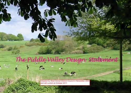
The Piddle Valley Design Statement
- Page 2 and 3: Plush Alton Pancras Piddletrenthide
- Page 4 and 5: 2 introduction W HAT IS A VILLAGE D
- Page 6 and 7: 4 the setting Ancient trackway, loo
- Page 8 and 9: 6 landscape and environment The Riv
- Page 10 and 11: 8 landscape and environment Chalk V
- Page 12 and 13: 10 landscape and environment Small
- Page 14 and 15: 12 community and business Tradition
- Page 16 and 17: 14 settlement and transport pattern
- Page 18 and 19: 16 the built environment A LTO N PA
- Page 20 and 21: 18 the built environment PID D LETR
- Page 22 and 23: 20 the built environment PID D LEH
- Page 24 and 25: 22 building materials and details A
- Page 26 and 27: 24 building and development guideli
- Page 28 and 29: 26 listed buildings in the piddle v
- Page 30: 28 references and acknowledgements
The <strong>Piddle</strong> <strong>Valley</strong> <strong>Design</strong> <strong>Statement</strong>
Plush<br />
Alton Pancras<br />
<strong>Piddle</strong>trenthide<br />
N<br />
<strong>Piddle</strong>hinton Cam p<br />
W hite Lackington<br />
<strong>Piddle</strong>hinton
contents<br />
INTRODUCTION 2 The <strong>Village</strong> <strong>Design</strong> <strong>Statement</strong><br />
How was it produced ?<br />
How will it affect future development ?<br />
THE SETTING 3 Location and Population<br />
Historical Context<br />
LANDSCAPE AND ENVIRONMENT 6 The River <strong>Piddle</strong><br />
Landscape Character<br />
Trees, Hedges and Field Boundaries<br />
Open Spaces<br />
Landscape and Environment Guidelines<br />
COMMUNITY AND BUSINESS 12 Background<br />
<strong>Community</strong> and Business Guidelines<br />
SETTLEMENT AND TRANSPORT 14 Background<br />
PATTERNS Settlement and Transport Guidelines<br />
THE BUILT ENVIRONMENT 16 Alton Pancras<br />
Plush<br />
<strong>Piddle</strong>trenthide<br />
White Lackington<br />
<strong>Piddle</strong>hinton<br />
<strong>Piddle</strong>hinton Camp<br />
BUILDING MATERIALS AND DETAILS 22 Walls<br />
Roofs<br />
Joinery<br />
Building and Development Guidelines<br />
LISTED BUILDINGS 26<br />
REFERENCES AND ACKNOWLEDGEMENTS 28
2 introduction<br />
W HAT IS A VILLAGE D ESIGN STATEM ENT ?<br />
In 1993 the then Countryside Commission published <strong>Design</strong> in the Countryside which noted that the character of<br />
the countryside was under increasing threat from standardisation and poor design. The Commission proposed<br />
<strong>Village</strong> <strong>Design</strong> <strong>Statement</strong>s as one mechanism for understanding and influencing future rural design.<br />
The <strong>Village</strong> <strong>Design</strong> <strong>Statement</strong> (VDS) aims to record the characteristics, both natural and man-made, which are seen<br />
by the local community to influence the distinctiveness of the area and which need to be maintained and enhanced,<br />
and to recommend design principles based on this distinctive local character.<br />
The VDS must complement and not contradict the Local Plan. It is about influencing change by stating how planned<br />
development can be carried out in harmony with its setting.<br />
In order to describe the distinct characteristics of the area covered by the <strong>Piddle</strong> <strong>Valley</strong> Parish Council, details of the<br />
geographical setting, natural environment, history, economic development and present built environment have<br />
been included. From these, guidelines have been agreed which we hope will have a significant influence in future<br />
village design.<br />
H O W W AS THE VILLAGE D ESIGN STATEM ENT PRO DUCED ?<br />
The <strong>Piddle</strong> <strong>Valley</strong> Parish Council (PVPC) invited three councillors to investigate the advantages of producing a VDS.<br />
As a result, it was decided to proceed and a committee of seventeen consisting of councillors and other local<br />
residents was formed. A questionnaire led to an all-day workshop when comments from residents were recorded.<br />
Four groups then worked on the preparation of a draft document. After further editing and consultation,<br />
including an Open Evening, the Parish Council asked West Dorset District Council (WDDC) to adopt the VDS as<br />
Supplementary Planning Guidance. It was formally adopted in November <strong>2004</strong>.<br />
H O W W ILL THE VILLAGE D ESIGN STATEM ENT AFFECT FUTURE DEVELO PM ENT ?<br />
It should help:<br />
• to raise awareness of the local environment and provide guidance to ensure that development<br />
is in keeping with the character of the valley<br />
• PVPC and WDDC, in considering planning applications<br />
• householders, developers and architects, by ensuring that their proposals are in keeping with<br />
local expectations
the setting 3<br />
LO CATIO N AND PO PULATIO N<br />
The <strong>Piddle</strong> <strong>Valley</strong> Parish Council covers the parishes of Alton Pancras, <strong>Piddle</strong>trenthide and <strong>Piddle</strong>hinton, which are<br />
situated in the upper reaches of the River <strong>Piddle</strong>.<br />
The <strong>Piddle</strong> <strong>Valley</strong> is in the heart of Dorset. <strong>Piddle</strong>hinton is some 6 miles north of Dorchester and Alton Pancras is<br />
approximately 9 miles south of Sherborne.<br />
<strong>Piddle</strong>trenthide, with a population of 680 is the largest settlement, while <strong>Piddle</strong>hinton has 400 and Alton Pancras<br />
140 residents. The parish of <strong>Piddle</strong>trenthide includes the smaller settlements of Plush and White Lackington.<br />
The B3143 runs alongside the River <strong>Piddle</strong> from its source near Alton Pancras, southwards through <strong>Piddle</strong>trenthide<br />
and <strong>Piddle</strong>hinton.<br />
N<br />
Alton Pancras Parish<br />
<strong>Piddle</strong>trenthide Parish<br />
<strong>Piddle</strong>hinton Parish<br />
The River <strong>Piddle</strong> north of <strong>Piddle</strong>trenthide
4 the setting<br />
Ancient trackway, looking south towards<br />
<strong>Piddle</strong>trenthide<br />
<strong>Piddle</strong>hinton Church<br />
B3143 in <strong>Piddle</strong>trenthide, looking north<br />
H ISTO RICAL CO NTEXT<br />
The River <strong>Piddle</strong> is sometimes shown as the Trent, a name never used by locals. Trent is a corruption of the French<br />
for thirty; in medieval times <strong>Piddle</strong>trenthide was taxed for thirty hides.<br />
The chalk hills surrounding the <strong>Piddle</strong> <strong>Valley</strong> bear witness to ancient man’s presence. Round barrows, cross-dykes,<br />
lynchets and Celtic field-systems abound but the modern settlements are to be found in the bottom of the steepsided<br />
river valley.<br />
The Romans may have lived here. In about 1740 a mosaic pavement, presumed to be Roman, was uncovered near<br />
<strong>Piddle</strong>trenthide Manor. More certainly, West Hill at Plush was a Romano-British settlement. By Saxon times small<br />
settlements existed throughout the valley.<br />
The Doomsday Survey identified five ‘<strong>Piddle</strong>s’. One of these, Little <strong>Piddle</strong> (between <strong>Piddle</strong>hinton and Puddletown),<br />
had a population of 19. <strong>Piddle</strong>trenthide’s three tythings were well established in medieval times, as were two<br />
settlements at Alton Pancras.<br />
Churches give an indication of permanent settlements. All Saints, <strong>Piddle</strong>trenthide, was first recorded in 1,000 AD.<br />
St Mary’s <strong>Piddle</strong>hinton has 13th century origins. St Pancras, Alton Pancras, has a Norman doorway, and<br />
St John the Baptist at Plush, now sadly redundant, occupies a site near the remains of the 12th century Chapel of<br />
Ease.<br />
As may be expected in a river valley, water mills were important. Alton Mill, Church Mill, Manor Mill, Lackington<br />
Mill and <strong>Piddle</strong>hinton Mill are all mentioned in the Doomsday Book - further evidence that the permanent<br />
settlements were well established before the Norman Conquest. In 1855, four millers were recorded in the <strong>Valley</strong>.<br />
Thereafter the mills gradually fell into disuse, the last to close being <strong>Piddle</strong>hinton, which was still being used as a<br />
sawmill in 1930.<br />
The old settlements would have been affected by the plague, which came into England via Melcombe Regis in<br />
1348. Fire was also a problem and destroyed 22 houses in <strong>Piddle</strong>trenthide in May 1654. The most recent major<br />
fire, in December 1933 in High Street, <strong>Piddle</strong>hinton, left three families homeless.
the setting 5<br />
Land ownership has the greatest bearing on the way settlements have developed since medieval times.<br />
<strong>Piddle</strong>hinton was granted to Eton College in 1422 by Henry VI as part of the College’s endowment.<br />
<strong>Piddle</strong>trenthide also had an academic landlord; Henry VIII gave the Parish to Winchester College after the<br />
dissolution of the monasteries. It had previously been held by Hyde Abbey. Ralph Wightman, arguably<br />
<strong>Piddle</strong>trenthide’s most famous son, attributed the different character of the two villages to the attitudes of<br />
the colleges. Eton may have been the more conservative as it did not allow a chapel in <strong>Piddle</strong>hinton. He says<br />
that in the late 19th Century, <strong>Piddle</strong>hinton had the church and one pub. By contrast, <strong>Piddle</strong>trenthide had the<br />
church, two chapels, five pubs and a Salvation Army meeting place. Alton Pancras, owned by a resident<br />
squire, had no pub or chapel. <strong>Piddle</strong>trenthide expanded considerably; <strong>Piddle</strong>hinton and Alton Pancras did not<br />
grow to the same extent. Winchester College sold its estate in <strong>Piddle</strong>trenthide in 1953 and Eton College sold<br />
its estate in <strong>Piddle</strong>hinton in 1966.<br />
The villages largely escaped late Victorian development and the 1902 Ordnance Survey shows that the present-day<br />
appearance of the villages was largely fixed by then.<br />
Local Authority housing appeared after the Second World War in <strong>Piddle</strong>trenthide, <strong>Piddle</strong>hinton and Alton<br />
Pancras. The County Structure Plan of 1979 identified the <strong>Piddle</strong> <strong>Valley</strong> as suitable for expansion, and this<br />
resulted in developments throughout the valley. The District Council’s Local Development Plans confirmed this<br />
expansion within village envelopes. This policy raised divergent views on design and density at the planning<br />
stage.<br />
The churches in <strong>Piddle</strong>hinton and <strong>Piddle</strong>trenthide are Grade I listed buildings. There are 17 Grade II listed<br />
buildings in <strong>Piddle</strong>hinton, 31 in <strong>Piddle</strong>trenthide (the Manor is Grade II*), 14 in Plush and 15 in Alton Pancras<br />
(again, the Manor is Grade II*). A full record of listed buildings can be found on page 26 and 27.<br />
View looking east from <strong>Piddle</strong>trenthide Manor<br />
Former Post Office (Alton Pancras)<br />
Post-war housing, Alton Pancras
6 landscape and environment<br />
The River <strong>Piddle</strong> at <strong>Piddle</strong>hinton<br />
Chalk valley floor and slopes<br />
Chalk uplands<br />
THE RIVER PIDDLE<br />
The River <strong>Piddle</strong>, which rises at Alton Pancras and eventually discharges into Poole Harbour, is an important chalk<br />
stream. The catchment for the upper reaches includes the whole area of the parish, with a winterbourne running<br />
from Plush to the main stream during periods of high rainfall.<br />
The river and the surrounding open spaces and water meadows are a common theme linking the villages in the<br />
valley bottom. Settlements were established nearby and the river was used to provide power for local industry.<br />
Traces of former mills are still evident in the landscape, as are diversions of the river from its natural course.<br />
Continual management is needed to clear some stretches prone to invasive weeds, but with a sensitive approach,<br />
all of the surrounding areas can contribute to the river’s character and be appreciated by the whole community. The<br />
areas surrounding the river provide a range of habitats for wildlife, but some, such as water voles, are increasingly<br />
threatened by inappropriate clearing and hard landscaping, preventing their access to the river.<br />
Although the river and its surrounding open spaces are greatly valued, access is still very restricted. With the<br />
exception of the views from the public bridges, public access to walk beside the river is limited and could be<br />
improved.<br />
In recent years high rainfall has highlighted the decline in river management and the need for better drainage.<br />
Although clearance of the river takes place annually on the stretch beside the school and the playing field,<br />
<strong>Piddle</strong>trenthide is still prone to flooding every year. A much-needed flood alleviation scheme for the village is due<br />
to be completed in 2005. Improvements were made to the drainage in <strong>Piddle</strong>hinton in 2003 but seasonal<br />
flooding still occurs in the fields either side of the river in areas such as White Lackington.<br />
LANDSCAPE CHARACTER<br />
West Dorset District Council’s Survey of the Built and Natural Environment 2000 divided the <strong>Piddle</strong> valley into five<br />
Landscape Character Areas: chalk valley floor, chalk valley slope, chalk uplands, escarpment and escarpment<br />
foothills.
landscape and environment 7<br />
Landscape Character Areas<br />
Chalk <strong>Valley</strong> Floor<br />
Chalk <strong>Valley</strong> Slope<br />
Chalk Upland<br />
Chalk Escarpment<br />
Escarpment Foothills
8 landscape and environment<br />
Chalk <strong>Valley</strong> Floor • The linear corridor incorporating River <strong>Piddle</strong> floodplain and adjoining dry valley bottoms<br />
• <strong>Piddle</strong> <strong>Valley</strong> floor prone to flooding<br />
• Water extraction at Alton Pancras<br />
• Main valley road follows valley floor<br />
• Largely developed within the confines of the valley<br />
• Open spaces between settlements are important for views across the valley; some are designated<br />
Land of Local Landscape Importance<br />
• Ornamental and garden planting<br />
• Small scale hedged meadow<br />
• Remains of former water meadows<br />
Chalk <strong>Valley</strong> Slopes • The area most likely to be affected by future development<br />
• Development spreading up slopes is conspicuous<br />
• Hedged arable and pasture fields gradually give way to a more open arable landscape<br />
• Grassland and woodland plantations on steeper slopes with habitats that may be neglected<br />
e.g. coppice woodland<br />
• Earthworks and ancient field systems on steeper slopes<br />
Chalk Uplands • Exposed open landscape with long distance views and few trees<br />
• Large scale arable fields, intensively farmed but affected by extensive hedge removal<br />
• Virtually undeveloped except for recent agricultural enterprises<br />
• Sensitive to development because of openness e.g. transmission masts<br />
• Many important ancient earthworks, which may not be protected<br />
Escarpment • Only a small area within Alton Pancras and <strong>Piddle</strong>trenthide<br />
• Wild and secret with panoramic views<br />
• Rich ecological interest with a mosaic of wood, grass and scrub<br />
• Ancient landscape<br />
• Almost totally undeveloped<br />
• Sensitive to development<br />
Escarpment Foothills • Only a small area within Alton Pancras and <strong>Piddle</strong>trenthide<br />
• Undeveloped<br />
• Improved pasture fields of varying sizes and shapes and densely hedged<br />
• Small woodlands and individual trees<br />
• Views over the Blackmoor Vale<br />
• Sensitive to development
landscape and environment 9<br />
Apart from the southern part of the valley, the whole area is designated an Area of Outstanding Natural Beauty<br />
(AONB) which has equivalent status to National Parks and where priority should be given to the<br />
conservation of the natural beauty of the landscape. Development should only be permitted in this area where<br />
it will not result in harm to this natural beauty and particular attention should be paid to the design, external<br />
appearance and location of all proposed development.<br />
Although it is the policy of central government and West Dorset District Council to promote renewable<br />
energy sources, it is recognised that certain forms of renewable energy, most notably windfarms, will not be<br />
generally accepted in nationally designated landscapes and the most sensitive or vulnerable landscape<br />
character areas due to the visual impact. It is therefore considered that the upland areas of the <strong>Piddle</strong> <strong>Valley</strong><br />
are an unacceptable location for wind turbines as the area is within the AONB and part of the sensitive chalk<br />
upland landscape character area.<br />
Land in the north of the valley is within the South Wessex Downs Environmentally Sensitive Area; this provides<br />
farmers with incentives to retain traditional farming methods, thus encouraging and protecting the wide range<br />
of flora and fauna found in chalk uplands.<br />
There are many Sites of Nature Conservation Interest, almost entirely in Alton Pancras and <strong>Piddle</strong>trenthide. These<br />
grass and woodland sites are recognised as important wildlife habitats but are not necessarily protected. There are<br />
also woodland sites listed in the Inventory of Ancient Woodlands and many recorded archaeological sites dating<br />
from prehistoric to modern times; some of these are protected as Scheduled Ancient Monuments. A large part<br />
of <strong>Piddle</strong>trenthide as well as parts of Alton Pancras and <strong>Piddle</strong>hinton is a Conservation Area and large parts of<br />
the valley floor are designated Land of Local landscape Importance.<br />
Views from the villages to the surrounding chalk downland are restricted, but magnificent views from the<br />
escarpment in the north east of Alton Pancras and <strong>Piddle</strong>trenthide encompass the Blackmoor Vale as far as the<br />
Mendips. From the chalk hilltops there are sweeping views across the chalk downs and into the valley itself.<br />
Land of Local Landscape Importance<br />
An Environmentally Sensitive Area<br />
Higher landscape towards the Blackmoor Vale
10 landscape and environment<br />
Small fields bounded by trees and hedges<br />
Millennium Green, <strong>Piddle</strong>hinton<br />
Large fields with hedgerow boundaries<br />
Slopes from the river valley vary in their gradient, but are steeper towards the north, rising from the narrow<br />
valley floor. Towards the south the valley broadens and the slopes are gentler. This has enabled more development<br />
to climb the valley slopes, and where this has happened the result is highly visible. On the steeper slopes,<br />
archaeological remains of ancient field systems and enclosures can be seen, which are often clothed in species-rich<br />
chalk grassland or scrub.<br />
The chalk uplands are broad, rounded and gently undulating with coombes incising the downland and creating<br />
attractive spurs with varying gradients. New and ancient tracks cross and rise up the slopes from the valley below.<br />
Small copses and woodland plantations on the downland and valley slopes are valuable features within the landscape.<br />
As farms have become highly mechanised, field sizes have been increased by the removal of hedgerows, resulting<br />
in large exposed fields. Traditional farm buildings have become redundant while large and visible farm complexes<br />
have been built on the downs.<br />
TREES, H EDGES AND FIELD BO UNDARIES<br />
Trees as individual specimens, groups or woodland, form a key part of our distinctive character and wildlife<br />
heritage. Wide ranges of tree species are found, a number of which are veteran trees.<br />
Many ancient hedgerows have been lost as fields have been enlarged to cater for modern agricultural<br />
machinery. It is important that existing hedgerows are retained and landowners encouraged to plant new ones.<br />
Most farm hedgerows are now managed using flail trimmers but landowners should be encouraged to lay hedges<br />
using traditional methods, as increasing financial help for this is now available.<br />
O PEN SPACES<br />
There is a variety of open spaces, both public and private within the valley which greatly enhance the villages and<br />
contribute to their characteristics.<br />
Many of these open spaces are privately owned and are vital in preventing urbanisation of the valley bottom. They<br />
include: the open space opposite the Brace of Pheasants at Plush; the fields opposite Austral Farm at Alton Pancras;<br />
the area between the Old Vicarage and the Poachers Inn, and the valley opposite the Manor at <strong>Piddle</strong>trenthide; the<br />
open fields adjacent to the road south of <strong>Piddle</strong>trenthide through White Lackington to south of the Thimble Inn at<br />
<strong>Piddle</strong>hinton; and the water meadows along the valley bottom.
landscape and environment guidelines 11<br />
• All areas of conservation policy, as set out in the Local Plan, should be rigidly adhered to.<br />
• Landowners should be encouraged to provide opportunities for quiet enjoyment of the River <strong>Piddle</strong>.<br />
Any proposals that limit significant views of the river from public places should be resisted.<br />
• The natural landscape and open spaces adjoining the River <strong>Piddle</strong> are greatly valued by the local<br />
community and should be maintained, or enhanced, for their scenic and wildlife value.<br />
• Riparian owners should be required to consider the impact on existing and potential wildlife of any<br />
changes to existing open spaces and to preserve riverbank habitats.<br />
• Any new development should respect the river valley setting of the village and its significant buildings<br />
and natural features.<br />
• Further building encroachment on the skyline should be avoided.<br />
• Developers should aim to maintain or improve the landscape characteristics of the villages and in<br />
particular consider the landscape setting of buildings within the Conservation Areas.<br />
• Key views into or out of the villages must be safeguarded. Views from public rights of ways should<br />
be protected.<br />
• Further developments, including wind turbines, on the upland areas are likely to be considered highly<br />
unacceptable due to visual impact.<br />
• The open spaces separating the villages within the valley should be preserved.<br />
• The record of significant trees within the <strong>Piddle</strong> <strong>Valley</strong> should be updated.<br />
• The removal of hedgerows should be strongly resisted due to their historical and aesthetic value and<br />
wildlife importance. New planting should be encouraged to create corridors for wildlife.<br />
• Plans for new developments should include details of new tree planting using appropriate native<br />
species of a significant size, to develop landscape character. Mature trees should be retained<br />
whenever possible.<br />
• Building in areas subject to flooding is likely to be unacceptable.<br />
Modern housing around a central space, Plush<br />
Skyline encroachment, White Lackington<br />
Open spaces separate the villages
12 community and business<br />
Traditional farm buildings are often not<br />
suited to modern use<br />
<strong>Piddle</strong>ntrenthide First School<br />
The former <strong>Piddle</strong>hinton village shop<br />
With no mineral or other materials to encourage industry, the main business of the valley for centuries has been<br />
farming. The thin and hungry soils forming the higher land and valley sides were traditionally retained in grass<br />
and stocked with sheep, as this was the only effective way of farming low-quality land. The<br />
introduction of fertilisers, particularly nitrogen and potash, during and after World War II transformed the yield<br />
potential of these soils with the result that mixed farming systems, including large areas of cereals, were<br />
introduced. The change was also facilitated by increasing mechanisation, with a consequent reduction in the<br />
size of the labour force – a trend continuing today.<br />
Over the twentieth century the population of the <strong>Piddle</strong> <strong>Valley</strong> showed little variation, but the nature of the<br />
population changed dramatically. Agricultural workers have moved away from a valley of low wages and high<br />
property costs to towns offering higher wages and lower property prices. Their place in the <strong>Piddle</strong> <strong>Valley</strong> has<br />
been taken by the retired and professional classes who commute to Dorchester, Weymouth, Poole, Bournemouth<br />
and beyond. The trend to second homes has also had an impact in the valley with the result that approximately<br />
one in twenty houses is now a holiday home. House purchase for the young first-time buyer is therefore<br />
extremely difficult.<br />
New industries have become established, and provide modest local employment. Many of these small to<br />
medium-sized businesses comprise light industry, and are located at the former Ministry of Defence camp at<br />
<strong>Piddle</strong>hinton, built in 1937 to house National Service personnel. Elsewhere, businesses tend to be small,<br />
providing trades that directly serve the valley.<br />
Sadly, only one village shop/post office (in <strong>Piddle</strong>trenthide) remains, as the shop in <strong>Piddle</strong>hinton closed in January<br />
<strong>2004</strong>. There are five public houses, one of which, The Poachers, is the single largest employer in the valley. The<br />
vast majority of the working population, however, works outside the valley.<br />
Tourism provides an appreciable income in the valley, with accommodation being available in the form of bed<br />
and breakfast, and self-catering properties. There is also some accommodation available at the local pubs. The<br />
valley provides a good base from which to explore Thomas Hardy Country and the World Heritage Coast.<br />
In addition to the pubs and the shop, the community is served by a number of other facilities. There are active<br />
churches in Alton Pancras, <strong>Piddle</strong>trenthide and <strong>Piddle</strong>hinton. There are two thriving village halls (<strong>Piddle</strong>hinton<br />
and <strong>Piddle</strong>trenthide), which support a number of clubs, societies and events. There is a new First School in<br />
<strong>Piddle</strong>trenthide, with a recreation ground adjacent to it which is open to the public outside school hours. The<br />
Millennium Green has been a welcome amenity in <strong>Piddle</strong>hinton. There is a tennis court for the <strong>Piddle</strong> <strong>Valley</strong><br />
Tennis Club, a football club in <strong>Piddle</strong>trenthide and a cricket club at Plush. A rugby club is based at <strong>Piddle</strong>hinton<br />
Camp, where the former gymnasium is used for badminton and indoor bowls.
community and business guidelines 13<br />
• Where a genuine demand from local people can be established, and the application respects the<br />
character of the existing traditional development, affordable local needs housing should be supported.<br />
• The housing needs of an increasingly elderly population should be addressed whenever opportunities arise.<br />
• The provision of social, educational and recreational facilities in the valley should continue to be supported<br />
and developed.<br />
• Proposals which lead to local employment opportunities should be treated sympathetically, provided that they<br />
are not intrusive for existing residents and do not lead to unacceptable pollution from noise, traffic, smells or<br />
light.<br />
• New industrial and agricultural buildings should be carefully sited, designed and landscaped.<br />
• The conversion of redundant traditional farm buildings for employment or tourism should be encouraged in<br />
suitable locations (avoiding remote employment) where a genuine need can be defined.<br />
• The conversion of existing commercial properties to residential use should generally be resisted.<br />
• Further supplementary street lighting should be avoided. Light pollution should be controlled by the use of<br />
low-level lighting appropriately positioned and pointing downwards wherever possible.<br />
• All new electric cables and telephone lines should be buried wherever practicable.<br />
• Further telecommunication masts would be acceptable if placed sensitively in unobtrusive positions, well away<br />
from domestic buildings.<br />
Tourism is important in the <strong>Piddle</strong> <strong>Valley</strong><br />
Wirescape near <strong>Piddle</strong>trenthide village shop<br />
The Brace of Pheasants, Plush
14 settlement and transport patterns<br />
The valley road in <strong>Piddle</strong>hinton, looking north<br />
Popular footpath in <strong>Piddle</strong>hinton<br />
White Lackington bus shelter<br />
The settlements of the <strong>Piddle</strong> <strong>Valley</strong> are all found along the valley floor. Alton Pancras, <strong>Piddle</strong>trenthide and<br />
<strong>Piddle</strong>hinton lie either side of the main river, while the hamlet of Plush lies in the deep valley of a tributary stream<br />
north-east of <strong>Piddle</strong>trenthide.<br />
The villages of the main valley all have a linear form, following the B3143 and the river along the narrow valley<br />
floor. A wider road, the C12, runs parallel along the chalk upland some 3 kilometres to the west. The settlements<br />
at <strong>Piddle</strong>trenthide, White Lackington and <strong>Piddle</strong>hinton have grown up at points where important east/west routes<br />
(often drove roads) have crossed the main valley road.<br />
The narrow strip of flatter land which has for long been the focus of settlement is an area of verdant pasture and<br />
clustered trees with occasional reminders of the orchards which were once so extensive along the valley<br />
bottom.<br />
The B3143 provides the main traffic route linking Alton Pancras, <strong>Piddle</strong>trenthide, White Lackington and<br />
<strong>Piddle</strong>hinton. A narrower road leads from <strong>Piddle</strong>trenthide to Plush. All the roads follow the valley bottom and the<br />
watercourses.<br />
Traffic using these routes includes local residents, tourists, heavy goods vehicles, farm vehicles, horse riders and<br />
cyclists. Large lorries are unsuited to the narrow roads of the <strong>Piddle</strong> <strong>Valley</strong>. The proposed upgrading of the<br />
Old Sherborne Road (the C12) would help alleviate some of these problems, as would re-routing lorries<br />
southwards down the valley from the light industrial units being proposed for the site of the former <strong>Piddle</strong>hinton<br />
Camp.<br />
Constriction of the road by parked cars is a considerable problem on the B3143 particularly in the southern part of<br />
<strong>Piddle</strong>trenthide and around the War Memorial in <strong>Piddle</strong>hinton. Adequate off-road parking should be<br />
provided in the vicinity of new developments.<br />
The valley has a regular bus service, the use of which must be encouraged. The community is also served by two<br />
taxi services. Rail links are available at Dorchester and Sherborne. There is an extensive network of public rights of<br />
way which are well used by ramblers, dog-walkers and horse-riders. Some of these are of historical interest. The<br />
roads throughout the <strong>Piddle</strong> <strong>Valley</strong> are generally without pavements. Few roads have kerbs and most are edged<br />
with grass. These natural verges and hedges support a variety of wildlife.<br />
There is generally an absence of street lighting, which helps to retain the rural character of the valley.
settlement and transport guidelines 15<br />
• The C12 should be upgraded to discourage the use of the B3143 as a through route.<br />
• The impact of development on the use of existing roadways and footways should be considered when<br />
planning applications are made.<br />
• Parking areas for small groups of cars should be identified for local residents and tourists and protected<br />
from further development, whilst each new dwelling should continue to be provided with adequate offroad<br />
parking spaces, according to the parking guidelines in the Local Plan.<br />
• Existing rights of way should be maintained and protected.<br />
• Traditional finger posts should be maintained. New signs should be restricted to the minimum necessary.<br />
Large vehicles and equipment squeeze through<br />
the <strong>Valley</strong> road<br />
Off-road parking at <strong>Piddle</strong>hinton<br />
Traditional finger post, Plush
16 the built environment<br />
A LTO N PA N CRA S<br />
Alton Pancras nestles on the valley<br />
floor and consists of two distinctive<br />
clusters of development: a northern<br />
block of mixed housing of varying<br />
ages, types and materials and a looser<br />
southern group which is the historic<br />
core of the settlement. The two<br />
clusters are divided by an area of open<br />
countryside on the east of the road.<br />
There are three important gaps in<br />
development, each designated as<br />
Land of Local Landscape Importance.<br />
N
the built environment 17<br />
N<br />
PLU SH<br />
The houses in Plush are informally<br />
arranged along a twisting lane that<br />
enters and leaves the village with<br />
sharp right-angled bends.<br />
The wooded gardens of the Manor<br />
House, together with the paddock in<br />
the centre of the hamlet, create a<br />
sense of space. The Brace of<br />
Pheasants public house makes a focal<br />
point to the hamlet which combines a<br />
number of older cob and thatched<br />
cottages, brick and flint properties<br />
with slate roofs and the most recent<br />
cul-de-sac development on the former<br />
orchid farm where a variety of<br />
traditional materials has been used.
18 the built environment<br />
PID D LETREN TH ID E<br />
<strong>Piddle</strong>trenthide is a long, linear settlement.<br />
The village is divided into several distinct<br />
clusters, separated by open countryside or<br />
parkland. The northern cluster marks the<br />
core of the old village around the church and<br />
has a nuclear form. Church Lane leads from<br />
the valley road across the river to Egypt,<br />
where a number of newer homes have been<br />
built.<br />
Low-density frontage development on the<br />
western side of the main road leads south to<br />
the junction with Smith’s Lane. From here,<br />
older cottages run west from the main valley<br />
route. The large grounds of the Manor<br />
House form a break in development but<br />
south of the western access to Cerne Abbas<br />
the main part of the village is found. This<br />
consists of a mixture of older cottages, 18th<br />
and 19th century housing, the former school<br />
and late 20th century culs-de-sac, on either<br />
side of the road. The modern First School is<br />
found on the southern edge of the village.<br />
N
the built environment 19<br />
N<br />
W H ITE LA CKIN G TO N<br />
The hamlet of White Lackington is<br />
situated within the civil parish of<br />
<strong>Piddle</strong>trenthide but the ecclesiastical<br />
parish of <strong>Piddle</strong>hinton. It developed at<br />
the crossroads of an important<br />
east/west drove road and the valley<br />
road and has a simple nuclear form<br />
centred on the former Fleet Farm. The<br />
line of former council housing, called<br />
South View, stretches east from the<br />
main road up a shallow combe.<br />
The hamlet contains a mixture of older<br />
housing, Lackington Mill, former<br />
farmhouses, the 19th century<br />
European Inn and a number of houses<br />
built during the last decade. Recent<br />
development to the north of the<br />
hamlet threatens to erode the open<br />
space between the villages.
20 the built environment<br />
PID D LEH IN TO N<br />
The settlement developed as a bridging point<br />
and crossroads and the main crossroads<br />
junction still forms the centre of the village.<br />
The valley road north of the crossroads is<br />
known as High Street and contains a number<br />
of larger properties including the Thimble Inn,<br />
and a small modern cul-de-sac, White’s Close,<br />
on the western side. The eastern side of the<br />
road is less developed, probably due to the<br />
sharp rise in gradient from the road.<br />
To the west of the crossroads, Rectory Road<br />
has a mixture of older cottages with more<br />
modern infill and the large Old Rectory. At<br />
the western end of the village a modern<br />
development, Payne’s Close, extends<br />
northwards in a cul-de-sac while eastwards<br />
from the crossroads London Row climbs the<br />
valley side to London Close, a modern cul-desac<br />
estate which dominates the village setting<br />
from the western approach. The Millennium<br />
Green forms a valuable open space to the<br />
south-west of the Thimble Inn.<br />
N
the built environment 21<br />
PID D LEH IN TO N CA M P<br />
<strong>Piddle</strong>hinton Camp, a 90-acre site approximately one mile to the south of <strong>Piddle</strong>hinton, was<br />
built during the Second World War to house troops. The main area, consisting of the former<br />
barracks, is partly let as small industrial units. Improvements to the camp by the present<br />
owner have helped to reduce the impact of this area on the rural landscape. Several of the<br />
units have been refurbished. It is important that the footprint of the units should not be<br />
significantly increased or the height of the buildings raised, particularly on the higher slopes,<br />
in view of the high visibility from surrounding areas.<br />
Limited refurbishment and lettings for similar start-up, light industrial, electronic and storage<br />
businesses are to be encouraged, providing the existing footprint and height of buildings is<br />
respected and consideration is given to the effect of increased traffic on the road network.<br />
Residential development would not be appropriate on this land as services in the valley are<br />
not geared for new residential areas and the intrusion of full-height housing on the skyline<br />
would be considerable.<br />
N
22 building materials and details<br />
Accommodating tree root, Alton Pancras<br />
Similar building materials combine<br />
Modern materials used traditionally<br />
All types of traditional materials may be found in the <strong>Piddle</strong> <strong>Valley</strong> and the periods of their use relate to their<br />
availability. Until the early 19th century and the introduction of long distance haulage, all but the most<br />
important buildings relied on locally produced products.<br />
W A LLS<br />
Chalk and clay have been used for humbler buildings to make cob for cottage and boundary walls, with flint<br />
and brick used for more significant buildings. Field stone was locally quarried for laying coursed or uncoursed<br />
random rubble walls for larger houses while dressed stone, often banded with flint, as at Whites Dairy House in<br />
<strong>Piddle</strong>hinton, has been used for the Parish Churches and surrounding cottages in <strong>Piddle</strong>trenthide and<br />
<strong>Piddle</strong>hinton. Mixtures of different materials have added a richness of variety, most commonly flint banded with<br />
red brick and ashlar or facing stone with brick and render. Examples are the former <strong>Village</strong> School and Pear Tree<br />
Cottage and Middle Thatch in <strong>Piddle</strong>trenthide.<br />
Bricks were produced here from the early 18th century and were still locally available from Broadmayne until the<br />
20th century. They can be recognised from their buff to red colour with carbon spots on the<br />
surface. From the early 19th century brick was often considered of inferior appearance and limewashed or even<br />
rendered and incised with course lines to represent stone blocks as can be seen at Beechmead, set away from<br />
the main road at Alton Pancras. Unusual old purple brickwork with red dressings may be seen at Alton Pancras<br />
Manor House contrasted with yellow ashlar stonework.<br />
The use of lime in building was universal until the early 20th century when production of cement became<br />
common. Simpler to use than lime, it tends towards a dull grey and is often harder than the material it bonds<br />
and can cause movement cracking and frost spalling or splitting of the wall face. By contrast lime is enjoying a<br />
revival for jointing natural materials and for external decorative treatment. It is lighter and brighter, lets<br />
materials breathe by absorbing and evaporating rainwater and allows movement without cracking in the heat<br />
and cold of the changing seasons.<br />
Structural timber framing is less common here but green oak is often used for beams, lintels over openings and<br />
for external cladding.<br />
In the last 50 years, the greatest period of change in the diversity of available materials and their aggressive<br />
marketing has led to the use of less environmentally sympathetic products such as artificial stone blocks and flint<br />
panels, concrete tiles, plastic joinery, short-lived softwood and plastics-based roofing systems. By<br />
contrast, examples are beginning to be seen of traditional materials used in a modern and sustainable way.
uilding materials and details 23<br />
RO O FS<br />
Purbeck stone slates may still be seen at eaves and for wall cappings but the traditional straw thatch is<br />
evident everywhere, sometimes replaced in modern times with water reed. Thatch is relatively expensive with<br />
outer layers needing to be renewed every 25 years or so. Slate from Wales and Cornwall became common with<br />
the introduction of the railways in the 19th century. Clay tiles were used less commonly and cheaper, concrete<br />
versions were adopted during the 1960s and 70s. Fortunately less so today. Plain clay tiles and<br />
double pantiles can be seen in <strong>Piddle</strong>hinton. Other natural materials such as lead and zinc are also used.<br />
JO IN ERY<br />
Windows and doors used to be made in oak or other hardwoods, and often limed or painted with lead-based<br />
paints, which are now banned except on historic buildings. Softwood of high quality became available in the<br />
18th century but this has given way to the less reliable, fast-grown products of today and plastics-based paints<br />
which tend to seal the timber and can cause decay. UPVC plastic windows of standard white colour are<br />
beginning to spread into the valley. Demand for reliable weather resistance and draught sealing with<br />
cheapness is attractive, but bulkier section size and less durability than painted hardwood can be seen to<br />
devalue property. UPVC windows should not be used within the conservation areas and are not permitted for<br />
listed buildings.<br />
A blending of old and new<br />
Split pole cladding<br />
Modern materials carefully used
24 building and development guidelines<br />
Blend of scale, Alton Pancras<br />
Extension by separation, <strong>Piddle</strong>hinton<br />
Tight-knit spaces, <strong>Piddle</strong>trenthide<br />
• The defined development boundaries agreed in the West Dorset Local Plan should be strictly adhered to,<br />
with exceptions made only in very special circumstances.<br />
• Development that detracts from the character and setting of the individual settlements within the<br />
valley should not be permitted.<br />
• The settlements within the <strong>Piddle</strong> <strong>Valley</strong> should not become one long linear village. The green and<br />
open spaces between them should be preserved.<br />
• Removal of redundant utility buildings in the landscape, that are not appropriate for re-use, should be<br />
encouraged.<br />
• New development, including extensions and porches, should be sympathetic to the form, style, scale<br />
and colour of the existing traditional buildings. It should respect but not necessarily copy the style of<br />
existing buildings.<br />
• Imaginative design using well-chosen natural materials that weather well should be encouraged.<br />
Traditional building materials such as stone, flint, brick, slate, timber and lime mortar and render rather<br />
than cement should be used for facework. The use of modern materials, per se, should not be<br />
discouraged.<br />
• Development strategies should include a range of housing types and sizes while layout should observe<br />
the current planning aims for density.<br />
• Development should not dominate the landscape but be designed to maintain or enhance the<br />
environment. Development on the valley slopes should be restricted, to avoid skyline intrusion.<br />
• The replacement of existing wooden joinery with UPVC should be discouraged, and consideration given<br />
to withdrawing permitted development rights, within the Conservation Area.<br />
• Special attention should be paid to landscape design and structural tree planting to enhance the<br />
overall village character.
uilding and development guidelines 25<br />
• Proposals should be encouraged for sustainable design in construction to support the natural<br />
environment, biodiversity, flood prevention, the recycling of water, re-use of materials and energy<br />
saving.<br />
• If affordable housing for local people is proposed, it should be built to match local needs and include<br />
1 or 2 bedroomed units, built to good quality specifications and with materials which look attractive.<br />
Affordable homes should be in small developments interspersed with other housing. Such housing<br />
should be retained to meet local housing need.<br />
• New building should not result in undue loss of light or outlook for immediate neighbours.<br />
• Care should be taken with the type and colour of roof materials on both new and old buildings.<br />
Replacement doors and windows should respect the style and period of the building.<br />
• Every new dwelling should have dedicated off-road parking spaces, in accordance with the Local Plan<br />
parking guidelines, not necessarily adjacent to the house.<br />
• Further refurbishment and lettings of the former barrack buildings at <strong>Piddle</strong>hinton Camp for start-up,<br />
light industrial, electronic and storage businesses is to be encouraged, provided that the existing<br />
footprints and heights of buildings are not significantly increased. Residential development on the<br />
former camp area should not be permitted. Development should not generate an unacceptable<br />
increase in vehicle movements and the size of vehicles using the local highway network. Landscape<br />
and visual improvements which will reduce the visual impact of <strong>Piddle</strong>hinton Camp will be encouraged.<br />
• New development should make adequate provision for children’s play areas.<br />
Roofing materials, <strong>Piddle</strong>hinton<br />
Replacement doors and windows, Plush<br />
Refurbished unit at <strong>Piddle</strong>hinton Camp
26 listed buildings in the piddle valley<br />
Beechmead, Alton Pancras<br />
The Manor, <strong>Piddle</strong>trenthide<br />
Pear Tree Cottage, <strong>Piddle</strong>trenthide<br />
ALTO N PANCRAS<br />
Probable Ice House and Stables at Manor<br />
Pigeon-cote and Brew or Bakehouse at Manor<br />
Churchyard wall<br />
Manor House (Grade II*)<br />
Gate Piers to Manor House<br />
Parish Church (Grade II*)<br />
Table Tomb in Churchyard<br />
Beechmead<br />
Cherry Cottage<br />
PLUSH<br />
Harvey’s Farmhouse<br />
Butt’s Cottage<br />
Range of three cottages SW of Butt’s Cottage<br />
(now Gardener’s Cottage and 2, Garden’s Cottage)<br />
Manor House<br />
Millers Barn (curtilage listing)<br />
West Barn (curtilage listing)<br />
Manor Gate Cottage<br />
PIDDLETRENTHIDE<br />
Dole’s Ash Farmhouse and two pairs of gate piers<br />
Kingsmead<br />
West House<br />
The Granary<br />
Glebe Cottage<br />
No 3 Church Lane (now Bridge Cottage)<br />
All Saints’ Church (Grade I)<br />
The Old Barn (now The Barn)<br />
House 110m S of Church (now Kiddle’s House)<br />
Dovecote ENE of Manor Lodge<br />
Gazebo E of Manor Lodge<br />
Hodgecliff Cottage<br />
Crown Cottage<br />
Crown House<br />
Ivy Cottage (now Ivy House)<br />
House adjoining Pear Tree House (now Middle Thatch)<br />
Austral Farmhouse<br />
Meadow View<br />
Box Cottage<br />
Grey Thatches<br />
No 1 & 2 Terrace Cottages and Old School House<br />
(No 2 Terrace Cottages now Halycon Cottage)<br />
Kipper’s Cottage (now Keeper’s Cottage)<br />
The Old Post Office<br />
Hillside<br />
The Brace of Pheasants<br />
The Old School House<br />
Plush Bottom<br />
Corner Cottage<br />
Astra<br />
Cottage 130m NE of Astra (now Four Corners)<br />
Church (now disused)<br />
Pear Tree House (now Pear Tree Cottage)<br />
East House<br />
Old Primary School<br />
Old School Gates and Piers (Gates now at new school)<br />
Bellamy’s Farmhouse (now Brick House)<br />
Southcombe Farmhouse<br />
Higher Tything Cottage<br />
The Manor House (Grade II*)<br />
Stables and Outbuildings Manor House<br />
Manor Lodge<br />
Sunny Cottage (now Brook House)<br />
Nos 1,2 & 3 Baker’s Row (now 1 and 2/3 Baker’s Row)<br />
Brownsville<br />
South House<br />
Colescote (now Littlebrook Cottage)
listed buildings in the piddle valley 27<br />
W HITE LACKINGTO N<br />
Fleet House (now Fleet Farmhouse)<br />
PIDDLEHINTO N<br />
Little Puddle Farmhouse (now Lawrence Mead)<br />
Muston Manor plus attached Wall, Dovecote and Mounting Block<br />
Two lengths of Walling, Muston Manor<br />
Granary Muston Manor<br />
The Thimble<br />
East Farmhouse (now White’s Dairy)<br />
Barn, East Farmhouse (now Barn, White’s Dairy)<br />
Stables and Carriage House, East Lodge (now West Lodge)<br />
Nos 22, 24 & 26 High Street (now Romaines Cottage)<br />
Morteyn and adjoining Cottage, London Row (now Morteyn and Shepherd’s Thatch)<br />
Bridge over River <strong>Piddle</strong>, Rectory Road<br />
Inglenook Cottage (now Payne’s Cottage)<br />
No 9 Rectory Road (now Hawthorn Cottage)<br />
No 11 Rectory Road (now Denches Cottage and 12 Rectory Road)<br />
Glebe Court (now The Old Rectory)<br />
Glebe Court Cottage (now Glebe Cottage)<br />
House 50m NE of Glebe Court (now Bridge House)<br />
Church (Grade I)<br />
Table Tomb<br />
All Grade II unless shown<br />
Taken from “List of Buildings of Special Architectural or Historical Importance” -<br />
Department of Environment 1984<br />
Bridge over River <strong>Piddle</strong>, <strong>Piddle</strong>hinton<br />
Muston Manor Dovecote, <strong>Piddle</strong>hinton
28 references and acknowledgements<br />
REFERENCES<br />
• <strong>Village</strong> <strong>Design</strong> – Making local character count in new development. The Countryside Commission (1996)<br />
• West Dorset District Council – Survey of the Built and Natural Environment (2000)<br />
• West Dorset District Council – District Plan (1998)<br />
• West Dorset District Council – Draft District Plan – First Deposit (2003) and Second Deposit (<strong>2004</strong>)<br />
• A Framework for the Future of the Dorset Areas of Outstanding Natural Beauty. Management Plan.<br />
Draft for Consultation AONB Partnership (2003)<br />
• <strong>Piddle</strong> <strong>Valley</strong> <strong>Village</strong> <strong>Design</strong> <strong>Statement</strong> – Questionnaire responses<br />
M APS<br />
Maps are reproduced from Ordnance Survey Material with the permission of Ordnance Survey on behalf of the<br />
Controller of Her Majesty’s Stationery Office Crown Copyright. Unauthorised reproduction infringes Crown<br />
Copyright and may lead to prosecution or civil proceedings. West Dorset District Council, Licence Number<br />
1000024307. <strong>2004</strong>. <strong>Piddle</strong>hinton Camp photograph taken for Perry & Perry Ltd. by Environs Partnership<br />
CO PYRIGHT ©<br />
Not to be reproduced without the written permission of the <strong>Piddle</strong> <strong>Valley</strong> <strong>Village</strong> <strong>Design</strong> <strong>Statement</strong> Committee.<br />
A CKNO W LEDGEM ENTS<br />
The VDS committee would like to thank :<br />
• The residents of the <strong>Piddle</strong> <strong>Valley</strong> who completed questionnaires, took part in the workshop and<br />
open evening and commented on the draft document<br />
• Dot Browning of <strong>Design</strong> Connections for the graphic design<br />
• Jo March and Jo Witherden of West Dorset District Council for guiding us through the VDS process<br />
• John Browning for the village maps<br />
• The Overton, Hampshire, and the West Stafford, Dorset, VDS Committees<br />
The Committee is grateful to the following for their support in financing this document :<br />
• Awards for All. Lottery Grants for Local Groups<br />
• <strong>Piddle</strong> <strong>Valley</strong> Parish Council<br />
• West Dorset District Council<br />
• Dorset <strong>Community</strong> Action<br />
• The <strong>Piddle</strong>hinton History Group
VDS CO M M ITTEE<br />
Richard Drewe (Chairman), David Abbott, Rachel Beckingham-Smith,<br />
John Browning, Peter Chance, John Cox, Lynne Cox, Peter Hiscock,<br />
George Jakeman, Janet Hamling, Helen Lilley, Pam Lock, Lynn Mailer,<br />
Malcolm Rogers, Bin Roy, Gillian Vickery and David Webb.<br />
CO NTACT<br />
For further information on the <strong>Village</strong> <strong>Design</strong> <strong>Statement</strong> please contact the<br />
Parish Clerk on 07765 241914. The <strong>Piddle</strong> <strong>Valley</strong> Parish Council meets at<br />
7.30 pm in <strong>Piddle</strong>trenthide Memorial Hall on the last Tuesday of each month,<br />
excluding August and September.


