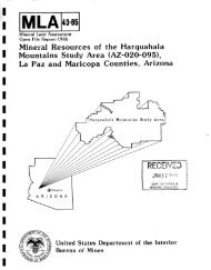
here - State of Arizona Department of Mines and Mineral Resources
here - State of Arizona Department of Mines and Mineral Resources
here - State of Arizona Department of Mines and Mineral Resources

Create successful ePaper yourself
Turn your PDF publications into a flip-book with our unique Google optimized e-Paper software.
194 PRINCIPAL GOLD-PRODUCING DISTRICTS OF THE UNITED STATES<br />
were still being worked, on a fairly large scale, in<br />
the early 1950's by the Round Mountain Gold<br />
Dredging Corp. Their operations were suspended<br />
during 1953-57, but were resumed in 1958; in<br />
1958-59 this company was the largest gold producer<br />
in Nevada.<br />
Ferguson <strong>and</strong> Cathcart (1954) estimated the total<br />
gold production <strong>of</strong> the district to be worth $8 million,<br />
<strong>of</strong> which about 15 or 20 percent was from<br />
placers <strong>and</strong> the remainder was from lodes. This<br />
would amount to about 329,000 ounces <strong>of</strong> lode gold<br />
<strong>and</strong> 58,200 ounces <strong>of</strong> placer gold. Most <strong>of</strong> the district's<br />
production during 1950-59 was combined<br />
with reports from other districts, but it was probably<br />
about 150,000 ounces. Total gold production<br />
for the district through 1959 was about 537,000<br />
ounces.<br />
The oldest rocks in the area are lower Paleozoic<br />
limestone, jasper, <strong>and</strong> dark slaty schist (Ferguson,<br />
1922, p. 386-398). These rocks are intensely folded<br />
<strong>and</strong> were intruded during Cretaceous time by bodies<br />
<strong>of</strong> granitic magma. Tertiary rocks, chiefly porphyritic<br />
rhyolite (Oddie Rhyolite) <strong>and</strong> lake beds <strong>of</strong> the<br />
Siebert Fonnation, overlie the folded Paleozoic<br />
rocks.<br />
T<strong>here</strong> were two periods <strong>of</strong> mineralization. The<br />
first occurred just after the granitic intrusions <strong>and</strong><br />
is characterized by huebnerite-bearing veins in the<br />
granite. The 8eaond period <strong>of</strong> mineralization is <strong>of</strong><br />
Tertiary age <strong>and</strong> resulted in the fonnation <strong>of</strong> epithermal<br />
gold-bearing quartz veins in the rhyolite.<br />
The mineralogy <strong>of</strong> these veins is relatively simple<br />
<strong>and</strong> consists <strong>of</strong> gold, auriferous pyrite, <strong>and</strong> sparse<br />
realgar in a gangue <strong>of</strong> drusy <strong>and</strong> comb quartz,<br />
adularia, <strong>and</strong> alunite. After the primary gold mineralization,<br />
additional fissures were fonned in which<br />
iron <strong>and</strong> manganese oxides <strong>and</strong> gold were deposited<br />
by supergene solutions. The gold in these later<br />
fractures was probably derived from the primary<br />
auriferous pyrite.<br />
TONOPAH DISTRICT<br />
This district is in the southern San Antonio<br />
Mountains near Tonopah, the county seat <strong>of</strong> Nye<br />
County <strong>and</strong> the largest town in the county.<br />
Tonopah was predominantly a silver district, but<br />
it also yielded large amounts <strong>of</strong> gold. The first<br />
claims were staked in 1900, <strong>and</strong> by 1901 t<strong>here</strong> was<br />
vigorous activity which lasted until the late 1940's;<br />
t<strong>here</strong>after, production declined. The principal companies<br />
were the Tonopah Mining, the Tonopah Belmont<br />
Development, <strong>and</strong> the Tonopah Extension<br />
(Kral, 1951, p. 171).<br />
Lincoln (1923, p. 186) listed the gold production<br />
<strong>of</strong> Tonopah from 1901 through 1921 as $30,360,903<br />
(about 1,473,830 ounces). From 1901 throug"t 1959,<br />
a total <strong>of</strong> 1,880,000 ounces <strong>of</strong> gold was pnduced.<br />
The rocks exposed in the Tonopah district are<br />
all <strong>of</strong> Tertiary age <strong>and</strong> consist <strong>of</strong> a series <strong>of</strong> lava<br />
flows, volcanic breccias, tuffs, <strong>and</strong> intrusives that<br />
have been somewhat displaced from their original<br />
attitudes by extensive faulting. Seven fon'1ations<br />
recognized in the district (Nolan, 1935b, p. 13) are,<br />
from oldest to youngest: the Tonopah Formation<br />
(volcanic tuffs, breccias, flows), S<strong>and</strong>grass Andesite<br />
(dark lavas interlayered with the Tonopah<br />
Fonnation), Mizpah Trachyte (2,000-foot-thick<br />
flows <strong>and</strong> breccias overlying the Tonopah), Extension<br />
Breccia (tabular intrusive mass in west half<br />
<strong>of</strong> district), West End Rhyolite (sills as much as<br />
600 feet thick that intrude the older formr,tions),<br />
Fraction Breccia Member <strong>of</strong> Esmeralda Formation<br />
(volcanic breccia unconformably overlying ore<br />
bodies), <strong>and</strong> postore rhyolite (dikes <strong>and</strong> lenticular<br />
bodies that intrude the older rocks). Numerous<br />
faults cut the Tertiary rocks, <strong>and</strong> Nolan (1935b,<br />
p. 28-39) divided them into three general groups:<br />
the Halifax fault zone which strikes generally<br />
northward; the Tonopah, a compound fault that in<br />
cross section has a trace that is convex upward;<br />
<strong>and</strong> the youngest group which includes a fault<br />
which strikes northwest, another which strikes<br />
northeast, <strong>and</strong> a third which strikes north <strong>and</strong> dips<br />
west.<br />
The ore bodies are replacement veins in faults or<br />
fractures (Nolan, 1935b, p. 40-49). The Tonopah<br />
fault is believed to have exerted a major control<br />
on the movement <strong>of</strong> mineralizing solutions. Ore<br />
bodies are found in all three groups <strong>of</strong> faults, but<br />
the Tonopah <strong>and</strong> Halifax seem to be more heavily<br />
mineralized. Hypogene ore contains electrum. argentite,<br />
polybasite, <strong>and</strong> pyrargyrite in a gar?:,ue <strong>of</strong><br />
quartz, pink carbonate, barite, <strong>and</strong> altere'l wallrocks.<br />
T<strong>here</strong> has been some supergene enrichment<br />
locally, but the hypogene ore has been m'lst important.<br />
TYBO DISTRICT<br />
The Tybo (Hot Creek, Keystone, Empire) district<br />
is in northeastern Nye County, in the Hot; Creek<br />
Range, 65 miles northeast <strong>of</strong> Tonopah <strong>and</strong> about<br />
100 miles southwest <strong>of</strong> Ely (lat 38°23' :roT., long<br />
116°23' E.). In the district, gold is a byproduct <strong>of</strong><br />
ores mined primarily for their lead <strong>and</strong> silYer content.<br />
The first mineral discoveries were made in<br />
1865, <strong>and</strong> the town <strong>of</strong> Hot Creek was the population<br />
center during the early days (Kral, 1951, p. 189).<br />
The district prospered from the rich near-surface