national register of historic places registration form - Rhode Island ...
national register of historic places registration form - Rhode Island ...
national register of historic places registration form - Rhode Island ...

Create successful ePaper yourself
Turn your PDF publications into a flip-book with our unique Google optimized e-Paper software.
NPS Form 10-900-a OMB Approval No. 1024-0018<br />
(8-86)<br />
United States Department <strong>of</strong> the Interior<br />
National Park Service<br />
NATIONAL REGISTER OF HISTORIC PLACES<br />
CONTINUATION SHEET<br />
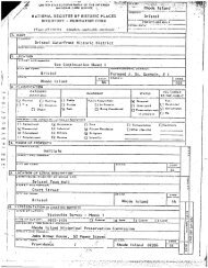
Stonybrook Estate Historic District Middletown Newport Co., R. I.<br />
Name <strong>of</strong> Property City/Town County and State<br />
Section Number 7 Page 4<br />
Indian Avenue continued<br />
501<br />
C<br />
Mrs. Knight. The property was subdivided after the Knights’ deaths, most recently in<br />
the 1980s, after which new houses were built to the north on the east side <strong>of</strong> Indian<br />
Avenue (see 502 and 515 Indian Avenue).<br />
Stonybrook Grounds: With a landscape that includes significant features <strong>of</strong> both<br />
hardscape and planting, the house is sited toward the northeast corner <strong>of</strong> an almost five<br />
acre parcel<br />
se<br />
fluence<br />
n<br />
the<br />
3 that gently rises east to west from approximately ten to twenty feet.<br />
Access to the house is across a long drive that curves in a forty-five-degree arc<br />
southeast from Indian Avenue; it supplements the original entrance, located<br />
immediately to the north, adjacent to the gatehouse (now a separate property, 515<br />
Indian Avenue, also included in this nomination, described below). Emulating the<br />
sequential experience <strong>of</strong> arrival that was both longer and more dramatically realized as<br />
first built, the present entrance drive arrives at two circular turnabouts to the west and<br />
north <strong>of</strong> the house, the <strong>form</strong>er in front <strong>of</strong> the principal entrance, the latter between the<br />
service entrance and the three-stall garage near the property’s edge. A random-cour<br />
ashlar retaining wall, similar in appearance to the stonework on the house, extends<br />
along the property’s Sakonnet River edge and continues into the mouth <strong>of</strong> a<br />
meandering brook that describes a 180-degree arc along the property’s southern edge;<br />
lined with ledges and filled with stones, this is no doubt the property’s eponymous<br />
feature. A circular-plan pergola stands near the brook toward the west end <strong>of</strong> the<br />
brook’s arc. A bridge with round-arch balustrade crosses the brook near its con<br />
with the river. Trees include a variety <strong>of</strong> specimen beeches and other deciduous trees,<br />
along the Indian Avenue property edge, framing the drive’s entrance to the property, o<br />
the northern edge, and clustered near the pergola and the brook. A row <strong>of</strong> conifers<br />
shields the property from the intersection <strong>of</strong> Indian and Vaucluse Avenues, and a<br />
variety <strong>of</strong> evergreen shrubs cluster at the façade’s northern and southern ends. A small<br />
hexagonal-plan <strong>form</strong>al garden, its edges defined by evergreen shrubs, is north <strong>of</strong><br />
3 Reduced in size from its original eight-and-a-half acres following the division in the mid-1980s <strong>of</strong> the northern 3.5<br />
acres into two separate lots; 515 and 521 Indian Avenue. Additional acreage on the west side <strong>of</strong> Indian Avenue was<br />
also <strong>historic</strong>ally associated with this property encompassing the present 502 Indian Avenue and 75 Vaucluse<br />
Avenue, see below.