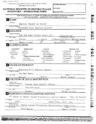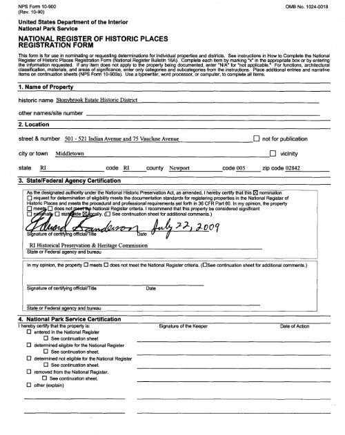
national register of historic places registration form - Rhode Island ...
national register of historic places registration form - Rhode Island ...
national register of historic places registration form - Rhode Island ...

You also want an ePaper? Increase the reach of your titles
YUMPU automatically turns print PDFs into web optimized ePapers that Google loves.
NPS Form 10-900<br />
(Rev. 10-90)<br />
United States Department <strong>of</strong> the Interior<br />
National Park Service<br />
NATIONAL REGISTER OF HISTORIC PLACES<br />
REGISTRATION FORM<br />
OMB No.1 024-0018<br />
This <strong>form</strong> is for use in nominating or requesting determinations for individual properties and districts. See instructions in How to Complete the National<br />
Register <strong>of</strong> Historic Places Registration Form (National Register Bulletin 16A). Complete each item by marking "x" in the appropriate box or by entering<br />
the in<strong>form</strong>ation requested. If any item does not apply to the property being documented, enter "N/A" for "not applicable." For functions, architectural<br />
classification, materials, and areas <strong>of</strong> significance, enter only categories and subcategories from the instructions. Place additional entries and narrative<br />
items on continuation sheets (NPS Form 10-900a). Use a typewriter, word processor, or computer, to complete all items.<br />
1. Name <strong>of</strong> Property<br />
<strong>historic</strong> name Stonvbrook Estate Historic District<br />
other names/site number<br />
2. Location<br />
street & number 501 - 521 IndianAvenue and 75 Vaucluse Avenue 0 not for publication<br />
city or town Middletown 0 vicinity<br />
state RI code RI county Newport code 005 zip code _0_28_4_2 _<br />
3. State/Federal Agency Certification<br />
As the designated authority<br />
o request for determination<br />
under the National Historic Preservation Act, as amended, I hereby certify that this I:8J nomination<br />
<strong>of</strong> eligibility meets the documentation standards for <strong>register</strong>ing properties in the National Register <strong>of</strong><br />
Historic Places and meets the procedural and pr<strong>of</strong>essional requirements set forth in 36 CFR Part 60. In my opinion, the property<br />
o me~ ¢"¢\alkf0 does 0 stadide no~. ~lIy. N~ational (0Register See continuation criteria. I sheet recommend for additional that thiscomments.) property be considered significant<br />
RI Historical Preservation & Heritage Commission<br />
State or Federal agency and bureau<br />
In my opinion, the property 0 meets 0 does not meet the National Register criteria. (OSee continuation sheet for additional comments.)<br />
Signature <strong>of</strong> certifying <strong>of</strong>ficiallTitJe<br />
State or Federal agency and bureau<br />
4. National Park Service Certification<br />
I hereby certify that the property is:<br />
o entered in the National Register<br />
o See continuation sheet<br />
o determined eligible for the National Register<br />
o See continuation sheet.<br />
o determined not eligible for the National Register<br />
o See continuation sheet.<br />
o removed from the National Register.<br />
o See continuation sheet.<br />
o other (explain)<br />
Date<br />
oor<br />
Signature <strong>of</strong> the Keeper Date <strong>of</strong> Action
Stonybrook Estate Historic District<br />
Name <strong>of</strong> Property<br />
5. Classification<br />
Ownership <strong>of</strong> Property<br />
(Check as many boxes as apply.)<br />
181 private<br />
o public-local<br />
o public-State<br />
o public-Federal<br />
Name <strong>of</strong> related multiple property listings<br />
Category <strong>of</strong> Property<br />
(Check only one box.)<br />
o buildings<br />
181 district<br />
26<br />
o site<br />
4 o structure<br />
o object<br />
(Enter "N/A" if property is not part <strong>of</strong> a multiple property listing.)<br />
6. Function or Use<br />
Historic Functions<br />
(Enter categories from instructions.)<br />
Domestic/Single Dwelling<br />
Landscape/Garden<br />
7. Description<br />
Architectural Classification<br />
(Enter categories from instructions.)<br />
Late Gothic Revival<br />
N/A<br />
Newport County, RI<br />
County and State<br />
Number <strong>of</strong> Resources within Property<br />
(Do not include any previously listed resources in the count.)<br />
Contributingtotal buildings 5<br />
Noncontributing sites<br />
structures<br />
obiects<br />
Number <strong>of</strong> contributing resources previously<br />
listed in the National Register<br />
Current Functions<br />
(Enter categories from instructions.)<br />
Domestic/Single Dwelling<br />
Landscape/Garden<br />
Materials<br />
(Enter categories from instructions.)<br />
o<br />
foundation _S~to~n_e _<br />
walls Stone<br />
-----------------wood<br />
- shingle<br />
ro<strong>of</strong> Slate, asphalt, copper<br />
nthp.r<br />
Narrative Description<br />
(Describe the <strong>historic</strong> and current condition <strong>of</strong> the property on one or more continuation sheets.)
Stonybrook Estate Historic District<br />
Name <strong>of</strong> Property<br />
8. Statement <strong>of</strong> Significance<br />
Applicable National Register Criteria<br />
(Mark "X' in one or more boxes for the criteria qualifying the property<br />
for National Register listing.)<br />
D A Property is associated with events that have made<br />
a significant contribution to the broad patterns <strong>of</strong><br />
our history.<br />
D B Property is associated with the lives <strong>of</strong> persons<br />
significant in our past.<br />
IZI C Property embodies the distinctive characteristics<br />
<strong>of</strong> a type, period, or method <strong>of</strong> construction or<br />
represents the work <strong>of</strong> a master, or possesses<br />
high artistic values, or represents a significant and<br />
distinguishable entity whose components lack<br />
individual distinction.<br />
D D Property has yielded, or is likely to yield<br />
in<strong>form</strong>ation important in prehistory or history.<br />
Criteria Considerations<br />
(Mark "X' in all the boxes that apply.)<br />
Property is:<br />
D A owned by a religious institution or used for<br />
religious purposes.<br />
DB removed from its original location.<br />
DCa birthplace or grave.<br />
D D a cemetery.<br />
D E a reconstructed building, object, or structure.<br />
D F a commemorative property.<br />
D G less than 50 years <strong>of</strong> age or achieved significance<br />
within the past 50 years<br />
Narrative Statement <strong>of</strong> Significance<br />
(Explain the significance <strong>of</strong> the property on one or more continuation sheets.)<br />
9. Major Bibliographical References<br />
Areas <strong>of</strong> Significance<br />
(Enter categories from instructions.)<br />
Architecture<br />
Period <strong>of</strong> Significance<br />
1928-1930<br />
Significant Dates<br />
1928<br />
Significant Person<br />
Cultural Affiliation<br />
Architect/Builder<br />
Horace Trumbauer<br />
Newport County, RI<br />
County and State<br />
Bibliography<br />
(Cite the books, articles, and other sources used in preparing this <strong>form</strong> on one or more continuation sheets.)<br />
Previous documentation on file (NPS): Primary location <strong>of</strong> additional data:<br />
o preliminary determination <strong>of</strong> individual listing IZI State Historic Preservation Office<br />
(36 CFR 67) has been requested 0 Other State Agency<br />
o previously listed in the National Register 0 Federal agency<br />
o previously determined eligible by the National 0 Local government<br />
Register D University<br />
D designated a National Historic Landmark D Other<br />
D recorded by Historic American Buildings Survey Name <strong>of</strong> repository<br />
#_---<br />
D recorded by Historic American Engineering Record<br />
#_---
Stonybrook Estate Historic District Newport County, RI<br />
Name <strong>of</strong> Property County and State<br />
10. Geographical Data<br />
Acreage <strong>of</strong> Property 8.6 acres<br />
UTM References<br />
(Place additional references on a continuation sheet.)<br />
1<br />
2<br />
1 9 3 1 3 0 0 0 4 5 9 7 2 1 0<br />
Zone Easting Northing<br />
Verbal Boundary Description<br />
(Describe the boundaries <strong>of</strong> the property on a continuation sheet.)<br />
Boundary Justification<br />
(Explain why the boundaries were selected on a continuation sheet.)<br />
11. Form Prepared By<br />
name/title Wm Mackenzie Woodward/ Architectural Historian<br />
3<br />
Zone Easting Northing<br />
4<br />
See continuation sheet<br />
organization <strong>Rhode</strong> <strong>Island</strong> Historical Preservation & Heritage Commission date 06/30/2009<br />
street & number 150 Benefit Street telephone 401-222-2678<br />
city or town Providence state RI zip code 02903<br />
Additional Documentation<br />
Submit the following items with the completed <strong>form</strong>:<br />
Continuation Sheets<br />
Maps<br />
Photographs<br />
A USGS map (7.5 or 15 minute series) indicating the property’s location.<br />
A Sketch map for <strong>historic</strong> districts and properties having large acreage or numerous resources.<br />
Representative black and white photographs <strong>of</strong> the property.<br />
Additional items<br />
(check with the SHPO or FPO for any additional items)<br />
Property Owner<br />
(Complete this item at the request <strong>of</strong> SHPO or FPO.)<br />
name<br />
street & number telephone<br />
city or town state zip code<br />
Paperwork Reduction Act Statement: This in<strong>form</strong>ation is being collected for applications to the National Register <strong>of</strong> Historic Places to nominate properties for listing or determine eligibility for listing, to<br />
list properties, and amend listings. Response to this request is required to obtain a benefit in accordance with the National Historic Preservation Act, as amended (16 U.S.C. 470 et seq.).<br />
Estimated Burden Statement: Public reporting burden for this <strong>form</strong> is estimated to average 18.1 hours per response including time for reviewing instructions, gathering and maintaining data, and<br />
completing and reviewing the <strong>form</strong>. Direct comments regarding this burden estimate or any aspect <strong>of</strong> this <strong>form</strong> to the Chief, Administrative Services Division, National Park Service, P.O. Box 37127,<br />
Washington, DC 20013-7127; and the Office <strong>of</strong> Management and Budget, Paperwork Reductions Projects (1024-0018), Washington, DC 2050
NPS Form 10-900-a OMB Approval No. 1024-0018<br />
(8-86)<br />
United States Department <strong>of</strong> the Interior<br />
National Park Service<br />
NATIONAL REGISTER OF HISTORIC PLACES<br />
CONTINUATION SHEET<br />
Stonybrook Estate Historic District Middletown Newport Co., R. I.<br />
Name <strong>of</strong> Property City/Town County and State<br />
Section Number 7 Page 1<br />
7. DESCRIPTION<br />
The Stonybrook Estate Historic District is an 8.6-acre lushly vegetated tract on both sides <strong>of</strong> a<br />
tree-lined section <strong>of</strong> Indian Avenue south <strong>of</strong> Green End Avenue and north <strong>of</strong> Taggert’s Ferry<br />
Road and Vaucluse Avenue, overlooking the west shore <strong>of</strong> the Sakonnet River at Middletown’s<br />
eastern edge. The land rises gently from sea level at the river’s shore to just over 50 feet at the<br />
district’s northwestern corner. Just south <strong>of</strong> Vaucluse Avenue, which <strong>form</strong>s part <strong>of</strong> the district’s<br />
western edge, a small creek crosses Indian Avenue and meanders into the Sakonnet River east <strong>of</strong><br />
the intersection <strong>of</strong> Vaucluse and Indian Avenues. The district’s principal properties comprise a<br />
large, early twentieth-century multiple-resource estate with landscaped grounds, subdivided in<br />
the late twentieth century. It includes nine buildings, four <strong>of</strong> which are contributing and five noncontributing,<br />
and two discrete contributing sites.<br />
Indian Avenue<br />
501<br />
C<br />
Stonybrook, the Edward Collings Knight, Jr Estate (1927-28; Horace Trumbauer<br />
[Philadelphia], architect): A large, asymmetrically massed, rambling-T-plan, one-anda-half-story<br />
random-course-ashlar stone house in an Anglo-French Late-Mediæval<br />
mode with windows arranged in banks <strong>of</strong> two, three, four, or five double-hung sash or<br />
casements; and prominent cross-gable and hip ro<strong>of</strong> with end-gable dormers on the<br />
gable-ro<strong>of</strong> sections, hip-ro<strong>of</strong> dormers on the hip-ro<strong>of</strong> section, dormers extending in the<br />
wall plane above the cornice on the east elevations, and large, prominent chimneys with<br />
clustered chimney pots, one toward the north end <strong>of</strong> the north-south main block, one<br />
toward the south end <strong>of</strong> the main block, one at the intersection <strong>of</strong> the main block and<br />
the base <strong>of</strong> the T, and two on the north elevation <strong>of</strong> the base <strong>of</strong> the T. The principal<br />
entrance, <strong>of</strong>f center on the façade (west elevation), is within an <strong>of</strong>f-center projecting<br />
end-gable-ro<strong>of</strong> pavilion with partially shingled gable end. On the east elevation are two<br />
large terraces: one within the re-entrant angle between the main block and the eastextending<br />
base <strong>of</strong> the T and one across the east elevation <strong>of</strong> the base <strong>of</strong> the T. A loggia<br />
with round-arch openings extends across the south end <strong>of</strong> the main block adjacent to<br />
the terrace. A glazed porch with-round-arch windows and French doors, similarly<br />
configured to the loggia on the south, extends across the east elevation.<br />
The interior contains large public spaces and broad halls on the first level and a number<br />
<strong>of</strong> moderate-size bedrooms connected by narrow hallways on the upper level.
NPS Form 10-900-a OMB Approval No. 1024-0018<br />
(8-86)<br />
United States Department <strong>of</strong> the Interior<br />
National Park Service<br />
NATIONAL REGISTER OF HISTORIC PLACES<br />
CONTINUATION SHEET<br />
Stonybrook Estate Historic District Middletown Newport Co., R. I.<br />
Name <strong>of</strong> Property City/Town County and State<br />
Section Number 7 Page 2<br />
Indian Avenue continued<br />
Designed and constructed as a summer residence, the spatial organization and finishes<br />
were calculated as responses to that specific use: accommodating a large number <strong>of</strong><br />
people who congregated on the lower level in well-detailed large spaces connected with<br />
the outdoors and who retired on the upper level to more modest bedrooms, many with<br />
original adjoining baths, for individuals or, at the most, couples.<br />
The interior unfolds in a dramatic spatial sequence. Entrance into this monumental<br />
house is through a modest entrance below flared-hip-ro<strong>of</strong> hood into a small low-ceiling<br />
vestibule, accommodating at most two persons. The vestibule opens into a telescopeplan<br />
main hall, wider in its western, entrance section, than that to the east. The triplerun<br />
principal stairs rise to the west at the west end <strong>of</strong> the hall, with the second landing<br />
above the vestibule. Immediately to the right <strong>of</strong> the entrance from the vestibule is a<br />
small coat closet and powder room. A large room, once a reception room now<br />
converted to a family kitchen, lies to the south <strong>of</strong> the main hall, filling the first level <strong>of</strong><br />
the south wing. To the north <strong>of</strong> the main hall, just east <strong>of</strong> the base <strong>of</strong> the staircase, is a<br />
service hall extending to the service wing in the north wing. Beyond the service hall,<br />
the dining room is on the north side <strong>of</strong> the main hall, with entrances in both the wider<br />
west section and the narrower east section. Beyond the main hall is a large paneled<br />
library; it communicates with the dining room immediately to its west and with the<br />
glazed loggia to its east.<br />
Interior surfaces and details on the first story are largely intact. Floors are stained<br />
hardwood, and ceilings are plaster. The principal hall (on both first and second level),<br />
original reception room, dining room, and service hall (extending north from the<br />
principal hall at the base <strong>of</strong> the principal staircase) have random-width vertical-board<br />
pine paneling with fluted edges and low chair rail. The lower section <strong>of</strong> the principal<br />
hall, original reception room, and dining room are now painted white, but may well<br />
have shared the grey pickled finish, still in the upper section <strong>of</strong> the principal hall and<br />
the service hall, that emphasizes the picturesque quality <strong>of</strong> heavily knotted pine. The<br />
walls in the principal hall have an overlay <strong>of</strong> rectangular panels, both below and above<br />
the rail, <strong>form</strong>ed by slender bolection molding; these panels may also be a later addition.<br />
The stained-pine beveled-panel library walls have garland-guilloche baseboard,<br />
wainscot, and cornice moldings and door frames, and garlands depend from the wall<br />
sconces and frame the overmantel centered on the north wall. These finishes are
NPS Form 10-900-a OMB Approval No. 1024-0018<br />
(8-86)<br />
United States Department <strong>of</strong> the Interior<br />
National Park Service<br />
NATIONAL REGISTER OF HISTORIC PLACES<br />
CONTINUATION SHEET<br />
Stonybrook Estate Historic District Middletown Newport Co., R. I.<br />
Name <strong>of</strong> Property City/Town County and State<br />
Section Number 7 Page 3<br />
Indian Avenue continued<br />
among the most rustic found in Trumbauer’s residential work.<br />
The upper story, dedicated to private bedrooms, has a large and spatially directed hall<br />
that extends south in the south wing from the top <strong>of</strong> the principal, but the halls that<br />
connect with the bedrooms in the east and north wings are episodic, turning to<br />
accommodate the more than eight bedrooms located under the eaves <strong>of</strong> the steep ro<strong>of</strong>.<br />
Finishes in these plaster-wall-and-ceiling rooms are simple: molded baseboards;<br />
simple door and window casings; and one-story mantels. The most dramatic space is<br />
the original sleeping porch on the south side <strong>of</strong> the base <strong>of</strong> the T near the center <strong>of</strong> the<br />
house: it has a flagstone-slate floor, horizontal-board walls, and exposed timber sills,<br />
plates, posts, and, in the gable end, kingpost and struts. Several <strong>of</strong> the mantels and<br />
doors, especially in the rooms in the east wing, appear to date to the mid-19 th century<br />
and may well have been relocated from another house. 1<br />
Edward Collings Knight, Jr (1864-1936), was the son <strong>of</strong> one <strong>of</strong> the pioneers <strong>of</strong> the<br />
Cuban molasses trade. In addition to sugar, Knight, Sr (1813-1892), made the family<br />
fortune in railroads and shipping, pursuits in which the son also successfully engaged.<br />
This was the third residence and the second <strong>Rhode</strong> <strong>Island</strong> house that Knight<br />
commissioned <strong>of</strong> Trumbauer. He and his first wife, Clara Waterman Dwight Knight<br />
(ca 1867-1910), first engaged the architect to design their town house (1902-03) at<br />
1629 Locust Street in Philadelphia, an almost minuscule eighteenth-century-inspired<br />
hôtel particulier. They then engaged Trumbauer to design their summer house,<br />
Claradon Court 2 (1903-04), 620 Bellevue Avenue, Newport (NHL, Bellevue Avenue<br />
Historic District, listed 11 May 1976), Trumbauer’s design homage to English architect<br />
Colen Campbell, whose Hedworth House (1716-17) in Durham, England, directly<br />
inspired its design. Knight’s second wife, Marie Louise LeBel Knight (?-1936) was a<br />
spirited French Canadian sportswoman. In the early 1920s they built Corolla <strong>Island</strong><br />
(now The Whalehead Club, NR) on the Outer Banks in Corolla, North Carolina, where<br />
they repaired each winter for hunting water fowl. The allusion to late mediæval<br />
English and French country lodges, a source at the height <strong>of</strong> its popularity in the 1920s,<br />
seems even more eminently appropriate for both the heritage and interests <strong>of</strong> the second<br />
1<br />
Whether these elements were installed at the time <strong>of</strong> the house’s construction or by a subsequent owner remains<br />
unknown.<br />
2<br />
Now known as Clarendon Court.
NPS Form 10-900-a OMB Approval No. 1024-0018<br />
(8-86)<br />
United States Department <strong>of</strong> the Interior<br />
National Park Service<br />
NATIONAL REGISTER OF HISTORIC PLACES<br />
CONTINUATION SHEET<br />
Stonybrook Estate Historic District Middletown Newport Co., R. I.<br />
Name <strong>of</strong> Property City/Town County and State<br />
Section Number 7 Page 4<br />
Indian Avenue continued<br />
501<br />
C<br />
Mrs. Knight. The property was subdivided after the Knights’ deaths, most recently in<br />
the 1980s, after which new houses were built to the north on the east side <strong>of</strong> Indian<br />
Avenue (see 502 and 515 Indian Avenue).<br />
Stonybrook Grounds: With a landscape that includes significant features <strong>of</strong> both<br />
hardscape and planting, the house is sited toward the northeast corner <strong>of</strong> an almost five<br />
acre parcel<br />
se<br />
fluence<br />
n<br />
the<br />
3 that gently rises east to west from approximately ten to twenty feet.<br />
Access to the house is across a long drive that curves in a forty-five-degree arc<br />
southeast from Indian Avenue; it supplements the original entrance, located<br />
immediately to the north, adjacent to the gatehouse (now a separate property, 515<br />
Indian Avenue, also included in this nomination, described below). Emulating the<br />
sequential experience <strong>of</strong> arrival that was both longer and more dramatically realized as<br />
first built, the present entrance drive arrives at two circular turnabouts to the west and<br />
north <strong>of</strong> the house, the <strong>form</strong>er in front <strong>of</strong> the principal entrance, the latter between the<br />
service entrance and the three-stall garage near the property’s edge. A random-cour<br />
ashlar retaining wall, similar in appearance to the stonework on the house, extends<br />
along the property’s Sakonnet River edge and continues into the mouth <strong>of</strong> a<br />
meandering brook that describes a 180-degree arc along the property’s southern edge;<br />
lined with ledges and filled with stones, this is no doubt the property’s eponymous<br />
feature. A circular-plan pergola stands near the brook toward the west end <strong>of</strong> the<br />
brook’s arc. A bridge with round-arch balustrade crosses the brook near its con<br />
with the river. Trees include a variety <strong>of</strong> specimen beeches and other deciduous trees,<br />
along the Indian Avenue property edge, framing the drive’s entrance to the property, o<br />
the northern edge, and clustered near the pergola and the brook. A row <strong>of</strong> conifers<br />
shields the property from the intersection <strong>of</strong> Indian and Vaucluse Avenues, and a<br />
variety <strong>of</strong> evergreen shrubs cluster at the façade’s northern and southern ends. A small<br />
hexagonal-plan <strong>form</strong>al garden, its edges defined by evergreen shrubs, is north <strong>of</strong><br />
3 Reduced in size from its original eight-and-a-half acres following the division in the mid-1980s <strong>of</strong> the northern 3.5<br />
acres into two separate lots; 515 and 521 Indian Avenue. Additional acreage on the west side <strong>of</strong> Indian Avenue was<br />
also <strong>historic</strong>ally associated with this property encompassing the present 502 Indian Avenue and 75 Vaucluse<br />
Avenue, see below.
NPS Form 10-900-a OMB Approval No. 1024-0018<br />
(8-86)<br />
United States Department <strong>of</strong> the Interior<br />
National Park Service<br />
NATIONAL REGISTER OF HISTORIC PLACES<br />
CONTINUATION SHEET<br />
Stonybrook Estate Historic District Middletown Newport Co., R. I.<br />
Name <strong>of</strong> Property City/Town County and State<br />
Section Number 7 Page 5<br />
Indian Avenue continued<br />
501<br />
NC<br />
502<br />
C<br />
The two-acre parcel once<br />
included an elaborate fan-plan <strong>form</strong>al garden south <strong>of</strong> the<br />
garage; that area is now open lawn, but archæological investigation may reveal<br />
subterranean remnants.<br />
502 Cottage (ca 1990): A shingled one-and-a-half-story building with two-stall garage on<br />
NC the façade flanked to the east by hip-ro<strong>of</strong> entrance porch, asymmetrically placed cross<br />
gable above façade, and two asymmetrically placed dormers on the north elevation.<br />
502 Cottage (ca 1990): A shingled one-and-a-half-story building<br />
with three vehicular<br />
NC entrances on the façade, three symmetrically placed dormers on east and west slopes <strong>of</strong><br />
the ro<strong>of</strong>, and square-plan cupola centered on the ridgeline.<br />
515<br />
C<br />
north elevation <strong>of</strong> the base <strong>of</strong> the T.<br />
Garage (ca 1985): A simple, wood-frame, one-story, flank-gable-ro<strong>of</strong> building with<br />
three vehicular entrances on the south elevation.<br />
Stonybrook Garage (1927-28; Horace Trumbauer [Philadelphia], architect): A oneand-a-half-story,<br />
symmetrical five-bay-façade, random-course ashlar building with a<br />
lower one-and-a-half-story ell set back from the façade’s wall plane and extending<br />
northwest from the northwest corner, five paired French doors arranged symmetrically<br />
on the façade, a small <strong>of</strong>f-center brick chimney below the crest <strong>of</strong> the south slope <strong>of</strong> the<br />
ro<strong>of</strong>, and a large stone chimney with two pots centered on the ridgeline within the west<br />
elevation; the asymmetrical north elevation has irregular fenestration, an <strong>of</strong>f-center<br />
entrance, and two large, asymmetrical end-gable dormers extending the wall plane<br />
above through the cornice with two small end-gable dormers placed symmetrically<br />
between them. Built as a five-stall garage, the building was originally oriented toward<br />
the south, with a large parking pad in front <strong>of</strong> it. As converted for residential use, its<br />
orientation was switched to the north elevation, and the garage doors replaced<br />
with<br />
French doors. Like many utilitarian service buildings on large estates, this continues<br />
materials and detailing found on the main house (see 501 Indian Avenue).<br />
Stonybrook Gatehouse (1927-28; Horace Trumbauer [Philadelphia], architect). A oneand-a-half-story,<br />
asymmetrically massed, L-plan, random-course ashlar building with
NPS Form 10-900-a OMB Approval No. 1024-0018<br />
(8-86)<br />
United States Department <strong>of</strong> the Interior<br />
National Park Service<br />
NATIONAL REGISTER OF HISTORIC PLACES<br />
CONTINUATION SHEET<br />
Stonybrook Estate Historic District Middletown Newport Co., R. I.<br />
Name <strong>of</strong> Property City/Town County and State<br />
Section Number 7 Page 6<br />
Indian Avenue continued<br />
515<br />
NC<br />
521<br />
C<br />
complex cross-gable slate ro<strong>of</strong>, principal entrance at the base <strong>of</strong> the ell that extends<br />
north from the main block, asymmetrical fenestration, large bow window on the south<br />
elevation, and prominent stone chimneys with pots centered on the ridgeline on the<br />
east<br />
and north elevations. Located immediately adjacent to Indian Avenue, this cadet<br />
version <strong>of</strong> the main house (see 501 Indian Avenue) continues<br />
its stylistic themes<br />
through massing, materials, and detailing. This building was separated from the main<br />
house when the property was subdivided in the 1980s.<br />
The gatehouse’s interior is large intact and includes a small one-story Tudoresque<br />
mantel in the parlor, a Tudor-arch opening between the parlor and dining room, simple<br />
staircase, and lancet-arch doors in the upper story.<br />
The 1.7-acre parcel includes some plant material that was part <strong>of</strong> Stonybrook’s original<br />
landscape, notably around the gatehouse, as well as some trees along the drive, which<br />
served originally as the principal entrance drive to Stonybrook.<br />
House (1988): A large, stone-clad, rectangular-plan, high-hip-ro<strong>of</strong> house with highly<br />
inflected massing, including twin end gables centered on the façade, hip- and endgable-ro<strong>of</strong><br />
projecting pavilions on the east elevation, large terrace<br />
extending from the<br />
east elevation to the east and to the south, where it surrounds a swimming pool and<br />
reaches a pool house near the property’s southern boundary.<br />
Stonybrook Grounds (1927-28): This 2.11-acre parcel was subdivided from the<br />
Stonybrook estate in the late 20<br />
all<br />
built<br />
Plantings<br />
site <strong>of</strong> the<br />
Stonybrook tennis court. A small <strong>historic</strong> building, that sheltered viewers at the tennis<br />
th century but still retains identifiable, intact landscape<br />
elements associated with that era. Landscape features include both hardscape and<br />
plantings. Built landscape features include an <strong>historic</strong> curved, ramped driftway from<br />
the middle <strong>of</strong> the lawn to the shore <strong>of</strong> the Sakonnet River, an <strong>historic</strong> retaining w<br />
along the lawn’s edge at the river, remnants <strong>of</strong> an <strong>historic</strong> subterranean boat house<br />
into the retaining wall just south <strong>of</strong> the ramp, a curving main drive that enters a<br />
teardrop-plan landscaped court in front <strong>of</strong> the house, a large parking apron on the<br />
southeast side <strong>of</strong> the garage wing, and terracing on the east side <strong>of</strong> the house.<br />
include specimen trees, some dating to the Stonybrook era, and contemporary hedges,<br />
shrubs, and trees. The modern house on the property occupies the
NPS Form 10-900-a OMB Approval No. 1024-0018<br />
(8-86)<br />
United States Department <strong>of</strong> the Interior<br />
National Park Service<br />
NATIONAL REGISTER OF HISTORIC PLACES<br />
CONTINUATION SHEET<br />
Stonybrook Estate Historic District Middletown Newport Co., R. I.<br />
Name <strong>of</strong> Property City/Town County and State<br />
Section Number 7 Page 7<br />
Indian Avenue continued<br />
521<br />
NC<br />
House (ca 1989): A one-and-a-half-story, staggered-T-plan, brick-and-shingle house in<br />
the Neo-Shingle Style with asymmetrical massing, telescope-plan north wing,<br />
asymmetrically placed windows, prominent twin-flue chimneys on the façade and on<br />
the ridgeline <strong>of</strong> the<br />
east ell, and a drive-through one-and-a-half-story service wing and<br />
garage set at<br />
a 45-degree angle and extending southwest from the southwest corner <strong>of</strong><br />
the main block.<br />
Vaucluse Avenue<br />
75<br />
C<br />
court, has been moved next to the ramp down to the boathouse.<br />
Stonybrook Gardener’s Cottage (1927-28; Horace Trumbauer [Philadelphia], architect):<br />
A random-course-stone, one-and-a-half-story, T-plan, slate-cross-gable-and-pent-ro<strong>of</strong><br />
house with principal entrance within an ample blind-façade porch on the west<br />
elevation, banked casement windows asymmetrically arranged on the north and west<br />
elevations and centered on the south elevation, ridgeline chimney in the wall plane <strong>of</strong><br />
the southern elevation, shed-ro<strong>of</strong> dormers on the ro<strong>of</strong>’s east and west elevations, and<br />
square-plan cupola with weathervane centered on the ridgeline. Set well back from<br />
Vaucluse Avenue on a 1.42-acre parcel, the house is approached by a slightly curving<br />
drive, a remnant <strong>of</strong> the<br />
drive that once extended from Indian Avenue to the east and<br />
past the garage (see 502 Indian Avenue). Trees adjacent to the house are part <strong>of</strong> the<br />
original landscaping.
NPS Form 10-900-a OMB Approval No. 1024-0018<br />
(8-86)<br />
United States Department <strong>of</strong> the Interior<br />
National Park Service<br />
NATIONAL REGISTER OF HISTORIC PLACES<br />
CONTINUATION SHEET<br />
Stonybrook Estate Historic District Middletown Newport Co., R. I.<br />
Name <strong>of</strong> Property City/Town County and State<br />
Section Number 8 Page 1<br />
8. SIGNIFICANCE<br />
The Stonybrook Estate Historic District is a notable example <strong>of</strong> the high-style residential<br />
development associated with the growth <strong>of</strong> an extensive summer-resort society that was centered<br />
in Newport, <strong>Rhode</strong> <strong>Island</strong> and spread into the neighboring towns <strong>of</strong> Middletown, Portsmouth,<br />
and Jamestown in the late nineteenth and early twentieth-centuries. The district, which achieves<br />
significance under Criterion C at the state level in the area <strong>of</strong> architectural history, is the<br />
community’s largest, most fully developed, and most intact representative <strong>of</strong> this phenomenon.<br />
It includes the main house, all attendant outbuildings, and associated grounds. It represents a<br />
<strong>national</strong>ly prominent individual and the mature work <strong>of</strong> a <strong>national</strong>ly prominent architect, Horace<br />
Trumbauer.<br />
Development History<br />
The southeastern corner <strong>of</strong> Aquidneck <strong>Island</strong>, where the Stonybrook Estate Historic District is<br />
located, developed shortly after the establishment <strong>of</strong> Newport in 1639 as part <strong>of</strong> the town’s<br />
agricultural hinterland. The pattern <strong>of</strong> agricultural land use set in the seventeenth century was<br />
fully established during the eighteenth century and persisted into the twentieth century, sustained<br />
by the area’s fertile soils and gently rolling terrain. In 1743, this area became part <strong>of</strong> the new<br />
town <strong>of</strong> Middletown, which was set <strong>of</strong>f from Newport, in part, because <strong>of</strong> the sharp difference in<br />
character between the urban port with its commercial interests and the surrounding farming<br />
community. In the middle decades <strong>of</strong> the nineteenth century, as Newport acquired <strong>national</strong><br />
renown as a summer resort, vacationers in the city began to explore this adjacent countryside,<br />
drawn by the scenic attractions <strong>of</strong> a bucolic landscape <strong>of</strong> isolated farmsteads surrounded by<br />
fields, pastureland, and coastal marshes; punctuated by dramatic ridges like nearby Hanging<br />
Rock; and bordered by an alternately rocky and sandy coastline.<br />
The immediate vicinity <strong>of</strong> the <strong>historic</strong> district at this time was divided by stone walls, fences, and<br />
the rocky shoreline into an irregular grid <strong>of</strong> field and pasture, the outlying lands <strong>of</strong> farms<br />
centered on Third Beach Road or Howland Avenue to the west. The closest farmsteads were<br />
those <strong>of</strong> the Taggart and Howland families, on either side <strong>of</strong> Howland Avenue, just west <strong>of</strong> the<br />
district. An extension <strong>of</strong>f the east end <strong>of</strong> Howland (today’s Taggarts Ferry Road) ran down to a<br />
ferry landing on the Taggart Farm. This ferry, which operated into the 1870s, served farmers<br />
across the Sakonnet River in Little Compton with transporting their produce in Newport.
NPS Form 10-900-a OMB Approval No. 1024-0018<br />
(8-86)<br />
United States Department <strong>of</strong> the Interior<br />
National Park Service<br />
NATIONAL REGISTER OF HISTORIC PLACES<br />
CONTINUATION SHEET<br />
Stonybrook Estate Historic District Middletown Newport Co., R. I.<br />
Name <strong>of</strong> Property City/Town County and State<br />
Section Number 8 Page 2<br />
Eugene Sturtevant (1838-1899), a Newport resident, initiated a new phase <strong>of</strong> development here<br />
in 1871, when he moved to a farmhouse <strong>of</strong>f Third Beach Road, <strong>form</strong>erly owned by a Peckham<br />
family. Inspired by the attractive qualities <strong>of</strong> the coastal land stretching north from his property,<br />
he conceived a plan to develop it as a satellite suburb for the burgeoning Newport summer<br />
colony. He moved quickly to realize the plan, taking on a limited partner, Alfred A. Smith, who<br />
had already achieved considerable success developing real estate for the Newport resort<br />
community, most notably along Bellevue Avenue and Ocean Drive. By February 1872,<br />
Sturtevant and Smith had acquired the two-and-a-half-mile stretch <strong>of</strong> shoreline from Sturtevant’s<br />
property at Third Beach north to Black Point in Portsmouth, and platted it for the sale <strong>of</strong><br />
individual lots. Their plat featured a central longitudinal road, Indian Avenue, flanked by one<br />
hundred rectilinear lots. The lots were generous in size for the most part, with an average<br />
frontage <strong>of</strong> 200 feet and depths <strong>of</strong> 400 feet or more; though some were <strong>of</strong> lesser depth.<br />
The development <strong>of</strong> Indian Avenue began slowly, hampered by the Panic <strong>of</strong> 1873 and the area’s<br />
relative remoteness from Newport. Sturtevant worked to establish Hanging Rocks Road, which<br />
would complete a direct public thoroughfare from downtown Newport to the south end <strong>of</strong> Indian<br />
Avenue. 1 When he finally succeeded in having the road opened in 1883, a brief burst <strong>of</strong> summer<br />
estate building occurred, primarily on the waterfront lots along the southern half <strong>of</strong> Indian<br />
Avenue. Unfortunately for Sturtevant and Smith, the three-and-a-half-mile distance to Newport<br />
still proved to be too great for most and .only a handful <strong>of</strong> properties were developed.<br />
With the advent <strong>of</strong> the automobile, the Indian Avenue neighborhood attracted more<br />
development. In the first three decades <strong>of</strong> the twentieth century, new summer estates filled in<br />
many <strong>of</strong> the spaces between the earlier ones on the southern half <strong>of</strong> Indian Avenue, though much<br />
<strong>of</strong> the original plat remained in agricultural use, especially north <strong>of</strong> Green End Avenue. The most<br />
important product <strong>of</strong> this period <strong>of</strong> growth was the Edward C. Knight, Jr. estate, Stonybrook<br />
(1927-28), designed by Horace Trumbauer, the prominent Philadelphia-based architect with<br />
numerous Newport mansions to his credit. In addition to the main house on a waterfront lot, the<br />
Knight estate extended across Indian Avenue, with <strong>form</strong>al gardens and outbuildings in the same<br />
style as Stonybrook. With its grounds enveloping Indian Avenue and its Gothic style<br />
complimenting the picturesque rural character, Stonybrook was a significant addition to the<br />
district.<br />
1 James Yarnall, Newport Through Its Architecture: A History <strong>of</strong> Styles from Postmedieval to<br />
Postmodern (Newport, 2005), pp. 87-88.
NPS Form 10-900-a OMB Approval No. 1024-0018<br />
(8-86)<br />
United States Department <strong>of</strong> the Interior<br />
National Park Service<br />
NATIONAL REGISTER OF HISTORIC PLACES<br />
CONTINUATION SHEET<br />
Stonybrook Estate Historic District Middletown Newport Co., R. I.<br />
Name <strong>of</strong> Property City/Town County and State<br />
Section Number 8 Page 3<br />
The pattern <strong>of</strong> summer estates with ample landscaped grounds interspersed with occasional farm<br />
fields defined the Indian Avenue neighborhood into the decade after World War II. In the last<br />
quarter <strong>of</strong> the twentieth century another round <strong>of</strong> development added a new generation <strong>of</strong> large<br />
houses, filling in <strong>form</strong>erly undeveloped land or subdivided portions <strong>of</strong> the earlier estates. Amid<br />
these modern additions, the section <strong>of</strong> Indian Avenue at its intersection with Vaucluse Avenue<br />
retains the <strong>historic</strong> look and feel <strong>of</strong> the earlier resort era, due to the proximity <strong>of</strong> the <strong>historic</strong><br />
buildings and the retention <strong>of</strong> the heavily landscaped acreage that has <strong>historic</strong>ally characterized<br />
the district and now serves to screen the newer houses.<br />
Architecture<br />
Horace Trumbauer (1869-1938) was born into a modest mercantile family in suburban<br />
Philadelphia. Trumbauer ended his <strong>form</strong>al education in a succession <strong>of</strong> local public schools by<br />
entering the Philadelphia architectural firm <strong>of</strong> George W. & William D. Hewitt as <strong>of</strong>fice boy.<br />
By 1890, he had opened his own <strong>of</strong>fice on that city’s Chestnut Street. His early years <strong>of</strong><br />
independent practice were largely devoted to speculative houses built by developers, but by the<br />
mid-1890s he was designing large houses for Philadelphia’s Elkins and Widener families, both<br />
related by marriage. With three substantial commissions from these families under his belt by<br />
1900, he was introduced to other wealthy Philadelphia families, including the newly rich<br />
Edward J. Berwind (1848-1936), the country’s most prosperous coal dealer, who gave<br />
Trumbauer his entré into <strong>Rhode</strong> <strong>Island</strong> with The Elms (1899-1901) on Newport’s Bellevue<br />
Avenue (NHL, Bellevue Avenue Historic District, listed 11 May 1976). While these early<br />
commissions included essays in the English-castle mode, such as Grey Towers (1893-96) for<br />
William Welsh Harrison in Glenside, Pennsylvania, or half-timbered Elizabethan, like Chelten<br />
House (1896, 1908) for George W. Elkins in Elkins Park, Pennsylvania, his principal milieu was<br />
the Renaissance Revival, drawing most heavily on eighteenth-century French architecture, as he<br />
did at The Elms.<br />
Trumbauer’s work in <strong>Rhode</strong> <strong>Island</strong> was a combination <strong>of</strong> commissions garnered from<br />
Philadelphians and those from elsewhere impressed by his work in Newport. The example <strong>of</strong><br />
The Elms brought the commission for another French-inspired house, Chetwode (1900-02;<br />
destroyed 1972), for New Yorkers William Storrs and Annie Raynor Wells, farther south on<br />
Bellevue Avenue. Back in Philadelphia, he designed the townhouse for Edward Collings Knight,<br />
Jr, and his wife Clara Waterman Dwight Knight, completed on Locust Street in 1903, followed<br />
immediately by their summer house, Claradon Court, 620 Bellevue Avenue, Newport (NHL,
NPS Form 10-900-a OMB Approval No. 1024-0018<br />
(8-86)<br />
United States Department <strong>of</strong> the Interior<br />
National Park Service<br />
NATIONAL REGISTER OF HISTORIC PLACES<br />
CONTINUATION SHEET<br />
Stonybrook Estate Historic District Middletown Newport Co., R. I.<br />
Name <strong>of</strong> Property City/Town County and State<br />
Section Number 8 Page 4<br />
Bellevue Avenue Historic District, listed 11 May 1976), this time in the mode <strong>of</strong> Palladian<br />
England. A fourth Trumbauer house on Bellevue, Miramar (1912-14), is also French in<br />
inspiration, commissioned by George D. and Eleanor Elkins Widener just before Mr. Widener's<br />
fatal voyage on the Titanic.<br />
In 1927, Edward C. Knight, Jr, and his second wife, Marie Louise LeBel Knight, turned to<br />
Trumbauer again for a new summer house; this time in the more rural waterfront setting <strong>of</strong><br />
Indian Avenue, which better suited the couple’s active sporting life. By this time, architectural<br />
taste among wealthy Newport cottagers had substantially shifted from the almost-palatial<br />
<strong>form</strong>alism <strong>of</strong> eighteenth-century models to smaller-scale, more in<strong>form</strong>al houses inspired by late<br />
medieval French and English sources. 2 Trumbauer had executed a large house in this mode for<br />
the Wideners’ daughter, Eleanor Widener Dixon at Ronaele Manor (1923-25) in Elkins Park,<br />
Pennsylvania, which the Knights surely knew. The smaller-scale house that they commissioned<br />
for Indian Avenue, Stonybrook, was one <strong>of</strong> the more modest <strong>of</strong> Trumbauer’s country house<br />
designs, but it is nevertheless as calculatingly proportioned and exquisitely detailed as the largescale<br />
commissions for which he is better known.<br />
Located outside the heart <strong>of</strong> Newport, the Indian Avenue Historic District vividly conveys a<br />
distinct sense <strong>of</strong> time and place that shares in many <strong>of</strong> the social and architectural qualities found<br />
at the center <strong>of</strong> the resort community, but adapted here to the distinctive character <strong>of</strong> its oncesecluded<br />
rural location.<br />
2 Yarnall, op. cit., pp. 162-164.
NPS Form 10-900-a OMB Approval No. 1024-0018<br />
(8-86)<br />
United States Department <strong>of</strong> the Interior<br />
National Park Service<br />
NATIONAL REGISTER OF HISTORIC PLACES<br />
CONTINUATION SHEET<br />
Stonybrook Estate Historic District Middletown Newport Co., R. I.<br />
Name <strong>of</strong> Property City/Town County and State<br />
Section Number 9 Page 1<br />
9 — Major Bibliographical References<br />
Jordy, William H. and Christopher P. Monkhouse. Buildings on Paper: <strong>Rhode</strong> <strong>Island</strong><br />
Architectural Drawings, 1825-1945. Providence, 1982.<br />
———, Ronald J. Onorato, and William McKenzie Woodward. Buildings <strong>of</strong> <strong>Rhode</strong> <strong>Island</strong>.<br />
Oxford and New York, 2004.<br />
Kathrens, Michael C. American Splendor: The Residential Architecture <strong>of</strong> Horace Trumbauer.<br />
New York, 2002.<br />
<strong>Rhode</strong> <strong>Island</strong> Historical Preservation Commission. Middletown: Preliminary Survey Report.<br />
Providence, 1979.<br />
Yarnall, James L. Newport Through Its Architecture: A History <strong>of</strong> Styles from Postmedieval to<br />
Postmodern. Newport, 2005.<br />
Maps and Aerial Photos: listed chronologically<br />
1860 M. Dripps. Map <strong>of</strong> Newport & Vicinity, or <strong>Rhode</strong> <strong>Island</strong>. New York.<br />
1872 Indian Avenue, Middletown, Newport County, <strong>Rhode</strong> <strong>Island</strong>. Wm. Dame Civil Engineer,<br />
Newport, R. I.<br />
1876 G. M. Hopkins & Co. City Atlas <strong>of</strong> Newport, R.I., from Official Records, Private Plans, and<br />
Actual Surveys …. Philadelphia.<br />
1893 L. J. Richards & Co. Atlas <strong>of</strong> the City <strong>of</strong> Newport, R.I., from Official Records and Actual<br />
Surveys. Springfield, Mass.<br />
1895 Unknown source, in collection <strong>of</strong> Middletown Historical Society.<br />
1907 L.J. Richards & Co.. Atlas <strong>of</strong> the City <strong>of</strong> Newport and Towns <strong>of</strong> Middletown and<br />
Portsmouth, R.I. Springfield, Mass.<br />
1921 Sanborn Map Company. Atlas <strong>of</strong> Newport, Jamestown, Middletown, and Portsmouth, R.I.,<br />
from Actual Survey and City Records. New York.<br />
1939 Digital Aerial Photographs. <strong>Rhode</strong> <strong>Island</strong> Geographic In<strong>form</strong>ation System (RIGIS) Data<br />
1951-52 Distribution System, Environmental Data Center, University <strong>of</strong> <strong>Rhode</strong> <strong>Island</strong>, Kingston,<br />
1962 R. I. Online at URL: http://www.edc.uri.edu/rigis
NPS Form 10-900-a OMB Approval No. 1024-0018<br />
(8-86)<br />
United States Department <strong>of</strong> the Interior<br />
National Park Service<br />
NATIONAL REGISTER OF HISTORIC PLACES<br />
CONTINUATION SHEET<br />
Stonybrook Estate Historic District Middletown Newport Co., R. I.<br />
Name <strong>of</strong> Property City/Town County and State<br />
Section Number 10 Page 1<br />
10 — Boundary Justification<br />
The boundaries have been drawn to include the contributing architectural and landscape features<br />
<strong>of</strong> the <strong>historic</strong> Stonybrook Estate, following its <strong>historic</strong> property lines as much as possible. Some<br />
non-<strong>historic</strong> buildings have been included where the surrounding landscape character remains<br />
intact.
501 Indian Avenue, Middletown, RI<br />
Stonybrook<br />
Looking northwest
501 Indian Avenue, Middletown, RI<br />
Stonybrook – stream and grounds<br />
Looking south
502 Indian Avenue, Middletown, RI<br />
Stonybrook Carriage House<br />
Northeast elevation
75 Vaucluse Avenue, Indian Avenue, Middletown, RI<br />
Stonybrook Gardener’s Cottage<br />
Southeast elevation entrance
515 Indian Avenue, Middletown, RI<br />
Stonybrook Gatehouse<br />
Northeast elevation
The following pictures were<br />
not included in the<br />
nomination for Stonybrook<br />
Estate HD. They are for your<br />
enjoyment only.
501 Indian Avenue, Middletown, RI<br />
Stonybrook – stone bridge<br />
Looking southeast
501 Indian Avenue, Middletown, RI<br />
Stonybrook<br />
Southeast elevation
501 Indian Avenue, Middletown, RI<br />
Stonybrook<br />
Southeast elevation
501 Indian Avenue, Middletown, RI<br />
Stonybrook – entrance detail<br />
Southeast elevation
501 Indian Avenue, Middletown, RI<br />
Stonybrook – entrance and garage<br />
Northeast elevation
501 Indian Avenue, Middletown, RI<br />
Stonybrook – chimney detail<br />
Northeast elevation
501 Indian Avenue, Middletown, RI<br />
Stonybrook - grounds<br />
Looking south<br />
v
502 Indian Avenue, Middletown, RI<br />
Stonybrook Carriage House<br />
Southwest elevation
502 Indian Avenue, Middletown, RI<br />
Stonybrook Carriage House<br />
Northeast facade
515 Indian Avenue, Middletown, RI<br />
Stonybrook Gatehouse<br />
Northeast facade
515 Indian Avenue, Middletown, RI<br />
Stonybrook Gatehouse<br />
Northwest elevation
515 Indian Avenue, Middletown, RI<br />
Stonybrook Gatehouse<br />
Southwest elevation
75 Vaucluse Avenue, Indian Avenue, Middletown, RI<br />
Stonybrook Gardener’s Cottage<br />
Southwest elevation
75 Vaucluse Avenue, Indian Avenue, Middletown, RI<br />
Stonybrook Gardener’s Cottage<br />
Southwest elevation entrance
75 Vaucluse Avenue, Indian Avenue, Middletown, RI<br />
Stonybrook Gardener’s Cottage<br />
Northeast elevation