Presentation
Presentation
Presentation

Create successful ePaper yourself
Turn your PDF publications into a flip-book with our unique Google optimized e-Paper software.
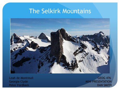
The Selkirk Mountains<br />
Leah de Montreuil GEOG 476<br />
Georgia Clyde MINI PRESENTATION<br />
Peter Fordham DAN SMITH
Study Site/Topography:
Selkirk Sub-Ranges:<br />
• Asulkan Range • Battle<br />
Range • Big Bend Ranges<br />
• Bishops Range •<br />
Bonnington Range •<br />
Clachnacudainn Range •<br />
Dawson Range • Duncan<br />
Ranges • Goat Range •<br />
Hermit Range • Kokanee<br />
Range • Lardeau Range •<br />
Nelson Range • Purity<br />
Range • Sir Donald Range •<br />
Valhalla Range • Valkyr<br />
Range
Top left: White<br />
Water ski resort<br />
Bottom Left: The<br />
Adamant<br />
Mountains<br />
Bottom Right:<br />
Mount Dag,<br />
Valhalla<br />
Provincial Park
National and Provincial Parks:
Glaciers:<br />
Top right: Durrand glacier<br />
Bottom right: Asulkan<br />
glacier<br />
Bottom Left: Illecillewaet<br />
glacier
GLACIERS:<br />
Caribou Glacier<br />
Kokanee Glacier<br />
Illecillewaet Glacier &<br />
Névé<br />
Albert Icefield<br />
Clachnacuainn Icefield<br />
Gyr Icefield<br />
Primrose Icefield<br />
Bonney Névé<br />
Deville Névé<br />
Duncan Névé<br />
Goldstream Névé<br />
Sonata Névé<br />
Van Horne Névé<br />
Woodbury Glacier
Human<br />
Influence:
Physiography: BEC zones of BC
Physiography: BEC ZONES IN THE SELKIRKS<br />
ICH BEC Zone<br />
Interior Cedar -<br />
Hemlock<br />
ESSF BEC Zone<br />
Engelmann Spruce-<br />
Subalpine Fir<br />
Alpine Tundra BEC Zone
AVALANCHE COUNTRY
Mitigation for Avalanches<br />
along HWY 1
Climate:<br />
GNP Rogers Pass, 1340m asl<br />
Mean annual temp: 1.6<br />
Mean annual rainfall: 614.8mm<br />
Mean annual snowfall: 932.5cm<br />
Kaslo, 600m asl<br />
Mean annual temp: 7.5<br />
Mean annual rainfall:664.8<br />
Mean annual snowfall: 221.8cm<br />
Revelstoke, 450m asl<br />
Mean annual temp: 6.9<br />
Mean annual rainfall: 617mm<br />
Mean annual snowfall: 424cm
The Holocene Climate
COLUMBIA RIVER BASIN<br />
Hydrology:<br />
KOOTENAY RIVER BASIN
DAMS ON THE COLUMBIA RIVER<br />
MICA DAM<br />
KINBASKET LAKE
Lake Revelstoke<br />
REVELSTOKE DAM
KEENLYSIDE DAM
LAKES<br />
Kinbasket Lake<br />
Lake Revelstoke<br />
Upper/Lower Arrow Lakes<br />
Slocan Lake<br />
Kootenay Lake<br />
Duncan Lake<br />
Trout Lake<br />
Many small alpine lakes ,<br />
like the Upper Sapphire<br />
Lake in Kokanee Glacier<br />
Park<br />
<br />
Upper Sapphire Lake, Kokanee Glacier Park
SLOCAN LAKE HYDROLOGIC FEATURES
GEOMORPHOLOGY: Fluvial<br />
Glacio-fluvial materials aggregated in valley bottoms, outwash<br />
sediments<br />
Fluvial sediment deposited during Holocene imbedded within faults<br />
Features:<br />
Terraces<br />
Alluvial Fans<br />
Shallow braided river channels<br />
Down-cutting of valleys, incising channels
GEOLOGY: Boundaries<br />
North and Westerly bounded by the south-flowing<br />
Columbia River and Columbia River Fault<br />
Separating from the Monashee<br />
Mountains<br />
South-Westerly bounded by Arrow Lakes<br />
Separating from the Okanogan<br />
Highlands<br />
North-Easterly bounded by north-flowing<br />
Columbia Rivers along the Rocky Mountain Trench<br />
Separating from the Rocky Mountains<br />
Easterly bounded by the Purcell Trench<br />
Separating from northern Purcell<br />
Mountains
GEOLOGY: History and Formation<br />
Located in the Omineca Belt<br />
180-60 Mya: Precambrian and Paleozoic sedimentary rocks<br />
metamorphosed during cordilleran Mtn. building, forming<br />
granitic magmatic arcs<br />
180-170 Mya: Intermountane belt terrains collided with the<br />
passive margin, creating Omineca Belt<br />
55 Mya: Normal faulting and crustal stretching<br />
Fun Fact: Southern<br />
Omineca contains<br />
some rocks older<br />
than Rockies, dated<br />
to 2 billions years
GEOLOGY: Characteristic<br />
Folding, thrust and reverse faulting created the enormous<br />
structure known as the Selkirk Fan<br />
As sections were thrust with east and west dipping slopes, it<br />
created the Selkirk Fan.<br />
Purcell Fault and concealed fault roughly 15km below surface<br />
also aided in fan formation<br />
3 main geological components of the Selkirk region and fan:<br />
1) Lardeau group<br />
2) Hamill group<br />
3) Horsetheif Creek group
GEOMORPHOLOGY: Slopes<br />
① Over-deepened<br />
valleys<br />
② Steep Jagged slopes<br />
③ Complex buried<br />
metamorphic layers<br />
Deep seated landslides, particularly<br />
Horsetheif Creek group<br />
Debris Flows, Rock Falls, Avalanches<br />
Freeze-Thaw action provides an<br />
abundance of source material<br />
Examples: Johnsons Landing, Heather<br />
Hill<br />
Glacier National Park: massive bedrock<br />
landslides, sagging slopes, toppling<br />
failure
JOHNSONS LANDING<br />
DEBRIS FLOW: SUMMER<br />
2012
THE END!!