PART ONE - Huddersfield Local History Society
PART ONE - Huddersfield Local History Society
PART ONE - Huddersfield Local History Society

Create successful ePaper yourself
Turn your PDF publications into a flip-book with our unique Google optimized e-Paper software.
<strong>PART</strong> <strong>ONE</strong><br />
Gordon and Enid Minter
Front cover:- Bay Hall, Birkby.<br />
Back cover:- Market Cross, Highburton
First published in 1993;<br />
republished in digital form by<br />
<strong>Huddersfield</strong> <strong>Local</strong> <strong>History</strong> <strong>Society</strong> in 2010;<br />
Digitised by Book Scan Bureau<br />
A division of Hollingworth & Moss Ltd.<br />
www.bookscanbureau.co.uk<br />
01132438642
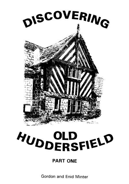
DISCOVERING<br />
OLD<br />
HUDDERSFIELD<br />
<strong>PART</strong> <strong>ONE</strong><br />
By<br />
Gordon and Enid Minter<br />
Illustrations by<br />
J. R. Beswick
This book is dedicated to the memory of<br />
Charles Robert Beswick<br />
1946-1991<br />
whose love of the area and its history was<br />
as great as ours.<br />
IBSN 0 9524747 0
CONTENTS<br />
Page<br />
Introduction i<br />
Tour No. 1 - The Old London Road 1<br />
Tour No. 2 - Mansions and Mills 68<br />
Illustrations<br />
Clough House, Birkby 26<br />
Lych Gate, Kirkburton 65<br />
<strong>Huddersfield</strong> Hall 76<br />
Rawthorpe Hall 83<br />
Fancy Cross, Whitley 89<br />
Old Longley Hall, Almondbury 106
In Odersfelt Godwin had six carucates of land<br />
for geld where eight ploughs can be Now the<br />
same has it of Ilbert but it is waste. Wood<br />
pasture one league long and one wide. In the<br />
time of King Edward it's value was 100<br />
Shillings.<br />
<strong>Huddersfield</strong>, Domesday Book, 1086
INTRODUCTION<br />
Over the years several excellent books have been published dealing with<br />
the history of the <strong>Huddersfield</strong> area or some aspect of it and they offer a wealth of<br />
information to the interested reader. It occurred to us though that very few of them<br />
are specifically aimed at those people who, like us, have a mild curiosity about the<br />
past and who might like to go out to see for themselves just how the concerns,<br />
needs and even whims of their ancestors have formed the landscape they see today.<br />
As a convenient way of presenting the history of the roads, railways and<br />
canals, the rivers, streams and bridges, the woods, parks and fields and the houses,<br />
churches and factories that make up the <strong>Huddersfield</strong> area we have devised two<br />
routes, one linear, one circular, both starting in St. George's Square, neither of any<br />
great length and both of which may be undertaken wholly by car or in parts on<br />
foot. The resulting work is not chronological, nor is it scholarly, nor is it exclusive<br />
but by pointing out on site that, for example, a particular road has followed its<br />
present course for a thousand years or more, or that an old bridge stands on the<br />
remains of one very much older, or that a mill stands on a particular site because of<br />
a bend in the nearby river, we hope we have provided a historical immediacy that<br />
will be appealing to the reader.<br />
In setting out the tours we have chosen to give the directions for the whole<br />
route before the historical commentary in order to avoid the confusion that might<br />
arise if we mixed the two together. However, each feature discussed in the<br />
commentary has been given a reference number which appears in the appropriate<br />
place in the directions and which should help to locate it. For example, in tour two,<br />
Oakes Fold will be found as Townend Lane No. 46. We have not confined our<br />
commentary exclusively to existing features. Several things of past importance<br />
have now disappeared but their sites may be identified and when we pass such<br />
places we tell the story. For instance, Bradley Spout was, until the nineteenth<br />
century, a vital water supply for the townspeople. All traces of it are now gone<br />
but, at the beginning of tour two, as we pass its approximate location we note it<br />
and tell its story.<br />
We have tried to make our directions clear and easy to follow. Where<br />
there might be some difficulty we have either provided small maps or given the<br />
precise distances involved - and we have used miles rather than kilometres because<br />
signposts and most car mileometers do the same.<br />
As the routes are divided into short measured sections you, the reader,<br />
might like to find a parking place and tackle some of the sections on foot. In<br />
certain places where we know that it is possible to park we have suggested this
with the symbol (P). Occasionally, to see some particular place of interest, it is<br />
necessary to leave the car and walk a short distance, Such places we have marked<br />
(P.W) but we leave the matter entirely to your discretion. In both directions and<br />
commentary instead of using compass point directions we have used left hand and<br />
right hand sides and these should, of course, be taken to refer to the direction in<br />
which you are travelling. It is worth bearing in mind that travelling the routes in<br />
winter, spring and autumn is easier than in summer when the vegetation might well<br />
obscure certain features mentioned in the directions.<br />
In undertaking the tours it is important to remember the difficulties and<br />
dangers of following an unfamiliar route by car as well as stopping, suddenly<br />
perhaps, to look at the various places of interest. In towns and on busy main roads<br />
traffic moves quickly and sites are passed before they are noticed. In the country<br />
slow driving along narrow lanes is sure to irritate other drivers. With this in mind<br />
we suggest that you carefully read through each tour before setting out. This will<br />
not only give you some idea of where you are heading but also allow you to locate<br />
anything of particular interest and be ready for it as you come across it. Of course,<br />
those familiar with the area may prefer merely to cover the journey in their<br />
imaginations from the comfort of their armchairs.<br />
It was our original intention to include six tours in one book but it soon<br />
became apparent that, if we were to keep the book to a manageable size, the<br />
number would have to be reduced. Consequently, this book of two tours we have<br />
designated part one and we hope to produce parts two and three at some later date.<br />
As our book is intended to be of general recreational interest rather than a<br />
scholarly work we have not provided footnotes but we have included a list of<br />
sources and references which we hope will be of interest to anyone who might wish<br />
to pursue a particular interest.<br />
It is undoubtedly true of any guide book that some information given in it<br />
will be out of date by the time the book is published. Buildings are demolished,<br />
new ones are built, roads are realigned, hedgerows are removed, trees are cut<br />
down; the environment is in a state of perpetual change as, of course, it has been<br />
throughout history. In the face of such changes, whether small or large, we cannot<br />
even say that our routes are accurate at the time of going to press, only that they<br />
are as we found them the last time we travelled them.<br />
Few books can be produced without help from others and we would like to<br />
thank Kathryn Beaumont, Michael Sharpe and Sue Cottrill for their cheerful and<br />
courteous help and Mike and Cynthia Beaumont and Dr Jane Minter for checking<br />
directions. Neil and Elaine Hughes also deserve special thanks for their extra zeal<br />
in checking the routes in the dark.
Tour No.l<br />
THE OLD LONDON ROAD<br />
In the year 1675 a surveyor, John Ogilby, published a series of maps<br />
showing the country's principal routes, one of which led from London to Oakham<br />
in Rutland and continued northwards to Richmond in Yorkshire. Nearly three<br />
hundred years later W.B.Crump in his '<strong>Huddersfield</strong> Highways Down the Ages'<br />
discussed a section of Ogilby's London road as it runs through our district between<br />
Kirkburton and Elland. It is this route that we follow in the second part of tour<br />
No. 1. The first part of the tour takes us from <strong>Huddersfield</strong> to Cowcliffe and<br />
through Grimescar Wood on the turnpike road opened in 1777 to replace the more<br />
difficult route over Cowcliffe Hill. Because we thought that Kirkburton Church<br />
would be a suitable place to end the journey, we chose to travel in the opposite<br />
direction to that take by Ogilby and his surveyors who travelled from south to<br />
north. Of course, we do not concentrate exclusively on the old highways as the<br />
route passes many other interesting features such as churches, houses, factories,<br />
woods, parks and streams all of which, whether they pre or post date the road, are<br />
discussed.<br />
DIRECTIONS<br />
Section 1.<br />
The tour starts in St. George's Square (1,2,3). Leave the Square passing<br />
the George Hotel on the left and turn left at the lights into John William Street<br />
(4). Continue straight on under the railway viaduct to join St. John's Road<br />
(5,6.7.8,9) and follow this across the ring road to St. John's Church on the left<br />
(10). Continue straight on to the traffic lights at Blacker Road and go straight<br />
ahead into Wheathouse Road (11,12,13.14). At the top of the hill carry on<br />
straight ahead into Grimescar Avenue. After crossing Grimescar Dike (15) in the<br />
valley bottom the route veers right into Alwen Avenue to join Halifax Old Road.<br />
This is 1.3 miles from the starting point.<br />
Section 2.<br />
From Alwen Avenue turn left into Halifax Old Road (16) and follow the<br />
road through Grimescar Wood (17.18) for about 1.6 miles to a T junction (19).<br />
Turn right into Brighouse Road (20) and follow this for a mile to the motorway<br />
bridge. Immediately after the bridge take the first left into Pinfold Lane (21).<br />
This is 2.7 miles from Alwen Avenue.<br />
Section 3.<br />
At the end of Pinfold Lane turn right into Dewsbury Road (B6114)<br />
(22). Follow this to the traffic lights by the Sun Inn and go straight across New<br />
1
Hey Road into Clough Lane. In about half a mile turn right into Lightridge Road<br />
(23) and, shortly after the entrance to the golf club on the right, take the right<br />
fork into Cowcliffe Hill Road (24,25). At the bottom of the hill the route passes<br />
through the ford at Ochre Hole (26.27.) and then climbs up to the Shepherds<br />
Arms at the top ofCowcliffe Hill (28,29). Descend the steep hill ahead (30) and,<br />
near the bottom, follow it (ignoring Clough Road) as it turns sharp right to join<br />
Halifax Old Road (31,32) see map in text p25. Turn left into Halifax Old Road.<br />
This is 2.9 miles from the beginning of Pinfold Lane.<br />
Section 4.<br />
As the next section of the tour runs along busy roads it is difficult to<br />
suggest convenient stopping places and we have, therefore, decided to give<br />
directions for rather a long stretch to Almondbury Bank. As there are a good<br />
many things of interest in this section it might be possible for readers, should<br />
they wish, to find their own stopping places.<br />
Follow Halifax Old Road (33.34,35,36,37,38) and at the second set of<br />
traffic lights go straight across Bradford Road (39) into Willow Lane East.<br />
Follow this under the railway viaduct into Hillhouse Lane (40,41,42,43) and at<br />
the next lights turn right into Leeds Road, A627, (44,45,46,47.48). In about half<br />
a mile (49) turn left at the lights into the ring-road (50,51,52) and follow this<br />
through three more sets of lights (53) to the roundabout and lights at Shorehead<br />
(54,55) which should be approached in the left hand lane. Follow the signs left<br />
for Wakefield, A642. (56,57,58,59,60) and at the third set of lights after Shore<br />
Head be prepared to turn right into Almondbury Bank, s.p. Almondbury, (61).<br />
This is 2.2 miles from the bottom ofCowcliffe Hill.<br />
Section 5<br />
Follow Almondbury Bank (62) to the top of the hill (63) and continue<br />
straight on along Town End (64). After the junction with Somerset Road our<br />
route follows Northgale (65,66) to Almondbury Church (67,68,69). N.B. beware<br />
of traffic calmers. Shortly after the church fork left into Fenay Lane and<br />
immediately fork right into the steep St. Helen's Gate (70,71,72,73) and follow<br />
this past the school (74,75) for half a mile to a T junction by a green triangle. At<br />
the triangle turn left into Woodsome Road, s.p. Kirkburton. This is 1.7 miles<br />
from the bottom of Almondbury Bank.<br />
Section 6<br />
Follow Woodsome Road (76,77) for one mile to its junction with<br />
Penistone Road, A629, (78). Turn right into Penistone Road (79.80,81,82,83,84)<br />
and after half a mile fork left, s.p. Scissett, (B6116) up the hill (85,86) towards<br />
Kirkburton. This is North Road (87) which should be followed into the village
passing the Liberal Club on the left and the Royal public house on the right<br />
(88,89,90). From the Royal follow the road (91) round and up the hill (92)<br />
passing the church (93) to a car park on the left which is the terminus of the tour.<br />
This is 2.7 miles from the junction of St. Helen's Gate and Woodsome Road and<br />
13.5 miles from the tour's starting point in St. George's Square.<br />
SECTION <strong>ONE</strong><br />
ST. GEORGE'S SQUARE. (1)<br />
Before departing on the tour allow a few moments to admire the open<br />
aspect of St. George's Square which has been much improved in recent years.<br />
Note also the buildings around the Square, the earliest of which is the railway<br />
station.<br />
The foundation stone of the station was laid by Earl Fitzwilliam on 9th<br />
October 1846. It was built at a little distance from the Market Place on part of a<br />
large close of land called Great George Close. To provide a connection between<br />
the two. John William Street was constructed and this was followed by the<br />
carefully planned development of the land around, with new streets being laid out<br />
and elegant buildings erected. The Ramsden family and their agents and architects<br />
were much concerned in the new development but their original intention to divide<br />
the space in front of the station into building plots was abandoned following<br />
vociferous arguments from Joshua Hobson, a local Radical, who pointed out the<br />
aesthetic advantage of an open square which would allow an uninterrupted view of<br />
the undeniably handsome station.<br />
For many years a statue of Sir Robert Peel stood in front of the station.<br />
The Peel Monument Movement came into existence in 1850 when there were forty-<br />
four members on the committee. During the first successful year many<br />
subscriptions were raised. When the time came to chose a sculptor, however, there<br />
were many dissensions which put a stop to all proceedings for seventeen years.<br />
The movement was revived on 20th June 1868 when it was discovered that there<br />
were only ten surviving members of the original committee, five of whom had left<br />
the town. A new committee was formed and, in a push towards a completion of the<br />
scheme, the town was divided into wards and collectors appointed to call on the<br />
people in their respective wards in the hope of increasing the £450 held by the<br />
original committee. On 21 st October, 1869 the committee announced that they had<br />
accepted the model of a Mr Theed for the Peel statue which was to be in Sicilian<br />
marble, nine feet high on a granite pedestal, ten feet high. The cost would be £950<br />
with £56 for extra bronze reliefs on the pedestal.
On 17th January. 1873 at a meeting of the committee it was announced that<br />
neither Sir John Ramsden nor the railway company would allow the statue to be<br />
erected in the Square. Consequently and in desperation, the committee decided to<br />
erect it on an open space in Upperhead Row. However, the authorities soon<br />
relented and later the same year the statue was unveiled in front of the station. It<br />
stood there until 1949 when, because the stone was deteriorating, it was removed<br />
and. as no-one now knows its whereabouts, presumably it has been destroyed.<br />
Before the secret ballot was introduced St. George's Square was often the<br />
scene of much excitable and rowdy behaviour during general elections. For<br />
instance, on Thursday, 13th July 1865 a wooden polling booth was set up in the<br />
Square to which the voters came to record their votes verbally. The candidates<br />
were E.A.Leatham, Liberal, and T.P.Crosland, Conservative, and supporters of<br />
both men soon made their presence felt. Towards noon, feelings were running high<br />
and street fighting broke out, shop windows were smashed and cabs and omnibuses<br />
bringing voters to the Square were attacked in John William Street. The local<br />
police were unable to restore order and, eventually, the chairman of the<br />
magistrates, George Armitage, came to read the Riot Act. He then wired for police<br />
reinforcements from Halifax. Wakefield, Dewsbury, Bradford & Saddlewoth as<br />
well as a troop of horse soldiers from Manchester and a troop of infantry from<br />
Salford. By two o'clock the unrest had subsided although the infirmary was kept<br />
busy all afternoon treating broken bones and broken heads. Fewer than two<br />
thousand people were eligible to vote and in the end Crosland won with a majority<br />
of 232. The result was unsuccessfully challenged in April, 1866 when a special<br />
committee rejected allegations of bribery, threats and undue influence made by the<br />
Liberals against Col. Crosland and his supporters.<br />
THE TITE BUILDING (2)<br />
Looking from the Square towards the station notice the building on the left.<br />
This is the Tite Building, built in 1856, and so named after its designer Mr (Later<br />
Sir) William Tite. It deserves a little study for it is a rather splendid building. Tite<br />
was a great advocate of the neo-classical style of architecture and his interest is<br />
apparent here in the semi-circular arched openings to the ground floor with their<br />
rebated, stepped voussoirs which reflect the Italian style and in the pediments over<br />
the first floor windows which reflect the Greek. The building was originally used<br />
as warehouses and offices bv local woollen manufacturers.
THE LION BUILDING (3)<br />
The first building to be seen by visitors coming to the town by rail is the<br />
Lion Building which faces the station across the Square. It was built by Samuel<br />
Oldfield and designed by James Pigott Pritchett who was also responsible for the<br />
railway station, the Parish Church and the college in New North Road. Pritchett's<br />
original designs were submitted for approval to William Tite, the Ramsden's<br />
architectural consultant, who disapproved and suggested certain amendments.<br />
Work started on the building, to Tile's amendments, in 1852 and was completed in<br />
1854. It would appear that both builder and architect resented Tite's interference<br />
for the latter comments in a letter to the Ramsden's agent: 'I wonder that Pritchett<br />
and Oldfield are being troublesome' Later in the same letter (quoted by D.J.Wyles<br />
in 'The Buildings of <strong>Huddersfield</strong>') Tite says: 'I am sure, without vanity, they are<br />
greatly indebted to me for putting a very crude design into shape and proportion'<br />
Faced with an attitude like that it is hardly surprising that the two men felt<br />
aggrieved.<br />
When finished, the building was opened as shops, offices and storerooms.<br />
The original white lion atop the building which was modelled by John Seeley<br />
began, after a hundred and twenty years of weathering and environmental<br />
pollution, to crumble and it was replaced in 1978 by a fibre glass replica. As to<br />
the building itself, we must leave it to our readers to decide for themselves whether<br />
it compares favourably or not with the other buildings in the Square.<br />
THE EMPIRE CINEMA. (4)<br />
Soon after turning left into John William Street notice on the right, at the<br />
top of Brook Street, a large white building. This was once the Empire Cinema<br />
which opened on the 8th March 1915. Although other cinemas were operating in<br />
the town by that time they were mainly located in converted buildings and only the<br />
Picture House in Ramsden Street preceded the Empire as a purpose-built cinema.<br />
The building that once stood next to the Empire in John William Street<br />
will, for tragic reasons, still be remembered by some of our readers. The wholesale<br />
clothing factory of H.Booth and Sons Ltd. stood five storeys high with timber<br />
floors and panelled walls throughout. On the morning of the 31st. October, 1941,<br />
just after the day's work had started and whilst the main doors of the building were<br />
still open, a fire broke out. The timber interior offered little resistance to the<br />
flames which, fanned by high winds, soon engulfed the building. By the time the<br />
fire brigade arrived all five storeys were alight and many people were trapped and<br />
beyond rescue. In all, forty-nine employees - one third of the workforce - lost their
lives. The youngest victim was fourteen year old Joan Doughty who had only<br />
started work on the previous day. After a moving and harrowing ceremony, forty-<br />
three of the dead were buried in a mass grave in Edgerton Cemetery whilst the<br />
other six were buried privately.<br />
ST JOHN'S ROAD. (5)<br />
Although St. John's Road dates back as a properly laid out road only to<br />
the second half of the nineteenth century it nevertheless follows, for part of its<br />
length, a much older route. This was a footway which started near the Parish<br />
Church, ran northwards across a number of agricultural closes to the present-day<br />
St. George's Square area and then continued on its way to Bay Hall and Birkby<br />
The first part of this old route, from the church to St. George's Square, was lost in<br />
the 1850s when land development to the north and east of the church resulted in a<br />
number of new streets including St. Peter's Street, Byram Street, Northumberland<br />
Street, Brook Street and John William Street all of which cut across the line of the<br />
footway. However, the major part of the old route to Birkby was preserved when<br />
St. John's Road was laid out on the same line.<br />
BATH STREET AND THE HALL OF SCIENCE. (6)<br />
Shortly after passing under the railway viaduct notice Bath Street on the<br />
left hand side of St. John's Road. Maps of the mid 1820s show that there were<br />
public baths here at the side of the road leading up the hill to Newhouse and<br />
Highfield. In 1839 the building on the left hand side of Bath Street (now occupied<br />
by a decorator ) was built as a Hall of Science and thereafter a good deal of mainly<br />
residential development went on. By 1850 there were nineteen families living in<br />
Bath Street and their occupations, which include manufacturers, merchants,<br />
drapers, agents and clerks, show that this was, at that time, an area for the so<br />
called professional and middle classes. Some of the houses in 1850 had quite<br />
elaborate ornamental gardens.<br />
The name Bath Street was not used until 1880. Before then all the<br />
buildings here, including the Hall of Science, were known collectively as Bath<br />
Buildings and, apart from their numbers, this was their only address. Incidentally,<br />
renumbering seems to have gone on at the same time as the name was changed with<br />
the even numbers being transferred from the south (left hand) side of the street to<br />
the north and the odd numbers from the north side to the south. Doubtless this led<br />
to a great deal of confusion for a time.<br />
The Hall of Science was built by the local disciples of Robert Owen 'for<br />
the education of the ordinary people" The Socialist principles behind its building
were regarded by a large part of the community with suspicion and mistrust. An<br />
example of this is found in the Constitution of the <strong>Huddersfield</strong> Choral <strong>Society</strong><br />
where Rule 28 states: 'No person shall be a member of this society who frequents<br />
the Hall of Science or any of the Socialist Meetings'<br />
By 1847 the Owenites were finding the upkeep of the Hall too costly and in<br />
that year it was let to the Unitarians for use as a chapel. Six years later the<br />
Unitarians moved out and local Baptists, who were by then anxious to open a<br />
meeting place in the town, bought the Hall and reopened it in 1855 as a Baptist<br />
Chapel, a purpose it served for the next twenty-three years. In 1878 the Baptists<br />
moved out to a new chapel in New North Road and subsequently the Hall was<br />
acquired by James Conacher & Sons, organ builders, who operated an erecting<br />
shop and saw mill there for some twenty years. In the 1920s and 30s the Hall was<br />
used as a warehouse by Grist Bros, shoddy merchants.<br />
NEWTOWN. (7)<br />
The modern retail and industrial estate on the right hand side of St. John's<br />
Road is built on land that was first developed between 1797 and 1825. Among the<br />
earliest buildings here was a terrace of dwelling houses called Newtown Row. An<br />
early example of high density housing, the Row was made up of seven yards each<br />
of which was surrounded by between ten and fourteen houses, some of them back<br />
to back. Nearby was Newtown Mill with its large dam which, according to<br />
Hardy s Plan and Commercial Directory of <strong>Huddersfield</strong>, was, in 1850 , operating<br />
as a corn mill. It is likely that the mill provided employment for at least some of<br />
the inhabitants of Newtown Row. The name Newtown suggests, perhaps, that the<br />
early builders hoped that the area would see much more industrial and residential<br />
development and that, indeed , a small new town would grow up on the empty land<br />
all around. If so, they were to be disappointed for Newtown grew hardly at all<br />
during the nineteenth century and by the early years of the twentieth the mill stood<br />
empty, soon, along with Newtown Row, to be demolished.<br />
In 1899 the Midland Railway Company was empowered by an Act of<br />
Parliament to build a new main line to the north through Bradford, with branches<br />
to <strong>Huddersfield</strong> and Halifax. The new line into <strong>Huddersfield</strong> was to run from<br />
Mirfield through Deighton, Fartown and Birkby to Newtown which was seen as an<br />
ideal site for a goods yard, sidings and a station. The five mile length of line was<br />
completed in 1910 and opened to goods traffic but, owing to the outbreak of war in<br />
1914, plans for a passenger station at Newtown were abandoned. After the war,<br />
because of the amalgamation of various railway companies, the original grand<br />
scheme was dropped The line continued to carry goods traffic until 1937 when it
was abandoned, although the sidings at Newtown Yard were maintained until the<br />
1950s. Subsequently the site was cleared and redeveloped in the modern style we<br />
see today.<br />
ALBANY PRINTING WORKS. (8)<br />
Notice on the left hand side of St. John's Road a handsome and ornate<br />
single storey building with a shield on the centre gable. In the shield is the<br />
monogram A.J. The building was erected in 1891 by Alfred Jubb as a printing<br />
works. Four years previously, Mr. Jubb had bought the premises of the<br />
<strong>Huddersfield</strong> Collegiate School which stood on the right hand side of Clare Hill.<br />
The school which opened in 1838 was administered by the established church and<br />
took both boarders and day boys. In 1887 the school, which had been in<br />
difficulties for many years, merged with <strong>Huddersfield</strong> College and thus the<br />
premises became available to Mr Jubb. His business was very successful and many<br />
people who handle old books and pamphlets appertaining to <strong>Huddersfield</strong> will be<br />
familiar with the legend 'printed by Alfred Jubb &Sons Ltd 1 His success led to<br />
the building of the printing works in front of the school which then became the<br />
Albany Hall to commemorate the visit of the Duke of Albany to <strong>Huddersfield</strong> in<br />
1883. Many of our older readers will remember the Albany Hall which, after a<br />
brief spell as a roller skating rink, became a venue for various social gatherings.<br />
The hall was demolished in the late 1970s.<br />
ST JOHN'S CHURCH. (9)<br />
A local author, Charles Hobkirk, writing in 1868 praises the 'pleasing<br />
aspect' of St. John's Church and describes it as being "situated almost in the<br />
country, surrounded by pasture land and backed to the north by Fixby Hills and<br />
Grimscar Woods' In the intervening years the pasture land has given way to<br />
concrete, brick and stone and the pleasant aspect is changed indeed. Nevertheless,<br />
the present surroundings should not detract attention from the impressive lines of<br />
this typical Gothic-Revival church. It was built for the Trustees of Sir John<br />
Ramsden who appointed the architect William Butterfield to design the building.<br />
Work started in 1851 and was completed in 1853. Butterfield was famous for his<br />
use of variously coloured brick and he must have felt some little frustration here<br />
when he found he was expected to use local stone.<br />
The builder was Joseph Kaye (see tour 2 No.9) who demanded of his<br />
workforce the highest standard of workmanship. However, perfectionists are not<br />
usually the speediest of workers and Kaye's rate of progress certainly displeased<br />
Mr. Butterfield who said in a letter concerning the church that '..he (Kaye) has but<br />
8
one pace and that is a very slow one...the tower is rising at the rate of four inches a<br />
week' Butterfield obviously made no allowance for the fact that Joseph Kaye was<br />
in his eighth decade at that time.<br />
Others though were kinder. William Tite, for example, was said to have a<br />
high opinion of the masonry and general character and detail of the whole building.<br />
St. John's Church is regarded by some as Kaye's masterpiece and a hundred and<br />
forty years after its building, during which time the stonework has needed few<br />
repairs, we can still appreciate the quality of the workmanship which was the<br />
man's hallmark.<br />
In 1820 an Act was passed for 'lighting, watching and cleaning the town of<br />
<strong>Huddersfield</strong>' For the purpose of the Act the town was deemed to be all the land<br />
within a radius of twelve hundred yards (1090 M) from the Market Cross. This-<br />
artificial boundary was reinforced by the Improvement Act of 1848. Four years<br />
later St. John's Church was built twelve hundred yards away from the Market<br />
Cross and, consequently, right on the boundary which ran diagonally through the<br />
church from north east to south west.<br />
BAY HALL. (10) (P.W. - at discretion)<br />
To see Bay Hall which stands to the right of St.John's Road and a little<br />
further on than the church it is necessary to leave the car to look over the wall on<br />
the right (ppposite a bus stop ). As this involves crossing a busy road we leave this<br />
option to the readers' discretion.<br />
Bay Hall is one of only three timber framed buildings in <strong>Huddersfield</strong> that<br />
are recognisable as such - in other words with the timbering still exposed<br />
externally. The black and white gabled section is obviously the oldest portion of<br />
the building and it would be this that was referred to as Bay Hall in the sixteenth<br />
century.<br />
The first reference to Bay Hall is found, according to Dr. George<br />
Redmonds, in 1565 when John Brook, who was a tanner, lived either in the hall or<br />
near to it. It is mentioned again in 1599, when Queen Elizabeth I sold the manor of<br />
<strong>Huddersfield</strong> to William Ramsden, as 'all our (The Queen's) capital messuage or<br />
tenement called Bay Hall ...now or lately in the tenure of occupation of John<br />
Brook' The fact that Bay Hall is the only building mentioned by name in the deed<br />
of sale adds weight to the suggestion made by some local historians that it was<br />
built as an estate office for the use of the agent of the lord of the manor and, as<br />
such, in its earliest days it served as an official building rather than a private<br />
residence.<br />
9
Philip Ahier, the local historian writing in the 1930s, puts forward another<br />
interesting suggestion about Bay Hall. He says that it might have been used as the<br />
Chantry Chapel of our Lady which was connected with the Parish Church of<br />
<strong>Huddersfield</strong> but which was described in 1534 as distant from it. It is not known<br />
with any certainty where this Chantry was situated but Ahier backs up his<br />
argument by pointing out that in the early part of the nineteenth century there were<br />
some old confessional boxes to be seen at Bay Hall and, about the same time, a<br />
font was unearthed in the garden. These, he points out, could be relics of pre-<br />
Reformation times and therefore, contemporary with the Chantry.<br />
The name Bay Hall is an unusual one and there are several theories as to<br />
its origin. We believe that the name comes from the design of the building. When<br />
a timber framed building was erected the space between the frames was termed a<br />
bay. Buildings with as many as eight bays survive in some parts of the country but<br />
here there are just two timber frames, one at the front and one at the back of the<br />
house. Thus this is a one bay building, hence the name Bay Hall.<br />
The name of course spread to define the area around the Hall. For<br />
example. Bay Hall Common would be so named soon after the Hall was built<br />
This is largely the area bounded today by Birkby Hall Road, Birkby Lodge Road,<br />
Blacker Road and Crescent Road. Similarly, the stream flowing near to the Hall<br />
would soon become Bay Hall Dike. In the 1850s there was a Bay Hall Fields<br />
Chymical Works situated about a third of a mile south of the Hall and by the 1890s<br />
Bay Hall Works and Bay Hall Mills had been built at the side of Bay Hall<br />
Common Road.<br />
WHEATHOUSE ROAD (11)<br />
Wheathouse Road is a continuation of St. John's Road and it was built to<br />
run across Bay Hall Common to connect Blacker Road and Birkby Hall Road.<br />
Like St. John's Road it follows the line of the old footway to Birkby. Virtually all<br />
the buildings here post-date the laying out of the road which takes its name from<br />
the one building that pre-dates it, a house called Wheathouse, which stands on the<br />
right hand side of the road just beyond the junction with Blacker Road. The<br />
splayed end of Wheathouse, which is the main feature visible from the road, dates<br />
back only to 1932 when part of the house was pulled down to allow for the<br />
widening of Wheathouse Road. Unfortunately, the quoin stones and recessed<br />
windows which reveal this to be a house of the early eighteenth century cannot be<br />
seen by the passer-by as they are at the back. One eighteenth century resident of<br />
Wheathouse was John Starkey, father of the Starkey brothers who had mills at<br />
Longroyd Bridge and built St. Thomas 1 Church there.<br />
10
BRITANNIA WORKS. (12)<br />
On the left hand side of Wheathouse Road the huge Britannia Works<br />
cannot be missed. These are the premises of Messrs Hopkinson, known more<br />
familiarly to all <strong>Huddersfield</strong> people as 'Hops' In the 1840s the founder of the<br />
firm, Joseph Hopkinson, began to manufacture safety mountings and valves for<br />
mill boilers in a workshop in Lockwood Road and by 1853 he had patented the<br />
compound safety valve. Fame and fortune followed and in 1871 the firm moved to<br />
larger premises in Viaduct Street. Soon Hopkinson's reputation spread world-wide<br />
and their valves played a part in the industrial development of many countries.<br />
More patented inventions led to further expansion and in 1904 the Britannia works<br />
was opened. It was unusual at that time for a town-centre firm to move to the<br />
suburbs but the location at Birkby offered the opportunity of further expansion if<br />
and when it became necessary. Later, the firm extended their activities into<br />
electrical valve control and for many years they were one of the foremost<br />
employers of labour in the town - so much so that most local people have either an<br />
ancestor, a relative or a friend who worked at 'Hops'<br />
Immediately after Britannia Works notice Macaulay Road on the left.<br />
This has a connection with our next subject.<br />
BIRKBY BREWERY. (13)<br />
The building on the right at the corner of Wheathouse Road and Birkby<br />
Hall Road once housed a brewery which was owned and worked in the early<br />
nineteenth century by a Thomas Wilson. In 1842 Wilson sold the brewery to<br />
Thomas F Macaulay great great grandson of Alexander McAulay (sic) who came<br />
to <strong>Huddersfield</strong> from Scotland at the beginning of the eighteenth century and whose<br />
name is perpetuated in Macaulay Street in the town. T.F.Macaulay owned land<br />
adjacent to the brewery and it seems likely that when Macaulay Road was laid out<br />
sometime between 1893 and 1905 it was so named in his memory. Macaulay died<br />
in 1874 and his obituary describes him as a brewer so it would seem possible that<br />
brewing went on here until that time. However, when his property was sold shortly<br />
after his death, it was described as the Birkby Old Brewery Estate and 'old' in this<br />
context implies past rather than present use. By 1893 the property, still called<br />
Birkby Old Brewery , had been partitioned into separate houses and soon the old<br />
name was replaced by the rather uninspired 'Ingle Nook'<br />
BIRKBY. (14)<br />
Until the late nineteenth century there were few houses and little industry in<br />
11
the Birkby area. It was the demand by a rising population for new housing and the<br />
concomitant dawning of the tramway era that led to the suburban development of<br />
the empty fields of Birkby. The steam trams which, by 1892, were running along<br />
St. John's Road and Wheathouse Road allowed people for the first time to live at<br />
some distance from their workplace. By 1895, new roads with long terraces of<br />
Victorian houses had made their appearance in the Bay Hall area and to the east<br />
and north east of Wheathouse Road. But as late as 1907 there was still a good<br />
deal of empty land to the north and north west (i.e. in front and to the left of<br />
Wheathouse Road) although encroachment of the area had started with the laying<br />
out of a short stretch of Grimescar Avenue as far as Storths Road.<br />
As the century progressed the tall Victorian terraces gave way to houses<br />
of a more modern age, red brick, pebble dashed, semi-detached, and these filled in<br />
much of the land down to Grimescar Dike. The demand for housing was, no<br />
doubt, stimulated by the building of the Britannia Works. In addition, Birkby was<br />
perceived as a desirable suburb, within easy reach of the town but far enough away<br />
from the worst of its smoke and pollution. Two churches and a Baptist chapel<br />
catered for the spiritual needs of the new suburb whilst for recreational needs.<br />
Norman Park was opened in 1896 and there was the <strong>Huddersfield</strong> Cricket and<br />
Athletic Club nearby. In addition, pleasant Sunday walks could be taken through<br />
the Grimescar Valley which remained undeveloped until the 1980s<br />
GRIMESCAR DIKE AND CLOUGH HOUSE MILLS. (15) (P)<br />
At the lowest part of Grimescar Avenue, just past Norman Road, stop<br />
briefly by a low brick parapet on the left. A small bridge is marked here on the<br />
1893 O.S map and, although at that time there was no road leading to it from<br />
Birkby, there was a footway leading from it up the hillside to Halifax Old Road.<br />
This would later be developed as Alwen Avenue. The stream flowing beneath the<br />
bridge is the Grimescar Dike which once supplied water to three dams belonging to<br />
Clough House Mill over on the right. Until the nineteenth century the Dike<br />
meandered on its time-honoured course through the fields of Birkby, Bay Hall and<br />
Hillhouse to join the River Colne about one third of a mile upstream from Bradley<br />
Mills. In the Hillhouse area the stream, which for centuries was the boundary<br />
between <strong>Huddersfield</strong> and Fartown, is called the Hebble Beck. Originally,<br />
however, it was known as the Town Brook and it is tempting to think that from this<br />
important watercourse came the surname Brook which is, and always has been,<br />
numerous the <strong>Huddersfield</strong> area. This idea is reinforced by the fact that four<br />
12
Brooks, Henricus, Willelmus, Johannes and Ricardus have their surname recorded<br />
as By-the-broke in the <strong>Huddersfield</strong> Poll Tax returns of 1379.<br />
During the nineteenth century the stream was culverted in the Bay Hall and<br />
Hillhouse areas but nevertheless, with the aid of an old map, its course may still be<br />
followed to its confluence with the River Colne.<br />
In 1896, Grimescar Dike became a pleasant feature in the newly laid out<br />
Norman Park. The stream was dammed to form a small lake below which the<br />
water cascaded over four or five stepped ponds before disappearing into a short<br />
culvert. An ornamental fountain, the sad remains of which may still be seen, was<br />
placed near the centre of the lake. Although today the stream still runs through the<br />
park, sadly, lake, ponds and cascades are gone.<br />
As already stated, the dike supplied water to the dams of Clough House<br />
Mill which stood on the site of the now empty supermarket on the right. In winter<br />
the largest dam, which covered most of the area now occupied by the supermarket<br />
car-park, was often used by skaters who illuminated the scene by placing candles<br />
in the snow. All three dams were stocked with a wide variety of fish including<br />
gudgeon , chubb, perch, trout and dace and must have been an angler's paradise!<br />
The mill is said to have been built circa 1820 although it may be earlier, as<br />
the 1797 map shows two small buildings on the site. In its early years it was<br />
worked by a large water-wheel, the water being brought from the largest dam along<br />
a short goit. The spent water was thrown off the wheel into a paved and walled<br />
tail-race. In 1854 the water wheel was replaced by a beam engine.<br />
For thirty-five years, from 1854, the Scholes family of Clough House (see<br />
No.31) were in business at the mill as woollen and angora spinners and they added<br />
considerably to the premises. After the Scholes left in 1889 the mill was acquired<br />
by Messrs Armitage and Clelland, fine cloth manufacturers, whose business failed<br />
five years later. In 1895 the premises were bought by Messrs Middlemost<br />
Brothers, fancy woollen manufacturers, who continued at the mill until 1971.<br />
Subsequently it was purchased by the Lodge family who demolished most<br />
of the old building to make way for <strong>Huddersfield</strong>'s first hypermarket which was<br />
built in the lamentable tin and plastic style of the 1970s. At the same time the<br />
dams were filled in to provide that most necessary adjunct to modern life, adequate<br />
car-parking space. Later, the hypermarket was taken over by Asda who remained<br />
there until 1993 when they removed to a new site in Bradford Road. At present<br />
(1994 ) the building is vacant.<br />
13
SECTION 2.<br />
HALIFAX OLD ROAD. (16)<br />
Until the late eighteenth century all traffic leaving <strong>Huddersfield</strong> for Halifax<br />
and the north went by way of Leeds Road, Hillhouse Lane and Cowcliffe Hill Road<br />
to Elland Upper Edge and so on to the river crossing at Elland. This route involved<br />
two very steep gradients, at Cowcliffe and Elland Upper Edge, which must have<br />
caused considerable difficulties to travellers, especially in winter. Consequently, in<br />
the 1770s 'Blind Jack' Metcalf was employed by the <strong>Huddersfield</strong> and Halifax<br />
Turnpike Trustees to cut an entirely new road which would provide an easier route<br />
to Halifax . The new turnpike, which was opened in 1777, started near the Clough<br />
House at the bottom of Cowcliffe Hill and reached Elland Bridge via Grimescar<br />
Wood and the Ainleys. At the same time another new road was cut across the<br />
fields from the Beastmarket in <strong>Huddersfield</strong> to Willow Lane which, by avoiding<br />
Leeds Road, provided a more direct route from the town to Cowcliffe and the new<br />
route to Halifax. Because it was superseded by an even newer road to Halifax, the<br />
New North Road, Blind Jack's road through Grimescar Wood remains much as it<br />
must have been in 1781 when a visitor to these parts from Essex praised the<br />
'distinct and picturesque views' he saw whilst riding along 'the new road from<br />
<strong>Huddersfield</strong> to Ealand' Until as late as the 1950s the road through the wood was<br />
regarded by many as an ideal route for a sedate Sunday walk but, alas, the<br />
excessive speed of modern traffic has put an end to this pleasant pastime.<br />
GRIMESCAR WOOD. (17) (P.W.)<br />
Whilst driving through the wood, notice how Blind Jack contoured his road<br />
round the deep valley formed by the small tributary of the Grimescar Dike and look<br />
out for the small bridge he built to carry the road across the narrowest part of the<br />
valley. Twenty five yards before the bridge a piece of rough ground on the left of<br />
the road provides a convenient stopping place to allow a view of the head of the<br />
stream, the valley floor, the bridge and the wood itself which, incidentally, is at its<br />
best in May when the bluebells are in flower. Despite the beauty and tranquillity<br />
of the scene today Grimescar Wood was, in the past, undoubtedly an area of much<br />
industrial activity because of the exploitation of its natural resources. The<br />
abundant trees provided timber for building and coppiced wood for tools, fences<br />
14
and fuel as well as bark for the tanning industry and charcoal for the local iron<br />
forges. We know charcoal burners were at work here in the sixteenth century for<br />
there is a report, written in 1590, of '..certain colliers working in Grimescar in<br />
Fixby framing a pit to burn the charcoal' Another clue to past industrial activity<br />
is in the tortured ground surface, a result of delving for stone which, among other<br />
things, would be used for the bridge and the retaining walls of Blind Jack's road.<br />
The earliest industry in Grimescar of which there is any record is Roman.<br />
If time allows, leave the car and walk to the bridge (but beware of the traffic!) and<br />
look over the parapet nearest to the rising hillside. It was in this area of the wood,<br />
by the side of the steeply descending stream, that the Romans built a kiln to<br />
manufacture tiles for the local forts of Slack, three miles away to the west and<br />
Castleshaw, ten miles away over the Pennine watershed. Centuries later the long<br />
abandoned kiln was discovered by the 'certain colliers' mentioned above. They<br />
described it as '... a certain work in the earth of most fine brick... most cunningly<br />
walled and having upon the top a very broad band of brickstone..with round edges<br />
wrought upon it and wherein were written divers Roman characters...'. The site of<br />
the tilery was lost again until 1955 when archaeological excavations revealed that<br />
the kiln had been built on a flat area about half way down the slope. All the raw<br />
materials necessary for production were at hand; nearby were bands of fireclay and<br />
sandstone, the former providing material for firing, the latter the blocks of stone<br />
needed in the construction for the kiln. The plentiful trees provided fuel for the kiln<br />
whilst the adjacent stream would also play a part in the manufacturing process.<br />
Artefacts found at the site indicate that the tilery was operating in the early part of<br />
the 2nd century A.D.<br />
The clay beds exploited by the Romans appear to have continued as a valuable<br />
resource into later centuries along with the underlying coal seams. Nearby fields<br />
called Brick Fields suggest the extraction of brick clay in the past and there was<br />
certainly a brick kiln at work on the valley floor in the mid-nineteenth century. All<br />
traces of this, save for a few cinders, are gone but there is still evidence down there<br />
of another extractive industry.<br />
Walk back to the car from the bridge and, on the way, look over the wall<br />
into the bottom of the valley. Those of our readers with sharp eyes will spot a<br />
rectangular iron fence standing on the valley floor, near to the stream. (N.B. it is<br />
only visible in the winter months before the trees are in leaf). The fence was put up<br />
to guard a shaft some fifty feet (15M) deep. Along with a few spoil heaps the shaft<br />
was. until recently, all that remained of the Grimescar Colliery which probably<br />
started work at the turn of the nineteenth century during the early days of mining<br />
for coal as opposed to gathering it from shallow day holes. The colliery, like its<br />
15
neighbour the brick kiln, was still working in the 1850s but once the seams were<br />
exhausted, work ceased and by 1890 all the buildings had been removed. The shaft<br />
which was lined with glazed bricks was, however, only filled in in 1989.<br />
Grimescar then, over the centuries has been a source of tile and brick clay,<br />
coal and stone. Its trees have provided building materials and fuel and the raw<br />
materials for a number of local industries. To us, today, it is a place of arcadian<br />
beauty but to the past inhabitants of the area it was something very different for<br />
they were the industrialists of their day and Grimescar was the source of their<br />
livelihood. N.B. Today the accepted spelling seems to be Grimescar rather than the<br />
older Grimscar.<br />
GRIMESCAR ROAD. (18)<br />
Please note that at the bridge Halifax Old Road becomes Grimescar Road.<br />
Just beyond the wood there is further evidence of coal getting in the area. Look<br />
out, on the left hand side of Grimescar Road, for a patch of thistles which, in the<br />
summer months, blooms brightly amongst the more mundane vegetation. When<br />
soil is disturbed a new plant species will quickly colonise the area of disturbance<br />
and such anomalies are worth checking on an old map. Here, the 1854 O.S map<br />
shows a small coal pit, abandoned, presumably, when the narrow seam was<br />
exhausted. After abandonment the thistles moved in and still today, more than a<br />
hundred and forty years later, they mark a scene of past industrial activity which.<br />
without their presence, might have gone unnoticed.<br />
A little further along Grimescar Road look, over on the left, for a group of<br />
farm buildings near the valley bottom. Beyond them a triangular piece of rough<br />
ground marks the site of the workings of Bum Colliery which was operating here in<br />
the mid nineteenth century. By 1890, the colliery had closed and soon its<br />
underground passages were forgotten. Then, in the late 1980s, there was a<br />
dramatic reminder of their existence when, in a field near to Grimescar Road, there<br />
was a land collapse and a hole some ninety feet (27M) deep suddenly appeared.<br />
Coal Board officials who came to inspect the hole decided that the collapse ocurred<br />
because the old timbers supporting the roofs of the underground passages had<br />
rotted away. They also suggested that the fault could lie a hundred and eighty feet<br />
(55M) below ground level. It was lucky indeed that the collapse occurred in a field<br />
and not under a house. The area was made safe by filling the void with concrete.<br />
Haifa mile after the bridge, Grimescar Road is crossed by Brian Lane and<br />
whilst approaching the crossroads notice, to the left, the small settlement of Stone.<br />
Among the buildings is a recently converted house built at right angles to Brian<br />
16
Lane. This was once Stone Mill, a woollen mill operating here in the nineteenth<br />
century, which doubtless employed some of the inhabitants of the small settlement.<br />
On the right hand side of Grimescar Road the field running up to the top<br />
half of Brian Lane was once the tenter field for Stone Mill. Tenter-posts supported<br />
horizontal rails from which were suspended pieces of cloth secured to the rails by<br />
tenter-hooks. In this way the cloth was stretched and then it was left in the open air<br />
until it was dried and bleached.<br />
Those of our readers who remember walking through Grimescar as<br />
children will also remember the sweet shop. This was a small wooden hut which<br />
stood at the junction of Grimescar Road and Brian Lane in the corner of the former<br />
tenter-field. It was run by an old woman who sold sweets and 'pop' to passers-by<br />
who, having walked from Birkby, were, doubtless, eager for refreshment. The<br />
shop was demolished after the Second World War but its site is marked by a short<br />
stretch of dry-stone wall, newer than the rest.<br />
THE OLD ROAD TO HALIFAX. (19)<br />
At the T junction, just before turning right into Brighouse Road from<br />
Grimescar Road, notice the alignment of the road opposite, also called Grimescar<br />
Road. This was the way the 1777 turnpike took to Ainley Top. From there it<br />
descended to the river crossing at El land and reached Halifax by way of Salter<br />
Hebble Hill. Just beyond the last section of Grimescar Road the old route is now<br />
lost under the motorway.<br />
BRIGHOUSE ROAD. (20)<br />
When the M.62 was built in the 1970s a great deal of new road building<br />
went on in this area whilst old routes were discontinued or re-aligned. The first<br />
quarter-mile of our route along Brighouse Road is new but look out for a road<br />
coming in from the left, just after a sign for the Nag's Head public house. From<br />
this point Brighouse Road, although it has been upgraded, is following the line of<br />
the Outlane and Rastrick branch of the <strong>Huddersfield</strong> and New Hey trust road<br />
which was turnpiked in the early nineteenth century. However, the line of the road<br />
may be much older for some historians believe that the Romans came this way<br />
when they built a road to link their forts at Manchester and Ilkley.<br />
The ornate building on the right hand side of Brighouse Road is the West<br />
Lodge of Fixby Hall. Just after the lodge the road runs along Fixby Ridge where<br />
the land to the left drops away steeply to reveal extensive views over Elland and<br />
Halifax to the hills above the Calder Valley. About half a mile past West Lodge<br />
17
look out for Cote Lane running up the hillside on the right. Before the motorway,<br />
this was the continuation of Pinfold Lane and will be referred to shortly.<br />
PINFOLD LANE. (21) (P)<br />
At the end of Pinfold Lane the tour will at last join the route Ogilby<br />
described in 1675. However, there was an even earlier route from Elland Edge to<br />
<strong>Huddersfield</strong> and to see part of this, stop just before the right-angled bend in the<br />
lane. It will be immediately obvious that Pinfold Lane was realigned when the<br />
M.62 was built and that the original route of the lane followed approximately the<br />
line of the footbridge over the motorway. It then climbed the hillside by way of the<br />
previously mentioned Cote Lane on its way to the hamlets of Upper Cote and<br />
Lower Cote. But, more importantly, at the top of the hill a stile admits to a<br />
footpath which takes a direct line across Fixby Park and emerges at the other side<br />
into Cowcliffe Top. From there the footpath continues straight down the hillside to<br />
end near the bottom of Cowcliffe Hill Road. Because of the directness of the route<br />
it is very likely that this was part of the original highway from Elland to<br />
<strong>Huddersfield</strong> which was re-routed to take it away from Fixby Hall when the land<br />
was emparked. Considering that, for centuries, it has run through private parkland<br />
the highway's survival, albeit as a mere footpath, is remarkable and clearly<br />
demonstrates the power of right of way attached to such old routes.<br />
The pinfold which gave the lane its name stood on the left hand side just<br />
after the bend but all traces of it are now gone.<br />
SECTION 3<br />
DEWSBURY ROAD. (THE OLD LONDON ROAD). (22)<br />
After turning right from Pinfold Lane into Dewsbury Road our tour, at<br />
long last, joins the route described by John Ogilby in 1675.<br />
A way to the capital was of growing importance in the seventeenth century<br />
because of the increase in traffic to the fairs and markets there. Ogilby was<br />
probably the first person ever to produce a route map which he did by showing<br />
roads in a strip fashion, indicating the turns by illustrated compass points. As well<br />
as towns and villages Ogilby marked rivers, bridges, hills, woods, commons,<br />
important houses, corn mills, churches and branch roads and, at every mile, the<br />
distance from London. The maps on the next page, which are based on Ogilby's.<br />
show his route between Elland and Kirkburton and give some idea of the amount of<br />
information available to travellers in the seventeenth century. Although W.B<br />
Crump in his '<strong>Huddersfield</strong> Highways Down the Ages' calls Ogilby's route the Old<br />
18
London Road it was not, of course, a purpose built highway. Rather it was a<br />
succession of pre-existing local lanes leading to local places which Ogilby<br />
arbitrarily linked to provide a convenient north-south route. If Ogilby could once<br />
more travel along the road he surveyed he would have difficulty in recognising it,<br />
U<br />
-JfiB ^<br />
as great changes have occurred in the three hundred years between his time and<br />
ours. For example, the road has been widened, surfaced and probably straightened<br />
in places and shops, churches, factories, and hundreds of houses have appeared<br />
along its length together with street lights, post and telephone boxes, bus shelters<br />
and hoardings. The sad but unavoidable result of all this is that the Old London<br />
Road, despite its age, displays few signs of antiquity.<br />
It is worth remembering that old routes were not exclusive and often, in the<br />
past, part of one route could become part of another. This certainly happened with<br />
the Dewsbury Road section of the Old London Road which, nearly a hundred<br />
years after Ogilby's survey, was turnpiked following an Act of 1759 'for the<br />
repairing and widening of the road from Dewsbury to Ealand' The two routes ran<br />
contiguously to Fixby where the older road turned towards Cowcliffe whilst the<br />
turnpike went forward towards Dewsbury by way of Fixby Road & Bradley Road.<br />
In the past a great many wagon loads of stone must have rumbled along<br />
Dewsbury Road. During the building boom of the nineteenth century there was a<br />
great demand for the Elland Flag sandstone which outcrops at the top of the steep<br />
scarp slope at Elland Edge and several quarries were at work in the area. For<br />
example, to the north (left hand side ) of the road between Pinfold Lane and New<br />
Hey Road, in an area roughly half a mile square, no fewer than eight quarries were<br />
being worked in the 1850s, some of them of considerable size as the name of one of<br />
them, Five Acre Delf, implies. The stone, which could easily be split into the so<br />
called grey slates, was used principally for roofing.<br />
Shortly after crossing New Hey Road look out on the left for Slade Lane<br />
which Crump identifies as a branch road to Colnebridge marked by Ogilby as 195<br />
miles from London. Near to Slade Lane is the appropriately named Round Hill<br />
which is an outlier of the Elland Flags. It is thought that in the distant past such<br />
isolated hills were used as lookouts where a warning could be sounded in times of<br />
danger and they were known, appropriately enough, as toot hills. Unfortunately,<br />
there is no record that Round Hill has ever been used as a toot hill and the fact that<br />
there is an area called Toothill only two thirds of a mile away must be regarded as<br />
a coincidence.<br />
LIGHTRIDGE ROAD (23)<br />
Near Fixby, the Dewsbury turnpike and the London Road part company as<br />
the latter swings right into Lightridge Road to make its way southwards towards<br />
Cowcliffe and <strong>Huddersfield</strong>. On the 1854 O.S map Lightridge Road is called Eyes<br />
20
Lane, a somewhat peculiar name which may possibly be explained by the fact that<br />
several adjacent fields are called Heys.<br />
On the right hand side of Lightridge Road look out for the East Lodge of<br />
Fixby Hall, now the entrance to the <strong>Huddersfield</strong> Golf Club.<br />
FIXBY PARK. (24) (P)<br />
A little further down the hill, after the fork into Cowcliffe Hill Road, stop<br />
by the electricity sub-station on the left. From here it is possible to see, with a little<br />
neck craning, Fixby Hall and its park, now a golf course.<br />
From the East Lodge to the top of Cowcliffe Hill the route skirts Fixby<br />
Park but, as mentioned earlier, a more direct route runs across the park and this,<br />
rather than the road through Ochre Hole, may have been Ogilby's London Road.<br />
Certainly in 1501, an area within the park, called Shepcott, is described as being<br />
on the side of the road from Elland to <strong>Huddersfield</strong>. Landowners, when they<br />
emparked their land would often re-route roads that ran inconveniently close to<br />
their doors but whether this happened before or after Ogilby came this way is a<br />
matter for conjecture. Unfortunately, the scale of his map is too small and the<br />
details too sparse to settle the matter but it is worth mentioning that he shows the<br />
hall very close to his road rather than at some distance from it. Also, in the region<br />
of the hall, the map shows the road running in a south easterly direction towards<br />
<strong>Huddersfield</strong>, which is what the footpath does, whilst the Lightridge Road-<br />
Cowcliffe Hill route, which Crump identifies as Ogilby's road, runs due south.<br />
The old footpath still survives and may just be made out (binoculars would<br />
help ) running in front of the hall beyond the bunkers, greens and fairways of the<br />
golf course.<br />
FIXBY HALL. (25)<br />
Fixby Hall was once the home of the Saville family and, later, the<br />
Thornhills but its greatest claim to fame comes through its association with that<br />
tireless champion of factory reform, Richard Oastler. Oastler worked as steward<br />
to Squire Thomas Thomhill and was resident at the Hall. In September 1830<br />
Oastler wrote a letter to the Leeds Mercury which was published under the title<br />
'Yorkshire Slavery'. In it he described the plight of '...the innocent victims at the<br />
accursed shrine of avarice who are compelled, by the thong or strap of the<br />
overlookers to hasten, half dressed to those magazines of British infantile slavery -<br />
the worsted mills in the town and neighbourhood of Bradford!' The letter<br />
impressed a number of men of like mind who formed the <strong>Huddersfield</strong> Short Time<br />
committee and who called on Oastler at Fixby Hall to invite him to assume<br />
21
committee and who called on Oastler at Fixby Hall to invite him to assume<br />
leadership of the group. He was an ideal choice. His skill with both the written<br />
and the spoken word and the force of his commanding personality easily drew<br />
people to the cause and soon Fixby Hall was at the centre of the Ten Hour<br />
Movement.<br />
By 1832 Oastler was ready to demonstrate the strength of his support. On<br />
24th April he organised a pilgrimage to York which was attended by thousands of<br />
people from all over the West Riding. Oastler marched all the way, surrounded by<br />
his most devoted followers who were known as 'Oastler's Own' He made a<br />
passionate speech in the Castle Yard and then marched all the way back again and.<br />
after four days of walking, held another public meeting in the Market Place in<br />
<strong>Huddersfield</strong>. It was during this campaign that Oastler was nicknamed The<br />
Factory King'. So strong was the feeling, so great the agitation that some sort of<br />
change was inevitable. Three Factory Bills were debated in Parliament between<br />
1831 and 1834 the last of which became law. This made illegal the employment<br />
of children under the age of nine and limited the working hours for those under<br />
thirteen to forty-eight per week. Those under eighteen would be allowed to work<br />
no more than sixty hours with no night work. Although the Bill went a little way<br />
towards the Movement's demands it was not the Ten Hours Bill they had hoped<br />
for, and, in fact, thirteen years were to pass before ten hours finally became law.<br />
Oastler stood for Parliament twice as a Tory Radical, surely a most<br />
unlikely political alliance. He had great support among the voteless working<br />
classes who frequently ensured that the meetings of his Whig opponents ended in<br />
chaos. At this time, in the late 1830s, Oastler had channelled his energies into<br />
opposing the Poor Law Amendment Act, which was designed to replace the old<br />
method of outdoor parish relief with the new and inhumane workhouses, a system<br />
that was greatly resented in the north. In the General Election of 1837 Oasler who<br />
stood, he said, 'for alter, throne and cottage', lost by fifty votes. A year later, in<br />
the election called after Queen Victoria's Succession, he lost again, this time by<br />
only twenty two votes.<br />
In that same year Oastler was dismissed from his post as steward of Fixby<br />
Hall by Thomas Thornhill who supported the new poor law. Later. Thornhill<br />
accused Oastler of misusing the estate finances and insisted on bringing him to trial<br />
in London. On the 10th July 1840 he was sent to the Fleet prison where he stayed<br />
for three years. On his release, which came after many deputations and much<br />
publicity in the press. Oastler returned to <strong>Huddersfield</strong> to be greeted, it is said, by<br />
ten thousand triumphant people. Thereafter, apart from an occasional foray into<br />
22
public life whenever the Ten Hours Bill issue re-emerged, Oastler lived a quiet life<br />
until his death in 1861.<br />
OCHRE HOLE. (26) (P)<br />
If possible, stop in this picturesque little hollow to admire the delightful<br />
woodland scene, the setted ford and the waterfall on the left where the stream<br />
tumbles abruptly into a deep narrow valley in Dick Wood. Crump describes the<br />
road at Ochre Hole as '...one of the finest examples of an unturnpiked and secluded<br />
coaching road now remaining' Although the road surface has been much<br />
improved in recent years, the ford, the gradients and the line of the road can be<br />
little changed since 1675 and if Crump is right and this, rather than the footpath<br />
across Fixby Park, is the road surveyed by Ogilby then it is one section of his route<br />
he would have little difficulty in recognising.<br />
The source of the stream which runs through the small wooded hollow of<br />
Ochre Hole is a spring which rises 300 yards ( 275 M) away from the ford, in<br />
Fixby park. Ochre Hole is more colloquially known as 'th' Ocker 'Oyle' and it<br />
may be that this pronunciation gave rise to a somewhat fanciful explanation of the<br />
name. It is said that, in the days before religious toleration, a Roman Catholic<br />
priest named Hocker ministered in secret to his flock in the <strong>Huddersfield</strong> area. A<br />
price was put on his head by those who opposed his faith and he sought and<br />
received succour and concealment at certain houses in the district whose occupants<br />
remained faithful to the Catholic cause. These houses, of course, were as well<br />
supplied with secret panels and underground passages as legend demands such<br />
houses should be. One day, after several years of escaping the law, Hocker's luck<br />
ran out. He had left Newhouse Hall at Sheepridge and was travelling along a quiet<br />
lane to Fixby Hall when he was caught and murdered by a small band of soldiers.<br />
It has been suggested that the dire deed happened at the ford and that thereafter the<br />
small valley took the name of the priest which, of course, would be pronounced in<br />
these parts without the aspirate.<br />
Another, much more mundane, explanation of the name is that it comes<br />
from the colour of the water which, it is said, at times of flood has a redish tint<br />
although this is something we have never seen. From the waterfall the stream is<br />
called Allison Dike. It leaves Dick Wood in the Netheroyd Hill area and continues,<br />
culverted in parts, to join Black House Dike at Fartown Green.<br />
Whilst travelling up the hill out of Ochre Hole notice on the right at the<br />
side of the road and about a metre above its surface, a few large stones among the<br />
vegetation. These are the remains of a causey laid here to provide a dry passage<br />
when the road was muddy. Causeys probably began to appear in the sixteenth<br />
century when the increasing use of packhorses led to a demand for a hard surface<br />
23
which would be negotiable all the year round. Here at Ochre Hole the causey is on<br />
a raised bank and it may have been so laid. But it is equally likely that the road<br />
surface gradually sank over the centuries as a result of people and their carts and<br />
horses using the full width of the road in dry weather and so wearing it down. This<br />
process would, doubtless, be accelerated when the road became part of a north-<br />
south route. Raised causeys are to be found at the side of many of our old lanes,<br />
especially those with steep gradients, and their presence usually indicates a route of<br />
some antiquity. Where causeys stetched for some distance, the highways they<br />
bordered would become known as causeyways and still today the pavements<br />
flanking our modern roads are referred to as causeways, certainly by the older<br />
members of the community.<br />
COWCLIFFE HILL ROAD. (27)<br />
About a quarter of a mile past the ford look out for a large field just past<br />
the modern houses on the left. This was once the site of a sizeable quarry called<br />
Delves Fold which was working here in the 1890s. At the edge of the field nearest<br />
to the houses a row of trees marks the boundary between Fixby and Fartown.<br />
Although the trees do not look particularly old, interestingly enough, trees are<br />
shown growing along the boundary on the 1854 O.S. map. Until recent years the<br />
boundary was marked at the road side by an old stone inscribed 'Here Parts Fixby<br />
and Firtown 1764' The stone is now preserved in Ravenknowle Park behind the<br />
Tolson Museum.<br />
THE VIEW (28) (P)<br />
Just past the Shepherd's Arms stop at the top of Cowcliffe Hill to take in<br />
the view which encompasses much of the town and spreads beyond to two of<br />
<strong>Huddersfield</strong>'s best known landmarks, the Victoria Tower on Castle Hill and the<br />
television mast at Holme Moss. As with all views from the hills overlooking the<br />
town, there is far more to be seen than we have space to discuss so we will leave<br />
the rest to our readers" discernment - with a little help from the following diagram.<br />
\/L-ev« jrort top of Cowicli^fe Hil<br />
24
EDGERTON CEMETERY. (29)<br />
From this altitude there is an excellent overview of Edgerton cemetery (see<br />
diagram ) with its tower and twin chapels and this is a good a place as any to tell<br />
its story. By 1850, the graveyard at the Parish Church was full. It was estimated<br />
at the time that more than thirty-eight thousand bodies had been buried there and<br />
there was many complaints about the awful stench from rotting corpses and the<br />
disgusting scenes which were witnessed at every new interment. There was much<br />
agitated discussion about what could be done until, in October 1850, Joshua<br />
Hobson a local Radical, who had become Clerk to the newly formed Board of<br />
Works and who was much concerned with sanitary improvement in the town,<br />
published a recommendation that a new municipal cemetery should be created at<br />
Edgerton. The site, he said, was central for all the existing burial places and it was<br />
away from the main streets. He also suggested that the cemetery should have two<br />
chapels, one for anglicans and one for non-conformists. Perhaps his most<br />
persuasive argument, however, was that the new cemetery would be in a place<br />
where the prevailing winds would carry any emanations away from the town and<br />
not into it. What the inhabitants of Birkby, Bradley, Deighton, Dalton, Kirheaton<br />
and Mirfield thought about that, we are unable to say. Edgerton Cemetery was<br />
opened in 1855 and <strong>Huddersfield</strong> was saved any further embarrassment.<br />
COWCLIFFE HILL ROAD. (30)<br />
Whilst driving down Cowcliffe Hill Road try to imagine the difficulties this<br />
steep gradient must have presented to travellers in the past, especially in winter.<br />
This hill was one of the factors that led to the construction of a new road to<br />
Halifax in 1777.<br />
Near the bottom of the hill be prepared to follow the road as it swings right<br />
to join Halifax Old Road (see map below).
CLOUGH HOUSE (31)(P)<br />
Immediately after turning left into Halifax Old Road stop in front of the<br />
Victorian houses to consider the site of Clough House which stood at right angles<br />
to the road and much nearer to it than the present houses. Describing the house in<br />
1885 G.W.Tomlinson writes of '... a charming old building with four gables<br />
looking upon an old fashioned garden with grass terraces, full of solemn yew trees<br />
and sweet smelling flowers. Over the door is a tablet with the date 1697, and the<br />
letters, A.M. and F. above, over the tablet is a sundial numbering only summer<br />
hours'<br />
CUOOCH House<br />
It is thought that Clough house pre-dates 1697 by a considerable number<br />
of years and that the stone tablet was put up to record some alteration or extension<br />
carried out by Abraham and Mary Firth when they resided there. The first mention<br />
of a Clough House is found in a conveyance of 1549 and, although no location is<br />
mentioned, it seems likely that it was the house here at Birkby to which the<br />
document referred. Thereafter, the house is mentioned in a number of documents<br />
including the Hearth Tax of 1664 when Richard Hirst of the Clough House was<br />
26
taxed on five hearths. This, at a time when the majority of people payed tax on<br />
only one hearth, gives some idea of the size and importance of the house.<br />
Clough House, over the years, was to be the home of several well known<br />
<strong>Huddersfield</strong> families including the Brooks, the Hirsts, the Firths, the Macaulays,<br />
the Rhodes and the Scholes. Richard Oastler paid several visits to the house when<br />
the Rhodes family was living there and, on 25th August 1838, on the occasion of<br />
Oastler's final departure from Fixby Hall they demonstrated their sympathy and<br />
support by decking the house with bunting and banners and by giving him a<br />
tremendous ovation as he passed by, on his way to <strong>Huddersfield</strong>.<br />
John Scholes, the last owner of Clough House, was one of a prolific family<br />
who had long been resident in the Fartown and Sheepridge areas. He bought the<br />
house in 1868 fourteen years after he and his father, Alderman George Scholes,<br />
had commenced business at Clough House Mills. During the course of two<br />
marriages he fathered fifteen children, five boys and ten girls. When he left Clough<br />
House in March, 1894 he made determined efforts to find a buyer who would<br />
preserve the old house but he was unsuccessful and in November, 1897 the house<br />
and the estates were sold by auction to a building developer. In April, 1898 the<br />
first two villas were built in the old garden and in January, 1899 the house was<br />
demolished to allow for the widening of Halifax Old Road.<br />
Before leaving the subject of Clough House notice, over the wall on the<br />
right hand side of the road, the now empty supermarket which stands on the site of<br />
the previously discussed Clough House Mills.<br />
NORMAN PARK (32) (P.W)<br />
Whilst in the Clough House area, readers might like to take a short walk in<br />
Norman Park which may be reached through an entrance to be found directly<br />
opposite the bottom of Cowcliffe Hill Road. Here, a number of stones from Clough<br />
House were preserved in a quiet arbour to the right of the gate. They included the<br />
date stone, the sun dial and a number of capstones and finials all of which are<br />
shown quite clearly in a photograph taken in the 1930s. Sadly, the picture is very<br />
different today. The capstones and finials are gone the sundial has fallen (or been<br />
pushed) over, face down, and the date stone is so badly weathered and overgrown<br />
that it is only with the greatest difficulty that the date, 1697, can be made out. It<br />
is sad indeed that these few relics of an interesting old house were not deemed<br />
worthy of better protection.<br />
Laid out in 1896 Norman Park was, in less sophisticated times, a popular<br />
amenity in the neighbourhood. Gone now are the local folk, dressed in their<br />
'Sunday best' who would stroll decorously along the walkways to admire flowers,<br />
27
trees and shrubs and lawns kept pristine by the many, always heeded, 'keep of the<br />
grass' signs. No more do bands perform for appreciative audiences on summer<br />
Sundays, no longer does the ornamental fountain play over the small lake into<br />
which, it was said, every child in Birkby fell, at least once. Gone are the children<br />
of those bygone days to whom the park offered limitless opportunities for such<br />
exciting games as hide and seek, cowboys and Indians, cops and robbers, tag and<br />
tin-cat-squat. Gone too is the park keeper, universally known as 'Parky', whose<br />
retribution, if the children trespassed on the grass, could be swift and painful.<br />
Today, alas, the park is run-down and somewhat neglected. However,<br />
flowers and trees remain and a short stroll around the walkways (and even across<br />
the grass) offers a chance at least of spotting something of the park's former glory.<br />
SECTION 4<br />
HILLHOUSE METHODIST (or TEAPOT) CHAPEL. (33)<br />
About a third of a mile after the bottom of Cowcliffe Hill Road stop to<br />
consider the chapel, Wasp Nest Road and King Cliff Road.<br />
Hillhouse Methodist Chapel was founded as a Free Wesleyan <strong>Society</strong> in<br />
the early 1870s by a breakaway group from the Brunswick Street Chapel in<br />
<strong>Huddersfield</strong>. From 1907 onwards small independent societies began to form<br />
themselves into the United Methodist Church and. as far as can be recalled.<br />
Hillhouse became part of this organisation towards the end of the First World War.<br />
The chapel is generally known as t' Teapot and there are two explanations<br />
for this wonderful colloquial name, the first and most obvious of which is that it<br />
derives from the ornamental urn still to be seen on the gable. The second is that a<br />
great deal of money for the chapel was raised by that most ubiquitous of<br />
institutions the chapel tea. Whatever the reason, the members of the chapel were<br />
known throughout the district as Teapotters'<br />
There are so many chapels on the route of our tour that it would be<br />
impossible to find space to detail the history of each one. However, 't' chapel' was<br />
so much a part of northern life that we felt we must include the 'feel" of one of<br />
them and as we have the reminiscences of a Teapotter', Mr. Harold Reynard, we<br />
feel we can do no better than quote a little of what he has to say:<br />
'The activities at Teapot were considerable for in addition to the Sunday<br />
services, Sunday school and mid-week meetings both music and sport were<br />
available for all members and friends. In summer the Teapot Tennis Club<br />
occupied much of our time. We had two grass courts near Cosy Nook Farm at<br />
the bottom ofGrimescar Wood. We had no water laid on at the club and the first<br />
28
job after opening up on a Saturday afternoon was to fetch water from the farm<br />
and then get the old primus stove going. In the evenings, when it became too<br />
dark to play, we fetched fish and chips from Birchencliffe whilst other members<br />
laid tables and lit candles on the veranda. Sheer bliss!<br />
The Whitsuntide treat was normally held at the Tennis Club but in the<br />
event of inclement weather we used Hillhouse Council School yard and held the<br />
races down Mead Street.<br />
In winter, the Young Men's Club met in the Sunday school where we all<br />
fancied our chances at snooker, billiards, darts and table tennis. These activities<br />
took place four nights a week. Friday was the caretaker's night when he cleaned<br />
in preparation for the week-end.<br />
As far as music was concerned one big musical production (in addition<br />
to t' Messiah) was performed each year between the wars. I recall three<br />
'Quaker Girl', 'The Girl Friend' and 'Betty in Mayfair'. All very corny but<br />
marvellous fun to be involved in.'<br />
Mr. Reynard's memories sum up so well the part played in the community<br />
by the local chapel. Religion, education, conversation, debates, meetings, bazaars<br />
and sales of work, entertainment, dances, choral societies, all these and more were<br />
available and freely enjoyed in those far off and less sophisticated days. But times<br />
change and. although its early members would have found it incredible, Teapot<br />
Chapel lasted less than a hundred years, finally closing its doors in 1962. Since<br />
then the building has been re-opened as an Islamic centre.<br />
WASP NEST ROAD. (34)<br />
More or less opposite the chapel notice Wasp Nest Road which is probably<br />
the start of a branch road marked by Ogilby as 'a lane to Rastrick' This is of<br />
some interest as, before Bradford Road was built, it was the original way from<br />
<strong>Huddersfield</strong> to Rastrick and Bradford. In its first section Ogilby's branch is<br />
followed by modem roads and goes by way of Fartown and Woodhouse Hill<br />
to Wiggan Lane at Sheepridge. From there it continues as a bridle path,<br />
significantly named Old Lane, through Fell Greave Wood to Bradley Road and by<br />
path again (Shepherds Thorn Lane ) through Bradley Wood to <strong>Huddersfield</strong> Road<br />
at Toothill. From there once more in its twentieth century guise the road descends<br />
the steep Toothill Bank to the old bridge at Rastrick and so on to Bradford. For<br />
anyone interested in following old highways this route is clearly shown on the<br />
1854 O.S map of the area which may be consulted at the <strong>Local</strong> <strong>History</strong> Library in<br />
<strong>Huddersfield</strong>.<br />
29
KING CLIFF. (35)<br />
The place name King Cliff, to be seen on a house on the right of Halifax<br />
Old Road, is interesting because of a slight possibility that it may have endured for<br />
a very long time indeed. The second element of the name is easy to explain.<br />
Behind the houses the land falls away sharply and 'cliff was a word used by the<br />
Angles who settled in our area to describe such steep banks. The more intriguing<br />
first element could have developed from the Old English word 'cyning' which<br />
means chieftain and if so then, more than a thousand years ago, this area might<br />
have been the stronghold of an Anglian warlord.<br />
However, it must be said that 'King Cliff does not appear on maps of the<br />
area before 1854 and, although a name may survive verbally for many centuries, it<br />
seems more likely that the hill was known in the past as The Mount. This much<br />
more prosaic name is shown on the 1854 map alongside King Cliff. Incidentally,<br />
someone in the late nineteenth century must have had a different idea about King<br />
Cliff for when a new road was constructed near to the base of the hill it was called<br />
Beacon Street.<br />
THE MIDLAND BRANCH LINE. (36)<br />
Two hundred and seventy five yards (250m) after King Cliff the road<br />
passes over a deep cutting dug at the turn of the century to bring the <strong>Huddersfield</strong><br />
branch of the Midland railway towards its terminus at Newtown (see No.7.). This<br />
line which was the last to be built in the <strong>Huddersfield</strong> area was the first to be<br />
closed.<br />
THE OLD LONDON ROAD AT HILLHOUSE. (37)<br />
Shortly after the railway cutting, Halifax Old Road (and our route) veers<br />
slightly to the right towards the traffic lights at Bradford Road. It is likely that this<br />
short section of road was constructed when Bradford Road was built, in 1840, and<br />
that the original London highway went straight ahead along Hillhouse Lane all the<br />
way to Leeds Road (See map on page 31).<br />
SHEARING CROSS. (38)<br />
Before crossing Bradford Road at the lights notice the triangular piece of<br />
land on the left, bounded by Halifax Old Road, Hillhouse Lane and Bradford Road.<br />
This small area which, in the 1890s, was the site of more than thirty houses, was<br />
called Shearing Cross, a name that is now little used.<br />
30
BRADFORD ROAD. (39)<br />
In 1838 an entirely new road was cut to provide an easier and more direct<br />
route between Bradford and <strong>Huddersfield</strong>. It was built through Wibsey, Low Moor<br />
and Brighouse to Hillhouse where it joined the 1777 road from <strong>Huddersfield</strong>.<br />
Opened in 1840, this was the last turnpike road to be built in the <strong>Huddersfield</strong> area.<br />
Crump, in his description of the Old London Road, says that it approached<br />
<strong>Huddersfield</strong> by way of Bradford Road and Northgate but as those roads did not<br />
exist in 1675 we feel this cannot be so. It is much more likely that Ogilby's road<br />
approached <strong>Huddersfield</strong> by way of an old highway which ran across the fields to<br />
the north east of the town and which was later to become part of the <strong>Huddersfield</strong><br />
to Birstall turnpike - the Leeds Road of today (see tour 2 No. 8)<br />
HILLHOUSE LANE (40)<br />
To reach Leeds Road from Hillhouse the London road must have followed<br />
the line of the present day Hillhouse Lane which was later to be crossed by the<br />
routes of two other modes of transport, a railway and a canal.<br />
THE RAILWAY (41)<br />
The railway which crosses the road by means of a high viaduct is the main<br />
line into <strong>Huddersfield</strong> from Heaton Moor which was opened in 1847. In 1879 the<br />
London and North Western Railway Company received new powers to double its<br />
31
lines in the <strong>Huddersfield</strong> area and the date 1880 prominently displayed in the stone<br />
work of the viaduct probably commemorates the time when this work was carried<br />
out.<br />
THE HEBBLE BECK. (42) (P.W. - at discretion)<br />
After the railway, Hillhouse Lane runs very close to the Hebble Beck<br />
which we first encountered as the Gnmescar Dike at Birkby (see No. 15). The<br />
stream flows along an open culvert at the far side of a piece of rough ground on the<br />
right hand side of the road. Here, in its lower reaches , it takes its name from the<br />
Hebble Bridge in Bradford Road but it seems likely that this is the water course<br />
called the Town Brook which is well documented in the history of <strong>Huddersfield</strong>.<br />
The Town Brook plays an important part in confirming the antiquity of<br />
this part of the route. On Oldfield's estate map of 1716 the brook is shown<br />
running parallel with and very close to a road which can only be the present day<br />
Hillhouse Lane and as this was then the only north - south road in the area it must<br />
surely have been the way taken by Ogilby in 1675<br />
If a parking space can be found, stop in Hillhouse Lane to take a short<br />
walk over the bridge and down the steps to the canal bank. Just a few metres from<br />
the steps look for a gap in the buildings on the opposite bank through which it is<br />
possible to see the Town Brook as it enters the culvert which takes it underneath<br />
the canal. It is interesting that, despite being culverted for much of its length and<br />
despite the enormous changes that have taken place in the intervening years, the<br />
stream and the important junction of Hillhouse Lane and Leeds Road still lie as<br />
close together as they did when Oldfield drew his map nearly three hundred years<br />
ago.<br />
THE CANAL. (43)<br />
In 1774 an Act of Parliament authorised the construction of a canal from<br />
the River Calder at Cooper Bridge to a terminus near the King's Mill on the River<br />
Colne. The work, which was completed in 1780, resulted in a broad canal just<br />
over three and a half miles long with a total rise of ninety three feet through nine<br />
locks. The Sir John Ramsden Canal (so called after its sponsor) joined the Calder<br />
and Hebble Navigation through a storm lock at Cooper Bridge and so gave<br />
<strong>Huddersfield</strong> a waterway link with Wakefield, Leeds and the Midlands. Unlike the<br />
<strong>Huddersfield</strong> Narrow Canal the Ramsden Canal has always remained navigable<br />
along most of its length and in the 1970s it underwent something of a renaissanas a<br />
result of the growing popularity of pleasure boating. The present-day bridge which<br />
carries Hillhouse Lane over the canal was built in 1905. Despite the all pervasive<br />
32
influence of Kirklees the bridge is still embellished with the Coat of Arms granted<br />
to the Borough of <strong>Huddersfield</strong> in 1868.<br />
In the mid nineteenth century, between the canal and Leeds Road, there<br />
was a colliery on the left hand side of Hillhouse Lane and a dyeworks on the right.<br />
The names of these, Lane Colliery and Lane Dyeworks (later Lane Mills) suggest<br />
that Hillhouse Lane was originally simply the Lane. If so, this is another<br />
confirmation of antiquity for when it was the only route in the area, no other<br />
identification would be necessary.<br />
LEEDS ROAD. (44)<br />
In 1765 a new turnpike road was constructed along the Lower Colne<br />
Valley to provide <strong>Huddersfield</strong> with direct access to Cooper Bridge and thence to<br />
Birstall and Leeds. However, there is no doubt that the first mile of the new road<br />
followed the route of a pre-existing footway that left <strong>Huddersfield</strong> by way of<br />
Lower Head Row and petered out in the fields to the north east of the town (see<br />
tour 2 Nos. 8 & 15). Oldfield's map clearly shows that the present day Hillhouse<br />
Lane joined the old footway about halfway along its length and so it is fairly safe<br />
to say that here, at the junction, the old London Road turned right to take a route<br />
into <strong>Huddersfield</strong> later followed by the present Leeds Road and Old Leeds Road.<br />
THE MARKET TAVERN. (45)<br />
Whilst turning right into Leeds Road notice, on the left, the Market<br />
Tavern. This was once called the London Tavern or the London Town but the fact<br />
that it stands at the side of the old road to London is purely coincidental.<br />
THE BUS DEPOT. (46)<br />
The large red brick building on the right hand side of Leeds Road was built<br />
as an extension to the tramway depot in Great Northern Street. It was constructed<br />
by the <strong>Local</strong> Authority and opened in September, 1928 to commemorate the<br />
Diamond Jubilee of the formation of the Borough. Prior to its building buses were<br />
stored at the Longroyd Bridge tram depot and in the fairground in Great Northern<br />
Street.<br />
It may be appropriate here to mention that <strong>Huddersfield</strong> Corporation was<br />
the first local authority to operate its own public transport service which began on<br />
the llth January 1883. From modest beginnings, using steam powered tramcars,<br />
the service grew and by 1900 covered thirty miles of track. A year later work<br />
began on the electrification of the system and soon, most of the outlying districts of<br />
<strong>Huddersfield</strong> could be reached by a cheap tram ride. However, as time went by<br />
trams were perceived to be noisy and cumbersome and the permanent way a<br />
nuisance to other road users and so, during the 1930s, they were gradually phased<br />
out and replaced by quieter and more pliable trolley buses which themselves were<br />
33
made redundant in 1968. Thereafter, all areas were served by motor buses which<br />
had been operating on some routes since the 1920s.<br />
BEAUMONT STREET. (47)<br />
Just after the bus depot notice the now blocked off Beaumont Street which<br />
was once the route taken by the engine and coal trucks of the <strong>Huddersfield</strong><br />
gasworks railway. The track of this small railway, which was opened in 1922, ran<br />
for approximately three quarters of a mile from the gasworks in Leeds Road, along<br />
the centre of Beaumont Street and across Bradford Road to the Newtown sidings.<br />
In the twenty-five years of the railway's existence a small steam engine<br />
hauled some five million tons of coal from Newtown to the gasworks and, of<br />
course, an equivalent amount of coke on the return journey. The engine, which<br />
was affectionately known as the 'Beaumont Street Flyer', was always preceeded by<br />
a flag man who would make sure that the line was clear of pedestrians and traffic.<br />
At the time of writing (1994) the lines of the old railway may still be seen in the<br />
centre of Beaumont Street.<br />
OLD LEEDS ROAD. (48) (P at discretion)<br />
Whilst driving up the new section of Leeds Road towards the ring road<br />
look out, on the left, for the entrance to Old Leeds Road which was the way<br />
Ogilby's Road took into <strong>Huddersfield</strong> and towards Shore Head. Because of<br />
modern building and road realignment this section of the old route is lost and so,<br />
briefly, the tour must follow more modern roads to rejoin the London Road at<br />
Shore Head. However, Old Leeds Road is an excellent place to stop so, if time<br />
allows, drive along it as far as Quay Street and stop there to consider, with the help<br />
of the map below, the roads as they used to be in this area. N.B. This option is a<br />
small diversion and not part of the tour as given in the directions.<br />
Street map of 1907<br />
*** ^
It is important to remember, when considering Ogilby's route, that<br />
Northgate was not a through road until 1777 and before that, traffic approaching<br />
<strong>Huddersfield</strong> from the north followed the line of the present day Hillhouse Lane,<br />
Leeds Road and Old Leeds Road. A glance at our map will show that there was a<br />
direct connection between Old Leeds Road (Lower Head Row ) and Shore Head<br />
via Castlegate and, as the connection is shown as early as 1717, it seem likely that<br />
this 'bypass' was part of Ogilby's route to the south.<br />
After 1777, Northgate provided a more convenient access to the town but<br />
until 1932, when Southgate was built, there was no direct connection between<br />
Northgate and the Shore Head junction and through traffic would continue to use<br />
the old route along Castlegate. Alternatively, travellers leaving the town itself for<br />
the south would approach Shore Head by way of Kirkgate, which name, until quite<br />
recent times applied to the whole stretch of road from the Market Place to Shore<br />
Head.<br />
The system of roads in this area has been drastically altered in recent<br />
years. The lower part of Northumberland Street has been replaced by a new<br />
section of Leeds Road on roughly the same line. Castlegate has disappeared as<br />
have the roads that gave access to it from the town, Denton Lane and Rosemary<br />
Lane, although the latter is remembered in the address of the <strong>Huddersfield</strong> Hotel, 1,<br />
Rosemary Lane. And along with the streets have gone the courts, folds, yards and<br />
terraces and the mutitude of houses, shops, factories, workshops and inns all of<br />
which made the Northgate, Southgate and Castlegate thoroughfares one of the most<br />
densely populated areas of the town.<br />
It has been suggested by some local historians that the suffix 'gate', found<br />
in several of <strong>Huddersfield</strong>'s street names, denotes antiquity as the word derives<br />
from the Old Norse word "gata", meaning street. However, whilst some streets so<br />
named are undoubtedly old it is doubtful that their 'gate' names date back to any<br />
earlier than the last decade of the eighteenth century. For example, on a map of<br />
1778, Kirkgate, Northgate and Westgate are called Church Street, North Street and<br />
West Street respectively. Castlegate is called Low Green and the present day<br />
Oldgate is described as Bridge or Mill Street. It may be, of course, that at the time<br />
the map was published an attempt was being made to modernise the names of these<br />
streets but as there are no 'gate' names in earlier references to them it seems more<br />
likely that they were re-named to give them a feeling of age at a time when several<br />
new streets were being built in the town. Two other gate names are definitely<br />
modern. Southgate dates from 1932 and Queensgate came into being with the<br />
construction of the ring road. At the time of writing, Kingsgate, which threatens to<br />
35
destroy more of the old layout of the town, is still in the future. Before leaving the<br />
subject of 'gates' we should mention that one old name. Castlegate, has been<br />
revived and, for some reason best known to the planners, transplanted to quite a<br />
long stretch of the ring road at some distance from its original location.<br />
N.B Those who took the Old Leeds Road option should now return to<br />
Leeds Road and the route of our tour as it turns left into the ring road. (s.p. M. 1,<br />
Oldham, Sheffield, and Wakefield A642).<br />
THE MECHANICS' INSTITUTION. (49)<br />
Before turning left at the lights notice, straight in front, at the bottom of<br />
Northumberland Street, the now defunct Friendly and Trades Club. This building<br />
started life as the premises of the <strong>Huddersfield</strong> Mechanics' Institution which, from<br />
its beginnings in the town as the <strong>Huddersfield</strong> Young Men's Mental Improvement<br />
<strong>Society</strong>, had provided an elementary education for youths and young men. By<br />
1843, when the name Mechanics' Institution was adopted by the society, there<br />
were a hundred and eighty two students attending classes in reading, writing,<br />
arithmetic, grammar, drawing, design, geography and French.<br />
After twenty years of using rented rooms in various parts of the town the<br />
Institution finally opened its own purpose built premises in Northumberland Street<br />
in 1861. In that year there were over seven hundred active pupils taught by twenty<br />
paid and twenty five voluntary teachers. Twenty years later, the Institution, with<br />
the co-operation of the Chamber of Commerce, established the <strong>Huddersfield</strong><br />
Technical College in Queen Street South and the building in Northumberland<br />
Street was occupied by the Friendly and Trades Club which was opened in 1886.<br />
NORTHGATE. (50)<br />
On turning left at the lights, the tour follows the route of Northgate as far<br />
as the Beastmarket. Unlike the so called Castlegate stretch of the ring road, this<br />
section has no road signs to tell us whether the planners have retained the old name<br />
or changed it and, unfortunately, even the Kirklees Street by Street map is less than<br />
clear on this point. So - this part of Northgate may now be Southgate but for the<br />
purposes of the tour we will refer to it by its original name.<br />
When the 1777 turnpike to Halifax was built it incorporated a pre-existing<br />
lane which ran from the Beastmarket area and petered out after about three<br />
hundred metres in the fields to the north of the town. The present day Northgate<br />
follows much the same route as the old lane which, in its early days, was called<br />
Norbar or, occasionally. North Barr. Such a name suggests the bar houses of the<br />
Turnpike Era but, in fact, there are references to Norbar two hundred years before<br />
36
that time and. in his 'Old <strong>Huddersfield</strong> 1500-1800', Dr. George Redmonds<br />
suggests that the North Bar was originally a barrier erected to prevent animals<br />
straying on to the town fields. As early as 1716 Norbar was a residential area, for<br />
the map of that year shows houses on both sides of the lane.<br />
After Norbar became part of the turnpike to Halifax the name was changed<br />
to North Street and after about 1800 to Northgate although, doubtless, the old<br />
name would continue to be used orally for many years.<br />
On the right hand side of Northgate notice the building at the bottom of St.<br />
Peter's Street, part of which is now a bookmaker's. This was once the Northgate<br />
Infant School which was set up under the aegis of the National <strong>Society</strong>.<br />
TOMLINSON'S YARD (51)<br />
A little further on. also on the right, Tomlinson's Yard was for many years<br />
the site of Hayley's shoeing forge which started trading in the yard in the 1860s<br />
and continued until well after the turn of the century. Like many of <strong>Huddersfield</strong>'s<br />
once thriving yards Tomlinson's is empty now and rather desolate and the only<br />
remnants of the once flourishing business are the flagged floors and drainage<br />
channels of the forge and stables.<br />
THE BEAST MARKET. (52)<br />
In 1671, King Charles II granted to Sir John Ramsden a Charter to hold<br />
' .one market in the town of <strong>Huddersfield</strong> on Tuesday in every week for ever, for<br />
buying and selling of all manner of goods and merchandise...'. At first, the general<br />
market was held in the newly laid out Market Place at the top of Church Street<br />
(Kirkgate) but as time went by, speciality markets developed elsewhere. The corn<br />
market, for example, was located behind Tomlinson's Yard in the area bounded on<br />
the east by the present day St. Peter's Street, on the west by Kirkgate and on the<br />
north by the wall of the Parish Church graveyard. The establishing of the com<br />
market led, naturally enough, to the residential and industrial growth of the area<br />
and by 1778 there were a number of houses, barns, inns, stables, workshops and<br />
warehouses clustered round the small open space where the market was held. By<br />
that time also the town's cattle market was located in the same general area and it<br />
may be that this came to be more important than the corn market as the place name<br />
Beast Market has survived to the present day.<br />
A hundred years later the area had become a warren of yards and alleys<br />
although the buildings adjacent to the church yard had been removed to make way<br />
for Lord Street. A number of nearby inns and beerhouses provided hospitality for<br />
visitors to the market and adequate stabling for their horses. These included the<br />
37
visitors to the market and adequate stabling for their horses. These included the<br />
Spotted Cow, the Royal Oak, the White Horse, the Boy and Barrel, the Shears and<br />
the Bull's Head. The latter, incidentally, may be seen from Northgate although its<br />
old name, incised in stone over the entrance, is somewhat eclipsed by 'Johnny's'<br />
more modern sign.<br />
The Beast Market ceased to be used as such in 1881 when a new cattle<br />
market was opened in Great Northern Street. Owing to clearance in recent years<br />
the area is once more an open space although one old house remains, the address of<br />
which is The Wells. Beast Market. The name Well or Wells is frequently<br />
mentioned in <strong>Huddersfield</strong>'s history and it probably goes back to the earliest days<br />
when, long before the markets were established here, this was the site of the small<br />
town's original water supply.<br />
SOUTHGATE. (53)<br />
At the bottom of Kirkgate the tour joins Southgate, the construction of<br />
which, in 1932, led to the demolition of a great deal of old property in Rosemary<br />
Lane and Denton Lane. Until 1932 the way to Shore Head from the town lay along<br />
Kirkgate (the present day Oldgate) or Castlegate and between these two streets<br />
there were a number of yards, the best remembered of which is Post Office Yard.<br />
As the name suggests this was the site of <strong>Huddersfield</strong>'s first post office where, in<br />
the days before the penny-post, the post mistress, Mrs. Murgatroyd, marked the<br />
price on each letter which had to be paid on delivery. Mrs. Murgatroyd was<br />
assisted by a Mrs Broadbent whose job it was to attend to all deliveries. The post<br />
office was moved to more convenient premises in New Street in the 1830s.<br />
Post Office Yard was also the site of one of <strong>Huddersfield</strong>'s first theatres,<br />
the New Theatre, which flourished there, between 1816 and 1836, in a large<br />
converted barn. A great favourite with audiences seems to have been Barnum's<br />
Circus which performed there several times during the theatre's twenty year life.<br />
During the second half of the nineteenth century Post Office Yard and<br />
several other yards and courts on both sides of Castlegate became notorious for<br />
their overcrowded lodging houses where the poorest members of the community,<br />
many of them Irish immigrants, lived in appalling squalor. As an example, one<br />
small two-roomed house in this area was occupied by two married couples, their<br />
fathers, three young men and five children - and perhaps they counted themselves<br />
lucky for other families lived out their days in a single room or even a cellar. Poor<br />
ventilation, inadequate drainage, open cesspools and communal privies ensured a<br />
high incidence of disease and epidemics of scarlet fever, small pox, cholera and<br />
typhoid were not uncommon. In 1914 an attempt at improvement was made when<br />
38
the Kirkgate tenements were built to replace the older meaner houses in Post Office<br />
Yard but the slum dwellings on the other side of Castlegate remained until the<br />
1930s.<br />
Today, of course, Southgate runs through the site of Post Office Yard and<br />
it is now difficult to pinpoint its exact location but, relating its position to the<br />
blocks of tenements on the right hand side of the road, the entrance to the yard was<br />
somewhere in the region of the second block.<br />
SHORE HEAD. (54)<br />
Approaching the roundabout at Shore Head we are nearing the point where<br />
we regain the London Road which came in along the now lost Castlegate and joined<br />
Southgate roughly in the area of the present day petrol station on the left.<br />
Two other roads joined the London Road at the Shore Head junction<br />
which, because of the destination of one and the name of the other, must date back<br />
to <strong>Huddersfield</strong>'s earliest days. One of these, which followed the present day<br />
Oldgate, was the way out of the town to the manorial corn mill at Shore Foot. The<br />
other took a route which is roughly followed by the ring road as far as the new<br />
market hall and then by Ramsden Street and High Street to Outcote Bank. From<br />
there it aimed for the river crossing at Longroyd Bridge and ultimately for the road<br />
over the Pennines at Marsden. From Shore Head to the top of High Street this old<br />
road was called Back Green and the 1716 map shows it running along a broad strip<br />
of uncultivated green land between a number of long, narrow agricultural closes<br />
which, from their shape, could well have been remnants of <strong>Huddersfield</strong>'s open-<br />
field system. If this is so, then Back Green, in the days before enclosure, would<br />
have been the balk where the ploughs working up and down the communal strips<br />
were turned. Green balks were a common feature in open-field farming and,<br />
because they remained uncultivated they were often used as a convenient route<br />
across large stretches of agricultural land. By 1825. much of the area had been<br />
developed and Back Green had become Ramsden Street and High Street although<br />
the old name continued to be used for a short section of the road near Shore Head<br />
for another quarter of a century.<br />
In the early years of the nineteenth century a new road was constructed<br />
along the line of an old footway from the Shore Head junction into the town. This<br />
was King Street which, together with the slightly earlier Cloth Hall Street, provided<br />
a direct and impressive approach to the Cloth Hall.<br />
In recent years Shore Head has been subjected to many alterations. Roads<br />
have been realigned and widened, old buildings have been demolished and new ones<br />
built and now a large roundabout and traffic lights control the road junction where,<br />
39
in earlier centuries, travellers from north, east and west joined the only local<br />
highway that led to the south from this side of town.<br />
Today the most tangible link with the old days is, perhaps, the name Shore<br />
which has remained , virtually unchanged, for at least four hundred years. 'Shore'<br />
probably shares a derivation with the word sewer, used in the sense of an open<br />
drain. It is first recorded locally as le Schoyr in the mid-sixteenth century and the<br />
definite article, together with the fact that there was a 'head' and a 'foot' reinforces<br />
the idea that the Shore was a linear feature such as a culvert or ditch which was an<br />
important enough landmark to give rise to a lasting place-name.<br />
SEED HILL. (55)<br />
Once the site of a large tenter field, Seed Hill was probably so named<br />
because of its proximity to the manorial corn mill. Because of the changes that<br />
have occurred in the Shore Head area it is difficult now to designate precise<br />
locations but it is fairly safe to say that Seed Hill is the area now largely occupied<br />
by Sainsbury's supermarket and car-park. It was in this area that St. Peter's<br />
School, the first elementary school in <strong>Huddersfield</strong>. was opened in 1818 by the<br />
National <strong>Society</strong> for the Promotion of Christian Knowledge. The school stood on<br />
land rented from the Ramsdens, the rent being 'one red rose at the time of roses if<br />
one be demanded'<br />
During the first half of the nineteenth century one or two sizeable houses<br />
made their appearance on the empty land behind the school. These were<br />
surrounded by ornate, tree lined terrace gardens and the area must, at the time,<br />
have been regarded as one of the fashionable quarters of the town despite its close<br />
proximity to the Castlegate slums. By 1905 only one small garden remained and<br />
the area had declined, a process accelerated, no doubt, by the building of a large<br />
laundry nearby. Since then Seed Hill has seen a number of businesses come and go<br />
including that of Norman Hopkinson - known locally as 'the pot man More<br />
recently, Brockholes car showroom was swept away to provide space for the<br />
supermarket, one of several of these temples of the late twentieth century that have<br />
been built in or near to the town. At the same time the road was widened and Seed<br />
Hill lost its separate identity.<br />
SHORE FOOT MILL. (56)<br />
After negotiating the lights at Shore Head we are once again on the route<br />
of the London Road and it is in this area that Ogilby marks a water mill on his<br />
map. This was <strong>Huddersfield</strong>'s manorial corn mill at Shore Foot which stood on a<br />
site now covered by the University car park.<br />
40
In feudal times a mill probably existed in every manor, erected by the lord<br />
of the manor, or his agent, close to the main stream. To build a mill was an<br />
expensive job involving the carting and dressing of building stone, the use of<br />
special timbers and much skilled civil engineering of goits and sluices as well as the<br />
provision and dressing of the mill stones themselves. Feudal owners, therefore,<br />
came to insist that the manorial mill ground for the whole district at a definite<br />
charge and, further, that the tenants should be responsible for repairs to the wheel<br />
and the dam. Thus the manorial mill was a profitable investment for the lord of<br />
the manor and of some benefit to his tenants as it saved many tedious hours of<br />
hand grinding. However, transport to the mill from remote parts of the manor was<br />
difficult and the fees charged were expensive and the lord's monopoly was often a<br />
cause of deep resentment.<br />
Although it is known that a corn mill was working in <strong>Huddersfield</strong> some<br />
eight hundred years ago it is impossible to be sure that the original mill was at<br />
Shore Foot. Dr. Redmonds has found references in the early sixteenth century to<br />
the 'mill at the Shore' so there can be no doubt that the site is of a certain antiquity.<br />
It is thought that in its early days as well as grinding corn, the mill also<br />
worked fulling hammers and in later centuries was probably concerned with other<br />
aspects of the textile industry. Certainly, for a good many years towards the end of<br />
the eighteenth century the Akinson family ran the mills as they ran several other<br />
textile mills in the area including Bradley Mills (See tour 2 No. 17) and Colne<br />
Bridge Mills where, in 1818, a disastrous fire killed seventeen young girls.<br />
Shore Foot Mill continued to grind corn until circa 1915 and although,<br />
because of its position, its demolition was inevitable, it is rather sad that its<br />
presence is now largely forgotten as its past importance is undeniable and its story<br />
of some interest.<br />
The mill was built at some distance from its only possible source of power,<br />
the River Colne, and its working was made possible by the digging of a goit or<br />
head race some three hundred yards long (273 metres) to bring water from the river<br />
to the mill wheel. The head of water necessary to feed the goit was provided by the<br />
building of a large weir across the bed of the river and the flow was controlled by<br />
sluices at each end of the goit. Another slightly longer goit was dug to carry the<br />
spent water across Aspley Common to rejoin the river about a quarter of a mile<br />
downstream. The initial work involved in all this must have been considerable, as<br />
must the subsequent maintenance and rebuilding of the weir and goits which were<br />
more than once damaged by floods, and it is gratifying that the weir and part of the<br />
head race remain to this day to remind us of one of the town's great enterprises.<br />
Near to the site of the mill, on the right hand side of the road, there still<br />
stands a building of some antiquity. This was a woollen warehouse and it was<br />
probably once associated with the mill as it was tenanted in the 1780s by a member<br />
of the Atkinson family. For several years, during the 1970s and 80s, the building<br />
stood empty and there was much debate about its future, whilst all the time its<br />
41
condition deteriorated, and it seemed likely that it would be left to tumble down<br />
into ruin. Then, in the late 1980s, along came a developer who sympathetically<br />
converted the warehouse into dwelling apartments and in so doing saved what must<br />
be one of the oldest industrial buildings in <strong>Huddersfield</strong>.<br />
ASPLEY COMMON (57)<br />
After Shore Head the London Road made its lonely way across Aspley<br />
Common towards the river crossing at <strong>Huddersfield</strong> Bridge. The name Aspley<br />
means a clearing in the aspen trees but although a clearing implies agriculture the<br />
area, in 1675, was probably uncultivated common land. It was also empty of<br />
buildings when Ogilby came this way and it was to be another hundred years<br />
before Aspley began to be developed, a process that owed a great deal to the<br />
building of the canal basin.<br />
ASPLEY BASIN. (58)<br />
The Ramsden Canal was brought through to its terminus near the King's Mill<br />
in 1780 and subsequently Aspley Basin was developed in an advantageous position<br />
near to the town. With its wharves, docks, warehouses, cranes and weighing<br />
machines the Basin was for many years a scene of bustling activity where horse<br />
drawn barges were loaded and unloaded. Coal, lime, stone, timber, slates, corn,<br />
machinery and textiles, all these and more were carried along the canal, and<br />
although transport was slow by modern standards it was much easier, and cheaper<br />
at one shilling and sixpence (7!/2p) a ton, than carrying goods over the difficult<br />
roads of those times.<br />
The importance of the Basin was increased when, in 1811, the<br />
<strong>Huddersfield</strong> Narrow Canal was finally opened through the Pennines to link up<br />
with the western waterways and ports thus putting <strong>Huddersfield</strong> at the centre of a<br />
cross country trade artery. Activity at Aspley Basin continued for some hundred<br />
and fifty years although, of course, the railway and, eventually, the improved roads<br />
took an ever increasing amount of business away from the canals Shortly after the<br />
Second World War the Narrow Canal was abandoned and although the Ramsden<br />
Canal continued to be navigable, albeit with some difficulty, there was no longer<br />
any trade and the wharves and warehouses at Aspley were left to decline.<br />
Then, in the late 1960s, the growing popularity of pleasure boating as a<br />
leisure activity encouraged the refurbishment of the Basin and the concomitant<br />
improvement of the Ramsden Canal was largely due to the efforts of those canal-<br />
boat owners who regarded reaching <strong>Huddersfield</strong> by water as something of an<br />
adventure.<br />
42
More recently, the <strong>Huddersfield</strong> Canal <strong>Society</strong>, formed in 1974, has<br />
lobbied long and hard for the restoration of the Narrow Canal and their labours<br />
were rewarded here at Aspley when the channel beneath Wakefield Road, which<br />
provided a link between the two canals, was cleared and restored.<br />
The scene at Aspley Basin is now dominated by a restaurant and by an<br />
unfortunate bridge which owes more to the style of Japan then to that of the West<br />
Riding. The restaurant, which was built in the mid 1980s on the site of some old<br />
coal bunkers, was opened as an 'American Diner Since then it has passed<br />
through Italian and French phases but not yet a Japanese phase which, in view of<br />
the bridge, might be more suitable.<br />
SOMERSET BRIDGE. (59)<br />
When Ogilby reached the river Colne he marked it as a brook crossed by a<br />
wooden bridge. This was the bridge shown as Hothersfield Bridge on the 1634<br />
map of Almondbury. Presumably it was of frail construction and built low down<br />
near to the water as it seems constantly to have been in need of repair. For<br />
example, it was repaired by the Wapentakes of Agbrigg and Morley in 1638 and<br />
yet, only four years later, it was reported that ' <strong>Huddersfield</strong> Bridge beinge a very<br />
useful and necessary bridge for the countrye is through the violence of the water<br />
decayed and quite taken away.' At that time £30 was made available to Sir John<br />
Ramsden who was required to see the money 'husbandly bestowed' for repairing<br />
the bridge.<br />
In 1699 the wooden bridge was replaced by one of stone and when John<br />
Warburton surveyed the road in 1719 he described a stone bridge of three arches<br />
over Huthersfield Water. This seems to have been a narrow humped structure<br />
built, like its wooden predecessors, at a low level and it, too, needed rebuilding<br />
after being damaged by floods in 1744. It was decided at that time to reduce the<br />
number of arches from three to two to allow the water to have a freer course and<br />
save the bridge from the worst buffeting of the water. Subsequently the width of<br />
the bridge was increased from twelve feet (3.64 metres) to twenty-two feet (6.66<br />
metres) and the parapets were raised.<br />
By the mid nineteenth century the bridge, which was once described as<br />
'looking as near as possible and not very much wider than an elephant's back', was<br />
having to carry much more traffic than was ever intended. The approaches were<br />
very steep and the gradients made the driving of vehicles across the bridge quite<br />
dangerous. The footpath over the bridge was very narrow and was often<br />
encroached when two or more vehicles attempted to cross at the same time.<br />
43
By 1860 moves were afoot to replace the old bridge and on 6th. January<br />
1864, at a meeting of the Improvement Commissioners, Mr. Clough, the clerk,<br />
reported that on the previous day at the Wakefield Sessions he had succeeded in<br />
getting a True Bill against the inhabitants of the West Riding for the nuisance in<br />
respect of the Long Bridge at Aspley, which gave the Magistrates power to make it<br />
imperative that the bridge should be widened. He stated that thirteen hundred<br />
vehicles passed over the bridge in one day together with eighty four omnibuses and<br />
ten thousand pedestrians.<br />
However, nothing seems to have been done until after the Incorporation of<br />
the town when the new borough, in the Improvement Act of July 1871, received<br />
power to take down and remove the bridge over the River Colne known as the Long<br />
Bridge of <strong>Huddersfield</strong> and construct a new bridge also to be called the Long<br />
Bridge of <strong>Huddersfield</strong>. The county authorities were to contribute £3000 out of the<br />
county rate and the Council persuaded Sir John Ramsden not only to give the land<br />
necessary for widening the approaches but also to contribute £1000 towards the<br />
cost of the new bridge.<br />
Early in 1872, under the direction of Mr. J.H. Abbey, the borough surveyor,<br />
work began on pulling down the old structure. A temporary wooden bridge was<br />
erected for use during the alterations. The foundation stone of the new bridge was<br />
laid on 20th September 1872 by the then Mayor, Alderman Wright Mellor, and on<br />
the 4th October 1873 the keystone was fixed by Mr. James Jordan, the chairman of<br />
the Bridge Committee. On that day it was decided to change the name to Somerset<br />
Bridge to honour Lady Guendolen Ramsden, daughter of the Duke of Somerset,<br />
who had agreed to open the bridge.<br />
The new bridge contained only one arch which spanned seventy feet (21<br />
metres) and rested on the springers of two abutments. The height of the arch from<br />
the bed of the river was twenty feet (6 metres) and the roadway, which was<br />
perfectly level, was thirty feet (9 metres) wide. The bridge was provided with foot<br />
paths nine feet (2.7 metres ) wide on each side and the handsome parapet of Newry<br />
granite was four feet (1.2 metres) high.<br />
In true Victorian fashion the opening, on 25th May 1874, was one of great<br />
celebration and the streets leading to the bridge were elaborately decorated with<br />
flags and bunting. A grand procession composed of public bodies, fire brigades,<br />
volunteers and yeomanry paraded from the council offices to Aspley. At the<br />
appointed time, with all the dignitaries in position. Lady Ramsden released a bottle<br />
of champagne to smash against the parapet and declared the bridge open.<br />
After the opening, the proceedings seem to have deteriorated into<br />
something of a farce. It had been intended that Sunday school scholars and some<br />
44
members of the Choral <strong>Society</strong> should sing three hymns to the accompaniment of a<br />
brass band in Greenhead Park. However the day was rainy and the musical<br />
director, Mr. Stocks, was told that the procession might not reach the park so he<br />
directed his singers to St. Georges's Square. The procession did not reach there<br />
either which was, perhaps, fortunate as only a few children turned up.<br />
Consequently, the hymn singing was abandoned. Mr. Stocks, however, did not<br />
give up easily and later he conducted the Choral <strong>Society</strong> as they sang in Greenhead<br />
Park. Unfortunately, by this time spirits had been completely dampened and there<br />
was no audience Nevertheless, the <strong>Society</strong> sang several glees in the rain which, it<br />
was reported, fell in a most uncomfortable misty manner all day.<br />
Many local people will remember Somerset Bridge which lasted as built<br />
until the road improvements carried out between 1964 and 1967. It exists still at<br />
the core of the present day bridge but its appearance is completely disguised<br />
although some of the old footings may still be seen among the more modern work<br />
by anyone who cares to view the bridge from below.<br />
Incidentally, Ogilby, in 1675, gave the distance between the bridge and the<br />
top of Almondbury Bank as nine furlongs. The term furlong was, for centuries,<br />
used to describe an eighth part of an English mile (220 yards) and our readers<br />
might find it interesting, three centuries later, to check the accuracy of Ogilby"s<br />
measurement.<br />
Soon after the bridge, notice Somerset Road on the right. On the 2nd<br />
January 1867 a meeting was held at Moldgreen to consider Sir John Ramsden's<br />
proposal '...to make a new road to Almondbury called Somerset Road which would<br />
save the steep ascent of the old road up Almondbury Bank' Despite some<br />
opposition, the scheme was adopted and eighteen months later the Trustees of the<br />
Almondbury based Nettleton's charity voted a sum of £200 towards the new road<br />
which was completed in 1870.<br />
At the bottom of Somerset Road and facing on to Wakefield Road there<br />
once stood the Lyceum Cinema. It is difficult now to pinpoint its exact position<br />
but it is likely that the right hand side of the road runs through the general area of<br />
the front stalls.<br />
THE GATES. (60)<br />
Shortly after Somerset Road look out on the left for the large wrought iron<br />
gates at the entrance to Shaw's Pickle Works. These once guarded the entrance<br />
from Victoria Street into the old market hall and were preserved here after the<br />
market was demolished in 1970. The Coat of Arms on the wall is that of Charles II<br />
who, in 1671, granted Sir John Ramsden the right to hold a market in <strong>Huddersfield</strong>.<br />
45
About a quarter of a mile after the gates be prepared to turn right at the<br />
traffic lights into Almondbury Bank (s.p Almondbury).<br />
GREEN CROSS CORNER. (61)<br />
It was at Green Cross Corner that the London Road swung right to begin<br />
its ascent to Almondbury by way of Almondbury Bank. Today, roads are easy to<br />
follow as they are surfaced, edged and lit. In earlier centuries when they were little<br />
more than rough trackways running across long stretches of empty countryside<br />
they must have been difficult to follow, particularly at night or when obscured by<br />
snow or fog. If follows, therefore, that waymarks would have a very important<br />
part to play in guiding travellers. A waymark was often called a cross - there are<br />
several 'cross' names to be found along old highways in the <strong>Huddersfield</strong> area -<br />
and the name Green Cross suggests that such a waymark once stood here on the<br />
Green of Moldgreen to point the way up the lonely hillside.<br />
Almondbury Bank was still the obvious outlet for southbound traffic when<br />
the earliest turnpike in the area, the road between Wakefield and Austerlands, was<br />
completed in 1759. This road which ran locally through Marsden, <strong>Huddersfield</strong>,<br />
Almondbury and Lepton followed the route of the London Road for the short<br />
section from Shore Head to Almondbury.<br />
It was not until 1820 that a new route was provided to avoid the steep<br />
slopes between Almondbury and Lepton. This third phase of the Wakefield to<br />
Austerlands road ran from the bottom of Almondbury Bank through Moldgreen<br />
and Greenside to Lepton where it joined the older route at the top of Rowley Lane<br />
A new stretch of Wakefield Road, constructed in the late 1980s, clipped<br />
off part of Almondbury Bank and bypassed the 1820 route between Green Cross<br />
Corner and the Junction at Moldgreen. As a result of this new work the old road<br />
alignments at Green Cross are much altered and although the old stretch of road<br />
remains, and is designated Old Wakefield Road, it now leads to nowhere in<br />
particular.<br />
Before turning right notice, ahead and slightly left, the modern premises of<br />
the Moldgreen United Reformed Church. It was the road widening scheme that led<br />
to the erection of this new, easily run chapel, partly on the site of its 1865<br />
predecessor and partly on the site of the Regal Cinema. Opposite the chapel, the<br />
building with the central gable was opened in 1875 as branch number two of the<br />
<strong>Huddersfield</strong> and District Co-operative <strong>Society</strong> to replace their older premises<br />
dating from 1860.<br />
46
SECTION 5<br />
ALMONDBURY BANK. (62)<br />
One or two place names in Almondbury Bank are of interest and although<br />
the first one we mention, Hole Bottom, now seems to be extinct we are fairly sure<br />
that it was the area on the right now occupied by Merlin Motors. Hole Bottom is<br />
first referred to in the 1584 survey of the Manor of Almondbury which, among<br />
other things, delineates the boundary of the manor. In this area the boundary is<br />
described as running '...by the south side of two little pig hills called the Lime<br />
Pighills and the highway on the east and so by the little river southeast until against<br />
one house called Hole Bottom..' Pighills were small enclosed fields and they are<br />
long gone. The 'highway on the east' was Almondbury Bank and the 'little river'<br />
was the stream which was later known as Penny Dike or Penny Spring Beck and<br />
which is now culverted down to the river Colne. The 1634 map of Almondbury<br />
shows a parcel of land, measuring 8 acres 3 roods 34 perches, bounded on the east<br />
by the Penny Spring Beck (unnamed on the map) and divided into three closes<br />
designated Robert Hole banck close. Rob Hole Bottome and Rob Hole Banck<br />
close. At the edge of the latter, near to the stream, the map shows a solitary house,<br />
presumably the one referred to in the recitation of the bounds. The name Hole<br />
Bottom seems to have fallen into disuse towards the end of the nineteenth century.<br />
A little higher up the Bank notice, also on the right, Kidroyd Lane which<br />
leads to the small settlement of Kidroyd beyond Somerset Road. There are several<br />
place names in Almondbury with the suffix royd, which means a clearing, and it is<br />
thought that they represent woodland clearances made in the thirteenth and early<br />
fourteenth centuries at a time when a growing population led to a demand for new<br />
agricultural land. Some of the royds took the names of people who carried out the<br />
clearances and the name Kyde has been found in the Almondbury Rentals of 1340.<br />
The survival of the place name has, doubtless, been helped by the fact that part of<br />
the Kidroyd later became a settlement site and whilst it is not certain when the first<br />
houses were built, entries in the Almondbury Parish Registers make it clear that a<br />
branch of the Ramsden family was living there in the second half of the sixteenth<br />
century.<br />
Forest Road on the left hand side of the Bank runs just below a narrow<br />
strip of woodland called, on the 1854 O.S. map, Radical Forest, a name for which<br />
we can offer no explanation. The old township boundary crossed Almondbury<br />
Bank just above Forest Road and its line may be discerned in the splayed end of the<br />
house at the junction of the two roads. From here, the boundary ran up to the high<br />
47
ground described at the end of the 1584 recitation of the bounds as '...the said<br />
Ravens Knoll Hill where the said boundary first began"<br />
BANK END LANE. (63)<br />
At the top of Almondbury Bank, on the left, is Bank End Lane. This is<br />
almost certainly a branch road marked by Ogilby as leading to Colne Bridge.<br />
From Bank End Lane the branch followed Greenhead Lane (formerly Lockwood<br />
Lane), Dalton Green Lane, Nettleton Road and Dalton Bank Lane to the river<br />
crossing at Colne Bridge. As an outlet to the northeast this would be a route of<br />
some importance to those travellers and traders whose business was in Leeds rather<br />
than in <strong>Huddersfield</strong> or Halifax.<br />
TOWN END. (64) (P)<br />
About 100 yards (90m) after the road levels out stop briefly to consider the<br />
strangely unsymmetrical old house on the right. On the 1634 map of Almondbury<br />
a house is shown at this point standing in a croft owned or tenanted by a Thomas<br />
Snape. The building as we see it today has obviously been partitioned and<br />
somewhat clumsy attempts have been made in the past to alter or 'modernise' the<br />
external appearance of the left hand side. Despite this, we feel there is enough<br />
architectural evidence left to date the house to the seventeenth century. The deeply<br />
recessed windows, the projecting string course at first floor level and the label<br />
mould over the first floor windows were all methods used at that time to try to<br />
prevent water penetration and it seems likely, therefore, that this is the very house<br />
shown on the old map.<br />
On his excellent map of Almondbury, the late Clifford Stephenson marks<br />
the house at Town End as the 'Monastery' and we have, on several occasions heard<br />
it referred to as either the monastery or the abbey. Unfortunately, we are unable to<br />
account for this intriguing name although one possible explanation is that it was, at<br />
one time, wrongly associated with a house belonging to the lost Chantry Chapel of<br />
St. Nicholas in Almondbury Church.<br />
NORTHGATE. (65)<br />
From Town End the old road follows Northgate to Almondbury Parish<br />
Church. Whilst there can be no doubt about the age of the road it seems likely that<br />
the name Northgate, although it sounds appropriately ancient, dates back only to<br />
the beginning or the early nineteenth century as there are no identifiable references<br />
to it before that time. Before it became Northgate it was probably simply referred<br />
to as the Town Street for in 1723 there is a report that "The King's Highway<br />
48
etween the towns of Wakefield and <strong>Huddersfield</strong> namely that part called Fenay<br />
Lane and Almondbury Town Street which leads from Fenay Beck to Almondbury<br />
Bank is very ruinous and in great decay'<br />
At the beginning of Northgate notice, on the right, the junction of the old<br />
road with the much more modem Somerset Road and, on the left, Southfield Road<br />
which, although a road of the present century, may preserve in its name the<br />
location of one of Almondbury's open fields.<br />
A few metres past Southfield Road look out, on the left, for the old blue,<br />
'Dr. Who" style police box. Until a few decades ago such telephone boxes were a<br />
common sight on our streets but more modern methods of communication have<br />
made them redundant and the survival of this one at Almondbury is rare indeed.<br />
(N.B. Just past the police box be prepared for the traffic calmers.)<br />
THE ALMSHOUSES. (66)<br />
On the right hand side of Northgate, just beyond the bus terminus, a notice<br />
points the way to Almondbury's almshouses, the earliest of which, six three<br />
roomed houses, were built at a cost of £600 and completed on the 28th March<br />
1864. A stone tablet gives the details but as it is difficult to read without<br />
appearing to gaze into someone's window we give the inscription below :<br />
'These almshouses were built by the trustees of the late Robert Nettleton,<br />
in the year 1863, for the permanent relief of the poor of Almondbury. The<br />
money was granted out of charity funds at the annual meeting of the<br />
trustees on the 20th January 1860. Joseph Armitage, chairman. The land<br />
was given by Sir John William Ramsden, Baronet.'<br />
Nettleton's Charity started with Robert Nettleton who, shortly before his<br />
death in 1621, settled his estate in trust for charitable purposes. A notable part of<br />
the Charity was the poor maid's grant which was a small sum (fifteen shillings in<br />
1864) given to all women born within the township provided they did not produce a<br />
child within nine months of their marriage.<br />
THE PARISH CHURCH OF ALL HALLOWS. (67) (P.W.)<br />
As the church at Almondbury has received so much meticulous and expert<br />
attention from other writers it is not our intention to give anything more than a very<br />
brief account of the exterior. Nevertheless, if possible, leave the car in the layby<br />
on the left hand side of Northgate as a short stroll through the churchyard will<br />
allow a closer view of some of the features we mention. Readers may also like to<br />
walk a little further to view the Almshouses.<br />
49
On its elevated site the church stands close to the old north-south highway<br />
as do other churches in the area (Elland, <strong>Huddersfield</strong>, Kirkburton) and it is<br />
interesting to speculate whether the churches were deliberately placed near to an<br />
already existing route, which would provide comparatively easy access, or whether<br />
it was the position of the churches that influenced the development and route of the<br />
road.<br />
The earliest recorded date in connection with the church is found in 1231<br />
but most writers favour the idea of a small church on the site before that date built,<br />
perhaps, by the de Lacis at the same time as they built the castle on the hill (see<br />
tour 2 No. 66). It is believed that the earliest church occupied the site of the present<br />
chancel and that parts of the Early English church, including the lancet windows in<br />
the present sanctuary, were incorporated in the new building when the church was<br />
rebuilt at the end of the fifteenth century.<br />
Although we should be aware of alterations made in the nineteenth century<br />
much of the fabric of the present building, including the tower, belongs to the<br />
church built between 1470 and 1520. It is thought that work started on the nave in<br />
1470 to be followed by the aisles and the tower until the Early English church was<br />
replaced by a church built in the Perpendicular style.<br />
The square tower is massive, seventy feet (21 metres) high, surmounted by<br />
four battlements and supported by buttresses of five heights. The clock in the<br />
tower which has faces to the north and east was installed in 1823 by Titus Bancroft<br />
of Sowerby Bridge at a cost of £250. Until the clock was electrified in 1977 the<br />
weights had to be wound up by hand every three days.<br />
The porch was designed and built in the nineteenth century but the Early<br />
English inner doorway is much older and could have been re-set at the time of the<br />
fifteenth century rebuilding. A close look will reveal two much weathered heads,<br />
one on each side of the door and, on the right hand side, still preserved, is a stoup<br />
for holy water. Stone heads are undoubtedly a feature of the church and whilst<br />
most of them are of fairly recent origin the sculptors followed the old fashion and<br />
made some of them saintly and others grotesque. Other carved heads, particularly<br />
those of animals, may predate the nineteenth century restoration and certainly the<br />
griffins on the tower are shown on a drawing of the church made in 1818.<br />
In 1870, three years after the Rev. C.A. Hulbert was appointed to the<br />
living, the decision was taken to restore and renovate the church. Work began on<br />
the nave in September, 1872. Externally, this involved placing new pinnacles and<br />
battlements on the roof of the nave and on the tower and erecting a handsome new<br />
Gothic porch to replace the old one. At the same time the churchyard was partially<br />
lowered, drained and paved, the walks were widened and a new entrance to the<br />
50
churchyard was opened up at the east end of the chancel. Internally, of course,<br />
great architectural improvements were made and the comfort of the congregation<br />
was not forgotten as new pews were provided, extra gas fittings installed and a new<br />
floor of Morion's eucanatic tiles was laid over the old stone flags.<br />
Work on phase one was completed in eighteen months and on Wednesday,<br />
25th March 1874 to the ringing of the church bells a procession of clergy and laity<br />
paraded to the church for a sevice of thanksgiving and dedication during which it<br />
was announced that £1000 was still needed for the restoration fund. Later, Canon<br />
Hulbert presided over lunch for a hundred and tea for a hundred and fifty which<br />
jointly resulted in £19 profit.<br />
As soon as the celebrations were over work started on phase two, the<br />
restoration of the chancel which was completed in November, 1876. The total cost<br />
of the enterprise was £8500.<br />
Writing about the restoration in 1975 the Rev. D.H.Boyling says, 'Since<br />
that day there has been little change. In due course additions were made but only<br />
in accordance with Canon Hulbert's plans....Visitors today can therefore see the<br />
Archbishop's church of the 15th century restored under the inspiration of Charles<br />
Hulbert, and they will wish to thank God that there have been such men who can<br />
realise in terms of wood and stone something of the beauty of holiness.'<br />
About the modern extension we find we have nothing to say.<br />
THE CHURCHYARD. (68)<br />
When a new cemetery was opened at Almondbury in 1860 the old<br />
churchyard was closed by Act of Parliament, except for burials in old graves.<br />
Gravestones were a seventeenth century innovation but, although one or two<br />
survive at Almondbury from that period, most date from the eighteenth century and<br />
later. Notice the large number of graves clustered together on the south side of the<br />
church. This has to do with the practice that persisted until the nineteenth century<br />
whereby the virtuous and godly received burial on the sunny side of the church<br />
whilst wrongdoers, criminals and strangers were consigned to the shadowy north<br />
side. Some of the gravestones have been broken and reused for paving and walling<br />
whilst others, like those in the north-west quarter, are forlorn and seldom visited<br />
but whatever their condition they offer an immense amount of information about<br />
the past inhabitants of the parish.<br />
By the west gate are the old village stocks which, after many years of<br />
disuse, were discovered in Wormall Hall and re-erected in 1903, Also within the<br />
churchyard are four old stones (two with initials ) which were probably boundary<br />
stones brought to the churchyard at some time for safe keeping. An appropriate<br />
51
end to our account of Almondbury church is to be found on the old sun dial on the<br />
south wall with its timely reminder : 'Ut hora sic Vita' (as the hour, so flies life).<br />
Leave the churchyard by way of the south gate (opposite the porch) and<br />
walk back to the car by way of Westgate.<br />
WORMALL HALL. (69)<br />
Wormall Hall, on the right hand side of Westgate, is a rare survival in the<br />
<strong>Huddersfield</strong> area where not many old road-side houses escaped the zeal of<br />
Victorian developers. The initials I.W.M in the fine carved lintel over the door are<br />
those of Isaac Wormall and his wife, Mary, but the date 1631 should not be<br />
regarded as the building date. Rather it commemorates the year when the<br />
Wormalls improved an already old house by encasing the ground floor in stone.<br />
Clues to the age of the building may be seen in the jettied first floor, in the spacing<br />
of the box frames and in the herring bone pattern of the bracing which is of a type<br />
used mainly in the north and west of the country in the sixteenth century.<br />
The name Wormall Hall is not recorded in early documents and it was<br />
probably invented in the nineteenth century by the trustees of the Wormall Charity<br />
who wished to commemorate the one known home of an ancestor of Israel<br />
Wormall, the founder of the Charity, who died in 1737. The Charity initially<br />
provided a stipend of £5 for the schoolmaster and apprenticeship for poor children<br />
to 'any of the lower sorts of Trade and Manufacture or Husbandry'<br />
On the way back to the car notice, on the corner of Westgate and<br />
Northgate, the handsome memorial dedicated to the men of Almondbury who fell in<br />
two world wars. This last decade of the twentieth century must mark the centenary<br />
of the birth of most of the brave men whose short lives ended eighty years ago on<br />
the killing fields of France and Flanders.<br />
ST. HELENS GATE. (70)<br />
Once past the church the London Road begins its descent, by way of St.<br />
Helen's Gate, to the lower parts of Almondbury and, ultimately, to a bridge over<br />
the Rushfield Dike. Today, St. Helen's Gate branches to the right out of Fenay<br />
Lane, a much more modern route constructed circa 1840 by the Battys of Fenay<br />
Hall.<br />
For centuries the top part of St. Helen's Gate has been known as the Hell<br />
Hole or, more colloquially, th' "ell 'oil. In his 'Almondbury Places and Place<br />
Names' Dr. Redmonds suggests that a possible explanation of the name Hell Hole<br />
is to be found in the nature of the road which, with its sharp, shadowy plunge down<br />
the hillside, could have been seen as imitative of a descent to the bowels of the<br />
52
earth. Another theory is that Hell Hole is a corruption of St. Helen's well which<br />
was located near the top of the hill. First recorded as St.Elynwell in 1561, the<br />
town well is likely to be much older than that date and probably goes back to the<br />
earliest days of settlement. It was quite a common custom in early Christian times<br />
to dedicate wells to St. Helen (there is another at Honley) and as a well may be<br />
described as a hole it is not too difficult to see in St. Helen's well the possible<br />
origin of Hell Hole. The well is no longer in use but its position may be discerned<br />
in the shape of an arched recess, now walled up, in the high wall on the left hand<br />
side of the road.<br />
CHAPEL YARD. (71)<br />
Where the road turns to the left notice, on the bend, the house called Kirk<br />
Royd. Until the nineteenth century the site of the house was known as Chapel Yard<br />
and it is thought to have been the location of an old chantry chapel associated with<br />
the church.<br />
In 1547 an Act was passed ordering the confiscation of the lands and<br />
revenues of all chantry chapels and most of our local chantries disappeared at that<br />
time. However, great efforts were made to preserve the one at St. Helen's Gate<br />
probably because it acted as some sort of school. John Kaye of Woodsome writing<br />
retrospectively in 1583 in his Commonplace Book obligingly tells us what<br />
happened:<br />
'Where his (John's father, Arthur) Auncestors buyldid a chapell of old<br />
tyme on the Lone end above ye Butts at St. Elynwell......He and I dyd<br />
shy ft yt and by concent of the parishe dyd translate the same into the<br />
Scole Howsse that now is. '<br />
The date of the "shift" was 1547 and it would appear that, in order to save<br />
the chapel from the attention of the King's Commissioners, John and Arthur Kaye<br />
pulled it down stone by stone and re-erected it to serve purely as a school. The<br />
new site was undoubtedly that of the present school a quarter of a mile away down<br />
the hill.<br />
DARK LANE (72)<br />
Soon after Kirk Royd notice Dark Lane coming in to St. Helen's Gate<br />
from the left. The pattern of highways in this area as shown on the 1634 map is of<br />
some interest. John Kaye describes the 'chapell of old tyme' as being at the Lone<br />
(Lane) end and it is easy to see that the lane could have been thought to end at the<br />
chapel, its ultimate destination. From Kirk Royd (Chapel Yard) St. Helen's Gate<br />
aligns with Dark Lane, a route of some antiquity which, according to the map, ran<br />
53
eastwards by way of Thorpe to the township border at Quarry Hill. Crump and<br />
others believe that the London Road followed the route of the present day St.<br />
Helen's Gate southwards to Rushfield Bridge but there is no such road shown on<br />
the map. This leaves us in something of a quandary when trying to determine the<br />
route taken by Ogilby. It may well be that, even as late as his time, the London<br />
Road followed Dark Lane for a short distance and then struck off south across the<br />
fields to reach Woodsome by way of Birks and, indeed, the map seems to show<br />
such a route. On the other hand, Rushfield Bridge is certainly shown on the 1634<br />
map and a bridge without approach roads seems unlikely. It is possible, therefore,<br />
that the route favoured by Crump did exist in 1634 but was unrecorded because it<br />
ran across free and common land of no interest to the Ramsdens. One further piece<br />
of evidence in favour of what might be called 'Crump's route' is found in a<br />
reference made in 1610 to land around the grammar school abutting 'upon a horse<br />
gate there on the east/ Interestingly, the school which stood on 'four acres of the<br />
waste', is not shown on the map either.<br />
With all this in mind it seems likely that in following St. Helen's Gate<br />
down to Rushfield Bridge we are indeed following the road taken by Ogilby in<br />
1675 (albeit in the opposite direction).<br />
THE BUTTS. (73)<br />
In the extract from his Commonplace Book quoted above, John Kaye<br />
says that the chapel at Lane End was above the Butts. When found as a place<br />
name element the word 'butts', in almost every case, is part of the terminology of<br />
the medieval open field system. However, the reference is to the Butts and because<br />
of the use of the definite article another explanation is possible. Almost certainly<br />
there would be archery butts in Almondbury in John Kaye's time as, in 1543, a<br />
statute was revived which made practice at the town butts obligatory in every town<br />
and village in the country. If indeed the butts were in this area, their exact site is<br />
long forgotten but with a little effort of the imagination it is not too difficult to<br />
picture the men of the village making their way down the hillside on Sundays,<br />
highdays and holidays to take part in the statutory practice, some, no doubt, happy<br />
at the thought of sport, others grumbling at wasted time.<br />
KING JAMES' GRAMMAR SCHOOL. (74)<br />
The school house, on the right, stands on or near to the site of the 'chapell<br />
of old tyme' which was 'shyfted' here in 1547 by John Kaye and his father. For<br />
the next sixty years the school was supported by the local gentry but, by the turn of<br />
the seventeenth century, as it had no fixed endowments it had declined to little more<br />
54
than a delapidated cottage. Consequently, in a move to procure an official status<br />
for the school, six local men, Robert Kaye of Woodsome, William Ramsden of<br />
Longley, Richard Appleyard of Over Longley, Nicholas Fenay of Fenay, Robert<br />
Nettleton of Almondbury and George Crosland, vicar of Almondbury, petitioned<br />
King James I for the provision of a free grammar school. In 1608, Letters Patent<br />
from the King granted the petitioners" request and established 'That hereafter there<br />
shalbe forever within the saide Towne and parishe of Almondburye one Grammar<br />
Schole for the teaching instructing and bringing up of children and youth in<br />
Grammar and other good leamyng as aforesaid which schole shalbe called The<br />
Free Grammar Schole of King James in Almondbury' The grammar was Latin<br />
and Greek and the children were, of course, boys.<br />
King James" Grammar School is the oldest surviving school in the district<br />
and in its long life it has seen many changes. Over the years it has been a boarding<br />
school, a day school, a selective school, a sixth form college and presently it is a<br />
co-educational high school. Sadly, the word grammar has been dropped from its<br />
title because, in fairly recent years, grammar schools came to be equated with<br />
selective education and that was regarded as elitist.<br />
Should anyone wish to know more about the school and the part it has<br />
played in the history of the area the full story is told in the excellent book ' A<br />
<strong>History</strong> of King James's Grammar School in Almondbury' by Gerald Hinchcliffe<br />
B.A,M.Ed<br />
RUSHFIELD BRIDGE. (75)<br />
From the grammar school the old London Road continues its descent<br />
towards Rushfield Bridge which it reaches shortly after the junction with Arkenley<br />
Lane.<br />
The development of the easier turnpike routes in the eighteenth and<br />
nineteenth centuries gradually led to the abandonment of the old route and by 1826<br />
both road and bridge had fallen into disuse. About that time there was much<br />
unemployment among textile workers and in an effort to provide work to relieve<br />
their distress various public schemes were considered, including the widening of<br />
what was described as the almost impassable lane leading from Almondbury to<br />
Rushfield. In his 'Glossary of the Dialect of Almondbury and <strong>Huddersfield</strong>' the<br />
Rev. Alfred Easther gives an account of a meeting, called to discuss the project,<br />
which makes it clear that then, as now, the spending of public money gave rise to<br />
dissent. The meeting had just approved the sum of £15 to improve Rushfield<br />
Bridge when a voice from the floor yelled, 'Yo're all a pack o' fooils together,<br />
fiftheen paands for Rushfield Brigg - Fifteen shillin's sadly too mitch for that, for<br />
55
t'road lead nowaher but to Nah-wills' at t'wood.' 'Nah-will at t'wood' was John<br />
Nowell who lived in a house called Farnley Wood about a quarter of a mile beyond<br />
the bridge. Despite the vehemence of the opposition the proposal was passed and<br />
Rushfield Bridge which, according to Easther, was little more then a plank at that<br />
time was improved.<br />
Unfortunately, it is impossible to see the bridge from the road but the<br />
descent to it from both sides must have been very steep and a glance over the right<br />
hand parapet will reveal how much the level of the road has been raised since its<br />
original construction.<br />
SECTION 6<br />
THE LONDON ROAD IN WOODSOME PARK. (76)<br />
Just after Rushfield Bridge we must briefly leave the route of the old<br />
London Road to follow Woodsome Lane towards the bridge over the Fenay Beck.<br />
Woodsome Lane was not constructed until 1826 and we have to imagine travellers<br />
in 1675, and later, making the steep climb up from Rushfield Bridge and<br />
continuing to climb, across the line of the present Woodsome Lane, on a route<br />
which would take them though Birks Wood and across Woodsome Park.<br />
The construction of Woodsome Lane led, as it was intended to, to the<br />
abandonment of the public road through the park but, more than a hundred and<br />
fifty years later, its line may still be discerned as it turns at forty-five degrees to<br />
climb up through the wood. Such links with the past are of great interest and it is<br />
well worth a short stop to try to pick it out and to wonder that this narrow sunken<br />
track was once the main highway to the south.<br />
A building in Woodsome Park, called the Armoury, was the headquarters<br />
of the Woodsome Company of the 34th West Riding Volunteers and frequently,<br />
during the mid-nineteenth century, the entire battalion of amateur soldiers met in<br />
the park to spend a week under canvas, to parade and to practice riding, shooting<br />
and drilling and other such military type pursuits. On the Sunday afternoon of<br />
each camp week the Volunteers marched to afternoon service at Almondbury<br />
Church and this is the way they came, down the old road which was specially<br />
opened for the convenience of visitors to the camp. In her book, 'Records of<br />
Woodsome Hall', Miss Ferrand of Almondbury, who must have been an<br />
eyewitness, describes the church parade in glowing terms:<br />
'Down (his romantic defile the volunteers marched .......andformed a<br />
remarkable and beautiful sight with their arms and musical instruments<br />
gleaming in the rays of the noontide sun'<br />
56
Perhaps, standing at the bottom of this old abandoned road, those of us with a<br />
romantic and vivid imagination will picture the scene and hear faintly, so very<br />
faintly, the echo of a martial tune floating on the wind.<br />
About three quarters of a mile after turning into Woodsome Lane look out<br />
on the right for a white gate. This is where we meet the abandoned road again as it<br />
descends the hillside towards the present day Woodsome Lane. Because it has<br />
been maintained as a private footpath this section of the old road is much more<br />
distinct than the short section in Birks Wood. From here the London Road turned<br />
abruptly right towards the bridge over the Fenay Beck on the same line as that<br />
followed by the modern road. (N.B Further details about Woodsome Road and its<br />
places of interest may be found in tour 2 Nos. 56 -62)<br />
WOODSOME BRIDGE. (77)<br />
There can be no doubt that the river crossing here is more than three<br />
hundred years old as, just after Woodsome Hall, Ogilby marks 'a Rill and Wooden<br />
bridg.' However, it is likely that the crossing was an old one even in Ogilby's day<br />
as the nearby manorial com mill (see tour 2 No.58), which dates back to the<br />
thirteenth century, was probably deliberately sited near to an already existing<br />
bridge in order to provide access from the Lepton side of the stream.<br />
Soon after the bridge the London Road turns right to run southwards<br />
towards Kirkburton.<br />
PENIST<strong>ONE</strong> ROAD. (78)<br />
As we have seen, old roads were not exclusive and for the short stretch to<br />
Spring Grove the route of the London Road became part of the later <strong>Huddersfield</strong><br />
to Penistone road which was improved following the construction of a new turnpike<br />
from Waterloo to Fenay Bridge in 1824. This new valley route to Penistone<br />
replaced the more difficult hilly road through Almondbury and, doubtless,<br />
stimulated the road improvements that went on in Almondbury and Farnley two<br />
years later.<br />
DOGLEYLANE. (79)<br />
Between Woodsome Bridge and Kirkburton, Ogilby marks just two place<br />
names, Dudgley Gate and Smithin Land. The first of these is now Dogley Lane.<br />
About a quarter of a mile after the bridge notice, on the left, the one time premises<br />
of Dogley Lane Congregational Church now divided into a dwelling house and a<br />
workshop. Opened in 1816 the church survived until the 1960s when a dwindling<br />
congregation inevitably led to its closure.<br />
57
A little further on, the large factory on the right, now occupied by Messrs<br />
Schofield & Simm, the publishers, was once Dogley Lane Woollen Mill which<br />
dates back to the first half of the nineteenth century.<br />
THE KIRKBURTON BRANCH LINE . (80)<br />
Whilst travelling along Dogley Lane notice an embankment (more easily<br />
seen in winter than in summer) running behind the buildings on the left, more or<br />
less parallel with the road. This was the track of the Kirkburton branch line, built<br />
by the London and North Western Railway Company, from <strong>Huddersfield</strong> through<br />
Deighton, Kirkheaton and Fenay Bridge to a terminus at Kirkburton. On the 30th<br />
March 1865 a dinner to celebrate the commencement of the line was given by the<br />
contractors, Messrs Eckersley & Bayliss, at the George Hotel, <strong>Huddersfield</strong>.<br />
Speakers at the event expressed confidence that the line would eventually go to<br />
South Yorkshire and would also connect Halifax and <strong>Huddersfield</strong>.<br />
Only five days later the Court of Referees met to consider the Midland<br />
Railway Company's Bamsley to Kirkburton Bill which would enable the Company<br />
to make an extension railway, twelve miles and thirty-three chains long, from<br />
Barnsley to Kirkburton. The Lancashire and Yorkshire and the Manchester<br />
Sheffield and Lincoln companies opposed the Bill. The matter was finally settled<br />
in June of the same year when the L. & Y. company gave the Midland running<br />
power from Penistone to <strong>Huddersfield</strong>, in perpetuity, for all traffic via Barnsley<br />
and Sheffield and station accommodation at <strong>Huddersfield</strong>. At the same time the<br />
M.S.&L. company agreed to give running power to the Midland, in perpetuity,<br />
from Sheffield to the junction of the Lancashire and Yorkshire railway at<br />
Penistone. Thus no extension was ever built from Kirkburton.<br />
The line was opened on Monday, 6th October 1867 when a decorated tank<br />
engine hauled the first train from <strong>Huddersfield</strong> to Kirkburton. For many years the<br />
passenger traffic on the line was operated by 'motor' engines on the pull and push<br />
system - the 'Burton Dick' of popular memory. Passengers continued to be carried<br />
on the line throughout the 1920s but the development during that decade of a<br />
reliable bus service led to a loss of custom and the passenger service was<br />
withdrawn in July 1930. Goods trains continued to use the line until 1965.<br />
FAR DEAN. (81)<br />
About a quarter of a mile past the chapel and immediately before the<br />
White Swan inn on the left notice Far Dean leading up the hillside to Highburton.<br />
It seems likely that the relationship between Highburton and Kirkburton is<br />
similar to that between Upper Heaton and Kirkheaton (see tour 2 No.33) whereby<br />
58
Highburton - the Burton on top of the hill - was the original settlement whilst<br />
Kirkburton - the Burton near the church developed after the church was built<br />
circa 1200.<br />
There can be no doubt that Far Dean was once an important route as it led<br />
directly from Highburton to the manorial corn mill and, according to the 1753<br />
township map, passed fairly close to the market cross, the village pinfold and the<br />
old hall. Incidentally, the market cross, thought to be a seventeenth century shaft<br />
resting on a much older base, still stands about a quarter of a mile up Far Dean<br />
marking the possible site of a market known to have been flourishing in the<br />
fourteenth century.<br />
BURTON MILL. (82)<br />
Just beyond Far Dean, on the right hand side of the road, the site of<br />
Burton's manorial com mill is now covered by a large modern house which, as it<br />
stands near to the bottom of the valley, is difficult to see from road level.<br />
The mill is shown quite clearly on the 1753 map when the Mill Holm - the<br />
land between the beck and the head race - was tenanted by a Richard Jackson.<br />
After grinding ceased in the second half of the nineteenth century the building<br />
seems to have been left to tumble down into ruin and decay. Until recent years this<br />
was a splendid site to visit as the sizeable remains of the mill lent themselves to<br />
easy interpretation. It was possible, for example, to pick out the wheel chamber,<br />
the wagon entrance and an extension which probably housed a steam engine. The<br />
quoins, jambs and mullions in the oldest part of the building were typical of the<br />
seventeenth century and one old window was partly below floor level. Water to<br />
turn the wheel was brought along a head race from the Fenay Beck about three<br />
hundred yards (273 metres) upstream. Although long abandoned the course of the<br />
goit can still be picked out, which is fortunate as it is all that now remains to<br />
remind us of this historical mill, the site of which must date back to the early days<br />
of the Burton township.<br />
N.B The goit is not visible from Penistone Road.<br />
WOODSOME LEES LANE. (83)<br />
Beyond the mill, Woodsome Lees Lane on the right runs down to another<br />
Woodsome Bridge built over the Fenay Beck near to its junction with the Range<br />
Dike. The latter stream, which divides the townships of Faraley and Thurstonland,<br />
approaches the Fenay Beck through a small valley once called Deadman's Clough.<br />
It is difficult to account for such a name but it might just be possible that a dead<br />
man, possibly a stranger, was once found in the vicinity. Coincidentally, there was<br />
59
a story prevalent in the mid nineteenth century that many years previously a man<br />
had buried his wife, after her natural death, in the nearby woods in compliance<br />
with her request that her last resting place should be in the woods where she had<br />
loved to walk. Naturally, in those superstitious times, such an unorthodox burial<br />
provoked great fears among the local people that she would continue to walk after<br />
death.<br />
SPRING GROVE. (84)<br />
The location of Smithin Land, marked by Ogilby near to 'Dudgley Gate",<br />
cannot be seen from the road as it lies some eighty yards (73 metres) beyond and<br />
behind the Spring Grove Tavern in the bottom of the valley on the far side of the<br />
stream. The name, which suggests that some time before 1675 there was some<br />
kind of forge at work, was preserved until fairly recent times as Smithy Place but<br />
now seems to have fallen into disuse.<br />
Just beyond the Spring Grove Tavern the old road to Penistone and the<br />
London Road part company with the former going straight ahead towards<br />
Penistone by way of the Thunder Bridge Valley. Shelley Bank and Shepley and the<br />
latter turning left up the hillside to Kirkburton.<br />
NORTHFIELD PARK (85)<br />
Northfield Park on the left hand side of the hill leads to a 1970s housing<br />
development built over the site of Kirkburton Station. It was to this station on<br />
Monday, 9th November 1874 that a squad of seventeen policemen was sent by the<br />
2.30 p.m. train from <strong>Huddersfield</strong> to stop a serious fight that had broken out<br />
between the people of Skelmanthorpe and the navvies working on the Clayton West<br />
line. The squad promptly marched to Skelmanthorpe only to find on arrival that<br />
the riot had already been quelled by the local policeman Sergeant Battye.<br />
Surprisingly, perhaps, in view of our received knowledge of navvies, the police had<br />
no hesitation in attributing the riot to the '...repeated insulting and brutal conduct<br />
of the Skelmanthorpe people towards the navvies."<br />
SLANT GATE. (86)<br />
Just beyond Northfield Park, Slant Gate, the old direct route between the<br />
two Burtons, turns up the hillside to join Far Dean at the Market Cross. The<br />
double fronted house at the bottom of Slant Gate was once the Rose and Crown<br />
Inn.<br />
60
NORTH ROAD. (87)<br />
The main road into Kirkburton from the north runs along the flank of a hill<br />
known as the Dean or Burton Dean. On the 1753 map there are just two instances<br />
of the name. Dean Close and Dean Well, both near to what the map describes as<br />
the High Road from <strong>Huddersfield</strong>. A hundred and forty years later there were no<br />
fewer than nine Dean or Dene names including Dean Bottom, Burton Dean and<br />
Dene Dye Works below the road and Dean Top, Dean Brow, Dean side and Dean<br />
View above. Of course, Far Dean marks the northernmost limit of the area. In the<br />
mid nineteenth century Burton Dean quarry was one of four small quarries at work<br />
on the hillside above the road, all providing sandstone, probably for local use.<br />
Settlement began to spread along North Road during the early part of the last<br />
century and, happily, the pleasant jumble of terraces, cottages, houses, clubs,<br />
shops and workshops, built in the varying styles of the Victorian Age, still survive.<br />
HALLASROAD. (88)<br />
Hallas Road, on the left, is shown on the 1753 map as a footway to Lepton<br />
which led directly across the fields to Moor Lane and on to Lepton via Lepton<br />
Lane and the old crossing of the Beldon Brook. In 1753, the path ran along the<br />
edge of two large fields both called Great Hallows Close which must surely be the<br />
derivation of the present name.<br />
BULL STAKE GREEN. (89)<br />
In days gone by many villages had an open space reserved for the cruel<br />
sport of bull baiting and Kirkburton seems to have been no exception. The 1753<br />
map shows a small area called Bull Stake Green near to the road from<br />
<strong>Huddersfield</strong>. It is difficult now to decide exactly where the Green was, as the area<br />
has been built over since 1753. but measurements taken from the church on the old<br />
map (scale 20 inches to the mile) when adjusted to the modern 25 inch map<br />
indicate that it was just past the bottom of Hallas Road near the Royal public<br />
house. Interestingly, in just that area there is still a small island (now built on)<br />
surrounded by roads which might just have been the Green.<br />
On bull baiting days bulls were brought in procession to a village and<br />
tethered to stakes on the Green. Bets were placed and successive bull dogs were<br />
released by their owners to try to bring a bull down by biting and worrying its<br />
nose. If a dog failed after three attempts it was succeeded by another. Naturally,<br />
the bull in its agony became enraged and it was quite common for dogs to be<br />
tossed, much to the delight of everyone except their owners. It is gratifying to learn<br />
that occasionally a bull broke lose and attacked the crowd. The Rev.Alfred<br />
Easther tells of one particular bullbaiting where an old acquaintance of his '...was<br />
61
thrown in the air and thus was seen a long way off; he came down on his head and<br />
was for a long time insensible"<br />
Fortunately this barbarous pastime was made illegal in 1835 along with<br />
dog fighting and cock fighting.<br />
R1LEYLANE. (90)<br />
Just past the Royal, Riley Lane on the right is the old route from<br />
Kirkburton to Penistone. It drops down sharply to cross a small stream, climbs up<br />
to the hamlet of Riley, continues along Causey Foot and crosses the modem<br />
Penistone Road to reach Penistone by way of Thunder Bridge and Shepley. The<br />
route is of great antiquity as a Kirkburton deed of 1313 mentions a highway<br />
leading through the town of Riley.<br />
LOW GATE. (91)<br />
Just before the church, on the right, a short road called Low Gate is more<br />
familiarly known as "t' Treacle 'oil' This colloquial name, so old residents say,<br />
dates from the time when a number of barrels of treacle fell off a cart at the top of<br />
the hill, rolled down to the bottom and smashed open, much to the delight of the<br />
locals who gratefully filled as many utensils as they could with the unexpected<br />
bounty.<br />
Just past the entry to t' Treacle 'oil, in a prominent position where several<br />
roads join, stood the village stocks appropriately near to that later guardian of law<br />
and order, the police station.<br />
Our journey along the London Road is almost over and, as a finale, readers<br />
might like to drive a short distance along <strong>Huddersfield</strong> Road to a convenient car<br />
park, on the left, and take a short stroll through the churchyard.<br />
THE VICARAGE (92)<br />
On the left hand side of <strong>Huddersfield</strong> Road, opposite the church (and<br />
before the car park), is the site of the vicarage which was the home, at the time of<br />
the Civil War, of the Rev. Gamaliel Whitaker and his wife, Hester. An interesting<br />
entry in the parish register of January, 1643/4, records the death of 'Hester<br />
Whitaker wife of Gamalel Whitaker viccar of Kirkburton who was slaine the Xllth<br />
day art night January instant and buried the XVth day.'<br />
The Rev. Whitaker, who had been at Kirkburton since 1615, was a great<br />
champion of the Royalist cause and his words and deeds were regarded with<br />
suspicion by his parishioners who, for the most part, supported Parliament. When,<br />
on that January night, a party of Parliamentary soldiers came to arrest Mr.<br />
62
Whitaker tradition has it that Mrs.Whitaker was shot on the staircase of the<br />
vicarage by one of the soldiers. It is not now known whether the shot was fired<br />
accidentally or in response to some resistance put up by the vicar and his friends.<br />
Mr Whitaker was duly arrested and taken to prison in Manchester where he died, it<br />
is said, of grief and ill-usage just over two weeks later on the Ist.February.<br />
THE PARISH CHURCH OF ALL HALLOWS. (93)<br />
As with all old churches there is far more to be said about Kirkburton<br />
Church than can be included in a work of this kind, consequently we intend to<br />
comment only very briefly on the history and architecture of the church and to<br />
highlight one or two of its more interesting events and customs.<br />
The history of Christianity in Kirkburton goes back a long time before the<br />
first recorded church was built. Evidence of the antiquity of the site came to light<br />
last century when, during repairs to the chancel walls, a stone cross (more properly<br />
a crucifix) was found. The cross, ascribed by experts to the ninth century or<br />
earlier, is thought to have been a preaching cross set up to mark the place where<br />
itinerant priests sent out from the Mother Church at Dewsbury preached the<br />
Gospel and celebrated the Mass.<br />
Although there is no mention of a church at Burton in the Domesday Book<br />
this does not rule out the possibility of a rudimentary church existing in the<br />
eleventh century which would have been built, initially, as a small shelter near to<br />
the cross. If such a building did exist it would, in due course, become a chapel of<br />
ease within the Dewsbury parish and, as such, it would be unendowed with glebe<br />
land and, therefore, overlooked by the Domesday Commissioners.<br />
Many years ago, Canon Raine published a theory in the 'Archeological<br />
Journal' that the first church at Burton was dedicated to All Hallows. If this is so<br />
it seems likely that the church was rededicated to St. John the Baptist when it was<br />
rebuilt in the twelfth century by William de Warrenne 2nd Earl of Surrey whose<br />
father had died on St. John's day, June 24th, 1088. Whatever the truth of the<br />
matter, the church remained St. John's until comparatively recent times. The<br />
church was built on a fine, elevated site and, like the churches at Almondbury and<br />
<strong>Huddersfield</strong>, it stands at the eastern extremity of its large parish by the side of the<br />
old north-south highway.<br />
The Norman church is thought to have been rebuilt during the reign of<br />
Edward HI (1327-1377) and there is an interesting legend connected with the<br />
rebuilding which was still common in 1861 when Dr. Moorhouse published his<br />
'<strong>History</strong> of the Parish of Kirkburton' Apparently, when the rebuilding was<br />
proposed a new centra site was chosen at Stocksmoor for the convenience of the<br />
63
people living in the western part of the parish. When building materials were<br />
taken to the chosen spot it was found that what had been taken each day was by<br />
some miraculous means removed to Kirkburton each night. In the end, the<br />
parishioners, presumably accepting God's will, gave in and accepted the traditional<br />
site. Was it a miracle or was it a touch of sharp practice by the people of Burton?<br />
Whatever the truth, a chapel of ease was soon provided in Holmfirth to minister to<br />
the needs of the western parts of the parish.<br />
A great deal of alteration and renovation has gone on at the church in the<br />
centuries since the rebuilding and not much that is obvious now remains of the<br />
Early English church although the handsome west door in the tower, with its dog<br />
tooth ornamentation is thought to be of that period. However, the door must have<br />
been re-set at some time as the tower is of a later date. It is seventy eight feet (24<br />
metres) high and it was built in two stages with diagonal buttresses to the first<br />
stage which was originally a small belfry with a single bell. A glance up at the<br />
eastern face of the tower will reveal that the roof of the nave was once much higher<br />
than it is today. The chancel was rebuilt from the foundations to the roof in 1872<br />
and if the lancet windows on the south side are, as is thought, Early English then<br />
they must have been reset at that time.<br />
If time allows, readers might like to follow the path across the churchyard<br />
to the steps leading to the lych gate in the western boundary wall. The word 'lych"<br />
is derived from an Old English word meaning corpse. The distinctive covers of<br />
lych gates were put over entrances to churchyards to provide shelter for the burial<br />
parties whilst they waited for the priest, without whom they were not allowed to<br />
proceed, to conduct them into the church. There are few genuinely old lych gates<br />
to be found in our area today but a close glance at the construction under the<br />
canopy, which is fastened with wooden pegs, easily reveals the age of this one.<br />
The lych gate at Kirkburton was the terminus of a so called corpse way<br />
which led across the fields from the edge of the township. Because of a once<br />
widely held belief that the passage of a corpse across private land automatically<br />
created a right of way, it was considered vital by landowners that funeral<br />
processions followed a set and customary path, hence corpse ways. Such routes<br />
traditionally approached the church from the east for the dead must never be<br />
carried against the sun. If a route approached from another direction, the burial<br />
party would circle the church in order to come in from the east. Bearers from<br />
distant parts of the parish would carry the shrouded body along the corpse way in<br />
relays and they would always carry it feet first - a custom meant to discourage the<br />
spirit from returning to the house.<br />
64
THE LfCH GATE , KIRKBUI?TO|-I<br />
It is unlikely that the corpse way would see much funereal ceremony during<br />
the autumn and winter of 1587/88 although the death rate at that time was<br />
shockingly high. From January to September 1587 the average monthly burial<br />
number was five; between October and the following January eighty one people<br />
were buried. The reason for this high mortality rate was, of course, the plague.<br />
After the Black Death of 1349, which decimated at least twenty percent (some<br />
estimates put the figure as high as fifty percent ) of the population, sporadic<br />
outbursts of the disease occurred all over the country until it finally died out in the<br />
eighteenth century. The most notable of these outbreaks was the virulent epidemic<br />
which killed thousands of people in London in 1665 but in terms of grief and<br />
suffering the epidemic in Kirkburton in 1587 must have been just as catastrophic to<br />
the people involved and, perhaps, even more so as the parish had suffered similarly<br />
in 1558, only one generation previously.<br />
During a visitation of the plague, priests were not eager to meet funeral<br />
processions at the lych gate in the usual way, so victims of the pestilence were.<br />
65
more often than not, buried at night by their relatives without any of the customary<br />
rites and ceremonies. Some were not even buried in the churchyard for when whole<br />
families were stricken it would be impossible for them to carry their dead to the<br />
church and it is unlikely that any volunteers would come forward to do the carrying<br />
for them. Consequently, bodies were hastily committed to mass grave-pits or to<br />
individual graves dug in gardens, orchards and fields. But wherever the burial<br />
occurred the names of the dead were noted, probably retrospectively, in the parish<br />
register.<br />
Between the 24th October and the 10th December 1587, whilst the epidemic<br />
was at its height, forty-one burials are the only transactions recorded in the<br />
Kirkburton register, with one exception. Surprisingly, in December, in the midst of<br />
all the misery, one couple came to the church to be married. The entry in the<br />
register is brief: 'Henrie Kay and Jennet Hunchonson were maried the III day."<br />
Happily the two survived the plague. Their first child was born in November,<br />
1588 and they had four more children, all of whom survived beyond infancy. They<br />
shared fourteen years of marriage until Jennet died in March, 1601. Why the<br />
couple took the risk, and risk it probably was, of marrying on that sad December<br />
day will, unfortunately, never be known.<br />
Kirkburton churchyard is a large one and, fortunately, no attempt has been<br />
made to 'improve" it by removing the stones and grassing it over. Thus we see the<br />
churchyard as it has evolved through the centuries of its existence. The only slight<br />
drawback to this is that it can be positively dangerous to leave the paths in the<br />
summer months when the undergrowth conceals or contains such dangers as holes,<br />
hollows, tree roots, grave kerbstones, stinging nettles and brambles. However, the<br />
gravestones may easily be inspected in winter. Note the large number of<br />
cumbersome table or chest tombs near to the south side of the chancel, the<br />
preferred place of burial. Such tombs were favoured by the well-to-do as their tops<br />
always remained above the level of the weeds and they were certain to be noticed<br />
among the more mundane headstones. Elsewhere, the draped urns, angels, shells<br />
and garlands of high Victorian monuments contrast sharply with the simple incised<br />
stones of an earlier age. The gravestones, of course, commemorate only a fraction<br />
of Kirkburton's dead as, until recent times, the poor were interred in common or<br />
paupers' graves. But even if the last resting place is unknown, all achieved a kind<br />
of immortality in the parish registers, albeit a brief one: they were baptised, they<br />
married, they bore children, they were buried.<br />
66
Perhaps now, at the end of the tour, we should turn from death to life and<br />
the reputation Kirkburton Church once had for longevity among its servants. In<br />
January, 1876 the Rev. R. Collins who had been at the church for thirty-eight years<br />
was eighty-two. Johnathan Fitton, parish clerk, was seventy-five, John Armitage,<br />
sexton, was eighty-four and James Hoyle, verger, was seventy-six. All were still<br />
active at their posts. Spoiling the record somewhat was Abraham Horsfall, school<br />
teacher, who had recently died aged seventy-eight. These interesting statistics<br />
inspired a twelve verse rhyme, part of which runs:<br />
In a rhyme tis hard to state years<br />
But there's a vicar who,<br />
Surviving thirty eight years<br />
Has reached eighty-two.<br />
Parish clerk is younger,<br />
Still he is alive<br />
With a healthy hunger<br />
For fees at seventy-five.<br />
Verger keeps in order<br />
Schoolboys at their tricks.<br />
Close on four score borders<br />
Being seventy-six.<br />
What a long lived Parish<br />
Must Kirkburton be!<br />
Instances are rareish<br />
Of such longevity.<br />
Sexton chants a merry hymn<br />
Though it be a bore.<br />
Some boys must some day bury him,<br />
He's only eighty-four.<br />
Verger who has listened<br />
Three score years and ten<br />
To vicar who has christened<br />
Babies, now old men.<br />
Pace grows quick and quicker,<br />
Old ways youth eschew<br />
But give me the old vicar,<br />
Hale at eighty-two.<br />
It is from the churchyard that we take our last look at the Old London<br />
Road as it continues on its way towards Shelley, Skelmanthorpe, Barnsley,<br />
Wombwell, Mansfield, Nottingham, Oakham and London. From here, we ask our<br />
readers to make their own way home, whichever way that takes them, and whilst<br />
doing so to reflect on the complexity of the old highway system and, perhaps, to<br />
rejoice that today our journeys are so much easier.<br />
67
TOUR NO.2<br />
MANSIONS AND MILLS<br />
Our second tour starts and finishes in St. George's Square and passes<br />
through the ancient townships of Dalton, Kirkheaton, Lepton, Farnley and<br />
Almondbury. In parts it follows roads made in the Turnpike Era and later whilst in<br />
others it follows the old lanes of a much earlier time. The tour passes four old<br />
halls and the site of another, all of them, in their time, the homes of the local<br />
gentry. A most important part of manorial life was the corn mill and three of these<br />
with their attendant water courses are passed and discussed. At Kirkheaton and<br />
again at Almondbury the tour climbs to the high ground and it is worth taking a<br />
little time to study the panoramic views for at both places it might truly be said that<br />
all <strong>Huddersfield</strong> is at one's feet!<br />
DIRECTIONS<br />
SECTION 1.<br />
Leave St. George's Square, passing the George Hotel on the left. Turn left<br />
into John William Street (1,2) and then first right into Brook Street (3), right into<br />
Byram Street (4) and left down Northumberland Street (5,6.7) to the traffic lights.<br />
Go straight on at the lights then take the first right into Old Leeds Road, (signed<br />
Sports Centre) (8) and left into Quay Street (9). This is 0.7 miles from the<br />
starting point.<br />
SECTION 2.<br />
Cross the bridge (10) over the canal (11) and go straight forward for<br />
about 100 yards then turn left in St. Andrew's Road (12,13,14). Continue along<br />
St. Andrew's Road through one set of lights and then turn left into Thistle Street<br />
(s.p Leeds). At the lights at the end of Thistle Street turn right into Leeds<br />
Road(15). In about a quarter of a mile look out for a working men's club on the<br />
right and soon after this turn right at the lights into Bradley Mills Road (16,17).<br />
Follow this as it bears left to climb up the hill (18,19,20) to Rawthorpe. This is<br />
1.7 miles from Quay Street.<br />
SECTION 3.<br />
From the top of the hill at Rawthorpe (21) keep on Bradley Mills Road<br />
passing the shops on the left. Soon, the road becomes Rawthorpe Lane (the name<br />
changes opposite Netherhall Bam 22). Follow Rawthorpe Lane passing a church<br />
(23) on the left and Rawthorpe Hall (24) on the right.<br />
68
Two hundred yards after a working mens club turn left into Ridgeway (25) and<br />
follow this to the bottom. Turn left into Long Lane (26,27,28) and after two<br />
thirds of a mile follow the road as it veers right and becomes Crossley Lane. At<br />
the T junction turn left into School Lane and in one tenth of a mile stop to inspect<br />
Kirkheaton Church (29) the Beaumont Arms (30) and the school (31). This is 1.7<br />
miles from the top of the hill at Rawthorpe.<br />
SECTION 4<br />
From the church continue up the hill towards Kirkheaton by way of St.<br />
Mary's Lane (32) which eventually becomes Shop Lane. Turn right in the village<br />
into Town Road (33) and then right, by the surgery, into Cockley Hill Lane (34).<br />
Follow this for about half a mile then turn right at Highgate Lane which soon<br />
becomes Bellstring Lane (35). This is 1.3 miles from Kirkheaton Church.<br />
SECTION 5.<br />
Follow Bellstring Lane for about three quarters of a mile, turn sharp<br />
right into Healey Green Lane (36) and follow this for three quarters of a mile to<br />
cross a small bridge (37) at the bottom of the hill (38) into Addle Croft Lane.<br />
After passing Whitley Willows Mill on the right (39) and Addle Croft Farm on<br />
the left (40) turn left into Botany Lane (41,42,43,44) which, after two thirds of a<br />
mile, enters Great Lepton (45) and becomes Townend Lane. Follow this beyond<br />
the village (46) to where the road becomes Pinfold Lane (47). This is 2.8 miles<br />
from the end of Cockley Hill Lane.<br />
SECTION 6.<br />
At the top of Pinfold Lane turn right into Wakefteld Road, A642,<br />
(48,49,50). After a quarter of a mile turn left into Rowley Lane, B6433,<br />
(51,52,53.54). At the mini roundabout (by the Sun Inn) continue straight on<br />
down the hill to the T junction with Penis tone Road A629. (55) Turn left and in<br />
one eighth of a mile turn right into Woodsome Road,(s.p Woodsome Hall Golf<br />
Club), (56,57,58,59,60,61.62). Follow this for about two miles to the Golden<br />
Cock at Farnley Tyas (63,64). Turn right into Honley Road. This is 3.7 miles<br />
from the end of Pinfold Lane.<br />
SECTION 7.<br />
As, at the time of writing, many of the road signs in the next two sections<br />
are missing, we include two small maps (with location numbers) which we hope<br />
69
clarify our directions. From the Golden Cock follow Honley Road, Hey Lane<br />
and Ashes Lane round Castle Hill to the top ofLongley Lane. This is 2.4 miles<br />
from the Golden Cock, (see map below).<br />
S^<br />
^\v^vV •«*«e ) V———::;::;(————<br />
Kiw«lva*e<br />
SECTION 8.<br />
Turn left (just after bus shelter) down Longley Lane. At the bottom of the<br />
hill as the road swings right look out for the Baptist Chapel and turn left<br />
opposite this to follow Hall Cross Road into Dog Kennel Bank (not named). At<br />
the bottom of the hill turn left into Somerset Road and almost immediately left<br />
again into Maple Street. At this point the University buildings and the spire of<br />
70
St. Paul's Church will be in sight. At the Tjunction turn left into Kings Mill<br />
Lane and at the lights turn right over Kings Bridge. This is 1.6 miles from top of<br />
Longley Lane,(see map below).<br />
SECTION 9.<br />
After crossing King's Bridge take the first turning left into Coins Road<br />
(87,88). Turn right at the next traffic lights and follow the road to the top of<br />
Chapel Hill (89,90). Turn left at the lights, taking the right hand lane, and<br />
follow the ring road (91) to the second set of lights, turn right into Market Street.<br />
After two more sets of lights follow Market Street (92) as it veers left and go<br />
through two more sets of traffic lights into St. George's Square (93) where the<br />
tour began. This is 1.1 miles from King's Bridge and 17 miles from the starting<br />
point of the tour.<br />
71
SECTION <strong>ONE</strong><br />
BRADLEY SPOUT (1)<br />
St. George's Square was once part of a huge field called George Close and<br />
it was somewhere here, beside a footway to Bay Hall, that the Bradley Spout once<br />
bubbled to the surface. This everlasting spring was one of the town's most<br />
important water supplies and it continued in use well into the nineteenth century. It<br />
was always in great demand, with several people waiting at all hours of the day<br />
and until late at night for their turn to fill their cans. Because of its unfailing<br />
supply the demand for spout water was even greater during a drought. In 1844, for<br />
instance, when other supplies had dried up people from the outlying districts<br />
brought carts loaded with barrels which they filled and carried away, much to the<br />
displeasure of frequent users. Scuffles and fights broke out between out-of<br />
towners and townees and the police had frequently to be summoned to restore<br />
order.<br />
In 1848, when the spring was overlapped by the new railway, the water<br />
was piped to a convient place for public use in the newly built John William Street.<br />
The trough which held the water was set in a recess in the railway retaining wall<br />
and was a foot or two below the road surface. It is tempting to think that an arched<br />
cavity to be seen in the wall under the railway viaduct is a remnant of this<br />
important water supply, but Woodhead in his '<strong>History</strong> of <strong>Huddersfield</strong> Water says<br />
that the trough was opposite Brook Street. There is no sign of a cavity of trough<br />
there today so it seems likely that it was lost during road lowering works earlier<br />
this century.<br />
THE RAILWAY VIADUCT. (2)<br />
Just before turning right into Brook Street from John William Street notice<br />
the railway viaduct, straight ahead. The railway line runs into the town from<br />
Heaton Moor two miles away to the north-east. The whole of the double -track<br />
line, including the construction of this forty-five arch viaduct, was completed in<br />
just under two years in August, 1847. This was a remarkable achievement<br />
considering that the line runs for most of its length through cuttings and over<br />
embankments.<br />
THE MARBLE WORKS. (3)<br />
After turning into Brook Street notice, on the left, a building proudly<br />
displaying the words Marble Works and the date. 1863. The latter is formed,<br />
72
appropriately enough, from regularly shaped pieces of marble. These were the<br />
premises of L & T Fisher & Dyson, marble masons and ironmongers, who traded<br />
here until 1891, when, having lost the Dyson member of the firm, Fishers moved to<br />
premises on the corner of Northumberland Street and Friendly Street. Thereafter<br />
they are variously described as marble masons, sculptors or modellers. Fishers are<br />
still trading today as wall and floor tilers.<br />
THE WHOLESALE FRUIT AND VEGETABLE MARKET. (4)<br />
Built in 1888 the handsome building on the left hand side of Byram Street<br />
served as the town's wholesale fruit and vegetable market until 1979. The use of<br />
iron and glass in its construction ensured a maximum amount of space and light.<br />
After closure the building was carefully restored and now houses the town's four<br />
weekly retail markets.<br />
THE OLD POST OFFICE. (5)<br />
The first post office in the town was situated in a yard off the present day<br />
Oldgate. Around 1830 a new office was opened in New Street but, as postal<br />
business increased in the town over the next forty years, this became inadequate<br />
and, in 1874, new and larger premises were erected on an empty plot of land on the<br />
north side of Northumberland Street. This is the building now occupied by Messrs<br />
Dugdale Bros, and a Christian Bookshop. It was erected here in the face of some<br />
opposition from the Chamber of Commerce who suggested building on the site of<br />
the then recently demolished Swan Yard in Kirkgate. This, the Chamber thought,<br />
would be more convenient, being nearer to the business centre of the town. The<br />
proponents of the Northumberland Street site argued that the position of the<br />
railway station and the new buildings near to it would cause the town centre to shift<br />
northwards and, more importantly, their site was cheaper. Their argument won the<br />
day. As we now know the town remained centred on the Market Place but the<br />
building in Northumberland Street served the town as a general post office until<br />
1914 and, further, its position must have been considered satisfactory for its<br />
successor was built in the same area.<br />
THE POST OFFICE AND THE EMPIRE. (6 & 7)<br />
A new general post-office was built opposite the old in 1914 and still<br />
serves the town today. But it is the plot of land on which it was built that is of<br />
most interest.<br />
On a birds-eye view illustration of the town centre, circa 1900, a large<br />
building described as the Empire is shown standing on the site of the present post<br />
73
office. Before the Empire was built, however, the site had been proposed for the<br />
construction of a Town Hall. After several heated meetings where protesters<br />
objected to a Town Hall 'being buried behind the Lion Arcade', the scheme was<br />
abandoned on the 17th November 1854.<br />
Subsequently, the site was used for the town's May Fair in 1858 and by<br />
various circus companies, some of whom stayed for several weeks. The first<br />
building on the site, a temporary timber structure, was erected as a theatre by a<br />
Mr. F Ginnet in 1861. On the opening night, the house was literally brought down<br />
when the whole of the gallery collapsed. Fortunately, there were no casualties and<br />
shows continued in the building until 1865. In that year a six week visit by Myers<br />
Great American Circus and Hippodrome led to the erection of what was described<br />
as a monster wooden building which was illuminated by some eight hundred gas<br />
jets and was wind and water-proof The local police were in attendance at every<br />
performance to rigidly enforce order and decorum.<br />
Twenty three years later, in 1884, this temporary 'monster' building was<br />
replaced by another more permanent timber structure. The new building was built<br />
towards the St. Peter's Street end of the site, on an area now occupied by the post<br />
office van park. Some three thousand people could be accommodated in the new<br />
theatre and there were enough exits to allow the whole to be evacuated, in case of<br />
fire, in just five minutes. Three years later, after alterations and repairs, the<br />
building reopened on Monday 22nd August 1887 as Rowley's Varieties.<br />
John Weldon Rowley (1847-1925) although a Bradford man by birth spent<br />
most of his life in <strong>Huddersfield</strong> and is one of her lesser know celebrities. After<br />
having worked in a coal-mine in Drighlington from the age of seven he came to<br />
<strong>Huddersfield</strong> in 1859 to learn the trade of a whitesmith with Benjamin Shaw & Co.<br />
at Rashcliffe. From an early age he was stage-struck and he worked hard to<br />
perfect an act as a comedian, singer and acrobat. He gave his first public<br />
performance at a Lodge meeting of the Order of Oddfellows at the Albion Hotel in<br />
Buxton Road. Soon after that he decided to make the stage his career and made<br />
his first professional appearance in Wakefield.<br />
Rowley bought the Empire in 1887 and during his ownership most of the<br />
great stars of the times performed there. One of these. Miss Ella Dean, who was<br />
described as ' the double voiced vocalist' must have made quite an impression on<br />
Rowley for soon, despite having a wife elsewhere, he was living with her at his<br />
home called, appropriately enough, "The Nest' in Swallow Street, off Upperhead<br />
Row.<br />
The theatre continued as Rowley's Empire until 1897 by which time it had<br />
lost some £25,000 and, comedian though he was, not even Rowley thought that<br />
74
was funny and so he sold out. His career, however, was far from over. He<br />
continued to tour the country and came back frequently to <strong>Huddersfield</strong> with Ella<br />
Dean to perform at the Hippodrome and the Theatre Royal, where they made their<br />
last appearance in 1923. At the height of his career Rowley was reputed to be<br />
earning £4000 per year, a tremendous sum at the time. At the age of sixty-five he<br />
appeared at the Royal Command Performance at the Palace Theatre, Shaftesbury<br />
Avenue. He was much admired for his ability to sing one hundred and three songs,<br />
from memory, in one evening, and always ended his performance with his signature<br />
tune, 'A Starry Night', the first verse of which went thus:-<br />
'A starry night and a beautijul girl,<br />
A shady lane and a flowery dell,<br />
A silent hour, oh, isn 't bliss<br />
A rosy bower and a sweet little kiss.'<br />
This song is still well remembered by some of <strong>Huddersfield</strong>'s older<br />
inhabitants. At the end of the song the audience would invariably shout, 'over<br />
Rowley' and he would oblige by turning backward somersaults off the stage. He<br />
was still performing this feat at the age of seventy-seven. J.W.Rowley died at the<br />
age of seventy-eight in 1925 and he is buried in Edgerton Cemetery.<br />
And what of the Empire? Rowley sold out to the Robinson Brothers who<br />
operated it for seven years when it had to close because the local magistrates<br />
refused to renew the licence. The last performance was on the 11th June 1904.<br />
OLD LEEDS ROAD. (8)<br />
This was the way that the Birstall to <strong>Huddersfield</strong> turnpike road of 1765<br />
entered the town However, there can be little doubt that the road here is much<br />
older than the Turnpike Era as the 1716 map of <strong>Huddersfield</strong> shows it as a lane<br />
running between two crofts called Tinker Croft and Hall Croft. In his 'Old<br />
<strong>Huddersfield</strong> 1500 - 1800' Dr. George Redmonds says that in a bye-law of 1690 a<br />
Henry Collingwood, who is described in the parish registers as 'of <strong>Huddersfield</strong><br />
Hall', is warned not to hinder or stop the ancient way through his croft called<br />
Tinkeler. So, it would appear that the lane was 'ancient' in 1690. Dr. Redmonds<br />
suggests that a house shown on the 1716 map standing on the western edge of<br />
Tinker Croft could be <strong>Huddersfield</strong> Hall. Certainly, an old half timbered house<br />
stood in this area until it was demolished earlier this century. In its later years it<br />
had been partitioned and a part of it was used as an inn called The Shears.<br />
75
HUDDERSriELD HALL<br />
On the opposite side of the lane from the Hall, in Hall Croft, a row of<br />
cottages built between 1601 and 1716 was called the Raw. Subsequently, this<br />
became Lowerhead Row a name that continued into the present century and which,<br />
presumably, was influenced by Upperhead Row on the top side of the town. From<br />
Lowerhead Row the road entered the town by way of the Beast Market but modern<br />
buildings and road realignments have obscured the route beyond here.<br />
QUAY STREET. (9) (P)<br />
Stop here to take a look at the remarkable locomotive bridge and the<br />
industrial and canal side scene.<br />
At the top of Quay street on the left-hand side (on the site now occupied by<br />
John Brierley's car park) there once stood a brewery owned by one of<br />
<strong>Huddersfield</strong>'s most distinguished sons, Joseph Kaye. He also owned offices,<br />
warehouses and five hundred and seventy four square yards of land in the Quay<br />
Street area. Kaye was a builder as well as a brewer and many of his fine buildings<br />
still stand, in or near to the town. Here, near the site of one of his important<br />
76
enterprises, is as good a place as any to consider the life and career of this<br />
remarkable man.<br />
Joseph Kaye was bom circa 1779 and died in 1858. During his lifetime he<br />
would see a great increase in the population of the town and an equally great<br />
upsurge in commercial ventures, both of which led to a demand for new buildings<br />
in the shape of houses, churches, chapels, warehouses, factories and public<br />
buildings. One of his first endeavours was the house called Thornton Lodge<br />
(which still stands today). Kaye was a great church builder. Among his parish<br />
churches still standing are those at Linthwaite, South Crosland, Paddock, Lindley<br />
and Golcar. He built Holy Trinity at Greenhead, St. Paul's at <strong>Huddersfield</strong> and St.<br />
John's at Birkby and for the Nonconformists, Queen Street Mission (now the<br />
town's new theatre) and Ramsden Street Congregational (on the site of the present<br />
library). St. Patrick's Roman Catholic Church was also his work. He was also<br />
responsible for one third of the new housing in the town at that time, for Folly Hall<br />
Mills, the <strong>Huddersfield</strong> Infirmary in New North Road and the Railway Station, the<br />
Britannia Buildings and the George Hotel all in St. George's Square. At the height<br />
of his building career Kaye employed eleven hundred men and, conveniently<br />
enough, he owned stone quarries in the Marsh area.<br />
Kaye took over the brewery here in Quay Street in 1823 and used it to<br />
supply the many inns he owned in and near the town. These included the<br />
Woolpack in New Street, the George and Dragon in Manchester Street, the<br />
Mechanic's Arms in Castlegate, the Unicorn, the Bull and Mouth and the Victoria<br />
all in Victoria Street, the Commercial at Folly Hall and the Jacob's Well Inn at<br />
Honlcy.<br />
In February, 1803 Joseph married Hannah Rigg and they produced eight<br />
children, four daughters and four sons, of whom one daughter and two sons died in<br />
infancy. The two surviving sons are supposed to have been a disappointment to<br />
their father. Certainly, he made no provision for them in his will. Hannah died in<br />
1836 and in 1841 Joseph married Eliza Aspinall, a widow some twenty-six years<br />
his junior. His second marriage was childless.<br />
As well as his private business ventures Joseph Kaye played an important<br />
part in the public affairs of the town for he served on the committees of the<br />
Dispensary and the Infirmary he was an Improvement Commissioner, a Turnpike<br />
Trustee and a member and sometime chairman of St. Peter s Vestry meeting.<br />
After a long, busy and useful life Joseph Kaye died in 1858 at his home,<br />
22, Buxton Road, <strong>Huddersfield</strong>, of what was described as 'gout of the stomach'<br />
This cannot be unconnected with the fact that he was to be found, according to his<br />
77
obituary in the <strong>Huddersfield</strong> Chronicle, 'in his accustomed place by the inglenook<br />
of the Woolpack every night for fifty years or more'<br />
In his will, which was made largely in favour of his two surviving<br />
daughters, Kaye directed that his building and quarrying interests be sold but that<br />
his Quay Street Brewery was to be kept for the benefit of his grandson, Lewis<br />
William Armitage, who at the age of twenty-one was to be 'placed in the brewery'<br />
To his wife, Eliza, he left an annuity of £150, providing she did not remarry, and<br />
he directed that she be allowed to keep the furniture she had 'bought with her own<br />
money' Joseph Kaye was buried in the graveyard of St. Peter s Church,<br />
<strong>Huddersfield</strong>, where his tombstone may still be seen.<br />
The brewery was eventually put up for auction in 1885 when it was<br />
described as '<strong>Huddersfield</strong> Old Brewery' It failed to attract a buyer because the<br />
plant was old and out of date. Consequently, the business was closed and the site<br />
was cleared and sold in 1888.<br />
SECTION 2<br />
TURNBRIDGE. (10)<br />
The locomotive bridge which carries Quay Street across the canal at<br />
Turnbridge is a wonderful device of wheels, chains and counter-weights and is<br />
surprisingly easy to operate by hand and windlass. It is not, however, this bridge<br />
that gave its name to the area. The first bridge was actually a turning or swivel<br />
bridge and is so marked on some early maps. It was replaced by the lifting bridge<br />
as long ago as 1865, yet the old name has persisted to the present day.<br />
THE CANAL. (11)<br />
Here Sir John Ramsden's canal has left the last of its nine locks behind and<br />
the pound stretches away southwards to the nearby Aspley Wharfe and beyond<br />
towards the old terminus near the King's Mill. Between the bridge and Aspley<br />
basin stands an old canal warehouse, now nicely renovated and extended. The<br />
warehouse would be used for storing goods awaiting transhipment down the canal<br />
to the junction with the Calder and Hebble Navigation at Cooper Bridge and hence<br />
to the eastern waterway system. (For more on the canal see tour 2 Nos. 43 & 58)<br />
ST. ANDREWS ROAD. (12)<br />
Built sometime between 1854 and 1894, St. Andrew's Road provides a<br />
direct connection between Wakefield Road and Leeds Road. Its route took it, at the<br />
time of building, through tenter fields, a rope walk and Charter's nursery gardens.<br />
Interestingly, near to the gas works it also passed through or near to a close of land<br />
78
called Goosepudding, a name that has disappeared today and for which we can<br />
offer no explanation. However, the name was certainly known in <strong>Huddersfield</strong> for<br />
more than a hundred and ten years as it appears on maps drawn in 1716, 1797 and<br />
1826.<br />
REID HOLLIDAYS AND BRITISH DYES. (13)<br />
In St. Andrew's Road look out on the right for the old entrance to British<br />
Dyes (the name can just be made out over a large stone gateway). In 1830, Reid<br />
Holliday rented a site in Leeds Road where he began to distil ammonia for use in<br />
wool scouring. In 1839 he moved to this site nearer to the gasworks where he<br />
could take advantage of one of their by-products, coal tar. By distilling the tar<br />
Holliday produced naphtha and creosote oil. This was the start of the chemical<br />
industry in the town. Later, Holliday played a pioneering role in the production of<br />
dyestuffs from chemicals. During the Boer War the firm started to produce picric<br />
acid and because of the explosive nature of the product (picric acid is the base<br />
component of lyddite) the picric acid sheds were sited on the other side of the river<br />
from the main factory. This proved to be a wise move for in May, 1900 there was<br />
a massive explosion which destroyed one of the sheds. In 1915, Hollidays merged<br />
with Levinsteins of Manchester under the name of British Dyes. Shortly<br />
afterwards the company expanded to a new site between Dalton and Leeds Road<br />
where, during the First World War, they concentrated once again on the production<br />
of explosives. Further amalgamations in 1926 resulted in the nationwide Imperial<br />
Chemical Industries, certain branches of which now trade as Zeneca.<br />
THE GAS WORKS. (14)<br />
The gas holders on the left hand side of St. Andrew's Road mark the site<br />
of the <strong>Huddersfield</strong> Gas Company formed in 1821. This continued as a private<br />
company until 1871 when it was bought by the Corporation for £130,000.<br />
LEEDS ROAD. (15)<br />
In 1765 an Act was passed for the amending and widening of the 'road<br />
from the sign of the Coach and Horses in Birstall to the Turnpike Road at<br />
Nunbrook and from Bradley Lane to the Town of <strong>Huddersfield</strong>.' The map of 1716<br />
shows a footway leaving the town by way of the later Lower Head Row and<br />
running for about a mile to the Town Ings, one of the town's old open fields which,<br />
despite a good deal of enclosure all around, was still being cultivated in strips.<br />
Presumably it was this ancient route that was amended and widened in 1765 and<br />
extended to run along the lower Colne Valley to provide a completely new route to<br />
79
Cooper Bridge. 1765 was unusually early for a new valley route to be cut as most<br />
of the first turnpikes merely improved and straightened already existing routes and<br />
these tended to run along the tops or sides of the hills, thus avoiding the difficult<br />
marshy terrain of the valleys. The new road in the valley was very soon followed<br />
by the canal and seventy years later by the railway. All of these played a part in<br />
the subsequent development of the lower Colne Valley.<br />
Whilst travelling along Leeds Road note the working men's club on the<br />
right at the corner of Bradley Mills Lane. This was once Bradley Mills School,<br />
originally built in 1855 and rebuilt in 1914. Very soon after the club our route<br />
turns right into the new Bradley Mills Road.<br />
BRADLEY MILLS ROAD AND HUDDERSFIELD TOWN A.F.C (16)<br />
Following the demolition of the famous Leeds Road football ground and<br />
the erection of the new stadium the roads at Bradley Mills are presently (September<br />
1994) undergoing great change.<br />
Over the years, at least three roads have given access from <strong>Huddersfield</strong> to<br />
the river crossing at Bradley Mills and, soon, there is to be a fourth. The first of<br />
these, in use before Leeds Road was built in 1765, was a footway which left the<br />
town near to the present Turnbridge area, skirted the close of land called<br />
Goosepudding and ran across the fields near to the river to approach Bradley Mills<br />
from the north west. All traces of this old route are now lost. The second, Bradley<br />
Mills Lane, appeared shortly after 1765 and provided a direct connection between<br />
the bridge and the new Leeds Road. This is shortly to become a cul-de-sac. The<br />
third, Bradley Mills Road, was built towards the end of the nineteenth century and<br />
soon became a convenient access road for the football ground and a terminus for<br />
the 'football - special' trams. This is shortly to be relegated to a mere access road<br />
into the new trading estate presently being built on the site of the football ground.<br />
A new, fourth, road to the bridge, between Bradley Mills Road and Lane, is now<br />
under construction.<br />
The football ground stood on the left hand side of Bradley Mills Road<br />
between Leeds Road and the river. It was the home of <strong>Huddersfield</strong> Town A.F.C.<br />
which was formed in 1908. The playing surface was laid out on land that had once<br />
been a tenter field and originally ran parallel to Leeds Road. Two years later the<br />
team joined the second division of the football league and, at the same time, the<br />
ground was re-positioned to run parallel to Bradley Mills Road. At that time also,<br />
the team's colours were changed from the original salmon pink shirts to white<br />
shirts with a blue neck ring. After ten seasons, the team was promoted to the first<br />
division by which time the familiar blue and white stripes were in use. Great days<br />
80
were to follow. Between 1921 and 1938 <strong>Huddersfield</strong> Town won the F.A. cup<br />
once and were losing finalists three times. They were first division champions for<br />
three successive seasons and three times runners up. Since then, the fortunes of the<br />
club have slumped but supporters can at least hope that the move to the new<br />
stadium will spark off a revival and that the glory days will return again to<br />
<strong>Huddersfield</strong> Town. Meanwhile, the site of the famous Leeds Road football<br />
ground is to be turned into an estate of retail outlets of no architectural merit<br />
whatsoever.<br />
BRADLEY MILLS. (17)<br />
The first mill here, probably a fulling mill, was built in 1679 on the Dalton<br />
side of the river, by a William Bradley, hence the name of the area. Because the<br />
fall of the river is only slight in this area a great deal of endeavour was needed to<br />
bring water to the mill wheel. A weir was constructed two thirds of a mile away<br />
upstream on an arc of the river and sluices were installed to control the flow of<br />
water along a correspondingly long head race dug along the foot of Kilner Bank.<br />
This was called, simply. The Goit. Traces of this feature may still be seen from<br />
the stadium's car park, although it is likely that they will soon disappear.<br />
In the mid eighteenth century Joseph Atkinson, who originated in<br />
Cumberland, bought Bradley Mill and, in time, his sons and grandsons added to the<br />
premises until all the processes of the woollen industry were carried out on the one<br />
site.<br />
One of Joseph Atkinson's grandsons, Thomas, was a great opponent of the<br />
Luddites and he took an active part against them. Shearing frames were introduced<br />
at Bradley Mills as early as 1800 and were working there from 1803. It was only<br />
after their use spread into other mills that serious discontent was felt which was to<br />
culminate in machine-breaking and murder in 1812. There is a report that Bradley<br />
Mill was attacked by the Luddites in April, 1812 although this is unconfirmed. It<br />
is certain though that Thomas Atkinson's life was threatened, as a letter received<br />
by Mr Justice Radcliffe of Milnsbridge and signed General Snipshears states that<br />
'.... .those who are among our greatest persecutors, Mr Horsfall and Mr. Atkinson<br />
will soon be numbered among the dead.' The letter was received on the day before<br />
William Horsfall was murdered. Thomas Atkinson was spared.<br />
By 1850 a large complex of buildings, a mixture of industrial premises<br />
and dwelling houses, had appeared on both sides of Bradley Mills Lane between<br />
the river and the steeply sloping Kilner Bank. Over the years, industrial pollution<br />
from the mill, and from other industry in the lower Colne Valley, killed most of the<br />
vegetation on Kilner Bank and it appeared for decades as a gaunt treeless cliff.<br />
81
Thirty or so years ago the bank was replanted and now the trees are growing tall its<br />
appearance has been pleasantly softened.<br />
Before leaving the Bradley Mills area note the bridge over the river Colne<br />
which has recently been cleaned and repaired. It is possible that the bridge was<br />
built merely to provide access to the mill from the <strong>Huddersfield</strong> side of the river.<br />
However, it seems more likely that the mill was built by an already existing bridge<br />
which was part of an old route from <strong>Huddersfield</strong> via Rawthorpe, Dalton,<br />
Kirkheaton and Mirfield to Dewsbury.<br />
BRADLEY MILLS ROAD. (18)<br />
On the left hand side of the road notice two large stone gateposts built into<br />
the wall (find them opposite the row of terrace houses on the right). This could<br />
once have been an entrance, albeit a steeply sloping one, to two houses which stood<br />
behind the premises of Bradley Mills, called Pigeon Court and Cumberland House.<br />
The latter was built in 1754 by Thomas Atkinson and so called to remind him of<br />
his home county. Both houses are now gone.<br />
DALTON GRANGE. (19)<br />
On the left hand side of Bradley Mills Road, Dalton Grange stands on or<br />
near the site of a house which, in 1854, was called View Cottage and which, in the<br />
early 19th Century must indeed have had a splendid view northeast over the lush<br />
water-meadows of the Colne to the wooded hillside of the Fartown and Sheepridge<br />
areas. Dalton Grange was built on the site in 1870 by Henry Brook of J.H.Brook<br />
& Sons of Bradley Mills. In 1916 it was bought by British Dyes for conversion<br />
into a recreation club for their employees, a purpose it serves to the present day.<br />
PARADISE HILL. (20) (P)<br />
At the top of the hill, stop to take in the view over the lower Colne Valley<br />
which, of course, is much more easily seen in winter than in summer. Up to 1850<br />
this area was called Paradise Hill and, indeed, the view over the lower Colne<br />
Valley must have been beautiful with the river and canal gleaming in the sunlight<br />
and a little used (to modem eyes) country road winding between the two. As late<br />
as 1850 there were few houses and no industry in the valley but there was, perhaps,<br />
the first intrusion into Paradise in the form of the new railway line built in 1845.<br />
Today, Paradise is lost indeed.<br />
SECTION 3<br />
RAWTHORPE. (21)<br />
Rawthorpe is mainly a product of the 1920s and '30s when the large<br />
housing estate and the shops were built. Before that time Rawthorpe was no more<br />
than a small group of houses in the region of Rawthorpe Hall. On the left hand<br />
side of the road, above the shops, there once stood the Pomona Hotel sited there<br />
82
among nursery gardens, one imagines, to take advantage of the idyllic situation -<br />
green fields, clean air and that view. Later, on the site of the hotel and gardens, a<br />
small reservoir was built, now the property of Zeneca.<br />
NETHER HALL. (22)<br />
New road alignment and modern landscaping have completely obliterated<br />
the site of Nether Hall and only its fine barn, now used as a riding school, remains<br />
to remind us of its presence. The hall ended its days partitioned into a row of small<br />
cottages which bore few traces of the building's past importance. The house stood<br />
somewhat below the modern 'Holays' road sign at the crossroads of two important<br />
highways. One of these ran in front of the house and straight down the hillside to<br />
join up with Jagger Lane leading to the village of Kirkheaton. There is no access<br />
to the lower part of this route today as it runs through land now owned by I.C.I.<br />
(Zeneca) and it has been shut off by them. The other road, called Lady Lane, ran<br />
directly south-east to Long Lane Bottom at Dalton. This route remains today as a<br />
footpath.<br />
ST JAMES CHURCH. (23)<br />
The church on the left was originally a large private house built between<br />
1860 and 1890 and named Foxlow. It was consecrated as a church at the time the<br />
Rawthorpe estate was built and much extended in the 1960s.<br />
83<br />
RAWTWORPE HA.U.
RAWTHORPE HALL. (24)<br />
Just past the Church, on the right hand side of the road, stands Rawthorpe<br />
Hall. Partitioned into separate houses now, it shows few signs of antiquity but the<br />
first reference to it is found in the early sixteenth century when it was described as<br />
a timber framed building with a jettied first floor. The timber frame is still at the<br />
core of the building which was later clad in stone. On the right hand wing the<br />
projecting jetty may be seen, covered now in blue slates.<br />
RIDGEWAY. (25)<br />
Despite its ancient sounding name, Ridgeway is a road of the late 1940s.<br />
On the right is the area where <strong>Huddersfield</strong>'s first prefabricated houses were<br />
erected shortly after the Second World War. The housing estate on the left retains<br />
in its street names the age-old names of the fields and closes on which it is built,<br />
names such as North Carr, Couleroyd, Harp Ings and Cow Hey.<br />
LONG LANE. (26) (P)<br />
As late as the mid-nineteenth century this literally named lane ran for a<br />
mile between Moldgreen and Dalton through virtually empty countryside. One<br />
fifth of a mile after turning into Long Lane stop (opposite Tolson Crescent) to view<br />
Coldroyd Lane on the hillside ahead.<br />
COLDROYD LANE. (27)<br />
On the hillside, to the left of a small wood, a lane may be seen climbing<br />
steeply towards Kirkheaton. This is Coldroyd Lane, a fine example of an old<br />
sunken way with its still intact raised causey clearly visible at the right hand side.<br />
Causeys were originally laid to ease the passage of people and animals, especially<br />
pack-horses, over difficult terrain and it is obvious that here at Coldroyd the whole<br />
width of the very steep lane could only have been used in the driest weather and<br />
that, therefore, a causey would be a necessary amenity.<br />
The lower part of Dalton lies in the parish of Kirkheaton, and Dalton<br />
people would, therefore, worship at Kirkheaton Church. From the top of Coldroyd<br />
Lane footpaths still lead across several fields directly to the church. Should any of<br />
our readers wish to interrupt the tour to walk this old lane they will fine the<br />
entrance to Coldroyd on the left hand side of Crossley Lane.<br />
DALTON. (28)<br />
The name Dalton aptly describes the township's position as it means the<br />
'tun' or settlement in the dale or valley. Of all the townships in the <strong>Huddersfield</strong><br />
84
area listed in the Domesday survey of 1086, Dalton was the only one where any<br />
activity was going on. Here 2 villeins were working one plough and it was worth<br />
ten shillings whilst all the other townships are described as waste and worth<br />
nothing.<br />
KIRKHEATON CHURCH. (29) (P.W.)<br />
Stop near the church to inspect the graveyard, the Beaumont Arms and the<br />
school.<br />
The Parish Church of St. John the Baptist was founded circa 1200 A.D<br />
but ancient stone fragments found at the church indicate some form of worship on<br />
this site dating back to the ninth century. As the church was badly damaged by fire<br />
in 1886, much of what we see is Victorian re-building but the tower survived the<br />
fire and dates back to the fifteenth century. The Beaumont Chapel which, until the<br />
Reformation, was probably a chantry chapel, also escaped the flames. It contains<br />
a collection of monuments, brasses and banners all relating to various members of<br />
the Beaumont family who were lords of the manor for more than four hundred<br />
years. This old chapel dates back to the fourteenth century and the stonework<br />
contrasts well with the more regular Victorian work and may easily be seen from<br />
the churchyard near to the east gate.<br />
The oldest gravestones are near the porch, the oldest one of all being that<br />
of John Horsfall who died in 1624. This, we believe, is the oldest surviving<br />
outdoor gravestone in the <strong>Huddersfield</strong> area. In 1859, the graveyard as it then<br />
existed was deemed to be full and a new piece of land, to the southwest of the<br />
church, called Church Close was consecrated in that year and brought into use to<br />
extend the burial ground. Today this 'new' graveyard is overgrown, neglected and<br />
desolate whilst the 'old' graveyard is much easier to inspect as, during the last two<br />
decades, it has been tidied and, in parts, cleared.<br />
In the cleared area in front of the eastern end of the church there may be<br />
seen, under a gravestone, the massive stump and extensive root system of a yew<br />
tree which in the early 1900s, when it was still growing, was said, credulously<br />
perhaps, to be a thousand years old.<br />
The gate on the south side of the churchyard is known as Deadman's Gate<br />
for it is the gate through which, over the centuries, have passed so many coffins<br />
and so many mourners. Near to the East gate, which was traditionally the way<br />
brides entered the church, is the most noticeable feature in the churchyard. This is<br />
the monument to seventeen girls who died in a fire at Atkinson's cotton mill at<br />
Colne Bridge in 1818. The monument tells the full story but don't overlook the<br />
girls' gravestone which lies near the foot of the column.<br />
85
THE BEAUMONT ARMS. (30)<br />
The Beaumont Arms, still known locally by the old name Kirk Stile, once<br />
had a close association with the nearby church. In the days when parishes were<br />
large such church houses offered hospitality to parishioners who lived at a distance<br />
from the church and, no doubt, the provision of liquid refreshment soon became an<br />
important part of that hospitality. The Kirk Stile was also used by the<br />
churchwardens for their meetings during which, it was said, they consumed liquor<br />
at the parish expense, a practice for which they were repeatedly censured by the<br />
Vestry Meetings. Slowly, the attitude of the church towards its church house<br />
hardened and by 1846 church officials were describing it as a public nuisance and<br />
a harbor for the idle, the mischievous and the dissolute and in that year the sale of<br />
the building was authorised. It was, perhaps, at this time that the Kirk Stile<br />
became the Beaumont Arms. For many years the inn was the centre of the social<br />
life of the village. <strong>Local</strong> societies met there. Estate dinners and election meetings<br />
were held there and, in the field behind the inn, Kirkheaton's annual fair the<br />
'Yetton Rant' continues to be held every Spring Bank Holiday. The inn also<br />
played a more sober part in village affairs in that it was used as a court house by<br />
local magistrates and its cellars served as a prison.<br />
Another connection between church and church house is to be found in the<br />
corner of the graveyard nearest to the inn, where two former landlords lie buried in<br />
the shadow of the place where they lived and worked.<br />
THE OLD SCHOOL. (31)<br />
The first school on this site was a free grammar school built in 1610 by<br />
Rev. Alexander Stock and Sir Richard Beaumont for the education of boys in<br />
Kirkheaton in good learning. Various bequests over the years ensured the school's<br />
survival and in 1844 it was conveyed to the National <strong>Society</strong> and became an<br />
elementary school for the education of the poor in the principles of the established<br />
church. In 1913 it became necessary to extend and improve the premises and a<br />
new three story wing was added, paid for by special efforts and private funding.<br />
The school closed in the summer of 1982.<br />
SECTION 4<br />
ST.MARYS. (32)<br />
The cottages lying to the right of St. Mary's Lane and at right angles to it<br />
housed, a hundred and forty years ago, twenty one families who were mostly<br />
engaged in the textile industry. The plot of land on which the cottages stand is<br />
86
called St. Mary's and it seems likely that the area had some connection with the<br />
Chantry Chapel of St. Mary in Kirkheaton Church. Certainly, a certificate issued<br />
by the Commissioners of King Edward VI stated that there was a house with a<br />
parcel of land connected with the Chantry and it may well be, in view of the name,<br />
that it was this land that was used to house and maintain the Chantry priest.<br />
KIRKHEATON AND TOWN ROAD. (33)<br />
If Kirkheaton can be said to have a centre, then Town Road is as near as<br />
we can get to it today. But it was not always so. Heaton means high farmstead<br />
and the original Anglo Saxon settlement was probably two thirds of a mile away,<br />
to the north of Town Road, on the site of the present Heaton Hall farm at<br />
Upperheaton. When the church was built, in a convenient position for the other<br />
townships in the parish, settlement would spring up near to it. Thus, there<br />
developed two Heatons, Upper Heaton near to the original site and Kirkheaton the<br />
Heaton near to the church. Town Road was originally a footway leading through<br />
one of Heaton*s vast open fields. Kirkheaton today is a pleasant mixture of<br />
architectural styles with houses and cottages, yards and folds ranging in date from<br />
the eighteenth to the twentieth centuries.<br />
COCKLEY HILL LANE. (34) (P)<br />
Look out for a seat on the right hand side of the lane and stop near it to<br />
study the extensive and interesting view visible from this altitude. From here parts<br />
of all four of the townships of the old Kirkheaton parish are visible.<br />
Hard to the left a few houses lie in Upper Whitley whilst below much of<br />
Kirkheaton itself is revealed, with the tree covered slopes of Round Wood in<br />
Dalton beyond. Prominent on the other side of the valley is the tower of Lepton<br />
Church and below, the neatly enclosed fields of Lepton slope down to that<br />
township's boundary with Kirkheaton. The panoramic scene stretches away far<br />
beyond Castle Hill to the vast escarpments of West Nab above Meltham and<br />
Shooters Nab above Marsden whilst all around much of the <strong>Huddersfield</strong> district<br />
reveals itself for discovery and discussion.<br />
A little further up Cockley Hill Lane look out on the right for the sign for<br />
Whinney Close farm. The house itself cannot be seen from the road but it is of<br />
some interest in that it was once the home of Alfred Moore who was accused of<br />
murdering two policemen on Sunday, 15th July 1951.<br />
Moore had been suspected of committing a number of burglaries in the<br />
87
<strong>Huddersfield</strong> area and, on the night of Saturday, 14th July 1951, a team often<br />
policemen assembled in the area to keep Whinney Close Farm under observation.<br />
Two of the team, Detective Inspector D.A. Fraser and Constable G. Jagger, were<br />
posted to cover a footpath leading across the fields below the farm. At about 2 a.m<br />
a man walking on the path towards the farm was stopped by Constable Jagger who<br />
was immediately joined by D.I.Fraser. When challenged, according to the later<br />
evidence of the constable, the man agreed that he was Alfred Moore but when<br />
informed that the police wanted him to go with them for questioning he produced a<br />
pistol and fired at point blank range at Constable Jagger. Moore immediately<br />
turned the pistol on D.I. Fraser and shot him. As Fraser staggered, Moore shot<br />
him again and again after he had fallen to the ground. Then Moore made himself<br />
scarce. When other members of the team arrived at the scene they found constable<br />
Jagger badly wounded and D.I. Fraser dead.<br />
Alfred Moore was arrested at Whinney Close Farm, without any<br />
resistance, about three hours after the murders. Later that day he took part in an<br />
identity parade held at the bedside of Constable Jagger who unhesitatingly<br />
identified Moore as the man who had shot D.I. Fraser and himself. At that time<br />
Jagger was quite lucid and he went on to make a statement in the presence of<br />
Moore and a local magistrate. Sadly, Constable Jagger died at 8.15 a.m. on<br />
Monday, 16th July.<br />
Alfred Moore was brought to trial at Leeds on Monday, 10th December<br />
1951 when he pleaded not guilty to the charge of murdering D.I. Fraser. Although<br />
the murder weapon, despite two weeks meticulous searching by the police, was<br />
never found, the jury took only fifty minutes to arrive at the verdict of guilty.<br />
An appeal against the conviction failed and Alfred Moore was hanged at<br />
Armley Jail, Leeds, on Wednesday, 6th February 1952.<br />
BELLSTRING LANE. (35)<br />
Bellstring Lane was once part of an important and ancient highway leading<br />
from Kendal in the north to London in the south. W.B. Crump believes the name<br />
'Bellstring' could indicate that this section of the old highway was once used by<br />
strings of packhorses headed by a bell horse. This highway was never turnpiked<br />
and today it retains all the characteristics of an ancient upland way, a contour road<br />
in this section, skirting the ridge that divides Heaton and Lepton from Hopton and<br />
Mirfield. The views on either side of Bellstring Lane are worthy of a little<br />
contemplation.<br />
88
„»**- - -<br />
.»**—<br />
F/KNCY CROSS<br />
SECTION 5<br />
FANCY CROSS. (36)<br />
Two thirds of the way down Healey Green Lane the group of buildings on<br />
the left stand on a site with the interesting name of Fancy Cross. Such a place<br />
name probably remembers the existence of a waymark, one of several in the area to<br />
the east and south east of <strong>Huddersfield</strong>, and this suggests that Healey Green Lane<br />
must once have been a highway of some importance. To the right, a lane passing a<br />
house that was once a Wesleyan chapel leads to the hamlet of Houses Hill and<br />
beyond there by distinct footpaths all the way to Kirkheaton Church. The<br />
Beaumonts of Whitley had close connections with Houses Hill, the name referring<br />
to houses built on the fringe of their demesne lands.<br />
RODS BECK. (37)<br />
The small bridge at the bottom of the hill crosses Rods Beck which, for<br />
centuries, has been the boundary between Upper Whitley and Lepton. Once known<br />
as Lepton Brook it was this stream that powered Lodge Mill, the Beaumont's<br />
manorial com mill. With the advent of the scribbling mill in the last quarter of the<br />
eighteenth century three further mills, Rods, Whitley Willows and Levi were built<br />
89
on a half mile section of this small stream. In the field beyond the left hand parapet<br />
of the bridge are the earthwork remains of a dam once used for storing water for<br />
Whitley Willows mill.<br />
LODGE MILL. (38)<br />
Immediately over the bridge, on the left hand side, a bridleway leads to a<br />
house that was once part of Whitley's manorial corn mill. The first documented<br />
reference to the mill is found in 1487 : 'a mill held by William Swallow in Whitley'<br />
and in 1533 there is mention of a Robert Swallow of Swallow Myln. Seventy<br />
years later a Court Roll describes the corn mill as belonging to Richard Lodge.<br />
Henceforth the mill was known as Lodge Mill. The mill was still operating as a<br />
corn mill in the last quarter of the nineteenth century although by then the miller<br />
was also described as a scribbler and fancy manufacturer. Today, the mill has<br />
become Whitley Hall Lodge Farm, the name Lodge preserved some 425 years after<br />
the family of that name first settled in the area.<br />
WHITLEY WILLOWS MILL. (39)<br />
First shown on the 1780 enclosure map of Lepton, the mill was described<br />
as a tumming mill in 1793. In 1821 new tenants, the Wilkinsons, took over and<br />
added carding and slabbing to the original scribbling mill. The tenancy changed<br />
again in 1829 when the Tolsons of Dalton moved in and it was during their tenancy<br />
that many alterations were made including the demolition and rebuilding of the mill<br />
itself and, in fact, the oldest parts of the present mill date back to this renovation by<br />
the Tolsons.<br />
The Tolson family worked here until 1879 when the Kilner brothers took<br />
over. They traded successfully as yarn spinners until the Depression of the 1920s<br />
when the mill was closed. It stood empty for many years apart from a brief time<br />
during the Second World War when the building housed Italian prisoners of war.<br />
Then, in the early 1950s, Samuel Tweed and Co. installed thirty five looms and<br />
began the manufacture of blankets, travel rugs and fashion fabrics thus giving the<br />
mill a new lease of life which continues to this day.<br />
ADDLE CROFT. (40)<br />
The farm buildings on the left stand on or near the site of one of Lepton's<br />
early settlements. The first evidence of it is found in 1329 when it is referred to as<br />
Arkel Croft, i.e. the croft of a man called Arkel. This name suggests a<br />
Scandinavian settlement, for the name Arkel developed from the Old Norse Arnkell<br />
or Amkettel. As such, it would fit in well with other place name evidence<br />
90
suggesting a Scandinavian influence in the area, for nearby are Gawthorpe and<br />
Thurgory. both names of Scandinavian origin.<br />
LODGE COLLIERY. (41) (P)<br />
After turning left into Botany Lane stop to look over the fields on the left<br />
to a large spoil heap which marks the site of Lodge Colliery in Whitley Woods.<br />
The colliery presumably took its name from the nearby Lodge Mill.<br />
A coroner's report of 1357 states that 'John Long of Lepton was<br />
accidently killed by falling into a colpyte' From this we can see that coal has been<br />
mined in Lepton for over six hundred years. There are remains of several small<br />
coal pits and dayholes in the area. When these were worked out shafts were sunk<br />
to reach the deeper seams as here at Lodge Colliery which was owned by Benjamin<br />
Elliott & Sons Ltd. In 1906 a tramway brought coals from the colliery across the<br />
fields to a small terminus near the bottom of Botany Lane. Two decaying timber<br />
posts may be spotted in the field, one standing and one fallen. These are all that<br />
remain of the tramway gantry. In 1929 the tramway was extended to run first by<br />
aerial ropeway over the brow of the hill on the right and then by tunnel to reach the<br />
coal bunkers in the brickworks, also owned by Elliotts, at Spa Bottom. Lodge<br />
Colliery ceased working and the shaft was sealed in 1939.<br />
BOTANY LANE AND BOTANY BAY (42)<br />
The two rows of cottages standing on the left of Botany Lane were built in<br />
1806 to house textile workers. They were named Botany Bay after the penal<br />
settlement set up in Australia in 1788. It was once quite a common practice to give<br />
names suggesting distance to such outlying settlements and Botany Bay, in 1806,<br />
was surely as far away as man could imagine. Botany Lane itself although much<br />
older than the cottages, must have been so named at the time they were built.<br />
Where the lane levels out notice the fields on the right. These, right up to<br />
Great Lepton, were once part of Lepton's open fields where the land had for<br />
centuries been cultivated in strips. The 1720 township map shows that large scale<br />
strip farming lasted until that time although a few fields were already enclosed. By<br />
1780 almost all the ancient strips were gone and the enclosure of Lepton's open<br />
fields was nearing completion.<br />
WHITLEY BEAUMONT. (43) (P)<br />
Where Botany Lane levels out stop and look over to the left where may be<br />
seen the parkland of Whitley Beaumont Hall. Around the year 1200, William de<br />
Bellamont, the ancestor of the Beaumonts of Whitley, received ten oxgangs of land<br />
91
in <strong>Huddersfield</strong> from Roger de Lacy, Lord of the Honour of Pontefract, and by the<br />
fourteenth century the family was established here at Whitley and at Crosland Hall<br />
in the Mag Valley, near Netherton.<br />
Doubtless, more than one house has stood on the site in Whitley Park but<br />
the only one of which there is any record was started by Sir Richard Beaumont<br />
who was born in 1574. Over the centuries various heads of the family made<br />
alterations and additions to the house which was described in the nineteenth century<br />
as an excellent example of an English manor house. Inside, the house was<br />
distinguished by many graceful rooms noted for their plasterwork, panelling,<br />
decorated ceilings and marble mantelpieces.<br />
During the seventeenth and eighteenth centuries the family endeavoured to<br />
build up and improve their estates in Lepton, Whitley, Dalton, Kirkheaton and<br />
Crosland. The last of the family to live at the Hall was Henry Frederick Beaumont<br />
who gave land for the laying out of Beaumont Park near Crosland Moor. By the<br />
early years of this century the house stood empty with many of its beautiful rooms<br />
dismantled and its grounds lapsing into wilderness. Like so many other landed<br />
families the Beaumonts found that the upkeep of their ancestral home was too<br />
expensive and so they moved out. Various schemes for the future of the house<br />
came to nothing and it was eventually demolished shortly after the Second World<br />
War when the area was given over to open-cast mining. After the mining the<br />
parkland was restored to something approaching its former glory. Unfortunately,<br />
an original deciduous wood was replaced by a plantation of spruce trees which,<br />
although they grow more quickly than our native broad leaf trees, are less pleasing<br />
to the eye. In early June, the hillside is bright with the flowering of that most<br />
common of parkland shrubs, the rhododendron and in their vicinity the remains of a<br />
walled garden may be made out.<br />
BLACK DICK'S TEMPLE. (44)<br />
This stands on the far hillside well to the left of the walled garden. Built at<br />
a time when follies were thought to enhance an estate, the Temple is a<br />
characteristically eighteenth century building and was probably used as a<br />
summerhouse. It stands some 750 feet above sea level and is a prominent<br />
landmark which may be seen from several parts of <strong>Huddersfield</strong>. <strong>Local</strong> legend<br />
connects the building with Sir Richard Beaumont who is reputed to have been<br />
dissolute and who is still known locally as Black Dick. It is said that the family<br />
fortunes were gambled away during Black Dick's lifetime. Today there is some<br />
doubt about this view of Sir Richard's character but there is no doubt at all that the<br />
92
Temple now so firmly associated with his name was built long after his death<br />
which occurred in 1631.<br />
GREAT LEPTON. (45)<br />
The land between Town End and Town Bottom is probably the original<br />
site of settlement in this area. The village was called Great Lepton to distinguish it<br />
from Little Lepton half a mile away to the south-east. Contrary to popular belief<br />
the 'Lep' part of the name had nothing to do with lepers but is probably derived<br />
from the Old English word 'hlep' meaning a steep hill. Great Lepton remained in<br />
this position as a fairly isolated hamlet until the twentieth century when extensive<br />
new building on the south side of Wakefield Road shifted the centre of the village<br />
from its age-old position.<br />
Three houses in Great Lepton are of some interest. In the first row of<br />
cottages on the right at Town Bottom is a house where, in the upper storey,<br />
services were held before Lepton Church was built. Field Gate House, standing<br />
back from the road on the left, was for many years the home of the Sykes family<br />
who were farmers and maltsters. The mailings behind the house were demolished<br />
in 1940. The name of the house suggests that it was built on the site of, or near to,<br />
the gate into the ancient open fields. Quintrel House, now much modernised, was,<br />
in the latter half of the nineteenth century, used as a co-operative store.<br />
OAKESFOLD. (46)<br />
Just after the modem houses in Townend Lane look out on the left for<br />
Oakes Fold. There is little left here to remind us of the past. Now the site of just<br />
two modem houses the Fold, a hundred and fifty years ago, consisted of eleven<br />
cottages, farm buildings, a mill house, mailings and a small manufactory. The<br />
hustle and bustle of everyday life must once have been considerable in this now<br />
quiet place.<br />
PINFOLD LANE. (47)<br />
Soon after Oakes Fold, Townend Lane becomes Pinfold Lane. At one time nearly<br />
every village had a pinfold where stray animals were impounded and released to<br />
their owners only after payment of a fine. Lepton's pinfold was on the right of<br />
Pinfold Lane where a semi-circle of tall trees borders a small piece of rough land.<br />
Ten years ago, although much of the walling had gone, the outline of the pound<br />
93
could still be made out. Today, the surrounding vegetation is encroaching and soon<br />
all traces of the historic pinfold will have disappeared.<br />
SECTION 6<br />
WAKEFIELD ROAD. (48)<br />
After leaving Pinfold Lane our route along Wakefield Road and down<br />
Rowley Lane to its junction with Highgate Lane is following, briefly, part of the<br />
route of the first highway in the <strong>Huddersfield</strong> area to be turnpiked. In 1758 an Act<br />
was passed for the repairing of the road leading from Wakefield through Horbury,<br />
Lepton, Almondbury, <strong>Huddersfield</strong> and Marsden to Austerlands on the Yorkshire -<br />
Lancashire border. There it would join up with a route from Manchester which<br />
had been turnpiked a quarter of a century earlier thus completing a valuable trade<br />
route between the two counties. The early Turnpike Acts required the trustees to<br />
repair, widen and improve the surface of already existing routes but rarely, at this<br />
period, to construct new roads and it is unlikely that the trustees diverged<br />
appreciably from an ancient route then in use. So, in our brief foray along the old<br />
turnpike we are following a route first taken by travellers many centuries ago.<br />
LYDGATE. (49)<br />
Notice on the left of Wakefield Road the area named Lydgate. The name,<br />
which is first mentioned in 1431, is derived from an Old English word meaning a<br />
swing gate. Such a gate would be placed here to give access to the moorland<br />
grazing on Lepton Edge.<br />
LEPTON C.E. SCHOOL. (50)<br />
A little further along Wakefield Road, on the right, Lepton Church of<br />
England School is presently empty and forlorn. Built at a cost of £1200 the school<br />
opened in 1860 for the education of the poorer and manufacturing classes in the<br />
principles of the National <strong>Society</strong>. The school was enlarged in the 1870s and again<br />
in the 1960s when the new block of classrooms was built to a design that had little<br />
sympathy with the older building. In 1991 the school moved to more modern<br />
premises in Station Road. In any future development of the property we can only<br />
hope that the ecclesiastical style of architecture, so typical of the National School<br />
Movement, is retained as a reminder that on this site Lepton children were educated<br />
for a hundred and thirty years.<br />
94
ST. JOHN S COURT. (51)<br />
The small estate of houses near to the top and on the right of Rowley Lane<br />
stands on the site of an old farm called Lepton Cross. The cross from which it<br />
took its name was probably a waymark, set up hereabouts to point the way to<br />
Kirkburton along the present day Green Balk Lane. As there is a John del Crosse<br />
listed in the Lepton Poll Tax returns of 1379 it would seem that the cross, and<br />
possibly the farmstead, had a long history. The shaft of the cross is now lost but<br />
the base is preserved near the porch of Lepton Parish Church.<br />
In the early years of this century the farm was demolished and a parish<br />
institute was built on the site in 1913. This was extended in 1962 to make a<br />
sizeable parish hall but, alas, the upkeep of the hall became a burden to the church<br />
officials and it was sold and demolished in the late 1980s.<br />
THEBARHOUSE. (52)<br />
On the left of Rowley Lane, opposite the Sun Inn, notice a small single<br />
decker cottage. This was once a barhouse on the old turnpike and it is a rare<br />
survival. The collection of tolls to pay for the maintenance of the road was let<br />
annually to the highest bidder who, in his turn, engaged the occupants of the toll<br />
houses whose duty it was to open the gate after collecting the proper tolls. The<br />
bow window on each side of the barhouse would allow the toll collector to see<br />
traffic approaching both sides of the gate which was often a single bar or 'pike'<br />
From the barhouse the old turnpike road swung to the right along Highgate Lane<br />
on its way to Amondbury but our route goes straight on to the bottom of Rowley<br />
Lane.<br />
ROWLEY LANE. (53)<br />
The lower part of Rowley Lane was known as Woodsome Mill Lane in the<br />
eighteenth century, probably because the old mill was the most frequent destination<br />
of the road's users at that time.<br />
Lepton Great Wood on the left was owned by the Beaumonts of Whitley<br />
and for most of its history experienced expert husbandry with some species and<br />
patterns of growth being encouraged and others removed. The wood contributed to<br />
the income of the estate through coppicing, that is the periodic felling of trees<br />
which would be sold for timber or for converting into charcoal. The bark of the<br />
trees would also be sold for use in local tanneries. The wall round the wood was<br />
built during the decade 1730 to 1740 and replaced an original hedgerow boundary.<br />
Towards the end of the nineteenth century two collieries were established in the<br />
wood. They were drift mines with passages running underground for about a mile<br />
95
and half. Coal was extracted there for some fifty years and remains of this<br />
industry may still be seen in the wood.<br />
WOODSOME PARK. (54) (P)<br />
Stop somewhere before the bend in Rowley Lane, from where may be seen<br />
on the hillside ahead the old manor house of Woodsome, sitting pleasantly in its<br />
attractive parkland. When the Dartmouth family inherited Woodsome in the<br />
eighteenth century they, following the custom of the time, set about improving the<br />
general layout of the estate and to do the work they engaged the services of that<br />
most famous of English landscape gardeners Lancelot (Capability) Brown.<br />
Although today the estate is a golf course, the overall scene remains pretty much as<br />
Brown must have envisioned it. Woodsome Hall itself will be discussed later in the<br />
tour.<br />
PENIST<strong>ONE</strong> ROAD. (55)<br />
This road was one of the last to be turnpiked in our area as a result of an<br />
Act of 1824 (See tour 1 No. 78).<br />
THE THREE CROWNS. (56)<br />
After negotiating the busy turn into Woodsome Lane notice the first house<br />
on the road side to the right. This was once the Three Crowns Inn where, for a<br />
time, a Jonas Pashley was innkeeper. When he died the tenancy was continued by<br />
his wife, Mary. From that time the inn became more familiarly known as Mally<br />
Pashley's and, locally, the house is still referred to by that name today.<br />
WOODSOME BRIDGE (57)<br />
The crossing of the Fenay Beck here is likely to date back to at least the<br />
thirteenth century as Kaye tenants living on the Lepton side of the stream would be<br />
obliged to bring their com for grinding at the nearby Woodsome Mill. The<br />
surveyor John Ogilby, who travelled these parts in 1675, described the crossing<br />
then as a wooden bridge over a rill.<br />
WOODSOME MILL. (58)<br />
The second house on the right, after the bridge, was once part of Farnley's<br />
manorial corn mill. Woodsome Mill was, together with the farm standing on the<br />
eminence opposite, in the tenancy of the Redfearn family for some three hundred<br />
years until comparatively recent times. The first reference to a mill on this site is<br />
found in 1297 and. although in its early days the mill worked fulling stocks, its<br />
primary purpose was to grind corn which it continued to do for some seven<br />
96
hundred years. Water for the mill wheel, which was twenty feet in diameter, was<br />
brought along a goit from the head of a weir built two hundred yards (182 metres)<br />
upstream on the Fenay Beck. The water was channelled diagonally under the road<br />
and to keep the channel free of obstructions the miller employed men to crawl<br />
through and clear it. The used water was thrown off into a tail race which flowed<br />
underground to emerge 350 yards (319 metres) beyond the mill and rejoin the<br />
stream at a lower level.<br />
In the mill, the top floor was used for rolling oats and the first floor for<br />
drying corn; hoisting equipment reached from top to bottom of the building. The<br />
mill machinery including the wheel and all the cogging and hoisting equipment was<br />
removed in 1966. Subsequently the building was used as a barn until the late<br />
1980s when it was sympathetically renovated and extended to make a very pleasant<br />
dwelling house. Although the alterations somewhat obscured the lines of the old<br />
mill, they did not obliterate them and by looking over the road-side wall to the back<br />
of the building, the typical three-storied com mill with its arched wagon-entrance<br />
may be easily recognised.<br />
WOODSOME LANE. (59)<br />
Soon after leaving Woodsome Mill look out on the left for a deep ravine.<br />
An old route skirted the ravine up the hillside to run close by Woodsome Hall (it<br />
remains today as a private footpath ). In the 1820s the Dartmouths engaged<br />
unemployed textile workers to construct a completely new road from the ravine to<br />
Farnley Tyas. By so doing they were much praised for their philanthropy.<br />
However, it is an inescapable conclusion that they benefited not only the<br />
unemployed but also themselves, as the new route allowed them to close the old<br />
public road which ran right by their doors and so achieve the privacy they desired.<br />
WOODSOME HALL. (60)<br />
Soon after the ravine may be seen, on the left, the gateway and tree lined<br />
avenue leading to Woodsome Hall. This is not the best view of the Hall but it is<br />
the nearest we come to it on the tour. The avenue was probable laid out as a new<br />
entrance in the 1820s when Woodsome Lane was built.<br />
The first recorded owners of Woodsome were the Notions, about whom<br />
little is known. In 1236 the estate passed to the Tyas family and remained in their<br />
possession until 1370 when it was transferred to Sir William Fynchenden. After<br />
his death his widow granted the manor of Woodsome and Farnley Tyas to her son-<br />
in-law, John Cay, and the estate remained in the hands of the Kaye family for the<br />
next three hundred and fifty years.<br />
97
Some of the fabric of the building is the work of Arthur Kaye, his son,<br />
John, and his grandson, Robert, carried out in the sixteenth and early seventeenth<br />
centuries. However, there is no doubt that the work done at that time was not new<br />
building but rather alterations and additions to a house which already existed. This<br />
was a fine timber framed structure which consisted of a hall, probably open to the<br />
roof, a kitchen and a number of chambers and parlours. This house still survives<br />
at the core of today's building for the fashion in the sixteenth century was for<br />
already existing houses to be clad in stone rather than for demolition and<br />
rebuilding. The old house was moated and had a drawbridge over the moat but all<br />
traces of these features have now disappeared.<br />
Over the years new generations of Kayes worked hard at building up their<br />
estates in Farnley Tyas, Slaithwaite, Lingards and Denby as well as extending and<br />
altering their ancestral home. The first baronet was Sir John Kaye, created in<br />
1641, whose loyalty to the Crown during the Civil War resulted in him having to<br />
pay £500 to Parliament for the redemption of his estates. In 1726, Sir Arthur<br />
Kaye, the last of the family in the direct male line, died. His daughter and heiress.<br />
Elizabeth, had married Viscount Lewisham, eldest son of the Earl of Dartmouth<br />
and so the estate passed into the hands of the Dartmouth family who used the hall<br />
infrequently as a country seat or dower house. The last members of the family to<br />
live at Woodsome were the Ladies Frances, Georgiana and Elizabeth Legge,<br />
daughters of the 5th Earl of Dartmouth, who left, reluctantly it is said, in 1910. In<br />
1911 the estate was let to Woodsome Golf Club who subsequently purchased the<br />
property and who have done much to preserve both hall and parkland.<br />
FENAYHALL. (61)(P)<br />
Just past the entrance to Woodsome Hall stop and look over to Fenay Hall<br />
on the right. Although the Fenays of Fenay have been extinct in the male line since<br />
1710 the blood of this ancient family (although diluted) must flow in the veins of<br />
many local people, through the Fenay daughters marrying into several local<br />
families over the generations. The first reference to the family is found in an<br />
undated deed issued some time between 1199 and 1216. From that time the name<br />
is found in numerous deeds, in the Poll Tax of 1379 and in various manorial<br />
inquisitions, showing that the Fenays continued for four hundred years in the same<br />
parish, living on the family land and taking their place among the local gentry.<br />
The builder of the oldest part of the present Fenay Hall was Nicholas<br />
Fenay who built in the timber and plaster style of the Tudor Age. This low wing is<br />
easily distinguished, even at this distance, from the later buildings. The old house<br />
continued as the home of the Fenays until about the time of the Civil War when<br />
they appear to have left it in the occupation of tenants.<br />
98
The last male heir of the Fenays was another Nicholas who died in 1710.<br />
He left the estate to his only surviving child, Jane. Jane Fenay's story is a sad one.<br />
She had, at the age of twenty-three, become engaged to be married. On the eve of<br />
the wedding her betrothed fell into a well near the White Bear Inn at Wakefield and<br />
was drowned. Later, Jane, a substantial heiress, received several offers of<br />
marriage none of which she accepted. When she died in 1776 she left the Fenay<br />
property to her kinsman, Richard Thornton, who directed in his will that it should<br />
be sold for the benefit of his two natural children. This was done in 1792 when the<br />
North family, who had been tenants at Fenay Hall for fifty years, bought the house<br />
and land. The estate soon passed, through marriage, to the Batty family who added<br />
new wings to the house and who remained at Fenay until the mid nineteenth<br />
century.<br />
WOODSOME LANE. (62)<br />
In the wooded bank on the left of Woodsome Lane may be seen the<br />
remains of several small abandoned sandstone quarries which would be used as a<br />
source of stone during the building of the road.<br />
On the hillside way over on the right, and to the right of Castle Hill, the<br />
small rectangular wood is named Haigh Spring. This name goes back certainly to<br />
1634 when the wood is shown on Senior's map of Almondbury as Widow Haigh's<br />
Spring and it has changed little in size and extent since then. A spring wood was a<br />
wood where coppicing activities went on, the word spring coming from the idea of<br />
new growth 'springing forth' after trees had been felled.<br />
The higher section of Woodsome Lane was once said to be haunted by a<br />
one-time steward of the Woodsome Estate, James Rimington, who died in 1697.<br />
He is supposed to have been seen galloping at full speed to Farnley where he pulled<br />
a nail out of a doorpost at the entrance to the village. Why a ghost should want to<br />
do such a thing is not explained but it is such a strange action - even for a ghost<br />
that the story must have its origin in some long forgotten and probably clandestine<br />
act.<br />
FARNLEY TYAS. (63)<br />
Farnley means a clearing or meadow among the ferns whilst Tyas is the<br />
anglicised version of Teutonicus, the name of the family who held the manor in the<br />
twelfth century.<br />
It is an interesting village in that, at the time of enclosure, the landowners<br />
simply walled or fenced around the old strips. In all the other local villages<br />
enclosure led to the formation of compact land holdings with new farm buildings at<br />
99
the centre of each holding. In Farnley, the farm houses remain where they have<br />
always been, along the main street. The old walled strips remain to this day and<br />
may be glimpsed by walking down Field Lane, the entrance to which may be found<br />
near to the telephone kiosk.<br />
THE GOLDEN COCK. (64)<br />
The inn has stood on this site, name unchanged, for more than a hundred<br />
and fifty years.<br />
SECTION 7<br />
ST. LUCIUS'CHURCH. (65)<br />
Built at the expense of the fourth Earl of Dartmouth St. Lucius' Church<br />
was consecrated in 1840. The small school near to it was originally a National<br />
School.<br />
CASTLE HILL (66) (P)<br />
After the fork on to Honley Lane stop about one tenth of a mile past the<br />
de-restriction sign to look over to Castle Hill on the right. Dominating the<br />
landscape as it does, Castle Hill is a prominent and distinctive landmark visible<br />
from many parts of the <strong>Huddersfield</strong> area. Indeed, to most travellers returning<br />
home to <strong>Huddersfield</strong>, their first welcome sight of Castle Hill tells them that they<br />
are near their journey's end. From earliest times the hill has played a significant<br />
part in the history of the district. It has served as a settlement site, a fort, a castle<br />
site, a signalling station, a rallying ground, a sporting venue, a picnic area and an<br />
exciting playground for those children lucky enough to have been told something of<br />
its story. Without doubt Castle Hill is the most ancient historical monument in this<br />
part of Yorkshire and so long is its history that, in a work of this kind, its story can<br />
only be summarised.<br />
Ash from one of the hearths of the first settlers on the hill has been radio<br />
carbon dated to 2151 B.C. As they built no defences on the site, these distant<br />
people were probably hunter gatherers who stayed a brief season on the hill and<br />
then moved on. After they went, the hill top was abandoned long enough for a<br />
layer of soil to form over their hearths.<br />
When people came back to the hill their settlement may have been more<br />
permanent as they lived within simple defences. An area of five acres at the south<br />
western end of the hill (where the tower now stands) was enclosed by a single bank<br />
which, with the exception of the northern portion, was placed at the edge of the<br />
100
summit plateau. The gateway was in the northern bank which ran across the<br />
summit from north-west to south-east. Like the first settlement this fort too was<br />
abandoned and fell into ruin being covered, over a considerable number of years,<br />
by a second land surface.<br />
Subsequent occupation of the hill became more and more defensive as<br />
tribal warfare spread in the area, with new and complex ramparts being built and<br />
ditches dug. About 550 B.C. the defences were extended to surround the whole of<br />
the summit plateau within the 875 foot contour and a new gateway was placed at<br />
the north-eastern end of the hill. A century or so later the occupants built another<br />
rampart and ditch below the summit at the eastern end and they also widened and<br />
heightened the existing inner rampart. Clearly, things were hotting up among the<br />
tribes living in this part of Yorkshire two and half thousand years ago.<br />
A short time after this last upgrading of the defences the ramparts were<br />
destroyed by fire. Until recent years it was believed that the burning was a result<br />
of the deliberate slighting of the fort by an enemy, probably the Romans who are<br />
known to have had several battles with the warlike northern tribes. However,<br />
modern dating methods have proved that the burning occurred about 400 B.C. and<br />
modern techniques have revealed that the fire was caused by spontaneous<br />
combustion of the timbers within the ramparts.<br />
After the catastrophe the inhabitants fled and the buildings were left to<br />
tumble down into ruin and decay. There is no evidence that the interior of the fort<br />
continued in use and if the Romans did come to the hill they found the site<br />
overgrown and decayed. They did not destroy it.<br />
It was to be some fifteen hundred years before the hill was re-occupied.<br />
The summit of the hill as we see it today is largely a result of the building of a<br />
medieval earthwork with a castle. From this distance it is possible to pick out the<br />
layout of a fairly standard type of Norman castle with an inner ward (where the<br />
Victoria Tower now stands) separated from a middle ward by a deep ditch. The<br />
castle keep would be sited in the inner ward. The middle ward which might have<br />
housed a small garrison was separated from the outer ward by another rampart and<br />
ditch on the same line as the northern defence of the small Iron Age fort. The<br />
castle was granted by King Stephen to Henry de Laci in the 1140s and probably<br />
served as an administrative centre for the western part of the Honour of Pontefract.<br />
Towards the end of the thirteenth century the function of the castle changed and it<br />
became a hunting lodge used, somewhat infrequently, by the de Lacis.<br />
By 1340 the castle was no more. It had been deliberately demolished<br />
following the defeat of the Earl of Lancaster at the Battle of Boroughbridge in<br />
101
1322. Lancaster had previously gained control of the Honour, and the castle,<br />
through marriage to Alice de Laci.<br />
In 1588, at the time of the Spanish Armanda, the first of several beacons<br />
was set up on Castle Hill, part of a countrywide network of beacons which were<br />
intended to be lit to give warning of invasion. After the beacons came the bonfires.<br />
The first of these was lit to mark the end of the Crimean War and since then<br />
bonfires have celebrated coronations and jubilees and there was a massive one lit<br />
on V.J. night in August, 1945. The plateau of the hill has also been the scene of<br />
prize fights, cock fights and dog fights as well as public meetings of various<br />
societies and organisations including the Chartists in 1848, the Secularists in 1861<br />
and the weavers at the time of their strike in 1883. The first public house was built<br />
on Castle Hill in 1811 and the present Castle Hill Hotel dates back to 1852<br />
As early as 1851 there were moves afoot to erect a tower on the hill but the<br />
scheme fell through when the Ramsden's Agent objected to the idea. Nevertheless,<br />
the idea lingered and another opportunity presented itself when Queen Victoria<br />
celebrated her Diamond Jubilee. Public subscriptions were collected and the<br />
corner-stone was laid by Mr. (later Sir) John Frecheville Ramsden on the 25th June<br />
1898. The tower was built one hundred and six feet high which, with the height of<br />
the hill, took the top to one thousand feet above sea level. Built in just under a year<br />
the Victoria Tower was opened by the Earl of Scarborough on 24th June 1899.<br />
And there it still stands, fast approaching its centenary. It cannot be denied that the<br />
tower is an intrusion into a site as old as this but it has, over the years, become<br />
very much an accepted part of the <strong>Huddersfield</strong> scene.<br />
FARNLEY PINFOLD. (67)<br />
A little further along on the left of Honley Road (near to a public footpath<br />
sign) some low ruined walls and a doorway are all that remains of Farnley's<br />
Pinfold. Despite its delapidated condition this pinfold is much more recognisable<br />
as such than the one passed earlier at Lepton.<br />
HEY WOOD. (68)<br />
The wood over the wall on the left of Honley Road is, in May, carpeted<br />
with bluebells and the air is sweet with their perfume, surely a sight and a scent<br />
worth stopping a car for.<br />
THE ANTI-AIRCRAFT BATTERY. (69)<br />
One tenth of a mile after the route forks into Hey Lane look out for a<br />
wooden bungalow on the right. In the fields behind the bungalow some buildings<br />
102
emain of an anti-aircraft battery set up here at the beginning of the Second World<br />
War. <strong>Local</strong> people who were alive then will remember the search lights and the<br />
booming of the guns during air raids and remember too the thrill of locating and<br />
collecting widely scattered shrapnel on the morning after a raid.<br />
THE PARK. (70)<br />
One tenth of a mile after the wooden bungalow look out on the left for a<br />
ditch running down the hill at right angles to the road. Once part of the boundary<br />
between Almondbury and Farnley the ditch is dry and, therefore, probably dug by<br />
man. Lower down the hillside it connects with a natural ditch which continues the<br />
boundary down to the river Holme. But as well as being the township boundary,<br />
the ditch also marked the boundary of a Norman deer park established here<br />
probably at the same time as the buildings on Castle Hill were being used as a<br />
hunting lodge. From the ditch the land on the left, as far as Park Lane, was part of<br />
the park which extended down the hillside to the river Holme, its western boundary.<br />
A medieval deer park was a venison farm of considerable size (in<br />
Almondbury's case, sixty acres) often enclosed by an earth bank and ditch and a<br />
deer proof palisade. Deer are notoriously difficult animals to contain and so the<br />
palisade would be set up on the outer edge of the ditch. Hunting was an important<br />
but nevertheless ancillary activity within a park, the confines of which would be<br />
considered too restrictive for a lengthy chase. The primary purpose of a park was<br />
the raising and managing of deer which may have been released into the<br />
surrounding countryside for the chase but which, above all, ensured a supply of<br />
fresh venison for the tables of the local magnates and the honouring of their guests.<br />
STIRLEYHILL. (71)<br />
One fifth of a mile past the ditch look out, on the left, for a row of cottages<br />
named Stirley Hill. On a map of the area drawn in 1716 the land here was divided<br />
into three closes, High Sturlees, round Sturlee and Hay Sturlee, and Styrrleye is<br />
mentioned in the 1584 survey of the Manor of Almondbury. The name, though, is<br />
likely to be older as the 'ley'element, which usually means a clearance made in the<br />
woodland, dates back to before the twelfth century. The first element of the name<br />
probably referred to steers (young oxen).<br />
CATTERST<strong>ONE</strong>S. (72)<br />
Three tenths of a mile after the road swings to the right to become Ashes<br />
Lane look on the right for a house called Catterstones. This a name of some<br />
antiquity as the land around here is marked as Catterston Banck on the 1634 map<br />
103
of Almondbury. But Dr. Redmonds in his *Almondbury Places and Place names'<br />
says that the name may be much older. He suggests that the 'carter' element was<br />
the original Celtic name for Castle Hill with a meaning simply of 'the hill' or 'hill<br />
fort'. If this is so, then Catterstones is one of the oldest surviving place names in<br />
the area.<br />
THE VIEW. (73) (P)<br />
Stop somewhere along Ashes Lane to take in the view to the left. Much of<br />
the layout of <strong>Huddersfield</strong> reveals itself from this altitude and, on a clear day, it is<br />
possible to pick out the factories and mills and the roads, canals and railways that<br />
contributed to the town's prosperity as well as the houses, churches, parks and<br />
gardens that resulted from it. The view extends to Golcar, Pole Moor, Outlane and<br />
the busy M62 and beyond these, on the far horizon, Stoodley Pike may be spotted,<br />
standing on the hills above Mytholmroyd, some 15 miles away.<br />
THE HOLLOW WAY (74)<br />
Three tenths of a mile after Catterstones look out on the right for a long<br />
flight of modern steps leading up to Castle Hill. On the left of the steps, and<br />
running almost parallel with them, a faint hollow way may be discerned. It is<br />
thought that this was the entrance to the Iron Age fort.<br />
ASHES COMMON. (75)<br />
The buildings on the right of Ashes Lane are aptly named for the land in<br />
front of them is Ashes Common. The name is likely to be old and, presumably, it<br />
referred to a prominent group of ash trees that once grew here. It is to Ashes<br />
Common that Ashes Lane has been leading. The lane is an old one and from its<br />
prominent depiction on the 1634 map was important even then. Soon after Ashes<br />
Common Farm has been left behind the name of the road changes to Kaye Lane<br />
and in that name it continues to Almondbury. Our route, however, turns left<br />
shortly after the farm.<br />
104
SECTION 8<br />
RISHYLEA. (76)<br />
The estate of houses in the hollow to the left of Longley Lane stands on<br />
what was, in 1634, an area of land with the pleasant name of Rishy Lea.<br />
The land was divided into two closes, tenanted by a John North. The lea part of<br />
the name suggests an early clearance and, because of the lie of the land, the area<br />
would be damp and, therefore, an ideal environment for rushes. It is a pity that<br />
such a pretty name was not retained as a street name when the houses were built.<br />
LONGLEY. (77) (P)<br />
Stop at the bottom of the hill to consider the hamlet of Longley and Old<br />
Longley Hall. When George Searle Phillips, Secretary of the <strong>Huddersfield</strong><br />
Mechanic's Institute, visited Longley in the 1840s he said, 'It is a poor and<br />
wretched looking place and all the houses have the appearance of prisons. How<br />
very strange it is, that men should build such dog kennels to live in, when for the<br />
same outlay of capital they might erect neat and healthy buildings.' Without doubt,<br />
some of the houses he saw remain today but surely they no longer merit such a<br />
harsh description.<br />
OLD LONGLEY HALL AND THE RAMSDENS. (78)<br />
Old Longley Hall (the house behind the bus shelter) is of some importance<br />
in the <strong>Huddersfield</strong> story for it was here that the Ramsdens, longtime Lords of the<br />
Manor, established themselves in the area. The house as we see it today has, over<br />
the centuries, undergone many alterations. The frontage, for instance, was<br />
probably rebuilt in the seventeenth century and later, in the early nineteenth<br />
century, two gables and a porch were removed when the house was partitioned<br />
into cottages. In 1884 when the house was restored to something like its former<br />
appearance some Tudor panelling was revealed and thus it may be deduced that the<br />
house the Ramsdens knew still survives at the core of the present building.<br />
Before the Ramsden family came, Longley was the home of the Wood<br />
family for many generations. There are records of Woods as far back as 1342 and<br />
they continued at Longley until the failure of the male line in 1538 when John<br />
Wood died leaving three daughters, the youngest of whom, Joan, had married<br />
William Ramsden in 1531.<br />
105
OLD IfittqiAY HAUL<br />
William seems to have been an ambitious man and a clever one whose<br />
main concern was to raise the status of his family from yeoman to gentry. After<br />
the Dissolution of the Monasteries he was an extensive speculator in abbey lands<br />
and in 1545 he was appointed Woodward General for Yorkshire. He spent a great<br />
deal of time away from home and, perhaps because of this, his marriage was<br />
unhappy and childless. In his later years he was plagued by debt and he spent<br />
more than one term in the Fleet Prison in London. Having no issue William settled<br />
his lands and property on his brother, John, who had been living at Longley during<br />
William's absence. John succeeded to the estates after William's death in London<br />
in 1580.<br />
John Ramsden was a much steadier character than William, content to stay<br />
at home and work on extending and improving the estates. In 1577 he built a new<br />
house, Nether Longley, half a mile to the north of the original Longley Hall. There<br />
is no doubt that his endeavours improved the status of the family and he was<br />
rewarded with a grant of arms in 1575. By the time of his death, in 1591, his<br />
family was wealthy and well connected and could truly be counted as members of<br />
the gentry.<br />
John Ramsden was succeeded by his son, William, who further increased<br />
the family's land and prestige when, in August 1599, he bought<br />
the Manor of <strong>Huddersfield</strong> from Queen Elizabeth 1 for £975.0.9d. William's son ,<br />
another John, was knighted in 1619 and became High Sheriff of York in 1636. In<br />
1627 he bought the Manor of Almondbury and, around the same time, he acquired<br />
the Manor of Byram, near Ferrybridge, which was to become the principal seat of<br />
106
the family. Sir John was an ardent Royalist during the Civil War and he served a<br />
term of imprisonment in the Tower of London in 1644. He died in March, 1646 at<br />
Newark Castle, a month before the garrison there surrended to Parliament.<br />
In 1671, Sir John's grandson, John, was granted a charter by King Charles<br />
II to hold a market in <strong>Huddersfield</strong> and this, as much as anything, secured the<br />
future prosperity of the town. This John was created baronet in 1689, the year<br />
before his death.<br />
Although succeeding generations of the Ramdcns chose to live at Byram<br />
they continued to concentrate their efforts on improving their <strong>Huddersfield</strong> estates.<br />
They were involved in supplying the town with its first central water supply in<br />
1743. They provided the Cloth Hall in 1766 and enlarged it in 1780. They were<br />
behind the scheme for bringing the first canal into the town in 1774 and they<br />
facilitated the building of the railway by allowing it to pass through certain of their<br />
lands. The Ramsdens and their kinsman. Earl Fitzwilliam, were instrumental in<br />
laying out the town in the mid nineteenth century, providing it with wide streets and<br />
handsome new buildings. A Ramsden was among the first Improvement<br />
Commissioners and they played a part in incorporation. As landowners and<br />
landlords they were not, of course, universally liked and their unpopularity came to<br />
a head during the vexatious tenants-rights dispute of the 1850s and 60s. The<br />
family's connections with <strong>Huddersfield</strong> came to an end in September, 1920 when<br />
Sir John Frecheville Ramsden, the sixth baronet, after much intrigue and<br />
bargaining, sold the estate to the Corporation for £1,300,000.<br />
OAKEN BANK. (79)<br />
The name Oaken Bank given to the crescent of houses on the left of Hall<br />
Cross Road is one name that has been preserved from the past. The sloping tree-<br />
clad land behind the houses was called 'The Oken Banck' in 1634 and it was<br />
described as "part of ye warant' The warren was land set aside for hunting and the<br />
rearing of game. An interesting variation of the name is shown on the map of 1716<br />
where the area is marked Yocking Banck. By 1844 the former open hunting<br />
ground had been enclosed and cleared of trees and the Oaken Bank Plantation of<br />
today is the result of re-planting.<br />
DOG KENNEL BANK. (80)<br />
A quarter of a mile after forking left into Dog Kennel Bank Lane look<br />
out for a newly renovated building on the left. On the 1844 map this house was<br />
107
named Dog Kennel and it must have been around here that the hunting dogs<br />
belonging to Longley Hall were kept. Dogs were an important part of any estate<br />
and that importance is reflected by the fact that their presence hereabouts gave rise<br />
to the name Dog Kennel Bank for all the hillside.<br />
NEW LONGLEY HALL. (81)<br />
A little further down the lane, on the left, is the entrance and driveway to<br />
New Longley Hall. When the Ramsdens visited the town from their seat at Byram<br />
they stayed at their new hall here at Nether Longley. The original house on the site<br />
was built in 1577 by John Ramsden. It was a Tudor style house, probably built<br />
four square round a courtyard. Over the centuries various additions and alterations<br />
were made and then, in the 1870s, Sir John William Ramsden built the present<br />
house on the original foundations. Today, New Longley Hall is a school.<br />
LONGLEY PARK. (82)<br />
The land over the wall on the left was once part of the demesne of New<br />
Longley Hall and was probably emparked during the eighteenth century. At that<br />
time, ornamental parkland was intended to emphasize the status and wealth of the<br />
owner. Parkland may be described as planned countryside and so the small closes<br />
of the demesne land gave way to vast open lawns planted with artfully arranged<br />
copses of trees whilst all around new plantations were established. Longley Park is<br />
now a nine hole golf course.<br />
SOMERSET ROAD. (83)<br />
A comparatively new route cut up the hillside to Almondbury, Somerset<br />
Road was opened circa 1870 and named in honour of Lady Guendolen Ramsden,<br />
wife of the Lord of the Manor and daughter of the Duke of Somerset. Before the<br />
new road was built Dog Kennel Bank Lane went straight ahead to enter Wakefield<br />
Road by way of Smithy Lane.<br />
KING'S MILL LANE. (84) (P - at discretion)<br />
There are several items of interest to be seen in King's Mill Lane, all to do<br />
with mills and their weirs and water courses. It is a busy lane and parking is<br />
difficult except, perhaps, in the evening or on Sundays but if a spot can be found<br />
then a short walk to view the various features will be rewarding.<br />
The massive weir on the River Colne is called Shore Foot Mill Dam on<br />
the 1778 map of <strong>Huddersfield</strong>. It was built to provide the head of water necessary<br />
for turning the wheel of the mill at Shore Foot which was <strong>Huddersfield</strong>'s manorial<br />
108
corn mill (See tour No. 1 No.56 ). The water was sent along a head race some 300<br />
yards (273 metres) long and the sluices that controlled the flow may still be seen in<br />
the wall above the weir. It seems likely that there has been a weir on this site for at<br />
least three hundred and sixty years as the 1634 map of Almondbury shows a<br />
feature that is probably a weir in just this position.<br />
King's Mill Lane, unsurprisingly, takes its name from the King's Mill<br />
which once stood near to the bend in the road. Our approach to the site from the<br />
north-east end of King's Mill Lane is not ideal as we are going against the flow of<br />
the water - that is from tail race to head race - but if this is kept in mind and if the<br />
small plan below is studied it will be easy to make sense of what remains of this<br />
ancient institution.<br />
THE KING'S MILL (85)<br />
Just after the Shorefoot weir look over the fence on the right to see a much<br />
silted up channel running alongside the road. This was the tail race from the<br />
King's Mill, the mill itself being built at the head of an arc in the river. The cutting<br />
of the channel to carry spent water from the mill wheel to the other end of the arc<br />
made a small island of the land between it and the river. Mill, goit and island are<br />
shown just so on the 1634 map but the mill and the goit are older than that as the<br />
1584 Survey of the Manor of Almondbury states '.... her Majesty hath one water<br />
mill within the said Manor of Almondbury and sometime had one fulling mill<br />
standing on the tayle goit end of the said com mill which is now utterly decayed'<br />
The King's Mill was Almondbury's manorial com mill. A corn mill was a<br />
profitable investment for a manorial lord and it is likely that a mill, built by the de<br />
109
All tenants were obliged to grind their corn at the mill and had to pay for the<br />
privilege. These payments were often in kind, the fee at the King's Mill in 1584,<br />
for instance, being one sack of corn in sixteen. In addition, the tenants had, at their<br />
own expense, to keep the mill, the wheel and the dam in good repair.<br />
It seems likely that as well as grinding corn the King's Mill, from its<br />
earliest days, also worked fulling hammers for there is reference as early as 1340<br />
to a fulling mill in Almondbury. A further connection with textiles is found at the<br />
same time in a reference to a dyehouse worth six shillings and eight pence. The<br />
name King's Mill dates from the time when the Crown owned the Manor of<br />
Almondbury. In 1627 when Sir John Ramsden bought the manor, the mill became<br />
his exclusive property but although the old name thus become inaccurate it was to<br />
persist through the centuries.<br />
The King's Mill continued working as a corn mill until 1915 when the<br />
water wheel was removed. In 1918 it was sold by the Ramsdens to a Joseph Kay<br />
and from that time it was run as a textile mill. The last owners were Kay Brown<br />
Ltd., Woollen Manufacturers. The building was badly damaged by fire in the late<br />
1960s and was eventually demolished in 1983. It stood on the right hand side of<br />
the road which had to bend to go round it. Thus, today, the bend nicely locates the<br />
site of the mill, part of which is now occupied by a small industrial building. On<br />
the opposite side of the road new apartments are presently being built on the site of<br />
another, much later, mill.<br />
Just past the site of King's Mill is a long weir which cuts off the arc of the<br />
river and which was built to provide the head of water necessary for turning the<br />
mill wheel. A weir is shown in just this position on the 1634 map to which this<br />
must be a successor. In 1716 the land opposite the weir was called Damside Close<br />
and it was at Damside that a group of men met to survey the King's Mill on the<br />
23rd May 1743. They were the steward and jurors of the manor court and with<br />
them were several freeholders and tenants whose bounden duty it was to repair the<br />
dam. Evidently there had been some friction and disagreement about liability<br />
which had resulted in the dam falling into disrepair. The result of the inquiry led to<br />
an important concession for whilst the tenants were to continue with their statutory<br />
duty, the lord of the manor was to provide sufficient timber and to allow stones to<br />
be taken from the most convenient place in the manor for repairing the dam.<br />
KING'S BRIDGE. (86)<br />
Canon Hulbert, sometime Vicar of Almondbury, writing in 1880 describes<br />
the bridge here as being '...recently erected near Stile Common, connecting the<br />
110
townships of Almondbury and <strong>Huddersfield</strong>' But, as always in history, the<br />
question is, how recent is recently? It is known that Joseph Kaye built two<br />
abutments and two stone piers for a wooden cart bridge over the River Colne above<br />
King's Mill in 1846. As no bridge is shown here on the 1844 estate map it would<br />
appear that the cart bridge was the first on this site. At that time the nearby New<br />
Ground and Bunkers Hill Collieries were being worked and it may be that the new<br />
bridge facilitated the carting of coals to a wharf on the canalside. The bridge is<br />
called 'Wooden Bridge' on the 1854 O.S. map but by the time that map was<br />
published the waters of the Holmfirth Flood of 1852 had swept it away.<br />
The present handsome cast iron bridge with its four shields displaying the<br />
Ramsden coat of Arms obviously merited a more impressive name than its<br />
predecessor. King's Bridge was, because of its proximity to the King's Mill, an<br />
obvious choice but it is important to remember that there was no bridge here at the<br />
time when the Crown owned the Manor.<br />
SECTION 9<br />
COLNE ROAD. (87)<br />
Before Colne Road was built, which was probably at the same time as the<br />
King's Bridge, the land around here was a series of small agricultural closes. One<br />
of these, in 1716, was named Priestroyd and that name is preserved in the nearby<br />
Priestroyd Ironworks to be seen on the right, at the junction of Queen Street South<br />
and Firth Street. As late as 1850 there were few buildings in this area although<br />
industry, in the form of a dyeworks and a mill, had started up on the left hand side<br />
of the road near to Folly Hall. By 1900 the industrial development of the area was<br />
complete, with factories on both sides of the road including one worsted and two<br />
woollen mills, a foundry and a lead works. In fifty years, the nineteenth century<br />
had laid its heavy, dirty but very profitable hand on the former quiet riverside<br />
fields.<br />
FOLLY HALL. (88)<br />
Folly Hall, the area at the end of Colne Road and the bottom of Chapel<br />
Hill, owes its name to the enterprise of one Marmaduke Hebden, a man of property<br />
in <strong>Huddersfield</strong> in the eighteenth century. Duke Hebden was the only <strong>Huddersfield</strong><br />
man to invest in the new <strong>Huddersfield</strong> to Woodhead turnpike of 1768. Confident<br />
that the new road would extend development southwards from the town centre,<br />
Hebden commissioned Blind Jack Metcalf to build a row of four tenements near to<br />
111
the bridge over the river. Most people, however, considered it unwise to build so<br />
far from the centre of things and soon, probably even before it was finished,<br />
Hebden's building was being referred to as 'Folly Hall'. The building, which<br />
became the Commercial Inn, stood for one hundred and fifteen years before it was<br />
demolished in 1890.<br />
CHAPEL HILL. (89)<br />
The road at Chapel Hill, originally Buxton Road, was the way by which<br />
the <strong>Huddersfield</strong> to Woodhead turnpike of 1768 left the town. The names of<br />
certain closes shown on the 1716 and 1778 maps of <strong>Huddersfield</strong> indicate that the<br />
sloping land around here was named Bank and when, in 1775, a so called<br />
'Dissenter's Chapel' was built near the top of the hill it was called Old Bank<br />
Chapel. This was the first Wesleyan Methodist Chapel to be built in the town and<br />
soon after its building this section of Buxton Road became Chapel Hill. The<br />
chapel, which stood on the right hand side of the road, was rebuilt in 1837 and<br />
renamed Buxton Road Chapel. It was closed in 1950 and subsequently demolished<br />
to make way for road improvements in the area.<br />
THE'CO-OP' (90)<br />
At the top of Chapel Hill notice, on the right hand side of New Street, the<br />
impressive premises of the central branch of the <strong>Huddersfield</strong> Co-operative<br />
<strong>Society</strong>. The Co-operative Movement was new in <strong>Huddersfield</strong> when the first store<br />
was opened on this site in 1860 and, because of the stigma of socialism then<br />
attached to the Movement, shopping there was at first considered to be less then<br />
respectable. Consequently, business was poor and to encourage trade it was<br />
advocated at a meeting that members of the committee should frequently walk in<br />
and out of the store to give the impression to the public that there were plenty of<br />
customers.<br />
This ploy must have been successful for in 1887 an impressive new store<br />
was erected on the comer of Buxton Road and Princess Street. Subsequently, three<br />
new phases of building extended the store: 1894 the section with the dome, 1905<br />
the section with the clock tower and 1936 the easily recognisable end section built<br />
very much in the style of the times.<br />
Success breeds success and between 1860 and 1901 the <strong>Society</strong> built and<br />
operated a further twenty-two stores all over the <strong>Huddersfield</strong> area. No doubt,<br />
many of our readers will still be able to remember their 'co-op' number.<br />
112
THE RING ROAD. (91)<br />
It is difficult now to picture the area around the ring road here as it looked<br />
only thirty or so years ago. The land was developed during the late nineteenth<br />
century with the building of street upon street of high density housing with its<br />
attendant yards and courts, shops, chapels and small workshops. The<br />
redevelopment of the area in the 1960s which included the building of the land-<br />
hungry ring road, swept away South Parade, Charles Street, John Street, Grove<br />
Street, Duke Street and Swallow Street, all names which doubtless will revive<br />
memories, fond or otherwise, for some of our readers. Incidentally, the name<br />
Castlegate, given to the part of the ring road near to the County Court does<br />
preserve an old <strong>Huddersfield</strong> street name but it really has no place here as the<br />
original Castlegate was at the other side of town near to Old Leeds Road.<br />
MARKET STREET. (92)<br />
On the right hand side of Market Street notice the Imperial Arcade, a<br />
partly covered shopping precinct which runs through to New Street. Originally,<br />
there were two adjoining yards here, the Queen's Yard at the Market Street end and<br />
Hanson's Yard at the New Street end. In 1873 a Mr.J.R.Hopkinson refurbished<br />
Hanson's Yard and covered it with a glass roof. Soon afterwards the wall dividing<br />
the two yards was demolished and the resulting new enlarged yard was re-named<br />
Imperial Arcade, taking its name from the Imperial Hotel which stood directly<br />
opposite the New Street entrance.<br />
The building adjoining the left hand side of the Arcade was once the Queen<br />
Hotel where, in 1891, a meeting of local cricketers led to the formation of the<br />
<strong>Huddersfield</strong> and District Cricket League. The league was made up of ten clubs:<br />
Armitage Bridge, Cliffe End, Golcar, <strong>Huddersfield</strong> United, Holmfirth, Lascelles<br />
Hall, Linthwaite, Lockwood, Meltham Mills and Slaithwaite.<br />
On the left hand side of Market Street, opposite to Cloth Hall Street,<br />
modem shops now stand on the site of <strong>Huddersfield</strong>'s Cloth Hall. Built in 1766 by<br />
Sir John Ramsden the hall helped to ensure the town's development as a centre of<br />
the textile industry. Constructed, unusually, of red brick the Cloth Hall was a<br />
circular building lit from an inner courtyard. In its heyday clothiers came from all<br />
the surrounding villages and buyers from as far as Leeds, Manchester and London.<br />
With the development of the fancy trade in the mid-nineteenth century the need to<br />
keep designs secret led to the clothiers conducting their business from small rooms<br />
built for the purpose in local inn yards. Consequently, the importance of the Cloth<br />
Hall declined and, in 1876, it was altered and fitted out as a general market, a<br />
113
purpose it served for four years until the new market hall was opened in King<br />
Street in 1880. The lettings for the stalls in the Cloth Hall were put up for auction<br />
on the 1st January 1877, the highest bid being £69 and the lowest £9. Bidders<br />
included shoe makers, fent dealers, earthenware dealers, oyster sellers, cheap-jacks,<br />
milliners and drapers. In 1881, after the market had moved on, the ground floor of<br />
the hall became an Exchange and News Room.<br />
When, in the late 1920s, the future of the Cloth Hall was considered by the<br />
Corporation there were few Councillors in favour of retention. The site was<br />
regarded as of more value than the hall and so it was demolished in 1930. There<br />
were hopes that a public library would be built on the site but these were dashed<br />
when the Corporation announced that the financial climate of the times precluded<br />
such a scheme. Subsequently, the site was sold and in 1935/36 the Ritz (later the<br />
A.B.C.) Cinema was built. Arguably, the Ritz was the most luxurious cinema in<br />
the town and many of our readers will remember it in its heyday when films played<br />
to full houses and people were willing to queue to gain admittance. They will<br />
remember too the magnificent organ which was played with many fanfares and<br />
much flourish during the intervals. In 1984, despite pleas for its retention as a<br />
theatre, the cinema was demolished. Once again the value of the site had proved<br />
too great to withstand.<br />
During its lifetime the Cloth Hall was often criticised for its lack of<br />
architectural merit - it was more than once described as downright ugly - and this<br />
was one factor that led to its demolition. But, when we compare it with what is on<br />
this prime site today the thought cannot be avoided that the Cloth Hall with its<br />
historical associations was handsome enough as, for that matter, was the Ritz.<br />
Market Street, which was opened up at the same time as the Cloth Hall<br />
was built, was originally called Cloth Hall Road. The name change came about<br />
some twenty years later presumably to avoid confusion when Cloth Hall Street was<br />
built. Cloth Hall Street with its wide approach to the Cloth Hall must have been<br />
considered the more important of the two.<br />
THE ESTATE BUILDINGS. (93)<br />
On the approach back to St. George's Square notice the building on the<br />
right hand side of Railway Street. This was built in 1871 as an estate office for<br />
the Ramsdens and the painted shields along the side are those of the families joined<br />
to them by marriage. As an end to the tour, it is worth taking time to pick out the<br />
several different species of birds and animals to be seen in the carvings that adorn<br />
114
the building and to look also among the carved foliage for the little man displaying<br />
his bare bottom. It is said that this was the parting shot of a dismissed mason. He<br />
is not easy to find, but he is there.<br />
115
BIBLIOGRAPHY AND SOURCES<br />
Most of the books and documents listed below are available for consultation at the local studies department<br />
at <strong>Huddersfield</strong> Central Library where the unfailingly cheerful and courteous staff are always delighted to<br />
do their utmost to help with genuine inquiries<br />
Books dealing with <strong>Huddersfield</strong> & District:<br />
WALKS AROUND HUDDERSFIELD<br />
HUDDERSFIELD, ITS HISTORY AND NATURAL HISTORY<br />
THE HISTORY OF HUDDERSFIELD AND DISTRICT<br />
THE STORY OF HUDDERSFIELD<br />
OLD HUDDERSFIELD 1500 -1800<br />
HUDDERSFIELD, A MOST HANDSOME TOWN<br />
Books dealing with specific areas:<br />
ANNALS OF THE CHURCH AND PARISH OF ALMONDBURY<br />
HISTORIC ALMONDBURY, A COLLECTION OF ESSAYS<br />
HEIRS OF WOODSOME<br />
ALMONDBURY PLACES AND PLACE NAMES<br />
HISTORY OF THE CHURCH OF KIRKHEATON<br />
DISCOVERING OLD LEPTON AND KIRKHEATON (2ND ED.)<br />
A HISTORY OF THE PARISH OF KIRKBURTON<br />
DOCUMENTS OF WOODSOME<br />
Books dealing with specific subjects:<br />
HUDDERSFIELD HIGHWAYS DOWN THE AGES<br />
PENNINE JOURNEY<br />
HUDDERSFIELD CORPORATION TRAMWAYS<br />
CHURCHES AND CHAPELS OF KIRKLEES<br />
KING JAMES'S GRAMMAR SCHOOL IN ALMONDBURY<br />
CASTLE HILL, ALMONDBURY<br />
THE STORY OF CASTLE HILL<br />
THE MINING AND QUARRYING INDUSTRY IN HUDDERSFIELD<br />
HUDDERSFIELD TOWN 75 YEARS ON<br />
STUDIES IN LOCAL TOPOGRAPHY<br />
THE OLD YARDS OF HUDDERSFIELD<br />
THE BUILDINGS OF HUDDERSFIELD<br />
JOSEPH KAYE<br />
THE LUDDITE TRAIL<br />
LAND OF LOST CONTENT<br />
116<br />
C.S. PHILIPS 1848<br />
CHARLES HOBKIRK 1868<br />
TAYLORDYSON 1951<br />
ROY BROOK 1968<br />
G. REDMONDS 1981<br />
ed. E.A.H. HAIGH 1992<br />
C.A. HULBERT 1882<br />
1975<br />
G. REDMONDS 1982<br />
G. REDMONDS 1983<br />
L TOLSON 1929<br />
J.G. & E.M. MINTER 1993<br />
H.J. MOORHOUSE 1861<br />
MISSFERRAND 1897<br />
W.B. CRUMP 1949<br />
W.B. STOCKS 1958<br />
R. BROOK 1983<br />
A.R. BIELBY 1978<br />
G. HINCHLIFFE 1963<br />
W.S. VARLEY 1973<br />
P. AHIER 1946<br />
D.H. HOLMES 1967<br />
G.S. BURNS 1984<br />
P. AHIER 1954<br />
BROWNING & SENIOR 1986<br />
D.J. WYLES undated<br />
E. LAW 1989<br />
KIPLING AND HALL 1982<br />
R. REID 1986
Documents and Maps:<br />
WHITLEY BEAUMONT PAPERS<br />
CENSUS RETURNS 1841 -1891<br />
TRADE DIRECTORIES. HUDDERSFIELD AND THE WEST RIDING<br />
HUDDERSFIELD EXAMINER (MICROFILM COPIES)<br />
PARISH REGISTERS, HUDDERSFIELD, KIRKHEATON, KIRKBURTON, ALMONDBURY<br />
TOWNSHIP MAPS: LEPTON 1720,1780<br />
KIRKBURTON 1753<br />
HUDDERSFI ELD MAPS, A COLLECTION 1634 -1844<br />
ALMONDBURY & HUDDERSFIELD MAPS - A COLLECTION 1634 -1860<br />
O.S. MAPS FROM 1854<br />
A PICTORIAL MAP OF ALMONDBURY C.STEVENSON 1975<br />
117
.and ,nearly 800 years later:<br />
<strong>Huddersfield</strong>, one of the principal seats of the<br />
Yorkshire woollen manufacture and a rapidly<br />
improving market town ..... is the head of a large<br />
parish. The town is pleasantly on the crown and<br />
declivities of eminence in the picturesque vale of<br />
the river Colne. The Municipal Borough of<br />
<strong>Huddersfield</strong> includes the townships of<br />
Almondbury, Dalton, <strong>Huddersfield</strong>, Lindley - cum<br />
-Quarmby, Lockwood, Moldgreen and Newsome<br />
and had 70253 inhabitants in 1871 ..... This part<br />
of the country is naturally barren and un<br />
productive; but it's advantages for manufacture<br />
arising principally from it's coal and waterfalls<br />
have raised it to it's present prosperity'.<br />
<strong>Huddersfield</strong>, Whites Directory, 1881<br />
118
f40J-«0«lHblH ' SSOWO<br />
50NS9I
<strong>PART</strong> TWO<br />
Gordon and Enid Minter<br />
3KB
Front cover:- The Jubilee Fountain, Greenhead Park.<br />
Back cover:- The South African War Memorial, Greenhead Park.
First published in 1995;<br />
republished in digital form by<br />
<strong>Huddersfield</strong> <strong>Local</strong> <strong>History</strong> <strong>Society</strong> in 2010;<br />
Digitised by Book Scan Bureau<br />
A division of Hollingworth & Moss Ltd.<br />
www.bookscanbureau.co.uk<br />
0113 2438642
DISCOVERING<br />
OLD<br />
HUDDERSFIELD<br />
<strong>PART</strong> TWO<br />
By<br />
Gordon and Enid Minter<br />
Illustrations by<br />
J.R. Beswick<br />
1995
This book is for three quarters of<br />
the 'Howgill Eight':<br />
James and Kathleen Broadbent<br />
Peter and Vera Greenwood<br />
Albeit and Ellen Ramsden<br />
with whom we have shared many countryside adventures<br />
and even more laughs.<br />
ISBN 0 9524747 1 9
CONTENTS<br />
Page<br />
Introduction i<br />
Tour No.l Palaces and pleasure grounds. 1<br />
Tour No.2 - The first turnpike road 1759. 51<br />
Illustrations<br />
1. Sparrow Park 11<br />
2. Lockwood Baths 22<br />
3. Milnsbridge House 36<br />
4. Crosland Lodge 68<br />
5. Turnpike Road at Holt Head 92<br />
6. Marsden Chapel 105<br />
7. Thieves Bridge 118
There are few towns in the manufacturing<br />
districts more delightfully situated, with<br />
respect to scenery, than our good town of<br />
<strong>Huddersfield</strong>.<br />
George Searle Phillips, 1848
INTRODUCTION<br />
Part two of 'Discovering Old <strong>Huddersfield</strong>' follows the same format<br />
as part one - two car tours designed to take you, the reader, out to discover how<br />
much of the past remains to be seen along our local highways and byways. The<br />
tours, both of which explore the area to the west and south west of <strong>Huddersfield</strong>,<br />
pay particular attention to social, industrial and recreational development, to<br />
the growth of communications and to the history of the water supply which has<br />
been of particular interest during the extraordinary dry summer of 1995. As<br />
both tours touch on the Colne Valley the story of the Luddite years is a<br />
recurring theme.<br />
As in part one, we have given the directions for the whole route before<br />
the historical commentary. Each feature discussed, however, has been given<br />
a reference number which appears in the appropriate place in the directions to<br />
help locate it.<br />
We have tried to make our directions clear, concise and easy to follow<br />
and we have used miles rather than kilometres because, at present, car<br />
mileometers and signposts do the same. However, as we are fast approaching<br />
the mandatory use of the metric system, all yardages are also given in metres.<br />
In both directions and commentary instead of using compass points we have<br />
used the less complicated left and right hand side and these should, of course,<br />
be taken to refer to the direction in which you are travelling.<br />
In undertaking the tours it is important to be aware of the difficulties<br />
of following what might be an unfamiliar route by car as well as the dangers<br />
of stopping, suddenly perhaps, to look at various places of interest. With the<br />
speed of modern traffic it is inevitable that some sites will be missed altogether<br />
and so, with this in mind, we suggest you carefully read through each tour<br />
before setting off. This will not only give you some idea of where you are<br />
heading but will also allow you to locate anything of particular interest and be<br />
ready for it as you come upon it.<br />
In certain places it is necessary to stop to take in all there is to see and,<br />
where we know that parking is easy, we have suggested this with the symbol<br />
(P). Occasionally, we suggest you leave the car and walk a short distance to<br />
see sites not visible from the road. Such places we have marked (P.W.) but we<br />
leave the decision to you. To help those who might like to find their own
parking place and tackle parts of the tours on foot we have divided each route<br />
into measured sections of about a mile. Thus an area of particular interest may<br />
be thoroughly explored by walking no more than two miles. Of course, anyone<br />
familiar with the area may prefer to undertake the journey merely in his or her<br />
imagination.<br />
As our book is of general recreational interest rather than a scholarly<br />
work we have not provided footnotes but we have included a bibliography<br />
which we hope will be of use to anyone who might wish to pursue a particular<br />
interest.<br />
In the introduction to part one we commented that some of the<br />
information contained in any guide book is likely to be out of date before the<br />
book is published. We were soon proved right for neither tour in that book is<br />
now exactly as we described it. For example, we mentioned a large gateway<br />
in St. Andrew's Road, once the entrance to British Dyes. Now it has gone and<br />
the site is unrecognisable. In view of such rapid changes we can only reiterate<br />
that our routes are described as we found them the last time we checked them.<br />
Few books can be produced without help from others and we are<br />
grateful to Mike and Cynthia Beaumont, Sue Cottril and Alison Hughes for<br />
their practical advice and encouragement. Special thanks are due to our<br />
brother/in law, Richard Beswick, for his admirable illustrations in both books<br />
and perhaps we should thank our family for putting up with what has been our<br />
eight months long preoccupation.<br />
Finally, we should say that if we live long enough we hope to produce<br />
part three which will be of a slightly different format.
Tour No. 1<br />
PALACES AND PLEASURE GROUNDS<br />
The first tour starts in St. George's Square, travels through an<br />
industrialised area to the south and west of the town, and ends at Greenhead<br />
Park - one of the pleasure grounds of the title. The provision of public parks<br />
in the late nineteenth century stemmed from a growing conviction that an<br />
urban population could and should benefit from open spaces and an acquaintance<br />
with nature. In addition to large landscaped areas like Greenhead, <strong>Huddersfield</strong><br />
had a number of smaller parks and public gardens and the tour passes the sites<br />
of three of these. At the opening of Greenhead Park in 1884, the Mayor<br />
commented that such a place would have had little value, sixty years previously,<br />
when people had no spare time to avail themselves of recreation. The mills and<br />
factories where those people worked were described by G.S. Phillips, in 1848,<br />
as 'enchanted palaces' and, as the tour crosses the Colne Valley, these<br />
improbably named buildings are much in evidence. Of course, we do not<br />
concentrate exclusively on parks and mills as the tour passes many other<br />
interesting features such as canals, turnpike roads, railways, public baths,<br />
schools, co-operative stores, hotels and cinemas all of which played an<br />
important part in the development of the area or in (he daily life of its people.<br />
DIRECTIONS<br />
Section 1.<br />
The tour starts in St. George's Square (1). Leave the Square, passing<br />
the George Hotel (2) on the left and turn right at the lights into John William<br />
Street (3). At the traffic lights at the Market Place (4) turn right into Westgate<br />
(5,6) and continue straight ahead (7) through the next set of lights (8). About<br />
60 yards (54m) after the ring road lights fork left into Greenhead Road<br />
(9,10,11) and then take first left into Park Avenue (12). At the Tjunction turn<br />
left into Springwood Avenue and in about 125 yards (114m) left again into<br />
Water Street (13). At the end of Water Street turn right into Spring Street (14)<br />
and right again into Old South Street (15,16). Turn left into Merton Street.<br />
This is 1.1 miles from the starting point.
Section 2.<br />
After turning left into Merton Street take the right hand lane to the<br />
traffic lights at the ring road. Turn right (s.p. Oldham A62, HolmfirthA616,<br />
Wakefieldand Sheffield A629) taking the middle lane (Holmfirth A616) (17)<br />
to the second set of lights at Chapel HilL Continue straight on down the hill<br />
(18) and keep straight on through the lights at Colne Road (19,20,21,22) and<br />
St. Thomas' Road and 125 yards (114m) after the latter fork left into Albert<br />
Street (23). After a third of a mile (24) turn right into Bath Street (25) and then<br />
left at its junction with Lockwood Road (26). Having joined Lockwood Road<br />
continue to the next set of lights at the Red Lion (27,28). This is 1.1 miles from<br />
Merton Street.<br />
Section 3.<br />
At the Red Lion lights turn right into Swan Lane (29,30) and follow this<br />
under the railway bridge (31,32,33), soon after which it becomes Park Road<br />
(34). Follow Park Road (passing St. Barnabas Church on the right) to the<br />
traffic lights at Blackmoorfoot Road (35). This is 0.7 miles from the Red Lion.<br />
Section 4.<br />
Cross Blackmoorfoot Road into Park Road West (36) and continue<br />
down the hill to turn left into Manchester Road (37,38). In a quarter of a mile<br />
fork right (s.p. Milnsbridge) into Whiteley Street (39) and, after crossing the<br />
canal (40) follow the one-way system by forking left into Yates Lane and then<br />
turning right into Morley Lane (41) and left into Market Street (42). At the<br />
lights turn right into George Street (43) and follow this for about a third of a<br />
mile before turning left into Bankhouse Lane. Follow this up the hill and take<br />
first left into Armitage Road and continue to its junction with Market Street.<br />
This is 1.6 miles from Blackmoorfoot Road.<br />
Section 5.<br />
At the end of Armitage Road turn right into Market Street and follow<br />
this under the railway viaduct (44). Immediately after the viaduct turn right<br />
into Lower gate (s.p. Paddock) (45). Follow Lowergatefor approximately half<br />
a mile (46) to the roundabout at Paddock Head (47). At the roundabout take<br />
the third exit into Luck Lane (48,49) and after half a mile turn right into Jim<br />
Lane. This is 1.1 miles from the end of Armitage Road.<br />
Section 6.<br />
Follow Jim Lane as it crosses Broomfield Road (50) and continue
straight ahead into Dudley Road. At the Tjunction turn right into Lawrence<br />
Road and then left into Heaton Road. Passing Grasmere Road on the left<br />
continue to the cross roads at Gledholt Road and go straight ahead into Park<br />
Drive South, Follow this round the park (51) for a third of a mile and at the<br />
T junction turn left into Park Avenue. The tour ends at the junction of Park<br />
Avenue and Trinity Street (52). This is 0.9 miles from the beginning of Jim<br />
Lane and 6.4 miles from the starting point of the tour.<br />
SECTION <strong>ONE</strong><br />
The tour starts in St. George's Square. Before leaving the Square spare<br />
a few moments to consider two of the town's finest buildings, the station and<br />
the George Hotel. (N.B. other buildings in the Square are dealt with in<br />
'Discovering Old <strong>Huddersfield</strong>, Part One').<br />
HUDDERSFIELD STATION (1)<br />
On the 26th April 1845 a local company, the <strong>Huddersfield</strong> and<br />
Manchester Railway and Canal Company, was authorised by Act of Parliament<br />
to begin work on a railway line, part of which would run along the lower Colne<br />
Valley to join the existing line at Heaton Lodge. The first sod was cut at<br />
Deighton on the 10th October 1845. Around the same time, work began on the<br />
station which was built to the northeast of the Market Place on part of a large<br />
field called George Close, subsequently to be developed as St. George's<br />
Square.<br />
The foundation stone of the station was laid on the 9th October 1846.<br />
The day was declared a public holiday, church bells rang all day and an<br />
impressive procession of clergy, police, architects, contractors, engineers,<br />
magistrates, freemasons, company officials and shareholders paraded through<br />
the town to the Square. Bringing up the rear of the procession was a Right Hon.<br />
the Earl Fitzwilliam who was to perform the stone laying ceremony. Thousands<br />
of people crowded into the Square to watch the proceedings and celebrations<br />
continued throughout the day. Less than a year later work on the line was<br />
completed and the first train arrived in <strong>Huddersfield</strong> on 2nd August 1847.<br />
The station, which was designed in classical style by James Pigott<br />
Pritchett of York, was built by Joseph Kaye, a man responsible for several of
<strong>Huddersfield</strong>'s fine public buildings. By the time the station was completed,<br />
in 1850, the <strong>Huddersfield</strong> and Manchester Company had become part of the<br />
much larger London and North Western Company. In May, 1849, the L. and<br />
N.W. reached an agreement with the Lancashire and Yorkshire Railway<br />
Company for the joint use of <strong>Huddersfield</strong> Station and for many years the two<br />
companies had separate booking offices at the station, the L. and Y. at the west<br />
end (unoccupied at present) and the L. and N.W.R. at the eastern end (now the<br />
Station Tavern). Still to be seen over these old offices are the nicely restored<br />
logos of the two companies, that of the Lancashire and Yorkshire with the<br />
appropriate red and white roses and that of the <strong>Huddersfield</strong> and Manchester<br />
(representing the L. & N.W.R.) with its suitable motto, 'devant si je puis'.<br />
Plans to convert the L. and Y. office into a Victorian type buffet and a<br />
rail museum to be called 'Head of Steam' are presently awaiting approval<br />
from the Secretary of State for the Environment.<br />
Only twenty years after the station was opened, the state of the public<br />
accommodation there had become the subject of many complaints. Both the<br />
Town Council and the Chamber of Commerce attempted to persuade the<br />
railway companies to attend to the matter but without success and it was only<br />
after Col. Zolland, a Government Inspector, held an inquiry into the matter at<br />
the station, on the 3rd February 1870, that things began to improve.<br />
In 1881, at a time when the London and North Western Company was<br />
doubling most of its railway lines through <strong>Huddersfield</strong>, the decision was<br />
taken to extend the station by the addition of an island platform and to improve<br />
it by providing a subway and a large roof to cover both the old and the new<br />
platforms.<br />
For many years, soot encrusted and grimy, <strong>Huddersfield</strong> Station was<br />
little regarded and it was not until it received fulsome praise from the poet John<br />
Betj amen in the 1960s that local people woke up to the fact that they had in their<br />
midst one of the finest examples of railway architecture in the country. In<br />
recent years the building has been cleaned and repaired whilst at the same time<br />
much has been done to improve the ambience of its surroundings. Now, at last,<br />
the scaffolding has been removed and we are able to see the station once again<br />
as its idealistic and confident Victorian builders meant it to be.<br />
<strong>Huddersfield</strong> Station must be unusual in that it is approached from the<br />
east, above the ground, by means of a viaduct and from the west, under the
ground, by means of a tunnel. At the time of building, the land to the east of<br />
the station was largely empty and consequently there was little difficulty in<br />
finding space for the long forty-five arch viaduct. The land to the west,<br />
however, was occupied and to make way for the entrance to the Springwood<br />
tunnel a great deal of property had to be demolished including a small street<br />
off Westgate, called Temple Street, which was the site of one of the town's first<br />
theatres, the Royal Circus.<br />
The viaduct was the scene of a potential disaster when, on Saturday,<br />
14th July 1866, shortly after 11 p.m. the express Bangor mail train hurtled into<br />
an excursion train from Leeds which, for some reason, had halted just outside<br />
the station. Amazingly, although there was a good deal of wreckage there were<br />
few serious injuries even among a party of teachers from Buxton Road Chapel<br />
who, returning from a day trip to Kirkstall Abbey, occupied the last carriage<br />
of the Leeds train.<br />
Accidents in tunnels were fairly common and one occurred in the<br />
Springwood tunnel on Thursday, 31st March 1870. A cattle truck containing<br />
a valuable cow had been attached to a passenger train due in <strong>Huddersfield</strong> at<br />
1.29 p.m. The train had passed through the Standedge and Gledholt tunnels<br />
without difficulty but in the Springwood, metal rails, put in to strengthen the<br />
tunnel roof some twenty years previously, caught the cattle truck and wrenched<br />
off the top and the sides. The train was brought to an abrupt stop but, luckily,<br />
although the passengers were severely shaken no one was seriously injured -<br />
not even the cow.<br />
In our safety conscious times it is difficult to believe the number of<br />
accidents that occurred on the railways in mid-Victorian times when, after all,<br />
they had been operating for more than a quarter of a century. For example, in<br />
the year of the cow, 1870, there were no fewer than ten accidents, mostly<br />
collisions and derailments, on lines in or near to <strong>Huddersfield</strong> and although<br />
this was undoubtedly an all time high for a single year there were at least eight<br />
others in the four previous years. We will encounter the scenes of one or two<br />
of these later.<br />
A calamity of a different kind put the station itself at risk on Wednesday,<br />
3rd April 1867. At 2 a.m. a fire was discovered at the Lancashire and<br />
Yorkshire Railway Company's warehouse. By 2.30 a.m. all the local fire<br />
brigades had arrived at the scene but despite their efforts the building was soon
engulfed. By 4 a.m. the roof was alight and half an hour later the wall nearest<br />
to John William Street fell. When the fire was at its height the heat was so<br />
intense that railway trucks some twenty yards away burst into flames. The<br />
wind carried showers of sparks and burning wood into St. George's Square<br />
and the streets around, putting other buildings at risk. One shop, Swallow's<br />
tobacconist in John William Street, actually caught fire - as also, it was claimed<br />
by its owner, did a drying stove some considerable distance away at Seed Hill.<br />
The L. & Y. must have either rebuilt quickly or moved into other premises for<br />
only sixteen months later on Sunday, 2nd August 1868, their warehouse again<br />
caught fire. It was the hottest day of a hot and dry summer and a wagon load<br />
of wool had been left directly beneath a plate glass skylight. The fire was<br />
discovered at 5.30 p.m. and by 8.00 p.m. despite the best efforts of the fire<br />
brigade the entire building had been destroyed.<br />
THE GEORGE HOTEL (2)<br />
The coming of the railway stimulated the commercial development of<br />
the hitherto empty land to the north of the Market Place and by 1849 a number<br />
of new streets had been proposed or laid out and several new buildings<br />
planned. Among the first of these was the George Hotel which was opened in<br />
the new Square in 1851. Built to replace the old George Inn in the Market Place<br />
the hotel is an impressive building, designed by William Wallen in an Italinate<br />
style to complement the classical facade of the railway station. The quality of<br />
the stonework is obvious and, nearly a century and a half later, is a fitting<br />
reminder of the excellent standards of the builder, Joseph Kaye.<br />
It was at the George Hotel on 29th August 1895 that a meeting was held<br />
by the English Rugby Football Union to discuss payment to players for broken<br />
time and loss of wages at work. The meeting was a bitter one, no agreement<br />
was reached and consequently twenty clubs, of which <strong>Huddersfield</strong> was one,<br />
broke away from the English Union, with its strict emphasis on amateur status,<br />
to form the Northern Rugby Football Union, known later as the Rugby<br />
League.<br />
Now, in the centenary year, after many meetings and following a<br />
proposed injection into the game of some £87 million by Sky Television,<br />
changes just as contentious have been approved by a majority of Rugby<br />
League officials. The new structure will consist of a super league of twelve
clubs, a first division of eleven clubs (including <strong>Huddersfield</strong>) and a second<br />
division often clubs. After a shortened 1995 - 1996 season the new three tier<br />
system will begin in March 1996 and will be run thenceforth as a summer<br />
competition.<br />
We can only hope that the new format will be successful and that the<br />
promised funding will continue into the future.<br />
JOHN WILLIAM STREET (3)<br />
Built to provide a new and direct approach to the station from the<br />
Market Place, John William Street was the first of several new streets to be laid<br />
out on the empty land to the north of the town. Thereafter, development was<br />
rapid and St. Peter's Street, Northumberland Street, Brook Street, Byram<br />
Street, Lord Street and Church Street soon followed with their attendant<br />
buildings. Most of John William Street's Victorian buildings remain and it is<br />
worth a glance above the modern day shop fronts to see the unchanged and<br />
more gracious building lines of those times. The street was named in honour<br />
of the then lord of the manor, Sir John William Ramsden.<br />
The construction of John William Street brought about the demolition<br />
of the old George Inn the position of which, on the north side of the Market<br />
Place, stood in the way of the new road' s continuation into New Street. As well<br />
as affording accommodation to many of the town's most eminent visitors the<br />
old George had, for more than a century, been the scene of many important<br />
political and business meetings. It may, therefore, have been a sense of history<br />
- or even sentiment - that led to the preservation of the old building for it was<br />
pulled down carefully and re-erected in 1852 at the corner of St. Peter's Street<br />
and Byram Street where it may still be seen. The route of our tour runs over<br />
the site of the George, just before the right turn into Westgate.<br />
THE MARKET PLACE (4)<br />
Before turning right into Westgate notice, straight ahead, the Market<br />
Place which, apart from the removal of the George Inn, has changed little in<br />
shape and extent since it was established here in 1671. In that year King<br />
Charles El granted to Sir John Ramsden the right'... to have and to hold one<br />
market in the town of <strong>Huddersfield</strong> to be held on Tuesday in every week for<br />
ever for the buying and selling of all manner of goods and merchandise...'.
Soon after receiving the Charter the Ramsdens raised the Market Cross to<br />
mark the site of the general market and although, over the years, it has been<br />
moved several times and has been repaired and restored it remains much as it<br />
was when erected, surely one of the oldest edifices in the town.<br />
The general market continued to be held in the Market Place for two<br />
centuries by which time there was much agitation for a covered market which<br />
would be more in keeping with the prosperous modern town. So great was the<br />
demand that it even found its way into the pantomime 'The Forty Thieves'<br />
presented at the Theatre Royal in 1872. In a forthright, if not literary, piece of<br />
dialogue several characters addressed the contentious subject thus:<br />
'Who talks of Markets? Where will they be found?<br />
Not here in <strong>Huddersfield</strong>, I dare be bound.<br />
Have they a covered market? Oh dear no!<br />
The <strong>Huddersfield</strong>ers no such blessings know.<br />
The working man whose daily task is ended<br />
Towards the Market Place his weary way has wended,<br />
The rain and cold his buoyant spirits crush,<br />
As he toils onward through the mire and slush;<br />
His dinner's not yet bought. Wet to the skin,<br />
The public house invites - he tumbles in,<br />
His money spends, gets drunk - Oh grief and sorrow,<br />
His children get no dinner on the morrow!<br />
His case is bad, but those share his disgrace<br />
Who should and don't build him a Market Place.'<br />
It was to be another eight years before the '<strong>Huddersfield</strong>ers' received their<br />
covered market which was opened on the site of the old Shambles in King<br />
Street in March 1880.<br />
RUSHWORTH'S (5)<br />
Whilst turning right from John William Street into Westgate notice the<br />
building now occupied by the Pizza Hut Restaurant. In 1867 this site housed<br />
the local branch of the United Kingdom Electric Telegraph Company and its<br />
clerk, George Bins. But it is the business established here by Mr. Aquilla<br />
Rushworth, in the 1880s, that will be best remembered. A. Rushworth & Co.<br />
traded at first as toy dealers but by 1900 the premises had become Rushworth's
Bazaar. A quarter of a century later, as Rushworths Ltd. General Fancy Goods,<br />
the shop had become <strong>Huddersfield</strong>'s premier department store, a position it<br />
retained until its much lamented closure in the late 1960s. Many of our readers<br />
will have fond memories of this store and will remember, perhaps, their<br />
childhood delight in the magical Christmas window displays.<br />
Until the new General Post Office opened in Northumberland Street in<br />
1914 the top floor of the Bazaar housed the local telephone exchange.<br />
WESTGATE (6)<br />
The estate map of 1716 shows Westgate as an unbroken continuation<br />
of Kirkgate leading to an area called, on the map of 1778, Top o'th Town.<br />
Neither Westgate nor Kirkgate are named on the 1716 map but on the later map<br />
they are shown as West Street and Church Street. Beyond Top o'th Town<br />
there were, in the eighteenth century, a number of agricultural closes, a large<br />
tenter ground and two footways, one leading to Greenhead and the other<br />
striking off to the north west to reach Marsh and Lindley. Not until the New<br />
Hey Turnpike and the New North Road were built in the early nineteenth<br />
century did <strong>Huddersfield</strong> have direct routes to the west and north and both<br />
these routes, when built, used the old Westgate thoroughfare to approach and<br />
leave the town.<br />
As early as 1716, Westgate was solidly built up on the south side and<br />
only marginally less so on the north. On both sides, the buildings, probably a<br />
mixture of dwelling houses, workshops, inns and stables, had large stretches<br />
of agricultural land to the rear. By 1778, several new buildings had appeared<br />
in the area, their presence brought about, no doubt, by the proximity of the<br />
Cloth Hall which had opened in Market Street in 1768 and which, naturally,<br />
stimulated new business and commercial ventures in the area.<br />
THE CHERRY TREE INN (7)<br />
In 1868 a good deal of old property on the north side of Westgate was<br />
demolished to make way for the new Ramsden Estate Offices. This handsome<br />
Gothic Revival building, designed by W.H. Crosland, opened in 1870 and still<br />
stands on the right hand side between Station Street and Railway Street. The<br />
demolished property included the shops of a fishmonger, a staymaker and a<br />
bootmaker and more notably, perhaps, the Cherry Tree Inn which stood on the
corner of Railway Street and Westgate. One of seven inns then standing in<br />
Westgate, the Cherry Tree was favoured by many of the clothiers who came<br />
into the town on market day and a great deal of business was contracted there.<br />
Those of our readers who enjoy seeking out old photographs of the town will<br />
have seen one of a group of men standing in front of the Cherry Tree Inn. This<br />
was taken on the afternoon on 27th July 1868 when the landlord, Mr. Cooper,<br />
had invited several friends to a final dinner to mark the passing of the old<br />
house. Happily a new Cherry Tree Inn, still with Mr. Cooper as landlord, was<br />
soon opened on the corner of Westgate and Market Street, diagonally opposite<br />
the site of the old one. By the 1920s this had become the Cherry Tree<br />
Commercial Hotel. That too is now gone but the area is still known as Cherry<br />
Tree Corner and the modern buildings on the site of the inn are part of the so<br />
called Cherry Tree Centre.<br />
On 3rd July 1883, visitors to the Cherry Tree would have witnessed a<br />
tragic accident when a steam tram and car coming into the town from Lindley<br />
ran out of control on the down-hill gradient in Trinity Street and overturned<br />
when attempting to round the curve from Westgate into Railway Street. Seven<br />
people were killed and twenty eight injured. Trams had been operating in the<br />
town only six months when the accident happened and on the Lindley route<br />
only two weeks. Public confidence in the new system must have been<br />
considerably shaken as a result. Afterwards, trams were required to stop for<br />
passengers to alight in Westgate before they continued to the terminus in St.<br />
George's Square.<br />
UPPERHEAD ROW AND PEEL PARK (8)<br />
Just after Cherry Tree Corner, look out on the left for Upperhead Row<br />
which, until the coming of the ring-road, led directly to Outcote Bank and<br />
hence to Manchester Road and the river crossing at Longroyd Bridge.<br />
Upperhead Row was the site chosen in the 1970s for the new bus station, the<br />
building of which led to the demolition of a great deal of property and the loss<br />
to the public of an area called Peel Park. This was a small paved square with<br />
a dozen or so specially planted trees, two or three park benches and an ornate<br />
drinking fountain.<br />
10
The name Peel Park must have been given to the area when, in January 1873,<br />
it was decided to erect a statue of Sir Robert Peel on what was described as 'the<br />
open space at Upperhead Row* after Sir John Ramsden and the railway<br />
companies refused to allow it to be erected in St. George's Square. However,<br />
by June of that year the authorities had relented and the statue was given its<br />
rightful place in the Square. Whether it ever stood at Upperhead Row is<br />
doubtful but the park must have been officially named in anticipation of its<br />
coming and, officially, the name remained. Unofficially, the people of<br />
<strong>Huddersfield</strong> preferred the soubriquet Sparrow Park and as such it is still<br />
remembered.<br />
Sparrow Park now lies beneath the entrance to the bus station which<br />
was opened on Sunday, 1st December 1974.<br />
11
GREENHEAD ROAD (9)<br />
The original destination of Greenhead Road, which is shown as a<br />
narrow footway on the 1716 map, was, of course, Greenhead Hall, one of four<br />
mansion houses situated on the gently sloping ground to the west of the town<br />
(the others were Gledholt, Spring Wood House and Spring Grove).<br />
THE 'PRINCESS ROYAL' AND ST. PETER'S VICARAGE (10)<br />
On the left hand side of Greenhead Road notice the large Gothic<br />
building, now part of the Princess Royal Health Centre. This was built in 1842<br />
as a new vicarage to replace the original one which, from earliest times, had<br />
stood in the area of the present day Venn Street, near to St. Peter's Church. The<br />
Rev. Josiah Bateman, vicar of <strong>Huddersfield</strong> from 1840 to 1855, described the<br />
original vicarage as '...a very old building in the worst part of the town with<br />
a garden attached in which nothing green would grow ... all was hemmed in<br />
by tall chimneys and wretched buildings.' After several members of his family<br />
fell ill Mr. Bateman called a vestry meeting at which he, in effect, laid down<br />
an ultimatum - if a new vicarage was not built in a healthier part of the town,<br />
he would leave. His incumbency must have been valued for a two acre plot of<br />
land was acquired in Greenhead Road and the desired vicarage was built for<br />
£2,200.<br />
Later, in 1928, the vicarage became part of a new municipal maternity<br />
home. When this was greatly extended in 1939 it was opened by Princess<br />
Mary, the then Princess Royal, and was renamed the Princess Royal Maternity<br />
Home. As such it served the town for more than forty years and, no doubt,<br />
many of our readers first saw light of day there.<br />
GREENHEAD (11)<br />
Just past the 'Princess Royal' notice straight ahead a large building<br />
visible beyond its boundary wall. This was built in 1909 as a high school for<br />
girls and many people will remember the Greenhead girls, strictly uniformed<br />
in light and dark blue, hats on heads, satchels over shoulders, decorously<br />
making their way to and from school. Greenhead continued as a selective<br />
school until a comprehensive educational system was introduced in<br />
<strong>Huddersfield</strong>. Thereafter it became a sixth form college.<br />
Greenhead High School was built on the site of Greenhead Hall which<br />
12
was demolished to make way for it. The Hall was probably built in the early<br />
seventeenth century and was owned or occupied over the years by the Hirsts,<br />
the Wilkinsons and the Lister-Kayes.<br />
In the early years of the nineteenth century, Greenhead was the home<br />
of Benjamin Haigh Alien, an active member of the Church Missionary <strong>Society</strong><br />
and a noted local philanthropist. At a time when the established church was<br />
becoming alarmed by the growth of nonconformity Mr. Alien, in 1816,<br />
received authority, through a private Act of Parliament, to purchase land and<br />
erect a new church. The result was the nearby Holy Trinity Church, opened<br />
in 1819, which apart from chapels-of-ease, was the first completely new<br />
Anglican church to be erected in the <strong>Huddersfield</strong> parish since circa 1200.<br />
Benjamin Haigh Alien died in 1829, aged thirty six, and sometime thereafter<br />
the Greenhead Estate was purchased by the Ramsdens. In 1884 a public park<br />
was opened on part of the estate (see No.51).<br />
RIFLE FIELDS (12)<br />
The street name Rifle Fields on the left hand side of Park Avenue is a<br />
remnant of a much larger area and may, in fact, mark the southernmost limit<br />
of the rifle ground which bordered Trinity Street and which covered much the<br />
same area as the present Greenhead Park. The name suggests that this once<br />
open area may have been used as a training ground for the local volunteer rifle<br />
corps which flourished in the second half of the nineteenth century.<br />
On a less militaristic note the rifle ground was certainly a popular venue<br />
for shows and sporting events. It was here, for example, that the <strong>Huddersfield</strong><br />
Floral and Horticultural <strong>Society</strong> held their annual shows during the 1860s and<br />
here that the <strong>Huddersfield</strong> Athletic Club chose to hold their first and at least<br />
seven subsequent festival sports days. In that first festival, held on 24th June<br />
1865, the hundred yards flat race was won in ten and threequarter seconds and<br />
the mile in five minutes and twenty seconds.<br />
One particular sporting event held on the rifle ground is worthy of note.<br />
On 15th May 1865 a cricket match was played between an all England Eleven<br />
and twenty <strong>Huddersfield</strong> and District players, one of whom was the great John<br />
Thewlis of Lascelles Hall. The scores were: All England 75 and 101; District<br />
87 and 90 - a famous local victory by just one run.<br />
13
WATER STREET (13) (P.W.)<br />
Soon after turning into Water Street notice, on the left, the premises of<br />
Conacher and Sons, organ builders who have been in the town for over a<br />
century. In the past they also had premises in Bath Street and in Upperhead<br />
Row near to Sparrow Park,<br />
At the end of the street stop to consider the old waterworks office, on<br />
the left hand side.<br />
Although Water Street and nearby Spring Street were not laid out until<br />
the early nineteenth century, the area has had a connection with the town's<br />
water supply for at least two hundred and fifty years. Hudders field, of course,<br />
is a well watered area and, in early days, the abundance of springs, wells and<br />
troughs was adequate to serve the needs of the small community. But as the<br />
town developed it became necessary to provide a more adequate and constant<br />
water supply to meet the needs of a rapidly growing urban population.<br />
Consequently, in 1743, Sir John Ramsden was approached to construct the<br />
town's first waterworks. The nearest copious supply was the river Colne and<br />
a scheme was put into operation to pump water from Folly Hall (see No. 19)<br />
for storage in a small rectangular reservoir in the Springwood area. From the<br />
reservoir, water was distributed at certain times of the day to various parts of<br />
the town, the supply being controlled for many years by one Betty Earnshaw<br />
who, as well as being the turnkey, was a fortune teller and something of a<br />
character in the town.<br />
The Springwood reservoir continued to be the town's main water<br />
supply for some eighty years but by the 1820s it had become inadequate. In<br />
addition, the growing concentration of factories on and near the banks of the<br />
river led to water pollution and, after eighty years, the old pumping engine at<br />
Folly Hall was regarded as unreliable and primitive.<br />
In 1820, the governing of the town passed, by Act of Parliament, to a<br />
'Committee for Lighting, Watching and Cleansing the town of <strong>Huddersfield</strong>'.<br />
In 1827, the Committee addressed the problem of the water supply through a<br />
special Act 'for supplying with water the neighbourhood and the town of<br />
<strong>Huddersfield</strong>'. The Act pointed out that a good supply could be obtained from<br />
certain springs within the township of Longwood. To carry out the Act, one<br />
hundred and twenty Commissioners were appointed each of whom had to<br />
swear that he was in possession of £1000, clear of debt. The Commissioners<br />
14
were empowered to borrow £20,000 and work began immediately on two<br />
reservoirs at Longwood, a compensation reservoir and Longwood Lower<br />
which, when filled to overflowing, held seventeen million gallons of water.<br />
From Longwood Lower, water was piped to a service tank at Longwood and<br />
to the Spring Street tank in <strong>Huddersfield</strong>. This circular tank, which had a<br />
capacity of nearly four hundred thousand gallons, was built on or near to the<br />
site of the old reservoir at Springwood. Around the same time, the waterworks<br />
office was erected in front of the Spring Street tank and opened in 1828. The<br />
facade of this handsome classical building was, happily, preserved during the<br />
recent redevelopment of the area. Spring Street tank, like most of the service<br />
tanks in the locality, became redundant about twenty years ago but although<br />
it was largely demolished a short section of the curved wall was preserved and<br />
may be seen by taking a very short walk along the path at the side of the old<br />
waterworks building.<br />
SPRING STREET (14)<br />
In Spring Street, notice how carefully the old houses have been cleaned<br />
and restored and how with the help of the cobbled road surface, the stone<br />
flagged pavements and the replica gas lamps, a feeling of the past has been<br />
achieved. We are nearer to Early Victorian <strong>Huddersfield</strong> here than almost<br />
anywhere else in the town.<br />
Whilst travelling down Spring Street notice, on the right hand side, the<br />
building now occupied by <strong>Huddersfield</strong> Plate Glass. This was once Spring<br />
Street infants school, where the <strong>Huddersfield</strong> Choral <strong>Society</strong> once held their<br />
monthly rehearsals on, or just before, the night of the full moon. The <strong>Society</strong><br />
was founded in June 1836 by a meeting of choral enthusiasts, held at the<br />
Plough Inn in Westgate. At the initial meeting it was decided that whilst men<br />
would pay a subscription of two shillings and sixpence per six months no<br />
subscription would be required from women. After rehearsals all members<br />
were allowed three gills of ale and bread and cheese before returning home -<br />
a gratuity no doubt much appreciated by those members who had to walk<br />
upwards of four miles each way to attend rehearsals. Doubtless they also<br />
appreciated the full moon.<br />
On the left hand side of Spring Street, No.46 was the home for many<br />
years of Charles Sikes, a member of a prominent <strong>Huddersfield</strong> banking<br />
15
family, who was manager of the <strong>Huddersfield</strong> Bank. Sikes was instrumental<br />
in persuading the Government to set up the Post Office Savings Bank which<br />
commenced business in 1861 with three hundred branches. The idea proved<br />
a popular one for only nine years later there were nearly six hundred branches<br />
and twelve thousand accounts with deposits of £15,077,104. For his<br />
achievement, Charles Sikes was knighted in 1881.<br />
OLD SOUTH STREET (15)<br />
After turning right out of Spring Street our route briefly follows a<br />
remnant of South Street once, at a third of a mile, the second longest street in<br />
<strong>Huddersfield</strong>. Twentieth century development has swept away much of the<br />
property that once stood in this area and it is difficult now to imagine the scene<br />
as it was, say, at the turn of the century. The modern car parking area has<br />
obliterated much of South Street which ran from the present day Trinity Street<br />
across George, Back Spring, Spring, Henry, Swallow and Grove Streets to<br />
Prospect Street. Most of these streets are now either truncated or gone as are<br />
the nearby Cross Grove, Duke and Heap Streets and part of Bow Street which<br />
once curved right round the edge of the high ground, between Springwood<br />
Avenue and Outcote Bank. (See map).<br />
p. MAP OF SPRING WOOD AREA-1900<br />
o\<br />
W.W. Rii. «,,. \<br />
Gone too are the yards and alleys, the shops and workshops and the hundreds<br />
16
of terrace houses that made this one of the most densely populated areas of the<br />
town.<br />
THE VENTILATORS (16)<br />
Although so much has disappeared in this area these two very obvious<br />
structures have survived and cannot be missed. The two shafts were built at<br />
different times to ventilate the Springwood railway tunnel which runs from the<br />
station to Gledholt sidings. The lighter coloured shaft is the oldest, built in<br />
1848, whilst the other was built c.1880 when a double track was laid. Both<br />
shafts were lowered by some two metres in 1970.<br />
SECTION TWO<br />
THE POLICE AND FIRE STATIONS (17)<br />
Once on the ring road notice the fire station on the right and the police<br />
station on the left. The name Castlegate, given to part of the ring road near the<br />
police station, was originally the name of an old street (now gone) on the other<br />
side of the town, near to Old Leeds Road. However, the name is rather apt, for<br />
the first place of detention in <strong>Huddersfield</strong> of which there is any record was<br />
a small lock-up, called Towser, in the original Castlegate.<br />
In the early years of the nineteenth century, <strong>Huddersfield</strong> had a police<br />
force of two, a constable and full time assistant constable, the latter being<br />
required to 'look after, detect and take thieves, to visit lodging houses<br />
frequently; vagrants of all kinds to take up; to examine pedlars and hawkers<br />
or those likely to have stolen goods in their possession; to visit public houses<br />
frequently.'<br />
By 1831 the need for law enforcement had grown along with the<br />
population and in that year, when Joseph Beaumont was the town's constable,<br />
a new police station with separate cells for men and women was built by public<br />
subscription in Bull and Mouth Street (an area now under the Piazza).<br />
Although by 1870 this had become inadequate, not until 1898 when there was<br />
a force of a hundred and thirteen men, was a new police headquarters built in<br />
Peel Street. At that time, the Chief Constable was also Captain of the fire<br />
brigade whose station in Princess Street adjoined the police station. Things<br />
must have been a little tricky for the fire brigade at that time as, although they<br />
17
had a number of horse drawn vehicles, they had no horses of their own and<br />
when they were called out they had to borrow them from a nearby cab<br />
proprietor.<br />
Both police force and fire brigade moved to their present premises near<br />
the ring road in the 1960s.<br />
CHAPEL HILL (18)<br />
Soon after the traffic lights at the top of Chapel Hill notice Chapel Street<br />
on the left. The names of both hill and street mark the one time presence of the<br />
Buxton Road Chapel, a so-called 'Dissenter's Chapel' built in 1775, which<br />
stood on the lower corner of Chapel Street. Originally called Old Bank Chapel<br />
it was the first Wesleyan Methodist church to be built in the town. It was rebuilt<br />
and renamed in 1837, closed in 1950 and subsequently demolished to make<br />
way for road improvements in the area.<br />
Demolished at the same time was the Model Lodging House which<br />
stood next to the chapel. This was an old warehouse, converted in 1854 by the<br />
Improvement Commissioners, at a cost of nearly £6,000, to provide nightly<br />
accommodation for some two hundred of the poorest members of the<br />
community. The instigator of the scheme was a local Radical, Joshua Hobson,<br />
who was proud to state that the lodging house was the only one in England to<br />
be constructed and supported out of the public rates. The building was<br />
enlarged in 1879 to contain one hundred and eighty six beds. That there was<br />
a long-time need for cheap lodgings is revealed by the dealings for the year<br />
1918, which show a 96% take up of beds:<br />
Males-single 6d per night 14,893<br />
Males - sharing 4d per night 44,620<br />
Females 4d per night 3,898<br />
Married couples 8d per night 2,006.<br />
The Model Lodging House continued to provide accommodation until<br />
it was demolished in 1957.<br />
ENGINE BRIDGE (19) (P.W. - at discretion)<br />
A third of a mile past Chapel Street our route reaches the river crossing<br />
at Folly Hall, long known as Engine Bridge. Although from earliest times<br />
18
there might have been a forded crossing in this area it seems likely that the first<br />
bridge here was built in 1768 as part of the <strong>Huddersfield</strong> to Woodhead<br />
turnpike. This new route left the Market Place and ran directly southwards<br />
across a number of agricultural closes to the river here at Folly Hall. Later, as<br />
the town grew, this section of the turnpike developed into New Street, Buxton<br />
Road and Chapel Hill. The bridge at Folly Hall was built close to a building<br />
known as Engine Mill, obviously the source of the name Engine Bridge.<br />
Engine Mill was built in 1743 to house a pumping engine which<br />
provided the town with its first piped water supply. The river water was<br />
pumped through wooden pipes, made of large tree trunks with a 3V4 inch<br />
(87mm) bore, to the storage reservoir at Springwood (see No. 13). John<br />
Hanson, who, in 1878, described the town as he remembered it in 1812, tells<br />
how he was' ...attracted by the screeching and groaning of the pumping engine<br />
driven by the old water wheel.' He goes on, 'It sounded as if it had not had a<br />
drop of oil for twelve months ... It would make a desperate effort for a few<br />
seconds and then groaningly move off again. Thus painfully and laboriously<br />
was the scanty supply of water pumped from the polluted river.'<br />
If it is possible to find a parking space -and to cross the road - in this<br />
busy area, walk to the bridge and look upstream. Engine Mill was situated on<br />
the right hand (north) bank of the river immediately below the bridge. Mill,<br />
engine and waterwheel are long gone but the top one of two weirs in the river<br />
was built to provide the head of water necessary for turning the wheel which<br />
drove the pumping engine. It is a happy survival for it is all that remains to<br />
remind us of one of the town's earliest enterprises.<br />
Interestingly, there was some doubt about the name of the river here on<br />
the part of the map makers in the late eighteenth and early nineteenth centuries.<br />
A little way downstream from Engine Bridge the rivers Colne and Holme join<br />
and from the junction down to its confluence with the Calder the river has<br />
always been known as the Colne. However, there is no doubt that the river we<br />
know as the Holme was for centuries called the Colne. It is referred to, for<br />
example, as the water of Colne in the 1584 recitation of the bounds of<br />
Almondbury and it is shown as the Colne on the 1778 map of <strong>Huddersfield</strong><br />
whilst the present day Colne, above its confluence with the Holme, is called<br />
the Hudder. Nearly fifty years later, on a map of 1826, the Hudder has become<br />
the Mars, presumably because it rises near Marsden. Early references to the<br />
19
iver flowing through the present day Colne Valley mention Slaithwaite<br />
Water, Golcar Beck and Linfit Beck and it seems likely that it was known by<br />
such local names until canal, road and railway and nineteenth century<br />
industrial development gave the valley a pre-eminence it had previously<br />
lacked. Such growth in status might well have led to a conscious decision<br />
being taken, sometime after 1825, to credit Marsden, rather than Holme, with<br />
the source of the Colne.<br />
FOLLY HALL (20)<br />
This area near to the river owes it name to the enterprise of an eighteenth<br />
century businessman, Marmaduke Hebden, who, in 1768, commissioned<br />
Blind Jack Metcalf to build a row of four tenements near to the new<br />
<strong>Huddersfield</strong> to Woodhead turnpike. Most local people, however, considered<br />
it foolish to build so far away from the centre of town and soon, probably<br />
before it was finished, Hebden's building was being referred to as Folly Hall.<br />
The building, which stood on the opposite side of the river to Engine Mill,<br />
ended its days as the Commercial Inn and was demolished in 1890.<br />
THE FOLLY HALL FIGHT (21)<br />
Engine Bridge was the scene of a disturbance, on Sunday 8th June<br />
1817, when a gathering of Holme Valley men assembled with the intention of<br />
marching on the town to make known their grievances at the unfairness of life.<br />
Their complaints, not unfamiliar today, were mainly against low wages, high<br />
taxation and the cost of maintaining Royalty and a standing army. The<br />
demonstration was doomed to failure from the start as there were only eighty<br />
or so men involved and only seven possessed firearms. Prior to their march the<br />
rebels were being drilled in a field near to the river by their leader, the so called<br />
'General' Croft. When a troop of local yeomanry, sent out to deter the rebels,<br />
arrived at the bridge Croft gave the somewhat ambitious command, 'Front<br />
rank kneel down, rear rank fire.' Only a few shots were exchanged before both<br />
sides decided to beat a hasty retreat, the rebels running back the way they had<br />
come along Woodhead Road, the Yeomanry riding at full gallop up Chapel<br />
Hill, back to the safety of the Armoury then situated in Upperhead Row. The<br />
whole engagement lasted only twenty minutes.<br />
Several of the rioters were later arrested and brought to trial. Eye<br />
20
witnesses gave differing accounts of the action, their testimony being influenced,<br />
no doubt, by whichever side they favoured. For example, the estimated<br />
number of rioters varied from seventy to seven hundred and several people<br />
swore that one of the Volunteers shot his own horse in the mouth in an attempt<br />
to prove that he and his fellows had been in enough peril to justify their rapid<br />
withdrawal. The jury returned a verdict of 'Not Guilty' and the rioters, after<br />
a stern warning from the judge to moderate their future conduct, returned<br />
home to great acclaim.<br />
FOLLY HALL MILLS (22)<br />
Just beyond Engine Bridge, on the right hand side of the road, notice<br />
the six storey building presently (1995) being renovated and restored as part<br />
of a new riverside leisure complex. It was here, in 1825, that Joseph Kaye built<br />
a large mill, six stories high, for the purpose of letting off rooms and power<br />
to small businessmen who could not afford to build their own premises. By<br />
1840 he had added two other mills, a weaving shed and allied buildings on<br />
adjoining land thus providing the town with what was probably its first<br />
industrial estate. After the first mill burnt down in 1844 it was soon replaced<br />
by the present building, built on the same site to the same scale and described<br />
as fireproof. One man, George Searle Phillips, secretary of the <strong>Huddersfield</strong><br />
Mechanics' Institute, was obviously greatly impressed by the complex for in<br />
his book 'Walks round <strong>Huddersfield</strong>*, published in 1848, he describes '... the<br />
factories of Joseph Kaye like so many Aladdin palaces with their hundred of<br />
windows and tall steeple chimneys.' Whether the people who worked there<br />
thought of the mills as palaces is debatable. A large part of the complex has<br />
recently been demolished to make way for the bowling alleys, bars and bingo<br />
halls of the leisure complex and it is fortunate that the old mill, which must be<br />
one of the most handsome industrial buildings in the town, has been spared.<br />
ALBERT STREET AND RASHCLIFFE (23)<br />
In the third decade of the nineteenth century the hitherto quiet fields in<br />
the Rashcliffe area of Lockwood, between Lockwood Road and the river,<br />
were perceived as an ideal location for new industry. These were the boom<br />
years of industrial development and by 1850 two large factories, both called<br />
Rashcliffe Mills, had been built on the river bank and these were soon<br />
21
followed by four more: Victoria Mills, Albert Mills, Bath Mills and Rashcliffe<br />
Brass and Iron Foundry. At the same time, several small streets of terrace<br />
houses (many now gone) were built to accommodate workers near to their<br />
places of employment. By 1870, by which time Albert Street had made its<br />
appearance, the area was suffering from the dirt, grime, soot and pollution that<br />
was always a consequence of nineteenth century industrial development.<br />
Rashclif fe - and Lockwood - had developed in a very different way from what<br />
was hoped for in the 1820s when there were serious plans to establish a<br />
fashionable spa resort here.<br />
LOCKWOOD SPA BATHS (24) (P)<br />
One third of a mile after turning into Albert Street stop somewhere in<br />
the open space just before Shaw Valves to consider the building on the left,<br />
now the premises of Messrs Sykes and Dyson. Described at the time of its<br />
erection as 'a handsome range of buildings' this was once Lockwood Spa<br />
Baths, considered at the time to be the 'most complete establishment of the<br />
kind in the West Riding of Yorkshire'.<br />
LOCKWOOD SFA EATH5<br />
22
The chalybeate spring waters which rise at Lockwood have a sulphur<br />
content and in the nineteenth century it became fashionable to administer such<br />
water to the body both externally and internally. In 1827, to exploit the fashion<br />
and, hopefully, to establish at Lockwood a spa town that would rival<br />
Harrogate, a private company built large spa baths over a sulphur spring on the<br />
river bank. At the same time an hotel was built nearby, lodging houses were<br />
provided in Lockwood, gardens were laid out in front of the baths and a new<br />
'rustic' bridge behind led to more gardens across the river.<br />
In 1828, the charges at the baths were:<br />
Swimming bath 6d<br />
Private cold and shower bath Is.Od.<br />
Buxton bath 86° ls.6d.<br />
Warm bath 2s.0d.<br />
Vapour baths 3s.6d.<br />
Annual subscription<br />
(swimming bath) 10s.6d.<br />
Family to all the cold baths one guinea.<br />
Interestingly, parties could be accommodated with tea, by the bathkeeper at<br />
one shilling each. For the time, these charges were quite high and it is likely<br />
that the baths were patronised more by the better off members of the<br />
community than by the factory workers who lived all around. By the 1860s,<br />
in addition to the above, sulphurous, shampoo and fumigating baths were<br />
available and the spa was attracting some thirty thousand visitors annually,<br />
promising them cures for 'glandular, rheumatic, gouty, dyspeptic, scorbutic<br />
and all other kinds of cutaneous complaints.'<br />
At the time of its building the Spa's promoters, naturally anxious to<br />
attract custom, truthfully described Lockwood as' ...beautifully and delightfully<br />
situated about % of a mile distant from the Market-Town of <strong>Huddersfield</strong> (it)<br />
lies in a romantic and finely sheltered country with good roads in every<br />
direction.' How sad that such an idyllic scene was so soon to be overwhelmed<br />
by ugly - but profitable - industry. Doubtless though, Harrogate was much<br />
relieved.<br />
In 1869 the <strong>Huddersfield</strong> Corporation bought the baths and, after<br />
23
alterations, reopened them to the public on 30th May 1870. They were finally<br />
declared redundant in 1945 and sold in 1946 for con version into an engineering<br />
shop.<br />
BATH STREET AND THE BATH HOTEL (25)<br />
Before driving off along Bath Street notice the three storey building<br />
opposite the end of the street on the far side of Lockwood Road. This was the<br />
Bath Hotel built at the same time as the baths to accommodate visitors coming<br />
from far afield. Bath Street was originally an ornamental garden planted with<br />
lawns, flower beds, shrubs and trees, where clients could stroll and take their<br />
ease after the exertions of the swimming baths and before the serious business<br />
of eating lunch or dinner at the Bath Hotel.<br />
LOCKWOOD ROAD (26)<br />
Soon after turning left from Bath Street into Lockwood Road notice<br />
Mount Pleasant School on the right. The school opened in August 1875 and<br />
by 1918 it had places in its four separate departments for nearly one thousand<br />
five hundred pupils, such a large number reflecting the density of population<br />
in the area. The school has been much extended in recent years but the old<br />
building still stands looking rather sedate when contrasted with the architectural<br />
exuberance of the modern extensions.<br />
Shortly after the school look out for a large red brick building, today the<br />
premises of a car body shop. The building was opened on 18th November<br />
1915 as the Lockwood Picture Palace, one of the earliest and largest of<br />
<strong>Huddersfield</strong>'s suburban cinemas. Later, the name was changed to the<br />
Excelda and it continued to offer twice nightly entertainment until it closed in<br />
February 1960.<br />
LOCKWOOD BAR (27)<br />
Lockwood Road was part of the original route of the <strong>Huddersfield</strong> to<br />
Woodhead turnpike road of 1768. The area at the bottom of Swan Lane, near<br />
to the traffic lights, is called Lockwood Bar, the name indicating the one time<br />
presence of a bar house where tolls were collected from travellers using the<br />
turnpike. At Lockwood Bar the Woodhead turnpike swung left along the<br />
present day Bridge Street to the river crossing at Lockwood Bridge from<br />
24
where it followed a steep route along the modern day Taylor Hill Road and<br />
Hangingstones Road to Honley. This narrow, hilly and difficult route soon<br />
became inadequate for the growing volume of traffic and it was replaced by<br />
the present day Woodhead Road in 1809.<br />
The road running straight ahead from the traffic lights at Lockwood Bar<br />
was constructed as a turnpike road to Meltham, work starting in 1819. It seems<br />
likely, from its appearance, that the building on the right hand side of Meltham<br />
Road just beyond the junction with Swan Lane (presently occupied by<br />
Expressions Kitchen and Bedroom Studio) was a toll house on this road.<br />
LOCKWOOD BRIDGE (28)<br />
From the traffic lights at Lockwood Bar it is possible to see, to the left,<br />
the bridge over the river Holme. As the surrounding area is called Salford it<br />
is very likely that the earliest river crossing here was by means of a ford, the<br />
name meaning the ford amongst or near to the sallow trees. Lockwood<br />
township was part of the parish of Almondbury and, as the route across the<br />
river and up Lockwood Scar led ultimately to Almondbury Church, it is likely<br />
that the ford would be replaced by a bridge early in the thirteenth century, soon<br />
after the church was built. Doubtless this would be a flimsy, wooden<br />
construction as were most early bridges but by the fifteenth century many<br />
wooden bridges in our area had been replaced by more substantial stone<br />
structures. Certainly by 1634 Lockwood Bridge was important enough to be<br />
marked and named on the Almondbury Township map, a distinction it shared<br />
only with <strong>Huddersfield</strong> Bridge. The present bridge was built in 1909.<br />
The elegant classical style houses standing on the right hand side of<br />
Bridge Street were, according to Brian Clarke in his '<strong>History</strong> of Lockwood',<br />
erected in the 1820s as lodging houses for visitors to the Spa Baths.<br />
In 1883 the <strong>Huddersfield</strong> Corporation became the first local authority<br />
to operate its own tramway system. The first route, opened on 11th January<br />
1883, was the line between Fartown and Lockwood. During the steam tram<br />
era the terminus was not at Lockwood Bar but just over half a mile away along<br />
Meltham Road, at Dungeon Cottages. In 1901, when the system was electrified<br />
it was decided that the line between Lockwood Bar and the terminus was<br />
uneconomical as it was used only at weekends in the summer months by<br />
passengers travelling to Beaumont Park. It was therefore abandoned and thus<br />
25
a part of the first tramway route to be opened was also the first to be made<br />
redundant after only eighteen years service. Thereafter, the terminus was at<br />
Lockwood Bar from where a spur ran along Bridge Street and on to Berry<br />
Brow and Honley.<br />
SECTION THREE<br />
LOCKWOOD 'CO-OP' (29)<br />
Soon after turning right into Swan Lane notice the premises on the left,<br />
now occupied by a television retailer and a fabric shop but with the name of<br />
the original owners still apparent overthe door and windows. The <strong>Huddersfield</strong><br />
Industrial Co-operative <strong>Society</strong> had only been established for sixteen months<br />
when the decision was taken to open branch number three in rented property<br />
at Lockwood (the first two branches were at Lindley and Moldgreen). Over<br />
the next several years business was brisk and in 1878 the <strong>Society</strong> was<br />
confident enough to build the premises at the bottom of Swan Lane. The<br />
general store occupied the larger part of the building whilst the present day<br />
fabric shop was a drapery department until 1888 and, after that, a 'co-op<br />
butchers'. Most of our local co-operative branches flourished until the spread<br />
of the new supermarkets in the 1960s. Their hundred-year success was partly<br />
due to the dividend they offered their customers and, no doubt, many of our<br />
older readers will still be able to remember their 'divi' numbers.<br />
LOCKWOOD TOWN HALL (30)<br />
On the right hand side of Swan Lane, just past Victoria Road,<br />
Lockwood's one time Town Hall may be easily recognised by its important<br />
upper storey and pediment. It is believed that the Lockwood <strong>Local</strong> Board,<br />
which was formed in 1863, was the first small local authority to build its own<br />
Town Hall which it did in 1866 here, on the site of an old school. However,<br />
the Board was to hold authority for only five years as, in 1868, Lockwood<br />
Township became part of the newly formed County Borough of <strong>Huddersfield</strong>.<br />
After 1868, the building served for atime as a police station and public meeting<br />
house. Today, the premises are occupied by Dixons who make what is<br />
arguably the best ice cream in the district - if not the country!<br />
26
THE PENIST<strong>ONE</strong> RAILWAY LINE (31)<br />
About three hundred yards (270 metres) past the Town Hall our route<br />
runs underneath the track of the Penistone railway line. On 30th June 1845 the<br />
<strong>Huddersfield</strong> and Sheffield Junction Railway Company was authorised by<br />
Act of Parliament to begin work on a new line to Penistone which would<br />
provide a direct link with Sheffield. The difficult terrain between Huddersfiekl<br />
and Penistone necessitated the excavating of six tunnels and several cuttings<br />
and the building of four viaducts, more than forty bridges and many<br />
embankments. Not surprisingly, such a massive enterprise took five years to<br />
complete and by the time the line was opened on 1st July 1850 the <strong>Huddersfield</strong><br />
and Sheffield Company had amalgamated with several others to form the<br />
Lancashire and Yorkshire Company which jointly operated <strong>Huddersfield</strong><br />
Station with the London and North Western Company (see No.l).<br />
LOCKWOOD STATION (32)<br />
As the branch lines to Holmfirth and Meltham left the Penistone line in<br />
the Lockwood area the volume of rail traffic through Lockwood was extremely<br />
heavy and business at the small station was brisk. It is not difficult to picture<br />
the hurry and bustle at the station in the heyday of the steam powered railways<br />
when the activities of booking clerks, ticket collectors, guards, porters and<br />
passengers would be closely monitored by a dignified top-hatted station<br />
master. The entrance to Lockwood's station lies just beyond the bridge on the<br />
right hand side of the road but today it is merely an unmanned halt. The track<br />
has been reduced to a single line, several buildings have been demolished and<br />
the subway which once led to the main platform has been blocked off.<br />
However, the decaying subway building on this platform remains, looking for<br />
all the world as if it is waiting to receive wraith-like passengers from a ghost<br />
train - hauled, of course, by a phantom steam engine.<br />
Nearby, to the north of the station is the Lockwood tunnel where, on<br />
Wednesday 17th March 1869, one of the all too frequent collisions of those<br />
times occurred. A goods train travelling to Penistone from <strong>Huddersfield</strong> made<br />
an unscheduled stop in the tunnel. Fortunately, the driver of a passenger train<br />
to Holmfirth, fast approaching the tunnel, noticed that it was full of steam and<br />
immediately shut off his own steam and tried to halt his train. He was not able<br />
to do so in time but his prompt action took much of the force out of the ensuing<br />
27
collision and although his passengers were severely shaken none was seriously<br />
injured.<br />
To the south of the station were the once extensive Lockwood sidings<br />
where, in August 1865, eleven runaway trucks began their dramatic and<br />
eventful journey towards <strong>Huddersfield</strong> Station (see tour 2 No.l 1).<br />
LOCKWOOD (33)<br />
Before leaving Lockwood, a little should be said about the name. When<br />
the Angles came to our area, probably in the seventh century, they found the<br />
land well wooded. We know this from the high incidence of the suffix 'ley',<br />
found in their place names, which means clearing in the trees. Such clearings<br />
were made for living space and agriculture. But woods were as valuable a<br />
resource as agricultural land and over the centuries they were carefully<br />
husbanded for their crops of timber, coppiced wood and firewood. As the<br />
name Lockwood means an enclosed wood it is possible that when the Angles<br />
came, they settled on the higher, easier ground in the Crosland area and farmed<br />
the trees they found growing in the valley near to the river. Certainly an<br />
enclosure implies ownership and, therefore, management.<br />
By the thirteenth century a family who had taken the name Lockwood<br />
as a surname was playing an important part in local affairs. Over the centuries<br />
the name ramified and it may be of interest to any of our readers who have the<br />
surname Lockwood, or who have a Lockwood in their family trees, that a<br />
clever piece of research by the late Clifford Stephenson (published in the<br />
journal 'Old West Riding' Vol.5 No.2) proved fairly conclusively that the<br />
surname originated here and nowhere else and that, therefore, all Lockwoods<br />
have a remote ancestor who lived in the township.<br />
DAVID BROWNS (34)<br />
Immediately beyond the railway bridge and before Yew Green Road,<br />
the factory on the left, now part of Brown Corporation P.L.C., was once the<br />
premises of William Whiteley & Sons Ltd., manufacturers of textile machinery.<br />
William Whiteley founded his business in 1850 and such was the demand at<br />
that time for new machinery that by 1890 the factory had spread to cover three<br />
acres and the workforce numbered four hundred. Goods were moved from the<br />
factory by rail from the firm's private railway siding. Towards the end of the<br />
28
nineteenth century the Whiteley family's home, Park Cottage, was bought by<br />
the Brown family and, eventually, the factory also passed into their hands.<br />
David Brown's large factory in Park Road is part of the success story<br />
of a company which, although founded in a very small way, expanded to<br />
employ some ten thousand workers in no fewer than fourteen factories. The<br />
story begins with David Brown who in 1860, at the age of seventeen, began<br />
making patterns for gears in partnership with Thomas Broadbent. Four years<br />
later, Brown moved to premises in East Parade, <strong>Huddersfield</strong> and began to<br />
manufacture his own gears. The business was slow to grow and as late as 1890<br />
when, for example, William Whiteley was employing four hundred workers,<br />
Brown employed only ten including himself and his three sons. Towards the<br />
end of the century, when the business at last began to prosper, the Brown<br />
family moved to Park Cottage at Lockwood and soon built a small factory<br />
nearby. In 1902, a year after the death of the founder, the gear cutting business<br />
was moved from East Parade to the new Park Works. During the First World<br />
War business expanded rapidly and by 1921, when David Brown II, the<br />
grandson of the founder, entered the firm, there were about a thousand<br />
employees.<br />
The Company managed to survive the Depression of the 1920s and 30s<br />
and, in 1939, started producing tractors at a factory at Meltham. Further<br />
expansion came during the Second World War with the various factories<br />
working flat out to produce badly needed parts for tanks, ships and aeroplanes.<br />
After the war, David Brown ventured into sports car production and soon his<br />
Aston Martin and Lagonda cars were entering and sometimes winning<br />
international road races. Browns reached their peak in the 1960s when, as well<br />
as their fourteen factories in Great Britain, they owned or were associated with<br />
another seventeen around the world.<br />
The story of David Browns is a long and complicated one and we have<br />
space to give only a very brief outline. Should any of our readers wish to know<br />
more they will find a much more detailed account in Brian Clarke' s book, 'The<br />
<strong>History</strong> of Lockwood and North Crosland'.<br />
BLACKMOORFOOT ROAD (35)<br />
About a quarter of a mile past Park Works our route crosses<br />
Blackmoorfoot Road which was once part of the Wakefield to Austerlands<br />
29
turnpike of 1758. Part of the route of this road, which was the first in our area<br />
to be turnpiked, is dealt with at length in tour number two. The single storey<br />
octagonal building on the corner of Blackmoorfoot Road and Park Road West<br />
was once a gatehouse belonging to Crosland Lodge (see tour 2 No. 19).<br />
SECTION FOUR<br />
PARK ROAD WEST (36) (P)<br />
On the right hand side of Park Road West the land soon falls away<br />
steeply to Manchester Road below, a result, no doubt, of the extensive stone<br />
quarrying that went on here in the mid nineteenth century.<br />
As the road begins its descent towards Manchester Road stop to take<br />
in the view over the Colne Valley. Whilst the prospect cannot be described as<br />
beautiful, it is certainly of interest in that it reveals, almost at a glance , the<br />
history of this once wild and remote area. When we think of local industry we<br />
tend to picture the tall chimneys, gaunt mills, narrow cobbled streets and rows<br />
of terrace houses of the nineteenth century. But the textile industry has been<br />
present in our area since medieval times and the scene high on the valley side,<br />
though we may not recognise it as such, is just as much an industrial landscape<br />
as any that has resulted from steam power. On the opposite hillside the<br />
churches at Longwood and Golcar are easy to make out and above and beyond,<br />
as far as the high ground at Scapegoat Hill, are the scattered cottages,<br />
smallholdings, paddocks and old tenter fields where local clothiers and their<br />
families once lived and worked.<br />
Until the late eighteenth century, there was little industry and less<br />
housing in the valley bottom and it was only after the <strong>Huddersfield</strong> Narrow<br />
Canal was put through in 1794 that the Colne Valley started to have an entity<br />
of its own. Until the canal there was, in fact, no route of any kind through the<br />
valley but its construction and the concomitant development of the new<br />
scribbling mills along its banks signalled an overwhelming change in working<br />
practices. Road and railway were to follow and the ease of access they<br />
provided undoubtedly helped in the industrialisation of the valley. In time, the<br />
small scribbling mills grew to finally encompass all the processes of the textile<br />
industry and, gradually, the hill clothiers were forced to abandon their<br />
30
handlooms and move down into the valley to seek work as paid hands in the<br />
new mills. Thus they lost their much valued independence.<br />
It is interesting to reflect that only three decades or so ago a clear view<br />
across the Colne Valley would have been impossible. In those days smoke<br />
poured forth from factories and houses alike contaminating the air, touching<br />
every building with its sooty fingers and discouraging any vegetation that<br />
might have beautified or at least brightened the scene. The river too was filmy<br />
taking, as it did, the effluent discharged from the factories along its banks. In<br />
fact, the colour of the river changed from day to day according to the needs of<br />
local dyers. It was only during one week in August, when the mills shut down<br />
for the annual local holiday, that the air cleared. That such a clear view is now<br />
possible at all times is due entirely to the Clean Air Acts of fairly recent years<br />
and, similarly, the slight sparkle now to be seen in the Colne has resulted from<br />
mandatory river improvements. We have a great deal to be thankful for!<br />
MANCHESTER ROAD (37)<br />
Constructed circa 1820, Manchester Road was an entirely new route<br />
cut through the Colne Valley to replace the hilly section of the Wakefield to<br />
Austerlands turnpike between <strong>Huddersfield</strong> and Marsden. The new route left<br />
the old just past Longroyd Bridge and its more or less level miles must have<br />
been greatly appreciated by travellers, whether journeying on foot or on<br />
horseback or by cart or coach, who previously had had to contend with the<br />
gradients of the original turnpike. Although the road runs more or less parallel<br />
with the river and the canal it was built, as may be seen, at a higher level to<br />
allow an unobstructed through route and, consequently, side roads such as<br />
Whiteley Street were soon developed to give access to the new mills and<br />
factories that were springing up at that time in the valley bottom.<br />
THE WARREN HOUSE (38)<br />
Soon after joining Manchester Road notice, on the left, the Warren<br />
House inn with its new sign depicting ambush and murder. It is a well known<br />
fact that, in April 1812, William Horsfall, arch-opponent of the Luddites, was<br />
murdered by them near to the Warren House Inn and that, mortally wounded,<br />
he was taken there to die. However, the attack took place half a mile away from<br />
here at Crosland Moor and the inn to which Horsfall was taken stood at the side<br />
31
of the old turnpike there (see tour 2 No.25). It was probably soon after 1820,<br />
when traffic on the old turnpike would be dwindling, that the original Warren<br />
House was replaced by the present inn on its much more profitable site. It may<br />
well be that the landlord of 1812 transferred to the new building, along with<br />
the licence, but today the only connection the Warren House has with the<br />
notorious murder is its name.<br />
WHITELEY STREET (39) (P. & W.)<br />
If possible, pull off Whiteley Street just before the canal bridge to take<br />
in the view over Milnsbridge. Ahead, on the skyline, is the squat Nab End<br />
Tower at Longwood Edge constructed, according to tradition, by local<br />
unemployed workers as a pastime. Reputedly built without any architectural<br />
plans the tower was completed in 1869 and, four years later, on "Thump<br />
Sunday' local people climbed the hillside to sing popular hymns at its base.<br />
Thus began the famous annual Longwood Sing. Longwood Feast is still called<br />
'Longud Thump' by some local people although the origin of the word<br />
"Thump* seems to be lost.<br />
The scene in the Valley is dominated by tall factories and by the<br />
impressive Longwood railway viaduct which carries the main line on its way<br />
from <strong>Huddersfield</strong> to Marsden, the Standedge Tunnel and the west. Many of<br />
the mills, houses, shops and churches in Milnsbridge date from the mid<br />
nineteenth century or later and it requires a great effort of the imagination to<br />
picture the area as it must have been in, say, medieval times when probably the<br />
only building in the lush water meadows near to the river was Longwood's<br />
manorial corn mill. Even as late as the eighteenth century, the scene was<br />
predominately one of open countryside where the owners of Milnsbridge<br />
House (see No.43) had more than enough space to lay out grounds half a mile<br />
longby one sixth of a mile wide complete with lawns, flowerbeds, shrubberies<br />
and two large fishponds.<br />
The first tentative steps towards industrial development in the valley<br />
came soon after the canal was put through and readers might like to walk to<br />
the canal bridge to look at the flight of four locks (two on each side of the road)<br />
that lift the waterway through the village. In the 1950s, after the canal was<br />
closed, all the locks between Paddock and the summit at Marsden were either<br />
capped, infilled or cascaded and the waterway was left to deteriorate. The<br />
32
excellent condition of the Milnsbridge locks today is due entirely to the efforts<br />
of the members of the <strong>Huddersfield</strong> Canal <strong>Society</strong> who, since its formation in<br />
1974, have lobbied long and hard for restoration. In recent years their efforts<br />
have been rewarded along the whole length of the canal with locks being<br />
rebuilt, lock gates reinstated and channels cleared of the debris dumped there<br />
by humankind. The <strong>Society</strong>'s ultimate goal is to reopen the entire canal,<br />
including the Standedge Tunnel, by the early years of the next century. We<br />
can only hope that they are successful in their admirable enterprise.<br />
TANYARD ROAD (40)<br />
Just after the canal bridge, notice Tanyard Road on the right. Until the<br />
mid-nineteenth century many villages had small lanyards, where leather was<br />
cured, and it is perhaps surprising that today there is little evidence of what was<br />
once a common activity. For example, of the several tanneries that existed in<br />
the <strong>Huddersfield</strong> district we know of only one, at Woodbottom near Meltham,<br />
where any recognisable remains of the industry have survived.<br />
Milnsbridge tannery is long gone but its position on the low ground<br />
between Tanyard Road and the river (now occupied by Custom Cars and<br />
others) may be seen from the canal bridge. The commencement date of the<br />
tannery is not known but as its site is near to a small basin and wharf on the<br />
canal it is likely that it dated from the last decade of the eighteenth century. It<br />
was certainly in operation in the 1820s when John Haigh was the tanner and<br />
over the years it grew to be quite a sizeable concern with over sixty stone-lined<br />
soaking pits. There must have been an unpleasant smell constantly hanging<br />
over the tannery, as the first process was to soak the hides in a lime solution<br />
to loosen the hair and decay the fat. Afterwards, the hides were immersed for<br />
a period ranging from nine to eighteen months in a brew of ground oak bark<br />
and acorns. By 1905, operations at the tannery had ceased and, later, the site<br />
was reclaimed. Now, only the name Tanyard Road remains to remind us of this<br />
once important local industry.<br />
MILNSBRIDGE CO-OP (41)<br />
Branch number eight of the <strong>Huddersfield</strong> Industrial Cooperative<br />
<strong>Society</strong> opened here at Milnsbridge, in December 1864, in rented cottage<br />
property. This soon became inadequate and, in 1871, new premises were built<br />
33
in Morley Lane and opened as a general store. Over the next three decades,<br />
business prospered enough to warrant the opening, in 1898, of new drapery<br />
and butchery departments in a separate building, designed by the <strong>Society</strong>'s<br />
favoured architect, Joseph Berry.<br />
Both properties remain today and although presently unoccupied they<br />
are, like most old co-operative buildings, reasonably easy to recognise. They<br />
may be seen immediately after negotiatingthe one-way systemintoMilnsbridge,<br />
the drapery and butchery building on the left hand corner of Yates Lane and<br />
Morley Lane and the general store on the right hand side of Morley Lane. A<br />
slight but interesting link with the past may be made out on the right hand end<br />
of the latter building in the shape of the shadowy outline of a notice board<br />
which was erected more than acentury ago todisplay the <strong>Society</strong>'s forthcoming<br />
events. Although all co-operative buildings had such notice boards it is only<br />
here, at Milnsbridge, that a recognisable trace remains.<br />
MILNSBRIDGE (42)<br />
The name Milnsbridge conies from the one time presence of Longwood<br />
township's corn mill which stood close to the bridge over the River Colne.<br />
The boundary of the hillside township of Longwood stretched down<br />
from the high ground to form a narrow corridor to the river at Milnsbridge (see<br />
map below).<br />
ANCIENT PARISH OF HUDDERSFIELD<br />
In his '<strong>History</strong> of the Countryside' Oliver Rackham says that township<br />
34
oundaries were fixed and immovable by the end of the twelfth century. It is<br />
possible, therefore, that a com mill was at work here in Norman times, as the<br />
Longwood boundary could have been so arranged to give the inhabitants<br />
access to the nearest possible source of water to turn their mill wheel. Little is<br />
known of the mill in its early days and it is not known when textile processes<br />
were added. A list of local clothiers, dated 1533, mentions Roger Hyrst of<br />
Mylnebrige and John Thornton of Mylnebrigge and this may indicate textile<br />
activity at the mill at that time. However, there were other mills by other<br />
bridges and as the Longwood township was part of <strong>Huddersfield</strong> and the two<br />
men are listed under Almondbury, identification cannot be certain.<br />
In his book 'A Living Inheritance', E. Shackleton identifies a woollen<br />
mill called Quarmby Mill, which stands three hundred yards downstream<br />
from the bridge, as the site of the com mill. However, it is possible, in view<br />
of the name Milnsbndge, that the original corn mill was located at the side of<br />
the bridge on a site now occupied by a supermarket. It was quite common for<br />
old corn mills to carry on grinding long after their main function had changed<br />
to textiles and, certainly, the mill by the bridge was still producing flour in the<br />
1850s.<br />
MILNSBRIDGE HOUSE (43) (P)<br />
Immediately after crossing the bridge our route turns right at the traffic<br />
lights to follow George Street, Bankhouse Lane and Armitage Road on a<br />
circumnavigation of Milnsbndge House and its former grounds (see map<br />
below).<br />
35
Picture the scene:<br />
"The valley in which the house is situated is of the most fertile and<br />
beautiful description, it is bounded by hills rising above each other to a<br />
considerable height and cultivated to the summit. The house is built with<br />
stone of correct architecture, consisting of a plain centre, having a<br />
pediment enriched with scrollwork, and two wings in corresponding<br />
design. The shrubbery that adjoins the house is disposed with much taste,<br />
in the front the lawn is bounded by two detached pools of water beyond<br />
which runs the rich prospect of the adjacent country.'<br />
Milnsbridge House and its surrounds were so described in Jones'<br />
'Views of Picturque Yorkshire Houses' in 1829. Today, with its original lofty<br />
roof gone, its elegant interior gutted and its extensive grounds infringed by<br />
housing and industry the house retains little of its former glory.<br />
The front gates to Milnsbridge House were opposite the old corn mill<br />
by the bridge and the drive followed part of the route of the present day George<br />
Street. Approaching the house from this direction today, the first view is of its<br />
unprepossessing back where the insertion of new entrances has spoiled the<br />
original symmetry. A little further along George Street, however, it is worth<br />
a short stop to study the front elevation which, although in no less a sad<br />
condition, does retain something of its balanced architecture.<br />
MILMSBRIDGC MOUSE<br />
36
The exact date of the house is not known but from its classical style it<br />
is likely to have been built in the mid eighteenth century. It is certainly shown,<br />
complete with its two fish ponds, on Jefferys' map of 1772. It is believed that<br />
the central part of the house was the residence of the owner and his family and<br />
that the two sloping wings housed their servants.<br />
The grounds, which to the north were bounded by a steep wooded bank,<br />
once extended half a mile or more to the east to take in two sizeable fish ponds.<br />
In front of the house there was a lawn large enough to use as a cricket field and<br />
beyond, the upper fish pond stretched some three hundred yards to the north<br />
east. It is worth noting that during cricket matches a boat was kept at the ready<br />
to facilitate the retrieval of balls hit into the pond. Whether the batters went on<br />
scoring runs until the ball was found is not known.<br />
The historical importance of Milnsbridge House is undoubtedly<br />
increased by the fact that it was once the home of Mr. (later Sir) Joseph<br />
Radcliffe who was born at Alt Hill, Ashton under Lyne and baptised there on<br />
8th May 1744. He was the son of Joseph Pickford of Ashton and Mary<br />
Radcliffe of Milnsbridge. In 1795, Mary's unmarried brother, William, died,<br />
leaving Joseph his sole heir providing he was willing to change his name from<br />
Pickford to Radcliffe. This he gladly did and thus, at the age of fifty-one, found<br />
himself the owner of extensive estates and properties in Milnsbridge and the<br />
Colne Valley.<br />
Joseph Radcliffe was an ardent opponent of the Luddites and, after the<br />
murder of William Horsfall in April 1812, he was tireless in his efforts to<br />
identify the assasins and bring them to justice. Throughout the summer of<br />
1812 many suspects were brought to Milnsbridge House and held there for<br />
questioning. Radcliffe's hope was that as soon as he had trawled the guilty<br />
men their accomplices would confess in order to save their own skins and also,<br />
of course, to collect the proffered reward. It was not until October that his<br />
methods proved successful and he was able to dispatch three of the men<br />
accused of the murder to York Castle. Subsequently, at the trial held on 6th<br />
January 1813, Radcliffe was a member of the jury who heard the case and<br />
brought in a verdict of 'Guilty' on all three.<br />
Two days later, he was a spectator at their execution at the New Drop<br />
at York. For his enterprise in the matter and for his implacable determination<br />
to stamp out all Luddite activity in the area, Joseph Radcliffe was created<br />
37
Baronet in November 1813.<br />
Sir Joseph died in February 1819 and four years later Milnsbridge<br />
House was sold to Joseph Armitage of Honley whose family retained<br />
possession for a hundred years. In the 1870s the house was partitioned into<br />
four separate dwellings and sometime afterwards the gardens around the<br />
upper fish pond may have been opened to the public, as maps of the 1890s<br />
mark the area as Milnsbridge Pleasure Grounds.<br />
By the turn of the century the house was in decline and in 1906 D.F.E.<br />
Sykes described it as '..hemmed in on every side by mills and the serried and<br />
dreary rows of homes of the hardy artisans of Milnsbridge'. In 1919, the<br />
Armitage family sold the house to the Armitage Lodge of Freemasons who<br />
hoped to convert it into a Masonic Temple. Their grandiose schemes,<br />
however, proved too expensive and they soon sold it to Mr. W.H. Robinson<br />
for use as industrial premises. The present owner is Mr. Geoffrey Sykes who<br />
is fully aware of the historical importance of the house.<br />
C ontinuing along George Street our route follows the southern perimeter<br />
of the once beautiful and tranquil grounds. The upper fish pond, later known<br />
as the Ratpond, is long gone and, although here and there a few sad bushes and<br />
wild flowers struggle for survival, it is difficult to reconcile the intrusive mills,<br />
garages and workshops with the lawns, elm trees and elegant flower beds of<br />
Sir Joseph Radcliffe's day. The grounds continued beyond Bankhouse Lane<br />
(where our route turns left) to the lower fish pond which, like its larger<br />
neighbour, has now been filled in. The area, however, is still known as<br />
Fishponds. At the top of Bankhouse Lane, Armitage Road, which was built in<br />
the second half of the nineteenth century, runs along the estate's northern<br />
boundary and it is possible, through an occasional gap on the left hand side,<br />
to look over the scene of long departed pomp from the high ground.<br />
SECTION FIVE<br />
THE VIADUCT (44)<br />
Shortly after rejoining Market Street our route passes under the eastern<br />
end of Longwood Viaduct. In 1879, the London and North Western Railway<br />
Company received new powers to double their lines in the <strong>Huddersfield</strong> area<br />
and work on the immense task started in 1880. Evidence of the widening of<br />
the Longwood Viaduct, which was completed in 1884, may easily be seen in<br />
38
the walls and arched roof where there is a noticeable difference in construction<br />
styles.<br />
LOWER GATE (45) (P)<br />
Immediately after the viaduct our route turns right into Lower Gate and<br />
soon passes the site of Longwood Station on the right. Not much remains today<br />
but the site can be identified by a low, red brick wall and a wide entrance now<br />
closed by a wooden gate. On the opposite side of the road (just beyond Meg<br />
Lane) notice a double fronted house with moulded stone corbels supporting<br />
a canopy over the central doorway. This was once the L. & N.W. Railway<br />
Hotel which, until its closure on 10th March 1948, catered for travellers using<br />
the once busy station.<br />
A little further along Lower Gate it is worth a short stop to take in the<br />
view over the Colne Valley. From this height it is possible to see the relative<br />
positions of railway, canal and road all of which, in their turn, brought in their<br />
wake the mills, factories and houses that jostle for position on or near the valley<br />
floor. Notice also, on the far hillside, the steep quarry face below Park Road<br />
West and, above, the roof and chimneys of Crosland Lodge (see tour 2 No. 19).<br />
THE PREMIER (46)<br />
On the right hand side of Lower Gate, just before the roundabout at<br />
Paddock Head, notice the premises designated 'Premier Works'. This single<br />
storey building, which was designed by F. Mallinson, opened as the Premier<br />
Picture House, on 18th October 1922, when the silent film, "The Romance of<br />
M ary Tudor' was shown. Eight years later, the Premier entered a new era when<br />
the talking picture 'Sunny Side Up' was screened there on 15th December<br />
1930. After the introduction of sound, the cinema, like many others around the<br />
town, presented two different programmes every week to more or less full<br />
houses. In 1950, the premises were renovated and new sound equipment was<br />
installed after which, under new management, the cinema continued for<br />
another decade until, as with cinemas everywhere, the inexorable spread of<br />
television eventually brought about its demise.<br />
After its closure as a cinema the building was used by a printing<br />
company for several years and presently (1995), it is owned by H. & H.<br />
Wholesale, trading as retail grocers.<br />
39
PADDOCK HEAD (47)<br />
Although the traffic roundabout just beyond the Premier is now<br />
thought of as Paddock Head, maps of the mid nineteenth century make it clear<br />
that, in those days, Paddock Head was some three hundred yards (273 m) away<br />
to the east, along Church Street. It is likely that the name was informally<br />
transferred during the tramway era when the terminus or head of the Paddock<br />
route was located at this end of Church Street. The same maps show that the<br />
area of the present day roundabout, between Lower Gate, Church Street and<br />
Luck Lane was then called Royds Hall, a name influenced, presumably, by the<br />
nearby mansion. However, the origin of the name is probably much older, as<br />
royds' were clearings made in woodland during the Middle Ages. Until the<br />
1920s, on the sloping ground behind Royds Hall, there were three small woods<br />
which were fragments of a much larger wooded area. As there are four 'royd'<br />
place names on the hillside it seems likely that this was the location of the<br />
original clearings made several centuries ago.<br />
ROYDS HALL SCHOOL (48) (P)<br />
Shortly after entering Luck Lane stop, if possible, near the drive to<br />
Royds Hall to look at the three phases of building, the mansion of the<br />
nineteenth century, the school buildings of the 1920s and the modern sports<br />
hall.<br />
During the First World War Royds Hall played an important part in the<br />
local war effort. Initially, the house was used as a reception centre for Belgian<br />
refugees, then, in June 1915, it was decided that the grounds would provide<br />
a suitable site for a military hospital. Within three months the project, which<br />
was funded entirely by voluntary subscription, was complete. Most of the<br />
hospital's six hundred beds were located in wooden huts erected near the<br />
house which itself was made over to the medical staff for the duration of the<br />
war. So great was the number of casualties during those calamitous years that<br />
the hospital was always full and by the end of the war more than seventeen<br />
thousand men had been treated there.<br />
In 1921, both the <strong>Huddersfield</strong> and West Riding Education Authorities<br />
found themselves short of grammar school places and, in September of that<br />
year, they opened and jointly ran a new school at Royds Hall. In the first year<br />
there were seventy pupils on roll with a staff often, led by the headmaster, Mr.<br />
40
E.F. Chancy M.A. A co-educational grammar school was something of a<br />
novelty in <strong>Huddersfield</strong> at that time but the idea proved popular for only two<br />
years later numbers had risen to three hundred pupils and twenty three<br />
teachers. Such an increase led to problems of accommodation. At first, the<br />
children were taught in the mansion but quite soon, what was described as<br />
'The Hut' was brought into use as an overspill.<br />
By January 1924, work on a new range of buildings was underway but<br />
progress was slowed by the builders' strike in July of that year. By that time<br />
numbers had risen to nearly four hundred and, at the beginning of the autumn<br />
term, as the new building was still nowhere near completion, the Governors<br />
resorted to renting Milnsbridge Baptist School as an annexe for the new<br />
entrants. This became affectionately known as the Nursery and continued in<br />
use until the new building opened in 1926. Four years later, the ground in front<br />
of the school was levelled to provide much needed playing fields for the use<br />
of the hockey, football and cricket teams.<br />
When Mr. Chancy retired in July 1933 he was succeeded as headmaster<br />
by Mr. D. St. J. C. Gumey B.A. M.Ed., who will doubtless be remembered by<br />
any of our readers who are Old Roydsians - as will the Senior Mistress, Mrs.<br />
Bamforth. Both Mr. Gurney and Mrs. Bamforth retired in July 1959 just<br />
before the school began admitting non-selective pupils.<br />
Before leaving Royds Hall School it is worth mentioning one of the<br />
school's ex-pupils who went on to achieve high office. J.H. Wilson entered the<br />
school in 1923 from New Street Council School, Milnsbridge. In July 1928,<br />
whilst in form Ic, he wrote an article for the school magazine describing<br />
aspects of a visit he had recently made to Australia - surely an exceptional<br />
experience for a child in those days. Three years later, the magazine reported<br />
that although J.H. Wilson was recovering from typhoid fever, his progress<br />
was slow and it would be many months before he could return to school.<br />
However, his long absence did not impede his academic progress for he<br />
eventually went, by way of Wirral Grammar School, to Jesus College, Oxford.<br />
In 1945, he entered Parliament and in 1947, at the age of thirty one, he was<br />
appointed President of the Board of Trade. In that year also he accepted an<br />
invitation to address the school at its annual Speech Day. In 1963, following<br />
the death of Hugh Gaitskell, he was appointed Leader of the Opposition and,<br />
a year later, the late Harold Wilson achieved his long stated ambition when he<br />
became Prime Minister.<br />
41
LUCK LANE (49)<br />
In 1716, Timothy Oldfield produced a map of 'the estate belonging to<br />
Sir William Ramsden in his manor of <strong>Huddersfield</strong>'. The map, which is the<br />
first to give a detailed view of the town and its environs, shows Luck Lane<br />
running along part of the north west boundary of the estate on much the same<br />
line as it takes today. The lane, which is the only highway on the map to be<br />
named, connected the uncultivated commons of Marsh and Paddock. By 1716<br />
a large parcel of former waste land to the east (right) of Luck Lane had been<br />
enclosed and divided into a number of small closes, the southernmost two of<br />
which were called Luck Royd and Luck Banck. It is difficult now to decide<br />
whether Luck Lane was so named because it led to and from the two closes<br />
or whether the closes took their names from the lane. Interestingly, in the 1716<br />
survey which accompanies the map, the closes are called Luke Royd and Luke<br />
Banck which may indicate the dialect pronunciation and spelling of Luck in<br />
the early eighteenth century. On the other hand, it may be that the map-maker<br />
interpreted Luke as Luck and that, therefore, the lane was originally Luke<br />
Lane.<br />
About a quarter of a mile beyond Royds Hall and just past Carr Street,<br />
on the left, notice how Luck Lane curves to the right (see map below).<br />
This is a result of a diversion made to take the lane round the front of the early<br />
nineteenth century Marsh Mill and its dam. Later, new premises were built -<br />
the Marsh Mills of today - and the original mill was renamed Providence Mill.<br />
Despite the diversion, the old route did not disappear. Such is the power of<br />
42
ight of way that it remains today as a public footpath which leaves Carr Street<br />
to run behind the old mill and rejoin Luck Lane at the far end of the diversion.<br />
Although the Luck Lane end of the footpath is now little used, its course can<br />
be made out running along the side of the present day Marsh Mills.<br />
SECTION SIX<br />
JIM LANE AND ELDON ROAD (50) (P.W.)<br />
Soon after joining Jim Lane, stop at the end of Eldon Road on the left.<br />
Although at first glance we might categorize this area, like so much of Marsh,<br />
as typical late nineteenth and early twentieth century development nevertheless,<br />
Eldon Road is at least two and a quarter centuries old and, nearby, is a row of<br />
cottages which contains what must surely be the oldest houses in Marsh.<br />
Until the early years of this century Eldon Road was called Cross Lane<br />
a name it took from a farmstead called Cross which, in turn, took its name from<br />
a cross or waymark that once stood on the side of the old highway from<br />
<strong>Huddersfield</strong> to Marsh (see map on page 42). The cross is clearly shown on<br />
the 1716 map and its presence must have been greatly appreciated at a time<br />
when Marsh was a vast tract of wasteland and common with few identifiable<br />
landmarks.<br />
In the early nineteenth century the old highway through Marsh became<br />
part of the <strong>Huddersfield</strong> to New Hey turnpike and its line (the present<br />
Westbourne Road) has not changed greatly since 1716. Incidentally, this<br />
turnpike took a completely new route between <strong>Huddersfield</strong> and Gledholt and,<br />
as a consequence, the older route, part of which can still be traced along<br />
Highfields Road and Mountjoy Road, was abandoned and soon forgotten.*<br />
Until the massive development of Marsh began in the late nineteenth<br />
century there were only two buildings in the vicinity of Cross Lane: the old<br />
Cross Farm and a row of cottages called Newhousing Fold. By 1870, farming<br />
had ceased at Cross Farm and the old homestead had been partitioned into<br />
separate dwellings where lived a laundress, a cloth dresser, a mill worker and<br />
their families and two gardeners. Cross Farm no longer exists but Newhousing<br />
Fold remains and readers might like to take a short walk along Eldon Road to<br />
the entrance to Marsh United Bowling Club from where the cottages may be<br />
seen.<br />
43 * See Appendix No. 1 pg. 119
The name Newhousing Fold appears on the 1854 O.S. map but the<br />
housing was certainly not new at that time. Although they are not shown on<br />
the 1716 map the cottages cannot post-date it by many years as the thick walls,<br />
double recessed windows and large quoins are typical of the early eighteenth<br />
century.<br />
In the mid 1850s, a narrow strip of land at the side of Cross Lane,<br />
between the Fold and Cross Farm, was laid out in formal gardens and named<br />
Shakespeare Public Gardens and soon afterwards Newhousing Fold became<br />
Shakespeare Cottages. One of the residents at the Fold at that time was Charles<br />
Iredale, a forty-four year old cloth finisher who lived there with his wife and<br />
six children. Twenty years later, he was working as head gardener at the small<br />
park assisted, no doubt, by the two gardeners then living at Cross Farm. By<br />
the turn of the century terrace housing had encroached on the gardens and only<br />
a few years later the lawns, walkways, flowerbeds and trees had disappeared<br />
for ever.<br />
The Shakespeare Gardens at Marsh were, locally, at the beginning of<br />
the public park movement which stemmed from a growing awareness that the<br />
beauties of nature could and should be made available to all classes through<br />
the provision of an artificially produced countryside. By the end of the<br />
nineteenth century three much larger parks had made their appearance in<br />
<strong>Huddersfield</strong> and it is at one of these that we make our next stop.<br />
GREENHEAD PARK (51) (P. W.)<br />
About a quarter of a mile along Park Drive South stop on the left hand<br />
side of the road where much of Greenhead Park may be seen.<br />
Although Beaumont Park at Crosland Moor, which opened on 13th.<br />
October 1883, is generally credited with being the town's first park, in fact the<br />
land at Greenhead was opened to the public some thirteen years earlier.<br />
Greenhead Park owes its existence to the foresight and understanding of the<br />
Borough Corporation in general and, in particular, to the endeavours of one<br />
of its members, Alderman Thomas Denham J.P. of John William Street. In<br />
May 1869, during a business visit to the Ramsden Estate offices, Mr. Denham<br />
noticed plans for building development on the old Greenhead estate, known<br />
locally at that time as Rifle Fields. Realising, regretfully, that the scheme<br />
would threaten many stands of fine, mature trees he requested a stay of<br />
44
execution to give the Corporation time to consider the possibility of acquiring<br />
the site for a public park. Mr. Graham, the Ramsden's agent, readily agreed<br />
to the request and also promised assistance.<br />
To test the strength of public support for a park Mr. Denham called a<br />
meeting on 29th May 1869 which was attended by manufacturers, merchants,<br />
tradesmen and, as they were described at the time, 'all classes of responsible<br />
townsfolk.' The meeting unanimously agreed that a sub-committee be formed<br />
to pursue the matter and Mr. Denham was asked to present his ideas to the<br />
Corporation. He was sympathetically received and, after some discussion, the<br />
project was brought before the General Purposes Committee for estimates to<br />
be prepared and the probable costs calculated. Three schemes, varying only<br />
in the amount of land to be acquired, were considered, the most extensive of<br />
which was an area of just over twenty-six acres which would include Gledholt<br />
Glen. However, the owner of the land, Sir John William Ramsden, favoured<br />
a smaller area of twenty two acres which, he said, would be sufficient to give<br />
<strong>Huddersfield</strong> a park three times the size of the one at Halifax.<br />
On 3rd July 1869 the grounds of the proposed park were thrown open<br />
for public inspection. Several thousand people came to explore the newly<br />
mown fields and to voice their approval. Mr. Rhodes, a crony of Mr. Denham,<br />
in a rousing speech said that a town which could subscribe £15,000 to the<br />
Crimean Fund, £5,000 to the Indian Relief Fund and £12,000 in aid of the<br />
sufferers of the Holmfirth Flood would also contribute largely to the funds for<br />
a public park.<br />
Mr. Denham knew that if the land was to be secured for the town, urgent<br />
action had to be taken. But, unsurprisingly, there was some disagreement<br />
within the Corporation as to how the money was to be raised so the Alderman,<br />
who knew only too well the length of time required for new projects to come<br />
to fruition, generously agreed to take the land himself on a yearly rental. In<br />
addition, he provided, at his own expense, a hundred and fifty rustic seats and<br />
built what was described as a large and handsome orchestra for band concerts.<br />
On Whit-Monday, 6th June 1870, the town's first park was temporarily<br />
opened to the public. It remained open for only two days that year but during<br />
the remaining two years of Mr. Denham's tenancy it was opened for all during<br />
the summer months and thousands of townspeople came to enjoy many<br />
promenade concerts in the pleasant surroundings.<br />
45
It was fortunate that Mr. Denham had the foresight to acquire the land<br />
when he did for it was to be another three years before the Corporation reached<br />
agreement on the matter during which time, had he not acted, the proposed<br />
building development would probably have gone ahead. When, at last, the<br />
Corporation did take over the tenancy from Mr. Denham they agreed to repay<br />
him all the money he had spent, including the cost of the seats and the<br />
orchestra.<br />
Later, the Corporation purchased the land from the Ramsden Estate for<br />
£30,000 of which Sir John William Ramsden returned £5,000 as a donation.<br />
For nearly a decade the park had remained much as it was during Mr.<br />
Denham's tenancy but, once entered into ownership, the Corporation<br />
determined to landscape the site and provide the appropriate, amenities. On<br />
15th March 1882 work began on the construction of a new road, Park Drive,<br />
which was to form the boundary of the park. Fourteen months later, on 2nd<br />
May 1883, the laying out of the interior was started under the direction of Mr.<br />
R.S. Dugdale, Borough Engineer. A broad straight avenue was constructed<br />
from the Trinity Street entrance to an artificially heightened mound on which<br />
it was originally planned to build an octagonal pavilion, two storeys high,<br />
surmounted by a glass dome. The natural slope of the land which was used to<br />
create elevated terraces and sunken paths also allowed such features as lakes,<br />
ponds, shelters and flower beds to be advantageously placed. Many new<br />
stands of trees were planted, the main avenue was lined with elms and new<br />
shrubberies were laid out with rhododendrons. When all was finished, the<br />
park was decorated with flags, streamers and bunting in preparation for the<br />
official opening.<br />
On Saturday, 27th September 1884, a grand procession of local<br />
dignitaries paraded from the Town Hall to the park. It was appropriate that the<br />
procession was headed by the band and four companies of the 2nd Volunteer<br />
Battalion, West Riding Regiment as the Greenhead area, in its former guise as<br />
the Rifle Fields, had been used as a training ground by the local Volunteers.<br />
On arrival, the Mayor, Aldermen Wright Mellor J.P., used a golden key<br />
studded with precious stones to open the park gates and then declared the park<br />
open to the public. In his speech Mr. Mellor said,' ...a park would have been<br />
of little value fifty or sixty years ago as the people had to work so many hours<br />
- that after they got up early in the morning and worked until late at night they<br />
46
wanted no recreation - only food and rest. The Factory Bill had so altered<br />
things that the position of the working people advanced higher and higher.' It<br />
is worth bearing in mind that these remarks were made at a time when few<br />
workers put in less than sixty hours a week and shop hours had no limit! After<br />
the official ceremonies, celebrations continued late into the evening when the<br />
park was illuminated by countless fairy lamps lit by small candles.<br />
The original grand scheme for the park, envisaged by Alderman<br />
Denham, included croquet and cricket fields, archery butts, an observatory, a<br />
museum, a vinery, public baths and homes for ladies and tradesmen. All of<br />
these failed to materialize but several features have been added to the original<br />
lay-out and, with the help of the map below, readers might like to take a stroll<br />
through the park to see how it has faired since its conception.<br />
When the park opened it was provided with two drinking fountains, one<br />
of which remains, on its original site, near to the main avenue. It was presented<br />
to the Corporation by the <strong>Huddersfield</strong> Temperance <strong>Society</strong> in 1884. All that<br />
47
emains of the other, called 'Rebecca at the well', is its circular stone base<br />
which may be seen near to the present sports pavilion.<br />
A third drinking fountain, given to the town by Sir John William<br />
Ramsden, to commemorate Queen Victoria's Golden Jubilee, came later to<br />
the park, as it was originally erected in the Market Place and unveiled there by<br />
Lady Gwendolen Ramsden on 12th June 1888. It stayed on its original site for<br />
thirty-four years until it was removed in September 1922 by the Highways<br />
Committee who said that its removal was made necessary by traffic<br />
requirements. A suggestion that it should be re-erected in St. Paul's Gardens<br />
fell on stoney ground as the Corporation, whose members had little liking for<br />
Sir John's fountain, refused to prepare a site. Thereafter, it disappeared from<br />
view for a time. As rumours spread that it was to be 'dumped', voices were<br />
heard demanding its acquittal and eventually a home was found for it in<br />
Greenhead Park, near to the children's playground where it remains to this<br />
day.<br />
The octagonal band stand which has, over the years, been the scene of<br />
many popular concerts is presently in a poor state of repair but we understand<br />
that there are tentative plans to renovate it for the summer of 1995. If this<br />
happens we can only hope that it escapes the attention of the vandals whose<br />
mindless efforts elsewhere in the park would certainly have astonished and<br />
saddened Alderman Denham.<br />
The two War Memorials in the park are worthy of note. The impressive<br />
edifice commemorating the dead of the two World Wars stands on the elevated<br />
site originally intended for an ornate pavilion which, because of the expense<br />
involved, was never built. The other smaller memorial, which was unveiled by<br />
General French on 20th May 1905, is much more unusual in that it<br />
commemorates local men who fell in the South African Campaigns.<br />
The park originally had two small lakes (or large pools) and a number<br />
of smaller fish ponds. The ponds, which soon became stagnant, were the first<br />
to be filled in as they were regarded as a health hazard. The larger of the two<br />
lakes, which had been used for boating, was filled in in the 1930s but the<br />
smaller, so called Pear Lake, which has been used for many years as a paddling<br />
pool, remains. Near to the paddling pool there is part of a pillar, all that remains<br />
of the three so called civic pillars which were removed from an old dwelling<br />
house in Post Office Yard, near Oldgate, and brought here for, as it turned out,<br />
48
not too successful preservation.<br />
In 1926 the children's playground was opened as a memorial to<br />
Richard Oastler and around the same time the pasture land between the park<br />
and Gledholt Road was taken in for the making of bowling greens, tennis<br />
courts and putting greens. Thus the boundary was extended westward and the<br />
old boundary road became a wide avenue within the park. The extension was<br />
opened on 2nd June 1927. In more recent years several magnificent trees have<br />
fallen victim to disease and their removal has left the main avenue sadly<br />
denuded. But even the stumps of dead trees have their uses and it is worth<br />
looking for a couple, where a clever wood carver, Colin Wilbourn, has<br />
practised his art in a most original manner.<br />
Many of our readers will have their own fond memories of Greenhead<br />
Park, of rowing or perhaps skating on the lake, of sailing model boats on the<br />
paddling pool, of 'keep off the grass' signs, of band concerts on Sunday<br />
afternoons, of the swings, slides and roundabouts in the children's playground<br />
which were much more dangerous, and therefore more exciting, than those of<br />
the present day. Those who are old enough will remember the entertainments<br />
started during the Second World War in the form of ' Holidays at Home' which<br />
included flower and vegetable shows, military displays, donkey rides,<br />
roundabouts, model trains and, of course, the open-air theatre with concerts<br />
presented by, among others, Nora Bray and Joan Morris. The Holidays at<br />
Home scheme continued after the war when, with the lifting of the blackout,<br />
it became customary to provide a grand firework display as a suitable finale.<br />
Public parks must surely rank among the greatest innovations of the<br />
Victorian Age. It is not too difficult to imagine the pleasure they must have<br />
given to an urban population at a time when a day at the seaside was unusual<br />
and fortnight abroad, unimaginable. Above all else, parks, at last, provided a<br />
reachable destination and people came in their thousands to avail themselves<br />
of all the delights they had to offer. Although, in recent years, the popularity<br />
of parks has declined, nevertheless, Greenhead is still one of <strong>Huddersfield</strong>'s<br />
favourite outdoor recreation areas and the town surely owes a debt of gratitude<br />
to Thomas Denham who, over a century ago, had the foresight to recognise an<br />
ideal site, the courage to secure the land and the tenacity to see his scheme<br />
brought to fruition.<br />
49
TRINITY STREET (52)<br />
After turning left from Park Drive South our route soon reaches Trinity<br />
Street and the main entrance to Greenhead Park, now sadly lacking the gates<br />
that were once opened with a golden key. Beyond the entrance there is a fine<br />
view along the main avenue to the War Memorial on its mound.<br />
Trinity Street, which takes its name from nearby Holy Trinity Church,<br />
was originally part of the <strong>Huddersfield</strong> to New Hey turnpike, opened c.1805.<br />
Beyond Marsh, the turnpike continued through Outlane and over the hills to<br />
New Hey on the outskirts of Rochdale. This old road (A640) was, for more<br />
than a century and a half one of the principal trans-pennine routes. Today, its<br />
importance has been diminished by the M62 but anyone returning to<br />
<strong>Huddersfield</strong> from the far corners of the country might find that there is a lot<br />
to be said for leaving the tumult of the motorway behind at junction 21 and<br />
completing the last few miles of his or her journey by following the older,<br />
quieter, less stressful route.<br />
It is at Trinity Street that we end our first tour. Should you wish to join<br />
the two tours together (16 miles in all) turn right into Trinity Street and then<br />
left to follow the ring road round to Shore Head, the starting point of the second<br />
tour.<br />
50
Tour No. 2<br />
THE FIRST TURNPIKE ROAD<br />
An Act of Parliament passed in 1758 gave <strong>Huddersfield</strong> its first<br />
turnpike road. Known as the Wakefield to Austerlands road, it passed through<br />
the townships of Horbury, Overton, Lepton, Almondbury, <strong>Huddersfield</strong> and<br />
Marsden on its way to Austerlands on the Yorkshire Lancashire border. There<br />
it joined up with a road leading to Manchester which had been turnpiked a<br />
quarter of a century earlier. This belated response by the people of Yorkshire<br />
to the efforts of their neighbours over the Pennines was a direct result of the<br />
growth of trade between the two counties.<br />
Our second tour which follows part of the route of this old highway<br />
allows us to comment not only on the many interesting features it passes but<br />
also on the provision of early turnpikes. As we have described sections of the<br />
road at Lepton, Almondbury and Aspley in earlier books, in this tour we pick<br />
it up at Shorehead and follow it through Crosland Moor and Holt Head to<br />
Marsden. Unlike the first tour which is concentrated into six eventful and<br />
industrialised miles near to the town, this tour stretches out to the western hills<br />
and, where it crosses moorland and heath, offers panoramic views on all sides.<br />
DIRECTIONS<br />
Section 1.<br />
From the roundabout at Shorehead (1) follow the Queensgate section<br />
of the ring road( 2,3,4,5,6) passing the University on the left (7,8). At the traffic<br />
lights at the top of Chapel Hill take the appropriate lane to turn into<br />
Manchester Road (9) and passing St. Thomas' Church on the right (10)<br />
continue to the traffic lights at Longroyd Bridge (11). This is 0.9 miles from<br />
the starting point.<br />
Section 2.<br />
At Longroyd Bridge (12,13) go through two sets of traffic lights (14)<br />
keeping to the A62 and soon after the railway viaduct (15,16) fork left at the<br />
traffic lights into Blackmoorfoot Road (s.p. Crosland Moor) (17,18,19,20).<br />
Continue up the hill (21) past St. Lukes Hospital (22), on the left, through<br />
Crosland Moor (23) to Dryclough Road on the left (24). This is 1.1 miles from<br />
Longroyd Bridge.<br />
51
Section 3.<br />
Continue along Blackmoorfoot Road (25,26) past the caravan park<br />
(27,28,29) and the golf course on the right (30).<br />
Soon after the white domed Huddersfleld Observatory and thirty yards<br />
(27 M) before a public footpath sign, on the right, the road passes a small<br />
milestone at the foot of the wall on the left. (31,32). This is 1.5 miles from<br />
Dryclough Road.<br />
Section 4.<br />
Continue down the hill to Blackmoorfoot village (33,34) just beyond<br />
which Blackmoorfoot Road turns left and our route becomes Holt Head Road.<br />
This is 0.8 miles from the milestone.<br />
Section 5.<br />
Continue straight ahead along Holt HeadRoad(35,36,37,38,39,40) to<br />
the bridge across Bradley Brook at Holt Head (41). This is 1.1 miles from<br />
Blackmoorfoot Road.<br />
Section 6.<br />
Soon after the bridge at Holt Head(42,43) turn left at the Tjunction into<br />
Varley Road (s.p. Marsden & Meltham) (44) and then, with great care, turn<br />
right (s.p. Marsden B 6107) into Chain Road. Follow this up the hill past Jim<br />
Hill (45) and the White House (46) and continue along to Lingards Lane on<br />
therightwhereChainRoad(47,48)becomesMelthamRoad(49,50). Continue<br />
straight on Meltham Road which, just before the entrance to Badger Gate<br />
Farm on the right, passes another milestone on the left (51). This is 1 mile from<br />
the bridge at Holt Head,<br />
Section?.<br />
Continue along Meltham Road passing Badger Gate, Badger Hey (52)<br />
and Chain (53) on the right and then down the hill to the junction with Carrs<br />
Road on the left (54). This is 0.9 miles from the milestone at Badger Gate.<br />
Section 8.<br />
Soon after Carrs Roadcross Manchester Road(A62) (55) and continue<br />
straight ahead into Brougham Road (56,57,58,59). In just under a quarter of<br />
a mile turn right into Peel Street and soon after crossing the river bridge turn<br />
left into Station Roadpassing the Swan public house on the right. In about 200<br />
yards (182 M) turn left into Church Lane (60,61,62,63) to the Churchyard<br />
Gates. This is 0.5 miles from Carrs Road.<br />
52
Section 9.<br />
At the end of Church Lane turn right into Town Gate across Manchester<br />
Roadto Throstle Nest(64) andclimb Old Mount Road (65)for just over a mile<br />
to the junction with Mount Road (66). This is 1.2 miles from Marsden Church.<br />
Section 10.<br />
Turn right into Mount Road (67,68,69) and continue along to a layby<br />
just beyond Gilberts Farm. This is 0.6 miles from the junction of Old Mount<br />
Road and Mount Road and 9.6 miles from the starting point of the tour at the<br />
Shorehead Roundabout.<br />
Before departing on the tour readers might like to know a little about<br />
the advent of turnpike roads.<br />
To understand the importance of turnpiking we have to imagine a<br />
landscape that is vastly different from the one we know today. Towns and<br />
villages were much smaller and the tracks between them were often narrow,<br />
unmarked footways crossing long tracts of uninhabited land. The more<br />
important long distance routes between various market towns and river and<br />
sea ports were little better. They may have been wider but they made small<br />
allowance for the difficulties of the terrain and, deeply rutted and muddy as<br />
they were, they were often impassable in summer and impossible in winter.<br />
For more than thirteen hundred years, since Roman times, little, if any,<br />
road construction took place in England and, as late as the eighteenth century,<br />
highways followed routes that had been developed naturally over the centuries<br />
by foot travellers. In the hilly area around <strong>Huddersfield</strong> the physical<br />
characteristics of the district naturally influenced the course of highways. The<br />
bleak harsh summits of the western hills were forbidding to early travellers<br />
who tended to cross them where they were at their narrowest, as at Standedge<br />
and Blackstone Edge. The marshy wooded terrain of the valley bottoms was<br />
similarly unattractive and if early highways had to venture into valleys it was<br />
to cross rather than to follow them. Of course, the route across a valley was<br />
often determined by the position of the easiest river crossing, whether by ford,<br />
ferry or bridge.<br />
Before the introduction of the turnpike system, road maintenance was<br />
a haphazard affair as each township or parish was in charge of its own roads.<br />
Naturally, local attitudes to such a responsibility varied from place to place and<br />
53
neglect was not uncommon. In addition, the financial burden was felt by many<br />
to be unfair as some townships were liable for roads which, although of great<br />
importance to nearby market towns, were of little benefit to themselves and<br />
this too led to neglect. By the mid-eighteenth century it was becoming obvious<br />
that road maintenance in our area was failing to keep pace with the growth of<br />
traffic brought about by the steadily expanding manufacturing industries. It<br />
was this need to provide improved routes that brought the turnpike system,<br />
which was already a hundred years old, to our district. The turnpike trusts<br />
undoubtedly provided a fairer system of road management not only through<br />
their concerted efforts to improve road surfaces but also through the transference<br />
of costs to the road user by the levying of tolls. Of course, as is always the case<br />
when new ideas are introduced, there were objections and even riots in some<br />
local areas because people objected to paying tolls on roads where they had<br />
previously travelled freely.<br />
A Turnpike Act was administered by a group of local citizens - often<br />
gentry and manufacturers who had a material interest in improving local<br />
roads. The trustees were empowered to borrow money for the making of a road<br />
and for the erection of toll houses and gates where charges were levied. The<br />
collection of tolls was let annually by the trustees to the highest bidder who,<br />
in turn, engaged the occupants of the toll houses whose duty it was to open the<br />
gate after collecting the appropriate fee. These varied, of course, according to<br />
the nature of the traffic with narrow-wheeled vehicles (six inches and under)<br />
paying the highest charge because they caused most damage to the road<br />
surface. It is important to remember though that whilst the increase in wheeled<br />
vehicles was the most common cause of the proliferation of turnpike roads this<br />
was not so in the hilly areas on both sides of the Pennines. Here, the stimulus<br />
came from the needs of the textile industry which was content to continue<br />
using pack horses for several decades after the advent of turnpikes. The main<br />
concern in the early days was to provide a good road surface.<br />
The earliest turnpikes in our area used the routes of existing highways<br />
which were repaired and possibly widened. Very occasionally, where the<br />
gradients were exceptionally steep, anew section of the road might be built but<br />
only in very short lengths. It follows then, that by tracing our earliest turnpike<br />
we are tracing a road that is older by far than the Act of Parliament that<br />
unproved it.<br />
54
SECTION <strong>ONE</strong><br />
SHORE HEAD (1)<br />
The name Shore is first recorded locally as 'le Schoyr' in the mid-<br />
sixteenth century. Shore derives from the same word as sewer, used in the<br />
sense of an open culvert (compare Shoreditch in London) and, as there is a<br />
Shore Foot as well as Shore Head it seems likely that there was once in this<br />
area a linear feature - a culverted stream perhaps - that was important enough<br />
to give rise to an enduring place-name.<br />
Although there are no signs of antiquity today at Shore Head there can<br />
be no doubt that there has been an important road junction here since the early<br />
days of settlement. Travellers approaching the area from the south and east by<br />
way of the ancient highway through Almondbury had, depending on their<br />
destination, a choice of three routes (see map) when they reached Shore Head:<br />
straight ahead along the present day Oldgate into the town; northwards along<br />
the now defunct Castlegate to link up with the old road to Halifax and, later,<br />
with the turnpike to Leeds; or westwards along Back Green and Outcote B ank<br />
to the river crossing at Longroyd Bridge and ultimately to Marsden and<br />
Standedge. It was this latter route that was to become part of the Wakefield to<br />
Austerlands turnpike soon after 1758.<br />
The present day King Street dates only from c. 1800 and was never part<br />
of the old highway system.<br />
loWaktfidd<br />
Map 91 Back Grtin c.1716<br />
55
BACK GREEN (2)<br />
From Shore Head the turnpike followed an old lane called Back Green<br />
which ran to the south of the town on a route that is roughly followed today<br />
by a short stretch of the ring-road and then by Ramsden Street and High Street.<br />
The 1716 map of <strong>Huddersfield</strong> shows Back Green running along abroad strip<br />
of unfilled green land at the northern edge of Nether Crofts, one of <strong>Huddersfield</strong>'s<br />
large open fields (see map p.55). Although by that time some enclosure had<br />
been undertaken in the Nether Crofts, a large part was still under strip<br />
cultivation and it seems likely that Back Green, in the days before enclosure,<br />
would have been the balk used to give access to the communal strips. Such<br />
green or town balks were a common feature in open-field fanning and they<br />
often developed into convenient routes across wide stretches of agricultural<br />
land.<br />
Settlement in Back Green in the early eighteenth century was sparse<br />
with just five or six houses along its whole length. In 1716, for example, John<br />
Bradley had 'a Cott in his farme' there, Duke Brook had 'a small new Cott',<br />
John Hirst 'a new Cott by ye Bowling Green' and Robert Walker 'a Cott at<br />
Back o'th Town". Not all the property was in good order though for Thomas<br />
Slack had '3 Dwellings in an old Decayed House under One Roof within his<br />
Farme'. The bowling green, incidentally, was situated on the left hand side of<br />
today's ring-road, in the area opposite the Ship Inn.<br />
Eighty years later, the bowling green was still there and a few houses<br />
with gardens and orchards had made their appearance in the future High Street<br />
along with courtyards, stables, bams and workshops. There was also a skin<br />
house (tannery?) near to the bowling green. Despite this activity, Back Green<br />
was to continue as a quiet country lane until well into the nineteenth century<br />
for it was not until the early 1820s that the western end was completely<br />
developed and renamed High Street. The development of the rest of the old<br />
road was slower although the name Ramsden Street seems to have been coined<br />
in 1825, as the trustees of the Back Green Congregational Church, which<br />
opened in that year, announced that henceforth it was to be known as Ramsden<br />
Street Chapel. The public library now stands on the site of this chapel.<br />
Until well into the nineteenth century, Ramsden Street was a favourite<br />
rallying ground for political meetings and torch-light processions. For instance,<br />
in August 1838 Richard Oastler addressed thousands of his followers there<br />
56
and, two years later, the so-called plug rioters from Lancashire held a noisy<br />
meeting near to St. Paul's Church to demand a fair day's pay for a fair day's<br />
work. As the rioters had already drawn the plugs from several mill boilers<br />
along the Colne and Holme Valleys, thus bringing production to a standstill,<br />
their demands met with little sympathy from the mill-owners or, for that<br />
matter, from local workers who were temporarily thrown out of work.<br />
By 1850 several more public buildings had joined the Chapel in<br />
Ramsden Street including St. Paul's Church, the Apollo Gymnasium (later<br />
the public baths) the Philosophical Hall (later the Theatre Royal) the Zetland<br />
Hotel (now O'Neills) and a Riding School (now a cinema). Later, in 1880, the<br />
Town Hall was built to the west of St. Paul's.<br />
Today, part of the upper section of Ramsden Street lies beneath the so-<br />
called piazza whilst the lower section has become part of the ring-road.<br />
ST. PAUL'S GARDENS (3)<br />
Whilst driving along the ring-road look out for a grassy bank on the left<br />
opposite to Zetland Street. The bank itself is not of any great interest except<br />
that it is the approximate location of a tiny public park called St. Paul's Garden<br />
which was once suggested as a suitable site for Sir John William Ramsden's<br />
Jubilee Fountain (see tour 1 No.51). The garden, which survived into the late<br />
1960s, is now covered by part of the University complex.<br />
THE TUDOR (4)<br />
Just after the grassy bank, on the other side of the ring road, notice the<br />
Zetland Hotel (now O'Neills) and the Tudor Cinema, both scheduled to be<br />
victims of the proposed Kingsgate development.<br />
The cinema, which over the years has seen many changes, was<br />
originally built at a cost of £2,400 as a Riding School. It opened to the public<br />
on 21st February 1848 with a performance by Batty "s Circus and thereafter<br />
various theatrical shows were staged there. The Riding School, however, had<br />
a dual role in that, until 1862, it was the headquarters of the 2nd. West<br />
Yorkshire Yeomanry Cavalry. In that year the building was sold to the 6th.<br />
West Yorkshire Rifle Volunteers who used it as an Armoury until they moved<br />
to the newly erected drill-hall in St. Paul's Street in 1901.<br />
In 1902 the Armoury was bought by the Northern Theatre Company for<br />
57
£2,250 and three years later, after conversion into an up-to-date music hall, it<br />
was reopened as the Hippodrome by Miss Vesta Tilley, one of the foremost<br />
variety artistes of the times. Over the next twenty-five years most of the great<br />
stars of music-hall appeared at the Hippodrome which, after modernisation in<br />
1926, was re-named the New Hippodrome and Opera House. The next great<br />
change came in 1930 when the Hippodrome became the Tudor House Super<br />
Cinema. The interior of the new cinema was appropriately decorated in Mock-<br />
Tudor style with lath and plaster 'timbering', and furnished with pseudo<br />
shields, tapestries and suits of armour. In the early years occasional theatrical<br />
shows were presented at the Tudor but the practice declined in the late 1930s.<br />
In recent decades the cinema has changed hands - and names - several times.<br />
Its days seemed to be numbered when it was closed by its owners, M.G.M.,<br />
on 22nd February 1995 but fortunately, at the eleventh hour, a new proprietor<br />
came along who reopened it on the 23rd. and, happily, revived the old name.<br />
Although a fire destroyed part of the building in December 1967, much of the<br />
old fabric remains and, as Riding School, Armoury, Hippodrome, Tudor,<br />
Essoldo, Classic, Cannon and now as Tudor again it has offered entertainment<br />
to the people of <strong>Huddersfield</strong> for nearly a century and half. Moreover, it has<br />
the distinction of being the only one of thirty-three local cinemas to survive.<br />
Unlike the Tudor, the Zetland Hotel (now O'Neills) with its eight<br />
Tuscan pilasters and its splendid ashlar elevation, has remained virtually<br />
unchanged since it was opened in 1849. The licence was transferred to the<br />
Zetland from the Druids Hotel in Temple Street, Westgate, when all the<br />
property there was demolished to make way for the Springwood Tunnel.<br />
ST. PAUL'S CHURCH (5)<br />
In 1818, Parliament voted a million pounds towards the building of<br />
Anglican churches in new areas. This so-called Million Act was ostensibly a<br />
thanksgiving for the recent victory at Waterloo but its underlying cause<br />
undoubtedly sprang from the desire of the Established Church to combat the<br />
inexorable spread of Nonconformity, especially in northern industrial areas.<br />
The churches built as a result of the Act were called Million or Waterloo<br />
churches and St. Paul's was one of these. Built at a cost of £6,000 the church,<br />
which was designed by John Gates, open in 1831 and served the town for more<br />
than a hundred and twenty years until it became redundant. It closed with a<br />
58
special service led by the Bishop of Wakefield on ISthApril 1956. The church,<br />
now St. Paul's Hall, is part of the university and the venue of a highly esteemed<br />
annual festival of contemporary music.<br />
Just beyond St. Paul's, the market complex solidly blocks the old route<br />
along Back Green and so we must briefly follow more modern roads to the<br />
bottom of Outcote Bank where we pick up the turnpike route again as it<br />
emerges from the town.<br />
MARKETS - OLD and NEW (6)<br />
In the late 1960s, when the fashion in civic architecture was for<br />
demolition and rebuilding rather than restoration and renovation, great changes<br />
took place in <strong>Huddersfield</strong> not least of which involved the destruction of the<br />
old market in King Street and the building of its replacement on a new site<br />
between Ramsden Street and Princess Street. To make way for the new market<br />
and its attendant 'piazza' a good deal of old property was demolished<br />
including the police and fire stations in Peel Street and Princess Street<br />
respectively and the Theatre Royal, the Picture House Cinema and the public<br />
baths in Ramsden Street. It was at this time, of course, that Ramsden Street lost<br />
half its length. As we find we have little to say about the new market perhaps<br />
this is as good a place as any to relate something about its predecessor.<br />
In 1880, after much public agitation (see tour 1. No. 4) a covered market<br />
was built on the site of the old Shambles in King Street. It was designed in the<br />
Gothic style by Edward Hughes of Lord Street and cost just under £30,000.<br />
There were two floors for trading: a ground floor and a balcony. For more than<br />
forty years the greater part of the ground floor was devoted to casual tenancies<br />
but after a fire in 1923 the area was rearranged and occupied by permanent<br />
stalls. The main entrance to this level was in Victoria Street. From the<br />
beginning, the whole of the upper floor, which had entrances from King Street,<br />
Victoria Lane and Shambles Lane, was occupied by a general market. The<br />
exterior shops on each side of the Victoria Street entrance were reserved for<br />
fishmongers whilst those in Shambles Lane and Victoria Lane were occupied<br />
by butchers.<br />
The letting of shops and stalls was put up for auction on 23rd March<br />
1880 in the presence of the Mayor and Corporation. During the auction there<br />
was frequent uproar owing to the successful bidding of traders who were<br />
59
considered to be outsiders.<br />
By the 1930s, greengrocers had replaced the butchers in Shambles<br />
Lane and many of our readers will remember Howarth's, Wilson's, Cowling's<br />
and Lindon Smith's. Of its many indoor stalls the best remembered is,<br />
undoubtedly, Dr. Dan's (herbal drinks and sarsaparilla) closely followed by<br />
Berry's (drapers) Hanson's (secondhandbooks) Wood's (sweets) and Bucci's,<br />
Colletta's, Marchini's and D'Agostino's (all ice cream). Also remembered is<br />
the atmosphere of the place - the warmth and bustle and even the distinctive<br />
smell that gave the old market a charm that is lacking in the new. It may well<br />
be that progress is necessary but other towns have successfully kept their<br />
Victorian markets and perhaps <strong>Huddersfield</strong> should have done the same.<br />
Although the old building was not architectually distinguished it was undeniably<br />
more in keeping with the town than its modernistically awful replacement.<br />
THE UNIVERSITY (7)<br />
On the left hand side of the ring-road, opposite the Market, are two<br />
buildings, of different dates, which are now part of the University of<br />
<strong>Huddersfield</strong>. The University has its origins in a small Philosophical <strong>Society</strong><br />
formed in the town in 1825 to provide an elementary education for youths and<br />
young men. In 1843, this became the <strong>Huddersfield</strong> Mechanics' Institution.<br />
After some twenty years of using rented rooms the Institution was prosperous<br />
enough, in 1861, to open its own newly built premises in Northumberland<br />
Street. In that year there were more than seven hundred pupils. Twenty two<br />
years later the Institution, with the co-operation of the Chamber of Commerce,<br />
established the <strong>Huddersfield</strong> Technical School and Mechanics' Institution<br />
(later the Technical College) in what was then Queen Street South. Their new<br />
building, which was designed by Edward Hughes, the architect of the old<br />
market hall, opened on 7th July 1883. This is the oldest of the two buildings<br />
referred to above. During the 1920s student numbers were such that the<br />
college was seriously overcrowded despite the fact that by that time it<br />
occupied eight separate buildings at various locations in the town. This<br />
situation was somewhat relieved in 1939 when the chemistry block was<br />
opened alongside the original building.<br />
In 1958 the College was re-named the <strong>Huddersfield</strong> College of<br />
Technology and since then the campus has grown to occupy a huge site<br />
60
etween the ring-road and the canal. The College was designated a Polytechnic<br />
in 1971 and achieved University status in June 1992. Thus, from a very small<br />
acorn has a mighty oak tree grown.<br />
MILTON CHURCH (8)<br />
Just beyond the original Technical College building is the one time<br />
Milton Congregational Church whose founder members broke away from the<br />
Ramsden Street Chapel following disagreement in 1881. The church which<br />
opened in 1883 became a nightclub and disco in the early 1990s - a<br />
transformation that would have astonished and probably dismayed its founders.<br />
In March 1995 the former church became part of the University.<br />
Beyond Milton Church, the ring-road follows the approximate line of<br />
East Parade where David Brown set up his business in 1864 (see tour 1. No.<br />
34).<br />
MANCHESTER ROAD (9)<br />
From the top of Chapel Hill to the bottom of Outcote Bank our route<br />
follows the 'New Manchester Road' of c.1820. This short section of road,<br />
which was part of a large scale realignment of the Austerlands turnpike, was<br />
built to replace the steep route out of the town at Outcote Bank.<br />
When compiling a book of this kind it is likely that one or two of the<br />
buildings it describes will have disappeared by the time it is published. A case<br />
in point is the now derelict Grand Cinema which can presently be seen about<br />
twenty five yards (23 M) along Manchester Road, on the right hand side. This<br />
once handsome building, designed by Clifford Hickson, opened on 4th March<br />
1921 and eight years later, became the third cinema in town to show the new<br />
'talking pictures'. After it closed in 1957 the Grand was converted into a<br />
nightclub and later into a disco. The building is reputed to be haunted by a<br />
former projectionist whose ghostly footsteps have been heard in the area of the<br />
old balcony. However, the ghost may soon find itself dispossessed as, at the<br />
time of writing, 1995, there are tentative plans to demolish its old haunts to<br />
make way for a retail development.<br />
Beyond the Grand, our approach to the road junction at Outcote Bank<br />
runs across what was, in the eighteenth century, a quiet agricultural close<br />
called EllinTree Wells. The close was tenanted in 1716 by Thomas Slack, the<br />
61
man who, at the same time, had an 'Old Decayed House' in Back Green. In<br />
1794 the <strong>Huddersfield</strong> Narrow Canal was cut across Ellin Tree Wells to be<br />
followed in 1820 by the New Manchester Road and the development that<br />
followed ensured that the close - and the pretty name - disappeared for ever.<br />
About one fifth of a mile from the traffic lights at Chapel Hill the tour<br />
rejoins the route of the 1758 turnpike as it emerges from its steep descent of<br />
Outcote Bank.<br />
THE STARKEYS AND ST. THOMAS' CHURCH (10)<br />
On the left-hand side of Manchester Road, work is presently going on<br />
to reinstate the <strong>Huddersfield</strong> Narrow Canal which, for many years, has been<br />
blocked between Queen Street South and Longroyd Bridge. In recent years a<br />
great deal of old industrial property has been demolished in this area, including<br />
the sizeable Springdale Mills which occupied a narrow site between the canal<br />
and the River Colne. The factory was the property of the brothers John,<br />
Thomas and Joseph Starkey, shrewd businessmen all, who, quick to recognise<br />
the potential profitability of new inventions in the textile industry, had, as early<br />
as 1835, installed some seventy power looms in their mills. As with all<br />
innovations at that time, the looms were regarded with suspicion and some<br />
resentment by the workforce and soon after they were introduced fifty women<br />
and girls went on strike because their wages were reduced by 1 s. 6d. per week.<br />
There was more trouble at the mill in August 1842 when the plug rioters<br />
succeeded in drawing the plug from the mill boiler despite the stalwart defence<br />
put up by Joseph Starkey and his workmen.<br />
Thomas Starkey died at the age of fifty three in 1847. Ten years later,<br />
his widow and his two brothers commissioned Sir George Gilbert Scott to<br />
design the church they intended to build in his memory. Scott was a great<br />
advocate of Gothic Revival architecture and St. Thomas' Church with its<br />
broach spire and stained glass windows is a splendid example of his work. By<br />
the time the church was completed in 1859 John and Joseph Starkey had also<br />
died and a magnificent stained glass window was erected in memory of all<br />
three brothers.<br />
St. Thomas', the first 'high' church to be built in <strong>Huddersfield</strong> still<br />
continues its ministry. After a dramatic but sympathetic refashioning of the<br />
interior to meet the needs of contemporary methods of worship, the church<br />
was rededicated in 1990.<br />
62
THE VIADUCT (11)<br />
Just past St. Thomas's Church, the scene ahead is dominated by the<br />
Paddock Viaduct which carries the Penistone line (see tour 1. No. 31) across<br />
the canal and the river. On the 19th August 1865 the viaduct was the scene of<br />
an episode in a drama that might well have been called, in the language of the<br />
times, 'The Remarkable Rampage of the Runaway Railway-train and its<br />
Regrettable Ruin*. The story starts at Lockwood where an engine was<br />
shunting carriages from one siding to another. Suddenly, eleven of the<br />
carriages broke loose and started down the incline towards <strong>Huddersfield</strong>. The<br />
engine driver set off in close pursuit and as he passed through Lockwood<br />
Station a porter there, named Sykes, with great presence of mind jumped<br />
aboard to do what he could to help the driver recover his train. They caught up<br />
with the carriages on the viaduct here at Paddock Foot and Sykes courageously<br />
scrambled to the front of the speeding engine and somehow managed to hook<br />
up the runaway carriages. The driver, relieved that the drama was, as he<br />
thought, over, applied the brakes. Unfortunately, he braked too hard, the<br />
coupling broke and off went the carriages again. Once more the engine<br />
followed and in Springwood tunnel Sykes again tried to couple the train but<br />
was unable to do so as the shackle was broken. Meanwhile, the pointsman at<br />
Springwood had telegraphed a warning to <strong>Huddersfield</strong> Station and by the<br />
time the runaways emerged from the tunnel a sleeper had been laid across the<br />
line at the end of the station. This somewhat desperate measure resulted in a<br />
spectacular derailment which severely damaged three of the carriages.<br />
Unfortunately, we have no further information about the porter or the engine<br />
driver.<br />
Immediately after the traffic lights by the Electrician's Arms public<br />
house our route veers to the left to cross in quick succession the canal and the<br />
river.<br />
SECTION TWO<br />
LONGROYD BRIDGE (12)<br />
If, as we have suggested, the route of the 1759 turnpike followed the<br />
course of an ancient highway to the west, it follows that the river crossing at<br />
Longroyd Bridge is of similar antiquity. The upkeep of bridges was a great<br />
concern to the community and before the Turnpike Acts local townships were<br />
63
expected to keep their own bridges in a good state of repair. The eighteenth<br />
century indictment books of local Courts record many complaints about the<br />
state of highways and bridges. One such complaint alleges that 'a certain<br />
common public bridge called Longroyd Bridge on the highway to Manchester<br />
is very ruinous, too narrow and in great decay for want of repairs so that people<br />
cannot go past that way without great danger to the common nuisance of all'.<br />
The indictment goes on to point out that "The inhabitants of <strong>Huddersfield</strong> and<br />
Quarmby have from time when the memory of man is not to the contrary been<br />
accustomed and still ought to repair the said bridge'. As there is no further<br />
mention of the bridge, presumably the repairs were carried out.<br />
From Longroyd Bridge the old road climbs some six hundred feet to the<br />
high ground at Crosland Moor on a line that has remained unaltered to the<br />
present day. It is difficult now to imagine travelling conditions in the<br />
eighteenth century when even a turnpike road would, to our eyes, be little more<br />
than a rough, deeply rutted trackway. In the hilly areas to the west of<br />
<strong>Huddersfield</strong> journeys must have been particularly difficult. For example,<br />
between Longroyd Bridge and Marsden travellers were faced with seven<br />
lonely and difficult miles across a featureless wilderness with only the<br />
occasional wayside inn to offer them shelter and sustenance.<br />
It might be appropriate to say here that to trace the route westward we<br />
have relied mainly on Jef f erys' map of 1772 which, because it is contemporary<br />
with the road and because it shows every milestone between <strong>Huddersfield</strong> and<br />
Austerlands, must be the most trustworthy record of the road as it was when<br />
first turnpiked. The milestones would, of course, have been the only indicators<br />
of how far travellers had come and how far they had still to go.<br />
THE TRAMWAY DEPOT (13)<br />
Once across the bridge and through the traffic lights notice, over on the<br />
left, a large building presently occupied by a window manufacturer. This was<br />
originally a tramway shed built at a cost of £51,000 to provide storage space<br />
for up to a hundred tramcars. On 15th July 1921, Alderman E.H. Sellers J.P.<br />
ceremonially drove a tram into the new premises and declared them open.<br />
Soon afterwards, the shed became the town's main tramway depot, succeeding<br />
the older depot in Great Northern Street which was then used for maintaining<br />
and repairing rolling stock. Prior to the prestigious new building the site had<br />
64
een occupied by the tramway power station and a small shed for twenty-five<br />
tramcars.<br />
Lost somewhere beneath the tram depot is the site of a small workshop<br />
which, because of its Luddite connections, has entered into local legend. John<br />
Wood's cropping shop stood on the river bank a little way down stream from<br />
Longroyd Bridge. Here, in the early years of the nineteenth century, croppers<br />
worked in the old way, raising the cloth nap with teasels or wire cards before<br />
cropping the nap with heavy shears. Because the work was so skilled croppers<br />
earned high wages and when, from about 1803, the use of shearing frames<br />
began to spread, their resentment was great. Soon the new machines, one of<br />
which could do the work of ten men, came to be regarded as the symbol of<br />
oppression. Resentment was channelled into violent action when the Luddite<br />
Movement reached the town in 1812. The leader of the Movement locally was<br />
George Mellor, John Wood's stepson, and it is believed that several machine<br />
breaking attacks were planned at the cropping shop as well as the assassination<br />
of William Horsfall on 28th April 1812 (see No. 25).<br />
THE PLAZA (14)<br />
About a fifth of a mile beyond Longroyd Bridge, St. Martin's Catholic<br />
Centre, on the right hand side of the road, was once a cinema. The original<br />
building on the site, the office of Messrs Edward Fisher & Co., silk spinners,<br />
was converted in 1912 into a picture house, called The Cinema. In 1930, the<br />
old building was demolished and a new cinema, the Plaza, was erected in its<br />
place. The Plaza, which opened on 2nd May 1931, was the first new cinema<br />
in the district to be specifically designed for sound.<br />
THE <strong>ONE</strong> MILE ST<strong>ONE</strong> (15)<br />
Jefferys' map shows six milestones between<br />
<strong>Huddersfield</strong> and Marsden of which two of the originals<br />
remain, two are replacements and two seem to have<br />
disappeared. Although the replacements are themselves<br />
old they are quite different from the originals both in<br />
shape and the information they give and, as the<br />
comparisons are interesting, we intend to point out the<br />
positions of all the remaining milestones, as we come to<br />
65
them.<br />
The first milestone, which is a replacement, stands on the left hand<br />
side of the road immediately beyond the railway viaduct. (N.B. As it is not<br />
advisable to stop in this busy area, we include a small sketch.) Jefferys<br />
numbers the stone at this point 1/14 - that is the first from <strong>Huddersfield</strong>, the<br />
fourteenth from Austerlands. On a slightly later map it is marked simply, 'One<br />
Mile Stone'. The stone, which is triangular in shape, has inscriptions on the<br />
two sides facing the road. These originally read: From <strong>Huddersfield</strong> 1 Mile,<br />
To <strong>Huddersfield</strong> 1 Mile. Today, the only legible words are To', 'From' and<br />
'Mile'. It might be reasonable to conclude that the missing words have<br />
weathered away over the years but this is not so. They were, in fact,<br />
deliberately chiselled out during the last war when it was the practice to<br />
remove or obliterate all wayside place names and distances in order to confuse<br />
any enemy paratrooper or spy who might happen to be passing by.<br />
The distance from the first milestone to the second is exactly one mile.<br />
THE 'NEW MANCHESTER ROAD (16)<br />
Jefferys' map of 1772 shows that the old turnpike was at that time the<br />
only through-route connecting <strong>Huddersfield</strong> with Marsden and it was to<br />
remain so for the next fifty years. During those years, a dramatic increase in<br />
wheeled traffic led to growing demands for road improvements in general and<br />
the elimination of steep gradients in particular. Consequently, in 1820, the<br />
trustees of the Wakefield to Austerlands turnpike set about constructing a new<br />
stretch of road which at last broke away from the hilly route of 1759. The new<br />
road, which left the old at what soon came to be called The Junction (notice<br />
the public house), provided the direct and level approach to Marsden necessary<br />
for the swifter mail and stage coaches of the times. Although it was to be<br />
another two decades before major improvements were completed beyond<br />
Marsden (see No.55), soon after 1820 there were several coaches running<br />
daily to Manchester and, indeed, passengers using the 'Accommodation'<br />
stage coach could leave <strong>Huddersfield</strong> at 6.30a.m. and arrive back on the same<br />
coach at 9.00p.m. the same day.<br />
BLACKMOORFOOT ROAD (17)<br />
S oon after 1820 the old turnpike was, naturally enough, designated Old<br />
66
Manchester Road and as such it remained until the late nineteenth century<br />
when the section between Longroyd Bridge and Park Road was renamed<br />
Thornton Road. The most recent name change, to Blackmoorfoot Road, came<br />
in 1920.<br />
G.H. CROSLAND & SONS LTD. (18)<br />
otlind le'oi I Mii» - c.isoo<br />
Just beyond Oldfleld Street, on the right hand side of Blackmoorfoot<br />
Road, is the site of Crosland Moor Woollen Mill (see map above) which was<br />
founded c.1820 by George Crosland of Crosland Lodge. The venture was<br />
successful and by 1850 some three hundred and fifty people were employed<br />
at the mill. When George Crosland retired in 1860 he was succeeded by his<br />
eldest son, Joseph, who became one of the town's most prominent business<br />
men and, briefly, its Member of Parliament.<br />
After the outbreak of war in August 1914 the firm worked non-stop to<br />
fulfil several orders for khaki cloth for the British, French and Russian armies.<br />
67
Sadly, for employer and employees alike, it all came to an end on 26th<br />
February 1915 when a small fire could not be contained. The resulting<br />
conflagration destroyed most of the premises although, fortunately, there<br />
were no casualties.<br />
Today, the site of the mill is largely empty but a couple of fragments<br />
remain at the roadside in the shape of a ruined wall and a small derelict building<br />
with an ashlar front elevation. Even though eighty years have gone by since<br />
the fire, evidence of burning can still be seen in the rough walls behind this<br />
building.<br />
CROSLAND LODGE (19)<br />
A little further up Blackmoorfoot Road there is, on the right, a small<br />
octagonal building which, from its appearance and its position at the side of<br />
the old turnpike, might well be mistaken for a bar house. Unfortunately, none<br />
of the bar houses on this side of <strong>Huddersfield</strong> have survived and the building<br />
in question was originally a gatehouse to Crosland Lodge, the one time home<br />
of George Crosland, founder of Crosland Moor Mill, his wife and six children.<br />
CROSLAMD<br />
68
The house, which still survives, has a plain ashlar front with a parapet<br />
at roof level adorned with five carved laurel wreaths. Six finely carved square<br />
columns support the portico on which is carved the motto vincit veritas omnia<br />
(truth above all).<br />
In its heyday Crosland Lodge stood in four acres of gardens and<br />
grounds. Today, most of the grounds are built over but the lawn in front of the<br />
house was made into a crown bowling green in 1927. This remains and is, we<br />
are reliably informed, one of the premier greens in Yorkshire, much used by<br />
the County side.<br />
Crosland Lodge was the birthplace and for many years the home of<br />
Joseph (later Sir Joseph) Crosland, businessman, newspaper proprietor and<br />
prominent Conservative, who stood for Parliament in 1885,1886 and 1892.<br />
Each time he was defeated by a Liberal candidate but his persistence was<br />
rewarded in 1893 when, at the age of sixty-six, he was elected M.P. for<br />
<strong>Huddersfield</strong> at a by-election caused by the death of the sitting Member. His<br />
majority was thirty-five. Sir Joseph was <strong>Huddersfield</strong>'s first Conservative<br />
M.P. and his feat in winning the seat for the party was not to be repeated until<br />
1979. His spell in the House of Commons was to be brief as in the General<br />
Election of 1895 his slender majority did not carry and he was again defeated<br />
by a Liberal. In view of his political record it is something of an irony that the<br />
one time home of this arch-Conservative has for many years been a Liberal<br />
Club.<br />
PARK ROAD (20)<br />
A little higher up Blackmoorfoot Road, at the corner of Park Road<br />
West, there is another gatehouse to Crosland Lodge, the twin of the first. It<br />
would appear that the gatekeepers' duties were not onerous as, in the mid-<br />
nineteenth century, the residents at both gatehouses were textile operatives.<br />
Park Road, on the left of Blackmoorfoot Road was, between 1890 and<br />
1902, the terminus of the Crosland Moor tramway. The <strong>Huddersfield</strong><br />
Improvement Act of 1880 authorised the construction of the first eleven<br />
tramway routes in the district. The Crosland Moor route which was designated<br />
number five in the schedule was, in the event, the eighth to be built being<br />
preceded by routes to Fartown, Lockwood, Lindley, Edgerton, Paddock<br />
Head, Holly Bank Road and Almondbury. The service to Crosland Moor,<br />
69
using steam trams, commenced on 23rd May 1890.<br />
Although there were a few houses in the area before 1890 it was<br />
undoubtedly the advent of the tramway that stimulated the suburban<br />
development of Crosland Moor. By the end of the century new streets with<br />
long terraces of Victorian houses had made their appearance within an easy<br />
walk of the terminus along with the shops, schools, chapels and clubs<br />
necessary for a growing population.<br />
On 18th February 1901, the tramway was electrified and extended to<br />
Dryclough Lane (Dryclough Road today) thus stimulating further development<br />
beyond the new terminus. As time went by architectural styles changed,<br />
terraces gave way to semi-detached, stone to brick and pebble-dash and it is<br />
not too difficult whilst driving along Blackmoorfoot Road to pick out the small<br />
houses of the pre-tramway era nestling among what might be called phase one<br />
and phase two of the post-tramway development.<br />
THE WARREN HOUSE (21)<br />
About a tenth of a mile past Park Road the old building on the right, now<br />
occupied by 'Lindsay's All Sorts', stands on the site of an old inn called the<br />
Warren (or Warrener) House. It was there that William Horsfall called for a<br />
stirrup cup on his fateful homeward journey on 28th April 1812 and there at<br />
about 6.00a.m. on the morning of the 30th that he died.<br />
ST. LUKES HOSPITAL (22)<br />
On the left hand side of Blackmoorfoot Road, St. Luke's Hospital has<br />
its origins in the Crosland Moor Workhouse and the original tall Victorian<br />
buildings of this institution are easily recognised.<br />
Until fairly recent times, poverty was generally regarded as avoidable<br />
and paupers, vagrants and the helpless poor received little understanding and<br />
less sympathy. From 1494 able bodied vagrants could be punished by<br />
whipping, the loss of an ear or even by hanging and from 1547 they could be<br />
branded on the cheek with the letter V (for vagabond).<br />
In 1572, parishes were empowered to elect an Overseer of the Poor who<br />
was responsible for administering charitable funds. Twenty-five years later,<br />
the Overseer was allowed to levy a Poor Ley (rate) which was used to provide<br />
minimal outdoor relief.<br />
70
The General Workhouse Act of 1723 required parishes to build small<br />
workhouses for those unable to benefit from outdoor relief and eventually<br />
there were some two thousand of these in England, including five in the<br />
<strong>Huddersfield</strong> district, at Lockwood, Birkby, Kirkheaton, Honley, Golcar and<br />
Almondbury.<br />
The next significant move came with the Poor Law Amendment Act of<br />
1834 which was designed to remove from the community all those who were<br />
unable to support themselves, by refusing them outdoor relief and admitting<br />
them to the workhouse. Following the Act, parishes were grouped together in<br />
new Poor Law Unions and elected Boards of Guardians were made responsible<br />
for the day to day management of poor relief. Large new workhouses were<br />
built where conditions were unpleasant enough to deter all but the most<br />
desperate. Sadly there were many such and although it was not deliberately<br />
intended that the workhouse regime they had to endure should be a punishment<br />
for being poor or sick or old, inevitably with its segregation of sexes,<br />
separation of families, institutional clothing, meagre food and rules of silence,<br />
this is precisely what it turned out to be.<br />
The Poor Law Amendment Act was fiercely opposed in the north<br />
where it was not implemented until 1837. Even after that date opposition<br />
continued, as northerners considered that they knew well enough how to treat<br />
their own poor. <strong>Local</strong>ly, for instance, when the parishes of Almondbury,<br />
<strong>Huddersfield</strong>, Kirkburton and Kirkheaton were formed into one large Poor<br />
Law Union there was real fear that the poor, the aged and the infirm would be<br />
shut up for ever. Poor Law Commissioners who visited <strong>Huddersfield</strong> in 1837<br />
were give short shrift and meetings of the localBoard of Guardians were faced<br />
with vociferous and unruly demonstrations. Such strength of feeling could not<br />
be ignored and for many years after 1837 the old system of outdoor and indoor<br />
relief continued in <strong>Huddersfield</strong> and other northern towns.<br />
The move towards large centralised Institutions, however, proved<br />
unstoppable and on 30th April 1869 the local Board of Guardians met to<br />
consider estimates for the erection of a new workhouse on a fifteen acre site<br />
at Crosland Moor. Among the tenders accepted were those of A. Graham,<br />
mason, £10,382, Fawcett & Sons, joiner, £4,927 and H. Garton, plumber,<br />
£1,395. The total estimated cost was £20,208.lOs.Od.<br />
The corner-stone of the workhouse, which consisted of a vagrant's<br />
71
ward, an infirmary and a school, was laid by the Chairman of the Board of<br />
Guardians, Mr. J. Wrigley, on 7th July 1869. After the opening ceremony on<br />
9th August 1872, arrangements were immediately made to close the old<br />
workhouses at Birkby and Kirkheaton.<br />
As time went by, attitudes towards the plight of the poor eased. In 1913,<br />
workhouses were renamed Poor Law Institutions and in 1929 the term pauper<br />
was officially abolished. From that time, local authorities were encouraged to<br />
convert their workhouses into hospitals and infirmaries and in 1930<br />
responsibility for the Crosland Moor Institution was transferred to the<br />
Corporation. One of their first moves was to change the name to St. Luke's<br />
Hospital although it was to be another four years before its facilities were made<br />
generally available. Since then, through many changes of function and status,<br />
St. Luke's has cared for those who would previously have been oppressed.<br />
Between January 1953 and October 1972 the running of St. Luke's<br />
Hospital was in the capable hands of the Matron, Miss Ellen Simpson (later<br />
Mrs. A. Ramsden) who will be remembered with affection by any of our<br />
readers who met her whether they were patients or members of staff.<br />
BARTON (23)<br />
On the opposite side of the road to St. Luke's, the area bounded by<br />
Matlock Street and Frederick Street was once called Barton Tower. One of the<br />
earliest instances of the name is found on Jefferys' map of 1772 but whether<br />
the 'Tower' was a building or a landscape feature is unclear. Some eighty<br />
years later, the 1854 O.S. map shows that the present day Ivy Street, which was<br />
then called Barton Lane, was the access road to a small sandstone quarry called<br />
Barton Delf. At that time there was a Higher and a Lower Barton Tower but<br />
these names seem to refer to the land on each side of Barton Lane rather than<br />
to specific buildings and again there is nothing to indicate the origin of the<br />
word Tower. The name Barton Tower persisted for another forty years by<br />
which time several streets of high density housing covered the area. Ten years<br />
later, Barton Lane had become Ivy Street, the enigmatic 'Tower* had been<br />
dropped and the area was simply called Barton.<br />
DRYCLOUGH ROAD (24)<br />
Running down the hillside behind St. Luke's Hospital is the shallow<br />
72
waterless depression - the dry clough - that gives the area it name. Dryclough<br />
Road, which crosses the clough, was chosen as the new tramway terminus<br />
when the Crosland Moor route was electrified and extended in 1901 and much<br />
of the development along the road post-dates that time.<br />
In the mid nineteenth century, the local Volunteers had a small barracks<br />
along the road, which at that time was called Dry Clough Lane, and nearby<br />
fields, collectively called Volunteer Close, were doubtless used by them for<br />
annual camps, parades and military training (see map p.76).<br />
Earlier, in 1812, presumably before there was military presence in the<br />
area, Dry Clough Lane was the escape route used by William HorsfalTs<br />
murderers (see No.25). From the far end of the Lane they had direct access to<br />
Dungeon Wood (now Beaumont Park) where a quick descent of the hillside<br />
would take them well away from the scene of the murder before a search could<br />
be mounted.<br />
It seems likely that Dry Clough Lane was laid out around the turn of the<br />
nineteenth century as its uncompromising straightness is typical of the new<br />
enclosure roads of that time. Like two other similar lanes in the area (see<br />
No.29) it led directly to an old route across the moor which might well predate<br />
Blackmoorfbot Road.<br />
SECTION THREE<br />
WILLIAM HORSFALL STREET (25)<br />
Just above Dryclough Road, William Horsfall Street was built in the<br />
early years of this century and so named to commemorate the fact that it was<br />
in this area that Horsfall, the owner of Ottiwells Mill at Marsden, was mortally<br />
wounded.<br />
The attack took place on Tuesday, 28th April 1812. Two weeks<br />
previously a large band of Luddites had mounted a raid on Rawfolds Mill at<br />
Cleckheaton which had been repulsed by the millowner, William Cartwright,<br />
and a handful of soldiers. Infuriated by their lack of success the Luddite<br />
leaders decided to change their tactics from machine breaking to murder. They<br />
must have reasoned that the death at their hands of one intransigent millowner<br />
would effectively dissuade others from installing the hated shearing frames in<br />
their own mills.<br />
73
They had no great difficulty in selecting a victim. William Horsfall, an<br />
outspoken opponent of the Luddite cause, had gone so far as to install a cannon<br />
at his mill to defend his machines from attack. More importantly, perhaps,<br />
once a week his journey to and from the market at <strong>Huddersfield</strong> took him past<br />
the Luddite headquarters at Longroyd Bridge and so put him within their<br />
reach.<br />
On that fateful Tuesday afternoon, the millowner called for his usual<br />
drink at the Warren House Inn after which he continued up the turnpike<br />
towards the Dryclough area. Unknown to him four armed men had concealed<br />
themselves in ambush behind the wall of a plantation on the left hand side of<br />
the road. The four, George Mellor, William Thorpe, Thomas Smith and<br />
Benjamin Walker had a great deal in common: they were enthusiastic<br />
Luddites, they were croppers by trade, three of them worked at Wood's<br />
cropping shop (see No. 13) and one at Fisher's shop close by, they had all taken<br />
part in machine breaking attacks and they were all under twenty-five years old.<br />
As Mr. Horsfall approached the plantation several shots were fired and<br />
he was severely wounded. Seeing their victim fall forward onto his horse's<br />
neck the assassins made their escape along Dry Clough Lane. Mr. Horsfall<br />
was assisted back to the Warren House where, despite medical attention, he<br />
died some thirty-six hours later. His last words are reputed to have been 'These<br />
are awful times'.<br />
On the day after the attack, George Mellor and William Thorpe<br />
promptly silenced all possible informers by forcing them at pistol point to<br />
swear on the Bible that they would reveal nothing of what they knew, and so<br />
the secret held until October 1812 (see Tour 1 No. 43).<br />
N.B. It should be said here that in their book 'On the Trail of the<br />
Luddites' Lesley Kipling and Nick Hall question the guilt of the Longroyd<br />
Bridge Four.<br />
THE SECOND MILEST<strong>ONE</strong> (26)<br />
One tenth of a mile past William Horsfall Street notice, on the left, the<br />
second milestone which is almost identical in shape and size to the first at<br />
Longroyd Bridge. Jefferys marked the stone at this point 2/13 i.e. two miles<br />
from <strong>Huddersfield</strong>, thirteen miles from Austerlands. Interestingly, like Jefferys,<br />
the two remaining original milestones state the distances to both <strong>Huddersfield</strong><br />
74
and Austerlands, as we shall see, but this second stone, like the first, merely<br />
records the mileage to and from <strong>Huddersfield</strong>. It seems likely, therefore, that<br />
this is a replacement of an older stone set up, perhaps, sometime after 1820<br />
when the importance of the old road as a through route via Austerlands to<br />
Manchester had declined.<br />
The inscription, which once read From <strong>Huddersfield</strong> 2 Miles, To<br />
<strong>Huddersfield</strong> 2 miles was, like that on the Longroyd Bridge stone, obliterated<br />
during the last war. Both the first and second milestones are, consequently, of<br />
little use to travellers but their survival is pleasing not only because of their<br />
historical importance to the old road but also because they are graphic<br />
reminders of those days during the Second World War when the very real<br />
threat of invasion led to such desperate measures being taken country-wide in<br />
the forlorn hope of impeding the expected advance of the enemy.<br />
CROSLAND HALL (27)<br />
A quarter of a mile beyond the milestone look out on the right for<br />
Crosland Hill Road where stands Crosland Hall, one of the oldest houses in<br />
the district. Several architectural features reveal the age of the building: the<br />
label moulds over the deeply recessed transomed windows, the twisted central<br />
chimney stack and the moulded head and jambs of the original central<br />
doorway (now blocked). Although the precise date of construction is not<br />
know, the hall must be over four hundred years old as there is a record of a<br />
Thomas Crosland living there in the mid sixteenth century.<br />
The hall remained in the Crosland family until the early years of the<br />
eighteenth century when it was sold by the Rev. Thomas Crosland to Matthew<br />
Wilkinson of Greenhead whose daughter and heiress married Sir John Lister<br />
Kaye of Denby Grange. In 1783 the Kayes sold the house and estate to the<br />
Battye family who, for some fifty years carried on an extensive legal business<br />
there. The estate remained in the hands of the Battye family throughout the<br />
nineteenth century although by 1850 the house had been partitioned into<br />
separate dwellings.<br />
CROSLAND HILL QUARRIES (28)<br />
Above Crosland Hill Road, the old turnpike passes through an area that<br />
over the centuries has been extensively quarried and it is not too much of an<br />
75
exaggeration to say that most of old Hudders field was built from the Millstone<br />
Grit sandstone that was extracted from the Crosland Hill district. The early<br />
quarries would be small concerns, opened up to fulfil a particular local need<br />
and then abandoned. As time went by and the population grew, stone was<br />
increasingly needed for housing and walling and by the early years of the<br />
eighteenth century, long before the road was turnpiked, Crosland Hill stone<br />
was being sent to such far away places as Lepton and Whitley. At that time,<br />
not surprisingly, stone carting was far more expensive than stone getting.<br />
With the passing of the local Enclosure Acts towards the end of the<br />
eighteenth century, the readily available stone in the <strong>Huddersfield</strong> district was<br />
seen as ideal material for the new field divisions and, during the early years<br />
of the nineteenth century, many miles of dry stone walls were built to enclose<br />
the hitherto open common land. The resulting demand for stone led to the<br />
reopening of many small abandoned quarries as well as the opening up of<br />
several new ones.<br />
• Ouarriat 1650<br />
-Ouirrltl 1900<br />
76<br />
Map el Crosland Hill
The period between 1820 and 1900 was one of remarkable progress<br />
and development in the <strong>Huddersfield</strong> area. The industrial advances of the<br />
times brought in their wake a massive expansion in building activity: mills,<br />
factories, workshops, warehouses, houses, churches, chapels, schools,<br />
hospitals, institutions, cemeteries, hotels, inns, new highways and byways,<br />
the viaducts, embankments, tunnels and stations of the main line railway and<br />
the branches, the dams, conduits and reservoirs of the new waterworks, all<br />
these and more made their appearance during those eventful years when it<br />
must have been impossible to make even a short journey without coming upon<br />
a new major building project. This was the heyday of the quarrying industry,<br />
the time when several large new quarries were opened up at Crosland Hill to<br />
win the much needed building stone (see map p.76).<br />
The use of Crosland Hill stone was not, of course, restricted to the local<br />
area and it continued to be used countrywide until well into the present<br />
century. As late as 1965 there were no fewer than eleven quarries at work here.<br />
Today, as a result of competition from cheaper bricks and artificial stone there<br />
is just one - Johnson's Wellfield Quarry on the corner of Blackmoorfoot Road<br />
and Thewlis Lane. Most of the abandoned quarries have been used in recent<br />
years for landfill so that little trace of them remains; it is difficult to believe,<br />
for example, that Goodall's caravan park is situated on the site of the once<br />
extensive Spinkwell Quarry.<br />
In the days when individuality and even eccentricity were prized there<br />
were many men affectionately known as 'characters' in the local quarrying<br />
industry, men like Alfred MeUor of the Crosland Hill Quarry Company who<br />
never spoke when he could bawl and who never bawled when he could bellow.<br />
It was said of Alf that when he ordered his crane operator to 'lower* the other<br />
crane-operators all over Crosland Hill obeyed the command. Then there was<br />
old Joe Shaw, owner of Spinkwell Quarry, whose method of delivering<br />
detonators to the bottom of the quarry was casual in the extreme. He would put<br />
the detonators into a bucket and light his pipe then, with one foot on the crane<br />
hook and his free hand holding onto the rope, Joe, his pipe and the detonators<br />
would be swung out over the void and precariously lowered some seventy feet<br />
to the quarry floor. One day, the Inspector of Mines and Quarries caught him<br />
in the act and remonstrated with him. This perhaps was the last time Joe used<br />
his unorthodox method of delivery - but, then again, perhaps it wasn't.<br />
77
THEWLIS LAND AND SANDS HOUSE LANE (29) (P.W.)<br />
On the left hand side of Blackmoorfoot Road, opposite the caravan<br />
park, notice Thewlis Lane and a quarter of a mile further on, Sands House Lane<br />
both of which were laid out in the early nineteenth century across the newly<br />
enclosed land between the turnpike and an old route to Almondbury (see map<br />
p.76). The latter, which has survived as a narrow trackway, crosses Sands<br />
House Lane not far from Blackmoorfoot Road. Such links with the distant past<br />
are of great interest and, if time allows, readers might like to park near the inn<br />
and take a short walk (350 yards, 318 M) to see this once important route.<br />
The name of the old track, if it ever had one, has not survived and so,<br />
as it coincides exactly with the boundary between South Crosland and<br />
Lockwood, we will call it, for the sake of convenience, the boundary lane. To<br />
the west of Sands House Lane the boundary lane is found as a narrow,<br />
overgrown but still walkable path running between a wall and a fence. To the<br />
east, however, modern quarrying operations have obliterated its ancient<br />
course between Sands House Lane and Thewlis Lane. (The path beyond the<br />
boulder on the left is not the boundary lane.)<br />
In medieval times, extensive parishes were established in the Pennine<br />
region to serve the needs of a sparse and widely scattered community. The old<br />
manor of Marsden, for example, lies at the western edge of the old parishes of<br />
<strong>Huddersfield</strong> and Almondbury and was originally divided between them, the<br />
dividing line being the river Colne. Parishioners from Marsden and from other<br />
settlements along the way making the long journey to their respective parish<br />
churches would follow a common route as far as Crosland Heath where there<br />
was a parting of ways. Those bound for <strong>Huddersfield</strong> would continue along<br />
the line of the present day Blackmoorfoot Road whilst those bound for<br />
Almondbury would strike off to the east to cross the moor by way of the<br />
boundary lane. Beyond the moor their route followed today's Woodside Road<br />
and Hanson Lane to the river crossing at Lockwood and thence up the steep<br />
hillside to Almondbury.<br />
Standing on the line of the boundary lane today it is difficult to believe<br />
that this rough narrow track was once part of a major highway used over the<br />
centuries by wedding parties and solemn funeral processions and by countless<br />
people on their way to church to celebrate the great Christian festivals of<br />
Christmas, Easter and Whitsuntide. Equally difficult to imagine is its role as<br />
78
a trade route used by pedlars, hawkers, traders, merchants, clothiers and<br />
farmers taking their wares to the small medieval market at Almondbury or,<br />
perhaps, to markets further afield for Almondbury was the outlet to the south<br />
and to London.<br />
Several factors must have led to the decline of the boundary lane<br />
including, from the fifteenth century, the provision of Chapels of Ease in the<br />
Colne Valley townships, the granting of a Market Charter to <strong>Huddersfield</strong> in<br />
1671, the town's development as the major centre of trade in the area and the<br />
consequential turnpiking of roads leading there rather than to Almondbury.<br />
Roads, of course, survive only through continuous and frequent use; neglected,<br />
they are soon overgrown. Whether the neglect in this case was gradual or<br />
sudden it is now impossible to say but certainly by 1850 the boundary lane was<br />
little more than the rough, overgrown track we see today.<br />
During the last decade of the nineteenth century the boundary lane and<br />
the land nearby was used as a thousand yard (903 M) rifle-range (see map<br />
p.76). Today there is no trace of the small magazine or the target although the<br />
site of the latter may be seen from Sands House Lane. To locate it stand in front<br />
of the boulder on the east (left) side of the lane and look west. About four<br />
hundred yards (363 M) away there is what appears to be a large mound which,<br />
according to our calculations, is on the very spot. It is tempting to think that<br />
this actually was the stop-butt against which the targets were placed but closer<br />
investigation reveals that the mound is the end of a spoil heap some 250 yards<br />
long. The range had marker butts at hundred yard (90 M) intervals and beyond<br />
five hundred yards (454 M) the markers were very close to the boundary lane.<br />
Looking across the quarry towards Thewlis Lane the approximate position of<br />
the nine hundred yard (818 M) marker may be calculated (with the help of the<br />
map). To hit the target from such a distance must surely have called for expert<br />
marksmanship and more than a little luck.<br />
Whilst walking back along Sands House Lane be sure to look over the<br />
walls on each side to see the enormous extent of Johnson's Wellfield Quarry.<br />
The Company, which was founded in 1895, opened up Wellfield in 1927 and<br />
over the years the quarry has produced fine ashlar stone for public and private<br />
buildings all over the country. Now owned by Readymix (<strong>Huddersfield</strong>) Ltd.,<br />
Wellfield is the only remaining working quarry in the area. Its products<br />
include building and monumental stone, gritstone for paving and steps,<br />
79
walling stone, broken stone aggregate and sand.<br />
The present day Sands House Lane was laid out in the nineteenth<br />
century on the line of a short section of a route to S outh Crosland, called Sandy<br />
Lane. The old name continued in use for many years and when a private<br />
residence was built near to Sandy Lane it was called, appropriately enough,<br />
Sand House. The slight name change, whether deliberate or accidental,<br />
occurred when the house became an inn in 1873 and shortly afterwards Sandy<br />
Lane became Sands House Lane - but only as far as the boundary. Beyond, the<br />
old name remains unchanged.<br />
CROSLAND HEATH GOLF CLUB AND THE ROYALTY (30)<br />
The golf club, which was formed in Cowlersley in 1896, moved to its<br />
present location, the fields and homestead of Barkerite Farm, in 1914. Until<br />
the farm buildings could be converted into a clubhouse members used the<br />
nearby Sands House Inn as a clubhouse. After the lease expired in 1920 the<br />
land was bought by the club and a limited company was formed<br />
About half a mile beyond Sands House Lane, look out on the right for<br />
a short section of the golf course boundary wall that is higher than the rest. This<br />
coincides exactly with the one time edge of a closely set stand of trees,<br />
originally called Batty's Plantation and later, The Royalty (see map p.76 ). Old<br />
plantations like this one usually contained just one or two species, often a<br />
mixture of aconifer and a broad leaf variety. Unlike trees in natural woodland,<br />
plantation trees were not coppiced and they did not therefore renew themselves<br />
through natural regrowth. On reaching commercial maturity, plantations were<br />
felled and replaced by newly planted stock.<br />
Although the tradition of plantations in this country goes back to c. 1600<br />
it is unlikely that Batty's Plantation is any older than the early nineteenth<br />
century, as its straight sided rectangular shape is typical of the landscape that<br />
resulted from the Parliamentary enclosures of that time. The name change to<br />
the Royalty occurred in the late 1890s. Unfortunately, we can find no<br />
explanation for this impressive name. Today, the Royalty, no longer managed<br />
for timber crops, has been invaded by a number of native trees. Although it no<br />
longer reaches the roadside it may still be seen (through a convenient gap in<br />
the wall) beyond and between the fairways and greens of the Crosland Heath<br />
Golf Club. Doubtless it is the repository of many lost golf balls.<br />
80
A few yards beyond The Royalty stop briefly by a gateway on the left<br />
for another view of the boundary lane, this time at the point where it parts<br />
company with the road to <strong>Huddersfield</strong>. N.B. This is the narrow lane running<br />
down the hill, not the path across the field.<br />
A few yards further on, notice on the right a public footpath sign. The<br />
path once led to an inn called Hole in the Wall (or Th' oile in t' Wall) which<br />
stood a hundred and fifty yards (147 M) back from the road. Intriguingly, this<br />
house sat on the line of an old footway (not the present path) which aligned<br />
perfectly with the boundary lane and which ran along the present day golf<br />
course and the fields beyond towards the bridge at Blackmoorfoot. Like the<br />
boundary lane, this footway also followed a boundary, here between South<br />
Crosland and Linthwaite. Such a combination of path, alignment, boundary<br />
and inn strongly suggests that this was the predecessor of the present route to<br />
Blackmoorfoot but if so, it is difficult to decide when it was replaced although,<br />
obviously, 1759 springs to mind. If a footway has been used regularly, some<br />
indication of its presence often remains on the ground. Unfortunately, no trace<br />
of this one remains today, presumably because when the golf club closed it in<br />
1914 they disturbed the ground to build their new course. Strangely though it<br />
is not evident in the fields beyond the golf course where we might have<br />
expected to see it as a faint sunken way descending the hillside towards<br />
Blackmoorfoot. So, although the possibility of this old road can be suggested,<br />
lack of evidence on the ground means it cannot be asserted.<br />
The Hole in the Wall was demolished soon after 1914 and all that<br />
remains to remind us of its presence is the right of way across the golf course.<br />
THE THIRD MILEST<strong>ONE</strong> (31) (P)<br />
In the eighteenth century, three Turnpike Acts (1744, 1766, 1773)<br />
made statutory provision for the erection of mile markers along turnpike<br />
roads, and one of these, the milestone marked third and twelfth on Jefferys'<br />
map, may be seen a third of a mile past The Royalty, nestling at the bottom of<br />
the wall on the left hand side of the road. This milestone differs in one or two<br />
obvious ways from the two already encountered: the stone itself is rough-<br />
hewn rather than worked, the incising is less proficient and the distance to<br />
Austerlands as well as to <strong>Huddersfield</strong> is stated. Clearly it is much older than<br />
the other two and probably, therefore, contemporary with the turnpike. We<br />
81
have already mentioned that this third milestone is 1.3 miles from the second<br />
and this is, perhaps, further evidence of its age as the customary mile which<br />
was longer than the statute mile survived in some places into the eighteenth<br />
century. Although in later years adjustments were undoubtedly made it is quite<br />
likely that this old stone, so far away from civilization, would easily be<br />
overlooked or ignored.<br />
It was certainly ignored during the Second World War as the inscription<br />
'To A 12 M' remains plain to see on the side protected from the weather. The<br />
other inscription, 'To H 3 M* is less easy to make out. Perhaps this stone<br />
escaped the chisel because the authorities believed its message too cryptic for<br />
the enemy to understand.<br />
THE VIEW (32) (P)<br />
Near to the third milestone the turnpike reaches a height of 875 ft. (265<br />
M) having climbed some 600 ft. (182 M) since leaving Longroyd Bridge and<br />
it is well worth a short stop to take in the interesting and extensive views visible<br />
from this altitude.<br />
Taking Castle Hill as a starting point and moving round in a clockwise<br />
direction the more obvious features to pick out include the mast at Emley<br />
Moor, Thurstonland Bank with the top of the church spire just visible beyond,<br />
the stepped landscape of the Lower Coal Measures, Honley Old Wood (where<br />
there are the remains of a tannery), Holy Trinity Church at South Crosland and,<br />
nearby, the regular fields of the Parliamentary enclosures, Holme Moss with<br />
its television mast, Cop Hill, West Nab and Shooters Nab, the embankment of<br />
Deer Hill Reservoir and the Standedge Hills beyond Marsden.<br />
The view to the right of the road at this point is less extensive but about<br />
thirty yards beyond the milestone there is, on the right, a public footpath<br />
leading across two fields and along a short walled lane to the edge of a steep<br />
bank and the site of an old quarry. As an old footway - it leads ultimately to<br />
Linthwaite - it is of interest in itself but perhaps an even greater attraction, and<br />
well worth a short walk, is the magnificent view that may be obtained from the<br />
top of the bank over a large part of the Colne Valley.<br />
82
SECTION FOUR<br />
THE RESERVOIRS (33)<br />
Descending the hill towards Blackmoorfoot notice the nearby<br />
Blackmoorfoot Reservoir and, further away, to the right of Shooters Nab, the<br />
embankment of the Deer Hill Reservoir.<br />
After <strong>Huddersfield</strong> became a Municiple Borough in 1868, one of the<br />
first problems addressed by the new Corporation was that of an adequate water<br />
supply for both domestic and industrial purposes. Application was made to<br />
Parliament and on 12th July 1869 the <strong>Huddersfield</strong> Waterworks Act was<br />
obtained.<br />
The first reservoir to be constructed as a result of the Act was at Deerhill<br />
where the first sod was cut in August 1870. The reservoir which had a capacity<br />
of a hundred and sixty million gallons was filled to overflowing on 3rd.<br />
September 187S. Compensation water to industrialists and riparian owners<br />
amounting to four hundred and eighty thousand gallons per working day was<br />
delivered from Deerhill. A twelve inch (300 mm) main was laid from this<br />
reservoir to a tank at Shepley Marsh to supply the higher parts of Shepley,<br />
Shelley, Lepton and Emley.<br />
Since 1861 Blackmoorfoot had been recognised as an excellent site<br />
for a reservoir and on 1st May 1871 work began on what was to be the largest<br />
of <strong>Huddersfield</strong>'s Victorian reservoirs. Some two hundred navvies were<br />
recruited to join the two hundred already at work at Deerhill and soon<br />
afterwards a Navvies' Mission was set up by the Rev. C.S. Green, Vicar of<br />
Helme.<br />
The navvies at both reservoirs were paid three shillings (15p) per day<br />
and worked a fifty and a half hour week. In early February 1872, an attempt<br />
by the Waterworks Committee to increase the navvies' weekly working hours<br />
to fifty-five and a half resulted in an all out strike. On 15th February the<br />
Deerhill men accepted an offer made by the Committee to meet them half way<br />
but the Blackmoorfoot men refused and continued to hold out. Eventually,<br />
after several heated meetings, the Committee offered a working week of fifty<br />
one and half hours. This was accepted and work resumed on 25th March.<br />
Whilst working on the reservoirs a few navvies rented houses and<br />
became landlords to other navvies but most lived near to the work site in<br />
83
specially erected huts. On Lingards Moor, for example, there were seven huts<br />
each accommodating between twelve and fifteen persons. There was usually<br />
one married couple per hut, the wife presumably there to clean, cook and wash.<br />
They came from all over England but surprisingly perhaps, in view of our<br />
received knowledge of navvies, none came from Ireland. Their reputation as<br />
hard drinkers and hard spenders is belied somewhat by the fact that when a<br />
Navvies Mission Post Office Savings Bank opened on 15th June 1851 at<br />
Blackmoorfoot, £21.4s.0d (£21.20p) was deposited in the first two hours.<br />
The foundation stone at Blackmoorfoot was laid on the 25th October<br />
1872 by Aid. Wright Mellor, Chairman of the Waterworks Committee. The<br />
ninety acre reservoir which is situated at the foot of Meltham Cop at an<br />
elevation of 832 ft. (251M) was filled to overflowing by 20th December 1876.<br />
The original capacity of six hundred and seventy five million gallons was<br />
eventually increased to seven hundred and five million gallons by twice<br />
raising the overflow shafts by twelve inches (300 mm) in all.<br />
Water is conveyed to the reservoir from the hills above Meltham and<br />
Marsden by means of two catchwater conduits (see No.48). Shortly after 1878<br />
the supply of water from Blackmoorfoot to the town and neighbourhood was<br />
three million gallons per day plus more than eight hundred and forty thousand<br />
gallons of compensation water. The water main to <strong>Huddersfield</strong> passed<br />
through Linthwaite, Milnesbridge, Longwood, Paddock and Marsh to the<br />
now defunct tank at Snodley near Greenhead Park. From there the water was<br />
distributed through the town. The main from the south entrance tunnel<br />
supplied Netherton, Berry Brow, Honley, Almondbury and Kirkheaton.<br />
It should be said that the advent of piped water was not greeted with<br />
universal acclaim. Many people distrusted 't'tahn watter' and for many years<br />
continued to use their local troughs and wells.<br />
BLACKMOORFOOT (34)<br />
Travellers from <strong>Huddersfield</strong> and Almondbury would, no doubt, be<br />
delighted to reach Blackmoorfoot with its useful amenities, a trough, a well,<br />
a pump and a smithy. In addition, the aptly named Travellers Inn offered rest<br />
and refreshment before the next ardous stage of the journey over Black Moor.<br />
This old inn which, until the mid-nineteenth century was the only sizeable<br />
institution of its kind for miles, stood just beyond the '40' traffic sign on a site<br />
84
now occupied by a modern house. The present inn at Blackmoorfoot, the<br />
Bull's Head, was established in the second half of the nineteenth century,<br />
although the building itself may be older.<br />
The small settlement at Blackmoorfoot grew up around a bridge over<br />
a small stream called Well Clough which flowed off the hillside to the south.<br />
After the reservoir was built the lower course of the stream was culverted and<br />
used as run-off channel but the old bridge abutment remains and may be seen<br />
at the roadside on the left. Over on the right the water tumbles out of the culvert<br />
into a deep narrow valley (or clough) and flows northwards towards Upper<br />
and Lower Clough at Linthwaite.<br />
At or near Blackmoorfoot, Gillroyd Lane, Upper Clough Road and<br />
High Royd Edge are all side roads joining the old highway from various parts<br />
of Linthwaite to the north. There are also side roads coming in from Helme<br />
(originally Elm) and Meltham to the south although to a certain extent their<br />
routes have been affected by the reservoir.<br />
In his '<strong>History</strong> of the Countryside', Oliver Rackham says: 'A genuine<br />
ancient long distance road is nearly always a parish boundary at least in parts.'<br />
In our area, where the old parishes consisted of several townships and where<br />
streams and rivers generally served as parish boundaries, old highways, we<br />
believe, were just as likely to be used as township boundaries. Interestingly,<br />
for the next mile over Black Moor the boundary between Meltham and<br />
Linthwaite, except for one short section (see No.39), follows the exact course<br />
of the road. Here again there is evidence of the age of the road for according<br />
to Rackham although in early Norman times minor boundary changes were<br />
possible in order to keep lands in one ownership, by 1180 the system had<br />
frozen and boundaries could no longer be altered when land changed hands.<br />
SECTION FIVE<br />
HOLT HEAD ROAD (35)<br />
About a third of a mile beyond the bridge, having left Blackmoorfoot<br />
behind, the name of our route changes to Holt Head Road.<br />
Shortly after the name change notice two small settlements on the left.<br />
Built at the edge of a large parcel of enclosed common land these probably date<br />
from the early nineteenth century. They were originally called New London<br />
85
and Black Moor but by the end of last century New London had become Little<br />
London and Black Moor, presumably influenced by its near neighbour, had<br />
become Windsor. Behind Windsor there was briefly at the turn of the century<br />
a running track some three hundred yards (273 M) long.<br />
At the end of the dry stone wall just before Windsor a careful look will<br />
reveal an old stone incised with the letters I.M.B. This is a boundary stone,<br />
a not unexpected find along this section of road.<br />
BETHANY (36)<br />
About two hundred yards (182 M) beyond Windsor, on the right hand<br />
side of the road, two white gateposts stand at the entrance to an old farmhouse<br />
called Bethany. Here again the name of one farm must have influenced the<br />
naming of its neighbour for nearby, to the north west, is a farmhouse called<br />
Jerusalem. It was quite a common practice in the eighteenth and early<br />
nineteenth centuries to give to outlying settlements names that suggest<br />
distance and all over the country there are isolated houses and farms with<br />
names such as Alaska, Botany Bay, Quebec and Egypt. The people who<br />
named Jerusalem and Bethany in the eighteenth century were simply following<br />
this fashion and, perhaps, proclaiming their scriptural knowledge for the<br />
Biblical village of Bethany, home of Lazarus, lies just to the south east of<br />
Jerusalem.<br />
Built in the eighteenth century, Bethany is typical of many moorland<br />
smallholdings where both weaving and farming were practised - there is<br />
evidence of the former in what was, before the mullions were removed, a long<br />
row of windows at first floor level and of the latter in the barn and mistal and<br />
the small area of cleared and cultivated land in front of the house (compare this<br />
with the rough uncultivated heathland opposite Windsor).<br />
We have already mentioned the enclosure of the wastes and commons<br />
in the early nineteenth century but, of course, some land, even out here in the<br />
wilderness, had already been enclosed by that time. By the early seventeenth<br />
century settlement was reaching out from townships towards the moors where<br />
land was plentiful. A man receiving permission to intake an acre or so of<br />
unused land would first clear and then cultivate it. As he added further intakes<br />
to his holding he would build a homestead at the centre for himself and his<br />
family. The land would support a few animals and an annual crop of oats,<br />
86
water was plentiful and, near at hand, there was abundant peat for fuel.<br />
The rewards of farming at this altitude barely reached subsistence level<br />
and from early times the hillside fanner, w orking in his own cottage on his own<br />
loom using his own materials, would produce a 'piece' of cloth every week.<br />
In this endeavour he was helped by his family who, from the youngest to the<br />
oldest, were responsible for such processes as cleaning, carding, spinning and<br />
finishing. Thus, in the moorland region there developed a dual economy<br />
although in time, weaving, originally the subsidiary occupation, became more<br />
profitable and, increasingly, families found their livelihood in the loom rather<br />
than the land.<br />
Of course, the growth of the factory system during the nineteenth<br />
century inevitably brought about the decline of the independent cottage based<br />
textile industry. In 1850, Bethany was still occupied by a clothier but twenty<br />
years later textile activities had ceased and the occupant was a smallholder<br />
who farmed the twenty acres around the house and sublet part of the premises<br />
to four waterworks employees.<br />
THE LOST FOURTH MILEST<strong>ONE</strong> (37)<br />
Allowing for the uncertainty of the eighteenth century mile we would<br />
expect to find the fourth milestone somewhere along the stretch of road near<br />
Bethany. Unfortunately, we can find no trace of it although it may well have<br />
survived, inscription concealed, as part of a dry stone wall.<br />
A BOUNDARY ST<strong>ONE</strong> (38)<br />
A hundred and fifty yards(136M) beyond the entrance to Bethany, just<br />
before the crest of the hill, look out for an old stone built into the wall on the<br />
left hand side of the road. Another boundary stone, this one has the inscription<br />
M + R and there is a crude representation of a hand with spread fingers above<br />
the inscription. Interestingly, this stone is exactly 1.3 miles from the third<br />
milestone. Elsewhere on this turnpike an old boundary stone was re-used as<br />
a milestone (see No.51) and it is just possible that the same thing happened<br />
here but as the reverse of the stone is concealed we will probably never know.<br />
As well as township boundaries, several other types of boundaries meet<br />
here on the high ground including Parliamentary, borough, county, civil<br />
parish, municipal ward and urban district divisions, most of which are of fairly<br />
87
ecent origin. For example, in the nineteenth century many new parishes with<br />
new bounds were carved out of the enormous ancient parishes of Almondbury,<br />
<strong>Huddersfield</strong> and Kirkburton. Later, in the 1970s, reorganisation of local<br />
government resulted in the rationalization of various boundaries for<br />
administrative purposes. Nevertheless, we believe that boundaries between<br />
townships, although they too could be subject to dispute, claim and counter<br />
claim, are most likely to be unchanged from ancient times and the survival of<br />
a number of obviously old boundary stones reinforces that belief.<br />
A REALIGNMENT (39)<br />
About two hundred yards (182 M) beyond the boundary stone notice<br />
a straight vertical joint in the drystone wall on the left marking a distinct<br />
change in construction style. It is at exactly this point that a short stretch of the<br />
road diverges from the Meltham Linthwaite boundary which runs at a higher<br />
level just behind Burr and Slacks farms (see map below).<br />
Mip ol \h» Burr area e. 1900<br />
The early residents of local townships coming out here to the featureless<br />
uplands to delineate their territorial boundaries would find it difficult to use<br />
88
any but artificial means: they would, perhaps, dig ditches, build cairns or earth<br />
mounds, set up boundary stones, even plant trees. However, all these had<br />
drawbacks in that they could be destroyed, removed or moved. Consequently<br />
where occasional linear features such as cloughs, streams and trodden ways<br />
existed they were undoubtedly brought into the boundary system because of<br />
their permanence.<br />
It is likely then that the boundary here is following the original course<br />
taken by the old way and that the present road is a realignment made at the time<br />
of turnpiking. Looking at the terrain it is not too difficult to see why the road<br />
makers thought it necessary to construct a new section here although, for the<br />
times, this was an unusual practice. Although nearly two hundred and forty<br />
years have elapsed since the line of the road was altered it is still just possible<br />
to make out part of the old route running in front of the broken down wall on<br />
the hillside.<br />
In the mid-nineteenth century a ten acre mixed plantation covered most<br />
of the hillside beyond the boundary. By 1900 most of this had been felled and<br />
the land reclaimed although the small area call Burr Wood remained (see<br />
map). Over the next thirty years this too was cut but here the underlying land<br />
was not reclaimed and it provides an interesting contrast with the cultivated<br />
fields around.<br />
After a third of a mile the boundary and the road are reunited at the<br />
entrance to Green Gate Farm. From here they run together down to Bradley<br />
Brook where they once again part company, this time for good.<br />
Just past the entrance to Green Gate Farm notice a small waterfall near<br />
the top of the hillside ahead. This is Bradley Book near the beginning of its<br />
steep man-made descent to Holt Head (see No.41). N.B. dry weather reduces<br />
the run off to a trickle and at such times the waterfall is difficult to pick out.<br />
HOLT LAITH (40)<br />
Dropping down towards the bridge at Holt Head, stop about fifty yards<br />
(45 M) past the 'road narrows' sign to look across the valley on the right to a<br />
group of newly renovated buildings. This is Holt Laith where the oldest<br />
building on the site sits squarely at the centre, its south facing gable, deeply<br />
recessed windows, large quoins and footstones dating it to the early seventeenth<br />
century. To the left there is a range of eighteenth century buildings including<br />
89
a cottage with a weaving chamber and the laithe that gave the property its name<br />
and to the right is a large nineteenth century family house. If we include the<br />
modern rebuilding and alterations we have, on one site, an excellent example<br />
of how fashions in vernacular architecture have changed over four hundred<br />
years.<br />
Laithe houses are common in West Yorkshire and usually date from the<br />
eighteenth and early nineteenth centuries. They are farm houses where the<br />
laithe or barn was built as an extension to the living quarters and often, as here,<br />
there is a nigh arched entrance which allowed hay carts to enter and unload<br />
within the barn. In recent years many laithe houses have been converted into<br />
'desirable residences' although in some cases the treatment of the arched<br />
doorways has been less than sympathetic.<br />
The Sykes family was early associated with the settlement at Holt and<br />
two of them, Benjamin and William, both woollen manufacturers, were living<br />
atHoltLaithin 1850. Twenty years later, a different Bejamin Sykes, afarmer,<br />
shared the property with a woollen warper, a widow, a waterworks manager<br />
and their families.<br />
Approaching the bridge at Holt Head, notice the narrow wooded valley<br />
to the right. This was probably the source of the place-name, for 'holt' is an<br />
old word for a small wood.<br />
During the sixteenth and seventeenth centuries Bradley Brook, at that<br />
time called Bridley Brook, featured in a long running boundary dispute<br />
between Meltham and Lingards. At the heart of the matter was the ownership<br />
of the common land and the turbary rights on Deer Hill. Allegations were<br />
made that men from Meltham had removed boundary markers, re-sited<br />
boundary stones and even altered a watercourse in a fraudulent attempted to<br />
justify their claim to the disputed land. In defence, John Kay, owner of the<br />
Lingards estate, set out a detailed statement of Lingards' claim citing the<br />
testimony of the oldest residents and quoting from documents hundreds of<br />
years old. The dispute continued for several decades until in 1741, after<br />
arbitration, it was decided that the moor should be divided equally between<br />
Meltham and Lingards.<br />
There is, of course, much more to the story than these bare facts and<br />
anyone interested will find a full account of this fascinating dispute in<br />
'Slaithwaite Places and Place Names' by Dr. George Redmonds.<br />
90
As Bradley Brook was part of the boundary it may well have been the<br />
very watercourse altered during the dispute. Later it became a run-off channel<br />
from Deer Hill reservoir along which water is supplied to the Blackmoorfoot<br />
conduit. The supply is controlled by weirs and sluices and any excess is sent<br />
away to flow along the original bed of the stream.<br />
HOLT HEAD (41)<br />
At Holt Head, Bradley Brook has cut a deep narrow valley which is<br />
crossed by a stone bridge of one arch which, viewed from below, is quite<br />
surprisingly massive. Its narrow stone courses suggest age but modern<br />
strengthening work makes it difficult to decide whether or not it is contemporary<br />
with the turnpike.<br />
Just beyond the bridge some of the buildings on the left were once part<br />
of Holt Head dyeworks, established here in 1799. The trade of dying, always<br />
a skilful one with its own mysteries, has been practised in and around<br />
<strong>Huddersfield</strong> since medieval times. For example, there is a record in 1340 of<br />
a dyehouse at Almondbury and the surname Lister (=dyer) is found in some<br />
of the earliest local subsidy rolls.<br />
The dyeworks at Holt Head, built on a prime site at the side of the road<br />
to Manchester prospered for fifty years or more. In 1850, the dyer, a John<br />
Kenworthy, would be working very much as his predecessors had done using<br />
natural or vegetable dyes. However, great changes were in the offing for the<br />
production of synthetic dyes from coal tar commenced in 1856 with Perkin's<br />
discovery of Mauve. Later that same year Magenta was produced in France<br />
by Natanson. This was first manufactured in England, under patent, by<br />
Messrs. Simpson, Maude and Nicholson in 1860. The <strong>Huddersfield</strong> firm of<br />
Read Holliday & Co who were very much leaders in the burgeoning chemical<br />
industry challenged the patent as being 'bad and void in law'.<br />
During the long drawn out litigation Magenta was often produced<br />
secretly by other manufacturers. For example, Daniel Dawson, a <strong>Huddersfield</strong><br />
dyer, made the dye in his domestic oven and sold it at the <strong>Huddersfield</strong> Cloth<br />
Hall, it was said, for approximately its weight in gold. The case was finally<br />
settled in Holliday's favour and the whole dyestuffs industry began to produce<br />
Magenta. During the next two decades several other synthetic dyes were<br />
produced and new methods of applying them were introduced such as the<br />
91
hydrosulphite vat which soon became generally known as the 'Holliday vat'.<br />
Such new processes had to overcome a good deal of inertia and prejudice<br />
among dyers who, preferring their age old ways, resented and resisted change.<br />
Whether this unwillingness to learn new tricks had any effect at Holt Head<br />
dyeworks is uncertain but it seems to have ceased trading c. 1870 and certainly<br />
in his later years John Kenworthy became a grocer.<br />
SECTION SIX<br />
WOOD LANE (42)<br />
Just beyond Holt Head we must deviate briefly from the route of the<br />
turnpike to follow more modern roads round to the White House. Before<br />
making the left turn into Varley Road notice the path curving up the steep<br />
hillside ahead.<br />
TURNPIKE ROAD, HOLT HEAD<br />
Now called Wood Lane this rough trackway is a little changed section<br />
of the turnpike and despite being overgrown it is as good an example as we<br />
92
have of the road's original condition. Although the Turnpike Acts generally<br />
required the new roads to be thirty to forty feet (9 to 12 M) wide, here, because<br />
of the terrain and because the road surface is on the natural rock, the turnpike<br />
builders were obviously content to keep to the road's original width. N.B. This<br />
old section may, of course, be walked.<br />
THE LOST FIFTH MILEST<strong>ONE</strong> (43)<br />
Jefferys shows the milestone marked 5/10 just after the stream at Holt<br />
Head and modern measurements suggest that it should be somewhere along<br />
the abandoned section. Unfortunately, despite careful searching, we have<br />
found no trace of it. Should any of our readers have more success, we would<br />
be delighted to hear from them.<br />
VARLEY ROAD (44)<br />
Running directly north from Holt Head, Varley Road was constructed<br />
in the nineteenth century and named for the Varley family who had mills in the<br />
vicinity. It provided a direct and easy route to Lingards and Slaithwaite from<br />
Holt Head and Meltham. Although it was completed by 1850 it was still being<br />
called the 'New Line' in the 1881 census.<br />
JIM HILL (45)<br />
After negotiating the right turn into Chain Road, notice Jim Hill on the<br />
right where there are indications that at least one of the houses dates back to<br />
the early seventeenth century. Jim Hill is typical of the settlement pattern that<br />
evolved during the seventeenth and eighteenth centuries in our upland areas.<br />
A single homestead would eventually be joined by others until there were three<br />
or four houses or more clustered together to share a favourable living site and<br />
a common water supply.<br />
The original occupants of such settlements were probably mainly<br />
concerned with farming and weaving but by the late nineteenth century the<br />
majority of bread-winners were occupied as general labourers or quarrymen.<br />
THE WHITE HOUSE INN (46)<br />
Shortly after Jim Hill stop near the White House and look back across<br />
the valley to see the direct route the road takes as it crosses the moor towards<br />
93
the bridge at Holt Head. Notice also, near to the car-park, the original section<br />
of turnpike emerging from the steep hillside. The path running northwards in<br />
front of the inn was, until Varley Road was constructed, the way to Slaithwaite<br />
from Holt Head.<br />
The White House Inn, now a country restaurant, probably dates from<br />
the end of the eighteenth century. An inn rather than a beer house it was<br />
originally called the Dyers Arms, presumably because there were two or three<br />
dyehouses nearby. In the days when local churches and chapels held an annual<br />
Whit-Monday Walk, the inn was the destination of the walkers from Holt<br />
Head Sunday School and the place where they held their 'Sing'. In preparation<br />
for this event the inn was white-washed every year, a custom that no doubt<br />
accounts for its present name.<br />
In addition to its two official names the White House has had at least<br />
two unofficial ones. One or two long time Holt Head residents remember their<br />
grandparents and possibly their parents, for old nick-names linger, refer to the<br />
inn as Alcander's. This was from the time in the 1860s and 70s when Alcander<br />
Holroyd was the landlord. Alcander was also a wheelwright and in 1880, when<br />
he was sixty, although still living at the inn, it seems that he was concentrating<br />
on his trade for at that time his Aunt Anne Holroyd, ten years his senior, is<br />
recorded as 'landlady'. During her term, the inn was known as Holroyd's.<br />
CHAIN ROAD (47)<br />
Beyond the White House the old road rises to 950 feet (287 M) near<br />
Causeway Foot and then begins its long descent towards Marsden passing a<br />
number of small settlements on the way, including Badger Gate, Badger Hey<br />
and Chain. Although a section of road from Causeway Foot to Gate Head is<br />
today officially designated Meltham Road the whole stretch from the White<br />
House to Gate Head is still generally known as the Chain or Chain Road, a<br />
name of some interest.<br />
When a new section of turnpike was opened it was obviously in the<br />
trustees' best interests to make sure that it, and more particularly its toll gates,<br />
were used by travellers. They, on the other hand would continue to use the old<br />
sections and thus avoid paying tolls. Such avoidance would be comparatively<br />
easy in the open countryside but at the edge of towns, where watch could be<br />
kept, the trustees often paid local householders to erect blocking chains on<br />
94
their property. Further along the road, on the outskirts of Marsden, there is a<br />
small settlement now called Chain and it is likely that soon after the new road<br />
to Manchester opened, such an obstacle was set up there and that thereafter,<br />
the name Chain Road began to be used.<br />
Prior to this the name of this section of the road was undoubtedly<br />
Badger Gate i.e. the road used by 'badgers'. Badgers were licenced (badge<br />
holders?) corn hawkers, several of whom lived in Marsden and made regular<br />
use of the turnpike as a trade route. It seems likely that the verb 'to badger'<br />
meaning to repeatedly entreat originates with these itinerant salesmen.<br />
THE BLACKMOORFOOT CONDUIT (48) (P.W.)<br />
About a fifth of a mile past the White House notice the catch-water<br />
conduit which comes very close to the left hand side of the road. Starting at<br />
Scout Holes above Marsden at an altitude of 1000 feet (303 M) the conduit is<br />
constructed along the contours of the hills to Blackmoorf oot Reservoir at 830<br />
feet (251 M), a fall of 170 feet (51 M) in 3.5 miles.<br />
Notice the quality of the stonework in the small bridge over the conduit<br />
which is typical of all nineteenth century waterworks construction. Even on<br />
the high moors where the bridges are, and always were, used mainly by sheep<br />
they are just as solidly built.<br />
If it is possible to park safely it is worth taking a short walk onto the<br />
bridge to look at the construction of the drain itself. When viewed from the<br />
bridge a curious optical illusion makes the water appear to be running uphill.<br />
Somewhere near to the conduit notice the view to the right over a<br />
pleasantly rural part of the Colne Valley. With a little neck craning river, canal<br />
and railway can be glimpsed (more easily in winter than in summer) but the<br />
road of 1820 is hidden beneath the hillside. Opposite the conduit, Moor Lane<br />
and, a little further on, Lingards Lane are two of a number of paths and lanes<br />
coming up from Slaithwaite and Marsden to join the old road to <strong>Huddersfield</strong><br />
and Almondbury.<br />
On the far hillside it is possible to make out a number of steep and<br />
circuitous routes. Most of these are local in that they lead to small hillside<br />
settlements but one or two push on to Moorside Edge and Outlane and<br />
doubtless they provided people living north of the river with alternative routes<br />
to <strong>Huddersfield</strong>.<br />
95
LINGARDS CROSS (49)<br />
Shortly after the conduit bridge, the first house on the right, near the top<br />
of Lingards Lane, is called Lingards Cross. It must have taken its name from<br />
a waymark of some kind probably marking the junction of Lingards Lane, or<br />
possibly Moor Lane, with the Chain Road. Obviously, on the featureless moor<br />
such navigational aids would be of assistance to travellers at all times but<br />
especially during the winter snows.<br />
CAUSEWAY FOOT (50)<br />
Near to Lingards Cross and setback from the road is another house with<br />
an interesting name, Causeway Foot. The name would seem to indicate the one<br />
time presence of a paved way, a causey laid, perhaps, to provide a year-round<br />
negotiable surface for packhorses. However, it is difficult to decide where the<br />
causey, if there ever was one, was located. The pre-turnpike road springs to<br />
mind as a likely candidate but here it is at its highest point before Marsden and<br />
it is unlikely that this section of the road was ever thought of as a 'foot'. For<br />
similar reasons we must dismiss Lingards Lane and having done so we are left<br />
with the steep and narrow grassy path which climbs up the hillside on the left<br />
of the road, passing a settlement called Causey Foot Green on the way.<br />
Unfortunately nowhere along its length is there anything to suggest that there<br />
was a causeway here either and so with such lack of firm evidence we must<br />
leave the problem unresolved.<br />
THE SIXTH MILEST<strong>ONE</strong> (51)<br />
The milestone marked 6/9 on Jefferys' map has survived. Although<br />
without close inspection it might be mistaken for an old gatepost and in<br />
summer it is hidden in the long grass, it is worth seeking out as it is the most<br />
interesting of all the milestones between <strong>Huddersfield</strong> and Marsden in that it<br />
had a dual role.<br />
It stands two fifths of a mile past the conduit bridge on the left-hand side<br />
of the road almost opposite the entrance to Badger Gate Farm. Notice that as<br />
well as the directions to A 9 M, to H 6 M (to Austerlands nine miles to<br />
<strong>Huddersfield</strong> six miles), cut into the stone there are the letter Hi-R and one or<br />
two other abstract incisions. Such inscriptions, their meaning now forgotten,<br />
are of a type often found on boundary stones and as this stone certainly stands<br />
96
on the line of the old Lingards/Meltham boundary, which crosses the road, it<br />
seems likely that this was its original function. According to the 1854 O.S.<br />
map it was at that time the last of a series of eight stones which defined the line<br />
of the boundary straight down the hillside to the road. From the other side of<br />
the road the boundary follows the stream in Badger Gate Clough down to the<br />
river Colne.<br />
It is impossible now to explain the 're-cycling' of the stone with any<br />
certainty but the most obvious solution is that the road makers, having<br />
discovered the stone standing conveniently at the six mile mark, made use of<br />
it as a milestone in order to save themselves a little time, effort and money.<br />
SECTION SEVEN<br />
BADGER GATE AND BADGER HEY (52)<br />
Just past the milestone notice on the right a small settlement below and<br />
at a little distance from the road. This is Badger Gate where one of the cottages<br />
is dated 1726. A little further on is the larger settlement of Badger Hey where<br />
most of the houses pre-date the turnpike although one, Badger Hey Cottage,<br />
is its exact contemporary.<br />
It is likely that the houses in both settlements were built alongside the<br />
original line of the old highway and that the section of present-day road<br />
between the milestone and Chain is a realignment at a higher level made to<br />
avoid the marshy ground near to the cottages. Because of the date of Badger<br />
Hey Cottage is it unlikely that this improvement was carried out at the time of<br />
turnpiking but it might well date from c.1780 when the turnpike trustees,<br />
having obtained a further Act to increase and extend their authority, were<br />
taking steps to improve the line of their road.<br />
Just after the last cottage at Badger Hey look out on the left for a path<br />
marked by a public footpath sign. The path is one of several on this side of the<br />
road leading to old quarries and to the Blackmoorfoot and Deer Hill conduits.<br />
Near to the foot of the sign there is a tall blackened stone with a couple<br />
of parallel grooves worn into the side facing the road. Similar grooves found<br />
on stones on canal banks have always been caused by ropes and it is possible<br />
therefore that there was once some sort of rope pulley here used either to bring<br />
down stone from the quarries or to take up building materials to the conduits.<br />
97
CHAIN (53)<br />
Just after the footpath there is a row of cottages on the right-hand side<br />
of the road, once collectively called Chain and, opposite, the site of a single<br />
house also called Chain, now demolished. Because of the name it seems likely<br />
that it was somewhere here that a blocking chain was stretched across the road<br />
to prevent travellers using this route after the new Manchester Road was<br />
opened through Marsden in 1839 (see No.55). It is of course impossible to<br />
decide now exactly where the chain was anchored although Chain Cottage<br />
itself and the demolished house must both be likely candidates.<br />
Notice the floor level of the derelict cottages at Chain, some two feet<br />
below the level of the modern road, evidence, surely, that the present road has<br />
been raised, at some time, above the original line. Note also that the latter can<br />
be seen in front of the cottages where it began its descent towards Badger Hey.<br />
In the late nineteenth century eight families, some forty people in all,<br />
lived at Chain. The breadwinners were, with one exception, quarrymen or<br />
general labourers occupied in the ganister and sandstone quarries then being<br />
worked on the opposite hillside. The exception was John Firth who fanned<br />
seven acres and kept a beerhouse in the next but one cottage to the end (nearest<br />
Marsden).<br />
Just beyond Chain where the road begins its descent towards Marsden<br />
notice an area of spoil heaps to the left. These are the remains of one of the<br />
largest local sandstone quarries, Hey Heads.<br />
A little further down the hill stop near the 30 m.p.h. sign to pick out the<br />
line of the turnpike where it leaves Marsden. It can be seen running diagonally<br />
across the far hillside above a long row of terrace houses. The challenge this<br />
steep section presented to travellers, especially in wet or icy weather, is not<br />
difficult to imagine and it is not surprising that this was the first lengthy section<br />
to be replaced.<br />
Continuing down the road look out on the right for Gate Head.<br />
Although a bar house stood in this area between 1759 and 1820 the name, of<br />
course, has nothing to do with toll gates. 'Gate', in fact, derives from the Old<br />
Norse 'gata' meaning a way - which is appropriate enough here. Until the<br />
turnpike system was introduced into the country in the seventeenth century the<br />
word road was little used. <strong>Local</strong>ly, people travelled along gates and lanes and<br />
the occurrence of these words in a name can, with caution, be taken to indicate<br />
age.<br />
98
CARRS ROAD (54)<br />
In 1778, the turnpike trustees obtained a new Act for 'altering and<br />
enlarging' their powers and sometime thereafter they engaged Blind Jack<br />
Metcalf, who had worked on the original turnpike some twenty years<br />
previously, to construct a completely new section of road that would bypass<br />
Marsden and thus avoid the steep climb out of the town from Throstle Nest to<br />
Mount Bar (see No.64).<br />
Weturn<br />
1(15<br />
Turnpike roidi through Mirsdtn.<br />
About half a mile after Chain, on the left, Carrs Road was the beginning<br />
of this new route which crossed Wessenden Brook by a new bridge, also built<br />
by Metcalf, at Ottiwells (see map above). From the brook it turned south to<br />
follow an easier gradient around Pule Hill, below the original line, and the two<br />
routes were united at Mount Bar.<br />
This project was the first of a series of major route changes made to<br />
accommodate an ever increasing volume of wheeled traffic and it marks a new<br />
99
confidence on the part of the trustees who, for the first twenty years of their<br />
trust, had clung to the old route despite its undisputed and oft-criticised<br />
difficulties. Later improvements included, of course, the new Manchester<br />
Road which was opened between <strong>Huddersfield</strong> and Marsden c.1820 and<br />
which originally followed the present day Stubbin Road (on the right) and<br />
crossed the olderturnpike to connect with the Carrs Road route (see map p.99).<br />
It is likely that soon after 1820 the Gate Head Bar would be moved to this<br />
junction where it could catch traffic using both routes.<br />
SECTION EIGHT<br />
MANCHESTER ROAD (55)<br />
Shortly after the Stubbin Road - Carrs Road junction the old turnpike<br />
is crossed by the second stage of the 'new' road to Manchester (the present<br />
A.62). As already mentioned, the first section from <strong>Huddersfield</strong> reached<br />
Carrs Road by way of the newly built Stubbin Road. Nineteen years later,<br />
engineering and surveying skills had advanced sufficiently to allow the<br />
traditional routes across Pule Hill to be discarded and the new section,<br />
ignoring Stubbin Road, adopted a new route round the northern side of Pule<br />
Hill (see map p.99). From there it crossed the summit plateau by means of an<br />
embankment and a cutting. When this section was opened in 1839 it provided<br />
a significantly faster route over the hills and the old turnpike, which followed<br />
a centuries old route, was finally eclipsed.<br />
After 1839, the Gate Head Bar was moved again, this time to the<br />
junction of the present Meltham Road and Manchester Road at Green Bower.<br />
Tolls continued to be levied on the new road until 1st. November 1882.<br />
The new routes that bypassed the centre of Marsden did not in any way<br />
bring about a decline in the town's growing prosperity. Coaches and carriers<br />
continued to call there and, more importantly perhaps, in 1794, several years<br />
before work started on the 'new' Manchester Road the <strong>Huddersfield</strong> Narrow<br />
Canal was being pushed through to Marsden and even before the great tunnel<br />
through the Pennines was completed the canal was opening up the Colne<br />
Valley to industrial development.<br />
Then, less than a decade after the final section of the new road was<br />
completed in 1839, the railway came to Marsden and brought with it all the<br />
100
enefits of fast travel and easy movement of goods. At last people could travel<br />
faster than a horse and it is small wonder that roads did not come into their own<br />
again until the motor-age.<br />
Of course, the story of Marsden began long before the days of industrial<br />
evolution and, although the subject has been much discussed, it might be<br />
appropriate here, as we approach the small town, to give just a few glimpses<br />
of the area through the ages.<br />
The name Marsden has its origin in the Old English words 'mearsc' -<br />
boundary and 'denu' - valley and, with the natural boundary of the Pennines<br />
looming over the town, the name is undeniably descriptive of its position.<br />
In 1067 Marsden was part of the honour of Pontefract granted by<br />
William the Conqueror to Dbert de Laci, one of his supporters at the Battle of<br />
Hastings. Nearly three hundred years later an Inquisition made during the<br />
reign of Edward III describes Marsden as a forest (hunting ground), two and<br />
half miles long by two miles wide, reserved for the lord of Pontefract. Within<br />
the forest there was one house and a few agricultural buildings.<br />
In the early years of the fifteenth century a chapel-of-ease was built at<br />
Marsden with accommodation for a congregation of just over three hundred<br />
and we can assume that this number reflects the sparse population of those<br />
times.<br />
The Hearth Tax rolls of 1666 reveal that at that time there were eighty-<br />
one households in Marsden from which we can assume a population of<br />
between three hundred and seven hundred. As a comparison, at the same time<br />
<strong>Huddersfield</strong> had a hundred and forty households and Holmfirth had no fewer<br />
than four hundred and thirty seven!<br />
The houses in the mid-seventeenth century would be scattered in small<br />
hamlets on the sides of the hills; there would be very little settlement down by<br />
the river although a corn mill may have been at work there. Of the houses, sixty<br />
one had one hearth, thirteen had two hearths, four had three hearths and one<br />
had four hearths. One or two of the houses with more than one hearth would<br />
doubtless be beer houses or inns. Only two households were 'omitted by<br />
reasons of poverty', an unusually low percentage (1.62%) when compared<br />
with <strong>Huddersfield</strong>, 15% and Holmfirth, 25.4%.<br />
The Hearth Tax also reveals that more than half the population of<br />
Marsden at that time shared just five surnames: Haigh (14 families), Marsden<br />
101
(13), Shaw (13), Firth(7) andMellor (7), all names still numerous in the Colne<br />
Valley today.<br />
John Wesley visited Marsden twice. He came first in 1746 when he<br />
spent the night either at the old house called Gate Head (now known as the<br />
Manor House) or at the Old Hall in Church Lane. Seven years later he came<br />
to preach at a cottage in Badger Gate. Perhaps it was the people of Marsden<br />
he had in mind when he wrote in his diary: 'I rode over the mountains to<br />
<strong>Huddersfield</strong> and a wilder people I never saw in all England'.<br />
Entering Marsden, there is evidence in the buildings all around that<br />
much of the town's prosperity was based on textiles. Originally a cottage<br />
based industry the only processes the householders found difficult to carry out<br />
were scouring and fulling and in 1710 a new fulling mill was built at Hey<br />
Green, about a mile west of Marsden town centre, after forty-two clothiers had<br />
signed a contract promising to use the mill. Probably in earlier years fulling<br />
hammers were at work at the corn mill which stood near Snail Horn Bridge.<br />
Of course, the development of the turnpike routes followed by the canal<br />
and the railway, to all of which local clothiers and merchants had virtually<br />
instant access, ensured Marsden's place in the textile market.<br />
BROUGHAM ROAD (56)<br />
Our route into Marsden follows, as far as is possible, the line of the first<br />
turnpike although unfortunately part of it is now lost.<br />
Brougham Road was named in honour of Henry (later Lord) Brougham<br />
who, in the early nineteenth century, championed the cause of education for<br />
the 'lower orders' and who was a leading figure in the Mechanics' Institute<br />
Movement.<br />
Notice on both sides of the road long terraces of houses built in the late<br />
nineteenth century to house workers at the nearby mills. There are several such<br />
terraces in Marsden.<br />
On the left side, somewhere in the region of the small school, the<br />
brothers Enoch and James Taylor set up a smithy in the early 1800s. Here they<br />
produced the cropping machines so detested by the Luddites and their<br />
sympathisers. Later, the brothers moved to a new site at Ready Carr, on Carrs<br />
Road, where they established Marsden Foundry a prosperous business which<br />
remained in the hands of the Taylor family throughout the nineteenth century.<br />
102
BROUGHAM ROAD SCHOOL (57)<br />
Following W.E. Forster's Education Act of 1870 local Boards of<br />
Education were set up to provide elementary schools where free education<br />
could be offered to children whose parents were unable to pay. Further<br />
legislation in 1876 established the principle that all children should receive<br />
free elementary education and as a direct result the school in Brougham Road<br />
was opened in 1877. Four years later, it became compulsory for all children<br />
between the ages of five and ten to attend school.<br />
The advent of compulsory education was not, as we might expect,<br />
universally popular. In many local areas there was a fierce determination on<br />
the part of a few parents to resist sending their children, especially their<br />
daughters, to school. There was, they believed, much more important work to<br />
do in and around the home.<br />
THE MECHANICS' INSTITUTE (58)<br />
Many years before compulsory education was introduced in England<br />
local Mechanics' Institutions were providing elementary education for young<br />
working men and youths. The Marsden Mechanics' Institution was founded<br />
in November 1841 when classes were held in a cottage in Carrs Road. Four<br />
years later the <strong>Society</strong> moved to larger premises at Ing Head, near Marsden<br />
Foundry. At that time as well as the three R's pupils could attend classes in<br />
grammar, drawing, geography, chemistry and botany. The teachers, who<br />
included several local businessmen, were unpaid volunteers.<br />
Inevitably, the numbers of students wishing to attend the classes grew<br />
rapidly and a public meeting was held in the late 1850s to consider the way<br />
forward. A committee was formed and with the enthusiasm and efficiency so<br />
typical of the times raised, through public subscription, the necessary funds to<br />
construct their own purpose built premises. A suitable site was found near the<br />
centre of the town, work commenced and the new Mechanics' Institute, built<br />
at a cost of £2,550, opened in 1862.<br />
The opening day with its processions, brass bands, flags and banners,<br />
teas and speeches was one of those great self-congratulatory celebrations at<br />
which the Victorians excelled.<br />
The building with its columns and capitals and its handsome wooden<br />
clock tower still stands on the corner of Peel Street and the aptly named<br />
103
Brougham Road. After the introduction of education for all the main function<br />
of the building changed and, as Marsden Public Hall, it became a venue for<br />
important local social, political and business events.<br />
MARKET PLACE (59)<br />
At the end of Brougham Road notice the street named Market Place.<br />
During the Luddite years, when it was said that <strong>Huddersfield</strong> resembled a<br />
garrison town, many of the district's inns were commandeered to provide<br />
billets for thirty soldiers each. The Red Lion which stood in the Market Place<br />
here was one such inn and the troops were mustered and paraded in front of<br />
the inn every evening before being marched off to guard the premises thought<br />
to be at most risk from attack. These included Woodbottom and Ottiwells<br />
Mills and probably the Taylor Brothers' smithy in Brougham Road.<br />
The 1759 route entered the Market Place and then crossed an old stone<br />
bridge over the Wessenden Brook. From Brougham Road it is just possible to<br />
make out, at the end of Market Place, something of that bridge's successor, a<br />
not very attractive iron structure, made at Taylor's Foundry in 1876. From the<br />
bridge the turnpike continued along Town Gate to the Marsden staging post<br />
at the Old Ram Inn.<br />
Unfortunately, this part of the route is now blocked by a modern<br />
housing estate and to rejoin the turnpike near the site of the Old Ram we must<br />
follow Peel Street, cross the poetically named Snail Horn Bridge where the<br />
Wessenden Brook and the River Colne meet, turn left into Station Road, left<br />
again into Church Lane and continue to its junction with Town Gate.<br />
MARSDEN CHAPEL (60) (P)<br />
Before Town Gate stop somewhere on the left hand side of Church<br />
Lane to consider the site of the old chapel and the church that replaced it.<br />
The few gravestones on the left hand side of the road lie in the graveyard<br />
of Marsden's old chapel of ease. We have already mentioned the long journey<br />
early Marsden inhabitants had to make to their parish churches in Almondbury<br />
and <strong>Huddersfield</strong> and the difficulties they must have encountered along the<br />
highways of those times. Eventually in the early years of the fifteenth century<br />
a small chapel of ease was built at Marsden for the greater convenience of<br />
public worship and local tenants found and paid a minister to hold daily<br />
104
services there. Attendance at the parish churches was still required however<br />
for the great Christian festivals and ceremonies.<br />
r.As.saeu CMA.PEL nse-iasi<br />
Before 1480 the chapel had fallen into disrepair and the people, finding<br />
it difficult to contribute towards their chapel as well as pay their minister,<br />
appealed to King Edward IV for help. In a warrant dated 18th May 1481 the<br />
King granted the sum of four marks annually for the use of the Minister (one<br />
mark = 13s.4d. or 67p). This endowment was renewed during the reign of<br />
Queen Elizabeth I when the incumbent was also to have the usual tythes and<br />
'competentand sufficient firebote, ploughbote, gatebote and cartbote' (firebote<br />
was the right to remove underwood from the common for fuel and the others<br />
the right to remove timber or wood for various agricultural and domestic<br />
repairs).<br />
105
The first minister of whom there is any record at Marsden is Rauf<br />
Haygh in 1545 who, with that surname, was probably a local man. In the early<br />
years of the eighteenth century the Rev. Isaac Walton of Marsden had a great<br />
reputation as a preacher. His sermons were so long that they had to be<br />
delivered in instalments and he was, apparently, in great demand at funerals<br />
throughout the district.<br />
By 1754, the chapel, by that time more than three hundred years old,<br />
was in a perilous state and it was decided to demolish it and build a new one<br />
on the same site. Work started at much the same time as the nearby road was<br />
being turnpiked and the new chapel opened in 1759. Built in a plain classical<br />
style the chapel, which cost £1145, was described as a roofed-in space with<br />
a central pulpit, three galleries and square box pews.<br />
So that the dead could have the privilege of being buried within the<br />
church there was no flooring and it was not long before bodies were being<br />
interred only a few inches beneath the surface. When, in 1798, black fever<br />
killed some two hundred and fifty people in Marsden there was not enough<br />
space in either church or churchyard to receive the dead. To solve what was<br />
obviously an urgent problem many loads of soil were brought and spread over<br />
the churchyard to accommodate the bodies. Consequently the ground level<br />
was raised some three feet (0.9 M) not only by the volume of soil but also,<br />
presumably, by the volume of corpses.<br />
By 1850, the churchyard had become so overcrowded and such a<br />
danger to public health that urgent action was needed. On the opposite side of<br />
the road, the fields behind the Old Ram Inn offered a solution and in 1852 a<br />
new graveyard was consecrated there by the Bishop of Ripon. At the same<br />
time the old churchyard was closed.<br />
Like <strong>Huddersfield</strong>, Marsden had (and has) a strong musical tradition<br />
and well attended oratorios were regularly performed in the chapel during the<br />
first decade of the nineteenth century. When, in the 1830s, it was decided to<br />
replace the organ the practice was revived and concerts were held in 1836,<br />
1838 and 1840. The profits, amounting to a total of £69.5s. 8d. (£69.28p) was<br />
invested in the organ fund. At a subsequent meeting it was decided that a new<br />
organ be obtained at a cost of £200 and subscriptions amounting to £68.10s.<br />
were promised and another concert, held in 1844, raised a further £16.<br />
Some years later, the organ project was dropped in favour of the more<br />
106
ambitious one of building an entirely new church to seat eight hundred people<br />
for which plans were prepared in 1865. Work began on the foundations in<br />
1866 but the project foundered owing to a dispute between the building<br />
committee and the contractors.<br />
Thoughts turned once again to providing the old chapel with a new<br />
organ. Meanwhile, the organ fund which had been deposited with the<br />
<strong>Huddersfield</strong> Savings Bank had remained so long unheard of that rumours<br />
began to spread that the money had been put to other uses. Happily, such<br />
uncharitable thoughts and hints of corruption were silenced when, in 1870, on<br />
the death of Mr. Fisher is whose name the fund had been invested, the money<br />
was produced and transferred to the account of Mr. T. Whitney, minister. In<br />
the intervening years the sum had grown to £235.5s.9d. (£235.29p). The new<br />
organ built by Messrs J. Conacher of <strong>Huddersfield</strong> was installed in the chapel<br />
in 1874.<br />
THE CHURCH OF ST. BARTHOLOMEW (61)<br />
M arsden Parish Church, dedicated to St. Bartholomew, stands opposite<br />
the site of the old chapel on the other side of Church Lane (originally Back<br />
Lane). As there is far more to be said about St. Bartholomew's Church than<br />
can be included in a work of this kind we must restrict our commentary to just<br />
a few of the main events in its hundred year history. Should any of our readers<br />
wish to know more they will find an excellent and detailed account in Eileen<br />
Pearson's book 'Saint Bartholomew's Church Marsden 1453 - 1980' which<br />
is on sale at the church.<br />
In 1888, Marsden in Almondbury and Marsden in <strong>Huddersfield</strong><br />
combined to become the parish of Marsden. Four years later, the Vicar of<br />
Marsden, the Rev. R.W.Buller, describing the old chapel as 'unsightly and<br />
insanitary' once more set in motion plans for building a new church. On<br />
Saturday, 31st March 1894 a procession headed by four brass bands wound<br />
its way through the town to the chosen site for the stone-laying ceremony. This<br />
was followed, of course, by tea, speeches and a concert. The nave and aisles<br />
of the new church, built by James Whitehead of Oldham, were consecrated in<br />
October 1895. Three years later work began on the chancel and the Lady<br />
Chapel, which were completed and consecrated in 1899.<br />
Work on the massive tower began ten years later and when it was<br />
107
completed Bishop Eden in a letter (quoted by Eileen Pearson) compliments the<br />
Vicar on the completion of the church and the dogged perserverence of<br />
Marsden churchmen and adds 'The tower is a great addition to the valley and<br />
it seems to claim Yorkshire for Christ as you emerge from the (Standedge)<br />
tunnel!'.<br />
On 31st March 1923, exactly twenty nine years after the memorial<br />
stone was laid, a new peal of bells was dedicated by the Ven. Archdeacon<br />
E.C.M.Harvey of <strong>Huddersfield</strong>. The whole peal was fitted in what was<br />
described at the time as 'Messrs. John Taylor and Go's (Loughboro') newest<br />
iron bell frame.' The bells were rung in festival on 21 st April 1923 from early<br />
afternoon to nine o'clock p.m. by twenty four teams visiting from other<br />
churches. The new bells cost £1,634 which sum was raised by the local<br />
community.<br />
Inside, much has been given to the church over the years and there is<br />
a great deal to see and admire: a lofty ceiling, wonderful stained glass, pitch<br />
pine pews which fortunately have not been removed, a magnificent chancel<br />
arch, a rood beam with its three customary figures, an oak reredos and oak alter<br />
rails, a good deal of intricate carving, many memorials to local people and so<br />
much more. It is with good reason that St. Bartholomew's is known locally as<br />
the Cathedral of the Colne Valley.<br />
It is a sad reflection on our times that the church has now to be kept<br />
locked as a defence against thieves and vandals. However, Mrs. Renee Brice<br />
(tel. 01484 847099) has kindly expressed her willingness to show (by<br />
appointment) the church to any of our readers who might be interested.<br />
CHURCH LANE (62) (P.W.)<br />
As parking is usually easy in Church Lane, readers might like to take<br />
the opportunity of inspecting at least the exterior of the church and also its<br />
extensive graveyard which is, like all graveyards, full of interest. The<br />
handsome lych gate at the comer of Church Lane and Clough Lea which was<br />
constructed in 1928 on the site of the old church school was the gift of Mr. &<br />
Mrs. J.E. Crowther of Marsden. The school was demolished in that year along<br />
with a good deal of other property to make way for the widening of Church<br />
Lane. Beyond the lych gate, along Clough Lea, look out for a pretty little hump<br />
back bridge. This happy survival is called Mellor Bridge and its design is<br />
108
probably typical of most of Marsden's early bridges.<br />
Whilst in Church Lane notice, on the left, the area of the old chapel and<br />
its graveyard which was laid out as a recreation area in the 1960s. If time<br />
allows, follow the gravestone path to inspect the outline of the chapel which<br />
has been marked out in stone and then continue down the grassy bank into<br />
Town Gate and turn left behind the modern houses to see Taylot's iron bridge<br />
over the Wessenden Brook. Returning to Church Lane along Town Gate,<br />
notice on the right the village stocks, last used in 1821, and the level of the old<br />
graveyard, three feet (0.9 M) above the level of the road.<br />
Town Gate was the route the old turnpike followed through Marsden<br />
to the halt at the Old Ram Inn. Not surprisingly, the inn was more familiarly<br />
known as Th' owd Tup and its largest public room, t' Tup Chaumber was<br />
regularly used by the Foresters for meetings and social gatherings. The Old<br />
Ram lasted until 26th December 1925 when it was closed and subsequently<br />
demolished to make way for an extension to the churchyard. It is difficult now<br />
to pinpoint the inn's exact position but an inspection of the lie of the land in<br />
the corner of the modern churchyard bounded by Church Lane and Town Gate<br />
and the extent of the gravestones which post date 1925 will help determine its<br />
approximate location.<br />
Adjoining the Old Ram and demolished at the same time was an<br />
important house called the Old Hall. A report of the demolition, printed in<br />
1926, has it that when John Wesley visited Marsden in 1746 he slept at the Old<br />
Hall and certainly its site, near to the centre of Marsden, makes it a more likely<br />
candidate for the honour than the outlying Old Manor House favoured by<br />
modern writers.<br />
Walking back along Church Lane from Town Gate notice, within the<br />
confines of the old graveyard, a large tombstone which has been preserved<br />
(although not in its original position) because of its historical associations.<br />
ENOCH TAYLOR (63)<br />
The tombstone commemorates Enoch Taylor who, with his brother<br />
James, operated a small smithy in Brougham Road in the early years of the<br />
nineteenth century. There they began making cropping frames to supply to<br />
local mill owners. There is something of a mystery regarding the feelings of<br />
the Luddites towards Enoch Taylor. Most historians make no reference to any<br />
109
threats against or even feelings of animosity towards Taylor and some even<br />
go so far as to say that perhaps he escaped the Luddites' anger because he<br />
might have been a free-thinker and even a Jacobin. However, threats are never<br />
as well documented as violent action and this idea of Taylor's immunity must<br />
be suspect as it would surely occur to the Luddite leaders that an attack on the<br />
machine maker, whatever his politics, would go a long way towards solving<br />
their problems.<br />
Certainly it was animosity rather than respect that led the Luddites to<br />
call their destructive hammers, 'Enochs' and to use the battle cry 'Enoch made<br />
'errand Enoch shall break 'em.' A local author, Charles Hobkirk, writing in<br />
1868, so much nearer than most to those turbulent times, gives a very different<br />
account of Taylor's standing with the Luddites. In his book '<strong>Huddersfield</strong> its<br />
<strong>History</strong> and <strong>Local</strong> <strong>History</strong>' he quotes a contemporary of the Luddites who told<br />
him: 'Mr. Enoch Taylor was the man whose life they most wished for.... the<br />
most vindictive feelings were entertained by the Luddites towards himself and<br />
his brother. During that fearful winter (1811-1812) Mr. Taylor's life was in<br />
constant jeopardy and he was assailed by the most malignant threats.' Hobkirk<br />
goes on to say that Taylor frequently accompanied William Horsfall on the<br />
way home from <strong>Huddersfield</strong> Market. On the day of the murder, however, he<br />
was detained but afterwards,'.. it was whispered to the Taylors that the chief<br />
victim was to have been the eldest brother.' It seems that some of this ill-<br />
feeling followed Taylor to the grave for when he died in 1837 - twenty five<br />
years after the Luddite troubles - a local preacher declared that he was in hell,<br />
making castings for the devil.<br />
SECTION NINE<br />
THROSTLE NEST (64)<br />
Leaving Church Lane behind, the old turnpike (and our route) turns<br />
right into the upper end of Town Gate where, at the top, it is once again crossed<br />
by the 'new' Manchester Road. Now called Old Mount Road it leaves<br />
Marsden by way of Throstle Nest and climbs some four hundred and fifty feet<br />
(136 M) to Mount Bar in just over a mile. It was to avoid this steep gradient<br />
that the Carrs Road route was constructed circa 1780.<br />
In the late eighteenth century there was, in Marsden, a group of children<br />
110
known as the Throstle Foundlers. They were foundlings brought from the<br />
foundling hospital in London, to work at the local cotton mill. They lived<br />
together at Throstle Nest in a large, cold, sparsely furnished building and in<br />
return for their unremitting and arduous labour their employer provided them<br />
with old clothes and fed them a subsistence diet consisting mainly of oatmeal<br />
porridge. They received no wages and when the mill closed in 1805 they at<br />
once became paupers. As such they were resented by many who saw no reason<br />
to pity the destitute who were a constant charge on the poor rate.<br />
It is unlikely that the pleasant cluster of houses at the bottom of Old<br />
Mount Road was the scene of so much misery. Maps of only a hundred years<br />
ago show that at that time the only Throstle Nest in Marsden was about a<br />
hundred and fifty yards (136 M) away in Fall Lane, near to the arch of the road<br />
bridge. It may well be that when the buildings in that area were demolished the<br />
name was transferred to its present location in a deliberate attempt to preserve<br />
it.<br />
OLD MOUNT ROAD (65)<br />
Just past Throstle Nest, notice over on the left the massive premises of<br />
Bank Bottom Mills and, climbing the hillside behind, the rows of terrace<br />
houses built to accommodate the mill workers. Somewhere in the area of Bank<br />
Bottom Mills is the site of William Horsfall's much smaller Ottiwells Mill.<br />
Where the road levels out notice, again on the left, the embankment of<br />
the Butterley Reservoir, the last of four reservoirs to be built in the Wessenden<br />
Valley. It was completed on 11th June 1906 after a set-back when the half-full<br />
reservoir began to leak. Puddle clay for this reservoir was brought from<br />
Greenfield to Marsden by main-line railway and then conveyed to the site by<br />
a specially constructed rail track, the retaining wall of which still survives<br />
behind a private garden in Mount Road.<br />
The Wessenden Valley which can be seen stretching away beyond<br />
Butterley was, with its four picturesque reservoirs, once a popular walk for<br />
people living in the <strong>Huddersfield</strong> district. A tram or bus ride to Marsden, a<br />
picnic lunch and a satisfying seven mile tramp through the valley to Meltham<br />
was regarded as a great day out in less sophisticated times. Now, as often as<br />
not, the Wessenden Valley is left alone to the sheep and the birds.<br />
On the hills above the reservoir the straight line of the Deerhill<br />
111
catchwater conduit can be made out.<br />
About half a mile beyond Throstle Nest, Gate House on the right stands<br />
at the entrance to a track leading uphill to a late seventeenth century cottage<br />
called Clark Hill. Beyond Clark Hill the track continues to High Gate which<br />
was built in 1611 and is one of the oldest surviving houses in Marsden<br />
(unfortunately it is not visible from the road).<br />
It was at High Gate, now known as the Manor House, that John Wesley<br />
is believed to have stayed when he visited Marsden in 1746 although, as we<br />
have already mentioned, that honour might well have belonged to the Old Hall<br />
in Church Lane.<br />
W.B. Crump and others have suggested that there was a route even<br />
older than Old Mount Road - a packhorse way perhaps - higher up the hillside<br />
and old maps certainly show a distinct track between Throstle Nest and Mount<br />
which passes the Manor House. Although it is possible that this was in part a<br />
cart road leading to the quarries on Pule Hill the old name of the Manor House,<br />
High Gate - literally high way adds weight to the theory that the track was<br />
once a well used thoroughfare, older by far than the quarries.*<br />
A little further on, another old cottage, Green Top, built in 1671, sits<br />
comfortably in the old landscape. In her book 'Marsden through the Ages',<br />
Eileen Pearson tells of Mary Firth, a resident at Green Top who lived on alms<br />
begged from travellers whose practice it was to rest their horses in this area<br />
after the long climb out of Marsden. She must have made a reasonable living<br />
for when she died in 1784 Mary Firth was a hundred and eleven years old!<br />
Just beyond Green Top notice over on the left a sports complex,<br />
unusually large for such a hilly area. It was laid out on some seventy acres of<br />
land in the mid 1920s at the suggestion of Mr. John Edward Crowther. As well<br />
as the golf course which naturally makes use of the hilly terrain there are<br />
football and cricket fields, a bowling green and tennis courts all of which, of<br />
course, require level ground. Incidentally, in June the rhododendrons growing<br />
around the golf course are a rewarding sight.<br />
The road dissecting the golf course is Mount Road, a continuation of<br />
the Carrs Road route built to replace the steep and narrow older road in the<br />
1780s when the use of wheeled traffic was increasing in our area. But even on<br />
the new road the gradient must have proved difficult for the new mail and stage<br />
coaches to negotiate as, to spare the horses, it was customary for all the outside<br />
! 12 * See Appendix No.2 pg. 120
passengers and some of those inside to alight and walk up the hill.<br />
The next house on the right, called Bowser, seems to have been built<br />
as two dwellings each with its own weaving chamber, one with seven lights<br />
and the other with eight. The houses were possibly built in the mid eighteenth<br />
century although the small barn door on the left appears to be earlier and could<br />
have been re-used.<br />
Three tenths of a mile after Bowser look out on the right for a large stone<br />
gatepost behind which are the ruins of Old Mount which was a bar house and<br />
possibly an inn on the old turnpike. Later, when the new Mount Road opened<br />
a new toll bar was built near the junction.<br />
Opposite Old Mount notice a path leading down the hillside. This once<br />
connected Old Mount with the Old Moorcock Inn in Mount Road of which<br />
only the levelled site and a few stones remain. The Old Moorcock, which was<br />
fairly new in 1812, is said to have been the haunt of the Luddites, where many<br />
of their sympathisers were sworn-in. This ceremony involving the swearing<br />
of many bloodthirsty oaths was called 'twisting-in' by the Luddites.<br />
Soon after Old Mount the old turnpike and its replacement, Mount<br />
Road, meet. Today there is no trace of the new Mount Bar which was situated<br />
in the middle of the junction where it could catch traffic using either route.<br />
Before joining Mount Road it is worth a short pause to take in the<br />
majestic moorland scene.<br />
MOUNT ROAD (66)<br />
After Mount Road was completed up to the junction at Mount Bar few<br />
if any route adjustments were made to the road on this side of the Pennines for<br />
two decades. But eventually, the demands of the increasingly speedy mail<br />
coaches led to the building of a new, level, two mile stretch to take the place<br />
of the difficult section between Mount Bar and Standedge Foot. This new road<br />
which took a less direct route across the moor started just beyond Mount Bar,<br />
passed to the south of Warcock Hill and Red Brook Reservoir and rejoined the<br />
older route near Standedge Foot.<br />
Ironically, unlike the older route which, as far as Gilberts Farm, is still<br />
in use, this new section, completed circa 1815, probably fell into disuse soon<br />
after the 1839 Manchester Road was opened. It can however still be seen.<br />
Once in Mount Road look out on the left beyond a deep ditch for a<br />
113
footpath marker sign placed on top of an embankment running diagonally<br />
away from Mount Road. This is the 1815 section and it may still be walked<br />
although the ditch must first be negotiated. Although it has been said that the<br />
ditch was dug to prevent toll dodgers using this section after Gilberts Bar was<br />
set up in 1839 this seems unlikely as the ditch must surely be natural.<br />
Obviously during the life of the road there had to be a connection with Mount<br />
Road. On the far side of the ditch notice the remains of a wall constructed of<br />
large stones which could just possibly be all that is left of an abutment that once<br />
supported a bridge. Certainly a timber bridge would be an easy way of<br />
spanning the ravine and its removal after 1839 would leave few traces. As<br />
additional evidence there was in the mid nineteenth century a structure nearby<br />
called Old Bridge House although the presence of the bridge mentioned below<br />
prevents certain identification.<br />
If a bridge did not exist then the link must have been made by filling in<br />
the ditch and the link broken by removing the filling at the appropriate time.<br />
Just after the junction, the road crosses an area called Slades which is<br />
a dialect word for a marshy hollow surrounded by rising ground. In this area,<br />
which is easily recognisable from that description, the pre-turnpike road<br />
probably crossed the marsh at a much lower level than the present road. The<br />
line of the original road and the low bridge that carried it across a stream can<br />
be seen from the road and inspected by anyone prepared to scramble down the<br />
bank on the left hand side.<br />
Blind JackMetcalf who constructed some twenty one miles of the 1759<br />
turnpike achieved one of his greatest successes on the mosses in the Pule Hill<br />
area. Despite his disability he was an extremely competent engineer who was<br />
able to recognise and solve the different problems presented by difficult<br />
terrain.<br />
The turnpike trustees had assumed that Metcalf, in the marshy Slades<br />
area, would excavate through the peat to bedrock and then backfill the trench<br />
with hardcore, well consolidated to provide a solid foundation for the road.<br />
However, such a process would have been lengthy and Metcalf, conscious of<br />
the cost involved, suggested another method which he had previously used<br />
with complete success on the Harrogate to Knaresborough turnpike. Despite<br />
their doubts the trustees gave their approval once they had been assured that<br />
if Metcalf s scheme did not work he would, at his own expense, revert to<br />
114
theirs.<br />
Metcalf immediately dispatched some fifteen percent of his work-force<br />
to gather heather of which there is a plentiful supply in the area. This was tied<br />
into bundles of a manageable size. Meanwhile, a strip forty feet (12 M) wide<br />
was cleared of vegetation and a shallow trench some thirty feet (9 M) wide was<br />
dug to a depth of only twelve inches (0.3 M) the bottom of which was<br />
cambered for drainage. The bundles of heather were arranged in the trench in<br />
two overlapping layers and finally, stones, decreasing in size to a surface layer<br />
of gravel, were laid on top of the heather.<br />
In the narrative of his life Metcalf remembers that whilst all this was<br />
going on, 'Numbers of clothiers usually going that way were not sparing in<br />
their censure'. However, he had the last laugh as the road he floated on a raft<br />
of heather needed no repairs for twelve years.<br />
Soon after Slades look out on the right for a stone standing a few feet<br />
away from the road. It is tempting to think that this is one of the milestones<br />
marked by Jefferys on his map but unfortunately it is in the wrong position.<br />
The last milestone we encountered was 6/9 at Badger Gate. The next<br />
two, which we have been unable to trace, are shown by Jefferys, 7/8 in<br />
Marsden and 8/7 at Old Mount. The next one, 9/6, then should be a mile or so<br />
from Old Mount, some distance beyond Gilberts Farm which is where<br />
Jefferys marks it.<br />
Of course, it could be that this stone has been removed from its original<br />
position and set up here for some reason but, apart from an O.S. bench mark<br />
(and a possible E H in certain lights) it is impossible to make out any<br />
inscription that might confirm such an identity.<br />
The 1894O.S.map records the height ofthe bench markhere as 1175.5<br />
v 71 ft. above mean sea level. Bench marks were cut into<br />
milestones, gateposts, field walls and other permanent<br />
structures to assist surveyors in calculating altitude. Long<br />
before the computer age, the instrument used was an angle<br />
iron which was positioned on the horizontal part of the mark<br />
to provide a support or 'bench' for the levelling stick. The lower part of the<br />
mark was adapted from the broad arrowhead used to mark crown property<br />
since medieval times. On modern maps, spot heights, given in metres, have<br />
replaced the old B.M. heights.<br />
115
SECTION 10<br />
PULE HILL (67)<br />
Behind the stone, Pule Hill rises another two hundred and fifty feet (75<br />
M) to fourteen hundred and forty three feet (437 M) above sea level at its<br />
highest point.<br />
From earliest times there have been periods of human activity on or<br />
near Pule Hill. A Bronze Age burial site (c. 1500 B .C.) containing vessels with<br />
cremated human remains was found on the summit in 1896. In the 1980s, just<br />
below the summit on the southern face, members of the <strong>Huddersfield</strong><br />
Archeological <strong>Society</strong> found part of the Roman road which connected the<br />
forts at Castleshaw and Slack as well as a medieval route on much the same<br />
line.<br />
In the eighteenth century the first turnpike road in the district was<br />
constructed round Pule's south flank and a canal tunnel, the highest and<br />
longest in the country, was bored beneath the hill from Marsden to Diggle.<br />
This was joined in the nineteenth century by three railway tunnels, the first of<br />
which was completed soon after the opening of the 1839 Manchester Road<br />
which followed a new course round the north and west of the hill. Throughout<br />
the last century quarries were worked on the hill to gain the prized millstone<br />
grit building stone for these and other projects.<br />
As might be expected, the remains of these later activities are still to be<br />
seen on Pule, mainly on the west side of the summit (A62 side), in the shape<br />
of spoil heaps, shafts, an engine house and a very obvious inclined plane<br />
leading down from the quarry at Pule Edge to the road. The oldest quarries are<br />
on the east side of the summit and they could well have been opened up to<br />
provide stone for Mount Road and perhaps even for the 1759 turnpike.<br />
GILBERTS AND BEYOND (68) (P)<br />
Just past the stone a small area of rough ground provides a convenient<br />
stopping place to take in the view ahead.<br />
The range of buildings to the front right is Gilberts Intake, a farmstead<br />
built in 1769 soon after the turnpike was completed. Later, towards the end of<br />
the eighteenth century a terrace of nine cottages was built at right angles to the<br />
farm to provide accommodation for canal workers. Only one of these, the<br />
116
uilding on the extreme right, now remains; the others were demolished<br />
before 1890.<br />
When the Manchester Road was opened in 1839 a toll bar was set up<br />
at Gilberts near the junction of the old and new roads. Tolls continued to be<br />
collected until 1st November 1882 when the road was freed. The last toll<br />
collector at Gilberts Bar was James Pogson.<br />
Running across the scene behind Gilberts, Manchester Road cuts<br />
across the line of the earlier turnpike which it destroyed and replaced. The<br />
tremendous amount of work necessary to keep the road to a manageable<br />
gradient is obvious in the embankment carrying it over the small valley ahead<br />
and the enormous cutting, nearly half a mile long, to the left. Looking straight<br />
ahead to the moorland beyond Manchester Road notice that the line of the<br />
1759 turnpike can be clearly made out even though more than a hundred and<br />
fifty years have gone by since it was abandoned. Just out of view it drops down<br />
to the lonely Thieves Bridge from where it continues in a south westerly<br />
direction over the high summit plateau to Standedge Foot and then, as a<br />
modern road again, on through Bleak Hey Nook, Delph, Thurston Clough and<br />
Doctor Lane Head to the Yorkshire Lancashire border at Austerlands.<br />
Two buildings on the hillside beyond Manchester Road are of interest.<br />
To the left is the Great Western public house named after Brunei's 'Great<br />
Western' which, in 1838, was one of the first two steam ships to cross the<br />
Atlantic.<br />
To the right, the plain square building is the Red Brook engine house<br />
built in 1803 to house an engine for raising excavated spoil from the canal<br />
tunnel. The building enclosed two shafts, each 490 ft. (148 M) deep, one of<br />
which reaches the canal tunnel. The other is offset and may have been an<br />
expensive mistake. An upsurge of interest in industrial archeology has<br />
recently led to measures being taken to preserve the engine house but for many<br />
years it received little if any attention and it is remarkable, considering its<br />
exposed position, that it has survived more or less intact (apart from its roof)<br />
for over a hundred and ninety years.<br />
In 1890, a new shaft was sunk a little way to the south west of the engine<br />
house whereby spoil was removed from the double track railway tunnel then<br />
under construction. The enormous spoil heaps in front of the engine house are<br />
a result of these diggings.<br />
117
THE OLD TURNPIKE - A FINAL VIEW (69)<br />
For a closer look at the abandoned stretch of the turnpike stop on the<br />
rough ground just past Gilberts. Unlike the present road which swings right<br />
to its junction with the A62, the original route went straight forward and its<br />
line, where it drops down into the small valley ahead, can still be seen. The<br />
section crossing the valley was, of course, destroyed when Manchester Road<br />
was constructed and the moorland section beyond would fall into disuse soon<br />
afterwards.<br />
It is at this point that we end our second tour. Of course, if time and<br />
energy allow, an exploration of the abandoned section is of great interest<br />
although it must, of necessity, be undertaken on foot. Up to Thieves Bridge the<br />
route is easily followed; beyond it is less clearly defined but it can still be traced<br />
most of the way to Standedge. The name Standedge, originally stone edge, is<br />
self explanatory and when standing on the old road it is easy to see how this<br />
rocky outcrop dominates the landscape. Beyond the summit the route is briefly<br />
lost in the quarries which were opened up after the road was abandoned but<br />
it can be picked up again as it descends towards Standedge Foot on a slight<br />
embankment.<br />
Readers returning to <strong>Huddersfield</strong> might like to take the A62 to<br />
compare it with the older road and to reflect that the land that it passes through<br />
was, at the time of its construction, virtually empty.<br />
-THIEVES ClOUGH 8RIDSE<br />
118
APPENDIX No.l<br />
The pre-turnpike route from <strong>Huddersfield</strong> to Marsh.<br />
T • p ••in T • w •<br />
The shaded line on the map above shows the route of the old highway<br />
from <strong>Huddersfield</strong> to Marsh. Shortly after the New Hey turnpike was<br />
constructed (c. 1805) on a more direct line the older route fell into comparative<br />
disuse and a long stretch of it was significantly called Old Lane. Later, towards<br />
the end of the last century Old Lane was developed and renamed Mountjoy<br />
Road. Unfortunately, the modern ring road has destroyed the first section of<br />
the old highway but the Highfield area may be reached by way of St. John's<br />
Road, Clare Hill and Belmont Street and from there the route may be followed<br />
to the present day Gledholt roundabout where old highway and later turnpike<br />
joined.<br />
119
APPENDIX No.2<br />
High Gate<br />
On page 112 we mention the existence of an old way, possibly called<br />
High Gate, which runs up the hillside between Throstle Nest and Mount at a<br />
higher level than Old Mount Road. For any of our readers who enjoy moorland<br />
walking and who might like to explore for themselves the possibility of this<br />
ancient highway, we include here convenient directions for reaching it.<br />
Park near to the Gate House in Old Mount Road and follow the nearby<br />
lane up the hillside to an old house, Clark Hill, dated 1674. Continue along the<br />
lane towards the Manor House where there are extensive views over Marsden<br />
and the Colne Valley. Immediately before the Manor House turn left and go<br />
through a small iron gate then turn left again passing a small trough on the left.<br />
From this point a section of High Gate may be seen as a sunken way climbing<br />
steeply up the hillside. After a difficult quarter of a mile the old route veers left<br />
to join a level roadway which once provided access to the nearby quarries. As<br />
several paths connect this quarry road with the old settlements in Old Mount<br />
Road it is possible that it follows the original line of High Gate. The road<br />
continues along to Mount Bar where it is marked as a footpath by the National<br />
Trust.<br />
120
BIBLIOGRAPHY AND SOURCES<br />
Most of the books and documents listed below are available for consultation at the local studies<br />
department of the <strong>Huddersfield</strong> Central Library where the unfailingly cheerful and courteous staff are<br />
always delighted to do their utmost to help with genuine inquiries.<br />
Books dealing with <strong>Huddersfield</strong> & District:<br />
WALKS AROUND HUDDERSFIELD<br />
HUDDERSFIELD. ITS HISTORY<br />
AND NATURAL HISTORY<br />
THE HISTORY OF HUDDERSFIELD & ITS VICINITY<br />
THE HISTORY OF HUDDERSFIELD AND DISTRICT<br />
THE STORY OF HUDDERSFIELD<br />
OLD HUDDERSFIELD 1500-1800<br />
HUDDERSFIELD IN OLD PICTURE POST CARDS<br />
HUDDERSFIELD, A MOST HANDSOME TOWN<br />
Books dealing with specific areas:<br />
HISTORY OF LOCKWOOD & NORTH CROSLAND<br />
A PASSAGE THROUGH TIME<br />
MARSDEN THROUGH THE AGES<br />
STANDEDGE GUIDE<br />
A LIVING INHERITANCE<br />
SLAITHWAITE PLACES & PLACE NAMES<br />
Books dealing with local subjects:<br />
HUDDERSFIELD INDUSTRIAL SOCIETY,<br />
JUBILEE HISTORY<br />
HISTORY OF THE HUDDERSFIELD WOOLLEN INDUSTRY<br />
HISTORY OF THE HUDDERSFIELD WATER SUPPLY<br />
HUDDERSFIELD HIGHWAYS DOWN THE AGES<br />
STUDIES IN LOCAL TOPOGRAPHY<br />
PENNINE JOURNEY<br />
THE MINING AND QUARRYING INDUSTRY<br />
IN HUDDERSFIELD<br />
CHURCHES AND CHAPELS OF KIRKLEES<br />
ST. BARTHOLOMEW'S CHURCH 1453-1980<br />
THE LUDDITE TRAIL<br />
LAND OF LOST CONTENT<br />
JOSEPH KAYE<br />
THE ROYDSIAN<br />
REID HOLLIDAYS<br />
121<br />
G.S. PHILIPS 1848<br />
CHARLES HOBKIRK 1868<br />
D.FE. SYKES 1898<br />
TAYLOR DYSON 1951<br />
ROY BROOK 1968<br />
G. REDMONDS 1981<br />
E.A. HILARY HAIGH 1983<br />
ed. E.A.H. HAIGH 1992<br />
BRIAN CLARK 1980<br />
BERNARD BARNES 1981<br />
E. IRENE PEARSON 1984<br />
GRAHAM KEEVILL 1986<br />
E. SHACKLETON 1988<br />
G. REDMONDS 1988<br />
OWEN BALMFORTH 1910<br />
W.B. CRUMP &<br />
GERTRUDE GHORBAL 1935<br />
T.W. WOODHEAD 1939<br />
W.B. CRUMP 1949<br />
P. AHIER 1954<br />
W.B. STOCKS 1958<br />
D.H. HOLMES 1967<br />
A.R. BIELBY 1978<br />
E. IRENE PEARSON 1981<br />
KIPLING & HALL 1982<br />
R. REID 1986<br />
E. LAW 1989<br />
(Magazines held by library)<br />
E.M. HUGHES (printed privately)
Books of general interest:<br />
EXPLORING OUR INDUSTRIAL PAST KENNETH HUDSON 1975<br />
SIGNPOSTS OF THE PAST MARGARET GELLING 1978<br />
COUNTRYSIDE GEOFFREY GRIGSON 1982<br />
THE HISTORY OF THE COUNTRYSIDE OLIVER RACKHAM 1986<br />
BATSFORD COMPANION TO LOCAL HISTORY STEPHEN FRIAR 1991<br />
Documents and maps:<br />
WHITLEY BEAUMONT PAPERS<br />
HUDDERSFIELD MAPS, A COLLECTION 1634-1844<br />
ALMONDBURY & HUDDERSFIELD MAPS - A COLLECTION 1634-1860<br />
TRADE DIRECTORIES, HUDDERSFIELD AND THE WEST RIDING<br />
HUDDERSFIELD EXAMINER (Microfilm copies)<br />
PARISH REGISTERS, HUDDERSFIELD & ALMONDBURY<br />
JEFFREYS' MAP 1772<br />
QUARTER SESSIONS RECORDS (18th CENTURY)<br />
SURVEYS OF HUDDERSFIELD 1716-1778<br />
CENSUS RETURNS 1841-1891<br />
ORDNANCE SURVEY MAPS FROM 1854<br />
122
ISBN 0 9524747 1 9
<strong>PART</strong> THREE<br />
Gordon and Enid Minter
Front cover:- The Shelter, Ravensknowle Park<br />
Back cover:- Coal Truck, Alder Street
First published in 1998;<br />
republished in digital form by<br />
<strong>Huddersfield</strong> <strong>Local</strong> <strong>History</strong> <strong>Society</strong> in 2010;<br />
Digitised by Book Scan Bureau<br />
A division of Hollingworth & Moss Ltd.<br />
www.bookscanbureau.co.uk<br />
0113 2438642
DISCOVERING<br />
OLD<br />
HUDDERSFIELD<br />
<strong>PART</strong> THREE<br />
By<br />
Gordon and Enid Minter<br />
Illustrations by<br />
J.R. Beswick<br />
1998
This book is dedicated to<br />
Mrs. E. Beswick and the late Mr. J. Beswick<br />
and<br />
the late Mrs. M.E. and Mr. A.J. Minter<br />
our parents<br />
who taught us to be curious<br />
about our surroundings.<br />
ISBN 0 9524747 5 1
CONTENTS<br />
Page<br />
Introduction i<br />
The Tour 1<br />
Illustrations<br />
1. Coal Shutes, Alder Street 18<br />
2. Horse Drawn Omnibus 30<br />
3. Flashhouse 33<br />
4. George Thomson 38<br />
5. Colne Bridge 70
'....though no ruins of a once stately abbey or<br />
imposing castle be at our door and though we<br />
have few historic mansions there is much of<br />
genuine interest in our neighbourhood ..."<br />
Taylor Dyson, 1951
INTRODUCTION<br />
Although the format of part three of 'Discovering Old <strong>Huddersfield</strong>' is<br />
similar to parts one and two it differs in three respects: a) it includes a number<br />
of optional walks and short drives to see places of interest near to but not on<br />
the route; b) some subjects are dealt with in much greater depth than in<br />
either of the previous books; c) because of a) and b) there is space for only<br />
one tour.<br />
As in parts one and two we have given the directions for the whole route<br />
before the commentary and each feature discussed has been given a reference<br />
number which appears in the appropriate place in the directions to help locate<br />
it. Directions for the options (which are not numbered) will be found in<br />
italics within the text, marked O. W. (optional walk) and O.D. (optional drive).<br />
Because the roads covered on the tour are often extremely busy we<br />
decided against dividing the route into sections as before. Rather we felt we<br />
should leave it to you, the reader, to decide if, when and where you want to<br />
stop to explore parts of the route on foot. (Wherever you leave your car<br />
always make sure it is secure).<br />
Occasionally on diis tour we meet the routes of earlier tours and where<br />
we come upon features already described, rather than repeat ourselves, we<br />
refer you to the appropriate places in parts one and two. Thus<br />
D.O.H.1 .ii.No.16 refers to 'Discovering Old <strong>Huddersfield</strong>1 part one, tour two,<br />
number 16.<br />
In the earlier books we commented that any guide book is likely to be<br />
out of date by the time it is published. Indeed, so speedily does the<br />
environment change that several buildings we passed when we started writing<br />
this book had been demolished and their sites obliterated by the time we<br />
finished. We have not, therefore, confined our commentary to existing<br />
features. If a once important house or school or hospital no longer exists we<br />
identify its site and tell its story there. For example, in Great Northern Street<br />
a trading estate has recently been built on the site of the old tram depot,<br />
fairground, cattle market and abattoir. Because the new buildings front onto<br />
Leeds Road, Great Northern Street has lost its former importance and to<br />
perpetuate its memory we describe it as it was in some detail and provide a<br />
small plan to make clear the various locations.
In putting this tour together our main aim was to include two branch<br />
roads marked by John Ogilby on his map of 1675 and mentioned by us in<br />
'Discovering Old <strong>Huddersfield</strong>' part one, tour one. In so doing we discovered<br />
a route which, although it does not cover the most beautiful parts of the<br />
district, is, nevertheless, full of interest and which we hope will appeal to<br />
those people who, like us, have some curiosity about the history of the district.<br />
Thanks are due, once again, to Mike and Cynthia Beaumont of Barden<br />
Print to Sue Cottrill and Alison Hughes and to Richard Beswick for another<br />
series of admirable line drawings. Thanks also to Mary Ellis for information<br />
on George Thomson.
INDUSTRIES AND INSTITUTIONS<br />
Three years ago, when we put together tour number one (The Old London<br />
Road) in part one of 'Discovering Old <strong>Huddersfield</strong>', we mentioned two branch<br />
roads, indicated by Ogilby on his 1675 map, one leading to Rastrick, the<br />
other to Colne Bridge. This tour follows both these routes and in so doing<br />
passes several schools and hospitals (or their sites) and one or two industrial<br />
complexes - hence the title. Of course, as with all our tours much more is<br />
included than is suggested by the title and this one looks at old lanes, canals,<br />
railways and their relics, old houses and sites of fairs and markets. All these<br />
and many other historical features may be seen by travelling just ten eventful<br />
miles to the north and north east of the town.<br />
As the tour is circular it may, of course, be joined anywhere along its<br />
route that is convenient to you. We chose to start near to the town in Northgate<br />
at the bottom of Kirkgate.<br />
DIRECTIONS<br />
The tour starts at the bottom of Kirkgate, in Northgate (1). Take the<br />
middle lane through the traffic lights at the bottom of Northumberland Street<br />
and then the right hand lane (2,3,4) to turn right at the next set of lights into<br />
Fitzwilliam Street (5,6). Take the second left into Great Northern Street, s.p.<br />
Ray Street Enterprise Centre (7,8,9,10,11,12). After a quarter of a mile at<br />
the end of Great Northern Street, turn left into Hillhouse Lane (13) go under<br />
the railway and immediately turn right into Alder Street (14). In approximately<br />
one fifth of a mile turn left into Whitestone Lane (15) and continue to its<br />
junction with Bradford Road (16). This is one mile from the starting point.<br />
Turn left into Bradford Road and take the right lane to turn right at the<br />
traffic lights up the hill into Halifax Old Road (17,18, 0. W.). In a quarter of<br />
a mile turn right into Wasp Nest Road (19,20) and at the end of the road turn<br />
right into Spaines Road (21, O.D., 22) to the lights at Fartown Bar (23,24,25).<br />
Go straight ahead at the lights into Fartown Green Road (26,27) and follow<br />
this for three tenths of a mile to the bottom ofWoodhouse Hill (28). This is<br />
one mile from Whitestone Lane.
Continue ahead up Woodhouse Hill (29,30) past Christ Church on the<br />
right (31.0.D..32) to Wiggan Lane on the left. Turn left (33) drive to the<br />
bottom of Wiggan Lane (0. W.) and then return to Sheepridge Road and turn<br />
left. Follow this for half a mile to the top ofWhitacre Street on the right (34).<br />
This is one mile from the bottom of Woodhouse Hill.<br />
Turn right into Whitacre Street and follow this to the junction with Leeds<br />
Road (0. D. W). Turn left into Leeds Road (35,36) and in about half a mile<br />
veer left into Oak Road, s.p. Colne Bridge and KirkheatonB6118 (37). This<br />
is one mile from the top ofWhitacre Street.<br />
At the end of Oak Road turn right into Bradley Road and at the traffic<br />
lights (38) go straight across Leeds Road into Colne Bridge Road (39, 0.<br />
W). After crossing the railway, canal and river bridges (40) turn right, s.p.<br />
Dalton, into Dalton Bank Road (41) passing the Royal & Ancient Public<br />
House on the left (42). Continue along this (43,44,45,46,47,48,49) to the<br />
bottom of Jagger Lane where Dalton Bank Road becomes Nettleton Road<br />
(50). This is two miles from Oak Road.<br />
Follow Nettleton Road (51) as it veers to the right towards the Black<br />
Horse public house. Just before the Black Horse the name of the road changes<br />
to Briggate (52). At the junction with Long Lane turn right and then<br />
immediately left into Dalton Green Lane (53,54,55) and follow this to the<br />
traffic lights at Wakefleld Road. This is one mile from the bottom of J agger<br />
Lane.<br />
Go straight across Wakefield Road at the lights into Greenhead Lane<br />
(56). Follow this to the junction with Forest Road where the name changes<br />
to Bank End Lane. Follow Bank End Lane (57) up the steep hill to the junction<br />
withAlmondbury Bank (58). Turn right for about five hundred yards (455M)<br />
and turn right into Forest Road (59). This is one mile from the end of Dalton<br />
Green Lane.<br />
Follow Forest Road to rejoin Greenhead Lane turning left to the traffic<br />
lights at Wakefield Road (60,61). Turn left at the lights and continue along<br />
Wakefield Road to the main entrance ofRavensknowle Park on the left (62).<br />
This is one mile from the beginning of Forest Road.<br />
Continue along Wakefield Road through Moldgreen (63,64,65) and<br />
Aspley (66,67) to return to the starting point of the tour. This is one point<br />
two miles from the gates at Ravensknowle Park.
NORTHGATE (1)<br />
Until 1777, when it became part of a new turnpike road to Halifax,<br />
Northgate, then called Norbar, was a narrow lane running towards the fields<br />
to the north of the small town of <strong>Huddersfield</strong>. In 1716, when the first map<br />
of <strong>Huddersfield</strong> was produced, there were six cottages on each side of Norbar,<br />
those on the west side (left) having their own garths (gardens). The Rental of<br />
the same year reveals that several of the cottages had been recently built and<br />
that they ranged in size and quality from James Haywood's 'small new cott'<br />
to Mrs. Cooper's 'cott and garth with a good barn in the farm.' The average<br />
annual rent for these desirable properties was £1.10.0. However, Widow<br />
Fletcher who occupied 'a very poor cott1 in Norbar paid only five shillings.<br />
Although a good deal of building and rebuilding has gone on on both sides<br />
of Northgate since 1716 it seems likely that the present premises on the left<br />
hand side, between Beastmarket and St. Peter's Street, preserve the building<br />
line of the eighteenth century cottages and, if this is so, then the present<br />
unlovely Tomlinson's Yard must overlie one or two of the long forgotten,<br />
once productive gardens.<br />
About 180 yards<br />
(164M) beyond the cot<br />
tages in Norbar, in the re<br />
gion of the present day<br />
(Fletchers) car showrooms,<br />
the lane narrowed down to<br />
become a footpath which<br />
ran north east across the<br />
fields to the Hebble Beck<br />
(see map).<br />
Although it is possible<br />
that the path crossed the<br />
beck to join Hillhouse<br />
Lane, once the main high<br />
way to the north, it is un<br />
likely that it was ever a<br />
main route for inter-town<br />
traffic. The long, narrow<br />
Not bar clrc»17lS
closes on either side of the path had probably been enclosed from one of<br />
<strong>Huddersfield</strong>'s medieval open fields (called Kirkmoor) and the most likely<br />
explanation of the footpath is that it provided access to Kirkmoor during the<br />
time when it was farmed in strips (see map p.3).<br />
When the new turnpike road to Halifax was constructed in the 1770s its<br />
builders followed the line of the residential part of Norbar and then struck a<br />
new route northwards to join the highway to the north at Hillhouse (see<br />
D.O.H.l.i.No.l6). Shortly afterwards the old name, Norbar, was dropped in<br />
favour of North Street or Northgate. The new road, naturally, eclipsed the<br />
old footway but it remained in use for the next hundred years or more and it<br />
can be traced on several local maps up to and including the 1854 O.S. map.<br />
As the town began to expand northwards in the second half of the nine<br />
teenth century most of the old Kirkmoor closes were sold off to developers<br />
and several new streets made their appearance on both sides of Northgate.<br />
As a result, a part of the old footway was built over and thus obliterated<br />
although, as we shall see, a section of its line, near to the Hebble Beck, was<br />
preserved.<br />
Further massive changes occurred in the 1960s when Northgate became<br />
part of the ring road. At that time several of the Victorian streets were either<br />
realigned, truncated or demolished and most of the old buildings on the east<br />
side of Northgate were swept away to make way for the present day sports<br />
hall, business premises and high rise buildings.<br />
Looking at this busy area today it is difficult to imagine the vast open<br />
field it once was where the inhabitants of the small town came along a quiet<br />
lane with their ploughs and oxen to prepare their strips and to sow and even<br />
tually reap their harvests of oats, barley, peas and beans.<br />
WELLS MILL (2)<br />
A look at our map (p.5) will reveal the site of Wells Mill, one of the<br />
town's early woollen mills, which stood on the corner of Northgate and the<br />
now defunct Fountain Street. Built during the early years of the nineteenth<br />
century, Wells Mill was occupied by Henry Brook & Sons whose operatives<br />
in 1832, at a time when Trade Union organisations were finding their feet,<br />
successfully came out on strike for an increase in their wages. In the 1860s<br />
the premises were let on a room and power basis - in 1866, for example,
there were no fewer than nine yarn spinners at work there as well as two<br />
woollen manufactures and a broach turner. By the end of the century the<br />
number of occupants had decreased to just two yarn spinners and thirty years<br />
later the mill was unoccupied. During the Second World War, soldiers of the<br />
Royal Corps of Signals were billeted at the mill. After the war the premises<br />
were opened up again but not to textiles; the occupants were W. & T. Avery,<br />
weighing machine manufacturers (many of our readers will remember Avery<br />
Scales) and R. Tailford, fish merchant. Wells Mill was demolished, and the<br />
site cleared towards the end of the 1950s.<br />
Part ol Norlhgit* prt mo<br />
Perhaps the most interesting aspect of Wells Mills was its name. Only<br />
200 or so yards (182M) to the west of Wells Mill an everlasting spring,<br />
called Bradley Spout, bubbled up to the surface. The spring, which until the<br />
mid-nineteenth century was one of the town's most important water supplies<br />
(see D.O.H.l.ii.No.l), might well account for the name Fountain Street as<br />
'spring 1 and 'fountain 1 have the same meaning (from the Old English 'funta'<br />
meaning spring). Wells Mill certainly took its name from a number of wells<br />
in this part of Northgate and it is highly likely that the Northgate wells,<br />
sometimes called Brook's Wells, were on the same spring-line as Bradley<br />
Spout and also that the mill's large dam was fed by the same reliable under-
ground source.<br />
Today, the sites of Fountain Street and Wells Mill lie beneath part of<br />
Tesco supermarket's lower car-park. The supermarket, which was opened<br />
by Messrs Hillards on 12th November 1979 at a cost of three million pounds,<br />
became part of the country-wide Tesco chain in June 1987 after a bitterly<br />
contested takeover battle.<br />
Just beyond the supermarket, notice that although the present-day road<br />
out of town swings to the left on a line constructed in the 1960s, the road into<br />
town follows old Northgate on a line unaltered since it was laid out in 1770<br />
as the new Turnpike to Halifax.<br />
THE RAILWAY (3)<br />
Whilst driving along Northgate notice the long railway viaduct straight<br />
ahead.<br />
On 26th April 1845 the <strong>Huddersfield</strong> and Manchester Railway and Canal<br />
Company was authorised by Act of Parliament to construct a railway line<br />
from <strong>Huddersfield</strong> along the lower Colne Valley to join the existing line at<br />
Heaton Lodge. The work which began on 10th October 1845 involved<br />
digging deep cuttings, constructing several embankments and bridges and<br />
building the long viaduct into the town. The first train into the new Hudders<br />
field Station arrived amidst great rejoicing on 2nd August 1847. Although<br />
much has been written about the viaducts at Lockwood and Denby Dale<br />
there are few references to the <strong>Huddersfield</strong> Viaduct perhaps because it is<br />
not as high as the other two and is, therefore, less impressive. Nevertheless,<br />
the fact that the whole line, including this forty-five arch viaduct, was<br />
completed in just twenty-one months must be regarded as a great achievement<br />
and a triumph for its builders.<br />
THE MAJESTIC (4)<br />
Before turning right into Fitzwilliam Street notice to the front left the<br />
large building occupied by Majestic Design. The left-hand end of this build<br />
ing once housed one of the town's popular cinemas. Originally the premises<br />
of Hirst's Yorkshire Toffee Company, the building was converted into a<br />
cinema in 1912 and opened as the Olympia on 21st October that year. The<br />
Olympia offered comfortable upholstered seating for nearly nine hundred
people and a few rows of cheap seats at the front of the auditorium in the<br />
form of backless wooden benches. In April 1916, the management showed<br />
the film 'Five Nights' which, for some reason, had been banned by the Cor<br />
poration Watch Committee and as a consequence lost their music licence<br />
and were subsequently forced to close.<br />
Under new management and renamed the Star, the cinema opened again<br />
on Christmas Day 1916, still offering its twopenny wooden seats. It was<br />
during its years as the Star that the cinema became known, widely, unofficially<br />
and probably unfairly, as the 'Flea Pit1 . On 3rd August 1939 the screen and<br />
stage were destroyed by fire. After extensive modernisation, including the<br />
removal of the benches, the cinema reopened in 1940 as the Majestic. Two<br />
decades later, owing to the increasing popularity of television, audiences at<br />
the Majestic, as at cinemas everywhere, declined and the final curtain fell in<br />
1968.<br />
When Majestic Design moved into the building in 1991 they found the<br />
1940 projectors still in place and, happily, the directors decided to retain<br />
them and make a feature of the old projector room to contrast old cinema<br />
technology with their own state-of-the-art computer systems. Thus, a little<br />
of the town's history has been preserved.<br />
FITZWILLIAM STREET (5)<br />
Although our route follows only a short section of Fitzwilliam Street we<br />
feel a little should be said about the street as a whole.<br />
In the 1840s a short residential street was laid out between Trinity Street<br />
and Dyke End Lane (the present day Portland Street) and named Fitzwilliam<br />
Street in honour of Earl Fitzwilliam, uncle and trustee of Sir John William<br />
Ramsden, who at that time was playing an important part in the affairs of the<br />
town. By 1850 plans were in hand to extend Fitzwilliam Street in a north<br />
westerly direction to connect Trinity Street with Leeds Road. On its way it<br />
would cross New North Road and Northgate and thus provide a connection<br />
between four of the main turnpike roads out of the town.<br />
The land through which the new street ran was, apart from the recently<br />
built railway viaduct under which it passed, largely empty at the time of<br />
construction. Fifty years later most of the land on both sides of the street had<br />
been taken up by the usual Victorian mixture of factories, small businesses,
shops, terrace houses, public houses and chapels. There were also two small<br />
private schools for young ladies and, at the other end of the scale, a Ragged<br />
School.<br />
Massive reconstruction and road realignments in the Northgate area in<br />
the 1960s resulted in the disappearance of the central section of Fitzwilliam<br />
Street and its associated buildings. Today the lost section lies beneath the<br />
entrance to the supermarket car-park from where the alignment of the two<br />
remaining sections may be clearly seen. However, because it has been so<br />
divided Fitzwilliam Street can no longer claim the record it once held of<br />
being, at two thirds of a mile, the longest street in <strong>Huddersfield</strong>.<br />
Once in Fitzwilliam Street look out, on the right, for William Street<br />
South. It is at this junction that we cross the lost line of the old footpath<br />
extension to Norbar, a line we will shortly meet again.<br />
THE RAGGED SCHOOL (6)<br />
The large building on the corner of Fitzwilliam Street and William Street<br />
South, presently occupied by a Muslim Association, was once the premises<br />
of the Fitzwilliam Street Ragged and Industrial School. The country-wide<br />
Ragged School Movement attracted the support of several Victorian philan<br />
thropists including Anthony Ashley Cooper, seventh Earl of Shaftesbury,<br />
who was Chairman of the Movement for forty years. As the name suggests,<br />
Ragged Schools provided an education for some of the poorest children in<br />
the community. They were charitable foundations, usually in the charge of a<br />
Master and Matron and often provided for orphans and foundlings who, of<br />
necessity, lived on the premises. In 1880, for example, there were nine girls<br />
and seven boys between the ages of six and thirteen living at the Hudders<br />
field school. Most of the children were born locally although one girl came<br />
from Worcester and one from as far away as India. At that time the master<br />
was Peter Grant, aged sixty five, a retired police sergeant from Devon, the<br />
matron was his wife, Mary Ann, and the assistant matron their daughter,<br />
Catherine.<br />
The <strong>Huddersfield</strong> Ragged & Industrial School was built by Joseph Sykes<br />
of Marsh House and given by him into the hands of trustees selected from<br />
each protestant religious denomination in the town. The first constitution<br />
stated: "The general plan upon which the School shall be conducted shall be<br />
8
as follows, viz: to give the children an allowance of food; to instruct them in<br />
Reading, Writing and Arithmetic; to train them in habits of Industry by<br />
instructing them daily hi such sorts of work as are suited to their years; to<br />
teach them the truths of the Gospel making the Holy Bible (comprising the<br />
Sacred Scriptures of the Old and New Testaments hi the Authorised Ver<br />
sions only) the groundwork of instruction. On the Sabbath the children shall<br />
receive food as on other days and such religious instruction as shall be ar<br />
ranged by the Committee.'<br />
The Committee was made up of twelve men and twelve women but the<br />
day-to-day supervision of the school was left to the women, two of whom,<br />
Miss M. M. Haigh of Greenhead Cottage and Mrs. Wright Mellor, wife of a<br />
one-time Mayor of <strong>Huddersfield</strong>, served for some thirty years.<br />
The first Master, George Higginbotham of Bristol, making his views<br />
clear in his letter of acceptance said: In <strong>Huddersfield</strong> I shall be able to la<br />
bour unshackled in proclaiming the glorious truths of the Gospel of our<br />
Blessed Lord. Where I am, I am too much surrounded by Unitarians to la<br />
bour as freely as is congenial.' Higginbotham took up his post on 1st January<br />
1862 at a salary of £90 per annum. Two years later his remuneration was<br />
altered to £85 p.a. plus house, gas, water and coals provided he undertook to<br />
clean the school and find 'all that is required for that purpose for 8d. a week.'<br />
In 1865 the committee became concerned about the status of the institu<br />
tion as a certificated industrial school which, apparently, implied the recep<br />
tion of juvenile delinquents who could be committed under schedules relating<br />
to industrial schools. The secretary accordingly was instructed to give no<br />
tice to the Secretary of State to withdraw the certificate. Shortly afterwards<br />
the institution became an Industrial Home, its newly stated object, 'to re<br />
claim the neglected and destitute children of <strong>Huddersfield</strong> by affording them<br />
the benefit of a Christian education and by training them in habits of indus<br />
try so as to enable them to earn an honest livelihood and fit them for the<br />
duties of life.' After 1874, the children were educated at Beaumont Street<br />
Board School.<br />
The home, for its running, relied on subscriptions, donations and legacies<br />
and a considerable number of gifts including bedding, fabrics, cast off<br />
clothing, shoes, boots, caps and bonnets, books, religious tracts, toys and<br />
food of all description including, every month, a pot of dripping and a basket
of broken cakes.<br />
The children themselves, through their industry, earned money for the<br />
home. The girls were employed in sewing, knitting, darning and mending<br />
and the boys in woodwork, tailoring, rug making and making between three<br />
thousand and six thousand paper bags a month. But in addition to work there<br />
were occasional treats, lantern shows for example and concerts, Christmas<br />
parties and even excursions by train to Fairhaven. Although some children<br />
ran away and others were expelled - occasionally for begging - the committee<br />
believed that the Institution achieved a homely character and that most<br />
children 'formed a loving attachment for the place which time and absence<br />
did not break asunder.' In a small way that belief is borne out in a letter sent<br />
to the committee in 1902 by Jere Mellor, a former inmate, which thanks<br />
them for 'the loving care, council and kindness I received over many years'<br />
and in which he enclosed a donation of £5 - a considerable sum in those<br />
days.<br />
In 1899 the trustees decided to renovate and extend the Home. An appeal<br />
to businesses and private individuals raised a total of £1760.8s.0d. including<br />
£105 from the Sykes family and £104 from Sir J.W. Ramsden. The new<br />
premises, which were described as light and airy and fitted with the most<br />
modern requirements, had space for forty beds - double the previous number.<br />
The Institution, renamed The Orphan Home, was reopened on 4th April<br />
1900 by Mrs. F.W. Sykes, wife of the Founder's nephew. At the ceremony<br />
several speakers stressed that increased subscriptions were vital to keep the<br />
enlarged Orphan Home going. After all, as one speaker pointed out, 'each<br />
child costs about £15 per annum for food and clothing.' Tributes were paid<br />
to Miss Mary Bickerstaff, the then Matron, who 'made such a pleasant home<br />
for the children who were happy with her as she was happy with them.'<br />
Miss Bickerstaff stayed at the Orphan Home until its closure in 1924.<br />
Subsequently, the premises were used as the Dyers, Finishers and Textile<br />
Workers Club.<br />
GREAT NORTHERN STREET (7)<br />
Shortly after turning left into Great Northern Street notice the Hudawi<br />
Community Centre on the left. This new building stands on the site of<br />
Beaumont Street School, opened in 1894, one of the first board schools to be<br />
10
uilt in <strong>Huddersfield</strong> and certainly the first in the central area. Hemmed in<br />
by housing and industry and with the railway nearby, the tall, neo-Gothic<br />
building soon became black and grimy and the small playground could have<br />
offered only limited facilities for healthy exercise.<br />
On 12th July 1993, many years after its use as a school ceased, the<br />
building was destroyed by fire. At the time of writing, the old boundary<br />
walls and the gatepost survive to remind us of the school but it is likely that<br />
these too will soon disappear.<br />
Just beyond the community centre, Beaumont Street crosses Great<br />
Northern Street. Notice here the redundant railway on the right which marks<br />
the route of the <strong>Huddersfield</strong> gasworks railway which was opened in 1922<br />
to haul coal from the Newtown sidings to the gasworks (see D.O.H. 1 .i.No.<br />
47). Both the writers have clear memories of the 'Beaumont Street Flyer' as<br />
the engine was known and it was the cherished but unachieved ambition of<br />
one of them to be not the engine driver but the flag carrier who walked in<br />
front of the engine to make sure the line was clear.<br />
MARKETS & FAIRS (8)<br />
Great Northern Street dates back to 1877 when the Corporation found a<br />
site for their new cattle market near to the old Norbar footway, part of which<br />
still existed at that time, and not far away from the Hillhouse railway sidings.<br />
To understand the past importance of the area it is necessary to consider,<br />
very briefly, the history of <strong>Huddersfield</strong>'s fairs and markets.<br />
It is possible that fairs have been held in <strong>Huddersfield</strong> since medieval<br />
times. Certainly, a survey of Almondbury made in 1584 mentions two little<br />
fairs held in the town of <strong>Huddersfield</strong>. The word fair is derived from the<br />
Latin 'feriat', the holy days of saints, and they often took place or commenced<br />
on the feast day of the patron saint of the local church. Appropriately, one of<br />
<strong>Huddersfield</strong>'s fairs was held on St. Peter's day but the origin of the other,<br />
held on St. Ellen's day, is not clear.<br />
Fairs were important events in the community when men, women and<br />
children would be freed from the daily grind of work to attend-holy days<br />
are, of course, the origin of our holidays. Although the primary purpose of<br />
fairs was commerce, from earliest times there was an element of entertainment<br />
and merrymaking attached and on fair days the light-hearted in holiday mood<br />
11
would flock in from all over the district. As well as acrobats, dancers, minstrels<br />
and story-tellers there would be sideshows, fortune tellers, freaks, performing<br />
animals, boxers and wrestlers and no doubt some form of mechanical<br />
merry-go-round. Thus we can see in the early fairs the ancestors of our modern<br />
fairs which come, as they have always done, to offer us all the fun of the fair.<br />
Until the late nineteenth century <strong>Huddersfield</strong> had no traditional or<br />
permanent fairground and it is likely that the booths, stalls, trestles and<br />
standings of the main commercial and pleasure fairs were set up on any<br />
available ground at the edge of the town.<br />
In 1671, King Charles n granted to Sir John Ramsden a Charter which<br />
allowed him to hold a weekly market in <strong>Huddersfield</strong> and soon afterwards a<br />
marketplace was laid out near to the church. Here the general market was<br />
held whilst speciality markets were established in different parts of the town.<br />
Corn and cattle markets, for example, were held in the area of the present<br />
day Beast Market and, in the 1840s, a swine market was established in Victoria<br />
Street near to the Shambles which itself had stalls selling flesh and fish.<br />
Some two hundred years after the Charter was granted, the Corporation<br />
purchased the market rights from Sir John William Ramsden and immediately<br />
decided to rationalise market arrangements in <strong>Huddersfield</strong>. In 1880, a new<br />
and prestigious covered market opened in King Street on the site of the<br />
Shambles and, a year later, a wholesale fruit and vegetable market opened in<br />
Brook Street. A few years later a cattle market was established in the newly<br />
laid out Great Northern Street, to be followed shortly afterwards by a slaughter<br />
house on the same site. At the same time a large area of land behind and to<br />
the side of the cattle market was designated a permanent fairground.<br />
Although the annual fair moved away from Great Northern Street in the<br />
1950s the cattle market lasted until 1991 when, much to the consternation of<br />
some local farmers, Kirklees Council announced its intention to discontinue<br />
the market and sell the site. It was not, a spokesman pointed out, a satisfactory<br />
situation to have a prime site near to the town centre used only on one day a<br />
week especially as letting or selling the site would bring in a great deal of<br />
money. Four years later, in November 1996, work began on clearing the<br />
land on the east (right) side of the street to make way for a large retail park<br />
and thus an important part of <strong>Huddersfield</strong>'s recent history is no more.<br />
Nevertheless, we hope the following description of the area as it was, along<br />
12
withthemap below whichnumbers each site, will perpetuate aremembrance<br />
footway.<br />
and maintaining rolling stock.<br />
Great Northern Sleet circa 1900<br />
13
In 1967 an inscribed stone tablet was affixed to the front of the building<br />
to commemorate the efforts of one of the town's luminaries. It read:<br />
County Borough of <strong>Huddersfield</strong><br />
On 13th day of March 1967<br />
This tablet was unveiled by<br />
Alderman H.A. Bennie Gray<br />
C.B.E., J.P<br />
at the wishes of the Council to<br />
commemorate his long association with the<br />
Corporation Passenger Transport Department.<br />
Alderman Harold Andrew Bennie Gray, a well known figure in the town,<br />
was chairman of the Passenger Transport sub-committee from 1937 to 1967.<br />
We understand that the tablet has been removed to the new bus depot in<br />
Leeds Road.<br />
THE LUMP (10)<br />
It was, perhaps, because the tramway depot was built on part of the<br />
fairground that a small area of land on the opposite side of the road (see<br />
No.2 on the map), now occupied by the Ray Street Enterprise Centre, was<br />
brought into use as an overspill when the fair arrived in town. Here, at a safe<br />
distance from the fast rides and adult side shows, children's roundabouts<br />
were to be found along with roll-a-penny stalls, and sellers of windmills,<br />
balloons, candy floss and the delicious fried potatoes called chats.<br />
This land, called the Lump by many local people, was also the site of a<br />
weekly open-air retail market which, although it was held on a Monday<br />
rather than the traditional Tuesday market day, replaced the general market<br />
held in the Market Place. Here, on the Lump, all manner of merchandise<br />
was offered for sale including fruit, vegetables, clothes, shoes, bags,<br />
household linen, hardware, floor coverings, fabric, fents and fancy goods.<br />
On 9th March 1981 the last Monday Market was held on the Lump. A week<br />
later, a twice weekly market, held on Mondays and Thursdays, opened in<br />
and around the newly renovated Wholesale Market in Brook Street.<br />
THE CATTLE MARKET (11)<br />
Sixty yards (55M) beyond the tramway depot was the gateway to the<br />
14
cattle market (No.3) its tall stone pillars appropriately surmounted by stone<br />
animals, a sheep on the left hand side and pig on the right. Inside, permanent<br />
sheep and cattle pens stood on the cobbled surface in front of single storey<br />
refreshment rooms which catered for buyers and sellers attending the market.<br />
During the demolition of the cattle market the sheep and the pig<br />
disappeared. We presumed that they had been removed for cleaning and<br />
renovation and would be eventually relocated and displayed as a small part<br />
of the town's history. In an effort to trace them and record their whereabouts<br />
in this book we contacted the demolition contractors, the architect, the<br />
builders, the planning department, the Examiner and Tolson Museum.<br />
Nobody knew what had become of them - apart from a suggestion from the<br />
architect that they had been stolen. If this is so then the theft was not a casual<br />
one as the sculptures weighed upwards of ten hundredweight and their<br />
removal would have required a crane, a lorry and several men. After the<br />
Examiner published our enquiry we received an anonymous telephone call<br />
telling us that the sculptures were taken away on a butcher's wagon one<br />
Saturday in July 1996. Despite further enquiries the trail went cold and we<br />
must presume that the sculptures are lost to the town forever.<br />
The main fairground (No .4) was laid out behind and to the south side of<br />
the cattle market. Here on fair days were to be found fast and thrilling<br />
roundabouts, the enormous steam operated swinging boats called Shamrocks,<br />
and such dubious delights as boxing booths, flea circuses and bearded ladies.<br />
When the fair was not in town the fairground was used as a convenient<br />
storage space for buses, an arrangement that lasted until 1928 when a new<br />
bus depot (No.la) was built behind the tramway depot.<br />
Thirty yards (27M) past the gateway to the cattle market a tall Gothic-<br />
style house (No.5) fronted onto Great Northern Street. This was for many<br />
years the home of successive Superintendents of Markets who were also<br />
Inspectors of Weights and Measures. Behind the house, between the cattle<br />
market and the Hebble Beck was the slaughter house (No.6) built to replace<br />
the old shambles in King Street.<br />
HEBBLE BECK (12)<br />
Just beyond the site of the old house (No.5) Great Northern Street crosses<br />
the Hebble Beck (No.7) which may be seen emerging from its culvert on the<br />
15
ight hand side of the road. This water course flows south east from the<br />
Grimescar Valley through Birkby and Bay Hall to Bradford Road from where,<br />
as the Hebble Beck, it continues to its confluence with the river Colne near<br />
Bradley Mills. As the stream was culverted for much of its length in the<br />
nineteenth century it is worth a short stop to see one of the few remaining<br />
open sections, not, we hasten to add, for its beauty for here it is not beautiful,<br />
but because of its historical interest.<br />
The stream which, here in its lower reaches, divides <strong>Huddersfield</strong> from<br />
the hamlet of Fartown was for centuries known simply as the Town Brook.<br />
In 1716 the close on the south side of the stream was also called Town<br />
Brook; this was where the slaughter house was to be built in later years.<br />
Interestingly, the field opposite Town Brook Close on the north side of the<br />
stream was called Hayford and it may well be that before the stream was<br />
bridged people, ploughs and hay carts made use of a forded crossing. By<br />
1780, the name Town Brook Close had changed to Hebble presumably<br />
because by that time the stream was known as the Hebble Beck. Seventeen<br />
years later, in the <strong>Huddersfield</strong> Valuation of 1797 the same close, tenanted<br />
at that time by Josiah Mitchell, is named Hardy Beck Close but as this name<br />
has not come down to us we can, we believe, consign it to the realms of all<br />
short-lived names and concentrate on Hebble.<br />
In the northern dialect a hebble was originally and specifically the wooden<br />
handrail of a short, narrow plank bridge but the word soon came to be used<br />
of the whole bridge. It follows then that somewhere here there was such a<br />
primitive bridge, erected to replace the ford.<br />
Because a bridge - or ford for that matter - would not exist without<br />
permanent lanes leading to it there are two possible locations for the hebble:<br />
where the present day Leeds Road (the old highway to the north) crosses the<br />
beck (No.8) or somewhere on the line of the Norbar lane. By the late<br />
eighteenth century, when the name Hebble appeared, most of the flimsy<br />
wooden bridges of earlier years had been replaced by more sophisticated<br />
structures on the main highways. It is possible, however, that a hebble survived<br />
here on the less important route, erected to carry the lane over the beck to<br />
connect up with a footpath leading across the fields to Fartown. Such a route<br />
would certainly provide a shorter, easier and less hilly way from <strong>Huddersfield</strong><br />
to Fartown than the main highway which, until the Halifax turnpike was<br />
16
opened in 1777, followed the present day Old Leeds Road, Leeds Road,<br />
Hillhouse Lane and Wasp Nest Road. If the hebble was, as we conjecture,<br />
part of the Norbar lane it would stay in some sort of use until the beck was<br />
culverted when the railway line was brought through the area in 1847. Its<br />
most likely site, judging by the alignment of footpaths shown on nineteenth<br />
century O.S. maps which post-date the railway, was a few metres to the west<br />
of the present day Great Northern Street, where the railway viaduct gives<br />
way to embankment.<br />
Incidentally it is unlikely that the present Hebble Bridge on Bradford<br />
Road, which was built as part of the 1777 turnpike, is on the site of the<br />
original hebble as it is situated some distance away from the area of Hayford<br />
Close. Much more likely is that Hebble Bridge took its name from the beck,<br />
which had taken its name from the earlier bridge situated a little way<br />
downstream.<br />
HILLHOUSE LANE (13)<br />
At the end of Great Northern Street our route turns left to briefly touch<br />
Hillhouse Lane, once part of the old highway to the north. Before the<br />
improvements and new road construction of the turnpike era the route from<br />
<strong>Huddersfield</strong> to Halifax and the north followed the present Old Leeds Road,<br />
Leeds Road and Hillhouse Lane to Clough House from where it climbed the<br />
steep Cowcliffe Hill and continued on through Fixby and Elland Upper Edge<br />
to the bridge over the Calder at Elland. This hilly route was superseded in<br />
1777 by the Halifax turnpike which followed a more direct route out of town<br />
and, from Clough House, an easier route through Grimescar Wood, (see<br />
D.O.H.l.i.No.l6).<br />
Beyond the railway bridge notice that Hillhouse Lane veers to the right<br />
and that the road straight ahead is Willow Lane East. As we have travelled<br />
the latter before (D.O.H.l.i) and as the former is no longer a through road,<br />
our route turns sharp right, immediately after the bridge, into Alder Street.<br />
ALDER STREET (14)<br />
Laid out during the second half of the nineteenth century, Alder Street<br />
preserves the line of the previously mentioned footpath to Fartown. The<br />
most obvious feature in Alder Street is the long line of coal hoppers with<br />
17
their numbered chutes to be seen over the wall on the right hand side. Here,<br />
coal, delivered by the railway company, was stored to await collection by<br />
the town's coal merchants.<br />
Stop by the second gateway for a good view of the coal hoppers and<br />
notice, beyond the gate, a short length of tramtrack. In 1903, the <strong>Huddersfield</strong><br />
Corporation Passenger Tramway Department received powers to lay a single<br />
line tram track from the coal yard, along Whitestone Lane, to join the<br />
passenger tramway in Bradford Road and another short stretch of track from<br />
the main line in New Hey Road along Crosland Road to the premises of<br />
Messrs Patrick Martin's Wellington Mills at Oakes. Coal shutes numbers<br />
thirty nine and forty were rented by the mill from the railway company and<br />
18
the Corporation purchased two coal trucks, specially designed to allow them<br />
to be positioned near to the chutes for easy loading. Thus coal was delivered<br />
speedily to the mill via the main tramway system.<br />
By 1905 Messrs. Ben Crosland of Oakes Mill and Messrs. Edward Sykes<br />
of Gosport Mill, Outlane were also making use of the new service which,<br />
per journey, proved to be more profitable to the Transport Department than<br />
the passenger service. To reach Gosport Mill the line was extended from the<br />
existing terminus at Outlane to a new one about a third of a mile further up<br />
New Hey Road. From there a single line connection was laid to the mill<br />
yard. Incidentally, the extension at Outlane gave the town a tramway terminus<br />
which, at 909 feet above sea level, was one of the highest in the country. The<br />
delivery of coal along the passenger tramway system lasted until 1934 when<br />
trams began to be phased out in favour of trolley buses. Now, the rusty<br />
tramlines inside the coal yard and a power line bracket high up on the retaining<br />
wall to the left are all that remain - along with the coal chutes-to remind us<br />
of a tramway practice unique to <strong>Huddersfield</strong>.<br />
The railway embankment above and behind the coal hoppers was the<br />
scene of one of the many accidents that occurred on the railways in mid<br />
Victorian times. On Tuesday 7th June 1870 a luggage train left <strong>Huddersfield</strong><br />
for Leeds at 7.45p.m. When the train arrived on the embankment the engine,<br />
somehow, came off the line, tore up the metals, broke the coupling chain<br />
and slipped diagonally down the embankment to the field below where it<br />
landed upside down. Miraculously, both the driver and the fireman were<br />
unhurt. A bystander, who knew that the Leeds express was due to arrive at<br />
any minute, scrambled up the embankment and ran along the line to give<br />
warning. Fortunately, he was spotted by the driver who brought the express<br />
to a halt just in time to prevent it running into the wrecked carriages of the<br />
luggage train.<br />
WfflTEST<strong>ONE</strong> LANE (15)<br />
This was the way the coal trams came from the coal yard to join the<br />
main tramway system in Bradford Road. At the end of Whitestone Lane<br />
notice Hillhouse Lane (now Croft Cottage Lane) coming into the junction<br />
from the left and its continuation on the opposite side of Bradford Road. As<br />
well as travellers to Halifax those bound for Bradford must also have come<br />
19
this way to Hillhouse from where they would follow a circuitous route through<br />
Fartown, Sheepridge and Toothill to the old bridge over the Calder at Rastrick.<br />
Their journey would be shortened somewhat after 1777 when the Halifax<br />
turnpike was opened but it would be another sixty-three years before a direct<br />
route between <strong>Huddersfield</strong> and Bradford was achieved.<br />
BRADFORD ROAD (16)<br />
Work on the new road, which was the last turnpike to be constructed in<br />
the <strong>Huddersfield</strong> area, started circa 1836 and was completed in 1840. It ran<br />
from the 1777 turnpike at the bottom of what is now Halifax Old Road to<br />
Fartown, where it bisected the older route, and continued on to reach Bradford<br />
via Brighouse, Low Moor and Wibsey.<br />
As one of the features of this tour is old footways and highways it would<br />
be logical to follow the short stretch of Hillhouse Lane to the branch road at<br />
Hillhouse but as it is almost impossible to cross the busy Bradford Road we<br />
turn left from Whitestone Lane to the traffic lights and then right into Halifax<br />
Old Road.<br />
It is at this junction that the 1777 and the 1840 turnpikes met.<br />
HALIFAX OLD ROAD (17)<br />
One hundred and sixty five yards (150M) after joining Halifax Old Road<br />
notice Hillhouse Lane coming in from the right. From this point to Clough<br />
House the 1777 turnpike followed the line of the old highway to the north<br />
and somewhere on the right, just beyond the junction stood the Hillhouse<br />
Bar. By the mid-nineteenth century the original barriers or pikes at many bar<br />
houses had been replaced by chains and so we find reference in the 1860s to<br />
Hillhouse Chain Bar. The last toll collectors here, before the Hillhouse tolls<br />
were abolished on 31st October 1867, were Edward and Hannah Waite.<br />
HILLHOUSE (18)<br />
About a quarter of a mile further up Halifax Old Road notice King Cliff<br />
Road coming in from the left. Although we have discussed King Cliff in an<br />
earlier work (D.O.H.l.i.No.35) we inadvertently omitted the information<br />
that behind the buildings on the corner is the site of the house that gave the<br />
area its name - the aptly named Hillhouse.<br />
20
Built in the first quarter of the sixteenth century Hillhouse, like several<br />
other homestead sites to be found north of the town brook, was early<br />
associated with the Brook family. In 1751, the house was purchased by<br />
Thomas Thornhill of Fixby Hall and it remained in the possession of the<br />
Thornhills until 1854 when it was sold to Sir John William Ramsden.<br />
Hillhouse stood to the north west of a round, tree covered knoll called<br />
Ark Hill Mound or, more simply, the Mount which could easily be mistaken<br />
for an ancient earthwork. To the west and south of the site the land drops<br />
steeply down to the valley of Clough House Mill Beck and it is this slope,<br />
rather than the Mount, that is likely to be the origin of the name Hillhouse.<br />
The house was demolished in 1871 to make way for new housing in the<br />
present Beacon and Back Beacon Streets. Later, a large factory was built on<br />
the steep hillside but, despite these intrusions into an old scene, the area is<br />
still, by any standards, of interest and deserves a leisurely inspection on<br />
foot.<br />
0. W. The site of Hillhouse may be reached by walking a few yards<br />
along King Cliff Road and then turning left into Back Beacon Street which<br />
follows the line of the original entrance to the house.<br />
The levelled area to the right of Back Beacon Street is where the house<br />
stood - notice the large flagstones which may have been hi situ before the<br />
Victorian houses were built. To the front left a few rather decrepit garages<br />
spoil the view to the Mount but walk on to the opposite side of the site where<br />
a clearer idea of the knoll's shape and size may be obtained. At the factory<br />
gate - the limit of the short walk - notice the stepped path which replaced an<br />
earlier footpath leading up the hillside from Bay Hall to Hillhouse. From<br />
this point it becomes apparent that the house was well named. With these<br />
few observations we leave the site, which lends itself to personal<br />
interpretation, to you.<br />
WASP NEST ROAD (19)<br />
It is at Wasp Nest Road that we reach one of Ogilby's branch roads,<br />
marked 'to Rastrick1 on his 1675 road map. From here to Sheepridge our<br />
route follows the probable line of the branch which, as an outlet to the north<br />
east, continued to be of some local importance until the Bradford turnpike<br />
was opened in 1840.<br />
21
Originally called Fartown Green Road, Wasp Nest Road takes its present<br />
name from a small settlement called Wasp Nest which in the mid nineteenth<br />
century stood on the left hand side in the area of the present Buckrose Street.<br />
Whether the name referred to a concentration of insects or whether it implied<br />
the industry or social behaviour of past residents is, of course, a matter for<br />
conjecture.<br />
The large school on the right of Wasp Nest Road was, in fact, two schools.<br />
The buildings nearest the road were opened in 1887 as Hillhouse Board<br />
School and, as may be seen, it had, like most schools of that time, separate<br />
departments and playgrounds for boys and girls over the age of seven. Below<br />
that age it was believed that boys and girls could safely be educated together.<br />
The building behind the board school was opened in 1909 as Hillhouse<br />
Higher Grade School (later Hillhouse Central School) for boys and girls.<br />
The first headmaster of the new school, Mr. R. Montgomery, was highly<br />
regarded in the town and one of his ex-pupils, the late Mr. J. Beswick,<br />
remembered a special and impressive ceremony at the Town Hall in July<br />
1924 to mark 'Monty's 1 retirement. Speeches applauding his long service<br />
and his understanding and sympathetic treatment of his pupils were made by<br />
the Mayor and the Chairman of the Education Authority and other speakers<br />
added to the praise and presented gifts.<br />
In 1924 Hillhouse Central School became a selective secondary school<br />
for boys only, the girls having transferred to a new school at Longley Hall<br />
which had been officially opened on 24th May that year. In 1958 the school<br />
left Hillhouse for new modern premises at Salendine Nook where it<br />
amalgamated with <strong>Huddersfield</strong> College to become <strong>Huddersfield</strong> New<br />
College.<br />
Opposite the school, look along Percy Street for a distant view of a<br />
monument, erected in 1954, as a memorial to that great cricketer, George<br />
Herbert Hirst. A closer view of the monument is part of our next option.<br />
HONORIA STREET (20)<br />
Just past the school, the Victorian terraces to be seen on Honoria Street<br />
represent one of the earliest moves towards suburban living in the<br />
<strong>Huddersfield</strong> area. Until the mid nineteenth century, there were few houses<br />
in the Hillhouse area but as industry in and around <strong>Huddersfield</strong> expanded a<br />
22
need arose for housing to accommodate the burgeoning working, artisan<br />
and lower middle classes. The principal landowners in the <strong>Huddersfield</strong> area,<br />
the Ramsdens, at first refused to countenance leases of more than ninety-nine<br />
years and disallowed the building of back-to-back houses on their land,<br />
although they relented later. Naturally then, the earliest suburban development<br />
tended to take place on land where the landowners were more tolerant.<br />
Hillhouse, within easy walking distance of the town but far enough away<br />
to escape the worst of its noise and pollution, was an obvious location for<br />
suburban development and as early as 1852 the Thornhills of Fixby, who<br />
were less restrictive in their conditions than the Ramsdens, had drawn up<br />
plans for three interconnecting residential streets to be laid out on a parcel of<br />
their land situated to the south east of Wasp Nest Road. The new streets,<br />
Honoria, Clara and Eleanor Streets were so named after members of the<br />
Thornhill family. Over the next several years plots were taken up and houses<br />
began to appear on the new estate, a process that undoubtedly speeded up<br />
after 1858 when horse drawn omnibuses started running along Bradford Road.<br />
FARTOWN SPORTS GROUND (21)<br />
From the end of Wasp Nest Road notice, straight ahead, the now disused<br />
entrances to the world famous Fartown stadium. The origins of this local,<br />
national and international sports venue can be traced back to a meeting held<br />
on 16th November 1864, at the Queen Hotel, <strong>Huddersfield</strong>, when a provisional<br />
committee was chosen to form the <strong>Huddersfield</strong> Athletic Club. The first<br />
chairman was Mr. John Dew and the first president, Lt. Col. Crosland. On<br />
24th June 1865 the club held their first festival day at the Rifle Fields,<br />
Greenhead, when athletes competed for silver and bronze medals in running<br />
and walking races, long and high jumps, cricket ball and hammer throwing,<br />
Indian clubs, vaulting, boxing and what was described as a 'consolation<br />
scramble'. The club was an undoubted success and at the eighth Annual<br />
General Meeting, held on 13th November 1872, the treasurer reported a<br />
balance in hand of a healthy £251.<br />
In 1876, the club amalgamated with St. John's Cricket Club at Fartown<br />
to form the <strong>Huddersfield</strong> Cricket and Athletic Club. St. John's cricket field<br />
was laid out in the 1860s on land that was formerly part of the Greenhouse<br />
estate (see No.22). After the amalgamation it became the home ground for<br />
23
the <strong>Huddersfield</strong> team who, in 1891, as <strong>Huddersfield</strong> United, joined the newly<br />
formed District Cricket League. Ten years later <strong>Huddersfield</strong> won the local<br />
championship. St. John's cricket field had been a venue for occasional county<br />
matches before the amalgamation and thereafter, until 1954, Yorkshire County<br />
Cricket Club frequently played at Fartown.<br />
The stadium at Fartown is, of course, also known for its rugby football<br />
ground. From the earliest days of the Athletic Club, rugby was a club activity<br />
and in November 1878 <strong>Huddersfield</strong> Rugby Club played their first game at<br />
Fartown. In those days, the game was strictly amateur but after a bitter<br />
meeting, held at the George Hotel, <strong>Huddersfield</strong>, in August 1895, twenty<br />
clubs, of which <strong>Huddersfield</strong> was one, broke away from the English Union<br />
to form the Northern Rugby Football Union (later the Rugby League). Thus<br />
began a split between the two rugby codes that has taken a century to heal.<br />
<strong>Huddersfield</strong> achieved their greatest success in the years 1913 1915<br />
when they won many cups thus earning themselves the name Team of all<br />
Talents'. Their last major success was in 1975 when they won the Division<br />
Two championship. Today, the team plays at the Me Alpine Stadium and<br />
their old ground is used for training and minor-league matches.<br />
A report of a meeting of the H.C. & A.C. held at the Town Hall on 14th<br />
July 1923 reveals that the habit of blaming management committees for the<br />
failure of sporting teams is not a new phenomenon. At that meeting the five<br />
members of the football section resigned en-masse. Their spokesman, Cllr.<br />
A.E. Sellers, said that another five ought to serve and he went on, The old<br />
committee, travelled between six and seven thousand miles last season,<br />
looking for players but those we saw were 'rabbits' and not good 'rabbits' at<br />
that. In my opinion the position is due to the aftermath of the war. After all<br />
the nasty things that have been said, I do not think it worth while to spend<br />
every Saturday in the winter and two evenings a week on the work of the<br />
committee. When nasty remarks are made to my wife and those intimately<br />
associated with me it is time to put a stop to it.' It was with some difficulty<br />
that five new committee members were found who were willing to take the<br />
job on.<br />
O.D. For a better view of the stadium turn left into Spaines Road and in<br />
one tenth of a mile right into the main entrance.<br />
From here the two fields, the mock-Tudor pavilion and some old stands<br />
24
may be seen. As well as the cricket and football clubs there was a thriving<br />
bowling club here with two greens and small pavilion. Over the years many<br />
athletic meetings were held on the cricket field and at one time cycle races<br />
took place on a track around the periphery of the field.<br />
The tall monument, originally a clock tower, was erected in 1954 as a<br />
memorial to George Herbert Hirst of Kirkheaton, Yorkshire and England.<br />
Nineteen years later a tablet commemorating his team-mate, Wilfred Rhodes,<br />
was added. After years of vandalism and neglect the edifice has been recently<br />
restored.<br />
Drive back to rejoin the main route of the tour at the end of Wasp Nest<br />
Road.<br />
GREENHOUSE (22)<br />
Seventy yards (63M) after turning into Spaines Road from Wasp Nest<br />
Road notice Fartown Grange on the left. The Grange stands on or near the<br />
site of Greenhouse which took its name from its position on the edge of<br />
Fartown Green. Dating back to the fifteenth century, or earlier, Greenhouse<br />
was, like several other farmsteads situated north of the town brook, occupied<br />
by a family called Brook in its early days and, typically, its name includes<br />
the suffix 'house'.<br />
The surname Brook(e) has been numerous in the <strong>Huddersfield</strong> area<br />
certainly since the fourteenth century and by the sixteenth and seventeenth<br />
centuries several Brooks had prospered and achieved the status of yeoman<br />
and occasionally gentleman. The name appears frequently in Tudor and Stuart<br />
taxation returns. For example in 1523, to finance his military operations in<br />
France, King Henry VIEI was granted a subsidy on land, goods and wages.<br />
Only the most prosperous members of society were liable for the tax and out<br />
of twenty-seven men and women listed in the <strong>Huddersfield</strong> returns there are<br />
no fewer than ten Brooks. One of these, Edmund Brooke of Greenhouse,<br />
paid one shilling on goods worth two pounds. The Brookes continued at<br />
Greenhouse well into the next century for we find that in 1664 Rodger Brooke<br />
of Greenhouse paid tax on three hearths. This suggests that the house had<br />
some status as out of a total of a hundred and forty householders listed in the<br />
<strong>Huddersfield</strong> Hearth Tax returns only twenty five paid tax on three or more<br />
hearths.<br />
25
By the early years of the eighteenth century the Brookes had been replaced<br />
by a family called Horsfall who tenanted the house and about thirty acres of<br />
the land around, including the closes called Stubble Croft, Schoolhouse Croft,<br />
Fourlands and Doles where, in later years, the sports stadium was to be built.<br />
The Horsfalls were still in possession at the time of the <strong>Huddersfield</strong> Survey<br />
of 1778 when die premises were described as a house and barn with a fold,<br />
orchard and garden. It is likely that the barn and outbuildings still to be seen<br />
behind Fartown Grange date from that time or earlier.<br />
During the nineteenth century a number of tenants lived at Greenhouse<br />
which name continued to be used until circa 1900 when it was replaced by<br />
Fartown Grange. Presumably the name change coincided with a major<br />
rebuilding that resulted in the house we see today. Looking at the house it is<br />
difficult to decide whether or not it incorporates some of the fabric of the<br />
earlier building. Certainly the chimney stacks and quoins at the west end are<br />
hi the style of an earlier age. Suitably, at the tune of the alterations, or just<br />
after, the house was hi the occupation of a James William Brook.<br />
Just past Fartown Grange notice Greenhouse Road which originally gave<br />
access to the old farmstead. Beyond the entrance it continued as a well defined<br />
footway running north-west across the fields to Cowcliffe and Netheroyd<br />
Hill. Now, a large housing estate obscures much of the original line of the<br />
path and although short sections of it remain they have to be sought among<br />
the modem houses.<br />
FARTOWN GRAMMAR SCHOOL (23)<br />
Just before the end of Spaines Road notice the area on the left, between<br />
a curved service road and Bradford Road. This was once the site of Fartown<br />
Grammar School. As no boundary walls, no building outline, no old<br />
alignments have survived we include a map (p.27) which will help to locate<br />
the position of the school.<br />
Although the school is long gone we hope a short account of it will be of<br />
interest for the light it sheds on the origins and practices of a small boarding<br />
and day school founded a century before the Education Acts of the late<br />
nineteenth century addressed the problem of education for all.<br />
Fartown Grammar School was founded in 1770 but, interestingly, the<br />
<strong>Huddersfield</strong> Rental of 1716 lists a Schoolhouse Croft among the holdings<br />
26
of John Horsfall of Greenhouse and the map of the same year shows its<br />
position in the immediate vicinity of the house. There are two possible<br />
explanations of this: either the profits from the croft went towards maintaining<br />
a school elsewhere or a small school was in existence in the area well before<br />
1770.<br />
Firlown G r a. m m • r Schoot<br />
The Grammar School was built on a parcel of land enclosed from the<br />
commons of <strong>Huddersfield</strong> and the cost of building was defrayed by public<br />
subscription. In the early years, the legal owners of the land had the right to<br />
appoint the schoolmaster. In 1834, Sir John Ramsden, Thomas Thornhill,<br />
John Whitacre, Rev. James Franks and Rev. Wyndham Carlyon Madden<br />
were recognised as acting trustees of the school. In fact, only one of these<br />
men, John Whitacre, still held his post in that year and in order to regulate<br />
the governance of the school he nominated four new trustees to act jointly<br />
with himself and conveyed to them the premises and the land. Thereafter,<br />
new trustees were appointed as and when necessary.<br />
The two storey stone-built premises comprised four classrooms and the<br />
master's house, all under one roof. The schoolhouse had three living rooms,<br />
kitchen, scullery and six bedrooms three of which were used to accommodate<br />
six boarders. For many years during the nineteenth century a Fartown man,<br />
George Binns, was master at the school assisted by his wife, Mary Ann, and<br />
27
eventually by his youngest son, George. Not surprisingly, the school was<br />
known in his time as Binns' Academy.<br />
After Binns' death in 1881 the trustees of the time decided to make the<br />
school an efficient secondary establishment to supply the needs of its large,<br />
lower-middle class neighbourhood. To that end the premises were renovated<br />
and enlarged and the school reorganised under a new, young master, W.P.<br />
Yates B.A. His salary was £100 per annum plus two shillings capitation per<br />
pupil. He was assisted by his wife and a certificated male teacher, a<br />
kindergarten teacher and a student governess. Two peripatetic teachers, Annie<br />
Wood and George Galloway, taught art and shorthand respectively. The<br />
curriculum included maths, botany, drill, singing, scripture, Latin and French;<br />
no provision was made for teaching science.<br />
For the first hundred or so years of its existence the school undoubtedly<br />
functioned as a boys only establishment; until the mid-nineteenth century,<br />
or later, schooling was not considered necessary for girls. After the<br />
reorganisation in 1882 girls were admitted, an innovation probably<br />
encouraged by Mr. Yates and his wife who was, herself, a qualified teacher.<br />
Although Yates adhered to the then common practice of keeping separate<br />
entrances and play-grounds for boys and girls, most uncommonly he<br />
introduced mixed classes, a system he considered worked well as it led to<br />
'..the manners of the boys being softened and the emulation of the girls<br />
quickened. 1<br />
The pupils, who rarely stayed on beyond the age of fifteen, came mainly<br />
from the lower-middle and artisan classes as a list of their fathers' occupations<br />
(made in 1897) shows:<br />
professional men and ministers of religion 9<br />
manufacturers and large tradesmen 23<br />
small tradesmen and shopkeepers 29<br />
artisans 25<br />
no occupation 3<br />
Fees at this time were five to seven guineas a term for weekly boarders and<br />
eight to ten guineas for full term boarders plus tuition fees and extras of two<br />
to three pounds per term. Presumably, day pupils paid similar tuition fees.<br />
Five scholarships (later reduced to three) were available at the school, paid<br />
for out of Holroyd's Charity (See No.24).<br />
28
Under Mr. Yates' leadership the school quickly became popular and<br />
successful and remained so for twenty years. However, after a higher grade<br />
school opened in New North Road in 1893 attendance at Fartown declined<br />
and by the end of the century the school, which could accommodate a hundred<br />
and eighty scholars, was only half full. As the twentieth century progressed<br />
the number of local authority secondary schools offering a modern curriculum<br />
increased and all over the country small private schools found it increasingly<br />
difficult to remain viable. The school at Fartown was no exception and despite<br />
a last-ditch attempt to keep it going as a preparatory school it finally closed<br />
in 1928. The building was demolished in 1971.<br />
HOLROYD'S CHARITY (24)<br />
In 1830, Thomas Holroyd of Birkby set up a charity trust fund of £800<br />
3% Consuls to support four cottage almshouses at Upper Birkby. Under the<br />
terms of the Trust the trustees were to use part of the income to maintain the<br />
property and from half of the surplus, 'purchase warm clothing in December<br />
and January for twelve poor and aged persons belonging to the township<br />
(sic) of Fartown whether living in the cottages or not. 'The other half of the<br />
surplus was to be used to support the education of five poor children at the<br />
school at Fartown Green.<br />
In 1874, under a legacy in the will of John Taylor Armitage, a former<br />
trustee, the endowment of the Charity was increased by £200. From the<br />
increased income the trustees were required to provide coals at Christinas<br />
for the occupants of the almshouses. The surplus income was divided into<br />
two equal shares and used, as before, to provide a clothing dole and<br />
scholarships to Fartown School. The clothing was distributed annually on<br />
the first of January at the school, the headmaster assisting in the distribution.<br />
Although the Trust still specified only twelve recipients, in practice, after<br />
1874, some forty persons received clothing to the value of five shillings<br />
each.<br />
After the school was reorganised in 1882, fees were increased and the<br />
number of poor children supported by Holroyd's Charity was reduced from<br />
five to three. The scholarships were awarded to local children, generally<br />
boys, on the result of examinations to standard four of the elementary<br />
education code and they were usually held for two to three years. By the<br />
29
1890s the awards were worth five guineas a year, which barely covered<br />
tuition fees.<br />
N.B. Although they are at some distance from the route of our tour,<br />
readers might like to know that the cottages mentioned above still exist, at<br />
Birkby Fold, off Birkby Lodge Road.<br />
FARTOWN BAR (25)<br />
Just past the site of the grammar school, the Bradford turnpike crosses<br />
the older route to the north (Ogilby's branch) at Fartown Bar. Because of<br />
modern buildings and road improvements it is impossible now to determine<br />
the exact location of the bar house from which the area took its name but it<br />
stood somewhere on the east side of Bradford Road near to its junction with<br />
Fartown Green Road. (See map p.27)<br />
Fartown became one of the first districts in the <strong>Huddersfield</strong> area to<br />
benefit from a frequent transport service when, on llth February 1858,<br />
omnibuses began running along Bradford Road to Fartown Bar. The service<br />
was successful and by 1873 Lockwood, Lindley, Edgerton and Moldgreen<br />
could also be reached by horse drawn omnibus. In that year, T.W. Coney, a<br />
cab and omnibus proprietor, was, weather permitting, operating a weekday<br />
service to Fartown, the buses leaving the Market Place corner every half<br />
hour between 8.30a.m. and 8.30p.m. and returning to <strong>Huddersfield</strong> on the<br />
30
quarter hour. The fare was a penny outside and twopence inside. The<br />
omnibuses, which were drawn by three horses, had seats for eight or nine<br />
passengers inside and more than a dozen on top. It must have been an<br />
unpleasant journey for the people perched on the top in inclement weather<br />
and a precarious one at all times as the buses rattled and jolted over the<br />
rough roads of the times. Nevertheless, the majority of passengers were<br />
willing to put up with the discomfort for the sake of saving a penny a journey.<br />
By the end of the decade the days of the horse drawn bus were numbered.<br />
In 1880, an Act of Parliament authorised the Corporation to construct a<br />
tramway system and by 1882 the tracks had reached several outlying areas,<br />
including Fartown. On 11th January 1883 <strong>Huddersfield</strong> Corporation became<br />
the first local authority in the country to operate its own tramway system<br />
when an inaugural tramcar, pulled by a steam engine, left Fartown Bar for<br />
the terminus at Lockwood Bar travelling via Bradford Road, Northumberland<br />
Street, John William Street, Buxton Road and Chapel Hill. Until a new<br />
tramway route to Fartown via Birkby was opened in 1892 Fartown Bar was<br />
the terminus for crowds attending matches at the nearby stadium and for a<br />
few years, until the Corporation Passenger Transport Department built up<br />
its fleet of steam trams, horse trams were also used on match days to provide<br />
extra capacity. Steam trams served Fartown for almost twenty years until<br />
they were replaced in June 1902 by electric trams.<br />
The advent of the tramway system, undoubtedly brought about great<br />
changes in the lives of ordinary people who welcomed the tramcars, noisy<br />
and cumbersome though they were, for the service they offered: cheap,<br />
regular, reliable and unaffected by the state of the roads and the vagaries of<br />
the weather. As well as stimulating suburban living, tramways made it<br />
possible for people to use their small amount of leisure time to become<br />
familiar with distant townships and villages. For example, a family living at<br />
Fartown could, via the tramway system, explore the old village of<br />
Almondbury, enjoy the open spaces on Lindley Moor or tramp across the<br />
hills near Slaithwaite and (after 1914) Marsden. And it is probably not a<br />
coincidence that whilst the first tram tracks were under construction two of<br />
<strong>Huddersfield</strong>'s major parks, Greenhead and Beaumont, were being laid out<br />
and that a third, Norman Park, was opened shortly after trams started running<br />
to Birkby.<br />
31
BLACK DYKE (26)<br />
Fifty yards (45M) after entering Fartown Green Road notice, behind a<br />
small car park on the left, a sadly dilapidated house with an attached barn.<br />
This is Black Dyke which, as it is half a mile away from the nearest stream,<br />
possibly took its name from the marshy nature of the low lying land around.<br />
Black Dyke is probably the house mentioned in the Hearth Tax Returns of<br />
1664 where it is recorded that John Brook of Blackdike paid tax on two<br />
hearths. There is little about the house today to suggest such antiquity as the<br />
south-east gable with its small extension as well as three gables and a larger<br />
extension on the north-west side were all part of alterations carried out in<br />
1900 by Sir John William Ramsden. Nevertheless, a careful examination of<br />
the stonework will reveal the dimensions of the original small rectangular<br />
farmhouse with its central chimney stack.<br />
Writing in 1933 the local historian, Philip Ahier, mentions two fireplaces<br />
which were placed in the middle of the house and were back to back.<br />
Presumably, these were the two hearths for which tax was demanded in<br />
1664. Mr. Ahier goes on: 'Previous to 1913 an old open fireplace some four<br />
feet wide and four feet six inches high stood in the present dining room but<br />
in that year a modern fireplace was inserted.' The fireplaces in situ today<br />
which are still 'back to back 1 are of a 1930s vintage, small, tiled and<br />
unimpressive.<br />
The house is presently for sale and when a buyer comes along perhaps<br />
he or she will take pleasure in revealing the ancient fireplaces, exposing old<br />
beams and restoring order to what was once a pleasant front garden.<br />
FLASHHOUSE(27)<br />
Just past the car park mentioned above, and on the opposite side of the<br />
road, modern houses on the left hand side of Leonard Street stand on the site<br />
of another of the area's old farmsteads, Flashhouse, which was demolished<br />
some forty years ago. The prefix 'flash1, which the English Dialect Dictionary<br />
defines as a shallow pool, or swamp, suggests that the house, like Black<br />
Dyke, was built at a time when the surrounding land was marshy.<br />
Readers will not by now be surprised to learn that Flashhouse, which<br />
dates back at least to the sixteenth century, was for hundreds of years tenanted<br />
by a family called Brook. The house is not mentioned by name in the Hearth<br />
32
Tax Returns of 1664 but a Thomas Brook of Greene is recorded as paying<br />
tax on one hearth and it is quite possible that he resided at Flashhouse which,<br />
of course, stood on Fartown Green.<br />
The <strong>Huddersfield</strong> Rental of 1797 describes the property, then in the<br />
tenancy of 'Mr. John Brook1, as a house and barn with fold and garden. The<br />
appellation 'Mr.'- unusual in the Rental - indicates that he was considered to<br />
be of higher status than most of the other tenant farmers of the time. He<br />
fanned a number of closes comprising some thirty acres of land lying between<br />
Fartown Green Road and the Ramsden Canal to the south east. John Brook,<br />
a staunch non-conformist, was a founder member of Highfield Congregational<br />
Church in <strong>Huddersfield</strong>. He was the last Brook to live at Flashhouse and<br />
after his death in 1820 the property was let to a succession of tenants including,<br />
in 1913, the butchering department of the <strong>Huddersfield</strong> Industrial Co<br />
operative <strong>Society</strong>.<br />
The main line railway to <strong>Huddersfield</strong>, completed in 1847, passed within<br />
a quarter of a mile of Flashhouse shattering forever the slumbering peace of<br />
33
centuries in John Brook's former fields. Some fifty years later the Midland<br />
Railway Company's branch line was constructed only a few yards away from<br />
the house itself. The track of this railway which ran to Newtown in<br />
<strong>Huddersfield</strong> (see D.O.H.l.i.No.7) has long since been lifted but the broad<br />
swathe of land it occupied remains and may be seen, along with two original<br />
bridges, by walking along Leonard Street and turning left just before the<br />
first modern house on the left.<br />
BLACK HOUSE (28)<br />
At the bottom of Woodhouse Hill, on the left, notice a white cottage<br />
with a blocked up doorway at the left hand end. This is all that remains of<br />
Blackhouse part of which was demolished in the early years of this century<br />
when the road was widened. The earliest mention of Blackhouse is found in<br />
the Subsidy Roll of 1523 which records that Edward Brook of Blakhouse<br />
paid one shilling tax on goods worth two pounds. The Brooks continued at<br />
Blackhouse until the mid eighteenth century when William Steel, who married<br />
a Brook daughter, took up the tenancy. The remaining cottage is, as my be<br />
seen, typical of the mid eighteenth century and it is likely that Steel, when<br />
he moved in, modernised or rebuilt the old house.<br />
William Steel, an arch opponent of the Luddites and the Trade Union<br />
Movement, was a successful fanner who through hard work, diligence and<br />
parsimony amassed a considerable fortune. When he died in 1828 he was<br />
succeeded as tenant of Blackhouse by his son, John. Even more miserly than<br />
his father, John Steel was the victim of a notorious robbery which for several<br />
years afterwards was the talk of the neighbourhood. A retrospective account<br />
of the crime was published in the <strong>Huddersfield</strong> Chronicle on 2nd March<br />
1912 and, as we pass Blackhouse, it is worth summarising.<br />
Johnny Steel, as he was known, was an eccentric character who, having<br />
no faith in banks, insisted on keeping his vast fortune at Blackhouse where<br />
he could see it and, perhaps, regularly count it. He hoarded it, in fact, in an<br />
oak chest fastened with heavy iron bands and secured by several padlocks.<br />
His friends warned him several times that he might be robbed but he believed<br />
that the chest was too secure to be broken open and too heavy to be carried<br />
away. As added security he had a gun which he said he would make speak to<br />
any intruder. Johnny was content.<br />
34
Unfortunately, he did not allow for a gang of men from Deighton who,<br />
with blackened faces, broke into Blackhouse one night in 1842. Disturbed,<br />
Johnny did indeed make his gun speak, once, but without effect and before<br />
he could reload he and his housekeeper were overcome. The intruders attacked<br />
the chest with sledge hammers and crowbars and soon had it open. The<br />
booty was a rich one and the thieves made off into the night carrying a<br />
fortune in gold and silver coins. The oak chest they left behind. One of the<br />
robbers who had filled his hat with gold coins was less fortunate than the<br />
rest as the hat split spilling the contents on the ground. As it was dark and he<br />
was, naturally, in a hurry he was unable to retrieve his ill gotten gains. For<br />
years afterwards it was whispered that one or two of the town's successful<br />
businesses were founded on money retrieved from the roadside in the days<br />
following the robbery.<br />
Some days after the raid the robbers met in a secret place and shared<br />
their loot by measuring it out in a pewter pint pot they had stolen from an inn<br />
in Deighton. That done, the thieves made haste to leave the country. One<br />
man, Robert Peel, succeeded in reaching Liverpool from where he made his<br />
escape to America. The others went together to Hull and, after making<br />
arrangements for sailing, decided to have one last drink in an English inn.<br />
Unwisely, one of them loudly proposed a toast to the old oak chest and the<br />
pewter pint pot. The landlord, who had read about the robbery in the<br />
newspaper, sent for the police. The villains were arrested, taken to York for<br />
trial, found guilty and sentenced to transportation across the seas for life.<br />
After the robbery Johnny Steel left Blackhouse to live at nearby<br />
Fieldhouse Green. Towards the end of his life he took to strolling along the<br />
canal bank behind Fieldhouse where he would look towards Deighton and<br />
loudly deplore the behaviour of 'those Deighton thieves'. He died, aged eighty,<br />
in 1860. Two years after his death a man digging in a field at Storths in<br />
Birkby found, underneath a large flat stone, an iron posnit (a small cooking<br />
vessel with feet and a handle) containing five hundred guineas. It was widely<br />
believed at the time that the money was part of Johnny Steel's fortune.<br />
Of the men transported to Australia the fate of only one is known because<br />
he managed, against all the odds, to escape. Ned Lumb, a Deighton man,<br />
deciding that the hardship of a convict's life was not for him, schemed with<br />
six others to capture a suitable vessel when the opportunity arose and sail to<br />
35
freedom. The escape was successful, the small fast boat they had<br />
commandeered outsailing all pursuing craft. Unfortunately for them, several<br />
days out of Australia, a storm overtook them and their boat was wrecked<br />
near the rocky shore of an uninhabited island. Four of the fugitives drowned<br />
in the wreck but the other three, who included Ned Lumb, managed to<br />
scramble ashore. Shortly afterwards one of the three died and, having no<br />
food, the two survivors only managed to stay alive by eating their dead<br />
companion.<br />
When a party of less than friendly natives landed on the island the two<br />
took to the sea again in a small rowing boat that had been washed ashore<br />
from the wreck. After several days in the open boat without food and water<br />
their situation was desperate and they were close to death. Almost at the last<br />
minute they were spotted by the crew of an East Indiaman on passage to<br />
Calcutta and taken aboard. From Calcutta Ned Lumb worked his passage to<br />
London from where he made his way to his family home in Deighton. His<br />
mother was amazed and delighted to see the son she had believed lost to her<br />
forever but her pleasure soon turned to apprehension when Ned recklessly<br />
insisted on meeting his old cronies and regaling them with the story of his<br />
remarkable adventures. Realising the secret of Ned's presence could not be<br />
kept, his mother eventually persuaded him that he had no future in England<br />
and three weeks after his dramatic return Ned left for Liverpool in the hope<br />
of taking ship for America. It is here that the newspaper account ends. Two<br />
other reports, current at the time, are vague and contradictory. One says that<br />
he was arrested at the dockside and transported to Australia again, the other<br />
that he succeeded in reaching America where he became a wealthy and<br />
respected citizen.<br />
WOODHOUSE(29)<br />
One tenth of a mile past Blackhouse notice on the right, near the junction<br />
of Woodhouse Hall Road with Woodhouse Hill, a large house, now a<br />
residential home, called Sun Woodhouse. It stands on the edge of the former<br />
Woodhouse Hall estate and was, during the nineteenth century, the home of<br />
John Whilacre, Deputy Lieutenant of the West Riding, Magistrate and Trustee<br />
of Fartown School. Born in 1786, Whitacre was an influential and devout<br />
Churchman who, in the early 1820s, built Christ Church, Woodhouse at his<br />
36
own expense (see No. 31). A wealthy mill owner he suffered a severe set<br />
back when, on New Year's Eve 1830, fire destroyed his factory, Woodhouse<br />
Mills in Leeds Road, causing £10,000 worth of damage and the death of a<br />
fireman, John Hartley.<br />
Whitacre was a prominent Tory who, along with his brother-in-law the<br />
Rev. W.C. Madden and several others, supported the candidacy of Richard<br />
Oastler in a by-election and a general election held in 1837. In both, Oastler<br />
was defeated by a Whig candidate and afterwards blamed his defeat on the<br />
influence of the Ramsden family and the presence of troops brought into<br />
town to keep order at the hustings.<br />
John Whitacre never married. He lived at Sun Woodhouse with his sister,<br />
Ann, for some thirty years and was a much respected member of the<br />
community. When he died on 13th March 1869, aged eighty-three, an obituary<br />
said: '...with him died almost the last generation of fine old West Riding<br />
gentlemen in this neighbourhood.'<br />
WOODHOUSE HALL (30)<br />
Further along Woodhouse Hall Road, the several buildings of Fartown<br />
High School stand on land once occupied by Woodhouse Hall which was<br />
built in the early years of the nineteenth century when newly prosperous<br />
merchants and manufacturers were spreading their wings and moving away<br />
from the town to the suburbs. The house which, like many of its kind, was<br />
built of local stone stood in five acres of well laid out, wooded gardens. It<br />
had an impressive pillared entrance leading to a large hall with a stone flagged<br />
floor. From an inner hall doors led off to an oval dining room, a drawing<br />
room and a billiard room. A splendid staircase, lit from above by a glass<br />
dome, gave access to the first floor where there were four large bedrooms<br />
each with its own dressing room.<br />
During the 1860s the Hall was occupied by Lewis Randal Starkey, his<br />
wife, two sons and seven servants. A member of the wealthy Starkey family,<br />
woollen manufacturers of Longroyd Bridge, Lewis Starkey, at the age of<br />
thirty-two, stood as a Conservative candidate for the Southern Division of<br />
the West Riding in the general election of 1865. He was defeated and when<br />
he tried again in 1874 and 1880 he was again unsuccessful.<br />
Another tenant of the Hall with strong political views was George<br />
37
Thomson who took up residence there in the 1880s. Twice Mayor of<br />
<strong>Huddersfield</strong> and a Freeman of the Borough he was a man much respected<br />
and admired throughout the district. George Thomson was born in 1842 at<br />
Lower Head Row, <strong>Huddersfield</strong>. His father, William, a cloth merchant, came<br />
to <strong>Huddersfield</strong> from Scotland and, for a time, lived at Newhouse, Highfield.<br />
George was educated at 'Old Tatterfields 1 school in Ramsden Street and at<br />
Bramham College, York. At the age of sixteen he entered his father's<br />
warehouse and, four years later, the two started a cloth manufacturing business<br />
at Priestroyd Mills, Firth Street. In 1880, two years after his father died, the<br />
firm, William Thomson & Co. Ltd., moved to Woodhouse Mills, Leeds Road,<br />
the premises once occupied by John Whitacre of Sun Woodhouse.<br />
Mr. GEORGE THOMSON.<br />
38
Whilst still a young man, George had come to admire the ideas of some<br />
of the great Radical thinkers of the times and in particular Ruskin, Hollyoak<br />
and Hughes. Not surprisingly, he was a strong supporter of the Co-operative<br />
Movement and he became a popular speaker at co-operative and other social<br />
meetings which aimed at some improvement in the conditions of industry<br />
and the working classes. In 1886, with a confidence born of maturity, he<br />
determined to put his beliefs into practice and started a profit sharing scheme<br />
at Woodhouse Mills. Four years later, the business suffered heavy losses and<br />
was only saved when the employees voluntarily paid back their wages to<br />
help pay the shareholders. After this setback the fortunes of the company<br />
improved, the workers' contributions were paid back and the profit sharing<br />
scheme continued. After deducting five per cent for dividends to shareholders<br />
and ten per cent to the reserve fund the profits of the company were divided<br />
equally, half going to the employees and half to co-operative societies whose<br />
directors purchased goods from the firm amounting to £50 in any one year.<br />
By 1895, £1163 had been paid to the employees and £1097 to various co<br />
operatives.<br />
Profit sharing in a private company was unusual enough for the times<br />
but more was to follow. In 1893, an eight hour working day came into<br />
operation along with a non-contributory sickness benefit and pension scheme<br />
and in 1910 an annual paid week's holiday was introduced. Such a caring<br />
employer was, naturally, held in high esteem by his employees and, as a<br />
token of their respect, they presented George with a silver rose bowl to mark<br />
the coming-of-age of the partnership.<br />
George Thomson, as might be expected, gave a lifetime's service to the<br />
affairs of the community. He was a member of the <strong>Huddersfield</strong> Chamber of<br />
Commerce, serving as President in 1902-03. For many years he was Honorary<br />
Secretary of the Mechanics Institute and, later, a governor of the Technical<br />
School. Always a keen co-operator he presided at the opening day of the<br />
twenty-seventh Co-operative Congress when it was held in <strong>Huddersfield</strong> in<br />
1895. A vice-president of the Liberal Association, he was elected to the<br />
Borough Council in 1898 and served the Fartown ward for twenty years. In<br />
1910 he was appointed Mayor of <strong>Huddersfield</strong> and reappointed for a second<br />
term the following year specifically to give him the honour of greeting King<br />
George V and Queen Mary when they visited the town in 1912. When he<br />
39
etired from the Council in 1918 he was made Freeman of the Borough.<br />
George Thomson died in 1921 aged seventy-eight. At his well attended<br />
funeral he was, with good reason, described as a man of vision and remarkable<br />
energy.<br />
In the late 1920s Woodhouse Hall ceased to be a private residence and<br />
on 5th June 1929 it was opened as a school for delicate children by Margaret<br />
McMillan, the pioneer of open-air education.<br />
In his admirable and learned essay 'Settlements in <strong>Huddersfield</strong> before<br />
1800' (printed in '<strong>Huddersfield</strong> a Most Handsome Town') George Redmonds<br />
says that the earliest reference to Woodhouse is found in 13 83 and its earliest<br />
tenants were the Brooks. Commenting on the remarkable concentration of<br />
Brooks in the Fartown area in Tudor times and earlier Dr. Redmonds says:<br />
'...it is tempting to see all this deriving from the Brooks of Woodhouse.'<br />
It has been suggested by local historian Philip Ahier that Woodhouse<br />
Hall was built on the site of the early Woodhouse but we are not convinced<br />
that this is so. On an estate map of 1797 Woodhouse is clearly marked close<br />
to Woodhouse Hill whilst on Jefferys' map of 1772 a building called Sun<br />
House is shown in a similar position. On neither map is there a building<br />
shown on the site of Woodhouse Hall. From all this it seems much more<br />
likely that the original Woodhouse evolved over the centuries into the house<br />
now called Sun Woodhouse.<br />
CHRIST CHURCH (31)<br />
Further up Woodhouse Hill, Christ Church, on the right, was built at his<br />
own expense by John Whitacre of Sun Woodhouse for the hamlets of<br />
Deighton, Fartown and Bradley. Whitacre's altruism was inspired, no doubt,<br />
by the example of his brother-in-law, Benjamin Haigh Alien of Greenhead,<br />
who, in 1819, built Holy Trinity Church, <strong>Huddersfield</strong>.<br />
The first stone at Christ Church was laid by Thomas Walker of Berry-Hill<br />
near Mansfield on 24th June 1823 and the church opened for worship the<br />
following year. Around the same time Whitacre built the Gothic style vicarage<br />
across the road. Initially, the patronage of the church was vested in the founder<br />
and his heirs. The first incumbent was the Rev. Windham Carlyon Madden<br />
M.A. who was married to Whitacre's sister, Mary, and the second was the<br />
Rev. John Willis Crane who married Annie Madden, Whitacre's niece. In<br />
40
1845, in order to obtain a permanent endowment from the Ecclesiastical<br />
Commissioners, Whitacre resigned the patronage to the Bishop of Ripon<br />
who, in 1851, appointed the Rev. Robert Crowe, then curate at Kirkburton,<br />
as the third incumbent. A tall monument commemorating Mr. Crowe's long<br />
ministry survives near the path on the south side of the church.<br />
Two other monuments nearby are of interest. One of these commemorates<br />
Richard Oastler, friend of John Whitacre and the Rev. Madden, and praises<br />
his patriotism, his loyalty to the church and the oppressed and his fearless<br />
advocacy of 'all the hapless factory workers.' The other is a stone cross<br />
dedicated to the men who fell in the First World War. At its foot are several<br />
rough stones on which are recorded the names of the battlefields of France<br />
and Flanders where local men fought and died: Mons, Loos, Ypres, Givenchy,<br />
Somme, Neuve Chappelle, Arras, Bullecourt and Cambrat. Also<br />
commemorated are the sea battles Jutland and Falklands and the landings at<br />
Suvla Bay in Turkey.<br />
Recently, we visited the quiet Hill 10 Cemetery overlooking Suvla Bay<br />
to pay our respects to local men of the Lancashire and Yorkshire and the<br />
Duke of Wellington's Regiments who fell so far from home. There on the<br />
Stone of Remembrance was the simple and moving inscription to be found<br />
not only in most C.W.G.C. cemeteries but also on this small cross at<br />
Woodhouse:<br />
"Their name liveth for evermore. 1<br />
The names of ninety five men from this small area who lost their lives in the<br />
Great War are recorded on a brass plaque inside the church, beneath a stained<br />
glass window depicting Christ appearing on the battlefield to comfort the<br />
wounded and carry away the dead<br />
THE BELLE VUE(O.D)<br />
After the church, our tour continues straight ahead still following the<br />
old route to the north-east but at this point we include an option to look at the<br />
site of what was described in the 1870s as 'the most popular place of resort<br />
between Leeds and Manchester.'<br />
To take the option turn left along Ash Brow Road and drive about a<br />
quarter of a mile to the Belle Vue public house, formerly the Belle Vue Hotel<br />
41
and Pleasure Gardens.<br />
Here, terraced gardens, laid out in the 1850s by John Aspinall who was<br />
the proprietor of the establishment for more than twenty years, once delighted<br />
the eye. Looking at the Belle Vue today there is nothing to remind us of<br />
those past delights except, perhaps, the lie of the land and the site of the<br />
bowling green (see plan). The latter was described in an advertisement as<br />
'commanding a fine view, unequalled in the district, of the surrounding<br />
country, overlooking the town of <strong>Huddersfield</strong> and the far distant hills.'<br />
On 17th July 1871 a Mr. Youens made an ascent from the gardens in his<br />
balloon, 'Stanley'. This may seem an unlikely name for a balloon but it was<br />
probably named after Henry Morton Stanley who was conducting his famous<br />
search for Dr. Livingstone in that year. Taking place, as it did, almost a<br />
hundred years after the first ever manned balloon ascent, this was not the<br />
first flight to be seen in <strong>Huddersfield</strong> (that happened in October 1828) but it<br />
was a rare enough event to attract curious and excited crowds and no doubt<br />
hundreds of people strolled along the flag-bedecked terraces and promenades<br />
that day, eagerly awaiting Mr. Youens1 daring ascent.<br />
Belle Vue c. 1 8 8 0<br />
42
In 1878, a new proprietor, George Hesketh, made extensive improve<br />
ments to the hotel and gardens. Among his innovations were ornamental<br />
flower beds, rose gardens, rock gardens with alpine plants and glass houses<br />
containing what he described as a rare natural history collection. For children<br />
there were swings, roundabouts and rocking horses and he encouraged the<br />
newly fashionable pastime of 'pick-nicking' by providing hot water and cups<br />
and saucers. There was also a large open-air platform where customers could<br />
round off a delightful day in the country, dancing to the music of a brass<br />
band. Such was the Belle Vue in the high summer of Victorian England.<br />
George Hesketh's stay at the Belle Vue was comparatively short for he<br />
left in 1884 to become proprietor of the Queen Hotel, <strong>Huddersfield</strong>. After<br />
his departure the pleasure gardens were less vigorously maintained. In 1901<br />
a new tramway was laid from Fartown Bar via Bradford Road and Ashbrow<br />
Road to Sheepridge. Ironically, this new service which certainly improved<br />
access to the Belle Vue also brought about its decline. Tramways tended to<br />
stimulate suburban development and soon after 1901 terrace houses began<br />
to appear in Ashbrow Road, some of them built on part of the pleasure gardens.<br />
By the 1920s only the bowling green remained of the former outdoor<br />
amenities.<br />
Today, the bowling green is overgrown and disused, coarse grass and<br />
rough bushes grow where once roses, alpines and exotic plants bloomed and<br />
it takes great effort of the imagination to picture the scene as it must have<br />
been when Mr. Youens ascended in his balloon or when the young in heart<br />
danced the evening away to the accompaniment of a 'splendid' brass band.<br />
From the Belle Vue drive back along Ashbrow Road and turn left into<br />
Sheepridge Road to rejoin the main route of the tour.<br />
THE RIALTO (32)<br />
Two hundred and ninety yards (266M) beyond Ashbrow Road the<br />
Catholic Church on the left was once the Rialto Cinema. Designed by J.H.<br />
Freer of Fenay Bridge the Rialto was the last pre-war cinema to be built in<br />
the <strong>Huddersfield</strong> area. The opening ceremony was performed by Councillor<br />
and Mrs. James Gregson on Thursday, 3rd November 1938. The film chosen<br />
for the occasion was Winifred Holtby's 'South Riding* and among those<br />
present at the ceremony was Miss Joan Ellum, a member of the cast.<br />
43
WIGGAN LANE (33)<br />
Two hundred and ten yards (190M) past the Catholic Church turn into<br />
Wiggan Lane on the left. It is here that the old route swings northwards to<br />
make its way across the edge of Sheepridge Common towards Toothill and<br />
the river crossing at Rastrick. The name 'Wiggan1 was probably originally<br />
'wiggin1 , an old north country name for the mountain ash.<br />
The industrial buildings on the right hand side of Wiggan Lane, origi<br />
nally Wigganfield Mills, were for many years the premises of the Hudders-<br />
field Sanitary Steam Laundry, one of two large laundries operating in<br />
Sheepridge during the first half of the twentieth century. Soon after the old<br />
laundry, Wiggan Lane bears right and then left. This lower section remained<br />
undeveloped and unsurfaced until the 1920s when the bungalows on the<br />
right were built. The semi-detached houses on the left followed a decade<br />
later.<br />
So far there has been no great feeling of age along the old route we have<br />
followed from Fartown to Sheepridge but at the bottom of Wiggan Lane<br />
notice the path straight ahead. This part of the old road remains much as it<br />
must have been in Ogilby's time, and it is full of interest. We therefore include<br />
an optional walk to Toothill at this point which not only offers a view of<br />
road conditions before the turnpike era but also allows a glimpse of the<br />
locality from what may be an unaccustomed view-point. The total length of<br />
the walk is about three miles there and back (see map p.47). Readers who<br />
do not wish to take the option should drive back up Wiggan Lane, turn left<br />
into Deighton Road and turn to page 51.<br />
OLD LANE (O.W.)<br />
Leave your car at the bottom of Wiggan Lane (taking care that it is<br />
secure) and follow the path ahead as it begins to climb gently uphill.<br />
From here to Bradley Road the old highway is called Old Lane and the<br />
obvious question with such a name is how old is 'old1? The most likely answer<br />
is that the lane was so designated soon after it was eclipsed in the 1830s by<br />
the Wibsey, Low Moor and <strong>Huddersfield</strong> turnpike (the Bradford Road of<br />
today) which took travellers in much the same direction as the old highway<br />
although to a newer crossing of the Calder at Brighouse. Occasionally in our<br />
area an old house took the name of the highway near to which it was built<br />
44
and it could be that the original name of the lane is preserved in the name of<br />
the house, Bradley Gate, soon to be seen on the right. In the north the word<br />
'gate' for a street or road derives from the Old Norse 'gata'. It is most familiar<br />
in old towns but it was also used for routes across open country and there are<br />
several such to be found in the <strong>Huddersfield</strong> area, at Marsden for example<br />
and at Kirkburton, Kirkheaton, Famley and Lepton. Invariably, old long<br />
distance highways undergo a number of name changes before they terminate<br />
and certainly the ultimate destination of this lane (or gate) would be perceived<br />
locally as less important than its more immediate destination, Bradley.<br />
The 1854 O.S. map shows five buildings near to Bradley Gate (the house)<br />
two of which were on the opposite side of the lane. These are now gone but<br />
in summer their sites can be located by the abundance of nettles growing<br />
there. Stinging nettles are most interesting plants. They are greedy for<br />
phosphate and grow where people and their animals have lived and left their<br />
waste - in stables, bams and styes and in ash pits, privies and rubbish heaps.<br />
When people move out, their buildings may be demolished or just tumble<br />
down into ruin and disappear but the phosphate they leave behind lasts for<br />
hundreds of years in non-acid soil. Nettles are quick to colonise such<br />
phosphate rich areas and often they are the only obvious indicators of long<br />
abandoned living sites.<br />
Beyond Bradley Gate and through the stile, Old Lane continues to climb<br />
between open meadows on the right and the eastern end of Lower Fell Greave<br />
Wood on the left. In winter and spring it is easy to discover the footings of a<br />
substantial wall which once separated the wood from the lane. A little higher<br />
up, the old hedgerow on the right has at least five species: hawthorne, elder,<br />
alder, sycamore and beech. Notice here evidence of layering, the age-old<br />
method of setting a hedgerow. About a hundred and twenty yards (109M)<br />
beyond the second gate there is, through a gap in the hedge, a fine view over<br />
Dalton Bank to Kirkburton, Whitley and Fjnley. Nearer, the modern houses<br />
across the field on the right stand on or near the site of Bradley Wood<br />
Sanatorium, an isolation hospital where victims of tuberculosis were treated.<br />
As we are passing so close to the site of the sanatorium we include a<br />
short reminiscence by Mrs. Ellen Ramsden (former Matron of St. Luke's<br />
Hospital, Crosland Moor) who, as a young nurse, worked at Bradley Wood<br />
45
during the 1940s. Mrs. Ramsden says:<br />
'It was an old style sanatorium, open cubicles with a covered<br />
walk-way to give the staff a little overhead cover whilst working but<br />
open to the elements at the front. At the end of the cubicle ward there<br />
were four to six huts on the lawn occupied by men, one man to a hut<br />
The accommodation was basic, very spartan.<br />
As there was no medication to treat tuberculosis at this time,<br />
treatment involved a long regime of bed-rest, fresh air and good food.<br />
It was not always successful.<br />
The cubicle doors were open all day but closed at night. The<br />
patients had high temperatures in the evening leading to quite severe<br />
night sweats. When the cubicle doors were folded back on cold winter<br />
mornings and the patients sat up to wash, steam would rise from their<br />
hot sweaty bodies.<br />
The advent of streptomycin in the early 1950s was the break<br />
through in drug treatment which started the cure for T.B.'<br />
Continuing up the lane, about a hundred yards (91M) further on, a wide<br />
overgrown footpath once led to the small settlement of Brier Hill which<br />
stood some fifty yards (45M) to the right of Old Lane. Little remains of the<br />
buildings now but the site can be easily identified by an abundance of nettles.<br />
After another tenth of a mile Old Lane reaches Bradley Road. This too is<br />
an ancient route, a section of an old north-south highway which, in 1759,<br />
was upgraded to become part of the Elland to Dewsbury turnpike. A bar<br />
house on this turnpike, which stood on the left hand side of Old Lane at its<br />
junction with Bradley Road, survived until the 1940s. It was presumably<br />
placed there to catch travellers entering the turnpike by way of Old Lane.<br />
At the end of Old Lane we leave the unspoilt section of the old highway<br />
behind. For various reasons a number of changes have occurred in recent<br />
years along the next section but here and there pockets of the past remain<br />
and the route itself is for the most part unchanged.<br />
From the other side of Bradley Road the old highway, now surfaced<br />
with fine aggregate, continues as Shepherds Thorn Lane. After skirting a<br />
large field on the left the lane picks up its previous north-easterly heading,<br />
the course unaltered since earliest times. Recently, however, the view to the<br />
right has changed dramatically. Where once were fields and pasture belonging<br />
46
to Shepherds Thorn and Lamb Cote farms (see map) are now the tees,<br />
fairways, bunkers and greens of Bradley Park Golf Club. Lamb Cote farm<br />
has gone but Shepherds Thorn survives, the house dating from the early<br />
nineteenth century but built on an older site. About a quarter of a mile along<br />
the lane a wide path to the right leads to Shepherds Thorn but our route<br />
follows the narrow path to the left. The path soon widens out and the original<br />
width of the old highway may be seen between a high bank on the left and a<br />
low bank on the right. Here again in the hedgerow there are good examples<br />
of layering. From this part of the lane there are fine views towards Clifton<br />
and Brighouse.<br />
(7 ^L °-T Fell G^:. -V^g<br />
47
All the way along Shepherds Thorn Lane the continual roar of traffic<br />
can be clearly heard and soon the source of the noise is reached. The motorway<br />
(M62) cuts across and destroys the line of the old highway for a short section<br />
but a bridge preserves the right of way. Once across the bridge turn left and,<br />
after seventy yards (64M), look back across the motorway to see how the<br />
lane on the opposite side aligns with the path ahead. It is at this point that we<br />
rejoin the old route.<br />
Just beyond a field gate on the right the lane begins a steep descent to<br />
Bradley Park Dike. Here, until very recently, there was fine example of a<br />
raised paved causey. Causeys were laid to assist the passage of people and<br />
animals over difficult terrain and for obvious reasons they are often found<br />
where there is a steep gradient. Sadly, of the forty or so original stones only<br />
two now remain, the rest presumably having been thoughtlessly removed to<br />
make someone's garden path or patio.<br />
In the valley bottom Bradley Park Dike, which is the boundary between<br />
Bradley and Rastrick, is culverted beneath the lane. From this point the lane<br />
has recently been surfaced to improve access to the camp in Bradley Park<br />
Wood. On the left, as the road begins to climb out of the valley, some low<br />
walls and an arched cellar are all that remain of the small settlement at Throstle<br />
Nest but in summer the extent of the site is, of course, marked by nettles. On<br />
the right, as the lane continues to climb, the raised verge of a causey can be<br />
seen but again only one or two stones survive. Nearthetop of the rise however,<br />
old stones have been re-set and at present the causey remains intact.<br />
Soon, Shepherds Thorn Lane meets the turnpike road that superseded it,<br />
now, in this section, called <strong>Huddersfield</strong> Road. This is the turn round point<br />
of the walk From the other side of <strong>Huddersfield</strong> Road the route of the older<br />
highway continues straight ahead along Toothill Lane for a short distance<br />
and then turns right down Toothill Bank to the old bridge at Rastrick where<br />
there has been a crossing of the Colder since at least the thirteenth century.<br />
From the turn round point follow the same route back towards Sheepridge.<br />
On the way we include a short diversion to look at Newhouse Hall.<br />
On reaching the houses at Bradley Gate take the narrow footpath to the<br />
right (marked by a red arrow on a wooden post) into Lower Fell Greave<br />
Wood. The footpath soon widens out and crosses a muddy stream by a modem<br />
footbridge. Across the bridge follow the path which skirts the bottom of the<br />
48
wood and after about a tenth of a mile notice, on the left, Newhouse Hall, its<br />
mullions, string courses andflnials proclaiming it to be a house of consider<br />
able age. Turn left along a narrow path which soon widens out into a track.<br />
Follow the track past the side of the house which may be glimpsed through<br />
the trees. Continue along the track for another sixty five yards (59M) and<br />
then turn left through a gap in a low wall. From here a distinct path leads<br />
back to Old Lane and your car.<br />
NEWHOUSE HALL<br />
Newhouse, like the other 'houses' in the area was, in its earliest days,<br />
occupied by a family of Brooks. During the sixteenth century several branches<br />
of the Brook family were engaged in the textile industry - a list of local<br />
manufacturers dated 1533 mentions five Brooks one of whom was Thomas<br />
Brook of Newhouse. In his will, proved in June 1554, Thomas Brook describes<br />
Newhouse as being recently built by himself. He was succeeded at Newhouse<br />
by his son, grandson and great grandson, all called Thomas. The fourth<br />
Thomas made extensive improvements to the original house including<br />
building the west wing.<br />
It might be of interest to readers (especially any called Brook) to know<br />
that the tombstone of this Thomas Brook has survived and may be seen in<br />
the south east comer of <strong>Huddersfield</strong> Parish Churchyard near to the vestry<br />
steps. Its badly weathered but quaint inscription reads:<br />
'Here resteth the bodie of Thomas Brook the Elder<br />
of Newhouse gentleman who was buried November 17<br />
AoDnil638.<br />
In the chvrch myllitant I fovt so vnshaken<br />
That to the chvrch trivmphant I am taken<br />
I am one oth Chvrch still<br />
Greve not trends to know me advansed higher<br />
Whilst I stayed I prayed<br />
And now I sing in the quier. Act Svae 87<br />
As the fourth Thomas Brook's eldest son, Thomas Brook 'the younger',<br />
had died unmarried in 1637 he was succeeded at Newhouse by his only<br />
surviving son, Joshua. Joshua Brook was the last direct male heir to live at<br />
49
Newhouse. After his death in 1652 his widow, Sarah, lived there with her<br />
daughters and the family's status at this time is indicated by the fact that in<br />
the Hearth Tax of 1664 she paid tax on no fewer than eight hearths. Only one<br />
person in <strong>Huddersfield</strong> paid more tax than Mrs. Brook.<br />
After Sarah Brook's death in 1683 the house and estates passed to her<br />
daughter, Helen, who married John To wnley, and from her to her descendants<br />
the Wilkinsons and the Whites. In 1751 the house was sold to the Thomhill<br />
family who afterwards let it out to tenants. A century later it was purchased<br />
by Sir John William Ramsden who rebuilt the east wing. It was probably at<br />
this time that Newhouse became Newhouse Hall. When the Ramsdens sold<br />
their land and property to <strong>Huddersfield</strong> Corporation in 1920 Newhouse Hall<br />
was included in the sale and it remained council property until 1996 when<br />
part of it was sold to the von Mickwitz family. According to a recent<br />
newspaper account Mr. & Mrs. von Mickwitz are fully aware of the historical<br />
importance of the house and determined to carry out the structural work<br />
necessary to ensure its survival.<br />
As with most old houses, there are many stories and legends attached to<br />
Newhouse. There is an unlikely tradition that Oliver Cromwell slept there<br />
after the Battle of Marston Moor in 1644 and a more believable account that<br />
the Luddites raided the house in 1812. The house is said to have a number of<br />
secret panels, behind which, of course, is hidden treasure. Secret chambers<br />
are supposed to have been used from time to time to conceal religious and<br />
political fugitives who used a secret underground passage to make their escape<br />
when danger threatened. Two murders, said to have been committed in the<br />
house at different times, went undetected as the bodies of the victims were<br />
concealed in the cellar and never discovered. And, of course, the house is<br />
haunted. In the mid seventeenth century, the story goes, a daughter of the<br />
house fell in love with a young man who lived at Toothill. Unfortunately,<br />
her father disapproved of her suitor and forbade the two to meet. Undeterred,<br />
the young man trained his dog to carry love letters to and from his beloved.<br />
One night her father discovered the dog and the letter it was carrying and<br />
with a stroke of his sword cut off the poor animal's head whereupon it<br />
immediately turned and ran headless through Fell Greave Wood. Discouraged,<br />
the young man left the district and his sweetheart, naturally, pined away and<br />
died of a broken heart. For many years after these supposed events the ghost<br />
50
of a young lady was occasionally seen walking through Newhouse and the<br />
ghost of a headless dog terrified anyone rash enough to enter Fell Greave<br />
Wood on moonlit nights!<br />
Hidden in its leafy hollow and unknown to many people in <strong>Huddersfield</strong>,<br />
Newhouse Hall, whatever the truth of the legends, represents four and half<br />
centuries of local history. We should be grateful therefore that there are<br />
people like Mr. & Mrs. von Mickwitz who are willing to shoulder a great<br />
financial burden to preserve what is of interest to us all.<br />
Should our readers wish to know more about Newhouse Hall they will<br />
find a detailed account in Philip Ahier's 'Studies in <strong>Local</strong> Topography' which<br />
may be consulted at the local studies department of the Central Library in<br />
<strong>Huddersfield</strong>.<br />
At the end of the walk drive back up Wiggan Lane and turn left into<br />
Deighton Road.<br />
In about two fifths of a mile, shortly before turning into Whitacre Street,<br />
notice, in the garden of Deighton Working Men's Club, a war memorial<br />
dedicated to the memory of local men who were killed in the First World<br />
War. One hundred and fifty seven names are inscribed on the monument and<br />
they speak more eloquently than any words of ours could do of the sacrifice,<br />
heartbreak and futile waste of that terrible conflict.<br />
WHITACRE STREET (34)<br />
It seems likely that Whitacre Street, which was constructed in the late<br />
1860s, was so named in honour of John Whitacre of Woodhouse who died in<br />
1869.<br />
Between Deighton and Leeds Road, Whitacre Street crosses three railway<br />
lines, two of which are now defunct. The bridges crossing each line have the<br />
massive rock-faced stone parapets so typical of railway architecture and are<br />
easily recognisable. The first, about a hundred yards (91M) down the hill,<br />
spans the short-lived Midland Railway branch line which was completed in<br />
1910 and abandoned in 1937 (see D.O.H.l.i.No.7).<br />
A hundred yards further on, the second bridge crosses the main Leeds to<br />
<strong>Huddersfield</strong> line and it was somewhere in this vicinity that the first sod of<br />
<strong>Huddersfield</strong>'s first railway was cut on 10th October 1845. The third bridge,<br />
which crosses the old Kirkburton branch line, can be seen soon after the<br />
51
second, where the road narrows. Between the second and third bridges is the<br />
entrance to Deighton Station.<br />
1 DeightonStation 4 Mill Ponds<br />
2 Kirkburton Line 5 Wood house Mills<br />
SWoodiand Road 6 Tail Race<br />
7 Viaduct<br />
When the main line was completed in 1847 a footbridge, called Falls<br />
Bridge, was constructed on the site occupied by the present bridge to give<br />
access to the land on both sides of the railway. Falls Bridge had no approach<br />
roads and it was not until the late 1860s, when Deighton Station was opened<br />
on the Kirkburton branch line, that Whitacre Street was built to provide<br />
access to the station. The original Deighton Station was on the east (left<br />
hand) side of Whitacre Street. A steep flight of steps on each side of the line<br />
led down to the station from street level and although these have now been<br />
removed the old entrances can still be located by the slightly different<br />
wallstones and the concrete copings in the parapet on the left hand side of<br />
the road. Messrs. Ember Rentals Ltd., van and truck hire, now occupy the<br />
site of the old station, all traces of which have disappeared except for a short<br />
stretch of the platform almost hidden in the undergrowth. It was only after<br />
52
the branch line closed that the present Deighton Station was opened as an<br />
unmanned halt on the main line.<br />
The Kirkburton branch line opened on 6th October 1867 and, although<br />
the passenger service was withdrawn in 1930, it continued to be used by<br />
goods trains until 1965 (see D.O.H.l.i.No.80.). From Deighton the line<br />
described a wide arc across Leeds Road, the canal, the river and the lower<br />
Colne Valley and then continued in a southerly direction via Kirkheaton and<br />
Fenay Bridge, where there were stations, to Kirkburton.<br />
The line was carried across the canal and the river by a seven arch viaduct<br />
which was approached on each side by steep embankments. The viaduct<br />
survives but, because of its secluded position, it is not well known. It may,<br />
however, be easily reached from this point of the tour and we give details of<br />
its location in our next option which also includes the site of Woodhouse<br />
Mill and a short walk to look at some interesting masons' marks on a canal<br />
bridge (see map p.52). Readers who do not wish to take the option should<br />
turn left at bottom of Whitacre Street into Leeds Road.<br />
THE VIADUCT (O.D.W.)<br />
At the bottom of Whitacre Street turn right into Leeds Road and after<br />
220 yards (200M) turn left into Woodland Road.<br />
In 1890 a tramline was laid along Woodland Road and Ashgrove Road<br />
to carry refuge to the sewage works. The project was short lived as the track<br />
was lifted in June 1902 just before the tramway system was electrified.<br />
Stop just before the second lamp post on the left hand side of Woodland<br />
Road to look over the wall at Woodhouse Mill dam. In its early days<br />
Woodhouse Mill was water powered and because the fall of the river is<br />
slight in the lower Colne Valley it was necessary to dig a long head race to<br />
bring water to the mill wheel. A weir was constructed half a mile upstream<br />
and sluices were installed to control the supply of water along the goit to the<br />
dam. More sluices at the dam regulated the flow of water onto the mill wheel<br />
and the spent water was returned to the river by way of a much shorter tail<br />
race (see map) remains of which still survive. The long head race, however,<br />
disappeared many years ago.<br />
Drive on to the T junction and turn left into Ashgrove Road.<br />
Woodhouse Mill, which was owned by John Whitacre of Sun Woodhouse<br />
53
and later by George Thomson of Woodhouse Hall, occupied the site now<br />
used for storing cars. Just before a short brick wall on the left, stop to look at<br />
the remains of the tail race which ran diagonally under the road to reach the<br />
river just beyond the viaduct. The tail race and the brick wall and, of course,<br />
the dam are all that remain of the once sizeable Woodhouse Mill.<br />
Although it has been abandoned for thirty years the viaduct, built of<br />
Staffordshire blue bricks, is still a handsome structure. Its construction though<br />
was not without its difficulties. By January 1866 the first and second arches<br />
(to the left of Ashgrove Road) were completed up to the string courses, the<br />
timber centre supports having been removed some time previously. The other<br />
arches were, at this tune, in various stages of completion. Early in February,<br />
a small subsidence of about two niches was noticed in the second arch and it<br />
was intended, after the other arches had been completed, to repair this section<br />
of the work. Unfortunately, a long period of heavy rain followed by a sharp<br />
frost further weakened the structure and at about two o'clock in the morning<br />
of 15th February the second arch fell pulling the first down with it. As a<br />
result of the collapse the canal underneath was blocked and closed to traffic<br />
for several days. Rebuilding started immediately and the viaduct was<br />
completed, without further incident, ready for the official inspection which<br />
was carried out on 13th September 1867.<br />
To see the canal bridge and the masons' marks mentioned above leave<br />
your car in Ashgrove Road and walk along the rough path to the left which<br />
runs in front of the viaduct. At the canal bank turn left and walk a short<br />
distance along the towing path to Woodhouse Mill Bridge (the bridge under<br />
Leeds Road).<br />
From earliest times masons incised their own particular symbol on the<br />
bed of the stones they dressed so that their work could be identified and paid<br />
for. The dressed stone would then be laid with the symbols concealed. Very<br />
occasionally, even in the most prestigious buildings, a mistake would be<br />
made and here and there in some of our great cathedrals it is possible to spot<br />
a mason's mark. However, on more modern, mundane canal and railway<br />
structures unconcealed masons' marks are fairly common and more than<br />
twenty have been identified along the <strong>Huddersfield</strong> Narrow Canal, many of<br />
them appearing over and over again on the various locks and bridges.<br />
Although there are fewer marks to be found along the Ramsden Canal,<br />
54
Woodhouse Mill Bridge on its own almost makes up for the lack, as a close<br />
inspection will reveal. This is, in fact, the only bridge we have found where<br />
there are masons' symbols on most of the stones. In addition and most<br />
unusually the numbers of the arch courses up to the eighth course at least are<br />
marked on the stones. As all the stones in an arched bridge are wedge shaped<br />
it must have been a deliberate policy to mark the face of each stone rather<br />
than the bed but the reason why this was done baffles even the one of us who<br />
spent many years in the building industry!<br />
From the bridge return to your car, follow the same route back to the<br />
bottom ofWhitacre Street and continue along Leeds Road on the main route<br />
of the tour.<br />
LEEDS ROAD (35)<br />
In 1765, an Act was passed authorising a turnpike road from Hudders-<br />
field via Bradley to Birstall where it would join up with a road from Leeds.<br />
For the most part this involved improving and widening existing roads but,<br />
unusually for the time, the section between <strong>Huddersfield</strong> and Bradley was a<br />
completely new route. With its construction <strong>Huddersfield</strong> for the first time<br />
gained direct access to the crossing of the Calder at Cooper Bridge (see<br />
D.O.H.l.ii.No.lS). On a wider scale the new turnpike provided a through<br />
and fairly direct route from Leeds to Manchester via the turnpike road over<br />
Standedge.<br />
Ninety yards (83M) beyond Whitacre Street the Kirkburton branch line<br />
crossed Leeds Road on its way to and from the viaduct. Although the bridge<br />
has gone the brick abutments remain and may be easily spotted on both<br />
sides of the road.<br />
HOLLIDAYS (36)<br />
Just after the railway bridge, the factory on the right hand side of the<br />
road perpetuates the family name of the man to whom must go the credit for<br />
establishing, nearly one hundred and fifty years ago, dyestuffs and chemicals<br />
as one of <strong>Huddersfield</strong>'s principal industries (see D.O.H.l.ii.No.l3). Read<br />
Holliday died in 1889, many years before this factory was founded, but the<br />
events that led to its foundation are of interest and we believe they are worth<br />
recounting here.<br />
55
For seventy years, Read Holliday and his sons played an important part<br />
in the development of the chemical and dyestuffs industry and their factory<br />
atTurnbridge grew and prospered. In April 1901, the last of Read Holliday1 s<br />
five sons, Robert, died and he was succeeded as Chairman of the Company<br />
by Mr. (later Sir) Joseph Turner who had joined the firm in 1881 at the age<br />
of twelve. Six months later, Read Holliday's grandson, Lionel Brook Holliday,<br />
joined the Board.<br />
L.B. Holliday, son of Read Holliday's eldest son, Thomas, was born in<br />
1880 and he was destined from birth to follow his grandfather and father<br />
into the family business. After leaving his public school, Uppingham, he<br />
was sent to Owens College, Manchester, one of only two institutions in the<br />
country at that time specialising in teaching chemistry. From there he<br />
proceeded to Germany where he completed his education at Bonn University.<br />
Thus he received the best scientific and technical education available at the<br />
time. After he joined the Board of Read Hollidays in 1901 he was instrumental<br />
in helping the company towards a new prosperity and doubtless he would<br />
have succeeded as Chairman of the Company had not a world war intervened.<br />
During the early years of this century, although dyestuffs production<br />
increased in this country, the undoubted leader in the field was Germany<br />
where the system of technical and scientific education and research was far<br />
superior to that in Britain. In 1914 it was stated that three quarters of the<br />
dyestuffs used in this country was produced in Germany and when war broke<br />
out between the two countries, in August of that year, the cessation of supplies<br />
of German dyes resulted in a great deal of panic. At Hollidays, for example,<br />
the pressure for a dye called Sulphur Black was so great that, late in 1914,<br />
customers waited with their own carts at the gates of the Turnbridge works<br />
and accepted unground, untested Sulphur Black lumps as they were knocked<br />
hot out of the drying trays. Like most emergency steps this was unsatisfactory<br />
as the lumps rapidly decomposed, became acid and lost strength while some<br />
casks actually burst into flames in the dyehouses. The shortage of dyes was<br />
such that obtainable prices frequently made it more profitable for a dyer to<br />
sell his dyes than to use them. It was well known at Hollidays, for example,<br />
that one dyeing group made £80,000 in one year by selling on their dyes.<br />
Such a situation led to searching political and press comment as a result<br />
of which the Board of Trade announced, in December 1914, that the<br />
56
Government was prepared to assist an effort to establish a factory for the<br />
large scale manufacture of dyes and intermediates. This resulted, in July<br />
1915, in the amalgamation of Read Hollidays with Levinsteins of Manchester<br />
under the name British Dyes Ltd. Sir Joseph Turner was appointed manager<br />
of the new company and L.B. Holliday was offered a place on the Board.<br />
Holliday however did not take up the offer as, at the outbreak of war, he had<br />
immediately joined the army, serving with the Duke of Wellington's Regi<br />
ment in France where he soon achieved the rank of Major.<br />
In early 1915, the shortage of supplies of explosives in this country was<br />
extremely grave and this situation made Holliday, with his technical knowl<br />
edge, an extremely valuable man. Consequently, at the suggestion of Lord<br />
Moulton, then Head of the Department of Explosive Supply, Holliday was<br />
recalled from France and asked to undertake the manufacture of picric acid.<br />
As it had been his intention to carry on the family name hi business after the<br />
war he readily agreed.<br />
Late in 1915, the Government built a small factory on an isolated site at<br />
Bradley (now part of the sewage works) and work commenced under<br />
Holliday's management on the manufacture of the explosive. In its first year<br />
the factory produced one hundred tons of picric acid per week which was<br />
conveyed to the Royal Arsenal, Woolwich, every night by special train.<br />
Simultaneously Major Holliday acquired the site here at Deighton from<br />
the Ramsden Estate. His intention was to eventually fill the site with a<br />
dyestuffs factory. Manufacture at Deighton commenced early in 1916 and<br />
during the period of the war the Major, as he was invariably known, with a<br />
total labour force of thirty, produced a number of wool dyes specifically<br />
made for the dyeing of uniform cloth.<br />
The site at Deighton was ideally situated as it was adjacent to the main<br />
Leeds Road and the railway, canal and river. It was not long before the firm<br />
had its own private railway sidings and the canal was used during the war by<br />
barges bringing acid from Widnes and nitro toluene from Castleford. After<br />
the war the canal continued to be used to bring in intermediates, mainly<br />
from Germany, and its use only ceased during the Second World War.<br />
Throughout the inter-war years the firm grew steadily as more plant was<br />
erected and new processes were introduced. The total labour force rose during<br />
this period from thirty to more than seven hundred. By the early 1930s the<br />
57
pay of the process workers had risen from the sixpence per hour of the war<br />
years to elevenpence per hour. During these years the Major played an<br />
important and active part on the two committees formed to regulate the<br />
dyestuffs industry in this country.<br />
During the Second World War Hollidays once again contributed to the<br />
country's war effort when the Government built a small plant at the factory<br />
for the manufacture of Carbonite which was used in explosives to slow down<br />
the reaction of the explosion. After the war, sales of dyestuffs and interme<br />
diates increased annually and new markets were found all over the world as<br />
the firm kept well apace with all the new developments in the synthetic<br />
dyestuffs field.<br />
Major Holliday, a lover of horses, maintained several teams of draught<br />
horses for carting products direct to local dyehouses and, long after wagons<br />
had taken over the delivery work, horses continued to be used for moving<br />
goods within the factory. It was said of the Major that if he discovered any<br />
of his horses in a distressed condition he would instantly dismiss the teamster<br />
responsible.<br />
Major Holliday was a well known and successful breeder of race horses<br />
and his ambition to win a classic race was achieved on 1st June 1951 when<br />
his horse, Neasham Belle, ridden by Stanley Clayton, won the Oaks at Epsom.<br />
On 9th July 1951, to celebrate his win, the Major took his entire workforce<br />
to Blackpool where he provided lunch and tea at the Winter Gardens - an<br />
event that perhaps one or two of our readers will remember.<br />
Shortly before his death the Major became involved in a legal argument<br />
between <strong>Huddersfield</strong> Corporation, Imperial Chemical Industries and his<br />
own firm. Hollidays had always taken water out of the river Colne for cooling<br />
purposes and put it back downstream. In the early 1960s the Corporation<br />
decided to apply for an Act of Parliament (the <strong>Huddersfield</strong> Water Act) to<br />
allow I.C.I to do the same. But the situation of the I.C.I, works, only a few<br />
hundred yards up stream from Hollidays, meant that had this been allowed<br />
the cooling water, when it reached Hollidays, would still be warm. The Major<br />
decided to fight, maintaining that such action would be detrimental to his<br />
firm's interests. After much discussion and advice from independent engi<br />
neers, I.C.I's engineers declared themselves impressed with Holliday's<br />
arguments and the case was as good as won. Sadly, Major Holliday died<br />
58
efore the proposal was finally dropped.<br />
Lionel Brook Holliday died on 17th December 1965 and control of the<br />
firm passed to his son, L. Brook Holliday. By 1980 the firm was in difficulties<br />
and in October 1981 the bank called in the receivers. Messrs L.B. Holliday<br />
and Sons Ltd., closed down in February 1982. When the assets were gathered<br />
in all creditors were paid in full. Shortly afterwards new owners started trading<br />
as Hollidays Dyes and Chemicals Ltd., and thus the name Holliday remains<br />
prominent in the synthetic dyestuffs industry of Great Britain.<br />
OAK ROAD (37)<br />
After the chemical works, continue along Leeds Road and in three<br />
quarters of a mile look out for the Woodman Inn on the right. Just after the<br />
inn fork left into Oak Road (s.p. Colnebridge and Kirkheaton) which was<br />
part of the 1765 turnpike. This short section was replaced in 1824 by the<br />
present main road which follows a straighter route between the Woodman<br />
and the White Cross Inn at Bradley.<br />
In Oak Road notice, on the left, a charming mid-eighteenth century<br />
cottage. This, according to the authors of 'On the Trail of the Luddites', was<br />
once a beerhouse where local Luddites met and plotted their attacks.<br />
At the end of Oak Road turn right into Bradley Road and continue down<br />
the hill to the traffic lights. Bradley Road, part of an old north-south route,<br />
was turnpiked following an Act of 1759 'for the repairing and widening of<br />
the road from Dewsbury to Ealand.' Notice to the left, the White Cross Inn<br />
built at a convenient place to serve both the Leeds and Dewsbury turnpikes.<br />
The traffic lights at the bottom of Bradley Road stand on a site once<br />
occupied by the Bradley tram tenninus waiting room, a wooden octagonal<br />
building with a conical roof and arched windows. Such shelters, always<br />
painted olive green, were a familiar part of <strong>Huddersfield</strong>'s tramway scene.<br />
They were much appreciated by passengers and never subjected to the<br />
mindless vandalism inflicted on so many of our modern bus shelters.<br />
Steam trams started running from <strong>Huddersfield</strong> via Northgate and Leeds<br />
Road to Bradley on 15th April 1892. The terminus was in front of the White<br />
Cross Inn where a turning circle was laid, one of only two in the entire local<br />
tramway system, the other being in St. George's Square. Ten years later the line<br />
was electrified and the first electric tram ran to Bradley on 13th July 1902.<br />
59
BRADLEY 'CO-OP (38)<br />
Branch number ten of the <strong>Huddersfield</strong> Industrial Co-operative <strong>Society</strong><br />
opened in Bradley in 1875 in a rented cottage. This served until 1889 when<br />
the directors of the <strong>Society</strong> were confident enough to build new premises at<br />
the corner of Leeds Road and Colne Bridge Road. The new store was designed<br />
by Joseph Berry the <strong>Society</strong>'s favoured architect. Over a hundred years later<br />
the building, now occupied by Mill Carpets Ltd., is little changed and the<br />
original loading door, landing and cat-head have survived. The undoubted<br />
success of the Co-operative movement was due in no small part to the<br />
dividend paid to customers; when branch number ten opened, for example,<br />
the dividend was a generous three shillings in the pound.<br />
COLNE BRIDGE ROAD (39)<br />
It is at Colne Bridge Road that our tour joins the second branch road<br />
mentioned in our introduction. On his map Ogilby notes a road at Almondbury<br />
leading to Colne Bridge. Although he gives no details of its course it is<br />
likely that the branch followed the present day Bank End Lane, Greenhead<br />
Lane, Dalton Green Lane, Nettleton Road and Dalton Bank Road to Colne<br />
Bridge. This route which afforded access to the bridges over the Colne and<br />
the Calder would be a local outlet from Almondbury to the market towns in<br />
the north east. Of course, as we follow the old route to Almondbury we are<br />
travelling towards the London Road rather than away from it as we did at<br />
Hillhouse.<br />
Immediately after entering Coke Bridge Road notice the terrace houses<br />
on the left. In the mid-nineteenth century, long before the houses were built,<br />
a small colliery, called Upper Staith Coal Pit, was operating here. Horse<br />
drawn carts carried the coal along a wooden train road to a small wharf on<br />
the nearby Ramsden Canal where it was loaded on to coal barges. The tram<br />
road is, of course, long gone but the line it took has been preserved, probably<br />
inadvertently, in the gap between the last terrace house and the Working<br />
Men's Club.<br />
A little further on, to the right of a new traffic roundabout, the site of<br />
Colne Bridge House is now almost obliterated. The house, a handsome<br />
Georgian residence which sat comfortably in its large wooded gardens, was<br />
recently demolished in the face of some local opposition. In the early<br />
60
nineteenth century Colne Bridge House was occupied by Thomas Atkinson,<br />
a member of a wealthy family of mill owners, who had their roots in<br />
Cumberland. Atkinson was one of the first local mill owners to make use of<br />
shearing frames when he installed them in his factory at Bradley Mills in<br />
1800. Like his friend, William Horsfall, Atkinson was outspoken in his<br />
condemnation of the Luddites and their machine breaking activities and in<br />
1812 the lives of both men were threatened in a letter directed to Mr. Justice<br />
Radcliffe at Milnsbridge. The letter, signed 'General Snipshears', stated that<br />
'...those who are among our greatest persecutors, Mr. Horsfall and Mr.<br />
Atkinson will soon be numbered among the dead.' It was received by Mr.<br />
Radcliffe on 27th April 1812 the day before William Horsfall was murdered<br />
at Crosland Moor by four Luddites. Atkinson, however, was spared probably<br />
because the assassins prudently decided to lie low to avoid the hue and cry<br />
raised after Horsfall's murder.<br />
After the traffic roundabout the road passes over the railway and the<br />
Ramsden Canal. Our next option offers a short walk to see the confluence of<br />
the rivers Colne and Calder, the entrance to the canal from the river at lock<br />
number one and the site of Colne Bridge Mills where a disastrous fire in<br />
1818 killed seventeen girls. Readers who do not wish to take the option<br />
should continue along Colne Bridge Road and turn right at its junction with<br />
Dalton Bank Road.<br />
RIVER AND CANAL (O.W.)<br />
Just after the canal bridge turn left into an unnamed road, drive past the<br />
buildings on the right and park by the side of the river. Walk along the metalled<br />
road, keeping the river on the right, and then take the wide rough footpath<br />
towards a metal bridge. Continue along the path under the railway bridge<br />
and at the far side of the bridge walk over the rough ground on the right to<br />
a metal rail from where there is a good view of the confluence of the two<br />
rivers.<br />
To anyone coming upon the scene for the first time this wide stretch of<br />
water (often complete with swans) will be a pleasant surprise, a placid, almost<br />
rural prospect in what is predominantly an industrial area. It must be admitted,<br />
however, that if the wind blows from a certain quarter one's enjoyment of the<br />
scene may be tempered by the pervasive emissions coming from the nearby<br />
61
sewage works.<br />
An interesting event took place here on Wednesday 1st August 1866<br />
when a life boat was launched on the River Calder near to the confluence.<br />
Public subscription had raised the thousand pounds necessary to purchase<br />
and equip the boat and before the launching it had been paraded round the<br />
town. The ceremony was performed by a Miss Cresswell who named the<br />
boat <strong>Huddersfield</strong> on behalf of the women of <strong>Huddersfield</strong>. After the vessel<br />
had been put through its paces to the satisfaction of the spectators it was<br />
taken by road to its permanent station at Happisburgh, Norfolk.<br />
Before leaving the confluence notice a single storey house on the opposite<br />
side of the river. This stands on the Cooper Bridge Cut, part of the<br />
Calder-Hebble Navigation. Unlike a canal, which is a wholly artificial<br />
waterway, a navigation is a river made navigable by the provision of locks<br />
and short artificial channels, often called cuts. The Calder-Hebble Navigation<br />
dates from 1758 when an Act was passed authorising improvements on the<br />
River Calder from Wakefield to the River Hebble at Sowerby Bridge. As<br />
part of the improvements the Cooper Bridge Cut was constructed to avoid a<br />
shallow unnavigable bend in the river. Entry to and exit from the cut at the<br />
south east end is through a lock some eight feet deep and the house mentioned<br />
above, which stands hard by the lock, is an excellent example of an early<br />
lock keeper's cottage.<br />
The navigations and canals of the eighteenth and early nineteenth<br />
centuries played no small part in the industrial evolution of the country.<br />
Before the advent of railways and modern roads the quickest and most reliable<br />
way of transporting goods was by water and as early as the sixteenth century<br />
the limits of navigation on some rivers had been extended by the development<br />
of locks. As industry expanded in the mid eighteenth century engineers such<br />
as Brindley and Telford recognised the possibility and profitability of<br />
extending the system by constructing canals to reach industrial centres far<br />
removed from navigable waterways. Because water offers little resistance<br />
to movement and because towing paths have no significant gradients a single<br />
barge horse could pull a large heavy load which, if taken over the steep,<br />
muddy, rutted roads of the times, would have required several teams of<br />
wagons and horses. Of course, canals have their drawbacks as ice in winter<br />
and water shortage in summer can temporarily bring traffic to a halt but<br />
62
nevertheless they proved a cheap and reasonably swift method of<br />
transportation and for a short period they became the industrial arteries of<br />
Britain.<br />
Profits from early navigations were enormous. For example, in 1788<br />
shareholders in the Aire and Calder Navigation were receiving dividends of<br />
twelve percent; by 1820 dividends had risen astronomically to two hundred<br />
and seventy percent. Such profits naturally stimulated other navigation and<br />
canal enterprises and the years between 1780 and 1820 have been described<br />
as the time of canal mania. Canals in the north of England constructed during<br />
those years include the Sir John Ramsden, the Leeds and Liverpool, the<br />
Rochdale and the <strong>Huddersfield</strong> Narrow, none of which was to be as profitable<br />
as the early navigations.<br />
Walk back to the path and follow it to the right to the canal bank. Turn<br />
right and walk along the towing path to lock number one on the Sir John<br />
Ramsden Canal where several interesting features may be seen from the<br />
lock-tail bridge.<br />
The opening of the Calder and Hebble navigation in 1758 put Hudders<br />
field within reach of a navigable waterway but the four mile road journey to<br />
Cooper Bridge and the transfer of cargo from wagon to barge was costly and<br />
time consuming. Consequently, by Act of Parliament dated 9th March 1774,<br />
Sir John Ramsden and his trustees were authorised to construct a canal from<br />
the Calder at Cooper Bridge to a terminus near the King's Mill at Hudders<br />
field. The work, which was completed in 1780 at a cost of twelve thousand<br />
pounds, resulted in a broad canal approximately three and a half miles long<br />
with a total rise of ninety three feet through nine locks. The overseer for the<br />
whole project was Luke Holt, well known locally as a bridge and navigation<br />
engineer. With the Ramsden Canal, <strong>Huddersfield</strong> gained a direct and advan<br />
tageous link with Wakefield, Leeds, the Midlands and the east coast ports<br />
and although transport was slow by modem standards it was more reliable<br />
and cheaper, at one and sixpence a ton, than moving goods over the difficult<br />
roads of the times.<br />
With the advent of railways the importance of canals declined but, unlike<br />
the <strong>Huddersfield</strong> Narrow, the Ramsden Canal remained navigable and<br />
continued to be used commercially until the 1940s.<br />
Interest in the country's inland waterways revived in the 1960s as a result<br />
63
of the growing popularity of pleasure boating. However, the Ramsden Canal,<br />
in the heart of the industrial West Riding was little regarded and it was not<br />
until September 1970 that the first pleasure boat, 'Constancy1, on passage<br />
from Market Drayton, came to <strong>Huddersfield</strong> via the Leeds and Liverpool<br />
Canal, the Aire and Calder and Calder and Hebble Navigations and, of course,<br />
the Ramsden Canal. Her journey along the latter was not without incident as<br />
the locks were difficult to operate, rubbish in the water fouled the propeller<br />
and the abundant weeds caused the water-cooled engine to fail several times.<br />
Unsurprisingly, after two miles the engine would take no more and, as<br />
nightfall was approaching, desperate measures were called for. Fortunately,<br />
two temporary but intrepid members of the crew, J.R. and C.R. Beswick,<br />
volunteered to haul the boat for the last mile to Aspley Basin and thus journey's<br />
end was achieved.<br />
Since then the canal has been improved and today it is quite common to<br />
see boats working their way towards <strong>Huddersfield</strong>, especially in September<br />
when there is a well attended annual canal festival organised by the Hudders<br />
field Canal <strong>Society</strong>.<br />
From the lock tail bridge notice a long weir a little downstream from<br />
lock one. This was built to ensure an adequate depth of water in front of the<br />
lock for craft entering or leaving the canal. Because the river below the lock<br />
is unnavigable boats heading down stream for Wakefield and Leeds must<br />
first travel upstream (under Leeds Road) for short distance, enter the Cooper<br />
Bridge Cut through a storm lock at the north east end and rejoin the lower<br />
reaches of the river through the lock at the south east end.<br />
A close examination of the cottage at the side of lock one reveals features<br />
that suggest that the building was originally constructed as a warehouse with,<br />
perhaps, living accommodation for the lock-keeper under the same roof.<br />
The most obvious clue is the blocked up taking-in door once used to give<br />
access to a warehouse which probably occupied the entire first floor. On the<br />
front of the building, notice that the present central doorway was originally<br />
a much wider opening. This suggests that the left hand side of the ground<br />
floor was also used as warehouse space whilst the right hand side, once<br />
entered through the blocked up doorway, would have been the living quarters<br />
of the lock keeper and his family.<br />
Only one other lock keeper's cottage was built on the Ramsden Canal<br />
64
and this too survives. It stands at the side of the top lock at Red Doles and is<br />
probably of a later date than the cottage here. There are no indications that it<br />
was ever used as a warehouse.<br />
COOPER BRIDGE<br />
One of the most obvious features to be seen from the lock tail bridge is<br />
the important road bridge which carries Leeds Road over the Calder. The<br />
present handsome structure is, clearly, a bridge of the 1930s but it stands on<br />
or near the site of a much earlier river crossing. Most local historians agree<br />
that the name 'Cooper' is a corruption of Cowford (which would be pro<br />
nounced locally as Cooford) and if this is so then the earliest crossing of the<br />
Calder in these parts would be by ford.<br />
This first bridge near to the Cowford was erected by the monks of<br />
Fountains Abbey who during the twelfth century acquired extensive lands in<br />
Bradley. Their business interests, which included grazing sheep, burning<br />
charcoal and mining the Black Bed Ironstone, were supervised by their agent<br />
from the monastic outpost at Bradley Grange. The monks had, of necessity,<br />
to build bridges to open up their estates and the bridge at the Cowford was in<br />
place before 1200. As long as the estate was profitable the timber bridge<br />
would be kept in good repair but by the fourteenth century the monks' interest<br />
in Bradley must have declined for there was, at that time, a dispute between<br />
the Manor of Wakefield and the Abbot of Fountains concerning the ruinous<br />
state of the bridge. At a Manor Court held in 1310, for example, the bridge<br />
was described as '...broken and in ruin to the grave damage of these parts<br />
and the great peril of men and animals crossing it...'. Despite frequent<br />
injunctions issued by the Court to amerce and distrain the Abbot the dispute<br />
dragged on and as late as 1366 the then Abbot was amerced six shillings and<br />
eight pence '...for not repairing the bridge over Keldre.'<br />
Nearly three hundred years later 'Cowper Bridge', which by then had<br />
become the responsibility of the West Riding of Yorkshire, was still a matter<br />
of concern to the authorities. In April 1638 an order issued by the West<br />
Riding Court of Quarter Sessions described the ruinous state of the bridge<br />
and declared that it '...very necessarily ought to be built of stone.' Work<br />
began later that year and resulted in a bridge with a paved roadway thirteen<br />
and a half feet wide supported by two piers with cutwaters, between three<br />
65
arches. Cutwaters, triangular stone projections built at the bases of piers,<br />
divide the current, thus reducing damage from erosion and debris.<br />
Towards the end of the eighteenth century the bridge was widened and<br />
thereafter, well maintained, it served its purpose until 1936 when it was<br />
replaced by the bridge we see today.<br />
Leave lock number one and walk along the towpath under the railway<br />
bridge and past lock number two towards the road bridge over the canal<br />
A hundred yards (91M) after leaving lock one notice a flat overgrown<br />
area in front of a pylon on the opposite side of the canal. This is the site of a<br />
small wharf where the short tram road from Upper Staith coal pit terminated.<br />
Whilst walking under the railway bridge notice the stone abutments of<br />
the original line built in 1847 and the blue brick abutments built c. 1884<br />
when the line was widened.<br />
COLNE BRIDGE MILL<br />
Just beyond lock two a low wall along the towing path is all that remains<br />
of Come Bridge cotton mill where, until the 1960s, many of the inhabitants<br />
of the once populous hamlet of Colne Bridge found their livelihood. It was<br />
an earlier Colne Bridge mill, owned by Thomas Atkinson of Colne Bridge<br />
House and situated nearer the river and road, that became notorious in 1818<br />
when it was destroyed by fire and seventeen young girls died.<br />
On Saturday 14th February 1818 at five o'clock a.m. a ten year old boy,<br />
James Thornton, was sent down to the card room in the mill to collect some<br />
rovings. Unfortunately, he lit his way with a naked candle instead of using<br />
the glass safety lamp provided for the purpose. One of the overlookers saw<br />
James disappearing with his candle and, realising the danger, ran after him.<br />
Sadly, he was too late to prevent the calamity for as he entered the card room<br />
he saw that several skips of oily cotton and card laps were already ablaze.<br />
The overlooker retreated, closely followed by James Thornton who, panic<br />
stricken and distressed, dashed up the stairs and out of the building. So rapid<br />
was the progress of the fire that when a girl who was following close on<br />
James' heels reached the landing, the floor gave way and she dropped through<br />
into the flames. Two minutes after the fire started the stairs were ablaze and<br />
the conflagration quickly spread to the top floor and engulfed several thousand<br />
pounds of cotton stored there. The situation of the children trapped in the<br />
66
upper rooms (strong local tradition holds that they were locked in) was now<br />
desperate. In an attempt to reach them, a ladder was placed against a small<br />
window at the end of the factory farthest from the seat of the fire but when<br />
the window was broken a dense column of smoke and flames drove the<br />
would-be rescuers back. No sound was heard from the children and it is<br />
likely that they were already dead, suffocated by the fumes from the burning<br />
cotton. Less than half an hour after the fire started the roof and floor fell and<br />
any lingering hope that some of the children might be found alive gave way<br />
to despair.<br />
Of the twenty-six persons at work in the mill that night, nine escaped<br />
and seventeen perished.<br />
Those who escaped were:<br />
William Smith<br />
James Sugden<br />
Dolly Bolton<br />
Mary Smith<br />
Esther Brook<br />
Those who died were:<br />
Betty Moody<br />
Nancy Carter<br />
Sarah North<br />
Sarah Sheard<br />
MaryLaycock<br />
Mary Denton<br />
Sarah Heeley<br />
Mary Moody<br />
Ellen Haylack<br />
aged 60<br />
40<br />
35<br />
20<br />
18<br />
aged 18<br />
18<br />
18<br />
15<br />
15<br />
14<br />
14<br />
13<br />
13<br />
Mary Hay<br />
Sarah Moody<br />
David Sugden<br />
James Thornton<br />
Mary Button<br />
Ellen Stocks<br />
Frances Sellers<br />
Betty Stafford<br />
Abigail Bolton<br />
Martha Hey<br />
Mary Hey<br />
Betty Drake<br />
aged 12<br />
11<br />
10<br />
10<br />
aged 12<br />
12<br />
12<br />
11<br />
10<br />
9<br />
9<br />
9<br />
The three Moodys, one of whom escaped and the other two who perished,<br />
were sisters; all the other children were from separate families.<br />
The remains of fifteen of the children were buried together in Kirkheaton<br />
churchyard where their gravestone may still be seen. The other two, Sarah<br />
Sheard and Betty Stafford, were never found. In 1821 a tall impressive<br />
monument listing the names of all the dead was erected near to the grave.<br />
The monument was restored in 1968 to mark the Centenary of the Trade<br />
Union Congress and it serves as a graphic reminder of the times when it was<br />
67
accepted that children not only worked full time in local factories - where<br />
fire precautions were unheard of - but also worked through the night.<br />
THE CANAL BRIDGE<br />
The road bridge over the canal was built in 1775 and, apart from the<br />
roadway being raised and levelled in 1847, it remained much as it was for<br />
over two hundred years. As the years went by the bridge was carrying more<br />
and much heavier traffic than was ever intended and by the 1980s tell-tales<br />
inserted in the parapet revealed that it was subsiding. As the date stone in the<br />
voussoirs shows, the bridge was strengthened and widened in 1988 and, as a<br />
result, the old parapet on the Cooper Bridge side disappeared from view<br />
behind the new work.<br />
Walking under the bridge it is easy to recognise the two phases of building<br />
but notice also a concrete insertion in the roof of the older arch where the<br />
original date stone of 1775 was set. There are also a few masons' marks to be<br />
spotted in the older structure.<br />
On the Bradley side, the bridge remains in appearance much as it ever<br />
was and a couple of links with the past may be seen, one in the form of a few<br />
blue bricks inserted to replace stones worn by the leading ropes of barge<br />
horses and a flat steel plate fixed to protect the bricks. More obvious is the<br />
old stone dating from the year after authorisation for the canal was obtained,<br />
which was removed from its original position and reset here in 1988.<br />
Walk back under the bridge and turn right along a narrow footpath.<br />
From the end of the footpath notice ahead and slightly to the right a<br />
modem aluminium clad building. This stands on or near the site of the factory<br />
destroyed by fire in 1818. Before the mill, the site was occupied by an iron<br />
forge which was established in the early years of the seventeenth century<br />
and continued working for some two hundred years. In 1620, Colne Bridge<br />
Forge was the scene of an affray when Arthur Pilkington, lord of the manor<br />
of Bradley, and a number of his tenants assembled on Colne Bridge and<br />
mounted an attack on the ironmaster, Thomas Barneby, and his workmen in<br />
an attempt to dismantle the works, destroy the dam and stop the watercourse.<br />
Apparently this dramatic action was the result of a serious disagreement<br />
between Pilkington and Barneby over the terms of the lease. Details of the<br />
attack were discovered by local historian Dr. George Redmonds and should<br />
68
eaders wish to know more they will find a full and fascinating account in<br />
his book The Heirs of Woodsome1 (1982).<br />
Colne Bridge Forge was not the first in the area and, indeed, it is possible<br />
that it replaced an earlier forge on the same site. From earliest times an iron<br />
industry was likely to develop wherever there was an accessible source of<br />
ironstone and an adequate supply of timber for charcoal production. Until<br />
circa 1500 iron was produced by the bloomery hearth method whereby iron<br />
ore and charcoal were combined in a clay furnace fanned by hand bellows.<br />
The metal was then repeatedly reheated and subjected to vigorous hammering<br />
in order to remove the slag. The resulting slag free bars of iron were called<br />
blooms. Charcoal was the only fuel used in iron production until the eighteenth<br />
century, continuing in favour even after Abraham Darby in 1709 had carried<br />
out successful experiments using coke as the purified smelting fuel. Around<br />
the year 1200 water powered hammers were developed for beating out the<br />
semi-molten ore and access to controllable rivers and streams became<br />
important.<br />
It is known that in the thirteenth century the monks of Fountains Abbey<br />
exploited the Black Bed Ironstone at Bradley and that they were granted<br />
rights in the woods at Bradley to take wood for charcoal. Abbey records also<br />
show that they operated a forge in the vicinity of Colne Bridge and it is quite<br />
feasible that it was sited here at the side of the river and near enough to the<br />
highway to facilitate transport of the finished product.<br />
From the end of the footpath turn left and walk back to your car. Drive<br />
back to Colne Bridge Road and turn left and then right into Dalton Bank<br />
Road to rejoin the main route of the tour.<br />
COLNE BRIDGE (40)<br />
N. B. As drivers tend to go too fast for the road conditions over Colne<br />
Bridge and along Dalton Bank Road it is difficult to drive slowly or stop in<br />
this area. Readers, therefore, might prefer to explore Colne Bridge and its<br />
environs - carefully - on foot and should be prepared to drive with greater<br />
caution than usual to the end of Dalton Bank Road.<br />
After the bridges over the railway and the canal a third bridge carries<br />
Colne Bridge Road over the river. The earliest bridge here was, like Cooper<br />
Bridge, erected in the late twelfth century by the monks of Fountains Abbey.<br />
69
These two bridges, which for the first four centuries of their existence were<br />
flimsy wooden structures, are the earliest recorded in the <strong>Huddersfield</strong> area.<br />
In 1752, a book listing the bridges maintained by the West Riding describes<br />
Colne Bridge as 'a very good bridge". By that time it was stone built and had<br />
a humped roadway, thirteen feet wide, supported by a central pier between<br />
two arches. The pier had cutwaters on both sides. In 1801, the bridge was<br />
doubled in width and it is obvious when viewing it from below that the new<br />
work was carried out on the north east (downstream) side as the chamfered<br />
voussoirs in the arches are of a later style than the plain voussoirs at the<br />
other side. Today, despite carrying much more and much heavier traffic than<br />
could have been imagined at the time, Colne Bridge remains much as it was<br />
in 1801 when George HI was King and the country was at war with Napoleon's<br />
France.<br />
70
SETTLEMENT AT COLNE BRIDGE (41)<br />
It is likely that some of the first cottages in the Colne Bridge area made<br />
their appearance in the seventeenth century, built to house workers at the<br />
Colne Bridge iron forge. By the second half of the nineteenth century there<br />
were houses on both sides of Dalton Bank Road, many of the occupants of<br />
which worked in the nearby textile mills, and the small community, known<br />
as Colne Bridge, was served by a public house, a Primitive Methodist Chapel<br />
and one or two small shops. A hundred years later, as the textile industry<br />
declined and mills closed people moved away and today all the buildings<br />
shown in our illustration (p.70) have gone.<br />
Immediately after turning right into Dalton Bank Road notice the trees<br />
growing on the rough ground on the right. Here, on the corner of Colne<br />
Bridge Road and Dalton Bank Road there was once a small general store - a<br />
typical corner shop - and beyond, two short terraces, called The Landings,<br />
which were two storeys high on the road side and four storeys high on the<br />
river side. The houses facing the road were built 'back to back' with houses<br />
facing the river. Access to the latter in each terrace was by means of a through<br />
passage onto an iron balcony or landing which ran along the back of the<br />
terrace and which accounts for the name of the buildings. Below the balcony<br />
the two lower storeys, which were separate dwellings, had their entrances<br />
only a few feet above river level and must have been susceptible to flooding.<br />
Such 'back to back' and 'over and under* houses made maximum use of a<br />
small site at minimal buildings costs. Sandwiched between the two terraces<br />
was a Primitive Methodist Chapel, a small four-square building, one storey<br />
high at the front and two storeys high at the back. The houses and the chapel<br />
were demolished in the late 1960s and all that remains today to remind us<br />
that this was once a busy living site are two stone gate posts, probably the<br />
entrance to the chapel, and a few footings and stone flags hidden in the<br />
undergrowth and nettles.<br />
THE SPINNERS' ARMS (42)<br />
The Royal and Ancient public house on the left was, until a few years<br />
ago, called the Spinners' Arms. It is obviously a building of the 1930s but it<br />
replaced an earlier Spinners' Arms on the same elevated site. The car park to<br />
the left of the pub and the high retaining wall cover part of the site of the<br />
71
long row of terrace houses shown in our illustration.<br />
An ugly incident occurred outside the Spinners' Arms on 29th December<br />
1872 when a gang of at least fifteen men swarmed out at closing time, shouting<br />
and swearing. They were approached by Police Constable William Preston<br />
who suggested they go home quietly as it was Sunday. Immediately the mob<br />
turned on the constable, knocked him to the ground and kicked him insensible.<br />
His colleague, P.C. Johnson, was also attacked. Later, five men, deemed to<br />
be the ringleaders, were arrested and appeared in court on 8th January 1873.<br />
The Chairman of the Magistrates told the accused that he considered a fine<br />
would be insufficient punishment for such brutal behaviour and sentenced<br />
them to three months hard labour. According to an Examiner report of the<br />
proceedings the sentences created 'a considerable sensation' among a large<br />
number of people in court, presumably the relatives and friends of the guilty<br />
men.<br />
THE MIDLAND BRANCH LINE (43)<br />
A fifth of a mile beyond the Spinners' Arms, at the top of the rise, the<br />
massive brick parapets on both sides of the road are relics of the Midland<br />
railway line into <strong>Huddersfield</strong>. Work on the five mile branch from Mirfield<br />
to a terminus at Newtown started at the turn of the century and was completed<br />
in 1910. The line, which was the last to be built into the town, was the first to<br />
close when it was abandoned in 1937 (see D.O.H.l .i.No.7).<br />
Another relic of the line is the blue brick fifteen arch viaduct which may<br />
be seen to the right of the road. It is a peculiarity of viaducts that, although<br />
such massive structures might be considered intrusive, many of them have<br />
over the years settled into and become an intrinsic part of their environment.<br />
<strong>Local</strong>ly, for example, the viaducts at Slaithwaite, Crimble, Lockwood and<br />
Derby Dale are affectionately regarded by many people, not all of whom are<br />
railway enthusiasts, and in the opinion of the writers this handsome viaduct,<br />
even though it is beginning to decay, has a quality that improves rather than<br />
spoils the view across the lower Colne Valley.<br />
PADANARAM (44)<br />
Soon after the parapets our route passes a small settlement which rejoices<br />
in the unusual name of Padanaram. The farmhouse is shown on Jefferys'<br />
72
map of 1772 as Fading Narvin, an understandable spelling mistake of an<br />
unusual name. Twenty years later the property was described in the Whitley<br />
Beaumont estate survey as a stone and slate building with two low<br />
(downstairs) rooms, two chambers and a good cellar. A detached bam stood<br />
nearby.<br />
It was quite a common practice in the eighteenth and nineteenth centuries<br />
to give Biblical names to farms and Padanaram, which means field of Aram,<br />
was a country in Mesopotamia. According to the book of Genesis (c.25v.20)<br />
Isaac married Rebekah daughter of Bethiel the Syrian of Padanaram and<br />
sister to Laban the Syrian. In the fullness of time Isaac sent his son, Jacob, to<br />
Padanaram to take a wife from the daughters of Laban, his uncle (c.28v2).<br />
Whether the story of Isaac and Rebekah, Lean, Rachel and the handmaidens<br />
was of any significance to the builders of the farm it is, of course, impossible<br />
to say but it is much more likely that they simply wanted to show their<br />
knowledge of the Scriptures and liked the sound of the unusual name.<br />
Behind the buildings on the left hand side of the road a distinct walled<br />
lane may be seen climbing the steep hillside. Called Round Hill Lane, this<br />
was once an important and direct route between Colne Bridge and Upper<br />
Heaton but now its status has declined and it has become one of the area's<br />
pleasant 'green roads'.<br />
In 1892, members of the Corporation were much concerned with the<br />
chosing of a site for a smallpox hospital. Four possible locations were mooted:<br />
Grove Place, Dalton Grange, Mill Hill and Padanaram. After months of<br />
sometimes acrimonious discussion among councillors, who, for their own<br />
reasons, favoured one site or another, Grove Place and Dalton Grange were<br />
dismissed and by October of that year the choice was between Mill Hill and<br />
Padanaram. At a meeting held on 9th November much concern was expressed<br />
about the suitability of both sites. For example, Councillor Benjamin<br />
Broadbent, a leading proponent of Padanaram, said, '...the site, whilst being<br />
inconvenient for building upon is not a bad one for smallpox although not<br />
good for fever.' He pointed out that it did not matter how exposed a site was<br />
for smallpox and told his listeners that when smallpox occurred at sea the<br />
best place for the patient was in the rigging! He went on, 'At Sheffield,<br />
smallpox spread during fog when the air was stagnant ...it is a redeeming<br />
feature about Padanaram that there cannot be any stagnation of the air.'<br />
73
In reply, Councillor Beaumont asked why if Padanaram was bad for<br />
fever should it not be bad for smallpox? He said, '...the river at the bottom<br />
of the site has been for years almost a cesspool and the sewage works which<br />
would be at its foot would have a depressing effect.' Another councillor<br />
mentioned that the sun did not shine at Padanaram until seven o'clock on a<br />
summer's evening and stressed that Mill Hill was in a healthier position.<br />
Others advocated Mill Hill on economic grounds. At the end of the lengthy<br />
meeting the vote was thirty-one in favour of Mill Hill and twenty-three hi<br />
favour of Padanaram and in the following year a temporary smallpox hospital<br />
was constructed at Mill Hill.<br />
THE SEWAGE WORKS (45)<br />
Whilst travelling along Dalton Bank Road notice the sewage works on<br />
the right which occupy the low lying land between the river and canal. The<br />
first attempt in <strong>Huddersfield</strong> to treat and purify its waste commenced at<br />
Deighton just over a hundred years ago and since then the works have<br />
expanded to include sites at Bradley, Cooper Bridge and Heaton Lodge, the<br />
whole stretching some three quarters of a mile down the valley.<br />
Although several ancient civilisations developed elaborate and efficient<br />
drainage systems it was not until the nineteenth century that any serious<br />
thought was given in this country to the problem of sewage disposal. The<br />
first patent for a water closet was taken out in 1755 and by the 1870s they<br />
had been installed by many of the more prosperous members of society.<br />
Those unable to afford such luxury the vast majority - continued to use<br />
earth closets housed in small sheds called privies which were prudently<br />
situated a few yards away (downwind if possible) from the houses they served.<br />
For example, a description of the Rectory at Kirkheaton, written in 1743,<br />
mentions 'a small croft behind the Bam with other conveniences and Easement<br />
thereto belonging. 1 Inside a privy, a wooden bench with a hole - or holes for<br />
privies were often communal affairs - was set over an ash pit. Whilst in rural<br />
areas it was possible for each family to have its own privy, people living in<br />
the teeming and overcrowded streets, yards and alleys of Victorian industrial<br />
towns knew no such luxury and it was common for ten to twelve families to<br />
share a single privy. Such over use led to the introduction of tub closets<br />
which could be emptied manually at regular intervals.<br />
74
Two old ladies of our acquaintance (sisters aged ninety and eighty-six)<br />
remember well the privy of their youth and because such testimony must<br />
soon disappear their brief recollections are worth recording here:<br />
'We lived in Moldgreen with our parents and eight brothers and sisters.<br />
Our privy which was in the wash-house across the yard was a two sealer<br />
tub closet. We shared it with eight families, some as big as our own. The<br />
smell was atrocious, there were always flies in summer and icy draughts<br />
in winter and we were frightened when we had to cross the yard at night.<br />
We had no toilet-paper in those days - if there was such a thing our parents<br />
couldn't afford it - we used newspaper which, as children, we had to tear<br />
into neat squares and thread on a string. Our aunt's family who lived in a<br />
'better street' had a privy to themselves. We thought that was wonderful,<br />
how we envied them! Then, in the 1920s, the Corporation installed a<br />
water closet and a bath with running water in the washhouse. Although<br />
we still had to cross the yard, and share as before, it was marvellous. We<br />
were much luckier than some of our friends who were still using old<br />
fashioned privies during the war!'<br />
In fact, earth closets continued in use in some country districts until the<br />
1960s.<br />
The unpleasant task of emptying tub closets was undertaken by night<br />
soil men - so called because they came under cover of darkness - who tipped<br />
the contents of the tubs onto high sided, horse drawn carts. Disposal presented<br />
the urban authorities with an enormous problem and although a few of the<br />
thousands of tons of excrement collected annually were used to manure fields,<br />
gardens and orchards the rest was probably dumped into local watercourses<br />
in the forlorn hope that it would be washed away. Not surprisingly, epidemics<br />
of cholera and typhoid were common during the nineteenth century.<br />
The disposal of urine was less of a problem as, by its very nature, it<br />
would run away and seep into the ground. Everyone has heard of the once<br />
widespread habit of emptying chamber pots in the street but it is not, perhaps,<br />
as well known that urine, in the northern textile areas, was once a valuable<br />
commodity, not to be disposed of so lightly. From earliest days the woollen<br />
industry had need of a strong alkaline substance for the finishing process,<br />
the only source of which, until the early nineteenth century, was stale urine.<br />
This nauseous liquid, known as 'wesh' or 'weeting 1 was preserved by hand<br />
loom weavers for scouring their cloth or collected and stored for sale to the<br />
local fulling mills. In the early 1800s the going rate was a penny per bucket<br />
75
and as an adult produced an average of two to three pints a day a family of<br />
eight or ten could, by the sale of their combined output, supplement their<br />
income by up to a shilling a week. Then, in 1830, Read Holliday perfected a<br />
method of distilling ammonia from the residual ammoniacal liquors of the<br />
local gas works and this new, cheap and hygienic scouring agent was<br />
welcomed by the textile industry. From that time the bottom fell out of the<br />
market for weeting although it continued to be used by one or two of our<br />
local mills until the 1930s.<br />
In addition to its commercial use urine was, in the past, valued for its<br />
medical and cosmetic properties. For example, it was claimed that chilblains<br />
could be easily cured by soaking the feet in a chamber pot of warm urine. In<br />
the days before soap was widely available it was believed that regular washing<br />
in urine produced a flawless complexion and sparkling eyes and that its<br />
frequent use as a shampoo was the best protection against greasy hair. Given<br />
the astringent, alkaline and mildly antiseptic properties of urine there is every<br />
reason to believe the validity of such claims but whether there was any truth<br />
in the belief, held in some rural areas, that a daily drink of fresh urine acted<br />
as a tonic we are unable to say and we are certainly unwilling to experiment.<br />
In 1872, a new, improved method of sewage collection, known as the<br />
Rochdale System was introduced in <strong>Huddersfield</strong> whereby tubs and then-<br />
contents were collected by sanitary department workmen who, at the same<br />
time, delivered replacements. To cope with the new system the town was<br />
divided into nineteen districts and the vans employed were given a number<br />
of tubs to collect daily. So that no street or house was overlooked each<br />
workman was checked in and out of the depot by recording clock and his<br />
tubs counted. At the depot the tubs were emptied, washed and disinfected<br />
before they were returned to the vans, which were similarly cleaned, for<br />
redistribution.<br />
By the 1880s the Sanitary Department was dealing with some five<br />
hundred and fifty thousand tubs a year and the problem of disposal continued.<br />
Although by this time some redundant pits and quarries had been brought<br />
into use as dumps it seems likely, given the vast amount of sewage collected,<br />
that a great deal of it went into the river. In the summer of 1889, for example,<br />
there were frequent complaints about the insanitary condition of the Colne<br />
and in July of that year the Medical Officer of Health was authorised to<br />
76
engage extra men to flush out drains and gulleys and to remove what was<br />
described as objectionable matter from the river. At the same time members<br />
of the Sanitary Committee were expressing the hope that all artisans' houses<br />
would be provided with water closets. However, progress towards that<br />
desirable end was slow and the Rochdale System was to continue in use for<br />
many years. In 1890 the Sanitary Inspector was authorised to employ<br />
additional men to make the extra number of tubs necessary to keep pace<br />
with demand and by 1917 the Sanitary Department was dealing with nearly<br />
eight hundred thousand tubs a year. However, by this time the sewage works<br />
were in operation and the problem of disposal was less acute.<br />
Like earth closets, early water closets were usually situated 'at the bottom<br />
of the garden'; it was not until improvements and inventions introduced by<br />
sanitary engineers such as Thomas Twyford and Thomas Crapper became<br />
widespread that lavatories could be installed indoors. The improvements<br />
included porcelain pans, efficient flushing systems and, most important of<br />
all, the 'U 1 bend whereby the trapped water prevented sewer gases from rising.<br />
By the 1860s most urban cesspools had been connected by pipes to flushless<br />
sewers which emptied into local streams and rivers.<br />
In <strong>Huddersfield</strong>, by 1888, a main intercepting sewer three miles long<br />
was discharging untreated sewage into the river Colne at Deighton. At this<br />
time sanitary departments all over the country were at last considering the<br />
possibilities of treatment and purification and in 1893 at Deighton a system<br />
of chemical purification and sand filtration was put into operation to treat<br />
four million gallons of sewage per day. Unfortunately, by 1896 the system<br />
had failed and a new scheme had to be considered.<br />
In 1906 the <strong>Huddersfield</strong> Corporation Act authorised work to begin on<br />
sites at Deighton and Cooper Bridge where a new purification system was<br />
installed comprising precipitation, effluent and settlement tanks, filter beds<br />
and sludge beds. As a result of the Act, local manufacturers were granted the<br />
right to discharge their trade waste into the sewers. Provision was made to<br />
treat a total daily flow of seven million gallons and it was said at the time<br />
that the effluent produced by the new works was of excellent quality.<br />
The 1930s saw a vast increase in the volume of sewage and trade waste<br />
and by the end of the decade it was obvious that a considerable amount of<br />
additional treatment plant was necessary but owing to the outbreak of war in<br />
77
1939 plans for extensions had to be shelved. In 1946 the River Board<br />
recommended that any new scheme should be capable of expansion, if<br />
necessary, to deal with all the waste from the catchment area of the river<br />
Colne and its tributaries. Extensions to the works commenced in 1952 and<br />
involved the purchase of sites at Bradley and Heaton Lodge for new plant,<br />
sludge tanks and percolating beds. In 1958 the flow of waste from the upper<br />
Colne Valley was connected to the Corporation sewers. By 1966 twenty<br />
million five hundred thousand gallons of sewage per day were being treated<br />
in the lower Colne Valley.<br />
Since that time there have been several Acts promoting river improve<br />
ments as a result of which our local water courses are in much better condition<br />
that they were only fifty years ago; today even the Colne sparkles!<br />
DALTON BANK (46)<br />
About three hundred and fifty yards (318M) after the sharp bend in the<br />
road notice the northern boundary of a plantation of trees growing on the<br />
hillside on the left. Established more than a hundred and fifty years ago, and<br />
covering an area of twelve acres between the two hundred and fifty and five<br />
hundred foot contours, this was the first plantation on Dalton Bank. Interest<br />
ingly, its eastern and northern margins coincide exactly with the old boundary<br />
between Kirkheaton and Dalton so that the whole lay just within the Dalton<br />
township. In the past, plantations usually consisted of just two species of<br />
trees, often a mixture of a conifer and a broad leaf variety and they were<br />
carefully husbanded to provide crops of timber. After management ceased,<br />
plantations would be invaded by native trees and this seems to have happened<br />
here although it is possible that the plantation has been replanted in recent<br />
years. About a hundred and seventy five yards (158M) beyond the northern<br />
edge a dilapidated dry-stone wall running down the hillside marks the<br />
southern edge of the old plantation. The trees growing beyond the wall are<br />
the result of more recent planting.<br />
In the 1970s a partnership was set up between Kirklees Countryside<br />
Unit and I.C.I. (now Zeneca), owners of fifty acres of Dalton Bank, to oversee<br />
its management and development. A small car-park was laid out to give the<br />
public access to the hillside which was designated a nature reserve. An<br />
interpretation sign in the car-park gives an insight into past, present and<br />
78
future projects and explains that new plantations of Corsican pine, birch,<br />
beech and sessile oak have been established and that the resulting mixture of<br />
grassland, scrub and plantation provides a wide variety of wild life habitats.<br />
Any of our readers who wish to explore the nature reserve will find a<br />
network of footpaths criss-crossing Dalton Bank. From the car-park a stepped<br />
path leads steeply to the top of the hill where there is a huge worked-out<br />
sandstone quarry complete with two decades of (mild) graffiti on the rock<br />
face. From the hilltop the view over the valley is panoramic and on a clear<br />
day it is possible to pick out, far and near, many interesting features, including<br />
several we have mentioned that are not easily seen from road level. Although<br />
walking on the hillside is steep and precipitous it is, nevertheless, a rewarding<br />
experience and for anyone with the inclination, the will and the wind to<br />
tackle the difficulties we will point out the entrance to the car-park when we<br />
come to it.<br />
WHITE HOUSE FARM (47)<br />
One hundred yards (91M) after leaving the plantation behind look out<br />
for a metal gate on the right hand side of the road. Although nothing remains<br />
on the site today this was once the entrance to a small farm, originally called<br />
Dalton Bank Bottom but which became, in 1902, the White House Farm<br />
Smallpox Hospital (see map p.84).<br />
During the last quarter of the nineteenth century local smallpox cases<br />
were isolated and treated in a wooden building (pavilion) situated in the<br />
grounds of the fever hospital, a former workhouse, at Birkby. During the<br />
second half of the nineteenth century vaccination had, of course, done much<br />
to reduce the incidence of the disease but vaccination was not, nor has it<br />
ever been, compulsory and many people, for one reason or another declined<br />
vaccination. Consequently, outbreaks of smallpox occurred regularly but<br />
they were, by the 1880s, small and usually effectively contained. Occasion<br />
ally, however, an outbreak became an epidemic which, whilst it was raging<br />
in one part of the country, naturally put the surrounding areas on alert. A<br />
local outbreak in 1888, for example, was easily traced to Sheffield where, it<br />
was said, the disease was causing havoc. The Medical Officer of Health for<br />
<strong>Huddersfield</strong> in reporting the outbreak said, The wonder is not that cases of<br />
smallpox should have arisen in the town but with smallpox so rampant only<br />
79
twenty six miles away we, on the direct route from south to north, should<br />
have escaped so lightly.'<br />
By 1892 the dilapidated state of both the fever hospital and the smallpox<br />
pavilion was causing great concern and the Medical Officer of Health made<br />
repeated calls for a new hospital, on a new site, which could be used<br />
exclusively for treating smallpox cases. After much discussion and argument<br />
as to a suitable site a small temporary building opened at Mill Hill, Dalton,<br />
in July 1893. Six years later, a prestigious sanantorium was opened on the<br />
same site and once again the M.O.H. was calling for a new isolated smallpox<br />
hospital. For almost two years the Health Committee at their monthly<br />
meetings deferred discussion of the matter but in 1901 the members received<br />
a report that there were severe outbreaks of smallpox in the Iberian Peninsula<br />
and in London, Glasgow and Liverpool and that it was likely that cases<br />
would soon appear in <strong>Huddersfield</strong>. At the same time their attention was<br />
drawn to a <strong>Local</strong> Government Board Memorandum which stated that<br />
smallpox hospitals were perceived by the majority of medical men to be<br />
centres of infection and therefore, 'No smallpox hospital shall be erected so<br />
as to have (a) within a quarter mile radius, any hospital, warehouse, asylum<br />
or any similar establishment or a population of as many as two hundred<br />
persons; or (b) within half a mile radius, a population of as many as six<br />
hundred persons whether in one or more institutions or dwelling houses.' As<br />
the smallpox pavilion at Mill Hill fitted neither of these criteria and with the<br />
threat of outbreak or epidemic looming an urgent search began immediately<br />
for suitable premises. White House Farm, situated hi an isolated position<br />
some three miles from the centre of town, was chosen and in January 1902 it<br />
was decided that the Mayor, the Chairman and the Deputy Chairman 'be<br />
empowered to arrange for the temporary occupation of the White House<br />
Farm buildings for isolating cases of smallpox and to take such steps and do<br />
such things as might be necessary to prevent the spread of the disease.'<br />
Alterations and extensions at the farm started in February 1902.<br />
Thankfully, smallpox is no longer a threat but readers might be interested<br />
to know how an outbreak of the disease was treated in <strong>Huddersfield</strong> at the<br />
beginning of the century.<br />
A month before work began at White House Farm the first cases in the<br />
outbreak were reported in <strong>Huddersfield</strong>. Only three people were affected, a<br />
80
aker, his mother and his sister who lived together in Somerset Crescent. It<br />
was found that the baker had recently returned from London where smallpox<br />
was prevalent. The disease was early diagnosed, the precautions taken were<br />
successful, the patients recovered and the initial outbreak contained. Between<br />
February and December 1902 the town was free from smallpox but on 16th<br />
December the disease was discovered in a common lodging house in Kirkgate.<br />
Sixteen people were infected from this source. From that time until June<br />
1904 fifty-two more cases were reported. Of the total of seventy one cases<br />
treated between January 1902 and June 1904 only three died, a mortality<br />
rate of just over four percent, and of the three, two had not previously been<br />
vaccinated.<br />
Such a low mortality rate resulted not only from pre-vaccination but<br />
also from the prompt action of the Medical Officer of Health and his staff<br />
who held themselves in readiness, day and night, to re-vaccinate and deal<br />
with cases as they were reported. The isolation of a sick person was carried<br />
with the greatest promptitude so that in most cases the patient was admitted<br />
to hospital within two hours of information reaching the department. The<br />
main method of treatment administered in hospital was to touch each vesicle<br />
(pock mark) once a day with pure liquid carbolic acid which, it was said,<br />
hastened the period of scabbing thus cutting down the period of convalescence<br />
and detention in hospital. Another benefit of the acid was described as 'the<br />
wonderful power it has in allaying the stench characteristic of pustulation.'<br />
To prevent the spread of the disease two kinds of contacts, primary and<br />
secondary, were recognised. Primary contacts included every person in the<br />
premises where the patient was housed and everyone who had any dealings<br />
with the patient during the period of infectivity. Secondary contacte included<br />
all who had come into close personal relationship with any primary contact.<br />
In dealing with primary contacts it was considered important to offer<br />
revaccination at the earliest possible opportunity. Although this was often<br />
done at the Sanatorium it was sometimes necessary for the Medical Officer<br />
of Health to approach contacts and persuade them to accept vaccination. As<br />
Dr. Moore points out in his report on the outbreak: It is very frequently a<br />
question of now or never. It is much easier to prevail upon one to be vaccinated<br />
at the moment that a case is being removed to hospital than it would be, say,<br />
twelve or twenty four hours afterwards. The sense of present peril makes<br />
81
him a willing subject but after an interval, having listened to the silly 'wisdom1<br />
of his associates, he wants to argue the point and if he gives way at all it is<br />
only by way of a concession or for a consideration.' Those more amenable to<br />
persuasion were taken to Mill Hill where they were vaccinated and bathed<br />
hi disinfectant whilst their clothes were passed through a steam disinfector.<br />
Thereafter they were kept under observation or, if vaccination was done<br />
more than forty eight hours after exposure to infection, hi isolation. With<br />
secondary, contacts vaccination and observation were considered sufficient.<br />
In every case of smallpox the most thorough form of disinfection of<br />
premises was carried out at the earliest possible opportunity. Before anything<br />
was removed the disinfector visited the premises, sealed up all the air vents,<br />
exposed bedding, rugs and clothing, opened cupboards and drawers and after<br />
fumigating throughout with sulphur dioxide locked all the doors from the<br />
outside. After an interval of twelve hours the premises were opened and<br />
clothing and bedding removed for steam disinfection. If the walls were<br />
papered they were stripped and the paper burned together with what rubbish<br />
happened to be found. The premises now consisted of bare walls and such<br />
articles of furniture as were capable of being disinfected on the spot. The<br />
disinfectant used at this stage was a ten percent alkaline solution of chlorine<br />
gas which was sprayed directly on the walls arid furniture. The rooms were<br />
again fumigated with sulphur dioxide and the premises closed and sealed as<br />
before for a further twelve hours. On re-opening, thorough natural ventilation<br />
was ensured by opening doors and windows. Whilst disinfection was in<br />
progress the occupants were provided with temporary accommodation. It is<br />
not difficult to imagine their dismay when they returned and saw the havoc<br />
that had been wreaked on their homes.<br />
After the outbreak was over the Health Committee passed several<br />
resolutions deploring the shortcomings of the law with regard to the vaccina<br />
tion and isolation of contacts: neither was compulsory. Despite the obvious<br />
benefits of vaccination no one could be forced to accept it and tramps and<br />
vagrants were, apparently, particularly reluctant to be either vaccinated or<br />
isolated although some allowed themselves to be persuaded 'for a considera<br />
tion'. Of the seventy-one smallpox cases reported between 1902 and 1904<br />
no fewer than forty-eight were vagrants and their control during epidemics<br />
was called for. One report pointed out that the tramp 1 ...is very mobile and<br />
82
his name is as elastic as his habits.' On one occasion, for example, it was<br />
necessary to take the names of forty-four contacts twice in one day - once at<br />
a common lodging house and once at the disinfecting station and these<br />
forty-four men furnished sixty-six different names. Among them was a man<br />
who, when asked by the Medical Officer of Health what name he had given,<br />
admitted that he had forgotten which particular name he had used on the<br />
former occasion. 'What use is there1 , the report asks, 'in forwarding the names<br />
of such contacts to their likely destinations?' The same report is brutally<br />
direct in summing up the Health Committee's attitude towards the tramping<br />
classes: If we could entirely eliminate the influence of the vagrant in<br />
<strong>Huddersfield</strong>, smallpox would be almost entirely unknown. The general<br />
feeling of those in the best position to judge is that something must be done<br />
with this class of society.'<br />
During the outbreak, one thousand nine hundred and forty-seven persons<br />
were known to have been exposed to infection. In each instance re-vaccination<br />
was offered but only four hundred and forty-three- less than a quarter<br />
-accepted. It is unlikely that all the refusals came from vagrants and we must<br />
conclude that it was not their non-acceptance of vaccination that incensed<br />
the authorities so much as their erratic way of life.<br />
At the time of its conversion White House Farm was described as a<br />
temporary hospital but it was kept in readiness and for many years continued<br />
to receive occasional cases. In 1920 it was listed among the Borough hospitals<br />
and institutions as having forty beds. Another, more severe, outbreak of<br />
smallpox occurred throughout the district in the years 1928 to 1930 during<br />
which period two hundred and thirty-eight cases were admitted. Attempts at<br />
containment were much the same as in the earlier outbreak and once again<br />
vagrants were castigated for their way of life with demands being made for<br />
power 'to detain and isolate such persons whether contacts or not.'<br />
Fumigation of premises, goods and clothing and disinfection of the person<br />
was carried out, as before, with great diligence often to the indignation of<br />
the people involved. In March 1928 the Town Clerk received a letter signed<br />
by fifteen contact cases, resident at 37, Denton Lane, <strong>Huddersfield</strong>, com<br />
plaining of the treatment they received during disinfection and of damage<br />
alleged to have been done to clothing during fumigation. The small damages<br />
they claimed were met. Not surprisingly several similar claims followed. In<br />
83
May 1928 Alderman Canby and five councillors were invited to test the<br />
efficiency of the disinfecting apparatus at Mill Hill. They reported that the<br />
apparatus was working satisfactorily and that textile fabric could not be burned<br />
or damaged in any way by passing through the machine. As a result of their<br />
findings the Corporation resolved not to recognise any further legal liability<br />
for such claims.<br />
In 1932 the Borough was stated to be free from smallpox and it appears<br />
that after that date no more cases were admitted to White House Farm<br />
although it remained in the Health Department records until 1936. After<br />
that, all is silence but a newspaper account of the 1980s notes that the hospital<br />
was demolished and the site cleared in the late 1940s.<br />
THE NATURE RESERVE CAR PARK<br />
The entrance to the car park mentioned above is on the left hand side of<br />
the road, one fifth of a mile past the site of White House Farm.<br />
About two hundred yards (182M) beyond the car park entrance a distinct<br />
bend to the right marks the place where Dalton Bank Road was re-routed<br />
slightly to make way for the Kirkburton branch line. Although the bridge<br />
parapets remain, the line on both sides of the road and the deep cutting it ran<br />
84
through on the left have, in recent years, been used for landfill and the course<br />
of the railway has thus been obliterated.<br />
Passengers using the Kirkburton line in its early days must surely have<br />
enjoyed the passing beauty of the lower Colne Valley. Between the viaduct<br />
and Dalton the line ran through pleasant waterside meadows passing only<br />
the old farmstead at Dalton Bank Bottom and a small woollen mill at Dalton<br />
Lees (see map p.84). The whole area between the river and the road is - or<br />
was - called Dalton Lees. 'Leaze' or 'lees' means cultivated land under grass<br />
or fine meadowland, an apt description of the valley as it once was. After<br />
1915, however, the prospect was to become less pleasing.<br />
I.C.I. (48)<br />
Shortly after the formation of British Dyes Ltd., in 1915, the Company<br />
acquired a new site which comprised two hundred and fifty acres fronting<br />
on Leeds Road near Woodhouse Mills at Deighton and two hundred adjoining<br />
acres, the latter being purchased to protect the Company from any possible<br />
claims for damages that might subsequently arise. The whole site stretched<br />
a distance of just over a mile from Leeds Road down the valley to Long<br />
Lane Bottom at Dalton. Initially, the Company concentrated on producing<br />
explosives at the new site but expansion was a major factor in their plans<br />
and as early as October 1915 it was forecast that as many as ten thousand<br />
workers would eventually be employed. By 1916 the production of dyestuffs<br />
and intermediates, then, because of the war, in short supply, had started at<br />
the Dalton works and a private railway line had been laid to connect the new<br />
works with the original Holliday factory at Tumbridge. This line ran through<br />
Bradley Mills (where traces of it remained until the new stadium was built)<br />
and joined the Kirkburton branch line at Lees Mills within the new site, thus<br />
giving access to main line railways.<br />
In 1919, British Dyes Ltd. became the British Dyestuffs Corporation<br />
and seven years later, following the amalgamation of several branches of<br />
the chemical industry, the corporation became part of the dyestuffs division<br />
of the nationwide conglomerate, Imperial Chemical Industries. Since that<br />
time the <strong>Huddersfield</strong> division, which now trades as Zeneca, has expanded<br />
and, as may be seen on the right, plant, laboratories, offices, sheds, warehouses<br />
and vehicle stores now fill the once pleasant valley.<br />
85
At the beginning of the venture in 1915 concern was expressed locally<br />
that, whilst the works would improve the commercial status of <strong>Huddersfield</strong>,<br />
many beauty spots and pleasant walks had been closed to the public, that the<br />
natural beauty of that part of the town was in jeopardy and that 'lofty chimneys<br />
and big brick structures would reduce the picturesque to the utilitarian.' How<br />
right such prophecies were.<br />
Despite the name change in 1926 the firm continued to be known locally<br />
as British Dyes, or more colloquially, t'Dyes, and as late as the 1950s trolley<br />
buses taking employees to work had destination boards bearing the simple<br />
legend 'Dyes'. During the Second World War people who lived near the<br />
factory believed that it would eventually fall victim to enemy attack from<br />
the air. Indeed many locals were convinced that any raiders in the vicinity<br />
had set off with the works as their sole target and during alerts air-raid wardens<br />
would confidently assert, 'They've come for t'Dyes again.' The factory<br />
certainly received early advice of air-raids and put up a concealing smoke<br />
screen, the distinctive hissing of which soon came to be recognised as a<br />
pre-siren warning. As time went by and no bombs dropped on the works the<br />
story went around - and was firmly believed - that the raiders' endeavours<br />
were foiled because Castle Hill stood in the way of the bomb run. To most<br />
locals the factory was the nearest thing to the front line they were ever going<br />
to experience and they were proud of it and its smoke screen. It was a small<br />
victory that t'Dyes survived unscathed. The truth is, of course, that the<br />
Germans were unlikely to be interested in a small dyestuffs factory and that<br />
the enemy overhead was on his way to bomb Sheffield or Manchester - but<br />
the truth was only acknowledged years after the apparent danger had passed.<br />
NAB HILL (49)<br />
Shortly after crossing the course of the old railway, notice how the Dalton<br />
Bank escarpment culminates in the steep slopes of Nab Hill on the left. 'Nab'<br />
from the Old Norse 'nabbi', a hilltop, is frequently found locally as suffix or<br />
prefix in names given to such steep scarp slopes (compare West Nab at<br />
Meltham, Shooters Nab at Marsden and Nab End at Longwood).<br />
In 1871 a gang of local youths took to assembling on Nab Hill to play<br />
pitch and toss. Such a commanding position allowed them for some time to<br />
foil the efforts of the police to take them in the act of gambling. Determined<br />
86
to stamp out the illegal activity and realising the futility of frontal assaults<br />
the police, in January 1872, changed their tactics. Unobserved, a number of<br />
constables took up positions some four hundred yards away, from where,<br />
through telescopes, they kept a close watch on the hill. When next the<br />
gamblers assembled, the constables were ready. Stealthily approaching the<br />
hill by different routes they came upon three of the youths who immediately<br />
raised the cry of 'bobbies'. Those at play made off but the three lookouts<br />
were not so lucky. They were, in a word, nabbed. After all that effort one of<br />
the lads, Joseph Berry, was fined three shillings and fourpence (17p) and the<br />
others were given the benefit of the doubt.<br />
JAGGER LANE & RAWTHORPE LANE (50)<br />
Just past Nab Hill, where Jagger Lane comes in from the left, Dalton<br />
Bank Road becomes Nettleton Road. Until 1915 Jagger Lane crossed<br />
Nettleton Road (the junction was called Four Lane Ends) and, with its name<br />
changed to Rawthorpe Lane, continued into the valley where, in quick<br />
succession, it crossed Dalton Lees Mill goit and Lees Head Beck (see map<br />
p.84). From Lees Head Bridge the lane climbed the hillside to Nether Hall<br />
where nineteenth century travellers could either turn north over Kilner Bank<br />
to Bradley Mills and the Leeds turnpike or continue straight ahead, past the<br />
fifteenth century Rawthorpe Hall, to Moldgreen and the turnpike road to<br />
<strong>Huddersfield</strong>. The Jagger Lane - Rawthorpe Lane route is, however, much<br />
older than the turnpikes and it is possible that it was what W.B. Crump in his<br />
book '<strong>Huddersfield</strong> Highways down the Ages', describes as a kirkway, that<br />
is a road that developed as early as the thirteenth century towards a church<br />
from distant hamlets within a parish. At the top of the hill on the left, Jagger<br />
Lane swings south to connect with a path leading directly to the church at<br />
Kirkheaton. Until the nineteenth century, Dalton township was part of the<br />
parish of Kirkheaton and the old lane might well have been the route taken<br />
from earliest times by people living in the west of the township - at Rawthorpe,<br />
Dalton Fold, Carr Green, Hill Top, Moldgreen and Bradley Mills - to their<br />
parish church.<br />
Another explanation of the route involves the name Jagger Lane. In the<br />
past a jag' was a saddlebag or pannier and 'to jag' was to transport goods by<br />
pack-animal. A Jagger, then, was a hawker or pedlar who travelled with a<br />
87
train of pack-horses and Jagger Lanes all over the country recall the days of<br />
these itinerant trademen. So, although the name Jagger Lane now applies to<br />
only a short section of the route it is just possible that the whole was, in<br />
nature if not in name, a pack horse way.<br />
Soon after British Dyes acquired their new site in 1915 the section of the<br />
lane between Nettleton Road and Lees Head Beck was closed and by 1930<br />
its line had been obliterated. Beyond the bridge the lane remains - its tree-lined<br />
course can be seen climbing the far hillside to Rawthorpe - but for many<br />
years there has been no right of access.<br />
Until it was swept away by industrial expansion the Black Horse Inn<br />
with its bowling green, situated between mill goit and beck, occupied an<br />
ideal position in the peaceful valley (see map p. 84). For some forty years,<br />
from 1840, the landlord of the inn, which was originally called the Bowling<br />
Green, was John Gomersal. In the 1870s, Gomersal also served as assistant<br />
overseer of the poor and poor rate collector for the township of Dalton. When<br />
he retired in 1879 he was succeeded as landlord by his son, Albert. The old<br />
inn closed its doors to the public in the early years of the present century<br />
when, not long after White House Farm became a smallpox hospital, the<br />
licence was transferred to a new Black Horse Inn built a quarter of a mile<br />
away in Briggate. The bowling green, however, continued to be used until<br />
British Dyes bought the land in 1915.<br />
NETTLETON ROAD (51)<br />
Soon after passing the houses at Nettleton, on the left, the road begins a<br />
long curve to the right to approach the bridge over Lees Head Beck at Dalton.<br />
Although the township of Dalton encompasses a good deal of comparatively<br />
high ground the name Dalton, which dates from Anglo-Saxon times, means<br />
settlement hi the valley. It is likely, then, that the first settlers hereabouts<br />
came to this low lying area near the stream.<br />
The Domesday Book of 1086, which gives an insight into the condition<br />
and value of several local manors or townships before and after the Norman<br />
Conquest, tells us that in the time of Edward the Confessor (1042 - 1066)<br />
Ulric held Dalton, two ploughs were working there and it was worth twenty<br />
shillings. By 1086, Dalton, like several other local manors, had become part<br />
of the huge Honour of Pontefract which was held by Ilbert de Laci, a<br />
88
compatriot and supporter of William the Conqueror. At that time, Suuen<br />
held Dalton as tenant of Ilbert, there was one plough worked by two villeins<br />
and the land was worth ten shillings. Thus the manor still had some value<br />
and so differed from its near neighbours, <strong>Huddersfield</strong>, Almondbury,<br />
Kirkheaton, Lepton and Bradley, all of which, in the time of Edward the<br />
Confessor, were worth the same as or more than Dalton but which by 1086<br />
were described as waste and worth nothing.<br />
BRIGGATE (52)<br />
Half a mile beyond Jagger Lane, just past Crossley Lane on the left,<br />
Nettleton Road becomes Briggate. The Black Horse public house, on the<br />
right hand side of Briggate was built soon after the turn of the century to<br />
replace the old Black Horse at Lees Head.<br />
Briggate means a gate (lane) leading to a bridge and just beyond the<br />
Black Horse our route crosses Briggate Bridge. If, as we believe, we are<br />
following a route mentioned by Ogilby in 1675 then it follows that there has<br />
been a bridge here for more than three hundred years; but it is important to<br />
remember that Ogilby's routes were probably old when he surveyed them.<br />
We have already suggested that this road was an important outlet from<br />
Almondbury to the north-east. Briggate Bridge is the only river crossing<br />
en-route from Almondbury to Colne Bridge and it is not unreasonable to<br />
believe that a rudimentary bridge appeared here around the same time as the<br />
bridges over the Colne and the Calder. Of course, over the centuries this<br />
bridge, like all bridges, will have been repaired, altered and rebuilt several<br />
times. Today, Briggate Bridge is modern, level and uncomplicated but before<br />
it was rebuilt in 1990 it was a narrow, slightly humped stone structure of<br />
considerable age.<br />
Beyond the bridge, Briggate meets Long Lane which connects Moldgreen<br />
with Kirkheaton via Crossley Lane. The bridge on the left hand side of the<br />
junction is modern having been built about forty years ago to carry a<br />
completely new stretch of Long Lane over Lees Head Beck. Before this<br />
short extension was constructed, Long Lane ended here and traffic<br />
approaching Kirkheaton turned left into Briggate to join Crossley Lane<br />
opposite the Black Horse public house.<br />
89
MILL HILL (53)<br />
Soon after entering Dalton Green Lane notice, on the left, a Community<br />
Health Centre, with the old Borough Coat of Arms prominently displayed at<br />
the right hand side, and nearby, a large housing estate. These modern buildings<br />
occupy the area long known as Mill Hill.<br />
In the early nineteenth century James Tolson built a house at Mill Hill<br />
and started to manufacture fancy cloth. The business prospered and in 1840<br />
he employed many handloom weavers living nearby. Ten years later, the<br />
firm was in the hands of his sons, George, Robert and Joseph Tolson, who<br />
employed some seven hundred hands, five hundred and sixty of whom were<br />
described as 'outdoor weavers' i.e. they worked in their own homes. The<br />
rest, the 'indoor workers' worked in the Tolsons' factory. At that time only<br />
Robert Tolson was living at the family home, Mill Hill House. His two<br />
brothers lived in some style, George at Greenhead, a large house off Wakefield<br />
Road, Joseph at Grove Place, Long Lane.<br />
In 1868 the Tolson brothers were described as manufacturers of shawls,<br />
fancy cloakings, dresses, coating and trousering. By this time Robert had<br />
built Oaklands, a prestigious house in Greenhead Lane where he lived with<br />
his wife, Eliza, and his sons, Whiteley and Legh. Four years later, George<br />
had either died or moved away and the other two had retired. Joseph who<br />
died in 1888 and Robert who died three years later are buried in the graveyard<br />
at Kirkheaton Church.<br />
In 1888, Alfred Sykes of the firm Joseph Sykes and Co. bought the Mill<br />
Hill site for £2,000. What was not known at the time was that Mr. Sykes was<br />
acting for the Corporation who saw Mill Hill as a possible site for a fever<br />
hospital. After the sale was completed he handed the property over to the<br />
Corporation without demanding any additional costs. This stratagem was<br />
deemed necessary as it was believed that had the Corporation's interest in<br />
the site been known the asking price would have doubled. That the belief<br />
was well founded was proved shortly afterwards when a syndicate of Dalton<br />
men, horrified at the thought of a fever hospital in their neighbourhood,<br />
approached Councillor Beaumont, a member of the Health Committee, with<br />
a substantial offer for the site. They were, Councillor Beaumont said, 'willing<br />
to give almost anything to get it back. 1<br />
In April 1889, the then Mayor, Joseph Brook J.P., moved a resolution in<br />
90
Council that a complete plan for the erection of a permanent hospital on the<br />
pavilion system be prepared for the site at Mill Hill. So began a seven year<br />
battle, fought in the council chambers, in which vituperation, innuendo,<br />
sarcasm, bitterness, passion and local jealousy knew no bounds. To reproduce<br />
this war of words is beyond our scope but we feel it is worth summarising a<br />
few of the many arguments put forward by the proponents and opponents of<br />
the scheme.<br />
At that first meeting the Mayor pointed out the need for a new infectious<br />
diseases hospital to replace the old one at Birkby where the meagre resources<br />
were often over-taxed. Birkby had only fifty-four beds and in a recent scarlet<br />
fever epidemic new cases had to be put in beds with one or two other patients.<br />
His supporters spoke of the dilapidated state of the hospital at Birkby and<br />
pointed out that if it was extended it would become a standing danger to the<br />
health and lives of the people living hi the surrounding houses. Objectors to<br />
the scheme remarked that the cost of a new building at Mill Hill, which<br />
might be as high as £50,000 and the cost of employing an extra doctor - even<br />
a young one at £150 per annum. - would be an added burden to ratepayers.<br />
Birkby, they said, could be improved and extended much more cheaply and<br />
there was no proof that disease would be transmitted from the hospital to<br />
local residents. Several councillors felt that Mill Hill was so far from the<br />
town centre that it would be a great hardship for the poor people of the<br />
borough to visit patients there. Others did not, it seems, mind where the<br />
hospital was built as long as it was not in their own wards. Eventually, after<br />
a long debate, the meeting closed with no decision having been taken.<br />
Subsequently, a special committee was appointed to determine a suitable site.<br />
Battle was joined again in October 1891 when Councillor Broadbent<br />
moved a resolution that as the special committee had not attempted to deal<br />
with the matter, the Health Committee should take up the suitability or<br />
otherwise of the Birkby site. He pointed out that although the Borough had<br />
been free from epidemics for four years it was certain they would get one<br />
soon. Typhoid, scarlet fever, diphtheria and smallpox all required separate<br />
wards for their treatment and as a ward could be used for nothing else, figures<br />
given as to vacant hospital accommodation at Birkby were delusive. It was<br />
time to provide patients with proper accommodation and not a miserable<br />
doghole like that at Birkby. Supporting him, Councillor Beaumont remarked<br />
91
that the erection at Birkby was rotting. He hoped never again to see what he<br />
had recently seen there: three patients to a bed, the nurses room turned into<br />
a mortuary, a wooden hutch put up and already rotting to pieces, patients<br />
carted to the workhouse at Crosland Moor and others put in tramway sheds<br />
because there was no room for them at Birkby. Other councillors voiced<br />
their support for the resolution but the Mayor, Godfrey Sykes J.P., suggested<br />
that the subject had been raised at an inconvenient time and as there had<br />
been no real complaint about the accommodation at Birkby, he did not see<br />
why they should go to the expense of a new hospital. After further discussion<br />
the matter was adjourned sine die.<br />
Just over a year later, in November 1892, the council met to discuss an<br />
allied matter, the building of a new smallpox hospital. There was general<br />
agreement that smallpox cases should be removed from Birkby but much<br />
heated discussion about a site, some members favouring Mill Hill and others,<br />
Padanaram. As already stated (No.44) the vote at the end of the meeting was<br />
in favour of Mill Hill. Two months later, Councillor Jessop, Chairman of the<br />
Health Committee, rose to ask the Council to accept a tender of £888. 10s.<br />
Od. for the erection of a temporary wooden smallpox hospital at Mill Hill.<br />
He pointed out that the matter was urgent as there was grave danger of an<br />
imminent smallpox epidemic. There were already fifteen cases of smallpox<br />
at Birkby and five others in isolation and he hoped they would put all petty<br />
considerations aside and settle the question of the hospital immediately.<br />
Despite the obvious urgency of the matter Councillor Broadbent, who must<br />
have feared that a smallpox hospital at Mill Hill would hinder his cherished<br />
scheme for a sanatorium there, said it was still a question of whether the<br />
hospital should be erected at Mill Hill or Padanaram. Uproar followed and<br />
the Councillor was told he was wasting time and behaving like a child. Eventu<br />
ally, the minutes were confirmed and in July 1893 a temporary smallpox<br />
hospital opened at Mill Hill. Shortly afterwards, at the request of the Fartown<br />
and Deighton sub-committee the old smallpox pavilion at Birkby was<br />
destroyed by fire.<br />
At the time the smallpox hospital was erected all the old industrial and<br />
residential buildings remained at Mill Hill but, at the suggestion of the Medical<br />
Officer of Health, Mill Hill House was demolished to provide more air and<br />
space for the new pavilion.<br />
92
The fight for a permanent fever hospital started again in earnest early in<br />
1894. The arguments were much as before with some councillors deploring<br />
the condition of the hospital at Birkby - tumble-down, rotten, patched up,<br />
neglected, overcrowded, unhygienic and others objecting to building at<br />
Mill Hill - distance, expense, close proximity to the smallpox hospital (thus<br />
confirming Councillor Broadbent's fears). Councillor Broadbent was elo<br />
quent in his plea for a new hospital befitting the Borough, whilst his opponents<br />
swore that people were perfectly happy with their treatment at Birkby.<br />
Nevertheless, at the end of February 1894 some sort of consensus was reached<br />
whereby the members of the Health Committee were instructed to obtain,<br />
by competition, plans for a permanent hospital for infectious diseases. The<br />
battle rumbled on for many months until in August 1896 it was announced<br />
that out of a hundred and sixty entries, the architect, Edward Thomas, had<br />
been awarded first prize for his design for a Sanatorium at Mill Hill. Work<br />
began later that year and the main building was completed by September<br />
1898.<br />
<strong>Huddersfield</strong> Corporation, in the nineteenth century, had a reputation<br />
for being far sighted, efficient and innovative in matters of public health.<br />
They had, for example, in 1876, been the first local authority in the country<br />
to institute compulsory notification of infectious diseases, a procedure that<br />
was later followed by every other local authority in the country. On reflection<br />
then, it is surprising that they argued and dallied so long over the provision<br />
of a new fever hospital. However, all ill feeling was set aside and self<br />
congratulation was in the air as the day of the Opening drew near.<br />
The Corporation undoubtedly had just cause to be proud of their latest<br />
enterprise. The long awaited, hundred bed hospital stood in thirteen acres of<br />
grounds, newly planted with trees, shrubs and flowers. A large administration<br />
block of offices, reception and examination rooms and accommodation for<br />
staff was connected by covered walkways to three light, airy wards. There<br />
were day rooms and convalescence rooms, modern kitchens, bathrooms and<br />
indoor flushing lavatories. The latest medical equipment was provided and<br />
no expense was spared on furnishings and linen. Two schemes were devised<br />
for the convenience of those people who lived at some distance from the<br />
hospital: firstly, direct communication by telephone was set up between Mill<br />
Hill and all local police stations so that anyone, anywhere in the Borough,<br />
93
could enquire about the condition of a relative or friend without having to<br />
visit the hospital; secondly, every patient was given a number and local<br />
newspapers regularly published the numbers of those who were dangerously<br />
ill and seriously ill and those who were improving. If visitors did come,<br />
although they were not allowed on the wards, provision was made for them<br />
to converse with patients through the windows of the pavilions. It truly was,<br />
in modern parlance, a state-of-the-art institution that awaited the Grand<br />
Opening Ceremony on Saturday 22nd October 1898.<br />
The new sanatorium was officially opened by Sir William Henry<br />
Broadbent M.D., F.R.S. brother of Councillor Benjamin Broadbent who, by<br />
this time, was Chairman of the Health Committee. Two special trains were<br />
laid on to carry many local dignitaries from <strong>Huddersfield</strong> along the Kirkburton<br />
Branch line to the station at Kirkheaton which was only three hundred yards<br />
from the hospital. Unfortunately, the day was wet and windy and the guests<br />
made their way speedily into a large marquee whilst, as a report of the<br />
proceedings puts it, 'Lindley Band, out in the rain and wind, tried to enliven<br />
them by playing selections of music.'<br />
The ceremony commenced with the choir of St. Paul's church singing<br />
Gounod's anthem 'Come unto Him' after which the Mayor's chaplain offered<br />
dedicatory prayers. During the devotions the wind tore open the canvas roof<br />
of the tent just above the heads of the choir, several of whom caught hold of<br />
the torn section and attempted, not very successfully, to hold it in place. As<br />
the rain poured in the Town Clerk started to read apologies for absence but<br />
as he could hardly be heard above the wind the Mayor, Alderman Jessop,<br />
intervened and suggested that the company adjourn to number two pavilion<br />
for the rest of the ceremony.<br />
Once inside, Councillor Broadbent welcomed the guests and remarked<br />
that the interruption of the proceedings by the weather might be regarded as<br />
appropriate to an enterprise that had had a stormy course throughout its career.<br />
He went on at length praising the Corporation for their successful endeavours<br />
and concluded by asking the Mayor to present his dear brother, Sir William<br />
Henry Broadbent, with the golden key which would admit him to the<br />
innermost secrets of that fairy palace, the new hospital.<br />
Sir William, an eminent London physician who had been born and<br />
educated in <strong>Huddersfield</strong>, accepted the key and after congratulating the<br />
94
Corporation on the foremost position they had always taken in matters of<br />
public health went on to say that the new hospital was, in every way, worthy<br />
of <strong>Huddersfield</strong> and would be of enormous service to every man, woman<br />
and child in the town. After further lengthy speeches the company adjourned<br />
to another ward where they took afternoon tea before returning to<br />
<strong>Huddersfield</strong>. In the evening the guests attended a celebratory banquet held<br />
at the Town Hall.<br />
The following week the sanatorium was opened for public inspection in<br />
the hope of breaking down some of the prejudices that existed among the<br />
public against the removal of patients to hospital. Before patients could be<br />
admitted, there were several jobs to be completed including the demolition<br />
of the old mill and constructing a boundary wall from the salvaged stone and<br />
building a shelter for the ambulance along with stabling for the horses required<br />
to pull it. When all was completed the total cost of £34,302. Is. 9d. was<br />
approved. The first patients, thirty-nine with scarlet fever and two with<br />
typhoid, were admitted in April 1899.<br />
Some of our older readers will, like us, remember being brought to Mill<br />
Hill in the brown fever ambulance and being incarcerated there out of reach<br />
of all physical contact with their parents. In his speech at the opening, Sir<br />
William Broadbent remarked that when children came into an isolation<br />
hospital he knew from experience that the kindness and attention they received<br />
meant that they were sorry to go home. Some forty years after 1898, when<br />
we were in Mill Hill, that certainly was not so.<br />
Perhaps Councillor Broadbent would have been surprised and pleased<br />
had he known that his cherished Sanatorium would become redundant as an<br />
isolation hospital after only sixty years. The attitude of the public towards<br />
immunisation and vaccination improved during the present century bringing<br />
about a decline in the number of diphtheria cases and the eradication of<br />
smallpox whilst modern drugs helped to deal with scarlet fever and typhoid.<br />
In its later years the Sanatorium was used as a geriatric hospital, a day centre,<br />
and an administrative centre.<br />
The buildings were demolished in 1996/97 and today all that is left of<br />
the great enterprise is the coat-of-arms rescued from the administration<br />
building and the boundary wall built of stone salvaged from the Tolson's<br />
period of occupation.<br />
95
DALTON GREEN LANE (54)<br />
Until comparatively recently Dalton Green Lane was a quiet lane running<br />
across the south eastern end of a large tract of agricultural land. To the north<br />
and west of the lane small green fields stretched away beyond Long Lane<br />
and Rawthorpe Lane to the edge of the high ground above the river Colne.<br />
Development of this rural area started in earnest in the 1920s and since then,<br />
every decade has contributed its own streets, avenues and crescents, its own<br />
style of architecture, until today of all those thousands of acres only a very<br />
few remain green. Despite its antiquity, Dalton Green Lane now differs very<br />
little in appearance from the modern roads in this densely populated area.<br />
DALTON GREEN (55)<br />
On its east side, Dalton Green Lane skirts the edge of the former Dalton<br />
Green from which, of course, it takes its name. A green was common or<br />
waste land usually to be found at the edge of a village, beyond the arable<br />
land, on poorer soils that did not repay cultivation. Most greens and commons<br />
date back to feudal times and, with arable, they were an integral part of the<br />
manorial system which was the basis of medieval husbandry. Although a<br />
green might belong to the lord of the manor, villagers had certain traditional<br />
rights there including the right to graze livestock. Over the centuries, many<br />
greens were reduced in size by encroachment and, as agricultural techniques<br />
improved, by enclosure and cultivation.<br />
96
Dalton Green, a long narrow piece of land (half a mile long by three<br />
hundred yards wide) was enclosed in 1811. Encroachment started in 1820<br />
when a new section of the Wakefield to Austerlands turnpike (see No.60 )<br />
was constructed across the southern end of the green. Soon afterwards, several<br />
dwellings were erected on the green, at the side of the road. Twentieth century<br />
development further fragmented the green and it is difficult now to picture it<br />
as the rural entity it once was. However, because a number of 'green1 names<br />
survive has been possible to plot its approximate area on a map (see p.96).<br />
It is interesting that the eastern edge of the green was bounded by a<br />
stream which flowed south east from a spring (see map) to enter Round<br />
Wood Beck just beyond Dalton Green Bottom (the stream which as far as<br />
we can tell was unnamed, was diverted and culverted many years ago). Given<br />
the lie of the land and the propensity of streams in this area to flood it is<br />
possible that the green would be boggy and therefore likely in medieval<br />
times to be designated waste. There is a possible confirmation of this hi the<br />
name of the farm (now gone) at Dalton Green Bottom; pog is identical in<br />
meaning to bog.<br />
Because Dalton Green has such a long history it is pleasing that a very<br />
small section of it is still green. This remnant, surrounded by houses, may be<br />
seen by walking a few yards along the path between bungalows eight and<br />
ten. In 1965 the Commons Registration Act defined a green, in part, as 'land<br />
subject to a customary right of playing lawful sports and pastimes...' In view<br />
of this it is rather ironic that the Council forbids the playing of ball games on<br />
this small relic of Dalton Green.<br />
Half a mile beyond Mill Hill the old route to Almondbury is crossed by<br />
the Wakefield to Austerlands turnpike of 1820 (Wakefield Road). From the<br />
other side of Wakefield Road our route, now called Greenhead Lane,<br />
continues straight ahead up the hillside.<br />
GREENHEAD LANE (56)<br />
About one tenth of a mile after entering Greenhead Lane, notice<br />
Greenhead Avenue on the right. This leads to a large house called Greenhead<br />
which, in the mid-nineteenth century, was the home of George Tolson the<br />
oldest of the three Tolson brothers of Mill Hill and later of his youngest<br />
brother, Joseph.<br />
97
Oaklands, the handsome house on the left hand side of Greenhead Lane,<br />
was built in the 1850s by the other brother, Robert Henry Tolson, and was<br />
the birthplace of his youngest son, Legh. Built of local stone, in the style of<br />
a miniature castle, the house has a well proportioned front elevation with an<br />
imitation castellated parapet and finials in the form of corner turrets. The<br />
impressive entrance with its moulded stone jambs and lintel has an elegant<br />
oriel window at first floor level. In its heyday Oaklands stood in three acres<br />
of landscaped gardens with a sizeable tree lined pond at the back. The latter,<br />
incidentally, accounts for the cul verting of the stream that once flowed along<br />
the edge of Dalton Green. Today, a small estate of modern houses occupies<br />
the former gardens and the house is presently used as a resource centre. The<br />
pond, however, has survived. On the lower side of the house, Tolson Grange,<br />
a modern sheltered housing complex, commemorates the Tolson connection.<br />
A little higher up the hill, on the right hand side, a row of early nineteenth<br />
century houses, called Greenhead Cottages, stands just beyond the<br />
southernmost limit of Dalton Green. For a time, during the nineteenth century,<br />
the section of road in front of and below the cottages was called Lockwood<br />
Lane.<br />
Continuing up the hill notice, at the junction with Forest Road on the<br />
right, the name change from Greenhead Lane to Bank End Lane.<br />
BANK END LANE (57)<br />
The bank in question is Almondbury Bank, the high ground ahead and<br />
to the right which stretches from Forest Road to the section of Ogilby's London<br />
Road now itself called Almondbury Bank. Like Bank End Lane, Forest Road<br />
leads to Almondbury Bank (the road) but whilst the former climbs the steep<br />
gradient ahead, the latter follows a contour round the hill and thus provides<br />
an easier route. Because a 'lane' is usually older than a 'road' and because it<br />
was quite common for early highways to pay no heed to steep gradients and<br />
not uncommon for later ones to find easier routes it would be easy to conclude<br />
that Bank End Lane is older than Forest Road. However it is not quite so<br />
simple, as the name Forest Road only dates back to the last quarter of the<br />
nineteenth century. Before that, Forest Road was called Bank End Lane and<br />
the two identically named sections were obviously regarded as one road.<br />
Which of the two sections was Ogilby's way to the London Road is difficult<br />
98
to decide as his map is not detailed enough to make a positive identification.<br />
Consequently, we include both sections in the fairly certain knowledge that<br />
one of them must be right (see No.59).<br />
One tenth of a mile beyond Forest Road, stop just beyond an old farm<br />
house on the left to look back at the splendid view over Dalton. From this<br />
altitude it is possible to pick out several places and buildings we have passed<br />
on the tour including Whitacre Street, Leeds Road, Hollidays, Bradley<br />
Church, the sewage works, the Midland Railway viaduct, Dalton Bank and<br />
Nab Hill, Dalton Bank Road, Zeneca, Jagger Lane, Rawthorpe Lane and<br />
Long Lane, the site of Mill Hill and Dalton Green Lane with the remnant of<br />
the green on the right. The view extends to Deighton and Bradley and, beyond,<br />
to Odsal Top near Bradford and Hartshead Moor where, on a clear day, the<br />
busy M62 and the motorway service station can be made out. There is more<br />
to see, of course, but we leave the rest to you.<br />
Before leaving the view notice the footpath on the left. For about four<br />
hundred and fifty yards (409M) this follows exactly the line of the old<br />
boundary between Dalton and Almondbury which ran from here down the<br />
hillside towards the Fenay Beck. On the other side of the road the boundary<br />
came off the high ground along the line of the gated path.<br />
In some parts of Fjigland, boundaries shown on nineteenth century O.S.<br />
maps have been proved to correspond exactly with perambulations described<br />
in Anglo Saxon charters. Although we cannot prove such antiquity for this<br />
boundary, it is likely to date back at least to Norman times for, according to<br />
the countryside expert Oliver Rackham, by the end of the twelfth century<br />
boundaries everywhere were frozen and remained unaltered until the great<br />
territorial changes of the nineteenth century. Where possible, early bounda<br />
ries took the obvious course and followed streams, hedges, ditches, woods,<br />
footpaths, highways and hill tops. In the absence of such linear features,<br />
ditches were dug, banks were piled up and ponds, boulders, tumuli, standing<br />
stones and even single trees were used as boundary markers.<br />
At first, boundaries were preserved by word of mouth passed down from<br />
generation to generation and this oral tradition was reinforced by frequent<br />
perambulations of the bounds which always followed a clockwise direction<br />
and included many traditional stops for Bible readings and prayers. Eventu<br />
ally, the routes of perambulations were written down and where they survive<br />
99
such descriptions are of great interest.<br />
A recitation of the bounds of Almondbury survives from 1584 and begins:<br />
"They say that the ring and uttermost boundaries of the said manor and lordship<br />
of Almondbury are as followeth first from the Ravensknoll Hill as one hedge<br />
divideth to John North house and so eastward upon the height to the Smithy<br />
Dyke ..." (Smithy Dike is the present day Fenay Beck). Here, in Bank End<br />
Lane, we are about three hundred yards (273M) from the edge of Ravensnowle<br />
Hill on the right and at the point where the boundary turned 'eastwards upon<br />
the height1 to run down to the Fenay Valley. From there, following streams<br />
and ditches for the most part, it continued, dividing Almondbury from the<br />
adjacent manors of Lepton, Woodsome, Honley, North Crosland, South<br />
Crosland and <strong>Huddersfield</strong>. Shortly, we shall meet the line of the old boundary<br />
again as it returns towards its starting point.<br />
Two hundred yards (182M) beyond the boundary, just after a sharp bend<br />
in the road, the houses on the left hand side stand on the site of a row of<br />
nineteenth century cottages called Ready Money Row. Whether this unusual<br />
name describes a condition governing the purchase of the cottages is a matter<br />
of conjecture.<br />
Fifty yards (45M) further along, Bank End Lane meets Almondbury<br />
Bank.<br />
ALMONDBURY BANK (58)<br />
In 1675, John Ogilby published a series of road maps showing the<br />
country's principal routes, one of which led from London in the south to<br />
Richmond in the north. <strong>Local</strong>ly, this highway, or, more correctly, series of<br />
highways, passed through Kirkburton, Almondbury, <strong>Huddersfield</strong>, Fartown,<br />
Cowcliffe and Fixby and, for the most part, the routes Ogilby used have<br />
survived to become part of the modern road system (see D.O.H.l.i.).<br />
Almondbury Bank was part of this long distance highway and it is likely<br />
that it was here, at this junction, that Ogilby's road to Colne Bridge branched<br />
out of the main route. However, the other end of Bank End Lane (now called<br />
Forest Road) also joins Almondbury Bank and it is just possible that Ogilby<br />
took the lower route. Consequently, we have incorporated that route into the<br />
tour and we leave you, the reader, to decide which of the two is most likely.<br />
To reach the lower route, turn right into Almondbury Bank and continue<br />
100
down the hill for about five hundred yards (450M) towards the junction with<br />
Forest Road. Just above Forest Road, the old boundary crossed Almondbury<br />
Bank on its way back to the starting point. Although here it is obviously not<br />
following a stream or a ditch, nevertheless its line is marked by the footpath<br />
on the left and, more unusually, by the angled gable-end of a house on the<br />
right. Beyond the house the boundary ran straight up to the high ground<br />
above Forest Road to finish, according to the 1584 recitation of the bounds,<br />
at 'the north end of one close called North Royd parcell of the inheritance of<br />
William Beaumont gentleman now in the tenure of John Boothroyd being<br />
the said Ravens Knoll hill where the said boundary first began'.<br />
FOREST ROAD (59)<br />
Today, Forest Road with its modern houses has no great feeling of age<br />
but until the late nineteenth century it was a quiet lane, empty of buildings of<br />
any kind, running round the flank of Ravensknowle Hill to provide a level<br />
route from Greenhead Lane to Almondbury Bank.<br />
About a hundred yards (90M) along Forest Road it is worth a short stop<br />
to look over the wall on the left at the view which extends over Moldgreen<br />
and <strong>Huddersfield</strong> to Sheepridge, Fartown, Cowcliffe, Fixby, Lindley, Outlane,<br />
Golcar and Scapegoat Hill.<br />
A little further along, notice the trees on the hillside above the houses on<br />
the right. In the mid-nineteenth century this narrow strip of woodland rejoiced<br />
in the name of Radical Forest and it could be that when a new name was<br />
sought for this section of Bank End Lane it was this 'forest' that sprang to<br />
mind. Just before the road bends to the right it is possible, through gaps in<br />
the houses on the left, to catch a glimpse of Ravensknowle Park, about a<br />
hundred feet below.<br />
Once back at Greenhead Lane turn left to the bottom of the hill and left<br />
again at the traffic lights into the main road.<br />
WAKEFIELD ROAD (60)<br />
An Act of Parliament passed in 1758 gave <strong>Huddersfield</strong> its first turnpike<br />
road. Known as the Wakefield to Austerlands turnpike, locally it passed<br />
through Lepton, Almondbury, <strong>Huddersfield</strong>, Crosland Moor and Marsden<br />
(see D.O.H.2.ii.). Early Turnpike Acts required trustees to repair, widen and<br />
101
improve the surface of already existing roads but only rarely to construct<br />
new ones. This first turnpike, therefore, followed indirect hilly routes and<br />
paid little attention to ease of passage. By the beginning of the nineteenth<br />
century the volume of wheeled traffic using the turnpikes had increased<br />
dramatically and there was a growing demand for road improvements in<br />
general and, in particular, for the elimination of steep gradients. Consequently,<br />
about sixty years after the first Act, the trustees obtained authorisation to<br />
construct new roads to replace the most difficult sections of the earlier route.<br />
Dating from 1820 Wakefield Road was one such road built to bypass the<br />
steep slopes between Almondbury and Lepton. The new road left the old at<br />
the bottom of Almondbury Bank (part of 1758 turnpike as well as the London<br />
Road) and ran through Moldgreen and Greenside to Lepton where the two<br />
routes rejoined at the top of Rowley Lane.<br />
Soon after turning into Wakefield Road notice (if traffic conditions allow)<br />
a metalled path at the end of the row of shops on the right. This was once the<br />
entrance road to Dives House, an old farmstead which was demolished in<br />
1957. The house and its ancient barn can be traced back to the sixteenth<br />
century and it seems likely that it stood on the site of a medieval building as<br />
the name is thought to originate with Thomas Dives who was living in Dalton<br />
in the fourteenth century. As with most old houses there were several legends<br />
attached to Dives House including ghostly apparitions, unexplained noises<br />
and the murder there of a Catholic priest. It was also firmly believed that<br />
Cromwell's soldiers used the barn as an overnight billet.<br />
After passing through the hands of several local families, Dives House<br />
was purchased by Sir John William Ramsden in 1878 and it became the<br />
property of the local authority when the Corporation bought the Ramsden<br />
estate in 1921. Thereafter, the house was partitioned into three dwellings,<br />
the lands were sold to developers and by the end of the 1930s Dives House<br />
was surrounded on all sides by modern houses. In 1950 the barn became an<br />
offshoot of the Tolson Museum when it was used to display old agricultural<br />
equipment.<br />
Four years later, as a result of storm damage, the barn became unsafe<br />
and was closed to the public. At that time there was little local interest in<br />
conserving historic buildings and when, in November 1955, the Council<br />
met to consider the future of the barn the consensus was for demolition; only<br />
102
six of the sixty members present voted for retention and repairs. A reprieve<br />
was offered by the Halifax Museum Services when they sought and received<br />
permission to carefully dismantle the barn and re-site it at Shibden Hall<br />
Park. Unfortunately, soon after it was re-erected it was destroyed by fire.<br />
The house itself, despite its age, received no special consideration and it<br />
was demolished at the same time as the barn. Today, the site of Dives House<br />
is a rough, open space occupied by some thirty garages in various states of<br />
repair and the only small reminder that this was once an occupation-site are<br />
two short sections of the old boundary wall, a few worked stones used as<br />
copings on the wall and, inevitably, an abundance of nettles. If a dispossessed<br />
ghost roams the site we have never seen it.<br />
THE ROEBUCK MEMORIAL HOMES (61)<br />
On the right hand side of Wakefield Road look out for four pairs of<br />
houses standing in pleasant gardens. The houses were given to the town by<br />
Harry Roebuck who was bom at Little Carr Green, Dalton in 1857. At the<br />
age of twenty-one he founded a cabinet making business, known as the Steam<br />
Cabinet Works, at Storthes, Moldgreen and in 1903 he opened a large furniture<br />
shop and workrooms at Aspley. Over the next few years the firm grew steadily<br />
until there were fifteen Roebuck branch shops in West Yorkshire and<br />
Lancashire. When he retired in 1922 his sons Gilbert and Clement took over<br />
the management of the firm which thrived for another forty years. In the<br />
1960s, as they approached retirement, the brothers gradually disposed of the<br />
branch shops and the firm finally closed down in 1967 when the premises at<br />
Aspley were sold.<br />
Ten years after he retired, Harry Roebuck built the eight houses in<br />
Wakefield Road as a Memorial to his wife, Jane, and his son, Leonard, an<br />
officer in the Royal Flying Corps who was fatally injured in a flying accident<br />
in 1918. In January 1933 Mr. Roebuck presented the houses, which he<br />
endowed free of rents, rates, lighting and heating, to the Corporation to use<br />
as 'eventide homes' for elderly, impoverished couples.<br />
The houses with their connecting loggias, central summerhouse and<br />
attractive gardens were much admired at the time of their construction and<br />
were described by a local newspaper as an 'architectural gem' and 'a source<br />
of envy to visitors from a distance1 .<br />
103
Harry Roebuck died in November 1938. Just over thirty years later, his<br />
son Clement, inspired no doubt by his father's example, built, endowed and<br />
presented four cottage homes to the village of Kettlewell in the Yorkshire<br />
Dales.<br />
RAVENSKNOWLE (62)<br />
About a quarter of a mile past the Memorial Homes our route passes the<br />
park and museum at Ravensknowle on the left. Both are worth a visit so, if<br />
time and inclination allow, turn in at the main entrance, drive slowly up the<br />
path and park in front of the museum.<br />
Legh Tolson in his essay, '<strong>History</strong> of Ravensknowle 1 , says that the earliest<br />
mention of Ravensknowle is found in 1446 when William Dyghton of<br />
Ravensknowle was witness to a land transaction in Dalton. In 1481 the estate<br />
was sold to the Saviles and afterwards it was successively owned by the<br />
Wheatleys, the Hirsts and the Lister-Kayes. When the estate was sold by<br />
auction in 1827 part of it was bought by Thomas Wilson of Birkby who<br />
afterwards built the lodge at the Ravensknowle Road entrance. In 1850,<br />
Thomas Wilson sold his estate to his nephew, John Beaumont.<br />
Born in Dalton, in 1808, John Beaumont was a successful businessman<br />
who, in the 1850s, employed more than seven hundred and fifty workers in<br />
his fancy-cloth manufacturing business. A decade after he bought the estate<br />
he built Ravenknowle Hall (the present-day museum) and afterwards lived<br />
there in retirement with his wife Amelia and their only child Sarah Martha.<br />
The mansion, which was designed by Richard Tress, was built at a reputed<br />
cost of £20,000 in the Italianate style. Inside, the many decorative features<br />
included carved stone, rich plasterwork, inlaid and tile floors, elaborate<br />
ceilings and a handsome staircase. The impressive stable block to the right<br />
of the mansion was built at the same time and housed the outdoor staff as<br />
well as the horses.<br />
After John Beaumont's death in 1889, the house passed to his daughter<br />
who, after her marriage rather late in life, moved away from <strong>Huddersfield</strong>.<br />
She leased the mansion to Robert Holliday, youngest son of Read Holliday,<br />
and after his death in 1901 sold it to her cousin, Legh Tolson, for £6,000. At<br />
that time Tolson was living at Elm Lea, a house in Ravensknowle Road,<br />
which had previously been occupied by his brother Whiteley. Tolson altered<br />
104
and extended the south west end of the house and converted the whole into<br />
two separate dwellings, Ravensknowle and Ravenshill. For some years the<br />
two sections were occupied by tenants but in 1914, two years after the death<br />
of his first wife, Charlotte, Tolson moved into Ravenshill with his second<br />
wife, Dorothy.<br />
Legh Tolson, who was born at Oaklands in 1856, maintained a lifelong<br />
interest in local history, archeology and heraldry. In 1890, he paid for the<br />
Kirkheaton Parish Registers, which were in a sorry state, to be repaired and<br />
rebound at the Public Record Office in London and afterwards provided a<br />
safe for their storage. He was an active member of the Yorkshire<br />
Archeological <strong>Society</strong> and a founder and lifelong member of the Yorkshire<br />
Tykes Club. In 1929 he published privately a history of the church and parish<br />
of Kirkheaton which he illustrated with his own drawings.<br />
When he decided to retire to the Lake District in 1919, Legh Tolson<br />
offered Ravensknowle to the corporation as a Memorial to his nephews,<br />
Robert and James, sons of his older brother Whiteley, who lost their lives in<br />
the First World War. He suggested that the mansion should become a<br />
municipal museum and the grounds a public park. His generous offer was<br />
accepted in Council on 16th July 1919 and five months later, at a meeting of<br />
the General Purposes Committee, a Standing Committee, consisting of the<br />
Mayor, two members of the Finance Committee, three representatives of the<br />
Moldgreen Ward, three members of the Public Library Committee, three<br />
members of the Parks Committee and three Technical College Governors,<br />
was appointed to manage the estate and supervise the preparatory work for<br />
the museum. The Deed of Gift was completed on 31st December 1919 and<br />
at the same time it was announced that Leeds University was prepared to<br />
hand over to the new museum the collection of Roman remains found at<br />
Slack, Outlane, which was at that time preserved at the University. Other<br />
exhibits came from a museum which had been developed at the Technical<br />
College by Dr. T.W. Woodhead, head of the biology department.<br />
Legh Tolson had previously invited Dr. Woodhead to prepare a scheme<br />
for the development of a municipal museum. This was accepted by the<br />
Council and Dr. Woodhead was appointed Director of the museum.<br />
The park at Ravensknowle was opened to the public without ceremony<br />
on Whit-Saturday, 14th May 1921. Just over a year later on Saturday 27th<br />
105
May 1922 the Tolson Memorial Museum was officially opened by Legh<br />
Tolson with a golden key presented to him by the Mayor, Alderman Wilfred<br />
Dawson. In his speech the Mayor paid tribute to Mr. Tolson and thanked<br />
him for a very wonderful gift made in the most graceful manner he (the<br />
Mayor) had ever known a gift to be made. In reply, Mr. Tolson thanked Dr.<br />
Woodhead, Seth Mosley the curator and others who had helped to arrange<br />
the exhibits and said he hoped the museum would be a source of interest to<br />
many and the park a source of pleasure to both young and old. He concluded<br />
by requesting his audience to give some thought not only to his two nephews<br />
but also to 'the great host of brave young men who died that the people of<br />
this country might have freedom and victory'.<br />
After the official party had toured the museum, the tennis courts (at that<br />
time in front of the museum) were officially opened by Mrs. Legh Tolson<br />
who was presented with an inscribed tennis racquet. Afterwards, Mrs. Tolson<br />
played in the first match, a mixed doubles. During the afternoon and evening<br />
of that gloriously sunny day, Moldgreen Brass Band entertained the crowds<br />
from a newly erected bandstand.<br />
In the ten years of life he had left, Legh Tolson saw his hopes for<br />
Ravenknowle fulfilled. Both park and museum became - and remain a<br />
source of interest and pleasure. He died on 17th January 1932 at Barton<br />
House near Penrith and was buried at Barton Church. He is also<br />
commemorated with his mother, father and first wife on a gravestone at<br />
Kirkheaton.<br />
On 1st July 1923, <strong>Huddersfield</strong>'s first municipal bowling green was<br />
opened in the park when an inaugural match was played between Councillor<br />
Robson and Alderman Halstead. On the same day, a newly completed aviary<br />
was to be presented by Councillor Hirst to the Mayor; unfortunately, the<br />
latter could not be present and the birds took up occupation without any<br />
official ceremony. Sadly, the aviary is long gone but some of our readers<br />
will remember it and will recall, like us, the fascinating contrast between its<br />
lively, noisy occupants and the sombre, silent stuffed birds in the museum.<br />
In November 1926, Mr. J. Roebuck of Honley presented a handloom to<br />
the museum to be displayed in a new Industrial Room. Other items in the<br />
room included a pair of cropping shears, one of the cropping machines so<br />
detested by the Luddites and a hammer used by them in their machine<br />
106
eaking activities. These exhibits, which are of special local interest, are<br />
still on display. In more recent years the museum has been extended and its<br />
exhibits have benefited from modern ideas about interpretation and display.<br />
It is no exaggeration to describe it as a treasure house for anyone interested<br />
in local and natural history and we commend it to any of our readers who do<br />
not know it.<br />
Outside the museum, a number of historical items are preserved in the<br />
park the most obvious of which is the shelter, erected in 1931, which stands<br />
to the east of the museum. Most of the material used in the construction of<br />
the shelter was salvaged from the <strong>Huddersfield</strong> Cloth Hall (demolished in<br />
1930) including the hand made bricks, ten massive pillars from the central<br />
hall of the old building and the cuppola with the clock and bell that for more<br />
than a century regulated the stint and finish of business on market days. Also<br />
preserved on the shelter are two plaques commemorating the building and<br />
later restoration of the Cloth Hall. Another remnant of the Cloth Hall, the<br />
western entrance, was re-erected in April 1932 to form a gateway to the park<br />
from Ravensknowle Road.<br />
Other interesting items in the park include the remains of a Roman<br />
hypocaust from Slack, an old boundary stone, a stone tablet commemorating<br />
the erection of the prison in Bull and Mouth Street, <strong>Huddersfield</strong>, the granite<br />
pedestal of Sir Robert Peel's statue that once stood in St. George's Square<br />
and, grouped together near the coach house, the remains of an ancient<br />
doorway, an old bake-oven and a trough.<br />
Before leaving, be sure to notice the steep Ravenknowle Hill behind the<br />
park which, as a knoll is a hill, must be the origin of the name. The<br />
interpretation of place names is fraught with difficulties but it is possible<br />
that this name can be interpreted literally from the Old English words hraefn<br />
(raven) and cnoll (hill, mound), as the hill inhabited by ravens. Another<br />
possibility is that the first element is from the Old Norse personal name<br />
Hrafh which would give a meaning of the hill belonging to Hrafn. Looking<br />
up at the hill from the park it is easy to see why, hundreds of years ago, this<br />
most prominent landmark was considered to be a suitable place to begin and<br />
end the perambulation of the bounds of Almondbury.<br />
Whilst driving out of the park, notice the lodge on the left. This was<br />
pulled down and rebuilt exactly as before when Wakefield Road was widened<br />
107
in 1923.<br />
MOLDGREEN (63)<br />
The road beyond the Junction traffic lights at Moldgreen, which dates<br />
from 1989, bypasses the 1820 route between the Junction and Almondbury<br />
Bank. The older route survives and has been designated Old Wakefield Road,<br />
but, as may be seen on the right, it is now merely a by way. As a result of the<br />
new work a good deal of property in this area was demolished including the<br />
Junction Inn which was the terminus of the Moldgreen tramway. Because<br />
road alignments in this area have changed since 1989 it is impossible to<br />
pinpoint the position of the inn, the site of which now lies somewhere under<br />
the modern road, but it stood on the left hand side of the old road opposite<br />
the Ivy Green public house.<br />
The tram service to Moldgreen was inaugurated on 9th May 1885. At<br />
first, operating difficulties precluded the use of steam trams on the line and<br />
for three years horse traction was used. The journey to Moldgreen from St.<br />
George's Square took twelve minutes and two double decker tramcars, each<br />
drawn by three horses, provided a half-hourly service. The reversible cars<br />
had sixteen cushioned seats inside and eighteen seats outside, on top. Brakes<br />
to all four wheels helped the horses to negotiate the difficult bend and gradient<br />
at Green Cross Corner.<br />
On the inaugural journey, the tramway superintendent and several town<br />
Councillors were allowed to travel gratis to Moldgreen and back. The receipts<br />
for the first day amounted to the satisfactory sum of £6.10s.3d. although on<br />
one journey - probably the first - the takings were as low as 8d. Shortly after<br />
the line opened it was reported that the horses had 'a stiff job ascending the<br />
hills' and, despite an officially expressed assurance that with use the tramlines<br />
would become smoother, the animals' hard labour was to continue until April<br />
1888 when they were replaced by steam engines. In September 1890 the<br />
tramway was extended along Wakefield Road to Waterloo and in May 1902<br />
the line was electrified.<br />
THE MILEST<strong>ONE</strong> (64)<br />
Immediately after the traffic lights, an old triangular milestone on the<br />
left, records the distance to and from <strong>Huddersfield</strong> as one mile. The stone<br />
108
was removed from its original position on the old turnpike and accurately<br />
placed here in 1989. The plaque at the side of the milestone commemorates<br />
the opening of the Wakefield Road improvements by Barry Sheerman M.P.<br />
on llth September 1989.<br />
THE REGAL (65)<br />
On the right hand side of the road, the Moldgreen United Reform Church<br />
stands partly on the site of its 1865 predecessor and partly on the site of the<br />
Regal Cinema both of which were demolished to make way for the new<br />
road. The Regal, which was a converted private residence, opened without<br />
ceremony on 6th April 1936. For some twenty years the cinema presented<br />
two different programmes every week to full and enthusiastic houses. Later,<br />
as more and more people acquired television sets, audiences dwindled and<br />
the Regal, like many local cinemas, closed in the 1960s. Afterwards the<br />
building was used for many years as a retail carpet outlet.<br />
ASPLEY (66)<br />
Just beyond the traffic lights at the bottom of Almondbury Bank the new<br />
road rejoins the 1820 route. As we have travelled and described this route<br />
before (D.O.H.l.i. Nos.53 to 60) we only need to mention that Harry<br />
Roebuck's furniture shop stood near the river on a site now covered by a<br />
supermarket car-park. And a little further on, whilst waiting at the traffic<br />
lights at Aspley, you might like to reflect that it was here, on 10th January<br />
1931, that Alderman Dawson switched on the first 'traffic robots' in the town.<br />
The new lights which, in the parlance of the time, flashed directions to any<br />
passing motorists, worked from eight a.m. to eleven p.m. and did away with<br />
the necessity of a point constable.<br />
BRffiRLEYS (67)<br />
Whilst approaching the traffic roundabout at Shore Head notice, over on<br />
the right, Turnbridge Mills (a large building easily identified by its blue fire-<br />
escape).<br />
The building, which dates back to 1846, is the property of Messrs. John<br />
L. Brierley and was bought by them in 1895 two years after they started<br />
their yarn spinning business in Firth Street.<br />
109
Shortly after 'Discovering Old <strong>Huddersfield</strong>1 part one was published we<br />
were gently rebuked by Mr. John Brierley for not mentioning the mill which<br />
has a long history in the town. More importantly, he pointed out, the Company<br />
provides employment for the area and therefore represents the future which<br />
is so much more important than the past. Briefly then, at the end of this tour,<br />
we repair our omission.<br />
Surviving a fire of 1918, the General Strike of 1926 and the depression<br />
of the 1930s, the firm was virtually bankrupt in 1938. The outbreak of war in<br />
1939 however brought increased orders and Brierleys held on. In 1941, on<br />
Government orders, most of the mill was taken over by David Brown<br />
Engineering Ltd. for making and storing essential engineering parts for the<br />
war effort. After the war, Brierleys returned to full production. Since then<br />
the Company has survived many vicissitudes of trade mainly through their<br />
policy of investing in modern machinery and ploughing back profits in the<br />
mill. Today, the directors are understandably proud that this family firm is<br />
still in production more than a century after it was founded.<br />
Shortly after Shore Head we reach the bottom of Kirkgate and the end of<br />
the tour. The parish church of St. Peter's in Kirkgate, an early Victorian<br />
structure standing on a site that dates back to Norman times, will, with luck,<br />
be the starting point of our Millennium project: 'Discovering Old Hudders<br />
field1 part four.<br />
110
BIBLIOGRAPHY AND SOURCES<br />
Most of the books and documents listed below are available for consultation at the local studies<br />
department of the Huddersfleld Central Library where help from the staff is always available.<br />
Books dealing with <strong>Huddersfield</strong> & District:<br />
WALKS AROUND HUDDERSFIELD<br />
HUDDERSFIELD ITS HISTORY AND<br />
NATURAL HISTORY<br />
THE HISTORY OF HUDDERSFIELD<br />
AND ITS VICINITY<br />
THE HISTORY OF HUDDERSFIELD<br />
AND DISTRICT<br />
THE STORY OF HUDDERSFIELD<br />
OLD HUDDERSFIELD 1500-1800<br />
THE HEIRS OF WOODSOME<br />
HUDDERSFIELD IN OLD PICTURE POST CARDS<br />
HUDDERSFIELD, A MOST HANDSOME TOWN<br />
Books dealing with local subjects:<br />
HUDDERSFIELD INDUSTRIAL SOCIETY,<br />
JUBILEE HISTORY<br />
HUDDERSFIELD HIGHWAYS DOWN THE AGES<br />
STUDIES IN LOCAL TOPOGRAPHY<br />
THE MINING AND QUARRYING INDUSTRY<br />
IN HUDDERSFIELD<br />
THE LUDDITE TRAIL<br />
HOLLIDAYS<br />
Books of general interest<br />
G.S. PHILIPS 1848<br />
C. HOBKIRK 1868<br />
D.F.E. SYKES 1898<br />
T. DYSON 1951<br />
ROY BROOK 1968<br />
G. REDMONDS 1981<br />
G. REDMONDS 1982<br />
E.A.H. HAIGH 1983<br />
ed. E.A.H. HAIGH 1992<br />
OWEN BALMFORTH 1910<br />
W.B. CRUMP 1949<br />
P. AHIER 1954<br />
D.H. HOLMES 1967<br />
KIPLING & HALL 1982<br />
E.M. Minter (printed privately)<br />
EXPLORING OUR INDUSTRIAL PAST K. HUDSON 1975<br />
SIGNPOSTS OF THE PAST M. GELLING 1978<br />
COUNTRYSIDE G. GRIGSON 1982<br />
THE HISTORY OF THE COUNTRYSIDE O. RACKHAM 1986<br />
BATSFORD COMPANION TO LOCAL HISTORY S. FRIAR 1991<br />
111
Documents and maps:<br />
SURVEYS AND RENTALS OF HUDDERSFIELD 1716-1797<br />
19th AND 20th CENTURY TRADE DIRECTORIES,<br />
HUDDERSFIELD & THE WEST RIDING<br />
HUDDERSFIELD EXAMINER (Microfilm copies)<br />
HUDDERSFIELD CHRONICLE (Microfilm copies)<br />
PARISH REGISTERS KIRKHEATON<br />
CENSUS RETURNS 1841 1891<br />
HUDDERSFIELD INDUSTRIAL HOME MINUTES<br />
ANNUAL REPORTS OF THE MEDICAL OFFICER OF HEALTH 1890 - 1906<br />
COUNTY BOROUGH OF HUDDERSFIELD COUNCIL PROCEEDINGS 1880 - 1910<br />
ENDOWED CHARITIES, WEST RIDING OF YORKSHIRE<br />
HUDDERSFIELD ESTATE MAPS 1716, 1778, 1797, 1825<br />
ORDNANCE SURVEY MAPS FROM 1854<br />
112
Books by the same authors:<br />
DISCOVERING OLD LEFTON 1983<br />
(revised and reprinted 1993)<br />
DISCOVERING OLD HUDDERSFIELD, part one. 1994<br />
DISCOVERING OLD HUDDERSFIELD, part two. 1995<br />
ON THE TRAIL OF THE HOLMFIRTH FLOOD. 1996<br />
113
If you would like a book publishing<br />
contact Barden Print for information.<br />
Telephone 01484 422522<br />
Facsimile 01484 435158<br />
or write to us at:-<br />
Barden Print<br />
Bayhall Printing Centre<br />
Common Road, Birkby<br />
<strong>Huddersfield</strong>HDl 5EU
ISBN 0 9524747 5 1
<strong>PART</strong> FOUR<br />
Gordon and Enid Minter
Front cover:- Cambridge Road Baths<br />
Back cover:- Clock Tower, Lindley
First published in 2000;<br />
republished in digital form by<br />
<strong>Huddersfield</strong> <strong>Local</strong> <strong>History</strong> <strong>Society</strong> in 2010;<br />
Digitised by Book Scan Bureau<br />
A division of Hollingworth & Moss Ltd.<br />
www.bookscanbureau.co.uk<br />
0113 2438642
DISCOVERING<br />
OLD<br />
HUDDERSFIELD<br />
<strong>PART</strong> FOUR<br />
By<br />
Gordon and Enid Minter<br />
Illustrations by<br />
J.R. Beswick<br />
2000
ISBN 0 9524747 6 X
CONTENTS<br />
Page<br />
Introduction i<br />
Directions 1<br />
The Tour 3<br />
at Newhouse 15<br />
at Marsh 37<br />
at Lindley 41<br />
at Salendine Nook 64<br />
at Paddock 72<br />
at Lockwood 87<br />
at Beaumont Park 92<br />
Bibliography & Sources 106
'Man could scarcely have achieved a greater<br />
triumph than that which shews itself in the<br />
work he has done in this town and<br />
neighbourhood.'<br />
George Searle Phillips, 1848
INTRODUCTION<br />
Like the other books in the Discovering Old <strong>Huddersfield</strong> series, part<br />
four is designed to take you, the reader, out into the local district to discover<br />
how much of the past remains to be seen in our busy modern town and<br />
suburbs and, in some cases, how much has disappeared. Initially, we put<br />
together a route that started at the Parish Church in Kirkgate, ran through<br />
Newhouse, Marsh, Lindley, Paddock, Beaumont Park, Armitage Bridge,<br />
Berry Brow and Almondbury and ended at the old Palace Theatre in Kirkgate.<br />
However, when we started the research we soon realised that by the time<br />
we reached Beaumont Park we would have enough material for the whole<br />
book. Consequently, part four contains only one car tour - our shortest so<br />
far - and the route is not circular. But Beaumont Park is as pleasant a place<br />
as any to end the tour offering, as it does, the opportunity to take a quiet<br />
stroll after eight eventful, interesting and busy miles.<br />
As in the earlier books we have given directions for the whole route<br />
before the commentary. To help locate the features discussed in the<br />
commentary each has been given a reference number which appears in the<br />
appropriate place in the directions. Where there may be some confusion,<br />
directions also appear, in italics, in the text. The roads covered on this tour<br />
are, more often than not, extremely busy. Fast moving traffic has no sympathy<br />
for dawdlers and it is inevitable that some sites will be passed before they<br />
are recognised. There is, then, a lot to be said for tackling parts of the route<br />
on foot and to this end we have noted each mile in the directions. Thus, if<br />
you decide to leave your car to explore sites or features of particular interest<br />
to you, you will know roughly how far you have to walk.<br />
Occasionally, we have suggested short optional walks or drives.<br />
Directions for these, (O.W. and O.D.), are given, in italics, in the commentary.<br />
Inevitably, in part four we meet routes of previous tours and where we<br />
come upon features already described, rather than repeat ourselves, we refer<br />
you to the appropriate places in parts one, two and three. Thus D.O.H.2.L<br />
No .51 refers to part two, tour one, number 51. Using this method helps us<br />
to explain why, for example, in this book we pass an interesting area like<br />
Greenhead Park without comment.<br />
With the dawn of a new century we have, grudgingly, decided that the
time has come to give precedence to the metric system. Most distances are<br />
given in metres with yards reduced to second place. Only when we are<br />
quoting from old documents and specifications do we use imperial<br />
measurements exclusively. As before, in both commentary and directions<br />
instead of using compass points we have used the less complicated left and<br />
right hand side and these should, of course, be taken to refer to the direction<br />
in which you are travelling.<br />
Once again we give our usual warning that some of the information<br />
contained in any guide book is likely to be out of date before the book is<br />
published. So speedily does the local scene change that not one of our<br />
previous tours is now exactly as we described it and, inevitably, this tour<br />
will be similarly affected. Indeed, while writing this introduction in May<br />
2000 we learned of a proposal to institute a new, one way system round the<br />
open market in <strong>Huddersfield</strong>. If this comes to pass part of our route will be<br />
cut off. Unfortunately we discovered the scheme too late to change the<br />
commentary but we have been able to insert an alternative in the directions.<br />
It is also necessary to mention here that the path between the twin chapels<br />
in Edgerton Cemetry has recently been closed. If the closure remains in<br />
force simply walk round the side of one of the chapels to regain our route.<br />
Of course, given their poor state of repair it is possible that the chapels will<br />
be demolished in the not too distant future and the scene will be greatly<br />
changed.<br />
Once again we acknowledge the help of Mike and Cynthia Beaumont,<br />
Susan Cottrill and Alison Hughes all of whom know far, far more about the<br />
practical details of producing a book than we do. We thank Peter Greenwood<br />
for the history of Brook Motors, Alan Walshaw for the description of card<br />
clothing, David Green for patiently answering our questions about the Brown<br />
Cow public house and, of course, Richard Beswick for his illustrations.<br />
Part four has taken eighteen months to write - probably because we are<br />
fast approaching extreme old age. Yet we feel we have one more book in<br />
us, not, perhaps, a 'tour' book but one that might be subtitled bits and bats<br />
and unconsidered trifles - a mixture of interesting sites, buildings and features<br />
that we have been unable to attach to a viable route. So, if we are spared,<br />
we will be back.
BENEFACTORS AND BUSINESSMEN<br />
When we sought a title for this tour it occurred to us that, in the eight<br />
miles involved, we pass the homes and workplaces and (optionally) visit<br />
the last resting places of a number of wealthy nineteenth century businessmen<br />
some, but by no means all, of whom chose to use their wealth and their<br />
position in society to benefit the local community. Of course, as with all our<br />
tours much more is involved than the title suggests and this one includes<br />
churches and chapels, schools, warehouses, co-operative stores, cinemas<br />
and a theatre, tramways, railways and the canal, old water courses, bridges,<br />
Edgerton Cemetery and the late and lamented Cambridge Road Baths.<br />
Beaumont Park is the last of <strong>Huddersfield</strong>'s four major parks to be<br />
included in our tours and we have devoted rather a lot of space to it. There<br />
are three reasons for this: it was the first public park in the district to be<br />
officially opened; the opening day provides a good example, only hinted at<br />
in our previous tours, of how our forebears liked to indulge themselves in<br />
an orgy of bunting and banners, processions and speeches; we like Victorian<br />
parks.<br />
DIRECTIONS<br />
The tour starts at the church gates in Kirkgate (1,2). Turn right into<br />
Bvram Street (3,4, 5, 6) cross St. Peter's Street and Northumberland Street<br />
(7) and turn left into Brook Street. At the top of Brook Street turn right into<br />
John William Street and continue under the railway viaduct into St. John's<br />
Road. In approximately 320 metres (350 yds) turn left into Clare Hill (8,9).<br />
ALTERNATIVE ROUTE: It is likely thatfromNorthumberland Street, Byram<br />
Street and Brook Street will soon become part of a one way system thus<br />
blocking the above route to Clare Hill. In this eventuality turn right at<br />
Northumberland Street and left at the ring road, s.p. Bradford, Halifax and<br />
Rochdale, take the right hand lane under the viaduct, turn right into St.<br />
John's Road, s.p. Cambridge Road carpark, and in 320 metres (350 yds)<br />
turn left into Clare Hill.<br />
In 228 metres (250 yds) turn left into Claremont Street and in 83 metres<br />
(90 yds) turn right Belmont Street (10). At the T junction with Highfields<br />
Road turn right (O.W. 11,12,13) and almost immediately left into the narrow,<br />
cobbled section of the road (14,15) to the junction with New North Road
(16,17). This is one mile from the starting point.<br />
Turn left into New North Road then first right into Mountjoy Road<br />
(18,19). At the end of Mountjoy Road turn right into Trinity Street, A640,<br />
(20). N.B. This difficult right turn should be executed with extreme caution.<br />
At the Gledholt roundabout take the second exit, s.p. Rochdale, M62 and<br />
the west, into Westbourne Road (21) and continue through Marsh (22, 23,<br />
24, 25) to the roundabout (26) by the Bay Horse public house. This is one<br />
mile from the end of Highfields Road.<br />
At the roundabout take the third exit into Acre Street (27, 28, 29, 30,<br />
31, 32). At the Clock Tower (33) continue straight ahead into Lidget Street<br />
(34, 35,36, 37,38). From the end of Lidget Street turn left into West Street<br />
(39) and follow this to its junction with Cowrakes Road (40). This is one<br />
mile from the Bay Horse.<br />
Follow Cowrakes Road (41) up the hill and at the next cross-roads<br />
continue straight ahead into Moor Hill Road (42,43, 44, 45,46, 47). At the<br />
end of Moor Hill Road turn left into New Hey Road, A640. This is one mile<br />
from the beginning of Cowrakes Road.<br />
Drive down New Hey Road, through Marsh, and after 1.8 miles, at the<br />
Gledholt roundabout by the Junction public house take the third exit into<br />
Gledholt Road to pass Gledholt Hall on the right (48,49, O.W. 50). This is<br />
two miles from the end of Moor Hill Road.<br />
Continue down Gledholt Road (51,52) to Paddock Triangle (53), turn<br />
right then quickly left into Colne Street and down the hill to Paddock Foot<br />
(54, 55, 56, 57, O. W. 58, 59). Follow Paddock Foot into Longroyd Lane,<br />
s.p. Oldham A62, and at the traffic lights at Longroyd Bridge turn right into<br />
Manchester Road and, at the next lights, left into St. Thomas' Road (60, 61,<br />
62, 63,64). Continue to the traffic lights at Folly Hall. This is one mile from<br />
Gledholt Hall.<br />
Turn right at the lights into Lockwood Road and after two thirds of a<br />
mile, at the traffic lights at Lockwood Bar, take the left hand lane and continue<br />
straight ahead into Meltham Road, s.p. B6108 Netherton and Meltham<br />
(O.D. 65, 66). After about a quarter of a mile fork right into Hanson Lane<br />
and at the top of the hill continue straight ahead into Beaumont Park Road.<br />
In half a mile stop outside the main gates of Beaumont Park (67, O.W. 68)<br />
where the tour ends. This is 1.4 miles from Folly Hall, 8.4 miles from the<br />
starting point.
Because the first part of our tour runs through two busy town streets readers<br />
might like to try for a parking space in either Lord Street or By ram Street<br />
and explore Nos. 1 to 5 on foot.<br />
THE PARISH CHURCH OF ST. PETER (1)<br />
Like the parish churches of Almondbury and Kirkheaton, St. Peter's<br />
church was built near the eastern edge of its large parish and close to an<br />
ancient north-south highway.<br />
After the Norman Conquest in 1066 <strong>Huddersfield</strong> was one of two<br />
hundred manors granted by King William I to one of his supporters, Ilbert<br />
de Laci, the whole estate forming the Honour of Pontefract. There was no<br />
mention of a church in <strong>Huddersfield</strong> in 1086 when the manor was described<br />
in Domesday Book.<br />
Legend has it that the first church on the site was erected by Walter de<br />
Laci who, when he fell into a marsh somewhere between <strong>Huddersfield</strong> and<br />
Halifax, swore to his God that if he was saved he would build a church on<br />
the family lands in <strong>Huddersfield</strong>. Whether or not this romantic tale is true, it<br />
is likely that the first church on the site was built by the de Lacis towards<br />
the end of the eleventh century. Certainly the church was up and running<br />
by 1130 for in that year it was granted to the Priory of St. Oswald at Nostell.<br />
For the next four hundred years the Priory was in possession of the<br />
church and its lands and the Prior had the right and duty to appoint a vicar<br />
as and when necessary. The first vicar of whom there is any record was<br />
Michael de Wakefield who was appointed in 1216. He was allowed a suitable<br />
vicarage, which was built close to the church, and he was granted the<br />
offerings at the alter. The Prior reserved for himself the tythes of corn, hay,<br />
peas and beans. A tythe is a tenth and therefore the Prior was receiving, in<br />
kind, a tenth of all the most important produce of the parish. In later times,<br />
vicars were allowed the smaller tythes such as wool and lambs but right up<br />
to the Reformation the Prior continued to receive the greater tythes.<br />
In the early years of the sixteenth century the small Norman church<br />
was pulled down and replaced by a larger and more imposing structure<br />
which was consecrated in 1503. In 1546, after the Reformation, William<br />
Ramsden purchased the advowson of <strong>Huddersfield</strong> church - that is the right<br />
to appoint a vicar.
In 1575, only seventy years after the rebuilding, a report stated that<br />
the chancel was 'out of reparation and the raine raineth into the church.'<br />
The chancel roof, in fact, had collapsed in 1568 killing the parish clerk.<br />
The Kaye Commonplace Book, compiled by Arthur Kaye of Woodsome<br />
and his heirs, gives an insight into the condition of the church towards the<br />
end of the sixteenth century. It seems that the church was without stalls and<br />
the parishioners had to kneel on a floor that was Very filthy and uncomely.'<br />
With the consent of the parish the Kayes put in new stalls dividing the<br />
seating accommodation into two parts to '....avoid contention and strife<br />
without offence to any.'<br />
Superficial repairs to the second parish church were probably carried<br />
out as and when needed for the next two hundred years. A vestry meeting<br />
held on the llth December 1811 records that 'the spire of the Parish Church<br />
should be taken down and at a proper season of the year the tower should<br />
be raised about seventy yards from the highest course. 1 This is the only<br />
written reference we have found to the second church having a spire.<br />
By 1830 the building was in a critical state. A survey carried out at the<br />
time reported that the rafters and principals were decayed and rotten and<br />
that a new roof was urgently needed. This would cost £780 but, the surveyor<br />
pointed out '...it would be almost useless putting a new roof on the present<br />
walls and pillars... as there is not a straight plumb wall about the building...<br />
several of the pillars are also not perpendicular and must be taken down if<br />
the church is repaired.' The surveyor also reported that the foundations<br />
were in a very bad condition and resting only on loose boulders. Nothing<br />
was done at that time and a report of 1831 states that the roof was propped<br />
up with poles.<br />
In 1834 action was at last taken and the poor old church was<br />
demolished. The present church, built to the design of J. P. Pritchett at a<br />
cost of £10,000, opened for worship in October 1836. The builder, W. Exley,<br />
who had presented the lowest tender, used stones salvaged from the old<br />
church and unfortunately laid them with the natural bed vertical and facing<br />
the weather. As a result, the stonework was found to be flaking and crumbling<br />
within twenty years of completion although it was not until well into the<br />
last century that the problem was addressed and repairs were made.<br />
Before leaving the church, glance back to the Chicago Rock Cafe at
the comer of Kirkgate and Venn Street. This was the location of St. Peter's<br />
vicarage and gardens until 1842 when, at the request of the then incumbent,<br />
new prestigious premises were built in Greenhead Road (see D.O.H.<br />
2.i.No.lO). After the site was cleared, Venn Street, named in memory of the<br />
Rev. Henry Venn, was constructed across the gardens and later the Palace<br />
Variety Theatre was built on part of the site.<br />
THE PALACE THEATRE (2)<br />
The Palace Theatre opened its doors to the public for the first time on<br />
2nd August 1909. Much thought had been given to the safety and comfort<br />
of the audience and it was claimed, prophetically as it turned out, that the<br />
several exit doors, fitted with the new-fangled panic bolts, would allow the<br />
building to be evacuated in minutes. There were no side seats in this ultra<br />
modern theatre and it was the boast of the management that, 'Whether one<br />
paid twopence for seats at the back of the gallery or a shilling for the front<br />
stalls there was an excellent view of the stage and all that was going on<br />
there. 1<br />
From the start, the management promised 'not deep, dull or heavy<br />
items but advanced vaudeville, sparkling, clean, instructive and entertaining.'<br />
The bill for the first night allows us a glimpse of what constituted popular<br />
entertainment in those far off days:<br />
Chas. T. Aldrich - a man of many parts.<br />
Arthur Gillimore Trio - popular comedy artistes.<br />
Arthur Woodville - versatile light comedian.<br />
Bernard & Western - comedians and dancers.<br />
Beatrice Willet - a melody of old flower songs.<br />
Four Sidney Girls - vocalists and dancers.<br />
Games - in a pot-pourri of charming songs.<br />
'Advanced vaudeville' featuring singers, dancers, acrobats, jugglers,<br />
magicians and comedians proved a successful formula and for the next<br />
twenty seven years the sixteen hundred seats were usually filled, twice<br />
nightly. Ladies and children were encouraged to attend the early<br />
performances at seven o'clock as, the management said, 'these are given<br />
especially for you.' What went on at the nine o'clock performances we
cannot imagine.<br />
On 23rd January 1936 at six-thirty p.m. an electrical fault on a switch<br />
board caused a fire which spread rapidly. Those patrons who were in their<br />
seats at the time were led to safety by the manger, Mr. Frederick Pitt, who,<br />
despite suffocating smoke, also managed to rescue his pet pigeon, Ko-Ko,<br />
which he was training to play the ukelele with its feet!<br />
The fire-brigade was early at the scene but lack of water pressure<br />
hampered their efforts and although they resorted to pumping up water<br />
from the canal, by nine-thirty the building was gutted. A great crowd turned<br />
out to watch the drama, the early arrivals securing a "grandstand1 view from<br />
St. Peter's churchyard.<br />
Work on rebuilding the Palace started immediately and although some<br />
of the old fabric was incorporated into the building (notice the outside wall<br />
on Venn Street) the look of the new theatre was entirely in keeping with the<br />
architecture of the 1930s. The grand re-opening took place on 1st March<br />
1937 in the presence of the Mayor, the Mayoress and several prominent<br />
citizens. Despite a heavy snowfall which blocked many roads there was a<br />
full house at both performances. The opening show, the Blackpool Arcadian<br />
Follies, featured, as star performer, Harry Korris whose popular 'wireless'<br />
programme Happydrome some of our readers may recall.<br />
The Palace variety shows were particularly popular during the Second<br />
World War when their colour, music and laughter provided a brief but<br />
welcome escape from grey reality. During this time most of the country's<br />
famous acts appeared at the Palace including Sandy Powell, Norman Evans,<br />
Frank Randle, Rob Wilton, Suzette Tarry, The Two Leslies, the Western<br />
Brothers, Albert Modley, Arthur Askey and Elsie and Doris Waters (Gert &<br />
Daisy).<br />
In the 1950s enthusiasm for live variety shows waned and falling<br />
attendances led to closure in 1954. Since then the building has been a diners'<br />
club, a night club and bingo hall, the latter opening in 1962 and continuing<br />
for more than thirty years. In 1998 the interior was completely redesigned<br />
when the Palace Theatre became the Chicago Rock Cafe.<br />
BYRAM STREET (3)<br />
Constructed in the last quarter of the nineteenth century, Byram Street
takes its name from Byram Hall near Ferrybridge, the principal seat of the<br />
Ramsdens, once lords of the manor of <strong>Huddersfield</strong>. One of several streets<br />
laid out during the development of the north side of the town, Byram Street<br />
was built across land previously occupied by the yard belonging to the<br />
Swan Inn (now the Pen & Cob) on the other side of Kirkgate. Dating back<br />
at least to the early eighteenth century the Swan yard stretched alongside<br />
the churchyard from Kirkgate to the area of the present day St. Peter's Street.<br />
The yard provided stabling and cart storage and there were also a few<br />
workshops, residential houses and a smithy.<br />
A photograph of the yard in 1875, just before its demolition, shows an<br />
uneven cobbled floor hemmed in by decrepit buildings with flights of outside<br />
stone steps giving access to their upper floors. The light source for the<br />
whole yard was one solitary gas lamp fixed on the corner of a building<br />
used as a billiard hall.<br />
In 1872 when a new general post office was badly needed in the town<br />
the local Chamber of Commerce put forward a strong argument for using<br />
the site of the Swan Yard. The post office authorities, however, successfully<br />
held out for a site in Northumberland Street which was cheaper (see<br />
D.O.H.l .ii.No.5). The buildings were finally demolished in 1878 and Byram<br />
Street with its handsome new buildings replaced the dereliction of the old<br />
yard.<br />
LIBRARIES IN THE TOWN (4)<br />
Once in Byram Street, notice Church Street on the left where, on both<br />
sides, there are buildings with identical facades. The premises on the right,<br />
called Somerset Buildings, were once used to house the town's first public<br />
library and art gallery.<br />
Although the provision of a public library had been suggested in the<br />
1850s and a Free Library Committee set up in 1880 it was not until 1897<br />
that the Corporation agreed to provide such a service, to commemorate<br />
Queen Victoria's Diamond Jubilee. Even then there was opposition to the<br />
idea from some members of the Corporation who insisted that a free library<br />
would be a waste of public money and a burden on the rates. Although Sir<br />
John William Ramsden encouraged the idea and offered Somerset Buildings<br />
on a ten year lease at a nominal rent it was only after a very close vote that
approval was given for the scheme to be implemented. A public subscription<br />
list was opened with a target of £3000 to purchase ten thousand books but<br />
owing to a poor response from the town's industrialists only £1600 was<br />
collected and therefore only half the intended number of books could be<br />
provided.<br />
On 22nd April 1898 the new library was opened by the Marquis of<br />
Ripon and the art gallery by Lady Gwendolen Ramsden. So popular did<br />
this free service become that by the late 1920s, despite the addition of new<br />
rooms, the premises could no longer adequately cope with public demand.<br />
Acknowledging the problem, the Corporation, in May 1928, approved by<br />
thirty eight votes to ten, a proposal to demolish the Cloth Hall in Market<br />
Street and use the site for a new library and art gallery. Consequently, in<br />
June 1929, the tenants of the Cloth Hall were given notice to quit and the<br />
building closed six months later. Demolition started in March 1930 and the<br />
site was cleared by the end of that year.<br />
In July 1930 the <strong>Huddersfield</strong> Chamber of Commerce voted<br />
unanimously that, owing to the state of trade at that time, no public money<br />
should be spent on the new library. Despite this lack of confidence the<br />
Corporation, at a meeting held in January 1931, decided to go ahead with<br />
the scheme. That decision was reversed in December of the same year when<br />
the Corporation announced that the financial climate constituted a national<br />
crisis and postponed all public building.<br />
In September 1933 when the Congregational Chapel in Ramsden Street<br />
was offered for sale the Corporation moved quickly and within two months<br />
finalised the purchase of the property. With two prime sites now in their<br />
hands the General Purposes Committee gained approval in February 1934<br />
to use the Ramsden Street site for a new library. Meanwhile, after secret<br />
negotiations, the Committee agreed to lease the Cloth Hall site to Union<br />
Cinemas who promised to erect 'the finest cinema yet built in the north.'<br />
This was the Ritz of popular memory (see D.O.H.l.ii.No.92).<br />
Work started in Ramsden Street in 1937 and the new library and art<br />
gallery was completed, at a cost of £102,000, in April 1940. As this was the<br />
time of blitzkrieg and possible gas attacks the lower ground floor was set<br />
aside for use as a first-aid post and decontamination centre whilst the upper<br />
floor was to be available, in case of emergency, as a hospital.<br />
8
After the war the library began an expansion that has continued to the<br />
present day and it now deals with a million visitors a year many of whom<br />
make use of the invaluable <strong>Local</strong> Studies and Reference Libraries. It is an<br />
undoubted success story and one that has its roots in the small library started<br />
here in Church Street just over one hundred years ago.<br />
THE PARISH CHURCH GRAVEYARD (5)<br />
Before returning to your car you might like to take a short stroll through<br />
St. Peter's Gardens which were laid out in 1952 over the old graveyard.<br />
Legend has it that when a Bishop consecrated a graveyard he was<br />
supposed to walk around the church in rough circle encompassing about<br />
one acre of land, hence the term God's Acre. Whether the resulting<br />
churchyard was the result of a Bishop's casual wandering or whether he<br />
followed a pre-set route is not clear. The oldest stones in a graveyard are<br />
often to be found on the eastern side and this has to do with early burial<br />
traditions. Bodies were customarily laid in the grave facing east, the direction<br />
of the rising sun and Jerusalem, though the clergy were sometimes buried<br />
the other way round so as to be ready to preach to their risen congregation<br />
on the Day of Resurrection. This, it was believed, would begin at the eastern<br />
end of the graveyard which was, therefore, the favoured place of burial,<br />
and continue in a sunwise direction to finish at the north or Devil's end.<br />
This end was thus, in many parishes, shunned by parishioners and<br />
abandoned to strangers and criminals. Later, as the east side filled up, the<br />
sunny southern side was favoured.<br />
Unfortunately these customs are no longer evident in St. Peter's<br />
graveyard as, when the gardens were laid out, most of the gravestones<br />
were removed from their original positions and indiscriminately relaid as<br />
paving stones. Weathering and the passage of feet have made some of the<br />
stones difficult to read but only a few are illegible and it is worth taking<br />
time to discover some of the past inhabitants of the town.<br />
On the north side of the church the tombstone of the eminent builder<br />
Joseph Kaye has survived intact although it has probably been moved from<br />
its original position. Joseph Kaye (see D.O.H.l.ii.No.9) built many of the<br />
public buildings in the town. He did not build the Parish Church but, as his<br />
Obituary pointed out, it would have been better for the parish had he done
so. At the right hand side of Kaye's tombstone is one of the oldest surviving<br />
outdoor gravestones in the churchyard. Dedicated to the memory of<br />
Elizabeth Hanson wife of John Hanson of Beay Hall, unusually it states the<br />
date of her baptism, 24th July 1636, as well as the date of her death, 10th<br />
January 1673.<br />
On the south side of the church there are a number of interesting old<br />
stones to be discovered including one, probably dating from the early<br />
seventeenth century, where the decorative border is crisp and clear but the<br />
inscription, apart from the name Goodal, is illegible. Here too is the<br />
gravestone of Thomas Brooke the Elder of Newhouse who died in 1638<br />
(see D.O.H.3.p.49) and also the stone of his mother, Elizabeth, who 'dyed<br />
in the faith of Christ First of February Anno Dom. 1616 Her age 63 y. 1 This<br />
stone was renewed and reused by Barnard Henry Brook in 1855 to remember<br />
his wife, Mary Maria. Of course, a few of the town's past residents are<br />
buried within the church whilst many more lie in unmarked communal or<br />
paupers' graves.<br />
By 1850 it was estimated that some thirty-eight thousand bodies had<br />
been buried in the graveyard and letters written at the time describe the<br />
awful stench from rotting corpses and the disgusting scenes witnessed at<br />
every new interment. Nevertheless, burials were increasing annually and<br />
when a Board of Trade inspector was asked to investigate he reported that<br />
it was the worse case he had ever come across outside London. After much<br />
discussion Joshua Hobson, clerk of the Board of Works, published a<br />
recommendation that a new municipal cemetery to be opened at Edgerton<br />
where the prevailing winds would carry any emanations away from the<br />
town rather than to it. The new cemetery was opened in 1855 and, to the<br />
relief of all, burials in the churchyard decreased from that time.<br />
THE GEORGE INN (6)<br />
The building on the corner of Byram Street and St. Peter's Street is<br />
reliably believed to have been the George Inn which, until 1850, stood on<br />
the north side of the Market Place. The George is thought to date back to<br />
c.l 716 but this building appears to be later than that and could have replaced<br />
an earlier inn of the same name.<br />
In the 1770s, <strong>Huddersfield</strong> was beginning its thrust forward towards<br />
10
its prosperous industrial future. By that time the flying shuttle was in general<br />
use in the local textile industry and in the mid 1770s the revolutionary<br />
spinning jenny reached the <strong>Huddersfield</strong> area. In 1774 work began on the<br />
Ramsden Canal which was to make possible cheap and reliable transportation<br />
of raw materials and merchandise. New Turnpike roads were providing<br />
easier access to the town and, as the textile industry expanded, buyers and<br />
manufacturers came from far and near to do business at the Cloth Hall<br />
(opened in 1768). This then is a likely time for a prestigious rebuilding of<br />
the town's premier hostelry and certainly this building appears to fit in with<br />
the classical architectural designs of those times.<br />
As well as affording accommodation to many of the town's eminent<br />
visitors, the George was also the scene of many important business and<br />
political meetings. In 1798 a meeting there led to the formation of the<br />
<strong>Huddersfield</strong> Armed Association and five years later another meeting saw<br />
the formation of the Upper Agbrigg Volunteers led by Joseph Radcliffe of<br />
Milnsbridge. These amateur 'armies' were born out of a fear that the radical<br />
ideas behind the French Revolution would spread to this country and indeed<br />
the early nineteenth century was a time of growing political awareness and<br />
unrest. Many noisy political demonstrations were held in the Market Place<br />
and on several occasions orators addressed massed crowds from the<br />
windows of the George. Later, residents at the inn might have seen the vast<br />
crowds assembled in the Market Place to support Richard Oastler and his<br />
Ten Hour Bill and in 1837 they may have witnessed and been intimidated<br />
by a hostile and vociferous demonstration against the Poor Law<br />
Commissioners who were staying at the George in the hope of meeting the<br />
local Board of Guardians.<br />
In 1849, two years after the railway came into <strong>Huddersfield</strong>, the<br />
Ramsden's agent suggested that a new and direct approach to the station<br />
from the town could be made by removing the George Inn and extending<br />
New Street. Thus the fate of the inn was sealed and it was pulled down in<br />
1850 to make way for John William Street. As already stated, the building<br />
was re-erected in St. Peter's Street but it did not re-open as an inn. The<br />
licence was transferred to the new George Hotel, built near to the station,<br />
which opened in 1851.<br />
11
THE PRINCESS CINEMA AND CAFE DANSANT (7)<br />
The large stone faced building on the corner of Northumberland Street<br />
and Byram Street was once one of the town's most popular cinemas, the<br />
Princess. Originally the premises of Herbert Dickinson, woollen merchant,<br />
the interior of the building was completely gutted, the front elevation was<br />
taken down and the foundations lowered a couple of metres. Steelwork<br />
was erected to support the roof, upper floor and balcony and a local architect,<br />
Clifford Hickson, designed a new front elevation in the neo-classical style.<br />
The work was completed at a cost of £30,000 in 1923.<br />
The Princess opened on 19th May 1923 with the presentation of the<br />
film Shifting Sands to an invited audience. The star of the film, Peggy Hyland,<br />
was present at the performance. Two days later, at the first public<br />
performance, the film was Way Down East.<br />
On 13th May 1929, the film The Singing Fool starring Al Jolson opened<br />
at the Princess. This, <strong>Huddersfield</strong>'s first exposure to a talking picture, was<br />
a great success and the film played to full houses for four weeks, returning,<br />
by popular demand, in September for a further week.<br />
The Cafe" Dansant, in the basement of the building, was officially opened<br />
by Aid. E. Woodhead on 19th October 1923 at a private dinner-dance,<br />
followed by a cabaret. The following day it opened to the public and<br />
continued for many years to be a popular venue for Saturday evening dinner-<br />
dances. Doubtless some of our readers will remember dancing to the music<br />
of Mrs. Elsie Richardson, Mr. Frank Sykes and Mr. Jack Townend, better<br />
known as the Princess Trio.<br />
N.B. As we have covered Brook Street and St. John's Road before (D.O.H. 1).<br />
We pick up our commentary at Clare Hill.<br />
THE COLLEGIATE SCHOOL(8)<br />
The rough land on the right hand side of Clare Hill (opposite Nos. 13<br />
and 15) was once occupied by the <strong>Huddersfield</strong> Collegiate School. Founded<br />
in 1838 as a proprietory fee-paying school for day boys and boarders it<br />
was administrated under the auspices of the Church of England and the<br />
headmaster was always an Anglican clergyman. The Collegiate was never<br />
as successful as its undenominational rival, <strong>Huddersfield</strong> College, and by<br />
12
the late 1870s it was in severe financial difficulties. In 1887, after lengthy<br />
negotiations between the proprietors of both schools about the provision of<br />
religious education, the Collegiate merged with the College in the latter's<br />
premises in New North Road.<br />
The empty Collegiate building was sold to Alfred Jubb who established<br />
a printing works there. His venture was successful and in 1891 he opened<br />
larger premises between the school and St. John's Road. Thereafter, the<br />
building was renamed Albany Hall to commemorate the visit to <strong>Huddersfield</strong><br />
of H.R.H. Prince Leopold, Duke of Albany (see No.67) and it became a<br />
popular venue for social gatherings.<br />
CAMBRIDGE ROAD BATHS (9)<br />
As long as the present generation of <strong>Huddersfield</strong> people remains alive,<br />
Cambridge Road will be remembered for its public swimming baths which<br />
stood on a large site on the left hand side of the road. At the time of writing<br />
(February 1999) the baths are being demolished and the site is ultimately to<br />
be redeveloped. Whether any new buildings will equal the architectural<br />
merit of the front elevation of the baths is doubtful.<br />
Provision for public bathing in <strong>Huddersfield</strong> started in 1869 when the<br />
new Corporation purchased and enlarged the swimming baths at Lockwood<br />
(see D.O.H.2.i.No.24). Nine years later, the Corporation acquired the<br />
gymnasium hall in Ramsden Street for conversion into a town centre<br />
swimming pool. Over the years, demand for swimming facilities grew and<br />
by 1918 the two existing pools were deemed too small to meet public<br />
requirements. Consequently, in 1919, the Corporation decided to build a<br />
large public swimming baths on an empty site in Cambridge Road. The<br />
landowner, Sir John F. Ramsden, agreed to lease the land to the Corporation<br />
for nine hundred and ninety nine years at a nominal rent of one guinea a<br />
year provided the baths were built within eighteen months and were not<br />
altered, added too or pulled down for the full term of the lease. These<br />
conditions no longer applied after the Corporation bought the entire Ramsden<br />
estate in <strong>Huddersfield</strong> in 1920 and, in effect, became its own landlord.<br />
Owing to restrictions on local authority spending after the First World<br />
War it was not until January 1928 that the Borough Architect submitted a<br />
draft sketch plan of the proposed new baths. The following month, members<br />
13
of the Baths Committee inspected the public baths at Leeds and Bingley,<br />
the only outcome of which seems to have been an instruction to include<br />
sufficient accommodation for sun-ray treatment. In July 1928, detailed<br />
working drawings were approved and a resolution passed that local stone<br />
be used and that the ashlar be polished.<br />
On the Diamond Jubilee day of the incorporation of the Borough,<br />
September 27th 1928, the first sod of the new baths was cut by the Mayor.<br />
In the following February, final tenders were accepted and building began<br />
under the supervision of the late Mr. A. J. Minter of Messrs John Radcliffe<br />
& Sons Ltd., masons. On 23rd October 1929, Corporation officials and<br />
representatives of swimming clubs in the town were taken by bus to the site<br />
where they witnessed the Mayor, Aid. T. Canby, and the Chairman of the<br />
Baths Committee, Aid. A. Willis, lay foundation stones.<br />
Cambridge Road Baths, built at a cost of £60,000, comprised one large<br />
swimming pool, 33 yards long by 12 yards wide, one small pool, 25 yards<br />
long by 12 yards wide, slipper baths for ladies and gentlemen (admission<br />
sixpence including the use of two towels) foam baths, shower baths, a cafe<br />
and a laundry. The small pool was used for single sex bathing. On 24th<br />
August 1931, Alderman Willis formally opened the main door of the building,<br />
Councillor George Thorp opened the small pool and the Mayor, Alderman<br />
W. T. Priest, opened the large pool. A mannequin parade of Windsor Water<br />
Woollies followed! In the evening, a swimming gala was held and so great<br />
was public interest that places were soon filled and hundreds of people had<br />
to be turned away.<br />
In 1934, a removable dance floor, made in 1931 to cover the large<br />
pool, was brought into use and for the next twenty years Cambridge Road<br />
Baths served as a popular dance hall during the winter months. No doubt<br />
some of our readers will remember happy times there dancing to the music<br />
of Aub Hirst, the Ambassadors and many other bands.<br />
Over the years, maintenance of the interior of the building was neglected<br />
and in 1997 Kirklees Council decided that the baths should close as it would<br />
be impractical to spend the two million pounds needed for repairs. Despite<br />
much vociferous and heartfelt opposition from the public the Council<br />
remained obdurate and, sadly, the baths closed on 10th August 1998. It is<br />
fairly safe to say that whatever stands on the site in the future will not hold<br />
14
as great a place in public affection as did the Cambridge Road Baths.<br />
NEWHOUSE(IO)<br />
Soon after turning right into Belmont Street, notice the house on the<br />
left just above Belmont Close. This is Newhouse, the origins of which go<br />
back to the early eighteenth century. The 1716 estate map of <strong>Huddersfield</strong><br />
shows that a Mr. Bradley held the freehold of a large parcel of land in this<br />
area together with a smaller freehold in the nearby Highfield area. On a<br />
later map (1797) Mr. Bradley's land is shown again but this time with a<br />
house, called New House, near to the centre of the larger holding. However,<br />
the house must have been well established by this time as we find recorded<br />
in the <strong>Huddersfield</strong> Parish Church register the baptism in 1727 of a daughter<br />
of William Bradley of Newhouse. Thus it would seem that early in the<br />
eighteenth century William Bradley (or his father) built a new house on his<br />
holding, near to the old road to Marsh which was, for two centuries, known<br />
as Bradley Lane.<br />
Whether any of the fabric remaining today is part of William Bradley's<br />
building is difficult to say. The cement rendering on the front of the house<br />
makes dating difficult but the symmetrical design suggests a date nearer to<br />
the middle of the eighteenth century than the beginning. However, the north<br />
side (facing Belmont Street), despite repairs and renovations carried out in<br />
fairly recent times, has the look of an earlier age.<br />
Over the years Newhouse was altered and enlarged and by the early<br />
years of the nineteenth century there were ranges of buildings on the north,<br />
east and west sides of a small courtyard. At the south side and stretching<br />
down the hill in front of the house was a large ornamental garden. (The<br />
new apartments in Belmont Close now stand on the site of the front garden.)<br />
The Bradleys' connection with Newhouse came to an end c.1820 and<br />
thereafter new streets were laid out across their land which was divided into<br />
small freeholds. By 1850, several high status houses had made their<br />
appearance near to Newhouse and later in the century Elmwood Avenue<br />
with its row of Gothic style villas (Nos. 19-23) was built over the side garden.<br />
Throughout most of the nineteenth century Newhouse and its environs<br />
was considered by the well-to-do to be a prestigious address. Merchants,<br />
manufacturers, solicitors, brewers, land agents and shop proprietors all lived<br />
15
here with their families and servants. Included in their number during the<br />
1860s were two prominent public servants, William Keighley, Chairman of<br />
the Improvement Commissioners, and John Fligg Brigg who was to become<br />
Mayor of <strong>Huddersfield</strong> in 1875.<br />
The advantage of the Newhouse area to all these important men of<br />
business was, of course, that it was pleasantly situated above the town but<br />
within half a mile of its centre and their places of work. But fashions change<br />
and improving methods of transport encouraged a move towards suburban<br />
living. As the twentieth century dawned the popularity of Newhouse began<br />
to decline and after the ring road was constructed in the 1960s, cutting off<br />
direct access from the town, the area, with its fine houses, became the little<br />
known backwater it is today.<br />
After passing Newhouse continue to the top of the hill where a rough<br />
path on the right (called Highfields) leads to Edgerton Cemetery. This is<br />
our first optional walk; readers who do not wish to walk should continue<br />
straight on into the narrow cobbled section of Highfields Road (No. 14).<br />
HIGHFIELDS (11) (O.W.)<br />
Turn right into Highfields and park on the right hand side.<br />
The large building on the left hand side of the path, presently occupied<br />
by J. O'Shaunessy, builders, was originally built by Benjamin Oxley, coach<br />
and cab proprietor. Benjamin Oxley was born in 1847, the son of Joseph<br />
Oxley, cab proprietor, whose premises were at 4, Upperhead Road. By<br />
1870 Benjamin was in charge of the business and was advertising himself<br />
as a livery stable keeper and a proprietor of omnibuses, mourning coaches<br />
and wedding carriages. Ten years later with his wife and seven children he<br />
was living at 29, West Parade (now part of Trinity Street) and he had acquired<br />
additional premises in Trinity Street where he established a coach building<br />
business. At that time he was advertising gigs, phaetons, wagonettes,<br />
hansom-cabs and wedding equipage for hire and he was obviously proud<br />
of his 'large wagonette, suitable for pic-nic parties, with a moveable top<br />
and side windows, capable of accommodating twenty persons.' His funeral<br />
department offered good hearses and mourning coaches and a mourning<br />
coach specially adapted for the interment of children.<br />
Benjamin Oxley had three sons, Edward, Joe and Percy, and around<br />
16
the turn of the century he formed a limited company trading under the<br />
name of Ben Oxley and Sons Ltd. At the same time he moved his coach<br />
building shop from Trinity Street and his livery stables from Upperhead<br />
Row to the newly built premises at Highfields. Thereafter he used 4,<br />
Upperhead Row as an office. Oxleys continued in business during the first<br />
decade of the twentieth century but after 1910 they disappear from all<br />
business records. Perhaps the advent of trams and motor cars adversely<br />
affected the business; there is certainly no indication that the Oxley sons<br />
tried to adapt to the motoring age.<br />
After the Oxleys' fairly short occupation of the premises here at<br />
Highfields, Benson & Co., motor car body builders, moved in and, for a<br />
time, part of the building was occupied by <strong>Huddersfield</strong> Curling Club. After<br />
the First World War, a new gear cutting company occupied the premises<br />
and took the name Highfield Gears. They later became Highfield Gear and<br />
Engineering Company and moved to the old Karrier Works at Nile Street,<br />
St. Thomas' Road.<br />
Of the four buildings associated with Benjamin Oxley this, we think,<br />
is the only one that remains. His premises at Upperhead Row lie under the<br />
bus station and, as far as we can tell (re-numbering makes positive<br />
identification difficult) his Trinity Street works stood on the site of the modern<br />
Technical College buildings. His house at 29, West Parade, where he was a<br />
near neighbour of Alderman John Fligg Brigg J.P. sometime Mayor of<br />
<strong>Huddersfield</strong>, was pulled down in the 1960s to make way for the ring road.<br />
Incidentally, John F. Brigg, who was a founding member of the <strong>Huddersfield</strong><br />
Mechanics Institution, is commemorated on the wall of a shop in Trinity<br />
Street which stands on or near to the site of his house.<br />
Leaving Oxley's Stables behind walk along the path to where it nar<br />
rows and notice here a recessed dry-stone wall on the left. On this site stood<br />
a small sweet shop owned by William Braime and affectionately remem<br />
bered by some <strong>Huddersfield</strong> College old boys who regarded it as their tuck<br />
shop.<br />
Walking along the path it becomes obvious that 'Highfields' is an ap<br />
propriate name. Facing the view from the path and following it through a<br />
hundred and eighty degrees from the left there is a clear view of Grimescar<br />
Wood, Cowcliffe, Fartown, St. John's Church at Birkby, Woodhouse Hill,<br />
17
Sheepridge, Deighton, Dalton Bank, Kilner Bank with the Stadium at its<br />
foot, Dalton, the mast at Emley and the high ground at Almondbury. In the<br />
eighteenth century five small fields to the left of the path each had the name<br />
Highfield Close and it is possible that they were enclosed from an original<br />
and much larger high field.<br />
THE WORKHOUSE (12)<br />
After about 180 metres (200yds), where the path divides, take the right<br />
hand branch to the bottom of the hill.<br />
From this branch of the path there is a good view of Birkby School<br />
which stands on ground long known to local people as't'owd oss' but which<br />
was originally the site of the <strong>Huddersfield</strong> township workhouse. But before<br />
we come to the workhouse we include a brief account of two Charities, set<br />
up to assist the poor, as lands held by both of them might well have influ<br />
enced the choice of the workhouse site here at Bay Hall Common.<br />
In his will dated 21st September 1647, Thomas Armitage, an English<br />
merchant residing in the city of St. Lucar de Barrameda in Spain, left £200<br />
to the poor of <strong>Huddersfield</strong>, the town of his birth, and directed that the<br />
profit from the money be used by appointed trustees 'to buy wool and de<br />
liver the same to the poor to work that they might have the wherewithal to<br />
sustain themselves. 1 At some later date Abraham Firth the elder, William<br />
Brook and others, trustees of the charity, with the consent of the church<br />
wardens and overseers of the poor, laid out £160 of the money on the<br />
purchase of lands in <strong>Huddersfield</strong>. Thereafter the charity was known as the<br />
Dole Land Charity. The estate purchased by the trustees included land ad<br />
joining Bay Hall Common, which was later to be tenanted by the overseers<br />
of the poor, and land alongside Leeds Road near to a large close called Red<br />
Doles. The present Red Doles Lane (formerly Canker Lane) runs along the<br />
western edge of this land.<br />
Although we do not know when this land transaction took place it was<br />
certainly before 1752 when the estates were conveyed to the Vicar of Hud<br />
dersfield and other trustees, and possibly before 1716 as the estate map of<br />
that year marks a close next to Red Doles as Poor Land - that is land being<br />
worked for the benefit of the poor. The profits from the estates continued to<br />
be distributed to the poor until 1865 although by this time the custom of<br />
18
distributing wool had long since been replaced by doles of money.<br />
In 1866 it was decided that the estates should be sold and the money<br />
used to erect an industrial school for the reclamation of poor or orphan<br />
boys and girls in <strong>Huddersfield</strong>. However, before this scheme could be car<br />
ried out, the passing of the Elementary Education Act in 1870 rendered<br />
such provision unnecessary and after long discussions the Charity Com<br />
missioners directed that the income from the trust should be used to set up<br />
an endowment for the purpose of maintaining scholarships for girls and<br />
boys at the Technical School. Armitage's Technical School Endowment was<br />
instituted in 1885 and it was appropriate that the name of the original ben<br />
efactor was remembered in the title.<br />
The second Charity of interest here, called the Poor's Estate, concerns<br />
an indenture dated 29th August 1767 by which Sir John Ramsden, as owner<br />
of the commons and wastes of <strong>Huddersfield</strong>, agreed, at the request of cer<br />
tain freeholders, to grant five acres of land at Bay Hall Common, the rents<br />
and profits of which would be forever applied towards the maintenance of<br />
the poor of <strong>Huddersfield</strong> '...whereby the burthen of maintaining the aged<br />
and infirm and poor persons would be reduced to the common benefit and<br />
advantage as well of Sir John Ramsden as of the freeholders... 1 The rents<br />
and profits were to be distributed as and when the Trustees of the Charity,<br />
the Overseers of the Poor and the Churchwardens thought necessary. Over<br />
the years the trusteeship lapsed, mainly because existing trustees had ne<br />
glected to appoint new ones to succeed them, and by 1850 the estate was in<br />
the possession of the overseers of the poor who were applying the rents<br />
and profits in aid of the poor rate. In 1863 under an order of the Charity<br />
Commissioners the land at Bay Hall was sold to the Guardians of the Poor<br />
Law Union who were anxious to acquire the land in order to increase ac<br />
commodation at the old workhouse. The money from the sale was invested<br />
in three per cent Consols and the income used to buy clothing and boots<br />
which were distributed on the Thursday before Christmas to the 'deserving<br />
poor' subject to the character, sobriety, honesty and industry of the appli<br />
cants.<br />
Although there is no mention of the workhouse in the records of either<br />
of these Charities it would seem that when a site was sought for a township<br />
workhouse it was found on or near land held on behalf of the poor. Early<br />
19
ecords of the workhouse do not seem to have survived and we have been<br />
unable to find the date when it was built although we know it was before<br />
1797 as it is shown on the estate map of that year. It is not, however, shown<br />
on the 1716 map and it is likely that it was one of the two thousand work<br />
houses built in England in the fifty years after the passing of the General<br />
Workhouse Act in 1723. This required parishes and townships to build<br />
workhouses and finance them out of the poor law rate. No drawings exist<br />
to show us what the workhouse was like and the only description we have<br />
found is by the local historian D.F.E. Sykes who, in 1897, wrote: 'At the<br />
beginning of the nineteenth century the poor were housed in a small ugly<br />
brick building at Birkby which seems to have been singularly unfortunate<br />
in having to accommodate both the Lazar House and the Fever Chambers<br />
of the town. 1<br />
In April 1851 the 'small ugly building1 housed one hundred and ten<br />
unfortunate souls whose ages ranged from three-weeks to eighty-two years.<br />
Seventy six were born locally, the rest were from Leeds, Sheffield, Wakefield,<br />
Halifax, Manchester, London and Ireland. Six of the inmates were described<br />
as idiots. In 1863, following the purchase of the land from the Poor's Estate<br />
Charity the premises were extended, not, alas, to improve conditions for<br />
existing inmates but to increase the accommodation capacity of the work<br />
house. The last master and matron of the workhouse were George and Edna<br />
Sykes who were in charge of one hundred and fifty-two inmates of whom<br />
one hundred and ten were locals The people of that time did not mince their<br />
words and saw nothing wrong in describing five of the inmates as imbe<br />
ciles, ten as idiots from birth and one as a lunatic. With its crowded, unsani<br />
tary accommodation, its cruel segregation of families and its harsh regime<br />
the workhouse was truly a place of last resort.<br />
In 1872, a large new workhouse opened at Crosland Moor and shortly<br />
afterwards the premises here at Birkby closed. The old building was not,<br />
however, razed to the ground as it should have been. At this time there was<br />
a growing recognition that epidemics of infectious diseases could be more<br />
efficiently contained if patients were isolated and the workhouse was seen<br />
as a convenient place to house an isolation hospital. It mattered less that the<br />
building was old, ramshackle and unhygienic than that it was cheap and<br />
would not be too great a burden on the rates.<br />
20
The infectious diseases hospital at Birkby (t'owd 'oss) opened in 1873<br />
and shortly afterwards a separate smallpox ward was opened close to the<br />
main building. Patients suffering from scarlet fever, typhoid, tuberculosis<br />
and smallpox, who lived in houses where they could not be properly iso<br />
lated, were removed to the hospital at their own expense there to take their<br />
chances in conditions that were far from ideal. In 1879 it was decided to<br />
extend the hospital and a new wing was built and opened in 1881.<br />
By diis time it had been recognised that inadequate drainage was of<br />
ten responsible for outbreaks of typhoid. Consequently, the drains of prop<br />
erties in which cases occurred were required to be thoroughly flushed and<br />
disinfected and the Medical Officer of Health made an eloquent plea for<br />
tub closets to be more frequently changed and more thoroughly disinfected.<br />
'Even a week in warm weather,' he pointed out, 'is too long to leave tubs<br />
unemptied in crowded yards...' With the new accommodation at Birkby it<br />
was hoped to keep typhoid in check as isolation at home, near to the of<br />
fending drains and tubs, was not considered efficient.<br />
In 1886 all fees for the removal of patients to the hospital and all<br />
charges for their maintenance were discontinued and a Removal Officer<br />
was appointed who, under the direction of the Medical Officer of Health,<br />
made house-to-house inspections and ordered the removal of reluctant pa<br />
tients to the hospital. Despite the new wing, conditions at the hospital were<br />
appalling. During epidemics there were not enough beds and, frequently,<br />
new cases had to share a bed with one or two other patients. Sanitary ar<br />
rangements were primitive and there was only one bath to serve the whole<br />
hospital.<br />
By 1890, £5880 had been spent on the hospital but still it was de<br />
scribed as patched-up, neglected and rotten. At a meeting of the Health<br />
Committee in 1892 Councillor T. Mellor said the buildings were 'of a<br />
tumble-down character and in a worse state than some of the lodging houses<br />
in Castlegate which the Committee had condemned.' He felt 'utterly ashamed<br />
of the Council for having allowed die hospital to get into such a state. After<br />
all, they had spent money lavishly on the parks and the Town Hall and he<br />
considered dmt the working folk ought to have the protection regarding<br />
health to which they were so justly entitled.' The battle for a new isolation<br />
hospital was fought over several years in the Council chambers and finally<br />
21
esulted in a prestigious new building at Mill Hill, Dalton which opened on<br />
22nd October 1898 (see D.O.H. 3.Nos.44, 47, 53).<br />
Shortly afterwards the wooden buildings at Birkby were destroyed,<br />
probably by fire. The old workhouse building lasted a little longer but it<br />
was demolished circa 1905 and the site cleared.<br />
The foundation stone of Birkby Council School was laid in 1910 and<br />
thankfully the laughter and charter of children has replaced the sadness,<br />
misery and horror so long associated with the site.<br />
At the bottom of the short hill turn right and then left onto the narrow<br />
path between the cemetery and the school.<br />
EDGERTON CEMETERY (13)<br />
When the municipal cemetery, over the wall on the left hand side of<br />
the path, was laid out it was divided into two halves, one half being conse<br />
crated for Anglicans whilst the other half, for Non-Conformists, was left<br />
unconsecrated. The cemetery, which was opened on 8th October 1855,<br />
was provided with two mortuary chapels which, although now in a sorry<br />
state, still survive and stand one on each side of the path that divides the<br />
consecrated ground from the unconsecrated.<br />
The first burial in the cemetery, that of William Ashness, a forty-seven<br />
year old silk spinner from Paddock, took place on the opening day. Three<br />
days later came the first non-conformist ceremony when a stillborn son of<br />
Joseph Thornton of the Temperance Hotel, New Street was interred.<br />
Walk to the end of the path, turn left into Blacker Road and in 82<br />
metres (90yds) enter the cemetery through the gate on the left.<br />
Immediately inside the gate notice the large cross on the right hand<br />
side of the path. This is a Cross of Sacrifice, identical to crosses in British<br />
and Commonwealth war cemeteries all over the world. It was erected by<br />
the Imperial War Graves Commission and dedicated by Canon Baines, Vicar<br />
of <strong>Huddersfield</strong>, on 14th October 1929 to the memory of members of the<br />
armed forces who lie buried in Edgerton, Lockwood and Almondbury cem<br />
eteries. After the dedication the representative of the Commission, Mr. E.<br />
H. Wilson, handed over the Cross to the Corporation and the Mayor, Aid. T.<br />
Canby, in accepting promised that it would always be cared for.<br />
At the Cross, turn right and follow the path uphill to a tall monument<br />
22
on the right. Turn left here along a path leading towards the mortuary<br />
chapels.<br />
Immediately on the right of the path notice the communal grave of the<br />
victims of the fire at Booth's clothing factory who lost their lives on 31st<br />
October 1941 (see D.O.H.l.i.No.4). Behind the grave and memorial are<br />
two rows of war graves where twenty four men lie buried who died during<br />
or just after the Second World War.<br />
Continue along the path to the mortuary chapels. The two chapels are<br />
identical in design and together with the arch over the path of division<br />
appear to be one structure. Close inspection, however, reveals that there<br />
are, in fact, three separate structures. The Church of England chapel on the<br />
right (as we approach), the Non-Conformist chapel on the left and the cen<br />
tral arch are separated by hidden gaps (see plan). Such was the religious<br />
feeling in the 1850s that neither committed Anglicans nor fervent Dissent<br />
ers could tolerate any sort of connection and so, to placate their feelings,<br />
the gaps were deliberately left and the consecrated and unconsecrated chapels<br />
were forever separate.<br />
Bi^j pitk<br />
ht • • VIM til* CtlllH<br />
Dlltiitirt • • .<br />
?<br />
mr<br />
Plan if Mirtiiriry Chapili<br />
23
Continue through the archway and notice how the scene changes, with<br />
what is virtually a forest of monuments clustered close together in the high<br />
est part of the cemetery, near to the main gate. Most of these were erected in<br />
high Victorian times when it was expected that a person's status during life<br />
would be reflected in his or her graveyard memorial and when grief could,<br />
to a certain extent, find its expression in marble and granite. The poor,<br />
buried in unmarked graves, lie elsewhere in the cemetery.<br />
At the top of the path, the obelisk on the right preserves the memory<br />
of Joshua Hobson who died in 1876. An Owenite, a Chartist and a sup<br />
porter of the trade union movement Hobson, in the early 1830s set up a<br />
printing press in the Swan Yard where he published a radical news sheet,<br />
Voice of the West Riding, which enjoyed a wide circulation locally. In 1834,<br />
however, publication ceased when Hobson was sentenced to six months<br />
imprisonment for publishing an unstamped newspaper. In the 1840s he<br />
was much concerned with improving sanitary conditions in the town and in<br />
1848 he was appointed Clerk to the newly formed Board of Works. In that<br />
capacity he became involved in the provision of a new cemetery and it was<br />
at his suggestion that there should be a mortuary chapel for Dissenters as<br />
well as one for Anglicans. Another of his schemes was the Model Lodging<br />
House at Chapel Hill which, he was proud to boast, was the only such<br />
establishment in England to be supported out of the public rates (see<br />
D.O.H.2.i.No.l8). In 1854, Hobson resigned his position to return to jour<br />
nalism but throughout his life he was held in great esteem by most local<br />
people and it is not surprising to find that his handsome memorial was<br />
erected by public subscription. As the inscription on the monument is diffi<br />
cult to read we include a transcript (see facing page).<br />
Although our route has merely followed the main paths through the<br />
cemetery we hope some of our readers will find time to wander at will<br />
along other paths to see for themselves the many and varied styles of monu<br />
mental architecture.<br />
By the 1850s the Cross, which had previously been regarded as pop<br />
ish, was gaining popularity as a graveyard memorial and there are many<br />
here, several in the Celtic or Saxon style. As well as a firm belief in salva<br />
tion, represented by the Cross, the allegory, symbolism and sentimentality<br />
of the late nineteenth century are evident in a welter of draped urns, shells,<br />
24
To the Memory of<br />
Joshua Hobson<br />
born 181O died 1876.<br />
Erected<br />
by public subscription<br />
in grateful recognition of<br />
private worth and public service<br />
during a prominent and eventful life.<br />
He proved himself<br />
an intrepid champion of the poor<br />
the advocate of a free press<br />
a bold and faithful journalist<br />
and useful public servant.<br />
His name<br />
must ever be associated with<br />
the passing of the Factory Acts<br />
the Huddersf ield Improvement Acts<br />
the erection of the Model Lodging House<br />
the establishment of this Cemetery<br />
and many other Social and Sanitary<br />
reforms.<br />
25
mourning cherubs, weeping angels and an occasional chain and anchor<br />
(his little barque is anchored on the everlasting shore). Later monuments<br />
tend to be less ornate, the rococo and neo-Gothic thrusting monuments<br />
giving way to plain, low gravestones simply incised with the name and<br />
dates of the deceased. A still later fashion that cannot be missed is the pol<br />
ished black marble and gold headstone, often with a photograph, of a type<br />
commonly found throughout the European mainland.<br />
As might be expected from a time of high infant mortality there are<br />
many children sadly commemorated on the nineteenth century monuments.<br />
In 1873, for example, the death rate of infants in <strong>Huddersfield</strong> was 20.35<br />
per 1000 of the population. Of course, many of the town's past luminaries<br />
are buried here including (at random) Sir Joseph Crosland, briefly a Mem<br />
ber of Parliament for <strong>Huddersfield</strong>, Joseph Sykes who founded the Ragged<br />
School in Fitzwilliam Street. Sir Charles Sikes instigator of the Post Office<br />
Savings Bank, Wright Mellor, Joseph Brook, John Joshua Brook and Joseph<br />
Blamires, Mayors of <strong>Huddersfield</strong>, and members of the Radcliffe, Mallinson,<br />
Pyrah, Conacher, Shires, Crowther, Crosland and Rippon families, manu<br />
facturers, industrialists and businessmen. Here and there among the more<br />
lavish monuments notice the simple white headstones of members of the<br />
armed forces who died during and just after the First World War. Some of<br />
these, and others who died in 1918 and 1919, might well have been victims<br />
of the great pandemic that swept across the world at that time, the so-called<br />
Spanish Flu.<br />
It is not known where the disease originated (although it probably was<br />
not Spain) but in the late summer of 1918 this new strain of influenza be<br />
gan its relentless spread among the war-weary civilian and military<br />
populations of Europe, across the United States and, with what seemed like<br />
lighting speed, around the world. The effects were drastic. The new virus<br />
was highly communicable and wildly aggressive, an unstoppable, airborne<br />
killer of millions.<br />
No one knows exactly how many people died during the 1918-19<br />
pandemic but the probable total, world-wide, lies somewhere between thirty<br />
and forty million. In England and Wales the total number of deaths rose<br />
from 14.4 per thousand of the population in 1917 to 17.6 per thousand in<br />
1918. These figures may not sound too dramatic but they represent a 22.2<br />
26
percent increase in the mortality rate in 1918; put another way, if we as<br />
sume a population of fifty million then Spanish flu killed one hundred and<br />
sixty thousand in England and Wales in 1918 most of whom died in the last<br />
quarter of the year.<br />
The outbreak in <strong>Huddersfield</strong> started in June 1918, faded away in<br />
July, appeared again in October and continued until April 1919. The total<br />
number of deaths from influenza in the Borough was three hundred and<br />
eighty seven. Strangely, the disease affected young and middle aged adults<br />
more severely than children and the elderly as the <strong>Huddersfield</strong> figures for<br />
1918 show:<br />
Age No. of deaths<br />
0-15 39<br />
15 - 45 98<br />
45 - 60 52<br />
over 60 17<br />
By April 1919 the worst was over. In the second six months of the year<br />
only two deaths were ascribed to influenza.<br />
In 1920 there was one local case reported of encephalitis lethargica, a<br />
strange and frightening condition that affected a few people who had seem<br />
ingly recovered from Spanish flu, causing them to fall suddenly into a coma<br />
which could last for many years and from which some never wakened.<br />
It is somewhat alarming that some epidemiologists are presently pre<br />
dicting the emergence, sooner rather than later, of an entirely new and viru<br />
lent strain of influenza which, unlike the 1997 'chicken flu1 in Hong Kong,<br />
will be impossible to control and which will once again wreak havoc around<br />
the world.<br />
Leave the cemetery by the main gate (near to the Lodge) turn left and<br />
take the path on the right of the school sign. Follow this back to your car<br />
and rejoin the main route of the tour in the narrow, cobbled section of<br />
Highfield Road.<br />
N.B. Readers who would like to explore Nos. 14 & 15 on foot should do so<br />
from Highfields as there is no more convenient place in the area to leave a<br />
car.<br />
27
HIGHFIELD CHAPEL (14)<br />
On the right hand side of the narrow section of Highfields Road notice<br />
two impressive buildings. The first of these, as we pass, was originally<br />
Highfield Sunday School, the second, Highfield Congregational Chapel.<br />
Highfield Chapel the first Dissenters' church to be built in the town<br />
may be said to have its origins in the ministry of the Rev. Henry Venn,<br />
Vicar of <strong>Huddersfield</strong> from 1759 to 1771. At a time of great religious fer<br />
vour Venn's evangelical sermons were deeply felt and loudly proclaimed -<br />
so much so that he was affectionately known as Towd Trumpet'. During<br />
his ministry people flocked from all the outlying districts to hear him preach<br />
and the Parish Church was, more often than not, packed to the doors during<br />
services. Deteriorating health led to Venn's decision to leave <strong>Huddersfield</strong><br />
for the quieter Rectory of Yelling in Huntingdonshire and he preached his<br />
farewell sermon at St. Peter's on 30th March 1771.<br />
His successor belonged to a different school of preachers and many of<br />
Venn's supporters left the church, determined to build a chapel in the hope<br />
that they might be united under a pastor of their choice. They were encour<br />
aged in their endeavours by Henry Venn who gave his sanction and sup<br />
port to the plan and advised his people to attend the chapel after it was<br />
built. It was his heartfelt wish that the Liturgy should be used in the new<br />
chapel but in this he was to be disappointed.<br />
As Sir John Ramsden refused to allow a Dissenting congregation to<br />
build on his land, a site at the northern edge of the town, described as quite<br />
among the fields, was purchased from one of the Bradleys of Newhouse.<br />
The first chapel, built at a cost of £800, opened on 1st January 1772. It was<br />
a plain, rectangular two storey building with three entrances at the west<br />
end, two leading into the body of the church and the third to the gallery.<br />
Near to the west end was a shed built to cover the conveyances of the<br />
well-to-do who came to attend morning and afternoon services from a dis<br />
tance - the Dewhirsts of Asp ley for example and the Cliffes of Paddock. In<br />
front of the chapel was a small graveyard with a number of plain table and<br />
chest tombs where the congregation paused to chat or to comment on the<br />
sermon they had just heard.<br />
For many years this was truly the chapel in the fields. Between here<br />
and Edgerton Bar to the northwest and Bay Hall to the northeast was all<br />
28
open country. From the graveyard there were uninterrupted views of<br />
Sheepridge, Woodhouse, Hillhouse and the woods at Fixby and, in be<br />
tween, pleasant meadows stretched away, their hedgerow divisions redo<br />
lent in spring and autumn with blossom and berries. The chapel, without<br />
doubt, was much loved by its congregation, a place to express their firm<br />
and unshakeable faith in the Almighty.<br />
But times changed and as confidence in and support for<br />
Non-Conformity grew so the plain, simple and often vernacular chapels of<br />
the eighteenth century gave way to the grander more massive edifices of<br />
the nineteenth. The certainty of belief was to be expressed in the stone,<br />
wood and glass of grand buildings. In 1843 the old chapel was pulled down<br />
and the present impressive late-classical style building erected on the same<br />
site at a cost of £7000. Opened in 1844 the new chapel could accommo<br />
date twelve hundred people. Ten years later an organ, built by Walkers of<br />
London, was installed much to the regret of John Crosland and Neddy<br />
Moorhouse whose services as instrumentalists were no longer required.<br />
Not to be completely outdone, during hymn singing John Crosland insisted<br />
on beating time with a leather strap on the pillared front of the organ gal<br />
lery.<br />
Highfield chapel continued in strength for the next hundred years but<br />
in the mid-twentieth century, as at so many places of worship, congrega<br />
tions began to dwindle and such a large building was expensive to main<br />
tain. In 1979 the chapel closed and was later converted into apartments.<br />
The bodies of its early members, several of whom, no doubt, still lie be<br />
neath the premises, must have done a considerable amount of turning!<br />
Highfield Sunday School, the first of its kind in <strong>Huddersfield</strong>, opened<br />
in 1811 in hired rooms in the town. The classes were well attended, for they<br />
taught reading and writing to children and young adults who had no other<br />
recourse to education, and the decision was soon made to build a school<br />
next to the chapel. This opened in December 1812 and was rebuilt in 1844.<br />
Twenty years later the present Italianate style building was erected at a cost<br />
of £4000 and opened in January 1865. At the time it was described as 'a<br />
building unsurpassed by any in the Kingdom for Sunday School purposes.'<br />
In 1871 a Limited Company was formed for the purpose of establish<br />
ing a Girls' College in the town and arrangements were made by the new<br />
29
company to secure the use of the Highfield Sunday School building. A<br />
Miss Cheveley was appointed principal under whose management the school<br />
was said to have acquired a high position amongst the educational institu<br />
tions in the town. Fourteen years after its formation the Girls' College merged<br />
with the Collegiate School and the Boys' College in the premises of the<br />
latter.<br />
Highfields Hall, as the building is known today, is presently used by<br />
the Technical College for its School of Music.<br />
HUDDERSFIELD COLLEGE (15)<br />
The Gothic building on the left hand side of Highfields Road and<br />
fronting on to New North Road was originally the <strong>Huddersfield</strong> College, a<br />
private proprietory school for day boys and boarders. The college opened<br />
on 21st January 1839, its professed aim to provide, at moderate expense, a<br />
superior collegiate and commercial education upon a Scriptural basis. The<br />
directors and masters of the school were usually Non-Conformists and its<br />
support came from the middle-class Dissenters in the town.<br />
By 1870 the College had more than two hundred pupils and its power<br />
ful patrons at that time were the Marquis of Ripon, Earl Grey, the Earl of<br />
Halifax and Sir J. W. Ramsden. Among the directors were Charles H. Jones<br />
and Wright Mellor, first and second Mayors of <strong>Huddersfield</strong>. The curricu<br />
lum included Scripture, English, French, German, Latin, Greek, <strong>History</strong>,<br />
Geography, Arithmetic, Mathematics and Economics. Fees were six to twelve<br />
guineas per annum according to age. Tuition in Art and Chemistry was<br />
extra. The undenominational College and the Anglican Collegiate at Clare<br />
Hill were always considered to be rival schools although a report of the<br />
Schools Enquiry Committee in 1868 pointed out that 'in practice the differ<br />
ence between the religious teaching at the two schools was far less than<br />
either the enthusiastic enemies or supporters would be ready to believe, the<br />
greatest practical difference being that in one the choice of headmaster was<br />
unrestricted whilst in the other he was obliged to be a clergyman.'<br />
Increasing financial difficulties at the Collegiate in the 1880s led to a<br />
suggestion of amalgamation with the College and on 18th July 1885 it was<br />
agreed that the several properties of the <strong>Huddersfield</strong> College Ltd., the<br />
<strong>Huddersfield</strong> Girls' College Company Ltd. and the trust estate of the Hud-<br />
30
dersfield Collegiate School should be transferred to a new joint stock com<br />
pany called the <strong>Huddersfield</strong> College Ltd. By this time, however, wealthy<br />
merchants and industrialists were choosing to send their sons to public<br />
schools whilst board schools were providing a free education for the chil<br />
dren of tradesmen and shopkeepers who had probably struggled to pay the<br />
College fees. The new venture was, therefore, unsuccessful and the Col<br />
lege Company was liquidated in 1893.<br />
After the closure of the College the <strong>Huddersfield</strong> School Board pur<br />
chased the premises for use as a Higher Grade School. As such it took, free<br />
of charge, pupils from the higher standards of local elementary schools.<br />
Thus, apart from the small private grammar schools at Longwood, Fartown<br />
and Almondbury, there was for a time no provision for secondary educa<br />
tion in <strong>Huddersfield</strong>.<br />
The next step in the development of the school came in 1907 when<br />
the Higher Grade School became the College Municipal Secondary School<br />
for girls and boys. The College became a boys only school again in 1909<br />
when the girls were transferred to the newly opened Greenhead High School<br />
<strong>Huddersfield</strong> College continued as a selective secondary school until<br />
1958 when it amalgamated with Hillhouse School to become <strong>Huddersfield</strong><br />
New College and moved to new modern premises at Salendine Nook.<br />
THE OLD ROAD TO MARSH (16)<br />
This short cobbled section of Highfields Road, narrowly confined by<br />
the buildings on either side, is part of an old route, clearly shown on the<br />
1716 map of <strong>Huddersfield</strong>, which left the town at the top of Westgate and<br />
ran in a northerly direction to skirt the western edge of the Bradley's estate<br />
at Newhouse. This direct connection between Westgate and Newhouse was<br />
lost when the ring road was constructed in the 1960s. From the Newhouse<br />
estate the road turned abruptly to the west and somewhere near the site of<br />
Highfield chapel merged with another route out of <strong>Huddersfield</strong> which fol<br />
lowed West Parade and Portland Street (formerly Dyke End Lane). From<br />
the junction of the two roads the route continued across the fields towards<br />
Marsh (see map p.32).<br />
The name Highfields Road is comparatively modern dating only from<br />
the early years of the twentieth century. Of the road's earliest name or names<br />
31
we have no record but from the eighteenth century to the twentieth it was<br />
called Bradley Lane, a name originating from the time when the Bradley<br />
family held the Newhouse estate. Beyond the junction with the other road<br />
the old highway was called Marsh Lane.<br />
After the New Hey and Hali<br />
fax turnpikes were constructed, in<br />
the first quarter of the nineteenth<br />
century, this old route to Marsh fell<br />
into comparative disuse and by the<br />
middle of the century it was merely<br />
a little used right-of-way running<br />
through the 'Edgerton New Cricket<br />
Ground'. Not surprisingly, the low<br />
ered status of Marsh Lane soon led<br />
to it becoming known merely as<br />
the old lane.<br />
We have mentioned this route<br />
before (D.O.H.2) and we have to<br />
confess that we misread a map and<br />
got it wrong. We suggested that<br />
Marsh (or Old) Lane was later re<br />
developed and renamed Mountjoy<br />
Road but this is not so. In fact, the<br />
old route to Marsh continued<br />
straight ahead from Highfield Road<br />
— Ike ON Hotel ti Hull -<br />
on a route briefly preserved in the short stretch of rough track to be seen on<br />
the opposite side of New North Road. This is all that remains of Marsh<br />
Lane between here and Snodley. In the last quarter of the nineteenth cen<br />
tury a new street, Vernon Avenue, was constructed across the line of Marsh<br />
Lane (and across the cricket field). This was the first of several encroach<br />
ments (see map). It is unusual for a once important highway to disappear<br />
completely but a search for Marsh Lane today is a fruitless task. All traces<br />
of the old highway have long since been lost beneath houses, gardens and<br />
garages and not even the narrowest of footpaths now remains to preserve a<br />
right-of-way that had existed for hundreds of years.<br />
32
Emerging from Highfield Road our route turns left into New North<br />
Road and then quickly right into Mountjoy Road. This manoeuvre should<br />
be executed with care.<br />
NEWNORTH ROAD (17)<br />
Opened c.1820 this new route to the north was the Ainley Top branch<br />
of the <strong>Huddersfield</strong> and Halifax Turnpike Trust. It was constructed to re<br />
place the old more circuitous branch from Ainley Top which reached Hud<br />
dersfield by way of Grimescar and Hillhouse (see D.O.H.l.i.No.l6).<br />
For the first thirty or so years of its existence the road ran through a<br />
landscape of green fields, hedgerows, small woods and occasional quiet<br />
farmsteads but this peaceful scene began to change in the 1850s when the<br />
advantage of suburban life, away from the smoke and pollution of the in<br />
dustrial areas, became apparent to wealthy manufacturers and merchants.<br />
During that decade large mansions set in well wooded gardens and grounds<br />
began to make their appearance at Edgerton. These were soon to be fol<br />
lowed by detached and semi-detached villas and substantial terraces built<br />
for the respectable middle classes who aspired to a 'good address'.<br />
New North Road was the artery of the new high status suburb provid<br />
ing easy access to the from town. For those not rich enough to keep their<br />
own carriages and for servants, workmen and their like, Foxton's horse<br />
drawn omnibuses operated an hourly service to Edgerton in the 1870s. The<br />
fare was twopence outside and threepence inside, a not inconsiderable<br />
amount at that time. The omnibuses were succeeded by steam trams on<br />
10th January 1884 and the line was electrified on 14th February 1901.<br />
MOUNTJOY ROAD (18)<br />
Originally called Mountjoy Street, Mountjoy Road belongs to the last<br />
quarter of the nineteenth century and was probably laid out soon after<br />
Greenhead Park was opened, to supply an anticipated demand for residen<br />
tial building sites in the area. In the event, only the land between New<br />
North Road and Vernon Avenue was taken up at that time for house build<br />
ing.<br />
In 227 metres (250yds) Mountjoy Road crosses its contemporary,<br />
Vernon Avenue. Pause here briefly to notice Clifton Villas on the right hand<br />
33
section of Vernon Avenue. This row of Victorian houses was built directly<br />
across the line of Marsh Lane and we were tempted to think that the narrow<br />
green lane behind the villas was a remnant of the old route. However, map<br />
measurements proved us wrong.<br />
Beyond Vernon Avenue the houses on both sides of Mountjoy Road<br />
are of a different style from those lower down and, clearly, development of<br />
this section of the road did not begin until the 1920s.<br />
Near the top of the road notice a high stone boundary wall on the left.<br />
It is at this point that Mountjoy Road picks up the line of Marsh Lane. From<br />
here the old highway crossed the once sparsely populated Marsh Common<br />
on its way to Lindley and the western hills.<br />
SNODLEYTANK(19)<br />
Greenhead Court, the small estate of houses on the left hand side of<br />
Mountjoy Road dates from 1992 but the high wall surrounding it is about a<br />
hundred and twenty years older. It was built to contain a break-pressure<br />
and service tank by the <strong>Huddersfield</strong> Waterworks Committee at the same<br />
time as they were building the reservoir at Blackmoorfoot. The head of<br />
flow from our upland collecting reservoirs was of such force that break-<br />
pressure tanks were needed to avoid burst pipes at lower levels and, in all,<br />
eighteen such tanks were constructed. Snodley Tank, completed in March<br />
1874, was the first of these. Situated at five hundred feet above sea-level<br />
the tank, which had a capacity of one and a quarter millions gallons, re<br />
ceived its water from Blackmoorfoot via a main running through Linthwaite,<br />
Longwood and Marsh. Filtered water from Snodley was supplied to<br />
Moldgreen, Dalton, Mirfield and the higher parts of Lockwood.<br />
The minor place-name 'Snodley' is little used today. The last O.S. map<br />
on which it appears is 1854, where it is shown as the name of the land<br />
between Old Lane (Marsh Lane) and Blacker Lane (now Edgerton Grove<br />
Road). The same area on the 1716 map is called Snoddle Hill. 'Lea1 or 'ley'<br />
means a clearing and 'snod' is an old dialect word meaning smooth or level<br />
(originally Old Norse). Just as Bradley means broad clearing and Longley<br />
means long clearing so Snodley could be level clearing. It is an uncommon<br />
name and so far we have not come across it in anywhere else but it could<br />
well be present somewhere locally as there must have been a good deal of<br />
34
sloping land in the <strong>Huddersfield</strong> district that needed clearing and levelling<br />
in preparation for cultivation.<br />
At the end ofMountjoy Road very carefully turn right into Trinity Street<br />
(which becomes Westbourne Road at the roundabout) and be prepared to<br />
keep moving here as the traffic is fast and unforgiving of dawdlers, even<br />
those in search of history.<br />
THE NEW HEY TURNPIKE (20)<br />
In 1806 an Act of Parliament authorised the making and maintaining<br />
of a turnpike road from <strong>Huddersfield</strong> to New Hey, near Milnrow, in the<br />
parish of Rochdale. The new road which ran locally through Marsh,<br />
Salendine Nook and Outlane ignored the old Marsh Lane and took a new<br />
and more direct route (the present day Trinity Street) between <strong>Huddersfield</strong><br />
and Snodley. At Snodley the turnpike picked up the old road and followed<br />
it through Marsh but after two thirds of a mile the old line through Lindley<br />
was abandoned in favour of a new straight route up the hillside through<br />
Salendine Nook.<br />
The trustees of a new turnpike road raised the necessary capital for<br />
building and maintenance by offering high interest rates against loans bor<br />
rowed on the security of tolls. Charges for using the road were collected at<br />
bar houses and a ticket issued by a toll collector would give a full day's<br />
clearance for a particular section of the road.<br />
A'A SECTION OF NEW HEY TURNPIKE<br />
35
Because the finances of a turnpike road depended heavily on tolls the<br />
trustees would sometimes take steps to prevent traffic using the older free<br />
routes to bypass the gates and to this end they erected barriers at side roads<br />
leading into the turnpike.<br />
There was an example of this here in the Gledholt area. Before<br />
Greenhead Park was opened in 1884 there were only two side roads in the<br />
area: Blacker Lane on the right and Gledholt Road on the left (see map<br />
p.35). Certainly in the 1850s, and possibly before and after that, chains<br />
were stretched across both these roads where they joined the turnpike. Al<br />
though the chains could have been immovable barriers it seems more likely<br />
that on request and payment of a fee they would be dropped to allow traffic<br />
to enter the main road. If this was so they must both have been attended to<br />
by the toll collector, Samuel Naylor, whose bar house was situated on the<br />
right hand side of the turnpike (see map p.35) and whose chief duties would<br />
have been collecting fees and opening the gates on the main road.<br />
THE AMBULANCE STATION (21)<br />
After negotiating the busy roundabout by the Junction Public House<br />
notice the ambulance station of the right hand side of the road.<br />
Before a municipal ambulance service was established in Hudders-<br />
field it was the responsibility of the police to transport emergency cases to<br />
hospital. The earliest method was a wheeled stretcher trundled along by a<br />
policeman and it must have been a considerable relief to patients and po<br />
lice alike when in 1898, soon after the new police station opened in Peel<br />
Street, an enclosed horse drawn ambulance was introduced. In the same<br />
year, the newly opened Mill Hill Isolation Hospital also obtained a horse<br />
ambulance which was kept in a small shelter in the hospital grounds. For<br />
obvious reasons this ambulance was strictly reserved for transporting pa<br />
tients to Mill Hill.<br />
The next significant advance came in 1912 when the horse ambu<br />
lance at the police station was superseded by a motor ambulance. Around<br />
the same time Mill Hill took delivery of its own motor ambulance which,<br />
because of its distinctive colour, soon became widely known as the brown<br />
fever van.<br />
By the early 1930s Mill Hill had three ambulances used exclusively<br />
for infectious cases and the police had two Rolls Royce ambulances which<br />
were used for accidents. In addition to these there was an ambulance, kept<br />
36
at the Haulage Department in Vine Street, which was used for non-infec<br />
tious cases and two kept at the Fire Station in Princess Street which could<br />
be requisitioned when required. In cases of accidents within the Borough<br />
no charge was made for the latter but for private use, in case of illness, the<br />
charge was three shilling (15p) per mile within and four shillings (20p) per<br />
mile outside the Borough. Only patients in very poor circumstances were<br />
excused these swingeing charges.<br />
No charge was made for use of the Mill Hill ambulances. Cases of<br />
infectious diseases were notifiable and, unless a patient could be properly<br />
isolated at home, removal to the Sanatorium was mandatory.<br />
During the Second World War, when the need for ambulances was<br />
expected to rise, an ambulance service was established under the auspices<br />
of the Civil Defence. The headquarters of the new service was a temporary<br />
building in Leeds Road which had initially been used as an auxiliary fire<br />
station. In 1947, in anticipation of the requirements of the National Health<br />
Service due to come into effect the following year, the Health Committee<br />
inaugurated a municipally owned ambulance service operated from the same<br />
'temporary1 building in Leeds Road. This soon proved inadequate owing to<br />
its small size and its situation on a very busy main road which was fre<br />
quently shrouded in fog. When radio communication was introduced in<br />
1951 the station's low-lying position did not lend itself to good reception<br />
between control and fleet and it soon became obvious that a new site was<br />
needed.<br />
The first calls for new and larger premises on higher ground were<br />
heard in 1953 at which time the service had a fleet of twenty vehicles. In<br />
1957 the number of ambulance journeys had increased to over sixty thou<br />
sand a year (compared with ten thousand in 1948) and the need for a new<br />
station was described as acute. The following year the decision was taken<br />
to build at Marsh nearer to the Infirmary which was then in Portland Street.<br />
The new station with a capacity for twenty-eight vehicles finally opened, to<br />
the relief of all concerned, in November 1961.<br />
MARSH'CO-OP1 (22)<br />
Two hundred and twenty seven metres (250yds) after the ambulance<br />
station notice the premises on the left hand side of Westbourne Road, on<br />
the corner of Eldon Road, presently occupied by an off-licence shop. This<br />
was the Marsh branch of the <strong>Huddersfield</strong> Industrial Co-operative <strong>Society</strong>,<br />
37
a purpose built store opened in 1877. Although designated branch number<br />
eleven it was, in fact, the <strong>Society</strong>'s twelfth branch, numbers having been<br />
adjusted after the Barkisland branch (number four) closed after only two<br />
years in 1864.<br />
The foundation stone of the Marsh branch was laid on Saturday 1st<br />
July 1877 by the President of the <strong>Society</strong>, Thomas Bland. The Directors<br />
decided to make a special occasion of the ceremony to prove to the public<br />
that there was a great deal of co-operative enthusiasm in the town. To this<br />
end, some employees were given leave of absence from two o'clock to six<br />
o'clock on condition they joined the procession. Doubtless the opportunity<br />
was enthusiastically accepted; a four hour break in a fourteen hour work<br />
ing day (8 a.m. to 10 p.m.) would be very welcome. At three o'clock the<br />
President, Committee and branch representatives assembled outside the<br />
society's headquarters in Buxton Road and, headed by Jackson's Brass<br />
Band, processed along New Street, Westgate, West Parade and Trinity Street<br />
to Marsh where a crowd had gathered to watch the ceremony. Afterwards<br />
the Committee congratulated themselves on their success and recorded in<br />
their minute book that the occasion had been a 'demonstration in true York<br />
shire fashion.' Ten months later, when the branch opened, a celebratory<br />
public tea was attended by many civic dignitaries and prominent co-opera<br />
tors. A small butchery department situated on the opposite side of Westbourne<br />
Road (presently occupied by Marsh Carpets) was opened on the same day.<br />
MARSH CROSS (23)<br />
On the 1716 estate map a tall cross is prominently marked at the side<br />
of the highway running through Marsh. At that time the appropriately named<br />
area was a sparsely populated tract of wasteland and common with few, if<br />
any, identifiable landmarks and the cross was most likely a waymark. In<br />
the days when roads were little more than rough, wandering trackways<br />
such a waymark, visible in thick snow and discernible in mist and heavy<br />
rain, would be a welcome guide and assurance to travellers. The cross stood<br />
at the junction of Eldon Road and Westbourne Road and, in addition to<br />
^identifying the main road, it seems likely it marked a parting of the ways.<br />
Today, 'Cross' has disappeared from Marsh place names but until the early<br />
years of the twentieth century Eldon Road was Cross Lane and a nearby<br />
38
farmstead was called Cross.<br />
THE SAVOY (24)<br />
On the right hand side of Westbourne Road, beyond the Croppers<br />
Arms, it is just possible to catch a passing glimpse of the Savoy Picture<br />
House, now used as a retail store. Known wryly in its early days as 'The<br />
Cabbage' the cinema, which had a seating capacity of seven hundred, was<br />
the sixth to be opened in the district. On the opening day, 19th February<br />
1920, there was no formal ceremony but admission was free to the after<br />
noon performance of the silent film A Tale of Two Cities.<br />
In 1926 the Savoy was purchased by Mark Freedman who had previ<br />
ously been connected with the Picture House cinema in Ramsden Street.<br />
One or two Marsh residents still remember Mr. Freedman who during the<br />
Depression generously offered free seats to some regular clients who were<br />
out of work.<br />
Like most out-of-town cinemas The Savoy presented two different<br />
programmes every week. Arguably it was at the height of its popularity in<br />
the 1940s and early 1950s when 'going to the pictures' provided a tempo<br />
rary escape from war and austerity.<br />
A steady decline in cinema audiences in the 1960s brought about the<br />
eventual closure of all our suburban cinemas but the buildings were often<br />
retained and put to other uses. The Savoy, for example, was purchased by<br />
the Lodge family who converted it into a supermarket - the first example of<br />
'a new and exciting shopping experience' to be opened in the <strong>Huddersfield</strong><br />
area.<br />
MARSH HOUSE (25)<br />
About two hundred and seventy metres (300yds) beyond the The Sa<br />
voy notice a small estate of modern houses on the right hand side of New<br />
Hey Road. The houses stand on the site of Marsh House a small, early<br />
Victorian mansion, which was once the home of Joseph Sykes a member of<br />
the philanthropic Sykes family of Lindley.<br />
Born in 1811, Joseph was the first son of John and Charlotte Sykes of<br />
Thomas Street, Lindley. John was a card clothing manufacturer and when<br />
he died in 1830 the business was carried on by his widow and three sons,<br />
39
Joseph, William and James. Subsequently, the three brothers, trading as<br />
Joseph Sykes Bros, woollen and cotton card manufacturers, built Acre Mills<br />
at Lindley. The business prospered and, as their fortunes increased, each of<br />
the brothers sought to benefit the community.<br />
A firm believer in the benefit to working men of an elementary educa<br />
tion Joseph Sykes contributed to the foundation of the Lindley Mechanics'<br />
Institute and as President he took an active part in its management and<br />
activities.<br />
His compassionate concern for homeless and destitute children<br />
prompted him, at his own expense, to provide a site and build a residential<br />
school for orphans and foundlings. The <strong>Huddersfield</strong> Ragged and Indus<br />
trial school opened in Fitzwilliam Street, <strong>Huddersfield</strong> in 1862 and was<br />
given by Sykes into the hands of trustees from each protestant religious<br />
denomination in the town (see D.O.H.3.No.6). After his death the Sykes<br />
family maintained an active interest in the institution (later called the Indus<br />
trial Home) and contributed generously towards renovations and exten<br />
sions in 1899. At the reopening ceremony Joseph's nephew, John Sykes,<br />
reminded the audience of his uncle's generosity and told them that when<br />
Joseph, the eldest of ten children, was left fatherless at the age of nineteen<br />
he promised his mother that he would be father to all these children. 'Never,'<br />
John said, 'did any man perform a duty more nobly, faithfully and consci<br />
entiously than he did and he was beloved by every brother and sister in the<br />
Sykes family.'<br />
Joseph Sykes J.P. died on 6th July 1865 aged fifty-four. He is buried at<br />
Edgerton Cemetery beneath a tall urn-topped, marble monument near to<br />
the Nonconformist Chapel. In his will he left £300 for the support of the<br />
Lindley Mechanics' Institute and the interest from £500 to be paid yearly to<br />
the 'poorest of the poor' in Lindley.<br />
At the roundabout ahead we leave New Hey Road and turn right into<br />
Lindley.<br />
NEW HEY ROAD (26)<br />
In the mid eighteenth century the trustees of the earliest turnpikes in<br />
our area provided their improved routes by widening, surfacing and repair<br />
ing existing highways. Fifty years later, as a result of advances in road<br />
40
engineering and a bolder approach to route planning, it had become in<br />
creasingly common to construct lengthy new stretches of road which at last<br />
broke away from the wandering, hilly routes of the past. The New Hey<br />
turnpike, for example, ignored the old indirect approach to Outlane through<br />
Lindley in favour of a new straight route through Salendine Nook.<br />
From Outlane, where there is a branch road to Rastrick, the turnpike<br />
crossed the hills to Denshaw, where it met the Ripponden and Oldham<br />
turnpike, and continued on to New Hey to link up with a turnpike leading<br />
to Rochdale.<br />
This old road (A640) was for over a hundred and fifty years, one of<br />
the main trans-pennine routes in the area. Since the advent of the M62 its<br />
traffic has considerably diminished but for anyone wishing to cross the<br />
hills it provides an infinitely less stressful route than its monstrous succes<br />
sor and, as a historical bonus, its little changed aspect offers an insight<br />
into the engineering of turnpike roads two centuries ago.<br />
N.B. Because of the volume of traffic using the main road through<br />
Lindley it may be difficult and even dangerous to stop at or drive slowly<br />
past the various places we mention in our commentary. The best way to<br />
tackle Lindley, therefore, is on foot. A roadside parting place can usually<br />
be found about a third of mile along the road, just past the church,<br />
WELLINGTON MILLS (27)<br />
Soon after turning into Acre Street look along Wellington Street, on<br />
the left, for a distant view of Wellington Mills the one-time premises of<br />
Messrs. Martin Sons & Co., better known as 'Pat Martins'.<br />
Born in Belfast in 1815, Patrick Martin came to <strong>Huddersfield</strong> circa<br />
1840 and found employment as a cloth designer. In 1859, he and two part<br />
ners set up the business of Messrs. Liddell, Bennet and Martin at premises<br />
in Spring Street, <strong>Huddersfield</strong> where they produced fancy woollens with a<br />
silk twist. Fifteen years later Liddell and Martin moved to Wellington Mills<br />
and in 1868 turned from woollens to the manufacture of plain and fancy<br />
worsteds.<br />
In the mid 1870s, at about the same time as two of Martin's sons.<br />
Henry and Edwin, were taken into the business, Joseph Liddell left Wel<br />
lington Mills and with another partner started the business of Liddell and<br />
41
Brierley, woollen and worsted manufacturers, Stanley Mills Marsh. (The<br />
site of this mill is now occupied by Leo's supermarket).<br />
After Patrick Martin died in 1880 his two younger sons, Fred and John,<br />
became members of the firm, the four brothers trading as Messrs. Martin<br />
Sons & Co. In 1891 the business was formed into a private limited com<br />
pany with Henry as chairman of directors, his brothers having previously<br />
ceased to have any control of the business. Rapid strides were made by the<br />
firm during Henry Martin's time and by 1894 they had offices in Hudders-<br />
field, London and New York. He constantly expanded Wellington Mills<br />
until every process connected with cloth manufacture could be carried out<br />
there. In 1904 he arranged to have coal delivered directly to the mill from<br />
the railway goods yard in Alder Street via the main tramway system (see<br />
D.O.H.3 No.14). By the early years of the twentieth century the firm had<br />
become the largest employer of labour in the <strong>Huddersfield</strong> textile trade,<br />
employing fourteen hundred workers at Wellington Mills and three hun<br />
dred at their subsidiary, Pellon Lane Mills, Halifax. Henry's insistence on<br />
using only the finest yarns maintained the firm's high reputation, which<br />
had been built on his father's skills as a designer, and their products were<br />
sold all over the world. <strong>Local</strong>ly, it was said that a suit made from Pat Mar<br />
tin's cloth would last at least twenty five years.<br />
The success of his business allowed Henry Martin to live in some<br />
style. For the last twenty years of his life he and his family occupied<br />
Stoneleigh, an ornate mansion in Bryan Road, Edgerton, where he em<br />
ployed nine servants including a butler, a cook and a nursemaid. After his<br />
death in 1911 control of the firm passed to his eldest son, Horace, who<br />
lived at Beechwood, Bryan Road (many years later to become a Cheshire<br />
Home).<br />
Wellington Mills remained in the hands of the Martin family until 1960<br />
when, after the death of Sir Ernest Martin, the name Martin Sons & Co. Ltd.<br />
was bought by Mr. Stanley Kinder who took production to Springfield Mills,<br />
Kirkburton. Today the Martin name survives as part of the <strong>Huddersfield</strong><br />
Fine Worsted group of Kirkheaton.<br />
The dam at Wellington Mills has twice been the scene of some drama.<br />
In February 1873 three young girls were sliding on the frozen dam when<br />
the ice gave way and they fell through into the water. Fortunately, five<br />
42
workmen saw their plight and at great personal risk managed to rescue all<br />
three. A month later, in front of three hundred of their workmates, the five<br />
men were presented with medals for their 'noble and heroic conduct'.<br />
The second incident happened during an air-raid on 23rd December<br />
1940 when high explosives and incendiary bombs fell on the mill, damag<br />
ing one of the sheds, and a land mine dropped into the mill dam. This failed<br />
to explode on impact but as it was possible that it could 'go up' at any<br />
moment people living nearby were hurriedly evacuated from their homes.<br />
So abrupt was their departure that an aunt, uncle and cousin of one of us<br />
walked through the 'black-out1 to a relative's house at Marsh completely<br />
unaware that they were covered in soot! Compared to towns such as Shef<br />
field, Hull and Manchester, <strong>Huddersfield</strong> received little bomb damage dur<br />
ing the Second World War and the memory of the land mine in Pat Martin's<br />
dam lingers simply because it was an unusual occurrence.<br />
GREEN LEA (28)<br />
Buried somewhere beneath the Infirmary car-park is the site of Green<br />
Lea, a handsome Victorian mansion built in the 1860s by William Sykes a<br />
member of the philanthropic Sykes family of Acre Mills. A staunch<br />
Non-Conformist, he was a devout member of the Methodist New Connexion<br />
and a generous contributor to the Zion Chapel and Sunday School in Lidget<br />
Street. In secular matters he served the community as a member of the<br />
<strong>Huddersfield</strong> School Board and a county magistrate.<br />
After his death in 1881 Green Lea passed to his only child, Frederick<br />
William Sykes J.P. who entered the family business and eventually became<br />
chairman of the company. As public spirited as his father and uncles,<br />
Frederick maintained the family connection with the Orphan Home in<br />
Fitzwilliam Street, serving as a trustee for many years. He died at Green<br />
Lea on 1st April 1923 aged sixty five and was buried at Edgerton Cemetery<br />
not very far away from his uncles Joseph and James.<br />
In August 1926 the <strong>Huddersfield</strong> Royal Infirmary purchased the Green<br />
Lea estate for £10,000 for use as a recovery hospital. The new unit opened<br />
on 14th June 1928, during the 'Great Infirmary Carnival Week'. So great<br />
was public support for the Infirmary that this special effort, in the town's<br />
Diamond Jubilee year, raised £30,000 ten times the carnival committee's<br />
43
original target. Seven years later Green Lea became the Infirmary's private<br />
patients' ward and remained so until 1957 when the site was cleared to<br />
make way for the new Infirmary. Private patients were transferred to St.<br />
Luke's Hospital at Crosland Moor a temporary arrangement that, because<br />
progress was slow at Lindley, lasted ten years. For several years after the<br />
new infirmary opened, private patients were treated in the so called Green<br />
Lea wing.<br />
THE INFIRMARY (29)<br />
The story of the <strong>Huddersfield</strong> Royal Infirmary is a long one and the<br />
proper place for telling it is outside the building in New North Road that<br />
was its home for more than a hundred and thirty years. Perhaps our jour<br />
neys will take us there one day but here, outside the comparatively new<br />
premises, we merely include a very brief summary of the development of<br />
the institution.<br />
The first public centre for medical treatment in <strong>Huddersfield</strong> was a<br />
Dispensary set up in 1814 in the Pack Horse Yard to provide relief for the<br />
industrial poor of the district. The Dispensary was funded by personal sub<br />
scriptions, donations, legacies and special fund raising efforts such as ba<br />
zaars and concerts. Patients able to attend were treated at the Dispensary,<br />
whilst those too ill to attend were visited at their own homes.<br />
The demand for treatment was great and the need was soon felt for an<br />
Infirmary where patients would receive proper supervision and a suitable<br />
diet. In 1824 a subscription list was opened and four years later application<br />
was made to Sir John Ramsden for the lease of a green field site in New<br />
North Road. The foundation stone of the <strong>Huddersfield</strong> and Upper Agbrigg<br />
Infirmary was laid by Mr. John Charles Ramsden on 29th June 1829. Ex<br />
actly two years later the building was opened for the reception of patients.<br />
Accidents in factories and coal pits, on building sites and on roads and<br />
railways were common occurrences in the nineteenth century and accident<br />
victims accounted for a large percentage of admissions at the Infirmary.<br />
Particularly distressing were cases where mill workers were caught by their<br />
smocks and drawn into unguarded machines and shafting. The few victims<br />
who survived such catastrophes often lost an arm or a leg - in its first year<br />
no fewer than twelve amputations were performed at the Infirmary.<br />
44
The premises were extended in 1859 and again in 1874 when new<br />
wards were added, furnished with what were described as desirable neces<br />
sities: kitchens, bathrooms and lavatories. In 1911 King George V signified<br />
his pleasure that the prefix 'Royal' should be used in the name of the Infir<br />
mary and the f ollowing year he unveiled a bronze statue of his father, King<br />
Edward VII, which was erected in front of the premises.<br />
The policy of extending and modernising continued in the twentieth<br />
century but by 1950 the old building had become inadequate to serve the<br />
needs of the town. In 1951 the Leeds Regional Health Board announced a<br />
scheme for a new Infirmary but it was to be six years before the site at<br />
Green Lea was cleared and little building progress was made until 1960.<br />
Thereafter, things went on apace and the new Royal Infirmary was opened<br />
by the Prime Minister, the Right Honourable Harold Wilson, on 27th Janu<br />
ary 1967.<br />
ACRE MILLS (30)<br />
On the left hand side of Acre Street, just beyond King Street, notice<br />
Acre Mills. Founded by Joseph Sykes and his brothers William and James,<br />
the factory produced card clothing used in the mechanical combing of wool<br />
and flax. We are indebted to Mr. Alan Walshaw, carding engineer, for the<br />
following description of card clothing:<br />
'Card clothing is what is used to cover the cylinders and rollers<br />
with the wire required to comb the material in the carding process.<br />
In the days when cylinders and rollers were made of wood the card<br />
clothing consisted of strips of leather, five to six inches wide, punched<br />
with wire card teeth which were nailed across the width of the cylin<br />
der or roller.<br />
'Modem carding machines are mainly made of metal cylinders<br />
and rollers so the card clothing now consists of a continuous band of<br />
foundation of various widths with metal card teeth punched through<br />
- this is called Fillet. It is wrapped round the cylinders under tension.<br />
The foundation can be leather or cloth but because of the expense of<br />
leather it is usually cloth.'<br />
In the second half of the nineteenth century there was an enormous<br />
increase in demand for card clothing and in fifty years Acre Mills expanded<br />
45
from two or three sheds in Acre Street to cover most of the ground between<br />
King Street and Union Street.<br />
In 1897 Joseph Sykes Bros, amalgamated with three other card cloth<br />
ing firms to form the English Card Clothing Company Ltd. The first two<br />
chairmen of the new company were both nephews of Joseph Sykes.<br />
ACRE HOUSE (31)<br />
On the right hand side of Acre Street, just beyond the Infirmary exit,<br />
Acre House was once the home of John Sykes, nephew of Joseph, William<br />
and James Sykes. John Sykes started his working life as a cotton spinner<br />
and after working in India for a time he set up a cotton spinning business at<br />
Acre Mills. Subsequently he joined Joseph Sykes Bros, and when the firm<br />
amalgamated with three others to form the English Card Clothing Com<br />
pany Ltd. he became the first chairman of the new company.<br />
Well known for his concern for the sick, poor and needy, in 1905 John<br />
Sykes was elected to the Board of Governors of the <strong>Huddersfield</strong> Infir<br />
mary. Four years later he became President, an office he held until his death.<br />
His gifts to the Infirmary included a Finson Lamp, an operating table, a<br />
research room and a lecture and recreation room. In 1910 it was agreed that<br />
a new ward to be built at the Infirmary should be named 'King Edward the<br />
Seventh Ward' to commemorate die reign of the late King. John Sykes helped<br />
to raise £24,000 for die endowment of twenty-four beds in die new ward<br />
and it was at his request that King George V agreed to unveil the statue of<br />
King Edward VII at the Infirmary.<br />
In 1912 Mr. Sykes offered to provide and equip a sanatorium for con<br />
sumptive children if the Corporation would be responsible for its mainte<br />
nance. After lengthy discussions agreement was reached and a thirteen acre<br />
site at Bradley Wood was chosen. The following year in appreciation of his<br />
generosity, he was made Honorary Freeman of the Borough.<br />
John Sykes died on 9th August 1914 aged seventy. He made provi<br />
sion in his will for the completion of the sanatorium at Bradley Wood and<br />
for a holiday home for crippled children to be built at Lindley Moor. The<br />
latter was opened by his widow, Mrs. Eliza Sykes, on 30th June 1915.<br />
Although John Sykes was only twenty-one when Joseph Sykes died<br />
he esteemed his uncle's memory throughout his life and freely acknowl<br />
edged that he owed nearly all he possessed to Joseph's influence and assist<br />
ance. 'A nobler man', he said on one occasion, 'never lived." For his public<br />
46
service, a similar compliment might be paid to John.<br />
LINDLEY'S ROADS AND FIELDS (32)<br />
Just before the Clock Tower, notice the junction of five of Lindley's<br />
most important roads. One of the roads, Lidget Street, probably dates back<br />
to the earliest days of settlement. The other four are merely two hundred<br />
years old having their origin in the Lindley Enclosure Awards of 1798.<br />
The principle of Parliamentary Enclosure was that owners and occupi<br />
ers of scattered holdings in open or common fields would be allotted new<br />
compact land holdings in the same fields. The cost of walling, hedging or<br />
fencing the new enclosures, which were notionally equivalent in acreage to<br />
the land previously held, fell on the recipients of the awards. Smaller land<br />
owners who could not meet the considerable costs involved were often<br />
forced to relinquish their land; there is no doubt that Parliamentary Enclo<br />
sure contributed considerably to rural depopulation.<br />
Lindley on the eve of enclosure consisted of a few farmsteads and<br />
cottages scattered along a village street on the line of the present day East<br />
and West Streets (see map below).<br />
11. HIM Mill<br />
IIrtllj'l FliNl filir |« 1711<br />
47
To the south lay the open and common fields called the Marsh (or West<br />
Field), Law Hill, Nearfield, Farfield, Spring and Upper and Lower Acre.<br />
Access to the fields was by way of Lidgate Lane (now Lidget Street). The<br />
name Lidgate is part of open field terminology and implies the one time<br />
presence of a swing gate placed at the entrance to the fields. At the time of<br />
enclosure mills, factories, chapels and church were all in the future.<br />
In many areas, before they dealt with enclosure, Award Commission<br />
ers often proposed a planned road system to replace old tracks and paths<br />
that wandered haphazardly between the furlongs of unenclosed arable and<br />
common, connecting fannsteads and villages. Enclosure roads, which may<br />
be recognised by their undeviating course, run to old township boundaries<br />
where, often with an abrupt change of alignment, they connect with roads<br />
leading to neighbouring villages.<br />
The four straight roads converging on Lidget Street were awarded,<br />
appointed and named by the Commissioners in 1798. The new roads paid<br />
lll
little attention to open field configuration but, naturally, they determined<br />
the setting out of new enclosures. Our second map (p.48), which like the<br />
first is based on the Awards Map and on written information in the sched<br />
ules, shows the new roads and enclosures.<br />
The first road described by the Commissioners was <strong>Huddersfield</strong> Road,<br />
a public carriageway thirty feet wide, leading from Lidgate Lane south<br />
wards in a direct line to the township boundary to connect there with an<br />
ancient highway leading to <strong>Huddersfield</strong>. The latter was the road running<br />
through Marsh, later to become part of the New Hey turnpike.<br />
The second was a public carriageway, also thirty feet wide, called<br />
Quarmby Road leading in a south westerly direction to connect, at the bound<br />
ary, with Sporth Lane leading to Quarmby. A short stretch of Sporth Lane<br />
(now called Sparks Lane) survives on the south side of New Hey Road.<br />
The third, Birkby Road, was a public footway twenty feet wide, lead<br />
ing in an easterly direction to unite with a footway to Birkby. The latter was<br />
never upgraded and exists, a footpath still, with its entrance near Banney<br />
Royd in Halifax Road.<br />
The fourth, Springs Road, a public footway twenty feet wide, was<br />
given the name of one of its adjoining fields. It ran in a south easterly<br />
direction to the 'Beggars Stile' where it crossed the Sunny Bank Beck and<br />
connected with a footpath to <strong>Huddersfield</strong>. As a result of development in<br />
this area, stile, beck and footpath have disappeared.<br />
The two public footways, Birkby Road and Springs Road, were also<br />
described in the awards as occupation roads, a term, commonly given to<br />
enclosure roads in Yorkshire, indicating that the owners and occupiers of<br />
adjoining fields were required to maintain, repair and support the roads. In<br />
return, they had liberty to pass and repass to their land and buildings on<br />
foot or with horses, asses, wains, carts and other carriages and to drive<br />
cattle along the roads. They were, however, not allowed to turn cattle into<br />
the roads to eat the herbage or to depasture them in any way.<br />
Once the Lindley Commissioners had rationalised the road system they<br />
moved on to land distribution. Following a survey and valuation, and prob<br />
ably several heated and acrimonious public meetings, the Commissioners<br />
awarded and set out' ... the several pieces of land in the several open and<br />
Common fields .... in full lieu and recompense for all the parcels of land<br />
49
lying in the same fields.' Altogether they disposed of some two hundred<br />
and fifty acres but it seems they ignored about twenty acres for the award<br />
map clearly shows that the arable strips on either side of the north end of<br />
Lidgate Lane remained intact after enclosure (see map p.48).<br />
The lion's share of the reapportioned land, approximately one hun<br />
dred and sixty acres, went to the Lord of the Manor, Thomas Thornhill;<br />
other names mentioned include Oldfield (approx. 21 acres) Radcliffe (14)<br />
Waterhouse (13) Lindley (12) Thornton (10) Wilkinson (8) and Dyson (5).<br />
The Awards were published on 3rd April 1798 and the owners and<br />
occupiers of the new allotments were required to complete their fences by<br />
25th March 1799. Until that date they had liberty to carry their materials<br />
over the occupation roads without interruption or disturbance. They were<br />
also required to fix good and substantial stiles in their fences.<br />
As well as roads and land the Lindley Commissioners dealt with water<br />
courses, the most important of which was the Sough Dike which flowed<br />
from a well at Law Hill (now Low Hills) to a trough situated at the junction<br />
of Quarmby Road and <strong>Huddersfield</strong> Road. The Commissioners directed<br />
that the dike should flow in the same direction and manner as before and<br />
that it should be kept covered for a space of twenty yards from the west end<br />
of the pipe which emptied into the trough. The owners and occupiers of the<br />
land on either side of the dike were to keep it cleansed and scoured.<br />
From the trough the water was to flow into and along the Birkby Road<br />
and all owners and occupiers of land adjoining the road were given liberty<br />
to take the water 'into their respective allotments for the purpose of water<br />
ing their cattle but for no other use or purpose whatsoever.' After they had<br />
'received the benefit thereof they were required to turn the water out into<br />
the road again. As there is no instruction here that the water was to flow in<br />
the same direction as before it can be implied that, beyond the trough, the<br />
water was sent along a new course. The reference to the water flowing<br />
along Birkby Road probably should not be taken at face-value. A road<br />
constantly under water would be impractical and the likely explanation is<br />
that it flowed along a channel newly dug at the side of the road. Exactly<br />
how long this arrangement continued is not known but by the 1850s the<br />
water had probably been culverted underground.<br />
The trough mentioned in the schedules, which was conveniently situ-<br />
50
ated near the five road junction, was an important enough feature in Lindley<br />
to give rise to a place-name. As late as the 1930s the area between Daisy<br />
Lea Lane and Occupation Road was called Trough.<br />
The original names of the enclosure roads, chosen by the Commis<br />
sioners in 1798, have not survived and perhaps they were never taken up<br />
by local people. Certainly by the 1850s Birkby Road had become Daisy<br />
Lea Lane whilst Quarmby Road was known at that time as Sparks Lane.<br />
Even then, it was the site of a large factory called Plover Mills which must<br />
account for its present name, Plover Road. <strong>Huddersfield</strong> Road soon be<br />
came Acre Street presumably because it runs across land formerly called<br />
Upper and Lower Acre. Conversely, Spring Road lost its designated con<br />
nection with Spring Field and became simply, Occupation Road.<br />
Although Lindley has been massively developed since 1798 a trace of<br />
the awards underlies the present day streets, mills, workshops, houses, chap<br />
els and shops. In the area of enclosure, several property boundaries run at<br />
right angles to Acre Street and Lidget Street and coincide with the compact<br />
land holdings set out at that time. In contrast, property boundaries at the<br />
north end of Lidget Street tend to run parallel with the street and coincide<br />
with the strips ignored by the Commissioners in 1798.<br />
UNDLEY CLOCK TOWER (33)<br />
The inscription over the door of the Clock Tower reads: 'This tower<br />
was erected by James Nield Sykes Esq. J.P. of Field Head, Lindley, for the<br />
benefit of the inhabitants of his village in 1902.' The tower was designed<br />
by James Sykes' nephew, Edgar Wood, one of the country's leading archi<br />
tects and the numerous symbolic sculptures, executed in the finest stone,<br />
were by T. Stirling of London.<br />
Carved over the door is the figure of Time standing on the winged<br />
globe, moving straight ahead in his full youth, holding his scythe and hour<br />
glass. On his right hand is the figure of Youth, sowing seed broadcast and<br />
on his left 'Old Age 1 reaping the harvest. The model for the sower in this<br />
simple sermon in stone is believed to have been thirteen year old Harry<br />
Mortimer whose father, Tom, was a plumber working on the tower's copper<br />
roof. One day, when the sculptor was in need of a model for 'Youth' he<br />
spotted Harry who had brought his father's dinner to the site. Thus Harry<br />
51
was immortalized in stone.<br />
The figures on each of the corner buttresses represent the four virtues:<br />
Faith (east), Love (south), Purity (west) and Justice (north). The four sea<br />
sons are portrayed on the frieze with spring symbolized by almond blos<br />
som, summer by the rose, autumn by the apple and winter by holly. The<br />
gargoyles represent 'the beasts fleeing from the tower of time' and are de<br />
scribed as The Lazy Dog, The Vicious Dog, The Cunning Dog and the<br />
Greedy Dog.<br />
The clock was started by Miss Mary Alice Sykes, youngest daughter<br />
of James Nield Sykes, on 24th December 1902. To celebrate the event F.<br />
W. Sykes of Green Lea gave a treat on Christmas Day to the aged and poor<br />
of Lindley and two days later John Sykes entertained some four hundred<br />
people over the age of sixty at Acre House.<br />
The Clock Tower was conveyed to the Corporation on 14th July 1925.<br />
In 1968 the copper sheeting on the roof was replaced and the stonework<br />
was cleaned and pointed. Two years later the clock's original mechanism,<br />
which had worn, was replaced by the mechanism from the old market hall<br />
clock. Many local people were disappointed that the new mechanism did<br />
not strike or chime and a 'Save the Clock Tower Chimes' fund was inaugu<br />
rated to raise the necessary £500. When the fund reached £400 the Town<br />
Council offered the rest and on llth September 1971, after more than a<br />
year of silence, the Mayor, Aid. Mrs. E. M. Whitteron, switched on the new<br />
electric chimes.<br />
Lindley Clock Tower with it copper roof is a landmark visible from<br />
many of the surrounding districts. That it is held in affection by the people<br />
of Lindley and areas further afield was proved on llth and 12th September<br />
1999 when, as part of a Heritage Weekend, the doors were thrown open to<br />
the public for die first time since 1902 and long queues of people patiently<br />
waited their chance to enter.<br />
After the clock tower was completed in 1902 it was whispered, rather<br />
unkindly, that Mr. Sykes' motive was to make sure that the employees at<br />
Acre Mills had no excuse for being late for work. If this idea, which is still<br />
current, is true then in Lindley Clock Tower we must have one of the most<br />
ornate and expensive alarm clocks ever known. For such a simple purpose<br />
it would surely have been cheaper to provide all the workmen with clocks<br />
52
or even the services of a 'knocker-up 1 . At the time the clock was built Mr.<br />
Sykes was retired and it is far more likely that his intention was, as the<br />
inscription suggests, to benefit his native village and, perhaps, as he was<br />
nearing the end of his life to leave something splendid as his memorial near<br />
to the place where he lived.<br />
THE PARISH CHURCH OF ST. STEPHEN (34)<br />
In 1818 Parliament made one million pounds available to extend the<br />
influence of the established church through the building of new churches.<br />
The Million Act was ostensibly to thank God for the recent victory over<br />
Napoleon at Waterloo but its underlying motive was to combat the growing<br />
popularity of dissenting religion in new, rapidly expanding industrial areas.<br />
Several churches in the <strong>Huddersfield</strong> district, including St. Stephen's, were<br />
built under the Million Act during the first three decades of the nineteenth<br />
century. The so-called Million or Waterloo churches were usually Gothic in<br />
design, inexpensive in construction and plainly functional in character. They<br />
were required to provide free seats for the poor and, in a contemporary<br />
account, were described as 'churches where working men and women may<br />
freely go and feel at home.'<br />
Built between 1828 and 1830, on land formerly owned by the<br />
Thornhills, St. Stephen's could accommodate a congregation of seven hun<br />
dred. Designed by John Gates, the church was built by Joseph Kaye, the<br />
most productive local builder of the times, who was responsible for many<br />
of the public buildings in <strong>Huddersfield</strong> (see D.O.H. 1 .ii.No.9). As well as St.<br />
Stephen's Kaye, between 1827 and 1831, built Waterloo churches at South<br />
Crosland, Linthwaite, Golcar, Paddock and <strong>Huddersfield</strong> (St. Paul's).<br />
St. Stephen's was opened by Rev. J.C. Franks, Vicar of <strong>Huddersfield</strong>,<br />
on llth February 1830 and consecrated by the Archbishop of York on 1st<br />
September following. On the same day the Archbishop consecrated Kaye's<br />
churches at Golcar and Paddock and on the following day he performed<br />
the same duty at new churches at Lockwood and Netherthong.<br />
In later years Waterloo churches came to be regarded as plain and<br />
unimpressive. Many were 'improved' by the addition of a chancel as here at<br />
St. Stephen's where the chancel was built in 1872 at a cost of £2,000. The<br />
new work included a vestry and an organ chamber and on 15th January<br />
53
1873, with much rejoicing, the newly installed organ was 'opened 1 . There<br />
was further rejoicing on 15th August 1878 when Mr. T. Varley presented a<br />
peal of eight bells to the church. Since they were installed the bells have<br />
doubtless rung out to mark many special occasions; most recently they<br />
rang at noon on 1st January 2000 to welcome the third millennium of the<br />
Christian era.<br />
HELD HEAD (35)<br />
A few metres beyond the church, the house called Field Head (origi<br />
nally Field House) was the residence of James Nield Sykes, giver of the<br />
Clock Tower. The younger brother of Joseph and William Sykes he entered<br />
the family business in his youth and became Chairman when the firm was<br />
converted into a limited company.<br />
A stauch Non-Conformist, he worshipped at the Wesleyan Methodist<br />
Chapel in East Street and contributed generously towards the extension of<br />
the premises and the purchase of a new burial ground.<br />
In 1893, James Sykes conveyed eight acres of land at the side of Daisy<br />
Lea Lane to the Corporation for use as a public recreation ground. The<br />
opening ceremony on 14th May 1894 was a grand affair with Lindley Brass<br />
Band, processions of teachers and scholars from all the local Sunday Schools,<br />
sports competitions and a spectacular fireworks display. For this and other<br />
services to the Corporation, Mr. Sykes was made Freeman of the Borough,<br />
only the fourth man to receive the honour.<br />
James Nield Sykes died on 4th March 1903 aged seventy seven. His<br />
funeral service, held three days later at the Wesleyan Chapel, was attended<br />
by most of the town's civic dignitaries and leading businessmen. As a mark<br />
of respect blinds were lowered and curtains drawn in almost all the houses<br />
and shops in Lindley. In his funeral oration the Rev. J.H. Clemison de<br />
scribed the deceased as '...a fine type of rough and ready Yorkshireman,<br />
bluntly outspoken and not squeamish in his choice of words. 1 He went to<br />
praise Mr. Sykes' generous gifts to the village and his contribution to the<br />
'beautification' of the Chapel, remarking that 'no more generous heart ever<br />
beat.' Surprisingly, perhaps, James Sykes was not buried in the Wesleyan<br />
Chapel graveyard. His remains lie beneath a large tombstone in front of the<br />
Non-Conformist Chapel in Edgerton Cemetery, near to the grave of his<br />
54
other Joseph.<br />
In 1937 after the death of James Sykes 1 daughter, Mary, Field Head<br />
was bought by <strong>Huddersfield</strong> Corporation for use as a children's home and<br />
nursery.<br />
LINDLEY TRAMS (36)<br />
Just beyond Field Head, on the opposite side of the road, the Fleece<br />
Inn was the terminus not only for Lindley's first tramway service but also<br />
for an earlier service of privately operated omnibuses. In the 1870s Coneys<br />
were running horse drawn omnibuses seven times a day (eight on Satur<br />
days) from the Market Place via Marsh to the Fleece. Fares to Lindley were<br />
threepence - ha'penny outside and fivepence inside - a tidy sum in those<br />
days. Fares in the opposite direction were, at threepence and twopence,<br />
slightly more modest perhaps because it was downhill. When steam trams<br />
started operating on the Lindley route the fares were twopence and three<br />
pence both ways.<br />
An hourly steam tram service from St. George's Square to Lindley was<br />
inaugurated on 9th June 1883. For a few weeks the Line terminated at the<br />
Bay Horse public house at the corner of New Hey Road and Acre Street<br />
because the Board of Trade decreed that Lidget Street was too narrow for<br />
the use of steam power. Fortunately, through the generosity of James Neild<br />
Sykes who offered, gratis, a strip of land about seventy yards long, the<br />
Corporation were able to widen the road and thus take the tramway to a<br />
terminus at the Fleece in the heart of the village.<br />
Three years later it was decided to extend the Edgerton route from<br />
Bryan Road to Lindley via Holly Bank Road so making the Lindley service<br />
a circular route. Although Holly Bank Road was a new road, having been<br />
constructed some time after 1850, it was, like Lidget Street, too narrow for<br />
steam trams and had to be widened before the line could be certified for<br />
public use. The new circular route opened on llth October 1886 and lasted<br />
until the Edgerton line was extended to Birchencliffe in 1911 when the<br />
Holly Bank Road section was closed. On 14th February 1901 the Lindley<br />
line was electrified and a more frequent service was introduced.<br />
During its lifetime there were only two accidents on the Lindley line,<br />
the worst of which was on 3rd July 1883 when seven passengers were<br />
55
killed (see D.O.H.2.i.No.7). The other occurred on 6th June 1905 when an<br />
electric tramcar left Lindley at 5.15 p.m. carrying several passengers. Shortly<br />
after turning into Holly Bank Road the car began to make speed. Although<br />
the driver tried his utmost to check it, the car continued to gather speed<br />
until it reached the bend into Halifax Road where it jumped the metals and<br />
careered across the road into a field, demolishing about six metres (20ft) of<br />
a substantial stone wall. The car remained upright, the driver remained at<br />
his controls and, remarkably, neither he nor his passengers were hurt.<br />
Two breakdown gangs were soon the scene closely followed by the<br />
tramway manager, Mr. Wilkinson, and the traffic superintendent, Mr. Hartly.<br />
Under their direction the work of removing the tram from the field began<br />
and by 9.30 p.m. it was on the metals again. The brakes were carefully<br />
examined by Mr. Wilkinson who could find no fault with them. Rashly,<br />
perhaps, he drove the tram several times up and down Holly Bank Road in<br />
the presence of three councillors who had arrived to take stock of the situ<br />
ation. Prudently, they watched rather than took part in the operation. The<br />
tram behaved perfectly and was later driven to the depot for repairs. Subse<br />
quently, the accident was put down to a temporary malfunction of the brakes.<br />
LINDLEY CO-OP (37)<br />
The <strong>Huddersfield</strong> Industrial Co-operative <strong>Society</strong> opened their first<br />
store in Buxton Road on 1st September 1860. Business was slow at first<br />
and by December of that year the new venture had attracted only three<br />
hundred members. The total profit for that first quarter was a mere £70 but<br />
so great was the directors' faith in the Co-operative Movement that, as soon<br />
as they were established in the town, they prepared to open their first two<br />
branches at Lindley and Moldgreen.<br />
Branch number one opened at Lindley in rented premises in Decem<br />
ber 1860. The undoubted success of the Movement was due in no small<br />
part to the yearly dividend (known throughout the area as 'divi') paid to<br />
members. In the first year of trading at Lindley the dividend was ls.7d. in<br />
the pound. Sixteen years later when a new purpose built store opened in<br />
Lidget Street the dividend had risen to 2s.7V2d.<br />
Today, unable to compete with the buying power of supermarkets, all<br />
co-operative stores in the <strong>Huddersfield</strong> area have ceased trading. In almost<br />
56
every district, however, the old premises remain, put to some other use.<br />
Nos 85, 87 and 89 Lidget Street (opposite the bus lay-by) today occupy the<br />
premises of the Lindley Co-op. More often than not old co-operative premises<br />
are easily recognised for what they were. Here nothing seems to remain to<br />
remind us of the past but a very careful inspection of the facade will reveal<br />
the faint semi-circular outline of the old timber sign-board that once dis<br />
played the name and number of the branch. This shadow of the past can be<br />
seen between the first floor windows of Nos. 85 and 87.<br />
THE LINDLEY COINERS (38)<br />
In 1769 several members of the notorious gang known as the Halifax<br />
Coiners were arrested and brought to trial. Their leader, David Hartley, was<br />
executed and several of his accomplices were transported for at least seven<br />
years. Exactly one hundred years later the Lindley coiners received much<br />
more lenient sentences.<br />
Somewhere beneath the modern property on the right hand side of<br />
Lidget Street, near its junction with East Street, is the site of a shop once<br />
occupied by Jonathan Shaw, shoemaker, Mary Shaw, greengrocer, and their<br />
seven children.<br />
For several years shopkeepers in <strong>Huddersfield</strong> had suffered loss through<br />
unwittingly accepting counterfeit coins in payment for goods. Suspicion<br />
eventually fell on Mary Shaw, a watch was kept and at 7.30 p.m. on 8th<br />
April 1869 she was caught tendering a bad florin at Woods fishmongers in<br />
Victoria Street. Inspector J.A. Whelan arrested her and took her to the po<br />
lice station in Bull and Mouth Street. Mr. Whelan and a police constable<br />
immediately went to Shaw's shop at Lindley where, in the loft, they found<br />
quantities of plaster of Paris, pewter, bismuth and black tin. Elsewhere they<br />
found an iron ladle with traces of a white metal clinging to it. To their ex<br />
treme disappointment they found no moulds.<br />
Jonathan Shaw was arrested shortly after midnight and taken to the<br />
police station where both prisoners were charged with uttering base coins.<br />
Shaw's response was, 'Well, what about it?' Mary, who had her baby son,<br />
Ellis, with her, made no reply.<br />
On 10th April the couple appeared at the Magristrates Court and were<br />
remanded for three days. As they were leaving the court a friend shouted to<br />
57
Mary, 'Its through him that you are in this position, I should tell all about it.'<br />
That evening Mary told Inspector Whelan that she had heard Jonathan tell<br />
a friend that he had planted things in Prince Wood and she offered to go to<br />
the wood to help search for the moulds. When she declared that she and<br />
Shaw were not married the police realised that any evidence she gave against<br />
Shaw could be admitted and permission was given for the search.<br />
At about 3.30 a.m. on llth April, Mary and baby Ellis accompanied<br />
by three police officers set off on foot for Prince Wood. After a lengthy<br />
search an oilskin parcel was discovered concealed in the boundary wall. It<br />
contained three plaster of Paris moulds, one for coining half-crowns and<br />
two for coining shillings and, in addition, four base half-crowns and five<br />
base shillings. From the wood the party made their way to Shaw's shop<br />
where Mary assisted in another search. Her appearance in Lindley caused a<br />
small sensation and scores of people gathered around the shop thinking she<br />
had been released. Nothing was discovered in the shop and Mary was re<br />
turned to the lock-up in <strong>Huddersfield</strong> on the Lindley omnibus.<br />
Another search of Prince Wood undertaken a day or so later led to the<br />
discovery, also in the boundary wall, of one hundred and sixteen base shil<br />
lings wrapped up in an apron which was later identified as Shaw's by his<br />
daughter, Eliza Ann. Around the same time two boys playing in the field<br />
where Shaw kept his donkey found, hidden in a wall, a bottle containing a<br />
number of base half-crowns, shillings and sixpences.<br />
On Tuesday 13th April the prisoners were brought before the magristates<br />
in a crowded courtroom. Several witnesses told the court that Mary Shaw<br />
had purchased goods from them with counterfeit coins. Inspector Whelan<br />
and other police officers told of their several discoveries of metal, dies and<br />
coins. The prisoners were held on remand until instructions were received<br />
from the Royal Mint for their prosecution. Two weeks later, the couple were<br />
remanded in custody to appear at the summer Assizes. Mary's desperate<br />
plea that she could be of service at home and her fervent promise to 'sit still'<br />
were ignored.<br />
During the second week of August 1869 Jonathan Shaw aged 50 and<br />
Mary Shaw aged 40, spinster, were indicted at Leeds Assizes, before Mr.<br />
Justice Forsyth, for having possession of three dies for making counterfeit<br />
money. After listening to the overwhelming evidence against Shaw the jury<br />
58
ignored his denial of all knowledge of the moulds and found him guilty.<br />
Mary was acquitted on that charge but was immediately put on trial for<br />
attempting to pass base coins. She admitted the attempt but declared she<br />
was ignorant of the coins being spurious. The jury found her guilty but<br />
recommended her to mercy. Shaw was sentenced to eighteen months im<br />
prisonment with hard labour, Mary to one month with hard labour.<br />
After her release Mary reverted to her maiden name, Schofield, and<br />
took a house in Thornhill Street (now Thorncliffe Street), Lindley, where<br />
she was reunited with her children. Two years later she took in a lodger - his<br />
name? Jonathan Shaw!<br />
N.B. Any of our readers who might light to try their luck with a metal detec<br />
tor can at this point easily make a short diversion to visit Prince Wood.<br />
From Lidget Street turn right into East Street and at the traffic lights at the<br />
bottom of the Ml continue straight ahead into Birkby Road. In about */2<br />
mile turn left into Reap Hirst Road and park near a public footpath sign on<br />
the left. The path borders a remnant of Prince Wood. After exploring the<br />
wood and its boundary walls return to the main route of the tour in Lindley.<br />
THE OLD BREWERY (39)<br />
About a quarter of mile after turning left into West Street notice, on the<br />
right, between Fern Lea Road and Weather Hill Road, a building called The<br />
Old Brewery. Lindley Brewery was founded in the late 1850s by George<br />
Netherwood who fanned sixteen acres of land at Weather Hill. After his<br />
death circa 1868 his sons Ellis and Law took over the business, trading as<br />
George Netherwood and Sons, ale and porter brewers and hop, wine and<br />
spirit merchants. In the day-to-day running of the firm Law was the brewer<br />
and Ellis the merchant. By 1880, Ellis had control of the brewery and was<br />
living, with his wife Susannah and their four children, in some style at Field<br />
Gate House in Temple Street.<br />
Ten years later, after her husband's death, Susannah was running the<br />
business with her eldest son, George. At that time there were at least eight<br />
inns and public houses in Lindley but despite having so many customers<br />
on the doorstep Lindley Brewery went out of business around the turn of<br />
the century.<br />
The building remained, disused and neglected, until someone saw the<br />
59
possibility of converting part of it into a dwelling house. Fortunately, when<br />
choosing a name for the house he or she had the good sense to remember<br />
its history.<br />
COWRAKES (40)<br />
Just beyond the brewery, West Street becomes Cowrakes Road. Near<br />
the top of the hill notice a small settlement on the right hand side. This was<br />
originally a single farmstead called Cowrakes, an unusual name that is at<br />
least two hundred years old and probably much older. In the northern coun<br />
ties the word 'rake' (from the Old Norse rak - a stripe) was commonly used<br />
of a steep, narrow track where animals were formed into single file. The use<br />
of Cowrakes as a place name tells us something of the conditions around<br />
and activities at the farm in its earliest days. Cowrakes Road, of course, was<br />
so named because it led to Cowrakes farm.<br />
BENJAMIN BROADBENT (41)<br />
One tenth of a mile beyond the Old Brewery, on the bend near the top<br />
of the hill, the house on the left hand side of the road is Gatesgarth the onetime<br />
home of one of our local heroes, Benjamin Broadbent.<br />
Bom at Longwood in 1850 he was the sixth son of John Broadbent of<br />
Parkwood Mills, a wealthy manufacturer<br />
who believed in providing<br />
his sons with a wide education. One<br />
of Benjamin's older brothers, for example,<br />
became an eminent physician,<br />
another became a Colonel in<br />
the British army. Benjamin was educated<br />
at <strong>Huddersfield</strong> College,<br />
King's College, London and<br />
Queen's College, Oxford. After taking<br />
his degree in 1874 he abandoned<br />
his early ambition to become<br />
a journalist and returned home to<br />
enter the family business. He mar<br />
COURCII.LOK B. BROADBEST, M.A, J.P.<br />
ried Louisa, daughter of William<br />
60
Keighley of Highfield, and in 1880 the couple set up home at Gatesgarth.<br />
He soon began to take an active interest in community health and<br />
quickly gained public recognition for his work. In 1886 he was elected<br />
councillor, by a large majority, for the Lindley-cum-Quarmby ward although<br />
he was out of country at the time and therefore unable to address any elec<br />
tion meetings. Throughout his twenty-seven years as councillor, and later<br />
alderman, he was resolutely non-political subscribing to the admirable be<br />
lief that the interests of the public should always be set before party politics.<br />
Over the years Councillor Broadbent served on many committees. As<br />
a member of the tramways committee he encouraged the provision of the<br />
circular route to Lindley and, later, pressed for the elecrriflcian of the sys<br />
tem. But it was as a member, and later chairman, of the Health Committee<br />
that he found his most fulfilling role. His fervent belief that the town needed<br />
improved facilities for treating infectious diseases led him to become one<br />
of the chief proponents of a scheme to build a new isolation hospital at Mill<br />
Hill. For some seven years he fought for Mill Hill in the council chamber<br />
and finally saw his dream realised when, on 22nd October 1898, he invited<br />
his brother, Sir W.H. Broadbent, physician to the Prince of Wales, to open<br />
the new hospital (see D.O.H.3.No.53).<br />
Councillor Broadbent's most important work was his lifelong crusade<br />
to improve infant welfare and he was instrumental in setting up the Infantile<br />
Mortality Sub-Committee in 1903. When he became Mayor, in November<br />
1904, he announced his intention of awarding a promissory note for twenty<br />
shillings to the parents of babies born in Longwood during his term of<br />
office, the sum to be payable when the babies reached the age of twelve<br />
months. A ladies committee was formed whose members visited the parents<br />
to offer help and advice. After two years as Mayor he reported that notes<br />
had been given in respect of one hundred and twelve babies of whom only<br />
four had died. As a result of the scheme the infantile death rate hi Longwood<br />
was reduced to less than half the national average.<br />
In 1905, at the end of his first term as Mayor, he was made Alderman.<br />
The following year he introduced a scheme for the prompt registration of<br />
all births within the Borough, a measure that was taken up a year later by<br />
the whole country.<br />
During the first decade of the twentieth century Alderman Broadbent<br />
61
eceived world-wide recognition for his innovative work in child welfare.<br />
In 1906 he accepted the post of Hon. Joint Secretary of the National Con<br />
ference on Infantile Mortality and in 1907 he was made Membre d'Honeur<br />
de las lique pour la protection de I'enfance du premier age. As his reputa<br />
tion grew he was always quick to acknowledge the help of members of the<br />
medical profession in London and the direct encouragement of Queen<br />
Alexandra. In 191S, in recognition of his single minded service to the com<br />
munity he was made Freeman of the Borough of <strong>Huddersfield</strong>.<br />
Alderman Benjamin Broadbent C.B.E., M.A., J.P., L.L.D. died on 25th<br />
April 1925. He was buried in the graveyard of the Wesleyan Methodist<br />
Chapel at Longwood. The chapel has gone now and we are unable to say<br />
whether a tombstone survives as, sadly, the graveyard is neglected, over<br />
grown and locked.<br />
Just beyond Gatesgarth our route continues straight ahead at the cross<br />
roads to follow Moor Hill Road to Salendine Nook.<br />
STARKEY'S ALLOTMENT<br />
(42)<br />
Immediately beyond<br />
the cross roads, the modern<br />
houses on the right hand<br />
side of Moor Hill Road<br />
were built on land allotted<br />
to a number of men in the<br />
Lindley Moor Enclosure<br />
Awards of 1813 and pur<br />
chased afterwards by a<br />
William Starkey. The prop<br />
erty amounting to about ten<br />
acres, soon became known<br />
as Starkey's Allotment (see<br />
map right) a name that, sur<br />
prisingly perhaps, survived<br />
until the housing estate was<br />
built in the 1970s.<br />
62
As a landowner Starkey was required to make and forever maintain<br />
fences around his land. His compliance may be deduced from the 1854<br />
O.S. map which clearly shows that the north and west sides of the allotment<br />
were bounded not only by straight walls but also by trees planted at regular<br />
intervals along the walls. This wall - tree boundary, always more noticeable<br />
than other field divisions in the area, has survived. Anyone interested in<br />
landscape history might like to take a short walk (136 metres, 150yds) along<br />
Crosland Road to look at the drystone wall (and trees) on the left side of the<br />
road and running at right angles to it. Today, this is the northern boundary<br />
of the housing estate but from its style and state we can be fairly sure that it<br />
dates back to the early years of the nineteenth century and might, therefore,<br />
have been built by William Starkey. As a matter of interest the land on the<br />
other side of the wall was awarded to Thomas Thornhill in 1813 in lieu of<br />
the rabbit warren, (see map p.62).<br />
LINDLEY WORKHOUSE (43)<br />
On the right hand side of Moor Hill Road, about eighteen metres<br />
(20yds) before a short road called Hill Close, notice a driveway leading to<br />
a modern house called White Gables. The driveway follows the exact line<br />
of a lane that once led to Lindley Workhouse and White Gables (which may<br />
be glimpsed from the road) now occupies the site of the building. The<br />
drystone wall on the right hand side of the drive is the south wall, now<br />
rebuilt, of Starkey's Allotment (see map p.62).<br />
It is difficult to decide whether or not the workhouse was ever an insti<br />
tution for housing the poor like the one at Birkby. Early references to Lindley<br />
Workhouse have proved elusive and, significantly, in a diligent search of<br />
the Lindley census returns we could find no mention of a workhouse let<br />
alone a list of inmates. The Lindley Moor Enclosure Map of 1813 shows<br />
that the workhouse occupied a site at the north-east corner of a close of<br />
land marked Lindley Poor. Interestingly, we have come across a similar<br />
arrangement of workhouse and poor's land at Lepton. There the land and<br />
house were let to tenants and the rents applied in aid of that township's poor<br />
rate. It may be that this system prevailed at Lindley from the beginning. In<br />
1924, the then occupant of the workhouse, who was described as of ad<br />
vanced age, said his father and grandfather had occupied the site before<br />
63
him. Although such hearsay evidence should be treated with caution this<br />
could mean that the workhouse was tenanted circa 1820. We are on safer<br />
ground in the 1860s when it is certain that the Lindley Overseers were<br />
letting the workhouse and land for £12 a year, which sum was paid into the<br />
township's account in respect of the poor rate.<br />
In 1924, the decision was taken to sell the workhouse property which<br />
comprised a freehold farmhouse, two single storey cottages and six acres<br />
of land. It was found that the sale had to comply with the provisions of the<br />
Union and Parish Act of 1835. This stipulated that the overseers of the poor<br />
must obtain permission for the sale from the Lindley rate payers who were<br />
to be summoned to a meeting by a 'fairly written' notice posted on the<br />
principal door of the Parish Church. The Act also laid down the method of<br />
voting. The resolution to be submitted to the meeting was entered in a spe<br />
cial book provided by the overseers and voters were required to sign their<br />
names, as they saw fit, on pages marked 'for* or 'against' the resolution.<br />
Ratepayers whose property was assessed at less than £50 had one vote.<br />
Those who were assessed at more than £50 were entitled to another vote for<br />
each subsequent £25.<br />
On 21st August 1924 twelve ratepayers attended a meeting held in the<br />
Town Hall. Accustomed, as they were, to the one man one vote secret ballot<br />
they found the system of voting laid down by the Act antiquated and un<br />
democratic. Nevertheless, the provisions of the Act were duly complied<br />
with and the meeting unanimously gave permission to the overseers to sell<br />
the property. The income from the sale was to be applied for the benefit of<br />
the Crippled Children's Home at Lindley Moor.<br />
It is interesting that some fifty years after the sale, long after the age of<br />
workhouses had passed, the buildings on the site were still called Old Work<br />
house.<br />
POTOVENS ROAD (44)<br />
In the late nineteenth century the rather bland name Moor Hill Road<br />
replaced the much more interesting and distinctive name Potovens Road<br />
which had it origin in the nearby Lindley Moor Pottery.<br />
Some time in the seventeenth century a family called Morton, tradi<br />
tionally said to come from Scotland, settled in the Lindley area and estab-<br />
64
lished themselves as clothiers and farmers. Towards the end of the eight<br />
eenth century two of their descendants, Edmund and Joseph Morton, set up<br />
a pottery kiln in Salendine Road (now Laund Road). Successive Morions<br />
continued the business, combining pot making with farming. Eventually,<br />
the pottery split into two separate concerns one of which closed in 1945.<br />
The other, still in the hands of the Mortons, continued in business until the<br />
early 1980s.<br />
After the potters left the builders moved in and today a number of<br />
distinctive dwelling houses, some of them converted warehouses and of<br />
fices, occupy the site which is appropriately called Kiln Court and Morton<br />
Way. Thus a small part of the fabric of Salendine Nook's history has been<br />
preserved on the site of it occupied for nearly two centuries. To see the site<br />
it is, of course, necessary to take a short diversion (about 200 metres, 220yds)<br />
into Laund Road.<br />
SALENDINE NOOK CHAPEL (45)<br />
Just before Laund Road, on the left hand side of Moor Hill Road,<br />
notice Salendine Nook Baptist Chapel. The chapel has received much ex<br />
pert attention from other writers and its story is well known. Nevertheless<br />
we feel we cannot pass by without giving a brief account of the foundation<br />
of the first Baptist cause in <strong>Huddersfield</strong>.<br />
In the seventeenth century as opposition to the doctrines and rituals of<br />
the Established Church grew, separate dissenting congregations met in pri<br />
vate houses to worship God according to their consciences. Because early<br />
Dissenters were persecuted for their beliefs their meetings were, of neces<br />
sity, held in secret behind locked doors. Religious toleration was slow to<br />
grow but by 1689 the idea that some sort of coexistence between estab<br />
lished and dissenting churches was possible led to the passing of the Tol<br />
eration Act. At last, provided their premises were licensed, those who did<br />
not conform were permitted to meet openly.<br />
As a result of the Act, Michael Morton obtained a licence on 8th Octo<br />
ber 1689 to use his house as a public meeting place for Protestant Dissent<br />
ers. In the early eighteenth century two other houses in the area were li<br />
censed as Dissenters' meeting places, the first in 1712 in the name of Samuel<br />
Grimshaw of Lindley, the second in 1713 in the name of John Morton of<br />
65
Quarmby.<br />
In 1731, Henry Clayton of Halifax began preaching regularly to the<br />
small community in their various premises and in 1739 a small meeting<br />
house was built at Salendine Nook which was duly licensed for religious<br />
meetings. This first chapel was erected on land belonging to the Morton<br />
family and three of the five trustees were Morions.<br />
A momentous step was taken in 1743 when Henry Clayton's small<br />
congregation was organised into an independent Baptist Church with a<br />
membership roll of eleven. Clayton, who became their pastor, remained<br />
with his flock until his death in 1761 by which time membership had grown<br />
to sixty one. The cause at Salendine Nook quickly prospered and in 1803<br />
the original meeting house was replaced by a larger one on the same site.<br />
The present chapel which dates from 1843, happily, still continues its<br />
ministry. On the south west side, the graves of several members of the<br />
Morton family prove that their allegiance to the chapel continued into the<br />
twentieth century. They are not alone for nearby in the huge graveyard<br />
generations of other families lie close together awaiting, with certainty, the<br />
Day of Resurrection.<br />
THE COSY NOOK (46)<br />
On the right hand side of Moor Hill Road, a small supermarket now<br />
occupies the site of the Cosy Nook picture house which opened without<br />
ceremony on Thursday 22nd March 1934.<br />
The Cosy Nook had the dubious distinction of being the only cinema<br />
in the <strong>Huddersfield</strong> area to be damaged by enemy action. On the night of<br />
the 13th October 1940 when an enemy raider jettisoned his high explosive<br />
and incendiary bombs over the area, shrapnel from the blast damaged the<br />
roof of the cinema. Fortunately there was no incendiary damage and, to the<br />
relief of the locals, their much loved 'Cosy1 soon reopened.<br />
SALENDINE NOOK (47)<br />
The place name Salendine Nook is of interest for what it has to tell us<br />
about the area as seen by our forebears. According to the Dialect Diction<br />
ary 'nook' is a remote corner and 'sallendine' is the northern name for the<br />
66
greater celandine. A plant of the poppy family, the celandine was supposed<br />
to flower when the swallows appeared and to fade when they departed. So,<br />
before we leave Salendine Nook try to imagine the area as it may once have<br />
been, a quiet, out of the way place where, in season, masses of yellow<br />
flowers on the hillside were, like the swallows, welcome harbingers of sum<br />
mer. This may be a fanciful explanation but is likely that Salendine Nook<br />
enjoyed noticeably higher temperatures than the exposed Raw Nook situ<br />
ated on the other side of New Hey Road at the top of the steep Longwood<br />
Edge.<br />
At the end of Moor Hill Road turn left into New Hey Road and drive<br />
1.8 miles to the traffic roundabout by the Junction public house near<br />
Greenhead Park, Turn right at the roundabout into Gledholt Road (see<br />
D.O.H.2.i.No.51 for Greenhead Park).<br />
GLEDHOLT HALL (48)<br />
About half a mile after entering Gledholt Road notice, on the right, the<br />
entrance to Gledholt Hall. The house, then called Glead Holt, is marked on<br />
the 1797 Valuation Map of <strong>Huddersfield</strong> but from a number of documen<br />
tary references occupation of the site can be taken much further back: in<br />
1664 Arthur Hirst of Gleadhould paid tax on four hearths; in the Subsidy<br />
Roll of 1523 John Hirst of the Gledholtt was taxed five shillings on goods<br />
worth ten pounds; Johannis Gleadhowe paid sixpence in the Poll Tax of<br />
1379; towards the end of the thirteenth century Robert de Gledhold wit<br />
nessed a grant of land from Arabella de Bellomonte to Adam de Hepworth.<br />
It is worth noting that in the three fiscal lists mentioned above the men<br />
associated with Gledholt were assessed at a higher rate than most of their<br />
contemporaries.<br />
The place name 'Gledholt1, which is obviously many hundreds of years<br />
old, is easy to interpret. The first element, 'glede1, is an old name for the<br />
common kite, birds of prey once more numerous and widely distributed<br />
than they are today. The word glede which is related to the verb 'to glide1,<br />
from the Old English 'glida', is descriptive of the birds' flight. The second<br />
element 'holt' is a wood or woody hill and it is easy to believe that the<br />
wooded hillside immediately to the south of Gledholt Hall was, long ago,<br />
the habitat of kites and, therefore, the origin of the place name.<br />
67
There is no doubt that Gledholt is one of the oldest occupation sites in<br />
<strong>Huddersfield</strong>. For most of its long history the house was called Gledholt (or<br />
its ancient equivalents). Hall was added to the name in the mid twentieth<br />
century, perhaps to improve public perception of its status and, by infer<br />
ence, that of its occupants.<br />
T.P.CROSLAND(49)<br />
In the mid nineteenth century Gledholt was the home of Thomas<br />
Pearson Crosland a wealthy industrialist who played an active part in the<br />
affairs of the town. An enthusiastic member of the <strong>Huddersfield</strong> Volunteers<br />
he became their commanding officer in 1864 and was thereafter known as<br />
Colonel Crosland.<br />
In the General Election of 1865, Crosland stood as a Liberal-Con<br />
servative candidate in opposition to the sitting Liberal member E. A. Leatham.<br />
Polling day, Thursday 13th June 1865, was marked by rowdyism, riots and<br />
running battles between the supporters of each candidate and only after the<br />
Riot Act was read and troops summoned did the crowds quieten down. The<br />
final result, declared at four o'clock, was 1019 votes for Crosland and 787<br />
votes for Leatham (see D.O.H.l.i.No.l).<br />
Just over a week later, on Saturday 22nd July, in what was described<br />
in the press as the greatest political demonstration ever to take place in<br />
<strong>Huddersfield</strong>, thousands of non-electors marched in procession to Mr.<br />
Leatham's home at Whitley Hall to present him with an address expressing<br />
their appreciation of his political services and their deep regret that he no<br />
longer represented them. It was said that the procession was several miles<br />
long and that the toll house keeper on Wakefield Road took an average<br />
month's revenue in that one afternoon.<br />
On 24th April 1866, a petition from <strong>Huddersfield</strong> against the return of<br />
Col. Crosland, alleging bribery, threats and undue influence, was presented<br />
to a special committee at the House of Commons. No fewer than thirty two<br />
witnesses were called against Col. Crosland and, as an insight into the man<br />
agement of mid nineteenth century elections, it is worth recording what one<br />
or two of them had to say.<br />
James Fawcett, tinner, of Market Walk spoke of receiving an envelope<br />
68
with a fifty pound note inside and said that his wife received three ten pound<br />
notes and another three a few days later. After that he voted for Col. Crosland.<br />
Thomas Dean, printer, said he was paid to break up Liberal meetings and to<br />
shout for Mr. Crosland. Joseph Smith, sawyer, of Castlegate had intended<br />
to vote for Mr. Leatham. He was offered five pounds to change his mind<br />
and ten shillings a day to act as a 'runner' to protect Col. Crosland's support<br />
ers. By this time he must have had enough for, in his own words, 'I got the<br />
ten shillings and then showed myself a runner by running away and voting<br />
for neither.'<br />
On the sixth day of the hearing T.P. Crosland was examined. He said<br />
he had 1060 pledges out of 2080 and polled 1019. He could have polled<br />
fifty more had there not been disturbances and riots by the Liberals. He<br />
denied all intimidation and said he did not spend a shilling illegally.<br />
Twenty three witnesses gave evidence for Col. Crosland including<br />
Sergeant William Hannan of the <strong>Huddersfield</strong> police. He said that Mr.<br />
Crosland was the popular candidate amongst the respectable people of<br />
<strong>Huddersfield</strong> but non-electors were dead against him and when Mr.<br />
Leatham's cabs brought voters to the polling booth the crowd made way for<br />
them but Mr. Crosland's cabs were obstructed.<br />
On the ninth day, after deliberating for two and half hours, the Com<br />
mittee declared that Col. Crosland had been duly elected.<br />
Thomas Pearson Crosland did not hold his seat for long. He died at<br />
Gledholt on 8th March 1868 aged fifty two. On the day of his funeral most<br />
places of business in the town closed for two hours and fourteen hundred<br />
people attended the service.<br />
In the resulting by-election A.E. Leatham was returned as Member for<br />
<strong>Huddersfield</strong>.<br />
GLEDHOLT WOOD (50) (O.W.)<br />
Just below Gledholt Hall, Gledholt Wood, better known locally as T.P.<br />
Woods, offers an opportunity for a short pleasant and interesting stroll. There<br />
is space to park one car in front of the stile entrance on the right but if this<br />
is occupied the nearest place to park is Heaton Road.<br />
The broad path leading into the wood from the stile was important<br />
69
enough two centuries ago to be mentioned in the <strong>Huddersfield</strong> Enclosure<br />
Awards of 1784. It was described as a public footway leading from Gledholt<br />
Bank Road westwards to an ancient enclosure of John Dyson. This was<br />
somewhere in the region of Heaton Fold. Once, the footpath ran between<br />
Gledholt Hall's high retaining wall on the right and a drystone wall on the<br />
left but today only the foundations of the latter remain. That apart, the old<br />
route probably looks much as it did two hundred years ago.<br />
On reaching two upright but redundant gateposts turn left towards the<br />
fishpond, a small man made lake fed by two streams. FoUow the footpath<br />
round the head of the pond and along the west side to the stepped path<br />
leading down to the embankment from where there is a good overview of<br />
the fishpond.<br />
From medieval times it was quite common for high status families to<br />
possess their own sources of fresh food in the form of dovecotes, rabbit<br />
warrens and fish ponds. The latter were of particular importance as they<br />
were a reliable source of food on the many 'fish days' observed throughout<br />
the year when, for religious reasons, eating meat was forbidden. The fa<br />
voured fish was carp but ponds were also stocked with such native fish as<br />
pike, tench, trout, roach, bream and perch. Small artificial islands, such as<br />
the one near the head of the pond, are a common feature of fish ponds and<br />
were constructed as a habitat for ducks and other wildfowl suitable for the<br />
table. With such bounty, fish ponds - and their islands - were magnets for<br />
poachers.<br />
Gledholt Wood was part of the Gledholt estate and doubtless food<br />
from the fish pond supplemented the diet of the occupants of the house, as<br />
well as poachers, over the years. How many years we are unable to say. A<br />
look over the embankment at the massive stonework of the dam and over<br />
flow quickly negates the idea that this pond dates back to medieval times.<br />
All we can say with certainty is that the fish pond in its present form is at<br />
least one hundred and fifty years old.<br />
In the 1860s, when Greenhead Park was in the planning stage, this<br />
wooded valley was known as Gledholt Glen and looking at the scene from<br />
the embankment it is easy to understand why. The alternative name, T.P.<br />
Woods', obviously dates from Thomas Pearson Crosland's association with<br />
70
Gledholt and could indicate that, in some way, he left his mark on the wood.<br />
Perhaps, in keeping with his times, he set about landscaping the wood to<br />
provide a pleasant environment, close to his home, for afternoon strolls. If<br />
this is so, it is tempting to think that the fish pond was included in his<br />
enterprise.<br />
Leave the embankment and climb the path straight ahead to return to<br />
the stile.<br />
GLEDHOLT BANK ROAD (51)<br />
After the brief interlude in T.P. Woods our route continues down Gledholt<br />
Bank Road towards Paddock. The road, which is mentioned in the 1784<br />
<strong>Huddersfield</strong> Enclosure Awards, was laid out on the approximate line of an<br />
earlier footway (shown on the 1716 Estate map). According to the 1784<br />
Schedules the road was twenty seven feet wide and led from Gledholt to<br />
Paddock Foot from where it turned eastwards towards the 'ford across the<br />
river' and the east end of Paddock Road (the present day Market Street).<br />
From this it appears that Paddock Foot was originally identified as the area<br />
at the bottom of Gledholt Bank Road and if so the name must have been<br />
transferred to the low lying area near the river in comparatively recent times.<br />
In 290 metres (320yds) the road is crossed by the main line railway to<br />
Manchester. The first double track line was opened in 1849 by the London<br />
and North Western Railway Company. Thirty years later the Company re<br />
ceived powers to double their lines in the <strong>Huddersfield</strong> area, an immense<br />
task that took some fourteen years to complete.<br />
Here, at Gledholt Bank Road, the original stone arched bridges were<br />
replaced by the present concrete structures in the 1960s to allow the pas<br />
sage of high sided road vehicles. At this point the two double track lines<br />
have just emerged from the Gledholt Tunnel about 45 metres (50 yds) to<br />
the left of the road and they pass Gledholt sidings immediately on the right.<br />
For many years Gledholt sidings was a repository where coal, delivered by<br />
the railway, was stored in a long row of hoppers. The hoppers are derelict<br />
now but in the day when coal was the main source of heat, light and power<br />
the place was forever busy with the comings and goings of local coal mer<br />
chants who collected their supplies there for delivery, in bulk to industry<br />
71
and bagged to domestic consumers. (N.B. Neither the tunnel nor the sid<br />
ings are visible from the road but paths giving access to both are easily<br />
found.)<br />
PEDLEY'S FACTORY (52)<br />
Near the bottom of Gledholt Bank Road the large mill on the right had<br />
a dam (now filled in) fed by the stream running down Gledholt Bank from<br />
the fish pond in Gledholt Wood. Shown on the 1854 O.S. map as Paddock<br />
Foot Mills (further confirmation that this area was known as Paddock Foot)<br />
the building was also called Pedley's Factory. In the 1870s it was owned by<br />
a Mrs. Alien of West Hill and rented by W. and H. Crosland, fancy manu<br />
facturers, who sublet rooms and provided power to A.B. Haigh cord manu<br />
facturer and J. Mellor, angora yarn spinner. On Wednesday 10th July 1872,<br />
a large part of Pedley's Factory, which was described as five stories high<br />
and fifteen windows long, was destroyed by fire. Rebuilding must have<br />
started immediately for only a year later the Croslands, Haigh and Meller<br />
were in production again. After the fire, the name Pedley faded into obscu<br />
rity being replaced by the more prosaic Gledholt Mills.<br />
PADDOCK (53)<br />
At the bottom of Gledholt Bank Road our route enters the lower part<br />
of Paddock. Modern Paddock is largely a result of nineteenth and early<br />
twentieth century expansion and development in an area that was formerly<br />
sparsely populated waste and common land. In early records the name ap<br />
pears as 'Parrack' which is an old northern counties version of the word<br />
paddock meaning an enclosed field. It is likely, therefore, that the name<br />
originated from an early clearance enclosed from the waste. That this was a<br />
well known territorial feature is proved by frequent documentary references<br />
to the upper end, north side, east end, nab end of the Parrack, top o'th<br />
Parrack and Parrackfote.<br />
By 1716, when the first map of <strong>Huddersfield</strong> appeared, encroachment<br />
on the common had already started. The survey of the same year lists about<br />
a dozen cottages most of which had garths or crofts. One man, Anthony<br />
Ainley, had 'a very good house' and several cottages which he let out to<br />
72
tenants whilst, at the other end of the scale, Widow Heartley had 'a cott and<br />
Little Garth on ye Parrack end. 1 The rent for the latter was twelve shillings<br />
but it was noted that this was 'Respited during ye Life of ye Old Poor Woman. 1<br />
At this time there were five small enclosures down by the river near to a<br />
fulling mill which was then the only industry in the area. Water to turn the<br />
mill wheel was brought along a goit from a weir about a half a mile up<br />
stream.<br />
Settlement on the common continued slowly and by the end of the<br />
eighteenth century there were about twelve dwellings at Paddock Head and<br />
at least twice that number at Paddock Foot. Several of the houses and cot<br />
tages had gardens and workshops. Joining the two communities was the<br />
Paddock Road which was laid out on the line of an old footway soon after<br />
the <strong>Huddersfield</strong> Enclosure Act of 1784. The road, which is described in<br />
the Awards as: 'Leading from the north west end of the common called<br />
Paddock eastwards over the said common to the north east end thereof...',<br />
is the present day Triangle - Market Street - Church Street thoroughfare.<br />
Other roads soon followed and by the mid-nineteenth century much of the<br />
ancient common had been lost beneath a labyrinth of yards, folds, courts<br />
and rows of working class houses.<br />
From the bottom ofGledholt Bank Road turn right and quickly left into<br />
Colne Street. Continue to the road at the bottom of the hill (which is called<br />
Paddock Foot). There are a number of interesting features in this part of<br />
Paddock that are best approached on foot. In non-working hours parking<br />
is easy, otherwise the best chance of finding a parking space is in the wide<br />
entrance to Birkhouse Lane, opposite the bottom of Colne Street.<br />
BIRKHOUSE BRIDGE (54)<br />
Walk a few metres along Birkhouse Lane to the bridge over the river<br />
Colne. It is possible that the earliest crossing here was by ford as the 1797<br />
map shows roads on both sides of the river but no bridge to connect them.<br />
The first bridge, erected early in the nineteenth century, was a narrow wooden<br />
structure only suitable for foot traffic. By 1850 this had become inadequate<br />
for the increasing local and industrial traffic of the times and in 1855 the<br />
present stone bridge was built. A stone tablet records that the bridge was<br />
73
erected conjointly by the Surveyors of the hamlet of Lockwood in Quarmby,<br />
the Board of Surveyors of Marsh Hamlet, Mr. William Arnold, Birkhouse<br />
Boiler Works and Messrs. J.H. & C. Walker, Birkhouse Dyeworks. Strangely,<br />
the tablet was set in the upstream parapet of the bridge, facing the river and<br />
consequently hidden from the gaze of passers-by. Why this was done, on<br />
an unnavigable river with no riverside footpath at a time when public ben<br />
efactors did not hide their lights under bushels, must remain a mystery.<br />
ARNOLD'S STEAM LOCOMOTIVE (55)<br />
Just beyond the bridge, on the left hand side, Arnold's Boiler Works<br />
was founded by William Arnold circa 1850. The firm manufactured dye<br />
pans, gas holders and multitubular, vertical and locomotive boilers.<br />
On 23rd May 1860, William Arnold caused great wonder and excite<br />
ment when he took the first road locomotive the town had ever seen on a<br />
trial run. The locomotive, which had been made to Arnold's design by Messrs.<br />
Lawrence and Sons of Lockwood Iron Works, performed faultlessly. The<br />
following day it hauled a sixty horse-power boiler to Newtown Mills, St.<br />
John's Road, in only half an hour! Sadly a few days later a more ambitious<br />
journey, to take a boiler to Kirkburton, failed when the locomotive repeat<br />
edly refused to ascend the steep incline onto the hump back bridge over the<br />
canal at Shore Foot.<br />
Walk back to the entrance to Birkhouse Lane and turn right along<br />
Paddock Foot. Just before the railway viaduct climb the rather messy but<br />
low bank on the right to look over the red brick wall at the canal.<br />
THE HUDDERSFJELD NARROW CANAL (56)<br />
On the far side of the canal the towing path rises over a stone cobbled<br />
archway. Although the archway is now blocked, nineteenth century maps<br />
show that this was the entrance to a short channel terminating at the side of<br />
what was then Fisher's Silk Mill. We are at a loss when it comes to suggest<br />
ing the purpose of the channel. It is unlikely that it was used to supply water<br />
to the mill as that would result in lowering the water level in, or even drain<br />
ing, the pound not a situation to commend itself to the canal operators.<br />
The only solution to we can come up with is that the channel was somehow<br />
74
used for direct deliveries of goods to the mill. We have long been puzzled<br />
by this strange feature and would be delighted to hear from anyone who<br />
can enlighten us.<br />
Just beyond the arch is the entrance to lock number five which is com<br />
bined in one structure with the Paddock Foot aqueduct. Boats entering the<br />
lock are lifted to emerge directly onto the aqueduct, an arrangement that is<br />
unusual if not unique. Paddock Foot aqueduct is one of two aqueducts<br />
crossing the Colne on this side of the summit, the other being at Golcar.<br />
Although we have met this canal on a previous tour we have said<br />
nothing of its history. Here then is as good a place as any to, briefly, repair<br />
the omission.<br />
The <strong>Huddersfield</strong> Narrow Canal was built to connect the Ramsden<br />
Canal, near King's Mill, with the Ashton Canal nearly twenty miles away in<br />
Lancashire. Because the canal would take the shortest possible route through<br />
the Pennines its proposers felt that it would have an advantage over its<br />
rivals, the Leeds and Liverpool and the Rochdale, which were already un<br />
der construction and which were, to a certain extent, contour canals. This<br />
was the time of canal mania when profits from navigations and canals were<br />
high and speculators in the <strong>Huddersfield</strong> Narrow expected a rich return.<br />
Work commenced in 1794 and by 1798 boats were plying along the<br />
canal as far as Marsden bringing ever increasing prosperity to the small<br />
communities in the Colne Valley. The waterway finally opened between<br />
<strong>Huddersfield</strong> and Ashton in 1811 shortly after the completion of the great<br />
Standedge Tunnel. At a length of 5.2 kilometres (3V4 miles) and a height of<br />
196 metres (645 ft.) above sea level the Standedge is the longest and high<br />
est canal tunnel in the country.<br />
Profits from the canal fell far short of expectations. The estimated cost<br />
was nearly £100,000 short of the actual cost of £272,463 and the immense<br />
task of tunneling three miles through the Pennines was treated far too lightly.<br />
In addition, the speculators did not anticipate that seventy four locks, the<br />
extra cost of one and sixpence per ton for using the tunnel, the effort of<br />
legging boats through and delays of up to five hours at the tunnel entrance<br />
would prove unattractive to canal boat operators. It was not until 1824 that<br />
the canal company could pay a dividend and then it was only one per cent,<br />
75
a far cry from the vast returns of the heady days of canal mania.<br />
In 1845 the canal became a subsidiary of the <strong>Huddersfield</strong> and Man<br />
chester Railway Company, later to amalgamate with the London & North<br />
Western Company. In 1849, 1870 and 1894 the railway company drove<br />
tunnels through the Pennines at Standedge and in each case the canal tun<br />
nel was used for access and the removal of spoil. Working traffic through<br />
the Standedge Tunnel ceased in 1921 although trade on the lower section<br />
of the canal continued until 1944 when an Act of Parliament authorised<br />
abandonment. The last passage from Ashton to <strong>Huddersfield</strong> was in 1948<br />
and subsequently lock gates were removed, parts of the canal were filled in<br />
and built over and the great engineering achievement was left to deterio<br />
rate.<br />
In 1974 the <strong>Huddersfield</strong> Canal <strong>Society</strong> was formed whose members,<br />
even then, had faith in the possibility of restoration. In recent years their<br />
efforts have been rewarded and, today, what seemed to many to be an im<br />
possible dream is approaching fulfilment.<br />
PADDOCK VIADUCT (57)<br />
The Penistone railway line (see D.O.H.2.i.No.31.) leaves the Hudders<br />
field and Manchester line at Springwood Junction and sweeps southwards<br />
to cross the valley here by way of the Paddock Viaduct. Notice that the four<br />
centre spans on the viaduct are different from the stone arched spans on<br />
either side. The reason for this unusual arrangement must, we feel, be be<br />
cause the proximity of road, canal and river beneath the viaduct meant that<br />
there was space to construct only three supporting piers. This resulted in<br />
greater distances between the piers and necessitated the use of lattice steel<br />
girders to bridge the wider spans.<br />
Walk back towards Birkhouse Lane. Whilst in this area readers inter<br />
ested in seeking outpost industrial activity might like to take a walk to see<br />
what is left of a mill race or goit dug over three hundred years ago to bring<br />
water to the wheel of Paddock's first mill. The walk, which starts in Millgate<br />
(beyond Birkhouse Lane) and follows a footpath to the weir at the head of<br />
the goit, is, there and back, about a mile in length. As the path is usually<br />
muddy it is advisable to wear boots or stout shoes. Readers who do not<br />
76
wish to walk should drive along Paddock Foot and Longroyd Lane to the<br />
traffic lights at Longroyd Bridge (page 80).<br />
EARLY ENCLOSURES, GOIT AND WEIR (58) (O.W.)<br />
Our map (below) shows the area as it was in 1716 when William Brook<br />
paid £20 a year as tenant of a fulling mill, mill house, croft and five small<br />
closes called Upper Bank, Lower Bank, Byset Close, Middle Close and<br />
Pinnacle. These, the first enclosures in this part of Paddock, occupied the<br />
narrow strip of land between the river and the steep bank to the north. The<br />
name Millgate means the way to the mill and it is likely that some sort of<br />
track developed soon after the mill was established. However, no track is<br />
marked on the earliest maps and for this reason Millgate is represented on<br />
our map by a dotted line.<br />
The site of the old fulling mile is now occupied by comparatively<br />
modern buildings but a glance through the wide gates on the left hand side<br />
of Millgate will reveal traces of old walls and steps that once led to a foot<br />
bridge over the goit.<br />
Further along Millgate, the area of Byset Close (see map) is now occu<br />
pied by Quality Halal Products and all traces of the goit, which ran parallel<br />
to and slightly below the road, have been obliterated.<br />
At the end of Millgate take the level footpath immediately on the right<br />
of the 10 m.p.h. sign. For the first 92 metres (100 yds) the path passes<br />
Middle Close now occupied by the unlovely premises of Readymix York<br />
shire Ltd. Looking at the area today with its silo, mixing plant and slurry<br />
77
pond it is difficult to imagine it as it was during the first half of the twentieth<br />
century when it was laid out in small cultivated allotment gardens. Here, as<br />
well as growing vegetables, tenants kept chickens, pigs, donkeys and, we<br />
are reliably informed, shire horses.<br />
At the end of what was Middle Close the path veers to the left round<br />
the site of Paddock Brow Mills an early nineteenth century mill, now gone.<br />
The mill was always difficult of access and must have been built here mainly<br />
to exploit the readily available supply of water in the goit. After the mill was<br />
built the goit was widened upstream to form a mill pond. The site of the mill<br />
is difficult to recognise today but here and there in the undergrowth moss<br />
covered worked stones may be spotted and near the river are the remains of<br />
the masonry connected with the overflow sluices.<br />
Beyond the site of the mill (and Readymix) the path runs through the<br />
flat area of the mill pond (now dry). This wild ground was once the enclo<br />
sure called Pinnacle. This may seem a peculiar name for such low lying<br />
land but it has, in fact, nothing to do with crests or peaks. 'Pinnacle' is<br />
simply a variant of the old word pingle meaning a small enclosure or croft.<br />
There are several pinnacles to be found among local field names along with<br />
pightels, pingots and pighills all with the same derivation. In 1797 the ten<br />
ant of Pinnacle was John Moor whose name is preserved in Johnny Moore's<br />
Hill a little to the north-west of here.<br />
The next landmark after 160 metres (175 yds) is a narrow bridge across<br />
the river but don't overlook the stone steps and wall a few metres to the<br />
right. This structure was originally a bridge over the goit, built, like the<br />
river bridge, as part of a footway leading from Lower Brow to the mills on<br />
the south side of the river. Here at Goit Bridge we are at the head of the mill<br />
pond mentioned above. A few metres further on, on the right hand side of<br />
the path, the centuries old line of the goit can at last be spotted as a slight<br />
ditch almost hidden beneath a tangle of reeds and rushes. From its present<br />
condition it is obvious that before it was abandoned the goit must have<br />
been periodically scoured and cleaned to ensure an uninterrupted flow.<br />
Further on, the channel is more obvious and usually wet and may easily be<br />
followed to the weir, a massive stone setted structure twenty three metres<br />
(75 ft.) wide and sloping twelve metres (39 ft.) from top to bottom.<br />
78
More than three hundred years ago a weir was constructed here to<br />
provide the head of water necessary to send a steady and controlled flow<br />
along the goit to the wheel of the fulling mill half a mile away down stream.<br />
The difference in height between the head of the goit and the mill is three<br />
metres (10 ft.), a fall sufficient to turn an overshot or breast-fed wheel. As<br />
we have seen, a mill was built over the goit in the early nineteenth century<br />
to take advantage of the same reliable water supply and it is likely that the<br />
original weir would be improved and repaired or even re-built at that time.<br />
After water ceased to be the motive power the goit continued to deliver<br />
water to the mills for use in industrial processes and as far as we can tell it<br />
was not abandoned until the 1960s. After abandonment, the height of the<br />
weir was reduced and, we believe, a short section at the head of the channel<br />
was filled in. This would explain why the goit is now higher than the river<br />
at the top of the weir. Before leaving, it is worth a final scramble through<br />
the undergrowth to look for traces of the sluices once used to control the<br />
flow of water from river to goit.<br />
N.B. The weir is the turn-round point of our guided walk but readers who,<br />
like us, enjoy landscape history might like to continue along the path to<br />
explore a little-known riverside scene and discover and interpret from them<br />
selves a number of interesting industrial relics. To follow the path to its end<br />
and come back to the weir will add about two thirds of a mile to the walk.<br />
From the weir follow the same route back to Mitigate.<br />
MILLGATE(59)<br />
On the left hand side of Millgate, Granville and Millgate Mills were<br />
built in the first half of the nineteenth century in the old enclosure called<br />
Lower Bank. Over the years both mills have been occupied by several<br />
branches of the textile trade including woollen and angola yam spinners,<br />
cloth finishers and woollen and fancy manufacturers. Half way along<br />
Millgate Mills notice the stepped footpath, typical of several rights of ways<br />
in this steeply sloping part of Paddock.<br />
Further along, the handsome early nineteenth century building, on the<br />
left hand side, was the Brown Cow Inn which closed after nearly one hun<br />
dred and thirty years of business in 1958. The Licence Consolidation Acts<br />
79
of 1904,1910 and 1911 allowed licensing authorities to close public houses<br />
in areas deemed to have too many. This was the fate of the Brown Cow;<br />
when the licence expired on 13th February 1958 it was not renewed and a<br />
month later the inn was declared redundant. Later that year the owners,<br />
Bentley & Shaw, and the landlord, David Green, were awarded £3856 and<br />
£464 respectively in compensation. Green continued to occupy the premises<br />
until the mid 1960s and afterwards the building was used as a workshop.<br />
Presently (April 2000) it is undergoing internal renovation.<br />
Walk back to your car and drive along Paddock Foot to the traffic<br />
lights at Longroyd Bridge, turn right and then left into St. Thomas' Road.<br />
ST. THOMAS 1 ROAD (60)<br />
St. Thomas' Road was laid out, probably in the 1870s, across an area<br />
of low lying land, called Deadwaters, bounded on the north by a wide arc<br />
of the River Colne. At its east end it connected with an earlier, short, un<br />
named road leading to the mill complex at Folly Hall established by Joseph<br />
Kaye in 1825 (see D.O.H.2.i.No,22). Because the area was developed piece<br />
meal over the years we include a small map (p.81) to help identify the sites<br />
referred to in the text.<br />
The large building on the left hand side of St. Thomas' Road, presently<br />
occupied by a window manufacturer, was originally a depot, built in 1920,<br />
to house the Corporation's fleet of electric tramcars. Lost somewhere be<br />
neath the building is the site of John Wood's Cropping shop, the workplace<br />
of George Mellor who was reputed to be the leader of the local Luddites<br />
during tumultuous early years of the nineteenth century. On 8th January<br />
1813, Mellor and two accomplices were executed at York for the murder,<br />
nine months previously of William Horsfall of Marsden (see<br />
D.O.H.2.ii.Nos.l3 & 25).<br />
BROOK MOTORS (61)<br />
In 1917, Ernest Brook opened Empress Works on land that had previ<br />
ously been occupied by the Victoria Gardens (see map), some thirty small<br />
allotments let to local inhabitants at a very low rent. It takes a vivid imagi<br />
nation now, in this built up industrialised area, to picture the sheds with<br />
80
their chickens and pigs, the greenhouses, the fruit trees and the rows of<br />
vegetables that were, for more than sixty years, a colourful part of what was<br />
essentially a rural landscape.<br />
The firm founded by Ernest Brook soon expanded to occupy other<br />
sites in St. Thomas' Road. Brook Motors undoubtedly contributed to the<br />
town's prosperity. During the last century they were one of the foremost<br />
employers of labour and doubtless some of our readers will have memo<br />
ries, fond or otherwise, of the firm. For this reason we are pleased to in<br />
clude the following account of Brook Motors written by our friend Peter<br />
Greenwood, a former director of the firm:<br />
"Throughout the century, St. Thomas' Road has been home to a<br />
variety of manufacturing companies. In addition to textiles, the prod<br />
ucts have included commercial vehicles, gear boxes, iron castings and<br />
cooking equipment, but without doubt the most significant has been<br />
the electric motor manufacturing company founded by Ernest Brook.<br />
Previously, electric motors were being produced in <strong>Huddersfield</strong><br />
at Dynamo Works, whose proprietor was T. W. Broadbent. In 1901<br />
he recruited as his manager and designer, 27year old Ernest Brook,<br />
born in Pontefract, and already widely experienced in the science of<br />
electrical machines. Broadbent's motors operated on direct current,<br />
and his new manager was convinced that the future of the industry<br />
would be dominated by the recently developed alternating current<br />
81
technologies. However, his attempts to persuade his employer to manu<br />
facture A.C. motors were unsuccessful, and he decided to set up his<br />
own factory.<br />
The firm of E. Brook was established in 1904 in Threadneedle<br />
Street near the town centre, employing initially 2 persons, but in<br />
creasing to 20 in the first year. Indeed the demand for his motors was<br />
such, that within 18 months he moved into larger premises at Nelson<br />
Mill, Colne Road. Expansion continued, and by 1915 with a workforce<br />
of nearly 200, he was planning a purpose-built factory in St. Thomas'<br />
Road.<br />
The official opening of Empress Works with its adjoining office<br />
block was on 6th October 1917, and it remains virtually unchanged,<br />
but surrounded by extensive later additions on both sides of the road.<br />
In 1927 the name was changed to Brook Motors Ltd., and Ernest<br />
Brook introduced a profit-sharing scheme, encouraging his employ<br />
ees to take up shares in the company. He retired in 1938, after ap<br />
pointing his two sons Frank and Jack Brook as joint managing direc<br />
tors, and it was under their highly individualistic style of manage<br />
ment that the firm developed into Britain's largest manufacturer of<br />
small/medium-size industrial electric motors, producing nearly 50%<br />
of the motors sold in the U.K., plus export sales via a network of<br />
outlets in every continent.<br />
The period of their most rapid expansion was during the war and<br />
the post-war boom, when the demand for their motors often exceeded<br />
their output. The main bottle-neck was handwinding and inserting<br />
the coils of wire, time-consuming operations performed by women,<br />
and in those days of full employment in <strong>Huddersfield</strong>'s textile mills,<br />
there was a shortage of applicants for the job vacancies at Brook<br />
Motors. Two courses of action were taken to resolve the problem.<br />
First was the opening of a winding factory in Barnsley, where<br />
female labour was plentiful.<br />
Second was the imaginative idea of inviting previously employed<br />
winders, (many of whom were mothers with young children) to be<br />
come "home winders'. Each was provided with a portable winding<br />
bench, and the work-pieces delivered and collected weekly. The scheme<br />
was probably unique in the electric motor industry. It quickly became<br />
popular, and thousands of motors were wound in this way.<br />
From about 1965 onwards, the situation was entirely changed by<br />
82
the phased introduction of winding machines, which could perform<br />
in minutes, tasks which had previously taken hours. The number of<br />
motors wound by hand was reduced dramatically, and the Barnsley<br />
factory was eventually closed, many of the workers being transported<br />
daily to <strong>Huddersfield</strong> and the recently opened Honley works.<br />
Brook Motors Ltd. ceased to be an independent company in 1970, as<br />
a result of an agreed take-over. It is unnecessary to recount the changes<br />
of ownership in which they and others have since been involved.<br />
Suffice it to say that their holding company is now Invensys, a British<br />
registered multi-billion international group manufacturing a diver<br />
sity of products, but who now own not only Brook, but virtually all<br />
their former U.K. based manufacturing competitors. They produce<br />
electric motors at <strong>Huddersfield</strong>, Guiseley, Doncaster and Birming<br />
ham, plus overseas factories in France, Poland, Canada, India and<br />
China. These manufacturing sites form the basis of a global manufac<br />
turing strategy covering a diverse range of-electric motors.<br />
Thirty years ago, Brook Motors Ltd. employed almost 3000 peo<br />
ple, of whom more than 2000 worked at the <strong>Huddersfield</strong> and Honley<br />
factories. Recently as a result of competitive pressures, their East<br />
European and far-Eastern manufacturing plants have expanded, whilst<br />
the Honley works has closed, and its production integrated into St<br />
Thomas' Road, with a total workforce now less than 1000. Neverthe<br />
less, considerable hi-tec investment has resulted in an output capacity<br />
of around 1200 motors per day, more than 50% of which are ex<br />
ported.<br />
The registered name is still Brook Motors Ltd., but its products<br />
are now traded under the name Invensys Brook Crompton.<br />
Ernest Brook died in 1956 and is buried in Edgerton cemetery,<br />
but the most fitting memorial to him and his two sons is the company<br />
which bears their family name, and which for nearly 100 years has<br />
contributed to the prosperity of <strong>Huddersfield</strong>, to the livelihood of so<br />
many of its citizens, and indeed to the economy of the nation.'<br />
Until it was swallowed up by the post-war expansion of Brook Motors<br />
the land opposite Empress Works was occupied by a recreation ground,<br />
sports field and bowling green (see map p.81). During the inter-war years<br />
the recreation ground was the location of an annual Whitsuntide fair.<br />
83
DEADWATERS(62)<br />
Although the name does not appear on any map, the land on both<br />
sides of St.Thomas 1 Road has long been known as Deadwaters. The name<br />
has always aroused a great deal of curiosity and we have heard one or two<br />
ingenious suggestions as to its origin the most persistent of which is that in<br />
1852 the dead of the Holmfirth Flood were deposited here by the swollen<br />
waters of the River Hohne. However, as the confluence of the Hohne with<br />
the Colne is two thirds of a mile away downstream and as the detailed<br />
records of the Flood make no reference to any bodies being recovered here<br />
this seems unlikely.<br />
Our more mundane explanation is based on the ancient course of the<br />
River Colne and our evidence on the line of the old boundary dividing the<br />
parishes of <strong>Huddersfield</strong> and Almondbury. All the way down from Marsden<br />
the boundary followed the River Colne but nineteenth century maps show<br />
that here at Deadwaters it abruptly left the river, described a great loop to<br />
the south and rejoined the river 275 metres (300 yds.) downstream. Thus it<br />
seems that long ago, when the boundary was drawn, the River Colne mean<br />
dered across the land now occupied by Nile Street, Graham Street,<br />
StThomas' Road and Hope Street (see map p.81). At some time in the past<br />
either through natural silting or, more likely, through human intervention<br />
the shallow meander was cut off and the course of the river realigned. It is<br />
conceivable that the name Deadwaters was applied to the old water course<br />
which, like the dead, had ceased to exist but more likely that the name was<br />
coined to describe the low lying land previously contained by the meander.<br />
This would undoubtedly be an area of stagnant boggy pools which, when<br />
compared to the lively sparkling waters of the River Colne flowing nearby,<br />
would indeed appear to be dead waters.<br />
The first streets and buildings hi the Deadwaters area were constructed<br />
by the <strong>Huddersfield</strong> Industrial Co-operative <strong>Society</strong> less than half a mile<br />
away from their headquarters in Buxton Road. The <strong>Society</strong>'s minute book<br />
records, in July 1879, the purchase of land at Deadwaters from Mrs. Cot<br />
ton. This is the land now bounded by Barge Street, Nile Street, Cable Street<br />
and St-Thomas's Road. Two years later, on 27th August 1881, the minutes<br />
record that new stables to accommodate the <strong>Society</strong>'s twenty horses were<br />
84
opened at Deadwaters with much rejoicing and tea at the Victoria Hall. The<br />
following year thirty two terrace houses, most of them back-to-back, were<br />
built on the site for letting or selling to members of the <strong>Society</strong>.<br />
An adjoining parcel of land, between Graham and Barge Streets, was<br />
taken on lease by the <strong>Society</strong> in 1898. In that year a lard refinery, work<br />
shops, a boiler house with a 'long chimney' and ten dwelling houses were<br />
built on the leasehold followed, a year later, by a clothing factory and a<br />
wheelwright's shop. All the buildings in this co-operative expansion were<br />
designed by the <strong>Society</strong>'s favoured architect, Joseph Berry. A three storey<br />
bakehouse, erected in 1900, was the <strong>Society</strong>'s last major project at<br />
Deadwaters but over the years other smaller concerns were operated from<br />
here including a shoeing forge, a monumental masons' yard, a funeral home<br />
and a taxi service.<br />
If the committed co-operators of a century ago, busy with their plans<br />
for expansion, ever spared a thought for the future it is unlikely that they<br />
would have envisaged the decline and eventual death of the dynamic move<br />
ment in which they had such faith. Yet one by one the branches closed and<br />
now even the splendid headquarters building in Buxton Road stands empty<br />
and forlorn. Here at Deadwaters, apart from a row of terrace houses, all that<br />
is left of the <strong>Society</strong>'s great undertakings is, fittingly perhaps, the Co-op<br />
funeral parlour.<br />
KARRIER WORKS (63)<br />
Another well remembered <strong>Huddersfield</strong> firm with premises at<br />
Deadwaters was Karrier Motors Ltd., (see map p.81). Karrier specialised in<br />
the design and construction of buses, lorries and road maintenance vehi<br />
cles and one of their most constant customers was the local authority. In<br />
1920, the Corporation, using Karrier buses, inaugurated shuttle services to<br />
outlying districts via the tramway system. For example, passengers leaving<br />
<strong>Huddersfield</strong> for Golcar would take the tram to Paddock Head and from<br />
there complete their journey on a connecting Karrier bus. The firm also<br />
supplied the Corporation Tramway Department with tower wagons for car<br />
rying out repairs to overhead wires and these became a familiar part of the<br />
<strong>Huddersfield</strong> tramway scene.<br />
85
In the 1920s Karrier built a number of charabancs (from the French<br />
char-a-banc, carriages with benches) which were long open-topped vehi<br />
cles with seats for up to thirty passengers. They were commonly hired out<br />
to local societies for outings to such distant destinations as the seaside, the<br />
Peak District and the Yorkshire Dales and a trip by charabanc, despite the<br />
discomforts of solid rubber tyres, inadequate suspension and, if they were<br />
unlucky, exposure to wind and rain must have been a great thrill to people<br />
unaccustomed to travelling any distance by road.<br />
In October 1925 Karrier exhibited a new and impressive six wheel,<br />
single decker omnibus saloon at Olympia. Substantial orders for fleets of<br />
the new buses were secured from the Sudan Government, the Cape Tram<br />
way Company, and the Dublin Bus Company.<br />
The following year, on 7th December, the Corporation Tramways De<br />
partment exhibited their latest acquisition, a six wheel Karrier bus, in<br />
St.George's Square. Described in the press as'.. .a wonderfully sprung luxury<br />
vehicle with bucket seats, electric gadgets and a clock...' the new bus, which<br />
had pneumatic tyres, was put into service on the Bradford route on the<br />
following day.<br />
A later Karrier invention was the fancifully named Ro-Railer, an open-<br />
back wagon designed to run on railway lines as well as on the roads. The<br />
vehicle was tested on the Midland Line between Newtown sidings and the<br />
main line junction at Red Doles and it was hoped that it would lead to the<br />
development of Ro-Railer buses and lorries. Inevitably, the new invention,<br />
like so many other outlandish inventions, came to nothing.<br />
In 1934 Karrier Motors Ltd., was taken over by the Rootes Group and<br />
in the following year production ceased at Deadwaters. Later, the Highfield<br />
Gear and Engineering Company moved from Oxley's Stables at Highfields<br />
to the Karrier Works premises in Nile Street.<br />
RIVER CONDITIONS (64)<br />
At the end of St.Thomas 1 Road we are only 137 metres (150 yds) from<br />
the confluence of the Rivers Holme and Come (see map p.81). Towards the<br />
end of the nineteenth century, as a result of nearly a hundred years of rapid<br />
population growth and industrial expansion, both rivers were heavily pol-<br />
86
hited. During the 1880s the Medical Officer of Health, Dr. J. Cameron<br />
Spottiswood, became increasingly concerned about the condition of the<br />
rivers and the threat they posed to the health of the community and in No<br />
vember 1887 he delivered the following brief but graphic report to the Health<br />
Committee:<br />
The junction of two filthy streams the Holme and (he Colne which<br />
unite and take the name of the latter at the foot of Primrose Hill come<br />
from two densely peopled valleys outside the Borough. They bring<br />
much sewage and manufacturing refuse from neighbouring townships<br />
as well as from portions of our own Borough to which our intercept<br />
ing sewer has not yet been extended. During a large portion of 1887<br />
the bed at their junction and thence down to the King's Mill damstakes<br />
was a smelly mess of festering filth.'<br />
Although at the end of the nineteenth century vital and fortunate ad<br />
vances in methods of sewage disposal (see D.O.H.3.No.45) removed much<br />
of the 'festering filth1, our rivers continued to be polluted by trade effluents<br />
and it was not until the second half of the last century that the problem was<br />
seriously addressed. Happily today, as a result of mandatory river improve<br />
ments no noxious smells arise from the confluence and the water, whilst it<br />
would surprise and please the nineteenth century community, has a quality<br />
that would not be unfamiliar to our more distant forebears.<br />
From the end of St.Thomas' Road turn right and continue along<br />
Lockwood Road to the traffic lights at Lockwood Bar. Just beyond the lights<br />
we include a short drive through Lockwood Park for an unparalleled view<br />
of the towering viaduct and to see the site of <strong>Huddersfield</strong>'s best known<br />
brewery. Readers who do not wish to take the detour which involves a cir<br />
cular route back to the lights, should continue through the lights into Hanson<br />
Lane and pick up the commentary onp.92.<br />
LOCKWOOD BREWERY (65) (O.D.)<br />
To take the detour drive past Hanson Lane, turn into the entrance<br />
marked Lockwood Park (a modern name) and follow the drive to the bot<br />
tom of the slope.<br />
87
There is little trace now of the brewery works that occupied this site<br />
but one or two ancillary buildings remain from those days including the<br />
fine terrace with a clock where once the firm's own fire engine was housed.<br />
Not too far away, a classical style house with a columned portico was the<br />
early home of the owners of the brewery. The 1879 date stone to be seen<br />
low down in the gable-end belies the age of the house which dates from<br />
earlier in the nineteenth century.<br />
There is little doubt that when Timothy Bentley, a Halifax man, came<br />
to Lockwood in 1795 to establish a brewery, his choice of site was influ<br />
enced by the existence of the Horse Bank Spring, an everlasting supply of<br />
water that gushed from a cavity in the rocky bank below the Meltham turn<br />
pike road. So important was the spring to production at the brewery that it<br />
was eventually adopted as the firm's trade<br />
mark (see right).<br />
Bentley's policy of introducing progres<br />
sive business methods, installing up-to-date<br />
plant and experimenting with new methods<br />
of fermentation ensured rapid success and<br />
he went on to establish breweries at<br />
Rotherham and at Woodlesford near Leeds.<br />
After Timothy Bentley's death in 1830 con<br />
trol of the latter passed to his sons Henry and<br />
Robert. Active management at Lockwood<br />
was eventually assumed by Bentley Shaw,<br />
son of Timothy's daughter Ann and her husband, William Shaw.<br />
Bentley Shaw, one of <strong>Huddersfield</strong>'s prominent and wealthy Victori<br />
ans who owned lands at Lockwood, Armitage Bridge and Crosland, was a<br />
supporter of the Mechanics Institution Movement, a Justice of the Peace, an<br />
active member of St. Stephen's Church Lockwood and, as Deputy Grand<br />
Master of the Province of Yorkshire West Riding, an eminent Freemason.<br />
Under his management, Lockwood Brewery, by now called Bentley and<br />
Shaw, was modernised and expanded to cover more than twelve acres of<br />
land between Meltham Road and the River Holme.<br />
88
LOCKWOOD BREWERY.<br />
In 1870 Bentley Shaw found himself at the centre of a bitter local<br />
dispute concerning the firm's most valuable asset, the Horse Bank Spring.<br />
On 25th April of that year a public meeting of ratepayers was held at<br />
Lockwood Town Hall to hear a report of the findings of a committee, previ<br />
ously appointed by the Town Council, as to steps to be taken to preserve to<br />
the public the use of the water of the Horse Bank Spring. Seventy five years<br />
previously, when the brewery was built, the inhabitants of Lockwood were<br />
few, the quantity of water used in the brewery was small and there was an<br />
abundant supply for all. Consequently, the inhabitants had taken no steps<br />
to maintain or recover their rights. In the intervening years, however, the<br />
population had grown, Messrs Bentley and Shaw had extended their works<br />
and their increased consumption of spring water was leaving the inhabit<br />
ants without supply for hours on end. Over the years, in fact, the spring had<br />
gradually been enclosed by the brewery and the inhabitants complained<br />
that the water was being intercepted, diverted and stored by means of tanks<br />
and cisterns. Thus, deprived of the rights to which they were legally enti<br />
tled and which had been theirs since time immemorial, they had, they said,<br />
been compelled during recent dry seasons to shorten their hours of rest so<br />
that they might procure water for their families from distant springs.<br />
The Committee maintained that the spring, which was reached by a<br />
public footpath and a flight of sixty steps, was marked as a trough on Ord-<br />
89
nance maps thereby implying a public watering place and, as such, the<br />
inhabitants had the right of first take of the water. Bentley Shaw, on the<br />
other hand, steadfastly maintained that his firm had that right but he offered<br />
to build a storage tank so that the brewery could take the night water, which<br />
generally ran to waste, thus leaving the daily flow for public use. His offer<br />
was received with much scepticism by the meeting. Opinions were expressed<br />
that the object in putting down such a tank was to reap advantage for the<br />
firm enabling them to catch water not only during the night but also during<br />
the day and store it for their own use.<br />
The Borough Surveyor, Mr. J.H. Abbey, told the meeting that he had<br />
advised Mr. Shaw to put down a tank which would contain as much water<br />
as would be required by the brewery whilst allowing the surplus to the<br />
inhabitants. Mr. Shaw had, in fact, been most solicitous and was prepared<br />
to act generously and he believed there would be no reason to complain of<br />
the firm's action in seeking to provide a sufficient supply for all.<br />
The secretary of the committee, Mr. W.R. Croft, was unimpressed by<br />
Mr. Abbey's remarks and he received cheers and loud applause when he<br />
expressed the opinion that there was no other landlord in all England who<br />
was so cold and heartless as to appropriate the whole of the local water<br />
supply to make beer and leave the people without sufficient supply for<br />
domestic uses. He went on, 'If Mr. Bentley Shaw was a man of honour, if he<br />
had a spark of philanthropy in his soul, if he was desirous that his tenantry<br />
should be healthy, he would open his heart for once and let the inhabitants<br />
see that he was not that cold and unfeeling man his tenantry and Lockwood<br />
believed him to be at present.'<br />
So the bitter debate went on with claims and counter claims being<br />
made, with bouquets and brickbats being thrown. There is little doubt that<br />
the two sides would have eventually faced each other in a court of law had<br />
there not been a general expectation that within a few years Lockwood<br />
would receive mains water. In the end, nothing was resolved, the meeting<br />
ending with the motion that This meeting leave the question as it is at present<br />
requesting the Town Council to watch the interests of the inhabitants of<br />
Lockwood at the Horse Bank Spring.' Four years later Lockwood did in<br />
deed receive mains water via the Snodley Tank.<br />
Bentley Shaw died on 20th March 1878 aged sixty two. The brewery<br />
90
emained a family concern until 1944 when it was taken over by Hammonds<br />
United Brewers. After several subsequent mergers and name changes<br />
(Charrington, Bass Charrington, Bass North) brewing ceased here in the<br />
mid 1960s and many of the old buildings were demolished in 1975.<br />
In 1997, after a lengthy search for a suitable site for a playing field the<br />
<strong>Huddersfield</strong> Rugby Union Football Club (the Old Boys) moved here from<br />
then- original home at Waterloo.<br />
The once contentious Horse Bank Spring still flows. At the top corner<br />
of the small car park, at the side of the Brewery House, is the structure built<br />
by the brewery to enclose the spring. The water cannot be seen but if all is<br />
still then it can, just, be heard.<br />
THE VIADUCT (66)<br />
The Lockwood Viaduct, built thirty nine metres (129 ft.) high to carry<br />
the Penistone branch line across the valley of the River Holme is an impres<br />
sive structure of thirty six arches stretching 1407 feet and containing some<br />
1,000,000 cubic feet of masonry. It is worth mentioning the existence of a<br />
stone tablet at the Woodhead Road end of the viaduct that commemorates<br />
its completion in 1848 and perpetuates the names of the contractors, Miller<br />
Blackie and Shortridge and the engineer, John Hawkshaw.<br />
Looking at the viaduct today, seeing it as an accustomed and intrinsic<br />
part of the environment, the achievement of its Victorian builders is still<br />
obvious. To the people who saw its construction and completion, people<br />
for whom the railway age was continually opening up new horizons, the<br />
viaduct must have seemed as marvellous an achievement as any that had<br />
gone before and it is worth quoting the words of one of them, George Searle<br />
Phillips:<br />
"The Lockwood Viaduct is one of the most stupendous structures of<br />
ancient and modern times. It bridges the deep, yawning valley with<br />
its innumerable pillars and tiers of arches and connects on either side<br />
the old hills which have been sundered since the creation. As you look<br />
at it... and see it stretch its enormous length of stone before you, the<br />
impression is almost irresistible that it is the work of demi-gods and<br />
giants.'<br />
Today Phillips' enthusiasm for the great building projects of his time is of-<br />
91
ten mocked as is his 'purple prose' but the man saw the viaduct built, his life<br />
was touched by it, his intellect thrilled by it and he was able to put into<br />
words the awe that must have been felt by many of his contempories.<br />
The great height of the viaduct has, on occasions, challenged cricket<br />
ers, some local some from afar, to prove their prowess by attempting to<br />
throw a cricket ball clear over the top. A few have succeeded! One story has<br />
it that during a match at the old Lockwood Cricket ground, in the shadow<br />
of the viaduct, a batsman hit a ball from the wicket with such force that it<br />
flew through the open window of a passenger train that happened to be<br />
crossing the viaduct at the time. The story is almost certainly apocryphal<br />
but allowing the remote possibility that it could be true and assuming the<br />
train continued its journey to Penistone uninterrupted then that ball should<br />
probably hold the record for travelling the farthest distance ever, after leav<br />
ing the bat.<br />
Follow the path past the function rooms and leave Lockwood Park by<br />
the marked exit turning left into the narrow road running alongside the<br />
River Holme. At the end, turn left into Bridge Street, at the traffic lights turn<br />
left again into Meltham Road and in 242 metres (265 yds) fork right into<br />
Hanson Lane.<br />
In 256 metres (280 yds), near the top of the hill it is worth stopping,<br />
in all but the summer months, to look over the wall on the left hand side for<br />
another, different, view of the great viaduct, which 'connects on either side<br />
the old hills. 1<br />
At the top of Hanson Lane continue straight ahead into Beaumont<br />
Park Road and in 668 metres (730 yds) stop near the main entrance by the<br />
lodge.<br />
BEAUMONT PARK (67)<br />
During the last few decades of the nineteenth century a growing re<br />
alisation, among those of liberal convictions, that the provision of accessi<br />
ble open spaces would be likely to increase the health and happiness of the<br />
working classes led to the development, all over the country, of public parks.<br />
Usually established within walking distance of or a short tram ride from the<br />
centres of urban population, parks, with their trees, shrubs and flower beds,<br />
their promenades, arbours and lakes, offered their enthusiastic visitors free<br />
92
acquaintance with nature, albeit of a controlled and managed variety.<br />
The idea of a public park in the <strong>Huddersfield</strong> area surfaced as early<br />
as 1866 when John Ashton at a meeting of the Lockwood <strong>Local</strong> Board<br />
suggested the idea of renting about eighteen acres of the Dungeon Wood<br />
Estate. He said that no attempt should be made to lay out the ground but the<br />
Board could provide seats here and there and grant the public the right of<br />
free access. The majority of Board members, however, were not convinced<br />
that it was necessary to provide a park for the people and the scheme was<br />
abandoned. A few years later, an unofficial attempt by Alfred Crowther J.P.<br />
of Lockwood to purchase Dungeon Wood for use as a park was also unsuc<br />
cessful.<br />
In May 1879 Mr. Henry Frederick Beaumont of Whitley Beaumont<br />
who owned a large estate in the Crosland area offered the Corporation the<br />
gift of some thirty acres of land at Crosland Moor for use as a public park<br />
and recreation ground. The offer was gratefully received but when a depu<br />
tation from the Council visited the site they decided that the land was scarcely<br />
suitable for the people as it was almost inaccessible by road and rail and to<br />
convert it into a park would undoubtedly be a very costly affair. (The land<br />
in question is now partly occupied by the Crosland Moor Airfield.) When<br />
the difficulties were pointed out to Mr. Beaumont he eventually agreed to<br />
the Council's request for a more favourable site at Dungeon Wood but be<br />
cause the land there was much more valuable than that originally suggested<br />
the offer was reduced to about twenty acres. In November 1879 a Deed of<br />
Conveyance was signed. The newly formed Park Committee resolved to<br />
name their new acquisition Beaumont Park, a name they hoped would be<br />
perpetuated through all coming time.<br />
The ceremony of cutting the first sod was carried out on 29th May<br />
1870 by Mrs. H.F. Beaumont in the presence of the Mayor, the corporation<br />
and a vast crowd of enthusiastic spectators. With a silver spade Mrs.<br />
Beaumont lifted the first sod and placed it on the Deed of Conveyance held<br />
by her husband. To loud cheers, Mr. Beaumont said, 'Mr. Mayor, by this<br />
deed I grant and with this sod in the name of the whole, I deliver possession<br />
to you, as representative of the town, of the lands described in the deed for<br />
the purposes of a public park for the inhabitants of <strong>Huddersfield</strong> for ever. 1<br />
Addressing the crowd Mr. Beaumont said that he believed parks tended to<br />
93
elevate the minds of the people because everything that was beautiful had<br />
an elevating tendency and he went on to contrast the squalid, pallid un<br />
healthy looks of town dwellers with the hale, ruddy and robust appearance<br />
of country folk. In his reply, the Mayor, Aid. A. Walker, expressed the hope<br />
that poor men after their day's work would come into the park and find their<br />
lungs refreshed by inhaling the pure air all around. He believed there could<br />
not be too many parks although this might not be palatable if the cost of<br />
them had to come out of the rates but it would be well if gentlemen living in<br />
other parts of the town would emulate Mr. Beaumont's great kindness and<br />
generosity. After further lengthy and effusive speeches the ceremony ended<br />
with the crowd singing 'Auld Lang Syne. 1<br />
The land provided at Dungeon Wood covered just over twenty acres<br />
of rocky and precipitous ground overlooking the Holme Valley. In its vir<br />
gin state the hillside was very rough and covered with spruce and stunted<br />
oak trees. Underlying the shallow soil was grey sandstone and the excava<br />
tions that were necessary in some parts of the new park afforded the oppor<br />
tunity of winning a vast quantity of stone, which was used for the construc<br />
tion of paths, steps, rockeries, balustrades and bridges. Because of the quan<br />
tity of available stone very little had to be bought and the money thus saved<br />
was a source of economic satisfaction to members of the Park Committee.<br />
The park was designed by Mr. R.S. Dugdale C.E., Borough Engineer<br />
and Surveyor, and laid out under his direction. Whilst providing two miles<br />
of paths and levelling the ground in many places Mr. Dugdale skilfully<br />
retained much of the natural beauty of the site. The addition of such fea<br />
tures as a small lake, a pond, a waterfall, one or two rustic shelters and a<br />
'castle' (refreshment room) did little to detract from the artfully contrived<br />
pastoral scene.<br />
In 1872, as the engineering projects were nearing completion, work<br />
began on laying out and stocking the gardens. Shrubberies were planted<br />
with rhododendron, acubas and golden elder; rockeries formed on many<br />
levels had several varieties of ferns and heathers; trees including laburnum,<br />
sycamore, ash and purple and copper beech were established among the<br />
existing oaks and spruce and, as a final touch, wherever practicable, stone<br />
vases were erected and filled with brilliant displays of flowering plants. All<br />
the landscaping was designed and carried out by Mr. George Renshaw of<br />
94
Linthwaite under orders from Mr. Dugdale.<br />
On Wednesday 10th October 1883, Mr. Beaumont accompanied by<br />
Mr. Reuben Hirst, Chairman, and other members of the Park Committee<br />
paid their last visit of inspection prior to the opening of the park and ex<br />
pressed their satisfaction. All was now ready for the Grand Opening Day.<br />
When the question of who should perform the opening ceremony<br />
came before the Committee earlier in the year it was soon realised that there<br />
was an obvious choice. The park was expected to be nearing completion in<br />
October and in that month the town was expecting its first ever royal visi<br />
tors. His Royal Highness Prince Leopold, Duke of Albany, youngest son of<br />
Queen Victoria, and Her Royal Highness Princess Helene of Waldeck<br />
Pyrmont, Duchess of Albany, had agreed to come to <strong>Huddersfield</strong> to in<br />
spect the Fine Arts and Industrial Exhibition at the Technical School. Who<br />
better than a royal prince to open <strong>Huddersfield</strong>'s first park? Steps were taken<br />
to obtain the prince's consent and much gratification was expressed when<br />
he agreed to perform the interesting ceremony.<br />
On hearing the happy news the Town Council decided almost unani<br />
mously to 'give their Royal Highnesses a loyal welcome to this seat of wool<br />
len manufacturers' by determining that the sum of no less than one thou<br />
sand pounds be placed at the disposal of the Mayor, Alderman John Fligg<br />
Brigg, for the purpose of decorating the town and entertaining the distin<br />
guished visitors. In true Victorian fashion there were to be processions,<br />
parades, presentations, bunting, banners and banquets and, of course,<br />
speeches, on a scale unprecedented even for those times. Royalty was coming<br />
to town and the people's loyalty to the crown and their pride in the town<br />
and the new park were to be clearly demonstrated to the Duke and Duch<br />
ess.<br />
On Saturday 13th October 1883 <strong>Huddersfield</strong> was en fete. All along<br />
the processional route Venetian masts, covered with scarlet cloth and dis<br />
playing shields and flags, were connected one to the other with brightly<br />
coloured bunting. Public and private buildings draped in blue and gold<br />
cloth displayed trophies of flags, shields and the Royal Arms. All over the<br />
town there were archways, medallions and cartouches, stars, shields, fes<br />
toons, streamers, flags, canopies, crowns and bunting, many of them illu<br />
minated by gas jets. The principal item in the display was a triumphal arch<br />
95
in Buxton Road, erected in the style of a Norman Castle with a tower on<br />
one side, a keep on the other and battlements connecting the two where<br />
trumpeters were to stand to herald the approach of the royal party. Inter<br />
twined ivy and evergreens decorated the arch which displayed the Royal<br />
Standard, the Union Flag, flags of other nations, the arms of the Duke and<br />
Duchess, Sir J.W. Ramsden and Mr. H.F. Beaumont and emblems repre<br />
senting the first three degrees of Freemasonry (the Duke was Provincial<br />
Grand Master of Oxfordshire). Bunting and streamers stretched from both<br />
tower and keep to the buildings on each side of the road and across the<br />
battlements was the motto 'God Bless the Royal Pair1 . The arch was illumi<br />
nated by gas lamps and it attracted much admiration from the thousands of<br />
people who flocked into the town during the evening of the great day.<br />
On that sunny Saturday morning the Duke and Duchess of Albany<br />
arrived by train at the lavishly decorated station and were received by the<br />
Mayor and Mayoress and Mr. & Mrs. Beaumont. After refreshments and an<br />
address of welcome read by the Town Clerk the royal couple joined a pro<br />
cession to the Technical School where they toured the exhibition. After<br />
wards, more than one hundred and fifty guests joined the Duke and Duch<br />
ess for luncheon at the Town Hall. The balcony and the gallery were occu<br />
pied by spectators, who were admitted by ticket, to watch the great and the<br />
good tackle the lavish menu (see facing page). The scene was described in<br />
the council minutes as 'exceedingly brilliant1 but, the note goes on, 'the<br />
persistent way in which some of the people in the balcony used opera glasses<br />
was very disagreeable. 1 After the loyal toast and a short speech by the Mayor<br />
the royal party prepared to join the procession, the leaders of which had<br />
already passed the Town Hall and were on their way to Beaumont Park.<br />
Headed by four mounted police officers and accompanied by the<br />
Holme, Moldgreen, Honley, Linthwaite and Catholic Brass Bands the first<br />
part of the procession consisted of representatives of local Friendly Socie<br />
ties: Oddfellows, Foresters, Buffaloes, Rechabites, Druids, Free Gardeners,<br />
Sons of Temperance, Good Templars and the Band of Hope. All wore rega<br />
lia and each society was headed by a wagon bearing the appropriate ban<br />
ner. They were followed by trade exhibits provided by the machine, stone,<br />
rug, blacksmith, butcher, draper, brewer, mineral water, boot, boiler maker,<br />
cotton, woollen, tea, sadler, bread, fish, piano and joinery trades. All the<br />
96
SOUP<br />
Clear Turtle<br />
JOINTS, POULTRY GAME, ETC.<br />
Boar's Head a la Grand Monarque.<br />
Collar of Beef.<br />
Galantine of Turkey with truffles.<br />
York Hams.<br />
Galantine of Veal.<br />
Cutlets a la Moscovette.<br />
Fowls a la Bechamel.<br />
Roast Fowls with Cresses.<br />
Strasburg Game Pate.<br />
Cold Quails.<br />
Pheasants Partridges.<br />
Salmon a la Cardinale.<br />
Fillets of Sole a la Hollandaise.<br />
Lobster Salad.<br />
Italian Salad.<br />
Galantine de Coupier.<br />
SWEETMEATS<br />
Ice a la Macedonian.<br />
Ice au Maraschino.<br />
Ice Noyau.<br />
Chartreuse of Strawberries.<br />
Swiss Chocolate Cream.<br />
Meringue (tartlet) a la Swiss.<br />
Victoria Charlotte.<br />
ChantillyCake.<br />
Polish Bun.<br />
Almond cakes and cream.<br />
97
exhibits were mounted on wagons, carts or drays and some were shown in<br />
practical operation. Already the procession was a lengthy affair.<br />
The trade exhibits were followed by carriages carrying officials of<br />
the Corporation and members of the Town Council. At this point, the Duke<br />
and Duchess entered their carriage from the Town Hall steps accompanied<br />
by the Mayor and Mayoress and escorted by a detachment of Yeoman Cav<br />
alry. Then came representatives of the law, education, religion, medicine<br />
and the guardians of the poor and a long string of private carriages. The<br />
<strong>Huddersfield</strong> and Holmfirth Fire Brigade Friendly Societies brought up the<br />
rear with their president, Mr. E.H. Carlile, on horseback, to maintain order!<br />
As the royal carriage approached Buxton Road the trumpeters sta<br />
tioned on the triumphal arch sounded a fanfare and the thousands of spec<br />
tators thronging pavements, windows, walls and even roof tops let out an<br />
enormous cheer, waved handkerchiefs and flags and threw hats into the air.<br />
All the way to Beaumont Park the route was lavishly decorated; even the<br />
Model Lodging House in Chapel Hill, more familiar with exhaustion than<br />
exuberance, was festooned with banners, streamers and drapery. Seldom, it<br />
was said, had that building been so gay and never had it entertained so<br />
distinguished a company as gathered there on that Saturday afternoon.<br />
The procession was a mile and half long and as the park is a mile and<br />
half away from the town, all things being equal, the vanguard should have<br />
arrived at the park gates as Mr. Carlile passed the Town Hall. This, did not<br />
happen for in Lockwood Road the lumbering drays and wagons carrying<br />
the trades exhibits were overtaken and, on turning up the hill beyond<br />
Lockwood Bar, the second part of the procession went on at a good round<br />
trot leaving even the brass bands behind. The confusion must have been<br />
disconcerting and, to the officials, organisers and trade representatives a<br />
touch humiliating. To everyone else it was probably hilarious.<br />
At half past three, half an hour late, the Duke and Duchess arrived at<br />
the park. With a solid gold key studded with precious gems (ten diamonds,<br />
three rubies, two emeralds, thirty pearls and thirty turquoises) the Duke<br />
performed the ceremony of opening the park gates. Amidst cheering crowds<br />
the official party made their way along the main promenade to a specially<br />
erected pavilion near the lake. Considerable commotion and confusion en<br />
sued when the crowd rushed up to occupy ground in front of the dais that<br />
98
had been reserved for the four thousand members of the procession. The<br />
Chief Constable called in his policemen to drive them back but his orders<br />
were soon rescinded and the crowd returned. Perhaps the trade societies<br />
were still making their way to the park.<br />
At four o'clock the official party mounted the dais and the Mayor<br />
introduced His Royal Highness to the crowd. After a lengthy speech during<br />
which he reminded the people how lucky they were in their generous ben<br />
efactor, the Duke declared the park open. More speeches followed given<br />
by the Mayor, Mr. Beaumont, Mr. Reuben Hirst and Alderman Walker, the<br />
latter saying he felt sure that one day Mr. Beaumont would offer land for a<br />
park at Dalton. (He was wrong.)<br />
The last part of the ceremony involved the Duchess who, with a solid<br />
silver spade, presented to her by the Mayor, planted a commemorative syca<br />
more tree.<br />
Thus the first public park in <strong>Huddersfield</strong> was opened. When the<br />
larger Greenhead Park (also designed by Mr. Dugdale) was officially opened<br />
eleven months later the celebrations were on a markedly quieter scale.<br />
For several decades Beaumont Park was a place of popular resort for<br />
local people. A park superintendent, a park keeper and no fewer than four<br />
teen full time gardeners worked to maintain the park and ensure it was<br />
treated with respect. Sadly, in more recent years a decline in the popularity<br />
of parks has been accompanied here by a decline in official interest, up<br />
keep and maintenance. By the 1980s, castle, shelter, bandstand and lake<br />
had gone the walkways and steps had fallen into disrepair, flower beds<br />
were over-grown and, inevitably, litter disfigured the scene. Then, in Sep<br />
tember 1998, a Friends of Beaumont Park group was set up to lobby Kirklees<br />
Council about the neglect and since then things have improved. Today,<br />
although there is only one full time gardener, Mr. Andrew Morris, the park<br />
is blooming again. A walk along some of its two miles of paths will reveal<br />
the Victorian layout of promenades, terraces and rockeries; trees and shrubs<br />
planted long ago still thrive among the native spruce and oak and, of course,<br />
the magnificent views endure.<br />
A WALKTHROUGH BEAUMONT PARK (68) (O.W.)<br />
Here, near the end of the tour we suggest an interesting circular route<br />
99
through the park which has something to offer in all seasons: blossom, new<br />
leaves and birdsong in spring, flowers, shady trees and the chance of a<br />
picnic in summer, in autumn - colour, and panoramic views on clear, crisp<br />
winter days after the leaves have fallen. Our route covers about a mile and<br />
involves several flights of steps. Anyone who has difficulty with steps could<br />
take a shorter stroll along the main promenade to the Butternab end of the<br />
park and return on one of the higher paths. We include a small plan (below)<br />
to help locate some of the features.<br />
Beaumont Park Road owes its existence to the park. Built to provide<br />
convenient access - and an excellent promenade drive for those who vis<br />
ited the park in carriages - it was constructed by men of the waterworks<br />
department whose work at the Wessenden Head reservoir had ended in<br />
1881.<br />
Before entering the park notice the handsome Victorian railings on<br />
the left hand side of the entrance and the lack of them on the right. Origi<br />
nally, railings extended along the whole length of Beaumont Park Road but<br />
a national call for metal during the Second World War (to make Spitfires we<br />
were told) resulted in the willing sacrifice, along with domestic pots and<br />
pans, of railings everywhere. The surviving railings at Beaumont Park must,<br />
we feel, have been spared because the land drops away behind them. It is<br />
likely that the park gates, opened with so much ceremony by the Duke of<br />
100
Albany, went at the same time and for the same reason.<br />
The pretty cottage or lodge (L on the plan) by the entrance, the only<br />
structure in the park not built of the underlying stone, was also constructed<br />
by the waterworks department. Now in private hands it was originally oc<br />
cupied by the head gardener, Andrew Paterson, and later by successive<br />
park superintendents.<br />
From the entrance walkpast the lodge to a viewing point (V.P.) straight<br />
ahead.<br />
From here there is a splendid view over the Holme Valley and we<br />
include a diagram to help locate places far and near. We must point out that<br />
only the roof of Honley High School and only the finials of Honley Church<br />
are visible through the trees. The land below Stirley Hill (the row of white<br />
cottages to the right of Castle Hill) was once part of a Norman hunting park<br />
established by the de Lacy family when they occupied the long gone castle<br />
on Castle Hill. The sports ground in the bottom of the valley, near Armitage<br />
Bridge Church, belongs to the police. Below the viewing point it is possi<br />
ble, in winter, to see the roof and chimneys of Woodfield House, once the<br />
home of Bentley Shaw and his family.<br />
101
From the viewing point descend the steps to the left.<br />
At the bottom of the steps notice a paved area. When the park was<br />
established the <strong>Huddersfield</strong> Naturalists <strong>Society</strong> asked for and were granted<br />
a part of the grounds for a botanical garden and it was here they built their<br />
greenhouses. They were removed circa 1980 after nearly a century on this<br />
site.<br />
From the bottom of the steps follow the path downhill between a mas<br />
sive rockery on the left and a steep drop on the right.<br />
The rockeries were formed from the sedimentary rock quarried when<br />
the park was laid out. Before the path starts to rise notice a cleared area<br />
below on the right. This was the site of the refreshment rooms (RR) where<br />
visitors could enjoy ham and eggs, a favourite repast. In the days before<br />
dinner replaced high tea there were ham and egg tea-rooms all over the<br />
West Riding.<br />
Follow the path uphill and continue straight ahead at the fork.<br />
Here and there, natural rock faces, exposed during the construction<br />
of the park can be spotted high up on the left. Further on, approaching the<br />
bridge, the path runs through a deep cutting made in the natural rock.<br />
Continue under the bridge, follow the path to the right, climb six<br />
steps on the right, turn right to walk over the bridge and continue along the<br />
path.<br />
After a few metres notice the arched recesses in the wall on the right<br />
built to retain the weight of Beaumont Park Road. When the wall was built<br />
it was noted that the arches would add considerably to the cost of the park<br />
and it was hoped they would not detract from the general effect. The red<br />
brick wall is later, built during the Second World War as a blast wall to<br />
protect visitors to the park in the event of them having to take shelter in the<br />
recesses during a daylight raid.<br />
Climb twenty three steps and follow the path, passing the lodge on<br />
the right to reach the main promenade. Follow this away from the lodge.<br />
In the massive rockery on the right, where ferns and heathers still<br />
flourish, look out for the lion. Soon the promenade crosses a natural ravine<br />
by a bridge constructed from rock quarried in the park. Originally, to give a<br />
rustic look, the bridge was veneered with the ancient roots of trees, felled<br />
102
long before work began on the park, found during quarrying. On the right<br />
hand side of the bridge notice a pretty little ornamental pond constructed at<br />
the head of the ravine. Here a fountain once played and, before the water<br />
level was lowered, a small waterfall cascaded down the face of the rocks.<br />
This water feature (as it would inevitably be called today) was much ad<br />
mired by the Duchess of Albany on the opening day. Just past the pond, on<br />
the right hand side of the path, notice two magnificent trees, a horse-chest<br />
nut and an oak. They were brought here as saplings from the battlefield of<br />
Verdun in France and planted on the 7th November 1921, the chestnut by<br />
the then Mayor, Aid. W. Dawson, the oak by Mrs. Dawson. Two other trees<br />
from the same source were planted on the same day and may well be the<br />
ones growing alongside the two already mentioned. The battle which started<br />
on the 21st February 1916 with an attack by the German 5th Army on the<br />
fortified town of Verdun lasted for ten months. French casualties were esti<br />
mated at 540,000, German at 430,000. Verdun did not fall. Today, although<br />
here and there in the French countryside some fortifications remain and<br />
vast military cemeteries and a huge ossuary bear witness to the slaughter,<br />
Verdun is a town dedicated to peace and the battlefields of 1916 are cov<br />
ered with trees of an age similar to their relatives here in the park.<br />
Just after the trees, ignore the steps ahead and follow the path round<br />
to the left to the Butternab end of the park.<br />
Near the Butternab Road entrance there was once a pavilion or shel<br />
ter (S) overlooking the children's playground and with a splendid view of<br />
the nearer hills. Now seats occupy the site and enjoy the same view. Behind<br />
the shelter was the large pond (P) or small lake. The area is now grassed<br />
over but the position of the pond's two small islands is obvious.<br />
From the end of the promenade fork right onto the uphill path above<br />
the rocky embankment.<br />
After a few metres notice that the glazed terracotta gutters at the sides<br />
of the path turn towards a short stretch of wall. This was once the entrance<br />
to a segmental arched bridge (F.B.) which led to the rocky island in the<br />
middle of the lake. Here, surrounded by water, people could take their ease<br />
on seats shaded by fir trees. After the bridge was demolished the wall was<br />
built to block off the entrance.<br />
103
At the next fork take the path to the right and pause at the steps on the<br />
left.<br />
Here, glance to the right to see the original extent of the lake which is<br />
delineated by large edging stones fastened together with metal clamps. Near<br />
to the edge of the defunct lake, a mature sycamore tree in a circular walled<br />
bed is the very tree planted by the Duchess of Albany on 13th October<br />
1883. Descend the eight steps to enter an area that once, on sunny summer<br />
evenings, echoed to the strains of Viennese waltzes, Sousa marches and,<br />
undoubtedly, the music of Arthur Sullivan. Built on the still existing stone<br />
base the bandstand (BS) was a framework of painted pitch pine the upper<br />
portions of which were filled in with coloured leaded lights. On the apex of<br />
the green slate roof was a finial indicating the cardinal points of the compass.<br />
Turn left round the bandstand, take the first flight of eight steps and<br />
follow the path round to the right towards a long row of arched recesses.<br />
In the tenth recess are the remains of an artificial grotto which, at the<br />
time of its construction, was much admired for its ingenuity. Made of foundry<br />
clinkers set in concrete and painted with what was described as cement<br />
slob the grotto contained a dual drinking fountain. It is difficult now to see<br />
how this worked but, here and there, are remains of water pipes that emptied<br />
into small basins. The overflow from the fountain found its way down<br />
to the ornamental pond.<br />
Continue along the high level path towards the lodge.<br />
Before the end of the walk we should mention the existence, somewhere<br />
in the park, of two stone heads, one male and one female, both with<br />
long, narrow angular and severe features. The heads, both badly weathered,<br />
are believed to be busts of Mr. & Mrs. H.F. Beaumont set up in the<br />
park when it was opened. This may well be so but from the amount of<br />
weathering and the less than flattering style we wonder if they could be<br />
carvings of an earlier date brought to the park from Whitley Beaumont as<br />
representations of Mr. & Mrs. Beaumont. Because the busts are difficult of<br />
access we include a drawing of the female version (see facing page).<br />
104
The walk ends at the lodge, where we started.<br />
At the end of the walk we hope we have shown that Beaumont Park<br />
is emerging from years of a 'don't care' attitude on the part of those who<br />
have our heritage in their charge. There are plans afoot to restore water to<br />
the fountain in the ornamental pond and to rebuild the band stand. Through<br />
the enthusiasm of its Friends and the careful work of Andrew Morris a ren<br />
aissance is beginning which, if we are very lucky, could stimulate the re<br />
birth of other, similarly neglected, public parks in the <strong>Huddersfield</strong> area.<br />
105
BIBLIOGRAPHY AND SOURCES<br />
Many 0} the books and all the documents and maps listed below are available for consultation at<br />
the local studies department of the <strong>Local</strong> <strong>History</strong> Library where the staf are always delighted to<br />
help with enquiries.<br />
Books:<br />
WALKS AROUND HUDDERSFIELD<br />
THE HISTORY OF HUDDERSFIELD<br />
AND ITS VICINITY<br />
THE HISTORY OF HUDDERSFIELD<br />
AND DISTRICT<br />
THE STORY OF HUDDERSFIELD<br />
HUDDERSFIELD, A MOST HANDSOME TOWN<br />
HUDDERSFIELD INDUSTRIAL SOCIETY,<br />
JUBILEE HISTORY<br />
JUBILEE HISTORY OF THE CORPORATION<br />
OF HUDDERSFIELD<br />
STUDIES IN LOCAL TOPOGRAPHY<br />
PENNINEJOURNEY<br />
HUDDERSFIELD CORPORATION TRAMWAYS<br />
THE HISTORY OF THE COUNTRYSIDE<br />
LAND OF LOST CONTENT<br />
BATSFORD COMPANION TO LOCAL HISTORY<br />
CATCHING COLD<br />
G.S. PHILIPS<br />
D.F.E.SYKES<br />
T, DYSON<br />
ROY BROOK<br />
ed. E.A.H. HAIGH<br />
1848<br />
1898<br />
1951<br />
1968<br />
1992<br />
OWEN BALMFORTH 1910<br />
OWEN BALMFORTH 1918<br />
P.AHIER 1954<br />
W.B. STOCKS 1958<br />
ROY BROOK 1983<br />
O.RACKHAM 1986<br />
R. REID 1986<br />
S. FRIAR 1991<br />
P.DAVIES 1999<br />
Documents and maps:<br />
SURVEYS AND RENTALS OF HUDDERSFIELD 1716-1797<br />
INCLOSURE OF LINDLEY1798<br />
INCLOSE OF LINDLEY MOOR 1816<br />
HUDDERSFIELD EXAMINER (Microfilmcopies)<br />
HUDDERSFIELD CHRONICLE (Microfilm copies)<br />
CENSUS RETURNS, HUDDERSFIELD, MARSH, LINDLEY 1841 -1891<br />
ANNUAL REPORTS OF THE MEDICAL OFFICER OF HEALTH 1890 -1906,1917 -1919<br />
HUDDERSFIELD CORPORATION MINUTES 1868 -1879<br />
COUNTY BOROUGH OF HUDDERSFIELD COUNCIL PROCEEDINGS FROM 1880<br />
ENDOWED CHARITIES, WEST RIDING OF YORKSHIRE<br />
HUDDERSFIELD ESTATE MAPS 1716,1778,1797,1825<br />
ORDNANCE SURVEY MAPS FROM 1854<br />
106
ISBN 0 9524747 6 X<br />
$422522
<strong>PART</strong> FIVE<br />
Gordon and Enid Minter
Front cover:- Town Hall, Princess Street c.1900<br />
Back cover :- Town Hall, Ramsden Street
First published in 2002;<br />
republished in digital form by<br />
<strong>Huddersfield</strong> <strong>Local</strong> <strong>History</strong> <strong>Society</strong> in 2010;<br />
Digitised by Book Scan Bureau<br />
A division of Hollingworth & Moss Ltd.<br />
www.bookscanbureau.co.uk<br />
0113 2438642
DISCOVERING<br />
OLD<br />
HUDDERSFIELD<br />
<strong>PART</strong> FIVE<br />
By<br />
Gordon and Enid Minter<br />
Illustrations by<br />
J.R. Beswick<br />
2002
With love, we dedicate this book<br />
to the memory of<br />
Jean Haigh Minter 1930 -1975<br />
and<br />
Kenneth Hughes 1931 1975<br />
ISBN 09540128 3 6
CONTENTS<br />
Page<br />
Introduction i<br />
The Cloth Hall 1<br />
King Street 6<br />
Cross Church Street 16<br />
New Street 19<br />
The Town Hall 34<br />
South Parade 48<br />
Edge House 51<br />
Cold Hill 58<br />
Skelmanthorpe Riots 67<br />
Beyond Cooper Bridge 71<br />
Poor James 80<br />
Riverside Way 90
'<strong>Huddersfield</strong> owes its prosperity to three great industries: textiles, engi<br />
neering and chemical. They came in that order and the evidence of their<br />
existence is prominent in every <strong>Huddersfield</strong> landscape. Nevertheless<br />
there is hardly a street or road in the entire town from which green fields<br />
are not visible.'<br />
William B. Stocks 1958
INTRODUCTION AND ACKNOWLEDGEMENTS<br />
This is probably the last book in our Discovering Old <strong>Huddersfield</strong> se<br />
ries and it differs from the others in that there is no lengthy car tour to fol<br />
low. By relaxing our tried and tested format we have been able to explore<br />
places that, for one reason or another, would not fit into a tour. But the pur<br />
pose behind this book is just the same as the others: to persuade you, the<br />
reader, to go out and see for yourself how the actions, concerns, convictions,<br />
needs and even conceits of our forebears - and for that matter of our contem<br />
poraries - have shaped the rural and urban landscape.<br />
The first part of the book explores four streets in the town centre: Cloth<br />
Hall Street, Cross Church Street, King Street and New Street. When we<br />
began, massive changes were afoot in King Street and restoration work had<br />
just begun on three of the street's old yards. Our interest in these yards led us<br />
to explore others and in recording their history as well as the history of the<br />
four streets with their houses, shops, stables, tramways, workshops,<br />
manufacturics, pubs, hotels, banks and hundreds of offices we hope we have<br />
been able to make clear what a lively and prosperous place the town centre<br />
was in the nineteenth and early twentieth centuries. We should add that, in<br />
places, we identify the sites and recount the history of buildings long gone;<br />
lack of substance has never stopped us telling an interesting story.<br />
In the first section we also describe, at some length, the intrigue, indig<br />
nation, determination and bitterness behind the building of the Town Hall. It<br />
is a fascinating tale of passionate verbal battles fought in the council cham<br />
bers and one, we believe, that has not previously been told in full.<br />
The second part of the book takes us out of town to explore places that<br />
played a part in the lives of some of the district's past inhabitants: a Civil<br />
War hero (or villain if your sympathies lie with Parliament), a dying boy, an<br />
outlaw, a riotous mob, groups of disaffected workers and a man who took on<br />
the mighty Sir John William Ramsden in the highest courts in the land. Fi<br />
nally, so as not to break away completely from the format of our earlier<br />
books, we include a short car tour and an even shorter walk. Directions for<br />
both are given in italics in the text. As before, where we come across places<br />
we have previously described we refer you to the appropriate books. Thus
D.O.H.3 No.63 refers to Discovering Old <strong>Huddersfield</strong> part three number<br />
63. (D.O.L. refers to Discovering Old Lepton).<br />
Few books can be produced without the help of others and we extend<br />
our thanks to Richard Van Reil, curator, and Pam Robins of the excellent<br />
Pontefract Museum for their kind and courteous reception and the readiness<br />
with which they answered our questions and searched out the appropriate<br />
books and documents. For similar reasons, thanks are due to HA.H. Haigh<br />
of the University of <strong>Huddersfield</strong> Library and to the staff of the local studies<br />
department at <strong>Huddersfield</strong> Central Library.<br />
We thank I^wis Moorhouse who many years ago, whilst a member of<br />
our U.3.A. class, teased out the history of the chimney in the Beast Market.<br />
That we have used only a very small part of his work should not detract from<br />
his meticulous research. Thankyou also to James T. Broadbent, Chairman of<br />
Dunsley Heating, Holmfiith, for his boyhood memories of Carr Pitt.<br />
For their expert help in the technicalities of producing this and our other<br />
books we once again extend our thanks to Mike, Cynthia and Richard<br />
Beaumont and Susan Cottril at Barden Print and Alison Hughes who has the<br />
thankless task of deciphering our script and reproducing it on her magical<br />
word-processor. Thanks also to Richard Beswick for his fraternal co-opera<br />
tion, his patience and his pictures.<br />
Finally, we thank all those who have bought - and read - our books and<br />
for all the kind comments that have come back to us. We hope we have<br />
persuaded you that the best way to see into the past is to go out and look for<br />
it and then to ask, of a busy street, a country lane, an old house, a bridge, a<br />
factory, a yard, a wood, a railway or even a few old stones or a patch of<br />
nettles, questions that begin with the words why, when, where, what and<br />
who. The answers, when found, are always interesting.
<strong>PART</strong> <strong>ONE</strong> IN TOWN<br />
THE CLOTH HALL<br />
We begin our short walking tour of the town centre at the site of the<br />
Cloth Hall which stood in Market Street opposite the entrance to Cloth Hall<br />
Street. The Cloth Hall undoubtedly contributed to <strong>Huddersfield</strong>'s growth<br />
from a small obscure market town to a prosperous and flourishing industrial<br />
centre, important enough to be created a Borough by the Reform Act of<br />
1832.<br />
Constructed by Sir John Ramsden on agricultural land near the top of<br />
the town, the Cloth Hall was built to provide covered accommodation for<br />
clothiers from near and far who had previously displayed their cloth for sale<br />
on the walls of the Parish Church graveyard. Built, unusually for these parts<br />
and those times, of red brick the Cloth Hall was opened as a single storey<br />
building in 1768 and enlarged by the addition of a second storey in 1780.<br />
The Cloth Hall is described in White's Directory of the West Riding, 1837<br />
as follows:<br />
"The building which is two stories high forms a circle of 880 yards with a<br />
diametrical range, one story high, which divides the interior part into two<br />
semi-circles. The light is wholly admitted from within there being no<br />
windows on the outside by which construction security is afforded against<br />
fire and depredation. The hall is subdivided into streets and the stalls are<br />
generally filled with cloths lying close together on edge with the bosom<br />
up for inspection. Here, in brisk times, an immense quantity of business is<br />
done in a few hours. The doors are opened early in the morning of market<br />
day, which is Tuesday, and closed at half past noon. They are again opened<br />
at three in the afternoon for the removal of cloth etc. Above the door is a<br />
handsome cupola in which a clock and bell tower are placed for regulating<br />
the commencing and terminating the business of the day. The hall is<br />
attended by about 600 manufacturers and many others have ware-rooms<br />
in various parts of the town.<br />
'The manufactures of <strong>Huddersfield</strong> are principally woollens consisting of<br />
broad and narrow cloths, serges, kerseymeres, cords etc. and fancy goods<br />
in an endless variety embracing shawls, waistcoating etc. of the most<br />
elegant patterns and finest fabrics.'
As early as the 1830s some manufacturers, particularly those engaged<br />
in the fancy trade where secrecy of design was essential, were choosing to<br />
show their cloth in small private warehouses situated in the streets and yards<br />
near to the Cloth Hall. Despite this increasing trend away from the hall the<br />
number of domestic clothiers displaying their plain cloths there ensured it<br />
held its own until the 1860s and indeed in 1864 the building was again<br />
enlarged by the addition of north and south transepts within the courtyard.<br />
Plan of Cloth Hall after 1864<br />
But during that decade changes in production, method and organisation<br />
accelerated to such an extent that, only a few years after it was enlarged, the<br />
Cloth Hall was seriously under used. In the face of the proliferation of the<br />
power loom the domestic clothier with his hand loom could no longer hold<br />
his own. Increasing numbers of woollen manufacturers and merchants were<br />
choosing to conduct their business at the source of production - many splendid<br />
mill offices made their appearance at this time. Others, who wanted a town
address, found it advantageous to follow the example of the fancy trade and<br />
conduct business from private warehouses near to but not part of the Cloth<br />
Hall.<br />
By 1870, the Cloth Hall had lost its purpose and in 1876, when demand<br />
for a covered market was at it height, it was possible to alter the ground floor<br />
for use as a general market, a puipose it served for four years until the new<br />
market hall opened in King Street. A contemporary description of this short<br />
lived market says '...within had been erected 50 neat looking shops, 48 round<br />
the egg-shaped interior contour and 4 in the central avenue. The area was<br />
divided into one principal nave with north and south transepts and here there<br />
were open stalls for shoe makers, fent dealers and others whilst the four<br />
quadrants were devoted to earthenware dealers, oyster stalls, cheap-Jacks<br />
and others.' Cheap-Jacks were traders who began their sales pitch by offering<br />
an article for, say, five shillings and ended by 'letting it go' for five pence.<br />
They arc with us still!<br />
In 1881, after the market had moved on, the ground floor of the Cloth<br />
Hall became an Exchange and News Room but by the 1920s there was a<br />
growing feeling that such a prime site should no longer be encumbered with<br />
what was regarded as an architectually undistinguished, out of date building.<br />
The suggestion that the site would be ideal for a new, much needed public<br />
library met with great approval and when, in June 1929, the future of the<br />
Cloth Hall came before the Council only a small minority of Councillors<br />
voted against demolition. By the end of 1930 the site was clear but the hoped-<br />
for library was not forthcoming as, by then, it was felt that the financial<br />
climate precluded such public expense as would be necessary. Meanwhile,<br />
to appease the lew but vocal citizens who bemoaned the passing of the historic<br />
building, parts of it were re-erected to form a shelter and gateway in<br />
Ravensknowle Park (see D.O.H.3 No.62).<br />
In 1935, after secret negotiations, the site was leased to Union Cinemas<br />
Ltd. and in 1936 the Ritz (later the A.B.C.) Cinema opened its doors to the<br />
public. The Ritz lasted until 1985 when it was replaced by the present<br />
buildings. Obviously planners in the 1980s were even less concerned with<br />
architectural merit than their predecessors.
HUDDERSFIELD'S YARDS<br />
As late as the middle of the last century <strong>Huddersfield</strong> had upwards of<br />
eighty yards, but today the number that survive is far exceeded by the number<br />
that have disappeared. The earliest were the inn yards where there was often<br />
a mixture of stabling, hay lofts, cart stores, warehouses, small businesses<br />
and, occasionally, residential property. Perhaps the best known of these in<br />
their time were the Swan Yard in Kirkgate, now gone, and the Pack Horse<br />
Yard, now changed out of all recognition.<br />
Around the turn of the 19th century, a time when rapidly expanding<br />
industry led to a demand for cheap housing near to the mills and factories<br />
within the town, a new type of yard developed, often round the edges of<br />
small compact land holdings. Such residential yards had a single entrance, a<br />
communal water supply and an inadequate number of privies, sited within<br />
the central courtyard, to be shared by all the inhabitants. Almost all the<br />
residential yards were situated near the top or the bottom of the town and<br />
most have now disappeared.<br />
Parallel with the development of residential yards were yards developed<br />
for trading purposes. We have already mentioned the break-away from the<br />
Cloth Hall by fancy manufacturers who preferred to display their goods in<br />
the privacy of their own premises. To this end they hired display rooms in<br />
warehouses built, like the houses in residential yards, around a central<br />
courtyard. Most of the business yards were located in the then recently<br />
developed streets near to the Cloth Hall: Market Street, Cloth Hall Street<br />
and New Street.<br />
Of the yards that survive some have had their innards torn out, others<br />
are dirty, dilapidated and dingy but here and there it is possible to find yards<br />
where, whatever their present condition, the building design has survived,<br />
virtually unchanged, over the years. One such is the yard to be found at the<br />
end of a passage running from the north side of Cloth Hall Street under the<br />
sign 'Cloth Hall Chambers'.<br />
LANCASTER'S YARD<br />
Walk along the passage to look at the interior of the yard where small<br />
upper floor rooms are approached by exterior stone steps and iron balconies.<br />
A century and half ago the rooms here were occupied exclusively by fancy<br />
manufacturers. The fancy trade occupied a definite geographical area to the<br />
south and south east of <strong>Huddersfield</strong> in Lepton, Kirkheaton, Kirkburton,
Dalton and Almondbury. In Williams' Directory of <strong>Huddersfield</strong>, dated 1845,<br />
twenty-two manufacturers had addresses in Tinners' Yard, Cloth Hall Street,<br />
of whom nine came from the Lepton area, five from Kirkheaton and four<br />
from Kirkburton. All were described as manufacturers of fancy waistcoating.<br />
The others who were from nearer the town, were fancy woollen<br />
manufacturers.<br />
The yard is not named on the 1851 O.S. map but, as the map shows no<br />
other unnamed yard in Cloth Hall Street, we may safely assume that this<br />
was Tinners' Yard. The name was not to last. By 1853 it had changed to<br />
Lancaster's Yard, presumably because of its proximity to Lancaster's<br />
Buildings to which there is a reference in White's Directory as early as 1837.<br />
Over the years, the number of textile firms occupying rooms in<br />
Lancaster's Yard decreased. In 1868, for example, there were thirteen fancy<br />
manufacturers there but a dozen years later, only three. The fancy trade had<br />
moved on, perhaps to more spacious premises, and by 1890 the yard was<br />
occupied by a diversity of trademen: an oil merchant, an auctioneer, a chemist,<br />
a tea merchant, a cigar merchant, an engraver and a working jeweller.<br />
Around 1918. Cloth Hall Chambers were constructed, possibly on the<br />
site of Lancaster's Buildings. One of the tenants in the new building was<br />
Guy Laycock, plumber and electrician, and for a few years thereafter the<br />
yard was called Laycock*s Yard. In 1924 there were only four businesses in<br />
I^aycock's Yard. After that year, although Cloth Hall Chambers continued in<br />
vigorous existence, there is no further reference to Laycock's Yard. This<br />
could be because the yard ceased to be occupied or, possibly, it had come to<br />
be regarded as an integral part of Cloth Hall Chambers. Certainly the address<br />
of the few businesses trading in the yard today is Cloth Hall Chambers.<br />
It is to be hoped that continuing occupation will help preserve this old<br />
yard which, more than most, retains its original lay-out - a building design<br />
that must date back to the very early days of the fancy trade.<br />
KING'S HEAD YARD<br />
Another centre of the fancy trade was to be found in the yard immediately<br />
behind the King's Head public house in Cloth Hall Street, opposite I^ancaster's<br />
Yard. Here, two storey warehouses on both sides of the yard were, like those<br />
in Lancaster's Yard, let off in single rooms with exterior steps and iron<br />
balconies providing access to the upper level. At the end of this closely<br />
confined yard an arched passage led to a more extensive part of the yard
with exits to Market Street and Hanson's Yard (now Imperial Arcade). In<br />
1853 no fewer than fifty fancy manufacturers, from Lepton, Kirkburton,<br />
Kirkheaton and Almondbury, had addresses in King's Head Yard together<br />
with eleven woollen merchants and eight woollen manufacturers.<br />
By 1900 the public house had closed but the building survived as a<br />
woollen warehouse until it was demolished, along with part of the yard, in<br />
the early 1920s. In 1924 the King's Head Buildings and an arcade were<br />
erected on the site. The entrance to the King's Head Arcade, a small, glass<br />
roofed shopping mall with about a dozen shops, was through a short passage<br />
leading from Cloth Hall Street. Like us, our older readers will surely<br />
remember some of the shops in the arcade: Netherwood and Dalton - printers,<br />
Beacon Bakery, the Parisian Pleating Company, Harold Hallas - pork butcher,<br />
L. Chillingworth - radio and musical instrument dealer, Arthur Wilde - tea<br />
and coffee dealer, Cliffe's sweets and, at the entrance to the arcade, George<br />
Hall's a name still familiar to all who recall the strict days of school uniform.<br />
The Cloth Hall branch of the Post Office was also housed in the arcade.<br />
The arcade had a short life for in 1960, less than forty years after it was<br />
constructed, the shops were demolished. At the same time the ground floor<br />
of the King's Head Buildings was refashioned and extended over the site of<br />
the arcade. The upper floors of the building remain, externally at least,<br />
unchanged.<br />
Today, what is left of the King's Head Yard is used as a private car-park<br />
and the hustle and bustle of both industry and shopping are but a silent<br />
memory. Nevertheless, the yard is worth a visit as an old warehouse, although<br />
in a parlous state, survives and the outlines of long gone buildings are<br />
preserved in the boundary walls. Access to the yard can be gained by the old<br />
entrances from Market Street and Imperial Arcade.<br />
KING STREET<br />
To make way for that latest addition to the Huddcrsfield scene, the<br />
Kingsgate Centre (opened March 2002), part of King Street has disappeared<br />
and a great deal of old and, it must be admitted, shabby property demolished<br />
whilst in a parallel development three of King Street's historic yards have<br />
been preserved. The argument whether it is better to conserve and improve<br />
rather than to destroy and replace is a contentious one and has, perhaps, no<br />
place here. Rather we will content ourselves with describing the lost scene
so that some memory of old <strong>Huddersfield</strong> survives.<br />
- Mip No i. Cirei 1797 -<br />
Of course it must be admitted that 'old' is an imprecise word. Compared,<br />
for example, to the Kirkgate-Westgate thoroughfare, King Street is not<br />
particularly old. Only two centuries ago the scene, between the buildings in<br />
Kirkgate and the old route called Back Green (later Ramsden Street), was<br />
one of the green fields divided by prominent hedgerows with, near to Shore<br />
Head, a scattering of properties, orchards and gardens (see mapl above).<br />
William Booth, for example, tenanted two crofts, including Long Tenter<br />
Croft, and his property included a house and workshop, a tree lined garden -<br />
an orchard perhaps - a barn and a row of cottages called Broad Tenter (see<br />
mapl No.3). William Bradley, described in the 1797 rentals as an Inholder<br />
(sic), owned a cottage and garden, a croft adjoining and the Inn called the<br />
Clothiers Arms with a cowhouse, a dungyard, stables and three dwelling<br />
houses adjoining (hence Bradley Street see mapl No.4). The sites of both
Bradley's and Booth's property now lie beneath the new shopping centre.<br />
The Clothiers Arms was, perhaps, the first of several inns and beerhouses<br />
(including The Dog, The Diana, The Queens Head, The Duke of York, The<br />
Globe and The Hope and Anchor) that would make their appearance in the<br />
area during the 19th century. So, at the beginning of that century the scene<br />
hereabouts was semi-rural, Cross Church Street, Queen Street, Zetland Street,<br />
Bradley Street and Venn Street were unthought of and the only intimation of<br />
the future King Street was a footway running up the hillside from Shore<br />
Head to the slaughter-house in New Street (see mapl No.2).<br />
Development on the line of the footway must have started during the<br />
first decade of the nineteenth century for King Street was accomplished and<br />
named by 1826. A map of that year shows a straight, wide street running<br />
from Shore Head to New Street and aligning directly with Cloth Hall Street,<br />
also recently developed. Looking at its direct course on the map it seems<br />
likely that the new thoroughfare was planned to allow an unrestricted view,<br />
from the important Shore Head junction, of the Cloth Hall with its cupola<br />
and clock tower. In its later years the Cloth Hall was regarded as having<br />
little architectural merit but in the days when merchants from many parts of<br />
the West Riding flocked through its doors it was regarded, no doubt, as an<br />
asset to the town and deemed worthy of the new, straight, handsome approach.<br />
Swept away in the new development was the slaughter house in New<br />
Street which, had it been allowed to remain, would undoubtedly have been a<br />
blot on the landscape (see mapl No.2). New slaughter houses, built on a site<br />
in King Street, were soon collectively and correctly known as the Shambles.<br />
A map of 1826 describes the Shambles as a new market presumably because<br />
there were stalls selling flesh and fish. For a time in the mid nineteenth<br />
century people who committed minor misdemeanours were publicly punished<br />
in the Shambles for it was here the town's stocks were to be found.<br />
During the 1870s there was public agitation for a covered market hall to<br />
replace the open air general market held in the Market Place and when, in<br />
1876, Sir John Ramsden sold all his market rights to the Corporation, planning<br />
started immediately for just such a market to be built on the site of the<br />
Shambles. Work started in 1878 and the new market was opened in March<br />
1880. Although the interior was used as a general market the tradition of<br />
selling flesh and fish in the area continued for some time after the market
hall opened. In the 1880s, for example, no fewer than thirty-one of the<br />
market's thirty-nine exterior shops were occupied by butchers and<br />
fishmongers: fourteen butchers and one tripe dresser in Shambles Lane, two<br />
butchers and two fishmongers in Victoria Street, eleven butchers in Victoria<br />
Lane and one butcher in King Street. Over the years, however, the tradition<br />
faded and by 1940, although the fishmongers remained, only six of the shops<br />
were trading as butchers. A diversity of retailers had moved into the others<br />
including a photographic dealer, a jeweller, two hardware dealers, several<br />
grocers, two gentlemen's outfitters, two seedsmen, a house furnisher and a<br />
dolls' hospital, and, in Shambles Lane, Wilson's, Cowling's, Linden Smith's<br />
and Howarth's, all greengrocers and florists, trading from open fronted shops.<br />
In 1970 a new market hall was opened on a site between Ramsden Street<br />
and Princess Street as a result of which, alter only 90 years of trading, the<br />
old market hall was demolished. The streets mentioned above still define its<br />
approximate position and although one of them runs at a higher level than<br />
the original, its name, Shambles Lane, lives on to remind us of a busy and<br />
bustling scene older even than the defunct market hall.<br />
PACK HORSE YARD<br />
On the north side of King Street, the Pack Horse Precinct covers much<br />
the same area as the older Pack Horse Yard which was attached to and took<br />
its name from the Pack Horse Inn in Kirkgate. A public dispensary was<br />
established in the yard in 1814. It was staffed by two surgeons, two physicians<br />
and an apothecary who treated ambulatory patients on the premises and visited<br />
the homes of those too ill to attend. The site of the dispensary lies somewhere<br />
beneath the present Argos shop premises. The Pack Horse was one of the<br />
town's foremost coaching inns and during the coaching era, in the yard behind<br />
the inn, there were coach houses, cart and wagon stores, hay lofts, tack rooms<br />
and stabling for a hundred horses. With its noise, bustle and smells the yard<br />
cannot have been the most soothing or healthy place for treating the sick.<br />
In the days before the country's post was carried on the railways, mail<br />
coaches running from Halifax to London, via New Mill, Penistone and<br />
Sheffield, called at the Pack Horse daily, the Royal Mail at 8.15p.m. and the<br />
Royal Hope at 7.15a.m. The fare forthe two and half day journey to London<br />
was £1.11s. 6d inside and £1. Is outside.
In the 1830s, by which time most of the local main routes had been<br />
turnpiked, named coaches were leaving the Pack Horse Inn daily for:<br />
Manchester Accommodation 6.00a.m.<br />
Umpire 11.30a.m.<br />
Celerity 2.00p.m.<br />
Celerity 3.15p.m.<br />
True Briton 5.00p.m.<br />
Leeds Dart 7.00a.m.<br />
True Briton 12 noon<br />
Umpire 3.45p.m.<br />
Wakefield and Hull Eclipse 11.00a.m.<br />
Eclipse 3.00p.m.<br />
A daily coach to Buxton ran from the Pack Horse during the summer season.<br />
In addition to the coach traffic there was a steady stream of carriers' wagons<br />
and carts leaving daily and nightly from the Pack Horse Yard for Leeds,<br />
Penistone, Sheffield, Halifax, Liverpool, Selby and Hull.<br />
As the railway network quickly spread across the country, coaching<br />
businesses declined and by the 1860s the Pack Horse Yard was given over to<br />
small businesses and shops. In 1867, for example, there were fourteen traders<br />
operating in the yard including a wine merchant, two tea merchants, a waste<br />
dealer, a woollen manufacturer, a tobacconist, a currier and a fruit and potato<br />
merchant.<br />
This pattern of occupation continued for the next hundred years with<br />
the property in the yard becoming ever more dilapidated and shabby. In<br />
1966 the yard was demolished and replaced by such trappings of modernity<br />
as ceramic tiles, plastic, plate glass and bright lights. The Pack Horse Precinct<br />
is a far cry from the days when enamelled, slate, marble or iron chimney<br />
pieces could be bought for two guineas in the Pack Horse Yard, when William<br />
Stones offered a dozen pint bottles of nourishing stout for half-a-crown<br />
(12Vfcp), when an ounce of special Pack Horse smoking mixture could be<br />
obtained for fourpence and a Robin Hood cigar for threepence from R.J.<br />
Elliott and Co. and when a nourishing luncheon cost sixpence at Gledhill's<br />
Dining Rooms.<br />
Some of our readers will have more recent memories of the old cobbled<br />
yard, its shops, the popular Pack Horse Tap and the Pack Horse Inn itself<br />
10
where an unusually wide choice of beers was available, and we are sure that<br />
some, like us, will feel a certain amount of nostalgia for the historic inn and<br />
its yard. Sadly, in 1966 the words 'sympathetic renovation' had no place in<br />
the planners' vocabulary although someone with more sense of history than<br />
most ensured that an element of the name was preserved. The Pack Horse<br />
Precinct was opened in October 1971 by the Mayor, Alderman Mrs. E.<br />
Whitteron. Just under a year later, to the regret of many, demolition of the<br />
Pack Horse Hotel began and all that remains today of the historic old inn are<br />
two delightful stained glass windows which are on display at the Tolson<br />
Museum.<br />
N.B. The fruit and potato merchant mentioned above was George<br />
Bletcher who traded in the yard for some thirty years. In 1904 Bletcher's<br />
Excelsior jam factory was built in the Beast Market. The factory is long<br />
gone but its tall brick chimney survives and is in use again, not as a chimney<br />
but as a ready-built and convenient communications mast.<br />
TRAMS IN KING STREET<br />
Seeing it now as a pedestrian precinct, blocked at the bottom end by the<br />
massive Kingsgate complex, it is difficult to believe that the rumbling and<br />
clanging of horse, steam and electric trams for years resounded along the<br />
length of King Street. In 1880, in the planning stage, it was intended that the<br />
line to Moldgreen would commence in St. George's Square and run via<br />
Northumberland Street, Lord Street and Kirkgate (the present day Oldgate)<br />
to Shorehead and thence to the terminus at the Junction Inn. Two years later,<br />
the proposed layout was abandoned in favour of a route that left the main<br />
line in New Street to reach Shore Head by way of King Street.<br />
The tramway service to Moldgreen was inaugurated on the 9th May<br />
1885 using horse drawn trams as, at that time, King Street was considered<br />
too steep, narrow and busy for the safe operation of steam trams (see D.O.H.3<br />
No.63). In 1888, when an extension from the Moldgreen line to Almondbury<br />
was laid, the Corporation had a change of heart and decided that steam trams<br />
could, after all, safely negotiate King Street. However, unlike the horse drawn<br />
cars, the body of which could be turned through 180 degrees, steam trams<br />
had to reverse into St. George's Square to enable them to make the return<br />
journey. In 1890 the line to Moldgreen was extended along Wakefield Road<br />
to Waterloo.<br />
By the time the line was electrified in 1902, new track had been laid<br />
11
from the main line in the Market Place along Kirkgate to join the line at<br />
Shore Head thus forming a loop with the King Street line. From that time the<br />
Moldgreen, Almondbury and Waterloo trams used the King Street line on<br />
their outward journeys only and the awkward reversing procedure was<br />
avoided.<br />
For several years towards the end of the nineteenth century there was<br />
fierce debate in the town about the propriety of running a Sunday tramway<br />
service. Despite long and loud protests from religious organisations such a<br />
service commenced in June 1901 but, to placate the Parish Church<br />
congregation, steam trams were not allowed to operate the Kirkgate loop<br />
during the hours of worship. With electrification, the cleaner, quieter tramcars<br />
were allowed to use the loop but drivers and conductors were required to<br />
wear their 'Sunday best' and were allowed to withdraw their labour if Sunday<br />
working was against their religious convictions.<br />
Electric trams continued to use the King Street route until they were<br />
withdrawn in 1933/4. The trolley buses that replaced them were kept away<br />
from King Street.<br />
WORMALD'S, GOLDTHORPE'S AND HAMMOND'S YARDS<br />
As part of the scheme to redevelop and regenerate lower King Street<br />
three of the town's old yards are presently (April 2001) undergoing<br />
sympathetic renovation after years of neglect. The yards, Wormald's,<br />
Goldthorpe's and Hammond's had a number of features in common: they<br />
were developed in the first quarter of the nineteenth century, they were mainly<br />
but not exclusively residential, their interior buildings faced onto cobbled<br />
courtyards, they had similar narrow passage entrances from King Street,<br />
each with a cobbled path edged with large flagstones (the former for horses<br />
hooves, the latter for cart wheels) and their original names have not survived.<br />
The top yard of the three was originally called Edwards' Yard. In 1818,<br />
when <strong>Huddersfield</strong>'s first trade directory was published the only person of<br />
that name listed in the town was John Edwards trading as a tailor and draper<br />
from premises in Kirkgate and New Street. It is possible, of course, that this<br />
man may have had an early unrecorded connection with the yard but it is<br />
equally possible that the man who gave his name to the yard was its builder<br />
or, perhaps, an early resident.<br />
The change of name from Edwards' to Wormald's is easier to explain<br />
for Wormald can be identified as John Wormald, a saddler, who, in 1867,<br />
12
was living and working at No.36, King Street, a property on the top side of<br />
the yard's entrance. Presumably the name Edwards' was dropped in favour<br />
of Wormald's soon after the latter moved in although the new name was not<br />
recorded in the local directories until 1879. By that time a Joseph Edward<br />
Hemingway had replaced John Wormald at No.36 but despite Wormald's<br />
short tenure his name has identified the yard for over a hundred and thirty<br />
years and will presumably continue to do so well into the future.<br />
The six houses in the yard were predominantly occupied by private<br />
tenants who worked elsewhere but from time to time a few residents set up<br />
in business in the yard. One such was the heroically named Francis Drake<br />
who in the 1860s was trading at No.2, Wormald's Yard as a maker and repairer<br />
of sewing machines. Some twenty years later we find the former sewing<br />
machine expert, still in Wormald's Yard, advertising himself as a consultant<br />
phrenologist.<br />
Very popular in late Victorian times, phrenology was a pseudo-scientific<br />
method of discerning a person's mental faculties and personality traits by<br />
feeling the bumps and lumps on the outside of his or her head. Mr. Drake<br />
offered verbatim examinations with a chart for one and sixpence and a full<br />
delineation of character for five shillings. The root word 'phrenetic' meaning<br />
frenzied, distracted or mad is, when used of a phrenology practitioner, quite<br />
apt. How many of Drake's clients left Wormald's Yard with a totally erronious<br />
view of their own personality and potential will never be known but the<br />
percentage must be in the region of a hundred!<br />
After the First World War, the Christian Spiritualist Mission took rooms<br />
at No.l, Wormald's Yard. Spiritualism, a movement born out of mass<br />
bereavement, was immensely popular as it professed to offer communication<br />
with those on 'the other side'. We can only hope that the relatives of a lost<br />
generation found some comfort at the Mission.<br />
Next door, on a much more earthly plane, lived the proprietor of the<br />
Busy Bee Credit Club whose members were able to purchase goods offered<br />
by the club by paying weekly installments.<br />
By the mid 1950s the last private tenants had moved out and the houses<br />
in Wormald's Yard settled down to their fifty years wail for regeneration.<br />
The middle of the three King Street yards took its original name,<br />
Lay cock's Yard, from James Campey Laycock, a solicitor, whose address is<br />
given as King Street in the 1822 directory. The change of name to<br />
Goldthorpe's Yard occurred at about the same time as Edwards' Yard changed<br />
13
to Wormald's and for several years the old and new names of both yards<br />
must have overlapped. There were not many Goldthorpes living in the town<br />
in the mid-nineteenth century and none in King Street. Precise identification<br />
of the source of the name therefore is impossible but there was a Robert<br />
Goldthorpe living in nearby Zetland Street in 1866 who may have had some<br />
unspecified connection with the yard at that time.<br />
At the back of the yard, the three-storey early nineteenth century houses,<br />
overshadowed throughout their existence by the massive Queen Street<br />
Mission (now the Lawrence Batley Theatre), continued in private occupation<br />
until the 1960s. Until restoration work started in 2001 the flagged floor and<br />
drainage channels of a small wash-house and privy block survived on the<br />
right hand side of the yard, a reminder of the days when all the residents<br />
would have to share an inadequate number of earth or tub closets. On the left<br />
hand side of the yard was the back entrance to Dodd's herbalists and chemists,<br />
who traded in King Street for nearly a hundred years. They were famous for<br />
their ninepenny packets of herbs which were individually mixed and<br />
guaranteed to cure all manner of complaints including anaemia, consumption,<br />
neuritis, constipation, piles, sciatica, worms, asthma, catarrh, gallstones,<br />
female complaints, rheumatism, obesity, vertigo and St Virus' dance.<br />
Over the years, one or two small businesses operated from the yard but<br />
perhaps the most notable occupants of premises there was not a business but<br />
a society. The mid-nineteenth century saw a dawning of interest, among the<br />
middle and educated classes, in science, archaeology, history and natural<br />
history and all over the country local societies were formed whose members<br />
met to discuss their interests and further their knowledge. One such society,<br />
the <strong>Huddersfield</strong> Naturalists <strong>Society</strong>, formed in 1847, held their fortnightly<br />
meetings in their own rooms in Laycock's Yard. At the meetings, members,<br />
who had use of several microscopes, exhibited and commented on natural<br />
history specimens. All the members had the right of free access to most of<br />
the private woods and parks in the district and in 1884 they were granted<br />
permission to establish botanical gardens in the newly opened Beaumont<br />
Park. In that same year, the <strong>Society</strong> left the yard for a higher status venue in<br />
the Victoria Hall, Buxton Road.<br />
The bottom yard of the three is not recorded in local directories until<br />
1894 probably because, in its early days, part of it was the private garden of<br />
the house at the entrance to the yard. Between 1814 and 1840 the occupant<br />
of the house was Dr. William Wilks who was senior surgeon at the dispensary<br />
14
in Pack Horse Yard, at that time the only public centre for medical attention<br />
in <strong>Huddersfield</strong>. With the population of the town rapidly increasing the<br />
dispensary soon became inadequate and by 1820 Dr. Wilks was leading a<br />
campaign for a publicly funded infirmary where patients could be properly<br />
supervised and receive an adequate diet. In 1824, a subscription list, headed<br />
by Dr. Wilks, was opened and only seven years later the <strong>Huddersfield</strong><br />
Infirmary in New North Road opened its doors.<br />
After Dr. Wilks died in 1840, his daughter, who had married Joseph<br />
Hammond, a tea dealer, moved into the house with her family and some<br />
time after that the yard and former garden, which may have been known as<br />
Wilks' Yard, became Hammond's Yard. By 1881 the Hammonds had moved<br />
away or died but their house was occupied by John Dixon, linen draper, who<br />
was a descendant of Dr. Wilks. The Dixon family continued to own the<br />
property for the next hundred years.<br />
In 1894 a small workshop at the rear of the yard was occupied by Fred<br />
Bailey, joiner. This was the only business recorded in the interior of<br />
Hammond's Yard in the nineteenth century. By the 1920s Bailey had given<br />
way to Jones and Farrand, joiners and funeral directors and today the same<br />
premises are occupied by a coffee shop.<br />
The large building on the left hand side of the yard, which fronts onto<br />
Zetland Street, will be remembered by some of our readers as the premises<br />
of Messrs Jackson and Taylor, cigar manufacturers. In the 1890s this building<br />
was occupied by the Bee Hive Drapery Company, a name that leads us to<br />
speculate whether the business had any connection with the Busy Bee credit<br />
club in Wormald's Yard. Interestingly, in 1958, long after Bee Hive and Busy<br />
Bee had left their respective sites, a shop in Zetland Street, opposite the<br />
former Bee Hive premises, was called the Buzzy B stores. It would seem<br />
that the industrious insect had made some sort of impression in this part of<br />
town.<br />
When the decision was taken to preserve the three yards in King Street<br />
it would have been an easy option to retain their individual configurations<br />
but replace their time-honoured premises with modern plastic and plate glass<br />
as was done in the historic Pack Horse Yard. Happily, the planners had<br />
other ideas and decided to refurbish the yards and their existing buildings<br />
with traditional materials: cobbles, slates, wood and iron. Thus the early<br />
nineteenth century houses in Wormald's and Goldthorpe's Yards, surely some<br />
of the oldest workers' houses in the town centre, have been preserved in<br />
15
almost their original state and these, along with the nineteenth century<br />
ambience of all three yards, will carry something of the town's past on into<br />
its future.<br />
CROSS CHURCH STREET & THH WHITE LION<br />
& SUN INN PUBLIC HOUSES<br />
Cross Church Street, laid out during the first quarter of the nineteenth<br />
century to provide a direct connection between the centuries-old Kirkgate<br />
and the newly built King Street, has, on its east side, two public houses the<br />
origins of which date back<br />
to the earliest days of the<br />
thoroughfare. Both houses<br />
have, over the years,<br />
undergone periods of<br />
renovation, alteration and in<br />
the case of one of them<br />
almost complete rebuilding<br />
and their once busy yards are<br />
now sadly diminished. The<br />
names 'Revolution' and<br />
'Minstrel' are of recent<br />
origin and perhaps we<br />
should think of former as the<br />
White Lion Hotel and the<br />
latter as the Sun Inn for these<br />
were the names by which<br />
they were known for more<br />
than a century and a half.<br />
During the nineteenth<br />
century most hostelries in the town were referred to as public houses or inns<br />
but the White Lion was, from its earliest days, described as an hotel, its<br />
higher status reflected perhaps in its once imposing facade (see illustration)<br />
and the fact that it was, for a time, the tallest building in Cross Church Street.<br />
It may well have been its height that resulted in the White Lion being struck<br />
by lightning during a spectacular thunderstorm on 13th July 1831. A report<br />
of the incident describes how '...the electric fluid melted gas pipes and set<br />
16
the gas on fire. It pursued the course of the bell wires which it melted and<br />
went out by one of the upper back windows which was shattered and burnt<br />
to pieces. A servant and a little boy were knocked down but soon recovered<br />
the shock.'<br />
In 1892, Henry Archer, then the proprietor of the White Lion, was proud<br />
to advertise good stabling, well aired beds and a 'free and easy' every evening.<br />
Doubtless he was also proud of his handsome building with its nicely<br />
proportioned double bay windows and neat ashlar quoins. Should Mr. Archer,<br />
in ghostly form, ever decide to return to his old haunt he would be unable to<br />
recognise it (or make sense of the new name) for, since his day, the White<br />
Lion has been twice altered. At some time, the original front elevation was<br />
replaced by a mock Tudor half-timbered facade with a handsome arched<br />
entrance embellished with Tudor roses. We have been unable to discover the<br />
date of the alterations but the stonework in the doorway is typical of the<br />
1930s. It was probably at the time of this work that the hotel was extended to<br />
the rear. For many years during the second half of the twentieth century the<br />
ground floor rooms on either side of the door were used as shops. As a result<br />
of much more recent alterations the hotel is whole again, a good deal of<br />
plate glass has been introduced and the timbers have been stripped of their<br />
black paint. The imposing door has, happily, been retained.<br />
The White Lion Yard was originally twice its present length and until<br />
the site was cleared for the Kingsgate project some of its old buildings<br />
survived, albeit in a dilapidated condition. During the nineteenth century<br />
there were three business premises in the yard occupied variously, over the<br />
years, by a cotton waste dealer, a wheelwright, a brush manufacturer, a paper<br />
bag merchant, a basket maker and a joiner. The bottom end of the yard was<br />
occupied by stables and cart stores, the headquarters of a number of carriers<br />
whose address was White Lion Yard and who delivered to villages at some<br />
distance from the town: Kirkburton, Shelley, Skelmanthorpe, Clayton West,<br />
Meltham, Hepworth and New Mill. As there was no entrance at the bottom<br />
of the yard the carriers would always have used the narrow passageway into<br />
Cross Church Street and here a very small part of the past survives, untouched,<br />
in the shape of the wheel stones placed to keep the cart wheels away from<br />
the walls on either side of the entrance.<br />
17
SUN INN<br />
Next door to the White Lion, the Sun Inn (now the Minstrel) was less<br />
imposing than its neighbour and remained so until 1890 when its owners,<br />
Messrs Seth Senior & Sons of Highfield Brewery, Shepley, decided to rebuild<br />
the inn and extend it to include a wine store, shop, order offices and, in the<br />
yard behind, a bottling store. Plans for the new building, designed by W.<br />
Cooper of Lord Street, were approved on 10th April 1890 and subsequently<br />
the two shops adjoining the inn were pulled down, the plan being to build<br />
the shop and office block before tackling the inn. As a safety measure<br />
substantial timber shoring was erected to prop up the side of the inn over the<br />
passage leading to the yard.<br />
At about 2.45a.m. on 15th April 1891, Police Constable Binns, on duty<br />
in Cross Church Street, heard a loud crack and saw some plaster falling from<br />
the underdrawing of the passage. Binns, described by the Examiner as an<br />
intelligent officer, immediately roused the occupants, Mr. M.T. Suthers,<br />
landlord, his wife and four servants and supervised their exit into the back<br />
yard. Immediately after their hasty escape the end of the building collapsed<br />
outwards and fell into the basement of the new building on the adjoining<br />
site. By the light of day the scene was described as a chaotic spectacle with<br />
curtains, pictures, carpets and clothing hanging from the ruin and iron<br />
bedsteads, bedding, furniture and floorboards piled in a jumbled heap in the<br />
street. The architect and contractor were early on the scene to supervise<br />
salvage operations and to make safe the front wall which it was thought<br />
might fall at any minute.<br />
Because of the prompt actions of P.C. Binns no lives were lost or injuries<br />
sustained. Work on the new buildings continued resulting in the impressive<br />
facade, still to be seen, with its central turret, twin gables, ornate carvings<br />
and stone finials. The gables, whether by accident or design made the new<br />
Sun Inn as tall as the White Lion. Identical carvings at the top of the gables<br />
represent the rising (or setting) sun. Lower down in<br />
each gable is a carved stone roundel, that over the<br />
Sun Inn depicting, appropriately enough, a sun in<br />
splendour. The other, only recently cleaned, depicts a<br />
sovereign of King George IV dated 1829 (see<br />
illustration). This was a mystery until we discovered<br />
that Seth Senior founded his brewing business with,<br />
it is said, a borrowed sovereign at the Sovereign Inn,<br />
18
Shepleyinl829.<br />
Of the once extensive Sun Inn Yard, only the passage now remains. The<br />
gates at the entrance are contemporary with the 1890 rebuilding as are the<br />
cast iron wall protectors and wheel stones. Apart from a bottling store the<br />
only buildings in the interior of the yard were stable blocks and cart stores<br />
which, as we can find no record, after the rebuilding, of outside carriers with<br />
a Sun Inn Yard address, were presumably used to house Senior's horses and<br />
drays.<br />
Messrs Seth Senior & Sons' prices in the 1880s may be of interest:<br />
Mild ale lOd a gallon Light bitter 2s.6d per doz bottles<br />
Strong ale l/4d a gallon Pale Ale 3s.0d. per doz bottles<br />
Wines from ls.6d. a bottle Spirits from 2s.6d. a bottle.<br />
NHW STREET<br />
In 1768, as part of the new <strong>Huddersfield</strong> to Woodhead turnpike, an old<br />
footway connecting Kirkgate and the Market Place with Back Green (now<br />
Ramsden Street and High Street) was upgraded and given the status of 'street'.<br />
Beyond Back Green the new road continued southwards to cross the Colne<br />
at Engine Bridge, Folly Hall. As the town grew this route between the Market<br />
Place and the river developed into one of the town's main thoroughfares:<br />
New Street, Buxton Road and Chapel Hill. On a map of <strong>Huddersfield</strong> dated<br />
1778 the section of road between the Market Place and Back Green is called<br />
South Street but this name did not survive for very long for by 1800 the<br />
descriptive name New Street was well established.<br />
In the two decades that followed the opening of the new turnpike, a few<br />
buildings made their appearance in the fields on both sides of New Street<br />
but, apart from the Brick Buildings, it was to be some time before business<br />
and commercial interests took root there.<br />
John Hanson, writing in 1878 but describing the town as it was in his<br />
youth, circa 1805, paints a semi-rural scene in New Street. He says: 'Between<br />
the bottom of High Street and the foot of Cloth Hall Street there were but<br />
two shops. In one, Tommy Ludlam, whitesmith and ironmonger, supplied<br />
the <strong>Huddersfield</strong>ians with kettles and pans and in the other Tommy Bradley,<br />
saddler, plied his needles and wax thread. These two were near neighbours.'<br />
Hanson then provides a description of the land between New Street and the<br />
Cloth Hall, given to him by a 'very respectable man' called Thomas Coldwell:<br />
19
'I remember when I was a boy we had no cart road from New Street to the<br />
Cloth Hall. There was only a footpath through the fields with hedgerows on<br />
each side. To get into the footpath we had to go up two or three steps and<br />
then stride over a flagstone set on end, called a lipping or a stepping stone. I<br />
well remember searching for birds' nests and getting hips and haws in the<br />
hedgerows that divided the fields.'<br />
Returning to his own memories John Hanson describes some buildings<br />
on the low side of New Street which had been converted into a cotton factory<br />
where, he says, '...the second steam engine in <strong>Huddersfield</strong> was installed ..<br />
Here two women with sticks battered the cotton as it lay on a wickerwork<br />
table. The cotton thus opened was afterwards picked by women and children.'<br />
He also recalls, '...standing, when a boy, on a butcher's cratch and looking<br />
out of the old slaughter house in New Street into the fields below. There<br />
behind the building was a large pool of blood and refuse...' There was, he<br />
says, no King Street at that time.<br />
John Hanson does not describe the scene in <strong>Huddersfield</strong> as it appeared<br />
when he reached manhood but it must have changed considerably. In 1818,<br />
for example, two public houses, the Boot and Shoe and the Prince Regent,<br />
had opened in New Street and three wool staplers, two merchants and one<br />
machine maker had premises there. Two surgeons, Benjamin Bradshaw and<br />
John Atkinson had their practices in New Street as did Dr. J.H. Walker, a<br />
physician, who also worked at the dispensary in Pack Horse Yard. Martha<br />
Ludlam had succeeded Tommy at the whitesmith's shop but Tommy Bradley<br />
was still there and their shops had been joined by a number of others including<br />
a watch and clock maker, a draper, a music-seller, an ironmonger, a grocer<br />
and a liquor merchant.<br />
Despite its central position New Street was never to become the location<br />
of any of <strong>Huddersfield</strong>'s municipal and public buildings. Hsiale and local<br />
government offices, courts, prison, police & fire stations, theatres and Town<br />
Hall were all built elsewhere, presumably because by the time the need or<br />
desire arose for such amenities there was no available land in New Street<br />
and the businesses there were in full, vigorous and profitable existence.<br />
At the end of the nineteenth century, New Street was at the centre of the<br />
town's commercial and professional life. In the soot-blackened buildings<br />
lining the street all manner of goods were on sale at ground floor level while<br />
20
on the upper floors were the offices of solicitors, accountants, merchants,<br />
manufacturers, surveyors, auctioneers, share brokers and agents. Important<br />
business was transacted at the Yorkshire Bank, the London City & Midland<br />
Bank and the Yorkshire Penny Bank and rest and refreshment were on offer<br />
at The Boot and Shoe and Imperial Hotels and the Commercial Inn. The<br />
customers at these institutions would, of course, be mainly men. Few, if any,<br />
'respectable' women entered public houses in those days so for them,<br />
refreshments were available at Morion's Dining Rooms in the Market Place<br />
or at Bradley's coffee rooms in King Street.<br />
It would be a busy, bustling and noisy scene at that time when goods<br />
were delivered to the shops by a steady stream of hand or horse drawn carts,<br />
when bicycles jostled for position among gigs, phaetons and hansom cabs<br />
and when steam trams, on their way to and from Lockwood, Paddock, Berry<br />
Brow and Fartown, added their daily dose of pollution and noise.<br />
In 1902 the steam trams were succeeded by electric trams and they, in<br />
due course, by trolly buses and motor buses. Horse and hand carts were<br />
replaced by motorised delivery vans, wagons and lorries and, over the years,<br />
an increasing number of private motor cars of necessity used New Street as<br />
it was the main route from the town centre towards the Holme and Colne<br />
Valleys. The situation improved when the ring road opened in the late 1960s<br />
(officially 1973) and the traffic problem was finally solved in 1993 when the<br />
street was fully pedestrianised. The new road surface laid at that time consists<br />
of coloured bricks forming a complicated pattern, the overall effect of which<br />
can only be appreciated from a considerable height!<br />
NEW STREET TODAY<br />
Sundays or light summer evenings, when the shoppers have gone home,<br />
are the best limes to stop and stare at New Street and its buildings.<br />
THE BRICK BUILDINGS<br />
A map of <strong>Huddersfield</strong>, dated 1778, shows a row of shops called New<br />
Buildings, fronting onto New Street which, as we have seen, had been laid<br />
out as part of the <strong>Huddersfield</strong> to Woodhead turnpike only ten years<br />
previously. Also called the Brick Buildings the shops were built on their<br />
prestigious site, near to the Market Place, by the Ramsdens and it is likely<br />
21
that the bricks came from the same source as those used in the construction<br />
of Sir John Ramsden's Cloth Hall. It would seem that, at that time, brick was<br />
regarded as a fashionable and modern alternative to local stone for new high-<br />
status buildings. That the Brick Buildings were intended to have a certain<br />
cachet is proved by the fact that in the early nineteenth century the annual<br />
rent for each property was the then enormous sum of twenty two pounds.<br />
One of the shopkeepers in the Brick Buildings at that time was Neddy<br />
Walton who made and sold leather breeches. Walton was the town's only<br />
constable and John Hanson (see page 19) describes him vividly: 'Whenever<br />
his official services were required he was sure to be at hand. Did any fight or<br />
disturbance occur, there was the constable, a little consequential man, proud<br />
of his authority and brandishing his little staff in his hand'. Neddy Walton's<br />
shop is now occupied by the Early Learning Centre (next door to the bank).<br />
In 1880 part of the row was swept away to make way for the new premises<br />
of the <strong>Huddersfield</strong> Banking Company in Cloth Hall Street. The rest of the<br />
Brick Buildings have survived (see mapl No.l p.7) surely one of the oldest<br />
structures in the town and attractive still although the original bow windows<br />
have been replaced by plate-glass and the bricks are hidden behind layers of<br />
cement rendering. Later stone buildings in Chancery Lane conceal the rear<br />
elevation of the Brick Buildings but spare a few seconds to stand in the side<br />
doorway of the Halif ax Building <strong>Society</strong>. From this vantage point it is possible<br />
to glimpse, beyond the parapet of the building opposite, just a few of the old<br />
handmade bricks, their colour, surprisingly perhaps, undimmed by time and<br />
grime.<br />
Before leaving the Brick Buildings notice the shop now occupied by<br />
Beaumont's Opticians. For several years around the middle of the nineteenth<br />
century these premises, No. 2, New Street, housed the town's head Post<br />
Office. After leaving Post Office Yard (see D.O.H. li. No. 53) and prior to<br />
moving in here, the Post Office seems to have wandered along New Street.<br />
George Crosland's map of 1826, for example, marks it somewhere in the<br />
region of the present day Market Avenue and White's Directory of 1837<br />
gives its address as No. 1, New Street (directly across the road from No. 2).<br />
During the 1830s, mail coaches departed for London at 11.15a.m. and<br />
for Halifax at 3.20p.m. and mail gigs left for Halifax at 10.15a.m. and 7.30p.m.<br />
The office, which opened at 7.00a.m. in summer and 8.00a.m. in winter,<br />
despatched mail twice daily around the town. Foot messengers carrying mail<br />
22
for the surrounding villages left the office at 8.00a.m. daily. letters were<br />
charged by distance: from London elevenpence-ha'penny, from Manchester<br />
sevenpcnce, from York, Keighley and Barnsley sixpence, from Leeds<br />
fivepence, from Halifax fourpence and from the outlying villages twopence.<br />
These not inconsiderable costs were met by the recipient. But far reaching<br />
changes in methods of delivery and paying for mail were afoot, changes that<br />
resulted in increased business at the Post Office and probably prompted the<br />
move into the Brick Buildings in the early 1840s.<br />
The railways began to carry mail on the Manchester to Liverpool line in<br />
1830 and, as the railway network rapidly expanded, postal deliveries from<br />
all ends of the country could be achieved in hours rather than days. The year<br />
1839 saw the opening of the Manchester and Leeds railway along the Calder<br />
Valley and for the next eight years post from all parts of the country arrived<br />
at the office at 2.00a.m., 8.00a.m., 12.30p.m., 1.00p.m., and 9.00p.m. brought<br />
by mail cart from the nearest station at Cooper Bridge.<br />
In 1840, a Warwickshire schoolmaster, Roland Hill, persuaded the<br />
Government to introduce the standard penny post whereby the sender prepaid<br />
postal delivery charges by means of an adhesive stamp. The innovation was<br />
an immediate and enormous success and was quickly copied by countries all<br />
around the world. Now, at last, poor as well as rich could afford to<br />
communicate with family and friends from whom they might be separated<br />
by work or marriage or war or emigration. Industry and commerce also<br />
benefited from cheap postage. Business at post offices everywhere increased<br />
dramatically over the next three or four decades, which time saw the<br />
introduction of post and pillar boxes, the electric telegraph, the picture<br />
postcard and postal orders by which means money could be transferred by<br />
post. <strong>Local</strong>ly, efficiency improved further when, in 1847, the railway came<br />
into the town thus eliminating the need for a three and a half mile journey by<br />
mail cart to and from Cooper Bridge.<br />
During these innovative and busy years the postmaster, William Moore,<br />
was assisted by just two clerks but the number of letter carriers for town<br />
deliveries rose from two in the 1830s to ten in 1857. Shortly after 1857 a<br />
new postmaster was appointed and the Post Office moved again. For the<br />
next few years part of No. 2, New Street became a lodging house and part<br />
was still used by William Moore who became a sharebroker after his spell as<br />
postmaster ended.<br />
23
THEBANK<br />
The building on the corner of New Street and Cloth Hall Street, now<br />
occupied by the Hong Kong and Shanghai Banking Company, was<br />
constructed in 1973 for the Midland Bank Ltd. Its modern design contrasted<br />
greatly with its predecessor on the site, a highly decorated and ornate building,<br />
designed by the local architect Edward Hughes in 1880 for the <strong>Huddersfield</strong><br />
Banking Company. The old bank's copper onion dome had been a familiar if<br />
unusual feature in the town's roof scape for nearly a century and its passing<br />
was lamented by many.<br />
THE BOOTAND SHOE<br />
The block of buildings between the Market Place and King Street<br />
(opposite the Brick Buildings) dates from 1900. Notice the ornamental relief<br />
proclaiming the Boot and Shoe Hotel which was built on the site of the<br />
original Boot and Shoe Inn dating back to the early nineteenth century. For<br />
a time, in the 1860s, William Cowell the landlord of the old Boot and Shoe<br />
was also a cab proprietor - no doubt a useful arrangement for any customers<br />
who might experience difficulty in walking home.<br />
The shop next door to the one-time hotel was, for many years, occupied<br />
by Armitage and Sons, seed merchants, who much later branched out from<br />
the town centre to run the well known and successful garden centres at Shelley<br />
and Birchencliffc.<br />
The age of the buildings beyond Cloth Hall Street and King Street is not<br />
immediately apparent at ground floor level where the facades of the shops<br />
have been redesigned several times over the years. A glance above the shops<br />
will, however, reveal a building style with, in places, quoins and corbels<br />
dating back to the early years of the nineteenth century, to the time, in fact,<br />
when the street was first developed.<br />
Here and there of course more modern buildings have been inserted on<br />
old sites.<br />
THORNTON'S<br />
On the east side of the road, for example, the shop built for Marks and<br />
Spencer in 3933 occupies the site of Thornton's Temperance Hotel, a place<br />
much frequented by local Radicals, Liberals, Socialists, Nonconformists and<br />
even an occasional Tory all of them worthy, and several of them 'characters'.<br />
Rich and poor from all over the <strong>Huddersfield</strong> district - and one or two from<br />
24
further afield came to Thornton's where solicitors, clothiers, cobblers,<br />
farmers, merchants, shopkeepers, architects, cabinet makers, tailors,<br />
manufacturers, mill workers, cheap jacks and a milk dealer who was always<br />
accompanied by his goose mixed freely and easily. Encouraged by the<br />
proprietor Joseph Thornton (as great a character as any of them) they played<br />
draughts and chess, wrote or recited poetry, debated educational, religious,<br />
social and political issues, attended lectures on mathematics, chemistry,<br />
history, archaeology and geology, practiced French and German and formed<br />
Thornton's Temperance Hotel literary and Scientific <strong>Society</strong>. So many and<br />
varied were the subjects discussed that Thornton's soon became known to<br />
its devotees as 'The Centre of Light and Knowledge'.<br />
During its last twelve years, Thornton's was the headquarters of the<br />
<strong>Huddersfield</strong> and District Temperance league. Outside the hotel in one of<br />
the dummy windows the league's advertisement was painted and on another<br />
was the representation of a large, open pledge-book with an invitation to<br />
every passer-by to sign the pledge. Many did, including those on their way<br />
to the Farmer Boy public house just below Thornton's in Lockwood's Yard.<br />
For over forty years Joseph Thornton presided over events at Thornton's<br />
Temperence Hotel. In 1900 a new proprietor, William Waite, took over. It<br />
may be that his talents did not measure up to Thornton's, it may be that the<br />
days of debate, self education, passionate politics and resolute temperance<br />
were passing; whatever the reason, Thornton's closed on 23rd October 1909.<br />
On the other side of the road, No.28, New Street (opposite Lockwood's<br />
Yard) played a small part in the activities of the <strong>Huddersfield</strong> Mechanics<br />
Institution when, between 1844 and 1850, classes were held in the upper<br />
rooms there. It is highly likely that most of Thornton's devotees were<br />
supporters of the Institution and its commitment to provide youths and young<br />
working men with a free elementary education. Certainly, two of Thornton's<br />
early stalwarts, William Marriott and Frank Curzon, played important roles<br />
in the Institution, the former as a teacher of chemistry - a little taught subject<br />
in the 1850s - and the latter as Secretary between 1854 and 1862.<br />
Some ten years after the Institution moved on to larger premises in Queen<br />
Street, the Post Office left the Brick Buildings and moved into No.28, New<br />
Street. Despite the move there was a general feeling that the new premises<br />
did not adequately meet the needs of the thriving trade of the town. Extensive<br />
alterations and improvements in 1866 helped the situation until a new purpose<br />
built General Post Office opened in Northumberland Street in 1874.<br />
25
After the Post Office moved out, No.28 was occupied by Elliott Hallas,<br />
mill furnisher, who always advertised his address as The Old Post Office,<br />
New Street'.<br />
THE YORKSHIRE BANK<br />
On the same side of the street, the Yorkshire Bank, originally the<br />
Yorkshire Penny Bank, opened at No.40, New Street around the turn of the<br />
nineteenth century. When the present premises were built, in 1926, the new<br />
building extended across the entrance to an old yard to incorporate No. 38,<br />
New Street. The yard was called Ludlam's Yard and No.38 was the shop<br />
formerly occupied by Ludlam and Co. whitesmiths. Thus we are able to<br />
place the whereabouts of Tommy Ludlam who 'supplied the <strong>Huddersfield</strong>ians<br />
with kettles and pans' and who was one of the first shopkeepers in New<br />
Street.<br />
Those like us who are of a 'certain age' will recall the saving scheme<br />
operated in schools by the Yorkshire Penny Bank and will remember taking<br />
their weekly pennies, threepenny bits or sixpences to school where their<br />
teachers diligently marked the amounts on brown bank cards - which must<br />
not be lost! When the savings reach one pound, a blue bank book was issued.<br />
At a penny a week, allowing for a school year of say forty weeks, it would<br />
be some six years before such a magnificent total was achieved.<br />
THE IMPERIAI, HOTEL<br />
Further along New Street, on the east side, the large building opposite<br />
Imperial Arcade was once the Imperial Hotel which opened hi 1845. Long<br />
gone is the elegant portico along the front of the building and the pendentive<br />
over the central door but, above ground floor level, apart from the artificial<br />
stone cladding, the facade has changed little since 1845. In 1886, John James<br />
Vickers, who had previously kept Vickers' Hotel and Dining Rooms in Market<br />
Walk, became the proprietor and from that time the hotel was known as<br />
Vickers' Imperial Hotel. Vickers catered mainly for 'commercial gentlemen'<br />
to whom he offered every comfort and convenience in the hotel's twenty<br />
bedrooms, the dining room and the commercial, stock, grill, billiards and<br />
smoke rooms. The Vickers family also had a grocer's shop in Market Walk<br />
and a confectioner's shop at 50, New Street both of which, no doubt, supplied<br />
the hotel. The Imperial Hotel closed on llth March 1909 and afterwards the<br />
premises, called Imperial Chambers, housed about a dozen small businesses<br />
26
and offices. The yard behind the hotel, of which only a fraction now remains,<br />
originally ran down to Victoria Lane and as late as the 1980s, some seventy<br />
years after the hotel closed, the arched entrance to the yard there bore the<br />
inscription, 'Footway to the Imperial Hotel'.<br />
THE COMMERCIAL<br />
At the corner of New Street and High Street the Commercial public<br />
house, sometimes called an inn, sometimes an hotel, has occupied this site<br />
since the early nineteenth century and for well over a hundred years the<br />
building incorporated a tobacconist's shop. This had a cross corner entrance<br />
and shop windows in New Street and High Street. Of course, during the<br />
1970s and 80s tobacco fell from grace and tobacconist's shops became an<br />
increasingly rare sight countrywide. When Hobson and Son, the last<br />
proprietors here closed, the opportunity was taken to extend the ground floor<br />
of the Commercial. So skilful was the rebuilding that, today, the only clue to<br />
the one-time presence of the shop is a row of holes where the fascia board<br />
was suspended.<br />
Opposite the Commercial, the Prudential Building, built in 1899, was<br />
designed by Alfred Waterhouse, one of the nineteenth century's foremost<br />
architects. Waterhouse designed for the company rather than for any particular<br />
site and buildings of similar design, age and origin can be spotted in many<br />
towns in England. The use of brick as a building material, after its brief<br />
popularity in <strong>Huddersfield</strong> in the eighteenth century, fell out of favour for<br />
the elevations of buildings on prime sites in the town although it was<br />
frequently used for rear elevations and the interiors of yards. The Prudential<br />
Building, with its use of red brick and terracotta was, therefore, a distinctive<br />
structure in early twentieth century <strong>Huddersfield</strong>.<br />
BERRY'S, LOCKWOOD'S and GREENWOOD'S YARDS<br />
The beginnings of three of New Street's yards can be traced back to the<br />
1770s when Godfrey Berry, George Lockwood and Edward Hawxby became<br />
tenants-at-will of just over one rood of land each (see mapl p.7). Their<br />
holdings ran side-by-side down the hillside from New Street to where Victoria<br />
Lane would be developed in the future. In 1818 we find Lockwood and<br />
Hawxby described as wool staplers and Berry as a grocer and maltster. Two<br />
of these men, at least, were by this time, men of substance. In 1820, when<br />
the first move towards responsible local government in <strong>Huddersfield</strong> resulted<br />
27
in the formation of a Board of Improvement Commissioners, Godfrey Berry<br />
and Edward Hawxby became members. Qualification for a seat on the Board<br />
was personal wealth of a least one thousand pounds.<br />
Godfrey Berry, in time, built a house at the corner of King Street and<br />
New Street and the land behind developed into Berry's Yard. The yard, which<br />
like its near neighbours had a narrow passage entrance, was never as important<br />
or busy as the other two. It had no direct exit into Victoria Lane and housed<br />
no more than three businesses at any time. After the site was redeveloped in<br />
the 1930s a trace of Berry's Yard survived in the form of an emergency<br />
passage exit between Marks and Spencer's and Burton's shops. The entrance<br />
which remains in its original position is now closed by a fire door.<br />
It is worth recording here that Godfrey Berry was behind an abortive<br />
scheme to provide the town centre with water from the Bradley Spout, an<br />
everlasting spring located in the area of St. George's Field (later St. George's<br />
Square). John Hanson tells the tale: 'His (Berry's) project was as follows:- A<br />
large reservoir was to be constructed in the old Market Place into which the<br />
Bradley Spout water was to be brought. Then there were to be four pumps,<br />
one at each corner of the Market Place, from which people might fetch water.<br />
Well, Godfrey and his colleagues set to work with a right good will at the<br />
new waterworks. A large hole was dug which might be, I dare say, thirty<br />
yards by seven. This they built round and arched over and, when all was<br />
ready, they made the astounding discovery that water would not run uphill.<br />
The project was therefore dropped. A considerable amount of money had<br />
been spent and nothing accomplished.'<br />
When excavations for the public lavatories beneath the Market Place<br />
began in 1906, Berry's arched 'hole' was discovered and many theories as to<br />
its origin were put forward including Roman remains, medieval cellars and<br />
secret passages. When the mundane truth was discovered the reservoir was<br />
sealed over and forgotten until the 1960s when it was rediscovered during<br />
excavation work connected with the Pack Horse Precinct. Another small<br />
sensation ensued and similar theories were propounded - as doubtless they<br />
will be again, next time the hole is discovered.<br />
Lockwood's Yard, which developed on the parcel of land held by George<br />
Lockwood in the 1770s (see map No. 1 p.7), obviously took it name from the<br />
original tenant. George Lockwood was still there in 1818 and as late as 1837,<br />
Lockwood and Thomas, a firm of woolstaplers, had premises in the yard.<br />
Today, apart from an old warehouse at the bottom (which rightly belongs to<br />
28
Greenwood's Yard) the yard is rather dull and it is difficult to picture it as the<br />
hive of activity it once was. Here, at various times, tea, shipping and woollen<br />
merchants, solicitors, surveyors and income tax inspectors had their offices.<br />
In its time, perhaps the most popular building in the yard was The Farmer<br />
Boy Inn which stood on part of the site now occupied by Marks and Spencer's<br />
lower floor. The inn flourished here for more than fifty years and the name<br />
Farmer Boy Yard was a widely used alternative to Lockwood's Yard. The<br />
Farmer Boy closed on New Year's Eve 1914, an early casualty perhaps, of<br />
recruitment for the Great War.<br />
By the mid 1920s professional men and merchants had given way in<br />
Lockwood's Yard to tradesmen who included a hatter, a furrier, a cabinet<br />
maker and a boot and shoe dealer. Even then, ten years after the inn closed,<br />
the name Farmer's Boy Yard (the slight change was inevitable) persisted.<br />
Early in the 1930s most of the old buildings in Lockwood's Yard disappeared<br />
when the site was cleared to make way for Marks & Spencer's store.<br />
As the two yards already mentioned retained the names of the original<br />
tenants we might have expected the third to do the same but we have found<br />
no mention of a Hawxby's Yard in the records. In the 1818 directory Hawxby<br />
and Sutcliffe, woolstaplers, are listed in New Street but a precise address is<br />
not given. It is possible, then, that a Hawxby's Yard did exist, unrecorded,<br />
on the east side of New Street but it is equally possible that by the time a<br />
yard had developed on the line of the original land holding, Hawxby, or the<br />
Hawxby firm, had moved. Certainly, in 1848 Henry Hawxby, woolstapler,<br />
had premises at No. 8, Hawxby's Court on the other side of New Street.<br />
A yard definitely existed on Hawxby's land in 1825 for it is shown but<br />
not named on a plan of <strong>Huddersfield</strong> made in that year. Nearly thirty years<br />
later, the ordnance survey map of 1851 shows it under the name Greenwood's<br />
Yard. It is by no means certain who Greenwood was, but the only man of<br />
that name we can find in New Street before 1851 is Wilh'am Greenwood,<br />
surgeon, who, with his wife and six children, is listed in the 1841 census.<br />
Until the early years of the last century, the buildings in Greenwood's<br />
Yard were occupied mainly by merchants and manufacturers but by the 1920s<br />
their warehouses had been converted into shops and the Yard had become a<br />
busy pedestrian way linking New Street with Victoria Lane and the market.<br />
Perhaps it was this shift from industry to shopping that brought about a<br />
change of name as it was around 1930 that Greenwood's Yard became Market<br />
Avenue. Readers may remember some of the shops in Market Avenue in the<br />
29
1940s: Stylo Shoes, the Manchester Furnishing Company, Middleton's<br />
confectioners, the <strong>Huddersfield</strong> Wallpaper Company, Harry Howarth,<br />
fruiterer, Redman's grocers, Butlin's jewellers and, at the entrance to the<br />
yard, Dunn's outfitters.<br />
Walking down the yard (or avenue) today it would be easy to believe<br />
that most of the shops survive from early days, for there is an air of the<br />
nineteenth century about them, but the truth is, of course, that they were<br />
completely rebuilt in 1994. At the same time a roof was built where no roof<br />
existed before. The only original building to survive is the warehouse at the<br />
bottom of the yard. The old hoist and taking-in-door have been retained,<br />
reminders of the days when this was Joshua Beaumont and Company's<br />
woollen warehouse.<br />
HAWKSBY'S COURT, IMPERIALARCADE, UNION BANK YARD<br />
There are other yards in New Street that are worth exploring. Hawksby's<br />
Court, directly opposite the land once tenanted by Edward Hawxby was, as<br />
we have seen, the address of Henry Hawxby in the 1840s. The change of<br />
spelling from Hawxby to Hawksby occurred in the 1860s presumably after<br />
the family's connection with the yard had ceased. In 1887, James Kilburn,<br />
ironfounder, had premises in Hawksby's Court and it is tempting to think<br />
that he provided the cast iron gates at the entrance not only to guard the<br />
premises but also to advertise his work.<br />
If the woollen merchants and manufacturers, solicitors, auctioneers and<br />
stockbrokers, who over the years, had their warehouses and offices in the<br />
yard, could see it today they would be surprised and saddened by its dirty,<br />
drab and dingy condition. The once elegant entrance gates are sagging and<br />
bent, the buildings in the interior are derelict and boarded up, unlovely piles<br />
of rubbish are decaying on the old cobbles and the yard is fit only for the<br />
dustbins of which, at the time of writing, there are several.<br />
The other two yards on the west side of New Street are in better condition<br />
than Hawksby's Court.<br />
Imperial Arcade is a busy and popular shopping precinct linking New<br />
Street with Market Street. Once there were two separate yards here, Hanson's<br />
Yard at the New Street end and the Queen Yard at the Market Street end. The<br />
former took its name from Hanson and Co., cabinet makers who occupied<br />
premises at the New Street entrance and the latter from the Queen Hotel in<br />
Market Street.<br />
30
In 1878 J. R. Hopkinson demolished the warehouses in Hanson's Yard,<br />
replaced them with eleven smart new shops with offices over, covered the<br />
yard with a glass roof and renamed it Imperial Arcade to reflect its change of<br />
status. The Imperial Hotel, directly opposite the Arcade, was obviously the<br />
source of the new name. Soon after the alterations, the wall separating<br />
Imperial Arcade from the Queen Yard was demolished and replaced by a<br />
row of cast iron bollards. Because the boundary was thus defined the name<br />
Queen Yard persisted until the end of the nineteenth century but inevitably<br />
the two yards came to be regarded as one and the name Imperial Arcade<br />
prevailed.<br />
In the early 1950s the Arcade was re-roofed and re-floored and the<br />
buildings put up in 1878 were refurbished. Milliners, jewellers, herbalists,<br />
tailors, tobacconists, stationers, booksellers, watchmakers, florists, chemists,<br />
photographers and many others have traded in the shops on the ground floor<br />
whilst the offices above were occupied by accountants, auditors, solicitors,<br />
auctioneers, sharebrokers and merchants. On the right hand side notice the<br />
passage entrance into the King's Head Yard which dates back to the time of<br />
Hanson's Yard.<br />
The bollards that marked the one-time boundary between Imperial Arcade<br />
and the Queen Yard have been moved but it is not difficult to work out<br />
where they once stood. A close look at the top building on the right hand side<br />
which was built beyond the boundary will reveal that it is later in date than<br />
its neighbours.<br />
On the right hand side of the exit to Market Street the large building<br />
was, according to local historian D.F.E. Sykes, originally a mansion belonging<br />
to John Brook J.P. The mansion fronted on to Market Street and behind was<br />
a tree lined garden. In the 1860s the mansion became the Queen Hotel and<br />
the gardens the Queen Yard. The hotel played a small part in the development<br />
of the town's sporting activities when, in November 1864, a meeting was<br />
held there to discuss the formation of the <strong>Huddersfield</strong> Athletic Club. Cricket<br />
and rugby football, as well as athletics were club activities and in 1876 the<br />
Athletic Club amalgamated with St. John's Cricket Club at Fartown to form<br />
the <strong>Huddersfield</strong> Cricket and Athletic Club. Thereafter <strong>Huddersfield</strong> United<br />
Cricket Club and <strong>Huddersfield</strong> Rugby Football Club played at Fartown.<br />
Another meeting at the Queen in 1891 led to the formation of the <strong>Huddersfield</strong><br />
and District Cricket League.<br />
For many years the Queen was a popular rendezvous for local<br />
31
usinessmen who particularly appreciated the hearty three course lunches<br />
which, in the 1950s, cost three and eleven (nearly 20p). But other times<br />
bring other ways and the Queen Hotel closed in 1972. The name was revived<br />
when the Queen's Tavern opened in 1975.<br />
Just beyond Imperial Arcade, the Union Bank Yard retains many of its<br />
nineteenth century features including the original paved cartway leading<br />
through the narrow passage entrance and the old setts and flagged pavements<br />
in the interior. The yard took it's name from the Halifax and <strong>Huddersfield</strong><br />
Union Bank, formed in 1836, which, according to the 1854 O.S. map,<br />
occupied the premises on the south side of the yard's entrance. In 1866, the<br />
bank moved to No.3 Westgate and, after a series of amalgamations, became<br />
a branch of Lloyds Bank, still on the Westgate and Market Place corner.<br />
By the 1880s the old woollen warehouses in the yard were occupied by<br />
a variety of tradesmen but among the mundane mix of painters, picture<br />
framers, plumbers, tailors and butter merchants we found one business worthy<br />
of comment. In late Victorian times, long before the terms 'alternative<br />
medicine' and 'alternative therapy' had been coined, there was a firm belief,<br />
among the credulous at least, that water applied internally or externally to<br />
the body would cure almost all known diseases. This craze was catered for<br />
in <strong>Huddersfield</strong> when, in the 1890s, the Askern Spa Hydropathic Company<br />
moved into the Union Bank Yard. Their premises arc now occupied by<br />
Greaves photographers.<br />
The attractive building on the south side of the yard, originally a woollen<br />
warehouse, was occupied between 1880 and 1940 by Eli Wadsworth and<br />
Sons Ltd., tea, coffee and cocoa merchants. In the mid 1980s the old<br />
warehouse was cleaned, renovated and converted to become the Union Bank<br />
Bar and Restaurant and it is surely this preservation of a fine old building<br />
together with the long term presence of Greaves that has prevented the yard<br />
from going the way of Hawksby's Court.<br />
The space over the wall at the top of the yard, now used as a private car<br />
park was, until the 1960s, occupied by the large Sunday School attached to<br />
the High Street Chapel.<br />
BUXTON ROAD<br />
Until 1966 the section of New Street beyond the Ramsden Street - High<br />
Street junction was called Buxton Road. Buxton was not the immediate or<br />
obvious destination of the 1768 turnpike which ran through Holmfirth to<br />
Woodhead where it joined an earlier turnpike from Barnsley to Stockport.<br />
32
Logically then, Holmfirth Road, Woodhead Road or even Stockport Road<br />
would have been more likely names so why was Buxton favoured?<br />
In the 1790s the Duke of Devonshire started to build in Buxton on a<br />
magnificent scale. Pump rooms, opera house, concert halls, spa baths and<br />
the like turned what had been a small market town into a prestigious resort.<br />
It seems likely then that the name Buxton Road, definitely in use by 1818,<br />
replaced an earlier name and was deliberately chosen to advertise the fact<br />
that the turnpike linked <strong>Huddersfield</strong>, albeit indirectly, with the fashionable<br />
spa town. As early as the 1820s coaches left the Pack Horse Inn for Buxton<br />
every day during the season, taking the fashionable to sample that town's<br />
delights, and it was entirely fitting that the route out of <strong>Huddersfield</strong> was<br />
called Buxton Road.<br />
This section of the turnpike ran through the Nether Croft Closes,<br />
rectangular fields which had been enclosed from one of the town's medieval<br />
open fields. Development of the land was slow to follow. John Hanson,<br />
describing the area as it was some forty years after the turnpike opened,<br />
remembers only two one-decker cottages at the corner of Buxton Road and<br />
High Street apart from which, he says, ;all was open fields and hedgerows<br />
from the bottom of High Street to the top of Chapel Hill .....The green expanse<br />
was unbroken save for hedge-rows and trees and a footpath which ran across<br />
the fields to Outcote Bank.'<br />
In 1818 justtwo businesses had premises in Buxton Road. By 1825 they<br />
had been joined by several more but all the development was on the east<br />
side of the road. It was to be another quarter of a century before the 'green<br />
expanse' on the west side was built over. Today, most of the buildings in<br />
Buxton Road date from a massive redevelopment scheme of the mid 1960s.<br />
Only the impressive building, once the central branch of the <strong>Huddersfield</strong><br />
Co-operative <strong>Society</strong>, remains from earlier times (see D.O.H.lii No.90). It<br />
was also in the 1960s that the ring road was constructed across the line of the<br />
turnpike severing Buxton Road and Chapel Hill. Later, the south end of<br />
Buxton Road was blocked and the two hundred years old route of the turnpike<br />
out of the centre of town ceased to exist.<br />
Before we leave Buxton Road, readers might like to be reminded of two<br />
of its well known establishments, one a shop the other a cinema.<br />
McKitrick Bros, (known to tradesmen as Mucky Tricks) were<br />
ironmongers and hardware dealers who supplied the town with such<br />
necessities as dolly tubs, possers, mangles, clothes posts, fire buckets, fire<br />
backs, tin baths, tin tacks, nails, screws, oil lamps, paraffin lamps, candles<br />
33
and all manner of tools most of which were displayed chaotically in their<br />
windows and on the railings and pavement outside. Several men of our<br />
acquaintance remember McKitrick's with enthusiasm and all have a dreamy<br />
look in their eyes when asked to describe it! The shop was at the south end<br />
of Buxton Road on the site presently occupied by the post office.<br />
At the other end of the street, underneath the premises of Primark, lies<br />
the site of the Picturedrome. In 1896 the proprietors of Rowley's Empire in<br />
Northumberland Street (see D.O.H.lii Nos.6 & 7) introduced a truly<br />
remarkable innovation when they replaced one of their variety turns with an<br />
'animated cinematograph'. It was reported that the front rows of the audience<br />
fled for their lives when they saw a railway engine coming towards them at<br />
full speed. Other theatres soon followed Rowley's lead and the popularity<br />
and growing availability of moving pictures prompted Mr. Henry Kaye to<br />
present film shows at the Victoria Temperence Hall. His successful venture<br />
was soon followed by the opening of the town's first cinema, the<br />
Picturedrome, in a converted woollen warehouse in Buxton Road. The<br />
opening ceremony was performed by the Mayor, Councillor George Thomson<br />
J.P., on 2nd December 1910.<br />
Like us, some of our readers will remember the Picturedrome with its<br />
covered canopy projecting to the pavement edge. Inside, a long foyer, which<br />
led to the pay desk at the top of a sloping floor, was much appreciated in<br />
inclement weather by people standing in line, as they frequently and<br />
uncomplainingly did, waiting for admission. The Picturedrome was widely<br />
known as the Ranch House not only because of the frequently shown westerns<br />
but also because a sprinkling of dust regularly fell from the ceiling onto the<br />
audience. Wags, of course, said the dust was raised by cowboys galloping<br />
across the prairie.<br />
In 1950 the Picturedrome was refurbished and renamed. It was opened<br />
as the Curzon on llth September 1950 by Eileen Fenton, a cross channel<br />
swimmer, from Dewsbury. The film chosen for the opening night was Ticket<br />
to Tomahawk. The Curzon had not severed all its links with the past.<br />
THE TOWN HALL<br />
After the Charter of Incorporation was obtained in 1868, members of<br />
the new Borough Council held their meetings at the Philosophical Hall in<br />
Ramsden Street in rooms vacated by their predecessors, the Improvement<br />
Commissioners. It soon became obvious that the rooms were totally<br />
34
inadequate for the needs of the Corporation and when the proprietor of the<br />
Philosophical Hall demanded an increase in rent, from £80 to £120 per annum,<br />
the Finance and General Purposes Committee searched the town for larger,<br />
more suitable premises. The search was lengthy and in vain.<br />
A last-ditch proposal that buildings in Ramsden Street occupied by<br />
Messrs John Cooke & Co. should be converted for their purposes was dropped<br />
after the Borough Surveyor, John Abbey, said it would be too dangerous to<br />
touch them as they were very old.<br />
There was only one option left and at a meeting of the Council, held on<br />
21st January 1875, Alderman John Fligg Brigg moved: That on the<br />
recommendation of the Finance and General Purposes Committee, new<br />
offices for the Council and Borough Surveyors and other departments of the<br />
Corporation be erected on the land in Ramsden Street belonging to the<br />
Corporation according to the plans prepared and submitted by the Borough<br />
Surveyor.' Alderman Mellor supported the resolution, remarking that the<br />
sooner the project was carried out the better.<br />
During the debate that followed, Councillor Glendenning explained that<br />
the new offices would be plain and substantial and suitable for conversion<br />
into offices and warehouses should the Corporation, in their wisdom, desire<br />
in the future to move and spend money on a Town Hall. Property in<br />
<strong>Huddersfield</strong> did not depreciate in value so there would be no losers if they<br />
wished, in subsequent years, to sell or let the property. Councillor<br />
Glendenning went on to point out the advantages of having a council room<br />
large enough to accommodate any ratepayers and members of the general<br />
public who wished to come and hear the oratorical flourishes and heated<br />
eloquence of the councillors. There would also, he said, '...be much more<br />
dignified accommodation for the Mayor than the present room which was<br />
hardly large enough for a Mayor of ordinary sized proportions to turn around<br />
in.'<br />
Councillor D. Eastwood expressed concern about the estimated cost of<br />
£6500 and asked for a guarantee that this would not be exceeded, 'After all',<br />
he said, 'Somerset Bridge was first projected at a cost of £4000 but its actual<br />
cost was £11,000; if that is an example of how the Corporation speculated in<br />
building how can we know that the offices will not cost us £13,000?' When<br />
he was assured by the Mayor, Alderman D. Sykes, that the resolution had<br />
been submitted to the Council on the understanding that the committee would<br />
35
ing the estimates before the Council for ratification, Councillor Eastwood<br />
withdrew all opposition and the resolution was unanimously carried.<br />
Over the next few months a number of Councillors pressed for another<br />
storey to be added to the proposed two storey building. Three special meetings<br />
were called to discuss the matter at the last of which it was decided, by<br />
twenty-two votes to eleven, not to have a third storey. This did not prevent<br />
Councillor J. Eastwood trying again. At a meeting held in October 1876 he<br />
moved, 'That the decision of the Council as to not having an additional<br />
storey to the new borough offices be rescinded and, having regard to the<br />
new public hall now decided to be built on the adjoining ground... that the<br />
erection of an additional storey be earned out.' He went on to point out that<br />
the present building would be so much lower than the proposed public hall<br />
and he thought in fairness to the appearance of the building and the credit of<br />
the Corporation they ought to lift it a little higher. Seconding the proposal,<br />
Alderman Sykes said a third storey would provide further office<br />
accommodation as well as a small concert room and that it could be done<br />
now at much less expense than by building additional rooms on some future<br />
occasion.<br />
In support, Councillor J. Brook remarked that it would be a great pity to<br />
let the building remain two storeys high. It seemed to him to be very dumpy,<br />
plain and unattractive whereas if they put another storey on it it would make<br />
a striking building and very attractive. He would not like to see such a blot<br />
in that street two storeys high; besides, the building in Princess Street would<br />
overtop the Ramsden Street building by at least sixteen feet and this would<br />
be a very great eyesore.<br />
Their earnest arguments did not impress the majority of the meeting and<br />
the resolution was defeated by thirty votes to seventeen.<br />
The (two storey) corporate office building was completed in 1878. All<br />
the work had been carried out by local contractors: mason, John Hill; joiner,<br />
John Rushworth; plasterer, W.E. Jowitt; plumber, J.E. Smithson; slaters, W.<br />
Goodwin & Sons; iron-founder, James Brook. The total cost of the building<br />
was £ 193 86-5 s-6d, a sum far in excess of Councillor Eastwood's gloomiest<br />
forecast.<br />
On Wednesday, 26th June 1878, a procession, consisting of detachments<br />
of the police and the fire brigade, council officials, councillors, Mr. Abbey,<br />
the Mace Bearer and the Mayor, Alderman J. Woodhead, formed up outside<br />
the old offices in Ramsden Street and shortly after 4.00p.m. proceeded to<br />
36
the new building. When the first detachment of police reached the steps the<br />
whole procession opened out and the Mayor passed between the lines, cheered<br />
by onlookers of whom, it was said, there might have been more if it had<br />
been widely known when the ceremony was to take place. When the Mayor<br />
reached the top steps Mr. Abbey presented him with a ceremonial key.<br />
Unlocking the doors the Mayor declared the building open and gave admission<br />
to council members, officials and a few invited guests.<br />
The opening ceremony was followed by the first meeting of the Council<br />
in the new chamber. In opening the meeting the Mayor congratulated members<br />
on taking possession of the new, commodious and beautiful premises. He<br />
did not think, he said, that it was necessary to attempt any lengthy or elaborate<br />
justification of the step they had taken and then proceeded to do so. Several<br />
more congratulatory speeches followed and then, after a cool refresher of<br />
claret cup, the company left the building and again formed up to process to<br />
the Princess Street site where the foundation stone of the Public Hall was to<br />
be laid.<br />
On arrival at the site Mr. Abbey, the architect of the new building, handed<br />
to Alderman Brigg, deputy Mayor, a tin box containing a portrait of the<br />
Mayor, cards of Mr. Brigg and Mr. Abbey, copies of the <strong>Huddersfield</strong><br />
Examiner, Chronicle and Weekly News dated 22nd June 1878, a shilling, a<br />
sixpence and a penny. Mr. Brigg placed the box in a prepared cavity beneath<br />
the foundation stone.<br />
With a silver and gilt trowel presented by Abraham Graham and an ivory<br />
and silver mallet presented by John Abbey, the Mayor laid the foundation<br />
stone which, the Town Clerk told the assembly, was to be covered with a<br />
brass plate inscribed with the words: This comer stone of the <strong>Huddersfield</strong><br />
Town Hall was laid by Joseph Woodhead Esq. Mayor of <strong>Huddersfield</strong>, June<br />
26th 1878. John H. Abbey, Mem. Inst. C.E., architect; Abraham Graham and<br />
Son, contractors.' (See appendix No.l p. 103).<br />
In his speech, the Mayor praised the excellent site, surrounded, as it<br />
was, by first class streets and contiguous to a very large proportion of the<br />
Borough. The building, which he hoped would be completed without accident,<br />
would not be quite so grand and certainly not so expensive as some of the<br />
Town Halls they knew. He did not wish to revive a dead controversy or<br />
touch a single jarring chord that afternoon and he would not do so. They had<br />
met to lay the corner stone of the Town Hall and they were satisfied they had<br />
done the right thing. He was sure it would be a credit to the architect and an<br />
37
ornament to the town notwithstanding what had been said to the contrary.<br />
A great deal had, in fact, been said to the contrary; almost from its<br />
inception the Town Hall scheme had been subject to subterfuge, political<br />
intrigue and conspiracy and bitter disagreement. What was at stake was<br />
nothing less than the governance of the town.<br />
As early as May 1872, long before the decision was taken to build the<br />
corporate offices in Ramsden Street, the Finance and General Purposes<br />
Committee instructed Joseph Batley, the Town Clerk, to give notice to Sir<br />
John William Ramsden that the Corporation desired to acquire the freehold<br />
of a plot of land in Princess Street and to ask him to name his price. The<br />
letter was followed, on 2nd June, by a reminder of the notice to treat which<br />
resulted in a reply from the Ramsden estate agent stating that he had<br />
mentioned the matter to Sir John but would have to speak to him again on<br />
the subject before he could communicate further. There was, in fact, no further<br />
communication on the subject for five years.<br />
In March 1876, after lengthy discussions, the Council adopted a<br />
resolution recommending the erection of a public hall in Princess Street.<br />
The Mayor, Alderman Brigg, and the Borough Surveyor, John Abbey, visited<br />
Liverpool, Manchester, Sheffield, Bolton and Southport to inspect their<br />
respective town or public halls and on 16th June 1876 they reported the<br />
results of their visits and Mr. Abbey submitted plan and design for a building<br />
comprising Public Hall, Borough Courts and School Board offices. The matter<br />
was discussed and the plan revised and suggestions were made for<br />
improvements. The plans were laid before the full Council at a meeting held<br />
on 29th September when they were examined and discussed. During the<br />
meeting, the Mayor, in answer to doubts and objections about the size, style<br />
and location of the hall, said that he thought the scheme very feasible for<br />
their generation. When <strong>Huddersfield</strong> had multiplied and was better qualified<br />
to have more splendid buildings than those now proposed they might erect<br />
them but he was thoroughly convinced that at this time they were not ripe to<br />
have a larger and more costly building. When the town was ambitious enough<br />
to require a palatial building like those at Manchester, Leeds or Bradford,<br />
the people of those days would probably erect such a building.<br />
After some discussion about estimated costs (£22,500), several<br />
reassurances that the hall would be admirably suited for concerts and musical<br />
performances and a promise that an organ would be installed, Councillor<br />
Thomas Denham moved a resolution that the plans be approved and carried<br />
38
out. The resolution was passed unanimously. Subsequently, the plans were<br />
left on display for examination by members of the public and a full report of<br />
the meeting was published in local newspapers. The matter was now in the<br />
public domain.<br />
At the next meeting of the Council, held on 18th October, the minutes<br />
of the special meeting were read and being unchallenged were sealed with<br />
the Borough seal. Nevertheless, at the same meeting Councillor William<br />
Marriott expressed his strong opposition to the scheme and advised a<br />
cautionary wait until the results of the forthcoming election were known. If<br />
the ratepayers were in favour of the course the Corporation were pursuing<br />
let them go on, but if not, let them retrace their steps and wait until the time<br />
arrived when they could have a building which was a proper Town Hall and<br />
not a substitute. Councillor Marriott's hopes were dashed when, during the<br />
election, not a single ward questioned the issue. The Council now felt fully<br />
justified in assuming that their actions had the approval of the ratepayers.<br />
During the year that followed the scheme for the public hall was brought<br />
before the Council and openly discussed five times so it was with some<br />
indignation that Alderman Joseph Woodhead, the current Mayor, at a meeting<br />
held on 1 Oth November 1877, reported that the Council had been accused of<br />
underhand conduct in rushing the plans through with secrecy and undue<br />
haste.<br />
The accusation came from a number of influential businessmen, led by<br />
James Priestley and Joel Denham, who had objected to the proposed public<br />
hall in a memorial (petition) presented to the Mayor two weeks after the<br />
plans had been approved. Their objections were twofold: the unsuitability of<br />
the site in a 'back street' (Princess Street) and the proposed building itself<br />
which would be unworthy of the town. They suggested, therefore, that the<br />
plans be dropped in favour of building, when the time was right, a suitably<br />
impressive Town Hall on an available and prestigious site in Northumberland<br />
Street. The Mayor said that the memorialists' suggestions had been discussed<br />
by the Council and rejected. Now, because of their failure to comply, the<br />
Council had been accused of acting discourteously.<br />
Commenting on what he described as the absurdity of the accusation,<br />
the Mayor remarked that the Council had for two years been carefully<br />
developing and maturing their plans for a public hall, the need for which<br />
was universally acknowledged. They had spent much time and effort in the<br />
work and then, without any change in the circumstances of the town, they<br />
39
were asked to give it up by gentlemen who, whatever their position as<br />
ratepayers, as public men or as tradesmen, certainly were not so well<br />
acquainted with the question as were members of the Council. The building<br />
had been designed to meet the wants of the town, the cost had been carefully<br />
estimated and there was nothing to render it necessary for the Council to<br />
abandon their plans and therefore they decided to carry them out.<br />
In an attempt to overturn the Council's decision, the memorialists<br />
appealed to Sir John William Ramsdcn to stop the further progress of the<br />
scheme. Their appeal led to the first correspondence in five years on the<br />
subject of the land in Princess Street. Major Graham, Sir John's agent, in a<br />
letter to the Town Clerk, dated 17th October 1877, pointed out that it was<br />
doubtful whether the project had the approval of the most important ratepayers<br />
or the Council generally and that it had been overlooked that Sir John's<br />
consent in writing should be obtained before any building scheme could be<br />
proceeded with. He would certainly refuse to give consent, on Sir John's<br />
behalf, to a project that so powerfully affected the interests of the town unless<br />
he first knew that it had the approval of the main body of ratepayers.<br />
In reply, Joseph B alley, the Town Clerk, pointed out that the Council<br />
members were two to one in favour of proceeding with the scheme in Princess<br />
Street and reminded Major Graham that as long ago as 1872 he had notified<br />
Sir John that the purchase of the freehold had been decided on by the Council<br />
and he had given notice to treat for the land. Now the Council would be<br />
driven to enfranchise the site by compulsory purchase so as to put to an end<br />
any such similar threats in the future.<br />
In a further letter dated 24th October 1877, Major Graham informed<br />
Mr. Batley that the powers conferred upon the Corporation by the<br />
Improvement Act of 1871 for the compulsory purchase of the land in Princess<br />
Street had expired in 1876.<br />
Several more letters were exchanged culminating in one in which Sir<br />
John Ramsden expressed his position directly: he did not regard Mr. Batley's<br />
letter of 6th May 1872 as notice to treat and from the silence during the<br />
ensuing five years, that he (Mr. Batley) did not intend that it should be so<br />
regarded. Sir John, therefore, proposed to withhold his consent, as required<br />
by the memorialists who constituted a body of such weight and opinion that<br />
it was doubtful that they did not represent the feelings of the main body of<br />
ratepayers, until the opinion of the inhabitants of <strong>Huddersfield</strong> had been<br />
tested.<br />
40
Expressing his own opinion of the situation the Mayor declared he wished<br />
to use no harsh language but, he said, 1 cannot refrain from expressing my<br />
surprise that there should be found a body of men in <strong>Huddersfield</strong> asking<br />
that the town should be placed in the humiliating position implied in their<br />
appeal to Sir J.W. Ramsden; asking that a decision of the Town Council - the<br />
representative body managing its municipal affairs - should be over-ruled<br />
and set aside by Sir John and that upon a question not in the least affecting<br />
him.' He went on, 'Gentlemen, this is not a question of Town Hall or no<br />
Town Hall but of the independence of the Town Council. We are not<br />
representatives of the Ramsden Estate but of the burgesses of <strong>Huddersfield</strong><br />
... we cannot afford to surrender the rights and sacrifice the independence of<br />
the Council and I feel confident that we shall not do so. At whatever cost of<br />
feeling, of labour or of money we have no honourable course left open to us<br />
but that of defending the independence of this Council and thus maintaining<br />
inviolate the rights which have been entrusted to our keeping.'<br />
After explaining the main points in Major Graham's letter the Mayor<br />
expressed his indignation at the unjust implication in the letter that a section<br />
of the Council was endeavouring in some improper manner to defeat the<br />
wishes of the majority. 'Major Graham', he said, 'knew that the vote was<br />
two to one in favour of the project but in his last letter he claims for Sir John<br />
Ramsden the right to decide whether you faithfully represent the burgesses<br />
by whom you have been sent here - a claim which every feeling of respect<br />
for yourselves will impel you firmly to resist.'<br />
Referring to Sir John's intention to withhold his consent until the opinions<br />
of the inhabitants of <strong>Huddersfield</strong> had been tested the Mayor said he knew<br />
of but one effectual way of testing public opinion - the elections which took<br />
place on 1st November each year. Judging by the elections of 1876 and 1877<br />
it seemed that the main body of the ratepayers were not opposed to the<br />
projected building. The memorialists, he pointed out, had not attempted to<br />
test the opinions of the ratepayers. Instead they preferred to appeal to Sir<br />
John Ramsden and ask him to crush the freedom of the municipal life of the<br />
Borough. The Mayor concluded, 'I regret the position now taken by Sir John.<br />
He has listened to one-sided statements from an irresponsible body and asks<br />
that you be set aside in their favour. Gentlemen, there can be but one answer<br />
to that ...that it will be better that Sir John should mind his own affairs and<br />
leave you to manage your business in your own way.' The Mayor sat down<br />
to loud applause.<br />
41
During the discussion that followed, Councillor Glendenning stated that<br />
in this unfortunate dilemma the only course open was for them to protect<br />
themselves by compulsory purchase of the land and he moved, That the<br />
Council apply to Parliament in the ensuing session for powers to acquire the<br />
freehold of the land now held on lease by the Corporation, under Sir John<br />
William Ramsden, in Princess Street...'<br />
Alderman Brooke, who supported the memorialists' stand, pointed out<br />
that the Council would have to spend a considerable amount of money if<br />
they went to Parliament. He was, he remarked, one of those who said that no<br />
building of the sort proposed ought to be erected but when they did build let<br />
them build something worthy of the town. He believed that a site would be<br />
forthcoming in Northumberland Street, a site which they could adopt, and<br />
until that time let them hold their hands where they were. He moved as an<br />
amendment that they should not go to Parliament for compulsory power.<br />
After further heated discussion, the vote was taken resulting in the<br />
amendment being defeated by thirty-nine votes to thirteen and the motion<br />
carried by thirty-nine to eleven.<br />
This, of course, was not the end of the matter. At a meeting on 22nd<br />
December 1877 the Mayor, Alderman Woodhead, said he had received a<br />
memorial, signed by nearly three thousand five hundred persons, on the public<br />
hall question. It was intended to strengthen the hands of the Council in the<br />
undertaking they had commenced. The main points, briefly, were:<br />
1. Because of the debt already incurred by the Council in the provision<br />
of public water, gas works and the market, the Council should not<br />
build a town hall of the size and costs desired by some ratepayers.<br />
2. The proposed building and site would meet the needs of the town for<br />
some time to come.<br />
3. The action taken by some ratepayers in appealing to Sir John Ramsden<br />
against the Council was to be deprecated.<br />
4. The Corporation would fail in their duty if they did not apply to<br />
Parliament for the freehold.<br />
5. There was complete confidence that the Council would carry out<br />
properly and efficiently such works as they thought necessary.<br />
Not to be outdone, the original 'influential' memorialists presented<br />
another memorial which, at a meeting held on 19th January 1878, the Mayor<br />
said was entirely the same as that presented before except that it contained<br />
additional names and some rough sketches of a ground plan of the<br />
42
Northumberland Street site. He had been told that if they took the site, Sir<br />
John would allow five years to elapse before he would charge any ground<br />
rent. After five years, ground rent would be charged whether or not the land<br />
was occupied by public buildings and the rent, the 'influential' memorialists<br />
admitted would be considerable. This news was received with some<br />
incredulity.<br />
Councillor Porrit expressed the scepticism of many when he asked,<br />
'Do I understand that Sir John will charge no rent for five years for land<br />
we don't want or for land we are going to build upon?'<br />
Tor land you do not occupy', said the Mayor.<br />
'How very liberal!', said Councillor Poiiit.<br />
The debate continued becoming more heated as members on both sides<br />
aired their views. Costs were the main concern of some council members.<br />
Councillor Halstead, for instance, pointed out that a building in<br />
Northumberland Street would need four frontages which would be much<br />
more expensive than a plainer building in Princess Street with only one<br />
frontage.<br />
Eventually, Alderman Hirst proposed, That after reconsideration of the<br />
memorials in opposition to and in favour of the public hall project on the<br />
Princess Street site the Council adhere to and hereby reaffirm their former<br />
decision., and that the same be proceeded with.'<br />
Now came the greatest surprise of that afternoon. Alderman Denham,<br />
the proposer of the original scheme, rose to ask the Council to examine the<br />
Northumberland Street site and the plans. He thought it only courteous that<br />
they should at least investigate the case so fully that they might be able to<br />
pronounce an opinion. If they did so he thought they would no longer have<br />
two opinions as to the merit of the two sites. It was an important undertaking<br />
and whether they went to one site or the other the building would remain as<br />
a monument to their wisdom or folly.<br />
After further pleading, Alderman Denham moved as an amendment:<br />
'That the question as to the erection of a Public Hall in Princess Street be<br />
adjourned for a week and that the plans forwarded by Sir John Ramsden be<br />
exhibited for inspection.'<br />
Supporting Alderman Denham, Alderman Henry Brooke said he had<br />
Major Graham's sanction for saying that the ground in Northumberland Street<br />
would be given to the Corporation on far more advantageous terms than it<br />
would be to anyone else. Sir John had kept this land for the purpose for ten<br />
43
or fifteen years and it would be most uncourteous to Sir John if they were<br />
not prepared to treat with Major Graham for this site in preference to Princess<br />
Street.<br />
The argument raged on with Alderman Denham's change of heart causing<br />
some indignation. Alderman H. Hirst, for<br />
example, expressed his surprise at Alderman<br />
Denham's turning back. He remarked that some<br />
people had very short memories, they could<br />
charge people with ingratitude and forget it<br />
when it touched themselves. If Mr. Denham<br />
would look at his conduct on this head, first in<br />
being the wannest advocate of the original, then<br />
in purchasing property in Back Buxton Road<br />
to improve the Princess Street site, and now in<br />
Alderman Thomas Den ham. J.P.<br />
his opposition to the scheme, he (Mr. Hirst)<br />
thought he would see such conduct would not<br />
bear being put before the public.<br />
Alderman Denham's explanation was that when he proposed the Princess<br />
Street site he did so because the building committee said that there was no<br />
other site available. When he saw there was movement in the town to direct<br />
their attention to a more eligible site he believed the Council should consider<br />
the fresh proposal. If they would examine the site he believed they would<br />
come to a unanimous vote that would please everybody.<br />
Just as the Mayor was about to put the resolution and the amendment,<br />
Alderman Sykes suggested that the Cloth Hall site might be preferable to<br />
the other two. His suggestion was ignored and the Mayor put the matter to<br />
the vote. The amendment was defeated by twenty-eight votes to twelve and<br />
the original resolution carried by twenty-eight votes to eleven.<br />
Alderman Denham did not give up easily. As late as 22nd March 1878,<br />
only three months before the foundation stone was due to be laid in Princess<br />
Street, he was still pleading for a change of heart. He appeared before the<br />
Council, he said, not only for the purpose of advocating his own view but<br />
also of laying before them the views of others. He had sought the real<br />
convictions of the most intelligent men in the town upon this very important<br />
question. Asked to name them, he said he could easily do so. When Alderman<br />
Hirst suggested they were those who occupied the warehouses in John William<br />
Street, Alderman Denham replied simply, 'Their name is legion.' His earnest<br />
44
convictions had led him to seek the views of architects but he could not find<br />
a single one in favour of the Princess Street site.<br />
He was accused by Councillor Marriott of trying to hoodwink the Council<br />
and waste their time by asking them to discuss a question after it had been<br />
repeatedly decided. Alderman Jordan pointed out that the matter had been<br />
fought in the superior courts and therefore they ought not to have another<br />
debate on it.<br />
Eventually, Alderman Denham's proposal that the matter should be<br />
referred back to the building committee was put to the meeting and was<br />
soundly defeated, only four members voting in favour.<br />
Thus the matter was decided and, as we have seen, the foundation stone<br />
was laid on 26th June 1878. By that time the new building was being referred<br />
to as the Town Hall.<br />
All the stone used in the building was quarried locally at Crosland Moor<br />
and about half the contractors were local men including A. Graham & Sons,<br />
masons; J. Christie, joiners; G. Garton, plumber; W.E. Jowett, plasterer. Sadly,<br />
John Abbey did not live to see the completion of the building he had designed.<br />
At the commencement of the scheme he had devolved much of the important<br />
work upon Thomas Wood his associate in his practice and, later upon<br />
Frederick Wild of Bradford. After John Abbey's death, in November 1880,<br />
Mr. B. Stocks of New Street was appointed by the Corporation to act as<br />
consulting architect and the successful completion of the work owed much<br />
to his efforts.<br />
Alderman Woodhead's sincere wish, expressed at the stonelaying<br />
ceremony, that the building would be erected without accident was not to be<br />
fulfilled. On 16th August 1881, only two months before the Town Hall was<br />
opened, Stephen Whithard Llewellyn was painting the ceiling of the concert<br />
hall when he fell from the scaffolding and broke his right thigh and left leg.<br />
Sadly, he died within the hour. Members of the Council, touched by the<br />
tragedy, contributed £20-7s. out of their own pockets to help his widow and<br />
three infant children.<br />
The opening ceremony was set for Tuesday 18th October 1881. Given<br />
the Victorians' prediliction for pomp and ceremony the occasion was<br />
surprisingly subdued. Little attempt had been made to signify the event by<br />
decorating the town and even along the processional route only a few flags<br />
and banners were displayed. The meticulous planning usual on such occasions<br />
was also lacking as, at the last minute, the route was altered. Confusion<br />
45
ensued and the efforts of the police were needed to maintain order.<br />
At 3.50p.m., on a cold, bright afternoon, a short procession, consisting<br />
of police, Councillors, Alderman, Borough Justices, the Mace Bearer, and<br />
the Mayors of <strong>Huddersfield</strong> and Halifax wearing their robes and chains of<br />
office, left the council offices in Ramsden Street and walked by way of<br />
Buxton Road to Princess Street. At the main entrance to the Town Hall the<br />
Mayor, none other than Alderman Thomas Denham, was presented with an<br />
ornate gold and enamel key by Mr. Stocks who expressed the hope that it<br />
would be passed on to the Mayor's successors as a memento of a great<br />
occasion. In reply, the Mayor, all contention forgotten, said that after he had<br />
opened wide the doors of the hall he would keep the key and hand it down to<br />
his children as a lasting memento of the kindness and confidence of his<br />
fellow townsmen. There was, it would seem, a misunderstanding on the<br />
Mayor's part of the word 'successors' (see appendix No.l page 103).<br />
As the procession entered the crowded concert hall the renowned organist,<br />
Walter Parratt, played Meyerbeer's Schiller March to the delight of the<br />
audience who were hearing their new organ for the first time.<br />
In his address, the Mayor began by praising the beautiful hall built by<br />
the people for the people with the people's money. He went on to describe<br />
the conditions in the town before Incorporation and the advances that had<br />
been made since in respect of the water supply, sanitary arrangements, gas<br />
supply, lighting, road improvements, markets, policing, hospitals, education,<br />
church building, the clearing out of cellar dwellings, the provision of artisans'<br />
houses and the tramways which were, at that time, being laid down. He<br />
regretted the fact that in one respect, <strong>Huddersfield</strong> remained an out of the<br />
way place approached only by branch railway lines as to their great north-<br />
south traffic and, he said, they should agitate, agitate, agitate until the town<br />
was on the main line north and south. With, perhaps, a backward glance at<br />
the Town Hall controversy, Alderman Denham said he rejoiced that the most<br />
cordial relations existed between the Ramsdens and the Corporation, for a<br />
house divided against itself could not stand. After praising the organ and the<br />
organist, who was his fellow townsman, Alderman Denham declared the<br />
public hall and the organ open.<br />
The Mayor was followed by Alderman John Fligg Brigg who had been<br />
closely connected with the undertaking since its inception. The most<br />
satisfactory matter to him was, that large as the building was, it would not<br />
prove a financial burden to the Corporation. They now knew that the entire<br />
cost would not exceed £40,000. The adjoining building had cost just over<br />
46
£ 19,000 so the entire cost of the two buildings would not be more than £60,000<br />
and the cost to ratepayers would be just one penny in the pound. Considering<br />
what they had got for their money he maintained that there was not a town in<br />
England which could make a better exhibition.<br />
After further speeches the ceremony ended with an organ recital by Walter<br />
Parratt. Much praise was lavished, at the time, on the magnificent instrument<br />
with its three thousand pipes ranging in length from sixteen feet to a quarter<br />
of an inch. The organ which was made by Messrs. Henry Willis and Sons of<br />
London was purchased by <strong>Huddersfield</strong> Corporation from the Albert Hall<br />
Company of Newport, Monmouthshire. The work of removing and<br />
transporting the organ from Newport and rebuilding it in the Town Hall was<br />
carried out by Messrs. James Conacher, organ builder, Bath Buildings,<br />
<strong>Huddersfield</strong>.<br />
In the evening of the opening day seventy-three guests (all male) attended<br />
a temperence banquet given by the Mayor in the reception room. Guests of<br />
honour included E.A. Leatham M.P., the Mayors of Halifax and Leeds,<br />
<strong>Huddersfield</strong>'s first Mayor, Mr. C.H. Jones, Walter Parratt B.Mus., and the<br />
Vicar of <strong>Huddersfield</strong>.<br />
The first great occasion at the Town Hall was a Musical Festival held on<br />
the 20th, 21st and 22nd October 1881. The first event of the festival, a<br />
performance of Mendelssohn's oratorio Elijah was conducted by the great<br />
Charles Halle of Manchester. A total often thousand one hundred and seventy<br />
persons attended the three day festival and the general opinion was that so<br />
far as resonance and acoustics, comfort and elegance were concerned the<br />
town's new concert hall left nothing to be desired.<br />
So, after all the acrimony and ill-feeling, <strong>Huddersfield</strong>'s Town Hall was<br />
achieved and opened and approved. Over the years the magnificent conceit<br />
hall has been the venue not only for musical performances but also for<br />
lectures, rallies, meetings, conferences and, in days when such things were<br />
fashionable, beauty parades and ballroom dances. The world famous<br />
<strong>Huddersfield</strong> Choral <strong>Society</strong> has been closely associated with the building<br />
from the beginning and tickets for their annual performance of Handel's<br />
Messiah are greatly prized. As we know, the Town Hall was never to be<br />
replaced by a building 'more worthy of the town' but it has served its purpose<br />
well and, perhaps, exceeded the expectations of even the most ardent of its<br />
proponents.<br />
Walter Parratt, the first person to play the Town Hall's great Willis organ<br />
in public, was born in <strong>Huddersfield</strong> and spent his early days in and around<br />
47
the town. Although we cannot show you the house where he was born we<br />
can take you to it's approximate location.<br />
SOUTH PARADE<br />
On the left hand side of the ring road (going towards the Fire Station),<br />
just beyond the Manchester road exit and opposite Albion Street, there is a<br />
small stone structure built to display a bronze plaque and a stone tablet which<br />
were preserved when the property they commemorated was demolished.<br />
The stone tablet records the erection of dwelling houses in 1812, under the<br />
immediate direction and superintendence of Godfrey Berry, for the purpose<br />
of supporting an organist and choir of singers in the Parish Church of<br />
<strong>Huddersfield</strong>.<br />
In 1812, this now busy area was all fields and hedgerows, remembered<br />
by John Hanson as the place where, as a boy, he rode a cart 'in the blythe<br />
hay-making time.' Berry's row of six houses, called South Parade, did not<br />
stand alone in the fields for long. Before 1850 other houses had been built<br />
and South Parade had lengthened to become a street connecting Manchester<br />
Road with the top of Outcote Bank. By 1880 both sides of the street were<br />
built over with the usual busy, Victorian mixture of private houses, shops,<br />
offices, workshops and small manufacturies. Such varied goods as cigars,<br />
dry soap, cards, hats and caps were manufactured in South Parade. A rag<br />
merchant, a drysalter, a photographer, a tailor and a greengrocer rubbed<br />
shoulders with a surgeon, an inland revenue officer and the registrar of births<br />
and deaths. On the north side there was a temperance hotel and a Masonic<br />
Hall (The <strong>Huddersfield</strong> Lodge, No. 240) and on the comer, at No. 1, a William<br />
Henry Beswick dressed hair and made umbrellas a practical combination<br />
of jobs.<br />
In the early 1960s, the property on the north side of South Parade was<br />
demolished to make way for the new police station and the law courts. The<br />
buildings on the south side lasted a little longer but they too fell victim to<br />
progress and by 1973 the street and its name were history.<br />
The site of the original South Parade - the houses Berry built - now lies<br />
under the ring road. In 1812, a young man came to <strong>Huddersfield</strong> to live in<br />
one of the newly built houses. His name was Thomas Parratt. Born in<br />
Tadcaster in 1793, Parratt was an accomplished musician who, at the age of<br />
nineteen, was appointed organist at St. Peter's Church, <strong>Huddersfield</strong>, the<br />
first ever holder of the post. He married rather late in life his first child,<br />
Henry, was born at South Parade in 1834, when Thomas was forty-one.<br />
48
Thereafter he and his wife, Sarah, produced four more children, three<br />
daughters and a son. Thomas Parratt continued as organist and choirmaster<br />
at the Parish Church until his death on 27th March 1862. He was succeeded<br />
as organist by his eldest son, Henry; together father and son served the church<br />
for a total of ninety-two years.<br />
In the 1860s, Henry Parratt, who described himself as Professor of Music,<br />
lived at No. 17, Ramsden Street with his younger sisters, Anne and Emily,<br />
who kept a school for young ladies there. Henry Parratt was an extremely<br />
talented musician and it was only his uncertain health that prevented him<br />
equalling, in some measure, the achievements of his eminent brother, Walter.<br />
WALTER PARRATT<br />
The third child and second son of Thomas Parratt, Walter Parratt was<br />
born on 10th February 1841 at No. 6, South Parade. His talent for making<br />
music manifested itself in early childhood. One day, the vicar of a local<br />
church, whose organist had been suddenly taken ill, came to South Parade to<br />
ask Thomas Parratt if he could recommend a substitute. Thomas immediately<br />
said, Take Walter, he'll do.' Walter did, and with his performance the seven<br />
year old proved that his father's confidence in his ability was not misplaced.<br />
Walter Parratt was educated at Tattersfield's school in Spring Street. A<br />
bright scholar, he was writing sermons at the age of six and he showed an<br />
early aptitude for chess. He also excelled at games and was easily the best<br />
runner in the school. At the age of eleven he succeeded his brother, Henry, as<br />
organist at Armitage Bridge Church. His salary was £10 a year which may<br />
not seem generous today but, in 1852, nearly four shillings a week was a<br />
considerable amount for a boy. Two years later, he was appointed organist at<br />
St. Paul's Church, <strong>Huddersfield</strong>, a post he held for the next seven years.<br />
In 1860 he became organist at Great Whitley Church a post which carried<br />
with it the position of private organist to Earl Dudley at a salary of £100 a<br />
year. Four years later he married Emma Gledhill of <strong>Huddersfield</strong>. Their<br />
marriage lasted two months short of sixty years and produced four daughters<br />
and a son.<br />
After a short spell as organist and choirmaster at Wigan Parish Church,<br />
Parratt was appointed, in 1870, to the prestigious post of organist at Magdalen<br />
College, Oxford where, three years later he was awarded the degree of<br />
Bachelor of Music. Whilst at Oxford he also became choirmaster at Jesus<br />
and Trinity Colleges and conductor of the Oxford Choral <strong>Society</strong>.<br />
In 1882, the year after he played at the opening of <strong>Huddersfield</strong> Town<br />
49
Hall, Walter Parratt was appointed organist of St. George's Chapel, Windsor<br />
Castle and the following year he was made Professor of the organ at the<br />
Royal College of Music. His interests were not entirely confined to music.<br />
For many years he was a competitive runner and chess was a lifetime passion.<br />
Impressively he could play four games at once blindfolded! For nearly<br />
forty years he trained and sent out musical disciples to all parts of the world.<br />
He also enjoyed seeing the world himself, travelling to places as far away as<br />
Canada, Russia and South Africa.<br />
He was knighted - in a borrowed frockcoat - in 1892 at Osbourne House<br />
by Queen Victoria. His appointment the following year to the post of Master<br />
of the Queen's Music brought him into close contact with the Queen and<br />
other members of the royal family and from that time he played at all the<br />
main royal events.<br />
Sir Walter Parratt was judged by his peers to be the greatest organist of<br />
his age and on his eightieth birthday letters and telegrams of congratulations<br />
poured in. There were three from King George V, one of which informed<br />
him that he was to receive the K.C.V.O. for services rendered to three<br />
monarchs.<br />
On 27th March 1924, the sixty-second anniversary of his father's death,<br />
Sir Walter Parratt died. Since it was no longer possible for a commoner to be<br />
buried in St. George's Chapel he was cremated at Woking. On 1st April a<br />
casket containing his ashes was placed in a small vault in the Chapel by the<br />
organ loft steps (see appendix 2 p. 105). Many eminent men attended the<br />
funeral service to honour the memory of Sir Walter and to give thanks to<br />
God for his life and his talent for making music.<br />
His life was commemorated in his home town when a bronze plaque<br />
was placed on the wall of No. 6 South Parade. It read:<br />
In this house was born<br />
Sir Walter Parratt<br />
K.C.V.O. Prof. Mus. Oxon.<br />
1841 - 1924<br />
By example and<br />
precept the<br />
outstanding organist<br />
of his time.<br />
This is, of course, the plaque preserved at the side of the ring road.<br />
50
<strong>PART</strong> TWO OUT OF TOWN<br />
Part two takes us to places as far afield as Paddock, Almondbury,<br />
Skelmantliorpe and Mirfleld. We therefore include brief directions to the<br />
appropriate sites.<br />
DIRECTIONS TO EDGE HOUSE<br />
Take the Manchester Road out of town to Longroyd Bridge traffic lights.<br />
Turn right, s.p. Paddock, and continue under the viaduct into Church Street.<br />
In a third of a mile turn left into West View and then right at its junction with<br />
Wren Street into an unmade road. Edge House is on the left.<br />
EDGE HOUSE & THE TENANTS' RIGHT QUESTION<br />
Although by no means extraordinary in size, appearance and style, Edge<br />
House must, nevertheless, be considered one of <strong>Huddersfield</strong>'s historic houses<br />
for the part it played in the bitter argument between landlord and tenants<br />
known, in the 1860s, as the Great Tenant Right Question.<br />
The controversy had its origins in a method of land management which<br />
started in 1789 when, as a result of the <strong>Huddersfield</strong> Enclosure Act, Sir John<br />
Ramsden was allotted a substantial amount of land that had been part of the<br />
commons and waste of <strong>Huddersfield</strong>. In order to increase the value of his<br />
estate Sir John let parcels of this otherwise unproductive land to various<br />
tenants for building purposes. The system of tenure, which was later de<br />
scribed in the courts as peculiar and extraordinary, involved tenants, who<br />
were given no written agreement, trusting their security to the word of the<br />
landlord.<br />
When a prospective tenant wanted land on which to build he appb'ed to<br />
the Ramsden's agent for the desired site. If the application was successful,<br />
the boundaries of the plot were marked out and when the building was com<br />
pleted the agent would fix the ground rent which was paid annually on the<br />
day of audit. The new tenant's name was then entered in a rent book kept at<br />
Longley Hall. If the tenant decided to sell his property the name of the pur<br />
chaser was substituted for his own, if he mortgaged it the name of the<br />
mortgager was entered in the rent book next to his own. This system was<br />
known as holding land by tenant right, the lessees becoming tenants at will.<br />
Some tenants, prudently perhaps, managed to obtain regular leases, usually<br />
for sixty years renewable every twenty years on payment of a fine (rent<br />
51
adjustment). Their names were also entered in the rent book but they paid a<br />
significantly higher ground rent than holders by tenant right.<br />
Many buildings were erected on Ramsden land under the tenant right<br />
system, including scores of workmen's cottages. The owners of the latter<br />
were helped by the cheap, unsecured leases and by the formation, in the<br />
1820s, of building clubs and money clubs whereby money to cover the cost<br />
of building was advanced by the clubs to their members who then repaid the<br />
amount by small weekly contributions. Thus many people in <strong>Huddersfield</strong><br />
were able to become home owners. Any worries they had about lack of title<br />
to their land were assuaged by repeated assurances from the Ramsden's agent<br />
that they were as safe without a lease as with one and that they benefited<br />
from paying a ground rent considerably lower than those with written leases.<br />
The tenant right system worked well enough until Sir John Ramsden*s<br />
death in 1839. He was succeeded by his grandson, John William, who was<br />
only seven years old so, until he came of age, the estate was administered by<br />
three trustees, Lord Zetland, Earl Fitzwilliam and George Fox (each of whom<br />
gave his name to a street in <strong>Huddersfield</strong>).<br />
The trustees found the tenant right system unsatisfactory and in an at<br />
tempt to regulate the estate they promoted, in 1844, a private Act of Parlia<br />
ment giving themselves powers to grant written leases, usually sixty years<br />
renewable, to persons who had taken land and erected buildings under the<br />
tenant right system. The agent of the day, Mr. Lock, recommended such<br />
tenants to take leases and some did so but a written lease meant the doubling<br />
of the ground rent paid under the old system and many tenants preferred to<br />
keep their cheap but unsecured leases in the confident hope and expectation<br />
that the 'honour of the Ramsdens' would ensure that their tenure would not<br />
be disturbed. During the period of trusteeship the estate was well adminis<br />
tered.<br />
On assuming control of his estate in 1852, Sir John William Ramsden<br />
appointed a Mr. Nelson of Cloak Lane, London, as agent. During his ap<br />
pointment, management of the estate took a distinct turn for the worse and<br />
after six years he was dismissed. Sir John William took over the administra<br />
tion himself and immediately sought to stop tenancies at will. To this end, in<br />
1859, he obtained a private Act of Parliament allowing him to impose leases<br />
for terms not exceeding ninety-nine years to persons who had built on Ram<br />
sden land at their own expense without being lessees of the land. Ninety-<br />
nine years leases are obviously greatly inferior in value to sixty years re-<br />
52
newable leases and there was widespread anxiety among the tenants who<br />
feared that their tenures might be disturbed and that they might even be<br />
ejected from their properties without compensation.<br />
In an attempt to reassure and pacify his tenants Ramsden agreed to meet<br />
them at the annual rent dinner held on 10th November 1859 at the Philo<br />
sophical Hall. In his toast to The Town and Trade of <strong>Huddersfield</strong>' he as<br />
sured the audience that although, technically, the relationship between them<br />
was that of landlord and tenants it differed widely from the relations ordi<br />
narily understood by those terms which implied dependence on the one hand<br />
and power and authority on the other. Such was not his relationship with his<br />
tenants, he explained, for how were they dependent on him and what power<br />
and authority had he over them? After all, any man who had taken a lease of<br />
ground possessed as distinct and assured an interest as any which he (Sir<br />
John) possessed himself. He concluded by saying that it was an entirely<br />
mistaken concept that <strong>Huddersfield</strong> belonged to him. The town of Hudders<br />
field was the property of the townspeople.<br />
His words were to ring hollow in the months and years that followed.<br />
It is now time to bring Edge House into the story. In 1837, Joseph<br />
Thornton, a twenty-five year old partner in a cloth dressing firm, decided to<br />
build a 'gentleman's residence* on high ground at Paddock. He applied to<br />
the agent of the Ramsden Estate, stating his desire to become a tenant of the<br />
land in question and, the application being approved, the plot was staked out<br />
and the ground rent fixed at £4 per annum. When the house was nearing<br />
completion Thornton consulted the agent as to the prudence of taking a writ<br />
ten lease. When he was assured that he would be equally as safe without one<br />
he took the land in the belief that he would never be disturbed as long as he<br />
paid his ground rent. No document was signed by Thornton but his name<br />
was entered in the estate rent book as tenant, holding by tenant right.<br />
Thornton's house was completed in 1839 and, being built on the edge of<br />
a worked out quarry, it was aptly named Edge House. At no small expense,<br />
he built access roads to the house and surrounded it with gardens and what<br />
he described as pleasure grounds where he and his family could enjoy unin<br />
terrupted views over the Colne Valley. In 1845, Thornton applied to the Ram<br />
sden Estate for a second piece of land which was duly measured out and on<br />
which he built a mistal and other outbuildings. In this case he signed an<br />
application form declaring his willingness to hold the land as tenant at will<br />
at such rent as was thought proper. The ground rent for the additional land,<br />
53
called 'the second take', was fixed at £1 .Os.6d per annum.<br />
In all, Thornton spent £1850 on his property, a considerable sum in those<br />
days and, not surprisingly, in the mid 1850s he found himself short of capi<br />
tal. To raise the money he needed he took the drastic step of mortgaging<br />
Edge House with a money club which fact was duly recorded in the rent<br />
book at Longley Hall.<br />
Following his private Act of Parliament, Sir John William Ramsden<br />
began to threaten those tenants who had 'unjustifiably rejected' what he<br />
considered his reasonable terms i.e. ninety-nine year leases. On 2nd No<br />
vember 1861, a notice of ejectment was served on Joseph Thornton and l^ee<br />
Dyson, his mortgager, stating that they were required to quit and deliver up<br />
(to Ramsden) 'quiet and peaceable possession of the dwelling house, cot<br />
tage, pleasure gardens, gardens, barn, mistal and stable' on or by llth May<br />
1862. Clearly, Ramsden had decided that the only way to settle the dispute<br />
was to submit a test case for decision by the law courts. Thornton and Dyson,<br />
supported by other tenants at will, took up the challenge contending that<br />
they had had an equitable right to a lease for sixty years with a covenant for<br />
perpetual renewal. Thus began the long, drawn out litigation known as<br />
Thornton v Ramsden or the <strong>Huddersfield</strong> Tenant Right Case.<br />
The case, in which Edge House figured largely, came up for hearing in<br />
the Vice Chancellor's Court on Wednesday 10th February 1864 and lasted<br />
eleven days. A great mass of evidence was heard from both sides, far too<br />
much, in fact, to attempt even to summarize here. We can, however, summa<br />
rize Vice Chancellor Stuart's judgement which he delivered on 25th May<br />
1864. He pointed out that there seemed to be no doubt that the agent of the<br />
Ramsden Estate systematically discouraged applications for leases by rep<br />
resentations that the rent would be doubled and the leases expensive. It had<br />
been shown by the evidence that Thornton's transactions in 1837 and 1845<br />
were the creation of tenancies for the purpose of building. According to the<br />
Act of 1844 Thornton was, therefore, entitled to have a lease granted, the<br />
rent to be double the amount hitherto paid.<br />
Relations between Ramsden and his tenants, which were far from cor<br />
dial, deteriorated further when he decided to appeal. The appeal was heard<br />
in the House of Lords on 15th June 1865 and the judgement deh'vered on<br />
llth May 1866.<br />
The Vice Chancellor said that Sir John had endeavoured to do what he<br />
thought fair and just by obtaining powers to grant leases for ninety-nine<br />
54
years. Whether that was more or less than his tenants at will had the right to<br />
look for from what they called the honour of the family was a point on<br />
which he would state no opinion but that some arrangement should be adopted<br />
to put an end to an unsatisfactory system seemed to him absolutely indis<br />
pensable. In his opinion and that of the majority of the noble Lords, the<br />
plaintiffs (Thoraton and Dyson) had not established their case and he gave<br />
judgement in favour of Ramsden but without costs.<br />
Subsequent to the case, tenants holding by tenant right and prospective<br />
new tenants were offered ninety-nine year leases. But by this time develop<br />
ers, building small mansions and villas for the wealthy middle classes, pre<br />
ferred to look for land offered on more favourable terms. They found it to<br />
the north west of the town on the extensive estate owned by the Thornhill<br />
family. The high status suburb of Edgerton, for example, was built on<br />
Thornhill land where nine hundred and ninety-nine year leases were avail<br />
able.<br />
Recognising the threat to the future prosperity of his estate Ramsden<br />
bowed to the inevitable and on 23rd May 1867, less than a year after the<br />
decision in the House of Lords, he introduced a private Act of Parliament to<br />
enable him to grant nine hundred and ninety-nine year leases. Shortly after<br />
wards, at a meeting held in the Gymnasium Hall in Ramsden Street, resolu<br />
tions were proposed expressing approval of the three nines leases and an<br />
address of thanks was forwarded to Sir John William Ramsden.<br />
By this lime, not surprisingly, Joseph Thornton was bankrupt. Never<br />
theless he somehow contrived to remain at Edge House until his death there<br />
some twenty years later. In his later years he described himself as an artist<br />
and it is pleasant to think of him in his pleasure grounds peacefully sketch<br />
ing, all turmoil put behind him and forgotten.<br />
EDGE HOUSE TODAY<br />
In an affidavit, sworn in 1862, Joseph Thornton described Edge House<br />
as being built of substantial and best materials and remarked with some<br />
pride that after nearly twenty-five years it was as sound and in as good repair<br />
as the day it was completed. Today, nearly a hundred and seventy years after<br />
it was completed, Edge House is little changed - if we overlook the later<br />
extension on its north side.<br />
Looking at the house from West View (without trespassing) it is possi<br />
ble to see that the northern boundary wall has survived. Beyond the wall lies<br />
55
the area ofThornton's 'second take', the piece of land he leased in 1845. No<br />
trace remains of the barn, mistal and other buildings he put up there but a<br />
photograph (below), taken at the time of the court case, shows the position<br />
of the 'second take' in relation to Edge House.<br />
Barn on Second Take<br />
The road now called West View was built as an access road by Thornton<br />
at his own expense. Near the end of West View the original gateway sur<br />
vives but its connection with Edge House is no longer obvious as the drive<br />
way has been blocked by a garage belonging to another, later house.<br />
As well as the benefits of uninterrupted views and uncontaminated air<br />
the site chosen by Thornton for his residence had the advantage of being<br />
close to his place of work. Apian, produced with his affidavit, clearly shows<br />
the route of a footpath starting near the gateway to Edge House and ending<br />
at his mill 32m. (106 ft.) below in the valley bottom (see opposite). The<br />
route has survived in its entirety and its upper section, a steep stepped path,<br />
complete with its old handrail, can be seen at the end of West View.<br />
The front of Edge House and its gardens cannot be seen from here but it<br />
is only a short drive to Upper Brow Road (called Occupation Road on the<br />
56
plan) where it is possible to see how time has dealt with the so-called pleas<br />
ure grounds. Of course, those who are sound of wind and limb might prefer<br />
to tackle the footpath on<br />
foot.<br />
From West View<br />
drive down Wren Street<br />
and at the bottom turn<br />
right into Upper Brow<br />
Road. In 320m. (352yds.)<br />
on the right it is possible,<br />
with a little neck craning,<br />
to see the roof and chim<br />
neys of Edge House.<br />
The steep ground<br />
between Upper Brow<br />
Road and the house was<br />
the area of the pleasure<br />
grounds and some of the<br />
walls that formed the<br />
once pristine terraces laid<br />
out by Joseph Thornton<br />
remain. Sadly, nature has<br />
taken over and the area is<br />
now abandoned, over<br />
grown and forlorn.<br />
N.B. Upper Brow<br />
Road is not a through<br />
road but it is possible to<br />
turn round further along,<br />
where the road bends to<br />
the right.<br />
It is worth noting<br />
that the grassy area on the<br />
left of Upper Brow Road<br />
was once occupied by several terraces of houses the back gardens of which<br />
clung precariously to the steep hillside (see appendix No.3 p. 105).<br />
On the way back (after turning round) notice on the left, the bottom of<br />
57
the first section of Thornton's footpath and a few metres further along, on<br />
the right, its continuation. From here the path leads steeply down to cross<br />
the Paddock goit and the river, the latter by a narrow footbridge. This is an<br />
area we have previously dealt with (see D.O.H.4 No.58).<br />
Because of its position high on a steep declivity it is impossible to ob<br />
tain a view of the front of Edge House from close at hand. However, if you<br />
are ever driving along Manchester Road (A.62) spare a few minutes to pull<br />
into the lay-by two-fifths of a mile past the traffic lights by the Junction<br />
Public House. From there, across the valley, there is an excellent view of<br />
Edge House and its position on the edge of Paddock Brow.<br />
COLD HILL<br />
The small settlement called Cold Hill is situated on aflat promontory to<br />
the north west of Castle Hill. To find it, start atAlmondbury Church, a rea<br />
sonably well known landmark, and from the front oftfie church turn right<br />
into Westgate (which becomes Kaye Lane). After four-fifths of a mile bear<br />
left into Ashes Lane and after a mile turn right into Park Lane where there is<br />
a convenient seat. Cold Hill is the small cluster of houses below and beyond<br />
the wall in front of the seat.<br />
Two houses, or a house and a barn, called Cold Hill are shown on the<br />
1634 estate map of Almondbury but the settlement is much older than that.<br />
Dr. George Redmonds has unearthed evidence that takes the history of Cold<br />
Hill back to the mid fourteenth century when William of Coldhill was a free<br />
tenant of the manor of Almondbury. Dr. Redmonds, in his book Almondbury<br />
Places and Place Names, says that by 1425 the tenancy of Cold Hill had<br />
been taken over by a family called Overall, who came from Flockton. To<br />
wards the end of the fifteenth century the Overalls removed to Bury and for<br />
much of the sixteenth century the Ratcliffes were the Overall's tenants at<br />
Cold Hill. In the early years of the seventeenth century the Ratcliffes de<br />
parted and a branch of the Blackburn family moved in.<br />
During the Civil War a member of this family achieved a certain amount<br />
of fame - or notoriety. The exploits of Blackburn of Cold Hill are not now<br />
widely known so, although the events in which he played a part did not take<br />
place in <strong>Huddersfield</strong>, we feel that his story is worth telling here, near to his<br />
family home.<br />
Michael Blackburn was probably born in 1597 (see note p.64). Of much<br />
of his life, little is known but when Parliament took up arms against King<br />
58
Charles I it seems Blackburn followed, supported and fought with Sir John<br />
Ramsden on the King's behalf. Sir John was at Selby when, on llth April<br />
1644, the garrison there was attacked by Parliamentary forces on their way<br />
to besiege York. After a short but fierce battle the Parliamentarians carried<br />
the day and Sir John Ramsden was one of several Royalists taken prisoner.<br />
On 31st May he was committed to the Tower of London for high treason but<br />
was released three months later. He died at Newark Castle in 1646. Presum<br />
ably Michael Blackburn was with him during these adventures for in his<br />
own words he '... was servante to Sir John Ramsden and waited on his cham<br />
bers till the tyme of his death...' For the next two years nothing is known of<br />
Blackburn's whereabouts.<br />
After the Royalist defeat at the Battle of Marston Moor, near York, the<br />
whole of the north came under the control of Parliament. Two years later<br />
King Charles was a prisoner and it was obvious to most that the King's<br />
cause was lost. But oblivious to harsh truth, a Royalist general, Sir Marmaduke<br />
Langdale, was secretly considering the possibility of wresting Pontefract<br />
Castle, which he described as 'the key of the north', from the control of the<br />
Parliamentarians. The successful outcome of his scheme would, he hoped,<br />
foment an uprising of Royalists in the north. To his side came Captain William<br />
Paulden and Colonel John Morris who had themselves been hatching such a<br />
scheme. Morris, in fact, had fought on the side of Parliament but had be<br />
come disenchanted with Cromwell and had retired for a time to his estates at<br />
Elmshall. He remained, however, on friendly terms with the governor of the<br />
Castle who never thought of suspecting him of treachery. More importantly<br />
he made contact with three members of the garrison, Major Ashby, Ensign<br />
Smyth and Sergeant Floyd who secretly agreed to help Moms, if they could,<br />
from within the castle.<br />
Before he made his attempt, Morris gathered together several accom<br />
plices and it is here we meet Michael Blackburn again for, although he later<br />
denied involvement, witnesses in their later depositions placed him present<br />
at 'the surprizall of the castle'.<br />
One night in May 1648 Morris and his small group of men reared scal<br />
ing ladders against the castle wall and waited for Sergeant Floyd who had<br />
promised to let them know from within when the coast was clear. Unfortu<br />
nately for the Royalists, Floyd was drunk that night and his watch had been<br />
taken over by a loyal member of the garrison who raised the alarm. The<br />
attack was hastily called off.<br />
59
Following the attempt on the castle the governor, Major Cotterell, de<br />
cided it would be wise to heighten security. Prior to the attack members of<br />
the garrison who were not on duty had been allowed to sleep in the town;<br />
afterwards they were required to sleep in the castle. Cotterell, therefore,<br />
made it known throughout the district that he was willing to buy beds from<br />
any who had them to sell.<br />
This was an opportunity not to be missed and early on the morning of<br />
the 3rd June 1648 the first purveyors of beds to reach the castle gates were<br />
Morris and Paulden accompanied by four others, including Blackburn. All<br />
were dressed as country folk and each was secretly armed with a dagger and<br />
a pistol. They were closely followed by three more members of their gang<br />
who were similarly disguised and armed.<br />
Once within the gates they raised the drawbridge, overcame the unsus<br />
pecting guard and drove the rest of the garrison, about thirty men, into a<br />
dungeon described by one of the captives as '.. .beinge a darke place about<br />
forty-two steps within the earth'. They were joined there shortly afterwards<br />
by the governor who was '.. .brought thither sore wounded in severall places<br />
of his body.'<br />
Within hours the Royal Standard was flying over the castle and Morris<br />
had appointed himself governor on behalf of the King. A few days later<br />
Michael Blackburn received a commission from Sir Marmaduke Langdale<br />
as cornet (sub-lieutenant) in Captain William Paulden's troop. As the news<br />
of the capture of the castle spread, Royalists from far and near flocked in to<br />
make a last stand for the King and within a month they were three hundred<br />
strong. They willingly placed themselves under the command of Colonel<br />
Morris who acted with wise forethought in victualling the castle and prepar<br />
ing it for the inevitable siege.<br />
For many weeks the Royalists within the castle held out against the<br />
power and might of Parliament outside. In late October two items of unwel<br />
come news filtered into the castle: Cromwell had ordered General Robert<br />
Rainsborough north to take charge of the siege and storm the castle and Sir<br />
Marmaduke Langdale, the great Royalist hero, had been taken prisoner at<br />
Preston. Worse, to intimidate the Royalists within the castle, many of whom<br />
had served under Langdale and held him in considerable affection, the Par<br />
liamentarians threatened to bring the captive to Pontefract and execute him<br />
on the gallows on Baghill immediately in front of the castle<br />
Hastily, in an attempt to save their hero's life, a daring and reckless plan<br />
60
was put together. A small group of Royalists would sally forth, seize Gen<br />
eral Rainsborough and bring him back into the castle to be used as a hostage<br />
for the safety of Langdale. The fact that Rainborough was quartered twelve<br />
miles away at Doncaster was regarded lightly.<br />
Just before midnight on 27th October 1648, twenty-two men, commanded<br />
by Captain Paulden, Captain Austwick and Cornet Blackburn, stole out of<br />
Pontefract Castle on horse-back and somehow managed to make their way<br />
through the enemy lines without being detected. It was an extraordinary feat<br />
and one that could only be accomplished by audacity, courage, daring and a<br />
large helping of the good luck that so often favours the brave.<br />
Daylight saw them at Mexborough where they let it be known that they<br />
were a party of Cromwell's horse on their way to Doncaster. All that day<br />
they carefully laid their plans and rehearsed their task. They decided to ride<br />
around Doncaster, enter the town from the south and then divide into four<br />
sorties. Six men would surprise and disarm the main guard, six would range<br />
the streets to give assistance wherever it was needed and six would ride<br />
through ihe town and seize the sentries on the north bridge, thus securing the<br />
homeward route. The hazardous task of kidnapping Rainsborough was en<br />
trusted to Austwick, Blackburn and two troopers.<br />
On Sunday morning, 29th October, the preliminary arrangements were<br />
successfully carried out and the raiding party rode straight for the inn where<br />
Rainsborough had his quarters. When challenged by the guard in the inn<br />
yard they produced a letter and said they had ridden post-haste from Cromwell<br />
with news for the General of a recent Scottish victory. The unsuspecting<br />
guard allowed them to go up to Rainsborough's bed chamber where Blackburn<br />
seized the General's sword and informed him he was their prisoner.<br />
Rainsborough was conducted downstairs and requested to mount Austwick's<br />
horse. He made as if to obey but with one foot in the stirrup he suddenly<br />
yelled for help. Swords were drawn, pistols were fired and General<br />
Rainsborough was killed. In that one moment their enterprise failed for a<br />
dead general was no use as a hostage. Dejectedly, the four took to their<br />
horses and rode pell-mell to join their comrades waiting at the north bridge.<br />
It would seem that, despite the hue and cry that inevitably followed the<br />
killing, the Parliamentary forces between Doncaster and Pontefract were<br />
less than alert for, having hidden up until nightfall, the party made their way<br />
back to Pontefract and, under cover of darkness, successfully re-entered the<br />
castle.<br />
61
PONTEFRACT CASTLE Befeged A.D.i648.<br />
o\<br />
to<br />
Reproduced by kind permission oi Pontcfrtct MUM urn
The Parliamentarians regarded Rainsborough's death as wilful mur<br />
der rather than the result of the fortunes of war. The furore brought Cromwell<br />
himself to Pontefract and his Ironsides closed in on the stronghold. In Janu<br />
ary 1649, King Charles was beheaded but still the diehards would not sur<br />
render. Undaunted, they held on proclaiming Prince Charles as King. Grimly,<br />
Cromwell strengthened the siege. The misery of privation began to take its<br />
toll and in February 1649, Captain Paulden died. By the end of March the<br />
Royalists could hold out no longer. Their glorious venture was all but over.<br />
Cromwell offered honourable surrender terms - a free pardon for all but<br />
six: Morris the instigator of the plot, Austick and Blackburn who were sus<br />
pected of being concerned in the death of General Rainsborough and Ashby,<br />
Smyth and Floyd who were charged with treasonable correspondence with<br />
the Royalists. The defenders of the fortress predictably refused to surrender<br />
if they were required to give up their comrades. The reply came back that if<br />
the six could escape then God be with them.<br />
So, one spring morning the castle gates were flung open and, with the<br />
daring of despair, the six rode out straight at the guard. Smyth was killed on<br />
the spot, Morris and Blackburn cut their way through the enemy lines and<br />
escaped and the other three were forced back into the castle. As the gates<br />
closed behind them they were rushed into a dungeon, supplied with provi<br />
sions for a month and walled up in a dark corner. After the surrender, a<br />
thorough search was made but the three were not found and after the hue and<br />
cry died down they quietly pulled down the masonry and made their escape.<br />
Morris and Blackburn made their way to the Lancashire coast where<br />
they hoped to take ship to the Isle of Man. Unfortunately, about ten days<br />
after their escape, they were betrayed and captured. They were taken to York<br />
gaol where, after twenty-two weeks, they were tried for high treason.<br />
In his deposition Morris did not deny that he acted as governor of<br />
Pontefract Castle, producing, as his authority for the post, a commission<br />
signed by Prince Charles as Captain General under his father, the King. This<br />
was disallowed. Blackburn admitted that'.. .at the tyme when Colonel (sic)<br />
Rainsborough was slaine at Doncaster he went forth with the same party ...'<br />
but denied any involvement in the killing, saying '.. .1 came not to Doncaster<br />
by reason that my horse was tired..' He also said he was not present at the<br />
surprising of the castle.<br />
Against him, one witness stated that '... he well knoweth him com<br />
monly called Michael Blackburne who was an actor in the conspiracy and<br />
63
ayded to surprise the castle and continued there under the command of Mor<br />
ris.' The witness had heard Blackburn '...utter many railing words against<br />
Parliament and affirm that he had gon forth upon parties and killed severall<br />
men'. Another witness said he had been told that Blackburn ' ... was one of<br />
those thatrunne through with his sword and murdered General Rainsborough<br />
at Doncaster.'<br />
The two men were found guilty and sentenced to die on the scaffold on<br />
Saturday 22nd August 1649. The story, however, is not yet over. On 20th<br />
August the two prisoners very nearly escaped from York Castle. Somehow<br />
they had obtained a rope - smuggled in by a sympathiser, perhaps. Under<br />
cover of darkness Morris lowered himself to the ground outside the castle.<br />
Blackburn followed but unfortunately fell and broke his leg. Thus disabled<br />
he could not cross the moat and Morris, who could easily have escaped,<br />
refused to desert his friend. At daybreak the two were recaptured and re<br />
turned to prison. The following day they were taken for execution to Tyburn<br />
without (outside) Micklegate Bar. Before they died they each testified their<br />
steady loyalty to their cause and their King. Their bodies were buried in the<br />
churchyard of St. John's, Hungate, York.<br />
N.B. We have estimated Blackburn's year of birth from an account of<br />
his execution in The Criminal Chronology of York Castle which states that<br />
he was fifty-two when he died (Morris was fifty-three). Having seen, in our<br />
younger days, several films and read several books detailing the exploits of<br />
dashing young Cavaliers we must admit that we were surprised to find that<br />
our two gallant desperadoes were distinctly middle-aged. It is, of course,<br />
possible that the account is wrong for we have searched the Almondbury<br />
Parish Registers from 1590 to 1610 and found no record of Blackburn's<br />
baptism. Unfortunately, several pages of the Registers during those years<br />
are damaged and parts are illegible so no definite conclusion can be drawn<br />
from that source. Searching further, we found a Michael Blackburn who was<br />
baptised in December 1619. If the Criminal Chronology was wrong (by<br />
twenty-two years!) and this is, indeed, our Michael Blackburn then his age<br />
when he went off to war would be about twenty-four and his age at death,<br />
thirty. In his speech from the gallows Blackburn said: 'I am not a gentleman<br />
by birth but my Parents are of an honest quality and condition...' A man of<br />
thirty would be more likely to have both parents alive than a man of fifty-<br />
two although people did live until their seventies and even eighties in the<br />
seventeenth century. On the other hand, a thirty-year-old would, perhaps,<br />
64
find it easier to escape, even with a broken leg, than a fifty-two-year-old.'In<br />
the end, perhaps, his age does not matter. He was most definitely Michael<br />
Blackburn of Cold Hill in the Parish of Almondbury, one of the district's<br />
lesser known heroes.<br />
Anyone who has been gripped by Blackburn's adventures might like to<br />
venture further afield to visit other places connected with the story. The<br />
ruined Pontefract Castle is certainly worth a visit not only because of Michael<br />
Blackburn's exploits but also to see the remnants of past splendour. The<br />
illustration on page 62 gives some indication of what the castle was like<br />
when Blackburn was there and it also shows the position of the besieging<br />
forces. It is quite an interesting exercise to wander round the castle ruins and<br />
speculate on the whereabouts of the entry to the dungeon used by the Royal<br />
ists to imprison the garrison and the dark corner where three Royalists were<br />
temporarily walled up. Also worth a visit is an excellent museum near the<br />
town centre where, among other things, artifacts, costumes and documents<br />
from the Civil War period are on display.<br />
The site of York Tyburn where Blackburn met his end may be found at<br />
the right hand side of the A64 about half a mile short of Micklegate Bar. The<br />
site which is marked by the word 'Tyburn', inscribed on a low stone, was the<br />
scene of hundreds of public executions between 1379 and 1802. There is a<br />
suggestion in the Surtees papers that, as traitors, Blackburn and Morris would<br />
have been hanged until they were unconscious then taken down from the<br />
gallows to be drawn and quartered. If so it is almost certain that their heads<br />
would be displayed on the principal gateway into the city, Micklegate Bar.<br />
The cells of York gaol are well known and may be visited but they be<br />
long to the Debtors' Prison built in the eighteenth century. The prison where<br />
Blackburn was most likely incarcerated was demolished in 1878.<br />
The whereabouts of Blackburn's bones is a mystery. The Criminal Chro<br />
nology states that he and Morris were buried at St. John's Church, Hungate.<br />
Hungate is a run-down area between St. Saviourgate and the River Foss but<br />
- there is no church or graveyard there today nor was there in 1823 when the<br />
premises of the York Union Gas Light Company were built on Foss Bank -<br />
the likely site of the church.<br />
Hungate is due to be redeveloped and hopefully the archeologists, who<br />
usually go in first, will uncover, under the modern land surface, the site of<br />
the church and its graveyard and even perhaps, two headless skeletons.<br />
65
THE CLAYTON WEST BRANCH LINE<br />
In recent years the Kirklees Light Railway has brought a measure of life<br />
back to one of the district's defunct branch lines. It has proved a popular<br />
attraction and, no doubt, many of our readers will have taken a ride along<br />
the line and, hopefully, wondered about its history.<br />
The struggle for a railway line to serve the Skelmanthorpe and Clayton<br />
West district was a long one. It began in November 1844 when a survey was<br />
made for a line from <strong>Huddersfield</strong> to Penistone via Kirkburton. Such a line<br />
would have served the district but the scheme was dropped when a Bill<br />
authorising the construction of the <strong>Huddersfield</strong>, Penistone and Sheffield<br />
Junction line was passed in June 1845. In 1849 the Lancashire and Yorkshire<br />
Company proposed a line to Darton which would pass through the<br />
Skelmanthorpe and Clayton West district. Authorisation for the line passed<br />
through the committee stage in the House of Commons but was narrowly<br />
defeated in the House of Lords.<br />
Six years later, in 1856, the <strong>Huddersfield</strong> to Barasley Collieries line<br />
was proposed. A subscription list was opened but at that time investment in<br />
railways was seen as a risky business and the undertaking failed for want of<br />
funds. Four more years passed and, at last, tired of being so neglected the<br />
inhabitants of the district send a deputation to Derby on 31st July 1860 to<br />
ask the Midland Railway Board to make a line for them. They were sympa<br />
thetically received by the Board who assured them that it was, indeed, abso<br />
lutely necessary for a line to go through the district. Unfortunately, the Board<br />
members did not see their way to providing it.<br />
Circumstances, however, alter cases and when the London and North<br />
Western Company started building the <strong>Huddersfield</strong> to Kirkburton branch<br />
line in 1865, the Midland Company sought powers to build an extension<br />
railway from Kirkburton to Barnsley. This again would have served the<br />
Skelmanthorpe and Clayton West district and it seemed to the locals that<br />
their long struggle was over. After a hard fight in the House of Commons a<br />
Bill authorising the line was passed. An even harder fight in the Lords fol<br />
lowed and the Bill was within an ace of being passed when the Manchester<br />
Sheffield and Lincoln Company and the I^ancashire and Yorkshire Com<br />
pany stepped in and jointly agreed to give the Midland Company running<br />
powers to <strong>Huddersfield</strong> and Penistone. Once again the district was shut out.<br />
However, a measure of hope remained as the L. and Y. Co., to placate many<br />
indignant voices, pledged themselves to make a branch line to Clayton West<br />
66
at some future date and in 1866 a Bill was passed authorising the line.<br />
Several years went by without any action and the locals came to suspect<br />
that the company had no intention of building the line. Their suspicions<br />
were confirmed when, early in 1874, the Company went to the House of<br />
Commons to request a postponement. They were opposed by John Kaye J.P.<br />
of Clayton West who had been one of the chief promoters of the line since<br />
1844. Kaye pleaded that the pledge made by the Company was binding and<br />
should be honoured. He won his case; at last Skelnianthorpe and Clayton<br />
West would have their railway.<br />
On 27th November 1872, twenty-eight years after the campaign had<br />
commenced, the first sod of the Clayton West branch line was cut in a field<br />
where the Skelmanthorpe Station was to be built. The ceremony was per<br />
formed by John Kaye who, ever hopeful, confidently forecast that soon the<br />
first sod would be cut for a line from Clayton West to Barnsley that would<br />
complete the system. His confidence was misplaced.<br />
The Clayton West line left the Penistone branch line at Shelley and<br />
Shepley Station and ran through Shelley Woodhouse and Skelmanthorpe to<br />
the terminus at Clayton West Station, three miles away. The principal civil<br />
engineering works on the line were deep cuttings near to Skelmanthorpe<br />
Station and the Skelmanthorpe tunnel, 559 m. (611 yds.) long, which was<br />
built wide enough to accommodate a double track if required; it never was.<br />
As usual, navvies were brought into the area to do the digging and huts were<br />
put up for their accommodation at various places along the line including<br />
Shelley Woodhouse and Skelmanthorpe. Their presence in the area led to a<br />
strange and violent episode known afterwards as:<br />
THE SKELMANTHORPE RIOTS<br />
Over the years, navvies had acquired a reputation for disorderly riotous<br />
and even criminal behaviour and their appearance in Skelmanthorpe was<br />
not welcomed by the locals. So great was their anxiety that they asked for a<br />
supernumerary policeman to provide protection from the anticipated law<br />
lessness. Curiously, things happened differently for, from the beginning, it<br />
was the locals who caused trouble. For two years they intruded on the works,<br />
attacked the huts and shouted insults at and picked fights with the navvies,<br />
presumably in the hope of getting rid of them. By October 1874, the village<br />
was seething with ill-feelings and fights between truculent locals and the<br />
despised navvies were becoming more frequent, especially on Saturday eve-<br />
67
nings when the navvies visited local public houses. The navvies proved them<br />
selves strong opponents and, in a fair fight, man against man, they invari<br />
ably won. Frustrated, the Skelmanthorpe men soon resorted to underhand<br />
tactics. One of them would confront a group of two or three navvies, insult<br />
them and challenge them to fight. Once the blows began, several locals came<br />
out of hiding to join in the fight taking great delight in kicking the navvies<br />
with their metal tipped clogs.<br />
On Saturday, 7th November 1874, a fierce skirmish broke out in front of<br />
the Commercial Inn. This time the numbers were evenly matched and the<br />
conflict was long and hard. Eventually, the navvies saw off the locals and<br />
triumphantly made their way back to their huts at Shelley Woodhouse leav<br />
ing their demoralized opponents in disarray.<br />
The following afternoon, still smarting from their defeat, a group of<br />
locals invaded the huts to fight a return battle but the navvies once again<br />
prevailed. Obviously, two defeats rankled and during Monday plans were<br />
carefully laid in the village. The local hot-heads had no intention of losing<br />
again and, spreading their grievances round the village, they recruited more<br />
and more people to their cause. Tomorrow, they were determined to be the<br />
victors.<br />
Between Skelmanthorpe Station and Shelley Woodhouse the line of the<br />
railway runs through a deep cutting called, in those days, Old George Cut<br />
ting. On Tuesday morning, 10th November, some two hundred navvies were<br />
at work in the cutting unaware that a group of about a hundred locals were<br />
making their way towards the line. Picking up stones as they went the at<br />
tackers quietly dispersed into the fields above the cutting closely followed<br />
by twenty or more women who carried extra ammunition in their aprons.<br />
Once in position along the edge of the cutting the men opened up a bom<br />
bardment on the navvies fifty feet below. Although there were more misses<br />
than hits the navvies took immediate action to defend themselves. Their<br />
position was difficult for advantage in battle usually belongs to those who<br />
hold the high ground but, armed with pick shafts, shovels and hedge stakes,<br />
they scrambled up the steep side of the cutting to meet the enemy at close<br />
quarters. Soon, by sheer weight of numbers, the locals were driven back to<br />
the road. Once again the navvies scented victory but exhilaration turned to<br />
alarm when a large back-up group of locals came out of concealment to join<br />
their beleaguered comrades. Another volley of stones scattered the navvies<br />
and drove them back towards the railway. But an appeal for help had been<br />
68
sent to another group of navvies working near Skelmanthorpe Station who<br />
armed themselves and set out to defend their own. Outnumbered and in<br />
danger of being closed in by the navvies the locals dropped their ammuni<br />
tion and ran.<br />
The locals had chosen that particular day for the attack because they<br />
knew the Skelmanthorpe police would be engaged at the Police Court in<br />
<strong>Huddersfield</strong>. However, Sergeant Battye of Scisset heard of the attack and,<br />
accompanied by two constables, arrived at Shelley Woodhouse at eleven<br />
o'clock, an hour after the start of the riot. He found some fifty navvies pre<br />
paring to march on Skelmanthorpe and the regrouped locals about to march<br />
on Shelley Woodhouse. As the two groups converged, positions were taken<br />
and insults were hurled as well as stones. Sergeant Battye immediately went<br />
into the fray to inform the ringleaders that a telegram had been sent to Hud<br />
dersfield and police reinforcements were on their way. Both sides immedi<br />
ately withdrew and the riot fizzled out.<br />
In response to the telegram, Superintendent Heaton sent a squad of sev<br />
enteen policemen by the 2.30p.m. train to Kirkburton. From the station there<br />
they marched to Shelley Woodhouse where the navvies cheered their com<br />
ing. By that time, of course, the local gang was nowhere to be seen and the<br />
excitement was over.<br />
Afterwards, sporadic fighting seems to have continued, for three weeks<br />
later three Skelmanthorpe men, Joseph Hey, Ellis Senior and John Turton,<br />
all weavers, were summoned to appear at the Police Court in <strong>Huddersfield</strong><br />
charged with assaulting three railway workers on 28th November. Stating<br />
the case, Superintendent Heaton said that the navvies were quietly enjoying<br />
a Saturday night pint in the Commercial Inn when the three defendants en<br />
tered. Their demeanour towards the navvies was exasperating and annoying<br />
and when the landlord tried to intervene they turned off the gas. The police<br />
were informed and Constable Cullingworth was sent to warn the defendants<br />
to moderate their behaviour. After about half an hour the navvies left, closely<br />
followed by the defendants who, once outside, threw stones and tried to<br />
provoke a fight. Constable Cullingworth who was still in the vicinity inter<br />
vened and arrested the three locals.<br />
The Chairman of the Magistrates, summing up, said he was determined<br />
to put a stop to such lawless behaviour and sent the three men to prison for<br />
two months with hard labour. Perhaps these custodial sentences brought the<br />
locals to their senses for afterwards there were no more reports of trouble.<br />
69
This strange episode challenges, perhaps, the familiar idea that wher<br />
ever they worked navvies could be expected to live up to their reputation for<br />
hard drinking, and unruly behaviour. In Skelmanthorpe the unrest arose en<br />
tirely from such preconceptions held by the locals who expected the navvies<br />
to disrupt the neighbourhood. When this did not happen, the locals, unable<br />
to suppress their prejudices, heckled the navvies, harassed them and chal<br />
lenged them to fight. The police had no hesitation in attributing the trouble<br />
'entirely to the repeated, insulting and brutal conduct of the Skelmanthorpe<br />
people towards the navvies'. As Superintendent Heaton pointed out, far from<br />
needing a supernumerary policemen to protect the inhabitants from the law<br />
lessness of the navvies it had turned out that extra police were needed to<br />
protect the navvies from the inhabitants.<br />
N.B. If you are in the district, or passing through, it is easy to find the<br />
places associated with the Skelmanthorpe Riots and the Clayton West line.<br />
Follow the B6116 through Kirkburton towards Skelmanthorpe. Shelley<br />
Woodhouse is the area about two thirds of a mile beyond Shelley Church.<br />
The railway line is beyond and below the fields on the left opposite the school.<br />
Soon after entering Skelmanthorpe turn left, by the Grove public house,<br />
into Station Road and in about 92m. (100 yds.) turn left again into Strike<br />
Lane. This was probably the way the combatants came from Skelmanthorpe.<br />
Continue along Strike Lane to a bridge spanning the railway line. To the left<br />
of the bridge are the fields where the locals took up their position and 15m.<br />
(50 feet) below is Old George Cutting. To the right of the bridge, and a little<br />
distance away, is the site of Skelmanthorpe Station where the backup nav<br />
vies were at work on the day of the fight.<br />
Retrace the route along Strike Lane and Station Road and turn left into<br />
the main road through Skelmanthorpe. In about a quarter of a mile notice<br />
the Chartist public house on the right. This was the Commercial Inn, scene<br />
of several fights between locals and navvies.<br />
Of course, an excellent way to see the cutting and other features of the<br />
branch line; including the tunnel, is to take a ride on the Kirklees Light<br />
Railway. To find it continue through Skelmanthorpe on the B.6116 and on<br />
reaching the A.636 turn left. After about two thirds of a mile turn right to<br />
follow the brown signs. The modem station is situated just a few metres<br />
down the line from the original station of which only a few large flagstones<br />
and part of a wall remain.<br />
70
BEYOND COOPER BRIDGE<br />
When we explored the Colne Bridge area for 'Discovering Old Hud-<br />
dersfield' (part three) we knew that beyond Cooper Bridge there were a few<br />
interesting features worthy of comment but our way, at that time, lay in<br />
another direction. Now, this book of 'bits and pieces' allows us to repair the<br />
omission. Street parking in the area is impossible but the Three Nuns public<br />
house offers excellent refreshment and it has a car park.<br />
It is obvious from its style that the present Cooper Bridge dates from the<br />
1930s but it stands on or near the site of much earlier crossing which, long<br />
ago, was by way of a ford. The name 'Cooper' is a corruption of Cow Ford<br />
(pronounced locally as Cooford) and so had nothing to do with barrel mak<br />
ers. The first bridge built near to the Cow Ford was erected in the twelfth<br />
century by the monks of Fountains Abbey who had extensive land holdings<br />
in the Bradley area and who would require bridges to open up their estates<br />
(see D.O.H.3 p.65).<br />
Near to Cooper Bridge the River Colne empties into the River Calder<br />
and the valleys of both rivers influenced the direction taken by the turnpike<br />
roads, navigations and canals of the eighteenth century and the railways of<br />
the nineteenth century. All three forms of transport come close together at<br />
Cooper Bridge (see D.O.H.3 pages 6,55,61 & 62).<br />
THE RAILWAY<br />
About 183m. (200 yds) past Cooper Bridge (going away from Hudders-<br />
field) the railway crossing Leeds Road is of some interest as it was the first<br />
line to operate in the area. The immediate success of the Liverpool to Man<br />
chester railway which opened in 1830 led to calls for a railway connection<br />
between Lancashire and Yorkshire. There was a suggestion at the time that<br />
filling in the <strong>Huddersfield</strong> Narrow Canal would provide a convenient, level<br />
and inexpensive route through the Pennines. This ingenious (or ingenuous)<br />
idea came to nothing and it was not until 1836 that work began on a route<br />
that had been surveyed by the great George Stephenson six years earlier.<br />
The line from Manchester to Littleborough was completed in July 1839 and<br />
the connection to Normanton in October 1840. At Normanton the line joined<br />
the North Midland line to Leeds. The Manchester and Leeds railway, as the<br />
line was called, followed the Calder Valley and had stations at Elland,<br />
Brighouse and Mirfield. <strong>Huddersfield</strong>, unfortunately, was bypassed.<br />
71
At a meeting held in 1842 influential local businessmen, eager to be<br />
part of the railway boom, asked the Lancashire and Yorkshire Company to<br />
build a branch line into <strong>Huddersfield</strong>. The Company was not enthusiastic<br />
and refused to consider building the high level line that would be necessary<br />
to make feasible a future extension through the Pennines into Lancashire.<br />
Building a line at river level they pointed out would be much less expensive.<br />
Feelings ran high and when the L. and Y. spokesman famously declared<br />
'<strong>Huddersfield</strong> is not worth stopping a train for' the meeting ended in uproar.<br />
Subsequently, a local company was formed to build the desired high level<br />
line into the town. Until that line was completed in 1847 local railway pas<br />
sengers had to rely on Ellam's horse buses to carry them to and from the<br />
nearest station at Cooper Bridge.<br />
The railway station at Cooper Bridge was closed and its buildings de<br />
molished during the Beeching era. Today, the only evidence of its existence<br />
is the walled up entrance which may be seen under the railway bridge. This<br />
doorway, which formerly gave access to the platform via a flight of steps,<br />
was erected by the Lancashire and Yorkshire Company in 1902 when the<br />
station was rebuilt. It is said to owe its rather grand design to Sir George<br />
Armylage of Kirklees Hall who was chairman of the company between 1887<br />
and 1918.<br />
DUMB STEEPLE<br />
About 183m. (200 yds.) beyond the railway bridge, near to the junction<br />
of three very busy roads, stands the obelisk know by the strange name, 'Dumb<br />
Steeple'. It was moved to its present location from its original position at the<br />
centre of the road junction when it became a hindrance to the flow of mod<br />
ern traffic. The strangest thing of all about Dumb Steeple is that nothing is<br />
known of its origin or history although there is general agreement that the<br />
present edifice is an eighteenth century replacement of an earlier stone or<br />
timber pillar.<br />
Lack of .ascertainable evidence has never, will never and should never<br />
stop informed speculation and there are several rival theories concerning<br />
Dumb Steeple, the most fanciful of which is that the original pillar was a<br />
relic of the primitive worship of Phallus. A Mr. Henry Speight who put for<br />
ward this theory remarks that the Dumb Steeple, near Kirklees Park, is a<br />
comparatively late erection that commemorates Phallic worship!<br />
A more favoured idea, first recorded by Charles Hobkirk in 1859, is<br />
72
that the original edifice was a sanctuary cross connected with nearby Kirklees<br />
Priory. The medieval custom of sanctuary, associated with religious estab<br />
lishments, offered safe refuge to law breakers for forty days during which<br />
time if they confessed their guilt they would be allowed to go unmolested<br />
into exile. Hobkirk's idea, which found favour with the other local histori<br />
ans, was that the Dumb Steeple, originally known as the Doom or Doomed<br />
Steeple marked one of the boundaries of sanctuary for 'doomed' persons.<br />
Another suggestion connecting Kirklees Priory with the Dumb Steeple<br />
comes from Taylor Dyson in his book The <strong>History</strong> of<strong>Huddersfield</strong>. He points<br />
out that there are many instances of steeples built within the precincts of<br />
monastic premises but away from the main buildings. The name, Dyson<br />
suggests, could have arisen because the steeple had no bell and was, there<br />
fore, dumb.<br />
Later writers, including Philip Ahier, disagree with the sanctuary theory.<br />
Kirklees Priory was, in fact, a small and not very rich nunnery. Ahier, says,<br />
'Such privileges (as sanctuary) were usually granted to Abbeys, Monaster<br />
ies and kindred male institutions.' He also points out that there is no refer<br />
ence in the charters of Kirklees Priory to the precincts of the priory ever<br />
having been used for that purpose.<br />
Ahier's own theory discounts any connection between the Priory and<br />
the obelisk. He believes that, 'the original pillar may have been erected to<br />
define the limits of several townships and parishes which converge in its<br />
vicinity viz., Mirfield, Clifton and Hartshead.' If it was a boundary post then<br />
the name 'Dumb Steeple' might be a corruption of 'Domini Stapulus' mean<br />
ing lord's post, the pillar set up on the boundary of his estates by a feudal<br />
lord. Yet another theory has been presented by members of the Mirfield Civic<br />
<strong>Society</strong> who recently set up the blue tablet on the wall behind the obelisk.<br />
This says that the Dumb Steeple was 'built around the 1760s and may have<br />
replaced an earlier structure that stood as a guide post to the Cowford.' Go<br />
ing off at a slight tangent, it is interesting that the name 'Stapleford', found<br />
in several parts of England, means 'ford marked by posts' from the Old<br />
English words 'stapol' (pillar of wood or stone) and 'ford' (river crossing).<br />
Places so named would have had either a dangerous ford where the crossing<br />
needed to be marked or a ford that needed to be pointed out because its<br />
position was not obvious from the road. This idea, then, accounts for the<br />
'steeple' element in the name but if it is correct we have to question why<br />
'Cowford' never became 'Stapleford'. Perhaps the answer lies in the dis-<br />
73
tance between the stapol and the ford.<br />
A final point needs to be made. In 1719 John Warburton, an eminent<br />
surveyor and map maker, surveyed in some detail the roads in these parts<br />
but he makes no mention of the Dumb Steeple, nor is it shown on Jefferey's<br />
map of 1772. Of course, the most likely explanation is that the usually me<br />
ticulous map makers merely overlooked the obelisk. On the other hand, it<br />
could mean that the present structure was not erected before 1772 and did<br />
not replace an earlier one.<br />
In the end, we must say that whatever its history, whatever its purpose,<br />
whatever its age the Dumb Steeple is well named for so far as facts go, as<br />
opposed to theories, all is silence.<br />
THE RENDEZVOUS<br />
At about half-past-nine on a cold April evening in 1812, two men stood<br />
near the Dumb Steeple quietly awaiting the culmination of their careful plan<br />
ning. They were George Mcllor, leader of the local Luddites, and William<br />
Thorpe his second-in-command. As they waited their thoughts turned to the<br />
successful machine breaking attacks they had recently led on several mills<br />
in <strong>Huddersfield</strong>. As a result, some mill owners had already removed their<br />
machines and others had announced their intentions of doing so. A few, how<br />
ever, stubbornly refused to give in to threats and blackmail.<br />
With confidence born of success Mellor determined to lead a large scale<br />
attack on one of the intransigent mill owners. He put forward his idea at a<br />
meeting of all the West Riding Luddite leaders held at the Crispin Inn, Hali<br />
fax. Tradition has it that it was a toss of a coin that made Rawfolds Mill at<br />
Cleckheaton the target rather than Ottiwells Mill at Marsden. The night cho<br />
sen for the attack was Saturday llth April 1812, the meeting place was the<br />
Dumb Steeple.<br />
During that day, trusted messengers had visited known Luddites and<br />
sympathisers to deliver firearms, powder and ball and to give last minute<br />
directions to the meeting place. Waiting at the rendezvous, Mellor and Thorpe<br />
knew that they would need a large force to be sure of success and they were<br />
relieved when, by ten o'clock, they had been joined by about sixty men; half<br />
an hour later another hundred had arrived. Some of the men were masked,<br />
others had blackened faces and each had a small white flash on his hat to<br />
make initial identification easy in the dark. At eleven o'clock, in the shadow<br />
of the Dumb Steeple, Mellor and Thorpe began to organise their men into<br />
74
companies. Two companies were armed with pistols, one with muskets and<br />
one with hatchets, mauls and large hammers. The muster was called by<br />
number - names were never used in the Luddite Organisation - and Mellor<br />
detailed two of his pistol men to the rear to make sure no-one defected dur<br />
ing the inarch. Even at this stage he was not completely confident that his<br />
men's courage and resolve would hold out.<br />
At about half past eleven, their feelings a mixture of exhilaration and<br />
apprehension at the task ahead, the little army left the Dumb Steeple behind<br />
and quickly moved off into the night. Their way would lake them through<br />
the fields near Kirklees Hall, over the ridge to Hightown on Hartshead Moor<br />
and down quiet paths to Rawfolds Mill in the Spen Valley. It would also take<br />
them to bitter defeat.<br />
William Cartwright, the mill owner, in expectation of trouble had taken<br />
steps to defend his property. Locked in the mill with three loyal workmen,<br />
five soldiers and a stock of primed guns he managed to repel the raid. Sev<br />
eral Luddites were wounded, two mortally, and their screams drained the<br />
resolve of the other attackers. There was nothing Mellor could say or do to<br />
prevent the flight of his army. After just twenty minutes he called off the<br />
attack.<br />
With his victory Cartwright proved that the Luddites were by no means<br />
invincible and it was the humiliation of defeat coupled with a sense of out<br />
rage at the death of two of their men that led Mellor and Thorpe to change<br />
their target from machines to masters. Just over two weeks later William<br />
Horsfall of Ottiwells Mill was dead at their hands (see D.O.H.2ii No.25).<br />
On Friday 8th January 1813 Mellor, Thorpe and their accomplice Tho<br />
mas Smith were executed for the murder of Horsfall at the new drop behind<br />
the castle walls at York. Eight days later fourteen men followed them to the<br />
scaffold to be hanged for the Rawfolds attack and other Luddite activities.<br />
Although these judicial punishments brought the Luddite Movement in<br />
<strong>Huddersfield</strong> to an end, discontent continued to smoulder and in 1820 local<br />
magistrates received information that a general uprising of workers was to<br />
be attempted and the town could expect to be attacked in force. The rendez<br />
vous was once again to be the Dumb Steeple and the firing of a bonfire on<br />
Castle Hill would signal the march on <strong>Huddersfield</strong>. The date of the attack,<br />
30th March, was known well in advance by the authorities who, on that day,<br />
took prompt measures to defend the town. Barricades were thrown up, shops<br />
were shuttered, the military was concentrated in the Market Place and special<br />
75
constables patrolled the streets. The signal on Castle Hill was duly lit and<br />
the inhabitants of the town awaited the insurgents. But the authorities' vig<br />
orous preparations must have been widely reported and if men did, indeed,<br />
assemble at the Dumb Steeple that night they found discretion of more im<br />
mediate concern than valour. No attack ever came.<br />
KIRKLEES<br />
In the field behind the Dumb Steeple a stone wall running in a north<br />
westerly direction follows exactly the course of a tree-lined path which, a<br />
hundred or more years ago, led from Wakefield Road (then called Obelisk<br />
Road) into the Kirklees estate. The path has long since been ploughed out<br />
but a gated entrance survives in the southern boundary wall of the estate<br />
which may be seen near the top of the gently sloping ground to the north<br />
west of the obelisk.<br />
As we have seen, some historians insist on a close connection between<br />
Kirklees and the Dumb Steeple and we feel it will not be out of place here to<br />
give a short account of the priory and to mention some of the stories at<br />
tached to it. We do not include a visit as the estate is private but limited visits<br />
to the grounds are allowed on very occasional open-days.<br />
Kirklees Priory, a nunnery of the Cistercian Order, was founded around<br />
the year 1135 when Reiner le Flemying, Lord of the Manor of Clifton, granted<br />
'to God, St. Mary and the Nuns of Kuthales the place in which they dwell, to<br />
wit Kuthalay and Hcdnesley as the water of Kalder goes to the old mill as far<br />
as to the river ... .and from Wagstan and so by the boundary of Liverseg and<br />
Herteshevet and Mirfield. All within the limits so named.' Some of these<br />
place names are lost but Liversedge, Hartshead and Mirfield have survived<br />
and these together with the Calder give some idea of the extent of the nuns'<br />
original land holding. The mill on the banks of the Calder worked for hun<br />
dreds of years after 1135. Its site is now occupied by the popular Old Corn<br />
Mill public house.<br />
During the four hundred years it existed, Kirklees Priory had twenty-<br />
one Prioresses of whom the earliest known is Elizabeth de Stainton. Her<br />
grave was discovered in 1706 north of the main priory site, in what was<br />
probably the convent chapel. The Cistercian rule was strict and the life aus<br />
tere, the nuns' days being devoted to prayer, contemplation and periods of<br />
manual labour on the land.<br />
In the early years of the fourteenth century the Archbishop's Registers<br />
76
at York reported an indelicate situation at Kirklees: The Archbishop having<br />
heard that there are scandalous reports in circulation about the nuns at<br />
Kirklees, especially Elizabeth de Hopton, Alice le Raggid and Joan de Heaton,<br />
that they admit both clergy and laymen too often into secret places of the<br />
monastery and have private talks with them, from which there is suspicion<br />
of sin and great scandal arises: he commands the Prioress to admonish the<br />
nuns, specially the above named, that they are to admit no-one whether reli<br />
gious or secular, clerk or layman unless in a public place and in the presence<br />
of the Prioress and any other two ladies.'<br />
The severe warning must have gone unheeded for in 1315 Joan de Heaton<br />
was judicially convicted, before the Archbishop, of the crime of inconti<br />
nence with Richard de Lathe and Sir Michael, called the Scot, a priest. In<br />
November of the same year Alice le Raggid was, on her own confession,<br />
convicted of incontinence with William de Heaton of Mirfield. They were<br />
expelled from the community. Margaret de Burton, who had also sinned,<br />
was allowed to return to the priory after she had prostrated herself before the<br />
gates and carried out the prescribed penance.<br />
It is clear from the names of three of the sinful nuns, Heaton, Hopton<br />
and Burton, that local girls entered the Priory. It was quite a common prac<br />
tice for families to give a daughter to the religious hie whether she had a<br />
vocation or not. The name of the fourth, Alice le Raggid suggests that the<br />
Priory accepted poor girls - orphans perhaps. In the early fourteenth century<br />
many ordinary people had not yet acquired a hereditary surname and poor<br />
Alice would have been named according to her condition - the ragged one.<br />
Over the years, the nuns of Kirklees acquired a good deal of land, in<br />
cluding pasture in Shelf for four hundred and eighty sheep with as many<br />
lambs, for ten cows with as many calves, for eight oxen and for one horse.<br />
True to the Cistercian ideal, the nuns were great farmers.<br />
Kirklees was never one of the great and rich Cistercian houses and, at<br />
the time of the dissolution of the monasteries it was worth just over £19 per<br />
annum and housed only the Prioress, six nuns and two novices. The last<br />
Prioress, Joan Kepasst, was ejected in 1540 and lived out the rest of her days<br />
at Mirfield on a pension of £2 per annum.<br />
Fifteen years later the priory and its precincts were acquired by John<br />
Armitage of Farnley Tyas. He, or his son, built a mansion house on the hill<br />
side overlooking the priory site, probably using the old convent buildings as<br />
a convenient quarry. The Annytages (the change of spelling must have been<br />
77
a deliberate attempt to distinguish themselves from hundreds of other<br />
Armitages in the area) remained in occupation until the 1990s when the<br />
mansion and outbuildings were sold to developers and converted into pri<br />
vate dwellings.<br />
By far the most intriguing legend connected with Kirklees concerns the<br />
death of Robin Hood whose grave is marked on Jefferys' map of 1772. The<br />
tradition of Robin's death and burial at Kirklees is very old. It first appeared<br />
in print around 1500 in 'A Lyttel Geste of Robyn Hode' a collection of bal<br />
lads thought to date back to the thirteenth century.<br />
Leaving aside the contentious issue of whether Robin actually existed,<br />
the story goes that, feeling unwell, he came to Kirklees with his companion,<br />
Little John, to have his blood let by his kinswoman, the Prioress. In the<br />
Middle Ages, blood letting was regarded as a cure for all ills and, at a time<br />
when doctors were few, bleeding irons were often administered by women.<br />
The Prioress, whose name is not mentioned, dismissed Little John and took<br />
Robin to the gatehouse of the priory. There, incited by her lover, Sir Roger<br />
of Doncaster who bore a grudge against Robin, the Prioress deliberately<br />
pierced a vein. The ballad graphically describes the results:<br />
And first it bled, the thicke, thicke bloode<br />
And afterwards the thinne,<br />
And well then wist good Robin Hoode<br />
Treason there was within.<br />
Knowing he was dying, Robin made his peace with God, and told Little<br />
John to carry him to his grave,<br />
And sett my bright sword at my head.<br />
Mine arrows at myfeete.<br />
And lay my yew bow by my side<br />
My met-yard wi....<br />
There the ballad breaks off. The story that Robin summons Little John with<br />
three blasts on his hunting horn, shoots an arrow through the gatehouse win<br />
dow and commands John to bury him where it falls is an eighteenth century<br />
embellishment.<br />
After Robin's burial in unhallowed ground the Prioress laid a great stone<br />
78
slab on the grave. Seventeenth century scholars, who saw it, said on it were<br />
inscribed the names of Roberd Hude and other outlaws. They make no men<br />
tion of an epitaph. Yet in the nineteenth century, by which time the stone was<br />
badly damaged, another stone was erected bearing an epitaph said to be<br />
copied from the original grave stone:<br />
Hear undernead dis laitel stean<br />
Lais Robert earl of Huntington<br />
Nea arcir ver as hei sae geud<br />
An pipl kauld im Robin Heud<br />
Sick utlawz as hi an is men<br />
Vil England nivr si agen<br />
Obiit 24 Kal Dekembris 1247.<br />
This is obviously someone's fanciful idea of 'Olde English' and must be<br />
regarded as a spurious attempt to reinforce the legend.<br />
A grave site and a gatehouse do still exist in Kirklees Park but, as the<br />
former was excavated in the eighteenth century by Sir Samuel Armytage<br />
who found the ground had never been disturbed and as the latter is thought<br />
to be post-Reformation, even their authenticity must be questioned.<br />
So, should we question the authenticity of the man himself? There are<br />
no official documents, either local or national, recording his criminal activi<br />
ties or even his nuisance value. The only information about Robin is to be<br />
found in ballads, the earliest of which would have been composed for and<br />
recited to audiences who enjoyed a stirring tale. As time went by, several<br />
new ballads introducing new characters and adventures appeared and by the<br />
end of the fifteenth century Robin Hood was well established as a character<br />
in plays written to celebrate May Day. Robin's connection with the earldom<br />
of Huntingdon is a late invention; in the earliest ballads he is a yeoman, a<br />
man of the people, who pitted his wits against those in high office and won.<br />
In this, even though the early stories make no mention of robbing the rich to<br />
pay the poor, his appeal to the common man would be irresistible. So the<br />
story grew and spread. Some well known characters, Maid Marian, Friar<br />
Tuck and Alan a' Dale for example, were taken from other literary sources<br />
and brought into later ballads to enhance the Robin Hood stories. And if they<br />
are the stuff of legend perhaps Robin, too, should be consigned to mythical<br />
realms.<br />
79
One thought, however, remains: fictitious heroes usually comes to glo<br />
rious ends. King Arthur, for example, died fearlessly in battle and in death<br />
was taken on a magic boat journey to rest in Avalon, beyond the west. Surely<br />
if Robin Hood was pure invention the early balladeers would have sung of a<br />
courageous death and a mystic burial, perhaps in the beloved greenwood.<br />
But Robin's death at the hands of a woman was far from glorious and Kirklees,<br />
lacking in prestige and romance, is an unlikely resting place for a hero. Per<br />
haps then, in the manner and place of his death, it is just possible to assert a<br />
measure of belief in the existence, if not of Robin Hood, then of a people's<br />
hero very much like him.<br />
THE THREE NUNS<br />
About 230m. (250 yds) away from the Dumb Steeple, the Three Nuns<br />
public house stands on the site of a much older establishment known by the<br />
same name. A plaque on the wall, put up by Mirfield Civic <strong>Society</strong> says that<br />
a tavern probably stood here in the sixteenth century and maybe as long ago<br />
as the fourteenth century and suggests that after the dissolution in 1539 'three<br />
nuns from the Priory may have taken over the tavern.' On the other hand,<br />
Taylor Dyson in The <strong>History</strong> of <strong>Huddersfield</strong> says that the inn's name prob<br />
ably recalls Prioress Elizabeth de Stainton and her two sisters, Agnes and<br />
Mary. Unfortunately the two theories cannot be reconciled as Elizabeth de<br />
Stainton was dead long before dissolution. The source of the name is a mys<br />
tery unlikely ever to be solved but of one thing we can be sure: the three<br />
nuns in question were not Alice le Raggid, Joan de Heaton and Elizabeth de<br />
Hopton. The Armytages owned the inn from 1565 until they sold it in 1935.<br />
The present building dates from 1939.<br />
Near the Three Nuns a substantial bridge carries Leeds Road over a<br />
narrow stream. The stream which flows through Kirklees Park must have<br />
been the Priory's main water source and its name, Nun Brook, recalls those<br />
far-off days when a small group of holy ladies settled in a beautiful valley,<br />
where they should have been remote from the ways of the world.<br />
On leaving the Cooper Bridge area, readers might like to make the short<br />
journey to Mirfield to pick up the route of the car tour beginning on page 85.<br />
POOR JAMES.<br />
On 27th February 1689 a poor boy was tied on the back of a horse in<br />
Dewsbury and led through Mirfield, Kirkheaton and Dalton to Hudders-<br />
80
field. It was to be his last journey on earth. We know nothing of him prior to<br />
his appearance in Dewsbury apart from a comment that he had outrun his<br />
master. Whatever his situation before, when he arrived in Dewsbury he was<br />
ill, penniless and in need of help and shelter. He was kindly treated by two<br />
local women but was not allowed to stay in Dewsbury for long. Itinerant<br />
strangers who were discovered within the boundaries of a parish or town<br />
ship that was not their own and who might, because of age, poverty or<br />
imfirmity, become a charge on the township received scant sympathy from<br />
local officials. After the Law of Settlement Act was passed in 1662 removal<br />
orders were easily obtained which enabled local overseers and constables to<br />
convey strangers to the first township along the road towards the place where<br />
they were born. If the first township would not receive them then the process<br />
was repeated.<br />
On Monday 25th February 1689, James Stancliffe a boy of about four<br />
teen years of age came to the house of Michael Parker in Dewsbury to ask<br />
for lodgings. Parker's wife, Easter, received him kindly, gave him some warm<br />
meat and told him he could spend the night in the barn where there was<br />
enough straw to keep him warm. James told her he was 'sicke sometimes<br />
and his leggs would not carry him.' The next morning Easter fed him again<br />
and then went (o 'acquaint the constable and others of the towne how it was<br />
with the boye.'<br />
A little before nightfall on 26th February James went to the house of<br />
Roger Holgate where he 'sate him downe and fell asleepe and slept about<br />
halff an hower.' He then went out of doors and disappeared. A search was<br />
organised by the constable and he was found among some straw in Michael<br />
Parker's yard. He was returned to the Holgate house where Jane Holgate<br />
settled him 'by the fier-side in an old coverlet and a quishinge under his<br />
heade.' At nine o'clock, after they had gone to bed. Easter Parker sent a<br />
pennyworth of ale for James if he was thirsty during the night.<br />
After an uneasy night, James rose at daybreak and sat by the fire. The<br />
constable, who by this time had made arrangements for the boy's removal,<br />
came to the house to pay the Holgates twopence for 'his lodgings and for<br />
fier and waytinge on him.' With him came Abraham Cosin who had been<br />
hired to lead James to the next township, Mirfield. After drinking a pint of<br />
warm ale James was put up on Cosin's horse and tied to the saddle because<br />
he could not support himself or sit upright. Before they left, Easter Parker<br />
came with some bread and cheese for the journey and a white cap which she<br />
81
tied on the boy's head. This was to be the last act of tenderness in James'<br />
life.<br />
At about ten o'clock in the morning on 27th February Cosin approached<br />
Joseph Allison, constable of Mirfield 'with aboye tyed on horseback, with a<br />
coard about his middle and tyed in a packe<br />
saddle.' Cosin told Allison he had brought<br />
the boy by virtue of a paper signed by the<br />
minister and constable of Dewsbury. When<br />
Allison said he would not receive the boy<br />
Cosin threatened to "set him downe at his<br />
Pack Saddle<br />
dore.' Allison asked Cosin to carry James to<br />
the next constable at Kirkheaton but he re<br />
fused to go without wages. Eventually they<br />
agreed on fourpence, a pennyworth of ale and 'another potte when he came<br />
backe.'<br />
At about mid-day Cosin and James were in Kirkheaton. Grace Jepson<br />
the wife of the constable said that the boy was very sick and had very bad<br />
clothes. She 'askt the childe why he had no better cloathes, but he could not<br />
speake ....beinge very weake.' She burned him some drink which he was<br />
unable to swallow but when they took him off the horse and into the house<br />
he revived a little. Grace was perturbed because she had nobody to send<br />
with the boy to the next constable at Dalton. Cosin said he would carry him<br />
for pay and 'demanded a shilling for goinge thither, it beinge but twoe myles.'<br />
After some argument Cosin settled for ninepence and some meat, drink and<br />
tobacco. After tying James on the horse again Cosin went back into the house<br />
to smoke his tobacco. Then the two set off towards Dalton.<br />
At about 2 o'clock Cosin and James arrived at the house of Joseph Dyson,<br />
constable of Dalton. Dyson said the boy was so bad he did not hear him<br />
speak all the time they were there. Cosin told Dyson that he had been hired<br />
by the constables of Dewsbury, Mirfield and Kirkheaton and 'if he pleased<br />
to hyer him hee wold carry (James) to <strong>Huddersfield</strong> beinge the next<br />
constablery.' He asked for a shilling but 'it beinge but a myle' accepted<br />
sixpence.<br />
An interested onlooker, Joshua Eastwood, who overheard the conver<br />
sation between Cosin and the constable, said, 'the childe was very sicke and<br />
lookt as if he would dye.' He heard Cosin say that the boy had outrun his<br />
master and had fallen sick in Dewsbury. As Cosin turned the horse out of the<br />
82
fold, 'the childes head hung down, first one waye and then another, and (he)<br />
wold have falne off but he was tyed on with coardes.' Eastwood watched<br />
them go towards <strong>Huddersfield</strong> and heard Cosin tell the boy 'to sitt up for he<br />
cold ryde well enough and he shold goe to <strong>Huddersfield</strong> one litle myle and<br />
might goe up by the church-yard-side and might see the place where he<br />
might be buried.'<br />
Later that afternoon, Mary Shaw of <strong>Huddersfield</strong> saw the pair at<br />
'<strong>Huddersfield</strong> towne end and because shee sawe his heade hange downe<br />
very lowc she went nere and tooke hold of the boye's hand...' She told Cosin<br />
she thought the child was dead but he told her to 'let him alone for I have but<br />
to goe to the constable with him.'<br />
Richard Thewlis, constable of <strong>Huddersfield</strong>, said that when James<br />
arrived at his house 'he was so weake with sickness that he cold not hold up<br />
his heade but it hunge below the sadle crutch on the farr side and some part<br />
of his face did, by the movinge of the horse, knocke against the sadle crutch.<br />
And soone after he got James into his dwelling house he dyed.'<br />
The tragic story of James Stancliffe is condensed from depositions<br />
made on llth March 1689 before John Hargreaves, Coroner of Hudders<br />
field, when Abraham Cosin was arraigned for murder. Cosin, naturally<br />
enough, tried to lay the blame on the constables who refused to receive the<br />
boy. Unfortunately, we have been unable to discover the outcome of the case<br />
but, as there is no record of an execution in The Criminal Chronology of<br />
York, perhaps Cosin received a lesser sentence.<br />
FROM MIRFIELD TO HUDDERSFIELD IN THE 17th CENTURY.<br />
After we had read James' story we wondered if it would be possible,<br />
312 years later, to follow in his footsteps and thus provide, in these pages, a<br />
short car tour for anyone interested in bygone routes. Of course, as with any<br />
long-ago journey where details are scanty, assumptions have to be made and<br />
theories tested. In this case we have four clues: the distance from Kirkheaton<br />
to Dalton (2 miles), 1'rom Dalton to <strong>Huddersfield</strong> (1 mile), the mention of a<br />
'fold' at Dalton and the place name '<strong>Huddersfield</strong> Town End'. We had, of<br />
course, to assume that Cosin led James along the highways and footways of<br />
the time rather than taking off over the fields.<br />
So, after picking out a likely route on old maps we set out one cold<br />
February day to assess its possibilities (although we did not do so on foot).<br />
Twice we found that parts of the old road have disappeared but in those<br />
83
places it was possible to describe the line of the lost sections and rejoin the<br />
route further on. Now, whilst we cheerfully admit that our route is merely<br />
conjectural as to the way taken by Abraham Cosin it does, nevertheless, fit<br />
in with distances and place names, it does use roads that were in existence in<br />
the seventeen century and it was a viable route between Mirfield and Hud-<br />
dersfield. Ixt us assume, then, that Cosin knew it and, by an even greater<br />
assumption, say he and his woebegone charge came this way.<br />
So that the tour might be easily undertaken after the exploration of the<br />
Cooper Bridge area, described in the previous section, we decided to pick<br />
up the route at Mirfield which is two miles from the Three Nuns along Hud-<br />
dcrsfield Road. Here and there, as is our wont, we point out interesting sites<br />
along the way but if you decide to follow the route remember that virtually<br />
all of them post date 1689 and, above all, remember poor James.<br />
In Mirfield turn right into Station Street, cross the bridge over the Colder<br />
and turn right into Granny Lane which soon becomes Hopton Lane. Follow<br />
this for 1.2 miles to the top of the hill.<br />
The word lane indicates that this is an old route as does its steep gradi<br />
ent. In his book <strong>Huddersfield</strong> Highways Down the Ages, W.H. Crump says<br />
of Hopton Lane: '....it was a deep narrow lane with a causey running along<br />
the middle, rocky and overhung with bushes. The side causeway was in<br />
many places a yard or so higher than the road and there was hardly room for<br />
two carts to pass.' It would not be so very different when James came this<br />
way.<br />
At the top of the hill, opposite the Blacksmith's Arms, notice the old<br />
milestone on the left hand side. Direction posts or stones at cross-highways<br />
were originally required by law in 1697 but, despite legislation, signposting<br />
remained sporadic. Further orders were necessary in 1733 when local offi<br />
cials were particularly required to set up direction posts on large moors and<br />
commons 'where intelligence is difficult to be had' and in 1738 when dis<br />
tances had to be stated. The much weathered guidestone here, which stands<br />
on a later base, fulfills all the requirements: it stands on Heaton Moor at<br />
cross-highways, it is dated 1738 (although the date may be retrospective)<br />
and it directs to Barnsley 12 miles, <strong>Huddersfield</strong> 6 miles and Hah" fax 6 miles.<br />
The fourth face, hidden from the road, points the way to Dews Berry but no<br />
mileage is given. If Cosin came this way in 1689 his only guide would have<br />
been local knowledge.<br />
At this point our route crosses another old highway, more important<br />
84
than ours in that it was part of a long distance route running from Kendal in<br />
the north to London in the south (see D.O.L. Second Edition p.43).<br />
Our route lies straight ahead down Heaton Moor Road to reach Town<br />
Top in three tenths of a mile.<br />
Here, on the left hand side near the junction with Cockley Hill Lane, the<br />
travellers would pass a structure which was a familiar sight in every village<br />
the pinfold. This was a pound or enclosure where straying animals were<br />
collected and kept until their owners claimed them and secured their release<br />
by payment of a fine to the pinder. Kirkheaton's pinfold disappeared long<br />
ago; its site is presently occupied by a surgery.<br />
On into Town Road which, in the seventeenth century, would be little<br />
more than a track through the village fields with a thin scatter of farmhouses<br />
and cottages. We are given no clues in the deposition as to the exact location<br />
of the constable's house where Cosin smoked his tobacco but it seems rea<br />
sonable to presume it was somewhere in the region of the 'town'. We do<br />
know that it was 'but two myles' to the next constable at Dalton and that he<br />
lived in a 'fold'. Folds, of course, are fairly common but sticking to our<br />
script, we had to look for one within the Dalton township, two miles from<br />
Kirkheaton, one mile from <strong>Huddersfield</strong> and, hopefully, with evidence of<br />
seventeenth century building. Amazingly, we found one.<br />
Leaving Town Road behind, at the road junction go straight ahead (in<br />
front of the chemist's shop) into Bankfteld Lane. After half a mile turn left<br />
into Jagger Lane and follow this to the bottom of the hill.<br />
On the right hand side of Bankfield Lane notice the Spangled Bull pub<br />
lic house the architectural features of which fit in well with the 1740 date<br />
stone. The bull over the front door is obviously of much more recent ances<br />
try and replaces or covers an older bull. Nevertheless, with his spangled<br />
collar, he is a cheerful beast and a striking inn sign. Obviously, Cosin never<br />
knew this building but if it stands, as it might, on the site of an earlier road<br />
side inn then we can easily imagine him stopping here to part with some of<br />
his 'wages'.<br />
A few metres further on, the shop on the right was, until recent years,<br />
the Field Head co-operative store. Despite Rochdale's well known claim to<br />
be the home of the co-operative movement (it started there in 1844) it is now<br />
known that a number of small co-operatives were operating in the north of<br />
England in the late eighteenth and early nineteenth centuries. This building,<br />
with its Venetian windows, large footstones and narrow stone courses, can<br />
85
e firmly dated to the eighteenth century although its traditional lines are<br />
somewhat obscured by the twentieth century extension at the front. As well<br />
as selling commodities such as oats, butter, flour, salt and lard to its mem<br />
bers, Field Head co-operative in the early nineteenth century farmed seven<br />
teen acres of land the profits from which would benefit what was a strictly<br />
local organisation.<br />
On the left hand side of the road notice, in the grass verge, the broken<br />
and disturbed remnants of an old causey. Many miles of causeys have sur<br />
vived at the side of our upland and country roads and they are usually indi<br />
cators of old pre-turnpike routes. The hard surface provided by a stone causey<br />
was the obvious solution to the problems of negotiating roads that in wet<br />
weather quickly deteriorated into quagmires. The short section of causey<br />
just beyond the cricket club, which has been recently relaid with concrete<br />
flags, gives some idea of the position, width and height of the original.<br />
In the seventeenth century, boys, in their scanty leisure time, probably<br />
enjoyed ball games and perhaps James once enjoyed whacking a ball with a<br />
piece of wood. However, the idea that land could be set aside exclusively for<br />
the playing of ball games would be beyond his imagination.<br />
Kirkheaton Cricket Club was formed in 1871 when it was known as the<br />
Kirkheaton Beaumonts. The members at that time played at Heaton Moor<br />
and then in the late 1870s moved to a pitch near to the church at Hole Bot<br />
tom. The name was changed to Kirkheaton Cricket Club in 1880 and the<br />
club moved to its present ground, previously known as Fletcher Croft, in<br />
1883. Forty years later the members purchased the ground for £375. It was<br />
here that two of Yorkshire's most famous sons began their playing career.<br />
They were, of course, George Herbert Hirst and Wilfred Rhodes.<br />
Just beyond the cricket field, where the road begins its sharp bend to the<br />
right, notice the raised causey at the left hand side. This leads to Coldroyd<br />
Lane, a steep and direct route down to Dalton. Although it is not on our route<br />
it is worth a short stop to look at Coldroyd Lane as it is a good example of a<br />
sunken lane with a raised causey. Over time, the surface of the lane was<br />
worn down by the passage of cart wheels, and the tramping feet of horses,<br />
cattle and people. Doubtless, on such a steep gradient the process would be<br />
accelerated by slope wash. In dry weather traffic would use the whole width<br />
of the lane but the raised causey at the side provided firm going all the year<br />
round. Today, most of the lane is overgrown and wild but the causey bank<br />
survives as do several of the old stones.<br />
86
Cosin, on his way to Dalton, could have chosen this route but the day<br />
was very cold with frequent hail showers and the surface of the causey might<br />
well have been slippery. So, bearing in mind James' condition, it seems more<br />
likely that Cosin would ignore the precipitous slope and make his way to<br />
Jagger Lane, an easier way down the hillside.<br />
Somewhere between Coldroyd and Jagger Lane it is worth stopping to<br />
take in the view on the left which extends beyond Castle Hill to the range of<br />
hills once called The Backbone of England. From here, far and near, a number<br />
of familiar places may be spotted including Cowcliffc, Fixby, Lindley, Ainley<br />
Top, Golcar, Scapegoat Hill, Rawthorpe, Dalton, Almondbury, Newsome,<br />
Cop Hill and Meltham. The many built-up areas date from the nineteenth<br />
and twentieth centuries and, of the hundreds of buildings to be seen today,<br />
perhaps only one, Almondbury Church, would be recognised by seventeenth<br />
century travellers. Their view would be of rolling green hills, of woods,<br />
meadows and fields, of small settlements and a scatter of farmhouses, stone<br />
cottages, small-holdings, paddocks, crofts and tenter-fields where the<br />
farmer-clothiers of the time, and their families, worked and lived out their<br />
lives in their own small, balanced economy.<br />
There can be little doubt that Jagger Lane is an old route leading, as it<br />
does, off the high ground to reach a river crossing. The name, like Jagger<br />
Lanes all over the country, recalls the days when goods were transported by<br />
pack animals (see D.O.H.3 No.50). The causey on the right hand side of the<br />
road is largely overgrown but here and there in the grass verge a few old<br />
stones are visible.<br />
Near the bottom of the hill we leave behind the ancient landscape through<br />
which, briefly, we have been travelling and abruptly catch up with the nine<br />
teenth and twentieth centuries. The massive stone parapets on either side of<br />
the lane are relics of the Kirkburton branch railway line which opened in<br />
1867. The course of the deep cutting through which the line ran has, in re<br />
cent years, been obliterated by landfill. At the bottom of the hill the old lane<br />
continued straight ahead to cross I^ees Head Beck by a wooden bridge. From<br />
there it climbed the far hillside to Nether Hall at Rawthorpe. This section of<br />
the road was lost soon after British Dyes Ltd. acquired the land in 1915 (see<br />
D.O.H.3 Nos.48 and 50). It is here then that we must make our first diver<br />
sion.<br />
Turn left at the bottom of Jagger Lane, follow the Moldgreen signs to<br />
Long Lane and in half a mile turn right into Ridgeway. At the top of the hill<br />
87
turn left into Kawthorpe Lane (at this point Nether Hall is about a third of a<br />
mile away to the right).<br />
There is nothing left of the seventeenth century in Rawthorpe Lane, not<br />
even a causey, and it is difficult to imagine Cosin plodding along here with<br />
the dying boy unprotected from hail and rain. But his next stop was not far<br />
away and we can follow him along Rawthorpe Lane and into Dalton Fold<br />
Road on the right. The houses here very obviously post date the seventeenth<br />
century but in 275m. (300 yds.) we come to Dalton Fold on the left. Evi<br />
dence that the Fold existed in Cosin's time is to be found in the first house on<br />
the left. Although cement rendering has obscured features such as the stone<br />
courses and quoins, the timber lintels and the thick walls arc typical of the<br />
seventeenth century. And Dalton Fold is just two miles from Kirkheaton.<br />
A footway from Dalton Fold to <strong>Huddersfield</strong>, 'one little myle' away, ran<br />
down Kilner Bank through Can' Pit, along what is now Carr Pit Road to the<br />
bridge over the River Colne. The exact route out of the Fold is now lost<br />
beneath Dalton Cricket Club and any search for a diversion is hazardous as,<br />
after negotiating a deep ditch just beyond the Fold, one comes, without warn<br />
ing, upon the dangerous, precipitous and unguarded rock face of Brown<br />
Royd Quarry. Here, then, is our second diversion.<br />
Drive back down Dalton Fold Road, turn right and at Moldgreen turn<br />
right into Wakefield Road. Follow this to Somerset Bridge and on into town.<br />
Carr Pit Road is on tfie right just before the bridge.<br />
The next clue in the story is Mary Shaw's encounter with the travellers<br />
at '<strong>Huddersfield</strong> towne end'. The name 'Town End' has not survived but Dr.<br />
George Redmonds firmly identifies it as the area later known as Bottom of<br />
Town the Seed Hill, Shore Head area on the east side of <strong>Huddersfield</strong>.<br />
After leaving Mary Shaw, Cosin's route lay along the present day Oldgate to<br />
the constable's house somewhere by 'the churchyard side'. Here, at last,<br />
James' suffering ended; his journey was over.<br />
Cosin's promise to the boy that 'he might see the place where he might<br />
be buryed' was probably fulfilled. It is likely that James' bones, buried in a<br />
pauper's grave, lie somewhere in the churchyard.<br />
Once again we emphasize that we can never know, with certainty, which<br />
way Cosin and James took on that cold February day so long ago but our<br />
route is a likely way between Mirfield and <strong>Huddersfield</strong> in the seventeenth<br />
century and if it does nothing else it shows how later roads have changed our<br />
perception of direction. The modern road from Mirfield to <strong>Huddersfield</strong> runs<br />
88
in an entirely different direction.<br />
THE RIVER COLNE & KII.NER BANK<br />
When, in the last decade of the twentieth century, <strong>Huddersfield</strong>'s im<br />
pressive new sports stadium was built the opportunity was taken to improve<br />
and publicise an interesting walk between Bradley Mills and Aspley. For<br />
about a mile the walk follows the river where there are many relics of past<br />
industrial activity. As early as the seventeenth century a weir had been con<br />
structed across the river with sluices to control a flow of water along a<br />
headrace or goit to the water wheel at Bradley Mills. At that time the water<br />
would be clear, sparkling and full of life. Certainly in 1743 the water of<br />
Colne was considered wholesome enough to provide the town with its first<br />
organised and copious supply (sec D.O.H.1 i No.19).<br />
A century and a half later things were very different. As a result of rapid<br />
population growth and industrial expansion, domestic sewage and industrial<br />
waste had turned the river into a noisome, lifeless drain. Described in 1887<br />
as 'a smelly mess of festering filth' the Colne was a cause of great concern<br />
to the Medical Officer of Health who had to resort to engaging men to re<br />
move 'objectionable matter' from the river. Things improved after 1906 when<br />
the <strong>Huddersfield</strong> Corporation Act authorised the installation of sewage works<br />
at Cooper Bridge. Since then several Acts promoting river improvements<br />
have brought about something of an ecological renaissance and today the<br />
Colne supports a diverse wildlife including several species of fish, particu<br />
larly trout and grayling, and many species of invertebrates.<br />
To make this a circular walk we return to Bradley Mills by way of Kilner<br />
Bank, the steep cliff on the east side of the river. Like the river, the condition<br />
of Kilner Bank deteriorated during the nineteenth century, its once lush veg<br />
etation killed off by the noxious fumes sent out by the chemical, textile and<br />
iron works in the lower Colne Valley. For many decades Kilner Bank was a<br />
gaunt, treeless cliff but, as with the river, more enlightened times have brought<br />
about an improvement. Forty or so years ago much of Kilner Bank was<br />
replanted and now, unchallenged by air pollution, the trees have grown tall.<br />
Around the same time row upon row of back-to back houses were demol<br />
ished and their sites support a mixed and luxuriant vegetation. Recently, The<br />
Kilner Bank Improvement Group was formed whose members aim to pro<br />
tect the area's wildlife and preserve its many footpaths. They hope also to<br />
put a stop to the activities of the thoughtless people who, for some reason or<br />
89
other, regard it as their right to tip rubbish - anything from a plastic bag to a<br />
three piece suite - on the Bank.<br />
We hope we have whetted your appetite for the walk which includes<br />
wide views over the town and a good deal of history, much of which we<br />
leave to your own interpretation. The total length is only three miles and the<br />
going is reasonably easy in dry weather. A sunny, early spring day is the best<br />
time to go when the budding leaves, catkins and pussy-willow and the dan<br />
delions, daisies and daffodils delight the eye but do not obscure the view. In<br />
summer, when the trees are in full leaf it is impossible to see the river, let<br />
alone any historical remains. On a non-match day there is adequate space at<br />
the stadium car-park which is where the walks begins. The maps on page 91<br />
will help identify the features we mention.<br />
THE RIVERSIDE WAY<br />
At the corner of the car-park a finger post points the way to Aspley.<br />
Follow the path past the car-park bridge (No.l on map A) and continue<br />
between the river and the sports shop.<br />
For many years part of the land between the river and the present sta<br />
dium buildings was occupied by two sizeable factories, Grove Dyeworks<br />
and Upper Dyeworks (No.2 on map A). The former had gone by 1930 but<br />
the buildings of the latter survived until the 1960s. Notice the shallow weir<br />
(No.3 on map A) in the river and the remains of a sluice on the near river<br />
bank. Prom here water entered the Upper Dyeworks via a short goit. Used<br />
water from the works was sent along a channel (No.4 on map A) to empty<br />
into the old Bradley Mills goit which at this point ran along the bottom of<br />
Kilner Bank.<br />
A few metres further on notice, on the far bank, a length of steel piling<br />
topped at the end by a mass of concrete. It was in this area that the British<br />
Dyes railway line crossed the river (No.5 on map A). The line, shown dotted<br />
on map A, which was laid during the First World War, ran from the factory at<br />
Turnbridge to British Dyes' (later I.C.I.) new site at Dalton (see D.O.H.3<br />
No.48). To be accurate the railway here was recrossing the river as the line<br />
first crossed about a third of a mile away upstream as we shall see. By the<br />
1950s the line had been lifted but traces of it remained until the stadium car<br />
park was laid out in the 1990s.<br />
90
MAP-A<br />
91
The next bridge (No.6 on map A) which leads directly from the car-park<br />
to the stadium entrance was built by Sellers International Engineering Com<br />
pany in memory of their former managing director, R.F. (Eric) Sellers who<br />
died in 1989. The dedication board explains that he was a lifelong supporter<br />
of <strong>Huddersfield</strong> Rugby League Club and was instrumental in Fartown's suc<br />
cess for many years after the Second World War.<br />
Follow the path to the top of the rise and look for a seat overlooking the<br />
river.<br />
It is in this area that the Hebble Beck empties into the river. This water<br />
course rises in the Grimescar area, flows south east through Birkby and Bay<br />
Hall and continues beneath Bradford Road and the canal to its confluence<br />
with the Colne. The stream, which near its source is called Grimescar Beck,<br />
was culverted for much (but not all) of its length in the nineteenth century.<br />
In its lower reaches it flowed through the town's open fields and in this<br />
section was, for centuries, known as the Town Brook. The change of name<br />
to Hebble Beck came in the late eighteenth century (see D.O.H.3 No.12).<br />
From the seat notice, on the opposite bank, an arched stone culvert with<br />
retaining walls on both sides (No.7 on map A). We are reasonably certain<br />
that this is the outfall of the Hebble Beck although the situation is compli<br />
cated by the existence of another similar, but newer, culvert only a few me<br />
tres upstream. There are many outlets for industrial waste along the river<br />
bank but this one is surely too elaborate for such a purpose. There is cer<br />
tainly no other culverted stream in the area and no map shows two outfalls at<br />
this point. Beyond the faint possibility that the newer culvert was built to<br />
take excess water from the Hebble Beck at times of flood we must admit<br />
that we can think of no good reason lor its existence.<br />
From the seat return to the path which in 183m. (200 yds.) passes a<br />
large weir (No.8 on map A).<br />
On our first exploration we carelessly assumed that this is the weir con<br />
nected with the ancient Bradley Mills goit, mentioned above. It is not. This<br />
weir, in fact, does not appear on maps before 1960 and it is, therefore, com<br />
paratively recent. As the maps show neither sluices nor goits at the head of<br />
the weir it is difficult to surmise its purpose but it could perhaps have had<br />
something to do with the cooling towers which once stood on the opposite<br />
bank above the weir.<br />
Just a few metres further on, on both sides of the river, are the remains<br />
92
of the abutments of a footbridge. This originally led to a house called The<br />
Grove (No.9 on map A) on our side of the river, the location of which is now<br />
totally obscured. By 1918 The Grove had gone but the bridge was still in<br />
daily use as it gave access to a small colliery (No. 10 on map A) opened up,<br />
perhaps, to provide a nearby factory with coal during the difficult days of<br />
the First World War. The entry to the single shaft of the colliery was some<br />
where near the present fenced enclosure.<br />
Continue along the path which, in 92m. (100yds.), reaches a new road<br />
and bridge, called Stadium Way (No. 11 on map A).<br />
The scene here has changed dramatically in the last few decades with<br />
the realignment of roads and the removal of gas holders, cooling towers,<br />
brick sheds, old workshops, factory chimneys and scores of chemical stor<br />
age tanks.<br />
Our route so far has followed the course of the British Dyes' railway<br />
and it is near here that the line crossed the river for the first time. The rail<br />
way bridge is long gone but a remnant of it survives in the shape of four<br />
concrete cutwater footings (No. 12 on map A) which can be seen in the river<br />
bed from the down stream side of Stadium Bridge.<br />
From Stadium Bridge go straight ahead on the path at the other side of<br />
the road towards the railed enclosure. Continue up the steps and pass the<br />
car-park, keeping to the right of the boulders. At the last boulder turn right,<br />
down and then up the gravel path.<br />
At the top of the rise look down on the river where there are the over<br />
grown stonework remains of a weir (No. 13 on map A). This was the weir<br />
built at the head of the long Bradley Mills goit. At this point the goit (No. 14<br />
on map A) ran along the flat marshy ground at the bottom of the bank. Both<br />
weir and goit are shown on the 1716 map of <strong>Huddersfield</strong> and they remained<br />
in use for some two hundred years. By 1918, however, the weir no longer<br />
spanned the full width of the river and a single line works tramway ran along<br />
the line of the goit towards the small colliery mentioned above. Unused and<br />
unmaintained, goit and weir soon degraded and by 1930 both had gone.<br />
For the next 320m. (350 yds.) the land on both sides of the river was<br />
once occupied by the aniline dyeworks of Messrs. Read Holliday and Sons<br />
which firm amalgamated with others in 1915 to form British Dyes. The<br />
railway mentioned above ran from and to a terminus in the works on the<br />
opposite side of the river.<br />
93
In 1899 the managers of Read Holliday's were offered a war-office con<br />
tract to produce Lyddite (picric acid) on condition the company laid down<br />
the necessary plant. Lyddite, an extremely effective explosive, was used in<br />
vast quantities during the Boer War. The offer was accepted and sheds for<br />
manufacturing and drying the product were erected, wisely as it turned out,<br />
in an isolated position on our side of the river, well away from the main<br />
works. To make way for the plant and laboratories the few remaining trees<br />
in Kilner Bank Wood, which grew between the bottom of the Bank and the<br />
river, were cut down.<br />
Early one evening in May 1900, things went wrong. "The inhabitants of<br />
<strong>Huddersfield</strong> abruptly realised what a bombardment by Lyddite shells was<br />
like when they were suddenly and fearfully alarmed by a great rumbling and<br />
booming noise, the rattling and breaking of windows and the shaking of<br />
their premises to the foundations.' So begins an Examiner account of a huge<br />
explosion in one of Holliday's picric acid sheds. The incident started with a<br />
small fire caused by a spark from the chisel of a workman who was carrying<br />
out repairs to a hydro extractor. James Turner, the chemist in charge, who<br />
was in the shed with five workmen noticed the fire at 5.40 p.m., some dis<br />
tance from where he was working. He later expressed his opinion that if the<br />
man nearest the fire had possessed sufficient presence of mind to merely put<br />
his cap over the flames, the fire would have been easily extinguished. In<br />
stead, the man and his four mates made themselves scarce leaving Turner to<br />
tackle the fire with a bucket of water. By that time the flames had spread and<br />
the water had little effect. Turner hastily left the premises.<br />
The fire spread rapidly through the stone-built shed, which was forty<br />
feet long, twenty-five feet wide and roofed with wooden joists and stone<br />
slabs. At 5.50 p.m., only ten minutes after the fire began, the shed blew up in<br />
a sheet of flame. Pieces of wood, iron, slate and stone were driven with<br />
terrific force in all directions and a column of smoke rose high into the sky.<br />
The explosion also wrecked the nearby benzol and aniline laboratories but,<br />
although a number of people were hit by flying debris, miraculously there<br />
were no fatalities.<br />
The fire brigade offices in Princess Street had received an alarm at 5.45<br />
p.m. and fourteen firemen with a horse drawn engine and a steam engine left<br />
immediately for the scene. They had reached Turnbridge when the shed went<br />
94
up but when they arrived at the scene there was no fire to fight as the explo<br />
sion had blown out the flames. Despite the mishap, the manufacture of pic<br />
ric acid proved extremely profitable and continued throughout the duration<br />
of the war. Perhaps we should add that men working in the picric acid sheds<br />
received a well earned bonus of two shillings and sixpence (12Vfcp) a week<br />
on top of the usual rate of sixpence (2Vip) an hour.<br />
In 1967, when one of us explored this area for a project on Read<br />
Holiday's, the remains of the shed could still be seen with huge slabs of<br />
masonry lying around at crazy angles. Today only some low stonework, a<br />
pipe and three iron joists remain and they have to be searched for in the<br />
grass. Thirty five years ago the whole scene hereabouts was very different.<br />
Two wide cobbled roads, which formerly gave access to the sheds and labo<br />
ratories, remained in position. Buried under the silt, which over the years<br />
had slipped down the hillside, were the brick floors of sheds with wooden<br />
drainage channels running alongside. In various places, water running off<br />
the hillside had cut channels which revealed deposits of colour and it was<br />
possible to find such chemical debris as jars, bottles and carboy tops.<br />
Continue along the path and, just before the steps, notice on the banks<br />
of the river the remains of the buttresses of a bridge (No.l 5 on map B) which<br />
once linked the picric acid plant on our side of the river with the main works.<br />
The site of Read Holliday's, and later of British Dyes, is presently occupied<br />
by the neatly laid out buildings of Holset Engineering although a link with<br />
the past remains in the shape of one of Holliday's red brick sheds.<br />
A flight of easily negotiated steps now leads up a steep bank. At the top,<br />
after about 18m. (20 yds) notice, on the right, an old rubbish tip which has<br />
obviously been dug over by modern-day bottle and pot collectors. In Janu<br />
ary 1887 the Council's Sanitary Inspector recommended to the Scavenging<br />
and Nuisance Committee the advisability of using part of the slope of Kilner<br />
Bank for tipping purposes and the pottery shards and broken glass left in the<br />
tip certainly suggest that they were deposited here more than a century ago.<br />
Continue along the narrow path at the side of the allotments and follow<br />
it uphill.<br />
275m. (300 yds) after the steps, just after the path starts to descend,<br />
notice a stepped footpath (No. 16 on map B) coming in from the left, com<br />
plete with its old handrail and lamp. Several paths coming over Kilner Bank<br />
95
from Dalton converge just above Kilner Bank Road and continue down the<br />
hillside on this path, making directly for the bridge over the Colne. This then<br />
could be the way Abraham Cosin and James Stancliffe came in 1689. Just<br />
before the path, what appears to be a short lane with a gentler gradient, was,<br />
in fact, the back way to a long-gone row of cottages. Hereabouts there are<br />
the debris remains of a number of other long lost buildings.<br />
Follow the old footway to the bottom oftlie hill to its junction with two<br />
paths.<br />
Carr Pit, the area to the right of the footway, has been banked and lev<br />
elled several times over the last hundred and fifty years and its once open<br />
aspect disappeared in the 1980s when the present industrial estate was built.<br />
Despite all the changes the old path has survived on more or less its ancient<br />
course. Thus when (and if) Cosin led his dying charge this way he would<br />
turn right at this point to follow the path across Carr Pit which led directly to<br />
the bridge over the river at Aspley (No. 17 on map B). Although it is much<br />
altered and includes the present day Carr Pit Road (No. 18 on map B) this<br />
route can still be followed.<br />
The name 'Carr Pit' appears on Crosland's map of 1826 and, as it takes<br />
some time for a place-name to become established, it must have been known<br />
for at least two hundred years and probably much longer. There seems never<br />
to have been a pit nor a colliery nor a shaft here and we have been told by a<br />
friend who lived in nearby Silver Street (No.19 on map B) in 1916 that<br />
locals believed the 'Pit' element referred to small day-holes driven into the<br />
side of Kilner Bank. There is, though, another possible explanation of the<br />
name. In the northern dialect 'carr' is a rock or a rocky shelf - an apt enough<br />
description of Kilner Bank. Interestingly, one or two Carr place names (Carr<br />
Green, Carr End) survive on the high ground above the Bank. It is possible<br />
then that the steep cliff was originally called Carr and if this is so then the<br />
'Pit' element is easily explained by contrasting the low lying area with the<br />
Bank - it is at the bottom, or far below, or deep in the nether regions or, as the<br />
Bible has it, a place to go down to (they that go down into the pit. Job 33:24).<br />
Over the years, Carr Pit has, for widely differing reasons, been a famil<br />
iar place to many people: to travellers making for the bridge into town, to<br />
street sweepers and employees of the Corporation's scavenging and sanitary<br />
departments, to horticulturists and gardeners, to rugby and soccer players<br />
and to local children.<br />
96
For more than sixty years Carr Pit was a noisome and unpleasant place.<br />
In the mid nineteenth century it was the site of the <strong>Huddersfield</strong> Street Ma<br />
nure Yard where horse dung - and there would be a lot of it in those days -<br />
was tipped by men employed to clean the street. Later, after the formation of<br />
the Borough, the Corporation's Scavenging and Nuisance Department's<br />
workmen also used Carr Pit as a repository for the ordure collected from<br />
streets and drains. In 1880, for example, the department removed 1332 cart<br />
loads of street sweepings, 1020 cart-loads of slop from drains and 597 cart<br />
loads of refuse from local markets. That amount of tipping went on year<br />
after year and there is no doubt that many of the loads ended up at Carr Pit.<br />
It is likely that human waste was also tipped at Carr Pit. In 1872 Hud<br />
dersfield adopted the Rochdale system of sewage management whereby closet<br />
tubs and their contents were collected weekly by Sanitary Department work<br />
men to be emptied and taken to the department's depot in Emerald Street<br />
(formerly Sanitary Lane) for cleaning and disinfecting (see D.O.H.3 No.45).<br />
By the early 1880s, the department was dealing with some five hundred and<br />
fifty thousand tubs a year but while the Council minutes record the amount<br />
of 'excremental matter' collected they give no indication of where it was<br />
tipped. However, a report in 1887 of an accumulation of water at the bottom<br />
of Kilner Bank 'next to the sanitary tip at Carr Pit' indicates that the depart<br />
ment was active there and this is confirmed in the same year by a comment<br />
that the disrepair of the footpath leading from Carr Pit Road to Kilner Bank<br />
had been caused by carts belonging to the Sanitary Department.<br />
Before local authorities learned how to purify and filter sewage, the<br />
disposal of human waste presented enormous problems. Although a large<br />
amount of the waste would be urine which would be quickly absorbed into<br />
the ground and although the solids would eventually decompose, the yearly<br />
collection must nevertheless have been overwhelming. To try to understand<br />
the amount involved, the one of us who enjoys such a challenge, used the<br />
following formula to calculate the approximate cubic content thus:<br />
Assuming the contents of a tub to be 1ft. 6ins. x 1ft. 3ins. then the area of a<br />
tub (Ttr2) x depth of a tub x No. of tubs<br />
= 3.14 x .75 x .75 x 1.25 x 550,000<br />
= 1,214,297 cubic feet (34,364 cubic metres)<br />
To put that figure into an understandable, but definitely imaginary, context<br />
there would be enough sewage collected in one year to spread one foot deep<br />
97
over twenty-seven football pitches or for those who are not Imperialists,<br />
one metre deep over eight pitches. With that amount of sewage to dispose<br />
of, Carr Pit, in use as a tip since the 1850s, would be seen by the Sanitary<br />
Committee as an obvious repository for at least part of their burden.<br />
A Sanitary Department minute dated 9th August 1887 resolved, 'that<br />
the remaining half of Charles Rowland's wages be paid, he having been on<br />
half wages during his three week illness caused through the smells arising<br />
from Carr Pit Tip.' For a man in those days to receive even half wages dur<br />
ing his illness proves, we believe, that the health problems associated with<br />
Cair Pit and its miasma were freely and publicly acknowledged.<br />
With the laying of intercepting sewers from most parts of the Borough<br />
in the late 1880s and the opening of the sewage works in 1906 the problem<br />
of disposal eased but tipping sewage from the outlying districts and dump<br />
ing drain sludge continued at Carr Pit until 1922. Our friend, who lived in<br />
Silver Street during the Great War, remembers, as a little child, digging with<br />
his friends in the deposits in the hope of finding something of value. 'We<br />
came across the nasty stuff", he told us, 'but we were mucky little beggars<br />
and if we found a penny it was worth a smack.'<br />
After tipping ceased, the ground was levelled and re-banked and by the<br />
1930s a number of allotment gardens (No.20 on map B) had been estab<br />
lished on the tip. Given the nature of the underlying soil no doubt the annual<br />
yield of vegetables and fruit was phenomenal. A few years later, a sports<br />
field was laid out alongside the allotments. (No.21 on map B). One of us,<br />
who played rugby there many, many years ago, remembers an ash path run<br />
ning across the field and a small changing room without the benefit of a<br />
communal bath! Today, the large premises of J.T. Ellis & Co. Ltd. cover the<br />
area of allotments and playing fields.<br />
Still at the bottom of the hill, notice the small green triangle between<br />
the two paths. This is all that remains of the area of a children's playground<br />
(No.22 on map B) where there was space to play the absorbing games of<br />
childhood: dusty bluebells, the alley O, Mr. Wolf, tin can squat, tag (called<br />
'it' in these parts) and a multitude of skipping games. Here also were to be<br />
found such amusements as seesaws, long rocking horses, slides, roundabouts<br />
(both barrel and maypole shaped) individual swings and the ever popular<br />
'big swing' which moved horizontally and could be made to carry six or<br />
98
seven children to great heights. None of these delights had any safety de<br />
vice, all were on hard standing and when big boys and girls took over their<br />
operation little boys and girls were thrilled to be frightened. The obvious<br />
dangers were, in fact, cheerfully ignored by children, who knew their own<br />
capabilities, and by parents who, sensibly, stayed at home. Much of the former<br />
playground is now occupied by a bank of large satelb'te dishes. On reflec<br />
tion, this is quite fitting given modern children's enthusiasm for the flicker<br />
ing screen.<br />
Follow the left hand path to reach Wakefield Road (No.23 on map B),<br />
turn left and in 83m. (90yds) left again into Back Chapel Lane. Turn right<br />
into Chapel Lane and at the end turn left into Chapel Street and at the road<br />
junction take the left fork to Kilner Bank.<br />
For the next section of the walk it is sensible to keep an ear and an eye<br />
open for traffic, to walk at the side of the road and, where necessary, to cross<br />
it carefully.<br />
The green field on the right hand side of Chapel Street now owned by<br />
Moldgreen School was the site of the Moldgreen United Methodist Church<br />
and Sunday School. The buildings were demolished in the 1960s but the<br />
street-name remains to remind us of its existence.<br />
KILNER BANK<br />
Just after the fork into Kilner Bank, the plot of land on the left was<br />
called Robinson's Fold. An old gatepost and a few bricks and worked stones<br />
partly buried in the undergrowth are all that is left of a dozen or so small<br />
houses that stood in the Fold and, here and there, a few raspberry canes and<br />
one or two fruit trees survive from their gardens. Over the Fold there is an<br />
attractive view beyond Wakefield Road of the heavily wooded slopes rising<br />
to the high ground at Almondbury and Newsome.<br />
On the right hand side Is more building debris, the remains of a row of<br />
nineteenth century houses which extended as far as Mount Zion Road some<br />
320m. (350 yds.) away. The houses were demolished in the late 1960s and<br />
now their sites support a rich mixed vegetation which includes beech, birch,<br />
ash, sycamore, hawthorne, brambles, and, in season, convolvulous, thistles<br />
and rose bay willow herb.<br />
It is soon obvious to anyone who comes this way that some memory of<br />
99
the tradition started, but long ago abandoned, by the Corporation of dump<br />
ing rubbish on Kilner Bank lives on unofficially in the minds of people who<br />
care nothing for the environment. It is difficult to understand their motives<br />
as much of the rubbish - anything from full bin bags to old furniture and<br />
carpets - must have been brought here by car and could just as easily have<br />
been taken to the official tip, less than a mile away. It is a problem very<br />
much on the minds of the members of the Kilner Bank Improvement Group,<br />
one they hope to solve in the near future. Already there is a sign stating that<br />
the penalty for tipping is £20,000.<br />
Soon after Mount Zion Road we come to the footpath on the left that we<br />
met earlier at a lower level. Notice its alignment with the cobbled path on<br />
the right coming over Kilner Bank from Dalton. 9m. (10 yds.) further on, at<br />
the end of a dry stone wall on the right, a straight vertical joint marks the site<br />
of another row of houses. A few worked stones may be seen in the bedded<br />
wall and at the end of the site an old gateway and path lead into a long-lost<br />
garden where old thresholds, flags and door and window jambs have been<br />
left by the demolition workers. Opposite, were more houses their site now<br />
colonised by an abundance of nettles.<br />
About a tenth of a mile further on, just past telegraph pole No.ll, look<br />
on one of the stone outcrops en the right for a bench mark.<br />
The O.S. map records the height here as 33144 feet above<br />
mean sea level. The level given at the bridge at Bradley<br />
Mills is 197-50 so we have climbed 134 feet to reach this<br />
point.<br />
Opposite, at a wide break in the trees on the left hand<br />
side of the road, spare a few minutes to admire the extensive view. Looking<br />
from right to left some of the most obvious places and features to pick out<br />
include: the water works buildings at Fixby, Grimescar Woods, St. John's<br />
Church at Birkby, the Clock Tower and the Church at Lindley, the railway<br />
viaduct, Highfields, the Royal Infirmary, Fitzwilliam Street, the line of the<br />
Ramsden Canal, Holy Trinity Church, the Cross on the War Memorial in<br />
Greenhead Park, Pole Moor, St. Peter's Church, Crosland Hill Airfield, St.<br />
Luke's Hospital, Kingsgate Shopping Centre and the ring road, St. Paul's<br />
Church, the University, Shooter's Nab and West Nab, Newsome Mills and<br />
Castle Hill.<br />
100
One interesting site in the valley bottom is now occupied by the car<br />
park which may be seen on the far side of St.<br />
Andrew's Road behind a modern brick building.<br />
This area was where, in the 1870s, the Corporation<br />
built the first artisans' houses in the town, men<br />
tioned by Alderman Denham in his speech at the<br />
opening of the Town Hall. In this small area,<br />
bounded on one side by the canal and on the other<br />
by St. Andrew's Road, were no fewer than a hun<br />
dred and eighty six houses, twenty-seven along St.<br />
Andrew's Road and the rest set out in short streets<br />
optimistically named Aster, Violet, Hope, Rose,<br />
Lily and Daisy Streets (see plan). Most of the<br />
houses had their own outside closet but a few, in<br />
Violet Street and Hope Street, were back-to-back<br />
and had shared closets. No doubt those families<br />
who were removed from crowded cellar dwellings<br />
into the new council houses regarded them as palaces. The houses were<br />
demolished in the 1960s.<br />
Half a mile further on, notice, over on the right, the pavilion of Dalton<br />
Cricket Club and its banked up ground. Just beyond the pavilion, but not<br />
visible from here, is Dalton Fold. The mounds below the cricket field are<br />
spoil heaps associated with the Brown Royd Quarry. After it was worked<br />
out, a brick works was established on the quarry floor to exploit the brick<br />
shales in the area. The small factory has been converted into a attractive<br />
single storey house and the owner, Chris Haigh, is, through her research,<br />
able to place the whereabouts of the kilns, boiler house, engine room and the<br />
chimney which was a hundred feet high. Beyond the old brickworks the<br />
massive sandstone quarry with its sheer, unprotected face soon comes into<br />
view.<br />
Here, on both sides of the road, in defiance of a 'strictly no tipping'<br />
sign, rubbish dumping is at its worst. When we were proving the walk, for<br />
example, someone had recently pushed an armchair, a sofa and a table down<br />
the bank on the left hand side.<br />
About 230m. (250 yds.) past the quarry gates, the log path coming in<br />
101
from the right is of fairly recent origin. It is a foot route from Rawthorpe to<br />
the Stadium but it also attracts the activities of would-be motor-bike scram<br />
blers.<br />
Some 75m. (80 yds.) after the log path, take the path on the left down<br />
the hillside towards the Stadium. Follow the fence round to the right and<br />
then to the left and near the bottom of the hill veer right (avoiding the very<br />
steep slope ahead) to Bradley Mills Road. There turn left and return to the<br />
car-park.<br />
N.B. Since we put this walk together the efforts of the Kilner Bank<br />
Improvement Group have started to show. A new section of path has been<br />
laid out (near Stadium Way) seats have appeared along Riverside Way and a<br />
skip has been provided in the Brown Royd area in an attempt to stop casual<br />
dumping. Doubtless there will be other improvements by the time our book<br />
is published.<br />
102
Appendix No. 1<br />
Anyone who has given more than a passing glance at the exterior of the<br />
Town Hall will be aware that the inscribed brass plate described by the Town<br />
Clerk at the stone-laying ceremony is now nowhere to be seen. Since the stone<br />
itself was not inscribed it is impossible to identify it, and the location of the 'time<br />
capsule', with any certainty.<br />
We thought, however, that a tentive identification might be possible if we<br />
could locate some likely fixing holes on one of the stones. We know the stone is<br />
in Princess Street and most likely on one of the corners but, unfortunately, what<br />
we found were identical fixings near both comers which, in any case, were prob<br />
ably too low down to be likely candidates. Prepared to be convinced that the<br />
stone was on neither corner we inspected the rest of the frontage and found a<br />
multitude of old fixings. We admitted defeat.<br />
We have been unable to find out why or when the plate was removed but we<br />
felt sure it would have been preserved and, perhaps, put on display within the<br />
building. Interested in seeing it, we initially contacted the Civic Department only<br />
to be met with marked disinterest.<br />
Determined not to be fobbed off we visited the Town hall and there met Mr.<br />
Leonard Spence, Mayor's Chauffeur Attendant, who was kind, courteous and<br />
willing to help. He told us that he was fairly sure that what we were seeking was<br />
not on display anywhere in the Town Hall. He was also reasonably sure it was not<br />
stored in the cellars as he had recently searched them, at the instigation of a<br />
member of Council, looking for, coincidentally, the location of the 'time cap<br />
sule'. So, for the present, all we can say is that the historic inscribed plate is<br />
missing.<br />
It is, of course, possible that in the three years separating the stone-laying<br />
from the completion of the building the idea of a commemorative plate was<br />
forgotten but this seems unlikely as those involved would surely be eager to have<br />
a public record of their part in the event.<br />
We were also curious about the whereabouts of the trowel and mallet used<br />
by Alderman Woodhead to lay the stone and the key used by Alderman Denham<br />
to open the doors. We were allowed to inspect the magnificent collection of silver<br />
in the reception room of the Town Hall and Mr. Spence was kind enough to open<br />
one of the display cabinets (which involved deactivating an alarm connected to<br />
the police station) to allow us to examine a likely looking key. The key and its<br />
case are sealed in a glass and wood box and no inscription is visible but from the<br />
description given in an account of the opening ceremony there is no doubt at all<br />
that this is the key used to open the Town Hall on 26th October 1881. Either<br />
Alderman Denham had changed his mind about the disposition of the key or his<br />
family had presented it to the Council after his death. There was no sign of the<br />
silver and gilt trowel nor of the ivory and silver mallet.<br />
103
Appendix No.2<br />
To summarise the remarkable honours and achievements of Sir<br />
Walter Parratt we include a copy of the inscription, written on vel<br />
lum, and placed within the casket:<br />
Here rest the ashes of<br />
SIR WALTER PARRATT<br />
Organist of St. George's Chapel, Windsor Castle,<br />
1882- 1924<br />
Knight Commander of the Royal Victorian Order,<br />
Knight Bachelor,<br />
Master of the Music to<br />
Queen Victoria,<br />
King Edward VII,<br />
King George V;<br />
Master of Arts, Oxford;<br />
Doctor of Music, Oxford, Cambridge, and Durham;<br />
Honorary Fellow of Magdalen College, Oxford;<br />
Fellow of the Royal College of Organists;<br />
Professor of the Royal College of Music;<br />
Professor of Music, Oxford University, 1908-18;<br />
Past Grand Organist of the Freemasons of England;<br />
Son of Thomas and Sarah Parratt, of <strong>Huddersfield</strong>.<br />
Born 1841 Died 1924.<br />
104
Appendix No.3<br />
The two photographs below were taken at the time of the Tenant Right Case. The<br />
top one shows Edge House from Manchester Road and the houses built on the<br />
steeply sloping bank that have since been demolished. The lower picture shows<br />
Edge House at closer quarters. It could well be thai the man standing at the front<br />
door is Joseph Thornton.<br />
105
BIBLIOGRAPHY AND SOURCES<br />
Most but not all the books, maps and documents listed below are available at the local studies<br />
department of the <strong>Huddersfield</strong> Central Library, Ramsden Street.<br />
Books:<br />
THE HUDDERSFIELD TENANTS' RIGHT CASE<br />
RAMSDEN V. THORNTON Appendix 1<br />
THE HISTORY OF HUDDERSFIELD<br />
AND ITS VICINITY<br />
THE HISTORY OF HUDDERSFIELD<br />
WOOLLEN HISTORY<br />
LEGENDS AND TRADITIONS OF HUDDERSFIELD<br />
HUDDERSFIELD HIGHWAYS DOWN THE AGES<br />
THE HISTORY OF HUDDERSFIELD AND DISTRICT<br />
THE STORY OF HUDDERSFIELD<br />
OLD HUDDERSFIELD 1500-1800<br />
ALMONDBURY PLACES AND PLACE NAMES<br />
HUDDERSFIELD CORPORATION TRAMWAYS<br />
OLD YARDS OF HUDDERSFIELD<br />
IMAGES OF HUDDERSFIELD<br />
DEPOSITIONS FROM YORK CASTLE<br />
A JOURNAL OF THE SIEGES OF<br />
PONTEFRACT CASTLE<br />
WALTER PARRATT<br />
HOLLIDAYS<br />
LAND OF LOST CONTENT<br />
ROBIN HOOD<br />
DICTIONARY OF PLACE NAMES<br />
YORKSHIRE BATTLEFIELDS<br />
D.F.E. SYKES<br />
CRUMP & GHORBAL<br />
P. AHIER<br />
W.B. CRUMP<br />
T. DYSON<br />
R. BROOK<br />
G. REDMONDS<br />
G. REDMONDS<br />
ROY BROOK<br />
BROWNING & SENIOR<br />
I. SCHOFIELD<br />
SURTEES SOC.<br />
SURTEES SOC.<br />
TOVEY & PARRATT<br />
E.M. MINTER<br />
R. REID<br />
J.C. ROLT<br />
A. ROOM<br />
I.E. BROADHEAD<br />
Documents and maps:<br />
SURVEYS AND RENTALS OF HUDDERSFIELD 1716-1797<br />
HUDDERSFIELD EXAMINER (Microfilm copies)<br />
CENSUS RETURNS, HUDDERSFIELD 1841 - 1891<br />
PARISH REGISTERS, ALMONDBURY 16th & 17th CENTURIES<br />
COUNTY BOROUGH OF HUDDERSFIELD COUNCIL PROCEEDINGS 1868 - 1900<br />
HUDDERSFIELD ESTATE MAPS 1716, 1778, 1797, 1825, 1826<br />
ALMONDBURY ESTATE MAP 1634<br />
ORDNANCE SURVEY MAPS FROM 1854<br />
HUDDERSFIELD AND WEST RIDING DIRECTORIES 19th AND 20th C.<br />
106<br />
1865<br />
1866<br />
1895<br />
1935<br />
1942<br />
1949<br />
1951<br />
1968<br />
1981<br />
1983<br />
1983<br />
1986<br />
1994<br />
19C<br />
19C<br />
1941<br />
1967<br />
1986<br />
1988<br />
1988<br />
1989
ISBN 09540128 3 6<br />
9422322