Where to watch our wildlife ? - Parc Naturel Régional des Marais du ...
Where to watch our wildlife ? - Parc Naturel Régional des Marais du ...
Where to watch our wildlife ? - Parc Naturel Régional des Marais du ...

Create successful ePaper yourself
Turn your PDF publications into a flip-book with our unique Google optimized e-Paper software.
<strong>Where</strong> <strong>to</strong> <strong>watch</strong> <strong>our</strong> <strong>wildlife</strong> ?<br />
D I S C O V E R<br />
sites <strong>to</strong> visit<br />
interpretation trails<br />
observation points<br />
www.parc-cotentin-bessin.fr<br />
N O R M A N D Y<br />
M A R A I S D U C O T E N T I N E T D U B E S S I N P A R C N AT U R E L R É G I O N A L
PARC NATUREL RÉGIONAL DES MARAIS DU COTENTIN ET DU BESSIN<br />
BARNEVILLE-<br />
CARTERET<br />
PORTBAIL<br />
CHERBOURG-OCTEVILLE<br />
D 650<br />
2<br />
CHERBOURG-OCTEVILLE<br />
BRICQUEBEC<br />
D 15<br />
D 903<br />
D 136<br />
20<br />
D 650<br />
GRANVILLE<br />
LE MONT ST-MICHEL<br />
19<br />
CHERBOURG-OCTEVILLE<br />
D 900<br />
D 72<br />
D 900<br />
La Douve<br />
ST-SAUVEUR-<br />
LE-VICOMTE<br />
1<br />
LESSAY<br />
6<br />
LA HAYE-<br />
DU-PUITS<br />
L’Ay<br />
3<br />
D 2<br />
D 53<br />
4<br />
D 2<br />
COUTANCES<br />
Le Gorget<br />
Lithaire<br />
L’Ay<br />
VALOGNES<br />
SNCF<br />
D 900<br />
Le Merderet<br />
D 15<br />
D 24<br />
Les Moitiersen-Baup<strong>to</strong>is<br />
D 68<br />
La Sèves<br />
5<br />
D 24<br />
PÉRIERS<br />
ST-SAUVEUR-<br />
LENDELIN<br />
COUTANCES<br />
D 24<br />
La Taute<br />
N 13<br />
La Douve<br />
La Senelle<br />
D 42<br />
D 52<br />
D 903<br />
D 70<br />
Vindefontaine<br />
18<br />
St-Martind'Aubigny<br />
D 42<br />
MONTEBOURG<br />
Chef-<strong>du</strong>-Pont<br />
La Sèves<br />
La Venloue<br />
N 13<br />
D 57<br />
La Sinope<br />
Canal d’Auvers<br />
La Taute<br />
La Sèves<br />
Le Mesnilbus<br />
D 14<br />
STE-MÈRE-<br />
ÉGLISE<br />
La Douve<br />
D 971<br />
D 70<br />
Méautis<br />
D 57<br />
BARFLEUR<br />
D 8<br />
Le Lozon<br />
D 15<br />
Canal <strong>des</strong> Espagnols<br />
D 29<br />
Marchésieux<br />
QUETTEHOU<br />
D 14<br />
Maison <strong>du</strong> <strong>Parc</strong> 14<br />
7<br />
Le Lozon<br />
SNCF<br />
D 29<br />
N 13<br />
CARENTAN<br />
8<br />
St-Andréde-Bohon<br />
La Taute<br />
Tribehou<br />
MARIGNY<br />
16<br />
COUTANCES<br />
D 900<br />
D 421<br />
La Terrette<br />
La Terrette<br />
D 913<br />
Canal de Carentan à la Mer<br />
9<br />
Graignes-<br />
Mesnil Angot<br />
Marshlands,<br />
between two coastlines…<br />
RENNES<br />
17<br />
ancienne N 174<br />
Canal de Vire et Taute<br />
D 77<br />
N 174<br />
15<br />
D 8<br />
ancienne N 174<br />
Baie<br />
<strong>des</strong> Veys<br />
La Vire<br />
ISIGNY-<br />
SUR-MER<br />
L’Elle<br />
La Vire<br />
10<br />
ST-JEAN-<br />
DE-DAYE<br />
La Vire<br />
La Vire<br />
SNCF<br />
11<br />
SAINT-LÔ<br />
Neuillyla-Forêt<br />
L’Aure<br />
SNCF<br />
Moonsur-Elle<br />
D 6<br />
D 11<br />
VILLEDIEU-LES-POELES<br />
A84 - LE MONT ST-MICHEL<br />
D 5<br />
12<br />
D 113<br />
ST-CLAIR-<br />
SUR-L'ELLE<br />
Environment and landscapes<br />
D 514<br />
L’Elle<br />
L’Esque<br />
13<br />
Colombières<br />
D 29<br />
Marshlands<br />
Foreshore<br />
Fields F and hedgerows<br />
Moor<br />
Wood or forest<br />
Dune or o beach<br />
L’Esque<br />
N 13<br />
L’Aure<br />
La Tor<strong>to</strong>nne<br />
D 5<br />
TRÉVIÈRES<br />
D 29<br />
D 96<br />
PORT-<br />
EN-BESSIN<br />
L’Aure<br />
LE MOLAY-LITTRY<br />
BAYEUX<br />
CAEN<br />
A 13 - PARIS<br />
CAEN<br />
PARIS<br />
BAYEUX<br />
CAEN<br />
Intro<strong>du</strong>ction<br />
1 The Mont de Doville p. 3<br />
2 The Havre at Saint-Germain-sur-Ay p. 4<br />
3 Mathon peat bog p. 6<br />
4 The Lande <strong>du</strong> Camp p. 7<br />
5 Saint-Patrice-de-Claids heaths p. 8<br />
6 Sursat pond p. 9<br />
7 Rouges-Pièces reedbed p. 10<br />
8 Bohons Reserve p. 11<br />
9 The Port <strong>des</strong> Planques p. 12<br />
10 The Château de la Rivière p. 13<br />
11 The Claies de Vire p. 14<br />
12 The Aure marshes p. 15<br />
13 The Colombières countryside p. 16<br />
14 The Ponts d’Ouve “Espace <strong>Naturel</strong> Sensible” p. 17<br />
15 The Veys bay<br />
16 The East coast seashore<br />
p. 18-19<br />
from Utah-Beach <strong>to</strong> Morsalines<br />
17 The Domaine de Beauguillot<br />
p. 20-21<br />
and the Sainte-Marie-<strong>du</strong>-Mont polders p. 22<br />
18 Fresville géosite p. 23<br />
19 Saint-Sauveur-le-Vicomte public forest p. 24<br />
20 Sangsurière and Adriennerie Nature Reserve p. 25<br />
Other sites <strong>to</strong> <strong>watch</strong> <strong>wildlife</strong> p. 26-27<br />
For further information
2<br />
<strong>Where</strong> <strong>to</strong> <strong>watch</strong> <strong>our</strong> <strong>wildlife</strong> ?<br />
The marshes between two seas<br />
Marshes, peat bogs, heaths, rivers, estuaries, <strong>du</strong>nes, hedgerows…, there is a vast diversity of<br />
habitats within the parc.<br />
There are large expanses of water-meadows criss-crossed by canals and ditches; from a distance<br />
these marshes appear uniform. However, once in them this false impression is soon put <strong>to</strong> rights.<br />
The soil type (peaty or mineral), <strong>to</strong>pography and thus humidity, agricultural use all influence<br />
the multitude of plant formations that occur. And, in winter they take on a completely different<br />
aspect: the meadows are covered in water forming an extensive lake surrounded by hedgerows.<br />
At its outlet, the freshwater meeting the sea gives rise <strong>to</strong> estuaries fringed by salt-marshes and<br />
<strong>du</strong>nes. Here, the daily changing of the tide is responsible for an ever changing landscape. On an<br />
important migration route, between the Scandinavian and Siberian tundra and African wetlands<br />
and bush, the Baie <strong>des</strong> Veys and the Saint-Germain-sur-Ay bay are used by thousands of migrant<br />
birds.<br />
In the west of the region, the Lessay heaths have within extensive areas of Maritime pines a<br />
reminding remnant of the “Grande Lande” (Big heath) immortalise in the writings of Barbey<br />
d’Aurevilly.<br />
Heather heaths dotted with peat bogs are a witness of a difficult geography both for plants and<br />
past land use.<br />
Compared <strong>to</strong> other regions, woodland and forest are rare here, but trees are everywhere. Here is<br />
one of the bastions of the French hedgerow countryside. This manmade landscape is relatively<br />
well conserved here. The presence of two different geological formations, the massif Armoricain<br />
and the Parisian basin as well as past and present land use explains hedgerow diversity (tree<br />
species, field size, tree size…).<br />
“<strong>Where</strong> <strong>to</strong> <strong>watch</strong> <strong>our</strong> <strong>wildlife</strong> ?” invites the visi<strong>to</strong>r <strong>to</strong> discover this mosaic of different habitats<br />
by choosing a selection of sites open <strong>to</strong> the public.<br />
Sites <strong>to</strong> visit Observation points<br />
le gorget<br />
Remarkable<br />
monument<br />
Interpretation trails: start Hide Information<br />
Footpath: start<br />
GPS coordinates<br />
National nature<br />
reserve<br />
Path<br />
Protected area<br />
1<br />
La Guilberderie<br />
Le Boscq<br />
La Volerie<br />
The Mont de Doville<br />
49.32218, -1.56051 3 km - 1h30<br />
Named “Escalleclif” (the bald escarpment) by Scandinavian colonists,<br />
the 127 metres summit of the Mont de Doville looks over the marshes,<br />
the Baup<strong>to</strong>is area and Jersey. Its <strong>to</strong>p is covered in low heather and gorse<br />
heath, whereas its flanks are occupied by taller heath of gorse and common<br />
oak.<br />
La Fosseyrie<br />
La Maison<br />
Langlois<br />
Le Roncheret<br />
Moulin<br />
La<br />
Carrière<br />
Le mont<br />
de Doville<br />
La Louetterie<br />
La Brière<br />
La Noblesse<br />
Corps de garde<br />
D137<br />
La Duperquerie<br />
La Perrerie<br />
La Scellerie<br />
Chapelle<br />
Saint-martin<br />
La Fontaine<br />
Saint-martin<br />
La Besnarderie<br />
La Jouennerie<br />
La Renauderie<br />
vers Doville<br />
et la D900<br />
D337<br />
le Buisson<br />
La Hostinguerie<br />
Look for<br />
Typical heath flora ( 1 Bell<br />
heather, 4 Cross-leaved heath,<br />
Heather, 2 Dwarf gorse and<br />
Western gorse, Bristle Bent,<br />
3 Deergrass, Marsh gentian,<br />
Small-flowered catchfly…).<br />
Dartford warbler breeds.<br />
1 2<br />
3 4<br />
When <strong>to</strong> look ?<br />
From April <strong>to</strong> July for birds.<br />
June <strong>to</strong> August for plants.<br />
Signposted from the D900 road<br />
between La Haye-<strong>du</strong>-Puits and<br />
Saint-Sauveur-le-Vicomte.<br />
Interpretation boards along the<br />
paths.<br />
back <strong>to</strong><br />
summary<br />
3
4<br />
2<br />
The Havre at Saint-Germain-sur-Ay<br />
49.21874, -1.60895 5 km - 2h<br />
Saint-Germain-sur-Ay Havre (Havre are morphologically specific <strong>to</strong> the<br />
west Cotentin coast – the nearest in English is haven) is an estuary<br />
closed by a sand bar <strong>to</strong> the north constantly supplied with sand by the<br />
sea currant parallel <strong>to</strong> the coast. Here is a complete spectrum of estuarine<br />
habitats: salt-marsh, colonization areas of glasswort and seablite, sand<br />
bars and mudflats.<br />
Two sand <strong>du</strong>ne formations, also very diversified, frame the “havre”: the<br />
“pointe <strong>du</strong> Banc” (Saint-Germain-sur-Ay) and the “pointe <strong>du</strong> Becquet”<br />
(Créances).<br />
Look for<br />
Salt-marsh flora (Glasswort, Orache, Sea wormwood,<br />
1 Sea aster…) and in the <strong>du</strong>nes (the maritime sub-species of<br />
Round-leaved wintergreen, 2 Jersey pink, Meadow violet, Brookweed,<br />
Bee orchid…).<br />
Various birds occur on migration or in winter (Brent goose,<br />
Shel<strong>du</strong>ck, various waders, Osprey, terns…).<br />
Breeding birds include: Shel<strong>du</strong>ck, 3 Oystercatcher and Sand<br />
martin. Breeding amphibians include ( 4 Parsley frog, Natterjack<br />
<strong>to</strong>ad, Marbled newt…).<br />
1<br />
Les Carrières<br />
La Morte<br />
Femme<br />
Les Blanchettes<br />
Mer<br />
de la<br />
Manche<br />
Le Pilier Des Fontaines<br />
3 4<br />
Les Fosses à Lin<br />
2<br />
Les Royales<br />
Pointe<br />
<strong>du</strong> Becquet<br />
Pointe <strong>du</strong> Banc<br />
l'Ouve<br />
When <strong>to</strong> look ?<br />
La Gaverie<br />
From April <strong>to</strong> August for plants.<br />
From August <strong>to</strong> March and May<br />
for wintering and migrant birds.<br />
March <strong>to</strong> July for breeding<br />
birds.<br />
March <strong>to</strong> May for amphibians.<br />
Corps de garde<br />
Le havre de Saint-Germain-sur-Ay<br />
Les Mares<br />
Les Caves <strong>du</strong> Haut Dy<br />
Les Caves<br />
Le Haut Dy<br />
Hameau Ermisse<br />
L'Yv<strong>our</strong>ie<br />
Les Salines<br />
la Brosse<br />
le Fieu<br />
vers Créances<br />
l’Ay<br />
Les Mézières<br />
La Doyennerie<br />
Hameau<br />
Legruel<br />
Le Bel<br />
ès Cygnes<br />
D650<br />
D650<br />
la Goutte<br />
Le Gué<br />
de l'Orme<br />
Various view-points around the “havre” are worth visiting: corps de garde<br />
(guardroom), «pointe <strong>du</strong> Banc», «pointe <strong>du</strong> Becquet».<br />
Interpretation trail in the <strong>du</strong>nes of Créances signposted from the D650 road<br />
between Lessay and Pirou.<br />
For seeing waders, best <strong>to</strong> look <strong>du</strong>ring a rising tide.<br />
Be careful there are often strong currents in the various canals which can be<br />
dangerous.<br />
back <strong>to</strong><br />
summary<br />
D72<br />
D652<br />
5
vers<br />
Créances Le Petit<br />
Gaslonde<br />
Gaslonde<br />
6<br />
3<br />
vers<br />
La Haye<strong>du</strong>-Puits<br />
Mathon peat bog<br />
Lessay<br />
49.21589, -1.52453<br />
Mathon peat bog national nature reserve covers a small peat depression<br />
between the heaths at Lessay <strong>to</strong> the south and Ay marshes <strong>to</strong> the north.<br />
Covering less than 16 hectares, created in 1973, not only is it one of the<br />
smallest national nature reserves in France but also one of the ol<strong>des</strong>t.<br />
Despite its small size there is a good diversity of habitats (woodland,<br />
meadows, heath, peat bogs and marsh).<br />
D900<br />
Le Moulin<br />
Le Hamet<br />
Lessay<br />
Le Ferrage<br />
D2<br />
vers<br />
Coutances<br />
La <strong>to</strong>urbière<br />
de Mathon<br />
D900<br />
D652<br />
La Bas<strong>to</strong>nnerie<br />
La Maison Du Garde<br />
le hocquet<br />
Look for<br />
Flora typical of acid and alkaline<br />
peat bogs (Bog rosemary,<br />
1 Greater spearwort,<br />
2 Sundews, 4 Brown beaksedge,<br />
Bog asphodel…) and<br />
of heath (Bell heather, Heather,<br />
Dwarf gorse…).<br />
Breeding birds include: Water<br />
rail, wetland warblers (Reed,<br />
Grasshopper, Savi’s and Sedge),<br />
and Nightjar. There are 25 species<br />
of Dragonfly ( 3 Variable<br />
damselfly, F<strong>our</strong>-spotted libellula…).<br />
1 2<br />
Gaslonde<br />
"<br />
#<br />
Le Petit Gaslonde<br />
His<strong>to</strong>rically " the site belonged <strong>to</strong> the inhabitants of Lessay, and then l'ay<br />
a mi-<br />
T<strong>our</strong>bière de mathon<br />
litary zone, (réserve the Lande naturelle) <strong>du</strong> Camp has since been sold <strong>to</strong> the “Conserva<strong>to</strong>ire<br />
<strong>du</strong> Lit<strong>to</strong>ral”. A mosaic of dry and wet heath La Vallée and Palla peat bogs, the site is one<br />
of the last examples of Mathon the vast heath that covered Lessay. The reinstitution<br />
of grazing (goats, sheep, cattle) in order <strong>to</strong> keep the habitat open is a<br />
new stage in the sites his<strong>to</strong>ry.<br />
Lessay<br />
4<br />
Le Ferrage<br />
D2<br />
The Lande <strong>du</strong> Camp<br />
Lessay<br />
49.18910, -1.50231 3 km - 1h30<br />
D394<br />
la Goutte<br />
Forêt de Vesly-Pissot<br />
Le Haut Bois<br />
Look for<br />
Heathland flora ( 3 Cross-leaved<br />
heath, Heather, Dwarf gorse,<br />
1 Marsh gentian…) and of peat<br />
bogs (sundews, Harestail cot<strong>to</strong>n-grass,<br />
Bog rosemary, Shoreweed…).<br />
Dartford warbler and 2 Nightjar<br />
nest.<br />
There’s a large Alcon blue butterfly<br />
colony.<br />
Smooth snake occurs.<br />
1 2<br />
Les Grands Bois<br />
D900<br />
rivière de cla<br />
La Croix<br />
La Paperie<br />
3 4<br />
Bellée<br />
La Petite<br />
When <strong>to</strong> look ?<br />
Vallée<br />
La Montagne La Jeanneterie<br />
From May <strong>to</strong> August for plants.<br />
La Gardiennerie<br />
From April <strong>to</strong> August for bree-<br />
Le Moulin ding birds.<br />
à Vent From Hocquet June <strong>to</strong> September for<br />
dragonflies.<br />
vers<br />
Lessay<br />
Hot<strong>to</strong>t<br />
La lande<br />
3<br />
When <strong>to</strong> look ?<br />
June <strong>to</strong> August for plants.<br />
April <strong>to</strong> July for birds.<br />
Car park on the D394 road between<br />
Cavilly<br />
the Le villages Bocageof<br />
Hot<strong>to</strong>t and Ren<strong>du</strong>rie<br />
Interpretation trail leaflet<br />
B<br />
Mathon<br />
Le Vivier<br />
La Vallée Palla<br />
vers<br />
Périers<br />
Access is strictly controlled,<br />
special access on request from the<br />
“Cotentin CPIE” or <strong>du</strong>ring organised<br />
guided outings in summer.<br />
Information: CPIE <strong>du</strong> Cotentin<br />
(02.33.46.37.06)<br />
Access form the centre of Lessay.<br />
Nearby<br />
Hameau<br />
Marguerin<br />
Le Buisson<br />
<strong>du</strong> Camp<br />
available at Lessay T<strong>our</strong>ist Office<br />
(02.33.45.14.34) or Cotentin CPIE La Rou<br />
(02.33.46.37.06).<br />
Beware, the site is often flooded in<br />
winter.<br />
Similar sites<br />
Cavilly<br />
The common heaths at Millières,<br />
Muneville-le-Bingard. Vesly-Pissot.<br />
“La Montagne” interpretation trail.<br />
back <strong>to</strong> summary<br />
vers<br />
Coutances<br />
Hôtel Coquet<br />
La Ren<strong>du</strong>rie<br />
Nearby<br />
La Guillaumerie<br />
Buisson interpretation trail.<br />
7
8<br />
5<br />
La Bayonnerie<br />
pirou plage<br />
La Val<br />
Saint-Patrice-de-Claids<br />
heaths<br />
49.22760, -1.43316 1,9 km - 2h<br />
la saurie<br />
la barberie<br />
la bosquerie<br />
la piloterie<br />
le moitier<br />
le bas de la ruepirou<br />
la croix vindy<br />
la rue <strong>du</strong> brocq<br />
The first woodland of the ancient common heaths appeared at the end of<br />
the 19<br />
la calière<br />
la demeure<br />
la jammerie<br />
th century and was cut for use in mines <strong>du</strong>ring the 1914-1918 war.<br />
There as a second large-scale planting of trees <strong>du</strong>ring the 1950s.<br />
Nowadays the Maritime pine dominates the Saint-Patrice-de-Claids communal<br />
forest but it nevertheless has a fine diversity of habitats: dry heath,<br />
peat heath, ponds, streams, deci<strong>du</strong>ous woodland…<br />
La Campagne<br />
La Hédouinerie<br />
D24<br />
vers<br />
Saint-Jores<br />
La Bonserie<br />
Les lan<strong>des</strong> de Saint-Patrice<br />
le pont<br />
château de pirou<br />
Le Domaine<br />
le haut de la rue<br />
la groucerie<br />
Le Pont Joliment la prévelleriegavron<br />
vers<br />
Périers<br />
Look for<br />
Peat bog and heath flora<br />
(Bell heather, 4 Heather, Dwarf<br />
gorse, 2 Oblong-leaved sundew,<br />
Brown beak-sedge, 1 White<br />
beak-sedge, Deergrass, Marsh<br />
gentian…).<br />
3 Nightjar nests.<br />
A small population of the Alcon<br />
blue butterfly.<br />
More than ten species of dragonflies.<br />
la maison neuve<br />
1 2<br />
b<strong>our</strong>gogne<br />
la liroterie<br />
3 4<br />
When <strong>to</strong> look les ? croutes<br />
June <strong>to</strong> August for plants.<br />
April <strong>to</strong> June for birds.<br />
An interpretation trail is signposted<br />
from the D24 road between Périers<br />
and Saint-Jores.<br />
Similar sites<br />
La Feuillie and Créances communal<br />
forests (Buisson).<br />
la gauderie<br />
la brassinerie<br />
l'éventard<br />
6<br />
vers<br />
Pirou-Pont<br />
Sursat pond<br />
Pirou<br />
49.16288, -1.53809 3,5 km - 2h<br />
Confined within Pirou communal forest, Sursat pond is one of the last<br />
peat bogs of the Lessay heaths. In a depression, it receives water form<br />
nearby springs. The stagnant, acid waters fav<strong>our</strong> the growth of sphagnum,<br />
mosses typical of peat bogs that contribute <strong>to</strong> peat formation.<br />
le far west<br />
!<br />
D94<br />
le château blanc<br />
vers<br />
Lessay<br />
vers<br />
Coutances<br />
D2<br />
Look for<br />
Peat bog flora ( 1 Bog rosemary,<br />
Brown sedge-grass, Deergrass,<br />
2 Lesser bladderwort…).<br />
14 species of Dragonfly occur<br />
(Scarce emerald damselfly,<br />
Goblet-marked damselfly,<br />
3 Black sympetrum…).<br />
Nightjars occur.<br />
1 2<br />
le pavillon<br />
When <strong>to</strong> look ?<br />
3<br />
rond buisson<br />
April <strong>to</strong> June for birds.<br />
June <strong>to</strong> August for plants.<br />
June <strong>to</strong> September for dragonflies.<br />
le grand heugueville<br />
Car park from the D94 road<br />
between Pirou-Pont and the D2<br />
(Lessay – Coutances road).<br />
A footpath accessible from the car<br />
park crosses the tree studded heath<br />
<strong>to</strong> the south of the peat bog.<br />
Be careful, peat bogs are fragile<br />
places, please don’t trample the<br />
site.<br />
back <strong>to</strong><br />
summary<br />
9
La Brechollerie<br />
D57<br />
vers<br />
Marchésieux<br />
10<br />
7<br />
Rouges-Pièces reedbed<br />
Marchésieux<br />
49.21136, -1.27022 0,8 km - 30 min.<br />
At the confluence of the Taute and the Lozon, the Rouge-Pièces reedbed<br />
forms an uplifted island of peat. Once used for providing “rotz”, a mixture<br />
of <strong>to</strong>ugh marsh grasses used for thatching, it was abandoned for a time.<br />
Today, the central meadow is surrounded by stands of willow with clearings<br />
of tall grasses.<br />
Le Quesnoy <strong>du</strong> Haut<br />
Le Moulin<br />
La roselière<br />
<strong>des</strong> Rouges-Pièces<br />
le Lozon<br />
Le Quesney<br />
Grand marais<br />
Rivière <strong>du</strong> Moulin<br />
la Taute<br />
<strong>Marais</strong> de la Baritte<br />
Le Port<br />
D29<br />
L'Isle<br />
Le Port Tribehou<br />
A voir<br />
Flora of alkaline peat bogs<br />
( 1 orchids, Marsh pea, Pale butterwort,<br />
Marsh fern…).<br />
Wetland warblers breed (Grasshopper,<br />
3 Sedge, Fan-tailed) as<br />
does Willow warbler.<br />
The area’s good for crickets and<br />
grasshoppers (Water-meadow<br />
grasshopper, Short-winged<br />
conehead, 2 Large marsh<br />
grasshopper, Mole-cricket).<br />
1 2<br />
When <strong>to</strong> look ?<br />
May <strong>to</strong> July for plants and birds.<br />
An interpretation trail is signposted<br />
from the D57 road between Saint-<br />
André-de-Bohon and Marchésieux.<br />
Be careful, the site is often flooded<br />
in winter.<br />
Nearby<br />
The “abri gabare” discovery site at<br />
Tribehou.<br />
3<br />
D903<br />
La<br />
F<strong>our</strong>chette<br />
8<br />
La Manerie<br />
Le Mesnil<br />
Auverville<br />
Les Terres<br />
vers Rouges<br />
Périers<br />
D29<br />
D971<br />
L'Équillau<br />
Le Grand Pré<br />
Saint-Julien<br />
La Pire Lande<br />
Le Flaguet<br />
Bohons reserve<br />
Saint-Georges-de-Bohon<br />
49.26348, -1.24026<br />
The Bohons no-hunting reserve is situated in the wi<strong>des</strong>t part of the Taute<br />
valley. It’s a vast area of peat meadows criss-crossed by channels and<br />
ditches; the sections of open water were digged in the 70s specifically for<br />
waterfowl. This ancient communal marsh is rented and managed by the<br />
“Manche Departmental Hunters Federation”.<br />
La Galloterie<br />
La Hougue<br />
Le Désert<br />
Saint-<br />
Quentin<br />
vers<br />
Carentan<br />
L'Abbaye<br />
Saint-Georges-de-Bohon<br />
L'eau Partie<br />
La Quenotterie<br />
Rivière <strong>des</strong> Gouffres<br />
la Rivière Neuve<br />
le Grand Fossé<br />
La Réserve de Chasse<br />
et de Faune Sauvage<br />
<strong>des</strong> Bohons<br />
canal de Vire et Taute<br />
<strong>Marais</strong> de Cap<br />
la Taute<br />
Maison<br />
<strong>des</strong><br />
Ormes<br />
<strong>Marais</strong> <strong>du</strong> Fetz<br />
Cap<br />
Look for<br />
Flora of both alkaline and acid<br />
bogs, (orchids, Marsh pea, sundews,<br />
2 Marsh lousewort…)<br />
and ditches (Water violet, Greater<br />
bladderwort…).<br />
Breeding Lapwing and flood<br />
meadow passerines (Blueheaded<br />
wagtail, Sedge warbler…).<br />
Resting and wintering site<br />
for waterfowl (Teal, Shoveler,<br />
1 Gadwall, 3 Snipe…).<br />
1 2<br />
When <strong>to</strong> look ?<br />
3<br />
May <strong>to</strong> July for plants.<br />
April <strong>to</strong> August for breeding<br />
birds.<br />
Oc<strong>to</strong>ber <strong>to</strong> February for wintering<br />
birds.<br />
Reserve visits only with a guide.<br />
Information: Fédération Départementale<br />
<strong>des</strong> Chasseurs de la<br />
Manche (02.33.72.63.63).<br />
Access from Saint-Georges-de-Bohon<br />
village.<br />
Nearby<br />
The “Maison <strong>des</strong> Ormes”<br />
interpretation trail.<br />
back <strong>to</strong> summary<br />
11
<strong>Marais</strong><br />
<strong>du</strong> Fetz<br />
Le Port <strong>des</strong> Planques<br />
<strong>Marais</strong> de la<br />
Petite<br />
Commune<br />
12<br />
9<br />
The Port <strong>des</strong> Planques<br />
Montmartin-en-Graignes<br />
49.26208, -1.19855 4 km - 2h<br />
The trail that leaves from Port <strong>des</strong> Planques follows the Vire-Taute canal.<br />
Built <strong>du</strong>ring the in<strong>du</strong>strial revolution, the canal allowed “gabares” traditional<br />
flat-bot<strong>to</strong>med boats, <strong>to</strong> go between Saint-Lô and Carentan without<br />
going on the sea. Other than that, the trail allows extensive views over<br />
peat marshes including the <strong>Marais</strong> de la Taute regional nature reserve,<br />
owned by the “Groupe Ornithologique Normand” – the local bird group.<br />
D89<br />
Le Petit Hameau<br />
Le Rotz<br />
vers Graignes<br />
Le C<strong>our</strong>val<br />
Canal de Vire et Taute<br />
<strong>Marais</strong><br />
<strong>du</strong> Rotz<br />
Le Clos<br />
<strong>Marais</strong> <strong>du</strong><br />
Grand Mont<br />
vers ancienne<br />
RN 174<br />
Saint-Nicolas<br />
L'Écluse<br />
<strong>Marais</strong> de Penême<br />
Look for<br />
Flora of both alkaline and acid<br />
bogs (orchids, Marsh pea…) and<br />
of ditches (Water violets, 1 Bogbean…).<br />
Nesting Bittern, 3 Marsh<br />
and Montagu’s harriers,<br />
Curlew and Lapwing, and<br />
flood meadow passerines<br />
( 2 Whinchat, Blue-headed wagtail…).<br />
Several White s<strong>to</strong>rk nests in the<br />
surrounding countryside. Harrier<br />
roost in winter. Resting and wintering<br />
wetland birds (Great egret,<br />
Snipe…).<br />
1 2<br />
When <strong>to</strong> look ?<br />
May and July for plants.<br />
April <strong>to</strong> August for nesting birds.<br />
Oc<strong>to</strong>ber <strong>to</strong> February for wintering<br />
birds.<br />
Access from the D89 road between<br />
the old RN174 road and Graignes-<br />
Mesnil Angot.<br />
Be careful, <strong>du</strong>ring winter the<br />
footpath is often flooded. The<br />
regional nature reserve is closed <strong>to</strong><br />
the public.<br />
Similar sites<br />
The “Maison <strong>des</strong> Ormes” at Mont-<br />
Martin-en-Graignes, the “<strong>Marais</strong> <strong>du</strong><br />
Rivage” at Auvers.<br />
3<br />
10<br />
vers Carentan<br />
La Tringale<br />
Le Pont<br />
Bignon<br />
La Corbetterie<br />
D 974<br />
La Comté<br />
The “Château de la Rivière”<br />
Saint-Fromond<br />
D 445<br />
La Vallée<br />
Saint-Jean-de-Daye<br />
vers Saint-Lô<br />
49.24447, -1.11468<br />
The “Château de la Rivière” was built in the 11 th century by Odon de<br />
Carteville, half-brother of William the Conqueror. When built it was on the<br />
side of the sea, on the Vire estuary. Today its ruins are in the heart of the<br />
Saint-Fromond marsh, some 10 km from the sea.<br />
The chateau was badly <strong>des</strong>troyed in 1944, in the battle following the Normandy<br />
landings.<br />
There’s a colony of White s<strong>to</strong>rks on the walls that remain.<br />
Canal de Vire et Taute<br />
Silly<br />
La Briquerie<br />
Château de la Rivière<br />
D 377<br />
La Rivière<br />
La Ruette<br />
Audeville<br />
vers<br />
Saint-Fromond<br />
Look for<br />
Ditch flora.<br />
1 2 3 White s<strong>to</strong>rk colony (about<br />
twenty pairs).<br />
1<br />
When <strong>to</strong> look ?<br />
March <strong>to</strong> August for the White<br />
S<strong>to</strong>rks.<br />
At the end of the D377 road accessible<br />
form the D445 road between<br />
Saint-Fromond and Saint-Jean-de-<br />
Daye.<br />
Be careful, the chateau and<br />
surrounding marshes are private,<br />
please stay on the tracks.<br />
3<br />
2<br />
back <strong>to</strong><br />
summary<br />
13
Le Clos<br />
Bessin<br />
Le Hameau<br />
Billard<br />
14<br />
11<br />
N174<br />
D974E1<br />
The Claies de Vire<br />
La Meauffe<br />
49.17826, -1.11480<br />
Fishpond, lock, mill and small electricity dam have all succeeded each<br />
other over the centuries at Claies de Vire. Today the site has been converted<br />
<strong>to</strong> a fish <strong>watch</strong> point. Populations of Allis shad and Atlantic salmon<br />
pass the site on their way <strong>to</strong> their spawning grounds and are presently<br />
increasing.<br />
Les F<strong>our</strong>neaux<br />
Le Hameau Thomasse<br />
D974E1<br />
vers<br />
Saint-Jean-de-Daye<br />
Pont-Hébert<br />
vers<br />
Saint-Lô<br />
Les Pézerils<br />
la Vire<br />
Coquet<br />
Les Claies<br />
de Vire<br />
La Vengerie<br />
La Meauffe<br />
Quartier <strong>du</strong> Pont<br />
Saint-<br />
Gilles<br />
La Cornicaillerie<br />
La Herbaudière<br />
vers<br />
St-Clair-sur-Elle<br />
D54<br />
La Perelle<br />
Look for<br />
2 Migra<strong>to</strong>ry fish (Allis shad, Atlantic<br />
salmon, Sea trout…).<br />
Breeding Grey wagtail and<br />
1 Kingfisher.<br />
When <strong>to</strong> look ?<br />
April-May for Shad.<br />
Oc<strong>to</strong>ber-November for Salmon<br />
and Sea trout.<br />
1<br />
Discovery site signposted from the<br />
centre of La Meauffe.<br />
A guide is present at the fish <strong>watch</strong><br />
point Monday and Wednesday<br />
afternoons from April <strong>to</strong> early June.<br />
Information : Fédération Départementale<br />
de Pêche de la Manche<br />
(02.33.46.96.50)<br />
back <strong>to</strong> summary<br />
2<br />
12<br />
vers<br />
Osmanville<br />
Le Joliet<br />
The Aure marshes<br />
Saint-Germain-<strong>du</strong>-Pert<br />
49.33067, -1.03933 5 km - 2h30<br />
As with the similar Cotentin area, the Aure marshes in the Bessin are<br />
an extensive area of water meadows interlaced with many canals and<br />
ditches. Here, trees (essentially willows) are rare and horizons distant.<br />
In winter, water overflowing from the rivers associated with the lands<br />
flatness means for extensive flooding so that for a few weeks the marshes<br />
are under water: locally termed “la blanchie”. In summer, water is found<br />
only in ponds and ditches, even though the water table is just under the<br />
soil surface.<br />
D 124<br />
La Laiterie<br />
La Perruque Hameau<br />
Pinson<br />
Hameau Braihat<br />
Les Gran<strong>des</strong> Mares<br />
La Girotterie<br />
Les<br />
Buttes<br />
Le Sillon<br />
de la Voie<br />
c<strong>our</strong>s <strong>du</strong> Jonquet<br />
La Croix Bunouf<br />
Le Jonquet<br />
Le Lieu Débonnaire<br />
Les Folies<br />
Saint-Germain<strong>du</strong>-Pert<br />
c<strong>our</strong>s <strong>des</strong> Folies<br />
Le Lieu<br />
Hébert<br />
vers<br />
Canchy<br />
Hameau<br />
Rai<strong>to</strong>n<br />
Look for<br />
Flora of water meadow (Marsh<br />
stitchwort, Narrow-leaved water<br />
dropwort, Lady’s smock…) and<br />
ditches (Water violet, 3 Frogbit,<br />
Common meadow-rue…).<br />
Lapwing, Marsh harrier and various<br />
water meadow passerines<br />
nest (Whinchat, 1 Blue-headed<br />
wagtail, 2 Sedge warbler…).<br />
Several White s<strong>to</strong>rk nests in the<br />
surrounding countryside.<br />
1 2<br />
3<br />
Quand voir ?<br />
May <strong>to</strong> August for plants.<br />
April <strong>to</strong> August for breeding birds.<br />
Oc<strong>to</strong>ber <strong>to</strong> February for wintering<br />
birds.<br />
Interpretation trail signposted from<br />
the D124 road between Osmanville<br />
and Canchy.<br />
Be careful, the trail is often flooded<br />
in winter.<br />
Similar sites<br />
The “<strong>Marais</strong> de l’Elle” trail at<br />
Neuilly-la-Forêt and “<strong>Marais</strong> Saint-<br />
Clair” trail at Marchésieux. The<br />
“Landscape through the ages”<br />
at Picauville.<br />
15
Le Lieu<br />
<strong>du</strong> Cheval<br />
Le Lieu Gilles<br />
Le Château<br />
vers<br />
Vouilly<br />
16<br />
13<br />
ruisseau <strong>du</strong> Coudray<br />
Saint-Jores<br />
Le Manoir<br />
Béatrix<br />
marais suhard<br />
ruisseau <strong>du</strong> Moulin d'Annebey<br />
Le Bouillon<br />
L'isle<br />
The Colombières<br />
countryside<br />
Lieu<br />
Folleville<br />
49.29699, -0.98032 10,5 km - 3h<br />
The walk through the Colombières countryside allows the visi<strong>to</strong>r <strong>to</strong> discover<br />
another part of the Aure marshes and especially the hedgerow<br />
countryside of higher land.<br />
The marshes are a transition zone between the limes<strong>to</strong>ne and marls of<br />
the Parisian bassin <strong>to</strong> the north and the schists and sands<strong>to</strong>nes of the<br />
Armoricain massif <strong>to</strong> the south. The countryside here is dominated by oaks<br />
and sweet chestnuts, whereas <strong>to</strong> the north the disappearance of Elms has<br />
given way <strong>to</strong> Ash and Field maple. Meadows, crops, hedgerows, ponds<br />
and orchards allow the visi<strong>to</strong>r <strong>to</strong> see <strong>wildlife</strong> typical of the countryside of<br />
western France.<br />
Ferme de la<br />
Suharderie<br />
Le Perrey<br />
ruisseau de Corainville<br />
Le Buisson<br />
La Lande<br />
La Campagne<br />
Hameau Minet<br />
La Maresquerie<br />
D5<br />
Le Lieu<br />
Vaudel<br />
La Perelle<br />
Corainville<br />
Thionville<br />
Le Couvent<br />
Ferme de<br />
la Ronde<br />
!<br />
La Perruque<br />
Château de<br />
Colombières<br />
Le<br />
Feuillet<br />
Colombières<br />
Ferme <strong>des</strong><br />
Hutereaux<br />
La Houssaye<br />
l'esque<br />
La Poterie<br />
La Basse<br />
Rivière<br />
La Campagne<br />
La Malvoye<br />
vers<br />
Le Molay-<br />
Littry<br />
Look for<br />
Hedgerow flora ( 1 Early purple<br />
orchid, Lesser celandine,<br />
4 Harts<strong>to</strong>ngue, Male fern), ancient<br />
oaks.<br />
Breeding hedgerow passerines<br />
(warblers, thrushes, Redstart,<br />
tits…).<br />
Breeding marshland birds, hunting<br />
Hobby, and Little and Cattle<br />
egrets.<br />
Wintering hedgerow birds<br />
( 2 Fieldfare, finches…).<br />
Several 3 White s<strong>to</strong>rk nests in<br />
the surrounding countryside.<br />
1 2<br />
3 4<br />
When <strong>to</strong> look ?<br />
April <strong>to</strong> August for plants.<br />
April <strong>to</strong> June for breeding birds.<br />
Start of the hiking trail from the<br />
church car park in the centre of<br />
Colombières.<br />
Be careful, in winter, that part of<br />
the trail that crosses the marshes<br />
is often flooded.<br />
14<br />
la Madeleine<br />
The Ponts d’Ouve<br />
“Espace <strong>Naturel</strong> Sensible”<br />
Saint-Côme-<strong>du</strong>-Mont<br />
49.32163, -1.26567 5,5 km - 2h30<br />
In the heart of the Douve marshes, the Ponts d’Ouve “Espace <strong>Naturel</strong><br />
Sensible”* has been set up for visi<strong>to</strong>rs <strong>to</strong> discover marshes. Several hi<strong>des</strong><br />
allow the visi<strong>to</strong>r <strong>to</strong> see the lakes and its reedbeds <strong>wildlife</strong> whilst the trail<br />
winds through the water meadows.<br />
* a form of local nature reserve<br />
la J<strong>our</strong>dan<br />
!<br />
les Ponts d’Ouve<br />
!<br />
!<br />
St-Côme-<strong>du</strong>-Mont<br />
!<br />
!<br />
L'Amont<br />
Canal <strong>des</strong> espagnols Canal gravier<br />
The “Maison <strong>du</strong> <strong>Parc</strong>” – parc visi<strong>to</strong>r centre, starting<br />
point for visiting the reserve, proposes various services<br />
that complement a reserve visit: information,<br />
films, exhibitions, informative garden and shop.<br />
la Douve<br />
D913<br />
la Groult<br />
vers RN 13<br />
Maison <strong>du</strong> <strong>Parc</strong><br />
Carentan<br />
vers<br />
Périers<br />
D971<br />
Pommenauque<br />
A voir<br />
Resting and over-wintering wetland<br />
birds ( 3 Teal, 3 Shoveler,<br />
Garganey, Snipe, 1 Bittern…).<br />
Breeding wetland warblers<br />
(Sedge, Savi’s and Marsh)<br />
Bluethroat, Marsh harrier and<br />
Bittern.<br />
27 species of dragonfly (Hairy<br />
dragonfly, 2 Emperor dragonfly…).<br />
1 2<br />
3<br />
When <strong>to</strong> look ?<br />
November <strong>to</strong> March for migrant<br />
and over-wintering <strong>du</strong>ck.<br />
July <strong>to</strong> March for migrant and<br />
over-wintering waders.<br />
April <strong>to</strong> July for nesting birds<br />
and plants.<br />
On the D913 road between Saint-<br />
Côme-<strong>du</strong>-Mont and Carentan.<br />
Paying entrance. Unaccompanied<br />
or guided visits. Opening times<br />
and conditions on the back of this<br />
leaflet.<br />
back <strong>to</strong><br />
summary<br />
17
18<br />
15<br />
The Veys bay<br />
49.36208, -1.15506<br />
The sea outlet for the Cotentin and Bessin marshes, the bay receives water<br />
of the f<strong>our</strong> rivers (Aure, Vire, Taute and Douve).<br />
The mix of fresh and sea water and large amount of sediments are the<br />
reason for a very pro<strong>du</strong>ctive ecosystem, particularly a rich food s<strong>our</strong>ce<br />
for <strong>wildlife</strong>. A fringe of salt-marsh, only flooded <strong>du</strong>ring the highest ti<strong>des</strong>,<br />
has developed in front of the polder dykes. Beyond it, 4000 hectares of<br />
mudflats are uncovered at low tide.<br />
Look for<br />
Salt-marsh plants (Glasswort, Sea purslane, Sea aster…).<br />
Thousands of wintering and resting wetland birds<br />
( 3 Brent goose, Shel<strong>du</strong>ck, Dunlin, 2 Ringed plover,<br />
Oystercatcher…) and birds of prey (Osprey, Shorteared<br />
owl…).<br />
A group of 1 Common seals (some 100 animals).<br />
Le Chalet<br />
2<br />
Le Grand Vey<br />
Rivière de<br />
D89<br />
Canal de Carentan à la mer<br />
l’Escalgrain<br />
vers Brévands<br />
1<br />
Passe de Carentan<br />
Polder <strong>du</strong><br />
Petit Saint-André<br />
Polder <strong>du</strong> Grand Saint-André<br />
2<br />
43<br />
La Grève<br />
La Coquerie<br />
When <strong>to</strong> look ?<br />
!<br />
April <strong>to</strong> August for plants.<br />
August <strong>to</strong> March and May for<br />
waders.<br />
Oc<strong>to</strong>ber for geese.<br />
August <strong>to</strong> Oc<strong>to</strong>ber for seals.<br />
Pointe de Brévands<br />
Polder <strong>du</strong> Rouff<br />
Polder St-Marguerite<br />
Polder<br />
<strong>du</strong> Carmel<br />
Polder Frémont<br />
Banc de la Ravine<br />
La pointe<br />
<strong>du</strong> Groin<br />
Various other viewpoints around the bay: the port at Brévands and the Pont de<br />
Reux.<br />
Observation site at the Pointe de Brévands.<br />
For seeing waders, best <strong>to</strong> look <strong>du</strong>ring a rising tide ; for seals it’s best <strong>to</strong> look at<br />
low tide.<br />
Stay on tracks, don’t walk on<strong>to</strong> the polders.<br />
Be careful there are often strong currents in the various canals around the bay<br />
which can be dangerous.<br />
back <strong>to</strong><br />
summary<br />
19
20<br />
16<br />
The East coast seashore<br />
from Utah-Beach <strong>to</strong> Morsalines<br />
49.45053, -1.21653<br />
From Utah-Beach <strong>to</strong> Morsalines is a long beach sometimes backed by low<br />
<strong>du</strong>nes (Utah-Beach, Fontenay-sur-Mer). Towards the north near the Cul<br />
de Loup spit the substrate becomes muddier allowing the development of<br />
a small salt-marsh between Lestre and Crasville. The streams that drain<br />
the east side of the marshes flow on<strong>to</strong> the beach via sluices constructed<br />
on the <strong>du</strong>nes or dykes whereas the Sinope estuary has a more natural<br />
configuration.<br />
Look for<br />
High beach flora ( 2 Sea rocket,<br />
Sea kale…), sand <strong>du</strong>ne flora<br />
( 4 Marsh heleborine, Adders<strong>to</strong>ngue,<br />
Creeping willow…).<br />
Breeding Shel<strong>du</strong>ck and 3 Kentish<br />
plover.<br />
Thousands of resting and overwintering<br />
birds (Brent goose,<br />
1 Dunlin, 1 Sanderling,<br />
Turns<strong>to</strong>ne, Ringed plover, Mediterranean<br />
gull, terns…).<br />
1 2<br />
3 4<br />
When <strong>to</strong> look ?<br />
April <strong>to</strong> June for plants.<br />
April <strong>to</strong> August for Kentish<br />
plover.<br />
August <strong>to</strong> March and May for<br />
migrant and wintering waders.<br />
Various sites <strong>to</strong> visit<br />
Islets and <strong>to</strong>p of the boulder beach<br />
at Lestre, shell beach at Saint-<br />
Marcouf, <strong>to</strong>p of the beach between<br />
Ravenoville and Audouville-la-<br />
Hubert.<br />
An incoming tide is best for <strong>watch</strong>ing<br />
waders.<br />
back <strong>to</strong> summary<br />
Crasville<br />
vers<br />
Monteb<strong>our</strong>g<br />
Morsalines<br />
Aumeville-<br />
Lestre<br />
Lestre<br />
Fontenay-sur-Mer<br />
vers<br />
Cherb<strong>our</strong>g<br />
RN 13<br />
vers<br />
Caen<br />
D42<br />
vers Quettehou<br />
D14<br />
D14<br />
St-Marcouf-de-l’Isle<br />
vers Sainte-<br />
Mère-Eglise<br />
Anse <strong>du</strong><br />
Cul de loup<br />
Ravenoville<br />
D15<br />
Quinéville<br />
D421<br />
D14<br />
Les Gougins<br />
Foucarville<br />
St-Germain-<br />
de-Varreville<br />
D421<br />
vers Sainte-<br />
Marie-<strong>du</strong>-Mont<br />
Ravenoville plage<br />
vers<br />
Utah-Beach<br />
21
vers Sainte-<br />
Marie-<strong>du</strong>-Mont<br />
La Bedelle<br />
Les Grandies<br />
Pouppeville<br />
The Domaine de Beauguillot<br />
and the Sainte-Marie-<strong>du</strong>-Mont polders<br />
49.39004, -1.17629 2 km - 1h30<br />
On the side of the Veys bay, the Domaine de Beauguillot and Sainte-Marie<strong>du</strong>-Mont<br />
polders were once a salt marsh successive claimed from the sea<br />
by f<strong>our</strong> embankments constructed between 1824 and 1972. The polders and<br />
their maritime fringe are classed as a National Nature Reserve except for<br />
the southern polder classed as a no hunting reserve. The flooded meadows<br />
are a refuge for thousands of migrant or wintering wetland birds. The management<br />
of water levels enables birds <strong>to</strong> nest in spring. On the sea side of<br />
the embankments, waders and seals occur on the salt marsh and mudflats.<br />
22<br />
17<br />
L'Épinette<br />
D913<br />
Le Beau<br />
Prenant<br />
Le Mur<br />
La Petite<br />
Dune<br />
La Dune<br />
D329<br />
vers Utah-Beach<br />
Beauguillot<br />
Réserve naturelle<br />
<strong>du</strong> Domaine de Beauguillot<br />
Bancs <strong>du</strong> Grand Vey<br />
Look for<br />
Salt marsh flora (Glasswort, Sea<br />
purslane, Sea aster…). Thousands<br />
of birds make a s<strong>to</strong>pover<br />
or pass the winter (Teal, 2<br />
Wigeon, 3 Pintail, 1 Greylag<br />
goose, Brent goose, Dunlin, Ringed<br />
plover, Oystercatcher…) as<br />
do birds of prey (Peregrine, Hen<br />
harrier…). Wetland birds nest<br />
(Lapwing, Shel<strong>du</strong>ck, Little grebe,<br />
passerines…).<br />
A Common seal colony.<br />
1 2<br />
When <strong>to</strong> look ?<br />
3<br />
November <strong>to</strong> April for <strong>du</strong>ck and<br />
geese.<br />
August <strong>to</strong> March and May for<br />
waders.<br />
April <strong>to</strong> July for breeding birds.<br />
Interpretation trail with hi<strong>des</strong> is<br />
signposted from Utah-Beach.<br />
Stay on the tracks, please don’t<br />
enter the polders.<br />
18<br />
Ruisseau de Coisel<br />
vers<br />
Ecrammeville<br />
Fresville géosite<br />
Le Goulet<br />
voie Ferrée<br />
49.44029, -1.38538 2 km - 2h<br />
Fresville géosite inclu<strong>des</strong> a lake surrounded by cliffs, calcareous grassland<br />
and young woodland. From the early 20 th century until 1984 the site<br />
was a quarry where men and machines extracted limes<strong>to</strong>ne. This extraction<br />
brought <strong>to</strong> evidence the geological his<strong>to</strong>ry of Normandy (Jurassic limes<strong>to</strong>ne<br />
and marl and Cetacean green clay and sand).<br />
La Gare<br />
La Vallée<br />
Le Frêne Bisson<br />
La Lande<br />
D 269<br />
Grainville<br />
Gonneville<br />
Le Hesnay<br />
Tamerville<br />
Vauville<br />
Les Poteries<br />
La C<strong>our</strong><br />
Fresville<br />
Les Hauts Vents<br />
vers<br />
RN13<br />
Look for<br />
Numerous Jussic fossils.<br />
Calcareous grassland plants<br />
( 1 Bee orchid, Slender wild oat,<br />
Purging flax…).<br />
Passage and wintering of waterfowl<br />
(Pochard and 2 Tufted<br />
<strong>du</strong>ck…).<br />
When <strong>to</strong> look ?<br />
April <strong>to</strong> June for plants.<br />
April <strong>to</strong> August for breeding<br />
birds.<br />
Oc<strong>to</strong>ber <strong>to</strong> February for wintering<br />
birds.<br />
Interpretation trail signposted from<br />
the centre of Fresville.<br />
1<br />
2<br />
back <strong>to</strong><br />
summary<br />
23
The 234 hectares of the Saint-Sauveur-le-Vicomte forest are all that remains<br />
of an ancient Royal estate thought <strong>to</strong> have covered 2000 hectares.<br />
It’s composed mainly of coppice under fine Oak or Beech with a few Pines<br />
here and there. There are a few majestic, ancient Beeches in the forest.<br />
An arboretum brings an exotic <strong>to</strong>uch <strong>to</strong> the area. Nearby, at the <strong>to</strong>p of the<br />
“Mont de Besneville”, heath completes the scene.<br />
vers<br />
Portbail<br />
Mont de<br />
Besneville<br />
24<br />
19<br />
Saint-Sauveur-le-Vicomte<br />
public forest<br />
Les <strong>Marais</strong><br />
Le Bas<br />
<strong>du</strong> Mont<br />
49.37589, -1.59314 2 km - 1h30<br />
La Poterie<br />
Forêt domaniale de Saint-sauveur<br />
vers Portbail<br />
D130<br />
D15<br />
La Forêt<br />
Taillepied<br />
La Faisanderie<br />
vers<br />
St-Sauveurle-Vicomte<br />
Le Paradis<br />
vers<br />
St-Sauveurle-Vicomte<br />
Le Jardin Boissy<br />
Château de<br />
Beaulieu<br />
Look for<br />
Forest and heath flora (Bell<br />
heather, Heather, 2 Marsh<br />
St.-John’s wort, 3 Bog pimpernel…).<br />
Breeding birds include Middle<br />
spotted woodpecker, 1 Honey<br />
buzzard, Wood and Dartford warblers<br />
and Nightjar…).<br />
1<br />
When <strong>to</strong> look ?<br />
March <strong>to</strong> July for plants.<br />
February <strong>to</strong> July for breeding<br />
birds.<br />
Interpretation trail signposted from<br />
the D15 road between Saint-Sauveur-le-Vicomte<br />
and Portbail.<br />
3<br />
2<br />
D127<br />
20<br />
ruisseau<br />
<strong>du</strong> Pont<br />
St-Sauveurde-Pierrepont<br />
St-Nicolasde-Pierrepont<br />
Sangsurière and Adriennerie<br />
Nature Reserve Doville<br />
Catteville<br />
d'Alleaume<br />
le Gorget<br />
49.33318, -1.59100<br />
Situated upstream of the Cotentin marshes, the Sangsurière and Adriennerie<br />
National Nature Reserve is one of the best preserved peat marshes<br />
of the area. Common land belonging <strong>to</strong> the inhabitants of the f<strong>our</strong> surrounding<br />
parishes, the marsh has two main parts: a central zone of peat<br />
heath dominated by high grasses, and an outer zone consisting of peat<br />
meadows still used by farmers.<br />
<strong>Marais</strong> de l'Anse<br />
de Catteville<br />
Mont de Doville<br />
D215<br />
<strong>Marais</strong> de la Sangsurière<br />
le Buisson<br />
Doville<br />
le Gorget<br />
D137<br />
D900<br />
D900<br />
vers<br />
La-Haye-<strong>du</strong>-Puits<br />
vers Saint-<br />
Sauveur-le-Vicomte<br />
<strong>Marais</strong> de l'Adriennerie<br />
Bois d'Etenclin<br />
le Buisson<br />
Look for<br />
Flora of alkaline and acid bogs<br />
(orchids, 4 sundews, 1 Harestail<br />
cot<strong>to</strong>n-grass, Brown beaksedge,<br />
3 Bog asphodel…).<br />
Breeding Lapwing and 2 Curlew,<br />
Bluethroat and various<br />
wetland warblers (Grasshopper,<br />
Sedge…).<br />
Winter roost of Marsh and Hen<br />
harriers.<br />
Passage and wintering aquatic<br />
birds (Snipe, Lapwing…).<br />
1 2<br />
3 4<br />
When <strong>to</strong> look ?<br />
May <strong>to</strong> July for plants.<br />
April <strong>to</strong> August for breeding<br />
birds.<br />
Interpretation site on the D137 road<br />
between Saint-Nicolas-de-Pierrepont<br />
and Saint-Sauveur-de-Pierrepont.<br />
Guided visits in spring and<br />
summer. Information : Maison <strong>du</strong><br />
<strong>Parc</strong> (02.33.71.65.30).<br />
back <strong>to</strong><br />
summary<br />
25
Other sites <strong>to</strong> <strong>watch</strong> <strong>wildlife</strong><br />
21<br />
Baie <strong>du</strong><br />
Mont St-Michel<br />
Aquatic birds.<br />
Salt-marsh flora.<br />
A Common seal colony.<br />
25<br />
Phare de Gatteville<br />
Migrant seabirds.<br />
22<br />
Falaises de Carolles<br />
Migrant passerines<br />
(cabane Vauban).<br />
26<br />
Anse <strong>du</strong> cul de loup<br />
Saint-Vaast-la-Hougue<br />
Presence of waterfowl.<br />
23<br />
Réserve de chasse<br />
Geffosses<br />
Presence of Waterfowl.<br />
27<br />
Pointe <strong>du</strong> Hoc<br />
Cricqueville-en-Bessin<br />
Breeding Kittiwake, Fulmar,<br />
Peregrine…<br />
Migration (Criqueville mill).<br />
24<br />
Pointe de la Hague<br />
Nesting seabirds, Peregrine…<br />
Heathland flora<br />
(cliffs and islands).<br />
Presence of waterfowl, <strong>du</strong>ne<br />
flora, amphibians (Mare de<br />
Vauville reserve).<br />
Migration (at G<strong>our</strong>y<br />
lighthouse).<br />
28<br />
Forêt de Cerisy<br />
Cerisy-la-Forêt<br />
Breeding Black and middle<br />
spotted woodpeckers,<br />
Redstart…<br />
Red deer present.<br />
Cap de<br />
la Hague<br />
24<br />
LA MANCHE<br />
0 7,5 km<br />
2<br />
Cherb<strong>our</strong>g<br />
22<br />
19<br />
23<br />
Baie <strong>du</strong><br />
Mont-Saint-Michel<br />
Granville<br />
20<br />
1<br />
3<br />
4<br />
6<br />
21<br />
5<br />
Coutances<br />
18<br />
Avranches<br />
26<br />
P a r c<br />
n a t u r e l<br />
r é g i o n a l<br />
<strong>des</strong> <strong>Marais</strong> <strong>du</strong><br />
Cotentin et <strong>du</strong> Bessin<br />
7<br />
16<br />
8<br />
25<br />
Pointe<br />
de Barfleur<br />
Île<br />
Tatihou<br />
17<br />
14<br />
Carentan<br />
9<br />
Baie<br />
<strong>des</strong> Veys<br />
15<br />
Isigny-sur-Mer<br />
12<br />
10<br />
27<br />
13<br />
11 28<br />
back <strong>to</strong><br />
26 27<br />
summary<br />
Saint-Lô<br />
LA MANCHE<br />
Bayeux
28<br />
Our partners, natural site managers<br />
Association Claude Hettier<br />
de Boislambert<br />
02.33.71.56.99<br />
rnbeauguillot@wanadoo.fr<br />
Centre Permanent d’Initiatives<br />
p<strong>our</strong> l’Environnement <strong>du</strong> Cotentin<br />
02.33.46.37.06<br />
www.cpiecotentin.com<br />
Conserva<strong>to</strong>ire de l’Espace Lit<strong>to</strong>ral<br />
et <strong>des</strong> Rivages Lacustres<br />
02.31.15.30.90<br />
www.conserva<strong>to</strong>ire-<strong>du</strong>-lit<strong>to</strong>ral.fr<br />
Fédération Départementale<br />
<strong>des</strong> Chasseurs de la Manche<br />
02.33.72.63.63<br />
www.fdc50.com<br />
Code of good practice<br />
Fédération Départementale<br />
de Pêche de la Manche<br />
02.33.46.96.50<br />
www.peche-manche.com<br />
Groupe Ornithologique Normand<br />
02.31.43.52.56<br />
www.gonm.org<br />
Office National <strong>des</strong> Forêts<br />
02.33.05.11.11<br />
www.onf.fr<br />
Syndicat Mixte <strong>des</strong> Espaces<br />
Lit<strong>to</strong>raux de la Manche<br />
02.33.05.98.83<br />
www.symel.fr<br />
Whilst <strong>watch</strong>ing and studying natural his<strong>to</strong>ry the welfare of species and their habitats<br />
must come first.<br />
Disturbance caused <strong>to</strong> animals or their habitat should be kept <strong>to</strong> a minimum, especially<br />
by keeping a reasonable distance from them in order <strong>to</strong> avoid birds taking flight<br />
or other animals (seals…) leaving their site. Avoid using the <strong>to</strong>p of the beach so as not<br />
<strong>to</strong> crush Kentish plover eggs or chicks (April <strong>to</strong> August).<br />
Respect the rights of local owners, by staying on roads, tracks and paths and avoiding<br />
blocking access when parking y<strong>our</strong> vehicle.<br />
Respect the rights of others, their activities and work in the countryside and opting for<br />
compromise and dialogue.<br />
At all times, respect national and regional laws concerning nature conservation (particularly<br />
on nature reserves).<br />
Please leave y<strong>our</strong> observations with local naturalists groups: nature conservation (the<br />
protection of species and sites) can be optimised by the use of more information, if<br />
necessary y<strong>our</strong> observations will be kept private.<br />
back <strong>to</strong><br />
summary
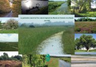
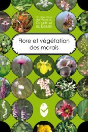
Flore et végétation<br />
<strong>des</strong> marais<br />
Des marais entre deux mers...<br />
Marshlands, between two coastlines...<br />
The <strong>Parc</strong> naturel regional in<br />
pictures, throughout the season<br />
French/English<br />
To find out more<br />
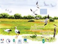
Les oiseaux nicheurs <strong>des</strong><br />
prairies humi<strong>des</strong><br />
Carte <strong>to</strong>uristique<br />
T<strong>our</strong>ist map<br />
Hikes, natural his<strong>to</strong>ry and<br />
water-based activities<br />
French/English<br />
<strong>des</strong> <strong>Marais</strong> <strong>du</strong> Cotentin et <strong>du</strong> Bessin<br />
Dépôt légal à parution : avril 2012 - Tirage : 5 000 ex.<br />
Crédit pho<strong>to</strong> : © C. Lecoq, S. Stauth (CPIE <strong>du</strong> Cotentin) ; S. Barrault ; T. Bousquet, H. Guit<strong>to</strong>n, M. Provost,<br />
S. Rivez (Conserva<strong>to</strong>ire Botanique National de Brest) ; S. Fautré (CDT50) ; Fédération Départementale <strong>des</strong><br />
Chasseurs de la Manche ; J-M. Gatey ; M. Guérard ; R. Purenne (GONm) ; M. Lagarde, L. Robert (GRETIA) ;<br />
T. Houyel ; F. Levalet ; B. Canu, F. Désert, N. Fillol, G. Hédouin, E. Génot, J-M. Lefèvre, R. Pavisse, M. Roche<br />
(Pnr <strong>Marais</strong> <strong>du</strong> Cotentin et <strong>du</strong> Bessin) ; L. Gabet, A. Hannok (SyMEL) ; S. Provost.<br />
Cartes issues <strong>des</strong> fichiers BD TOPO® ©IGN - 2012 - Au<strong>to</strong>risation n° 43-12003<br />
Imprimé sur <strong>du</strong> papier certifié PEFC avec <strong>des</strong> encres végétales<br />
par l’imprimerie Le Révérend à Valognes.<br />
M!GRATEURS<br />
à plumes, à poils, à écailles...<br />
Les rendez-vous <strong>du</strong> <strong>Parc</strong><br />
The <strong>Parc</strong> organizes guided<br />
events, at the Maison <strong>du</strong> <strong>Parc</strong><br />
or in one of the 150 parishes<br />
that make up the <strong>Parc</strong><br />
These publications are pro<strong>du</strong>ced by the <strong>Parc</strong> naturel régional and available<br />
at the Maison <strong>du</strong> <strong>Parc</strong> (tel. 00 33 (0)2 33 71 65 30), at <strong>to</strong>urist offices<br />
or at www.parc-cotentin-bessin.fr<br />
back <strong>to</strong><br />
summary
ack <strong>to</strong><br />
summary<br />
Guernesey<br />
Aurigny<br />
Serq<br />
Jersey<br />
Saint-Malo<br />
Cap de<br />
la Hague<br />
Rosslare<br />
Diélette<br />
Barneville-<br />
Carteret<br />
Marshlands,<br />
between two coastlines…<br />
Poole - Portsmouth<br />
Iles<br />
Chausey<br />
Maison Maison <strong>du</strong> <strong>Parc</strong> <strong>Parc</strong> naturel naturel régional régional<br />
<strong>des</strong> <strong>Marais</strong> <strong>Marais</strong> <strong>du</strong> Cotentin Cotentin et <strong>du</strong> Bessin Bessin<br />
3 village Ponts d’Ouve<br />
50500 SAINT-CÔME-DU-MONT<br />
Tél. 00 33 (0)2 33 71 65 30<br />
Fax. 00 33 (0)2 33 71 65 31<br />
accueil@parc-cotentin-bessin.fr<br />
www.parc-cotentin-bessin.fr<br />
Poole<br />
Caen-Rennes<br />
Rennes<br />
Nantes<br />
Coutances<br />
Granville<br />
Baie <strong>du</strong><br />
Mont-St-Michel<br />
Portsmouth<br />
Cherb<strong>our</strong>g<br />
Carentan<br />
Pointe<br />
de Barfleur<br />
Ile<br />
Tatihou<br />
Utah Beach<br />
Baie<br />
<strong>des</strong> Veys<br />
Isigny-sur-Mer<br />
Avranches<br />
Saint-Lô<br />
Omaha Beach<br />
Cherb<strong>our</strong>g 45’<br />
Bayeux<br />
S t -Côme-<strong>du</strong>-Mont<br />
Angers<br />
Portsmouth<br />
Portsmouth<br />
Caen<br />
Paris-Granville<br />
Baie<br />
de Seine<br />
Ouistreham<br />
le Havre<br />
Paris-Cherb<strong>our</strong>g<br />
N O R M A N D I E<br />
D 913<br />
D 971<br />
Coutances 40’<br />
Maison <strong>du</strong> <strong>Parc</strong><br />
Sortie<br />
S t -Côme-<strong>du</strong>-Mont<br />
S te -Marie-<strong>du</strong>-Mont<br />
Utah-Beach<br />
CARENTAN<br />
4 9 . 3 2 1 6 3 6 , - 1 . 2 6 5 6 7 1<br />
Le Mans<br />
Caen 60’<br />
Saint-Lô 30’<br />
From Easter <strong>to</strong> the end of September<br />
open daily from 9.30 a.m. <strong>to</strong> 7 p.m.<br />
From Oc<strong>to</strong>ber <strong>to</strong> Easter<br />
open daily, except on Mondays, from 9.30 a.m.<br />
<strong>to</strong> 1 p.m. and from 2 p.m. <strong>to</strong> 5.30 p.m.<br />
(the national nature reserve is closed for 2<br />
weeks as from the end of September).<br />
Closed annually<br />
from the end of December <strong>to</strong> early January.<br />
T<strong>our</strong>s