Bruthen State Forest - Department of Sustainability and Environment
Bruthen State Forest - Department of Sustainability and Environment
Bruthen State Forest - Department of Sustainability and Environment

Create successful ePaper yourself
Turn your PDF publications into a flip-book with our unique Google optimized e-Paper software.
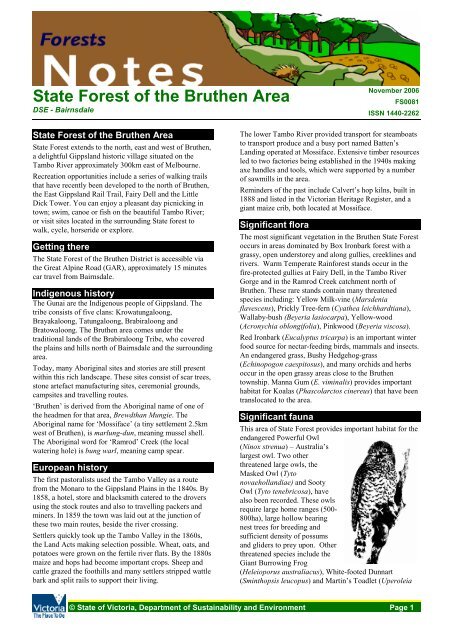
<strong>State</strong> <strong>Forest</strong> <strong>of</strong> the <strong>Bruthen</strong> Area<br />
DSE - Bairnsdale<br />
<strong>State</strong> <strong>Forest</strong> <strong>of</strong> the <strong>Bruthen</strong> Area<br />
<strong>State</strong> <strong>Forest</strong> extends to the north, east <strong>and</strong> west <strong>of</strong> <strong>Bruthen</strong>,<br />
a delightful Gippsl<strong>and</strong> historic village situated on the<br />
Tambo River approximately 300km east <strong>of</strong> Melbourne.<br />
Recreation opportunities include a series <strong>of</strong> walking trails<br />
that have recently been developed to the north <strong>of</strong> <strong>Bruthen</strong>,<br />
the East Gippsl<strong>and</strong> Rail Trail, Fairy Dell <strong>and</strong> the Little<br />
Dick Tower. You can enjoy a pleasant day picnicking in<br />
town; swim, canoe or fish on the beautiful Tambo River;<br />
or visit sites located in the surrounding <strong>State</strong> forest to<br />
walk, cycle, horseride or explore.<br />
Getting there<br />
The <strong>State</strong> <strong>Forest</strong> <strong>of</strong> the <strong>Bruthen</strong> District is accessible via<br />
the Great Alpine Road (GAR), approximately 15 minutes<br />
car travel from Bairnsdale.<br />
Indigenous history<br />
The Gunai are the Indigenous people <strong>of</strong> Gippsl<strong>and</strong>. The<br />
tribe consists <strong>of</strong> five clans: Krowatungaloong,<br />
Brayakaloong, Tatungaloong, Brabiraloong <strong>and</strong><br />
Bratowaloong. The <strong>Bruthen</strong> area comes under the<br />
traditional l<strong>and</strong>s <strong>of</strong> the Brabiraloong Tribe, who covered<br />
the plains <strong>and</strong> hills north <strong>of</strong> Bairnsdale <strong>and</strong> the surrounding<br />
area.<br />
Today, many Aboriginal sites <strong>and</strong> stories are still present<br />
within this rich l<strong>and</strong>scape. These sites consist <strong>of</strong> scar trees,<br />
stone artefact manufacturing sites, ceremonial grounds,<br />
campsites <strong>and</strong> travelling routes.<br />
‘<strong>Bruthen</strong>’ is derived from the Aboriginal name <strong>of</strong> one <strong>of</strong><br />
the headmen for that area, Brewdthan Mungie. The<br />
Aboriginal name for ‘Mossiface’ (a tiny settlement 2.5km<br />
west <strong>of</strong> <strong>Bruthen</strong>), is marlung-dun, meaning mussel shell.<br />
The Aboriginal word for ‘Ramrod’ Creek (the local<br />
watering hole) is bung warl, meaning camp spear.<br />
European history<br />
The first pastoralists used the Tambo Valley as a route<br />
from the Monaro to the Gippsl<strong>and</strong> Plains in the 1840s. By<br />
1858, a hotel, store <strong>and</strong> blacksmith catered to the drovers<br />
using the stock routes <strong>and</strong> also to travelling packers <strong>and</strong><br />
miners. In 1859 the town was laid out at the junction <strong>of</strong><br />
these two main routes, beside the river crossing.<br />
Settlers quickly took up the Tambo Valley in the 1860s,<br />
the L<strong>and</strong> Acts making selection possible. Wheat, oats, <strong>and</strong><br />
potatoes were grown on the fertile river flats. By the 1880s<br />
maize <strong>and</strong> hops had become important crops. Sheep <strong>and</strong><br />
cattle grazed the foothills <strong>and</strong> many settlers stripped wattle<br />
bark <strong>and</strong> split rails to support their living.<br />
November 2006<br />
FS0081<br />
ISSN 1440-2262<br />
The lower Tambo River provided transport for steamboats<br />
to transport produce <strong>and</strong> a busy port named Batten’s<br />
L<strong>and</strong>ing operated at Mossiface. Extensive timber resources<br />
led to two factories being established in the 1940s making<br />
axe h<strong>and</strong>les <strong>and</strong> tools, which were supported by a number<br />
<strong>of</strong> sawmills in the area.<br />
Reminders <strong>of</strong> the past include Calvert’s hop kilns, built in<br />
1888 <strong>and</strong> listed in the Victorian Heritage Register, <strong>and</strong> a<br />
giant maize crib, both located at Mossiface.<br />
Significant flora<br />
The most significant vegetation in the <strong>Bruthen</strong> <strong>State</strong> <strong>Forest</strong><br />
occurs in areas dominated by Box Ironbark forest with a<br />
grassy, open understorey <strong>and</strong> along gullies, creeklines <strong>and</strong><br />
rivers. Warm Temperate Rainforest st<strong>and</strong>s occur in the<br />
fire-protected gullies at Fairy Dell, in the Tambo River<br />
Gorge <strong>and</strong> in the Ramrod Creek catchment north <strong>of</strong><br />
<strong>Bruthen</strong>. These rare st<strong>and</strong>s contain many threatened<br />
species including: Yellow Milk-vine (Marsdenia<br />
flavescens), Prickly Tree-fern (Cyathea leichhardtiana),<br />
Wallaby-bush (Beyeria lasiocarpa), Yellow-wood<br />
(Acronychia oblongifolia), Pinkwood (Beyeria viscosa).<br />
Red Ironbark (Eucalyptus tricarpa) is an important winter<br />
food source for nectar-feeding birds, mammals <strong>and</strong> insects.<br />
An endangered grass, Bushy Hedgehog-grass<br />
(Echinopogon caespitosus), <strong>and</strong> many orchids <strong>and</strong> herbs<br />
occur in the open grassy areas close to the <strong>Bruthen</strong><br />
township. Manna Gum (E. viminalis) provides important<br />
habitat for Koalas (Phascolarctos cinereus) that have been<br />
translocated to the area.<br />
Significant fauna<br />
This area <strong>of</strong> <strong>State</strong> <strong>Forest</strong> provides important habitat for the<br />
endangered Powerful Owl<br />
(Ninox strenua) – Australia’s<br />
largest owl. Two other<br />
threatened large owls, the<br />
Masked Owl (Tyto<br />
novaeholl<strong>and</strong>iae) <strong>and</strong> Sooty<br />
Owl (Tyto tenebricosa), have<br />
also been recorded. These owls<br />
require large home ranges (500-<br />
800ha), large hollow bearing<br />
nest trees for breeding <strong>and</strong><br />
sufficient density <strong>of</strong> possums<br />
<strong>and</strong> gliders to prey upon. Other<br />
threatened species include the<br />
Giant Burrowing Frog<br />
(Heleioporus australiacus), White-footed Dunnart<br />
(Sminthopsis leucopus) <strong>and</strong> Martin’s Toadlet (Uperoleia<br />
© <strong>State</strong> <strong>of</strong> Victoria, <strong>Department</strong> <strong>of</strong> <strong>Sustainability</strong> <strong>and</strong> <strong>Environment</strong> Page 1
<strong>State</strong> <strong>Forest</strong> <strong>of</strong> the <strong>Bruthen</strong> Area FS0081<br />
martini). Woodl<strong>and</strong>-dependent summer migrants visit the<br />
rainshadow areas along the Tambo River from the north,<br />
such as Rainbow Bee-eaters (Merops ornatus) <strong>and</strong><br />
Dollarbirds (Eurystomus orientalis).<br />
Walking Trails<br />
The <strong>Bruthen</strong> Walking Trails are a unique product <strong>of</strong> a<br />
2005 health sector initiative to encourage more members<br />
<strong>of</strong> the community to increase their exercise as an illness<br />
preventative measure.<br />
There are six trails in total, with distances ranging from<br />
2km-7km; trail grade ranges from easy to hard.<br />
McLeans Carpark provides the trailhead for the six<br />
<strong>Bruthen</strong> Walking Trails. The Trails’ brochure is available<br />
for download from the website:<br />
www.vicnet.net.au/~bruthen/bruthen_trails.html<br />
Rail Trail<br />
The East Gippsl<strong>and</strong> Rail Trail is a recreation trail for<br />
cyclists, walkers <strong>and</strong> horse riders.<br />
The 97km trail follows the former Bairnsdale to Orbost<br />
railway line. It passes through rural l<strong>and</strong>scapes with views<br />
<strong>of</strong> the Gippsl<strong>and</strong> Lakes, <strong>and</strong> through peaceful forest<br />
settings. The trail passes through the townships <strong>of</strong><br />
Nicholson, <strong>Bruthen</strong> <strong>and</strong> Nowa Nowa.<br />
More information about this long <strong>and</strong> varied trail can be<br />
found at the website: www.eastgippsl<strong>and</strong>railtrail.com<br />
Gippsl<strong>and</strong> Lakes Discovery Trail<br />
The Gippsl<strong>and</strong> Lakes Discovery Trail (GLDT) is a<br />
purpose built bicycle <strong>and</strong> walking trail that intimately<br />
winds through the forest, providing a unique experience<br />
not found elsewhere in Victoria. Passing through the<br />
Colquhoun <strong>State</strong> <strong>Forest</strong>, this trail runs from the East<br />
Gippsl<strong>and</strong> Rail Trail at Seaton Track (11km from <strong>Bruthen</strong>)<br />
25km to Lakes Entrance. Horses are not permitted on the<br />
GLDT.<br />
The GLDT <strong>Forest</strong>s Note provides more information about<br />
this track <strong>and</strong> is available at DSE’s website:<br />
www.dse.vic.gov.au/forests<br />
Picnic sites<br />
Picnic facilities <strong>and</strong> public toilets are available in the<br />
<strong>Bruthen</strong> town. Facilities within forest locations include:<br />
• Fairy Dell – ample car parking, toilets, picnic tables,<br />
barbecues, walking trail interpretive material.<br />
• McLeans Carpark – ample car parking, picnic table,<br />
walking trails’ interpretive material <strong>and</strong> trailhead for<br />
the six <strong>Bruthen</strong> Walking Trails.<br />
Fairy Dell<br />
Fairy Dell Flora Reserve is a Nature Conservation Reserve<br />
<strong>of</strong> special significance to the local area. At 80ha in size, it<br />
protects an important area <strong>of</strong> Warm Temperate Rainforest.<br />
Dogs <strong>and</strong> firewood cutting are not permitted within the<br />
reserve. On the outskirts <strong>of</strong> <strong>Bruthen</strong>, this reserve is a<br />
lovely spot to visit, with a picnic area <strong>and</strong> walking trail.<br />
This area is managed by Parks Victoria, <strong>and</strong> further<br />
information can be obtained by calling the Parks Victoria<br />
Information Centre on 131 963. See attached map.<br />
Little Dick Tower<br />
In response to the massive devastation from bushfires in<br />
1939, the then <strong>Forest</strong>s<br />
Commission rapidly<br />
upgraded <strong>and</strong> exp<strong>and</strong>ed the<br />
<strong>State</strong>’s fire detection system.<br />
Mt. Little Dick Firetower was<br />
built in 1940, from timber<br />
hewn by h<strong>and</strong> with broadaxes<br />
<strong>and</strong> adzes. The 19m high<br />
tower was constructed by<br />
well known <strong>Forest</strong><br />
Commission identities,<br />
including Cecil Cross <strong>and</strong><br />
Charlie Wain.<br />
The tower is located 4.5km<br />
up Mount Little Dick Range Road, which runs <strong>of</strong>f the<br />
GAR 3km north <strong>of</strong> <strong>Bruthen</strong>. Access up the structure is<br />
prohibited but the site can be visited to see the tower <strong>and</strong><br />
views <strong>of</strong> the Tambo River flats south <strong>of</strong> <strong>Bruthen</strong>.<br />
Looking after our forests<br />
• Don’t disturb native plants <strong>and</strong> animals.<br />
• There is no rubbish collection service, so please take<br />
your rubbish home. If you have the misfortune to<br />
come across other people’s rubbish, do the bush a<br />
favour <strong>and</strong> take it out with you too.<br />
• Dogs must be under direct control at all times <strong>and</strong> are<br />
expected to be kept on a leash in picnic <strong>and</strong> camping<br />
areas or when near other visitors.<br />
• Take care with fire – observe all fire regulations <strong>and</strong><br />
Total Fire Ban days. Use existing fireplaces rather<br />
than create your own. Never leave fires unattended.<br />
Ensure fires are safe <strong>and</strong> that they are completely<br />
extinguished when you leave.<br />
• Only light fires in fireplaces or 30cm deep trenches.<br />
Fires must be less than 1m square <strong>and</strong> at least 3m clear<br />
<strong>of</strong> burnable material.<br />
• Minor forest (unsealed) roads can be boggy in winter.<br />
Stay on the major (sealed) roads in wet weather.<br />
• Motor vehicles including motorcycles must not be<br />
driven <strong>of</strong>f formed roads.<br />
• Make sure you tell someone where you are going,<br />
when you expect to return, <strong>and</strong> when you are back.<br />
For more information<br />
The <strong>Department</strong> <strong>of</strong> <strong>Sustainability</strong> & <strong>Environment</strong> (DSE) is<br />
responsible for managing Victoria's <strong>State</strong> <strong>Forest</strong>. For<br />
further information contact DSE’s Bairnsdale <strong>of</strong>fice on <br />
(03) 5152 0600 or the <strong>Department</strong>’s Customer Service<br />
Centre on 136 186 or visit the website at:<br />
http://www.dse.vic.gov.au/forests<br />
Acknowledgements: This brochure was written by DSE<br />
staff in conjunction with the <strong>Bruthen</strong> Walking Trails<br />
Committee.<br />
This publication may be <strong>of</strong> assistance to you but the <strong>State</strong> <strong>of</strong> Victoria<br />
<strong>and</strong> its <strong>of</strong>ficers do not guarantee that the publication is without flaw <strong>of</strong><br />
any kind or is wholly appropriate for your particular purposes <strong>and</strong><br />
therefore disclaims all liability for any error, loss or other consequence<br />
which may arise from you relying on any information in this publication.<br />
© <strong>State</strong> <strong>of</strong> Victoria, <strong>Department</strong> <strong>of</strong> <strong>Sustainability</strong> <strong>and</strong> <strong>Environment</strong> Page 2
ST<br />
River<br />
ROAD<br />
ROAD<br />
STONY<br />
MAN<br />
OLD OLD<br />
EK<br />
Paddys<br />
ROAD ROAD<br />
STONY<br />
ROAD ROAD<br />
CREEK CREEK<br />
Chinaman<br />
NICHOLSON<br />
Creek<br />
TRACK TRACK<br />
Dave<br />
MILE<br />
Creek Creek<br />
R<br />
<strong>State</strong> <strong>Forest</strong> <strong>of</strong> the <strong>Bruthen</strong> Area FS0081<br />
PADDYS<br />
CREEK<br />
PADDYS<br />
GULLY<br />
MILL<br />
HILL<br />
<strong>State</strong> <strong>Forest</strong> <strong>of</strong> the <strong>Bruthen</strong> Area<br />
Highway<br />
Sealed road<br />
Unsealed road<br />
Vehicle track (4WD)<br />
<strong>Forest</strong> Drive<br />
East Gippsl<strong>and</strong> Rail Trail<br />
Walking track<br />
WARD<br />
FLAT ROAD<br />
Stony<br />
STONY<br />
COSTERS<br />
FIDDLERS<br />
ELEVEN<br />
ROAD<br />
CREEK<br />
ROAD ROAD<br />
CREEK ROAD<br />
ROAD<br />
SARSFIELD<br />
BUSHLAND<br />
RESERVE<br />
<strong>State</strong> <strong>Forest</strong><br />
Park / Reserve<br />
Special Protection<br />
Zone<br />
(No firewood collection<br />
is permitted)<br />
Water body<br />
Dinghy<br />
Hall Creek<br />
Gully<br />
DEEP DEEP<br />
ELEVEN ELEVEN<br />
BOUNDARY<br />
CREEK CREEK<br />
To<br />
Bairnsdale<br />
Hollow<br />
ROAD ROAD<br />
DINGHY<br />
TRACK<br />
GREAT<br />
MILE<br />
MURPHY<br />
Creek<br />
ROAD ROAD<br />
FREEMANS TRACK<br />
NICHOLSON<br />
TRACK<br />
ROAD<br />
WINDSOR<br />
ALPINE<br />
TRACK<br />
DVE<br />
KERRY<br />
FAIRY FAIRY<br />
ENGINEERS<br />
Recreational Facilities<br />
Cycling<br />
Carpark<br />
Fireplace<br />
Firetower / Lookout<br />
Picnic table<br />
Toilets<br />
Walking<br />
Fairy Dell<br />
Flora Reserve<br />
DELL DELL<br />
DELL DELL<br />
FAIRY FAIRY<br />
JEEP JEEP<br />
TK TK<br />
TOWN BOUNDARY TRACK<br />
HOWARDS<br />
ROAD<br />
DEEP<br />
ã<br />
LANE<br />
Monkey<br />
AY<br />
N<br />
TRACK TRACK<br />
CREEK<br />
LEES<br />
Deep<br />
Creek<br />
LANE<br />
ENGINEERS<br />
ENGINEERS<br />
Creek<br />
MELBOURNE<br />
l<br />
TAMBO<br />
BUSHLAND<br />
RESERVE<br />
CREEK<br />
OLD<br />
FAIRY DELL<br />
ROAD<br />
WISELEIGH<br />
BUSHLAND<br />
RESERVE<br />
ROAD<br />
ROAD ROAD<br />
WISELEIGH<br />
Creek<br />
TK<br />
TRACK<br />
ROAD<br />
MOUNT MOUNT<br />
LITTLE LITTLE<br />
ROAD<br />
Ramrod Ramrod<br />
Rowley<br />
CREEK<br />
DEEP<br />
BARKLY ST<br />
B500<br />
BRUTHEN<br />
STATE<br />
FOREST<br />
<strong>Bruthen</strong><br />
l Nowa<br />
Nowa l<br />
l Sale<br />
Bairnsdale<br />
l<br />
Metung<br />
l l<br />
Paynesville l<br />
Lakes<br />
Entrance<br />
l<br />
Loch Sport<br />
pray<br />
0 500 1000<br />
PRINCES<br />
l<br />
METRES<br />
Cartography by Spatial Vision 2007<br />
M/8722<br />
H<br />
HWY<br />
DICK DICK<br />
Fairy Dell<br />
Scenic Reserve<br />
ROAD<br />
Wiseleigh<br />
BRUTHEN SWAN<br />
Old<br />
TRACK<br />
MARTEN MARTEN<br />
Tambo<br />
C605<br />
RANGE RANGE<br />
PIPE<br />
SEE SEPARATE BROCHURE<br />
BRUTHEN WALKING TRAILS<br />
Mossiface<br />
TOWN<br />
LAMBOURNES<br />
ROAD<br />
REACH<br />
STATION<br />
CURTIS<br />
ROAD<br />
HOFFMAN<br />
River<br />
To Swan<br />
Reach<br />
D<br />
BOUND<br />
R
TEN TEN<br />
ambo<br />
RANGE RANGE<br />
PIPE<br />
ARATE BROCHURE<br />
N WALKING TRAILS<br />
TOWN<br />
LAMBOURNES<br />
ROAD<br />
05<br />
REACH<br />
STATION<br />
CURTIS<br />
ROAD<br />
River<br />
To Swan<br />
Reach<br />
ROAD<br />
Tambo<br />
ROAD ROAD<br />
ENGINEERS<br />
DUMP<br />
ROAD<br />
BOUNDARY<br />
RD<br />
HOFFMANS LANE<br />
BAINES<br />
Mt Little Dick l<br />
Firetower<br />
BROOKS<br />
TOWN<br />
TRACK<br />
Tambo<br />
DICK<br />
ROAD<br />
LANE<br />
LITTLE<br />
Creek<br />
JEEP TK<br />
Gin<br />
ROAD<br />
River<br />
MOUNT<br />
BOUNDARY<br />
ROAD<br />
GIN CRE<br />
LITTLE<br />
Creek<br />
McLEANS RD<br />
<strong>Bruthen</strong><br />
CHAMBERS<br />
TRACK<br />
RD<br />
DICK<br />
GREAT<br />
RANGE<br />
ROAD<br />
ROAD<br />
BECKERS<br />
CAVANNAHS<br />
<strong>Bruthen</strong> Walking<br />
Trails Carpark<br />
BRUTHEN<br />
TAMBO<br />
KIRLEY DVE<br />
PILGRIMS<br />
UPPER<br />
RD<br />
JENNINGS<br />
C620<br />
DUKES<br />
Bridle<br />
OMARAS<br />
ROAD<br />
ROAD<br />
BOUNDARY<br />
THE GLEN<br />
FLORA<br />
RESERVE<br />
Three<br />
ROAD<br />
ROAD<br />
ALPINE<br />
RD<br />
BIGROAD<br />
NOWA<br />
Mile<br />
BOYS<br />
CREEK<br />
TRACK<br />
Ramrod Creek<br />
CAMP TRACK<br />
Creek<br />
Tambo<br />
HAMBROOKS<br />
WARDS<br />
Bridle<br />
NOWA<br />
Creek<br />
Monkey<br />
River<br />
To<br />
Omeo<br />
B500<br />
MM<br />
EVANS<br />
ROAD<br />
COLQUHOUN<br />
Creek<br />
STATE<br />
FOREST<br />
TRACK<br />
ROAD<br />
CROFTS<br />
TRACK<br />
Deadhorse<br />
DEAD<br />
HORSE<br />
ROAD<br />
CREEK<br />
BO<br />
VICS<br />
DEAD COW<br />
BO<br />
To<br />
Omeo<br />
TRACK<br />
To Nowa<br />
Nowa<br />
This publication may be <strong>of</strong> assistance to you but the <strong>State</strong> <strong>of</strong> Victoria <strong>and</strong> its <strong>of</strong>ficers do not guarantee that the publication is without flaw <strong>of</strong> any kind or is<br />
wholly appropriate for your particular purposes <strong>and</strong> therefore disclaims all liability for any error, loss or other consequence which may arise from you<br />
relying on any information in this publication.<br />
© <strong>State</strong> <strong>of</strong> Victoria, <strong>Department</strong> <strong>of</strong> <strong>Sustainability</strong> <strong>and</strong> <strong>Environment</strong><br />
TREE<br />
Creek<br />
CKS T<br />
TRACK<br />
ROAD<br />
TRACK<br />
TRACK<br />
SEATON<br />
ROAD<br />
T

![Metcalfe State Forest Fauna Species List [PDF File - 16.9 KB]](https://img.yumpu.com/22024301/1/184x260/metcalfe-state-forest-fauna-species-list-pdf-file-169-kb.jpg?quality=85)
![PPE Price List for Wildlife Volunteers [PDF File - 20.3 KB]](https://img.yumpu.com/15321634/1/190x135/ppe-price-list-for-wildlife-volunteers-pdf-file-203-kb.jpg?quality=85)