STAR*NET V6 - Circe
STAR*NET V6 - Circe
STAR*NET V6 - Circe
You also want an ePaper? Increase the reach of your titles
YUMPU automatically turns print PDFs into web optimized ePapers that Google loves.
Chapter 9 Tools<br />
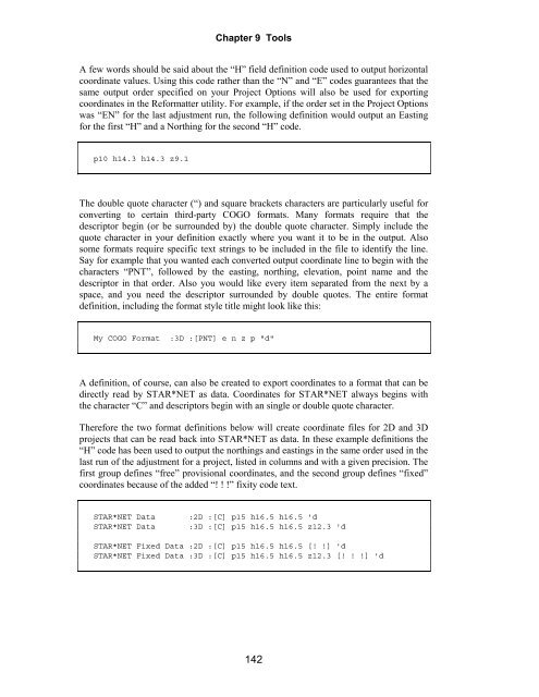
A few words should be said about the “H” field definition code used to output horizontal<br />
coordinate values. Using this code rather than the “N” and “E” codes guarantees that the<br />
same output order specified on your Project Options will also be used for exporting<br />
coordinates in the Reformatter utility. For example, if the order set in the Project Options<br />
was “EN” for the last adjustment run, the following definition would output an Easting<br />
for the first “H” and a Northing for the second “H” code.<br />
p10 h14.3 h14.3 z9.1<br />
The double quote character (“) and square brackets characters are particularly useful for<br />
converting to certain third-party COGO formats. Many formats require that the<br />
descriptor begin (or be surrounded by) the double quote character. Simply include the<br />
quote character in your definition exactly where you want it to be in the output. Also<br />
some formats require specific text strings to be included in the file to identify the line.<br />
Say for example that you wanted each converted output coordinate line to begin with the<br />
characters “PNT”, followed by the easting, northing, elevation, point name and the<br />
descriptor in that order. Also you would like every item separated from the next by a<br />
space, and you need the descriptor surrounded by double quotes. The entire format<br />
definition, including the format style title might look like this:<br />
My COGO Format :3D :[PNT] e n z p "d"<br />
A definition, of course, can also be created to export coordinates to a format that can be<br />
directly read by <strong>STAR*NET</strong> as data. Coordinates for <strong>STAR*NET</strong> always begins with<br />
the character “C” and descriptors begin with an single or double quote character.<br />
Therefore the two format definitions below will create coordinate files for 2D and 3D<br />
projects that can be read back into <strong>STAR*NET</strong> as data. In these example definitions the<br />
“H” code has been used to output the northings and eastings in the same order used in the<br />
last run of the adjustment for a project, listed in columns and with a given precision. The<br />
first group defines “free” provisional coordinates, and the second group defines “fixed”<br />
coordinates because of the added “! ! !” fixity code text.<br />
<strong>STAR*NET</strong> Data :2D :[C] p15 h16.5 h16.5 'd<br />
<strong>STAR*NET</strong> Data :3D :[C] p15 h16.5 h16.5 z12.3 'd<br />
<strong>STAR*NET</strong> Fixed Data :2D :[C] p15 h16.5 h16.5 [! !] 'd<br />
<strong>STAR*NET</strong> Fixed Data :3D :[C] p15 h16.5 h16.5 z12.3 [! ! !] 'd<br />
142


