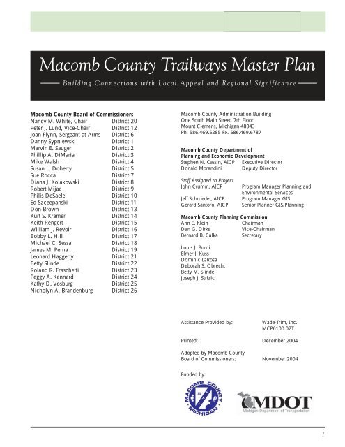
Macomb County Trailways Master Plan
Macomb County Trailways Master Plan
Macomb County Trailways Master Plan

Create successful ePaper yourself
Turn your PDF publications into a flip-book with our unique Google optimized e-Paper software.
<strong>Macomb</strong> <strong>County</strong><br />
<strong>Trailways</strong> <strong>Master</strong> <strong>Plan</strong><br />
<strong>Macomb</strong> <strong>County</strong> <strong>Trailways</strong> <strong>Master</strong> <strong>Plan</strong><br />
Building Connections with Local Appeal and Regional Significance<br />
<strong>Macomb</strong> <strong>County</strong> Board of Commissioners<br />
Nancy M. White, Chair District 20<br />
Peter J. Lund, Vice-Chair District 12<br />
Joan Flynn, Sergeant-at-Arms District 6<br />
Danny Sypniewski District 1<br />
Marvin E. Sauger District 2<br />
Phillip A. DiMaria District 3<br />
Mike Walsh District 4<br />
Susan L. Doherty District 5<br />
Sue Rocca District 7<br />
Diana J. Kolakowski District 8<br />
Robert Mijac District 9<br />
Philis DeSaele District 10<br />
Ed Szczepanski District 11<br />
Don Brown District 13<br />
Kurt S. Kramer District 14<br />
Keith Rengert District 15<br />
William J. Revoir District 16<br />
Bobby L. Hill District 17<br />
Michael C. Sessa District 18<br />
James M. Perna District 19<br />
Leonard Haggerty District 21<br />
Betty Slinde District 22<br />
Roland R. Fraschetti District 23<br />
Peggy A. Kennard District 24<br />
Kathy D. Vosburg District 25<br />
Nicholyn A. Brandenburg District 26<br />
<strong>Macomb</strong> <strong>County</strong> Administration Building<br />
One South Main Street, 7th Floor<br />
Mount Clemens, Michigan 48043<br />
Ph. 586.469.5285 Fx. 586.469.6787<br />
<strong>Macomb</strong> <strong>County</strong> Department of<br />
<strong>Plan</strong>ning and Economic Development<br />
Stephen N. Cassin, AICP Executive Director<br />
Donald Morandini Deputy Director<br />
Staff Assigned to Project<br />
John Crumm, AICP Program Manager <strong>Plan</strong>ning and<br />
Environmental Services<br />
Jeff Schroeder, AICP Program Manager GIS<br />
Gerard Santoro, AICP Senior <strong>Plan</strong>ner GIS/<strong>Plan</strong>ning<br />
<strong>Macomb</strong> <strong>County</strong> <strong>Plan</strong>ning Commission<br />
Ann E. Klein Chairman<br />
Dan G. Dirks Vice-Chairman<br />
Bernard B. Calka Secretary<br />
Louis J. Burdi<br />
Elmer J. Kuss<br />
Dominic LaRosa<br />
Deborah S. Obrecht<br />
Betty M. Slinde<br />
Joseph J. Strizic<br />
Assistance Provided by: Wade-Trim, Inc.<br />
MCP6100.02T<br />
Printed: December 2004<br />
Adopted by <strong>Macomb</strong> <strong>County</strong><br />
Board of Commissioners: November 2004<br />
Funded by:<br />
1
<strong>Macomb</strong> <strong>County</strong> <strong>Trailways</strong> <strong>Master</strong> <strong>Plan</strong><br />
Special Thanks To Meeting Participants:<br />
Tom VanDamme Fraser (Committee Co-Chair)<br />
Anthony Casasanta <strong>Macomb</strong> <strong>County</strong> Parks & Recreation Department<br />
Lynne Yustick <strong>Macomb</strong> <strong>County</strong> Public Works Office<br />
Lara Sucharski <strong>Macomb</strong> <strong>County</strong> Public Works Office<br />
Robert Hoepfner Road Commission of <strong>Macomb</strong> <strong>County</strong><br />
Joe Pacella Road Commission of <strong>Macomb</strong> <strong>County</strong><br />
Gary Schocke Bruce Township<br />
Eric Wurmlinger Chesterfield Township<br />
Joe Silbernagel Clinton Township<br />
Gary Young City of Eastpointe<br />
Fred Lienemann City of Fraser<br />
Carolyn Loh Lenox Township<br />
Jeanette Ventimiglia Lenox Township<br />
Jerry Schmeiser <strong>Macomb</strong> Township<br />
Rick Onagn <strong>Macomb</strong> Township<br />
Denise Pike City of Mt. Clemens<br />
Paula Artman Ray Township<br />
Kathleen Bolton Ray Township<br />
Dennis Tipsword Ray Twp/ Friends of the <strong>Macomb</strong> Orchard Trail<br />
Jon Moore City of Richmond<br />
Troy Jeschke City of Richmond<br />
Kelley Osterman City of Richmond<br />
Joe Youngblood Shelby Township<br />
Denice Gerstenberg City of Sterling Heights<br />
Liz Mancini City of St. Clair Shores<br />
Chris Rayes City of St. Clair Shores<br />
Maggie Paul City of Utica<br />
Bill Lamb City of Utica<br />
Daniel Smith City of Warren<br />
Richard Doherty City of Warren<br />
Henry Bowman City of Warren<br />
Jim Kropp Huron Clinton Metropolitan Authority<br />
Eric Douglas Clinton River Pathway<br />
Janet Jawor Clinton River Pathway<br />
Andy Anderson Prestige Cycles<br />
Susan Stefanski SEMCOG<br />
Roberta Urbani DTE Energy<br />
Barbara Mention International Transmission Company<br />
Jennifer Welch International Transmission Company<br />
Chuck Lumpkin <strong>Macomb</strong> Land Conservancy<br />
Drew Buckner MDOT<br />
Doug Skrzyniarz Mt. Clemens General Hospital<br />
Todd Scott Michigan Mountain Biking Association<br />
Matt Kowalczyk Michigan Mountain Biking Association<br />
Dan Keifer Clinton River Watershed Council<br />
Michael Sproul St. Clair Shores Resident<br />
Jennifer Chehab AEW<br />
Norman Cox St. Clair <strong>County</strong> (consultant)<br />
Anthony Marrocco Red Run Drain Board<br />
William Misterovich Red Run Drain Board<br />
Special Thanks To Those Who Served As<br />
Data And Information Resources:<br />
Rails-To-Trails Conservancy, Michigan Field Office<br />
Enhancement Staff from MDOT<br />
Southeast Michigan Council of Governments<br />
Community Foundation for Southeast Michigan<br />
In memory of:<br />
Ralph A. Liberato, <strong>County</strong> Commissioner
Sterling Heights<br />
Purpose & Process ................. 5<br />
Project Overview ...........................................................6<br />
<strong>Plan</strong>ning Process ............................................................6<br />
Benefits of Non-Motorized Systems ...............................8<br />
Existing Systems.................. 13<br />
Significant Systems Within <strong>Macomb</strong> <strong>County</strong>................14<br />
Associated <strong>Plan</strong>ning Efforts ..........................................18<br />
Non-Motorized Regional Perspective ..........................23<br />
Preferred Corridors .............. 25<br />
Route Classifications ....................................................26<br />
Staging Areas ...............................................................26<br />
Public Forum Input ......................................................27<br />
Proposed Corridors and Community Cut Sheets ..........31<br />
Table of Contents<br />
Design Considerations ........... 53<br />
General Design Guidelines .......................................... 54<br />
Agency Policies and Contacts ...................................... 64<br />
Implementation Strategy ......... 67<br />
Role of <strong>County</strong> Dept of <strong>Plan</strong>ning & Economic Dev ..... 68<br />
Recommended Actions ................................................ 68<br />
Additional Tools and Strategies For Implementation .... 71<br />
Phasing Priorities ......................................................... 73<br />
Probable Cost Estimates ............................................... 76<br />
Possible Funding Sources............................................. 77<br />
Strategies of Successful Grant Applications .................. 78
Mt. Clemens<br />
1<br />
<strong>Macomb</strong> <strong>County</strong><br />
<strong>Trailways</strong> <strong>Master</strong> <strong>Plan</strong><br />
Purpose & Process<br />
Through funding assistance from the Michigan Department of<br />
Transportation, the <strong>Macomb</strong> <strong>County</strong> Department of <strong>Plan</strong>ning and<br />
Economic Development has facilitated the development of a<br />
county-wide trailways master plan. The benefits of trails and<br />
greenways have been heavily documented including economics,<br />
recreation, health, environmental protection, education and<br />
overall quality of life improvements. It is the <strong>County</strong>’s intention to<br />
capture the momentum of existing trail projects and work closely<br />
with local, regional and state agencies to develop a plan that<br />
presents a unified and coordinated vision for non-motorized<br />
transportation planning and development in <strong>Macomb</strong> <strong>County</strong>.<br />
The <strong>Macomb</strong> <strong>County</strong> <strong>Trailways</strong> <strong>Master</strong> <strong>Plan</strong> will:<br />
• Clearly and easily communicate the coordinated goals and<br />
direction of non-motorized trails and greenways in <strong>Macomb</strong><br />
<strong>County</strong>;<br />
• Serve as a tool and foundation for future grant applications;<br />
• Provide flexibility and be uniquely tailored to the communities<br />
within <strong>Macomb</strong> <strong>County</strong>;<br />
• Go beyond policy making and into implementation;<br />
• Serve to develop public and private partnerships;<br />
• Serve as an educational tool for the various benefits of trails<br />
and greenways including economic development, transportation<br />
alternatives, community health, conservation and<br />
recreation.<br />
5
Project Overview<br />
The <strong>Macomb</strong> <strong>County</strong> Department of <strong>Plan</strong>ning and Economic<br />
Development received funding assistance from the Michigan<br />
Department of Transportation (MDOT) and the <strong>Macomb</strong><br />
<strong>County</strong> Board of Commissioners to develop a master plan for<br />
greenways and trails that will link people, schools, businesses,<br />
parks, natural resources, and cultural and historic landmarks to<br />
each other as well as to communities and resources in adjacent<br />
counties. The <strong>County</strong> worked with local, regional and state<br />
agencies to develop a consensus on the direction of trails and<br />
greenways within <strong>Macomb</strong> <strong>County</strong>. This report is tailored to<br />
the communities within <strong>Macomb</strong> <strong>County</strong> and will serve as a<br />
guide to future trail planning, design and construction. This<br />
plan is also intended to serve as a document that can easily<br />
communicate the coordinated goals and direction of trails and<br />
greenways in <strong>Macomb</strong> <strong>County</strong>.<br />
<strong>Plan</strong>ning Process<br />
The <strong>Macomb</strong> <strong>County</strong> <strong>Trailways</strong> <strong>Master</strong> <strong>Plan</strong> was an excellent<br />
opportunity for multi-jurisdictional collaboration. Open<br />
communication and coordination between the project team,<br />
an informal working committee, <strong>Macomb</strong> <strong>County</strong>, Huron-<br />
Clinton Metropolitan Authority, local communities and<br />
interested stakeholders was essential in its development. The<br />
planning process brought together the varied greenways and<br />
trail projects and ideas that had already been initiated prior to<br />
this project. Through an interactive planning process, these<br />
individual plans were combined into a single <strong>Trailways</strong> <strong>Master</strong><br />
<strong>Plan</strong> for <strong>Macomb</strong> <strong>County</strong>.<br />
<strong>Macomb</strong> <strong>County</strong><br />
<strong>Trailways</strong> <strong>Master</strong> <strong>Plan</strong><br />
In response to local requests, and prior to receiving a grant<br />
through MDOT, the <strong>County</strong> began to hold meetings with many of<br />
the local communities and regional agencies to discuss the<br />
development of a county-wide non-motorized plan. A precedent<br />
for coordinated non-motorized planning had already been<br />
established with the development of a plan for the <strong>Macomb</strong><br />
Orchard Trail and the creation of the <strong>Macomb</strong> Orchard Trail<br />
Commission. From these meetings, and with the <strong>County</strong> Board of<br />
Commissioners providing matching funds, the <strong>County</strong> Department<br />
of <strong>Plan</strong>ning and Economic Development secured funding<br />
assistance from MDOT.<br />
Stakeholder Meetings<br />
The <strong>County</strong> held meetings with an informal stakeholder group<br />
consisting of representatives from local communities, other<br />
<strong>County</strong> departments, the HCMA, MDOT, <strong>Macomb</strong> Land Conservancy,<br />
Friends of the <strong>Macomb</strong> Orchard Trail, SEMCOG, Mt.<br />
Clemens General Hospital, ITC, Oakland <strong>County</strong>, St. Clair<br />
<strong>County</strong>, and others to begin to develop a vision for a county-wide<br />
non-motorized system. These meetings and discussions were<br />
used to develop a goal statement and guiding principles for the<br />
project, to communicate planning, design and construction<br />
efforts occurring at the local level, discuss issues in regard to<br />
potential non-motorized routes, confirm and/or correct the<br />
<strong>County</strong> geographic information systems (GIS) data and review<br />
draft versions of the plan.<br />
6
<strong>Plan</strong> Development<br />
Existing <strong>County</strong> GIS data was utilized to begin the development<br />
of the master plan. The <strong>County</strong> had previously collected and<br />
mapped some initial non-motorized route information from local<br />
communities. This data, along with information regarding<br />
locations of cultural destinations, orchards, historic sites,<br />
marinas, parks, schools, wetlands, institutions, etc. was utilized<br />
as a foundation in the development of preferred non-motorized<br />
routes. This information was presented at several meetings with<br />
the stakeholders and subsequent meetings with the general<br />
public to ensure accuracy, local preferences and overall consensus.<br />
Outside of the regularly scheduled meetings with the informal<br />
stakeholder committee, the <strong>County</strong> Department of <strong>Plan</strong>ning and<br />
Economic Development staff met individually with the following<br />
entities to discuss the development of the master plan:<br />
St. Clair Shores<br />
Fraser<br />
Bruce Township<br />
Eastpointe<br />
Mt. Clemens<br />
<strong>Macomb</strong> Township<br />
Clinton Township<br />
MDOT<br />
Red Run Inter-<strong>County</strong> Drain Board<br />
City of Richmond<br />
St. Clair <strong>County</strong><br />
Public Forums<br />
After the local agencies and targeted stakeholder group reached<br />
general consensus on the preferred routes, four public forums<br />
were held. These forums were held to ensure a high level of<br />
project awareness and to review and gain input and ultimately<br />
citizen preference to non-motorized trail alignments throughout<br />
the <strong>County</strong>. These meetings also continued to build enthusiasm<br />
and momentum for the project and ensured that the study is<br />
thorough and provides a vision for the system.<br />
Four public forums were held in February and March 2004 at the<br />
following locations:<br />
February 18, 2004 Warren Community Center<br />
February 25, 2004 Wolcott Mills Metropark (Ray Twp)<br />
March 3, 2004 Clinton-<strong>Macomb</strong> Public Library<br />
March 18, 2004 Chesterfield Township<br />
Forum goals included:<br />
• Raise the level of awareness and understanding of the<br />
purpose and anticipated future use of the county-wide<br />
trailways master plan project.<br />
• Understand the regional context of non-motorized system<br />
planning.<br />
• Discuss the benefits of non-motorized systems.<br />
• Review the proposed <strong>Master</strong> <strong>Plan</strong>’s system of hubs and<br />
linkages.<br />
• Establish priorities for short-term and long-term actions.<br />
Public Forum--Ray Township Public Forum--Chesterfield Township<br />
<strong>Macomb</strong> <strong>County</strong><br />
<strong>Trailways</strong> <strong>Master</strong> <strong>Plan</strong><br />
Overall, attendance at the four public forums was impressive. In<br />
addition to the <strong>County</strong> <strong>Trailways</strong> <strong>Master</strong> <strong>Plan</strong> being presented at<br />
the forums, other grass roots trail groups and non-profit<br />
organizations set up their displays within or near the meeting<br />
room. Groups such as the Clinton River Watershed Council,<br />
Spillway Trail, Friends of the Clinton River Pathway, Rails-to-<br />
Trails Conservancy, <strong>Macomb</strong> Land Conservancy, and <strong>Macomb</strong><br />
Orchard Trail Commission were among a few that displayed.<br />
Forum Location Approx. Attendance<br />
Warren 90<br />
Ray Twp 75<br />
Clinton Twp 70<br />
Chesterfield Twp 45<br />
In general, the majority of attendees supported the development<br />
of a connected trail system within the <strong>County</strong>. Attendees were<br />
encouraged that the <strong>County</strong> and communities were working<br />
together to establish a foundation and beginning for a nonmotorized<br />
system. Concerns that were heard and documented<br />
included typical issues of almost any trail planning, design, or<br />
7
construction project. Concerns included property values, crime<br />
increases, disruption of nature and wildlife, private property<br />
rights, continued maintenance, design standards, safety, liability,<br />
etc. Although these concerns are typical for any trail project,<br />
they are nonetheless very real issues that will need to continue<br />
to be addressed as trail planning and design progresses. While<br />
these concerns are common, many dissipate after the trail is<br />
established and experienced.<br />
Public Comment on Draft <strong>Plan</strong><br />
A public comment session was held on August 26, 2004, at the<br />
Clinton-<strong>Macomb</strong> Public Library to present the draft master plan<br />
and associated vision map for additional public comment prior<br />
to completion. Approximately 50 people attended the<br />
presentation. Goals for the meeting were to:<br />
• Continue to raise the level of awareness and understanding<br />
of the purpose and anticipated future use of the county-wide<br />
<strong>Trailways</strong> <strong>Master</strong> <strong>Plan</strong>.<br />
• Review the system of preferred corridors within the county.<br />
• Provide an overview of the draft <strong>Master</strong> <strong>Plan</strong> contents.<br />
• Gather final comments and concerns prior to adoption.<br />
The majority of those that attended were very supportive of<br />
developing a connected non-motorized system within <strong>Macomb</strong><br />
<strong>County</strong> and were encouraged that communities were working<br />
together toward that goal. Discussions continued as to where<br />
trails would be most appropriate. It was reiterated that this <strong>Master</strong><br />
<strong>Plan</strong> is a framework for more detailed studies and analysis. It is<br />
fully anticipated that connections and trail locations will likely<br />
change over the course of implementation due to a variety of<br />
issues such as public input, property ownership, soil conditions,<br />
available funding, adequate space to accommodate a trail,<br />
wetlands, etc. Most in attendance agreed that the plan presented<br />
a beginning foundation for the local communities and the county<br />
to build upon.<br />
Benefits of Non-Motorized Systems<br />
Trails and greenways positively impact individuals and improve<br />
communities by providing not only recreation and transportation<br />
opportunities, but also influencing economic and community<br />
development as well as conservation, water quality improvements,<br />
health benefits, public education, and an overall improvement<br />
in quality of life. Some of the many trails and greenways<br />
benefits include:<br />
• making communities better places to live by preserving and<br />
creating open spaces<br />
• encouraging physical fitness and healthy lifestyles<br />
• creating new opportunities for outdoor recreation and nonmotorized<br />
transportation<br />
• strengthening local economies<br />
• protecting the environment<br />
• preserving culturally and historically valuable areas<br />
We have designed and built an environment over the last 50<br />
years that, through land-use patterns and transportation facilities,<br />
makes non-automobile travel difficult. The result has been a<br />
reduction in non-motorized trip making and an increase in traffic<br />
congestion, air pollution, loss of open space and decreases in our<br />
collective health. (RTC Trails and Greenways: Advancing the<br />
Smart Growth Agenda)<br />
<strong>Macomb</strong> <strong>County</strong><br />
<strong>Trailways</strong> <strong>Master</strong> <strong>Plan</strong><br />
Recreation<br />
The growing popularity of outdoor recreation activities, such as<br />
cycling, inline skating, walking and running, combined with the<br />
loss of community open space, has increased the need to<br />
develop quality recreational facilities. Trails provide places for<br />
cyclists, hikers, walkers, runners, horseback riders, inline skaters,<br />
cross-country skiers and physically challenged individuals to<br />
exercise and experience the many natural and cultural wonders<br />
of the urban, suburban and rural environments. Trails serve as<br />
independent community amenities and also enhance existing<br />
recreational resources by linking neighborhoods and schools to<br />
parks, waterfronts, recreational centers and other facilities.<br />
Alternative Transportation<br />
Many public agencies, as well as prominent advocacy groups,<br />
are leading the charge for smarter community design through<br />
better choices in transportation spending. Many environmentalists<br />
and urban planners agree: transportation systems that rely<br />
upon the automobile are increasingly detrimental to both quality<br />
of life and community budgets saddled with increasing road<br />
repair and construction costs. If properly planned for and<br />
constructed, trails can connect residential areas with retail areas,<br />
neighborhoods with schools and homes with work. If coordinated<br />
to intersect with bus routes and bus stops, trails can allow<br />
people to access these other modes of regional transit. SMART<br />
recently announced a new “bikes on board” program where all<br />
280 fixed-route SMART buses will be equipped with racks that<br />
hold bicycles. Trails can provide an alternate route for commuting<br />
or running an errand, reducing air pollution and traffic<br />
congestion.<br />
Conservation and Water Quality<br />
As tools for ecology and conservation, trails can help preserve<br />
important natural landscapes, provide needed links between<br />
fragmented habitats and offer tremendous opportunities for<br />
protecting plant and animal species. They also can be useful<br />
tools for wetland preservation and improvement of air and water<br />
quality. In appropriate and applicable areas, a trail corridor can<br />
become a linear habitat or “greenway” that connects wildlife<br />
areas isolated by expansive development, with only a minimal<br />
intrusion by trail users.<br />
Trails and greenways can play an important role in improving<br />
water quality and mitigating flood damage. Many times, trails can<br />
be incorporated into or near natural resources such as water<br />
bodies, rivers, streams, creeks, wetlands and woodlands.<br />
Greenways along riparian corridors, drains, etc., preserve critical<br />
open space that provides natural buffer zones, allows for ground<br />
infiltration, and protects the resource from pollution run-off.<br />
These areas can also serve as flood plains that absorb excess<br />
water and mitigate damage caused by flooding.<br />
In addition, as tools for conservation or preservation of historic<br />
and cultural resources, trails can provide a window into our<br />
history and culture by connecting people to the past. Trails can<br />
often link and connect people to historic features such as bridges,<br />
canals and buildings.<br />
8
Health Benefits<br />
Many studies show that trails create healthy recreation and<br />
transportation opportunities by providing people of all ages with<br />
attractive, safe, accessible and low- or no-cost places to cycle,<br />
walk, hike, jog or skate. Trails help people of all ages incorporate<br />
exercise into their daily routines by connecting them with places<br />
they want or need to go.<br />
In a recent report on physical activity and health, the U.S.<br />
Department of Health and Human Services (HHS) addressed the<br />
national public health crisis stemming from physical inactivity.<br />
Most Americans make the connection between exercise and<br />
health, but many people still lead sedentary lives. According to<br />
HHS, “approximately 300,000 U.S. deaths a year are associated<br />
with obesity and overweight (compared with 400,000 deaths a<br />
year associated with cigarette smoking). The total direct and<br />
indirect costs attributed to overweight and obesity amounted to<br />
$117 billion in the year 2000.” The alarming national statistics<br />
point to a growing health crisis that impacts Americans of all<br />
ages.<br />
Trails figure prominently in the fight against obesity and inactivity.<br />
The National Center for Chronic Disease Prevention and<br />
Health Promotion (Center for Disease Control) trumpets the<br />
positive impact trails can have on the overall health of their<br />
users. As described in the CDC publication “Promoting Physical<br />
Activity Through Trails,” there is now scientific evidence that<br />
providing access to places for physical activity increases the level<br />
of physical activity in a community. The Task Force on Community<br />
Preventive Services strongly recommends creating or<br />
enhancing access to trails and other places for physical activity.<br />
However, just building trails is not enough, the Task Force<br />
highlighted that communication strategies and outreach activities<br />
that promote using trails and facilities are also recommended.<br />
The CDC has found that the health benefits of using trails are<br />
significant.<br />
• Regular physical activity is a key component of any weight<br />
loss effort. Greater access to trails can directly impact our<br />
nation’s obesity epidemic by improving access to places for<br />
physical activity and opportunities.<br />
• Participating in aerobic training significantly reduces systolic<br />
and diastolic blood pressure. Trails provide the opportunity<br />
for individuals to help control their hypertension (high blood<br />
pressure).<br />
• Moderate physical activity such as walking and cycling on<br />
trails can protect against developing non-insulin dependent<br />
diabetes.<br />
• Through aerobic exercise training, walking and cycling on<br />
trails can improve symptoms of mild-to-moderate depression<br />
and anxiety of a magnitude comparable to that obtained<br />
with some pharmacological agents.<br />
• Studies have reported that walking two or more miles a day<br />
reduces the chance of premature death by 50%.<br />
A significant amount of information regarding benefits was derived from the Rails-To-<br />
Trails Conservancy Fact Sheets.<br />
<strong>Macomb</strong> <strong>County</strong><br />
<strong>Trailways</strong> <strong>Master</strong> <strong>Plan</strong><br />
Many commonly recognized activities related to physical activity<br />
exclude large segments of the community. For example: organized<br />
team sports may favor athletically gifted individuals and<br />
families with sufficient financial means; fitness centers may favor<br />
individuals who have high self-determination and fitness ability;<br />
youth recreational programs may favor young children. Trails<br />
however, represent a diversity of opportunity from the gifted<br />
athlete interested in a convenient place to train to individuals<br />
who are looking for an aesthetically-pleasing place to take an<br />
after-dinner walk.<br />
A recent study completed by the Michigan Department of<br />
Community Health and the Governor’s Council on Physical<br />
Fitness, Health and Sports, states that intervening on the human<br />
built environment is a new concept for today’s public health<br />
professionals. The 2000 Behavioral Risk Factor Surveillance<br />
System indicated that 62% of adults in Michigan are overweight<br />
and/or obese, a rate that’s tied with Alabama for first in the<br />
nation. In addition, the prevalence of overweight children has<br />
tripled over the last 20 years.<br />
Physical Inactivity and<br />
Overweight Trends Among Youth<br />
• 1 in 3 high school youth do not engage in vigorous<br />
physical activity<br />
• Less than 30% attend daily physical education<br />
• 1 in 7 youth ages 6-19 is overweight<br />
• Children spend more time watching television in a year<br />
than they do attending school<br />
Source: Community, Active Living and Public Health Presentation<br />
www.lgc.org<br />
Economic Benefits<br />
One of the greatest challenges many local governments face is<br />
how to revitalize urban environments and attract people back to<br />
the cities from the suburbs (or back to the suburbs from the<br />
extended suburbs). Trails and greenways are valued for their<br />
ability to connect people with places and enhance the beauty of<br />
urban centers. Trails and greenways bring job growth in construction<br />
and maintenance as well as tourism-related opportunities<br />
like canoeing, horseback riding, bike rentals, restaurants and<br />
lodging.<br />
Trails have also been shown to bolster property values and make<br />
adjacent properties easier to sell. A central Indiana study found<br />
that the average price for all homes sold in greenway corridors<br />
was nearly 10% higher than the average price for all homes. 1<br />
More and more real estate advertisements proclaim the proximity<br />
of the property to a trail, demonstrating that agents are recognizing<br />
that trails are an asset and key attractor to neighborhoods. In<br />
addition, the cost of infrastructure to support non-motorized<br />
1 Central Indiana: Understanding the Region and Identifying Choices. Center for<br />
Urban Policy and the Environment. December 2003.<br />
9
transportation is significantly less than that needed for motorized<br />
transportation.<br />
Outdoor Education<br />
Because trails connect a wide variety of things and are used by a<br />
wide variety of people, they can serve as a catalyst to bridge a<br />
vast range of topics and serve as a conduit for education.<br />
Through interpretive signs that describe wildlife or historic<br />
aspects of corridors, for example, trails can serve as outdoor<br />
classrooms that tell the story of the community, and describe<br />
resources on the landscape.<br />
Quality of Life<br />
The “quality of life” of a community or county is a primary<br />
attractor and marketing tool for many places in the United States<br />
and Michigan. Those communities perceived to offer a high<br />
“quality of life”, including parks, open spaces, natural resources,<br />
walkability, connectivity, etc. are the areas that are beginning to<br />
attract people and business. Factors and programs relating to<br />
trails and greenways that lend to the quality of life initiative<br />
include some of the following.<br />
Smart Growth 2<br />
In communities across the nation, there is a growing concern that<br />
current development patterns — dominated by what some call<br />
“sprawl” — are no longer in the long-term interest of cities,<br />
existing suburbs, small towns, rural communities, or wilderness<br />
areas. Though supportive of growth, communities are questioning<br />
the economic costs of abandoning infrastructure in the city, only<br />
to rebuild it further out. Spurring the smart growth movement are<br />
demographic shifts, a strong environmental ethic, increased fiscal<br />
concerns, and more nuanced views of growth. The result is both<br />
a new demand and a new opportunity for smart growth.<br />
Safe Routes to School Program<br />
The Safe Routes to School program is a national movement to<br />
make it safe, convenient and fun for children to bicycle and walk<br />
to school. When routes are safe, walking or biking to and from<br />
school is an easy way to get the regular physical activity children<br />
need for good health. Safe Routes to School initiatives also help<br />
ease traffic jams and air pollution, unite neighborhoods and<br />
contribute to students’ readiness to learn in school. In Michigan,<br />
officials from transportation, public health, and education have<br />
joined with parents, students, teachers, school administrators,<br />
city engineers, law enforcement, and other community leaders to<br />
support Safe Routes to School.<br />
As documented by the Safe Routes to School Program, 30 years<br />
ago, more than 66% of all children walked to school. Walking or<br />
biking to school gives children a sense of freedom and responsibility,<br />
allows them to enjoy the fresh air, and provides opportunities<br />
to get to know their neighborhood while arriving at school<br />
alert, refreshed, and ready to start their day. Yet most American<br />
children are denied this experience; in fact, only 13 percent of<br />
American children walk or bike to school. Recent research<br />
indicates that 20 to 25% of morning traffic is due to parents<br />
driving their children to school. As a result, traffic congestion has<br />
increased around schools, prompting even more parents to drive<br />
2 Smart Growth Online (www.smartgrowth.org)<br />
<strong>Macomb</strong> <strong>County</strong><br />
<strong>Trailways</strong> <strong>Master</strong> <strong>Plan</strong><br />
their children to school. The health consequences to our children<br />
and to the well being of the community are extensive.<br />
Michigan’s Cool Cities Initiative<br />
A series of 150 forums held by mayors across Michigan, culminated<br />
in a conference in December 2003 to focus on stemming<br />
the migration of young professionals (ages 25-34) out of Michigan<br />
by increasing creative arts and vibrant quality of life in<br />
communities. A recent report from the U.S. Census Bureau<br />
indicated that more than 33,000 young adults left the southeast<br />
Michigan region alone, between 2000 and 2002. Trails and<br />
bikeable/walkable communities were mentioned as a component<br />
of cool cities in every one of the forums across the state.<br />
The Governor’s Cool Cities Initiative is about reinventing<br />
Michigan’s cities to be attractive places to live for an increasingly<br />
diverse group of residents. This pilot program, under the<br />
Governor’s initiative, is an effort to promote neighborhoods as<br />
attractive places to live, by promoting investment in neighborhoods<br />
that have, or are moving to create, higher density, a mix of<br />
residential and commercial uses, mixed income housing, and a<br />
pedestrian-friendly environment. This is as important in downtown<br />
and near downtown areas as it is in more traditional<br />
residential neighborhoods.<br />
Cool Cities in <strong>Macomb</strong> <strong>County</strong><br />
Center Line<br />
Eastpointe<br />
Fraser<br />
Mount Clemens<br />
New Baltimore<br />
City of Richmond<br />
Saint Clair Shores<br />
Sterling Heights<br />
Utica<br />
Warren<br />
10
Principles of Smart Growth<br />
• Create range of housing opportunities and choices<br />
• Create walkable neighborhoods<br />
• Encourage community and stakeholder collaboration<br />
• Foster distinctive, attractive communities with a strong<br />
sense of place<br />
• Make development decisions predictable, fair and cost<br />
effective<br />
• Mix land uses<br />
• Preserve open space, farmland, natural beauty and<br />
critical environmental areas<br />
• Provide a variety of transportation choices<br />
• Strengthen and direct development towards existing<br />
communities<br />
• Take advantage of compact building design<br />
The Disappearing Walk to School<br />
• 1 in 4 trips made by 5-15 year olds are for the journey<br />
to and from school<br />
• Only 10% of these trips are made by walking and<br />
bicycling<br />
• Of school trips one mile or less, about 28% are walkbased<br />
and less than 1% are bike-based.<br />
Source: Community, Active Living and Public Health Presentation<br />
www.lgc.org<br />
It’s the Urban Design....<br />
“Reliance on physical activity as an alternative to car use<br />
is less likely to occur in many cities and towns unless<br />
they are designed or retrofitted to permit walking or<br />
bicycling. The location of schools, work sites, and<br />
shopping areas near residential areas will require<br />
substantial changes in community or regional design.”<br />
--Journal of the American Medical Association, Editorial, 10/27/99<br />
<strong>Macomb</strong> <strong>County</strong><br />
<strong>Trailways</strong> <strong>Master</strong> <strong>Plan</strong><br />
11
<strong>Macomb</strong> <strong>County</strong><br />
<strong>Trailways</strong> <strong>Master</strong> <strong>Plan</strong><br />
12
Chesterfield Township<br />
2<br />
<strong>Macomb</strong> <strong>County</strong><br />
<strong>Trailways</strong> <strong>Master</strong> <strong>Plan</strong><br />
Existing Systems<br />
Prior to receiving a grant through MDOT, the <strong>County</strong> and many<br />
of the local communities and regional agencies were meeting on<br />
a regular basis to discuss the development of a county-wide nonmotorized<br />
plan. A precedent for coordinated non-motorized<br />
planning had already been established with the development and<br />
maintenance of the <strong>Macomb</strong> Orchard Trail in northern <strong>Macomb</strong><br />
<strong>County</strong> and the creation of the <strong>Macomb</strong> Orchard Trail Commission.<br />
Utilizing the <strong>County</strong> GIS data, a base map of existing conditions<br />
was generated as a foundation for further non-motorized<br />
transportation planning. Elements such as rivers, creeks and roads<br />
were mapped in relation to community boundaries, schools, and<br />
economic centers. Existing conditions information also included<br />
the locations of marinas, cider mills, libraries, community<br />
centers, college campuses and museums. Providing connections<br />
to these destinations was a guiding principal throughout the<br />
development of the overall non-motorized vision.<br />
The existing non-motorized system was reviewed and modified<br />
by local communities and stakeholders to ensure accuracy. This<br />
effort revealed that the <strong>County</strong> has the beginnings of an emerging<br />
network of non-motorized facilities that include: the Metropolitan<br />
Parkway, a system developing along the Clinton River, the<br />
Spillway Trail in Clinton and Harrison Townships, and the<br />
developing <strong>Macomb</strong> Orchard Trail.<br />
13
Significant Systems Within <strong>Macomb</strong> <strong>County</strong><br />
<strong>Macomb</strong> Orchard Trail<br />
The <strong>Macomb</strong> Orchard Trail (MOT) is a non-motorized path<br />
that will provide users with a safe transportation and recreation<br />
route through northern <strong>Macomb</strong> <strong>County</strong>. The 24-mile route<br />
will serve as a regional connection between the Clinton River<br />
and Paint Creek Trails in Oakland <strong>County</strong>, through the<br />
developing communities of Shelby and Washington Townships<br />
and to the rural and agricultural landscapes of Bruce, Armada,<br />
and Richmond Townships. The MOT will also connect the<br />
Villages of Romeo and Armada, as well as the City of Richmond<br />
where it will link to trail efforts in St. Clair <strong>County</strong>.<br />
The route of the MOT will follow an old Canadian National<br />
Railroad right-of-way that was put up for sale in 1998. The<br />
<strong>Macomb</strong> <strong>County</strong> Board of Commissioners negotiated with the<br />
railroad for a price of $3.5 million for the 24-mile corridor.<br />
Financing for the purchase of the land was achieved through<br />
the Trust for Public Land.<br />
In 2001, the <strong>Macomb</strong> Orchard Trail Commission was formed<br />
and was given the responsibility of developing and providing<br />
ongoing maintenance for the trail. Members include representatives<br />
from five of the ten communities that the former rail<br />
corridor runs through, a <strong>County</strong> commissioner and a member<br />
of the Huron-Clinton Metropolitan Authority. The Commission<br />
is staffed by <strong>Macomb</strong> <strong>County</strong> <strong>Plan</strong>ning, <strong>Macomb</strong> <strong>County</strong><br />
Corporation Council, and Parks and Recreation. In 2002, the<br />
Commission developed a <strong>Master</strong> <strong>Plan</strong> for the trail to provide a<br />
safe and attractive trail for users. In 2003, the Commission<br />
hired an engineering firm to prepare specifications for developing<br />
Phase I of the MOT. Phase I includes a six-mile stretch from<br />
24 Mile Road and Dequindre in Shelby Township to 29 Mile<br />
Road and Van Dyke in Washington Township. Phase I was<br />
completed in summer 2004. Equestrian use of the trail is<br />
planned from the east side of Romeo to the City of Richmond.<br />
Stony To MetroBeach Trail<br />
The Stony Creek Metropark to MetroBeach Metropark trail is<br />
an emerging, and nearly continuous trail and greenway along<br />
the Clinton River and Metropolitan Parkway. This trail route<br />
connects two Metroparks as well as a string of local parks<br />
providing access to significant open space preserves along the<br />
Clinton River. The trail also meets at Dequindre Road at the<br />
intersection of the <strong>Macomb</strong> Orchard Trail and the Clinton<br />
River Trail in Oakland <strong>County</strong>.<br />
Clinton River Spillway Trail<br />
The Clinton River Spillway trail extends from Shadyside Park in<br />
Mt. Clemens, across the Clinton River via a pedestrian bridge<br />
into Clinton Township, then runs parallel to the spillway,<br />
intersecting with the Metroparkway trail and progressing<br />
beyond it eastward until it reaches its Lake St. Clair destination<br />
two miles down in Harrison Township. Five parks are accessible<br />
near or along this important stretch of the trail network<br />
including Shadyside and historic Sleepy Hollow in Mt.<br />
Clemens, Neil Reid in Clinton Township, Tucker Park and Lake<br />
St. Clair Park in Harrison Township (located at the path’s end<br />
<strong>Macomb</strong> <strong>County</strong><br />
<strong>Trailways</strong> <strong>Master</strong> <strong>Plan</strong><br />
near the newly constructed DNR boat launch). The Charter<br />
Township of Clinton is also implementing a Downtown Redevelopment<br />
<strong>Plan</strong> ½ mile west of the current path’s location that will<br />
be significant in connecting pathway users to this vital economic<br />
undertaking.<br />
The spillway path is home to the <strong>County</strong>’s first “Adopt a Hike-<br />
Bike Path” adopted by The Michigan State University <strong>Master</strong><br />
Gardener program where it has nurtured the establishment of 230<br />
new trees and nine gardens. Not only does this particular<br />
segment of the path provide an aesthetic and quieter trail option<br />
for its users, the public is actually invited into the garden to sit,<br />
relax and enjoy the peaceful beauty of the surrounding gardens<br />
that are designed to encourage the return of wildlife to the city.<br />
Apartment dwellers and nursing home residents along this trail<br />
have found respite and ownership in “their” backyard trail as<br />
they come to visit or volunteer. This part of the trail is cosponsored<br />
by several large organizations including the <strong>Macomb</strong><br />
<strong>County</strong> Public Works and Road Commission, <strong>Macomb</strong> Conservation<br />
District, Clinton River Watershed Council, River of Life,<br />
Nautical Coast Clean-Up and We are Here Foundation.<br />
14
<strong>Macomb</strong> <strong>County</strong><br />
<strong>Trailways</strong> <strong>Master</strong> <strong>Plan</strong><br />
15
Existing Non-Motorized Systems in <strong>Macomb</strong> <strong>County</strong><br />
Spillway Trail in Clinton Township<br />
Canal Park in Clinton Township<br />
Riverbend Park in Shelby Township<br />
<strong>Macomb</strong> Orchard Trail (City of Richmond)<br />
Jefferson Bridge ( over Milk River)<br />
Red Run Drain Trail ( Warren Community Center)<br />
<strong>Macomb</strong> <strong>County</strong><br />
<strong>Trailways</strong> <strong>Master</strong> <strong>Plan</strong><br />
16
Existing Non-Motorized Systems in <strong>Macomb</strong> <strong>County</strong><br />
Metropolitan Parkway Trail (Harrison Township)<br />
Boardwalk in Mt. Clemens<br />
Riverbend Park (Shelby Township)<br />
Spillway Trail (Harrison Township)<br />
Route in City of Utica<br />
Equestrian Trails at Wolcott Mill Metropark (Ray Township)<br />
<strong>Macomb</strong> <strong>County</strong><br />
<strong>Trailways</strong> <strong>Master</strong> <strong>Plan</strong><br />
17
Associated <strong>Plan</strong>ning Efforts<br />
Several significant planning efforts that relate to greenways and<br />
non-motorized transportation have occurred in the region and<br />
surrounding counties that affect the <strong>Macomb</strong> <strong>County</strong> <strong>Trailways</strong><br />
<strong>Master</strong> <strong>Plan</strong>.<br />
Southeast Michigan Greenways <strong>Plan</strong><br />
In 1998, the Rails-to-Trails Conservancy<br />
(RTC) developed a vision for<br />
Southeast Michigan Greenways.<br />
RTC’s Michigan Field Office and the<br />
National Parks Service Rivers, Trails<br />
and Conservation Assistance<br />
Program as well as many other local<br />
and national entities, both public<br />
and private, assisted in the development.<br />
The plan is a vision for an<br />
interconnected greenway system for<br />
the seven counties of southeast<br />
Michigan, including <strong>Macomb</strong>, and<br />
is intended to give communities and<br />
counties guidance regarding the<br />
acquisition of land for public greenway use.<br />
RTC’s Michigan Field Office was established in 1989 and<br />
launched the Southeast Michigan Greenways Initiative in 1990<br />
with the goal to connect the 4.5 million people of southeast<br />
Michigan to the proposed Discover Michigan Trail. Since then,<br />
the Initiative has brought together professionals, officials and<br />
representatives from across the area to discuss some of the<br />
critical issues facing communities including:<br />
• Promoting sustainable economic growth<br />
• Preserving community character<br />
• Providing close-to-home recreation while reducing crime<br />
• Teaching young people about the natural world<br />
• Accommodating wildlife in rapidly suburbanizing areas<br />
• Protecting drinking water quality<br />
• Reducing flooding<br />
• Providing safe places to walk and bike to work, school and<br />
local stores<br />
After inviting members of the public to share their hopes, ideas<br />
and concerns for developing a regional greenway system in<br />
southeast Michigan, project leaders carried out the follow-up<br />
work of assessing over 2,300 miles of corridor and more than<br />
200,000 acres of predominantly public land for suitable inclusion<br />
in a seven-county network that:<br />
• Links communities to existing parks, trails and open space<br />
• Protects natural and cultural resources<br />
• Improves the quality of life throughout the region.<br />
<strong>Macomb</strong> <strong>County</strong><br />
<strong>Trailways</strong> <strong>Master</strong> <strong>Plan</strong><br />
Southeast Michigan Greenways: Strategic <strong>Plan</strong>s for The<br />
Clinton River Trail, The <strong>Macomb</strong> Orchard Trail, and the<br />
Stony Creek Metropark/Clinton River Park Link<br />
Completed in 2001 by the Rails-to-Trails Conservancy, Michigan<br />
Field Office, with funding assistance from the Department of<br />
Natural Resources, this feasibility study identifies key bits of<br />
information to assist in eventual implementation. The purpose of<br />
the report was to:<br />
• Identify the project scope<br />
• Determine the probable project cost<br />
• Identify potential funding sources<br />
• Identify key stakeholders<br />
• Define proposed implementation teams<br />
• Outline potential partnerships<br />
• Outline proposed implementation steps<br />
The three projects studied have the potential to be connected not<br />
only to each other but to four of the region’s longest greenways<br />
creating an impressive “x” shaped greenway system that will<br />
provide 110 miles of shared-use pathways and regional interconnected<br />
green space to one of the fastest growing areas in the<br />
state.<br />
Oakland <strong>County</strong> Projects<br />
Clinton River Trail <strong>Master</strong> <strong>Plan</strong><br />
The Clinton River Trail <strong>Master</strong> <strong>Plan</strong>, completed in 2003, was a<br />
project of the Rails-to-Trails Conservancy with funding from the<br />
Community Foundation for Southeast Michigan: Greenways<br />
Initiative. The Clinton River Trail is a nearly 16-mile proposed<br />
multi-use path that travels through the eastern half of Oakland<br />
<strong>County</strong>, roughly paralleling and frequently crossing the Clinton<br />
River. The proposed Clinton River Trail goes from the West<br />
Bloomfield Trail, through Sylvan Lake, Pontiac, Auburn Hills,<br />
Rochester Hills, and Rochester, ending at Dequindre Road where<br />
the <strong>Macomb</strong> Orchard Trail begins.<br />
Paint Creek Trail<br />
The Paint Creek Trailway is approximately 8.5 miles long and<br />
runs from the City Rochester to Lake Orion in Oakland <strong>County</strong><br />
and connects the suburban Detroit communities of Rochester,<br />
Rochester Hills, Oakland and Orion Townships. The trail is used<br />
by hikers, cyclists, joggers, equestrians, nature observers and<br />
photographers. The trail follows the old Penn Central Railroad up<br />
the Paint Creek Valley through highlands, pastures, and wetlands.<br />
The compacted limestone surface provides a solid, but natural<br />
surface for non-motorized uses. During winter, many residents<br />
utilize the trail for cross-country skiing.<br />
Polly Ann Trail<br />
The Polly Ann Trail is a non-motorized trail that uses the abandoned<br />
P.O. & N. railroad corridor. This linear park transverses<br />
12.2 miles through some of the most beautiful and untouched<br />
landscape in northern Oakland <strong>County</strong>. It begins in Orion<br />
Township on Joslyn and Indianwood Roads and continues<br />
northeast through Oxford and Leonard and into the middle<br />
portion of Lapeer <strong>County</strong>.<br />
18
<strong>Macomb</strong> <strong>County</strong><br />
<strong>Trailways</strong> <strong>Master</strong> <strong>Plan</strong><br />
19
<strong>Macomb</strong> <strong>County</strong><br />
<strong>Trailways</strong> <strong>Master</strong> <strong>Plan</strong><br />
20
<strong>Macomb</strong> <strong>County</strong><br />
<strong>Trailways</strong> <strong>Master</strong> <strong>Plan</strong><br />
21
Madison Heights<br />
Red Run Drain Trail Study<br />
The George W. Kuhn Drain project is scheduled for completion<br />
in December 2005. Madison Heights has initiated conversations<br />
with Oakland <strong>County</strong> Parks to develop a non-motorized trail<br />
along the historic corridor of the Red Run Drain and within or<br />
near the Red Oaks Golf Course. The Madison Heights plan<br />
proposes a trail from Dequindre, along the historic drain corridor<br />
to I-75 and Stephenson Highway.<br />
Oakland Trails Advisory Council<br />
The Oakland Trails Advisory Council (OTAC) recently formed to<br />
partner, expand and coordinate a network of trails within the<br />
<strong>County</strong>. There are 41 miles of completed trails; 29 miles in the<br />
planning, design and development stage; and 82 miles under<br />
consideration. The OTAC envisions an interconnected trail<br />
system throughout the region for enjoyment of the outdoors and<br />
fitness activities. The OTAC group is represented by various<br />
partners involved in trails and pathways and meets on a monthly<br />
basis to discuss and coordinate non-motorized activities within<br />
Oakland <strong>County</strong>.<br />
Wayne <strong>County</strong> Project<br />
Conner Creek Greenway<br />
The Detroit Eastside Community Collaborative (DECC) has been<br />
developing a plan for the proposed Conner Creek Greenway<br />
which is approximately eight miles long running from Maharas<br />
Park on the Detroit River up to Eight Mile Road. It roughly<br />
follows the historic route of the Conner Creek, which now has<br />
been enclosed in storm sewers. The corridor passes through<br />
significant industrial and commercial developments. The<br />
greenway will provide a key non-motorized link between<br />
numerous parks, cultural sites, recreation centers and neighborhoods.<br />
The challenges the project present include working with<br />
extremely busy road corridors and industrial landscapes. The<br />
master plan includes recommendations for road reconfigurations<br />
and intersection improvements to safely move people along the<br />
greenway.<br />
St. Clair <strong>County</strong> Projects<br />
There are two primary non-motorized projects in St. Clair <strong>County</strong><br />
that provide regional connections into <strong>Macomb</strong> <strong>County</strong>: The<br />
Bridge-To-Bay Trail and the proposed South <strong>County</strong> Connector.<br />
Bridge-to-Bay Trail<br />
The proposed Bridge-to-Bay Trail project<br />
is a cooperative program involving the St.<br />
Clair <strong>County</strong> Parks and Recreation<br />
Commission and local units of government.<br />
The planned trail traverses more<br />
than 50 miles and extends from the Blue<br />
Water Bridge in Port Huron near the<br />
waters edge to Algonac and Anchor Bay. Sections of the trail<br />
have been built and include diverse styles and landscapes<br />
featuring boardwalks, river walks, rail trails, safety paths and bike<br />
paths.<br />
<strong>Macomb</strong> <strong>County</strong><br />
<strong>Trailways</strong> <strong>Master</strong> <strong>Plan</strong><br />
South <strong>County</strong> Connector Greenway<br />
The South <strong>County</strong> Connector Greenway in St. Clair <strong>County</strong> is<br />
proposed to provide an east-west connection from the City of St.<br />
Clair and East China Township area, generally following the Belle<br />
River to the City of Richmond in <strong>Macomb</strong> <strong>County</strong>. The preferred<br />
route for the South Connector has not yet been determined.<br />
<strong>County</strong>-Wide Effort<br />
MDOT and St. Clair <strong>County</strong> are working together to generate a<br />
county-wide non-motorized transportation plan along existing or<br />
proposed county or state thoroughfares. This effort will include a<br />
comprehensive analysis of the existing and planned systems and<br />
coordinating them with the MDOT transportation planning,<br />
design, and construction process.<br />
22
Non-Motorized Regional Perspective<br />
Many of these regional non-motorized corridors are in the<br />
planning or conceptual phase, several are emerging routes in<br />
the design phase, some are under construction, and several<br />
segments have been in the ground and utilized for many<br />
years.<br />
The emerging regional network of non-motorized facilities is<br />
continuing to grow and gain momentum as communities<br />
work toward providing citizens with a connected transportation<br />
alternative to improve quality of life, overall health,<br />
protect natural resources, and bolster economic activity.<br />
N <strong>County</strong> Trail<br />
I-275<br />
Hines Drive<br />
Polly Ann<br />
Woodward<br />
Paint<br />
Creek<br />
Clinton<br />
River<br />
Red Run<br />
<strong>Macomb</strong> Orchard<br />
Downriver Linked<br />
Greenways Initiative<br />
<strong>Macomb</strong> <strong>County</strong><br />
<strong>Trailways</strong> <strong>Master</strong> <strong>Plan</strong><br />
Metro<br />
Parkway Trail<br />
Conner Creek Trail<br />
Bridge-to-Bay<br />
South<br />
Connector<br />
23
<strong>Macomb</strong> <strong>County</strong><br />
<strong>Trailways</strong> <strong>Master</strong> <strong>Plan</strong><br />
24
Shelby Township<br />
3<br />
<strong>Macomb</strong> <strong>County</strong><br />
<strong>Trailways</strong> <strong>Master</strong> <strong>Plan</strong><br />
Preferred Corridors<br />
Efforts to develop this master plan will move the state, region,<br />
county, local governments, as well as existing and future trail<br />
users one-step closer to realizing a coordinated and connected<br />
non-motorized system.<br />
This master plan and the preferred corridors represent a longterm<br />
vision for non-motorized facilities in <strong>Macomb</strong> <strong>County</strong>.<br />
Significant amounts of work, further planning, public involvement,<br />
design and construction efforts will need to follow this<br />
initial effort in order for implementation to begin. As time<br />
progresses, and more details and studies are gathered, it is highly<br />
likely that the preferred corridors will need to change or move<br />
due to a number of potential issues including property ownership,<br />
public opinion, funding, soil conditions, land use, and<br />
many others. This master plan is a foundation; a beginning point<br />
for non-motorized planning within <strong>Macomb</strong> <strong>County</strong>. This is not a<br />
static document; it will change and be updated on a regular<br />
basis.<br />
25
Understanding that this master plan is a foundation for the<br />
<strong>County</strong> and local communities, the stakeholder committee that<br />
guided the development of this plan engaged in a process to<br />
develop preferred non-motorized corridors and routes within<br />
<strong>Macomb</strong> <strong>County</strong>. Utilizing the existing GIS information, the<br />
committee met on a regular basis to confirm the accuracy of the<br />
information, provide updates based on their local recreation and<br />
non-motorized plans, and to guide the overall development of<br />
the county-wide trailways plan. The committee also worked<br />
together to suggest potential route solutions to “gaps” in the<br />
existing and planned non-motorized system. The <strong>County</strong> also<br />
held public forums throughout the <strong>County</strong> to garner public input<br />
and to assist in beginning to develop priority routes and corridor<br />
connections. In addition, numerous individual meetings were<br />
held with special interest groups, Oakland <strong>County</strong>, St. Clair<br />
<strong>County</strong>, representatives from Wayne <strong>County</strong>, the <strong>Macomb</strong> <strong>County</strong><br />
Road Commission, MDOT, and several local communities within<br />
the <strong>County</strong> to discuss the feasibility of potential non-motorized<br />
routes.<br />
The planning process culminated with the identification of<br />
preferred non-motorized corridors that traverse the <strong>County</strong><br />
providing connections to significant natural resources, parkland,<br />
commercial centers, institutions, neighborhoods and schools, as<br />
well as routes that provide connections into non-motorized<br />
systems that exist or are being planned in adjacent counties.<br />
Route Classifications<br />
As the planning process progressed, and the system of existing<br />
and planned non-motorized routes began to emerge, it became<br />
evident that segments of the system were different in terms of<br />
what they connected, where they were located and the distance<br />
they traveled. It was apparent that non-motorized segments such<br />
as the <strong>Macomb</strong> Orchard Trail and the Stony to MetroBeach<br />
connection were of regional significance due to the nature of the<br />
routes, the elements they connected, and the fact that they<br />
directly connected into adjacent counties. Therefore, a route<br />
classification system was developed to begin to help illustrate the<br />
developing hierarchy within the overall non-motorized systems.<br />
Regional Corridor<br />
Regional corridors include primary routes and corridors that<br />
connect into planned and/or built systems in adjacent counties as<br />
well as provide access to major regional destinations such as<br />
Lake St. Clair, and the Huron-Clinton Metropolitan Authority<br />
System.<br />
<strong>County</strong> Connectors<br />
<strong>County</strong> connectors are routes that provide significant connections<br />
into the larger regional system and continuously traverse a<br />
considerable portion of the <strong>County</strong> in all directions.<br />
Local Connectors<br />
Local connectors are segments within the system that lead from<br />
the regional or county system to various destinations or points of<br />
interest. Local connector segments also serve as feeder connections<br />
within a community into either the <strong>County</strong> Connectors or<br />
Regional Corridors.<br />
<strong>Macomb</strong> <strong>County</strong><br />
<strong>Trailways</strong> <strong>Master</strong> <strong>Plan</strong><br />
Blueway Water Trail<br />
A portion of the Clinton River within <strong>Macomb</strong> <strong>County</strong> was<br />
discussed as a potential future Blueway Water Trail. This designation<br />
is intended to allow small boaters or other water vessels<br />
access to rivers, streams, and coastlines. Designation as a<br />
Blueway can assist in broadening awareness and education of<br />
navigable areas and natural resources.<br />
Staging Areas<br />
Discussions also took place regarding locations of potential<br />
staging areas within the non-motorized system. It was discussed<br />
that staging areas should have sufficient parking and preferably<br />
restrooms. The majority of identified staging areas are also<br />
destinations in and of themselves including the Clinton-<strong>Macomb</strong><br />
Public Library, <strong>Macomb</strong> Township Town Center, Wolcott Mill<br />
Metropark, Riverbend Park, Freedom Hill <strong>County</strong> Park, Wetzel<br />
State Park, and other municipal facilities. As described in the<br />
Southeast Michigan Strategic <strong>Plan</strong>s completed by the Rails-To-<br />
Trails Conservancy, staging areas located near a town or commercial<br />
center provide opportunities for local business to offer<br />
provisions for trail users. Locations that take advantage of shared<br />
parking, where the parking demands of the existing use complement<br />
the typical demands of the path users are also advantageous<br />
from a cost and environmental standpoint. Designated staging<br />
areas within the non-motorized system should be signed as such<br />
and ideally include a map and information regarding the system.<br />
<strong>Macomb</strong> Township Town Center<br />
26
Public Forum Input<br />
At the public forums held in February and March 2004,<br />
participants were asked to use stickers on maps illustrating the<br />
preferred corridors to designate their top three priorities for<br />
regional corridors, top three priorities for county connectors and<br />
top three priorities for local connectors. While nearly every trail<br />
segment proposed on the county-wide map received at least a<br />
couple of “priority votes”, several segments received a vast<br />
majority of “priority votes”. (Refer to public forum maps on the<br />
following pages) These included:<br />
Regional Corridor Priorities<br />
<strong>Macomb</strong> Orchard Trail<br />
Stony to Metro Beach<br />
Red Run Drain<br />
Clinton River Pathway*<br />
<strong>County</strong> Connector Priorities<br />
26 Mile Road<br />
North-South Ray Twp Corridor<br />
Clinton River Pathway*<br />
Gratiot (New Haven to Richmond)<br />
Metropolitan Parkway (Freedom Hill to Dequindre)<br />
Local Connector Priorities<br />
Garfield Road<br />
Clinton River Pathway*<br />
East-West Ray to Washington Twp<br />
Within the entire <strong>County</strong>, the two trail segments that garnered<br />
the greatest amount of comments and concerns were the:<br />
Red Run Drain in Warren and Sterling Heights and the Clinton<br />
River Pathway in Shelby Township, Sterling Heights, Clinton<br />
Township and Mt. Clemens. Before design and construction<br />
would begin on any proposed trail segment within the <strong>County</strong>,<br />
much greater planning work, analysis, public involvement and<br />
coordination will need to take place. However, the issues and<br />
concerns, for the public and the political entities as well as<br />
technical issues that remain outstanding on the Red Run Drain,<br />
Clinton River Pathway, as well as the equestrian-based<br />
connection between the <strong>Macomb</strong> Orchard Trail and Polly Ann<br />
Trail in Bruce Township, warrant a much greater detailed<br />
analysis, beyond that of which was permitted during the process<br />
of developing this plan. To determine feasibility of these three<br />
segments in particular, it is likely that separate planning studies<br />
for each of these corridors would need to take place before a<br />
conclusive feasibility determination could be made.<br />
After the public forums were held in February and March,<br />
general consensus among the stakeholder group and <strong>County</strong>, was<br />
that these three segments of trail be illustrated on the map as<br />
“Special Study Areas”. This acknowledges the interest shown at<br />
the public forums as well as the many outstanding issues that<br />
need to be studied in much greater detail before progressing.<br />
* Public indicated as high priority in each of the three designations. A<br />
special study of the corridor should also suggest how/if the pathway<br />
should be classified as a regional, county, or local connector.<br />
<strong>Macomb</strong> <strong>County</strong><br />
<strong>Trailways</strong> <strong>Master</strong> <strong>Plan</strong><br />
27
Public Forum Composite Results<br />
Regional Corridor Priorities<br />
<strong>Macomb</strong> <strong>County</strong><br />
<strong>Trailways</strong> <strong>Master</strong> <strong>Plan</strong><br />
28
Public Forum Composite Results<br />
<strong>County</strong> Connector Priorities<br />
<strong>Macomb</strong> <strong>County</strong><br />
<strong>Trailways</strong> <strong>Master</strong> <strong>Plan</strong><br />
29
Public Forum Composite Results<br />
Local Connector Priorities<br />
<strong>Macomb</strong> <strong>County</strong><br />
<strong>Trailways</strong> <strong>Master</strong> <strong>Plan</strong><br />
30
Proposed Corridors and Community Cut Sheets<br />
The county-wide map on the following page illustrates the<br />
foundation for a vision of a connected, non-motorized system<br />
within <strong>Macomb</strong> <strong>County</strong> that will also link to adjacent counties<br />
and lend to recognizing a regional vision for southeast Michigan.<br />
In addition to the county-wide map, that illustrates the connectivity<br />
of the overall system, separate “cut sheets” for each community<br />
or geographic area were created to provide local communities<br />
with a more detailed tool describing the various segments of<br />
the system within their municipality. The cut sheets describe the<br />
proposed routes as well as indicate outstanding issues that should<br />
be taken into consideration as the plan progresses and communities<br />
forge ahead with implementing non-motorized systems<br />
within their jurisdictions. The cut sheets are organized from west<br />
to east beginning in the southwest corner of the <strong>County</strong> with<br />
Warren and Centerline.<br />
As has been described, three areas have been categorized as<br />
“Special Study Areas” including the <strong>Macomb</strong> Orchard Trail to<br />
Polly Ann Trail equestrian connection, the Clinton River Pathway<br />
and the Red Run Drain. These have been designated as such due<br />
to the complexity of issues that remain outstanding to determine<br />
feasibility on these routes. While every proposed non-motorized<br />
corridor will require much more ground work and coordination<br />
prior to implementation, each of the Special Study Areas will<br />
require a significant amount of detailed examination, public<br />
involvement, property ownership research, general engineering<br />
pre-design analysis, etc., prior to determining feasibility. Therefore,<br />
separate cut sheets have been made for each of the Special<br />
Study Areas.<br />
As is further detailed in the Implementation Strategies chapter,<br />
it is hoped that <strong>Macomb</strong> <strong>County</strong> communities will amend their<br />
local plans, ordinances, site plan standards, and policies to<br />
incorporate the county-wide vision. This will assist in the<br />
implementation of non-motorized segments within each<br />
individual jurisdiction.<br />
<strong>Macomb</strong> <strong>County</strong><br />
<strong>Trailways</strong> <strong>Master</strong> <strong>Plan</strong><br />
31
<strong>Macomb</strong> <strong>County</strong><br />
<strong>Trailways</strong> <strong>Master</strong> <strong>Plan</strong><br />
32
Route Description<br />
Proposed Routes and Outstanding Issues<br />
Regional Corridors<br />
Two regional routes bisect within the City of Warren,<br />
including an east-west route along the Red Run Drain<br />
(Special Study Area) connecting the Warren Community<br />
Center and Library into Madison Heights and Freedom Hill<br />
<strong>County</strong> Park, and a north-south route, primarily within the<br />
ITC corridor and connecting into the planned Conner<br />
Creek Greenway and Detroit River.<br />
<strong>County</strong> Connectors<br />
An east-west route is proposed along 12 Mile Road,<br />
providing connections into Roseville, the GM Tech Center,<br />
St. John <strong>Macomb</strong> Hospital and the <strong>Macomb</strong> <strong>County</strong><br />
Community College South Campus.<br />
Local Connectors<br />
Two primary local connectors identified within the City<br />
include Van Dyke (also within City of Centerline) and a<br />
north-south route connecting several of the City’s major<br />
parks and schools.<br />
Trail Head/Staging Area<br />
The City of Warren Community Center, south of 14 Mile<br />
Road and north of the Red Run Drain has been proposed<br />
as a staging area for the non-motorized system.<br />
ITC Corridor<br />
Warren Community Center<br />
Outstanding Issues and Considerations<br />
City of Warren and<br />
City of Centerline<br />
Significant comment was gathered at the public forums,<br />
particularly surrounding property rights and proximity to<br />
homes of a proposed trail along the Red Run Drain.<br />
Further study would be necessary to determine feasibility<br />
of this route (see following page).<br />
Routes proposed on Van Dyke as well as connections in<br />
the southern portion of the City are in highly dense, urban<br />
areas. These connections will likely be on-road facilities<br />
due to limited right-of-way and extensive curb cuts.<br />
33
Route Description<br />
Proposed Routes and Outstanding Issues<br />
RED RUN DRAIN<br />
SPECIAL STUDY AREA<br />
The Red Run Drain flows from Madison Heights in<br />
Oakland <strong>County</strong> (where it’s enclosed) through Warren and<br />
Sterling Heights within <strong>Macomb</strong> <strong>County</strong>. The drain flows<br />
from the southwest to the northeast near Dequindre, north<br />
of 13 Mile Road, to Freedom Hill <strong>County</strong> Park and into<br />
the Clinton River near Hayes and Metropolitan Parkway.<br />
The drain and associated corridor are under the jurisdiction<br />
of the Red Run Inter-<strong>County</strong> Drain Board. The Red<br />
Run Drain is some of the only contiguous open space<br />
remaining within the City of Warren. Discussions have<br />
occurred regarding the potential of creating a greenway<br />
and non-motorized trail system connecting Oakland and<br />
<strong>Macomb</strong> Counties to one another and into the emerging<br />
regional network. A greenway and trail along the Red Run<br />
Drain would connect several residential neighborhoods to<br />
the Warren Community Center and Library, businesses<br />
along Mound and Van Dyke Roads, as well as Eckstein<br />
Park, Halmich Park, Bates Park, Baumgartner Park, and<br />
Freedom Hill.<br />
Red Run Drain<br />
Red Run Drain<br />
Outstanding Issues and Considerations<br />
Warren &<br />
Sterling Heights<br />
Significant public input regarding the Red Run Drain was<br />
gathered at the county-wide forums held during the<br />
planning process for this <strong>Master</strong> <strong>Plan</strong> and it was designated<br />
as a top priority connection by the public. Outstanding<br />
issues for future study include soils, property<br />
ownership and associated legal concerns, further public<br />
input, contaminated lands, and general design, grading<br />
and underpass issues. Segments of the route may need to<br />
deviate away from the Red Run Drain due to the above<br />
noted issues. The drain easement is one of the only<br />
remaining contiguous open spaces within the City of<br />
Warren.<br />
Due to the extent and complexity of the outstanding<br />
issues, the Red Run Drain segment has been designated as<br />
a Special Study Area. A separate and detailed analysis of<br />
this corridor is necessary to determine the feasibility of<br />
implementation.<br />
34
Route Description<br />
Proposed Routes and Outstanding Issues<br />
Regional Corridors<br />
A regional corridor route is proposed along or near<br />
Jefferson Avenue and Lake St. Clair. This regional connection<br />
would provide connectivity south into Wayne <strong>County</strong>,<br />
north into Harrison Township and destinations along the<br />
way.<br />
<strong>County</strong> Connectors<br />
An east-west route is proposed along 12 Mile Road within<br />
the City of Roseville, south along Little Mack and east<br />
along 11 Mile Road to Jefferson Avenue.<br />
Local Connectors<br />
Eastpointe has indicated an interest in creating a local<br />
non-motorized connection along Gratiot Avenue. A local<br />
connector is also proposed along Hayes Road which is the<br />
border of Roseville, Warren and Fraser.<br />
Trail Head/Staging Area<br />
Eastpointe City Hall and the One-Water Place development<br />
in St. Clair Shores have been proposed as primary<br />
destinations within the county-wide system.<br />
East side of Jefferson Avenue (St. Clair Shores)<br />
12 Mile Road (Roseville)<br />
Outstanding Issues and Considerations<br />
Roseville, Eastpointe, St.<br />
Clair Shores, & Lake Twp.<br />
Route proposed along Gratiot Avenue is located in a<br />
highly dense, urban area. This connection will likely be an<br />
on-road facility due to limited right-of-way and extensive<br />
curb cuts. Where an on-road facility or trail within the<br />
right-of-way cannot be accommodated, it may be<br />
necessary to deviate away from the proposed route.<br />
Lake St. Clair was identified as a primary resource and<br />
destination within the <strong>County</strong>, therefore, a regional<br />
corridor has been proposed within St. Clair Shores. While<br />
space limitations may prove difficult to resolve, a northsouth<br />
connection, as close to the lake as possible, is a<br />
long-term preference. The existing 6-foot wide system<br />
along Jefferson Avenue may be utilized to provide<br />
pedestrian connectivity and connections to major<br />
destinations.<br />
35
Route Description<br />
Proposed Routes and Outstanding Issues<br />
Regional Corridors<br />
Two segments of the proposed regional corridor exist<br />
along the spillway and Metropolitan Parkway and Metro<br />
Beach. Routes are also proposed near Jefferson and along<br />
the I-94 right-of-way, west of the Selfridge Air National<br />
Guard Base.<br />
Local Connectors<br />
Harrison Township has proposed several local routes to<br />
provide connections to the regional system, the Clinton<br />
River and Lake St. Clair. Local routes are proposed along<br />
Jefferson, Lanse Creuse, Coleridge, Shoreline, South River<br />
and North River Roads.<br />
Blueway Water Trail<br />
The Clinton River, leading out to Lake St. Clair, within<br />
Harrison Township, has been designated as a potential<br />
blueway to provide for small watercraft and highlight the<br />
natural resource and history of the area.<br />
Trail Head/Staging Area<br />
The Huron-Clinton Metropolitan Authority, Metropolitan<br />
Beach is designated as a trail head and staging area within<br />
the county-wide system as is the area near Metropolitan<br />
Parkway and the Clinton River Spillway.<br />
Spillway Trail<br />
Freedom Trail<br />
Outstanding Issues and Considerations<br />
Harrison Township<br />
Lake St. Clair, as well as Metro Beach, were identified as<br />
primary resources and destinations within the <strong>County</strong>,<br />
therefore, regional corridors have been proposed within<br />
Harrison Township. Coordination and additional conversations<br />
with MDOT and Selfridge will be necessary to<br />
determine the feasibility of a route within or near the I-94<br />
right-of-way. The route location will need to ensure<br />
security measures and concerns at Selfridge.<br />
Local routes proposed within Harrison Township are<br />
located in fairly dense, urban areas. Some of these<br />
connections may need to be on-road facilities due to<br />
limited right-of-way and extensive curb cuts.<br />
36
Route Description<br />
Proposed Routes and Outstanding Issues<br />
Regional Corridors<br />
A segment of a primary regional route is planned within<br />
the City of Mt. Clemens. A preferred route is along the I-94<br />
right-of-way from Chesterfield Township south to North<br />
River Road. The route is then planned along the Clinton<br />
River in downtown Mt. Clemens where segments are<br />
already constructed. The regional corridor will then follow<br />
the Spillway toward Lake St. Clair.<br />
<strong>County</strong> Connectors<br />
An east-west route is proposed along Harrington Road,<br />
passing Mt. Clemens General Hospital and leading to<br />
Canal Park in Clinton Township.<br />
Local Connectors<br />
A local connector along Gratiot is proposed as the City<br />
works to improve the walkability of their primary commercial<br />
corridor.<br />
Blueway Water Trail<br />
The Clinton River within Mt. Clemens has been designated<br />
as a potential blueway to provide for small boats or<br />
other water vessels and highlight the natural resource and<br />
history of the area.<br />
Boardwalk along Clinton River<br />
Clinton River<br />
Outstanding Issues and Considerations<br />
City of Mt. Clemens<br />
The City of Mt. Clemens is considered a primary destination<br />
and economic and cultural center within <strong>Macomb</strong><br />
<strong>County</strong> and the region. The segment of the regional<br />
corridor system planned along the Clinton River is<br />
fundamental, however, several private properties exist<br />
along this segment within Mt. Clemens. As redevelopment<br />
along the river corridor continues, sufficient easements or<br />
dedicated public property should remain along the river to<br />
accommodate public space including a greenway/trail,<br />
landscaping and amenities (20 to 30 feet is preferred). It<br />
may also be necessary to provide separate systems for<br />
bicycles and pedestrians due to space constraints and<br />
safety provisions.<br />
Significant comment was also gathered during public<br />
forums regarding a trail connection along the Clinton<br />
River from Canal Park in Clinton Township to downtown.<br />
This has been designated as a Special Study Area for<br />
further analysis and determination of feasibility.<br />
Coordination of the county-wide non-motorized plan and<br />
the on-going redevelopment and improvements made to<br />
the Gratiot corridor is essential in accommodating<br />
connections into the larger system.<br />
37
Route Description<br />
Proposed Routes and Outstanding Issues<br />
Regional Corridors<br />
The existing system along Metropolitan Parkway and the<br />
Spillway have been designated as regional routes due to<br />
their connections to Mt. Clemens and Metro Beach.<br />
<strong>County</strong> Connectors<br />
A route along Heydenreich, Cass, Moravian and<br />
Harrington has been proposed to provide connections to<br />
the northern communities as well as Mt. Clemens.<br />
Local Connectors<br />
Several local connections are proposed near Romeo<br />
<strong>Plan</strong>k, 18 Mile, Clinton River Rd, Gratiot and Garfield.<br />
This will provide connections to the Civic Center, Budd<br />
Park, Canal Park and the Clinton-<strong>Macomb</strong> Public Library.<br />
Blueway Water Trail<br />
The Clinton River has been designated as a potential<br />
blueway to provide for small boats and other water vessels<br />
and highlight the natural resource and history of the area.<br />
Trail Head/Staging Area<br />
The Clinton Township Civic Center has been proposed as<br />
a trail head.<br />
Spillway Trail<br />
Clinton River at Canal Park<br />
Outstanding Issues and Considerations<br />
Clinton Township<br />
<strong>County</strong> and local connectors are proposed within fairly<br />
dense, urban areas. Some of these connections may need<br />
to be on-road facilities due to limited right-of-way and /or<br />
extensive curb cuts.<br />
Walkability and non-motorized connections should be<br />
incorporated into the design and promotional elements<br />
being proposed along the Gratiot corridor. This is a major<br />
commercial center and destination for the Township.<br />
Significant comment was gathered during public forums<br />
regarding a trail connection along or near the Clinton<br />
River (Clinton River Pathway) from Sterling Heights,<br />
through Clinton Township and into Mt. Clemens. This has<br />
been designated as a Special Study Area for further<br />
analysis and determination of feasibility (see following<br />
page).<br />
38
Route Description<br />
Proposed Routes and Outstanding Issues<br />
CLINTON RIVER PATHWAY<br />
SPECIAL STUDY AREA<br />
A grass roots initiative is underway to establish a “Clinton<br />
River Pathway”. Advocates have proposed a nonmotorized<br />
route along or near the Clinton River from<br />
Dodge Park in Sterling Heights to downtown Mt. Clemens.<br />
This segment of trail is proposed to link into the emerging<br />
Stony to MetroBeach Trail, and provide a northern route<br />
along the river into Mt. Clemens. The route through Mt.<br />
Clemens, Clinton Township, Sterling Heights, Shelby<br />
Township and Utica is proposed to utilize the riparian<br />
corridor where possible to provide access to the natural<br />
resources of the Clinton River as well as link the Edison<br />
Train Station in Mt. Clemens and the historic remnants of<br />
the Clinton-Kalamazoo Canal.<br />
Clinton River (Clinton Township)<br />
Canal Park (Clinton Township)<br />
Outstanding Issues and Considerations<br />
Sterling Heights, Clinton Twp<br />
& Mt. Clemens<br />
Significant public input regarding the feasibility of the<br />
“Clinton River Pathway” was gathered at the county-wide<br />
forums held during the planning process for this <strong>Master</strong><br />
<strong>Plan</strong> and it was designated as a top priority connection by<br />
the public. Outstanding issues for future study include<br />
property ownership, political support, further public input,<br />
coordination, consensus and support with and between<br />
the local entities, route determination, and general design,<br />
grading, materials and underpass issues. Segments of the<br />
route may need to deviate away from the Clinton River<br />
due to the above noted issues. The Clinton River corridor<br />
is one of the significant natural resources within the<br />
<strong>County</strong>. If feasible, trail development could assist with<br />
general clean up of the corridor, as well as raise public<br />
awareness of the natural resource and amenity within the<br />
community.<br />
Due to the extent and complexity of the outstanding<br />
issues, and the fact that it does not have complete local<br />
government support at this time, the Clinton River<br />
Pathway segment has been designated as a Special Study<br />
Area. A separate and detailed analysis of this corridor is<br />
necessary to determine the feasibility of implementation.<br />
39
Route Description<br />
Proposed Routes and Outstanding Issues<br />
Local Connectors<br />
Several Local connector routes have been proposed within<br />
the City of Fraser, all along or near road rights-of-way.<br />
These include Garfield, Mulvey, 14 Mile Road and Hayes.<br />
Trail Head/Staging Area<br />
The municipal complex in the center of the City of Fraser<br />
has been proposed as a trail head within the county-wide<br />
non-motorized system.<br />
Mulvey Road<br />
Joe Blanke Park<br />
Outstanding Issues and Considerations<br />
City of Fraser<br />
Coordination with Roseville, Warren and Clinton Township<br />
will be important to ensure connectivity with one<br />
another, and understand project status as well as location<br />
preference. Proposed routes are located in highly dense,<br />
urban areas. These connections may need to be on-road<br />
facilities due to limited right-of-way and extensive curb<br />
cuts.<br />
40
Route Description<br />
Proposed Routes and Outstanding Issues<br />
Regional Corridors<br />
The emerging system along the Clinton River and local<br />
parklands has been designated as a Regional Corridor.<br />
From Dodge Park, the City has indicated a route continuing<br />
along Schoenherr and connecting to Freedom Hill<br />
<strong>County</strong> Park and the Metropolitan Parkway system.<br />
<strong>County</strong> Connectors<br />
Two primary routes have been proposed including<br />
Metropolitan Parkway (16 Mile Road) heading west into<br />
Oakland <strong>County</strong>, and Troy’s “Golden Corridor” as well as<br />
a north-south connection within the ITC corridor.<br />
Local Connectors<br />
Local connectors are proposed along 14 Mile Road as well<br />
as loops within local parks.<br />
Blueway Water Trail<br />
The Clinton River has been designated as a potential<br />
blueway to provide for small watercraft and highlight the<br />
natural resource and history of the area.<br />
Trail Head/Staging Area<br />
Dodge Park and Freedom Hill <strong>County</strong> Park have been<br />
designated as trail heads within the county-wide system.<br />
Clinton River Trail<br />
Wetland along Schoenherr<br />
Outstanding Issues and Considerations<br />
City of Sterling Heights<br />
Significant comment was gathered during public forums<br />
regarding a trail connection along or near the Clinton<br />
River (Clinton River Pathway) from Sterling Heights,<br />
through Clinton Township and into Mt. Clemens. This has<br />
been designated as a Special Study Area for further<br />
analysis and determination of feasibility. (See Clinton<br />
River Pathway Special Study Area Cut Sheet)<br />
Significant discussion also took place at the public forums<br />
regarding a trail along the Red Run Drain. Particular issues<br />
included property rights, proximity to homes, and<br />
potential issues related to contamination. Further study<br />
would be necessary to determine feasibility of this route.<br />
(See Red Run Drain Special Study Area Cut Sheet)<br />
The City recently finished construction of the regional trail<br />
on the south side of Utica Road from Schoenherr to<br />
Dodge Park Road. This allows users to travel non-stop<br />
from Metropolitan Beach to Dodge Park. The City has<br />
future plans to widen Utica Road to five lanes from Utica<br />
Road to Van Dyke. With this widening project, the City<br />
would like to finish installation of the path on both the<br />
north and south side of Utica Road. This would provide a<br />
local connection with Clinton Township at Hayes Road<br />
and a connection with the City Nature Center.<br />
41
Route Description<br />
Proposed Routes and Outstanding Issues<br />
Regional Corridors<br />
A regional route has been proposed to continue along the<br />
Clinton River corridor within the City of Utica, utilizing<br />
the existing non-motorized tunnel under M-59 and<br />
connecting to Shelby Township and Sterling Heights.<br />
<strong>County</strong> Connectors<br />
A segment of the north-south connector within the ITC<br />
utility corridor between Van Dyke and Schoenherr is<br />
located within Utica.<br />
Local Connectors<br />
The City has indicated a desire to provide a local connector<br />
route along M-59, connecting the regional and county<br />
corridors as well as passing through the City’s primary<br />
commercial district.<br />
Trail Head/Staging Area<br />
The City of Utica City Hall and associated property, north<br />
of M-59 and near the Clinton River is a proposed trailhead<br />
for the county-wide system.<br />
Tunnel Under M-59<br />
Undeveloped Land Along Clinton River<br />
Outstanding Issues and Considerations<br />
City of Utica<br />
Inclusion of the regional corridor along the Clinton River<br />
should be closely coordinated in early conversations<br />
related to any potential redevelopment or use, particularly<br />
of the sizeable vacant property on the east side of the<br />
river, north of M-59. A 20- to 30-foot easement for public<br />
use would be the preferred minimum, although a larger<br />
easement would be desirable to ensure adequate protection<br />
and buffer for the Clinton River.<br />
Coordination with Sterling Heights and Shelby Township<br />
should occur to establish a trail alignment and easement<br />
language within the ITC corridor.<br />
42
Route Description<br />
Proposed Routes and Outstanding Issues<br />
Regional Corridors<br />
Two regional corridors intersect in Shelby Township and<br />
serve as primary connections into Oakland <strong>County</strong>; the<br />
<strong>Macomb</strong> Orchard Trail near 24 Mile Road and the<br />
emerging Stony to Metro Beach route near the Clinton<br />
River and connecting Holland Ponds Park and River Bend<br />
Park.<br />
<strong>County</strong> Connectors<br />
A segment of the north-south connector within the ITC<br />
utility corridor between Van Dyke and Schoenherr is<br />
continued as well as an east-west route along 26 Mile<br />
Road. Routes are also designated along Dequindre and<br />
into Stony Creek Metropark.<br />
Local Connectors<br />
Local routes are designated along 22 Mile, 24 Mile, and<br />
Mound Roads to feed into the larger regional and county<br />
system.<br />
Trail Head/Staging Area<br />
Trail heads for the county-wide system are proposed at<br />
River Bend Park, Holland Ponds Park, as well as the<br />
intersection of the <strong>Macomb</strong> Orchard Trail and the Stony to<br />
Metro Beach system along the Clinton River.<br />
Trail In Riverbend Park<br />
<strong>Macomb</strong> Orchard Trail<br />
Outstanding Issues and Considerations<br />
Shelby Township<br />
Coordination with Utica and Sterling Heights should<br />
occur to establish a trail alignment and easement language<br />
within the ITC corridor.<br />
Shelby Township has aggressively pursued funding sources<br />
and has been successful in developing significant segments<br />
of non-motorized trail, particularly within River<br />
Bend Park. Close coordination will be required with the<br />
City of Utica to establish an alignment and linkage, most<br />
likely on the east side of the Clinton River.<br />
43
Route Description<br />
Proposed Routes and Outstanding Issues<br />
<strong>County</strong> Connectors<br />
A north-south route is proposed along or near the North<br />
Branch of the Clinton River (north of 23 Mile) and Card<br />
Road, south of 23 Mile, to M-59. An east-west connection<br />
is proposed along 26 Mile into Wolcott Mill Metropark<br />
and west toward the <strong>Macomb</strong> Orchard Trail.<br />
Local Connectors<br />
Local connectors are proposed along Romeo <strong>Plan</strong>k, 24<br />
Mile Road, east of Hayes, and Broughton which provides<br />
a connection into the new Town Center.<br />
Trail Head/Staging Area<br />
The Town Center has been proposed as a trail head and<br />
staging area within <strong>Macomb</strong> Township due to the parks,<br />
municipal offices, recreation center, and planned neighborhoods<br />
and commercial areas.<br />
Old Bridge Along Coon Creek<br />
Town Center<br />
Outstanding Issues and Considerations<br />
<strong>Macomb</strong> Township<br />
The establishment of the Town Center, including the<br />
Township Hall, and the new 57,000-square-foot recreation<br />
center, as well as planned neighborhoods, parks and<br />
restaurants, are undoubtedly primary destinations for the<br />
community and surrounding areas. The provision of nonmotorized<br />
connections to these facilities should be<br />
paramount and included early in the design and planning<br />
stages.<br />
<strong>Macomb</strong> Township is one of the fastest growing communities<br />
in southeast Michigan with significant land planned<br />
and/or available for future development, particularly along<br />
the North Branch of the Clinton River, McBride Drain, and<br />
Coon Creek. Conversations with potential developers<br />
should occur early in the planning and design phase to<br />
ensure continuous public access and the provision of a<br />
non-motorized system that connects neighborhoods,<br />
adjacent communities, the Wolcott Mill Metropark and<br />
the Town Center. A 20- to 30-foot easement for public use<br />
would be the preferred minimum, although a larger<br />
easement would be desirable to ensure adequate protection<br />
and buffer for the various rivers, creeks and drains.<br />
Public input indicated a strong desire to establish the nonmotorized<br />
system along or near the natural resources of<br />
the community.<br />
44
Route Description<br />
Proposed Routes and Outstanding Issues<br />
Regional Corridors<br />
A continuation of the St. Clair <strong>County</strong> Bridge-to-Bay nonmotorized<br />
project is proposed as a regional route within<br />
New Baltimore and Chesterfield. Traversing along or near<br />
Jefferson, then to Sugar Bush to connect to the Township<br />
Hall and parkland, to 21 Mile and then within or near the<br />
I-94 right-of-way. A regional route has also been designated<br />
along or near <strong>County</strong> Line Road to connect to the<br />
new High School and the City of Richmond.<br />
<strong>County</strong> Connectors<br />
New Haven-Washington Road from Gratiot into New<br />
Baltimore and connecting to Jefferson is a proposed<br />
<strong>County</strong> connection.<br />
Local Connectors<br />
Local connectors within New Baltimore and leading to<br />
various parks and facilities are proposed as connections<br />
along 24 Mile, Chesterfield, 25 Mile and Gratiot.<br />
Trail Head/Staging Area<br />
Pollard Park and Brandenburg Memorial Park in Chesterfield<br />
Township have been proposed as trail heads within<br />
the county-wide system.<br />
Bridge-to-Bay Trail (Chesterfield Township)<br />
Outstanding Issues and Considerations<br />
Chesterfield Township &<br />
City of New Baltimore<br />
Coordination and conversations with the Road Commission<br />
of <strong>Macomb</strong> <strong>County</strong> should begin to try and coordinate<br />
the provision of non-motorized facilities as plans to<br />
widen Gratiot, north to 26 Mile Road progress.<br />
The Regional Corridor is proposed to veer away from<br />
Jefferson and onto Sugar Bush to maintain security<br />
concerns around Selfridge National Guard Base. This also<br />
provides a connection to the Township Hall and surrounding<br />
parklands.<br />
I-94 is a significant physical barrier between the west and<br />
east sides of the community. Providing non-motorized<br />
connections to Pollard Park, as well as New Haven and<br />
<strong>Macomb</strong> Township, will be essential. Local connectors<br />
proposed in the northwest portion of the Township are<br />
along roads that are currently gravel with open drainage<br />
ditches on either side. Accommodating a non-motorized<br />
system may be difficult, however, if development begins<br />
to occur in these areas. It may be possible to work with<br />
developers to incorporate segments of the non-motorized<br />
connections.<br />
45
Route Description<br />
Proposed Routes and Outstanding Issues<br />
Regional Corridors<br />
A regional route has been designated along or near <strong>County</strong><br />
Line Road to connect to the new High School, the City of<br />
Richmond, and a proposed non-motorized system within<br />
St. Clair <strong>County</strong>.<br />
<strong>County</strong> Connectors<br />
M-19 (Gratiot) within New Haven and Lenox, leading into<br />
the City of Richmond, is a proposed <strong>County</strong> connection as<br />
is 27 Mile Road leading into Wetzel Park and Ray Township.<br />
Local Connectors<br />
Lenox Township recently updated and adopted their<br />
Recreation <strong>Master</strong> <strong>Plan</strong> and included potential local nonmotorized<br />
connections along three ITC utility corridors<br />
that run the length of the Township (east-west), a connection<br />
along or near Coon Creek and Omo Road, as well as<br />
Forest, leading into the City of Richmond.<br />
Electrical Easement (Lenox Township)<br />
North of 28 Mile Road (Lenox Township)<br />
Outstanding Issues and Considerations<br />
Lenox Township &<br />
Village of New Haven<br />
Coordination and conversations with the Road Commission<br />
of <strong>Macomb</strong> <strong>County</strong> will need to occur in the coming<br />
years regarding the provision of non-motorized facilities<br />
along Gratiot, particularly if plans arise for widening or<br />
improvements.<br />
Coordination with the Michigan Department of Natural<br />
Resources will be essential to provide a non-motorized<br />
connection into Wetzel State Recreation Area. It is a<br />
beautiful natural resource amenity that has remained<br />
undeveloped and is utilized for hiking, hunting,<br />
snowmobiling and cross-country skiing. These other uses<br />
will need to be considered when locating non-motorized<br />
routes.<br />
Discussions with ITC will need to occur to evaluate the<br />
feasibility of locating non-motorized routes with their<br />
utility corridors. It may also prove useful to discuss route<br />
alternatives and connectivity with Ray Township.<br />
46
Route Description<br />
Proposed Routes and Outstanding Issues<br />
Regional Corridors<br />
No regional corridor is currently proposed within Ray<br />
Township, however, the <strong>Macomb</strong> Orchard Trail (regional<br />
corridor) is located just a few miles to the north and west<br />
in Washington and Armada Townships.<br />
<strong>County</strong> Connectors<br />
A significant north-south route is proposed to connect the<br />
<strong>Macomb</strong> Orchard Trail to the Wolcott Mill Metropark<br />
south to 26 Mile Road. This route is illustrated along<br />
Wolcott Road, south into the planned Metropark trail<br />
system. The connection between Wolcott Mill and the<br />
<strong>Macomb</strong> Orchard Trail should also accommodate<br />
equestrian use. An east-west route is also planned within<br />
an existing ITC electrical corridor connecting Wolcott Mill<br />
to the W.C. Wetzel State Recreation Area.<br />
Local Connectors<br />
An east-west local connector is proposed within an ITC<br />
electrical corridor between 29 and 30 Mile Roads, to<br />
provide a connection into Washington Township.<br />
Trail Head/Staging Area<br />
Wolcott Mill Metropark has been proposed as a trail head<br />
within the county-wide system.<br />
Wolcott Mill Metropark Equestrian Trails<br />
Outstanding Issues and Considerations<br />
Ray Township<br />
Equestrians represent a large number of potential users in<br />
the northern portion of the <strong>County</strong>. There was considerable<br />
interest at public forums to incorporate equestrian trails<br />
into planning, design and construction efforts. The<br />
<strong>Macomb</strong> Orchard Trail (MOT), in Armada and Richmond<br />
Townships is planned to accommodate equestrians.<br />
Significant equestrian trails exist within Wolcott Mill.<br />
Providing a trail connection that accommodates equestrians<br />
between these two amenities is a priority in Ray<br />
Township. There is potential for the connection between<br />
Wolcott Mill and the MOT to follow near the North Branch<br />
of the Clinton River rather than Wolcott Road. If airport<br />
expansion plans progress, this possibility should be further<br />
investigated.<br />
There are also several ITC electrical corridors as well as gas<br />
easements within Ray Township. Although not currently<br />
identified as a priority connection, these corridors may<br />
prove to be viable, contiguous land areas where future trail<br />
connections could be accommodated.<br />
Coordination efforts should continue between the Township,<br />
ITC, Wolcott Mill Metropark, W.C. Wetzel Park and<br />
adjacent communities.<br />
47
Route Description<br />
Proposed Routes and Outstanding Issues<br />
Regional Corridors<br />
The <strong>Macomb</strong> Orchard Trail is designated as a regional<br />
corridor as it traverses through Washington Township and<br />
into the Village of Romeo.<br />
<strong>County</strong> Connectors<br />
<strong>County</strong> Connectors are proposed along 26 Mile Road and<br />
within the Stony Creek Metropark.<br />
Local Connectors<br />
Local connections are proposed along Mound, 28 Mile<br />
Road, Camp Ground Road, 27 Mile and Jewell. These will<br />
improve the connectivity of the surrounding areas to the<br />
<strong>Macomb</strong> Orchard Trail and Stony Creek Metropark.<br />
Trail Head/Staging Area<br />
Stony Creek Metropark as well as two locations along the<br />
<strong>Macomb</strong> Orchard Trail (near 26 Mile and 28 Mile Roads)<br />
are planned as trail heads within the county-wide system.<br />
<strong>Macomb</strong> Orchard Trail<br />
<strong>Macomb</strong> Orchard Trail<br />
Outstanding Issues and Considerations<br />
Washington Township<br />
The two primary destinations within the Township,<br />
particularly for non-motorized users, are likely to be the<br />
Stony Creek Metropark and the <strong>Macomb</strong> Orchard Trail.<br />
Implementing the <strong>Macomb</strong> Orchard Trail has been a<br />
successful challenge that will be a jewel to the community,<br />
county and region.<br />
Future and on-going challenges will be the provision of<br />
local connections to and from the <strong>Macomb</strong> Orchard Trail<br />
and Stony Creek Metropark.<br />
48
Route Description<br />
Proposed Routes and Outstanding Issues<br />
Regional Corridors<br />
The <strong>Macomb</strong> Orchard Trail is planned to continue from<br />
Washington Township into the Village of Romeo and then<br />
into Armada Township. In addition, a regional corridor has<br />
been proposed to connect Romeo and Bruce Township to<br />
Oakland <strong>County</strong>, toward Leonard and the Polly Ann Trail.<br />
Local Connectors<br />
The Village of Romeo has proposed designating local<br />
connections along Morton, Gates, Bailey and 32 Mile<br />
Road.<br />
Trail Head/Staging Area<br />
A trail head/staging area has been proposed along the<br />
<strong>Macomb</strong> Orchard Trail, just east of the Village of Romeo<br />
that will accommodate equestrian use as well as other<br />
non-motorized users.<br />
Community Park at 33 Mile Road (Bruce Township)<br />
<strong>Macomb</strong> Orchard Trail (Village of Romeo) Photo by T. Gondert<br />
Outstanding Issues and Considerations<br />
Village of Romeo &<br />
Bruce Township<br />
Further coordination and discussion will be necessary<br />
with Ford Motor Company, the Village of Romeo, Bruce<br />
Township, Oakland <strong>County</strong> and the Polly Ann Trail<br />
Manager regarding a regional corridor. The 4,000-acre<br />
Ford Proving Grounds is bounded by 34 Mile, 36 Mile,<br />
Hipp and Dequindre, and occupies approximately 17% of<br />
Bruce Township.<br />
Significant comment was gathered during public forums<br />
regarding a potential trail connection between the<br />
<strong>Macomb</strong> Orchard Trail and the Polly Ann Trail in Oakland<br />
<strong>County</strong>. Considerable interest in including equestrian use<br />
was essential due to the fact that the Polly Ann Trail is<br />
equestrian, the eastern portion of the MOT is planned for<br />
equestrians, and the Wolcott Mill Metropark includes<br />
equestrian trails. The vision is for a future link between<br />
these three systems. This link has been designated as a<br />
Special Study Area for further analysis, study, discussion<br />
and determination of feasibility (see following page).<br />
49
Route Description<br />
Proposed Routes and Outstanding Issues<br />
MACOMB ORCHARD TRAIL<br />
TO POLLY ANN TRAIL<br />
SPECIAL STUDY AREA<br />
The non-motorized Polly Ann Trail uses an abandoned<br />
P.O. & N. railroad corridor. It traverses 12.2 miles<br />
beginning in Orion Township in Oakland <strong>County</strong> and<br />
continues northeast through Oxford and Leonard to<br />
central Lapeer <strong>County</strong>. Permitted activities include hiking,<br />
biking, horseback riding and cross country skiing. A horse<br />
staging area has been constructed in the Village of<br />
Leonard (Oakland <strong>County</strong>) along the Polly Ann Trail.<br />
No potential route locations to connect the Polly Ann Trail<br />
with the planned equestrian staging area along the<br />
<strong>Macomb</strong> Orchard Trail have been discussed or reviewed<br />
at this time.<br />
Polly Ann Trail (Oakland <strong>County</strong>) Photo by T. Gondert<br />
Outstanding Issues and Considerations<br />
Bruce Twp, Village of<br />
Romeo & Armada Twp<br />
Significant public input regarding the potential for a<br />
connection between the <strong>Macomb</strong> Orchard Trail and the<br />
existing Polly Ann Trail in Oakland <strong>County</strong> was gathered<br />
during the development of this <strong>Master</strong> <strong>Plan</strong>. Interest exists<br />
to provide non-motorized, including equestrian, connections<br />
due to the relative proximity of the Polly Ann system,<br />
the planned equestrian use of the MOT from Hayes, east<br />
to the City of Richmond, as well as the extensive equestrian<br />
trails within Wolcott Mill Metropark.<br />
Due to the complexity of outstanding issues and the<br />
preliminary nature of the discussions that have taken place<br />
to date, this has been designated as a Special Study Area.<br />
No potential route locations have been discussed or<br />
reviewed at this time. The graphic on the map merely<br />
represents a desire for connectivity. Van Dyke is a<br />
significant physical obstacle, particularly for equestrian<br />
use. There may be a need to propose a route further north<br />
and even into Lapeer <strong>County</strong> if necessary. A separate and<br />
detailed analysis of a potential corridor is necessary to<br />
determine feasibility of implementation.<br />
50
Route Description<br />
Proposed Routes and Outstanding Issues<br />
Regional Corridors<br />
The <strong>Macomb</strong> Orchard Trail runs along the southern<br />
portion of Armada Township, into the Village of Armada<br />
and then neighboring Richmond Township. This segment<br />
of the MOT is planned to accommodate multiple uses<br />
including equestrians.<br />
<strong>County</strong> Connectors<br />
A county connector is proposed to connect the MOT<br />
with the Wolcott Mill Metropark in Ray Township. This<br />
route is illustrated along Wolcott Road, Armada Ridge<br />
and Coon Creek. The connection between Wolcott Mill<br />
and the <strong>Macomb</strong> Orchard Trail should also accommodate<br />
equestrians.<br />
Trail Head/Staging Area<br />
A trail head/staging area has been proposed along the<br />
<strong>Macomb</strong> Orchard Trail, just east of the Village of Romeo<br />
that will accommodate equestrians as well as other nonmotorized<br />
users.<br />
Photo by T. Gondert<br />
<strong>Macomb</strong> Orchard Trail (Village of Armada)<br />
Photo by T. Gondert<br />
<strong>Macomb</strong> Orchard Trail (Armada Township)<br />
Outstanding Issues and Considerations<br />
Armada Township &<br />
Village of Armada<br />
Equestrians represent a large number of potential users in<br />
the northern portion of the <strong>County</strong>. There was considerable<br />
interest at public forums to incorporate equestrian<br />
trails into planning, design and construction efforts. The<br />
<strong>Macomb</strong> Orchard Trail (MOT), in Armada and Richmond<br />
Townships are planned to accommodate equestrians.<br />
Significant equestrian trails also exist within Wolcott Mill<br />
Metropark in Ray Township. Providing a trail connection<br />
that accommodates equestrians between these two<br />
amenities is preferred. There is potential for the connection<br />
between Wolcott Mill and the MOT to follow near the<br />
North Branch of the Clinton River rather than Wolcott<br />
Road, Armada Ridge and Coon Creek. If airport expansion<br />
plans progress in Ray Township, this possibility should be<br />
further investigated.<br />
Significant comment was gathered during public forums<br />
regarding a potential equestrian trail connection between<br />
the <strong>Macomb</strong> Orchard Trail and the Polly Ann Trail in<br />
Oakland <strong>County</strong>. A future link between these three<br />
systems has been designated as a Special Study Area for<br />
further analysis, study, discussion and determination of<br />
feasibility (see Special Study Area Cut Sheet).<br />
51
Route Description<br />
Proposed Routes and Outstanding Issues<br />
Regional Corridors<br />
The <strong>Macomb</strong> Orchard Trail runs from Armada Township<br />
along the southern portion of Richmond Township and<br />
into the City of Richmond where it terminates. This<br />
segment of the MOT is planned to accommodate<br />
equestrians. The regional corridor is proposed to<br />
continue along 32 Mile Road and along <strong>County</strong> Line<br />
Road to provide a connection into a planned system in<br />
St. Clair <strong>County</strong>.<br />
<strong>County</strong> Connectors<br />
A route along Gratiot, leading from the City of Richmond<br />
into New Haven has been proposed.<br />
Trail Head/Staging Area<br />
Two locations along the <strong>Macomb</strong> Orchard Trail (both<br />
near Armada Ridge in the Township and City) are<br />
planned as trail heads within the county-wide system.<br />
<strong>Macomb</strong> Orchard Trail (City of Richmond) <strong>Macomb</strong> Orchard Trail (Richmond) Photo by T. Gondert<br />
Outstanding Issues and Considerations<br />
Richmond Twp, City of<br />
Richmond & Memphis<br />
Coordination efforts should continue between the City of<br />
Richmond and St. Clair <strong>County</strong> to ensure alignment and<br />
connectivity with a “South Connector” route that is in the<br />
early planning stages in St. Clair <strong>County</strong>. This South<br />
Connector will lead into the Bridge-To-Bay system along<br />
the St. Clair River.<br />
Coordination and conversations with the Road Commission<br />
of <strong>Macomb</strong> <strong>County</strong> as well as Lenox Township will<br />
need to occur in the coming years regarding the provision<br />
of non-motorized facilities along Gratiot, particularly if<br />
plans arise for widening or improvements.<br />
52
Sterling Heights<br />
4<br />
<strong>Macomb</strong> <strong>County</strong><br />
<strong>Trailways</strong> <strong>Master</strong> <strong>Plan</strong><br />
Design Considerations<br />
The key to successfully accommodating multiple modes of nonmotorized<br />
transportation is to involve all users early on in the<br />
planning and design phase. This will ensure that the variety of<br />
needs based on user type are fully understood, and where<br />
feasible, incorporated into the final design and construction.<br />
With the exception of on-road bike lanes and already designated<br />
special purpose trails, the vast majority of routes within <strong>Macomb</strong><br />
<strong>County</strong> are likely to be multi-use or multi-purpose. This could<br />
include a variety of users such as pedestrians, bicyclists, in-line<br />
skaters, equestrians, and those with strollers, wheel chairs, etc.<br />
Designing and constructing trails and non-motorized systems is<br />
often as complicated as building roads. There are undoubtedly a<br />
number of agencies and groups that need to be involved in the<br />
planning and design process and multiple issues must be<br />
considered and resolved. The following pages provide guidance<br />
and example cross-sections for typical non-motorized sections<br />
and situations within <strong>Macomb</strong> <strong>County</strong>. While planning, designing<br />
and constructing a connected non-motorized system will<br />
require some continuity and coordination between communities<br />
to ensure quality and connectivity, there remains a strong desire<br />
for each community to have the ability to establish a uniqueness<br />
to the system. These are intended as guidelines only, although<br />
they are based on standards established by the American<br />
Association of State Highway and Transportation Officials<br />
(AASHTO), and other state agencies and non-motorized organizations.<br />
All mandated standards (outside of this document) that<br />
are required for construction, should be referenced at the time of<br />
design as they change and are updated.<br />
Regardless of where a non-motorized system is built or who it is<br />
built by, users should expect a safe, user-friendly, and accessible<br />
system.<br />
53
Trailway <strong>Plan</strong>ning and Design Steps<br />
Conduct Pre-Design Study<br />
Locate utilities<br />
Confirm right-of-way & property ownership<br />
Identify outstanding issues and concerns<br />
Meet with appropriate agencies and stakeholders<br />
Gather public input<br />
Identify unique features and potential connections<br />
Gain Right-of-Entry Permit If Not Public Property<br />
Walk and Stake Trail Centerline<br />
Gather Survey Data<br />
Topographic data<br />
Benchmarks/control points<br />
Tree survey<br />
Wetland edge delineations<br />
Stream/river/water top of bank<br />
Cross-sections of streams at bridge locations<br />
Location of trail centerline<br />
Existing structures<br />
Property lines<br />
Road right-of-way and curbs<br />
Utilities<br />
Existing abutments/piles<br />
Conduct Geotechnical Work to Determine Soil Conditions<br />
Develop Engineering Construction Design Drawings<br />
Obtain Permits, Necessary Reviews and Approvals<br />
Complete Bid and Specification Package<br />
Bid and Award Construction Project<br />
General Design Guidelines<br />
Nearly every accepted design guideline has exceptions, necessitated<br />
by local conditions, community desire, changing trends,<br />
intensity of use, and many other factors. However, design<br />
guidelines offer an easy-to-use summary of extensive design<br />
expertise, that allows for flexibility in dealing with site-specific<br />
issues without the rigid process associated with mandated<br />
standards. 1<br />
These design guidelines are not all inclusive. Typical guidelines<br />
that are most likely to apply to situations within <strong>Macomb</strong> <strong>County</strong><br />
have been highlighted as a reference and starting point for<br />
communities and agencies to further their implementation efforts.<br />
1 Iowa Trails 2000: Design Guidelines<br />
<strong>Macomb</strong> <strong>County</strong><br />
<strong>Trailways</strong> <strong>Master</strong> <strong>Plan</strong><br />
Typical Situations<br />
General guidelines are provided for on-road bike lanes, nonmotorized<br />
systems that are within road rights-of-way, but<br />
separated from traffic, routes within riparian corridors, utility<br />
corridors, as well as guidelines for the accommodation of<br />
equestrians.<br />
Bike Lanes<br />
It should be noted that the current Road Commission of <strong>Macomb</strong> <strong>County</strong><br />
policy does not permit on-road bike lanes.<br />
During design of road improvements, shared roadways require<br />
improvements that promote bicycle-safe design practices as<br />
described in the Guide for the Development of Bicycle Facilities<br />
(AASHTO), so that costly retrofits can be avoided. Several design<br />
features of roadways can be made more compatible to bicycle<br />
travel including bicycle-safe drainage grates, bridge expansion<br />
joints, rail crossing treatments, pavement textures, sight distances<br />
and signal timing and detector systems. All of these elements<br />
should be designed with the bicyclist in mind if the road corridor<br />
is to be shared safely and effectively. However, the most critical<br />
variable affecting the capability of a roadway to accommodate<br />
the bicycle is road width. Two means to providing adequate road<br />
width for both vehicular and bicycle travel are paved shoulders<br />
and bike lane restriping.<br />
Paved Shoulders<br />
Often roads are designed with a wide shoulder to enhance the<br />
service life of the road, facilitate drainage and maintain adequate<br />
sight distances. Paving of these shoulders is an effective means to<br />
prevent edge deterioration of the road surface as well as accommodate<br />
bicycle travel.<br />
www.pedbikeimages.org<br />
Paved Shoulder Bike Lane<br />
5’ Min.<br />
Smooth Riding<br />
Surface Should Be<br />
Provided<br />
6”<br />
Min.<br />
Solid White Line<br />
54
Non-Motorized Design Resources<br />
Guide for the Development of Bicycle Facilities, American<br />
Association of State Highway and Transportation Officials<br />
(AASHTO), 1999.<br />
Manual on Uniform Traffic Control Devices<br />
A Policy on Geometric Design of Highways and Streets<br />
“Green Book”, AASHTO.<br />
Recommendations for Accessibility Guidelines: Outdoor<br />
Developed Areas, US Architectural and Transportation<br />
Barriers Compliance Board (US Access Board), 1999.<br />
Designing Sidewalks and Trails for Access: Part II of II: Best<br />
Practices Design Guide, Federal Highway Administration<br />
(FHWA), 2000.<br />
Selecting Roadway Design Treatments to Accommodate<br />
Bicycles, Federal Highway Administration, 1994.<br />
Michigan Non-Motorized Transportation Facilities Best<br />
Practices CD, MDOT Intermodal Policy Division, 2002.<br />
Logical Lasting Launches: Design Guidance For Canoe and<br />
Kayak Launches. National Parks Service, Spring 2004.<br />
Downriver Linked Greenways: Wayside Companion, City of<br />
Woodhaven, DTE Energy, National Park Service, 2004.<br />
Designing Sidewalks and Trails for Access: Part II Best<br />
Practices Design Guide, FHWA.<br />
Universal Access to Outdoor Recreation: A Design Guide,<br />
USDA Forest Service.<br />
Bike Lane Restriping<br />
In urban areas, a wide curb lane is a cost-effective means to<br />
safely provide a designated section of the road for bicycles. The<br />
designation of a bike lane in pavement striping tends to minimize<br />
motorists from swerving to the left to avoid bicyclists that may be<br />
traveling along the curb lane. Bike lanes should be one-way<br />
facilities and carry bike traffic in the same direction as adjacent<br />
motor vehicles. A bike lane width of five feet is recommended<br />
and should only occur on the right-hand side of the travel lane.<br />
A wide lane of six to eight feet is recommended when larger<br />
vehicle traffic is numerous and higher vehicle speeds are<br />
permitted. A smooth riding surface is necessary as well as<br />
drainage and utility grates that are bicycle friendly and flush with<br />
the surface.<br />
Bike lane pavement marking can be designated at the edge of the<br />
travel lane with a four-inch solid white line. Raised pavement<br />
markings and barriers can cause steering difficulties and,<br />
therefore, should be avoided. Bike lane pavement marking<br />
should never extend through the intersection and never cross<br />
pedestrian crosswalks.<br />
www.pedbikeimages.org www.pedbikeimages.org<br />
<strong>Macomb</strong> <strong>County</strong><br />
<strong>Trailways</strong> <strong>Master</strong> <strong>Plan</strong><br />
Drainage Inlet Grates<br />
Grate covers are potential obstructions to bicyclists and, therefore,<br />
may result in serious damage to the bicycle wheel and<br />
frame and/or injury to the bicyclist. Drainage inlet grates with<br />
slots parallel to the roadway or gaps between the grate and frame<br />
can trap the front wheel of a bicycle causing a loss of control.<br />
Several models of bicycle-safe and hydraulically-efficient grates<br />
are available in the marketplace so retrofitting is easily accomplished<br />
and relatively inexpensive.<br />
55
<strong>Macomb</strong> <strong>County</strong><br />
<strong>Trailways</strong> <strong>Master</strong> <strong>Plan</strong><br />
56
Successful Components of<br />
Non-Motorized Systems<br />
• Scenic qualities offer an aesthetic experience that attracts<br />
cyclists and pedestrians<br />
• Connect to land-uses such as shopping malls, downtown,<br />
schools and other community destinations<br />
• Continuous separation from traffic by locating paths<br />
along a river or a greenbelt such as a rail-to-trail conversion,<br />
with few street or driveway crossings<br />
• Well-designed street crossings with measures such as<br />
bike and pedestrian activated signals, median refuges<br />
and warning signs for both motor vehicles and path users<br />
• Shorter trip lengths than the road network, with connections<br />
between dead-end streets or cul-de-sacs, or as<br />
short-cuts through open spaces<br />
• Visibility, proximity to housing and businesses increases<br />
safety. Despite fears of some property owners, paths have<br />
not attracted crime into adjacent neighborhoods<br />
• Good design by providing adequate width and sight<br />
distance, and avoiding problems such as poor drainage,<br />
blind corners and steep slopes<br />
• Proper maintenance with regular sweeping and repairs.<br />
The separation from motor vehicle traffic can reduce<br />
some maintenance requirements, such as sweeping the<br />
debris that accumulates on roads.<br />
Source: Oregon Department of Transportation<br />
Systems Separated From Motor Vehicles<br />
Trails separated from motor vehicles can provide experiences for<br />
differing levels of accessibility. The level of accessibility<br />
depends to a great extent on the setting. In urban areas, full<br />
accessibility is typically expected. Therefore, easy access,<br />
smooth hard pavement, and easy gradient are the norm.<br />
In more rural areas and primitively developed recreation areas,<br />
full accessibility is not expected. Trails tend to serve a varying<br />
level of accessibility and may have segments that use granular<br />
surfacing, steeper gradient and sometimes unpaved surfaces.<br />
Individuals are free to choose a trail that provides the recreation<br />
experiences and degree of challenge that they desire. A recent<br />
publication of the FHWA, “Designing Sidewalks and Trails for<br />
Access: Part II Best Practices Design Guide” provides<br />
information on trail design to accommodate a variety of users<br />
with disabilities. “Universal Access to Outdoor Recreation: A<br />
design Guide” USDA Forest Service, provides extensive design<br />
guidance related to outdoor recreation trails and includes a<br />
universal trail rating system to indicate level of accessibility.<br />
Shared Use (Pedestrians and Bikes)<br />
The mix of pedestrian and bicycles on multi-purpose trails is not<br />
without problems and can result in conflicts between different<br />
trail users. However, when design treatments are employed to<br />
address these potential conflicts, the majority of user problems<br />
can generally be avoided.<br />
<strong>Macomb</strong> <strong>County</strong><br />
<strong>Trailways</strong> <strong>Master</strong> <strong>Plan</strong><br />
Paths shared by pedestrians and bicyclists need to be designed<br />
in accordance with AASHTO design requirements. In particular,<br />
the following design considerations should be used in planning<br />
for a shared-use facility.<br />
• Horizontal and vertical alignment to ensure clear sight lines.<br />
• Wide shoulders, two feet minimum on each side, to provide<br />
stopping and resting areas and allow for passing and<br />
widening at curves.<br />
• Avoid view obstructions at edges of the trail by placing signs,<br />
poles, utility boxes, waste receptacles, trenches and other<br />
elements away from the edge of the path and using lowgrowing<br />
shrubs and groundcovers or high-branching trees.<br />
• Use bicycle speed limits.<br />
• Use delineation and separation treatments such as colored<br />
paving, textured paving, pavement markings, and signing.<br />
• Use directional signing.<br />
• It is recommended to sign and mark a four-inch wide solid<br />
line at the center of the path as well as edge lines when<br />
curves with restricted sight distances are experienced.<br />
The minimum width of a shared path is 10 feet and possibly a<br />
12-foot minimum in more heavily-used sections.<br />
A separate, soft-surfaced jogging or equestrian path may be<br />
constructed using wood chips, compacted crushed gravel, or<br />
other resilient material, parallel to but separated from the paved<br />
shared-use path (see Equestrian Systems for more details).<br />
57
Shared Use Within Road Rights-of-Way<br />
The compelling rationale for placing a non-motorized system<br />
within an existing right-of-way is typically, single, continuous<br />
ownership as well as access to various destinations. However,<br />
conflicts at intersections and driveways are a major concern on<br />
paths located adjacent to roadways. Motorists will often not see<br />
bicyclists or pedestrians coming toward them on the right, since<br />
they do not expect to see them going against the flow of traffic.<br />
AASHTO has documented numerous concerns related to this<br />
type of environment and several conditions should exist during<br />
planning and design.<br />
• A minimum of five feet horizontal separation or a physical<br />
barrier (concrete divider and railing minimum of 3.5 feet<br />
high) from motor vehicle traffic.<br />
• Development of bike lanes and sidewalks as an alternative<br />
to the shared use path is not feasible or permitted.<br />
• There are no reasonable alternative alignment for bikeways<br />
and sidewalks on nearby parallel routes.<br />
• The path can be terminated onto streets with good bicycle<br />
and pedestrian facilities at each end.<br />
• There are popular origins and destinations throughout the<br />
corridor.<br />
• The path can be constructed wide enough to accommodate<br />
all types of users, with delineation and separation techniques<br />
to minimize conflicts between users. (10 to 12 feet wide is<br />
desirable, 14 feet wide is optimum)<br />
10’ to 12’ Min.<br />
5’ Min.<br />
Example Trail Within Road Right-of-Way (Rendering)<br />
Systems Within Riparian Corridors<br />
Riparian corridors and greenways are one of the preferred<br />
locations for the provision of non-motorized facilities and<br />
connections. However, consideration and potential impacts of<br />
the project to the natural environment must be considered for a<br />
project to successfully balance recreational, transportation and<br />
2’<br />
<strong>Macomb</strong> <strong>County</strong><br />
<strong>Trailways</strong> <strong>Master</strong> <strong>Plan</strong><br />
interpretive opportunities with protection of the greenway’s<br />
environmental assets. If constructing a trail within a riparian<br />
corridor, permits will likely be necessary prior to construction.<br />
Consultation with appropriate professionals and specialists to<br />
evaluate the most ecologically-sensitive alignment of the trail<br />
project is essential.<br />
Except during flood events, riparian corridors are accessible for<br />
a variety of recreational pursuits and are a good choice for trail<br />
development. However, there are a few restrictions that need to<br />
be considered during project planning:<br />
• Limit trails to one side of the river or stream, especially in<br />
sensitive areas.<br />
• Route trails through areas of least habitat value i.e., disturbed<br />
areas and stands of invasive vegetation.<br />
10’ to 12’ Min.<br />
10’ to 20’ Min.<br />
Vegetated Buffer<br />
2’ Min.<br />
Example Trail Within Riparian Corridor (Rendering)<br />
58
• Avoid long stretches of path immediately adjacent to<br />
riverbanks.<br />
• Avoid nesting areas of wildlife.<br />
• Avoid wetlands if possible (development within these areas<br />
may fall under the regulation of the Michigan Department of<br />
Environmental Quality).<br />
• Filling of floodplain and wetlands is prohibited.<br />
• Avoid loss of mature trees and native vegetation.<br />
• Route locations may need to divert away from the natural<br />
resource due to unresolved private property issues.<br />
A primary design issue associated with trails in riparian<br />
corridors is trail surface treatments. In natural areas, such as<br />
floodplain forest basins, natural surface materials such as<br />
aggregates and crushed stone may be appropriate. They will<br />
need yearly maintenance after flood waters recede, but will<br />
have minimal impacts on the environment and adverse effects<br />
from flooding. Care should be taken to grade and compact the<br />
natural surface to a firm and stable state that is accessible to all<br />
users.<br />
In urban areas, hard surfaced trails can provide important links<br />
in a non-motorized network and will experience heavier use.<br />
Trails should be surfaced with concrete or asphalt due to<br />
frequency and velocity of flood waters typical to the urban<br />
floodway. Aggregate surfaces should not be used. In areas that<br />
are periodically inundated or cross wetlands, boardwalks<br />
constructed on piles or piers that limit disturbance to the<br />
existing system are preferred. In all cases, erosion and sediment<br />
control measures are required during construction.<br />
Equestrian Systems<br />
Equestrian interest is particularly extensive in the northern<br />
portion of <strong>Macomb</strong> <strong>County</strong>. There is significant support by<br />
equestrian user groups to provide and accommodate horses<br />
within as many non-motorized systems as possible. The <strong>Macomb</strong><br />
Orchard Trail is already slated to accommodate equestrians from<br />
just east of the Village of Romeo, east to the City of Richmond.<br />
The Wolcott Mill Metropark also has an extensive equestrian trail<br />
system.<br />
Multiple uses can be safely accommodated within a nonmotorized<br />
corridor provided there is adequate space, as well as<br />
appropriate design and signage. In terms of design, local equestrian<br />
groups should be consulted to ensure adequate setbacks,<br />
signage, etc.<br />
Trails for horses have some flexibility in design. One of the most<br />
important consideration for equestrian trails is that the surface,<br />
minimizes injuries to animals and riders. Equestrian requirements<br />
should be considered when designing crossings, bridges and<br />
tunnels. Trails should be designed to avoid or limit the number of<br />
times a rider is required to dismount to avoid obstacles. If a rider<br />
is required to dismount, install mounting blocks or rest benches<br />
<strong>Macomb</strong> <strong>County</strong><br />
<strong>Trailways</strong> <strong>Master</strong> <strong>Plan</strong><br />
Preferred Equestrian Trail Guidelines<br />
Trail Width 3 to 4 feet<br />
Cleared Width 3 to 4 feet on each side of the trail<br />
Vertical Clearance 10 feet<br />
Desirable Grade` 0% - 10%<br />
When Adjacent to 4 feet on one side of asphalt<br />
Asphalt Trail permits safe passing<br />
Surface Materials Dirt, grass, wood chips,<br />
crushed limestone, asphalt when<br />
necessary<br />
Source: Oakland <strong>County</strong> Equestrian Info CD 12-03<br />
Iowa DOT: Iowa Trails 2000<br />
on each side. In addition, equestrian safety signage and awareness<br />
that trails are used by multiple forms of non-motorized<br />
transportation including feet, wheels, and horses is essential to<br />
improve safety and awareness.<br />
Blueways and Water Trails<br />
A designated blueway was discussed for the Clinton River as it<br />
traverses <strong>Macomb</strong> <strong>County</strong>. Blueways, or water trails, are specifically<br />
designed for small, non-motorized boats to access the local<br />
waterway, features and stopping points along the way, public<br />
parks and the area’s natural landscape. It is hoped that users<br />
could experience the ecosystem in the region and ultimately<br />
build and foster a respect, understanding, and stewardship of the<br />
natural resources. Water trails can also provide links to local<br />
culture, as well as interpret the environment and history of the<br />
area.<br />
Blueways and Water Trails follow three primary principles: 2<br />
1. Environmental Enhancement<br />
• natural resource conservation, preservation and restoration<br />
• volunteer resource stewardship by the users of the<br />
resource<br />
• sensitive, sustainable, no-impact use by individuals and<br />
business<br />
2. Community Livability<br />
• citizen’s rights of access to public waterways and enjoyment<br />
of the resource<br />
• scientific, historical and cultural interpretation, appreciation<br />
and education<br />
• citizen involvement, local community involvement, action<br />
and pride<br />
3. Personal Wholeness<br />
• health and wellness through outdoor exertion<br />
• character growth - building confidence and self-reliance<br />
through outdoor skills<br />
• growth through solitude, observation and communication<br />
with the wilderness<br />
2 National Park Service: Rivers, Trails and Conservation Assistance Program<br />
Website<br />
59
Recommended Dimensions For Non-Motorized Trails and Paths<br />
A map is the key element to a water trail. The map should<br />
identify paddling routes, describe difficulty levels, identify public<br />
lands, warn of hazards and communicate rules and regulations. It<br />
is a critical guide providing information to visitors. To prevent<br />
inadvertent use of private lands, a water trail map should clearly<br />
and accurately indicate all public lands and rest areas. Water trail<br />
guides can educate the visitor about conservation concerns and<br />
entice paddlers to learn about natural and historic features. It<br />
should also provide information regarding low-impact use and<br />
regulations to protect and enhance natural and heritage resources.<br />
Printing the water trail guide on synthetic, waterproof paper<br />
creates a map and guide that is assured to last through wet<br />
conditions. 3<br />
Water Trail Design and Management Considerations<br />
• Designate and clearly sign legal access points and public<br />
land at reasonable intervals to minimize landowner concerns.<br />
<strong>Macomb</strong> <strong>County</strong><br />
<strong>Trailways</strong> <strong>Master</strong> <strong>Plan</strong><br />
Trail/Pathway Element<br />
RECREATION TRAILS<br />
Recommended<br />
Dimensions<br />
Comments<br />
Paved Pedestrian-Only<br />
5 ft minimum<br />
These trails are for exclusive use by pedestrians.<br />
Trail Width<br />
6 ft desirable<br />
Unpaved Pedestrian-Only<br />
2 ft minimum<br />
Best as limited purpose facility in rural or semi-primitive areas;<br />
Trail Width<br />
4 — 6 ft desirable<br />
can provide interim solution; minimum width should only be<br />
used in constrained areas.<br />
Unpaved Shared Use<br />
6 ft minimum<br />
Only suggested as an interim solution and not appropriate for<br />
Trail Width<br />
8 — 10 ft desirable<br />
high use trails; best in rural or semi-primitive areas.<br />
Vertical Clearance 8 ft minimum<br />
Additional clearance improves visibility. Ten feet is minimum<br />
SHARED USE NON-MOTORIZED SYSTEMS<br />
10 ft desirable<br />
when equestrian use is expected.<br />
Shared Use Path Width 10 ft minimum<br />
Minimum width should only be used where volumes are low<br />
12 ft desirable<br />
and sight distances are good; width should be based on relative<br />
14 ft optimum<br />
speed of users; higher speed users (bicyclists and skaters) require<br />
greater widths.<br />
Roadway Separation 5 ft minimum Minimum separation for parallel, adjacent path; a physical<br />
barrier should be installed where minimum separation cannot<br />
be met.<br />
Shoulders 1 ft minimum<br />
Shoulders provide pull-off/resting and passing space; should be<br />
(peds. Only)<br />
graded to the same slope as the path; minimum shoulder width<br />
2 ft minimum<br />
(shared use)<br />
of 1-foot should only be used in constrained areas.<br />
Clear Zones 1 ft minimum*<br />
Clear zones are additional lateral clearance on each side of the<br />
2 ft desirable*<br />
path beyond the shoulders. All obstructions (e.g., trees, signs,<br />
etc.) should lie outside of the clear zones.<br />
Vertical Clearance 8 ft minimum<br />
10 ft desirable<br />
Additional clearance improves visibility.<br />
*If less than (4 ft.) total lateral clearance is provided (including shoulder) between the edge of trail, and there is a vertical grade drop greater<br />
than (30 in), steeper than 2:1, railing may be required.<br />
Source: Georgia Department of Transportation Pedestrian and Streetscape Guide<br />
3 Case Studies of Water Impacts on Rural Communities by Lindsy Johnson,<br />
September 2002.<br />
• Promote ‘leave no trace’ ethics or provide adequately<br />
maintained facilities to mitigate for environmental impacts<br />
from improperly disposed human waste, large groups and<br />
littering.<br />
• Ensure adequate access to parking at river put-ins. Information<br />
and access are two big issues to improve trail system<br />
usage.<br />
• Manage a river experience. The quality of the natural<br />
environment and uncrowded river conditions are important<br />
to paddlers. These aspects of the river experience are vital<br />
for all management actions.<br />
• Explore the history of the waterway and interpret these<br />
stories to paddlers in creative ways. Trail users often have an<br />
interest in the history and environment of the community,<br />
and can help to support museums, nature centers and other<br />
cultural assets. The interpretation of history and linkages<br />
with the past is a marketable concept.<br />
• Offer a variety of accessible activities. Paddlers are often<br />
interested in easy access to downtown, restaurants, campgrounds<br />
and bed and breakfasts, in other outdoor recreation<br />
experiences and learning about local history and culture.<br />
Successful paddle destinations offer diverse activities with a<br />
wide variety of opportunities.<br />
60
• Access points (landings) should be situated at maximum<br />
intervals of 5 miles.<br />
• Camping and sanitary facilities should be situated at<br />
maximum intervals of 20 miles.<br />
• Portages should be kept to a minimum, but, where required,<br />
should consist of established landings and a well-drained,<br />
natural surface trail that is free from branches, brush, or<br />
other obstacles.<br />
• Accurate information on the route should be available,<br />
including river maps, mileage between services, level of<br />
difficulty, and current water levels. This information should<br />
be updated frequently.<br />
• Signage should be included to direct users to the river, and<br />
to inform users on the river. Uniform directional signage<br />
should be placed on nearby roadways to advertise landing<br />
locations. Uniform signage should be installed along the<br />
river to advertise landings, camping facilities, portages, and<br />
hazards.<br />
Other Non-Motorized Considerations<br />
In addition to the general design guidelines and cross-sections for<br />
each typical situation, a variety of other issues must be considered<br />
during the design and implementation of a non-motorized<br />
system.<br />
Materials<br />
Hard, all-weather pavement surfaces are usually preferred over<br />
those of crushed aggregate, sand, clay or stabilized earth. These<br />
materials provide a much lower level of service and require<br />
higher maintenance. However, operating agencies that have<br />
chosen crushed aggregate as their surface material have found<br />
that they can achieve a completed path in less time and at less<br />
cost than with asphalt or concrete. In areas that are subjected to<br />
frequent or even occasional flooding or drainage problems, or in<br />
areas with steeper terrain, unpaved surfaces will often erode and<br />
are not recommended.<br />
Designing and selecting pavement sections for shared-use paths<br />
is in many ways similar to designing and selecting highway<br />
pavement sections. A soils investigation should be conducted to<br />
determine the load-carrying capabilities of the native soil,<br />
unimproved shoulder or former railroad bed. Paths should be<br />
designed to sustain, without damage, wheel loads of occasional<br />
emergency, patrol, maintenance and other motor vehicles<br />
expected to use or cross the path. Pavements should be machine<br />
laid; soil sterilants should be used where necessary to prevent<br />
vegetation from erupting through the pavement. On Portland<br />
cement concrete, the transverse joints necessary to control<br />
cracking, should be saw cut to provide a smooth ride. However,<br />
skid resistance qualities should not be sacrificed for the sake of<br />
smoothness. Broom finish or burlap drag concrete surfaces are<br />
preferred.<br />
Typical Bituminous Cross-Section<br />
<strong>Macomb</strong> <strong>County</strong><br />
<strong>Trailways</strong> <strong>Master</strong> <strong>Plan</strong><br />
Crushed stone (gravel) provides a smooth, firm, durable surface<br />
that can also be suitable for trails with high use requirements.<br />
Crushed stone surfaces are more easily repaired than asphalt<br />
surfaces and the patched areas do not show. Gravel trail surfaces<br />
are suitable for a wide range of trail activities. Clay-gravel<br />
mixtures provide a trail surface that approaches asphalt or<br />
concrete in consistency and helps reduce the spreading seen on<br />
gravel only trails. Gravel surfaces can become very dusty. Avoid<br />
attempts to remedy the situation with chemicals, such as calcium<br />
chloride (CaCl), because the chemicals will kill vegetation along<br />
trail edges.<br />
Typical Crushed Stone Cross-Section<br />
Crushed limestone is similar to gravel surfaces. Limestone is<br />
generally rolled to provide a smooth surface suitable for most<br />
uses, but must be graded regularly to maintain an even tread. Use<br />
construction procedures similar to those for gravel surfaces.<br />
Railroad Crossings<br />
When railroad crossings are required, the trail should cross at a<br />
right angle to the tracks as much as possible. If this is not<br />
possible, consideration should be given to the following options:<br />
1. Widening the approaching roadway, bike lane or shoulder<br />
will allow the user to cross at approximately 90 degrees<br />
without veering into the path of overtaking traffic. The<br />
minimum amount of widening should be six feet; however,<br />
eight feet is desirable, depending on the amount of available<br />
right-of-way. Adequate tapers should be provided.<br />
2. On low-speed, lightly-traveled railroad tracks, commercially<br />
available flangeway fillers can eliminate the gap next to the<br />
rail. The filler normally fills the gap between the inside<br />
railbed and the rail. When a train wheel rolls over it, the<br />
flangeway filler compresses. This solution, however, is not<br />
acceptable for high-speed rail lines, as the filler will not<br />
compress fast enough and the train may derail.<br />
3. In some cases, abandoned tracks can be removed, completely<br />
eliminating the problem.<br />
4. If no other solution is available, warning signs and pavement<br />
markings should be installed in accordance with the<br />
Michigan Manual of Uniform Traffic Control Devices<br />
(MMUTCD). A warning sign with an appropriate subpanel<br />
message (e.g., Bike Cross at Right Angle) may provide<br />
sufficient warning for bicyclists.<br />
61
Structures<br />
An overpass, underpass, bridge, or facility on a highway bridge<br />
may be necessary to provide connectivity and continuity to the<br />
developing non-motorized system. For new structures, the<br />
minimum clear width should be the same as the approach paved<br />
shared use trail, plus the minimum 2-foot wide clear areas. As an<br />
example, a 10-foot wide paved path would require a 14-foot<br />
wide bridge to provide the required clearance areas. Access by<br />
emergency, patrol and maintenance vehicles should also be<br />
considered in establishing design clearances of structures along a<br />
trail system. A vertical clearance of 10-feet is desirable for<br />
adequate vertical shy distance. On all bridge decks, special care<br />
should be taken to ensure that bicycle-safe expansion joints are<br />
used, and that decking materials that become slippery when wet<br />
are avoided.<br />
www.pedbikeimages.org<br />
10’ MIN.<br />
10’ MIN.<br />
14’ MIN.<br />
<strong>Macomb</strong> <strong>County</strong><br />
<strong>Trailways</strong> <strong>Master</strong> <strong>Plan</strong><br />
Signage<br />
Signage is an essential element for a successful non-motorized<br />
system. While it is assumed that, in most cases, each local entity<br />
will design and implement signage for a system segment within<br />
their jurisdiction, coordination and some consistency in signage<br />
and way-finding will be of utmost importance.<br />
Signage and way-finding can provide educational and/or<br />
interpretive directional, informational, regulatory, awareness, or<br />
warning messages. All traffic control devices must conform to the<br />
“Manual on Uniform Traffic Control Devices” (MUTCD) and be<br />
coordinated with the <strong>Macomb</strong> <strong>County</strong> Road Commission and/or<br />
MDOT. All bikeway signing and striping plans should also be<br />
reviewed by a traffic engineer and coordinated and approved by<br />
the applicable road agency.<br />
Signage and way-finding coordination should not only occur<br />
with communities within <strong>Macomb</strong> <strong>County</strong>, but also with<br />
communities and agencies in adjacent counties. Several of the<br />
proposed or constructed non-motorized segments connect into<br />
adjacent counties where signage consistency is already being<br />
discussed and/or developed.<br />
Maintenance 4<br />
Developing maintenance guidelines and standards will be<br />
essential in assuring the safety and continued life of the nonmotorized<br />
system. Repairs may be as minor as fixing a pothole in<br />
an asphalt trail or as major as the complete renovation of an<br />
entire trail section. Low areas that hold or channel water<br />
need to be repaired as soon as possible. Areas that have not held<br />
or channeled water in the past may begin to due to increased<br />
runoff from nearby development. If not addressed immediately,<br />
these areas can spread and damage large sections of trails. As is<br />
recommended as a short-term action, communities and entities<br />
within <strong>Macomb</strong> <strong>County</strong> should develop a consistent, minimum<br />
maintenance guideline for the entire system.<br />
Routine Trail Tasks<br />
Routine maintenance tasks are all directed to extending the life<br />
expectancy of trails, providing a high quality product to trail<br />
users, and ensuring the safety of trail users. Routine maintenance<br />
and inspection of the trail system also minimizes repair and<br />
renovation costs.<br />
• Trail Inspection<br />
Trails must be inspected on a routine basis. Inspections<br />
should include the trail surface, any culverts and water<br />
crossings, all amenities, signs, and surrounding vegetation.<br />
User safety should always be the primary consideration of<br />
any inspection. Potential safety problems should always take<br />
precedence when scheduling maintenance. Vandalism left<br />
unattended encourages more of the same and should<br />
likewise be a high priority for maintenance. Graffiti and<br />
“tagging art” should be documented with incident reports<br />
and police should be notified, then the graffiti removed or<br />
covered as soon as possible. Inspections may also need to be<br />
done after severe weather events or storms.<br />
4 Fairfax <strong>County</strong> Trail Maintenance Standards.<br />
62
• Mowing<br />
Mowing should be done on a regular basis to prevent trails<br />
from becoming overgrown. Brush and grass that grow along<br />
trails should not be allowed to grow to excessive heights<br />
within two feet of the edge of the trail surface.<br />
• Tree and Brush Pruning<br />
Pruning is performed for the safety of the trail user and to<br />
protect the trail and other assets located along the trail.<br />
Proper pruning also allows mowing operators to do a<br />
thorough and safe job. Inspectors need to be trained to<br />
identify potential hazards and to determine what can be<br />
handled by staff and what will require the attention of a<br />
private contractor.<br />
• Leaf and Debris Removal<br />
Keeping the trail surface clean is one of the most important<br />
aspects of trail maintenance. Mud and other sediment<br />
should be removed along with fallen leaves and branches to<br />
ensure the safety of users and to increase the life expectancy<br />
of the trail itself.<br />
• Snow and Ice Removal<br />
Decisions should be made early on as to whether trails will<br />
be cleared of snow and ice. Snow and ice should be<br />
removed, particularly from trails used by children going to<br />
and from school sites.<br />
• Cleaning and Replacement of Culverts<br />
Culverts often become clogged with trash and debris that<br />
must be removed to prevent flooding and undercutting of<br />
trail surfaces. Culverts may also need to be upgraded in size<br />
or replaced because of deterioration or increased storm<br />
water flow due to increased surrounding development.<br />
• Maintenance of Water Crossings<br />
Water crossings can be bridges, fair weather crossings, or<br />
open box culverts. Debris needs to be removed on an asneeded<br />
basis from these structures to allow for free flow of<br />
water and to reduce the risk of flooding. These structures<br />
need to be inspected on a regular basis for erosion control<br />
and action taken accordingly to preserve or replace the<br />
structure.<br />
• Repairs to Signs and Other Amenities<br />
These repairs may include kiosks, wood and metal signs,<br />
benches, etc. These amenities need to be kept in safe and<br />
aesthetically pleasing condition. Items that fall into disrepair<br />
often become the target of vandals. Repairs should be<br />
completed as quickly as possible to discourage vandalism.<br />
Safety Considerations<br />
Safety considerations should be at the forefront of design<br />
decisions for any non-motorized project. Several design guidelines<br />
and suggestions have been made within this chapter as they<br />
relate to improving and ensuring safety for users. The combination<br />
of a multitude of factors assists in developing and maintaining<br />
a safe non-motorized system. These include elements such as<br />
bicycle safe drainage grates, and providing adequate clearance<br />
<strong>Macomb</strong> <strong>County</strong><br />
<strong>Trailways</strong> <strong>Master</strong> <strong>Plan</strong><br />
along the edges of trails, paths and bike lanes. Considering<br />
pavement textures, sight distances, design speeds, proper striping<br />
and signage go a long way to help make non-motorized systems<br />
safe. Choosing an appropriate type of trail based on the situation<br />
and conditions is also important. For example, when there are a<br />
significant amount of curb cuts, it is typically much safer to have<br />
on-road bike lanes rather than trails off road, but within the rightof-way.<br />
Providing access points and adequate room for emergency<br />
and maintenance vehicles is also important to trail safety.<br />
Proper and regular maintenance of non-motorized systems is<br />
essential when it comes to providing a safe and enjoyable<br />
system.<br />
Permits<br />
Permits are necessary for every trail or greenway project. The<br />
specific permits that may be required vary greatly depending on<br />
the circumstances and location of the project. Obtaining permits<br />
almost always requires the assistance of a professional and the<br />
timing it takes to develop and obtain permits must be built into<br />
the design and construction timeline.<br />
Regulatory Approvals Often Required<br />
For Greenway/Trail Implementation<br />
Regulatory Approval Reviewing Agency<br />
Section 106 Clearance State Historic Pres Office<br />
NEPA MDOT/Federal Highway<br />
Floodplain Impacts FEMA/MDEQ<br />
Inland Lakes & Streams MDEQ<br />
Construction Permits Local Jurisdiction<br />
<strong>Macomb</strong> Co Road Comm<br />
Erosion & Sediment Control Drain Commission<br />
Section 404 Army Corps of Engineers<br />
Wetland Impacts MDEQ/MDNR<br />
63
Agency Policies and Contacts<br />
During the process of developing this master plan, several<br />
meetings and communications took place with a wide variety of<br />
agencies that will have an influence on the development of a<br />
non-motorized system in <strong>Macomb</strong> <strong>County</strong>.<br />
International Transmission Company<br />
The International Transmission Company (ITC) transmits highvoltage<br />
electricity throughout southeast Michigan. ITC owns and<br />
operates the vast majority of electrical transmission corridors in<br />
<strong>Macomb</strong> <strong>County</strong>. The ITC corridors, particularly one running<br />
north and south on the west side of the <strong>County</strong> from Warren to<br />
Washington Township, as well as corridors in Lenox and Ray<br />
Townships, have been identified as potential non-motorized<br />
routes. In several places, these corridors are the only remaining<br />
contiguous land under single ownership. ITC considers itself an<br />
environmental and community asset to the areas they serve and<br />
they have an established corporate policy intended to encourage<br />
public development of their corridors and rights-of-way for<br />
bicycle and pedestrian paths.<br />
In general, use of their corridors must be for non-motorized<br />
purposes and no permanent structures such as play equipment or<br />
park benches are permitted within the easement. Bike or<br />
pedestrian facilities are limited to ten feet in width and should be<br />
located at the edge of ITC’s corridor. No part of the path can be<br />
located closer than twenty feet from any transmission tower. If<br />
this requirement cannot be met, the community will be responsible<br />
for the installation of an 8-foot chain link fence around the<br />
tower.<br />
The local community is responsible for maintenance of the trail.<br />
ITC will continue to mow the corridor area, however, if greater<br />
frequency is desired, the community can provide its own mowing<br />
of the area ten feet either side of the trail. Insurance and indemnification<br />
requirements are necessary and will be included in final<br />
executed easement agreements.<br />
10’ to 12’ Min.<br />
Example Trail Within Utility Corridor (Rendering)<br />
2’<br />
20’<br />
<strong>Macomb</strong> <strong>County</strong><br />
<strong>Trailways</strong> <strong>Master</strong> <strong>Plan</strong><br />
To begin the review process, drawings of the proposed location<br />
of the path should be submitted to ITC for review by their Real<br />
Estate and Engineering Departments. If feasible, ITC can grant a<br />
right-of-entry permit so that the centerline of the trail can be<br />
staked and surveyed prior to final easement language being<br />
drafted and executed.<br />
Road Commission of <strong>Macomb</strong> <strong>County</strong><br />
The Road Commission of <strong>Macomb</strong> <strong>County</strong> (RCMC) maintains<br />
more than 1,500 miles of road, more than 800 traffic signals, and<br />
60,000 signs. The RCMC is not part of the general <strong>County</strong><br />
government and is funded directly by the State, through Motor<br />
Fuel Taxes and Vehicle Registration fees. The RCMC completed<br />
the Road Commission of <strong>Macomb</strong> <strong>County</strong> Long Range <strong>Master</strong><br />
<strong>Plan</strong> 2003-2028. The vision of the plan is to improve the quality<br />
of life for users of the transportation system by utilizing transportation<br />
to shape desired development patterns, enhance the<br />
community, and promote economic vitality. At this time, the<br />
RCMC does not allow for on-road bicycle lanes on their facilities.<br />
The Commission has accommodated off-road trails within<br />
<strong>County</strong> road rights-of-way.<br />
Michigan Department of Transportation<br />
The Michigan Department of Transportation (MDOT) <strong>Macomb</strong><br />
TSC office is located in Sterling Heights. The office has participated<br />
in the development of this <strong>Trailways</strong> <strong>Master</strong> <strong>Plan</strong> and is<br />
aware of the proposed routes within or near MDOT rights-of-way<br />
and properties. MDOT has indicated a willingness to discuss<br />
non-motorized planning and specifics of preferred routes as they<br />
develop throughout the <strong>County</strong>.<br />
Red Run Inter-<strong>County</strong> Drain Board<br />
The Red Run Inter-<strong>County</strong> Drain Board has representatives from<br />
the State of Michigan, Oakland <strong>County</strong> and <strong>Macomb</strong> <strong>County</strong><br />
who are responsible for maintaining the Red Run Drain as well as<br />
review, on a case-by-case basis, any proposed uses or crossings<br />
of the drain and the associated easement.<br />
<strong>Macomb</strong> <strong>County</strong> Public Works Office<br />
The goal of the <strong>Macomb</strong> Public Works Office is to help protect<br />
the environment of <strong>Macomb</strong> <strong>County</strong> for all its residents. Their<br />
primary function is to direct the construction and maintenance of<br />
storm water drains, sanitary sewers, and water supply systems.<br />
They also have the responsibility of controlling soil erosion,<br />
reviewing subdivision plats for property drainage, and operation<br />
of <strong>County</strong> flood control and anti-pollution facilities. Improving<br />
the quality of water in the Clinton River and Lake St. Clair is also<br />
a function of the Office and is accomplished through combined<br />
sewage overflow basins, the metropolitan sewerage system, a soil<br />
erosion program, as well as regular testing of <strong>County</strong> drains, the<br />
Clinton River and Lake St. Clair.<br />
The Public Works Office has participated in the development of<br />
this <strong>Trailways</strong> <strong>Master</strong> <strong>Plan</strong> with particular interest in corridors<br />
proposed near the lakes, rivers, creeks, and drains within the<br />
<strong>County</strong>. The Public Works Office sees the development of a nonmotorized<br />
system within riparian corridors as an opportunity to<br />
implement associated Best Management Practices as required<br />
under the National Pollutant Discharge Elimination System<br />
(NPDES) Permitting Program.<br />
64
Agency Contact Information<br />
International Transmission Company<br />
39500 Orchard Hill Place<br />
Novi, Michigan 48375<br />
Attention: Barbara Mention<br />
248.374.7257<br />
<strong>Macomb</strong> <strong>County</strong> Road Commission<br />
117 S. Groesbeck Highway<br />
Mount Clemens, Michigan 48043<br />
Attention: Robert Hoepfner<br />
586.463.8671<br />
<strong>Macomb</strong> <strong>County</strong> Public Works Office<br />
115 S. Groesbeck Highway<br />
Mount Clemens, Michigan 48043<br />
Attention: Lynne Yustick<br />
586.469.5325<br />
Michigan Department of Transportation<br />
<strong>Macomb</strong> TSC<br />
38257 Mound Road<br />
Sterling Heights, Michigan 48310<br />
Attention: Drew Buckner, Manager<br />
586.978.1935<br />
Red Run Inter-<strong>County</strong> Drain Board<br />
Public Works Building 95 West<br />
One Public Works Drive<br />
Waterford, Michigan 48328<br />
Attention: John P. McCulloch, Drain Commissioner<br />
248.858.0958<br />
<strong>Macomb</strong> <strong>County</strong><br />
<strong>Trailways</strong> <strong>Master</strong> <strong>Plan</strong><br />
65
<strong>Macomb</strong> <strong>County</strong><br />
<strong>Trailways</strong> <strong>Master</strong> <strong>Plan</strong><br />
66
Utica<br />
5<br />
<strong>Macomb</strong> <strong>County</strong><br />
<strong>Trailways</strong> <strong>Master</strong> <strong>Plan</strong><br />
Implementation Strategy<br />
The <strong>Macomb</strong> <strong>County</strong> <strong>Trailways</strong> <strong>Master</strong> <strong>Plan</strong> is a long-term vision<br />
for a connected non-motorized network both within <strong>Macomb</strong><br />
<strong>County</strong> and within the larger, emerging regional system. Implementation<br />
of this vision will require extensive effort on the part of<br />
multiple agencies, departments, and organizations. As has been<br />
witnessed by the effort, coordination and funding that has<br />
produced the implementation of the <strong>Macomb</strong> Orchard Trail, the<br />
eventual construction of connecting county-wide non-motorized<br />
segments will require extensive cooperation and resources. Trails<br />
and greenways are not implemented overnight. This <strong>Master</strong> <strong>Plan</strong>,<br />
however, is intended to provide a foundation and vision for<br />
communities to reference as they continue to develop and<br />
contemplate future development patterns, road projects, land<br />
acquisitions, economic development strategies, resource<br />
protection, community health and education opportunities.<br />
The corner stones for successful implementation of this <strong>Master</strong><br />
<strong>Plan</strong> are cooperation, coordination, and relentless focus on the<br />
overall goal of connectivity. The implementation strategies<br />
contained on the following pages are actions that will serve to<br />
move the creation of a connected, non-motorized system closer<br />
to reality. This portion of the <strong>Master</strong> <strong>Plan</strong> in particular, should be<br />
reviewed and updated on a regular basis as priorities shift,<br />
recommended actions are completed, and costs and funding<br />
opportunities change.<br />
67
Role of the <strong>County</strong> Department of<br />
<strong>Plan</strong>ning and Economic Development<br />
<strong>Macomb</strong> <strong>County</strong> provided funding and obtained funding<br />
assistance from MDOT to facilitate development of this countywide<br />
non-motorized transportation plan. The <strong>County</strong> approached<br />
the development of the plan as a facilitator, fiduciary and<br />
resource. The <strong>County</strong> has looked to the individual local units of<br />
government to provide their plans and recommended routes for<br />
inclusion in the county-wide plan. The <strong>County</strong> has served to<br />
facilitate the resolution of “gaps” in the emerging system,<br />
however, the <strong>County</strong> does not intend to dictate or mandate the<br />
final location or implementation of the non-motorized system.<br />
This plan is a resource that will provide local agencies with tools<br />
and information to respond to their own individual needs.<br />
The <strong>County</strong> Department of <strong>Plan</strong>ning and Economic Development<br />
will continue to assist communities that request guidance. The<br />
Department will also be the repository for non-motorized efforts<br />
and updates to the GIS layers, databases and maps. The <strong>County</strong><br />
also intends on facilitating continuing meetings regarding the<br />
county-wide system. The <strong>County</strong>, however, does not intend on<br />
implementing or lobbying for routes that are not supported (either<br />
formally or informally) by the local unit of government that they<br />
traverse. This does not mean that the <strong>County</strong> will not meet with<br />
local units of governments, agencies and stakeholders to attempt<br />
to resolve outstanding issues, discuss route locations, attempt to<br />
ensure connectivity, or provide guidance based on experience.<br />
The <strong>County</strong> looks forward to continuing to serve in a leadership<br />
position and as an entity that has the ability and responsibility to<br />
engage in planning, design and construction efforts that will<br />
benefit the <strong>County</strong> as a whole as well as ensure <strong>Macomb</strong><br />
<strong>County</strong>’s inclusion in the materializing regional system.<br />
Recommended Actions<br />
The following actions will assist in furthering implementation<br />
efforts for a connected non-motorized system within the <strong>County</strong><br />
and southeast Michigan.<br />
• Local communities and the <strong>County</strong> should amend Land Use,<br />
Transportation, and Recreation <strong>Master</strong> <strong>Plan</strong>s to include the<br />
<strong>Macomb</strong> <strong>County</strong> <strong>Trailways</strong> <strong>Master</strong> <strong>Plan</strong>. Proposed developments<br />
should be designed in a manner that is consistent with<br />
the adopted plans for the area or community.<br />
• Raise the level of awareness of the <strong>Plan</strong> both internally with<br />
<strong>County</strong> staff as well as with local units of government,<br />
regional, state and national agencies. Eventual design and<br />
construction of the non-motorized corridors will require<br />
involvement, cooperation and support of many departments<br />
and agencies.<br />
• Develop a coordinated signage and wayfinding plan for the<br />
non-motorized system that allows for local flare while<br />
providing some visual consistency for the user.<br />
• As segments of the system are proposed for construction, it<br />
will be necessary to develop a continued and dedicated<br />
maintenance program and associated funds. This is imperative<br />
to ensure the long-term success of the network.<br />
<strong>Macomb</strong> <strong>County</strong><br />
<strong>Trailways</strong> <strong>Master</strong> <strong>Plan</strong><br />
• A map of the proposed non-motorized system should be<br />
updated and published on an annual basis to ensure<br />
accurate information is available and to celebrate progress.<br />
The master plan that is currently being developed is fluid<br />
and dynamic. Overtime, it is fully anticipated that the map<br />
and plan will be outdated as communities are continuously<br />
working to build non-motorized trail segments or alter their<br />
local plans based on technical issues, land acquisitions,<br />
political agendas, etc.<br />
• Awareness of grant opportunities should remain high. Local<br />
agencies should pursue funding and grant prospects on a<br />
regular basis to advance those segments of the system that<br />
are within their jurisdiction and/or boundaries.<br />
• Incorporate and coordinate non-motorized goals and plans<br />
with the <strong>Macomb</strong> <strong>County</strong> Road Commission, MDOT and<br />
SEMCOG.<br />
Several segments of the planned non-motorized system are<br />
within road rights-of-way, or cross over or under road rightsof-way.<br />
Significant coordination with MDOT and the Road<br />
Commission of <strong>Macomb</strong> <strong>County</strong> will need to occur on a<br />
continual basis to discuss potential for providing space for<br />
non-motorized facilities or accommodating non-motorized<br />
facilities within a planned design and construction project.<br />
This includes rehabilitation and/or replacement of bridges.<br />
The local communities and <strong>Macomb</strong> <strong>County</strong> <strong>Plan</strong>ning &<br />
Economic Development must stay aware of road rehabilitation,<br />
widening and design projects and compare them to<br />
proposed non-motorized connections.<br />
All transportation projects receiving federal funding in<br />
southeast Michigan are identified in the Transportation<br />
Improvement Program (TIP) which is posted and updated on<br />
the SEMCOG website (www.semcog.org). The TIP represents<br />
the priorities of cities and transportation agencies for<br />
implementing the 2025 Regional Transportation <strong>Plan</strong> (RTP).<br />
It should be noted that SEMCOG has begun development of<br />
the 2030 RTP, that is anticipated for adoption in November<br />
2004. For a community or agency to receive federal<br />
highway or transit funds, the project must first be in the<br />
Regional Transportation <strong>Plan</strong>. To get in the TIP, projects pass<br />
through a rigorous technical review that determines the<br />
impact on our community’s air quality and minority<br />
populations and the financial feasibility of the project. The<br />
current TIP provides projects for the years 2004 through<br />
2006. Many of the projects currently listed in the TIP are<br />
either under construction or very near completion of design,<br />
therefore, if non-motorized facility accommodation has not<br />
taken place to date, it may prove more difficult to coordinate<br />
as road/bridge projects near completion. Projects identified<br />
in the current TIP and RTP that may have some effect on the<br />
emerging non-motorized system have been listed. This is not<br />
a complete listing of projects. The complete TIP and RTP<br />
should be reviewed and project details and applicability<br />
discussed with the jurisdiction. Local communities, and the<br />
<strong>Macomb</strong> <strong>County</strong> Department of <strong>Plan</strong>ning and Economic<br />
Development should ensure considerable involvement and<br />
review of TIP amendments as well as the development of the<br />
68
SEMCOG TIP Projects Near Proposed Non-Motorized System<br />
<strong>Macomb</strong> <strong>County</strong><br />
<strong>Trailways</strong> <strong>Master</strong> <strong>Plan</strong><br />
Jurisdiction Name Limits Proposed Work Project Year<br />
Mt Clemens Crocker Blvd Bridge @ Clinton River Resurface deck, new wall 2006<br />
& railing, replace sidewalks<br />
Mt Clemens Dickinson Bridge over Clinton River Bridge rehabilitation 2006<br />
RCMC Gratiot 24 Mile to 25 Mile Widen from 2 to 5 lanes 2004<br />
RCMC Harper 11 Mile to 12 Mile Resurface 2006<br />
MDOT I-696 4 bridges on 696, Warren Replace decks and overlays 2006<br />
MDOT I-94 4 Bridges on I-94 Overlays 2006<br />
MDOT I-94 4 Bridges on I-94 Superstructures and 2006<br />
substructure repairs<br />
RCMC Metro Parkway Gratiot to Harper Reconstruct, add 1 lane 2006<br />
each direction<br />
RCMC Metro Parkway Groesbeck to Gratiot Widen from 4 to 6 lanes 2005<br />
RCMC Metro Parkway Utica to Garfield Widen from 4 to 6 lanes 2004<br />
RCMC Romeo <strong>Plan</strong>k Rd Bridge over Gloede Drain Rehab bridge 2004<br />
Source: SEMCOG TIP for Southeast Michigan (2004-2006)<br />
RCMC = Road Commission of <strong>Macomb</strong> <strong>County</strong><br />
MDOT = Michigan Department of Transportation<br />
RCMC Bridge Program Work <strong>Plan</strong><br />
2005<br />
Shelby over Conrail Shelby<br />
Bridgeview over Clinton River Harrison<br />
Hagen over Deek Creek Chesterfield<br />
33 Mile over Ward Drain Richmond<br />
34 Mile over Cemetery Creek Richmond<br />
Bordman over EB Coon Creek Armada<br />
Lowe <strong>Plan</strong>k over Tributary Salt River Lenox<br />
Irwin over EB Coon Creek Armada<br />
2006<br />
14 Mile over Red Run Drain Warren/Sterling<br />
Heights<br />
Chapman over Deer Creek <strong>Macomb</strong><br />
Lowe <strong>Plan</strong>k over Salt River Lenox<br />
Irwin over Coon Creek Armada<br />
27 Mile over NB Clinton River Ray<br />
28 Mile over NB Clinton River Ray<br />
30 Mile over NB Clinton River Ray<br />
Source: <strong>Macomb</strong> Co Board of Commissioners Bridge Program Update.<br />
October 2003.<br />
long-range transportation plan as they relate to the proposed<br />
non-motorized system.<br />
• The non-motorized stakeholder group that has assisted in<br />
developing this <strong>Master</strong> <strong>Plan</strong> needs to work to identify or<br />
establish a “formal” non-motorized advisory council,<br />
committee or group. To date, the stakeholder group has been<br />
informal and has served well in the development of this<br />
<strong>Master</strong> <strong>Plan</strong>. However, as implementation progresses, it will<br />
become evident and necessary for a formal advisory group<br />
to exist that has established goals and a regular meeting<br />
schedule to oversee and discuss implementation and<br />
updating of the <strong>Master</strong> <strong>Plan</strong>.<br />
• General maintenance guidelines should be developed so<br />
that there is some expected consistency within the system.<br />
While it is likely that individual communities will be<br />
responsible for segments within their boundaries, each<br />
community should follow a uniform minimum maintenance<br />
guideline.<br />
69
<strong>Macomb</strong> <strong>County</strong><br />
<strong>Trailways</strong> <strong>Master</strong> <strong>Plan</strong><br />
SEMCOG 2025 Regional Transportation <strong>Plan</strong> Projects Near Proposed Non-Motorized System<br />
Jurisdiction Name Limits Proposed Work<br />
RCMC Multiple miles of <strong>County</strong>-wide Pave<br />
gravel roads<br />
Warren 13 Mile Road Dequindre to Ryan Widen to 5 lanes<br />
RCMC 15 Mile Road Groesbeck to Harper Widen to 5 lanes<br />
RCMC <strong>County</strong> Line Road Green to 25 Mile Resurface<br />
RCMC Critical Bridges <strong>County</strong>-wide Replace, rehab<br />
RCMC Garfield 14 Mile to 16 Mile Widen to 5 lanes<br />
St. Clair Shores Jefferson 10 Mile to Riovista Reconstruct<br />
St. Clair Shores Jefferson Hoffman to NCL Reconstruct<br />
St. Clair Shores Jefferson Riovista to Hoffman Reconstruct<br />
St. Clair Shores Jefferson SCL St. Clair Shores Reconstruct<br />
to Marter<br />
RCMC Metro Parkway Dodge Park to Schoenherr Widen from 4 to 6 lanes<br />
RCMC Metro Parkway Groesbeck to I-94 Widen to 6 lanes<br />
RCMC Metro Parkway Schoenherr to Utica Widen from 4 to 6 lanes<br />
RCMC Metro Parkway Utica to Groesbeck Widen from 4 to 6 lanes<br />
RCMC Mound Shelby to 26 Mile Widen to 5 lanes<br />
RCMC Romeo <strong>Plan</strong>k 21 1/2 Mile to 23 Mile Widen from 2 to 5 lanes<br />
RCMC Romeo <strong>Plan</strong>k Hall to 21 1/2 Mile Widen to 5 lanes<br />
RCMC Romeo <strong>Plan</strong>k/Cass Hall to Halsey Widen to 5 lanes<br />
Source: SEMCOG 2025 RTP for Southeast Michigan (2006-2025)<br />
RCMC = Road Commission of <strong>Macomb</strong> <strong>County</strong><br />
MDOT = Michigan Department of Transportation<br />
70
Additional Tools and Strategies For<br />
Implementation<br />
There are a number of techniques and methods that communities<br />
and agencies across the country have utilized to assist in<br />
implementation of a connected, non-motorized system. When<br />
public spaces and connections are implemented in a systemwide<br />
approach, they can provide a central focus for new<br />
development, serve as a catalyst for private investment, and<br />
contribute to the creation of a coherent framework of open space<br />
amenities. As has been described, it is hoped that <strong>Macomb</strong><br />
<strong>County</strong> communities will amend their local plans, ordinances,<br />
site plan standards, and policies to incorporate the county-wide<br />
vision. Coordinating both public and private sector planning of<br />
green space and non-motorized systems will ensure a connected<br />
system with a multitude of destinations and amenities. Nonmotorized<br />
systems and connections should be incorporated at all<br />
levels of planning including conceptual planning, site plan<br />
review, planned unit developments, cluster development<br />
projects, etc. To work toward accomplishing this, a few strategies<br />
have been described with illustrations on the following page.<br />
• Work with developers to encourage the inclusion of<br />
pedestrian or non-motorized connections as part of their<br />
development. Ensure the smaller system is connected, or can<br />
be linked in the future, to the larger emerging county and<br />
regional systems. Examples around the country include<br />
Stapleton, Colorado, and Haile <strong>Plan</strong>tation in Florida. These<br />
developments incorporated extensive open space and nonmotorized<br />
systems to ensure connectivity within the<br />
development as well as with adjacent land uses and<br />
amenities.<br />
Open space systems can be designed to meet multiple needs<br />
including storm water drainage and treatment, wildlife<br />
habitat, as well as active and passive recreation. The site’s<br />
topography, drainage flows, corridors and channels should<br />
be used to give structure and form to the overall site plan.<br />
• Work with developers and property owners to discuss the<br />
county-wide non-motorized vision and associated benefits.<br />
Meet with property owners and developers early to discuss<br />
voluntary trail easements or dedications of land so that<br />
planned segments of the system can be incorporated.<br />
• Develop ordinance language that addresses non-motorized<br />
system connectivity and provides guidance and regulations<br />
for including and building upon the county-wide vision. This<br />
can include language for developer provision of easements<br />
and development of critical non-motorized segments.<br />
• Non-motorized systems typically have the support of<br />
numerous nonprofit organizations that have a demonstrated<br />
ability to maintain and construct trails. These groups not<br />
only can provide tools, equipment, and labor to supplement<br />
government efforts, but also help by organizing community<br />
events, conducting fundraising activities, participating in<br />
grant application preparation, and soliciting donations of<br />
money, land, or easements from property owners.<br />
<strong>Macomb</strong> <strong>County</strong><br />
<strong>Trailways</strong> <strong>Master</strong> <strong>Plan</strong><br />
As community members and trail advocates, they understand<br />
the issues and concerns of property owners. They can<br />
serve as community “trail ambassadors” that can answer<br />
many property owner questions regarding liability, associated<br />
costs and potential tax reduction for their donation. 1<br />
1 San Diego <strong>County</strong> Trails Program<br />
71
Example conceptual plan that includes non-motorized system<br />
and connections to adjacent neighborhoods and land uses.<br />
Source: Wade-Trim June 2004.<br />
Conventional Subdivision<br />
<strong>Macomb</strong> <strong>County</strong><br />
<strong>Trailways</strong> <strong>Master</strong> <strong>Plan</strong><br />
Cluster Subdivision With Non-Motorized Connections<br />
Source: SEMCOG Land Use Tools and Techniques. March 2003.<br />
Modified by Wade-Trim 2004.<br />
72
Phasing Priorities<br />
As has been stated, this master plan represents a long-term vision<br />
that may not be fully implemented for 20 plus years due to a<br />
variety of reasons including funding, politics, feasibility, public<br />
involvement and overall community priorities.<br />
Regional System<br />
A hierarchy within the non-motorized system has begun to<br />
develop with regional corridors, and county and local connectors.<br />
Implementation of any segment of the proposed system is a<br />
step toward recognizing the goals of the plan, however, implementation<br />
of the regional corridors should take highest priority as<br />
these systems connect major destinations and are an integral part<br />
of the larger southeast Michigan system. In the same vain,<br />
implementation of the county connectors would be the second<br />
highest priority, and so on.<br />
Public Forum Priorities<br />
Regional Corridor Priorities<br />
<strong>Macomb</strong> Orchard Trail<br />
Stony to Metro Beach<br />
Red Run Drain<br />
Clinton River Pathway<br />
<strong>County</strong> Connector<br />
26 Mile Road<br />
North-South Ray Twp Corridor<br />
Clinton River Pathway<br />
Gratiot (New Haven to Richmond)<br />
Metropolitan Parkway (Freedom Hill to Dequindre)<br />
Local Connector<br />
Garfield Road<br />
Clinton River Pathway<br />
East-West Ray to Washington Twp<br />
Special Study Areas<br />
Three areas have been designated as “Special Study Areas” due<br />
to the complexity of issues that remain outstanding. These<br />
include a connection between the <strong>Macomb</strong> Orchard Trail and<br />
the Polly Ann Trail, the Clinton River Pathway and the Red Run<br />
Drain. Each of these potential segments are likely to require<br />
significant “master planning” and detailed data collection in and<br />
of themselves. Due to the level of effort required and the possible<br />
significance and importance of these connections, it is recommended<br />
that these special studies be undertaken as soon as<br />
possible.<br />
Population Density<br />
US Census data from 1990 and 2000 for <strong>Macomb</strong> <strong>County</strong><br />
indicates an overall growth in population by 10%. This is greater<br />
than the State of Michigan as a whole, which grew by 7%, and<br />
the same as neighboring Oakland <strong>County</strong>. Population by census<br />
tract illustrates those areas that have the greatest density of<br />
population within the <strong>County</strong>. As depicted on the map on the<br />
Population Change<br />
<strong>Macomb</strong> <strong>County</strong><br />
<strong>Trailways</strong> <strong>Master</strong> <strong>Plan</strong><br />
following page, south of M-59, generally has the greatest<br />
population density. This area is the most “urban” area within the<br />
<strong>County</strong> and many communities, such as Warren, Eastpointe,<br />
Fraser, Centerline, Roseville, Mt. Clemens, Clinton Township and<br />
St. Clair Shores are nearly built out with little remaining land<br />
available for open space and/or development. With respect to<br />
non-motorized transportation planning and implementation,<br />
these areas have unique issues and constraints. Many places have<br />
limited rights-of-way, there are a significant number of curb cuts<br />
along many of the main thoroughfares, and little, contiguous<br />
open space or property remains under single ownership. In most<br />
cases, non-motorized transportation must be retrofitted into an<br />
already established infrastructure and development pattern.<br />
US Census Bureau<br />
1990 2000 % change<br />
<strong>Macomb</strong> <strong>County</strong> 717,400 788,149 10%<br />
Armada village 1,548 1,573 2%<br />
Armada twp 2,943 5,246 78%<br />
Bruce twp 4,193 8,158 95%<br />
Center Line city 9,026 8,531 -5%<br />
Chesterfield twp 25,905 37,405 44%<br />
Clinton twp 85,866 95,648 11%<br />
Eastpointe city 35,283 34,077 -3%<br />
Fraser city 13,899 15,297 10%<br />
Harrison twp 24,685 24,461 -1%<br />
Lake twp 101 80 -21%<br />
Lenox twp 3,069 5,362 75%<br />
<strong>Macomb</strong> twp 22,714 50,478 122%<br />
Memphis city (pt) 896 807 -10%<br />
Mount Clemens city 18,405 17,312 -6%<br />
New Baltimore city 5,798 7,405 28%<br />
New Haven village 2,335 3,020 29%<br />
Ray twp 3,230 3,740 16%<br />
Richmond city 4,141 4,896 18%<br />
Richmond twp 2,528 3,416 35%<br />
Romeo village 3,520 3,721 6%<br />
Roseville city 51,412 48,129 -6%<br />
St. Clair Shores city 68,107 63,096 -7%<br />
Shelby twp 48,655 65,159 34%<br />
Sterling Heights city 117,810 124,471 6%<br />
Utica city 5,081 4,577 -10%<br />
Warren city 144,864 138,247 -5%<br />
Washington twp 11,386 19,080 68%<br />
Oakland <strong>County</strong> 1,083,592 1,194,156 10%<br />
St. Clair <strong>County</strong> 145,607 164,235 13%<br />
Wayne <strong>County</strong> 2,111,687 2,061,162 -2%<br />
Lapeer <strong>County</strong> 74,768 87,904 18%<br />
State of Michigan 9,295,297 9,990,817 7%<br />
73
<strong>Macomb</strong> <strong>County</strong><br />
<strong>Trailways</strong> <strong>Master</strong> <strong>Plan</strong><br />
74
<strong>Macomb</strong> <strong>County</strong><br />
<strong>Trailways</strong> <strong>Master</strong> <strong>Plan</strong><br />
75
Population Growth Pressure<br />
The population density map demonstrates areas within the<br />
<strong>County</strong> that have the greatest numbers of people per square mile,<br />
however it does not show which areas of the <strong>County</strong> that are<br />
receiving the greatest amount of growth pressures. The second<br />
map illustrates the percent change in population, by community,<br />
from 1990 to 2000. This clearly reveals population growth is<br />
occurring at high percentages in many of the northern communities.<br />
Lenox Township population increased by 175% and<br />
<strong>Macomb</strong> Township by 122%. Other communities such as<br />
Armada, Bruce, Chesterfield, and Washington Townships also<br />
experienced significant increases in population between 1990<br />
and 2000. These areas, while still considered “rural” in comparison<br />
to the southern portion of the <strong>County</strong>, are attempting to<br />
manage significant growth pressures. In terms of non-motorized<br />
transportation planning and implementation, these areas have the<br />
greatest opportunity, although it is diminishing with each day that<br />
passes, to establish preferred non-motorized routes that can be<br />
implemented as roads are expanded, as stream and river corridors<br />
are protected, as development occurs, and as funds become<br />
available. In many places, large pieces of land are still under<br />
single ownership, or plans to acquire additional right-of-way are<br />
only in the discussion phase. This makes the opportunity ripe to<br />
include planning for the space to accommodate non-motorized<br />
transportation connections.<br />
Probable Cost Estimates<br />
Implementation of the vision for <strong>Macomb</strong> <strong>County</strong> is envisioned<br />
to take several years, however the planning of the network is an<br />
ongoing effort both at the local and county level of government.<br />
A major consideration during the planning for the implementation<br />
phase of the <strong>Master</strong> <strong>Plan</strong> is cost. Cost will influence the type<br />
of materials and construction, the phasing of the improvements<br />
and the potential funding sources. This section of the <strong>Master</strong> <strong>Plan</strong><br />
provides a summary of probable costs for implementation. The<br />
costs are derived from a variety of sources and are intended to<br />
illustrate magnitude of costs and estimates for the purpose of<br />
capital expenditure planning by local communities and special<br />
interest groups. The costs indicated are a starting point in<br />
planning for the cost of implementation. More detailed engineering<br />
design, analyses and site-specific design data must be<br />
collected as part of a more detailed design phase and prior to<br />
funding requests being submitted.<br />
<strong>Macomb</strong> <strong>County</strong><br />
<strong>Trailways</strong> <strong>Master</strong> <strong>Plan</strong><br />
Estimated Cost Per Mile For<br />
Non-Motorized Development<br />
Surface Material Cost Per Mile Longevity<br />
Granular Stone $60-100K 7-10 Years<br />
Asphalt $200-300K 7-15 Years<br />
Concrete $300-500K 20+ Years<br />
Boardwalk $1.5 -2 Million 7- 15 Years<br />
Resin Stabilized Varies Based 7-15 Years<br />
On Application<br />
Wood Chips $65-85K Short-term<br />
1-3 Years<br />
Source: “Trails for The 21 st Century” , Rails-to-Trails Conservancy, 2001.<br />
Cost Estimates For Retrofitting Existing Road<br />
Sections For Bike Paths<br />
Paved Shoulder Per Mile<br />
4 feet each side $70,000<br />
Bike Lanes Per Mile<br />
5 feet each side with curb and gutter $281,000<br />
Wide Curb Lane Per Mile<br />
2 feet each side $50,000<br />
Source: Adapted from Virginia Department of Transportation, 2000.<br />
Typical Annual Maintenance Costs For<br />
One-Mile Paved Trail<br />
Drainage and storm channel maintenance $500<br />
Sweeping/blowing debris off trail $1,200<br />
Pick-up/removal of trash $1,200<br />
Weed control and vegetation management $1,000<br />
Mowing of grass shoulder $1,200<br />
Minor repair to trail furniture/safety features $500<br />
Maintenance supplies for work crews $300<br />
Equipment fuel and repairs $600<br />
Total Estimated Cost Per Mile $6,500<br />
Source: “Trails for The 21 st Century” , Rails-to-Trails Conservancy, 2001.<br />
76
Possible Funding Sources<br />
Potential funding sources for non-motorized planning, design<br />
and construction change and evolve on a regular basis. Understanding<br />
available funding programs, their requirements and<br />
deadlines requires continuous monitoring. A few of the more<br />
common funding sources have been detailed here as a reference<br />
and resource. The next few pages are by no means all inclusive.<br />
Michigan Natural Resources Trust Fund<br />
The MNRTF provides funding for both the purchase of land (or<br />
interests in land) for recreation or protection of land because of<br />
its environmental importance or scenic beauty and the appropriate<br />
development of land for public outdoor recreation use. Goals<br />
of the program are to: 1) protect Michigan’s natural resources and<br />
provide for their access, public use and enjoyment; 2) provide<br />
public access to Michigan’s water bodies, particularly the Great<br />
Lakes, and facilitate their recreation use; 3) meet regional, county<br />
and community needs for outdoor recreation opportunities; 4)<br />
improve the opportunities for outdoor recreation in Michigan’s<br />
urban areas; and, 5) stimulate Michigan’s economy through<br />
recreation-related tourism and community revitalization.<br />
Any individual, group, organization, or unit of government may<br />
submit a land acquisition proposal. However, only state and local<br />
units of government can submit development proposals. All<br />
proposals for grants must include a local match of at least 25% of<br />
the total project cost. There is no minimum or maximum for<br />
acquisition projects. For development projects, the minimum<br />
funding request is $15,000 and the maximum is $500,000.<br />
Applications are due in April and August for acquisition projects<br />
and April for development projects. (Although in 2004 the<br />
August deadline was also open to development projects).<br />
Potential revisions to the Trust Goals and Evaluation Criteria are<br />
currently being discussed at the state level.<br />
Land and Water Conservation Fund<br />
The Land and Water Conservation Fund (LWCF) is a federal<br />
appropriation to the National Park Service who distributes funds<br />
to the Michigan Department of Natural Resources for land<br />
acquisition and development of outdoor recreation facilities. Due<br />
to limited funds within this program, the MDNR has focused<br />
funding on outdoor development projects. Applications are due<br />
in April and the LWCF program requires a 50% local match. The<br />
LWCF program utilizes the same application as the MNRTF<br />
program.<br />
Transportation Enhancement Funds (MDOT)<br />
The Intermodal Surface Transportation Efficiency Act of 1991<br />
(ISTEA) established a fund for Transportation Enhancement<br />
Activities. Transportation Equity Act for the 21st Century (TEA-21)<br />
of 1998 continued this program through the year 2003. Legislation<br />
for a new Transportation Bill is currently under negotiation at<br />
the Congressional level. The Transportation Equity Act for the<br />
21st Century (TEA-21) defines a bicycle transportation facility as<br />
“a new or improved lane, path, or shoulder for use by bicyclists<br />
and a traffic control device, shelter, or parking facility for<br />
bicycles.”<br />
<strong>Macomb</strong> <strong>County</strong><br />
<strong>Trailways</strong> <strong>Master</strong> <strong>Plan</strong><br />
To be eligible for TEA-21 funds, projects must either be associated<br />
with a roadway and consist of:<br />
• Paved shoulders 4 or more feet wide<br />
• Curb lane width greater than 12 feet<br />
• Bike lanes; and/or,<br />
• Pedestrian facilities<br />
or be separate from roadways and consist of:<br />
• Multi-use paths at least 10 feet wide;<br />
• Path/trail user amenities;<br />
• Facility grade separations; and/or,<br />
• Bicycle parking facilities<br />
A minimum 20% local match is required for proposed projects<br />
and applications are accepted on an on-going basis with awards<br />
made twice a year. Eligible Transportation Enhancement work<br />
items include:<br />
• Property acquisition<br />
• Grade separation structures<br />
• Grade preparation and surfacing<br />
• Pavement marking and signage<br />
• Trail heads<br />
As of summer 2004, MDOT was in the process of improving the<br />
Enhancement Program and revising the application process.<br />
Currently, applications can be submitted at any time.<br />
DALMAC Fund<br />
Established in 1975 to promote bicycling in Michigan, the<br />
DALMAC Fund is administered by the Tri-<strong>County</strong> Bicycle<br />
Association and supported by proceeds from DALMAC. The<br />
DALMAC Fund supports safety and education programs, bicycle<br />
trail development, state-wide bicycle organizations, and route<br />
mapping projects. Applications must be submitted between<br />
January 1st and March 15th. They are reviewed by the DALMAC<br />
Fund Committee and approved by the Board. Grants are made<br />
between June and August of the year they were submitted.<br />
Applications can be found at www.biketcba.org.<br />
REI, Inc.<br />
The outdoor store and company, REI, Inc., dedicates a portion of<br />
its operating profits to help protect and restore the environment,<br />
increase access to outdoor activities, and encourage involvement<br />
in muscle-powered recreation. REI employees nominate organizations,<br />
projects, and programs in which they are personally<br />
involved to receive funding or gear donations. REI does not<br />
accept unsolicited grant requests and proposals. The company<br />
calls on their employees to nominate non-profit organizations for<br />
REI grants. Recent grants range from $2,000 to $25,000.<br />
Community Foundation for Southeastern Michigan:<br />
GreenWays Initiative<br />
The Community Foundation for Southeastern Michigan solicits,<br />
receives and manages charitable contributions from individuals,<br />
families, corporations, other foundations and nonprofit organizations.<br />
These financial resources are used to make grants that<br />
benefit the quality of life in the region. In addition to providing<br />
support for nonprofit organizations, the Community Foundation<br />
77
sponsors special projects, convenes groups of people to explore<br />
specific issues and works with their organizations to anticipate<br />
challenges and identify new solutions to community problems.<br />
The Community Foundation serves the seven counties that<br />
comprise southeast Michigan: Wayne, Oakland, <strong>Macomb</strong>,<br />
Washtenaw, Livingston, Monroe and Saint Clair.<br />
The GreenWays Initiative is a comprehensive effort aimed at<br />
expanding and enhancing the region’s natural landscape. The<br />
Initiative is about linkage, leverage and collaboration. The<br />
objectives of the program are to:<br />
• Build awareness in southeast Michigan about the value of<br />
greenways.<br />
• Build the capacity of non-profits and government agencies to<br />
help them engage in future greenway projects.<br />
• Help local governments and nonprofit organizations<br />
construct and implement greenways projects.<br />
The two types of grants offered are:<br />
• GreenWays Predevelopment Grants<br />
Predevelopment activities such as engineering studies,<br />
design, activities to increase collaboration, final planning<br />
work, etc. Range from $5,000 to $100,000.<br />
• GreenWays Land Grants<br />
For the physical creation of greenways, including in-ground<br />
construction, renewal of habitat, planting of native species,<br />
trail construction, waterfront restoration, etc. Range from<br />
$25,000 to $1 million and require matching funds at a 2 to 1<br />
ratio.<br />
Applications are due by June 1st and December 1st. Decisions of<br />
award are typically within three months of the deadline. For<br />
additional details, deadlines, grant programs/funds available, go<br />
to www.cfsem.org.<br />
The Trust for Public Land<br />
Founded in 1972, the Trust for Public Land is the only national<br />
nonprofit working exclusively to protect land for human enjoyment<br />
and well-being. TPL helps conserve land for recreation and<br />
spiritual nourishment and to improve the health and quality of<br />
life of American communities. TPL’s legal and real estate<br />
specialists work with landowners, government agencies and<br />
community groups to:<br />
• Create urban parks, gardens, greenways, and riverways<br />
• Build livable communities by setting aside open space in the<br />
path of growth<br />
• Conserve land for watershed protection, scenic beauty, and<br />
close-to-home recreation<br />
• Safeguard the character of communities by preserving<br />
historic landmarks and landscapes.<br />
In the past few years, the TPL has assisted with several projects in<br />
Michigan, including financial assistance to ensure the acquisition<br />
of the <strong>Macomb</strong> Orchard Trail.<br />
KODAK Grants Program<br />
Kodak, The Conservation Fund, and the National Geographic<br />
Society, provide small grants to stimulate the planning and design<br />
of greenways in communities throughout America. The annual<br />
grants program was instituted in response to the President’s<br />
<strong>Macomb</strong> <strong>County</strong><br />
<strong>Trailways</strong> <strong>Master</strong> <strong>Plan</strong><br />
Commission on Americans Outdoors recommendation to<br />
establish a national network of greenways. Made possible by a<br />
grant from Eastman Kodak, the program also honors groups and<br />
individuals whose ingenuity and creativity foster the creation of<br />
greenways. The application period typically runs from March 1st<br />
through June 1st. Grants may be used for activities such as:<br />
mapping, ecological assessments, surveying, conferences, design<br />
activities, developing brochures, interpretive displays, planning,<br />
hiring consultants, etc. Maximum grant is $2,500, however, most<br />
grants range from $500 to $1,500. For more information go to<br />
www.conservationfund.org.<br />
Cool Cities Grant Pilot Program<br />
The Governor’s Cool Cities Initiative is about reinventing<br />
Michigan’s cities to be attractive places to live for an increasingly<br />
diverse group of residents. The pilot program promotes investment<br />
in neighborhoods that have, or are moving to create, higher<br />
density, a mix of residential and commercial uses, mixed income<br />
housing, and a pedestrian-friendly environment. The program<br />
combines more than 100 of the state’s community improvement<br />
grants, tax credits, loans and assistance programs into a single<br />
resource toolbox that can be used by cities and communities for<br />
revitalization projects. In 2004, the first year of the program,<br />
Warren was selected as an awardee for their City Square Project,<br />
a two-acre urban park that will contain a fountain and ice rink.<br />
For more information go to www.coolcities.com.<br />
Strategies of Successful Grant Applications<br />
Compiling and writing a successful grant application is not an<br />
easy task, particularly when funds for non-motorized projects in<br />
Michigan are highly competitive. There are several things that<br />
should be kept in mind when deciding whether or not to apply<br />
for funding assistance, and when developing a grant application.<br />
Know the Funding Source<br />
Do your homework up front and fully understand the goals and<br />
purpose of the funding agency. This is essential in determining<br />
whether or not your project has a high likelihood of being<br />
considered for funding. Funding is extremely competitive.<br />
Understanding the funding source will require work up front, but<br />
could save you the time of completing an entire application if<br />
your project scope is not appropriate. This upfront work could<br />
also change your project scope and can definitely make your<br />
application stronger.<br />
Talk With the Funding Agency<br />
When at all possible, talk with a representative of the funding<br />
agency either via phone, or better yet, in person to discuss your<br />
project before investing time and resources in completing a grant<br />
application. Be prepared to show photos and a map of your<br />
proposed project. This meeting or discussion will help you make<br />
a final decision as to whether or not you should submit an<br />
application. This will also make the funding agency aware of<br />
your project and will give them some context and understanding<br />
when reviewing your application.<br />
78
Collaborate<br />
It is essential, particularly in non-motorized planning, design and<br />
construction projects, to collaborate with multiple agencies,<br />
organizations and departments. Meet early on with adjacent<br />
communities, with adjacent property owners, and other interested<br />
parties. Gather their input and incorporate it into the grant<br />
application and design. Include letters of support from the<br />
various partnerships you have developed. Funders are looking for<br />
projects with collaboration and broad support that will improve a<br />
community and provide benefits to an expansive cross-section of<br />
the population.<br />
Start Early<br />
The time it takes to assemble a high-quality grant application is<br />
often times underestimated. Meeting with potential partners,<br />
gathering letters of support, generating solid cost estimates,<br />
developing graphics, taking photographs, holding public<br />
hearings, getting resolutions of support from governing bodies<br />
and discussing your project with potential funders takes a<br />
considerable amount of time. Deciding to submit a grant<br />
application three weeks before it is due will likely not yield a<br />
strong submittal and chances for success are lessened. Be aware<br />
of funding opportunity due dates and make decisions to assemble<br />
an application package at least two to three months prior to the<br />
due date.<br />
Be Clear and Concise<br />
Assume the reader and evaluator of your grant application has<br />
never been to your community and that they know very little<br />
about your efforts to date. In your grant application, describe<br />
your project scope and benefits, and include photographs and<br />
graphics that clearly and concisely illustrate your project. If it’s<br />
part of a bigger project, describe the bigger project, but make it<br />
very clear as to the exact scope and elements that you are<br />
requesting funding for. Set the stage and paint the picture for the<br />
application reviewer. What’s clear to you may not be clear to<br />
someone who has never been to your community or never<br />
walked the proposed trail route.<br />
Cost Estimates<br />
Enlist help and assistance from someone who has experience in<br />
designing and constructing non-motorized systems to develop a<br />
cost estimate to include in your grant application. This is a<br />
difficult task because often times you will be attempting to<br />
generate a cost estimate based on a loose concept plan. You may<br />
not have completed soil investigations, you may not have<br />
preliminary engineering completed, you may not know the exact<br />
route or location of the trail, or fully understand the extent of<br />
necessary permits, length of boardwalk necessary, or cost of<br />
construction design drawings. If awarded a grant, your community<br />
will be held to the funding amount requested in your<br />
application. Any cost overruns are typically the responsibility of<br />
the grantee, not the grantor. It is essential to ensure you have<br />
developed conservative cost estimates and are capable of<br />
providing the local match. You don’t want to be in the situation<br />
of having to return grant funds because you underestimated the<br />
cost of the project and now don’t have sufficient local funds to<br />
complete it.<br />
<strong>Macomb</strong> <strong>County</strong><br />
<strong>Trailways</strong> <strong>Master</strong> <strong>Plan</strong><br />
Know the Schedule<br />
Fully investigate and understand how the funding source and its<br />
requirements and stipulations will affect the timing of your<br />
project. It can take many months to hear whether or not your<br />
project has been selected to receive funds and then several more<br />
to execute an agreement with the funding agency. Typically, no<br />
work can be done on your project (that you expect to be<br />
reimbursed for) prior to an agreement being executed. Your<br />
public and governing bodies need to be aware of the potential<br />
delays in beginning the project versus the potential benefits of<br />
funding assistance.<br />
79