TRIPS ON THE ROCKS - Hofstra People - Hofstra University
TRIPS ON THE ROCKS - Hofstra People - Hofstra University
TRIPS ON THE ROCKS - Hofstra People - Hofstra University

Create successful ePaper yourself
Turn your PDF publications into a flip-book with our unique Google optimized e-Paper software.
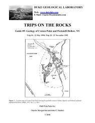
DUKE GEOLOGICAL LABORATORY<br />
Web: www.dukelabs.com<br />
E-Mail: CharlesM@dukelabs.com<br />
<strong>TRIPS</strong> <strong>ON</strong> <strong>THE</strong> <strong>ROCKS</strong><br />
Guide 22: New Haven-East Haven-Branford Area, Connecticut<br />
Trip 38A: 27 April 1996<br />
Figure 1. Geological map of New Haven, CT. (Rodgers, 1985.)<br />
Field Trip Notes by:<br />
Charles Merguerian and John E. Sanders<br />
© 2010
C<strong>ON</strong>TENTS<br />
C<strong>ON</strong>TENTS..................................................................................................................................... i<br />
INTRODUCTI<strong>ON</strong> .......................................................................................................................... 1<br />
GEOLOGIC BACKGROUND....................................................................................................... 4<br />
PHYSIOGRAPHIC RELATI<strong>ON</strong>SHIPS..................................................................................... 4<br />
GENERALIZED FEATURES OF BEDROCK IN TERRANES TO BE VISITED ................. 4<br />
REGI<strong>ON</strong>AL GLACIAL FEATURES ........................................................................................ 8<br />
GEOLOGIC SUMMARY OF NEW HAVEN AREA ................................................................... 8<br />
PHYSIOGRAPHIC FEATURES OF NEW HAVEN AND VICINITY.................................... 9<br />
STRATIGRAPHY OF NEWARK SUPERGROUP .................................................................... 12<br />
NAME and GEOLOGIC AGE ................................................................................................. 12<br />
New Haven Arkose............................................................................................................... 13<br />
Talcott Formation.................................................................................................................. 14<br />
Basal Brecciated Flow Member........................................................................................ 16<br />
Lower Sandstone Member ................................................................................................ 16<br />
Lower Massive Flow Member.......................................................................................... 16<br />
Middle Sandstone Member............................................................................................... 16<br />
Brecciated and Pillowed Flow Member............................................................................ 16<br />
Upper Sedimentary Member............................................................................................. 17<br />
Upper Breccia Member..................................................................................................... 17<br />
Shuttle Meadow Formation................................................................................................... 18<br />
Holyoke Formation ............................................................................................................... 18<br />
East Berlin Formation........................................................................................................... 20<br />
Hampden Formation ............................................................................................................. 21<br />
Portland Formation ............................................................................................................... 23<br />
PALEOGEOGRAPHIC RELATI<strong>ON</strong>SHIPS............................................................................ 25<br />
Hydrologic Situation in Nonmarine Basins .......................................................................... 25<br />
Permanent Through-flowing Rivers ................................................................................. 26<br />
Basinward Ground-water Flow in Shallow Aquifers........................................................ 27<br />
Alternating Wet- and Dry Seasons ................................................................................... 28<br />
Change of Climate ............................................................................................................ 28<br />
Some Relationships Between Water and Sediment.............................................................. 29<br />
Debris Flows and Debris-flow Deposits........................................................................... 29<br />
Meandering Streams and Point-bar Successions .............................................................. 29<br />
Primary Sedimentary Structures ........................................................................................... 32<br />
ASSOCIATED MAFIC PLUT<strong>ON</strong>S......................................................................................... 34<br />
GEOLOGIC STRUCTURE...................................................................................................... 34<br />
Folds...................................................................................................................................... 34<br />
Faults..................................................................................................................................... 35<br />
Relationship to Folds and Faults........................................................................................... 35<br />
QUATERNARY DEPOSITS ................................................................................................... 36<br />
Pleistocene Deposits ............................................................................................................. 36<br />
Holocene Sediments.............................................................................................................. 38<br />
DRAINAGE HISTORY ........................................................................................................... 39<br />
Drainage During Filling of Hartford Basin........................................................................... 39<br />
i
Post-Basin, pre-Glacial Drainage.......................................................................................... 40<br />
The "Sound River"................................................................................................................ 40<br />
Pleistocene Drainage Changes.............................................................................................. 40<br />
Relationships of Modern Rivers to Hartford Basin-Filling Strata........................................ 43<br />
The Connecticut River .......................................................................................................... 43<br />
FLAPPING OF ARMS (AND GUMS) .................................................................................... 43<br />
EXTENSI<strong>ON</strong>AL TECT<strong>ON</strong>ICS; RIFT BASINS...................................................................... 43<br />
Does The Rift-Basin Concept Fit the Hartford Basin? ......................................................... 47<br />
How About a Crestal-collapse-graben Basin? ...................................................................... 49<br />
OBJECTIVES............................................................................................................................... 49<br />
LIST OF LOCALITIES TO BE VISITED................................................................................... 50<br />
DRIVING DIRECTI<strong>ON</strong>S............................................................................................................. 51<br />
DESCRIPTI<strong>ON</strong>S OF INDIVIDUAL LOCALITIES ("STOPS") ................................................ 53<br />
ACKNOWLEDGEMENTS.......................................................................................................... 64<br />
TABLES ....................................................................................................................................... 65<br />
REFERENCES CITED................................................................................................................. 69<br />
ii
DUKE GEOLOGICAL LABORATORY<br />
<strong>TRIPS</strong> <strong>ON</strong> <strong>THE</strong> <strong>ROCKS</strong><br />
Guide 22: New Haven-East Haven-Branford Area, Connecticut<br />
Trip 38A: 27 April 1996<br />
Logistics:<br />
Departure from NYAS: 0830<br />
Return to NYAS: 1800<br />
Bring lunch, including drinking water or other beverages.<br />
INTRODUCTI<strong>ON</strong><br />
Today's trip to the New Haven area will provide an opportunity to study the geologic<br />
relationships at the south end of the Hartford Basin (Figure 1, on cover) for comparison with the<br />
situation at the NE end of the Newark Basin. We will start by examining the basal contact of the<br />
Newark Supergroup, something that is not possible to do in the Newark Basin. Other topics<br />
include the sedimentological characteristics of the thick basal formation, the New Haven Arkose<br />
(Figure 2), the contact-metamorphic effects on the New Haven Arkose of a dike, and the<br />
geologic relationships in the Gaillard graben, a fault block adjacent to the basin-marginal fault<br />
that was active during deposition, at least during the time when the two sedimentary formations<br />
between the three extrusive complexes accumulated. These sedimentary formations are the<br />
Shuttle Meadow Formation (between the basal Talcott extrusive complex and the median<br />
Holyoke complex, which is the thickest of the three) and the East Berlin Formation (between the<br />
Holyoke and the upper complex, the Hampden). We shall spend most of our time in the East<br />
Haven-Branford area, where coarse sedimentary rocks near the basin-marginal fault are<br />
interbedded with the extrusive sheets. Our itinerary will take us to Stony Creek to look at the<br />
pink granite and to Lighthouse Point for other granitic rocks, both of which provided much<br />
feldspar into the Newark Supergroup sediments in southern Connecticut. We will also examine<br />
the relationships between faults and gaps in monoclinal ridges underlain by sheets of extrusive<br />
igneous rock.<br />
The area is one with which I am familiar from detailed mapping carried out more than 30<br />
years ago and that I have revisited a few times since then. It is also a region that became a cause<br />
celebre between members of the geology faculty at Harvard and at Yale. At issue was the origin<br />
of the igneous rocks ("trap rocks") underlying the topographically prominent ridges, which had<br />
been so meticulously mapped by James Gates Percival (1842). Percival offered no interpretation<br />
of these sheets. Later, however, their origins became an important subject. Were these sheets<br />
intrusive? or extrusive?<br />
The famous Yale Professor James Dwight Dana (1813-1895) examined the trap-rock<br />
bodies within walking distance of his house in central New Haven and pronounced them all to be<br />
of intrusive origin (Dana, 1871; 1883a; 1891a, b). He was correct. However, Dana extrapolated<br />
1
from these correct observations within the city limits of New Haven to all the ridges within the<br />
Central Lowlands province of Connecticut and concluded they, too, were all of intrusive origin.<br />
Figure 02. Restored stratigraphic diagram through Hartford basin-filling strata in southern<br />
Connecticut drawn on the supposition that all strata were initially horizontal and that present-day<br />
dip, which has been removed, is of postdepositional tectonic origin. (J. E. Sanders, 1960, fig. 2,<br />
p. 123.)<br />
William Morris Davis (1850-1934), at that time a young instructor at Harvard, studied the<br />
relationships in central Connecticut, where he and his Harvard students proved that all the<br />
topographic ridges composed of "trap rock" are former lava flows, thus extrusives. After all is<br />
said and done, as the saying goes, more gets said than done. The upshot of this dispute is that<br />
Dana was correct with respect to what he had actually seen in New Haven and wrong with<br />
respect to his extrapolations outside of New Haven.<br />
One of the side effects of Yale's embarrassment over the outcome of the Dana-Davis<br />
controversy was that the Yale faculty sees to it that every geology student is well versed in how<br />
to distiniguish a sill from an ancient lava flow (Figure 3). The barn door got locked after the<br />
horse had been stolen.<br />
Apart from the question of who was right and who was wrong, tremendous implications<br />
were attached to the Davis extrusive interpretation. As Davis emphasized, extrusives are<br />
stratigraphic units that can be mapped just as if they were distinctive limestones, for example.<br />
Moreover, because the extrusion of a given lava flow can be considered as a geologically<br />
instantaneous process, the extrusive sheets serve as time markers. Not only that, but the lava<br />
spread across whatever kinds of sediments were on the ground at the time. For example, coarse<br />
gravels accumulated close to the basin-marginal fault, whereas mudstones were deposited in<br />
localities well away from this fault (Figure 4).<br />
2
Figure 03. Geologic features for distinguishing a sill (intrusive sheet) from an ancient lava flow<br />
(extrusive sheet). (C. R. Longwell, R. F. Flint, and J. E. Sanders, 1969, fig. 20-6 and table 20-1,<br />
p. 494.)<br />
Figure 04. Schematic sketch of a sheet of extrusive igneous rock (vertical line pattern) from a<br />
former lava flow overlying gravel, sand, mud near margin of Hartford Basin. Notice how rudites<br />
adjacent to the basin-marginal fault give way to sands and then to silts/muds farther away from<br />
this fault. (After J. E. Sanders, 1968a, fig. 7A, p. 298.)<br />
3
To assist you with the following discussion, consult Table 1 (a time chart showing geologic<br />
time subdivisions mentioned on the bedrock maps herein, with estimates of numbers of years for<br />
their boundaries and a list of some important local geologic events). I present a section on<br />
geologic background, a description of the geologic features of the New Haven area, and a<br />
discussion of how the geologic relationships established in the New Haven area bear on some<br />
currently cherished geologic dogma.<br />
GEOLOGIC BACKGROUND<br />
Under this heading, I include the generalized physiographic relationships, discuss the general<br />
features of the bedrock composing the terranes we shall visit, and conclude with a brief mention<br />
of the glacial deposits.<br />
PHYSIOGRAPHIC RELATI<strong>ON</strong>SHIPS<br />
In today's trip, we will visit all three of the major physiographic provinces of<br />
Connecticut: (1) the Western Uplands, (2) the Central Lowlands, and (3) the Eastern Uplands<br />
(Figure 5). In general, the morphology matches the names of these provinces. That is, in the<br />
Uplands, the land levels attain altitudes of several hundred feet and low areas are mostly<br />
confined to modern river valleys. Within the generally low territory (underlain by sedimentary<br />
rocks) of the Central Lowlands, however, conspicuous linear ridges (underlain by igneous rocks)<br />
project as high or even higher as some parts of the Eastern- and Western Uplands. As we shall<br />
see, a close relationship exists between the physiographic aspect and the kinds of rocks.<br />
GENERALIZED FEATURES OF BEDROCK IN TERRANES TO BE VISITED<br />
In the following discussion, I emphasize the geology of our trip route only. I do not<br />
discuss details of the geology of the Eastern Uplands except in the context of correlation with the<br />
Western Uplands and as a parent area from which many of the sediments forming the filling of<br />
the Hartford Basin, which underlie the Central Lowlands, were derived.<br />
As shown in Figure 5, each of the above-mentioned physiographic provinces is underlain<br />
by rocks that have been assigned to geologic terranes. For the most part, the Western Uplands<br />
are underlain by metamorphic- and igneous rocks, mostly of Paleozoic ages, that are designated<br />
by the number 3, which is labelled as the "Iapetos (Oceanic) Terrane." Without doubt, these<br />
rocks merit the designation "oceanic", but I question the wisdom of continuing to apply the<br />
"Iapetos" to these rocks. The term "Iapetos" (the father of Atlantis) is an outgrowth of the platetectonic<br />
concept that the Atlantic Ocean closed and then open up again. Users of this term<br />
presume that the rocks are now forming the eastern margin of North America have always<br />
formed the eastern margin of North America. However, early in the Paleozoic Era, North<br />
America straddled the Earth's Equator, and what is now the eastern margin was then the southern<br />
margin (Figure 6). If any paleo-ocean needs to be mentioned, then perhaps "Paleo-Tethys" is<br />
more appropriate.<br />
4
Figure 05. Index maps of physiographic provinces and geologic terranes in Connecticut and<br />
vicinity. (John Rodgers, 1985).<br />
We will drive across the metamorphic rocks underlying the Western Upland and examine<br />
only its eastern part that forms the floor of the Hartford basin. Only two exceptions are known to<br />
the general statement that the Western Uplands are underlain by oceanic rocks, metamorphic and<br />
igneous. In these two exceptional areas, (1) the Pomperaug Valley, and (2) Cherry Brook valley,<br />
Canton Center, nonmarine sedimentary rocks are present (Platt, 1957). The sedimentary strata<br />
(and igneous rocks in the Pomperaug Valley) of these two areas are thought to have been<br />
continuous formerly with those of the Hartford Basin.<br />
5
Figure 06. Block diagram of New Haven area viewed obliquely downward from above with<br />
three vertical panels cut away to show the geologic structural relationships. Ridge-making sheets<br />
of extrusive igneous rocks shown in black (at R, in East Haven-Branford area); ridge-making<br />
intrusives shown by "ropy" line pattern (the two "rocks" in New Haven, West Rock, at L, and<br />
East Rock, in center). (R. F. Flint, 1930, fig. 35, p. 178-179.)<br />
At the point where we shall study them, the rocks of the Western Uplands consist of<br />
greenschists and altered volcanic rocks (Fritts, 1962, 1963a, 1965b; Burger, 1967). These rocks<br />
formed the floor of the Newark Basin which subsided and was buried by thousands of meters of<br />
nonmarine sedimentary strata and interbedded sheets of extrusive igneous rocks (the Newark<br />
Supergroup)<br />
The rocks underlying the Central Lowlands are assigned to the "Newark (Rift Valley)<br />
Terrane in Figure 5. As I hope to convince you today, significant doubt can be raised about the<br />
continued used of "rift" with respect to the strata of the Newark Supergroup. Rift or no, these<br />
strata filled the subsiding Hartford basin. The tilted- and eroded edges of these strata now<br />
underlie the Central Lowlands. In this guidebook, I hope I succeed in keeping before the reader<br />
the difference between the Hartford basin, which was a tectonic basin that actively subsided<br />
during the Triassic- and Jurassic Periods, and the modern lowland (Central Lowlands of<br />
Connecticut), a low topographic region because the tilted- and eroded edges of the Hartford<br />
basin-filling strata are less resistant that the rocks of the neighboring uplands. From what many<br />
geologists have written, the reader comes away with the impression that the modern lowlands are<br />
synonymous with the early Mesozoic tectonic feature.<br />
6
The eastern margin of the Hartford basin was formed by a large fault, comparable to the<br />
Ramapo fault of NW New Jersey, but so far in Connecticut, never given a formal geographic<br />
name. "The Great Triassic Fault" (W. L. Russell, 1922 ms.; 1922) or simply "Great Fault" are<br />
the terms usually applied. I shall use basin-marginal fault.<br />
The rocks of the Eastern Uplands (Nos. 3 and 4 on the "terrane list" of Figure 5) are<br />
assigned to both the oceanic- and continental categories. The continental rocks are termed<br />
Avalonian. Notice that they are not labeled "proto-North American." We shall examine some of<br />
the Avalonian rocks, notably the Stony Creek Granite and associated feldspathic quartzites<br />
(Plainfield Formation) and granitic gneisses, and the Lighthouse Granite-gneiss.<br />
Late in the Triassic- and early in the Jurassic Periods, the basin-marginal fault started its<br />
long career. Along it, rocks underlying the Eastern Uplands were elevated and eroded to provide<br />
sediment that was transported westward into the subsiding Hartford basin. The strata that filled<br />
this basin are assigned to the Newark Supergroup, of Late Triassic-Early Jurassic ages (Cornet<br />
and Traverse, 1975; Olsen, 1978, 1984 ms.; Olsen, McCune, and Thomson, 1982; Froelich and<br />
Olsen, 1985). Interstratified with the nonmarine sedimentary strata are the products of three<br />
episodes of mafic volcanism (Barrell, 1915; Longwell, 1933, 1937)<br />
In general, a close relationship exists between clasts in the basin-margin sediments and<br />
parent areas in the bedrock of the Eastern Uplands. This situation forms the basis for the<br />
conclusion that no major strike-slip motion has taken place along the basin-marginal fault. One<br />
point of some interest is the presence in the basin-marginal coarse sediments of greenschist<br />
pebbles resembling the rocks of the basin floor that we shall see at Stop 1. Presumably such<br />
rocks formerly extended eastward far enough to have been part of the elevated block. Now,<br />
however, all that is left is the pebbles.<br />
During at least part of the sediment-accumulation stage, along the SE side of the<br />
subsiding Hartford Basin, the Gaillard graben (Sanders, Guidotti, and Wilde, 1963) formed. In<br />
this graben the thicknesses of the Shuttle Meadow and East Berlin formations are up to 3 times<br />
greater than in areas outside this graben. Possibly similar thickness relationships prevailed<br />
during deposition of the New Haven Arkose and the Portland Formation, but comparisons of<br />
thicknesses of these units between southern Connecticut and central Connecticut are no longer<br />
possible. The thickness of the New Haven Arkose cannot be demonstrated in either southern<br />
Connecticut (where the outcrop belt is very wide) or in central Connecticut (where the outcrop is<br />
narrow but bounded on the W by a fault of not-known displacement). Only small remnants of<br />
the Portland Formation a few hundred meters thick are preserved in narrow outcrop belts in<br />
southern Connecticut compared with several kilometers or more in a very wide outcrop belt in<br />
central Connecticut.<br />
The Hartford basin-filling strata dip regionally toward the east (compare with regional<br />
westward dip in the Newark basin). Because all the strata were initially deposited in horizontal<br />
positions, their modern-day dips must be ascribed to the effects of post-Early Jurassic, pre-Late<br />
Cretaceous tectonic uplift, with the axis of this feature located to the west of South Britain,<br />
Connecticut, where east-dipping Newark-age strata are exposed in the valley of the Pomperaug<br />
River.<br />
7
REGI<strong>ON</strong>AL GLACIAL FEATURES<br />
The glacial deposits of Connecticut include the work of at least two ice sheets that flowed<br />
from contrasting directions: (i) from the NNE to the SSW, and (ii) from the NW to the SE, the<br />
same two directions previously discussed by Sanders and Merguerian in the New York City<br />
region (Sanders, 1974a; Sanders and Merguerian, 1991a, b; 1992; Merguerian and Sanders,<br />
1992b, 1993a, b; 1994d). These two directions were noticed under the heading of "Diluvial<br />
Scratches" by the great genius of Connecticut geology, J. G. Percival (1842). Two tills having<br />
these contrasting directions of flow have been described from central Connecticut: the older,<br />
Lake Chamberlain Till with flow from NW to SE; and the younger, Hamden till, with flow from<br />
NNE to SSW (Flint, 1961). In addition, evidence for significant end moraines has been<br />
described along the Long Island Sound coast of Connecticut (Flint and Gebert, 1974 and 1976).<br />
I think these end moraines are the terminal moraines for the glacier that deposited the Hamden<br />
till, which I assign to the Woodfordian, the latest glacial advance in the Wisconsinan Stage.<br />
Drumlins having long axes oriented NW-SE are abundant as are drumlins having long<br />
axes oriented NNE-SSW. The coexistence of such drumlins inferred to have been the work of<br />
two different ice sheets is hard for some glacial geologists to accept. They argue that the<br />
younger glacier should have wiped out all traces of any older glacier, especially one having a<br />
contrasting flow direction (Flint, 1943, 1951). JES has no simple explanation for how this can<br />
have happened; he merely cites the topographic maps as proof that it did happen.<br />
The main interest in the glacial geology of Connecticut has centered around the<br />
aboundant evidence left behind when the last glacier melted. Connecticut's deglacial history<br />
contrasts decidedly with that of the midwestern United States, which had been studied first and<br />
therefore had been taken as a standard for reference. In the midwestern states, the outer margin<br />
of the last glacier retreated northward while the ice mass remained a glacier. That is, it was<br />
continuing to flow outward from its center(s) of accumulation, but this rate of outflow was<br />
exceeded by the rate of melting of the margin. Accordingly, the retreating glacier left behind a<br />
great series of end moraines (also known as recessional moraines). Each of these was heaped up<br />
as the ice halted, or even advanced slightly during the general retreat. In Connecticut, however,<br />
Flint (1930) demonstrated that the hallmark of the disappearance of the last ice was extensive<br />
deposits from meltwater, many of which formed in contact with blocks of stagnant ice. The<br />
interpretation is that the former glacier underwent a general meltdown and became so thin that its<br />
gravity-driven outflow ceased. No series of recessional moraines resulted. Instead, lake deposits<br />
are numerous and outwash sand and -gravel blanket the countryside.<br />
GEOLOGIC SUMMARY OF NEW HAVEN AREA<br />
In this section, I discuss the physiographic features of New Haven and vicinity, the<br />
stratigraphy of the Newark Supergroup, paleogeographic relationships (including primary<br />
sedimentary structures), the geologic structure, the glacial features, and the drainage history.<br />
8
PHYSIOGRAPHIC FEATURES OF NEW HAVEN AND VICINITY<br />
New Haven (Figure 6) lies at the south end of the Hartford Basin, which coincides with<br />
the Central Lowlands province of Connecticut. Much of New Haven is underlain by a thick<br />
body of outwash sediments that was deposited as the Woodfordian glacier melted away. Today,<br />
the main drainage routes into New Haven Harbor are the Quinnipiac River on the E, and the Mill<br />
River and West River to the W (Figure 7). Farther E, is the Farm River, which now drains<br />
directly into Long Island Sound, but during the Pleistocene, emptied into New Haven Harbor at<br />
Morris Cove.<br />
Figure 07. Map of modern rivers and Pleistocene outwash valley trains (composed of sand and<br />
silt) in New Haven area and their locations with respect to the proglacial lake in the southern<br />
Quinnipiac Valley. (J. E. Sanders, 1989 ms., based on mapping by R. F. Flint.<br />
Two prominent "rocks," West Rock and East Rock, are underlain by concordant plutons<br />
composed of sheets of mafic igneous rock. West Rock is analogous to the Palisades. Mill Rock<br />
and Pine Rock, which extend between West Rock and East Rock, are discordant sheets (dikes) of<br />
mafic igneous rock of which no analogues are known in the Newark basin.<br />
9
Under the water of New Haven harbor, I infer that the rocks of the Eastern Uplands are in<br />
fault contact those of the Western Uplands. A buried valley having a V-shaped transverse profile<br />
and talweg more than 950 feet below modern sea level extends WSW from New Haven harbor<br />
following the trend of this fault (Figures 8 and 9).<br />
Figure 08. Buried valley, New Haven harbor, CT. (J. E. Sanders, 1981, fig. 19.12 (a) and (b), p.<br />
486.)<br />
A. Location map. Line AA' locates continuous seismic-reflection profile of Figure 08B.<br />
B. Continuous-seismic-reflection profile along line AA' parallel to shore off West Haven, CT,<br />
showing V-shaped valley, eroded in metamorphic bedrock, with talweg extending to about -300<br />
m (modern SL reference).<br />
10
Figure 09. Photographs of styrofoam model of New Haven harbor and vicinity showing contrast<br />
between modern relief and buried valleys. (Model built by Topofoam, Inc., New York City,<br />
supported by U. S. Office of Naval Research at Hudson Laboratories of Columbia <strong>University</strong>,<br />
Dobbs Ferry, New York.)<br />
A. View showing relief of the land (based on contours from U. S. Geological Survey), with each<br />
step representing 50 feet, and the first 50 feet taken up at the shoreline.<br />
B. View with modern water depths shown by 10-foot isobaths (datum, mean sea level).<br />
C. View showing shape of bedrock walls of buried valleys; each step equals 100 feet. The valley<br />
was arbitrarily ended in inner New Haven harbor where thick Holocene silt absorbed sound<br />
signals so that no reflections were returned from the top of the bedrock. (J. E. Sanders, 1981, fig.<br />
19.13c, p. 487.)<br />
11
Lying east of the Farm River Valley is a narrow belt of territory displaying a valley-andridge-type<br />
aspect. The ridges are underlain by tilted sheets of extrusive igneous rock and the<br />
valleys, by sedimentary strata. The most prominent of these ridges is Saltonstall Ridge. In the<br />
adjacent valley on the E side of Saltstonstall Ridge is a lowland mostly occupied by Lake<br />
Saltonstall, a water-supply reservoir.<br />
NAME and GEOLOGIC AGE<br />
STRATIGRAPHY OF NEWARK SUPERGROUP<br />
The name Newark, from Newark, New Jersey, is a venerable one in American<br />
stratigraphy; it was proposed by W. C. Redfield in 1856. Today, the term Newark has been<br />
accorded the status of a Supergroup (Cornet, 1977 ms.; Olsen, 1980c, Froelich and Olsen, 1985;<br />
Luttrell, 1989).<br />
The age range assigned to the strata composing the Newark Supergroup has oscillated<br />
back and forth like a geological pendulum. During the 19th century, based on studies of fossil<br />
fish, Redfield (1851, 1856, 1857) assigned them to the Jurassic. By contrast, dinosaur remains<br />
and -footprints suggested Late Triassic. Given this situation, some geologists classified these<br />
strata as Jura-Trias (for instance, Darton, 1902 in the New York City Folio 83 of the U. S.<br />
Geological Survey). Many geologists, however, took the Newark strata to be synonymous with<br />
Triassic (Cook, 1968, 1879, 1882, 1887, 1888, 1889).<br />
But compulsive geologists who were inclined toward tidiness in classification were<br />
uncomfortable with the notion that a well-behaved formation should span the boundary between<br />
two geologic periods. Accordingly, when Pirsson and Schuchert (in their Textbook of Geology<br />
published in 1915) proposed the name "Palisades Disturbance" for the episode of crustal unrest<br />
which they supposed marked the end of the Triassic Period, they decided that, by definition, all<br />
the Newark strata had to be of Late Triassic age (i. e., they had been affected by the periodending<br />
"Palisades Disturbance"). Thus, they started a line of thought that lasted for 60 years. In<br />
addition, they also started a tradition that might be expressed by the title of a modern book: "We<br />
learned it all in kindergarten." In this analogy, "we" is all geologists trained in the United States,<br />
"kindergarten" is the first-year college course in geology, and "learned it all" refers to knowledge<br />
about the Newark strata. Based on the Pirsson-Schuchert scheme of things, Widmer (1964, p.<br />
85) wrote: "There are no known Jurassic sediments in eastern North America."<br />
Modern students (Cornet and Traverse, 1975; McDonald, 1975 ms., 1982, 1992; Cornet,<br />
1977 ms.; Olsen, 1978, 1980a, 1980b, 1984 ms.; Olsen, McCune, and Thomson, 1982; Olsen and<br />
McCune, 1991; Fowell and Olsen, 1993) have re-established what the real old-timers knew all<br />
along: the age range of the Newark strata is Late Triassic through Early Jurassic. (For a general<br />
summary of the geologic literature on the Newark Group up to 1984, see Margolis, Robinson,<br />
and Schafer, 1986.)<br />
12
The names of the formations of the Newark Supergroup (with thicknesses in the<br />
Watchung syncline) are (Olsen, 1980b):<br />
Formation Name Thickness (m)<br />
Boonton (sedimentary strata; top eroded) 500+<br />
Hook Mountain Basalt (two flow units) 110<br />
Towaco Formation (sedimentary strata) 340<br />
Preakness Basalt (2, poss. 3 flow units) 300<br />
Feltville Formation (sedimentary strata) 170<br />
Orange Mountain Basalt (at least 2 flow<br />
units, one of them pillowed) 150<br />
Passaic Formation 6,000<br />
Lockatong Formation 150<br />
Stockton Formation 350<br />
Total (Watchung syncline) 8,070+<br />
Where the three well-known sheets of extrusive basalt (Percival's "Anterior," "Main," and<br />
"Posterior" trap sheets, later named Talcott, Holyoke, and Hampden, respectively) are present,<br />
the Newark sedimentary strata are easy to subdivide. But where one is faced with an isolated<br />
exposure of a non-fossiliferous Newark-type reddish-brown sandstone, -siltstone, or -shale, or<br />
even a coarse conglomerate with reddish-brown sandstone matrix, the problem of assigning the<br />
correct formation verges on hopeless. Ultimately, some mineralogic- or lithologic criteria may<br />
prove to be helpful for stratigraphic assignment.<br />
New Haven Arkose<br />
The New Haven Arkose was named by Krynine (1941, p. 1919; 1950, p. 30, and table 1)<br />
for that part of Percival's (1842) Western Sandstone which underlies the lowest extrusive sheet.<br />
On the basis of abundant schist pebbles in the lower part and their relative absence in the<br />
upper part, Krynine (1950, table 2, and p. 43-49) recognized lower- and upper members of the<br />
New Haven Arkose. In the Mt. Carmel quadrangle, Fritts (1963a) mapped a similar subdivision.<br />
No type section was ever designated for the New Haven Arkose; indeed, no continuous<br />
section suitable for this purpose has yet been found. Scattered exposures in the Quinnipiac<br />
lowland near New Haven, however, reveal the general characteristics of this formation. Its<br />
thickness has never been satisfactorily determined.<br />
One of the most-prominent and -continuous exposures is located in the north-central part<br />
of the Branford quadrangle, in SW North Haven just NW of the extreme northern end of East<br />
Haven, along the NE face of the elongate hill that lies N of Half Mile Road, west of Clintonville<br />
Road, and southeast of Middletown Avenue (Connecticut Route 17), approximately 2 mi. NE of<br />
Rabbit Rock (19.12N, 57.78E to 19.44N, 57.80E). Another excellent section is exposed in the<br />
13
deep cuts along the abandoned trolley line where the road bridge crosses over the old trolley<br />
right-of-way, at the SE end of Old Russo Avenue, Foxon (17.52N, 57.06E). A small sill is<br />
present at the W end of the S face, but otherwise, the cut exposes New Haven pebbly arkose for<br />
nearly 200 ft horizontally. Other exposures are abundant in the bluffs E of Quinnipiac Avenue in<br />
the extreme NE part of New Haven (17.80N, 56.600E to 18.50N, 56.96E). The cuts along Route<br />
80 (Foxon Road) opposite the entrance to the abandoned Foxon Trap Rock Company quarry<br />
0.15 mi. W of the New Haven-East Haven town line (17.74N, 56.68E) display typical varieties<br />
of New Haven Arkose, including the contact-metamorphosed sandstones.<br />
The New Haven Arkose consists of complexly interbedded units of thick-bedded, coarsetextured,<br />
conglomeratic sandstones, commonly devoid of internal structure but locally vaguely<br />
laminated or cross stratified, together with structureless maroon pebbly- to sandy siltstones that<br />
are extremely poorly sorted. Both kinds contain the same varieties of coarse constituents:<br />
pebbles and boulders of Plainfield Quartzite, pegmatitic pink feldspar, granites and granitic<br />
gneisses, muscovite, and locally, two-mica schists, green schists, and phyllites. As mentioned,<br />
Krynine's proposed twofold subdivision of the New Haven Arkose was based on abundant schist<br />
pebbles in the lower unit, and less-abundant schist pebbles in the upper unit. Krynine supposed<br />
that the Stony Creek Granite is a stock and that its gradual unroofing caused this change in<br />
composition of the New Haven Arkose. According to Krynine's concept, as the stock became<br />
unroofed, plutonic material would gradually supplant the metamorphic material in the<br />
sedimentary debris supplied to the Hartford basin. In his work on the adjoining Mount Carmel<br />
quadrangle, Fritts (1963) accepted Krynine's subdivision. I have observed abundant schist<br />
pebbles in units overlying the New Haven Arkose. Accordingly, I doubt the validity of the<br />
concept that the abundance of schist pebbles declined with time and thus reject Krynine's<br />
proposed subdivision of the New Haven Arkose.<br />
Talcott Formation<br />
The Talcott Formation was named by B. K. Emerson (1898a, p. 6) from the town of<br />
Talcott, Connecticut, which is located in the northwestern part of the outcrop belt of the Newark<br />
Supergroup. The Talcott Formation includes Percival's (1842) Anterior Trap Sheet and the lower<br />
extrusive sheet ("lava flow") of most other authors.<br />
I have been able to recognize a sevenfold subdivision of what had been regarded<br />
previously as one unit designated as basalt.<br />
The Talcott Formation crops out in six discontinuous belts. Of these, belts 1 to 3 lie west<br />
of the more-prominent ridges underlain by the Holyoke Formation. Belts 4 to 6 lie along the<br />
basin-marginal fault in the Branford quadrangle, east of Saltonstall Ridge (underlain by the<br />
Holyoke Formation).<br />
Previous workers in the area have assigned the volcanic rocks in belts 5 and 6 to the<br />
"upper lava flow" (Hampden Formation of current usage). As is explained in following sections,<br />
my new stratigraphic information indicates that the rocks in these two belts clearly belong<br />
instead to the Talcott Formation.<br />
14
Previously published maps and reports (Percival, 1842; Hovey, 1889; Davis, 1898, map<br />
and also p. 98; Longwell, 1932, 1933; Krynine, 1950) show belt 2 of the Talcott Formation<br />
ending abruptly north of the Amtrak railway line in East Haven. In contrast, I have confirmed<br />
the unpublished observations of George Beck (1907-1909 ms.) that this belt of the Talcott<br />
Formation extends south to the basin-marginal fault west of Beacon Hill.<br />
I ascribe the absence of the Talcott Formation between belts 1 and 2 to a fault, which I<br />
infer has dropped the overlying Shuttle Meadow Formation against the underlying New Haven<br />
Arkose.<br />
The basalt members of the Talcott Formation tend to form ridges, whereas the<br />
intervening sandstone units tend to form strike valleys. As a result of complex faulting, this<br />
valley-and-ridge aspect of the Talcott Formation is not commonly seen. A particularly fine<br />
example of it, however, is located in Foxon (northern East Haven), just north of Route 80, from<br />
Deer Run School eastward for nearly 0.5 mi.<br />
According to my interpretation, the Pleistocene deposits in the Farm River valley in the<br />
Branford quadrangle obscure the upper two thirds of the Talcott Formation and this part of the<br />
unit does not crop out south of Foxon.<br />
Excellent exposures of parts of the Talcott Formation are in the cuts on the Connecticut<br />
Turnpike: in East Haven west of Saltonstall Ridge; and in Branford near the Todds Hill Road<br />
overpass, just west of Interchange 54, Branford quadrangle. Other fresh exposures are in the<br />
Branford quadrangle: in cuts on Route 80, Foxon; in the abandoned Dixwell quarry (on<br />
Thompson Street near the corner of Thomaston Street, in northern East Haven); and along<br />
Clintonville Road and Idlewood Drive, a street that extends eastward from Village Street north<br />
of its junction with Totoket Road, North Branford. In addition, natural exposures, too numerous<br />
to list individually, are present in the area that extends from Foxon northeastwrd to a point<br />
northeast of Northford (Wallingford quadrangle). The best place to observe the sequence of the<br />
lower five members is in the parallel ridges and intervening strike valleys that trend east west<br />
and are north of Route 80 between Foxon Pond and Deer Run School and eastward for<br />
approximately half a mile (Branford quadrangle).<br />
From base upward, I designate the four basaltic members and three intervening<br />
sedimentary members informally as: basal brecciated flow, lower sandstone, lower massive<br />
flow, middle sandstone, brecciated-and-pillowed flow, upper sedimentary, and upper breccia<br />
members.<br />
The thickness of the Talcott Formation in the Branford quadrangle is 1,000 ft. This<br />
figure is four to five times greater than thickness figures previously reported for the Talcott. The<br />
increase is based on my recognition of members not heretofore identified. Davis (1898, p. 62-<br />
63) observed what I consider to be the upper three members. Although his sequence was:<br />
compact basalt, sandstone, and "ash bed with blocks of lava and crystalline rocks," he mapped<br />
them all as a single unit, although locally, he did map the "ash bed" separately. Percival (1842,<br />
p. 326-327) remarked on the double-ridge characteristics of the Anterior Trap Sheet in the Foxon<br />
area.<br />
15
Basal Brecciated Flow Member<br />
The basal brecciated flow member is 150 feet thick. The basalt of this member generally<br />
is massive, but may be amygdaloidal and locally contains flow breccia. In this member, I have<br />
found fracture- and cavity fillings from that contain quartz, calcite, and other secondary minerals,<br />
but I have never seen pillows within it.<br />
Lower Sandstone Member<br />
The lower sandstone member rarely is well exposed. The sandstone from this member is<br />
identical to the coarser-textured varieties of the New Haven Arkose and in isolated exposures,<br />
cannot be distinguished from the New Haven. My thickness estimate of 40 ft. has been<br />
determined from drawing profile-sections from map data of positions of contacts.<br />
Lower Massive Flow Member<br />
The lower massive flow member is 100 ft. thick and as far as I have been able to<br />
determine, consists of massive basalt that lacks breccia. Locally, this member displays welldeveloped<br />
columnar joints. The lower massive flow member underlies the line of knolls east of<br />
Rabbit Rock.<br />
Middle Sandstone Member<br />
The middle sandstone member is at least 60 ft. thick. It is best exposed along the cuts of<br />
the abandoned trolley line W of Route 100 and NE of Maloney's Brook, East Haven (17.65N,<br />
57.25E; Branford quadrangle). The sandstone is generally coarse textured and contains abundant<br />
pebbles. This member is also present along the western slope of the low ridge (locally known as<br />
Mullins Hill) that lies west of Saltonstall Ridge. Specimens of the middle sandstone member<br />
collected from the old Dixwell quarry show abundant pebbles of pegmatite with pink feldspar,<br />
pieces of pink feldspar, granite with both pink- and white feldspar, quartzite, smoky quartz,<br />
green schist and/or -phyllite, mica schist, and hornblende gneiss.<br />
Brecciated and Pillowed Flow Member<br />
The brecciated-and-pillowed flow member actually consists of two flow units separated<br />
by a few inches of sedimentary material. Where exposed in the cuts on the Connecticut<br />
Turnpike W of Saltonstall Ridge, East Haven (16.42 N, 56.67 E, Branford quadrangle), the lower<br />
flow unit is 60 ft. thick, and the upper flow unit, at least 50 ft. thick--possibly more. Profilesections<br />
drawn from map data in the Foxon area suggest that the thickness of this member is 200<br />
ft., of which 140 ft. belong to the upper flow unit.<br />
The brecciated-and-pillowed flow member is more resistant morphologiically than are<br />
other members of the Talcott Formation. Accordingly, it is the unit that previous workers have<br />
regarded as the "lower lava flow." Apart from the flow breccia and pillows, this member is also<br />
displays distinctive cavities, some having shapes of crystals, that have been lined or filled with<br />
secondary minerals (LaGanza, 1960); and by a distinctive breccia named "ball-in-socket" breccia<br />
16
y W. L. Russell (1922 ms.). Russell thought that this breccia had resulted from tectonic activity<br />
along the basin-marginal fault, but the fact that the matrix of this breccia consists of fine-textured<br />
sedimentary material leads me to prefer the interpretation that the brecciation took place at time<br />
of extrusion.<br />
The exposure of the brecciated-and-pillowed flow member along the south side of the<br />
Connecticut Turnpke, just west of the Todds Hill overpass, shows basaltic lava-flow units and<br />
two layers of interbedded sedimentary rock. I infer that these two sedimentary layers do not<br />
indicate a normal stratigraphic succession but rather are the same, single sedimentary unit<br />
repeated by faulting along an irregular fault that extends along the face of the steep exposure<br />
parallel to the highway.<br />
Upper Sedimentary Member<br />
The upper sedimentary member consists of a lower coarse-textured sandstone and an<br />
upper finer-textured siltstone- and carbonate-rock unit. The thickness of the member is 250 ft.<br />
Given more-numerous exposures, it would have been possible to map these two units separately.<br />
The upper part of this member is well exposed in the cut along the north side of the Connecticut<br />
Turnpike just west of the Todds Hill Road overpass (Branford quadrangle). Here, it consists of<br />
fine-textured maroon shaly siltstone. I found the carbonate rocks in the exposure east of<br />
Barberry Road and just west of the East Haven-North Branford Town Line, in the extreme<br />
northern part of East Haven (Branford quadrangle). These same exposures display the full<br />
thickness of this member and reveal both the lower sandstone and the upper fine-textured strata.<br />
Upper Breccia Member<br />
Although previous workers have noticed the rocks that I assign to the upper breccia<br />
member, these workers did not realize the lateral persistence and stratigraphic importance of the<br />
distinctive breccias. For example, Percival (1842, p. 316, 341-344) referred to these rocks as the<br />
"trap conglomerate." Davis (1898, p. 62-63) called them "tuffaceous trap" or the "ash bed." W.<br />
L. Russell (1922 ms.) also referred to this member as the "ash bed," but, as mentioned, assigned<br />
the rocks exposed near the basin-marginal fault northwest of Branford to the uppermost lavaflow<br />
unit (now the Hampden Formation) and supposed that the brecciation had resulted from<br />
faulting. Longwell (1922) identified this member as volcanic agglomerate and inferred that<br />
liquid lava on its way to the surface had picked up foreign rock fragments. The thickness of the<br />
upper breccia member is 200 ft.<br />
The upper breccia member is well exposed in cuts on the north side of the Connecticut<br />
Turnpike just west of and underneath the bridge for the Todds Hill Road overpass (Branford<br />
quadrangle). The basal contact is well exposed striking N75°E and dipping 5 to 10° N. Small<br />
faults cut the rocks here, but nevertheless the stratigraphic relationships are clear. In the top few<br />
feet of siltstone below the basal contact, a few detached basalt blebs have been altered to light<br />
gray. In the basal layers of this member, rounded- and angular fragments of basalt are set in a<br />
matrix of maroon siltstone. A large sandstone "erratic" measuring 8 by 3 ft. on the exposed<br />
surface, is situated 10 to 15 ft. above the basal contact. A small fault striking N55°W and<br />
17
dipping 80°SW displaces this block of sandstone. Angular chunks of basalt are set in a matrix of<br />
particles of quartz and feldspar that also includes larger fragments of metamorphic rocks.<br />
Shuttle Meadow Formation<br />
The Shuttle Meadow Formation was named by Lehmann (1959, p. 7) for the beds that<br />
Krynine (1950, tables 1, 2, p. 31, 32) had designated as the Lower Sedimentary division of the<br />
Meriden formation. Percival (1842) considered these beds to be part of the Middle Shale in<br />
central- and northern parts of the Connecticut Valley area. Davis (1898) referred to these beds as<br />
the Anterior Shales.<br />
The type locality of the Shuttle Meadow Formation, which exposes only its lower strata,<br />
is located in the New Britain qudrangle along the south shore of the Shuttle Meadow reservoir<br />
between Meriden and New Britain (Simpson, 1966). Because of their topographic weakness and<br />
the cover of glacial deposits, exposures of this unit are few and scattered. In the Meriden<br />
quadrangle (Hanshaw, 1968) and in the Middletown quadrangle (Lehmann, 1959, p. 11), the<br />
thickness of the Shuttle Meadow Formation is 310 feet. But, in the Branford quadrangle, the<br />
thickness of this formation is 900 feet.<br />
As mentioned, the Shuttle Meadow Formation is rarely exposed. It is totally concealed<br />
beneath the Pleistocene sediments of the Farm River valley. The topmost strata are exposed<br />
locally along the western slopes of Totoket Mountain, Saltonstall Ridge, and Beacon Hill.<br />
Where it consists of fine-textured materials, the Shuttle Meadow Formation is<br />
topographically weak and forms strike valleys. By contrast, near the basin-marginal fault, where<br />
it consists of conglomerate, it forms strike ridges.<br />
Southward along the Farm River outcrop belt, as one approaches the basin-marginal fault,<br />
coarse conglomerates become interbedded with the fine-textured sandstones and -siltstones. A<br />
noteworthy feature of the clasts in these conglomerates is a gray, fine-textured limestone not<br />
observed at any other locality. The parent area from which these limestones were eroded is not<br />
known.<br />
Holyoke Formation<br />
The name Holyoke for a part of the Newark strata was proposed by B. K. Emerson<br />
(1898a) for a unit, which he designated as a basalt, that underlies the Holyoke Range in central<br />
Massachusetts, near the northern end of the Hartford basin outcrop belt. The Holyoke Range is<br />
topographically continuous with ridges in Connecticut that are underlain by a comparable sheet<br />
of mafic extrusive rock which Percival (1842) designated the Main Trap Sheet. W. M. Davis<br />
(1898) used the term Middle or Main flow for the Holyoke. The name Holyoke was extended<br />
into Connecticut by Rodgers, Gates, and Rosenfeld (1956, 1959).<br />
18
Because I have found that the proportion of basalt in the Holyoke is much less than that<br />
of coarser-textured rocks, such as dolerite and even gabbro, I propose to drop the designation<br />
basalt. Instead, I here propose to change the designation to formation.<br />
The Holyoke Formation underlies Totoket Mountain, Saltonstall Ridge, and Beacon Hill.<br />
The Holyoke is the most-resistant stratigraphic unit in the Branford and Wallingford<br />
quadrangles. Wherever it is exposed, it forms high, rocky ridges. At the NE end of Saltonstall<br />
Ridge, the outcrop belt narrows. This narrowing has been explained as a result of stratigraphic<br />
thinning brought about by the overlap and wedging of the flow against the W-dipping surface of<br />
an ancient fan near the basin-marginal fault (Longwell, 1937, p. 437). My mapping suggests that<br />
this change has resulted from postdepositional faulting.<br />
Fresh exposures of the Holyoke Formation in the Branford quadrangle include: (1) the<br />
cut along the N side of the Connecticut Turnpike W of Saltonstall Lake; (2) along the S side of<br />
the Amtrack Railroad tracks just S of the Turnpike; (3) in the New Haven Water Company<br />
tunnel at the N end of Saltonstall Lake (Longwell, 1922, 1932); (4) in the North Branford quarry<br />
of Tilcon, Inc.; and (5) in an abandoned quarry at the S end of Beacon Hill. Numerous other<br />
fresh exposures of the Holyoke Formation are present on the upper parts of the steep slopes<br />
underlain by this unit.<br />
The base of the Holyoke Formation is exposed in the several localities discussed for the<br />
Shuttle Meadow Formation. The top of the Holyoke Formation is visible on the S side of the<br />
railroad tracks west of Saltonstall Lake, in the S approach to the New Haven Water Company<br />
tunnel at the N end of Lake Saltonstall (Longwell, 1932, p. 132), and in hillside exposures on the<br />
SW slope of Saltonstall Ridge near its NE end, 0.4 mi W of Linsley Pond. These last-named<br />
hillside exposures were noted by Hovey (1889, p. 364, 371) and by Davis and Whittle (1889, p.<br />
110-111), but they did not mention any faults.<br />
The Holyoke Formation contains numerous varieties of mafic igneous rock that are well<br />
shown on Totoket Mountain.<br />
On the basis of the textures, I infer that at least two distinct flow units are present on<br />
Totoket Mountain. Aerial photographs of the ridge suggest that more than two flow units may<br />
be present, although I have not mapped them separately. In the Turnpike cuts west of Lake<br />
Saltonstall, I have not found any evidence that more than a single flow unit is present. Similarly,<br />
despite his search for individual flow units, Longwell (1922, 1932, 1933) mentioned that he<br />
found only a single flow unit in the New Haven Water Company tunnel.<br />
The Holoyke compares closely with the Preakness Formation (Second Watchung flow) of<br />
New Jersey. Cores through the Preakness Formation show a thickness of 310 m, with at least 5<br />
flow units, two of which are separated by 3 m of sedimentary strata. "The 145-m thick basalt<br />
below the sedimentary layer has (sic) coarsely crystalline gabbroic layers as much as 11 m thick.<br />
The upper basaltic unit also contains gabbroic layers, but they are less than 8 cm thick. The<br />
coarsely crystalline layers may represent pockets of slowly cooled lava, segregation veins, or<br />
intrusive layers" (Fedosh and Smoot, 1988, p. 22). This, and other, similarities form the basis for<br />
19
McHone's (1996a, b) conclusion that all the extrusives in the Newark-type basins were formerly<br />
continuous and formed a large plateau-basalt province.<br />
East Berlin Formation<br />
The East Berlin Formation was named by Lehmann (1959, p. 7 ) from the Town of East<br />
Berlin, Connecticut. The unit involved is the same one that Krynine (1950, tables 1 and 2, p. 31,<br />
32) had designated as the "Upper sedimentary division of the Meriden formation." The East<br />
Berlin Formation includes part of Percival's Middle Shale and is identical with the Posterior<br />
Shales of Davis (1898).<br />
The type locality of the formation is the roadcuts on Connecticut Route 72 just east of the<br />
Wilbur Cross Parkway, in the NW corner of the Middletown quadrangle. Lehmann's section<br />
here measured 325 feet thick, with base not exposed. Widening of the highway in 1961<br />
increased the length of this exposure. Large new cuts on Connecticut Route 72 relocation and<br />
enlargement to a 4-lane divided highway in 1988 provide splendid new exposures showing the<br />
decidedly cyclic aspect of the formation.<br />
The East Berlin Formation occupies the entire lowland enclosed by Totoket Mountain<br />
(including Lake Gaillard) and the curving lowland that lies parallel to and S and E of Saltonstall<br />
Ridge (including Lake Saltonstall). Where the formation consists of fine-textured strata (inferred<br />
ancient lake deposits), such as siltstones, very fine-textured sandstones, claystones, and shales, it<br />
is topographically weak and forms lowlands that typically are covered by fields of drumlins.<br />
Where the unit consists of conglomerates, however, as near the NE end of Saltonstall Ridge and<br />
the SW end of Totoket Mountain, however, it tends to form steep-sided ridges.<br />
The most-continuous exposures of the East Berlin Formation are present in the New<br />
Haven Water Company's Sugarloaf tunnel, which extends eastward from the N end of Lake<br />
Gaillard. I have not seen these exposures; they were described by Thorpe (1929). The basal<br />
beds of the East Berlin Formation are visible in scattered natural exposures near the N end of<br />
Lake Gaillard, along the E shore of this lake, in the lower reaches of Roses Brook that drains into<br />
the lake on the E side, in the hills NW of Connecticut Route 80 NE of North Branford center, in<br />
the valley of Pisgah Brook S of the E end of Saltonstall Ridge, at the S end of the New Haven<br />
Water Company's tunnel at the N end of Saltonstall Lake, and in the cut on the S side of the<br />
Amtrak Railroad tracks, 0.2 mi. E of Lake Saltonstall. Strata higher in the formation are exposed<br />
along the E shore of Lake Saltonstall about half way along the lake from its S end and along the<br />
S side of the Amtrak Railroad tracks just W of the Hosley Avenue overpass. The upper beds of<br />
the formation are exposed near the basin-marginal fault NW of Pisgah Brook and S of the NE<br />
end of Saltonstall Ridge.<br />
The East Berlin Formation closely resembles the Shuttle Meadow Formation and, like it,<br />
consists of a finer-textured facies of maroon siltstone and fine-textured sandstone, and, in<br />
localities adjacent to the basin-marginal fault, of a coarser-textured facies that consists of gray<br />
conglomerates. I mention some of the more-distinctive rock types. In the Amtrak Railroad cut<br />
20
W of Saltonstall Lake, a light gray, fine-textured limestone, 1 ft. thick, is present approximately<br />
1 ft. stratigraphically above the base of the formation.<br />
The conglomerates in the formation are exposed underneath the power line northwest of<br />
Pisgah Brook. Clasts here are very angular for their sizes. They consist of pegmatitic rocks up<br />
to 2 ft. in diameter containing pink feldpsar; weathered vesicular basalt (one block measured 18<br />
by 18 in.); quartz and quartzite; gneiss; and green schist. Other conglomerate is exposed 0.5 mi.<br />
to the NW, just E and W of Laurel Hill Road, at the power line crossing. Pebbles here consist of<br />
quartz and quartzite, pink feldspar, slightly weathered basalt, and green schist. The<br />
conglomerate exposed on the NW side of Route 80 just northeast of the intersection with Sea<br />
Hill Road is noteworthy for its abundant basalt clasts and nearly complete lack of feldspar.<br />
In the Branford quadrangle, I have determined the thickness of the East Berlin Formation<br />
from the profile-sections controlled by the top of the Holyoke Formation and base of the<br />
Hampden Formation. The average value is 1,400 ft. By contrast, in the Middletown quadrangle,<br />
Lehmann (1959) reported a thickness of only 550 to 600 feet. A comparable change in thickness<br />
between southern Connecticut and central Connecticut also takes place in the Shuttle Meadow<br />
Formation. These thickness changes do not involve the extrusive sheets of mafic igneous rock.<br />
Although the details are not known, I relate them to differential subsidence on the actively<br />
subsiding Gaillard Graben. Whether such graben subsidence also affected the New Haven<br />
Arkose and Portland Formation is not possible to determine. The thicknesses of the New Haven<br />
Arkose in southern Connecticut and in central Connecticut are not known. Only a few hundred<br />
feet of Portland Formation are exposed in narrow outcrop belts in southern Connecticut, whereas<br />
several kilometers of Portlant occupy a wide outcrop belt in central Connecticut.<br />
Hampden Formation<br />
The name Hampden basalt was proposed by B. K. Emerson (1898a, p. 6) for the<br />
uppermost of the three sheets of extrusive mafic rock in the Newark succession. Presumably, the<br />
name was taken from Hampden County, Massachusetts, although Emerson did not specifially<br />
make this derivation. The Hampden applies to the unit that Percival (1842) had called the<br />
"Posterior Trap Sheet" and to which Davis (1898) had referred as the "Posterior" or "Upper Lava<br />
Flow." Rodgers and others (1956, 1959) extended the name Hampden Basalt into Connecticut. I<br />
propose to change the designation from "basalt" to "formation" because in the Branford<br />
quadrangle, I have found that what has been considered previously to be the "upper lava flow"<br />
consists of two sheets of mafic extrusive rock separated by an interbedded unit of sedimentary<br />
rocks.<br />
The Hampden Formation is confined to the southwest-central part of the Branford<br />
quadrangle, where it underlies the curvilinear row of low knolls situated parallel to- and S and E<br />
of Saltonstall Ridge and of the lowland underlain by the East Berlin Formation. The Hampden<br />
Formation does not appear in that part of the Totoket transverse syncline which lies within the<br />
Branford quadrangle. A small outcrop area of the Hampden Formation that is separated from its<br />
main outcrop belt is present in the axis of the Pisgah Brook syncline in the hills NW of Pisgah<br />
Brook, 0.7 mi. N of the point where Chestnut Street crosses the Branford Water Supply Ponds.<br />
21
My finding of this remnant of the Hampden Formation adjacent to the basin-marginal fault<br />
proves that this formation extends all the way to this fault, and does not lap out eastward against<br />
a former west-sloping fan surface, as has been suggested by W. L. Russell (1922 ms, 1922), by<br />
Longwell (1922, p. 234; l933, p. 98; 1937, p. 437, fig. 1) and by Rodgers (in Rodgers, Gates and<br />
Rosenfeld, 1959, p. 16). I differ from all previous workers (except Rodgers 1985, who accepted<br />
my work) in removing from the Hampden two outcrop belts of basalt adjacent to the basinmarginal<br />
fault NW of Branford center. According to the evidence exposed in the cuts on the<br />
Connecticut Turnpike, these are the distinctive extrusives from the Talcott Formation.<br />
The low, rounded knolls underlain by the Hampden Formation tend to be elongated in the<br />
strike direction. In localities E of Lake Saltstonstall, a double-crested ridge is present, as mapped<br />
by Percival (1842).<br />
The best exposures of the Hampden Formation are in Branford, in the New Haven Water<br />
Company's drainage ditch E of Lake Saltonstall, 0.8 mi. north of Interchange 53 on the<br />
Connecticut Turnpike, in the roadcut 0.25 mi. N of this ditch, in a large borrow quarry that was<br />
made for fill on the Connectciut Turnpike just north of this roadcut, and in a small quarry south<br />
of Laurel Hill Road 0.25 mi E of the junction with Brushy Plain Road. Fresh rock has been<br />
found only in these artificial exposures. Natural exposures of the basalt of the Hampden<br />
Formation have been much weathered; the rock has been deeply decomposed. During<br />
construction of the Connecticut Turnpike, the basalt of the Hampden was exposed behind the<br />
footings of the bridge piers for the Hosley Avenue overpass. These were visible only for a few<br />
months in 1957; during final construction, they were filled in and covered.<br />
The middle siltstone member of the Hampden Formation is well exposed in the New<br />
Haven Water Company's drainage ditch and in the borrow quarry N of the ditch. The siltstone<br />
member was also exposed briefly in 1957, during construction of the Hosley Avenue bridge piers<br />
on the Connecticut Turnpike. The siltstone member is exposed naturally E of Lake Saltonstall<br />
about half way between the Hosely Avenue bridge over the Amtrak Railroad tracks and the New<br />
Haven Water Company drainage ditch.<br />
In the areas E of Lake Saltonstall, the Hampden Formation consists of two sheets of<br />
extrusive mafic rock and an intervening siltstone. Percival (1842) is the only previous worker<br />
who remarked on the double-ridged characteristic of this formation in this area. In most other<br />
localities within the Branford quadrangle, and elsewhere in Connecticut, the composite nature of<br />
the Hampden Formation is not easily demonstrated. Another locality where the Hampden is<br />
composite is just north of the Sebethe River, near Westfield (Rice, 1906, p. 191).<br />
The three parts of the composite Hampden Formation will be informally designated as<br />
lower basalt-, siltstone-, and upper basalt members. Their thicknesses are 60 ft., 40 ft., and 100<br />
ft., respectively.<br />
22
Portland Formation<br />
The Portland was first used as a name in the Newark succession as "Portland arkose"<br />
(Krynine, 1941, p. 1919; 1950, tables 1 and 3, p. 31, 32). Krynine chose the name from the town<br />
of Portland, Connecticut, for the "Eastern Sandstone" of Percival (1942) and of Davis (1898).<br />
The Portland Formation underlies the broad lowland E of Lake Saltonstall. A muchsmaller<br />
remnant of the formation is preserved in the Pisgah Brook syncline northwest of Pisgah<br />
Brook, 0.8 mi. due N of the eastern end of the Branford Water Supply Ponds.<br />
Where the Portland Formation is fine textured, it tends to form lowlands that have been<br />
covered with till, commonly in drumlins. The coarse-textured facies of this formation, however,<br />
form steep-sided ridges.<br />
The best exposures of the Portland Formation are located just S of Route 1, at the corner<br />
of Orchard Hill Road, behind a retaining wall beside a building occupied (in 1964) by the Tilo<br />
Roofing and Siding Company. During construction of the drainage ditches for the Connecticut<br />
Turnpike in the summer of 1957, the formation was briefly but extensively exposed, notably<br />
along the Branford Connector road SW of Cherry Hill, and NE of Cherry Hill. Although<br />
subsequently they have been covered, these ditch exposures were available long enough for me<br />
to make detailed studies and to collect specimens. Figure 10 shows a graphic log of part of the<br />
ditch section with emphasis on the deltaic aspects. Natural exposures of the fine-textured facies<br />
of the Portland Formation are present in the steep ravines E of Brushy Plain Road, 0.5 mi. west<br />
of the Cedar Street crossing of the Branford Water Supply Ponds. The only conglomerates found<br />
in the Portland Formation are in the small outcrop area in the axis of the Pisgah Brook syncline<br />
and along the north end of Cherry Hill Road, Branford, NE of the New Haven Water Company<br />
drainage ditch.<br />
The Portland Formation seems to be conglomeratic in its lower part and much finer<br />
textured in its upper part. The two localities where conglomerate has been found lie close to the<br />
contact with the underlying Hampden Formation. One of the localities is adjacent to the basinmarginal<br />
fault, and the other lies 1 mi. W of this fault. The upper finer-textured beds do not<br />
change particle size even in localities adjacent to the basin-marginal fault. The coarse-textured<br />
conglomerates north of the Branford Water Supply ponds, which formerly were assigned to the<br />
Portland, have been found to underlie the Hampden Formation, previously thought not to be<br />
present here. Accordingly, I have assigned these exposures to the East Berlin Formation. The<br />
fine-textured facies of the main part of the Portland Formation in the Branford quadrangle<br />
provide a striking exception to the nearly universal depositional pattern that prevailed in most<br />
localities in the Hartford basin during the Late Triassic and Early Jurassic Periods. In these other<br />
localities, near the basin-marginal fault at all stratigraphic levels, basin-marginal rudites are<br />
present. Strata that are fine textured only a few miles away from this fault pass very abruptly<br />
into coarse deposits near the fault. I have found fine-textured strata with no indications of basinmarginal<br />
rudites in the Portland Formation only 400 ft. away from the basin-marginal fault.<br />
Other fine-textured Portland strata occur 0.4 mi distant from the fault.<br />
23
Figure 10. Graphic log, Portland Formation exposed temporarily during construction of<br />
drainage ditches along the Branford Connector Road to Connecticut Turnpike. (G. M. Friedman<br />
and J. E. Sanders, 1978, fig. 9-27, p. 260.)<br />
A. Location map; tip of arrow locations graphic log of Figure 10B.<br />
B. Graphic log of alternating kinds of sequences deposited on lacustrine deltas composed of finetextured<br />
sediments. (Based in part on J. E. Sanders, 1968a.)<br />
24
The coarse conglomerates of the Portland Formation are noteworthy for their large<br />
contents of vesicular-basalt boulders. Basalt boulders are also present in the coarser parts of the<br />
Shuttle Meadow and East Berlin formations.<br />
The fine-textured parts of the Portland Formation consist of such varied rocks as maroon<br />
claystone, -siltstone, and -very fine-textured sandstone; black siltstone, and -shale with<br />
intercalated gray graded sandstones. I have measured two stratigraphic sections in these beds:<br />
from the ditches along the Branford Connector road of the Connecticut Turnpike and behind a<br />
low retaining wall at the Tilo Roofing and Siding Company.<br />
In the Branford quadrangle, I estimate that the preserved thickness of the Portland<br />
Formation is 1,500 feet (based on profile-sections drawn from the geologic map). This<br />
represents only a small fraction of the thickness preserved in central Connecticut.<br />
PALEOGEOGRAPHIC RELATI<strong>ON</strong>SHIPS<br />
Of special interest in the understanding of any sedimentary rock is the general<br />
paleogeographic (or paleoecologic) setting in which its antecedent sediments were deposited.<br />
For example, was the setting in the sea (marine) or in some inland continental basin<br />
(nonmarine)? Was the site of deposition in the tropics? In an ancient temperate zone? In a polar<br />
region? Where was it situated with respect to a former continental margin?<br />
All available evidence demonstrates that the Newark basins were filled with nonmarine<br />
sediments. An attribute of great significance in any nonmarine setting is the hydrologic<br />
situation. Was water abundant or scarce? Was rainfall distributed seasonally? In the following<br />
paragraphs, I discuss some hydrologic possibilities in nonmarine basins in general terms and then<br />
review some of the relationships between water and deposition of sediments.<br />
Hydrologic Situation in Nonmarine Basins<br />
The hydrologic situation controls many geologic process and all biologic/botanical<br />
possibilities. The first-order control on the distribution of water in an area is position with<br />
respect to the Earth's latitudinal climate zones. For example, is the long axis of an elongate<br />
depositional basin parallel with or perpendicular to the Earth's Equator? During the early part of<br />
the Paleozoic, our region lay in the Southern Hemisphere and the edge of the continent was<br />
parallel to the Equator (Figure 11). By the beginning of the Mesozoic Era, however, the position<br />
of North America with respect to the Equator had shifted closer to its present setting. This is<br />
indicated by the paleoclimatic relationships implied by the Newark basins whose long axes<br />
trended perpendicular to the latitudinal climatic belts. Ancient coal swamps, which prevailed in<br />
Virigina, imply an equatorial rain-forest setting. By contrast, the ancient desert sands of Nova<br />
Scotia suggest a position in the world's arid latitudes (Paul Olsen, May 1994 lecture in Nyack,<br />
NY, NAGT section meeting).<br />
25
Figure 11. Paleogeographic map showing North America in its Early Paleozoic position astride<br />
the Earth's Equator, with what is now the eastern continental margin in the Southern Hemisphere<br />
as the southern continental margin. (C. K. Seyfert and L. A. Sirkin, 1979, fig. 10.4b, p. 252.)<br />
One scarcely needs to emphasize the point that water controls organisms. If water is<br />
present, plants grow. If not, no plants can survive. And, without plants, no animals can exist.<br />
Dinosaur footprints (Figure 12), such as are found in some Newark strata, imply that during the<br />
Triassic-Jurassic time of sediment accumulation, dinosaurs were numerous. This, in turn, means<br />
that vegetation, hence water, was plentiful. How can evidence for abundant water implied by the<br />
large number of dinosaurs to make footprints and for lack of water implied by the footprints<br />
themselves be reconciled? Several such ways are possible. These include: permanent throughflowing<br />
rivers that head in areas where rainfall is abundant; ground water flowing basinward in<br />
shallow aquifers consisting of tongues of coarse sediments that extend from the marginal<br />
highland out into the basin-floor lowland; contrasting wet- and dry seasons; and climatic changes<br />
involving a shift from dry to wet and back to dry again.<br />
Permanent Through-flowing Rivers<br />
Two examples of permanent, through-flowing rivers that arise in a wet-climate zone and<br />
flows across a desert with enough discharge so that they do not dry out, are the Colorado River<br />
in SW USA and the Nile River, Egypt. As pictures taken from satellites amply demonstrate, the<br />
banks of the Nile are lined with trees. Only a short distance away from the river is a treeless<br />
desert. As pointed out by the pioneer American meteorologist, William Ferrel (1863), the annual<br />
flood of the Nile is controlled by the northward migration of the zone of vertically rising air that<br />
is associated with the sub-solar point (place on Earth where the Sun's rays arrive at normal<br />
incidence). This zone of updrafts is also a zone of torrential rainfall; it is known as the<br />
26
Intertropical Convergence Zone (abbreviated ITCZ). According to Ferrel, during Northern-<br />
Hemisphere summer, when the ITCZ migrates northward away from the Equator, following the<br />
Sun, its torrential downpours soak the Ethiopian Highlands, the headwaters of the Blue Nile.<br />
The flood subsides when the ITCZ migrates southward taking its rainfall with it.<br />
Figure 12. Sketch of several dinosaur footprints made in swampy Cretaceous material in what is<br />
now Wyoming that became a coal (black, below) that were preserved as counterparts on the base<br />
of the overlying layer of terrigenous sediment (stippled) that covered the footprints. The<br />
complete footprint shown was made by an enormous dinosaur; the length is 1 meter and the<br />
depth, 0.3 meter. (Slightly modified from R. R. Shrock, 1948, fig. 133, p. 178.)<br />
Basinward Ground-water Flow in Shallow Aquifers<br />
Another way a desert area can receive an abundant supply of water is via underground<br />
flow within tongues of coarse, permeable sediment that extend into the basin-floor desert from<br />
the basin-marginal highlands where rainfall is plentiful. The abundant rainfall in the highlands<br />
recharges such shallow aquifers, which can transported the ground water in the subsurface into a<br />
desert area. An example is the tropical "rain" forest at Lake Manyara National Park, Tanzania<br />
(35°50'E, 03°20'S). This forest is a distinct anomaly; it grows within an area where rainfall is a<br />
rarity; the surrounding territory is a bone-dry desert. But in the midst of this desert is a tract that<br />
is so lushly vegetated that it supports an abundant fauna including herds of large vertebrates.<br />
The plants are able to grow here because their roots derive water from shallow aquifers in the<br />
basin-marginal fan sediments. The aquifers are recharged in the highland at the margin of the<br />
basin. Thus this local Lake Manyara tropical "rain forest" is really a tropical "ground-water"<br />
forest.<br />
27
Alternating Wet- and Dry Seasons<br />
Another way in which water can appear in an otherwise-dry setting is for wet- and dry<br />
seasons to alternate. Rainfall could come more or less regularly during one- or two short<br />
seasons. Tropical regions affected by the seasonal migration of the ITCZ into each hemisphere<br />
and back again provide examples. At the extreme positions of this annual migration, only a<br />
single rainy season takes place. The monsoon belt of India is an example of a region receiving<br />
one-season rainfall. As with the Nile floods, the monsoon season in India accompanies the<br />
annual northward migration toward the Tropic of Cancer of the ITCZ (Friedman, Sanders, and<br />
Kopaska-Merkel, 1992, p. 282-286).<br />
Localities closer to the Equator experience two rainy seasons that are of shorter duration<br />
than the Indian monsoon. One rainy season takes place when the ITCZ passes over during its<br />
migration from S to N, and the other, when the ITCZ comes back headed from N to S.<br />
An interesting meteorological mystery is why the seasonal migrations of the ITCZ are not<br />
more regular than they are. After all, the position of the migrating subsolar point (place where<br />
the Sun's rays strike the Earth's surface at normal incidence) repeats itself within a few meters,<br />
year after year. Using the known limits of the latitudes reached by the migrating subsolar point,<br />
geographers define the Tropic of Cancer in the Northern Hemisphere and the Tropic of<br />
Capricorn in the Southern Hemisphere. But, the ITCZ, though driven by the location of the<br />
subsolar point, evidently is marching to a different drummer. For example, the west coast of<br />
South America is not subjected to an annual El Ni¤o. Instead, El Ni¤o's take place only when<br />
the seasonal migration of the ITCZ reaches as far as Latitude 15°S. I suspect that the orbital<br />
situation of the Moon may be a factor in all this, but can't prove this yet.<br />
Change of Climate<br />
Still-another way for creating hydrologic variation is climate change. During the<br />
Pleistocene Epoch, the tropical regions experienced dramatic shifts from wet times, known as<br />
pluvials, and dry times (interpluvials). The arid times in the tropics coincide with glacial-age<br />
climates elsewhere. The accompanying high winds propelled much dust high into the<br />
stratosphere, where the high-altitude winds sent it around the world. Interglacial times in the<br />
tropics were marked by abundant rainfall and lush vegetation; under these conditions, the amount<br />
of atmospheric dust was greatly diminished.<br />
These times of contrasting abundance of atmospheric dust have been logged in the latest<br />
ice cores drilled in Greenland. Zones of dusty ice can be recognized by their higher electrical<br />
conductivity (related to the feldspar content in the dust). Continuous resistivity logging enables<br />
a graph to be constructed that shows dust content vs. depth (and down to a certain level, at least,<br />
depth is a direct function of age). The Greenland ice dated as having been deposited during the<br />
last glacial episode shows many sharply defined zones of dusty ice (implying glacial climate)<br />
alternating with zones low in dust, which imply nonglacial climate (Taylor and 9 others, 1993).<br />
An astonishing attribute of this electrical-resistivity logging of the ice cores is the abruptness of<br />
the change from dusty zones to low-dust zones. These imply that the climate shift from one<br />
mode to the other was very rapid (within a few tens of years).<br />
28
The strata that filled the Hartford basin were deposited under contrasting hydrologic<br />
settings. Some of them were deposited in a deep lake that may have filled much of the basin,<br />
just as Pleistocene Lake Bonneville filled the Great Salt Lake lowland in north-central Utah<br />
20,000 yrs ago. Typical deep-lake deposits are microlaminated black shales containing abundant<br />
remains of fossil fish. Other strata accumulated subaerially in a dry climate. Typical features of<br />
such strata are desiccation cracks, dinosaur footprints, and paleosol caliche.<br />
Paul Olsen (1986) has given the name Van Houten cycles to lake deposits made during a<br />
change from deep water to shallow water (or even no water) and back to deep water again. Such<br />
changes characterize lakes in closed drainage basins. The water-level fluctuations are controlled<br />
by climatic changes.<br />
Studies of the cyclicity by Van Houten (1962, 1964) and Olsen (1984 ms., 1986, and<br />
continuing from the Newark-basin cored borings) have indicated cycles having periods<br />
coinciding with the climatic cycles computed by Milankovitch based on variations in the Earth's<br />
orbital elements. The finding of such Milankovitch-type cycles in rocks as old as Late Triassic-<br />
Early Jurassic demonstrates that the computer-modelling gurus who claimed that the<br />
Milankovitch periodicities break down within a few million years have been using the wrong<br />
numbers in their formulae (Sanders 1995).<br />
Some Relationships Between Water and Sediment<br />
Key points about the relationships between water and sediment come into play when the<br />
flowing water transports the sediment, deposits the sediment, and may or may not rework the<br />
deposited sediments. By studying distinctive primary sedimentary structures in strata of<br />
sedimentary rocks, geologists are able to reconstruct some of these relationships. I illustrate this<br />
by considering two extreme sets of conditions: (1) a debris flow generated during a flash flood;<br />
and (2) a meandering stream that continues to flow between rain storms.<br />
Debris Flows and Debris-flow Deposits<br />
A debris flow generated during a flash flood is a one-shot affair--a kind of pasty wet flow<br />
having certain features analogous to those associated with a lava flow. The material flows over<br />
the landscape as a sheet, stops flowing, and not much more happens. The water may disappear<br />
downward by seepage. Once the material has been spread out into a layer, no more water is<br />
available to rework it. The interior of the sediment deposited may be essentially devoid of<br />
bedding. The sorting of the sediment will be generally poor; indeed, the contrast may be a<br />
between a fine-textured matrix and boulders or cobbles scattered at random within.<br />
Meandering Streams and Point-bar Successions<br />
A meandering stream typifies a stream that flows continuously between rainfalls, thus<br />
proving that it is fed by springs and/or general seepage from the ground water. The large<br />
amounts of water required are illustrated by a computation of how much rainfall is needed to<br />
keep the stream flowing. A tiny ditch flowing 1 cubic foot of water per second requires 60 cubic<br />
29
feet of water every minute, 3600 cubic feet every hour, and 24 x 3600, or 86,400 cubic feet per<br />
day. Taking 365.25 days per year, the total becomes 31,557,600. An acre-foot of water (an acre<br />
covered with water one foot deep) is 43,600 cu. ft. A square-mile-foot is 43,600 x 640 equals<br />
27,904,000 cubic feet. Adjusting for runoff, infiltration, and evaporation, I conclude that the<br />
amount of water required to keep up a continuous flow of 1 cubic foot per second is the average<br />
annual rainfall in the New York region over a catchment area of about a square mile.<br />
A continuously flowing meandering stream consists of a channel, whose position tends to<br />
shift laterally, and a flood plain, which is covered with water only during floods.<br />
The sediments deposited by a continuously flowing, meandering stream consist of two<br />
contrasting kinds: (a) the coarser material deposited in the migrating channel; and (b) the finer<br />
material that was deposited on the flood plain between the channels.<br />
As a meandering channel shifts, it leaves behind a patterned succession starting at the<br />
base with a scoured surface that is overlain by a coarse lag deposit. Higher up are cross-stratified<br />
coarse sands. At the top of the channel succession may be rippled fine sands. The thickness of<br />
the succession from the coarse lag to the rippled fine sands is equal to the depth of the flow in the<br />
channel during floods. The broader overbank areas, which are inundated only in floods, are the<br />
sites where fine sediments accumulate. The result of continued channel shifting and subsidence<br />
of the valley floor is a series of interbedded sandstones and siltstones/mudstones in which the<br />
particle sizes diminish systematically upward from the channel-floor lag to the overbank fines<br />
(Figure 13).<br />
In the newly fashionable buzz words of "sequence stratigraphy," a patterned succession<br />
deposited by the lateral shifting of a stream channel is known as an upward-fining autocyclic<br />
parasequence.<br />
30
Figure 13. Point-bar succession deposited by meandering channel of Brazos River, SE Texas,<br />
based on borings made by Shell Development Company, Houston. (G. M. Friedman and J. E.<br />
Sanders, 1978; A, fig. 8-41, p. 222; B and C, fig. 8-43, p. 225; both based on H. A. Bernard and<br />
others, courtesy R. J. LeBlanc, Sr.)<br />
A. Location of profile across flood plain; notice that the depth of water during fair<br />
weather is less than 20 feet (about 5 m), as shown at the right-hand end of the profile. By<br />
contrast, the mean thickness of the point-bar succession is 55 feet (about 17 m). This<br />
relationship proves conclusively the importance of floods in determining the thickness of the<br />
point-bar succession that will be recorded in the geologic record.<br />
B. Detailed stratigraphic log and spontaneous-potential (SP; a kind of electrical log<br />
invented by the Schlumberger brothers) log for two closely spaced borings (R2857 for<br />
stratigraphic log; R2857A for SP curve). Curve at right shows mean diameter of sediment<br />
particles.<br />
C. Photographs of the internal structures in sands at different levels in the succession.<br />
31
Primary Sedimentary Structures<br />
Of particular interest today are the features made in coarse sediments. One of the<br />
problems is to determine the bedding and to look for features showing current activity. This is<br />
usually expressed by finding parts of strata composed of finer sediment within the coarser parts<br />
(Figure 14).<br />
Figure 14. Sketch of gravel (or conglomerate) showing how bedding is revealed by finer<br />
sediment in planar layers (such as B, C, and D) or in lenses (as in A). (R. R. Shrock, 1948, fig.<br />
3, p. 12.)<br />
It is possible to use cross strata to determine the direction of flow of the ancient currents.<br />
The key to interpreting cross strata is that they dip in the downcurrent direction. The main point<br />
to be established before the interpretation can be considered complete is to determine the threedimensional<br />
attitudes of the cross strata. If they are planar, then the interpretation is not<br />
complicated (Figure 15A). If they are cuspate (spoon shaped), the one needs to find the median<br />
line of the cusp. Cuspate cross strata dip through directions that may span an azimuth of 270°.<br />
Cuspate cross strata are concave downcurrent (Figure 15B).<br />
32
Figure 15. Sketches of contrasting shapes of bed forms created by a current flowing from left to<br />
right and cross strata resulting from their downcurrent migration.<br />
A. Linear bed forms create planar cross strata. (G. M. Friedman, J. E. Sanders, and D. C.<br />
Kopaska-Merkel, 1992, fig. 5-19, A, p. 166.)<br />
B. When cuspate (lunate) megaripples migrate downcurrent trough-type cross strata form. In<br />
sections that are parallel to the current, trough cross strata and planar cross strata look about<br />
alike. The difference between them is immediately apparent in sections normal to the current.<br />
(H. E. Reineck and I. B. Singh, 1980, fig. 52, p. 43.)<br />
33
ASSOCIATED MAFIC PLUT<strong>ON</strong>S<br />
In addition to the sheets of extrusive igneous rock described as stratigraphic units, are<br />
various intrusive bodies (i. e. plutons, such as the sheets forming West Rock, Pine Rock, Mill<br />
Rock, East Rock, and Rabbit Rock in New Haven; the buttress dike; Mount Carmel, and dike<br />
swarms in Fair Haven). Our interest in these will be chiefly from the point of view of the contact<br />
effects they exerted on the New Haven Arkose.<br />
In passing, however, especially in view of the work Merguerian and Sanders have carried<br />
out on the Palisades (Merguerian and Sanders, 1992a; 1995a, b, c, d), I note that in a quarry in<br />
the West Rock ridge, New Haven, CT, a layer of conglomeratic arkose produced a branching,<br />
irregular clastic dike exhibiting sharp contacts which was intruded upward more than 10 m into<br />
the dolerite sill (Walton and O'Sullivan, 1950). The particles within the clastic dike include<br />
several large pebbles, one of which was transported 0.6 m above the base of the sill. According<br />
to Walton and O'Sullivan, the clastic dikes were intruded at a temperature of roughly 400°C and<br />
a pressure of 0.4 Kb.<br />
GEOLOGIC STRUCTURE<br />
In this section, I include folds, faults, and the relationship of folds to faults. Use Figure 1<br />
(on cover) as a reference to this discussion.<br />
Folds<br />
The fact that the outcrop belts of the resistant sheets of mafic rocks are not straight but<br />
curved demonstrates that the interpretation of the geologic structure as a simple homocline<br />
(Figure 16) is not accurate. Instead of being strictly linear, as would be the eroded edges of<br />
resistant strata in a true homocline, the ridges that are underlain by the sheets of extrusive<br />
igneous rock are curvilinear. Their pattern is more like that of a group of offset letter "C's"<br />
instead of "I's" as in a simple homocline. This curvilinear pattern has resulted from the erosion<br />
of a series of folds whose axial planes are perpendicular to the basin-marginal fault.<br />
Accordingly, JES has classified these folds as being transverse folds. (See detailed discussion in<br />
Merguerian and Sanders, 1991c; 1994.)<br />
Most of the folds that I have mapped in the Branford quadrangle are of the transverse<br />
variety. In addition, many of them are small enough to be appreciated by everyone having a<br />
sense of three-dimensional relationships. For example, on the R-hand side of block diagram of<br />
Figure 6 is shown the North Branford anticline, which intervenes between the Saltonstall<br />
syncline on the SW and the Totoket syncline on the NE. My mapping indicates that the North<br />
Branford anticline is not a simple fold as shown in Figure 6, but that several faults trending<br />
parallel to its axis are present.<br />
One fold that is too large for most geologists to comprehend is what I have designated as<br />
the Danbury anticline. According to my interpretation, along the NE limb of the Danbury<br />
anticline, the base of the Newark, dipping NE, is brought against the basin-marginal fault in New<br />
34
Haven Harbor. Moreover, the steep dips (45° or so at Route 1, and steepening to the S to about<br />
75°) in the Newark strata are a part of the Danbury anticline.<br />
Figure 16. Profile-section through Hartford basin in latitude of central Connecticut showing<br />
regional eastward dip of the strata and the postdepositional faults. (Barrell, 1915, fig. 2.)<br />
Faults<br />
The major fault in the vicinity of our trip is the basin-marginal fault. The presence of this<br />
fault is indicated by the existence of Newark strata and/or extrusive igneous rocks on one side<br />
and pre-Newark metamorphic rocks of the Eastern Uplands province on the other. The basinmarginal<br />
fault has affected the immediately adjacent rocks, but has not created anything like<br />
mylonite. I emphasize this point, because in the metamorphic rocks of the Eastern Uplands in<br />
Branford are some NW-dipping mylonites that some have acribed to the effects of the basinmarginal<br />
fault. I reject this interpretation. The mylonites formed during extreme deformation of<br />
the metamorphic rocks. Moreover, the mylonites trend away from the basin-marginal fault.<br />
Other faults are present within the strata filling the Hartford basin and are recognized on<br />
the basis of the offsets of geologic contacts. We shall examine faults of this kind at Stops 7 and<br />
8.<br />
Relationship to Folds and Faults<br />
C. R. Longwell (1922) was the first to point out that after these folds had formed, they<br />
were offset by later faults which were not related to the folding. I have tried to extend this<br />
analysis one step further by using the displacement of the vertical axial surfaces of some of these<br />
transverse anticlines to infer the existence of strike-slip faults (Sanders, 1962a). Only a few<br />
geologists who have expressed their opinions about the structural history have paid much<br />
attention to the folds (W. M. Davis, 1888, 1898; W. L. Russell, 1922 ms. 1922; and C. R.<br />
Longwell, 1922, in Connecticut; N. H. Darton, 1890, in New Jersey; and Girard Wheeler, 1939<br />
for both Connecticut and New Jersey). Obviously, geologists who have not recognized the<br />
existence of these folds find no basis for my view that the horizontal offsets of the vertical axial<br />
surfaces of some of the transverse anticlines serve as proof of the existence of strike-slip faults.<br />
All those who have glossed over- or ignored the transverse folds have tended to doubt the<br />
35
existence of such "non-tensional" features as strike-slip faults. Luckily, we have never doubted<br />
our eyes on this matter (Sanders, 1962a; 1963; Merguerian and Sanders, 1994a, b).<br />
The abrupt ending of many folds having vertical axial surfaces disposed at right angles to<br />
the basin-marginal fault (Sanders, 1963) suggests that the fault served as a zone of adjustment for<br />
these folds during one or more episodes of deformation that took place after sediments had<br />
ceased to accumulate in the basin.<br />
Clearly one's explanation of post-Newark folds and -faults basically depends on how one<br />
interprets the orientation of the Newark strata. At one end of the ideological spectrum are those<br />
who insist that the Newark strata assumed their present attitudes as a result of the operations of<br />
the same geologic machinery that caused the Newark basins to form, to subside, and to<br />
accumulate sediments. At the other end of this spectrum are those few (including Sanders and<br />
Merguerian) who insist that the strata were essentially horizontal when deposited and that the<br />
modern-day lack of horizontality requires a postdepositional compressive tectonic explanation.<br />
The ultimate in horizontal reference planes is the top of an ancient lava flow; it serves as<br />
a kind of gigantic level bubble. Three complexes of ancient lava flows and interstratifed<br />
sedimentary strata are present in the filling of the Hartford basin (the tilted-, eroded edges of<br />
which now form curvilinear ridges, such as Saltonstall Ridge in the Branford quadrangle, CT).<br />
As we shall see, field relationships adequately demonstrate the parallelism of these three sheets<br />
of extrusive igneous rocks. The attitudes of these extrusive sheets and their associated<br />
sedimentary strata define at least two sets of folds.<br />
QUATERNARY DEPOSITS<br />
The Quaternary deposits of the New Haven region include various sediments of<br />
Pleistocene- and Holocene ages. Some Pleistocene deposits were made by the advances of<br />
several glaciers that flowed across the region from NW to SE and from NNE to SSW. Other<br />
Pleistocene sediments accumulated during the great meltdown stage of the latest glacier<br />
(Woodfordian). The thickest Holocene deposits have been deposited along the shores of Long<br />
Island Sound.<br />
Pleistocene Deposits<br />
As mentioned in a previous section, Pleistocene glaciers flowed across the region from<br />
two directions: (1) from NW to SE, and (2) from NNE to SSW. The evidence for such flow<br />
includes striae on the bedrock, orientations of the long axes of drumlins, and provenance data in<br />
the tills.<br />
In the lowlands near New Haven, Flint's mapping has shown that bodies of outwash fed<br />
by several rivers extend into New Haven harbor. These were deposited simultaneously with<br />
fine-textured, laminated clays, inferred proglacial lake deposits in the southern Quinniapiac<br />
Valley. (See Figure 7, area marked by square pattern in NE corner). These laminated clays have<br />
been interpreted as varves, that is, deposits made during a yearly cycle. Antevs (1922) studied<br />
36
the varved clays in the then-active brick pits (lower unit in Figure 17) and found three<br />
overlapping sequences of varves that he inferred represented 732 years' worth of sediment.<br />
Schove (1984, p. 368) has assigned these Quinnipiac Valley varves counted by Antevs to the<br />
time period between 16,500 and 15,500 BP. (I think this assignment is probably too old by as<br />
much as 3,000 years, but that is another story.)<br />
Figure 17. Stratigraphic section of Holocene sediments in Stiles clay pit, opposite Montowese,<br />
Quinnipiac Valley, Connecticut. (R. W. Brown, 1930, in R. F. Flint, 1930, fig. 42, p. 263.)<br />
37
Flint (1930, p. 101) cited Dana (1884) as the source of a report that a dropstone erratic of<br />
dolerite, four feet in diameter, had been taken from a Quinnipiac clay pit.<br />
Holocene Sediments<br />
After the outwash had been deposited, a period of erosion ensued during which the<br />
topmost layers of outwash were removed and some relief carved. Thereafter, the modern sea<br />
arrived and along its margins, estuarine sands and saltmarsh peats were deposited. Information<br />
on the thickness and characteristics of these Holocene deposits comes from borings in New<br />
Haven harbor (where the maximum thickness of estuarine silt is about 50 feet; Figure 18) and<br />
from exposures in the Quinnipiac Valley brick pits (where a thickness of about 20 feet is seen;<br />
Figure 19). (See also Figure 17.)<br />
Figure 18. Geologic profile-section based on engineering test borings made before the<br />
construction of the I-95 bridge across the Quinnipiac River, New Haven, CT. (J. E. Upson, E. B.<br />
Leopold, and Meyer Rubin, 1964.)<br />
38
Figure 19. Section through Holocene sediments exposed in Quinnipiac Valley, showing results<br />
of radiocarbon dating of fossil wood. (A. L. Bloom and C. W. Ellis, Jr., 1965, fig. 2, p. 2.)<br />
DRAINAGE HISTORY<br />
The drainage history of Connecticut extends back to the early part of the Mesozoic Era, when<br />
the Hartford Basin was being filled with sediment. Evidence exists for several post-basin, preglacial<br />
episodes of drainage development. Less certain is the number of episodes of drainage<br />
rearrangement that took place during the Pleistocene.<br />
Drainage During Filling of Hartford Basin<br />
As mentioned, provenance data demonstrate that many early Mesozoic rivers flowed<br />
from what is now the Eastern Uplands into the Hartford basin. A current favorite pastime is to<br />
show that not all rivers associated with the Hartford basin flowed from E to W, and thus that the<br />
Hartford basin-filling strata did not extend much farther W than their present outcrop limit. I<br />
have not yet seen provenance data that is totally compelling with respect to this point.<br />
39
The provenance data (Krynine, 1950) and the cross strata in the Newark strata of the<br />
Southbury outlier show that the Late Triassic-Early Jurassic drainage flowed from E to W, from<br />
E of the basin-marginal fault along the E side of the Hartford basin all the way to South Britain.<br />
Post-Basin, pre-Glacial Drainage<br />
The next possible time for drainage change was in the middle of the Jurassic Period in<br />
connection with the uplift- and breakup of the Newark-Hartford basin complex, an event that I<br />
think was a major one, but which many think never happened. During this time, the regional<br />
arch formed with its axis lying W of the east-dipping strata at South Britain and E of the Wdipping<br />
strata of the Newark basin.<br />
This period of erosion culminated in the Cretaceous-age Fall Zone peneplain, whose<br />
traces in Connecticut have been studied by Flint (1963a). A valley that may have formed at this<br />
time lies buried beneath New Haven harbor (Sanders, 1965, 1988 ms., 1994; Haeni and Sanders,<br />
1974; Lewis and Needell, 1987). (See Figures 08 and 09.) The age of this valley is not known,<br />
but one possible interpretation is that it extends to the WSW from New Haven harbor and<br />
disappears by going underneath the Upper Cretaceous strata underlying western Long Island. If<br />
so, it would be the same age as the strike valley at the base of the Newark Supergroup that passes<br />
beneath the Upper Cretaceous on western Staten Island.<br />
Because the Upper Cretaceous coastal-plain strata probably covered parts of all of<br />
Connecticut and Massachusetts (at least all of the Hartford-Deerfield basin-filling strata to keep<br />
them out of circulation), we can infer that no drainage systems formed during the time (Late<br />
Cretaceous to the end of the Miocene) while western Connecticut was subsiding and receiving<br />
sediment during its second passive-margin phase. After this phase, the first time when erosion<br />
could have started again is late in the Miocene Epoch (or early in the Pliocene Epoch), when<br />
New England was regionally elevated, all traces of any former updip extension of the coastalplain<br />
strata were removed, and the depression now occupied by Long Island Sound was eroded.<br />
The "Sound River"<br />
The name "Sound River" has been given to the river that is inferred to have eroded the<br />
valley now occupied by Long Island Sound. Presumably, the drainage in the Sound area was<br />
analogous to the modern Delaware River, which flows along the Inner Lowland of the coastal<br />
plain. Figure 20 shows a series of four stages in the drainage history of northeastern United<br />
States according to Veatch (1906).<br />
Pleistocene Drainage Changes<br />
The relationships between Pleistocene glaciers and drainage were complex; just how<br />
complex one is prepared to accept depends on how many glacial episodes may have affected the<br />
region and how much rearranging accompanied each glacial advance and -retreat. This<br />
statement may seem self evident, but it is included because most of the students of the drainage<br />
history of Connecticut have thought in terms of a single Pleistocene glaciation and some of them<br />
have been persuaded that the effects of this glacier on the landscape and drainage were minimal.<br />
40
Figure 20. Maps showing inferred drainage at four episodes in post-Miocene time. (A. C.<br />
Veatch, 1906, plate VI.)<br />
A continental glacier would tend to deepen any valleys trending parallel to the glacier's<br />
flow direction and to fill any valleys trending at a high angle to this direction. Each glacial<br />
advance would terminate all previous drainage and each glacial retreat would enable new<br />
drainage networks to form. Ithink that some of the new drainage may have been initiated on the<br />
top of the ice itself. If this happened, then some anomalous cross-axial drainage routes, such as<br />
that of the Housatonic River across the Housatonic Highlands in northwestern Connecticut, for<br />
example, conceivably could have been established by superposition from the glacier.<br />
The uniformity of flow directions associated with the glaciers that came from the NW<br />
and traveled SE, a rectilinear pattern found on even the highest ridges in today's landscape,<br />
41
suggests to me a thick glacier whose flow direction was determined by the slope on the top of the<br />
ice sheet. Any rivers that began on the top surface of such an ice sheet would have been afforded<br />
numerous possibilities for superposition. How many times such thick glaciers overspread<br />
southern New England is not known, but I think the minimum number is 3 (Table 3).<br />
Superposition or rivers from the top of a continental glacier is a concept that has not been<br />
considered by previous students of drainage history. Many such students have visualized the<br />
possibility that modern rivers may have attained their present locations as a result of<br />
superposition, but they supposed that the only way this could happen would be from the noweroded<br />
former landward extensions of the coastal-plain strata.<br />
Geophysical studies of the subbottom sediments in western Long Island Sound have<br />
shown that a U-shaped valley, trending more or less E-W, and with its thalweg extending down<br />
to about 600 feet below modern sea level has been cut into the coastal-plain strata (Grim, Drake,<br />
and Heirtzler, 1970). I think that this U-shaped valley was carved by one of the glaciers that<br />
flowed from the NW to the SE until it reached the escarpment facing the inner cuesta lowland at<br />
the eroded edge of the coastal-plain strata (Figure 21). This escarpment probably diverted the ice<br />
and caused it to flow nearly W-E.<br />
Figure 21. North-South profile-section across Long Island Sound from off Lighthouse Point,<br />
New Haven, CT, along West Longitude 72°53'. Water depths from NOS chart. Water of Long<br />
Island Sound shown in black. (Subbottom relationships from M. S. Grim, C. L. Drake, and J. R.<br />
Heirtzler, 1970, fig. 12, p. 661.)<br />
Table 3 shows the Sanders-Merguerian correlation of the Pleistocene units on Long<br />
Island that show the relationships of the post-Manneto and Vineyard erosion intervals.<br />
As mentioned in a previous section, during the melting- and retreat of the latest<br />
Pleistocene ice, large lakes formed in the important lowlands--Long Island Sound and the<br />
Central Valley in Connecticut and Massachusetts (Ashley, 1972, 1975). In these lakes were<br />
deposited varved sediments that Antevs (1922) and Schove (1984) used to assemble a<br />
chronology of glacial retreat.<br />
42
Relationships of Modern Rivers to Hartford Basin-Filling Strata<br />
A glance at a regional drainage map shows a striking difference between modern large<br />
rivers and the orientations of the elongate areas underlain by the filling strata of the Newark and<br />
Hartford basins. The paths of two major rivers, the Hudson and the Delaware, bring them close<br />
to or across the outcrop areas of the Newark basin-filling strata. The Delaware cuts directly<br />
across the outcrop of the Newark basin fill. The Hudson follows the basal Newark strike valley.<br />
By contrast, the Connecticut River flows along the length of the outcrop of the Hartford basinfilling<br />
strata. No major rivers flow across the area underlain by the Hartford basin-filling strata.<br />
The Connecticut River<br />
The Connecticut enters the outcrop area of the Hartford basin-filling strata at The Notch<br />
through the Holyoke Range. From there, it flows in a shallow channel more or less straight S to<br />
Middletown, CT. Just above Middletown, the Connecticut bends 45° to its left and crosses<br />
gneisses and other metamorphic rocks of the Eastern Uplands in its path to Long Island Sound.<br />
Dana (1882, 1883b, 1884) inferred that the Connecticut formerly flowed in the strike<br />
along the W edge of the outcrop of the Hartford basin-filling strata and entered Long Island<br />
Sound at New Haven Harbor. Today, the major stream feeding into New Haven Harbor is the<br />
Quinnipiac, which heads in this west-edge strike valley, but leaves it by flowing through a gap at<br />
Plainville.<br />
FLAPPING OF ARMS (AND GUMS)<br />
Nearly all currently fashionable interpretations about the Newark strata begin with the<br />
phrase "rift basin." Such basins are diagnostic features of extensional tectonics. With respect to<br />
the Newark basin, the concept of rift tectonics has been refined slightly by including the notion<br />
of "reactivation tectonics." And, now we are beginning to hear words like "inversion tectonics."<br />
And, praise be! "compression" and "folding." The following remarks present my view that the<br />
Newark-type basins are definitely NOT rift basins. I start by presenting my understanding of<br />
what rift basins really are.<br />
EXTENSI<strong>ON</strong>AL TECT<strong>ON</strong>ICS; RIFT BASINS<br />
Bird and Dewey (1970) first suggested that the Newark troughs formed after plate<br />
spreading and "extensional necking." Subsequently, this concept has been elaborated by many<br />
others; the diagnostic products of such lithosphere stretching are rift basins.<br />
The fundamental features of extensional tectonics are listric normal faults that are steep at<br />
the Earth's surface, but that curve around to a horizontal orientation at a depth of 15 km or so,<br />
where the rheological properties of the lithosphere change from brittle to ductile (Figure 22).<br />
The normal faults in the extensional network do not extend laterally along the Earth's surface for<br />
great distances; they die out. Beyond where one fault ends, another may appear. In between is a<br />
relay ramp (Figure 23).<br />
43
Figure 22. Profile section; steep brittle faults propagating downard, curving, and becoming<br />
horizontal at depth in the brittle-ductile transition zone. (R. D. Hatcher, Jr., 1990, A, fig. 10-15<br />
(c), p. 190; and B fig.13-8 (c), p. 261.)<br />
A. All faults curve in the same sense.<br />
B. Before- and after sketch of a crustal segment in a pre-extended condition (above) and after<br />
extension and thinning. Notice that two sets of curving normal faults are present.<br />
Figure 23. Schematic block diagram viewed diagonally from above showing two normal faults<br />
that are offset en ‚chelon and separated by a relay ramp (=transfer zone). Black arrows on top of<br />
diagram indicate major transport directions of sediment on upthrown block. On the downthrown<br />
block, coarser synrift sediments accumulate near the ramp. (A. Roberts and G. Yielding, 1994,<br />
fig. 11.19, p. 242.)<br />
44
Displacement on the curved surfaces of listric normal faults causes the formerly<br />
horizontal surface of the Earth moving downward along the fault to dip toward the fault (Figure<br />
24). Because the angle between the fault and the surface is fixed by the relationships at the<br />
surface, as further displacement on the curved fault surface takes place, the top of the<br />
downshifted block becomes tilted to ever-steeper angles (Figure 25).<br />
The mechanism shown in Figure 24 could cause a basin to form and to fill with sediment.<br />
Moreover, cessation of the movement on the fault would stop all the activity. When movement<br />
on the fault stopped, many strata, which were initially deposited in a horizontal orientation,<br />
would dip toward the fault. The amount of this dip would be greatest in the oldest strata and<br />
would progressively diminish to zero in the youngest beds.<br />
Figure 24. Wedge-shaped basin (stippled) formed by movement of a crustal block along a listric<br />
normal fault. Progressive movement causes the initially horizontal land surface to be bent<br />
downward to maintain the constant angle between the fault and the land surface (where the fault<br />
is steep) as the surface moves along the curved fault surface. (J. M. Crespi, 1988, fig. 1, p. 221.)<br />
45
Figure 25. Effects on strata of upper block as a result of displacement along a curving normal<br />
fault. The angle between fault and strata remains constant. As the strata move downward and<br />
the fault curves, they dip toward the fault.<br />
(a) Continuous seismic-reflection profile in Gulf of Mexico.<br />
(b) View of sand-box model with rigid footwall block. (A. Roberts and G. Yielding, 1994, fig.<br />
11.20, p. 243.)<br />
46
Two other characteristic features of networks of normal faults, resulting from horizontal<br />
extension, that are associated with rift basins are: (1) reversal of polarity (change of direction of<br />
the strata dipping toward the active faults), a feature typically found where one normal fault dies<br />
out at a relay ramp and another fault extends beyond such a ramp; and (2) the concave-up shapes<br />
of basin floors facing concave fault surfaces. The polarity-reversal configuration results from<br />
simple extension. It does not mean that the strata, originally all horizontal, were<br />
postdepositionally arched.<br />
The concave-up basin floor facing a concave sector of the normal fault is a configuration<br />
that results from the dying out of the displacement along a fault at both ends of the fault. The<br />
thicknesses of sediments deposited in such a basin are greatest at the point of maximum fault<br />
displacement and diminish to zero along the fault in both directions away from the point of<br />
maximum thickness.<br />
Many of these attributes of rift basins have been displayed dramatically on the<br />
continuous-seismic-reflection profiles that Bruce Rosendahl and his associates have collected<br />
from the large lakes in the East African rift valley (Rosendahl, 1987; Rosendahl and Livingstone,<br />
1983; Rosendahl, Reynolds, Lonben, Burgess, McGill, Scott, Lambiase, and Derksen, 1986).<br />
These concepts have been applied by many geologists to the so-called tilted-fault-block or "halfgraben"<br />
variety of sedimentary basins (Leeder and Gawthorpe, 1987; Lindholm, R. C., 1978a;<br />
Manspeizer, 1988a, b; Manspeizer and Cousminer, 1976; Manspeizer, Cousminer and Puffer,<br />
1978; Kinsman, 1975; Klitgord and Behrendt, 1979; Klitgord and Hutchinson, 1985; Klitgord,<br />
Hutchinson, and Schouten, 1988).<br />
Does The Rift-Basin Concept Fit the Hartford Basin?<br />
I consider that application of the rift-basin concept to the Newark basin can be classified<br />
as nothing more than a modern-day variation of the "cabbage-patch" approach to the Newark. It<br />
is an up-to-date tectonic version of H. D. Rogers' depositional scheme whereby the tilted strata<br />
are initial dips; no postdepositional tilting is required. (Many of the ideas such as this have been<br />
proposed by workers who have seen the deep seismic-reflection profiles which may show in the<br />
subsurface of the Newark basin features such as in Figure 25. I have not seen any continuous<br />
seismic-reflection profiles from the Newark basin, so my thinking is based on outcrop data only).<br />
By virtue of numerous repetitions, the Newark-type basins have become almost<br />
synonymous with rift basins and are cited as shining examples of the products of rift tectonics.<br />
The "hidden agenda" behind this usage is that when one has incanted the magic phrase "rift<br />
basin," then all other things fall into place and our brains can go back into peaceful relaxation.<br />
Until very recently, partisans of "rift-tectonics-says-it-all" school have presumed that the<br />
machinery, which commenced operating when the Newark basin initially formed, simply kept on<br />
running, and one day, just stopped. And, when the tectonic "music" stopped being played,<br />
everything was in place. All players in the game had found seats.<br />
My fundamental reasons for doubting that the Newark-type basins are rift basins is the<br />
field evidence in support of the view that during the episode of sedimentation, subsidence took<br />
place in such a way that the strata were deposited horizontally. In particular, the parallel<br />
47
elationships among the extrusive sheets does not support the concept that significant differential<br />
tilting toward the basin-marginal fault took place while strata accumulated. The only way thick<br />
strata can accumulate horizontally along an active basin-marginal fault is if this fault is vertical.<br />
The verticality must extend all along the fault. If the fault curves, the subsiding strata will<br />
acquire differential dips, greater in the older layers and less in the younger ones. Figure 26 is an<br />
example of what I regard as a flawed profile section. It shows that all the strata are parallel<br />
among themselves and to the basin floor (i. e., no differential tilting), yet portrays the basinmarginal<br />
fault as distinctly curved (concave up). This would be possible only if movement on<br />
the fault shown were entirely postdepositional. If this fault is supposed to represent the basinmarginal<br />
fault during deposition, then because all the basin-filling strata are parallel, it must not<br />
only be perpendicular to all the strata but also extend indefinitely downward at this same<br />
orientation.<br />
Figure 26. Geologic profile-section through Hartford basin showing parallelism of all basinfilling<br />
strata (thus not related to syndepositional movement on a curved basin-marginal fault) and<br />
curvature of the basin-marginal fault. The only way this diagram is correct is if the fault shown<br />
is entirely postdepositional. That could be possible, but if so, then the resolutely planar<br />
syndpositional fault, perpendicular to the basin-filling strata, is not shown. (J. A. Kolleeny,<br />
1996, fig. 2, p. 74.)<br />
48
How About a Crestal-collapse-graben Basin?<br />
Another possibility, not yet applied to the Newark-type basins, is that these basins are<br />
remannts of the dropped keystone block of an arch, known as a crestal-collapse graben. As<br />
mentioned, this concept would be applicable only if the faults bounding the graben are vertical.<br />
Obviously, I have not worked through all of the ramifications of the suggestion that the<br />
Newark basin resulted from relative regional elevation rather than lithosphere stretching. The<br />
plate-tectonic setting of a crestal-collapse-graben basin would be one of epeirogenic uplift,<br />
presumably related to phase changes and the thermal situation down below. The whole point is<br />
that such a basin is not in any way directly connected to a new ocean.<br />
Another salient point, and one not generally recognized, is that the tectonic activity which<br />
ended the life span of the Newark-type basins differed significantly from whatever tectonic<br />
activity caused the basin to form and to fill with sediments. In other words, something changed<br />
drastically to end the period of sediment accumulation and to cause the formerly horizontal strata<br />
to acquire their present non-horizontal attitudes.<br />
So much for gum-flapping and arm waving. On to today's objectives.<br />
OBJECTIVES<br />
1) To study the basal contact of the New Haven Arkose and the kinds of metamorphic rocks<br />
forming the floor of the Hartford Basin.<br />
2) To examine paleosol caliche in the New Haven Arkose and study the contact-metamorphic<br />
effects on the caliche along the walls of mafic dikes.<br />
3) To examine pillows--the products of the extrusion of hot lava under a cover of water.<br />
4) To examine the characteristics of the Newark sedimentary strata and to notice the contrast<br />
between sediments deposited well away from the basin-marginal fault along the SE basin margin<br />
and those deposited close to this basin-marginal fault.<br />
5) To study the composition of boulders in the basin-marginal rudites (general name for any<br />
coarse sediment composed chiefly of gravel-size debris, i.e., coarser than 2 mm).<br />
6) To study the evidence for postdepositional faults and the relationship between some of these<br />
faults and gaps in Saltonstall Ridge.<br />
7) To examine the evidence for the presence of the Talcott Formation along the basin-marginal<br />
fault and to observe a distinctive volcanic breccia.<br />
8) To visit the Eastern Uplands and examine the pink granitic rocks at Stony Creek and the light<br />
gray granitic rocks at Lighthouse Point.<br />
49
LIST OF LOCALITIES TO BE VISITED<br />
(Stop locations are shown on the road map, Figure 27).<br />
Figure 27. Road map showing locations of Stops 1 through 10. (Official highway map of<br />
Connecticut; two joined-together segments.)<br />
Stop 1 - Nonconformable basal contact of Newark Supergroup, Amity Shopping Center,<br />
Woodbridge, CT (near Interchange 59, Wilbur Cross Parkway), New Haven quadrangle.<br />
Stop 2 - New Haven Arkose, roadcut on Wilbur Cross Parkway at Interchange 60, CT Route 10,<br />
Dixwell Avenue, New Haven quadrangle.<br />
Stop 3 - Contact of Mill Rock dike and New Haven Arkose, Whitney Avenue near corner of<br />
Armory Street, New Haven, CT, New Haven quadrangle.<br />
Stop 4 - LUNCH; Top of East Rock, New Haven quadrangle.<br />
Stop 5 - Contact-metamorphosed New Haven Arkose, roadcut on Route 80, northeastern New<br />
Haven (Branford quadrangle).<br />
50
Stop 6 - Talcott Formation, pillowed member, near restaurant (Weeping Willows in 1960's; same<br />
name in 1996?), off Laurel St., East Haven, CT (Branford quadrangle).<br />
Stop 7 - Shuttle Meadow Formation, Holyoke Formation, East Berlin Formation; faults and gaps<br />
near S end of Lake Saltonstall, East Haven, CT. (Branford quadrangle).<br />
Stop 8 - Talcott Formation in fault blocks adjacent to basin-marginal fault, Todds Hill Rd.<br />
overpass, W. of Interchange 54 on Connecticut Turnpike, Branford, CT. (Branford quadrangle).<br />
Stop 9 - Stony Creek Granite, Stony Creek village (Branford quadrangle).<br />
Stop 10 - Lighthouse Granitic Gneiss, Lighthouse Point, New Haven (Woodmont quadrangle).<br />
DRIVING DIRECTI<strong>ON</strong>S<br />
NYAS to 5th Ave, S to 62nd St., E to FDR Drive northbound. Cross East River at Willis<br />
Ave. bridge, turn L to enter Major Deegan Expressway northbound. Off at Cross County<br />
Shopping center to pick up participants from Westchester Co.<br />
Go R. out of Cross County Shopping center, and turn R again for eastbound Cross<br />
County Parkway, Hutchinson River Parkway, Merritt Parkway.<br />
Merritt Parkway/Wilbur Cross Parkway to Woodbridge, CT. Leave Wilbur Cross<br />
Parkway at Interchange 59, just before West Rock Tunnel. Exit ramp ends at Litchfield<br />
Turnpike (CT Route 69). Turn L, drive under Parkway, and in 0.1 mi., turn L into Lucy Street.<br />
In one block, Lucy St. ends against Amity Road (CT Route 63). Turn L onto Amity Road and R<br />
into Amity Shopping Center for STOP 1.<br />
Leave Amity Shopping Center; turn R on Amity Road and drive under Parkway. In 0.2<br />
mi, at intersection with Litchfield Turnpike, make sharp L into Litchfield Turnpike (CT Route<br />
69), and in 0.2 mi, turn R into entrance ramp for Wilbur Cross Parkway (in direction of<br />
Hartford). Join parkway and drive through West Rock Tunnel. In mi. leave Parkway at<br />
Interchange 60, exit ramp on R for Dixwell Avenue (CT Route 10). Park along exit ramp and<br />
walk back to cut on SE side of Parkway for STOP 2. New Haven Arkose with greenish calcite<br />
caliche (calcrete).<br />
Continue on exit ramp to Dixwell Avenue. Turn L onto Dixwell Ave. (CT Route 10).<br />
Follow it for 2.4 mi to intersection where CT Route 10 goes R into Arch Street, turn L into<br />
Morse Street. In 0.5 mi, turn L (to N) onto Winchester Avenue (so named for the Winchester<br />
Repeating Arms Co. factory ca. 0.5 mi. to the S from Morse St.). Continue N on Winchester<br />
Ave. to dead end at Mill Rock Road. Turn R onto Mill Rock Road and follow it 0.65 mi. to its E<br />
end (Armory Street). Start looking for a place to park for STOP 3 (on Whitney Avenue just N of<br />
Armory Street).<br />
51
Return to van; turn R into Whitney Avneue, and take first street on L (East Rock Park).<br />
In 0.2 mi, turn L onto East Rock Road, cross Mill R. and turn L on Farnum Drive (drive to top of<br />
East Rock if the road is open) for Lunch Stop 4 at top of East Rock. (Plan B, to be announced, if<br />
drive to top is closed.)<br />
Return to bottom on Farnum Drive; at end of Orange Street, Farnum Drive becomes<br />
English Drive. Drive to end (onto Grace St., and junction of State Street (US Route 5) and<br />
Middletown Avenue. Cross State Street, take Ferry Street-Middletown Avenue (CT Route 80)<br />
bridge over RR tracks. Just over this bridge, Middletown Avenue goes to the L (staying parallel<br />
to and just N of I-91). Following Middletown Avenue, cross Quinnipiac R., go under 2 RR<br />
bridges and beneath I-91 at Interchange 8. Just after passing beneath I-91, Middletown Avenue<br />
goes to the L and CT Route 80, the road we want, becomes Foxon Blvd. In 0.5 mi, enter<br />
Branford quadrangle, then immediately cross Quinnipiac Ave. and look for parking place,<br />
possibly along Old Foxon Road on R. Contact-metamorphosed New Haven Arkose, Stop 5 in<br />
cuts on N. side of Ct. Route 80.<br />
Reboard vans, turn R into Old Russo Avenue and drive 0.75 mi. to end. Canvass<br />
situation with respect to cuts in New Haven Arkose along old trolley line just N of T intersection<br />
where Old Russo Avenue ends against Strong Street. Possible STOP 5A.<br />
Turn R into Strong Street. In 0.3 mi., curve 90° R, in 0.15 mi, bends around to L past<br />
Camp Hubinger. In another 0.35 mi, dead end against Grannis Street. Turn R onto Grannis<br />
Street. In 0.1 mi, curve to L. In 0.2 mi, X intersection, turn L into Laurel Street. In 0.2 mi, look<br />
on L for what used to be the site of the former Weeping Willows Restaurant. What this place is<br />
now is anybody's guess; there's no more Weeping Willows Restaurant and the East Haven<br />
Chamber of Commerce never called back to say what it has become. Slight pause while the trip<br />
leader goes inside to request permission to park out back and to look at the rocks beyond. STOP<br />
6, Talcott Formation,<br />
Leave parking lot by turning L into Laurel Street. Drive to S end of Laurel St., Use High<br />
Street over RR and Connecticut Turnpike. In 0.35 mi, turn L into Main Street, East Haven. In<br />
0.25, Main Street bends L. In 0.35 mi, complex intersection; turn L to cross over US Route 1.<br />
Cross over and park van. Walk back to roadcut on N side of US Route 1 for STOP 7.<br />
Walk to Railroad cut; van to move closer.<br />
Reboard van, turn around, return to US Route 1 and turn L (eastward). Continue E on<br />
Boston Post Road for 2.0 mi to jct US Routes. 1 and 1A; bear L to take US 1A to the E. After<br />
0.5 mi, turn sharply L onto Todds Hill Road (L-hand of V junction with Cedar Street on R) and<br />
drive 0.35 mi to cross above Connecticut Turnpike. Park on N side of bridge over Turnpike for<br />
STOP 8.<br />
Reboard van, turn around; retrace route to V junction at US Route 1A. Without entering<br />
US 1-A (if possible), turn sharply L into Cedar Street, drive 0.15 mi. N and turn R into E-bound<br />
Connecticut Turnpike at Interchange 54. The rocks in the cuts along the entrance ramps are part<br />
of the Eastern Uplands; we have crossed the basin-marginal fault (which is under Cedar Street).<br />
52
Drive 2.8 mi. E to Interchange 56. Leave Turnpike at Interchange 56, Leetes Island Road. Drive<br />
2.0 mi. S to Stony Creek to see Stony Creek Granite (STOP 9)<br />
Reboard van, retrace route to Connecticut Turnpike, Interchange 56. Enter W-bound lane<br />
and drive to East Haven. Exit from Turnpike at Interchange 50, Townsend Avenue and New<br />
Haven airport. At top of ramp, turn L, cross over Turnpike and go south on Townsend Avenue.<br />
Continue past Forbes Bluff to Morris Cove. Turn R onto Lighthouse Road. Just after entering<br />
Lighthouse Road, cross basin-marginal fault and onto pre-Newark rocks. Follow to end of<br />
Lighthouse Road at Lighthouse Point Park for STOP 10.<br />
DESCRIPTI<strong>ON</strong>S OF INDIVIDUAL LOCALITIES ("STOPS")<br />
STOP 1 - Base of Newark Supergroup in contact with Milford Chlorite Schist, Amity Shopping<br />
Center. [UTM Coordinates: 668.55E / 4577.83N, New Haven quadrangle.]<br />
You're on your own.<br />
STOP 2 - New Haven Arkose and caliche carbonate (green) cut on Wilbur Cross Parkway at<br />
Interchange 60. [UTM Coordinates: 673.81E / 4581.02N, New Haven quadrangle.]<br />
Krynine (1950) measured a section here when the cut on the Parkway was fresh. In 1958,<br />
JES spotted the green calcareous nodules and interpreted them as probable caliche. Hubert<br />
(1977, 1978) has published the results of his careful petrographic examination of the<br />
caliche/calcrete. We will forego an opportunity to see spectacular exposure of caliche<br />
carbonates, etc., in the New Haven Arkose on Mt. Carmel Connector Road. Pedogenic<br />
carbonates are important indicators of a former semiarid climate (Hubert 1977, 1978). At Stony<br />
Brook investigations are in progress on the possibility of using Pb/U dating methods on<br />
syndepositional uranium (Wang, Rasbury, Hanson, and Meyers 1996) and on the contactmetamorphic<br />
effects on caliche near dikes (Kolleny, 1996).<br />
STOP 3 - New Haven Arkose in contact with N wall of Mill Rock dike. [UTM Coordinates:<br />
674.35E / 4578.07N, New Haven quadrangle.]<br />
You're on your own.<br />
STOP 4 - Top of East Rock. On a clear day, the view from up here is spectacular. [UTM<br />
Coordinates: 675.19E / 4577.09N, New Haven quadrangle.]<br />
You're on your own.<br />
53
STOP 5 - New Haven Arkose in contact with one of the Foxon dikes. [UTM Coordinates:<br />
678.07E / 4576.29N, Branford quadrangle.]<br />
You're on your own. Hope this figure helps!<br />
Figure 28. Sketch of enlarged view of petrographic thin section cut through a meta-calcrete<br />
nodule within a metasiltstone, New Haven Arkose adjacent to a dike at Dee's Quarry, Mount<br />
Carmel. PPL, view in plane-polarized light; XPL, view in cross-polarized light. (J. A. Kolleeny,<br />
1996, fig. 3, p. 76)<br />
STOP 6 - Pillowed Talcott basalt, hillside E of what formerly was the Weeping Willows<br />
Restaurant, E of Laurel Street, East Haven. [UTM Coordinates: 678.11E / 4574.60N, Branford<br />
quadrangle.]<br />
At this locality, the distance from the basin-marginal fault is 2 miles. (3.2 km.) The strata<br />
strike N15°E and dip 30° SE on a limb of the Saltonstall syncline. The part of the Talcott<br />
exposed here is the base of the pillowed- and brecciated member. The correct classification of<br />
the underlying pebbly coarse sandstone is still a puzzle. The answer depends on whether other<br />
Talcott flow units are present below the sandstone. If so, then these strata belong in the middle<br />
sedimentary member. If not, then these strata presumably belong at the top of the New Haven<br />
Arkose.<br />
This exposure resulted from excavation of till and the effects of subsequent rainstorms.<br />
The pillows of the pillowed- and brecciated member of the Talcott Formation are strikingly<br />
displayed. The effect of a Pleistocene glacier on the pebbly sandstone is also well displayed<br />
here. This is a good spot for comparing the scratches and striae created by a glacier with the<br />
marks made by the large power shovel used in excavating the till.<br />
54
STOP 7A - Cut on N side of US Route 1, East Haven, at junction with western end of loop made<br />
by CT Route 142. This is the southern of two large gaps in Saltonstall Ridge. [UTM<br />
Coordinates: 679.10E / 4571.51N, Branford quadrangle.]<br />
Formation: Shuttle Meadow<br />
Stratigraphic position: Highest strata exposed are approximately 200 ft below top, but exact<br />
location is not known.<br />
Distance from border fault: 0.85 mi.<br />
Particle sizes of sedimentary strata: silt up to boulders.<br />
Attitude of strata: N 43° W, 55° NE.<br />
Structural setting: Totoket syncline; limb offset by numerous faults striking nearly E-W; gaps<br />
have formed as a result of fault displacement of the resistant Holyoke Formation underlying the<br />
ridge.<br />
A tape-and-compass traverse of this cut indicates that about 190 ft of strata are present;<br />
there are numerous small faults, but nevertheless the succession seems to be fairly<br />
straightforward. The lower 80 ft are interbedded sandstone and siltstone with a few pebbly<br />
layers. Two prominent conglomerates are present: a unit 20 ft thick at 80 ft above the base of the<br />
exposure, and a unit 18 ft thick at 130 ft above base of the exposure. The sandstones at the top<br />
of the exposure may correlate with those exposed north of the New Haven Railway tracks in the<br />
next gap to the north, but this is not certain.<br />
A count of 400 pebbles in the lower (20-ft) conglomerate unit showed the following<br />
distribution of long diameters:<br />
Names of particles Limiting diam. Proportion<br />
(mm.) (per cent)<br />
Fine pebbles 4 to 8 2.5<br />
Medium pebbles 8 to 16 16.8<br />
Coarse pebbles 16 to 32 36.7<br />
Very coarse pebbles 32 to 64 29.4<br />
Small cobbles 64 to 128 13.5<br />
Large cobbles 128 to 256 1.0<br />
The kinds of rocks were distributed as follows:<br />
Rock type Proportion<br />
(per cent)<br />
Quartzite 60<br />
Granitic rocks and pegmatites 20<br />
Schists 8<br />
Limestone and carbonate rocks 6<br />
Sandstones (?) 4<br />
Gneisses 2<br />
55
The noteworthy feature of the composition of the clasts is the large proportion of<br />
quartzite (presumably from the Plainfield Formation) and the presence of limestones and<br />
carbonate rocks. These earbonate rocks form disks and blades; several kinds are present and all<br />
were derived from nonmetamorphosed source rocks. The whereabouts of such source rocks in<br />
the Eastern Highland province is a complete enigma. One possibility is that they were derived<br />
from the carbonate rocks of the Lower Jurassic Talcott and basal Shuttle Meadow formations. If<br />
so, then these Jurassic carbonate rocks were deposited in lakes that extended at least locally<br />
across the basin-marginal fault. It is not known whether any Jurassic carbonate rocks are present<br />
on the fault block to be seen at Stop 8.<br />
The exposures in this cut and those in the cuts in the next gap to the north are instructive<br />
in that they completely disprove the idea, championed by W. M. Davis (1898), that gaps resulted<br />
from zones of weakness along faults. Davis mapped one fault along the axis of each gap; he<br />
thought the strike of the gap-forming faults is NE-SW.<br />
Figure 29 shows my interpretation of the faults. Although many of the details may be<br />
difficult to see clearly in the black-and-white drawing, the important points are obvious. In<br />
particular, each gap has resulted from the dislocations on four faults striking N85°E, not from<br />
one fault striking NE-SW, as Davis supposed.<br />
Figure 29. Geologic sketch map of faults- and gaps in Saltonstall Ridge, East Haven, CT<br />
(Branford 7.5-min. topographic quadrangle map of U. S. Geological Survey. (J. E. Sanders,<br />
1970, fig. 5, p. 12; drawn by Bill Osborn.)<br />
56
Two faults can be pinpointed in the US Route 1 cut; these are shown by the solid lines in<br />
Figure 29. The perpendicular distance between these two faults (based on tape-and-compass<br />
survey) is 57 ft. Along the northern of these two faults the base of the Holyoke Formation has<br />
been displaced from a presumed position at road Ievel (on side road west of the hill) to a point on<br />
the hillside where it dips 45°. Assuming a 45° dip on both sides of the northern fault, then the<br />
vertical component of slip is 65 ft relatively up on the S side.<br />
The southern of these two faults is by far the larger. Along it, the base of the Holyoke<br />
Formation has been displaced at least 450 ft eastward south of the fault. Assuming a dip of 55°,<br />
then the vertical component of slip is 643 ft relatively up on the S side. The base of the Holyoke<br />
Formation on the block S of this fault has not been precisely located. Borings for the highway<br />
where it crosses the outlet of Lake Saltonstall reported only conglomerate- and sandstone<br />
bedrock. My best guess is that the base of the Holyoke Formation lies nearly opposite the line<br />
formed by the top of this formation on the block N of the two faults being described. The other<br />
two faults shown S of US Route 1 are based on indirect evidence. No direct confirmation is<br />
available for the presence of the Holyoke Foration in the lowland south of the highway (as<br />
shown on the map); it is thought to be there because only sedimentary strata are present on the N<br />
slope of the knoll at the S edge of Figure 29.<br />
STOP 7B - Cuts on AMTRAK Railway and Connecticut Turnpike, East Haven, in an artificial<br />
gap west of Saltonstall Lake, the northernmost of the two large gaps in Saltonstall Ridge. [UTM<br />
Coordinates: 679.06E / 4571.95N, Branford quadrangle.]<br />
Formations: Shuttle Meadow, Holyoke, East Berlin.<br />
Stratigraphic positions: Shuttle Meadow (base and top 174 ft).<br />
Holyoke (most of it, including base and top)<br />
East Berlin (basal few feet)<br />
Distance from border fault: 1.25 mi (2.0 kilometers)<br />
Particle sizes of sedimentary strata: silt, sand, and fine pebbles.<br />
Attitude of strata: (varied; in cut on north side of New Haven Railway tracks: N20°W, 40° NE).<br />
Structural setting: faulted limb of Saltonstall syncline. The large gap accommodating the<br />
railway and the Connecticut Turnpike is, evidently, the work of man (sic). Percival (1842)<br />
mentions that the crest of Saltonstall Ridge extended unbroken from the gap through which<br />
Saltonstall Lake overflows (Stop 7A) to its northeastern extremity. The location of one of the<br />
faults is known exactly and the positions of the other three can be bracketed within narrow<br />
limits.<br />
To begin with, the Shuttle Meadow strata in the railway cut consist largely of sandstone<br />
and siltstone in beds 1 to 3 ft thick; a tape-and-compass traverse indicates 174 feet of strata are<br />
present from the bridge abutment on the north side of the tracks to the western limit of the<br />
exposure. The contact between Shuttle Meadow sandstone and Holyoke basalt was exposed<br />
during construction of the bridge in the middle of the nineteenth century; the stones of the bridge<br />
pier conceal it now.<br />
57
The top of the Holyoke is present just east of this bridge, on both the N side and S side of<br />
the tracks. The horizontal distance between the base of the Holyoke and the top of the sheet is<br />
110 ft; assuming a dip of 45° this indicates a vertical component of slip equal to about 700 ft.<br />
About 1 ft above the base of the overlying East Berlin Formation is a limestone bed 1 ft thick; it<br />
is visible in the cut on the south side of the railway and east of the bridge.<br />
The bridge over the railway, therefore, spans the fault marking the north side of a graben<br />
750 feet wide. The Holyoke Formation in the graben is largely covered. The Holyoke-East<br />
Berlin contact can be followed part way up the hill to the fault on the south side of the graben.<br />
Along this fault the East Berlin formation has been shifted 560 feet eastward to the pump house<br />
along the west shore of Lake Saltonstall; with dip of 45° (and assuming strike is perpendicular to<br />
the faults, which is not quite true), the vertical component of displacement is also 460 ft.<br />
By crossing over the tracks on the bridge and turning left onto the small hill separating<br />
the railway and the Connecticut Turnpike, it is possible to pinpoint a fault separating the<br />
Holyoke igneous rock and Shuttle Meadow sandstone and to see the contact at the base of the<br />
Holyoke Formation. The fault extends down the center of this small hill; it is only 31 ft north of<br />
the fault at the N side of the graben we have just seen. Along the fault at the north side of this<br />
thin fault block, the base of the Holyoke Formation has been shifted relatively downward on the<br />
N so that it is displaced from the bridge abutment to the cut along the south side of the<br />
Connecticut Turnpike (16.32 N - 56.84 E). The indicated vertical component of slip is 172 ft.<br />
Still-another fault lies somewhere under the Conecticut Turnpike: along it the base of the<br />
Holyoke Formation has been shifted westward to the base of Saltonstall Ridge. A tape-andcompass<br />
traverse of the Holyoke Formation along the cut north of the Turnpike yielded a<br />
thickness of 434 ft, with neither base nor top exposed. This is 34 ft more than the thickness<br />
Longwell found in the New Haven Water Company's tunnel through Saltonstall Ridge at the<br />
north end of Saltonstall Lake (Figure 3).<br />
In summary, the four faults that strike E-W through Saltonstall Ridge at the gap cut for<br />
the railway and turnpike have resulted in a general left-lateral offset of the ridge, just as in the<br />
gap followed by US Route 1. In each case, the topographic low point evidently has resulted<br />
from the effects of the shift of the of the resistant sheet of extrusive rock. The natural gap<br />
followed by US Route 1 has cut through at the point where the base of the resistant layer has<br />
been shifted opposite its top on the opposite side of the fault.<br />
STOP 8 - Roadcuts in Branford, along Connecticut Turnpike W of Todds (Cherry) Hill Road<br />
overpass and at Interchange 54. [UTM Coordinates: 681.92E / 4572.54N, Branford<br />
quadrangle.]<br />
From the bridge carrying Todds Hill Road over the Connecticut Turnpike three rock<br />
faces are visible (Figure 30):<br />
58
Figure 30. Sketches of the three roadcut faces at Stop 8, Todds Hill Road overpass, just W of<br />
Interchange 54, Branford, CT. (J. E. Sanders, 1970, fig. 2, p. 5 and top part of fig. 3, p. 6.)<br />
Face A (16.51 N - 57.94 E) South side of turnpike, W of Todds Hill Road overpass;<br />
Face B (16.55 N - 57.98 E) North side of turnpike, W of Todds Hill Road overpass;<br />
Face C (16.56 N - 58.02 E) North side of westbound approach road of Interchange 54 onto<br />
Connecticut Turnpike.<br />
59
These three rock faces expose volcanic rocks belonging to a linear belt of extrusive rocks<br />
paralleling the basin-marginal fault and extending NNE for 0.95 mi. (1.55 km), from the basinmarginal<br />
fault at the intersection of US Routes 1 and 1A, west of Branford Center (16.53 N -<br />
57.84 E) to a point 0.07 mi. (0.1 km) N of the intersection of Todds Hill Road and a short road<br />
leading to Brush Plain Road (16.65 N - 57.97 E).<br />
Percival (1842, p. 325) designated this belt as the "Second Posterior Range" (p. 2 of his<br />
map). Since the time of W. M. Davis (1898, p. 128; fig. 31) most geologists (exception Rodgers<br />
1985, following Sanders' results) have assigned the volcanic rocks of this belt to the upper<br />
extrusive sheet (Hampden Formation of modern terminology; lower part of Figure 31). Davis<br />
inferred that the volcanic rocks had been dragged upward by movement along several smaller<br />
faults paralleling the basin-marginal fault. In the absence of any other compelling evidence to<br />
the contrary, this interpretation satisfied the dictates of the rule of simplicity: if there must be a<br />
fault, prefer the alternative that requires the least displacement. The Davis cross section of the<br />
1898 report was not drawn to scale; I have tried to re-create it along a profile based on the<br />
modern topographic map of the Branford quadrangle (lower part of Figure 31). Davis' geologic<br />
map did not show as many faults as he sketched on his cross section.<br />
Figure 31. Geologic profile-sections along axis of Saltonstall transverse syncline, Branford 7.5min.<br />
quadrangle, CT, according to two interpretations. Upper section shows the upfaulted<br />
extrusive rock adjacent to the basin-marginal fault to be the Talcott Formation. Lower section<br />
shows upfaulted extrusive rock to be part of the Hampden Formation (after W. M. Davis, 1898,<br />
fig. 31). (J. E. Sanders, 1970, fig. 4, p. 7.)<br />
60
Assignment of the volcanic rocks of this belt to the Hampden Formation implies a<br />
minimum displacement on the fault lying to the west of 1,400 ft (420 m). According to my<br />
stratigraphic interpretation, the volcanic rocks belong to the Talcott Formation. Assignment of<br />
these volcanic rocks to the Talcott Formation increases the number of faults from 1 (or 3,<br />
according to Davis) to at least 10, and increases the stratigraphic displacement on the fault lying<br />
to the west by 3,000 ft (920 meters) to a value of 4,400 ft (1,340 meters).<br />
Face A:<br />
The rocks exposed in the main part of Face A are nearly flat lying and include a lower<br />
pillowed basalt, at least 25 ft (8 m) thick with base not exposed, a sedimentary parting, 6 to 12<br />
in. (15 to 30 cm) thick, and an upper brecciated- and vesicular basalt at least 55 ft (17 m) thick<br />
with top eroded. Careful examination discloses that two thin sedimentary partings are present<br />
(not shown on the sketch of Figure 30). These are interpreted to be the result of faulting of a<br />
single sedimentary parting. A fault parallel to the face is inferred to have dropped the north side<br />
by a few meters, thus repeating the sedimentary parting. These volcanic rocks are assigned to<br />
the pillowed- and brecciated member of the Talcott Formation, which elsewhere [for example,<br />
Connecticut Turnpike cuts through Mullins Hill west of Saltonstall Ridge (16.40 N - 56.66 E)]<br />
consists of two sheets of extrusive rock, a lower pillowed sheet an an upper sheet that contains<br />
columnar joints and/or a distinctive breccia that W. L. Russell (l922 ms.) named the "ball and<br />
socket" (sic) breccia. A more-accessible face exposing the "ball and socket" (sic) breccia is<br />
located at the rear of the drive-up hamburger stand at the junction of US Route 1 and 1A (16.53<br />
N - 57.84 E). The "balls" evidently are tiny pillows or broken pillows; the "sockets" are formed<br />
by thin layers of clay, silt, and fine-textured tephra.<br />
Face B:<br />
The west end of Face B displays the contact between maroon siltstone and brecciated<br />
basalt. The siltstone is noteworthy because this close to the basin-marginal fault such finetextureed<br />
stata are rare. The best explanation to account for the deposition of such fine-textured<br />
strata in localities where coarse fan debris generally prevails suggests that within the lowland<br />
receiving sediment during Early Jurassic time, large, deep lakes appeared and that their waters<br />
submered the fans and their shores lapped against the marginal highland block to the east<br />
(Sanders, 1968).<br />
Isolated within the upper 2 ft of the siltstone are ellipsoidal bodies of gray, altered basalt,<br />
6 in. to 1 ft in longest diameter.<br />
The basal 4 to 5 ft of the volcanic unit consists of altered volcanic rock mixed with<br />
maroon sediment. Higher up, the volcanic rock is not altered but includes angular blocks of<br />
basalt in a matrix that includes coarse sedimentary debris and a few large "erratics" of<br />
sedimentary- and metamorphic rocks. Toward the top of the middle of Face B is the largest of<br />
these "erratic" blocks. Here, a platy chunk of feldspathic sandstone, 8 ft long and 3 ft thick, has<br />
been cut through by a fault having a displacement of 2 ft up on its east side.<br />
61
At the E end of Face B the distinctive breccia of this member extends to road level. The<br />
largest block of basalt seen here measured 2 by 3 ft; the dimensions of many are 1 by 2 ft, but<br />
most of them measured 6 to 8 in. across. All blocks show chilled margins with the coarse sandy<br />
matrix.<br />
On the top surface of breccia just west of the bridge pier are glacial striae oriented N15°E -<br />
S15°W.<br />
Face C:<br />
Face C displays both sedimentary- and volcanic strata dipping 30° to 35° eastward. The<br />
sedimentary strata include boulder-bearing conglomerates, in layers 2 to 10 ft thick, intebedded<br />
with pebbly- and shaly poorly sorted silty sandstone (coarse variety of "redstone" facies of<br />
Krynine, 1950), in layers 2 to 20 ft thick. These strata are repeated by faults dipping about 30°<br />
W. Subtracting for these repetitions and including a covered interval next to the fault lying west<br />
of the exposures, a tape-and-compass traverse along the side of the road suggests a thickness of<br />
114 ft of strata beneath the volcanic rock.<br />
In the conglomerate layers cobbles and boulders of greenschists, feldspathic quartzites,<br />
granitic rocks, and gneisses are abundant. The dominant clasts, feldspathic quartzites, probably<br />
were derived from the Plainfield Formation. Many of the platy greenschist clasts are imbricated<br />
with their long axes steeply inclined in the downdip direction. This suggests stream flow in the<br />
updip direction, directly away from the basin-marginal fault.<br />
The abundance of schist clasts is emphasized because this abundance contrasts with the<br />
observations of Krynine (1950) and of Fritts (1963) that in the New Haven Arkose N of New<br />
Haven, schist clasts become notably less abundant upward in the succession.<br />
The basal part of the volcanic rock capping the knoll at the E end of Face C is a breccia<br />
with mineral-filled cavities. Breccia with mineral-lined cavities occurs at the base of the<br />
pillowed- and brecciated member of the Talcott Formation, the upper part of which forms Face<br />
A.<br />
As I see it, therefore, the rocks in the three faces may be summarized as follows:<br />
Face A:<br />
Formations: Talcott and (?) New Haven.<br />
Stratigraphic position: Pillowed- and brecciated member (main part of cut), upper breccia<br />
member, Shuttle Meadow Formation, and (?)New Haven Arkose (or one of lower sedimentary<br />
members of Talcott).<br />
Distance from border fault: 0.12 mi.<br />
Particle sizes of sedimentary strata: silt, sand, and cobbles.<br />
Attitude of strata: pillowed basalt: N50°E, 10°SE; conglomerate: N85°W, 25°SW.<br />
Structural setting: Saltonstall syncline; upfaulted block along basin-marginal fault.<br />
Face B:<br />
62
Formation: Talcott.<br />
Stratigraphic position: Lower part of upper breccia member and basal contact with upper<br />
sedimentary member.<br />
Distance from border fault: 0.17 mi.<br />
Particle sizes of sedimentary strata: clay, silt, and very fine sand.<br />
Attitude of strata: N75°E, 5° to 10°NW.<br />
Structural setting: Saltonstall syncline; upfaulted block along the basin-marginal fault.<br />
Face C:<br />
Formation: Talcott.<br />
Stratigraphic position: middle sedimentary member (or New Haven Arkose) and pillowed- and<br />
brecciated member.<br />
Distance from border fault: 0.05 mi.<br />
Particle size of sedimentary strata: coarse sand to coarse boulders.<br />
Attitude of strata: N60°W, 30° to 35°NE.<br />
Structural setting: Saltonstall syncline; upfaulted block along basin-marginal fault.<br />
If these assignments are correct, then each face is separated from the other faces by one or<br />
more faults. Two sets of faults are inferred, the principal one striking N25°W and a subordinate<br />
one striking N60°E. These two sets are in addition to the main fault lying west of the belt of<br />
volcanic rock, which strikes N10°E. The oldest strata are exposed in Face C and at the eastern<br />
end of Face A; the youngest strata (Shuttle Meadow Formation) are present near the E end of<br />
Face A.<br />
STOP 9 - Proterozoic Stony Creek Granite at Stony Creek, remobilization rather than classical<br />
intrusion? [UTM Coordinates: ~688.25E / 4570.82N, Branford quadrangle.]<br />
You're on your own.<br />
STOP 10 - Lighthouse granite-gneiss, Lighthouse Point Park, New Haven, CT. [UTM<br />
Coordinates of BM @ +31': 675.75E / 4568.52, Branford quadrangle.]<br />
You're on your own.<br />
It's time to go home. I hope you enjoyed the trip! Onward with On-The-Rocks,<br />
wherever that may lead.<br />
63
ACKNOWLEDGEMENTS<br />
My field work on the Branford quadrangle was supported by the Connecticut Geological<br />
and Natural History Survey, who have probably given up all hope that I will ever submit a<br />
finished map and accompanying bulletin. Because of insurance problems with the Academy that<br />
forced CM to “walk away” from the loss of liability, this trip started out as a solo venture. My<br />
burden was been greatly eased when Charles Merguerian helped by picking up the 15-passenger<br />
van in Garden City, Long Island, and driving to the New York Academy to pick up most of the<br />
participants and assisted in conducting the trip. This arrangement enabled me and some others to<br />
join the trip at the Cross County Shopping Center.<br />
64
TABLES<br />
Table 01 - GEOLOGIC TIME CHART<br />
(with selected major geologic events from southeastern New York and vicinity)<br />
ERA<br />
Periods Years Selected Major Events<br />
(Epochs) (Ma)<br />
CENOZOIC<br />
(Holocene) 0.1 Rising sea forms Hudson Estuary, Long Island Sound, and other<br />
bays. Barrier islands form and migrate.<br />
(Pleistocene) 1.6 Melting of last glaciers forms large lakes.<br />
Drainage from Great Lakes overflows into Hudson Valley.<br />
Dam at The Narrows suddenly breached and flood waters erode<br />
Hudson shelf valley.<br />
Repeated continental glaciation with five? glaciers flowing from<br />
NW and NE form moraine ridges on Long Island.<br />
(Pliocene) 6.2 Regional uplift, tilting and erosion of coastal-plain strata; sea level<br />
drops. Depression eroded that later becomes Long Island Sound.<br />
(Miocene) 26.2 Fans spread E and SE from Appalachians and push back sea.<br />
Last widespread marine unit in coastal-plain strata.<br />
MESOZOIC 66.5<br />
(Cretaceous)<br />
96 Passive eastern margin of North American plate subsides and<br />
sediments (the coastal-plain strata) accumulate.<br />
131 (Passive-margin sequence II).<br />
(Jurassic) Baltimore Canyon Trough forms and fills with 8,000 feet of pre-<br />
Cretaceous sediments.<br />
Atlantic Ocean starts to open.<br />
Newark basins deformed, arched, eroded.<br />
190 Continued filling of subsiding Newark basins and mafic igneous<br />
(Triassic) activity both extrusive and intrusive.<br />
Newark basins form and fill with non-marine sediments.<br />
65
PALEOZOIC 245<br />
(Permian) Pre-Newark erosion surface formed.<br />
260 Appalachian orogeny. (Terminal stage.) Folding, overthrusting,<br />
and metamorphism of Rhode Island coal basins; granites intruded.<br />
(Carboniferous) Faulting, folding, and metamorphism in New York City area.<br />
Southeastern New York undergoes continued uplift and erosion.<br />
(Devonian) 365 Acadian orogeny. Deep burial of sedimentary strata.<br />
Faulting, folding, and metamorphism in New York City area.<br />
Peekskill Granite and Acadian granites intruded.<br />
(Silurian)<br />
440 Taconic orogeny. Intense deformation and metamorphism.<br />
450 Cortlandt Complex and related rocks intrude Taconian suture zone.<br />
(Cameron's Line). Arc-continent collision.<br />
Great overthrusting from ocean toward continent. Taconic<br />
(Ordovician) deep-water strata thrust above shallow-water strata.<br />
Ultramafic rocks (oceanic lithosphere) sliced off and transported<br />
above deposits of continental shelf.<br />
Shallow-water clastics and carbonates accumulate in west of basin<br />
(= Sauk Sequence; protoliths of the Lowerre Quartzite, Inwood<br />
Marble, part of Manhattan Schist Fm.).<br />
Deep-water terrigenous silts form to east. (= Taconic Sequence;<br />
(Cambrian) protoliths of Hartland Formation, parts of Manhattan Schist Fm.).<br />
(Passive-margin sequence I).<br />
PROTEROZOIC<br />
570 Period of uplift and erosion followed by subsidence of margin.<br />
(Z) 600 Rifting with rift sediments, volcanism, and intrusive activity. (Ned<br />
Mountain, Pound Ridge, and Yonkers gneiss protoliths).<br />
(Y) 1100 Grenville orogeny. Sediments and volcanics deposited,<br />
compressive deformation, intrusive activity, and granulite facies<br />
metamorphism. (Fordham Gneiss, Hudson Highlands and related<br />
rocks).<br />
ARCHEOZOIC<br />
2600 No record in New York.<br />
4600 Solar system (including Earth) forms.<br />
66
Table 02 - Names, abbreviations, descriptions and thicknesses of Upper Triassic to Lower<br />
Jurassic strata, southern Connecticut<br />
(Names of formations as in Rodgers, Gates, and Rosenfeld, 1959)<br />
Name Abbreviation Description and Thickness (ft)<br />
Portland Formation Jp Conglomerates, coarse<br />
sandstones and fine-textured,<br />
well-bedded maroon-, gray and<br />
black strata; top eroded (1,600).<br />
Hampden Formation Jha Extrusive basalt; locally two<br />
sheets separated by about 40 feet<br />
of sedimentary strata (200).<br />
East Berlin Formation Jeb Sedimentary strata; sandstones<br />
and siltstones away from basinmarginal<br />
fault; conglomerates<br />
near fault (1,500).<br />
Holyoke Formation Jho Extrusive basalt; at least two<br />
flow units represented. Three<br />
members: basal dolerite, middle<br />
dolerite and gabbro, upper basalt<br />
(450).<br />
Shuttle Meadow Formation Jsm Sedimentary strata; fine<br />
sandstones and siltstones away<br />
from basin-marginal fault;<br />
conglomerates near fault (1,500).<br />
Talcott Formation: Jt<br />
Upper breccia member Jtb Massive basalt breccia; some<br />
framents of crystalline rocks;<br />
matrix contains quartz and<br />
feldspar up to coarse sand size<br />
(200).<br />
Upper sedimentary member Jsu Coarse pebbly arkose at base;<br />
siltstone and carbonate rocks in<br />
upper part (250).<br />
Pillowed and brecciated member Jpb Pillowed extrusive basalt in<br />
lower of two sheets; breccia in<br />
upper sheet (200).<br />
Middle sedimentary member Jms Coarse pebbly arkose (60+).<br />
Lower massive member Jte Fine-textured extrusive basalt;<br />
well-developed columnar joints<br />
(100).<br />
Lower sedimentary member Jsl Coarse pebbly arkose (40).<br />
Basal member Jtba Fine-textured extrusive basalt;<br />
locally brecciated and<br />
amygdaloidal (150).<br />
New Haven Arkose Tnh Coarse- and fine arkose; base not<br />
exposed (5,000+).<br />
TOTAL AGGREGATE THICKNESS = (10,650’+)<br />
67
Table 03 – Proposed new classification of the Pleistocene deposits of New York City and<br />
vicinity<br />
(Sanders and Merguerian, 1998, Table 2)<br />
68
REFERENCES CITED<br />
Ashley, G. M., 1972, Rhythmic sedimentation in glacial Lake Hitchcock, Massachusetts-Connecticut: Amherst, Massachusetts, <strong>University</strong> of<br />
Massachusetts, Department of Geology, Contribution No. 10, 148 p.<br />
Ashley, G. M., 1975, Rhythmic sedimentation in glacial Lake Hitchcock, Massachusetts, p. 304-320 in Jopling, A. V., and McDonald, B. C., eds.,<br />
Glaciofluvial (sic) and glaciolacustrine sedimentation: Tulsa, OK, Society of Economic Paleontologists and Mineralogists Special Publication<br />
No. 23, 325 p.<br />
Bain, G. L., 1977, Wrench-fault tectonic origin of east coast (sic) Triassic basins (abstract): Geological Society of America Abstracts with<br />
Programs, v. 9, p. 115 (only).<br />
Bain, G. W., 1932, The northern area of Connecticut Valley Triassic: American Journal of Science, 5th series, v. 23, p. 57-77.<br />
Bain, G. W., 1941, The Holyoke Range and Connecticut Valley structure: American Journal of Science, v. 239, p. 261-275.<br />
Bain, G. W., 1957a, Triassic age (sic) rift structure in eastern North America: New York Academy of Sciences Transactions, series II, v. 19, p.<br />
489-502.<br />
Bain, G. W., and Meyerhoff, H. A., 1942, The flow of time in the Connecticut Valley--geological imprints: Northampton, MA, The Hampshire<br />
Bookshop, 129 p.<br />
Bain, G. W., ed., 1957b, Geology of northern part--Connecticut Valley: New England Intercollegiate Geological Conference Annual Meeting,<br />
49th, Guidebook, p. 1-26.<br />
Balk, Robert, 1957, Bedrock geology of the Mount Holyoke quadrangle, Massachusetts: Geological Society of America Bulletin, v. 68, p. 481-<br />
504, colored geologic map on scale of 1/31,680.<br />
Banks, Wayne, 1982 ms., Detailed gravity profile (sic) and structural interpretation of the Mesozoic basin of northern Connecticut: Storrs, CT,<br />
<strong>University</strong> of Connecticut Department of Geology Master's Thesis, xxx p.<br />
Barrell, Joseph, 1906, Relative importance of continental (sic), littoral (sic), and marine sedimentation: Journal of Geology, v. 14, Part I, p. 312-<br />
356; Part II, p. 430-457; Part III, Mud-cracks (sic) as a criteria (sic) of continental sedimentation.<br />
Barrell, Joseph, 1908, Relations (sic) between climate and terrestrial deposits: Journal of Geology, v. 16, Part I, Relations (sic) of sediments to<br />
regions of erpsion, p. 159-190; Part II, Relations (sic) of sediments to regions of deposition, p. 255-295; Part III, Relations (sic) of climate to<br />
stream transportation, p. 363-384.<br />
Barrell, Joseph, 1915, Central Connecticut in the geologic past: Connecticut Geological and Natural History Survey Bulletin 23, 44 p.<br />
Barrell, Joseph, and Loughlin, G. F., 1910, The lithology of Connecticut: Connecticut Geological and Natural History Survey Bulletin 13, 207 p.<br />
Bell, Michael, 1985, The face of Connecticut. <strong>People</strong>, geology, and the land: Hartford, Connecticut Geological and Natural History Survey, 196<br />
p.<br />
Bello, D. M., 1983, Pillow lavas (sic) of the Triassic-Jurassic Newark (sic) and Hartford Basins: Geological Society of America Abstracts with<br />
Programs, v. 15, p. 91 (only).<br />
Berner, R. A., 1969, Goethite stability and the origin of red beds (sic): Geochimica et Cosmochimica Acta, v. 33, p. 267-273.<br />
Bingham, J. W., 1976, Contour map of the bedrock surface, Middletown quadrangle, Connecticut: U. S. Geological Survey Map MF-639b, scale<br />
1/24,000.<br />
Bingham, J. W., and Paine, J. D., 1976, Contour map of the bedrock surface, Durham quadrangle, Connecticut: U. S. Geological Survey Map<br />
MF-776a, scale 1/24,000.<br />
Bird, J. M., and Dewey, J. R., 1970, Lithosphere-continental margin (sic) tectonics and the evolution of the Appalachian orogen: Geological<br />
Society of America Bulletin, v. 81, p. 1031-1059.<br />
Bloom, A. L.; and Ellis, C. W., Jr, 1965, Postglacial stratigraphy and morphology (sic) of coastal Connecticut: Connecticut Geological and<br />
Natural History Survey Guidebook 1, 10 p.<br />
Brock, P. J. C., 1989, Stratigraphy of the northeastern Manhattan Prong, Peach Lake quadrangle, New York-Connecticut, p. 1-27 in Weiss,<br />
Dennis, ed., New York State Geological Association Annual Meeting, 61st, Field trip guidebook: Middletown, NY, Orange County Community<br />
College, Department of Science and Engineering, 302 p.<br />
Brock, P. J. C., 1993 ms., Geology of parts of the Peach Lake and Brewster quadrangle, southeastern New York and adjacent Connecticut, and<br />
basement blocks of the north-central Appalachians: New York, NY, City <strong>University</strong> of New York Graduate Faculty in Earth and Environmental<br />
Sciences, Ph. D. Dissertation, 494 p., 6 plates.<br />
69
Brown, C. E., 1974, Contour map of the bedrock surface, Branford quadrangle, Connecticut: U. S. Geological Survey Map MF-560c, scale<br />
1/24,000.<br />
Burger, H. R., III, 1967, Stratigraphy (sic) and structure of the western part of the New Haven quadrangle, Connecticut: Connecticut Geological<br />
and Natural History Survey Report of Investigations No. 4, 15 p. (geologic map on scale of 1/57,600).<br />
Burger, H. R., III; and Ataman, Peri, 1984, Thickness of Mesozoic sedimentary rocks, Hartford Basin, Massachusetts ans interpreted from<br />
Bouguer gravity (abstract): Geological Society of America Abstracts with Programs, v. 16, p. 7 (only).<br />
Burger, H. R., III; Barlow, L. K; Negrini, R. M.; and Upton, E. G., 1980, A gravity investigation of the Connecticut Valley, Massachusetts<br />
(abstract): Geological Society of America Abstracts with Programs, v. 12, p. 395 (only).<br />
Burkett, D. H., 1991, Pervasive syncooling alteration of the Hampden Basalt; Hartford Basin, Connecticut (abstract): Geological Society of<br />
America Abstracts with Programs, v. 23, no. 1, p. 13 (only).<br />
Chang, C. C., 1968a, A gravity study of the Triassic valley in southern Connecticut: Middletown, CT, Wesleyan <strong>University</strong> Master's thesis, 108<br />
p.<br />
Chapman, R. W., 1965, Stratigraphy (sic) and petrology of the Hampden Basalt in central Connecticut: Connecticut Geological and Natural<br />
History Survey, Report of Investigations, No. 3, 38 p.<br />
Cornet, Bruce; and Traverse, Alfred, 1975, Palynological contributions to the chronology and stratigraphy of the Hartford Basin in Connecticut<br />
and Massachusetts, p. 1-33 in Geoscience and Man: American Association of Stratigraphic Palynologists, Annual Meeting, 6th, Proceedings, v.<br />
11,<br />
Crespi, J. M., 1988, Using balanced cross sections to understand Early Mesozoic extensional faulting, p. 220-229 in Froelich, A. J., and<br />
Robinson, G. R., Jr., eds., Studies of the Early Mesozoic basins of the eastern United States: U. S. Geological Survey Bulletin 1776, 423 p.<br />
Dana, J. D., 1871, On the geology of the New Haven region, with special reference to the origin of some of its topographical features:<br />
Connecticut Academy of Arts and Sciences Transactions, v. 2, p. 45-112.<br />
Dana, J. D., 1871c, On the Connecticut River valley glacier and other examples of glacier movement along the valleys of New England:<br />
American Journal of Science, 3rd series, v. 2, p. 324-330.<br />
Dana, J. D., 1878, On "indurated bitumen" in cavities in the trap of the Connecticut Valley: American Journal of Science, 3rd series, v. 16, p.<br />
130-132.<br />
Dana, J. D., 1879, [Critical review of: The physical history of the Triassic formation of New Jersey and the Connecticut Vally, by I. C. Russell]:<br />
American Journal of Science, 3rd series. v. 17, p. 328-330.<br />
Dana, J. D., 1882, The flood of the Connecticut River valley from the melting of the Quaternary glacier: American Journal of Science, 3rd series,<br />
v. 23, p. 87-97, 179-202, 360-373.<br />
Dana, J. D., 1883a, The origin of the Jura-Trias of eastern North America: American Journal of Science, 3rd series, v. 25, p. 383-386.<br />
Dana, J. D., 1883b, On the western discharge of the flooded Connecticut, or that through the Farmington Valley to New Haven Bay: American<br />
Journal of Science, 3rd series, v. 25, p. 440-448.<br />
Dana, J. D., 1883c, Phenomena of the Glacial (sic) and Champlain periods about the mouth of the Connecticut valley, in the New Haven region.<br />
I. Glacial phenomena: American Journal of Science, 3rd series, v. 26, p. 341-361.<br />
Dana, J. D., 1884, Phenomena of the Glacial (sic) and Champlain periods about the mouth of the Connecticut Valley--that is, in the New Haven<br />
region. II. The phenomena of the Champlain Period, or the consequences of the glacial flood in the New Haven region: American Journal of<br />
Science, 3rd series, v. 27, p. 113-130.<br />
Dana, J. D., 1891a, Some of the features of non-volcanic igneous injections (sic), as illustrated in the four "Rocks" of the New Haven region,<br />
West Rock, Pine Rock, Mill Rock, and East Rock: American Journal of Science, 3rd series, v. 42, p. 79-110.<br />
Dana, J. D., 1891b, On Percival's map of the Jura-Trias belts of central Connecticut, with observations on the upturning or mountain making (sic)<br />
disturbance of the Formation: American Journal of Science, 3rd series, v. 42, p. 432-447.<br />
Darton, N. H., 1889, On the great lava flows and intrusive trap sheets of the Newark system in New Jersey: American Journal of Science, 3rd<br />
series, v. 38, p. 134-139.<br />
Darton, N. H., 1890, The relations (sic) of the traps of the Newark system in the New Jersey region: U. S. Geological Survey, Bulletin 67, 82 p.<br />
Darton, N. H., 1908, Newark system, p. 9, in U. S. Geological Survey, Geologic Atlas of the United States, Passaic Folio, No. 157.<br />
Davis, W. M., 1882a, Brief notice of observations on the Triassic trap rocks of Massachusetts, Connecticut and New Jersey: American Journal of<br />
Science, 3rd series, v. 24, p. 345-349.<br />
70
Davis, W. M., 1882b, The structural value of the trap ridges of the Connecticut Valley: Boston Society of Natural History, Proceedings, v. 22, p.<br />
116-124.<br />
Davis, W. M., 1883, On the relations (sic) of the Triassic traps and sandstones of the eastern United States: Harvard College, Museum of<br />
Comparative Zoology Bulletin, v. 7 (1880-1884), p. 249-309.<br />
Davis, W. M., 1886, The structure of the Triassic formation of the Connecticut valley: American Journal of Science, 3rd series, v. 32, p. 342-<br />
253.<br />
Davis, W. M., 1888a, The structure of the Triassic formation of the Connecticut Valley: U. S. Geological Survey Annual Report, 7th (1885-<br />
1886), p. 455-490.<br />
Davis, W. M., 1888b, Remarks on the mechanical origin of the Triassic monoclinal in the Connecticut valley: Boston Society of Natural History<br />
Proceedings, v. 23, p. 339-341.<br />
Davis, W. M., 1889a, The faults in the Triassic formation near Meriden, Conn. A week's work in the Harvard summer school of geology:<br />
Harvard College Museum of Comparative Zoology Bulletin, v. 16, p. 61-87.<br />
Davis, W. M., 1889b, Topographical development of the Triassic formation of the Connecticut valley: American Journal of Science, 3rd series,<br />
v. 37, p. 423-434.<br />
Davis, W. M., 1891, The geological dates of origin of certain topographical forms on the Atlantic slope of the United States: Geological Society<br />
of America, Bulletin, v. 2, p. 545-584.<br />
Davis, W. M., 1896, The quarries and the lava (sic) beds at Meriden, Conn.: American Journal of Science, 4th series, v. 1, p. 1-13.<br />
Davis, W. M., 1898, The Triassic formation of Connecticut: U. S. Geological Survey, Annual Report, 18th, Part 2, p. 1-192.<br />
Davis, W. M., and Loper, S. W., 1891, Two belts of fossiliferous black shale in the Triassic formation of Connecticut: Geological Society of<br />
America, Bulletin, v. 2, p. 415-430.<br />
Davis, W. M., and Whittle, C. L., 1889, The intrusive (sic) and extrusive trap sheets of the Connecticut valley: Harvard College Museum of<br />
Comparative Zoology Bulletin, v. 16, p. 99-138.<br />
de Boer, J. Z., 1992, Stress configuration during (sic) and following emplacement of ENA basalts in the northern Appalachians, p. 361-378 in<br />
Puffer, J. H., and Ragland, P. C., eds., Eastern North American Mesozoic magmatiasm: Boulder, CO, Geological Society of America Special<br />
Papers No. 268, 406 p.<br />
de Boer, J. Z., and Clifton, A. E., 1988, Mesozoic tectogenesis: development (sic) and deformation of Newark rift zones in the Appalachians<br />
(with special emphasis on the Hartford Basin,<br />
Demicco, R. V., and Gierlowski-Kordesch, E. G., 1986, Facies sequences of a semi-arid closed basin: the Lower Jurassic East Berlin Formation<br />
of the Hartford Basin, New England, U. S. A.: Sedimentology, v. 33, p. 107-118.<br />
Denny, C. S., 1982, Geomorphology of New England: United States Geological Survey Professional Paper 1208, 18 p.<br />
Digman, R. E., 1949 ms., Geology of the Guilford quadrangle, Connecticut: Syracuse, New York, Syracuse <strong>University</strong>, Department of Geology,<br />
Ph. D. dissertation.<br />
Digman, R. W., 1957, in Mikami, H. M., and Digman, R. E., The bedrock geology of the Guilford 15-minute quadrangle and a portion of the<br />
New Haven quadrangle: Connecticut Geological and Natural History Survey, Bulletin 86, 99 p.<br />
Digman, Ralph, 1950, An exposure of the Triassic eastern border fault in Connecticut: American Journal of Science, v. 248, p. 37-45.<br />
Dostal, J.; and Greenough, J. D., 1992, Geochemistry (sic) and petrogenesis of the early Mesozoic North Mountain basalts of Nova Scotia,<br />
Canada, p. 149-159 in Puffer, J. H., and Ragland, P. C. eds., Eastern North America Mesozoic magmatism: Boulder, CO, Geological Society of<br />
America Special Paper 268, 406 p.<br />
Dryden, Lincoln; and Dryden, Clarissa, 1956, Atlantic Coastal Plain heavy minerals: a speculative summary: International Geological Congress,<br />
20th, Mexico, preprint 18 p.<br />
Eaton, G. P., and Rosenfeld, J. L., 1960, Gravimetric (sic) and structural investigations in central Connecticut: International Geological<br />
Congress, 21st, Copenhagen, Reports, part 2, p. 168-178.<br />
Ellefsen, K. J., and Rydel, P. L., 1985, Flow direction of the Hampden Basalt in the Hartford Basin, Connecticut and southern Massachusetts:<br />
Northeastern Geology, v. 7, p. 33-36.<br />
Emerson, B. K., 1898, Geology of Old Hampshire County Massachusetts, comprising Franklin, Hampshire, and Hampden Counties: United<br />
States Geological Survey Monograph 29, 790 p.<br />
71
Fedosh, M. S., and Smoot, J. P., 1988, A cored stratigraphic section through the northern Newark basin, New Jersey, p. 19-24 in Froelich, A. J.,<br />
and Robinson, G. R., Jr., eds., 1988, Studies of the early Mesozoic basins of the eastern United States: U. S. Geological Survey, Bulletin 1776,<br />
423 p.<br />
Ferrel, William 1863, On the causes of the annual inundation of the Nile: American Journal of Science, 2nd series, v. 35, p. 62-64.<br />
Flint, R. F., 1930, The glacial geology of Connecticut: Connecticut Geological and Natural History Survey Bulletin 47, 294 p.<br />
Flint, R. F., 1943, Growth of North American ice sheet during the Wisconsin Age: Geological Society of America Bulletin, v. 54, no. 3, p. 325-<br />
362.<br />
Flint, R. F., 1945, Glacial map of North America: Geological Society of America Special Papers No. 60, 37 p.<br />
Flint, R. F., 1951, Highland centers of former glacial outflow in northeastern North America: Geological Society of America Bulletin, v. 62, no.<br />
1, p. 21-37.<br />
Flint, R. F., 1961, Two tills in southern Connecticut: Geological Society of America Bulletin, v. 72, no. 11, p. 1687-1691.<br />
Flint, R. F., 1962, The surficial geology of the Mount Carmel quadrangle, with map: Connecticut Geological and Natural History Survey<br />
Quadrangle Report 12, 25 p.<br />
Flint, R. F., 1963a, Altitude, lithology, and the Fall Zone in Connecticut: Journal of Geology, v. 71, no. 6, p. 683-697.<br />
Flint, R. F., 1963b, The surficial geology of the Branford quadrangle: Connecticut Geological and Natural History Survey Quadrangle Report 14,<br />
47 p.<br />
Flint, R. F., 1965, The surficial geology of the New Haven and Woodmont quadrangles, with map: Connecticut Geological and Natural History<br />
Survey Quadrangle Report 18, 42 p.<br />
Flint, R. F., 1968, Surficial geology of the Ansonia and Milford quadrangles, with map: Connecticut Geological and Natural History Survey<br />
Quadrangle Report 23, 36 p.<br />
Flint, R. F., and Gebert, J. A., 1974, End moraines on and off the Connecticut shore (abstract): Geological Society of America Abstracts with<br />
Programs, v. 6, no. 7, p. 738-739.<br />
Flint, R. F., and Gebert, J. A., 1976, Latest Laurentide ice sheet: new evidence from southern New England: Geological Society of America<br />
Bulletin, v. 87, p. 182-188.<br />
Flint, R. F.; Sanders, J. E.; and Rodgers, John, 1960a, Symmictite: a name for nonsorted terrigenous sedimentary rocks that contain a wide range<br />
of particle sizes: Geological Society of America Bulletin, v. 71, no. 4, p. 507-510.<br />
Flint, R. F.; Sanders, J. E.; and Rodgers, John, 1960b, Diamictite, a substitute term for symmictite: Geological Society of America Bulletin, v.<br />
71, no. 12, p. 1809.<br />
Friedman, G. M., and Sanders, J. E., 1978, Principles of Sedimentology: New York, John Wiley and Sons, Inc., 792 p.<br />
Friedman, G. M., Sanders, J. E., and Kopaska-Merkel, David, 1992, Principles of sedimentary deposits: stratigraphy and sedimentation: New<br />
York, Macmillan Publishing Company, 717 p.<br />
Fritts, C. E., 1962, Age (sic) and sequence of metasedimentary (sic) and metavolcanic formations northwest of New Haven Connecticut: U. S.<br />
Geological Survey Professional Paper 450-D, p. D32-D36.<br />
Fritts, C. E., 1963a, Bedrock geology of the Mount Carmel quadrangle, Connecticut: U. S. Geological Survey Quadrangle Map GQ-199, scale<br />
1:24,000.<br />
Fritts, C. E., 1963b, Late Newark fault versus pre-Newark peneplain in Connecticut: American Journal of Science, v. 261, p. 268-281.<br />
Fritts, C. E., 1963c, Bedrock Geology of the Southington quadrangle, Connecticut: U. S. Geological Survey Quadrangle Map GQ-200, scale<br />
1:24,000.<br />
Fritts, C. E., 1965a, Bedrock geologic map of the Ansonia quadrangle, Connecticut: U. S. Geologic Survey Quadrangle Map GQ-426, scale<br />
1:24,000.<br />
Fritts, C. E., 1965b, Bedrock geologic map of the Milford quadrangle, Fairfield and New Haven Counties, Connecticut: U. S. Geologic Survey<br />
Quadrangle Map GQ-427, scale 1:24,000.<br />
Froelich, A. J., and Olsen, P. E., 1984, Newark Supergroup, a revision of the Newark Group in eastern North America, p. 55-58 in U. S.<br />
Geological Survey Bulletin 1537-A.<br />
72
Froelich, A. J., and Olsen, P. E., 1985, 1. Newark Supergroup, a revision of the Newark Group in eastern North America, p. 1-3 in Robinson, G.<br />
R., and Froelich, A. J., eds., U. S. Geological Survey workshop on the Early Mesozoic basins of the eastern United States, Second, Proceedings:<br />
U. S. Geological Survey, Circular 946, 147 p.<br />
Fuller, M. L., 1914, The geology of Long Island, New York: U. S. Geological Survey Professional Paper 82, 223 p.<br />
Fuller, M. L., 1937, Comment on "Correlation of Late Pleistocene marine (sic) and glacial deposits of New Jersey and New York" by Paul<br />
MacClintock and H. G. Richards: Geological Society of America Bulletin, v. 47, p. 1982-1992.<br />
Gray, N. H., 1982, Mesozoic volcanism in north-central Connecticut, p. 173-190 in Joesten, R.; and Quarrier, S. S., eds., Guidebook for fieldtrips<br />
in Connecticut and south-central Massachusetts: New England Intercollegiate Geological Conference Annual Meeting, 74th, Storrs, Connecticut:<br />
Connecticut Geological and Natural History Survey Guidebook 5, 000 p.<br />
Gray, N. H., 1988, The origin of copper occurrences in the Hartford Basin, p. 341-349 in Froelich, A. J.; and Robinson, G. R., Jr., eds., Studies of<br />
the Early Mesozoic basins of the eastern United States: U. S. Geological Survey Bulletin 1776, 423 p.<br />
Gregory, H. E., and Robinson, H. H., 1907, Preliminary geological map of Connecticut: Connecticut Geological and Natural History Survey<br />
Bulletin 7, 39p.<br />
Grim, M. S., Drake, C. L., and Heirtzler, J. R., 1970, Sub-bottom study of Long Island Sound: Geological Society of America Bulletin, v. 81, no.<br />
3, p. 649-665.<br />
Haeni, F. D., and Sanders, J. E., 1974, Contour map of the bedrock surface, New Haven-Woodmont quadrangles, Connecticut: United States<br />
Geological Survey, Miscellaneous Field Investigations Map MF 557A.<br />
Hatcher, R. D., Jr., 1990, Structural geology. Principles, concepts, and problems: Columbus-Toronto-London-Melbourne, Merrill Publishing<br />
Co., 531 p.<br />
Hobbs, W. H., 1901a, The Newark System of the Pomperaug Valley, Connecticut: United States Geological Survey Annual Report, 21st, Part 3,<br />
p. 7-160.<br />
Hobbs, W. H., 1901b, The river system of Connecticut: Journal of Geology, v. 9, p. 469-485.<br />
Hobbs, W. H., 1901c, The Newark System of the Pomperaug Valley, Connecticut, p. 7-160 in U. S. Geological Survey Annual Report, 21st, Part<br />
III.<br />
Hobbs, W. H., 1902, Former extent of the Newark System: Geological Society of America Bulletin, v. 13, p. 139-148.<br />
Hogg, S. E., 1982, Sheetfloods, sheetwash, sheetflow, or ...?: Earth-Science Reviews, v. 18, p. 59-76.<br />
Holbrook, W. C., and Kelemen, G. R., 1993, Large igneous province on the U. S. Atlantic margin and implications for magmatism during<br />
continental breakup: Nature, v. 364, p. 433-436.<br />
Hooper, P. R., 1988, The Columbia River basalt, p. 1-33 in Macdougall, J. D., ed., Continental flood basalts: Boston, MA, Kluwer Academic<br />
Publishers, xxx p.<br />
Horne, G. S., McDonald, N. G., LeTourneau, P. M., and deBoer, J. Z., 1993, Paleoenvironmental traverse across the Early Mesozoic Hartford rift<br />
basin, Connecticut, Chapter P, p. P-1 to P-26 in Cheney, J. T., and Hepburn, J. C., eds., Field trip (sic) guidebook for the northeastern United<br />
States, v. 2: Geological Society of America Annual Meeting, , Boston, MA, and New England Intercollegiate Geological Conference, 85th:<br />
Amherst, MA, <strong>University</strong> of Massachusetts Department of Geology and Geography Contribution No. 67, in 2 volumes, not consecutively<br />
paginated.<br />
Hovey, E. O., 1889, Observations on some of the trap ridges of the East Haven-Branford region: American Journal of Science, 3rd series, v. 38,<br />
p. 361-383.<br />
Hovey, E. O., 1890, The oil well at Southbury, Connecticut: Scientific American, v. 62, p. 275.<br />
Hubbard, O. P., 1889, Notice of pothole opposite Catskill, N. Y., and a deep boring in Newark sandstones at New Haven, Conn. (communication<br />
by the Vice President to meeting of 07 October 1889): New York Academy of Sciences Transactions, v. 9, p. 3 (only).<br />
Hubert, J. F., 1977, Paleosol caliche in the New Haven Arkose, Connecticut: record of semi-aridity in Late Triassic-Early Jurassic time:<br />
Geology, v. 4, p. 302-304.<br />
Hubert, J. F., 1978, Paleosol caliche in the New Haven Arkose, Newark Group, Connecticut: Palaeogeography, Palaeoclimatology, and<br />
Palaeoecology, v. 24, p. 151-168.<br />
Hubert, J. F., Feshbach-Meriney, P. E., and Smith, M. A., 1992, The Triassic-Jurassic Hartford rift basin, Connecticut and Massachusetts:<br />
evolution, sandstone diagenesis, and hydrocarbon history: American Association of Petroleum Geologists Bulletin, v. 97, p. 688-702.<br />
73
Hubert, J. F.; Gilchrist, J. M.; and Reed, A. A., 1982, Jurassic redbeds of the Connecticut Valley: (1) brownstone of the Portland Formation; and<br />
(2) playa-playa lake-oligomictic lake (sic) model for parts of the East Berlin, Shuttle Meadow, and Portland Formations (sic), p. 103-141 in<br />
Joesten, R.; and Quarrier, S. S., eds., Guidebbok for field trips in Connecticut and south-central Massachusetts: Connecticut Geological and<br />
Natural History Survey Guidebook 5.<br />
Hubert, J. F., and Reed, A. A., 1978, Red-bed diagenesis in the East Berlin Formation, Newark Group, Connecticut Valley: Journal of<br />
Sedimentary Petrology, v. 48, p. 175-184.<br />
Hubert, J. F.; Reed, A. A.; and Carey, P. J., 1976, Paleogoegraphy of the East Berlin Formation, Newark Group, Connecticut Valley: American<br />
Journal of Science, v. 276, p. 1183-1207.<br />
Hubert, J. F., Reed, A. A., Dowdall, W. L., and Gilchrist, J. M., 1978, Guidebook to Mesozoic redbeds of central Connecticut: Connecticut<br />
Geological and Natural History Survey, Guidebook No. 4, 129 p. (reprint from Society of Economic Mineralogists and Paleontologists, Eastern<br />
Section Guidebook).<br />
Johnson, D. W., 1931a, Stream sculpture on the Atlantic slope, a study in the evolution of Appalachian rivers: New York, New York, Columbia<br />
<strong>University</strong> Press, 142 p.<br />
Johnson, D. W., 1931b, A theory (sic) of Appalachian geomorphic evolution: Journal of Geology, v. 39, no. 6, p. 497-508.<br />
Kaye, C. A., 1983, Discovery of a Late Triassic basin north of Boston and some implications as to post-Paleozoic tectonics in northeastern<br />
Massachusetts: American Journal of Science, v. 283, p. 1060-1079.<br />
Kinsman, D. J. J., 1975, Rift valley (sic) basins and sedimentary history of trailing continental margins, p. 83-126 in Fischer, A. G.; and Judson,<br />
Sheldon, eds., Petroleum and global tectonics: Princeton, NJ, Princeton <strong>University</strong> Press, 322 p.<br />
Klein, G. deV., 1968, Sedimentology of Triassic rocks in the lower Connecticut Valley, Trip C-1, p. C1-C19 in Orville, P. M., ed., Guidebook for<br />
fieldtrips in Connecticut: New England Intercollegiate Geological Conference, Annual Meeting, 60th, New Haven, Connecticut, 25-27 October<br />
1968 (not consecutively paginated).<br />
Klitgord, K. S., and Behrendt, J. D., 1979, Basin structure of the U. S. continental margin, p. 85-112 in Watkins, J. S.; Montadert, L.; and<br />
Dickerson, P. W., eds., Geological (sic) and geophysical investigations of the continental margins: Tulsa, OK, American Association of<br />
Petroleum Geologists Memoir 29, 801 p.<br />
Klitgord, K. S., and Hutchinson, D. R., 1985, Distribution and geophysical signatures of early Mesozoic rift basins beneath the U. S. Atlantic<br />
continental margin, Chapter 9, p. 45-53 in Robinson, G. R., Jr.; and Froelich, A. J., eds., U. S. Geological Survey workshop on the Early<br />
Mesozoic basins of the eastern United States, Second, Proceedings: U. S. Geological Survey Circular 946, 147 p.<br />
Klitgord, K. D.; Hutchinson, D. R.; and Schouten, H., 1988, U. S. Atlantic continental margin; stuructral (sic) and tectonic framework, p. 19-56 in<br />
Sheridan, R. E., and Grow, J. A., eds., The Atlantic continental margin, U. S.: Boulder, CO, Geological Society of America, The Geology of<br />
North America, V. I-2, 610 p.<br />
Kolleeny, J. A., 1996, Contact metamorphism of calcrete in New Haven Arkose (Tr/J): Role of infiltration metasomatism and hydrothermal<br />
boiling (extended abstract), p. 73-82 in Hanson, G. H., ed., Geology of Long Island and Metropolitan New York Program with Abstracts: Stony<br />
Brook, NY, Long Island Geologists, 177 p.<br />
Krynine, P. D., 1950, Petrology, stratigraphy, and origin of the Triassic sedimentary rocks of Connecticut: Connecticut Geological and Natural<br />
History Survey, Bulletin 73, 247 p.<br />
K mmel, H. B., 1893, Some rivers of Connecticut: Journal of Geology, v. 1, p. 371-393.<br />
LaGanza, R. F., 1960, Paragenetic relationships of deuteric minerals in Triassic dolerite near New Haven, Connecticut, p. 559-563 in Neues<br />
Jarbuch f r Mineralogie, Abhandlungen, v. 94, Festband Ramdohr.<br />
Leeder, M. R., and Gawthorpe, R. L., 1987, Sedimentary models for extensional tilt-block/half-graben basins, p. 139-152 in Coward, M. P.;<br />
Dewey, J. F.; and Hancock, P. L., eds., Continental extensional tectonics: London, UK, Geological Society of London Special Publications No.<br />
28, xxx p.<br />
Lehmann, E. P., 1959, The bedrock geology of the Middletown quadrangle: Connecticut Geological and Natural History Survey Quadrangle<br />
Report 8, 40 p.<br />
LeTourneau, P. M., 1984, Alluvial fan (sic) development in the Lower Jurassic Portlland Formation, Connecticut (abstract): Geological Society<br />
of America Abstracts with Programs, v. 16, p. 46-47.<br />
LeTourneau, P. M., 1985 ms., The sedimentology (sic) and stratigraphy of the Lower Jurassic Portland Formation, central Connecticut:<br />
Middletown, CT, Wesleyan <strong>University</strong> Department of Geology Master's Thesis, 247 p.<br />
LeTourneau, P. M., 1985a, Lithofacies analysis of the Portland Formation in central Connecticut (abs.): Geological Society of America Abstracts<br />
With Programs, v. 17, p. 3 (only).<br />
74
LeTourneau, P. M., 1985b, Alluvial fan (sic) development in the Lower Jurassic Portland Formation, central Connecticut--implications for<br />
tectonics and climate, p. 17-26 in Robinson, G. R., and Froelich, A. J., eds., U. S. Geological Survey workshop on the Early Mesozoic basins of<br />
the eastern United States, Second, Proceedings: U. S. Geological Survey, Circular 946, 147 p.<br />
LeTourneau, P. M., and McDonald, N. G., 1985, The sedimentology (sic). stratigraphy (sic) and paleontology of the Lower Jurassic Portland<br />
Formation, Hartford Basin, central Connecticut, trip B7, p. 353-391 in Tracy, R. J., ed., Guidebook for fieldtrips in Connecticut and adjacent<br />
areas of New York and Rhode Island: New England Intercollegiate Geological Conference Annual Meeting, 77th, New Haven, Connecticut:<br />
Connecticut Geological and Natural History Survey Guidebook No. 6, xxx p.<br />
LeTourneau, P. M., and Smoot, J. P., 1985, Comparison of ancient (sic) and modern lake margin (sic) deposits from the Lower Jurassic Portland<br />
Formation, Connecticut, and Walker Lake, Nevada (abstract): Geological Society of America Abstracts With Programs, v. 17, p. 31 (only).<br />
Lewis, R. S., and Needell, S. W., 1987, Maps showing stratigraphic framework and Quaternary geologic history of eastern Long Island Sound:<br />
U. S. Geological Survey, Miscellaneous Field Studies, Map MF-1939-A, Pamphlet.<br />
Lindholm, R. C., 1978a, Tectonic control of sedimentation in Triassic-Jurassic Culpeper basin, Virginia (abstract): American Association of<br />
Petroleum Geologists Bulletin, v. 62, p. 537 (only).<br />
Lindholm, R. C., 1978b, Triassic-Jurassic faulting in eastern North America--a model based on pre-Triassic structures: Geology, v. 6, no. 6, p.<br />
365-368.<br />
Longwell, C. R., 1922, Notes on the structure of the Triassic rocks in southern Connecticut: American Journal of Science, 5th series, v. 4, p. 233-<br />
236.<br />
Longwell, C. R., 1928, The Triassic of Connecticut: American Journal of Science, 5th series, v. 16, p. 259-263.<br />
Longwell, C. R., 1933, The Triassic belt of Massachusetts and Connecticut, p. 93-118 in International Geological Congress, 16th, Washington, D.<br />
C., Guidebook l, Excursion A-1, Eastern New York and Western New England,<br />
Longwell, C. R., 1937, Sedimentation in relation to faulting: Geological Society of America, Bulletin, v. 48, p. 433-442.<br />
Longwell, C. R., and Dana, E. S., 1932, Walks and rides in central Connecticut and Massachusetts: New Haven, Connecticut, 229 p.<br />
Longwell, C. R., Flint, R. F., and Sanders, J. E., 1969, Physical geology: New York, NY, John Wiley and Sons, 685 p.<br />
Malde, H. M., 1967, Surficial geology of the Roxbury quadrangle, Connecticut: United States Geological Survey, Geologic Quadrangle Map<br />
GQ-611 (scale 1:24,000).<br />
Manspeizer, Warren, 1981, Early Mesozoic basins of the central Atlantic passive margins, p. 4-1 to 4-60 in Bally, A. W., ed., Geology of passive<br />
continental margins: history, structure,and sedimentologic record (with special emphasis on the Atlantic margins): Tulsa, OK, American<br />
Association of Petroleum Geologists Education Course Note Series, No. 19.<br />
Manspeizer, Warren, ed., 1988a, Triassic-Jurassic rifting, continental breakup and the origin of the Atlantic Ocean and passive margin:<br />
Amsterdam, The Netherlands, Elsevier Science Publishers, 998 p. (2 volumes).<br />
Manspeizer, Warren, 1988b, Triassic-Jurassic rifting and opening of the Atlantic: an overview, Chapter 3, in Manspeizer, Warren, ed., Triassic-<br />
Jurassic rifting, continental breakup and the origin of the Atlantic Ocean and passive margin: Amsterdam, The Netherlands, Elsevier Science<br />
Publishers, 998 p. (2 volumes).<br />
Manspeizer, Warren; and Cousminer, H. L., 1976, Crustal thinning: A precursor to the break-up (sic) of Pangaea and the opening of the Atlantic<br />
Ocean (abstract): Geological Society of America Abstracts With Programs, v. 8, p. 995-996.<br />
Manspeizer, Warren; Cousminer, H. L.; and Puffer, J. L., 1978, Separation of Morocco and eastern North America: a Triassic-Liassic<br />
stratigraphic record: Geological Society of America Bulletin, v. 89, p. 910-920.<br />
Margolis, Jacob; Robinson, G. R., Jr.; and Schafer, C. M., 1986, Annotated bibliography of studies of the geology (sic), geochemistry (sic)<br />
mineral resources (sic), and geophysical character (sic) of the Early Mesozoic basinsof the eastern United States, 1880-1984: U. S. Geological<br />
Survey Bulletin 1688, 492 p.<br />
McDonald, N. G., 1975 ms., Fossil fishes from the Newark Group of the Connecticut Valley: Middletown, CT, Wesleyan <strong>University</strong> Department<br />
of Geology Master's Thesis, 230 p.<br />
McDonald, N. G., 1982, Paleontology of the Mesozoic rocks of the Connecticut Valley, trip M-2, p. 143-172 in Joestin, R.; and Quarrier, S. S.,<br />
eds., Guidebook for fieldtrips in Connecticut and south-central Massachusetts: New England Intercollegiate Geological Conference Annual<br />
Meeting, 74th, Storrs, Connecticut: Connecticut Geological and Natural History Survey Guidebook No. 5<br />
McDonald, N. G., 1992, Paleontology of the early (sic) Mesozoic (Newark Supergroup) rocks of the Connecticut Valley: Northeastern Geology,<br />
v. 14, p. 185-199.<br />
75
McDonald, N. G., and LeTourneau, P. M., 1990, Revised paleogeographic model for Early (sic) Jurassic deposits, Connecticut Valley: regional<br />
easterly paleoslopes and internal drainage in an asymmetrical extensional basin (abstract): Geological Society of America Abstracts with<br />
Programs, v. 22, no. 2, p. 54 (only).<br />
McDonald, N. G., and Textoris, D. A., 1984, Petrology of ooid-bearing silcrete, Upper Triassic Cherry Brook Basin, Connecticut (abstract):<br />
Geological Society of America Abstracts with Programs, v. 16, no. 1, p. 49 (only).<br />
McHone, J. G., 1988, Tectonic (sic) and paleostress patterns of Mesozoic intrusions (sic) in eastern North America, Chapter 25, p. 607-620 in<br />
Manspeizer, Warren, ed., Triassic-Jurassic rifting, continental breakup and the origin of the Atlantic Ocean and passive margin: Amsterdam, The<br />
Netherlands, Elsevier Science Publishers, 998 p. (2 volumes).<br />
McHone, J. G., 1996a, Broad-terrane Jurassic flood basalts across northeastern North America (abstract): Geological Society of America<br />
Abstracts with Programs, v. 28, no. 3, p. 79 (only)<br />
McHone, J. G., 1996b, Broad-terrane Jurassic flood basalts across northeastern North America: Geology, v. 24, no. 4, p. 319-322.<br />
McHone, J. R., and Butler, J. R., 1984, Mesozoic igneous provinces and the opening of the North Atlantic Ocean: Geological Society of America<br />
Bulletin, v. 95, p. 757-765.<br />
McHone, J. G., and Philpotts, A. R., 1995, Trip C. The Holyoke basalt in southern Connecticut, p. C-1 to C-7 in McHone, N. W., ed., Guidebook<br />
for fieldtrips in eastern Connecticut and the Hartford basin: Geological Society of America Northeast Section, Annual Meeting, 30th, Cromwell,<br />
CT, 19-22 March 1995: Connecticut Geological and Natural History Survey Guidebook No. 7, not consecutively paginated.<br />
McHone, J. G.; West, D. P., Jr.; Hussey, A. M., III; and McHone, N. W., 1995, The Christmas Cove dike, coastal Maine: Petrology and regional<br />
significance (abstract): Geological Society of America Abstracts with Programs, v. 27, no. 1, p. 67-68.<br />
Merguerian, Charles, 1983a, Tectonic significance of Cameron's Line in the vicinity of the Hodges Complex - an imbricate thrust (sic) model for<br />
western Connecticut: American Journal of Science, v. 283, no. 4, p. 341-368.<br />
Merguerian, Charles, 1987, The geology of Cameron's Line, West Torrington, Connecticut, p. 159-164 in Roy, D. C., ed., Northeastern Section of<br />
the Geological Society of America, Centennial Fieldguide, Volume 5, 481 p.<br />
Merguerian, Charles; and Sanders, J. E., 1991a, Trip 16: Geology of Manhattan and the Bronx, 21 April 1991: New York Academy of Sciences<br />
Section of Geological Sciences Trips on the Rocks Guidebook, 141 p.<br />
Merguerian, Charles; and Sanders, J. E., 1991b, Trip 18: Connecticut mines and dinosaurs, 16 June 1991: New York Academy of Sciences<br />
Section of Geological Sciences Trips on the Rocks Guidebook, 91 p.<br />
Merguerian, Charles; and Sanders, J. E., 1991c, Trip 21: Cameron's Line and the Bronx parks, 24 November 1991: New York Academy of<br />
Sciences Section of Geological Sciences Trips on the Rocks, Guidebook, 141 p.<br />
Merguerian, Charles; and Sanders, J. E., 1992a, Xenoliths as indicators of paleoflow and paleoenvironmental conditions in the Palisades sheet,<br />
New York and New Jersey (abstract): Geological Society of America, Abstracts with Programs, v. 24, no. 3, p. 62-63.<br />
Merguerian, Charles; and Sanders, J. E., 1992b, Trip 25, Geology of Croton Point and Peekskill Hollow, 21 November 1992, (revision of Trip 10,<br />
May 1990): New York Academy of Sciences Section of Geological Sciences 1992 Trips on the Rocks Guidebook, 107 p.<br />
Merguerian, Charles; and Sanders, J. E., 1993a, Trip 26, Cameron's Line and The Bronx parks, 08 May 1993 (revision of Trip 21, 24 November<br />
1991): New York Academy of Sciences Section of Geological Sciences Trips on the Rocks Guidebook, 126 p.<br />
Merguerian, Charles; and Sanders, J. E., 1993b, Trip 28, Geology of southern Central Park, New York City, 26 September 1993: New York<br />
Academy of Sciences Section of Geological Sciences Trips on the Rocks Guidebook, 143 p.<br />
Merguerian, Charles; and Sanders, J. E., 1994a, Danbury anticline of Sanders (1960) revisited: Postdepositional structural explanation for<br />
northeast end of Newark Basin, Rockland County, NY (abstract): Geological Society of America Abstracts with Programs, v. 26, no. 3, p. 62<br />
(only).<br />
Merguerian, Charles; and Sanders, J. E., 1994b, Post-Newark folds and -faults: implications for the geologic history of the Newark Basin<br />
(extended abstract), p. 57-64 in Hanson, G. N., chm., Geology of Long Island and metropolitan New York, 23 April 1994: Stony Brook, NY:<br />
Stony Brook, NY, Long Island Geologists Program with Abstracts, 165 p.<br />
Merguerian, Charles; and Sanders, J. E., 1994c, Trip 31: Connecticut mines and dinosaurs, 18 June 1994: New York Academy of Sciences<br />
Section of Geological Sciences Trips on the Rocks Guidebook, 111 p.<br />
Merguerian, Charles; and Sanders, J. E., 1994d, Trip 33, Staten Island and vicinity, 16 October<br />
1994: New York Academy of Sciences 1994 Trips on the Rocks Guidebook, 151 p.<br />
Merguerian, Charles; and Sanders, J. E., 1995a, Late syn-intrusive clastic dikes at the base of the Palisades intrusive sheet, Fort Lee, NJ, imply a<br />
shallow (~3 to 4 km) depth of intrusion (extended abstract): p. 54-63 in Hanson, G. N., chm., Geology of Long Island and metropolitan New<br />
York, 22 April 1995: Stony Brook, NY: Stony Brook, NY, Long Island Geologists Program with Abstracts, 135 p.<br />
76
Merguerian, Charles; and Sanders, J. E., 1995b, NE-, not SE-, (sic) directed paleoflow of the Palisades magma: new evidence from xenoliths and<br />
contact relationships (extended abstract): p. 64-77 in Hanson, G. N., chm., Geology of Long Island and metropolitan New York, 22 April 1995:<br />
Stony Brook, NY: Stony Brook, NY, Long Island Geologists Program with Abstracts, 135 p.<br />
Merguerian, Charles; and Sanders, J. E., 1995c, Trip 34: Palisades and the Newark basin, 29 April 1995 (revision of Trip 20, 26 October 1991):<br />
New York Academy of Sciences Section of Geological Sciences Trips on the Rocks Guidebook, 120 p.<br />
Merguerian, Charles; and Sanders, J. E., 1995d, Late syn-intrusive clastic dikes, contact relationships and xenoliths at the base of the Palisades<br />
intrusive sheet, Fort Lee, NJ imply a shallow (~3 to 4 km) depth of intrusion and NE-directed paleoflow of the Palisades magma (abstract):<br />
Geological Society of America Abstracts with Programs, v. 27, no. 6, p. A-284 (only).<br />
Merguerian, Charles; and Sanders, J. E., 1996, Diversion of the Bronx River in New York City--evidence for postglacial surface faulting?<br />
(extended abstract), p. 131-145 in Hanson, G. H., ed., Geology of Long Island and Metropolitan New York Program with Abstracts: Stony<br />
Brook, NY, Long Island Geologists, 177 p.<br />
Mikami, H. M., and Digman, R. E., 1957, The bedrock geology of the Guilford 15-minute quadrangle and a portion of the New Haven<br />
quadrangle: Connecticut Geological and Natural History Survey Bulletin 86, 99 p.<br />
Oh, Jinyong; Austin, J. A., Jr.,; Phillips, J. D.; Coffin, M. F.; and Stoffa, P. L., 1995, Seaward-dipping reflectors offshore the southeastern United<br />
States: Seismic evidence for extensive volcanism accompanying sequential formation of the Carolina trough and Blake Plateau basin: Geology,<br />
v. 23, no. 1, p. 9-12.<br />
Olsen, P. E., 1978, On the use of the term Newark for Triassic and Early (sic) Jurassic rocks of eastern North America: Newsletters Stratigraphy,<br />
v. 7, no. 2, p. 90-95.<br />
Olsen, P. E., 1978, On the use of the term Newark for Triassic and Early (sic) Jurassic rocks of eastern North America: Newsletters Stratigraphy,<br />
v. 7, no. 2, p. 90-95.<br />
Olsen, P. E., 1980, The latest (sic) Triassic and Early (sic) Jurassic formations of the Newark basin (eastern North America, Newark Supergroup):<br />
Stratigraphy, structure, and correlation: New Jersey Academy of Science Bulletin, v. 25, p. 25-51.<br />
Olsen, P. E., 1984 ms., Comparative paleolimnology of the Newark Supergroup: a study of ecosystem evolution: Yale <strong>University</strong>, Department<br />
of Biological Sciences, Ph. D. Dissertation, 726 p.<br />
Olsen, P. E., 1984 ms., Size (sic) and shape of the original Newark Basin--historical accident sets the stage for ecosystem development, Chapter<br />
3, p. 184-223 in Comparative paleolimnology of the Newark Supergroup--A study of ecosystem evolution: New Haven, Connecticut, Yale<br />
<strong>University</strong> Department of Biological Sciences Ph. D. Dissertation, 726 p.<br />
Olsen, P. E., 1986, A 40-million year (sic) lake record of orbital climatic forcing: Science, v. 234, p. 842-847.<br />
Olsen, P. E., and Fedosh, M. S., 1988, Duration of the early Mesozoic extrusive igneous episode in eastern North America determined by the use<br />
of Milankovitch-type lake cycles (abstract): Geological Society of America Abstracts with Programs, v. 20, no. 1, p. 59 (only).<br />
Olsen, P. E., McCune, A. R., and Thomson, K. S., 1982, Correlation of the Early (sic) Mesozoic Newark Supergroup by vertebrates, principally<br />
fishes: American Journal of Science, v. 282, p. 1-44.<br />
Papezik, V. S., Greenough, J. D., Colwell, J. A., and Mallinson, T. J., 1988, North Mountain basalt from Digby, Nova Scotia: Models for a<br />
fissure eruption from stratigraphy and petrochemistry: Canadian Journal of Earth Sciences, v. 25, p. 74-83.<br />
Pegram, W. J., 1990, Development of continental lithospheric mantle as reflected in the chemistry (sic) of the Mesozoic Appalachian tholeiites,<br />
U. S. A.: Earth and Planetary Science Letters, v. 97, p. 316-331.<br />
Percival, J. G., 1842, Report on the geology of the State of Connecticut: New Haven, Connecticut, Osborn and Baldwin, 495 p.<br />
Phillips, J. D., 1988, A geophysical study of the northern Hartford basin and vicinity, Massachusetts, p. 235-247 in Froelich, A. J., and Robinson,<br />
G. R., Jr., eds., Studies of the Early Mesozoic basins of the eastern United States: United States Geological Survey Bulletin 1776, 423 p.<br />
Philpotts, A. R., 1985, Recent petrologic studies of Mesozoic igneous rocks in Connecticut, p. 107-110 in Robinson, G. R., and Froelich, A. J.,<br />
eds., U. S. Geological Survey workshop on the Early Mesozoic basins of the eastern United States, Second, Proceedings: U. S. Geological<br />
Survey, Circular 946, 147 p.<br />
Philpotts, A. R.; and Martello, A., 1986, Diabase feeder dikes for the Mesozoic basalts in southern New England: American Journal of Science,<br />
v. 286, p. 105-126.<br />
Piepul, R. G., 1975, Analysis of jointing (sic) and faulting (sic) at the southern end of the Eastern Border Fault, Connecticut: Amherst, MA,<br />
<strong>University</strong> of Massachusetts Department of Geology and Geogrpahy Contribution No. 23, 109 p.<br />
Platt, J. N., Jr., 1957, Sedimentary rocks of the Newark group in the Cherry Brook valley, Canton Center, Connecticut: American Journal of<br />
Science, v. 255, p. 517-522.<br />
77
Puffer, J. H., 1992, Eastern North American flood basalts in the context of the incipient breakup of Pangea, pp. 95-118 in Puffer, J. H., and<br />
Ragland, P. C., eds., Eastern North American Mesozoic magmatism: Boulder, CO, Geological Society of America Special Papers 268, 406 p.<br />
Puffer, J. H., and Horter, Dawn L., 1993, Origin of pegmatitic segretation veins within flood basalts: Geological Society of America Bulletin, v.<br />
105, no. 6, p. 738-748.<br />
Puffer, J. H., and Ragland, P. C., eds., Eastern North American Mesozoic magmatism: Boulder, CO, Geological Society of America Special<br />
Papers 268, 406 p.<br />
Redfield, W. C., 1851, On the post-Permian date of the red sandstone rocks of New Jersey and the Connecticut Valley, as shown by their fossil<br />
remains: American Association for the Advancement of Science Proceedings, v. 5, p. 45-46.<br />
Redfield, W. C., 1856, On the relations (sic) of the fossil fishes of the sandstone of Connecticut and other Atlantic states to the Liassic and Oolitic<br />
periods: American Journal of Science, 2nd series, v. 22, p. 357-363.<br />
Redfield, W. C., 1857, On the relations (sic) of the fossil fishes of the sandstone of Connecticut and other Atlantic states, to the Liassic and<br />
Jurassic periods: American Association for the Advancement of Science Proceedings, v. 10, part. 2, p. 180-188.<br />
Reineck, H. E., and Singh, I. B., 1980, Depositional sedimentary environments, with reference to terrigenous clastics, 2nd revised and updated<br />
ed.: Berlin-Heidelberg-New York, Springer-Verlag, 549 p.<br />
Rice, W. N., 1906, The Triassic, p. 157-222 in Rice, W. N., and Gregory, H. E., 1906, Manual of the geology of Connecticut: Connecticut<br />
Geological and Natural History Survey Bulletin 6, 273 p. (map).<br />
Rice, W. N., and Foye, W. G., 1927, Guide to the geology of Middletown, Connecticut, and vicinity: Connecticut Geological and Natural<br />
History Bulletin 41, 137 p.<br />
Rice, W. N., and Gregory, H. E., 1906, Manual of the geology of Connecticut: Connecticut Geological and Natural History Survey, Bulletin 6,<br />
273 p.<br />
Roberts, Alan; and Yielding, Graham, 1994, Continental extensional tectonics, Ch. 11, p. 223-250 in Hancock, P. L., ed., Continental<br />
deformation: Oxford-New York-Seoul-Tokyo, Pergamon Press, 421 p.<br />
Robinson, G. R., Jr.; and Froelich, A. J., eds., 1985, United States Geological Survey workshop on the Early Mesozoic basins of the eastern<br />
United States, 2nd, Proceedings: United States Geological Survey Circular 946, 147 p.<br />
Rodgers, John, 1967, Chronology of tectonic movements in the Appalachian region of eastern North America: American Journal of Science, v.<br />
265, p. 408-427.<br />
Rodgers, John, 1985, Bedrock geological map of Connecticut: Hartford, Connecticut, Connecticut Geological and Natural History Survey,<br />
Connecticut Natural Resources Atlas Series (2 sheets, scale 1:125,000).<br />
Rodgers, John; Gates, R. M.; and Rosenfeld, J. L., 1959, Explanatory text for preliminary geologic map of Connecticut, 1956: Connecticut<br />
Geological and Natural History Survey, Bulletin 84, 64 p.<br />
Rosendahl, B. R., 1987, Architecture of continental rifts with special reference to East Africa: Annual Reviews of Earth and Planetary Science,<br />
v. 15, p. 445-503.<br />
Rosendahl, B. R., and Livingstone, D. A., 1983, Rift lakes of East Africa: New seismic data and implications for future research: Episodes, v. 6,<br />
no. 1, p. 14-19.<br />
Rosendahl, B. R.,; Reynolds, D. J.; Lorber, P. M.; Burgess, C. F.; McGill, J.; Scott, D.; Lambiase, J. J.; and Derksen, S. J., 1986, Structural<br />
expressions of rifting: Lessons from Lake Tanganyika, p. 27-38 in Frostick, Lynne, and others, eds., Sedimentation in the African rifts:<br />
Geological Society of London Special Publication No. 23, XXX p.<br />
Russell, I. C., 1878, On the physical history of the Triassic formation in New Jersey and the Connecticut valley: New York Academy of Sciences<br />
Annals, v. 1 (1879), p. 220-254.<br />
Russell, I. C., 1880, On the former extent of the Triassic formation of the Atlantic states: American Naturalist, v. 14, p. 703-712.<br />
Russell, I. C., 1889a, Subaerial decay of rocks and origin of the red color of certain formations: U. S. Geological Survey Bulletin 52, 00 p.<br />
Russell, I. C., 1889b, The Newark system: American Geologist, v. 3, p. 178-182.<br />
Russell, I. C., 1891, Has Newark priority as a group name?: American Geologist, v. 7, p. 238-241.<br />
Russell, I. C., 1892, Correlation papers. The Newark System: United States Geological Survey Bulletin 85, 344 p. (Conn. area on p. 80-82, 98-<br />
107; Index and bibliography, p. 131-339).<br />
78
Russell, I. C., 1895, The Newark system: Science, v. 1, p. 266-268.<br />
Russell, W. L., 1922, The structural (sic) and stratigraphic relations (sic) of the Great Triassic fault of southern Connecticut: American Journal of<br />
Science, 5th series, v. 4, p. 483-497.<br />
Sanders, J. E., 1958, Stratigraphy (sic) and structure of the Triassic rocks of central Connecticut: New England Intercollegiate Geological Field<br />
Conference, Annual Meeting, 50th, Guidebook for Trip B, 13 p. (mimeographed).<br />
Sanders, J. E., 1960, Structural history of Triassic rocks of Connecticut Valley belt and its regional implications: New York Academy of<br />
Sciences Transactions, Series II, v. 23, p. 119-132.<br />
Sanders, J. E., 1962 ms. a, Petrographic descriptions and photomicrographs of Triassic dolerites from Connecticut localities: Prepared for New<br />
Haven Trap Rock Company, 15 January 1962, 13 p., 5 figs.<br />
Sanders, J. E., 1962 ms. b, Geological report on visual inspection of cores from Plainville, Wallingford, and North Branford plants of New Haven<br />
Trap Rock Company: Prepared for New Haven Trap Rock Company, 15 May 1962, 5 p.<br />
Sanders, J. E., 1962a, Strike-slip displacement on faults in Triassic rocks in New Jersey: Science, v. 136, p. 40-42.<br />
Sanders, J. E., 1962b, Stratigraphy of the Talcott Formation (Upper Triassic), southern Connecticut (abstract): Geological Society of America<br />
Special Papers No. 68, p. 260 (only).<br />
Sanders, J. E., 1962c, Relationship of folds to faults in Upper Triassic rocks northeast of the Schuylkill (Pennsylvania to Massachusetts)<br />
(abstract): Geological Society of America Special Papers No. 68, p. 260-261.<br />
Sanders, J. E., 1963, Late Triassic tectonic history of northeastern United States: American Journal of Science, v. 261, p. 501-524.<br />
Sanders, J. E., 1965, Sediment-filled deep valleys underlying New Haven Harbor, Connecticut, revealed by continuous seismic profiling using<br />
sparker and pneumatic sources (abstract): American Geophysical Union Transactions, v. 46, no. 1, p. 105 (only).<br />
Sanders, J. E., 1968a, Stratigraphy (sic) and primary sedimentary structures of fine-grained, well-bedded strata, inferred lake deposits, Upper<br />
Triassic, central and southern Connecticut, p. 265-305 in Klein, G. deV., ed., Late Paleozoic and Mesozoic continental sedimentation,<br />
northeastern North America: Geological Society of America Special Paper 106, 315 p.<br />
Sanders, J. E., 1968b, Lacustrine sedimentation in the Triassic of Connecticut: Geological Society of America Special Papers No. 101, p. 276-<br />
277.<br />
Sanders, J. E., 1970, Stratigraphy (sic) and structure of the Triassic strata of the Gaillard graben, south-central Connecticut: Connecticut<br />
Geological and Natural History Survey, Guidebook No. 3, 15 p.<br />
Sanders, J. E., 1971a, Upper Triassic rocks, northeastern North America: interpretation as products of transition period between ancient<br />
"Appalachian" and modern "Atlantic" lithosphere-plate regimes (abstract): Pennsylvania Academy of Sciences, v. 45, p. 179 (only).<br />
Sanders, J. E., 1971b, Triassic rocks, northeastern North America: regional tectonic significance in light of plate tectonics (extended abstract):<br />
Geological Society of America Abstracts with Programs, v. 3, no. 7, p. 781-783.<br />
Sanders, J. E., 1972, Sedimentology (sic) and general structure of the northern portion of the Newark Basin: National Association of Geology<br />
Teachers, Eastern Section, Spring Meeting, Fairleigh Dickinson <strong>University</strong>, Rutherford, New Jersey, 8 April 1972, Guidebook for Trip 3, 16 p.<br />
(mimeographed).<br />
Sanders, J. E., 1974a, Geomorphology of the Hudson Estuary, p. 5-38 in Roels, Oswald, ed., Hudson River Colloquium: New York Academy of<br />
Sciences Annals, v. 250, 185 p.<br />
Sanders, J. E., 1974b, Guidebook to field trip in Rockland County, New York: New York, NY, Petroleum Exploration Society of New York, 87<br />
p.<br />
Sanders, J. E., 1977, Newark basins and the Baltimore Canyon trough: myth of "crustal tension" exploded; Newark erosional debris as possible<br />
source of petroleum in Lower Cretaceous sands (abstract), p. 7-9 in Watts, A. B.; and Burke, Kevin, convenors, Symposium on the geological<br />
development of the New York Bight: Palisades, NY, Lamont-Doherty Geological Observatory of Columbia <strong>University</strong>, 19 October 1977,<br />
volume of abstracts, 33 p.<br />
Sanders, J. E., 1978, Primary sedimentary structures, p. 680-682 in Fairbridge, R. W.; and Bourgeois, Joanne, eds., The encyclopedia of<br />
sedimentology: Encyclopedia of Earth Sciences, v. VI: Stroudsburg, PA, Dowden, Hutchinson, and Ross, 901 p.<br />
Sanders, J. E., 1980 ms., Wallingford, Connecticut, Quarry, 1980 status report: Geologic Source Report prepared for Tilcon-Warren Quarries,<br />
Inc., for submission to New York State Department of Transportation, 31 July 1980, 11 p. and 8 exhibits.<br />
Sanders, J. E., 1981, Principles of physical geology: New York, John Wiley and Sons, Inc. 624 p.<br />
79
Sanders, J. E., 1988 ms., Sediment-filled deep V-shaped, bedrock-walled valleys underlying New Haven Harbor, Connecticut, revealed by<br />
continuous seismic-reflection profiling using sparker- and compressed-air sound sources: 76 p.<br />
Sanders, J. E., 1994, Buried, anomalously deep V-shaped valley in bedrock surface, New Haven Harbor, Connecticut (extended abstract), p. 94-<br />
102 in Hanson, G. N., chm., Geology of Long Island and metropolitan New York, 23 April 1994, Stony Brook, NY: Stony Brook, NY, Long<br />
Island Geologists Program with Abstracts, 165 p.<br />
Sanders, J. E., 1995, Astronomical forcing functions: From Hutton to Milankovitch and beyond: Northeastern Geology and Environmental<br />
Science, v. 17, no. 3, p. 306-345.<br />
Sanders, J. E., 1996, Drainage history of the New York City region (extended abstract), p. 147-158 in Hanson, G. H., ed., Geology of Long Island<br />
and Metropolitan New York Program with Abstracts: Stony Brook, NY, Long Island Geologists, 177 p.<br />
Sanders, J. E., ms., Bedrock geology of the Branford and Wallingford quadrangles: Report and geologic map on scale of 1:24,000 prepared for<br />
Connecticut Geological and Natural History Survey.<br />
Sanders, J. E.; Guidotti, C. V.; and Wilde, Pat, 1963, Foxon fault and Gaillard graben in the Triassic of southern Connecticut: Connecticut<br />
Geological and Natural History Survey, Report of Investigations, No. 2, 16 p.<br />
Sanders, J. E.; and Merguerian, Charles, 1991a, Pleistocene tills in the New York City region: New evidence confirms multiple (three and<br />
possibly four) glaciations from two directions (NNE to SSE (sic) and NW to SE) (abstract): Geological Society of America Abstracts with<br />
Programs, v. 23, no. 1, p. 123 (only).<br />
Sanders, J. E.; and Merguerian, Charles, 1991b, Pleistocene geology of Long Island's north shore: Sands Point and Garvies Point to Target Rock:<br />
Long Island Geologists' Association Field Trip 29 June 1991 Guidebook: Hempstead, NY, <strong>Hofstra</strong> <strong>University</strong> Department of Geology, 40 p.<br />
Sanders, J. E.; and Merguerian, Charles, 1992, Directional history of Pleistocene glaciers inferred from features eroded on bedrock, New York<br />
metropolitan area, SE NY (abstract): Geological Society of America Abstracts with Programs, v. 24, no. 1, p. 72 (only).<br />
Sanders, J. E.; and Merguerian, Charles, 1994a, Fitting newly discovered north-shore Gilbert-type lacustrine deltas into a revised Pleistocene<br />
chronology of Long Island (extended abstract), p. 103-113 in Hanson, G. N., chm., Geology of Long Island and metropolitan New York, 23 April<br />
1994, Stony Brook, NY: Stony Brook, NY, Long Island Geologists Program with Abstracts, 165 p.<br />
Sanders, J. E.; and Merguerian, Charles, 1994b, Glacial geology of the New York City region, p. 93-200 in Benimoff, A. I., ed., The geology of<br />
Staten Island, New York: Geological Association of New Jersey Annual Meeting, 11th, Somerset, NJ, 14-15 October 1994, Field guide and<br />
proceedings, 296 p.<br />
Sanders, J. E. and Merguerian, Charles, 1995a, Evidence for pre-Woodfordian ages of Long Island's terminal moraines (extended abstract), p. 91-<br />
106 in Hanson, G. N., chm., Geology of Long Island and metropolitan New York, 22 April 1995, Stony Brook, NY: Stony Brook, NY, Long<br />
Island Geologists Program with Abstracts, 135 p.<br />
Sanders, J. E. and Merguerian, Charles, 1995b, New York City region: Unique testing ground for flow models of Quaternary continental glaciers<br />
(abstract): Geological Society of America Abstracts with Programs, v. no. , p. .<br />
Sanders, J. E.; Merguerian, Charles; and Mills, H. C., 1993, "Port Washington deltas" of Woodworth (1901) revisited: pre-Woodfordian Gilberttype<br />
deltas revealed in storm-eroded coastal bluff, Sands Point, New York (abstract): Geological Society of America Abstracts with Programs, v.<br />
25, no. 6, p. A-308 (only).<br />
Schamel, S.; and Hubbard, I. G., 1985, Thermal maturity of Newark Supergroup basins from vitrinite reflectance and clay mineralogy (sic)<br />
(abstract): American Association of Petroleum Geologists Bulletin, v. 69, p. 1447 (only).<br />
Schlisse, R. W., and Ackermann, R. V., 1995, Kinematic significance of sediment-filled fissures in the North Mountain basalt, Fundy rift basin,<br />
Nova Scotia, Canada: Journal of Structural Geology, v. 17, p. 987-996.<br />
Scholtz, C. A., Johnson, T. C., and McGill, G. W., 1993, Deltaic sedimentation in a rift valley (sic): New seismic reflection (sic) from Lake<br />
Malawi (Nyasa), East Africa: Geology, v. 21, no. 5, p. 395-398.<br />
Scholz, C. A., and Rosendahl, B. R., 1988, Low lake stands in Lakes Malawi and Tanganyika, East Africa, delineated with multifold seismic<br />
data: Science, v. 240, p. 1645-1648.<br />
Scholz, C. A., Rosendahl, B. R., and Scott, D. L., 1990, Devlopment of coarse-grained facies in lacustrine rift basins: Examples from East<br />
Africa: Geology, v. 18, no. 2, p. 140-144.<br />
Schove, D. J., 1987, Sunspot cycles and weather history, Ch. 21, p. 355-377 in Rampino, M. R., Sanders, J. E., Newman, W. S., and Konigsson,<br />
L. K., eds., Climate - History, periodicity, and predictability: New York, Van Reinhold Company, 588 p.<br />
Seidemann, D. E., Masterson, W. D., Dowling, M. P., and Turekian, K. K., 1984, K-Ar dates and 40Ar/39Ar age spectra for Mesozoic basalt<br />
flows of the Hartford Basin, Connecticut and the Newark Basin, New Jersey: Geological Society of America, Bulletin, v. 95, p. 594-598.<br />
Seyfert, C. K., and Sirkin, L. A., 1979, Earth history and plate tectonics: New York, NY, Harper and Row Publishers, 600 p.<br />
80
Sharp, H. S., 1929, The physical history of the Connecticut shoreline: Connecticut Geological and Natural History Survey Bulletin 46, 97 p.<br />
Shepard, C. U., 1837, Report on the geological survey of Connecticut: New Haven, 188 p.<br />
Shrock, R. R., 1948, Sequence in layered rocks. A study of features and structures useful for determining top and bottom or order of succession<br />
in bedded (sic) and tabular rock bodies: New York, McGraw-Hill Book Company, Inc., 507 p.<br />
Simpson, H. E., 1966, Bedrock geologic map of the New Britain quadrangle, Connecticut: U. S. Geological Survey Geologic Quadrangle Map<br />
GQ-494, scale 1:24,000, 1 sheet, text.<br />
Skinner, B. J.; and Rodgers, John, 1985, Geology of southern Connecticut, east-west transec, p. 210-218 in Tracy, R. J., ed., Guidebook for field<br />
trips in Connecticut and adjacent areas of New York and Rhode Island: New England Intercollegiate Geological Conference Annual Meeting,<br />
77th: Connecticut Geological and Natural History Survey Guidebook No. 6.<br />
Smith, T. E., 1976, Paleomagnetic study of Lower Mesozoic diabase dikes and sills (sic) of Connecticut and Maryland: Canadian Journal of<br />
Earth Sciences, v. 13, p. 597-609.<br />
Smith, T. E., and Noltimier, H. C., 1979, Paleomagnetism of the Newark trend (sic) igneous rocks of the north-central Appalachians and the<br />
opening of the central Atlantic Ocean: American Journal of Science, v. 279, p. 778-807.<br />
Smoot, J. P., 1991, Sedimentary facies (sic) and depositional environments of early Mesozoic Newark Supergroup basins, eastern North America:<br />
Palaeogeography, Palaeoclimatology, Palaeoecology, v. 84, p. 369-423.<br />
Smoot, J. P., and Olsen, P. E., 1988, Massive mudstones in basin analysis and paleoclimate interpretation of the Newark Supergroup, Chapter 10,<br />
p. 000-000 in Manspeizer, Warren, ed., Triassic-Jurassic rifting, continental breakup and the origin of the Atlantic Ocean and passive margin:<br />
Amsterdam, The Netherlands, Elsevier Science Publishers, 998 p. (2 volumes).<br />
Smoot, J. P., and Robinson, G. R., Jr., 1988, Sedimentology of stratabound base-metal occurrences in the Newark Supergroup, p. 356-376 in<br />
Froelich, A. J., and Robinson, G. R., Jr., eds., Studies of the Early Mesozoic basins of the eastern United States: United States Geological Survey<br />
Bulletin 1776, 423 p.<br />
Smoot, J. P., LeTourneau, P. M., Turner-Peterson, C. M., and Olsen, P. E., 1985, Sandstone (sic) and conglomerate shoreline deposits in Triassic-<br />
Jurassic Newark and Hartford bvasins of Newark Supergroup (abstract): American Association of Petroleum Geologists Bulletin, v. 69, p. 1448<br />
(only).<br />
Specht, T. D., and Rosendahl, B. R., 1989, Architecture of Lake Malawi Rift, East Africa, p. 355-382 in Rosendahl, B. R., and others, eds.,<br />
African rifting: Journal of African Earth Sciences, v.<br />
Swanson, M. T., 1986, Pre-existing fault control for Mesozoic basin formation in eastern North America: Geology, v. 14, p. 19-22.<br />
Taylor, K. C., and 9 others, 1993, Electrical conductivity (sic) measurements from the GISP2 and GRIP Greenland ice cores: Nature, v. 366, p.<br />
549-552.<br />
Toro, J., 1985 ms., Petrology of the Sleeping Giant diabase intrusion (sic) and neighboring dikes: New Haven, CT, Yale <strong>University</strong> Department<br />
of Geology and Geophysics Senior Thesis, 14 p.<br />
Upson, J. E.; Leopold, E. B.; and Rubin, Meyer, 1964, Postglacial changes of sealevel in New Haven harbor, Connecticut: American Journal of<br />
Science, v. 262, p. 121-132.<br />
Van Houten, F. B., 1962, Cyclic sedimentation and the origin of analcime-rich upper Triassic Lockatong Formation, west-central New Jersey and<br />
adjacent Pennsylvania: American Journal of Science, v. 260, p. 561-576.<br />
Van Houten, F. B., 1964, Cyclic lacustrine sedimentation, Upper Triassic Lockatong Formation, central New Jersey and adjacent Pennsylvania,<br />
p. 497-531 in Merriam, D. F., ed., Symposium on cyclic sedimentation: Lawrence, KA, <strong>University</strong> of Kansas, Kansas Geological Survey<br />
Bulletin 169, 2 volumes (v. 1, p. 1-380; v. 2, p. 381-636).<br />
Veatch, A. C., 1906, Outlines of the geology of Long Island, Chapter 1, p. 15-85 in Veatch, A. C.; Schlichter, C. A., Bowman, Isiah, Crosby, W.<br />
O.; and Horton, R. E., 1906, Underground water (sic) resources of Long Island, New York: United States Geological Survey Professional Paper<br />
44, 394 p.<br />
Wang, Z. S., Rasbury, E. T., Hanson, G. N., and Meyers, W. J., 1996, U-Pb dating of paleocaliche in the Triassic New Haven Arkose, Hartford<br />
Basin, Connecticut (extended abstract), p. 176-177 in Hanson, G. H., ed., Geology of Long Island and Metropolitan New York Program with<br />
Abstracts: Stony Brook, NY, Long Island Geologists, 177 p.<br />
Ward, Freeman, 1908 ms., Geology of the New Haven-Branford area: New Haven, CT, Yale <strong>University</strong> Department of Geology Ph. D.<br />
Dissertation, xxx p.<br />
Ward, Freeman, 1909, On the Lighthouse granite near New Haven, Connecticut: American Journal of Science, 4th series, v. 28, p. 131-142.<br />
Ward, Freeman, 1920, The Quaternary geology of the New Haven region: Connecticut Geological and Natural History Survey Bulletin 29, 78 p.<br />
81
Weddle, T. K., and Hubert, J. F., 1983, Petrology of Upper Triassic sandstones of the Newark Supergroup in the northern Newark, Pomperaug,<br />
Hartford, and Deerfield basins: Northeastern Geology, v. 5, no. 1, p. 8-22.<br />
Wheeler, Girard, 1937, The west wall of the New England Triassic lowland: Connecticut Geological and Natural History Survey, Bulletin 58, 73<br />
p.<br />
Wheeler, Girard, 1938, Further evidence of broad-terrane Triassic: Journal of Geomorphology, v. 1, no. 2, p. 140-142.<br />
Wheeler, Girard, 1939, Triassic fault-line deflections and associated warping: Journal of Geology, v. 47, p. 337-370.<br />
Wise, D. U., 1982, New fault (sic) and fracture domains of southwestern New England--hints on localization of the Mesozoic basins, p. 447-453<br />
in Farquhar, O. C., ed., Geotechnology in Massachusetts: <strong>University</strong> of Massachusetts Conference March 1980 Proceedings: Amherst, MA,<br />
<strong>University</strong> of Massachusetts Press.<br />
Wise, D. U., 1992, Dip domain (sic) method applied to the Mesozoic Connecticut Valley rift basins: Tectonics, v. 11, p. 1347-1368.<br />
Wise, D. U.; and Robinson, Peter, 1982, Tectonics of the Mesozoic Connecticut Valley graben (abstract): Geological Society of America<br />
Abstracts with Programs, v. 13, no. 1-2, p. 96 (only).<br />
82<br />
Filename: OTR22 New Haven.doc