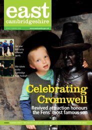
6. Soham Conservation Area - East Cambridgeshire District Council
6. Soham Conservation Area - East Cambridgeshire District Council
6. Soham Conservation Area - East Cambridgeshire District Council

You also want an ePaper? Increase the reach of your titles
YUMPU automatically turns print PDFs into web optimized ePapers that Google loves.
used to draw up a new boundary for the <strong>Conservation</strong> <strong>Area</strong>, and<br />
provide design guidance relating to new developments, replacement<br />
and new shop fronts and extensions to existing buildings within the<br />
<strong>Conservation</strong> <strong>Area</strong>.<br />
4.2 As with many towns and cities <strong>Soham</strong> is made up of distinct areas of<br />
land use, and this document will look at the character of each area<br />
separately. The section on each area will look at the hard and soft<br />
landscaping; important views; boundary treatments; the scale of<br />
buildings and construction materials and methods.<br />
4.3 This will help to provide the evidence for the design guidance for each<br />
individual area. By dividing up the document in this way, it will make it<br />
easily accessible and understandable for the stakeholders of <strong>Soham</strong>.<br />
5 Overview of the area<br />
5.1 <strong>Soham</strong> is essentially a linear village that has resulted from its growth<br />
along the route from Fordham to Ely. It is wider at certain points, in<br />
particular at St Andrew’s Church around which the streets reputedly<br />
follow the enclosure of a Saxon Cathedral. Modern development has<br />
expanded the village, encroaching further upon the Commons to the<br />
east and west towards the old railway.<br />
5.2 The <strong>Conservation</strong> <strong>Area</strong> boundary includes the historic north-south<br />
route around which the town has grown and the ‘back lanes’ that run<br />
east and west from the central spine. The main space within the<br />
<strong>Conservation</strong> <strong>Area</strong> is the churchyard and adjacent Recreation Ground<br />
that are a pleasant green respite from the busy commercial streets; the<br />
churchyard a quiet secluded area whilst the Recreation Ground is an<br />
open grassed area of activity.<br />
5.3 Because <strong>Soham</strong> is virtually level, the Church, although it is the focal<br />
point of the village, is not as dominant as it could be and is only visible<br />
at certain points from the village. Longer views of the Church are rare<br />
and it tends to appear quite suddenly at the end of roads such as<br />
Market Street and Churchgate Street.<br />
5.4 The <strong>Conservation</strong> <strong>Area</strong> is predominantly residential, with the main<br />
commercial streets being Churchgate Street and High Street, although<br />
the odd commercial property is found along Hall Street and Pratt<br />
Street. Nonconformist Chapels and their associated Sunday Schools<br />
and Manses tend to be located just off the central spine, the exception<br />
being the former Wesleyan Methodist Chapel, which is on Churchgate<br />
Street.<br />
5.5 A large number of inns and alehouses used to line <strong>Soham</strong>’s streets,<br />
and their past use is often still apparent in the external features of<br />
many of the surviving buildings. Part of the substantial brewery that<br />
opened in the 1880s (and was worked until the 1930s) still survives off<br />
Paddock Street, but is now converted. Only a handful of the large<br />
4