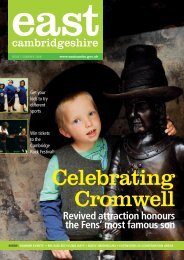
6. Soham Conservation Area - East Cambridgeshire District Council
6. Soham Conservation Area - East Cambridgeshire District Council
6. Soham Conservation Area - East Cambridgeshire District Council

Create successful ePaper yourself
Turn your PDF publications into a flip-book with our unique Google optimized e-Paper software.
9.7.3 The south side is predominantly modern with the exception of No.45,<br />
an attractive 19 th century house of similar detailing to those on the<br />
northern side of the street. The adjacent bowling green is an important<br />
community facility and the open space adds to the low-key character of<br />
the former lane.<br />
9.7.4 A row of former almshouses marks the point where the road opens up<br />
and its character changes to become more ‘suburban’. The<br />
almshouses close views from the south from Fountain Lane and<br />
contrast sharply with the modern development on Fountain Lane and<br />
the mid 20 th century bungalows on the south side of Station Road.<br />
9.7.5 The traditional buildings on this western stretch of Station Road reflect<br />
the change in character with more urban building types predominating.<br />
The gault brick ‘villas’ and terraces reflecting the road’s increased<br />
importance and proximity in the late 19 th century/ early 20 th century to<br />
the railway station. The former Angel Public House adjacent to the<br />
almshouses would presumably have served rail travellers.<br />
Age 19 th century, including Baptist Church, and some 20 th<br />
century infill.<br />
Wall Materials Gault brick (some painted). Modern properties of varying<br />
brick types<br />
Roof Materials Slate, concrete tiles on modern buildings<br />
Windows/Doors Sliding sash windows, a few timber casement<br />
replacements<br />
Scale 2 storeys<br />
Features Segmental window and door arches, chimneystacks,<br />
decorative bargeboards. Flat hood and Classical door<br />
surrounds.<br />
9.8 Paddock Street<br />
9.8.1 At the southern end of Pratt Street, Paddock Street (almost back lane<br />
to the linear settlement) veers off to the southeast along the boundary<br />
wall of the vicarage. This c.2m high flint wall tightly defines the western<br />
edge of Paddock Street and follows the sweep in the road, drawing the<br />
eye down the street. The eastern side of the street in contrast has a<br />
19