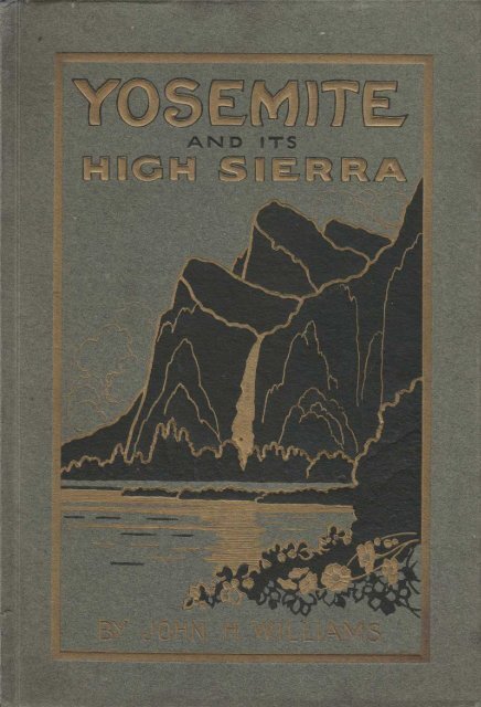
YOSEMITE AND ITS HIGH SIERRA BY JOHN H ... - Yosemite Online
YOSEMITE AND ITS HIGH SIERRA BY JOHN H ... - Yosemite Online
YOSEMITE AND ITS HIGH SIERRA BY JOHN H ... - Yosemite Online

Create successful ePaper yourself
Turn your PDF publications into a flip-book with our unique Google optimized e-Paper software.
<strong>YOSEMITE</strong><br />
<strong>HIGH</strong> <strong>SIERRA</strong><br />
<strong>BY</strong> <strong>JOHN</strong> H WILLIAMS<br />
<strong>AND</strong> <strong>ITS</strong>
On the Coulterville Road through Pierced Grove of Big Trees.<br />
ILLUSTRATED BOOKS <strong>BY</strong> <strong>JOHN</strong> H . WILLIAMS<br />
"THE MOUNTAIN THAT WAS ` GOD ' "<br />
" THE GUARDIANS OF THE COLUMBIA "<br />
" THE CANOE <strong>AND</strong> THE SADDLE "<br />
<strong>BY</strong> THEODORE WINTHROP<br />
to which are now first added his WESTERN LETTERS<br />
<strong>AND</strong> JOURNALS . Edited with an Introduction<br />
and Notes by John H. Williams .
"There is no death ; love paid the debt;<br />
Tho' moons may wane and men forget,<br />
The mountain's heart beats on for aye;<br />
IPlho truly loved us cannot die."<br />
And so I wait, nor fear the tide<br />
That comes so swiftly on to hide<br />
My little light. The mountains glow;<br />
1 have their promise, and I know.<br />
—Richardson : "The Promise of the Sierra."
Iltlpl n l n 1,111'<br />
A . IRII,F1 1 .~ I<br />
+IIl~linu.<br />
'1'Iie ( iw . . of '1 u .w•ulilr .
<strong>YOSEMITE</strong><br />
and its <strong>HIGH</strong> <strong>SIERRA</strong><br />
By <strong>JOHN</strong> H . WILLIAMS<br />
Author of "THE MOUNTAIN THAT WAS ` GOD'"<br />
" THE GUARDIANS OF THE COLUMBIA" etc.<br />
WITH MORE THAN TWO HUNDRED ILLUSTRATIONS<br />
INCLUDING EIGHT COLOR PLATES FROM<br />
PAINTINGS <strong>BY</strong> CHRIS JORGENSEN<br />
TACOMA <strong>AND</strong> SAN FRANCISCO<br />
<strong>JOHN</strong> H. WILLIAMS<br />
1914
The "Washington" and ''Lincoln," Giant Sequoias in<br />
Mariposa Grove.<br />
COPYRIGHT, 1914, eY <strong>JOHN</strong> H . WILLIAMS
On the Summit of Clouds Rest, looking southeast over Little <strong>Yosemite</strong> and the Merced<br />
Canon to Mt. Clark.<br />
TO<br />
THE <strong>SIERRA</strong> CLUB<br />
THIS VOLUME ABOUT A NOBLE REGION<br />
WHICH PP HAS LABORED TO CONSERVE <strong>AND</strong> MAKE ACCESSIBLE<br />
IS CORDIALLY DEDICATED<br />
Have you gazed on naked grandeur where there' s<br />
nothing else to gaze on,<br />
Set pieces and drop-curtain scenes galore,<br />
Big mountains heaved to heaven, which the blinding<br />
sunsets blazon,<br />
Black canons where the rapids rip and roar?<br />
* * * * *<br />
Have you seen God in His splendors, heard the text<br />
that Nature renders,<br />
You'll never hear it in the family pew,<br />
The simple things, the true things, the silent men<br />
who do things?<br />
Then listen to the Wild—it's calling you.<br />
—Robert tr. Service.<br />
Starting for the Ascent of Mt . Lyell .
North Dome, Royal Arches and Washington Column, seen from<br />
the Merced River. The concentric formation in the granite,<br />
which is characteristic of the <strong>Yosemite</strong> region, is nowhere<br />
better shown. The imposing architectural aspect of this<br />
group, as if it were the ruins of some vast, decaying medieval<br />
cathedral, with crumbling arches and broken campanile,<br />
makes it the most interesting rock feature in the<br />
Valley.
The Half Dome, seen from the Overhanging Rock at Glacier Point, more than half a mile<br />
above the floor of <strong>Yosemite</strong>.<br />
FOREWORD<br />
The present addition to my series about the great mountains of the West will serve<br />
a happy purpose if it does no more than to gain new readers for the splendid books on<br />
<strong>Yosemite</strong> that have preceded it. One who follows in the footsteps of J . D. Whitney,<br />
Clarence King, Galen Clark, John Muir, and Smeaton Chase must needs enter upon his<br />
task with diffidence . Nevertheless, it is largely a new work that I have undertaken,<br />
namely, to describe and exhibit, not merely the famous <strong>Yosemite</strong> Valley, but the entire<br />
<strong>Yosemite</strong> National Park, so far as may be possible, by the aid of telling pictures . The<br />
field is so vast, its mountains, canons, lakes, waterfalls, and forests are so important and<br />
spectacular, that even the unprecedented number of illustrations given here can only<br />
suggest its riches of wonder and beauty. In order to make room for the largest number<br />
of views, I have confined my text to those matters which persons visiting <strong>Yosemite</strong> for<br />
the first time may naturally wish to know,—an outline of the great physical features of<br />
the <strong>Yosemite</strong> country and their causes, the story of its native inhabitants and their<br />
worthy but pathetically hopeless fight to hold their alpine fastness, and the increasing<br />
facilities for the enjoyment of its renowned valleys and equally inviting highlands . I<br />
shall feel it no defect in this brief essay if among my readers some Oliver Twist may<br />
perchance ask for more!<br />
The choosing of more than two hundred illustrations from many thousands of photographs<br />
involved no little labor. Much of the district was, until lately, very inadequately<br />
photographed . <strong>Yosemite</strong> Valley has long been the best illustrated scenic spot in America,<br />
but the wonderful High Sierra back of it has been surprisingly neglected by the professional<br />
photographers . Fortunately for this book, however, the large membership of the<br />
Sierra Club includes many expert amateurs, and the club's different expeditions into the<br />
mountains have produced a multitude of photographs that are equal to the best professional<br />
work. My first acknowledgment must therefore be to the photographers among<br />
my fellow-members for the unanimity with which they have placed their negatives at my<br />
disposal. Without such help, it would have been possible to show little more than the<br />
beaten paths of <strong>Yosemite</strong> Valley and the Big Tree Groves . I am also indebted to the passenger<br />
departments of the Southern Pacific, Santa Fe and <strong>Yosemite</strong> Valley Railways for<br />
many fine photographs ; to the professional photographers, Messrs . Fiske, Pillsbury, Tibbitts,<br />
Boysen and others, for their interest and cooperation, and to Mr . M. M . O' Shaughnessy,<br />
City Engineer of San Francisco, for invaluable photographs of Hetch Hetchy .
IO FOREWORD<br />
Thanks are also due to the directors of the Bohemian Club of San Francisco for permission<br />
to reproduce Mr . Chris Jorgensen's spirited painting of <strong>Yosemite</strong> from Inspiration<br />
Point. The book is much enriched by this picture and by the others painted by Mr.<br />
Jorgensen especially for it.<br />
Mr. William E . Colby, the Sierra Club's untiring secretary, has kindly read proofs,<br />
and aided me greatly with his expert counsel. Prof. C. A. Kofoid and Prof. Willis Linn<br />
Jepson, of the University of California, Rev . Joseph S. Swain , of Cambridge, Mass ., Mr.<br />
Russ Avery, of Los Angeles, Mr . Mark A. Daniels, of San Francisco, Superintendent of the<br />
National Parks, Messrs . Herbert Bashford and Homer T . Miller, of the same city . Misa<br />
Mary A. Byrne, of the San Francisco Public Library, and Mr. John B. Kaiser, of the<br />
Tacoma Public Library, have made me their debtor by many courtesies . I must also<br />
thank the Houghton-Mifflin Company , of Boston ; the Century Company, of New York, and<br />
the Blair-Murdock Company and Mr . A. M. Robertson, of San Francisco, for liberty to<br />
quote from copyrighted works of Muir, Burt, Chase, Symmes, Sterling and Richardson.<br />
This book is an acknowledgment of a long-standing debt to the Sierra. Years ago,<br />
while a resident of California, I became a lover of her mountains . It has since been my<br />
good fortune to study other great mountain districts, and to learn that each has its own<br />
special inspiration ; but on returning to the <strong>Yosemite</strong> upland after a decade of absence,<br />
I have still found in its nobly sculptured heights and gentle valleys a peculiar and lasting<br />
charm possessed by no other wild landscape, American or European, with which I am acquainted<br />
,—a mingling of sublimity and tenderness that should make it the joy of all<br />
Americans, and the best-guarded treasure of California.<br />
Tacoma. Nov . 15, 1914.<br />
"With frontier strength ye stand your ground;<br />
With grand content ye circle round,<br />
Tumultuous silence for all sound, . . .<br />
Like some vast fleet,<br />
Sailing through winter's cold and summer's heat;<br />
Still holding on your high emprise,<br />
Until ye find a home amid the skies ."<br />
Jack Main Cation and Wilmer Lake, north of Retch Hetehy Valley .
Lunch Time on the Tuolumne, at the Sierra Club's Camp near Soda Springs.<br />
CONTENTS<br />
L THE <strong>YOSEMITE</strong> NATIONAL PARK 17<br />
II. THE CA\ON OF <strong>YOSEMITE</strong> 61<br />
III. ON THE CALIFORNIA SKY-LINE 93<br />
IV. TUOLUMNE GR<strong>AND</strong> CAI\ON <strong>AND</strong> HETCH HETCHY 113<br />
V. THE "KING OF THE FOREST" 137<br />
NOTES<br />
ILLUSTRATIONS<br />
The * indicates engravings from copyrighted photographs. See notice under the<br />
illustration .<br />
FOUR-COLOR HALFTONES<br />
From paintings by Chris Jorgensen.<br />
The Canon of <strong>Yosemite</strong> By courtesy of the Bohemian Club 4<br />
Cathedral Rocks and Spires 19<br />
<strong>Yosemite</strong> Falls, seen from the Merced Meadows 24<br />
Cascades at the Head of Happy Isles 41<br />
Half Dome in the Alpen-Glow 60<br />
Vernal Fall 77<br />
Mt. Lyell and its Glacier 111<br />
in Mariposa Grove 130<br />
ONE-COLOR HALFTONES.<br />
Title Photographer Page<br />
On the Coulterville Road S. A. Gray 2<br />
"'Washington" and "Lincoln" Trees, Mariposa Grove H. C. Tibbitts 6<br />
On the Summit of Clouds Rest Pillsbury Picture Co . 7<br />
Starting for the Ascent of Mt. Lyell Pillsbury Picture Co . 7<br />
Royal Arches and the Merced River H. C. Tibbitts 8<br />
Half Dome , from Overhanging Rock, Glacier Point H. C. Tibbitts 9<br />
Jack Main Canon<br />
J. F. Kinman 10<br />
Lunch Time on the Tuolumne Pillsbury Picture Co. 11<br />
The Gates of <strong>Yosemite</strong> Pillsbury Picture Co. 16<br />
Regulation Peak and Rodgers Lake<br />
J. F. Kinman 17<br />
143
I2 ILLUSTRATIONS<br />
Title Photographer Page<br />
Returning from Summit of Mt. Hoffman Dr. Edward Gray 17<br />
Upper <strong>Yosemite</strong> Fall Arthur W. Wilding 18<br />
Bridal Veil Fall Pillsbury Picture Co . 20<br />
Sentinel Rock (2) Fiske and Pillsbury 21<br />
A Glacier Landscape : Tuolumne Canon C. H. Hamilton 22<br />
Another Glacier Landscape : Mt. Starr King, etc . George R. King 22<br />
El Capitan, from East Side George Fiske 23<br />
First View of Lyell and its Neighbors Prof. Everett Shepardson 25<br />
White Cascade, in Tuolumne River Walter LeRoy Huber 25<br />
Indian Grist-Mill George R. King 26<br />
Snow-Creek Falls Lena M. Reddington 26<br />
Three Brothers H. C. Tibbitts 27<br />
The Domes in a Winter Storm Pillsbury Picture Co . 28<br />
Two North-side Lakes (2) J. F. Kinman 29<br />
"Apron" and Glacial Tarn, in Little <strong>Yosemite</strong> Hazel E . Roberts 29<br />
Cathedral Peak Walter LeRoy Huber 30<br />
Dome at Head of Tenaya Lake Pillsbury Picture Co . 30<br />
View East from Glacier Point J. T. Boysen 31<br />
The "Governor Tod" Group Pillsbury Picture Co . 32<br />
A Study in Clouds and Mountains Clinton C. Clarke 33<br />
Buttercups Following Retreat of the Snow Clinton C. Clarke 33<br />
Washburn Lake J. T. Boysen 34<br />
North Dome, seen from Happy Isles H. C. Tibbitts 34<br />
The Tuolumne Grand Canon Walter LeRoy Huber 35<br />
The Terraced Walls of Hetch Hetchy Pillsbury Picture Co . 36<br />
Giant Sequoias at Cabin in Mariposa Grove H. C. Tibbitts 37<br />
View South from Kuna Crest Walter LeRoy Huber 38<br />
White Firs on Eagle Peak Trail Prof. George J . Young 38<br />
Mt. Dana, seen from Tioga Lake H. E. Bailey 39<br />
Sugar Pine Loaded with Cones George R. King 40<br />
Crossing Cold Canon Meadows Ruth I. Dyar 40<br />
View down from Clouds Rest J. T. Boysen 42<br />
<strong>Yosemite</strong> Squaw, with Papoose J. T. Boysen 43<br />
Polemonium near Parker Pass Rose M. Higley 43<br />
Mono Pass ; with Bloody Canon and Mono Lake (2) Francis P . Farquhar 44<br />
*Happy Hours! (Deer in the Park) J. T. Boysen 44<br />
Sardine Lake in Bloody Canon J. T. Boysen 45<br />
Mt. Hoffman, from Snow Flat on the Tioga Road Philip S. Carlton 45<br />
<strong>Yosemite</strong> Valley, seen from <strong>Yosemite</strong> Falls Trail George Fiske 46<br />
Distinguished Visitors to the Grizzly Giant Pillsbury Picture Co . 46<br />
Western End of <strong>Yosemite</strong>, from Union Point George Fiske 47<br />
Indian Acorn Cache H. C. Tibbitts 48<br />
Tenaya Peak , with Tenaya Lake Pillsbury Picture Co . 48<br />
In Tenaya Canon (2) Prof. J. N. Le Conte 49<br />
Tenaya Lake J. T. Boysen 50<br />
Gates of Tenaya Canon in Winter George Fiske 51<br />
South Merced Valley, from Lookout Point J. T. Boysen 52<br />
A <strong>Yosemite</strong> Wood-Gatherer George Fiske 52<br />
Mirror Lake and Mt. Watkins Pillsbury Picture Co . 53<br />
<strong>Yosemite</strong> Indian Basket-Maker J. T. Boysen 54<br />
"Umbrella Tree" George Fiske 54<br />
Wild Flowers beneath the Royal Arches Pillsbury Picture Co . 55<br />
The "Forest Queen" in the Mariposa Grove J. T. Boysen 56<br />
*"Watch Me!" (Bear Cub) J. T. Boysen 56<br />
*On the Overhanging Rock in Winter Pillsbury Picture Co . 57<br />
Blue Jay in Merced Canon Prof. Everett Shepardson 57<br />
John Muir in Hetch Hetchy George R. King 58<br />
Ready for the Trails H. C. Tibbitts 58<br />
Tenaya Canon and Half Dome, from Glacier Point George Fiske 59<br />
Merced River and the Forest in <strong>Yosemite</strong> H. C. Tibbitts 61<br />
Lost Arrow Trail H. C. Tibbitts 61<br />
Chilnualna Falls, near Wawona J. T. Boysen 62<br />
"New England Bridge," at Wawona George Fiske 62<br />
Bridal Veil Meadow H. C. Tibbitts 63
ILLUSTRATIONS 13<br />
Title Photographer Page<br />
On Wawona Road George Fiske 63<br />
The Merced River above El Portal Pillsbury Picture Co. 64<br />
Cascade Falls J. T. Boysen 65<br />
Bridal Veil Fall in Early Winter George Fiske 66<br />
Winter Sports in <strong>Yosemite</strong> Philip S . Carlton 66<br />
El Capitan and Three Brothers Pillsbury Picture Co . 67<br />
A Glimpse of North Dome George Fiske 67<br />
North Wall of <strong>Yosemite</strong> Valley Pillsbury Picture Co. 68<br />
Panoramic View East from Washburn Point Pillsbury Picture Co. 68<br />
Cathedral Rocks and Spires Pillsbury Picture Co . 69<br />
The "Back Road," South Side of <strong>Yosemite</strong> George Fiske 70<br />
<strong>Yosemite</strong> Falls, seen from North-side Trail Pillsbury Picture Co . 71<br />
Cliff at Head of <strong>Yosemite</strong> Falls U. S. Geological Survey 72<br />
Leopard Lily Arthur W. Wilding 72<br />
Evening Primroses and the Half Dome Pillsbury Picture Co . 73<br />
Ice Cone at Upper <strong>Yosemite</strong> Fall (2) George Fiske 74<br />
Overhanging Rock at Glacier Point George Fiske 75<br />
Glacier Point Jutting into <strong>Yosemite</strong> Pacific Photo and Art Co . 76<br />
-Illilouette Fall Pillsbury Picture Co . 78<br />
The Merced at Happy Isles (2) Pillsbury Picture Co. 79<br />
Le Conte Memorial George Fiske 80<br />
The "Fallen Monarch" U. S . Forestry Bureau 80<br />
Vernal Fall, from Clark's Point George Fiske 81<br />
Vernal Fall in Winter George Fiske 82<br />
At the Head of Nevada Fall W. J. Grow 82<br />
The "Cataract of Diamonds" Pillsbury Picture Co . 83<br />
Little <strong>Yosemite</strong>, from Liberty Cap Pillsbury Picture Co . 83<br />
Nevada Fall (2) Pillsbury Picture Co . 84<br />
Little <strong>Yosemite</strong>, with Clouds Rest George Fiske 85<br />
Sugar-Loaf Dome, in Little <strong>Yosemite</strong> George Fiske 85<br />
Climbing the Half Dome (2) R. O . Quesnal 86<br />
Overhang at Summit of Half Dome R. O. Quesnal 87<br />
Phlox Pillsbury Picture Co . 87<br />
Half Dome at Sunrise Violet Ehrman 88<br />
On the "Short Trail" to Glacier Point Pillsbury Picture Co . 88<br />
Lake Merced J. T. Boysen 89<br />
A Characteristic Dome Landscape Pacific Photo and Art Co. 90<br />
Sentinel Dome George Fiske 90<br />
Jeffrey Pine on Sentinel Dome Pillsbury Picture Co . 91<br />
Aspen Forest at Lake Merced W. W. Lyman 92<br />
Triple Divide Peal: William Templeton Johnson 93<br />
Climbing Mt. Clark F. R. v. Bichowsky 93<br />
Tuolumne Pass (2) . . . Clair S. Tappaan and Dr. Edward Gray 94<br />
On Lake Washburn at Sunset W. W. Lyman 94<br />
Vogelsang Pass and Vogelsang Peak Pillsbury Picture Co. 95<br />
View South from Vogelsang Pass Pillsbury Picture Co. 95<br />
Summer Snowfields in the Sierra (3) Charles W. Michael 96<br />
Cathedral Peak, from Cathedral Pass J. Floyd Place 97<br />
Looking up Lyell Fork of the Tuolumne Prof. Everett Shepardson 98<br />
Pack Train at Vogelsang Pass Pillsbury Picture Co. 98<br />
Kuna Crest, from Meadows near Mono Pass Rose M. Higley 99<br />
Mountain Hemlocks Ruth I. Dyar 99<br />
In Alpine California (2) . . . Prof. E. Shepardson and F. P. Farquhar 100<br />
Cutting Steps up Snow-Finger on Mt . Lyell Walter LeRoy Huber 100<br />
Luncheon on Lyell Summit Pillsbury Picture Co. 101<br />
Sierra Club Climbing Mt . Lyell Pillsbury Picture Co. 101<br />
Rodgers, Electra and Davis Peaks J. Floyd Place 102<br />
A Convenient Crack Clinton C. Clarke 102<br />
Summit of Mt . Lyell Prof. Everett Shepardson 103<br />
The "Bergschrund" of Lyell Glacier H. E. Bailey 104<br />
The Uplands in July : Echo Peak from Unicorn Francis P. Farquhar 104<br />
Mts. Dana and Gibbs (2) Ruth I. Dyar 105<br />
The Craters of Mono County J. T. Boysen 105<br />
Summit of Mt. Conness (2) F. R. v. Bichowsky 106
14<br />
ILLUSTRATIONS<br />
Title Photographer Page<br />
Cathedral Peak Range, from Tuolumne Meadows . Philip S. Carlton 107<br />
Tenaya Lake, from Old Tioga Road<br />
Lambert Dome and Tuolumne Meadows<br />
Pillsbury Picture Co .<br />
Pillsbury Picture Co .<br />
10S<br />
10S<br />
Matterhorn Cation, from its East Slope Ruth I. Dyar 109<br />
The Hammond Fly-Catcher Rose M. Higley 109<br />
View East, from Benson Pass Walter LeRoy Huber 110<br />
Snow Plant J. T. Boysen 110<br />
Mts. Ritter and Banner, from Shadow Lake Walter LeRoy Huber 112<br />
Group of 250-foot Sequoias U. S. Forestry Bureau 113<br />
Nearing the Summit of Mt . Lyell Pillsbury Picture Co . 113<br />
Piute Mountain and Lakelet in Seavey Pass C. H. Hamilton 114<br />
A Typical Glacial Cirque U. S. Geological Survey 114<br />
Upper Hetch Hetchy, from Le Conte Point Walter LeRoy Huber 115<br />
Coasting on the Granite Pillsbury Picture Co . 115<br />
Lower End of Tuolumne Meadows, from Lambert Dome<br />
Cathedral Creek Falls<br />
. Ruth I. Dyar<br />
Robert L. Lipman<br />
116<br />
116<br />
Glen Aulin and Wildcat Point Philip S. Carlton 117<br />
Spermophiles at Conness Creek Ruth I. Dyar 117<br />
Tuolumne Falls Walter LeRoy Huber 118<br />
Grand Cation of the Tuolumne River Walter LeRoy Huber 119<br />
Largest of the Waterwheels Francis P . Farquhar 120<br />
A Fair Knapsacker Lucile R. Grunewald 120<br />
Waterwheel Falls, Tuolumne Canon Francis P . Farquhar 121<br />
Benson Lake (2) Prof. Ralph R. Lawrence 122<br />
Cookstoves on the March Ruth I. Dyar 122<br />
Rodgers Lake Rose M. Higley 123<br />
Heart of Tuolumne Canon ; Entrance to Muir Gorge (2)<br />
*Lower End of Muir Gorge<br />
. Francis P. Farquhar<br />
Francis M. Fultz<br />
124<br />
125<br />
Little Hetch Hetchy John S. P. Dean 126<br />
Weighing the Dunnage . .<br />
River, Meadow and Forest, in Hetch Hetchy<br />
. Elizabeth Underwood<br />
Pillsbury Picture Co .<br />
126<br />
127<br />
Waterfalls and Cascades in Tuolumne Canon<br />
Sunrise in Hetch Hetchy<br />
Unnamed Lake in Eleanor Canon<br />
The "Twins"<br />
. . Pillsbury Picture Co .<br />
Rose M. Higley<br />
J. F. Kinman<br />
Walter LeRoy Huber<br />
127<br />
12S<br />
12S<br />
129<br />
Five-Finger Falls, in Hetch Hetchy Walter LeRoy Huber 131<br />
Lake Eleanor J. F. Kinman 131<br />
Central Hetch Hetchy Taber Photo Co . 132<br />
Upper Hetch Hetchy H. B. Chaffee 133<br />
Yellow Pines George Fiske 134<br />
Overhanging Rock at Eleanor Carton Robert Schaezlein, Jr . 134<br />
Lower Hetch Hetchy H. B. Chaffee 135<br />
A Contemporary of Noah : the "Grizzly Giant" H. C. Tibbitts 136<br />
Cavalrymen at Cabin in Mariposa Grove Pillsbury Picture Co . 137<br />
A Fish Story from Laurel Lake J. F. Kinman 137<br />
Wawona Meadows and South Merced Valley J. T. Boysen 13S<br />
Red Fir Meyer Lissner 139<br />
"Alabama ." in the Mariposa Grove J. T. Boysen 139<br />
Maul Oak, on Wawona Road H. C. Tibbitts<br />
Mariposa Lily Prof. Ralph R. Lawrence 140<br />
The "King of the Forest" (2) Walter LeRoy Huber 141<br />
Three Veterans E. N. Baxter 142<br />
Del Portal Hotel , at El Portal J. T. Boysen 143<br />
Camp Curry (2) Pacific Photo and Art Co . 144<br />
Watching the Sunrise at Mirror Lake Pillsbury Picture Co . 145<br />
MAPS<br />
From <strong>Yosemite</strong> Valley to Wawona and Mariposa Grove, Drawn by Chris Jorgensen 146<br />
Travel-Guide Map, <strong>Yosemite</strong> National Park. U. S. Geological Survey . Inside Back Cover<br />
<strong>Yosemite</strong> Valley. Drawn by Chris Jorgensen<br />
Inside Back Cover<br />
140
Here the glacier ground the<br />
stone,<br />
Here spake God and it was<br />
done;<br />
Buttress, pinnacle and wall,<br />
River, forest, waterfall,<br />
And God's right hand over<br />
all.<br />
Hear the mountain torrents<br />
call,<br />
Swung colossal from the<br />
steep;<br />
See them, wind-tossed, wave<br />
and sweep ;<br />
Hear them sound like harper<br />
's hands<br />
On the quivering granite<br />
strands,<br />
Now with thunderous thud<br />
and moan,<br />
Now with giant undertone;<br />
While the pine trees whisper<br />
low,<br />
And the sunset 's shadows<br />
slow<br />
Up the vast gnarled ridges<br />
go<br />
To the roseate far snow.<br />
—Rev. Joseph Cook:<br />
"<strong>Yosemite</strong>"<br />
"Soon, quitting the narrow, cluttered wildness of the lower river, the<br />
newcomer is face to face with the ordered peace and glory of the Enchanted<br />
Valley. Here, fully spread before him, is that combination or sylvan charm<br />
with stupendous natural phenomena which makes <strong>Yosemite</strong> unique among<br />
Earth's great pictures. He sees the canton's level floor, telling, of an ancient<br />
glacial lake that has given place to wide, grassy meadows ; fields of glad<br />
THE GATES OF <strong>YOSEMITE</strong>.<br />
mountain flowers ; forests of many greens and lavenders ; the fascination<br />
of the winding Merced; and, gleaming high above this world of gentle<br />
loveliness, the amazing gray face of El Capitan, while Pohono drops from<br />
a `banging valley' superbly sculptured, and so beautiful that he may<br />
well deem it the noblest setting Nature has given to any of her famous<br />
waterfalls ."—P . 66 .
Regulation Peak (el. 10,500 ft.), and Rodgers Lnke, the best known of many beautiful<br />
mountain lakes in the northern part of the Park.<br />
T HE<br />
<strong>YOSEMITE</strong> <strong>AND</strong> <strong>ITS</strong> <strong>HIGH</strong> <strong>SIERRA</strong><br />
I.<br />
THE <strong>YOSEMITE</strong> NATIONAL PARK<br />
God of the open air,<br />
To Thee I make my prayer . .<br />
By the breadth of the blue that shines in silence o'er me,<br />
By the length of the mountain lines that stretch before me,<br />
By the height of the cloud that sails, with rest in motion,<br />
Over the plains and the vales to the measureless ocean<br />
(Oh, how the sight of the things that are great enlarges the eyes!),<br />
Lead me out of the narrow life to the peace of the hills and the skies.<br />
—Henry Van Dyke.<br />
<strong>Yosemite</strong> Country invites all lovers of the thronging mountains.<br />
It offers the enjoyment of a landscape famous for its elements of<br />
surprise and wonder. It promises the lasting interest of upland<br />
grandeur, softened by the beauty of lake and forest, flowers and falling<br />
waters. A land of superlatives, it may truthfully boast the most splendid<br />
high-walled valleys, the<br />
loftiest cataracts, the oldest,<br />
stateliest, and most noteworthy<br />
trees, in the world.<br />
It multiplies the delights<br />
of mountaineering with then<br />
most equable of sunny if* ,<br />
'<br />
mountain climates. Finally,<br />
—and this is its loudest call<br />
to thousands of true naturelovers,—it<br />
presents a legible Returning from the Summit of :lit. Hoffman.
IS <strong>YOSEMITE</strong> <strong>AND</strong> <strong>ITS</strong> <strong>HIGH</strong> <strong>SIERRA</strong><br />
Upper <strong>Yosemite</strong> Fall, seen from <strong>Yosemite</strong> Point Trail.<br />
In its drop of 1,430 feet, the stream, even at flood,<br />
becomes a cloud of spray, which the wind catches<br />
as on a cushion, and sways from side to side.<br />
and absorbing record of the<br />
making of great scenery.<br />
It is a commonplace of<br />
foreign visitors of the boulevard<br />
type, and of some Americans<br />
who know the towns and<br />
spas of Europe better than the<br />
glory of their own land, that<br />
the mountain scenery of Western<br />
America is a scenery of<br />
mere savage bigness, rather<br />
than of predominant beauty.<br />
This easy complaint may be<br />
charged in good part to our<br />
modern demand for luxury,<br />
and will be forgotten with the<br />
multiplication of automobile<br />
roads and expensive hotels. A<br />
fashionable inn on its summit<br />
has made many a third-rate<br />
hill in Europe the goal of<br />
spell-bound tourists, including<br />
droves of our globe-trotting<br />
fellow-countrymen . Nevertheless,<br />
the trite criticism has in it<br />
a half-truth. It is true of the<br />
Rocky Mountain and Sierra<br />
systems to the same extent that<br />
it is true of the Swiss plateaus<br />
supporting the great snow<br />
peaks, or the Tyrolese uplands,<br />
or the cirque country<br />
of the Pyrenees . The beauty<br />
of such scenes is not to be<br />
measured on the scale of<br />
country estates and welltrimmed<br />
pastoral landscape.<br />
High mountain lands but<br />
lately abandoned by ice-sheet<br />
and glacier wear similar aspects<br />
the world over. They<br />
are the seats of sublimity<br />
rather than of the picturesque.<br />
Their fascination lies not so<br />
much in softness of detail as,
. There the sun himself .<br />
At the calm close of summer's longest day,<br />
Rests his substantial orb ; between those heights<br />
Sparkle the stars, as of their station proud.—Wordsworth .<br />
Cathedral Rocks and Spires.
Bridal Veil Pall, the Indian Pohono . Dropping 620 feet, with 200 feet of cascades below it, this f<br />
is noteworthy in its setting, and perhaps the most graceful in form of all the <strong>Yosemite</strong> eat<br />
racts. Note the °°comets"—arrow-lil.-e masses of water shooting out from the fall .
THE <strong>YOSEMITE</strong> NATIONAL PARK 2I<br />
in breadth of view, in strength of line and majesty of form . They conjure<br />
with a story of their master sculptor, the Sun, wielding vast tools of ice<br />
and snow and rushing<br />
torrent, to block<br />
out peak and range,<br />
to lay broad glacial<br />
valleys deep with<br />
soil, to plant the<br />
highland lakes, and<br />
to smooth the wide<br />
rock benches, which,<br />
even yet unweathered,<br />
refuse welcome<br />
to forest or farm .<br />
Sentinel Rock, seen front<br />
the east and west—the<br />
great, glacier-carved cliff<br />
rising 3,086 feet on the<br />
south side of the valley,<br />
opposite Three Brothers.<br />
The perpendicular front<br />
of the Sentinel, sheer for<br />
half its height, shows<br />
how the cleavage has followed<br />
vertical jointing in<br />
the granite.<br />
In such alpine regions,<br />
whether of Europe<br />
or America, the<br />
real out-door man needs<br />
no handbook of science<br />
to interpret their report<br />
elemental forces, busy until comparatively recent time. Nor does the wild-<br />
-tss of their scenes, or the slight effort needed to attain them, weigh against
22<br />
<strong>YOSEMITE</strong> <strong>AND</strong> <strong>ITS</strong> <strong>HIGH</strong> <strong>SIERRA</strong><br />
A Glacier Landscape : Tuolumne Canon, where many thousands<br />
of years ago, the great Tuolumne Glacier left its record in<br />
the deep trough and polished granite slopes .<br />
the inspiration which<br />
he prizes more than<br />
comfort . He is not<br />
offended by the absence<br />
of those sylvan<br />
'graces common only<br />
to the older lowlands.<br />
And if, happily,<br />
prodigal Nature,<br />
in her bounty,<br />
should set down a<br />
delightful picture of<br />
gentler beauty in<br />
the midst of her<br />
mountain grandeurs,<br />
he appraises it the<br />
more justly for its<br />
mighty surround-<br />
ings. The ancient hills, he knows, are man's oldest and unfailing friends;<br />
their service, past and present, in making the earth inhabitable calls for his<br />
tribute ; and year after year finds him returning with joy to learn their<br />
lessons and receive their strength . As Maxwell Burt gaily sings,<br />
There is no good denying it,<br />
If you be mountain born,<br />
You hear the high hills calling<br />
Like the echo of a horn;<br />
Like the echo of a silver horn that threads the golden day,<br />
You hear the high hills calling, and your heart goes away.<br />
The character and accent of mountain landscape at its best distinguish<br />
the whole of the <strong>Yosemite</strong> National Park. Its area of 1,124 square miles<br />
Another Glacier Landscape : The domes of Mt. Starr King (right), with the Mt. Clark<br />
group and its cirques beyond, forming the Illilouette water-shed.
El Capitan (the Captain), with early morning sunlight on its east face. One needs the<br />
aid of figures to appreciate the magnitude of this vast block of unjointed granite. The<br />
brow of El Capitan is 3,100 feet above the Merced River ; its actual summit is 500 feet<br />
higher. Each face of the cliff exceeds 160 acres in area. A lone tree growing on a<br />
ledge under the arch seen in the shadow- on the right is more than eighty feet high .
<strong>Yosemite</strong> Falls, seen from the Merced Meadows.<br />
The cataracts blow their trumpets from the steep ; . .<br />
I hear the echoes through the mountains throng,<br />
The winds come to me from the fields of sleep.<br />
—Wordsworth.
THE <strong>YOSEMITE</strong> NATIONAL PARK 25<br />
i'Frst View of Lyeil and its Neighbors, from the Lyell Fork of the Tuolumne . Mts. Lyell<br />
and McClure are seen on the sky-line . right of center.<br />
::mbines the most rugged wildness with innumerable scenes of composed<br />
beauty-. Extending from an average elevation of 4,500 feet on its western<br />
Boundary to the snowy summits of the Sierra Nevada Range, at more than<br />
;.000 feet, it includes the watersheds of two important rivers, the Merced<br />
and the Tuolumne, and embraces a variety of upland scenery unequaled in<br />
my other of our national parks.<br />
Each of these great public outing grounds has its own especial interthe<br />
Colorado Grand Canon, its vast gorge, with an infinite variety in<br />
the forms and coloring of the river-sculptured rock ; the Rainier Park, its<br />
sangle volcanic peak,<br />
:7 posing beyond<br />
:ter American<br />
mountains, snowcrowned,<br />
and radi-<br />
E_ing a score of huge<br />
g:aciers down its<br />
densely forested<br />
f apes : the Yellow-<br />
Kone, its wonderful<br />
thermal basins and<br />
teirgeysers ;thenew<br />
Glacier Park, like<br />
the still grander Cal_dian<br />
Rockies near<br />
:. a wealth of snowpeaks,<br />
glaciers, and The White Cascade, in Tuolumne Riser at Conness Creek Basin .
26 <strong>YOSEMITE</strong> <strong>AND</strong> <strong>ITS</strong> <strong>HIGH</strong> <strong>SIERRA</strong><br />
beautiful lake-strewn<br />
valleys.<br />
The <strong>Yosemite</strong><br />
Park has no geysers.<br />
Its former mighty<br />
ice-sheets have now<br />
shrunk to a few pygmy<br />
glaciers, sheltered<br />
on the north<br />
slopes of the highest<br />
peaks . These are<br />
mere shadows of the<br />
ancient glaciers,<br />
which left the story<br />
of their extent and<br />
work clearly written<br />
Indian Grist-Mill . An important article of Sierra Indian diet<br />
was meal made by pounding black oak acorns in rude mor- upon what is doubttars<br />
in the granite . The meal was bleached with hot water less the most fascin -<br />
to remove the bitter taste, and baked into hard cake by<br />
dropping heated stones into cooking baskets containing the acing glacial landpaste.<br />
Such acorn bread is still made by the Indians .<br />
scape in America.<br />
Such a record holds, inevitably, far greater value and concern for us<br />
than the glaciers themselves could ever have had . The gray granite canons<br />
which the ice-streams dug are as deep as that in the Arizona sand-stones.<br />
Though less gorgeously colored, they are quite as wonderful in the carving<br />
of cliff and wall . But they have other interest found nowhere else in equal<br />
degree. Glorious waterfalls, flung banner-like from the sheer canon sides,<br />
tell of complex systems of branches . These radiated like a family tree from<br />
the trunk glaciers. All were bent to denude the Sierra slope of its sedimentary<br />
rocks, and dissect the underlying granites with hundreds of canons,<br />
gorges, and valleys. Some<br />
thousands of years ago, the<br />
glaciers retreated slowly<br />
back upon the heights of the<br />
range . Each of the larger<br />
troughs thus abandoned bore<br />
proof of its glacial origin.<br />
Instead of the even grades<br />
of stream-cut canons, they<br />
presented the form of giant<br />
stairways, down which the<br />
glaciers had moved majestically,<br />
to yield at last to the<br />
then tropical heat of the<br />
lower valleys . In this de- Snow-Creek Falls, on Tenaya Lake Trail .
'I'1aree Brothers, an imposing mass of granite which the inclined joint-planes enabled the glaciers to carve into triple gables . The<br />
name was given in 1851. to connneinorate the capture here of the three sons of the <strong>Yosemite</strong> chief Tenaya . The Indian name, however,<br />
was "Kona-po-pai-zes," or Frogs' Heads . Eagle Peak, the highest of these cliffs, rises 3,800 feet above the Merced, which is seen<br />
in the foreground .
`` '- . . . ... .^. ^'."" .~ .''""'~"^-~<br />
Al
THE <strong>YOSEMITE</strong> NATIONAL PARK 29<br />
scent, the ice carved steps in its path, varying in height and breadth with<br />
.ts own varying mass and the character and jointing of the rock . On<br />
these steps hung a multitude of cataracts, and their deeply cupped treads<br />
:held hundreds of high-walled lakes.<br />
The passing centuries have greatly relieved the primitive wildness of<br />
this glacial landscape.<br />
Forests as important as<br />
:hose of the Rainier<br />
Park, and perhaps even<br />
more beautiful in their<br />
sniversal mingling of<br />
sunshine and shade, have<br />
_3vered the upland mo-<br />
-a :nes and soil beds laid<br />
Two North-side Lakes . Upper<br />
Twin Lake, above, is at the<br />
head of Eleanor Creek, and<br />
forms part of the Lake Eleanor<br />
system. Below is Tilden<br />
Lake, with Tower Peak (11,-<br />
704 ft.) in the central distance,<br />
and Saurian Crest on<br />
the left.<br />
by the ice . Many of the<br />
waterfalls on the canon<br />
stairways have cut through<br />
their ledges, and become even more picturesque as cascades . While scores<br />
.ipon scores of the fine glacial lakes still remain—and a larger book than this<br />
would be required to describe and exhibit the notable lakes of the <strong>Yosemite</strong><br />
Park,—many others have been filled by stream deposit, profitably convert-<br />
_ng bare water areas into delightful mountain vales . Such is Nature's art.<br />
Here our debt to the glaciers reaches its climax . For among the filled<br />
lake basins made possible by their<br />
mighty sculpturing are the valleys of<br />
<strong>Yosemite</strong> and Hetch Hetchy, the chief<br />
glories of the entire Park. By the<br />
height and grandeur of their walls, the<br />
::nequaled majesty of their cataracts, the<br />
:arm of their level floors, and the variety<br />
and interest of their forests and<br />
Mountain wild flowers, these famous<br />
. alleys claim place among the pre-emin-<br />
=nt treasures, not only of California,<br />
"Apron" and Glacial Tarn on Lakelet, on<br />
the Merced at head of Little <strong>Yosemite</strong>.
3 0<br />
VOSkMIITE <strong>AND</strong> <strong>ITS</strong> <strong>HIGH</strong> <strong>SIERRA</strong><br />
Cathedral Peak (el . 10 .933 ft.), a prmuitent landmark<br />
on the divide between the âMerced and<br />
Tuolumne watersheds .<br />
but of all America. They are<br />
part of our great national heritage,—part,<br />
indeed, of "those<br />
higher things among our possessions,"<br />
as Prof. Lyman has<br />
said, "that cannot be measured<br />
in money, but have an untold<br />
bearing upon the finer sensibilities<br />
of a nation ."<br />
Let no one, however, who<br />
knows only these renowned valleys<br />
imagine that he has won his<br />
due share of <strong>Yosemite</strong>'s inspiration.<br />
His birthright of beauty<br />
and grandeur here is something<br />
far more worth while . The two<br />
great valleys are of course magnificent,<br />
and each day spent in<br />
them, or in climbing their walls,<br />
will bring new rewards . But I<br />
am sorry for those who go no<br />
farther ; who cannot spend a<br />
few days, at least, back in the<br />
upper country of the Merced or<br />
Tuolumne, among the lakes and<br />
shining granite domes of the<br />
highlands . Even though they may climb no peaks, the high mountains will<br />
welcome them to sit at their feet, share their gentler sunshine and broader<br />
outlook, breathe their diviner airs, learn the joy of the upland trails, and<br />
know that the best of <strong>Yosemite</strong> lies far from the crowds of <strong>Yosemite</strong> Valley.<br />
Happily, this is now to be made easy, even for the "tenderfoot ."<br />
For the <strong>Yosemite</strong> country is a picture of contrasts and harmonies that<br />
make a perfect whole . It is<br />
not to be known by its famous<br />
valleys only. These<br />
are but the enchanting foreground<br />
of our scene, and<br />
gain vastly by the dignity<br />
and austerity of their high<br />
mountain setting. Viewed<br />
separately, the valleys,<br />
splendid as they are, do not<br />
make the picture, any more<br />
Dome at Head of Tenaya Lake . Note the large tree<br />
growing halfway up the slope.
East from Glacier Point. Below, in the Merced Cation, are vernal and Nevada Falls, with<br />
Liberty Cap, a quarter dome, rising a thousand feet above the latter fall. The granite slopes of<br />
Little <strong>Yosemite</strong> are seen beyond . Mt. Clark, the "Obelisk," tops the sky-line on the right, and<br />
wit. Florence on the extreme left.
32<br />
<strong>YOSEMITE</strong> <strong>AND</strong> <strong>ITS</strong> <strong>HIGH</strong> <strong>SIERRA</strong><br />
than Millet's two figures bent in prayer make the "Angelus ." We need to<br />
know the background in order to get the true values of the foreseen . And<br />
only so, indeed, can the highly sensational features of the valleys themselves,<br />
and their ancient story, be understood . <strong>Yosemite</strong> Valley and its sister<br />
canon of Hetch Hetchy, with their lesser replicas in different parts of the<br />
Park, are all inseparable, geologically, from the High Sierra back of them.<br />
The "Governor Tod" Group, one of the finest in the Mnriposn Grove.<br />
The "dropped-block" theory of their origin has long been abandoned . They<br />
are linked by the vanished glaciers with the snow-peaks.<br />
Thus our <strong>Yosemite</strong> picture, both scenically and historically, looks back<br />
of necessity from the warmth of its lowland grandeur to the wild sublimity<br />
of bleak highlands, till recently the home of perennial frost . Even here<br />
are startling surprises for one who expects no beauty on the ice-swept<br />
heights. The stern sculpturing of pinnacled granite crags that dot the wide<br />
plateaus is no more characteristic of the landscape than is their flora . Outposts<br />
of the forests, huddled clumps of lodgepole and white-bark pine, are<br />
everywhere bravely scaling the ridges . Throngs of hardy mountain flowers,<br />
most brilliant of Nature's children, crowd all the ravines and lakesides, and<br />
seize upon every sheltered nook . The shallowest pretense of soil, weathered
THE <strong>YOSEMITE</strong> NATIONAL PARK 33<br />
A Study in Clouds and Mountains . View east from the summit of Lambert Dome . Beginning<br />
on the left, the peaks seen here are Dana, Gibbs and Mammoth. The cloud<br />
scenery of the Sierra is as characteristic and impressive as its landscape.<br />
from the somber granites, is sufficient invitation . The short alpine summer<br />
is long enough for their modest needs . Boldly they rush the season, edging<br />
away the tardy snow-banks, and calling on Old Winter to be up and going,<br />
Hardly waiting for his departure, at once they set about their business of<br />
hiding the glacial scars with masses of gay color . This ministry of beauty<br />
begins at the very snow-line, and grows as flowers and forest march together<br />
down to the sunny glacial meadows, and on to the still older valleys<br />
of the Sierranmiddle zone, deep with soil, and glowing in the long summer.<br />
Eager as Nature has been to plant the broad <strong>Yosemite</strong> uplands<br />
with flowers and trees, she has scattered other wonders here with even<br />
greater extravagance. Almost everything is on a scale of surprise. Nowhere<br />
else in America are<br />
highland lakes so plentiful<br />
or their settings more superb<br />
. The giant cataracts<br />
of <strong>Yosemite</strong> Valley dwarf a<br />
hundred other great waterfalls<br />
and cascades in the<br />
Park . These are hardly<br />
noticed here, but any one of<br />
them, could it be removed<br />
to Switzerland, would be- Buttercups Following Retreat of the Snow . This is<br />
come a center of crowded the custom of many early flowers, near the timber line.
34<br />
<strong>YOSEMITE</strong> <strong>AND</strong> <strong>ITS</strong> <strong>HIGH</strong> <strong>SIERRA</strong><br />
Washburn Lake (7,640 ft . el.(, on the Merced River above Lake Merced . Long Mountain<br />
(11.465 ft.), on the crest of the Sierra, is seen in the distance.<br />
tourist inns . The Park's genial forests of white and red firs, sugar and yellow<br />
pines, incense cedars and mountain hemlocks, spreading up to altitudes<br />
of eight and nine thousand feet, thrill every lover of splendid trees . But<br />
these are overshadowed by its groves of kingly Sequoias, the marvel of<br />
the botanical world,—immemorial trees that might have heard blind Homer<br />
sing the fall of<br />
Troy, or furnished<br />
the timbers for Solomon's<br />
temple.<br />
Colossal t h i s<br />
landscape is, but its<br />
features are so well<br />
proportioned that in<br />
their immensity we<br />
feel no exaggeration<br />
or distortion . Only<br />
when the visitor<br />
compares them with<br />
more familiar objects<br />
does he clearly<br />
see that here, truly,<br />
North Dome . seen from Happy Isles .<br />
is a playground
The Tuolumne Grand Cation, eieeved from its north wall, above Muir (:urge, the top of whieh is seen in the lower right-hand eorner of<br />
the picture. Colby Mountain, named in honor of the Secretary of the Sierra Club, rises beyond, a mile in height above the river.<br />
Grand Mountain is near the center of the sky-line, with Cathedral Creek Canon at its foot, and Falls Ridge between Cathedral Creek<br />
and the Tuolumne. 1tuua Crest is seen in the distance on the left .
36 <strong>YOSEMITE</strong> <strong>AND</strong> <strong>ITS</strong> <strong>HIGH</strong> <strong>SIERRA</strong><br />
fashioned for giants. The very harmony of its elements makes us slow to<br />
grasp the full majesty of the whole . To know <strong>Yosemite</strong> well is the study<br />
of a lifetime,—labor well repaying the student, as John Muir has found it.<br />
We may not quickly learn all its magic, though even the newcomer yields<br />
to its spell. He comes again and again who would know its mysteries . If<br />
<strong>Yosemite</strong> were of Greece, how inevitably legend, seeking the clue to such<br />
perfection of beauty, must have peopled it with gods !<br />
The Indians of the Sierra, however, were seldom builders of myths.<br />
The Terraced Walls of Retch Hetehy, seen from granite bar in center of the Valley near<br />
its lower end. Kolana Rock on right and North Dome on left rise more than 2,000 feet<br />
above the meadows and forests of the Valley floor,<br />
Stolid and unimaginative beyond most of their brethren, they saw in their<br />
mountains only homes, sustenance and defense . Superstitions and devillore<br />
they had in plenty . One of their tales, for example, concerned <strong>Yosemite</strong><br />
Valley, their "Ah-wah-nee," meaning a deep grassy vale . Ah-wah-nee, they<br />
told the whites, was the abode of demons, at whose head was the great<br />
Tu-tock-ah-nu-lah, the "Rock Chief," which we have translated into current<br />
usage in the Spanish "El Capitan ." His ominous face could be seen<br />
in the side of a vast cliff, threatening invaders of his domain . But one<br />
suspects that this naive legend may have been invented for a timely purpose .
Giant Sequoias at the Cabin in Mariposa Grove.
3 8<br />
<strong>YOSEMITE</strong> <strong>AND</strong> <strong>ITS</strong> <strong>HIGH</strong> <strong>SIERRA</strong><br />
View South from Kuna Crest, showing Mts. Lyell, McClure and Florence on the distant<br />
sky-line, with Potter Point and Parsons Peak in center, beyond Lyell Fork Callon.<br />
The Indian tradition of <strong>Yosemite</strong> is too much attenuated by the years,<br />
and adulterated by the fancies of white writers, to permit the acceptance of<br />
many so-called Indian legends<br />
of present-day publication<br />
. But even these ascribe<br />
to the aborigines here no<br />
such veneration for the great<br />
peaks, the wonderful cataracts,<br />
and other superlative<br />
forms of nature as among<br />
primitive men elsewhere<br />
clothed them with power<br />
over human lives, or<br />
amounted to worship. Nor<br />
does it appear that their<br />
speculation undertook seriously<br />
to explain these phenomena<br />
by a mythology such<br />
even as grew up in the<br />
Northwest, where the leg-<br />
White Firs (Abies concolor), on the Eagle Peak Trail.<br />
This tree, so named because of its light gray bark,<br />
is common throughout the Park at 3,000 to 7,000<br />
feet, giving place to the Red Fir, which abounds at<br />
altitudes up to 9,000 feet.<br />
ends of the "Bridge of the<br />
Gods" and the "Battle of<br />
the Winds" on the Columbia<br />
River, the Puget Sound
Mt. Dana (13,050 ft .), seen from Tioga Lake, on its northwest slope .
<strong>YOSEMITE</strong> <strong>AND</strong> <strong>ITS</strong> <strong>HIGH</strong> <strong>SIERRA</strong><br />
Sugar Pine (Pinus lauibertiana), loaded with cones.<br />
This tree, king of all the pines, is noted for its<br />
tine cones, twelve to twenty inches long.<br />
folk-tale of the "Miser of Takhoma,"<br />
and the like show the<br />
Indian's restless mind allying<br />
Nature with his daily life, and<br />
seeking curiously to unravel her<br />
problems . For the <strong>Yosemite</strong><br />
Indian, the unknown darkness<br />
held only ghosts and witches.<br />
His mountains gave him no<br />
vision . Yet they supplied him<br />
with a place to live in comfort<br />
and aboriginal luxury. They<br />
provided him with acorns, nuts,<br />
game and other food. They enabled<br />
him to hide in pathless<br />
canons, where pursuit was impossible,<br />
and from the walls of<br />
which he might roll down rocks<br />
upon any who should attempt to<br />
penetrate his mountain fastness.<br />
It is not surprising, therefore,<br />
that our first native tradition<br />
of the <strong>Yosemite</strong> represents<br />
the Red Man as telling white<br />
trespassers that Tutockahnulah<br />
would surely punish their intrusion into his Ahwahnee . The white tide<br />
was rolling steadily across the plains to the Pacific . A wave had swept<br />
up the coast from Mexico ; all lowland California was inundated. The<br />
mountain Indians had no wish to be "civilized " as their valley cousins had<br />
been. Hence even as<br />
early as 1833, long<br />
before the discovery<br />
of gold and the rush<br />
of miners to the foothills,<br />
Captain Joseph<br />
Walker, the first<br />
white man to lay<br />
eyes upon the <strong>Yosemite</strong><br />
country, was<br />
carefully warned by<br />
his Indian guides<br />
away from the great<br />
valleys, and made to<br />
keep his course on<br />
Crossing Cold Canon Meadows, on trail between Conness Creek<br />
and Virginia Callon . This is a typical filled glacial lake.<br />
There are hundreds of such broad, shining upland meadows<br />
in the Park, each a park in itself, carpeted with the finest<br />
grass and brilliant with alpine flowers .
Oh, the mountain music of the Happy Isles!<br />
There cool winds are singing,<br />
And crystal waters flinging<br />
Their diamond dancing laughter about the Happy Isles.<br />
—Harold Synames .<br />
Cascades at the Head of Happy Isles .
Looking Down into <strong>Yosemite</strong> from the Western Slope of Clouds Rest. On the right are seen 'Penay-a Canon, North Dome and the top<br />
of Washington Column, with El Capitan in the distance ; on the left, Half Dome and the profile of Glacier Point .
THE <strong>YOSEMITE</strong> NATIONAL PARK 43<br />
:he divide between the Merced and Tuolumne.<br />
And when the gold-hunters came, a notable fig-<br />
..re, if California furnished any notables to the<br />
:Al of Indian history, arose on behalf of his<br />
rninished tribe to dispute their advance into<br />
-~e beloved canon . Tenaya, the <strong>Yosemite</strong> chief,<br />
the most memorable and picturesque native<br />
reader in the annals of the state.<br />
The actual discovery of this Indian stronghold<br />
is a matter of some debate. Whether it was<br />
Walker, in '33, or Savage's frontier militia of<br />
:1, that first looked down into the vast <strong>Yosemite</strong><br />
_Jrge may never be established. Each expedi-<br />
: :on, however, is part of our story.<br />
History has done scant justice to Joseph<br />
Reddeford Walker. He belonged to that small<br />
coup of intrepid frontiersmen who did much but<br />
--rote little, and whose achievements have been<br />
_pored through their own neglect of fame and<br />
- :e claims of more ambitious rivals . Walker's<br />
_ilure to publish his discoveries, and the fact that<br />
e served under a jealous commander, who was<br />
: .en capable of claiming them for his own, have<br />
_ Dmbined to obscure his work. That he led a<br />
:arty of Bonneville's men in the first exploration<br />
estward from "the Great Salt Lake ;" that he <strong>Yosemite</strong> Squaw, with Papoose<br />
and Baby Basket.<br />
: :sproved the then accepted belief that that lake<br />
.rained into the Pacific ; that he established the existence, extent and<br />
character of the Great Basin ; that he charted its rivers and lakes ending as<br />
they begin in the desert ; that he discovered<br />
and was the first to cross the Sierra Nevada<br />
Range, entering Alta California through the<br />
Mono Pass and leaving it the next year, 18 34,<br />
by the route since known as Walker's Pass ;—<br />
here, surely, was a real "pathfinder," worth a<br />
4 clear and permanent page in Western history!<br />
Walker concerns us, not only because he<br />
was the first white visitor to the <strong>Yosemite</strong><br />
region, but especially because the claim is now<br />
made by his family and others that he "discovered<br />
and camped in <strong>Yosemite</strong> Valley ."<br />
The evidence available hardly seems to sus-<br />
tain this claim in full.<br />
(P. eximium), at 12,000<br />
ft., near Parker Pass. This On the stone over Walker 's grave in Al-<br />
daring blue perennial seeks the<br />
highest slopes .<br />
hambra Cemetery, at Martinez, Cal ., is this
44<br />
<strong>YOSEMITE</strong> <strong>AND</strong> <strong>ITS</strong> <strong>HIGH</strong> <strong>SIERRA</strong><br />
line, said to have been placed there on authority of Captain Walker himself<br />
: "Camped at <strong>Yosemite</strong>, November 13, 1833 ;" and Munro-Fraser's<br />
"History of Contra-Costa County," published in 1882, six years after<br />
Walker's death, contains<br />
a sketch of the<br />
explorer, quoting his<br />
nephew, with whom<br />
he spent his last<br />
years, and saying:<br />
"His were the first<br />
white man's eyes that<br />
ever looked u p o n<br />
the <strong>Yosemite</strong>, which<br />
Above, Mono Pass (el.<br />
10,599 ft.), looking west,<br />
with Mammoth Mountain<br />
and Iiuna Crest on<br />
left . Below, Bloody<br />
Canon and Walker Lake,<br />
with Williams Butte and<br />
Mono Lake beyond.<br />
he then discovered, although<br />
the honor has<br />
been accorded to some<br />
other person at a<br />
period twenty years<br />
later." Thus it is<br />
seen that the present claim goes somewhat beyond the testimony of Walker<br />
and his nephew. We may accept "Camped at <strong>Yosemite</strong>," but are we warranted<br />
in assuming that "at" means "in"?<br />
On the contrary, Dr. L. H . Bunnell, who was of the Savage party<br />
visiting the valley in<br />
1851, and who named<br />
it "<strong>Yosemite</strong>," says in<br />
his well-known book,<br />
"Discovery of t h e<br />
<strong>Yosemite</strong>" (4th ed .,<br />
pp . 3 8 ' 39) :<br />
COPYRIGHT, J . T. BOYSEN<br />
Happy Hours! Deer are a familiar sight everywhere in the upland<br />
forests and meadows of the Park .<br />
I cheerfully concede<br />
the fact * * * that "his<br />
were the first white man's<br />
eyes that ever looked upon<br />
the <strong>Yosemite</strong>" above<br />
the valley, and in that
sense he was certainly<br />
-he original white dis-<br />
:overer.<br />
The topography of<br />
The country over which<br />
The Mono trail ran, and<br />
which was followed by<br />
'apt. Walker, did not<br />
admit of his seeing the<br />
-:alley proper . The de-<br />
-ression indicating the<br />
'.-alley, and its magnifient<br />
surroundings, could<br />
alone have been disovered,<br />
and in Capt.<br />
Walker's conversations<br />
with me at various<br />
-:mes he was manly<br />
enough to say so. Up-<br />
_n one occasion I told<br />
.'apt. Walker that Tenie-ya<br />
had said that "a<br />
small party of white<br />
men once crossed the<br />
mountains on the north<br />
side, but were so guid-<br />
THE <strong>YOSEMITE</strong> NATIONAL PARK 45<br />
Sardine Lake, filling a glacial cirque<br />
below Mono Pass .<br />
ed as not to see the valley proper." With a smile the captain said : "That was my<br />
:,arty, but I was not deceived, for the lay of the land showed there was a valley below;<br />
but we had become nearly barefooted, our animals poor, and ourselves on the verge of<br />
starvation, so we followed down the ridge to Bull Creek, where, killing a deer, we<br />
went into camp ."<br />
Again, on p . 78, Dr. Bunnell says Walker told him that "his Ute and<br />
Mono guides gave such a dismal account of the canons of both rivers that<br />
he kept his course near to the divide,"—that is, between the Tuolumne<br />
and the Merced . With no other chronicle of this first expedition, Bunnell's<br />
quotations from Walker and the <strong>Yosemite</strong> chief enable us to see the weary<br />
explorers struggling up the<br />
her'' ;`` steep defile of Bloody Canon<br />
from the volcanic Mono<br />
plain, descending the long<br />
western slope, half starved,<br />
and floundering through the<br />
untracked snow of November<br />
on the divide, to reach<br />
at last the sunshine and comfort<br />
of the provincial capital,<br />
Monterey. Probably<br />
Walker's route was much<br />
the same as that of the later<br />
Tioga Road. The Indians<br />
had kept the secret of their<br />
Mt. Hoffman, from Snow Flat, on the Tioga Road . This<br />
mass of granite ramparts is the crest of the divide<br />
between <strong>Yosemite</strong> Valley and the Tuolumne.<br />
in Bloody Cation.<br />
warm <strong>Yosemite</strong> home.<br />
We must conclude, I<br />
think, that while Walker
4 6<br />
<strong>YOSEMITE</strong> <strong>AND</strong> <strong>ITS</strong> <strong>HIGH</strong> <strong>SIERRA</strong><br />
Eastern End of <strong>Yosemite</strong> Valley, seen from <strong>Yosemite</strong> Falls Trail, near foot of the - U pper<br />
Fall. Beginning with Glacier Point on the right, the sky-line shows successively Mt.<br />
Starr King, the Mt . Clark group, Half Dome, and North Dome.<br />
first traversed the <strong>Yosemite</strong> uplands, and was, in that sense, as Bunnell<br />
admits, "the original white discoverer," the honor of first visiting the floor<br />
of the valley and making known the majesty of its walls remained for the<br />
"Mariposa Battalion ." Of<br />
that second expedition we<br />
have a vivid and trustworthy<br />
report. Dr. Bunnell's<br />
account of it, and of<br />
the Indian war of 1851, of<br />
which it was a part, is a<br />
frontier classic, with Tenaya<br />
as its hero . In the old<br />
chief's last stand for the<br />
mountain fortress of his<br />
people, we see the Indian<br />
at his best.<br />
The gold-seekers and<br />
game-hunters of '49 and '5o<br />
Distinguished Visitors to the Grizzly Giant . On President<br />
Roosevelt's right are Gifford Pinchot and Gov.<br />
Pardee; on his left, John Muir, Benjamin Ide Wheeler,<br />
etc. Out of this visit grew the recession of <strong>Yosemite</strong><br />
Valley and the Mariposa Grove, and their incorporation<br />
in the <strong>Yosemite</strong> National Park .<br />
were pushing the natives<br />
back into the mountains;<br />
the Indians were retaliating<br />
as usual with robberies,
.tern end of <strong>Yosemite</strong>. with Sentinel Hoek and El Capitan, seen from Union Point, 2,334 feet<br />
above the Valley floor .
4 8<br />
Indians Acorn Cache ("Chuckah"),<br />
consisting of a large<br />
wicker basket set on posts,<br />
and thatched with pine<br />
branches, points down, to<br />
keep out squirrels and mice.<br />
<strong>YOSEMITE</strong> <strong>AND</strong> <strong>ITS</strong> <strong>HIGH</strong> <strong>SIERRA</strong><br />
burnings, and occasional murder . To the reservation<br />
established by the Indian commissioners<br />
on the Fresno, near the site of the present town<br />
of Madera, some of the hill tribes had come<br />
peaceably. Others were brought in by the militia<br />
companies of the new state government. But<br />
far in the heart of the Sierra, the half-breed<br />
scouts reported, near the head of the Merced<br />
River, was a small tribe that refused to leave its<br />
deep, rocky valley.<br />
"There," they said, "one Indian is more<br />
than ten white men. Hiding places are many,<br />
and the Indians will hurl down rocks upon all<br />
who pursue them . Other tribes dare not make<br />
war on them, for they are lawless, like the grizzly<br />
bear, whose name, Yo-Semite, they have<br />
adopted, and as strong . We fear to go to this<br />
valley. There are many witches there . "<br />
Messengers sent to the <strong>Yosemite</strong>s failed,<br />
but at last their chief came alone. Addressing<br />
Major Savage, a veteran frontiersman who commanded<br />
the Battalion, the grave old Indian said:<br />
"My people do not want anything from the<br />
Great Father you tell me about. The Great<br />
Spirit is our father, and has supplied us with all<br />
we need. We want nothing from white men.<br />
Our women are able to do our work. Go then;<br />
let us remain in the mountains where we were born, and where the ashes<br />
of our fathers have been given to the winds . I have said enough!"<br />
Tenaya Peak (10,200 ft.), on the right, with Tenaya Lake in the distance at its foot.
THE <strong>YOSEMITE</strong> NATIONAL PARK 49<br />
Tenaya was sent to bring in his tribe, but only a part came, mostly<br />
the old and the very young. The aged chief, when charged with deception,<br />
promised to go on with his people to the soldiers' camp . Major<br />
Savage, he said, might go to the valley with one of his youths as a guide,<br />
but he would find no one there;<br />
the younger men frorn Mono<br />
and the Tuolumne who had<br />
married into the tribe had gone<br />
back to the mountains . "iNIy<br />
tribe is small," he declared,<br />
In Tenayn Canon . The upper view<br />
looks back to the half Dome ; the<br />
lower one shows the gorge blocked<br />
by a huge boulder. The steep<br />
south wall, swept by avalanches<br />
every spring from the side of<br />
Clouds Rest, is seen in each picture.<br />
This cation otters great difficulties<br />
to the climber.<br />
not large as the white chief has said . The Piutes and Monos are all gone.<br />
Young and strong men can find plenty in the mountains ; why should they<br />
go to see the white chiefs, to be yarded like horses and cattle? I am<br />
willing to go, for it is best for my people ."
Lake Tena)a . at the head of Tetucta Creek Canon. The remarkable domes am' polished granite hillsides surrounding this beautiful<br />
lake vividly recall its n,ontparsltively recent glacial history .
Gates of Tenaya Canon in Winter—North and Half Domes, Royal Arches, and Washington Column. In beauty of detail, the photograph<br />
here reproduced is the finest ever made of these commanding cliffs and peaks . Note the overhang of the arehes, the .valeretched<br />
rock, and the snow-laden trees and chaparral . The vast span of the concentric strata may be inferred from their elevation:<br />
the upper arch is 1,500 feet above the Valley . North Dome rises 3,530 feet; Half Dome, 4,850 feet . Clouds Hest, the snowy slope of<br />
which is seen beyond, overtops the Valley by almost 6,000 feet .
5 2<br />
<strong>YOSEMITE</strong> <strong>AND</strong> <strong>ITS</strong> IIIGH <strong>SIERRA</strong><br />
South Merced Valley, seen from Lookout Point, on the road from Walt ona to <strong>Yosemite</strong>.<br />
Sending Tenaya and his band on to the camp, upon the South Fork<br />
of the Merced, Savage and his men proceeded across the upland through<br />
deep snow, and on March 21, 1851, descended to the mysterious valley.<br />
There they found only an aged squaw . It was as Tenaya had said ; the<br />
young men and their women had disappeared, and after a brief survey<br />
the disappointed whites recrossed the hills to their camp.<br />
During this first visit to the valley,<br />
Dr. Bunnell proposed naming it <strong>Yosemite</strong>,<br />
after its Indian inhabitants ; and the beautiful<br />
name was adopted, though not without<br />
the usual opposition from men who<br />
saw in the Indian merely a savage to be<br />
despoiled of his lands . But the Indian<br />
name of the valley, as I have said, was<br />
Ah-wah-nee . Its ancient tribe had been<br />
almost exterminated by disease many years<br />
before, and the valley home abandoned,<br />
until Tenaya, son of an Ahwahneechee<br />
father by a Mono mother, had led back the<br />
few survivors of the race, re-enforced by<br />
renegade Monos, Piutes from the Tuolumne,<br />
and fugitives from the lowland tribes.<br />
The mongrel clan of several hundred mem-<br />
A <strong>Yosemite</strong> Wood-Gatherer .<br />
bers proudly adopted a new name given it
Mirror Lake, at mouth of Tenaya Canon, with reflection of Mt. Watkins, rising more than<br />
4,000 feet above its surface . Perfect reflections such as this are seen only in the early<br />
morning interval between the downward currents of the night and the warm winds<br />
that draw up the Sierra slope as soon as the sun strikes it.
54 <strong>YOSEMITE</strong> <strong>AND</strong> <strong>ITS</strong> <strong>HIGH</strong> <strong>SIERRA</strong><br />
<strong>Yosemite</strong> Indian Basket-Maker, weaving a burden basket. The<br />
large basket to the left is for cooking .<br />
by others, <strong>Yosemite</strong>,<br />
or Grizzly Bear, for<br />
the animal which the<br />
Indians most feared<br />
and emulated.<br />
Savage never got<br />
his captives to the<br />
Fresno reservation.<br />
When nearly there,<br />
alarmed by runners<br />
from the hostile<br />
Chowchillas on the<br />
South Fork, and<br />
taking advantage of<br />
the relaxed vigilance<br />
of their guards, they<br />
fled in the night, and<br />
were not again to be<br />
tempted away from<br />
their valley. Inducements<br />
successful<br />
with other tribes<br />
were rejected with<br />
contempt . Gaudy clothing and cheap presents Tenaya declared no recompense<br />
for loss of freedom in their mountain home . Even the offered beef<br />
was refused ; the Indians preferred horse-flesh . Hence, after the Chowchillas<br />
had been subdued, and the other tribes had made treaties, Savage sent<br />
a second expedition, under Captain Boling, to bring in the stubborn <strong>Yosemite</strong>s<br />
. Bunnell again was of the party, which expected to have little<br />
difficulty in persuading Tenaya to surrender. But on reaching the valley<br />
in May, Boling found only deserted wigwams and smoking ash-heaps telling<br />
ofhastyflight . Three<br />
of the chief's sons<br />
were captured at the<br />
foot of the great<br />
rock then named, in<br />
memory of the capture,<br />
"Three Brothers."<br />
One of these<br />
youths was killed in<br />
trying to escape, and<br />
shortly afterwards<br />
Tenaya himself was<br />
caught by Boling's<br />
Indian scouts on a "Umbrella Tree," a snow-flattened pine at bead of Nevada Fall.
THE <strong>YOSEMITE</strong> NATIONAL PARK 55<br />
high bench east of<br />
the "Big Falls,"<br />
whence he had been<br />
watching his enemies<br />
below . When he<br />
saw the body of his<br />
son, his grief found<br />
vent only in a look<br />
of hatred that Boling<br />
well understood.<br />
No word could be<br />
coaxed from him in<br />
reply to the captain's<br />
regrets for the<br />
youth's death. A<br />
day or two later, he<br />
made an unsuccessful<br />
attempt to escape<br />
across the swollen<br />
Merced. Then at<br />
last his grief and<br />
rage poured out in<br />
characteristic speech.<br />
"Kill me, Captain,"<br />
he cried, "as<br />
you killed my son;<br />
as you would kill my<br />
people, if they were<br />
to come to you . You<br />
have made my life<br />
dark . But wait a<br />
little. When I am<br />
dead, my spirit will<br />
Wild Flowers beneath the Royal Arches .<br />
make trouble for<br />
you and your people . I will follow in your footsteps, and be among the<br />
rocks and waterfalls, and in the rivers and winds . You will not see me,<br />
but you shall fear the spirit of the old chief, and grow cold ."<br />
Tenaya's appeal to the unknown was as futile as eloquence generally<br />
is. The white conquest paid no heed to his threats. Steadily rounding up<br />
the savages, Boling's party captured the last of their band at a rancheria<br />
or village a few miles above the valley, on a beautiful lake walled by polished<br />
granite cliffs and domes, which they at once named Lake Tenaya.<br />
"But it already has a name," Tenaya protested,—" Ty-we-ack,' Lake of<br />
the Shining Rocks." The naming of a lake in his honor seemed to him a<br />
poor equivalent for the loss of his territory. Another chance was given him.
5 6<br />
The "Forest Queen," in the<br />
Mariposa Grove, — an exceptionally<br />
straight trunk,<br />
without the usual buttresses<br />
at the base .<br />
<strong>YOSEMITE</strong> <strong>AND</strong> <strong>ITS</strong> <strong>HIGH</strong> <strong>SIERRA</strong><br />
Taken at last to the Fresno, he soon begged for<br />
leave to quit the heat and dust of the reservation<br />
; and on his pledge of their good behavior,<br />
he led back his people once more to the cool<br />
spaces of the <strong>Yosemite</strong> . The aged sachem himself<br />
kept faith, but he could not control his<br />
young men . The killing of prospectors in the<br />
valley the next summer quickly brought a third<br />
visit from the soldiers, and the final dispersion<br />
of the <strong>Yosemite</strong>s. It hardly detracts from the<br />
pathos of Tenaya's losing fight for his wild<br />
home that he and his last handful of followers<br />
were killed by Mono s<br />
whose hospitality they<br />
had repaid by stealing<br />
their horses. The Indian's<br />
code did not recognize<br />
other people's rights<br />
in livestock.<br />
Present-day visitors<br />
to <strong>Yosemite</strong> are often<br />
disappointed that their<br />
first impression of t h e<br />
height of the valley walls<br />
falls short of published<br />
accounts. <strong>Yosemite</strong> magnitudes<br />
are not quickly<br />
realized. Even Dr. Bunnell<br />
was ridiculed by Cap-<br />
tain Boling and others<br />
when he estimated the<br />
,:OVYHiOni, J . T. BOVSEN<br />
"Watch Me!"<br />
superb granite cliff opposite their camp as at<br />
least fifteen hundred feet high . Some guessed<br />
five hundred, others eight hundred. Not even<br />
Bunnell himself dreamed that El Capitan actually<br />
towered more than three-fifths of a mile<br />
above the silent Merced.<br />
Its Indian inhabitants gone, <strong>Yosemite</strong> soon<br />
came into public notice. As early as 1855, the<br />
first tourist parties visited the valley . Trails<br />
were quickly opened, rude inns established, and,<br />
in 1864, John Conness, a senator from California,<br />
introduced and Congress passed an act granting<br />
to the state "the `cleft' or `gorge' in the granite<br />
peak of the Sierra Nevada Mountains . .
known as the <strong>Yosemite</strong> Valley,<br />
with its branches or<br />
spurs, in estimated length<br />
fifteen miles, and in average<br />
width one mile back from<br />
the main edge of the precipice,<br />
on each side of the<br />
valley, with the stipulation,<br />
nevertheless, . . . that the<br />
premises shall be held for<br />
public use, resort, and recreation<br />
." To this grant was<br />
added the " `Mariposa Big<br />
Tree Grove,' not to exceed<br />
the area of four sections ."<br />
In 189o, Congress created<br />
the <strong>Yosemite</strong> National<br />
Park, subject to the grant of<br />
1864 . Its lines have since<br />
been modified considerably<br />
by acts of 1905 and 1906,<br />
excluding the head basins of<br />
the north and middle forks<br />
of the San Joaquin, and embracing<br />
more completely the<br />
watersheds of the Tuolumne<br />
and Merced Rivers. Its<br />
area, as already noted, is<br />
now 1,124 square miles.<br />
The dual administra-<br />
THE <strong>YOSEMITE</strong> NATIONAL PARK 57<br />
tion established by the creation of the National Park surrounding the State<br />
Park was soon found impracticable and disastrous. The state commissioners<br />
did the best they could with the ten<br />
or fifteen thousand dollars annually voted<br />
by the legislature, but these inadequate appropriations<br />
were largely consumed in the<br />
salaries of park guardians and the traveling<br />
expenses of the commissioners ; little was<br />
left for needed improvements. Much of<br />
<strong>Yosemite</strong> Valley was fenced in, and let to<br />
private contractors . Conflicts occurred between<br />
the state and federal authorities . A<br />
forest fire, for example, was sometimes left<br />
Blue Jay, in Merced Canon below<br />
Vernal Fall.<br />
,OPYhIUnl, PILUEURY<br />
On the Overhanging Rock at Glacier Point, with eighi<br />
feet of snow .<br />
to burn while the officers debated as to<br />
which jurisdiction was responsible!
5 s<br />
John Muir in Retch Hetehy. The tree shown<br />
here is a fine example of Yellow Pine .<br />
<strong>YOSEMITE</strong> <strong>AND</strong> <strong>ITS</strong> <strong>HIGH</strong> <strong>SIERRA</strong><br />
John Muir was one of the first<br />
and most active in pointing out the<br />
importance of ending this imperium<br />
in imperio . His opportunity came<br />
in 1903, when he was invited by<br />
President Roosevelt to accompany<br />
him on his visit to <strong>Yosemite</strong> . Governor<br />
Pardee, President Benjamin<br />
Ide Wheeler of the State University,<br />
and other well-known men were<br />
in the party, which received Mr.<br />
Muir's arguments for the recession<br />
of the valley and Big Tree grove<br />
with unanimous approval.<br />
A vigorous state-wide campaign<br />
was started by the Sierra<br />
Club, the strong California society<br />
of mountain-lovers of which Muir<br />
was president. The plan won generous<br />
support from the newspapers<br />
of the state, as well as from the<br />
Native Sons and other large organizations ; and was eventually successful,<br />
though its advocates had to overcome bitter opposition, both at Sacramento<br />
and at Washington, from certain politicians and favored concessionnaires<br />
whose private interests conflicted with the public advantage.<br />
The recession has been justified by its results. Better order has been<br />
established, and in every way the rights and convenience of the public have<br />
been promoted. The federal management, while sometimes open to criticism,<br />
has devoted annual<br />
appropriations exceeding<br />
$5o,000, besides an increased<br />
income from concessions,<br />
mainly to improvements<br />
that would still<br />
be lacking under the clumsy<br />
dual system. Several hundred<br />
thousand dollars have<br />
been spent in building<br />
good roads and permanent<br />
bridges, and in leading<br />
trails into all parts of the<br />
Park. No one who views<br />
the matter impartially can<br />
now be found to advocate<br />
:a return to the old regime.<br />
Ready for the Trails .
*.'rnaya Canon, from Glacier Point (3,250 feet), with the late Galen Clark at the age of 94 on "Photographer&<br />
Rock." The perpendicular cleavage of the Half Dome by weathering is well shown<br />
in this view. Mirror Lake lies below in the canon, and beyond rise Mt . Watkins on the left,<br />
Clouds Rest on the right, and Tenaya Peak in the distance at the head of the canon .
Now . while a farewell gleam of evening light<br />
Is fondly lingering on thy shattered front,<br />
Do thou, in turn, be paramount ; and rule<br />
Over the pomp and beauty of a scene<br />
Whose mountains, torrents, lake and wood unite<br />
To pay thee homage .<br />
—Wordsworth.<br />
Ball-Dome in the Alpen-Glow.
Diereed River and the Forest in <strong>Yosemite</strong>, with Half Dome in distance.<br />
IL<br />
THE CANON OF <strong>YOSEMITE</strong>.<br />
"Of the grandest sights I have enjoyed,—Rome from the dome of St. Peter's, the<br />
Alps from lake Conio, Mont Blanc and its glaciers from Chamouni, Niagara, and<br />
<strong>Yosemite</strong>.—I judge the last named the most unique and stupendous ."— Horace Greeley.<br />
The only spot I have ever found that came up to the brag."—Ralph Waldo Emerson.<br />
FARLY visitors to <strong>Yosemite</strong> paid well for its pleasures . To reach the<br />
valley by any of the old routes meant a hot and dusty ride of two or<br />
three days, in a primitive vehicle, over the roughest of mountain roads.<br />
In common with thousands of others, I painfully recall my first trip . We<br />
quit the train from San Francisco at Raymond, to endure a day of misery in<br />
a crowded "stage," which jolted us up from the low country into the noble<br />
valley of the South Fork at<br />
Wawona . That ride made<br />
the friendly little inn there,<br />
when we finally reached it,<br />
seem more luxurious than<br />
anymetropolitan hotel . The<br />
next day was spent among<br />
the Mariposa Big Trees.<br />
The third carried us across<br />
the broad Wawona ridge to<br />
Inspiration Point and the<br />
hard-won vision of <strong>Yosemite</strong><br />
itself. We were bruised<br />
and happy.<br />
Hundreds of tourists<br />
Lost Arrow Trail, east side of <strong>Yosemite</strong> Creek, leading<br />
still come and go by the to Camp Lost Arrow .
62 <strong>YOSEMITE</strong> <strong>AND</strong> <strong>ITS</strong> <strong>HIGH</strong> <strong>SIERRA</strong><br />
Wawona route, leaving or returning<br />
to the railway at Madera or<br />
Raymond . Automobiles, good<br />
roads, and improved hotel service<br />
have robbed the trip of its terrors.<br />
The traveler is able to enjoy fully<br />
the increasing interest of a wonderful<br />
ride, as his motor climbs swiftly<br />
back among the great, forested hills<br />
of Wawona. It is a country which,<br />
even without <strong>Yosemite</strong> or the Mariposa<br />
Grove, might well draw him<br />
to its own splendid outlooks, deep<br />
valleys, and fine waterfalls and<br />
lakes,—a sportsman's paradise that<br />
should form part of any extended<br />
<strong>Yosemite</strong> outing.<br />
The Wawona route, like the<br />
Big Oak Flat road north of the<br />
Merced, is recommended by the fact<br />
that it gives the incoming visitor<br />
his introduction to <strong>Yosemite</strong> Valley<br />
from the heights . Few things in<br />
Chilnunlua Falls, near Wawona ; one of the this world can exceed the surprise<br />
most beautiful series of cataracts and ens- and pleasure of that view . Nearing<br />
in the Park . g<br />
the rim of the plateau, the road suddenly<br />
leaves the forest for a turn far out on a rocky promontory . Nearly<br />
two thousand feet below, the river lies, a white thread, at the bottom of its<br />
gorge. The foreground is wild and unformed,—an abyss fringed by projecting<br />
crags and pinnacles, and barren save for a few rugged and adventurous<br />
pines clutching the ledges . But eastward opens the famous valley,<br />
always more impressive<br />
than imagination<br />
has conceived<br />
it. Its nearest cliffs<br />
tower as far above<br />
as the river lies below,<br />
while, miles<br />
beyond, the great<br />
picture closes with<br />
domes and peaks<br />
lightly silhouetted<br />
against the softest<br />
blues and whites of<br />
the Sierran sky . "New England Bridge," at Wawona, built by Galen Clark in 1870 .
THE CANON OF <strong>YOSEMITE</strong> 63<br />
Bridal Veil Meadow, on the route of the ancient Pohono Glacier . Such sunny glacial<br />
flats, large and small, telling of old lakes long since transformed by stream-wash,<br />
are come upon everywhere below timber line, on forest trails or among the upland<br />
granite domes. Homes of flowers and deer, musical with the song of birds, they are<br />
one of the surprises of the Park.<br />
It is a picture one can not afford to miss, and if he comes to <strong>Yosemite</strong><br />
by rail, as most visitors now do, he will lose much of its beauty if he fails to<br />
see the valley from Wawona road . I do not wonder that every artist wants<br />
to paint his interpretation of <strong>Yosemite</strong>'s<br />
message from the sublime<br />
outlooks on or near this road, as<br />
it rises out of the canon ; or that<br />
the scene inspires such admirable<br />
work as we have in Mr. Jorgensen's<br />
Bohemian Club painting.<br />
But all nature-lovers will indorse<br />
Mr. Chase's protest against the<br />
cheap, bromidic names given these<br />
view-points. It does not add to<br />
the inspiration of the scene to be<br />
told, "This is Inspiration Point !"<br />
There is both good humor and<br />
good sense in what Chase says:<br />
Inspiration, in any case, is a timid<br />
bird, which appears without advertisement,<br />
delights not in sign-boards, and On Wawona Road, near Inspiration Point .
64 <strong>YOSEMITE</strong> <strong>AND</strong> <strong>ITS</strong> <strong>HIGH</strong> <strong>SIERRA</strong><br />
the louder it is whistled for is the more apt to refuse to come . I have heard the<br />
spot spoken of by warm and jocular young gentlemen as Perspiration Point ; and<br />
although that species of witticism is, generally speaking, distasteful to me, I find that<br />
I suffer no pang when it is practiced at the expense of this piece of pedantry .—<br />
<strong>Yosemite</strong> Trails, p . ~8.<br />
The Merced River, three miles above El Portal . The sharp V-shape of the gorge indicates<br />
that it was probably eut by stream erosion, rather than by the glacier which carved the<br />
U-shaped canon of <strong>Yosemite</strong> above. Along this wild trough, filled with boulders from<br />
the cliffs. an excellent automobile road has been built at great cost.<br />
The majority of <strong>Yosemite</strong> visitors to-day prefer the quicker service<br />
of the railway, even to automobiles on the roads into the Park which have<br />
recently been opened to those vehicles . Leaving the Southern Pacific or<br />
Santa Fe system at the pleasant town of Merced, their through cars from<br />
San Francisco or Los Angeles carry them over the <strong>Yosemite</strong> Valley Railroad<br />
to El Portal, its terminus, just outside the Park boundary . This road is a<br />
noteworthy piece of railway building . A few miles above Merced, it enters<br />
the Merced River gorge, which it follows for the rest of its seventyeight<br />
miles, as the canon sinks deeper into the range . For most of this<br />
length it was blasted out of the granite or cleated upon the wall of the<br />
gorge. Below it the Merced winds in a narrow, tortuous channel, which<br />
is dammed here and there to supply power for quartz and lumber mills.<br />
Gold mining is in progress at many points .
THE CANON OF <strong>YOSEMITE</strong><br />
At El Portal, the railway<br />
maintains an excellent<br />
hotel. From here automobile<br />
stages run not only to<br />
<strong>Yosemite</strong>, but also to the<br />
Merced and Tuolumne Big<br />
Tree Groves . These small<br />
areas contain many fine<br />
trees, and the journey to<br />
them is one of great interest.<br />
The road, as it climbs the<br />
hills, unfolds magnificent<br />
views of <strong>Yosemite</strong> and the<br />
lower Merced valley. Even<br />
if there were no Giant Sequoias<br />
in prospect, the ride<br />
would be well worth while,<br />
for the forests of fir, pine<br />
and cedar through which it<br />
passes are among the most<br />
interesting in the state.<br />
A ride of twelve miles<br />
over a good automobile<br />
road of easy grades brings<br />
the visitor to <strong>Yosemite</strong> Village,<br />
at the center of <strong>Yosemite</strong><br />
Valley . This highway<br />
is one of the most picturesque<br />
mountain roads in<br />
America. From El Portal<br />
to the very gates of the valley,<br />
it had to be cut out of<br />
the granite hillsides. All<br />
about it is a scene of colossal<br />
disorder, the work of avalanche<br />
and earthquake, filling<br />
the canon with mighty Cascade Falls, four miles west of El Capitan .<br />
boulders from the cliffs<br />
above, over which the river foams in continuous cascades . One great<br />
waterfall is passed before we reach <strong>Yosemite</strong>, though among the multitude<br />
of cataracts hereabout it is so inconspicuous that the automobile driver may<br />
rush by it without calling his passengers' attention to its beauty. This is<br />
Cascade Falls, seen on the left, where Cascade Creek pours from the north<br />
wall of the canon, five hundred feet, in a deep recess close to the road.<br />
So fine a sight should not be overlooked . It prepares one for the<br />
65
66 <strong>YOSEMITE</strong> <strong>AND</strong> <strong>ITS</strong> <strong>HIGH</strong> <strong>SIERRA</strong><br />
Bridal Veil Fall, seen in early Winter from the<br />
south-side road.<br />
that he may well deem it the<br />
famous waterfalls.<br />
Here, too, at the very gates of the valley, we find an invaluable key<br />
to the problem of its origin . As we followed up the Merced, we have thus<br />
far seen it everywhere a turbulent<br />
canon stream . But at the base<br />
of Cathedral Rocks its character<br />
changes. For seven miles above<br />
that point, it is the most peaceful<br />
of meadow-bordered rivers, with<br />
only a few feet of fall as it meanders<br />
indolently down the level<br />
valley floor from Happy Isles. A<br />
little easy investigation, for want of<br />
which, however, some eminent scientists<br />
have gone far astray, ex-<br />
plains the change.<br />
At the place just mentioned,<br />
where El Capitan bridge formerly<br />
greater magnificence of Bridal Veil<br />
Fall ahead.<br />
Soon, quitting the narrow, cluttered<br />
wildness of the lower river,<br />
the newcomer is face to face with<br />
the ordered peace and glory of <strong>Yosemite</strong><br />
itself. Gratefully, silently, he<br />
breathes the very magic of the Enchanted<br />
Valley. For here, fully<br />
spread before him, is that combination<br />
of sylvan charm with stupendous<br />
natural phenomena which<br />
makes <strong>Yosemite</strong> unique among<br />
Earth's great pictures. He sees the<br />
canon's level floor, telling of an ancient<br />
glacial lake that has given<br />
place to wide, grassy meadows;<br />
fields of glad mountain flowers;<br />
forests of many greens and lavenders<br />
; the fascination of the winding<br />
Merced, River of Mercy ; and,<br />
gleaming high above this world of<br />
gentle loveliness, the amazing gray<br />
face of El Capitan, while Pohono<br />
drops from a "hanging valley" superbly<br />
sculptured, and so beautiful<br />
noblest setting Nature has given to any of her<br />
Winter Sports in -<strong>Yosemite</strong>. Skiing and<br />
snow-shoeing draw many parties to the<br />
galley each winter .
THE CANON OF <strong>YOSEMITE</strong> 67<br />
El Capitan and Three Brothers, seen from the moraine at the foot of Cathedral Rocks.<br />
Tourists of the class that finds its chief out-door interest in discovering zoological resemblances<br />
in natural objects have dubbed El Capitan "the Crouching Lion of <strong>Yosemite</strong>."<br />
This is a misnomer, as the splendid huge rock is obviously an elephant:<br />
stood, and where its piers may yet be seen, a broad ridge of glacial debris,<br />
now covered with young forest, and notched by the river channel, stretches<br />
from the talus slope below Cathedral Rocks a quarter of a mile across to<br />
the rock slide, or earthquake talus, west of El Capitan . It is largely buried<br />
in silt and river gravel, but about twenty feet of its height is visible on the<br />
upper side, and twice as much below . So solid and level an embankment of<br />
soil and boulders,<br />
some of which have<br />
been freighted<br />
down from the seabeach<br />
strata still remaining<br />
back on<br />
the highest peaks,<br />
is unmistakably a<br />
glacier's record.<br />
Had Prof. J. D.<br />
Whitney seen it<br />
when, as state geologist,<br />
he conducted<br />
his famous Yosem-<br />
ite survey, fifty<br />
years ago, he would<br />
A Glimpse of North Dome . from one of the beautiful forest roads<br />
in <strong>Yosemite</strong> Valley .
El Capitan . Eagle Peak_ <strong>Yosemite</strong> Falls . <strong>Yosemite</strong> Point . Indian Callon. North Dome . Half Dome.<br />
<strong>Yosemite</strong> Village . Merced River. Royal Arches . Tenaya Canon.<br />
North Wall of the Valley, seen from the talus back of <strong>Yosemite</strong> Village . The trail to the top of <strong>Yosemite</strong> Falls and <strong>Yosemite</strong> Point<br />
climbs out of the Valley over the wooded earthquake talus seen in this view below Eagle Peak, follows the second bench eastward<br />
to the foot of the upper fall, and then, by many zigzags, ascends the small glacial canon west of that cataract.<br />
Mt . Watkins.<br />
Tenaya Canon . Half Dome. Mt . Broderick. Liberty Cap. Vernal and Nevada Falls . Mt . Starr King.<br />
Panoramic View East from Washburn Point, above Glacier Point.
Ca hedral Roeks and Spires, from the Mereed River near Rocky Point.
7o<br />
<strong>YOSEMITE</strong> <strong>AND</strong> <strong>ITS</strong> <strong>HIGH</strong> <strong>SIERRA</strong><br />
The "Back Road," on the south side of <strong>Yosemite</strong>. The trees<br />
shown are chiefly California Black Oaks (Quercus kelloggii),<br />
a deciduous species that does much to beautify <strong>Yosemite</strong> and<br />
Retch Hetchy. Its acorns supply bread to the Indians, and<br />
are prized by squirrels and woodpeckers .<br />
not have made the<br />
blunder of his life<br />
by denying that the<br />
valley was due to<br />
glacial action, or<br />
said : "There are below<br />
the valley no<br />
remains of the moraines<br />
which such an<br />
operation could not<br />
fail to have formed ."<br />
For in fact this ridge<br />
is simply a terminal<br />
moraine, deposited<br />
by the great valley<br />
glacier at the point<br />
where the last of its<br />
repeated advances<br />
stopped, and from<br />
which its final slow<br />
retreat began.<br />
The line of the<br />
moraine, geologists<br />
tell us, practically<br />
coincides with, and<br />
covers, a granite bar,<br />
or sill, which formed<br />
the dam of the ancient<br />
<strong>Yosemite</strong> Lake.<br />
This body of water<br />
had the same history as hundreds of other canon lakes still to be found<br />
in the High Sierra, occupying the depressed treads of the huge glacial stairways.<br />
Deep basins were quarried by the glaciers wherever inflowing<br />
branch glaciers greatly augmented their mass and weight, with a corresponding<br />
increase in digging power . Glaciers alone produce these rock-basins.<br />
Lakes such as Merced and Tenaya, above <strong>Yosemite</strong> Valley, and filled<br />
lake-beds such as <strong>Yosemite</strong> and Hecch Hetchy Valleys, are found only in<br />
the tracks of the vanished ice-streams . River erosion never cuts such<br />
hollowed steps in water-channels . It requires the long scouring of incalculable<br />
moving ice-masses, armed with vast rocks plucked from their beds,<br />
to prepare the canons for the lakes and level valleys of the later time.<br />
Thus the sudden change in the Merced River, from a quiet meadow<br />
stream to a brawling mountain torrent, recalls vividly to the modern<br />
student that distant day when the receding glacier left behind it a beautiful<br />
lake, seven miles in length and probably four or five hundred feet deep.
losemite Falls, seen front trail through the beautiful oak and pine forest that skirts the north<br />
wall of the Valley . The upper fall, beginning 2,365 feet above the Valley floor, drops 1,430<br />
feet ; the lower fall, 320 feet, with several smaller falls between. <strong>Yosemite</strong> Point, 2,97 5<br />
feet, is on the right, and the tall granite spire in front of it is the "Lost Arrow" of Indian<br />
legend.
7 2<br />
Cliff at Head of <strong>Yosemite</strong> Falls,<br />
showing the vertical cleavage<br />
joints which have guided the glacial<br />
sculpturing and made possible<br />
the sheer walls of A osemite, Hetch<br />
Hetchy and similar cations.<br />
evidence that convinces them it<br />
<strong>YOSEMITE</strong> <strong>AND</strong> <strong>ITS</strong> <strong>HIGH</strong> <strong>SIERRA</strong><br />
Government geologists are now making a minute examination<br />
of the region, and the publication of their<br />
work will throw light on many such minor problems.<br />
But the main question is no longer disputed.<br />
Such agreement, however, is of comparatively<br />
recent date. There have been many theories as to the<br />
making of the great canon . The most interesting of<br />
these, because of the eminence of its author, and the<br />
violence with which he mistakenly denounced the glacial<br />
hypothesis, was the famous fault-block contention<br />
of Prof. Whitney. Said he:<br />
A more absurd theory was never advanced than that by<br />
which it was sought to ascribe to glaciers the sawing out of<br />
these vertical walls and the rounding of the domes . Nothing<br />
more unlike the real work of ice, as exhibited in the Alps,<br />
could be found . Besides, there is no reason to suppose, or at<br />
least no proof, that glaciers have ever occupied the valley, or<br />
any portion of it, so that this theory, based on entire ignorance<br />
of the whole subject, may be dropped without wasting any<br />
more time on it . . . . We conceive that, during the upheaval<br />
of the Sierra, or, possibly, at some time after that had taken<br />
place, there was at the <strong>Yosemite</strong> a subsidence of a limited<br />
walled by perpendicular cliffs rising more<br />
than three thousand feet, and dammed by<br />
a rocky moraine overlying a granite dike.<br />
Where the lake ended, the Merced cut a<br />
pass for itself through the moraine . This<br />
is also used by the road to-day. The lake<br />
itself, probably within the last two or<br />
three hundred years, if we may judge by<br />
the trees growing where once was only<br />
water, has filled up with rich alluvial soil,<br />
brought down mainly by spring freshets<br />
from near-by heights, rather than by the<br />
larger river, and giving us the fertile valley<br />
floor, with an inestimable part of the<br />
beauty of <strong>Yosemite</strong>.<br />
That <strong>Yosemite</strong> Valley is due mainly<br />
to glacial action, which deepened and<br />
widened a river gorge existing before the<br />
glacial epoch or epochs, is now generally<br />
accepted by the geologists : they differ only<br />
as to the length of the main <strong>Yosemite</strong> glacier,<br />
some believing<br />
that it extended little<br />
below El Capitan,<br />
while others find<br />
reached the foothills.<br />
Leopard Lily (L. pardalinum),<br />
a gorgeous<br />
orange - and - purple<br />
member of the Lily<br />
family, which frequents<br />
the lower<br />
valleys of the Park.-
Evening Primroses and the Half Dome . These beautiful luminous yellow flowers are a familiar<br />
decoration of <strong>Yosemite</strong>, Heteh Hetehy and other valleys in the Park during July, when their<br />
buds "pop" open noisily at sunset for a single night of fragrant revelry .
74<br />
area, marked by lines of "fault" or<br />
fissures crossing each other somewhat<br />
nearly at right angles. In<br />
other and more simple language,<br />
the bottom of the valley sank<br />
down to an unknown depth, owing<br />
to its support being withdrawn<br />
from underneath . —The <strong>Yosemite</strong><br />
Guide Book, 73, 74.<br />
Had Whitney's examination<br />
of the valley been<br />
thorough enough to take note<br />
of the old moraine below<br />
El Capitan, it is probable he<br />
would not have written those<br />
words. And yet he had other<br />
evidence that should have<br />
prevented his error. El Capitan<br />
Moraine and the old <strong>Yosemite</strong><br />
Lake which it helps us<br />
<strong>YOSEMITE</strong> <strong>AND</strong> <strong>ITS</strong> <strong>HIGH</strong> <strong>SIERRA</strong><br />
lee Cone at the Foot of Upper <strong>Yosemite</strong><br />
Fall. This volcano-like<br />
hill rises each winter to a height<br />
of four or five hundred feet,<br />
formed by the freezing spray and<br />
by blocks of ice fallen from the<br />
face of the cliff. The mouth of<br />
the cone is about 200 feet in<br />
diameter, says Muir, who has<br />
looked down into it from the<br />
ledge seen ou the right in the<br />
upper picture. The two small<br />
specks on the side of the cone<br />
in the lower view are the late<br />
Galen Clark and a companion,<br />
who climbed it to get a look into<br />
the "crater ."<br />
to reconstruct are far from being<br />
the only reminders of the<br />
valley's glacial history. Most<br />
striking of all, the hanging<br />
valleys on its walls are no<br />
less clearly of glacial origin .
cerhanging Rock at Glacier Point, the most famous and important viewpoint on the rim of <strong>Yosemite</strong>.<br />
From it the spectator looks down 3,230 feet sheer to the Merced, winding among the<br />
forests and meadows of the valley floor, and across to the beautiful <strong>Yosemite</strong> Fall, dropping<br />
half a mile out of its own hanging valley.
7 6 <strong>YOSEMITE</strong> <strong>AND</strong> <strong>ITS</strong> <strong>HIGH</strong> <strong>SIERRA</strong><br />
As we pass Bridal Veil<br />
Fall, we note that it drops,<br />
not from a flat plateau<br />
above, nor from a narrow<br />
cleft in the wall, but out of<br />
a high side-valley, which in<br />
turn is framed by lofty cliffs.<br />
The U-shape of this broad<br />
valley is so clear that we at<br />
once perceive that it, too,<br />
must have been scoured out<br />
by a glacier, rather than by<br />
Pohono Creek, which could<br />
have cut only a V-shaped<br />
gorge. Its sculptor, in fact,<br />
was a minor glacier, mighty<br />
enough to dig a splendid<br />
wild valley, more than fifteen<br />
hundred feet deep, but<br />
not powerful enough to sink<br />
it to the bed of the main<br />
valley . Hence, as the larger<br />
Glacier Point . jutting into <strong>Yosemite</strong><br />
Valley at its junction with<br />
the Merced-Illilouette Cafion.<br />
Seen either from the Valley<br />
floor or from the trail to Vernal<br />
Fall, this massive cliff is the<br />
stateliest headland of the south<br />
wall. Its precipitous faces are<br />
due to glacial quarrying along<br />
vertical joint-planes.<br />
glacier shrank in bulk, and<br />
ceased to fill the great canon<br />
of <strong>Yosemite</strong>, the Pohono<br />
glacier was left "hanging"<br />
on the side; to drop its ice and<br />
rock in avalanches upon the<br />
trunk glacier below . Finally,<br />
both glaciers vanished,
1- springs are in the cloud, thy stream<br />
=egins to move and murmur first<br />
r ._ere ice-peaks feel the noonday beam,<br />
=r rain-storms on the glacier burst,<br />
—Bryant.<br />
Vernal Fall.
111ilouette Fall, viewed from its canon below. This fine waterfall has a drop of 370 feet.<br />
It is a hard climb up Illilouette Canon from the Merced River to the foot of the fall,<br />
which may be seen more easily from above, on the Long Trail to Glacier Point .
THE CASON OF <strong>YOSEMITE</strong> 79<br />
with increasing mean temperature and decreasing snowfall. Of their<br />
canons one was occupied by the typical glacier-made lake of <strong>Yosemite</strong>,<br />
nearly four thousand feet above sea ; while the other, for want of icebergs<br />
to drop into the .Iake, just as plainly declared its origin by flinging out a<br />
,lacial banner, the most graceful and musical, though far from the largest,<br />
of the <strong>Yosemite</strong> waterfalls.<br />
Other famous cataracts<br />
hung high on the valley<br />
walls repeat the story<br />
of Bridal Veil. <strong>Yosemite</strong><br />
Falls, at the center of the<br />
north wall, and Illilouette,<br />
on the south wall at the<br />
head of the valley, are the<br />
most important in volume<br />
and length of season, telling<br />
by their well-defined<br />
The Merced at Happy Isles<br />
—two beautifully wooded<br />
islets at the upper end of<br />
the Valley, where the<br />
river rushes out of its<br />
narrow canon below Iliilouette<br />
and Vernal Falls.<br />
,<br />
hanging valleys and fan-<br />
amphitheaters, set deep<br />
in the highlands, that they,<br />
too, are glacier-born.<br />
No more enjoyable occupation<br />
can be found<br />
for part of a <strong>Yosemite</strong><br />
vacation than to trace their old glaciers to their sources in the Hoffman and<br />
Merced spurs of the main Sierra.<br />
If one follows up <strong>Yosemite</strong> Creek, above its falls, and beyond the old<br />
Tioga Road, he discovers a fine cluster of glacial cirques, stretching around<br />
from the north side of Mt. Hoffman, along the southern slope of the<br />
Merced-Tuolumne divide, and forming a mountain-walled basin, almost
8o <strong>YOSEMITE</strong> <strong>AND</strong> <strong>ITS</strong> <strong>HIGH</strong> <strong>SIERRA</strong><br />
Le Conte Memorial, at the foot of Glacier Point; erected by the<br />
Sierra Club in honor of the late Prof . Joseph Le Conte, the<br />
famous geologist and author, of the University of California,<br />
and maintained as the Club's <strong>Yosemite</strong> headquarters. Here<br />
a library of out-door literature is accessible to the public .<br />
circular, and five or<br />
six miles in diameter.<br />
In outline it<br />
is like the spreading<br />
crown of one of the<br />
canon live-oaks that<br />
beautify the upland<br />
roads and trails.<br />
This characteristic<br />
abandoned home of<br />
a minor glacier no<br />
longer holds its permanent<br />
neve. It is<br />
to-day merely a temporary<br />
reservoir.<br />
There the annual<br />
snows are held until<br />
it pleases their parent,<br />
the Sun, to<br />
transform them<br />
again into summer floods, and send them, singing, down the valley to join<br />
the <strong>Yosemite</strong> chorus. <strong>Yosemite</strong> Creek now flows to its fall amidst a wild<br />
panorama of gray, barren domes and fir-covered moraines . But here for<br />
centuries a shallow glacier, fifteen miles in length and several miles wide,<br />
crept slowly from the Mt . Hoffman Range to meet the great ice-stream<br />
of the Merced ; and when the larger glacier sank low in its vast canon, the<br />
north-side feeder dug back its section of the wall until it had quarried a<br />
deep branch canon, in which <strong>Yosemite</strong> Upper Fall now thunders its own<br />
The "Fallen Monarch," with troop of cavalry. This great Sequoia, standing, was one of the<br />
largest in the Mariposa Grove.
vernal Fall, from Clark's Point, on the horse trail . This famous cataract is eighty feet wide, and<br />
has a drop of 317 feet . Although the most conventional of the great falls in <strong>Yosemite</strong>, Vernal<br />
offers a magnificent picture, both in its setting and in its wealth of color. The golden greens and<br />
blues of the steadily falling stream, its shooting "comets," clouds of spray, and circular rainbows.<br />
make it an ideal study, well worth many visits .
82 <strong>YOSEMITE</strong> <strong>AND</strong> <strong>ITS</strong> <strong>HIGH</strong> <strong>SIERRA</strong><br />
j<br />
Vernal Fall in Winter, when the<br />
Merced's fountains in the High<br />
Sierra are frozen, and curious leeforms<br />
are built by the spray at the<br />
foot of the shrunken fall.<br />
chapter of the glacial story, king of all the<br />
waterfalls in height and stateliness.<br />
How easily the <strong>Yosemite</strong> cliffs were<br />
undercut and torn away by the blows of<br />
avalanches from the glacier above may be<br />
guessed from the picture on page 72, showing<br />
the wall so deeply fissured by vertical<br />
and intersecting cleavage planes that it is<br />
merely a standing pile of huge rectangular<br />
granite blocks, ready to be tumbled over<br />
by any power that can.<br />
The Illilouette watershed is larger,<br />
and even more interesting, as rimmed by<br />
higher mountains. From the "Long Trail"<br />
approaching Glacier Point, we get a good<br />
view of its deep lower valley, encircling<br />
Mt. Starr King, and inviting us back to its<br />
fountain basins sunk in the west flank of<br />
the Merced Range. There Mt. Clark, and<br />
Gray, Red and Merced Peaks, accent as<br />
noble a ring of cirques as we shall find<br />
below the very crest of the Sierra. This<br />
watershed, once occupied by a broad river<br />
of ice, is now a land of sunny meadows,<br />
shining domes, and densely forested con-<br />
verging moraines, the whole walled by snowy mountains that rise to elevations<br />
of eleven thousand feet . Some idea of it may be had from the<br />
illustration on page 22 . But its wonder<br />
and beauty are beyond the power of photography.<br />
The best general view is to be<br />
had from Mt. Clark or the east slope of<br />
Mt. Starr King, whence one carries away<br />
a lasting picture of what a glacier can do<br />
as a landscape architect.<br />
Differing from these three important<br />
cataracts in their manner of birth, but<br />
none the less proclaiming a glacial origin,<br />
Vernal and Nevada Falls, at the head of<br />
the valley, are the largest in volume of all<br />
the <strong>Yosemite</strong> group . Instead of falling<br />
from their own hanging valleys, backed<br />
by independent basins, they are part of the<br />
Merced itself, and drop from giant steps<br />
in the river's glacial stairway. These<br />
steps, like the outstanding sheer cliffs of<br />
At the Head of Nevada Fall . Here a<br />
projecting ledge, guarded by an<br />
iron rail, enables visitors to study<br />
the wild Rood at close range .
<strong>Yosemite</strong>, owe their remarkable<br />
height and perpendicular<br />
faces to the alternation<br />
of practically solid granite<br />
ridges, lying across the path<br />
of the ancient Merced glacier,<br />
with areas of looser<br />
rock, vertically jointed, and<br />
therefore readily disintegrated<br />
by the ice.<br />
Glacial canon steps as<br />
high as these are exceedingly<br />
rare . Hence canon waterfalls<br />
of the height of Vernal<br />
and Nevada are elsewhere<br />
almost unknown, while cliff<br />
cataracts of even greater<br />
fall, dropping from hanging<br />
valleys on the sides of<br />
trunk-glacier canons, are a<br />
familiar feature of every<br />
important alpine district.<br />
But the two renowned falls<br />
of the Merced stand quite<br />
alone among canon cataracts<br />
in their union of large<br />
volume with great altitude,<br />
Vernal falling 317 feet, and<br />
THE CANON OF <strong>YOSEMITE</strong> 83<br />
The "Cataract of Diamonds," between vernal and<br />
Nevada Falls .<br />
Nevada 594 feet. Not only are they thus exceptional in magnitude, but the<br />
glacier used the local rock formations to make them different . Each has<br />
its own special character . Vernal meets all the requirements of an ideal<br />
cataract,—a solid sheet of clear water bending easily from the brink of a<br />
Little <strong>Yosemite</strong>, with its bare granite slopes, seen from summit of Liberty Cap, with Half<br />
Dome on the left . Here, too, a Jeffrey Pine, more symmetrical than that on Sentinel<br />
Dome, has established itself. Mt. Clark is is distance (left).
84<br />
broad, level granite<br />
platform, and offering<br />
all the colors of its own<br />
delightful rainbows, as<br />
the flood changes swiftly<br />
from golden green<br />
at its brow to broken<br />
grays and flashing<br />
snows in the sunny<br />
canon below. Nevada<br />
presents a striking<br />
contrast to such conventional,<br />
if surpassing,<br />
beauty. Already<br />
churned to foam in a<br />
YOSEMIT'1 <strong>AND</strong> <strong>ITS</strong> <strong>HIGH</strong> <strong>SIERRA</strong><br />
Nevada Fall (384 ft.), seen<br />
from. the (anon below and<br />
from Zig-Zrag Trail, halfway<br />
to the top. In display<br />
of power, this great<br />
fall ranks first among the<br />
Tosemite cataracts.<br />
steep, crooked trough,<br />
it shoots far out from<br />
its narrow cleft, a passionate<br />
cloud, seemingly<br />
made up of millions<br />
of distinct, pearl-like<br />
drops ; and midway in<br />
its descent it strikes the<br />
sloping cliff, spreading<br />
into a wide "apron" of
THE CANON OF <strong>YOSEMITE</strong> 85<br />
Little <strong>Yosemite</strong>, with Clouds Rest in the distance.<br />
still more dazzling whiteness . So splendid are the children of the glaciers.<br />
The record of these waterfalls is corroborated by the rock-basins which<br />
the glacier scoured out on<br />
their plateaus, just as it hollowed<br />
the basin of <strong>Yosemite</strong><br />
Lake itself. Emerald Pool,<br />
the little tarn immediately<br />
above Vernal Fall, is hardly<br />
a stone's throw across, but<br />
unmistakable . River erosion<br />
could never have fashioned<br />
so perfect a bowl . A mile<br />
higher up, beyond Nevada<br />
Fall, the basin was three<br />
miles long, holding a lake<br />
that has now given place to<br />
the charming vale of Little<br />
<strong>Yosemite</strong>. Here bare cliffs<br />
and domes frame another<br />
level valley of meadow, forest<br />
and lazy river, all on<br />
about one-half the scale of<br />
the greater <strong>Yosemite</strong> below.<br />
Other yosemites lie beyond,<br />
until we reach the splendid<br />
glacial lakes, Merced and Sugar-Loaf Dome, a he head of Little <strong>Yosemite</strong>.
86 <strong>YOSEMITE</strong> <strong>AND</strong> <strong>ITS</strong> <strong>HIGH</strong> <strong>SIERRA</strong><br />
Washburn, far up the canon . These, too, in time will fill with detritus from<br />
the hills, and become delightful valleys . Nature abhors barren waters.<br />
Glacial history is<br />
also written plain on the<br />
two "domes" that rise<br />
just north of Nevada<br />
Fall, called the Cap of<br />
Liberty and Mt. Broderick.<br />
These are simply<br />
masses of unfissured<br />
granite, too large and<br />
solid for the glacier to<br />
plane away, though it<br />
gouged out the vast beds<br />
of jointed rock in which<br />
Climbing the Half Dome . This<br />
feat was first performed in<br />
1S75 by George Anderson<br />
who drilled holes and set<br />
eye-bolts in the northeast<br />
slope, the only practicable<br />
route. The ascent is now<br />
made by occasional adventurers,<br />
aided by Anderson's<br />
spikes and a rope. The<br />
lower view here shows a<br />
climber making his way up<br />
across the projecting layers<br />
of granite.<br />
they lay ; and as it swept<br />
over them, it shaved<br />
down their east slopes so that one may easily scale them, and find glacier<br />
boulders on their tops that have traveled far .
As Merced Canon forms the<br />
southeast branch of <strong>Yosemite</strong> Valley,<br />
so the still deeper canon of<br />
Tenava Creek is its northeastern<br />
arm. Here the glacial story is less<br />
plain, and on first sight, from the<br />
heights on either side, it might be<br />
overlooked. For above the canon's<br />
lower two miles,—that is, beyond<br />
the foot of Mt. Watkins,—it crowds<br />
to a narrow box-canon between that<br />
great cliff and the steep incline of<br />
Clouds Rest. This might seem to<br />
be a V-shaped, stream-cut gorge,<br />
rather than to have the broader<br />
bottom commonly left by a glacier.<br />
But a little exploration discovers<br />
glacial footprints in the terminal<br />
moraines and the lakes and filled<br />
lake-beds, with fine connecting<br />
waterfalls, that mark a glacier's<br />
descent from the Cathedral Peak<br />
Range, south of the Tuolumne. We<br />
have hardly entered the canon, indeed,<br />
before we are reminded of<br />
THE CANON OF <strong>YOSEMITE</strong> 87<br />
El Capitan moraine and the enclosed <strong>Yosemite</strong> Lake . A similar boulder<br />
ridge, thrown across the canon here, is traversed by the road as it carries<br />
visitors on their early morning trips to<br />
see the sunrise reflections in Mirror<br />
Lake. This lakelet evidently occupies<br />
the lowermost of the glacial steps . It<br />
is a mere reminder of its former size,<br />
the delta of Tenaya Creek having stolen<br />
a mile from its upper end. Farther<br />
up the canon, below and above Mt.<br />
Watkins, stream sediment has already<br />
turned similar lakes into meadows. But<br />
eight miles east of <strong>Yosemite</strong>, at the<br />
head of the canon, Tenaya Lake not<br />
only presents one of the most fascinating<br />
views in the whole Park, but also<br />
recalls, in its polished granite pavements,<br />
walls and domes, a very differ-<br />
Phlox (P . douglasii), on the Glacier<br />
Point Trail .<br />
Overhang at Summit of the Half Dome, nearly<br />
a mile above the Valley floor and Tenaya<br />
Canton. El Capitan is seen in the distance.<br />
ent scene,—a picture of the old Tuolumne<br />
glacier, split against the east front
8 8 <strong>YOSEMITE</strong> <strong>AND</strong> <strong>ITS</strong> <strong>HIGH</strong> <strong>SIERRA</strong><br />
Half Yâome at Sunrise, seen from Glacier Point.<br />
of Mt. Hoffman, and sending part of its immense ice-stream over the low<br />
divide into Tenaya basin, to form the main ice supply of Tenaya glacier,<br />
and the rest down Tuolumne Canon to Hetch Hetchy.<br />
Thus Tenaya Canon forms no exception . Its narrowness between<br />
Clouds Rest and Mt. Watkins, well shown in Prof . Le Conte's pictures on<br />
page 49, is seen to be due to the<br />
solidity of the huge inclined strata<br />
of the former, and the fact that the<br />
latter is a single block of massive<br />
granite, rising as high, as sheer and<br />
as unbroken as El Capitan, which<br />
it greatly resembles. The striking<br />
contrast which Tenaya Canon thus<br />
presents to <strong>Yosemite</strong> Valley is<br />
lucidly set forth by Mr. Matthes,<br />
the well-known expert of the Geological<br />
Survey :<br />
The <strong>Yosemite</strong> Valley evidently was<br />
carved from prevailingly fissured materials<br />
in which the ice was able to quarry to<br />
great depth and width. Tenaya Canon,<br />
on the other hand, was laid along a rather<br />
narrow zone of fissuring, flanked by<br />
close-set, solid masses ; and the glacier<br />
that flowed through it, while permitted<br />
to carve deeply—more deeply even than<br />
the mightier <strong>Yosemite</strong> glacier,—was impeded<br />
in its lateral excavating, and has<br />
on the "Short Trail, to Glacier Point. This been able to produce only a narrow,<br />
trail commands splendid views of Sentinel gorge-like trough . — Sketch of <strong>Yosemite</strong><br />
Rock, <strong>Yosemite</strong> Falls and the Valley floor . National Park.
Lake Merced, one of the finest mountain-walled glacial lakes of the Sierra, in the upper Merced Cation, four miles above Little <strong>Yosemite</strong> .
9 0<br />
<strong>YOSEMITE</strong> <strong>AND</strong> <strong>ITS</strong> <strong>HIGH</strong> <strong>SIERRA</strong><br />
A Characteristic Dome Landscape ; view north from Glacier<br />
Point, looking across <strong>Yosemite</strong> Valley to North Dome, Basket<br />
Dome, and Mt. Hoffman . In the foreground, note the deep<br />
fissure separating Washington Column from the Royal Arches .<br />
<strong>Yosemite</strong> offers<br />
many other convincing<br />
particulars of the<br />
life of its great valley<br />
glacier . The<br />
beauty of its cliffs<br />
is no more obvious<br />
than is their testimony<br />
regarding<br />
their origin, outline<br />
and sculpturing.<br />
Their perpendicular<br />
fronts and projecting<br />
angles, narrowing<br />
the valley here,<br />
or overtowering its<br />
deeper recesses there,<br />
tell unmistakably of<br />
the glacier's work as<br />
a giant sapper and<br />
miner . But that<br />
work was made possible<br />
by the extreme<br />
mingling of zones<br />
of jointed and unjointed<br />
granites . It<br />
was carried on first<br />
by the ice, and later<br />
by all the agencies of weathering,—water, frost and snow . Where the<br />
valley contracts, we find unfissured masses that resisted the stresses of the<br />
cooling earth, and in<br />
the glacial age were<br />
able equally to withstand<br />
the action of<br />
ice . Here El Capitan<br />
and Cathedral<br />
Rocks, rising opposite<br />
each other at<br />
the valley's narrowest<br />
part, were undivided<br />
blocks too vast<br />
for the glacier to re-<br />
move. So <strong>Yosemite</strong><br />
P O l n t c O n f r on t s<br />
Union Point, and which is shown at large on the opposite page.<br />
Sentinel Dome, on the plateau above S osemite Valley, south of<br />
Sentinel Rock. On the summit is seen the lone Jeffrey Pine
Jeffrey Pine on Sentinel Dome. Such outposts of the forest are found on nearly all the bare granite bosses that stud the <strong>Yosemite</strong><br />
uplands. Starting life where no life would seem possible, they bore down into the cleavage joints, and draw moisture from the<br />
rock itself. Above, they grow slowly, turning their few stocky limbs eastward with the prevailing winds . The heroic tree shown<br />
here is doubtless several hundred years old, though hardly more than twenty feet high .
92<br />
<strong>YOSEMITE</strong> <strong>AND</strong> <strong>ITS</strong> <strong>HIGH</strong> <strong>SIERRA</strong><br />
itr--`<br />
: may: E the splendid prow<br />
R of Glacier Point the<br />
projecting pedestal<br />
of the Half Dome.<br />
In the areas of abundantly<br />
fissured rock<br />
separating each of<br />
these pairs of opposing<br />
cliffs from the<br />
next, the glacier took<br />
advantage of the<br />
vertical and horizontal<br />
jointing to undermine<br />
and cutback<br />
the valley walls.<br />
Their varying cleavage<br />
planes, with the<br />
occurrence of smaller<br />
unjointed masses,<br />
were set out in an<br />
infinite variety of<br />
gables, pinnacles and<br />
spires. Where the<br />
Aspen Forest at Lake Merced . The finest grove of Aspens in<br />
California. The large trunk at the right shows scratches<br />
from the claws of mountain lions, AYhich delight in climbing<br />
these trees. The Aspen (Populus tremuloides) is the most<br />
widely distributed of American trees, ranging from the Arctic<br />
Circle to _Mexico; and with the Black Willow (Salii nigra)<br />
it monopolizes the distinction of being common to both the<br />
Atlantic and the Pacific Coast .<br />
jointing was vertical,<br />
the ice left the sheer<br />
faces of Glacier and<br />
<strong>Yosemite</strong> Points and<br />
the Sentinel. Where<br />
it inclined, the Three<br />
Brothers, with their sloping steps, resulted . A succession of fissured and<br />
massive granites gave us the deeply trenched Cathedral Rocks . Purely<br />
local solidity surrounded by a fissile structure is represented in Cathedral<br />
Spires and the Lost Arrow, as well as in such clefts as The Fissures and<br />
the gap separating Washington Column from the Royal Arches. Much<br />
of this detailed sculpture, of course, has been the result of weathering<br />
since the retreat of the glacier. To that agency must also be ascribed the<br />
splitting off of flat plates from the front of Half Dome, as well as the exfoliation<br />
of concentric layers from the top of that and other domes, which,<br />
rather than any glacial grinding, is responsible for their rounded form.<br />
Half Dome, the Indian Tis-sa-ack, dominates the upper end of the valley<br />
even more finely than El Capitan, Tu-tock-ah-nu-lah, commands the lower.<br />
These superb cliffs, perhaps the noblest rocks in the world, withstood the ice<br />
as they now endure the storms . Serene and distinguished, they express <strong>Yosemite</strong>'s<br />
majesty . "The Colorado Grand Canon," writes John Burroughs,<br />
"is more unearthly, apochryphal ; but one could live with <strong>Yosemite</strong> ."
Triple Divide Peak (11,613 ft .), seen from meadows at the foot of Foerster Peak. So called<br />
because its snow-fields feed the San Joaquin and two forks of Merced River.<br />
ON THE CALIFORNIA SKY-LINE<br />
I ramble to the summit of Mt . Hoffman, eleven thousand feet high, the highest<br />
point in life's journey my feet have yet touched . And what glorious landscapes are<br />
about me, new plants, new animals, new crystals, and multitudes of new mountains,<br />
far higher than Hoffman, towering in glorious array along the axis of the range, serene,<br />
majestic, snow-laden, sun-drenched, vast domes and ridges shining below them, forests,<br />
lakes, and meadows in the hollows, the pure blue bell-flower sky brooding them all,—<br />
a glory day of admission into a new realm of wonders as if Nature had wooingly<br />
whispered, "Come higher ."—John Muir : "My First Summer in the Sierra ."<br />
THE best way to see <strong>Yosemite</strong> is from the heights . The wonder and<br />
pleasure of this experience draws thousands of visitors each summer to<br />
<strong>Yosemite</strong> Point, overlooking <strong>Yosemite</strong><br />
Falls, and thence to the still higher<br />
elevations of El Capitan, Three Brothers<br />
(Eagle Peak) and the North Dome ; or, on<br />
the south side, to Glacier Point, Sentinel<br />
Dome and the great outlooks offered by the<br />
Long trail and Pohono trail . These comparatively<br />
easy ascents should be made on<br />
foot by everybody who commands good<br />
wind and a fair pair of legs. Others are<br />
advised to take horses . It is not well to<br />
underestimate either the labor required or<br />
the rewards to be obtained . As one rises<br />
from the valley, the view develops unexpected<br />
surprises Climbing Mt. Clark .<br />
; the opposite cliffs rise
94<br />
<strong>YOSEMITE</strong> <strong>AND</strong> <strong>ITS</strong> <strong>HIGH</strong> <strong>SIERRA</strong><br />
with him ; new rock forms are discovered, colossal and unique ; near-by<br />
proportions and distant perspective alike change with increasing altitude;<br />
until, at last, from the summits he beholds at his feet a vaster and<br />
more beautiful <strong>Yosemite</strong><br />
than he has<br />
ever dreamed of.<br />
These upland<br />
trails are the keys -0604<br />
that unlock, not only<br />
the secrets of Yo- -- ke ,<br />
semite Valley, with<br />
-tea- .<br />
Tuolumne Pass,—upper<br />
view looking south;<br />
lower view, north. Below<br />
is seen a snowfield<br />
on the slope of<br />
Mt. Vogelsang, with<br />
advance of Sierra Club<br />
pack-train coming into<br />
view. Beyond are<br />
Rafferty Creek Cation<br />
and Rafferty and Johnson<br />
Peaks.<br />
• its cliff sculptures,<br />
waterfalls and glacial<br />
story, but also the greater mysteries of the higher mountains . No one<br />
can climb the valley walls, under the clear Sierran sky, and behold the<br />
panorama which they unfold of the far-away California sky-line, without<br />
hearing the call of those snowy peaks and sunny ranges rising in the east.<br />
Splendid views of the High Sierra may be had from Glacier Point or North<br />
Dome, and still grander<br />
ones from Clouds Rest, east<br />
of Half Dome and easily<br />
reached by trail from Nevada<br />
Fall,—the highest<br />
point on the rim of the valley.<br />
But distant views are<br />
a poor substitute for the<br />
real enjoyment of days and<br />
nights spent amongthe lofty<br />
passes and fascinating alpine<br />
meadows nearer the backbone<br />
of the range, with such<br />
ascents as may be within<br />
On Lake Washburn at Sunset .
Vogelsang Pass (left) and Vogelsang Peak (1 .1,511 ft.) . In the foreground is Vogelsang Lake (frozen), and on the right Fletcher Creek<br />
Canon. This Kew looks south from Tuolumne Pass .<br />
View South from Vogelsang Pass, looking down the Me(lure Fork of the Merced to Mt . (lark and the Merced Range .<br />
(A..
96<br />
one's time and inclination.<br />
Hence the most important<br />
thing about the trails out of<br />
the valley is that they invite<br />
one on and on, to the<br />
grander <strong>Yosemite</strong> of the far<br />
heights.<br />
Visiting the <strong>Yosemite</strong><br />
Sierra has till recentlymeant<br />
real exploration, but with<br />
the good trails now opened<br />
to many parts of the Park,<br />
one can hardly go anywhere<br />
below timber line without<br />
Summer Snowfields<br />
in t6re<br />
Sierra. Upper<br />
picture shows<br />
party entering<br />
Park via Donohue<br />
Pass and<br />
east shoulder<br />
of Lyell. Middle,<br />
a view<br />
south, near<br />
<strong>YOSEMITE</strong> <strong>AND</strong> <strong>ITS</strong> <strong>HIGH</strong> <strong>SIERRA</strong><br />
Foerster Pass,<br />
across frozen<br />
Lake Harriet.<br />
Lower, coasting<br />
on snow<br />
slope near<br />
Foerster Pass.<br />
with Merced<br />
Cation and Mt.<br />
Clark in distance<br />
beyond .<br />
finding sign-boards pointing<br />
him to lake or peak or valley<br />
. All this is in disregard<br />
of the professional climber's<br />
fear that his favorite wilds<br />
will be rushed by the "mob."<br />
The Park administration<br />
wisely aims to make this<br />
great national playground<br />
fully accessible to the general<br />
public, as well as to the<br />
mountain enthusiast. The<br />
"mob," of course, will not<br />
follow ; but mountain par-
Cathedral Peak (10,933 ft .), from unnamed lake at its foot, on the northwest side, at summit of Cathedral Pass.
9 8<br />
<strong>YOSEMITE</strong> <strong>AND</strong> <strong>ITS</strong> <strong>HIGH</strong> <strong>SIERRA</strong><br />
Looking up Lyell Fork of the Tuolumne, with Kuna Crest on the extreme left, Potter<br />
Point in the center, and Parsons Peak at the end of the ridge beyond.<br />
ties become larger and more numerous every year, and with the establishment<br />
of the Sierra Club's lodge and camp at Soda Springs next summer,<br />
and the chalets which the government is about to erect at Lake Merced,<br />
Tuolumne Meadows and some of the intervening passes, the number of such<br />
companies taking the long trails will, happily, soon be multiplied.<br />
There is variety enough in the mountain<br />
trails and the districts to which they<br />
lead to fill many summers with enjoyment.<br />
No season would be long enough to cover<br />
all the trails at anything less than a sprinter's<br />
gait. Hence it is best to undertake<br />
some definite section of the Park, knowing<br />
that unforeseen calls are likely to be made<br />
on one's interest and time.<br />
Except the old Tioga road, all highways<br />
entering the Park lead to <strong>Yosemite</strong><br />
Village, and end there ; travel to the uplands,<br />
save for persons relying upon their<br />
knapsacks, must be by the horse-trails . The<br />
Tioga road is not really an exception . Built<br />
many years ago on easy grades to reach the<br />
Tioga Mine, it follows up the Merced-<br />
Tuolumne divide, and crosses Tioga Pass.<br />
East of the Park, it is maintained as a state<br />
Pack Train at Vogelsang Pass. Mt.<br />
Clark is seen in the distance .<br />
road ; but the western end, long unused and<br />
now impassable for vehicles, is simply a
ON THE CALIFORNIA SKY-LINE 99<br />
Huna Crest, seen from meadows near Mono Pass.<br />
well-marked, though very rocky, trail through the central zone of the Park<br />
to Tenaya Lake and Tuolumne Meadows. It is necessarily traversed in<br />
part by those who go north from the valley,<br />
whether to the upper Tuolumne or to<br />
Hetch Hetchy.<br />
This road could be put in good shape,<br />
and connected by a branch road from Aspen<br />
Valley with the Big Oak Flat road, at comparatively<br />
small cost. When this is done,<br />
we shall have a practicable highway, as<br />
nearly direct as is now possible, from <strong>Yosemite</strong><br />
to Tenaya Lake and the Tuolumne<br />
country, and forming part of a transcontinental<br />
automobile highway. Such a road<br />
would be very much used . Next to more<br />
hotels, it is the greatest present need of the<br />
Park. The government project of a road<br />
from <strong>Yosemite</strong> to Nevada Fall and Little<br />
<strong>Yosemite</strong>, and thence across one of the<br />
passes east of Clouds Rest, promises in time<br />
to give the Park a magnificent highway by<br />
the upper Merced to Soda Springs . But it<br />
will probably cost four or five times as much<br />
as the other, and, in view of Congressional Mountain Hemlocks (T.saga mertensiana)<br />
on east slope of Mat-<br />
indifference to "mere scenery," is not likely terhorn Cason, where there is a<br />
to be built within a decade .<br />
remarkable forest of this most<br />
graceful of alpine trees .
100 <strong>YOSEMITE</strong> <strong>AND</strong> <strong>ITS</strong> <strong>HIGH</strong> <strong>SIERRA</strong><br />
Outing parties visiting the High Sierra may now leave <strong>Yosemite</strong><br />
Village, where camp equipment and supplies, horses and guides are to be<br />
had, by one of several<br />
trails . The most popular<br />
are those by Nevada<br />
Fall, Little <strong>Yosemite</strong><br />
and Lake Merced, in the<br />
Merced Canon, and by<br />
Lake Tenaya and the<br />
Tioga road to Soda<br />
Springs and Tuolumne<br />
Meadows . There is also<br />
In Alpine California. Above,<br />
Mt. Gana Glacier, seen from<br />
the summit, with camera<br />
pointing sharply downward<br />
to the 'moraines and snowcov<br />
ered ice cascades. Below,<br />
an arctic pool, not at<br />
the North Pole, but in Bloody<br />
Callon.<br />
a good trail from Glacier<br />
Point south, across the<br />
wooded uplands, to the<br />
lake country north of Wawona ; and, on the north side, a new route continuing<br />
the <strong>Yosemite</strong> Falls trail has been opened to Hetch Hetchy.<br />
The pierced route, besides its branch trails to Clouds Rest, Mt . Clark<br />
and the Illilouette head-basin, connects with other well-blazed trails crossing<br />
the divide to the Tuolumne through Cathedral<br />
and Tuolumne Passes ; and also offers access to<br />
the entire upper watershed of the Merced River.<br />
In this basin, the Merced's branches flow down<br />
from cirques and snowfields which form a great<br />
horse-shoe stretching from the Merced Range<br />
and Triple Divide Peak, on the south, along the<br />
crest of the Sierra to the Cathedral Peak Range.<br />
Its principal peaks, reaching elevations of twelve<br />
and thirteen thousand feet, are Long, Foerster,<br />
Electra, Rodgers, Lyell, McClure, Florence,<br />
Parsons, and Vogelsang,—a splendid line of<br />
snow-fountains, forming a vast amphitheater<br />
laced with canons, and ridged by great moraines<br />
Cutting Steps up the Snow-<br />
Finger on alt. I.yeu .<br />
of the old Merced glacier. In this wild region,<br />
Mr. Muir counted sixty-seven glacier lakes, not
Luncheon on the Lee Side of Lyell Summit . View looking across North Fork of the San Joaquin.<br />
Sierra Club Climbing the North Slope of Mt. Lyell. Donohue Pass is seen below on the left, leading down to the Rush Creek country .<br />
I t
IO2 <strong>YOSEMITE</strong> <strong>AND</strong> <strong>ITS</strong> <strong>HIGH</strong> <strong>SIERRA</strong><br />
Rodgers, Electra and Davis Peaks, seen from near Island Pass.<br />
to mention scores of others across in the Illilouette basin and on the south<br />
side of the Park, in the watershed of the MVlerced's South Fork.<br />
This whole southeastern section is a favorite haunt of sportsmen, since<br />
its lakes and streams are abundantly<br />
stocked with trout,—as, indeed, are<br />
the waters of the entire Park. Many<br />
thousands of young trout have been<br />
successfully planted in nearly every<br />
stream and larger lake, up to nine<br />
or ten thousand feet . Nowhere in<br />
America is there better fishing.<br />
Down in <strong>Yosemite</strong> Valley, the<br />
Merced shelters many an educated<br />
trout that exhibits only indifference<br />
to the lures of the fly-book. But<br />
back in the streams and lakes of the<br />
higher altitudes, as well as in the<br />
less fished waters of Hetch Hetchy,<br />
during July and August, even a<br />
novice may fill his creel with glittering<br />
beauties. The native Rainbow<br />
trout (Salmo ivideus) is widespread<br />
in the Sierra . The Eastern Brook<br />
trout (Salvelinus fontinalis) , intro-<br />
A Convenient Crack. Such chance fissures -<br />
frequently offer the only possible trails<br />
across the glacier-polished granite slopes.<br />
duced here from the hatchery near<br />
Wawona has multiplied extensively'<br />
on the upper Merced, especially in
S mmit of Mt. Lye11 (13,090 ft .) . Made in the mountain spring (July), this picture shows the fine north-side glacier still too deeply<br />
covered with snow to disclose its characteristic crevasses,
104 <strong>YOSEMITE</strong> <strong>AND</strong> <strong>ITS</strong> HIGI-I <strong>SIERRA</strong><br />
The "llergschrund" of Lyell Glacier . This German word ("mountain rift") is applied to<br />
the great crevasse stretching across the head of every active glacier at the point where<br />
its motion begins, and the ice-stream pulls away from the summit snowfield . To the<br />
weathering of the slope exposed in such crevasses, through daily thawing and freezing<br />
in summer, is chiefly due the head-wall cutting that digs the "cirque" or glacial<br />
head-basin far hack into the heart of the mountain, and opens passes through the range.<br />
This is now recognized as the prime factor in the sculpturing of high mountain districts.<br />
The upper rim of a bergschrund often overhangs, as here, in a "°snow-cornice."<br />
Merced and Washburn Lakes, and also in the Tuolumne basin. A few<br />
Tahoe trout (Salmo mykiss henshaw'i) are also to be taken in the Merced,<br />
and an occasional Loch Levin, or hybrids of it with native species, rewards<br />
the angler. On the other hand, the wonderfully brilliant and gamy Golden<br />
trout of high altitudes in<br />
the Mt. Whitney region is<br />
not found here. It is to be<br />
caught only in the lakes and<br />
streams of the southern<br />
Sierra, notably in the Cot-<br />
"i tonwood Lakes, where it is<br />
known scientifically asSalmo<br />
agua-bonita, and in Volcanic<br />
Creek (Salmo roosevelti).<br />
For those who mix<br />
The Uplands in July. View of Echo Peak from Unicorn<br />
Peak, with alt. Holfmau iu the distance .<br />
mountain climbing with<br />
their fishing, or vice versa,
ON THE CALIFORNIA SKY-LINE<br />
the snow-peaks that sentinel the Merced amphitheater offer fascinating<br />
ascents ; and the climber is rewarded with far-reaching views, both of that<br />
watershed and of the upper San Joaquin. But the best mountain climbing<br />
in the Park is doubtless<br />
to be had from<br />
Tuolumne Meadows<br />
as a base. The way<br />
thither from the<br />
Merced, by either<br />
Cathedral or Tuolumne<br />
Pass, is a day's<br />
easy march across<br />
high country of<br />
IOj<br />
Above, Mt. Dana (13,050<br />
ft.), seen from Gibbs. Below,<br />
Gibbs Mountain (12,-<br />
700 ft.), from the Dana-<br />
Gibbs saddle.<br />
broad, snowy cols and<br />
sunny, wind-swept<br />
plateaus, dotted with<br />
peaks of curious glacial<br />
architecture and<br />
shining granite bosses,<br />
all burnished by the recent ice . It is country of immense interest, because<br />
it is astonishingly new,—so new, indeed, that the rapid disintegration common<br />
to altitudes of nine and ten thousand feet under daily interchange of<br />
The Craters of Mono County. This unique volcanic range, which lies in the desert of<br />
Eastern California, below Mono Pass, ri es 2.500 feet above the near-by Mono Lake.<br />
The picture is a winter view from Pumice Valley .
IO6 <strong>YOSEMITE</strong> <strong>AND</strong> <strong>ITS</strong> <strong>HIGH</strong> <strong>SIERRA</strong><br />
sun and frost has not yet tarnished the landscape . Glacier-polished slopes<br />
and benches are common enough on the uplands adjacent to <strong>Yosemite</strong> and<br />
Hetch Hetchy. Here, on the edge of the snowfields, they are everywhere;<br />
but hundreds, perhaps<br />
thousands, of years<br />
younger. How hard it<br />
is to take Nature's word<br />
for it, that this land of<br />
sunshine and gentlest<br />
mountain airs, with joyous<br />
flowers in every hollow<br />
that holds a spoonful<br />
of soil, was yesterday a<br />
sea of sullen ice!<br />
Sununit of Mt. Conness (12,556<br />
ft.). The cliff shown below is<br />
the top of a 2,000-foot wall,<br />
part of the rim of an ancient<br />
glacial cirque.<br />
<strong>Yosemite</strong> visitors who<br />
have the time will find a<br />
trip to Soda Springs from<br />
the Merced, across one of<br />
the high passes, as fine an<br />
experience as the Park can<br />
give. But the Tuolumne<br />
may be reached more<br />
directly from the valley, either by the <strong>Yosemite</strong> Point trail or by the new<br />
Snow-Creek trail out of Tenaya Canon . Each of these trails soon brings<br />
one to the Tioga road, which he follows to Tenaya Lake, and thence northward<br />
past Mt. Hoffman and Fairview Dome. This is the region traversed<br />
by the south branch of the Tuolumne glacier, on its way to Tenaya Canon<br />
and <strong>Yosemite</strong>. The cleanness of the country is amazing, and we realize<br />
how the mighty ice-stream stripped the whole region bare of its overlying<br />
sedimentary rock, and left only the hardest granites .
Cathedral Peak Range, seen from the Tuolumne Meadows. View from junction of the Dana and Lyeli Forks of Tuolumne River, showing<br />
Fairview Dome on extreme right, with Cathedral Peak beyond . Unicorn Peak is the high mountain on the left .
Ten:lyn Lake, keen front the old Tioga Rona. built Tunn years at_'o across the Sierra by the owners of the once iiinlous Tioga 1iine.<br />
East of Tioga Pass this road is maintained by California as a State hig9ncay, but vest of the suainnit it is still privately- tinned,<br />
though non within the National Park . This portion has long been unused, but there is a gro n-i ug demand that it be purchased by<br />
the Government and improved.<br />
Lambert Dome and Tuolumne Jleado la's, with Mt. Dana in the dista nee. The easy slope on the east or up-stream side of this and other<br />
domes, will. their sheer nest faces, indicates the direel ion in which the :nlrient 'i' ,olummlit. Glacier Honed . Fairview Domc, south of<br />
the Olen d,, .•w, wh,r ~~w n wln,llnr In,•Ilnr .
ON THE CALIFORNIA SKY-LINE 109<br />
Matterhorn Callon. seen front its east slope . Matterhorn Peak (12,272 ft .), is on the skyline<br />
at right, and the Saw-Tooth Range in the distance on left of center.<br />
The trails radiating from Tuolumne Meadows bring a score of important<br />
peaks, with their glaciers and snowfields, within easy reach of the<br />
climber. The story of actual ascents must be left to our illustrations showing<br />
some of the adventures of California's great Sierra Club.<br />
Of all high mountain scenes, the glacial head-basins are the most interesting.<br />
For they hold the secret of the glacier's method . The fundamental<br />
importance of such cirques as makers of<br />
mountain landscape was not recognized,<br />
even by leading geologists, till the last<br />
decade. Much less was it understood that<br />
the tool with which the work is done is the<br />
"bergschrund," or crevasse across the head<br />
of every living glacier, separating the moving<br />
ice from the snowfield above (See page<br />
104) . That the bergschrund, through its<br />
exposure of the head-wall to daily thawing<br />
and drenching, and to nightly freezin7.<br />
plucks huge rocks from the mountain, and<br />
so drives the cirque deeper and farther<br />
back, till great peaks are undermined and<br />
overthrown, and broad passes are cut<br />
where two glaciers head together, — this<br />
world-old romance of the silent, icy heights<br />
is one of the newest nature-stories told by The Hammond Fly-Cateher .
IIO <strong>YOSEMITE</strong> <strong>AND</strong> <strong>ITS</strong> <strong>HIGH</strong> <strong>SIERRA</strong><br />
View East from Benson Pass (10.130 ft .). In the foreground, Wilson Creek Canon leads<br />
down to the Matterhorn Canon . Eight miles east, Conness Mountain rises at center of<br />
the sky-line,<br />
twentieth-century science. So little were these things known a few years ago,<br />
indeed, that the famous Scotch geologist, Professor Geikie, could describe<br />
the "corries" or cirques of the Scotch Highlands as mainly excavated by<br />
" convergent torrents, " dropping over<br />
their rims! But if Geikie's theory<br />
begged the question, it remained for our<br />
distinguished American scientist, Dr.<br />
Gannett, president of the National Geographic<br />
Society, writing as late as 1898,<br />
to ascribe the cirque to the avalanches<br />
which its steep walls induce:<br />
Snow Plant (Sareodes sanguinea),—the<br />
most curious and brilliant decoration<br />
of the Yellow Pine belt, where its<br />
scaly stems and fleshy blood-red<br />
flowers closely follow the retreat of<br />
the snowbanks.<br />
Glaciers commonly head in amphitheaters<br />
or cirques—basins lying under the shadow<br />
of the summit cliffs . An amphitheater is surrounded<br />
on three sides by vertical walls or<br />
steep slopes, down which the ice and snow<br />
slide in avalanches. The effect is precisely<br />
like that of a waterfall . The falling snow and<br />
ice dig a hollow or depression at the foot of<br />
the steep descent, just as water does. Such<br />
amphitheaters are found at the heads of all<br />
glacial gorges in the high mountains .—National<br />
Geographic Magazine, vol . 9, p. 419.<br />
Dr. Gannett assumed the existence<br />
of the "vertical walls" and "steep descent"—the<br />
very things his theory professed<br />
to account for! But field work<br />
by Johnson and Matthes discovered the<br />
real cause. It is the bergschrund that<br />
digs the cirques and levels the peaks.
I know a mountain thrilling to the stars, Mt. Leell and its Glaeier.<br />
Peerless and pure, and pinnacled with snow;<br />
Glimpsing the golden (lawn o'er coral bars,<br />
Flaunting the vanisht sunset's garnet glow;<br />
Proudly patrician, passionless, serene;<br />
Virgin and vestal,—O, a very queen!—Robert W. Service.
The Minarets . Mt. Ritter . Banner Peak.<br />
Banner Peak (12,957 ft.), Mt. Ritter (13,156 ft .), and the Minarets (12,000 ft .), seen from Shadow Lake (8,700 ft.), east of the<br />
range. 'These peaks are about file miles east of the <strong>Yosemite</strong> National Park, from which they are separated by the basin<br />
of the North Fork of San Joaquin River .
ON THE CALIFORNIA SKY-LINE<br />
California's mountains crown all<br />
her diversified wealth of scenery and<br />
climate. The story of her old glaciers<br />
is as fascinating as the new life of tree<br />
and flower which they have made possible<br />
. Under the gentle and unfailing<br />
sunshine of the highlands, on one of<br />
their broadest alpine meadows, those<br />
dauntless explorers, the members of<br />
the Sierra Club, led by America's<br />
greatest mountaineer, their president,<br />
have discovered the very Fountain of<br />
Eternal Youth, and proved it no fable,<br />
but a fact of the <strong>Yosemite</strong> Sierra.<br />
And what a leader is John Muir! As<br />
one talks with him, or reads his books,<br />
George Sterling's lines on another<br />
great Californian come to mind:<br />
Of all he said, I best recall:<br />
"He knows the sky who knows the sod;<br />
And he who loves a flower loves God ."<br />
Sky, flower and sod, he loved them all.<br />
The Sierrans testify their love of<br />
the mountains by spending a month<br />
each summer among them. This is the<br />
sanest and most joyous of sport. It<br />
was my privilege for the first time to<br />
join the club's large party last July at<br />
their camp in Tuolumne Meadows, and there learn how two hundred and<br />
fifty men and women, drawn from all the professions, lawyers, teachers and<br />
students, doctors, preachers and business men, were able, after a day's climbing,<br />
to gather about a huge campfire, and jest away their weariness in club songs:<br />
t Woof<br />
'40004<br />
Nearing the Summit of Mt . Lyell.<br />
113<br />
Group of 250-foot Sequoias, showing characteristic<br />
dome shape of crown when<br />
unbroken. The sharp-pointed trees at<br />
sides are White Firs (Abies eoneolor).<br />
In the mountains of California,<br />
We're hitting the trail and shoving<br />
our feet along.<br />
Or, still more pathetically:<br />
There are rocks in the cradle<br />
where I sleep,<br />
And roots and cones embedded<br />
deep;<br />
Aslant I lie upon my bed,<br />
My feet are higher than my<br />
head.<br />
I know I shall not hear the<br />
"call"<br />
My camp is farthest off of all;<br />
And so I dare not go to sleep,<br />
While ants and lizards o'er me<br />
creep.
11 4<br />
<strong>YOSEMITE</strong> <strong>AND</strong> <strong>ITS</strong> <strong>HIGH</strong> <strong>SIERRA</strong><br />
Piute Mountain, and Lakelet near the head of<br />
Seavey Pass.<br />
trout. "We estimate the age of a tree," said<br />
growth rings . We estimate the age<br />
of a horse by its teeth . We estimate<br />
the age of a woman by counting<br />
ten, and then asking . We<br />
estimate the age of a fish by noting<br />
the circles in its ear-bones." No<br />
wonder those "serious" campfires<br />
drew crowds of tired trampers!<br />
This inspiring society is one of<br />
the most useful of California organizations.<br />
Its intelligent efforts to<br />
make the mountain districts of the<br />
state better known and more widely<br />
enjoyed should have the support of<br />
many thousands of Californians,<br />
expressed by the payment of its<br />
modest membership fee . We complain<br />
that the East goes to Europe<br />
to see mountains . This will be true<br />
until we make our mountains as<br />
Ah! those mountain<br />
firesides, after the long<br />
marches over the snowfields,<br />
or across the passes,<br />
or down the canons! We<br />
were not always frivolous.<br />
One evening, a brilliant college<br />
philosopher put into<br />
crisp English Plato's legacy<br />
to modern life. Again, a<br />
returned diplomat outlined<br />
America's relations with the<br />
Orient, and a well-known<br />
Hebrew scholar, turning<br />
from philology, very delightfully<br />
described the birds<br />
of <strong>Yosemite</strong> . Another<br />
night, a distinguished scientist<br />
from California ' s<br />
great university explained<br />
how he told the years of a<br />
the solemn professor, "by its<br />
accessible as are the Alps, and as<br />
well known . The Sierra Club is<br />
hard at work on that task . each glacier, using the bergsehrund as a tool.<br />
A Typical Glacial Cirque on Duna Crest . Such<br />
a horse-shoe-shaped head-basin is dug by
-Upper Hetrh Hetchy . view-m-1 from Rancheria Trail on north side of Le Conte Point.<br />
North Dome is seen on the right, Kolana Rock in center, and Smith Peak on the left,<br />
4,200 feet above the floor of the Valley .<br />
IV.<br />
TUOLUMNE GR<strong>AND</strong> CAS±ON <strong>AND</strong> HETCH HETCHY<br />
I see an eagle sweep<br />
Athwart the blue ; a gleaming river bind<br />
In gorgeous braid the valleys golden gown;<br />
A cataract plunge o'er its distant steep,<br />
And flutter like a ribbon in the wind.<br />
—Herbert Bash ford.<br />
T HE Sierra Club discovered the Fountain of Youth, which men have<br />
sought for centuries ; and having taken possession of it, now plans<br />
to guard the treasure well, sharing it, however, with all who may<br />
come to drink its sparkling waters and breathe its mountain air. In the<br />
homelier language of to-day, this coveted fountain is the "Soda Springs ."<br />
It is on the north rim of Tuolumne Meadows, a dozen miles by Tioga road<br />
from Tenaya Lake, and<br />
twice as far from <strong>Yosemite</strong><br />
Village.<br />
No finer spot could be<br />
found for a mountaineers'<br />
rendezvous in the High<br />
Sierra . The great valley<br />
known as Tuolumne Meadows—a<br />
filled-up lake basin<br />
at the junction of the Dana<br />
and Lyell Forks of the Tuolumne<br />
River—is about ten<br />
miles long and two in width . Coasting on the Polished Granite, at the Waterwheels .
116 <strong>YOSEMITE</strong> <strong>AND</strong> <strong>ITS</strong> <strong>HIGH</strong> <strong>SIERRA</strong><br />
Lower End of Tuolumne Meadows, with Cathedral Peak on the sky-line . The Tioga Road<br />
skirts the south side of the Valley, which is also reached by many trails, making it<br />
the most accessible point in the northeastern part of the Park, while the important<br />
mountains surrounding it make it a favorite starting point for exploration . In the center<br />
of this picture is seen the Soda Springs tract of the Sierra Club, 160 acres, including<br />
the Springs themselves, at the edge of the wooded moraine north of the river bend.<br />
Tine Club will erect a lodge here . This view is from the summit of Lambert Dome.<br />
On all its sides, the highest mountains of the central Sierra stand guard.<br />
Conness, Dana, Mammoth and Lyell peaks are upon the north and east.<br />
The unique Cathedral Range overlooks it<br />
immediately on the south . Lambert Dome<br />
rises from its floor, and, still more beautiful,<br />
Fairview Dome towers over its lower end,<br />
where the river, leaving its quiet meadow<br />
reaches, plunges down the vast Tuolumne<br />
canon on its boisterous way to Hetch Hetchy.<br />
Upon this capital site, the club has<br />
bought the old Lambert, or Lembert, homestead,<br />
a quarter-section in the heart of the<br />
Meadows, which was preempted by John<br />
Baptist Lembert, a stockman, in 1885, before<br />
the creation of the National Park. The<br />
tract embraces several fine mineral springs,<br />
and with one exception is the only private<br />
holding in the eastern section of the Park.<br />
The land is part meadow and part hillside<br />
facing the mountains on the south . Its cen-<br />
Cathedral Creek Falls, the fine cascade<br />
by which Cathedral Creek<br />
drops into Tuolumne Canon.<br />
tral location, with the Tioga road running<br />
south and east, and trails radiating to all<br />
parts of the Tuolumne watershed, makes it
TUOLUMNE GR<strong>AND</strong> CANON <strong>AND</strong> HETCH HETCHY<br />
the natural starting point, either for<br />
mountain climbing, or for explora- '''<br />
tion of Tuolumne Canon and the<br />
alluring region north of it. From it<br />
one goes with equal directness across<br />
the passes to Mono Lake or west to<br />
Hetch Hetchy.<br />
Three or four times, at intervals<br />
of three years, the club has<br />
made Tuolumne Meadows a base<br />
for its summer explorations ; and<br />
now, on the one hundred and sixty<br />
acres which good fortune has enabled<br />
it to acquire, it proposes<br />
during the coming summer to erect<br />
a lodge and establish a camp, thus<br />
making Soda Springs its permanent<br />
Tuolumne headquarters. Here will<br />
be provided simple entertainment,<br />
not only for members of the Sierra<br />
Club, but also for those of similar<br />
associations who may visit the<br />
Meadows, and for such others as<br />
there may be room to accommodate.<br />
It will be named "Parsons Memorial Lodge," in honor of the late Edward T.<br />
Parsons, long a director of the club, and one of its most active mountaineers.<br />
Arrangement for accommodations should be made at LeConte Lodge in<br />
<strong>Yosemite</strong>. As the Panama-Pacific Exposition will doubtless bring a host of<br />
mountaineers to California, the new camp on the Tuolumne should aid<br />
many in exploring the Park.<br />
It is a day's good walk from Soda Springs to the summit of Mt . Dana<br />
and back. The Tioga road and Dana Fork are followed to the foot of<br />
the mountain, whence the trail climbs<br />
the pass between Dana and Gibbs.<br />
The ascent from the saddle is short<br />
and easy. The summit of Dana commands<br />
a view of more snow-peaks,<br />
probably, than one can see with so<br />
little labor anywhere else on the continent,<br />
while a mile down on the east<br />
side lie Mono Lake, rimmed with fine<br />
mountains, and, south of it, a gray<br />
and grim line of volcanic peaks.<br />
From the Dana-Gibbs saddle one<br />
Spermophiles at Connes Creek .<br />
I17<br />
Glen Tulin and Wildeat Point, near the upper<br />
end of Tuolumne Grand Canon.<br />
day last July,—the only stormy day
Tuolumne Falls, at the Head of the Grand (anon of the Tuolumne ;—first and most important<br />
of the cascades by which tills nobly turbulent river, dropping 5,600 feet in<br />
twenty-five miles, comes to tie quiet waters and lovely wild gardens of He-tell Hetchy .
Grand Carson of the Tuolumne, seen from its north wall, looking across to the deeply<br />
eroded side of Falls Ridge. This vast cutting by glacier and stream extends from Tuolumne<br />
Meadows to Hetch Hetchy, twenty-five miles in length and from 3,000 feet to a<br />
mile in depth .
I20 <strong>YOSEMITE</strong> <strong>AND</strong> <strong>ITS</strong> <strong>HIGH</strong> <strong>SIERRA</strong><br />
Largest of the "Waterwheels," Tuolumne Canon.<br />
of the Sierra Club outing,—I beheld a scene that can never be forgotten.<br />
In Tuolumne Meadows, westward, it was raining lightly ; but below us, on<br />
the east, a wild thunder-storm swept the Mono Lake basin with lightning and<br />
rain. All the great amphitheater seemed filled with the black, solid mass of<br />
the tempest ; but as flash upon flash pierced the<br />
darkness, we saw, vivid as day, the breakers beating<br />
the shore of the lake, and the trees upon the<br />
islands that dot its breast . While this storm<br />
blackened the Mono basin at our feet, beyond,<br />
stretching far into Nevada, range after range rolled<br />
away, waves of a sea of mountains, flashing in the<br />
same sunshine that bathed our lofty outlook.<br />
Other peaks are reached from the Tuolumne<br />
base with almost equal ease . The trail to Mt. Lyell<br />
and its neighbors follows up Lyell Fork, and unfolds<br />
a succession of splendid mountain pictures . In<br />
other directions, trails lead north to Conness Mountain,<br />
remarkable for the sheer walls of great glacial<br />
head-basins, and to beautiful Matterhorn Canon<br />
and the Benson Pass country . Those who like still<br />
harder climbing may go with the Tuolumne down<br />
the whole length of its rough canon to Hetch<br />
A Fair Iinapsacker, ready<br />
for Tuolumne Canon trip .<br />
Hetchy. The Sierra Club parties commonly divide,<br />
as did that of last summer, part taking the trails
N t i le, . . I ..•cl I .11 s, In 1he 'Iunlo . . .11e 1,raod I'n no . . . Ilene the river, s h uuli .g•ilolvn a smooth granite thine, strikes several bowl-shaped<br />
do pre aala ua larun• .1 b . 1144 rrnsluu ul .•uu .pn rnll .rl~ soil suits In the ruck, and is hurled far aloft, thirty to forty feet at high water,<br />
la Me .4 no, . hubl. ` .. hrr Is" sI .u ..n iiione .
I22 <strong>YOSEMITE</strong> <strong>AND</strong> <strong>ITS</strong> <strong>HIGH</strong> <strong>SIERRA</strong><br />
across the uplands, the rest choosing the pathless river gorge . The former<br />
route offers the inspiration of wide views from the heights ; the latter, the<br />
zest of a long scramble across huge boulders and polished benches, around<br />
frequent cascades, and over the walls of such impassable box-canons as<br />
Muir Gorge . The cation of the Tuolumne is one of the deepest and wildest<br />
glacier-troughs in the world.<br />
Its walls rise to heights of a<br />
mile above the mad river,<br />
with constantly changing interest<br />
in their sculpture.<br />
The falls of the Tuolumne<br />
are nowhere compara-<br />
Benson Lake, one of tJoe most Dietlu•esilne<br />
of the Park's alpine<br />
lakes. The inlet is seen above;<br />
the outlet below.<br />
ble in altitude with Vernal or<br />
Nevada Falls, but they have<br />
the fascination of infinite varietyand<br />
the impressive power of repetition, while their setting, at the bottom<br />
of this truly grand canon, is far more stupendous and wonderful than<br />
that of the great Merced cataracts . For twenty-five miles of cascades,<br />
rapids, sheer falls of considerable drop, and delightful glacial tarns, the<br />
wild river plunges down a path so narrow and difficult that to follow it<br />
two or three miles is sometimes a day's work for a party of experienced<br />
climbers. Even these climb over and around Muir Gorge, rather than risk<br />
their lives in its deep flume.<br />
Camping at Conness Creek basin,<br />
Cookstoves on the march. Part of the Sierra<br />
Club's comuiissar3 in motion .<br />
below the splendid Tuolumne Falls,<br />
and at the foot of the noble White<br />
Cascade, most of the Sierra Club<br />
party in July went down the canon<br />
as far as the Waterwheel Falls.<br />
These surprising water forms are<br />
found where the turbulent river,<br />
shooting down smooth inclines at<br />
furious speed, drops into spoonshaped<br />
depressions caused by the<br />
erosion of soft rock. The water is<br />
hurled aloft, twenty to forty feet at<br />
different stages of the stream, and
Rodgers Lake. View looking down from the trail to Benson Pass. This fine alpine lake is a fat orite camping spot of the Sierra Club<br />
and other parties exploring the north side .
I24 <strong>YOSEMITE</strong> <strong>AND</strong> <strong>ITS</strong> <strong>HIGH</strong> <strong>SIERRA</strong><br />
the backward action of the spray gives a good imitation of a wheel revolving<br />
with great velocity.<br />
Returning to Conness Creek, we took the high trail up the fine Cold<br />
Creek Meadows, and across Virginia Canon, thence climbing an unnamed<br />
pass to reach Miller Lake, and late in the day descended through a noteworthy<br />
forest of mountain hemlocks<br />
to our night's camp in Matterhorn<br />
Canon. Matterhorn<br />
Peak and the canon are worth<br />
seeing, but the next day, after we<br />
had climbed the long trough of<br />
Wilson Creek to Benson Pass,<br />
and then ascended the hills overlooking<br />
the pass at an elevation<br />
In the Heart of the Tuolumne Grand<br />
(anon. The lower siew shoes the<br />
entrance to Muir Gorge.<br />
of about Io,Soo feet, a wonderful<br />
array of mountains, canons,<br />
valleys and lakes swept majestically<br />
from Conness on the east<br />
around the circle to Rancheria<br />
Mountain and the blue deeps of<br />
Tuolumne Canon in the southwest . Everywhere the vast amphitheater told<br />
of its ancient inhabitants, the glaciers, now long vanished, but proclaimed<br />
in the clean-cut cirques, deep-set glacial lakes, and silvery waterfalls dropping<br />
from hanging valleys high on distant canon rims.<br />
Descending from Benson Pass, the trail wound round Volunteer Peak,<br />
past Smedberg Lake, and in the sunny afternoon brought us to camp on
COPY RIGHT, F . M . FULTZ<br />
Muir Gorge. View from its lower end, looking' up the Tuolumne . Half a mile above this<br />
point the river contracts into a race-like stream, hemmed in by the precipitous walls<br />
of a box canon, impassable save at lowest water. Only a few daring climbers have<br />
ever made the trip .
126 <strong>YOSEMITE</strong> <strong>AND</strong> <strong>ITS</strong> <strong>HIGH</strong> <strong>SIERRA</strong><br />
Little Ketch Hetchy, a mile above the main Valley;<br />
Kolana Rock in the distance.<br />
Rodgers Lake, the queen of all<br />
the lakes, on the north side of<br />
the Park. Leaving this camp<br />
the next morning, abandoning<br />
the delightful lake shore was<br />
a hard parting. But the day<br />
brought new wonders in the<br />
great views it gave us of Tuolumne<br />
Canon, as the trail skirted<br />
its north wall. Camp at night<br />
at Pleasant Valley in Piute<br />
Canon was followed by the long<br />
ascent of Rancheria Mountain,<br />
the next day, through forests of<br />
red fir (dbies magniica) that<br />
were a joy to see. These stately<br />
trees justify Chase's enthusiasm :<br />
"If I were called upon to choose<br />
the one among the conifers that<br />
I would live and die by, I should<br />
choose the red silver fir, with no<br />
fear of ever wearying of its<br />
sublime companionship ."<br />
Reaching camp on Rancheria<br />
early in the afternoon, we<br />
had more glimpses down into<br />
the Tuolumne abyss, and still<br />
more the following morning, when the trail led us westward to Rancheria<br />
Creek. The descent into its canon brought us to its charming falls, and finally<br />
to the Mecca of our pilgrimage, lovely, famous, fought-over Hetch Hetchy.<br />
This book is not a brief for or against the San Francisco power and<br />
water dam. Enough has already been said on both sides of that controversy<br />
that were better left unsaid ; and although I have been heartily with those who<br />
opposed the commercializing<br />
of any of our too few<br />
national parks ; who deemed<br />
Hetch Hetchy, properly<br />
drained and made accessible,<br />
infinitely more valuable,<br />
even to California, as<br />
a park than it can ever be as<br />
a reservoir for water that is<br />
obtainable elsewhere ; and<br />
who saw behind the call for Weighing the Dunnage. This ceremony precedes each<br />
increased water supply a day's march on a Sierra Club outing.
Waterfalls and Cascades in the Tuolumne Grand Cation.<br />
River, Meadow and Forest in Hetch Hetchy . Here the peaceful Tuolumne presents a striking contrast to its turbulence in the cation<br />
above. The trees are mainly black oaks and yellow pines,
I28 <strong>YOSEMITE</strong> <strong>AND</strong> <strong>ITS</strong> <strong>HIGH</strong> <strong>SIERRA</strong><br />
vast municipal power project, and<br />
questioned the propriety of Congress<br />
endowing such an undertaking<br />
with public property worth many<br />
millions ; nevertheless I recognize<br />
that many conservative and disinterested<br />
Californians, both in and out<br />
of San Francisco, hold the opposite<br />
view, believing that the conversion is<br />
necessary, and that it need not close<br />
the Tuolumne watershed, or preclude<br />
the establishment of sanitary camps<br />
and hotels for visitors who may wish<br />
to explore the Tuolumne highlands.<br />
The issue has been fought in good<br />
faith, and to a finish. Congress has<br />
acted sincerely in the belief that the<br />
necessities of this case transcend the<br />
danger of a possibly troublesome<br />
precedent. Its action, unless repealed,<br />
settles the question so far as<br />
the country at large is concerned ; the<br />
matter now rests with the courts and<br />
people of California . I have room<br />
only to point out the fact that those<br />
Sunrise in Hetch Hetchy. who would know Hetch Hetchy must<br />
see it before it ceases to be the unique<br />
and glorious vale it is to-day . The <strong>Yosemite</strong> Park contains many lakes as<br />
fine as this will be ; it has only one Hetch Hetchy.<br />
If there were no <strong>Yosemite</strong>, Hetch Hetchy would doubtless be the<br />
most celebrated valley in America . But it is misleading, though easy, to<br />
describe it as merely a minor edition of the more magnificent canon . The<br />
resemblances, of course, are<br />
startling. Sheer gray walls<br />
of granite, marked with<br />
"royal arches," crowned<br />
with domes, and hung with<br />
splendid waterfalls, rim a<br />
similar level valley floor.<br />
This records the filling of an<br />
ancient glacial lake, which<br />
is still more plainly recalled<br />
in the rock sill at its lower<br />
end. Here the Tuolumne, Unnamed Lake in Eleanor Canon, at the foot of the<br />
after flowing lazily for<br />
overhanging rock shown on page 134.
"The Tvcins," a splendid double tree in the Tuolumne Grove .
Thy giant brood, . .<br />
Children of elder time, in whose devotion<br />
The chainless winds still come and ever came<br />
To hear an old and solemn harmony.<br />
—Shelley .<br />
In Mariposa Grove.
TLOLLNINE GR<strong>AND</strong> CANON <strong>AND</strong> HETCH HETCHY 1 3 1<br />
three miles amidst meadows<br />
and forests, is cutting<br />
a narrow box canon,<br />
too shallow as yet to<br />
save the valley from annual<br />
inundation by<br />
spring floods . Freed<br />
thus from unwonted restraint,<br />
the impatient<br />
stream resumes its role<br />
as a canon torrent, and<br />
bounds wildly away to<br />
join the San Joaquin.<br />
But Hetch Hetchy<br />
has a character and atmosphere<br />
all its own . It<br />
lies five hundred feet<br />
lower than <strong>Yosemite</strong> ; it<br />
is only half as long and<br />
wide, with walls two-<br />
Fix e-Finger Falls, in Raneheria Creek, Heteh Hetehy.<br />
thirds as high. The<br />
smaller canon is warmer, sunnier, more gracious . Its beauty is less appalling,<br />
but so much more intimate and lovable that save for the formal resemblance<br />
Lake Eleanor, five miles northwest of Hetch Hetchy . This beautiful mountain-walled<br />
lake, enlarged by a dam at its outlet, will form part of the San Francisco water system.
Central I-Ietch Hetchy, the <strong>Yosemite</strong> of the Tuolumne. View from Surprise Point on the south trail. At the middle of the south wall<br />
(right), Kolana Rock rises approximately 2,04111 feet . Opposite are two flue water falls, Tueealala and Wapama, with the Retell<br />
Hetehy El Capital( (1,900 ft.) between them . Beyond is North Home (2,400 ft .) . The likeness of this famous but little known cation<br />
to the still grander -<strong>Yosemite</strong> of the Merced is seen in its sheer walls, with their cataracts, "royal arches" and domes ; its level,<br />
filled-lake floor, and its vvinding river, bordered with flowery meadows and groves of splendid pines and oaks,
Upper Retch Iletehy', seen front the bench of the north wall . The foreground shows the alley at its least width . Its elevation above<br />
sea let el is 3,660 feet. On the left, beyond the foot of North Dome, it widens to meet the callous of Till Till and Raucheria Creeks;<br />
Rancheria Mountain forms the distant sky-line. Retch Hetchy ends where he Conte Point, the conical mountain in the middle distance,<br />
cuts off Little Retch I-letchy beyond, crowding the Tuolumne River against the foot of Smith Peak, the long slope of which<br />
rises east of Kolana Rock on the right .
1 34<br />
Yellow Pines (Plains ponderosa) .<br />
<strong>YOSEMITE</strong> <strong>AND</strong> <strong>ITS</strong> <strong>HIGH</strong> <strong>SIERRA</strong><br />
and contiguity of the two valleys, a reader<br />
of mountain character would hardly compare<br />
the gentler graces of Hetch Hetchy with the<br />
stupendous grandeurs of <strong>Yosemite</strong>.<br />
The walls of Hetch Hetchy, imposing<br />
in their height and sculptured forms, will<br />
make a very splendid frame for the restored<br />
lake . Its two great waterfalls, with the cascades<br />
in the<br />
branch canons of<br />
Rancheria a n d<br />
Till-Till Creeks,<br />
so far as not<br />
buried by the<br />
rising waters,<br />
will always<br />
be among the<br />
most beautiful<br />
in the Park. But<br />
its valley floor,<br />
with all the<br />
splendor of<br />
mountain flowers<br />
and stately forests,<br />
will be overwhelmed<br />
. No<br />
lake can ever<br />
compare with<br />
such a valley, or<br />
make up the loss<br />
of such groves<br />
of pines and<br />
oaks. Black oaks<br />
dominate this<br />
valley floor, just<br />
as the yellow<br />
pines are su-<br />
Overhanging Rock at Eleanor<br />
Canon. This little known<br />
cliff rises two thousand feet<br />
or more above one of the<br />
most beautiful lakes in the<br />
National Park.<br />
preme on the floor of <strong>Yosemite</strong> . Taller than<br />
the live oaks, with vast crowns of bright<br />
deciduous foliage, they form here the noblest<br />
oak groves I have ever seen ; and I advise my<br />
readers who love beautiful trees to see these<br />
great oaks, and walk among them, and bathe<br />
in the cool Tuolumne beneath their spreading<br />
shade, before it is too late.
Lower Hetch Hetchy, seen from the Lake Eleanor Trail. The dam which will impound the Tuolumne for San Francisco's water and<br />
power supply is to be erected at the end of the meadows, where the bills come together, forming a boa cation less than a hundred<br />
feet wide. It will have a height of 377,0 feet, throwing the waters back for seven miles, and flooding both Ileteh Hetchy and Little<br />
Heteh Hetchy Valleys. Around the lake thus formed, it is proposed to build a fine automobile road .
A Contemporary of Noah . The famous "Grizzly Giant," patriarch of the Mariposa Grove,<br />
has watched the career of man upon the earth for at least forty centuries . It is one<br />
of a few very ancient trees found in the several groves, and believed to be survivors<br />
of a former generation of Sequoias,—doubtless the oldest of all living things. This<br />
venerable Big Tree is thirty feet in diameter ; its largest limb is six feet thick. Its<br />
height, 204 feet, however, is less than that of ninny younger trees, the storms having<br />
destroyed much of its crown. It shows few signs of senility, and may live many centuries<br />
more,
Cavalrymen at the Cabin in Mariposa Grove . For many years the National Park has<br />
been policed by a detail of United States cavalry, and its Superintendent has been an<br />
Army officer. This system, however, has been changed by the present Federal administration<br />
to one of civilian supervision,<br />
V.<br />
THE "KING OF THE FOREST"<br />
In terraced emerald they stand<br />
Against the sky,<br />
Each elder tree a king<br />
whose fame the wordless billows magnify.<br />
—George Sterling : "An Altar of the West ."<br />
THE crowning glory of the <strong>Yosemite</strong> country is its forests . Of these<br />
the three groves of Big Trees (Sequoia gigantea), especially the great<br />
Mariposa Grove, reached by way of Wawona, represent the climax<br />
of plant life. To leave the Park without seeing them is unthinkable,<br />
The <strong>Yosemite</strong> forests begin with the magnificent yellow pines and<br />
incense cedars (Libocedrus<br />
decurrens),<br />
as well as black and<br />
maul oaks, which do<br />
so much to soften<br />
and adorn the deep,<br />
wide valleys on the<br />
Merced and Tuolumne<br />
. Whether we<br />
look down on these<br />
notable forests from<br />
the valley walls, or<br />
walk among their<br />
A Fish Story from Laurel Lake. One day's catch of a party<br />
of sportsmen.
138 <strong>YOSEMITE</strong> <strong>AND</strong> <strong>ITS</strong> <strong>HIGH</strong> <strong>SIERRA</strong><br />
fine trees, we quickly recognize that, unparalleled as is their setting, they<br />
are worthy of it.<br />
Quitting the valleys for the uplands, we soon find the yellow pine<br />
yielding in number to the great sugar pine of California and southern Oregon<br />
. On the plateaus above, first place is taken by white fir (Abies concolor),<br />
and held up to about 7,500 feet, where the still more imposing red<br />
fir (Abies magnifica) supplants it. Each of these typical Sierran trees<br />
forms large and delightful forests in many parts of the Park . Along with<br />
Wawona Meadows and the South Merced Valley . seen from Wawona Point, near the<br />
Mariposa Grove.<br />
red fir, Jeffrey and mountain pines are found, to the nine thousand foot<br />
level and beyond, where the graceful mountain hemlocks dwell, and the<br />
tamarack or lodgepole pine (Pines contorta murrayana) takes up its task<br />
of covering the thinnest soils with gaunt forests that seem to belong to the<br />
stern, new landscapes. On the highest ridges, outposts of stunted whitebark<br />
pine (Pinus albicaulis) march with the hardiest alpine flowers to the<br />
very snow-line. But it is the Sequoia which, in interest and importance, rises<br />
immeasurably above the Park's other forest wealth, peerless among all<br />
growing creatures of the soil in age and size, and equally preeminent in<br />
beauty and distinction .
Would you know what the famous<br />
Big Tree really is, how it outlives all<br />
its forest comrades, enduring by the<br />
pluck that meets calamity with a laugh?<br />
A volume of botanical data would tell<br />
less of its habits, its virility, than one<br />
may learn by seeing a single example of<br />
Sequoia well-doing. Let us visit the<br />
little Tuolumne Grove, on the west<br />
boundary of the Park . This contains<br />
only thirty trees, among them some of<br />
colossal size and perfect proportion.<br />
But we have come to see a burnt and<br />
shattered stump that sets forth the virtues<br />
of its clan more bravely than any<br />
of its comelier<br />
peers. It is the<br />
so-called "King<br />
of the Forest."<br />
Among my<br />
boyhood friends<br />
was a worthy but<br />
broken old man.<br />
In earlier years<br />
he had served<br />
his community<br />
well. Then misfortune<br />
and i l l<br />
health dealt him<br />
a cruel slap, and<br />
his kindly heart<br />
took on a veneer<br />
of eccentricity.<br />
He became a village<br />
"character ."<br />
His neighbors,<br />
loving him but<br />
knowing the<br />
twist, put him<br />
gently by as a<br />
negligible "back<br />
number ." But<br />
Red Fir (Abies magniflea),<br />
on Raneheria<br />
Mountain .<br />
THE "KING OF THE FOREST " 1 39<br />
when a test came<br />
that tried the<br />
soul of our town,<br />
"Alabama," in the Mariposa Grove . Its<br />
typical dome-shaped crown indicates<br />
that it has been exceptional in thus<br />
far escaping damage by storm .
1 40 <strong>YOSEMITE</strong> <strong>AND</strong> <strong>ITS</strong> <strong>HIGH</strong> <strong>SIERRA</strong><br />
Maul Oak (Quereus chrysolepls), on SYawona Road.<br />
This familiar tree, also known as "Canon Live Oak,"<br />
"Gold-Cup Oak," etc., is common on hillsides and<br />
canon walls in the lower half of the Park, and<br />
covers the talus and rock ledges of <strong>Yosemite</strong> and<br />
Heteh Hetehy with low-spreading evergreen foliage.<br />
it was "Old Ben," the superannuate,<br />
whose fiber and<br />
courage saved the day.<br />
The forest life, too, has<br />
its crises ; it provides tests<br />
of the hardest. And as<br />
human wrecks often regain<br />
their footing and make<br />
good, so a tree that by all<br />
signs is down and out, like<br />
an obsolete and seedy politician,<br />
or king discrowned,<br />
—may not it "come back"?<br />
Originally our tatterdemalion<br />
"King of the Forest"<br />
was one of the noblest<br />
Big Trees. It had a circumference<br />
of nearly a hundred<br />
feet. Its height was doubtless<br />
three hundred. Its<br />
crown was worthy of a<br />
monarch of giants. Around<br />
it the tides of ordinary tree<br />
life rose and fell. Pines and<br />
firs, the sturdy commoners<br />
of the forest, spanning out their little generation of three or four centuries,<br />
came and went. But His Sequoia Majesty ruled on. For<br />
two thousand years, or even three, it was the pride of<br />
its stately grove.<br />
Then came disaster that would have wiped out any<br />
other tree. Fire destroyed one side of it, and ate away<br />
its heart. Of the huge bole there remained hardly a half<br />
cylinder of sound wood and thick cinnamon-colored bark.<br />
The crown fell, but this charred fragment stood, ninety<br />
feet of hollowed stalk, still flaunting two or three scorched<br />
and ragged little limbs. It seemed merely a lopsided and<br />
ludicrous monument to departed grandeur . Surely even<br />
a forest king, in such plight, might yield without dishonor,<br />
and returning to the soil await reincarnation in<br />
another age of Big Tree life . But not the unconquerable<br />
Sequoia . Blood will tell ! So long as a sound root rernained,<br />
and sap still flowed, this "King" would be no<br />
less than kingly.<br />
Mustering its diminished resources, the stricken<br />
monarch held its ground . It is the Sequoia way, if a tree<br />
Mariposa Lily (Ca lochortasveuustus)<br />
.
I4I<br />
THE "KING OF THE FOREST"<br />
be weakened by fire, to clutch<br />
the soil more broadly than before<br />
. Thus, here, the few remaining<br />
roots were sent farther<br />
out, and new stores of nourishment<br />
drawn upon. But it<br />
must do more than feed. It<br />
is a tree's office to be beautiful.<br />
It is a king's right to wear a<br />
crown. So now the surviving<br />
"King of the Forest." a mere shell,<br />
left by fire, of what was once the<br />
monarch of the Tuolumne Grove;<br />
now making an heroic effort to rebuild<br />
its crown, and get a new start<br />
in life. The three figures at its base<br />
show that its diameter was about<br />
thirty feet. The fine tree in the<br />
foreground below is a six-foot Red<br />
Fir (Abies naagnifica),<br />
branchlets are cheerily turning<br />
upward,—also after the habit<br />
of the species when, crushed by<br />
lightning or storm, it quickly
142 <strong>YOSEMITE</strong> <strong>AND</strong> <strong>ITS</strong> <strong>HIGH</strong> <strong>SIERRA</strong><br />
rebuilds its top ; and one of them has already taken shape there, far aloft,<br />
as a symmetrical young tree, undaunted by adversity, and fighting for its<br />
share of air and sunshine . Thus would the living skeleton hide its shame<br />
by grace of new foliage. Here's wishing it luck! Royal endurance merits<br />
homage. Long may so kingly a forest "character" play a part in the tree<br />
world! An eminent expert, famous for his knowledge of mankind, once<br />
Three Veterans,—the "Haverford" and "Ohio" trees in the Mariposa Grove, and Galen<br />
Clark at the age of 93 . This is said to be the last picture of the celebrated "Guardian<br />
of <strong>Yosemite</strong>," who died a year later, in 1910. The "Haverford," named for the<br />
college in Pennsylvania . illustrates the Indian practice of using Big Trees as backlogs<br />
for fires . Although its core was burnt away, leaving a cavern that is reputed to<br />
have sheltered seventeen horses and their riders, its remaining roots have reached<br />
out the more stoutly for nourishment, and are supplying ample sap to stalk and crown.<br />
declared : "Skin for skin, yea, all that a man hath will he give for his life ."<br />
This Sequoia King, more than human in its tenacity, is a veritable Job of<br />
the forest. Its faith forbids death . Better to keep on growing against<br />
odds, better to live even as a misshapen cripple, showing what humble<br />
beauty it may, than to stand a black and rotting shell where once it reigned<br />
Sovereign of the Woods! Truly, it is not alone in the Forest of Arden<br />
that we<br />
Find tongues in trees, books in the running brooks,<br />
Sermons in stones .
NOTES<br />
Transportation, Hotels, Camps, Guides, etc .—<strong>Yosemite</strong> Valley is about 150 miles due<br />
east of San Francisco. It is reached by either the Southern Pacific or the Santa Fe Railway<br />
to Merced, 145 miles by rail from San Francisco and 330 from Los Angeles ; by the<br />
<strong>Yosemite</strong> Valley Railroad from Merced, 78 miles, to El Portal, just outside the National<br />
Park boundary, and by automobile stages from El Portal to <strong>Yosemite</strong> village, 12 miles.<br />
Round-trip tickets from San Francisco to <strong>Yosemite</strong>, $22 .35 ; from Los Angeles, $31.20.<br />
Sleeping-car berths, $2 .50 each way.<br />
Del Portal, the <strong>Yosemite</strong> Valley Railroad's hotel at El Portal, is more than a stopping<br />
place on the way to <strong>Yosemite</strong>, as it offers excellent accommodations for sportsmen<br />
hunting or fishing in the near-by mountains, or tourists visiting the Merced and Tuolumne<br />
Sequoia Groves. Hotel Rates, $4 .00 per day, or $22 .50 per week, upwards. Automobile<br />
round trip to the Big Trees, made in one day, $7 .50.<br />
Tourist accommodations in <strong>Yosemite</strong> are provided at present by the Sentinel Hotel<br />
and three large permanent camps . While a larger and modern hotel is promised by the<br />
Park administration for the season of 1915, the Sentinel Hotel, opposite <strong>Yosemite</strong> Falls,<br />
W. M. Sell, Jr., manager, gives good service at the prices charged, $3 .50 to $5.00 a day,<br />
or $23 to $30 a week; for two persons in a room, $3.00 to $4 .00 a day, or $20 to $25 a<br />
week. Camp Ahwahnee is situated at the foot of Sentinel Rock . It is well managed by<br />
W . Al. Sell, and offers an excellent table with clean, roomy floored tents at $3 .00 to $3 .75<br />
a day, or $17 .50 to $22 .75 a week. Camp Lost Arrow, near the foot of <strong>Yosemite</strong> Falls,<br />
W. M. Sell, Jr., manager, is a popular resort at $2 .50 a day or $15 a week.<br />
Camp Curry, D. A. Curry, proprietor, at the upper end of the valley, is the largest<br />
and best known of the camps. Its structures include offices, dining rooms, steam<br />
laundry, bakery, bath house, swimming pool, etc . Comfortable tents are provided for<br />
1,000 guests. Rates, $2.50 a day, or $15 weekly. At Glacier Point, overlooking<br />
<strong>Yosemite</strong> and Little <strong>Yosemite</strong>, W . M. Sell, Jr., conducts a hotel and camp . Rates, $2 .50<br />
to $4 .00 a day.<br />
Free sites are designated by the Superintendent in different parts of the valley for<br />
parties wishing to establish temporary private camps . Cut firewood may be bought from<br />
the Superintendent. Tents, camp outfits, groceries and other supplies, as well as outfits<br />
Del Portal, the <strong>Yosemite</strong> Valley Railway Company's attractive hotel nt El Portal .
1 44<br />
NOTES<br />
for High Sierra trips, are obtainable from the well-stocked general store of W . D.<br />
Thornton in <strong>Yosemite</strong> . Thornton's store is also the post office . A bakery and confectioner's<br />
shop, meat market, laundry, telegraph and express office , with several photographic<br />
and art studios, will be found in the village.<br />
Carriages from the hotel and camps to all parts of the valley, and horses and guides<br />
for the trails, are supplied by<br />
J. W. Coffman, under regulation<br />
of the Superintendent, at<br />
whose office the authorized<br />
rates may be obtained. Arrangements<br />
and prices should<br />
be made in advance through<br />
the hotel or camp management.<br />
Camp (lorry . delightfully situated<br />
among the pines at the<br />
foot of Glacier Point one mile<br />
from Happy Isles. This is the<br />
largest of the tourist camps in<br />
<strong>Yosemite</strong> Valley. The little<br />
Douglas squirrels are common<br />
throughout the Park.<br />
Wawona and the Mariposa<br />
Grove. — Transportation fr em<br />
TtilaNNINKt"<br />
<strong>Yosemite</strong> to Wawona, 26 miles, and thence to the Mariposa Big Tree Grove, is by the<br />
automobile stages of the <strong>Yosemite</strong> Stage and Turnpike Company. Rates, <strong>Yosemite</strong> to<br />
Wawona, $6.50, round trip, $13 ; <strong>Yosemite</strong> to Mariposa Grove, $7 .50, round trip, $15.<br />
Transportation <strong>Yosemite</strong> to Glacier Point by stage, via Inspiration Point and Chinquapin,<br />
$6 .50 each way. At Wawona, the Wawona Hotel is one of the best kept mountain inns in<br />
America; rates from $3.50 to $4 .50 a day.<br />
Automobiles.—Automcbiles are now admitted to the Park . Good roads from Stockton,<br />
Modesto and Merced, in the San Joaquin Valley , lead to the west boundary of the<br />
Park, connecting with the Coulterville and Big Oak Flat roads . Automobiles are permitted<br />
to enter the Park over either of these roads, but east of the Merced Grove they<br />
are limited to the Coulterville road as far as Big Meadows, whence they may either proceed<br />
directly to <strong>Yosemite</strong>, or take the new road via El Portal. A fee of $5 .00 is charged<br />
for permit. Garage and automobile-camp sites are provided in the valley . For regulations<br />
apply to the Superintendent.<br />
Literature.—The useful pamphlet, General Information Regarding <strong>Yosemite</strong> National<br />
Park, may be had gratis at the office of the Superintendent in <strong>Yosemite</strong> Village, or by<br />
mail from the Department of the Interior, Washington, D . C. It contains brief notes on<br />
the Park and its administration ; altitudes, distances, trails, etc . ; size of Big Trees in<br />
Mariposa Grove ; rules and authorized rates of transportation ; hotels, camps, and camp-
NOTES Iq-S<br />
ing outfits ; automobile regulations ; and a bibliography of books and important magazine<br />
articles. Two other government pamphlets are for sale at the Superintendent's office:<br />
Sketch of <strong>Yosemite</strong> National Park, a popular account of <strong>Yosemite</strong> geology by F . E. Matthes,<br />
of the U. S. Geological Survey, price 10 cents ; and The Secret of the Big Trees, by Ellsworth<br />
Huntington, price 5 cents . Foley's <strong>Yosemite</strong> Souvenir, a handy pocket guide, may be<br />
purchased at J . D. Foley's studio in the village.<br />
Of the earlier books, Dr . L. H. Bunnell's Discovery of <strong>Yosemite</strong>, 1880, 4th ed ., 1911, is<br />
the best account of the Indian war of 1851 and the visits of the Mariposa Battalion. The<br />
last edition is handsomely illustrated from photographs by Boysen . In the Heart of the<br />
Sierras, by J . M. Hutchings, 1886, is a history of the valley by one of its earliest residents.<br />
Prof. J. D. Whitney's The <strong>Yosemite</strong> Guide-Book, 1871, despite its obsolete theory of the<br />
valley's origin, is a very readable and informing essay . Mountaineering in the Sierra Nevada,<br />
1871, by Clarence King, who was Whitney's associate in the geological survey of California<br />
, is one of the best books inspired by the mountains of the West.<br />
Three booklets, Indians of <strong>Yosemite</strong> Valley, 1904 ; The Big Trees of California, 1907;<br />
and The <strong>Yosemite</strong> Valley, 1910, by Galen Clark, discoverer of the Mariposa Grove and<br />
long the guardian of <strong>Yosemite</strong> under the state regime, contain much first-hand information.<br />
The fullest and most valuable description of the Park, with its glaciers, past and<br />
present ; its forests, flowers, birds and animals, is of course, John Muir's <strong>Yosemite</strong>, 1912.<br />
Muir's other books, My First Summer in the Sierra, 1911 ; The Mountains of California, enlarged<br />
ed., 1913 ; and Our National Parks, 1909, are also full of <strong>Yosemite</strong> . Naturalist and<br />
geologist as he is, Mr. Muir, rather than Joaquin Miller, has been the real poet of the<br />
Sierra, though he writes in prose. His books are after all not so much treatises on its<br />
natural history as delightful interpretations of its spirit . <strong>Yosemite</strong> Trails, 1911, by J.<br />
Smeaton Chase, is an enjoyable account of the <strong>Yosemite</strong> uplands, especially useful on<br />
their trees and flowers . Mr. Chase's little manual, Cone-Bearing Trees of the California<br />
Mountains, 1911, will also be found of service.<br />
The standard handbook on the botany of the Park is A <strong>Yosemite</strong> Flora, 1912, by<br />
Prof. Harvey M. Hall and Carlotta C. Hall. Untechnical in style and excellently illustrated,<br />
with keys for identifying the trees and flowers, this accurate manual is invaluable<br />
for field work. Prof. Willis Linn Jepson's The Trees<br />
of California, 1909, is well planned for laymen's use,<br />
and capitally illustrated. It is not to be confused<br />
with his monumental and technical Silva of California,<br />
published by the University of California . Supplementing<br />
these popular handbooks, Sudworth's Forest<br />
Trees of the Pacific Slope, 1908, published by the U . S.<br />
Forest Service, covers the Sierra forests with the<br />
same thoroughness given to the rest of its subject.<br />
The nine volumes of the Sierra Club Bulletin contain<br />
a store of papers by experts, covering not only<br />
the <strong>Yosemite</strong> country, but also the great mountains<br />
of the Kings and Kern River basins . These admirably<br />
edited publications, with a considerable library of<br />
other mountain literature, may be consulted at the<br />
Sierra Club's headquarters, the LeConte Memorial<br />
Lodge, near Camp Curry. In the general periodicals<br />
of this country and Europe, <strong>Yosemite</strong> and Hetch<br />
Hetchy Valleys have received more attention than<br />
any other American scenic district, and many note-<br />
Hatching the Sunrise at Mirror<br />
Lake.<br />
worthy articles may be found through the periodical<br />
indexes and magazine files at the public libraries.
FROM <strong>YOSEMITE</strong> V :ILLEY TO WAWONA <strong>AND</strong> THE MARIPOSA GROVE.<br />
1. Mt. Raymond (El. S.54S ft.).<br />
2. Signal Peak, or Devil Peal. (7,079),<br />
3. Wawona Point.<br />
4. Mariposa Grove.<br />
5. Wawona.<br />
6. Fish Hatchery.<br />
Eight Mile.<br />
S. Eleven Mile.<br />
9. Chinquapin.<br />
10. Grouse Creek.<br />
1Y. Fort Monroe.<br />
12. Inspiration Point,<br />
13. Artist Point.<br />
14. Old Inspiration Point.<br />
15. Stanford Point.<br />
16. Crocker Point.<br />
PRESS OF<br />
THE BLAIF-MUR DOCK COMPANY<br />
SAN FRANCISCO<br />
17. Dewey Point.<br />
1S. Cathedral Rocks.<br />
19. Cathedral Spires.<br />
20. Taft Point.<br />
21. Sentinel Rock.<br />
22. Sentinel Dome.<br />
23. Union Point.<br />
24. Glacier Point.<br />
25. Sentinel Hotel, <strong>Yosemite</strong> Village.<br />
26. Lost Arrow Camp.<br />
27. Three Brothers.<br />
2S. Camp Ahwahnee.<br />
29. El Capitan.<br />
30. Lookout Point,<br />
31. Ostrander Lake,<br />
32. Crescent Lake .
s<br />
5<br />
4<br />
'37+<br />
f<br />
.. ,an<br />
.•J ,• y<br />
« 'In?<br />
' tea,<br />
W "1"..' "2 Y•<br />
~' P•r y : Ol•P1<br />
. CR<br />
FY i 'sm<br />
`<br />
A0' 2,0' 20' al 9'10'<br />
na -<br />
'' ..<br />
r M31t P k<br />
- 4wo,e<br />
e'<br />
• 4 .a<br />
f1e~a m~, , tP<br />
PN<br />
..<br />
~ .<br />
_<br />
Pane • ` :,<br />
s;•<br />
'Pt eW o<br />
C<br />
..''<br />
Pi anat<br />
4<br />
~ S~iPIAfr<br />
oP,<br />
a<br />
q•,~,` ~~~~<br />
TRAYEL — OP GUIDE TH. M.AP<br />
<strong>YOSEMITE</strong> NATIONAL PARK<br />
a<br />
04y ~ .<br />
g000 E<br />
o<br />
p a1}erhor~<br />
dIS2~1<br />
(0 f.<br />
P'<br />
a5nn m<br />
kr,<br />
CALIFORNIA<br />
Seale<br />
,° r- + E<br />
Y<br />
`~•<br />
N .. ..<br />
Pte TYO` .~<br />
Muir<br />
N Co, mt<br />
u<br />
Owe.<br />
,<br />
.',/ .,~ ` o!t f~<br />
wr3Jn'VW<br />
...<br />
~r 6<br />
.0000<br />
r.<br />
1<br />
!0 .. r V • `~<br />
A~'<br />
Tuaae u PF C` k`<br />
fe.ry ,<br />
9<br />
. .1 a<br />
~<br />
pWm n ' -,he<br />
`<br />
La G<br />
•[o<br />
s<br />
P `~ 9 .<br />
yJ ~• ••_<br />
t~/ • ~t ' ~ t!?~ I *C<br />
u Rocks<br />
e. T r,• Q~<br />
tje -. eU ~' -<br />
Y t<br />
P1 ~ ,~ ~M1r. Mt rrK e<br />
!I.<br />
, :6rli~'<br />
G<br />
a<br />
otu<br />
v:'s~<br />
P<br />
X<br />
N<br />
Tk. .o ;r Pe . ~•<br />
s<br />
... .r.<br />
Rv h y nMt<br />
a- • na Mt<br />
Laud<br />
~<br />
le tl,z. st •j ' • I<br />
-•<br />
ask. • (J0, ,._ Pk<br />
e.k n : op .; r<br />
•. 4y .- . a . :~-~- !<br />
CPCk<br />
k<br />
i~ ;<br />
I. • k noo Peea•-„•<br />
M1r _<br />
~ris<br />
-n<br />
.yN~Mil DomR~a. 'r :'<br />
I r ,P a+i<br />
ter.<br />
Y'6<br />
e`/' ItrenCiiSai M o<br />
•' .Y I I<br />
M iosYeG o<br />
.nt n,r .4<br />
;<br />
.<br />
. .<br />
`w .<br />
.P~ss- ePetN ` .<br />
..<br />
Pero/'y akG . .<br />
. . . . ..<br />
•sc .~~<br />
t~ /' +~rRetl of •<br />
1~e mPs<br />
/, *6u "r<br />
10 os,. s<br />
. .0 '<br />
11 Tftlaw Pk<br />
yi, twka<br />
JSrr -_<br />
•._ Meg' F~-_ f . .~<br />
IKGeaeae r~d<br />
\ ?3.•t~ .So QPk .<br />
,<br />
#N'61o0Ik<br />
0_u-, ,<br />
•<br />
„<br />
J •wR<br />
i0<br />
.1,1esz9,E P,BS<br />
~•~•eu~atR,'<br />
18 ' 30 ' 40 ' 30 ' 20<br />
/<br />
w<br />
Oi<br />
~ ~ ~ '°<br />
The following maps, at the prices given, may be obtained from the Director of the U. S . Geological Survey,<br />
Washington, D . C ., or at the office of the Superintendent of the Park in <strong>Yosemite</strong> Village:<br />
Map of <strong>Yosemite</strong> National Park, 283 x 27 inches, scale z miles to the inch . Price, 5o cents a copy flat ; 55 cents<br />
a copy folded and bound between covers.<br />
Map of <strong>Yosemite</strong> Valley, 35 x 15% inches, scale 2,000 feet to the inch. Price, 20 cents.<br />
Panoramic view of <strong>Yosemite</strong> National Park, 183/. x 18 inches, scale 3 miles to the inch . Price, 25 cents .<br />
K<br />
4,<br />
GuE6 Me<br />
R .cis k•<br />
4,<br />
Mt<br />
of<br />
iii~t v<br />
Ic<br />
s'<br />
0 '<br />
40'<br />
37. 3(<br />
us . no'
Key to Outline Map of <strong>Yosemite</strong> Valley and Adjacent Peaks, with Elevations of Principal Landmarks.<br />
NOTE : The elevations given below are from the maps of the United States Geological Survey . These maps do not always agree one with another, and even in<br />
the same map slight differences between the legend and bench-mark figures are sometimes found . Such variations, however, are inconsiderable,—never more than a few<br />
feet. Where they occur, the authority of the latest map, the " Panoramic View of the <strong>Yosemite</strong> National Park," has as far as possible been followed.<br />
The figures indicate height above sea-level . For height above the floor of <strong>Yosemite</strong> Valley, deduct 3,960 feet, the elevation of the pier near the Sentinel Hotel.<br />
In the case of waterfalls, the height, or "drop," of each is given, as well as its elevation above sea-level.<br />
1. Artist Point, 4,701 feet.<br />
2. Inspiration Point, 5,391.<br />
3. Old Inspiration Point, 6,603.<br />
1. Stanford Point, 6,659.<br />
5. Crocker Point, 7,090.<br />
6. Dewey Point, 7,316.<br />
7. Bridal Veil Fall, top, 4,787 ; drop, 620.<br />
S. Cathedral Rocks, 6,638.<br />
9. Cathedral Spires, 6,114.<br />
10. Taft Point, 7,503.<br />
11. The Fissures.<br />
12. Sentinel Rock, 7,046.<br />
13. Union Point, 6,314.<br />
14. Glacier Point, 7,214.<br />
15. Sentinel Dome, 8,117.<br />
16. Glacier Point Hotel.<br />
17. Vernal Fall, top, 5,049 ; drop, 317.<br />
18. Panorama Cliff, 6,224.<br />
19. Illilouette Fall, top, 5,816 ; drop, 370.<br />
20. Nevada Fall, top, 5,910 ; drop, 594.<br />
21. Mt. Broderick, 6,705.<br />
22. Liberty Cap, 7,072.<br />
23. Little <strong>Yosemite</strong>, 6,150.<br />
24. Mt. Starr King, 9,181.<br />
25. Mt. Clark, 11,500.<br />
26. Foerster Peak, 12,062.<br />
27. Electra Peak, 12,462.<br />
28. Rodgers Peak, 13,006.<br />
29. Mt. Lyell, 13,090.<br />
30. Mt. McClure.<br />
31. Mt. Florence, 12,507.<br />
32. Half Dome, 8,852 .<br />
33. Clouds Rest, 9,924.<br />
34. Parker Peak, 12,850.<br />
35. Gibbs Mountain, 12,700.<br />
36. Tenaya Peak, 10,200.<br />
37. Mt. Watkins, 8,235.<br />
38. Indian Rock, 8.526.<br />
39. Basket Dome, 7,602.<br />
40. Leaning Tower, 5,863.<br />
41. North Dome, 7,531.<br />
42. Washington Column, 5,912.<br />
43. Mirror Lake, 4,096.<br />
44. Camp Curry.<br />
45. Kennyville.<br />
46. Royal Arches, 5,500.<br />
47. Indian Camp.<br />
48. Camp Lost Arrow.<br />
li1I , ._.<br />
49. Camp <strong>Yosemite</strong> (Military).<br />
50. <strong>Yosemite</strong> Point, 6,935.<br />
51. <strong>Yosemite</strong> Falls : Top of Upper Fall,<br />
6,525 ; drop, 1,430. Top of Lower Fall,<br />
4,420 ; drop, 320.<br />
52. Lost Arrow.<br />
53. Three Brothers, 7,773 (Eagle Peak).<br />
54. El Capitan : Brow, 7,042 : summit, 7,564.<br />
55. Ribbon Fall, top, 7,008 ; drop, 1,612.<br />
56. Sentinel Hotel, <strong>Yosemite</strong> Village, 3,964.<br />
57. Camp Ahwahnee.<br />
58. Garage.<br />
59. Lake Tenaya, 8,146.<br />
60. Dana Mountain, 13,050 .
Digitized by<br />
<strong>Yosemite</strong> <strong>Online</strong> Library<br />
http ://www .yosemite .ca .us/library<br />
Dan Anderson
![(March 1982) [PDF] “We Are Pleased to Announce†- Yosemite Online](https://img.yumpu.com/51299748/1/190x242/march-1982-pdf-aeuroewe-are-pleased-to-announceaeur-yosemite-online.jpg?quality=85)
![[PDF] Old Horny, Yosemite's Unicorn Buck - Yosemite Online](https://img.yumpu.com/51269869/1/184x260/pdf-old-horny-yosemites-unicorn-buck-yosemite-online.jpg?quality=85)
![1985 [PDF] - Yosemite](https://img.yumpu.com/48128837/1/184x260/1985-pdf-yosemite.jpg?quality=85)