National Park Service - Rhode Island Historical Preservation ...
National Park Service - Rhode Island Historical Preservation ...
National Park Service - Rhode Island Historical Preservation ...

Create successful ePaper yourself
Turn your PDF publications into a flip-book with our unique Google optimized e-Paper software.
-<br />
NPS Form ‘0-900-.<br />
3-82<br />
- 0MB Nt *024.-COil<br />
Eip- *0-31-84<br />
United States Department of the Interior -<br />
<strong>National</strong> <strong>Park</strong> <strong>Service</strong> -<br />
<strong>National</strong> Register of Historic Places<br />
Inventory-Nomination Form - -<br />
Continuation sheet 54 Item number 10<br />
Page 1<br />
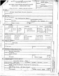
The - boundary of the - Peace Dale Historic District is<br />
represented-on the accompanying map, titled "<strong>National</strong> Register<br />
Historic District, Map of Peace Dale village," drawn at a scale<br />
of 1" 400’. The borders of the Peace Dale <strong>National</strong> Register<br />
Historic District are based on the evidence of historic maps and<br />
a careful analysis of existing conditions. - Fisk Flats has not<br />
been included. On the north, contiguous portions of Rocky Brook<br />
and a series of eighteenth- - and early nineteenth-century<br />
dwellings, spotted along North Road historically separate from<br />
Peace Dale’s evolution have-been omitted, while the Peace Dale<br />
School map #1 and a group of mill houses on Kersey Road have<br />
been included. The - district boundary includes extant Hazard<br />
estates on the south shore of Saugatucket Pond #15 and #17 but<br />
excludes the sites of two demolished Hazard houses, including<br />
property along Kingstown Road occupied by residential<br />
subdivisions developed after 1948. The boundary includes<br />
Kingstown Road dwellings south of the village center as far as<br />
School Street, where the north end of Wakefield-oriented<br />
development begins, on the east it encompasses the villagerelated<br />
section of Broad Rock Road and the most important<br />
surviving Hazard family house, the Acorns #71. The border<br />
skirts two groups of late twentieth-century houses off the<br />
eastern end of Church Street on Rose Circle and Steven Circle.<br />
School Street constitutes the district’s south line for the<br />
reason noted above. On the west, the boundary follows the<br />
Saugatucket River in order to include Peace Dale-oriented<br />
buildings on Columbia Street, then follows Church Street westwardas<br />
far as the former Peace Dale Congregational Church parsonage<br />
#88, turning north again and following the back lot lines of<br />
houses lining Railroad Street, omitting undeveloped property to<br />
the west. At Railroad Street and Kingstown Road the boundary<br />
includes the historic Railroad Street Bridge #78, then jogs<br />
east and north again, omitting the vacant Narragansett Pier<br />
Railroad right-of-way and- several non-historic commercial<br />
buildings, continuing<br />
Peace Dale School #1.<br />
to the district’s northwest corner<br />
-<br />
at the<br />
-