National Park Service - Rhode Island Historical Preservation ...
National Park Service - Rhode Island Historical Preservation ...
National Park Service - Rhode Island Historical Preservation ...

You also want an ePaper? Increase the reach of your titles
YUMPU automatically turns print PDFs into web optimized ePapers that Google loves.
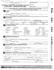
7. Description<br />
Condition<br />
excellent<br />
X good<br />
deteriorated<br />
ruins<br />
Check one<br />
unaltered<br />
_& altered<br />
Check one<br />
- original site<br />
-- moved date<br />
- fair - unexposed<br />
Describe the present and original if known physical appearance<br />
________<br />
Located in east-central South Kingstown, Peace Dale is the<br />
largest of a half dozen villages and lesser hamlets in town.<br />
Kingstown Road State Route 108 is the major artery running<br />
through Peace Dale, linking Kingston, a couple of miles<br />
northward, with Point Judith on the Atlantic coast, about five -<br />
miles to the south. -<br />
Kingstown Road crosses the Saugatucket River at Peace Dale’s<br />
center. Here stands the factory complex which is the village’s<br />
reason for being. Here too are the Hazard Memorial, containing<br />
the public library and assembly hall; the quasi-civic office<br />
Building, housing the post office, shops and a small museum; the<br />
headquarters of the Neighborhood Guild, with its recreational<br />
facilities and meeting rooms; and the village green.<br />
Additionally, at this village focal point may be found two of<br />
what were six interconnecting estates bordering Saugatucket Pond<br />
owned by the Hazard family, proprietors of the mills and creators<br />
of Peace Dale. Close to the mill complex cluster most of the<br />
village’s few commercial buildings, and the former railroad<br />
station now converted to residential and office use. A dozen<br />
residential streets fan out irregularly from this nexus and<br />
accommodate five school houses one now vacant and Peace Dale’s<br />
lone church. Because the village center and its environs are<br />
traversed by the meandering Saugatucket and’ several lesser<br />
streams, Peace Dale is replete with bridges: six small,<br />
privately-owned wooden bridges with the mill complex; seven<br />
highway bridges elsewhere in the village of which five are<br />
historic stone-arch spans erected in the 1880s and designed by<br />
Rowland Hazard II of the mill-owning family who, to a<br />
remarkable degree, designed and/or built much of Peace Dale.<br />
If defining the center of Peace Dale presents no difficulty,<br />
delineating the borders of the village constitutes a very<br />
problematic task. This has been the case since the late<br />
nineteenth century, when the nearby mill villages of Rocky Brook,<br />
Wakefield, and Peace Dale began to coalesce into a single builtup<br />
district,, and when formerly-vacant Fisk Flats, just northwest<br />
of Peace Dale, became a commercial zone serving all three<br />
villages. As presented in this nomination see district map,<br />
the borders of the Peace Dale <strong>National</strong> Register historic district<br />
are based on the evidence of historic maps and a careful analysis<br />
of existing conditions. Fisk Flats’has not been included. On<br />
the north, contiguous portions of Rocky Brook and a series of<br />
eighteenth-and early nineteenth-century dwellings spotted along<br />
North Road historically separate from Peace Dale’s evolution<br />
have been omitted, while the Peace Dale School map #1 and a<br />
group of mill houses on Kersey Road have been included. The<br />
district boundary includes extant Hazard estates on the south<br />
1