National Park Service - Rhode Island Historical Preservation ...
National Park Service - Rhode Island Historical Preservation ...
National Park Service - Rhode Island Historical Preservation ...

You also want an ePaper? Increase the reach of your titles
YUMPU automatically turns print PDFs into web optimized ePapers that Google loves.
V<br />
Farm<br />
0MB No.1024-cole 1!<br />
3M<br />
Eap 10-31-84<br />
United States Department of the Interior<br />
<strong>National</strong> <strong>Park</strong> <strong>Service</strong><br />
<strong>National</strong> Register of Historic Places<br />
Inventory-Nomination Form<br />
See instructions in How to Complete <strong>National</strong> Register Forms<br />
Type all entries-complete applicable sections<br />
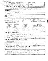
1. Name<br />
historic Peace Dale Historic District<br />
and:or common<br />
2. Location<br />
For NPS use only<br />
received<br />
date entered<br />
street & number N,A not for publication<br />
city, town South Kingstown N.A.vicinityot<br />
state <strong>Rhode</strong> <strong>Island</strong> code 44 county Washington code 009<br />
3. Classification<br />
Category Ownership Status Present Use<br />
X_. district public .2_ occupied - agriculture museum<br />
buildings private - unoccupied X_ commercial L_ park<br />
- structure _ both work in progress x_ educational JL_ private residence<br />
site Public Acquisition Accessible entertainment X_ religious<br />
- object in process yes: restricted government scientific<br />
being considered . yes: unrestricted .L industrial transportation<br />
no military X_ other: museum<br />
4. Owner of Property<br />
name Multiple owners - see list<br />
street & number<br />
city, town vicinity ot state<br />
5. Location of Legal Description -<br />
courthouse, registry otdeeds,etc. Town Clerk’s Office. Town Hall<br />
street&number 66 High Street<br />
clty,town South Kingstown, state RI 02879<br />
6. Representation in Existing Surveys<br />
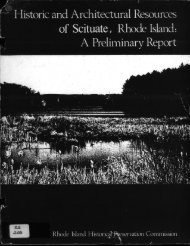
title Historic and Architectural Re - has this property_been determined eligible? yes A no<br />
sources ot bouth KingSt5Wn A Pre.LTIhTffary RepOrt<br />
date federai state county local<br />
depository tot survey records <strong>Rhode</strong> <strong>Island</strong> <strong>Historical</strong> <strong>Preservation</strong> Commission<br />
city, town<br />
Providence<br />
-<br />
state<br />
<strong>Rhode</strong> <strong>Island</strong><br />
4
7. Description<br />
Condition<br />
excellent<br />
X good<br />
deteriorated<br />
ruins<br />
Check one<br />
unaltered<br />
_& altered<br />
Check one<br />
- original site<br />
-- moved date<br />
- fair - unexposed<br />
Describe the present and original if known physical appearance<br />
________<br />
Located in east-central South Kingstown, Peace Dale is the<br />
largest of a half dozen villages and lesser hamlets in town.<br />
Kingstown Road State Route 108 is the major artery running<br />
through Peace Dale, linking Kingston, a couple of miles<br />
northward, with Point Judith on the Atlantic coast, about five -<br />
miles to the south. -<br />
Kingstown Road crosses the Saugatucket River at Peace Dale’s<br />
center. Here stands the factory complex which is the village’s<br />
reason for being. Here too are the Hazard Memorial, containing<br />
the public library and assembly hall; the quasi-civic office<br />
Building, housing the post office, shops and a small museum; the<br />
headquarters of the Neighborhood Guild, with its recreational<br />
facilities and meeting rooms; and the village green.<br />
Additionally, at this village focal point may be found two of<br />
what were six interconnecting estates bordering Saugatucket Pond<br />
owned by the Hazard family, proprietors of the mills and creators<br />
of Peace Dale. Close to the mill complex cluster most of the<br />
village’s few commercial buildings, and the former railroad<br />
station now converted to residential and office use. A dozen<br />
residential streets fan out irregularly from this nexus and<br />
accommodate five school houses one now vacant and Peace Dale’s<br />
lone church. Because the village center and its environs are<br />
traversed by the meandering Saugatucket and’ several lesser<br />
streams, Peace Dale is replete with bridges: six small,<br />
privately-owned wooden bridges with the mill complex; seven<br />
highway bridges elsewhere in the village of which five are<br />
historic stone-arch spans erected in the 1880s and designed by<br />
Rowland Hazard II of the mill-owning family who, to a<br />
remarkable degree, designed and/or built much of Peace Dale.<br />
If defining the center of Peace Dale presents no difficulty,<br />
delineating the borders of the village constitutes a very<br />
problematic task. This has been the case since the late<br />
nineteenth century, when the nearby mill villages of Rocky Brook,<br />
Wakefield, and Peace Dale began to coalesce into a single builtup<br />
district,, and when formerly-vacant Fisk Flats, just northwest<br />
of Peace Dale, became a commercial zone serving all three<br />
villages. As presented in this nomination see district map,<br />
the borders of the Peace Dale <strong>National</strong> Register historic district<br />
are based on the evidence of historic maps and a careful analysis<br />
of existing conditions. Fisk Flats’has not been included. On<br />
the north, contiguous portions of Rocky Brook and a series of<br />
eighteenth-and early nineteenth-century dwellings spotted along<br />
North Road historically separate from Peace Dale’s evolution<br />
have been omitted, while the Peace Dale School map #1 and a<br />
group of mill houses on Kersey Road have been included. The<br />
district boundary includes extant Hazard estates on the south<br />
1
NPS Form 10400. 0MB IC 1024-0018<br />
Exp. 10-31-84<br />
United States Department of the Interior<br />
<strong>National</strong> <strong>Park</strong> <strong>Service</strong><br />
<strong>National</strong> Register of Historic Places<br />
Inventory-Nomination Form<br />
Continuation sheet 1 Item number 7<br />
Page 2<br />
shore of Saugatucket Pond #15 and #17 but excludes the sites of<br />
two demolished Hazard houses, including property along Kingstown<br />
Road occupied by residential subdivisions developed after 1948.<br />
The boundary includes Kingstown Road dwellings south of the<br />
village center as far as School Street, where the north end of<br />
Wakefield-oriented development begins. On the east it<br />
encompasses the village-related section of Broad Rock Road and<br />
the most important surviving Hazard family house, the Acorns<br />
#71. The border skirts two groups of late twentieth-century<br />
houses off the eastern end of Church Street on Rose Circle and<br />
Steven Circle. School Street constitutes the district’s south<br />
line for the reason noted above. On the west, the boundary<br />
follows the Saugatucket River in order to include Peace Daleoriented<br />
buildings on Columbia Street, then follows Church Street<br />
westward as far as the former Peace Dale Congregational Church<br />
parsonage #88, turning north again and following the back lot<br />
lines ofhouses lining Railroad Street, omitting undeveloped<br />
property to the west. At Railroad Street and Kingstown Road the<br />
boundary includes the historic Railroad Street Bridge#78, then<br />
jogs east and north again, omitting the vacant Narragansett Pier<br />
Railroad right-of-way and several non-historic commercial.<br />
buildings, continuing to the district’s northwest corner at the<br />
Peace Dale School #1.<br />
Topographically, Peace Dale presents a varied scene, with<br />
lowest elevations in the stream bed valleys and highest<br />
elevations along Railroad Street, Kersey Road, and Church Street<br />
at Brown Street. Most of the district is well wooded. However,<br />
the mill yard#37 is largely devoid of trees, as is the<br />
industrial property and former railroad land to the south and<br />
west #82, 90, 91. Other large open spaces include the<br />
landscaped Green #41, the grounds of the Peace Dale School 1,<br />
and the complex of school properties at the southwest corners of<br />
the district #110, 113, and 115.<br />
Village streets possess distinct visual and historic<br />
characteristics. The main thoroughfare, Kingstown Road, winds<br />
through Peace Dale from northwest to southeast. This is an<br />
eighteenth-century highway, save for the tortured course it<br />
follows around the mill complex. Until 1870 at least, Kingstown<br />
Road ran straight through the mill site; when the factory complex<br />
was enlarged in the ‘70s, the road was rerouted to accommodate<br />
industrial expansion. Bordering the mills #37 on the south,<br />
this section of Kingstown Road passes on the north a small group<br />
of commercial buildings #19, #20, #23; the remnant of a small,<br />
contiguous early nineteenth-century factory complex #22, and
0MB PC 1024-0018<br />
NPS Form 10300-a Exp. 0-31-84<br />
3-82<br />
United States Department of the Interior<br />
<strong>National</strong> <strong>Park</strong> <strong>Service</strong><br />
<strong>National</strong> Register of Historic’ Places<br />
Inventory-Nomination Form<br />
Continuation sheet 3 Item number 7<br />
Page 4<br />
housing--that on Amos Stteet multi-unit, that on Brown Street<br />
single-family. Kimball Street is a short, dead-end right-of-way<br />
off Brown Street on which stand three good early twentiethcentury<br />
bungalows. Turn-of-the-century Branch Street, connecting<br />
Church Street and School Street, is characterized by a variety of<br />
modest late nineteenth-and twentieth-century dwellings. By<br />
contrast, Indian Run Road just to the east, bordered by a small<br />
brookside park between it and Kingstown Road, has a row of<br />
closely related company-built Colonial Revival dwellings<br />
possessing considerable architectural interest. School Street, a<br />
late nineteenth-century roadway at the south end of the <strong>National</strong><br />
Register historic district, has wakefield-oriented commercial and<br />
residential properties on its south side. The north side, within<br />
the district boundary, includes properties facing Indian Run Road<br />
and Branch Street, as well as the former High School now the<br />
School Street Apartments, #157 and Hazard School #115.<br />
The above account should not mislead the reader into<br />
thinking that Peace Dale lacks coherence. On the contrary, and<br />
issues of boundary definition notwithstanding, Peace Dale<br />
possesses remarkable unity, which can be defined in terms of<br />
purpose, focus, ownership, period, design, authorship, and<br />
ambience. Peace Dale is a mill village. Nearly all the<br />
buildings in the village were built for operations of the Peace<br />
Dale Manufacturing Company, to house its owners and workers, or<br />
to serve these same people when not at work. Peace Dale in every<br />
sense focuses on the mills, and on the adjacent facilities for<br />
commerce, recreation, education, relaxation, and worship provided<br />
by mills’ owners, the Hazard family. There are some 180<br />
properties in the Peace Dale historic district inventory;<br />
discounting roughly 20 non-historic buildings, there remain 160<br />
historically significant properties. Of these, about 110 are<br />
directly associated with the Peace Dale Manufacturing Company and<br />
the Hazard family. Moreover, every noteworthy building erected<br />
in every period up to the Second World war is associated with the<br />
Hazards--from "The Cottage" #17, of c.1790, the oldest building<br />
in Peace’ Dale, purchased by Rowland Hazard I in 1804 and used and<br />
reworked by generations of family into the 1960s; to the first<br />
stone mill of 1847 #37B; the second stone mill and office<br />
building of 1856 #37E and 40; the Congregational Church and<br />
railroad station of the ‘70s #106 and 82; The Acorns’ 1882,<br />
#71; the Hazard Memorial of 1891-92 #38; the turn-of-the<br />
century Colonial Revival dwelling built by the Company #149,<br />
#151, #154, and 164-167; the Neighborhood Guild of 1907-08<br />
#94; Hazard School 1911, #115; Stepping Stone Kindergarten<br />
1916-17, #124; and the Peace Dale School of 1923 #1.
- <strong>National</strong><br />
0MB PC 024-0018<br />
NPS Form 0-900-a Ezp- 10-31-84<br />
3-52<br />
United States Department of the Interior<br />
<strong>National</strong> <strong>Park</strong> <strong>Service</strong><br />
Register of Historic Places<br />
Inventory-Nomination Form<br />
Continuation sheet 4 Item number 7<br />
Page 5<br />
As a product of the growth and prosperity of the Peace Dale<br />
Manufacturing Company, village development closely paralleled<br />
that of the mills. This heritage remains intact and legible.<br />
The Company flourished in the seven decades between incorporation<br />
in 1848 and sale out of Hazard ownership in 1918. Of the 180<br />
buildings, objects and sites in Peace Dale, only about ten<br />
predate 1848, fewer than 30 postdate 1918. The major growth<br />
period was circa 1860-1895. Fully half the 180 properties date<br />
from that period. The detailed 1895 map of Peace Dale shows 115<br />
buildings not counting dependencies standing at that time; over<br />
100 survive.<br />
The unity of design characterizing Peace Dale architecture,<br />
in the broadest terms, can be defined as a certain reticence, a<br />
lack of showiness, which is pervasive. The only building which<br />
has something of a hint of bluster to it is the mill office<br />
#37A, once the nerve center of the community, and very aptly<br />
its physical center as well. The brick and stone building’s twotone<br />
color scheme, eccentric chimney, overwrought cornice and<br />
stained glass transoms are held in check by its ponderous<br />
proportions, symmetry, and small size. Other Peace Dale<br />
buildings are more soberly handsome. They can be subdivided into<br />
two major classes: mills and civic buildings, and residential<br />
architecture. Together they define the visual character of the<br />
village. The five village schoolhouses, while interesting<br />
individually and possessed of considerable design quality, are a<br />
disparate lot and do not add to the unity of, design under<br />
discussion; rather, they provide interesting, widely dispersed<br />
contrasting accents. Peace Dale mills and civic buildings, and<br />
village dwellings are consistent in materials: all the former<br />
are built of local gray granite, all the latter are of frame<br />
construction. As a rule, and this applies to all building types,<br />
the attributes of period-style are lacking or, very under-played..<br />
Thus the "Richardsonian Romanesgue" of the Hazard Memorial #38<br />
is not so pronounced as to dissociate this building from the<br />
styleless mills across the road #37, or the nominally<br />
"Colonial" Neighborhood Guild #94 on the opposite side of the<br />
Green. . -<br />
There are a great many more residential buildings in Peace<br />
Dale and naturally greater variety of design, but one type<br />
predominates: The L-plan, 1-1/2-story, gable-and cross-gable<br />
cottage with a 2- or 3-bay, end-gable main block containing the<br />
entrance, and a lateral kitchen ell sometimes with a lower roof<br />
height fronted by a porch. Sudh cottages comprise a quarter of<br />
the residential building stock. They are found on nearly every
P8,Form 10-900’.<br />
0MB IC 1024-0018<br />
- Eap- 10-31-84<br />
United States Department of the Interior<br />
<strong>National</strong> <strong>Park</strong> <strong>Service</strong><br />
<strong>National</strong> Register of Historic Places<br />
Inventory-Nomination Form<br />
Continuation sheet 5 Item number 7<br />
Page<br />
street, with many minor variations in design. They date as early<br />
as c.1860 and as late as c.1900. Many were company-built,<br />
providing an alternative to multi-unit housing. Of this last<br />
type of housing some 30 examples carl be found. Unlike the<br />
cottages just described, they follow no one pattern, ranging from<br />
1-1/2-story, flank-gable, 2-unit structures to 8-unit, 2-story,<br />
hip-roofed buildings.. There are even two mansard-roofed former<br />
rooming houses. It appears that the multi-unit buildings were<br />
clustered off the main streets and consciously’ arrayed to avoid<br />
the look of a typical company town.<br />
Authorship plays a distinctive role in Peace Dale’s visual<br />
coherence. As noted, the primary era of development here was<br />
between 1860 and 1895. Throughout that period one man, Rowland<br />
Hazard II who in association with other members of his family<br />
owned and operated the mills, had control over Peace Dale’s<br />
architectural development. He was himself an amateur architect<br />
and designed quite a number of structures, beginning, with the<br />
mill and the office building erected in 1856 #37E and 40, the<br />
1872 worsted mill #37F, the Congregational Church #104, a<br />
whole series of stone-arch bridges erected in the early 1880s<br />
#35, 78, 92, 93, 162, and an addition to the church’ built in<br />
1895. Other buildings are attributed to Hazard, notably the mill<br />
office #37A of 1881. He was’ responsible for building dozens of’<br />
other structures, particularly mill houses. The introduction and<br />
prevalence of the L-plan cottage in Peace Dale is credited to.<br />
Rowland Hazard II. He may have designed many of these cottages,<br />
but only four are presently attributed to him: two early,<br />
nominally "Gothic" cottages #88 and 114, and a pair of Queen<br />
Anne L-plan cottages on Kingstown Road #45 and 46. Moreover,<br />
Rowland Hazard called upon a professional architect with whom he<br />
particularly liked to work, Frank Angell, to design at least two<br />
major Peace Dale buildings: the railroad station #82 and the<br />
Hazard Memorial #38. Angell probably also designed The Acorns<br />
for Hazard and certainly planned alterations to the building<br />
#71. Frank Angell’s hand is. likely also found in severallater -<br />
buildings, among them a multi-unit mill house on Kersey Road #9<br />
and a group of company-owned houses on Brown Street, Church<br />
Street, and Indian Run Road dated to the late 1890s #149-151,<br />
154, 164-167. -<br />
Finally, the ambience of Peace Dale augments its unity.<br />
Peace Dale is a very picturesque, quiet, attractive village,<br />
casual in layout yet with a certain quality of kemptness and<br />
amenity which sets it apart. Though the mills are the focus,<br />
they do not-dominate the scene. This is not,the sort of factory
NPS Form 10.900-S<br />
United States Department of the Interior<br />
<strong>National</strong> <strong>Park</strong> <strong>Service</strong><br />
<strong>National</strong> Register of Historic Places<br />
Inventory-Nomination Form<br />
Continuation sheet 6 , Item number 7<br />
I’<br />
0MB Nt 1024-0018<br />
Esp- 10-31-84<br />
village where rows of dwellings face a huge, overbearing plant-like<br />
White Rock or Lonsdale, to cite two <strong>Rhode</strong> <strong>Island</strong> examples.<br />
At Peace Dale, there is a visual balance between mill, civic<br />
structures, and the residential sector. The visual quality of<br />
Peace Dale is such that the beautifully landscaped Hazard<br />
Memorial can harmonize with the mills across the road, and the<br />
Memorial’s grounds can be graced both by a whimsical stone<br />
watering trough designed by Rowland Hazard #36 and by a<br />
magnificent bronze monument, "The Weaver," by Daniel Chester<br />
French #39. The ambience of amenity makes it all work.<br />
Detailed descriptions of individual properties are<br />
contained in the inventory which follows.<br />
Page 7
PIPS Form 10-900-S<br />
United States Department of the Interior<br />
<strong>National</strong> <strong>Park</strong> <strong>Service</strong><br />
<strong>National</strong> Register of Historic Places<br />
Inventory-Nomination Form<br />
Continuation sheet 7 Item number 7<br />
PROPERTY INVENTORY<br />
Plo 1024-0018<br />
NOTE: Properties are listed in order by assigned historic map<br />
numbers see historic district map. Town Assessor’s<br />
map plat and lot numbers are listed below the historic<br />
district thap number. The entry proper is headed by the<br />
street address, property title where appropriate, and<br />
date. The letters C or NC following each entry<br />
indicate that a given property either contributes to<br />
the significance of the district C or is noncontributing<br />
NC.<br />
1 . . -<br />
48-2/73 -<br />
Kersey Road, Peace Dale Grammar School 1923:<br />
This handsome, single-story Colonial Revival brick school<br />
house has a modified E-plan. The gable roofs are variegated<br />
slate and the brickwork is laid up in Flemish bond. There are<br />
three pedimented entrances from the forecourt: the main<br />
entrance, with a segmental-head pedimented architrave, graces a<br />
cross-gabled central pavilion; two lateral entrances have small,<br />
cross-gabled porches with round-arch openings. Edith Hazard<br />
Forbes donated the site, and members of the Hazard family helped<br />
pay for the building. This was the last in a long series of<br />
local schools built by or with the assistance of the Hazard<br />
family, owners of the Peace Dale Woolen Mills until 1918. C<br />
2<br />
48-2/72<br />
t Kersey Road c. 1960:<br />
One-story, hip-roofed ranch-style house. NC<br />
Page 8<br />
3<br />
49-1/154<br />
737-39 Kersey Road, former mill tenement c. 1900:<br />
Located on Paddy’s Hill, this is one of a group of five,,<br />
multi-unit dwellings erected by the Peace Dale Manufacturing<br />
Company to house employees. This one is a very plain 2-story,<br />
hip-roofed structure with two entrances. C<br />
4<br />
49-1/124<br />
/31-33 Kersey Road C. 1900:<br />
This 2-story, hip-roofed former mill tenement on Paddy’s<br />
Hill has bracketed hoods over its twin entrances. It is similar,<br />
but not identical to neighboring 37-39 Kersey Road. C
NPS Form 10-900-a - 0MB P40,1024-0018<br />
3-82<br />
Exp tO-31-84<br />
United States Department of the Interior<br />
<strong>National</strong> <strong>Park</strong> <strong>Service</strong><br />
<strong>National</strong> Register of Historic Places<br />
Inventory-Nomination Form<br />
Continuation sheet 8 Item number 7<br />
5<br />
49-1/12 5<br />
727 Kersey Road c. 1890:<br />
Overlooking the lane leading up onto Paddy’s Hill from<br />
Kersey Road, this multi-unit former mill tenement is a 1-1/2story,<br />
flank-gable structure. Below, on the opposite side of the<br />
lane, is a small, shingled, hip-roofed utility building, perhaps<br />
once a transformer house. See photo #7 C<br />
6<br />
49-1/123<br />
Page 9<br />
/ 80-81 Kersey Road c- 1890<br />
Originally identical to neighboring 27 and 82-83 Kersey,<br />
this is a 1-1/2-story, flank-gable, multi-unit mill house on<br />
Paddy’s Hill, built by the company. It now has wood-shingle<br />
cladding and an added end entrance. C<br />
7<br />
49-1/122<br />
782-83 Kersey Road c. 1890:<br />
The northernmost of the 5 multi-unit former mill houses On<br />
Paddy’s Hill, this is a little-altered, 1-1/2-story, flank-gable<br />
structure with multiple entrances. C<br />
8<br />
49-1/138<br />
728-30 Kersey Road c. 1890:<br />
Very like mill houses on Paddy’s Hill, just opposite of f<br />
Kersey Road, this is a multi-unit, 2-story, hip-roofed clapboard<br />
structure 18-20 Kersey Road, #10, is very similar. C<br />
9<br />
49-1/137 -<br />
722-24 Kersey Road c. 1890:<br />
This former mill tenement was either designed by or reflects<br />
the influence of architect Frank Angell, who did a good deal of<br />
work for the Hazards in this era. The 2-story clapboard building<br />
has a high hip roof "kicked out" at the eaves; jack-raftered,<br />
broad eave soffits; bay windows and enclosed entrances. It is<br />
Peace Dale’s most elaborate multi-unit mill house. C
NPS Form 10-900-a<br />
3’52<br />
United States Department Of the Interior<br />
<strong>National</strong> <strong>Park</strong> <strong>Service</strong> -<br />
<strong>National</strong> Register of Historic Places<br />
Inventory-Nomination Form<br />
Continuation sheet g Item number<br />
0MB NO, 1024-0018<br />
Eap, 10-31-84<br />
10<br />
49-1/136<br />
18-20 Kersey Road C. 1890:<br />
This 2-story hip-roofed, clapboard former mill tenement is<br />
very similar to nearby 28-30 Kersey Road and to other late<br />
nineteenth-century mill houses erected by the Peace Dale<br />
Manufacturing Company on Paddy’s Hill. C<br />
11 - ‘ . -<br />
49-1/135<br />
Larkin Street c. 1960:<br />
One-story, 6-bay, gable-roofed garage. NC -<br />
Page 1 fl<br />
12<br />
4 9-1/129<br />
8 Kersey Road, former Peace Dale Grammar School 1902:<br />
Attributed to architect Frank Angell, this 2-story, shingled<br />
schoolhouse displays his characteristic design sophistication as<br />
well as cognate details like the high hip roof with "kicked-out"<br />
eaves and the suppression of any elaboration of window openings.<br />
Unassuming yet somehow imposing, a cross-gable on the building’s<br />
roof carries a louvered belfry. There is a very simple hiproofed<br />
entrance porch with shingled piers. On each side<br />
elevation the banks of classroom windows are articulated by<br />
curious pilasters flanking the central window. Despite the fact<br />
that this building is out of Town ownership and now is used<br />
largely for storage, it remains handsome and well preserved, a<br />
fine and now rare example of a once common building type. C<br />
13<br />
49-1/128<br />
North Road, northwest corner Kersey Road, The Dixon House,<br />
now Caswell Associates Realtors c. 1820:<br />
This 1-1/2-story, flank-gable, clapboard cottage has a<br />
central brick chimney and a 5-bay facade. A delicate, pilast,ered<br />
Late Federal architrave embellishes the central entrance. C<br />
14 -<br />
49-1/130 -<br />
10 North Road, southwest corner Kersey Road, the Thomas Lynch<br />
-r"HouSe c. 1820:<br />
A 1-1/2-story, flank-gable "cape" with central brick chimney<br />
and 5-bay facade with typical Late Federal pilastered entry.<br />
Very similar to the Dixon House #13. C
NPS Form *0-900-a<br />
3.82<br />
0MB P40*024-0018<br />
- Eip- 10-31-84<br />
United States Department of the Interiàr .<br />
<strong>National</strong> <strong>Park</strong> <strong>Service</strong><br />
<strong>National</strong> Register of Historic Places i%%øiUIJIji<br />
Inventory-Nomination Form<br />
Continuation sheet 10 -<br />
. Item number 7 Page<br />
15<br />
49-1/83<br />
7-9-11 North Road, The J. N. Hazard Estate, Lily Padsc. 1865 et<br />
- seq., now Lily Pads Professional Center:<br />
Much added-to and altered over the years, the wood-frame<br />
house, originally clapboard-clad, was later shingled and now is<br />
covered with aluminum siding. The earliest section of the house<br />
is a cross-gabled, 2-1/2-story structure, 3-bays across the<br />
front. The building became a Catholic retreat and school in<br />
1946, and several large wings were added subsequently. In the<br />
1970’s it was converted into offices, and a new entrance portion<br />
was added, connecting the house to the former carriage barn.<br />
Among other historic outbuildings on the property is a unique,<br />
cylindrical, shingled, mushroom-like wellhead of Japanese<br />
inspiration. The main house occupies a terrace overlooking the<br />
mill dam and head race; the property runs back from thedam along<br />
the shore of Saugatucket Pond. Lily Pads is the westernmost of a<br />
series of what were eventually six contiguous Hazard family<br />
estates-bordering the south end of the pond see #17 and #71.<br />
Born at Peace Dale in 1836, John Newbold Hazard was a<br />
grandson of Rowland Hazard I, founder of the local woolens<br />
industry. His father and uncle, Rowland Gibson and Isaac Peace<br />
Hazard, incorporated the company, changed its product line, and<br />
greatly expanded its business. J. N. Hazard studied at Brown<br />
University and in France. In the 1860s he entered the family<br />
business, succeeding his father as president of the Peace Dale<br />
Manufacturing Company in 1866, a post he held until 1892. He<br />
died at Peace Dale in 1900. C<br />
-1<br />
h6<br />
49-1/75, 83, 144 & 49-4/141<br />
North and south of Kingstown Road, Peace Dale Manufacturing<br />
Company Water Power System primarily mid-nineteenth century:<br />
The Peace Dale hydropower system typifies those found<br />
throughout <strong>Rhode</strong> <strong>Island</strong> on the state’s many small rivers where<br />
water-powered factories once dotted the rural landscape. The<br />
Peace Dale water power system stands out because it is well<br />
preserved and unusually beautiful. The heart of the system is<br />
- Saugatucket Pond, the dam, penstock house, headrace and spillway,<br />
all north of Kingstown Road. To the south, the headrace flows<br />
into the mill complex, over a fish ladder and adjacent ornamental<br />
waterfall added in the 1960s, and out tht’ough a tailrace running<br />
under the mills and back into the Saugatucket River. The<br />
aesthetic development of the water power system reflects the fact<br />
that it ran between two of the Hazard family’s estates, Lily Pads<br />
and The Cottage see #15 and #17. At the east end of the stone
- CUB NO 1024-0018<br />
NPS Form 10-900-a - Exp- 10-31-84<br />
3-82 P<br />
United States Department of the Interior<br />
<strong>National</strong> <strong>Park</strong> <strong>Service</strong> -<br />
-<br />
<strong>National</strong> Register of Historic Places<br />
Inventory-Nomination Form<br />
Continuation sheet 11 -<br />
- Item number 7 - Page 12<br />
dam is a small picturesque shingled building probably designed<br />
by Rowland Hazard II housing the penstocks which control the<br />
flow of water from the pond into the headrace. This power trench<br />
is a placid canal surrounded by dense woods and paralleled by<br />
"Water Way,". the beautiful entry drive laid out in 1888 by<br />
- landscape architect Charles Eliot leading from Kingstown Road - -<br />
back into the Hazard Compound. C<br />
- 17<br />
49-1/ 75<br />
North off Kingstown Road, The Cottage/Hazard Homestead c. 1790<br />
et seq.: -<br />
This secluded 12-acre estate at the southeast end of<br />
Saugatucket Pond is largely hidden from the road by the Hazard<br />
Memorial #38. The land and much added-to and Colonial<br />
Revivalized 1-1/2 story, gambrel-roofed cottage were part of<br />
Rowland Hazard I’s original Peace Dale purchase of 1804-05, sold<br />
to him by Benjamin Rodman. Generations of Hazards lived here<br />
until 1969. The site includes "Water Way" and a portion of the<br />
Peace Dale water power system see #16. It was on this<br />
property in the 1850s that Rowland Gibson Hazard erected a Gothic<br />
Revival dwelling which his nephew, Rowland G. Hazard II,<br />
aggrandized into a Tudor style mansion, Holly House, designed by<br />
McKim, Mead & White in 1892; it was demolished in 1948. See<br />
#71. C<br />
- /<br />
18 -<br />
49-1/81 /<br />
off Kingstown Road, behind Hazard Memorial, R. C. Hazard<br />
Estate Outbuilding c. 1880:<br />
This 1-1/2-story clapboard cottage has a distinctive bellcast<br />
gambrel roof. C<br />
19 - -<br />
49-4/154 - -<br />
689 Kingstown Road c. 1900:<br />
- Small 2-story, hip-roofed commercial/residential building.<br />
- A bookshop occupies the altered first floor. The building is<br />
- adjacent to the former Narragansett Pier Railroad right-of-way; a<br />
high trestle which carried the tracks over Kingstown Road has<br />
recently been demolished. C<br />
-
- 0MB NO- 1024-0018<br />
NPS Form 10-900-i - Eap- 10-31-84<br />
3-82<br />
United States Department of the Interior<br />
<strong>National</strong> <strong>Park</strong> <strong>Service</strong><br />
<strong>National</strong> Register of Historic Places<br />
Inventory-Nomination Form -<br />
Continuation sheet 12 - Item number 7<br />
20-<br />
49-1/147 - - -<br />
-- 685 Kingstown Road c. 1865/c. 1985:<br />
Much renovated 2-story, end-gable, clapboard commercial<br />
building; a colossal portico has recently been added to the<br />
street elevation. C -<br />
Page 13<br />
21<br />
49-1/146 -<br />
681 Kingstown Road, former J. P. Hazard Dye House c. 1835:<br />
Now an antiques and upholstery shop, this much altered 1story,<br />
flank-gable stone building is the last extant remnant of<br />
Joseph P. Hazard’s mill complex. Initially an axe manufactory,<br />
the property was leased to Stephen Wright and Stephen Fisk and<br />
converted into.a textile plant producing kerseys. This building,<br />
along with the mill and mill pond, were purchased by the Peace<br />
Dale Manufacturing Company before 1895. The mill was taken down<br />
and the pond was filled in, providing space for new housing on<br />
Green Street. C<br />
22 -<br />
49-1/145 -<br />
675 Kingstown Road c. 1900:<br />
Much altered flank-gable, 1-1/2-story mill tenement standing<br />
on or near the site of Joseph Hazard’s factory erected in the<br />
1830s which first produced axes, then kersey woolen goods See<br />
#21. C<br />
23 -<br />
49-1/14 3<br />
669 Kingstown Road, Store c. 1925:-<br />
This 1-1/2-story stuccoed, gable-on-hip-roofed former<br />
grocery store is a good example of the picturesque "English<br />
Cottage" style applied to a commercial structure. The front roof<br />
slope is brought down low over the storefront and is broken by a<br />
shed dormer adorned with patterned shingling. The storefront<br />
features twin bay windows flanking the entrance. C<br />
24<br />
49-1/142 -<br />
657 Kingstown Road c. 1880:<br />
A very typical Peace Dale Company-built single-family<br />
- cottage. This 1-1/2-story L-plan dwelling has a cross-gable<br />
roof; a 2-bay, end-gable main block containing the entrance; and<br />
a lateral porch-fronted kitchen ell. C
NPS Form 10-900-. . 0MB NOJ024-0OI8<br />
3-82<br />
Exp. 10-31-84<br />
United States Department of the Interior<br />
<strong>National</strong> <strong>Park</strong> <strong>Service</strong><br />
Nationa! Register of Historic Places<br />
Inventory-Nomination Form -<br />
Continuation sheet 1 3 Item number 7<br />
25<br />
49-1/131<br />
Kingstown Road, northwest corner North Road c. 1870:<br />
According to local historian Oliver Stedman, this 2-1/2story,<br />
mansard-roofed former mill tenement was moved here in 1891<br />
to make way for construction of the Hazard Memorial #38. C -<br />
26<br />
49-1/148 -<br />
8-14 Green Street c. 1900:<br />
r Standing on the site of Joseph Hazard’s mill pond, this 4unit<br />
row house was erected by the Peace Dale Manufacturing<br />
Company. The 1-1/2-stdry flank-gable building is accented by two<br />
cross gables. C - -<br />
27 -<br />
49-1/141 - . -<br />
3-15 Green Street 1906: -<br />
This 6-unit, 2-story row in the past decade has been<br />
renovated extensively,-the exterior clad in rough, "rustic",<br />
dark-stained board-and-batten siding. Despite its lack of<br />
architectural quality, historically this structure has<br />
substantial importance. Early in 1906 many Peace Dale mill<br />
workers went out on strike. This was the first significant labor<br />
dispute since Rowland Hazard I began manufacturing woolen goods<br />
here nearly a century before. This row was thrown up in March of<br />
1906 by the company to house strikebreakers mostly Italian<br />
immigrants recruited in Providence brought in to keep the mills<br />
running. C - -<br />
28<br />
49-1/140 -<br />
21 Green Street c. 1900:<br />
Altered, 2-1/2-story, end-gable, 4-bay late Queen Anne house<br />
similar to 22 Green Street 29. C<br />
29 - -<br />
49-1/14 9<br />
Page 14<br />
..-- 22 Green Street c. 1900: -<br />
Little altered 2-1/2-story, end-gable, clapboard and shingle<br />
late Queen Anne house; 3-bay facade with turned-post front porch.<br />
C - -
- NPS Form 10-900-i<br />
3-82 -<br />
United States Department of the Interior<br />
<strong>National</strong> <strong>Park</strong> <strong>Service</strong><br />
<strong>National</strong> Register of Historic Places<br />
- Inventory-Nomination Form dosr<br />
0MB HOc 1024-0018<br />
Eap- 10-31-84<br />
Continuation sheet 14 Item number 7 Page 15<br />
30 - - -<br />
49-1/139 -<br />
34 Green Street c. 1885:<br />
1-1/2-story clapboard and shingle Queen Anne double mill<br />
/ cottage; there is a very plain, plank-sided out building on the<br />
site. C -<br />
31 -<br />
49-1/155 -<br />
Green Street, corner Larkin, Peace Dale Manufacturing<br />
Company Barn 1866: - -<br />
This shingled bank barn has shed-roofed appendages. There<br />
is also a board-and-batten shed on the site. Rural factories<br />
like Peace Dale’s woolen mills generally depended on<br />
transportation provided by horse-drawn freight wagons to bring in<br />
raw materials and take out finished goods. The railroad did not<br />
come to Peace Dale until 1876, and even after that date there was<br />
a need for horses and wagons. The barn served this adjunct to<br />
industrial production. C<br />
32 -<br />
49-1/134<br />
Larkin Street c. 1880:<br />
Typical company-built, L-plãn, 1-1/2-story, cross-gabled<br />
cottage; the kitchen wing has a porch across the front. There<br />
are numerous small outbuildings on the property. C<br />
49-1/13 3<br />
9 Larkin Street c. 1880:<br />
A very small, L-plan, company-built, cross-gabled cottage.<br />
C<br />
34<br />
49-1/132 -<br />
3 Larkin Street, the Stephen Fisk Cottage c. 1840:<br />
This 1-1/2-story, flank-gable, clapboard cottagehas a 4-bay<br />
,.- facade. Essentially Late Federal in style, the dwelling has a<br />
broad, simple Greek Revival entrance. In the 1840s and ‘SOs<br />
Stephen Fisk leased the nearby Joseph Hazard mill see #21 and<br />
#26 and produced kersey cloth with great success. Prosperity<br />
led Fisk to buy a large tract later known as Fisk Flats and in<br />
the lasos he built a new and larger residence there. C
NPS Form 10-900-. - 0MB NO- ‘024-0018<br />
3-82<br />
Eap. 10-31-84<br />
United States Department of the Interior<br />
<strong>National</strong> <strong>Park</strong> <strong>Service</strong><br />
<strong>National</strong> Register of Historic Places<br />
Inventory-Nomination Form -<br />
Continuation sheet 15 Item number - 7<br />
Page io<br />
35 -<br />
49-1/no lot #<br />
Kingstown Road Saugatucket Bridge c. 1880/1926:<br />
The stone bridge has a stone-walled sidewalk on its north<br />
side. One of the seven stone-arch bridges designed by Rowland<br />
Hazard II and erected in Peace Dale, this bridge has a span of 24<br />
feet.. A stone-walled sidewalk was added after this bridge became<br />
State property. C<br />
36<br />
49-4/140 -<br />
Kingstown Road at the Hazard Memorial, Watering Trough 1890:<br />
This unique and rugged stone watering trough is a 3-tiered<br />
affair--a large circular bowl on a pedestal for horses, a midlevel<br />
basin for oxen, and a small low basin for dogs.. It is a<br />
characteristic design of Rowland Hazard II -- a bit crude, very<br />
original, and thoroughly charming. Rowland Hazard donated this<br />
gift to the four-legged residents of Peace Dale and it stood in<br />
the center of Kingstown Road, in front of his mill office, from<br />
1890 until it was moved to its present site in 1959 see photo<br />
#1. C - -<br />
37<br />
49-1/144 & 49-4/141, 143, 153 -<br />
Kingstown Road & Columbia Street, Peace Dale Manufacturing<br />
Company Mill Complex 1847 et seq.: - -<br />
The existing mill complex replaces earlier mills located<br />
north of Kingstown Road destroyed by fire in 1844. Portions of<br />
the water power system date to the 1840s see #16, as does the<br />
relic-like tower and end gable of the 1847 woolen mill 37B.<br />
That structure is built of granite rubble, and so too are eight<br />
of the eleven other buildings in the complex; three later<br />
buildings are brick. No major buildings have been demolished.<br />
The only structures no longer standing were ancillary facilities,<br />
a brick gasometer and a series of small frame sheds -- the<br />
machine shop, carpenter shop, paint shed, bicycle shed, store<br />
houses, etc. All of the standing structures have been altered,<br />
some substantially, over the years. Nevertheless, this is one of<br />
<strong>Rhode</strong> <strong>Island</strong>’s best preserved nineteenth-century textile<br />
manufacturing complexes, one of the most important in historic<br />
terms, and one of the most picturesque. It remains in industrial<br />
use, including textile manufacturing.<br />
Isaac P. and Rowland G. Hazard sons of founder Rowland<br />
Hazard ran the family business when the fire of 1844 occurred.<br />
They had the hydropower system rebuilt and enlarged and they<br />
constructed the first stone mill here, in 1847 37B. They -
0MB IC 1024 0018<br />
NPS Form 10-900-i Exp- 10-31-84<br />
3-82 -<br />
United States Department of the Interior<br />
<strong>National</strong> <strong>Park</strong> <strong>Service</strong> -<br />
<strong>National</strong> Register of Historic Places<br />
Inventory-Nomination Form -<br />
Continuation sheet 16 - Item number 7<br />
Page 17<br />
incorporated the firm as the Peace Dale Manufacturing Company in<br />
1848 and began production of high-quality woolens in 1849. They<br />
made shawls, which gained wide renown, in place -of the kersey<br />
cloth and linsey-woolsey formerly produced. Manufacturing<br />
capacity was- greatly increased in 1856, with the construction of<br />
a-new and larger stone factory 37E. It was on of two buildings<br />
designed that year for the company by Rowland G. Hazard’s son,<br />
owland Hazard II, a latter-day gentleman architect. Most of the<br />
- later buildings in the mill complex are either known to be his<br />
work or are attributed to him.<br />
In 1868 a stone finishing plant was erected. In 1872 the<br />
Peace Dale Manufacturing Company again changed its product line,<br />
converting to worsteds, becoming one of the first full-production<br />
worsted plants in the country. - A new stone mill went up 37F<br />
from Rowland Hazard II’s plans. A major wing 37C was added to<br />
the first stone mill and that 1847 structure 37B was radically<br />
reduced in size. Only the stair tower, belfry, and stepped end<br />
gable remain; they were preserved, consciously, as a monument to<br />
the firm’s early history. In the mid-187Os a small stone<br />
laboratory building went up 37D and in 1881 a small yet<br />
imposing brick-trimmed stone mill office 37A was erected. It<br />
is believed the grouping of stone dye houses 37J was also<br />
constructed in the 1880s, as well as the stone weave shed 37G.<br />
The brick portions of the power plant 371 date to the 18908,<br />
- and two wool warehouses 37K and 37L date to about 1900.<br />
Because a network of waterways crisscrosses the mill yard,<br />
there has always been a need for bridges facilitating internal<br />
transportation and linking the mills to Kingstown Road and<br />
Columbia Street. None of the small nineteenth-century bridges<br />
within the mill complex survives. They have been replaced<br />
sympathetically by a half-dozen timber spans bridging the<br />
Saugatucket River and the mill race.<br />
A perspective view of the.mill complex published in 1901<br />
shows the Peace Dale plant at its fullest development and reveals<br />
that it remains essentially intact. The most significant changes<br />
since 1901 aside from the demolition of secondary structures<br />
noted above involved the reworking of the roofs of the worsted<br />
mill and weave shed 37F and 370. In the past twenty years new<br />
- owners have re-landscaped the most visible portions of the mill<br />
yard. This embellishment recalls the late nineteenth-century<br />
greening of the factory complex when the Peace Dale Mills were<br />
ivy-decked and surrounded by small lawns and great elms.
0MB NO- 1024-0018<br />
NPS Form 10-900-i - - En,- 10-31-84<br />
3-82<br />
United States Department of the Interior<br />
<strong>National</strong> <strong>Park</strong> <strong>Service</strong><br />
<strong>National</strong> Register of Historic Places<br />
Inventory-Nomination Form - -<br />
Continuation sheet 17<br />
Item number 7<br />
Page 1 $<br />
37A -<br />
Mill Office 1881:<br />
This small yet monumental brick-trimmed stone building<br />
terminates the vista north up Kingstown Road toward the center of<br />
the village. Its location and elaboration herald the fact that<br />
it was the nerve center of Peace Dale. The 1-1/2-story structure<br />
has a high basement. Its stone walls terminate in an extremely -<br />
heavy, corbelled brick cornice; there are brick panels below each<br />
window. The windows have stained glass transoms. The high hip<br />
roof is accented by gabled dormers and enriched at the ridge by a<br />
massive chimney stack in brick corbelled out at the top above a<br />
row of four small blind and open arches. Known as the "counting<br />
house" within the Hazard family, this striking, more-or-less<br />
Queen Anne style building is attributed to Rowland Hazard II,<br />
whose office was here see photos #1 and #2. C<br />
373<br />
- The original Peace Dale Stone Woolens Mill 1847 et seq.:<br />
The extant structure is a remnant of the 1847 mill building<br />
preserved for its historic interest by the Hazard family when the<br />
plant was greatly enlarged and converted for production of<br />
worsted goods. Of the 1847 factory what survives is the 2-1/2story,<br />
stepped-end-gable, 3-story, and belfry. The Greek Revival<br />
style belfry is frame. From a panelled base section housing the<br />
bell-there rises a delicate open framework forming a short spire<br />
crowned by a weathervane in the form of a shuttle. The main body -<br />
of the 1847 mill was replaced by a 1- and 2-story flat roofed<br />
structure which in truth is but an appendage to a large 2-story<br />
wing 37C. see photo #2. C<br />
37C -<br />
Wing added to the 1847 Mill 1847 et seq.:<br />
The 2-story stone wing has a very low gable roof. Its end<br />
wall on Columbia Street is incorporated directly into the<br />
stonework of the relic-like remnant of the 1847 mill 373. The<br />
long west wall of this mill as well as the east wall of the<br />
reworked 1847 mill have what in effect are "ribbon windows" -continuous<br />
banks of 12/12 sash with narrow, metal-clad posts<br />
between. Most extant glazing is heavy, ribbed diffusion glass<br />
see photo #2. C<br />
37D<br />
Laboratory and Store House c. 1875:<br />
Small, 2-story stone structure with low pitched roof, wide<br />
eaves. The lower story has few openings; there are S windows on<br />
each side in the second story. Now used as offices, there is a
0MB HOc 10240018<br />
NPS Fou,, 10-900-. - - En,- 10-31-84<br />
3-82 -<br />
United States Department of the Interior<br />
<strong>National</strong> <strong>Park</strong> <strong>Service</strong><br />
<strong>National</strong> Register of Historic Places<br />
Inventory-’-Nomination Form -<br />
Continuation sheet 18 Item number 7<br />
Page 19<br />
modern grille of closely spaced upright 2x4s on the street end<br />
gable see photo #2. C<br />
37E - -<br />
Woolens Mill 1856: -<br />
This 2-story stone factory, 117x57’, has a low-pitched roof<br />
and a pair of corner towers on the east end. Originally, this<br />
was a 3-story building with wide eaves overhangs. It has been<br />
reduced in height and the roof simplified. In 1883 the southeast<br />
corner tower was given a mansard roof. The interior of this<br />
structure has been gutted: it is now one vast open space.<br />
Rowland Hazard II produced the original design of this atypical<br />
factory. He probably also designed the mansard tower roof, and<br />
possibly other alterations see-photo #1. C<br />
37F - -<br />
Worsted Mill 1872:<br />
The worsted mill as designed by Rowland Hazard II was a<br />
3-1/2-story stone factory, 155x60’, with a monitor-on-gable roof.<br />
In the early twentieth century the top floor was made a full<br />
story, the walls were built up accordingly, and the existing lowpitched<br />
roof replaced the original. C<br />
37G<br />
Weave Shed c. 1880/1902/1920:<br />
The 1-story stone weave shed is another Rowland Hazard II<br />
building. Roughly 175 feet square, it had a flat roof with a<br />
large rectangular "lantern" to provide light to the center of the<br />
structure. This roof form was replaced by the existing and much<br />
more typical sawtooth roof with north-facing glazing now largely<br />
covered over. C<br />
37H . -<br />
Finishing Plant 1868/c. 1902: .<br />
This 2-story stone structure has an altered low-pitched<br />
gable roof. A long, narrow lateral wing has been added to the<br />
northwest corner of the building. C<br />
371 . -<br />
Former Power Plant c. 1872/c. 1890:<br />
Now used as a forge, the much altered power plant is a 1and<br />
2-story, flat-roofed stone and brick structure. Only the<br />
bottom portion of what was a very tall brick smoke stack<br />
survives. Steam power was provided to augment water power,<br />
probably when the mill complex was much expanded in the early<br />
1870s. In 1875 the Narragansett Pier Railroad was built; it was
NPS Form 10-900-. 0MB IC 1024-0018 -<br />
3-82 En,. 10-31-84<br />
United States Department of the Interior<br />
<strong>National</strong> <strong>Park</strong> <strong>Service</strong><br />
<strong>National</strong> Register of Historic Places<br />
Inventory-Nomination Form<br />
Continuation sheet 1 9 Item number 7<br />
adjacent to and above the level of the mill yard and an elevated<br />
spur now gone ran from the NPRR mainline to the coal-bins of<br />
this building. C -<br />
373 -<br />
Dye Houses c. 1885:<br />
This complex and irregular group of much altered,<br />
interconnected 1- and 2-story stone buildings has very lowpitched<br />
gable roofs. C<br />
37K - . -<br />
Wool Store House c. 1900:<br />
3-story brick warehouse with-low-pitched gable roof, typical<br />
small, segmental-head windows. A railroad siding now gone<br />
connected this structure to the Narragansett Pier Railroad main<br />
line; an elevated gantry also gone. linked it to -the mill<br />
complex on the opposite shore of the Saugatucket River. C<br />
37L<br />
Warehouse c. 1900:<br />
A small shed-roofed brick warehouse, much altered and<br />
removed from the rest of the mill complex. NC<br />
Page 20<br />
38<br />
49-4/140 -<br />
Kingstown Road, Hazard Memorial/Peace Dale Library<br />
1890-91:<br />
From an architectural standpoint, this is the finest<br />
- building in the village; indeed, it is a very good example of the<br />
Richardsonjan Romanesque in any context see photo #3. The<br />
building consists of two sections: a stone main block housing<br />
the library, and a shingle-clad frame rear wing housing an<br />
auditorium. The 2-1/2-story stone section has hipped roofs with<br />
a distinct bellcast at the eaves and wide jets with jackrafter<br />
supports. The stereotomy in contrast to that of Peace Dale’s<br />
many other stone buildings is very sophisticated, utilizing two<br />
subtly different shades of pink and gray granite. The body of<br />
the building is rockfaced gray granite in uncoursed ashlar, with<br />
belt courses and window-trim in pink granite. The unity and<br />
solemnity of the structure is offset by almost whimsical dormers<br />
in a variety of picturesque shapes.<br />
A veritable cascade of curving, low steps flows -out from the<br />
entrance, recessed within a great round arch. The form of the<br />
archway is echoed in a large, half-round bay projecting from the<br />
body of the building beside the entryway. The shingled<br />
auditorium reads clearly on the exterior as a single, 2-1/2-story
0MB HO- 1024-0018<br />
NPS Form 10-900-i En,- 10-31-84<br />
3-fl<br />
United States Department of the Interior -<br />
<strong>National</strong> <strong>Park</strong> <strong>Service</strong><br />
<strong>National</strong> Register of Historic Places<br />
Inventory-Nomination Form -<br />
Continuation sheet 2 0 Item number 7 -<br />
Page 21<br />
interior space because, in each side, there is a pair of 2-1/2-<br />
-story transomed windows glazed with frosted and tinted glass. On<br />
the north side of the auditorium is a covered entrance porch and<br />
on the south is a corresponding porte cochere; both are hiproofed<br />
and shingled.<br />
one of the glories of this building is the fact that it is<br />
so little altered. The exterior is virtually original. The<br />
interiors are largely intact, preserving not only the floor plan<br />
but also the original finish, detail,- and many furnishings. This<br />
is so both in the library and the auditorium.<br />
The Hazard Memorial was donated to the community by Rowland<br />
Hazard II and John N. Hazard, sons of Rowland G. Hazard, who died<br />
in 1888. Architect Frank W. Angell designed the building. It<br />
was the outstanding achievement of a long professional<br />
association between Angell and Rowland Hazard II an amateur<br />
architect in his own right dating back to the early 18705. The<br />
Memorial was an instant success, becoming the social hub of the<br />
entire town. Here lectures, concerts, plays and graduation<br />
ceremonies took place into the mid-twentieth century.<br />
The Memorial’s grounds are like the building itself,<br />
handsome and well maintained. The building occupies the summit of<br />
a high, sloping, corner lot at the-center of the village opposite<br />
the mills 37 and the office building 40. Lawns, large shade<br />
trees, and mature plantings of shrubbery set off this structure.<br />
The landscaping is attributed to Charles Eliot. The most<br />
conspicuous embellishment to the grounds is "The Weaver", a large<br />
sculptural memorial #339. C -<br />
39 -<br />
49-4/140 . -<br />
Kingstown Road, "The Weaver" c. 1920:<br />
Located on the grounds of the Hazard Memorial/Peace Dale<br />
Library #38, "The Weaver" is a substantial stone and bronze -<br />
monument, flanked by rhododendrons, presented by Miss Caroline<br />
Hazard in memory of her father, Rowland Hazard II, and her<br />
brothers, Rowland G. Hazard II and Frederick R. Hazard. The work<br />
of sculptor Daniel Chester French, "The Weaver" is an allegorical<br />
monument of classical inspiration, wedding the theme of thethread<br />
of life with -the Hazard’s and Peace Dale’s history in<br />
the textile business. Based on ancient funerary tablets in high<br />
relief, in this memorial three figures nearly in the round and<br />
life-size are presented as a-tableau against a flat slab. A<br />
seated, youthful male figure, clad in a-sheepskin, weaves the<br />
cloth. Behind, in classical garb, stands, a female figure bearing<br />
the distaff and the thread, which she hands to him. Just behind
NPS Form 10-900-i<br />
3-82 -<br />
United States Department of the Interior -<br />
<strong>National</strong> <strong>Park</strong> <strong>Service</strong><br />
<strong>National</strong> Register of Historic Places<br />
Inventory-Nomination Form -<br />
Continuation sheet 21 . Item number 7<br />
0MB HOc 10240018<br />
En,- 10-31-84<br />
Page 22<br />
the central figure is Time, heavily shrouded, carrying an hour<br />
glass. She will cut the thread. -<br />
Caroline Hazard, retired president of Wellesley College, was<br />
an historian. Both personally and professionally she had a keen<br />
interest in her family and its accomplishments. And although she<br />
and other Hazards continued to have considerable influence on<br />
life in Peace Dale for some two decades more,’ -1920 was a very apt<br />
time to erect this memorial. It marked the end of an era: the<br />
Hazard heirs sold the Peace Dale Mills in 1918. C<br />
- 4049-4/138<br />
604 Kingstown Road, corner Columbia Street, Peace Dale Office -<br />
Building 1856/c. 1908:<br />
This oblong, .3-story, granite-rubble building was one of<br />
Rowland Hazard II’s first designs see #37E. Designed to<br />
accommodate the company store, mill offices, the local library<br />
association, and a meeting hall, the building originally had a<br />
low gable roof with broad eaves. The original 1856 storefront<br />
modified with plate-glass windows exists on the Columbia Street<br />
- side of the building. The Post Of fice storefront on the east<br />
-- elevation as well as the present hipped roof and ornamental<br />
balcony on the south end are all early twentieth-century<br />
alterations which transformed this ponderous early Victorian<br />
- block into something a bit more refined and faintly Federal<br />
- Revival. In addition to the Post Office, the building houses a<br />
shop, offices, room used by the Neighborhood Guild #96 and the<br />
Museum of Primitive Culture. The top-floor meeting hall was<br />
eliminated after its function was taken over by Hazard Memorial<br />
Hall #38. C - -<br />
41 - -<br />
49-4/125 -<br />
Kingstown Road, Columbia Street and Spring Street, The Green<br />
1907-08:<br />
This 4-acre grassy park, traversed by Indian Run, has a row<br />
of oak trees along Kingstown Road and willows bordering Columbia<br />
Street. There are two tennis courts at the Spring Street end of<br />
the property and a parking area between the Green and the<br />
Neighborhood Guild. When members of the Hazard family erected<br />
the Neighborhood Guild #94 in 1907-08, the family-owned and<br />
operated Peace Dale Manufacturing created this small park. Both<br />
the Green and the Guild were designed by R. C. Sturges, a Hazard<br />
relation. The Green links the Guild to the Hazard Memorial #38<br />
and creates a public "breathing space" and greensward in the<br />
center of the village. C -
NPS Form 10-900-. 0MB IC 1024-OOIB<br />
3-82 En,- 10-31-U<br />
United States Department of the Interior<br />
Natiohal <strong>Park</strong> <strong>Service</strong> - - -<br />
<strong>National</strong> Register of Historic Places<br />
Inventory-Nomination Form<br />
Continuation sheet 22 Item number 7<br />
Page 2 3<br />
42 -<br />
49-4/123<br />
586 Kingstown Road c. 1885:<br />
Built by the Peace Dale Manufacturing Company, this is a 1-<br />
_--1/2-story, end-gable clapboard cottage with a 3-bay front and<br />
turned-post Queen Anne porch. C -<br />
43<br />
49-4/124<br />
582-584 Kingstown Road c1890: . -<br />
Company-built, flank-gable, 1-1/2-story mill house with twin<br />
entrances. C<br />
44<br />
4 9-4/6 1<br />
578 Kingstown Road, corner Spring Street c. 1845:<br />
This altered, early nineteenth-century 1-1/2-story, flankgable<br />
5-bay cottage stands on a high granite basement and has a<br />
- 0MB HO. 1024-0010<br />
NPS Form 10-900-. En,- 10-31-84<br />
3-82<br />
United States Department of the Interior<br />
<strong>National</strong> <strong>Park</strong> <strong>Service</strong> - -<br />
Nationa! Register of Historic Places<br />
Inventory-Nomination Form -<br />
Continuation sheet 23 Item number 7<br />
47 -<br />
49-4/116<br />
571 Kingstown Road c. 1865:<br />
Typical company-built 1-1/2-story, L-plan, cross-gabled<br />
cottage; the 2-bay main block has a bay window flanking the<br />
hooded entrance. There are a number of nineteenth-century, Queen<br />
Anne style alterations and the building has been clad in rustic<br />
wood shakes. C -<br />
48 -<br />
49-4/115<br />
- 569 Kingstown Road c. 1845:<br />
This 1-1/2-story, clapboard, flank-gable, 5-bay, centralentrance<br />
Greek Revival cottage must have been moved to this site<br />
in about 1865 for use as a mill house. It has characteristic<br />
corner pilasters and a sidelighted entry with plank entablature.<br />
C - - -<br />
49 -<br />
49-4/6 4<br />
-- 568 Kingstown Road, the George Rodman Cottage c. 1885:<br />
Altered, 1-1/2- and 2-1/2-story, cross-gabled Queen Anne<br />
cottage; a 2-story former stable in the rear yard is now<br />
apartments. C<br />
/<br />
50 . . -<br />
49-4/114 . -<br />
- 565 Kingstown Road c. 1865: - -<br />
Typical company-built L-plan, 1-1/2-story, cross-gabled<br />
cottage, here with Queen Anne and later alterations. The 2-story<br />
main block has a large semi-octagonal bay window flanking a<br />
hooded entrance. The kitchen ell porch has been enclosed. C -<br />
‘51<br />
49-4/65 -<br />
564 Kingstown Road c. 1960:<br />
-1-story, hip-roofed "ranch". NC<br />
52 . . - -<br />
49-4/66 -<br />
560 Kingstown Road-, the J. H. Brown House c. 1865:<br />
- Flank-gable, 2-1/2-story, clapboard tenement; hip-roofed -<br />
front porch; 4-bay facade with twin entrances; 2 small shed<br />
dormers. C<br />
-<br />
Page 24
- 0MB HO. 1024-0018<br />
NPS Form 10-900-i En,- 10.31-84<br />
3-92 -<br />
United States Department of the Interior<br />
<strong>National</strong> <strong>Park</strong> <strong>Service</strong> -<br />
<strong>National</strong> Register of Historic Places<br />
Inventory-Nomination Form<br />
Continuation sheet 24 Item number 7<br />
53 -<br />
49-4/112 -<br />
559 Kingstown Road, the J. Mulligan Cottage c. 1860:<br />
7 Small,- 1-1/2-story, end-gable cottage with a shed-roofed<br />
addition on the north side and a small wing added at the rear.<br />
The 2-bay main elevation has a large, semi-octagonal bay window -<br />
beside a sidelighted late ‘Greek Revival-type entrance. C<br />
57<br />
49-4/76<br />
,- 556 Kingstown Road c. 1900:<br />
Small, 1-1/2-story, shingled, end-gable 3-bay cottage. C<br />
58<br />
49-4/77 - -<br />
-552 Kingstown Road, the N. E. Potter Cottage c. 1875:<br />
Altered, end-gable, 1-1/2-story dwelling with a square bay<br />
window;,sun porch addition. Jackrafter roof jets, and window and<br />
door hoods make this a very Downingesque cottage. C<br />
/5 9<br />
,49-4/109<br />
551 Kingstown Road c. 1950:<br />
Altered, wood-shingle cape/ranch with attached garage.<br />
Page 2S<br />
NC
- OMBN0cIO24-OOIB<br />
NPS Form 10-900-8 - En,- 10-31-fl<br />
3-82<br />
United States Department of the Interior<br />
<strong>National</strong> <strong>Park</strong> <strong>Service</strong><br />
<strong>National</strong>-Register of Historic Places<br />
Inventory-Nomination Form<br />
Continuation sheet 2 5 Item number 7<br />
60<br />
49-4/78 ‘ -<br />
550 Kingstown Road, the Theodore Friday Cottage c. 1860:<br />
Altered 3-bay, 1-1/2-story, end-gable cottage with enclosed<br />
porch. C -<br />
61 -<br />
49-4/79 - -<br />
- 546 KingstOwn Road c. 1840:<br />
Moved and altered 1-1/2-story, end-gable, 2-unit early mill<br />
house. C<br />
62<br />
49-4/108 -<br />
_.- 547 Kingstown Road c. 1900:<br />
1-1/2-story, end-gable, 3-bay clapboard cottage with<br />
enclosed porch across the front. C<br />
63 -<br />
- 49-4/107<br />
- 545 Kingstown Road, corner Broad Rock Road, The Mahon Cottage c.<br />
1890: Altered L-plan 1- and 1-1/2-story, cross-gabled cottage with<br />
enclosed kitchen ell porch. - C<br />
64<br />
49-4/105<br />
-8 Broad Rock Road, the Brennan Cottage c. 1890:<br />
Cross-gabled, L-plan, 1- and 1-1/2-story cottage with<br />
enclosed kitchen ell porch. C<br />
Page 26<br />
65<br />
49-4/104 -<br />
14 Broad Rock Road c. 1880:<br />
Built for and very probably designed by Rowland Hazard, this<br />
‘ in one of the largest and most elaborate of the many L-plan,<br />
- cross-gabled cottages erected by the Hazards at Peace Dale. This<br />
example is clapboard. The end-gable main block is 3-bays wide -‘<br />
and has a hooded entrance and piercedwork "Gothic" barge board.<br />
The lateral kitchen wing has a front porch, now enclosed; the<br />
ell’s end gable also has piercedwork in the gables see photo<br />
#10, C
NPS Form 10-900-i<br />
3-82<br />
United States Department of the Interior<br />
<strong>National</strong> <strong>Park</strong> <strong>Service</strong><br />
<strong>National</strong> Register of Historic Places<br />
Inventory-Nomination Form<br />
0MB Nt 1024-0018<br />
‘ En,- 10-31-U<br />
Continuation sheet 26 - - - item number 7 ‘ Page 27<br />
66<br />
49-4/10 3<br />
16 Broad Rock Road, the Peter Doane Cottage’ c. 1890:<br />
‘ Altered, L-plan, cross-gabled, 1-1/2-story cottage; a 2story<br />
porch now fronts the kitchen ell. C<br />
67 -<br />
49-4/102<br />
- 0MB HO. 1024-0018<br />
NPS Form Ia-BOO-i en,- 10-31-U<br />
3-92 -<br />
United States Department of the Interior<br />
<strong>National</strong> <strong>Park</strong> <strong>Service</strong><br />
<strong>National</strong> Register of Historic Places<br />
Inventory-Nomination Form -<br />
Continuation sheet 27 - - Item number 7<br />
Page 28<br />
71 -‘ - -<br />
49-4/98<br />
- Off Broad Rock Road, The Acorns c. 1850/1881-82/1894-95:<br />
The Acorns is set well off highway on a private lane running<br />
back into the woods; the Hazards titled it "Roy’s Road." The<br />
house is a large, shingle-clad, Queen Anne- style frame dwelling,<br />
2-1/2-stories, very complex and picturesque in form, with a<br />
profusion of piazzas, porche’s, porte cochere and balconies,<br />
elaborated gables. diverse dormers, and rugged stone chimneys.<br />
It has a complex history. The earliest portion was a modest midnineteenth-century<br />
cottage located off Kingstown Road and used by<br />
the Hazard family primarily as a quest house, It belonged to<br />
Rowland Hazard II in the early 1880s and he had the house greatly<br />
enlarged and embellished as a residence for his newly married<br />
son, Rowland G. Hazard ii. The result likely reflects both his<br />
own ideas and the effort of his frequent collaborator, architect<br />
Frank W. Angell. After Rowland 0. Hazard II took possession of<br />
and rebuilt another dwelling on Hazard property, Holly House,<br />
Rowland Hazard II had The Acorns moved to its present location<br />
and substantially reworked in 1894-95 for his newly married<br />
daughter, Helen Hazard Bacon. The work executed in 1894-95 is<br />
known to be by Frank Angell. The name "The Acorns" derives from<br />
the fact that this house is "offspring" of Rowland Hazard II’s<br />
house, "Oakwood." In about 1910, the Bacons added a studio #70<br />
to The Acorns property.<br />
The Acorns is the easternmost of what were six adjoining<br />
Hazard family residences ringing the south shore of Saugatucket<br />
Pond. Next west was Caroline Hazard’s house, the Scallop Shell,<br />
which was made into a nursing home in 1948 and then demolished to<br />
make way for a new nursing facility. To the northwest stood<br />
"Oakwoods" and "Holly House" -- the greatest of the family houses<br />
and both demolished in 1948 to make-way for a residential<br />
subdivision. Next west and still standing is "The Cottage" also<br />
known as the "Hazard Homestead", #17 and, on the opposite side<br />
of the mill dam, Lily Pads #15. C -<br />
72<br />
49-4/80<br />
542 Kingstown Road c. 1860:<br />
This is a very fine example of a simple Downingesque<br />
cottage. Moved to this location, the house is a 1-1/2-story<br />
clapboard structure with a 3-bay, end-gable street elevation; the<br />
rear portion of the structure is cross gabled. The broad eaves<br />
are carried on jackrafters and the windows and doors have<br />
shingled hoods. C -
NPS Form 10-900.8<br />
3-82<br />
United States Department of the Interior<br />
<strong>National</strong> <strong>Park</strong> <strong>Service</strong><br />
<strong>National</strong> Register of Historic Places<br />
Inventory-Nomination Form -<br />
Continuation sheet 28 item number 7<br />
73 -<br />
49-4/91<br />
541 Kingstown Road, The J. Gould Cottage c. 1865:<br />
Shingle-clad, L-plan, cross-gabled, i- and 1-1/2-story<br />
- cottage with a closed-in side porch and other alterations and<br />
additions. C - ‘ -<br />
74 -<br />
* 49-4/81<br />
538 Kingstown Road c. 1890:<br />
Small, end gable, 1-1/2-story, 3-bay cottage with a porch<br />
across the front. C<br />
75 ‘ ‘<br />
-<br />
49-4/90 -<br />
-Kingstown Road, the W. J. Northrup Cottage c. 1865:<br />
Very small, 1- and 1-1/2-story, L-plan cottage with side<br />
porch. C -<br />
76 -<br />
49-4/89<br />
r --Kingstown Road c. 1900:<br />
Altered 1-1/2-story, end-gable, 3-bay Queen Anne cottage<br />
with closed-in porch. C<br />
77 -<br />
49-4/88<br />
533 Kingstown Road c. 1900: -<br />
End-gable, clapboard-and-shingle, 1-1/2-story Queen Anne<br />
cottage with lateral cross gables above semi-octagonal bay<br />
windows. C<br />
OUR Nt 1024-0018<br />
En,- 10-31-U<br />
78<br />
no plat & lots numbers ‘ -<br />
rvRailroad Street at Kingstown Road, Railroad Street Bridge c.<br />
1875-76:<br />
Probably constructed when Railroad Street was put through at<br />
the time of the opening of the Narragansett Pier Railroad, this<br />
small, single-span stone arch bridge is one of seven in Peace<br />
Dale designed by Rowland Hazard II. C<br />
;-<br />
79<br />
49-4/159 -<br />
Railroad Street c. 1960:<br />
Cross gabled "ranch." NC<br />
Page 29
NPS Form 10-900-i<br />
3-82 -<br />
United States Department of the Interior<br />
<strong>National</strong> <strong>Park</strong> <strong>Service</strong><br />
<strong>National</strong> Register of Historic Places<br />
Inventory-Nomination Form<br />
OUR HO. 1024-0018<br />
En,- 10-31-U<br />
Continuation sheet 29 - item number 7 Page 30<br />
80 -<br />
49-4/160<br />
Railroad Street, the P. Baton Cottage c. 1880:<br />
Cross-gabled, L-plan, 1-1/2-story cottage; the 3-bay main<br />
block has a bracketed portico. C<br />
81<br />
49-4/16 1<br />
Railroad Street c. 1890: -<br />
Altered; 2-1/2-story, L-plan, cross-gabled Queen Anne house;<br />
Japanesque porch detail; piercedwork gable panel. C<br />
82 -<br />
49-4/172<br />
Railroad Street, fprmer Peace Dale Railroad Station<br />
1875-76/c. 1985:<br />
Recently made over into offices and an apartment, the<br />
station is a small, 1-1/2-story structure with a curious monitoron-hip-<br />
roof. The eaves are very broad, functioning as a shelter<br />
over the station platform, and supported by big ornamented<br />
-brackets. The local line, the Narragansett Pier Railroad, opened<br />
in 1876,’ was largely a Hazard family creation. It provided a<br />
direct rail link to their Peace Dale mills and spurred<br />
development at Narragansett Pier, where the family owned<br />
extensive property. This and other stations on the NPRR were<br />
designed by Frank W. Angell, based on design ideas provided by<br />
Rowland Hazard II. The rail line closed early in the 1950s and<br />
in the past few years the tracks have been taken up. C<br />
83<br />
49-4 /16 2<br />
Railroad Street c. 1890:<br />
Altered 2-story, hip-roofed house with 5-bay facade, porch,<br />
and central entrance. C<br />
84<br />
49-4/163 - -<br />
16 Railroad Street, the F. Clement Cottage c. 1880:<br />
Typical L-plan, cross-gabled, 1-1/2-story cOttage with a bay<br />
‘- window flanking the hooded entrance. On the side elevation there<br />
is a porch and oriel. C
NPS Form 10900$<br />
- OUR HO- 1024-0018<br />
En,- 10-31-U<br />
3-82 -<br />
United States Department of the Inter!or<br />
<strong>National</strong> <strong>Park</strong> <strong>Service</strong> ‘ - -<br />
<strong>National</strong> Register of Historic Places<br />
Inventory-Nomination Form -<br />
Continuation sheet 30 item number 7<br />
85<br />
49-4/164<br />
12 Railroad Street, the E.S. Hodge House c. 1885:<br />
A good, 2-story, gable-and-cross-gable Queen Anne house with<br />
patterned shingling, wrap-around porch, and side turret. C<br />
86<br />
49-4/165 - -<br />
, 10 Railroad Street c. 1900:<br />
Three-bay, flank-gable, 2-1/2-story Colonial Revival house<br />
with a Tuscan portico. C<br />
87<br />
49-4/167 -<br />
8 Railroad Street c. 1900:<br />
Two 1-1/2-story, end-gable, 3-bay Queen Anne house; altered<br />
but good reeded porch posts survive. C<br />
88<br />
49-4/16 8<br />
32 Church Street, former Congregational Parsonage c. 1860:<br />
Now shingle-clad, this L-plan, gable- and cross-gable,<br />
1-1/2-story Gothic cottage is similar to many cottages erected in<br />
Peace Dale during the mid nineteenth century. This version of<br />
the type- stands out only because the roof pitch is steeper than<br />
usual and the finish is more elaborate. The end-gable wing has a<br />
large, semi-octagonal bay and the entrance is ,within a decorative<br />
portico. The parsonage was probably designed by Rowland Hazard<br />
II, a major benefactor of the congregation and architect of its<br />
somewhat later church building #104. C<br />
89 - -<br />
49-4/167 -<br />
Church Street, northwest corner Railroad Street c. 1970:<br />
Small, 1-story, hip-roofed dwelling. NC<br />
90 -<br />
49-4/144<br />
Church Street, Tech Industries c. 1975:-<br />
One-story, aluminum panel and brick, veneer warehouse and<br />
office. NC<br />
____<br />
Page -Si
- 0MB HO 1024-0018<br />
NPS Form 10900. En,- 10-31-U<br />
3-82 ‘ -<br />
United States Department of the Interior<br />
<strong>National</strong> <strong>Park</strong> <strong>Service</strong><br />
<strong>National</strong> Register of Historic Places<br />
Inventory-Nomination Form<br />
Continuation sheet 31 - Item number 7<br />
Page 32<br />
91<br />
49-4/144<br />
Off Columbia Street, River Bend C. 1975:<br />
One-and-a-half-story, flat-roofed health club and racquet<br />
ball court struéture; concrete block. NC<br />
92 -<br />
no plat & lot numbers<br />
Church Street at the Saugatucket River, Saugatucket River Bridge<br />
- 1883: This is the largest of Rowland-Hazard II’s stone bridges.<br />
It is a single-arch span of 40 feet. Built by local masonry<br />
contractor Kneeland Partelow from Hazard’s design, when<br />
constructed this was <strong>Rhode</strong> <strong>Island</strong>’s longest stone-arch bridge.<br />
C<br />
93<br />
no plat and lot numbers<br />
Columbia Street at Indian Run, the Columbia Street Bridge C.<br />
< 1885: II. This small; twin-arch stone bridge was designed by<br />
Rowland Hazard. Its high masonry abutments give it more visual<br />
character than most of his bridges, and its location beside Peace<br />
Dale Green makes it a familiar landmark. C<br />
94<br />
49-4/125<br />
131 columbia Street, The Neighborhood Guild 1907-08:<br />
The Neighborhood Guild is a large stone building, looking<br />
.
NPS Form 10-900-i<br />
3-82<br />
- OMBNOcIO24-0018<br />
United States Department of the Interior<br />
<strong>National</strong> <strong>Park</strong> <strong>Service</strong><br />
<strong>National</strong> Register of Historic Places II$I!II<br />
Inventory-Nomination Form<br />
En,- 10-31-84<br />
Continuation sheet 32 , item number 7 Page 33<br />
South Kingstown’s Recreation Community now administers Guild<br />
Programs. C -<br />
95<br />
49-4/137 -<br />
Columbia Street, Town Garage C. 1945:<br />
One-story service building. NC<br />
96<br />
49-4/145<br />
146 Columbia Street -- former fire house, now South Kingstown<br />
School Department Maintenance Department 1874 et seq.:<br />
End-gable, 2-story, wood-shingle, barn-like structure,<br />
considerably altered, built by the Peace Dale Manufacturing<br />
Company close by the mills to house the Narragansett Fire<br />
Company’s local unit. C<br />
97<br />
49-4/136<br />
111 Columbia Street, the Campbell Cottage c. 1865:<br />
A good example of the L-plan, cross-gabled, i- and 1-1/2story<br />
cottage with kitchen-ell side porch so common in Peace<br />
- Dale. The entrance and windows are hooded. The 2-bay end-gable<br />
main block has a bay window beside the entrance. C<br />
98<br />
49-4/135<br />
I_ Columbia Street, Mike’s Barber Shop c. 1890:<br />
Altered 2-story, hip-roofed dwelling with a 1-story, hiproofed<br />
story addition across the front.. C<br />
99<br />
49-4/146<br />
Columbia Street c. 1840:<br />
Early flank-gable, 6-bay, double mill house built on steep<br />
bank sloping down to the Saugatucket River. Moved here, the<br />
house is 1-1/2-stories in front, 2 1/2 stories in rear. Stone<br />
foundation. C - -<br />
100 - ‘ -<br />
49-4/147<br />
134 Columbia Street c. 1900: -<br />
-Clapboard and patterned shingle, 1-1/2-story, end-gable, 3-bay<br />
Queen Anne cottage with front porch now closed-in. C
0MB HO- 1024-0018<br />
NPS Farm 10-900-i En,- 10-31-U<br />
3-82<br />
United States Department of the Interior<br />
<strong>National</strong> <strong>Park</strong> <strong>Service</strong> -<br />
<strong>National</strong> Register of Historic Places<br />
Inventory-Nomination Form<br />
Continuation sheet 33 Item number 7<br />
101 - -<br />
49-4/148<br />
_- 132 Columbia Street C. 1865:<br />
Small 1-1/2-story, L-plan, cross-gabled, clapboard cottage<br />
with side porch now enclosed. C<br />
102<br />
49-4/149<br />
130 Columbia Street c. 1880:<br />
/ Cross-gabled, 2-story L-plan clapboard house with verge<br />
board, bay window. C<br />
10,3<br />
49-4/150<br />
Page 34<br />
- 128 Columbia Street, northwest corner Church Street, the Schmidt<br />
Cottage c. 1875<br />
Flank-gable, 1-1/2-story cottage with altered porch across -<br />
front, major addition being heavily reworked in 1986 on side.<br />
C<br />
104 ‘ -<br />
49-4/132<br />
- Columbia Road, northeast corner Church Street, Peace Dale<br />
Congregational Church 1870-72/1895/1958: -<br />
This delightful, vaguely Gothic, stone church was Rowland<br />
Hazard Ii’s most ambitious undertaking as a amateur architect,<br />
and distinctly the product of an autodidact with very distinctive’<br />
tastes see photo #5. He not only designed the building, he<br />
supervj.sed the work and paid for its construction. The program<br />
is complex: the church proper, with entrance porch; an attached<br />
bell tower, also with an entrance; and a Sunday School Wing in<br />
the rear, also with an entrance. The building is gray granite -<br />
rubble, like the, mills, and has slate roofs patterned in bands of<br />
pale gray, dark-gray, and red. The sanctuary has a broad,<br />
chalet-like gable roof with verge boards pierced in quatrefoil<br />
pattern. The twin- gables of the main entrance porch, as well as<br />
of the slightly set-back tower entrance repeat the form and<br />
detail of the sanctuary gable. Decoratively handled, monitorlike<br />
vents on the ridge enliven the skyline, and there is a cross<br />
at the peak of the front gable end. The major feature of the<br />
entrance elevation is a rose window of particularly complex<br />
pattern which, according to Hazard’s daughter Caroline, gave his<br />
country carpenters much trouble. Set to one side, the nearly<br />
free-standing square tower has a large belfry with round-arch,<br />
louvered openings and, above, clock faces. The tower terminates<br />
in a tall, octagonal spire finished in banded slatework.
- 0MB HO. 1024-0018<br />
NpS Form 10-900-a En,- 10-31-U<br />
3-82<br />
United States Department of the Interior<br />
<strong>National</strong> <strong>Park</strong> <strong>Service</strong><br />
<strong>National</strong> Register of Historic Places<br />
inventory-Nomination Form<br />
Continuation sheet 34 Item number 7<br />
*<br />
Page 35<br />
The interior of the church has been restored since a fire<br />
which occurred in 1983. All interior woodwork and period<br />
furnishings are intact,’ the stained glass was saved, and the<br />
decorative stencilling has been duplicated. The church proper is<br />
a rectangular hall with open trusswork roof, balcony over the<br />
vestibule and small sanctuary recess defined by a large round<br />
arch. Bands of bold geometric stencil patterns outline major<br />
openings and run along the walls. There is a dark wood wainscot<br />
and panelled pews. The sanctuary is richly panelled and carved<br />
and focuses on a Gothic cathedra and lectern.<br />
In 1895 Rowland Hazard II designed and built a transept<br />
addition dedicated as a memorial to his wife. Known as the<br />
"Margaret Chapel," it actually houses the organ and provides<br />
space for the choir. It has a very complex trusswork roof and,<br />
above the organ pipes in the end gable, a handsome LaFarge window<br />
in jewel glass. The rose window has multi-colored stained glass<br />
of Gothic inspiration. The five windows along each side of the<br />
nave have classical revival art glass in a aedicular pattern.<br />
The Sunday School wing in the rear focuses on a cruciform hall<br />
with very simple finish.<br />
In 1958 a 2-story, flat-roofed modernist office wing was<br />
added to the north side of the church. There is also a large<br />
parking area’ on this side. Behind the church is the parsonage.<br />
#137. C<br />
Although Rowland Hazard II was brought up in a Quaker family<br />
and retained Quakerly attitudes throughout his life, as a young<br />
man he became a Congregationalist and the Peace Dale<br />
Congregational Church was in every sense his creation. The<br />
congregation was organized in his home in 1857 and services were<br />
held there or in the Peace Dale Office Building #40; Hazard’s<br />
home was demolished in 1948 Until the present church -- Hazard’s<br />
design and gift -- was completed in 1872.<br />
107<br />
49-4/9<br />
110 Columbia Street, J. H. Brown’s Market c. 1860:<br />
End-gable, 3-bay, 1-1/2-story clapboard commercial building<br />
converted into a residence. C<br />
108 -<br />
49-4/10 -<br />
106-108 Columbia Street c. 1875:<br />
Flank-gable, 2-story, 5-bay dwelling with stone foundation,<br />
good bracketed entrance hood. C<br />
*See Continuation Sheet #34A for missing entries 105 .106
NPS Form 10-900-i ‘ oem Na 1024-0018<br />
342 Lip. 10-31-U<br />
United States Department of the Interior<br />
<strong>National</strong> <strong>Park</strong> <strong>Service</strong> -<br />
<strong>National</strong> Register of Historic Places<br />
Inventory-Nomination Form<br />
Continuation sheet 34A -<br />
‘<br />
___________<br />
- Item number 7 Page 35A<br />
105 -<br />
49-4/is<br />
97 Columbia Street the John A. Brown House c. 1880<br />
End-gable, 2 .1/2-story, 3-bay sidehall-plan Late Victorian<br />
house with a .1 i/2’-story lateral kitchen dl and porch. C<br />
l 06<br />
49-4/8<br />
Southwest corner Church Street and Columbia Street c. 1960<br />
Gas storage facility. NC
0MB NOc1t001B<br />
NPS Form 10-900-i - ‘ En,- 10-31-U<br />
3-82 . - . -<br />
United States Department of the Interior<br />
<strong>National</strong> <strong>Park</strong> <strong>Service</strong><br />
<strong>National</strong> Register of Historic Places<br />
Inventory-Nomination Form - . -<br />
Continuation sheet 35 . Item number 7<br />
109<br />
49-4/11 -<br />
102-104 Columbia Street c. 1900:<br />
Flank-gable, 2-story, 4-bay dwelling; brick foundation;<br />
- bracketed entrance hood. C<br />
Page 36<br />
110<br />
49-4/14 Columbia Street, South Kingstown High School 1954:<br />
This large high school mixes modernist and stripped<br />
classical design idioms. It features a 3-story, sandstone-clad<br />
main elevation with 2-story colossal entrance portico defined by<br />
a hexastyle pilastrade. Ribbon windows are partially glazed with<br />
glass block. There is a large gymnasium and auditorium wings in<br />
rear. A good and important building, none the less, it is not<br />
part of the Hazard-dominated history of Peace Dale. NC<br />
111<br />
49-4/12<br />
98 Columbia Street c. 1880;<br />
Much altered L-plan, 1-1/2-story, cross-gabled cottage.<br />
This and neighboring 96 Columbia Street #223 belonged to Mrs.<br />
Th. J. Armstrong. C<br />
112 H -<br />
49-4/13<br />
96 Columbia Street C. 1880: . -<br />
L-plan, cross-gabled, 1-1/2-stàry Queen Anne cottage with<br />
good Japanesque porch detail. This and neighboring 98 Columbia<br />
Street #111 belonged to Mrs. Th. J. Armstrong. C<br />
113<br />
57-1/217 -<br />
Columbia Street, South Kingstown School Department<br />
Administration Building c. 1865/c. 1890:<br />
Although this Hazard family house may date to the 1860s, its<br />
exterior form and detail is much later. As it stands, this is an<br />
end-gable, 2-1/2-story, clapboard and shingle dwelling with a<br />
closed-in Tuscan porch. C -<br />
114<br />
57-1/2<br />
92 Columbia Street c. 1860: - .<br />
Despite significant alterations and additions, this remains<br />
one of the most engaging of Peace Dale’s numerous 1-1/2-story,<br />
L-plan,- cross-gabled cottages. The building’s unusually steep
,r<br />
NPS Form 10-900-i<br />
3-82 -<br />
United States Department of the Interior<br />
<strong>National</strong> <strong>Park</strong> <strong>Service</strong><br />
<strong>National</strong> Register ofHistoric Places<br />
Inventory-Nomination Form ‘<br />
‘<br />
- 0M8Na1024-001B<br />
En,- 10-31-U<br />
Continuation sheet 36 - - , Item number 7 - , Page 37<br />
roof pitch and piercedwork "gingerbread" verge bbard raise this<br />
to the status of "Gothick Cottage," similar in many respects to<br />
the former Congregational Parsonage at 32 Church Street #88<br />
Like that building, this cottage is associated with Rowland<br />
Hazard II, and in all likelihood he was its architect. C<br />
115 -<br />
57-1/209<br />
School Street, northeast corner Columbia Street, Hazard School<br />
Large, 2-story, Jacobethan former-high school. Symmetrical<br />
gable and cross-gable roofs and slightly projected oriels. First<br />
story is granite, with stucco and half-timber above. Tudor-arch<br />
main entrance has a scallop-shell-carved keystone cartouche.<br />
Built with Hazard family support, this handsome and expensive<br />
public school was designed by Providence architects Clarke, Howe<br />
& Homer, who specialized in school design. The present building<br />
replaced an earlier high school, on this site see #159, and in<br />
turn has been superseded by the present South Kingstown High<br />
School #110. C<br />
On the grounds of the Hazard School, close to the<br />
intersection of Columbia Street and School Street, stands the<br />
World War I Veterans Memorial Flagstaff. Erected in 1932, the<br />
- elaborate base of the flagpole is masonry, with tablets, reliefs<br />
!> and figures in bronze. Designed by A. E. Tickell of Gorham, the<br />
eagle-decorated monument was erected in the bicentennial of<br />
Washington’s birth. Miss Caroline’ Hazard substantially supported<br />
efforts to create the Memorial. C -<br />
116<br />
49-4/60 - - - - ‘ -<br />
47 Spring Street c. 1850: - - - - -<br />
Moved to this site, this late Greek Revival cottage is a<br />
1-1/2-story frame structure with a flank-gable entrance within an<br />
altered porch. When moved here the house was set end-wise to the<br />
street and raised on a full basement story built of stone. C<br />
117<br />
49-4/59 - -<br />
Spring Street c. -1890:<br />
End-gable, 2-story, multi-unit tenement, possibly moved<br />
here, and not the property of the Peace Dale Manufacturing -<br />
Company but of one Charles Sweet, who owned four houses in this<br />
- area in the 1890s. C - - -
0MB 1024-0018<br />
NPS Form 10-900-i En,- 10-31-U<br />
3-82 -<br />
United States Department of the Interior<br />
<strong>National</strong> <strong>Park</strong> <strong>Service</strong><br />
<strong>National</strong> Register of Historic Places<br />
Inventory-Nomination Form -<br />
Continuation sheet 37 - Item number 7<br />
118 -<br />
49-4 /5 8<br />
37 Spring Street c. 1892: -<br />
- Flank-gable, 2-unit, 1-1/2-story double cottage with shed<br />
dormers and an altered 5-bay facade. The building is on a high<br />
stone foundation, probably because it stands close to Indian Run.<br />
C -<br />
r<br />
119 -<br />
49-4/126<br />
22 Spring Street, the W. H. Long Cottage c. 1880;<br />
Altered end-gable, 3-bay, clapboard cottage. C<br />
120<br />
49-4/57<br />
21 Spring Street C. 1970:<br />
Flank-gable 2-story "Colonial" with attached garage. NC<br />
Page 38<br />
121<br />
49-4/127 - -<br />
20 Spring Street C. 1880:<br />
Cross gabled, 1-1/2-story, L-plan cottage with a bay window -<br />
and gabled dormer. Dwelling probably moved to this site. C<br />
122<br />
49-4/128 -<br />
16 Spring Street, the George Easterbrook House c. 1890: -<br />
End-gable 3-bay, 2-1/2-story house with altered porch. C<br />
123 -<br />
49-4/55 -<br />
15-17 Spring Street C. 1885: -<br />
Altered 1-1/2-story, end-gable, Queen Anne style double mill<br />
house; there is a large outbuilding on the property. - C<br />
124 -<br />
49-4/129 -<br />
16 Spring Street, Stepping Stones Kindergarten 1916-17:<br />
This appealing, 1-story stuccoed building has a slate-clad<br />
hip roof and large brick chimney see photo #6. The projecting<br />
àntrance vestibule has a pedimented cross gable embellished with<br />
a small diamond-pane window in a shaped surround. The building<br />
is very much in the English Arts and Crafts manner of Baillie<br />
Scott and Voysey. The kindergarten was founded by Mrs. Rowland<br />
Hazard II. In the summer of 1891-, she was travelling in Germany<br />
and took a keen interest in the kindergarten movement. She hired
- 0MB Nt 1024-0018<br />
NPS Form 10-900-i ElD- 10-31-U<br />
382<br />
United States Department of the Interior - -<br />
<strong>National</strong> <strong>Park</strong> <strong>Service</strong> - -<br />
<strong>National</strong> Register of Historic Places<br />
lnventoi’y-Nomination Form -<br />
Continuation sheet 38 - Item number 7<br />
Page 39<br />
a trained teacher, Miss Anna Schliepstein, brought her to<br />
America, and opened Stepping Stone Kindergarten in a building on<br />
the Hazard estate grounds that September. After Mrs. Hazard’s<br />
death in 1895, the school was sustained by her daughter Caroline<br />
Hazard, a noted educator who in 1899 became president of<br />
wellesley College. Miss Hazard built the present schoolhouse and<br />
continued to operate the kindergarten, entirely at her own -<br />
expense, as a Hazard benefaction until her death in 1945. Since<br />
then this has been a public kindergarten. C<br />
125<br />
49-4/54 -<br />
7 Spring Street, the E.F. Hazard Cottage C. 1875:<br />
This clapboard, L-plan, 1-1/2-story cross-gabled cottage is<br />
rather more elaborate in treatment than most of the many other<br />
-‘ examples of this type in Peace -Dale. A broad bay window flanks<br />
the entrance. The porch fronting the lateral kitchen ell has<br />
been glassed-in. There are a pair of roundhead windows in the<br />
gable. C - -<br />
126<br />
49-4/53 -<br />
5 Spring Street, the D. W. Hoxie House- c. 1885:<br />
Somewhat altered, 2-1/2-story, end-gable Queen Anne dwelling<br />
-with a recessed entrance beside a shallow, broad bay window. C<br />
127<br />
49-4/52 -<br />
Spring Street, northeast corner Church Street 1865:<br />
7- Typical company-built, L-plan, cross-gabled, 1-1/2-story<br />
clapboard cottage, here with a large bay window on the south<br />
Church Street end. The lateral kitchen ell has a bracketed<br />
porch. This is one of four such cottages erected by- the Peace<br />
Dale Mahufacturing Company in 1865: according to a Providence<br />
Journal story published December 28th each cost an average of<br />
$1,40Q see #‘s 138, 139, 140. C<br />
128 -<br />
49-4/74 - -<br />
8-lAmos Street c. 1875:<br />
Flank-gable, 5-bay, 1-1/2-story cottage with central<br />
- entrance in side elevation; set end-wise to street with big bay<br />
window in the street end. This house may have been moved to this<br />
-site. C<br />
-O
-<br />
NPS Form 10-900-i<br />
0MB No.1024-0018<br />
3-82 - -<br />
En,- 10-31-U<br />
United Statis Department of the Interior -<br />
<strong>National</strong> <strong>Park</strong> <strong>Service</strong><br />
<strong>National</strong> Register of Historic Places<br />
Inventory-Nomination Form<br />
Continuation sheet 39 Item number 7 Page 40<br />
129<br />
49-4/9 -<br />
-<br />
Amos Street c. 1900: -<br />
within<br />
End-gable, 1-1/2-story shingled cottage<br />
the porch which runs across the 2-bay<br />
with bay window<br />
front. C<br />
130 - -<br />
- 49-4/73 - - -<br />
10-12-14 Amos Street c. 1875: - -<br />
Big, mansard-roofed, 2-1/2-story mill tenement moved to this<br />
site. C - - -<br />
-131 --<br />
49-4/68<br />
- 11-15’ Amos Street c. 1880:<br />
Moved, 2-story, flank-gable, clapboard mill tenement with a<br />
4-bay main elevation and lateral entrances. C<br />
132 -<br />
- 49-4/72<br />
-‘ 18-20 Amos Street c. 1880: -<br />
Mill tenement essentially identical to 11-15 Amos Street #131.<br />
C - -<br />
133 - - -<br />
0MB NO 1024-0018<br />
NPS Form 10-900-i - En,- 10-31-U<br />
3-82<br />
Urited States Department of the Interior<br />
<strong>National</strong> <strong>Park</strong> <strong>Service</strong> - -<br />
<strong>National</strong> Register of Historic Places<br />
Inventory-Nomination Form - -<br />
-<br />
Continuation sheet 4 0 Item number 7<br />
136<br />
49-4/16 - - -<br />
75 Church Street c. 1955:<br />
- Flank-gable, 1-story, shingled "ranch". NC<br />
Page 41<br />
137 -<br />
49-4/13 1<br />
,- 72 Church Street, Congregational Church Parsonage 1937:<br />
Cross-gabled, 1-1/2-story, rather rustic wood-shingled<br />
parsonage, replacing the earlier parsonage farther west on Church<br />
Street #88. C<br />
138 - - -<br />
49-4/17 -<br />
77 Church Street 1865:<br />
Typical company-built, L-plan, cross-gabled, 1-1/2-story<br />
cottage; the entrance has sidelights and a hood. one of four<br />
cottages on Church and Spring Streets erected in 1865 see #127.<br />
C<br />
139<br />
49-4/18 - -<br />
81 Church Street 1865:<br />
One of four company-built 1-1/2-story, L-plan, cross-gabled<br />
cottages with porch-fronted lateral kitchen ells erected in 1865<br />
on Church and Spring Streets see #127. Number 81 has a 3-bay<br />
main block with a bracket-supported entrance hood see photo #9.<br />
C<br />
140 - - -<br />
.- 49-4/19 Church Street 1865:<br />
One of four company-built, L-plan, 1-1/2-story, cross-gabled<br />
cottages with lateral kitchen ells and porches erected in 1865<br />
see #127. Good bracketed entrance hood. C<br />
141 -<br />
49-4/20 - -<br />
89 Church Street C. 1910:<br />
- End-gable, 3-bay, 1-1/2-story banded shingle ‘cottage. C<br />
142 -<br />
49-4/51<br />
._- 84 Church Street C. 1880:<br />
Company-built L-plan, 1-1/2-story, cross-gabled cottage with<br />
lateral kitchen ell porch, hooded entrance. C
- 0MB Nt 1024-0018<br />
NPS Form 10-900-i<br />
En,- 10-31-84<br />
3-82 -<br />
United States Department of the Interior -<br />
<strong>National</strong> <strong>Park</strong> <strong>Service</strong> -<br />
<strong>National</strong> Register of Historic Places<br />
lnventry-Nomination Form -<br />
Continuation sheet 41 Item number 7<br />
143 -<br />
49-4/50 -<br />
86-88 Church Street C. 1900: - - -<br />
Flank-gable, 1-1/2-story, 7-bay double mill house with big<br />
shed dormer; similar to 19-21 Amos Street #133. C<br />
144<br />
- 49-4/22 - - -<br />
Kirtiball Street, northwest corner Brown Street c. 1920:<br />
Flank-gable, 1-1/2-story, wood-shingled bungalow with a<br />
recesEed porch across the front; there are twin bay windows -<br />
beneath a pent roof on the Brown Street elevation. C<br />
145 -<br />
49-4/21 - -<br />
- Kimball Street off Brown St. c. 1,925: -<br />
Colonialized, clapboard bungalow with flank-gable roof,<br />
segmental-head entrance portico with a fan in the pedim!nt. C<br />
146 - -<br />
49-4/2 3<br />
- Kimball Street, southwest corner Brown -Street C. 1920:<br />
Good wood shingle bungalow much obscured by plantings. C<br />
147 - -<br />
49-4/28 - - -<br />
97 Church Street C. 1900: - -<br />
Altered, 1-1/2-story, end-gable Queen Anne cottage now clad<br />
in banded wood shingling; bracketed front porch. C<br />
148 -<br />
49-4/27 - -<br />
Page 42<br />
.- 10 Brown Street C. 1910: - -<br />
Hip-roofed, 2-story, more-or-less Colonial Revival house -<br />
- with altered entrance portiáo. C<br />
149<br />
49-4/26 - -<br />
--12 Brown Street C. 1900: -<br />
- Colonial Revival, 1-1/2-story, end-gambrel cottage with<br />
recessed entrance porch, wood shingle siding. This is one of a<br />
group of gambrel-roofed Colonial Revival dwellings, varying<br />
greatly in size and design,’erected by the Peace Dale<br />
- Manufacturing Company around the turn of the century and probably<br />
designed by Frank Angell see 1 Indian Run Road, #164. C
NPS Form 10-900-i<br />
3-82<br />
United States Department of the Interior<br />
<strong>National</strong> <strong>Park</strong> <strong>Service</strong><br />
<strong>National</strong> Register of Historic Places-<br />
-<br />
Inventory-Nomination Form<br />
Continuation sheet 42 -<br />
- Item number 7 Page<br />
0MB No 1024-0018<br />
En,- 10-31-U<br />
150 - -<br />
49-4/25 - -<br />
16 Brown Street c. 1900: -<br />
Colonial Revival, 1-1/2-story, end-gambrel dwelling in wood<br />
- shingle with altered, hip-roofed entrance porch. Company-built<br />
and attributed to architect Frank Angell see 1 Indian Run ‘Road,<br />
#164. C<br />
151<br />
49-4/24<br />
15 Brown Street c. 1900:<br />
Flank-gambrel, shingled 1-1/2-story Colonial Revival cottage<br />
‘ with Tuscan porch across the front. Company-built, this house is<br />
attributed to Frank Angell. It is one of a group of companyowned<br />
residences in this section of Peace Dale erected around the<br />
turn of the century see 1 Indian Run Road, #164. C-<br />
152<br />
94-4/29 -<br />
107 Church Street C. 1900:<br />
End-gable, 3-bay house with screened-in front porch; lateral<br />
cross-gables. C<br />
153<br />
49-4/30<br />
3 Branch Street c. 1945: -<br />
.-Flank-gable, 3-bay, 2-story house, more or less "Colonial." NC<br />
154 - - - --<br />
49-4/34 -<br />
113 Church Street, the Fred Johnson Cottage c. 1890:<br />
Johnson, a Hazard family employee, was given this 1-1/2r-<br />
story gambrel-roofed-cottage, it has a 3-bay front and Tuscan<br />
entrance portico. Originally clapboard and wood shingle, it now<br />
is clad in composition shingling. This was the first of a series<br />
of similar company-built cottages erected in this area. All are<br />
attributed to architect Frank Angell see 1 Indian Run Road,<br />
#164. C -<br />
155 -<br />
U,Z 49-4/31 -<br />
9 Branch Street c. 1900:<br />
End-gable, 3-bay, wood-shingle cottage with a Queen Anne<br />
turned-post porch. C<br />
-
NPS Form 10-900-i<br />
3-i2<br />
United States Department of the Interior<br />
<strong>National</strong> <strong>Park</strong> <strong>Service</strong> -<br />
<strong>National</strong> Register of Historic Places<br />
Inventory-Nomination Form<br />
0MB No 1024-0015<br />
- En,- 10-31-U<br />
Continuation sheet 43 Item number 7 Page 44<br />
r<br />
156<br />
49-4/3 3<br />
12 Branch Street c. 1960:<br />
1-story "ranch". NC<br />
157 - -<br />
49-4/32 -<br />
,_- 13 Branch Street c. 1900:<br />
Altered cross-gabled, L-plan cottage. C<br />
158<br />
57-1/2 16<br />
Branch Street c. 1900:<br />
-Altered, cross-gabled, Queen Anne cottage with extensive<br />
twentieth-century additions. Former stable in rear converted<br />
-<br />
- into apartments. Si<br />
C<br />
159<br />
- 57-1/120<br />
38-40 School Street, former South Kingstown High School, now the<br />
-- School Street Apartments c. 1880/c1915:<br />
- Originally much smaller and built as a high school at the<br />
corner of School Street and Columbia Street, the building was<br />
moved here when the Hazard School was built to replace it see<br />
#115. As altered for apartment use, the building is -a 2-1/2story,<br />
flank-gable structure with cross-gable oriels. It has a<br />
high stone basement, aluminum clapboard on the first story, and<br />
wood shingle above. C - -<br />
160 -<br />
-57-1/211 -<br />
School Street, northwest corner Branch c. 1900:<br />
Hip-roofed, 2-story, 5-bay, clapboard and shingle house;<br />
central entrance within a turned-post porch. C<br />
161 - -<br />
.57-1/212<br />
y50 School Street, northeast corner Branch c. 1925:<br />
Clapboard "Colonial" bungalow, 1-story, with a pedimented<br />
entrance pavilion. C
NPS Form 10-900-i<br />
-<br />
-<br />
0MB Nt 1024-0018<br />
En,- 10-31-U<br />
3-82 - -<br />
United States Department of the Interior<br />
<strong>National</strong> <strong>Park</strong> <strong>Service</strong> - -<br />
<strong>National</strong> Register of Historic Places<br />
Inventory-Nomination Form -<br />
Continuation sheet 44 - Item number 7<br />
Page 45<br />
162 - -<br />
no plat/lot numbers<br />
- -Church Street near Kingstown Road, Church Street-Indian Run<br />
Bridge C. 1883:<br />
A low, stone-arch bridge with picturesque beach-boulder<br />
abutments. This was one of seven stone bridges erected at Peace<br />
Dale from Rowland Hazard II’s designs. C<br />
163 -<br />
49-4/37 - -<br />
-Between indian Run Road, Church Street, Kingstown Road and School<br />
Street: - -<br />
This "mini-park" along Indian Run greatly enhances the<br />
beauty and seclusion of the several company-built Colonial<br />
Revival houses on Indian Run Road. NC<br />
i64 - -<br />
49-1/35 -<br />
1 Thdian Run Road, southwest corner Church Street c. 1900:<br />
Around the turn of the century, the Peace Dale Manufacturing<br />
Company erected a number of Colonial Revival dwellings, all with<br />
gambrel roofs but otherwise varying considerably in design, size,<br />
and elaboration. The first of these houses was erected for Fred<br />
Johnson, the Hazard family’s head gardener, before 1895; it<br />
stands at 113 Church Street #154. Three other modest cottages<br />
stand at 12, 15 and 16 Brown Street #149, 150 and 151. This<br />
house, at the corner of Church Street, is the first in a row of<br />
four dwellings on Indian Run #164, 165, 166, and 167.fàcing out<br />
across the brookside part to Kingstown Road. The largest and<br />
most elaborate of these buildings, no longer stands; it was north<br />
of Indian Run Road, on the opposite side of Church Street, and<br />
was the mill agent’s residence. All of these houses are<br />
attributed to architect Frank AngelI, probably working with<br />
Rowland Hazard II before the latter’s death in 1898. One Indian<br />
Run Road is similar in size and elaboration- to the Johnson<br />
cottage just behind 113 Church Street, #154. It is a flank<br />
gambrel,-1-1/2-story, 3-bay dwelling with a cross-gambrel<br />
entrance pavilion incorporating a recessed entrance porch. C -<br />
165 - - - -<br />
49-4/36 Indian Run Road c. 1900:<br />
This is the finest of the extant company-built Colonial<br />
Revival, gambrel-roofed homes here. It is a big, 1-1/2-story,<br />
clapboard-and-shingle, flank-gambrel dwelling with a Tuscan porch<br />
across the front intersecting a 2-story entrance pavilion, which
NPS Form 10-900-i<br />
3-82 -<br />
United States Department of the Interior<br />
<strong>National</strong> <strong>Park</strong> <strong>Service</strong><br />
<strong>National</strong> Register of Historic Places<br />
Inventory-Nomination Form<br />
0MB No 1024-0010<br />
En,- 10-31-U<br />
Continuation sheet 45 Item number 7 Page 46<br />
in the upper story is a glassed-in sleeping porch with hip roof<br />
see 1 Indian Run-Road, #164. C -<br />
166 - -<br />
57-1/ 214<br />
Indian Run Road C. 1900:<br />
One of the extant company-built Colonial Revival dwellings<br />
in this area, this is a 2-story, end-gambrel, 3-bay, clapboard<br />
and shingle dwelling with a Tuscan corner porch at the entrance<br />
see I Indian Run Road, #164. C<br />
167<br />
57-1/213 - -<br />
- 15 Indian Run Road c. 1900:<br />
Flank-gambrel, 1-1/2-story, 3-bay cottage with glassed-in<br />
porch. This is one the extant gambrel-roofed, Colonial Revival,<br />
company-built houses in the area see 1 Indian Run Road, #164.<br />
C - -<br />
168<br />
57-1/213<br />
Indian Run Road, northwest-corner School Street C. 1985:<br />
- 1-story, shingled "ranch". NC<br />
Number of Contributing Properties<br />
Buildings 164<br />
Structures 13’. -<br />
Objects 3
0MB Nt 1024-0018<br />
NPS Form 10-900-i - - En,- 10-31-U<br />
3-82<br />
United States Department of the Interior<br />
<strong>National</strong> <strong>Park</strong> <strong>Service</strong> - - -<br />
<strong>National</strong> Register of Historic Places<br />
Inventory-Nomination Form -<br />
Continuation sheet 46 -<br />
- Item number 8<br />
Page 2<br />
The village was the creation of the Hazard family over four<br />
generations. Their accomplishments as industrialists, both in<br />
terms of innovation and success, were matched by dedication to an<br />
improved social order, and the munificence of their philanthropy.<br />
The Hazards were Friends into the -mid-nineteenth century. There<br />
is- about their seriousness, ambition, and commitment -- and in<br />
the sobriety, unity and air of elevated amenity encountered in<br />
their village--much which reflects Quakerly attitudes. Named by<br />
- the founder of the family woolens business, Rowland Hazard I, for<br />
his wife, Mary Peace, "Peace Dale" bespeaks what was sought--a<br />
community living in sweet harmony with itself.<br />
Peace Dale merits consideration in at least seven of the<br />
established <strong>National</strong> Register "areas of significance" -architecture,<br />
art, community planning, engineering, industry,<br />
landscape architecture and the catchall "social/humanitarian"<br />
category. Of these, the most important areas are the last, and<br />
industry. Before substantiating these seven areas of<br />
significance, however, it will be useful first to review the<br />
history of the Peace Dale Manufacturing Company, the Hazard<br />
family, and the village.<br />
During the late seventeenth and early eighteenth centuries,<br />
South Kingstown and much of Washington County were dominated by a<br />
small group of families owning large plantations devoted to<br />
commercial agriculture directed to export through nearby Newport.<br />
Among these "Narragansett Planters" the Quaker Hazards were the<br />
largest and most powerful clan. In the late eighteenth century<br />
Rowland Hazard I left <strong>Rhode</strong> <strong>Island</strong> to establish itself in the<br />
shipping business in Charleston, South Carolina. There he<br />
married Mary Peace. In the 1790s, war in Europe played havoc<br />
with American maritime commerce, and in 1799 Rowland Hazard<br />
returned to South Kingstown with his w-ife. In 1804 he purchased<br />
a 1/3 interest in a small wool-carding mill at a water power<br />
privilege on the Saugatucket River. During the next few years<br />
his involvement in the business grew. He began putting out his<br />
carded wool to be spun in area homes, then taking the yarn<br />
produced and putting it out to be hand-woven into cloth by local<br />
- weavers. Hazard purchased the mill privilege outright in 1812<br />
and invested in experimental machinery including primitive power<br />
looms. -By 1815, Rowland Hazard I ran a small, fully integrated<br />
manufacturing operation, going from raw material to finished<br />
goods; it is said to have been one of the first such textile<br />
plants in America. -
- .0MB Nt 1024-0018<br />
NPS rorm 10-900-i - En,- 10-31-U<br />
3-82 -<br />
United States Department of the Interior -<br />
<strong>National</strong> <strong>Park</strong> <strong>Service</strong><br />
<strong>National</strong> Register of Historic Places<br />
Inventory-Nomination Form -<br />
Continuation sheet 47<br />
-<br />
t*4 a:-*- -* -<br />
‘t 45<br />
- Item number Page .<br />
Thus began Peace Dale. It remained very small. In the<br />
early 1820s there were only 30 inhabitants here, the wood-frame<br />
mill buildings,- five dwellings and a store. The mills had been<br />
taken- on by Rowland Hazard’s sons, Isaac P. and Rowland G.<br />
Hazard. By the end of the decade they had the-operation fully<br />
mechanized, producing coarse kersey cloth End linsey woolsey.<br />
Little new development occurred until the Hazard mills burned in<br />
the mid 1840s. The brothers decided to begin anew. They rebuilt<br />
their hydropower system to increase production capacity and in<br />
1847 completed a fireproof stone factory with distinctive stepped<br />
gable and double-monitor roof. They incorporated the Peace Dale<br />
Manufacturing Company in 1848 and in 1849 started to produce<br />
woolen shawls in place of the cheap yard goods of former days.<br />
Peace Dale shawls gained a considerable reputation and from this<br />
period on, the company specialized in high-quality products.<br />
Isaac P. Hazard served as company president until 1864. He<br />
took an-interest in politics and repeatedly represented South<br />
Kingstown in the state General Assembly. Rowland G. Hazard not<br />
only helped operate the family textile business, he assumed a<br />
role in local and national affairs, and pursued broader moral and<br />
philosophical topics. He wrote extensively. His "Essay on<br />
Language" 1834 was highly regarded. While travelling in<br />
England he met and befriended John Stuart Mill. He was staunchly<br />
opposed to slavery, helped found the Republican Party in<br />
furtherance of abolition, and -in 1860 participated in the party<br />
convention which nominated Lincoln. During the Civil War, though<br />
a pacifist, he promoted the Union cause through published essays<br />
bolstering Northern financial credit abroad. On a local level,<br />
Rowland G. Hazard built village schools and the South Kingstown<br />
Town Hall. He underwrote a library society and later published<br />
an essay on "The Duty of Individuals to Support Science and<br />
Literature" 1885.<br />
Rowland G. Hazard’E sons, John N. and Rowland Hazard II, ran<br />
the Peace Dale Mills in the late nineteenth century. It was the<br />
latter who had the greatest impact on development of the village.<br />
As a junior member of the firm in 1856 he designed a new stone -<br />
weaving mill and a stone building across from the mills to house<br />
offices, a store, the post office, and a public hall. Over the<br />
next four decades, as amateur architect and/or client,- he saw to<br />
the building of over half the extant physical fabric of Peace<br />
Dale. -<br />
In 1872 the Hazards again pioneered as textile<br />
manufacturers. They converted and greatly enlarged their plant
- 0MB Nt *024-0018<br />
NPS Form 10-900-i En,- 10-31-U<br />
3-82<br />
United States Department of the Interior<br />
<strong>National</strong> <strong>Park</strong> <strong>Service</strong> - -<br />
<strong>National</strong>. -Register of Historic Places -<br />
Inventory-Nomination Form -<br />
Continuation sheet 48 Item number 8<br />
and switched to worsted goods production. The cloth produced was<br />
again highly regarded, receiving prizes in the industrial<br />
expositions at the Chicago Fair of- 1893, the Paris Fair of 1901,<br />
and at St. Louis in 1904. Among other contracts, the firm<br />
produced serge for New York City police uniforms.<br />
During the late nineteenth century, the Hazards’ company<br />
practiced an enlightened form of paternalistic capitalism notable<br />
for its scope and innovation. The 1820s hamlet of 30 inhabitants<br />
grew into a village with a population of 750 in 1875 and 1,000 in<br />
1895. The company experimented with shortened hours, provided<br />
sick care, pensions, and one of the earliest profit-sharing<br />
programs in the country, -introduced in 1887. All this was done<br />
under the-leadership of Rowland Hazard II, whose interest in the<br />
relationship between capital and labor led him to study various<br />
European social experiments, including the cooperatives at<br />
Rochdale, England.<br />
In the area of housing, the Hazards displayed particular<br />
independence from the norms of late nineteenth-century<br />
industrialism. Most rural mill owners provided housing, often at<br />
low cost, but few if any attempted so concertedly or successfully<br />
to eliminate its impersonal, "corporate" aspect or to promote<br />
homeownership among their workers. Acting on behalf of the<br />
family, Rowland Hazard II determined that multi-unit mill<br />
tenements would-be scattered about the village, generally in<br />
groups of two or three buildings differing considerably in<br />
design. His preference was for another housing option -- single<br />
family.cottages. All followed the same basic form they were L<br />
plan, cross-gabled, 1-1/2 story structures but were varied in<br />
detail. These cottages were erected throughout Peace Dale during<br />
the late nineteenth century and remain the prevalent domestic<br />
building type. They were made available to occupants for<br />
purchase with the assistance of company-provided low-interest<br />
loans. In constructing both multi-unit and single-family<br />
housing, Rowland Hazard II deliberately avoided the typical<br />
company-town layout. No grid-pattern of streets filled with rows<br />
of identical houses was tolerated here. Peace Dale’s street<br />
pattern and housing stock have an ad hoc appearance which masks<br />
their singleness of origin and purpose.<br />
In the mills, the company prided itself on having what was<br />
rated the best lit and best ventilated factory in <strong>Rhode</strong> <strong>Island</strong>.<br />
Through the Neighborhood Guild, supported entirely by the Hazard<br />
family, classes were offered in various practical and educational<br />
fields; a nurse was on duty; there was a constant round of<br />
-<br />
Page 4
NPS Form 10-900-i<br />
3-82<br />
-<br />
-<br />
-<br />
0MB Nt 10240018<br />
En,- 10-31-U<br />
United States Department of the Interior -<br />
<strong>National</strong> <strong>Park</strong> <strong>Service</strong><br />
<strong>National</strong> Register of HistOric Places<br />
Inventory-Nomination Foim -<br />
Continuation sheet 4 9 Item number 8<br />
Page 5<br />
dinners and soc-ials; and a well-staffed gym provided exercise and<br />
recreation. The Hazards erected at least four Peace Dale -<br />
schools, including Stepping Stone Kindergarten founded in 1891 by<br />
Mrs. Rowland Hazard II and sustained by her daughter, Caroline<br />
Hazard, until donated to the Town in 1945.<br />
Throughout the nineteenth century, labor relations in Peace<br />
Dale were a model of cooperation and cordiality, a situation<br />
promoted by the practice of sending each worker a yearly circular<br />
reporting on the status of business, prospects for the future,<br />
and topics of immediate concern to employer and employees. After<br />
the death-of Rowland Hazard II, the closeness of labor-management<br />
relations diminished. There was a minor strike the first at<br />
Peace Dale in 1903, followed in 1906 by a major. walkout which<br />
threatened to shut down the mills. A fourth generation of Peace -<br />
Dale Hazards now ran the mills. They worked determinedly and<br />
effectively to counter the strike. The workers who struck were<br />
dismissed and immediately replaced by strikebreakers. This<br />
uncharacteristic episode in Peace Dale’s industrial and social<br />
history is memorialized by a very unprepossessing row of attached -<br />
mill- houses at 3-15 Green Street #27 throw up hastily in March,<br />
1906, to house the "scabs." Despite this conflict, -the Hazard<br />
family quickly resumed its long-established pattern of local -<br />
philanthropy, beginning construction of the Neighborhood Guild<br />
headquarters and creating the village green in 1907. With the<br />
death of Rowland G. Hazard II in 1918, however, the family<br />
decided to sell the mills. From a business viewpoint it was, a<br />
wise decision, and Hazard patronage in the village continued on a<br />
reduced but still very significant level right up to the Second<br />
World War. The new owner was the M.T. Stevens Company of North<br />
Andover, Massachusetts. No longer, however, was there a close<br />
identification between the mills’ proprietor and the village. -<br />
After an enormous increase in production at Peace Dale during the<br />
Second World War, the Stevens Company shut down the plant in<br />
1948. in 1946 Lily Pads, the J. N. Hazard place, became a<br />
Catholic school and retreat. In 1948 two other Hazard dwellings,<br />
Holly House and Oakwoods, were torn down, the land becoming a<br />
residential subdivision. That same year Caroline Hazard’s<br />
residence, the Scallop Shell, was converted into a nursing home.<br />
The era of Hazard domination had come to an end.<br />
Demolition of Holly House, Oakwoods, and Scallop Shell were<br />
the only major losses to Peace Dale’s historic fabric. And<br />
- because all three big houses were secluded within extensive<br />
grounds, their absence, visually speaking, has had little impact.<br />
Peace Dale "reads" as it would have in the early twentieth
-<br />
0MB P- 1024-0018<br />
NPS Form io900i En,- 10-31-U<br />
3-82 - - -<br />
United States Department of the Interior<br />
<strong>National</strong> <strong>Park</strong> <strong>Service</strong><br />
<strong>National</strong> Register of Historic Places<br />
Inventory-Nomination Form -<br />
Continuation sheet SO Item number 8<br />
Page 6<br />
century--an-intact, active industrial village of great historical<br />
interest, picturesque and appealing.<br />
In addressing this village and its architectural<br />
significance, several points stand out. First, it harbors a<br />
major complex of mid- and late nineteenth-century industrial<br />
buildings #37 which both reflect the evolution of textile mill<br />
design over six decades in terms of size, massing, roof form, and<br />
fenestration, and also is the product of a continuance of local<br />
vernacular masonry construction traditions for which Washington<br />
- County is known and which was fostered in Peace Dale by the<br />
generally conservative, Quakerly tastes of Rowland Hazard II who<br />
designed many of these buildings and who clearly wished to create<br />
a unified ensemble. Secondly, the civic architecture of Peace<br />
Dale, closely related to that of the mills, is very consistent in<br />
material, design and. quality. One civic building is outstanding,<br />
Frank Angell’s Richardsonian Romanesque Hazard Memorial of 1891-<br />
- 92 #30. Thirdly, vernacular architecture in Peace Dale<br />
possesses a remarkable consistency of scale, design, and<br />
ambition. This -is seen especially in Peace Dale domestic - -<br />
architecture, most interestingly in its many L-plan, gable-and- -<br />
cross-gable cottages. But in a teal sense, this strong<br />
journeyman’s vernacular quality can be found in all building here<br />
and this leads to a fourth poiht: Peace Dale architecture is the<br />
product, largely, of-one man’s design efforts and patronage.<br />
Rowland Hazard II’s architectural vocabulary; taste, and social<br />
aims created a unified body of work possessing enormous interest.<br />
He was not a gifted architect; his aesthetic was limited. But<br />
herein lies the strength of his achievement. He. gave a good,<br />
workthanlike air to the village, enlivened by an occasional<br />
eccentricity like the watering trough #36 or company office<br />
#37A. It was Hazard, from an architectural viewpoint, who made<br />
this village distinctive and fine, in the same way that a wellcrafted<br />
piece of country furniture can, be fine.<br />
--<br />
- Art may be deemed an area of significance relevant to Peace<br />
Dale, for here stands, at the village center on the grounds of<br />
Hazard Memorial library, Daniel Chester French’s beautiful 1920<br />
monument, ,"The Weaver" #30, commissioned by Hiss Caroline<br />
Hazard to honor her father and brothers, and, in effect, to<br />
ceremoniously<br />
control over<br />
bid farewell<br />
the village’s<br />
through<br />
destiny.<br />
art to the era of Hazard<br />
-<br />
- Peace Dale bears notice, in a contrary fashion, as an<br />
example of community planning. It is a -planned industrial<br />
village in which every effort was made to make it look unplanned,
0MB Nt 1024-0018<br />
NPS Form 10-900-i - En,- 10-31-U<br />
3-82<br />
United States Department of the Interior<br />
<strong>National</strong> <strong>Park</strong> <strong>Service</strong> - -<br />
<strong>National</strong> Register of Historic Places -<br />
Inventory-Nomination Form -<br />
Continuation sheet 51 -<br />
- Item number 8<br />
Page 7<br />
to not look like a company town. It was part of the Hazards’<br />
social scheme to improve the lot of their workers by creating an -<br />
environment in which social hierarchy and corporate domination<br />
could not be read in the very pattern of the streets and dull<br />
uniformity of its housing.<br />
In the field of engineering, Peace Dale’s bridges and water<br />
power system are significant artifacts. The group of five extant<br />
- stone-arch bridges in the village #35, 78, 92, 93, and 162<br />
dating -to the 1880s, all designed by Rowland Hazard II and built<br />
by local masons, is unparalleled in the state in terms of number,<br />
range of size, variety of form, and quality of construction. The<br />
pond, dam, penstock house, and mill race make up a typical -<br />
moderate-size nineteenth-century hydropower system #16,<br />
noteworthy as a well preserved and very beautiful example of this<br />
once-common class of engineering work. -<br />
Peace Dale holds a place of distinction in the annals of<br />
American industry. Here was a very early and possibly the<br />
first integrated textile manufacturing enterprise in the United<br />
States. Moreover, the Peace Dale Manufacturing Company was<br />
widely known as a producer of high-quality woolen goods and is<br />
credited as an early worsted mill. Equal if not greater import<br />
derives from the Hazards’ progressive labor policies -- provision<br />
of a safe and attractive workplace, "deinstitutionalized" housing<br />
and community setting, opportunities for home ownership,<br />
education, recreational facilities, and profit sharing. At an<br />
entirely different level, one also values, in the context of<br />
industrial history, the Hazards’ decision to preserve, as a<br />
monument to the company’s heritages the stair tower, belfry and<br />
end gable of the 1847 stone factory #37B when the mill complex<br />
- - was greatly altered and enlarged.<br />
Two examples of the work of landscape architect Charles -<br />
Eliot merit attention in this account of Peace Dale’s -<br />
significance: the "Water Way" he created along mill race and<br />
pond #16, and his design of the grounds of the Hazard Memorial<br />
#38. -<br />
Lastly, in the area of "social/humanitarian" significance,<br />
the history of social engineering, utopianism, and benevolent<br />
paternalism which so directly shaped Peace Dale’s institutions,<br />
layout, and buildings, has great importance. The Hazard family<br />
made a very serious and sustained effort to create an ideal<br />
environment for their workers. They did this through provision<br />
of benefits like pensions and profit-sharing which were decades
- OUR Nc,. 1024-0018<br />
NPS Form iOgOOi LiP- 10-31-84<br />
3-82 - - - - - -<br />
United States Department of the Interior - - ‘-r<br />
<strong>National</strong> <strong>Park</strong> <strong>Service</strong> - --<br />
-<br />
1-<br />
<strong>National</strong> Register of HistOric Places -<br />
-<br />
Inventory_Nomination Form - -<br />
-Continuation sheet52 - Item number 8 Page 8 -<br />
- ahead, of- their timet’ They- did.this through- the constructionof’’<br />
‘pleasant, affordable, individualized- housinq and by encouraging:<br />
home-ownership witffin,the village by mill employees. - They.’--’<br />
promoted education locally, not only by buildinq.schools but also’<br />
by offering free kindergarten schooling long before it becaRe<br />
available through the public school system. They built and<br />
endowed libraries and recreation halls, and a cfrarch; they<br />
supported a- lyceurrr’and-’ a-choral group. If the-Hazards are’ to -be<br />
faulted, it might be on the basis that they became- too- involved<br />
in the lives of companyemployees and their families. The.<br />
Hazards sought perfection of community-life and pursued<br />
through the vehicle of paternalism. - There is no <strong>Rhode</strong>-<strong>Island</strong>.<br />
community where this’ system of -benevolent control-- is better -<br />
exen-iplified. - - - - - -<br />
The Hazards’ identification with their peaceful village was<br />
seemingly without limit. Shortly after the deatft of Rowland’<br />
Hazard II. in 1898, his-family erected to his memory a tablet in -<br />
the peace Dale Congregational Church which he had designed and<br />
built. The tablet’s inscription reads impart,- "He loved this<br />
people with a father’s love and-did with his might what his hands<br />
found to do for the good of his fellow men and the glory of God."<br />
it is a fitting epitaph for the whole of what the- Hazard family<br />
strove to achieve in Peace Dale.<br />
- Peace Dale’s period of significance extends from c. i790<br />
-<br />
when the Hazard Homestead off Kingstown Road was constructed to<br />
1937 when- the last contributing building was constructed.<br />
a
NPS Form 10-900-i<br />
3-82P -<br />
United States Department of the Interior<br />
<strong>National</strong> <strong>Park</strong> <strong>Service</strong> - - -<br />
<strong>National</strong> Register of Historic Places<br />
Inventory-Nomination Form --<br />
Continuation sheet 53 - Item number 9<br />
9. MAJOR BIBLIOGRAPHICAL REFERENCES<br />
-<br />
- 0MB Nt 1024-0018<br />
En,- *0-31-84<br />
Chase, David, "An <strong>Historical</strong> Survey of <strong>Rhode</strong> <strong>Island</strong> Textile<br />
- Mills," 1969, passim. -<br />
Cole, Arthur H., The American Wool Manufacture, Cambridge,<br />
MA, 1936, passim.<br />
Cole! J. R. ed., History of Washington & Kent Counties,<br />
New York, 1889, pp. 592-608. -<br />
Hall, Joseph D. ed., Biographical History of the<br />
Manufacturers and’Business Men of <strong>Rhode</strong> <strong>Island</strong>.<br />
-Providence 1901, pp.68-69.<br />
Hazard, Caroline, A Precious Heritage, Peace Dale, 1929,<br />
passim. - -<br />
Kulik, Gary et al, <strong>Rhode</strong> <strong>Island</strong>: An Inventory of Historic<br />
Engineering and Industrial sites, Washington, 1978,<br />
pp.230-231, and passim.<br />
Nebiker, Walter, Historic and Architectural Resources of<br />
South Kingstown, <strong>Rhode</strong> <strong>Island</strong>: A Preliminary Report,<br />
Providence, 1984, passim<br />
Representative Men and Old Families of <strong>Rhode</strong> <strong>Island</strong>,<br />
Providence, 1910, vol. III, pp. 965-971.<br />
- Sanborn Map Company, Maps of South Kingstown, April<br />
1903. -<br />
Stedman, Oliver H., A Stroll Through Memory Lane..., Peace<br />
-Dale, 1978, vol. I-V. passim. -<br />
Stewart, Peter C., "A History of the Peace Dale<br />
Manufacturing Company", University of <strong>Rhode</strong> <strong>Island</strong>,<br />
Thesis, 1962, passim.<br />
Page1
-<br />
NPS Form ‘0-900-.<br />
3-82<br />
- 0MB Nt *024.-COil<br />
Eip- *0-31-84<br />
United States Department of the Interior -<br />
<strong>National</strong> <strong>Park</strong> <strong>Service</strong> -<br />
<strong>National</strong> Register of Historic Places<br />
Inventory-Nomination Form - -<br />
Continuation sheet 54 Item number 10<br />
Page 1<br />
The - boundary of the - Peace Dale Historic District is<br />
represented-on the accompanying map, titled "<strong>National</strong> Register<br />
Historic District, Map of Peace Dale village," drawn at a scale<br />
of 1" 400’. The borders of the Peace Dale <strong>National</strong> Register<br />
Historic District are based on the evidence of historic maps and<br />
a careful analysis of existing conditions. - Fisk Flats has not<br />
been included. On the north, contiguous portions of Rocky Brook<br />
and a series of eighteenth- - and early nineteenth-century<br />
dwellings, spotted along North Road historically separate from<br />
Peace Dale’s evolution have-been omitted, while the Peace Dale<br />
School map #1 and a group of mill houses on Kersey Road have<br />
been included. The - district boundary includes extant Hazard<br />
estates on the south shore of Saugatucket Pond #15 and #17 but<br />
excludes the sites of two demolished Hazard houses, including<br />
property along Kingstown Road occupied by residential<br />
subdivisions developed after 1948. The boundary includes<br />
Kingstown Road dwellings south of the village center as far as<br />
School Street, where the north end of Wakefield-oriented<br />
development begins, on the east it encompasses the villagerelated<br />
section of Broad Rock Road and the most important<br />
surviving Hazard family house, the Acorns #71. The border<br />
skirts two groups of late twentieth-century houses off the<br />
eastern end of Church Street on Rose Circle and Steven Circle.<br />
School Street constitutes the district’s south line for the<br />
reason noted above. On the west, the boundary follows the<br />
Saugatucket River in order to include Peace Dale-oriented<br />
buildings on Columbia Street, then follows Church Street westwardas<br />
far as the former Peace Dale Congregational Church parsonage<br />
#88, turning north again and following the back lot lines of<br />
houses lining Railroad Street, omitting undeveloped property to<br />
the west. At Railroad Street and Kingstown Road the boundary<br />
includes the historic Railroad Street Bridge #78, then jogs<br />
east and north again, omitting the vacant Narragansett Pier<br />
Railroad right-of-way and- several non-historic commercial<br />
buildings, continuing<br />
Peace Dale School #1.<br />
to the district’s northwest corner<br />
-<br />
at the<br />
-
- ftBI8-y<br />
8. Significance<br />
Period Areas of Significance-check and justify below -<br />
prehistoric archeology-prehistoric X_ community planning X landscape architecture_ religion<br />
-- 1400-1499 archeology-historic conservation law - science<br />
1500-1599 agriculture economics literature sculpture<br />
- 1600-1699 & architecture education military 2_ social!<br />
-- 1700-1799 X. art X engineering music humanitarian<br />
_1 1800-1899 commerce exploration/settlement philosophy - theater<br />
& 1900- communications -X- industry -- politicsigovernment transportation<br />
invention - other specify<br />
Specific datesc1790-1937 Bu,lderArch.tect multiple, see inventory -<br />
Statement of Significance in one paragraph<br />
Peace Dale deserves recognition as a major example of an -.<br />
important New England phenomenon, the textile mill village.<br />
Developed during the nineteenth and early twentieth centuries,<br />
Peace Dale retains a high level of integrity. It is significant<br />
architecturally as an exemplar of its type containing<br />
characteristic industrial, residential, civic, and religious<br />
buildings, as well as a large number of noteworthy structures of<br />
all these varieties designed by architect Frank Angell and/or by<br />
mill owner and amateur architect Rowland Hazard II. It is also<br />
notable architecturally for a collection of stone-built<br />
structures illustrating the highly regarded craftsmanship of<br />
local masons. In the area of art, Peace Dale is significant as<br />
the site of a fine monument, "The Weaver", by Daniel Chester<br />
Frerch. In the area of landscape architecture, this is the<br />
setting for two handsome designs created by Charles Eliot, the<br />
"Water Way" and the grounds of the Hazard Memorial library and<br />
auditorium. In the field of community planning, Peace Dale’s<br />
studied informality and the special efforts the mill-owning<br />
Hazard family took to avoid the usual visual character of a<br />
company town bear note. The village has significance in the area<br />
of engineering due to its well preserved hydropower system and<br />
five stone-arch nineteenth-century bridges, all designed by<br />
Rowland Hazard II. -The industrial heritage of Peace Dale is<br />
considered important on several bases: the fabric of its factory<br />
complex is remarkably intact; the Peace Dale Manufacturing<br />
Company was an early, innovative, prize-winning producer of<br />
woolen goods; and- the mills and village were the creation of the<br />
Hazard family, who experimented here with a number of enlightened<br />
labor policies and attained prominence thereby in the annals of<br />
American industry. Finally, Peace Dale possesses significance in<br />
the "social/humanitarian" category, most particularly because its<br />
history and physical development so beautifully reflect the<br />
concept of benevolent paternalism which guided generations of<br />
Hazard family members as owners, leaders, and benefactors of the<br />
village. -<br />
Peace Dale is at once typical and unique: typical in that<br />
it is a rural industrial village, a common New England<br />
phenomenon; unique in its state of preservation, historic<br />
importance, and beauty. Peace Dale ranks with a handful of other<br />
communities as a truly outstanding example of this regional type.<br />
N
9. Major Bibliographical References<br />
-<br />
- See Continuation Sheet #53.<br />
10. Geographical Data -<br />
- - -- -<br />
Acreage of nominated property C. 138 acres - -<br />
auadrangle name Kingston i Narragansett Pier Quadrangle scaleiliL4O<br />
LiTMReferences -- - ‘ - - - -<br />
- - ‘ -<br />
A11191<br />
Zone<br />
I2I9l11714101<br />
Easting<br />
1415i9l11915101<br />
Northing<br />
- BiligI<br />
Zone<br />
I2I9i21liOiOI<br />
Easting<br />
14l5191114l5101<br />
Northing -<br />
C11i91 I2I9t1I9l2l0I 1415191018l8101 Diligi 121911131010I I41519l1I911il11<br />
E11i91 1219i111i6iOI I41519l21510l01 F11i9j 121g11-1312101 1415l9111810101<br />
Gjlj 91 1219! 01912 oI 14 iS 19 lISi4 101 H I1i9 I 121 911 Ii ID iD I 14’iSI 92 Iii 6i0 I<br />
Verbal boundary description and justification - - -<br />
- - - --<br />
See Continuation-Sheet #54. - -<br />
List all states and counties for properties overlapping state or county boundaries<br />
state - code - county code -<br />
state - code county -<br />
- code<br />
11. Form Prepared By -<br />
- -<br />
- -<br />
name/title David Chase, Historic <strong>Preservation</strong> Consultant -<br />
- Town of NortlFTingstown -<br />
organization Denise 11. Rose - - date August, 1986<br />
street&numberp.U. Box 31-- 401-789-9331 telephone 301-435-8221 - -<br />
cityortown__South Kingstown state <strong>Rhode</strong> <strong>Island</strong> 02880-0031<br />
12. State Historic <strong>Preservation</strong> Officer Certification<br />
The evaluated significance of this property within the state is: - -<br />
national state local - -<br />
As the designated State Historic <strong>Preservation</strong> Officer for the <strong>National</strong> Historic <strong>Preservation</strong> Act of 1966 Public Law 89-<br />
665, I hereby nominate this property for inclusion’ <strong>National</strong> Register and certify that it has been evaluated<br />
according to the criteria and procedures set forth y th Natlo I <strong>Park</strong> <strong>Service</strong>. - -<br />
State Historic <strong>Preservation</strong> Officer signature - T<br />
title - -<br />
t’n%1kSe4-%._ - -<br />
- date<br />
For NPS useonly<br />
I hereby certify that this property is included in the <strong>National</strong> Register - -<br />
- date<br />
- Keeper of the <strong>National</strong> Register -<br />
Attest: - date<br />
Chief of Registration -<br />
US. GOVERNMENT PRINTING OFFICE 1983 0 - 419-311
Peace Dale Photo #2<br />
South Kingstown, RI<br />
Photographer: David Chase<br />
Date: 1986<br />
Negative filed at: RI <strong>Historical</strong> <strong>Preservation</strong><br />
Commission<br />
150 Benefit Street<br />
Providence, RI 02903<br />
View: Peace Dale Manufacturing Company mill complex,<br />
general view showing the mill office #37A,<br />
the 1847 miii #378, the wing added to the<br />
1847 mill #37C, and the laboratory-storehouse<br />
#37D.
I HI IH II
Peace Dale Photo #6<br />
South Kingstown, RI<br />
Photographer: David Chase<br />
Date: 1986<br />
Negative filed at: RI <strong>Historical</strong> <strong>Preservation</strong><br />
Commission<br />
150 Benefit Street<br />
Providence, RI 02903<br />
View: Stepping Stone Kindergarten 1916-17,<br />
16 Spring Street #124.
Peace Dale Photo #10<br />
South Kingstown, RI<br />
Photographer: David Chase<br />
Date: 1986<br />
Negative flied at: RI <strong>Historical</strong> <strong>Preservation</strong><br />
Commission<br />
150 Benefit Street<br />
Providence, RI 02903<br />
View: 14 Broad Rock Road #65; c.1880. This<br />
is one of the largest and most elaborate<br />
of the many L-plan, cross-gabled cottages<br />
erected in Peace Dale.
Photo #9<br />
Peace Dale<br />
South KingstOwfl, RI<br />
Photographer David Chase<br />
Date: 1986<br />
Negative filed at: RI <strong>Historical</strong> <strong>Preservation</strong><br />
Commission<br />
150 Benefit Street<br />
Providence, RI 02903<br />
View: 81 Church Street #139<br />
companybuilt cottages erected in 1865<br />
and very typical of Peace Dale housing<br />
in general.<br />
- One of four
Photo #4<br />
Peace Dale<br />
South Kingstown, RI<br />
Photographer: David Chase<br />
Date: 1986<br />
Negative filed at: RI <strong>Historical</strong> <strong>Preservation</strong><br />
Commission<br />
150 Benefit Street<br />
Providence, RI 02903<br />
View: The Neighborhood Guild 1907-08, view from<br />
Columbia Street #94.
C... .* - -<br />
- .. .<br />
‘?,.! t
Peace Dale Photo #8<br />
South Kingstown, RI<br />
Photographer: David Chase<br />
Date: 1986<br />
Negative filed at: RI <strong>Historical</strong> <strong>Preservation</strong><br />
Commission<br />
150 Benefit Street<br />
Providence, RI 02903<br />
View: General view south down Kingstown Road<br />
showing typical village houses near the<br />
intersection with Broad Rock Road.
I<br />
.t<br />
:P
I /<br />
r7<br />
Peace Dale Photo #1<br />
South Kingstown, RI<br />
Photographer: Dexter Hoxsie<br />
ot Date: c.1905<br />
Negative filed at: <strong>Rhode</strong> <strong>Island</strong> <strong>Historical</strong> Society<br />
Library, Hoxie Photographic<br />
Collection<br />
Hope Street<br />
Providence, RI 02906<br />
View: Peace Dale Manufacturing Company workers<br />
leaving the mill complex in about 1905.<br />
Three historic structures are visible: the<br />
mill office #37A, the 1856 woolens mill<br />
#37 E, and the watering trough at its<br />
original site #36.
Peace Dale Photo #5<br />
South Kingstown, RI<br />
Photographer: David Chase<br />
Date: 1986<br />
Negative filed at: RI <strong>Historical</strong> <strong>Preservation</strong><br />
Commission<br />
150 Benefit Street<br />
Providence, RI 02903<br />
View: Peace Dale Congregational Church<br />
1870-72/1895/1958, Columbia Street<br />
#104.
-<br />
*1. -<br />
E<br />
F
Peace Dale Photo #3<br />
South Kingstown, RI<br />
Photographer: Walter Nebiker<br />
Date: 1984<br />
Negative filed at: RI <strong>Historical</strong> <strong>Preservation</strong><br />
Commission<br />
150 Benefit Street<br />
Providence, RI 02903<br />
View: The Hazard Memorial 1890-91; map #38
Peace Dale Photo #7<br />
South Kingstown, RI<br />
Photographer: David Chase<br />
Date: 1986<br />
Negative filed at: RI <strong>Historical</strong> <strong>Preservation</strong><br />
Commission<br />
150 Benefit Street<br />
Providence, RI 02903<br />
View: 27 Kersey Road #5 - multi-unit mill<br />
housing built c.1890 on Paddy’s Hill.
‘4<br />
27’30"<br />
U><br />
&<br />
UJ0<br />
I. .t.:<br />
*-*-:*<br />
0<br />
-<br />
I,a ke<br />
HISTORIC PISTHICT LOCUS<br />
See Ijngston, .I.quadrnie for<br />
rernafning porL.on of district<br />
PEACEDALE HISTORIC DISTRICT<br />
South Kingstown, R.I<br />
A<br />
B<br />
C<br />
D<br />
E<br />
F<br />
G<br />
H<br />
19<br />
19<br />
19<br />
19<br />
19<br />
19<br />
19<br />
19<br />
291740<br />
292100<br />
291920<br />
291300<br />
291160<br />
291320<br />
290920<br />
291100<br />
4591950<br />
4591450<br />
4590880<br />
4591900<br />
4592500<br />
4591800<br />
4591840<br />
4592160<br />
78<br />
Li:’
L_<br />
/
I?<br />
-<br />
NATIONAL REGISTER HISTORIC DISTRICT<br />
MAP OF PEACE DALE VILLAGE<br />
SCALE I%400’<br />
TOWN OF SOUTH<br />
---<br />
AUGUST 1986<br />
KINGSTOWN, Ri.<br />
- -<br />
d
HISTORIC DISTRICT LOCUS<br />
See Narragansett Pier, H.I quadrangle<br />
for the remaining portion f the<br />
district - .<br />
-<br />
PEACEDALE HISTORIC DISTRICT<br />
South Kingstown, R.I.<br />
19 291740<br />
19 292100<br />
19 291920<br />
19 291300<br />
19 291160<br />
19 291320<br />
19 290920<br />
19 291100<br />
4591950<br />
4591450<br />
4590880<br />
4591900<br />
4592500<br />
4591800<br />
4591840<br />
4592160<br />
4595<br />
27’30"