National Register of Historic Places - Rhode Island Historical ...
National Register of Historic Places - Rhode Island Historical ...
National Register of Historic Places - Rhode Island Historical ...
Create successful ePaper yourself
Turn your PDF publications into a flip-book with our unique Google optimized e-Paper software.
NP s r n.m lo.’IoO.. - OMI I P1. * II?. ‘0111<br />
3 a? I 10 10-il -!l4<br />
United States Department <strong>of</strong> thO Interior<br />
<strong>National</strong> Park Service . For NPS use only<br />
<strong>National</strong> <strong>Register</strong> <strong>of</strong> <strong>Historic</strong> <strong>Places</strong><br />
Inventory-Nomination Form<br />
Continuation sheet 63<br />
sett Bay to the point <strong>of</strong><br />
assessors’ plat 172.<br />
Just i ii cat ion -<br />
Item number 10<br />
received<br />
date entered<br />
Page 2<br />
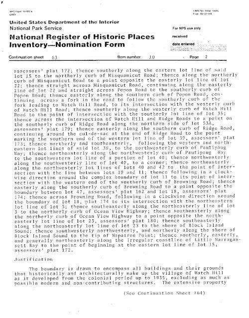
assessors’ plat 17?; thence southerly along the eastern lot line <strong>of</strong>’ said<br />
lot 15 to the northerly curb <strong>of</strong> Misquamicut Road; thence along the northerly<br />
curb <strong>of</strong> Misquamicut Road to a point opposite the easterly lot line <strong>of</strong> lot<br />
22; thence straight across Misquamicut Road, continuing along the easterly<br />
line <strong>of</strong> lot 22 and straight across Popon Road to the southerly curb <strong>of</strong><br />
Popon Road; thence easterly along the southern curb <strong>of</strong> Popon Road, con -<br />
tinuing across a fork in the road to follow the southerly curb <strong>of</strong> the<br />
fork leading to Watch 11111 Road, to its intersection with the westerly curb<br />
<strong>of</strong> Watch Hill Road; thence southerly along the westerly curb <strong>of</strong> Watch Hill<br />
Road to the point <strong>of</strong> intersection with the southerly lot line <strong>of</strong> lot 35;<br />
thence across the intersection <strong>of</strong> Watch Hill and Ridge Roads to a point on<br />
the southerly curb <strong>of</strong> Ridge Road along the northern side <strong>of</strong> lot 53A,<br />
assessors’ plat 179; thence easterly along the southern curb <strong>of</strong> Ridge Road,<br />
continuing around the cul-de-sac at the end <strong>of</strong> Ridge Road to the point<br />
mark ing the southern end <strong>of</strong> the western lot line <strong>of</strong> lot 39, assessors ‘- p1 at<br />
173; thence northerly and southeasterly, following the western and north<br />
eastern lot lines <strong>of</strong> said lot 39, to the northwesterly curb <strong>of</strong> Pautipaug<br />
Way; thence northeasterly along the northwester 1’ cu r I <strong>of</strong> Pautipaug Way<br />
to the south western lot line <strong>of</strong> a portion <strong>of</strong> lot 40; thence northwesterly<br />
along the southwesterly line <strong>of</strong> lot 40, to a corner; thence northeasterly<br />
along the northwesterly lot lines <strong>of</strong> lots 40 and 42 t o the point <strong>of</strong> inter-<br />
section with the line between lots 19 and lit; thence following in a clock-<br />
hi se direction around the complex. boundary <strong>of</strong> lot 11 to its polnt <strong>of</strong> intersection<br />
with the western end <strong>of</strong> the southerly curb <strong>of</strong> Browning Road; thence<br />
easterly along the southerly curb <strong>of</strong> Browning Road to a point opposite the<br />
boundary between lot 47, assessors’ plat 162 a nd 1 0 t 1 8 assessors’ pInt<br />
174; thence across Browning Road, following in a clockwise directiob around<br />
the boundary <strong>of</strong> lot 18, plat 174 -to its intersection with the northeastern<br />
lot line <strong>of</strong> lot 3; thence southeasterly along the northeasterly line <strong>of</strong> lot<br />
3 to the northerly curb <strong>of</strong> Ocean View Highway; thence southeasterly along<br />
the nqrtherly curb <strong>of</strong> Ocean View Highway to a point opposite the north-<br />
easterly lot line <strong>of</strong> lot 23 assessors’ plat 180; thence southeasterly<br />
along the northeasterly lot line <strong>of</strong> lot 23 to the shore <strong>of</strong> Block Isi and<br />
Sound; thence southwesterly northwesterly, and northerly along the shore <strong>of</strong><br />
Block <strong>Island</strong> Sound to the t ip <strong>of</strong> Napatree Point; thence. southerly, caste- ny<br />
- and genera ily northeasterly along the irregular coastl Inc <strong>of</strong> Little Na rragan<br />
be g inn In g at the eastern lot line <strong>of</strong> lot 15,<br />
The boundary is drawn to encompass all buildings and their grounds<br />
that historically and architecturally make up the vii lage <strong>of</strong> Watch Hill<br />
as it developed from the colonial period up to 1935, excluding as much as<br />
possible modern and non-contributing structures. The extensive property<br />
See Con-ti nuat ion Sheet 64


