National Register of Historic -Places - Rhode Island Historical ...
National Register of Historic -Places - Rhode Island Historical ...
National Register of Historic -Places - Rhode Island Historical ...

You also want an ePaper? Increase the reach of your titles
YUMPU automatically turns print PDFs into web optimized ePapers that Google loves.
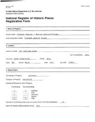
,i4nited States Department <strong>of</strong> the InterIor<br />
<strong>National</strong> Park Service<br />
<strong>National</strong> <strong>Register</strong> <strong>of</strong> Histèiric <strong>Places</strong><br />
Inventory-Nomination Form<br />
See instructions in How to Complete <strong>National</strong> <strong>Register</strong> Forms<br />
Type all entries-complete applicable sections<br />
1. Name<br />
oc N.A.<br />
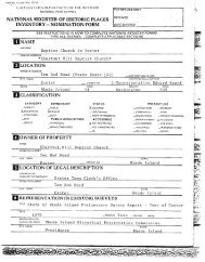
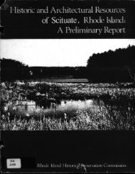
<strong>Historic</strong> Resources <strong>of</strong> North Kingstown,<br />
andorcommon <strong>Historic</strong> and Architectural Pronerti es<br />
2. Location<br />
Esp. 10-31-94<br />
For 14PS use only<br />
received<br />
date entered<br />
RI.Partial Inventory:<br />
street & number town boundaries <strong>of</strong> Town <strong>of</strong> Nor ngstown, RinottorbHcatlon<br />
congressional district 112<br />
city1town North Kingstown N.A..vicinity<strong>of</strong> I-Jon. Claudine Schneider<br />
state <strong>Rhode</strong> <strong>Island</strong> code 44 county Washington code 009<br />
1* Classification see also inventory sheets<br />
egory Ownership Status Present Use<br />
district - public occupied & agriculture -- museum<br />
SL. buildings - private A unoccupied commercial park<br />
1L. strOcture JL both - X. work in progress - educational _ private residence<br />
site Public Acquisition Accessible entertainment religious<br />
- object N in process yes: restricted ...... government - - sckntlflc<br />
being considered yes: unrestricted L. industrial transportation<br />
no military other:*<br />
4. Owner <strong>of</strong> Property<br />
name Multiple; see inventory sheets<br />
street & number<br />
city, town - vicinity <strong>of</strong> slate<br />
5. Location <strong>of</strong> Legal Description<br />
courthouse, registry ot deeds, etc. North Kings town Town Hall<br />
street&number 80 Boston Neck Road<br />
_______<br />
clty.town North Kingstown state <strong>Rhode</strong> <strong>Island</strong><br />
6. Representation in Existing Surveys<br />
title<br />
North Kingstown, <strong>Rhode</strong> <strong>Island</strong>:<br />
Statewiue <strong>Historic</strong> Preservatiorjas<br />
see cont.<br />
this property been determined eligible?<br />
sheet #1<br />
- yes_____ no<br />
P.eport, W-NK-l<br />
jjoventher, 1979 -_____<br />
_tederal .7state<br />
depositoryforsurveyrecorcis <strong>Rhode</strong> <strong>Island</strong> <strong>Historic</strong>al Preservation Commission<br />
clty,town Providence state<br />
<strong>Rhode</strong> <strong>Island</strong><br />
I
NPS Form logoc-.<br />
3-82<br />
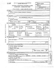
United States Department <strong>of</strong> the Interior<br />
<strong>National</strong> Park Service For NPS use only<br />
<strong>National</strong> <strong>Register</strong> <strong>of</strong> <strong>Historic</strong> <strong>Places</strong><br />
Inventory-Nomination Form<br />
;tnte<br />
0MB Mo. 1024-0018<br />
Exp- 0 31 84<br />
Continuation sheet 1 Item numb’,. 6 Page 2<br />
Entered in the <strong>National</strong> <strong>Register</strong>: -<br />
Camp Endicott Davisville Construction Battalion Center <strong>Historic</strong><br />
District<br />
Hamilton Mill Village <strong>Historic</strong> District<br />
Lafayette Village <strong>Historic</strong> District<br />
Wickford <strong>Historic</strong> District<br />
RI-bOO, Lischio Archaeological Site, Routes 2 and 102<br />
Silas Casey Farm, Boston Neck Road -<br />
Old Narragansett Church, 60 Church Lane<br />
Allen-Madison House, Davisville Construction Battalion Center<br />
Gilbert Stuart Birthplace, Gilbert Stuart Road<br />
YWCA Archaeological Site, <strong>of</strong>f Gilbert Stuart Road<br />
St. Paul’s Church, 76 Main Street<br />
Six Principle Baptist Church, 85 Old Baptist Road<br />
Smith’s Castle/Cocumscussoc, Post Road<br />
*HallNorthup House, 7919 Post Road<br />
George Douglas House, 7060 Tower Hill Road<br />
- Determined eligible for the <strong>National</strong> <strong>Register</strong>: -<br />
Quonset Point Naval Air Station <strong>Historic</strong> District 10/12/78<br />
Scrabbletown <strong>Historic</strong> District 5/28/El<br />
RI-667, Archaeological Site, Route 102 9/8/81<br />
RI-669, Bestwick Archaeological Site,- Scrabbletown Road 9/8/81<br />
RI-670, Scrabbletown Brook Site, Stony Lane 9/8/81<br />
<strong>Historic</strong> American Engineering Record, <strong>Rhode</strong> <strong>Island</strong>: An Inventory <strong>of</strong><br />
<strong>Historic</strong> Engineering and Industrial Sites, 1978:<br />
Gilbert Stuart Snuff Mill Grist Mill<br />
Hamilton Web Company Mill Hamilton Village <strong>Historic</strong> District<br />
Lafayette Mill Lafayette <strong>Historic</strong> District<br />
Shady Lea Mill Shady Lea <strong>Historic</strong> District<br />
Quonset Point - Davisville Navy Bases<br />
<strong>Historic</strong> Americal Building Survey:<br />
Cocumscussoc, Post Road<br />
Northrup House, Post Road<br />
Stuart House, Gilbert Stuart Road<br />
*Listed in the <strong>National</strong> <strong>Register</strong> as the Palmer-Northrup House. Further<br />
research indicates that the present name, Hall-Northup House, is more<br />
accurate, -
i. Description -<br />
- - -<br />
Condition Check one<br />
JC_ excellent - deteriorated X unaltered o1,,..,rt site see individual entries<br />
_&..good _ruins altered _iiiod date . ----; -<br />
L_ fair - unexposed<br />
Describe the present and original if known physical appearance<br />
North KingstoWn is a 44.5-squire-mile town on the west side <strong>of</strong> Narra<br />
gansett Bay, about twenty miles south <strong>of</strong> Providence. It shares borders<br />
with Warwick, East Greenwich, Exeter, South Kingstown, and Narragansett.<br />
The population is about 25,000.<br />
- The town’s most prominent geographical feature is thirty miles <strong>of</strong><br />
Narragansett Bay coastline, much <strong>of</strong> it remarkably attractive, with inlets:<br />
sheltered coves, wetland areas, and dramatic blUffs overlooking the-water.<br />
The town has considerable variation in topography, with a high elevation<br />
<strong>of</strong> 320 feet in the northwest corner, near the village <strong>of</strong> -Scrabbletown, and<br />
1sn a number <strong>of</strong> hills nearer the bay in the south, one 220 feet high.<br />
The west-central part <strong>of</strong> town, Swamptown, is a region <strong>of</strong> small steep hills<br />
and depressions and glacial kames and kettles. Further west is the Slocum<br />
area, an outwash plain <strong>of</strong> flat land with good soil still used for farming.<br />
Most <strong>of</strong> the town, though once farmed, is now heavily wooded.<br />
There are about a dozen ponds <strong>of</strong> varying size, many <strong>of</strong> them increased<br />
- in area by nineteenth-century mill dams. These ponds are part <strong>of</strong> North<br />
Kingstown’s three small river systems, all with headwaters in the central<br />
part <strong>of</strong> town. - -<br />
The Hunts River, flowing northeast into the tidal estuary <strong>of</strong> the Poto<br />
mut River, .Eorms much <strong>of</strong> the Warwick-East Greenwich border. Old Davisville<br />
a village fragment on this river. Sand Hill Village, another village<br />
-fragment, is on Sandhill Brook, a second tributary to the Potowomut River.<br />
The Annaquatucket River, also called the Shewatuck at one <strong>of</strong> its headwaters,<br />
flows southeast through a series <strong>of</strong> ponds--including Belleville Pond,<br />
the largest in town--and empties into the Bay at Bissel’s Cove. Mill villages<br />
and hamlets on the Annaquatucket River include Lafayette, Oak Hill, Belle<br />
yule, Annaquatucket, and Hamilton. They bear witness to the fact that the<br />
Annao.jtucket was North Kingstown’s most important nineteenth-century in<br />
dust.ial waterway.<br />
The third river, the Mattatuxet, flows south through Silver Spring,<br />
Shady Lea, and Carr ponds into the Pettaquamscutt River, the latter a tidal<br />
estuary with access to the Bay in Narragansett. The Mattatuxet River<br />
generated the milling hamlets at Silver Spring and Shady Lea and powered the<br />
eighteenth-century snuff mill and sawmill that are now the Gilbert Stuart<br />
memorial. -<br />
Principal modern transportation routes running north and south and con<br />
necting the Providence metropolitan area with the southern towns <strong>of</strong> Narra<br />
gansett and South Kingstown are Post Road -U.S. 1 and Route 2 which con<br />
tinues through part <strong>of</strong> town as the divided Colonel Rodman Highway , and<br />
Tower Hill Road. Route 138 enters at the east from the Jamestown Bridge- and<br />
crosses half <strong>of</strong> the town before joining Colonel Rodman Highway. Boston Neck<br />
See Continuation Sheet #2
NPS form 0-900 liMO No 1024-0018<br />
3-82<br />
E.p- 10-31-84<br />
United States Department <strong>of</strong> the Interior - -<br />
Nation& Park Service - ror.N PS use only..<br />
<strong>National</strong> <strong>Register</strong> <strong>of</strong> <strong>Historic</strong> <strong>Places</strong><br />
Inventory-Nomination Form<br />
received<br />
Continuation sheet 2 Item number 7 Page 2<br />
Road is another north-south route. East-west roads include Route 102, which<br />
connects Wickford to Exeter; the locally important Stony Lane; and Gilbert<br />
Stuart Road, with its extension as the Shermantown Road. A section <strong>of</strong> the<br />
main line <strong>of</strong> Amtrak slices diagonally through the western part <strong>of</strong> town.<br />
Stations; once existed at Slocum, Wickford Junction, and Davisville. A trunk<br />
line, built during World War II, branches <strong>of</strong>f the main line at the Davisville<br />
Station and runs to the former Navy bases <strong>of</strong> Davi-sville and Quonset Point.<br />
The Quonset Point Naval-Air Station airport remains from World War II develop<br />
ment <strong>of</strong> the area. -<br />
The population-<strong>of</strong> North Kingstown in the late seventeenth and eighteenth<br />
centuries was <strong>of</strong> predominantly- English and Welsh- stock--people who engaged<br />
in farming, fishing, and trading. The numerous mill villages which grew up<br />
along the three rivers in the nineteenth century drew largely upon this local<br />
Yankee farm population for labor but -also brought in some Canadian and Irish<br />
workers who became integrated with the earlier "English" population. Coastal<br />
summer-resort developments in the early twentieth century, such as at Plum<br />
Beach and Saunderstown- in the south and at the Quonset Point area in the<br />
north, brought seasonal residents -from the Providence area and also from New<br />
York and Philadelphia. With World War II and the building <strong>of</strong> the major Navy<br />
bases at Quonset and Davisville, the population was dramatically increased<br />
and transformed as residents, both temporary and permanent, arrived from all<br />
over the nation. -<br />
Since the war, the tendency toward extensive suburbanization <strong>of</strong> large<br />
areas <strong>of</strong> the formerly rural sections <strong>of</strong> town and further influx <strong>of</strong> people<br />
from the more heavily urbanized center <strong>of</strong> the state and elsewhere in the<br />
country has, with some fluctuation, continued. New industries have arrived,<br />
a commercial highway strip has grown along Post Road, and a large park<br />
surrounding Belleville Pond and a state park have been founded. Areas<br />
which had been farmed in the eighteenth and nineteenth centuries and over<br />
grown by woods in recent times are in the process <strong>of</strong> subdivision for houses.
NPS Form 10-9000 - 0MB Mo. 1024-0018<br />
3-82 - E.p. 103164<br />
United States Department <strong>of</strong> the Interior<br />
<strong>National</strong> Park Service - For NPS ass<br />
<strong>National</strong> <strong>Register</strong> <strong>of</strong> <strong>Historic</strong> <strong>Places</strong><br />
Inventory-Nomination Form<br />
received<br />
deteerflered<br />
Continuation sheet 3 - Item number 7 Page 3<br />
NAME: Camp Endicott <strong>Historic</strong> District<br />
LOCATION: Davisville Construction Battalion Center<br />
Entered on the <strong>National</strong> <strong>Register</strong>, 10/19/78; for further information,<br />
see <strong>National</strong> <strong>Register</strong> nomination.
NPS Fort,, 10-90°-u - 0MB No.1024-0018<br />
3-82<br />
E*p. 10-31-84<br />
United States Department <strong>of</strong> the Interior<br />
NatIonal Park Service -ForP1PS,aaMy<br />
<strong>National</strong> <strong>Register</strong> <strong>of</strong> <strong>Historic</strong> <strong>Places</strong><br />
Inventory-Nomination Form<br />
Continuation sheet 4 Item number 7 Page 4<br />
NAME: Crowfield <strong>Historic</strong> District<br />
LOCATION: Boston Neck Road<br />
OWNERS: Multiple; see owners list on file at <strong>Rhode</strong> <strong>Island</strong> <strong>Historic</strong>al<br />
Preservation Commission<br />
CONDITION: Excellent; Altered; Original Site<br />
DESCRIPTION:<br />
The Crowfield <strong>Historic</strong> District encompasses a small cluster <strong>of</strong> early<br />
20th-century shingled houses set on the gentle, wooded slope between Boston<br />
Neck Road and the Narragansett Bay shore. The houses are set well back<br />
from Boston Neck Road and are reached via dirt tracks through the woods<br />
which screen the houses from the road and from each other. The district<br />
includes four houses: Crowfield, Jamieson House, Champ de Corbeau, and<br />
Orchard House, and their dependencies all constructed as second residences<br />
between 1906 and 1924. All are 1½- to 2½-stories, wood-frame structures,<br />
covered with shingles, and built in simplified versions <strong>of</strong> the Shingle<br />
Style. -<br />
Dry-laid stone walls, some <strong>of</strong> which pre-date the houses, thread<br />
through the woods surrounding the houses. The buildings <strong>of</strong> the district<br />
have been little altered since construction.<br />
INVENTORY OF CONTRIBUTING STRUCTURES:<br />
Contributing structures are defined as those constructed during the<br />
period <strong>of</strong> significance, 1906-1924, during which Crowfield was developed<br />
as a summer residential area for the Cope family and their associates.<br />
BOSTON NECK ROAD<br />
Crowfield 1906, c. 1915: A 2-story shingled house, designed by<br />
Philadelphia architect James P. Jamieson for Eliza Cope. The house<br />
is rectangular with a high gambrel ro<strong>of</strong>, slightly flared-at the eaves<br />
and pierced by several dormers which light the second floor. Two<br />
asymmetrically-placed brick chimneys rise above the ro<strong>of</strong>. The<br />
center entrance is deeply recessed under a porch protruding from<br />
the east elevation, and is flanked on each side by three large,<br />
nearly square windows. The interior is plainly finished: ornamenta<br />
tion is minimal, fireplaces have no mantels, the stairway has treads<br />
but no risers, and the doors are re-used and all different, perhaps<br />
coming from Pennsylvania or Europe. A lower, gambrel-ro<strong>of</strong>ed exten<br />
sion from the northwest corner houses a kitchen and was added around<br />
the time <strong>of</strong> World War I by the architect Thomas Cope, son <strong>of</strong> Eliza<br />
Cope.<br />
&"*--<br />
en
NPS Fonn10300. - 0*16 No.1024-0018<br />
3.82 - - EXp- 10-31-84<br />
United States Department <strong>of</strong> the InteriOl<br />
<strong>National</strong> Park Service -<br />
<strong>National</strong> <strong>Register</strong> <strong>of</strong> <strong>Historic</strong> <strong>Places</strong><br />
Inventory-Nomination Form -<br />
Cc;inuation sheet 5 Item number<br />
Boston Neck Road cont - -<br />
,Jami.es.onHouse,i906.: . Built simultaneous.l.y_to_Crowfield -and designed<br />
by the same architect--here building for his own fal!lily--Jamieson House<br />
:is smaller than the Copes’ house. One-and-a-half stories, it is<br />
complexly-massed:. a small, gambreL-ro<strong>of</strong> section is nearest the bay<br />
.and stands almost independent <strong>of</strong> the flank-gable ro<strong>of</strong>ed mass behind<br />
it. At a right, angle to the latter is an ell covered by another<br />
gambrel ro<strong>of</strong>.flormers, chimneys, a variety <strong>of</strong> door and window shapes,<br />
and a mixture <strong>of</strong> shingle and clapboard- covering, add further variety<br />
to the building’s composition. Several simple, shingled outbuildings<br />
are located on the property. -<br />
-1600 Champ de Corbeau 1905-1910: A large, 2½-story shingled house,<br />
designed by New York and Saunderstown architect Grant Lafarge for -<br />
his friend Owen Wister. Set under a wide gambrel ro<strong>of</strong>, the, house<br />
is rectangular- in mass- and covered in shingles; a -large wing projects<br />
from the northwest -corner. The house has an asymmetrical facade<br />
on its west entrance side, with the entry set under a flat-ro<strong>of</strong>ed<br />
porch with Tuscan columns. The more formal eastern elevation faces<br />
the bay, with its center Colonial -Revival entrance, projecting first<br />
floor bays, and symmetrically arranged windows and dormers.<br />
A small caretaker’s house, constructed with the main house and<br />
designed by the same architect, is set to the west <strong>of</strong> Champ de Corbeau.<br />
It is a one-and-one half-story, shingled building with a gambrel ro<strong>of</strong><br />
echoing that <strong>of</strong> the larger house. A recessed veranda runs along the<br />
east side.<br />
Orchard House 1924; 19505: The smallest <strong>of</strong> the summer houses in<br />
Crowfield <strong>Historic</strong> District, Orchard House was built originally for<br />
Oliver Cope and Derrick January. Two stories high, it has the<br />
shingled walls and gambrel ro<strong>of</strong> which are characteristic <strong>of</strong> the<br />
district. The entrance is recessed under a southeast corner porch<br />
with a low pyramidal ro<strong>of</strong>. A 1-story gable-ro<strong>of</strong>ed addition from<br />
the l950s is attached to the house by a covered walkway.<br />
PERIOD OF- SIGNIFICANCE: 1900-<br />
AREAS OF SIGNIFICANCE: Architecture, Literature, Other; Recreation<br />
SPECIFIC DATES: 1906, 1909-1910, 1924<br />
BUILDER/ARCHITECT: See inventory entries -<br />
SIGNIFICANCE: -<br />
Page 5<br />
The Crowfield <strong>Historic</strong> District is significant as a well-preserved<br />
early twentieth-century summer resort compound built for members and friends<br />
<strong>of</strong> an extended family and for its association with Owen Wister, author<br />
<strong>of</strong> the first popular western novel. The district is unusual in North
NPS Form 10-900-. 0MB No.1024-0018<br />
Exp- 10-31-84<br />
United States Departnient <strong>of</strong> the Interior -<br />
NatIonal Park Service FwNPSuaanly<br />
<strong>National</strong> <strong>Register</strong> <strong>of</strong> <strong>Historic</strong> <strong>Places</strong><br />
Inventory-Nomination Form<br />
‘recee<br />
dateent red<br />
Continuation sheet 6 Item number 7 Page 6<br />
Kingstown where resort development ordinarily consisted <strong>of</strong> isolated<br />
houses or was oriented to earlier seacoast villages. -<br />
Crowfield began in 1906 when Philadelphian Eliza Middleton Cope,<br />
widow <strong>of</strong> architect Walter Cope, joined1her auntWMary and uncle Owen<br />
Wister in the purchase <strong>of</strong> one hundred and twenty acres from the heirs<br />
<strong>of</strong> Oliver Greene-. They named the property "Crowfield" after the estate<br />
<strong>of</strong> an English ancestor. Mrs. Cope immediately began plans for a summer<br />
house which also -became known as Crowfield. The architect was James P.<br />
Jamieson, who had been the chief draftsman in Walter Cope’s architectural<br />
firm and became a partner after the death <strong>of</strong> Walter Cope. Simultaneously,<br />
Jamieson began construction on his own house at Crowfield. By 1920 the<br />
house had been sold to Eliza Cope and soon thereafter became the home<br />
<strong>of</strong> her daughter Elizabeth Cope and her husband Dr. Joseph Aub, a Boston<br />
p hy s ici an. -<br />
Owen :Wister began construction on his house Champ de Corbeau, -<br />
designed by Grant LaFarge a friend and former neighbor in Saunderstown,<br />
in 1909-1910. It was not occupied until 1913. Wister was already an<br />
important figure in American literary life as author <strong>of</strong> The Virginian<br />
1902, a popular Western, the stage version <strong>of</strong> which played for years,<br />
and <strong>of</strong> a non-fiction best seller about European politics at the time <strong>of</strong><br />
World War I.<br />
The last addition to the Crowfield <strong>Historic</strong> District was the 1924<br />
Orchard House, built for Derrick January and Oliver Cope, son <strong>of</strong><br />
Elizabeth Cope.<br />
Crowfield today is little changed from the early decades <strong>of</strong> the<br />
twentieth century. Some major alterations have been made to the houses<br />
but they are for the most part well preserved. Equally important is the<br />
setting; there have been on intrusions constructed and the woods separating<br />
the houses from each other and the road have been preserved as have the<br />
views to the shore <strong>of</strong> the Narragansett Bay which originally attracted the<br />
Cope familyY Crowfield remains a peaceful, scenic summer retreat.<br />
ACREAGE: c. 56.3 acres<br />
QUA.NAME: Wickford, R.I.<br />
UTM REFERENCES:<br />
A 19 298280 4600930 B i 298250 4600680<br />
C 19 297400 4600270 - B 19 297230 4600500<br />
- c.t Q.b t -2-is 3e Y’<br />
-.
NPS Form 10-900-a - 0MB No.1024-0018<br />
3-82 Exp. 10-31-84<br />
United States Department <strong>of</strong> the Interior - -<br />
<strong>National</strong> Park Service For UPS ua only<br />
<strong>National</strong> <strong>Register</strong> <strong>of</strong> <strong>Historic</strong> <strong>Places</strong> mc&ved<br />
Inventory-Nomination Form -<br />
Continuation sheet 7 Item number 7 Page 7<br />
BOUNDARY DESCRIPTION:<br />
The boundary <strong>of</strong> the Crowfield.<strong>Historic</strong> District has been drawn to<br />
encompass all those properties associated wi.th the development <strong>of</strong> the<br />
district as a summer resort compound. and, in addition, some land which<br />
has been associated historically with these properties. This land, still<br />
wooded as it was during the period <strong>of</strong> significance, is an important<br />
component <strong>of</strong> the setting <strong>of</strong> the distriOt’s building; its inclusion within<br />
the district documents the environmental and visual relationship <strong>of</strong> the<br />
houses to each other, to the road, and, most importantly, to the water’s<br />
edge which originally prompted a summer settlement here.<br />
All numbers refer to plats/lots: The boundary begins at the south<br />
west corner <strong>of</strong> 42/201, proceeds north along the east side <strong>of</strong> Boston Neck<br />
Road to the northwest corner <strong>of</strong> 42/197, west along the north lines <strong>of</strong> 42/197<br />
and 42/196 to the northeast corner <strong>of</strong> 42/196; then southeast along the<br />
east, north, and east lines <strong>of</strong> 42/196 and 42/194, then east along the<br />
north line <strong>of</strong> 42/190 to the shore <strong>of</strong> Narragansett Bay, south along the<br />
shore to the southeast corner <strong>of</strong> 42/190, then west along the south lines<br />
<strong>of</strong> 42/190, 42/187, and 42/201 to the point- <strong>of</strong> beginning.<br />
LEVEL OF SIGNIFICANCE: State<br />
Photo numbers 1-5
NPS Form 10-900-s 0MB No.1024-0018<br />
3-82 Esp- 10-31-84<br />
United States Department <strong>of</strong> the Interior -<br />
<strong>National</strong> Park Service For UPS use only<br />
<strong>National</strong> <strong>Register</strong> <strong>of</strong> <strong>Historic</strong> <strong>Places</strong><br />
Inventory-Nomination Form<br />
dateenterd<br />
Continuation sheet 8 Item nur’her- 7 Page 8<br />
NAME: Davisville <strong>Historic</strong> District<br />
LOCATION: Davisville Road<br />
Owners: Multiple; see owners list or file at <strong>Rhode</strong> <strong>Island</strong> <strong>Historic</strong>al<br />
Preservation Commission<br />
CONDITION: Good, Excellent; Altered; Original site, except 277 Davisville<br />
Road, moved 1856, within the district.<br />
DESCRIPTION:<br />
The Davisville <strong>Historic</strong> District along both sides <strong>of</strong> Davisville Road<br />
south <strong>of</strong> Hunts River, is an area <strong>of</strong> fields, woodland, the site- <strong>of</strong> a nine<br />
teenth-century textile mill and earlier grist mill, five well-preserved<br />
eighteenth and nineteenth century dwellings, a cemetery and the sites <strong>of</strong><br />
some additional mill nineteenth century houses.<br />
The district includes a mill site, used since 1700, first for a<br />
-gristmill, later for a textile manufacture. The district’s five houses<br />
are all 2½-story, gable-ro<strong>of</strong>ed, wood-frame structures, dating from 1715<br />
- through the l8SOs. Most are set back only slightly 20-30 feet from<br />
Davisville Road, which has been widened seireral times; however, there is<br />
a short by-pass on the west side <strong>of</strong> the road, passing in front <strong>of</strong> 277 and<br />
299 and divided from the road by a narrow greensward; it documents the<br />
relationahip <strong>of</strong> some <strong>of</strong> the district’s buildings to the early road and<br />
suggests the character <strong>of</strong> the road before its widening and straightening.<br />
The Joshua Davis House, 296 Davisville Road, is set far back, about 200<br />
feet from the road. On both sides <strong>of</strong> the road, the houses are backed<br />
by woods; and cleared fields on the west side <strong>of</strong> the road, the woods<br />
stretch back to Hunts River. Some fine dry-laid stone walls divide<br />
299 and 277 Davisville Road from the road, and outline the Davis family<br />
cemetery set behind 299.<br />
INVENTORY OF CONTRIBUTING STRUCTURES: -<br />
Contributing buildings are defined as those dating from the period<br />
<strong>of</strong> Davisville’s development as a small, rural milling hamlet. There<br />
are no non-contributing structures and the district retains to a large<br />
extent its nineteenth-century setting: the close integration <strong>of</strong> woods,<br />
cleared fields and houses; the relationship <strong>of</strong> the houses to the road<br />
and to one another; graveled and dirt paths leading to the houses from<br />
the road. The North Kingstown Planning Commission has granted permission<br />
for the development <strong>of</strong> a housing subdivision on the east side <strong>of</strong> Davis<br />
ville Road between 296 and 350 but the land has not yet been platted.<br />
The path <strong>of</strong> a proposed access road has been cleared from Davisville Road<br />
to the east building <strong>of</strong> the district.
NPS Form 10900-a<br />
0MB No. 1024-0018<br />
3-82 - Lip- 10-31-84<br />
United States Departnient <strong>of</strong> the Interior<br />
<strong>National</strong> Park Service For UPS use only<br />
<strong>National</strong> <strong>Register</strong> <strong>of</strong> <strong>Historic</strong> <strong>Places</strong><br />
Inventory-Nomination Form<br />
relved<br />
teenter<br />
Continuation sheet 9 - item number - 7 Page 9<br />
DAVISVILLE ROAD<br />
Mill Site 1700-1929: The mill site at Davisville, set on the south<br />
side-<strong>of</strong> Hunts River near the Davisville Road Bridge, has been used<br />
since an eighteenth-century gristmill operated here. Today only the<br />
mill trench lined with dry-laid rubble, some foundations and what<br />
appears to be fragments <strong>of</strong> the mill’s turbine remain. The mill was<br />
demolished in the l970s as the site has been little disturbed since<br />
then, it appears to be a good candidate for future archeological<br />
investigations.<br />
Mill House Sites mid-l9th century: The west side <strong>of</strong> Davisville Road,<br />
north <strong>of</strong> 277, was the site <strong>of</strong> several houses owned in-the late 19th<br />
century by the Davises’ company and presently used to house company’s<br />
workers. Probably demolished in the 1920s or l930s, the outlines <strong>of</strong><br />
some foundations remain. It is unlikely that their sites have been<br />
heavily disturbed since demolition and, in the future, they may prove<br />
good candidates for archeological investigation. - Together with the<br />
mill site and the remaining owners’ workers’ houses would help to -<br />
complete the portrait <strong>of</strong> mill life at Davisville.<br />
277 Ezra Davis House 1805: A 2½-story, central-entry central-chimney,<br />
Federal house with a doorway with fanlight under pediment and fluted<br />
pilasters. This, the second Davis house in Davisville, was moved<br />
about 1500 feet north in 1856 when Bellefield 299 Davisville Road<br />
was built. The interiOr, whose- finish is now much altered, is<br />
arranged in the typical S-room, center chimney plan.<br />
-296 Joshua Davis House c. 1715 and 1820: This 2-story clapboarded<br />
house with an unusual plan was built in stages, beginning in the<br />
early eighteenth century as Joshua Davis’ home-. The plan <strong>of</strong> the<br />
older, western part is unusual for an eighteenth-century house, with<br />
its chimney well <strong>of</strong>f center:- the five rooms are grouped asymmetrically<br />
around the large chimney rather than following the typical centerchimney<br />
plan. Restoration architect John Hutchins Cade, who re<br />
stored the house for <strong>Rhode</strong> <strong>Island</strong> historian, William Davis Miller in<br />
1948, believed that the beaded, encased summer beam and exposed girts<br />
in one <strong>of</strong> the rooms <strong>of</strong> the western section might have originally been<br />
the frame <strong>of</strong> a two-story, two-room stone-ender, a house type char<br />
acteristic <strong>of</strong> <strong>Rhode</strong> <strong>Island</strong>’s first building period. This could explain<br />
the unusual plan. Later in the eighteenth -century the house was<br />
nearly doubled by an addition to the east built by the second Joshua<br />
Davis. The house is set back from the road, and the property also<br />
includes a barn, a shed, and a handsome picket fence. -
NPS Form 10-900-a<br />
United States Departrrient <strong>of</strong> the Interior-<br />
<strong>National</strong> Park Service For PIPS useonly<br />
<strong>National</strong> <strong>Register</strong> <strong>of</strong> <strong>Historic</strong> <strong>Places</strong><br />
Inventory-Nomination Form<br />
:reéiive<br />
dsteetered<br />
0MB No.1024-0018<br />
Lap- 10-31-84<br />
Continuation sheet - 10 - item number 7 Page - 1 c<br />
DAVISVILLE ROAD cont<br />
299 Bellefield 1856; barn, 1883: An unusually well preserved and sub<br />
stantial, 2½-story, Victorian house typical <strong>of</strong> the mid-1850s in its<br />
mixing <strong>of</strong> Greek Revival form with bracketed Italianate detailing:<br />
the corner posts with recessed panels are typical <strong>of</strong> the earlier period<br />
as is the pedimented treatment <strong>of</strong> the facade, while the brackets under<br />
eaves and window hoods are characteristic <strong>of</strong> the later style. A onestory,-<br />
flat-ro<strong>of</strong>ed, open veranda wraps around the front and the<br />
sides. The interior is handsomely finished and little altered since<br />
the l890s.<br />
Outbuildings, including an-early shed and a barn, are strung in<br />
a row behind the rear ell. Across the drive and north <strong>of</strong> the house<br />
is a clapboarded barn built in 1883 and ornamented by patterned<br />
shingles, with a delicate cupola centered on its cross-gable ro<strong>of</strong>.<br />
West <strong>of</strong> the house is the Davis family burial ground, set at the edge<br />
<strong>of</strong> cleared fields and woods.<br />
- 345 Henry Sweet House ca. 1850: This is a 2½-story clapboarded, endgable<br />
house. The house is a far less exuberant example than Bellefield<br />
<strong>of</strong> the transition between the Greek Revival and bracketed styles.:<br />
Corner posts and a closed pediment front are conservative as is the<br />
modest application <strong>of</strong> brackets under the eaves. A two-story eli-with<br />
a modern fieldstone porch extends from the south side <strong>of</strong> the structure’s<br />
main, two-and-one-half story mass. An unusual lattice screen with a<br />
Palladianmotif, probably-early twentieth century, connects the house<br />
to a large shed in the rear. Further back from the road is a barn<br />
with a jerkinhead ro<strong>of</strong> erected in the late nineteenth or early<br />
twentieth century.<br />
350 Albert S. Reynolds House ca. 1850. A simple, ciapboarded, Greek<br />
Revival, 3-bay house. A 2-story eil projects from the 2-story, endgable<br />
main section. A glazed porch and entrance portico were added<br />
in the 20th century.<br />
PERI1OD: 1700-1799; 1800-1899<br />
AREAS OF SIGNIFICANCE: Architecture, Industry -<br />
SPECIFIC DATES: c. 1715, 1805, 1847, c. 1850,1856<br />
BUILDER/ARCHITECT: See inventory entries<br />
SIGNIFICANCE:<br />
Davisville is a diminutive linear hamlet, significant for its<br />
early and long history <strong>of</strong> water-powered milling,, for its ability to<br />
document the visual aspect <strong>of</strong> a small nineteenth-century industrial<br />
village which never grew into a substantial development, and for the
NP$ Form 10-900-a<br />
United States Department <strong>of</strong> the Interior<br />
<strong>National</strong> Park Service<br />
<strong>National</strong> <strong>Register</strong> <strong>of</strong> <strong>Historic</strong> <strong>Places</strong><br />
Inventory-Nomination Form<br />
For UPS use only<br />
receWed<br />
0MB No 1024-0018<br />
Continuation sheet -11 Item number - 7 Page 11<br />
architectural quality <strong>of</strong> its constituent buildings.<br />
Milling had taken place at this location on Hunts River since<br />
1700 when Joshua Davis operated a gristmill here. Davis’ first house<br />
in East Greenwich to the north is gone, but his second-dwelling<br />
dating from c. 1715 remains, embedded in a series <strong>of</strong> later additions.<br />
From 1811 to 1824, Ezra and Jeffrey Davis operated a water-powered<br />
woolen loom, one <strong>of</strong> the earliest in the state, an enterprise which<br />
developed from Jeffrey Davis’ previous ventures in carding and<br />
dressing wool for home weaving. The early mill -burned in 1847 and<br />
was replaced by a small wooden mill where manufacturing by the firm<br />
<strong>of</strong> Davis; Reynolds Company cont&nued until 1924; The mill’s princi<br />
pal ptoduct:.was "Kentucky jean." The mill was demolished in the 1970s,<br />
but its trench and some remnants <strong>of</strong> its gatehouse remain.<br />
The small-scale prosperity <strong>of</strong> Davisville produced a series <strong>of</strong><br />
well-preserved houses associated with the Davies family: Joshua-<br />
Davis’ c. 1715 house, later enlarged by a second Joshua Davis’ the<br />
1805 Federal house built by Ezra Davis; James Davis’ handsome 1856<br />
Bellefield; the c. 1850 house built by Henry Sweet, son-in-law <strong>of</strong><br />
Ezra Davis and superintendant <strong>of</strong> the mill; and the simple Albert<br />
Reynold’s house c. 1850, built by the Davises’ partner. A series<br />
<strong>of</strong> small workers’ cottages, a stove, and a post <strong>of</strong>fice which once<br />
stood on the west side <strong>of</strong> the road are gone, but the remarkable<br />
collection <strong>of</strong> houses which are left document the presence here <strong>of</strong> a<br />
small industrial operation, owned and managed by members <strong>of</strong> a single<br />
family for over three centuries. The five residences erected by the<br />
Davis family and business associates not only reflect the pr<strong>of</strong>its<br />
<strong>of</strong> the milling -enterprises, they are in themselves architecturally<br />
noteworthy. The Joshua Davis House is particularly interesting as<br />
it appears to have evolved from a stone-ender, a- characteristic<br />
early <strong>Rhode</strong> <strong>Island</strong> house type. The three Davis houses 277, 296,<br />
and 299 Davisville Road and their outbuildings exhibit high quality<br />
craftsmanship and fine design, and are well preserved. The other<br />
residences 345 and 350 Davisville Road , while not as outstanding,<br />
are nonetheless good examples <strong>of</strong> mid-nineteenth century construction<br />
and they are visually and historically related to Davisville. To<br />
gether, the five properties form an impressive display <strong>of</strong> architectur<br />
al styles popular in the eighteenth and nineteenth centuries.<br />
In the 1870s, the Davis family sold some <strong>of</strong> their land to the<br />
south to 0. S1 Briggs, who platted lots and sold them; Reynolds<br />
Manufacturing Company built a steam-powered mill here; and eventually<br />
the newer village also called Davisville overtook in size and<br />
import its early neighbor. -<br />
N
NPS Form 10-900-a<br />
0MB No 1024-0018<br />
- Eap- 10-31-84<br />
United States Department <strong>of</strong> the Interior<br />
<strong>National</strong> Park Service ForNPS use<br />
<strong>National</strong> <strong>Register</strong> <strong>of</strong> <strong>Historic</strong> <strong>Places</strong><br />
Inventory-Nomination Form<br />
reaeved<br />
datentered<br />
Continuation sheet -12 item number 7 Page 12<br />
ACREAGE: Approximately 30 -acres.<br />
QUAD NAME: Wickford, R.I.<br />
UTM REFERENCES: -<br />
A 19 293800 4601400 B 19 2357Q 461Q480<br />
C 19 293200 4610210 D 19 293020 4610680<br />
BOUNDARY DESCRIPTION:<br />
The boundary <strong>of</strong> the Davisville <strong>Historic</strong> District has been drawn to<br />
include the remaining structures historically associated with the Davis<br />
family’s occupation and use <strong>of</strong> the mill site on Hunts River and some land<br />
which is historically associated with those structures and which docu<br />
ments their historic environmental setting. The boundary excludes some<br />
modern residential development, especially along the north side <strong>of</strong> -<br />
Charles Street and includes some wooded land on the west side <strong>of</strong> Davis<br />
ville Road which, according to 19th-century maps, was the site <strong>of</strong> a small<br />
group <strong>of</strong> workers’ houses, since demolished at a date unknown, but<br />
probably early 20th century: this cluster may be a candidate for future<br />
archeological investigation.<br />
All numbers refer to plats/lots: The boundary begins at the south<br />
east corner <strong>of</strong> 154/3, proceeds west along the south line <strong>of</strong> 154/3, across<br />
Davisville Road, and along the south line <strong>of</strong> 152/46, north a-long the<br />
west line <strong>of</strong> 152/46, west along the south line <strong>of</strong> 152/1 to the pOint<br />
where the line turns southwest; proceeding across 152/1 to the west corner<br />
<strong>of</strong> the historic cemetery, northeast-and southeast along the cemetery<br />
bounds to the north line <strong>of</strong> 152/1, then west along the north line <strong>of</strong><br />
152/1 to the southwest corner <strong>of</strong> 152/13, north along the east line <strong>of</strong><br />
152/13, 152/11, crossing 152/10, along the east line <strong>of</strong> 152/12, east along<br />
the north line <strong>of</strong> 152/12, crossing Davisville Road, north along the west<br />
lines <strong>of</strong> 1S2/13 and 153/1 to Hunts River, east along the river to a point<br />
opposite the northeast corner <strong>of</strong> 153/13, then south across 153/1, along<br />
the east line-<strong>of</strong> 153/13 to the southeast corner <strong>of</strong> 153/13, then south to<br />
the northeast corner <strong>of</strong> 154/3, crossing 153/1, passing south along the<br />
east line <strong>of</strong> 154/3 to the point <strong>of</strong> beginning.<br />
Level <strong>of</strong> Significance: State<br />
Photo numbers 7-12
NPS Fain 10-900 a<br />
3-WI<br />
DM11 No 1024 -0018<br />
F<br />
United States Department <strong>of</strong> the Interior - - -<br />
<strong>National</strong> Park Service<br />
FOrN PS U5SOVIPY. :.-><br />
<strong>National</strong> <strong>Register</strong> <strong>of</strong> <strong>Historic</strong> <strong>Places</strong> --<br />
Inventory-Nomination Form<br />
Continuation sheet 13 item number 7 Page i<br />
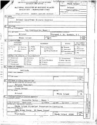
NAME: Hamilton Mill Village <strong>Historic</strong> District<br />
LOCATION: Boston Neck Road, Salisbury and Webb Avenues<br />
-Entered on the <strong>National</strong> <strong>Register</strong>, 11/3/83; for further information,<br />
see <strong>National</strong> <strong>Register</strong> nomination. -<br />
-:-
NPS Fain 10-gao-a<br />
CMII No 1024-0018<br />
13-52 - E<br />
ap-<br />
10-31-84<br />
United States Department <strong>of</strong> the Interior - -<br />
<strong>National</strong> Park Service - For lIPS use only<br />
<strong>National</strong> <strong>Register</strong> <strong>of</strong> <strong>Historic</strong> <strong>Places</strong><br />
Inventory-Nomination Form<br />
received<br />
Continuation sheet 14 item number 7 Page 14<br />
NAME: Lafayette Village <strong>Historic</strong> District<br />
LOCATION: Bounded by Mill Cove, Wickford Harbor and Cove, the railroad<br />
right-<strong>of</strong>-way, Tower Hill and Post Roads<br />
Entered on the <strong>National</strong> <strong>Register</strong>, 12/31/74; for further information,<br />
see <strong>National</strong> <strong>Register</strong> nomination. -
NPS Fa,m I0-900a 0MB No 1024-0018<br />
13-521 E.p- I0-3184<br />
United States Department <strong>of</strong> the Interior<br />
<strong>National</strong> Park Service -.-:For.NPS-use-only -::-f -<br />
<strong>National</strong> <strong>Register</strong> <strong>of</strong> <strong>Historic</strong> <strong>Places</strong><br />
Inventory-Nomination Form<br />
Continuation sheet 15 -<br />
received<br />
- item number 7 Page 15<br />
NAME: Saunderstown <strong>Historic</strong> District -<br />
- LOCATION: Boston Neck Road, Briggs Road, Cavanaugh Court, Church Way,<br />
Ferry Lane, Ferry Road, Gould Way, Keeley Road, Saunders<br />
Road, Stillman Road, Waterway, Waterway Extension, Willett<br />
Rod<br />
OWNERS: See list on file at R.I. <strong>Historic</strong>al Preservation Commission<br />
CONDITION: Good, Excellent; Altered; Original site, except 18 Waterway,<br />
moved within district<br />
DESCRIPTION: -<br />
Saunderstown is a large historic district, containing 92<br />
structures, most dating from the late nineteenth century, when the area<br />
served as a boat-building center, and the early twentieth century, when<br />
it became a summer resort. For the most part, houses are one-and-a-halfor<br />
two-stories; clapboarded or shingled, vernacular cottages or simple<br />
versions <strong>of</strong> popular-architectural styles from the 1870s through the 1920s.<br />
The district is set-in the southeast corner <strong>of</strong> North Kingstown, on a slope<br />
leading to the shores <strong>of</strong> Narragansett Bay.<br />
Boston Neck Road crosses diagonally southwest to northeast at the<br />
western edge <strong>of</strong> Saunderstown; a small cluster <strong>of</strong> the district’s buildings<br />
are set west <strong>of</strong> this major road. The district’s three major roads are<br />
Ferry -Road, which connects Boston Neck Road to the shore, and the Water<br />
way and Willet Road which run parallel to the shore. The community is<br />
largely residential, though a tiny community center Post Office and<br />
Town Recreation Building is located at the intersection <strong>of</strong> Boston Neck<br />
Road and Ferry Road.<br />
Houses are set on large lots, <strong>of</strong>ten well back from the road, and<br />
the landscape is still rough and semi-rural. Wooded areas visually<br />
separate many <strong>of</strong> the houses from each other and the roads. Streets are<br />
small and narrow, without sidewalks, and, in some cases, unpaved some<br />
are not, in fact, public roads but remain private ways. Fine, dry-laid<br />
stone walls thread throughout the district, most marking lot lines,<br />
drives, or the road edge; some walls-may document earlier agricultural<br />
uses <strong>of</strong> the land as they appear to mark field-divisions.<br />
INVENTORY OF CONTRIBUTING STRUCTURES<br />
Contributing structures are defined as those which are relatively<br />
well preserved and which date from the period <strong>of</strong> Saunderstown’s develop<br />
ment as a late 19th-century boat-building center and early 20th-century<br />
summer resort. Few new structures were added to Saunderstown during the<br />
-/
NPS I aiTTI 10-900-a IMII N4 1074 -04111<br />
3-82 t .p 10-31-84<br />
United States Department <strong>of</strong> the Interior -<br />
<strong>National</strong> Park Service rorNpsunonly.:-.:.... - -- -<br />
<strong>National</strong> <strong>Register</strong> <strong>of</strong> <strong>Historic</strong> <strong>Places</strong><br />
Inventory-Nomination Form<br />
received<br />
daloentered<br />
Continuation sheet 16 Item number 7 Page 16<br />
1930s, but throughout the 1940s to the present, building has continued<br />
in the area and Saunderstown is now becoming a year-round residential<br />
village. Many <strong>of</strong> the houses constructed since the 1940s are fine ex<br />
amples <strong>of</strong> how modern construction need not destroy the -historic charac<br />
ter <strong>of</strong> a district--their scale, materials, and siting respect the earlier<br />
buildings. A few <strong>of</strong> the newer houses are characteristic <strong>of</strong> the -forms <strong>of</strong><br />
development, such as suburban tracts. However,- all <strong>of</strong> these later<br />
buildings have been defined as technically non-contributing; none meets<br />
the test <strong>of</strong> exceptionality, although many are attractive and sympathetic.<br />
Only a few are real intrusions on the historic character <strong>of</strong> the district,<br />
but they describe a later-stage in the development <strong>of</strong> Saunderstown which,<br />
while not unimportant, is not so significant as the earlier stages. This<br />
accounts for the relatively large number <strong>of</strong> non-contributing structures;<br />
it should be understood that, while these buildings do not add in an ex<br />
ceptional manner to the district’s character, neither do they significantly<br />
detract from it. When buildings from the period <strong>of</strong> significance are well<br />
preserved except for re-siding with vinyl or-aluminum, they are described<br />
as contributing. -<br />
BOSTON NECK ROAD - - -<br />
2500 Saunderstown Country Store c. 1914: .A simple, 2½-story, shingled<br />
and clapboarded commercial building.<br />
2549 Former-Fire Barn, now Town Recreation Building c. 1900: This<br />
simple, 2-story, shingled building was a community hall for theatri<br />
cals, dances, and public suppers before 1905, when it was converted<br />
into a fire barn. By 1909, it housed the first motorized fire<br />
apparatus in southern <strong>Rhode</strong> <strong>Island</strong>. After the construction <strong>of</strong> a<br />
new Saunderstown fire station in the mid-1960s, it once again became<br />
a recreation center.<br />
2590 Henry S. Newcombe House 1921: A 2½-story, Colonial Revival house<br />
designed by Jackson, Robertson and Adams <strong>of</strong> Providence, set well back<br />
- on a private drive, and built on the foundation <strong>of</strong> the 17th-century<br />
Willet-Carpenter House. Owen Wister wrote most <strong>of</strong> his novel Lady<br />
Baltimore here but was dissuaded from purchasing the Carpenter House<br />
when the Misses Carpenter insisted upon a deed restriction forbidding<br />
-- alcohol on-the premises. - -<br />
2600 House c. 1900: -A 1½-story, gambrel-ro<strong>of</strong>ed structure with monitor<br />
- dormers and a recessed front porch. North <strong>of</strong> the house is a small<br />
guest cottage, c. 1960 and non-contributing.
NPS Foon 10-900-s<br />
382 -<br />
United States Department <strong>of</strong> the Interior<br />
<strong>National</strong> Park Service<br />
<strong>National</strong> <strong>Register</strong> <strong>of</strong> <strong>Historic</strong> <strong>Places</strong><br />
Inventory-Nomination Form<br />
0MB No 1024-0018<br />
- E ap 10-31-84<br />
Continuation sheet 17 Item number 7 Page 17<br />
CAVANAUGH COURT -<br />
1 House c. 1915: A l½Lstory bungalow with wide clapboards, a<br />
partially recessed porch. around the southeast corner, and broad, -<br />
shed-ro<strong>of</strong>ed dormers on the slopes-<strong>of</strong> the gable ro<strong>of</strong>.<br />
2 House c. 1915: Once similar to #4, this house has been altered by<br />
enclosure <strong>of</strong> its veranda, installation <strong>of</strong> a bay window, and vinyl<br />
siding. -<br />
3 House c. 1915: A large-gable projects from the front ro<strong>of</strong> slope<br />
<strong>of</strong> this 1½-story, flank-gable-ro<strong>of</strong>ed house. The ro<strong>of</strong>’s exposed<br />
rafters cover a small veranda and are supported by piers <strong>of</strong> concrete<br />
blocks cast to simulate stone. The same type <strong>of</strong> blocks are used for<br />
the foundation. Clapboards cover the lower section <strong>of</strong> the house,<br />
with shingles appearing above.<br />
4 House c. 1915: Similar to -#3, but somewhat smaller. It has a<br />
veranda across the entire front elevation. -<br />
S House c. 1915: Similar to #3, with a full front veranda; completely<br />
- sheathed in shingles. -<br />
6 House c. 1930: The jerkinhead ro<strong>of</strong> <strong>of</strong> thjs small house is echoed<br />
by a jerkinhead door hood; a flat-ro<strong>of</strong>ed addition is set to the east.<br />
CHURCH WAY - -<br />
FERRY ROAD<br />
S House Cc. 1870: A 2-story, gable-ro<strong>of</strong>ed cottage with a veranda<br />
edging the east and south sides. -<br />
36 House c. 193S: - A 1½-story, shingled house with a screened porch<br />
to the east.<br />
60 House c. 1935 : - A gable ro<strong>of</strong> covers this 1½-story, shingled<br />
residence.<br />
70 House c. 1935, c. 1945 additions: This 1½-story, shingled residence<br />
evolved from a 1--room cottage that was enlarged following the second<br />
World War.<br />
4 House c. 1900: A 1½-story, gable-ro<strong>of</strong>ed house, covered with painted<br />
shingles and set on a stone foundation. -
NPS Fa,tn io-goo-.<br />
3-82<br />
0MB No 1024-0018<br />
,p. 10-31-84<br />
United States Department <strong>of</strong> the Interior - - - -- -<br />
<strong>National</strong> Park Service<br />
<strong>National</strong> <strong>Register</strong> <strong>of</strong> <strong>Historic</strong> <strong>Places</strong><br />
Inventory-Nomination Form<br />
rec&ved<br />
Continuation sheet 18 Item number 7 Page 18<br />
Ferry Road cont.<br />
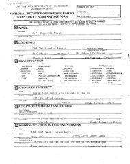
20 Saunderstown Post Office, former Narragansett Baptist Church 1902:<br />
This 1-story, hipped-ro<strong>of</strong> building- with a 2-story, hipped-ro<strong>of</strong> en<br />
-<br />
trance tower was built in 1902 as a Baptist mission chapel. It be-<br />
- came the Narragansett Baptist Church in 1908 when a large part <strong>of</strong><br />
the congregation which had met at the South Ferry Baptist Church<br />
moved here. The tower was once open on the upper level with arched<br />
arcades.<br />
53 William S. Nichols House c. 1900:. A cross-gable ro<strong>of</strong>, its broad<br />
eaves cantileve±ed out by long, exposed modillions, covers this 2story<br />
-residence which is clapboarded on the first floor and shingled<br />
above. A veranda, which.stretches along the north elevation and<br />
- wraps around:both corners, is supported by turned posts. A large<br />
wing was added to the south soon after the house was built; an attached<br />
- garage has been built recently.<br />
- 54 Saunders-Arnold House c. 1855: This house was built by Stephen<br />
- Saunders, one <strong>of</strong> four Saunders brothers who settled in the area around<br />
18S5, and had been owned by the Arnold family since 1865. The 2½story<br />
house is gable-ro<strong>of</strong>ed; two small gables break the eave line <strong>of</strong><br />
the facade; a front porch is now enclosed.<br />
69 Reuben Garlick House Cc. 1900: A 1½-story, gambrel-ro<strong>of</strong>ed house<br />
that is clapboarded on the first floor and shingled above. A<br />
veranda with turned posts faces Ferry Road.<br />
99 Martin Saunders House c. 1880-: A 1½-story, gambrel-ro<strong>of</strong>ed house with<br />
a large ell to the rear-and a veranda around the east and north sides.<br />
The lowest row <strong>of</strong> shingles has a zigzag edge where the second floor<br />
shingle covering meets the clapboards on the first floor. This house<br />
belonged to the Saunders family until 1960.<br />
116 House c. 1890: A 2½-story house with irregular massing staggered<br />
shingles under the east- gable accent the shingled exterior. A 1-<br />
- story screened porch wraps around the east and south sides. The<br />
house is set far back from Ferry Road on a private lane. -<br />
122 House c. 1915: A 2½-story, S-bay house covered by a gable ro<strong>of</strong>.<br />
-A 1-story polygonal bay projects to the east. To the south and east<br />
a deck has been added.<br />
136 House c. 1915: The Georgian Revival proportions <strong>of</strong> this cubical,<br />
2-story house are unusual in Saunderstown. The Tuscan-columned<br />
veranda runs along the south and part <strong>of</strong> the east elevations.
- Inventory-Nomination<br />
NPS Ui II 1091141 - IMII N. 104 04111<br />
3-82 - I .p. 10-31-04<br />
United States Department <strong>of</strong> the Interior<br />
<strong>National</strong> Park Service -- For<br />
<strong>National</strong> <strong>Register</strong> <strong>of</strong> <strong>Historic</strong> <strong>Places</strong><br />
received<br />
Form -<br />
Continuation sheet 19 - Item number 7 Page 19<br />
perry Road cont. -<br />
137 House c. 1910: A 2-story, shingled building with a veranda that<br />
runs across the front- gable end and continues along the east side.<br />
- A 1-story addition is set to the south. The building was used as<br />
a guest house for the John Dennis estate 28 Waterway in the l920s.<br />
161 Daniel Saunders-Benoni Lockwood House c.1855 and later: A rambling,<br />
2--story, clapboarded house with several gables and eaves edged with<br />
decorated vergeboards. The core <strong>of</strong> the house was built by Daniel<br />
Saunders, one <strong>of</strong> the four brothers who came to Willettville Saunderstown<br />
in 1855 to found a marine railway and shipyard. After 1875,<br />
the house was occupied by-Major Benoni Lockwood <strong>of</strong> New York, the<br />
first out-<strong>of</strong>-state summer resident in Saunderstown and creator, with<br />
his many friends and relations, <strong>of</strong> the Saunderstown summer community.<br />
166 Saunders Homestead c. 1853,. 1930s: A 2-story, gambrel-ro<strong>of</strong>ed house<br />
with a projecting 2-story entrance bay with a pedimented, 2-story<br />
entrance bay and a large 2nd-story window over the front door, partially<br />
-<br />
screened by a balustrade. This -was the home <strong>of</strong> Captain John Aldrich<br />
- Saunders, Jr., who moved to Willettville Saunderstown in 1855 in<br />
order to create the marine railway and shipyard. Stillman Saunders,<br />
- steam ferry designer and founder <strong>of</strong> both -the Narragansett Transporta<br />
tion Company and the Saunders House Hotel, later lived here. The -<br />
house was at first a 2-story, -gable-ro<strong>of</strong>ed cottage which was expanded<br />
and given the popular gambrel ro<strong>of</strong> in the 1930s.<br />
176 House c. 1880: This 1½-story, clapboarded structure has a crossgable<br />
ro<strong>of</strong>. A veranda-wrapping around the south, east, and north<br />
elevations is partially enclosed. -<br />
185 Bay Cottage c. 1890: A fine example <strong>of</strong> picturesque late nineteenthcentury<br />
design. A veranda overlooking the bay to the east wraps<br />
around the sides. A polygonal tower projects from the northeastcorner,<br />
topped by a flared, pointed-ro<strong>of</strong>. The 2½-story, hip-ro<strong>of</strong>ed<br />
house also features hip-ro<strong>of</strong>eddormers, corbelled chimneys, an inset<br />
balcony on the-southeast corner <strong>of</strong> the second floor, and Colonial<br />
- - - Revival detailing. The house was probably built by Edgar Logan, who<br />
worked at the Saunderstowxi shipyard.<br />
Willow Tea Cottage 1889: A veranda wraps around the gable end <strong>of</strong><br />
this 1½-story, shingled structure that overlooks the bay. Above<br />
the veranda an unusual rectangular bay projects from the east facade.<br />
An ell extends to the north. The cottage was built and operated in<br />
conjunction with the Saunders House, once directly to the north, and<br />
continued to serve refreshments after the hotel was demolished in<br />
1933. -
NPS Form l0-90a-. - 0MB No 1024-0010<br />
3-82<br />
ip. 10-31-84<br />
United States Department <strong>of</strong> the Interior --<br />
<strong>National</strong> Park Service 5-for! PSi.<br />
-<br />
<strong>National</strong> <strong>Register</strong> <strong>of</strong> <strong>Historic</strong> <strong>Places</strong> rece1’ted<br />
Inventory-Nomination Form -<br />
Continuation sheet 20 Item number 7 Page 20<br />
GOULD WAY -<br />
21 House early 2Qth century: A 1½-story, shingled residence with a<br />
large veranda on the east and south.<br />
22 Gould-Osborne House c. 1900 with later changes: The original part<br />
<strong>of</strong> this house was built as a caretaker cottage for the LaFarge estate<br />
- and occupied by-Alfonzo Gould, -a retired sailor. The house later<br />
was occupied by Margaret LaFarge Osborne and was much added to and<br />
much remodeled, some <strong>of</strong> it in a Colonial Revival mode by architect<br />
and Osborne cousin Al!xander Knox.<br />
30 House c. 19 0: Built -as a barn and servants quarters for #22,<br />
thisis a 1-story, shingled building.<br />
31 Housec. 1900: K 1½-story, gable-ro<strong>of</strong>ed house with a screened -<br />
veranda on the east and a 1-stOry extension, including a garage, to<br />
the west. -<br />
KELLEY ROAD a private path linking Church Way with Old Boston Neck Road<br />
A. Livingston Kelley House 1928: A 1-story, flank-gable house.<br />
Kelley and the neighboring Staley family built houses at the same<br />
time and established a cooperative farm further down the road. The<br />
land was not divided until the 1970s.<br />
SAUNDERS ROAD -<br />
12 House c. 1935: A shed dormer displaying exposed rafters.and<br />
staggered butt shingles runs across the entire front ro<strong>of</strong> slope <strong>of</strong><br />
this 1½-story, gable-ro<strong>of</strong>ed house. The house and its front veranda<br />
are on a high foundation.<br />
18 House c. 1900: This gambrel-ro<strong>of</strong>ed, shingled house has had an<br />
exterior brick chimney added in the past decade.<br />
24 House Cc. 1890: This 2-story house has a tall, steeply pitched,<br />
gable ro<strong>of</strong>. The walls <strong>of</strong> the house are greatly recessed to create a<br />
broad piazza. Turned posts and- carved brackets support the overhanging<br />
eaves.<br />
STILLMAN ROAD -<br />
2 House c. 1920: A 2½-story, shingled building with shed-ro<strong>of</strong>ed<br />
dormers protruding from the gable ro<strong>of</strong>. An enclosed veranda runs<br />
across the south side. -
NPS foilil 10-900 - 0MB No 1024 -00111<br />
3-82 1 .p 10-31-84<br />
United States Department <strong>of</strong> the Interior - -<br />
<strong>National</strong> Park Service .:-:.!!.! ?.-" -9!.-: :- -<br />
<strong>National</strong> <strong>Register</strong> <strong>of</strong> <strong>Historic</strong> <strong>Places</strong><br />
Inventory-Nomination Form<br />
received<br />
Continuation sheet 21 - Item number 7 Page 21<br />
Stillman Road -<br />
7 House c. 1905: The gable ro<strong>of</strong> <strong>of</strong> this 2-story structure has<br />
rafters exposed beneath the eaves-. A garage is incorporated into the<br />
first floot, and a porch-extends to the east.<br />
22 House c. 1890: A large, 2½-story, gable-ro<strong>of</strong>ed structure that,<br />
judging from its irregular massing, has probably experienced some<br />
alterations. It was perhaps constructed in conjunction with the<br />
Saunders House.<br />
32 House c. 1915: Vinyl siding covers this bungalow which features<br />
a broad, flank-gable ro<strong>of</strong> witha shed-ro<strong>of</strong>ed dormer, a deeply re<br />
cessed porch, and a foundation <strong>of</strong> cast concrete blocks.<br />
40 House 1889 : A steeply-pitched -gable ro<strong>of</strong> covers this L-shaped,<br />
1½-story cottage; built as part <strong>of</strong> the Saunders House complex.<br />
WATERWAY -<br />
10 Captain George Kenyon House rnid-l9th century, later alterations<br />
The gambrel ro<strong>of</strong>- <strong>of</strong> this 2½-story house- and -the combination <strong>of</strong><br />
clapboard and shingle wall covering probably date from about half<br />
a century after the initial consturction <strong>of</strong> the house in the mid<br />
1800s. - -<br />
18 House Cc. 1895; moved and additions after 1912-: This 1½- and 2½story<br />
house has a polygonal bay, pendant drops, broad eaves, and<br />
vertical board siding. The building originally housed the Saunderstown<br />
post <strong>of</strong>fice and probably stood near the intersection <strong>of</strong> Ferry<br />
and Saunders Roads. It was moved after 1912 to its present location<br />
and a large rear section was added. -<br />
22 House c. 1895: A 1½-story, clapboarded cottage on a high founda<br />
tion. On the south a veranda runs across the 3-bay facade, and shedro<strong>of</strong>ed<br />
dormers -break the eave line <strong>of</strong> the gable ro<strong>of</strong>.<br />
25 Captain Alfonso Gould House c. 1850: A 2½-story, clapboarded<br />
house which was rented by Owen Wister before he built his own house<br />
at Crowfield. -<br />
28 John Dennis House c. 1900: This large, 2½-story, cross-gambrel<br />
ro<strong>of</strong>ed house overlooking the water has had several additions. Inset<br />
cut shingles create diamond patterns under the gambrel ends.<br />
K’
NPS Fo,rn ‘0900. MI No 1024 -00111<br />
13-821<br />
- *0- 10-31-04<br />
United States Department <strong>of</strong> the Interior -- - --<br />
<strong>National</strong> Park Service -- For.Nfl Use only - - - -<br />
<strong>National</strong> <strong>Register</strong> <strong>of</strong> <strong>Historic</strong> <strong>Places</strong> rec&ved -<br />
Inventory-Nomination Form .::EH- .;..:-:: :. - -<br />
Continuation sheet 22 Item number 7 Page 22<br />
Waterway cont.<br />
28 Garlick-Wharton House late 19th and early 20th centuries: A 1½story,<br />
L-plan., shingled house that-was built in three stages in the<br />
late 19th and early 20th centuries, The core <strong>of</strong> the house belonged<br />
to Captain Charles H. Garlick in the 1880s. The house was later<br />
owned by Frances Willing Wharton, a daughter <strong>of</strong> Benoni Lockwood and<br />
a once well known story writer, and her husband Henry T. Wharton.<br />
The Whartons-were cousins <strong>of</strong> the nOvelist Edith Wharton who visited<br />
here frequently. -<br />
174 Spindrift c. 1893: A large, 2½-story, gambrel-ro<strong>of</strong>ed, shingled,<br />
summer house built by H.B. Dexter, a Pawtucket lumber merchant. A<br />
large shingled garage/apartment stands by the road.<br />
WILLETT ROAD - -<br />
S House c. 1890: A 2-story, gambrel-ro<strong>of</strong>ed, shingled cottage. Ballon-post<br />
newels flank the stairs leading to the veranda which is<br />
recessed on the east and south sides. -<br />
8 House Cc. 1925-: A tiny shingled cottage on a concrete block -<br />
foundation. -<br />
15- Harry Saunders House c. 1890: A 2-story, flank-gable house with<br />
a large gable centered in the front over a full-length veranda.<br />
There is a rear ell. -<br />
19 House c. 1895: A gambrel-ro<strong>of</strong>ed, shingled cottage with a porch<br />
extending from the front. A large eli extends to the rear.<br />
25 House c. 1900: A 2-story, end-gable structure with a wing to the<br />
south. Recent alterations include addition <strong>of</strong> a bay window to the<br />
wing and vinyl siding. -<br />
34 House Cc. 1925: A 2-story, gable-ro<strong>of</strong>ed structure, sheathed in<br />
shingles, with a first floor veranda. It is set well back from the<br />
road. -<br />
35 House c. 1870: A 2-story, flank-gable-ro<strong>of</strong>ed structure with a<br />
handsome bracketed porch to the east and south and a large rear ell.<br />
Shingles cover the second floor, clapboards the first.<br />
42 House c. 1890: A 1½- and 2-story, gable-ro<strong>of</strong>ed structure set back<br />
from the road. Clapboards cover the first floor, with staggered<br />
butt shingles above.
lIPS Forn, ‘o-gOO* 0MB No 1024-Cole<br />
3-82 1 .p. 10-31-84<br />
United States Department <strong>of</strong> the Interior - --- - - -<br />
<strong>National</strong> Park Service - .:ForNP$:useonIy I.: -- - -<br />
<strong>National</strong> <strong>Register</strong> <strong>of</strong> <strong>Historic</strong> <strong>Places</strong><br />
Inventory-Nomination Form<br />
received<br />
dateentered<br />
Continuation sheet 23 - Item number 7 Page 23<br />
Willett Road cont. -<br />
45 House Cc. 1890: A 2-story, shingled residence with an end-gable<br />
ro<strong>of</strong> and a large, hip-ro<strong>of</strong>ed ell to the north.<br />
54 "Rest- Cottage" c. 18901: This 2-story, gable-ro<strong>of</strong>ed structure was<br />
built by the Women’s Christian Temperance Movement. Some decorative<br />
elements were unfortunately removed when vinyl siding was applied.<br />
A diagonal bay projecting from the southeast is surrounded by a<br />
veranda on the first floor.<br />
65 Chapel <strong>of</strong> Saint John the Divine 1895, 1971: Land for this pictur<br />
esque, gable-ro<strong>of</strong>ed,- shingled chapel, with its pyramidal-ro<strong>of</strong>ed bell<br />
tower, was given by the Misses Carpenter, descendants <strong>of</strong> the Willett<br />
family, as a memorial to their sister. Elisha M. Robinson <strong>of</strong> Wake<br />
field was the builder and the Reverend Philip M. Prescott, a summer<br />
resident fromWashington, D.C., who donated $2,200 to the building,<br />
oversaw its construction. Rockwell K. du Moulin was architect <strong>of</strong><br />
a sympathetic new wing. -<br />
.66 House c. 1910: A 1½-story, gambrel-ro<strong>of</strong>ed Colonial Revival house,<br />
with large shed dormer. A door with sidelights is centered in the<br />
S-bay facade. A-wing extends to the northwest.<br />
72 Thomas J. Gould House c. 1870 : Second floor windows break the eave<br />
line <strong>of</strong> this gable-ro<strong>of</strong>ed house and create gabled dormers. The<br />
shingled structure stands close to the road, the property edged by<br />
a tail stone wall.<br />
75 St. Stephen’s House 1902: A large, 2-story, gable-ro<strong>of</strong>ed, shingled<br />
house with central- chimney and front porch. The house was originally<br />
owned by St. Stephen’s Church.<br />
90 Adolphe Bone House 1903: A large, 2-story, frame house with a hip<br />
ro<strong>of</strong>. It was designed by the Philadelphia firm Zantzinger, Bone<br />
and Medary, for architect Bone’s brother, Adoiphe Bone, a well<br />
known artist. Some windows have been modernized and the porch on the<br />
south side filled in. Another building on the property was once a<br />
barn but has been converted into a residence. A handsome peacock<br />
weathervane is perched atop the latter’s cupola.<br />
126 House c. 1920: A steep, cross-gambrel ro<strong>of</strong> covers this 2-story,<br />
shingled house,- which has -a large glazed porch extending to the south<br />
east and a Tuscan columned veranda to the southwest. A small carriage/<br />
caretaker’s house near the road was built in the 1920s and also has<br />
a gambrel ro<strong>of</strong>.<br />
‘p
lIPS coin ‘0-900-. 0MB No 1024-0018<br />
13-82<br />
United States Department <strong>of</strong> the Interior ... -- -<br />
<strong>National</strong> Park Service - -:?-9!’ :-TY---- - --<br />
<strong>National</strong> <strong>Register</strong> <strong>of</strong> <strong>Historic</strong> -<strong>Places</strong><br />
- -- - - -<br />
Inventory-Nomination Form --<br />
Continuation sheet 24 Item number 7 Page 24<br />
Wi].lett Road cont.<br />
140 House c. 1924: A tall gambrel ro<strong>of</strong> with-a broad shed dormer covers<br />
this 2½-story, clapboarded house. The recessed east porch overlooks<br />
a wide lawn that slopes to the Waterway. An eli has been added to<br />
the north. -<br />
156 House 1924: Similar to #140, but it has no-northern ell and is<br />
shingled. -<br />
INVENTORY OF NON-CONTRIBUTING STRUCTURES<br />
BRIGGS ROAD - -<br />
29 "The Shack" Cc. 1940: A- 1-story cottage with painted shingle<br />
sheathing and low gable ro<strong>of</strong>s over its several sections.<br />
44 House Cc. 1950: A gable ro<strong>of</strong> covers the irregular massing <strong>of</strong> this<br />
shingled residence.<br />
- 56 House Cc-. 1945: A small, 1-story, shingled cottage.<br />
CAVANAUGH COURT -<br />
CHURCH WAY<br />
FERRY LANE<br />
16 Cottage Cc. 1940: A- low, shed-ro<strong>of</strong>ed dormer extends along the gable<br />
ro<strong>of</strong> <strong>of</strong> this 1½-stony house. The ro<strong>of</strong> pitch flattens to cover a<br />
veranda on-the east.<br />
20 House c. 1955: A 1½-story, shingled residence with a gable ro<strong>of</strong>.<br />
35 House c. 1966: A 1½-story residence with a 1-story section con<br />
nected to the northwest by an open deck.<br />
76 House c. 1965: A S-bay, Colonial-style house with a second-floor<br />
overhang. A garage is attached to the north.<br />
3½ House Cc. 1950: A shingled, 1½-stony, gable-ro<strong>of</strong>ed house with a<br />
large shed-ro<strong>of</strong>ed projection from the southern ro<strong>of</strong> slope.<br />
33 House c. 1950: A steep gable ro<strong>of</strong> covers this 1-story house, which<br />
has a lower extension to the north and an asymmetrical gable hood over<br />
the front door. At each end under the gable is an unusual thin,<br />
lap.<br />
10-31-84
lIPS loin’ ,o-goo-, MII No 024 0011<br />
3-82 I- ip. 10-31-84<br />
United States Department <strong>of</strong> the Interior - --<br />
<strong>National</strong> Park Service - -: For NJ’S :"!°!Y--. - -<br />
<strong>National</strong> <strong>Register</strong> <strong>of</strong> <strong>Historic</strong> <strong>Places</strong> eind<br />
Inventory-Nomination Form .:. er d. 7: :-<br />
Continuation sheet 25 Item number 7 Page 25<br />
Ferry Lane cont.<br />
round-headed window with a keystone detail.<br />
FERRY ROAD - -<br />
33 House c. 1950: A 1-story, gable-rO<strong>of</strong>ed house.<br />
80 Winslow Ames House 1958: This modern shed-ro<strong>of</strong>ed house, clad in<br />
weathered vertical boarding was designed by <strong>Rhode</strong> <strong>Island</strong> architect<br />
Rockwell K. du Moulin for art historian Winslow Ames.<br />
100 House c. 195S: A broad driveway leads to the double garage which,<br />
owing to a slope, is set under the main floor <strong>of</strong> the house. A low<br />
gable ro<strong>of</strong> covers the L-shaped plan. -<br />
110 House Cc. 1945: A 1½-story, gable-ro<strong>of</strong>ed nesidence. The front ro<strong>of</strong><br />
- slope has a large shed dormer. -<br />
131 House c. 1950: Separated from Ferry Road by a lange lawn, this<br />
is a 2-story, gable-ro<strong>of</strong>ed &tructure. - -<br />
156 House c. 1960: This 1-stony, gable-ro<strong>of</strong>ed house with vertical<br />
board siding rests on a high concrete basement.- An exterior stone<br />
chimney rises to the south. -<br />
190 House Cc. 1940: A 1½-story, gable-ro<strong>of</strong>ed, shingled house set back<br />
from the road. A garage is attached to the west.<br />
WATERWAY -<br />
D.B. -Wilson House 1950, 1968: The southern portion <strong>of</strong> this low,<br />
gable-ro<strong>of</strong>ed house .was designed by the architect Alexander Knox in<br />
1950; the northern -section was added by Frederick Lansing Day <strong>of</strong><br />
Boston in -1968. Horizontal flush board siding covers both sections.<br />
The house stands on the site <strong>of</strong> the Grant and Florence LaFarge house,<br />
which burned in 1945. -<br />
71 House 1954: The central section <strong>of</strong> this 1-story, cruciform plan<br />
house is slightly taller than the rest. A deck nuns across the east<br />
facade. The house is sided- with vertical boards.<br />
77 House 1973: The broad eaves <strong>of</strong> the low gable ro<strong>of</strong> <strong>of</strong> this 1-story<br />
house ane supported by prominent cantilevers. -A deck is attached<br />
to a pavillion extending eastward. -
lIPS Fo,n, 0-900-. OMI No 1024-0018<br />
3-82<br />
1 ip. 10-31.84<br />
United States Department <strong>of</strong> the Interior - -... - .- .-. - --- --- -- -<br />
NatIonal Park Service For NJ’S us* any<br />
<strong>National</strong> <strong>Register</strong> <strong>of</strong> <strong>Historic</strong> <strong>Places</strong><br />
Inventory-Nomination Form<br />
received<br />
Continuation sheet 26 Item number 7 Page 26<br />
Waterway cont.<br />
78 House 1975: A gable ro<strong>of</strong> form is created by joining right angle<br />
triangles back to back, which meet unevenly. The stnucture is<br />
covered with vertical boards.<br />
110 House 1954: Vertical board siding covers this low,- cross-gable<br />
house. To the east is a 1½-story, clapboarded structure that has a<br />
large stone chimney with a tapered brick cap. A -1½-story barn/resi<br />
dence by the road was built in 1965 and has a gambrel ro<strong>of</strong> and clap<br />
board siding.<br />
WATERWAY EXTENSION<br />
Saunderstown Yacht Club 1962: A long, gable-ro<strong>of</strong>ed building that<br />
extends parallel to theshoreline. The central section is tallen;<br />
the entire building is covered in shingles. The building occupies<br />
the site <strong>of</strong> the Saunders House,- built in 1889 and demolished in 1933,<br />
and the Saunders boatyard, active fnom about 1855 to 1911. The first<br />
clubhouse, erected shortly after the Saunders House was removed, was<br />
- destroyed in the 1938 hurricane. The former Saunders House laundry<br />
shed was then converted and served as a clubhouse until the present<br />
structure was constructed.<br />
WILLETT ROAD -<br />
8 House Cc. 1945: A small shingled cottage.<br />
95 House Cc. 1955: A low, shingled stnucture with a large bay window.<br />
110 House Cc.. 1965: A split-level house with a 2-story centnal gable,<br />
a double ganage -to the north, and a bay window in its south wing.
lIPS Form ‘0-900-s<br />
13-82<br />
0MB No 1024-0016<br />
liP- 10-31-84<br />
United States Department <strong>of</strong> the Interior -- - - -<br />
<strong>National</strong> Park Service - - !!rN!;.us!.:ar.v .:- H - - - --<br />
<strong>National</strong> <strong>Register</strong> <strong>of</strong> <strong>Historic</strong> <strong>Places</strong><br />
Inventory-Nomination Form<br />
rec&ved<br />
Continuation sheet 27 item number 7 Page 27<br />
PERIODS OF SIGNIFICANCE: 1800-1899, 1900-<br />
AREAS OF SIGNIFICANCE: - Other: Community Development, Recreation<br />
SPECIFIC DATES: See inventory entries -<br />
BUILDER/ARCHITECT: Various; see inventory entries<br />
SIGNIFICANCE: - -<br />
Saunderstown.Histonic District is significant as a small, late nine<br />
teenth-centuny boatbuilding center Cone -<strong>of</strong> several on Narragansett Bay<br />
and as an early twentieth-centuny sunnier colony, whose residents were<br />
attracted by the historic character <strong>of</strong> the old village, the rough wooded<br />
setting, and- the exceptional location on the Bay.<br />
Like many areas <strong>of</strong> North Kingstown, Saunderstown was farmed thnoughout<br />
the eighteenth and early nineteenth centuries, A major change was initiated<br />
in September, 1856, when John A. Saunders, Jr., his three brothers, Elias,<br />
Stephen, and Daniel, and William Caswell and Thomas J. Gould bought land<br />
here at what was then called Willettville, for the purpose -<strong>of</strong> developing a<br />
marine railway and shipyard, -The Saunders bnothens were the sons <strong>of</strong> the<br />
shipwright John Aldrich Saunders who, first in Westerly and later in Newpont,<br />
South Kingstown, and North Kingstown, built at least twenty-one sailing<br />
vessels, mostly for the- coasting trade. At his Nonth Kingstown site, nean<br />
the Gilbert Stuart mill, Saunders had constructed the schooner Nonsuch, one<br />
<strong>of</strong> the most famous <strong>Rhode</strong> <strong>Island</strong> boats <strong>of</strong> the first half <strong>of</strong> the nineteenth<br />
century. The Saunders -family, characterized by their descendant-historians<br />
as "compulsive boat designers and builders," kept at their trade at Willett<br />
ville thnough John Aldrich Saunders, Jr., and, later, Stillman Saunders and<br />
his brothers. --Between 1859 and 1874, three sloops were constructed at their<br />
shipyard, and many othen vessels we’e repaired; their yard was located on<br />
the site now -occupied by the Sauñderstown Yacht Club. The six original<br />
settlers <strong>of</strong> the boat-building village had expanded to twenty families by<br />
1878 in what by then was called Saunderstown. The male population was en<br />
gaged in the coal trade, fishing, or in boatbuilding at the Saunders boat<br />
yand, which, by 1888, was run by the inventor and pnomoten Stillman Saunders.<br />
Stillman Saunders, the colonful and dynamic moving spirit <strong>of</strong> his com<br />
munity in the first part <strong>of</strong> this century, designed six steam-scnew ferry<br />
boats, construction <strong>of</strong> which was supervised by his brother, Martin Saunders.<br />
The West Side, the J.A. Saunders, the Narragansett and the 373-ton Newport<br />
canned people and goods from Saunderstown to Jamestown and to Newport. The<br />
Newport, built in 1907 for this run, was for some time the fastest and largest<br />
boat plying-Narragansett Bay. The Wyona and Anawon, two earlier Saundens<br />
boats 1884 and 1893 respectively, were used principally on a Saunderstown<br />
Wickford-Providence route. -
lIPS Form 0-900 S - 0MB No 1024-0018<br />
3-82 lip- IC -31-84<br />
United States Department <strong>of</strong> the Interior - - -<br />
<strong>National</strong> Park Service For NPS use only<br />
<strong>National</strong> <strong>Register</strong> <strong>of</strong> <strong>Historic</strong> <strong>Places</strong> -<br />
received<br />
- - -<br />
Inventory-Nomination Form to ---
lIPS Farm io-9o0-s - 0MB No 1024-0016<br />
j3-821<br />
I ip 10-31-84<br />
United States Department <strong>of</strong> the Interior ...*. LHH:.- -<br />
<strong>National</strong> Park Service<br />
<strong>National</strong> <strong>Register</strong> <strong>of</strong> <strong>Historic</strong> <strong>Places</strong><br />
Inventory-Nomination Form<br />
received<br />
Continuation sheet 29 Item number 7 Page 29<br />
the nonth 1600 Boston Neck Road. Wister was an important figure in<br />
Amenican literary and political life early in the twentieth centuny as the<br />
author not only <strong>of</strong> a popular novel which generated years <strong>of</strong> traveling pro<br />
ductions <strong>of</strong> its play version and- several movies as well, but also <strong>of</strong> a non<br />
fiction best seller about Eunopean politics at the time <strong>of</strong> World Wan I.<br />
Wisten was a close friend <strong>of</strong> Theodore Roosevelt and was involved in diplo<br />
matic work in Europe. Other litenany and artistió residents <strong>of</strong> Saundenstown,<br />
perhaps betten known in their own day, lived in other modest shingle houses<br />
in this rustic bay-side setting, creating for themselves and their <strong>of</strong>fspning<br />
memorable summers <strong>of</strong> vigorous outdoor pursuits- -swimming, camping, hunting,<br />
fishing, riding-in--in the North Kingstown countryside, interspersed with<br />
equally vigorous discussions <strong>of</strong> mattens scholarly, literary, and civic.<br />
ACREAGE: c. 79 acres - -<br />
QUAD NAME: Wickford, R.I.<br />
UTM: A 19 298300 4597840 B 19 298010 4597340<br />
C 19 297480 4597240 - D 19 297360 4597600<br />
E 19 297910 4598410<br />
BOUNDARY DESCRIPTION AND JUSTIFICATION:<br />
The boundary <strong>of</strong> the Saunderstown <strong>Historic</strong> District is drawn to encompass<br />
the greatest number <strong>of</strong> buildings which have participated in the district’s<br />
significance as a boat-building village and- summer colony and t5’ exclude,<br />
ins<strong>of</strong>ar as is feasible, buildings which do not contribute to its historic<br />
characten. The district proposed for <strong>National</strong> <strong>Register</strong> listing does not<br />
include all the area popularly known in Nonth .Kingstown as "Saunderstown."<br />
While the-re ane some older buildings to the north and west <strong>of</strong> the boundary,<br />
development in these areas is more scattered and less oniented to the shoneline<br />
<strong>of</strong> Narragansett Bay. Onlya handful <strong>of</strong> buildings on the west side <strong>of</strong><br />
Boston Neck Road are included in the district: the Saundenstown Post Office,<br />
the fonmer Fire Barn, and a single house 4 Ferry Road. These are included<br />
since the Post Office and Fine Barn mark a tiny community centen, because<br />
they have been historically associated with the summer colony, and because<br />
they serve as a visual "sign" on the principal road passing through the area<br />
that Saunderstown is located here--without these buildings, the historic<br />
distnict is well hidden fnom the major thoroughfare. -<br />
All numbens nefer to lots in Plat 1: the boundary, begins at the shone<br />
on the southeast conner <strong>of</strong> 148, pnoceeds west to the southwest corner <strong>of</strong> 165,<br />
north along the east side <strong>of</strong> Willett Road, to a point opposite the southeast<br />
cornen <strong>of</strong> 71, west along the south line 71, south, west, and north around 52,<br />
west on the south line <strong>of</strong> 28, north along the west lines <strong>of</strong> 28, 21, and 26,<br />
west acnoss 24 to Boston Neck Road, northeast along the east side <strong>of</strong> the road,<br />
crossing Boston Neck Road to the southeast conner <strong>of</strong> 19, north along that<br />
lotts west bound, across 3 to the west line <strong>of</strong> 17, across 3 again to the<br />
southwest conner <strong>of</strong> 14, north, east, and south around 14, and across Ferry
Farm 10900.<br />
United States Department <strong>of</strong> the Interior<br />
<strong>National</strong> Park Service For NI’S use only<br />
-. <strong>National</strong> <strong>Register</strong> <strong>of</strong> <strong>Historic</strong> <strong>Places</strong><br />
Inventory-Nomination Form<br />
0MB No, 1024-0018<br />
Isp- 10-31-84<br />
Continuation sheet 30 Item number 7 Page 30<br />
-<br />
Road; then east along the south line <strong>of</strong> Ferry Road, across Boston Neck Road<br />
to the southwest cornen <strong>of</strong> 31, north along the east side <strong>of</strong> Boston Neck Road<br />
to the nonthwest corner <strong>of</strong> 53, then east along the -north lines <strong>of</strong> 53, 74, 88,<br />
89, 101, 102, 110, 111, 112, and 127, to the shore, then south to the point<br />
<strong>of</strong> beginning. -<br />
LEVEL OF SIGNIFICANCE: Local -<br />
Photo numbers: 13-19
lIPS Form 10900- 0MB No, 9024-0018<br />
3-82 Isp- 10-31-84<br />
United States Oepartrvient Of the Interior<br />
<strong>National</strong> Park Service ForNPSua only<br />
<strong>National</strong> <strong>Register</strong> <strong>of</strong> <strong>Historic</strong> <strong>Places</strong> mcd<br />
Inventory-Nomination Form ,<br />
Continuation sheet 31 Item number 7 Paqe 31<br />
NAME: Shady Lea <strong>Historic</strong> District<br />
LOCATION: Shady Lea Road and Tower<br />
OWNERS: Multiple; see list on file<br />
Hill Road<br />
at <strong>Rhode</strong> <strong>Island</strong> <strong>Historic</strong>al Presenva:<br />
tion Commission<br />
CONDITION:<br />
-<br />
Good; Altered; Original<br />
Tower Hill Road, moved,<br />
Site except a corn crib<br />
1970s, within district<br />
at 1340<br />
-<br />
DESCRIPTION: -<br />
The Shady Lea <strong>Historic</strong> District is a small, linear, nineteenthcentury<br />
milling hamlet set on the Pettaquamscutt Riven. A long, narrow<br />
district, Shady Lea’s form is created by the Pettaquamscutt River, a<br />
relatively small stream which flows south through southern North Kingstown;<br />
at the north end <strong>of</strong> the district is the mill owner’s house; at the<br />
southern end is Shady Lea Pond, created by draining the Pettasquamscutt.<br />
The district’s buildings-are located along the north-south axis created<br />
by Shady Lea Pond; at the north boundary is Tower Hill Road a muchwidened<br />
stretch <strong>of</strong> the old Post Road.<br />
The west edge <strong>of</strong> the district is marked by the Shady Lea mill pond<br />
probably created in the l820s. At the southern end <strong>of</strong> Shady Lea Pond<br />
is the Shady Lea Mill, a rambling, L-shaped, factory complex <strong>of</strong> wood,<br />
stone, and brick, mostly two stories high, with two stair towers, two<br />
engine buildings, and several outbuildings, all from the nineteenth<br />
century. The mill is now used for staple manufacture. A cluster <strong>of</strong><br />
nineteenth-century double mill cottages is set east <strong>of</strong> the mill; several<br />
‘others are set along Shady Lea Road. Several modern houses at the<br />
northern end <strong>of</strong> Shady Lea Road 33, 39, and 47 have been built in the<br />
district.<br />
Set at the north end <strong>of</strong> Shady Lea is the Rodman House, a large<br />
mansard-ro<strong>of</strong>ed stnucture. North <strong>of</strong> the Rodman House on Tower Hill Road<br />
is a large Rodman-built horse barn.<br />
INVENTORY OF CONTRIBUTING STRUCTURES:<br />
Contributing structures ane defined as those dating from the period<br />
<strong>of</strong> Shady Lea’s significance as a small rural nineteenth-century mill<br />
village. -All buildings are <strong>of</strong> frame constnuction unless otherwise<br />
indicated. -<br />
SHADY LEA ROAD<br />
20 Charles Rodman House mid-1860s: A 2½-stony mansion with a<br />
mansard-ro<strong>of</strong>, brackets under the eaves, first-floor bay window and<br />
veranda. Granite gateposts, picket fence, and fine trees maintain<br />
the Victorian setting. The house was apparently built by Charles
lIPS Farm 10900-.<br />
3-82<br />
United States Department <strong>of</strong> the Interior<br />
<strong>National</strong> Park Service<br />
<strong>National</strong> <strong>Register</strong> <strong>of</strong> <strong>Historic</strong> <strong>Places</strong><br />
Inventory-Nomination Form<br />
For NI’S us. only<br />
se.nterd<br />
0MB No, 1024-0018<br />
Esp- 10-31-84<br />
Continuation sheet 32 Item number 7 Page 32<br />
SHADY LEA ROAD cont -<br />
Rodman; Robert Rodman lived here before moving to- Lafayette village.<br />
63-69 Mill Tenement House mid-l9th century: -2½-story, flank gable,<br />
centered-double-entry-plan, multifamily dwelling with pnojecting<br />
bracketed door hoods, built to house workers at the Shady Lea mills.<br />
111 Mill Cottage mid-l9th-century:: This is a 2-story flank gable,<br />
5-bay residence, with a 1-story ponch with square posts and small<br />
- addition acnoss its street facade. Small square windows, tucked<br />
under the eaves. A 1-story ell is attached to the rear.<br />
150 Mill Cottage mid- to late 19th century: A 1½-stony, 5-bay,<br />
flank-gable shingled house with dormers; its door is set at the<br />
center <strong>of</strong> the facade.<br />
162 Mill Cottage mid- to late 19th-century: A small, 1½-story, 3-bay,<br />
flank-gable house with centen door; the fenestration has been<br />
altered somewhat and vinyl siding applied.<br />
Shady Lea Mill before 1832 and throughout the 19th century A<br />
rambling, L-shaped, factory complex <strong>of</strong> wood, stone, and. brick,<br />
mostly two stonies high, with two stair towers, two engine build<br />
ings, and several outbuildings, all from the 19th centuny. The<br />
earliest part <strong>of</strong> the mill remains <strong>of</strong> a stone-and-wood building<br />
with some Federal l2-over-12 windows was probably built by Esbon<br />
Sanford during- the first third <strong>of</strong> the 19th century. It is now<br />
hidden within the mid-l9th-century eastern end, with only a few<br />
Federal-style 6-over-S windows showing to the night <strong>of</strong> the stair<br />
tower. Several brick extensions to the west and south date from<br />
a series <strong>of</strong> building campaigns <strong>of</strong> the second half <strong>of</strong> the century;<br />
Most <strong>of</strong> the sturdily crafted frame-outbuildings were in place by<br />
1883. These include the <strong>of</strong>fice, set to the-west <strong>of</strong> the mill;<br />
stock houses, to the south; carpentry shop to the southwest;<br />
wheel turbine house attached to the southern end <strong>of</strong> the mill;<br />
and, across the Pettaquamscutt River, the smithy. Together, they<br />
form an unusually well-presenved mill complex.<br />
203 Mill House mid-l9th century: A 2½-story, flank-gable, brick<br />
house, its flat front facade directly opposite the road from the<br />
mill; its narrow door is set in the center <strong>of</strong> the facade. A<br />
2-story eli. has been added to the rean.<br />
233 Double Mill House mid-l9th century: A simple 1½-story, 8-bay,<br />
shingled house, with a flanking gable ro<strong>of</strong>. Flat boards mark the<br />
corners and fname the two doors with transoms.
lIPS Form 10900ã 0MB NoA024-OO1B-<br />
United States Department <strong>of</strong> the Interior<br />
<strong>National</strong> Park Service fot NI’S uss only<br />
<strong>National</strong> <strong>Register</strong> <strong>of</strong> <strong>Historic</strong> <strong>Places</strong><br />
Inventory-Nomination Form<br />
-- 6&*-sf,, -<br />
Continuation sheet 33 Item number 7 Page 33<br />
SHADY LEA ROAD cont<br />
234-236 Double Mill House mid-l9th century: Same as 233,. except that it<br />
retains its.oniginal clapboard siding and has an ell to the northwest.<br />
-<br />
TOWER HILL ROAD<br />
1340 Potpourri Potters, Former Rodman/Shady Lea Mill Barn late 19thcentuny:<br />
A modern -pottery now occupies this handsome large barn,<br />
with clapboard wall cover, attached silo, jerkinhead gable ro<strong>of</strong>,<br />
- and cupola, probably built for the Rodman milling operations at<br />
Shady Lea. A corncrib moved, 1977, from a nearby location on<br />
the-farm is set near the road; its wall cover and ro<strong>of</strong> form repeat<br />
those <strong>of</strong> the larger barn. A small, shingled, gable-ro<strong>of</strong>ed shed’ is<br />
also set nearby.<br />
1376 House mid-l9th-century: A particularly fine 5-bay, 1½-story,<br />
Greek Revival house, with a handsome pilaster-and-anchitrave doon<br />
- frame, panelled pilasters, large 2-oven-2 window and a bracketed<br />
veranda on a near ell. -<br />
1410 House ca. 1865: A 1½-story, cross-gable house, with projecting<br />
front porch with turned posts and delicate brackets, first floor<br />
bay, trefoil bargeboards, and 2-over-2 sash.<br />
NON-CONTRIBUTING STRUCTURES<br />
SHADY LEA ROAD -<br />
33 House ca. 1955: A simple 1-story, flank-gable shingled house.<br />
39 House ca. 1955: A simple gable-no<strong>of</strong>ed, 1-story house.<br />
47 House ca. 1955: A simple gable-ro<strong>of</strong>ed, 1-stony house.<br />
PERIOD: 1800-1899<br />
AREAS OF SIGNIFICANCE: Industry -<br />
SPECIFIC DATES: - Various see inventory entries<br />
BUILDER: Various, unknown<br />
SIGNIFICANCE: -<br />
The Shady Lea <strong>Historic</strong> District is significant for it ability to<br />
document a relatively well-preserved, nineteenth-century rural milling<br />
village, and fon its association with the Rodman family’s -textile firm.<br />
Throughout the nineteenth -centuny small textile mills were constructed
lIPS Form 10-900-a 0MB No 024-0018<br />
3-82<br />
United States Departnient <strong>of</strong> the Interior<br />
<strong>National</strong> Park Service NI’S use only<br />
<strong>National</strong> <strong>Register</strong> <strong>of</strong> <strong>Historic</strong> <strong>Places</strong><br />
recs4ed<br />
Eap- 10-31-84<br />
Inventory-Nomination Form $dattentere - -<br />
Continuatn sheet 34 item number 7 Page 34<br />
on the waterways <strong>of</strong> North Kingstown and generated about themselves small<br />
villages to house mill workers; in North Kingstown few villages grew<br />
to substantial size and most remained small industrial outposts set in<br />
a rural landscape; Shady Lea is representative <strong>of</strong> this development<br />
pattern. The Rodman family was instrumental in the development, <strong>of</strong> three<br />
<strong>of</strong> the town’s villages: Shady Lea, Silver Spning .nonth <strong>of</strong> Shady Lea,<br />
and Lafayette already entered on the <strong>National</strong> <strong>Register</strong>. Operating in<br />
the southem<strong>Rhode</strong> <strong>Island</strong> tradition <strong>of</strong> small, highly paternalistic textile<br />
firms, the Rodmans produced cottons and woolens from the 1840s through<br />
the 1940s. At Lafayette, the Rodmans created a fully-realized company<br />
town with mills, houses, and attendent institutions, managed on a daily<br />
basis by resident owners. The Shady Lea Mill mills supplemented production<br />
at Lafayette throughout the last half <strong>of</strong> the nineteenth century<br />
and well into the twentieth.<br />
Manufacture <strong>of</strong> jeans at Shady Lea on the Pettaquamscutt River was<br />
begun by Captain- Esbon Sanfond, Jr., who sold the operation in 1832 when<br />
he moved t,o Annaquatucket. Fon several decades, different owners<br />
manufactured a variety <strong>of</strong> cotton and wool textiles: flannels, linsey<br />
woolseys, and cassimenes. Under Walter B. Chkpin, builder <strong>of</strong> a mill<br />
in Wickford, Shady Lea made blankets for the Union Anmy during the Civil<br />
War. Robert Rodman purchased Shady Lea in 1870 for the manufacture <strong>of</strong><br />
warps used in jeans. He expanded the factory to the west and it re<br />
mained in his empire until the Rodman family disbanded their holdings<br />
in 1952. -<br />
Of special significance at Shady Lea is the mill itself, little<br />
changed since the early twentith century and still used for manufactur<br />
ing. Especially noteworthy is the collection <strong>of</strong> small mill outbuildings<br />
<strong>of</strong>fice, carpenter shop, stock houses, and the like which are among<br />
the most fragile and least likely to survive <strong>of</strong> industrial buildings;<br />
they document the multiple phases <strong>of</strong> textile pnoduction and help to<br />
tell the stony <strong>of</strong> nineteenth-century manufacture in North Kingstown.<br />
ACREAGE: c, 18 acres -<br />
QUAD NAME: Wickford R.I.<br />
UTM: A 19 294100 46Q1480 B 19 294600 460081Q<br />
C 19 294440 4600590 D 19 293930 4601250<br />
BOUNDARY DESCRIPTION: -<br />
The boundary <strong>of</strong> the Shady Lea <strong>Historic</strong> District is drawn to encompass<br />
those structunes which historically participated in the district’s<br />
significance as-a rural industrial village: mill, workers’ houses,
lIPS Form 10-900-a 0MB NO- 024-0018<br />
3-82<br />
E,p 10-31-84<br />
United States Department <strong>of</strong> the Interior<br />
<strong>National</strong> Park Service - For NI’S use only -<br />
<strong>National</strong> <strong>Register</strong> <strong>of</strong> <strong>Historic</strong>-<strong>Places</strong> -<br />
Inventory-Nomination Form<br />
Continuation sheet 35 Item number 7 Page 35<br />
the Rodman House and barn. A small wooded anea located between Shady<br />
Lea Road and the Pettaquamscutt Riven and east <strong>of</strong> the Shady Lea Pond is<br />
included; this- land has historically been associated with ;the mill<br />
ownership and its inclusion documents the historic environmental setting<br />
<strong>of</strong> the distnict. Shady Lea Pond, created to power the mill, is -also<br />
included.<br />
All numbers refer to plots/lots: The boundary begins at the north<br />
west corner <strong>of</strong> 7/18, proceeds south to the southeast corner <strong>of</strong> 7/18,<br />
southwest along the southeast lines <strong>of</strong> 7/18, across the Shady Lea Road,<br />
-7/19, and 7/11, northwest along the southwest line <strong>of</strong> 7/11 to the west<br />
side <strong>of</strong> Shady Lea Pond and the west side <strong>of</strong> the Pettaquamscutt River<br />
to Tower Hill Road; tfren north along the east side <strong>of</strong> Tower Hill Road<br />
to the northwest corner <strong>of</strong> 7/23; then southwest, southeast, and south<br />
west again along the east lines <strong>of</strong> 7/23, 7/13, and 7/9; crossing Shady<br />
Lea Road to the northeast line <strong>of</strong> 7/3; then following the west side <strong>of</strong><br />
Shady Lea Road to a point opposite the northwest corner <strong>of</strong> 7/14,<br />
crossing Shady Lea Road and proceeding east, south, and west around<br />
7/14 and 7/15, back to the east-side <strong>of</strong> Shady Lea Road, proceeding<br />
south along the east side <strong>of</strong> the road to a point opposite the north<br />
western corner <strong>of</strong> 7/8, then northeast to the point <strong>of</strong> beginning.<br />
LEVEL OF SIGNIFICANCE: Local<br />
Photo numbers 10-25
NI’S 01111 1090415<br />
3824 -<br />
OMU No 1024 -0018<br />
F .p 10-31-84<br />
United States Department <strong>of</strong> the Interior -<br />
<strong>National</strong> Park Service -<br />
- For NPS use only -<br />
<strong>National</strong> <strong>Register</strong> <strong>of</strong> <strong>Historic</strong> <strong>Places</strong><br />
Inventory-Nomination Form -<br />
receed - -<br />
Continuation sheet 36 item number 7 Page 36<br />
NAME: Rathbun House<br />
LOCATION: 343 Beacon Drive formerly 287 Hatchery Road<br />
OWNER: Craig Willey Celia Crawford Whilley, 343 Beacon Drive, N. Kingstown<br />
CONDITION: Good; Altered; Oniginal Site 02852<br />
DESCRIPTION:<br />
The Rathbun House is a one-and-a-half-story, five-bay, centerchimney<br />
house, dating fnom the mid-eighteenth century, and set amid late<br />
twentieth-century residences.<br />
The house is set under a steep gable ro<strong>of</strong> and is covered by.un<br />
painted shingles. The corners are marked by flat boards and the cornice<br />
by a heavy molding. The simple, south-facing entry is slightly <strong>of</strong>f center<br />
and is surrounded with a simple, flat frame; the door itself is modern.<br />
The windows, whose frames were apparently replaced in the early twentieth<br />
century, have two-over-one sash. The foundation was necently rebuilt with<br />
concrete block. The chimney, recently rebuilt so as to preserve its on-<br />
- ginal appearance, is <strong>of</strong> brick.<br />
The interior arrangement <strong>of</strong> the house follows the standard five-room<br />
plan. An enclosed stair turns tightly against the chimney; it faces the<br />
door across a small entrance hall. Both front rooms have full-height<br />
fineplace bneàsts, the panels <strong>of</strong> which are raised in the southwest room,<br />
recessed in the southeast. The wide kitchen fireplace in the near center<br />
room has a simple surround which continues to the ceiling around a recessed,<br />
plastered niche. All fireplaces are <strong>of</strong> brick; the kitchen fireplace con<br />
tains an oven. Four-panel doors with original latches and H-hinges<br />
separate the rooms. Corner posts are cased; walls and ceilings are<br />
plastered, except for an early twentieth-century wainscot in the rean<br />
center room.<br />
Alterations are more extensive in the two attic rooms; modern panel<br />
ling covers the walls and a fireplace in the west room, but wide plank<br />
flooring remains.<br />
- Two outbuildings are located on the property: a small gable-ro<strong>of</strong>ed<br />
shed to the west and a nubblestone barn or ice-house? built partially<br />
below grade just north <strong>of</strong> the house.-
NI’S In’’’’ III 91116 0MB Nc 107400111<br />
Ii 621 E * p 10-31-84<br />
United States Department <strong>of</strong> the Interior<br />
<strong>National</strong> Park Service For UPS use only<br />
<strong>National</strong> <strong>Register</strong> <strong>of</strong> <strong>Historic</strong> <strong>Places</strong> rec&vod<br />
Inventory-Nomination Form :d8tt<br />
Contilitiation sheet 37 Item number 7 Page 37<br />
PERIOD: 1700-1799<br />
AREAS OF SIGNIFICANCE: Architecture<br />
SPECIFIC DATE: Unknown; probably mid-eighteenth century<br />
BUILDER/ARCHITECT: Unknown<br />
SIGNIFICANCE:<br />
The Rathbun house, a simple one-and-a-half-story, five-bay, centerchimney<br />
house, is one <strong>of</strong> the few intact farmhouses remaining in North<br />
Kingstown from the mid-eighteenth century, a well-preserved example <strong>of</strong><br />
a house type that once dotted the town’s rural landscape during an im<br />
portant early phase <strong>of</strong> its development.<br />
The house may be the second *oldest <strong>of</strong> the four Rathbun houses once<br />
situated on that family’s large landholdings in this area. Several<br />
Rathbuns from New Shoreham, perhaps cousins, began buying land in the<br />
area shortly thereafter and through land purchases and marriage became<br />
tightly interwoven with the small number <strong>of</strong> families who controlled the<br />
west-central edge <strong>of</strong> North Kingstown through the eighteenth andnine<br />
teenth centuries.<br />
ACREAGE: less than 1 acre<br />
QUAD NAME: Slocuin, R.I.<br />
UTM: A 19 291100 4605120<br />
BOUNDARY DESCRIPTION:<br />
The Rathbun House boundary is the lot line <strong>of</strong> lot 112, Assessor’s<br />
Plat 103, and includes the house itself, two small outbuildings, and the<br />
immediate surroundings.<br />
LEVEL: Local<br />
Photo numbers 26-28
NPS F OItfl 109006 CMlI No 1024 -DOW<br />
13821 *p 10-31-84<br />
United States Department <strong>of</strong> the Interior<br />
<strong>National</strong> Park Service For UPS use only<br />
<strong>National</strong> <strong>Register</strong> <strong>of</strong> <strong>Historic</strong> <strong>Places</strong><br />
Inventory-Nomination Form<br />
reced<br />
Continuation sheet 38 Item number 7 Page 33<br />
NAME: Silas Casey Farm<br />
LOCATION: Boston Neck Road<br />
Entered on the <strong>National</strong> <strong>Register</strong>, 8/14/73; for further information,<br />
see <strong>National</strong> <strong>Register</strong> nomination.
NPS onn ‘09000 3MB No 1024 0018<br />
3821 1 .1, 10-31-04<br />
United States Department <strong>of</strong> the Interior<br />
<strong>National</strong> Park Service For UPS use only<br />
<strong>National</strong> <strong>Register</strong> <strong>of</strong> <strong>Historic</strong> <strong>Places</strong><br />
Inventory-N omination Form ..<br />
recsvad<br />
Continuation sheet 39 Item number 7 Page 39<br />
NAME: Old Narragansett Church<br />
LOCATION: 60 Church Lane<br />
Entered on the <strong>National</strong> <strong>Register</strong>, 7/2/73; for further information,<br />
see <strong>National</strong> <strong>Register</strong> nomination.<br />
.:
NPS Io*,n 0900. QMII No 1021 -0016<br />
13871 F up 10-31-94<br />
United States Department <strong>of</strong> the Interior<br />
<strong>National</strong> Park Service For UPS use only<br />
<strong>National</strong> <strong>Register</strong> <strong>of</strong> <strong>Historic</strong> <strong>Places</strong><br />
Inventory-Nomination Form<br />
rec&ved<br />
Continuation sheet 4 Item number 7 Page 40<br />
NAME: Allen-Madison House<br />
LOCATION: Davisville Construction Battalion Center<br />
Entered on the <strong>National</strong> <strong>Register</strong>, 3/28/80; for further information,<br />
see <strong>National</strong> <strong>Register</strong> nomination.
tips t o.... ID qoo. DM11 N., 1074 -01111<br />
1*0 10-31-84<br />
United States Department <strong>of</strong> the Interior<br />
<strong>National</strong> Park Service For UPS use only<br />
<strong>National</strong> <strong>Register</strong> <strong>of</strong> <strong>Historic</strong> <strong>Places</strong><br />
rec&ved<br />
Inventory-Nomination Form daleenterod<br />
Continuation sheet 41 Item number 7 Page 41<br />
NAME: Esbon Sanford House<br />
LOCATION: 88 Featherbed Lane<br />
OWNER: Robert Diane Plante<br />
88 Featherbed Lane<br />
North Kingstown, RI 02852<br />
CONDITION: Excellent; Altered; Original site<br />
DESCRIPTION:<br />
The Esbon Sanford House is a one-and-one-half-story, five-bay,<br />
gable-ro<strong>of</strong>ed house, its detailing an amalgam <strong>of</strong> the Federal and Greek<br />
Revival styles.<br />
The chimney centered on the flank-gable ro<strong>of</strong> is deceptive because<br />
the plan is organized around a center hall. The flues <strong>of</strong> the fireplaces<br />
in two rooms flanking the hall join on the second floor and emerge from<br />
the ro<strong>of</strong> as a single stack, with a smoke chamber tucked in the niche below<br />
their intersection. A kitchen eli which appears to have been constructed<br />
at the same time as the front section, extends from the center <strong>of</strong> the<br />
back.<br />
Exterior ornamentation is indicative <strong>of</strong> a period <strong>of</strong> stylistic transi<br />
tion and vernacular creativity. The front doorway, centered on the facade,<br />
has three-light sidelights; the overdoor panel is framed bypairs <strong>of</strong> flat<br />
pilasters. Recessed panels edged by bolection molding ornament the<br />
corner posts.<br />
Two alterations have been made in the past decade. A gable-ro<strong>of</strong>ed<br />
entry porch was added to the north wall <strong>of</strong> the ell. The ro<strong>of</strong> <strong>of</strong> the<br />
eli was raised by half a story to permit creation <strong>of</strong> a large room on the<br />
second floor.<br />
Interior woodwork is simple. Shallow panelled pilasters frame the<br />
two front fireplaces and support a wide entablature interrupted only by<br />
a single strip <strong>of</strong> horizontal molding. Panels with raised molding extend<br />
below the windows to the floor in the northeast parlor. Window and door<br />
frames have a simple molding; some have corner blocks with gouged circles.<br />
Panelled interior shutters fold into the splayed sides <strong>of</strong> deep-silled<br />
windows on the first floor. A third chimney is located in the kitchen<br />
eli. The kitchen fireplace is edged by molding and has a simple shelf.<br />
The house rests on a foundation <strong>of</strong> granite blocks. A cellar runs<br />
beneath the entire structure. Along the Featherbed Lane frontage a wood<br />
picket fence stands on a granite base and has granite gateposts. Two<br />
small, gable-ro<strong>of</strong>ed outbuildings are set directly behind the house. To<br />
the southwest low stone walls surround three sides <strong>of</strong> what was, perhaps,<br />
the site <strong>of</strong> a barn.
NIS 10,1,, 10 900 I DVII No 1024 -0018<br />
3821 F .p. 10-31- B4<br />
United States Department <strong>of</strong> the Interior<br />
<strong>National</strong> Park Service For NPS use only<br />
<strong>National</strong> <strong>Register</strong> <strong>of</strong> <strong>Historic</strong> <strong>Places</strong><br />
recek’ed<br />
Inventory-Nomination Form dateenterod .<br />
Continuatcon sheet 42 Item number 7 Page 42<br />
PERIOD: l800-1o99<br />
AREAS OF SIGNIFICANCE: Architecture, Industry<br />
SPECIFIC DATE: probably 1832<br />
BUILDER: Esbon Sanford<br />
STGNIFTCANCE:<br />
S..- . -<br />
The Esbon Sanford House is significant for its unusual chimney<br />
arrangement, an interesting hybrid resulting from the desire to retain<br />
the traditional central chimney on the exterior while accommodating the<br />
newer central hall plan. The quality and creative design <strong>of</strong> the exterior<br />
and interior woodwork are also noteworthy, particularly given the rural<br />
context. The house is also <strong>of</strong> interest as the long-time residence <strong>of</strong><br />
Eshon Sanford, founder <strong>of</strong> the nearby Annaquatucket mill, no longer extant.<br />
The house presumably dates from about 1832, the year that Esbon<br />
Sanford, Jr., dammed the Annaquatucket River to form a mill pond. He<br />
- soon thereafter established a factory to produce Jean cloth and red and<br />
blue flannel. His house and five others, including the Stephen Northrup<br />
house at 99 Featherbed Lane also nominated to the <strong>National</strong> <strong>Register</strong><br />
formed a hamlet on the fifty-acre parcel <strong>of</strong> land owned by Sanford. He<br />
and several relatives were involved with other milling enterprises in<br />
North Kingstown as well, but the mill by his house was probably his major<br />
interest. -<br />
A new dam was built to enlarge the Annaquatucket Pond in 1861. At<br />
this time Sanford was leasing the fifty acres with the factory and build<br />
ings in the hamlet to Owen Vaughan, who was active in the previous decade<br />
at the Hamilton Mill to the east.- When Sanford died in 1864 his heirs<br />
continued the lease. The original factory burned in 1875 and was rebuilt.<br />
In 1877 the heirs sold the property to Joseph Greene <strong>of</strong> New York, who<br />
had taken over the mill at Hamilton several years earlier. The mill<br />
ceased operation early in the twentieth century and is now a ruins,<br />
but the dam remains, with Featherbed Lane running across it. Fortunately<br />
the Sanford and Northup Houses have survived as a remnant <strong>of</strong> the earlier<br />
mill hamlet.<br />
ACREAGE: less than one<br />
QUAD NAME: Wickford, R.I.<br />
UTM: A 19 295790 4602610<br />
BOUNDARY DESCRIPTION AND JUSTIFICATION:<br />
The Sanford House boundary is the lot -line <strong>of</strong> Assessor’s Plat 70,<br />
lot 17; and includes the Sanford House, its nearby outbuildings, and their<br />
immediate surroundings.<br />
LEVEL: Local -<br />
Photo numbers 29-32
NPS oun 0900. OMIJ NO 1074 .QQ18<br />
13 87 F .p 10-31-84<br />
United States Department <strong>of</strong> the Interior -<br />
<strong>National</strong> Park Service - - For UPS use only<br />
<strong>National</strong> <strong>Register</strong> <strong>of</strong> <strong>Historic</strong> <strong>Places</strong> reod -- -<br />
Inventory-Nomination Form daetre .: - -<br />
Continuation sheet 43 Item number 7 Page 43<br />
NAME: Stephen Northrup House -<br />
LOCATION: 99 Featherbed Lane<br />
OWNER: Emma Rogers -<br />
O9Featherbed Lane -<br />
North Kingstown, RI 02852<br />
CONDITION: Good; Altered; Original site<br />
DESCRIPTION:<br />
The Stephen Northrup house is a two-story, shingled, flank gable<br />
structure, set in a relatively rural area south <strong>of</strong> Wickford near the<br />
Annaquatucket River. The original house, built in the late seventeenth<br />
or early eighteenth century, had a large section added to its chimney<br />
end in the mid- or late eighteenth century; an eli was built on back<br />
in the mid-nineteenth century. Framing and interior detailing reflect<br />
the construction phases: large chamfered beams are visible in the ori<br />
ginal structure, while beaded corner posts and more elaborate woodwork<br />
appear in the eighteenth-century section-and machine-finished materials.<br />
in the dl. The three sections <strong>of</strong> the house are remarkably intact.<br />
The facade, which faces Featherbed Lane to the west, is slightly<br />
asymmetrical. The simple doorway is just north <strong>of</strong> the center <strong>of</strong> the<br />
five-bay facade, its alignment matched by the large chimney projecting<br />
from the ro<strong>of</strong> ridge above. This asymmetry reflects the house’s constrüc<br />
tion: the older section to the south is several feet longer than the<br />
eighteenth-century addition.<br />
The first floor <strong>of</strong> the older half has one large room with two very<br />
small rooms at the southern end. It is dominated by a heavy chamfered<br />
frame and a long chamfered summer beam which runs from the stone fire<br />
place now covered in the northern end to the southern exterior wall.<br />
There is one raised, two-panel door; the others are <strong>of</strong> plain board-andbatten<br />
design.<br />
- The eighteenth-century north section mirrors the floor plan <strong>of</strong> the<br />
older section on a smaller scale. All original woodwork remains inchiding<br />
raised, four-panel doors, beaded corner posts, and beaded boardand-batten<br />
doors. Its overmantel is comprised <strong>of</strong> two horizontal,- raised<br />
panels.<br />
- The ell contains two kitchens and two stairways. It was added when<br />
the house was divided to serve as mill workers’ housing for the nearby<br />
Annaquatucket Mill, established in 1832. Apparently little else was<br />
added in the conversion. The second floor is divided into rooms, the<br />
detailing matching that on the first floor.
NPS F o,,n 109011. - INn No 074 DOlli<br />
3821 F .p 10-31-84<br />
United States Department <strong>of</strong> the Interior -<br />
<strong>National</strong> Park Service ForNP$useonly -- -<br />
<strong>National</strong> <strong>Register</strong> <strong>of</strong> <strong>Historic</strong> <strong>Places</strong> received - -- - -- -<br />
Inventory-Nomination Form -<br />
Continuation sheet 44 Item number 7 Page 44<br />
The existence <strong>of</strong> archeaological evidence on the property relating<br />
to the earliest period <strong>of</strong> occupation is quite probable. Written sources<br />
mention outbuildings and, although none remain, ground configuration<br />
may indicate possible locations. The property could be particularly<br />
rich in archaeological resources since it is undisturbed by driveways<br />
or other modern intrusions.<br />
PERIODS: 1700-1799, 1800-1899<br />
AREAS OF SIGNIFICANCE: Architecture<br />
SPECIFIC DATES: early 18th century perhaps 1712; mid-l8th century;<br />
-<br />
. mid-l9th century probably<br />
BUILDER: Stephen Northrup ?<br />
after 1832<br />
SIGNIFICANCE: -<br />
The Stephen Northrup House is significant in the history <strong>of</strong> North<br />
Kingstown’s architecture as a rare survivor <strong>of</strong> the early eighteenth<br />
century; major additions made in the mid-eighteenth and mid-nineteenth<br />
centuries have significance in documenting the use and adaptation <strong>of</strong> an<br />
early house by later owners.<br />
In a 1727 land title case, John Kenyon <strong>of</strong> Westerly claimed that in<br />
1683 he had moved into the house occupied by Stephen Northrup at the<br />
time <strong>of</strong> the case. Kenyon said that he lived there for eight years,<br />
paying rent to "Mayor Smith in behalf <strong>of</strong> Mr. Killum <strong>of</strong> Boston.," and that<br />
Northrup took up residence there when he left. Land acquisition records<br />
indicate that Northrup purchased the land about 1712, suggesting that<br />
the house may date from this time instead. In either case, the house is<br />
a rare surviving example <strong>of</strong> <strong>Rhode</strong> <strong>Island</strong>’s early building period which<br />
is characterized by a heavy, chamfered frame. Subsequent additions<br />
altered this original structure very little and are themselves <strong>of</strong> interest.<br />
Eshon Sanford, who built the neighboring Annaquatucket Mill in 1832<br />
and lived across the street at 88 Featherbed Lane, owned the property<br />
for many decades. He first rented out the house in 1860 and later sold<br />
it to the founders <strong>of</strong> the Hamilton Web Company. The Hamilton Company<br />
owned the property until 1952.<br />
Little is known about Stephen Northrup other than that he produced<br />
a large family, and that he and his heirs were active in purchasing and<br />
exchanging land in North Kingstown. -
NPS F on. ‘090 MII N., 024 00111<br />
3021<br />
F .p. 10-31-04<br />
United States Department <strong>of</strong> the Interior - -<br />
<strong>National</strong> Park Service - - ForNPSussonly - -<br />
<strong>National</strong> <strong>Register</strong> <strong>of</strong> <strong>Historic</strong> <strong>Places</strong> received - -<br />
Inventory-Nomination Form wed :-<br />
Continuation sheet - Item numher 7 Page 45<br />
ACREAGE: less than one<br />
QUAD NAME: Wickford, R.I.<br />
UTM: A 19 295840 4602650 -<br />
BOUNDARY DESCRIPTION: -<br />
The boundary <strong>of</strong> the Northrup House is defined as the lot line <strong>of</strong><br />
Assessor’s Plat 69, lot 27, and includes the house and its immediate<br />
surroundings. -<br />
LEVEL OP SIGNIFICANCE: Local<br />
Photo numhers 33-36
NP5 F0,U I0900a 0MB No 1074-0018<br />
382 F .p 10-31-04<br />
United States Department <strong>of</strong> the Interior<br />
- <strong>National</strong> Park Service For UPS use only - --<br />
<strong>National</strong> <strong>Register</strong> <strong>of</strong> <strong>Historic</strong> <strong>Places</strong> ‘-eceIed -- - -<br />
Inventory-Nomination Form OflterdE: -<br />
Continuation sheet 4f, Item number 7 Page 46<br />
NAME: Gilbert Stuart Birthplace<br />
LOCATION: Gilbert Stuart Road,<br />
Entered on the <strong>National</strong> <strong>Register</strong>, 1Q/iS/66; for further information,<br />
see <strong>National</strong> <strong>Register</strong> nomination.
NPS I not, ‘090Dm JMIJ No 1024 ‘OOIH<br />
382 F .p. 10-31-84<br />
United States Department <strong>of</strong> the Interior<br />
<strong>National</strong> Park Service - For UPS use only -<br />
<strong>National</strong> <strong>Register</strong> <strong>of</strong> <strong>Historic</strong> <strong>Places</strong> ‘reSved -<br />
Inventory-Nomination Form ::- :::--[<br />
Continuation sheet 47 Item number 7 Page 47<br />
NAME: Joseph Pierce Farm<br />
LOCATION: 933 Gilbert Stuart Road -<br />
OWNER: Heirs <strong>of</strong> Virginia MacLeod, do Sherman Gifford<br />
10509 Buffapple Drive<br />
Richmond, VA 23233<br />
CONDITION: Excellent; Altered; Original site<br />
DESCRIPTION: -<br />
The Joseph Pierce House is a clapboarded, one-and-one-half-story, gam<br />
brel-ro<strong>of</strong>ed, eighteenth-century house, with nineteenth- and twentieth- -<br />
century additions. The resulting structure is basically cruciform in plan.<br />
The well-preserved house rests on a stone foundation, the basement <strong>of</strong> the<br />
oldest part exposed to the west. It stands adjacent to a cluster <strong>of</strong> out<br />
buildings atop a hill gently sloping to a pond, its rural setting virtually<br />
undisturbed by modern intrusions.<br />
What is now the house’s southern wing is the oldest section, dating<br />
from the mid-eighteenth century. Its fireplace now surrounded by English<br />
tiles and two raised-, four-panel doors date from the late Federal period.<br />
The beaded corner posts flare slightly at the top, suggesting that they may<br />
conceal chamfered posts. In the basement <strong>of</strong> this oldest wing is a large<br />
stone fireplace with a slightly arched stone lintel and an oven.<br />
At a later date, perhaps the late eighteenth or early nineteenth<br />
century, the house was extended to,the north, the addition served by a new<br />
brick fireplace backed on the older fieldstone chimney. The fireplace’s<br />
stone lintel was damaged and replaced by one <strong>of</strong> wood in the twentiethcentury.<br />
Stairs were installed west <strong>of</strong> the chimney. Alterations to the<br />
earlier structure, including the Federal mantel and doors and transformation<br />
<strong>of</strong> the original gable ro<strong>of</strong> to a gambrel, probably date from ,this time<br />
as well.<br />
In the nineteenth century, a one-story, gable-ro<strong>of</strong>ed wing containing<br />
a milk room and dairy was attached to the northeast corner <strong>of</strong> the building. -<br />
The present owners, who purchased the farm in 1939, expanded the north<br />
section to the west and added modern conveniences.<br />
Outbuildings, gable-ro<strong>of</strong>ed with vertical board or board-and-batten<br />
siding, include a barn with attached privy, a tool shed, a hen house, a<br />
pump house, and several small connected sheds. A garage and trailer shed<br />
have been added since 1939; except for these last two, the outbuildings are<br />
typical vernacular structures <strong>of</strong> the nineteenth century.
NI’S fo,,n 0900 I OMII No 1024 ‘JOIn<br />
382 lip. 10-31-84<br />
United States Department <strong>of</strong> the Interior<br />
Na!ional Park Service For UPS use only - -<br />
<strong>National</strong> <strong>Register</strong> <strong>of</strong> <strong>Historic</strong> <strong>Places</strong><br />
Inventory-Nomination Form -<br />
receIved<br />
- cia !!-<br />
Continuation sheet 48 Item number 7 Page 48<br />
The wooded, gently undulating acres surrounding the house and out<br />
buildings contain several fine stone walls.<br />
PERIOD: 1700-1799, 1800-1899<br />
AREAS OF SIGNIFICANCE: Agriculture, Architecture<br />
SPECIFIC DATES: Unknown; mid-lSth century, late 18th/early 19th century,<br />
mid-l9th century -<br />
BUILDER: Unknown - - -<br />
SIGNIFICANCE: -. - - -<br />
The Joseph Pierce House is significant as a well-preserved eighteenthcentury<br />
farm house, able to document early agricultural life in North<br />
Kingstown. The successive additions to the house are significant in them<br />
selves and describe the adaptation <strong>of</strong> an early dwelling to the needs <strong>of</strong><br />
later occupants. Equally important is the collection <strong>of</strong> nineteenth<br />
century outbuildings near the house.<br />
Joseph Pierce, who owned the property in 1819, is the earliest person<br />
possible to positively associate With the farm using the fire-damaged<br />
North Kingstown records. The farm may have begun as one <strong>of</strong> the Narragansett<br />
plantations, a.type <strong>of</strong> agricultural development unusual in New England but<br />
common in this area in the eighteenth century. The decline -<strong>of</strong> the plan<br />
tation system after the Revolutionary War led to fragmentation <strong>of</strong> the<br />
large estates, and this farm appears to have shared that fate. The return<br />
<strong>of</strong> much <strong>of</strong> the land to untilled acreage and second-growth woods in the<br />
twentieth century again parallels a trend evident throughout North Kingstown<br />
as agricultural production suffered an overall deciease. Despite the<br />
discontinuation <strong>of</strong> active farming, the house, outbuildings and setting are<br />
- an exceptionally well-preserved reminder <strong>of</strong> the area’s early rural heritage.<br />
ACREAGE: c. 18 acres -<br />
QUAD NAME: Wickford, R.I.<br />
UTM REFERENCES: A 19 296140 4599620 B 19 296180 4599420<br />
C 19 295790 4599330 D 19 295780 4599490<br />
BOUNDARY DESCRIPTION:<br />
The property nominated is Assessor’s Plat 38, Lot 12; this boundary<br />
includes the historical resource and its agricultural setting and includes<br />
some land which has historically been associated with the house.<br />
LEVEL OF SIGNIFICANCE: Local<br />
Photo numbers 37-40
NI’S I opt., 10901. UMII No 1024.0018<br />
13821 up 10-3l.84<br />
United States Department <strong>of</strong> the Interior - -<br />
<strong>National</strong> Park Service For UPS use only<br />
<strong>National</strong> <strong>Register</strong> <strong>of</strong> <strong>Historic</strong> <strong>Places</strong><br />
Inventory-Nomination Form<br />
ContIrItlatlon shec<br />
NAME: Anna<br />
LOCATION:<br />
OWNER: F i d -<br />
Phi<br />
CONDITION:<br />
MEMO<br />
-- RHODL ISLAND HISTORICAL PRESERVATION COMMISSION<br />
PAMELA KENNEDY<br />
- NATXA, I,GIb1LI4 COIflINA1OH<br />
re1ve<br />
Bro -<br />
10<br />
DESCRIPTION<br />
RE: Donne ly House<br />
-<br />
The Do:<br />
two stories<br />
dramatic cl<br />
Not listed; returned by NPS; see<br />
file for comments and disposition.<br />
house,<br />
t on a.<br />
ed by<br />
the Phi lade: ert<br />
Montgomery<br />
open plan a<br />
fine materli<br />
the<br />
ure’s<br />
antage.<br />
As ori uction<br />
<strong>of</strong> cypress 5 :ale<br />
and cost we iced<br />
by about ha] - ii was<br />
accepted an<br />
- Few ope which<br />
is centered pen<br />
the interior stown<br />
Bridge. Nar<br />
flatness. T muse’s<br />
cubic mass, me,<br />
have been pa<br />
On the ‘ is -<br />
quarters to At the<br />
same time th iassage/<br />
patio, desig: ructed<br />
as a diagona. - wimining<br />
pool has bee -est is<br />
a garage corn outhern<br />
edge <strong>of</strong> the i ion<br />
with the how - e to<br />
the west, gii -<br />
- g with<br />
the openness<br />
The fin nuous<br />
open space, i -slat<br />
partition tha - TI. A<br />
9
NI’S F o,n, 0 900 * DM13 Nrp 074 - 00’!<br />
3 82 1. p 10-39-84<br />
United States Department <strong>of</strong> the Interior -<br />
<strong>National</strong> Park Service .ForNPsuseonly - ‘: -- -<br />
<strong>National</strong> <strong>Register</strong> <strong>of</strong> <strong>Historic</strong> <strong>Places</strong><br />
Inventory-Nomination Form<br />
reced<br />
date emorod<br />
Continuation sheet 50 - Item number - 7 Page so<br />
fireplace acts as the southern terminus-<strong>of</strong> the space. The furniture,<br />
most <strong>of</strong> which was specifically designed for the house, features geometric<br />
shapes made <strong>of</strong> unornamented wood.<br />
The second floor is reached from the entry hall by a stair with a<br />
streamlined chrome. rail. Originally there were four small rooms on the<br />
second; one wall has been removed to create a large master bedroom.<br />
At the bottom <strong>of</strong> the cliff a beach house, also sheathed in cypress<br />
boards, has two porthole windows in doors opening towards the bay. It<br />
was built to replace an earlier one that was swept away by the 1938 hur<br />
ricane, and is the work <strong>of</strong> Robert Montgomery Brown. -<br />
Several architectural historians, including Henry Russell Hitchcock<br />
and Robert Stern, credit the house’s design to Brown in conjunction with<br />
Howe. Brown and Howe started a loose association in July, 1936, in which<br />
Howe would turn over small commissions to Brown for design and construc<br />
tion. Determining which architect was responsible for the design <strong>of</strong> the<br />
Donnelly house is difficult. Correspondence between Howe and Mrs. Donnelly<br />
during the building’s construction shows that Howe was very much involved<br />
with contracting and other details, and Howe visited the construction site<br />
several times. - - -<br />
PERIOD: 1900-<br />
AREAS OF SIGNIFICANCE: Architecture<br />
SPECIFIC DATE: 1937-1938<br />
ARCHITECT: George Howe Robert Montgomery Brown, Philadelphia<br />
SIGNIFICANCE:<br />
The 1937-1938 Donnelly House is significant for its architectural<br />
quality and for its ability to document the work <strong>of</strong> the important modernist<br />
Philadelphia architect George Howe and his young associate Robert Montgomery<br />
Brown. Designed as a residence for a Philadelphia family, the house ex- -<br />
emplifies the continuing importance <strong>of</strong> sea-side summer houses in North<br />
Kingstown’s twentieth-century development. With its crisp rectangular<br />
geometries and tightrope balance between the light plane <strong>of</strong> walls and the<br />
dark void <strong>of</strong> windows, it is an early New England example <strong>of</strong> the Interna- -<br />
tional Style, and has been recognized as significant in early guides to<br />
the architecture <strong>of</strong> this region.<br />
George Howe, born in Worcester, Massachusetts in 1886, had a tradi<br />
tional early twentieth-century architectural education, studying at Rome<br />
and the Ecole des Beaux Arts in Paris after graduating from Harvard. He<br />
.<br />
-
- Inventory-Nomination<br />
NI’S 01111 109001 -<br />
387 1 .p 10-31-04<br />
, OMU No ?024 .IJJp$<br />
United States Department <strong>of</strong> the interior<br />
<strong>National</strong> Park Service - For UPS use only. - -<br />
<strong>National</strong> <strong>Register</strong> <strong>of</strong> <strong>Historic</strong> <strong>Places</strong> reed -- - -<br />
Form dateentored<br />
ContInuatIon sheet<br />
51 Item number - Page<br />
joined the conservative Philadelphia architectural firm <strong>of</strong> Mellor Meigs<br />
in 1916 and rose to a partnership within three years. By 1928 he had grown<br />
disenchanted with the firm’s typical commission, which he later described<br />
as the "Jumbo, Anti-economy Romantic Country House Package," and resigned<br />
to form a partnership with the Swiss-born, New York architect William<br />
Lescaze, an arrangement that lasted until 1935. -The pair shook Philadelphia<br />
architectural circles when, upon receiving the commission for the 32-story<br />
Philadelphia Savings Fund Society building in 1930, they proposed a dramatic<br />
curtain-walled skyscraper with a flexible <strong>of</strong>fice plan, a building un<br />
like anything in Philadelphia or most other American cities at that time.<br />
In subsequent decades, Howe continued to champion modern design, his ideas<br />
making an impact on the architectural pr<strong>of</strong>ession in part because <strong>of</strong> his<br />
earlier prominence as a traditional designer. His influence on a new<br />
generation <strong>of</strong> architects was increased by his chairmanship <strong>of</strong> Yale’s archi<br />
tecture department from 1949 until his death six years later.<br />
- In 1936 I-lowe formed a business association with Robert Montgomery<br />
Brown. The men had been acquainted since 1930 when Brown was an archi<br />
tecture student. Brown went on to New York University to finish his pro<br />
fessional-degree, and practiced in the Philadelphia area until his death in<br />
1969. - -<br />
Whether the Donnelly House was primarily the work <strong>of</strong> Howe or Brown<br />
is difficult to determine and not particularly important, since the building<br />
clearly follows Howe’s design philosophies. It features many elements,<br />
such as ribbon windows and crisp, geometric forms, with which he began -to<br />
experiment during his partnership with Lescaze. These elements and the<br />
emphatic horizontality <strong>of</strong> the Donnelly House relate the house to the<br />
earlier Prairie School and the contemporary streamlined Moderne, as well<br />
as to European Bauhaus influences. The house introduced new design ideas<br />
to the rather conservative architectural tradition <strong>of</strong> <strong>Rhode</strong> <strong>Island</strong>, and<br />
it appears truly modern even today. - - -<br />
ACREAGE: c. 2.5 acres - -<br />
QUAD NAME: Wickford, R.I.<br />
UTM REFERENCES: A 19 298360 4599340<br />
BOUNDARY DESCRIPTION: The boi,ndary is the lot line <strong>of</strong> Assessor’s Plat 19,<br />
Lot 98, and includes the Donnelly House and its associated setting.<br />
LEVEL OF SIGNIFItANCE: State -<br />
Photo numbers 41-45<br />
:-<br />
-
NPS FoliO 0.900. - OMIJ NO 1024.0018<br />
387 .p, 10_a,- 84<br />
United States Department <strong>of</strong> the Interior<br />
<strong>National</strong> Park Service - - For UPS usø only - -<br />
<strong>National</strong> <strong>Register</strong> <strong>of</strong> <strong>Historic</strong> <strong>Places</strong> received -- - - - -<br />
Inventory-Nomination Form<br />
Continuation sheet 52 -<br />
NAME: YWCA Archaeological Site<br />
LOCATION: Off Gilbert Stuart Road<br />
- item number Page 52<br />
Entered on the <strong>National</strong> <strong>Register</strong>, 11/21/80; for further Information,<br />
see <strong>National</strong> <strong>Register</strong> nomination. -
UPS loin. 0900s 0MB No 1074 -OOIO<br />
138? 1 p 10]1 84<br />
United States Department <strong>of</strong> the interior<br />
<strong>National</strong> Park Service For NPS use only --<br />
<strong>National</strong> <strong>Register</strong> <strong>of</strong> <strong>Historic</strong> <strong>Places</strong><br />
Inventory-Nomination Form<br />
Continuation sheet 53 Item number 7 Page 53<br />
NANE: Saint Paul’s Church<br />
LOCATION: 76 Main Street -<br />
Entered on the <strong>National</strong> <strong>Register</strong>, 6-30/72; for further information,<br />
see <strong>National</strong> <strong>Register</strong> nomination.
NPS Foim 0-900-, 0MB No 1024-0018<br />
3-82 - .p- 10-31-84<br />
United States Department <strong>of</strong> the Interior<br />
<strong>National</strong> Park Service For UPS use only<br />
<strong>National</strong> <strong>Register</strong> <strong>of</strong> <strong>Historic</strong> <strong>Places</strong><br />
Inventory-Nomination Form<br />
received<br />
Continuation sheet 4 item number Page<br />
NAME: Six Principle Baptist Church/Stony Lane Baptist Church<br />
LOCATION: 85 Old Baptist Road<br />
Entered on the <strong>National</strong> <strong>Register</strong>, 1J1/2J./78; for further information,<br />
see.<strong>National</strong> <strong>Register</strong> nomination.
NPS F Olin ‘0-900-8 0MB Mo 1024-0018<br />
Ia 82 hp- 10-31-84<br />
United States Department <strong>of</strong> the interior - : - -<br />
<strong>National</strong> Park Service :0rNe55e0v*i!.:. - - - -- -<br />
<strong>National</strong> <strong>Register</strong> <strong>of</strong> <strong>Historic</strong> <strong>Places</strong><br />
Inventory-Nomination Form<br />
received<br />
Continuation sheet Item number Page<br />
NAME: Ezekial Gardner House<br />
LOCATION: 297 Pendar Road<br />
OWNER: Mr. Mrs. Edwin Bellamy<br />
P.O. Box 112<br />
North Kingstown, <strong>Rhode</strong> <strong>Island</strong> 02852<br />
CONDITION: Good; Altered; Original site - -<br />
DESCRIPTION:<br />
The Ezekial Gardner house is a mid-eighteenth century house, with a<br />
gambrel ro<strong>of</strong>, central chimney plan, and simple woodwork which are charac<br />
teristic <strong>of</strong> early rural North Kingstown houses. The house and an early<br />
twentieth-century barn stand at the end <strong>of</strong> a long, wood-lined lane that<br />
leads from Pendar Road.<br />
The south facing house is one-and-a-half-stories; its front door,<br />
which has side-lights, is centered in the clapboarded, five-bay facade <strong>of</strong><br />
the original section. A tall gambrel ro<strong>of</strong> covers the one-story base, with<br />
dormers on the north side. - - -<br />
The five-room floor -plan with three fireplaces is a typical central<br />
chimney plan, though the rear central room is -somewhat smaller than usual.<br />
A one-story, gable--ro<strong>of</strong>ed, wing was added to the west end, probably about<br />
1800.<br />
- The second floor <strong>of</strong> the house is reached by a steep, two-run stairway.<br />
There was a single fireplace on the second floor, but it is now covered.<br />
Interior finishihides the pegged construction <strong>of</strong> the gambrel ro<strong>of</strong>. Cased<br />
posts and beams are visible on both stories. Original two-panel doors re<br />
main throughout, with more recent hardware. Full-height chimney breasts<br />
with raised panels are also original.<br />
The barn/garage to. the west was built in the 1920s in the Colonial Re<br />
vival style. Its gambrel ro<strong>of</strong> repeats that <strong>of</strong> the house. No other out<br />
buildings remain. - -<br />
The house is surrounded by fields and woods, through which thread some<br />
dry-laid stone walls; these may have marked agricultural divisions, but<br />
the land has not been farmed for decades.<br />
PERIOD: 1700-1799<br />
AREAS OF SIGNIFICANCE: Agriculture, Architecture<br />
SPECIFIC DATES: Unknown, probably mid-l8th-century, with later 19th-century<br />
addition.<br />
BUILDER: Unknown
NPS Form 10-900-’ 0MB No 1024-0018<br />
1362 up. 10-31-84<br />
United States Department <strong>of</strong> the interior -- - - - - - -- -<br />
<strong>National</strong> Park Service .-!or UPS us..--.;<br />
<strong>National</strong> <strong>Register</strong> <strong>of</strong> <strong>Historic</strong> <strong>Places</strong><br />
Inventory-Nomination Form<br />
received<br />
datitered<br />
Continuation sheet 56 item number 7 Page 56<br />
SIGNIFICANCE: , -<br />
The Gardner House is significant as an eighteenth-century rural house,<br />
a homestead at the core <strong>of</strong> what was once a large farm-and a seat <strong>of</strong> one <strong>of</strong><br />
the Narragansett planter families. -The house is exceptionally well pre<br />
served, with few alterations since its west wing was constructed in the<br />
late eighteenth century; in addition,.the setting <strong>of</strong> the Gardner House is<br />
still well-preserved, with its surrounding acreage some <strong>of</strong> it returned<br />
to forest still undeveloped.<br />
Documentation <strong>of</strong> the property is difficult owing to the destruction<br />
<strong>of</strong> many early North Kingstown records and also ‘because <strong>of</strong> the large number<br />
<strong>of</strong> Gardner relations and the many tracts <strong>of</strong> land they held. In any case,<br />
it seems likely that an early owner was Ezekial Gardner 1712-1802;<br />
Gardner was apparently a large-scale planter, owning a -large dairy where<br />
thousands <strong>of</strong> pounds <strong>of</strong> cheese were produced each year. He was politically<br />
active and influential as was his son Ezekial, born in 1738, who became a<br />
Justice <strong>of</strong> the Peace and also served on the <strong>Rhode</strong> <strong>Island</strong>- Supreme Court.<br />
The will <strong>of</strong> yet another Ezekial Gardner dated 1808 speOified that his<br />
land and buildings should be leased to sujiport-his wife and four unmarried<br />
daughters except the "new end <strong>of</strong> my dwelling house on-my homestead farm."<br />
This addition had a "great room" and chamber, -and is probably this house’s<br />
west wing. The house and a large tract <strong>of</strong> land remained in possession <strong>of</strong><br />
the Gardner family until the early twentieth century.<br />
This is one <strong>of</strong> three extant mid-eighteenth century-houses built by<br />
members <strong>of</strong> the Gardner family in the vicinity <strong>of</strong> Pendar Road,-once a section<br />
<strong>of</strong> the Post Road. It is the only one <strong>of</strong> three which is so well preserved.<br />
ACREAGE: 97.31 acres -<br />
QUADNAME: Wickford, R.I. -<br />
UTM REFERENCES:<br />
A 19 293520 4600650 B 19 293790 46001.10<br />
C 19 293290 4600000 P 19 292970 4600450<br />
BOUNDARY DESCRIPTION:<br />
-The boundary is defined as the line <strong>of</strong> Assessor’s Plat 51, lot 1, and<br />
includes the Gardner House and barn, their immediate setting, and some<br />
acreage which has been associated historicallywith the Gardner Farm<br />
Much <strong>of</strong> the land is no longer open fields, but some stone walls remain<br />
which appear to outline field divisions.<br />
LEVEL OF SIGNIFICANCE: Local<br />
Photo numbers 46-48 -
NPS Form 10-900-a 0MB No.1024-0016<br />
3-82 - Eip- 10-31-84<br />
United States Department <strong>of</strong> the Interior . . -<br />
<strong>National</strong> Park Service FrN-usø onlY .:. ...::: - -<br />
<strong>National</strong> <strong>Register</strong> <strong>of</strong> <strong>Historic</strong> <strong>Places</strong><br />
Inventory-Nomination Form<br />
received<br />
Continuation sheet 57 item number 7 Page 57<br />
NAME: Hall-Northup House [entered as the Palmer-Northup House<br />
LOCATION: 7919 Post Road<br />
Entered on the <strong>National</strong> <strong>Register</strong>, 4/11/73; for further information,<br />
see <strong>National</strong> <strong>Register</strong> nomination. -
NPS F Om 10-9008 - OMI] No 1024-0018<br />
13-82 h.p. 10-31-84<br />
United States Department <strong>of</strong> the Interior . -<br />
<strong>National</strong> Park Service - For-Nfl use only.; -<br />
<strong>National</strong> <strong>Register</strong> <strong>of</strong> <strong>Historic</strong> <strong>Places</strong><br />
Inventory-Nomination Form<br />
received<br />
Continuation sheet item number Page çg<br />
NAME: Old Narragansett Cemetery -<br />
LOCATION: Shermantown Road<br />
OWNER: Episcopal Diocese <strong>of</strong> <strong>Rhode</strong> <strong>Island</strong><br />
275 North Main Street<br />
Providence, <strong>Rhode</strong> <strong>Island</strong> 02903<br />
CONDITION: Good; Altered .by weathering; Original site<br />
DESCRIPTION: -<br />
The Old Narragansett cemetery lies in southwest North Kingstown on<br />
a site known as ‘!The Platform" because <strong>of</strong> its elevation on a knoll, a<br />
topographical feature now difficult to discern due to growth <strong>of</strong> trees and<br />
bushes in the twentieth century. The cemetery is to the east <strong>of</strong> the site<br />
<strong>of</strong> the Narragansett Church, constructed in 1707 and moved five miles north<br />
to Wickford in 1800. There are about 110 graves marked with stones <strong>of</strong><br />
slate, fieldstone, granite, and marble. The largest monument is a twelvefoot,<br />
granite, Latin cross erected in 1869 to mark the graves <strong>of</strong> the<br />
longest, serving eighteenth-century rectors, James MacSparran and Samuel<br />
Fayerweather. A- number <strong>of</strong> the members <strong>of</strong> the early congregation are<br />
buried here, though many families used private burial- grounds on their<br />
own farms. Closed to burials - in the 1880s, the cemetery is maintamed<br />
by the <strong>Rhode</strong> <strong>Island</strong> Episcopal Diocese, and is surrounded by a nine<br />
teenth-century stone wall that excludes some adjacent slave graves. A<br />
narrow path leads about 285 feet south from the road to the cemetery.<br />
Most head and foot stones are slabs <strong>of</strong> marble, slate, and fieldstone<br />
4Those <strong>of</strong> fieldstone have- suffered greatly from exposure to the elements,<br />
their inscriptions obscured by weathering. Slate monuments, popular in<br />
the eighteenth and early nineteenth centuries, are ornamented with winged<br />
heads and skulls, masonic emblems, -and scroliwork. One <strong>of</strong> the most<br />
elaborate slate tablets covers the table tomb <strong>of</strong> Christopher Philips, a<br />
prominent early colonist and close friend <strong>of</strong> Reverend MacSparran. A few<br />
brownstone and granite markers also date from the eighteenth century.<br />
Most marble monuments postdate the relocation <strong>of</strong> the church, and are quite<br />
simple in design.<br />
All monuments face west with the exception <strong>of</strong> the MacSparran/Fayer<br />
weather memorial which is inscribed on the four sides <strong>of</strong> its base, and<br />
are arranged roughly in rows running from north to south. The cemetery<br />
is owned-by the Episcopal Diocese <strong>of</strong> <strong>Rhode</strong> <strong>Island</strong> and maintained by an<br />
endowment. The property includes an adjacent, one-acre lot that connects<br />
the cemetery to the road and -was probably the site <strong>of</strong> a dwelling for<br />
ëemetery caretaker; it was torn down in 1918.
NPS 10cm 10-900. 0MB No 024 -0011<br />
3-82<br />
- I cp 10-31-84<br />
United States Department <strong>of</strong> the Interior - - -<br />
<strong>National</strong> Park Service . -For UPS use only - -<br />
<strong>National</strong> <strong>Register</strong> <strong>of</strong> <strong>Historic</strong> <strong>Places</strong><br />
Inventory-Nomination Form<br />
received<br />
Continuation sheet 59 - item number 7 Page 59<br />
PERIOD: 1700-1799, 1800-1899 -<br />
AREAS OF SIGNIFICANCE: Religion, Sculpture<br />
SPECIFIC DATES: Early 18th century through 1880 -<br />
BUILDER: None<br />
SIGNIFICANCE:<br />
The Old Narragansett Cemetery is significant not only for its age<br />
it is one <strong>of</strong> North Kingstown’s oldest burying grounds but also for the<br />
length <strong>of</strong> its use, the variety and good condition <strong>of</strong> most <strong>of</strong> the markers,<br />
and for its ability to document the presence here <strong>of</strong> a eighteenth-century<br />
community center, now otherwise without physical documentation.<br />
Grave markers here date from the early eighteenth to the late nine<br />
teenth century; many are fine examples <strong>of</strong> the carver’s craft, decorated<br />
with motifs reflecting changes in artistic fashions and in the perception<br />
<strong>of</strong> the relationship between God and man. Many <strong>of</strong> the stones are signed,<br />
including some slate markers from the workshop <strong>of</strong> noted -Newport stone<br />
carver John Stevens. . -<br />
The Narragansett Church now St. Paul’s, whose former site adjoins<br />
the cemetery, was once the center <strong>of</strong> the religious life <strong>of</strong> the entire<br />
Narragansett region. The Narragansett Church was founded with the aid<br />
<strong>of</strong> the Society for the Prop.agation <strong>of</strong> the Gospel in Foreign Parts, an<br />
active British missionary association, which sent a minister to the Nar<br />
ragansett country in 1702. Optimism about the area’s future, probably<br />
inspired by the prosperous planter society that was developing, is in<br />
dicated by the choice <strong>of</strong> Narragansett region over Little Compton and<br />
Tiverton, other <strong>Rhode</strong> island communities that petitioned for assistance<br />
at the same time.<br />
- The church was erected in 1707 following a typical meetinghouse plan,<br />
with entry and pulpit on the long sides and exposed interior frathing. A<br />
large scroll pediment over the entrance was one <strong>of</strong> the earliest uses <strong>of</strong><br />
a classical architectural motif in New England. The pulpit hosted a<br />
rapid succession <strong>of</strong> ministers until the arrival <strong>of</strong> the Scotsman James Mac<br />
Sparran, an active writer, teacher, physician, and minister, who remained -<br />
at the church from 1721 to his death in 1757. His house was located just<br />
past the North Kingstown line and was known as the "Glebe," following<br />
English custom. MacSparran’s energetic work increased the importance <strong>of</strong><br />
the church and his home as the center <strong>of</strong> intellectual and social, as well<br />
as religious, life in- the Narragansett region.<br />
Samuel Fayerweather succeeded MacSparran, but his tenure was not as<br />
happy. The Church <strong>of</strong> England was resented by some colonists as a symbol<br />
<strong>of</strong> the mother country and, by 1774, anti-British sentiment was so intense
NPS r0,01 10-900-. - 0MB No 1024-0018<br />
3-02<br />
h.p. 10-31-34<br />
United States Department <strong>of</strong> the Interior<br />
:,.<br />
:.- .-. ,-,,<br />
<strong>National</strong> Park Service cFor:NPS-use OflI.:..I -.-:.-- -<br />
<strong>National</strong> <strong>Register</strong> <strong>of</strong> <strong>Historic</strong> <strong>Places</strong><br />
Inventory-Nomination Form<br />
received<br />
Continuation sheet 60 item number 7 Page 60<br />
that Fayerweather closed the church. He continued to preach occasionally<br />
in private houses until his death in 1781. -<br />
The church was used during the war as an American barracks, and it<br />
was not until 1787 that religious services again convened in the building.<br />
During the war, however, funding from the Society- for the -PropØgation <strong>of</strong><br />
the Gospel had ceased and the congregation had dwindled. Only eleven<br />
members attended a meeting in 1799 during which a vote was taken to iñove<br />
the edifice to Wickford, the nearby seaport. The building, which was<br />
entered on the <strong>National</strong> <strong>Register</strong> on July 2, 1972, and is in-the Wickford<br />
<strong>Historic</strong> District, was used regularly until 1847 when a new structure was<br />
built nearby. The move reflects the shift in population which had taken<br />
place during the church’s century-long history, as the prosperous agri<br />
cultural life <strong>of</strong> the eighteenth century gave way to the increasing develop<br />
ment at Wickford.<br />
ACREAGE: c. 1.2 acres<br />
QUAD NAME: Wickford, R.I. -<br />
UTM REFERENCES: A 19 293200- 4599130<br />
BOUNDARY DESCRIPTION:<br />
The boundary is defined as the lot lines <strong>of</strong> the cemetery lot shown on<br />
Assessor’s Plat 25 [surrounded by lots 2 and 3 and Plat 25, lot 2, and<br />
includes the cemetery which is surrounded by a stone wall, some slave graves<br />
outside the wall, and the site <strong>of</strong> a now demolished caretaker’s house.<br />
LEVEL OF SIGNIFICANCE: State<br />
Photo numbers 49-50
NPS Form 10.900-. - 0MB No 1024-0016<br />
3-82 F .p. 10.31-84<br />
United States Department <strong>of</strong> the Interior .-. - --.:-:-<br />
<strong>National</strong> Park Service For UPS use only<br />
<strong>National</strong> <strong>Register</strong> <strong>of</strong> <strong>Historic</strong> <strong>Places</strong><br />
Inventory-Nomination Form<br />
e1ved<br />
Continuation sheet oi Item number 7 Page 61<br />
NAME: Spink Farm<br />
LOCATION: .1325 Shermantown Road, Saunderstown<br />
OWNER: Sanford Spink -<br />
RFD #1, Shermantown Road<br />
Saunderstown, RI Q2874<br />
CONDITION: Excellent; Altered; Original site -<br />
DESCRIPTION: -<br />
The Spink Farm consists <strong>of</strong> a two-and-one-half-story, gable-ro<strong>of</strong>ed<br />
house, with one outbuilding, a family cemetery, and large open fields<br />
bounded by carefully maintained stone walls. The farm lies in the south<br />
west corner <strong>of</strong> North Kingstown on land that has been owned by the Spink<br />
family since 1790. The house dates from about 1798 and has a central<br />
chimney plan and Federal detailing. The farm once produced dairy products,<br />
corn, potatOes, and fruits; although no longer a working farm, its rural<br />
setting is remarkably well preserved.<br />
The two-and-one-half-story farmhouse faces Shermantown Road to the<br />
east. A doorway flanked by plain pilasters and topped by transom lights<br />
and a shallow hood is centered in the five-bay facade. The central chimney<br />
which emerges from the gable ro<strong>of</strong> serves six brick fireplaces, three on<br />
the second floor and three on the first. One <strong>of</strong> the latter, that in the<br />
southeast parlor, has been covered and the flue utilized for the furnace<br />
in the basement. Fine Federal mantels remain throughout the house. To<br />
the right <strong>of</strong> the kitchen fireplace is an oven. The house is arranged in<br />
the central chimney plan; a 1½-story kitchen lean-to and a fieldstone porch<br />
on the rear are twentieth-century additions.<br />
An orchard, which once stood to the- north <strong>of</strong> the house, and a barn<br />
once to the west, are both gone. The only outbuildings on the property<br />
are a modern two-car garage and a small milk house probably nineteenth<br />
century ,to the southwest, the first floor <strong>of</strong> which is stone with boardand-batten<br />
siding on the-story above.<br />
* Stone walls outline th9pen fields surrounding, the house. In the north<br />
east corner <strong>of</strong> the fields is a small family cemetery holding three genera<br />
tions <strong>of</strong> the Spink family. Graves are marked by rows <strong>of</strong> marble and granite<br />
slabs, all facing west. - The earliest dates from .1838 and was erected for<br />
the farm’s founder, Isaac Spink. The cemetery is surrounded to the north<br />
and west by stone walls, and enclosed to the east and south by a delicate<br />
iron fence.<br />
PERIOD: 1700-1799, 1800-1899<br />
AREAS OF SIGNIFICANCE: Agriculture, Architecture
NpS Form 10-900-s 0MB No 1024-0018<br />
3-82 F .p. 10-31-04<br />
United States Department <strong>of</strong> the Interior . . -<br />
<strong>National</strong> Park Service qr.PS InoSy:. *,<br />
<strong>National</strong> <strong>Register</strong> <strong>of</strong> <strong>Historic</strong> <strong>Places</strong><br />
Inventory-Nomination Form<br />
"reèd<br />
Continuation sheet 62 item number 7 Page 62<br />
SPECIFIC DATE: c. 1798 . -<br />
BUILDER: probably Isaac Spink<br />
SIGNIFICANCE: -<br />
The Spink farmhouse is an intact example <strong>of</strong> a high quality vernacular<br />
structure from the late 1700s, still able to document eighteenth and<br />
nineteenth century agricultural life in North Kingstown. Although re<br />
taining the central chimney plan, its style and craftsmanship are far more<br />
sophisticated than that exhibited by most-earlier rural residences. The<br />
farm itself, despite demolition <strong>of</strong> the barn and other outbuildings, is a<br />
remarkable survival from’the area’s agricultural past. While much farm<br />
land in North Kingstown has been developed or become reforested and many<br />
stone walls allowed to deteriorate, the Spink farm preserves the appearance<br />
<strong>of</strong> rural North Kingstown in the nineteenth and early twentieth centuries.<br />
Robert Spink came from. England to Jamestown, Virginia, in 1635. In<br />
1648 he moved to Newport, <strong>Rhode</strong> <strong>Island</strong>, and in 1665 he settled across the<br />
bay in North Kingstown where the Spink family proliferated and became<br />
prominent in community affairs. It was Robert’s great gran4son Isaac,<br />
born in 1767, who established this farm on Shermantown Road when he pur<br />
chased 34 acres in 1790 from Thomas Sherman for "two hundred ten pounds<br />
Real Silver." * Isaac added twenty acres directly to the north in 1793 and<br />
it is these two tracts -which are here nominated. With subsequent land<br />
acquisition the farm grew to over 200 acres by the late nineteenth century.<br />
A small dwelling was erected on the southeast corner <strong>of</strong> the farm, replaced<br />
by the existing house about 1798.<br />
ACREAGE: c. 55 acres<br />
QUAD NAME: Wickford, ILl.<br />
UTM REFERENCES:<br />
A 19 291831 4598400 - B 19 291520 4597780<br />
C- 19 291380 4597900 B 19 291580 4598360<br />
BOUNDARY DESCRIPTION:<br />
The boundary <strong>of</strong> the Spink Farm is defined as the lot line <strong>of</strong> Assessor’s<br />
Plat 10, lot 3, which includes the Spink House, outbuildings, and some open<br />
fields outlined by stone walls. The fifty-five acres nominated were his<br />
torically the core <strong>of</strong> Spink Farm, acquired by Isaac Spink in 1767 and 1790.<br />
LEVEL OF SIGNIFICANCE: Local<br />
Photo numbers 51-55
NPS Form l0-90O- . 0MB No 1024-0018<br />
13-821 F .p. 10-31-84<br />
United States Department <strong>of</strong> the Interior -<br />
<strong>National</strong> Park Service . ..FOr.PIPS -use-li. -..<br />
<strong>National</strong> <strong>Register</strong> <strong>of</strong> <strong>Historic</strong> <strong>Places</strong><br />
Inventory-Nomination Form<br />
Continuation sheet 63 - item number 7 Page 63<br />
NAME: Joseph Slocum House<br />
LOCATION: Slocum Road one-quarter mile south <strong>of</strong> its intersection with<br />
Indian Corner Road -<br />
OWNER:<br />
CONDITION: Fair; Altered; Original site<br />
DESCRIPTION:<br />
The Slocum House is a plain, simple, five-bay, one-and-one-halfstory,<br />
gable-ro<strong>of</strong>ed farmhouse, which dates from the mid-eighteenth century<br />
with later additions. The house is oriented to the1-.çsouth with Slocum Road<br />
running to the west, and is organized on a central himney plan around a<br />
* massive stone center chimney. Interior woodwork, most -notably mantels in<br />
the two front rooms, was added in the Federal period. The house is sur<br />
rounded by flat, fertile land in the southwestern corner <strong>of</strong> North Kingstown<br />
where agriculture, particularly turf farming and nurseries, continues to<br />
be an important concern. -<br />
Clapboards cover the exterior walls’ <strong>of</strong> the house, except on the east<br />
wall where they have -been replaced by shingles-. Other alterations to the<br />
exterior include the addition <strong>of</strong> an enclosed porch to the west and a shedro<strong>of</strong>ed<br />
extension to the north. The large central chimney has been stabi<br />
lized by application <strong>of</strong> concrete which hides its original stone work.<br />
Though the original fenestration pattern remains, the sash is 2-over-2,<br />
probably late nineteenth century.<br />
Fireplaces in the front rooms are surrounded by plain, Federal-style<br />
mantels. The seven-foot wide fireplace opening in the rear center kitchen<br />
which probably contains an oven has been covered, but its mantel is still<br />
in place. -<br />
Walls and ceilings are plastered on the first floor. The front rooms<br />
have simple chair rails. Throughout the house there are four-panel and<br />
board-and-batten doors with old hardware. Posts are cased.<br />
The, attic is reached by a steep enclosed stair leading from<br />
the front entry. Partitions, perhaps dating from the same period as the<br />
first floor woodwork,, divide the space. The ro<strong>of</strong> is constructed <strong>of</strong> pegged,<br />
common rafters.<br />
‘-‘."<br />
.
NPSFo,n, 10-900-i<br />
United States Department <strong>of</strong> the Interior *:,: :::1:.<br />
<strong>National</strong> Park Service<br />
<strong>National</strong> <strong>Register</strong> <strong>of</strong> <strong>Historic</strong> <strong>Places</strong><br />
Inventory-Nomination Form<br />
For UPS us, only<br />
received<br />
etered<br />
0MB Mo 1024-0018<br />
Continuation sheet 64 item number 7 Page 64<br />
PERIOD: 1700-1799, 1800-1899<br />
AREAS OF SIGNIFICANCE: Architecture<br />
SPECIFIC DATES: Unknown; mid-l7th century<br />
BUILDER: Unknown<br />
SIGNIFICANCE: - - -<br />
The Slocum House is a well-preserved example <strong>of</strong> the plain, vernacular<br />
eighteenth-ceiitury farmhouse, once common-in North Kin’gstown and now rare.<br />
Simple in form and decoration, the house is characteristic <strong>of</strong> those built<br />
by small holders in southern and western <strong>Rhode</strong> <strong>Island</strong> in the mid-eighteenth<br />
to the mid-nineteenth centuries.<br />
Joseph Slocum who owned the house in the early 1800s is the first<br />
owner it is possible to document using North Kingstown’s fire-damaged land<br />
records. It was he, most likely, who installed the simple Federal wood<br />
work. It seems likely that the house was built by a Slocum as this large<br />
family settled in this area still known as "Slocumville" in the early’<br />
eighteenth century. The Slocums seem to have been small farmers; the house<br />
is still surrounded by flat, open land in a section <strong>of</strong> North Kingstown<br />
still used for agriculture.<br />
ACREAGE: less than one -<br />
QUAD NAME: Slocum, R.I.<br />
UTM REFERENCES: A 19 289930 4600040<br />
BOUNDARY DESCRIPTION:<br />
The boundary line <strong>of</strong> the nominated property is defined as the lot<br />
line <strong>of</strong> Assessor’s Plat 56, lot 3, and includes the Slocum House and its<br />
immediate setting.<br />
LEVEL: Local -<br />
Photo numbers 56-58<br />
-
NPS Form<br />
3-02<br />
United States Department <strong>of</strong> the Interior<br />
<strong>National</strong> Park Service * For UPS use only<br />
<strong>National</strong> <strong>Register</strong> <strong>of</strong> <strong>Historic</strong> <strong>Places</strong><br />
Inventory-Nomination Form<br />
received<br />
0MB Mo. 1024-0010<br />
F.p. 10-31-04<br />
Continuation sheet 65 item number 7 Page 65<br />
NAME; George DQuglas House -<br />
LOCATION: - Tower [till Road and Gilbert Stuart Road<br />
Entered on the <strong>National</strong> <strong>Register</strong>, 10/iO/75; for further information,<br />
see <strong>National</strong> <strong>Register</strong> nomination.
8.<br />
Significance<br />
Period - Areas <strong>of</strong> Significance-Check and justify below see inventory sheets<br />
prehistoric archdoiogy-prehistoric - - -- community planning landscape architecture_. religion<br />
1400-1499 archeology-historic conservation law __science<br />
1500-1599 agriculture economics literature sculpture<br />
x-. 1600-1699<br />
_x_ 1700-1799<br />
.. 1800-1899<br />
_L 1900-<br />
. architecture<br />
. art<br />
__,commerce<br />
communications<br />
*,.<br />
**.<br />
education ,.<br />
engineering<br />
exploration/settlement<br />
industry<br />
military<br />
music<br />
philosophy<br />
politics/government<br />
-<br />
-___<br />
-<br />
social/<br />
humanitarian<br />
theater<br />
transportation<br />
invention other specify<br />
Specific dates N. A. Builder-Architect N. A.<br />
Statement <strong>of</strong> Significance in one paragraph -<br />
_______________<br />
The individual properties and districts in the North Kingstown multiple<br />
resource area nomination reflect the development <strong>of</strong> the town over the last<br />
three hundred years. With four districts ,Camp Endicott, Lafayette Village,<br />
Wickford, and Hamilton <strong>Historic</strong> Districts and the ten -individual sites<br />
and buildings Silas Casey Farm, Old Narragansett Church, Allen-Madison<br />
House, Gilbert Stuart Birthplace,YWCA Site, St. Paul’s Church, Six Principle<br />
Baptist Church, Smith’s Castle, Hall-Northup House, and George Douglas Uouse,<br />
which are already entered on the <strong>National</strong> <strong>Register</strong>, these five additional<br />
districts, eight individual structures, and one cemetery-best exemplify in<br />
well-preserved physical form the town’s long’history. The judgement that<br />
these properties represent the developmental, economic, social, and cultural<br />
history <strong>of</strong> North Kingstown is based on the results <strong>of</strong> a comprehensive survey<br />
<strong>of</strong> historic and architectural resources <strong>of</strong> the town conducted in 1977 and<br />
1978 by the <strong>Rhode</strong> <strong>Island</strong> <strong>Historic</strong>al Preservation Commission in conjunction<br />
with the Town <strong>of</strong> North Kingstown.<br />
The first European interest in the Narragansett areas, after some pre<br />
liminary exploration Of the bay, was for the trade with the Indians. Dutch<br />
traders from New Amsterdam may -have sailed into Wickford Harbor in the early<br />
seventeenth century. In 1637, a year after his arrival in <strong>Rhode</strong> <strong>Island</strong>,<br />
Roger Williams established a temporary trading post in the northern part<br />
<strong>of</strong> what was to be North Kingstown. In 1643, Williams built a permanent<br />
house and stayed in it for six years, farming, raising goats on Queen’s<br />
<strong>Island</strong>, and trading with the Indians for fur and wampum. Modern estimates<br />
as to the location <strong>of</strong> his house vary, but a granite marker in the Richard<br />
Smith Roadside Park on Post Road commemorates his presence. A seventeenthcentury<br />
house near this marker, the Hall-Northup house at 7919 Post Road,<br />
is so-much like the type <strong>of</strong> <strong>Rhode</strong> <strong>Island</strong> house <strong>of</strong> -the mid-seventeenth<br />
century--the one-room, one-and-a-half-story "stone-ender" built in Providence<br />
in the lô4Os--that it could be Roger Williams’ 1643 house.<br />
Richard Smith, <strong>of</strong> Gloucestershire, England, -and then <strong>of</strong> Taunton,<br />
Massachusetts, the first permanent settler in North Kingstown, acquired land<br />
north <strong>of</strong> today’s Wickford from Canonicus and Miantonomi about 1639. Some<br />
time after 1641 Smith built a fortified trading post but did not permanently’<br />
occupy it until after 1651 when he left Taunton "for conscience’s sake"<br />
and moved his family here. In 1651, he also bought Roger Williams’ house,<br />
Williams needing the funds for a voyage to England to confirm the Providence<br />
Plantations charter. Cocumscussoc, or "Smith’s Castle," his trading post<br />
55 Richard Smith Drive, became the political, social, and religious<br />
capital <strong>of</strong> the developing Narragansett area, which included all <strong>of</strong> southwest<br />
See Continuation Sheet #66
I name/title<br />
9. Major Bibliographical References<br />
North Kingstown, <strong>Rhode</strong> <strong>Island</strong>: Statewide <strong>Historic</strong>al Preservation<br />
Report, W-NK-1,<strong>Rhode</strong> <strong>Island</strong> <strong>Historic</strong>al Preservation Commission,<br />
November, 1979. . - . . -<br />
10. Geographical Data see inventory sheets<br />
Acreage <strong>of</strong> nominated property -<br />
Quadrangle name ‘ Quadrangle scale<br />
UT M References<br />
A B<br />
II Ii I l.tl II<br />
Zone Easting Northing Zone Easting Northing<br />
Cliii I i I i ill’ II I Iii I - °I I, it, Ii, I, I Ii I’, I -<br />
EIIIII,IlllI,IlHII - r.IilI,IltI,’I,-,I<br />
11111111 liii F1.I 1111111111 Iti<br />
Verbal boundary description and iustification ‘ . .<br />
- See inventory sheets - - -. - . - -<br />
List all states and counties for properties overlapping state or county boundaries -,<br />
-<br />
state - - code - county - code<br />
state code - county - - code<br />
11. Form Prepared By<br />
Charlene Roise . ‘- ‘ . -<br />
<strong>Rhode</strong> <strong>Island</strong><br />
organization Commission<br />
Histdrical-<br />
- -<br />
Preervatioa -<br />
. mite February 15, 1985-<br />
street&number 150 Benefit Street telephone 401-277-2678<br />
cityorüwn Providence state <strong>Rhode</strong> Islaid - . - -<br />
12. ‘State <strong>Historic</strong> Preservation Officer Certification<br />
The evaluated significance <strong>of</strong> th is property within the state is: - - -<br />
national state - ‘ ,local See inventdry sheets<br />
As the designated State <strong>Historic</strong> Preservation Officer r the <strong>National</strong> <strong>Historic</strong> Preservation Act <strong>of</strong> 1966 Public Law 89-<br />
665. I hereby nominate this property for inclusion i th <strong>National</strong> <strong>Register</strong> and certify that it has been evaluated<br />
according to the criteria and procedures set forth b the at al Park S,rvlce.<br />
State <strong>Historic</strong> Preservation Officer signature<br />
-<br />
title , ‘ ‘ - ‘<br />
tb-i [Li - I"<br />
F0rNPS useonly - -‘ . .<br />
I hereby certify that this property Is Included In the <strong>National</strong> <strong>Register</strong><br />
flAA/kN’<br />
-_-.-I - .<br />
- date ‘<br />
* - .<br />
‘ date .<br />
Keeper <strong>of</strong> the <strong>National</strong> <strong>Register</strong><br />
Attest’<br />
Chief <strong>of</strong> Registration<br />
r<br />
-<br />
date<br />
U.S. GOVERNMENT PRINTING OEFtCE 1983 0 - 419-311<br />
,<br />
.<br />
-
NPS Form 1D00-. - 0MB No.1024-0018<br />
Exp- 10-31-84<br />
United States Department <strong>of</strong> the Interior<br />
<strong>National</strong> Park Service<br />
<strong>National</strong> <strong>Register</strong> <strong>of</strong> <strong>Historic</strong> <strong>Places</strong><br />
Inventory-Nomination Form<br />
Continuation sheet 66 item number 8<br />
Page 2<br />
<strong>Rhode</strong> <strong>Island</strong>. The mid-seventeenth-century house was destroyed by- Indians<br />
in 1676 during King Phillip’s War but was rebuilt in 1678. Some <strong>of</strong> the<br />
1678 building remains, protected by an eighteenth-century expansion. -<br />
Colonial jurisdiction over the land which is now North Kingstown was<br />
ambiguous throughout the seventeenth century and into the eighteenth. <strong>Rhode</strong><br />
<strong>Island</strong>, Connecticut, and Massachusetts all claimed ownership. The problem<br />
<strong>of</strong> the area’s colonial allegiance-was not fully resolved until 1728, leaving<br />
the region in its earliest period <strong>of</strong> development a governmental no-man’s<br />
land assured <strong>of</strong> no colony’s protection. In spite <strong>of</strong> these jurisdictional<br />
problems, settlement in the Narragansett region expanded in the third quarter<br />
<strong>of</strong> the seventeenth century and-mandated some political formalization. Kings<br />
Towne was founded in 1674 to include the present-day towns <strong>of</strong> North Kingstown,<br />
South Kingstown, Narragansett and Exeter.<br />
In 1675, King Phillip’s -War, an angry uprising <strong>of</strong>a misunderstood and<br />
greatly wronged native population, raged over southeast New England. The<br />
finale <strong>of</strong> <strong>Rhode</strong> <strong>Island</strong>’s part in the tragedy was played out in the central<br />
Narragansett area, the present South Kingstown, in the Great Swamp Fight <strong>of</strong><br />
- December, 1675, where the Indians were defeated by the colonists. Cocum<br />
scussoc served as headquarters for the colonial military operations. The<br />
Indians, in retaliation for the devastation <strong>of</strong> their population in the Great<br />
Swamp Fight, reportedly burned all buildings <strong>of</strong> the European settlers in<br />
the area. Thus, though settlement in North Kingstown dates from the l640s,<br />
it has always been understood in modern times that no buildings from before<br />
1676 remain.<br />
Settlement increased in all parts <strong>of</strong> town in the last part <strong>of</strong> the<br />
seventeenth and early part <strong>of</strong>-the eighteenth centuries. Growth was so<br />
marked that by 1722 it was deemed necessary to divide Kings Towne in two.<br />
North and South Kingstown were created, with the understanding that the<br />
former, which had the earliest settlement, -was to be the older, 1674 town.<br />
A census <strong>of</strong> 1730 recorded -2,105-people in North Kingstown, almost double<br />
the number in a count <strong>of</strong> 1708. -<br />
Growth was aided by the creation <strong>of</strong> new roads, which allowed the trans<br />
port <strong>of</strong> -cattle and grains from the interior to the coast for shipment to<br />
Newport and other ports. Ten Rod Road, a major route west through the<br />
present-day Exeter, which had been separated from North Kingstown in 1742,<br />
to Connecticut, was authorized in 1703. It provided a stimulus both for<br />
-inland settlement and for the growth <strong>of</strong> Updike’s Newtown, later called<br />
Wickford, which had been founded within a few years <strong>of</strong> the creation <strong>of</strong> Ten<br />
Rod Road, close to the road’s eastern terminus.<br />
Early eighteenth-century settlement in inland North Kingstown is docu<br />
mented by the Stephen Northup House at 99 Featherbed Lane. The chamfered
NPS Form 10400a 0MB Na 1024-0018<br />
Paz Ezp. 10-31-84<br />
United States Department <strong>of</strong> the intiriàr<br />
<strong>National</strong> Park Service JEI!tP1tIV<br />
<strong>National</strong> <strong>Register</strong> <strong>of</strong> <strong>Historic</strong> <strong>Places</strong> I!*IIIII<br />
Inventory-Nomination Form<br />
Continuation sheet 67 item number g tge<br />
frame, with an especially long summer beam, possibly <strong>of</strong> c.1680, is visible<br />
inside the southern- half <strong>of</strong>. the house. -<br />
The southern <strong>Rhode</strong> <strong>Island</strong> area had many favorable conditions for development--good<br />
soil, a- climate tempered by open water, large landholdings, and<br />
a location along the bay- which permitted relatively easy transportation.<br />
These conditions, combined-with-the liberal use <strong>of</strong> slave labor, brought into<br />
being here a class <strong>of</strong> farmers known as the Narragansett Planters. In con<br />
trast to inland farmers, who worked closer to subsistence level,- the Nar<br />
ragansett Planters were. stock and dairy men and also traders and shipowners.<br />
Vast fields <strong>of</strong> grass and corn nurtured cattle, sheep, and hogs--which yielded<br />
commercial products in the form <strong>of</strong> pork,- butter, cheese, and wool--as well<br />
as a special breed <strong>of</strong> riding or saddle horse, the Narragansett Pacer, which<br />
was much in demand in-the southern colonies and in the West Indies. The<br />
Planters created a society unique in New England, a slave-owning plantation<br />
system with- a high degree <strong>of</strong> wealth and education concentrated in the planta<br />
tion owner’s family, frequent though not necessary identification with the<br />
Church <strong>of</strong> England, and a particular penchant for the law. Most <strong>of</strong> the great<br />
plantations <strong>of</strong> <strong>Rhode</strong> <strong>Island</strong> were in South Kingstown or Narragansett, but<br />
one at least, Cocumscussoc, emerged in North Kingstown. -<br />
In addition, some other large and smaller farms <strong>of</strong> the eighteenth<br />
century shared at least some <strong>of</strong> the planter-society characteristics. For<br />
example, the country villa, built on Boston Neck some time between 1725 and<br />
1760 by Newport -Quaker merchant Daniel Coggeshall, survives. The property<br />
descended by inheritance to an East Greenwich-merchant, Silas Casey, and,<br />
as CaseyFarm, with outbuildings, open fields, woods, stone walls, and an<br />
assortment <strong>of</strong> domestic animals, it is now a farm museum. Casey Farm commem<br />
orates the agricultural prosperity-<strong>of</strong> eighteenth-century North Kingstown<br />
and, with its gable-on-hip ro<strong>of</strong>, a form common in Newport after 1720, the<br />
house is a-reminder-<strong>of</strong> North Kingstown’s ties with the aristocratic Newport<br />
merchant class.<br />
Still other houses, and even farms, scattered about North Kingstown,<br />
stand today as survivors <strong>of</strong> the vigorous middle eighteenth century.<br />
A house at- 170 Fletcher Road, built by a - - - - -<br />
descendant<strong>of</strong> a prosperous mid-seventeenth-century settler, retains much<br />
eighteenth-century paneling and stands on land which was farmed in the seven<br />
teenth century and which, miraculously, is still farmed today. The Joseph -<br />
Peirce House, 933 Gilbert Stuart Road, and the- house at 297 Pendar Road,<br />
which probably belonged to Ezekiel Gardiner, a leading citizen <strong>of</strong> eighteenth<br />
century North Kingstown, are fine examples, relatively unchanged, <strong>of</strong><br />
eighteenth-century, gambrel-ro<strong>of</strong>ed farmhouses. The best known example <strong>of</strong><br />
such a gambrel-ro<strong>of</strong>ed house is the snuff mill erected- in 1751 by Dr. James<br />
M<strong>of</strong>fatt as a home and workplace for a Scottish miller. This building has
NPS Form 1O.900.a 0MB NO.1024-0mB<br />
342 - - Eip- 10-31-84<br />
United States Department <strong>of</strong> the Interior -<br />
<strong>National</strong> Park Service For Nfl usoidy<br />
<strong>National</strong> <strong>Register</strong> <strong>of</strong> <strong>Historic</strong> <strong>Places</strong> reed<br />
Inventory-Nomination Form<br />
tnt<br />
Continuation sheet 68 Item number 8 - Page 4<br />
..: n---- -<br />
been restored as a museum dedicated to the miller’s son, born there in<br />
1755, the illustrious painter Gilbert Stuart. -<br />
Not all farmhouses <strong>of</strong> this petiod had gambrel ro<strong>of</strong>s, however. The<br />
one-and-a-half-story, - gable-ro<strong>of</strong>ed Rathbun House on Beacon Drive has fire<br />
place paneling very much like that at Casey Farm, suggesting a mid-eighteenthcentury<br />
date. The two-story George Douglas House c. 1738 at Tower Hill<br />
Road, is still another survivor <strong>of</strong> this age. The Mary Arnold House-at<br />
1341 Stony Lane Scrabbletown <strong>Historic</strong> District also dates from the mideighteenth<br />
century.<br />
Extensions <strong>of</strong> older houses made in the mid-eighteenth century, extensions<br />
which made the -primitive early houses viable in more affluent times and<br />
thus preserved them for posterity, also abound. The most important is that<br />
at the Hall-Northup House on Post Road. The Stephen Northup House at 99<br />
Featherbed Lane is another house in which the seventeenth-century core has<br />
been preserved by an eighteenth-century addition.<br />
Sometime between-the 1760s and the Revolutionary War, the prosperity<br />
which had created the affluent planter society declined. Markets in the<br />
East Indies for South County products were cut <strong>of</strong>f by war, and slavery,<br />
which had probably-already been on the decline, was abolished. While it<br />
- is probable that the limits <strong>of</strong> agricultural expansion had already been<br />
reached by the mid-eighteenth century, certainly by the end <strong>of</strong> the Revolu<br />
tion the era <strong>of</strong> the Narragansett Planters was over.- Their large land<br />
holdings were gradually broken up into smaller farms. These continued as<br />
farms, at a less remarkable scale <strong>of</strong> prosperity, throughout the nineteenth<br />
and into the twentieth century. -<br />
Laid out -as a port town in the first decade <strong>of</strong> the eighteenth century<br />
by Lodowick Updike, Wickford grew slowly during the early eighteenth<br />
century. By the time <strong>of</strong> the Revolution there had been a long history <strong>of</strong><br />
speculation in unbuilt lots in the village, but probably only about twenty<br />
standing houses-. Fifteen pre-Revolutionary houses and inns remain, in whole<br />
or in part, along Main Street and on adjacent lanes today; typically, these<br />
are five-bay, central-entrance, central-chimney houses, a type built in<br />
pr<strong>of</strong>usion after 1776 as well. Also standing are some <strong>of</strong> the many inns and<br />
taverns <strong>of</strong> the eighteenth century where townsmen met for business and<br />
pleasure and mustered for service during the Revolution. The houses <strong>of</strong><br />
Wickford--many <strong>of</strong> them typical two-and-a-half-story, center-chimney types-clearly<br />
defined by the time <strong>of</strong> the war the Grand Highway now Main Street,<br />
one <strong>of</strong> the most interesting, beautiful, and intact historic streets in <strong>Rhode</strong><br />
<strong>Island</strong>.
NPS Form Io.goo.a - 0MB NO 10240018<br />
342<br />
Esp- 10-31-84<br />
United States Depa rtrnent <strong>of</strong> the Interior<br />
<strong>National</strong> Park Service ForNPSuseonIp<br />
<strong>National</strong> <strong>Register</strong> <strong>of</strong> <strong>Historic</strong> <strong>Places</strong><br />
Inventory-Nomination Form<br />
reed<br />
ientered<br />
Continuation sheet 69 item number 8 Page - 5<br />
The immediate-post-Revolutionary period was slow in Wickford as well<br />
- as in the rest <strong>of</strong> the state, but by the l790s, with the resumption <strong>of</strong><br />
coastal and West Indian trading and fishing, Wickford entered a period <strong>of</strong><br />
vibrant growth as a busy port, building and maintaining the boats that<br />
brought agriucltural products from the Narragansett regions to other ports.<br />
The many fine early nineteenth-century houses lining the village streets<br />
testify to its growing wealth and prominence.<br />
Expansion <strong>of</strong> the village and its activities is indicated as well by<br />
building for specialized cultural, economic, religious, and governmental<br />
institutions. A Quaker meetinghouse was raised in Wickford in 1797; a<br />
house <strong>of</strong> worship for Baptists in 1816; in- 1800, St. Pau]Js Church was<br />
moved to the village from its original and now outlying location. A<br />
Masonic Lodge was founded in 1798 its building, at 44Nain Street, dating<br />
from 1828, and a post <strong>of</strong>fice was built-in 1799. In 1807, North Kingstown<br />
constructed its first municipal building, the Town House, which stands<br />
today at 136 West Main Street. The first financial institution in this<br />
part <strong>of</strong> the state, the Narragansett Bank, was chartered in 1805 by Benjamin<br />
Fowler and associates, and placed in part <strong>of</strong> his house 99 Main Street.<br />
A second bank, the North Kingstown Bank, was begun in 1819 in the brick<br />
building at 24-Main Street. In 1819 there were ninety houses and thirty<br />
stores in the busy community, which had by then grown into Church and<br />
Fowler Streets and into the Brown Street area.<br />
Wickford’s boom period ended, in the view <strong>of</strong> later nineteenth-century<br />
historians, when the major Providence traders Brown and Ives were dis<br />
suaded from investing in the port by the high price <strong>of</strong> wharfage set by<br />
ambitious landowners. Further decline in the growth rate was assured when<br />
the village was bypassed by the Providence and Stonington Railroad in the<br />
1830s. But while the economic changes <strong>of</strong> the second and third decades <strong>of</strong><br />
the century meant an ehd to expansion, the village continued a vital<br />
economic existence all through the nineteenth century as a secondary port<br />
and as the commercial capital <strong>of</strong> a town whose prosperity was now becoming<br />
dependent upon the developing textile mill villages in the hinterlands. -<br />
The early twentieth century in Wickford was a period <strong>of</strong> somewhat<br />
greater economic stagnation, but one beloved by a new kind <strong>of</strong> resident,<br />
the summer visitor. Wickford’s history as a summer resort may have been<br />
stimulated in part by the post-1870 Wickford Branch Railroad and the steamer<br />
from the railroad terminus at the end <strong>of</strong> Steamboat Avenue to Newport.<br />
Thomas C. Peirce’s hotel, the Cold Spring House, built in 1881, became a<br />
favorite resort <strong>of</strong> St. Louis families. Some <strong>of</strong> the new visitors built<br />
summer homes, but many more occupied old Colonial and Federal houses.
NPS Form 10.9006 - 0MB No.1024-COle<br />
3-82 Eip- 10-31-84<br />
United States Department <strong>of</strong> the Interior<br />
<strong>National</strong> Park Service For Nfl unonly<br />
<strong>National</strong> <strong>Register</strong> <strong>of</strong> <strong>Historic</strong> <strong>Places</strong><br />
Inventory-Nomination Form<br />
ece$<br />
Continuation r-,eet 70 - item number 8 Page 6<br />
Throughout the nineteenth century both cotton and woolen mills were<br />
established along the- three principal waterways <strong>of</strong> the town, sometimes on<br />
the sites <strong>of</strong> previous sawmills, gristmills, or fulling mills, and usually<br />
generating about themselves villages to house the workers. By 1832, North<br />
Kingstown had six woOlen mills, employing altogether eighty workers, and<br />
three cotton mills which employed one hundred thirty-three workers. By<br />
1870, there were eight woolen and four cotton mills, employing five or six<br />
hundred workers, most <strong>of</strong> them in the woolen trade. The older agricultural<br />
and fishing activities <strong>of</strong> the town’s economy remained, but the value <strong>of</strong><br />
North Kingstown’s manufactured products -was more than four times than <strong>of</strong><br />
farm, forest, and fishing products, according to the 1875 <strong>Rhode</strong> <strong>Island</strong><br />
census.<br />
The opportunity to work in the mills attracted new workers to North<br />
Kingstown from other parts <strong>of</strong> the state, from other-states in the union,<br />
and from other countries; In 1875, out-<strong>of</strong> a total town population <strong>of</strong> 3,505,<br />
333 were foreign born. Of these 333 foreigners, 143 were Irish, 85 English,<br />
21 Scottish or Welsh, and 71 Canadian. The predominately northern European<br />
origins <strong>of</strong> the new manufacturing peoples allowed them to be absorbed into<br />
the "Yankee" town -with little change <strong>of</strong> its character or institutions, other<br />
than the introduction <strong>of</strong> a Catholic church.<br />
Today whole communities or fragments <strong>of</strong> these milling villages remain.<br />
They are attractive and a -testament to a particularly tight community form<br />
now rare in the nation. Because <strong>of</strong> their active economic life deep into<br />
the twentieth century, several are well preserved.<br />
At Annaquatucket, the mill is gone, bu a handsome waste house remains,<br />
as does the house 88 Featherbed Lane built by Esbon Sanford who began<br />
manufacturing here in 1832. Belleville, once one <strong>of</strong> the town’s largest<br />
mill villages-,- retains some -early cottages and fragments <strong>of</strong> one substantial<br />
house. The Davis family operated water-powered wool looms at Davisville<br />
from 1811 to 1824; their early mill and its 1847 replacement are both gone,<br />
but several Davis houses still stand. Milling at Hamilton dates from<br />
the early seventeenth century, with grist and fulling mills and an iron<br />
manufactory; by the l840s a textile mill was in operation. The handsome<br />
mid-nineteenth century mill with its impressive double monitor remains as<br />
do a number <strong>of</strong> small wood-frame workers’ houses on nearby streets. The<br />
village <strong>of</strong> Lafayette is noted for its long history <strong>of</strong> woolen manufacture<br />
by a single family; Robert Rodman began making woolens here in 1847 and built<br />
the present mill with its mansard towers and five outbuildings, in 1877-1878.<br />
In addition to the mill, Lafayette retains a church, Rodman mansions, a<br />
school, and an assortment <strong>of</strong> houses. Narragansett and Oak Hill villages<br />
both date from the mid-nineteenth century; only a few houses remain at each.<br />
Sand Hill, whose manufacturing life dates from the early nineteenth century,
NPS Form 10-900-i 0MB NO.1024-0018 - -<br />
3.62<br />
Exp- 10-31-84<br />
United States Department <strong>of</strong> the Interior<br />
<strong>National</strong> Park Service For Nfl usaony<br />
<strong>National</strong> <strong>Register</strong> <strong>of</strong> <strong>Historic</strong> <strong>Places</strong><br />
Inventory-Nomination Form<br />
denteed<br />
-<br />
Continuation sheet 71 - item number 8 Page 7<br />
was once a thriving village- - today only a half dozen houses on Chadsey<br />
Road are extant. Manufacture <strong>of</strong> jeans at Shady Lea was begun by Esbon<br />
Sanford, Jr., who sold the operation in 1832; for several decades after<br />
various owners made a variety <strong>of</strong> cotton and wool textiles here. Its mill<br />
buildings are still in use and a cluster <strong>of</strong> houses and outbuildings, some -<br />
dating from the Rodman family’s ownership <strong>of</strong> the area, remain. Silver<br />
Spring village was the site <strong>of</strong> one <strong>of</strong> North Kingstown’s colonial mills--<br />
Joseph Taylor -operated- a carding and fulling mill here in the 1760s. Like<br />
several other villages Silver Spring was at one point owned by the Rodman<br />
family. Their mill, the last constructed here, is gone but<br />
houses from all periods <strong>of</strong> the village’s history remain.<br />
Most areas <strong>of</strong> North Kingstown have been farmed at some time since European<br />
settlement. Much <strong>of</strong> this land was not well suited to agriculture and a<br />
high proportion reverted -to brush and forest in the late nineteenth and<br />
twentieth centuries.- North Kingstown’s wooded hills and valleys shelter<br />
many cellar holes- and stone walls, remnants <strong>of</strong> these lost farmsteads.<br />
Both early and late nineteenth-century descriptions <strong>of</strong> North Kingstown.<br />
note the general north-south agricultural division <strong>of</strong> the town, with topsoil<br />
<strong>of</strong> sandy loam in the north, best suited to grain culture, and gravelly loam,<br />
better for grazing, in the hilly south. The major crops in 1819 were Indian<br />
corn, barley, beans, peas, potatoes, wheat, buckwheat, and wood for ship<br />
building. The same products--minus wheat, buckwheat, and wood for ship- -<br />
building--with the addition- pf oats -are noted in 1878. The census <strong>of</strong> 1865<br />
listed an even wider variety: onions, potatoes, carrots, beets, turnips,<br />
beans, garden seeds, manure, peat, poultry, cheese, eggs, honey, hay, butter,<br />
timber, straw,, fruit, strawberries, cranberries, tobacco, and wine. Among<br />
livestock counted were milk cows, other cattle, sheep, and bees. By 1885<br />
there were 1,400. acres in plowed land and 7,442 acres in pasture.<br />
The North Kingstown farms that produced this rich array were many in<br />
ñumber.but small in size. In 1865, there were 282 farms; 83 <strong>of</strong> them had<br />
between SO and 100acres; none were larger than 400 acres. Some farms were<br />
prosperous, but many more were not. Scrabbletown, in the hilly, stony,<br />
northwest part <strong>of</strong> town, was said to have been so named because the people<br />
there--had to "scrabble" for a living.<br />
Several important nineteenth-century farmsteads remain in North Kingstown.<br />
The Gardiner-Arnold Farm includes a Victorian house, barns, corncrib,<br />
two, large sheds, a milk house, a wash house, cemeteries, and the<br />
foundation <strong>of</strong> an earlier house. The Wilbur Hazard House at 2015 Boston<br />
Neck Road is a two-and-a--half-story example which retains marvelous out<br />
buildings including two large barns built in the second half <strong>of</strong> the nine<br />
teenth century. The Gardiner-Arnold Farm formerly the South County<br />
Museum at 66- Scrabbletown Road is a particularly attractive complex <strong>of</strong>
NPS Form 10.900-a 0MB No 1024-0018<br />
3-82 Eap. 10-31-84<br />
United States Department <strong>of</strong> the Interior<br />
<strong>National</strong> Park Service For NPSiae osdy<br />
<strong>National</strong> <strong>Register</strong> <strong>of</strong> <strong>Historic</strong> <strong>Places</strong><br />
Inventory-Nomination Form<br />
recsv<br />
dateenterd<br />
Continuation sheet 72 - item number 8 Page 8<br />
Victorian with bay windows and eaves brackets barns one a fine, twentiethcentury,<br />
gambrel-ro<strong>of</strong>ed structure,- corncrib, -sheds, wash house, picket<br />
fence, and family cemeteries. Subsurface remains <strong>of</strong> an early eighteenthcentury<br />
house on this property suggest- that this might be a case where<br />
nineteenth-century agricultural prosperity did-in the ancient house.<br />
Barns, outbuildings, and stone walls are thetrue indicators <strong>of</strong> farming<br />
history, but are difficult to date for historical purposes and difficult<br />
to maintain once active farming has stopped. North Kingstown has lost a<br />
number <strong>of</strong> the barns and outbuildings that once belonged -to its many farms.<br />
Some do remain, scattered in all sections <strong>of</strong> town.<br />
North Kingstown has always attracted summer residents. Rome Farm and<br />
Casey Farm were country estates for well-to-do Newport merchants in the<br />
mid-eighteenth century. "Rustication" by the sea appears as early as the<br />
1850s at Duck Cove Fan, owned by Randall Holden Greene <strong>of</strong> Brooklyn, New<br />
York. From the mid-nineteenth century through the mid-twentieth, many <strong>of</strong><br />
the ancient Quidnesset farms became the summer homes <strong>of</strong> well-to-do people<br />
from other parts <strong>of</strong> the state. -<br />
Contemporary to the Sea View trolley, to the Newport boat connections<br />
at Wickford and Saunderstown, and especially to the development <strong>of</strong> the auto<br />
mobile, many coastal areas were platted- into a variety <strong>of</strong> summer-cottage<br />
developments. Of special importance are Plum Beach and Saunderstown.<br />
As a resort community, Plum Beach is one <strong>of</strong> the older-<strong>of</strong> the twentiethcentury<br />
coastal developments--many houses and a hotel having been built soon<br />
after 1900. By 1923 there were seventy houses, many <strong>of</strong> them in a gambrelro<strong>of</strong>ed<br />
and shingled style which set a building mode for the community. There<br />
was also, by 1923, a beach club with a private parking lot.<br />
Further development <strong>of</strong> Plum Beach was dependent upon roads after the<br />
demise <strong>of</strong> the Sea View Trolley Line in 1921-1922. The State <strong>of</strong> <strong>Rhode</strong> <strong>Island</strong><br />
had begun an extensive program <strong>of</strong> scraping and grading existing roads- for<br />
auto travel as early as 1905 and, by the 1920s, was paving several roads<br />
throughout southern <strong>Rhode</strong> <strong>Island</strong>.<br />
South <strong>of</strong> Plum Beach are developments <strong>of</strong> larger and more individualized<br />
houses built deep in the -woods by owners whose tastes ran more towards<br />
privacy than community. Many <strong>of</strong> these people were later generations <strong>of</strong><br />
Saunderstown summer residents. Some, such as Alexander Knox and Mrs. Anna<br />
H. Donnelly, built houses <strong>of</strong> distinction in advanced- styles <strong>of</strong> modern<br />
architecture.
NPS Form 10-900-a<br />
3.82<br />
United States Department <strong>of</strong> the Interior<br />
<strong>National</strong> Park Service For Nfl<br />
<strong>National</strong> <strong>Register</strong> <strong>of</strong> <strong>Historic</strong> <strong>Places</strong><br />
Inventory-Nomination Form<br />
dateeed<br />
0MB No. 1024-0018<br />
Eap- 10-31-84<br />
Continuation sheet 73 Item number S Page 9<br />
Saunderstown had its origins in. the small coastal shipyard village <strong>of</strong><br />
Willettville, used by the Saunders family as a construction site for their<br />
notable sailing and steam vessels. By 1878 the village contained 20<br />
families and was called Saunderstown. All the male population was engaged<br />
in the coal trade, seacoasting, fishing, or in the Saunders boatyard.<br />
Capitalizing on the ferry connections between Saunderstown, Wickford,<br />
Providence, -James-town and Newport, and, perhaps taking a suggestion from<br />
the presence <strong>of</strong> Major Benoni Lockwood, a New Yorker who some fifteen years<br />
earlier had become Saunderstown’s fiTst summer resident, Stillman Saunders<br />
built in 1889 on part <strong>of</strong> his shipyard site, a -hotel, Outre Mere, or Saunders<br />
House, and a group <strong>of</strong> dependent cottages. Travelers awaiting the next boat<br />
to Newport from the Saunders ferry wharf at the base <strong>of</strong> Perry Road could<br />
stay overnight at the hotel. Some <strong>of</strong> them decided that the informal,<br />
working village-on-the-bay was more to their taste than their intended<br />
destination and stayed. Many <strong>of</strong> Saunders House’s early guests were Benoni<br />
Lockwood’s friends and became North Kingstown’s most widely known residents.<br />
Saunderstown’s resort history is unique in North Kingstown for the<br />
national reputation in literary, artistic, and political realms <strong>of</strong> some <strong>of</strong><br />
its denizens. Benoni Lockwood, who first rented about 1875 and then<br />
purchased the Daniel Saunders House 161 Ferry Road, was a son <strong>of</strong> a<br />
Providence West India trader -<strong>of</strong> the same name. Saunderstown’s Benoni Lock<br />
wood came to North Kingstown to escape the consuming social life <strong>of</strong> Nar<br />
ragansett Pier, and his friends and family followed. His daughter, Frances<br />
Willing Wharton, a well-known story writer, summered a little down Waterway,<br />
in the former home <strong>of</strong> steamboat captain Charles Garlick 56 Waterway, with<br />
her husband,- Henry Wharton, a Philadelphia coal industrialist. -The Whartons<br />
were cousins <strong>of</strong> the novelist Edith Wharton, who visited in Saunderstown<br />
from Newport. -<br />
Just south <strong>of</strong> the Wharton, House stood the larger home <strong>of</strong> the Grant<br />
LaFarge family, which burned in 1945. Grant LaFarge was a son <strong>of</strong> a major<br />
American artist, John LaFarge <strong>of</strong> Newport, and was ,a well known New York<br />
architect. -<br />
The next generation <strong>of</strong> LaFarges included sons Christopher and Oliver<br />
who became authors. Christopher LaFarge’s 1-loxie Sells’ His Acres was a<br />
popular novel in verse published in 1934. In 1929, Oliver LaFarge won a<br />
Pulitzer Prize for Laughing Boy,- a story about American Indians, and he is<br />
generally considered one- <strong>of</strong> the most important ethnologists this country<br />
has ever produced.<br />
A<br />
S<br />
A
NPS Form 10-900-. 0MB No.1024-0018<br />
3-82<br />
E.p. 10-31-84<br />
United States Department <strong>of</strong> the Interior<br />
<strong>National</strong> Park Service ForNPSunonI :<br />
<strong>National</strong> <strong>Register</strong> <strong>of</strong> <strong>Historic</strong> <strong>Places</strong><br />
Inventory-Nomination Form<br />
t1wrS?<br />
Continuation sheet 74 item number 8 *Pge -<br />
On the west side <strong>of</strong> the Waterway’, at number 25, Owen’Wister, a friend<br />
<strong>of</strong> Benoni Lockwood and the Lafarges-, author <strong>of</strong> Âme-rica’s first western<br />
novel, The Virginian, rented the Captain Alfonso Gould House for ten years<br />
before building his own large summer house designed by Grant LaFarge two<br />
miles to the north 1600 Boston Neck Road . Wister was an important figure<br />
in American literary and political life early in the twentieth century as<br />
the author not only <strong>of</strong> a -popular novel which generated years <strong>of</strong> traveling<br />
productions <strong>of</strong> its play version and several movies as well, but also <strong>of</strong><br />
a nonfiction best seller aboUt European-politics at the time <strong>of</strong> World War I.<br />
Wister was a close friend <strong>of</strong> Theodore Roosevelt and was involved in diplo<br />
matic work in Europe. Other literary and artistic residents <strong>of</strong> Saunderstown,<br />
better known in their own- day, lived in other modest shingle houses in this<br />
rustic bay-side setting, creating for themselves and their <strong>of</strong>fspring memor<br />
able summers <strong>of</strong> vigorous outdoor pursuits in the North Kingstown country<br />
side, interspersed with equally- vigorous discussions <strong>of</strong> miatters scholarly,<br />
literary, and civic. ‘ -<br />
North Kingstown’s backwater status, with its little mill villages,<br />
farms, somnolent Wickford, and quiet summer colonies, changed dramatically,<br />
at least in one region, with World War II and the building <strong>of</strong> the two major<br />
Naval bases, Quonset..Naval Air Station and Davisville Naval Construction<br />
Training Center, on-the southern half <strong>of</strong> Quidnesset. In 1938, a U.S. Navy<br />
report to the Congress rated Quonset, the now-lost point <strong>of</strong> land north <strong>of</strong><br />
the entrance to Wickford Harbor, - as "the most favorable site in New England"<br />
for a base for -a-naval air -station to protect the northeast coast from the<br />
escalating war in Europe. President Roosevelt signed the appropriation for<br />
$1,000,000 for land acquisition in May, 1939, and, as hostilities increased<br />
in Europe, plans for constructing the base were escalated.<br />
The construction <strong>of</strong> most <strong>of</strong> the Navy base, initially planned for a<br />
three-year period, was hurriedly executed in one year, between July, 1940,<br />
and July, 1941. The first seaplane hangar, for the Neutrality Patrol, was<br />
erected in 1939. Rock was blasted at Devil’s Foot for a railway spur line<br />
from the Davisville station. Landfill added 400 acres to the existing<br />
seven-hundred-fifty-acre tract and turned the triangular land mass that<br />
once projected into Narragansett Bay into a square one to provide runways<br />
for the land-based planes. Three large hydraulic dredges and many smaller<br />
ones dug a deep water channel and a turning basin- for carriers. Construc<br />
tion <strong>of</strong> buildings continued during winter under tarpaulins, with fires<br />
inside to keep the concrete liquid. The 1,000-foot pier built into the<br />
deep-water channel was constructed <strong>of</strong> steamcured concrete. The runways<br />
had to be built <strong>of</strong> special asphaltic concrete on unsettled fill land. By<br />
spring, when the railway spur line was finished, skilled tradesmen from<br />
Providence started arriving daily, by the thousands, to continue work on the
NPS Form 10-900-. 0MB No. 1024001B<br />
3-82 Exp- 10-31-84<br />
United States Department <strong>of</strong> the Interior :*:rs.s.-<br />
<strong>National</strong> Park Service ForNPS use any<br />
<strong>National</strong> <strong>Register</strong> <strong>of</strong> <strong>Historic</strong> <strong>Places</strong><br />
Inventory-Nomination Form<br />
dateentere<br />
Continuation sheet 75 item number 8 Page 11 -<br />
scores <strong>of</strong> new buildings rapidly rising: hangars-, shops, barracks, ware<br />
houses, utilities, a power plant, a hospital, and the many more structures<br />
needed for a completely functioning military city.<br />
The buildings erected at Quonset in this remarkable construction cam<br />
paign stand today as a group <strong>of</strong>well preserved structures <strong>of</strong> the 1939-1945<br />
period, as well as a staunch and visible reminder <strong>of</strong> America’s role in<br />
World War II.<br />
All <strong>of</strong> the original brick domestic structures <strong>of</strong> the new base and the<br />
seaplane and landplane hangars were designed-by an internationally known<br />
industrial architectural firm, Albert Kahn, Inc., <strong>of</strong> Detroit. At the center<br />
<strong>of</strong> the Kahn-designed Quonset Point base is the vast, two-story enlisted<br />
men’s barracks with its spread <strong>of</strong> fifteen dormitory units ranged east and<br />
west <strong>of</strong> the- central mess hall. Smaller buildings for other base functions<br />
border the barracks on all sides. Although built in the same materials as<br />
the barracks--steel frame with brick exterior cover and cast-concrete trim-they<br />
are designed to emphasize the individuality <strong>of</strong> their purpose and are<br />
given varying treatments signaling theirimportance in the military hier<br />
archy. They include dispensary, administration building, bachelor <strong>of</strong>ficers’<br />
quarters; cafeteria, gatehouse, and <strong>of</strong>ficers’ club.<br />
The Davisville base--containing the-Navy’s first Advance Base Depot<br />
established March, 1942, the Naval Construction-Training Center June,<br />
1942 and-the Advance Base Proving Ground Spring, 1943--was constructed<br />
to house the expansion <strong>of</strong> programs -that were begun at Quonset but that soon<br />
outstripped facilities there. Davisville, the name taken from the nearby<br />
railroad station, was applied to the extensive complex on the Quidnesset<br />
Peninsula north <strong>of</strong> Quonset, stretching from the Bay west to the Post Road<br />
and including a- triangular area adjacent to the main line railway tracks,<br />
-west <strong>of</strong> Post Road.<br />
The Navy, through its first Advance Base Depot, purchased, stored,<br />
and shipped half a million tons <strong>of</strong> cargo per year to overseas bases during<br />
the height <strong>of</strong> the war. Wartime material- -from anti-submarine, harbor nets<br />
to chocolate bars, vehicles <strong>of</strong> all kinds and even humble nautical items<br />
like rope, nails, and canvas--passed through this North Kingstown port.<br />
The depot areas and, docks, at- the northeast corner <strong>of</strong> the Navy Quidnessett<br />
area, vacated by the Navy-in 1974, are now largely used by firms working in<br />
<strong>of</strong>fshore oil exploration.<br />
The Advance Base Proving Ground, located in the Allen’s Harbor area,<br />
acquired all <strong>of</strong> Quonset’s equipment testing operations by spring <strong>of</strong> 1943.<br />
These included research and development <strong>of</strong> hundreds <strong>of</strong> pieces <strong>of</strong> equipmenteverything<br />
from laundry and galley equipment, engines and generators,
NPS Form 10-900-s 0MB No. 024-0018<br />
3-82 - - -Exp. 10-31-8-4<br />
United -States Departnient <strong>of</strong> the Interior<br />
<strong>National</strong> Park Service<br />
<strong>National</strong> <strong>Register</strong> <strong>of</strong> <strong>Historic</strong> <strong>Places</strong><br />
Inventory-Nomination Form<br />
rd<br />
dateenterod<br />
Continuation sheet 7-6 - item number 3 Page 12<br />
water-treatment plants, propulsion Units trucks and generators, and<br />
pontoon assemblies--, all pf which had to perform for Allied success in<br />
the war effort.<br />
The Quonset hut- -whose memorable form took the Indian name <strong>of</strong> North<br />
Kingstown’s lost peninsula around the world--was developed at Quonset Point<br />
in several sizes:for use as a universal structure. Quonset Naval Air<br />
Station, midway in construction in March, 1941, was chosen for this work<br />
because the four-lane access road and railway spur into the base and the<br />
aircraft-carrier pier needed to ship materiel in and huts out were nearing<br />
completion. The famous semicircular, galvanized, corrugated-steel building<br />
was designed to be inexpensive and quick to manufacture, compact and light<br />
weight to ship, easy to erect at distant bases, cool in the tropics, warm<br />
in the arctic, rigid under hurricane-level winds, capable <strong>of</strong> supporting<br />
sandbags against bombardment, and adaptable to a wide variety <strong>of</strong> uses. In<br />
May, 1941, eleven weeks after the problem was-posed for design and manu<br />
facture, the first shipment left Quonset’s pier. Eventually, 32,253 units<br />
would be produced at a West Davisville factory before manufacture was trans<br />
ferred to private firms outside <strong>Rhode</strong> <strong>Island</strong>.<br />
The building <strong>of</strong> the Naval Construction Training Center at Davisville,<br />
the country’s second Construction Battalion camp, was still another exercise<br />
in rapid planning and execution. The building team from Quonset Naval Air<br />
Station, fresh from naval-base construction in Great Britain and Iceland,<br />
had fifty-nine days, starting on June 13, 1942, to prepare a training camp<br />
for a battalion <strong>of</strong> twenty-five <strong>of</strong>ficers and one thousand and seventy-one<br />
men. Full capacity <strong>of</strong> ten battalions was reached shortly thereafter.<br />
Trainees at what became known -as Camp Endicott were skilled construction<br />
workers, builders, tradesmen, and engineers in civilian life. These men<br />
were trained here to fun’ction in combat military units with specialized<br />
construction skills needed to build overseas bases. Two hundred buildings,<br />
mostly <strong>of</strong> wood, were constructed on the 250-acre site north <strong>of</strong> Quonset Naval<br />
Air Station and south and west <strong>of</strong> the Advance Base Depot. Most <strong>of</strong> these are<br />
gone, though two <strong>of</strong> the drill halls remain. A well preserved cluster <strong>of</strong><br />
Quonset huts, once used as classrooms, also remains. Although Camp Endicott<br />
was not the first Construction Battalion "C.B." training center, it was<br />
here- that- the name <strong>of</strong> these units, the "Seabees," originated.<br />
One interesting side effect <strong>of</strong> the wartime activity at Quonset-Davis<br />
ville was the construction <strong>of</strong> some remarkable new suburbs for <strong>of</strong>ficers and<br />
civilian workers at the base. These residential areas mark the coming <strong>of</strong><br />
modern subdivision planning to- n,ot only North Kingstown but also to the state.<br />
In 1943, two congressional committees, one headed by Senator Harry S. Truman,<br />
4
2 -<br />
- -.<br />
NPS Form 10-900-. 0MB P401024-0018<br />
3-82 Exp- 10-31-84<br />
United States Department <strong>of</strong> the Interior -<br />
<strong>National</strong> Park Service Par liPS ua*onfr<br />
<strong>National</strong> <strong>Register</strong> <strong>of</strong> <strong>Historic</strong> <strong>Places</strong><br />
Inventory-Nomination Form<br />
:recevs<br />
dateSred<br />
Continuation sheet 7 7 Item number 8 Page 13<br />
investigated the effects <strong>of</strong> both the east and west Narragansett Bay Navy<br />
bases on their host communities. They concluded that the overcrowding<br />
<strong>of</strong> existing housing in East Greenwich and North Kingstown by Navy families<br />
and the difficulty <strong>of</strong> getting civilian workers from distant Providence to<br />
the base were serious problems. Shortly thereafter several subdivisions<br />
were constructed near the base; These were Yorktown Manor, Sand Hill<br />
Terrace, Quonset Manor,- and Plantations Park--feeding <strong>of</strong>f Post Road, north<br />
<strong>of</strong> the bases--and Preston Manor--further south, near Wickford. These were<br />
Federal Housing Administration-financed communities and embodied progressive<br />
design standards, such as curving street patterns to reflect and reinforce<br />
the natural topography, provision for parks within the -communities, and<br />
rigorous separation <strong>of</strong> the interior residential streets from heavily traveled<br />
arterial roads.- These communities <strong>of</strong> single-family and duplex houses are<br />
still memorable for their sense <strong>of</strong> specialness--<strong>of</strong> privacy and<strong>of</strong> place-even<br />
though the houses are small and the duplex housing has not fared well<br />
on the postwar market. Their importance ranges beyond their effect on North<br />
Kingstown, for they introduced <strong>Rhode</strong> <strong>Island</strong> land surveyors and developers<br />
to ‘modern principles <strong>of</strong> -subdivision layout, so different from-the simple<br />
street grids <strong>of</strong>, for example, the slightly earlier Quonset summer-colony<br />
subdivisions, and began the dominant style <strong>of</strong> subdivision layout used<br />
throughout the state after the war and through the present day.<br />
There was one remarkable earlier 1941 community scheme- -for Cedarhurst<br />
Farm, on Fishing Cove Road south <strong>of</strong> Quonset, which was never built.<br />
It is incorporated not only a variety <strong>of</strong> types <strong>of</strong> housing but also exten<br />
sive commercial and recreational facilities--an entire support village for<br />
Quonset workers- -arranged in an attractive- form with a central avenue and<br />
symmetrical arrangement <strong>of</strong> buildings. Had it been built, it might have<br />
achieVed national recognition for its design quality. The aesthetic power<br />
<strong>of</strong> such planning should not be underestimated. King Phillip’s Drive, while<br />
not as historic as Wickford’s Main Street, is in many ways as attractive,<br />
with its curving streets and carefully retained great trees, and adds im<br />
measurably to the quality <strong>of</strong> life in North KinEstown.<br />
North Kingstown’s and <strong>Rhode</strong> <strong>Island</strong>’s largest industry after World -<br />
War II continued to be the U.S. Navy. Parts <strong>of</strong> the bases which had been<br />
deactivated after the war -were re-established in time for the Korean con<br />
flict <strong>of</strong> 1950-1953. The Commander <strong>of</strong> the Atlantic Fleet Seabees was located<br />
at Davisville in 1951 and many <strong>of</strong> the older proving-ground operations became<br />
specialized in developing and testing equipment for Antarctic research<br />
stations. The Air Rework Facility continued its operations until 1973. In<br />
1970, there were 14,975 military and 5,963 civilian employees at Quonset<br />
and Davisville. In April, 1973, however, the Navy announced that by July 1,<br />
1974 the beginning <strong>of</strong> the town’s tercentennial celebration most <strong>of</strong> the
NPS Form 10-900-. OMU No 1024-0018<br />
3-82 - E ,p, 10-31-84<br />
United States Department <strong>of</strong> the Interior - - - - - -<br />
<strong>National</strong> Park Service >:FN uaonyH H - -<br />
<strong>National</strong> <strong>Register</strong> <strong>of</strong> <strong>Historic</strong> <strong>Places</strong><br />
Inventory-Nomination Form<br />
received<br />
Continuation sheet 78 item number 8 Page 14<br />
Navy functions in Nrth Kingstown would be withdrawn. -<br />
- Offsetting in part the later loss <strong>of</strong> the Navy was the arrival in -<br />
1964 <strong>of</strong> Brown and Sharpe, the internationally known precision tool manu<br />
factuter, which had vacated its Providence plant for -a new one at the<br />
northern edge <strong>of</strong> town. The arrival <strong>of</strong>this major firm was indicative <strong>of</strong><br />
both the postwar exodus <strong>of</strong> business and industry’ from older urban centers<br />
and <strong>of</strong> the increasing -integration <strong>of</strong> North Kingstown into the large metro<br />
politan area.<br />
More <strong>of</strong> this integration has been as a bedroom suburb for’cities to<br />
the north, and is closely tied to the construction <strong>of</strong> Interstate 95 and<br />
Route 4 in the 1960s. The dramatic scale <strong>of</strong> this residential growth is<br />
indicated by the following figures: from 1819 to 1875, a period <strong>of</strong> sub<br />
stantial growth, the number <strong>of</strong> houses in North Kingstown increased from<br />
391 to 658. By 1975, there were 5,372 houses. Fully 3,097 <strong>of</strong> this 1975<br />
figure were built since 1950, mostly in large-lot subdivisions.<br />
Most <strong>of</strong> the residential expansion <strong>of</strong> the twentieth century has taken<br />
place on wooded land which was farmed during the eighteenth and nineteenthcenturies,or<br />
on open land which was farmed in more recent times. Prime<br />
agricultural land had declined as residential ,units have expanded. Agri<br />
cultural pursuits do continue, however, on an impressive and very attractive<br />
scale. The dai’ry farm at 170 Fletcher- Road continues a traditional practice<br />
into the twentieth century while the vast tracts in turf, nursery, and<br />
potatoes in the Slocum area allow one to still characterize North Kingstown<br />
as an agricultural as-well as industrial -and residential town. -<br />
Areas <strong>of</strong> Significance - -<br />
Agriculture: North Kingstown has- a three-century-long history <strong>of</strong> agriculture,<br />
from the eighteenth-century "Narragansett plantations" through nineteenthcentury<br />
small holdings to twentieth-century specialty- farming. The town re<br />
tains evidences <strong>of</strong> each stage <strong>of</strong> agricultural development; especially note<br />
worthy are three eighteenth-century farm house nominated here: the Gardner<br />
House, once the seat <strong>of</strong> a planter family, still retaining its agricultural<br />
setting; the Spink Farm, including a dwelling and a milk house, set among<br />
open fields; and the Pierce Farm, with its well-preserved house, nineteenthcentury<br />
outbuildings, and stone walls. -<br />
Architecture: The North Kingstown Multipiple Resource Area nomination in<br />
cludes structures representing facets <strong>of</strong> many periods <strong>of</strong> the town’s growth.<br />
The Northup and Pierce Houses are eighteenth-century dwellings with note<br />
worthy additions which describe the adaptation <strong>of</strong> the early houses for later
NPS Form 10900-. - 0MB No 1024-0018<br />
3-82 59- 10-31-84 -<br />
United States Department <strong>of</strong> the Interior ---.-::,:.--: :::,,- :-- -<br />
<strong>National</strong> Park Service For liPS us only<br />
<strong>National</strong> <strong>Register</strong> <strong>of</strong> <strong>Historic</strong> <strong>Places</strong><br />
received<br />
Inventory-Nomination Form / dateenteTed<br />
Continuation sheet 79 Item number 8 Page 15<br />
occupants. Likewise, the Rathbun House is a fine eighteenth-century resi<br />
dence; the Spink House i,s an intact, high-quality vernacular farm house,<br />
while the Slocuin Rouse is representative <strong>of</strong> the plain dwellings built for<br />
the town’s small farmers in 2ts second century. -<br />
- - Davisville <strong>Historic</strong> District includes houses which exemplify those con<br />
stucted for the owners and supervisors <strong>of</strong> small rural manufacturing village,<br />
active in the eighteenth and nineteenth centuries. Crowfield <strong>Historic</strong> Dis<br />
trict includes Shingle Style houses constructed as part <strong>of</strong> a residential<br />
summer compound for members and friends <strong>of</strong> a single -extended family, while<br />
Packard Rocks <strong>Historic</strong> District* presents another collection <strong>of</strong> summer houses<br />
built in the early twentieth century, here exemplifying the diversity <strong>of</strong><br />
styles employed by architects <strong>of</strong> the 1930s. Finally, the Donnelly House is<br />
significant for the high quality <strong>of</strong> its International Style design and work<br />
manship an.d for its association with modernists George -Howe and Robert Mont<br />
gomery Brown.<br />
Industry: Manufacturing in North Kingstown has taken place since the seven<br />
teenth century, and several properties here nominated represent various<br />
stages <strong>of</strong> its development. Davisville <strong>Historic</strong> District, *ith its long -<br />
history <strong>of</strong> water-powered milling, is a relatively intact nineteenth-century<br />
rural mill hamlet; Shady Lea <strong>Historic</strong> District- is significant as a well-pre<br />
served nineteenth-century mill village, associated with the important Rodman<br />
family; and the Sanford House documents the way <strong>of</strong> life <strong>of</strong> a small mill<br />
owner on the Annaquatucket River and is one <strong>of</strong> the last traces <strong>of</strong> the small<br />
village once located here.<br />
Literature: Crowfield <strong>Historic</strong> District has significance as the summer<br />
home <strong>of</strong> Owen Wister, popular novelist <strong>of</strong> the early twentieth century.<br />
Religion: Old Narragansett Cemetery is significant as one <strong>of</strong> North Kingstown’s<br />
earliest burial grounds and as the sole physical document <strong>of</strong> the location <strong>of</strong><br />
an important eighteenth-century religious center.<br />
Sculpture: Old Narragansett Cemetery describes the variety and scope <strong>of</strong><br />
funerary art produced in <strong>Rhode</strong> <strong>Island</strong> during the eighteenth and nineteenth<br />
centuries and, in addition, contains many fine examples <strong>of</strong> the stonecarver’s<br />
art, including some stones from the noted Stevens shop <strong>of</strong> Newport<br />
Other: Community Development: Saunderstown <strong>Historic</strong> District is signifi<br />
cant as a small nineteenth-century boat-building center which later developed<br />
into an early twentieth-century summer resort, with buildings from its two<br />
stages <strong>of</strong> development now integrated into a small, but substantial, com<br />
munity.<br />
*Not approved by Ikhode <strong>Island</strong> Review Board.
- A<br />
NPS Fonn ‘0900$ - 0MB No ‘024 -‘0058<br />
3-02 - F .p, 0-31-84<br />
United States Department <strong>of</strong> the Interior -<br />
<strong>National</strong> Park Service For liPS use only<br />
<strong>National</strong> <strong>Register</strong> <strong>of</strong> <strong>Historic</strong> <strong>Places</strong><br />
Inventory-Nomination Form<br />
received<br />
Continuation sheet pp ‘ item number 8 - Page io<br />
Other: Recreation;, The development <strong>of</strong> North Kingstown as. a summer resort<br />
was an important stage in tb,e town’s nineteenth and twentieth century histo<br />
Crowfield <strong>Historic</strong> Dis’trict and Saunderstown <strong>Historic</strong> District represent t<br />
varieties <strong>of</strong> this Important phase: Crowfield wa’s developed as a small<br />
compound <strong>of</strong> houses- for the summer life <strong>of</strong> a single family and their friends,<br />
while Saunderstown ‘represents the alteration <strong>of</strong> a- small maritime village<br />
for later summer visitors- -