

Mapping Manchester - University of Manchester
Mapping Manchester - University of Manchester
Mapping Manchester - University of Manchester

You also want an ePaper? Increase the reach of your titles
YUMPU automatically turns print PDFs into web optimized ePapers that Google loves.
About the exhibition<br />
The cartographic stories told in the exhibition include:<br />
People behind the map, focusing upon contrasts in<br />
commercial mapping <strong>of</strong> <strong>Manchester</strong> over a two<br />
hundred year period.<br />
The role <strong>of</strong> mapping in foretelling developments in<br />
road and public transport networks.<br />
<strong>Manchester</strong> as an industrial powerhouse and<br />
commercial centre, looking at the Ship Canal and<br />
Trafford Park.<br />
<strong>Mapping</strong> contrasts between rich and poor housing<br />
in the city – through social surveys such as Richard<br />
Bastow’s map and the changing built environment<br />
<strong>of</strong> Hulme.<br />
Sanitary infrastructure to improve the health <strong>of</strong><br />
citizens is examined via maps <strong>of</strong> water supply,<br />
public baths and sewage systems.<br />
Changing moralities in the city is considered<br />
through representations <strong>of</strong> disease and drinking.<br />
The pleasures <strong>of</strong> mapping is brought to life in<br />
terms <strong>of</strong> visitors’ guides to Belle Vue Zoo and<br />
Pleasure Gardens, now no longer in existence.<br />
A series <strong>of</strong> display boards also highlight the<br />
different techniques employed by pr<strong>of</strong>essional<br />
cartographers to map the city. These displays<br />
examine change over time, scale, thematic<br />
content and design.<br />
We hope this exhibition will encourage you to visit <strong>Manchester</strong>’s rich map<br />
collections and to explore for yourself the changing cartographic stories <strong>of</strong> the city.<br />
The exhibition has been curated by Martin Dodge and Chris Perkins who work as lecturers in Geography in the<br />
School <strong>of</strong> Environment and Development at the <strong>University</strong> <strong>of</strong> <strong>Manchester</strong>. It builds upon a longstanding research<br />
interest in the many roles that maps play in society.<br />
For further information about their research, see www.sed.manchester.ac.uk/geography/research/maps/<br />
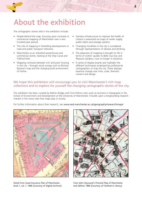
Detail from Goad Insurance Plan <strong>of</strong> <strong>Manchester</strong>,<br />
book 1, vol. 1, 1886 (Courtesy <strong>of</strong> Digital Archives)<br />
From John Heywood’s Pictorial Map <strong>of</strong> <strong>Manchester</strong><br />
and Salford, 1886 (Courtesy <strong>of</strong> Chetham’s Library)<br />
4


