

Mapping Manchester - University of Manchester
Mapping Manchester - University of Manchester
Mapping Manchester - University of Manchester

You also want an ePaper? Increase the reach of your titles
YUMPU automatically turns print PDFs into web optimized ePapers that Google loves.
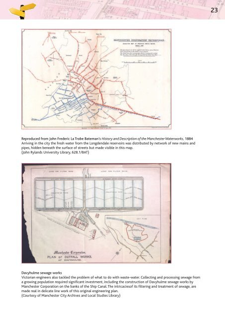
Reproduced from John Frederic La Trobe Bateman’s History and Description <strong>of</strong> the <strong>Manchester</strong> Waterworks, 1884<br />
Arriving in the city the fresh water from the Longdendale reservoirs was distributed by network <strong>of</strong> new mains and<br />
pipes, hidden beneath the surface <strong>of</strong> streets but made visible in this map.<br />
(John Rylands <strong>University</strong> Library, 628.1/BAT)<br />
Davyhulme sewage works<br />
Victorian engineers also tackled the problem <strong>of</strong> what to do with waste-water. Collecting and processing sewage from<br />
a growing population required significant investment, including the construction <strong>of</strong> Davyhulme sewage works by<br />
<strong>Manchester</strong> Corporation on the banks <strong>of</strong> the Ship Canal. The intricacies<strong>of</strong> its filtering and treatment <strong>of</strong> sewage, are<br />
made real in delicate line work <strong>of</strong> this original engineering plan.<br />
(Courtesy <strong>of</strong> <strong>Manchester</strong> City Archives and Local Studies Library)<br />
23


