Dameron Marsh NAP self-guided field trip guide - Virginia ...
Dameron Marsh NAP self-guided field trip guide - Virginia ...
Dameron Marsh NAP self-guided field trip guide - Virginia ...

Create successful ePaper yourself
Turn your PDF publications into a flip-book with our unique Google optimized e-Paper software.
<strong>Dameron</strong> <strong>Marsh</strong> Natural Area Preserve<br />
Self-Guided Nature Trail<br />
The following text is geared to a fall walk, but works well throughout the year.<br />
Parking lot...<br />
• Welcome to <strong>Dameron</strong> <strong>Marsh</strong> Natural Area Preserve— one of 45 Natural Area Preserves that the Commonwealth of <strong>Virginia</strong><br />
manages for the protection of biodiversity.<br />
• All Preserves in the system have rare or exemplary plants, animals or natural communities. <strong>Dameron</strong> <strong>Marsh</strong><br />
has the federally threatened Northeastern Beach tiger beetle and two rare or exemplary communities<br />
• There are 316 acres of beach, marsh, <strong>field</strong>s, and forests. DM <strong>NAP</strong> was acquired in 1998 with assistance from Northern<br />
Neck Audubon Society, the Nature Conservancy, the US Fish and Wildlife Service, and VA Natural Area Bonds<br />
• <strong>Dameron</strong> <strong>Marsh</strong> received its name from Lawrence <strong>Dameron</strong> of Suffolk England who purchased this property in 1655. It<br />
became part of a plantation called Guarding<br />
• The shore on which the preserve is located is exposed to high winds and tides accompanying severe storms. These events<br />
can cause drastic changes to the physiography of the preserve. The beaches and shoreline are constantly shifting - the eastern<br />
beach on the erodes approximately 2 feet annually, while the southeastern spits and beaches accrete (grow more sand)<br />
Plans for the management of the preserve:<br />
• DM <strong>NAP</strong> is managed by the <strong>Virginia</strong> Department of Conservation and Recreation, Natural Heritage Division as a natural area preserve.<br />
The primary purpose for establishing the preserve is for the protection of the natural resources. The preserve protects over 240 acres of<br />
wetlands that support nationally significant marsh and shorebird nesting habitat, exemplary wetland plant communities, and the<br />
beaches provide critical habitat for the northeastern beach tiger beetle, a federally threatened species.<br />
• Other uses such as scientific research, environmental education and interpretation such as this tour will always be secondary. A professional<br />
preserve steward closely monitors and manages the area to ensure survival of the resources that the site supports.<br />
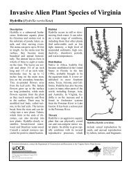
The very large leaved plant near the parking lot is a Royal Paulownia, a native of the Far East. At maturity, they have clusters of hanging<br />
wisteria-looking blooms in the spring. (Preserve stewards are attempting to eradicate these invasive alien trees) The seed pods of this plant<br />
were once used as packing material for fine porcelain from the orient, like Styrofoam peanuts today, and as a result have colonized all over<br />
the U.S. The wood is highly valued in Japan for dowry chests, and mature specimens of Paulownias have actually been cut down and stolen<br />
by Paulownia rustlers! Some other plants you may see in the parking lot are pictured below. Look for the chat in the tree… (also Lance<br />
Johnson saw a cuckoo there this summer!)<br />
Wool Grass—Scirpus cyperinus Thistle—Cirsium spp? non-native and<br />
invasive but sometimes attract butterflies<br />
Boneset<br />
Eupatorium hyssopifolium<br />
Smartweed or Knotweed -<br />
Polygonum spp?<br />
Trumpet creeper—Campsis radicans<br />
Tickseed sunflower<br />
Bidens coronata
Stop 1...<br />
• There once was a house right here which accounts for the pile of rubble (in high summer it’s just an extra high pile of weeds.) Even<br />
as late as the early 20 th century, there were several more houses in this area, now lost to high water and erosion. Mr. Carter Harding,<br />
a native of the area, lived in a home near here and remembers a big storm that left high water up to the second story.<br />
• (Depending on the season, you might see ‘out of place’ garden plants and trees which have survived. In the spring for example, you<br />
will see daffodils, a dead give away of old homesites.) look up—Grapes should be ripe! Try them—I did—they are nasty!<br />
• The very large leaved plant is a Royal Paulownia, a native of the Far East. At maturity, they have clusters of hanging wisterialooking<br />
blooms in the spring. (Preserve stewards are attempting to eradicate these invasive alien trees) The seed pods of this plant<br />
were once used as packing material for fine porcelain from the orient, like Styrofoam peanuts today, and as a result have colonized<br />
all over the U.S. The wood is highly valued in Japan for dowry chests, and mature specimens of Paulownia have actually been cut<br />
down and stolen by Paulownia rustlers!<br />
• Near the numbered sign you will notice that there is some phragmites that is snaking its way across the trail—these rhizomes are the<br />
key to success for this ugly beast!<br />
Rhizome of common reed—<br />
Phragmites australis<br />
Sea side goldenrod<br />
Solidago sempervirons<br />
Grapes—Vitis spp?<br />
(Muscadine is my guess—Vitis rotundafolia)<br />
Rag weed<br />
Ambrosia artemesifolia<br />
High tide bush<br />
Baccharis<br />
halimifolia<br />
Wax myrtle<br />
Morella cerifera<br />
Switchgrass -<br />
Panicum virgatum
Stop 2...<br />
The area’s geology:<br />
• 120,000 years ago the sea level was 15-25 feet higher that it is today.<br />
• 18,000 years ago if you looked east you would see a broad canyon containing the ancestral Susquehanna River.<br />
• Sea level continues to rise about 2mm a year.<br />
• The shore line of <strong>Dameron</strong> <strong>Marsh</strong> is eroding at a rate of about 8—10 feet a year. There were once three islands off<br />
the tip of the marsh (Carters Filer’s father promised to give her those islands when she was a little girl!) that are now<br />
gone. Since 1937 - 250 feet have been lost from the shoreline and sea level rose nearly 2 feet in that time.<br />
• Previous landowners drained these <strong>field</strong>s and this led to belts of different vegetation reflect the response of plants to<br />
changes in thickness of the unsaturated zone ( the zone between the land surface and the water table) and the frequency<br />
of flooding after rains. In some of the deeper ditches cat-tails have established themselves and are indicators<br />
not only of a wetland but of the salinity of the water. The Narrow-leaved Cat Tail that you can see from here is<br />
more tolerant of salt water than the Common Cat tail.<br />
• Look for Narrow -leaved Cat tails, Partridge Pea (will be in fruit on later <strong>trip</strong>s), High Tide Bush in bloom, and<br />
Broomsedge (remember that it is not a sedge—that is a misnomer—it is really a grass).<br />
Seaside Goldenrod<br />
Solidago sempervirons<br />
Cattails are behind the switchgrass—rather<br />
hard to see this year —a good lead in for<br />
old <strong>field</strong> succession and how much everything<br />
has changed in just a few years...<br />
Wax Myrtle<br />
Morella cerifera<br />
Partidge pea<br />
Cassia facisiculata<br />
(Formerly Chamaecrista)<br />
Broom sedge<br />
Andropogon virginicus
Stop 3...<br />
• Notice that the trail is sometimes underwater here —good evidence of changes in hydrologic conditions due to<br />
rainfall.<br />
• Old <strong>field</strong> succession. The seeds of most of the plant sequences that will cover an abandoned <strong>field</strong> in the years to<br />
come are there at abandonment but won’t germinate all at once or under the same conditions. Grasses germinate<br />
well in bare soil are some of the first colonizers of old <strong>field</strong>s. Soon other plants such as goldenrod and camphor<br />
weed make their way into the line up, followed by shrubs and pioneer trees such as persimmon, black gum,<br />
cherry, pine and red cedar. Eventually these <strong>field</strong>s will be forested wetlands comprised primarily of Loblolly<br />
Pine. This is a community we call Maritime Loblolly Pine Forest. Because these same forests are made up of<br />
different species of trees to the north and south of us—the maritime loblolly pine forest in <strong>Virginia</strong> is considered<br />
a globally rare community.<br />
• Look up for eagles, marsh hawks or vultures wheeling overhead.<br />
• There are several species of sedges here if you look closely...- Remember the old mnemonic “Sedges have<br />
edges, rushes are round, grasses are hollow right up from the ground”. It is pretty reliable though not absolute.<br />
Most sedges have a triangular shaped stem “the edges”, narrow leaves arranged in threes and prefer wet places.<br />
Many have an umbrella shape. Towards the top of the stalk there will be 3-5 leaves extending horizontally, and<br />
radiating above that will be spiky ‘flowers’, usually yellow or brown. There are literally dozens of species of<br />
sedges (Cyperus, scirpus, carex, etc.) and are often difficult to distinguish from each other.<br />
A nut sedge Cyperus spp?<br />
Persimmon trees<br />
Diospyrosora virginiana<br />
Narrow leaved cat tail<br />
Typha angustifolia
Stop 4...<br />
This is a good place to reflect on the history of the area.<br />
• Algonquian Indians and their predecessors lived in this area since at least 6500 BC. Many Prehistoric Native<br />
American village sites are now several hundred yards offshore, due to the rising level of the Bay.<br />
• Captain John Smith’s map of <strong>Virginia</strong> of 1612 suggests that the <strong>Marsh</strong> lay within the chiefdom of Wiccocomico,<br />
known to have had about 130 men in 1600. It was bordered on the south by the chiefdom and possibly<br />
the village of Cuttatawomen.<br />
• The Algonquians lived in villages and dwelt in barrel shaped houses, covered with mats or bark, with a smoke<br />
hole in the top. These were easily disassembled and relocated as weather, farming, and hunting needs dictated.<br />
• They fished and collected oysters and clams from the then crystal blue waters of the Chesapeake Bay We<br />
know they were here because they left behind their trash---a pile of oyster shells, and arrowheads and spear<br />
points that still turn up from time to time in the plowed <strong>field</strong>s. They grew corn, beans, squash, pumpkins,<br />
gourds, sunflowers and tobacco. They also collected a wide variety of plants for both food and medicinal purposes.<br />
Many of which you can see at this stop...<br />
• They ate the fruit from the female Persimmon trees and used Dogbane to make rope and cordage. The berries<br />
were of Winged Sumac were used to make a medicine for stomach pain and the pulp of the stalk was used as a<br />
dye.<br />
• Persimmons (Diospyros virginiana) are the deciduous trees visible all along the trail. They grow to about 50<br />
feet tall and more are found along the old hedgerows in the preserve. In the summer and fall you’ll see the persimmons<br />
hanging on the tree. When ripe they will be an orange fleshy fruit, but remember the old rule, you<br />
must wait until the first frost before trying to eat a persimmon, otherwise they are very astringent and will<br />
pucker your mouth up. There is a nice patch of partridge pea to the left of the sign.<br />
Partidge pea<br />
Cassia facisiculata<br />
(Formerly Chamaecrista)<br />
Persimmon<br />
Diospyrosora virginiana<br />
Barnyard Grass—Enchinochloa spp?
Stop 5...<br />
• To the right in the lower lying swale is salt meadow hay (Spartina patens). Salt meadow hay has a tidy mowed<br />
look and is usually dry enough to walk on. Historically cattle grazed on the salt meadow hay marshes and the<br />
grass was often mowed for fodder.<br />
• In 2001 Natural Heritage staff initiatied a Wetland Restoration project on the preserve, here you can see faint evidence<br />
of one of the many ditch plugs installed in 2001. These low earthen berms were installed to stop drainage<br />
of the <strong>field</strong>s.<br />
• Paid for by money from the US Army Corps of Engineers Wetland Restoration Trust Fund—this was a cooperative<br />
project involving DCR’s Land Steward, The Nature Conservancy’s Wetland Scientist and staff from the<br />
Army Corps of Engineers.<br />
• 40 acres of old <strong>field</strong>s are in the process of being restored to forested wetlands. To the south of the trail , the low<br />
grass that you see is Salt Meadow Hay which has spread into this area since the water level has risen.<br />
• You can see Phragmites australis in the distance. This grass threatens the mash with all out invasion. It could<br />
easily take over all of the wet areas of <strong>Dameron</strong> <strong>Marsh</strong>. With help again from the Wetland Restoration Trust<br />
fund, we are actively spraying this grass ( both with back pack sprayers and aerially from a helicopter) with a<br />
chemical called Rodeo—which works much like Round-up but is approved for use in wetlands.<br />
• Look for Saltmarsh fleabane in bloom ). It has tiny pink flowers concentrated into flowerheads resembling milkweed<br />
and it blooms from mid-summer through fall. (Crush the leaves and you’ll get a medicinal smell which gave<br />
rise to another of its common names – camphorweed.)<br />
• There is a good example of the invasive exotic plant Sericea Lespedeza—we have been trying to eradicate this<br />
plant.<br />
Saltmarsh fleabane<br />
Pluchea odorata<br />
Salt meadow hay<br />
Spartina patens<br />
Sericea lespedeza<br />
Lespedeza cuneata
Stop 6...<br />
• Winged sumac (Rhus copallina), a shrub or small tree typical of advancing old <strong>field</strong> succession<br />
is found along this stretch of the trail. Its fruit in the fall is a large drooping cluster<br />
of tiny seedheads starting out reddish/rusty and turning brown. They often persist on the<br />
shrub in the fall after the leaves have fallen. The ‘wings’ in the name refer to narrow winglike<br />
“leaves” along the stem of the plant in between the stems of the compound leaves..The<br />
berries were of Winged Sumac were used to make a medicine for stomach pain and the<br />
pulp of the stalk was used as a dye. I have heard that you can make a tangy leomade-like<br />
drink out of the berries- .<br />
Stop 7...<br />
• This observation deck was completed in 2002 after just a few months of hard work from out Operations<br />
Steward and a few good volunteers. One volunteer (Bob Healy) generously gave over 200 hours of his time<br />
and energy to the completion of the deck.<br />
• Stress that minimizing disturbance is the best way to keep out the invasive grass Phragmites. The area that<br />
you are looking at here was an area that we parked vehicles and staged equipment during deck construction.<br />
There was very little phrag in this area before construction. There was some—but not much. This is a good<br />
lesson on how quickly and completely this plant can take over.<br />
• This area was sprayed in 2004. Plans to control this grass in 2004 were postponed in 2003 due to the fact<br />
that salt spray from Isabel caused this plant to die and go dormant before we could spray it. If plants are not<br />
actively growing the chemical can not be delivered to the roots. Getting the chemical into the roots of this<br />
plant is a key to successful control.<br />
• There is a large patch of <strong>Marsh</strong> mallow to the left at the bottom of the boardwalk. This will be in seed<br />
now. <strong>Marsh</strong> mallow (Hibiscus moscheutos) also called Rose mallow, is the huge showy plant of the marsh.<br />
Stems can reach 6 feet high and the flowers are 4-8 inches across. Generally white, but sometimes pink,<br />
these flowers always have a red center.<br />
• Near the end of the boardwalk is a wax myrtle that has fruit on it—birds LOVE these berries.<br />
Boardwalk construction<br />
October 2002<br />
<strong>Marsh</strong> mallow<br />
Hibiscus moscheutos<br />
Wax myrtle berries<br />
Morella cerifera
Onto the boardwalk...<br />
• Once you reach the end of the boardwalk...everything in front of you is the salt marsh community,<br />
regularly flooded by salt water. Salt marshes are the most productive ecosystems on earth, producing<br />
more organic material per acre per year than tropical rain forests or modern agriculture. They<br />
have very low diversity (number of species) compared to fresh water marshes.<br />
• Salt marshes perform many important functions. They provide important habitat for many organisms,<br />
especially juvenile marine organisms. They are an important food source. Few organisms actually<br />
eat the grasses. Instead, the debris is decomposed by microbes and the slimy particles<br />
(detritus) form the food. <strong>Marsh</strong>es trap sediment and the dense root (rhizome) network retards erosion.<br />
Nitrate in groundwater discharging into the marsh is converted to nitrogen gas so that it does<br />
not fertilize the marine water.<br />
• All salt marsh plants require full sunlight for best growth. People whose property includes marshes<br />
should prune back all overhanging vegetation and remove trash (and Phragmites) to provide the<br />
marsh with full sunlight.<br />
• The seaward-most grass, common cordgrass (Spartina alterniflora) extends down to mid-tide level<br />
(low marsh). Marine grasses do not grow below mid-tide level. Although submerged grasses (SAV<br />
or Submerged Aquatic Vegetation) were once abundant around the Preserve (see the 1937 air<br />
photo), about 90% of the area they once occupied is now barren.<br />
• Between the common cordgrass and the observation deck, in areas periodically flooded by high<br />
spring tides (high marsh), the common plants are:<br />
Black Needle-Rush (Juncus roemerianus) - note the black-tipped round stems.<br />
Salt Grass (Distichlis spicata) - sometimes you can see salt crystals on the leaves.<br />
Three-Square (Scirpus robustus) - look for triangular stems and spiky seed pods. This genus is<br />
especially important for wildlife, including ducks.<br />
Common Reed (Phragmites) - unfortunately.<br />
• The loblolly pine community, seen in the distance, occupies the highest ground. Three of the four major<br />
communities in the Preserve can be seen from the observation deck, the marine salt marsh, the <strong>field</strong><br />
succession and the loblolly pine communities.
• Take a look over the railing of the deck.<br />
• Notice the raccoon prints in the mud. There may be other prints.<br />
• From here you have a good view of <strong>Marsh</strong> Elder and Camphor weed that has gone to seed.<br />
• If you turn around and look at the wax myrtle you are likely to see Yellow Rumped Warblers feasting on<br />
Wax Myrtle berries. You can see the yellow on their rump when they fly. A common name for this bird is<br />
“Butter Butt”.<br />
Stop 8<br />
Stop 9<br />
Stop 10<br />
• If you again look over the railing—you will see a handsome<br />
example of Salt Meadow Hay.<br />
• More tracks.<br />
• Look out into the distance to the shallow cove. You might<br />
spy some geese or swans. You might see 300 swans from this<br />
observation deck if you’re lucky.<br />
• Unfortunately, you might also see Mute Swans which are a<br />
non native bird species that competes with migrating tundra<br />
swans for food and nest areas, and devastate native submerged<br />
plants in the bay.<br />
• If you look straight ahead you may be able to distinguish<br />
some of the Phragmites australis that we have been spraying<br />
with a helicopter. Its hard to tell with everything all browned<br />
out but you might be able to see some white PVC stakes that<br />
I use for monitoring.<br />
• One of the reasons that <strong>Dameron</strong> <strong>Marsh</strong> is protected as a<br />
Natural Area Preserve ( the highest level of protection possible<br />
in <strong>Virginia</strong>) is because of the exemplary wetland community<br />
that you can see from here. There are many different<br />
zones of vegetation which are hard to see from here. The<br />
wetlands are mostly tidal and range from low to high marsh<br />
vegetation depending on slight variations in elevation and exposure<br />
to salt water.<br />
• The dominate grasses in the marsh are Black Needle Rush,<br />
Salt Meadow Hay and Salt Grass. For a nice view of salt<br />
grass peer over the railing—it is growing in stately lines from<br />
its rhizomes.<br />
• This is a nice view of all three of the rare or exemplary communities.<br />
• The sandy Northeastern Tiger Beetle beaches are just over the<br />
rise in the distance.<br />
• The vast marsh community is spread out before you all the<br />
land that you can see from here is part of <strong>Dameron</strong> <strong>Marsh</strong>.<br />
• The maritime loblolly pine forest is just to the north.
Points of interest along the trail to the house and beach:<br />
1. The fresh-water pond:<br />
- Just past the sharp curve in the road there is a trail to a fresh-water pond: We will probably mow this trail again later this fall.<br />
2. The road north to the beach:<br />
- The road has been maintained for about half a century, and as a result of continual disturbance it contains many invasive species.<br />
- The large trees around the house are persimmons, not visible in the 1937 air photo.<br />
- The beach in front of the house and associated sand spit to the left constitute the fourth natural community found in the Preserve.<br />
The high energy beach is subject to constant wave erosion, exacerbated by high energy events like “northers” and hurricanes. On<br />
average, the erosion rate is about 4 feet per year, and 20(?) feet were lost during Hurricane Isabel in 2003. Approximately 250<br />
feet has been lost from the beach since 1937, and during that period sea level has risen approximately one foot.<br />
3. The beach and spit:<br />
- If the tide is low enough, you can climb down the small cliff to the beach. The cliff exposes a soil profile. At the land surface is<br />
the “A-horizon,” characterized by an accumulation of organic material. The sediment between the A-horizon and sea level is oxidized<br />
(rust-colored) and is being locally penetrated by roots. Hydrologically, the exposed cliff exposes the “unsaturated zone” in<br />
which the spaces between the grains of sediment are occupied by gas, not water.<br />
- If we could examine the sediment below sea level we would find that it is saturated with fresh water, but few roots would be present.<br />
Although some plants are adapted to saturated conditions (they have mechanisms to pump oxygen down into the submerged<br />
roots), most are not. This is the reason for the extensive ditching system we have seen, to increase the thickness of the unsaturated<br />
zone so crops could be grown.<br />
- You may see accumulations of black sand on the beach. The black grains are denser than the white grains, and geologists call<br />
them “heavy minerals.” Also called “accessory minerals” they are winnowed from the less dense minerals by the waves just as a<br />
miner pans for gold. The minerals can be traced back to specific rock units in the Appalachian Mountains, the ultimate source of<br />
all the sediment that constitutes <strong>Dameron</strong> <strong>Marsh</strong>.<br />
- If you are able to walk along the beach to the west (left) you will encounter muddy sediment containing abundant plant debris.<br />
This material, which might even be called peat, is the remnant of marshes that once existed here when the beach was north of its<br />
present position and sea level was lower. The marsh mud and intertwined rhizomes from marsh plants is difficult to erode and<br />
therefore it persists.<br />
- Sand eroded from the cliff has been moved offshore, and to the northwest where a sandy spit has developed. You can get to the<br />
spit by walking along the beach or by crossing a short stretch of marsh from the boat ramp. If you take that route, note the abandoned<br />
pier and pilings, indicating that this area was once open water. The sand spit enclosed this area and the low energy area<br />
behind the spit eventually developed into marsh, making the pier useless.<br />
- The sandy spit is extremely dynamic and is constantly changing. Small spits grow, enclose ponds, and then are breached by<br />
storms.<br />
- Animals found on the beach include.<br />
- Plants, some helping to stabilize the incipient dunes, include.<br />
4. The Loblolly Pine Forest:<br />
- The Loblolly Pine forests of <strong>Dameron</strong> <strong>Marsh</strong> contain understories of red maple, black cherry and sassafras. Shrubs include<br />
Southern Bayberry. There are also Muscadine Grapes and Greenbriers. This community is restricted to a narrow geographic<br />
range from Delaware to North Carolina, and this special habitat has been subject to intense development pressure. Maritime pine<br />
forests such as these at <strong>Dameron</strong> <strong>Marsh</strong> are considered globally uncommon to rare, and this is one of the communities that DCR<br />
is most anxious to preserve and expand.<br />
- Although the canopy and shrub layers of this community can be quite dense, the herbaceous (non-woody) layer is usually sparse.<br />
- The roots buffer erosion (seen in the air photos as differing shoreline position from adjacent salt marsh or <strong>field</strong>s) and filter both<br />
runoff and groundwater discharge into the Bay.<br />
****This final section of the trial <strong>guide</strong> was prepared by Lynton Land…..****<br />
****All other sections were a collaboration of all the <strong>guide</strong>s—most notably Susan Tipton and Carter Filer****<br />
For more information contact:<br />
<strong>Virginia</strong> Department of Conservation and Recreation<br />
Natural Heritage Program<br />
Chesapeake Bay Region Steward (804) 225-2302<br />
or<br />
217 Governor Street<br />
Richmond, VA 23219 (804) 786-7951<br />
website: www.dcr.virginia.gov/dnh<br />
May 2005