
You also want an ePaper? Increase the reach of your titles
YUMPU automatically turns print PDFs into web optimized ePapers that Google loves.
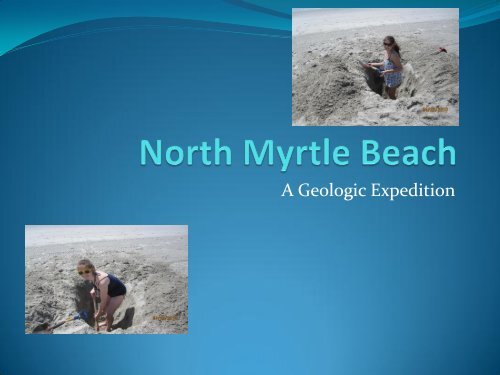
A Geologic Expedition
We gathered our data from Cherry Grove <strong>Beach</strong>. Cherry Grove <strong>Beach</strong> is<br />
located in the city of <strong>North</strong> <strong>Myrtle</strong> <strong>Beach</strong>, South Carolina. It is situated in<br />
Horry County, which is near the border between <strong>North</strong> and South Carolina.
I. <strong>North</strong> <strong>Myrtle</strong> <strong>Beach</strong> Introduction<br />
II. <strong>North</strong> <strong>Myrtle</strong> <strong>Beach</strong> Geologic History<br />
III.<strong>North</strong> <strong>Myrtle</strong> <strong>Beach</strong> Data
The Geology Background
The<br />
Bedrock<br />
The bedrock<br />
in the <strong>North</strong><br />
<strong>Myrtle</strong> <strong>Beach</strong><br />
area formed<br />
during the<br />
Pleistocene<br />
Epoch.<br />
<strong>North</strong> <strong>Myrtle</strong> <strong>Beach</strong><br />
http://www.dnr.sc.gov/geology/geology.htm
This map shows<br />
both the bedrock<br />
and fault areas of<br />
South Carolina.<br />
The majority of fault<br />
zones are located<br />
in <strong>North</strong> West<br />
South Carolina. (http://sciway3.net/2001/sc-geology/Overview_of_SC_Geology.htm)
(http://sciway3.net/2001/sc-geology/Overview_of_SC_Geology.htm)<br />
The Resources<br />
The geologic resources found in the area around <strong>North</strong><br />
<strong>Myrtle</strong> <strong>Beach</strong> are crushed stone, sand, and clay.
Sand Content<br />
The sand specimen from<br />
<strong>Myrtle</strong> <strong>Beach</strong> is<br />
predominantly quartz<br />
(around 90%). There are<br />
some grains of biotite<br />
mica within in as well<br />
(5%). Small shell<br />
fragments were also<br />
present in the sample (5%<br />
organic). The sand was<br />
made up of very small,<br />
sub-angular grains.<br />
Cherry Grove <strong>Beach</strong><br />
A close up of the sand at Cherry Grove <strong>Beach</strong>.<br />
Although the majority of the<br />
sand on the beach was<br />
dredged from an area<br />
offshore, a possible source of<br />
sediment is the marsh<br />
mouth, indicated by the star<br />
on the map http://www.holidaycity.com/northmyrtlebeachhotels/map.gif
<strong>North</strong> <strong>Myrtle</strong> <strong>Beach</strong> is continuously being attacked by erosion. The beach needs to be<br />
renourished repeatedly, especially due to hurricane. Also boats and jet skis going<br />
through the marsh increase erosion. Locals have different ways of protecting their<br />
homes from erosion.<br />
Riprap: This pile of stones is<br />
used to protect houses.<br />
Although, somewhat unsightly, it<br />
is less damaging to the beach in<br />
front of it as it does not reflect<br />
wave energy, but absorbs it.<br />
Seawall: This is a wall<br />
designed to protect homes from<br />
erosion. However this is<br />
damaging to the beach in front of<br />
the wall because the wall reflects<br />
the wave energy, increasing its<br />
ability to erode the shore .
Fossils<br />
When walking the shore of <strong>North</strong> <strong>Myrtle</strong> <strong>Beach</strong><br />
one may come across fossils such as the ones<br />
pictured here. They are a type of bivalve mollusk<br />
(clam). Their scientific name is Cucellae Sp. and<br />
are relatively numerous in the Upper Cretaceous<br />
marine deposits. In South Carolina, along Route<br />
17, there are a few recovery sites.<br />
Identification thanks to Dr. Mark Leney,<br />
Assistant Professor at UMass<br />
A view of the <strong>Myrtle</strong> <strong>Beach</strong> Fossils
More Fossils:<br />
Shark Teeth<br />
The shark teeth that are seen<br />
on this slide are like those<br />
that can be found within the<br />
sands of <strong>North</strong> <strong>Myrtle</strong> <strong>Beach</strong>.<br />
Since they are fossilized,<br />
these teeth can be millions of<br />
years old. They vary in size,<br />
shape, and color.
The Geologic History
Geologic History Of South Carolina<br />
(http://sciway3.net/2001/sc-geology/Overview_of_SC_Geology.htm)
The Events pertinent to the<br />
<strong>North</strong> <strong>Myrtle</strong> <strong>Beach</strong> Area<br />
The more recent events occurring during the Cenozoic<br />
Era are more relative to the <strong>North</strong> <strong>Myrtle</strong> <strong>Beach</strong> area as<br />
they are the events that formed the coast of South<br />
Carolina.<br />
These Events Include:<br />
<br />
<br />
(http://sciway3.net/2001/sc-geology/Overview_of_SC_Geology.htm)<br />
The most important<br />
event in the<br />
formation of <strong>North</strong><br />
<strong>Myrtle</strong> <strong>Beach</strong> is<br />
what occurred<br />
during the<br />
Pleistocene Epoch<br />
and later, when the<br />
bedrock was<br />
formed.
Earthquakes:<br />
An Important Part of South Carolina’s History<br />
In <strong>Myrtle</strong> <strong>Beach</strong>'s more recent geologic history, there was a large scale earthquake. Known as<br />
the Charleston Earthquake, it occurred on August 31st,1886<br />
(http://earthquake.usgs.gov/earthquakes/states/events/1886_09_01.php). It had a magnitude<br />
of 7.3 and an intensity of X<br />
(http://earthquake.usgs.gov/earthquakes/states/events/1886_09_01.php). A rating of X means<br />
"Some well-built wooden structures destroyed; most masonry and frame structures destroyed<br />
with foundations; ground badly cracked. Rails bent. Landslides considerable from river banks<br />
and steep slopes. Shifted sand and mud. Water splashed over<br />
banks(http://geology.about.com/library/bl/blmercalli.htm)." There was 5 to 6 million dollars<br />
in property damage and 60 lives were lost<br />
(http://earthquake.usgs.gov/earthquakes/states/events/1886_09_01.php). It was the most<br />
destructive seismic event to ever take place in this portion of the US and, historically, among<br />
the strongest earthquakes in Eastern <strong>North</strong><br />
America(http://earthquake.usgs.gov/earthquakes/states/events/1886_09_01.php). <strong>Myrtle</strong><br />
<strong>Beach</strong> felt the shock quite severely<br />
(http://earthquake.usgs.gov/earthquakes/states/events/1886_09_01.php). In fact, it could even<br />
be felt as far away as Boston, Milwaukee, and<br />
Bermuda(http://earthquake.usgs.gov/earthquakes/states/events/1886_09_01.php).<br />
This was not a one time occurrence (http://www.scearthquakes.com/). As well as there having<br />
been several smaller scale seismic events, there are risks of another shock in South Carolina<br />
and it could potentially be very damaging, as strong earthquake precautions have not been put<br />
in place there (http://www.scearthquakes.com/). If a similar earthquake were to occur today,<br />
Horry County (where <strong>Myrtle</strong> <strong>Beach</strong> is located) would experience an intensity on the Mercalli<br />
Scale of XI meaning “Everyone feels movement. Poorly built buildings are damaged slightly.<br />
Considerable quantities of dishes and glassware, and some windows, are broken. People have<br />
trouble walking. Pictures fall off walls. Objects fall from shelves. Plaster in walls might crack.<br />
Some furniture is overturned. Small bells in churches and schools ring<br />
(http://www.scearthquakes.com/)." But many other places in South Carolina will receive much<br />
more damage (http://www.scearthquakes.com/).<br />
http://www.scearthquakes.com/<br />
Aftermath of the<br />
Charleston 1886 quake.<br />
http://www.scearthquakes.com/
The Recent History<br />
of <strong>North</strong> <strong>Myrtle</strong><br />
<strong>Beach</strong><br />
A beach nourishment project put into<br />
action in recent years has had the<br />
most effect on the beach itself. Sand<br />
was dredged from the ocean bottom,<br />
three miles offshore, and pumped<br />
back onto shore to protect people and<br />
property on the shoreline from<br />
erosion<br />
(http://www.sac.usace.army.mil/?action=programs.m<br />
yrtle_beach). 750,000 cubic yards of sand<br />
was spread over 8.6 miles of shore<br />
(http://www.sac.usace.army.mil/?action=programs.m<br />
yrtle_beach). This is not the first time the<br />
Cherry Grove <strong>Beach</strong> area of <strong>North</strong><br />
<strong>Myrtle</strong> <strong>Beach</strong> has been part of a<br />
renourishment project, but it is the<br />
first time since to 1996-98 dredge<br />
(http://www.sac.usace.army.mil/?action=programs.m<br />
yrtle_beach). <strong>Beach</strong> renourishment is<br />
not a permanent solution and the<br />
process will need to be repeated. Also<br />
the use of this solution to erosion<br />
means that the face and shape of the<br />
beach will be changing in the future<br />
as well as it has been different in the<br />
past.<br />
Some of the equipment used to dredge<br />
<strong>North</strong> <strong>Myrtle</strong> <strong>Beach</strong>’s <strong>Beach</strong>es.<br />
http://www.flickr.com/photos/whatafarce/2920042639/
The Data
The Longshore<br />
Current.<br />
The longshore current is the<br />
current created when waves are<br />
refracted as they come into shore.<br />
It is located in the surf zone and<br />
moves parallel to the beach.<br />
The longshore current of <strong>Myrtle</strong><br />
<strong>Beach</strong> the current runs west along<br />
the beach and takes roughly a<br />
minute and forty-five seconds to<br />
travel thirty meters. This is a rate<br />
of one meter per every three and a<br />
half seconds.<br />
We measured the longshore<br />
current by throwing an orange<br />
into the surf and timing how long<br />
it took to travel across a thirty<br />
meter length, which we marked<br />
out on the sand.<br />
http://www.bonappetit.com/tipstools<br />
/ingredients/2008/04/orange_peel<br />
An orange, like the<br />
one we used to<br />
measure the longshore<br />
current.<br />
The surf zone where the longshore current can be found.
The Marsh<br />
Harold, a local<br />
fisherman who<br />
we became<br />
friendly with.<br />
Hannah and Julia kayaking in the marsh of <strong>North</strong> <strong>Myrtle</strong> <strong>Beach</strong>.
The Flora of the Marsh<br />
We noticed long grasses associated with the<br />
lower marsh:<br />
Alterna flora<br />
However, the plants we saw that were<br />
associated with higher marsh areas<br />
were different(circled in the picture).<br />
Here small, shrubs and bushes may be seen,<br />
such as the palmetto bush. Also small trees<br />
grow in the even higher marsh areas.
As can be seen by the previous slide, there are differences in the flora seen in<br />
high versus low marsh areas. As low marsh areas are routinely flooded with<br />
saline water while high marsh areas are not, both cannot support the same<br />
plants. In lower marsh regions grasses grow as they can live in with the saline<br />
water that floods them daily. However, at high marsh areas small trees and<br />
shrubs grow. These plants cannot survive the daily flooding with saline water.<br />
Therefore the difference between plants growing in high versus low marshland is<br />
how much saline water they can withstand.
Oysters are a vital part of the<br />
marsh ecosystem. They anchor<br />
the grasses’ root system and<br />
prevent marsh erosion. However,<br />
boats making land in the grasses<br />
destroy these oyster beds and<br />
make the marsh susceptible to<br />
erosion.
High Tide Mark<br />
Using evidence in the marsh it is<br />
possible to determine where the<br />
high tide level is.<br />
If you examine the photo to the<br />
right, a dark line is noticeable in<br />
the marsh grasses. This indicates<br />
where the tide comes up too.<br />
Also, by observing the marsh for<br />
an entire day, it is possible to see<br />
the changes in water height in<br />
relation to the grasses.<br />
By using this evidence in the<br />
marsh, scientists can determine<br />
sea level changes.<br />
Alterna Flora exhibiting a dark line (indicated<br />
by the arrow) showing the height of the water<br />
at high tide.
Here you can see the differences in water level that can be used by<br />
scientists to detect sea level changes.
<strong>Beach</strong> Profile<br />
Swash Zone<br />
Berm<br />
Foredune
The dune closest to the shore.
The part of the beach that remains dry.
The portion of the beach where the waves break.
Before we took the data for the first beach profile, <strong>North</strong> <strong>Myrtle</strong><br />
<strong>Beach</strong> experienced rainfall, which may have altered the profile of<br />
the beach slightly.<br />
These profiles, taken from the same spot on two different days,<br />
vary slightly from eachother. One of the reasons for these<br />
differences could be erosion associated with the recent downpour.<br />
Also, this beach is a high traffic one, as the area is a popular<br />
vacation spot, and human activity on the beach, such as walking,<br />
sandcastle building, hole digging, ect, could have altered the<br />
profile a bit from day to day. That could be the reason for the<br />
sudden dip at the end of the Day Two Profile. One final reason is<br />
that our measurements will not be perfect and some differences<br />
could be accounted for by a margin of human error.<br />
*Note that the data tables do not go to the proper number of<br />
significant digits. The proper number of digits is one significant<br />
digit after the decimal point.
Elevation (cm)<br />
0<br />
-50<br />
-100<br />
-150<br />
-200<br />
-250<br />
-300<br />
-350<br />
<strong>Beach</strong> Profile Day 1<br />
0 20 40 60 80 100<br />
Foredune<br />
Berm<br />
Distance (M)<br />
Swash Zone
Original Distance (m) Original Elevation Change Total Distance Change Total Elevation Change<br />
0 0<br />
1 -6 1 6<br />
3 -5 4 11<br />
1.5 -7.5 5.5 18.5<br />
2 -22 7.5 40.5<br />
3 -17.5 10.5 58<br />
2 -16.5 12.5 74.5<br />
2 -21 14.5 89.5<br />
2 -25 16.5 120.5<br />
2 -19 18.5 139.5<br />
3 -22 21.5 161.5<br />
3 -20.5 24.5 182<br />
3 -9 27.5 191<br />
3 -10 30.5 201<br />
3 -17.5 33.5 218.5<br />
2 -9 35.5 227.5<br />
3 -17.5 38.5 245<br />
3 -12 41.5 257<br />
3 -9 44.5 266<br />
3 -7 47.5 273<br />
3 -3.5 50.5 276.5<br />
3 -5 53.5 281.5<br />
3 -4 56.5 285.5<br />
3 -3 59.5 288.5<br />
3 -3 62.5 291.5<br />
3 -3 75.5 294.5<br />
3 -3 78.5 297.5<br />
3 -4 81.5 301.5<br />
3 -5 84.5 306.5<br />
3 -5 87.5 311.5<br />
3 -4.5 90.5 316<br />
3 -3.5 93.5 319.5<br />
3 -3 96.5 322.5<br />
3 -1 99.5 323.5
Elevation (cm)<br />
Fordune<br />
0<br />
-50<br />
-100<br />
-150<br />
-200<br />
-250<br />
-300<br />
-350<br />
-400<br />
<strong>Beach</strong> Profile Day 2<br />
0 20 40 60 80 100 120<br />
Berm<br />
Distance (M)<br />
Swash Zone
Original Distance (m) Original Elevation (cm) Total Distance Change (m) Total Elevation Change (cm)<br />
0 0<br />
3 -10 2 10<br />
3 0 5 10<br />
3 -23 7 33<br />
3 -12 9 45<br />
3 -20.5 12 65.5<br />
3 -20 14 85.5<br />
3 -25.5 16 111<br />
3 -23.5 18 134.5<br />
2 -15.5 20 150<br />
2 -24.5 23 174.5<br />
2 -11.5 26 186<br />
2 -11.5 29 197.5<br />
2 -15 32 212.5<br />
2 -20 35 234.5<br />
2 -12 37 246.5<br />
2 -10.5 39 257<br />
2 -10 41 267<br />
2 -9 44 276<br />
3 -5 47 281<br />
3 -4 50 285<br />
3 -3 53 288<br />
3 -3 56 291<br />
3 -2 59 293<br />
3 -3 62 296<br />
3 -3 65 299<br />
3 -3 68 302<br />
3 -3 71 305<br />
3 -5 74 310<br />
3 -5 77 315<br />
3 -4 80 319<br />
3 -4 83 323<br />
3 -4 86 327<br />
3 0 89 327<br />
3 0 92 327<br />
3 -2 95 329<br />
3 -3.5 98 367.5<br />
3 -4 101 371.5<br />
3 -3 104 374.5
<strong>Beach</strong> Cross Section. Digital image. Web. 25 Apr. 2010. .<br />
"<strong>Beach</strong> Dredging - <strong>North</strong> <strong>Myrtle</strong> <strong>Beach</strong> SC on Flickr - Photo Sharing!" Welcome to Flickr - Photo Sharing. Web. 7 Apr. 2010.<br />
.<br />
"Digital Geologic Data at the South Carolina Geological Survey." South Carolina Department of Natural Resources. Web. 7 Apr. 2010.<br />
.<br />
"Digital Geologic Data at the South Carolina Geological Survey." South Carolina Department of Natural Resources. Web. 7 Apr. 2010.<br />
.<br />
"Historic Earthquakes." U.S. Geological Survey Earthquake Hazards Program. Web. 18 May 2010.<br />
.<br />
Map of <strong>North</strong> <strong>Myrtle</strong> <strong>Beach</strong>. Digital image. Web. 24 May 2010. .<br />
"Mercalli Earthquake Intensity Scale." About Geology - The Complete Guide to Earth Science and Geology. Web. 18 May 2010.<br />
.<br />
"Orange Peel: Ingredients : Bonappetit.com." Bon Appetit Magazine: Recipes, Menus, Cooking Videos, and Food Blogs. Web. 22 May<br />
2010. .<br />
"Overview of SC Geology." South Carolina SC - Genealogical and Historical Websites. Web. 7 Apr. 2010.<br />
.<br />
"SC Administrative Law Court - Decisions." SC Administrative Law Court - <strong>Home</strong>. Web. 4 May 2010.<br />
.<br />
SCEARTHQUAKES.COM. Web. 18 May 2010. .<br />
"SCSB#395: Geology." Web. 22 Apr. 2010. .<br />
"U.S. Army Corps of Engineers, Charleston District ? <strong>Myrtle</strong> <strong>Beach</strong> Nourishment Project." U.S. Army Corps of Engineers, Charleston<br />
District ? <strong>Home</strong>. Web. 22 Apr. 2010. .


![';1asAu ro; las I sgeo8 leuo!]eslanuol aql utelqo o1 palenttouJ ue I ...](https://img.yumpu.com/49072782/1/190x221/1asau-ro-las-i-sgeo8-leuoeslanuol-aql-utelqo-o1-palenttouj-ue-i-.jpg?quality=85)