Wren Heritage Walks - Shropshire Council
Wren Heritage Walks - Shropshire Council
Wren Heritage Walks - Shropshire Council

Create successful ePaper yourself
Turn your PDF publications into a flip-book with our unique Google optimized e-Paper software.
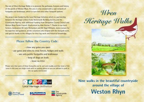
The aim of <strong>Wren</strong> <strong>Heritage</strong> <strong>Walks</strong> is to promote the pathways, features and history<br />
of the parish of Weston Rhyn. The area is criss-crossed with a vast network of<br />
footpaths and bridleways, which in turn link onto other footpath systems.<br />
The project was funded by the Local <strong>Heritage</strong> Initiative which is a partnership<br />
between the <strong>Heritage</strong> Lottery Fund, Nationwide Building Society and the<br />
Countryside Agency, with additional funding from <strong>Shropshire</strong> County <strong>Council</strong> and<br />
Weston Rhyn Parish <strong>Council</strong>. Illustrations by Alan Gorton ©. Thanks to our local<br />
farmers, landowners Mr John Richardson and Mr Nigel Williams, James Lanyon for<br />
his expertise and guidance, all the volunteers who helped with the footpath work,<br />
and special thanks to the villagers for their leg-work and historical knowledge.<br />
Please follow the Country Code:<br />
- close any gates you open<br />
- use gates and stiles to cross fences, hedges and walls<br />
- use only public footpaths and bridleways<br />
- keep all dogs on leads<br />
- leave no litter<br />
Please note that some of these footpaths can be wet and muddy and that most of the<br />
lanes in this area are single track with no passing places so you are advised to park at<br />
the car parks mentioned.<br />
<strong>Wren</strong><br />
<strong>Heritage</strong> <strong>Walks</strong><br />
Nine walks in the beautiful countryside<br />
around the village of<br />
Weston Rhyn
Lime Kilns<br />
Chapel<br />
Mount<br />
Wood<br />
Upper Craignant<br />
Fron<br />
Heulog<br />
Fron Rough<br />
Offa's<br />
Dyke Top<br />
Fron<br />
SELATTYN<br />
HILL<br />
Bronygarth<br />
To Selattyn<br />
Tynyrhos<br />
Dinas<br />
Tynycelyn<br />
Wern Mill<br />
CHIRK CASTLE ESTATE<br />
TELEPHONE BOX<br />
POST BOX<br />
Quinta<br />
Pontfaen<br />
Temple<br />
Woods<br />
Butcher's<br />
Arms<br />
New Mills<br />
RIVER CEIRIOG<br />
Quinta<br />
Sunday<br />
School<br />
Village Hall<br />
Weston<br />
Rhyn Mill<br />
The Last Inn<br />
Car Park<br />
<strong>Wren</strong> <strong>Heritage</strong> <strong>Walks</strong>, Weston Rhyn<br />
BRIDGE<br />
Weston Rhyn<br />
Weston Mill<br />
Upper Hengoed<br />
VIADUCT<br />
The Cross Keys<br />
The Lodge<br />
To Chirk<br />
AQUADUCT<br />
The Plough<br />
MORLAS BROOK<br />
Chirk Bank<br />
Poacher's Pocket<br />
Preesgweene<br />
CANAL<br />
A5<br />
A5<br />
To Oswestry<br />
To Wrexham<br />
Gobowen<br />
St Martin'<br />
CANAL
Walk 1 – TREHOWELL WOODS<br />
EASY WALK • Approximately 3 miles • TIME about 1 hour<br />
Park at the Cross Keys.<br />
Turn right out of car park, through<br />
village, over level crossing to Canal<br />
Bridge No 18, turn left onto tow path,<br />
with the canal on your left, continue to<br />
The Poacher’s Pocket, up the steps at<br />
Bridge No 19, left onto the lane (*1),<br />
continue to T-junction, turn left and<br />
quick right by a safety barrier, walk<br />
between conifer hedges to a road, turn<br />
left and quick right by lamp post and<br />
wooden fence, straight across the next<br />
road, through a metal kissing gate,<br />
follow conifer hedge, through the next<br />
kissing gate turn right. Over the railway<br />
bridge to T-junction, turn left, 250<br />
metres turn left through a wooden<br />
gate into Trehowell Woods, turn right<br />
under the bridge (*2). At the end of the<br />
woods turn left into lane, past a small<br />
cemetery and bear left, passing the<br />
Quinta Sunday School on the right, this<br />
lane ends at the village shop, turn left<br />
and return to The Cross Keys.<br />
The Cross Keys Public House takes its name<br />
from the device on the shield of Renier, the<br />
Bishop of St Asaph. The village once<br />
belonged to his diocese.<br />
*1 By staying on the towpath you can walk along<br />
the canal and over the Aqueduct into Chirk.<br />
*2 This footpath is used by kind permission of the<br />
landowner.<br />
Walk 2 – ALONG THE CANAL<br />
EASY WALK • Approximately 2 1 ⁄2 miles • TIME about 1 hour<br />
Circular route with starting points at<br />
The Plough or The Poachers Pocket<br />
(both public houses serve food).<br />
Turn right out of Plough Car Park, over<br />
level crossing, down to Canal Bridge No<br />
18, turn left onto tow path, with the<br />
canal on your left, continue to The<br />
Poacher’s Pocket, up the steps at Bridge<br />
No 19 and right into lane and up to T<br />
junction. ( ** This is also the starting<br />
point from Poacher’s Pocket). Straight<br />
across road, down lane to the left of<br />
white cottages. Continue under by-pass<br />
bridge onto green lane, turn right at T<br />
junction, continue to main road. Turn<br />
left, walk along pavement, TAKE CARE<br />
THIS ROAD CAN BE VERY BUSY, turn<br />
right at cross roads (mirror). Continue<br />
down this lane to canal bridge, turn<br />
right onto tow path, under by-pass<br />
bridge, to next bridge (No 18) leave<br />
tow path, turn right and return to the<br />
Plough, or stay on tow path to return<br />
to the Poacher’s Pocket.<br />
Rhyn means “promontory” in Welsh, the<br />
settlement of Wes (the farm of Wes) was<br />
established at about the time that Offa built<br />
his famous dyke and so the area became<br />
known as Weston Rhyn.
Walk 3 – SELATTYN VIEWS<br />
MEDIUM WALK • Approximately 3 miles • TIME about 1 hour<br />
Park at the Butchers Arms,<br />
The Wern, Weston Rhyn.<br />
This is a walk with outstanding views<br />
across the <strong>Shropshire</strong> Plain, Weston<br />
Rhyn, St Martins, Gobowen, The<br />
Wrekin, Nesscliffe, Cheshire,<br />
Wrexham.<br />
Down lane directly opposite the car<br />
park, past cottages, through the field<br />
gate/stile, continue straight ahead to<br />
gate/stile by stream. Across next field<br />
bearing left to opposite hedge, over 3rd<br />
stile and straight ahead to 4th stile,<br />
turn right into Tyn-Y-Celyn Farm drive,<br />
at T-junction (20 metres) post box on<br />
right, turn left onto lane. Next left into<br />
Dinas Lane, up the bank, bear left at<br />
Dinas Cottage, continue up the hill 1 ⁄4<br />
mile, ignore farm track to Fron Farm on<br />
right. Fron Farmhouse dates from 1692.<br />
The lane takes a sharp turn to the left,<br />
then right and up another hill. (*) At<br />
cross roads, turn left down the hill, left<br />
again at next cross roads and return to<br />
the Butcher's Arms. This road is busy at<br />
times.<br />
Buzzards now breed in the area, once more,<br />
and can be seen soaring and heard "mewing"<br />
when quartering the land in search of prey.<br />
Walk 4 – MORLAS BROOK<br />
MEDIUM WALK • Approximately 4 miles • TIME about 1 1 ⁄2 hours<br />
As Walk 3 until (*). As Walk 3 until (*)<br />
At crossroads, straight ahead into lane<br />
opposite, continue about 1 ⁄2 mile,<br />
road dips down steeply, there is a<br />
water pumping box on the left and a<br />
track leading down towards the<br />
Morlas Brook, go down the track and<br />
across wooden bridge, turn right into<br />
lane, past Nant Isaf Hall on left, keep<br />
on this lane past cottage and lane on<br />
the right until you reach Dingle<br />
Cottage (there is a track to the left<br />
Nant Ffynodd Lane) take the steep,<br />
right-hand path going up behind the<br />
cottage until you reach Top Fron<br />
Farm, turn left onto farm drive and<br />
quick right. Walk straight down this<br />
lane ( 3 ⁄4 mile) to cross roads, turn left<br />
to return to the Butchers Arms, this<br />
road is busy at times.<br />
The cellar at the Butcher’s Arms was once<br />
used as a slaughterhouse – hence the name.<br />
The area has a history of coal mining and<br />
lime kilns, the kilns were used to burn lime<br />
for fertilisers, there were corn mills, fulling<br />
mills and paper mills along the Morlas Brook.<br />
The paper mills used wood pulp and rags to<br />
produce various products including the blue<br />
paper once used to line sugar bags.
Walk 5 – CHAPEL IN THE VALLEY<br />
LONGER WALK • Approximately 5 miles • TIME about 2 3 ⁄4 hours<br />
As Walk 3 until (*). At Cross Roads<br />
turn right up the hill, straight on at<br />
cross roads, along lane marked<br />
unsuitable for heavy goods vehicles.<br />
Fron Rough woodland on right, bit of a<br />
drop and stream on the left, carry on<br />
until you come to a cottage on the left<br />
and Craignant Chapel on the right,<br />
road bends round to the left, at the top<br />
of bank join the Offas Dyke Path down<br />
to the right, past lime kilns and then up<br />
track to junction with lane, turn right,<br />
past Upper Craignant Farm, continue to<br />
the cross roads turn left, keep straight<br />
on down the hill ( 3 ⁄4 mile) until cross<br />
roads, turn left to return to the<br />
Butchers Arms, this road is busy at<br />
times.<br />
On a clear day you can see the village of<br />
Weston Rhyn nestling in the foothills, the<br />
expanse known as the <strong>Shropshire</strong> Plain and<br />
the defined outlines of Nesscliffe and The<br />
Wrekin. You can also see across to Chirk,<br />
Wrexham, Cheshire, Deeside and the Peak<br />
District.<br />
Henry II and his army marched across the<br />
land between Oswestry and Weston Rhyn to<br />
reach the River Ceiriog where the Battle of<br />
Crogen took place.<br />
Walk 6 – THE RIVER WALK<br />
SHORT WALK • Approximately 2 1 ⁄2 miles • TIME about 1 hour<br />
This is a walk along the banks of the<br />
River Ceiriog.<br />
Park by Telephone Kiosk at Pontfaen<br />
Bridge (2 cars).<br />
Cross stile into field adjacent to<br />
Telephone Kiosk, continue with River<br />
Ceiriog on the right until you reach<br />
Woodland Trust stile into woods,<br />
straight ahead through the woods and<br />
up some steps. Leave the woods via a<br />
stile – good views of Chirk Castle,<br />
follow path past a magnificent oak tree<br />
to next stile into green lane, continue<br />
through gates through a small holding,<br />
straight up driveway to meet main<br />
Bronygarth Road, turn left, up bank to<br />
S-bend. *At S bend take stile on left<br />
back into woods, continue down steps,<br />
through the woods, rejoin path at<br />
Woodlands Trust stile and return across<br />
field to Telephone Kiosk. (*or continue<br />
along Bronygarth Road to next road on<br />
the left, down steep hill to Telephone<br />
Kiosk.<br />
Chirk Castle was built by Edward I as a<br />
border stronghold to control the Welsh. It is<br />
reputed that after the Battle of Crogen in<br />
1165, between the Welsh and Henry II’s<br />
army, the River Ceiriog ran red with blood,<br />
and that Owain Gwynedd, Prince of Wales<br />
slept at Tyn-y-Rhos Hall.
Walk 7 – FRON (Outstanding Views)<br />
MEDIUM WALK • Approximately 4 miles • TIME about 1 1 ⁄2 hours<br />
Park at The Lodge or Village Hall<br />
Car Parks.<br />
Proceed along Bronygarth Road to<br />
crossroads, turn left into Quinta Road,<br />
keep the Quinta Wall on your right<br />
until you reach left hand turn into<br />
Dinas Lane, up the bank, bear left at<br />
Dinas Cottage, continue up the hill 1 ⁄4<br />
mile, ignore farm track to Fron Farm on<br />
right. The lane takes a sharp turn to the<br />
left, then right and up another hill,<br />
turn right at crossroads. Continue to<br />
grass triangle, turn right and then fork<br />
right onto bridleway. Continue on<br />
bridleway through gateways and stiles<br />
passing a small farm on the left and<br />
onto a track turn right into lane (**),<br />
down the hill, past Tyn-Y-Rhos Hall,<br />
second turning right, keep Quinta Wall<br />
on your left, at Cross Roads turn right<br />
and return to village.<br />
(**) If you turn left here you will come to Mount<br />
Wood. You are welcome by kind permission of the<br />
landowner. There are numerous well marked paths.<br />
The area at the top of the village was known<br />
as "The Lodge" prior to all the village being<br />
named Weston Rhyn. Weston Rhyn and<br />
Bronygarth were part of the township of St<br />
Martins until 1870 when they jointly became<br />
known as the ecclesiastical district of “The<br />
Lodge”, and in 1898 became a civil parish.<br />
All the villages west of Weston Rhyn have<br />
welsh names.
Walk 8 – THE TUNNEL WALK<br />
LONGER WALK • Approximately 4 miles • TIME about 2 hours<br />
Park at the Lodge or The Village Hall<br />
Car Parks.<br />
Walk along Bronygarth Road, past The<br />
Quinta Christian Centre. Opposite a<br />
lane on the left is a stile in the hedge<br />
(step up) across field towards woods,<br />
over stile through woods, you may walk<br />
through tunnel or take the path<br />
alongside, over further stile, across field<br />
to lane, over stile turn left, about 50<br />
metres on right is the entrance to<br />
another tunnel, through tunnel and<br />
over stile, across field, over another<br />
stile, across field passing farm yard on<br />
right to stile by oak tree in the hedge,<br />
onto lane turn left, down the bank to T<br />
junction, bear right down to the river,<br />
before bridge turn left, up steep hill,<br />
left at T junction at the top, next right,<br />
2nd left, follow the Quinta Wall on<br />
your left until you return to Quinta<br />
Crossroads, turn right and return to<br />
village.<br />
The path under the tunnel was an existing<br />
miners track, the tunnel was built to take a<br />
carriageway from The Quinta Hall in the<br />
1800s. The Quinta was a vast estate,<br />
originally owned by the Myddleton family<br />
(Chirk Castle) and from the mid 1800s by<br />
Thomas Barnes, MP for Bolton<br />
Walk 9 – THE LAST WALK<br />
MEDIUM WALK Suitable for wheelchairs/pushchairs along quiet<br />
country lanes • Approximately 2 miles • TIME about 1 hour<br />
The road above crosses one of the streams that feed<br />
into the Morlas Brook.<br />
Both lanes are quiet by-roads, there are many in the<br />
area, connecting the farms and the houses to the<br />
main roads into Oswestry where traditional and<br />
livestock markets have been held for hundreds of<br />
years.<br />
This one is particularly old and leads to the Old<br />
Roman Hill Fort known as "Old Oswestry".<br />
Park at The Last Inn, Upper<br />
Hengoed.<br />
This is a walk along the lanes<br />
with lovely views of the<br />
surrounding hills.<br />
From the Car Park with The Last Inn<br />
on your right cross the road into<br />
lane opposite, straight ahead at<br />
cross roads, continue through a<br />
shallow ford (over footbridge) to<br />
triangle at road junction, turn right<br />
past pig farm and Daywell Manor,<br />
the lane meanders along to a 4-way<br />
junction – take sharp right follow<br />
straight road, past another pig farm<br />
back to cross roads, turn left and<br />
return to The Last Inn, TAKE CARE<br />
WHEN CROSSING THIS ROAD IT<br />
CAN BE BUSY.