AGL Brochure and Proposal - Allied Geophysics Laboratory ...
AGL Brochure and Proposal - Allied Geophysics Laboratory ...
AGL Brochure and Proposal - Allied Geophysics Laboratory ...

Create successful ePaper yourself
Turn your PDF publications into a flip-book with our unique Google optimized e-Paper software.
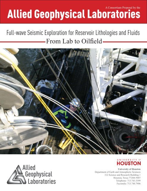
A Consortium <strong>Proposal</strong> by the<br />
<strong>Allied</strong> Geophysical Laboratories<br />
Full-wave Seismic Exploration for Reservoir Lithologies <strong>and</strong> Fluids<br />
From Lab to Oilfi eld<br />
University of Houston<br />
Department of Earth <strong>and</strong> Atmospheric Sciences<br />
312 Science <strong>and</strong> Research Building 1<br />
Houston, Texas 77204-5007<br />
Telephone: 713.743.3399<br />
Facsimile: 713.748.7906
A <strong>Proposal</strong> Submitted to a Consortium of Companies by the<br />
INVESTIGATORS:<br />
Institutional Approval by Anne Sherman, University of Houston Offi ce of Grants <strong>and</strong> Contracts<br />
Annual sponsor contribution $45, 000<br />
ROBERT STEWART<br />
<strong>AGL</strong> Director<br />
CHRISTOPHER LINER<br />
<strong>AGL</strong> Associate Director<br />
JOHN CASTAGNA<br />
FRED HILTERMAN<br />
EVGENI CHESNOKOV<br />
GENNADY GOLOSHUBIN<br />
DE-HUA HAN<br />
AIBING LI<br />
LEON THOMSEN<br />
ROBERT WILEY<br />
1
Summary<br />
This proposal outlines plans for<br />
the research <strong>and</strong> educational<br />
efforts of the new <strong>Allied</strong><br />
Geophysical Laboratories (<strong>AGL</strong>)<br />
at the University of Houston in<br />
2011-2012. We invite potential<br />
sponsors of <strong>AGL</strong> to support <strong>and</strong><br />
guide our quest to enhance<br />
the science of geophysics,<br />
develop aspiring scientists,<br />
<strong>and</strong> contribute to economic<br />
prosperity. The proposed<br />
program will be based on a<br />
number of data acquisition <strong>and</strong><br />
analysis projects directed at<br />
improved imaging <strong>and</strong> analysis<br />
of subsurface reservoirs.<br />
Research will be driven by ideas<br />
<strong>and</strong> data: novel concepts about<br />
acquisition, wave propagation,<br />
<strong>and</strong> imaging in increasingly<br />
realistic media will be developed<br />
<strong>and</strong> tested via lab <strong>and</strong> fi eld<br />
experiments. Existing advanced<br />
data sets, especially full-wave<br />
3D seismic surveys, will be<br />
analyzed to provide improved<br />
description of reservoir rocks<br />
<strong>and</strong> fl uids. Graduate student<br />
education is a key component<br />
of this effort.<br />
<strong>Laboratory</strong> experiments<br />
We are undertaking a number of ultrasonic<br />
physical modeling experiments using our<br />
robotic surveying facility. These include 3D<br />
VSP geometries, fracture zone traverses,<br />
rugose scattering, ocean-bottom node<br />
simulations, <strong>and</strong> measurements through<br />
various anisotropic media. We will<br />
investigate non-linear imaging concepts<br />
in porous fl uid-saturated media under<br />
controlled lab conditions, including direct<br />
imaging of hydrocarbon movement <strong>and</strong><br />
production through time-lapse models.<br />
Field surveys <strong>and</strong> tests<br />
<strong>AGL</strong>’s fi eld seismic capability has exp<strong>and</strong>ed<br />
with GPS, well logging, VSP, <strong>and</strong> full-wave<br />
surface seismic systems, allowing us to<br />
conduct a variety of surveys <strong>and</strong> tests. We<br />
are particularly interested in unconventional<br />
resource rocks: shales, <strong>and</strong> other lowporosity,<br />
low- permeability reservoirs.<br />
In addition, we have two fi eld sites under<br />
development. The UH Coastal Field Station<br />
is 30 miles south of Houston <strong>and</strong> is beside a<br />
producing oilfi eld. The Yellowstone Bighorn<br />
site in Montana is a structurally complex<br />
region also proximal to oil production. In<br />
these <strong>and</strong> other areas, we are evaluating <strong>and</strong><br />
comparing planted geophones <strong>and</strong> l<strong>and</strong>streamers,<br />
analog <strong>and</strong> digital sensors, <strong>and</strong><br />
microphones as auxillary sensors. Our goal<br />
is continued development of the technology<br />
<strong>and</strong> methods related to the full seismic<br />
wavefi eld recorded with multicomponent<br />
sensors in both l<strong>and</strong> <strong>and</strong> marine settings.<br />
With sponsor collaboration <strong>and</strong> counsel, we<br />
propose to undertake a problem-driven fi eld<br />
program addressing fundamental issues of<br />
data acquisition, subsurface imaging,<br />
<strong>and</strong> analysis.<br />
Theory <strong>and</strong> processing<br />
Analysis of fi eld <strong>and</strong> lab data will spur<br />
development of custom algorithms while<br />
data preparation <strong>and</strong> processing will use the<br />
latest industry-st<strong>and</strong>ard tools. We aspire to<br />
make advancement in theory as well as data<br />
processing. Some of our topics of interest<br />
<strong>and</strong> focus include: fl uid substitution effects,<br />
surface-wave <strong>and</strong> refl ectivity inversion,<br />
converted-wave analysis, microseismic<br />
monitoring, anisotropic wave propagation,<br />
seismic attributes, spectral characteristics,<br />
<strong>and</strong> time-lapse phenomena.<br />
Personnel<br />
Professor Robert Stewart (<strong>AGL</strong> Director)<br />
<strong>and</strong> Christopher Liner (Associate Director)<br />
with co-investigators Drs. John Castagna,<br />
Evgeni Chesnokov, <strong>and</strong> Robert Wiley<br />
are delighted to welcome distinguished<br />
colleagues Drs. Gennady Goloshubin, Dehua<br />
Han, Fred Hilterman, Aibing Li, <strong>and</strong><br />
Leon Thomsen as collaborators.<br />
Goals, deliverables, <strong>and</strong> fees<br />
A primary goal of <strong>AGL</strong> is the education<br />
<strong>and</strong> professional development of students.<br />
Some 25 MS <strong>and</strong> PhD graduate students<br />
are currently associated wtih <strong>AGL</strong>. We<br />
anticipate that 25 more will be supported<br />
annually. Upon graduation, they will<br />
be ready for industrial <strong>and</strong> academic roles<br />
in geophysical acquisition, processing,<br />
interpretation, or research. Our scientifi c<br />
objective is to better underst<strong>and</strong> <strong>and</strong><br />
image the subsurface <strong>and</strong> thus, to enhance<br />
the discovery <strong>and</strong> recovery of resources.<br />
Deliverables from this work include<br />
ideas, lab <strong>and</strong> fi eld data, software, reports,<br />
newsletters, courses, <strong>and</strong> presentations.<br />
The sponsorship fee for 2011-2012 is<br />
US $45,000.<br />
Overview<br />
Geophysical science <strong>and</strong> resource<br />
exploration begin with the acquisition of<br />
data. In the new <strong>Allied</strong> Geophysical Lab,<br />
we start many of our studies with full<br />
wavefi eld generation <strong>and</strong> measurement.<br />
We make measurements in three broad<br />
ways: (1) elastic wavefi eld computer<br />
simulation, (2) accurately scaled ultrasonic<br />
physical modeling in the lab, <strong>and</strong> (3) fi eld<br />
acquisition over areas of resource interest.<br />
In addition, we anticipate collaboration with<br />
a number of our sponsoring companies <strong>and</strong><br />
analysis of their existing data sets. These<br />
measurements will be processed through<br />
various st<strong>and</strong>ard <strong>and</strong> custom algorithms<br />
<strong>and</strong> procedures, then interpreted. On the<br />
other h<strong>and</strong>, we expect to develop novel<br />
ideas about wave propagation <strong>and</strong> imaging<br />
in increasingly complex materials that will<br />
be tested with actual experiments. Thus,<br />
our work is directed toward developing<br />
better seismic imaging techniques for new<br />
resource targets.<br />
METHODS<br />
At the university, our m<strong>and</strong>ate is<br />
multicomponent or 3C: Create, Conserve<br />
<strong>and</strong> Communicate knowledge. We might<br />
add to this Commercialization or transfer<br />
of our results to receiving groups for<br />
application to problems of practical interest.<br />
Our role is somewhat complementary to<br />
that of the industry. We have educational<br />
<strong>and</strong> research responsibilities, in contrast to<br />
largely economic ones. Nonetheless, much<br />
of our research is naturally targeted toward<br />
problems <strong>and</strong> areas of current economic<br />
interest (Figure 1). Exciting resource targets<br />
in 2011-2012 include those overlain by<br />
deep water (e.g., the Tupi, Brazil supergiant<br />
oil discovery) <strong>and</strong> hydrocarbons contained<br />
in shale (e.g., Bakken <strong>and</strong> Eagle Ford), or<br />
low-permeability s<strong>and</strong>stone. Monitoring the<br />
hydraulic fracturing process or predicting<br />
where natural fractures occur continues<br />
to be a challenge as does following CO 2<br />
enhanced oil recovery <strong>and</strong> sequestration.<br />
The full-wave or multicomponent seismic<br />
method has much to offer for subsurface<br />
imaging <strong>and</strong> rock property estimation.<br />
However, full-wave seismology is more<br />
complex than simple acoustic imaging,<br />
thus gr<strong>and</strong> challenges remain in improving<br />
data acquisition, developing more accurate<br />
processing methods, <strong>and</strong> interpreting<br />
the images more usefully. We advocate<br />
acquiring elastic (3C or 4C) seismic data<br />
whenever possible to advance lithologic<br />
<strong>and</strong> petrophysical aspects of reservoir<br />
assessment. Much of our ability to detect<br />
fl uid movement depends on underst<strong>and</strong>ing<br />
the changes that a rock undergoes with<br />
fl uid saturation. Thus, a major component<br />
of the project is attached to laboratory<br />
measurements on rocks <strong>and</strong> scaled models,<br />
computer simulations, <strong>and</strong> well log analysis.<br />
Acquisition <strong>and</strong> use of these richer data sets<br />
will also help students become familiar with<br />
their value <strong>and</strong> application.<br />
2 3<br />
Lab, log, <strong>and</strong><br />
field data<br />
acquisition<br />
Processing <strong>and</strong><br />
imaging<br />
Interpretation<br />
Figure 1.<br />
Schematic overview of the elements of this<br />
proposal including methods, their applications,<br />
<strong>and</strong> specific resource targets<br />
APPLICATIONS<br />
Subsurface<br />
architecture<br />
Rock type <strong>and</strong><br />
properties<br />
Fluids <strong>and</strong> their<br />
movements<br />
TARGETS<br />
Unconventional oil<br />
<strong>and</strong> gas, CO2<br />
Deep water,<br />
near surface<br />
Water resources,<br />
mining
ANALYSIS ACQUISITION<br />
DATA<br />
PROCESSING<br />
EVALUATION<br />
3/4C-3D<br />
Seismic<br />
Survey 1<br />
Imaging<br />
(Rpp Rps)<br />
Inversion<br />
(Vp Vs Qp<br />
3C passive<br />
monitoring<br />
Integration<br />
(well logs, core, geology)<br />
Lithology<br />
(rock type,<br />
fractures, , )<br />
Fluids<br />
3/4C-3D<br />
Seismic<br />
Survey 2<br />
(type, pressure, sat.)<br />
Figure 2.<br />
Schematic diagram of full-wave seismic methodologies<br />
to assess reservoir rock <strong>and</strong> physical model properties,<br />
fluids, <strong>and</strong> their changes<br />
Imaging<br />
Inversion<br />
TIME<br />
3C passive<br />
monitoring<br />
Integration<br />
Geol. change<br />
(subsidence, frac.)<br />
Figure 3.<br />
Amplitude time slice from a 3C–3D seismic volume on a s<strong>and</strong> channel<br />
(Varga <strong>and</strong> Stewart, 2009, Delineating s<strong>and</strong> channels using 3C-3D seismic data,<br />
Manitou Lk. heavy oil fi eld, Can. Soc. Expl. Geophys. Ann. Mtg.)<br />
Fluid changes<br />
(distrib., pres.)<br />
3/4C-3D<br />
Seismic<br />
Survey 3<br />
Imaging<br />
Inversion<br />
Integration<br />
Geologic<br />
change<br />
1000m<br />
Fluid changes<br />
(volume, pres.)<br />
Going beyond the lab <strong>and</strong> logs, seismic<br />
methodology for subsurface imaging <strong>and</strong><br />
monitoring is often divided into three broad<br />
categories: data acquisition, processing,<br />
<strong>and</strong> interpretation. As we believe that<br />
all three categories are intimately <strong>and</strong><br />
inextricably connected, we will conduct<br />
research in all three areas. Seismic data<br />
are often fi rst collected for exploration<br />
purposes, but then possibly repeated for<br />
reservoir development <strong>and</strong> management<br />
(Figure 2). Initially, the data are processed<br />
into a refl ection image (to provide a b<strong>and</strong>limited<br />
subsurface architecture – see Figure<br />
3) then, with supporting information, they<br />
may be analyzed further into pictures of<br />
estimated lithology <strong>and</strong> other properties.<br />
Integrating these images with followon<br />
survey results leads to indicators of<br />
geologic <strong>and</strong> fl uid change. To this end,<br />
we will undertake time-lapse, full-wave<br />
experiments in the lab <strong>and</strong> fi eld.<br />
Most of the methodology that we are<br />
developing for imaging hydrocarbon<br />
reservoirs can be applied to making images<br />
of greenhouse or waste gases injected into<br />
the subsurface. We seek to fi nd improved<br />
ways of underst<strong>and</strong>ing gas emplacement<br />
<strong>and</strong> containment. Detecting <strong>and</strong> mapping<br />
water <strong>and</strong> its fl ows may be amenable to<br />
similar seismic methodologies. In fact,<br />
sophisticated seismic analysis has found<br />
signifi cant application in the mining<br />
industry, especially as related to faults <strong>and</strong><br />
aquifer fl ows.<br />
The New <strong>Allied</strong> Geophysical Lab<br />
The original <strong>Allied</strong> Geophysical Lab<br />
came to life under the tutelage of Dr.<br />
Fred Hilterman some 30 years ago. It<br />
was founded by associating disparate<br />
exploration-related projects: physical<br />
modeling, well log analysis, seismic data<br />
processing, <strong>and</strong> interpretation. In the<br />
following years, <strong>AGL</strong> made outst<strong>and</strong>ing<br />
contributions to exploration geophysics<br />
while educating generations of students.<br />
We are returning to some of the <strong>AGL</strong>’s<br />
geophysical roots, but with energetic new<br />
growth. The new <strong>AGL</strong> is focusing on<br />
experimental geophysics <strong>and</strong> associated<br />
theory, data assessment, <strong>and</strong> application.<br />
We plan to carefully collect <strong>and</strong> thoroughly<br />
analyze a wide variety of geophysical data,<br />
from the lab to fi eld scale. The Department<br />
of Earth <strong>and</strong> Atmospheric Sciences at the<br />
University of Houston is broadly exp<strong>and</strong>ing<br />
its geophysical capabilities with the recent<br />
hiring of four geophysics professors: Evgeni<br />
Chesnokov, Christopher Liner, Robert<br />
Stewart, <strong>and</strong> Leon Thomsen. Dr. Stewart<br />
was appointed as Director of <strong>AGL</strong> <strong>and</strong> Drs.<br />
Castagna, Chesnokov, Liner, <strong>and</strong> Wiley are<br />
co-investigators. Collaborators include Drs.<br />
Gennady Goloshubin, De-hua Han, Fred<br />
Hilterman, Aibing Li, <strong>and</strong> Leon Thomsen.<br />
These individuals <strong>and</strong> their students bring a<br />
wealth of experience <strong>and</strong> expertise to <strong>AGL</strong> efforts.<br />
Investigator General expertise<br />
Robert Stewart<br />
PhD, Massachusetts Institute of Technology<br />
Chevron, ARCO, Veritas, University of Calgary<br />
Christopher Liner<br />
PhD, Colorado School of Mines<br />
U. Tulsa, Aramco, Conoco, Western Geo<br />
John Castagna<br />
PhD, University of Texas at Austin<br />
ARCO, Fusion Geophysical<br />
Evgeni Chesnokov<br />
PhD, Moscow State University<br />
University College of London, University of<br />
As part of a presidential initiative, the<br />
university is hiring three more geoscience<br />
faculty in the coming months. We anticipate<br />
that some will undertake undertake joint<br />
projects with <strong>AGL</strong> personnel.<br />
Research Personnel<br />
<strong>and</strong> Expertise<br />
The <strong>AGL</strong> group of experienced <strong>and</strong><br />
enthusiastic geophysicists is uniquely<br />
suited to the challenge of lab-to-fi eld<br />
experimentation, analysis, <strong>and</strong> application.<br />
They are committed to working together as<br />
a team <strong>and</strong> advancing the fi eld of exploration<br />
geophysics. Their backgrounds <strong>and</strong> general<br />
areas of expertise are outlined below.<br />
Borehole geophysics (well logging, VSP, crosswell<br />
analysis), multicomponent seismic methods<br />
Rock properties, seismic attributes, AVO<br />
4 5<br />
Oklahoma<br />
Gennady Goloshubin<br />
PhD, Institute of Solid Earth, Moscow<br />
Western Siberian Institute<br />
De-hua Han<br />
PhD, Stanford University<br />
Unocal, HARC<br />
Fred Hilterman<br />
PhD, Colorado School of Mines<br />
Geophysical Development Corp., Mobil<br />
Aibing Li<br />
PhD, Brown University<br />
Woods Hole Institute<br />
Leon Thomsen<br />
PhD, Columbia University<br />
Amoco, BP, Delta <strong>Geophysics</strong><br />
Robert Wiley<br />
PhD, Colorado School of Mines<br />
Marathon Oil<br />
Seismic data processing, seismic interpretation,<br />
time series analysis, CO2 sequestration<br />
Theoretical seismology, anisotropy, fracture monitoring<br />
Seismic exploration, reservoir analysis,<br />
permeability prediction<br />
<strong>Laboratory</strong> rock properties, seismic monitoring<br />
AVO, seismic processing, petrophysics<br />
Seismic tomography, inversion, crustal structure<br />
Anisotropy, seismic processing, EM analysis<br />
Physical modeling, instrumentation,<br />
shallow seismic analysis
Current Resources <strong>and</strong> Work<br />
<strong>AGL</strong> operates a fully equipped ultrasonic modeling tank (2m x 4m x 1.5m) with acoustic<br />
<strong>and</strong> elastic measurement capability. Dr. Robert Wiley is currently conducting a 3D VSP<br />
survey in the Vinton Dome model (Figure 4) simulating a wide-azimuth fi eld experiment.<br />
The lab recording system has been upgraded to have a 60-channel simultaneous capability.<br />
New amplifi ers <strong>and</strong> recorders are under Labview control.<br />
We have access to the UH Texas Learning <strong>and</strong> Computation Center (TLC2). This is<br />
a fi rst-class visualization facility for demonstrations, analysis, <strong>and</strong> development. For<br />
example, we are very interested in building tools for interactive 3D visualization of timelapse<br />
phenomena. <strong>AGL</strong> has access to a Departmental computational network consisting<br />
of a Sun Starfi re 880 server with dozens of Sun Ultra workstations augmented by a<br />
Beowolf computing cluster. Additionally, TLC2 operates a 500 CPU Titanium cluster<br />
<strong>and</strong> two 64 CPU SGI Altix clusters. We also use a wide variety of commercial software<br />
for seismic processing, imaging, visualization, interpretation, reservoir calibration, <strong>and</strong><br />
fl ow simulation. <strong>AGL</strong> has a large inventory of previously shot physical <strong>and</strong> numerical<br />
modeling data sets, including the Marmousi elastic wave numerical model. These will be<br />
made available to sponsors. In addition, there are several dozen industry seismic data sets<br />
currently available for processing <strong>and</strong> interpretation.<br />
The University of Houston manages the Yellowstone Bighorn Research Association<br />
(YBRA) Geoscience Field Camp near Red Lodge, Montana (Figure 5). We have conducted<br />
the geophysical fi eld schools there since the summer of 2009 <strong>and</strong> 2010. Students undertake<br />
experimental, h<strong>and</strong>s-on acquisition of 3C seismic surveys as well as GPS, GPR, well<br />
logging, <strong>and</strong> VSP data. We will return to YBRA annually in August.<br />
A little closer to UH, we are developing a fi eld geophysics test site on university-owned<br />
l<strong>and</strong>. This facility is part of UH’s Coastal Center <strong>and</strong> includes a producing oilfi eld<br />
(Figure 6). This key site is being used to test equipment, acquire repeat surveys, <strong>and</strong><br />
conduct fi eld schools. We plan to drill of test wells for fi eld-scale injection <strong>and</strong><br />
monitoring experiments.<br />
<strong>AGL</strong> has a 200-channel Geometrics seismic recording system as well as a 300-channel I/O<br />
system. We use the PEG accelerated weight drop source <strong>and</strong> an IVI T15000 vibrator. We<br />
have a number of vertical <strong>and</strong> 3-G geophones in addition to l<strong>and</strong> streamers. We also have<br />
a suite of well logging tools from Mt. Sopris as wells as VSP receivers from Geostuff. Our<br />
ground-penetrating radar equipment includes Sensors <strong>and</strong> Software’s NOGGIN <strong>and</strong><br />
Pulse EKKO systems.<br />
Figure 4.<br />
Physical modeling facility at <strong>AGL</strong> with Dr. Wiley<br />
confi guring the Vinton Dome 3D VSP model<br />
Figure 5.<br />
Classroom at the YBRA fi eld site<br />
(photo by Mike Murphy)<br />
Figure 6.<br />
UH faculty near the Coastal Field Site<br />
Specifi c Research Topics<br />
Investigator Topics<br />
Robert Stewart<br />
15 20<br />
students<br />
Christopher Liner<br />
5 students<br />
John Castagna<br />
5 students<br />
Evgeni Chesnokov<br />
5 students<br />
Gennady Goloshubin<br />
2 students<br />
De-hua Han<br />
2 students<br />
Fred Hilterman<br />
2 students<br />
Microphone suppression of geophone noise; 3C l<strong>and</strong> streamer assessment;<br />
MEMS response; surface-wave inversion; full-wave case histories;<br />
microseismic monitoring (Figure 7)<br />
Spectral decomposition <strong>and</strong> AVO, rock physics<br />
Wave propagation in anisotropic media, fracture characterization,<br />
hypocenter location<br />
Waves in porous media <strong>and</strong> 3C seismic analysis, permeability studies<br />
Seismic monitoring <strong>and</strong> rock properties<br />
AVO <strong>and</strong> attributes<br />
Figure 7.<br />
Testing true amplitude seismic<br />
response in the fi eld to calibrate<br />
microseismic monitoring instruments<br />
6 7<br />
Aibing Li<br />
2 students<br />
Leon Thomsen<br />
2 students<br />
Robert Wiley<br />
2 students<br />
Visualization, acoustic scattering, CO2 sequestration, advanced interpretation<br />
Surface-wave inversion, 3C continuous monitoring, microseismic analysis<br />
Anisotropy <strong>and</strong> rock properties<br />
Physical modeling: Vinton Dome 3D VSP <strong>and</strong> RVSP, anistropic fault 3C-3D
Activities <strong>and</strong> Timeline: 2011-2012<br />
Aspect<br />
Equipment<br />
Facilities<br />
<strong>and</strong> software<br />
Personnel<br />
Physical<br />
modeling<br />
Field work<br />
Time<br />
June 2011 Oct 2011 Feb 2012 June 2012<br />
200-ch seismic, GPR,<br />
ultrasonic upgrade,<br />
GPS, microphones<br />
VISTA, Petrel<br />
Kingdom<br />
Geophysical<br />
technician<br />
3D VSP,<br />
fracture, fault<br />
Houston/local<br />
(shallow faults)<br />
300-ch seismic<br />
vibroseis<br />
Transform, Focus<br />
Hampson-Russell<br />
Geophysical postdoctoral<br />
fellow<br />
Time-lapse s<strong>and</strong><br />
Montana (deep structure);<br />
Texas crater<br />
Our goals are ambitious <strong>and</strong> moving forward will require sponsorship for the<br />
purchase of equipment, instruments, computers, <strong>and</strong> software. New personnel are needed<br />
to undertake research, maintain <strong>and</strong> operate equipment, as well as for administrative<br />
operations, university reporting, safety compliance, <strong>and</strong> sponsor communications.<br />
An overview of our proposed activities in 2011-2012 is shown above.<br />
Shallow marine<br />
seismic<br />
Computer hardware<br />
Upgrade<br />
System/data<br />
geophysicists<br />
3C structure<br />
nonlinear<br />
Houston/local<br />
(deeper structures)<br />
Deliverables <strong>and</strong> Other Benefi ts<br />
OBS<br />
hydrophone<br />
streamer<br />
ProMax<br />
Administrative<br />
manager<br />
3C-3D anisotropy<br />
Gulf of Mexico<br />
(shallower tests<br />
The new <strong>AGL</strong> aspires to make a signifi cant impact on the science of geophysics <strong>and</strong><br />
deliver clear benefi t <strong>and</strong> advantage to our sponsors. A list of deliverables <strong>and</strong> other<br />
benefi ts follows:<br />
• All <strong>AGL</strong>-sponsored physical modeling data will be available to sponsoring organizations<br />
• All fi eld data acquired by <strong>AGL</strong> will be available to sponsors<br />
• All <strong>AGL</strong>-supported theses, posters, preprints, exp<strong>and</strong>ed abstracts, <strong>and</strong> technical papers <strong>and</strong> reports will be<br />
provided to sponsors<br />
• Sponsor representatives will be invited to the <strong>AGL</strong> Annual Spring Meeting summarizing the year’s research<br />
activities in addition to the Annual Dobrin Graphics Lecture. Each sponsor will receive the <strong>AGL</strong> Annual Report<br />
Budget Overview: 2011-2012<br />
Through 2011-2012, we intend to purchase a substantial amount of geophysical equipment.<br />
To date, the University of Houston has provided $1,200,000 toward this effort <strong>and</strong> will<br />
expend another $300K. We seek further contribution from the industry <strong>and</strong> various other<br />
agencies. Equipment purchases are to upgrade the existing physical modeling facility as<br />
well as provide an augmented fi eld acquisition <strong>and</strong> data processing capability. Our fi rst step<br />
was a portable seismic system, but we continue to work toward assembling a full industryst<strong>and</strong>ard<br />
l<strong>and</strong> <strong>and</strong> marine system. Other supporting equipment includes GPS, well-logging,<br />
VSP, CG-5 gravimeter, <strong>and</strong> GPR instruments.<br />
2011-2012 Budget Expenses Revenue<br />
Equipment, instruments, computers<br />
Personnel salaries<br />
Field work, travel, communication<br />
University, state, federal contribution (cash)<br />
Industry sponsorship (cash)<br />
Total<br />
Lab Instruments Transducers, A/D converters, controllers, software $75k<br />
Field Equipment 100-channel seismic recorder (Geometrics/Geodes), cables <strong>and</strong> 3C<br />
geophones $85k, GPS $25k, Well Logging tools, cable, winch <strong>and</strong> truck $80k, VSP tools,<br />
cable, <strong>and</strong> recorders $20k, Ground-penetrating radar (GPR) – SmartCart (100MHZ) $20k<br />
IVI T15000 horizontal plate add-on $30k<br />
Computers Hardware, software, <strong>and</strong> visualization $75k<br />
Personnel Five(s) graduate students $150k, Four technical staff $250k.<br />
Field Work Survey travel $45k<br />
Travel Conferences, meetings, courses $20k<br />
Communication Publication costs, newsletters, seminars, meetings $50k<br />
Total 2011-2012 expenses - $925K<br />
• Each sponsor will receive periodic communication about <strong>AGL</strong> personnel, activities, <strong>and</strong> research<br />
Contact director Robert Stewart for further information.<br />
• Sponsors will have a voice on the <strong>AGL</strong> Industrial Advisory Board to provide guidance <strong>and</strong> counsel to the Lab<br />
Contact Information:<br />
• Sponsors have the opportunity to become familiar with students (prospective staff) <strong>and</strong> their work<br />
Dr. Robert Stewart – (713) 743.8230 or rrstewart@uh.edu<br />
Dr. Christopher Liner – (713) 743.9119 or cliner@uh.edu<br />
8 9<br />
$410,000<br />
$400,000<br />
$115,000<br />
$925,000<br />
$385,000<br />
$540,000<br />
$925,000<br />
We require a number of additional staff to operate <strong>and</strong> maintain the various computer <strong>and</strong> measurement systems as well as facilitate<br />
research. We anticipate hiring four staff throughout 2011-2012. They would include a geophysical technician, geophysics postdoctoral<br />
fellow, system <strong>and</strong> data manager, <strong>and</strong> an administrative assistant. We seek <strong>AGL</strong> industrial sponsors from the energy, mining,<br />
engineering <strong>and</strong> related sectors. Annual sponsorship cost is $45K for 2011-2012. A reduced rate of $15K is available for smaller<br />
enterprises (under $5 million annual revenue). We anticipate that this support <strong>and</strong> collaboration will arise primarily from the<br />
energy industry. We also offer a limited number of Founding <strong>and</strong> Sustaining Memberships that allow more direct involvement <strong>and</strong><br />
impact on the future of <strong>AGL</strong> <strong>and</strong> its people.
The <strong>Allied</strong> Geophysical Lab (<strong>AGL</strong>) Vision<br />
Our goal is to do excellent applied geophysical research!<br />
We are dedicated to making signifi cant advances in the underst<strong>and</strong>ing <strong>and</strong> imaging of the subsurface.<br />
Specifi cally, we will work with the resource industry <strong>and</strong> professional societies to create novel ways to<br />
discover <strong>and</strong> conscientiously recover resources while educating the next generation of geoscientists.<br />
Scope of Work<br />
At <strong>AGL</strong>, we emphasize the physics behind<br />
making geologic images of the subsurface.<br />
This involves three main categories:<br />
Acquisition, analysis, <strong>and</strong> interpretation<br />
of largely seismic data. A key component<br />
of our effort is to make geophysical<br />
measurements in the laboratory, computer,<br />
<strong>and</strong> fi eld. We have one of the few physical,<br />
robotic modeling facilities in the world<br />
dedicated to making scaled surveys of<br />
structures of energy interest. In addition,<br />
we write <strong>and</strong> employ a number of numerical<br />
modeling codes. Furthermore, we have an<br />
excellent capability to acquire near-surface<br />
geophysical data (seismic, VSP, well logs,<br />
GPS, GPR, <strong>and</strong> gravity.) The university<br />
owns a section of l<strong>and</strong> near Galveston that<br />
we are developing as a geophysical test site.<br />
UH also manages a 100-person geoscience<br />
fi eld camp near Red Lodge, Montana for the<br />
education of students in fi eld methods.<br />
On the processing <strong>and</strong> analysis side, we<br />
develop algorithms related to the imaging<br />
10<br />
<strong>and</strong> underst<strong>and</strong>ing of geophysical (mostly<br />
seismic) data. We also use many of<br />
the industry st<strong>and</strong>ard processing codes<br />
(Paradigm, VISTA, Petrel, Kingdom.) Our<br />
particular expertise is in multicomponent<br />
seismic analysis, seismic attributes,<br />
borehole seismic, AVO, CO2 sequestration<br />
assessment, quantitative interpretation,<br />
attenuation, <strong>and</strong> anisotropy. We are involved<br />
with a number of case histories including<br />
resource targets at the Barnett, Bakken,<br />
<strong>and</strong> Marcellus shales. In addition, we<br />
have numerous studies relating to VSP<br />
<strong>and</strong> 3D (several 4C) seismic data sets in<br />
the Gulf of Mexico. Along with our fi ve<br />
closely associated faculty (Stewart, Liner,<br />
Thomsen, Chesnokov, <strong>and</strong> Castagna,) we<br />
have some 70 graduate students <strong>and</strong> staff<br />
attached to our applied geophysics effort.<br />
We are enthusiastic about working with our<br />
industry partners!<br />
The University of Houston is an Equal Opportunity/Affi rmative Action Institution. Minorities, women, veterans <strong>and</strong> persons with disabilities are encouraged to apply