34th International Geological Congress (IGC): AUSTRALIA 2012
34th International Geological Congress (IGC): AUSTRALIA 2012
34th International Geological Congress (IGC): AUSTRALIA 2012

You also want an ePaper? Increase the reach of your titles
YUMPU automatically turns print PDFs into web optimized ePapers that Google loves.
Q-9A Granite Belt (including visits to Wineries)<br />
Pre Trip: 2 days 1 night - Friday 3 August to Saturday 4 August <strong>2012</strong><br />
Starts: Brisbane<br />
Finishes: Brisbane<br />
Numbers limited to 30<br />
Cost: $800 per person share twin/double<br />
Single supplement: $68<br />
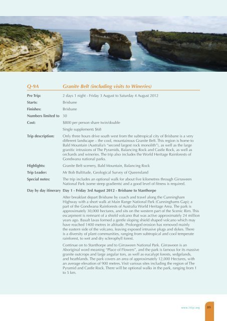
Trip description: Only three hours drive south west from the subtropical city of Brisbane is a very<br />
different landscape – the cool, mountainous Granite Belt. This region is home to<br />
Bald Mountain (Australia’s “second largest rock monolith”), as well as the large<br />
granitic intrusions of The Pyramids, Balancing Rock and Castle Rock, as well as<br />
orchards and wineries. The trip also includes the World Heritage Rainforests of<br />
Gondwana national parks.<br />
Highlights: Granite Belt scenery, Bald Mountain, Balancing Rock<br />
Trip Leader: Mr Bob Bultitude, <strong>Geological</strong> Survey of Queensland<br />
Special notes: The trip includes an optional walk for about five kilometres through Girraween<br />
National Park (some steep gradients) and a good level of fitness is required.<br />
Day by day itinerary Day 1 - Friday 3rd August <strong>2012</strong> - Brisbane to Stanthorpe<br />
After breakfast depart Brisbane by coach and travel along the Cunningham<br />
Highway with a short walk at Main Range National Park (Cunninghams Gap); a<br />
part of the Gondwana Rainforests of Australia World Heritage Area. The park is<br />
approximately 30,000 hectares, and sits on the western part of the Scenic Rim. This<br />
escarpment is remnant of a shield volcano that was active approximately 24 million<br />
years ago. Basalt lavas formed a gentle sloping shield shaped volcano which may<br />
have reached 1400 metres in altitude. Prolonged erosion has removed mainly<br />
the eastern side of the volcano, leaving exposed intrusive plugs and dykes. There<br />
is a diversity of plant communities, ranging from subtropical and cool temperate<br />
rainforest, to wet and dry sclerophyll forest.<br />
Continue on to Stanthorpe and to Girraween National Park. Girraween is an<br />
Aboriginal word meaning “Place of Flowers”, and the park is famous for its massive<br />
granite outcrops and large angular tors, as well as eucalypt forests, sedgelands,<br />
and heathlands. The park covers an area of approximately 12,000 Hectares, with<br />
an average elevation of 900 metres. Visit various sites including the region of The<br />
Pyramid and Castle Rock. There will be optional walks in the park, ranging from 1<br />
to 5 km.<br />
www.34igc.org 89