

SDI Convergence - Nederlandse Commissie voor Geodesie - KNAW
SDI Convergence - Nederlandse Commissie voor Geodesie - KNAW
SDI Convergence - Nederlandse Commissie voor Geodesie - KNAW

Create successful ePaper yourself
Turn your PDF publications into a flip-book with our unique Google optimized e-Paper software.
Some differences are not clear from the models, but were identified by comparing the<br />
datasets. Therefore our first recommendation, before harmonising the models, is to<br />
model any information about the content and meaning of datasets that is currently not<br />
included in the domain models, e.g. acquisition rules. This allows harmonising and integrating<br />
this information as well. For example, the current TOP10NL acquisition rules<br />
state that railway banks are not measured, despite the presence of the class Railway in<br />
the model.<br />
Many differences between the information models are caused by difference in perspective<br />
(section 2.1). These different perspectives cannot easily be harmonised because<br />
they are justified by differences in objectives, source data, application domain, providers,<br />
and acquisition methods. However, the law on key registers provides potentials for<br />
harmonising some parts of the perspective. Specifically two aspects of the law enforce<br />
municipalities to inform the Kadaster about updates for TOP10NL data. The first aspect<br />
is that any user of the key register must inform the provider when (s)he notices an error.<br />
Secondly, municipalities are obliged to use the Kadaster’s TOP10NL data, updated<br />
every 2 years, instead of their self-produced 1:10k datasets, updated more frequently.<br />
To effectuate updates in TOP10NL data as soon as possible, some large municipalities<br />
will send TOP10NL updates based on their 1:10k datasets. For this purpose they are<br />
currently converting their 1:10k datasets into TOP10NL compliant datasets. This practice<br />
makes the integration issue of the two topographic datasets, i.e. IMGeo and<br />
TOP10NL, relevant within municipalities.<br />
Because not all information on the data is laid down in the TOP10NL model, TOP10NL<br />
data can be generated from a municipal perspective without violating the model. An<br />
example is that the Kadaster often assigns road areas that are too small to be area objects<br />
(smaller than 2 meters) to terrain. However, assigning these areas to neighbouring<br />
roads better supports the municipal maintenance task of public area and fits better<br />
with the definition of PartOfRoad in the TOP10NL model. Consequently municipal<br />
TOP10NL roads may cover the full construction of all IMGeo road objects which solves<br />
the differences in object demarcation of roads (section 2.3). To illustrate this, two<br />
TOP10NL road implementations, one generated by Kadaster and one generated by<br />
municipality of Rotterdam, are compared with IMGeo roads in Figure 3.<br />
Obviously this poses new research questions, since now the differences in perspective<br />
do not occur between IMGeo and TOP10NL, but within one dataset, i.e. TOP10NL. In<br />
conclusion, to solve the differences in object demarcation it is most important to make<br />
these demarcations unambiguously explicit in the models. In a next step it can be studied<br />
whether differences can be aligned and how.<br />
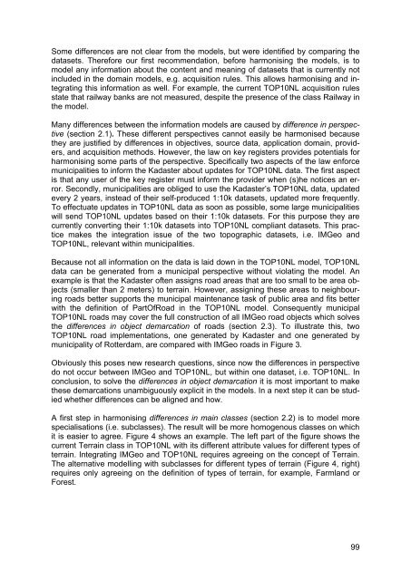
A first step in harmonising differences in main classes (section 2.2) is to model more<br />
specialisations (i.e. subclasses). The result will be more homogenous classes on which<br />
it is easier to agree. Figure 4 shows an example. The left part of the figure shows the<br />
current Terrain class in TOP10NL with its different attribute values for different types of<br />
terrain. Integrating IMGeo and TOP10NL requires agreeing on the concept of Terrain.<br />
The alternative modelling with subclasses for different types of terrain (Figure 4, right)<br />
requires only agreeing on the definition of types of terrain, for example, Farmland or<br />
Forest.<br />
99


