

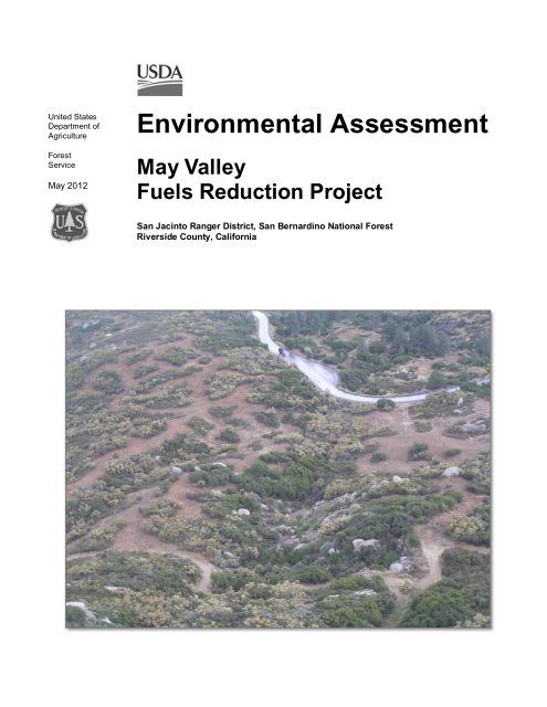
May Valley Fuels Reduction Project Environmental Assessment
May Valley Fuels Reduction Project Environmental Assessment
May Valley Fuels Reduction Project Environmental Assessment

You also want an ePaper? Increase the reach of your titles
YUMPU automatically turns print PDFs into web optimized ePapers that Google loves.
United States<br />
Department of<br />
Agriculture<br />
Forest<br />
Service<br />
<strong>May</strong> 2012<br />
<strong>Environmental</strong> <strong>Assessment</strong><br />
<strong>May</strong> <strong>Valley</strong><br />
<strong>Fuels</strong> <strong>Reduction</strong> <strong>Project</strong><br />
San Jacinto Ranger District, San Bernardino National Forest<br />
Riverside County, California
For More Information Contact:<br />
Laurie Rosenthal, District Ranger<br />
San Jacinto Ranger District<br />
P.O. Box 518<br />
Idyllwild, CA 92549<br />
909/382-2924<br />
The U.S. Department of Agriculture (USDA) prohibits discrimination in all its programs and activities on the basis<br />
of race, color, national origin, age, disability, and where applicable, sex, marital status, familial status, parental<br />
status, religion, sexual orientation, genetic information, political beliefs, reprisal, or because all or part of an<br />
individual’s income is derived from any public assistance program. (Not all prohibited bases apply to all programs.)<br />
Persons with disabilities who require alternative means for communication of program information (Braille, large<br />
print, audiotape, etc.) should contact USDA’s TARGET Center at (202) 720-2600 (voice and TDD). To file a<br />
complaint of discrimination, write to USDA, Director, Office of Civil Rights, 1400 Independence Avenue, S.W.,<br />
Washington, D.C. 20250-9410, or call (800) 795-3272 (voice) or (202) 720-6382 (TDD). USDA is an equal<br />
opportunity provider and employer.
Contents<br />
<strong>Environmental</strong> <strong>Assessment</strong><br />
Introduction ............................................................................................................................................ 1<br />
Background......................................................................................................................................... 1<br />
<strong>Project</strong> Location .................................................................................................................................. 2<br />
Management Direction ........................................................................................................................ 2<br />
Purpose and Need for Action ................................................................................................................... 3<br />
Why Here? .......................................................................................................................................... 4<br />
Why Now? .......................................................................................................................................... 8<br />
Proposed Action ...................................................................................................................................... 9<br />
Decision Framework ............................................................................................................................. 10<br />
Public Involvement ............................................................................................................................... 10<br />
Community Wildfire Protection Plan ................................................................................................. 10<br />
Public Field Trip and Planning Meeting ............................................................................................ 10<br />
Soliciting Public Comments .............................................................................................................. 11<br />
Forest Schedule of Proposed Actions and Forest Website .................................................................. 11<br />
Issues ................................................................................................................................................ 11<br />
<strong>Project</strong> Record Availability ............................................................................................................... 12<br />
Alternatives, including the Proposed Action .......................................................................................... 12<br />
Alternative Development .................................................................................................................. 12<br />
<strong>Project</strong> Design Features and Monitoring ............................................................................................ 19<br />
Comparison of Alternatives ............................................................................................................... 29<br />
<strong>Environmental</strong> Consequences ................................................................................................................ 33<br />
Forest Vegetation .............................................................................................................................. 34<br />
Fire Hazard and Fuel Loading ........................................................................................................... 49<br />
Wildlife ............................................................................................................................................ 59<br />
Soil and Water .................................................................................................................................. 79<br />
Botanical Resources and Invasive Weeds ........................................................................................ 103<br />
Air Quality ...................................................................................................................................... 124<br />
Heritage .......................................................................................................................................... 137<br />
Scenery and Recreation ................................................................................................................... 138<br />
<strong>Environmental</strong> Justice ..................................................................................................................... 142<br />
Economics and Social Environment ................................................................................................ 143<br />
Climate Change .............................................................................................................................. 146<br />
Consultation, Coordination, and Analysis Preparation ......................................................................... 149<br />
References .......................................................................................................................................... 151<br />
Appendix A – Maps ............................................................................................................................ 163<br />
Appendix B - Best Management Practices ........................................................................................... 171<br />
Tables<br />
Table 1. <strong>Project</strong> area existing and desired fire behavior characteristics ..................................................... 4<br />
Table 2. Proposed actions in each project area unit ................................................................................ 17<br />
Table 3. Minimum effective ground cover based on erosion hazard rating (FSH 22509.22-2005-1)........ 24<br />
Table 4. Summary of how alternatives meet project purpose and need ................................................... 29<br />
Table 5. Summary of effects .................................................................................................................. 30<br />
Table 6. Vegetation types (series) within <strong>May</strong> valley <strong>Fuels</strong> <strong>Reduction</strong> planning area ............................. 36<br />
Table 7. Stand density of mixed Jeffrey pine at SSPM from Minnich et al. (2000) ................................. 42<br />
Table 8. Stand density of mixed Jeffrey pine in San Bernardino Mts. from Minnich et al. (1995) ........... 42<br />
Table 9. Existing fire behavior for vegetation in the <strong>May</strong> <strong>Valley</strong> project area ......................................... 51<br />
i
<strong>May</strong> <strong>Valley</strong> <strong>Fuels</strong> <strong>Reduction</strong> <strong>Project</strong><br />
Table 10. Timber understory existing condition and fuel conditions following treatment ........................ 55<br />
Table 11. Chaparral existing condition and fuel conditions following treatment ..................................... 56<br />
Table 12. Summary of wildlife species analyzed for the project ............................................................. 59<br />
Table 13. Effects of the proposed action of r5 sensitive and watchlist wildlife species ............................ 69<br />
Table 14. Acres and percent of 6th- and 7th-level watersheds found within the <strong>May</strong> <strong>Valley</strong> <strong>Fuels</strong><br />
<strong>Reduction</strong> <strong>Project</strong> area .............................................................................................................. 81<br />
Table 15. Ephemeral/intermittent and perennial stream miles located in 6 th and 7 th level<br />
watersheds within the <strong>May</strong> <strong>Valley</strong> fuels reduction project area .................................................. 82<br />
Table 16. Existing road densities for 7 th -level watersheds within the <strong>May</strong> <strong>Valley</strong> <strong>Fuels</strong> <strong>Reduction</strong><br />
<strong>Project</strong> area ............................................................................................................................... 82<br />
Table 17. 7 th -level watersheds in the <strong>May</strong> <strong>Valley</strong> project area and summary of existing ERA data<br />
and resulting watershed condition class ..................................................................................... 84<br />
Table 18. Summary of soil types associated with proposed treatment units in the <strong>May</strong> <strong>Valley</strong><br />
<strong>Project</strong> area ............................................................................................................................... 84<br />
Table 19. Summary of soil characteristics associated with proposed treatment units ............................... 85<br />
Table 20. Current detrimental soil disturbance in harvest units for the <strong>May</strong> <strong>Valley</strong> project ..................... 86<br />
Table 21. Summary of additional soil characteristics for soils associated with proposed treatment<br />
units .......................................................................................................................................... 87<br />
Table 22. Designated beneficial uses for streams within the <strong>May</strong> <strong>Valley</strong> fuels reduction project<br />
area ........................................................................................................................................... 89<br />
Table 23. Summary of proper functioning condition data ....................................................................... 90<br />
Table 24. Existing riparian conservation area acres within 6 th - and 7 th -level watersheds located<br />
within the <strong>May</strong> <strong>Valley</strong> <strong>Project</strong> area on National Forest land....................................................... 91<br />
Table 25. Acreage summaries of vegetation management system types and fuel treatments for the<br />
<strong>May</strong> <strong>Valley</strong> fuels project ........................................................................................................... 92<br />
Table 26. Summary of existing and estimated post project implementation soil disturbance ................... 93<br />
Table 27. Summary of ERA estimates after project implementation ..................................................... 100<br />
Table 28. Summary of plant species analyzed for the project................................................................ 104<br />
Table 29. Sensitive plant species analysis for the <strong>May</strong> <strong>Valley</strong> Fuel <strong>Reduction</strong> <strong>Project</strong> .......................... 110<br />
Table 30. Invasive plants found in the project area ............................................................................... 123<br />
Table 31. Air quality designations for Riverside County ...................................................................... 128<br />
Table 32. Potential smoke sensitive receptors ...................................................................................... 129<br />
Table 33. Emissions for major pollutants in South Coast Air Basin ...................................................... 130<br />
Table 34. Comparison of acres burned by wildfire and prescribed fire across all ownerships by<br />
decade within the South Coast Air Basin ................................................................................. 131<br />
Table 35. Summary of equipment emissions ........................................................................................ 134<br />
Table 36. Estimated annual tons of emission for burning activities ....................................................... 134<br />
Table 37. Summaryof the modeled potential PM2.5 impacts at several downwind distances up to<br />
50 miles .................................................................................................................................. 135<br />
Table 38. Percent of population of Riverside County and the state of California by race and<br />
ethnicity (2000)....................................................................................................................... 142<br />
Table 39. Percent of the population below the federal poverty level in the state of California,<br />
Riverside County, and Idyllwild-Pine Cove census-designated place ....................................... 142<br />
Table 40. Riverside County employment by industry ........................................................................... 143<br />
Table 41. Direct effects to estimated project jobs and income outputs .................................................. 144<br />
ii
Figures<br />
<strong>Environmental</strong> <strong>Assessment</strong><br />
Figure 1. Timber understory existing condition and fuel conditions following treatment ........................ 55<br />
Figure 2. Chaparral existing condition and fuel conditions following treatment ...................................... 56<br />
Figure 3. Location of the <strong>May</strong> <strong>Valley</strong> <strong>Fuels</strong> <strong>Project</strong> and associated 6 th - and 7 th -level watersheds ............ 79<br />
Figure 4. Threshold of concern (TOC) and watershed condition class (WCC) ........................................ 83<br />
Figure 5. Tributary to Herkey Creek ...................................................................................................... 90<br />
Figure 6. Tank and spring in the <strong>May</strong> <strong>Valley</strong> project area, Granite Springs ............................................ 90<br />
Figure 7. Example of an over-the-side drain .......................................................................................... 97<br />
Figure 8. Summaries of past treatments in the <strong>May</strong> <strong>Valley</strong> cumulative watershed effects area .............. 102<br />
Figure 9. Endangered species habitat for plants within the project area ................................................ 107<br />
Figure 10. Rare plants in <strong>May</strong> <strong>Valley</strong> <strong>Fuels</strong> <strong>Reduction</strong> project area...................................................... 109<br />
Figure 11. PM10 Emissions produced from wildfire and prescribed fire in the South Coast Air<br />
Basin ...................................................................................................................................... 131<br />
Figure 12. Representative fuels in the project area ............................................................................... 132<br />
Figure 13. Location of the <strong>May</strong> <strong>Valley</strong> <strong>Fuels</strong> <strong>Reduction</strong> <strong>Project</strong>........................................................... 165<br />
Figure 14. Forest plan land use zones in the <strong>May</strong> <strong>Valley</strong> project area ................................................... 166<br />
Figure 15.Proposed treatments in the <strong>May</strong> <strong>Valley</strong> <strong>Fuels</strong> <strong>Reduction</strong> <strong>Project</strong> .......................................... 167<br />
Figure 16. Map of fire history in the <strong>May</strong> <strong>Valley</strong> area .......................................................................... 168<br />
Figure 17. Map of past, present and foreseeable projects in the planning area for cumulative<br />
effects analysis ....................................................................................................................... 169<br />
Figure 18. Quino checkerspot butterfly suitable habitat and occurence in the project area .................... 170<br />
iii
Introduction<br />
<strong>Environmental</strong> <strong>Assessment</strong><br />
The San Jacinto Ranger District, San Bernardino National Forest has prepared this environmental<br />
assessment (EA) in compliance with the National <strong>Environmental</strong> Policy Act of 1969 (NEPA) and<br />
other relevant Federal and State laws and regulations. This environmental assessment discloses<br />
the direct, indirect, and cumulative environmental impacts that would result from the proposed<br />
action and alternatives. It provides the supporting information to determine whether to prepare an<br />
environmental impact statement or a finding of no significant impact (FONSI).<br />
Background<br />
Nationwide, millions of acres of National Forest System lands are presently classified as being at<br />
risk from catastrophic wildfire, disease epidemics, and insect outbreaks. There has been a<br />
growing awareness that many of the past century’s traditional approaches to land management, a<br />
high level of growth in the wildland-urban interface, and increasing ecosystem health problems<br />
across the landscape have contributed to more severe wildland fires and created widespread<br />
threats to communities and ecosystems. The past two decades have seen a rapid escalation of<br />
severe fire behavior, home and property losses, higher costs, increased threats to communities,<br />
and worsening conditions on the land. The Nation has diverse landscapes, demographics, and<br />
social values, and because of this, the challenges of fire management are growing more complex.<br />
The Federal Land Assistance, Management and Enhancement Act of 2009 (the FLAME Act) was<br />
signed by the President in November 2009. In response to requirements of the FLAME Act, the<br />
Wildland Fire Leadership Council (WFLC) directed the development of the National Cohesive<br />
Wildland Fire Management Strategy (cohesive strategy). This new approach includes all partners<br />
involved in fire management and gives each a voice and a role in addressing a collective problem.<br />
The cohesive strategy builds on successes of the past and on the foundation of other efforts to<br />
establish direction for wildland fire management, including the documents that comprised the<br />
National Fire Plan; “A Collaborative Approach for Reducing Wildland Fire Risks to Communities<br />
and the Environment: A 10-Year Strategy.”<br />
The San Jacinto Ranger District is proposing hazardous fuels reduction activities within the<br />
wildland-urban interface in recognized “at risk” areas (Federal Register, August 17, 2001, Vol. 66,<br />
No. 160). These activities incorporate recommendations from the San Jacinto Mountains<br />
Community Wildfire Protection Plan (March 2006). The San Bernardino National Forest actively<br />
collaborates on fuels reduction activities, and is an active member in the Mountain Area Safety<br />
Taskforce (MAST).<br />
The Forest Service is preparing this environmental assessment under the provisions of the<br />
Healthy Forests Restoration Act of 2003 (P.L.108-148) (HFRA), which authorizes a predecisional<br />
administrative review process for hazardous fuel reduction projects (36 CFR Part 218, Subpart<br />
A). The HFRA is the latest in a series of steps to address the recognized threat posed to millions<br />
of acres of Federal lands that are at risk from wildfire and large-scale insect and disease<br />
epidemics.<br />
<strong>Environmental</strong> review of this proposal will be conducted as required by the National<br />
<strong>Environmental</strong> Policy Act. This includes application of NEPA procedures at 36 CFR Part 220,<br />
and compliance with NEPA-implementing regulations of the Council on <strong>Environmental</strong> Quality<br />
(CEQ) at 40 CFR Part 1500.<br />
1
<strong>May</strong> <strong>Valley</strong> <strong>Fuels</strong> <strong>Reduction</strong> <strong>Project</strong><br />
<strong>Project</strong> Location<br />
The <strong>May</strong> <strong>Valley</strong> <strong>Fuels</strong> <strong>Reduction</strong> <strong>Project</strong> is in the San Jacinto Ranger District of the San<br />
Bernardino National Forest. The project is located north of State highway 74 (Palms to Pines<br />
Scenic Highway) and east of State route 243, roughly between the communities of Idyllwild,<br />
Mountain Center, Apple Canyon Center, Bonita Vista Ranch, and Fleming Ranch 1 (Appendix A,<br />
Figure 13, page 165). The project area includes approximately 2,816 acres of National Forest<br />
System (NFS) land. Approximately 864 acres are proposed for treatment within the project area.<br />
The project lies between and incorporates additional treatment on the Southrigdge fuelbreak and<br />
Bonita Vista fuelbreak. These prior fuelbreak projects, combined with the <strong>May</strong> <strong>Valley</strong> <strong>Fuels</strong><br />
<strong>Project</strong>, are part of a larger strategy to reduce fuels and protect communities, critical<br />
infrastructure, and economic stability.<br />
Management Direction<br />
The San Bernardino National Forest Land Management Plan (hereafter referred to as the “forest<br />
plan”) provides a programmatic framework regarding allocation of National Forest System lands<br />
and the measures necessary to protect the forest’s resources. It describes how the San Bernardino<br />
National Forest should be managed and what resources should be provided by these lands now<br />
and in the future. The accompanying final environmental impact statement (FEIS) displays<br />
forestwide effects of activities such as fire and fuels management, wildlife management,<br />
recreation management, wilderness management, and other forest resources management. The<br />
forest plan embodies the provisions of the National Forest Management Act of 1976, its<br />
implementing regulations, and other guiding documents.<br />
The forest plan consists of three parts: the Southern California National Forests Vision, San<br />
Bernardino National Forest Strategy, and Design Criteria for the Southern California National<br />
Forests (USDA Forest Service 2005a, 2005b, 2005c).<br />
This project-level environmental assessment is tiered to the forest plan and associated FEIS.<br />
Tiering is in accordance with Council on <strong>Environmental</strong> Quality regulations (40 CFR 1502.20<br />
and 1508.28), which allow the responsible official to focus on site-specific issues within the<br />
scope of a broader plan or analysis that is already approved. The <strong>May</strong> <strong>Valley</strong> <strong>Fuels</strong> <strong>Reduction</strong><br />
<strong>Project</strong> is designed to move the landscape toward goals embodied in the forest plan. Its scope is<br />
confined to addressing the issues and site-specific effects of the proposed management action and<br />
its alternatives.<br />
The forest plan assigns land use zones to help identify appropriate management uses to achieve<br />
the forest’s desired future condition. These land uses demonstrate management’s intent and<br />
indicate the anticipated level of public land use in any area or place on the national forest. The<br />
forest plan designates the areas encompassed in the <strong>May</strong> <strong>Valley</strong> <strong>Fuels</strong> <strong>Reduction</strong> <strong>Project</strong> area as<br />
back country non-motorized (241 acres), back country motorized use restricted (180 acres), back<br />
country (2,047 acres), and developed area interface (347 acres)(Figure 14, page 166). Suitable<br />
management uses within each of these zones include community protection areas and fuelbreak<br />
construction, restoration of vegetation condition, and road construction and reconstruction<br />
(USDA Forest Service 2005b). None of these zones allow wildland fire-use strategies (managed<br />
fire), which means all wildfires will be suppressed.<br />
1 The legal map location is T. 5 S., R. 3 E., Sections 17, 19, 20, 27, 28, 29, 30, 31, 32, 33, and 34<br />
2
<strong>Environmental</strong> <strong>Assessment</strong><br />
The San Bernardino National Forest is managed with a “place-based” emphasis, where each<br />
“place” has its own landscape character that gives it an identity and “sense of place.” The <strong>May</strong><br />
<strong>Valley</strong> <strong>Fuels</strong> <strong>Reduction</strong> <strong>Project</strong> is located in the Garner <strong>Valley</strong> and Idyllwild places within the San<br />
Jacinto Mountain Range, where community protection from wildfire is the highest priority.<br />
Community protection is emphasized through public education, fire prevention, and fuels<br />
management. Forest health projects are implemented to remove dead trees, reduce stand density,<br />
and promote fire patterns like those that occurred before people regularly suppressed fire. The<br />
valued landscape attributes to be preserved over time are the variety of striking landscapes and<br />
visual characteristics, open grasslands, montane and wet meadows, large and continuous expanses<br />
of chaparral vegetation, Jeffery pine forests along the valley’s edge, mixed-conifer forests and<br />
Bigcone Douglas-fir stands, and rich cultural history and recreational opportunities. Allotment<br />
management is emphasized, and habitat is enhanced for unique plant species and wildlife species<br />
such as bald eagle, and Quino checkerspot butterfly.<br />
Purpose and Need for Action<br />
Fires are a significant component of ecosystems on the San Bernardino National Forest and<br />
surrounding areas. Yet fire and fuels management is problematic due to a lack of comprehensive<br />
information about the long-term fire regimes 2 of the past and their relationship to forest stand<br />
conditions (Skinner, Stephens, and Everett 2006). Fire is not driven by a single factor, but<br />
multiple factors that include both biological and social components. Fuel management in southern<br />
California’s wildland-urban interface, where relationships between past and present fire regimes,<br />
effects of fire suppression and fire ignitions, and impacts on ecosystem processes are not well<br />
documented or understood, requires appropriate integration of biological and social issues<br />
(Conard and Weise 1998). Managers must realistically balance the impacts on ecosystems with<br />
societal concerns and interests in areas with large wildland-urban interfaces. There is strong<br />
evidence that supports the efficacy of fuels reduction treatments in southern California and on the<br />
San Bernardino National Forest. Previous examples of effectiveness in fire and landscape<br />
planning and implementation on the San Jacinto Ranger District have been recognized by<br />
scientists (Conrad and Weise 1998). The 1996 Bee Fire and the 2009 Grass <strong>Valley</strong> Fire in the San<br />
Bernardino mountains are two examples of how strategically placed fuel treatments can affect the<br />
outcome of large fires in vegetation comparable to that of the <strong>May</strong> <strong>Valley</strong> project area.<br />
The Forest’s vegetation management program emphasizes restoring forest health and community<br />
protection through a variety of methods (forest plan, Part 2, p. 2-27). These methods include:<br />
• Mortality Removal – This includes the removal of dead vegetation to reduce fire hazard.<br />
It includes the removal of merchantable and nonmerchantable trees and shrubs and<br />
incorporates timbered stands and chaparral.<br />
• Fuelbreak Construction and Maintenance – This includes prescribed fire or mechanical<br />
treatements in high hazard chaparral or coniferous forest, designed to limit wildland fire<br />
size by providing firefighter access and improved firefighter safety. Generally, fuelbreaks<br />
are constructed on ridgetops, along roads, and surrounding communities.<br />
• Prescribed Fire – Generally includes large burns in chaparral to reduce fire hazard near<br />
communities or adjacent conifer stands. It is also used to restore condition class in fireadapted<br />
ecosytems.<br />
2 A natural fire regime is a general classification of the role fire would play across a landscape in the absence of<br />
modern human mechanical intervention, but including the influence of aboriginal burning (Agee 1993).<br />
3
<strong>May</strong> <strong>Valley</strong> <strong>Fuels</strong> <strong>Reduction</strong> <strong>Project</strong><br />
Implementation of the <strong>May</strong> <strong>Valley</strong> <strong>Fuels</strong> <strong>Reduction</strong> project would fill a necessary role bringing<br />
together geographically separated fuels treatments within a vulnerable segment of the Idyllwild,<br />
Mountain Center, and Bonita Vista wildland-urban interface. Once completed, an effective fuels<br />
reduction buffer would be in place east of Highway 243 and south of Idyllwild, east to the Bonita<br />
Vista community and south to Highway 74. A key portion of the Southridge fuelbreak would be<br />
completed, providing significant protection for the Idyllwild community and filling a current<br />
“hole“ in the district’s strategic fuelbreak system. Having a modified fuels profile consisting of<br />
the Highway 243, Southridge, Bonita Vista, and <strong>May</strong> <strong>Valley</strong> fuels reduction projects would create<br />
the synergy necessary to more effectively manage wildfires and provide better protection of life<br />
and property across the landscape.<br />
Why Here?<br />
The proposed treatments in the <strong>May</strong> <strong>Valley</strong> <strong>Fuels</strong> <strong>Reduction</strong> <strong>Project</strong> respond to the goals and<br />
strategies of the forest plan and the cohesive strategy, and are consistent with the HFRA and the<br />
San Jacinto Mountains Community Wildfire Protection Plan (CWPP). By comparing the project<br />
area existing conditions in the context of cohesive strategy outcomes and goals with the desired<br />
conditions outlined in the forest plan, we demonstrate the need for change in the project area.<br />
Wildfire Response<br />
Cohesive Strategy Goal: All jurisdictions participate in making and implementing safe,<br />
effective, efficient risk-based wildfire management decisions.<br />
Existing Condition<br />
The <strong>May</strong> <strong>Valley</strong> <strong>Fuels</strong> <strong>Reduction</strong> project area is bounded by the communities of Idyllwild,<br />
Mountain Center, Apple Canyon Center, Bonita Vista, and Fleming Ranch. The ability to protect<br />
people and emergency infrastructure during a wildfire depends on safe access for firefighting<br />
personnel and areas of reduced fire intensity.<br />
The project area is dominated by dense, continuous expanses of chaparral averaging 20 to 85<br />
years old, and mixed-conifer and oak forest. The older age-class chaparral is very flammable<br />
because of its resinous foliage, woody stems, and accumulated dead branches. The extensive<br />
brush in the understory of conifer stands creates ladder fuels, which allow a ground fire to climb<br />
into the lower branches of the trees, and spread into a crown fire. These conditions, along with<br />
average slopes of 40 percent, the dry climate, and unstable atmospheric conditions typical of the<br />
area, contribute to the potential for extreme fire behavior across large portions of the project area.<br />
Table 1 displays existing and desired fire behavior characteristics using representative fuel<br />
models to compare fire behavior for the current and desired conditions in the project area.<br />
Table 1. <strong>Project</strong> area existing and desired fire behavior characteristics<br />
4<br />
Fire Behavior Parameters<br />
Chaparral Timber Understory<br />
Existing Desired Existing Desired<br />
Rate of Spread (chains/hr) 357.6 43.3 207.2 7.7<br />
Fireline Intensity (BTUs/ft/sec) 20,860 301 2,142 32<br />
Flame Length (feet) 43.7 6.2 15.3 2.2
<strong>Environmental</strong> <strong>Assessment</strong><br />
These vegetative conditions exist in close proximity to communities, National Forest System<br />
roads and state highways, and critical infrastructure in the area. In the event of a wildfire, current<br />
conditions would pose serious risk to firefighters and the public by threatening suppression<br />
corridors, evacuation routes, and emergency infrastructure.<br />
Desired Condition<br />
The following cohesive strategy outcome based performance measures and forest plan goals and<br />
strategies define the desired condition for wildfire response:<br />
• Diminish injuries and loss of life to firefighters and the public. (Cohesive Stategy)<br />
• Response to shared jurisdiction wildfires is efficient and effective. (Cohesive Strategy)<br />
• Pre-fire, multi-jursidictional planning occurs. (Cohesive Strategy)<br />
• Improve the ability of southern California communities to limit the loss of life and<br />
property and recover from the high-intensity wildland fires that are a natural part of this<br />
state’s ecosystem. (Forest Plan Goal 1.1–Community Protection)<br />
• Reduce the fire threat to communities using mechanical treatments, prescribed fire, and<br />
herbicides. Identify and schedule for treatment the high-risk and high-value acres near<br />
communities, including the installation of Wildland-Urban Interface Defense and Threat<br />
Zone vegetation treatments. Highest priority should be given to those evacuation routes,<br />
Wildland-Urban Interface Community Defense and Threat Zones, and communication<br />
site areas with substantial drought and insect-killed vegetation that significantly threaten<br />
life and property in entire communities. (Forest Plan Strategy Fire 2–Direct Community<br />
Protection)<br />
• Firefighter and public safety is the first priority in every fire management activity.<br />
Integrate all fire management activities with those of other government agencies and<br />
conduct fire management activities in a cost-effective manner. (Forest Plan Strategy Fire<br />
4–Firefighter and Public Safety)<br />
• Maintain the existing system of roadside fuelbreaks and fuelbreaks along watershed<br />
boundaries to minimize fire size and the number of communities threatened by both fires<br />
and floods. Consider constructing new fuelbreaks on land outside of wilderness or other<br />
special designations. (Forest Plan Strategy Fire 5–Fuelbreaks and Indirect Community<br />
Protection)<br />
Need for Action<br />
The project is needed to reduce fireline intensity, flame length, and rate of spread in wildfires in<br />
chaparral and mixed-conifer stands in the wildland-urban interface on National Forest System<br />
lands. There is a need to create and maintain fuelbreaks and areas where fuels are reduced so we<br />
can suppress fire safely and effectively, and protect infrastructure such as roads, homes and other<br />
facilities.<br />
Restore and Maintain Landscapes<br />
Cohesive Strategy Goal: Landscapes across all jurisdictions are resilient to fire-related<br />
disturbances in accordance with management objectives.<br />
Existing Condition<br />
The <strong>May</strong> <strong>Valley</strong> project area provides numerous ecosystem amenities for forest users and nearby<br />
municipalities and communities. These include processes and benefits such as carbon<br />
5
<strong>May</strong> <strong>Valley</strong> <strong>Fuels</strong> <strong>Reduction</strong> <strong>Project</strong><br />
sequestration, biodiversity, habitat for native plants and animals, and watershed elements like<br />
erosion control, water quality, flow quantity and timing, nutrient cycling, and stream and riparian<br />
habitat.<br />
The present fuels arrangement in the project area places the existing forest ecosystem at high risk<br />
for large-scale, stand-replacing fire, and losses of biodiversity and watershed function. The high<br />
percentage of dead versus live vegetation in the chaparral type, coupled with the encroaching<br />
chaparral species in the mixed-conifer stands that transition between chaparral and conifer<br />
forests, make the environment vulnerable to extreme fire activity. A landscape-scale, highintensity<br />
wildfire in chaparral could alter habitat conditions that currently support Quino<br />
checkerspot butterfly. Fire behavior predicted under current conditions has the potential to change<br />
the composition of mixed-conifer forests, shifting coulter and Jeffrey pine stands to chaparral and<br />
shrub-dominated ecosystem types. Extreme fire behavior could also affect vegetative cover and<br />
soil characteristics so severely it results in increased flooding and landslides causing severe<br />
impacts to roads, water supplies, communications, homes and businesses.<br />
Desired Condition<br />
The following cohesive strategy outcome-based performance measures and forest plan goals and<br />
strategies define the desired condition for restoring and maintaining landscapes:<br />
6<br />
• Diminish risks to landscapes (Cohesive Strategy)<br />
• Restore forest health where altered natural fire regimes have put human and natural<br />
resource values at risk. Reduce the potential for widespread losses of forests caused by<br />
severe, extensive, stand-replacing fires. Reduce the number of acres at risk from<br />
excessively frequent fires while improving defensible space around communities.<br />
Establish a diversity of chaparral age classes in key areas near communities. Strategically<br />
placed blocks of young chaparral around certain forest types could be used to reduce the<br />
risk of crown fires. (Forest Plan Goal 1.2- Restoration of Forest Health)<br />
• Streams and rivers offer habitat to numerous aquatic and riparian dependant species-atrisk<br />
in addition to providing water for municipal, commercial, and agricultural uses off<br />
the National Forests. Watersheds, streams, groundwater recharge areas, springs, wetlands,<br />
and aquifers are managed to assure the sustainability of high quantity and quality water.<br />
(Forest Plan Goal 5.1- Improve Watershed Conditions through Cooperative Management)<br />
• The desired condition is that habitats for federally listed species are conserved, and listed<br />
species are recovered or are moving towards recovery. Habitats for sensitive species and<br />
other species of concern are managed to prevent downward trends in populations or<br />
habitat capability, and to avoid federal listing. (Forest Plan Goal 6.2- Provide ecological<br />
conditions to sustain viable populations of native and desirable non-native species)<br />
• Minimize vegetation type conversion (permanent or long-term loss of plant communities)<br />
resulting from increased human-caused fires. (Forest Plan Strategy FH 2- Prevention of<br />
Fire Induced type Conversion)<br />
• Remove ladder fuels and forest floor fuel accumulations to protect stands of mixed<br />
conifers from stand-replacing crown fires. Reduce fuel loading in chaparral adjacent to<br />
these stands so that future wildland fires are less likely to initiate crown fires from<br />
surrounding shrublands. (Forest Plan Strategy FH 3- Restoration of Forest Health)
<strong>Environmental</strong> <strong>Assessment</strong><br />
• Treat fuel loading in montane chaparral to reduce the likelihood that fires originating in<br />
this type will generate crown fires in adjacent forested stands. (Forest Plan Strategy FH<br />
3- Restoration of Forest Health)<br />
• Manage chaparral in selected locations to protect life and property (e.g., the urban<br />
interface), to improve wildlife forage, and to protect watersheds from the adverse impacts<br />
of large, destructive, high intensity fires. (Forest Plan Strategy FH 3- Restoration of<br />
Forest Health)<br />
Need for Action<br />
This project is needed to sustain healthy, disturbance-resilient ecosystems on project lands at risk<br />
from wildfire, improving the condition and function of important watersheds and sustaining<br />
biodiversity and critical plant and wildlife habitats. Protection of watersheds has been a consistent<br />
concern of wildland-urban interfaces in the southwestern United States. Water is a scarce resource<br />
throughout southern California; the San Jacinto Mountains are a critical watershed for hundreds<br />
of thousands of people living in western Riverside County. Any degradation of the watershed is<br />
detrimental to this crucial water source (ESRI 2006).<br />
There is a need to reduce the continuity of fuels in chaparral vegetation, to reduce ladder fuels,<br />
and to reduce the density of mixed-conifer/oak stands. These treatments would moderate fuel<br />
loading and modify fire behavior to minimize loss of mixed-conifer forests, and protect<br />
threatened, endangered, and sensitive species and watersheds from damaging impacts of largescale,<br />
high-intensity fire.<br />
Fire Adapted Communities<br />
Cohesive Strategy Goal: Human populations and infrastructure can withstand a wildfire<br />
without loss of life and property.<br />
Existing Condition<br />
The <strong>May</strong> <strong>Valley</strong> project area provides a variety of social amenities including clean water,<br />
recreation, scenic beauty, and educational and spiritual values. Diverse recreational opportunities<br />
exist within and around the planning area. Approximately 40 miles of nonsystem, user-made, and<br />
National Forest System trails are used extensively by mountain bikers, equestrians, and hikers.<br />
These are accessed by developed trailheads both on and off National Forest lands. Dispersed<br />
camping sites are found on the outer reaches of the project area where motorized access is<br />
authorized. The project area is also a traditional use area for local Native American Indian tribes.<br />
The San Jacinto Wilderness, located north of the project area, contains wilderness trails, including<br />
the Pacific Crest Trail, and is accessed by thousands of people annually. The <strong>May</strong> <strong>Valley</strong> project<br />
provides a buffer to prevent fire from impacting wilderness values.<br />
Riverside County and surrounding areas depend on the health and diversity of the adjoining<br />
National Forest lands to provide clean water and the scenic and recreation base that supports local<br />
community businesses and institutions.<br />
7
<strong>May</strong> <strong>Valley</strong> <strong>Fuels</strong> <strong>Reduction</strong> <strong>Project</strong><br />
Desired Condition<br />
The following cohesive strategy outcome based performance measures and forest plan goal<br />
defines the desired condition for fire adapted communities:<br />
8<br />
• Risk of wildfire impacts to communities is diminished (Cohesive Stategy).<br />
• Individuals and communities accept and act upon their responsibility to prepare their<br />
properties for wildfire (Cohesive Stategy).<br />
• Jurisdictions assess level of risk and establish roles and responsibilities for mitigating<br />
both the threat and the consequences of wildfire (Cohesive Stategy).<br />
• Effectiveness of mitigation activities is monitored, collected and shared (Cohesive<br />
Stategy).<br />
• Recreation opportunities, outreach, activities, and services contribute to urban community<br />
well-being and visitors’ physical and mental well-being. Scenic routes are a key feature<br />
that link key places within the national forest and offer ecosystem-based excursion<br />
opportunities through the national forest’s varied landscapes. Significant heritage<br />
resource sites are preserved or enhanced. The trail system is safe, environmentally sound,<br />
responds to public needs, and is efficient to manage. (Goal 3.1- Provide for Public Use<br />
and Natural Resource Protection)<br />
Need for Action<br />
There is a need to protect the fundamental and cultural framework that National Forest System<br />
lands provide to communities and community well-being.<br />
Why Now?<br />
Recent drought conditions in the western United States have put the forest at greater risk for<br />
increased wildfire severity. Warmer temperatures and less rainfall have contributed to widespread<br />
insect outbreaks and wildfires that are burning hotter and covering larger areas. The resulting<br />
changes in vegetation and soil characteristics have had devastating effects on forests and<br />
communities.<br />
The situation is worsened by past fire-suppression practices that have resulted in the development<br />
of unnaturally dense stands of trees and accumulations of brush. New home construction next to<br />
national forest boundaries is increasing rapidly without adequate provisions for defensible space<br />
around them.<br />
The area included in the San Jacinto Mountains Community Wildfire Protection Plan has<br />
experienced numerous large fires, including the Vista Fire 1972, Soboba Fire 1974, Dry Falls Fire<br />
1980, Palm Fire 1994, Bee Fire 1996, Mixing Fire 1999, Esperanza Fire 2006, and Cottonwood<br />
Fire 2009. Each covered large areas and burned both chaparral and timber in most cases. This fire<br />
history demonstrates the need for fuel treatments across the broad landscape.<br />
The Bee Fire and the 2009 Grass <strong>Valley</strong> Fire in the San Bernardino mountains, are good examples<br />
of how strategically placed fuel treatments can affect the outcome of large fires in vegetation<br />
comparable to that of the <strong>May</strong> <strong>Valley</strong> project area. Three broadcast burn projects on ridgelines<br />
almost 2 miles from town modified fire behavior at the head of the Bee Fire, which facilitated<br />
suppression opportunities and significantly changed the outcome of the fire. The Grass <strong>Valley</strong><br />
Fire burned through wildland and urban structural fuels, destroying or damaging approximately<br />
199 structures. Fuel reduction treatments had been implemented throughout the area along roads,<br />
powerlines, and urban areas to reduce crowning potential and enhance fire suppression actions.
<strong>Environmental</strong> <strong>Assessment</strong><br />
Findings of the review panel in the Grass <strong>Valley</strong> Fire Review 3 showed that fire behavior in fuel<br />
treatment areas exhibited lower flame lengths, slower rate of spread, less transition to crown fire,<br />
and less spotting than outside the treatment areas. Although there were structures lost, the reduced<br />
fire behavior and subsequent improved visibility allowed fire suppression resources to more<br />
effectively evacuate the public, protect other structures, and prevent additional fire spread.<br />
Vegetation is the single variable that can be influenced on national forest lands to reduce fire<br />
behavior and the threat to firefighters, communities, forest resources, and forest health. Pollet and<br />
Omi (2002) concluded that “fuel treatments do mitigate fire severity. Treatments provide a<br />
window of opportunity for effective fire suppression and protecting high-value areas. Although<br />
topography and weather may play a more important role than fuels in governing fire behavior,<br />
topography and weather cannot be realistically manipulated to reduce fire severity.”<br />
The San Jacinto Mountains Community Wildfire Protection Plan states, “While the majority of<br />
fuel reduction projects are designed for community protection, other values are taken into<br />
consideration: watershed quality, wildlife habitat and continued viability of forested areas. These<br />
projects are not designed to ‘stop’ wildfires under all conditions; in fact very little can be done to<br />
eliminate wildfire threat to life, property and resources under the most extreme weather<br />
conditions that regularly present themselves in southern California. What these projects do is<br />
create strategically placed areas of modified vegetation that offer suppression resources an<br />
enhanced opportunity to successfully ‘catch’ wildfires before they cause destruction of life,<br />
property and resources.”<br />
Proposed Action<br />
The following proposed action is designed to move the existing conditions within the <strong>May</strong> <strong>Valley</strong><br />
planning area toward the desired future conditions as defined by the forest plan (see Figure 15 on<br />
page 167). More details of the proposed action are described on page 14.<br />
Within mixed oak and conifer and chaparral-dominated units, excluding designated fuelbreaks,<br />
(Units 1–4, 6–9, and 11–20), hazardous fuels would be reduced and stand structure and species<br />
composition would be altered to healthy and productive forested stands within the wildland-urban<br />
interface. Using hand or mechanical methods and prescribed fire, we would treat approximately<br />
664 acres of mixed oak and conifer forest and chaparral. <strong>Fuels</strong> reduction areas would be<br />
maintained using mechanical methods and/or prescribed fire. The frequency of maintenance<br />
would be determined by average rates of regeneration, averaging 10- to 20-year intervals for<br />
mixed oak and conifer units and 5- to 10-year intervals for chaparral-dominated units.<br />
Within designated fuelbreak units (units 5 and 21–25), we would reduce hazardous fuels to<br />
maintain the viability of critical district fuelbreaks by treating approximately 166 acres of<br />
chaparral and mixed oak and conifer stands using hand or mechanical methods and prescribed<br />
fire. <strong>Fuels</strong> reduction areas would be maintained using mechanical methods, hand treatments<br />
and/or prescribed fire. The frequency of maintenance would be determined by average rates of<br />
regeneration, averaging 10- to 20-year intervals for unit 5, and 5- to 10-year intervals for units 21<br />
through 25.<br />
3<br />
Fuel Treatment Effects on Fire Behavior, Suppression Effectiveness, and Structure Ignition for the Grass <strong>Valley</strong> Fire;<br />
USDA 2008<br />
9
<strong>May</strong> <strong>Valley</strong> <strong>Fuels</strong> <strong>Reduction</strong> <strong>Project</strong><br />
Within the meadow-dominated unit (unit 10), we would reduce hazardous fuels and restore<br />
ecological condition class in meadow habitat by treating approximately 34 acres of mixedmeadow<br />
and conifer using hand treatments and prescribed fire. Hand treatments would be used to<br />
cut and pile trees and brush. Pile burning and broadcast burning would be employed to reduce<br />
slash, return fire to the landscape, and maintain the meadow in an open condition. The frequency<br />
of maintenance intervals would be determined by rates of regeneration.<br />
No changes to road or trail density or travel management are proposed as a part of this project.<br />
The existing road system is generally adequate for proposed project treatment activities. Road<br />
improvements would include minimal road realignment, fortification of the Herkey Creek stream<br />
crossing, and adding rolling dips and over-the side drains as necessary. Skid trails, temporary<br />
roads, and log landings would be rehabilitated and blocked following implementation of the<br />
proposed activities.<br />
Decision Framework<br />
Based on the environmental assessment and following a public review period on the document,<br />
the responsible official for the San Jacinto Ranger District will decide whether and how to reduce<br />
fuel loading and improve forest health conditions in the <strong>May</strong> <strong>Valley</strong> <strong>Fuels</strong> <strong>Reduction</strong> project area.<br />
The responsible official will decide whether to proceed with the proposed action, a modification<br />
of the proposed action, or the no-action alternative. The decision will be in accordance with forest<br />
plan goals, objectives, and desired future conditions, and will be based on which alternative best<br />
meets the purpose and need. If the action alternative is selected, the decision will include:<br />
10<br />
• the location, timing, and design of the proposed prescribed burning and thinning, and<br />
other activities or connected actions; and<br />
• design features and monitoring requirements.<br />
If the decision is to proceed, it is anticipated that project operations could begin in late 2012, and<br />
continue intermittently for at least 5 more years.<br />
Public Involvement<br />
This section summarizes the public involvement for this project. A list of agencies, organizations,<br />
and individuals contacted during the planning of this project is available in the project record. To<br />
date, the public has been invited to participate in the project in the following ways:<br />
Community Wildfire Protection Plan<br />
Initial development of the proposed action began with direction provided in the forest plan and<br />
the San Jacinto Mountains Community Wildfire Protection Plan (CWPP). Public involvement in<br />
the planning process of the CWPP is described in the plan, which specifically includes the <strong>May</strong><br />
<strong>Valley</strong> <strong>Fuels</strong> <strong>Reduction</strong> project area.<br />
Public Field Trip and Planning Meeting<br />
Mailings and a press release invited participation in a day-long field trip and planning meeting on<br />
March 3, 2010 to share in the early development of a fuel reduction proposal for the <strong>May</strong> <strong>Valley</strong><br />
area. Invitations were sent to community members, political entities, tribes, public and private<br />
individuals, agencies, and organizations that have expressed interest in this or other projects on
<strong>Environmental</strong> <strong>Assessment</strong><br />
the San Jacinto Ranger District. The press release announcing the meeting appeared in local<br />
newspapers.<br />
At the meeting, forest resource specialists shared broad direction and regulations pertaining to the<br />
management of the project area, and public participants related their concerns, values, and desired<br />
outcomes. The larger public group elected a small team to work with the Forest Service to<br />
assimilate suggestions into strategies for fuel management. Together, the interdisciplinary team of<br />
forest resource specialists and the small group of public participants developed and refined a<br />
proposed action. The proposal was then reviewed and approved by the larger group of public<br />
participants who attended the initial meeting. The process was a collaborative endeavor, where<br />
concerns and ideas were communicated, and priorities and proposals were established.<br />
An article in the Idyllwild Town Crier summarized the events of the field trip and planning<br />
meeting the following week.<br />
Soliciting Public Comments<br />
On July 28, 2010, a scoping document 4 providing detailed information on the proposed action<br />
and soliciting public comments was mailed to interested individuals and groups, including<br />
Federal, State, and local agencies, and affected Indian tribes. A public notice was also published<br />
in the Idyllwild Town Crier as the newspaper of record on the same day.<br />
Forest Schedule of Proposed Actions and Forest Website<br />
The proposed action was listed in the San Bernardino National Forest Schedule of Proposed<br />
Actions beginning in 2009, and was posted on the Forest website in January 2010.<br />
Issues<br />
An issue, as it relates to the NEPA process, is a point of disagreement, debate, or dispute with a<br />
specific proposed activity based on an anticipated effect. Issues can be resolved in several ways.<br />
They can be addressed by changing the design of the proposed action to avoid an anticipated<br />
effect, or by adding measures to mitigate an expected effect. Some issues can be addressed<br />
through analysis of effects of relevant resources, where analysis includes additional information<br />
necessary to understand the full extent of the activities’ potential effects. If an issue is not easily<br />
resolved by these measures, it may need to be resolved through the creation of an alternative.<br />
Issues, mitigations, and suggestions originating from the <strong>May</strong> <strong>Valley</strong> <strong>Fuels</strong> <strong>Project</strong> March 2010<br />
planning meeting are incorporated into the proposed action and design features. Planning meeting<br />
notes are a part of the project record.<br />
Five emails were received in response to the scoping proposal, and one email was received in<br />
response to the announcement of the public planning meeting. Three of the emails were from<br />
organizations, and three were from individual citizens. Copies of the emails are in the project file.<br />
The interdisciplinary team read each email and identified individual comments or concerns. All<br />
comments received to date and documentation of how those comments or concerns were<br />
addressed is provided in the comment analysis located in the project record.<br />
Several analysis issues were approved for consideration. These issues are considered in the<br />
effects analysis of the document.<br />
4 Scoping is an early and open process for determining the scope of issues related to a proposed action.<br />
11
<strong>May</strong> <strong>Valley</strong> <strong>Fuels</strong> <strong>Reduction</strong> <strong>Project</strong><br />
Three analysis issues are presented in this document:<br />
12<br />
• Fuel manipulation and fire frequencies exceeding the natural fire regime in chaparral<br />
vegetation on the San Jacinto Ranger District are leading to the elimination of healthy<br />
chaparral and other shrubland ecosystems by altering natural successional processes.<br />
• The cumulative harm caused by the combination of deliberate mastication and prescribed<br />
fire, along with future accidental fires, will cause large-scale vegetation type conversions.<br />
• Mastication treatments negatively impact the long-term survival and health of shrubland<br />
ecosystems by increasing the population and spread of invasive species and significantly<br />
lowering rates of recovery for native species following wildfire.<br />
Other comments or questions raised through scoping are shown in the comments analysis in the<br />
project record. These comments are addressed in various sections of this document, as<br />
appropriate.<br />
<strong>Project</strong> Record Availability<br />
Additional documentation, including more detailed analyses of project-area resources, may be<br />
found in the project record located at the San Jacinto Ranger District in Idyllwild, California.<br />
Scientific publications and detailed data referenced in individual reports are contained in the<br />
project record, and may be summarized in the EA. These reports include the best available<br />
science used to develop and analyze the project activities.<br />
Alternatives, including the Proposed Action<br />
This section describes and compares the proposed management action and alternatives to the<br />
proposed action. The proposed action is a set of activities designed to accomplish the objectives<br />
described in the Purpose and Need section of this document. This section also includes project<br />
design features and monitoring requirements built into the proposed action to resolve issues and<br />
concerns raised by agency resource specialists, other agencies, and the public. Comments from<br />
public scoping proposed two additional alternatives that were considered but eliminated from<br />
detailed study based on HFRA direction.<br />
Alternative Development<br />
The Healthy Forests Restoration Act (HFRA) states that for an authorized fuels reduction project<br />
proposed within wildland-urban interface and located no farther than 1.5 miles from the boundary<br />
of an at-risk community, the Forest Service is not required to study, develop, or describe any<br />
alternative to the proposed agency action in the EA, unless the proposed agency action does not<br />
implement the recommendations as provided in an adopted community wildfire protection plan<br />
(HFRA section 104 (d)).<br />
To encourage meaningful public participation during the preparation of the <strong>May</strong> <strong>Valley</strong> hazardous<br />
fuels reduction project, the Forest Service invited early public collaboration in the development of<br />
the proposed agency action (HFRA section 104 (e)(f)) (see Public Involvement section of this<br />
document). The proposed action began with direction derived from the forest plan,<br />
recommendations established in the San Jacinto Mountains CWPP, and public input from initial<br />
project planning meetings.<br />
The San Jacinto Mountains CWPP defines the wildland-urban interface to include “all<br />
communities that can be affected by catastrophic fire in the San Jacinto Mountains,” and states
<strong>Environmental</strong> <strong>Assessment</strong><br />
that it shall include “strategic fuelbreaks...projects that insure the integrity of local<br />
watersheds...projects that insure slope and soil stability...areas that are critical to the aesthetic<br />
appeal of the mountains, clean air, clean water, wildlife, and recreation.” The plan also stresses<br />
the development of strategic fuelbreaks located well outside the developed community to reduce<br />
the possibility of a fire reaching catastrophic proportions.<br />
Chapter 10 of the CWPP, the Community Action Plan, identifies 1,888 acres for the <strong>May</strong> <strong>Valley</strong><br />
<strong>Fuels</strong> <strong>Reduction</strong> <strong>Project</strong> as a priority for mechanical thinning, hand thinning, and prescribed fire<br />
to reduce fuel loading southeast of Idyllwild. It also cites a continued need for fuel reduction and<br />
maintenance of fire roads or “truck trails” used to access fires as a major component of integrated<br />
fire protection.<br />
The proposed action was developed to meet the purpose and need for the project as described on<br />
pages 3 through 9, and to address the CWPP to the greatest extent practicable. Alternative<br />
suggestions received in response to the proposed action included suggestions to treat less than the<br />
proposed action, and suggestions to treat more than what is proposed. The intent of the project is<br />
to manipulate vegetation in strategic areas to alter fire behavior in a way that protects the<br />
resources of concern, meets the purpose and need, and does not conduct management activities<br />
above and beyond what is needed to meet those objectives. Each suggestion was considered, and<br />
we determined that the proposed action, as designed, would provide adequate protection for all of<br />
the resources and values of concern while minimizing potentially negative impacts on the<br />
landscape. A synopsis of alternative suggestions can be found in the project record.<br />
In compliance with HFRA direction, two alternatives were fully considered for the project area:<br />
no action and the proposed action.<br />
Alternative 1<br />
No Action<br />
The emphasis of this alternative is to disclose the effects of not conducting fuel reduction<br />
treatments in the <strong>May</strong> <strong>Valley</strong> project area. It does not preclude activities occurring in another area<br />
or in the <strong>May</strong> <strong>Valley</strong> project area at some time in the future. The CEQ regulations (40 CFR<br />
1502.14d) require that a “no-action” alternative be analyzed. This alternative represents the<br />
existing and projected future condition against which the other alternatives are compared.<br />
The no-action alternative would not achieve the purpose and need for the proposal. The no-action<br />
alternative would not move the project area toward the desired conditions as stated in the forest<br />
plan and the San Jacinto Mountains Community Wildfire Protection Plan.<br />
Under the no-action alternative, there would be no consideration for enhanced firefighter and<br />
public safety, resource protection and forest health, and recreation and economic stability through<br />
implementation of fuels treatments. No road maintenance or road improvements would be<br />
accomplished. Ongoing and previously approved activities would continue to be implemented.<br />
Beyond those treatments, the no-action alternative would allow vegetation development without<br />
consideration of forest plan vegetation management objectives that emphasize restoring forest<br />
health and protecting communities (forest plan, Part 2, p. 2-27). Wildfires would continue to be<br />
suppressed to protect resources, life, and property.<br />
13
<strong>May</strong> <strong>Valley</strong> <strong>Fuels</strong> <strong>Reduction</strong> <strong>Project</strong><br />
Alternative 2<br />
The Proposed Action<br />
We designed the proposed action to respond to the project purpose and need stated in pages 3<br />
through 9 of this document. This action responds to the need to reduce hazardous fuels to protect<br />
life, property, forest resources, and economic stability. All design features listed are incorporated<br />
into project activities and would be followed through project implementation. The project<br />
activities map, Figure 15 on page 167, displays the proposed action.<br />
14<br />
• Within mixed oak and conifer and chaparral-dominated units, excluding designated<br />
fuelbreaks (units 1–4, 6–9, and 11–20), we would reduce hazardous fuels and promote<br />
stand structure and species composition to reflect healthy and productive forested stands<br />
within the wildland-urban interface. We would treat approximately 664 acres of mixed<br />
oak and conifer forest and chaparral using hand or mechanical methods and prescribed<br />
fire. <strong>Fuels</strong> reduction areas would be maintained using mechanical methods and/or<br />
prescribed fire. The frequency of maintenance would be determined by average rates of<br />
regeneration, averaging 10- to 20-year intervals for mixed oak and conifer units and 5- to<br />
10-year intervals for chaparral-dominated units.<br />
○ A total of 50 to 70 percent of all chaparral would be removed within the<br />
treatment unit as a whole, and located outside of the dripline of residual trees.<br />
○ Dead chaparral would be the priority for removal, while maintaining the largest,<br />
most robust vegetation in islands throughout the treatment unit.<br />
○ Up to 90 percent of all chaparral and ladder fuels located under the dripline of<br />
residual trees would be cut and removed to release residual trees from<br />
competition and to avoid scorching of residual trees while employing pile and<br />
understory burning operations.<br />
○ Residual trees would be pruned to a height of 12 to 15 feet, and ladder fuels<br />
would be removed using chainsaws, pole saws, or other mechanical means.<br />
○ Dead trees between 12 and 16 inches d.b.h. that are not required to meet wildlife<br />
snag retention or large woody debris standards (design features) would be cut and<br />
removed.<br />
○ Dead trees less than 12 inches d.b.h. would be cut and removed.<br />
○ Suppressed and intermediate live conifer trees less than 16 inches d.b.h. would be<br />
cut and yarded to designated landings. Live conifers less than 6 inches d.b.h. may<br />
be masticated or chipped in place. Live conifers less than 16 inches d.b.h. that<br />
have ample growing space or are otherwise not suppressed by competition with<br />
larger conifers, would be retained within the treatment units.<br />
○ Live oaks less than 6 inches d.b.h. may be cut and yarded to landings, or may be<br />
chipped or masticated in place. Live oaks greater than 6 inches d.b.h. would not<br />
be treated.<br />
○ Unit 1<br />
In this unit we would treat approximately 13 acres of mixed oak and conifer trees<br />
to create defensible space for protecting communities and vital infrastructure<br />
around Mountain Center and the Forest Service Keenwild Fire Station. Operators<br />
would use full suspension operations to remove trees and cut material as outlined<br />
above. Residual slash may also be hand piled and a combination of pile burning<br />
and understory burning would reduce slash and return fire to the landscape.
<strong>Environmental</strong> <strong>Assessment</strong><br />
○ Units 2 and 3<br />
In these units we would treat approximately 173 acres of chaparral to protect<br />
vital infrastructure, including primary power and telecommunication lines and<br />
towers, and the Forest Service Keenwild Helibase and Fire Station. We would use<br />
wheeled or track-mounted machinery equipped with chipping, grinding, grapple,<br />
or mastication attachments, together with hand cutting, to treat the vegetation.<br />
Vegetation not removed by chipping, grinding, grapple, or mastication would be<br />
piled, and a combination of pile burning and broadcast burning would dispose of<br />
cut material and return fire to the landscape.<br />
○ Units 4, 6, 7, 8, and 9<br />
In these units, we would treat approximately 173 acres of mixed oak and conifer<br />
trees to create a fire suppression corridor along <strong>May</strong> <strong>Valley</strong> Road (NFS road<br />
5S21). The suppression corridor would provide a zone of reduced fuel loading<br />
next to the road to improve firefighter safety during fire-suppression activities. In<br />
unit 4 we would use hand cut and pile methods together with pile burning to<br />
achieve the desired result. In units 6, 7, 8, and 9 we would use wheeled or trackmounted<br />
machinery equipped with chipping, grinding, grapple, or mastication<br />
attachments, or hand methods to cut, pile, and remove trees and brush. Hand<br />
cutting and grapple piling, rather than chipping, grinding, or mastication, would<br />
be used within 100 feet of the road to reduce accumulations of chip and mulch<br />
material next to the suppression corridor. Pile burning and understory burning<br />
would also be employed in each unit to reduce slash and return fire to the<br />
landscape.<br />
○ Units 11 and 12<br />
In these units, we would treat approximately 35 acres of chaparral to create a fire<br />
suppression corridor along Bonita Vista Road (NFS road 5S05). The suppression<br />
corridor would provide a zone of reduced fuel loading adjacent to the road to<br />
improve firefighter safety during fire-suppression activities. We would use<br />
wheeled or track-mounted machinery equipped with chipping, grinding, grapple,<br />
or mastication attachments, together with hand cutting, to treat the vegetation.<br />
Intensity of treatment would be highest closest to the road, with treatment<br />
intensity decreasing as distance from the road increases. We would use hand<br />
cutting and grapple piling, rather than chipping, grinding, or mastication, within<br />
100 feet of the road to reduce accumulations of chip and mulch material next to<br />
the suppression corridor. Vegetation not removed by chipping, grinding, grapple,<br />
or mastication would be piled, and a combination of pile burning and broadcast<br />
burning would dispose of cut material and return fire to the landscape.<br />
○ Units 13, 14, 15, 16, 17, 18 19, and 20<br />
In these units we would treat approximately 270 acres of mixed oak and conifer<br />
to create a fire suppression corridor along Bonita Vista Road (NFS road 5S05)<br />
and to reduce fuels in the vicinities of Bonita Vista community and Fleming<br />
Ranch. The suppression corridor would provide a zone of reduced fuel loading<br />
adjacent to the road to improve firefighter safety during fire-suppression<br />
activities. We would use wheeled or track-mounted machinery equipped with<br />
chipping, grinding, grapple, or mastication attachments, or hand methods to cut,<br />
pile, and remove trees and chaparral shrubs. Hand cutting and grapple piling,<br />
rather than chipping, grinding, or mastication, would be used within 100 feet of<br />
15
<strong>May</strong> <strong>Valley</strong> <strong>Fuels</strong> <strong>Reduction</strong> <strong>Project</strong><br />
16<br />
the road to reduce accumulations of chip and mulch material adjacent to the<br />
suppression corridor. Pile burning and understory burning would also be used in<br />
each unit to reduce slash and return fire to the landscape.<br />
• Within designated fuelbreak units (units 5 and 21 through 25), we would reduce<br />
hazardous fuels to maintain the viability of critical district fuelbreaks by treating<br />
approximately 166 acres of chaparral and mixed oak and conifer stands using hand or<br />
mechanical methods and prescribed fire. Fuel reduction areas would be maintained using<br />
mechanical methods, hand treatments and/or prescribed fire. The frequency of<br />
maintenance would be determined by average rates of regeneration, averaging 10- to 20year<br />
intervals for unit 5, and 5- to 10-year intervals for Units 21 through 25.<br />
○ Up to 90 percent of all chaparral and ladder fuels located under the dripline of<br />
residual trees would be cut and removed to release residual trees from<br />
competition and to avoid scorching of residual trees while employing pile and<br />
understory burning operations.<br />
○ Up to 90 percent of all chaparral within the fuelbreaks as a whole would be<br />
removed.<br />
○ Residual trees would be pruned to a height of 12 to 15 feet, and removing ladder<br />
fuel using chainsaws, pole saws, or other mechanical means.<br />
○ Dead trees of any size may be cut and removed to provide for the viability of the<br />
fuelbreak and for the safety of fire-suppression personnel.<br />
○ Suppressed and intermediate live conifers less than 16 inches d.b.h. would be cut<br />
and yarded to designated landings. Live conifers less than 6 inches d.b.h. may be<br />
cut and piled, masticated, or chipped in place. Live conifers less than 16 inches<br />
d.b.h. that have ample growing space or are otherwise not suppressed by<br />
competition with larger conifers, would be retained within the treatment units.<br />
Live oaks less than 6 inches d.b.h. may be cut and yarded to landings, or may be<br />
cut and piled, chipped or masticated in place. Live oaks larger than 6 inches<br />
d.b.h. would not be treated.<br />
○ Unit 5<br />
In this unit we would treat approximately 10 acres of mixed oak and conifer trees<br />
to construct and/or maintain a 300-foot fuelbreak located on a strategic ridgeline<br />
adjacent to the community of Idyllwild. We would use hand cutting and piling,<br />
together with full-suspension yarding, to treat and remove the vegetation.<br />
Grubbing of root balls using hand tools may also be used. Vegetation not<br />
removed by full suspension yarding would be treated by a combination of pile<br />
burning and broadcast burning.<br />
○ Units 21, 22, 23, 24, and 25<br />
In these units, we would treat approximately 156 acres of chaparral to construct<br />
and/or maintain a 300-foot fuelbreak around the Bonita Vista community. We<br />
would use wheeled or track-mounted machinery equipped with grapple or ripping<br />
attachments, together with hand cutting, to treat the vegetation. Vegetation not<br />
removed by grapple yarding or root ripping would be piled and a combination of<br />
pile burning and broadcast burning would be employed to dispose of cut material<br />
and return fire to the landscape.
<strong>Environmental</strong> <strong>Assessment</strong><br />
• Within the meadow-dominated unit (unit 10), we would reduce hazardous fuels and<br />
restore ecological condition class in meadow habitat by treating approximately 34 acres<br />
of mixed meadow and conifer trees using hand treatments and prescribed fire. Hand<br />
treatments would be used to cut and pile trees and shrubs. Pile burning and broadcast<br />
burning would be used to reduce slash, return fire to the landscape, and maintain the<br />
meadow in an open condition. The frequency of maintenance intervals would be<br />
determined by rates of regeneration.<br />
○ Up to 90 percent of all chaparral shrubs, duff, and ladder fuels located within the<br />
treatment unit would be cut and removed to decrease chaparral incursion into the<br />
meadow and to avoid scorching of residual trees while employing pile and<br />
broadcast burning operations.<br />
○ Pruning residual trees to 12 to 15 feet, and removing ladder fuel using chainsaws,<br />
pole saws, or other mechanical means.<br />
○ Live and dead trees greater than 12 inches d.b.h. would be left uncut unless they<br />
pose a hazard to operations, the public, or infrastructure such as NFS roads,<br />
trails, recreation sites, and primary power and telecommunication lines and<br />
towers.<br />
○ Suppressed and intermediate live conifers and dead trees less than 12 inches<br />
d.b.h. would be cut and piled.<br />
• The transportation system would be managed within the project area as follows:<br />
○ Maintenance of approximately 6.5 miles of existing National Forest System<br />
(NFS) and unclassified roads would be completed to facilitate access for project<br />
activities. Needed road improvements or upgrades would be engineered to<br />
facilitate trucking and equipment operations associated with the proposed action.<br />
Approximately 0.25 mile of NFS road in units 8 and 9 would be realigned, the<br />
Herkey Creek crossing would be fortified with concrete, and rolling dips and<br />
over-the-side drains would be installed where necessary.<br />
○ Approximately 2.4 miles of skid trails and 0.1 miles of temporary road would be<br />
constructed to accomplish the proposed work. All temporary roads and skid trails<br />
would be ripped, recontoured, reseeded and blocked to public access upon the<br />
completion of the planned operations.<br />
○ Approximately 30 landings of up to 1 or 2 acres in size would be designated and<br />
constructed to facilitate the removal of material resulting from the proposed<br />
activities. All landings would be ripped, recontoured, reseeded and blocked to<br />
public access upon the completion of the planned operations.<br />
Table 2. Proposed actions in each project area unit<br />
Unit Acres Vegetation Type System Treatment<br />
01 13.29 Mixed Oak/Conifer Full Suspension<br />
02 113.33 Chaparral Ground-based<br />
Hand Pile, Endline, Full Suspension-<br />
Helicopter or Skyline<br />
Pile Burning, Understory Burn<br />
Masticate, Machine Pile, Hand Pile,<br />
Skidding, Endline<br />
Pile Burning, Broadcast Burn<br />
17
<strong>May</strong> <strong>Valley</strong> <strong>Fuels</strong> <strong>Reduction</strong> <strong>Project</strong><br />
18<br />
Table 2. Proposed actions in each project area unit<br />
Unit Acres Vegetation Type System Treatment<br />
03 59.75 Chaparral Ground-based<br />
04 1.90 Mixed Oak/Conifer Hand<br />
05 9.66 Mixed Oak/Conifer Full Suspension<br />
06 36.90 Mixed Oak/Conifer Ground-based<br />
07 53.13 Mixed Oak/Conifer Ground-based<br />
08 28.02 Mixed Oak/Conifer Ground-based<br />
09 53.37 Mixed Oak/Conifer Ground-based<br />
10 34.49 Meadow/Conifer Hand<br />
11 10.97 Chaparral Ground-based<br />
12 23.88 Chaparral Ground-based<br />
13 29.44 Mixed Oak/Conifer Ground-based<br />
14 30.75 Mixed Oak/Conifer Ground-based<br />
15 11.69 Mixed Oak/Conifer Ground-based<br />
16 34.18 Mixed Oak/Conifer Ground-based<br />
17 38.85 Mixed Oak/Conifer Ground-based<br />
18 32.01 Mixed Oak/Conifer Ground-based<br />
Masticate, Machine Pile, Hand Pile,<br />
Skidding, Endline<br />
Pile Burning, Broadcast Burn<br />
Hand Pile<br />
Pile Burning, Understory Burn<br />
Hand Pile, Full Suspension-<br />
Helicopter<br />
Pile Burning, Understory Burn<br />
Masticate, Machine Pile, Hand Pile,<br />
Skidding, Endline<br />
Pile Burning, Understory Burn<br />
Masticate, Machine Pile, Hand Pile,<br />
Skidding<br />
Pile Burning, Understory Burn<br />
Masticate, Machine Pile, Hand Pile,<br />
Skidding<br />
Pile Burning, Understory Burn<br />
Masticate, Machine Pile, Hand Pile,<br />
Skidding, Endline<br />
Pile Burning, Understory Burn<br />
Hand Pile, Endline<br />
Pile Burning, Broadcast Burn<br />
Masticate, Machine Pile, Hand Pile<br />
Pile Burning, Broadcast Burn<br />
Masticate, Machine Pile, Endline,<br />
Hand Pile<br />
Pile Burning, Broadcast Burn<br />
Masticate, Machine Pile, Hand Pile,<br />
Skidding, Endline<br />
Pile Burning, Understory Burn<br />
Masticate, Machine Pile, Hand Pile,<br />
Skidding, Endline<br />
Pile Burning, Understory Burn<br />
Masticate, Machine Pile, Skidding,<br />
Hand Pile<br />
Pile Burning, Understory Burn<br />
Masticate, Machine Pile, Hand Pile,<br />
Skidding, Endline<br />
Pile Burning, Understory Burn<br />
Masticate, Machine Pile, Hand Pile,<br />
Skidding, Endline<br />
Pile Burning, Understory Burn<br />
Masticate, Machine Pile, Hand Pile,<br />
Skidding, Endline<br />
Pile Burning, Understory Burn
Table 2. Proposed actions in each project area unit<br />
Unit Acres Vegetation Type System Treatment<br />
19 9.30 Mixed Oak/Conifer Ground-based<br />
20 84.04 Mixed Oak/Conifer Ground-based<br />
21 36.34<br />
Mixed Oak/Conifer<br />
Chappral<br />
Ground-based<br />
22 38.12 Chaparral Ground-based<br />
23 38.03 Chaparral Ground-based<br />
24 31.56 Chaparral Ground-based<br />
25 12.24 Chaparral Ground-based<br />
<strong>Environmental</strong> <strong>Assessment</strong><br />
Masticate, Machine Pile, Hand Pile,<br />
Skidding, Endline<br />
Pile Burning, Understory Burn<br />
Masticate, Machine Pile, Hand Pile,<br />
Skidding, Endline<br />
Pile Burning/ Understory Burn<br />
Machine Pile, Hand Pile, Skidding,<br />
Endline<br />
Pile Burning, Understory Burn<br />
Machine Pile, Hand Pile, Skidding,<br />
Endline<br />
Pile Burning, Broadcast Burn<br />
Machine Pile, Hand Pile, Skidding,<br />
Endline<br />
Pile Burning, Broadcast Burn<br />
Machine Pile, Hand Pile, Skidding,<br />
Endline<br />
Pile Burning, Broadcast Burn<br />
Machine Pile, Hand Pile, Skidding,<br />
Endline<br />
Pile Burning, Broadcast Burn<br />
<strong>Project</strong> Design Features and Monitoring<br />
We have incorporated design features and monitoring into the project to mitigate or reduce<br />
adverse impacts and to help achieve desired outcomes. These measures were guided by direction<br />
in the forest plan, project-specific objectives, and concerns identified by resource specialists and<br />
public comments. Design features and monitoring specific to the <strong>May</strong> <strong>Valley</strong> <strong>Fuels</strong> <strong>Reduction</strong><br />
<strong>Project</strong> and incorporated into the proposed action include the following.<br />
Vegetation and <strong>Fuels</strong> (VEG)<br />
• In both large blocks of chaparral and in the understory of forested stands, prescribed fire<br />
would be used to consume post-mechanical slash and other natural concentrations of fuel.<br />
• Throughout the project area, all trees, live or dead, greater than 16 inches in diameter at<br />
breast height would be retained, except within fuelbreaks, defense zones or within 300<br />
feet of roads, trails or structures. Live or dead trees greater than 16 inches in diameter at<br />
breast height may be retained within fuelbreaks, defense zones or within 300 feet of<br />
roads, trails or structures that are determined not to be a hazard to life, property,<br />
infrastructure or operational activities. Live trees greater than 16 inches d.b.h. would be<br />
left uncut unless they pose a hazard to operations, the public, or infrastructure such as<br />
National Forest System roads, trails, recreation sites, and primary power and<br />
telecommunication lines and towers.<br />
• Throughout the project area, all open-growing, dominant or codominate trees would be<br />
retained, regardless of size or diameter.<br />
19
<strong>May</strong> <strong>Valley</strong> <strong>Fuels</strong> <strong>Reduction</strong> <strong>Project</strong><br />
20<br />
• Reforestation and maintenance management activities (as described in these design<br />
features) may be conducted in favorable sites throughout the planning area if needed to<br />
bring forest characteristics closer to historic baseline conditions.<br />
• Throughout the treatment area, suppressed and intermediate trees less than 16 inches in<br />
diameter at breast height would be removed where they are determined to be competing<br />
with desired residual (dominate and codominate) trees (forest plan; Part 2, Strategies and<br />
Tactics, FH-3; and Part 3, Design Criteria, S2 and Table 3.1-mixed conifer yellow pine).<br />
• Ten percent cover (+/- 5 percent) would be retained of the largest available chaparral<br />
shrubs and oaks located under or within 20 feet of residual conifer driplines (forest plan;<br />
Part 2, Strategies and Tactics, FH-3).<br />
• In large blocks of chaparral vegetation and oaks less than 6.0 inches d.b.h., overall fire<br />
intensity and resistance to control would be reduced by manipulating the continuity,<br />
spatial arrangement, and overall density of chaparral, thereby creating patches of less<br />
volatile younger-aged chaparral<br />
○ A range of 30 to 70 percent cover would be retained in chaparral and oaks of any<br />
size outside of designated fuelbreaks, the driplines of residual trees, and other<br />
critical defense areas.<br />
○ Fifteen percent cover (+/- 10 percent) would be retained in chaparral and oaks of<br />
any size within designated fuelbreaks and critical defense areas.<br />
• Disposal of cut material would be completed through a variety of methods, including<br />
whole tree yarding, slash yarding and removal, chipping, mastication or piling and<br />
burning.<br />
• All burn piles resulting from the proposed action shall be burned within two seasons of<br />
their establishment (professional recommendation).<br />
• Debris and slash piles would be built away from residual trees, snags and downed logs to<br />
prevent crown and bole scorch when burned (professional recommendation).<br />
• Canopy base height would be increased to 12 to 15 feet in trees 20 feet tall and greater to<br />
reduce initiation of crown fire (professional recommendation based on modeled fire<br />
behavior).<br />
• Residue from chipping would be spread in a discontinuous layer to a maximum depth of<br />
2 to 4 inches (professional recommendation).<br />
• Where down logs would be needed to meet other resource objectives (e.g., wildlife,<br />
watershed), limbs and tops would be removed and left flush with the ground to reduce the<br />
fuel hazard (professional recommendation).<br />
• The operation of ground-based equipment would be restricted to 35 percent slopes or<br />
less. Relocation of equipment across small inclusions of steeper areas up to 50 percent<br />
slope for 200 feet slope distance or less is allowed.<br />
Wildlife (WL-GEN)<br />
• Where available and within the capability of the site, a minimum of 6 downed logs per<br />
acre (minimum 12 inches diameter at the small end and at least 20 feet long; 120 total<br />
linear feet) and 10 to 15 hard snags per five acres (minimum 16 inches diameter at breast<br />
height and 40 feet tall, or next largest available) would be retained. Exceptions would be<br />
allowed in wildland-urban interface defense zones, fuelbreaks, and where snags pose a<br />
safety hazard. For safety and fire suppression reasons, snags and down logs would not be<br />
retained within 300 feet from main access road (forest plan; part 3, p. 6, S14).
<strong>Environmental</strong> <strong>Assessment</strong><br />
• One slash pile per acre would be retained, with a minimum size of 4 feet by 4 feet. This<br />
would provide habitat and gathering material for small mammals, birds, reptiles, and<br />
amphibians (professional recommendation).<br />
• In areas outside of wildland-urban interface defense zones and fuelbreaks, soft snags and<br />
acorn storage trees would be retained unless they pose a safety hazard, fire threat, or<br />
impediment to operability (forest plan; Part 3, p. 6, S17).<br />
• Within riparian conservation areas, all snags (standing dead trees 9 inches d.b.h. and<br />
larger and at least 12 feet tall) and downed logs would be retained unless they are<br />
identified as a threat to life, property, or sustainability of the riparian conservation area<br />
(forest plan; Part 3, p. 6, S15).<br />
• No operations would occur within ¼-mile of known occupied sensitive raptor nests from<br />
March 1 to July 15 (forest plan; Part 3, p. 7, S18).<br />
• If any bird nests are found (tree nests, cavity nests or ground nests) during layout and<br />
marking, or implementation, a district staff biologist would be contacted to evaluate and<br />
recommend protection measures (Migratory Bird Treaty Act).<br />
• Rocky outcrops or boulders would not be disturbed or altered with heavy equipment or<br />
other means when conducting any type of fuels treatments (professional<br />
recommendation).<br />
• Woodrat middens discovered during any phase of project implementation would be<br />
maintained and protected where possible by leaving vegetation around the midden for a<br />
distance of 10 feet, taking care not to expose midden entrance/exit holes (professional<br />
recommendation).<br />
Wildlife 2 – Spotted Owl (WL-CASPO)<br />
There currently are no known spotted owls or territories within the analysis area; however, if<br />
spotted owl individuals or territories are discovered, the project will adhere to design features in<br />
the 2004 California Spotted Owl Conservation Strategy.<br />
Wildlife 3 – Southern Rubber Boa Habitat (WL3-SRB)<br />
• Where available (in mixed conifer) in suitable southern rubber boa habitat, a minimum of<br />
nine down logs per acre (minimum 12 inches diameter and 180 total linear feet) would be<br />
retained except in wildland-urban interface defense zones and fuelbreaks. Preference<br />
would be given to large-diameter logs (forest plan; Part, 3, p. 6, S14).<br />
Wildlife 4 – Southwestern Willow Flycatcher (WL4-SWF)<br />
• Potentially suitable habitat would be surveyed for suitability, prior to implementation<br />
(forest plan; Part 3, p. 6, S11).<br />
• In areas of suitable habitat, prescribed burns would be implemented before <strong>May</strong> 1 or after<br />
August 31 to avoid the breeding period. Direct burning of suitable habitat would not<br />
occur (forest plan. Part 3, pg 6, S11).<br />
• Within 98 feet of the riparian conservation area (RCA) intermittent channel, heavy<br />
equipment would not be used. Within 50 feet of ephemeral channels, heavy equipment<br />
would not be used. Trees or shrubs whose roots are helping to keep the channel bank<br />
stable would be retained (forest plan; Part 3, p. 11, S47).<br />
21
<strong>May</strong> <strong>Valley</strong> <strong>Fuels</strong> <strong>Reduction</strong> <strong>Project</strong><br />
22<br />
• Piles would be burned on flat ground away from the RCA channel far enough that it<br />
would not damage the vegetation left to hold the channel together (R5 FSH 2509.22<br />
Chapter 10 BMPs 1.8, 1.19, 6.2; Forest Supplement FSH 2509.22-2005-1 p. 20 of 33) .<br />
• Following treatment, 70 percent of effective ground cover would be retained in the RCA.<br />
This is to prevent erosion within the riparian conservation area and stop sediment from<br />
being delivered directly to the stream (forest plan; Part 3, p. 11, S47; Forest Supplement<br />
FSH 2509.22-2005-1 p. 21 of 33).<br />
Wildlife 5 – Quino Checkerspot Butterfly (WL5-QCB)<br />
• Treatment would be avoided from March 1 - June 30 (LOP) in occupied habitat. If the<br />
avoidance period cannot be met, potentially suitable habitat would be surveyed for<br />
suitability (host plants) prior to implementation. Host plant patches would be flagged and<br />
avoided. Areas avoided because of host plants during this season may be treated at other<br />
times of the year (forest plan; Part 3, p. 8, S30).<br />
• Off-road vehicle traffic would be avoided to the greatest extent possible while<br />
implementing fuels reduction activities (forest plan; Part 3, p. 9, S37).<br />
• During prescribed burning, actively firing the open areas would be avoided to reduce the<br />
impact on occupied habitat.Creeping backfires would be allowed when feasible (forest<br />
plan; Part 3, p. 9, S38).<br />
• To reduce the spread and abundance of nonnative plants, as much litter and ground cover<br />
as feasible would be retained (professional recommendation).<br />
• To reduce nonnative plant establishment and spread, the creation of bare soil would be<br />
avoided in maintenance activities, to the extent possible (professional recommendation).<br />
• Equipment directly used in fuelbreak maintenance (e.g., chippers, tractors, masticators)<br />
would be thoroughly washed prior to moving on site to avoid bringing in nonnative plant<br />
seed sources (professional recommendation).<br />
• Protocol level surveys for Quino checkerspot butterfly would be conducted in areas of<br />
suitable habitat within the <strong>May</strong> <strong>Valley</strong> project area each year until project completion<br />
(forest plan; Part 3, p. 8, S32).<br />
• Focused habitat assessments would be conducted after project completion to determine<br />
the response of host plants to fuels treatments. At least 2 years of monitoring would be<br />
conducted starting 1 to 2 years after the units are burned (professional recommendation).<br />
• No chemicals, including foam and retardant would be used on or near areas with host<br />
plants during prescribed burn activities.<br />
• A wildlife biologist would be consulted prior to the layout and marking of the project by<br />
the project layout specialist to determine if any additional areas need to be identified to<br />
protect Quino checkerspot butterfly habitat. Treatments to prevent unauthorized access<br />
into habitat would be discussed.<br />
• Noxious weed inventories would be conducted in areas of Quino checkerspot butterfly<br />
habitat affected by project activities annually for 5 years after project implementation.<br />
Subsequent treatments of these areas would be identified and implemented if needed.<br />
Botanical Resources (BOT)<br />
• Occurrences of threatened, endangered, and sensitive plants located in the project area<br />
that would experience negative effects due to project activities, would be flagged and<br />
avoided during implementation and monitored.
<strong>Environmental</strong> <strong>Assessment</strong><br />
Noxious Weeds (WEEDS)<br />
The authority for the noxious weed design features is the Pacific Southwest Region Noxious<br />
Weed Management Strategy and Action Plan, which tiers to the National Strategy.<br />
• A field reconnaissance of the project area (prior to implementation) and a noxious weed<br />
assessment would be developed for the project. The noxious weed assessment would<br />
specify areas where disturbance from equipment, fire, and other project-related weed<br />
vector activities would need to avoid or require treatment to reduce the spread of noxious<br />
weeds into the project area including threatened, endangered, and sensitive plant habitats.<br />
Surveys of borrow pits used for the repair and maintenance of roads within the project<br />
would also be conducted. Possible design features as a result of this assessment could<br />
include the relocation of landing locations in areas where State-listed noxious weed<br />
populations are found, and/or the strategic placement of burn piles (i.e., away from roads<br />
if possible) to reduce the spread of weeds and/or spreading wood chips to strategically<br />
mulch and cover other invasive plants such as cheat grass to reduce potential future<br />
spread (USDA Forest Service 2011). Borrow pits infested with noxious and invasive<br />
weeds may require weed and weed seed removal treatments prior to use or may be<br />
exempted from use in project road repair if highly infested. These recommendations and<br />
activities would be under the direction of the district botanist.<br />
• Pacific Southwest Region-approved standard clauses in contracts would be used for<br />
equipment cleaning such as washing off-road equipment and vehicles (both Forest<br />
Service and contracted) for project implementation and fire suppression (USDA Forest<br />
Service 2011).<br />
• Where possible, areas for spreading wood chips would be selected to strategically mulch<br />
and minimize invasive weed establishment. Chips would be no more than 2 to 4 inches<br />
deep and be spread in discontinuous units so as to reduce weed growth and not carry fire.<br />
• Noxious weed inventories would be conducted annually for 5 years (after project) on all<br />
open and closed NFS and temporary roads affected by the project activities in addition to<br />
landings, burn piles, fuelbreak areas, and any other areas where project activities have<br />
resulted in soil disturbance. If possible, monitoring plots should be established to evaluate<br />
the effects of weed control measures implemented on noxious weed spread. Weed<br />
monitoring would be conducted the first, third, and fifth years after implementation of all<br />
ground-based units. Monitoring plots would be established in 20 percent of the treated<br />
units.<br />
Hydrology and Soils (HYDRO)<br />
• Riparian conservation areas with a width of 98 feet (30 meters) from bankfull stage<br />
would be established along designated intermittent streams within the project and 50 feet<br />
along designated ephemeral streams. RCAs with a width of 328 feet from bankfull stage<br />
will be established along designated perennial streams within the project. Additional<br />
ephemeral streams may be identified during project implementation. Mechanical<br />
equipment is prohibited in the RCA except at approved crossing locations (forest plan;<br />
Part 3, pages 65-66).<br />
• Minimum effective ground cover in riparian conservation areas after treatment shall be<br />
based on calculated erosion hazard rating (FSH 2509.22-2005-1(Table 3)).<br />
23
<strong>May</strong> <strong>Valley</strong> <strong>Fuels</strong> <strong>Reduction</strong> <strong>Project</strong><br />
24<br />
Table 3. Minimum effective ground cover based on erosion hazard rating (FSH 22509.22-<br />
2005-1)<br />
Erosion Hazard Rating Minimum Effective Ground Cover<br />
Low (4-5) 40 percent<br />
Moderate (6-8) 50 percent<br />
High (9-10) 60 percent<br />
Very High (11-13) 70 percent<br />
• Burn piles must be located outside of any stream drainages inner gorge beyond where the<br />
predominant slope break occurs (R5 FSH 2509.22 Chapter 10 BMPs 1.8, 1.19, 6.2;<br />
Forest Supplement FSH 2509.22-2005-1 p. 20 of 33).<br />
• Best management practices would be applied to areas that will prevent detrimental<br />
changes to water quality, aquatic flora and fauna, and/or hydrophytic vegetation within<br />
these areas, and adverse riparian area changes in water temperature, chemistry,<br />
sedimentation, and channel blockages, and riparian-dependent resources (USDA Forest<br />
Service 2011)(Appendix B).<br />
• Ground-based skidding equipment would be restricted to designated trails spaced about<br />
100 feet apart except where converging at junctions or at landings (R5 FSH 2509.22<br />
Chapter 10 BMP).<br />
• Skid trails would be restored and closed to motorized travel with earth barriers, large<br />
trees, cull logs or rocks after operations are complete (R5 FSH 2509.22 Chapter 10<br />
BMP).<br />
• To protect soil and water resources, grapple piling and fire control line construction<br />
would be restricted to 35 percent slopes or less with small inclusions of steeper areas.<br />
Hand piling and hand fire line construction would be done on slopes over 35 percent<br />
(professional recommendation).<br />
• Machine mastication for hazard fuel reduction would be restricted to 35 percent slopes or<br />
less. Relocation of equipment across small inclusions of steeper areas up to 50 percent<br />
slope for 200 feet slope distance or less is allowed.<br />
• Landings would be constructed outside all designated Riparian Conservation Areas<br />
(RCAs). Landings not located on roads would be ripped or scarified where soils are<br />
compacted, cross drained or re-contoured and seeded after operations are complete with<br />
noxious weed free native seed where available and if not available, noninvasive and<br />
nonpersistent noxious weed-free seed should be used after operations are complete (R5<br />
FSH 2509.22 Chapter 10 BMP).<br />
• For the following units log landings would be located as follows:<br />
○ Unit 6: One landing within the unit. Five landings located on roads.<br />
○ Unit13: One landing within the unit and one landing to be located on roads.<br />
○ Unit15: One landing to be located on a road.<br />
○ Unit 19: One landing to be located on a road.<br />
• No individual treatment unit would exceed 15 percent cumulative soil disturbance as<br />
directed by Pacific Southwest Region Soil and Watershed Conservation Handbook<br />
(FSH2509.18).<br />
• Compacted areas such as skid trails, cable corridors, landings, firelines, and temporary<br />
roads would be reclaimed by recontouring, waterbarring, scarifying, or subsoiling to a
<strong>Environmental</strong> <strong>Assessment</strong><br />
depth of 4 to 8 inches where directed by best management practices (USDA Forest<br />
Service 2011).<br />
• Burning would occur when soil moisture contents are relatively high to minimize<br />
overheating of soils; 51 to 70 percent ground cover would be maintained to reduce the<br />
hazard of erosion post treatment (Forest Supplement FSH 2509.22-2005-1).<br />
• Burning would occur in a mosaic pattern where minimum ground cover is at least 50<br />
percent and preserves forest floor cover depth as much as possible.<br />
• No ignition would be allowed in RCAs; back burning would be allowed when soil<br />
moisture is high and air temperatures cool (Forest Supplement FSH 2509.22-2005-1).<br />
• Waterbars would be incorporated into skid trails. Distances are approximate and spacing<br />
should take into consideration natural topographic features and make use of them to slow<br />
down water and enhance sediment deposition. Waterbar spacing is based on the type of<br />
underlying parent material, following specifications from a state of Oregon publication 5 .<br />
• If other springs or wet areas are identified during unit layout, a 100-foot no ignition/no<br />
treatment buffer would be implemented.<br />
• Pile and underburning would not occur in the same unit in the same year.<br />
• On Pacifico-Preston or Wapi-Pacifico soils, units adjacent to each other would not be<br />
burned within the same year.<br />
Appendix B of this EA displays a summy of best management practices to be applied to this<br />
project.<br />
Recreation and Scenery - General (REC-GEN)<br />
The following unit design and layout (recreation) would assist in meeting the recreation<br />
opportunity spectrum class (roaded natural) assigned to the project area:<br />
• A recreation forester would be consulted prior to the layout and marking of the project by<br />
the project layout specialist to determine any additional precautions necessary to protect<br />
the recreation resources. Additionally, treatment options for any unapproved trails in the<br />
project area should be discussed (i.e., protect, block, rehabilitate, disguise, etc.) prior to<br />
implementation.<br />
• If any recreation permits are issued for the project area during the implementation<br />
process of this project, users should be informed of possible hazards that may be<br />
encountered in the project area through proper signage and/or other forms to inform the<br />
users of the management activity in the vicinity.<br />
• A 30-foot-wide equipment exclusion zone would be provided on either side of the center<br />
line for any designated system trails within the project area. Vegetation treatments may<br />
still occur within this zone, but the wheels or tracks of ground-based equipment would<br />
not be allowed to operate within the zone.<br />
• Ground-based equipment may be allowed to cross designated system trails at locations<br />
predetermined by the Forest Service. All crossing locations shall be flagged in advance<br />
and approved by the Forest Service prior to instillation and use. Ground-based equipment<br />
may not operate on any other portion of a designated system trail other than at the<br />
approved point of crossing. Any disturbance to the tread of the trail as a result of<br />
vegetation treatments shall be mitigated and the original tread of the trail restored<br />
immediately upon the completion of activities.<br />
5 http://www.oregon.gov/ODF/privateforests/docs/WaterbarsFPNote1.pdf?ga=t<br />
25
<strong>May</strong> <strong>Valley</strong> <strong>Fuels</strong> <strong>Reduction</strong> <strong>Project</strong><br />
26<br />
• Cut material resulting from vegetation treatments shall not be piled or staged within 10<br />
feet of designated system trails.<br />
The landscape architect should be consulted before layout and marking begins to determine if<br />
additional project level assistance is needed regarding scenery resources. To decrease the impact<br />
to visitor days, implementation of treatment next to or within any scenery resource or trail<br />
identified within or next to the project boundary, should be implemented in low-use seasons.<br />
Decisions may need to be reached on whether to close a trail or a scenery area due to the degree<br />
of public hazard the implementation of the treatment may cause. The recreation specialist should<br />
determine if any alternative recreation routes should be provided to users of trails that are being<br />
closed or affected during project implementation.<br />
The following design features, unit design and layout (general features and immediate foreground<br />
features) would assist in meeting the Aesthetic Management Standards S9 and S10 found in the<br />
forest plan (Part 3, p. 6) and apply to the entire project area:<br />
• No boundary paint would be visible from NFS roads or developed recreation sites.<br />
• Straight lines and geometric shapes would be minimized to blend units and create freeform<br />
vegetative patterns that mimic natural patterns.<br />
• Shrub islands of various shapes and sizes would be left in a random distribution pattern<br />
providing a characteristic vegetative appearance where possible, while meeting fuel<br />
reduction and wildlife habitat objectives.<br />
• If applicable, general access roads to landings would not be located perpendicular to the<br />
NFS roads in travel corridors. This would minimize the forest visitor’s direct views into<br />
landings. Where practical, landings would be located off of NFS roads.<br />
• If used, skid trails would be placed at different angles to each other and roads.<br />
Recreation and Scenery 2 - Foreground Design and Layout (REC2)<br />
The following design features would be specific to the project areas that fall within the immediate<br />
foreground of the scenery site viewshed (pertains to private property boundaries for this analysis).<br />
In general, the immediate foreground is from the scenery site boundary up to 300 feet of the seen<br />
area that falls within the project boundary. However, the following design features apply to the<br />
first 150 feet unless otherwise in the design feature stated per San Bernardino National Forest<br />
landscape architect request:<br />
• Stumps would be cut within 3 inches to the ground on the up hillside or within 12 inches<br />
of the downhill side of the stump, whichever allows the stump to be shorter, as practical.<br />
• Tree prune heights would not exceed 15 feet or half the tree height, whichever is higher.<br />
• Natural features (i.e., topographic features such as rock outcrops, hills, vegetation, etc.)<br />
would be used to conceal burn piles.<br />
• Any visible burn sites would be restacked and burned down to ashes not allowing more<br />
than 4.5 inches of charcoal to exist.<br />
• To prevent burn piles from being visible from the foreground travel route zone by the end<br />
of 2 years, piles would be burned to reduce the burn footprint to the smallest residual ash<br />
remnant possible. General guidelines are that charred chunks should not be obvious and<br />
residual material over 1 inch in depth or larger than 2 feet square should then be scattered<br />
and broken up to make obvious ash piles less visible by removing contrast and allowing<br />
vegetative growth through the burn pile as soon as possible.
<strong>Environmental</strong> <strong>Assessment</strong><br />
• After piles have been burned, visible ash should be scattered to allow approximately 40<br />
to 50 percent of the soil to be seen through the ash residue.<br />
• When any private land boundary falls within or next to the project boundary, a transition<br />
zone (150 feet) that gradually mimics the private land vegetative pattern should be used<br />
to minimize the appearance of the management activities (unless the private vegetation<br />
contradicts the project’s objective).<br />
• Placing skid trails within 100 feet of scenery sites, would be avoided where practical.<br />
• Unit layout would be planned in the field by starting with land features such as rock<br />
outcrops and/or prominent vegetation. The patches should be irregular and roughly<br />
triangular in shape with the widest portion parallel to the travel way. The patches should<br />
alternate shrub patches to screen views. Irregular and scattered trees should be ignored in<br />
shrub layout.<br />
• Brush-masticated slash would be spread in discontinuous units and not exceed 4 inches in<br />
depth.<br />
Air Quality (AQ)<br />
• Visual smoke observations would be monitored on site and at receptor areas during burn<br />
implementation to ensure that smoke dispersion remains within identified parameters, as<br />
stated in the smoke management plan.<br />
• Safety signing, lights, and other devices would be employed along traffic routes, which<br />
may be impacted by smoke, as stated in the smoke management plan.<br />
• Aerial ignition may be used in some areas during burning. This technique dramatically<br />
reduces the time needed for an area to burn. The intensity of the fire can be controlled to<br />
quickly achieve the fuel load reduction objective. Since the time of the smoldering phase<br />
of the fire is minimized, overall emissions would be reduced.<br />
Heritage Resources (HR)<br />
• Areas of high-to-medium probability for heritage resources and areas of low<br />
topographical relief that are identified where ground disturbance may occur and/or would<br />
have the potential to affect heritage resources have been inventoried (forest plan; Part 3,<br />
pp. 3-4, SG 1- 3). The inventory is in accordance with Section 106 of the National<br />
Historic Preservation Act, NEPA, and the First Amended Regional Programmatic<br />
Agreement among the USDA Forest Service, Pacific Southwest Region, California State<br />
Historic Preservation Officer, and Advisory Council on Historic Preservation (1996<br />
Regional PA) and the Interim Protocol for Non-Intensive Inventory Strategies for<br />
Hazardous <strong>Fuels</strong> and Vegetation <strong>Reduction</strong> <strong>Project</strong>s (Interim Protocol). Known historic<br />
properties and unevaluated heritage resource sites located within the area of potential<br />
effect have been recorded (1996 Regional PA). Ground-disturbing activities would only<br />
occur within the boundaries of these sites and buffers as specified below on a case-bycase<br />
basis approved by a heritage resource manager.<br />
• “Proposed activities, facilities, improvements, and disturbances shall avoid historic<br />
properties. Avoidance means that no activities associated with an undertaking that may<br />
affect historic properties, unless specifically identified in the Regional PA, shall occur<br />
within an historic property's boundaries, including any defined buffer zones. Portions of<br />
undertakings may need to be modified, redesigned, or eliminated to properly avoid<br />
historic properties.”<br />
27
<strong>May</strong> <strong>Valley</strong> <strong>Fuels</strong> <strong>Reduction</strong> <strong>Project</strong><br />
28<br />
• When project activities do occur within boundaries of sites, Standard Resource Protection<br />
Measures would be followed (forest plan; part 3, pp. 5-6, SG 1- 2), as provided for in the<br />
Regional PA (III, D. 3.) and Interim Protocol (V.). The authorized heritage specialist<br />
would monitor all project-related activity within site boundaries. Consultation with the<br />
State Historic Preservation Office and appropriate tribes may be required.<br />
○ No skidding or firelines of any kind would be allowed within historic property<br />
boundaries unless a pre-existing road through the site exists and this pre-existing<br />
road contains no potential for subsurface cultural properties that may be damaged<br />
by the above activity (professional ecommendation).<br />
○ No treatment would occur within any site, structure or object until the heritage<br />
resource manager has developed an implementation plan.<br />
○ Authorized heritage resource specialists shall monitor a certain percentage of<br />
sites that the heritage resource manager deems necessary after project<br />
completion.<br />
• The heritage resource manager may designate specific locations to reinventory and<br />
monitor upon the completion of the project and produce a follow-up report identifying<br />
the results. This report would be submitted to the State Historic Preservation Officer<br />
during year-end reporting.<br />
• At-risk historic properties (sites, structures, features, or objects) containing combustible<br />
cultural materials (wood, paper, plastics, glass, clothing, basketry, etc.) and rock art<br />
would be excluded from prescribed fire.<br />
• Heritage sites within fuelbreaks or that contain heavy concentrations of brush, chaparral,<br />
or dense stands of trees would be cleared by hand and downed materials hand carried offsite.<br />
No pile burns would be conducted within a resource boundary. Following review<br />
and consultation with the heritage resource manager, prescribed fire treatment areas<br />
would be considered exempt undertakings for all other heritage resource types unless<br />
specified.<br />
• Low-intensity prescribed fire can proceed in areas previously affected by moderate- and<br />
high-intensity wildfire.<br />
• Linear sites may be crossed or bounded in areas where their features or characteristics<br />
clearly lack historic integrity, that is, where those portions (taking into account any buffer<br />
zones related to setting) do not contribute to site eligibility or values. Routine road<br />
maintenance and resurfacing can occur where work is confined to previously maintained<br />
surfaces, ditches, culverts, and cut and fill slopes where there are no known historic<br />
properties or historic properties would not be affected because proposed work is clearly<br />
within disturbed context. Felling and removal of hazard and windthrow trees from road<br />
prisms can occur where it is deemed necessary for health, safety, or administrative<br />
reasons, so long as trees are felled into and removed from within existing road prisms<br />
(area clearly associated with road construction, from road surface to top of cut and/or toe<br />
of fill), where previous disturbance is such that the presence of historic properties is<br />
considered unlikely, and so long as ground disturbance is not allowed off previously<br />
disturbed areas associated with road prisms.<br />
• If additional heritage resources are discovered during project implementation, work<br />
would immediately stop in that area until the heritage resource manager evaluates the<br />
resource, and if necessary consults with the State Historic Preservation Officer.<br />
Implementation could proceed elsewhere, provided the potentially affected area is<br />
avoided.
Access and Communication (AC)<br />
<strong>Environmental</strong> <strong>Assessment</strong><br />
• Temporary closures of national forest facilities to public use would be set up to minimize<br />
public exposure to operational safety hazards. Closures may include roads, trails,<br />
campgrounds, other recreation sites, or larger geographic areas depending on operational<br />
hazards.<br />
• Signboards shall be erected at main points of ingress to the project area and shall provide,<br />
at a minimum, the following information: Name of the project, name of the contractor(s)<br />
performing the work, map depicting location of the project, a brief description of project<br />
activities, projected duration or timeframe of the project, name of the Forest Service point<br />
of contact for the project, and a telephone number for contacting the Forest Service<br />
representative.<br />
Comparison of Alternatives<br />
This section provides a summary of how the proposed action meets the purpose and need, and the<br />
potential effects of implementing the proposed action. Information in the table is focused on<br />
activities and effects where different levels of effects or outputs can be distinguished<br />
quantitatively or qualitatively among alternatives. Table 4 displays how each alternative achieves<br />
the purpose and need.<br />
Table 4. Summary of how alternatives meet project purpose and need<br />
Primary <strong>Project</strong><br />
Objective<br />
Public and Firefighter<br />
Health and Safety<br />
Resource Protection<br />
and Forest Health<br />
Alternative 1- No Action Alternative 2- Proposed Action<br />
In the event of a wildfire, modeling<br />
predicts flame lengths of 43.7 feet and<br />
rate of spread of about 357 chains per<br />
hour in chaparral. Current conditions<br />
would pose serious risk to firefighters<br />
and the public by threatening<br />
suppression corridors, evacuation<br />
routes, and emergency infrastructure.<br />
The high percentage of dead versus<br />
live chaparral and the encroaching<br />
brush in the mixed conifer stands<br />
make the environment vulnerable to<br />
extreme fire activity.<br />
Landscape scale, high-intensity<br />
wildfire in chaparral systems could<br />
alter habitat conditions that currently<br />
support Quino checkerspot butterfly.<br />
Fire behavior predicted under current<br />
conditions has the potential to change<br />
vegetation types in mixed conifer<br />
forests, shifting coulter and Jeffrey<br />
pine stands to chaparral and shrub<br />
dominated types.<br />
Expected fire behavior could also<br />
produce changes in vegetative cover<br />
and soil characteristics that result in<br />
increased flooding and landslidesg,<br />
with severe impacts to downstream<br />
infrastructure and aquatic ecosystems.<br />
In the event of a wildfire, modeling<br />
predicts flame lengths of 6.2 feet and<br />
rate of spread of about 43 chains per<br />
hour in chaparral. <strong>Project</strong> activities<br />
would reduce flame length and rate of<br />
spread and create defensible fuel<br />
profiles around key suppression<br />
corridors and critical community and<br />
forest infrastructure.<br />
<strong>Project</strong> activities would help sustain<br />
healthy, disturbance-resilient<br />
ecosystems, improving the condition<br />
and function of important watersheds<br />
and sustaining biodiversity and critical<br />
plant and wildlife habitats.<br />
By reducing the continuity of fuels in<br />
chaparral vegetation, and reducing<br />
ladder fuels and the density of<br />
vegetation in mixed conifer/oak stands,<br />
project treatments would reduce fuel<br />
loading and modify fire behavior to<br />
reduce potential loss of chaparral and<br />
mixed conifer forests and protect<br />
threatened, endangered, and sensitive<br />
species and watersheds from<br />
damaging impacts of large scale, highintensity<br />
fire.<br />
29
<strong>May</strong> <strong>Valley</strong> <strong>Fuels</strong> <strong>Reduction</strong> <strong>Project</strong><br />
30<br />
Table 4. Summary of how alternatives meet project purpose and need<br />
Primary <strong>Project</strong><br />
Objective<br />
Recreation Values<br />
and Economic<br />
Stability<br />
Alternative 1- No Action Alternative 2- Proposed Action<br />
High intensity wildfire could potentially<br />
affect the provision of clean water and<br />
wood products for local homes and<br />
communities, and the scenic and<br />
recreation base that supports local<br />
community businesses and<br />
institutions.<br />
Table 5 displays the effects on relevant resource indicators.<br />
Table 5. Summary of effects<br />
Relevant Resource<br />
Tracking Issue<br />
Vegetation<br />
Fire And <strong>Fuels</strong><br />
Proposed Action<br />
<strong>Project</strong> activities would help to protect<br />
areas critical to the aesthetic appeal of<br />
the mountains, clean air, clean water,<br />
wildlife, and recreation,that contribute<br />
to community and visitors’ well-being.<br />
Chaparral:<br />
Chaparral species composition is expected to become more diverse. By creating<br />
openings, grasses and forbs that have been outcompeted by more robust woody<br />
individuals would reestablish. Treatments would reduce density of older chaparral<br />
possessing woody limbs and dead branches. This would permit a new generation<br />
of plants to colonize the open areas. The resulting increase in species diversity<br />
would lead to greater variety of habitat for plant and animal species. The<br />
anticipated change in chaparral structure and composition would more accurately<br />
resemble vegetative conditions of the pre-fire suppression era.<br />
Forest Vegetation:<br />
Treatments in mixed-conifer stands would reduce overall stand densities as well<br />
as the proportion of competing understory vegetation. The results of these<br />
changes would be a reduction of moisture stress on overstory trees and a shift to<br />
more drought-tolerant and fire resistant species. Average diameters would<br />
increase from 16.2 inches d.b.h. to 18.8 inches d.b.h., thereby moving tree<br />
diameters towards historic baseline conditions (approximately 20 inches d.b.h.).<br />
Surface vegetation would be reduced by over 20%, thereby moving levels back<br />
toward historic ranges.<br />
Continued long-term maintenance of the project area would result in long-term<br />
direct, indirect, and cumulative beneficial effects to forest health. Effects would be<br />
localized due to the limited area treated in comparison to the project area (30%),<br />
the San Jacinto Ranger District (0.4%), and the SanBernardino National Forest<br />
(0.1%).<br />
Chaparral:<br />
• 85.8% reduction in flame lengths (from 43.7 ft to 6.2 ft);<br />
• 77.8 % reduction in spotting distance (from 1.8 mi to 0.4 mi) ;<br />
• 87.9 % reduction in rate of spread (from 4.47 mi/hr to 0.54 mi/hr);<br />
• 98.5% reduction in fireline intensity (from 20,860 BTU to 301 BTU).<br />
Forest Vegetation:<br />
• 85.6% reduction in flame lengths (from 15.3 ft to 2.2 ft);<br />
• 96.3% reduction in rate of spread (from 2.59 mph to .096 mph);<br />
• 98.5% reduction in fireline intensity (from 2,142 BTU to 32 BTU);<br />
• 25% reduction in surface fuel loading<br />
• Increase in crown base height from 0 feet to more than 12 feet<br />
Implementation of the proposed action would offer firefighters a substantial<br />
advantage when constructing and holding fireline. <strong>Reduction</strong> of vegetation in key<br />
areas along roads and around subdivisions would improve safe access and
Table 5. Summary of effects<br />
Relevant Resource<br />
Tracking Issue<br />
Wildlife<br />
Hydrology and Soils<br />
Proposed Action<br />
<strong>Environmental</strong> <strong>Assessment</strong><br />
egress for firefighters and the public during a wildfire, and create a suppression<br />
corridor that provides an opportunity to engage a wildfire for protection of<br />
subdivisions and communities.<br />
Combining the beneficial direct and indirect impacts of implementing the<br />
proposed activities with ongoing fuels reduction activities across the district and<br />
on adjacent state and private lands would result in cumulative beneficial effects. A<br />
strategic system of fuelbreaks that include Highway 243 <strong>Fuels</strong> <strong>Reduction</strong> project,<br />
Southridge <strong>Fuels</strong> <strong>Reduction</strong> <strong>Project</strong>, Bonita Vista <strong>Fuels</strong> <strong>Reduction</strong> project, and<br />
<strong>May</strong> <strong>Valley</strong> <strong>Fuels</strong> <strong>Reduction</strong> project would help to effectively manage wildfires<br />
within the watershed, thereby providing for better protection of life and property<br />
across the landscape.<br />
Threatened and Endangered Species:<br />
Implementation of the project is expected to result in the direct effects (mortality)<br />
of an unquantified number of Quino checkerspot butterfly larvae and/or egg<br />
clusters, and indirect effects on Quino checkerspot butterfly individuals and/or<br />
their suitable habitat. There are 24.4 acres of mapped suitable habitat (containing<br />
host plants) within the treatment units. Design criteria to reduce impacts require<br />
avoiding known host plant locations, implementating the project outside of the<br />
butterfly breeding season, and habitat suitability surveys and/or occupancy<br />
surveys during project implementation.<br />
It is expected that with implementation of the design criteria, there would be no<br />
direct effect to southwestern willow flycatcher individuals, and insignificant<br />
negative impacts to marginally suitable habitat as a result of the project.<br />
Regional Sensitive and Forest Watchlist Species:<br />
There would be minimal direct and indirect effects to R5 sensitive and San<br />
Bernardino National Forest watchlist wildlife species and their habitat resulting<br />
from implementation of fuels reduction activities. Design criteria would help limit<br />
potential impacts to individuals and their habitat. The proposed action is not<br />
expected to contribute to a trend toward federal listing or loss of population<br />
viability for any species.<br />
Management Indicator Species:<br />
Expected outcomes of project activities would be some short-term reduction of<br />
diverse healthy deer habitat, but long-term beneficial effects. Indirect effects<br />
would be a slight improvement to the quality of mule deer habitat, and an<br />
improvement in the prey base for mountain lions.The project is not expected to<br />
have any significant negative effects on mountain lions.<br />
Song sparrows are generally tolerant of human presence, but could be adversely<br />
affected if habitat is degraded or nests are impacted. <strong>Project</strong> implementation<br />
would slightly reduce the amount of available song sparrow habitat.<br />
The proposed project is not expected to result in changes to existing habitat<br />
conditions for California spotted owl. There are 93.88 acres of suitable habitat<br />
within the project area.Only 6.89 acres are within a treatment unit. Potentially<br />
suitable habitat is not within a known territory and home range core habitat is<br />
outside of planned treatment areas.The project is not expected to influence<br />
distribution of this species over the long-term.<br />
Soil Resources:<br />
The San Bernardino National Forest does not allow more than 15 percent<br />
cumulative detrimental soil disturbance within any individual harvest unit. Postproject<br />
disturbance is estimated to range from a low of 2.0 percent to a high of<br />
13.8 percent. None of the proposed treatment units would exceed the 15 percent<br />
cumulative detrimental soil disturbance.<br />
Prescribed fire would be conducted when soils are moderately moist. During<br />
periods of high soil moisture content, direct and indirect effects related to fire<br />
duration and soil overheating (alteration of soil texture, carbon storage and soil<br />
31
<strong>May</strong> <strong>Valley</strong> <strong>Fuels</strong> <strong>Reduction</strong> <strong>Project</strong><br />
32<br />
Table 5. Summary of effects<br />
Relevant Resource<br />
Tracking Issue<br />
Botanical<br />
Resources and<br />
Invasive Weeds<br />
organisms) are expected to be minimal.<br />
Proposed Action<br />
Water Resources:<br />
The Pacific Southwest Region Erosion Hazard Rating (EHR) Model was used to<br />
assess likelihood of accelerated erosion resulting from project activities. By<br />
maintaining a 51 to 70 percent ground cover after treatment, there would be no<br />
difference between existing and post-treatment conditions; the EHR rating should<br />
remain “low”. Potential impacts to water quality would be confined to burned<br />
areas, and any generated sediment would be trapped in adjacent vegetated<br />
areas before reaching streams. Design features and best management practices<br />
would prevent or mitigate impacts, resulting in no expected direct and indirect<br />
effects to water quality.<br />
Roughly 2.1 percent of the 6 th -level Lower South Fork San Jacinto River<br />
watershed, and 1.2 percent of the 6 th -level San Jacinto River/Strawberry Creek<br />
watershed is proposed for project treatment. Flow increases are generally not<br />
measurable until about 25 percent of the basal area of a forested watershed is<br />
harvested. Therefore, no discernible changes to water quantity or timing of peak<br />
flows would be expected.<br />
No discernable direct and indirect effects to stream channel conditions, riparian<br />
conservation areas, springs, floodplains, and municipal watersheds would be<br />
expected with implementation of design features and best management practices.<br />
Threatened and Endangered Plant Species:<br />
While there is potential habitat for Poa atropurpurea within the project area, it is<br />
not within any treatment units. Neither the proposed action nor the no-action<br />
alternative would affect any federally listed plant species.<br />
Regional Sensitive and Forest Watchlist Plant Species:<br />
Following previous fuels treatments within the project area, R5 sensitive species<br />
Limnanthes gracilis var. parishii appeared in great abundance.This species was<br />
not known from this range prior to the fuels treatments. Habitat should increase<br />
for all species adapted to and thriving on disturbed habitats in all units except 1,<br />
4, 5 and 10. All treatments should increase habitat for species preferring sunlight<br />
and openings in the forest canopy. Effort would be made to flag and avoid<br />
existing populations of species not adapted to disturbance.<br />
Implementation of the proposed project may have some short-term impacts to<br />
watchlist species Chaenactis parishii and Hulsea vestita ssp. callicarpha. The<br />
project would not interfere with maintaining viable populations, which are well<br />
distributed across the project area.<br />
Management Indicator Species:<br />
Overall effects to Coulter pine would be moderately positive. Removal of<br />
competing vegetation would result in small but positive direct effects. Indirectly,<br />
the proposed action would make less fuel available to carry wildfire, resulting in<br />
reduced opportunities for natural restoration.<br />
Only a small amount of black oak habitat and stands occur within project<br />
treatment units. Smaller trees would be removed and the remaining larger black<br />
oak individuals would benefit from less competition. Indirect effects would be<br />
moderate in magnitude and positive. Larger trees would be less vulnerable to fire<br />
(surrounding brush and small trees would be removed) and able to more<br />
effectively reproduce.<br />
Multiple Species Habitat Conservation Plan (MSHCP) Species<br />
Eighteen plant species covered under the Western Riverside MSHCP were<br />
analyzed for this project. Implementation of project activities would not lead to<br />
loss of viability or trend toward federal listing. The no-action and proposed action<br />
alternatives are compatible with the management objectives of the MSHCP.<br />
Weed Risk <strong>Assessment</strong>:<br />
There would be a medium risk of new noxious weed introduction and spread with
Table 5. Summary of effects<br />
Relevant Resource<br />
Tracking Issue<br />
Air Quality<br />
Proposed Action<br />
<strong>Environmental</strong> <strong>Assessment</strong><br />
implementation of project activities. Immediately after implementation, there is a<br />
medium risk of invasive plants reestablishing in the project area. With monitoring,<br />
selective hand treatment of these species would prevent their permanent<br />
establishment. <strong>Project</strong> design features would reduce the risk for all assessment<br />
factors.<br />
Direct, short-term effects on air quality are anticipated within the project area<br />
resulting from equipment activities and smoke. Operations are expected to take<br />
place over a 10-year period and effects are expected to be localized, minimal,<br />
and to dissipate rapidly. All burning is expected to be conducted with an approved<br />
SCAQMD 6 smoke management plan using best management practices, and<br />
applying appropriate mitigation measures. The Federal PM2.5 concentration<br />
standard of 35 µg/m 3 is not expected to be exceeded.<br />
Beneficial and adverse affects of the proposed action on global climate change<br />
would be localized and negligible to minor due to the size of the area being<br />
considered and the small acreage being treated. Treatments being applied are in<br />
line with the more prudent approach in helping to trend towards storing carbon<br />
and reducing greenhouse gases over the long term.<br />
<strong>Environmental</strong> Consequences<br />
This section summarizes the physical, biological, social and economic environments of the<br />
affected project area and the potential changes to those environments due to implementation of<br />
the alternatives. It also presents the scientific and analytical basis for comparison of alternatives<br />
presented in the chart above. Each resource area is summarized from individual resource<br />
specialist reports that are incorporated by reference and available in the project record.<br />
Interdisciplinary team specialists used on-the-ground inventories, computer (geographic<br />
information system (GIS)) data, and various studies and models to prepare their reports.<br />
Specialists’ reports show the cause-and-effect relationships between the alternatives and their<br />
specific effects, and indicate design features to reduce or eliminate those adverse effects in the<br />
design of the proposed action.<br />
A summary of past, present and reasonably foreseeable project acres by treatment type, status,<br />
and vegetation cover type considered for cumulative effects analyses is included in the project<br />
record. The majority of these projects consist of fuels reduction and hazard tree removal, similar<br />
to this project. Most of these projects include similar treatments, design features, and findings of<br />
effects comparable to this project. Past, present and foreseeable activities were derived from the<br />
San Jacinto Ranger District, Natural Resource Conservation Service, and California Department<br />
of Forestry and Fire Protection (Cal Fire) information sources. Cumulative effects are analyzed at<br />
scales consistent with each specific resource, and where larger than the project area, are disclosed<br />
in the specific resource section. Timeframes for cumulative effects range from 5 to 50 years,<br />
depending on the resource attributes affected.<br />
In order to understand the contribution of past actions to the cumulative effects of the proposed<br />
action, this analysis relies on current environmental conditions as a proxy for the impacts of past<br />
actions. This is because existing conditions reflect the aggregate impact of all prior human actions<br />
and natural events that have affected the environment and might contribute to cumulative effects.<br />
6 South Coast Air Quality Management District<br />
33
<strong>May</strong> <strong>Valley</strong> <strong>Fuels</strong> <strong>Reduction</strong> <strong>Project</strong><br />
The cumulative effects analysis does not attempt to quantify the effects of past human actions by<br />
adding up all prior actions on an action-by-action basis. There are several reasons for not taking<br />
this approach. First, a catalog and analysis of all past actions would be impractical to compile and<br />
unduly costly to obtain. Current conditions have been impacted by innumerable actions over the<br />
last century (and beyond), and trying to isolate the individual actions that continue to have<br />
residual impacts would be nearly impossible. Second, providing the details of past actions on an<br />
individual basis would not be useful to predict the cumulative effects of the proposed action. By<br />
looking at current conditions, we capture the residual effects of past human actions and natural<br />
events, regardless of which particular action or event contributed those effects. Finally, the<br />
Council on <strong>Environmental</strong> Quality issued an interpretive memorandum on June 24, 2005<br />
regarding analysis of past actions, which states, “agencies can conduct an adequate cumulative<br />
effects analysis by focusing on the current aggregate effects of past actions without delving into<br />
the historical details of individual past actions.”<br />
Forest Vegetation<br />
Methodology<br />
This analysis categorizes the current state of vegetation in the analysis area and compares the<br />
existing condition of the vegetation with its historic range of variability. The purpose and need for<br />
this project is driven by evidence that processes and functions of these forests and chaparral<br />
communities are vastly different than how they were historically, and these conditions conflict<br />
with management direction in the forest plan. There is a need to create chaparral and forest<br />
compositions and structures that are resilient to patterns of disturbance (such as fire or insect and<br />
disease outbreaks). Historic references serve as an approximation of the types of vegetation<br />
conditions likely to be best adapted to these disturbances, but may not be entirely representative<br />
of conditions that would be most resilient given the added stresses from predicted climate change<br />
(warmer, wetter winters and hotter, drier summers).<br />
Sources of Information<br />
Sources of vegetation information and data used in this analysis are: common stand exam plots<br />
(2010), CalVeg vegetation mapping updated by district staff (2010), 2003 aerial photography used<br />
for stand typing by the silviculturist, and walk-through stand exams and diagnosis by the district<br />
forester and forest technician staff (Fall 2010).<br />
Aerial Photography<br />
Stand typing was completed on 2003 color aerial photos using stereoscopic examination.<br />
Representative stands were chosen for stand exams. These photos were also used as an aid to<br />
designing treatment units and assigning prescriptions based on the vegetative stratum.<br />
Stand Exams<br />
Common stand exam was done in the mixed conifer-pine forest series to collect data on current<br />
stand density, species composition, size classes, snags, down wood, and fuels profiles. Stand data<br />
was summarized and analyzed using the Forest Vegetation Simulator (FVS) program as well as<br />
summary reports from the FSVeg database. Field data was also used to analyze fire behavior<br />
through the BehavePlus4 model (<strong>May</strong> <strong>Valley</strong> <strong>Fuels</strong> <strong>Reduction</strong> <strong>Project</strong> Fire and <strong>Fuels</strong> Report).<br />
34
<strong>Environmental</strong> <strong>Assessment</strong><br />
GIS<br />
Geographic information system layers were used as an aid in classifying and analyzing data, and<br />
in designing treatment units. These layers included roads, NAIP imagery (digital orthogonally<br />
correct aerial photo mosaics), updated CalVeg, and a digital elevation mode (DEM) used to<br />
generate contour lines and slope classes.<br />
Modeling Tools Used<br />
FVS-FFE Model<br />
The Western Sierra Nevada (WS) Variant of the Forest Vegetation Simulator (FVS) and the Fire<br />
and <strong>Fuels</strong> Extension (FFE) model were used to simulate thinning and fuel treatments for the<br />
Jeffrey pine and mixed conifer-pine within the project area. The effects of no action and the<br />
proposed action on wildfire behavior were modeled. Data for running the model came from the<br />
stand exams described previously.<br />
BehavePlus4Model<br />
Comparison of current and desired fire behavior was modeled using representative fuel models<br />
(Anderson 1982, Scott & Burgan 2005). Fire behavior models were run using BehavePlus4. (<strong>May</strong><br />
<strong>Valley</strong> <strong>Fuels</strong> <strong>Reduction</strong> <strong>Project</strong> Fire and <strong>Fuels</strong> Report; project record.)<br />
Incomplete and Unavailable Information<br />
Field-based data collection and site visits on all areas were not feasible due to budget, access, and<br />
time limitations. Vegetation classifications and treatment prescriptions were based on the best<br />
available information.<br />
Affected Environment<br />
Vegetative Composition- Series and Species<br />
The CalVeg series were used to classify vegetation in the planning area. Typing was done using<br />
aerial photos, stand exam data, and field reconnaissance. Table 6 presents the results of this<br />
classification across the planning area as a whole (2,813 acres) and within the proposed treatment<br />
units specifically (862 acres). The mixed conifer-pine series and the Coulter pine series are the<br />
most represented conifer types in the planning area. The conifer series represents 32.8 percent<br />
(922.1 acres) of the planning area and 25.6 percent (220.6 acres) of the treatment units. The<br />
hardwood series is not strongly represented (12.2 acres of the planning area and 2.2 acres within<br />
the treatment units). The redshank series and the lower montane-mixed chaparral series dominant<br />
the shrub series which occupies 61.6 percent (1,734.2 acres) of the planning area and 70.3 percent<br />
(606.3 acres) of the treatment units.<br />
Forest Composition and Succession<br />
The majority of the upper slopes in the <strong>May</strong> <strong>Valley</strong> <strong>Fuels</strong> <strong>Reduction</strong> <strong>Project</strong> planning area are<br />
covered in fairly open mixed-conifer forest. Dense concentrations of live oak are a major<br />
understory tree component throughout the upper slope. Along the central and lower slopes of the<br />
planning area, where most of the treatment units are located, mixed-conifer stands exist in small,<br />
densely packed and widely spaced pockets surrounded by expanses of brush and oak. In these<br />
lower-elevation stands, densities and height-to-diameter ratios are generally above the desired<br />
range. Many of the lower-elevation conifer pockets have high densities of brush in the understory,<br />
low crown-base heights and numerous ladder fuels and ground fuel accumulations. Much of the<br />
understory vegetation is decedent and comprised of high levels of dead stems contributing to live<br />
35
<strong>May</strong> <strong>Valley</strong> <strong>Fuels</strong> <strong>Reduction</strong> <strong>Project</strong><br />
ladder fuels that have grown to the point where active tree torching would be expected during a<br />
wildfire event. The overstocked conditions and high levels of competition with understory brush<br />
have led to weak conifer stands that are highly susceptible to infestation and disease. As a result,<br />
many of the larger remnant Jeffrey and Coulter pines are being attacked by red turpentine beetles<br />
(Dendroctonus valens), Western Pine Beetle (Dendroctonus brevicomus), and western dwarf<br />
mistletoe (Arceuthobium campylopodum).<br />
Table 6. Vegetation types (series) within <strong>May</strong> valley <strong>Fuels</strong> <strong>Reduction</strong> planning area<br />
36<br />
Vegetation Type<br />
Sum of Acres<br />
in the<br />
Planning Area<br />
Percent of<br />
Planning<br />
Area<br />
Sum of Acres<br />
in Treatment<br />
Units<br />
Percent within<br />
Treatment<br />
Units<br />
Coulter Pine Series 389.2 13.8 53.6 6.2<br />
Jeffery Pine Series 24.6 0.9 8.6 1.0<br />
Mixed Conifer – Pine Series 508.4 18.1 158.4 18.4<br />
Canyon Live Oak Series 7.5 0.3 2.2 0.3<br />
Interior Live Oak Series 4.7 0.2
<strong>Environmental</strong> <strong>Assessment</strong><br />
thinning and/or release from competition. Vegetation succession is trending toward conversion of<br />
the conifer stands (currently dominated by Jeffrey pine and Coulter pine) to lower-montane mixed<br />
chaparral with widely spaced remnant pockets of conifers in only the most favorable sites. The<br />
main challenge for forest health and restoration in this planning area is not a trend of dominating<br />
shade-tolerant, fire-sensitive species, but rather managing dense conifer stands and managing the<br />
brush that is competing for growing space on the fringes of those remnant stands.<br />
Chaparral Succession and Composition<br />
Succession of chaparral in the project area may be considered “autosuccessional,” meaning the<br />
chaparral succeeds itself rather than being preceded or followed by other vegetative series (Hanes<br />
1971). After a disturbance such as fire, sites are quickly recaptured by seedlings and rootcrown<br />
sprouts with herbs and forbs dominating the site for the first few years (Hanes 1976; Quinn and<br />
Keeley 2006). After approximately 3 to 5 years, the woody chaparral species begin to overtop the<br />
herbs and forbs outcompeting them for light, mineral and water resources. After 3 to 4 decades<br />
following a disturbance, most nonsprouting species may have died with the longer-lived<br />
rootcrown sprouters increasing in size, but not numbers, to fill in available niches (Hanes1976).<br />
After approximately 50 years without disturbance, annual growth decreases to a point of virtually<br />
no productivity, understory regeneration is negligible, and the number of dead branches per<br />
individual begins to exceed the number of live branches (Hanes 1971).<br />
The chaparral stand structure in the project area is comprised of older age class, late-development<br />
plants with a high degree of spatial heterogeneity 7 . This pattern is typically course-grained, with<br />
many large patches of relatively even-aged groups. The current representations of chaparral<br />
species within the project area are evergreen and fire-resilient. They are drought tolerant, adept at<br />
capturing and using infrequent moisture, and commonly retain moisture under the canopy (Quinn<br />
and Keeley 2006). The spreading root systems of the represented chaparral species are resilient to<br />
coppicing 8 , fire and other forms of disturbance and are effective at locking soil in place during<br />
sudden, monsoonal rain events (Leiberg 1900; Quinn and Keeley 2006). The existing chaparral<br />
also plays an important ecological role in providing habitat for a wide range of animal species<br />
present throughout the southern California peninsular ranges in general, and within the planning<br />
area specifically.<br />
The large, expansive patches of chaparral (comprising approximately 70 percent of the proposed<br />
chaparral treatment units) are bisected by small stands of mixed-conifers generally located in the<br />
protected draws of riparian corridors with limited patches of open dry meadows. A 1:1 ratio of<br />
live-to-dead material comprising individual plants is common with many large patches of lowermontane<br />
mixed chaparral exhibiting a 10:1 ratio of dead-to-live material. The average height of<br />
the chaparral consistently exceeds 6 feet, frequently reaching 12 feet or more, and typically<br />
overtops an average of 22 inches of litter and almost 4 inches of duff. Within the fuelbreak units<br />
(21, 22 and 23), redshank and manzanita treated by hand cut and pile burning operations in 2005<br />
and 2006 have regenerated robustly with redshank individuals exceeding 4 feet in height and 3<br />
feet in crown diameter. The individuals are still widely spaced with annual grasses and forbs<br />
filling in the gaps.<br />
7 A population showing spatial heterogeneity is one where various concentrations of individuals of this species are<br />
unevenly distributed across an area; nearly synonymous with "patchily distributed."<br />
8 Where new shoots emerge from a stump or plant that has been cut down.<br />
37
<strong>May</strong> <strong>Valley</strong> <strong>Fuels</strong> <strong>Reduction</strong> <strong>Project</strong><br />
Vegetation Influences on the Existing Condition<br />
Fire<br />
As described previously, the analysis area is dominated by dense, continuous expanses of<br />
chaparral, which, in its current condition, provides for vegetative fuels capable of sustaining<br />
extreme fire behavior and carrying uncontrolled wildfires across, and adjacent to, large portions<br />
of the analysis area. The abundance of brush in the understory of the conifer stands provides<br />
ladder fuels that could spread fire into the crowns and overstory of the conifers placing these trees<br />
at high risk for stand-replacing fires. Such an event could lead to converting these conifer stands<br />
to a chaparral-dominated ecosystem type.<br />
The amount of fuel loading, low average crown-base heights in the mixed-conifer stands, and<br />
continuous chaparral fields that currently reside within the planning area, along with the dry<br />
climate and unstable atmospheric conditions that are indicative of this area, all contribute to<br />
extreme fire intensities. Fires of this nature will put the human and vegetative communities at risk<br />
and threaten vital infrastructure<br />
Insects and Disease<br />
Native insects and pathogens of chaparral and forest trees perform important functions in natural<br />
ecosystems, killing decadent trees and brush, creating dead and down woody habitat for other<br />
species, recycling nutrients, and creating gaps for regeneration. Most of the time, these organisms<br />
remain at levels where they do not cause rapid, large-scale changes in the structure or<br />
composition of plant communities. Yet certain conditions, such as drought and competition, can<br />
trigger major insect or disease outbreaks that result in substantial tree mortality. Recent outbreaks<br />
in the San Jacinto Mountains have increased fuel loadings, contributing to increased fire hazards<br />
in local forests.<br />
Forest Insects and Disease Common to the <strong>Project</strong> Area<br />
Annosus Root Disease – This fungus colonizes freshly cut conifer stumps and grows down<br />
through the woody tissue into the roots. Susceptible trees become infected when their roots<br />
contact infected roots in the soil. The fungus may kill the trees directly or debilitate them to the<br />
point where they are readily colonized and killed by bark beetles or other wood-boring insects.<br />
Infection by this pathogen can be prevented by treating freshly cut stumps with borate<br />
(Stephenson and Calcarone 1999, Schmitt et al. 2000). This disease is a very serious problem in<br />
southern California, and once established on a site, it remains there for decades, killing trees<br />
gradually over time (Merrill 2005, pers. comm.).<br />
Bark Beetles – This group of forest insects is best known for killing conifers stressed by disease,<br />
drought, or other factors. When populations of some species of bark beetles build up during<br />
droughts, even vigorously growing trees may be successfully attacked and killed. Effective<br />
strategies for reducing conifer losses during these population explosions includes keeping root<br />
diseases and dwarf mistletoes at low levels, and thinning to reduce drought stress (Stephenson<br />
and Calcarone 1999).<br />
The western pine beetle (Dendroctonus brevicomus) has one generation per year and can attack<br />
and kill otherwise vigorous trees when beetle populations are high. The western pine beetle is<br />
most often found on Jeffery pine in the project area. This beetle became very active on the Forest<br />
in 2003 and is responsible for much of the pine mortality within the planning area that is visible<br />
today (Merrill 2005, pers. comm.).<br />
38
<strong>Environmental</strong> <strong>Assessment</strong><br />
The red turpentine beetle (Dendroctonus valens) infests freshly cut stumps and roots and the<br />
lower boles of living trees, particularly those damaged by fire or root disease. This species rarely<br />
causes tree mortality, but often contributes to the decline of trees, which are then attacked by<br />
more aggressive species (Stephenson and Calcarone 1999). Some of the older pine individuals in<br />
the planning area appear to be succumbing to concurrent attacks by turpentine beetles and the<br />
western pine beetle.<br />
Chaparral Phytotoxin – Through extensive investigation, it was revealed that very little research<br />
exists pertaining to pests and diseases that may impact chaparral individuals or chaparral<br />
communities as a whole. The only mention of infestation or pathology affecting chaparral comes<br />
from Ted Hanes (1976) who describes a situation which he calls “artificial” since it would require<br />
complete exclusion of fire from the chaparral which, he contests, is fire dependent. He writes:<br />
…the chaparral would not become anything new, only a progressively more degraded<br />
stand. More and more we suspect that old age in chaparral is related to the production of<br />
toxic substances by various chaparral shrubs. As the stand ages, these phytotoxins<br />
accumulate in the ground, affecting plants directly or upsetting microbial activity and<br />
nutrient cycles to the detriment of normal plant processes (Haynes 1976).<br />
Baseline and Reference Conditions<br />
Vegetation in the San Jacinto Reserve circa 1900<br />
An excellent early account of the vegetation found in and around the planning area is provided by<br />
John B. Leiberg, a USGS surveyor who made the first scientific assessments of vegetation and<br />
geology for the newly established San Jacinto Forest Reserve in 1898 and 1899. Some accounts<br />
from his 1900 USGS publication, titled “The San Gabriel, San Bernardino and San Jacinto Forest<br />
Reserves” include the following:<br />
Aside from the grassy tracks, which are small in extent, the vegetation on the reserve<br />
occur under two chief aspects, namely, a brush growth and a forest growth (p. 463).<br />
Above the 5,000-foot contour the chaparral is not so uniform…it is broken in its<br />
continuity by patches of timbered land, while at the 5,700-foot contour the growth is<br />
reduced to scattered clumps throughout the forest, ceasing altogether at elevations of<br />
10,500 feet (p. 464).<br />
Composition of the shrub growth in the forested areas exclusively (western slope above<br />
5,000 feet) (p. 466):<br />
Adenostoma fasciculatum…2% Castanopsis chrysophylla…5%<br />
Adenostoma sparsifolia…..1% Ceanothus divaricatus…….10%<br />
Arctostaphylos manzanita.35% Quercus undulate…………6%<br />
Arctostaphylos patula…...40%<br />
The (forest) stands are usually open, never very dense unless the spaces between the<br />
conifers happen to be occupied by patches of oak or mountain mahogany, which<br />
occasionally occur below the 8,000 foot contour line (p. 472).<br />
Composition of forests of the western yellow pine-type in the San Jacinto Reserve<br />
between the 3,000-foot and 6,000-foot contours (p. 473):<br />
Libocedrus decurrens…….3% Quercus californica………1.5%<br />
Pinus coulteri……………..6% Quercus chrysolepis……..2.5%<br />
Pinus lambertiana…………2% Quercus (other varieties and<br />
39
<strong>May</strong> <strong>Valley</strong> <strong>Fuels</strong> <strong>Reduction</strong> <strong>Project</strong><br />
40<br />
Pinus macrocarpa…………3% (various riparian species)…..1%<br />
Pinus ponderosa (includes Jeffrey pine)…..……………………………….80%<br />
The areas of the second class (timber) carry an open growth, with less than 1,000 feet<br />
B.M. per acre. The trees stand scattered, with an undue proportion of crown and lateral<br />
branches. But little is strictly commercially-valuable timber except for purposes of<br />
firewood (Pl. CLIX) (pp. 473-474).<br />
Conversion to National Forest and the Advent of Fire Suppression<br />
Timber harvest and reforestation has had a minor role in shaping the mixed-conifer forests within<br />
the planning area. During the early 1900s, a lumber mill located at Keen Camp harvested trees<br />
from portions of the planning area, yet, was not involved in post-harvest reforestation (Leiberg<br />
1900). Evidence of former skid trails permeating the planning area also remain and have now<br />
been converted into recreation trails by forest users. Past and recent removal of hazard trees<br />
around recreation sites and along the main access roads has occurred together with post-fire<br />
salvage and reforestation in the wake of the 1899, 1924, 1943 and the Center fire of 1981, among<br />
others (The San Jacintos, p. 179; Figure 16; District Records for Fire Salvage).<br />
In July1898, the Interior Department authorized the hiring of 20 men, instructing them to prevent<br />
fires and placed them in the forests where they were most needed (Leiberg 1900). The “Forest<br />
Reserves” were changed to “National Forests” in 1907 and since the creation of the San Jacinto<br />
Ranger District in 1908, fire suppression, rather than timber production, has been the primary<br />
management direction impacting vegetative conditions present in the <strong>May</strong> <strong>Valley</strong> <strong>Fuels</strong> <strong>Reduction</strong><br />
planning area today (Leiberg 1900).<br />
Prior to fire suppression management of the 20 th century, most mixed-conifer forests in the<br />
Southern California Transverse and Peninsular Ranges experienced relatively frequent, lowintensity<br />
surface fires (Minnich et al. 1995). Frequent fires in the mixed-conifer type maintained<br />
surface fuels at fairly low levels, and kept understory layers relatively free of trees and other<br />
vegetation that could form fuel ladders to carry surface fire in the main canopy. Leiberg (1900,<br />
p. 477) wrote:<br />
Fires have run through the commercially-valuable forests everywhere…the damage<br />
resulting from the fires has not been extensive. I would place it at less than 1 per<br />
cent…The absence of humus and the small quantity of litter on the ground make the<br />
occurrence of hot and lasting fires in the forest impossible.<br />
Crown fires that affected small areas (ranging in size from a single tree, to groups of trees, to<br />
perhaps several acres) probably were relatively common and an important influence on stand<br />
structure. This complex fire regime, along with other agents of disturbance (for example, group<br />
kills of trees by bark beetles), produced a variable, irregular patchwork of even-aged groups, most<br />
ranging between less than an acre and several acres in size (Weatherspoon et al. 1992). The forest<br />
was almost park-like, with loose clusters of large trees alternating with openings and relatively<br />
few trees of intermediate height (Barbour 1988, Leiberg 1900).<br />
The more shade-tolerant and fire-sensitive species (live oak and incense cedar) regenerated<br />
beneath overstory trees as well as in openings. However, periodic fires kept their numbers<br />
relatively low, especially in the understory (Weatherspoon et al. 1992, Leiberg 1900).
<strong>Environmental</strong> <strong>Assessment</strong><br />
Recent publications support the conclusions made above for earlier research on fire regimes in<br />
Southern California. Skinner et al. (2006) found mean fire return intervals 9 ranging from 2 to 36<br />
years, with the majority of fires occurring from mid-summer through autumn. On a nearby site at<br />
Black Mountain, Everett (2008) reported a fire return interval of five years for the study site, and<br />
32 years for individual trees in Jeffrey pine mixed conifer forest, with 96 percent of fires<br />
occurring mid-summer to late autumn. Fire regimes here were characterized as spatially patchy,<br />
and dominated by frequent small fires, although four larger scale fires did occur during the fire<br />
history period analyzed in this study (The San Jacintos, pg 179; Fire History Map; District<br />
Records for Fire Salvage).<br />
Fire behavior in pre- and post-suppression chaparral ecosystems, however, is substantially<br />
different in comparison to historic fire behavior in forested stands as described above.<br />
Throughout the span of time—whether as the result of natural forces such as lightning, or through<br />
the actions of humans—where there is chaparral, eventually there will be fire. Fire frequency and<br />
intensity is determined by several factors such as wind, topography, temperature, humidity,<br />
ignition source, density of vegetation, age and decay class of vegetation, slope, aspect, etc. At the<br />
very onset of the fire suppression era, Leiberg (1900) noted that chaparral in the San Jacinto<br />
Reserve burned frequently and at various scales and intensities. He notes on p. 477:<br />
“It is entirely probable that the entire area of chaparral on the western slope of the reserve<br />
has been repeatedly destroyed by fire. Within the past eight or ten years, 14,000 to 15,000<br />
acres of brush growth, in small tracts, situated in various portions of the reserve, have<br />
been burned…”<br />
And, although Leiberg describes very active fire behavior in the chaparral with strong resistance<br />
to control, he also describes a very resilient plant community capable of quickly reestablishing its<br />
previous structure and diversity in the wake of frequent and intense fires (Lieberg 1900, p. 477).<br />
Since Lieberg’s observations at the turn of the 20 th Century, the policy of active fire suppression<br />
has become firmly established for all portions of the San Jacinto Ranger District. Additionally,<br />
fire prevention tactics, such as prescribed burning and mechanical manipulation of vegetation<br />
have also become well established and practiced within the planning area and across the San<br />
Jacinto Ranger District.<br />
Minnich et al. (1995) and Minnich et al. (2000) looked at the forests of the Sierra San Pedro Matir<br />
(SSPM) from the standpoint of a forest ecosystem under a natural fire regime that is similar to the<br />
forests of the San Bernardino Mountains. Fires there had never been suppressed at the time of his<br />
study. Based on his field data, the density of the mixed-Jeffrey pine forest was about 34 trees per<br />
acre and 130 square feet of basal area per acre for trees 4 inches and larger (Minnich et al. 1995<br />
and 2000; see Table 7 and Table 8. These figures also may represent an approximation of the<br />
historic density that was found over much of the San Bernardino National Forest within this<br />
forest type.<br />
9 A fire return interval is the interval between successive fire occurrences. A mean fire return interval is the arithmetic<br />
average of all fire intervals determined, in years, in a designated area during a specified time period.<br />
41
<strong>May</strong> <strong>Valley</strong> <strong>Fuels</strong> <strong>Reduction</strong> <strong>Project</strong><br />
Table 7. Stand density of mixed Jeffrey pine at SSPM from Minnich et al. (2000)<br />
42<br />
Diameter Class Trees/acre Basal area/acre<br />
4-8 in. 8.9 2<br />
8-16 in. 6.1 5<br />
16-24 in. 5.3 11<br />
24-32 in. 4.5 19<br />
32-40 in. 4.0 29<br />
>40 in. 5.3 66<br />
Totals 34.0 132<br />
Table 8. Stand density of mixed Jeffrey pine in San Bernardino Mts. from Minnich et al. (1995)<br />
Diameter Class Trees/acre Basal area/acre<br />
4-12 in. 10 4<br />
12-24 in. 14 25<br />
24-36 in. 7 34<br />
>36 in. 6 52<br />
Totals 37* 115<br />
*Approx. 15 percent of these were white fir<br />
Minnich et al. (2000) also reported on aerial photo sampling of the forests at SSPM, providing a<br />
large scale picture of the forest conditions found there. They reported the following forest<br />
attributes:<br />
• For all forest types, woody cover (including shrubs) averaged 25 to 45 percent, overstory<br />
trees averaged from 26 to 59 per acre, and pole-sized trees averaged 6 to 8 per acre with<br />
little variation in density.<br />
• For all forest types, snags averaged 0.4 per acre, and 61 percent of stands had no snags.<br />
Down logs averaged 0.8 per acre.<br />
• Mixed Jeffrey pine averaged 25 overstory trees per acre, and 47 percent woody cover<br />
(including shrubs).<br />
Also in the Sierra San Pedro Matir, Stephens (2004) looked at snag abundance, snag recruitment,<br />
and fuel loads in Jeffrey pine mixed conifer, which is floristically very similar to portions of the<br />
eastern Sierra Nevada and southern California mountains. Prior to a severe drought from 1999 to<br />
2003, snags averaged 1.6 per acre, with 35 percent of plots having no snags. After the drought in<br />
2003, snags increased to an average of 2.0 per acre, with 28 percent of plots still having no snags;<br />
63 percent of snags were 20 inches in diameter or larger, and were dominated by early/mid-decay<br />
classes. Surface fuel loads averaged 9 tons per acre, again with great variation. The author states<br />
that high variability was found in all snag and fuel attributes, and that this patchy distribution is<br />
an argument against application of uniform targets for forest snag components.<br />
In summary, the baseline or reference condition for vegetation in the <strong>May</strong> <strong>Valley</strong> <strong>Fuels</strong> <strong>Reduction</strong><br />
planning area may be determined by historic observations and records made by Lieberg’s study of<br />
the San Jacinto reserve in the late 1800s, by site-specific research revealing historic fire return<br />
intervals and 20 th century stand characteristics, and by comparison to the forests of the Sierra San<br />
Pedro Matir from the standpoint of a forest ecosystem under a natural fire regime that is similar to
<strong>Environmental</strong> <strong>Assessment</strong><br />
the forests of the San Bernardino Mountains. Based on these various studies, the following forest<br />
and chaparral attributes appear to characterize what may be considered the baseline or reference<br />
condition for vegetation in the planning area:<br />
• Open-grown timber stands dominated by Jeffery pine averaging 34 to 37 trees per acre<br />
and 115 to 132 of basal area per acre with a limited composition of shade-tolerant<br />
conifers and less than 50 percent woody cover (including brush and chaparral) in the<br />
understory that experiences an average fire return interval of approximately 2 to 36 years.<br />
• An average of 0.5 to 1.5 snags per acre across all forest types in a patchwork arrangement<br />
dominated by larger diameter individuals of medium decay class and a surface fuel<br />
loading comprised of sparse and widely spaced downed logs (0.8/acre or 9 tons/acre)<br />
with very little humus and ground litter.<br />
• Expanses of mixed-aged, chaparral broken by patches of timber dominating the landscape<br />
below the 5,700 foot contour closely associated with, and resilient to, fires of various<br />
frequencies, intensities and season of activity.<br />
This reference condition fits with a strategy to manage fuels with varying degrees of intensity<br />
across the landscape.<br />
Comparison of Existing Vegetative Conditions to the Reference Conditions<br />
Stand density in the intact mixed-conifer series, as measured by average d.b.h. and stems per acre,<br />
differs from desired ranges based on reference conditions and density management guidelines.<br />
Currently, average d.b.h. is 13.2 inches, compared to the baseline reference of 20 inches d.b.h.,<br />
and the current average trees per acre is 10.1, compared to the baseline reference of 34 to 37 trees<br />
per acre.<br />
Stand structure and species composition in the intact mixed-conifer series have changed because<br />
of a lack of periodic fires and is also different from desired ranges in comparison to the reference<br />
condition. A crown-base height averaging 5.9 feet is not consistent with Leiberg’s observations in<br />
1898. The percentage of understory occupied by brush (greater than 50 percent) generally<br />
exceeds the historic baseline of 25 to 50 percent. The mixed-conifer series does not occupy an<br />
overstory position, but rather a codominant position with oak—sapling and pole-sized species<br />
composition is also dominated by live oak. The existing average number of snags per acre (3) is<br />
approximately twice the historic level with surface fuel loading exceeding 21 tons per acre—133<br />
percent more than the reference condition. The presence of 22 inches of litter and 4 inches of<br />
duff, on average, is also contrary to the observations of Leiberg recorded at the onset of the firesuppression<br />
era.<br />
Outside of the intact mixed-conifer stands, chaparral density, height and species composition is<br />
generally consistent with the historic reference conditions within the planning area. However, the<br />
structure of chaparral stands and the high ratio of dead-to-live stems in various pockets<br />
throughout the planning area indicate that much of the chaparral is fully mature and approaching<br />
an over-mature age class that may not be consistent with the reference conditions.<br />
Direct and Indirect Effects<br />
Comparison of Alternatives<br />
The alternatives are compared in terms of the following factors, which form the basis of the<br />
purpose and need for the project:<br />
43
<strong>May</strong> <strong>Valley</strong> <strong>Fuels</strong> <strong>Reduction</strong> <strong>Project</strong><br />
44<br />
• Effects on community and infrastructure protection from wildfire<br />
• Effects on public and firefighter safety from wildfire<br />
• Effects on fire severity in the Jeffrey pine and mixed conifer-pine in terms of its ability to<br />
withstand wildfire and burn within historic ranges of fire severity<br />
• Effects on fire severity in the chaparral vegetative series in terms of its ability to<br />
withstand wildfire and burn within historic ranges of fire severity<br />
• Effects on forest structure, species composition, and density<br />
• Effects on chaparral structure, species composition, and density<br />
Effects of No Action<br />
Community and Infrastructure Protection from Wildfire<br />
Large contiguous areas of mature chaparral and forests with heavy surface and ladder fuel loading<br />
currently exist in proximity to communities, recreation sites, and key infrastructure. With no<br />
action, these areas would remain at a high hazard for high-intensity fire, and pose a high risk due<br />
to their location within the wildland-urban interface where fire starts are most frequent (see<br />
Figure 16). For example, under a scenario run in the BehavePlus4 model according to existing<br />
conditions, the rate of spread for fire in the chaparral is predicted to be almost 4.47 miles per hour<br />
with flame lengths approximately 43.7 feet and an estimated spotting distance of 1.8 miles. In the<br />
timbered understory, rate of spread is predicted to be 2.59 miles per hour with flame lengths<br />
approximately 15.3 feet and a scorch height of 133 feet. Given these modeled outputs, it is clear<br />
that communities and infrastructure in this area would remain highly threatened by intense<br />
wildfire conditions that could quickly overwhelm initial attack resources and develop into an<br />
unmanageable incident.<br />
Public and Firefighter Safety from Wildfire<br />
The existing condition currently poses a real and significant threat to public and firefighter safety<br />
from wildfire. For the same reasons presented in the previous paragraph, individuals are at just as<br />
much risk as communities and infrastructure during a high intensity fire. One key difference,<br />
though, is mobility. Whereas infrastructure must depend on the quality of its defensible space and<br />
construction materials for protection from fire, human nature and emergency response protocol<br />
often requires the evacuation of areas threatened by high-intensity wildfires. Current routes likely<br />
to be used for evacuation or for staging suppression activities are underdeveloped and heavily<br />
crowded by dense concentrations of vegetation. These conditions are predicted by the<br />
BehavePlus4 model to produce 43.7 foot flames in chaparral capable of creating a fireline<br />
intensity of approximately 20,860 BTUs in its current condition. Under such conditions, all roads<br />
within the planning area are currently unsuitable for either conducting safe evacuations or for<br />
staging suppression activities due to the high fuel loading, long flame lengths and extreme fireline<br />
intensities posed by the existing vegetation and its close proximity to the roads.<br />
Maintenance and Restoration of Forest Vegetation that is Resilient to Wildfire and Burns<br />
within Historic Ranges of Fire Severity<br />
The concern for the intact mixed-conifer forest is its current propensity towards a high-severity,<br />
stand-replacing fire regime, rather than a low-severity regime that would minimize in-growth of<br />
shade-tolerant trees and brush. Continued competition-related stress from this developing<br />
understory on the large overstory trees is also a concern. Large, old trees surrounded by<br />
competing vegetation are often the first to die during a drought because they become stressed as<br />
they compete for water and nutrients, and more easily succumb to insects and diseases.
<strong>Environmental</strong> <strong>Assessment</strong><br />
The no-action alternative can be summarized in terms of the following stand structural elements<br />
affecting fire hazard and severity:<br />
• Stand structure of most stands would continue to consist of dense, multi-storied canopies,<br />
resulting in large areas of contiguous ladder fuels; this condition relates directly to crown<br />
bulk density and crown-base height, which are two of the three primary determinants of<br />
fire behavior (Graham et al. 1999). No acres would be thinned from below (with fire or<br />
mechanical methods) in order to reduce the number of canopy layers and break up<br />
contiguous blocks of ladder fuels.<br />
• There would be no increase in average tree diameters of the stand—larger trees have<br />
thicker bark and are more resistant to flame scorch from surface fuels. No acres would be<br />
thinned from below; the acres thinned from below (with prescribed fire or mechanical<br />
methods) is the measure of the increase in average diameters (average d.b.h. of trees<br />
removed or cut is less than the average d.b.h. of residual trees, resulting in a posttreatment<br />
average d.b.h. that is greater).<br />
• There would be no treatment to reduce natural surface fuels.<br />
Based on outcomes of past wildfires on the district, mortality from wildfire is predicted to<br />
average in the 90 th percentile for conifer stands in the project area. Canopy cover is predicted to<br />
be similarly affected, with reductions greatest where ladder fuels are the densest. Flame heights<br />
were modeled to exceed 15.3 feet within the understory of conifer stands in the project area<br />
producing a scorch height of 133 feet. This result is attributed to extensive consumption of ladder<br />
fuels as well as scorching-related mortality to larger trees.<br />
Maintenance and Restoration of Chaparral Vegetation that is Resilient to Wildfire and<br />
Burns within Historic Ranges of Fire Severity<br />
With no action, chaparral vegetation would still burn within historic severity ranges (moderate to<br />
extreme) and would continue be resilient to wildfire consistent with the fire-adaptive ecological<br />
strategies it has developed over time. Flame heights are predicted to average 43.7 feet in the<br />
chaparral-dominated areas. The location, intensity and season of burning would be highly<br />
variable and unpredictable. Resistance to control would also remain high with a fast rate of spread<br />
(4.47 miles per hour), extreme fireline intensity (~20,860 BTUs) and a spotting distance of<br />
approximately 1.8 miles.<br />
Maintenance and Restoration of Forest Species Composition and Density<br />
Stand structure and density under the no action alternative would continue to deviate from<br />
historical conditions in the following ways:<br />
• Stands would continue the successional trend and in the long-term become dominated by<br />
small trees (smaller than 16 inches d.b.h.) that are codominant with, or suppressed by,<br />
competing oaks and brush.<br />
• The structure of most conifer stands would consist of dense, multi-storied canopies,<br />
resulting in large areas of contiguous vertical and horizontal fuels.<br />
• Dead fuels on the surface would continue to accumulate in the form of decadent brush,<br />
dead material from insect and disease mortality, limbs, and needles, adding to the fuels<br />
that have accumulated since the last burn cycle.<br />
• Inter and intra-species competition would continue to increase resulting in a greater<br />
proportion of resource-stressed trees that are, thereby, more susceptible to disease and<br />
mortality.<br />
45
<strong>May</strong> <strong>Valley</strong> <strong>Fuels</strong> <strong>Reduction</strong> <strong>Project</strong><br />
Maintenance and Restoration of Chaparral Species Composition and Density<br />
Species composition with no action would continue to be less diverse as the more dominant<br />
woody species outcompete the lower growing herbaceous varieties and forbs. Gap openings in the<br />
chaparral would fill in further reducing diversity through reduced ecotone effect. Density, in<br />
terms of stems per acre would eventually stabilize, yet fuel loading would increase through limb<br />
shed and regeneration and an increase in the dead-to-live stem ratio. Chaparral could also be<br />
expected to continue encroaching into the understory of mixed-conifer stands and into the few<br />
open dry meadows present in the planning area. Phytotoxins and litter will also continue to<br />
accumulate until the next wildfire event.<br />
Proposed Action<br />
The proposed action for the <strong>May</strong> <strong>Valley</strong> <strong>Fuels</strong> <strong>Reduction</strong> <strong>Project</strong> would best be characterized as a<br />
series of coordinated activities that would begin with mechanically manipulating fuels where<br />
possible, followed by preparing for burn activities and then proceeding with burn activities to<br />
consume the activity-created slash and fuel.<br />
Ground-based machine mastication and piling of vegetative material would be carried out on<br />
slopes suitable for this equipment to lower costs, reduce firefighter exposure to heavy fuel loads,<br />
and to provide flexibility in the timing and location of burn operations. Chainsaw limbing and<br />
thinning and the hand or machine piling of snags and ladder fuels would also help prepare for<br />
understory burn operations.<br />
Pile burning and low-intensity understory burning would take place in a way that poses little risk<br />
of damaging remaining desired trees and vegetation. Broadcast burning would take place in<br />
proposed treatment units that have few, if any timber resources of concern or in units previously<br />
masticated to reduce mastication-related slash accumulations. The timing and location of all<br />
operations would be carefully determined to manage fire intensities, limit potential impacts to the<br />
watershed or sensitive species, and to attain protection of the highest priority elements first.<br />
Protecting Community Infrastructure from Wildfire<br />
Mastication and prescribed burning would result in shrub top-kill in approximately 50 to 70<br />
percent of the area, creating a mosaic of mature and young chaparral. This change in continuity of<br />
fuels would result in less intense fires that would be easier for suppression forces to manage.<br />
Within chaparral communities, the BehavePlus4 model shows an 87.9 percent reduction in rate of<br />
spread (from 4.47 mi/hr to 0.54 mi/hr) and a 77.8 percent reduction in spotting distance (from 1.8<br />
miles to 0.4 miles). Within the timber understory portions of the project area, the model shows a<br />
96.3 percent reduction in rate of spread (from 2.59 mph to 0.096 mph). These results indicate a<br />
much more secure environment for the protection of community infrastructure from wildfire in<br />
comparison to the no-action alternative. Impacts and effects are expected to last approximately 10<br />
years.<br />
Treatment units 1, 2, and 3 were designed with the specific intent of providing defensible space<br />
around Forest Service Station 56 and the Forest Service Helitack staging area—a recently<br />
constructed site and key strategic component offering suppression capabilities during major<br />
wildfire events. Planned treatments in these units also provide additional protection to the Living<br />
Free animal sanctuary and the community of Mountain Center. Treatment units 5 and 21 through<br />
25 were also designed to complement, improve upon and maintain existing fuelbreaks protecting<br />
both the communities of Idyllwild and Bonita Vista.<br />
46
<strong>Environmental</strong> <strong>Assessment</strong><br />
Public and Firefighter Safety from Wildfire<br />
Treatments along NFS roads 5S05 and 5S21 would include mastication of chaparral, thinning of<br />
small trees that act as ladder fuels in a wildfire, removal of dead hazard trees, and piling and<br />
burning of fuel concentrations, followed by prescribed under-burning of the chaparral and mixed<br />
conifer stands. As a result of these actions, and within the chaparral-dominated portions of the<br />
project area, predicted flame lengths would be decrease by 85.8 percent (from 43.7 feet to 6.2<br />
feet) and fireline intensity would drop from 20,860 BTUs under the no-action alternative to less<br />
that 301 BTUs—a 98.5 percent decrease. Likewise, in the timber understory portions of the<br />
project area, predicted flame lengths would decrease by 85.6 percent (from 15.3 feet to 2.2 feet)<br />
and fireline intensity would decrease by 98.5 percent (from 2,142 BTUs to 32 BTUs). These<br />
impacts on fire behavior and intensity would make public and private access through the planning<br />
area safer and would allow safer ingress and egress for suppression forces engaging in<br />
suppression activities.<br />
Maintenance and Restoration of Forest Vegetation that is Resilient to Wildfire and Burns<br />
within Historic Ranges of Fire Severity<br />
In the mixed-conifer vegetation component, prescribed fire treatments would help species<br />
composition and successional processes trend toward a frequent, low-severity fire regime such as<br />
that which prevailed here in the past. There has been an increase in small tree and live oak ladder<br />
fuels since the last recorded fires occurred. Prescribed underburning would favor the more opengrown,<br />
fire-resistant timber stands and reduce overall understory suppressed trees and brush<br />
density in a patchwork fashion. The FVS model predicts a 25 percent reduction in surface fuel<br />
loading in the forest stands and a lifting of the canopy-base height from virtually 0 feet to 12 feet<br />
or more. The effects of this would be more resilience to future wildfires, since average tree<br />
diameter would be increased, canopy-base height increased, canopy density reduced, and<br />
accumulations of surface and ladder fuels consumed. A direct result is the reduction in scorch<br />
height from 133 feet to 2 feet as predicted in the BehavePlus4 model.<br />
Maintenance and Restoration of Chaparral Vegetation that is Resilient to Wildfire and<br />
Burns within Historic Ranges of Fire Severity<br />
Like the no-action alternative, chaparral resilience to wildfire will be unaffected by the proposed<br />
action. Successional trends equivalent to historic post-fire patterns would be expected under the<br />
proposed action. Conversion to other vegetation types, regardless of how the existing chaparral is<br />
disturbed, is highly unlikely based on recent and relevant nearby comparisons, such as the Bonita<br />
Vista unit 1 broadcast burn, the Bonita Vista fuelbreak cut and pile project and the Highway 243<br />
and Highway 74 mastication projects. The range of fire severity or intensity, however, will be<br />
affected by the proposed action.<br />
Rather than being susceptible to only severe or extreme fires, due to existing composition and<br />
density, the proposed action will result in expanses of mixed-aged chaparral broken by patches of<br />
timber, forbs and grasses that may be associated with fires of various frequencies, intensities and<br />
season of activity thereby returning the site to conditions more similar to the aforementioned<br />
baseline reference conditions.<br />
Maintenance and Restoration of Forest Species Composition and Density<br />
Prescribed underburning in the mixed-conifer stands reduce overall stand densities as well as the<br />
proportion of competing oak species. The results of these changes would be a reduction of<br />
moisture stress on overstory trees and a shift to more drought-tolerant and fire-resistant species.<br />
Average diameters, according to FVS, would also increase from 16.2 inches d.b.h. to 18.8 inches<br />
47
<strong>May</strong> <strong>Valley</strong> <strong>Fuels</strong> <strong>Reduction</strong> <strong>Project</strong><br />
d.b.h. due to treatments thereby moving back towards baseline conditions (approximately 20<br />
inches d.b.h.). Stands with these characteristics would be the most resilient in the long term, given<br />
the most recent likely climate change scenarios that predict warmer and drier weather patterns.<br />
Surface fuels would also be reduced by over 20 percent (according to the FVS model), thereby<br />
moving their levels back toward historic ranges.<br />
Forest best managment practices (Appendix B) include treating all conifer tree stumps created<br />
from live and recently dead trees with a borax treatment to inhibit the spread of annosus root<br />
disease. Annosus root disease is spread long distances by spores. Borax treatments have been<br />
shown to be effective in preventing the colonization in cut stump faces by annosus, and have been<br />
recommended by a number of sources. With implementation of best managment practices guiding<br />
use of an approved borax product in the project area, no adverse effects are expected and longterm<br />
benefits would be realized by the prevention of annosus root disease.<br />
Maintenance and Restoration of Chaparral Species Composition and Density<br />
Type-conversion of the chaparral vegetation series is not expected to occur as a result of the<br />
proposed action. Chaparral is a fire-dependent vegetation series that is extremely resilient to most<br />
types of disturbance (see Chaparral Succession and Composition on pages 7 and 8 of the<br />
silviculture report). Evidence provided by recent mechanical disturbance, naturally occurring fires<br />
and application of prescribed fires demonstrate that conversion of chaparral vegetation to some<br />
other vegetative type is not occurring as a result of such disturbance. Recent mechanical<br />
treatments along Highway 74 and Highway 243 in very close proximity to the project area, as<br />
well as older treatments conducted on the Southridge, Westridge and Strawberry Fuelbreaks<br />
located on the San Jacinto Ranger District are all site-specific, local examples supporting the<br />
assertion that type-conversion of the chaparral to some other vegetative type would not occur as a<br />
result of the proposed action. The Bee Fire (1996), Mixing Fire (1998) and Esperanza Fire (2006)<br />
provide evidence in support of this claim for areas impacted by unplanned wildfires, while<br />
prescribed burn areas in the Bonita Vista (each year between 2005 and 2008 and in 2010) and<br />
Garner <strong>Valley</strong> (2008) project areas may be referenced for evidence of chaparral resiliency in the<br />
wake of planned broadcast burns and pile burning. Furthermore, Leiberg estimated in 1898 that<br />
approximately 70 percent of the San Jacinto Reserve was occupied by chaparral while the most<br />
recent CalVeg data estimates that approximately 73 percent of the San Jacinto Ranger District is<br />
currently occupied by chaparral (See page 6 of the Silviculture report and the Lieberg 1900<br />
paper).<br />
Chaparral species composition is expected to become more diverse. Gap openings would lead to<br />
ingrowth by grasses and forbs that have long been outcompeted by more robust woody<br />
individuals. Chaparral density would be reduced by removing plants possessing high dead-to-live<br />
limb ratios and reoccupation of the site by plants composed of less woody mass or dead limb<br />
material. The resulting increase in species diversity would lead to greater variety of habitat for<br />
plant and animal species. The increase in gap dynamics anticipated as a result of the proposed<br />
action would more accurately resemble vegetation conditions of the pre-fire suppression era.<br />
Cumulative Effects<br />
Spatial and Temporal Context for Effects Analysis<br />
The spatial boundary for direct effects is the 862-acre <strong>May</strong> <strong>Valley</strong> <strong>Fuels</strong> <strong>Reduction</strong> planning area<br />
that will be treated in the proposed action. The time horizon for direct effects is 10 years since<br />
activities will be strategically implemented over that length of time.<br />
48
<strong>Environmental</strong> <strong>Assessment</strong><br />
The boundary for analyzing cumulative effects is the two 6 th -code watersheds the project area<br />
falls into. These include the San Jacinto River/Strawberry Creek watershed and the Lower South<br />
Fork San Jacinto River watershed (Figure 17). This area includes vegetation treatments that<br />
together, complete a fuelbreak system for Idyllwild, Mountain Center, and Bonita Vista<br />
communities. The boundary in time for cumulative effects is 20 years given the 10 years expected<br />
to complete implementation combined with the expected 10 additional years that it will take for<br />
vegetation to recapture disturbed areas.<br />
Cumulative Effects Discussion<br />
The cumulative effect of the activities mentioned in the previous paragraph, taken together with<br />
the proposed action, are not expected to negatively impact the resiliency, composition or<br />
successional pathways of existing vegetation. Support for this assertion is provided throughout<br />
this analysis and in the existing condition and effects analysis of the proposed action. Specific to<br />
chaparral, within the 2,816 acre <strong>May</strong> <strong>Valley</strong> project area, there are 1,734 acres occupied by<br />
chaparral. There are approximately 606 acres of chaparral are within proposed treatment units.<br />
With the exception of 166 acres proposed to be treated at fuelbreak standards, the remaining 439<br />
acres of chaparral adjacent to communities, suppression corridors, or infrastructure are proposed<br />
to be reduced or thinned by an average of 30 to 70 percent in strategic locations. This leaves<br />
1,127 acres (65 percent) of chaparral untreated across the greater planning area. The same ratios<br />
of treatment are applicable to adjacent fuels reduction project areas where, even though the<br />
overall planning area may be substantial in terms of acreage, the actual percentage of chaparral<br />
treated within those planning areas is less than half of the actual planning area acres (on average).<br />
Across the greater landscape, implementation of the <strong>May</strong> <strong>Valley</strong> <strong>Fuels</strong> <strong>Reduction</strong> project would<br />
fill a necessary role bringing together geographically separated fuels treatments within a<br />
vulnerable segment of the Idyllwild/Mountain Center/Bonita Vista wildland-urban interface.<br />
Once completed, an effective fuels reduction buffer would be in place east of Highway 243 and<br />
south of Idyllwild, east to the Bonita Vista community and south to Highway 74. A key portion of<br />
the Southridge fuelbreak would be completed, providing significant protection for the Idyllwild<br />
Community and filling a current “hole“ in the district’s strategic fuelbreak system. Having a<br />
modified fuels profile consisting of the Highway 243 <strong>Fuels</strong> <strong>Reduction</strong> project, the Southridge<br />
<strong>Fuels</strong> <strong>Reduction</strong> <strong>Project</strong>, the <strong>May</strong> <strong>Valley</strong> <strong>Fuels</strong> <strong>Reduction</strong> <strong>Project</strong> and the Bonita Vista <strong>Fuels</strong><br />
<strong>Reduction</strong> <strong>Project</strong> would create the synergy necessary to effectively manage wildfires within the<br />
watershed and thereby providing for better protection of life and property across the landscape.<br />
Fire Hazard and Fuel Loading<br />
Methodology<br />
Walk-through field visits were conducted and observations made to determine fuel conditions of<br />
the treatment areas and potential fire risk. Representative fuel models (Anderson 1982, Scott &<br />
Burgan 2005) were used to model and compare fire behavior in both current and desired<br />
conditions. Fire behavior models were run using Behave+4. Fuel models are tools that help land<br />
management agencies and fire planners realistically estimate fire behavior or fire danger. Fuel<br />
models were used as a measure to display general changes in fuel profiles by vegetative cover<br />
type.<br />
Changes in fire behavior (based on fuel modeling) measured through flame length, expressed in<br />
feet, rate of spread (ROS), chains per hour, fireline intensity, and BTUs per foot per second, are<br />
used as measurement indicators to evaluate the effects of treatments.<br />
49
<strong>May</strong> <strong>Valley</strong> <strong>Fuels</strong> <strong>Reduction</strong> <strong>Project</strong><br />
Affected Environment<br />
Fire History and Occurrence<br />
The fire history map shown in Figure 16 on page 168 demonstrates that fires starting in this area<br />
have the potential to become very large and threaten the adjacent communities of Fleming Ranch,<br />
Bonita Vista, Mountain Center and Idyllwild. The fire history map also shows the potential for<br />
wildfires to impact vital infrastructure such as primary power and telecommunication lines and<br />
towers and the Forest Service’s Keenwild Helibase and Station that are highly relied upon by both<br />
the Forest Service and CalFire fire organizations. The communication towers and transmission<br />
lines provide power, crucial radio and other types of communications during both routine and<br />
emergency activities. The Keenwild Helipad and Station are critical first responders for fires on<br />
both the San Jacinto Ranger District and the Santa Rosa and San Jacinto Mountains National<br />
Monument.<br />
Fire threats to the wildland-urban interface from human-caused ignitions occur on both private<br />
and public land. Some landowners have taken steps to create defensible space around their<br />
residences and some have not. Much of the hazardous fuels that cause high-intensity fires are<br />
located on National Forest System lands. The Fire Safe Council, Forest Service, Natural Resource<br />
Conservation Service, CalFire, and other agencies have been actively working on community<br />
protection plans and projects for the communities of Idyllwild, Mountain Center, Fleming Ranch,<br />
and Bonita Vista.<br />
Defense and Threat Zones<br />
There are extensive areas within and adjacent to the National Forests of Southern California<br />
meeting the definition of wildland-urban interface as described in the Healthy Forest Restoration<br />
Act of 2003. Wildland-urban interface (as defined by the Act) is a variable width up to 1.5 miles<br />
from communities at risk or as defined in individual community fire protection plans. The San<br />
Jacinto Mountains Community Wildfire Protection Plan (CWPP) is complete. Preliminary results<br />
from the CWPP process recommend the entire San Jacinto Ranger District be managed as<br />
wildland-urban interface due to the nature of the fire hazard and proximity to people in this<br />
mountain range. For this analysis, the defense zone was determined using criteria stated in Part 3<br />
of the forest plan (USDA Forest Service 2005). The threat zone extends beyond the defense zone<br />
based on the possible fire threats, spotting distance, and rate of spread.<br />
A wildland-urban interface defense zone is a strip of land where planned suppression activities<br />
involve both containment of the fire perimeter and protection of structures. Flame lengths<br />
expected from wildland fires burning in these various vegetation types are the basis for the<br />
minimum and maximum widths of planned defense zones. For chaparral fires, generally, a width<br />
of 100 to 300 feet will be sufficient in some conditions to provide community safety objectives;<br />
however, on steep slopes or areas of significant mortality, a greater expanded width of defense<br />
zone may be necessary. These conditions may require defense zone widths between 300 to 1,500<br />
feet. Defense zone management activities take precedence over all other management activities<br />
within the defense zone and forest plan standard 8 would apply (forest plan, Part 3, p. 5).<br />
The threat zone generally extends approximately 1¼ miles out from the defense zone boundary.<br />
Yet, actual extents of threat zones are based on fire history, local fuel conditions, weather,<br />
topography, existing proposed fuel treatments, natural barriers to fire and community protection<br />
plans, and therefore could extend well beyond 1¼ miles.<br />
50
<strong>Environmental</strong> <strong>Assessment</strong><br />
Vegetation and <strong>Fuels</strong><br />
The “Vegetation” section on page 35 describes the current conditions of the mixed-conifer-oak<br />
forests and chaparral conditions within the project area. As mentioned previously, these<br />
conditions are at high risk for fueling a stand-replacing fire that could cause the vegetation to<br />
convert to a chaparral dominated ecosystem.<br />
Slopes within the project area range from 0 to 70 percent on the steeper aspects. Within the<br />
project area chaparral, the average slope is 40 percent. Steeper slopes can increase fire intensity<br />
and accelerate fire’s rate of spread due to preheating of the fuels.<br />
The amount of fuel loading, low average canopy-base heights in the mixed-conifer stands, and<br />
continuous chaparral fields and topography within the planning area, along with the dry climate<br />
and unstable atmospheric conditions that are indicative of this area, all contribute to extreme fire<br />
intensities. Fires of this nature could put the human and vegetation communities at risk and<br />
threaten vital infrastructure.<br />
Potential Fire Behavior Hazard<br />
There are two primary fire seasons in Southern California. The longest fire season is during the<br />
hot dry summers. The second season is a more extreme weather condition that occurs during the<br />
fall with dry easterly Santa Ana winds. Analysis was focused on fire simulations representing hot,<br />
dry summer conditions common to the planning area. Wind and drought conditions like Santa<br />
Anas or during the fall of 2003 and 2007 fire sieges would produce higher intensity fires than<br />
what was modeled but is not the most common situation. Twenty foot wind speeds of 10 to 20<br />
mph, which are common, were used in the models.<br />
Weather parameters used in the models represent the 90 th percentile weather conditions (very high<br />
fire danger) for the local area. With average inputs for temperature, live and dead fuel moisture,<br />
slope, and wind which are indicative of this area from June 1 to October 31, these values<br />
represent the period when most fire ignitions occur. It is acknowledged that severe fire weather<br />
conditions do occur in the planning area, such as severe drought and Santa Ana wind events. In<br />
these conditions, fires would burn more intensely than the modeled behavior. Average 20-foot<br />
wind speed at the 90 th percentile conditions for the area is approximately 20 miles per hour.<br />
However, since wind speed is considered a more critical factor as related to torching, crowning,<br />
spotting, and rate of spread, especially near wildland-urban interface areas, a fire occurring during<br />
any special event will produce more extreme burning conditions than predicted.<br />
As described previously, the fuel arrangement in the <strong>May</strong> <strong>Valley</strong> analysis area falls into two<br />
categories, timber understory and chaparral. These two categories are commonly intermixed and<br />
in strong competition throughout the analysis area. Table 9 displays the existing fire behavior of<br />
the two vegetation types in the project area, based on fuel modeling.<br />
Table 9. Existing fire behavior for vegetation in the <strong>May</strong> <strong>Valley</strong> project area<br />
Vegetation Cover<br />
Type<br />
Fuel<br />
Model<br />
Flame<br />
Length<br />
(feet)<br />
Rate of Spread<br />
(chains 1<br />
per hour)<br />
Fireline Intensity<br />
(BTU/foot/sec) 2<br />
Scorch<br />
Height<br />
(feet)<br />
Timber Understory 2 15.3 207.2 2,142 133<br />
Chaparral 4 43.7 357.6 20,860 -<br />
1. Chains: One chain equals 66 feet.<br />
2. The British thermal unit (BTU or Btu) is a traditional unit of energy equal to about 1.06 kilojoules. It is approximately the<br />
amount of energy needed to heat one pound of water one degree Fahrenheit<br />
51
<strong>May</strong> <strong>Valley</strong> <strong>Fuels</strong> <strong>Reduction</strong> <strong>Project</strong><br />
Within the Timber Understory<br />
Modeling shows that if a fire starts under current understory conditions there is a high probability<br />
that it would result in a standireplacing event. In most coniferous species, high degrees of<br />
crown/bole scorch experienced by these predicted flame lengths, scorch height, and intensities<br />
result in tree mortality. Under these conditions, regeneration and redevelopment of the entire<br />
stand takes place, radical change in species composition is possible and it may convert to fireadapted<br />
species or to brush (Wenger 1984). The presence of ladder fuels such as low hanging<br />
limbs, combined with chaparral and saplings in the understory, further promote the potential for<br />
crown fire occurrence.<br />
Within Chaparral<br />
The average fuelbed depth associated with fuel model 4 is 6 feet. The average height of the<br />
chaparral in the <strong>May</strong> <strong>Valley</strong> area consistently exceeds 6 feet, frequently reaching 12 feet or more,<br />
and typically overtops an average of 22 inches of litter and almost 4 inches of duff. The exclusion<br />
of fire has contributed to this current condition, through both natural and man caused events, and<br />
has resulted in very dense deep stands of chaparral. As shown in the fire history map (Figure 16)<br />
the age class of the chaparral within the proposed treatment units is 20 to 85 years or older. The<br />
current fuel conditions within the chaparral are indicative of extreme fire behavior above the 90 th<br />
percentile and would pose serious risk to both firefighter and public safety. Under current<br />
conditions, fires that originate within the chaparral fields would rapidly advance and continue into<br />
the timber canopy resulting in high mortality among the mixed conifer.<br />
Resistance to Control<br />
Resistance to control is a way to express suppression difficulty with respect to fuels, topography<br />
and weather, which influence flame lengths, fireline intensity, and rate of spread. Low resistance<br />
to control implies ground personnel can quickly build handline to contain a fire. Since the line is<br />
intended to halt fire spread, ground and aerial fuels need to be removed. As terrain becomes<br />
steeper, fuels occupy more of the ground surface, flame lengths increase, and suppression<br />
becomes more difficult, resulting in slower line production and generally greater area burned.<br />
Under very dry conditions, some fires can quickly defy control efforts and become large. Large<br />
woody fuel (course woody debris) is part of the resistance to control equation. The more material<br />
there is greater than 3 inches in diameter, the slower line production becomes, increasing<br />
resistance to control. Large woody fuels have little influence during the initial start of fires;<br />
however they contribute to the development of large fires and high fire severity. Graham (2004)<br />
states:<br />
52<br />
Woody fuel can greatly increase the energy release from surface fires and in some cases<br />
increase flame length sufficiently to ignite ladder and/or canopy fuels.<br />
Understory vegetation also influences speed of line construction and so is part of the resistance to<br />
control equation.<br />
Separation Distance<br />
Residential losses associated with wildland fires have become a serious fire protection problem in<br />
the ever increasing wildland-urban interface. The wildland-urban interface fire problem can be<br />
characterized as the external fire exposure of a residence to flame radiation, flame impingement<br />
and firebrands which result in ignition of the structure. The radiant heat from burning vegetation<br />
adjacent to a structure is a principle ignition factor. The separation module in the Behaves Fire<br />
Modeling System estimates the minimum distance between a given vegetation and firefighter in<br />
full protective clothing to prevent radiant heat injuries. This estimation is based on four times the
<strong>Environmental</strong> <strong>Assessment</strong><br />
flame length and is calculated to prevent only radiant heat; exposure to convective heat is not<br />
accounted for. According to “Firefighter Safety Zones: A Theoretical Model Based on Radiative<br />
Heating” (Butler and Cohen 1998):<br />
A general rule-of-thumb derived from this work is that a safety zone radius must be equal<br />
to or greater than 4 times the maximum flame height.<br />
This model did not include a safety factor. This means that the distance predicted by the rule-ofthumb<br />
should be multiplied by the safety factor, 2 to 4 times—possibly higher—to obtain the<br />
recommended safe separation distance (Butler and Cohen 1998). Significant radiant heat transfer<br />
can cause ignitions without convection (i.e., no flame contac). A structure’s ignition potential<br />
increases as the radiative, convective and fire-brand exposures increase. Thus, decreasing<br />
potential structure ignitions involves decreasing the exposure to each of the ignition factors<br />
(Cohen and Butler 1998). The California Fire Plan specifically identifies fuel hazard reduction<br />
near structures for the purpose of defensible space. Defensible space is defined as that area<br />
between structures and burning vegetation adequate for the safe operations of firefighters<br />
(California State Board of Forestry 1996).<br />
Direct and Indirect Effects<br />
No Action<br />
This alternative would allow the current hazardous fuels conditions to remain unchanged and<br />
continue to accumulate throughout the area until an unplanned natural or human-caused event,<br />
such as a wildfire, occurred. Modeled fire behavior characteristics based on current vegetation<br />
conditions (Table 9) greatly exceed the capability of firefighters with hand tools and equipment<br />
such as engines and dozers to attempt a direct attack on the forward spread of a wildfire.<br />
Resistance to control would remain unchanged or continue to increase as vegetation and dead<br />
woody material would continue to accumulate throughout the project area. Unchanged and<br />
continued accumulation of fuels directly affects separation distance, limiting safe firefighting and<br />
structure protection operations. Fire history within the analysis area shows that there have been<br />
nine large fires in the past 86 years with five of those fires occurring within the past 40 years. The<br />
most recent large wildfire was 22 years ago. Some areas have burned up to three times in the past<br />
86 years. The current condition of the fuels in many units of the <strong>May</strong> <strong>Valley</strong> <strong>Project</strong> prohibit the<br />
use of prescribed fire until some form of mechanical thinning can be accomplished.<br />
The communities of Idyllwild, Mountain Center, and Bonita Vista, as well as vital infrastructure<br />
including primary power and communications towers and transmission lines, and the U.S. Forest<br />
Service Keenwild Fire Station and Helibase Compound would remain at a higher risk from<br />
wildfire. Bonita Vista Fuelbreak and a portion of the Southridge Fuelbreak, which are both part of<br />
San Jacinto District Primary Fuelbreak System would not be completed or maintained. A<br />
suppression corridor would not be created or maintained along forest system roads in the <strong>May</strong><br />
<strong>Valley</strong> area, which would severely limit safe access for firefighters and equipment and logical<br />
anchor points to engage fires. No activities would be implemented to reduce fuel loading,<br />
horizontal and vertical arrangement, and fire behavior characteristics such as fireline intensity and<br />
flame lengths adjacent to wildland-urban interface threat and defense zones. This would not meet<br />
forest plan objectives and the project purpose and need to create defensible fuel profiles around<br />
key suppression corridors and critical community and forest infrastructure in wildland-urban<br />
interface, reducing the threat to communities and promoting the safety of firefighters and the<br />
public.<br />
53
<strong>May</strong> <strong>Valley</strong> <strong>Fuels</strong> <strong>Reduction</strong> <strong>Project</strong><br />
Proposed Action<br />
Implementation of the proposed action in accordance with management direction would meet the<br />
need to reduce wildland fire behavior characteristics and associated crown fire in chaparral and<br />
mixed-conifer stands to reduce risks to firefighters, the public, critical infrastructure, and adjacent<br />
communities.<br />
Vegetation and <strong>Fuels</strong><br />
Strategically placed fuel management zones were developed and proposed treatments were<br />
carefully designed by fire and vegetation management experts to reduce fuel loading, and modify<br />
the horizontal and vertical arrangement and continuity of fuels. If approved and implemented,<br />
these fuels modifications would significantly reduce potential fire behavior characteristics such as<br />
rate of spread, flame length, fireline intensity, and scorch height (where applicable) in key areas<br />
such as community protection fuelbreaks, along suppression corridors, and adjacent to<br />
communities and critical infrastructure. This would provide better access and safety for<br />
firefighters to attack fires and protect homes and resources. Previous examples of effectiveness in<br />
fire and landscape planning and implementation on the San Jacinto Ranger District have been<br />
recognized by scientists (Conrad and Weise 1998).<br />
The proposed action is not designed to alter the ecological health of the chaparral. The intent of<br />
this project is to modify vegetative and fuel profiles to reduce potential fire behavior<br />
characteristics in strategically located areas next to communities, infrastructure, and suppression<br />
corridors. The proposed actions are consistent with the forest plan, San Jacinto Mountains CWPP,<br />
the Healthy Forests Initiative and HFRA.<br />
Potential Fire Behavior Hazard<br />
Within the Timber Understory<br />
Table 10 and Figure 1 on page 55 show the modeled comparison between timber understory<br />
existing conditions (fuel model 2) and fuel conditions following treatment (fuel model 8). The<br />
outputs displayed are rate of spread (ROS), fireline intensity (FLI), flame length (FL), and scorch<br />
height.<br />
Within the Chaparral<br />
The proposed treatments are intended to help limit wildland fire sizes and severity by directly<br />
mitigating fire behavior and indirectly by facilitating suppression. Table 11 and Figure 2 on page<br />
56 compare the existing conditions (FM 4) of project area chaparral and conditions following<br />
treatment (SH 1). The outputs shown are rate of spread (ROS), fire line intensity (FLI), and flame<br />
length (FL). With the implementation of this alternative, fire behavior within the treated units<br />
would be reduced. As shown in Tables 9, 10, and 11, and Figures 1 and 2, modeling suggests<br />
flame length, rate of spread, and fireline intensity would decrease following prescribed<br />
treatments. Suppression forces could enter these areas and take appropriate actions as needed to<br />
safely manage and suppress fires.<br />
54
Table 10. Timber understory existing condition and fuel conditions following treatment<br />
Fuel Model<br />
Flame Length<br />
(feet)<br />
Rate of Spread<br />
(chains 1 per hour)<br />
Fireline Intensity<br />
(BTU/foot/sec) 2<br />
Scorch Height<br />
(feet)<br />
2 15.3 207.2 2,142 133<br />
8 2.2 7.7 32 2<br />
1. Chains: One chain equals 66 feet.<br />
2. The British thermal unit (BTU or Btu) is a traditional unit of energy equal to about 1.06 kilojoules. It is approximately<br />
the amount of energy needed to heat one pound of water one degree Fahrenheit<br />
(http://en.wikipedia.org/wiki/British_thermal_unit)<br />
Figure 1. Timber understory existing condition and fuel conditions following treatment<br />
<strong>Environmental</strong> <strong>Assessment</strong><br />
55
<strong>May</strong> <strong>Valley</strong> <strong>Fuels</strong> <strong>Reduction</strong> <strong>Project</strong><br />
56<br />
Table 11. Chaparral existing condition and fuel conditions following treatment<br />
Fuel Model<br />
Flame Length<br />
(feet)<br />
Rate of Spread<br />
(chains 1 per hour)<br />
Fireline Intensity<br />
(BTU/foot/sec) 2<br />
4 43.7 357.6 20,860<br />
sh1 6.2 43.3 301<br />
1. Chains: One chain equals 66 feet.<br />
2.The British thermal unit (BTU or Btu) is a traditional unit of energy equal to about 1.06 kilojoules. It is approximately the<br />
amount of energy needed to heat one pound of water one degree Fahrenheit<br />
Figure 2. Chaparral existing condition and fuel conditions following treatment
<strong>Environmental</strong> <strong>Assessment</strong><br />
While there is not unanimous agreement in the fire science and management community on the<br />
success of linear fuelbreaks, there is evidence of their effectiveness (Agee et al. 2000). Fire<br />
behavior is typically described at the stand level, but the spatial arrangement of stands affects the<br />
growth of large fires across landscapes (Graham et al. 2004). As fire moves into a treated area the<br />
rate of spread and fire behavior would be reduced, providing opportunity for suppression forces<br />
to take appropriate actions. In an analysis by Finney (2000), simulations showed that overlapping<br />
patterns of disconnected fuel treatment patches (mosaics) theoretically reduce the spread rate over<br />
much of a burned area, even outside the treatment unit where a fire is forced to flank. Fire effects<br />
and behaviors are modified wherever fire encounters treated fuels. Suppression is facilitated by<br />
allowing firefighting tactics (direct, indirect, or parallel attacks) to adapt to changes in collective<br />
fire behavior as a result of the modified vegetative conditions. A study conducted by Halsey et al.<br />
(2009) in southern California found that that young (3-year-old) chamise-chaparral is capable of<br />
carrying a fire, but that the young vegetation does make it possible for firefighters to approach a<br />
burned or treated area with acceptable risk in order to conduct fire suppression activities. These<br />
studies indicate that strategically placed fuel treatments can play a supporting role in fire<br />
suppression efforts, and support the observation that younger fuels in post-fire chaparral<br />
ecosystems can provide greater opportunities for firefighters to safely manage and suppress fires.<br />
A recent fuel treatment effectiveness review conducted by Rogers et al. (2008) of the Grass<br />
<strong>Valley</strong> Fire that occurred north of the project analysis area in 2007, concluded that fire behavior<br />
in fuel treatment areas was less rapid and less intense than in adjacent untreated wildland fuel and<br />
urban structural fuel. The reduced spread rate and intensity allowed suppression forces to<br />
concentrate on protecting structures and on preventing additional fire spread to the south. Fuel<br />
treatments also improved visibility, enabling firefighters to engage the fire directly in places and<br />
to protect homes without jeopardizing their safety. During the Grass <strong>Valley</strong> Fire, David Kelly,<br />
Initial Attack Operations Section Chief, was able to get out to the Tunnel 2 fuelbreak to check the<br />
fire behavior through the treated area. At that time, the fuelbreak exhibited a very low intensity<br />
surface fire with predominately two foot flame lengths. According to Kelly, “It was a relief to see<br />
the type of fire behavior in the fuelbreak so our fire resources could concentrate on the east side<br />
in the community.”<br />
Resistance to Control<br />
Strategically placed fuels reduction treatments have been designed by fire and vegetation<br />
management experts to reduce resistance to control in the most logical and accessible locations<br />
throughout the <strong>May</strong> <strong>Valley</strong> <strong>Project</strong> area. Snag removal is very important in treatment units<br />
designed to reduce fire behavior characteristics and increase firefighter safety. Snags (standing<br />
dead and dying trees) are hazardous to any work environment. In a fire environment, snags are<br />
unstable and receptive to ignition by fire brands. Once ignited, snags can burn intensely and are a<br />
major source of fire brands which can ignite spot fires ahead of a fire front. Falling snags remain<br />
a persistent threat to wildland firefighter safety, and account for a high percentage of serious and<br />
disabling injuries, and about four percent of wildland firefighter deaths (Magnan 2007). Over<br />
time, standing snags fall, creating concentrations of heavy fuels which are also easily ignited,<br />
produce fire brands, and burn intensely for longer periods. All of these factors increase resistance<br />
to control in a fire situation.<br />
It is possible that under certain extreme conditions a fire could breach or spot over any fuelbreak<br />
and/or fire control line. In the future, area-wide, landscape-scale treatments adjacent to fuelbreaks<br />
and suppression corridors could also be necessary in the project vicinity over time to further<br />
reduce this possibility and the likelihood of high-intensity fire. Maintenance treatments would be<br />
required to keep fire intensity within the desired range and to maintain the integrity of the<br />
57
<strong>May</strong> <strong>Valley</strong> <strong>Fuels</strong> <strong>Reduction</strong> <strong>Project</strong><br />
fuelbreaks. A combination of broadcast burning, mechanical treatments, and hand treatments<br />
would be used to maintain these fuelbreaks. The frequency of maintenance would be determined<br />
by average rates of regeneration. The direct and indirect effects of long-term maintenance on fire<br />
behavior and fireline production capability are expected to be the same as stated above.<br />
Separation Distance<br />
Residential losses associated with wildland fires have become a serious fire protection problem in<br />
the ever increasing wildland-urban interface. The wildland-urban interface fire problem can be<br />
characterized as the external fire exposure of a residence to flame radiation, flame impingement<br />
and firebrands (embers transported by wind) which result in ignition of the structure. Most<br />
successful structure protection operations have been accomplished because adequate separation<br />
distance allowed for firefighters to remain in the area to extinguish spot fires on and around<br />
structures that were caused by firebrands. The proposed fuels reduction treatments in the <strong>May</strong><br />
<strong>Valley</strong> area are designed to reduce the intensity of radiant heat and production of firebrands<br />
adjacent to communities, infrastructure, and system roads providing adequate separation distance<br />
for firefighters. Implementation of the proposed action would improve the ability for firefighters<br />
to make access to engage fires and conduct firefighting and structure protection operations.<br />
<strong>Fuels</strong> treatment adjacent to the road system would create a suppression corridor and improve the<br />
safety for all users. In the event of a wildfire, the reduction of vegetation would result in a<br />
reduction in fire behavior adjacent to the roads. Roads are commonly used as a control point for<br />
containing wildfire and are often used as the fire line. Roadside treatments would provide a<br />
continual interruption in the fuel profiles crossing the project area. This interruption in fuels<br />
would provide opportunity to engage a wildfire as well as provide a logical point for<br />
implementing fuels reduction activities such as prescribed burning.<br />
Cumulative Effects<br />
Spatial and Temporal Context for Effects Analysis<br />
Direct and indirect effects to the fire and fuels resource were assessed within the treatment areas<br />
of the <strong>May</strong> <strong>Valley</strong> <strong>Fuels</strong> <strong>Reduction</strong> <strong>Project</strong>. Cumulative effects were assessed within the<br />
boundaries of the two 6 th -code hydrologic unit codes (HUC) or watersheds incorporating the<br />
project area (Figure 17, p. 169). This area was chosen because of the potential for impacts of<br />
multiple actions on the natural environment within same watersheds.<br />
Cumulative effects are assessed for 10 years beyond implementation of the proposed treatments,<br />
as this is an average indicative of the length of time the treatments would be effective.<br />
Cumulative Effects Discussion<br />
Implementation of this project along with past and foreseeable future projects would combine to<br />
affect fire behavior across the San Jacinto Ranger District. Wildfire starting in or burning through<br />
this area would experience a change in fire behavior as it encountered treated areas. The varied<br />
treatments would cause changes in fire behavior and rates of spread and in turn result in a variety<br />
of fire effects. Although fuels treatments would be varied and result in a mosaic of fire behavior<br />
and effects, firefighters would have more opportunities to safely engage a fire and take<br />
appropriate actions. Continued management practices can and will alter the effects of wildland<br />
fire (Agee and Skinner 2005, Skinner et al. 2005).<br />
The San Bernardino National Forest is a member of the Mountain Area Safety Taskforce<br />
(MAST). MAST includes representatives from over 30 entities with a role in emergency response<br />
58
<strong>Environmental</strong> <strong>Assessment</strong><br />
in the San Jacinto Mountains. MAST was formed in 2003 to mitigate the threat to life, property,<br />
watersheds and the ecosystem. A success of the group has been cooperative efforts towards<br />
effective implementation of the San Jacinto Mountains Community Wildfire Protection Plan. As a<br />
result of these common goals and cooperation, many areas with hazardous fuels conditions have<br />
been identified and treated across the district on private, State and Federal lands. The <strong>May</strong> <strong>Valley</strong><br />
<strong>Fuels</strong> <strong>Reduction</strong> <strong>Project</strong> is situated amongst these other interagency fuels reduction projects<br />
which are in various stages of completion (Figure 17, p. 169). Implementation of the proposed<br />
action would complement, reinforce, and connect adjacent treatments located on private, State,<br />
and Federal lands. Across the greater landscape, implementation of the <strong>May</strong> <strong>Valley</strong> <strong>Fuels</strong><br />
<strong>Reduction</strong> <strong>Project</strong> would fill a necessary role in bringing together geographically separated fuels<br />
treatments within a vulnerable segment of the Idyllwild/Mountain Center/Bonita Vista wildlandurban<br />
interface.<br />
Wildlife<br />
The following discussion summarizes the effects analysis for wildlife species listed under the<br />
Endangered Species Act, sensitive species as identified by the Pacific Southwest Region,<br />
watchlist species as identified by the San Bernardino National Forest, and management indicator<br />
species (MIS) as identified by the forest plan. More information can be found in the Biological<br />
<strong>Assessment</strong>, Biological Evaluation, and Management Indicator Species report included in the<br />
project record. The species that occur or are likely or possible based on available suitable habitat<br />
within or near the <strong>May</strong> <strong>Valley</strong> <strong>Fuels</strong> <strong>Reduction</strong> <strong>Project</strong> are listed in Table 12.<br />
Table 12. Summary of wildlife species analyzed for the project<br />
Species Common Name Latin Name<br />
Threatened and Endangered Species<br />
Quino checkerspot butterfly Euphydryas editha quino<br />
southwestern willow flycatcher<br />
Sensitive Species<br />
Empidonax trailii extimus<br />
large-blotched ensatina Ensatina eschscholtzii klauberi<br />
California legless lizard Aniella pulchra<br />
San Diego horned lizard Phrynosoma coronatum blainvillii<br />
southern rubber boa Charina umbratica<br />
coastal rosy boa Lichanura trivirgata rosafusca<br />
San Bernardino ringneck snake Diadophis punctatus modestus<br />
San Diego ringneck snake Diadophis punctatus similis<br />
San Bernardino mountain kingsnake Lampropeltis zonata parvirubra<br />
San Diego mountain kingsnake Lampropeltis zonata pulchra<br />
Two-striped garter snake Thamnophis hammondii<br />
Willow flycatcher (migrant) Empidonax traillii<br />
California spotted owl Strix occidentalis occidentalis<br />
Townsend’s big-eared bat Corynorhinus townsendii<br />
pallid bat<br />
Watchlist Species<br />
Antrozous pallidus<br />
simple hydroporus diving beetle Hydroporus simplex<br />
arboreal salamander Aneides lugubris<br />
59
<strong>May</strong> <strong>Valley</strong> <strong>Fuels</strong> <strong>Reduction</strong> <strong>Project</strong><br />
60<br />
Table 12. Summary of wildlife species analyzed for the project<br />
Species Common Name Latin Name<br />
garden slender salamander Batrachoseps major<br />
western spadefoot toad Spea hamondii<br />
granite night lizard Xantusia henshawi<br />
Coronado skink Eumeces skiltonianus interparietalis<br />
coast patch-nosed snake Salvadora hexalepis virgultea<br />
red diamond rattlesnake Crotalus ruber ruber<br />
southwestern speckeled rattlesnake Crotalus mitchellii pyrrhus<br />
turkey vulture (breeding) Cathartes aura<br />
osprey Pandion haliaetus<br />
white-tailed kite Elanus leucurus<br />
northern harrier Circus cyaneus<br />
sharp-shinned hawk (breeding) Accipiter striatus<br />
Cooper's hawk (breeding) Accipiter cooperii<br />
ferruginous hawk Buteo regalis<br />
golden eagle Aquila chrysaetos<br />
merlin Falco columbarius<br />
prairie falcon Falco mexicanus<br />
mountain quail Oreortyx pictus<br />
band-tailed pigeon Columba fasciata<br />
flammulated owl Otus flammeolus<br />
western screech owl Otus kennicottii<br />
northern pygmy owl Glaucidium gnoma<br />
long-eared owl Asio otus<br />
northern saw-whet owl Aegolius acadicus<br />
whip-poor-will Caprimulgus vociferus<br />
black swift Cypseloides niger<br />
calliope hummingbird Stellula calliope<br />
Lewis' woodpecker Melanerpes lewis<br />
Williamson's sapsucker Sphyrapicus thyroideus<br />
Nuttall's woodpecker Picoides nuttallii<br />
southern white-headed woodpecker Picoides albolarvatus<br />
gray flycatcher Empidonax wrightii<br />
California horned lark (breeding) Eremophila alpestris actia<br />
purple martin Progne subis<br />
tree swallow Tachycineta bicolor<br />
pinyon jay Gymnorhinus cyanocephalus<br />
oak titmouse Baeolophus inornatus<br />
American dipper Cinclus mexicanus<br />
Swainson's thrush Catharus ustulatus<br />
hermit thrush (breeding) Catharus guttatus<br />
loggerhead shrike Lanius ludovicianus
Table 12. Summary of wildlife species analyzed for the project<br />
Species Common Name Latin Name<br />
Cassin’s vireo (solitary) Vireo cassinii<br />
plumbeus vireo (solitary) Vireo plumbeus<br />
warbling vireo Vireo gilvus<br />
yellow warbler Dendroica petechia brewsteri<br />
MacGillivray's warbler Oporornis tolmiei<br />
Wilson's warbler Wilsonia pusilla<br />
yellow-breasted chat Icteria virens<br />
summer tanager Piranga rubra<br />
southern California rufous-crowned sparrow Aimophila ruficeps canescens<br />
black-chinned sparrow Spizella atrogularis<br />
Bell's sage sparrow Amphispiza belli belli<br />
tri-colored blackbird Agelaius tricolor<br />
Lawrence's goldfinch Carduelis lawrencei<br />
long-eared myotis Myotis evotis<br />
fringed myotis Myotis thysanodes<br />
long-legged myotis Myotis volans<br />
occult little brown bat Myotis lucifugus<br />
western small-footed myotis Myotis ciliolabrum<br />
western mastiff bat Eumops perotis californicus<br />
San Diego black-tailed jackrabbit Lepus californicus bennettii<br />
southern grasshopper mouse Onychomys torridus ramona<br />
San Diego desert woodrat Neotoma lepida intermedia<br />
American badger Taxidea taxus<br />
mountain lion Felis concolor<br />
Management Indicator Species<br />
Mule Deer Odocoileus hemionus<br />
Mountain Lion Felis concolor<br />
Song Sparrow Melospiza melodia<br />
California spotted owl Strix occidentalis occidentalis<br />
<strong>Environmental</strong> <strong>Assessment</strong><br />
Methodology<br />
Literature review was used to determine potential wildlife species that could occur in the <strong>May</strong><br />
<strong>Valley</strong> area. Information from the California Department of Fish & Game Natural Diversity<br />
Database (CNDDB 2003-2010), USDA Forest Service Land Management Plan, <strong>Environmental</strong><br />
Impact Statement, and Species Accounts (USDA Forest Service 2006), local experts, contract<br />
reports, San Bernardino County Museum surveys, San Diego Natural History Museum<br />
Centennial Survey, Riverside County Multi-Species Habitat Conservation Plan (2005) data, and<br />
reports from other projects planned and/or implemented on the San Jacinto Ranger District were<br />
used as resources. In addition, data and reports from project-related surveys and analyses done in<br />
the project area in the past 10 to 15 years (Lake Hemet Telecommunication Tower, <strong>May</strong> <strong>Valley</strong><br />
Bike Event SUP, Bonita Vista Hazardous <strong>Fuels</strong> <strong>Reduction</strong>, Garner <strong>Valley</strong> Hazardous <strong>Fuels</strong><br />
61
<strong>May</strong> <strong>Valley</strong> <strong>Fuels</strong> <strong>Reduction</strong> <strong>Project</strong><br />
<strong>Reduction</strong>, Livestock Grazing NEPA, and Highway 74 project) were also considered in this<br />
analysis.<br />
Detailed accounts for species included in this document are incorporated by reference from the<br />
forest plan. Species accounts are also available on disc as a part of the project file at the San<br />
Jacinto Ranger Station, Idyllwild, CA or on line at:<br />
http://www.fs.fed.us/r5/scfpr/projects/lmp/read.htm. These species accounts are incorporated by<br />
reference into this analysis and are not repeated in their entirety.<br />
Field surveys for wildlife species have been occurring in the <strong>May</strong> <strong>Valley</strong> planning area for several<br />
years as a part of scientific research, general data collection, and other project-related data needs.<br />
Data is available as a part of a long term study conducted by the Forest Service-Pacific<br />
Southwest-Riverside Research Fire Lab (J. Rechel, pers. comm. 2011). Additional occurrence<br />
data is currently being collected by San Diego Natural History Museum as part of their<br />
Centennial Survey project (P. Unitt, pers. comm. 2011). Other data is from Riverside County<br />
Multi-Species Habitat Conservation Plan riparian bird survey efforts (N. Peterson, pers. comm.<br />
2011). Data used include mammals, birds, reptiles, and amphibian and bat data. Wildlife data was<br />
also collected by San Bernardino County Museum as a part of general data collection. Protocol<br />
surveys were also conducted by various private consulting firms for species such as southwestern<br />
willow flycatcher and quino checkerspot butterfly. Although the data was not collected for this<br />
NEPA analysis specifically, it provides additional occurrence information of the various sensitive<br />
and watchlist wildlife species.<br />
Threatened and Endangered Wildlife Species<br />
The proposed project area has occupied habitat for the federally endangered Quino checkerspot<br />
butterfly (Euphydryas editha quino), and unoccupied habitat for southwestern willow flycatcher<br />
(Empidonax trailii extimus). Detailed species accounts for these species are contained in the<br />
forest plan; they are summarized here without citations.<br />
Affected Environment<br />
Pre-field reviews were conducted to determine which wildlife species are known from the<br />
analysis area or have suitable habitat present and/or potentially occur. The analysis of effects in<br />
this document is based on pre-existing data and some site visits.<br />
Quino Checkerspot Butterfly<br />
Habitat for Quino checkerspot butterfly (Euphydryas editha quino) is compromised of sparsely<br />
vegetated openings occurring in a variety of vegetation types, most commonly in coastal sage<br />
scrub, chaparral, grasslands, and juniper woodlands. Topographic features such as hilltops and<br />
ridges provide basking and combat/mating areas.<br />
The most commonly used primary host plant (adults deposit eggs on the plant) is Plantago erecta,<br />
but other documented primary host plants include: P. patagonica, Antirrhinum coulterianum, and<br />
Cordylanthus rigidus. Where Plantago erecta is present, optimum stand structure for Quino<br />
consists of patchy shrub or small tree landscapes with opening of several meters between large<br />
plants. Secondary host plants (adults don’t deposit eggs on them, but larvae eat them) include<br />
Castilleja exserta and Collinsia heterophylla. The primary food plants are wide ranging and<br />
associated with a variety of plant communities. Quino use a wider range of plants for adult nectar<br />
feeding than for larval feeding (USFWS 2003).<br />
62
<strong>Environmental</strong> <strong>Assessment</strong><br />
Portions of the project area are considered suitable for Quino checkerspot butterfly, a federally<br />
endangered species. Quino checkerspot butterfly protocol surveys have been conducted on<br />
several areas across the San Jacinto Ranger District. There is an occurrence of Quino within the<br />
<strong>May</strong> <strong>Valley</strong> project area, within the Bonita Vista fuelbreak (Figure 18, p. 170).<br />
The U.S. Fish and Wildlife Service consider elevations below 5,500 feet to be suitable for Quino<br />
(Jesse Bennett, pers. comm. 2009) on the district. Some project specific habitat suitability and/or<br />
occurrence surveys were conducted as part of this project (Pratt and Pierce 2007, AMEC 2008<br />
and 2009); however, not the entire project area was surveyed. Information regarding habitat<br />
suitability and occurrence has also been from other projects (i.e., livestock grazing, prescribed<br />
burn projects, etc.). Information from these projects was used to determine suitability of the <strong>May</strong><br />
<strong>Valley</strong> area. Therefore, based upon lack of site-specific information, areas that are considered<br />
suitable are also considered occupied for the effects analysis of this proposed project. Critical<br />
habitat was initially designated for Quino on April 15, 2002 (67 FR 18356), and recently revised<br />
on June 17, 2009 (74 FR 28776). The proposed project is not located within the revised<br />
designation of critical habitat for Quino. South-facing slopes with cryptogrammic soils and host<br />
plants are of high value as habitat for the Quino checkerspot butterfly. However, much of these<br />
slopes are overgrown with chamise with little open areas for hostplants, and therefore provide<br />
little feeding or breeding habitat. At least 138.74 acres of Quino suitable habitat (contains host<br />
plants) is within the <strong>May</strong> <strong>Valley</strong> fuels project analysis boundary (Figure 18, p. 170). Of that<br />
138.74 acres, 24.41 acres are within the treatment units and subject to fuels reduction activities<br />
(i.e., 114.33 acres of suitable habitat are not subject to fuels reduction activities).<br />
Southwestern Willow Flycatcher<br />
The San Jacinto Ranger District contains some habitat for southwestern willow flycatchers<br />
(Empidonax trailli extimus), a federally endangered species across the district. In the San<br />
Bernardino National Forest, southwestern willow flycatchers have been documented in riparian<br />
habitats along rivers, streams and wet meadows ranging from 3,000 to 8,000 feet in elevation.<br />
They are most common in wetland habitats where dense growths of willows (Salix spp.),<br />
Baccharis, rose (Rosa spp.) and other plants of similar structure and form are present. Perennial<br />
water or moist soil appears to be essential at nesting sites. Low, exposed branches are used for<br />
singing posts and hunting perches. Riparian corridors provide both the nesting and foraging<br />
habitat for southwestern willow flycatchers.<br />
Within the proposed project area there is marginally suitable habitat along stretches of the western<br />
most tributary to Herkey Creek (parallel to Hwy 74). Areas such as the main tributary of Herkey<br />
Creek are surrounded by dense stands of chaparral, and riparian vegetation is out competed by<br />
chaparral species. Coldwater creek was determined to be unsuitable for the species due to the<br />
patchy nature of willow stands and the lack of understory vegetation (San Bernardino County<br />
Museum 2010). These areas are currently not productive riparian sites for obligate species such as<br />
the southwestern willow flycatcher. No southwestern willow flycatchers have ever been detected<br />
to date in the <strong>May</strong> <strong>Valley</strong> area. The proposed project is not located within critical habitat for the<br />
southwestern willow flycatcher, designated on October 19, 2005 (70 FR 60886).<br />
At least 41.68 acres of southwestern willow flycatcher habitat is within the <strong>May</strong> <strong>Valley</strong> <strong>Fuels</strong><br />
<strong>Project</strong> analysis boundary. Of the 41.68 acres, only 9 acres of suitable habitat are within the<br />
treatment units and subject to fuels treatment (i.e., 32.68 acres are not subject to fuels treatment).<br />
63
<strong>May</strong> <strong>Valley</strong> <strong>Fuels</strong> <strong>Reduction</strong> <strong>Project</strong><br />
Direct and Indirect Effects<br />
Quino Checkerspot Butterfly (QCB)<br />
No Action<br />
The no-action alternative (not implementing the <strong>May</strong> <strong>Valley</strong> fuels reduction project) would have<br />
no negative direct effects on Quino checkerspot butterfly. Butterflies and/or larvae would not be<br />
unintentionally killed. The no-action alternative may have negative effects on Quino checkerspot<br />
butterfly habitat. Host plants and currently open chaparral may be lost in the long term if the area<br />
is left untreated, thus reducing suitability for Quino checkerspot butterfly.<br />
Proposed Action<br />
It is expected that the <strong>May</strong> <strong>Valley</strong> <strong>Fuels</strong> <strong>Reduction</strong> <strong>Project</strong> would have direct effects on Quino<br />
checkerspot butterfly individuals. Unit 23 (Bonita Vista fuelbreak) of the project has been<br />
considered occupied since 2009 (AMEC 2009). This area represents the northernmost occurrence<br />
of Quino checkerspot butterfly in the Garner <strong>Valley</strong> area. Effects to Quino checkerspot butterfly<br />
within the Bonita Vista fuelbreak were considered in a separate formal consultation due to the<br />
urgent need to start implementation prior to the rest of the project. A biological opinion (BO) was<br />
provided by the Fish and Wildlife Service on January 21, 2011 (FWS-WRIV-10B0290-10F850).<br />
The conservation measures from this BO were incorporated as part of the overall design features<br />
for the rest of the <strong>May</strong> <strong>Valley</strong> <strong>Fuels</strong> <strong>Project</strong>. The implementation of the project is expected to<br />
result in the direct mortality of an unquantified number of larvae and/or egg clusters that may be<br />
present in areas of suitable habitat from crushing and vegetation removal. The avoidance of<br />
treatment during the Quino checkerspot butterfly flight season (March 1- June 30) would help<br />
reduce direct effects to adult butterflies and some dispersing larvae. It is expected that mobile<br />
adults would be able to avoid heavy equipment, personnel and/or prescribed burning activities by<br />
flying out of the immediate area. Diapausing 10 or post-diapausing individuals could be crushed by<br />
personnel or equipment when treatments take place. Flagging off and avoiding host plants that<br />
could be used by larvae will reduce this potential, however, some uncertainty remains. Because<br />
the project could potentially occur during the flight season, the probability of mortality of<br />
butterflies and larvae remains.<br />
It is expected that the <strong>May</strong> <strong>Valley</strong> <strong>Fuels</strong> <strong>Reduction</strong> <strong>Project</strong> will have indirect effects on Quino<br />
checkerspot butterfly individuals and/or their suitable habitat. Units 1 through 3 and 6 through 25<br />
of the project contains suitable habitat (host plants) for the Quino checkerspot butterfly (Figure<br />
17, p. 169). There are approximately 138.74 acres of mapped suitable habitat (contains host<br />
plants) within the <strong>May</strong> <strong>Valley</strong> analysis boundary (864 acres), including the Bonita Vista fuelbreak<br />
(185 acres). Of the 138.74 acres, there are 24.41acres of suitable habitat that are within the<br />
treatment units (i.e., 114.33 acres are not subject to fuels treatments). The Bonita Vista fuelbreak<br />
was a part of the <strong>May</strong> <strong>Valley</strong> <strong>Project</strong> analysis area and has completed a separate formal<br />
consultation (FWS 2011, WRIV-10B0290-10F850) due to the implementation timeline.<br />
Design criteria would be used to help avoid known host plant locations, and implementation of<br />
the project outside of the host plant growing season (same time as the flight season March 1-June<br />
30) would help allow plants to mature and set seed. However, since the suitable habitat can<br />
expand, there is a potential that some unmapped areas of suitable habitat may be treated. It is<br />
expected that the <strong>May</strong> <strong>Valley</strong> fuels project would be implemented over multiple years, as funding<br />
and personnel allow. Additional habitat suitability surveys and/or occupancy surveys during the<br />
10<br />
Insect diapause is an alternative life-history strategy used to increase longevity and survival in harsh environmental<br />
conditions.<br />
64
<strong>Environmental</strong> <strong>Assessment</strong><br />
years of implementation would help personnel avoid these areas (by identifying and flagging<br />
areas off), thus decreasing potential effects.<br />
Vegetation treatments in general could potentially increase the number and abundance of<br />
nonnative, invasive plants (Keeley 2007, Kyle et al. 2006). An increase in invasive plant species<br />
could adversely affect host plants within the project area. Invasives may compete with Quino<br />
checkerspot butterfly host plant establishment in the area. The expansion of invasive plant species<br />
from an area could be as far as 33 feet from sources (Keeley 2007, Kyle et al. 2006). Much of the<br />
surrounding area already is inundated with various invasive plant species as a result of<br />
construction of homes around the Bonita Vista community, recreation, roadways, livestock<br />
grazing, and powerline corridors.<br />
Unauthorized or undesired use of the <strong>May</strong> <strong>Valley</strong> area as a result of reduced vegetation is<br />
expected as a result of implementing this project. It is expected that there would be an increase in<br />
unauthorized off-highway vehicle (OHV) and mountain bike use in this area. These activities,<br />
although not authorized by the Forest Service, also contribute to the overall decrease in the<br />
quantity and quality of Quino checkerspot butterfly habitat. There is the potential that the <strong>May</strong><br />
<strong>Valley</strong> <strong>Fuels</strong> <strong>Project</strong> may allow for the expansion of invasive plant species into this area. Ensuring<br />
equipment is weed-free prior to entering the area would help reduce the spread of invasive plant<br />
species. Use of other design features such as staying on designated trails, closures of temporary<br />
and unauthorized access points, and post-implementation weed inventory would help identify the<br />
response needed to prevent non-native noxious plant species in Quino checkerspot butterfly<br />
habitat. Flagging and avoiding host plant patches would also reduce the overall amount of<br />
disturbance to habitat.<br />
The <strong>May</strong> <strong>Valley</strong> <strong>Fuels</strong> <strong>Project</strong> may have some beneficial effects to Quino checkerspot butterfly<br />
habitat by improving habitat conditions for the butterfly in the long term. This has been<br />
potentially demonstrated with creation of the Bonita Vista fuelbreak. This area was considered<br />
unsuitable due to dense chaparral and was outside of the known historic distribution of the<br />
species. However, the 2009 discovery of two Quino checkerspot butterfly individuals hilltopping<br />
in the area following 2005 treatment activities suggest a possible range extension due to the<br />
creation of habitat. Vegetation treatments that open up dense chaparral may provide additional<br />
habitat for hilltopping and sunning and could potentially allow the expansion of host plants that<br />
were previously shaded out by large chaparral species. The recovery plan (USDI Fish and<br />
Wildlife Service 2003) notes that “controlled burns over small areas should be implemented to<br />
avoid landscape scale wildfires.” Prescribed burning can also provide a role in creating and<br />
maintaining suitable habitat for Quino checkerspot butterfly (Mattoni et al. 1997). Monitoring of<br />
Quino checkerspot butterfly populations as a result of the <strong>May</strong> <strong>Valley</strong> <strong>Fuels</strong> <strong>Project</strong> would<br />
provide information as to the effectiveness of fuels reduction in creating habitat for Quino.<br />
Southwestern Willow Flycatcher (SWWF)<br />
No Action<br />
The no-action alternative (not implementing the <strong>May</strong> <strong>Valley</strong> <strong>Fuels</strong> <strong>Reduction</strong> <strong>Project</strong>) would have<br />
no negative direct effects on southwestern willow flycatcher. Birds (if present) would not be<br />
disturbed by equipment or the prescribed burning activities. The no-action alternative may have<br />
negative effects on southwestern willow flycatcher habitat. Riparian areas may be lost to wildfires<br />
if fuels in adjacent areas are not treated, thus reducing suitability for southwestern willow<br />
flycatchers.<br />
65
<strong>May</strong> <strong>Valley</strong> <strong>Fuels</strong> <strong>Reduction</strong> <strong>Project</strong><br />
Proposed Action<br />
It is expected that the <strong>May</strong> <strong>Valley</strong> <strong>Fuels</strong> <strong>Reduction</strong> <strong>Project</strong> would have no direct effect on<br />
southwestern willow flycatcher individuals. No southwestern willow flycatcher individuals have<br />
been detected in the area to date, thus the area is considered unoccupied at this time. Ongoing<br />
long-term spring bird surveys (more than 10 years) completed by the Forest Service’s Pacific<br />
Southwest Research Riverside Fire Ecology Lab have not detected any southwestern willow<br />
flycatchers in <strong>May</strong> <strong>Valley</strong> (Jenny Rechel, pers. comm. 2011). No southwestern willow flycatchers<br />
have been detected by ongoing riparian bird surveys conducted by western Riverside County<br />
Multiple Species Habitat Conservation Plan.<br />
No southwestern willow flycatchers have been detected by ongoing riparian bird surveys<br />
conducted by San Diego Natural History Museum as part of their centennial survey (Phillip Unitt,<br />
pers. comm. 2011).<br />
In the event, that a southwestern willow flycatcher is detected in the project area during<br />
implementation, design criteria are part of the proposed action to help reduce direct effects to the<br />
species. Consultation with the U.S. Fish and Wildlife Service would be immediately initiated to<br />
deal with a new occurrence. Potentially suitable habitats would also be surveyed for suitability<br />
and/or occupancy if deemed necessary. It is expected that with the implementation of the design<br />
criteria, there would be insignificant negative impacts to marginally suitable habitat for the<br />
flycatchers as a result of the <strong>May</strong> <strong>Valley</strong> fuels <strong>Reduction</strong> <strong>Project</strong>. There are approximately 41.68<br />
acres of marginally suitable or suitable habitat within the <strong>May</strong> <strong>Valley</strong> <strong>Project</strong> analysis boundary.<br />
This riparian habitat occurs along Herkey Creek. Of the 41.68 acres, 9 acres fall within units 14,<br />
16, 17, and 20 and are subject to fuels treatment. Within these units, the objective is to treat mixed<br />
oak and conifer stands using mechanical methods and/or prescribed burning. There is no intent to<br />
directly treat any riparian vegetation within the project area. Implementation of the hydrology<br />
design features for riparian conservation areas would ensure the integrity of the riparian habitat.<br />
There would be no mechanical equipment in the riparian conservation areass except at approved<br />
crossings. There would be no landings within riparian conservation areass. Effective ground<br />
cover is to be maintained and erosion control practices would be used. See the hydrology design<br />
features for more details regarding actual practices (p. 23). Direct burning of any riparian habitat<br />
would not occur. Prescribed burning activities would occur outside of the southwestern willow<br />
flycatcher breeding season (<strong>May</strong> 1 through August 31) to minimize disturbance to habitat. There<br />
is potential for some prescribed burning activities to creep into riparian areas, but no riparian<br />
areas would be treated directly. If some vegetation is burned, there may be a short-term reduction<br />
in some understory vegetation. However, with the implementation of both the wildlife and<br />
hydrology design criteria, it is expected that this effect on habitat would be short term and<br />
insignificant.<br />
Cumulative Effects<br />
Quino Checkerspot Butterfly and Southwestern Willow Flycatcher<br />
The cumulative effects boundary for both Quino checkerspot butterfly and southwestern willow<br />
flycatcher is the available occupied and/or suitable habitat within the project analysis boundary<br />
and the immediate surrounding areas of Garner <strong>Valley</strong> .<br />
Under NEPA, “cumulative impacts” are those impacts caused by past, present, and foreseeable<br />
future federal, state, and private activities within or onto special status animals and their habitats.<br />
Local activities that are reasonably certain to occur within the analysis area involve local<br />
residents and grazing permittees driving vehicles along <strong>May</strong> <strong>Valley</strong> Road to access Idyllwild from<br />
66
<strong>Environmental</strong> <strong>Assessment</strong><br />
the community of Bonita Vista and vice versa. The use of <strong>May</strong> <strong>Valley</strong> Road by vehicles, mountain<br />
bikes, horses and/or foot is limited due to gated access and other options available for local<br />
residents to reach Idyllwild from the community of Bonita Vista. The use of <strong>May</strong> <strong>Valley</strong> Road by<br />
local residents may result in some mortality of Quino adults and/or larvae if they are struck by<br />
vehicles. However, this mortality is expected to be very low for any given year due to the very<br />
low density of Quino in this area and the lack of suitable habitat along the road. There are no<br />
expected effects to southwestern willow flycatcher from private activities within the analysis<br />
area.<br />
Cumulative effects might occur from several Forest Service projects (e.g., Lake Hemet<br />
Telecommunication Tower, <strong>May</strong> <strong>Valley</strong> Bike Event SUP, Bonita Vista hazardous fuels reduction,<br />
Garner <strong>Valley</strong> Hazardous <strong>Fuels</strong> <strong>Reduction</strong>, livestock grazing program, Thomas Mountain <strong>Fuels</strong><br />
<strong>Reduction</strong>, Southridge <strong>Fuels</strong> <strong>Reduction</strong>) and consist of alteration of suitable or potentially<br />
suitable habitat for the Quino and flycatcher. These projects have both spatial and temporal<br />
effects. Several Forest Service hazardous fuels reduction projects such as the Rouse North<br />
(implemented in 1993 and 1995), Rouse South (implemented in 2002), Garner <strong>Valley</strong> and Bonita<br />
Vista projects (started in 2004; in progress), Southridge (implemented in 2005; in progress) have<br />
altered, reduced or increased the amount of available suitable habitat for Quino checkerspot<br />
butterfly. The Thomas Mountain Hazardous <strong>Fuels</strong> <strong>Project</strong> will affect the majority of suitable<br />
habitat for Quino checkerspot butterfly on the ranger district. The Thomas Mountain <strong>Project</strong><br />
proposes to implement controlled burns on approximately 9,900 acres, in stages over<br />
approximately 5 years. These projects were planned to reduce overgrown chaparral and mixedconifer<br />
growth, which will result in mosaic acres of open and dense vegetation.<br />
The goal of implementing these controlled burns and mechanical treatments is to avoid<br />
landscape-scale wildfires across the landscape, which would benefit the Quino (U.S. Fish and<br />
Wildlife Service 2003). The recovery plan for this species recommends implementing controlled<br />
burns over small areas to avoid landscape-scale wildfires. While these treatments would have a<br />
short-term negative effect on habitat, over the long term they would prove beneficial in reducing<br />
the risk of landscape scale, high-intensity wildfire. Additionally, host plants such as Plantago sp.,<br />
and Antirrhinum coulterianum, which may be adapted to disturbance, may colonize these areas.<br />
While direct burning of riparian habitat within the riparian conservation area is not desired, some<br />
fire is allowed to creep into the area as a part of fuels reduction projects. While these treatments<br />
would have a short-term negative effect on the habitat, over the long term they would prove<br />
beneficial effects in reducing the risk of landscape scale, high intensity wildfire. Prevention of<br />
large-scale fires is beneficial to flycatchers and their habitat.<br />
The analysis area is also within the Garner livestock grazing allotment. This area has been<br />
historically grazed since the turn of the century, well before the establishment of the National<br />
Forest in this area. Currently, livestock stocking levels are far below what has been historically<br />
occurring in this area. Several areas of highly suitable habitat for southwestern willow flycatcher<br />
have been removed from the grazing allotments to reduce potential effects to the species and/or<br />
its habitat. Apple and Spillway canyon within the Garner allotment, Fobes creek within the<br />
Wellman allotment, and Willow creek within the Rouse allotment have all been withdrawn from<br />
grazing due to potential suitability for flycatcher. The Garner Allotment NEPA is a separate<br />
project requiring Section 7 consultation. Biological opinions for livestock grazing in adjacent<br />
allotments (Paradise/Rouse/Wellman) have design criteria to minimize effects to quino and<br />
flycatchers.<br />
67
<strong>May</strong> <strong>Valley</strong> <strong>Fuels</strong> <strong>Reduction</strong> <strong>Project</strong><br />
Other Forest Service projects such as tamarisk removal in Palm Canyon also seek to improve<br />
riparian habitat. Tamarisk will be removed and replaced with native cottonwoods etc. to facilitate<br />
the rehabilitation of this area. The Palm Canyon tamarisk removal project was a separate project<br />
that underwent separate Section 7 consultation (FWS-WRIV-08B0068-08I0053).<br />
Many other Forest Service activities occur within the analysis area and can contribute to<br />
cumulative effects. Activities include: recreation (camping, biking, hiking, equestrian use, target<br />
shooting, hunting), OHV use, road maintenance, mining, prospecting, special use events, law<br />
enforcement, fuel wood cutting, Native American products gathering and fire suppression.<br />
National Forest System lands are also places where numerous illegal activities including<br />
marijuana plantations, hazardous material dumping, trash dumping, and illicit drug cultivations<br />
occur. Unauthorized off-highway vehicle (OHV) and mountain bike use within the <strong>May</strong> <strong>Valley</strong><br />
area is the largest illegal activity that occurs in this area. These activities have resulted in the<br />
overall decrease in quality and quantity for suitable habitat for wildlife species. Activities have<br />
also contributed to a higher than desired level of disturbance to native wildlife. State and private<br />
activities and/or events may also occur on the National Forest with or without permits or<br />
authorizations.<br />
Determinations of Effects<br />
Quino Checkerspot Butterfly<br />
The <strong>May</strong> <strong>Valley</strong> <strong>Fuels</strong> <strong>Project</strong> may affect, and is likely to adversely affect the Quino<br />
checkerspot butterfly, and will not affect its designated critical habitat.<br />
Rationale for Determination:<br />
68<br />
• No designated critical habitat overlaps with the project area.<br />
• Quino have been documented on the Bonita Vista fuelbreak.<br />
• Implementation of the project would try to avoid the flight season (March 1 – June 30)<br />
allowing adult butterflies to breed, host plants to flower and set seed, and for larvae to<br />
enter into diapauses. However, there is a possibility that portions of the project could<br />
occur during the flight season, thus a probability exists that Quino individuals could be<br />
impacted.<br />
• 24.41 acres of suitable habitat is subject to short-term negative effects from fuels<br />
treatments.<br />
Southwestern Willow Flycatcher<br />
The <strong>May</strong> <strong>Valley</strong> <strong>Fuels</strong> <strong>Project</strong> may affect, but is not likely to adversely affect southwestern<br />
willow flycatcher, and will not affects its designated critical habitat.<br />
Rationale for Determination:<br />
• No designated critical habitat overlaps with the project area.<br />
• No southwestern willow flycatchers have ever been documented in the general area.<br />
• 9 acres of suitable habitat is subject to short-term negative effects from prescribed<br />
burning understory riparian vegetation.<br />
• 32.68 acres of suitable habitat within the analysis boundary is not subject to any<br />
treatments.
Regional Sensitive and Watchlist Wildlife Species<br />
<strong>Environmental</strong> <strong>Assessment</strong><br />
Affected Environment<br />
The project area may have occurrences and/or suitable habitat for Pacific Southwest Region<br />
sensitive wildlife species and San Bernardino National Forest watchlist wildlife species. Pacific<br />
Southwest Region sensitive and San Bernardino National Forest watchlist species are addressed<br />
here in similar groups based on behavior and habitat use. Species accounts are incorporated by<br />
reference from the forest plan and are not summarized here. Detailed species accounts are<br />
available on disc as part of the project file at the San Jacinto Ranger Station, Idyllwild, CA or on<br />
line at: http://www.fs.fed.us/r5/scfpr/projects/lmp/read.htm.<br />
Direct and Indirect Effects<br />
The no-action alternative would have no negative direct and/or indirect effects on Pacific<br />
Southwest Region (R5) sensitive and San Bernardino National Forest watchlist wildlife species.<br />
Animals would not be unintentionally trampled, or burned. Habitat for sensitive and watchlist<br />
species would not be altered and/or destroyed by equipment or personnel. However, taking no<br />
action to treat vegetation affected by insect and disease could result in continued risk of largescale<br />
wildfires and overall decrease health of the forest. The no-action alternative would not<br />
contribute to cumulative effects.<br />
A summary of the predicted effects from the proposed activities are listed in Table 13. The<br />
proposed action is not expected to contribute to a trend toward Federal listing or loss of<br />
population viability for any species.<br />
Table 13. Effects of the proposed action of r5 sensitive and watchlist wildlife species<br />
Species<br />
Group<br />
Amphibians<br />
Species Effects of Proposed Action<br />
R5 Sensitive: NA Species may be present in riparian habitat within the<br />
project analysis boundary. The likelihood of direct mortality<br />
to spadefoot toads is low due to design features<br />
established for Riparian Conservation Areas (RCA). No<br />
mechanical equipment in RCAs will minimize crushing of<br />
individuals. Prescribed fire could creep into riparian areas<br />
San Bernardino National<br />
Forest Watchlist: western<br />
spadefoot toad<br />
resulting in the mortality of some individuals, especially if<br />
prescribed burning is occurring when animals are<br />
transitioning from aquatic to upland habitat. Animals could<br />
be disturbed by the presence of hand crews and noise<br />
during burning operations. Indirect effects will be minimized<br />
by design criteria to prevent soil compaction and erosion.<br />
Water barring and establishment of burn piles away from<br />
the inner gorge will help ensure that habitat is not being<br />
negatively affected. Maintaining ground cover will also help<br />
prevent soil erosion in and around RCAs.<br />
69
<strong>May</strong> <strong>Valley</strong> <strong>Fuels</strong> <strong>Reduction</strong> <strong>Project</strong><br />
70<br />
Table 13. Effects of the proposed action of r5 sensitive and watchlist wildlife species<br />
Species<br />
Group<br />
Bats<br />
Birds<br />
Mid- and<br />
large-sized<br />
mammals<br />
Species Effects of Proposed Action<br />
R5 Sensitive: townsend’s<br />
leaf nosed bat, pallid bat<br />
San Bernardino National<br />
Forest Watchlist: Yuma<br />
myotis, long-eared myotis,<br />
long-legged myotis, western<br />
small-footed myotis, western<br />
mastiff bat<br />
R5 Sensitive: willow<br />
flycatcher, California spotted<br />
owl<br />
San Bernardino National<br />
Forest Watchlist: turkey<br />
vultures, sharp-shinned<br />
hawk, cooper hawk,<br />
mountain quail, band-tailed<br />
pigeon, western screech<br />
owl, northern pygmy owl,<br />
Lewis' woodpecker,<br />
Williamson's sapsucker,<br />
Nuttall's woodpecker, tree<br />
swallow, oak titmouse,<br />
Swainson's thrush, Cassin’s<br />
vireo, warbling vireo, yellow<br />
warbler, MacGillivray's<br />
warbler, Wilson's warbler,<br />
hepatic tanager, summer<br />
tanager, southern California<br />
rufous-crowned sparrow,<br />
black-chinned sparrow,<br />
Lincoln's sparrow, tri-colored<br />
blackbird, Lawrence's<br />
goldfinch<br />
Bats will be minimally directly affected by fuels reduction<br />
activities. Bats could be disturbed by noise from fire<br />
equipment and personnel, and smoke generated from<br />
burning activities. Bat species that use snags or trees for<br />
roosting will be disturbed and displaced as snags/trees are<br />
removed. Bat species present are not known to use snags<br />
for maternity colony sites, so losses of reproductive<br />
colonies is not expected. Bats could be indirectly affected<br />
as prescribed fire could change habitat composition and<br />
available prey base. Design criteria to retain snags and<br />
down logs will help to retain the prey base (insects). There<br />
may be a temporary increase in prey species as vegetation<br />
is removed and ground disturbance occurs, causing insects<br />
to disperse. Overall, the proposed project will result in<br />
short-term negative effects and long-term positive effects.<br />
For effects to willow flycatcher, see discussion on<br />
southwestern willow flycatcher in Threatened and<br />
Endangered Wildlife Species section of this EA. For effects<br />
to California spotted owl, see discussion California spotted<br />
owl in Management Indicator Wildlife Species section of<br />
this EA.<br />
Birds could be disturbed by noise from fire equipment and<br />
personnel, and smoke generated from burning activities.<br />
Birds may temporarily avoid the area for foraging and may<br />
abandon nests if disturbed. Design criteria will help<br />
minimize disturbance during the nesting season. It is likely<br />
that there will be some loss of individual chicks that cannot<br />
fly. Indirect effects include loss of shrub habitat, canopy<br />
cover, nesting sites, and temporary changes to prey<br />
availability. There may be a temporary increase in insects<br />
as shrubs are removed and ground cover is disturbed.<br />
Design criteria to retain snags/logs will help provide prey<br />
sources for insectivorous birds. Design criteria to retain<br />
slash piles will help provide material and habitat for<br />
displaced individuals. Vultures might avoid the area during<br />
implementation, but this effect would not be expected to<br />
last past project activities. There would be no impacts to<br />
the breeding habitat or the food base for vultures.<br />
R5 Sensitive: NA American badgers could be directly affected by nighttime<br />
prescribed burning activities. Foraging behavior will be<br />
affected by disturbance from smoke, fire, and personnel.<br />
Indirect effects to badgers will occur from a loss of habitat<br />
and cover for prey species, and/or avoidance of the area<br />
by prey species. Burrows could be damaged or destroyed<br />
by heavy equipment. Mountain lions were observed in the<br />
San Bernardino National<br />
Forest Watchlist: American<br />
badger, mountain lion<br />
Johnson Meadow area in 2010.<br />
Direct impacts to the mountain lion would be expected to<br />
be minimal. Except for denning areas, mountain lion habitat<br />
is essentially that of their primary prey, mule deer. During<br />
project implementation, mule deer would likely avoid the<br />
area, and lions would be expected to follow. Over the long<br />
term, habitat for deer is expected to improve due to<br />
enhancement of forage quality and quantity resulting from<br />
opening the understory and burning of chaparral species.<br />
Therefore, mountain lion habitat may also improve.
Table 13. Effects of the proposed action of r5 sensitive and watchlist wildlife species<br />
Species<br />
Group<br />
Small sized<br />
mammals<br />
Reptiles<br />
Insects<br />
Species Effects of Proposed Action<br />
<strong>Environmental</strong> <strong>Assessment</strong><br />
R5 Sensitive: NA Direct effects will result from disturbance from personnel,<br />
equipment and prescribed burning activities. Jackrabbits<br />
and rodents will likely avoid the area during project<br />
activities or retreat to their burrows when disturbed. Some<br />
San Bernardino National<br />
Forest Watchlist: San<br />
Diego black-tailed jackrabbit,<br />
San Diego pocket mouse,<br />
southern grasshopper<br />
mouse, San Diego desert<br />
woodrat<br />
R5 Sensitive: largeblotched<br />
ensatina, California<br />
legless lizard, San Diego<br />
horned lizard, southern<br />
rubber boa, coastal rosy<br />
boa, San Bernardino<br />
ringneck snake, San Diego<br />
ringneck snake, San<br />
Bernardino mountain<br />
kingsnake, San Diego<br />
mountain kingsnake, twostriped<br />
garter snake<br />
San Bernardino National<br />
Forest Watchlist: garden<br />
slender salamander,<br />
western spadefoot toad,<br />
granite night lizard,<br />
Coronado skink, coast<br />
patch-nosed snake, red<br />
diamond rattlesnake,<br />
southwestern speckled<br />
rattlesnake<br />
loss of individuals is expected from crushing by heavy<br />
equipment. Woodrat middens might be disturbed and/or<br />
destroyed. Indirect effects to small mammals include<br />
disturbance to burrows and middens. Design criteria will<br />
help reduce effects to woodrats. There will be short-term<br />
loss of food sources as vegetation is removed, especially<br />
for granivorous species. Long-term, the removal of<br />
decadent chaparral will allow for more productive early<br />
seral species growth. Carnivorous species such as the<br />
grasshopper mouse may experience a temporary increase<br />
in prey species as insects are flushed from the ground and<br />
shrubs.<br />
There will be direct effects including injury and potential<br />
death to diurnal reptiles as most fuels reduction projects<br />
will occur while animals are active in the project area. Most<br />
species burrow in soft dirt or move into rock crevices or<br />
under decaying logs to escape disturbance. Design criteria<br />
will help limit potential impacts to individuals and their<br />
habitat. Some individual mortality of reptiles from crushing,<br />
mastication and prescribed burning is expected.<br />
Crepuscular and/or nocturnal species such as Coastal rosy<br />
boa, ensatinas, and legless lizards will be minimally<br />
disturbed except for during nighttime prescribed burning<br />
activities. Ensatinas will retreat underground during the<br />
summer, further reducing impacts. There would be a shortterm<br />
loss of hiding cover (down woody debris, woodrat<br />
nests and dense vegetation). Most hiding cover (rock piles)<br />
would be maintained for legless lizards and rosy boas.<br />
Legless lizards are fossorial. No active treatments in RCAs<br />
and design criteria for riparian areas will protect riparian<br />
obligate species such as garter snakes.<br />
R5 Sensitive: NA Little is known about these species and no studies have<br />
San Bernardino National<br />
Forest Watchlist: Dorhn’s<br />
elegant eucnemid beetle,<br />
Springsnails, simple<br />
hydroporus diving beetle,<br />
greenest tiger beetle<br />
been undertaken to document their presence on the<br />
district. Design criteria for RCAs will help to protect these<br />
species, as most are aquatic species. There will be no<br />
fuels reduction projects within actual water courses. It is<br />
not expected that the fuels reduction activities would have<br />
any effect on these species.<br />
Cumulative Effects<br />
The cumulative effects analysis boundary for Pacific Southwest Region sensitive and San<br />
Bernardino National Forest watchlist species includes all the habitat types within the <strong>May</strong> <strong>Valley</strong><br />
<strong>Fuels</strong> <strong>Reduction</strong> <strong>Project</strong> area. There are no State or private fuels reduction activities that are<br />
reasonably certain to occur within the action area.<br />
Forest Service activities within the <strong>May</strong> <strong>Valley</strong> <strong>Fuels</strong> <strong>Project</strong> boundary include recreation<br />
(camping, biking, hiking, equestrian use, target shooting, hunting), OHV use, road maintenance,<br />
livestock grazing, mining, prospecting, special use events, law enforcement, fuel wood cutting,<br />
71
<strong>May</strong> <strong>Valley</strong> <strong>Fuels</strong> <strong>Reduction</strong> <strong>Project</strong><br />
Native American products gathering, and fire suppression. National Forest System lands are also<br />
places where numerous illegal activities including marijuana plantations, hazardous material<br />
dumping, trash dumping, and illicit drug cultivations occur. The most common illegal use within<br />
the <strong>May</strong> <strong>Valley</strong> area is unauthorized use of off highway vehicles (OHV) and mountain biking.<br />
There are no designated OHV or mountain biking trails within this area. However, there is<br />
persistent use of this area by these user groups. This activity has resulted in the net reduction in<br />
quantity and quality of wildlife habitat available. State and private activities and/or events may<br />
also occur on the National Forest with or without permits or authorizations. Cumulative effects<br />
from Forest Service projects and activities consist of alteration of occupied, suitable or potentially<br />
suitable habitat for Pacific Southwest Region sensitive and San Bernardino National Forest<br />
watchlist wildlife species.<br />
Several Forest Service hazardous fuels reduction projects, including the Bonita Vista <strong>Fuels</strong><br />
<strong>Project</strong> (started in 2004; in progress), have altered, reduced, or increased the amount of available<br />
suitable habitat for wildlife species. Prescribed burning and removal of chaparral may be<br />
beneficial for species that prefer disturbed or more open habitats. This treatment would have a<br />
short-term negative effect on the habitat. Over the long term, treatments would prove beneficial in<br />
reducing the risk of landscape scale, high intensity wildfire, and providing a mosaic of habitat<br />
types. Mosaic habitat provide species a variety of areas for foraging, roosting, nesting and other<br />
cover types.<br />
Livestock grazing (Garner Allotment) occurs within the <strong>May</strong> <strong>Valley</strong> <strong>Fuels</strong> project area. Livestock<br />
grazing has been occurring in this area since the early 20th century and continues today. Although<br />
there has been a decrease in the number of livestock, heavily used areas are present on the<br />
landscape. The Forest Service is currently updating the allotment management plan that will<br />
guide the management of these acres toward a desired future condition that is beneficial for<br />
wildlife. Soil compaction and trampling of burrows for reptiles, amphibians and small-mid size<br />
mammals has probably resulted from livestock grazing.<br />
The Spring Challenge and 24HR Adrenaline mountain bike event occurs within the <strong>May</strong> <strong>Valley</strong><br />
<strong>Fuels</strong> project area over several days each year. This event uses approximately 27 miles of nonsystem<br />
(unauthorized) trails on National Forest System lands within the <strong>May</strong> <strong>Valley</strong> <strong>Fuels</strong> project<br />
boundary. Additionally, dispersed mountain biking is occurring regularly in this area on the<br />
unauthorized trails. This has contributed to substantial habitat disturbance and fragmentation for<br />
wildlife species. Trails of various widths and depths crisscross the <strong>May</strong> <strong>Valley</strong> area and have<br />
contributed to soil compaction and loss of habitat in areas where trails have exposed mineral soil.<br />
Unauthorized maintenance of these trails has also contributed to disturbance for both wildlife and<br />
their habitat.<br />
Forest recreation is expected to increase in the future as the population of Southern California<br />
continues to increase. The San Bernardino National Forest is one of the most highly recreated<br />
national forests in the Pacific Southwest Region. The San Jacinto Ranger District is currently<br />
proposing the designation of a non-motorized trail system in the <strong>May</strong> <strong>Valley</strong> project area. The<br />
result of this process should be a managed system of trails for hiking, mountain biking and<br />
equestrian use, while minimizing effects to the landscape and wildlife species in the area. Despite<br />
these efforts, the cumulative effect of all of these activities is a reduction in quantity and quality<br />
of habitat for Pacific Southwest Region sensitive and San Bernardino National Forest watchlist<br />
species over the long term. This effect is permanent, as more areas become developed and fewer<br />
areas remain undisturbed.<br />
72
<strong>Environmental</strong> <strong>Assessment</strong><br />
Other uncontrollable factors such as global warming may also have unforeseen effects on<br />
sensitive and watchlist wildlife species and their habitats. Broad changes in the environment are<br />
probably not affected by small scale fuel reduction projects on the San Jacinto Ranger District.<br />
However, the localized effects of global climate change (i.e., extended periods of drought) can<br />
and do have an effect on the compatibility and timing of fuels reduction on wildlife habitat.<br />
Short-term reduction in wildlife habitat can affect a species’ survival and reproductive rate for<br />
those years until the habitat returns.<br />
Determination of Effects<br />
The <strong>May</strong> <strong>Valley</strong> <strong>Fuels</strong> <strong>Reduction</strong> <strong>Project</strong> may impact individuals but is not likely to result in a<br />
trend toward Federal listing or loss of viability of the wildlife species currently on the Pacific<br />
Southwest Region Sensitive Wildlife Species list or any species currently on the San Bernardino<br />
National Forest Watchlist Species list.<br />
Management Indicator Species<br />
Affected Environment<br />
Life history and general habitat requirements for management indicator species are presented in<br />
the Reading Room accompanying the forest plan (USDA Forest Service 2006). Baseline<br />
information for each of the management indicator species is contained in the forest plan EIS<br />
(page 123 and Table 433 on p. 177) and in the management indicator species accounts<br />
(Poopatanapong 2011). The management indicator species accounts contain detailed information<br />
regarding life history, habitat relationships, past and present suitable habitat, and population<br />
information. They also discuss the methodology used for assessing status and trends (e.g.,<br />
breeding bird surveys, Forest Inventory <strong>Assessment</strong> data) on the San Bernardino National Forest<br />
and in the National Forest southern province.<br />
Mule Deer (Odocoileus hemionus)<br />
The mule deer was selected as a management indicator species for forest health related to<br />
vegetation management, roads and associated recreation management. There is suitable habitat<br />
for mule deer throughout all of the San Jacinto Ranger District, and within the entire analysis<br />
boundary of the <strong>May</strong> <strong>Valley</strong> <strong>Fuels</strong> <strong>Reduction</strong> <strong>Project</strong>. Habitat requirements for deer include<br />
hiding cover, thermal cover, foraging areas and fawning habitat. Mule deer are found in a variety<br />
of habitat including early to intermediate successional stages of forest, woodland, and brush<br />
habitats. Mule deer prefer a mosaic of vegetation with interspersions of dense shrub or trees<br />
among herbaceous and riparian areas. Edge habitat and vegetation ecotones are important<br />
components for optimal deer habitat. Dense shrubs and trees provide hiding cover from<br />
disturbance and predation. Shrub and tree canopies are also utilized for thermal cover during the<br />
winter and temperature regulation during summer months. Mule deer prefer to browse new<br />
growth of shrubs, which provides a more easily digestible nutrient source, in addition to forbs and<br />
some grasses. Acorns (mast) are an important part of the fall diet. Openings that are 600 feet or<br />
less from cover provide ideal foraging areas. Optimal fawning habitat consists of low shrubs or<br />
small trees (2 to 6 feet) under a tree overstory of about 50 percent crown closure, and less than 15<br />
percent slope with succulent vegetation and water within 600 feet. Ranges of fawn and doe<br />
groups are small, varying from 0.4 to 1.9 miles depending upon water availability and<br />
topography. Deer will migrate down slope in winter to areas with less than 18 inches of snow.<br />
Fire and fuel management are the main tools utilized to implement deer management objectives.<br />
A habitat management goal is to conduct mosaic burning that keeps a continual supply of high-<br />
73
<strong>May</strong> <strong>Valley</strong> <strong>Fuels</strong> <strong>Reduction</strong> <strong>Project</strong><br />
quality forage in close proximity to cover in mule deer home ranges. Lack of fire has resulted in<br />
stand densification in many areas, which results in decline of shrub and herbaceous species that<br />
deer use as food. Stand densification also has favored white fir and incense cedar at the expense<br />
of black oak, which is an extremely valuable mast crop (acorn) producer (California Department<br />
of Fish and Game 2002). This has serious long-term consequences for deer and other mastdependent<br />
species.<br />
Mule deer populations across California and in southern California have declined from high<br />
levels in the early 1960s. A sustained low survival rate of fawns is suspected as a major factor in<br />
the deer population decline. Factors thought to be contributing to the low survival rate of fawns<br />
include changes in the amount and distribution of vegetation and age classes, private land<br />
development adjacent to National Forest lands, recreation use in key areas, lack of frequent small<br />
fires, an increase in mountain lion predation, and severe drought cycles affecting vegetation and<br />
water sources.<br />
Mountain Lion (Felis concolor)<br />
The mountain lion was selected as a management indicator species to detect the effects of<br />
National Forest activities and uses on landscape-level habitat fragmentation and habitat linkages.<br />
The mountain lion is the largest carnivore in southern California and requires large core habitat<br />
areas, abundant prey, and habitat connectivity between sub-populations. The San Bernardino<br />
National Forest has some large areas of unfragmented habitat ideal for supporting mountain lion<br />
populations.<br />
There is suitable habitat for mountain lion throughout all of the San Jacinto Ranger District, and<br />
the <strong>May</strong> <strong>Valley</strong> project boundary is capable of supporting lions. Mountain lions are found in<br />
nearly all habitat types, but particularly require large areas of riparian vegetation and brushy<br />
habitats. They use natural caves, rocky ledges, and thickets for cover and denning. Lions feed<br />
primarily on deer and bighorn sheep when available, but also eat rabbits, hares, coyotes, skunks,<br />
rodents, and occasionally domestic animals. Mountain lions inhabit forest and shrubland habitats<br />
throughout California where deer, their primary prey, are found (California Department of Fish<br />
and Game 2005). Factors that adversely affect mule deer also adversely affect mountain lions.<br />
Mountain lions prefer areas with solitude, as do mule deer, so disturbances in riparian areas and<br />
key deer summer and winter ranges also affect mountain lions. Fire and fuel management are the<br />
main tools utilized to provide prey availability.<br />
The greatest concern for the long-term health of mountain lion populations on the national forests<br />
of southern California is loss of landscape connectivity between mountain ranges and large<br />
blocks of open space on private land (Dickson et al. 2005). Mountain lion population counts are<br />
very difficult and expensive, and do not exist for the San Bernardino National Forest. Recent state<br />
population estimates range from 4,000 to 6,000 individuals, with a stable population trend.<br />
Song Sparrow (Melospiza melodia)<br />
The song sparrow was selected as a management indicator species for riparian areas because its<br />
abundance is expected to be responsive to management actions and to indicate trends in the status<br />
of the riparian biological community, particularly birds. The song sparrow is considered one of<br />
the best indicators of riparian health in the western U.S., since over 90 percent of song sparrow<br />
nests are found in riparian vegetation. Its distribution is defined by the presence of water through<br />
the breeding season, becoming scarce where undergrowth is reduced along ephemeral streams<br />
(Roberson and Tenney 1993). Song sparrow abundance is negatively correlated with the use of<br />
74
<strong>Environmental</strong> <strong>Assessment</strong><br />
riparian understory habitat for grazing and recreation (Marshall 1948) and positively correlated<br />
with the abundance of herbaceous vegetation (Ballard and Geupel 1998).<br />
Song sparrows are found in riparian streams, coastal scrub, chaparral and wetlands. Of the 31<br />
subspecies, 12 breed in California. The most common subspecies in Southern California is the<br />
San Diego Song Sparrow (M .m. cooperi). It is known to breed in streams on the east side of the<br />
San Jacinto Mountains. There is habitat for song sparrows within the <strong>May</strong> <strong>Valley</strong> project area<br />
along Herkey creek. Song sparrows have been detected in the <strong>May</strong> <strong>Valley</strong> area through spring<br />
bird counts (J. Rechel pers. comm., 2008). Specific surveys for song sparrows were not<br />
conducted in this project area.<br />
The main habitat requirements for song sparrows are a water source, moderately dense<br />
vegetation, plenty of light, and exposed ground/litter for foraging. Their diet consists of insects<br />
and seeds with the percentage of insects increasing during the nesting season. They forage on the<br />
ground and in shallow water and mud. On the San Bernardino National Forest, riparian habitat<br />
conditions have improved over the past century due to greater restrictions on grazing, timber<br />
management and recreational use. However, riparian habitat within the San Bernardino National<br />
Forest, San Jacinto Ranger District, and eastern San Gabriel Mountains on federal and nonfederal<br />
lands has been affected by water diversions and extractions over the years, reducing the<br />
amount and quality of this habitat type. Demands on water, and thus riparian habitat both on and<br />
off the San Bernardino National Forest, are likely to continue to increase.<br />
Sauer et al. (2005) summarized Breeding Bird Survey data, which show a declining trend for the<br />
song sparrow in California. Song sparrows are well represented on all four southern California<br />
National Forests; they were recorded at 197 out of 206 stations during the 1988 to 1996 riparian<br />
bird count surveys. Negative trends in song sparrow abundance were determined from this<br />
monitoring data (USDA Forest Service 1998). Song sparrows are known to adapt to agricultural<br />
and landscaped areas. In San Diego County, they have been documented nesting in gardens,<br />
nurseries, and weedy areas, and may occupy territories as small as 0.05 acres (Unitt 2004). The<br />
colonization of these new habitats may partially compensate for declines in other areas.<br />
California Spotted Owl (Strix occidentalis occidentalis)<br />
The California spotted owl is a Forest Service sensitive species as well as a management indicator<br />
species. The California spotted owl was chosen as the management indicator species for mature,<br />
large-diameter, high canopy closure conditions of montane conifer forest. See the management<br />
indicator species account (Poopatanapong 2011), for detailed information regarding life history,<br />
habitat conditions, and population trends on the San Bernardino National Forest and in the<br />
National Forest southern province.<br />
On the San Bernardino National Forest, there are 157 spotted owl territories. Of these, 22 are on<br />
the San Jacinto Ranger District. Extensive efforts since the 1990s have been made on monitoring<br />
the spotted owl population on the San Bernardino National Forest. Monitoring method follow<br />
Forest Service Pacific Southwest Region, California Department of Fish and Game protocol<br />
(forest plan FEIS, vol. 1. p. 177, Table 433). The San Jacinto Ranger District contains the<br />
smallest population of spotted owls on the forest, and concern exists regarding the extreme<br />
vulnerability of the populations to become extirpated. Recent surveys have showed a continued<br />
decline in detectability and reproduction in spotted owl on the San Jacinto Ranger District<br />
(Tanner 2007).<br />
75
<strong>May</strong> <strong>Valley</strong> <strong>Fuels</strong> <strong>Reduction</strong> <strong>Project</strong><br />
Within the <strong>May</strong> <strong>Valley</strong> fuels reduction project, there is one spotted owl territory (Anstell Rock).<br />
Approximately 8.6 acres of home range core habitat acres are within the <strong>May</strong> <strong>Valley</strong> analysis<br />
boundary. These acres are not within any treatment area and thus not subject to any vegetation<br />
removal. There is 93.88 acres of suitable habitat within unit 17 of the <strong>May</strong> <strong>Valley</strong> fuels project.<br />
Of the 93.88 acres, only 6.89 acres is within a treatment unit. The remaining acres are not subject<br />
to vegetation removal. The objective for unit 17 is to treat mixed oak and conifer stands using<br />
mechanical methods and/or prescribed fire.<br />
Within southern California, habitat for the California spotted owl has been dramatically altered<br />
within the past decade. Historic drought conditions between 2002 and 2008 and the associated<br />
disease and insect problems have caused significant die-offs of mixed conifer and big-cone<br />
Douglas fir stands on all four of the southern province national forests. These recent severe<br />
drought events have dramatically increased tree and chaparral mortality on the four southern<br />
California forests. Additionally, these forests are artificially dense (as a result of fire suppression)<br />
and in many places are highly impacted by air pollution (smog), leading to greater mortality than<br />
would have likely occurred under pre-settlement stand conditions (USDA Forest Service 2006,<br />
FEIS p. 87).<br />
Direct and Indirect Effects<br />
Mule Deer<br />
No Action<br />
<strong>Fuels</strong> treatments are implemented, in part, to protect watersheds and habitat from the adverse<br />
impacts of large, destructive, high-intensity fires. Large, high-intensity wildfires reduce the<br />
amount of chaparral cover below desirable levels for mule deer. These fires result in large<br />
amounts of early successional forage for a few years after a fire. When the vegetation matures,<br />
the quality of large expanses of forage declines and is not favorable for long periods of time. Lack<br />
of fire has resulted in dense stands of chaparral, which results in decline of shrub and herbaceous<br />
species that deer use as food. Stand densification has encouraged the growth of white fir and<br />
incense cedar at the expense of black oak, which is an extremely valuable mast crop (acorn)<br />
producer (California Department of Fish and Game 2002). This has serious long-term<br />
consequences for deer and other mast-dependent species.<br />
Proposed Action<br />
As a forest management indicator species, the indicator of management for mule deer is diverse<br />
healthy habitats. Meadows, intermittent and ephemeral creeks, and riparian areas all provide<br />
water and forage for the species. The proposed <strong>May</strong> <strong>Valley</strong> <strong>Fuels</strong> <strong>Reduction</strong> <strong>Project</strong> is expected to<br />
result in short-term reduction in the quantity and quality of habitat available for mule deer.<br />
However, there will be significant long-term benefits to habitat from the fuels reduction. Direct<br />
effects include disturbance from equipment noise, human presence, and smoke from prescribed<br />
burning. This may discourage deer from using this area as fawning or foraging habitat. It is<br />
unlikely that deer will be accidentally killed during implementation of the project. Under the<br />
proposed action, small diameter trees will be removed, and prescribed burning and mastication<br />
will be used to reduce shrub covers. This will result in some benefits to mule deer habitat.<br />
Thinning of small diameter oaks and conifers should result in improved health and vigor of<br />
remaining oaks and increase their mast production, improving forage opportunities for deer. In<br />
addition, opening up the stands would allow for more regeneration of desired species. Vigor of<br />
many existing large oaks would be improved by thinning conifers in the lower canopy and<br />
reducing competition. Where treatments change canopy closure, thermal cover (including the<br />
76
<strong>Environmental</strong> <strong>Assessment</strong><br />
amount of shade and snow hitting the ground) may be affected. Hiding and escape cover may also<br />
be affected in the more intensively treated areas (Bonita Vista fuelbreak), until understory shrubs<br />
and oak regenerate to provide cover. Design features that provide protection of riparian<br />
conservation areas will help minimize disturbance to key water sources and movement corridor<br />
areas. The project would result in an opening up of habitat, making it more accessible and<br />
increasing the use of the area by people (e.g., hikers, mountain biking, dogs, equestrians, etc.) and<br />
unauthorized motorized vehicles. The expected outcome of <strong>May</strong> <strong>Valley</strong> fuels project will result in<br />
some short-term reduction of diverse healthy habitat, but long-term beneficial effects to deer<br />
habitat.<br />
Mountain Lion<br />
No Action<br />
<strong>Fuels</strong> management is the main tool utilized to provide prey availability for mountain lions.<br />
Without fuels treatments, habitat for prey species is at risk from large, destructive, high-intensity<br />
fires.<br />
Proposed Action<br />
The <strong>May</strong> <strong>Valley</strong> <strong>Fuels</strong> <strong>Reduction</strong> <strong>Project</strong> not expected to have any significant negative effects on<br />
mountain lions. The greatest concern for the long-term health of mountain lion populations on the<br />
National Forests of southern California is loss of landscape connectivity between mountain<br />
ranges and large blocks of open space on private land (Dickson et al. 2005). This project would<br />
have no effect on landscape connectivity between mountain ranges. The proposed treatments<br />
would also not result in habitat fragmentation because treated stands would remain forested and<br />
retain mature overstory. All temporary roads and existing, closed roads would be rehabilitated<br />
after use. Direct effects may include the avoidance of the area during implementation due to to<br />
increased noise, human presence, and smoke/fire from prescribed burning activities. Lions will<br />
likely return to the area following implementation.<br />
Design features for riparian conservation areas would help limit disturbance in riparian corridors.<br />
During project implementation, open road density would increase because there are proposed<br />
temporary roads. Because mountain lions are such a wide-ranging species, the level of<br />
displacement is not expected to be significant.<br />
Changes in mule deer availability as a result of implementation would impact mountain lions.<br />
The indirect effects of the proposed action would be expected to slightly improve the quality of<br />
mule deer habitat (see mule deer analysis above), and thus improve the prey base for mountain<br />
lions. It is expected that there will be a no change from the desired forest condition.<br />
Song Sparrow<br />
No Action<br />
No effects to song sparrows are expected if no activities were implemented in the project or<br />
analysis area.<br />
Proposed Action<br />
Song sparrows nest on or near the ground, and prefer habitat that provides fairly dense cover. It is<br />
possible that fuels reduction may accidentally disturb birds and/or nest sites during<br />
implementation. Adult sparrows would be able to fly away to other nearby suitable habitats and<br />
would not likely be directly affected. However non-flying fledglings may not be able to escape<br />
77
<strong>May</strong> <strong>Valley</strong> <strong>Fuels</strong> <strong>Reduction</strong> <strong>Project</strong><br />
prescribed burn activities and/or mastication. This type of disturbance would have negative<br />
consequences for breeding success for this species.<br />
Design criteria to help identify and avoid nesting birds will help reduce direct effects to song<br />
sparrows, but it is expected that there will be some loss of individuals. This species is also<br />
strongly associated with perennial riparian habitats. Design criteria for riparian conservation areas<br />
will reduce disturbance to birds and minimize any effects to riparian habitats. Equipment use<br />
within riparian conservation areas is limited to protect water quality and quantity and riparian<br />
vegetation. It is possible that there may be increased use of the <strong>May</strong> <strong>Valley</strong> area by recreationists<br />
once the fuels have been reduced. This could include increased exposure to disturbance by hiking,<br />
biking, horse riding, unauthorized off-road vehicle use, and dogs. Mountain biking may increase<br />
significantly with more access. Song sparrows are generally tolerant of human presence, but<br />
could be adversely affected if habitat is degraded or nests are impacted. Implementation of the<br />
<strong>May</strong> <strong>Valley</strong> <strong>Project</strong> on the San Jacinto Ranger District is expected to slightly reduce the amount<br />
of habitat available for song sparrows away from the desired condition.<br />
California Spotted Owl<br />
No Action<br />
No effects to California spotted owl would be expected if no activities were implemented in the<br />
project or analysis area.<br />
Proposed Action<br />
The proposed project is not expected to result in any changes to the existing habitat conditions for<br />
California spotted owl. The potentially suitable habitat is not within a known territory. The home<br />
range core habitat is outside of planned treatment areas. Since the area has low occupancy rates,<br />
the likelihood of the fuels project directly affecting an owl individual is fairly low. It is unlikely<br />
that there will be any disturbance to owl individuals since they will most likely not be in this area.<br />
Owls will tend to use the best available habitat first, before traveling into less optimal habitats.<br />
The only short-term disturbance expected would be from smoke that could drift north from the<br />
prescribed burning activities.<br />
Additional suitable habitat for owls exists to the north and east, and is outside of the project<br />
analysis boundary. Effects to habitat include fuels reduction in 6.89 acres of suitable habitat. In<br />
the long term, this may be an improvement in the ability of the Forest Service to handle future<br />
wildfires. This may make the area more resilent to droughts and fire and may actually be a benefit<br />
to spotted owl habitat management. The <strong>May</strong> <strong>Valley</strong> <strong>Project</strong> is not expected to influence<br />
distribution of this species over the long term. This project would be neutral relative to the<br />
desired condition for montane conifer forest on the San Bernardino National Forest and in the<br />
National Forest Southern Province.<br />
Cumulative Effects<br />
For analysis of cumulative effects, the action area is defined as the <strong>May</strong> <strong>Valley</strong> analysis boundary,<br />
and the surrounding national forest within the <strong>May</strong> <strong>Valley</strong> area. The <strong>May</strong> <strong>Valley</strong> project covers<br />
approximately 2,816 acres of National Forest System lands on the San Jacinto Ranger District.<br />
Approximately 864 acres are proposed for treatment within the project analysis boundary. All of<br />
the MIS species known to occur have been, are, and will continue to be affected by the<br />
continuation of the Forest Service management activities. Refer to the “Cumulative Effects”<br />
78
<strong>Environmental</strong> <strong>Assessment</strong><br />
section for sensitive and watchlist species for more information on various activities that also<br />
contribute to effects to wildlife species.<br />
It is expected that effects will continue and potentially increase as recreation on the San<br />
Bernardino National Forest continues to increase. The cumulative effect of all of these activities<br />
is a reduction in the quantity and quality of habitat for management indicator species species<br />
within the proposed project area. However, based on the existing information regarding<br />
management indicator species populations and the effect of Forest management activities on these<br />
species, at this time, the management indicator species addressed in this document are not<br />
considered to be or going towards a decreasing trend in sustainability.<br />
Soil and Water<br />
Effects analysis for this project considers direct, indirect and cumulative effects. The area of<br />
analysis for potential direct, indirect, and cumulative effects is displayed in Figure 3. Spatially,<br />
effects are analyzed within the boundaries of the 7th level watersheds where any treatments or<br />
project-associated activities would occur. Two levels of temporal context used in the effects<br />
analysis are short-term effects, defined as less than 10 years, and long-term effects, defined as<br />
greater than 10 years.<br />
Figure 3. Location of the <strong>May</strong> <strong>Valley</strong> <strong>Fuels</strong> <strong>Project</strong> and associated 6 th - and 7 th -level watersheds<br />
Methodology<br />
Field reconnaissance was conducted in the summer of 2010 to evaluate existing soil and<br />
watershed conditions and the potential effects to these resources related to the proposed action<br />
(Hermandorfer 2010a, 2010b).<br />
79
<strong>May</strong> <strong>Valley</strong> <strong>Fuels</strong> <strong>Reduction</strong> <strong>Project</strong><br />
A portion of the proposed treatment units were visited to assess stream channel type (perennial,<br />
intermittent, or ephemeral), presence or absence of wetlands, current ground cover, and existing<br />
+soil disturbance percentages. In addition, properly functioning condition (PFC) surveys (USDI<br />
BLM et al 1998) were conducted on both Herkey and Coldwater Creeks to assess stream channel<br />
and riparian conditions.<br />
In addition to field data, best available science, literature reviews, Forest monitoring reports,<br />
Geographical Information System (GIS) data, and professional judgment were also used to<br />
support report conclusions.<br />
Effects of soil disturbance on soil productivity were assessed by comparing the percentage of an<br />
activity area that may be impacted to a guideline of 15 percent detrimental soil disturbance for an<br />
activity area. In this case, an activity area is an individual treatment unit. Existing condition in all<br />
treatment units was assessed using a modified survey protocol for soil disturbance outlined by<br />
Howe (2000, unpublished).<br />
PRISM, a precipitation model incorporated into the Forest Service Water Erosion Prediction<br />
<strong>Project</strong> (WEPP), allows users to input the latitude/longitude and elevation of a project area in<br />
order to estimate precipitation based on data interpolation from established nearby weather<br />
stations. In this case, the Palomar Mountain Observatory station was used. A precipitation<br />
estimate for the <strong>May</strong> <strong>Valley</strong> project area was obtained using the PRISM model. A latitude of<br />
33.68 degrees North and a longitude of 116.68 degrees East with an elevation of 5, 200 feet were<br />
chosen as the parameters that described the project area. A mean annual precipitation value of<br />
18.62 inches was calculated by PRISM. Prism calculations showed that the month of July is by<br />
far the driest with a monthly average of 0.1 inches and the wettest month is January with 4.9<br />
inches. These calculations are based on a 45 year period of record.<br />
The Forest Service Pacific Southwest Region Erosion Hazard Rating (EHR) Model (USDA<br />
Forest Service 1990) was used as required in the Pacific Southwest Region Soil and Water<br />
Conservation Handbook, Chapter 50 (USDA Forest Service 1990; Amendment 2) to help assess<br />
the probability that proposed treatments would increase the risk of erosion and subsequent<br />
sedimentation into project area stream drainages. Modeling was also conducted to evaluate<br />
existing and potential project-related changes to cumulative effects using the Equivalent Roaded<br />
Area (ERA) model. Thresholds of concern (TOC) established for the four 7th level cumulative<br />
effects watersheds shown in Figure 3, were developed by following the official Forest cumulative<br />
watershed effects modeling protocol (Taylor 2011).<br />
Best management practices were implemented for the protection or improvement of water quality,<br />
as required by the State Regional Water Quality Control Board (USDA Forest Service 2011). Best<br />
management practices are described in the document “CaliforniaR5 FSH 2509.22 – Soil and<br />
Water Conservation Handbook, Chapter 10 – Water Quality Management Handbook” for<br />
applicable management activities (USDA Forest Service 2011). The selection of individual best<br />
management practices and the site-specific applications were developed during project-level<br />
planning using information obtained from onsite soil, water, and geology investigations.<br />
This direction conforms and complies with Sections 208 and 319 of the Federal Clean Water Act<br />
(PL 92-500) and the guidelines established by the Santa Ana Regional Water Quality Control<br />
Board (USDA Forest Service 2011).<br />
80
Affected Environment<br />
<strong>Environmental</strong> <strong>Assessment</strong><br />
The project area is located in portions of the Lower South Fork San Jacinto River and San Jacinto<br />
River/Strawberry Creek 6 th -level watersheds. Associated 7 th -level watersheds are the Herkey<br />
Creek, K Flat, <strong>May</strong> <strong>Valley</strong>, and Johnson Meadow watersheds (Figure 3 on page 79).<br />
Watershed Description and Condition<br />
Watershed boundaries were identified from the Forest watershed GIS layer. Boundaries are based<br />
on hydrologic unit code (HUC) 6 th - and 7 th -level watersheds. The project area is located in<br />
portions of the Lower South Fork San Jacinto River and San Jacinto River/Strawberry Creek 6 th -<br />
level watersheds. Associated 7 th -level watersheds are the Herkey Creek, K Flat, <strong>May</strong> <strong>Valley</strong>, and<br />
Johnson Meadow watersheds (Table 14).<br />
Table 14. Acres and percent of 6th- and 7th-level watersheds found within the <strong>May</strong> <strong>Valley</strong> <strong>Fuels</strong><br />
<strong>Reduction</strong> <strong>Project</strong> area<br />
6 th -level Watershed<br />
Number and Name<br />
180702020102<br />
(Lower South Fork San<br />
Jacinto River)<br />
18070202020103<br />
(San Jacinto<br />
River/Strawberry Creek)<br />
7 th -level Watershed<br />
Number and Name<br />
Herkey Creek<br />
(Lower South Fork San<br />
Jacinto River)<br />
K Flat<br />
(Lower South Fork San<br />
Jacinto River)<br />
<strong>May</strong> <strong>Valley</strong><br />
(Lower South Fork San<br />
Jacinto River)<br />
Johnson Meadow<br />
(San Jacinto<br />
River/Strawberry Creek)<br />
Forest Service <strong>Project</strong><br />
Area Acres in 6 th -level<br />
Watershed<br />
6 th -level Watershed<br />
Total Acres<br />
<strong>Project</strong> Percent of<br />
6 th -level Watershed<br />
Involved with <strong>Project</strong><br />
576.7 27,571 2.1<br />
288.5 24,517 1.1<br />
Forest Service <strong>Project</strong><br />
Area Acres in 7 th -level<br />
Watershed<br />
7 th -level Watershed<br />
Total Acres<br />
<strong>Project</strong> Percent of<br />
7 th -level Watershed<br />
Involved with <strong>Project</strong><br />
228.1 2,036.2 11.2<br />
288.5 3,594.5 8.0<br />
103.5 5,096.3 2.0<br />
245.2 4,718.6 5.2<br />
The National Hydrography Dataset (NHD) (2000) was used to determine the miles of perennial,<br />
intermittent, or ephemeral streams located within the project area. There are 4.2 miles of<br />
perennial streams located within the project area as shown in Table 15. Ephemeral and<br />
intermittent stream miles are considered the same by NHD and are shown in Table 15 as well.<br />
The 6 th -level Lower South Fork San Jacinto River watershed has the most total stream miles<br />
within the project area at 23.8 miles while the San Jacinto River/Strawberry Creek watershed has<br />
the least amount of total stream miles at 12.8 miles.<br />
The <strong>May</strong> <strong>Valley</strong> 7 th -level watershed has the highest total of intermittent streams with 10.8 miles<br />
of stream while the Herkey Creek watershed has only 4.1 miles of intermittent and/or ephemeral<br />
streams.<br />
81
<strong>May</strong> <strong>Valley</strong> <strong>Fuels</strong> <strong>Reduction</strong> <strong>Project</strong><br />
Table 15. Ephemeral/intermittent and perennial stream miles located in 6 th and 7 th level watersheds<br />
within the <strong>May</strong> <strong>Valley</strong> fuels reduction project area<br />
82<br />
6 th -level Watershed Number and Name<br />
180702020102<br />
(Lower South Fork San Jacinto River)<br />
18070202020103<br />
(San Jacinto River/Strawberry Creek)<br />
7 th -level Watershed Number and Name<br />
Herkey Creek<br />
(Lower South Fork San Jacinto River)<br />
K Flat<br />
(Lower South Fork San Jacinto River)<br />
<strong>May</strong> <strong>Valley</strong><br />
(Lower South Fork San Jacinto River)<br />
Johnson Meadow<br />
(San Jacinto River/Strawberry Creek)<br />
Ephemeral/Intermittent<br />
Stream Miles<br />
Perennial Stream Miles<br />
23.8 4.2<br />
12.8 0<br />
Ephemeral/Intermittent<br />
Stream Miles<br />
Perennial Stream Miles<br />
4.1 2.4<br />
8.9 0<br />
10.8 1.8<br />
12.8 0<br />
Streams in the headwater areas of both the 6 th - and 7 th -level watersheds generally function to<br />
transport sediment and large woody debris in some instances. Channels in the project area<br />
typically range from between 2 to 5 percent in the main stems of both Herkey and Coldwater<br />
Creeks; side slopes often range from between 10 to 25 percent, with some side slopes 50slightly<br />
higher than that.<br />
The overall road density for the 7 th -level watersheds is shown in Table 16. Calculated densities<br />
include both private and Forest Service-administered lands within those watersheds. Road<br />
densities for the 6 th -level watersheds were not calculated due to the incomplete road dataset on<br />
private lands.<br />
Table 16. Existing road densities for 7 th -level watersheds within the <strong>May</strong> <strong>Valley</strong> <strong>Fuels</strong><br />
<strong>Reduction</strong> <strong>Project</strong> area<br />
7 th -level Watershed Number and Name<br />
Road Density (mi/sq.mi) for Forest Service-<br />
Administered Lands within the <strong>Project</strong> Area<br />
Herkey Creek 0.8<br />
K Flat 0.2<br />
<strong>May</strong> <strong>Valley</strong> 0.2<br />
Johnson Meadow 0.9<br />
The existing road densities in the 7 th -level watersheds range from 0.2 to 0.9 miles/square mile.<br />
Several of the roads within the project area were observed to be actively eroding with ruts and<br />
gulleys in several areas (Hermandorfer 2010a). However, none of these areas were directly<br />
inputting sediment to project area streams.<br />
Historically the <strong>May</strong> <strong>Valley</strong> area has been used for grazing (Garner Allotment), mining, plantation<br />
establishment, and recreation, including mountain biking. Roads were developed for logging and<br />
reforestation as well as for fire suppression activities. At least one road was developed for the<br />
purpose of community access.
<strong>Environmental</strong> <strong>Assessment</strong><br />
Existing site specific disturbance conditions within these watersheds have been evaluated onsite<br />
and by using the Equivalent Roaded Area (ERA) process. The ERA model is a watershed<br />
disturbance index model developed by the Forest Service to assess cumulative watershed effects.<br />
The methodology can be found in the project record (Taylor 2011). In calculating ERAs, all<br />
documented ground-disturbing activities such as roads, trails, wildfire, past vegetation treatments,<br />
and grazing was entered into the model. The model then calculated a percent disturbance for that<br />
watershed, which is the percent existing ERA. This number is compared to a predetermined<br />
threshold of concern (TOC); and when the ERA percentage equals 80 percent or greater of TOC,<br />
further analysis is triggered to determine if water yield, erosion, or sedimentation are of concern.<br />
Watershed condition class (WCC) is defined as an indicator of cumulative watershed risk.<br />
TOC for all involved watersheds in this project are shown in Figure 4 (Overland 2010). These<br />
classes are defined below by FSM 2521.1 (USDA Forest Service 2004b).<br />
• WCC I: ERA is less than 40 percent TOC<br />
• WCC II: ERA is between 40 percent and 80 percent TOC<br />
• WCC III: ERA is greater than 80 percent TOC<br />
Figure 4. Threshold of concern (TOC) and watershed condition class (WCC)<br />
Definitions for each watershed condition class (Forest Service Manual 2521.1) are as follows:<br />
• Class I: Watersheds exhibit high geomorphic, hydrologic, and biotic integrity relative to<br />
their natural potential condition. The drainage network is generally stable. Physical,<br />
chemical, and biologic conditions suggest that soil, aquatic, and riparian systems are<br />
predominantly functional in terms of supporting beneficial uses.<br />
• Class II: Watersheds exhibit moderate geomorphic, hydrologic, and biotic integrity<br />
relative to their natural potential condition. Portions of the drainage network may be<br />
unstable. Physical, chemical, and biologic conditions suggest that soil, aquatic, and<br />
riparian systems are at risk in being able to support beneficial uses.<br />
• Class III: Watersheds exhibit low geomorphic, hydrologic, and biotic integrity relative to<br />
their natural potential condition. A majority of the drainage network may be unstable<br />
physical, chemical, and biologic conditions suggest that soil, aquatic, and riparian<br />
systems do not support beneficial uses.<br />
ERA analyses of existing conditions for the four 7th-level watersheds are shown in Table 17.<br />
Associated activities contributing to the ERA are roads, trails, urban development, past vegetation<br />
83
<strong>May</strong> <strong>Valley</strong> <strong>Fuels</strong> <strong>Reduction</strong> <strong>Project</strong><br />
management projects, and fire activity (Overland 2010). ERA spreadsheets and calculations are<br />
included in the project file.<br />
Table 17. 7 th -level watersheds in the <strong>May</strong> <strong>Valley</strong> project area and summary of existing ERA data and<br />
resulting watershed condition class<br />
84<br />
7 th -level<br />
Watershed<br />
Acres<br />
Existing Percent<br />
ERA<br />
Existing Percent<br />
Threshold of<br />
Concern (TOC)<br />
TOC<br />
Watershed<br />
Condition<br />
Class<br />
(WCC)<br />
Herkey Creek 2,036 5.2 29 18 I<br />
K Flat 3,595 1.7 11 16 I<br />
<strong>May</strong> <strong>Valley</strong> 5,096 0.9 6 14 I<br />
Johnson<br />
Meadow<br />
4,719 3.5 22 16 I<br />
Table 17 indicates that all watersheds within the project area currently have a watershed condition<br />
class rating of I. This means that all 7 th -level watersheds within the project area are in a highly<br />
functioning condition.<br />
Soils<br />
Within the <strong>May</strong> <strong>Valley</strong> project area there are five soil types that would be involved with proposed<br />
units. Spatially, these differing soil types display a mosaic pattern, reflecting the influence of<br />
slope, aspect and elevation.<br />
Table 18 displays the soil types and associated acres that are found in proposed treatment units.<br />
Table 18. Summary of soil types associated with proposed treatment units in the <strong>May</strong> <strong>Valley</strong> <strong>Project</strong><br />
area<br />
Pacifico-<br />
Preston<br />
families<br />
complex 2-30<br />
percent slope<br />
(DdDE)<br />
(acres)<br />
Wapi-Pacifico<br />
families dry<br />
rock complex,<br />
15-30 percent<br />
slope<br />
(DxE)<br />
(acres)<br />
Wapi-Pacifico<br />
families dry<br />
rock complex,<br />
30-50 percent<br />
slope<br />
(DxF)<br />
(acres)<br />
Wind River-<br />
Oak Glen<br />
family<br />
association, 2-<br />
15 percent<br />
slope<br />
(KoD)<br />
(acres)<br />
Typical<br />
Xerorthents-<br />
Morical family<br />
dry<br />
association;<br />
30-75 percent<br />
slope<br />
(MoFG)<br />
(acres)<br />
K Flat 8.6 65.9 0 28.7 0.3<br />
Johnson<br />
Meadow<br />
71.9 0 197.1 16.4 3.1<br />
Herkey Creek 89.7 5.4 0 132.9 0.1<br />
<strong>May</strong> <strong>Valley</strong> 52.1 18.7 0 174.4 0<br />
Total Acres 222.3 90 197.1 352.4 3.5<br />
Percent of<br />
Acres<br />
Proposed for<br />
Treatment<br />
26 10.4 22.8 40.7 < 1
<strong>Environmental</strong> <strong>Assessment</strong><br />
Pacifico-Preston families complex 2 to 30 percent slope, Wapi-Pacifico family’s dry rock<br />
complex, 15 to 30 percent slope and Wapi-Pacifico families dry rock complex, 30 to 50 percent<br />
slope soils are derived from weathered granodioritic residuum. The Wind River-Oak Glen family<br />
association, 2 to 15 percent slope soil is derived from weather granitic residuum and the parent<br />
material for the Typical Xerorthents-Morical family dry association; 30 to 75 percent slope soil is<br />
alluvium. Selected soil characteristics are summarized in Table 19 (NRCS 2010).<br />
Table 19. Summary of soil characteristics associated with proposed treatment units<br />
Pacifico-<br />
Preston<br />
families<br />
complex 2-30<br />
percent slope<br />
(DdDE)<br />
Wapi-Pacifico<br />
families dry<br />
rock complex,<br />
15-30 percent<br />
slope<br />
(DxE)<br />
Texture<br />
Depth to<br />
Parent<br />
Material<br />
Loamy Sand Gravelly Loamy<br />
Sand<br />
Soil Drainage Somewhat<br />
Excessively<br />
Drained<br />
Wapi-Pacifico<br />
families dry<br />
rock complex,<br />
30-50 percent<br />
slope<br />
(DxF)<br />
Gravelly Loamy<br />
Sand<br />
Wind River-<br />
Oak Glen<br />
family<br />
association, 2-<br />
15 percent<br />
slope<br />
(KoD)<br />
Typical<br />
Xerorthents-<br />
Morical family<br />
dry<br />
association;<br />
30-75 percent<br />
slope<br />
(MoFG)<br />
Sandy Loam Very Gravelly<br />
Sand<br />
0-15 inches 0-15 inches 0-15 inches 0-45 inches 0-60 inches<br />
Somewhat<br />
Excessively<br />
Drained<br />
Somewhat<br />
Excessively<br />
Drained<br />
Well Drained Somewhat<br />
Excessively<br />
Drained<br />
Landform Mountains Mountains Mountains Mountains Terraces<br />
Field observations within the project area found that vegetative canopy, outside disturbed areas,<br />
was generally well over 70 percent cover and litter layers of one to three inches in depth usually<br />
provided greater than 90 percent overall ground cover, whether on the chaparral or forested<br />
slopes. Soil structure was typically weak and granular. Disturbed slopes usually had a granule<br />
mineral surface, and a complete lack of organic duff, and often no discernible topsoil horizon.<br />
Rock content ranged from between 10 percent to 15 percent throughout the project area. Ground<br />
disturbance within obvious yarding or transport routes had blocky or moderately platy structure.<br />
The definition of detrimental soil disturbance is the condition where established threshold values<br />
for soil quality properties are exceeded and results in significant changes in productivity on a<br />
treatment unit basis, which is considered the activity area (USDA Forest Service 1995).<br />
These properties are soil porosity, (measured qualitatively as degree of compaction), soil loss<br />
(indications of erosion), and organic matter present as in the form of a litter and/or duff layer.<br />
Disturbance values were measured by observing cover, erosion features, soil horizon and<br />
compaction levels following a modification to the protocol outlined by Howe (unpublished,<br />
2000). Transects for sampling soil disturbance and ground cover were spatially distributed (Howe<br />
2000). This allowed the sampling process to capture areas with different treatment types as well<br />
as soil properties. These included areas with proposed ground, full suspension and hand<br />
treatments (Table 20).<br />
85
<strong>May</strong> <strong>Valley</strong> <strong>Fuels</strong> <strong>Reduction</strong> <strong>Project</strong><br />
Table 20. Current detrimental soil disturbance in harvest units for the <strong>May</strong> <strong>Valley</strong> project<br />
86<br />
Units Sampled System Employed Unit Acres<br />
Detrimental<br />
Percent Disturbance<br />
1 Full Suspension 13.3 2.0<br />
2 Ground 133.3 2.0<br />
3 Ground 59.7 4.0<br />
4 Hand 1.9 5.8<br />
5 Full Suspension 9.7 3.0<br />
6 Ground 36.9 4.2<br />
7 Ground 53.1 6.1<br />
8 Ground 28.0 5.5<br />
9 Ground 53.4 3.9<br />
10 Hand 34.5 2.0<br />
11 Ground 11.0 8.9<br />
12 Ground 23.9 8.7<br />
13 Ground 29.4 7.8<br />
14 Ground 30.7 4.6<br />
15 Ground 11.7 8.0<br />
16 Ground 34.2 8.1<br />
17 Ground 38.9 7.5<br />
18 Ground 32.0 6.1<br />
19 Ground 9.3 5.2<br />
20 Ground 84.0 3.4<br />
21 Ground 36.3 2.0<br />
22 Ground 38.1 2.0<br />
23 Ground 38.0 3.7<br />
24 Ground 31.6 6.8<br />
25 Ground 12.2 7.0<br />
Table 20 shows percent detrimentally disturbed ground within the units sampled. A threshold of<br />
15 percent of a total activity area is implied within threshold standards of individual parameters<br />
described within the regional soil quality standards (USDA Forest Service 1995). The lowest<br />
measured percent detrimental disturbance within the project area was 2.0 percent with the highest<br />
measured percent detrimental disturbance being 8.9, well below the implied threshold of 15<br />
percent.<br />
Table 20 shows that none of the surveyed units are at or approaching threshold disturbances for<br />
soil quality.<br />
Additional soil characteristics, for the soils associated with proposed treatment units, are<br />
summarized below in Table 21.
<strong>Environmental</strong> <strong>Assessment</strong><br />
Table 21. Summary of additional soil characteristics for soils associated with proposed treatment<br />
units<br />
Erosion Hazard<br />
(Off-Road or<br />
Trail)<br />
Erosion Hazard<br />
(Roads and<br />
Trails)<br />
Suitability for<br />
Roads<br />
Harvest<br />
Equipment<br />
Operability<br />
Log Landings<br />
Mechanical Site<br />
Preparation<br />
(Surface)<br />
Potential<br />
Damage by Fire<br />
Potential for<br />
Damage by<br />
Rutting<br />
Pacifico-<br />
Preston<br />
families<br />
complex 2-30<br />
percent slope<br />
(DdDE)<br />
Moderate<br />
(slope/<br />
erodability)<br />
Severe<br />
(slope/<br />
erodability)<br />
Poorly Suited<br />
(slope)<br />
Well Suited<br />
(slope)<br />
Poorly Suited<br />
(slope)<br />
Poorly Suited<br />
(slope)<br />
High<br />
(texture/surfac<br />
e depth/rock<br />
fragments)<br />
High<br />
(texture/surfac<br />
e depth/rock<br />
fragments)<br />
Wapi-Pacifico<br />
families dry<br />
rock complex,<br />
15-30 percent<br />
slope<br />
(DxE)<br />
Moderate<br />
(slope/<br />
erodability)<br />
Severe<br />
(slope/<br />
erodability)<br />
Poorly Suited<br />
(slope)<br />
Moderately<br />
Suited<br />
(slope)<br />
Poorly Suited<br />
(slope)<br />
Poorly Suited<br />
(slope)<br />
High<br />
(texture/surfac<br />
e depth/rock<br />
fragments)<br />
High<br />
(texture/surfac<br />
e depth/rock<br />
fragments)<br />
Wapi-Pacifico<br />
families dry<br />
rock complex,<br />
30-50 percent<br />
slope<br />
(DxF)<br />
Severe<br />
(slope/<br />
erodability)<br />
Severe<br />
(slope/<br />
erodability)<br />
Poorly Suited<br />
(slope)<br />
Poorly Suited<br />
(slope)<br />
Poorly Suited<br />
(slope)<br />
Unsuited<br />
(slope)<br />
High<br />
(texture/surfac<br />
e depth/rock<br />
fragments)<br />
High<br />
(texture/surfac<br />
e depth/rock<br />
fragments)<br />
Wind River-<br />
Oak Glen<br />
family<br />
association,<br />
2-15 percent<br />
slope<br />
(KoD)<br />
Slight<br />
Moderate<br />
(slope/<br />
erodability)<br />
Moderately<br />
Suited<br />
(slope)<br />
Well Suited<br />
(slope)<br />
Well Suited<br />
(slope)<br />
Well Suited<br />
(slope)<br />
Low<br />
Low<br />
Typical<br />
Xerorthents-<br />
Morical<br />
family dry<br />
association;<br />
30-75<br />
percent<br />
slope<br />
(MoFG)<br />
Very<br />
Severe<br />
(slope/<br />
erodability)<br />
Severe<br />
(slope/<br />
erodability)<br />
Poorly Suited<br />
(slope)<br />
Poorly Suited<br />
(slope)<br />
Poorly Suited<br />
(slope)<br />
Unsuited<br />
(slope)<br />
High<br />
(texture/surfa<br />
ce depth/rock<br />
fragments)<br />
High<br />
(texture/surfa<br />
ce depth/rock<br />
fragments)<br />
Erosion Hazard Rating (EHR)<br />
The Pacific Southwest Region Erosion Hazard Rating (EHR) Model was completed in order to<br />
assess the likelihood for accelerated erosion to occur as a result of implementing the <strong>May</strong> <strong>Valley</strong><br />
<strong>Fuels</strong> <strong>Reduction</strong> <strong>Project</strong>. Potential effects of erosion include the displacement of organic nutrients<br />
and ground cover thus reducing site productivity. Water quality has the potential to be affected as<br />
well. The EHR Model aids land managers in assessing the risk of accelerated sheet and rill<br />
erosion from proposed land management activities (USDA Forest Service 1990).<br />
Input parameters for the EHR come from soil properties and vegetation cover. The <strong>May</strong> <strong>Valley</strong><br />
<strong>Fuels</strong> <strong>Reduction</strong> <strong>Project</strong> encompasses an area with distinct soil types as well as vegetation. In<br />
order to address this spatial variability the Pacifico-Preston family’s complex, Wapi-Pacifico<br />
family’s complex and the Wind River-Oak Glen family association were used to determine the<br />
87
<strong>May</strong> <strong>Valley</strong> <strong>Fuels</strong> <strong>Reduction</strong> <strong>Project</strong><br />
erosion hazard rating. These three major soil types account for approximately 89 percent of the<br />
treatment units. In terms of ground cover, shrubs and mixed conifer were identified as the major<br />
vegetation types. The shrubs vegetation type mainly consists of chaparral and manzanita species,<br />
whereas mixed conifer include pinyon-juniper and Jeffrey pine.<br />
Units 2, 3, 7 9, 13 and 17 were modeled for proposed treatment units. Units 5, 21 and 23 were<br />
modeled for fuelbreaks. These units were selected for modeling as they represent the major soil<br />
and treatment types that have been proposed. These units represented the major soil and<br />
vegetation types within the project area. Existing cover levels were provided by the project<br />
silviculturist. Existing cover levels ranged from greater than 90 for both percent ground cover and<br />
tree and/or shrub canopy to greater than 90 percent ground cover and 11 to 30 percent tree and or<br />
shrub canopy.<br />
All ratings calculated out to an existing condition of “low”. Spreadsheets containing these<br />
calculations are located in the project file.<br />
The EHR results show that soils in both the mixed conifer stands and shrubs have an EHR of low.<br />
The EHR is based on a low, moderate, high, or very high rating. The ratings are defined as<br />
follows:<br />
A “low” EHR rating has a numeric value of less than 4 and is defined as “accelerated erosion is<br />
not likely to occur, except in the upper part of the low EHR numerical range, or during periods of<br />
above average storm occurrence. If accelerated erosion does occur, adverse effects on soil<br />
productivity and to nearby water quality are not expected. Erosion control measures are usually<br />
not needed for these areas”.<br />
88<br />
• A “moderate” EHR rating is defined as having a numeric rating between 4 and 12 and is<br />
characterized as “accelerated erosion is likely to occur in most years. Adverse effects on<br />
soil productivity (especially to shallow and moderately deep soils) and to nearby water<br />
quality may occur for the upper part of the Moderate EHR range, or during periods of<br />
above average storm occurrence”. Evaluate the need for erosion control for these areas.<br />
• A “high” EHR rating is defined as having a numeric rating ranging from 13 to 29 and is<br />
characterized as accelerated erosion will occur in most years. Adverse effects on soil<br />
productivity (especially to shallow and moderately deep soils) and to nearby water<br />
qualities are likely to occur, especially during periods of above average storm<br />
occurrence”. Erosion control is necessary for these areas to prevent accelerated erosion,<br />
with the limited measures and methods of application available for implementation.<br />
• A “very high” EHR rating has a numeric rating range of greater than 29 and is<br />
characterized as “accelerated erosion will occur in most years. Adverse effects on soil<br />
productivity and to nearby water quality is very likely to occur even during periods of<br />
below average storm occurrence”. Erosion control is essential for these areas to prevent<br />
accelerated erosion. The Type of measures and methods available for application are<br />
limited.<br />
Water Quality<br />
Water quality is regulated by the Santa Ana Water Quality Control Board in the project area.<br />
Designated beneficial uses, water quality objectives (standards), and a policy statement regarding<br />
maintaining high quality waters in California are in the Board’s Water Quality Control Plan<br />
(California Regional Water Quality Control Board, Santa Ana 2008). The 2005 forest plan directs
<strong>Environmental</strong> <strong>Assessment</strong><br />
water quality to be maintained and improved through the use of state certified and <strong>Environmental</strong><br />
Protection Agency (EPA)-approved best management practices.<br />
This direction conforms and complies with Sections 208 and 319 of the Federal Clean Water Act<br />
(PL 92-500) and the guidelines established by the Santa Ana Regional Water Quality Control<br />
Board (California Regional Water Quality Control Board, Santa Ana River Basin 2008).<br />
The 2008 Water Quality Control Plan for the Santa Ana Region defines the following beneficial<br />
uses for the San Jacinto Hydrologic Unit, which contains the project area (Table 22).<br />
Table 22. Designated beneficial uses for streams within the <strong>May</strong> <strong>Valley</strong> fuels reduction project area<br />
Designated Beneficial Use Herkey Creek Strawberry Creek<br />
Unlisted Intermittent<br />
and Ephemeral<br />
Streams<br />
Municipal or domestic water<br />
supply<br />
I* X** I<br />
Agricultural Supply I X I<br />
Groundwater Recharge I X I<br />
Water Contact Recreation I X I<br />
Non-contact water recreation I X I<br />
Warm freshwater habitat I X I<br />
Wildlife Habitat I X I<br />
* Stands for intermittent beneficial use. Intermittent beneficial uses are defined where the beneficial use may not exist<br />
year-round. The most common example of this would be an ephemeral stream. When these streams do flow beneficial<br />
uses are made from this water (Santa Ana RWQCB, 2008); “X” indicates an existing or potential beneficial use.<br />
Streamflow Regime<br />
Streamflow is influenced by local climatic, topographic, and geophysical properties. The<br />
streamflow in the project area is unregulated and is primarily influenced by rainstorms and, more<br />
rarely, by spring snowmelt in some years. Based on the NHD layer, Herkey Creek is the only<br />
perennial stream within the project area. However, perennial flow was also noted in a stream<br />
drainage in the northwestern-most portion of unit 16 in the Coldwater Creek drainage.<br />
Stream Channel Conditions<br />
Overall, stream channels appear to be functioning properly. There has been limited land use<br />
disturbance within the project area in the past 100 years, as references by the low soil disturbance<br />
percentages in Table 20 and the Watershed Condition Class ratings of I in Table 17. There have<br />
been no large scale wildfires during the past 50 plus years and limited road building due to the<br />
steep terrain. Because of this, channels are functioning properly. In addition, two proper<br />
functioning conditions were conducted on Coldwater and Herkey Creek. (USDI BLM 1998). The<br />
term PFC not only is used to describe the assessment process, it also defines an on-the-ground<br />
condition of a riparian-wetland area. The on-the-ground use of the word defines how well the<br />
physical processes are function. In rating a location, ratings may be “proper functioning<br />
condition” (PFC) “functioning at risk” (FAR) or “non-functioning” (NF). Copies of the PFC<br />
survey forms are in the hydrology project file. The results of these PFC surveys are summarized<br />
in Table 23. The Rosgen system of channel typing was used (Rosgen 1994).<br />
89
<strong>May</strong> <strong>Valley</strong> <strong>Fuels</strong> <strong>Reduction</strong> <strong>Project</strong><br />
90<br />
Figure 5. Tributary to Herkey Creek<br />
Table 23. Summary of proper functioning condition data<br />
Stream Location PFC Status Channel Type Comments<br />
Coldwater Creek<br />
Herkey Creek<br />
Eastern edge of<br />
unit 16<br />
Above stream<br />
crossing with low<br />
water crossing<br />
on Rd 5S05<br />
PFC B<br />
PFC B<br />
Riparian consists of willow,<br />
cottonwood and rose. Willows<br />
have variety of age classes<br />
and are healthy. Stream 2-3 ft<br />
wide. No bank issues<br />
Alder, choke cherry, ribes,<br />
rose, rushes and willow.<br />
Floodplain is limited due to<br />
channel entrenchment but<br />
channel is in good condition. 8”<br />
alder line the channel.<br />
Springs<br />
A review of the NHD waterbody geodatabase does not reveal any waterbodies or springs within<br />
the project area. However, a forest trails<br />
map shows at least six other springs<br />
within the 6 th -level watersheds involved<br />
with the project. Only one spring is<br />
associated with a treatment unit, which<br />
is developed and located in the<br />
northwest quarter of unit 9. The<br />
development doesn’t capture all the<br />
water as water loving vegetation is<br />
present around the tank and the area<br />
well covered by vegetation. The tank is<br />
being used by wildlife and by<br />
equestrians for their horses with<br />
minimal tramping (Figure 6). This<br />
spring is also known as Granite Spring.<br />
Figure 6. Tank and spring in the <strong>May</strong> <strong>Valley</strong> project<br />
area, Granite Springs
<strong>Environmental</strong> <strong>Assessment</strong><br />
Riparian Reserves<br />
Table 24 shows the acres of RCA within each of the project area 6 th - and 7 th -level watersheds.<br />
Table 24. Existing riparian conservation area acres within 6 th - and 7 th -level watersheds located within<br />
the <strong>May</strong> <strong>Valley</strong> <strong>Project</strong> area on National Forest land<br />
6 th -level Watershed<br />
180702020102<br />
(Lower South Fork San Jacinto River)<br />
180702020103<br />
(San Jacinto River/Strawberry Creek)<br />
7 th -level Watershed<br />
Herkey Creek<br />
(Lower South Fork San Jacinto River)<br />
K Flat<br />
(Lower South Fork San Jacinto River)<br />
<strong>May</strong> <strong>Valley</strong><br />
(San Jacinto River/Strawberry Creek)<br />
Johnson Meadow<br />
(San Jacinto River/Strawberry Creek)<br />
Acres of Riparian Conservation Area on National<br />
Forest Land within the <strong>Project</strong> Area<br />
213.9<br />
183.5<br />
Acres of Riparian Conservation Area on National<br />
Forest Land within the <strong>Project</strong> Area<br />
37.2<br />
20.7<br />
156<br />
183.5<br />
Wetlands<br />
A review of the National Hydrography Dataset and supporting fieldwork showed that no wetland<br />
over 1 contiguous acre is located within proposed units within the project area.<br />
Floodplains<br />
Due to the nature of the stream channel types (mainly Rosgen A and B channel types) within the<br />
project area proposed harvest units, floodplain development is limited (Rosgen 1994). Those that<br />
are present are generally well connected to their streams and are functioning. The <strong>May</strong> <strong>Valley</strong><br />
<strong>Fuels</strong> <strong>Reduction</strong> <strong>Project</strong> does not propose any filling of stream channels or floodplains, therefore<br />
no deleterious effects to these resources will be seen.<br />
Municipal Watersheds<br />
The project area forms part of the Lake Hemet Water District. Herkey Creek, which is a perennial<br />
drainage, flows from north to south, into Lake Hemet. The Lake Hemet Water District supplies<br />
water for the municipalities of Lake Hemet and San Jacinto.<br />
Direct and Indirect Effects<br />
NoAction<br />
Soils<br />
Under the no-action alternative, no full suspension or ground/hand treatments to remove trees and<br />
shrubs, chipping or mastication of trees and shrubs, prescribed or broadcast burning would occur.<br />
No maintenance of existing roads would occur. No landings or skid trails would be constructed.<br />
91
<strong>May</strong> <strong>Valley</strong> <strong>Fuels</strong> <strong>Reduction</strong> <strong>Project</strong><br />
Existing levels of disturbance in areas of proposed units would remain unchanged, if no dramatic<br />
changes in land use or natural disturbance regimes occur (Table 26).<br />
Water<br />
Existing conditions in the project area would continue, including present conditions for soils,<br />
water quality and quantity, riparian areas, floodplain function, and stream channels. Road 5S21<br />
would continue to have drainage issues related to the influence of Granite Spring. As a result,<br />
there would be no change to existing levels of direct or indirect impacts under this alternative.<br />
Proposed Action<br />
Table 25 summarizes the types of treatments, and associated acreages, being proposed.<br />
92<br />
Table 25. Acreage summaries of vegetation management system<br />
types and fuel treatments for the <strong>May</strong> <strong>Valley</strong> fuels project<br />
System Total Acres<br />
Ground 806.9<br />
Hand/Ground 36.4<br />
Full Suspension 23.0<br />
Fuel Treatments Total Acres<br />
Hand Pile 36.4<br />
Hand Pile/Full Suspension 23.0<br />
Machine/Machine Pile 805.9<br />
Grand Total Acres 865.20<br />
Soils<br />
Table 26 summarizes pre and post project levels of soil disturbance, which is the measure of<br />
analysis for soils.<br />
Soil compaction and erosion are primary impacts resulting from land management activities, but<br />
are limited to where those activities occur. Soil compaction increases soil density and reduces soil<br />
pore space so that water absorption and root growth are impaired. Compaction is generally found<br />
on skid trails, log landings or areas where logs have been dragged. Detrimental compaction may<br />
occur with few passes in moist soils but may take many passes in dry soils (USDA Forest Service<br />
2006d). The San Bernardino National Forest does not allow more than 15 percent cumulative<br />
detrimental soil disturbance within any individual harvest unit. Post-project disturbance is<br />
estimated to range from a low of 2.0 percent to a high of 13.8 percent. None of the proposed<br />
treatment units would exceed the 15 percent cumulative detrimental soil disturbance (Table 26).<br />
Many of the proposed units are located in close proximity to roads where wide turnouts exist.<br />
These roads are proposed to be used for landings, thus reducing the amount of new disturbance<br />
associated with the project. Following project implementation, landings not located on roads<br />
would be ripped, recontoured, reseeded and blocked to public access. In addition other best<br />
management practices which control erosion would be implemented. See hydrology design<br />
features, pages 23-25). As a result, short term impacts to soil productivity and hydrology would<br />
be expected. Impacts would decrease over time as soil hydrology is re-established.
<strong>Environmental</strong> <strong>Assessment</strong><br />
Table 26. Summary of existing and estimated post project implementation soil disturbance<br />
Unit<br />
Existing<br />
Detrimental<br />
Disturbance<br />
(Percent)<br />
Estimated Percent<br />
Skid Trail<br />
Disturbance<br />
Estimated Percent<br />
Proposed Landing<br />
Related<br />
Disturbance<br />
Estimated Total<br />
Post <strong>Project</strong><br />
Disturbance<br />
1 2.0 0 0 2.0<br />
2 2.0 0 0.5 2.5<br />
3 4.0 0 0 4.0<br />
4 5.8 0 0 5.8<br />
5 3.0 0 0 3.0<br />
6 4.2 0.3 2.7 8.2<br />
7* 6.1 0.1 2.0 8.2<br />
8 5.5 0.3 7.0 13.8<br />
9 3.9 0.6 7.5 13.0<br />
10 2.0 0 2.9 4.9<br />
11 8.9 0 0 8.9<br />
12 8.7 0 0 8.7<br />
13* 7.8 0 3.4 11.2<br />
14 4.6 0 6.5 11.4<br />
15* 8.0 0.1 0 8.1<br />
16 8.1 0.2 0 8.3<br />
17 7.5 0.3 5.0 13.6<br />
18 6.1 0.2 0 7.2<br />
19* 5.2 0.1 0 5.3<br />
20 3.4 0 2.3 6.4<br />
21 2.0 0.1 0 2.9<br />
22 2.0 0 0 2.0<br />
23 3.7 0 0 3.7<br />
24 6.8 0 0 6.8<br />
25 7.0 0 0 7.0<br />
Units with * have special design features for landings and their locations<br />
Increased risk of landslides, due to project implementation, is not likely under the proposed<br />
action. During field review, no signs of slope instability were observed. Existing slopes were<br />
found to be less than 25 percent and post-treatment ground-covers of 51 to 70 percent would be<br />
maintained to ensure slope stability (see project design features).<br />
Implementation of prescribed burning, fuel breaks and pile burning would result in portions of the<br />
forest floor being consumed. Prescribed burning would generally result in minor heating of the<br />
soil surface. Areas of higher burn intensity would be expected with pile burning. The extent of<br />
these effects would depend on the duration and amount of heating, in context of fire severity and<br />
intensity (DeBano and Neary 2005). Fire severity consists of two components: intensity and<br />
duration. Intensity is defined as the rate at which a fire produces thermal energy. Duration is the<br />
component that can have the biggest role in producing below-ground damage (Certini 2005).<br />
93
<strong>May</strong> <strong>Valley</strong> <strong>Fuels</strong> <strong>Reduction</strong> <strong>Project</strong><br />
For the <strong>May</strong> <strong>Valley</strong> <strong>Project</strong>, prescribed fire would be conducted typically when soils are<br />
moderately moist to limit fire severity and impacts to soil productivity (project design features).<br />
Research supports this approach (Certini 2005, Erickson and White 2008). The consumption of<br />
the forest floor and downed wood depends on the soil moisture and moisture in downed wood<br />
debris and understory vegetation. Percent duff consumption and mineral soil exposure were<br />
negatively related to duff moisture and positively related to large fuel (great than 7.6 cm<br />
diameter) reduction.<br />
Diameter reduction of large fuels was also negatively related to measured moisture content<br />
(Brown et al. 1991, Knapp et al. 2005).<br />
During periods of high soil moisture content, direct effects related to soil overheating would be<br />
expected to be minimized.<br />
Indirect effects due to heating, such as alteration of soil texture, carbon storage and soil organisms<br />
are expected to be minimal. Duration of effects is expected to be short term if burning occurs<br />
during periods of high soil moisture content.<br />
How soil is affected by fire and to what degree it impacts the soil is in large part determined by<br />
fire severity (Erickson and White 2008). One of the most beneficial impacts of fire to soil<br />
ecosystems, and the best known, is the associated increase in soil fertility that occurs when burn<br />
severity is low (Erickson and White 2008, Hart et al. 2005). Soil chemical properties commonly<br />
affected by fire include organic matter, nitrogen, sulfur, phosphorous, magnesium, soil acidity and<br />
buffering capacity. Ammonium, nitrate, and plant available forms of nitrogen often increase after<br />
a fire due to the release of ammonium from organic matter as it is heated, and the stimulation of<br />
nitrification (Erickson and White 2008). Prescribed burning increase the amount of substrate<br />
available for microbial processing and results in stimulation of biogeochemical cycling, resulting<br />
in increased plant available phosphorus (Hart el al. 2005). Burn residue in the form of ash will<br />
increase pH slightly (DeBano and Neary 2005), while the charcoal serves as soil amendment for<br />
buffering against phenolic compounds in soil and bolsters water holding capacity (DeLuca and<br />
Aplet 2008).<br />
One of the main indicators for impacts to nutrient availability would be the amount of biologic<br />
substrate in the form of organic matter and the conditions for microbial habitat from moisture and<br />
temperature. Conserving the forest floor and loss of topsoil is the primary mitigation for insuring<br />
adequate substrate for nutrient cycling. Adequate soil moisture for forest and soil processes is not<br />
expected to be limiting. Burning off the brown cubicle rot could lower potential mulching<br />
properties of the forest floor. The mosaic pattern of burning and the prevalent moist conditions<br />
would help limit losses of forest floor cover. As a result, negative direct or indirect effects are<br />
expected to be minimal to nutrient cycling if burned under adequate soil moisture conditions and<br />
of short duration.<br />
Sediment and Water Quality<br />
Potential effects to water quality would be increased sediment generation associated with<br />
vegetation treatments, prescribed burning, skid trails and road maintenance activities.<br />
To estimate the potential for sediment generation associated with the proposed action, EHR<br />
values were recalculated for proposed units 2, 3, 5, 7, 9, 13, 17, 21, and 23. The recalculations<br />
were done using projected ground cover and tree and canopy cover percentages, which were<br />
predicted for after treatment implementation (Carey 2010).<br />
94
<strong>Environmental</strong> <strong>Assessment</strong><br />
In recalculating EHR, two assumptions were used: forested components would not change by<br />
more than 5 to 10 percent for canopy after treatment, and areas dominated by chaparral would<br />
have the shrub cover reduced up to 60 percent (Carey 2010). Typically treatment activities would<br />
result in an increase in the EHR value post-harvest when compared to calculated values for the<br />
existing condition.<br />
Although the EHR model does not account for this, burning would be conducted when soil<br />
moisture contents are relatively high in order to minimize soil overheating and when weather<br />
conditions are appropriate for igniting a control fire. This would limit the chances for high<br />
severity burns and increased potential for erosion and sediment generation.<br />
Recalculations were done for each type of treatment (vegetation treatment, fuel breaks and<br />
prescribed burning).<br />
For vegetation treatment units, EHR calculations determined that post-treatment ground cover<br />
would need to range from 51 to 70 percent to prevent an increase in erosion potential. By<br />
maintaining such a ground cover percentage the EHR model indicates that there would be no<br />
increase in rating between existing and post treatment conditions. Comparing EHR ratings<br />
between existing and post treatment conditions for proposed fuel break units showed a similar<br />
result. By maintaining a 51 to 70 percent ground cover post treatment the EHR post treatment<br />
should remain “low”. As a result, no direct and indirect effects to water quality would be expected<br />
related to unit treatments or treatments in the fuelbreaks.<br />
EHR modeling was also done for prescribed fire. Out of 865 acres proposed for burning, 781<br />
acres, or 90 percent, is pile burning with underburning. Based on past practices, piles would<br />
average eight feet in diameter and eight feet tall. On the average, there would be 32 piles per acre<br />
with a maximum of 50 piles per acre. Pile burning has the potential to result in areas of higher<br />
burn intensity, but is limited in the extent, with areas of intact vegetation around them to act as<br />
filter strips if there is any surface overland flow and sediment transport. Underburning would take<br />
place where there is less canopy and increased forest ground cover in the form of litter and duff.<br />
Pile and underburning would not occur in the same unit in the same year (see Appendix B).<br />
Natural Resource Conservation Service soil data indicate that soils in the Pacifico-Preston and<br />
Wapi Pacifico soil families have a high susceptibility to damage by fire, while the Wind River<br />
Oak Glen soils have a low susceptibility to fire damage 11 (Table 18 and Table 19). EHR values<br />
after burning for both the Pacifico-Preston and Wapi-Pacifico soils would increase from “low” in<br />
the existing condition to “moderate” (EHR values 4 to 12) even with maintaining 51 to 70 percent<br />
ground cover and 0 to 70 percent shrub and canopy cover. EHR ratings for the wind River-Oak<br />
Glen family would remain unchanged from “low”.<br />
As the Pacifico-Preston and Wapi Pacifico soil families have a higher potential for damage due to<br />
burning, there is an increased potential for short term effects related to soil erosion. This potential<br />
increase is not expected to be measurable for several reasons. Both pile and underburning would<br />
be conducted when soil moisture contents are relatively high in order to minimize soil<br />
overheating and when weather conditions are appropriate for igniting a controlled fire. Low burn<br />
intensity is the expected outcome of this activity and adequate organic matter and coarse woody<br />
debris (51 to 70 percent cover) is expected to remain onsite. In addition, for units located on<br />
Pacifico-Preston or Wapi-Pacifico soils, units adjacent to each other would not be burned within<br />
11 http://websoilsurvey.nrcs.usda.gov/app/WebSoilSurvey.aspx<br />
95
<strong>May</strong> <strong>Valley</strong> <strong>Fuels</strong> <strong>Reduction</strong> <strong>Project</strong><br />
the same year (see project design features). This would limit potential areas of erosion and allow<br />
for vegetation regeneration before adjacent units are burned.<br />
Prescribed fire has been proposed for implementation to reduce the risk of a catastrophic wildfire.<br />
Burning would be conducted when adequate soil moisture is present and weather conditions are<br />
appropriate for igniting a controlled fire. Low burn intensity is the expected outcome of this<br />
activity and adequate organic matter and coarse woody debris (51 to 70 percent cover) is expected<br />
to remain onsite (project design features). Prescribed burning would result in a mosaic pattern of<br />
burned and un-burned vegetation. The un-burned vegetation would act as a sediment filter strip,<br />
limiting soil erosion. In addition, the appropriate streamside buffers would be implemented (see<br />
project design features).<br />
As a result, soil erosion has the probability to occur in the short term. However, impacts are<br />
expected to be limited and confined to areas which have burned, and sediment would be expected<br />
to be trapped in adjacent vegetated areas before reaching project area streams.<br />
Although there is an increased potential for erosion, impacts to water quality would not be<br />
expected for the reasons stated above, and because appropriate streamside buffers would be<br />
implemented (see Appendix B).<br />
Monitoring conducted by Neihoff (2002) on the Idaho Panhandle National Forest shows that 0<br />
percent detrimental disturbance occurs on soils where prescribed burning occurs in the spring<br />
with greater than 25 percent soil moisture, and 2 percent detrimental soil disturbance occurs in the<br />
fall when cooler temperatures prevail. This data indicates that little to no erosion and sediment to<br />
project area streams is expected from burning activities. Although this reference comes from<br />
another region with differing precipitation and climate regimes as well as a different geology, the<br />
information is used here to demonstrate that if prescribed fire is implemented properly, little to no<br />
impacts occur.<br />
Twenty-six landings are proposed for this project. Many of the proposed landings are<br />
immediately adjacent to roads and existing wide turnout areas. These areas would be used for the<br />
landings. Best management practices (BMPs) would be implemented that are designed to limit or<br />
prevent erosion and sedimentation associated with landings (see BMPs 1.12, 1.13. 1.16, 1.2, 2.13,<br />
Appendix B). The project design features state that no landings would be constructed within<br />
riparian conservation areas. In addition, best management practices controlling landing-related<br />
erosion would be implemented. The effectiveness of best management practices in controlling<br />
these non-point sources of pollution were discussed under the section “<strong>Project</strong> Design Features<br />
and Mitigation.” After project completion, landings not located on roads would be ripped,<br />
recontoured, seeded, and blocked to public access (USDA Forest Service 2011). Implementation<br />
of best management practices would prevent or limit the extent of short-term direct and indirect<br />
effects on water quality. Long-term direct and indirect effects on water quality would not be<br />
expected.<br />
Maintenance of approximately 6.5 miles of existing Forest Service system and unclassified roads<br />
is built into this project. This includes blading, grading and putting shot rock down and over the<br />
side drain installations. Up to 116 over the side drain installations would occur. The drains are<br />
designed to route road-related surface runoff of roads. At the base of the drain, cobble-boulder<br />
sized substrate is placed to slow flow, minimize erosion and enhance sediment deposition (Figure<br />
7). Installation requires use of mechanized equipment to dig into the road bed and install the<br />
metal drain. Based on a comparison of GIS stream data and GPS points for where drains would<br />
be involved, three intermittent streams, including Coldwater Creek, would be associated with<br />
96
<strong>Environmental</strong> <strong>Assessment</strong><br />
installed drains. Other unmapped ephemeral or intermittent drainages may also have drains<br />
associated with them.<br />
Figure 7. Example of an over-the-side drain<br />
Road maintenance and installation of drains would result in short term impacts to water quality<br />
due to road prism and soil disturbance. However, in the long term, road related impacts due to<br />
surface runoff from the road, and sediment transport to associated drainages would be reduced<br />
due to improved drainage control and routing that drainage off the road to places where streams<br />
are not involved.<br />
Existing levels of direct and indirect effects would be reduced through the relocation of 0.25 mile<br />
of road 5S21. At present the road is located too closely to Granite Springs, which results in a large<br />
wet and muddy stretch of road, with no way to drain the water off the road surface. Road-related<br />
best management practices would be implemented during road relocation to control erosion and<br />
the introduction of sediment into the area surrounding the spring. Best management practices<br />
would be expected to prevent and limit impacts during this time (see “<strong>Project</strong> Design Features<br />
and Mitigation” section for a discussion of best management practices effectiveness). However,<br />
short-term direct and indirect effects to water quality, due to ground disturbance and sediment<br />
generation, may occur during road relocation in the area associated with the spring. In the long<br />
term, direct and indirect effects on water quality would be expected to be reduced as the road<br />
would no longer be within the spring’s sphere of influence.<br />
Implementation of the project would result in one new stream crossing. The crossing would either<br />
be hardened or a temporary structure installed. Both direct and indirect effects are expected over<br />
the short term related to hardening the crossing or installing a structure; disturbance would be<br />
expected due to use during project implementation and from removing the material used to<br />
harden the creek or removal of the temporary structure. No long-term direct and indirect effects<br />
would be expected.<br />
Water Quantity<br />
Natural flow in a wildland watershed can be impacted by a variety of land management activities<br />
including vegetation manipulation, prescribed fire, and road building. Although any disturbance<br />
that reduces the density of live vegetation cover has the potential to increase runoff from forested<br />
watersheds, flow increases are generally not measurable until about 25 percent of the basal area<br />
97
<strong>May</strong> <strong>Valley</strong> <strong>Fuels</strong> <strong>Reduction</strong> <strong>Project</strong><br />
of a forested watershed has been harvested (this viewpoint is supported by Grant et al. 2008 and<br />
Ziemer 1986).<br />
Under the proposed action approximately 577 acres in the Lower south Fork San Jacinto River<br />
6 th -level watershed would be harvested, which is roughly 2.1 percent of the watershed.<br />
In the San Jacinto River/Strawberry Creek 6 th -level watershed only 1.2 percent of the watershed<br />
is proposed for treatment. As a result, no discernible changes to water quantity or timing of peak<br />
flows would be expected.<br />
Stream Channel Conditions<br />
Streams represent systems that are complex and dynamic. The channel morphology, including<br />
streambed and streambank stability, reflects the existing balance between streamflow, sediment<br />
input, and substrate/bank composition. If one of these components varies, then there is a<br />
corresponding change with the other two. As a result, changes in channel morphology (shape),<br />
stability, and changes in the streambed or streambank are often seen, especially over time.<br />
Increases in peak flow increases the energy available for sediment transport and bank erosion.<br />
Increases in sediment input result in a decrease of energy available for erosion, deposition of<br />
sediment, channel widening, and a decrease in bankfull depth. These changes in turn can<br />
potentially result in modifications to water quality and aquatic habitat.<br />
Best management practices, which have been proven effective in prevent or mitigating non-point<br />
sources of sediment, were incorporated into the development of the proposed action in order to<br />
protect both soil and water resources (Schuler and Briggs 2000, Seyedbagheri 1996, USDA<br />
Forest Service 2002).<br />
Soil project design features were designed not only to minimize impacts to soil hydrology and<br />
nutrient cycling, but also to protect soil stability and to prevent or limit any sediment increases<br />
found on associated uplands.<br />
Hydrologically related best management practices were selected and designed to prevent, or limit,<br />
upland sediment introduction into streams (see Appendix B). This includes project specific<br />
riparian conservation area requirements.<br />
Appendix E of the forest plan (USDA Forest Service 1995b) would require a 328-foot buffer strip<br />
on Herkey Creek and 98-foot buffers on any associated intermittent stream and 50 feet on<br />
associated ephemeral drainages. No mechanical treatment or fire ignition would be allowed in<br />
these areas. Underburns would be allowed to back into these areas, which are expected to be<br />
limited in extent. These riparian conservation area buffers would function as buffer strips, which<br />
would slow any overland flow, depositing upland related sediment, and preventing additional<br />
sediment contributions to streams. As mechanical treatment and fire ignition would not be<br />
allowed in the riparian conservation area, combined with the prescribed buffer widths, increased<br />
sedimentation to associated stream drainages would not be expected. As a result, no change to<br />
sediment load and stream channel morphology would be expected.<br />
Based on the discussion above in the “Water Quantity” section, and the implementation of best<br />
management practices, no discernible change in flow volume, or alteration to timing of peak<br />
flows would be expected due to the implementation of the proposed action. As a result, no<br />
discernable direct and indirect effects, either short or long term, would be expected.<br />
98
<strong>Environmental</strong> <strong>Assessment</strong><br />
Riparian Conservation Areas<br />
Appendix E of the forest plan requires the establishment of riparian conservation areas on streams<br />
associated with, or in treatment units. A 328-foot buffer on Herkey Creek (perennial drainage),<br />
and a 98-foot riparian conservation area would be established on either side of identified<br />
intermittent streams, and 50 feet along ephemeral streams within or immediately adjacent to any<br />
proposed unit (USDA Forest Service 2005; Appendix E and USDA Forest Service 2005b).<br />
Specific unit requirements can be found in the Hydrology and Soils Report (Hermandorfer and<br />
Fryxell 2011).<br />
The purpose of the riparian conservation area is to prevent sediment from the activity area<br />
reaching the stream channel, and to preserve adequate canopy for streamside cover, shading, and<br />
recruitment of large woody material into the future. Effective ground cover within an riparian<br />
conservation area and for preventing soil erosion in general was determined by using the EHR<br />
method (USDA Forest Service 1990). Using this method, it was determined that the rating of low<br />
on project treatment area soils, the existing minimum effective ground cover is 51 to 70 percent<br />
for the project riparian conservation area (see project file, EHR modeling). Ground cover consists<br />
of a combination of rocks, living plants, litter, slash and duff.<br />
<strong>Project</strong> resource protection measures state that prescribed fire ignitions would not be set within<br />
Riparian Reserves, but would be allowed to back burn into these areas. As stated above under<br />
“Soils” burning would take place under cool and moist conditions, minimizing burn intensity to<br />
soils and the potential for sediment generation. As result, no discernable direct and indirect<br />
effects, either short or long term, would be expected if burning occurs under recommended<br />
conditions.<br />
Wetlands<br />
There are no wetlands within the proposed project area; hence, there would be no direct or<br />
indirect effects under this alternative.<br />
Springs<br />
The developed spring located in the northwest corner of unit 9 will be surrounded by a 100-foot<br />
no ignition/no treatment buffer (project design features). If other springs or wet areas are<br />
identified during unit layout, a 100-foot no ignition/no treatment buffer would also be<br />
implemented.<br />
In addition, no mechanized equipment or ignition of prescribed fire or pile burning should take<br />
place within these buffers. Ignition would take place no closer than 50 feet from the 100-foot<br />
delineated boundary around the spring or springs and wet areas identified during unit layout.<br />
Burning would also take place when soil moisture conditions are high, limiting burn severity. As<br />
a result, no direct and indirect effects, short or long term, would be expected.<br />
Floodplains<br />
Floodplain development within treatment units in the project area is limited. No road or landing<br />
building would occur within RCAs or stream channels. Best management practices, and project<br />
resource protection measures, would be expected to protect any of the very limited floodplain<br />
development within the project area. Hence, there would be no direct or indirect effects to<br />
floodplains under this alternative.<br />
99
<strong>May</strong> <strong>Valley</strong> <strong>Fuels</strong> <strong>Reduction</strong> <strong>Project</strong><br />
Municiple Watersheds<br />
The project area forms part of the Lake Hemet Water District. Post-prescribed burning ground<br />
cover would be maintained between 51 and 70 percent. With ground-cover maintained within that<br />
percentage range, accelerated erosion would not be expected to occur except for periods of above<br />
average storm occurrences. If accelerated erosion did occur, direct and indirect effects, both short<br />
and long term, would not be expected. Groundcover estimates are based on EHR modeling<br />
(project file).<br />
Cumulative Effects<br />
Spatial and Temporal Context for Effects Analysis<br />
The cumulative effects boundary for this project was based on two factors: the location of project<br />
activities and the use of the Equivalent Roaded Acres (ERA) model for analyzing potential<br />
cumulative effects. <strong>Project</strong> activities are proposed in Herkey Creek, K Flat, <strong>May</strong> <strong>Valley</strong> and<br />
Johnson Meadows 7 th -level watersheds. The protocol direction for the model directs that analysis<br />
be conducted on watersheds that are generally between 3,000 and 5,000 acres, which translates<br />
most closely to the 7 th -level watershed size. As a result, the ERA model for cumulative effects<br />
was run only on the 7 th -level watersheds. No activities related to this project are proposed in any<br />
other 7 th -level watersheds.<br />
In generating the results for the ERA model it is assumed that all harvest would occur in 2012,<br />
with associated effects first occurring in 2013. This was done because differing treatment types<br />
have differing coefficients, which relate to treatment type and the amount of associated ground<br />
disturbance. Since it is not known exactly which treatments will be done when, and the model is<br />
not designed to account for phased treatments, it is assumed that all treatments would occur<br />
during the first year of project implementation. However, in reality, this is not likely to occur. As<br />
a result of these assumptions the results documented in Table 20 represent a maximum case<br />
scenario which has very little chance of occurring.<br />
Past activities in the 7 th -level watersheds involved with this project include fuels reduction and<br />
timber harvest, roads, grazing, trails, temporary roads, landings and fire. Results of ERA<br />
modeling are summarized in Table 27. Past vegetation treatments are shown in Figure 8.<br />
For purposes of analysis it was assumed that hydrologic recovery occurs 30 years post-treatment;<br />
as a result, data older than 1981 was not used.<br />
Table 27. Summary of ERA estimates after project implementation<br />
100<br />
7 th Level<br />
Watersheds<br />
Acres<br />
TOC<br />
Value<br />
Percent ERA<br />
before Implementation<br />
Percent TOC<br />
before Implementation<br />
Percent ERA<br />
after Implementation<br />
Percent of<br />
TOC after<br />
Implementation<br />
Watershed<br />
Condition<br />
Class<br />
Herkey<br />
Creek<br />
2,036 18 5.2 29 6.4 36 I<br />
K Flat 3,595 16 1.7 11 2.0 13 I<br />
<strong>May</strong><br />
<strong>Valley</strong><br />
5,096 14 0.9 6 1.6 11 I<br />
Johnson<br />
Meadow<br />
4,719 16 3.5 22 4.2 26 I
<strong>Environmental</strong> <strong>Assessment</strong><br />
Past, Present,and Resonably Foreseeable Future <strong>Project</strong>s<br />
Overall, past treatments consist of helicopter, mastication and prescribed burning, mechanical<br />
thinning, hand thinning and skyline yarding. Approximately 96 percent of the treatments were<br />
done in 2004 and 2005. The majority of treatments consisted of mastication and prescribed<br />
burning. The other four percent was conducted between 1981 and 1996. These treatment areas are<br />
either totally recovered or have recovered for a period of fifteen years.<br />
There is only one grazing allotment within the project area; the Garner allotment. Watersheds<br />
involved with this allotment are currently in watershed condition class I. Active grazing is<br />
currently occurring in the area and according to Forest Range Management Specialist Lance<br />
Criley, he indicates light use in the project area.<br />
In the Herkey Creek watershed, approximately 1, 895 acres of the Garner allotment is present.<br />
There are approximately 14.6 miles of roads, 0.9 acres of log landings, and 3 acres of urban lands<br />
associated with this watershed. In 2007, there were 23 acres of prescribed burning, mastication,<br />
and hand thinning conducted, and another 23 acres of prescribed burning in 2010.<br />
In the K Flat watershed, 1, 072 acres of the Garner allotment is present. There are approximately<br />
8.9 miles of road, 2.7 miles of system and unauthorized trails, and 4 acres of urban lands<br />
associated with this watershed. In 2008, 123 acres of prescribed fire and 2 acres of wildfire<br />
occurred.<br />
In the <strong>May</strong> <strong>Valley</strong> watershed, there are approximately 381 acres of the Garner allotment. There<br />
are approximately 10.4 miles of road, 1.9 miles of system and unauthorized trails, and 3.2 acres<br />
of log landings present. There have been no recent vegetation projects in this drainage.<br />
In the Johnson Meadow watershed there are 1, 287 acres of the Garner allotment. There are<br />
approximately 39.5 miles of road, 2.9 miles of system and unauthorized trails, 1.7 miles of log<br />
landings, and 1 acre of urban land associated with this watershed. Between 2006 and 2010 there<br />
has been a total of 550 acres treated via mastication, prescribed burning, precommercial and hand<br />
thinning.<br />
The following activities are planned in the reasonably foreseeable future (10 years). These<br />
projects are located within the cumulative effects boundary for the <strong>May</strong> <strong>Valley</strong> project and were<br />
selected from the Forest’s Schedule of Proposed Actions (SOPA). These projects are as follows:<br />
• Caltrans SR 74 Improvements and Safety – planning stages<br />
• Fleming Ranch Road ROW Easement - on existing roads, no new disturbance related to<br />
road construction.<br />
• Garner Grazing Allotment EA - in progress<br />
• <strong>May</strong> <strong>Valley</strong> Bike Event Permits EA - held on existing trails<br />
• <strong>May</strong> <strong>Valley</strong> Non-motorized Trail System EA – fiscal year 2013<br />
• Pole Replacement on the San Jacinto District - replace utility poles as needed.<br />
Disturbance would be negligible at the 7th-level watershed.<br />
• San Jacinto Fuelbreak Maintenance - fiscal year 2013<br />
• San Jacinto Ranger District Roadside Hazard Tree Removal <strong>Project</strong> EA - fall and remove<br />
trees impacting Forest Service roads across the San Jacinto District. Disturbance would<br />
be negligible at the 7th-level watershed.<br />
101
<strong>May</strong> <strong>Valley</strong> <strong>Fuels</strong> <strong>Reduction</strong> <strong>Project</strong><br />
102<br />
Figure 8. Summaries of past treatments in the <strong>May</strong> <strong>Valley</strong> cumulative watershed effects area
<strong>Environmental</strong> <strong>Assessment</strong><br />
Cumulative Effects Discussion<br />
For municipal watersheds, water quantity, wetlands, and floodplains, no direct and indirect effects<br />
would be expected. As a result, no change (either positive or negative) would be expected.<br />
Existing levels of recreation would be expected to continue. Recovery from past treatments would<br />
continue.<br />
To help assess project-related potential cumulative effects on watershed condition, ERA analysis<br />
was conducted on the Herkey Creek, K Flat, and <strong>May</strong> <strong>Valley</strong> and Johnson Meadow watersheds.<br />
<strong>Project</strong>s listed above from the Forest’s SOPA were not included in the ERA analysis if they were<br />
listed as “on hold”. All other proposed projects were accounted for in the analysis.<br />
Analysis of equivalent roaded acres (ERA) shows an increase in the percent ERA for all four<br />
watersheds (Table 27). Herkey Creek’s ERA would increase by one percent, K Flat by 0.3 percent<br />
and <strong>May</strong> valley by 0.5 percent. The ERA in Johnson Meadow would increase by 0.6 percent.<br />
Even with these increases, none of the Watershed Condition Classes (WCCs) for the cumulative<br />
effects watersheds change after implementation of the proposed project (alternative 2). All<br />
watershed condition classes were rated as I prior to project implementation and remain as WCC I<br />
after project implementation.<br />
With a WCC rating of I prior to project implementation and after project implementation, all<br />
watersheds would exhibit high geomorphic, hydrologic, and biotic integrity relative to their<br />
natural potential condition. This in turn indicates that drainage networks would generally be<br />
stable.<br />
Physical, chemical, and biologic conditions within the watersheds would suggest that soil,<br />
aquatic, and riparian systems would be predominantly functional in terms of supporting beneficial<br />
uses.<br />
With this said, under the proposed action Alternative, short-term increases in potential sediment<br />
would be expected due to prescribed burning, under burning, landing construction, road<br />
maintenance, road relocation and the additional new stream crossing (see “Water Quality”<br />
section, “Direct and Indirect Effects”). However, over the long term, watershed condition would<br />
be expected to remain in high quality condition or even improve, and existing levels of<br />
cumulative effects reduced, due to the reduction in catastrophic fire potential and improvements<br />
in drainage to existing roads.<br />
There would be increases in cumulative effects for soils related to compaction in the short term<br />
for soil productivity and soil hydrology. Long term effects would occur but the magnitude of the<br />
effects would decrease over time as soil compaction decreases and soil hydrology is restored.<br />
Botanical Resources and Invasive Weeds<br />
The following discussion summarizes the effects analysis for plant species listed under the<br />
Endangered Species Act, sensitive species as identified by the Pacific Southwest Region,<br />
watchlist species as identified by the San Bernardino National Forest, and management indicator<br />
species as identified by the forest plan. More information can be found in the Biological<br />
<strong>Assessment</strong> and Evaluation for Plants and Botany Report included in the project record. The<br />
species that occur or are likely or possible based on available suitable habitat within or near the<br />
<strong>May</strong> <strong>Valley</strong> <strong>Fuels</strong> <strong>Reduction</strong> <strong>Project</strong> are listed in Table 28.<br />
103
<strong>May</strong> <strong>Valley</strong> <strong>Fuels</strong> <strong>Reduction</strong> <strong>Project</strong><br />
Table 28. Summary of plant species analyzed for the project<br />
104<br />
Species Common Name Latin Name<br />
Threatened and Endangered Species<br />
San Bernardino bluegrass Poa atropurpurea<br />
Sensitive Species<br />
Chaparral sand verbena Abronia villosa var. aurita<br />
Johnston’s rock cress Arabis johnstonii<br />
Jaeger’s milkvetch Astragalus pachypus jaegeri<br />
Scalloped Moonwort Botrychium crenulatum<br />
Munz’s mariposa lily Calochortus palmeri var. munzii<br />
Plummer’s mariposa lily Calochortus plummerae<br />
San Bernardino Mountains owl’s clover Castilleja lasiorhyncha (syn. Orthocarpus l.)<br />
Payson’s jewel-flower Caulanthus simulans<br />
Long-spined spineflower Chorizanthe polygonoides var. longispina<br />
Mojave tarplant Deinandra mohavensis<br />
Vanishing wild buckwheat Eriogonum evanidum<br />
San Jacinto Mtn. bedstraw Galium angustifolium ssp. jacinticum<br />
California bedstraw Galium californicum ssp. primum<br />
Lemon lily Lilium parryi<br />
Parish’s meadowfoan Limnanthes gracilis var. parishii<br />
Hall’s monardella Monardella macrantha ssp. halli<br />
San Felipe monardella Monardella nana ssp. leptosiphon<br />
Baja navarretia Navarretia peninsularis<br />
California penstemon Penstemon californicus<br />
Southern skullcap Scutellaria bolanderi ssp. austromontana<br />
Chickweed starry puncture bract Sidotheca caryophylloides<br />
White-margined starry puncturebract Sidotheca emarginata<br />
Laguna Mountains jewel-flower Streptanthus bernardinus<br />
Southern jewel-flower Streptanthus campestris<br />
Watchlist Species<br />
Parish’s chaenactis Chaenactis parishii<br />
Beautiful hulsea Hulsea vestita ssp. callicarpha<br />
Management Indicator Species<br />
Coulter pine Pinus coulteri<br />
Black oak Quercus kelloggii<br />
Methodology<br />
Literature Review<br />
Sensitive botanical resources present or potentially present were identified through a review of<br />
the following resources: California Department of Fish & Game Natural Diversity Database<br />
(CNDDB 2003-2010), USDA Forest Service Land Management Plan, <strong>Environmental</strong> Impact<br />
Statement, and Species Accounts (USDA Forest Service 2006), local experts, the Jepson Manual<br />
(Hickman 1993), and the following reports housed at the San Jacinto Ranger District: <strong>May</strong> <strong>Valley</strong>
<strong>Environmental</strong> <strong>Assessment</strong><br />
Trails <strong>Project</strong> – Draft (Howe and Tennant), Southridge <strong>Fuels</strong> <strong>Reduction</strong> <strong>Project</strong> (Baker<br />
2004),Bonita Vista <strong>Fuels</strong> <strong>Reduction</strong> <strong>Project</strong> (Carsey and Kramer 2004), Highway 74 Evacuation<br />
Route <strong>Project</strong> (Kramer 2006), Highway 243 Evacuation Route <strong>Project</strong> (Kramer 2005) Garner<br />
<strong>Valley</strong> <strong>Fuels</strong> <strong>Reduction</strong> <strong>Project</strong> (K. Kramer 2004) , Grazing Program (Tennant and Kramer 2009)<br />
and the Garner Grazing Allotment <strong>Project</strong>-Draft (Kramer).<br />
Detailed accounts for these species are incorporated here by reference from the San Bernardino<br />
Land Management Plan (USDA Forest Service 2006). Species accounts are also available on disc<br />
as a part of the project file at the San Jacinto Ranger Station, Idyllwild, CA or on line at:<br />
http://www.fs.fed.us/r5/scfpr/projects/lmp/read.htm.<br />
Vegetation classifications follow the Western Riverside County Multi-Species Habitat<br />
Conservation Plan (MSHCP; 2005). Many projects on the west side of the San Jacinto Ranger<br />
District are within the MSHCP vegetation map boundaries. This map was developed using<br />
vegetation classification methods of Sawyer and Keeler-Wolf (1995) and will be refered to as the<br />
Keeler Vegetation map. Since it is detailed and ground-truthed, and the <strong>May</strong> <strong>Valley</strong> Fuel<br />
<strong>Reduction</strong> <strong>Project</strong> falls within the map boundaries, it is used for the vegetation and management<br />
indicator species analyses (Kramer 2011). Botanical nomenclature follows that of the Jepson<br />
Manual (Hickman 1993) with few exceptions.<br />
Field Surveys<br />
Habitat for federally-listed Poa atropurpurea was modeled in 1999 within the project boundaries<br />
of the <strong>May</strong> <strong>Valley</strong> <strong>Fuels</strong> <strong>Reduction</strong> <strong>Project</strong>. Modeled habitat is rough and only serves as a guide<br />
for where to look for suitable habitat. Modeled habitat has been surveyed; focused to “potential”<br />
or suitable habitat throughout the project area and Garner <strong>Valley</strong> from 2001 through 2007. The<br />
2008 and 2009 spring survey seasons were adequate in terms of rainfall for protocol Poa<br />
atropurpurea surveys to determine presence (Southern California Conservation Settlement, SJRD<br />
files, 2002). Rancho Santa Ana Botanic Gardens completed surveys under a cooperative<br />
agreement with the San Bernardino National Forest in 2008.<br />
Field surveys in the project area have been ongoing since 2006 for the <strong>May</strong> <strong>Valley</strong> Trails project,<br />
the Bonita Vista <strong>Fuels</strong> project, the Garner Grazing Allotment project and the current project.<br />
During habitat surveys for the endangered Quino Checkerspot butterfly, a new occurrence of<br />
Limnanthes gracilis var. parishii was discovered (California Natural Diversity Database 2008).<br />
This was the first record for this species in the San Jacinto Mountains. Subsequent field surveys<br />
indicated that it was common in the hand-cut perimeter of the Bonita Vista community fuelbreak;<br />
a direct result of management activities that opened up the habitat. Several new locations for<br />
Scutellaria bolanderi ssp. austromontana were found during surveys for this project as well. The<br />
extent of this species occurrence on the district was previously unknown.<br />
MIS Analysis<br />
The Keeler Vegetation map from the Western Riverside MSHCP includes many alliances and<br />
associations of vegetation types. Each vegetation type is named for the dominant and codominant<br />
species. For the purposes of this project, the alliances and associations that contained<br />
the names of the management indicator species were used to map the management indicator<br />
species in the project area. In this way, the <strong>May</strong> <strong>Valley</strong> <strong>Fuels</strong> <strong>Reduction</strong> <strong>Project</strong> and other projects<br />
in the area could be compared and effects to the management indicator species (coulter pine and<br />
black oak) could be more easily analyzed.<br />
105
<strong>May</strong> <strong>Valley</strong> <strong>Fuels</strong> <strong>Reduction</strong> <strong>Project</strong><br />
For the purposes of this analysis, the alliances and associations were aggregated into five types:<br />
106<br />
• Chaparral - Comprised of the alliances of “shrub-overstory vegetation” of Klein and<br />
Evens (2005).<br />
• Coulter Pine - Tree-dominated overstory alliances aggregated to delineate the vegetation<br />
intermediate between shrub and tree-dominated types .<br />
• Jeffrey Pine/Oak - To delineate forest vegetation.<br />
• Grass - Annual grass alliances.<br />
• Riparian - Aggregated based on known stream courses in the area.<br />
Threatened and Endangered Plant Species<br />
Affected Environment<br />
Only one federally listed species has the potential of occurring in the project area: Poa<br />
atropurpurea. Modeled habitat is to be examined for habitat that is potential or suitable for these<br />
species as part of the Southern California Conservation Settlement in 2001. Potential habitat, a<br />
much smaller area (Figure 9), is that which is surveyed according to a protocol agreed to by the<br />
Forest Service and the U.S. Fish & Wildlife Service. The protocol survey requires a focused<br />
survey for two field seasons during reasonable years. For this project, the potential habitat was<br />
surveyed. Note that part of the Johnson Meadow area has habitat that needs to be resurveyed a<br />
second time. However, since there are no treatment units in or around this area, no effects to P.<br />
atropurpurea are likely even if it were present. For this reason, this species was not considered<br />
further. The biological assessment and evaluation prepared for this project (Kramer 2010)<br />
provides more detail on the assessment of effects to federally listed species.<br />
Direct and Indirect Effects<br />
Proposed Action and No Action Alternatives<br />
While there is potential habitat within the project area, it is not within any treatment areas.<br />
Neither the proposed action nor the no action alternative will affect any listed plant species.<br />
Cumulative Effects<br />
There are no direct or indirect effects to listed plant species; there are no cumulative effects to<br />
listed plant species.<br />
Determination of Effects for Threatened and Endangered Plant Species<br />
No alternatives being considered in the <strong>May</strong> <strong>Valley</strong> <strong>Fuels</strong> <strong>Reduction</strong> project will affect Poa<br />
atropurpurea.
Figure 9. Endangered species habitat for plants within the project area<br />
<strong>Environmental</strong> <strong>Assessment</strong><br />
107
<strong>May</strong> <strong>Valley</strong> <strong>Fuels</strong> <strong>Reduction</strong> <strong>Project</strong><br />
Forest Sensitive and Watchlist Plant Species<br />
Affected Environment<br />
Forest sensitive species were reviewed for impacts from this project. Refer to the biological<br />
assessment and evaluation (Kramer 2010) for the full forest list. Figure 10 shows the locations of<br />
rare and sensitive species in the project area.<br />
The fuelbreak around the Bonita Vista community was previously treated as part of the Bonita<br />
Vista <strong>Fuels</strong> <strong>Project</strong>. Following the fuels treatment and a wet spring, Limnanthes gracilis var.<br />
parishii appeared in great abundance.This species was not known from this range prior to the<br />
Bonita Vista fuels treatment.<br />
Direct and Indirect Effects<br />
No Action<br />
No habitat would be increased for species preferring ground disturbance or for species requiring<br />
open habitat with full sun exposure. For plant species that are not adapted to disturbance, there<br />
would be no change to their status in the project area.<br />
Proposed Action<br />
Habitat should increase for species adapted to and thriving on disturbed habitats in all units<br />
except units 1, 4, 5 and 10. All treatments should increase habitat for species preferring sunlight<br />
and openings in the forest canopy. <strong>Project</strong> activities would not enhance the habitats of species not<br />
adapted to disturbance. Every effort would be made to flag and avoid existing populations of<br />
these species. See the botanical resources design features for more details regarding actual<br />
practices (p. 22).<br />
Cumulative Effects<br />
The cumulative effects boundary for this analysis is the project boundary. There are six current or<br />
proposed projects that intersect with the project boundaries to various degrees. These include:<br />
Highway 243, Southridge, and Bonita Vista <strong>Fuels</strong> <strong>Reduction</strong> <strong>Project</strong>s; Garner Grazing Allotment<br />
<strong>Project</strong>; Fleming Ranch Right-of-Way <strong>Project</strong>; and <strong>May</strong> <strong>Valley</strong> Trails <strong>Project</strong>. Maps and further<br />
information regarding these projects is discussed in the biological assessment and evaluation<br />
prepared for this project (Kramer 2010).<br />
108
Figure 10. Rare plants in <strong>May</strong> <strong>Valley</strong> <strong>Fuels</strong> <strong>Reduction</strong> project area<br />
<strong>Environmental</strong> <strong>Assessment</strong><br />
109
<strong>May</strong> <strong>Valley</strong> <strong>Fuels</strong> <strong>Reduction</strong> <strong>Project</strong><br />
The expected direct, indirect, and cumulative effects to plants or plants habitat that is or may be<br />
affected for both alternatives are summarized and addressed by species in Table 29. Effects to<br />
those plant species not affected by project acitivities are addressed in the botany report (Kramer<br />
2011) found in the project record.<br />
Table 29. Sensitive plant species analysis for the <strong>May</strong> <strong>Valley</strong> Fuel <strong>Reduction</strong> <strong>Project</strong><br />
Arabis johnstonii<br />
Existing Conditions:<br />
110<br />
No Action<br />
Proposed Action<br />
Arabis johnstonii is a perennial found in open, dry areas on clay or gravelly soils,<br />
often on benches and knolls in openings in chaparral and meadow edges between<br />
the elevations of 4,000-7,000 feet. Flowering begins early in the season (February)<br />
and can last until June (USDA Forest Service 2006). This species is endemic to the<br />
San Jacinto Mountains and is distributed in three population centers on the San<br />
Jacinto Ranger District: Garner <strong>Valley</strong>, T&E Flats, and the Pacific Crest Trail (PCT)<br />
between Lion Peak and Little Desert Peak. No plants have been found in any of the<br />
<strong>May</strong> <strong>Valley</strong> <strong>Fuels</strong> units.<br />
Direct: There would be no direct effects to this species with the no-action<br />
alternative.<br />
Indirect: There would be no indirect effects to this species with the no-action<br />
alternative<br />
Cumulative: The effects of not adding this project to the six projects already<br />
occurring within its boundary would not add to the negative to the species. There<br />
would be no cumulative effects with this alternative.<br />
Determination: It is my determination that the no-action alternative will not affect<br />
Arabis johnstonii.<br />
Direct: <strong>Project</strong> activities will not directly affect this species since it is currently not<br />
known from the project area.<br />
Indirect: Arabis johnstonii is a long-lived species (pers. obs.) that grows in areas<br />
that have not been significantly disturbed. Disturbing potential habitat would be a<br />
negative effect for this species. Since the amount of potential habitat is unknown, I<br />
am estimating that there is only a small amount is likely present since the species<br />
has not been observed in the project area. Therefore, indirect effects of habitat<br />
disturbance for this species are considered small and negative.<br />
Cumulative: Cumulative effects, due to habitat disturbance (considered a negative<br />
effect for A. johnstonii) with the addition of this project to the 6 projects intersecting<br />
the project area (above) would be small (limited to treatment units in appropriate<br />
habitat) but negative.<br />
Determination: It is my determination that the proposed action may affect habitat,<br />
but is not likely to result in a trend toward Federal listing or loss of viability for Arabis<br />
johnstonii in the project area.<br />
Botrychium crenulatum<br />
Botrychium crenulatum is a diminutive fern in the adder’s tongue family<br />
(Ophioglossaceae). Members of this genus live underground for 3-5 years before<br />
above-ground parts appear. Above-ground parts are produced for an average of 5<br />
years. This cryptic species is found in meadows, seeps, springs and streambanks<br />
Existing Conditions: from 4,900 to 10,750 feet. It may occur with other Botrychium species, making it<br />
even more difficult to detect during surveys. It has been found in the San<br />
Bernardino mountains, but not in the San Jacinto or Santa Rosa mountains. Due to<br />
its’ illusive nature, however, its presence cannot be ruled out in suitable habitat<br />
areas of the project area.
Table 29. Sensitive plant species analysis for the <strong>May</strong> <strong>Valley</strong> Fuel <strong>Reduction</strong> <strong>Project</strong><br />
No Action<br />
Proposed Action<br />
<strong>Environmental</strong> <strong>Assessment</strong><br />
Direct: No direct impacts would occur due to this project under the no-action<br />
alternative.<br />
Indirect: No impacts to potential habitat due to this project would occur with this<br />
alternative.<br />
Cumulative: With no additional negative impacts of riparian habitat compaction as<br />
stream crossings will not need to be designated if the <strong>May</strong> <strong>Valley</strong> Fuel <strong>Reduction</strong><br />
project is not implemented, cumulative impacts would not occur.<br />
Determination: It is my determination that the no-action alternative will not affect<br />
Botrychium crenulatum.<br />
Direct: Direct effects to B. crenulatum are expected to be small but negative.<br />
Although this species is not known from the project area, it is difficult to detect and<br />
may be there. However, little of its potential habitat is expected to be disturbed due<br />
to the Riparian Conservation Area buffers along stream courses, even intermittent<br />
ones. Refer to the Hydrology Design Features section in the hydrology report.<br />
(Hermandorfer/Fryxell 2010). There is a low probability of direct impact.<br />
Indirect: Indirect effects are expected to be negative in the form of habitat<br />
disturbance, but small due to little potential habitat being disturbed due to the<br />
above-mentioned design feature.<br />
Cumulative: Cumulative effects of habitat compaction from equipment crossing<br />
riparian areas are expected to be negative when added to the other projects<br />
impacting riparian areas such as the non-motorized trails project and the grazing<br />
allotment.<br />
Determination: It is my determination that the proposed action alternative may<br />
affect individuals, but is not likely to result in a trend toward Federal listing or loss of<br />
viability for Botrychium crenulatum in the project area.<br />
Castilleja lasiorhyncha<br />
Castilleja lasiorhyncha is a low-statured (40cm), hemi-parasitic annual forb (host<br />
unknown) found in meadow edges, swales and vernal stream margins in chaparral,<br />
montane conifer forests, piñyon-juniper woodlands, and Mojave desert scrub<br />
Existing Conditions: generally between 4,600 – 7,400 feet. Flowering occurs in June and July. Most<br />
occurrences are known from the San Bernardino Mountains. Only two have been<br />
reported in the San Jacinto Mountains (near Idyllwild - late 1800s, and Taquitz<br />
<strong>Valley</strong> - date unknown), but, are now believed extirpated.<br />
Direct: No direct impacts would occur due to this project under the no-action<br />
alternative.<br />
Indirect: No impacts to potential habitat due to this project would occur with this<br />
alternative.<br />
No Action Cumulative: With no additional negative impacts of riparian habitat compaction as<br />
stream crossings will not need to be designated if the <strong>May</strong> <strong>Valley</strong> Fuel <strong>Reduction</strong><br />
project is not implemented, cumulative impacts would not occur.<br />
Determination: It is my determination that the no-action alternative will not affect<br />
Castilleja lasiorhyncha.<br />
Direct: Direct effects are expected to be small but negative to this species, if it<br />
exists in the project area, due to the logic given for B. crenulatum: little potential<br />
habitat is expected to be disturbed due to the Riparian Conservation Area buffers<br />
along stream courses, even intermittent ones. Refer to the Hydrology Design<br />
Features section in the hydrology report. (Hermandorfer/Fryxell 2010). There is a<br />
low probability of direct impact.<br />
Proposed Action Indirect: Indirect effects are expected to be negative in the form of habitat<br />
disturbance, but small due to little potential habitat being disturbed due to the<br />
above-mentioned design feature.<br />
Cumulative: Cumulative effects of habitat compaction from equipment crossing<br />
riparian areas are expected to be negative when added to the other projects<br />
impacting riparian areas such as the non-motorized trails project and the grazing<br />
allotment.<br />
111
<strong>May</strong> <strong>Valley</strong> <strong>Fuels</strong> <strong>Reduction</strong> <strong>Project</strong><br />
Table 29. Sensitive plant species analysis for the <strong>May</strong> <strong>Valley</strong> Fuel <strong>Reduction</strong> <strong>Project</strong><br />
112<br />
Determination: It is my determination that the proposed action alternative may<br />
affect habitat but is not likely to result in a trend towards Federal listing or loss of<br />
viability for Castilleja lasiorhyncha in the project area.<br />
Chorizanthe polygonoides var. longispina<br />
Existing Conditions: Chorizanthe polygonoides var. longispina is a small, prostrate, annual member of<br />
the Polygonaceae family found in heavy, sometimes rocky, clay soils in open areas<br />
of needlegrass grasslands, coastal sage scrub, and chaparral. It has also been<br />
found at the edges of vernal pools in grasslands and meadows. It blooms from April<br />
to July, and occurs at elevations below ~4,700 feet. Known occurrences are<br />
distributed throughout the peninsular mountain range from western Riverside<br />
County into Baja California. On the Forest, it is known only from three occurrences<br />
on the San Jacinto Ranger District.<br />
No Action Direct: There would be no direct effect to C. polygonoides var. longispina with the<br />
no-action alternative.<br />
Indirect: There would be no indirect effect to C. polygonoides var. longispina<br />
habitat with the no-action alternative.<br />
Cumulative: Without the proposed action, habitat disturbance would still occur for<br />
the species via the <strong>May</strong> <strong>Valley</strong> Non-Motorized Trails project, the Bonita Vista <strong>Fuels</strong><br />
project and the Garner Grazing allotment. If the <strong>May</strong> <strong>Valley</strong> <strong>Fuels</strong> project were not<br />
done, no additional intensive ground disturbance in relatively small areas (treatment<br />
units intersecting the above-mentioned projects) would occur. No additional<br />
cumulative effects would be expected under this alternative.<br />
Determination: The no-action alternative would not affect C. polygonoides var.<br />
longispina.<br />
Proposed Action Direct: <strong>Project</strong> activities will not directly affect this species since it is currently not<br />
known from the project area.<br />
Indirect: Since this species grows in areas that do not have much ground<br />
disturbance other than grazing, disturbing potential habitat, as most of the proposed<br />
project activities would do, would be a negative effect for this species. Since the<br />
amount of potential habitat is unknown, I am estimating that there is only a small<br />
amount is likely present since the species has not been observed in the project<br />
area. Therefore, indirect effects of habitat disturbance for this species are<br />
considered small but still negative.<br />
Cumulative: This project contributes to habitat disturbance as do the <strong>May</strong> <strong>Valley</strong><br />
Non-Motorized Trails project, Bonita Vista <strong>Fuels</strong> project and the Garner Grazing<br />
allotment. This project is expected to disturb ground a little more intensively in the<br />
Garner Grazing and Bonita Vista <strong>Fuels</strong> reduction project; this additional ground<br />
disturbance would be moderately small but negative for C. polygonoides var.<br />
longispina.<br />
Determination: The proposed action alternative may affect habitat, but is not likely<br />
to result in a trend toward Federal listing or loss of viability for C. polygonoides var.<br />
longispina.<br />
Eriogonum evanidum<br />
Existing Conditions: Eriogonum evanidum is a little-understood, newly described species of the<br />
buckwheat family (Polygonaceae), recently differentiated from Eriogonum foliosum,<br />
(which occurs south of the US/Mexico border). It is a low-statured (20cm) annual<br />
forb that flowers late in the season (July through October), occurring on sandy,<br />
gravelly flats and slopes in sagebrush, oak woodland and montane coniferous<br />
forests between the elevations of 3,000-6,000 ft. Historically, E. evanidum was<br />
collected in the San Bernardino, San Jacinto and Cuyamaca Mountains. The last<br />
known occurrence of the species was reported by Ziegler in 1967 on the “dry valley<br />
floor, yellow pine forest” of “Hemet [Garner] <strong>Valley</strong>, near Thomas Mt. <strong>Valley</strong><br />
subdivision, 4,600 feet” in the San Jacinto Mountains. This species was recently<br />
found in the Garner grazing allotment.
Table 29. Sensitive plant species analysis for the <strong>May</strong> <strong>Valley</strong> Fuel <strong>Reduction</strong> <strong>Project</strong><br />
<strong>Environmental</strong> <strong>Assessment</strong><br />
No Action Direct: There would be no direct effects to E. evanidum with the no-action<br />
alternative.<br />
Indirect: No indirect effects are expected to this species with the no-action<br />
alternative as populations would remain the same on the District.<br />
Cumulative: No cumulative effects would occur to E. evanidum with the no-action<br />
alternative.<br />
Determination: It is my determination that no-action alternative would not affect<br />
Eriogonum evanidum.<br />
Proposed Action Direct: Although this species was not detected within the project boundary, it is<br />
small and could easily be missed. Direct effects to this species would be negative if<br />
it occurs in the treatment units, but small since there is a low probability of it’s<br />
occurrence.<br />
Indirect: Since we do not know if this species thrives or tolerates disturbed habitats,<br />
other than being found in sandy soils, we do not know if disturbing sandy soils<br />
creates more habitat for it or not. For the purposes of this analysis, we will assume,<br />
to be conservative, that disturbing sandy soils does not benefit E. evandum. Since<br />
the amount of sandy soil in the project footprint is probably small given the forest<br />
and chaparral vegetation and years of hummus production, we assume that the<br />
negative indirect effects to this species are small.<br />
Cumulative: The cumulative effects would be negative for this species In that this<br />
project would disturb more habitat when added to the effects of the Bonita Vista<br />
<strong>Fuels</strong> project, the Garner Grazing Allotment, the <strong>May</strong> <strong>Valley</strong> Trails Non-Motorized<br />
project, the Southridge <strong>Fuels</strong> <strong>Reduction</strong> project and the Highway 243 Evacuation<br />
Route project.<br />
Determination: If there were a significant known population of Eriogonum<br />
evanidum in the project area, the proposed action would be detrimental to the<br />
species. However, since there is not and the main effects are to habitat, it is my<br />
determination that the proposed action alternative may affect individuals but is not<br />
likely to result in a trend towards Federal listing or loss of viability for Eriogonum<br />
evanidum in the project area.<br />
Galium angustifolium ssp. jacinticum<br />
Existing Conditions: Galium angustifolium ssp. jacinticum, one of eight subspecies of Galium<br />
angustifolium, is endemic to the San Jacinto Mountains, and has been found<br />
scattered across the District in localized patches (from Lake Fulmor, Black<br />
Mountain Road, Alvin Meadow, and Garner <strong>Valley</strong>, to Piñyon Flat). The<br />
inconspicuous perennial favors open mixed forest and montane coniferous forest<br />
between the elevations of 4,000 and 6,400 feet, and is often found in association<br />
with other species of bedstraw, from which is it distinguished by its more spreading,<br />
rhizomatous growth habit and corollas which tend to be hairier than the herbage.<br />
Flowering occurs late in the season from June-August.<br />
No Action Direct: There would be no direct effects to G. angustifolium ssp. jacinticum with the<br />
no-action alternative.<br />
Indirect: No indirect effects are expected to this species with the no-action<br />
alternative as populations would remain the same on the District.<br />
Cumulative: The effects of not adding this project to the six projects already<br />
occurring within its boundary would not add to the negative to the species. There<br />
would be no cumulative effects with this alternative.<br />
Determination: It is my determination that the no-action alternative would not affect<br />
Galium angustifolium ssp. jacinticum.<br />
Proposed Action Direct: Although any new locations would be flagged and avoided, it is possible that<br />
a few individuals may be destroyed during ground-disturbing activities. Direct<br />
effects would be small but negative.<br />
Indirect: Indirect effects of habitat disturbance, in the form of opening up the<br />
canopy and ground disturbance would be negative for G. angustifolium ssp.<br />
jacinticum. Indirect effects would be moderately negative.<br />
113
<strong>May</strong> <strong>Valley</strong> <strong>Fuels</strong> <strong>Reduction</strong> <strong>Project</strong><br />
Table 29. Sensitive plant species analysis for the <strong>May</strong> <strong>Valley</strong> Fuel <strong>Reduction</strong> <strong>Project</strong><br />
Cumulative: The cumulative effects would be negative for this species In that this<br />
project would disturb additional habitat when added to the effects of the Bonita Vista<br />
<strong>Fuels</strong> project, the Garner Grazing Allotment, the <strong>May</strong> <strong>Valley</strong> Trails Non-Motorized<br />
project, the Southridge <strong>Fuels</strong> <strong>Reduction</strong> project and the Highway 243 Evacuation<br />
Route project.<br />
Determination: My determination is that the proposed action alternative may affect<br />
individuals, but is not likely to result in a trend toward Federal listing or loss of<br />
viability for Galium angustifolium ssp. jacinticum .<br />
Galium californicum ssp. primum<br />
Existing Conditions: G. californicum ssp. primum is a low, perennial herb of the Rubiaceae family,<br />
associated with montane forests and the ecotone with chaparral between 4,400 and<br />
5,600 feet. The taxon typically occurs in mixed oak/conifer stands with a relatively<br />
open understory receiving partial or bright indirect sunlight in a substrate of oak<br />
and/or pine litter and duff. However, the species has also been found in sunnier<br />
locations under mature specimens of chaparral species, such as Arctostaphylos<br />
(field observations by District botany staff, 2005/2006). Galium californicum ssp.<br />
primum is currently known only from the San Jacinto Mountains. One historical<br />
location in Reche Canyon (south of San Bernardino) was reported by Parish in the<br />
1890s, but is now considered extirpated from this location as of 1967 due to genetic<br />
swamping with Galium nuttallii and land development in the area (USDA Forest<br />
Service 2006). The remaining known locations of the species are primarily restricted<br />
to the area near the town of Idyllwild, California. Extensive surveys for this species<br />
were completed in Alvin Meadow in 2005 and 2006 (results on file at the San<br />
Jacinto Ranger District) as part of the Idyllwild West <strong>Fuels</strong> <strong>Reduction</strong> <strong>Project</strong> (Baker<br />
2004). Populations in this area are relatively abundant (~60 new locations<br />
discovered) and well distributed throughout, but many exist as potential hybrids with<br />
G. porrigens. (Genetics work on this species is underway, V. Sosa, University of<br />
Washington.) Forest Service botanist, J. Zylstra, found additional populations along<br />
Hwy 243 near the crossing with Dry Creek, south of Hwy 74 west of Keen Summit,<br />
and within <strong>May</strong> <strong>Valley</strong>. An unverified population was also collected by J. Zylstra<br />
along the Cahuilla Mountain Trail in 2006.<br />
No Action Direct: There would be no direct effects to G. californicum ssp. primum with the noaction<br />
alternative<br />
Indirect: No indirect effects are expected to this species with the no-action<br />
alternative as populations would remain the same on the District.<br />
Cumulative: No cumulative effects would occur to G. californicum ssp. primum with<br />
the no-action alternative.<br />
Determination: It is my determination that the no-action alternative would not affect<br />
Galium californicum ssp. primum.<br />
Proposed Action Direct: Although known locations would be flagged and avoided, it is possible that a<br />
few individuals may be destroyed during ground-disturbing activities. Direct effects<br />
would be small but negative.<br />
Indirect: Indirect effects of habitat disturbance, in the form of opening up the<br />
canopy and ground disturbance would be negative for G. californicum ssp. primum.<br />
Indirect effects would be moderately negative.<br />
Cumulative: The cumulative effects would be negative for this species In that this<br />
project would disturb additional habitat when added to the effects of the Bonita Vista<br />
<strong>Fuels</strong> project, the Garner Grazing Allotment, the <strong>May</strong> <strong>Valley</strong> Trails Non-Motorized<br />
project, the Southridge <strong>Fuels</strong> <strong>Reduction</strong> project and the Highway 243 Evacuation<br />
Route project.<br />
Determination: My determination is that the proposed action alternative may affect<br />
individuals, but is not likely to result in a trend toward Federal listing or loss of<br />
viability for G. californicum ssp. primum in the project area.<br />
114
Table 29. Sensitive plant species analysis for the <strong>May</strong> <strong>Valley</strong> Fuel <strong>Reduction</strong> <strong>Project</strong><br />
Monardella macrantha ssp. halli<br />
<strong>Environmental</strong> <strong>Assessment</strong><br />
Existing Conditions: Monardella macrantha ssp. hallii is a perennial, rhizomatous member of the Mint<br />
family (Lamiaceae), which occupies a variety of habitats between the elevations of<br />
2,400 and 7,200 feet, including: valley-foothill grassland, chaparral, cismontane<br />
woodland, broad-leaved upland forest, and lower montane conifer forest. It grows in<br />
rocky places and in openings of vegetation near rocky rubble and boulders where<br />
shrub cover is limited. Flowering occurs from June to August. Many documented<br />
occurrences note that decades of fire suppression may pose a threat to the species<br />
through the build-up of dense vegetation which reduces the availability of suitable<br />
habitat and increases the potential for catastrophic fires (USDA Forest Service<br />
2006). Twenty-seven documented occurrences (CNDDB 2007) are reported,<br />
ranging from the San Gabriel, San Bernardino, San Jacinto mountains south to the<br />
Santa Ana, Palomar, and Agua Tibia mountains. There are two occurrences on the<br />
District, one from the San Jacinto Wilderness and the other from Cahuilla Mountain,<br />
which was revisited in 2006 (San Jacinto Ranger District files 2006).<br />
No Action Direct: There would be no direct effect to M. macrantha ssp. halli with no action in<br />
the project area.<br />
Indirect: No indirect effects are expected to this species with the no-action<br />
alternative as populations would remain the same on the District.<br />
Cumulative: There would be no positive cumulative effects to add from this project<br />
to the others for this species.<br />
Determination: It is my determination is that the no-action alternative may affect<br />
individuals in the future from a potential wildfire, but is not likely to result in a trend<br />
toward Federal listing or loss of viability for M. macrantha ssp. halli in the project<br />
area.<br />
Proposed Action Direct: <strong>Project</strong> activities will not directly affect M. macrantha spp. halli since it is<br />
currently not known from the project area.<br />
Indirect: The proposed action has the potential of creating more habitat for this<br />
species by reducing dense vegetation in the treatment units. Indirect effects for this<br />
species are moderately positive with this alternative.<br />
Cumulative: Cumulative effects from this project, added to the other 6 projects<br />
would be positive in that vegetation would be cleared and the threat of a<br />
catastrophic wildfire would be reduced in the project area.<br />
Determination: It is my determination that the proposed action alternative would<br />
not affect M. macrantha ssp. halli in a negative way.<br />
Monardella nana ssp. leptosiphon<br />
Existing Conditions: Monardella nana ssp. leptosiphon is a low, rhizomatous perennial of the Mint family<br />
(Lamiaceae) associated with chaparral, mixed-conifer, and yellow pine forest at<br />
elevations of 3,950–10,050 feet (CNPS 2006). It flowers June-July. Occurrences of<br />
the species have been reported in the Palomar Mountains in San Diego county and<br />
the San Jacinto Mountains. The northern-most recorded occurrence is from the San<br />
Jacinto Wilderness. After extensive surveys in 2005, the species was found locally<br />
abundant in numerous locations within mixed conifer stands near Idyllwild.<br />
However, positive identification is in question, as distinction from the closely related<br />
M. nana ssp. nana could not be made with certainty, even with the help of local<br />
experts. Collection and submission to a species’ expert is needed. This analysis<br />
takes the conservative route in that plants resembling M. nana ssp. leptosiphon are<br />
assumed to be M. nana ssp. leptosiphon.<br />
No Action Direct: There would be no direct effect to M. nana ssp. leptosiphon with no action in<br />
the project area.<br />
Indirect: No indirect effects are expected to this species with the no-action<br />
alternative as populations would remain the same on the District.<br />
Cumulative: There would be no positive cumulative effects to add from this project<br />
to the others for this species.<br />
115
<strong>May</strong> <strong>Valley</strong> <strong>Fuels</strong> <strong>Reduction</strong> <strong>Project</strong><br />
Table 29. Sensitive plant species analysis for the <strong>May</strong> <strong>Valley</strong> Fuel <strong>Reduction</strong> <strong>Project</strong><br />
Determination: It is my determination is that the no-action alternative may affect<br />
individuals in the future from a potential wildfire, but is not likely to result in a trend<br />
toward Federal listing or loss of viability for M. nana ssp. leptosiphon in the project<br />
area.<br />
Proposed Action Direct: <strong>Project</strong> activities will not directly affect M. nana spp. leptosiphon since it is<br />
currently not known from the project area.<br />
Indirect: The indirect effects are similar to it’s conspecific, above: the proposed<br />
action has the potential of creating more habitat for this species by reducing dense<br />
vegetation in the treatment units. Indirect effects for this species are moderately<br />
positive with this alternative.<br />
Cumulative: Cumulative effects from this project, added to the other 6 projects<br />
would be positive in that vegetation would be cleared and the threat of a<br />
catastrophic wildfire would be reduced in the project area.<br />
Determination: It is my determination that the proposed action would not affect<br />
Monardella nana ssp. leptosiphon .<br />
Navarretia peninsularis<br />
Existing Conditions: Navarretia peninsularis is an annual in the Phlox (Polemoniaceae) family that grows<br />
in the understory and mesic openings of chaparral, piñyon woodland, and Jeffrey<br />
pine forest between the elevations of ~6,000-7,500 feet. In some locations, plants<br />
are found along vernal creeks, in meadows, wet meadow edges, and in snowmelt<br />
seeps within piñyon-juniper woodland and yellow pine forest (USDA Forest Service<br />
2006). It blooms from June to August. It has limited distribution in the mountainous<br />
areas of Kern, Santa Barbara, Ventura, San Bernardino, and San Diego counties,<br />
and south to Baja California. On the San Bernardino National Forest, it has only<br />
been found on the Mountaintop District.<br />
No Action Direct: There would be no direct effects to N. peninsularis under the no-action<br />
alternative.<br />
Indirect: No indirect effects are expected to this species with the no-action<br />
alternative as the status of populations on the District would be the same –<br />
unknown at this time.<br />
Cumulative: With no additional negative impacts of riparian habitat compaction as<br />
stream crossings will not need to be designated if the <strong>May</strong> <strong>Valley</strong> Fuel <strong>Reduction</strong><br />
project is not implemented, cumulative impacts would not occur.<br />
Determination: It is my determination that the no-action alternative would not affect<br />
Navarretia peninsularis .<br />
116<br />
Proposed Action Direct: <strong>Project</strong> activities will not directly affect N. peninsularis since it is currently<br />
not known from the project area.<br />
Indirect: Few indirect are expected since its likely habitat in the treatment areas will<br />
not be disturbed or opened up due to the hydrology design feature of the Riparian<br />
Conservation Areas. No indirect effects.<br />
Cumulative: Cumulative effects of habitat compaction from equipment crossing<br />
riparian areas are expected to be negative when added to the other projects<br />
impacting riparian areas such as the non-motorized trails project and the grazing<br />
allotment.<br />
Determination: It is my determination that the proposed action alternative may<br />
affect habitat but is not likely to result in a trend towards Federal listing or loss of<br />
viability for Navarretia peninsularis in the project area.
Table 29. Sensitive plant species analysis for the <strong>May</strong> <strong>Valley</strong> Fuel <strong>Reduction</strong> <strong>Project</strong><br />
Penstemon californicus<br />
<strong>Environmental</strong> <strong>Assessment</strong><br />
Existing Conditions: Penstemon californicus is a low (< 30 cm), spreading perennial of the figwort family<br />
(Scrophulariaceae), inhabiting sandy or rocky soils in chaparral, yellow pine forest,<br />
piñyon-juniper woodland, and lower montane conifer forest (at the ecotone with<br />
chaparral) at elevations between 3,600 – 7,000 feet. The species is known from the<br />
Garner allotment and in the Santa Rosa Mountains, and from two questionable<br />
historic occurrences near Aguanga, and the Santa Ana Mountains, CA. This<br />
species is also found in the Sierra Juarez and Sierra de San Pedro Martir in Baja<br />
California Norte. Flowering occurs between <strong>May</strong> and June.<br />
No Action Direct: There would be no effects to this species with the no-action alternative.<br />
Indirect: No indirect effects are expected to this species with the no-action<br />
alternative as the status of populations on the District would be the same –<br />
unknown at this time.<br />
Cumulative: The effects of not adding this project to the six projects already<br />
occurring within its boundary would not add to the negative to the species. There<br />
would be no cumulative effects with this alternative.<br />
Determination: It is my determination that the no-action alternative will not affect<br />
Penstemon californicus.<br />
Proposed Action Direct: <strong>Project</strong> activities would not directly affect P. californicus since it is not known<br />
from the project area.<br />
Indirect: Disturbing potential habitat would be a negative effect for this species.<br />
Since the amount of potential habitat is unknown, I am estimating that there is only<br />
a small amount is likely present since the species has not been observed in the<br />
project area. Therefore, indirect effects of habitat disturbance for this species are<br />
considered small and negative.<br />
Cumulative: Cumulative effects, due to habitat disturbance (considered a negative<br />
effect for P. californicus) with the addition of this project to the 6 projects<br />
intersecting the project area (above) would be small (limited to treatment units in<br />
appropriate habitat) but negative.<br />
Determination: It is my determination that the proposed action alternative may<br />
affect habitat, but is not likely to result in a trend toward Federal listing or loss of<br />
viability for Penstemon californicus in the project area.<br />
Scutellaria bolanderi ssp. austromontana<br />
Existing Conditions: Scutellaria bolanderi ssp. austromontana is a low statured, perennial rhizomatous<br />
member of the Mint family (Lamiaceae) that grows in gravelly soil along stream<br />
banks and other mesic sites of oak and pine woodlands at elevations between<br />
1,400-8,000 feet. Flowering occurs between June and August. Its range appears to<br />
be relatively wide, occurring in San Diego, Riverside and San Bernardino Counties,<br />
but it is an uncommon plant within that range. Eighteen occurrences are reported in<br />
the CNDDB database (2007), four recorded in the San Jacinto Mountains in<br />
drainages near Mountain Center downstream of the Johnson Meadow area, Herkey<br />
Creek in the vicinity of Fleming Ranch in <strong>May</strong> <strong>Valley</strong> and Strawberry Creek SW of<br />
Idyllwild.<br />
No Action Direct: No direct effects are expected if the project is not implemented.<br />
Indirect: No indirect effects are expected to the species if the project is not<br />
implemented.<br />
Cumulative: With no additional negative impacts of riparian habitat compaction as<br />
stream crossings will not need to be designated if the <strong>May</strong> <strong>Valley</strong> Fuel <strong>Reduction</strong><br />
project is not implemented, cumulative impacts would not occur.<br />
Determination: It is my determination that the no-action alternative will not affect<br />
Scutellaria bolanderi.<br />
117
<strong>May</strong> <strong>Valley</strong> <strong>Fuels</strong> <strong>Reduction</strong> <strong>Project</strong><br />
Table 29. Sensitive plant species analysis for the <strong>May</strong> <strong>Valley</strong> Fuel <strong>Reduction</strong> <strong>Project</strong><br />
118<br />
Proposed Action Direct: Direct effects are expected to be negative but very small for S. bolanderi<br />
spp. austromantana. It IS found in the project area, but due to the Riparian<br />
Conservation Area buffers along stream courses, few plants are expected to be<br />
impacted by project activities. Known populations will be flagged for avoidance for<br />
stream crossing areas.<br />
Indirect: Indirect effects of habitat compaction of stream crossing areas are<br />
negative but minor due to little of the habitat being used for stream crossings in<br />
implementation and due to the RCA buffers.<br />
Cumulative: Cumulative effects of habitat compaction from equipment crossing<br />
riparian areas are expected to be negative when added to the other projects<br />
impacting riparian areas such as the non-motorized trails project and the grazing<br />
allotment.<br />
Determination: It is my determination that the proposed action alternative may<br />
affect individuals but is not likely to result in a trend towards Federal listing or loss of<br />
viability for Scutellaria bolanderi in the project area.<br />
Streptanthus campestris<br />
Existing Conditions: Streptanthus campestris is a tall, short-lived perennial found in rocky soils of juniper<br />
woodlands, high desert transitional chaparral, and conifer forests between the<br />
elevations of 2,700 – 7,000 ft. Flowering occurs from <strong>May</strong> – July. Streptanthus<br />
campestris occurs in Riverside, San Bernardino and San Diego Counties, and south<br />
into Baja California, Mexico. On District, it has been documented in Piñyon Flat, at<br />
the base of Santa Rosa Mountain, and in the Toro Peak area. One occurrence has<br />
also been reported in the San Jacinto State Wilderness. Population trends in the<br />
Peninsular range appear to be stable (Reiser 1994). To date, no plants have been<br />
found within the project area.<br />
No Action Direct: There would be no direct impacts to this species with the no-action<br />
alternative.<br />
Indirect: Indirect effects would not occur with the no-action alternative as<br />
populations would remain the same on the District.<br />
Cumulative: There would be no cumulative effects to this species under the noaction<br />
alternative of any kind.<br />
Determination: It is my determination that the no-action alternative will not affect<br />
Streptanthus campestris.<br />
Proposed Action Direct: Direct effects for this species are expected to be very small but negative.<br />
Although no plants have been found, there is habitat in the project area currently<br />
and plants could be directly damaged, although it is less likely that a perennial<br />
species would have been missed during surveys.<br />
Indirect: Indirect effects are small but positive in that in the drier areas of the project<br />
treatment areas, habitat would be created. This species probably does not benefit<br />
from ground disturbance, so the indirect positive effects would occur farther in the<br />
future.<br />
Cumulative: <strong>Project</strong>s that would open up dry areas in the future (and thus have<br />
positive cumulative effects) would be the Bonita Vista <strong>Fuels</strong> project, Southridge and<br />
Highway 243 projects. <strong>Project</strong>s that would mainly add habitat disturbance would be<br />
the <strong>May</strong> <strong>Valley</strong> Non-Motorized Trails project and the Garner Grazing Allotment. This<br />
project would have both positive effects of future habitat creation and negative<br />
effects of ground disturbance.<br />
Determination: It is my determination that the proposed action alternative may affect<br />
individuals and habitat, but is not likely to result in a trend toward Federal listing or<br />
loss of viability for Streptanthus campestris in the project area.
Determination of Effects for Forest Sensitive Plant Species<br />
No Action<br />
The no-action alternative would not affect the following species:<br />
<strong>Environmental</strong> <strong>Assessment</strong><br />
Abronia villosa var. aurita, Arabis johnstonii, Astragalus pachypus var. jaegeri, Botrychium<br />
crenulatum, Calochortus palmeri var. munzii, C. plummerae, Castilleja lasiorhyncha, Caulanthus<br />
simulans, Chorizanthe polygonoides ssp. longispina, Deinandra mohavensis, Eriogonum<br />
evanidum, Galium angustifolium ssp. jacinticum, Galium californicum ssp. primum, Lilium<br />
parryi, Limnanthes gracilis var. parishii, Navarretia peninsularis, Penstemon californicus,<br />
Scutellaria bolanderi ssp. austromontana, Sidotheca caryophylloides, Sidotheca emarginata,<br />
Streptanthus bernardinus and Streptanthus campestris.<br />
The no-action alternative may affect individuals, but is not likely to result in a trend towards<br />
Federal listing or loss of viability in the project area for the following species:<br />
Mondardella macrantha ssp. halli and Monardella nana ssp. Leptosiphon.<br />
Proposed Action<br />
The proposed action would not affect the following species:<br />
Abronia villosa var. aurita, Astragalus pachypus var. jaegeri, Calochortus palmeri var. munzii, C.<br />
plummerae, Caulanthus simulans, Deinandra mohavensis,Lilium parryi, Limnanthes gracilis var.<br />
parishii, Mondardella macrantha ssp. halli, Monardella nana ssp. leptosiphon, Sidotheca<br />
caryophylloides, Streptanthus bernardinus and Sidotheca emarginata.<br />
The proposed action may affect individuals, but is not likely to result in a trend towards Federal<br />
listing or loss of viability in the project area for the following species:<br />
Arabis johnstonii, Botrychium crenulatum, Castilleja lasiorhyncha, Chorizanthe polygonoides<br />
ssp. longispina, Eriogonum evanidum, Galium angustifolium ssp. jacinticum, Galium<br />
californicum ssp. primum, Navarretia peninsularis, Penstemon californicus, Scutellaria bolanderi<br />
ssp. austromontana and Streptanthus campestris.<br />
Management Indicator Species<br />
Affected Environment<br />
Management indicator species are animal or plant species identified in the forest plan (USDA<br />
Forest Service 2006, Part 1, p. 45). Guidance regarding management indicator species set forth in<br />
the forest plan directs Forest Service resource managers to (1) analyze the effects of proposed<br />
projects on the habitats of each management indicator species affected by such projects at the<br />
project scale, and (2) at the national forest level, monitor populations and/or habitat trends of<br />
forest management indicator species, as identified by the forest plan. The San Bernardino forest<br />
plan requires habitat monitoring rather than population level monitoring; habitat will be used for<br />
this analysis.<br />
The management indicator species whose habitat would be either directly or indirectly affected by<br />
the <strong>May</strong> <strong>Valley</strong> <strong>Fuels</strong> <strong>Reduction</strong> <strong>Project</strong> are Coulter pine and black oak.<br />
The Final <strong>Environmental</strong> Impact Statement for the forest plan identified that Coulter pine was<br />
selected to determine whether drought and bark beetle-induced mortality without subsequent fire<br />
119
<strong>May</strong> <strong>Valley</strong> <strong>Fuels</strong> <strong>Reduction</strong> <strong>Project</strong><br />
to open up cones could be jeopardizing seedling establishment and stand persistence. Desired<br />
condition for Coulter pine is maintenance of the species on the Forest (at the time the forest plan<br />
was developed, Coulter seed trees were being lost to drought and bark beetles). Black oak was<br />
selected to determine whether fire or other kinds of disturbance were occurring often enough in<br />
mid-elevation conifer stands to allow black oak and other shade-intolerant species to persist over<br />
time. Desired condition for black oak is to manage towards stands with large individuals while<br />
providing canopy openings for its regeneration.<br />
Direct and Indirect Effects<br />
Coulter Pine<br />
No Action<br />
There would be no direct effects to Coulter pine habitat under the no-action alternative.<br />
Indirect effects would include vegetation growth that could carry wildfire. Fire would cause the<br />
cones of the existing Coulter pines to open and allow for natural regeneration. Indirect effects<br />
would be positive for Coulter pine, but small since it occurs only within a small portion of the<br />
project area.<br />
Proposed Action<br />
Direct effects to Coulter pine under this alternative would be small but positive due to removal of<br />
competing vegetation. Smaller trees would have a chance of maturing to reproductive individuals<br />
over time; the resulting healthy, large trees would be considered a positive direct effect.<br />
Indirectly, the proposed action would make less fuel available to carry wildfire, resulting in<br />
reduced opportunities for natural restoration.<br />
Overall effects withing the project area would be moderately positive.<br />
Black Oak<br />
No Action<br />
There would be no direct effects to black oak habitat under the no-action alternative.<br />
Indirectly, the build-up of brush near fire-intolerant black oak trees would cause higher mortality<br />
of the species.<br />
Proposed Action<br />
Only a small amount of black oak habitat/stands occur within the project’s treatment units<br />
(approximately 142 acres). Within treatment units, smaller trees would be removed and the<br />
remaining larger individuals would benefit from less competition.<br />
Indirectly, the larger trees would be less vulnerable to fire (surrounding brush and small trees<br />
would be removed) and able to reproduce more. Indirect effects would be moderate in magnitude<br />
and positive.<br />
Cumulative Effects<br />
The cumulative effects boundary for this analysis is the project boundary. There are six current or<br />
proposed projects that intersect with the project boundaries to various degrees. These include:<br />
Highway 243, Southridge, and Bonita Vista <strong>Fuels</strong> <strong>Reduction</strong> <strong>Project</strong>s; Garner Grazing Allotment<br />
120
<strong>Environmental</strong> <strong>Assessment</strong><br />
<strong>Project</strong>; Fleming Ranch Right-of-Way <strong>Project</strong>; and <strong>May</strong> <strong>Valley</strong> Trails <strong>Project</strong>. Maps and further<br />
information regarding these projects is discussed in the biological assessment and evaluation<br />
prepared for this project (Kramer 2011). Cumulative effects are considered for the duration of the<br />
project during implementation plus 15 years of “re-growth” of vegetation in the project area.<br />
Coulter pine<br />
No Action<br />
There is a positive cumulative effect due to increased chance of fire that is necessary for Coulter<br />
pine reproduction. There is also a negative cumulative effect in that Coulter pine are not able to<br />
grow large enough to produce a good cone-crop due to competition from brush and suppressed<br />
growth by competing trees and brush. The overall cumulative effect to habitat is small but<br />
negative.<br />
Proposed Action<br />
Cumulatively, the sum of the fuels projects benefit Coulter pine through reducing competition<br />
with brush. Coulter pine is negatively affected by continued grazing within portions of the project<br />
area (Garner Grazing Allotment project). The extent of the grazing permitted in the allotment is<br />
not expected to impact seedlings or young saplings to the point of elimination, or to harm large<br />
trees due to grazing or resting. Cumulative effects to Coulter pine are expected to be small in a<br />
positive way due to mid to large size trees having less competition and being able to grow to<br />
reproduce.<br />
Black Oak<br />
No Action<br />
Cumulative effects would be small for the amount of black oak habitat existing in the treatment<br />
units and negative due to continued brush accumulation around black oak trees.<br />
Proposed Action<br />
Cumulatively, the sum of the fuels projects benefit black oak through reducing competition with<br />
brush. Black oak is negatively affected by continued grazing within portions of the project area<br />
(Garner Grazing Allotment project). The extent of the grazing permitted in the allotment is not<br />
expected to impact seedlings or young saplings to the point of elimination, or to harm large trees<br />
due to grazing or resting. Cumulative effects to black oak are expected to be small in a positive<br />
way due to mid to large size trees having less competition and being able to grow to reproduce.<br />
Forest Watchlist Species<br />
Affected Environment<br />
There are two San Bernardino Forest Watchlist species that have been found in or near the project<br />
boundary. The two Watchlist species and their status in the project area include:<br />
Chaenactis parishii (Parish’s Chaenactis)<br />
Chaenactis parishii grows in dry rocky openings in low growing chaparral (Rieser 1994). Its<br />
range is the Peninsular Ranges of Riverside and San Diego counties and Baja California (Calflora<br />
2008). On the San Jacinto Ranger District it is found from South Ridge, near Idyllwild, to<br />
Thomas Mountain, Garner <strong>Valley</strong> and Santa Rosa Mountain.<br />
121
<strong>May</strong> <strong>Valley</strong> <strong>Fuels</strong> <strong>Reduction</strong> <strong>Project</strong><br />
Hulsea vestita ssp. callicarpha (Beautiful Hulsea)<br />
Hulsea vestita ssp. callicarpha grows on rocky or gravelly granitic soils in chaparral and in open<br />
areas of montane coniferous forest (CNPS 2001). It is endemic to the northern Peninsular Ranges<br />
(San Jacinto, Santa Rosa, and Palomar Mountains) (Wilken 1993). It has been collected<br />
throughout the western portion of the San Jacinto Ranger District, and on the west sides of the<br />
mountains, with a collection on Santa Rosa Mountain (Calflora 2008).<br />
Direct and Indirect Effects and Viability Statement<br />
Viability of watchlist plant species is not expected to be impacted under the no action alternative.<br />
Implementation of the proposed project may have some short-term impacts to watchlist species<br />
Chaenactis parishii and Hulsea vestita ssp. callicarpha. The proposed project will not result in a<br />
loss of viability for these species. The project will not interfere with maintaining viable<br />
populations, which are well distributed across the planning area (36 CFR 219.19).<br />
Multiple Species Habitat Conservation Plan Species<br />
Affected Environment<br />
The forest plan for the San Bernardino National Forest states that the Forest will “provide<br />
compatible management on those portions of National Forest System land designated as being<br />
part of Multiple Species Habitat Conservation Plans (MSHCP) under the National Memorandum<br />
of Understanding with the U. S. Fish & Wildlife Service” (forest plan, Vol 2, p. 100). Per this<br />
criterion, we have evaluated the plant species covered in the Western Riverside Multiple Species<br />
Habitat Conservation Plan (WRSHCP) as the project area is included in the plan boundaries. The<br />
planning area for this covers the west side of the San Jacinto Ranger District (WRMSHCP 2004).<br />
The plan covers 63 plant species (Kramer 2011).<br />
Eighteen plant species covered under the Western Riverside MSHCP were analyzed for this<br />
project. Implementation of the proposed action would not lead to loss of viability or trend toward<br />
Federal listing.Both the no action and proposed action alternatives are compatible with the<br />
management objectives of the Habitat Conservation Plan.<br />
Weed Risk <strong>Assessment</strong><br />
This weed risk assessment complies with the San Bernardino National Forest Land Management<br />
Plan (USDA Forest Service 2005) and the direction in the Forest Service Manual (FSM) section<br />
2080, Noxious Weed Management, which includes a policy statement calling for a risk<br />
assessment for noxious weeds to be completed for every project. This assessment serves as a<br />
predictor of the risk of introduction of noxious weeds and invasive non native plant species into<br />
the project area.<br />
Affected Environment<br />
The dominant vegetation types occurring in the project area are chaparral, Coulter pine, Jeffrey<br />
pine/oak, grass and riparian. The project area has no Federal or State listed noxious weeds, but<br />
has low levels of invasive weed species. The weeds are concentrated along roads and trails.<br />
Habitats become susceptible to weed invasions after disturbance. The primary concern is to keep<br />
the current populations of weed species from spreading both within the project area and beyond<br />
the project area. Disturbance impacts and spread of weeds will be mitigated by design features for<br />
this project (project design features).<br />
122
<strong>Environmental</strong> <strong>Assessment</strong><br />
Surveys were conducted in the project area in 2009 to 2011. Invasive plants found in the project<br />
area are summarized in Table 30.<br />
Direct and Indirect Effects<br />
Weed Risk for Pathways of Introduction<br />
Weed risk for pathways of introduction was determined to be medium. This determination was<br />
based on the design features for the project which will limit the movement of invasive plants. The<br />
most common pathway for introduction of noxious weeds and invasive non native plant species<br />
are roadways, which act as corridors. Plants may be spread by sticking to vehicles, people and<br />
animals. Disturbance is a common factor which favors the establishment of infestations.<br />
Weed Risk for Soil Disturbance<br />
Weed risk for soil disturbance was determined to be medium. The risk will be reduced by design<br />
features. Nearly all of the 864 acres of the treatment areas will be disturbed. Ground disturbance<br />
is expected to be minimal in the burn and hand-treated units but maximum in the mechanical<br />
treatment areas.<br />
Table 30. Invasive plants found in the project area<br />
Species Common Name Cal-IPC Rating 1<br />
Avena barbata Slender Wild Oat Unknown<br />
Brassica tournefortii Sahara Mustard Moderate<br />
Bromus diandrus Ripgut Brome Moderate<br />
Bromus madritensis ssp rubens Foxtail Chess High<br />
Bromus tectorum Cheat Grass High<br />
Centaurea melitensis Tecolate Moderate<br />
Cirsium vulgare Bull Thistle Moderate<br />
Hirshfeldia incana Short Pod Mustard Moderate<br />
Erodium cicutarium Redstem filaree Moderate<br />
Melilotus indicus Annual Yellow Sweetclover Unknown<br />
Polygonum Knotweed unknown<br />
Polypogon monspeliensis Rabbit’s Foot Grass unknown<br />
Rumex Dock unknown<br />
Salsola tragus Prickly Russian Thistle Limited<br />
Schismus barbatus Common Mediterannean grass Moderate<br />
Sisymbrium altissimum Jim Hill Mustard Moderate<br />
Sisymbrium orientale Oriental Mustard Moderate<br />
Sonchus asper Spiny Sowthistle Unknown<br />
Taraxacum officinale Common Dandylion Unknown<br />
California Invasive plant council (Cal-Ipc) rating system for invasive plants (www.cal-ippc.org).<br />
Weed Risk from Travel Routes<br />
Weed risk from travel routes was determined to be medium. The risk will be reduced by design<br />
features. Existing roads will be used to access much of the project area for fuels clearance.<br />
Equipment will be parked and staged on site.<br />
123
<strong>May</strong> <strong>Valley</strong> <strong>Fuels</strong> <strong>Reduction</strong> <strong>Project</strong><br />
Risk of Transporting New Weed Infestations into the <strong>Project</strong> Area<br />
Risk of transporting new weed infestations into the project area was determined to be high. The<br />
design features in the proposed action will reduce the risk.<br />
Treatments with ground disturbance are proposed in chaparral units 8, 12, 16, and 21 through 23.<br />
Previous experience with hand cutting of chaparral in the Bonita Vista Fuel <strong>Reduction</strong> <strong>Project</strong> has<br />
shown that chaparral did not type-convert to non-native herbaceous grasses in this area. In fact,<br />
Limnanthes gracilis var. parishii, a sensitive species previously not found on the San Jacinto<br />
Ranger District, appeared after the habitat was cleared of over-story chaparral. Refer to the<br />
analysis of Limnanthes gracilis var. parishii in the Sensitive Plant Species section, above. The<br />
<strong>May</strong> <strong>Valley</strong> <strong>Fuels</strong> reduction project area has, to date, not had a frequent fire history; the build-up<br />
of fuels in the area is the reason for reducing fuels. There are weed species in the project area,<br />
particularly along the grass understory along Forest Road 5S21. With the design features for<br />
noxious weeds, no type conversion is expected within the project area. <strong>Project</strong> design features<br />
will help prevent the establishment of the expected weed species.<br />
Risk Determination<br />
There would be a medium risk of new noxious weed introduction and spread with implementation<br />
of the <strong>May</strong> <strong>Valley</strong> <strong>Fuels</strong> <strong>Reduction</strong> <strong>Project</strong>. Immediately after implementation, there is a medium<br />
risk of invasive plants reestablishing in the project area. With monitoring, selective hand<br />
treatment of these species will prevent their permanent establishment.<br />
Air Quality<br />
The smoke from combustion contains a number of pollutants, including microscopic particles<br />
called “particulate matter” (PM). Exposure to particulate matter can cause significant health<br />
problems, especially for people suffering from respiratory illnesses. Smoke also adversely affects<br />
the clarity of the air, or visibility. The <strong>Environmental</strong> Protection Agency (EPA) has revised the air<br />
quality standards to provide improved health and visibility protection. With these standards in<br />
place land managers must consider using techniques that minimize prescribed fire emissions and<br />
the adverse impacts of smoke on public health and the environment. Careful planning and<br />
cooperation among land managers, air quality regulators, and local communities ensures that<br />
prescribed fire, clean air and public health goals can be met.<br />
This analysis describes the desired and existing condition of the air quality resource within the<br />
project area and evaluates the potential effects of the no-action and action alternatives.<br />
Air quality is managed through a complex series of Federal, State, and local laws and regulations<br />
designed to assure compliance with the Clean Air Act. The <strong>May</strong> <strong>Valley</strong> <strong>Project</strong> is designed to<br />
meet the goals, objectives and standards set forth by the following federal and local regulatory<br />
framework. (Detailed discussion of the state and federal regulatory framework can be found in<br />
the <strong>May</strong> <strong>Valley</strong> <strong>Fuels</strong> <strong>Reduction</strong> <strong>Project</strong> Air Quality Report (Buhl 2011) in the project record).<br />
Methodology<br />
Weather information was reviewed from the Keenwild weather station. Requirements of the<br />
Clean Air Act as amended and the State of California regulations were reviewed for applicability<br />
to this project. In order to be consistent with the local Smoke Management Plan, EPA AP-42<br />
emission factors were used for this analysis to estimate total particulate emissions (in tons)<br />
expected from the project including carbon monoxide (CO), PM10, volatile organic compounds<br />
(VOCs), and nitrogen oxides (NOx) (U.S. EPA 1995). Analysis of smoke production used current<br />
124
<strong>Environmental</strong> <strong>Assessment</strong><br />
versions of FOFEM 5 (First Order Fire Effects Model), CONSUME 2.1, and SIS (Smoke Impact<br />
Spreadsheet) smoke production models (Schaaf and Norville 2002). Embedded in SIS is a module<br />
that calculates emissions using FOFEM 5 and the CONSUME 2.1 Pile Wizard. A dispersion<br />
module is also incorporated into the spreadsheet that calculates down-wind concentrations using<br />
the CALPUFF dispersion model.<br />
Threshold for Significance<br />
The threshold for significance will be the Federal and State regulatory standard of 35 µg/m³ for<br />
PM2.5 and how the modeled PM2.5 emissions compare with the regulatory standard as well as the<br />
conformity de minimus levels as specified in the General Conformity Rules.<br />
Assumptions Used In The Models<br />
It was estimated five landing piles would be created throughout the course of the project. All<br />
sellable logs and biomass would be removed prior to jackpot or under burning to meet soil<br />
amendments and reduce fuel loading levels. It is estimated 2 to 3 piles of approximately 15 feet<br />
diameter by 8 feet tall would be burned over the course of 3 to 4 years (Carey 2010b). The<br />
average hand pile dimension is expected to be about 8 feet high and 6 feet wide. It is assumed 90<br />
percent of the pile is consumed during burning.<br />
For broadcast and under burning units in the chaparral and mixed oak/conifer fuel types we are<br />
assuming 30 to 70 percent of fuels would be consumed (Espinoza 2011). Unit 20 was used for the<br />
under burning scenarios because it represents the largest unit proposed for burning in the project<br />
area and provides a representative analysis of vegetative species to be burned. Burning would<br />
occur when conditions are favorable and would take place over a four year period. The calculated<br />
emissions are based on the assumption that units proposed for burning would have continuous<br />
fuels across the ground showing the maximum result of emissions that could be produced under<br />
the circumstances.<br />
Limitations<br />
Because model inputs are constant and there is no avenue to incorporate variability due to<br />
landscape, weather changes or human factors, the models will not precisely determine the exact<br />
amount of smoke or pollutant released. The possibility of increased smoke production and<br />
duration of smoke release exists due to the potential for multiple day burn windows, unpredicted<br />
stable air masses settling over the burn area and unexpected changes in weather conditions. Given<br />
the uncertainty of any modeling exercise, the results are best used to compare the relative effects,<br />
rather than as an indicator of absolute effects (Graham et al. 2004).<br />
Spatial and Temporal Context for Effects Analysis<br />
Spatial Bounds<br />
A maximum perimeter distance of 50 miles was considered for direct, indirect and cumulative<br />
effects. This allows for consideration of the effects to surrounding smoke sensitive areas and class<br />
1 and 2 areas.<br />
Temporal Bounds<br />
The time span of 1 to 5 days was chosen because smoke from prescribed burning is usually<br />
transitory in nature and impacts to air quality are expected to be relatively short-lived, lasting 1to<br />
5 days after ignition is complete.<br />
125
<strong>May</strong> <strong>Valley</strong> <strong>Fuels</strong> <strong>Reduction</strong> <strong>Project</strong><br />
Measurement Indicators<br />
The measurement indicator will be the predicted emissions (tons/year) and how that compares<br />
with conformity de minimus levels as specified in the General Conformity Rules of the Clean Air<br />
Act as specified at 40CFR part 51, subpart W, and part 93, subpart B. The conformity analysis<br />
process requires federal agencies to identify, analyze, and quantify emission impacts of an action.<br />
It is required for any action that is federally funded, licensed, permitted, or approved where the<br />
total direct and indirect emissions for criteria pollutants in a nonattainment or maintenance area<br />
may exceed rates (i.e., de minimus levels) specified in Title 40 CFR 93.153(b)(1) and (2).<br />
Mitigation<br />
Regulatory Requirements<br />
To minimize the negative effects of smoke and associated pollutants on visibility and human<br />
health, smoke management plans and daily air pollution control distraict (APCD) authorizations<br />
are required as part of every prescribed fire implementation project. Planning and executing<br />
prescribed fires on days with fair to excellent dispersion and avoiding smoke sensitive areas can<br />
reduce the negative effects of smoke. Strategies have been developed to reduce the amount of<br />
smoke emissions. The first two are employed by the SCAQMD 12 to manage burning on a given<br />
day. The last strategy is managed by both the air quality management district and the burner.<br />
126<br />
• Avoidance - don't burn when smoke would not disperse well or would carry into a smoke<br />
sensitive area<br />
• Dilution - reduce smoke concentration by staggering ignitions and/or burning when there<br />
is good smoke lift and dispersion<br />
• Emission-reduction - using best available control measures such as:<br />
○ Reduce acres burned<br />
○ Reduce fuel loading<br />
○ Reduce fuel consumption<br />
○ Lower the applicable emission factor (PM10)<br />
The SCAQMD Rule 444(c) (20) METEOROLOGICAL CRITERIA defines the daily predicted<br />
meteorological conditions that need to be satisfied to permit open burning for an air basin. The<br />
criteria are as follows for Burn Area 40: South Coast Air Basin (at least one criterion must be<br />
satisfied; AQMD 2008):<br />
(i) Near 6:00 a.m., the expected height of the inversion base, if any, at Los Angeles International<br />
Airport is 1,500 feet above mean sea level or higher.<br />
(ii) The expected maximum mixing height during the day is 3,500 feet above the surface.<br />
(iii) The expected mean surface wind between 6:00 a.m. and noon is greater than five miles per<br />
hour.<br />
Green House Gas Emissions <strong>Reduction</strong> and CO2 Sequestration<br />
This project may emit greenhouse gases that could contribute to the global concentration of<br />
greenhouse gases that affect climate. Analyses of the impacts of such emissions or sinks at the<br />
project level are not feasible to provide meaningful information to translate the information into<br />
12 South Coast Air quality Management District
<strong>Environmental</strong> <strong>Assessment</strong><br />
climate change. Any mitigation measure that result in reduced fuel combustion will also release<br />
less greenhouse gases. Any measure that leads to production of greater biomass will result in<br />
greater carbon sequestration. Some examples of how greenhouse gas might be mitigated include<br />
alteration to the carbon cycle caused by hazardous fuels reduction projects and avoiding large<br />
greenhouse gas emissions pulses and effects to the carbon cycle by thinning overstocked stands to<br />
increase forest resilience and decrease the potential for large scale wildfire.<br />
Some of the strategies the agency is implementing include:<br />
• Reducing overstocking - Forest thinning leads to reduced fuels and lowers risks of<br />
catastrophic wildfires, insect and disease. A healthy forest acts as a better CO2 sink.<br />
• Encouraging species mixes that can act as a better sink and tolerant to environmental<br />
factors like higher temperatures, droughts.<br />
• Encouraging environmentally sound human use through public outreach and other<br />
incentives<br />
• Restoring degraded ecosystems<br />
• Implementing emission reduction techniques that generate less emissions and create<br />
better CO2 sink<br />
• Applying non-burning alternatives for fuel reduction where ever possible<br />
• Developing/manufacturing/transferring waste/dead wood into other useable form that has<br />
longer life for carbon sequestration.<br />
Because greenhouse gases mix readily into the global pool of greenhouse gases, it is not currently<br />
possible to ascertain the indirect effects of emissions from single or multiple sources (projects)<br />
such as this. This project is an extremely small project in the global atmospheric CO2 context and<br />
it is not presently possible to conduct quantitative analysis of actual climate change effects.<br />
<strong>Project</strong> Design Features<br />
All burning would be consistent with the provisions of the air quality management district<br />
(AQMD) air program rules and regulations through the permit process. A smoke management<br />
plan would be submitted to the AQMD with the project burn plan. The AQMD would issue a burn<br />
permit upon approval of the smoke management plan.<br />
Smoke dispersal will be monitored during burning operations to determine if it is consistent with<br />
the Smoke Management Plan.<br />
Affected Environment<br />
The majority of the project lies within the South Coast Air Basin. Approximately 17 acres lies<br />
within the Salton Sea Air Basin. For the purpose of this analysis we will discuss the SCAB since<br />
there are no treatment units being proposed in the portion of the project area that lies in the Salton<br />
Sea Air Basin. The South Coast Air Basin is California’s largest metropolitan region. The area<br />
includes the southern two-thirds of Los Angeles County, all of Orange County, and the western<br />
urbanized portions of Riverside and San Bernardino counties. It covers a total of 6,480 square<br />
miles, is home to more than 43 percent of California’s population, and generates about 28 percent<br />
of the State’s total criteria pollutant emissions. The project lies entirely in Riverside County.<br />
The Air Basin generally forms a lowland plain, bounded by the Pacific Ocean on the west and by<br />
mountains on the other three sides. The warm sunny weather associated with a persistent highpressure<br />
system is conducive to the formation of ozone, commonly referred to as “smog.” The<br />
127
<strong>May</strong> <strong>Valley</strong> <strong>Fuels</strong> <strong>Reduction</strong> <strong>Project</strong><br />
problem is further aggravated by the surrounding mountains, frequent low inversion heights, and<br />
stagnant air conditions. All of these factors act together to trap pollutants in the air basin.<br />
Pollutant concentrations in parts of the South Coast Air Basin are among the highest in the nation.<br />
As a result, controlling the contributing emission sources poses a great challenge to State and<br />
local air pollution control agencies (The California Almanac of Emissions and Air Quality, edition<br />
2009, p. 4-4).<br />
In contrast, the mountain communities have essentially good air quality relative to other areas in<br />
southern California. Most of the pollution in these communities is caused by the transport of<br />
pollutants from cities and metropolitan areas.<br />
Climate<br />
The project area is located within a Mediterranean climate zone characterized by hot dry summers<br />
and cool winters. Approximately 80 percent of precipitation falls within the months of November<br />
to March. Weather data at the Idyllwild Fire Department between the years 1943 to 1995 show an<br />
average of 25.8 inches of precipitation per year (worldclimate.com). A trace of precipitation falls<br />
during the month of June to a high of 4.4 inches in the month of January. Wind data collected<br />
from the Keenwild RAWS station (WRCC-1990-2010) show winds throughout the year ranging<br />
between 1 and 13 miles per hour with an average 3 miles per hour. The most predominate wind<br />
direction is from the west (W) and west northwest (WNW).<br />
Air Quality/Pollution<br />
Pertinent air quality designations for Riverside County are shown in Table 31. Criteria pollutants<br />
that would be released include PM10, PM2.5, carbon monoxide (CO), nitrogen oxides (NOx),<br />
volatile organic carbons (VOCs) and minute quantities of non-criteria air toxics. These pollutants<br />
and air toxics are considered unhealthy for the public. In addition, greenhouse gases like carbon<br />
dioxide (CO2) and methane (CH4) are also emitted. These gases are known to impact climate<br />
change.<br />
Table 31. Air quality designations for Riverside County<br />
Criteria Pollutant Federal Status 1 State Status 2<br />
Carbon Monoxide<br />
(CO)<br />
128<br />
Unclassified/Attainment<br />
Ozone<br />
Non-attainment (west portion of county)<br />
Unclassified/Attainment(east portion)<br />
Non-attainment<br />
PM-10 Non-attainment Non-attainment<br />
PM-2.5<br />
Nitrogen Dioxide<br />
(NO2)<br />
Sulphur Dioxide (SO2)<br />
Lead (Pb)<br />
Non-attainment (west portion of county)<br />
Unclassified/Attainment (east portion)<br />
Unclassified/Attainment<br />
Attainment (west portion of county)<br />
Unclassified (east portion)<br />
Attainment<br />
No designation Attainment<br />
Attainment (west portion of county)<br />
Unclassified (east portion)<br />
Non-attainment (west portion of<br />
county) Unclassified (eastern<br />
portion)<br />
Non-attainment (west portion of<br />
county)<br />
Attainment (east portion)<br />
1. Source: US EPA: Criteria Pollutant Area Summary Report (Green Book). Accessed on-line 3/23/11 at<br />
http://www.epa.gov/oar/oaqps/greenbk/astate.html) These are 2010 designations<br />
2. Accessed on-line 3/23/11 at http://www.arb.ca.gov/desig/adm/adm.htm . These are 2010 designations.
<strong>Environmental</strong> <strong>Assessment</strong><br />
The Air Basin’s air pollution problem is a consequence of the combination of emissions from its<br />
large urban area and meteorological conditions that are adverse to the dispersion of those<br />
emissions. The average wind speed for Los Angeles is the lowest of the nation’s 10 largest urban<br />
areas. In addition, the summertime maximum mixing height in southern California averages the<br />
lowest in the U.S. The southern California area is also an area of abundant sunshine, which drives<br />
the photochemical reactions that form pollutants such as ozone. The typical smog season in<br />
southern California is <strong>May</strong> through October when ozone concentrations have reached their peak<br />
concentrations (California Air Resources Board 2004).<br />
Smoke Sensitive Areas<br />
In addition to the importance of the non-attainment status of areas listed above, a general list of<br />
some of the sensitive receptors that could be impacted by smoke in or near the project area are<br />
listed in Table 32 as identified from maps and local sources.<br />
Table 32. Potential smoke sensitive receptors<br />
Sensitive Receptors Receptor<br />
Approximate<br />
Distance (miles)<br />
Direction from<br />
<strong>Project</strong> to Receptor<br />
Roads<br />
State Hwy 74<br />
State Hwy 243<br />
<strong>May</strong> <strong>Valley</strong> <strong>Fuels</strong> <strong>Reduction</strong> <strong>Project</strong><br />
Smoke sensitive areas are defined as:<br />
130<br />
Populated areas and other areas where an Air District determines that smoke and air<br />
pollutants can adversely affect public health or welfare.” Such areas can include, but are<br />
not limited to, towns and villages, campgrounds, trails, populated recreational areas,<br />
hospitals, nursing homes, schools, roads, airports, public events, shopping centers, and<br />
Class I Areas (areas that are mandatory visibility protection areas designated pursuant to<br />
section 169A of the federal Clean Air Act). - CARB website<br />
Visibility at Class I Areas<br />
Local visibility is affected by several variables including the amount, size, and type of air borne<br />
particulates. On the worst days, the primary pollutants affecting visibility are nitrates, sulfates,<br />
and organic carbon (U.S. EPA 2005). These visibility ranges reflect the influence of local<br />
meteorology and the levels of pollutants generated within the Los Angeles Basin. The EPA and<br />
the National Park Service, along with other Federal land managers, jointly operate a long-term<br />
visibility program with stations in 155 national parks and wilderness areas nationwide. The<br />
Regional Haze Rule, issued by the EPA in 1999, mandates that natural background conditions be<br />
achieved before 2064. These natural background conditions are visibility conditions that existed<br />
before human-caused pollution. The IMPROVE monitoring program 13 was established in 1985 to<br />
aid the creation of Federal and State implementation plans for the protection of visibility in these<br />
national parks and wilderness areas. One of the objectives of the IMPROVE program is to<br />
identify chemical species and emission sources responsible for existing man-made visibility<br />
impairment. Based on the 1st Quarter 2010 IMPROVE Newsletter, Volume 19 Number 1, the<br />
overall long-term visibility trends indicate that visibility is improving, on both the 20 percent<br />
worst days and the 20 percent best days. The San Gorgonio Wilderness is one of those wilderness<br />
areas monitoring visibility and indicates that haze is about the same and/or possibly decreasing 14 .<br />
An EPA report entitled “Our Nation’s Air Status and Trends Through 2008” also indicates similar<br />
findings 15 .<br />
Sources of Air Pollution<br />
The largest source of carbon monoxide (CO), nitrogen oxides (NOx) and reactive organic gases<br />
(ROG) in the Air Basin are on-road motor vehicles (California Air Resources Board 2009).<br />
Particulates (PM10 and PM2.5) are emitted into the air by sources such as factories, power plants,<br />
construction activities, automobiles, fires, and agricultural activities. Most of the haze or smog<br />
that is visible within the project area moves into these higher elevations from valleys below.<br />
Emissions for the major pollutants for South Coast Air Basin and Riverside County are listed in<br />
Table 33.<br />
Table 33. Emissions for major pollutants in South Coast Air Basin<br />
Area CO PM10 SOx PM2.5 NOx ROG<br />
South Coast Air Basin<br />
Tons/day *<br />
South Coast Air Basin<br />
Tons/year<br />
2,950 286 39<br />
1,076,750 104,390 14,235<br />
102<br />
37,230<br />
742 576<br />
270,830 210,240<br />
*Estimated tons per day were derived from, California Almanac of Emissions and Air Quality 2009 Edition Page 4-5, for<br />
the year 2010 Available at: http://www.arb.ca.gov/aqd/almanac/almanac09/chap409.htm Accessed online on 10/23/10<br />
13 http://vista.cira.colostate.edu/improve<br />
14 http://vista.cira.colostate.edu/improve/Publications/news_letters.htm<br />
15 http://www.epa.gov/airtrends/2010/
<strong>Environmental</strong> <strong>Assessment</strong><br />
Smoke<br />
Within the Air Basin, the majority of the pollution is derived from nearby urban areas. Wildfire is<br />
one of the few exceptions. From 1980 to 2008, about 1,753,315 acres have burned in wildfires<br />
and about 74,465 acres have been treated with prescribed fire Table 34. Figure 11 displays the<br />
PM10 emissions from both wildfire and prescribed fire from 1980 through 2008. As shown,<br />
wildfire emissions were substantially greater than prescribed fire emissions over this time period.<br />
Table 34. Comparison of acres burned by wildfire and prescribed fire across all ownerships by<br />
decade within the South Coast Air Basin 16<br />
150000<br />
100000<br />
50000<br />
Decade Wildfire<br />
Total Acres Burned<br />
Prescribed Burns<br />
1980-1989 650,481 38,993<br />
1990-1999 426,496 16,434<br />
2000-2008 676,338 19,038<br />
TOTAL 1,753,315 74,465<br />
0<br />
Total Amount of PM-10 Emissions (tons per time period)<br />
Produced from Wildfire and Prescribed Fire in the South<br />
Coast Air Basin from All Ownerships<br />
1980-1989 1990-1999 2000-2008<br />
Wildfire PM-10 Emissions<br />
Prescribed Burning PM-10<br />
Emissions<br />
Figure 11. PM10 Emissions produced from wildfire and prescribed fire in the South Coast Air<br />
Basin 17<br />
Unlike most industrial and urban sources, wildfire smoke is usually transitory in nature, lasting<br />
only a few days or weeks at a single location. However, in overall pollution loading it can<br />
represent a substantial part of the uncontrolled pollution occurring in some air districts. Figure 11<br />
compares estimated smoke produced from wildfire and prescribed fires from 1980-2008 using the<br />
acreage estimates from the previous table. Emissions were estimated using AP-42 (U.S. EPA<br />
1995) default fuel loadings and consumption for California chaparral for prescribed burning<br />
16<br />
Source: CDF; Fire and Resource <strong>Assessment</strong> Program<br />
http://frap.cdf.ca.gov/data/frapgisdata/download.asp?spatialdist=1&rec=fire<br />
17<br />
Data derived from 1) Fire and Resource <strong>Assessment</strong> Program. http://frap.cdf.ca.gov/. Emissions generated from AP-<br />
42 (U.S. EPA 1995)<br />
131
<strong>May</strong> <strong>Valley</strong> <strong>Fuels</strong> <strong>Reduction</strong> <strong>Project</strong><br />
conditions, due to the fact that a majority of the acres burned by wildfire and prescribed fire on<br />
the forest has occurred in Chaparral over the last 3 decades.<br />
Fire and <strong>Fuels</strong><br />
The majority of the project area is made up of mixed conifer-oak stands, primarily Jeffery Pine,<br />
Coulter Pine, Sugar Pine, White Fir, Ponderosa pine, Black Oak, Interior Live oak and Coastal<br />
Live oak are present in the higher elevations to the north of the project area. Sporadic pockets of<br />
mixed conifer-oaks, primarily Coulter Pine, Jeffery Pine, Black Oak, Interior Live oak and<br />
Coastal Live oak are present at mid and lower elevations in the central and southern portions of<br />
the analysis area. Stringers and meadows of riparian habitat, including Jeffery Pine, Black Oak,<br />
Interior Live Oak, Cottonwood and Alder, with native grasses comprising the meadows, radiate<br />
throughout the analysis area. The project area is also dominated by dense, continuous expanses of<br />
chaparral averaging 20-85 years old .The older age-class chaparral possesses a higher live to dead<br />
woody component in comparison to younger aged chaparral and, in its current condition, provides<br />
for expansive horizontal fuel continuity capable of sustaining extreme fire behavior and carrying<br />
uncontrolled wildfires across, and adjacent to, large portions of the analysis area. The present<br />
fuels arrangement places existing conifer stands and individuals at high risk for stand replacing<br />
fires and subsequent conversion to a chaparral dominated ecosystem type (Espinoza 2010).<br />
132<br />
Figure 12. Representative fuels in the project area<br />
Direct and Indirect Effects<br />
No Action<br />
Direct Effects<br />
This alternative has no direct effect on air quality because no treatment activities are proposed.
<strong>Environmental</strong> <strong>Assessment</strong><br />
Indirect Effects<br />
Under this alternative, no treatments would occur and there would be no anthropogenic emission<br />
contribution for air quality degradation. However, this alternative could lead to increased<br />
accumulation of ground fuel due to insect and disease activity and continuous natural forest<br />
succession. This accumulation of ladder and ground fuels may lead to an increased probability of<br />
high intensity wildfire in the future which could result in air quality degradation. Wildfires<br />
present a risk to the public health and result in damage to both the environment and property.<br />
Wildfire has the potential to result in extensive smoke and air quality impacts from PM2.5, PM10<br />
and other pollutant emissions. In fact, emissions from wildfire are typically twice those of a<br />
prescribed fire on the same acreage due to greater emission factor (Ottmar 2001), fuel<br />
consumption, and fire intensity. Air quality can be degraded by smoke from wildfires to the point<br />
of human illness in some instances. Hardy (2001) noted emissions from wildfire are typically<br />
greater than emissions from a prescribed fire on the same acreage due to greater emission factor,<br />
fuel consumption, and fire intensity. Wildfires are known to result in high levels of emissions, and<br />
associated National Ambient Air Quality Standards (NAAQS) violations. Smoke from wildfire<br />
can cause visual impacts to the surrounding area and create hazardous driving conditions on<br />
adjacent state, county, and Forest Service roads for extended periods of time. Should a wildfire<br />
occur, dust emissions from fire suppression equipment could also show a marked increase. In the<br />
short-term air quality impacts from alternative 1 would be less because prescribed burning and<br />
pile burning would not occur. However, vegetation management treatments provide the<br />
opportunity on a long-term basis to reduce the magnitude of wildfire air quality problems.<br />
A report on greenhouse gas emissions from combustion caused by four California fires (the<br />
3,100-acre Angora fire in 2007, the 59,840-acre Fountain fire in 1992, the 16,171-acre Star fire in<br />
2001, and the 65,714-acre Moonlight fire in 2007) found that the average greenhouse gases<br />
emitted was about 62.8 tons per acre (Bonnicksen 2008). It was concluded these fires exceeded<br />
emissions that would have occurred in historic fires because the biomass available to burn was so<br />
much greater than what is found in natural forests. It is expected that by thinning stands, proposed<br />
treatments will help to reduce potential greenhouse gases that could be emitted by wildfire.<br />
Proposed Action<br />
Direct and Indirect Effects<br />
Under this alternative, there would be a direct, short-term effect on air quality in the project area,<br />
intermittently resulting from equipment activities and smoke. Equipment used for various<br />
activities such as thinning, pruning, mastication, chipping, removal and prescribed burn<br />
operations would produce some fugitive dust. These operations are expected to take place over a<br />
10 year period (Carey 2010b). Localized dust from these operations is expected to be minimal<br />
and should dissipate rapidly.<br />
Vehicle and equipment exhaust emissions are based on the estimated use of logging equipment,<br />
prescribed-burning and associated equipment occurring within SCAQMD. Table 35 shows the<br />
estimated emissions from hauling logs, road maintenance and other equipment activities<br />
associated with this project. It is assumed emissions generated from vehicle and equipment<br />
activities would be spread over a period of 10 years.<br />
133
<strong>May</strong> <strong>Valley</strong> <strong>Fuels</strong> <strong>Reduction</strong> <strong>Project</strong><br />
Table 35. Summary of equipment emissions<br />
134<br />
PM10 CO VOC NOx<br />
Total Tons 0.96 50.97 2.63 8.72<br />
Total Annual Tons 0.095 5.09 0.26 0.87<br />
Total Pounds/Day 1.31 69.82 3.60 11.95<br />
Total Tons/Day 0.00026 0.0139 0.0007 0.0023<br />
The calculations and specific details of proposed equipment and estimated hours of use are located in the project<br />
record.<br />
Most of the activity-generated fuel is planned for removal off-site. All sellable logs and biomass<br />
would be removed (Carey 2010b). Vegetation not removed would be piled and a combination of<br />
pile, broadcast and understory burning would be employed to reduce fuel levels and return fire to<br />
the landscape. Table 36 shows the type of burning, approximate size of piles, estimate of burned<br />
acres (blackened), and approximates emissions that would be generated from burning.<br />
Table 36. Estimated annual tons of emission for burning activities<br />
Prescribed<br />
Burn Type<br />
Hand pile<br />
burning<br />
Landing Pile<br />
Burning<br />
Under<br />
burning/<br />
Broadcast<br />
burning<br />
Treatment<br />
area<br />
8 ft wide x<br />
6 ft wide<br />
15 ft wide x<br />
8 ft high<br />
Est. No.<br />
piles/acres<br />
PM2.5<br />
tons/yr<br />
PM10<br />
tons/yr<br />
CO<br />
tons/yr<br />
S02<br />
tons/yr<br />
NOx<br />
tons/yr<br />
3.5 acres 0.025 0.029 0.061 0.009 0.03<br />
5 piles 0.00009 0.0001 0.0002 0.00 0.0001<br />
253 acres n/a 8.98 10.54 79.2 1.6 4.58<br />
Totals: ------ ---- 9.005 10.57 79.26 0.609 4.61<br />
*Estimates are based on 4 years to complete burning operations.<br />
Generally, smoke emissions resulting from daytime ignitions will travel in the direction of<br />
transport (upper level) winds. In mountainous terrain, smoke emissions may impact smoke<br />
sensitive receptors in the evening and early morning hours as smoke travels down slope with<br />
cooling air masses and is trapped in low-lying areas. Burning activities are likely to be<br />
implemented outside the main use period for campgrounds and organizational camps and during<br />
the winter and spring when rain and/or snow are likely. Many of the campgrounds and<br />
organization camps near the project area would be closed, and therefore not be affected by smoke<br />
from pile burning from November through April. Slash material would be made available for<br />
utilization and taken off-site. Taking the fuel off-site reduces the amount of emissions going into<br />
the atmosphere through prescribed burning or wildfire. It is not known at this time how much<br />
material would actually be moved off-site to predict the amount of emissions saved.<br />
Table 37 summarizes the modeled potential PM2.5 emissions that may occur up to 50 miles down<br />
wind. <strong>Project</strong> emissions are not considered a significant planning event when compared to the<br />
significance criteria. This result further reinforces the need to apply the “best available control<br />
measures” as suggested in the South Coast AQMD Smoke Management Plan. Emission estimates
<strong>Environmental</strong> <strong>Assessment</strong><br />
are likely high because of the assumptions used for modeling (refer to Methodology section). It is<br />
anticipated actual emissions would be less, especially in the thinning units because the majority<br />
of the activity fuels are planned for removal. California <strong>Environmental</strong> Quality Act requires<br />
public notification of projects that exceed the significance thresholds for air quality.<br />
Documentation of this project’s public notification process and scoping procedures would address<br />
this requirement. See the Conformity Determination appropriate for this project.<br />
Modeling suggests the highest concentration of PM2.5 is right at the source where piles would be<br />
burned. Concentration of PM2.5 drops at approximately 1mile out from the burn location.<br />
Modeling also suggests that receptors located directly downwind are expected to not exceed the<br />
planning threshold.<br />
Table 37. Summaryof the modeled potential PM2.5 impacts at several downwind distances up to 50<br />
miles<br />
Burn<br />
Type<br />
Pile Burn<br />
Under<br />
burning<br />
Primary<br />
Veg<br />
Species<br />
Various<br />
conifer<br />
Est.<br />
Acres<br />
PM2.5<br />
Conc.<br />
(μg/m3)<br />
0.5 mi<br />
PM2.5<br />
Conc.<br />
(μg/m3)<br />
1 mi<br />
PM2.5<br />
Conc.<br />
(μg/m3)<br />
5 mi<br />
PM2.5<br />
Conc.<br />
(μg/m3)<br />
10 mi<br />
PM2.5<br />
Conc.<br />
(μg/m3)<br />
20 mi<br />
PM2.5<br />
Conc.<br />
(μg/m3)<br />
50 mi<br />
5 piles ----- 3.12 0.05 0.03 0.018 0.011<br />
Chaparral 113 1.075 0.00015 0.005 0.0002 0.0001 0.00<br />
*Acreage estimation is based on burning unit 20 of the proposed action.<br />
All burning is expected to be conducted with an approved SCAQMD Smoke Management Plan<br />
using best management practices, and applying appropriate mitigation measures. The Federal<br />
PM2.5 concentration standard of 35 µg/m 3 is not expected to be exceeded. The San Jacinto<br />
Wilderness area lies adjacent to the project area. In addition there are several class 1 and 2<br />
wilderness areas located within 50 miles of the project that may experience some short duration<br />
haze; this impact should be negligible.<br />
Seasonality of Emissions<br />
Actual emissions and air quality impacts from the proposed action would vary based on a variety<br />
of factors such as weather, topography, wind, and unit size. Pile burning would likely occur in<br />
late fall to spring. Visitor use to local campgrounds and wilderness areas is generally lower this<br />
time of year. Nighttime inversions may trap smoke until air temperature rise allowing the smoke<br />
to disperse. In most cases transport winds would disperse smoke to the north and northeast (Buhl<br />
2011).<br />
Burning can only occur on days when meteorological conditions meet requirements specified in<br />
the SCAQMD Smoke Management Plan. It is expected residents near project area may see or<br />
smell smoke. It is anticipated this “nuisance” smoke would meet all the ambient air quality<br />
standards and would be of short duration.<br />
An indirect effect of these alternatives is a reduction in the emissions that would be released from<br />
potential wildfires in the area. Proposed treatments would help firefighting efforts and would<br />
reduce the potential for high-intensity wildfire that could produce high emissions.<br />
135
<strong>May</strong> <strong>Valley</strong> <strong>Fuels</strong> <strong>Reduction</strong> <strong>Project</strong><br />
Effects on Greenhouse Gases and Carbon Sequestration<br />
In a study on fuel treatment effects on stand-level carbon pools, treatment–related emissions and<br />
fire risk in a Sierra Nevada mixed-conifer forest, Stephens and others (2009) state that policies<br />
have been enacted to encourage carbon sequestration through afforestation, reforestation, and<br />
other silvicultural practices; however, the effects on forest carbon stocks are poorly understood.<br />
They concluded that forest managers face an important decision: should carbon be stored on site<br />
and be maximized to insure greatest short-term benefit of carbon sequestration and potential<br />
carbon-related revenue, or should some of that carbon be removed using active treatments,<br />
including prescribed fire, mechanical thinning from below, and mastication, thereby reducing<br />
total stored carbon in the short term but increasing fire resistance in the long term? Results from<br />
this study indicate that in fire-prone dry coniferous forests of the western United States that once<br />
burned frequently; the latter is the more prudent approach to storing carbon over the long term in<br />
these ecosystems. Within the context of historical fire emissions, today’s emissions from<br />
prescribed fire and wildfire are less than those reported under the historical fire regime (Stephens<br />
et al. 2007). Previously published work by Narayan et al. (2007) suggests that the use of<br />
prescribed burning as mitigation for potential wildfire CO2 emissions is a valid approach to<br />
reducing overall green house gases under the Kyoto Protocol. The Kyoto Protocol, an<br />
international treaty of the United Nations Framework Convention on Climate Change<br />
(UNFCCC), set greenhouse gas emissions limitations on its signatory countries and established<br />
mechanisms for reducing overall greenhouse gases by at least 5 percent below 1990 levels by the<br />
end of 2012. Based on Stephens and others (2009) the treatments being applied on this project are<br />
in line with the more prudent approach in helping to trend towards storing carbon and reduce<br />
greenhouse gases over the long term.<br />
Cumulative Effects<br />
Past, present and reasonably foreseeable activities and their impacts on air quality are difficult to<br />
address in terms of cumulative effects. Several large fires have occurred near the project area over<br />
the past century (Espinoza 2011); however, those effects on air quality are gone and cannot be<br />
viewed cumulatively.<br />
Presently and within the future, gaseous pollutants and airborne particulate matter would continue<br />
to be present. Primary contributing emissions sources would include wood burning stoves, motor<br />
vehicle exhaust, recreational campfires, emissions associated with development of private lands,<br />
prescribed fire, fugitive dust, and wildfires within or adjacent to the project area. Similar fuels<br />
reduction activities have occurred, or will occur, in close proximity to the <strong>May</strong> <strong>Valley</strong> <strong>Fuels</strong><br />
<strong>Reduction</strong> <strong>Project</strong> area. Pile and burn activities have been implemented in the Bonita Vista fuel<br />
break in recent years together with broadcast burn operations in the Bonita Vista planning area.<br />
Mastication and thin-from-below operations have been implemented in the Southridge and<br />
Highway 243 planning areas adjacent to the planning area. <strong>Fuels</strong> reduction activities have also<br />
been implemented on nearby private lands in recent years. Road maintenance, biomass removal<br />
and hazard tree removal have also taken place near or within the planning area in recent years.<br />
The effects on air quality from these actions are gone and cannot be viewed cumulatively.<br />
Completion of broadcast burns in the Bonita Vista planning area, as well as implementation or<br />
maintenance of both the Southridge and Bonita Vista Fuel breaks are planned to occur within the<br />
next 1 to 5 years. Burning associated with foreseeable actions, as well as adjacent agencies<br />
outside of the area can be expected, and would have short-term effects. There has also been an<br />
un-estimated amount of burning on private lands within the county.<br />
136
<strong>Environmental</strong> <strong>Assessment</strong><br />
Cumulative foreseeable activities that produce pollutants include, but are not limited to, the<br />
burning on private lands and public lands, use of fireplaces, dust from un-surfaced roads,<br />
wildfires, and so on. It is the Forest Service responsibility to establish priorities for burning on<br />
NFS lands and the responsibility of the South Coast AQMD to manage all burning in the basin on<br />
any given day. Because air quality is strictly regulated, overlapping effects to air quality are<br />
minimized.<br />
The cumulative effect on class 1 and 2 areas from the implementation of the proposed action and<br />
other present and reasonably foreseeable future actions is not known at this time. The production<br />
of air pollutants associated with the implementation of this project would vary over time and<br />
would not be continuous. Impacts would be intermittent in nature and the potential for occurrence<br />
would end when the implementation of this project is completed.<br />
Smoke from prescribed burning is transitory in nature. The effects of the proposed action from<br />
smoke are not likely to have cumulative effects with other activities in the airshed given the<br />
oversight by the SCAQMD. The district’s burn-day determinations only allow burning when<br />
criteria are met that allow for good smoke dispersion. Daily regulation of amount of burning is<br />
managed to reduce impacts and negative effects of smoke. The number of days to accomplish<br />
prescribed burning in this project would compete with other burning in the airshed on any given<br />
day. It will be up to the Forest Service to establish burn priorities and the responsibility of the Air<br />
Quality Management District to manage all the burning on a given day. If air quality is exceeding<br />
thresholds when proposed activities are scheduled to occur, implementing either one of these<br />
alternatives may result in some delays in burning as a result of this increased demand for “air<br />
space.”<br />
Connected Actions, Past, Present, and Foreseeable Activities Relevant to<br />
Cumulative Effect Analysis<br />
Units 5 and 21 through 25 are proposed to be treated to fuel break standards. These units are part<br />
of the San Jacinto District Fuel break System and will require periodic maintenance utilizing<br />
various methods including; mechanical, mastication and prescribed burning at appropriate<br />
intervals to maintain effectiveness. Prescribed understory burning would be used as appropriate in<br />
units following initial treatment to reintroduce fire to the landscape. The impacts to air quality<br />
from the implementation of these connected actions is not known at this time. The production of<br />
air pollutants associated with implementation would vary over time and would not be continuous.<br />
Impacts would be intermittent in nature and the potential for occurrence would end when<br />
implementation is complete.<br />
Heritage<br />
Methodology<br />
Cultural resources include archeological, historical, ethnographic, and tribal resources; these are<br />
considered irreplaceable and nonrenewable resources. Previous heritage resource inventory of the<br />
Area of Potential Effect (APE) for the proposed activities was reviewed and determined adequate<br />
for the purpose of historic property identification. Surveys were completed under the guidelines<br />
of the First Amended Regional Programmatic Agreement among the USDA Forest Service,<br />
Pacific Southwest Region, California State Historic Preservation Officer, and Advisory Council<br />
on Historic Preservation (Regional PA 1996), including the Interim Protocol for Non-Intensive<br />
Strategies for Hazardous <strong>Fuels</strong> and Vegetation <strong>Reduction</strong> <strong>Project</strong>s (2004), and are in compliance<br />
137
<strong>May</strong> <strong>Valley</strong> <strong>Fuels</strong> <strong>Reduction</strong> <strong>Project</strong><br />
with Section 106 (36 CFR 800, Protection of Historic and Cultural Properties, revised 2000) of<br />
the National Historic Preservation Act (NHPA), as amended.<br />
Affected Environment<br />
Based on past surveys, 25 cultural sites have been identified within the proposed treatment units.<br />
Sites consist of bedrock milling features, lithic scatter, ceramic sherds, historic trash scatter, a<br />
stone and mortar chimney, along with a historic road.<br />
Direct, Indirect, and Cumulative Effects<br />
No Action<br />
If no action were taken to achieve the purpose and need, no direct, immediate changes would<br />
occur to existing cultural resource sites. Indirect effects are possible and include the potential for<br />
cultural resource site disturbance and destruction from high-intensity wildland fire and post fire<br />
erosion which could result in the loss of archeological or historical context, features, or artifacts.<br />
Proposed Action<br />
<strong>Project</strong> design features have been developed to minimize the potential for direct, adverse impacts<br />
to known cultural sites within proposed treatment units (pp. 27-28). Design features include<br />
insuring proposed actions do not occur within or near cultural sites and monitoring during<br />
implementation and subsequent long-term maintenance activities. These features are consistent<br />
with the 1996 Regional PA for this type of project. Indirect effects are possible and include<br />
increased exposure of sites due to removal of vegetation and tree cover surrounding the site,<br />
which can lead to looting, vandalism, and increased unauthorized off-highway vehicle activity.<br />
These effects would be negligible to minor due to limited motorized public access in the project<br />
area.<br />
Cumulative effects can occur as a result of time (natural erosion), inadequate or inappropriate<br />
maintenance, destruction, and on-going or recurring loss of cultural sites through continual<br />
vandalism or looting, or repeated mitigation of adverse effects instead of preservation in-situ.<br />
Because all sites would be protected by avoidance or exclusion from project activities and/or<br />
monitoring to minimize potential for effects using standard resource protection measures<br />
stipulated in the Regional PA, direct, indirect, and cumulative effects would be negligible to<br />
minor.<br />
Scenery and Recreation<br />
Affected Environment<br />
Recreation<br />
The project area includes four land use zones as described by the forest plan. These zones, in<br />
order of most to least developed include, Developed Area Interface, Back Country, Back Country<br />
Motorized Use Restricted, and Back Country Non-Motorized (Figure 14, p. 166). Approximately<br />
85 percent of the project area is in combined Developed Area Interface and Back Country land<br />
use zones, and 99 percent of proposed fuels treatments occur within these two land use zones.<br />
The Developed Area Interface zone includes areas adjacent to communities and concentrated use<br />
areas. The level of use and infrastructure is higher than in other zones and the level of<br />
development varies between highly developed and undeveloped. Most direct community<br />
138
<strong>Environmental</strong> <strong>Assessment</strong><br />
protection wildland-urban interface defense zones are located in the Developed Area Interface.<br />
The Back Country land use zone is characterized by forest that is generally undeveloped with few<br />
roads, where human use and infrastructure is low to moderate. Wildland-urban interface threat<br />
zones and community protection vegetation treatments requiring permanent roaded access<br />
(fulebreaks) are characteristic in this zone.<br />
The desired condition for recreation resources is to provide high quality outdoor recreation<br />
opportunities while sustaining natural resources. Desired landscape character and setting is<br />
defined geographically by units called “places”. The <strong>May</strong> <strong>Valley</strong> <strong>Fuels</strong> <strong>Project</strong> falls into Idyllwild<br />
Place and Garner <strong>Valley</strong> Place. Both Places provide a variety of recreational opportunities,<br />
including mountain biking, hiking, hunting, fishing, camping, and equestrian use. Idyllwild Place<br />
also features vertical rock faces that accommodate rock climbing activities.<br />
The desired condition for recreation is defined by recreation opportunity spectrum, which is the<br />
management approach the forest service uses to provide a framework for defining types of<br />
outdoor recreation environment, activities, and opportunities along a continuum. Recreation<br />
opportunity spectrum classes within the <strong>May</strong> <strong>Valley</strong> project area include natural/roaded, semi<br />
primitive-motorized, and semi-primitive non-motorized.<br />
The general <strong>May</strong> <strong>Valley</strong> area contains approximately 60 miles of system and nonsystem, nonmotorized,<br />
multi-use trails. Approximately 60 percent of these trail miles fall within the <strong>May</strong><br />
<strong>Valley</strong> Fuel <strong>Reduction</strong> <strong>Project</strong> Area. The South Ridge Trail traverses treatment unit 7 of the <strong>May</strong><br />
<strong>Valley</strong> <strong>Fuels</strong> <strong>Project</strong>, and is the only designated trail within a proposed treatment area. The larger<br />
portion of the project area is closed to public motor vehicle use by three gates. Two trailhead<br />
parking areas and the gated <strong>May</strong> <strong>Valley</strong> Road (5S21) are the main access points for trail use.<br />
The trails in the project area are popular with mountain bikers, equestrians, and hikers. Weekends<br />
and holidays see heavier use than weekdays. Two to three mountain bike events are permitted<br />
annually (spring and fall), and utilize trails within the project area. The area sees some illegal<br />
OHV use, and occasionally experiences trash dumping and squatters, mostly in the vicinity of<br />
<strong>May</strong> <strong>Valley</strong> Road (5S21).<br />
The <strong>May</strong> <strong>Valley</strong> Multiple-Use, Non-Motorized Trails <strong>Project</strong> currently proposes a designated<br />
non-motorized trail system throughout the area. Opportunities exist to coordinate the two projects<br />
so that treatments and proposals complement one another. Unwanted trails could potentially be<br />
closed through fuels treatments, and designated trails could be enhanced or protected. Visually<br />
pleasing mosaic blocks of vegetation could be left along trail corridors to mimic naturally<br />
occurring patterns while meeting project objectives. Openings could be created along trails to<br />
highlight scenic vistas of Garner <strong>Valley</strong>, Lake Hemet, and the San Jacinto Mountains.<br />
Recreational visitors could be educated about the purpose of and the need for the fuel reduction<br />
activities.<br />
Scenery<br />
GIS coverage developed for the San Bernardino National Forest was used to determine existing<br />
scenic integrity objectives and their distribution throughout the project area. Scenic integrity is a<br />
key concept of the Scenery Management System, which is used to determine the relative value<br />
and importance of scenery in the national forest. Scenery Management System is used in the<br />
context of ecosystem management to inventory and analyze scenery; assist in developing natural<br />
resource goals and objectives; and ensure that attractive landscapes are sustained for the future.<br />
139
<strong>May</strong> <strong>Valley</strong> <strong>Fuels</strong> <strong>Reduction</strong> <strong>Project</strong><br />
Scenic integrity incorporates a defined landscape character and scenic attractiveness class, and is<br />
an indication of the state of naturalness or, conversely, the state of disturbance created by human<br />
activities or alteration. It measures how closely the landscape approaches the character desired<br />
over the long term. It is stated in degrees of deviation from this desired character. Landscape<br />
character with a high degree of scenic integrity has a sense of wholeness or being complete. In<br />
SMS, scenic integrity is a continuum, managed in degrees over five levels from very high to very<br />
low.<br />
Elevations in the project area range from about 5,000 feet in the south to approximately 6,000 feet<br />
in the north. Higher elevation forested, mixed-conifer stands are a backdrop to the lower slopes,<br />
characterized by widely spaced pockets of mixed conifer surrounded by expanses of brush and<br />
oak. These large, expansive patches of chaparral make up approximately 60 percent of the project<br />
area, and 70 percent of the proposed treatment units. Mixed conifers within the chaparral are<br />
generally located in the protected draws of riparian corridors and in limited patches of dry, open<br />
meadows. Visual contrast is evident in both texture and pattern on the landscape.<br />
The scenic integrity objective of the area, as defined by the forest plan (Part 2, Appendix C), is<br />
classed as “high”. This objective was determined at a forest-scale, and was based on constituent<br />
values, frequency of use, and visibility from key viewpoints. Landscapes with a high scenic<br />
integrity appear “intact”. Deviations may be present but should blend with the character<br />
landscape so that they are not readily evident.<br />
Direct and Indirect Effects<br />
No Action<br />
Recreation<br />
The no-action alternative would have no effect on the recreational setting or uses, or opportunities<br />
available in the short term. There would be no interruption to existing activities, and outcomes of<br />
recreational pursuits should remain fairly constant. If a wildfire were to start within the project<br />
area, visitor safety could be immediately affected by the lack of suppression corridors and escape<br />
routes. Wildfires could result in temporary closure of forest trails due to safety hazards such as<br />
snags and fallen debris.<br />
The recreation opportunity spectrum and recreation character would remain relatively unaffected<br />
in the long term.<br />
Scenery<br />
If no action is taken to address the purpose and need, there would be no immediate effect on<br />
scenic integrity in the project area. Over time, brush and undergrowth would persist and increase<br />
in the mixed-conifer forest, continuing to alter stand structure and species composition of the<br />
historically semi-open system. Visual quality would degrade as visual texture and patterns<br />
became less distinguished across the landscape. Accumulation of ladder fuels and increased ratio<br />
of dead to live chaparral would promote fire intensity and the likelihood of high severity wildfire.<br />
High severity fire could result in considerable and evident changes in the quality of the scenery of<br />
the project area. Desirable landscape characteristics would subtly disappear and desired scenic<br />
integrity objectives could be compromised.<br />
140
Proposed Action<br />
<strong>Environmental</strong> <strong>Assessment</strong><br />
Recreation<br />
The proposed action is a suitable use within affected land use zones and would not change the<br />
desired “place” based conditions of the recreation resource. Proposed treatments would not alter<br />
the current recreation opportunity spectrum. Because the majority of the project area is closed to<br />
public motor vehicle traffic, motorized travel through the area would not be affected.<br />
Trails being utilized within the project area, whether they are a part of the designated trail system<br />
or a user developed route, have the potential to be affected by the proposed activities. Within the<br />
immediate treatment areas, fuel reduction activities could directly impact user safety. Indirect<br />
impacts to nearby forest visitors could include smoke from prescribed fire or pile burning, and<br />
noise associated with logging and mechanical equipment. Decisions regarding trail closures and<br />
alternate trail routes would be determined by the district recreation specialist prior to project<br />
implementation. See recreation design features, p. 25). The short-term closure of trails and access<br />
points would temporarily displace some users. <strong>Project</strong> implementation schedules and planned<br />
closure dates would be posted at main access points to inform visitors and minimize visitor<br />
inconvenience. To decrease the impact to visitor days, treatments adjacent to or near identified<br />
trails would be implemented in low-use seasons to the extent practical.<br />
Future maintenance of fuel reduction treatments would incorporate design features and result in<br />
similar effects.<br />
Scenery<br />
<strong>Fuels</strong> reduction activities could result in changes in scenic integrity objectives within the project<br />
area. These changes will likely be visible to frequent forest users, but would blend with the<br />
landscape so that they are not readily apparent to less established visitors. Effects of treatments<br />
could be beneficial and adverse, depending on proximity to trails, private land, and scenic<br />
viewpoints, and would change as time from implementation progresses.<br />
Trail users may be temporarily affected during project implementation when equipment and slash<br />
are evident. There will also be temporary visual effects from smoke produced by broadcast<br />
burning within the area. The “high” scenic integrity objective could decrease slightly in portions<br />
of the project area during this time. Effects of completed fuels treatments would be most visible<br />
immediately following implementation in close proximity to treatment units, and also from<br />
distant vantage points that are higher in elevation than the treatment areas. Fuel reduction<br />
activities along roads and private property would decrease vegetation density and would contrast<br />
with denser surrounding vegetation. These visual changes would soften within a couple of years,<br />
and would ultimately improve scenic integrity by removing dead brush and re-establishing young<br />
growth and more open conditions representative of healthy, intact area ecosystems. <strong>Project</strong> design<br />
features and monitoring have been developed to minimize the potential for any long-term adverse<br />
impacts to scenery (p. 26).<br />
Cumulative Effects<br />
Past and ongoing fuels reduction projects within or adjacent to the project area include Highway<br />
243 Fuelbreak, Southridge Fuelbreak, Bonita Vista <strong>Fuels</strong>, <strong>May</strong> <strong>Valley</strong> Trails, and Garner Grazing<br />
Allotment projects. These projects, along with the proposed <strong>May</strong> <strong>Valley</strong> <strong>Fuels</strong> project, have the<br />
potential to cumulatively affect the recreation and scenic character of the area.<br />
141
<strong>May</strong> <strong>Valley</strong> <strong>Fuels</strong> <strong>Reduction</strong> <strong>Project</strong><br />
The combined effects of the proposed action and other projects in the area would support a more<br />
open and visually diverse landscape that would enhance the experience of trail users. <strong>Project</strong>s<br />
would cumulatively provide a safer environment for recreation users by maintaining open spaces<br />
and escape routes across the landscape. These blended activities would maintain forest plan land<br />
use zones, recreation opportunity spectrum, and scenic integrity objectives and subtly move the<br />
landscape toward the desired character of the mixed-conifer and chaparral ecosystems once<br />
maintained by periodic wildfire.<br />
<strong>Environmental</strong> Justice<br />
Affected Environment<br />
Executive Order 12898 (February 11, 1994) directs Federal agencies to focus attention on the<br />
human health and environmental condition in minority communities and low-income<br />
communities. The purpose of the executive order is to identify and address, as appropriate,<br />
disproportionally high and adverse human health or environmental effects on minority<br />
populations and low-income populations. The principle behind environmental justice is simple:<br />
people should not suffer disproportionately because of their ethnicity or income level.<br />
The Census Bureau’s population and income estimates for 2009, derived from 2000 census data,<br />
were used to identify minority populations and income levels for the state of California, Riverside<br />
County, and Idyllwild-Pine Grove CDP (census designated place) in which the <strong>May</strong> <strong>Valley</strong> <strong>Fuels</strong><br />
<strong>Reduction</strong> <strong>Project</strong> is located. Population and income demographics are shown in Table 38 and<br />
Table 39.<br />
Table 38. Percent of population of Riverside County and the state of California by race and ethnicity<br />
(2000)<br />
142<br />
Scale<br />
State of<br />
California<br />
Riverside<br />
County<br />
Idyllwild-Pine<br />
Cove CDP*<br />
*census-designated place<br />
Hispanic<br />
Ethnicity Race<br />
Not<br />
Hispanic<br />
Asian Black White All Others<br />
37 63 13 7 76 4<br />
45 55 6 7 83 4<br />
8 92
Direct and Indirect Effects<br />
<strong>Environmental</strong> <strong>Assessment</strong><br />
No Action<br />
The no-action alternative is not expected to have a disproportionately high or adverse human<br />
health or environmental effect on minority or low income populations. Occasional employment<br />
opportunities for local workforce could emerge in response to suppression of local wildfires.<br />
Proposed Action<br />
Implementation of the proposed fuels activities is not expected to have a disproportionately high<br />
or adverse human health or environmental effect on minority or low income populations. Benefits<br />
and impacts of fuels treatments would affect all races and ethnicities, so minorities and low<br />
income populations would not bear any disproportionate burdens. Employment opportunities<br />
associated with the proposed activities could benefit local populations.<br />
Cumulative Effects<br />
Because there would be no measurable direct or indirect effects from the alternatives, no<br />
cumulative effects would occur.<br />
Economics and Social Environment<br />
Affected Environment<br />
The <strong>May</strong> <strong>Valley</strong> <strong>Fuels</strong> <strong>Reduction</strong> <strong>Project</strong> is located within Riverside County, California, which<br />
encompasses 7,207 square miles. The Census Bureau’s population estimate for Riverside County<br />
for 2009 is 2,125,440, an increase of 37 percent from 2000 census figures. The economy of<br />
Riverside County is urban in nature and highly diversified (Table 40).<br />
Table 40. Riverside County employment by industry<br />
Industry Employment Percent<br />
Management, professional, and related occupations 5,295,069 36.0<br />
Service occupations 2,173,874 14.8<br />
Sales and office occupations 3,939,383 26.8<br />
Farming, fishing, and forestry occupations 196,695 1.3<br />
Construction, extraction, and maintenance occupations 1,239,160 8.4<br />
Production, transportation, and material moving occupations 1,874,747 12.7<br />
Source US Census 2000<br />
The Idyllwild-Pine Cove area is located within Riverside County, in the San Jacinto Mountains<br />
above the cities of Los Angeles and San Diego. The local population is approximately 3,500<br />
people. It is home to several popular mountain resorts and is known for its rock climbing<br />
opportunities. The area is attractive in that it offers all four seasons, including winter recreation<br />
activities only an hour’s drive from warm desert climates. The area has been minimally developed<br />
over the years and remains a center for hiking, mountain and rock climbing, and horseback riding.<br />
Idyllwild is known as a resort or vacation town; accommodating tourists who enjoy the outdoors<br />
and the arts. As such, the character and sanctuary of the surrounding national forest lands play a<br />
large role in the social and economic climate of this highly integrated community. The town of<br />
143
<strong>May</strong> <strong>Valley</strong> <strong>Fuels</strong> <strong>Reduction</strong> <strong>Project</strong><br />
Idyllwild supports 142 businesses that employ 990 full time employees, which accounts for<br />
approximately 0.2 percent of the total employees in Riverside County. The recreation and scenic<br />
values of the area forest lands have a direct influence on the types of area services and businesses,<br />
and the social climate and attitudes of residents. The surrounding forest setting supports<br />
community well-being by bringing tourism and visitors to local communities that rely on forest<br />
recreation users.<br />
Direct and Indirect Effects<br />
No Action<br />
The planning costs of the project would be considered a ‘sunk cost’, and no other costs or benefits<br />
of the proposed action would be realized. No outputs would be generated or jobs created.<br />
Occasional short term employment opportunities for local workforce could emerge in response to<br />
suppression of local wildfires requiring additional community assistance.<br />
The communities of Idyllwild and Mountain Center would be relatively unaffected socially if the<br />
proposed action were not implemented. A substantial wildfire in the general area could result in<br />
short-term economic losses which could affect the well-being of community as a whole. The<br />
established character of the area communities would continue to promote the unique economic<br />
and social environment present.<br />
Proposed Action<br />
This project would have minor social and economic effects on Riverside County residents as a<br />
whole. Timber harvest and fuel reduction work would support an estimated 5.75 jobs and have a<br />
total $141,530 estimated income value. These jobs represent less than one percent of the total<br />
jobs in the agriculture, forestry, and fisheries sector of the economy. Table 41 displays the direct<br />
effects on the estimated number of jobs and employment income for the proposed action.<br />
144<br />
Table 41. Direct effects to estimated project jobs and income outputs<br />
<strong>Project</strong> Outputs<br />
Volume (CCF) Sawlog Size Timber 75 - 100<br />
Logging Jobs Supported per CCF 0.00104<br />
Total Logging Jobs Supported >0.1<br />
Total Fuel Treatment Jobs Supported 5.4<br />
Total Truck Hauling Jobs Supported 0.35<br />
Total Jobs Supported 5.75<br />
Average Laborer Annual Income $24,253<br />
Average Truck Driver Annual Income $30,188<br />
Total Jobs Income $141,530<br />
Proposed Treatment Costs<br />
Very little volume is expected from green, sawlog-sized material resulting from fuels treatments,<br />
therefore, hauling needs would be minimal. Based on a similar project with nearly identical stand<br />
characteristics, mechanical treatments would support a five person crew accomplishing<br />
approximately 3 acres per day. This would take the 5 person crew about 288 days to complete the<br />
project work.
<strong>Environmental</strong> <strong>Assessment</strong><br />
Treatments include removal of approximately 75 to 100 CCF (hundred cubic feet) of conifer<br />
sawlog-size wood (live and dead) and on-site treatment of approximately 14,560 tons of small<br />
trees and brush fuels on 364 acres of chaparral.<br />
Whole trees or logs would be removed with skidders, forwarders, and skyline and helicopter<br />
logging. Submerchantable forest fuel material could be transported to a railroad in San<br />
Bernardino, and sold in deck lots or offered on the stump as part of a timber sale, stewardship, or<br />
service contract. Costs for submerchantable, sawlog-sized fuels include falling, yarding, loading,<br />
chipping, and hauling.<br />
Small woody material to be removed includes the tops and limbs (slash) from 8 inch d.b.h. and<br />
larger sawlog-size trees to be whole-tree yarded using tractor, skyline, and helicopter yarding<br />
systems. Whole-tree yarded slash would be chipped into trucks and hauled to the nearest landfill<br />
for disposal, used for cogeneration fuel, or other uses. Costs for these treatments include removal,<br />
chipping, hauling, and disposal.<br />
Small trees and brush fuels would be treated on-site. Treatments include a combination of hand<br />
piling, grapple piling, lopping, machine mastication, and chipping, pile burning, slash pull-back<br />
from residual trees, and prescribed burning. Many of these treatments would be done on the same<br />
acres. Cost centers for these treatments are cutting, chipping, lopping, piling and burning,<br />
prescribed burning, and machine mastication.<br />
Social Effects to Adjacent Communities<br />
Proposed fuels treatments would provide direct and/or indirect community protection to<br />
Idyllwild-Fern <strong>Valley</strong>, Mountain Center, Apple Canyon, and Bonita Vista communities.<br />
Implementation of the proposed treatments would benefit these communities both economically<br />
and socially. Protection of communities and the forest resources these communities are dependent<br />
on contribute to community economic and social well-being, and the physical and mental wellbeing<br />
of the recreating public.<br />
More than 80 percent of the local businesses in the neighboring communities are somehow tied to<br />
area visitors who recreate in the national forest. Motels, campgrounds, restaurants, markets, art<br />
galleries, gift shops, specialty furniture, health facilities, and clothing boutiques, entertainment,<br />
and real estate businesses, all rely on the recreation and sense-of-place attributed to the area’s<br />
natural surroundings. Proposed activities would reduce the threat of high-intensity wildland fires<br />
to communities, and would limit loss of ecosystem services that communities rely on. <strong>Fuels</strong><br />
treatments would also provide security through protection of communication facilities and<br />
creation and enhancement of escape routes and suppression corridors.<br />
Cumulative Effects<br />
The cumulative effects analysis area for the economics and social environment is the San Jacinto<br />
Mountains Community, as described in the San Jacinto Mountains Community Wildfire<br />
Protection Plan (2006). This area covers the communities<br />
The <strong>May</strong> <strong>Valley</strong> <strong>Fuels</strong> <strong>Reduction</strong> project would have minor economic and social effects on<br />
Riverside County residents. Cumulative past, present, and foreseeable future projects would have<br />
a slightly greater positive effect on local community economics and social well-being.<br />
145
<strong>May</strong> <strong>Valley</strong> <strong>Fuels</strong> <strong>Reduction</strong> <strong>Project</strong><br />
Climate Change<br />
Methodology<br />
The methods used to assess how success of the proposed activities could be affected by climate<br />
change and the predicted impacts of the proposed action on climate change came from guidance<br />
in Climate Change Considerations in <strong>Project</strong> Level NEPA Analysis (USDA Forest Service 2009)<br />
and information provided by the Climate Change Resource Center found at<br />
http://www.fs.fed.us/ccrc/topics/landscape-analysis.shtml.<br />
Cutting trees and brush, prescribed burning, and other project activities can result in release of<br />
greenhouse gases through smoke from prescribed burning, and to a limitied extent, through<br />
operation of vehicles. These actions may also result in alteration of large pulses of greenhouse gas<br />
emissions through a decrease in potential for high-intensity wildfire. These effects are discussed<br />
in the Air Quality section of this EA. The effect of climate change on the proposed project<br />
includes changes in temperature and rainfall patterns over time that can influence the success of<br />
proposed treatments over the long term.<br />
Affected Environment<br />
The temperatuare of the earth’s atmosphere is regulated by a balance between amount of radiation<br />
received from the sun that is reflected by the earth’s surface and clouds, and the amount of<br />
radiation absorbed by the earth and atmosphere. Greenhouse gases, which include carbone<br />
dioxide and water vapor, keep the earth’s surface warmer than it would be otherwise because they<br />
absorb infrared radiation from the earth and in turn, radiate this energy back down to the surface.<br />
While these gases occur naturally in the atmosphere, there has been a rapid increase in<br />
concentrations of greenhouse gases in the earth’s atmosphere from human sources since the start<br />
of industrialization, which has caused concerns over potential changes in the global climate. For<br />
over the past 200 years, the burning of fossil fuels, such as coal and oil, and deforestation has<br />
caused concentrations of heat trapping “greenhouse gases” to increase significantly in our<br />
atmosphere (U.S. EPA 2009).<br />
Forests play a major role in the carbon cylcle. The carbon stored in live biomass, dead plant<br />
material, and soil represents the balance between CO2 absorbed from the atmosphere and its<br />
release through respiration, decomposition, and burning. Over longer time period, indeed as long<br />
as forests exist, they will continue to absorb carbon (USDA Forest Service 2009b).<br />
Ongoing climate change research is summarized in reports by the United Nations<br />
Intergovernmental Panel on Climate Change (IPCC) (www.ipcc.ch), U.S. Climate Change<br />
Science Program’s Science Synthesis and <strong>Assessment</strong> Products, and the U.S. Global Climate<br />
Change Research Program. These reports concluded that climate is already changing; that the<br />
change would accelerate, and that human greenhouse gas emissions, primarily carbon dioxide<br />
emissions, are the main source of accelerated climate change (USDA Forest Service 2009b).<br />
Effects of climate change related to fire hazard and risk are difficult to measure, but it is<br />
acknowledged that changes in climate may be having an impact on fire size and severity. One<br />
study conducted by Campbell et al. (2007), looking at ozone injury in west coast forests,<br />
concluded that changes in global and regional climate, increases in population and human sources<br />
of pollution, and greater potential for disturbance events such as wildfires and insect and disease<br />
outbreaks, are resulting in forests becoming increasingly vulnerable.<br />
146
<strong>Environmental</strong> <strong>Assessment</strong><br />
<strong>Project</strong>ed global climate change impacts include air temperature increases; sea level rises;<br />
changes in the timing, location, and quantity of precipitation; and increased frequency of extreme<br />
weather events such as drought, floods, and heat waves. These changes would vary regionally and<br />
affect renewable resources, aquatic and terrestrial ecosystems, and agriculture. While<br />
uncertainties would remain regarding the timing and magnitude of climate change impacts, the<br />
scientific evidence predicts that continued increases in greenhouse gas emissions would lead to<br />
increased climate changes.<br />
In 2006, the responsibililty for maintaining and updating the State’s greenhouse gas inventory<br />
was transferred to the California Air Resources Board (CARB) with the passage of the Global<br />
Warming Solutions Act of 2006 (AB 1803). Also approved was the California Global Warming<br />
Solutions Act of 2006 (AB 32), which requires that the CARB develop a strategy to reduce<br />
greenhouse gas emissions to 1990 levels by 2020 (CARB 2009, pp. 1-36).<br />
Direct and Indirect Effects<br />
No Action<br />
If no action were taken, there would be no direct greenhouse gas emissions or direct changes in<br />
climate or overall vegetation patterns. Not taking action to reduce brush and maintain fuelbreak<br />
areas would contribute to a less resilient ecosystem that would be more susceptible to large,<br />
severe wildfires. A severe wildfire that grew to uncharacteristic size would result in substantial<br />
greenhouse gas emissions through release of carbon dioxide.<br />
Proposed Action<br />
Many projects and programs emit greenhouse gases (direct effects) and, therefore, could<br />
contribute to the global concentration of greenhouse gases that affect climate (indirect effects).<br />
It is not currently feasible to quantify the indirect effects of individual or multiple projects on<br />
global climate change (USDA Forest Service 2009b). Because greenhouse gases mix readily into<br />
the global pool of greenhouse gases, it is not currently possible to determine the indirect effects of<br />
emissions from single or multiple projects such as this. The project is particularly small in the<br />
global CO2 context, and it is not currently possible to conduct quantitative analysis of actual<br />
climate change effects.<br />
Implementation of the proposed action would result in release of greenhouse gases through tree<br />
removal and burning, primarily from release of carbon dioxide from burning and emissions from<br />
vehicles and equipment. These emissions would be localized and temporary. By reducing the risk<br />
of large, high-intensity wildfire in the project area, the proposed action reduces risk of subsequent<br />
substantial release of carbon dioxide during a large wildfire. Carbon dioxide emissions would be<br />
substantially lower for pile burning and prescribed broadcast burning than for a large wildfire<br />
(Air Quality section Figure 11). There is an indirect beneficial effect by treating these acres<br />
because live stands of trees retain higher capacity to sequester carbon dioxide compared to stands<br />
killed by uncharacteristically severe wildfires.<br />
Due to the size of the area being considered and the small acreage being treated by this project,<br />
beneficial and adverse affects of the proposed action on global climate change would be localized<br />
and negligible to minor.<br />
147
<strong>May</strong> <strong>Valley</strong> <strong>Fuels</strong> <strong>Reduction</strong> <strong>Project</strong><br />
Cumulative Effects<br />
At this time there are no Federal regulations to limit greenhouse gas emissions. The current state<br />
of science does not allow for site-specific analysis of greenhouse gas emissions at local or<br />
regional levels. Global climate change models are not yet able to determine specific impacts of<br />
greenhouse gases on local climate patterns. In general, however, moving the project area and<br />
other areas across the southwest to a condition where severe wildfire is less likely, has the<br />
potential to reduce greenhouse gas emissions.<br />
148
Consultation, Coordination, and Analysis<br />
Preparation<br />
<strong>Environmental</strong> <strong>Assessment</strong><br />
The Forest Service consulted the following individuals, Federal, State, tribal, and local agencies<br />
during the development of this environmental assessment:<br />
Federal, State, and Local Agencies:<br />
County of Riverside<br />
Bureau of Land Management<br />
California Department of Fish and Game<br />
U.S. Fish and Wildlife Service<br />
4th District, Riverside County<br />
Pinyon Pines County Water District<br />
California Department of Transportation<br />
Western Riverside County, Regulation<br />
Conservation Authority<br />
Desert Water Agency<br />
Tribes:<br />
Soboba Band of Mission Indians<br />
Cabezon Band of Mission Indians<br />
Morongo Band of Mission Indians<br />
Ramona Band of Cahuilla Indians<br />
Agua Caliente Band, Cahuilla Indians<br />
Augustine Bank of Mission Indians<br />
Cahuilla Band of Mission Indians<br />
Morongo Band of Mission Idnians<br />
Cahuilla Band of Mission Indians<br />
City of Palm Springs<br />
Lake Hemet Water District<br />
Riverside County Flood Control<br />
County of Riverside, Utilities Department<br />
State Water Res. Control Board<br />
Lake Hemet Water Department, Utilities<br />
Department<br />
California Department of Fish & Game<br />
Riverside County Agriculture Commissioner<br />
Morongo Band of Mission Indians<br />
Soboba Band of Mission Indians<br />
Torres-Martinez Band of Desert Cahuilla<br />
Indians<br />
Agua Caliente Band, Cahuilla Indians<br />
Cabezon Band of Mission Indians<br />
Santa Rosa Band of Mission Indians<br />
Torres-Martinez Band of Desert Cahuilla<br />
Indians<br />
Others:<br />
Other contacts, including elected officials, members of the Riverside County Mountain Area<br />
Safety Taskforce, the Mountain Communities Fire Safe Council, environmental organizations,<br />
private citizens, and other interested parties, were made through public meetings and during the<br />
public scoping process for this project to solicit issues and concerns with the proposed action. A<br />
full list of contacts is available in the project record.<br />
149
<strong>May</strong> <strong>Valley</strong> <strong>Fuels</strong> <strong>Reduction</strong> <strong>Project</strong><br />
Analysis Contributors and Reviewers<br />
Forest Service personnel who prepared, contributed to, or reviewed this environmental analysis<br />
are listed below:<br />
Reviewer/Contributor<br />
TEAMS Enterprise Unit<br />
Title Contribution/Responsibility<br />
Rebecca Riegle <strong>Environmental</strong> Coordinator Interdisciplinary Team Leader<br />
Rob Schantz Silviculturist Forest Vegetation<br />
Chad Hermandorfer Hydrologist Soils and Water<br />
Jenny Fryxell Hydrologist Soils and Water<br />
Tracie Buhl <strong>Fuels</strong> and Air Specialist Air Quality<br />
Joe Cinek Engineer Transportation<br />
Cheryl Beck GIS Specialist GIS Mapping/Analysis<br />
Judy York Writer-Editor Editing and Layout<br />
San Bernardino National Forest – San Jacinto Ranger District<br />
Harold Carey Forester Forest Vegetation<br />
Freddie Espinoza <strong>Fuels</strong> Planner <strong>Fuels</strong><br />
Anne Poopatanapong Wildlife Biologist Wildlife<br />
Kate Kramer Botanist Plants<br />
Dustin Bryant Archeologist Heritage<br />
John Ladley Recreation Forester Recreation and Scenery<br />
Chris Fogle <strong>Fuels</strong> Planner <strong>Fuels</strong><br />
Laurie Rosenthal District Ranger District Ranger<br />
Lee Beyer Forester District Contact/Forest Vegetation<br />
San Bernardino National Forest – Forest Supervisor Office<br />
Tom Hall NEPA Specialist NEPA Complience<br />
Robert Taylor Hydrologist Hydrology Consultation<br />
Tracy Tennant GIS Specialist GIS Consultation<br />
150
References<br />
Analysis Documents Used for This <strong>Assessment</strong><br />
<strong>Environmental</strong> <strong>Assessment</strong><br />
Buhl, Tracie. 2011. Air Quality Report. <strong>May</strong> <strong>Valley</strong> <strong>Fuels</strong> <strong>Reduction</strong> <strong>Project</strong>. San Bernardino<br />
National Forest, San Jacinto Ranger District. Unpublished, internal report.<br />
Espinoza, Freddie and C. Fogle. 2010. Fire and <strong>Fuels</strong> Specialist Report. <strong>May</strong> <strong>Valley</strong> <strong>Fuels</strong><br />
<strong>Reduction</strong> <strong>Project</strong>. San Bernardino National Forest, San Jacinto Ranger District.<br />
Unpublished, internal report.<br />
Hermandorfer, Chad and J. Fryxell. 2011. Hydrology and Soils Report. <strong>May</strong> <strong>Valley</strong> <strong>Fuels</strong><br />
<strong>Reduction</strong> <strong>Project</strong>. San Bernardino National Forest, San Jacinto Ranger District.<br />
Unpublished, internal report.<br />
Kramer, Kathryn A. 2011. Biological Evaluation and <strong>Assessment</strong> for Plants, Botany Report and<br />
Weed Risk <strong>Assessment</strong>. <strong>May</strong> <strong>Valley</strong> <strong>Fuels</strong> <strong>Reduction</strong> <strong>Project</strong>. San Bernardino National<br />
Forest, San Jacinto Ranger District. Unpublished, internal report.<br />
Poopatanapong, Anne. 2011. Biological <strong>Assessment</strong> and Evaluation. <strong>May</strong> <strong>Valley</strong> <strong>Fuels</strong> <strong>Reduction</strong><br />
<strong>Project</strong>. San Bernardino National Forest, San Jacinto Ranger District. Unpublished,<br />
internal report.<br />
Schantz, Rob. 2011. Silviculture Report. <strong>May</strong> <strong>Valley</strong> <strong>Fuels</strong> <strong>Reduction</strong> <strong>Project</strong>. San Bernardino<br />
National Forest, San Jacinto Ranger District. Unpublished, internal report.<br />
Literature Cited<br />
Agee, James K. 1993. Fire Ecology of Pacific Northwest Forests. Island Press, Washington, DC.<br />
Air Quality Management District (AQMD) 2008. Rule 444 Open Burning Regulations. Available<br />
at http://www.aqmd.gov/rules/reg/reg04/r444.pdf<br />
AMEC Earth and <strong>Environmental</strong>, Inc. 2008. Focused surveys for the Quino checkerspot butterfly<br />
(Euphydryas editha quino) at selected sites in 2008 on the San Bernardino National<br />
forest, San Jacinto Ranger District. 18+ pp.<br />
AMEC Earth and <strong>Environmental</strong>, Inc. 2009. Focused surveys for the Quino checkerspot butterfly<br />
(Euphydryas editha quino) at selected sites in 2009 on the San Bernardino National<br />
forest, San Jacinto Ranger District. 34+ pp.<br />
Anderson, Hal E. 1982. Aids to Determining Fuel Models for Estimating Fire Behavior. USDA<br />
Forest Service Gen. Tech. Rep. INT-122<br />
Ballard, G. and G. R. Geupel. 1998. Songbird monitoring on the San Luis National Wildlife<br />
Refuge 1995-1997. Report to the US Fish and Wildlife Service. PRBO.<br />
Barbour, M.G. 1988. California upland forests and woodlands. In: M.G. Barbour & W.D.<br />
Billings, editors. North American Terrestrial Vegetation. Cambridge University Press,<br />
New York; pp. 131-164.<br />
151
<strong>May</strong> <strong>Valley</strong> <strong>Fuels</strong> <strong>Reduction</strong> <strong>Project</strong><br />
Bonnicksen, T.M. 2008. Greenhouse gas emissions from four California wildfires: opportunities<br />
to prevent and reverse environmental and climate impacts. FCEM Report 2. The Forest<br />
Foundation, Auburn, California. 19 p.<br />
Brown, James K, Elizabeth D. Reinhardt and William C. Fischer, 1991, Predicting Duff and<br />
Woody Fuel Consumption in Northern Idaho Prescribed Fires, Forest Science, Volume<br />
37, No 6, pp 1550-1566<br />
Burroughs, Edward R., Jr.; King, John G. 1985. Surface Erosion Control on Roads in Granitic<br />
Soils. Proceedings of Symposium Sponsored by Committee on Watershed Management,<br />
Irrigation and Drainage Division, ASCE, ASCE Convention, Denver, CO, April 30–<strong>May</strong><br />
1. p. 183-190.<br />
Burroughs, Edward R., Jr.; King, John G. 1989. <strong>Reduction</strong> of Soil Erosion on Forest Roads,<br />
USDA Intermountain Research Station, General Technical Report INT 264.<br />
Burroughs, Edward R., Jr. 1990. Predicting Onsite Sediment Yield from Forest Roads.<br />
Proceedings of Conference XXI, International Erosion Control Association, Erosion<br />
Control: Technology in Transition. Washington, DC, February 14-17. p. 223-232.<br />
Butler, Bret W. and Cohen, Jack D. Firefighter Safety Zones: A theoretical Model Based on<br />
Radiative Heating. Int. J. Wildland Fire 8(2): 73-77, 1998. IAWF.<br />
Calflora. 2008. Information on California Plants for Education, Research and Conservation. [web<br />
application]. The CalFlora Database [a non-profit organization], Berkeley, CA.<br />
California Air Resources Board. 2001. Smoke Management Plan Application for Burn Permit.<br />
Available at http://www.arb.ca.gov/smp/techtool/smplong.doc<br />
California Air Resources Board, 2009. The California Almanac of Emissions and Air Quality,<br />
2009 edition. Available at http://www.arb.ca.gov/aqd/almanac/almanac09/almanac09.htm<br />
California Air Resources Board, 2004a. 2003 South Coast State Implementation Plan. Available<br />
at http://www.arb.ca.gov/planning/sip/scsip03/scsip03.htm<br />
California Department of Fish and Game. 2002. California Wildlife Habitat Relationship System<br />
(CWHR). http://www.dfg.ca.gov/whdab/cwhr<br />
California Department of Fish and Game. 2005. General Deer Hunting Information for ZONE D-<br />
14. Available at http://www.dfg.ca.gov/hunting/deer/zoneinfo/d14zoneinfo2005.pdf<br />
California Department of Fish and Game. 2011. Commonly Asked Questions about Mountain<br />
Lions. Http://www.dfg.ca.gov/news/issues/lion/lion_faq.html<br />
California <strong>Environmental</strong> Protection Agency. 2008. Santa Ana Water Quality Control Board Santa<br />
Ana River Basin, Beneficial Uses, chapter 3. Avalialbe at<br />
http://www.swrcb.ca.gov/santaana/water_issues/programs/basin_plan/index.shtml ><br />
California <strong>Environmental</strong> Protection Agency, 2006. State Water Resources Control Board Total<br />
Maximum Daily Load Program. Avalilable at<br />
http://www.waterboards.ca.gov/water_issues/programs/tmdl/303d_lists2006_approved.sh<br />
tml<br />
152
<strong>Environmental</strong> <strong>Assessment</strong><br />
California Fire and Resource <strong>Assessment</strong> Program. 2005. California Department of Forestry and<br />
Fire Protection. Sacramento CA. Available at: http://frap.cdf.ca.gov/. Tiffany Meyer of<br />
TEAMS analyzed data for wildfire and prescribed fire acres by decade.<br />
California Natural Diversity Database (CNDDB). 2002-2010. California Department of Fish &<br />
Game, Natural Heritage Division, Sacramento, CA.<br />
Carey, Harold. 2010. Email Communication regarding skid trail length. October 12, 2010.<br />
Carey, Harold. 2010b. District Forester, San Jacinto Ranger District, San Bernadino National<br />
Forest. Email Correspondence<br />
Carsey, K. and K. Kramer. 2004. Bonita Vista <strong>Fuels</strong> <strong>Reduction</strong> <strong>Project</strong> Biological<br />
Evaluation/<strong>Assessment</strong> for Plants and Botany Report. USDA Forest Service, San<br />
Bernardino National Forest, San Jacinto Ranger District, Idyllwild, CA.<br />
Center for Conservation Biology Species Occurrence Database. 2005. Center for Conservation<br />
Biology, University of California, Riverside, California.<br />
Certini, Giacomo, 2005, Effects of fire on Properties of Forest Soils: A Review, Oecologia (2005)<br />
143: 1-10, DOI 10.1007/s00442-004-1877-8<br />
Cohen, Jack D. and Butler, Bret W. 1998. Modeling Potential Structure Ignitions from Flame<br />
Radiation Exposure with Implications for Wildland/ Urban Interface Fire Management.<br />
13th Fire and Forestry Meteorology Conference. Lorne, Australia 1996. IAWF, 1998<br />
Conrad, Susan G., and David R. Weise. 1998. (Management of fire regime, fuels, and fire effects<br />
in southern California chaparral: lessons from the past and thoughts for the future. Pages<br />
342-350 in Teresa L. Pruden and Leonard A. Brennan (eds.). Fire in ecosystem<br />
management: shifting the paradigm from suppression to prescription. Tall timbers fire.<br />
Criley, L. 2010. Rangeland Specialist Report June 2010 Rouse, and Paradise Allotments, San<br />
Jacinto Ranger District. On file at: San Jacinto Ranger District, San Bernardino National<br />
Forest, Idyllwild, CA<br />
DeBano, L.F. and D.G. Neary. 2005. The soil resource: its importance, characteristics, and<br />
general responses to fire. In Neary, D.G., K.C. Ryan, L.F. DeBano, (eds.) Wildland fire in<br />
ecosystems: effects of fire on soils and water. Gen. Tech. Rep. RMRS-GTR-42-vol. 4.<br />
Ogen UT: USDA Forest Service, Rocky Mountain Research Station. pp. 24-25<br />
DeLuca, T.H. and G.H. Aplet. 2008. Charcoal and carbon storage in forests of the Rocky<br />
Mountain West. Front. Ecol. Environ. 6(1): 18-24<br />
Dickson, B.G., J.S. Jenness, and P. Beier. 2005. Influence on vegetation, topography, and roads on<br />
cougar movement in southern California. J. Wildlife Management 69:264-276.<br />
Dixon, Gary. 1994. Western Sierra Nevada Prognosis Geographic Variant of the Forest Vegetation<br />
Simulator. WO-TM Service Center, USDA Forest Service, Fort Collins, CO.<br />
Dzomba, Thomas; Story, Mark. 2005. Smoke NEPA Guidance: Air Resource Smoke Impacts<br />
from Prescribed Fire on National Forests & Grasslands of Montana, Idaho, North Dakota,<br />
& South Dakota in Regions 1 & 4. November.<br />
153
<strong>May</strong> <strong>Valley</strong> <strong>Fuels</strong> <strong>Reduction</strong> <strong>Project</strong><br />
Erickson, Heather E and Rachel White, 2006, Soils Under Fire: Soils Research and the Joint Fire<br />
Science Program, USDA Department of Agriculture, Pacific Northwest Research Station,<br />
General Technical Report, PNW_GTR_759, <strong>May</strong> 2008<br />
Espinoza, Freddie. 2010. <strong>May</strong> <strong>Valley</strong> Fire and <strong>Fuels</strong> Report.<br />
Espinoza, Freddie. 2011. Personal communication and email correspondence.<br />
ESRI. 2006. San Jacinto Mountains Community Wildfire Protection Plan. Prepared for Riverside<br />
County Mountain Area Safety Taskforce. ESRI, Redlands, CA. Available online at:<br />
http://rvcweb.org/mastportal/FIREPREVENTION/SanJacintoMountainsCWPP/tabid/76/<br />
Default.aspx. 122 p.<br />
Everett, Richard G. 2008. Dendrochronology-based fire history of mixed-conifer forests in the<br />
San Jacinto Mountains, California. Forest Ecology and Management 256 (2008) 1805-<br />
1814<br />
Finney, M. A. 2001. Design of Regular Landscape Fuel Treatment Patterns for Modifying Fire<br />
Growth and Behavior. Forest Science 47 (2): 219-228.<br />
Graham, Russell T. 2003. Hayman Fire Case Study (and summary) Gen. Tech. Rep. RMRS-GTR-<br />
114 and 115. Ogden, UT: USDA Forest Service, Rocky Mountain Research Station.<br />
Graham, Russell T.; Harvey, Alan E.; Jain, Theresa B.; Tonn, Jonalea R. 1999. The effects of<br />
thinning and similar stand treatments on fire behavior in Western forests. Gen. Tech. Rep.<br />
PNW-GTR-463. Portland, OR: U.S. Department of Agriculture, Forest Service, Pacific<br />
Northwest Research Station. 27 p.<br />
Grant, Gordon E.; Lewis, Sarah L.; Swanson, Frederick J.; Cissel, John H.; McDonnell, Jeffrey J.<br />
<strong>May</strong> 2008. General Technical Report PNW-GTR-760, USDA Forest Service, Pacific<br />
Northwest Research Station, Portland, OR. 76 p.<br />
Hanes, Ted, L. 1971. The Vegetation Called Chaparral. California Stae University, Fullerton. 13p.<br />
Hart, S.C., T.H. DeLuca, G.S. Newman, M.D. MacKenzie, and S. Boyle. 2005. Post-fire<br />
vegetative dynamics as drivers of microbial community structure and function in forest<br />
soils. For. Ecol. Man. 230: 166-184<br />
Healthy Forests Initiative 2001. Available at<br />
http://www.forestsandrangelands.gov/resources/overview/<br />
Healthy Forests Restoration Act. 2003. Available at<br />
http://www.forestsandrangelands.gov/resources/overview/hfra-implementation12-<br />
2004.shtml<br />
Hermandorfer, Chad. 2010a. Field Notes from July 2010 field visit to the <strong>May</strong> <strong>Valley</strong> <strong>Project</strong><br />
Area.<br />
Hermandorfer, Chad. 2010b. Soil Disturbance Calculations for Selected Units in the <strong>May</strong> <strong>Valley</strong><br />
<strong>Project</strong> Area<br />
Hickman, J. C., editor. 1993. The Jepson Manual, Higher Plants of California. Unversity of<br />
California Press, Berkeley and Los Angeles, CA. 1400 pp.<br />
154
<strong>Environmental</strong> <strong>Assessment</strong><br />
Howe, S. W. 2000. Proposed Soil Resource Condition <strong>Assessment</strong>, Final Draft. Wallow-Whitman<br />
National Forest. 9p.<br />
Huff, Mark H.; Ottmar, Roger D.; Alvarado, Ernesto; Vihnanek, Robert E.; Lehmkuhl, John F.;<br />
Hessburg, Paul F.; Everett, Richard L. 1995. Historical and current forest landscapes in<br />
eastern Oregon and Washington. Part II: Linking vegetation characteristics to potential<br />
fire behavior and related smoke production. Gen. Tech. Rep. PNW-GTR-355. Portland,<br />
OR: U.S. Department of Agriculture, Forest Service, Pacific Northwest Research Station.<br />
43 pp.<br />
Keeley, J.E.; Aplet, G.H.; Christensen, N.L.; Conard, S.C.; Johnson, E.A.; Omi, P.N.; Peterson,<br />
D.L.; Swetnam, T.W. 2009. Ecological foundations for fire management in North<br />
American forest and shrubland ecosystems. Gen. Tech. Rep. PNW-GTR-779. Portland,<br />
OR: U.S. Department of Agriculture, Forest Service, Pacific Northwest Research Station.<br />
92 p.<br />
Kelly, Anne E. and Michael L. Goulden. 2008. Rapid shifts in plant distribution with recent<br />
climate change. PNAS, August 19, 2008, vol. 105, no. 33, 11823-11826, The National<br />
Academy of Sciences of the USA.<br />
Knapp, Eric, Jon E. Keeley, Elizabeth A. Ballenger and Teresa J. Brennan, 2005, Fuel <strong>Reduction</strong><br />
and Coarse Woody debris Dynamics with Early season and Late Season Prescribed Fire<br />
in a Sierra Nevada Mixed Conifer Forest, Forest Ecology and Management 208 (2005)<br />
pgs 383-397<br />
Kramer, K.A. 2004. Garner <strong>Valley</strong> <strong>Fuels</strong> <strong>Reduction</strong> <strong>Project</strong> Biological Evaluation/<strong>Assessment</strong> for<br />
Plants and Botany Report. USDA Forest Service, San Bernardino National Forest, San<br />
Jacinto Ranger District, Idyllwild, CA.<br />
Kramer, K. 2005. Biological Evaluation/<strong>Assessment</strong> for Plants and Botany Report for Highway<br />
243 <strong>Fuels</strong> <strong>Reduction</strong> <strong>Project</strong>, San Jacinto Ranger District, San Bernardino National<br />
Forest. On file at: San Jacinto Ranger District, San Bernardino National Forest, Idyllwild,<br />
CA.<br />
Kramer, K.A. 2006. Highway 74 Evacuation Route <strong>Project</strong> Biological Evaluation/<strong>Assessment</strong> for<br />
Plants and Botany Report. USDA Forest Service, San Bernardino National Forest, San<br />
Jacinto Ranger District, Idyllwild, CA.<br />
Kyle, M.E., J.E.Keeley, and J.L. Beyers. 2006. Fuel breaks affect nonnative species abundance in<br />
California plant communities. Ecological Applications 16 (2) 515-527.<br />
Laufmann, J. 2006. Biological Evaluation/<strong>Assessment</strong> for Plants and Botany Report for Thomas<br />
Mountain <strong>Fuels</strong> <strong>Reduction</strong> <strong>Project</strong>. On file at: San Jacinto Ranger District, San<br />
Bernardino National Forest, Idyllwild, CA<br />
Leiberg, John B. 1900. The San Gabriel, San Bernardino and San Jacinto Forest Reserves. Extract<br />
from the Twentieth Annual Report of the Survey, 1898-1899, Part V. Washington<br />
Government Printing Office on behalf of the Department of the Interior, U.S. Geological<br />
Survey, Division of Geography and Forestry. 143 p.<br />
155
<strong>May</strong> <strong>Valley</strong> <strong>Fuels</strong> <strong>Reduction</strong> <strong>Project</strong><br />
Livingston, R. Ladd. 1979. The Pine Engraver, Ips pini (Say), in Idaho- Life History, Habits, and<br />
Management Recommendations. Idaho Dept. of Lands, Forest Insect and Disease Control<br />
P.O. Box 670 Coeur d’Alene, Idaho, 83814. Report 79-3 November 1979.<br />
Magnon, Robert. 2007. Wildland Firefighter Fatalities in the United States:1990-2006. National<br />
Fire Coordinating Group. PMS 841. August 2007.<br />
Malmsheimer, R.W., P. Heffernan, S. Brink, D. Crandall, F. Deneke, C. Galik, E. Gee, J.A.<br />
Helms, N. McClure, M. Mortimer, S. Ruddell, M. Smith, and J. Stewart. 2008. Forest<br />
Management Solutions for Mitigating Climate Change in the United States. Journal of<br />
Forestry 106(3):115-173<br />
Marshall, J.T. 1948. Ecological races of song sparrows in the San Francisco Bay region. Part 1.<br />
Habitat and abundance. Condor 50: 193-215.<br />
Mattoni, R., G.F. Pratt, T.R. Longcore, J.F. Emmel, and J.N. George. 1997. The endangered<br />
Quino checkerspot, Euphydryas editha quino (Lepidoptera: Nymphalidae). Journal of<br />
Research on the Lepidoptera 34: 99-118.<br />
Merrill, Laura D. 2005. Entomologist, USDA Forest Service, Forest Health Protection, Southern<br />
California Shared Service Area, Riverside, CA. Personal communication via telephone,<br />
<strong>May</strong>. 2005.<br />
Minnich, R.A., M.G. Barbour, J.H. Burk, and R.F. Fernau. 1995. Sixty years of change in<br />
Californian conifer forests of the San Bernardino Mountains. Conservation Biology<br />
9:902-914.<br />
Minnich, R.A., M.G. Barbour, J.H. Burk, and J. Sosa-Ramirez. 2000. Californian mixed conifer<br />
forests under unmanaged fire regimes in the Sierra San Pedro Martir, Baja California,<br />
Mexico. Journal of Biogeography, 27, 105-129. Morefield, James D. 1993. Chaenactis<br />
Pin Cushion. In: J. C. Hickman, editor. The Jepson Manual: Higher Plants of California.<br />
Berkeley, CA: University of California Press. Pp. 223-226.<br />
Munz, P.A. 1974. A Flora of Southern California. University of California Press, Berkeley and<br />
Los Angeles, CA.<br />
National Cohesive Wildland Fire Management Strategy. 2009. Available at<br />
http://www.forestsandrangelands.gov/strategy/index.shtml<br />
Natural Resources Conservation Service. 2010. Available at<br />
http://websoilsurvey.nrcs.usda.gov/app/WebSoilSurvey.aspx<br />
Ottmar, R.D. 2001. Smoke source characteristics. In: Hardy, C.C., R.D. Ottmar, J.L. Peterson,<br />
J.E. Core, P. Seamon, eds/comps. Smoke management guide for prescribed and wildland<br />
fire 2001 edition. National Wildfire Coordination Group; PMS 420-2, NFES 1279.<br />
December 2001. Chapter 5, pp 89-106. Available at<br />
http://www.nwcg.gov/pms/pubs/SMG/SMG-72.pdf.<br />
Overland, Bill. 2010. Equivalent Roaded Acre (ERA) Calculations for Cumulative Watershed<br />
Effects (see project file).<br />
156
<strong>Environmental</strong> <strong>Assessment</strong><br />
Pavlik, Bruce M, Pamela C. Muick, Sharon Johnson and Majorie Popper. 1991. Oaks of<br />
California. Cachuma Press, Inc., Los Olivos, CA. 184 pp.<br />
Pollet and Omi 2000. Effect of thinning and prescribed burning on crown fire severity in<br />
ponderosa pine forests. International Journal of Wildland Fire, 2002, 11,1-10<br />
Pratt, G.F., and C.L. Pierce. 2007. Survey for the Quino checkerspot habitat at the Johnson<br />
Meadow and Bald Meadow Proposed Burn Sites East of Mountain Center, 2007. 18 pgs.<br />
Quinn, Ronald D. and Keeley, Sterling C. 2006. Introduction to California Chaparral.University<br />
of California Press, 322 p.<br />
Rechel, J. Ph.D. 2011. Wildlife Biologist. Pacific Southwest Research Station –Riverside Fire<br />
Lab. Personal communication with Anne Poopatanapong, District Wildlife Biologist, San<br />
Bernardino National Forest.<br />
Rechel, J. Ph. D. 2008. Wildlife Biologist. Forest Service – PSW – Riverside Fire Lab. Personal<br />
communications with Anne Poopatanapong, District Wildlife Biologist.<br />
Reinhardt, Elizabeth, and Nicholas L. Crookston (Technical Editors). 2003. The Fire and <strong>Fuels</strong><br />
Extension to the Forest Vegetation Simulator. USDA Forest Service Rocky Mt. Research<br />
Station, Ogden, UT, General Technical Report, RMRS-GTR-116, 209 p.<br />
Reiser, C.H. 1994. Rare Plants of San Diego County. Aquafir Press, Imperial Beach, CA.<br />
Roberson, D., and C. Tenney. Eds. 1993. Atlas of the breeding birds of Monterey County,<br />
California. Monterey, CA: Monterey Peninsula Audubon Society.<br />
Robinson, John W. and Risher, Bruce D. 2003. The San Jacintos. Big Santa Anita Historical<br />
Society, Arcadia, CA. 252 p.<br />
Safford, H.D., et al., Effects of fuel treatments on fire severity in an area of wildland–urban<br />
interface, Angora Fire, Lake Tahoe Basin, California. Forest Ecol. Manage. (2009),<br />
doi:10.1016/j.foreco.2009.05.024.<br />
Sampson, Arthur W. and Beryl S. Jespersen. 1963. California range brushlands and browse plants.<br />
Berkeley, CA: University of California, Division of Agricultural Sciences, California<br />
Agricultural Experiment Station, Extension Service. 162 p.<br />
San Bernardino County Museum (SBCM). 2010. Southwestern Willow Flycatcher, Least Bell’s<br />
Vireo and Golden Eagle survey results, and habitat suitability survey . 87+pp.<br />
Sauer, J.R., J.E. Hines, and J. Fallon. 2005. The North American Breeding Bird Survey, Results<br />
and Analysis 1996 – 2004. Version 2005.2. USGS Patuxent Wildlife Research Center.<br />
Laurel, MD. Avalialbe at http://www.mbr-pwrc.usgs.gov/bbs/bbs.html.<br />
Sawyer, John O. and Todd Keeler-Wolf. 1995. A Manual of California Vegetation. California<br />
Native Plant Society, Sacramento, CA. 471 p.<br />
Schmitt, Craig L., John R. Parmeter, and John T. Klejunas. 2000. Annosus root disease of western<br />
conifers. USDA Forest Service, Forest Insect and Disease Leaflet 172, revised February<br />
2000.<br />
157
<strong>May</strong> <strong>Valley</strong> <strong>Fuels</strong> <strong>Reduction</strong> <strong>Project</strong><br />
Schuler, Jamie L.; Briggs, Russell D. 2000. Assessing Application and Effectiveness of Forestry<br />
Best Management Practices in New York. National Journal of American Forestry 17(4):<br />
125-134.<br />
Scott, Joe H. & Burgan, Robert E. 2005. Standard Fire Behavior Fuel Models: A comprehensive<br />
Set for Use with Rothermel’s Surface Fire Spread Model. USDA Forest Service Gen.<br />
Tech. Rep. RMRS-GTR-153<br />
Seyedbagheri, Kathleen A. 1996. Idaho Forestry Best Management Practices: Compilation of<br />
Research on their Effectiveness. USDA Forest Service Intermountain Research Station,<br />
General Technical Report INT-GTR-339. 89 p.<br />
Skinner, Carl, Scott Stephens, and Rick Everett. 2006. Final Report: Fire Regimes of Forests in<br />
the Peninsular and Transverse Ranges of Southern California. Joint Fire Science Program<br />
<strong>Project</strong> 01B-3-3-18, December 15, 2006.<br />
South Coast Air Pollution Control District, Rule 444, Wildland vegetation burning. Avaliable at<br />
http://www.aqmd.gov/rules/reg/reg04_tofc.html<br />
South Coast Air Pollution Control District, 2001. Preliminary Staff Report for: Proposed<br />
Amended Rule 444 – Open Burning and Proposed Amended Rule 208 – Permits and<br />
Burn Authorization for Open Burning. Available at<br />
http://www.arb.ca.gov/smp/district/sc.pdf<br />
South Coast Air Pollution Control District. Avaliable at http://www.aqmd.gov/aqmd/index.html<br />
Stephen R. Mitchell, Mark E. Harmon, Kari E. B. O'Connell. (2009) Forest fuel reduction alters<br />
fire severity and long-term carbon storage in three Pacific Northwest ecosystems.<br />
Ecological Applications 19:3, 643-655. Available at<br />
http://www.esajournals.org/doi/abs/10.2307/1942033<br />
Stephens, S.L., J. Moghaddas, B. Hartsough, E. Moghaddas, and N. E. Clinton. 2009. Fuel<br />
treatment effects on stand level carbon pools, treatment related emissions, and fire risk in<br />
a Sierran mixed conifer forest. Canadian Journal of Forest Research 39: 1538-1547.<br />
Stephens S.L., Martin, R.E., and Clinton, N.E., 2007. Prehistoric fire area and emissions from<br />
California’s forests, woodlands, shrub lands and grasslands. For. Ecol. Manage.<br />
251(3):205-216.doi:10.1016/j.foreco.2007.06.005 Stephens, Scott L. 2004. Fuel loads,<br />
snag abundance, and snag recruitment in an unmanaged Jeffrey pine-mixed conifer forest<br />
in Northwestern Mexico. Forest Ecology and Management 199 (2004) 103-113.<br />
Syphard, Alexandra D., Volker C. Radeloff, Nicholas S. Keuler, Robert S. Taylor, Todd J.<br />
Hawbaker, Susan I. Stewart, and Murray K. Clayton. 2008. Predicting spatial patterns of<br />
fire on a southern California landscape. International Journal of Wildland Fire 2008, 17,<br />
602-613.<br />
Tanner, R. 2011. Wildlife Biologist. Tanner <strong>Environmental</strong> Services. Personal communications<br />
with Anne Poopatanapong, District Wildlife Biologist.<br />
Tanner, R. 2010. Results of the California Spotted Owl Surveying and Monitoring Report in the<br />
San Bernardino National Forest. Spring and Summer 2010. Tanner <strong>Environmental</strong><br />
Services. 25 pgs.<br />
158
<strong>Environmental</strong> <strong>Assessment</strong><br />
Tanner, R. 2007. Results of the California Spotted Owl Surveying and Monitoring Report in the<br />
San Bernardino National Forest. Spring and Summer 2007. Tanner <strong>Environmental</strong><br />
Services. 22pgs.<br />
Tennant, T. 2006. Thomas Mountain Hazard Tree Removal <strong>Project</strong> Biological Evaluation and<br />
<strong>Assessment</strong> for Plants plus Weed <strong>Assessment</strong>. USDA Forest Service, San Bernardino<br />
National Forest, San Jacinto Ranger District, Idyllwild, CA<br />
Tennant, T. 2006a. Pinyon <strong>Fuels</strong> <strong>Reduction</strong> <strong>Project</strong> Biological Evaluation and <strong>Assessment</strong> for<br />
Plants. USDA Forest Service, San Bernardino National Forest, San Jacinto Ranger<br />
District, Idyllwild, CA<br />
Tennant, T. 2006b. DRAFT <strong>May</strong> <strong>Valley</strong> Trails <strong>Project</strong> – Biological Evaluation and <strong>Assessment</strong> for<br />
Plants. USDA Forest Service, San Bernardino National Forest, San Jacinto Ranger<br />
District, Idyllwild, CA.<br />
Tennant, T. and K. Kramer. 2009. Grazing Program, San Jacinto Ranger District, San Bernardino<br />
National Forest. Biological Evaluation and <strong>Assessment</strong> for Plants and Botany Report. On<br />
file at: San Jacinto Ranger District, San Bernardino National Forest, Idyllwild, CA.<br />
Torres, S., T.M. Mansfield, J.E.Foley, T. Lupo, and A. Brinkhaus. 1996. Mountain loin and human<br />
activity in California: Testing speculations. Wildlife Society Bulletin 24:451-60<br />
Unitt, P. 2011. Ornithologist and Curator. San Diego Natural History Museum. Personal<br />
communication with Anne Poopatanpong, District Wildlife Biologist.<br />
Unitt, P. 2004. San Diego County Bird Atlas. Proceedins of the San Diego Society of Natural<br />
History. No. 39. San Diego Natural History Museum. 645 pgs.<br />
USDA Forest Service. 1994. Ecological Guide to Southern California Chaparral Plant Series--<br />
Traverse and Peninsular Ranges: Angeles, Cleveland and San Bernardino National<br />
Forests. Pacific Southwest Region. R5-ECOL-TP-005.<br />
USDA Forest Service. 1995. Soil Management Handbook. FSH 2509.18, R5 Supplement No.<br />
2509.18-95-1, effective 6/11/95.<br />
USDA Forest Service. 1996. First Amended Regional Programmatic Agreement Among the<br />
U.S.D.A. Forest Service, Pacific Southwest Region, California State Historic<br />
Preservation Officer, and Advisory Council on Historic Preservation Regarding the<br />
Process for Compliance with Section 106 of the National Historic Preservation Act for<br />
Undertakings on the National Forests of the Pacific Southwest Region.<br />
USDA Forest Service. 1998. Trends in riparian bird abundance across four National Forest in<br />
southern California, 1998-1996. Unpublished report.<br />
USDA Forest Service. 2002. Best Management Practices Effectiveness Monitoring Report, Lolo<br />
National Forest. Compiled by Renee Hanna.<br />
USDA Forest Service. 2005a. Land Management Plan, Part 1 Southern California National<br />
Forests Vision. Pacific Southwest Region. R5-MB-075.<br />
USDA Forest Service. 2005b. Land Management Plan, Part 2 San Bernardino National Forest<br />
Strategy. Pacific Southwest Region. R5-MB-076.<br />
159
<strong>May</strong> <strong>Valley</strong> <strong>Fuels</strong> <strong>Reduction</strong> <strong>Project</strong><br />
USDA Forest Service. 2005c. Land Management Plan, Part 3 Design Criteria for the Southern<br />
California National Forests. Pacific Southwest Region. R5-MB-080.<br />
USDA Forest Service. 2006. Revised Land Management Plans and Final <strong>Environmental</strong> Impact<br />
Statement. San Bernardino National Forest. Pacific Southwest Region. R5-MB-086-CD.<br />
USDA Forest Service. 2008. Fuel Treatment Effects on Fire Behavior, Suppression Effectiveness,<br />
and Structure Ignition for the Grass <strong>Valley</strong> Fire. San Bernardino National Forest. R5-TP-<br />
026a.<br />
USDA Forest Service. 2009. Climate Change Considerations in <strong>Project</strong> Level NEPA Analysis.<br />
January 2009.<br />
USDA Forest Service. 2011. Water Quality Management for Forest System Lands in California,<br />
Best Management Practices. Pacific Southwest Region.<br />
U.S. <strong>Environmental</strong> Protection Agency. 1995. AP 42, Volume I, Fifth Edition. Chapter 13.<br />
Available at http://www.epa.gov/ttn/chief/ap42/<br />
U.S. <strong>Environmental</strong> Protection Agency. 1998. Interim air quality policy on wildfire and<br />
prescribed fires. Final report.<br />
U.S. <strong>Environmental</strong> Protection Agency. 1999. Regional Haze Regulations, Final Rule, 40 CFR<br />
Part 51.<br />
U.S. <strong>Environmental</strong> Protection Agency. 2009. AIR Data. http://www.epa.gov/air/data/geosel.html<br />
U.S. <strong>Environmental</strong> Protection Agency. 2009. Global Climate Change Data. Available at<br />
http://www.epa.gov/climatechange/basicinfo.html<br />
U.S. <strong>Environmental</strong> Protection Agency. 2009. Visibility in our Nation's Parks and Wilderness<br />
Areas. Web site: http://www.epa.gov/air/visibility/parks/sago_p.html. Accessed August<br />
22, 2009.<br />
U.S. Fish and Wildlife Service (USFWS). 2003. Recovery Plan for the Quino Checkerspot<br />
Butterfly (Euphydryas editha quino). Portland, Oregon. x + 179 pp.<br />
U.S. Fish and Wildlife Service (USFWS). 2011. Biological Opinion (BO) for the Bonita Vista<br />
Fuelbreak <strong>Project</strong> (FWS-WRIV-10B0290-10F850).<br />
Weatherspoon, C.P, S.J. Husari and J.W. van Wagtendonk. 1992. Fire and fuels management in<br />
relation to owl habitat in forests of the Sierra Nevada and southern California. In: Verner,<br />
J., K.S. McKelvey, B.R. Noon, R.J. Gutierrez, G.I. Guild, T.W. Beck, tech. coordinators.<br />
The California Spotted Owl: a technical assessment of its current status. USDA Forest<br />
Service, General Technical Report PSW-133; 247-260.<br />
Wenger, Karl F. 1984. Forestry Handbook (Second Edition). John Wiley & Sons.1335 p.<br />
Disturbed WEPP Rock: Clime, Rocky Mountain Research Station Climate Generator. Available at<br />
http://forest.moscowfsl.wsu.edu/cgi-bin/fswepp/wd/wd.pl.<br />
160<br />
Western Riverside County Multiple Species Habitat Conservation Plan (WRMSHCP)<br />
2005. Available at http://www.rctlma.org/mshcp/
<strong>Environmental</strong> <strong>Assessment</strong><br />
Wiedinmyer C., and Hurteau 2010. Prescribed Fire As a Means of Reducing Forest Carbon<br />
Emissions in the Western United States. <strong>Environmental</strong> Science & Technology 2010 44<br />
(6), 1926-1932<br />
Wiedinmyer, C.; Neff, J. C. Estimates of CO2 from fires in the United States: Implications for<br />
Carbon Management. Carbon Balance Manag. 2007, 2, 10.<br />
WRMSHCP. 2005. Western Riverside Multiple Species Habitat Conservation Plan.<br />
http://www.rctlma.org/mshcp/volume2/plants.html<br />
Ziemer, Robert R. 1986. Water Yields from Forests: An Agnostic View. California Watershed<br />
Management Conference, November 18-20, West Sacramento, CA<br />
161
Appendix A – Maps<br />
<strong>Environmental</strong> <strong>Assessment</strong><br />
163
Figure 13. Location of the <strong>May</strong> <strong>Valley</strong> <strong>Fuels</strong> <strong>Reduction</strong> <strong>Project</strong><br />
<strong>Environmental</strong> <strong>Assessment</strong><br />
165
<strong>May</strong> <strong>Valley</strong> <strong>Fuels</strong> <strong>Reduction</strong> <strong>Project</strong><br />
166<br />
Figure 14. Forest plan land use zones in the <strong>May</strong> <strong>Valley</strong> project area
Figure 15.Proposed treatments in the <strong>May</strong> <strong>Valley</strong> <strong>Fuels</strong> <strong>Reduction</strong> <strong>Project</strong><br />
<strong>Environmental</strong> <strong>Assessment</strong><br />
167
<strong>May</strong> <strong>Valley</strong> <strong>Fuels</strong> <strong>Reduction</strong> <strong>Project</strong><br />
168<br />
Figure 16. Map of fire history in the <strong>May</strong> <strong>Valley</strong> area
Figure 17. Map of past, present and foreseeable projects in the planning area for cumulative effects analysis<br />
<strong>Environmental</strong> <strong>Assessment</strong><br />
169
<strong>May</strong> <strong>Valley</strong> <strong>Fuels</strong> <strong>Reduction</strong> <strong>Project</strong><br />
170<br />
Figure 18. Quino checkerspot butterfly suitable habitat and occurence in the project area
Appendix B - Best Management Practices<br />
<strong>Environmental</strong> <strong>Assessment</strong><br />
The following Best Management Practices (BMPs; USDA Forest Service 2011) are recommended<br />
for project implementation. Many of these are already incorporated in the project design features<br />
in the EA. BMPs are certified by the California State Water Resource Control Board and<br />
approved by the <strong>Environmental</strong> Protection Agency, in compliance with Section 208 of the Clean<br />
Water Act (PL-500).<br />
These practices are monitored annually on the San Bernardino National Forest on a sampling of<br />
projects across the forest. Monitoring includes both implementation (how well the practices were<br />
incorporated into project design and carried out during the project), and effectiveness (how well<br />
did the practice mitigate effects). The following BMPs are applied specifically to this project:<br />
Practice 1.3 – Determining Surface Erosion Hazard for Timber Harvest Unit Design<br />
The California Soil Survey Committee erosion hazard rating (EHR) system is a method used to<br />
estimate the potential erosion hazard of a given area. Where the psot-harvest hazard is predicted<br />
to be “moderate” an onsite evaluation is conducted to determine the need for erosion control<br />
measures. Where the harvest impacts cannot be reduced to a low or moderate level with<br />
treatments, then the harvest units should be avoided or harvest methods modified, or both (see<br />
also BMP 1.6).<br />
Practice 1.4 – Use of Sale Area Map for Designating Water Quality Protection Needs<br />
Objective: To ensure recognition and protection of areas related to water-quality protection<br />
delineated on a sale-area map or a project map.<br />
Explanation: This is an administrative and preventative practice. The following are examples of<br />
water-quality protection features that pre-sale foresters can designate on the sale area map or<br />
project map, thereby ensuring their incorporation as timber sale contract requirements:<br />
• Location of streamcourses and riparian zones to be protected, including the width of the<br />
protection zone required for each stream<br />
• Wetlands (meadows, lakes, springs, and so forth) to be protected<br />
• Boundaries of harvest units<br />
• Specified roads<br />
• Roads where log hauling is prohibited, or restricted<br />
• Structural improvement<br />
• Area of different skidding and/or yarding method application<br />
• Sources of rock for road work, riprapping, and borrow materials<br />
• Water sources that are available for purchasers' use<br />
• Other features that are required by contract provisions<br />
• Site preparation/fuel treatment<br />
Implementation: The interdisciplinary team will identify and delineate these and other features on<br />
maps, as part of the environmental documentation process. The Sale Preparation Forester will<br />
include them on the sale area map at the time of contract preparation. The sale administrator and<br />
the purchaser will review these areas on the ground before commencing harvest.<br />
171
<strong>May</strong> <strong>Valley</strong> <strong>Fuels</strong> <strong>Reduction</strong> <strong>Project</strong><br />
Practice 1.5 – Limiting the Operating Period of Timber Sale Activities<br />
Objective: To ensure that the purchasers conduct their operations, including, erosion-control<br />
work, road maintenance, and so forth, in a timely manner, within the time specified in the timber<br />
sale contract.<br />
Explanation: Contract provision C6.3, “Plan of Operation” is required in all timber sale contracts.<br />
This provision states that the purchaser must submit a general plan of operation which will set<br />
forth planned periods for, and methods of road construction, timber harvesting, completion of<br />
slash disposal, erosion-control work, and other contractual requirements. Forest Service written<br />
approval of the Plan of Operation is prerequisite to commencement of the purchaser's operation.<br />
Contract clause B6.31, “Operation Schedule,” requires that the purchaser provide an annual<br />
schedule of anticipated activities such as road maintenance and erosion-control work until the<br />
sale is closed. Contract clause C6.313, “Limited Operating Period,” will be used in a contract to<br />
limit the purchaser's operation to specified periods when adverse environmental effects are<br />
unlikely. Contract provision B6.6 can be used to close down operations due to the rainy season,<br />
high water, and other adverse operating conditions, to protect resources.<br />
Implementation: During the timber sale planning process, the interdisciplinary team will identify<br />
and recommend limited operating periods. The Sale Preparation Forester prepares the contract to<br />
include clause C6.313. Provisions B6.3, B6.31, and C6.3 are all mandatory provisions of the<br />
timber sale contract. Provision C6.3 is mandatory only for sales over a 2.year contract period. The<br />
purchaser must submit a general plan and annual plans to the Forest Service. The purchaser may<br />
commence operations only after written Forest Service approval of the general plan under C6.3.<br />
Practice 1.8 – Streamside Management Zone Designation<br />
Objective: To designate a zone along riparian areas, streams, and wetlands that will minimize<br />
potential for adverse effects from adjacent management activities. Management activities within<br />
these zones are designed to improve riparian values.<br />
Explanation: As a preventive measure, roads, skid trails, landings, and other timber-harvesting<br />
facilities will be kept at a prescribed distance from designated stream courses.<br />
Factors such as stream class, channel aspect, channel stability, sideslope steepness, and slope<br />
stability are considered in determining the limitations on activities within the width of streamside<br />
management zones (SMZ). Aquatic and riparian habitat, beneficial riparian zone functions, their<br />
condition and their estimated response to the proposed timber sale are also evaluated in<br />
determining the need for and width of the streamside management zones.<br />
The SMZ will be a zone of total exclusion of activity, or a zone of closely managed activity as<br />
described in the “Glossary of Terms.” It is a zone that acts as an effective filter and absorptive<br />
zone for sediment; maintains shade; protects aquatic and terrestrial riparian habitats; protects<br />
channel and streambanks; and promotes floodplain stability.<br />
Implementation: Identify the streamside management zone requirements during the<br />
environmental documentation process. Each forest's LRMP identifies specific measures to protect<br />
these zones. As a minimum, forest requirements must be identified and implemented. The timber<br />
sale project is designed to include site-specific prescriptions for preventing sedimentation and<br />
other stream damage from logging debris. The timber sale contract will be designed to ensure<br />
retention of streamside vegetation and improve the condition and beneficial functions of the<br />
riparian area.<br />
172
<strong>Environmental</strong> <strong>Assessment</strong><br />
As appropriate, water-quality monitoring is identified in the environmental document. The<br />
Timber Sale Preparation Forester is responsible for including the zones in the timber sale contract<br />
and on the sale area map as identified by the environmental document. The sale administrator is<br />
responsible for contract compliance during harvest operations.<br />
Practice 1.9 – Determining Tractor-loggable Ground<br />
A trained and qualified Forest Service employee will evaluate the EHR during the on-the-ground<br />
planning phase. This work is done within each area by evaluating representative sites. The<br />
resulting EHRs are condired during the selection of logging methods and silvicultural<br />
prescriptions, or erosion-control measures to reduce risk, and in determining the intensity of and<br />
controls for land-disturbing activities.<br />
Practice 1.10 – Tractor Skidding Design<br />
Objective: By designing skidding patterns to best fit the terrain, the volume, velocity,<br />
concentration, and direction of runoff water can be controlled in a manner that will minimize<br />
erosion and sedimentation.<br />
Explanation: This is a preventative practice. Watershed factors considered include slope, soil<br />
stability, exposure, SMZs, meadows, and other factors that may affect the surface water runoff<br />
and sediment yield potential of the land. The careful control of skidding patterns serves to avoid<br />
onsite and downstream channel instability, build-up of destructive runoff flows, and erosion in<br />
sensitive watershed areas such as meadows and SMZs.<br />
Methods for protecting water quality while utilizing tractor skid trail systems are:<br />
• End-Lining. This method involves winching the log directly out of the sensitive areas<br />
(such as SMZs and meadows) with a cable operated from outside the sensitive area. In<br />
this manner, logs can be removed from the sensitive areas, while avoiding encroachment<br />
by heavy equipment and associated adverse environmental effects.<br />
• Felling to the Lead. This method involves felling trees toward a predetermined skid<br />
pattern. This procedure facilitates an uncomplicated approach of the tractor operating<br />
between the log and the skid trail. Soil disturbance and compaction are consequently<br />
lessened, and residual stand and site damage is minimized.<br />
• Specialized Equipment Access. Specialized equipment (harvesters, feller bunchers)<br />
having low ground pressures can move in and out of selected SMZs without turning and<br />
leaving disturbed ground.<br />
Implementation: For skid trail design, sensitive areas will be identified and evaluated in the<br />
environmental documentation process during the timber sale planning process. When needed to<br />
protect water quality, prescriptions must be included in the basic TSC by the use of special<br />
contract provisions (C-clauses). The sale administrator then executes the prescription on the<br />
ground by locating the skid trails with the timber purchaser, or by agreeing to the purchaser's<br />
proposed locations prior to construction. Guidelines for skid trail locations are referenced in the<br />
sale administrator Handbook, and will be in the environmental documentation and the timber sale<br />
contract.<br />
Practice 1.11 – Suspended Log Yarding in Timber Harvesting<br />
Objectives:<br />
• 1. To protect the soil mantle from excessive disturbance.<br />
173
<strong>May</strong> <strong>Valley</strong> <strong>Fuels</strong> <strong>Reduction</strong> <strong>Project</strong><br />
174<br />
• 2. To maintain the integrity of the SMZ and other sensitive watershed areas.<br />
• 3. To control erosion on cable corridors.<br />
Explanation: Suspended log yarding includes all yarding systems that suspend logs either<br />
partially or completely off the ground. These systems include, but are not limited to, skyline,<br />
helicopter, and balloon yarders. The systems are used on steep slopes where tractors cannot<br />
operate. All of the systems result in less soil disturbance since heavy machinery is not used over<br />
the sale area. Erosion-control measures are applied as necessary in cable corridors to control<br />
erosion and runoff.<br />
Implementation: The areas where suspended log yarding is required will be determined during the<br />
pre-sale planning process, and they will be included in the sale plan. The specific systems must be<br />
included in the timber sale contract, and designated on the sale area map by the Sale Preparation<br />
Forester. The sale administrator will oversee the project operation using the guidelines and<br />
standards established in the timber sale contract and sale administrator handbook with reference<br />
to the sale plan.<br />
Practice 1.12 – Log Landing Location<br />
Objective: To locate new landings or reuse old landings in such a way as to avoid watershed<br />
impacts and associated water-quality degradation.<br />
Explanation: This practice is both administrative and preventive. The location of and clearing<br />
limits for log landings are commonly evaluated by the interdiscipliinary team, and are agreed to<br />
by the sale administrator and purchaser prior to construction. The following criteria are used by<br />
the sale administrator in evaluating landings:<br />
• 1. The cleared or excavated size of landings should not exceed that needed for safe and<br />
efficient skidding and loading operations. Trees considered dangerous will be removed<br />
around landings to meet the safety requirements of the Occupational Safety and Health<br />
Administration (OSHA).<br />
• 2. To the extent feasible, select landing locations that involve the least amount of<br />
excavation and the least erosion potential, and are well outside of the SMZ.<br />
• 3. Where feasible, locate landings near ridges away from headwater swales in areas that<br />
will allow skidding without crossing channels, violating the SMZ, or causing direct<br />
deposit of soil and debris to the stream.<br />
• 4. Locate landings where the least number of skid roads will be required, and sidecast can<br />
be stabilized without entering drainages, or affecting other sensitive areas.<br />
• 5. Position landings such that the skid road approach will be as nearly level as feasible, to<br />
promote safety, and protect the soil from erosion.<br />
• 6. Keep to a minimum the number of skid trails entering a landing.<br />
• 7. Avoid excessive fills associated with landings constructed on old landslide benches. Do<br />
not change the mass balance to point to destabilize the landslide.<br />
• 8. Construct stable landing fills or improve existing landings by using appropriate<br />
compaction and drainage specifications. Engineered fills will be needed under certain<br />
conditions.<br />
Implementation: The sale administrator must agree to landing locations proposed by the<br />
purchaser or their representatives. Relying on interdiscipliinary team input and the stated criteria,<br />
the sale administrator can negotiate to select mutually acceptable landing locations—other than<br />
those identified in the NEPA document. To be an acceptable landing, it must meet the above
<strong>Environmental</strong> <strong>Assessment</strong><br />
criteria. Should agreement not be reached, the decision of the Forest Service will prevail within<br />
contract limitations.<br />
Practice 1.13 – Erosion Prevention and Control Measures During Timber Sale Operations<br />
Objective: To ensure that the purchasers' operations will be conducted reasonably to minimize<br />
soil erosion.<br />
Explanation: Timber is purchased by individuals or companies who either harvest the timber<br />
themselves, or sub-contract to other parties. Therefore, it is necessary to ensure that purchasers<br />
and their sub-contractors understand and adhere to water-quality BMP prescriptions formulated<br />
during the timber sale planning process. This is accomplished by setting forth the purchaser's<br />
responsibilities in the timber sale contract, and holding the purchaser accountable for actions of<br />
their sub-contractor.<br />
Implementation: Equipment will not be operated when ground conditions are such that excessive<br />
damage will result. The kinds and intensity of control work required of the purchaser will be<br />
adjusted to ground and weather conditions, with emphasis on the need to control overland runoff,<br />
erosion, and sedimentation. Erosion-control work required by the contract will be kept current. At<br />
certain times of the year this means daily, if precipitation is likely, or at least weekly when<br />
precipitation is predicted for the weekend.<br />
If the purchaser fails to perform seasonal erosion-control work prior to any seasonal period of<br />
precipitation, or runoff, the Forest Service may temporarily assume responsibility, complete the<br />
work, and use any unencumbered deposits as payment for the work.<br />
Practice 1.16 – Log Landing Erosion Control<br />
Objective: To reduce the impacts of erosion and subsequent sedimentation associated with log<br />
landings by use of mitigating measures.<br />
Explanation: This practice uses administrative, preventive, and corrective controls to meet the<br />
objective. The Sale Planning Forester and sale administrator assess the need for stabilization, with<br />
the assistance of earth scientists as needed.<br />
Implementation: Timber sale contract requirements provide for erosion prevention and control<br />
measures on all landings. The Timber Sale Preparation Forester will include provisions in the<br />
timber sale contract for landings to have proper drainage. After landings have served the<br />
purchaser's purpose, the purchaser will ditch, or slope the landings, and may be required to rip or<br />
subsoil and make provisions for revegetation to permit the drainage and dispersion of water.<br />
Erosion-prevention measures such as waterbars will be constructed to divert water away from<br />
landings.<br />
Other provisions may include aggregate surfacing; scarifying; smoothing and sloping;<br />
construction of drainage ditches; spreading slash; covering with mulch or wood chips; or<br />
applying straw mulch. Prevent road drainage from reaching landings. Unless agreed otherwise,<br />
cut and fill banks around landings will be reshaped to stabilize the area.<br />
The specific work needed on each landing will depend on the actual onsite conditions. The sale<br />
administrator is responsible for ensuring that this practice is properly implemented on the ground.<br />
The sale administrator will agree upon the location and size of log landings proposed by the<br />
purchaser before clearing and construction begins.<br />
175
<strong>May</strong> <strong>Valley</strong> <strong>Fuels</strong> <strong>Reduction</strong> <strong>Project</strong><br />
Practice 1.17 – Erosion Control on Skid Trails<br />
Objective: To protect water quality by minimizing erosion and sedimentation derived from skid<br />
trails.<br />
Explanation: This practice uses preventive controls to reach the objective.<br />
The timber sale contract requires the installation of erosion-control measures on skid trails, tractor<br />
roads, and temporary roads. Normally, the work involves constructing cross ditches and waterspreading<br />
ditches. Other methods such as back blading will be agreed to in lieu of cross drains.<br />
Grass seeding or other erosion-control and compaction remediation measures may also be<br />
required by a “C” provision, which will be added to the timber sale contract. Areas to be treated<br />
are shown on the sale area map legend. During the life of the contract, these areas are designated<br />
on the ground annually as logging and temporary access construction progresses.<br />
Implementation: Locations of all erosion-control measures are designated and agreed to on the<br />
ground by the sale administrator. The sale administrator handbook section on Skid Trails and<br />
Firelines contains guidelines for spacing of cross drains, construction techniques, and cross drain<br />
heights. The sale administrator should use these guidelines on the ground to identify site-specific<br />
preventive work that is required of the purchaser. The purchaser is obligated to complete and<br />
maintain erosion-control work specified in contract provisions during the life of the contract.<br />
Practice 1.18 – Meadow Protection during Timber Harvesting<br />
Objective: To avoid damage to the ground cover, soil, and the hydrologic function of meadows.<br />
Explanation: This is an administrative and preventive action. The interdisciplinary team identifies<br />
these sensitive environments during the scoping and onsite evaluation portion of the<br />
environmental document preparation process. As a minimum, meadow protection requirements<br />
contained in the forest LRMP must be identified and implemented. Trained and qualified Forest<br />
Service employees will assess these areas. Protection zones and tree directional felling are<br />
prescribed according to site conditions and within guidelines provided by the Forest Service<br />
directive system and the LRMP guidelines.<br />
The timber sale contract prohibits unauthorized operation of vehicular or skidding equipment in<br />
meadows or in protection zones designated on sale area maps and marked on the ground.<br />
Vehicular or skidding equipment is not to be used on meadows except when specifically approved<br />
by the sale administrator. Where feasible, directional felling will be used to avoid felling trees<br />
into meadows. Unless otherwise agreed, trees felled into meadows will be removed by end-lining,<br />
slash removed, and resulting disturbance will be repaired where necessary to protect vegetative<br />
cover, soil, and water quality.<br />
Implementation: The concerns and requirements will be set forth in the timber sale contract<br />
requirements for sale areas with meadow land. The contract may also specify that a purchaser is<br />
subject to liquidated damage charges each time equipment enters a designated meadow. The<br />
purchaser will repair damage to these designated areas and/or their associated protection zones in<br />
a timely manner, as agreed to by the sale administrator.<br />
The purchaser will repair damage to a streamcourse, or SMZs caused by unauthorized purchasers'<br />
operations in a timely and agreed-upon manner.<br />
Practice 1.19 – Streamcourse and Aquatic Protection<br />
Objectives:<br />
176
<strong>Environmental</strong> <strong>Assessment</strong><br />
• To conduct management actions within these areas in a manner that maintains or<br />
improves riparian and aquatic values.<br />
• To provide unobstructed passage of stormflows.<br />
• To control sediment and other pollutants entering streamcourses.<br />
• To restore the natural course of any stream as soon as practicable, where diversion of the<br />
stream has resulted from timber management activities.<br />
Explanation: This management practice uses administrative, preventive, and corrective measures<br />
to meet the objectives.<br />
Streams within proposed timber sale areas are surveyed and protection zones are prescribed<br />
during the timber sale planning process. The interdisciplinary team formulates stream-protection<br />
requirements, and includes the prescription in the decision document. The requirements are then<br />
included in the timber sale contract and identified on the sale area map.<br />
The following principles are fundamental to protecting stream courses:<br />
• The sale administrator must agree to location and method of stream course crossings<br />
prior to construction. This is done at the same time as agreements are made with the<br />
purchaser or purchaser’s representative for the locations of landings, skid trails, tractor<br />
roads, and temporary roads.<br />
• All damage to a stream course, including damage to banks and channels, will be repaired<br />
to the extent practicable.<br />
• All sale-generated debris is removed from stream courses, unless otherwise agreed to by<br />
the sale administrator, and in an agreed-upon manner that will cause the least disturbance.<br />
• Limit, or exclude equipment use in designated SMZs. Widths of SMZ and restrictions<br />
pertaining to equipment use are defined by onsite project investigation and are included<br />
in the timber sale contract. The Forest Service identifies these areas on the sale area map<br />
prior to advertising. Boundaries of zones will be modified by agreement between the<br />
contractor and sale administrator, to compensate for unforeseen operation conditions.<br />
• Methods for protecting water quality while utilizing tractor skid trail design in<br />
streamcourse areas where harvest is approved include: 1) end lining, 2) felling to the lead,<br />
and 3) utilizing specialized equipment with low ground pressure such as a feller buncher<br />
harvester. Permit equipment to enter streamside areas only at locations agreed to by the<br />
sale administrator and the purchaser.<br />
• Water bars and other erosion-control structures will be located so as to disperse<br />
concentrated flows and filter out suspended sediments prior to entry into streamcourse.<br />
• Material from temporary road and skid trail streamcourse crossings is removed and<br />
streambanks restored to the extent practicable.<br />
• In cable log yarding operations, logs will be fully airborne within the SMZ, when<br />
required by the timber sale contract.<br />
• Special slash-treatment site-preparation activities will be prescribed in sensitive areas to<br />
facilitate slash disposal without use of mechanized equipment.<br />
Implementation: The sale administrator works with the purchaser's representative to ensure that<br />
the timber sale contract clauses covering the above items are carried out on the ground.<br />
Specialists can be called upon to help the sale administrator with decisions. In the event the<br />
purchaser causes debris to enter stream courses in amounts which may adversely affect the<br />
natural flow of the stream, water quality, or fishery resource, the purchaser will remove such<br />
177
<strong>May</strong> <strong>Valley</strong> <strong>Fuels</strong> <strong>Reduction</strong> <strong>Project</strong><br />
debris as soon as practicable, but not to exceed 48 hours, and in an agreed-upon manner that will<br />
cause the least disturbance to stream courses.<br />
Practice 1.20 – Erosion Control Structure Maintenance<br />
Objective: To ensure that constructed erosion-control structures are stabilized and working.<br />
Explanation: Erosion-control structures are only effective when they are in good repair and<br />
function as designed. Once the erosion-control structures are constructed, there is a possibility<br />
that they may not become adequately effective, or they will become damaged from subsequent<br />
harvest activities. It is necessary to provide follow-up inspection and structural maintenance to<br />
avoid these problems and ensure adequate erosion control.<br />
Implementation: During the period of the timber sale contract, the purchaser will provide<br />
maintenance of soil erosion-control structures constructed by the purchaser until they become<br />
stabilized, but not for more than one year after their construction. After one year, accomplish<br />
needed erosion-control maintenance work using other funding sources under timber sale contract<br />
provisions B6.6 and B6.66.<br />
The Forest Service may agree to perform such structure maintenance under timber sale contract<br />
provision B4.225 (Cooperative Deposits), if requested by the purchaser, subject to agreement on<br />
rates. If the purchaser fails to do seasonal maintenance work, the Forest Service may assume<br />
responsibility and charge the purchaser accordingly.<br />
Practice 1.21 – Acceptance of Timber Sale Erosion Control Measures before Sale Closure<br />
Objective: To ensure the adequacy of required erosion-control work on timber sales.<br />
Explanation: The effectiveness of soil erosion prevention and control measures is determined by<br />
the conditions found after sale areas have been exposed for one, or more years to the elements.<br />
The evaluation is to ensure that erosion-control treatments are in good repair and functioning as<br />
designed before releasing the purchaser from the contract responsibility.<br />
Although a careful check is required before a timber sale is closed to ensure that planned erosion<br />
work has been completed to the standard prescribed, the erosion prevention work done in<br />
previous years must also be inspected during the life of the timber sale. These inspections will<br />
help determine whether the planned work was adequate, if maintenance work is needed, the<br />
practicability of the various treatments used, and the necessity for modifying present standards, or<br />
procedures.<br />
Implementation: “Acceptable” erosion control means only minor deviation from established<br />
objectives, provided no major, or lasting damage is caused to soil, or water. Sale administrators<br />
will not accept erosion-control measures that fail to meet these criteria. Specific requirements for<br />
erosion control are included in each timber sale contract and the sale administrator handbook.<br />
Practice 1.25 – Modification of the Timber Sale Contract<br />
Objective: To modify the timber sale contract if new circumstances or conditions indicate that the<br />
timber sale will damage soil, water, or watershed values.<br />
Explanation: Once timber sales are sold, they are harvested as planned via the timber sale<br />
contract. At times, however, it will be necessary to modify a timber sale contract because of new<br />
concerns about the potential effects of land disturbance on the water resource. If new evidence<br />
178
<strong>Environmental</strong> <strong>Assessment</strong><br />
raises serious concerns to the Forest Service representative, an interdisciplinary team will be<br />
assigned to assess the evidence and implications.<br />
The team will report to the appropriate line officer on whether the timber sale as currently<br />
planned will (1) damage soil, water, or watershed conditions or (2) inadequately protect stream<br />
courses, streambanks, shorelines, lakes, wetlands, and other bodies of water from detrimental<br />
changes in water quality, and/or blockages of watercourses. The interdisciplinary team will also<br />
recommend mitigation and corrective actions. The environmental document prepared for the<br />
timber sale will then be amended to reflect the findings of the interdisciplinary team.<br />
Implementation: Where the project is determined to unacceptably affect watershed values, the<br />
appropriate line officer will take corrective actions, which may include contract modification. The<br />
timber sale modification can be accomplished by agreement with the timber sale purchaser, or<br />
unilaterally by the Forest Service (with suitable compensation to the purchaser) using the<br />
amended environmental document prepared by the interdisciplinary team.<br />
Practice 2.2 –<br />
Objective: Locate roads to minimize problems and risks to water; aquatic, and riparian resources.<br />
Incorporate measures that prevent or reduce impacts, through design for construction,<br />
reconstruction, and other route system improvements.<br />
Explanation: A road’s location and design may have long-term effects on water quality,<br />
construction and maintenance costs, safety, and other public resources. Road location and design<br />
control hydrologic connectivity—the degree that road runoff and sediment are linked to the<br />
stream channel network. The extent of hydrologic connectivity, along with the magnitude and<br />
frequency of road erosion, drives road-related water-quality impacts.<br />
Roads are located according to standards and specifications to meet their use objectives, while<br />
protecting other resources. Well-defined project objectives are necessary to locate and design<br />
roads that will best address environmental and resources issues, as well as safety and traffic<br />
requirements.<br />
Designs of new roads and upgrades to existing roads consider ways to reduce impacts to<br />
beneficial uses of water. Management needs have changed considerably since most NFS roads<br />
were constructed. Influences of roads on aquatic and riparian resources are recognized and<br />
considered. Road maintenance budgets and opportunities have diminished. Designs for<br />
improvements to existing roads significantly reduce or eliminate impacts to beneficial uses of<br />
water. Drainage features and surfacing are among elements often considered for change.<br />
Improvements to the road system are made on a priority basis that considers road and resource<br />
condition, beneficial uses at risk, and cost.<br />
In addition, some situations may require adherence to special conditions associated with Clean<br />
Water Act permits for water quality certification (401), storm water (402), and discharge of<br />
dredge and fill material (404). State and local entities may also provide guidance and regulations<br />
such as a Forest Practices Act or a Stream Alteration Act. Forest plans often contain direction on<br />
location of roads relative to streams, wetlands, and unstable landforms.<br />
The risk from road management activities can be managed by using the appropriate techniques<br />
for road location and design from the following list, and adapted as needed to local site<br />
conditions.<br />
179
<strong>May</strong> <strong>Valley</strong> <strong>Fuels</strong> <strong>Reduction</strong> <strong>Project</strong><br />
Implementation: Implementation considers new road location, relocation, and design only.<br />
Construction, reconstruction, maintenance, decommissioning, and erosion control are covered in<br />
subsequent BMPs.<br />
Location:<br />
180<br />
• Avoid locating new roads where water-quality risks outweigh beneficial uses.<br />
• Locate roads to fit the terrain, limit the need for excavation, and prevent damage to<br />
improvements and resources.<br />
• Avoid sensitive areas such as riparian areas, wetlands, meadows, bogs, fens, inner gorges,<br />
overly steep slopes, and unstable landforms to the extent practicable. If such areas cannot<br />
be avoided:<br />
○ Use bridges or raised prisms with diffuse drainage to sustain flow patterns<br />
○ Set crossing bottoms at natural levels of channel beds and wet meadow surfaces<br />
○ Avoid actions that may dewater or reduce water budgets in wetlands. Consider<br />
compensatory mitigation or mitigation banking.<br />
• Locate roads outside SMZs whenever possible, with a minimum of number of crossings<br />
and connections between the road and streams.<br />
• Relocate existing routes or segments that are in high-risk locations, including the SMZ, to<br />
the extent practicable.<br />
• Relocate roads that are causing uncontrollable adverse effects to beneficial uses of water,<br />
with commensurate decommissioning of high-risk roads.<br />
• Consider potential for generation of waste material in location of roads, and need for<br />
access to appropriate disposal areas. Waste or spoil may not be placed within SMZs, on<br />
slopes greater than 60 percent, on unstable slopes, or in areas subject to converging<br />
runoff.<br />
• Locate roads in an interdisciplinary manner with a hydrologist, soils scientist, and<br />
geologist, if necessary.<br />
• Final road location drives design features, assuring protection of water quality.<br />
Incorporate modeling as necessary to assist with design of road segments displaying<br />
higher erosion potential.<br />
Design:<br />
Design roads to balance cuts and fills or use full bench construction where stable fill construction<br />
is not possible.<br />
○ Consider full bench construction or mechanically stabilized fills on unstable<br />
slopes or slopes greater than 60 percent.<br />
○ Ensure design addresses method to stabilize constructed fill slopes, including key<br />
ways where fill slopes exceed 3 feet in height at the hinge point.<br />
○ Do not design to discharge runoff on to unstable landforms, such as hollows.<br />
• Design road surfaces to dissipate intercepted water in a uniform manner along the road by<br />
out-sloping, in-sloping with drains, or crowning with drains, subject to site soil<br />
characteristics to prevent the discharge of sediment to surface waters.<br />
• Design to reduce the hydrologic connectivity of the road segment or network.<br />
• Limit occurrence of connectivity areas to water crossings only, if possible.
<strong>Environmental</strong> <strong>Assessment</strong><br />
• Choose low-maintenance designs (for example, out-sloping and rolling the grade) for<br />
roads that may be subject to minimal use or will be put in storage.<br />
• Follow general principles of storm water and erosion control related to roads including<br />
permanent and temporary controls that:<br />
○ Minimize soil compaction (except as needed to achieve compaction standards on<br />
road prism) and bare ground coverage.<br />
○ Separate exposed bare ground from surface waters. Incorporate vegetation or<br />
slash over exposed fill slopes.<br />
○ Design stable road prisms and stream crossings.<br />
○ Use geotextiles when necessary to avoid mixing aggregate with subgrade and<br />
subsequent rutting of road.<br />
• Employ treatments that control stormwater and erosion at the source through the use of<br />
small-scale treatments distributed throughout the road prism.<br />
• Design properly spaced cross drains to provide maximum filter distance and to limit<br />
hydrologic connectivity between the road and water resource where practicable.<br />
• Design subsurface dispersion measures and cross drains as necessary to capture and<br />
disperse expected flows contributed by locally shallow groundwater and road surfaces.<br />
• Design energy dissipaters, apron, downspouts, gabions, flumes, oversize drains and<br />
debris racks, culvert and cross drain inlets and outlets, where needed to prevent erosion<br />
and discharge of sediment to surface waters. Do not discharge runoff on to unstable<br />
surfaces.<br />
• Design stable ditch configuration that does not erode, yet does not fail during mechanical<br />
maintenance activity<br />
• Carefully consider impacts vs. benefits of berm in the control of runoff. Avoid berms<br />
except where needed to facilitate drainage patterns without adverse impact to water<br />
quality.<br />
• Design spot surface treatments to areas that are sensitive, erodible, subject to high<br />
seasonal water tables, or will be heavily traveled.<br />
• For roads located within the SMZ where adequate buffer zone does not exist, design for<br />
aggregate or paved surface. Design for a floodplain surface to slow water velocities and<br />
minimize erosion by flood flows (energy dissipation).<br />
• Generally use the minimum road standards for grade and alignment (width, turning<br />
radius, maximum slope) to accommodate the design vehicle and traffic mix and volume.<br />
• Consider maintenance requirements in road design.<br />
• For roads to be reconstructed, incorporate design features to reduce or eliminate<br />
identified water-quality impacts.<br />
Crossings:<br />
• Design both temporary and system roads to limit the number of surface-water crossings<br />
necessary to meet planned activity objectives and safety requirements.<br />
• When necessary to cross streams, find optimal places for road-stream crossings. If<br />
possible avoid:<br />
○ Areas requiring steep road approaches.<br />
○ Crossing braided or migrating stream channels.<br />
○ Flat stream gradient immediately downstream of steep stream gradients.<br />
181
<strong>May</strong> <strong>Valley</strong> <strong>Fuels</strong> <strong>Reduction</strong> <strong>Project</strong><br />
182<br />
○ Areas requiring deep fills.<br />
○ Areas immediately downstream of unstable slopes or landforms.<br />
• Design crossing approaches so road surfaces and drainage features have minimum<br />
hydrologic connectivity with channels.<br />
• Design diversion potential dips at existing crossings where there is a risk of flow<br />
diversion or where crossing fills are higher than approaches. Consider hardened fills<br />
commensurate with fill height. Consult with hydrologist.<br />
• Design stream-crossing structures to provide the most resource protection consistent with<br />
facility needs, legal obligations, and cost considerations.<br />
• Provide for desired passage of aquatic and terrestrial organisms, debris, and bedload as<br />
well as flow.<br />
○ Size crossings for the 100-year flood event, plus associated debris and sediment,<br />
or greater.<br />
○ Design for stream simulation if feasible in consultation with hydrologists and<br />
fisheries biologists.<br />
• Consider using culvert arrays, perched culverts and/or permeable fills in meadow<br />
environments or areas with naturally high water tables to encourage meadow function.<br />
Practice 2.3 – Road Construction and Reconstruction<br />
Objective: Minimize erosion and sediment delivery from roads during road construction or<br />
reconstruction, and their related activities.<br />
Explanation: During road construction and reconstruction activities, vegetation and ground cover<br />
are removed, often exposing both the surface and subsurface soil to erosion. Temporary and longterm<br />
erosion-control measures are necessary to reduce erosion and maintain overall slope<br />
stability. These erosion-control measures may include vegetative and structural techniques to<br />
ensure the area’s long-term stability. The risk from road construction and reconstruction activities<br />
can be managed by using the appropriate techniques from the following list adapted as needed to<br />
local site conditions.<br />
Implementation: Enforcement of the techniques is the responsibility of the inspector and<br />
contracting officer’s representative for public works contracts, the inspector and engineering<br />
representative for timber sale roads, and the permit administrator for roads constructed or<br />
reconstructed under administrative operations (that is, Road Use Permit, Special Use Permit, and<br />
so forth). If roads are constructed or reconstructed by force account crews, the project manager<br />
and foreman are responsible for adherence to project drawings, specifications, and erosion control<br />
plan.<br />
• Implement the approved erosion control plan that covers all disturbed areas, including<br />
borrow areas and stockpiles used during road management activities (see BMP 2.13-<br />
Erosion Control Plan). Include the forest’s wet weather operations standards (WWOS).<br />
• Maintain erosion-control measures to function effectively throughout the project area<br />
during road construction and reconstruction, and in accordance with the approved erosion<br />
control plan (see BMP 2.13- Erosion Control Plan).<br />
• Set the minimum construction limits needed for the project and confine disturbance to<br />
that area.<br />
• Locate and designate waste areas before operations begin.
<strong>Environmental</strong> <strong>Assessment</strong><br />
○ Deposit and stabilize excess and unsuitable materials only is designated sites.<br />
○ Do not place such materials on slopes with a high risk of mass failure, in areas<br />
subject to overland flow (for example, convergent areas subject to saturation<br />
overland flow), or within the SMZ.<br />
○ Provide adequate surface drainage and erosion protection at disposal sites.<br />
○ Comply with BMP 2.5 - Water Source Development and Utilization.<br />
• Comply with BMP 2.11 - Equipment Refueling and Servicing.<br />
• Do not permit side casting within the SMZ. Prevent excavated materials from entering<br />
water ways or SMZs.<br />
• Develop and follow blasting plans to move materials when necessary.<br />
○ To the extent possible, restrict blasting in sensitive areas and those sites with high<br />
landslide potential.<br />
○ Restrict blasting after intense storms when soils are saturated.<br />
○ Prevent damage from fly rock and overshot by not overloading shots, installing<br />
blasting mats, or avoiding setting charges through variable rock strata.<br />
• Schedule operations when rain, runoff, wet soils, snowmelt or frost melt are less likely.<br />
Follow seasonal restrictions of the forest’s WWOS, and notification protocols, as outlined<br />
in an approved erosion control plan.<br />
○ Optimally, schedule construction during dry periods, while still adhering to other<br />
seasonal restrictions (wildlife breeding, spawning, fire activity levels, and so<br />
forth), consistent with local ordinances.<br />
○ Stabilize project area during normal operating season when the National Weather<br />
Service predicts a 30 percent or greater chance of precipitation, such as localized<br />
thunderstorm or approaching frontal system.<br />
○ Keep erosion-control measures sufficiently effective during ground disturbance<br />
to allow rapid closure when weather conditions deteriorate.<br />
○ Complete all necessary stabilization measures prior to predicted precipitation that<br />
could result in surface runoff.<br />
• To the extent possible, construct new stream crossings when streams are dry or when<br />
stream flow is at its lowest. Install sediment controls.<br />
• Comply with BMP 2.8- Stream Crossings.<br />
• Limit operation of equipment when ground conditions could result in excessive rutting,<br />
soil compaction (except on the road prism or other surface to be compacted), or runoff of<br />
sediments directly to streams.<br />
• On slopes greater than 40 percent, the organic layer of the soil shall be removed prior to<br />
fill placement, according to project specifications.<br />
• Waste organic material, such as uprooted stumps, cull logs, accumulations of limbs and<br />
branches, and un-merchantable trees, shall not be buried in logging road or landing fills.<br />
Dispose of waste organic material according to project specifications, in locations<br />
designated for waste disposal. Assure compliance with the project erosion control plan.<br />
• Construct fills and keyways according to design drawings and specifications, not<br />
exceeding specified lift thickness and moisture content. Ensure uncompacted materials<br />
are prevented from leaving disturbance limits.<br />
183
<strong>May</strong> <strong>Valley</strong> <strong>Fuels</strong> <strong>Reduction</strong> <strong>Project</strong><br />
184<br />
• Stabilize all disturbed areas with mulch, erosion fabric, vegetation, rock, large organic<br />
materials, engineered structures, or other stabilization measures according to the Erosion<br />
Control Plan, and project specifications and drawings for permanent controls (that is, crib<br />
walls, gabions, riprap placement, and so forth).<br />
• Scatter construction-generated slash on disturbed areas to help control erosion.<br />
○ Ensure ground contact between slash and disturbed slopes.<br />
○ Windrow slash at the base of fill slopes to reduce sedimentation.<br />
○ Ensure that windrows are placed along the contour and that there is ground<br />
contact between slash and disturbed slope.<br />
• Remove large limbs and cull logs to designated sites outside the SMZ or relocate within<br />
the SMZ to meet aquatic resource management objectives.<br />
• Monitor contractor’s plans and operations to assure contractor does not open up more<br />
ground than can be substantially completed before expected winter shutdowns, unless<br />
erosion-control measures are implemented.<br />
• If snow/rainy season operations are proposed, specifications for snow/ice depth or soil<br />
operability conditions must be described. Include these specifications in the erosion<br />
control plan (see BMP 2.13- Erosion Control Plans).<br />
• Install erosion-control measures on incomplete roads prior to precipitation events or the<br />
start of the winter period (November 16 through March 31) and in accordance with the<br />
approved erosion control plan:<br />
○ Remove ineffective temporary culverts, culvert plugs, diversion dams, or<br />
elevated stream crossings, leaving a channel at least as wide as before<br />
construction and as close to the original grade as possible.<br />
○ Install temporary culverts, side drains, cross drains, diversion ditches, energy<br />
dissipaters, dips, sediment basins, berms, dikes, debris racks, pipe risers, or other<br />
facilities needed to control erosion.<br />
○ Remove debris, obstructions, and spoil material from channels, floodplains, and<br />
riparian areas.<br />
○ Do not leave project areas for the winter with remedial measures incomplete.<br />
○ Plant vegetation, mulch, and amendments, or provide other protective cover for<br />
exposed soil surfaces.<br />
• When pioneer roads are necessary:<br />
○ Confine construction of pioneer roads to the planned roadway limits unless<br />
otherwise specified or approved.<br />
○ Locate and construct pioneering roads to prevent undercutting of the designated<br />
final cut slope.<br />
○ Avoid deposition of materials outside the designated roadway limits.<br />
○ Dewater live streams where crossed by pioneer roads with appropriate diversion<br />
devices.<br />
○ Accommodate drainage with adequate temporary crossings.<br />
Practice 2.4 – Road Maintenance and Operations<br />
Objective: To ensure water-quality protection by providing adequate and appropriate maintenance<br />
and by controlling road use and operations.
<strong>Environmental</strong> <strong>Assessment</strong><br />
Explanation: Appropriate maintenance and control of road use and operations can protect water<br />
quality, aquatic and riparian resources, and capital investments. Maintenance needs and<br />
operational controls are informed by periodic inventory and assessment that determine road<br />
condition and the potential impacts the road has on water quality.<br />
Properly designed and maintained road surfaces and drainage systems can reduce adverse effects<br />
to water resources by facilitating natural hydrologic function. Roads and drainage systems<br />
normally deteriorate because of traffic, weather, and effects of maintenance. In addition, roads<br />
occasionally become saturated by new groundwater springs and seeps after a wildfire or<br />
unusually wet periods. Many such conditions can be corrected by timely maintenance. However,<br />
while routine maintenance may be needed to ensure the road performs as designed, it can also be<br />
a source of soil disturbance and therefore, sediment production. In particular, the grading of<br />
inside ditches and road surfaces can significantly increase sediment production rates. Less<br />
aggressive maintenance may be desired to minimize disturbance of stable sites.<br />
Road management objectives include the level and type of maintenance that a road is expected to<br />
receive. Assigned road maintenance levels vary from 1 to 5, and are directly linked to the<br />
operational objectives for the road. Maintenance Level 1 is assigned to roads closed to all<br />
motorized vehicles for a year or more; they should be left in a stable condition, and by definition,<br />
require less maintenance. Maintenance Levels 4 and 5 are assigned to roads that are typically<br />
double-lane, aggregate-surfaced or paved, and passenger vehicle traffic is “encouraged.” They are<br />
well maintained to provide a moderate to high degree of user comfort and convenience.<br />
Operational objectives and activities are also defined by the road management objectives, and<br />
depend upon the amount of maintenance a road is expected to receive. Road operations also<br />
include permit, contract, and agreement administration, control of seasonal use, sustaining roads<br />
in closed status and revising maintenance levels and seasonal closures, as needed. Road closures<br />
and restrictions are necessary because many forest roads are designed for dry-season use. Most<br />
local roads are not surfaced, while others have some surfacing or spot stabilization. Roads<br />
without stabilized surfaces or adequate base can be damaged by use during wet periods or by<br />
loads heavier than the road was designed to convey.<br />
Road maintenance plans are implemented through contract, cooperators, force account, and active<br />
timber sale or other authorized activities. Contract, timber sale, and other authorized or permitted<br />
operations are bound by specifications and drawings. BMPs are incorporated as specifications,<br />
contract or sale clauses, and operating plan requirements, permit clauses, and are often shown in<br />
the drawings. The contracting officer’s representative is responsible for assuring compliance by<br />
contractors; engineering representative, TSA, or FSR assures compliance by cooperator,<br />
purchaser or permitted operator. <strong>Project</strong> manager and crew supervisor assures compliance for<br />
force account work. Optimally, the forest hydrologist works with the forest quality assurance<br />
personnel to determine if approved maintenance tasks are completed with minimal resource<br />
impacts. Adjustments to future maintenance plans and methods are considered when previous<br />
methods do not provide the needed protection to water quality.<br />
Risk from road maintenance activities can be managed by using the appropriate techniques from<br />
the following list adapted as needed to local site conditions.<br />
185
<strong>May</strong> <strong>Valley</strong> <strong>Fuels</strong> <strong>Reduction</strong> <strong>Project</strong><br />
Implementation<br />
186<br />
Inspection:<br />
• Periodically inspect system travel routes to assess condition and linkage to water quality.<br />
This information assists in setting maintenance and improvement priorities.<br />
○ Provide training to the engineering personnel performing condition surveys to<br />
successfully identify and assess linkage to water quality.<br />
○ Conduct condition surveys jointly with engineering and hydrology personnel, to<br />
more accurately assess potential of road to impact water quality.<br />
○ Prioritize inspections to roads at high risk of failure, followed by road segments<br />
that are hydrologically connected to the stream network, to reduce risk of<br />
diversions and cascading failures.<br />
○ Identify diversion potential on roads, and prioritize for treatment.<br />
• Inspect drainage structures and runoff patterns after major storm events and snowmelt,<br />
and perform any necessary maintenance. Major storm events include all storm events for<br />
which the National Weather Service issues a local flood watch, advisory, or warning.<br />
○ Determine the extent of hydrologic connectivity during and/or just after major<br />
storm events, including the connectivity of disturbed areas directly adjacent to<br />
the road network. Use this information to prioritize and plan improvements to<br />
road drainage.<br />
○ Immediately clean out, repair or reconstruct waterbars, inside ditches, culverts,<br />
and other features that are not functioning in order to hydrologically disconnect<br />
roads from surface waters and prevent discharges of sediment and other<br />
pollutants to water bodies.<br />
• Regularly inspect roads during all operations.<br />
• Keep roads closed to public use, but open for administrative use, in hydrologically<br />
functional condition. If waterbars are breached, forest personnel will promptly repair<br />
them.<br />
• Encourage field personnel of all disciplines to observe road deterioration or damage<br />
commensurate with travel to field activities, and report to engineering, for immediate<br />
action, if necessary.<br />
○ Restrict operations if impact or imminent threat of impact to water quality is<br />
occurring.<br />
○ Consider restricting operations if road damage such as surface displacement or<br />
active rutting is occurring.<br />
Maintenance Planning:<br />
• Incorporate the forest’s Wet Weather Operations Standards and notification protocols in<br />
maintenance and operations.<br />
• Develop and implement an erosion control plan commensurate with the complexity and<br />
scale, and duration of the activity. See BMP 2.13.<br />
• Develop and implement annual maintenance plans that prioritize road maintenance work<br />
for the forest or district.<br />
○ Include roads identified as needing maintenance from field condition surveys,<br />
and roads identified through roads analysis and travel analysis that negatively<br />
impact water quality.
<strong>Environmental</strong> <strong>Assessment</strong><br />
○ Determine method of accomplishment (contract, force account, permit, and<br />
cooperative) and define responsibilities and maintenance timing in the plan.<br />
• Planning for emergency interim/temporary erosion controls to protect water quality is<br />
considered for roads that may require immediate maintenance, but are beyond capability<br />
of annual maintenance plan.<br />
• Identify roads with potential to improve water quality by modifying road prism and<br />
drainage patterns through maintenance operations.<br />
○ Analyze roads in an interdisciplinary manner to identify other impacts that may<br />
occur due to changes in road prism or drainage patterns. Consider local<br />
conditions and site characteristics.<br />
○ Implement diversion potential method per Forest Service Publication<br />
9777.1814P-SDTDC Diversion Potential at Road-Stream Crossings.<br />
○ Consider user safety and protection of other forest resources.<br />
○ Provide training and reference materials for forest road managers, road<br />
maintenance operators, and road maintenance contract preparation personnel to<br />
work with hydrologists in identifying appropriate roads for revised maintenance<br />
procedures.<br />
• Evaluate road management objectives when an inspection indicates road design is not<br />
meeting current transportation and/or resource needs. Road management objectives<br />
support forest LRMP prescriptions.<br />
Maintenance Activities:<br />
• Maintain road surfaces to dissipate intercepted water in a uniform manner along the road<br />
by outsloping with rolling dips, insloping with drains, or crowning with drains. Where<br />
feasible and consistent with protecting public safety, utilize outsloping and rolling the<br />
grade (rolling dips) as the primary drainage technique.<br />
• Adjust surface drainage structures to minimize hydrologic connectivity by:<br />
○ Discharging road runoff to areas of high infiltration and high surface roughness.<br />
○ Armoring drainage facility outlet as energy dissipater and to prevent gully<br />
initiation.<br />
○ Increasing the number drainage facilities with SMZs.<br />
• Clean ditches and drainage structure inlets only as often as needed to keep them<br />
functioning. Prevent unnecessary or excessive vegetation disturbance and removal on<br />
features such as swales, ditches, shoulders, and cut and fill slopes.<br />
• Minimize diversion potential by installing diversion prevention dips that can<br />
accommodate overtopping runoff.<br />
Practice 2.5 – Water Source Development and Utilization<br />
Objective: To supply water for road construction, maintenance, dust abatement, fire protection,<br />
and other management activities, while protecting and maintaining water quality.<br />
Explanation: Water source development is needed to supply water for road construction and<br />
maintenance, dust control, and fire control. In-stream water drafting can substantially affect water<br />
flow and/or configuration of the bed, bank, or channel of streams. Aquatic species present could<br />
be at risk due to rapid changes or sustained reductions in flow, reduced dissolved oxygen, and/or<br />
187
<strong>May</strong> <strong>Valley</strong> <strong>Fuels</strong> <strong>Reduction</strong> <strong>Project</strong><br />
increased water temperature. Exposed surfaces of water holes or other developments could erode<br />
and discharge sediment back into the waterway. In addition to direct hydrogeomorphic (forming<br />
and shaping landform by water) disruption to the channel and subsequent impacts to aquatic<br />
species, water-quality impacts can occur from road approaches that access the water drafting site.<br />
Many water drafting sites have steep approaches and in the absence of adequate drainage or<br />
surfacing, these approaches can become chronic sources of sediment and runoff to the channel.<br />
Water trucks often leak oil, and sometimes fuel, onto drafting pads, becoming a source of<br />
petroleum product contamination to surface waters.<br />
Regular monitoring of water supply developments, during construction and use, and enforcement<br />
of contract and sale clauses, specifications, and restrictions is the responsibility of inspectors,<br />
contracting officer representatives, engineering representatives, sale administrators, and force<br />
account crew foreman.<br />
Implementation<br />
Location and Development:<br />
Critical to the effectiveness of this practice is the coordination of engineering representatives,<br />
hydrologists, fishery biologists, and permit and sale administrators. Locate existing<br />
developments, or proposed streams, and evaluate for feasibility of use; determine scope and<br />
scale of environmental risks; select techniques for mitigating disturbance to water quality;<br />
and compare with the economics of development and use:<br />
188<br />
• Water sources designed for permanent installation, such as piped diversions to off-site<br />
storage, are preferred over temporary, short-term-use developments.<br />
• If off-site storage is not an option then the following locations shall be considered.<br />
○ Locations where flowing side channels rather than the main thread of the channel<br />
can be used for drafting.<br />
○ Areas with existing pools that can be partially blocked, rather than in-channel<br />
excavation are preferred.<br />
○ Sites where road approaches can be hydrologically disconnected from streams.<br />
○ Sites where the drafting pad can be placed above the bankfull elevation of the<br />
channel with little or no excavation and/or fill placement.<br />
• Develop and implement Erosion Control Plan for water supply site construction and use.<br />
• Follow the forest’s wet weather operations standards and guidelines. See BMP 2.13.<br />
• Excavation of streambed or bank materials for approaches, drafting pads, and water<br />
drafting intakes are subject to local or regional restrictions on ground-disturbing<br />
activities.<br />
○ Excavations should not occur during peak runoff season.<br />
○ Federally listed threatened and endangered species, sensitive (including Statelisted)<br />
species, management Indicator species, and aquatic organisms of interest<br />
may impose further restrictions.<br />
○ Other restrictions such as spawning season may be applicable<br />
• Basins shall not be constructed at culvert inlets for the purpose of developing a<br />
waterhole, as these can exacerbate plugging of the culvert.<br />
• Access approaches are located as close to perpendicular as possible to prevent stream<br />
bank excavation.
<strong>Environmental</strong> <strong>Assessment</strong><br />
• Access approaches are stabilized with appropriate materials, depending on expected life<br />
and use frequency of the developed water source.<br />
• Fish-bearing streams that are temporarily dammed to create a drafting pool shall provide<br />
fish passage for all life stages of fish.<br />
• Temporary dams shall be removed when operations are complete.<br />
• Removal shall be done gradually so that released impoundments do not discharge<br />
sediment into the streamflow.<br />
• When diverting water from streams, bypass flows shall be maintained that ensure<br />
continuous surface flow in downstream reaches, and keep habitat in downstream reaches<br />
in good condition.<br />
Drafting Operations:<br />
• For fish-bearing streams, the water drafting rate should not exceed 350 gallons per<br />
minute for streamflow greater than or equal to 4.0 cubic feet per second (cfs).<br />
• Below 4.0 cfs, drafting rates should not exceed 20 percent of surface flows.<br />
• Water drafting should cease when bypass surface flows drop below 1.5 cfs.<br />
• For non-fish-bearing streams, the water drafting rate should not exceed 350 gallons per<br />
minute for stream flow greater than or equal to 2.0 cfs.<br />
• Drafting rate should not exceed 50 percent of surface flow for non-fish-bearing streams.<br />
• Water drafting should cease from non-fish-bearing streams when bypass surface flow<br />
drops below 10 gallons per minute.<br />
• Intakes, for trucks and tanks, shall be placed parallel to the flow of water and screened,<br />
with opening size consistent with the protection of aquatic species of interest.<br />
• Drafting from gravity-fed storage tanks shall utilize the following<br />
• Water storage tanks shall be fitted with properly sized pipes designed to cleanly return the<br />
tank overflow to the source stream.<br />
• Outflow pipes shall be sized to fully contain the tank overflow and prevent it from<br />
overflowing onto the drafting pad or road surface.<br />
• Water storage tank return pipes at the water outfall area shall be armored to prevent<br />
erosion of the streambed, bank, or channel.<br />
• At the end of drafting operations, intake screens shall be removed and drafting pipes<br />
plugged, capped, or otherwise blocked or removed from the active channel to terminate<br />
water drafting during the winter season.<br />
• Trucks directly drafting from the channel shall utilize the following practices.<br />
• Water drafting by more than one truck shall not occur simultaneously<br />
Approaches and Drafting Pads:<br />
• Road approaches and drafting pads shall be treated to prevent sediment production and<br />
delivery to a watercourse or waterhole.<br />
• Road approaches shall be armored as necessary from the end of the approach nearest a<br />
stream for a minimum of 50 feet, or to the nearest drainage structure (for example,<br />
waterbar or rolling dip) or point where road drainage does not drain toward the stream.<br />
• Areas subject to high flood events shall be armored to prevent erosion and sediment<br />
delivery to water courses.<br />
189
<strong>May</strong> <strong>Valley</strong> <strong>Fuels</strong> <strong>Reduction</strong> <strong>Project</strong><br />
190<br />
• Where overflow runoff from water trucks or storage tanks may enter the stream, effective<br />
erosion control devices shall be installed (for example, gravel berms or waterbars).<br />
• All water-drafting vehicles shall be checked daily and shall be repaired as necessary to<br />
prevent leaks of petroleum products from entering SMZs.<br />
• Water-drafting vehicles shall contain petroleum-absorbent pads, which are placed under<br />
vehicles before drafting.<br />
• Water-drafting vehicles shall contain petroleum spill kits. Dispose of absorbent pads<br />
according to the Hazardous Response Plan.<br />
Practice 2.7 –Road Decommissioning<br />
Objective: Stabilize, restore, and vegetate unneeded roads to a more natural state as necessary to<br />
protect and enhance NFS lands, resources, and water quality. The end result is that the<br />
decommissioned road will not represent a significant impact to water quality by:<br />
• Reducing erosion from road surfaces and slopes and related sedimentation of streams;<br />
• Reducing risk of mass failures and subsequent impact on water quality;<br />
• Restoring natural surface and subsurface drainage patterns;<br />
• Restoring stream channels at road crossings and where roads run adjacent to channels.<br />
Explanation: Roads no longer needed are identified during transportation planning activities (see<br />
description of Travel Management subpart A in BMP 2.1) at the forest, watershed or project level.<br />
The unneeded road may be decommissioned, or converted to a trail or other use as appropriate.<br />
Temporary roads constructed for a specific short-term purpose (for example, ski area<br />
development, minerals exploration, or vegetation extraction) are decommissioned at the<br />
completion of their intended use, and vegetation reestablished within 10 years.<br />
Road decommissioning terminates the use of the road as a road, and as such, treatments can range<br />
from simply blocking the road entrance, to totally eliminating the road prism and structures, and<br />
restoring the land to original contours. Treatment method is carefully chosen to minimize<br />
negative impacts to water quality, reestablish vegetation, and restore ecological processes. More<br />
aggressive techniques may include greater and longer term risks to water quality through<br />
exposure of larger disrupted soil surfaces. Road decommissioning can be accomplished by using<br />
the appropriate techniques from the following list adapted as needed to local site conditions.<br />
Implementation:<br />
• Engineering and hydrology personnel conduct field review of road selected for<br />
decommissioning to determine site characteristics: aspect, soil type(s), topography,<br />
surrounding vegetation, proximity to water sources, and so forth.<br />
• Optimize treatments that will achieve long-term watershed protection goals on individual<br />
roads to stretch the available funds for road decommissioning over as many miles as<br />
practicable.<br />
• Weigh benefits and costs of treatments against alternative of placing road in storage and<br />
costs for continuing to maintain for hydrologic functionality. See BMP 2.1.<br />
• Prepare and implement an approved erosion and sediment control plan for both<br />
temporary and long-term recovery of the site as specified.<br />
• Outslope road by pulling back unstable or perched fill. Remove berms.<br />
• Restore stream courses and floodplains where feasible, to natural grade and<br />
configuration.
• Remove drainage structures determined as necessary to protect water quality:<br />
• Re-contour disturbed fill material, and compact minimally to allow filtration.<br />
<strong>Environmental</strong> <strong>Assessment</strong><br />
• Re-contour the road surface cut and fill slopes to restore natural hillslope topography<br />
where specified.<br />
• De-compact areas with stable fill but reduced infiltration and productivity.<br />
• Haul excess fill to stable disposal areas outside of the SMZ.<br />
• Provide effective soil cover (such as mulch, woody debris, rock, vegetation, blankets) to<br />
exposed soil surfaces for both short- and long-term recovery.<br />
• Revegetate disturbed areas, particularly at or near stream crossings.<br />
• Block vehicle access to prevent motorized traffic, in conjunction with signing,<br />
publication, and enforcement of the forest’s motor vehicle use map.<br />
Practice 2.11 – Equipment Refueling and Servicing<br />
Objective: Prevent fuels, lubricants, cleaners, and other harmful materials from discharging into<br />
nearby surface waters or infiltrating through soils to contaminate groundwater resources.<br />
Explanation: Many activities require the use and maintenance of petroleum-powered equipment<br />
in the field: vegetation harvest and regeneration; road, trail, and facility construction,<br />
reconstruction, and maintenance. The activities often employ equipment that uses or contains<br />
gasoline, diesel, oil, grease, hydraulic fluids, antifreeze, coolants, cleaning agents, and/or<br />
pesticides. These petroleum and chemical products may pose a risk to surface water and<br />
groundwater during refueling and servicing the equipment.<br />
Sale administrators, contracting officer’s representatives, engineering representatives, inspectors,<br />
permit administrators, and force account crew supervisors are responsible for enforcing<br />
requirements of equipment fueling and servicing activities. They can manage the risk from fuel<br />
and chemical spills during equipment refueling or servicing by using the appropriate techniques<br />
from the following list adapted as needed to local site conditions.<br />
Implementation:<br />
• Plan for appropriate equipment refueling and servicing sites during project planning and<br />
design.<br />
• Allow temporary refueling and servicing only at approved locations, which are well away<br />
from water or riparian resources.<br />
• Develop or use existing fuel and chemical management plans (for example, spill<br />
prevention control and countermeasures (SPCC), spill response plan, emergency response<br />
plan) when developing the management prescription for refueling and servicing sites.<br />
• Locate, design, construct, and maintain petroleum and chemical delivery and storage<br />
facilities consistent with local, State and Federal regulations.<br />
• Install contour berms and trenches around vehicle service and refueling areas, chemical<br />
storage and use areas, and waste dumps to fully contain spills.<br />
• Use liners as needed to prevent seepage to groundwater.<br />
• Provide training for all personnel handling fuels and chemicals in their proper use,<br />
handling, storage, and disposal.<br />
• Avoid spilling fuels, lubricants, cleaners, and other chemicals during handling and<br />
transporting.<br />
191
<strong>May</strong> <strong>Valley</strong> <strong>Fuels</strong> <strong>Reduction</strong> <strong>Project</strong><br />
192<br />
• Prohibit excess chemicals or wastes from being stored or accumulated in the project area.<br />
• Remove service residues, waste oil, and other materials from NFS land and properly<br />
dispose them following completion of the project.<br />
• Clean up and dispose of spilled materials according to specified requirements in the<br />
appropriate guiding document.<br />
• Report spills and initiate appropriate clean-up action in accordance with applicable State<br />
and Federal laws, rules and regulations. The forest hazardous materials coordinator’s<br />
name and phone number shall be available to Forest Service personnel who administer or<br />
manage activities utilizing petroleum-powered equipment.<br />
• Remove contaminated soil and other material from NFS lands and dispose of this<br />
material in a manner according to controlling regulations.<br />
• Prepare a certified SPCC Plan for each facility, including mobile and portable facilities<br />
that have oil storage capacity of at least 1,320 gallons in containers 55 gallons or greater.<br />
○ Install or construct the containment features or countermeasures called for in the<br />
SPCC Plan to ensure that spilled oil does not reach groundwater or surface water.<br />
○ Ensure that each SPCC Plan includes a spill contingency plan at each facility that<br />
is unable to provide secondary spill containment.<br />
○ Ensure that clean-up of spills and leaking tanks complies with Federal, State and<br />
local regulations and requirements.<br />
• Prepare a contingency plan when quantities of petroleum products are capable of<br />
violating Basin Plan water-quality objectives.<br />
• Section H clauses for Public Works Construction include a standard clause for Spill Plan<br />
when project or activity includes oil or oil products storage exceeding 1,320 gallons, or a<br />
single container exceeding 660 gallons. Section H clauses also require designation of<br />
contractor’s key personnel, including authorized on-site representative and phone<br />
number(s).<br />
Objective: Minimize disturbance to water, aquatic, and riparian resources when developing and<br />
using aggregate borrow sites.<br />
Explanation: Materials deposited along channels and in floodplains during high flows and storm<br />
runoff can provide a source of aggregates such as gravels, cobbles, and boulders for some<br />
management activities. Many of these aggregate deposits also include finer materials such as<br />
sand, silt, clay, and organic debris that can be mobilized during or following desired materialextraction<br />
operations. Additionally, the location of these deposits may require equipment to pass<br />
over or through water courses or riparian areas, increasing the potential for bed, bank, riparian,<br />
and aquatic habitat disturbance.<br />
Adequate planning is necessary to minimize adverse impacts on water, aquatic, and riparian<br />
resources; natural geomorphic processes; and existing infrastructure while removing aggregate<br />
deposits. The size and location of the deposit, as well as the amount and duration of need for<br />
materials, are commonly the key factors to consider when evaluating and designing an<br />
appropriate strategy to remove the materials and stabilize the site following extraction. <strong>Project</strong><br />
crew leaders and supervisors are responsible for implementing force account projects; contracted<br />
projects are implemented by the contractor or equipment operator, and compliance is ensured by<br />
Forest Service engineering representative, contracting officer’s representative, inspector, or Forest<br />
Service representative. They can manage the risk to water-quality impacts from aggregate borrow
<strong>Environmental</strong> <strong>Assessment</strong><br />
activities by using the appropriate techniques from the following list adapted as needed to local<br />
site conditions.<br />
Implementation:<br />
• Determine the limits of disturbance for extraction such that water and adjacent waterdependent<br />
resources are protected.<br />
• Determine safe periods of use and limit extraction to those periods.<br />
• Install temporary barriers between the extraction area and surface waters to prevent<br />
sedimentation.<br />
• Provide for appropriate soil and stream crossings, as necessary, while working in the<br />
SMZ and waterbodies.<br />
• Develop detailed mitigation measures to stabilize and restore the borrow area to desired<br />
conditions for the site.<br />
• Ensure that areas restored within active channels and floodplains will be stable and<br />
function as expected under higher flows.<br />
Practice 2.13 Erosion Control Plan<br />
Objective: Effectively limit and mitigate erosion and sedimentation from any ground-disturbing<br />
activities, through planning prior to commencement of project activity, and through project<br />
management and administration during project implementation.<br />
• Provide seamless transition between planning-level (NEPA) mitigation descriptions and<br />
on-the-ground implementation of erosion-control measures tailored to site conditions.<br />
• Ensure that all disturbance-related mitigation requirements and provisions for field<br />
revisions or modifications are accurately captured in one comprehensive document for<br />
each project or activity.<br />
• Activities include, but are not limited to: timber sale harvest; facility site, road, bridge,<br />
trail and appurtenance construction, reconstruction, and maintenance; watershed<br />
improvement; road and trail decommissioning; legacy site restoration, administratively<br />
permitted activities; and vegetation and fuels management activities.<br />
• Comply with overarching area plans, such as Northwest Forest Plan and Sierra Nevada<br />
Framework Plan Amendment.<br />
Explanation: Ground-disturbing activities can result in erosion and sedimentation. By effectively<br />
planning for erosion control, sedimentation can be controlled or prevented. Engineering and<br />
hydrology personnel jointly develop mitigation recommendations and preliminary BMPs using an<br />
interdisciplinary team during the project planning process and environmental analysis phase.<br />
Erosion control plans are not be confused with design features whose primary objective is to<br />
provide or improve water quality, such as a bridge; reinforced earth retaining wall; or<br />
landscaping. The long-term mitigation objectives are typically described in the NEPA document<br />
for the project, and then refined in project drawings and specifications as design features. Shortterm<br />
mitigation measures to prevent erosion and sedimentation are described in detail in the<br />
project’s erosion control plan.<br />
<strong>Project</strong> mitigations are conceptually described in NEPA analyses but are typically generic.<br />
Detailed mitigation measures are based on site-specific surveys, conditions, and characteristics,<br />
and are developed in the project design phase. They are ultimately displayed in the project<br />
document’s design documents (specifications and drawings) based on site-specific surveys,<br />
193
<strong>May</strong> <strong>Valley</strong> <strong>Fuels</strong> <strong>Reduction</strong> <strong>Project</strong><br />
conditions, and characteristics. Furthermore, field personnel have the responsibility to make<br />
refinements or additional recommendations to adjust to actual current and predicted future<br />
conditions.<br />
This flexibility is a necessary and desirable component of project implementation, but must<br />
ultimately result in implementation of requirements to protect soil and water quality. To ensure<br />
that all required and relevant mitigation measures are documented and implemented, an<br />
environmental control plan will be prepared to complement design (design addresses required<br />
mitigations specified in NEPA documents), site-specific prescriptions, and amended to include<br />
changes made in the field. Detailed and accurate environmental control plan will allow Forest<br />
Service and Water Board staff to conduct efficient, meaningful inspections of ground-disturbing<br />
projects, and will provide a needed check to ensure that mitigation measures for addressing<br />
impacts from the activities are accurately communicated to field staff.<br />
Implementation: Ground-disturbing activities will be exempt from the requirement to prepare an<br />
erosion control plan under any of the four exemption categories below:<br />
• Area-based - less than 50 square feet in riparian area; less than 10,000 square feet in a<br />
non-riparian area;<br />
• Activity-based - activities conducted under a categorical exclusion with no wheeled or<br />
tracked equipment, or included under North Coast Regional or State waiver Category A;<br />
• Site-condition criteria - project locations that are: outside of riparian areas and on soils<br />
with high infiltration rates (more than 2 inches per hour) and on slopes less than 15<br />
percent.<br />
• Flexibility criteria - any activity approved by the forest hydrologist with documentation<br />
explaining the rationale for the exemption.<br />
BMP checklists will be prepared for all projects (see section 16) even if an erosion control plan is<br />
not necessary.<br />
Erosion control plans for any ground-disturbing activity not meeting the exemption categories<br />
above will be reviewed and recommended by the forest hydrologist, and approved and signed by<br />
the District Ranger. The hydrologist’s recommendation and signature indicates that all mitigation<br />
measures prescribed in environmental documents and project plans, or resource specialist's<br />
recommendations are included on the environmental control plan. The Forest Supervisor will<br />
approve and sign the environmental control plan for forest-wide ground-disturbing activities, such<br />
as annual road maintenance.<br />
All forests shall develop wet weather operations standards (WWOS). The purpose of the WWOS<br />
is to provide guidance with the end result of preventing significant adverse impacts to water<br />
quality from wet weather operations on NFTS roads and trails. Such operations may include<br />
winter hauling, fuel wood gathering, public access for hunting or Christmas tree cutting,<br />
administrative access on closed roads for springtime burning of slash piles, reforestation<br />
activities, snow plowing, or other ground disturbance outside normal operating season. WWOS<br />
must include notification protocols for informing resource specialists (hydrologists, biologists,<br />
soil scientists) as well as line officers prior to initiation or continuation of a project or activity into<br />
wet weather season.<br />
<strong>Project</strong> field operations cannot begin until the District Ranger approves and signs the plan. The<br />
erosion control plan will be kept on site during project activity and made available for review<br />
194
<strong>Environmental</strong> <strong>Assessment</strong><br />
upon request of a representative of the Water Board or any local storm water management agency<br />
which receives the storm water discharge. The erosion control plan shall be amended if there is a<br />
change in control practices, site conditions, or BMPs that may result in less water-quality<br />
protection than specified in the project's environmental document, project plan, accepted erosion<br />
control plan, or permit/waiver. The amendment must include: name of person requesting the<br />
change; a description of the change, including revised BMPs or control practices to mitigate the<br />
effects of the change; and why the change is needed.<br />
Even the best erosion and sediment control plan cannot cover the specifics of each situation that<br />
will arise on a site during the life of a project. All parties involved in the project have a role and<br />
responsibility to ensure the activity complies with the goals or intent of the erosion control plan at<br />
all times. All temporary erosion and sediment control practices must be maintained and repaired<br />
as needed to assure continued performance of their intended function.<br />
Erosion Control Plan Contents<br />
• Erosion and Sediment Control shall include:<br />
○ List of anticipated ground-disturbing actions associated with the project (for<br />
example, stream diversion; exposed cut slopes; stripped and stockpiled topsoil;<br />
water source development or use)<br />
○ Checklist which includes mitigation measures required by project NEPA, and in<br />
some cases CEQA documents, requirements to meet BMPs, project plans,<br />
specifications, and permits, if any. The selection of erosion and sedimentation<br />
control measures shall be based on assessments of site conditions and how storm<br />
events may contribute to erosion. Control measures will be selected from the<br />
references provided in the On-Line Library at the end of section 12, or will be of<br />
equivalent effectiveness as the measures described in those references.<br />
○ Illustrations of control practices designed to prevent erosion and sedimentation.<br />
Illustrations must show construction and installation details for control practices,<br />
and must be included in the erosion control plan. (for example, California<br />
Stormwater Quality Association BMP standard specifications CASQA at<br />
http://www.cabmphandbooks.com, or Caltrans Stormwater and Water Pollution<br />
Control guides at<br />
http://www.dot.ca.gov/hq/construc/stormwater/stormwater1.htm)<br />
○ Map/drawing(s) showing soil or water buffer zones, RCAs, RCHAs, SMZs or<br />
other soil or water protection areas to be protected from project activities. <strong>Project</strong><br />
boundary extends beyond disturbance limits.<br />
○ A description of the color and/or pattern of flagging or marking for soil or water<br />
buffer zones, RCAs, RCHAs, SMZs or other soil or water protection areas for<br />
each unit.<br />
○ Relevant sections from the forest’s WWOS that apply to activity/activities. The<br />
WWOS will provide guidance to prevent significant adverse impacts to water<br />
quality from wet weather operations on NFTS roads and trails.<br />
○ Forest motor vehicle use map will be used to determine seasonal closures for all<br />
NFTS routes that are not under permit or for administrative use only.<br />
a. A storm preparedness plan that describes additional control practices to be<br />
implemented when the National Weather Service predicts a 50 percent or<br />
greater chance of precipitation.<br />
195
<strong>May</strong> <strong>Valley</strong> <strong>Fuels</strong> <strong>Reduction</strong> <strong>Project</strong><br />
b. A winterization plan that describes additional control practices to be<br />
implemented to stabilize the site during periods of seasonal inactivity. The<br />
dates vary by locality, and may be determined by the individual RWQCB<br />
(for example, October 15 through <strong>May</strong> 1). “Winterized” means that the site is<br />
stabilized to prevent soil movement permanently if project activities are<br />
complete, or temporarily in a manner which will remain effective until end of<br />
the stabilization period.<br />
c. If winter activity, including over-snow operation is proposed, specifications<br />
for snow/ice depth or soil operability conditions must be described.<br />
○ Control practices to reduce the tracking of sediment onto paved roads. These<br />
roads will be inspected and cleaned as necessary.<br />
○ Control practices to reduce wind erosion and control dust.<br />
○ A proposed sequential schedule to implement erosion and sediment control<br />
measures, in addition to the general construction schedule.<br />
○ Location information, including directions to access the project area. Include a<br />
scaled map, with road names/numbers.<br />
○ Contact information of project personnel, including name and cell phone number<br />
(that is, sale administrator, contracting officer’s representative, project manager,<br />
project supervisor, contractor, site superintendent, hydrologist, permit<br />
administrator and so forth)<br />
• Maps requirements: Maps must be clear, legible, and of a scale such that depicted features are<br />
readily discernible. For example, sale area maps may be used to satisfy the mapping<br />
requirements outlined in b.ii, below, if they meet this intent.<br />
○ As a means of determining BMPs and erosion control measures, a topographic<br />
map should be in the project file. The map should extend beyond the boundaries<br />
of the project site, showing the project site boundaries, and surface and<br />
subsurface water bodies (ephemeral and intermittent waters, springs, wells, and<br />
wetlands) that could be at risk of water-quality impacts from project activities.<br />
○ For timber harvest activities, unit-specific map(s) shall be scaled no smaller than<br />
1 inch equals 1,000 feet (1:12,000). For all other activities, maps shall be scaled<br />
to provide legible interpretation of requirements shown above. All maps shall<br />
include:<br />
a. Specific locations of storm water structures and controls used during project<br />
activities.<br />
b. Erosion hazard ratings for each unit, specified down to 20 acres if different<br />
EHRs exist within each unit.<br />
c. Locations of existing and proposed haul roads, watercourse crossings, skid<br />
trails, and landings.<br />
d. Locations of post-project storm water structures and controls.<br />
e. Equipment access, storage, and service areas.<br />
• Diversion of Live Streams: If the project involves stream diversions for crossing construction,<br />
the erosion control plan must include detailed plans for these activities, including storm<br />
contingencies. See BMP 2.8 - Stream Crossings.<br />
• Non-storm Water Management: The erosion control plan shall include provisions which<br />
eliminate or reduce the discharge of materials other than storm water to the storm sewer<br />
system and/or receiving waters. Such provisions shall ensure that discharged materials shall<br />
196
<strong>Environmental</strong> <strong>Assessment</strong><br />
not have an adverse effect on receiving waters. Materials other than storm water that are<br />
discharged shall be listed, along with the estimated quantity of the discharged material.<br />
• Waste Management and Disposal: The erosion control plan shall describe waste management<br />
and disposal practices to be used at the project site. All wastes (including equipment and<br />
maintenance waste) removed from the site for disposal shall be disposed of in a manner that<br />
is in compliance with Federal, State, and local laws, regulations, and ordinances. Include plan<br />
for project-specific activities that produce waste products, such as concrete truck/chute/pump<br />
washout, equipment servicing, equipment washing, and so forth.<br />
• Maintenance, Inspection, and Repair: The erosion control plan shall include inspection,<br />
maintenance and repair procedures to ensure that all pollution-control devices identified in<br />
the erosion control plan are maintained in good and effective condition and are promptly<br />
repaired or restored. A qualified person shall be assigned the responsibility to conduct<br />
inspections. The name and telephone number of that person shall be listed in the erosion<br />
control plan. A tracking and follow-up procedure shall be described to ensure that all<br />
inspections are done by trained personnel and that adequate response and corrective actions<br />
have been taken in response to the inspection. This procedure may be in the form of a written<br />
checklist, with inspections signed and dated. Photo documentation is encouraged.<br />
• Other Plans: This erosion control plan may incorporate, by reference, the appropriate<br />
elements of other plans required by local, State, or Federal agencies. A copy of any<br />
requirements incorporated by reference shall be kept in the project file.<br />
• Post-<strong>Project</strong> Storm Water Management: The erosion control plan shall describe the storm<br />
water control structures and management practices that will be implemented to minimize<br />
pollutants in storm water discharges after project activity phases have been completed at the<br />
site. It shall also specify controls to be removed from the activity site(s) and methods for their<br />
removal. The discharger must consider site-specific factors and seasonal conditions when<br />
designing the control practices that will function after the project is complete.<br />
• Preparer: The erosion control plan shall include the title and signature of the person<br />
responsible for preparation of the erosion control plan, the date of initial preparation, and the<br />
person and date responsible for any amendments to the erosion control plan.<br />
• Template: The Forest Service will develop sample templates for erosion control plans based<br />
on activity type. Complexity of the template will be commensurate with the degree of risk to<br />
impact water quality by the activity.<br />
Practice 5.2 – Slope Limitations Mechanical Equipment Operation<br />
Objective: To reduce gully and sheet erosion and associated sediment production by limiting<br />
tractor use.<br />
Explanation: This is a preventive measure that limits excessive surface disturbance and keeps<br />
surface water from concentrating. This measure facilitates making allowances for proper drainage<br />
of disturbed areas by limiting tractor operation to slopes where corrective measures such as water<br />
bars can be effectively installed.<br />
Criteria used to determine slope restrictions are onsite evaluations of soil stability, mass stability<br />
and geology, climate conditions, and soil water-holding capacity. These field determinations will<br />
be made as part of the environmental documentation process during project planning.<br />
Implementation: <strong>Project</strong> planners will be responsible for ensuring that appropriate tractor<br />
operation provisions are included in the decision and activity-controlling documents. This<br />
197
<strong>May</strong> <strong>Valley</strong> <strong>Fuels</strong> <strong>Reduction</strong> <strong>Project</strong><br />
practice will be implemented on vegetation-manipulation projects where determined to be<br />
appropriate by the interdisciplinary team.<br />
The project leader will be responsible for applying management requirements and mitigation<br />
measures on site-specific areas, with the assistance of selected interdisciplinary team members.<br />
The contracting officer’s representative will be responsible for ensuring implementation of the<br />
contract provisions that pertain to tractor operation on steep slopes.<br />
The forest plan on page IV-39 states, “Generally confine tractor logging to sustained slopes of<br />
less than 35 percent."<br />
Practice 5.6 – Soil Moisture Limitations for Tractor Operations<br />
Objective: To prevent compaction, rutting, and gullying, with resultant sediment production and<br />
turbidity.<br />
Explanation: This is a preventive practice that reduces surface disturbance during wet soil<br />
conditions, which would result in compaction, rutting, and gullying. Soil moisture guidelines will<br />
be developed for each site, based on the characteristics of the soil.<br />
The project should then be conducted as guided by soil erodibility, climate factors, soil and water<br />
relationships, and mass stability hazards identified by trained and qualified earth scientists (see<br />
also BMP 1.5).<br />
Implementation: Soil conditions will be evaluated during the environmental documentation<br />
process and the interdisciplinary team will develop operating limitations as the alternatives are<br />
formulated. <strong>Project</strong> planners will also be responsible for including appropriate contract provisions<br />
and management requirements in project work plans and environmental documentation.<br />
For force account projects, the project leader will be responsible for determining when the soil<br />
surface is unstable and susceptible to damage, and for terminating operations.<br />
The contracting officer’s representative will determine when optimum soil conditions exist, and<br />
administer the operation to prevent adverse soil effects, in addition to suspending, or terminating<br />
operations for contracted projects as soil moisture conditions warrant.<br />
Practice 6.1 – Fire and Fuel Management Activities<br />
Objective: To reduce public and private losses and environmental impacts which result from<br />
wildfires and/or subsequent flooding and erosion by reducing or managing the frequency,<br />
intensity, and extent of wildfire.<br />
Explanation: These administrative, corrective, and preventive measures include the use of<br />
prescribed fire or mechanical methods to achieve:<br />
• Defensive fuel profile zones,<br />
• Type conversions,<br />
• Greenbelt establishment to separate urban areas from wildlands,<br />
• Fuel reduction units,<br />
• Access roads and trails for rapid ingress and egress,<br />
• Fire-suppression activities,<br />
198
• Fuel utilization and modification programs, and<br />
• Public information and education programs.<br />
<strong>Environmental</strong> <strong>Assessment</strong><br />
Implementation: Fuel management will be implemented through normal program planning and<br />
budgeting and NEPA processes, predominantly, but not exclusively, by personnel in the Forest<br />
Service fire management organization.<br />
Other resource managers, such as timber, range; watershed, and wildlife may initiate fuelmodification<br />
projects that also benefit fire management. Fuel-management projects will be<br />
evaluated by the interdisciplinary team. Management requirements, mitigation measures, and<br />
multiple resource-protection prescriptions are documented in the project-specific decision and<br />
implementation documents.<br />
The project planners and supervisor are responsible for applying mitigation measures and<br />
prescriptions.<br />
Practice 6.2 – Consideration of Water Quality in Formulating Fire prescriptions<br />
Objective: To provide for water-quality protection while achieving the management objectives<br />
through the use of prescribed fire.<br />
Explanation: Prescription elements will include, but not be limited to, such factors as fire weather,<br />
slope, aspect, soil moisture, and fuel moisture. These elements influence the fire intensity and<br />
thus have a direct effect on whether a desired ground cover remains after burning, and whether a<br />
water-repellent layer is formed. The prescription will include at the watershed- and subwatershedscale<br />
the optimum and maximum burn block size, aggregate burned area, acceptable disturbance<br />
for contiguous and aggregate length for the riparian/SMZ; and expected fire return intervals and<br />
maximum expected area covered by water-repellant soils.<br />
Implementation: Field investigations will be conducted as required to identify site-specific<br />
conditions, which may affect the prescription. Both the optimum and allowable limits for the burn<br />
to ensure water-quality protection will be established prior to preparation of the burn plan. An<br />
interdisciplinary team will assess the prescription elements and the optimum and maximum<br />
acceptable disturbance, and the fire management officer or fuel management specialist will<br />
prepare the fire prescription. The fire prescription will be reviewed by the interdisciplinary team<br />
and approved by the appropriate line officer.<br />
Practice 6.3 – Protection of Water Quality from Prescribed Burning Effects<br />
Objective: To maintain soil productivity; minimize erosion; and minimize ash, sediment,<br />
nutrients, and debris from entering water bodies.<br />
Explanation: Some of the techniques used to prevent water-quality degradation are:<br />
• Constructing water bars in fire lines,<br />
• Reducing fuel loading in drainage channels,<br />
• Maintaining the integrity of the SMZ within the limits of the burn plan,<br />
• Planning prescribed fires for burn intensities so that when water-repellant soils are formed,<br />
they are within the limits and at locations described in the burn plan, and<br />
• Retaining or re-establishing ground cover as needed to keep erosion of the burned site within<br />
the limits of the burn plan.<br />
199
<strong>May</strong> <strong>Valley</strong> <strong>Fuels</strong> <strong>Reduction</strong> <strong>Project</strong><br />
Implementation: Forest Service and other crews will be used to prepare the units for burning. This<br />
will include, but not be limited to, water barring firelines, reducing fuel concentrations, and<br />
moving fuel to designated disposal and burning areas.<br />
The interdisciplinary team will identify the SMZ and soils with high risk of becoming waterrepellant<br />
as part of project planning.<br />
200


