

Rudarski radovi br 4 2011 - Institut za rudarstvo i metalurgiju Bor
Rudarski radovi br 4 2011 - Institut za rudarstvo i metalurgiju Bor
Rudarski radovi br 4 2011 - Institut za rudarstvo i metalurgiju Bor

Create successful ePaper yourself
Turn your PDF publications into a flip-book with our unique Google optimized e-Paper software.
The clay deposit Dušanovac is spatially<<strong>br</strong> />
located in the lower Pliocene sediments<<strong>br</strong> />
(sands, clays and sandstones). The exploration<<strong>br</strong> />
area Dušanovac was explored in detail<<strong>br</strong> />
in 2008/2010 by the exploratory trenches<<strong>br</strong> />
shallow geological exploration drill holes.<<strong>br</strong> />
Those works investigated the exploration<<strong>br</strong> />
area, countoured the deposit, the clay quality<<strong>br</strong> />
as the mineral resource was tested<<strong>br</strong> />
(which directly points out the possibility of<<strong>br</strong> />
use) and total reserves were calculated in<<strong>br</strong> />
the clay deposit. Total reserves of clay in<<strong>br</strong> />
this deposit amount to 69,041,871 tons (reserves<<strong>br</strong> />
of A + B category).<<strong>br</strong> />
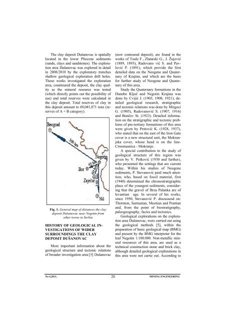
Fig. 1. General map of distances the clay<<strong>br</strong> />
deposit Dušanovac near Negotin from<<strong>br</strong> />
other towns in Serbia<<strong>br</strong> />
HISTORY OF GEOLOGICAL IN-<<strong>br</strong> />
VESTIGATIONS OF WIDER<<strong>br</strong> />
SURROUNDINGS THE CLAY<<strong>br</strong> />
DEPOSIT DUŠANOVAC<<strong>br</strong> />
More important information about the<<strong>br</strong> />
geological structure and tectonic relations<<strong>br</strong> />
of <strong>br</strong>oader investigation area [5] Dušanovac<<strong>br</strong> />
(now contoured deposit), are found in the<<strong>br</strong> />
works of Toule F., Zlatarski G., J. Žujović<<strong>br</strong> />
(1889, 1893), Radovano vić S. and Pavlović<<strong>br</strong> />
P. (1891), which provide the first<<strong>br</strong> />
detailed data on the Neogene and Quaternary<<strong>br</strong> />
of Krajina, and which are the basis<<strong>br</strong> />
for further study of Neogene and Quaternary<<strong>br</strong> />
of this area.<<strong>br</strong> />
Study the Quaternary formations in the<<strong>br</strong> />
Danube Ključ and Negotin Krajina was<<strong>br</strong> />
done by Cvijić J. (1903, 1908, 1921); detailed<<strong>br</strong> />
geological research, stratigraphic<<strong>br</strong> />
and tectonic relations was done by Mirgoci<<strong>br</strong> />
G. (1905), Radovanović S. (1907, 1916)<<strong>br</strong> />
and Bončev St. (1923). Detailed information<<strong>br</strong> />
on the stratigraphic and tectonic problems<<strong>br</strong> />
of pre-tertiary formations of this area<<strong>br</strong> />
were given by Petrović K. (1928, 1937),<<strong>br</strong> />
who stated that on the east of the Iron Gate<<strong>br</strong> />
cover is a new structural unit, the Mokranjska<<strong>br</strong> />
cover, whose head is on the line-<<strong>br</strong> />
Crnomasnica - Mokranje.<<strong>br</strong> />
A special contribution to the study of<<strong>br</strong> />
geological structure of this region was<<strong>br</strong> />
given by V. Petković (1930 and further),<<strong>br</strong> />
who presented the settings that are current<<strong>br</strong> />
today. Within his studies of Neogene<<strong>br</strong> />
sediments, P. Stevanović paid much attention,<<strong>br</strong> />
who, based on fossil material, first<<strong>br</strong> />
(1940) determined the chronostratigraphic<<strong>br</strong> />
place of the youngest sediments, considering<<strong>br</strong> />
that the gravel of Br<strong>za</strong> Palanka are of<<strong>br</strong> />
levantian age. In several of his works,<<strong>br</strong> />
since 1950, Stevanović P. discussesd on:<<strong>br</strong> />
Thornton, Sarmatian, Meotian and Pontian<<strong>br</strong> />
and, from the point of biostratigraphy,<<strong>br</strong> />
paleogeography, facies and tectonics.<<strong>br</strong> />
Geological explorations on the exploration<<strong>br</strong> />
area Dušanovac, were carried out using<<strong>br</strong> />
the geological methods [5], within the<<strong>br</strong> />
preparation of basic geological map (BMG)<<strong>br</strong> />
and present by the BMG interpreter for the<<strong>br</strong> />
leaf Negotin 1:100.000. Non-metallic mineral<<strong>br</strong> />
resources of this area, are used as a<<strong>br</strong> />
technical construction stone and <strong>br</strong>ick clay,<<strong>br</strong> />
although detailed geological explorations in<<strong>br</strong> />
this area were not carrie out. According to<<strong>br</strong> />
No 4,<strong>2011</strong>. 20<<strong>br</strong> />
MINING ENGINEERING
