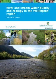
Air, land and water in the Wellington region - Greater Wellington ...
Air, land and water in the Wellington region - Greater Wellington ...
Air, land and water in the Wellington region - Greater Wellington ...

You also want an ePaper? Increase the reach of your titles
YUMPU automatically turns print PDFs into web optimized ePapers that Google loves.
How clean is <strong>the</strong> air?<br />
It’s not too bad where people live. Monitor<strong>in</strong>g between 2008<br />
<strong>and</strong> 2010 shows that air quality met national st<strong>and</strong>ards for<br />
<strong>the</strong> three key variables we monitor – f<strong>in</strong>e particulate matter<br />
(PM 10 ), nitrogen dioxide <strong>and</strong> carbon monoxide – <strong>in</strong> residential<br />
areas <strong>in</strong> both Lower Hutt <strong>and</strong> Upper Hutt. Levels of PM 10 <strong>in</strong><br />
Wa<strong>in</strong>uiomata were high on some cold <strong>and</strong> calm w<strong>in</strong>ter nights<br />
when many homes are heated with fires. Wood burner use <strong>in</strong><br />
<strong>the</strong> <strong>region</strong> is highest <strong>in</strong> Wa<strong>in</strong>uiomata (39% of homes) followed<br />
by Upper Hutt (36%) <strong>and</strong> Lower Hutt (27%).<br />
In <strong>the</strong> <strong>in</strong>dustrial area of Seaview,<br />
monitor<strong>in</strong>g from 2004 to 2007<br />
showed PM 10 concentrations were<br />
largely made up of mar<strong>in</strong>e aerosol<br />
<strong>and</strong> soils (both natural sources)<br />
with some z<strong>in</strong>c, lead <strong>and</strong> sulphate<br />
detected from <strong>in</strong>dustrial sources.<br />
Benzene <strong>and</strong> o<strong>the</strong>r volatile organics<br />
compounds met relevant guidel<strong>in</strong>es<br />
when measured<br />
Water resources – what’s be<strong>in</strong>g used <strong>and</strong> how much is left?<br />
Most of <strong>the</strong> fresh<strong>water</strong> used <strong>in</strong> this sub-<strong>region</strong> goes to public <strong>water</strong> supply<br />
– <strong>the</strong>re’s very little <strong>water</strong> left to allocate from major rivers or ground<strong>water</strong><br />
aquifers. As at <strong>the</strong> end of 2010, <strong>water</strong> allocated through resource consents<br />
was 114.6 millions cubic metres per year – 94% of this went to public supply,<br />
<strong>and</strong> <strong>the</strong> rest to irrigation (ma<strong>in</strong>ly golf courses) <strong>and</strong> <strong>in</strong>dustry.<br />
The Hutt River near Manor Park. The Hutt,<br />
Wa<strong>in</strong>uiomata <strong>and</strong> Orongorongo rivers are <strong>the</strong> source<br />
of 70% of <strong>the</strong> public supply, while <strong>the</strong> rema<strong>in</strong>der<br />
comes from ground<strong>water</strong> aquifers. The upper<br />
reaches of <strong>the</strong>se rivers are highly allocated – dur<strong>in</strong>g<br />
times of low flow, up to 40–70% of <strong>water</strong> <strong>in</strong> <strong>the</strong><br />
rivers can potentially be removed. Prolonged low<br />
flows are known to contribute to <strong>water</strong> quality<br />
issues, particularly nuisance algae growth<br />
Between 1990 <strong>and</strong> 2010, <strong>water</strong> allocation <strong>in</strong>creased by about 10%. This<br />
largely reflects actual <strong>and</strong> anticipated population growth <strong>in</strong> <strong>the</strong> cities.<br />
Annual extremes <strong>in</strong> m<strong>in</strong>imum summer ra<strong>in</strong>fall <strong>and</strong> river flows have not<br />
changed significantly over <strong>the</strong> past 30 to 40 years. Ground<strong>water</strong> levels<br />
also appear to be stable; recent analysis of data from a well <strong>in</strong> each of<br />
<strong>the</strong> Lower Hutt <strong>and</strong> Upper Hutt aquifers showed no trend for <strong>the</strong> period<br />
1994–2010. The Lower Hutt aquifer, <strong>the</strong> source of 95% of <strong>the</strong> ground<strong>water</strong><br />
contribution to public supply, is fully allocated.<br />
How healthy are <strong>the</strong> Parangarahu Lakes?<br />
The ecological condition of Lake Kohangapiripiri<br />
<strong>and</strong> Lake Kohangatera (commonly referred to as <strong>the</strong><br />
Pencarrow lakes) was rated ‘high’ <strong>and</strong> ‘excellent’,<br />
respectively, <strong>in</strong> aquatic vegetation surveys carried out<br />
<strong>in</strong> 2011. Lake Kohangatera was ranked 10th best <strong>in</strong><br />
New Zea<strong>l<strong>and</strong></strong> <strong>and</strong> noted as an outst<strong>and</strong><strong>in</strong>g example<br />
of a low<strong>l<strong>and</strong></strong> lagoon system.<br />
#<br />
Makara Stream<br />
Well<strong>in</strong>gton<br />
Karori Stream<br />
#<br />
N<br />
Free vehicle emissions<br />
check at Westpac<br />
Stadium (March 2006)<br />
<strong>in</strong> Well<strong>in</strong>gton city<br />
offered as part of <strong>the</strong><br />
publicity <strong>and</strong> education<br />
campaign runn<strong>in</strong>g <strong>in</strong><br />
t<strong>and</strong>em with <strong>the</strong> onroad<br />
vehicle emissions<br />
test<strong>in</strong>g study<br />
<strong>Air</strong> quality is also pretty good along roads with heavy traffic<br />
flows – national st<strong>and</strong>ards were not breached at any sites we<br />
monitored (<strong>in</strong>clud<strong>in</strong>g <strong>the</strong> now-closed sites at Mell<strong>in</strong>g (SH2)<br />
<strong>and</strong> Ngauranga Gorge). At our Well<strong>in</strong>gton CBD monitor<strong>in</strong>g<br />
site (Victoria Street) peak levels of PM 10 <strong>and</strong> carbon<br />
monoxide decl<strong>in</strong>ed over <strong>the</strong> period 2004 to 2010, despite<br />
high traffic volumes. Peak nitrogen dioxide levels have also<br />
decl<strong>in</strong>ed s<strong>in</strong>ce 2005.<br />
Lake Kohangatera<br />
What’s <strong>the</strong> condition of Well<strong>in</strong>gton Harbour?<br />
Well<strong>in</strong>gton Harbour acts as a dra<strong>in</strong>age ‘s<strong>in</strong>k’ for <strong>the</strong> entire Hutt Valley <strong>and</strong> much of<br />
Well<strong>in</strong>gton city, so it is no surprise that contam<strong>in</strong>ants from urban storm<strong>water</strong> <strong>and</strong> o<strong>the</strong>r<br />
<strong>l<strong>and</strong></strong> uses accumulate <strong>in</strong> <strong>the</strong> harbour sediments. In 2006 we tested <strong>the</strong>se sediments at 17<br />
locations <strong>and</strong> found levels of some contam<strong>in</strong>ants were above ‘early warn<strong>in</strong>g’ guidel<strong>in</strong>es<br />
for aquatic health – <strong>in</strong>clud<strong>in</strong>g lead, copper, z<strong>in</strong>c, mercury <strong>and</strong> polycyclic aromatic<br />
hydrocarbons (PAHs). Concentrations of <strong>the</strong> long-banned <strong>in</strong>secticide DDT were also<br />
elevated – highlight<strong>in</strong>g how long past practices can cont<strong>in</strong>ue to affect <strong>the</strong> environment.<br />
Contam<strong>in</strong>ant levels are highest <strong>in</strong> <strong>the</strong> sediments of <strong>the</strong> <strong>in</strong>ner Lambton bas<strong>in</strong> <strong>and</strong> Evans<br />
Bay, a clear <strong>in</strong>dication that nearby urban storm<strong>water</strong> outfalls are <strong>the</strong> ma<strong>in</strong> source of<br />
contam<strong>in</strong>ation. In late 2011 we completed a second survey so we’ll soon have a better<br />
idea whe<strong>the</strong>r this contam<strong>in</strong>ation is gett<strong>in</strong>g any worse, <strong>and</strong> what it might mean for <strong>the</strong><br />
animals liv<strong>in</strong>g <strong>in</strong> <strong>the</strong> harbour sediments.<br />
Ngauranga Stream<br />
Kaiwharawhara<br />
Stream<br />
WELLINGTON<br />
#<br />
Kaiwharawhara Stream<br />
! !!<br />
! ! !<br />
!<br />
!!<br />
!!! !<br />
! !! !<br />
Evans Bay<br />
! !!!<br />
Well<strong>in</strong>gton Harbour<br />
#<br />
#<br />
#<br />
! !!<br />
#<br />
Hutt Riv<br />
Lo<br />
Hu<br />
!!!<br />
Eastbourne<br />
!<br />
!<br />
Lake Kohangapiripiri<br />
Waiwhetu<br />
Lake Kohangatera<br />
0 10 Kilometres<br />
Petone<br />
Hutt River<br />
Eastbourne<br />
Total lead concentrations <strong>in</strong> Well<strong>in</strong>gton Harbour<br />
sediments. The length of <strong>the</strong> bars is proportional to <strong>the</strong><br />
concentrations present. Bars coloured orange <strong>in</strong>dicate<br />
levels above ‘early warn<strong>in</strong>g’ guidel<strong>in</strong>es<br />
W