SPOrT FISHIng regulaTIOnS - Oregon Department of Fish and Wildlife
SPOrT FISHIng regulaTIOnS - Oregon Department of Fish and Wildlife
SPOrT FISHIng regulaTIOnS - Oregon Department of Fish and Wildlife

Create successful ePaper yourself
Turn your PDF publications into a flip-book with our unique Google optimized e-Paper software.
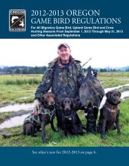
2013 OregOn <strong>SPOrT</strong><br />
<strong>FISHIng</strong> <strong>regulaTIOnS</strong><br />
www.dfw.state.or.us<br />
ODFW Headquarters moving in Summer <strong>of</strong> 2013! See page 45 for more details.<br />
Online License Sales at: www.dfw.state.or.us/online_license_sales/index.asp<br />
Scanable QR codes on page 21, <strong>and</strong> the beginning <strong>of</strong> each anging zone, take<br />
you to the regulations update webpages.<br />
Turn in your Combined Angling Tag for a chance to WIN a<br />
<strong>Fish</strong> Rite 16’ aluminum drift boat package<br />
(See Page 22 for details.)
BEHOLD. THE LONGEST<br />
SPLIT SECOND<br />
IN THE UNIVERSE.<br />
The big one? Or the one that got away?<br />
What you do with your wrist in the next fraction <strong>of</strong> a second decides it.<br />
Tick, tock.<br />
ONLY WHOLESALE SPORTS IS AS OBSESSED WITH FISHING AS YOU ARE.<br />
AND WE HAVE THE PEOPLE AND GEAR TO PROVE IT.<br />
FIND YOUR LOCAL STORE AT WHOLESALESPORTS.COM
Page<br />
How To Use This Guide .................................................... 4<br />
General (Statewide) Regulations<br />
Licenses, Tags <strong>and</strong> Permits ............................................... 5<br />
Catch <strong>and</strong> Possession Limits ............................................. 8<br />
Definitions .......................................................................... 8<br />
Gear <strong>and</strong> Bait Restrictions ............................................... 10<br />
General Restrictions ........................................................ 10<br />
Hook <strong>and</strong> Weight Regulations ......................................... 11<br />
Angling <strong>and</strong> Harvest Methods, Hours <strong>and</strong> Restrictions ... 11<br />
<strong>Fish</strong> District Boundaries <strong>and</strong> Contact Numbers ............... 12<br />
Northwest Zone<br />
Maps .................................................................................24<br />
Zone <strong>and</strong> Special Regulations ..........................................26<br />
Southwest Zone<br />
Maps .................................................................................36<br />
Zone <strong>and</strong> Special Regulations ..........................................38<br />
Willamette Zone<br />
Maps .................................................................................46<br />
Zone <strong>and</strong> Special Regulations ..........................................48<br />
Central Zone<br />
Maps .................................................................................62<br />
Zone <strong>and</strong> Special Regulations ..........................................64<br />
Northeast Zone<br />
Maps .................................................................................70<br />
Zone <strong>and</strong> Special Regulations ..........................................72<br />
Southeast Zone<br />
Maps .................................................................................76<br />
Zone <strong>and</strong> Special Regulations ..........................................81<br />
Snake River Zone<br />
Maps .................................................................................88<br />
Zone <strong>and</strong> Special Regulations ..........................................90<br />
English<br />
This book includes important information about <strong>Oregon</strong> fishing laws. You can<br />
be fined or jailed if you violate these laws. Please have an English reader who<br />
fully underst<strong>and</strong>s this information <strong>and</strong> can accurately interpret the legal<br />
meaning <strong>of</strong> the regulations in this book explain them to you.<br />
Spanish<br />
Este libro incluye información importante sobre las leyes de pesca de <strong>Oregon</strong>.<br />
Puede recibir multas o ir a la cárcel si infringe esas leyes. Haga que un lector<br />
angloparlante que entienda cabalmente esta información y pueda interpretar<br />
con exactitud el alcance legal de las leyes expresadas en este libro, se las<br />
explique.<br />
Traditional Chinese<br />
本書包括有關俄勒岡州漁業法的重要資訊。如果違反這些法律,將會被處以罰款<br />
或監禁。請讓完全瞭解這些資訊並能夠準確詮釋本書條例法律含義的英文讀者為<br />
你解釋這些資訊。<br />
Text highlighted in blue is new or changed from 2012<br />
TABLE OF CONTENTS<br />
REGULATIONS MAY CHANGE<br />
Page<br />
Columbia Zone<br />
Maps .................................................................................92<br />
Zone <strong>and</strong> Special Regulations ..........................................96<br />
Marine Zone<br />
Maps (including Marine Gardens) ...................................101<br />
Zone <strong>and</strong> Special Regulations ........................................104<br />
Other Information<br />
Angler Rights <strong>and</strong> Access Information .............................15<br />
Angling Mail Order Application ........................................100<br />
Angling Zones Map ...........................................................13<br />
Aquatic Invasive Species Prevention Permit Info .............58<br />
Bail Schedules ................................................................103<br />
Brook <strong>and</strong> Bull Trout Identification ....................................75<br />
Clam <strong>and</strong> Crab Identification ...........................................109<br />
Director’s Message .............................................................2<br />
Disabilities Hunting <strong>and</strong> <strong>Fish</strong>ing Permit Information .........87<br />
Ethics, Freshwater Angling ...............................................16<br />
Fin-clip <strong>and</strong> Salmon Identification .....................................17<br />
Find Great <strong>Fish</strong>ing In <strong>Oregon</strong> ...........................................14<br />
<strong>Fish</strong> Measurements ..........................................................21<br />
Free <strong>Fish</strong>ing Weekend ......................................................86<br />
Harvest Card Instructions .................................................22<br />
Health Advisories ..............................................................20<br />
Introduced <strong>Fish</strong> Species Identification ..............................19<br />
Invasive (Harmful) Species Alert .......................................69<br />
Native <strong>Fish</strong> Species Identification .....................................18<br />
Rockfish Species Identification .......................................108<br />
Scanable QR Codes take you to Regulations Updates<br />
found on ODFW’s Website ............................................21<br />
Stream Location <strong>and</strong> Species Codes ................................23<br />
Tiger Trout Description .....................................................35<br />
Transfer Record Form .......................................................91<br />
<strong>Wildlife</strong> Area Parking Permit Program Info .......................13<br />
Russian<br />
Данная книга содержит важную информацию о законах штата Орегон о<br />
рыбной ловле. За нарушение этих законов Вы можете быть<br />
оштрафованы или осуждены. Пожалуйста, убедитесь, что Вы полностью<br />
понимаете информацию правового характера, изложенную в этой книге.<br />
Ukrainian<br />
Ця книга містить важливу інформацію про закони про риболовлю в штаті<br />
Орегон. Якщо Ви порушите ці закони, з Вас можуть стягнути штраф або<br />
посадити у вязницю.Будь ласка, попросіть людину, яка добре розуміє<br />
англійську і може точно передати юридичне значення цієї книги, прочитати<br />
і пояснити Вам ці правила.<br />
Vietnamese<br />
Quyển sách này bao gồm những thông tin quan trọng về luật đi săn của<br />
<strong>Oregon</strong>. Quý vị có thể bị phạt tiền hoặc phạt tù nếu vi phạm những luật này.<br />
Hãy nhờ một người thạo tiếng Anh, người có thể hoàn toàn hiểu những thông<br />
tin này và có thể giải thích chính xác ý nghĩa luật pháp của các quy chế nêu<br />
trong sách, giải thích cho quý vị.<br />
Call the <strong>Department</strong> <strong>of</strong> <strong>Fish</strong> <strong>and</strong> <strong>Wildlife</strong> at 503-947-6000 for up-to-date information about fishing <strong>and</strong> regulations<br />
changes or visit us on the Internet at: www.dfw.state.or.us. This Internet site also features a weekly recreation report,<br />
the latest <strong>Department</strong> news releases <strong>and</strong> much more.<br />
PLEASE HELP US IMPROVE THE NEXT EDITION<br />
Every year we try to make the contents <strong>and</strong> layout <strong>of</strong> this booklet as clear <strong>and</strong> user friendly as possible. If you have any<br />
suggestions to help us improve the presentation <strong>of</strong> information, please send them to:<br />
<strong>Oregon</strong> <strong>Department</strong> <strong>of</strong> <strong>Fish</strong> <strong>and</strong> <strong>Wildlife</strong><br />
<strong>Fish</strong> Division - Angling Regulations Coordinator<br />
3406 Cherry Avenue NE<br />
Salem, OR 97303<br />
<strong>Oregon</strong> <strong>Department</strong> <strong>of</strong> <strong>Fish</strong> <strong>and</strong> <strong>Wildlife</strong> 1<br />
STATEWIDE<br />
Pages 4 - 23<br />
NORTHWEST<br />
Pages 24 - 35<br />
SOUTHWEST<br />
Pages 36 - 45<br />
WILLAMETTE<br />
Pages 46 - 58<br />
CENTRAL<br />
Pages 62 - 68<br />
NORTHEAST<br />
Pages 70 - 75<br />
SOUTHEAST<br />
Pages 76 - 86<br />
SNAKE RIVER<br />
Pages 88 - 91<br />
COLUMBIA<br />
Pages 92 - 99<br />
MARINE<br />
Pages 101 - 109
2<br />
Take Someone <strong>Fish</strong>ing In 2013<br />
I’m excited about fishing in<br />
<strong>Oregon</strong>. Whether you’re<br />
hooking salmon, steelhead,<br />
trout, bass, halibut or tuna,<br />
casting from the bank or a<br />
20-foot sled, or fishing for the<br />
freezer or for fun, <strong>Oregon</strong>ians<br />
have some <strong>of</strong> the most diverse<br />
<strong>and</strong> dynamic fishing<br />
opportunities <strong>of</strong> any state in the<br />
country.<br />
At ODFW, we’re encouraging more people to be a part<br />
<strong>of</strong> <strong>Oregon</strong>’s angling community. One <strong>of</strong> our priorities in<br />
recent years has been to encourage more people to<br />
start <strong>and</strong> continue fishing. Recruiting <strong>and</strong> retaining<br />
anglers is not a new idea, but in the past few years<br />
we’ve developed new products <strong>and</strong> programs that are<br />
more strategic, more efficient <strong>and</strong>, we hope, more<br />
successful. For example, we’ve:<br />
• Re-vamped our Youth <strong>Fish</strong>ing Events to include the<br />
entire family. The Family <strong>Fish</strong>ing program<br />
recognizes that kids don’t take themselves fishing,<br />
parents take kids fishing.<br />
• Increased recruitment <strong>of</strong> adult anglers (because<br />
you shouldn’t have to “have kids” to learn how to<br />
fish) through more fishing, clamming <strong>and</strong> crabbing<br />
classes, <strong>and</strong> through how-to publications to help<br />
them get started.<br />
• Moved Free <strong>Fish</strong>ing Weekend to the full first<br />
weekend in June so it aligns with <strong>Oregon</strong> State<br />
Parks Day, National <strong>Fish</strong>ing <strong>and</strong> Boating Week,<br />
National Trails day, <strong>and</strong> other activities to<br />
encourage outdoor recreation. This will help us<br />
stretch our marketing resources by partnering with<br />
other agencies, <strong>and</strong> to remind people to take a rod<br />
with them when they go camping, hiking or boating.<br />
• Partnered with industry <strong>and</strong> retailers to promote<br />
fisheries like Columbia River steelhead or events<br />
like Free <strong>Fish</strong>ing Weekend.<br />
• Focused on fishing close to home. Researchers<br />
have found the lack <strong>of</strong> time is the number one<br />
barrier to fishing, so why not remind folks they don’t<br />
have to travel far to go fishing? Our popular 50<br />
Places to <strong>Fish</strong> . . . series lists great places to go<br />
fishing within 60 or 90 minutes <strong>of</strong> Portl<strong>and</strong>, Bend,<br />
Medford <strong>and</strong> Roseburg. If this list doesn’t include<br />
your neighborhood, we’ve got more on the way.<br />
<strong>Oregon</strong> <strong>Department</strong> <strong>of</strong> <strong>Fish</strong> <strong>and</strong> <strong>Wildlife</strong><br />
• Made it easier to find the places we’ve stocked<br />
trout. We stock over 7 million trout each year <strong>and</strong><br />
new Google maps make it easy for anglers to get to<br />
where the fish are.<br />
At the same time we’re encouraging <strong>Oregon</strong>ians to get<br />
out <strong>and</strong> fish, we’re putting boots on the ground to make<br />
sure they have great places to go fishing. Many <strong>of</strong> these<br />
projects received support from the <strong>Fish</strong> Restoration <strong>and</strong><br />
Enhancement Program, funded by a surcharge on<br />
fishing licenses. In 2012, the program spent $689,000<br />
on 17 different projects to improve fishing access <strong>and</strong><br />
opportunities. These included improvements to local<br />
fishing ponds in Grant, Multnomah, Union, Tillamook,<br />
Jefferson <strong>and</strong> Marion counties – five <strong>of</strong> these projects<br />
provided ADA approved access for anglers with<br />
disabilities.<br />
But as committed as we are to recruiting <strong>and</strong> retaining<br />
anglers, we know the best way to get people out fishing<br />
is through other anglers. So what can you do?<br />
• TAKE SOMEONE FISHING. It can be a buddy, a<br />
spouse, a child, a new member <strong>of</strong> your fishing club.<br />
Your passion <strong>and</strong> enthusiasm for fishing is the most<br />
effective recruitment tool we have.<br />
• Consider becoming an Angling Education<br />
Instructor. Each year our volunteer instructors teach<br />
thous<strong>and</strong>s <strong>of</strong> youths <strong>and</strong> adults how to bait a hook,<br />
cast a line <strong>and</strong> l<strong>and</strong> a fish.<br />
• Volunteer to help improve a fishery by helping to<br />
restore habitat or build a new dock. Join the<br />
hundreds <strong>of</strong> volunteers in the Salmon Trout<br />
Enhancement Program (STEP) who each year<br />
donate approximately $3 million in labor to help<br />
restore <strong>and</strong> enhance fishing in <strong>Oregon</strong>.<br />
I hope you find great fishing in 2013. Let’s continue to<br />
work together to build great fisheries <strong>and</strong> to get some<br />
new faces on the water.<br />
Tight lines,<br />
Roy Elicker, Director<br />
All trout, salmon <strong>and</strong> steelhead that are released must be unharmed <strong>and</strong> should not<br />
be removed from the water.
OREGON FISHING REGS 2013.indd 1 10/25/12 11:03 AM<br />
BEST TIRE VALUE PROMISE<br />
FREE WITH EVERY TIRE PURCHASE*<br />
Peace <strong>of</strong> Mind<br />
Tire Protection<br />
Whatever the road throws at<br />
you, from potholes to nails - any<br />
road hazard, we guarantee you’re<br />
protected<br />
*Light Truck <strong>and</strong> Passenger Car Tires Only<br />
Lifetime Tire &<br />
Mileage Care<br />
To help you get more miles out<br />
<strong>of</strong> your tires <strong>and</strong> more miles per<br />
gallon <strong>of</strong> gas<br />
OVER 435 LOCATIONS TO SERVE YOU<br />
visit www.LesSchwab.com to find the location nearest you<br />
<strong>Oregon</strong> <strong>Department</strong> <strong>of</strong> <strong>Fish</strong> <strong>and</strong> <strong>Wildlife</strong> 3
4<br />
ODFW on the Internet:<br />
www.dfw.state.or.us<br />
E-mail us at:<br />
odfw.info@state.or.us<br />
ODFW Headquarters:<br />
503-947-6000<br />
or<br />
In-state toll-free:<br />
800-720-6339<br />
Information & Education:<br />
503-947-6002<br />
<strong>Fish</strong> Division:<br />
503-947-6201<br />
Licensing Services:<br />
503-947-6100<br />
Marine Programs:<br />
541-867-4741<br />
<strong>Wildlife</strong> Violations:<br />
1-800-452-7888<br />
The information in this<br />
booklet will be furnished in<br />
alternate format for people<br />
with disabilities, if needed.<br />
Please call 503-947-6002<br />
or e-mail to:<br />
odfw.info@state.or.us to<br />
request an alternate format.<br />
ODFW prohibits discrimination<br />
on the basis <strong>of</strong> race, color,<br />
national origin, age, sex or<br />
disability. If you believe you<br />
have been discriminated<br />
against in any ODFW program,<br />
activity or facility, or if you<br />
desire further information,<br />
please contact: Deputy<br />
Director, <strong>Fish</strong> & <strong>Wildlife</strong><br />
Programs, ODFW, 3406<br />
Cherry Ave. NE, Salem, OR<br />
97303-4924, or call 503-947-<br />
6000, or write to the Civil<br />
Rights Coordinator for Public<br />
Access, U.S. <strong>Fish</strong> <strong>and</strong><br />
<strong>Wildlife</strong> Service<br />
at: Mail Stop: WSFR-4020<br />
4401 N. Fairfax Drive,<br />
Arlington, VA 22203.<br />
ODFW allows appropriate<br />
advertising in this booklet to<br />
help <strong>of</strong>fset the cost <strong>of</strong> printing.<br />
ODFW neither endorses<br />
products or services listed nor<br />
accepts any liability arising<br />
from the use <strong>of</strong> products or<br />
services listed.<br />
Front Cover, upper photo:<br />
Twin Lakes near Halfway,<br />
<strong>Oregon</strong>.<br />
OregOn<br />
<strong>Department</strong> OF <strong>Fish</strong> anD WilDliFe<br />
REGIONAL OFFICES<br />
High Desert<br />
61374 Parrell Rd<br />
Bend, OR 97702<br />
541-388-6363<br />
Northeast<br />
107 20th Street<br />
La Gr<strong>and</strong>e, OR 97850<br />
541-963-2138<br />
Northwest<br />
17330 SE Evelyn Street<br />
Clackamas, OR 97015<br />
971-673-6000<br />
Southwest<br />
4192 N Umpqua Hwy<br />
Roseburg, OR 97470<br />
541-440-3353<br />
Roy Elicker, Director<br />
Headquarters Office<br />
3406 Cherry Ave. NE<br />
Salem, OR 97303-4924<br />
503-947-6044<br />
This guide contains information you need to<br />
legally fish throughout <strong>Oregon</strong>.<br />
Note: Regulations may change on short notice<br />
during the year or season. If you want the latest<br />
on regulations or other fishing information, you<br />
may call the <strong>Oregon</strong> <strong>Department</strong> <strong>of</strong> <strong>Fish</strong> <strong>and</strong><br />
<strong>Wildlife</strong> at 503-947-6000 during normal businss<br />
hours or visit us at our Internet site: www.<br />
dfw.state.or.us.<br />
<strong>Oregon</strong> has three types <strong>of</strong> regulations for all<br />
fishing waters:<br />
• General Regulations – Include information<br />
on licenses, tags/harvest cards,<br />
permits, catch <strong>and</strong> possession limits, definitions,<br />
gear <strong>and</strong> bait restrictions, <strong>and</strong> harvest<br />
methods <strong>and</strong> hours.<br />
• Zone Regulations – Apply to entire geographical<br />
areas. There are nine zones in<br />
<strong>Oregon</strong>. See page 13.<br />
• Special Regulations – Apply to specific<br />
bodies <strong>of</strong> water or portions <strong>of</strong> water within<br />
a zone. If a body <strong>of</strong> water or specific references<br />
to species, catch limits, length limits,<br />
seasons, or other specifications are not<br />
made in the Special Regulations for the<br />
zone, then Zone Regulations apply.<br />
Before you fish any body <strong>of</strong> water, always:<br />
1. Check the Special Regulations first. If the<br />
waterbody you intend to fish is listed, then<br />
follow the Special Regulations but also<br />
check in the Zone Regulations for additional<br />
regulations which apply.<br />
2. If a body <strong>of</strong> water is not listed in the Special<br />
Regulations for the zone, check the Zone<br />
Regulations.<br />
3. Regardless <strong>of</strong> where you fish, be certain to<br />
review <strong>and</strong> follow the General Regulations.<br />
Let’s try an example. You want to go fishing at<br />
Crescent Lake in Central <strong>Oregon</strong>.<br />
HOW TO USE THIS GUIDE<br />
<strong>Oregon</strong> <strong>Department</strong> <strong>of</strong> <strong>Fish</strong> <strong>and</strong> <strong>Wildlife</strong><br />
OREGON FISH AND WILDLIFE COMMISSION<br />
Bobby Levy (Chair) ........................................Echo<br />
Michael Finley (Vice-Chair) ..................... Medford<br />
Holly Akenson .............................................Joseph<br />
Laura Anderson ........................................Newport<br />
Bob Webber ..........................................Port Orford<br />
Gregory J. Wolley .....................................Portl<strong>and</strong><br />
1. First, determine the zone where Crescent<br />
Lake is located. You locate the lake on the<br />
Central Zone map on page 63.<br />
2. Next, determine if there are any special fishing<br />
regulations for Crescent Lake.<br />
• You find Crescent Lake listed on page 65.<br />
• Crescent Lake has a trout daily catch limit<br />
that may include only one lake trout that<br />
must be at least 30 inches in length.<br />
• You then turn back to page 64 <strong>and</strong> review<br />
the Zone Regulations for the Central<br />
Zone.<br />
• By reading the Zone Regulations, you<br />
learn you may catch <strong>and</strong> keep only five<br />
trout per day with a minimum size limit <strong>of</strong><br />
8 inches, <strong>of</strong> which only one may be over<br />
20 inches.<br />
• Thus, if you catch <strong>and</strong> keep one lake<br />
trout that is at least 30 inches in length,<br />
you may still catch four other trout in<br />
Crescent Lake that are 20 inches or less.<br />
3. Can you fish Crescent Lake all year?<br />
• On page 64,<br />
you note that the season<br />
column states lakes in the Central Zone<br />
are open to fishing for trout all year.<br />
4. What do you need to legally catch a trout in<br />
Crescent Lake?<br />
• You note that there are no other restrictions<br />
listed in the Special or Zone<br />
Regulations.<br />
• So you turn to pages 5-12 to review the<br />
General Regulations.<br />
5. In the General Regulations you learn:<br />
• You need an angling license;<br />
• You may not use live fish to catch fish in<br />
Crescent Lake; <strong>and</strong><br />
• You may only use one fishing rod, except<br />
by permit.<br />
(Continued on next page.)<br />
Text highlighted in blue is new or changed from 2012
Continue to thoroughly read the General<br />
Regulations for other information regarding<br />
harvest methods <strong>and</strong> hours.<br />
Note: Text highlighted in blue is new or<br />
changed from last year’s guide.<br />
Other Information - Boats <strong>and</strong> Motors:<br />
Only those boating regulations restricting<br />
sport fishing are listed in this booklet.<br />
Instructions:<br />
1. Read the Special Regulations for the zone in which you will be fishing. Special Regulations apply to specific bodies <strong>of</strong> water or<br />
portions <strong>of</strong> water within a zone. If specific references to a body <strong>of</strong> water, species, catch limits, length limits, seasons, or other specifications<br />
are not made in the Special Regulations for this zone, then Zone Regulations apply.<br />
2. Read the section entitled Regulations for this zone for the zone in which you will be fishing.<br />
3. Always read the following General Regulations, which apply to all zones, for information about licenses; tags/harvest cards, <strong>and</strong><br />
permits; definitions; catch <strong>and</strong> possession limits; gear <strong>and</strong> bait restrictions; <strong>and</strong> harvest methods <strong>and</strong> hours, before going fishing.<br />
4. Emergency or permanent rules adopted since these rules were printed supersede these regulations. Anglers may call ODFW headquarters<br />
or regional <strong>of</strong>fices at the numbers on page 4 <strong>of</strong> these regulations, or check the ODFW web site, www.dfw.state.or.us for<br />
these rules.<br />
Licenses, Tags <strong>and</strong> Permits:<br />
1. Licenses, tags <strong>and</strong> permits can be obtained at license agents throughout the state <strong>of</strong> <strong>Oregon</strong>, via the Internet (www.dfw.state.or.us/<br />
online_license_sales/index.asp), or through the headquarters <strong>of</strong>fice in Salem by mail, fax, or in person. Licenses <strong>and</strong> tags may be<br />
purchased for you by a family member or friend. See page 100 for more about purchasing licenses.<br />
2. State <strong>and</strong> federal laws require a Social Security Number to obtain most hunting <strong>and</strong> fishing licenses.<br />
3. All persons 14 years or older must have in possession a valid <strong>Oregon</strong> angling license to angle for or take or assist another in angling<br />
for or taking <strong>of</strong> any fish for personal use, except:<br />
• During “Free <strong>Fish</strong>ing Weekend” (June 1-2, 2013) when no license or tag is required;<br />
• When taking smelt, crayfish, or bullfrogs;<br />
• <strong>Oregon</strong> resident l<strong>and</strong>owners <strong>and</strong> members <strong>of</strong> their immediate family may angle for fish on l<strong>and</strong> they own <strong>and</strong> reside upon;<br />
• When angling in the Pacific Ocean within 3 miles <strong>of</strong> shore between Cape Falcon, <strong>Oregon</strong> <strong>and</strong> Leadbetter Point, Washington either<br />
a resident Washington license or an <strong>Oregon</strong> license is valid. Persons other than Washington residents must have a valid <strong>Oregon</strong><br />
license to l<strong>and</strong> fish in <strong>Oregon</strong> which were caught in the ocean.<br />
4. All persons 14 years or older must have in possession a valid <strong>Oregon</strong> shellfish license to take any shellfish for personal use, except:<br />
• During “Free <strong>Fish</strong>ing Weekend” ( June 1-2, 2013) when no license is required;<br />
• When taking crayfish;<br />
• <strong>Oregon</strong> resident l<strong>and</strong>owners <strong>and</strong> members <strong>of</strong> their immediate family may take shellfish on l<strong>and</strong> they own <strong>and</strong> reside upon.<br />
5. All anglers, regardless <strong>of</strong> age, need in possession a valid Combined Angling Tag to angle for salmon, steelhead, sturgeon or Pacific<br />
halibut. Anglers may purchase only one Combined Angling Tag (authorizing harvest <strong>of</strong> 20 salmon or steelhead) per year. Any salmon<br />
or steelhead may be recorded on the Combined Angling Tag.<br />
6. Anglers may purchase multiple Hatchery Harvest Tags to record adipose or otherwise fin-clipped salmon or adipose fin-clipped steelhead<br />
harvested, in lieu <strong>of</strong> recording those fish on the Combined Angling Tag. Only adipose or otherwise fin-clipped salmon or adipose<br />
fin-clipped steelhead may be recorded on the Hatchery Harvest Tag.<br />
Licenses, Tags <strong>and</strong> Permits - <strong>Fish</strong> Fee Qualifications<br />
Resident Annual Licenses:<br />
Angling License*<br />
$33.00<br />
Combination Angling/Hunting License* $58.00<br />
Juvenile Angling License*<br />
(14 through 17 years <strong>of</strong> age)<br />
$9.00<br />
Youth Under 14 Angling License* Free<br />
Senior Citizen Combination<br />
Angling/Hunting License*<br />
$25.50<br />
Senior Citizen Angling License* $15.00<br />
• See also: definition <strong>of</strong> “Resident” at top <strong>of</strong> page 9.<br />
• A person who has resided in <strong>Oregon</strong> for at least 6 consecutive months<br />
immediately prior to the date <strong>of</strong> making application for a license, tag or<br />
permit.<br />
• A Youth Under 14 Angling License is valid only for youths age 13 or<br />
younger. Youths wishing to continue angling after turning age 14 must<br />
first purchase a Juvenile Angling License prior to angling.<br />
Note: Angling licenses may be exchanged for Combination licenses or<br />
Sports Pac licenses within 90 days from original purchase.<br />
• Must be at least 70 years <strong>of</strong> age <strong>and</strong> have lived in <strong>Oregon</strong> for more<br />
than 5 years <strong>and</strong> for at least 6 consecutive months immediately before<br />
buying a license.<br />
• Available from license agents.<br />
Sports Pac License* $164.75 • Includes: combination angling/hunting license; shellfish license;<br />
combined angling tag, spring turkey, cougar, general or controlled<br />
bear tag, elk <strong>and</strong> deer tags; upl<strong>and</strong> bird <strong>and</strong> waterfowl validations.<br />
Juvenile Sports Pac License*<br />
resident only, age 12 through 17)<br />
Duplicate License or Tag<br />
HOW TO USE THIS GUIDE (continued) STATEWIDE<br />
General Boating Regulations:<br />
Information on general boating regulations<br />
can be obtained from the web at: www.<br />
boatoregon.com or <strong>Oregon</strong> State Marine<br />
Board, 435 Commercial Street NE, Salem,<br />
OR 97301, 503-378-8587, <strong>and</strong> Marine<br />
Board agents.<br />
GENERAL (STATEWIDE) REGULATIONS<br />
$52.00 • Includes: combination angling/hunting license; shellfish license;<br />
combined angling tag, spring turkey, cougar, general or controlled<br />
bear tag, elk <strong>and</strong> deer tags; upl<strong>and</strong> bird <strong>and</strong> waterfowl validations.<br />
$17.00<br />
or less<br />
Guides <strong>and</strong> Packers: Information on<br />
guides <strong>and</strong> packers can be obtained<br />
from <strong>Oregon</strong> State Marine Board, 435<br />
Commercial Street NE, Salem, OR 97301,<br />
503-378-8587.<br />
Travel Information: <strong>Oregon</strong> Tourism,<br />
Telephone: 1-800-547-7842.<br />
• Duplicate tags available only at ODFW <strong>of</strong>fices.<br />
• Duplicate tags are $17.00 or their original cost, whichever is less.<br />
Text highlighted in blue is new or changed from 2012 * To obtain mail order licenses <strong>and</strong>/or tags see page 100.<br />
<strong>Oregon</strong> <strong>Department</strong> <strong>of</strong> <strong>Fish</strong> <strong>and</strong> <strong>Wildlife</strong> 5<br />
Pages 4 - 23
6<br />
Licenses, Tags <strong>and</strong> Permits - <strong>Fish</strong> Fee Qualifications<br />
Resident Permanent Licenses:<br />
Resident Disabled Veteran<br />
Angling <strong>and</strong> Hunting License<br />
Resident Pioneer Angling <strong>and</strong> Hunting<br />
Permanent License<br />
GENERAL (STATEWIDE) REGULATIONS<br />
Free • Available only at ODFW <strong>of</strong>fices.<br />
• Must have resided in <strong>Oregon</strong> for at least 6 consecutive months<br />
immediately before applying for a license <strong>and</strong> provide written<br />
certification <strong>of</strong> at least 25 percent disability from Veterans Affairs or a<br />
branch <strong>of</strong> the Armed Forces.<br />
Free • Available only at ODFW <strong>of</strong>fices.<br />
• Must be at least 65 years <strong>of</strong> age <strong>and</strong> have lived in <strong>Oregon</strong> for at least<br />
50 years <strong>and</strong> for at least 6 consecutive months immediately before<br />
applying for a license.<br />
Nonresident Annual License:<br />
Angling License*<br />
$106.25 • No residency requirements.<br />
Nonresident Juvenile Angling License*<br />
(14 through 17 years <strong>of</strong> age) $20.25 • No residency requirements.<br />
Nonresident Youth Under 14 Angling License*<br />
Daily Licenses:<br />
Free • No residency requirements.<br />
1-Day Angling License* $16.75 • Salmon, Steelhead, Sturgeon <strong>and</strong> Pacific Halibut Tag (Combined<br />
2-Day Angling License*<br />
3-Day Angling License*<br />
$31.50<br />
$46.25<br />
Angling Tag) is included with daily licenses, <strong>and</strong> all retained fish must<br />
be recorded on the tag.<br />
• The same fees apply to residents <strong>and</strong> nonresidents.<br />
4-Day Angling License* $58.00<br />
7-Day Angling License* $59.75 • Non-resid ents only.<br />
Tags:<br />
Combined Angling Tag* (Adult: 18 <strong>and</strong> older)<br />
(Annual Tag to fish for salmon, steelhead,<br />
sturgeon <strong>and</strong> Pacific halibut.)<br />
Combined Angling Tag* (Juvenile: ages 14-17)<br />
(Annual Tag to fish for salmon steelhead,<br />
sturgeon <strong>and</strong> Pacific halibut.)<br />
Combined Angling Tag* (Juvenile: up to age 13)<br />
(Annual Tag required to fish for salmon<br />
steelhead, sturgeon <strong>and</strong> Pacific halibut.)<br />
Note: A Juvenile Combined Angling Tag that was<br />
purchased with the Youth Under 14 Angling License<br />
is valid for the remainder <strong>of</strong> the calendar year with the<br />
purchase <strong>of</strong> the Juvenile Angling License. Youths up to<br />
age 13 must first obtain a free Youth Under 14 Angling<br />
License prior to purchasing this tag.<br />
$26.50<br />
$8.50<br />
$8.50<br />
Free<br />
• The same fee applies to both residents <strong>and</strong> non-residents.<br />
• Anglers may purchase only one Combined Angling Tag per year.<br />
• It is unlawful to alter entries on tags or licenses <strong>and</strong> to possess an<br />
altered tag or license.<br />
• Entries must be recorded in ball point pen. No erasures allowed.<br />
• Adult salmon or steelhead, legal size sturgeon <strong>and</strong> Pacific halibut<br />
must immediately upon removal from the water, be recorded on the<br />
Combined Angling or Hatchery Harvest Tag in the chronological<br />
order caught, except during Free <strong>Fish</strong>ing Weekend (June 1-2, 2013)<br />
when no licenses or tags are required. Jack salmon are not required<br />
to be tagged.<br />
• The angler who l<strong>and</strong>ed the fish must record the fish on his or her tag<br />
irrespective <strong>of</strong> who hooked the fish.<br />
• See pages 22 <strong>and</strong> 23 for instructions <strong>and</strong> codes.<br />
Hatchery Harvest Tag*<br />
$16.50 • Angler must purchase Combined Angling Tag, which, along with<br />
(Annual Tag to record adult hatchery salmon<br />
all purchased Hatchery Harvest Tags, must be in possession <strong>and</strong><br />
or hatchery steelhead)<br />
presented when requested while angling. Each Hatchery Harvest Tag<br />
purchased authorizes the harvest <strong>of</strong> a combined total <strong>of</strong> 10 adipose<br />
or otherwise fin-clipped salmon or adipose fin-clipped steelhead.<br />
• No limit on the number <strong>of</strong> Hatchery Harvest Tags an angler may<br />
purchase per year.<br />
• Only adipose or otherwise fin-clipped adult salmon or adipose finclipped<br />
steelhead may be recorded on the Hatchery Harvest Tags.<br />
• Entries must be recorded in ball point pen. No erasures allowed.<br />
Two-Rod Validation* $17.00 • Adult (18 <strong>and</strong> older) <strong>and</strong> juvenile (14-17 years <strong>of</strong> age) anglers must<br />
possess a valid Angling License in order to purchase a Two-Rod<br />
validation. Anglers under age 14 may use two rods where allowed<br />
without a Two-Rod validation.<br />
<strong>Oregon</strong> Disabilities Hunting <strong>and</strong> <strong>Fish</strong>ing Permit Free • Issued by ODFW Salem (Disabilities Permit application <strong>and</strong> updated<br />
(Permit holders must still acquire the<br />
information can be found at: http://www.dfw.state.or.us/resources/<br />
appropriate license <strong>and</strong> tags.)<br />
hunting/disability/permit.pdf). Written certification from a licensed<br />
physician which states that the applicant meets one <strong>of</strong> the following<br />
criteria:<br />
1. Is permanently unable to walk without the use <strong>of</strong>, or assistance<br />
from, a brace, cane, crutch, prosthetic device, wheelchair, scooter<br />
or walker, full time;<br />
2. Is restricted by lung disease to the extent that the person’s forced<br />
expiratory volume for one second, when measured by a spirometer,<br />
is less than 35 percent predicted, or arterial oxygen tension<br />
(Continued on next page.)<br />
is less than 55 mm/Hg on room air at rest;<br />
<strong>Oregon</strong> <strong>Department</strong> <strong>of</strong> <strong>Fish</strong> <strong>and</strong> <strong>Wildlife</strong><br />
Text highlighted in blue is new or changed from 2012
GENERAL (STATEWIDE) REGULATIONS<br />
Free 3. Has a cardiac condition to the extent that the person’s functional<br />
STATEWIDE<br />
Licenses, Tags <strong>and</strong> Permits - <strong>Fish</strong><br />
<strong>Oregon</strong> Disabilities Hunting <strong>and</strong> <strong>Fish</strong>ing Permit<br />
Fee Qualifications<br />
(Permit holders must still acquire the<br />
limitations are classified in severity as Class III or Class IV, accord-<br />
appropriate license <strong>and</strong> tags.)<br />
ing to st<strong>and</strong>ards established by the American Heart Association;<br />
4. Has a permanent, physical impairment that prevents the person<br />
(Continued from previous page.)<br />
from holding or shooting a firearm or bow or from holding a fishing<br />
rod in h<strong>and</strong>; or<br />
5. Has central visual acuity that permanently does not exceed<br />
20/200 in the better eye with corrective lenses, or the widest diameter<br />
<strong>of</strong> the visual field is no greater than 20 degrees; or<br />
• Written pro<strong>of</strong> that the last <strong>of</strong>ficial certification <strong>of</strong> record by the United<br />
States <strong>Department</strong> <strong>of</strong> Veterans Affairs or any branch <strong>of</strong> the Armed<br />
Forces <strong>of</strong> the United States shows the person to be at least 65<br />
percent disabled (ORS 496.018).<br />
• Holders <strong>of</strong> a <strong>Oregon</strong> Disabilities Hunting <strong>and</strong> <strong>Fish</strong>ing Permit; a<br />
Permanent Wheel-chair Angling License or a Permanent Blind<br />
Angler License (issued prior to 2000); or a Walking Disability Permit<br />
(issued prior to 1988) may angle from an anchored craft in waters<br />
where angling from a floating device is prohibited by ODFW. This<br />
allowance does not supersede safety or security regulations enacted<br />
by other agencies. Disabilities Permit holder may angle with use <strong>of</strong><br />
electric powered reels. Rods with electric reels may be kept in rod<br />
holder when angling <strong>and</strong> l<strong>and</strong>ing fish.<br />
• A person may assist a disabled angler provided:<br />
1. The person assisting the disabled angler has the appropriate<br />
license <strong>and</strong> tags in possession <strong>and</strong> a copy <strong>of</strong> the disabled angler’s<br />
Permanent Disabilities Permit while providing assistance.<br />
2. The Permanent Disabilities Permit holder is present <strong>and</strong> participating<br />
in the angling activities.<br />
3. <strong>Fish</strong> harvested while providing assistance to the Permanent<br />
Disabilities Permit holder become part <strong>of</strong> the Disabled Permit<br />
holder’s bag <strong>and</strong> possession limit.<br />
4. The disabled angler <strong>and</strong> their assistant(s) may only use one fishing<br />
rod while being assisted or providing assistance, except in<br />
Two-Rod waters when disabled angler <strong>and</strong> assistant(s) have<br />
Two-Rod validations.<br />
5. The person(s) assisting the disabled angler may be in possession<br />
<strong>of</strong> their daily bag limit <strong>and</strong> still assist the disabled angler.<br />
Licenses <strong>and</strong> Permits - Shellfish Fee Qualifications<br />
Resident Annual Shellfish License* $7.00<br />
• Same qualifications as Resident Annual Angling License (see page<br />
5 under Licenses, Tags <strong>and</strong> Permits).<br />
Nonresident Annual Shellfish License* $20.50 • No residency requirements.<br />
Disabled Veteran Shellfish License Free • Available only at ODFW <strong>of</strong>fices.<br />
• Must have resided in <strong>Oregon</strong> for at least 6 consecutive months<br />
immediately before applying for a license <strong>and</strong> provide written<br />
certification <strong>of</strong> at least 25 percent disability from Veterans Affairs or<br />
a branch <strong>of</strong> the Armed Forces.<br />
Nonresident 3-day Shellfish License* $11.50 • No residency requirements.<br />
Disabled Clam Digger Permit<br />
Free • Issued by ODFW Newport, Charleston or Astoria <strong>of</strong>fices.<br />
• A person may assist a disabled clam digger,<br />
• Written certification from a licensed physician that the applicant<br />
provided:<br />
meets one <strong>of</strong> the following criteria:<br />
1. Both diggers have their own containers for<br />
1. Severely limited mobility because <strong>of</strong> paralysis or loss <strong>of</strong> use <strong>of</strong><br />
clams; <strong>and</strong><br />
some or all <strong>of</strong> a person’s legs or arms;<br />
2. The disabled clam digger is within 100<br />
2. Loss <strong>of</strong> vision or substantial loss <strong>of</strong> visual acuity or visual field<br />
feet <strong>of</strong> the assistant while the assistant is<br />
beyond correction; or<br />
digging; <strong>and</strong><br />
3. Unable to walk without an assistive device or unable to walk more<br />
3. The disabled clam digger has one <strong>of</strong> the<br />
than 200 feet.<br />
permits or licenses listed in possession on<br />
• The doctor’s certification must state whether the condition is<br />
the clam beds; <strong>and</strong><br />
permanent or temporary <strong>and</strong>, if temporary, the date when assistance<br />
4. The person assisting the clam digger holding<br />
would no longer be required.<br />
one <strong>of</strong> the permits or licenses listed has a<br />
• A Disabled Veterans License, a <strong>Oregon</strong> Disabilities Hunting <strong>and</strong><br />
copy <strong>of</strong> said permit or license in possession<br />
<strong>Fish</strong>ing Permit, Wheelchair Angler License, or a Blind Angler<br />
on the clam beds.<br />
License, issued by ODFW, may be used instead <strong>of</strong> the Disabled<br />
Clam Digger Permit.<br />
• A shellfish license is required in addition to this permit.<br />
Abalone Harvest Permit / Scallop Harvest Permit<br />
Text highlighted in blue is new or changed from 2012<br />
Free • Issued by ODFW Newport, Charleston or Astoria <strong>of</strong>fices.<br />
<strong>Oregon</strong> <strong>Department</strong> <strong>of</strong> <strong>Fish</strong> <strong>and</strong> <strong>Wildlife</strong> 7<br />
Pages 4 - 23
Catch <strong>and</strong> Possession Limits:<br />
Catch <strong>and</strong><br />
Possession<br />
Limits:<br />
8<br />
Catch <strong>and</strong> possession limits apply to all waters <strong>and</strong> across Zone boundaries <strong>and</strong> apply to all fish <strong>and</strong> shellfish<br />
in possession regardless <strong>of</strong> condition. This includes fish <strong>and</strong> shellfish which are fresh, <strong>and</strong> when lawful, frozen,<br />
canned, smoked or otherwise processed.<br />
Daily Limit: Maximum number <strong>of</strong> fish or shellfish which may be legally caught <strong>and</strong> reduced to possession in one day. An angler<br />
may take daily limits <strong>of</strong> several types <strong>of</strong> fish per day.<br />
Annual Limit: Applies to abalone, Pacific halibut, salmon, steelhead <strong>and</strong> sturgeon only. The annual catch limits are: abalone<br />
5; sturgeon 1; Pacific halibut 6; <strong>and</strong> 20 for salmon <strong>and</strong> steelhead, in any combination, when recorded on the<br />
Combined Angling Tag. Adipose or otherwise fin-clipped salmon or adipose fin-clipped steelhead legally recorded<br />
on a Hatchery Harvest Tag do not count toward this annual limit.<br />
Possession Limit: Maximum number or amount <strong>of</strong> a type <strong>of</strong> fish or shellfish that a person may lawfully possess in the field or forest,<br />
or in transit to the place <strong>of</strong> permanent residence. The possession limit is: 2 daily limits for all species, including jack<br />
salmon except 1 daily limit for abalone, 1 daily limit on the vessel or three daily limits on l<strong>and</strong> for Pacific halibut,<br />
<strong>and</strong> no possession limit for adult salmon, steelhead, or sturgeon. Anglers are restricted to 1 daily catch limit <strong>and</strong> 1<br />
annual catch limit for all fish species from the Columbia River, even if licensed in <strong>Oregon</strong> <strong>and</strong> Washington.<br />
Size Limit: It is unlawful to take or have in possession any fish or shellfish that are smaller than the minimum size or larger than<br />
the maximum size limits. All undersized, oversized, prohibited species or unwanted fish or shellfish taken must be<br />
immediately released unharmed <strong>and</strong> should not be removed from the water.<br />
Definitions:<br />
Adipose Fin-<br />
Clipped <strong>Fish</strong><br />
A hatchery salmon, steelhead or trout with a clipped adipose fin <strong>and</strong> having a healed scar at the location <strong>of</strong> the<br />
fin. The adipose fin is the small fatty fin on salmon, steelhead, <strong>and</strong> trout located between the dorsal fin <strong>and</strong> the tail<br />
(see page 17).<br />
Aggregate The total sum or number; as in 15 fish in aggregate. Generally used where several species make up a combined<br />
daily catch limit.<br />
Angling To take or attempt to take fish for personal use by hook <strong>and</strong> line.<br />
Artificial Fly A fly is a hook, dressed with conventional fly tying materials. The affixed materials may be natural or synthetic.<br />
Tied in conjunction with other materials, the following items may be part <strong>of</strong> the fly: wire (lead or other metal) used<br />
for weighting the fly, dumbbell eyes or beads (metal, glass or plastic). A fly is not a hook to which sinkers, molded<br />
weights, spinners, spoons or similar attractors are attached.<br />
Attractor A hookless device attached to an angler’s fishing line in advance <strong>of</strong> the primary lure, fly, or baited hook that<br />
provides added motion or other visual attraction to the primary lure, fly, or bait. Typical attractors include lake trolls<br />
such as Ford fenders, willow leaf, or cowbell flashers; dodgers; or spreader bars with any number <strong>of</strong> hoochies,<br />
artificial rubber or molded plastic (s<strong>of</strong>t or hard) attractors.<br />
Bait Any item used to attract fish which is not an artificial fly, lure, or attractor. Molded s<strong>of</strong>t plastic or rubber imitation<br />
worms, eggs, or other rubber or s<strong>of</strong>t plastic imitation baits are considered bait. Scent is not considered bait.<br />
Bank Angling Angling from the mainl<strong>and</strong> or isl<strong>and</strong> shore or from docks physically attached to the shore.<br />
Barbless Hook A hook manufactured without barbs or a hook with the point barb removed or bent down to the shank.<br />
Bobber A hook-less, floating device that is attached to or slides along the mainline or leader above the hook(s) for the<br />
purpose <strong>of</strong> suspending hook(s) (which are part <strong>of</strong> the bait, lure or artificial fly) <strong>of</strong>f <strong>of</strong> the bottom <strong>of</strong> the stream <strong>and</strong><br />
visually signaling (from the surface <strong>of</strong> the water) a fish’s strike at the hook(s).<br />
Chumming Depositing in the water any substance, not attached to a hook, which may attract fish.<br />
Fin Clip A healed scar where a fish fin has been clipped.<br />
Fly Angling Angling with a fly rod, fly reel, (no spinning or fixed spool reel(s)), floating or sinking fly line, leader, any type <strong>of</strong><br />
backing line, <strong>and</strong> an artificial fly. In waters restricted to “Fly Angling Only” no additional weights or attractors shall<br />
be attached to the hook, leader, or line, <strong>and</strong> no metal core lines may be used.<br />
Game <strong>Fish</strong> Are defined as follows: Trout, salmon when taken by angling, steelhead, largemouth bass, smallmouth bass, bluegill,<br />
crappie, other sunfish, catfish, walleye, yellow perch, hybrid bass (white x striped cross), whitefish, sturgeon<br />
<strong>and</strong> shad when taken by angling, mullet, grayling <strong>and</strong> striped bass.<br />
Groundfish Group Includes: lingcod, rockfish, greenling, cabezon, skates, flatfish other than Pacific halibut, <strong>and</strong> all other marine fish<br />
species not listed on pages 104-105.<br />
Herring Jig A series <strong>of</strong> single point hooks that are no larger than 3/8-inch gap between point <strong>and</strong> shank. Herring jigs are typically<br />
used to catch species such as herring, sardine, <strong>and</strong> anchovy. A herring jig may have any number <strong>of</strong> hooks.<br />
Immediate Family A l<strong>and</strong>owner’s immediate family is the l<strong>and</strong>owner’s spouse, domestic partner, children <strong>and</strong> parents who reside on<br />
the l<strong>and</strong>owner’s property.<br />
In the Field, Anywhere other than a permanent residence.<br />
Forest or Transit<br />
Lake The slack water portion <strong>of</strong> all lakes, ponds <strong>and</strong> reservoirs; excluding beaver ponds <strong>and</strong> tide-gate sloughs.<br />
Leader A section <strong>of</strong> line, other than the mainline, extending from the lowermost hook (part <strong>of</strong> bait, lure, or fly) to the first<br />
swivel, weight, bobber, or any other attachment.<br />
(Continued on next page)<br />
GENERAL (STATEWIDE) REGULATIONS<br />
<strong>Oregon</strong> <strong>Department</strong> <strong>of</strong> <strong>Fish</strong> <strong>and</strong> <strong>Wildlife</strong><br />
Text highlighted in blue is new or changed from 2012
Length The length <strong>of</strong> any fish (except halibut <strong>and</strong> sturgeon) is the shortest distance measured in a straight line between<br />
the tip <strong>of</strong> the tail <strong>and</strong> the tip <strong>of</strong> the snout while the fish is lying on its side, on a flat surface, with its tail in a normal<br />
position (see sketch, page 21). The length <strong>of</strong> a Pacific halibut is measured in a straight line from the tip <strong>of</strong> the lower<br />
jaw with the mouth closed to the extreme end <strong>of</strong> the middle <strong>of</strong> the tail (see sketch, page 21). The fork length <strong>of</strong> a<br />
sturgeon is measured in a straight line from the tip <strong>of</strong> the nose to the fork in the caudal fin (tail), with the fish laying<br />
on its side, on a flat surface (see sketch, page 21).<br />
Lure An artificial device, complete with hooks, intended to attract <strong>and</strong> entice fish; excluding artificial flies or attractors.<br />
Corkies, spin-n-glos, go-glos, birdy drifters, lead-head jigs, etc., are considered lures. Molded s<strong>of</strong>t plastic or rubber<br />
imitation worms, eggs, or other rubber or s<strong>of</strong>t plastic imitation baits are considered bait.<br />
Metal Core Line Line which when bent sharply <strong>and</strong> then released remains bent.<br />
Nongame <strong>Fish</strong> Are defined as all fish except those which are defined as Game <strong>Fish</strong>. See species listed as Nongame in the Harvest<br />
Methods, Hours <strong>and</strong> Restrictions table on page 11.<br />
Offshore Pelagic<br />
Species<br />
Includes all species <strong>of</strong> tuna <strong>and</strong> mackerel (family Scombridae), swordfish, all species <strong>of</strong> bill fish (family Istiophoridae),<br />
all species <strong>of</strong> the family jacks (family Carangidae), opah, dorado, Pacific pomfret, <strong>and</strong> all species <strong>of</strong> shark except<br />
leopard shark, spiny dogfish, white shark, soupfin shark, <strong>and</strong> basking shark.<br />
A residential dwelling where a person normally lives, with associated features such as address, telephone number,<br />
utility account, etc.<br />
Text highlighted in blue is new or changed from 2012<br />
GENERAL (STATEWIDE) REGULATIONS STATEWIDE<br />
Permanent<br />
Residence<br />
Resident A person who has resided in <strong>Oregon</strong> for at least 6 consecutive months immediately prior to the date <strong>of</strong> making application<br />
for a license, tag or permit. Resident license <strong>and</strong> tags may also be purchased by:<br />
1. Members <strong>of</strong> the Armed Forces <strong>of</strong> the United States who:<br />
• Are permanently assigned to active duty in this state, <strong>and</strong> their spouse <strong>and</strong> dependent children.<br />
• Reside in this state while assigned to duty at any base, station, shore establishment or other facility in this state.<br />
• Reside in this state while serving as members <strong>of</strong> the crew <strong>of</strong> a ship that has an <strong>Oregon</strong> port or shore<br />
establishment as its home port or permanent station.<br />
• Armed Forces includes Army, Navy, Air Force, Marine Corps <strong>and</strong> Coast Guard, or their reserve components;<br />
the National Guard or <strong>Oregon</strong> National Guard.<br />
2. Aliens attending school in <strong>Oregon</strong> under a foreign student exchange program.<br />
Rockfish All genera <strong>and</strong> species <strong>of</strong> the family Scorpaenidae which include Sebastes, Sebastolobus, <strong>and</strong> that occur in <strong>Oregon</strong>.<br />
Refer to ODFW’s website or contact ODFW’s Marine Program at the Newport <strong>of</strong>fice for a listing <strong>of</strong> <strong>Oregon</strong>’s<br />
Rockfish species, descriptions <strong>and</strong> photographs.<br />
Salmon Includes 5 species: Chinook, coho, chum, sockeye <strong>and</strong> pink. Adult salmon are coho over 20 inches in length <strong>and</strong><br />
any other salmon species over 24 inches in length, except in the ocean where all legal size salmon are considered<br />
to be adults. Jack salmon are coho between 15 <strong>and</strong> 20 inches in length <strong>and</strong> any other salmon species between 15<br />
<strong>and</strong> 24 inches in length when in fresh-water or bays. Jack salmon are not a separate species <strong>of</strong> salmon, but a lifehistory<br />
stage <strong>of</strong> various species <strong>of</strong> salmon that return to fresh-water <strong>and</strong> become sexually mature after only a short<br />
period in the ocean. Thus, there are jack coho <strong>and</strong> jack Chinook salmon, for example. See exception to salmon<br />
minimum length limits for Sections 2-4 <strong>of</strong> the Columbia River <strong>and</strong> the Umatilla River.<br />
Shellfish Abalone, clams, crabs, crayfish, mussels, oysters, piddocks, scallops, shrimp <strong>and</strong> other marine invertebrates with<br />
shells.<br />
Snagging Taking or attempting to take a fish with a hook <strong>and</strong> line in a way or manner where the fish is not enticed to<br />
voluntarily take the hook(s) in its mouth. Gamefish which are hooked other than inside <strong>of</strong> its mouth must be<br />
released immediately unharmed.<br />
Steelhead Sea-run rainbow trout over 20 inches in length except in Northwest <strong>and</strong> Southwest Zone streams where rainbow<br />
trout over 16 inches in length are defined as steelhead.<br />
Stream The free-flowing portion <strong>of</strong> all rivers <strong>and</strong> creeks, including beaver ponds <strong>and</strong> tide-gated sloughs.<br />
Strike Indicator A hookless, unscented floating device attached to the line or leader for the purpose <strong>of</strong> signaling a strike at the fly.<br />
The point <strong>of</strong> attachment must be at least 18 inches from the fly. Strike indicators are not considered an “attachment”<br />
or an “attractor” <strong>and</strong> are therefore permitted in fly angling <strong>and</strong> artificial fly waters, except the North Umpqua.<br />
Sunfish Largemouth <strong>and</strong> smallmouth bass; bluegill; crappie; green sunfish; redear sunfish; Sacramento perch; pumpkinseed;<br />
warmouth <strong>and</strong> all hybrids <strong>of</strong> these species.<br />
Take To kill, reduce to possession or control or attempt to possess or control which incudes catch-<strong>and</strong>-release angling.<br />
Tidewaters Stream or estuary waters affected by daily ebb <strong>and</strong> flow <strong>of</strong> tides.<br />
Tributary A stream flowing into a larger stream or a lake.<br />
Trout All rainbow (except steelhead); cutthroat; brook; brown; bull; golden <strong>and</strong> lake trout; Atlantic salmon <strong>and</strong> kokanee.<br />
Coho salmon are always considered salmon regardless <strong>of</strong> size <strong>and</strong> Chinook salmon are considered trout in some<br />
areas (see Special <strong>and</strong> Zone regulations).<br />
Two-Rod A validation which allows an angler with a current resident or non-resident fishing license to angle with two rods<br />
Validation or lines when angling on st<strong>and</strong>ing water bodies which include lakes, ponds, <strong>and</strong> reservoirs including Snake River<br />
impoundments above Hell’s Canyon Dam but excludes the Columbia River <strong>and</strong> its impoundments. Seasonal or<br />
permanent backwaters <strong>and</strong> sloughs <strong>of</strong> rivers, streams or creeks <strong>and</strong> bays, estuaries <strong>and</strong> ocean waters are also<br />
excluded from the Two-Rod Validation. See exceptions in Special Regulations which prohibit Two-Rod angling in<br />
coastal lakes during wild coho salmon seasons.<br />
<strong>Oregon</strong> <strong>Department</strong> <strong>of</strong> <strong>Fish</strong> <strong>and</strong> <strong>Wildlife</strong> 9<br />
Pages 4 - 23
Gear <strong>and</strong> Bait Restrictions:<br />
Use <strong>of</strong> <strong>Fish</strong> for Bait<br />
1. It is unlawful to: transport live fish into, within or out <strong>of</strong> this state; hold any live fish in the waters <strong>of</strong> this state; or release or attempt to<br />
release any live fish into the waters <strong>of</strong> this state; except as provided by OAR 635-007-0600(3)(a) for aquaria fish intended for aquaria<br />
use <strong>and</strong> those holding a valid <strong>Fish</strong> Transport Permit.<br />
2. Live fish may not be used or held for use as bait, except live nongame fish may be used in the ocean, bays <strong>and</strong> tidewaters when<br />
taken from the waterbody in which they will be used.<br />
3. Dead fish, preserved fish, or parts <strong>of</strong> fish, shellfish <strong>and</strong> fish eggs may be used as bait. Goldfish may not be used as bait or in angler’s<br />
possession while angling.<br />
4. It is unlawful to use lamprey as bait in any recreational fishery.<br />
5. Live crayfish may not be used as bait <strong>and</strong> live crayfish taken for bait may not be released into <strong>Oregon</strong> waters except in the waterbody<br />
in which they were taken.<br />
6. Live leeches may not be used as bait or in angler’s possession while angling.<br />
General Restrictions:<br />
The following activities are unlawful:<br />
1. Use <strong>of</strong> more than one rod or one line when angling for any fish except:<br />
a. A person with a current Two-Rod Validation may use two rods or lines when angling on st<strong>and</strong>ing water bodies which include<br />
lakes, ponds, <strong>and</strong> reservoirs but exclude reservoirs on the Columbia River <strong>and</strong> the Snake River below Hells Canyon Dam. Seasonal<br />
or permanent backwaters <strong>and</strong> sloughs <strong>of</strong> rivers, streams or creeks <strong>and</strong> bays, estuaries <strong>and</strong> ocean waters are also excluded from the<br />
Two-Rod Validation. See exceptions in Special Regulations which prohibit Two-Rod angling in coastal lakes during wild coho salmon<br />
seasons.<br />
b. Any number <strong>of</strong> rods or lines are allowed outside <strong>of</strong> three miles from shore when angling for <strong>of</strong>fshore pelagic species <strong>and</strong> only if<br />
no species other than <strong>of</strong>fshore pelagic species have been retained.<br />
c. Rods or lines must be closely attended.<br />
2. Use <strong>of</strong> gurdies, winches or reels affixed to a boat to l<strong>and</strong> fish (rod or line must be held in h<strong>and</strong>) except when used for retrieving crab<br />
rings or pots.<br />
3. Sale or purchase <strong>of</strong> fish or shellfish, or parts there<strong>of</strong>, which have been taken for personal use. Except the skeletal remains <strong>of</strong> ocean<br />
food fish may be sold; <strong>and</strong> eggs from ocean-caught salmon may be sold to a licensed wholesale fish or bait dealer.<br />
4. Catching all or part <strong>of</strong> another person’s catch limit, except as provided for by a <strong>Oregon</strong> Disabilities Hunting <strong>and</strong> <strong>Fish</strong>ing Permit.<br />
See page 7.<br />
5. Trespassing on a fishway, weir or fish trap; <strong>and</strong> angling within 200 feet above <strong>and</strong> 200 feet below a weir or the entrance or exit <strong>of</strong> a<br />
fishway or fish trap either public or private.<br />
6. Taking or attempting to take fish from state or federal hatchery facilities.<br />
7. Removal, alteration or possession <strong>of</strong> ODFW signs.<br />
8. Angling through a human-made ice hole larger than 12 inches diameter or length.<br />
9. Transporting live fish or live eggs from one waterbody to another or into the state without a permit from ODFW.<br />
10. Wasting fish, shellfish or marine intertidal invertebrates.<br />
11. Angling on private l<strong>and</strong> without permission.<br />
12. Denying ODFW employees, peace <strong>of</strong>ficers or l<strong>and</strong>owners opportunity to inspect license, catch <strong>and</strong> gear. It is also unlawful for<br />
any person licensed by ODFW to fail to comply with the directions <strong>of</strong> authorized <strong>Department</strong> personnel related to the collection <strong>of</strong><br />
sampling data or material from salmon or other fish. It is also unlawful for any such person to fail to relinquish to the <strong>Department</strong> any<br />
part <strong>of</strong> a salmon or other fish containing coded-wire tags, including but not limited to, the snouts <strong>of</strong> those salmon that are marked by<br />
having clipped adipose fins.<br />
13. Taking or attempting to take any fish by means <strong>of</strong> chumming, or knowingly angle with the aid <strong>of</strong> chum, except chumming is allowed<br />
when fishing for <strong>of</strong>fshore pelagic species outside <strong>of</strong> three miles from shore <strong>and</strong> only if no species other than <strong>of</strong>fshore pelagic species<br />
have been retained.<br />
14. Continuing to angle for the same type <strong>of</strong> fish after taking <strong>and</strong> retaining a catch or possession limit. Exceptions are provided for in bass<br />
fishing tournament regulations <strong>and</strong> while anglers are providing assistance to a disabled angler (see page 7). Anglers may continue<br />
to angle for sturgeon provided all subsequent fish are released.<br />
15. Dispose <strong>of</strong> dead animal (fish) carcasses, or parts there<strong>of</strong>, in <strong>Oregon</strong> waters.<br />
16. To attach a tag or physically mark any fish in <strong>Oregon</strong> waters without a scientific taking permit except that adipose or otherwise finclipped<br />
fish may be tagged as part <strong>of</strong> angling tournament activities authorized under <strong>Department</strong> tournament permits. Contact ODFW<br />
in Salem for an application.<br />
17. Take a fish which has had a radio tag inserted (a fish with an antenna trailing from its mouth or body) except radio-tagged fish may<br />
be retained, when otherwise legal, (consistent with all other existing regulations <strong>and</strong> applicable laws) in the mainstem Columbia River<br />
<strong>and</strong> its tributaries.<br />
18. Unless authorized by a specific permit issued by the <strong>Oregon</strong> <strong>Fish</strong> <strong>and</strong> <strong>Wildlife</strong> Commission, no person may angle for or possess any<br />
<strong>of</strong> the following species <strong>of</strong> fish: Goose Lake lamprey; Pacific lamprey; River lamprey; Western brook lamprey; Miller Lake lamprey;<br />
Klamath lamprey; Pit-Klamath lamprey; Klamath Basin lamprey; Goose Lake tui chub; Warner Basin tui chub; Alvord chub; Catlow<br />
tui chub; <strong>Oregon</strong> lakes tui chub; Sheldon tui chub; Summer Lake Basin tui chub; Borax Lake chub; <strong>Oregon</strong> tui chub <strong>of</strong> Hutton<br />
Spring; <strong>Oregon</strong> chub (Willamette Basin); California roach; Millicoma dace; Foskett Springs speckled dace; Lahonton redside shiner;<br />
Goose Lake sucker; Modoc sucker; Tahoe sucker; Lost River sucker; short nose sucker (mullet) <strong>of</strong> Klamath County; Jenny Creek<br />
sucker; Warner sucker; Malheur mottled sculpin; margined sculpin; pit sculpin; grass carp; caribe or piranha; walking catfish; Snake<br />
River Spring/Summer Chinook Salmon; Snake River Fall Chinook Salmon; Columbia River Coho Salmon. Note: fish listed under<br />
state or federal endangered species acts may be harvested under “incidental take permits,” which are considered annually. Check<br />
regulations to see under what circumstances these fish may be taken.<br />
19. Snag or attempt to snag gamefish.<br />
20. Take, possess, or remove from streams salmon <strong>and</strong> steelhead carcasses or parts there<strong>of</strong> not legally taken.<br />
10<br />
GENERAL (STATEWIDE) REGULATIONS<br />
<strong>Oregon</strong> <strong>Department</strong> <strong>of</strong> <strong>Fish</strong> <strong>and</strong> <strong>Wildlife</strong><br />
Text highlighted in blue is new or changed from 2012
GENERAL (STATEWIDE) REGULATIONS STATEWIDE<br />
Hook <strong>and</strong> Weight Regulations:<br />
1. No more than two hooks may be used while angling for Pacific halibut <strong>and</strong> no more than three hooks may be used while angling for<br />
other species except herring jigs may be used for marine food fish species (defined on pages 8 <strong>and</strong> 9) other than Pacific halibut. A<br />
double or treble point hook is classified as one hook. When angling with two rods (where allowed <strong>and</strong> with a current Two-Rod Angling<br />
Validation), the general hook rule applies to each rod.<br />
2. Measure hook gap from point to shank (see sketches at right).<br />
3. When angling for sturgeon, anglers are restricted to one single-point barbless hook<br />
in all <strong>Oregon</strong> waters.<br />
4. When angling for salmon or steelhead, (except in the ocean or as listed under<br />
Special Regulations for specific bodies <strong>of</strong> water) the following regulations apply:<br />
• Single-point hooks larger than 1 inch <strong>and</strong> multiple-point hooks larger than 9/16-inch gap are prohibited.<br />
• All weight, if not part <strong>of</strong> a conventional lure, must be attached above the hooks. When using single-point hooks larger than 5/8-inch<br />
gap or multiple-point hooks, the attachment <strong>of</strong> the weight must be 18 inches or more above uppermost hook.<br />
5. When angling for salmon or steelhead in the ocean, anglers must refer to Marine Zone Regulations for Salmon <strong>and</strong> Steelhead,<br />
page 105.<br />
6. Anti-snagging Rule. Except when fishing with a buoyant lure (with no weights added to the line or lure), or trolling from a moving<br />
vessel or floating device, terminal fishing gear is restricted to an artificial fly, lure, or bait with one single-point hook. Hooks must<br />
measure 3/4-inch or less from point to shank, <strong>and</strong> must be attached to or below the lure or bait. Weights may not be attached below<br />
or less than 18 inches above the lure or bait. Anti-snagging regulations are in place for Big Creek (Clatsop Co.) August 1-31 <strong>and</strong><br />
Oct. 1-31 downstream from hatchery weir deadline; North Umpqua River March 1-July 31 from the Lone Rock boat launch upstream<br />
to the beginning <strong>of</strong> the fly area above Rock Creek; Isthmus Slough upstream/up-slough from Milepost 3 on Hwy 42; <strong>and</strong> Eagle Creek<br />
(Clackamas Co.) Aug. 1-Dec. 31. See Special Regulations for these waterbodies for additional regulations.<br />
7. Barbless hooks are required when angling for salmon, steelhead, or trout in some areas <strong>of</strong> the following angling zones: Columbia,<br />
Northwest, <strong>and</strong> Willamette (see pages 96, 26, <strong>and</strong> 48 respectively). Barbless hooks are advised for fisheries where the release <strong>of</strong><br />
fish is anticipated, unless specifically required.<br />
Angling <strong>and</strong> Harvest Methods, Hours <strong>and</strong> Restrictions:<br />
1. <strong>Fish</strong>, shellfish or marine invertebrates may be taken only by the method or gear <strong>and</strong> during hours listed below.<br />
Species<br />
Game <strong>Fish</strong>:<br />
Harvest Method Restrictions<br />
Salmon, Shad, Angling only Unlawful to:<br />
Steelhead, Sturgeon,<br />
1. Angle for or take salmon, shad, steelhead, sturgeon, trout or whitefish except in day-<br />
Trout, Whitefish,<br />
light hours (one hour before sunrise until one hour after sunset). See exceptions for<br />
Largemouth Bass,<br />
specific waterbodies: Southwest Zone (Rogue River, Section 3); Southeast Zone<br />
Smallmouth Bass,<br />
(Miller Lake <strong>and</strong> Lake-<strong>of</strong>-the-woods); <strong>and</strong> Columbia Zone (McNary Dam to <strong>Oregon</strong>-<br />
Hybrid Bass, Striped<br />
Washington border);<br />
Bass, Bluegill, Catfish,<br />
2. Attempt to snag, spear, gaff, net, trap, club, shoot or ensnare any game fish. A h<strong>and</strong>-<br />
Crappie, Sunfish,<br />
held l<strong>and</strong>ing net may be used to l<strong>and</strong> legally hooked fish. A gaff may not be used<br />
Yellow Perch, Walleye<br />
to l<strong>and</strong> hooked salmon, steelhead or other freshwater game fish in inl<strong>and</strong> or ocean<br />
<strong>and</strong> Mullet<br />
fisheries;<br />
3. Take game fish other than those hooked inside the mouth;<br />
4. Remove eggs from any salmon, steelhead or sturgeon without retaining the carcass<br />
while in the field;<br />
5. Possess in the field game fish dressed or mutilated so that size, species or fin clip<br />
cannot be determined until the angler has reached their automobile or principle<br />
means <strong>of</strong> l<strong>and</strong> transportation <strong>and</strong> has completed their daily angling;<br />
6. Angle for sturgeon with lures in waters closed to salmon or steelhead angling;<br />
7. Gaff or penetrate sturgeon in any way while l<strong>and</strong>ing or releasing it;<br />
8. Remove oversize sturgeon totally or in part from the water;<br />
9. Take or possess suckers (mullet) in Klamath County;<br />
10. Continue to angle for jack salmon after retaining a limit <strong>of</strong> adult salmon or steelhead.<br />
Nongame <strong>Fish</strong> <strong>and</strong> Shellfish - Freshwater:<br />
Bullfrogs Angling, H<strong>and</strong>, Bow<br />
& Arrow, Spear, Gig,<br />
Spear Gun, Dip Net<br />
• No angling license is required to take bullfrogs.<br />
Crayfish H<strong>and</strong>, Baited Lines<br />
(no hooks allowed),<br />
Net, Rings <strong>and</strong> Traps<br />
• Neither an angling nor a shellfish license is required.<br />
Freshwater Clams Harvest prohibited • It is illegal to harvest or possess all freshwater mussels or clams unless authorized by<br />
<strong>and</strong> Mussels<br />
a specific permit issued by the <strong>Oregon</strong> <strong>Fish</strong> <strong>and</strong> <strong>Wildlife</strong> Commission (Scientific Take<br />
Permit). Note: Unlawful to take or possess Zebra mussels or Asian clams.<br />
Pacific Lamprey H<strong>and</strong> or h<strong>and</strong>- 1. May be taken at Willamette Falls only.<br />
powered tools 2. Must have in possession both a Personal Use Permit <strong>and</strong> a Possession Permit<br />
issued from the ODFW Northwest Region Office in Clackamas when harvesting<br />
(Continued on next page)<br />
lamprey.<br />
3. Must have a Possession Permit to possess lamprey. Possession Permit does not<br />
authorize harvest <strong>of</strong> lamprey.<br />
Text highlighted in blue is new or changed from 2012<br />
(Continued on next page)<br />
<strong>Oregon</strong> <strong>Department</strong> <strong>of</strong> <strong>Fish</strong> <strong>and</strong> <strong>Wildlife</strong> 11<br />
Pages 4 - 23
Species Harvest Method Restrictions<br />
Pacific Lamprey H<strong>and</strong> or h<strong>and</strong>- 4. Season, Harvest Hours <strong>and</strong> Possession Limits established by the <strong>Oregon</strong> <strong>Fish</strong> <strong>and</strong><br />
powered tools<br />
<strong>Wildlife</strong> Commission are printed on Personal Use Permit.<br />
(Continued from<br />
5. Lamprey Harvest Permit with completed catch information must be turned in to the<br />
previous page)<br />
Northwest Region Office within 30 days <strong>of</strong> the end <strong>of</strong> season. Failure to report annual<br />
catch may jeopardize your ability to obtain a Lamprey Harvest Permit in the future.<br />
Smelt See Restrictions. First • May be taken by cast net, angling, <strong>and</strong> angling with herring jigs. Herring jigs may have<br />
25 pounds per day. any number <strong>of</strong> hooks. Separate container required for each angler. Unlawful to take<br />
or attempt to take Eulachon smelt in inl<strong>and</strong> waters including: bays, estuaries, rivers<br />
<strong>and</strong> streams.<br />
Suckers, Northern Angling, H<strong>and</strong>, Bow<br />
Note: See Marine Sport <strong>Fish</strong> Identification Key at: www.dfw.state.or.us/MRP/<strong>Fish</strong>ID.<br />
• Unlawful to take or attempt to take suckers (mullet) in Klamath <strong>and</strong> Lake Counties.<br />
Pikeminnow, Carp, & Arrow, Crossbow,<br />
Chub, Sculpin, <strong>and</strong> Spear, Spear Gun,<br />
other Nongame<br />
Freshwater <strong>Fish</strong><br />
Gaff & Snag Hook<br />
Food <strong>Fish</strong> <strong>and</strong> Shellfish - Marine:<br />
Food <strong>Fish</strong><br />
Angling, Dip Net, Cast • Unlawful to take or attempt to take Eulachon smelt in inl<strong>and</strong> waters including bays,<br />
Herring, Anchovy, Net & Herring Jig with estuaries, rivers <strong>and</strong> streams. See ODFW website for smelt identification guide.<br />
Sardines <strong>and</strong> Smelt any number <strong>of</strong> hooks Note: Marine Shellfish; Marine Invertebrates <strong>and</strong> Other Marine Regulations are<br />
listed on pages 105-106. For Licensing Requirements see pages 5-7.<br />
Lingcod, Rockfish, Angling, H<strong>and</strong>, Bow & • Unlawful to mutilate fish so that size or species cannot be determined prior to l<strong>and</strong>ing<br />
Cabezon, Greenling, Arrow, Spear, Spear or to transport mutilated fish across state water.<br />
Flounder, Sole, Perch, Gun, Gaff & Snag<br />
other Nongame<br />
Marine <strong>Fish</strong> <strong>and</strong> Offshore<br />
Pelagic species<br />
Hook <strong>and</strong> Herring Jig<br />
Pacific Halibut Single Line, no more<br />
than 2 hooks; Spears<br />
Marine Shellfish <strong>and</strong> See Marine Zone<br />
Marine Invertebrates<br />
• See Marine Zone page 105 <strong>and</strong> License Requirements pages 5-7.<br />
N o r t h<br />
C o a s t<br />
W a t e r -<br />
s h e d<br />
12<br />
North Coast<br />
Chris Knutsen<br />
503-842-2741<br />
Mid-Coast<br />
Bob Buckman<br />
541-265-8306<br />
Coos-<br />
Coquille<br />
Mike Gray<br />
541-888-5515<br />
CURRY<br />
COOS<br />
South<br />
Coast<br />
Todd Confer<br />
541-247-7605<br />
LINCOLN<br />
CLATSOP<br />
TILLAMOOK<br />
BENTON<br />
YAMHILL<br />
POLK<br />
DOUGLAS<br />
Mid Willamette<br />
Alex Farr<strong>and</strong><br />
541-757-4186<br />
LANE<br />
Umpqua<br />
Laura Jackson<br />
541-440-3353<br />
Upper Rogue<br />
Dan VanDyke<br />
541-826-8774<br />
JOSEPHINE<br />
COLUMBIA<br />
WASH.<br />
U m p q u a<br />
W a t e r s h e d<br />
R o g u e W a t e r s h e d<br />
NWWD -<br />
Coast Range<br />
Tom Murtagh<br />
(971)673-6000<br />
N . W i l l a m e t t e<br />
W a t e r s h e d<br />
NWWD -<br />
Cascade Unit<br />
Todd Alsbury<br />
971-673-6000<br />
S . W i l l a m e t t e<br />
W a t e r s h e d<br />
Upper<br />
Willamette<br />
Jeff Ziller<br />
541-726-3515<br />
JACKSON<br />
<strong>Fish</strong> District Boundaries <strong>and</strong> Contacts<br />
<strong>Fish</strong> Districts Watershed Districts Counties<br />
MARION<br />
LINN<br />
HOOD<br />
RIVER<br />
Mid-Columbia<br />
Rod French<br />
541-296-4628<br />
JEFFERSON<br />
DESCHUTES<br />
KLAMATH<br />
WASCO<br />
SHERMAN<br />
D e s c h u t e s<br />
W a t e r s h e d<br />
Deschutes<br />
Brett Hodgson<br />
541-388-6363<br />
Klamath<br />
Bill Tinniswood<br />
541-883-5732<br />
GILLIAM<br />
WHEELER<br />
LAKE<br />
CROOK<br />
K l a m a t h W a t e r s h e d<br />
<strong>Oregon</strong> <strong>Department</strong> <strong>of</strong> <strong>Fish</strong> <strong>and</strong> <strong>Wildlife</strong><br />
Umatilla<br />
Bill Duke<br />
541-276-2344<br />
MORROW<br />
J o h n D a y<br />
W a t e r s h e d<br />
John Day<br />
Jeff Neal<br />
541-575-1167<br />
GRANT<br />
UMATILLA<br />
HARNEY<br />
UNION<br />
La Gr<strong>and</strong>e<br />
Tim Bailey<br />
541-963-2138<br />
Southeast<br />
Shannon Hurn<br />
541-573-6582<br />
G r a n d e R o n d e<br />
W a t e r s h e d<br />
Wallowa<br />
Jeff Yanke<br />
541-426-3279<br />
M a l h e u r W a t e r s h e d<br />
MALHEUR<br />
WALLOWA<br />
BAKER<br />
Text highlighted in blue is new or changed from 2012
M a r i n e Z o n e<br />
£¤ 101<br />
N o r t h w e s t<br />
COOS<br />
LINCOLN<br />
Newport<br />
£¤ 101<br />
Coos<br />
Bay<br />
><br />
CURRY<br />
JOSEPHINE<br />
£¤ 199<br />
§¨¦ 5<br />
CLATSOP<br />
COLUMBIA<br />
TILLAMOOK<br />
HOOD<br />
WASHINGTON MULTNOMAH<br />
YAMHILL §¨¦ CLACKAMAS<br />
RIVER<br />
205<br />
£¤ 30<br />
£¤ 101<br />
£¤ 30<br />
§¨¦ 5<br />
£¤ 26<br />
§¨¦ 84<br />
Portl<strong>and</strong><br />
Astoria<br />
W i l l a m e t t e<br />
POLK<br />
Roseburg<br />
LANE<br />
DOUGLAS<br />
JACKSON<br />
LINN<br />
£¤ 20<br />
MARION<br />
Gold Beach<br />
Medford<br />
Text highlighted in blue is new or changed from 2012<br />
§¨¦5<br />
Salem<br />
Eugene<br />
S o u t h w e s t<br />
£¤ 97<br />
Angling Zones ><br />
C o l u m b i a<br />
WASCO<br />
£¤ 26<br />
Bend<br />
KLAMATH<br />
Klamath<br />
Falls<br />
£¤ 97<br />
£¤ 197<br />
JEFFERSON<br />
DESCHUTES<br />
£¤ 97<br />
SHERMAN<br />
LAKE<br />
§¨¦ 84<br />
GILLIAM<br />
WHEELER<br />
C e n t r a l<br />
CROOK<br />
£¤ 20<br />
MORROW<br />
£¤ 395<br />
£¤ 730<br />
GRANT<br />
£¤ 26<br />
><br />
HARNEY<br />
UMATILLA<br />
UNION<br />
BAKER<br />
§¨¦ 84<br />
MALHEUR<br />
WALLOWA<br />
§¨¦ 84£¤<br />
95<br />
<strong>Oregon</strong> <strong>Department</strong> <strong>of</strong> <strong>Fish</strong> <strong>and</strong> <strong>Wildlife</strong> 13<br />
£¤ 395<br />
£¤ 395<br />
N o r t h e a s t<br />
Burns<br />
Pendleton<br />
QR 78<br />
S o u t h e a s t<br />
La Gr<strong>and</strong>e<br />
£¤ 20<br />
£¤ 26<br />
£¤ 95<br />
S n a k e<br />
><br />
STATEWIDE<br />
Pages 4 - 23
14<br />
Find Great <strong>Fish</strong>ing in <strong>Oregon</strong><br />
www.dfw.state.or.us/resources/fishing/<br />
In Print:<br />
l 50 places to fish near Portl<strong>and</strong>, Roseburg <strong>and</strong> Medford<br />
l Great places for beginners-Easy Angling <strong>Oregon</strong><br />
l And favorite bass <strong>and</strong> panfish spots<br />
Online:<br />
l Trout stocking maps<br />
l And 50 places to fish near Portl<strong>and</strong> <strong>and</strong> Medford,<br />
with more to come<br />
<strong>Oregon</strong> <strong>Department</strong> <strong>of</strong> <strong>Fish</strong> <strong>and</strong> <strong>Wildlife</strong><br />
Text highlighted in blue is new or changed from 2012
All trout, salmon <strong>and</strong> steelhead that are released must be unharmed <strong>and</strong> should not<br />
be removed from the water.<br />
Text highlighted in blue is new or changed from 2012<br />
<strong>Oregon</strong> <strong>Department</strong> <strong>of</strong> <strong>Fish</strong> <strong>and</strong> <strong>Wildlife</strong> 15<br />
STATEWIDE<br />
Pages 4 - 23
16<br />
Freshwater Angling Ethics<br />
Enjoying angling in <strong>Oregon</strong>’s waters brings with it some responsibilities.<br />
To ensure viable fish populations <strong>and</strong> continued fishing<br />
opportunities, all <strong>Oregon</strong>ians are encouraged to make a personal<br />
commitment to the care <strong>of</strong> the state’s fish <strong>and</strong> their habitats.<br />
Positive voluntary efforts can reduce the necessity for future<br />
m<strong>and</strong>atory regulations.<br />
Here are some guidelines to consider when pledging a personal<br />
code <strong>of</strong> ethics one that reflects your values <strong>and</strong> your respect for<br />
<strong>Oregon</strong>’s natural places.<br />
• Know <strong>and</strong> follow all state angling rules <strong>and</strong> regulations. Call: 1-<br />
503-947-6000 or visit ODFW’s website at: www.dfw.state.or.us.<br />
• Protect <strong>Oregon</strong>’s waters from pollutants <strong>and</strong> waste. Dispose <strong>of</strong> all<br />
trash, including fishing line <strong>and</strong> tackle, at collection stations or<br />
disposal sites.<br />
• Ask first! Do not trespass on private l<strong>and</strong>.<br />
• Be courteous to other anglers, boaters, hikers <strong>and</strong> campers.<br />
• Remember that warm water conditions can stress salmon,<br />
steelhead <strong>and</strong> trout. Seek cooler waters during summer months,<br />
especially early in the day.<br />
• Clean angling equipment <strong>and</strong> boats. Disinfect wading boots to<br />
prevent the spread <strong>of</strong> aquatic “hitch hikers” such as weeds <strong>and</strong><br />
diseases. See page 65 for details.<br />
• Report angling violations to the <strong>Oregon</strong> State Police at: 1-800-<br />
452-7888.<br />
• Avoid actively spawning fish.<br />
• Teach future generations how to enjoy <strong>and</strong> conserve <strong>Oregon</strong>’s<br />
fish <strong>and</strong> their habitats.<br />
ODFW Outdoors connects people with <strong>Oregon</strong>’s fish <strong>and</strong> wildlife<br />
– through Aquatic <strong>and</strong> Angler, Hunter <strong>and</strong> Outdoor Skills<br />
Education Programs. These h<strong>and</strong>s-on programs teach skills that<br />
help you enjoy fishing, hunting, <strong>and</strong> wildlife viewing<br />
as lifelong activities.<br />
All trout, salmon <strong>and</strong> steelhead that are released must be unharmed <strong>and</strong> should not<br />
be removed from the water.<br />
<strong>Oregon</strong> <strong>Department</strong> <strong>of</strong> <strong>Fish</strong> <strong>and</strong> <strong>Wildlife</strong><br />
Catch <strong>and</strong> Release<br />
Using Tackle<br />
• Use barbless hooks so you can<br />
easily release your catch. Use<br />
pliers to pinch down barbs.<br />
• Use tackle strong enough to bring<br />
your fish in quickly <strong>and</strong> gently.<br />
Removing Hooks<br />
• L<strong>and</strong> fish as carefully as possible.<br />
• Avoid removing fish from the<br />
water, but if you must, use a cotton<br />
or rubber net – not nylon<br />
• Keep your h<strong>and</strong>s wet when<br />
h<strong>and</strong>ling fish.<br />
• If taking a photo, cradle the fish at<br />
water level <strong>and</strong> quickly take the<br />
picture.<br />
• Remove the hook quickly <strong>and</strong><br />
gently while keeping the fish under<br />
water.<br />
• Use long-nosed pliers or<br />
hemostats to back out the hook.<br />
• If a fish is hooked deeply, cut the<br />
line near the hook, which will<br />
dissolve.<br />
Reviving <strong>Fish</strong><br />
• Point the fish into a slow current or<br />
move it back <strong>and</strong> forth until its gills<br />
are working <strong>and</strong> it maintains its<br />
balance on its own. Be patient!<br />
• When possible, let it swim out <strong>of</strong><br />
your h<strong>and</strong>s.<br />
Check us out on Facebook at www.facebook.com/odfwoutdoors or visit<br />
the ODFW Outdoors section <strong>of</strong> our website at www.dfw.state.or.us<br />
Text highlighted in blue is new or changed from 2012
Chinook <strong>and</strong> Coho Salmon Identification<br />
Most reliable Feature: lower jaw is<br />
dark or mottled from outside gums<br />
through base <strong>of</strong> teeth to inside gums.<br />
Most reliable Feature: lower jaw is<br />
b<strong>and</strong>ed from dark outside teeth, to<br />
white at base <strong>of</strong> teeth, to dark inside<br />
teeth.<br />
Salmon Adipose Fin Clip Identification<br />
Not Fin-Clipped (Unmarked) Fin-clipped (Marked)<br />
Text highlighted in blue is new or changed from 2012<br />
Chinook (King) Salmon<br />
Secondary Feature: Tail fin rays are<br />
smooth along length <strong>of</strong> rays.<br />
Coho (Silver) Salmon<br />
Secondary Feature: Tail fin rays are<br />
ribbed with prominent crosshatching along<br />
length <strong>of</strong> rays.<br />
Fin-clipped salmon are<br />
marked by removing their<br />
adipose fin. During markselective<br />
salmon seasons, fish<br />
caught with an intact adipose<br />
fin should be h<strong>and</strong>led as<br />
carefully as possible <strong>and</strong><br />
released unharmed.<br />
less Dependable Feature: round,<br />
black spots may be present on both<br />
upper <strong>and</strong> lower lobes <strong>of</strong> tail.<br />
extremely variable in saltwater.<br />
less Dependable Feature: round<br />
black spots may be present on<br />
upper lobe <strong>of</strong> tail. extremely<br />
variable in saltwater<br />
<strong>Oregon</strong> <strong>Department</strong> <strong>of</strong> <strong>Fish</strong> <strong>and</strong> <strong>Wildlife</strong> 17<br />
STATEWIDE<br />
Pages 4 - 23
Rainbow Trout<br />
Coastal Cutthroat Trout<br />
18<br />
Chinook Salmon (King, Blackmouth)<br />
Kokanee/Sockeye spawning colors<br />
Steelhead<br />
White Sturgeon<br />
NATIVE FISH SPECIES<br />
Northern Pikeminnow<br />
Redb<strong>and</strong> Trout<br />
Westslope Cutthroat Trout<br />
Coho Salmon (Silver)<br />
Bull Trout<br />
Green Sturgeon<br />
<strong>Oregon</strong> <strong>Department</strong> <strong>of</strong> <strong>Fish</strong> <strong>and</strong> <strong>Wildlife</strong><br />
Kokanee/Sockeye pre-spawning colors<br />
Text highlighted in blue is new or changed from 2012
Largemouth Bass<br />
Yellow Perch Walleye<br />
American Shad<br />
Channel Catfish<br />
Text highlighted in blue is new or changed from 2012<br />
Striped Bass<br />
Black Crappie Bluegill<br />
Brook Trout<br />
Lake Trout<br />
INTRODUCED FISH SPECIES<br />
Smallmouth Bass<br />
STATEWIDE<br />
Brown Trout<br />
Atlantic Salmon<br />
Illustrations this <strong>and</strong> previous page are taken from Game <strong>Fish</strong> Identification Charts, by <strong>Oregon</strong> artist Ron Pittard, published <strong>and</strong><br />
copyrighted by Windsor Nature Discovery, LLC. See their web site www.nature-discovery.com or call 1-800-635-4194.<br />
Or visit 1000 S. Bertelsen Rd. #13, Eugene, OR.<br />
<strong>Oregon</strong> <strong>Department</strong> <strong>of</strong> <strong>Fish</strong> <strong>and</strong> <strong>Wildlife</strong> 19<br />
Pages 4 - 23
Antelope Reservoir<br />
(SE Zone)<br />
Columbia River - from Bonneville Dam<br />
upstream to Ruckel Creek<br />
(Columbia River Zone)<br />
Columbia Slough<br />
(Willamette Zone)<br />
Cooper Creek Reservoir<br />
(SW Zone)<br />
Cottage Grove Reservoir<br />
(Willamette Zone)<br />
Dorena Reservoir<br />
(Willamette Zone)<br />
East Lake<br />
(Central Zone)<br />
Emigrant Reservoir<br />
(SW Zone)<br />
Galesville Reservoir<br />
(SW Zone)<br />
Jordan Creek<br />
(SE Zone)<br />
Owyhee Reservoir <strong>and</strong> Owyhee River<br />
upstream to Three Forks (SE Zone)<br />
Phillips Reservoir<br />
(SE Zone)<br />
Plat I Reservoir<br />
(SW Zone)<br />
Portl<strong>and</strong> Harbor (Lower Willamette River)<br />
(Willamette Zone)<br />
Avoid eating carp, bass <strong>and</strong> catfish<br />
Snake River including Brownlee Reservoir<br />
(Snake River Zone)<br />
Willamette River <strong>and</strong> Coast Fork<br />
Willamette to Cottage Grove Reservoir<br />
(Willamette Zone)<br />
20<br />
OREGON FISH ADVISORIES<br />
<strong>Fish</strong> are a nutritious, low-fat source <strong>of</strong> protein. However, fish in some <strong>Oregon</strong> waters<br />
have contaminants that may be harmful to you <strong>and</strong> your family. Please consult the<br />
recommendations below for fish consumption guidelines. For more information call<br />
the <strong>Oregon</strong> <strong>Department</strong> <strong>of</strong> Human Services at (971) 673-0440 or visit their Web site<br />
at http://www.oregon.gov/DHS/ph/entox. Please note: Not all <strong>of</strong> <strong>Oregon</strong>’s waters have<br />
been sampled for contaminants in fish.<br />
WATERBODY CONTAMINANT CONSUMPTION RECOMMENDATIONS<br />
ONE 8-OUNCE SERVING<br />
is about the size <strong>and</strong> thickness<br />
<strong>of</strong> your h<strong>and</strong>.<br />
Very high mercury levels<br />
All species<br />
PCB levels<br />
Smallmouth bass<br />
(no more than one 8-ounce serving<br />
per month)<br />
PCB levels<br />
All resident species<br />
(no more than two 8-ounce<br />
servings per month)<br />
High mercury levels<br />
All species<br />
Very high mercury levels<br />
All species except stocked<br />
(fin-marked) rainbow trout<br />
Moderate mercury levels<br />
All species except stocked<br />
(fin-marked) rainbow trout<br />
High mercury levels<br />
All species<br />
Very high mercury levels<br />
All species except rainbow trout<br />
High mercury levels<br />
All species<br />
Very high mercury levels<br />
All species<br />
Very high mercury levels<br />
All species<br />
High mercury levels<br />
Yellow perch<br />
Moderate mercury levels<br />
All species<br />
PCBs, dioxins & pesticides<br />
All resident species<br />
High mercury levels<br />
All species<br />
High mercury levels <strong>and</strong><br />
PCBs, dioxins & pesticides<br />
All resident species<br />
<strong>Oregon</strong> <strong>Department</strong> <strong>of</strong> <strong>Fish</strong> <strong>and</strong> <strong>Wildlife</strong><br />
VERY HIGH MERCURY LEVELS<br />
n Women <strong>of</strong> childbearing age, children<br />
under 6, <strong>and</strong> people with liver <strong>and</strong> kidney<br />
damage should avoid eating fish from<br />
these waters.<br />
n Healthy adults should eat no more than<br />
one 8-ounce serving per month<br />
HIGH MERCURY LEVELS<br />
n Children under 6 should eat no more than<br />
one 4-ounce serving every two months.<br />
n Women <strong>of</strong> childbearing age should eat<br />
no more than one 8-ounce serving every<br />
month.<br />
n Healthy adults should eat no more than<br />
one 8-ounce serving every two weeks.<br />
MODERATE MERCURY LEVELS<br />
n Children under 6 should eat no more than<br />
one 4-ounce serving every month.<br />
n Women <strong>of</strong> childbearing age should eat no<br />
more than one 8-ounce serving every two<br />
weeks.<br />
n Healthy adults should eat no more than<br />
one 8-ounce serving every week.<br />
PCBs, DIOXINS & PESTICIDES<br />
n All persons should reduce or avoid eating<br />
fatty parts <strong>of</strong> fish. Exposure can be<br />
reduced by removing the skin <strong>and</strong> all fat,<br />
eggs <strong>and</strong> internal organs. See diagram<br />
below.<br />
Remove skin<br />
Cut away back fat<br />
Cut away fatty area along<br />
the side <strong>of</strong> the fish Trim <strong>of</strong>f belly fat<br />
Text highlighted in blue is new or changed from 2012
Sturgeon<br />
*<br />
Legal Measurement<br />
PLEASE RETURN STURGEON TAGS<br />
They Provide Important Biological Information<br />
Do not remove tags from fish not being retained, but record:<br />
• Tag number <strong>and</strong> color.<br />
• Date <strong>and</strong> location <strong>of</strong> catch.<br />
• Fork length measurement.<br />
• Your name <strong>and</strong> address.<br />
Mail to:<br />
ODFW<br />
17330 SE Evelyn St.<br />
Clackamas, OR 97015 or<br />
WDFW<br />
2108 Gr<strong>and</strong> Blvd.<br />
Vancouver, WA 98661<br />
Text highlighted in blue is new or changed from 2012<br />
FISH MEASUREMENTS STATEWIDE<br />
Scan with<br />
smartphone<br />
QR code reader<br />
for regulation<br />
updates by zone<br />
Sturgeon length measurements are taken by fork<br />
length. Fork length is measured in a straight line from<br />
the tip <strong>of</strong> the nose to the fork in the caudal fin (tail),<br />
with the fish laying on its side, on a flat surface.<br />
Natural Shorelines Are Good For <strong>Fish</strong>ing<br />
By keeping shorelines natural, you can help protect<br />
water quality <strong>and</strong> improve fish habitat. A shoreline<br />
without trees <strong>and</strong> shrubs can get washed away, making<br />
the water muddy <strong>and</strong> unsuitable for fish. If you live near<br />
a lake or river, plant a buffer strip along the water’s edge<br />
using trees, shrubs, wildflowers or other native plants.<br />
Trees <strong>and</strong> other vegetation filter pollution <strong>and</strong> provide<br />
shade, shelter, habitat <strong>and</strong> food critical for salmon,<br />
steelhead, trout <strong>and</strong> other fish to thrive <strong>and</strong> reproduce.<br />
Keep your favorite fishing spots well vegetated! For<br />
more tips <strong>and</strong> information visit the web at:<br />
http://water.epa.gov/type/lakes/index.cfm<br />
Northwest<br />
Northeast Southeast<br />
Southwest<br />
Snake<br />
Willamette<br />
Columbia<br />
All trout, salmon <strong>and</strong> steelhead that are released must be unharmed <strong>and</strong> should not<br />
be removed from the water.<br />
Central<br />
Marine<br />
<strong>Oregon</strong> <strong>Department</strong> <strong>of</strong> <strong>Fish</strong> <strong>and</strong> <strong>Wildlife</strong> 21<br />
Pages 4 - 23
22<br />
Turn In<br />
Your 2012 Salmon/Steelhead/<br />
Sturgeon/Halibut Harvest Card<br />
To Win!<br />
You’ll be entered into a drawing sponsored<br />
by Bi-Mart <strong>and</strong> the following vendors:<br />
Berkley • Abu Garcia • Pfluger • Midl<strong>and</strong><br />
Plano • Kershaw • Lamiglas • Okuma<br />
Bushnell • Smokehouse • Coleman • Igloo<br />
Over 100 chances to win $1000s in prizes!<br />
Drawing to be held May 31, 2013<br />
For more info, call your local ODFW <strong>of</strong>fice or<br />
ODFW Headquarters - (503) 947-6200<br />
or visit: www.dfw.state.or.us/boatdrawing/<br />
73 Stores in the NW • www.bimart.com<br />
One Gr<strong>and</strong> Prize !<br />
16’ x 54” Drift Boat Package<br />
Includes: Anchor, Oars &<br />
Galvanized Trailer<br />
1-800-575-2243 or www.fish-rite.com<br />
<strong>Oregon</strong> <strong>Department</strong> <strong>of</strong> <strong>Fish</strong> <strong>and</strong> <strong>Wildlife</strong><br />
Instructions for Completing Salmon,<br />
Steelhead, Sturgeon, <strong>and</strong> Halibut<br />
Harvest Card (Tag)<br />
Example <strong>of</strong> a coded entry w hile fishing on the Lower<br />
Rogue River on January 25, a fin-clipped Chinook then an<br />
unmarked Steelhead are taken. On Tahkenitch Lk. Nov. 30<br />
a wild Coho is taken.<br />
Species Location Length<br />
(inches)<br />
Month Day<br />
1 225 36 1 25<br />
6W 225 28 1 25<br />
2W 93 30 11 30<br />
SALMON, STEELHEAD, STURGEON & HALIBUT ANGLERS:<br />
Upon l<strong>and</strong>ing <strong>and</strong> keeping an adult salmon, steelhead, legal size<br />
sturgeon, or halibut, the angler must IMMEDIATELY enter the<br />
codes for the species caught (ocean port or stream) <strong>and</strong> the month<br />
<strong>and</strong> day <strong>of</strong> catch. Record fish in consecutive order. Use only 1 line<br />
per fish. Sturgeon <strong>and</strong> halibut anglers must record the fish length in<br />
inches. Jack salmon are not required to be tagged.<br />
ENTRIES MUST BE RECORDED IN BALL POINT PEN !<br />
NO ERASURES ALLOWED !<br />
HANDLE WITH CARE: When you catch <strong>and</strong> release fish, you are<br />
preserving a valuable resource for other anglers to enjoy in the<br />
future. Use barbless hooks in order to easily release your catch.<br />
L<strong>and</strong> fish as carefully as possible. Remove the hook quickly <strong>and</strong><br />
gently, keeping the fish underwater. See page 16 for Catch <strong>and</strong><br />
Release guidelines. Carefully released fish may also be counted<br />
on spawning grounds, ensuring adequate escapement for conservation<br />
<strong>and</strong> management <strong>of</strong> fish populations.<br />
Codes Species <strong>of</strong> <strong>Fish</strong><br />
1 Chinook Fin-Clipped (Hatchery) (king or blackmouth)<br />
- has black lower gum line<br />
1W Chinook Unmarked (Wild) (king or blackmouth) - has<br />
black lower gum line<br />
2 Coho Fin-Clipped (Hatchery) (silver) - has white lower<br />
gum line<br />
2W Coho Unmarked (Wild) (silver) - has white lower gum<br />
line<br />
3 Other Salmon - Pink (humpy); Chum (dog); or Sockeye<br />
6 Steelhead Fin-Clipped (Hatchery)<br />
6W Steelhead Unmarked (Wild)<br />
7 White Sturgeon - gray with uniform pale belly<br />
9 Halibut<br />
Return expired Harvest Card (tags) to qualify for prizes <strong>and</strong><br />
help ODFW manage the fisheries <strong>and</strong> estimate total harvest.<br />
Return to:<br />
ODFW<br />
3406 Cherry Ave NE<br />
Salem OR 97303-4924<br />
or:<br />
Deposit with any ODFW<br />
License Agent<br />
Text highlighted in blue is new or changed from 2012
Code Coastal Port<br />
1 Astoria<br />
18 Gearhart Beach N to Astoria<br />
19 Cannon Beach<br />
2 Nehalem Bay<br />
3 Garibaldi<br />
Code Waterbody<br />
211 Buoy 10 to Tongue Pt.<br />
212 Tongue Pt. to Longview Bridge<br />
213 Longview Bridge to I-5 Bridge<br />
Code Waterbody<br />
187 Alton Baker Canoe Canal<br />
(Willamette R.)<br />
114 Bear Cr. (Clatsop Co.)<br />
115 Beaver Cr. (Columbia Co.)<br />
116 Big Cr. (Clatsop Co.)<br />
149 Big Sheep Cr. from mouth to<br />
Little Sheep Cr.<br />
223 Blue R. (McKenzie R.)<br />
117 Bull Run R.<br />
120 Catherine Cr.<br />
122 Clackamas R. below Carver<br />
Bridge<br />
245 Clackamas R. from Carver<br />
Bridge to Bakers Ferry Rd.<br />
246 Clackamas R. from Bakers<br />
Ferry Rd. to River Mill Dam<br />
247 Clackamas R. from River Mill<br />
Dam to Cazadero Dam<br />
123 Clatskanie R.<br />
131 Deschutes R. below Sherar<br />
Falls<br />
203 Deschutes R. above Sherar<br />
Falls<br />
132 Eagle Cr. (Clackamas. R.)<br />
133 Eagle Cr. (Columbia R.)<br />
134 Fall Cr. (Willamette R.)<br />
Code Waterbody<br />
21 Alsea R. & Bay<br />
22 North Fk. Alsea R.<br />
23 South Fk. Alsea R.<br />
24 Applegate R.<br />
25 Beaver Cr. (Lincoln Co.)<br />
26 Beaver Cr. (Tillamook Co.)<br />
27 Big Cr. (Lane Co.)<br />
28 Big Elk Cr. (Yaquina R.)<br />
29 Brush Cr. (Curry Co.)<br />
30 Cape Cr.<br />
31 Chetco R. & Bay<br />
32 Cook Cr. (Nehalem R.)<br />
33 Coos R. & Bay<br />
34 South Fk. Coos R.<br />
35 Coquille R. & Bay<br />
36 North Fk. Coquille R.<br />
37 East Fk. Coquille R.<br />
38 South Fk. Coquille R.<br />
39 Middle Fk. Coquille R.<br />
52 Cow Cr.<br />
40 Cummins Cr.<br />
42 Deadwood Cr. (Siuslaw R.)<br />
43 Drift Cr. (Alsea R.)<br />
44 Drift Cr. (Siletz R.)<br />
45 Eel Cr. & Lake<br />
46 Elk Cr. (Clatsop Co.)<br />
Text highlighted in blue is new or changed from 2012<br />
HARVEST CARD (TAG) LOCATION CODES<br />
OCEAN HARVESTED FISH ONLY<br />
(for bays <strong>and</strong> estuaries use river systems codes below)<br />
Code Coastal Port<br />
4 Netarts Bay<br />
5 Cape Kiw<strong>and</strong>a & Pacific City<br />
6 Salmon River<br />
7 Siletz Bay<br />
8 Depoe Bay<br />
Code Waterbody<br />
209 Little Fall Cr. (Willamette R.)<br />
135 Fifteenmile Cr.<br />
137 Gales Cr. (Tualatin R.)<br />
138 Gnat Cr.<br />
231 Gr<strong>and</strong>e Ronde R. from<br />
Stateline to Wildcat Bridge<br />
232 Gr<strong>and</strong>e Ronde R. from Wildcat<br />
Bridge to Isl<strong>and</strong> City Bridge<br />
233 Gr<strong>and</strong>e Ronde R. above<br />
Isl<strong>and</strong> City Bridge<br />
140 Herman Cr. (Columbia R.)<br />
229 Hood R.<br />
144 Imnaha R.<br />
208 John Day Arm<br />
250 John Day R. (Clatsop Co.)<br />
238 John Day R. below<br />
Cottonwood Bridge<br />
239 John Day R. above<br />
Cottonwood Bridge<br />
146 Middle Fk. John Day R.<br />
147 North Fk. John Day R.<br />
148 Johnson Cr. (Willamette R.)<br />
151 Klaskanine R.<br />
152 North Fk. Klaskanine R.<br />
153 South Fk. Klaskanine R.<br />
150 Knappa / Blind sloughs<br />
Code Coastal Port<br />
9 Newport<br />
10 Waldport<br />
11 Florence<br />
12 Winchester Bay<br />
13 Charleston<br />
COLUMBIA RIVER MAINSTEM<br />
Code Waterbody<br />
214 I-5 Bridge to Bonneville Dam<br />
215 Bonneville Dam to The Dalles<br />
Dam<br />
Code Waterbody<br />
216 The Dalles Dam to John Day<br />
Dam<br />
COLUMBIA RIVER TRIBUTARIES<br />
Code Waterbody<br />
47 Elk R.<br />
48 Euchre Cr.<br />
49 Fall Cr. (Alsea R.)<br />
50 Five R. (Alsea R.)<br />
51 Floras Cr.<br />
54 Hunter Cr.<br />
55 Illinois R.<br />
240 Isthmus Slough<br />
56 Indian Cr. (Siuslaw R.)<br />
57 Kilchis R.<br />
58 Lake Cr. (Siuslaw R.)<br />
60 Miami R.<br />
61 Middle Cr. (Coquille R.)<br />
62 Millicoma R.<br />
63 East Fk. Millicoma R.<br />
64 West Fk. Millicoma R.<br />
65 Necanicum R.<br />
66 Nehalem R. & Bay below<br />
Hwy. 26/Elsie<br />
204 Nehalem R. above Hwy 26/<br />
Elsie<br />
67 North Fk. Nehalem R.<br />
224 Neskowin Cr.<br />
69 Nestucca R. & Bay<br />
70 Little Nestucca R.<br />
Code Waterbody<br />
154 Lewis & Clark R.<br />
220 Long Tom R.<br />
156 Luckiamute R.<br />
156 Little Luckiamute R.<br />
241 Lookingglass Cr.<br />
157 Marys R.<br />
155 McKenzie R. below Leaburg<br />
Dam<br />
158 McKenzie R. above Leaburg<br />
Dam<br />
164 Molalla R.<br />
242 Powder R.<br />
165 Rickreall Cr.<br />
221 Row R.<br />
167 Salmon R. (S<strong>and</strong>y R.)<br />
168 S<strong>and</strong>y R. from mouth to<br />
Revenue Bridge<br />
205 S<strong>and</strong>y R. from Revenue<br />
Bridge to Salmon R.<br />
244 S<strong>and</strong>y R. above Salmon R.<br />
169 Santiam R.<br />
170 North Fk. Santiam R.<br />
171 Little North Fk. Santiam R.<br />
172 South Fk. Santiam R.<br />
176 Snake R.<br />
COASTAL RIVER SYSTEMS<br />
Code Waterbody<br />
51 New R.<br />
71 Pistol R.<br />
72 Rock Cr. (Lane Co.)<br />
73 Rock Cr. (Nehalem R.)<br />
74 Rock Cr. (Siletz R.)<br />
225 Rogue Bay up to Elephant<br />
Rock<br />
226 Rogue R. from Elephant Rock<br />
to Grave Cr.<br />
227 Rogue R. from Grave Cr. to<br />
<strong>Fish</strong>ers Ferry Boat Ramp<br />
228 Rogue R. above <strong>Fish</strong>ers Ferry<br />
Boat Ramp<br />
77 Salmon R. (Coast)<br />
78 Salmonberry R.<br />
79 S<strong>and</strong> Lk.<br />
80 Schooner Cr. (Siletz R.)<br />
81 Siletz R. & Bay<br />
84 Siltcoos R. & Lk.<br />
85 Siuslaw R. & Bay<br />
86 North Fk. Siuslaw R.<br />
87 Sixes R.<br />
89 Smith R.<br />
90 North Fk. Smith R.<br />
92 Sweet Cr. (Siuslaw R.)<br />
Code Coastal Port<br />
20 Sunset Bay<br />
14 B<strong>and</strong>on<br />
15 Port Orford<br />
16 Gold Beach<br />
17 Brookings<br />
Code Waterbody<br />
217 John Day Dam to McNary<br />
Dam<br />
218 McNary Dam to Stateline<br />
Code Waterbody<br />
183 Springfield Mill Race<br />
178 Tanner Cr.<br />
180 Tualatin R.<br />
236 Umatilla R. below Three-Mile<br />
Dam<br />
243 Umatilla R. Three-Mile Dam to<br />
Nolin<br />
237 Umatilla R. above Nolin<br />
182 Walla Walla R.<br />
234 Wallowa R. mouth to Minam<br />
State Park<br />
235 Wallowa R. above Minam<br />
State Park<br />
184 Wenaha R.<br />
203 White R.<br />
185 Willamette R. & Slough below<br />
<strong>Oregon</strong> City Falls<br />
186 Willamette R. above <strong>Oregon</strong><br />
City Falls<br />
188 Middle Fk. Willamette R.<br />
210 Coast Fk. Willamette R.<br />
190 Yamhill R.<br />
191 North Fk. Yamhill R.<br />
192 South Fk. Yamhill R.<br />
193 Youngs R. & Bay<br />
Code Waterbody<br />
93 Tahkenitch Cr. & Lake<br />
94 Tenmile Cr. & Lake (Coos Co.)<br />
95 Tenmile Cr. (Lane Co.)<br />
96 Three Rivers<br />
97 Tillamook Bay<br />
98 Tillamook R.<br />
194 Tioga Cr.<br />
99 Trask R.<br />
100 North Fk. Trask R.<br />
101 South Fk. Trask R.<br />
102 Umpqua R. & Bay<br />
103 North Fk. Umpqua R. below<br />
Winchester Dam<br />
201 North Fk. Umpqua R. from<br />
Winchester Dam to Rock Cr.<br />
219 North Fk. Umpqua R. from<br />
Rock Cr. to Soda Springs (Fly<br />
Area)<br />
104 South Fk. Umpqua R.<br />
105 Wilson R.<br />
106 South Fk. Wilson R.<br />
107 Little North Fk. (Wilson R.)<br />
108 Winchuck R.<br />
110 Yachats R.<br />
111 Yaquina R. & Bay<br />
<strong>Oregon</strong> <strong>Department</strong> <strong>of</strong> <strong>Fish</strong> <strong>and</strong> <strong>Wildlife</strong> 23<br />
STATEWIDE<br />
Pages 4 - 23
24<br />
P A C I F I C O C E A N<br />
Devils Lake<br />
Lincoln City<br />
Depoe<br />
Warrenton<br />
Seaside<br />
Cannon<br />
Beach<br />
Cape<br />
Falcon<br />
S<strong>and</strong><br />
Lake<br />
Pacific City<br />
Siletz<br />
Bay<br />
Lake<br />
Lytle<br />
Tillamook<br />
Bay<br />
Netarts<br />
Bay<br />
Nestucca<br />
Bay<br />
Columb ia River<br />
Sunset<br />
Lake<br />
12th Ave Br<br />
101<br />
Nehalem<br />
Bay<br />
101<br />
Garibaldi<br />
Tillamook<br />
Town<br />
Lake<br />
Hwy<br />
101<br />
Br<br />
SALMON<br />
RIVER<br />
W Beaver Cr<br />
Far mer Cr<br />
Neskowin Cr<br />
Miami-<br />
Foley Br<br />
Hwy 101 Br<br />
Cloverdale<br />
Br<br />
edar Creek<br />
Bear Cr<br />
101<br />
101<br />
Neawann a Cr<br />
Burton Br<br />
Astoria<br />
Youngs R<br />
Falls<br />
Warrenton<br />
Res. Dam<br />
NEHALEM<br />
TRASK<br />
CEDAR CREEK<br />
Dolph<br />
Alt Hwy<br />
101 Br<br />
Nec anicum Ri ver<br />
N Fk Ecola Cr<br />
West Fk<br />
Bewley Cr Br<br />
MP 11 Br<br />
Slick Rock Cr<br />
Hwy 53 Br<br />
Head<br />
<strong>of</strong><br />
Tide<br />
Old 101 Br<br />
RR Br<br />
101 Br<br />
101<br />
E Beaver Cr<br />
Blaine<br />
USFS Br<br />
MP 9 Br<br />
53<br />
Siletz River<br />
N o rth Fk<br />
South Fk<br />
Gold Cr<br />
Olney Ln<br />
Br<br />
TILLAMOOK<br />
Drift Cr<br />
N Fk Nehalem R<br />
Tillamook R<br />
Beaver Cr<br />
22<br />
iver<br />
John Da y R<br />
Youngs R<br />
Lewis <strong>and</strong> Clark R<br />
Miami River<br />
Three<br />
Little Nestucca R<br />
Salmon R<br />
Schooner Cr<br />
Quarry Cr<br />
Kilchis R<br />
Moon Cr<br />
Washington State<br />
KLASKANINE<br />
S F k K laskanine R<br />
Saddle<br />
Mtn Rd. Br<br />
Blue Ridge<br />
Cr<br />
Edwards Cr<br />
Elsie<br />
4th Br<br />
County<br />
Park<br />
18<br />
BIG<br />
CREEK<br />
Elk Creek<br />
30<br />
GNAT<br />
CREEK<br />
Nestucca River<br />
Clatskanie<br />
Keasey<br />
Dam<br />
McMinnville<br />
Siletz Falls <strong>Oregon</strong> <strong>Department</strong> <strong>of</strong> <strong>Fish</strong> <strong>and</strong> <strong>Wildlife</strong><br />
South Fork Siletz River<br />
RR Bridge<br />
26<br />
Cook Creek<br />
Little N Fk Wilson<br />
Bear Cr<br />
N Fk Klaskanine R<br />
6<br />
Wilson River<br />
Nestuc ca River<br />
N Fk Wilson R<br />
Ba rk Sh an ty Cr<br />
POLK<br />
Aldrich Pt<br />
Rd Br<br />
Big Cr eek<br />
CLATSOP<br />
Hwy 26 Br<br />
Salmonberry River<br />
Trask RN Fk Trask R<br />
Rivers<br />
S F k Trask R<br />
E Fk Trask R<br />
Gnat Cr<br />
Hunt Cr<br />
S Fk Wilson R<br />
YAMHILL<br />
Valsetz Lake Sills Dam<br />
Hunt Cr<br />
Falls<br />
Plympton Cr<br />
Falls<br />
RR Bridge<br />
Plympton Cr<br />
202<br />
Devils Lake Fk<br />
Barney<br />
Res.<br />
<strong>Fish</strong>hawk<br />
Lake<br />
Rock Creek<br />
Timber<br />
22<br />
Nehalem River<br />
18<br />
Columbia River Not<br />
Included In This Zone<br />
Hagg Lake<br />
51<br />
Swedetown<br />
Road Bridge<br />
233<br />
Beaver<br />
Falls<br />
COLUMBIA<br />
47<br />
Vernonia<br />
47<br />
47<br />
WASHINGTON<br />
240<br />
Bridges<br />
Falls<br />
219<br />
Other L<strong>and</strong>marks<br />
Salem<br />
Beaver Cr<br />
Clatskanie River<br />
Rainier<br />
Hillsboro<br />
10<br />
26<br />
219<br />
St. Helens<br />
Scappoose Bay<br />
210<br />
214<br />
Portl<strong>and</strong><br />
8 217<br />
Beaverton<br />
Northwest Zone<br />
Legend<br />
Dams<br />
Hatcheries<br />
Zone Boundary<br />
Closed All Year<br />
County boundaries<br />
Railroad<br />
214<br />
0 5<br />
10 20<br />
Miles<br />
405<br />
205<br />
99E<br />
Text highlighted in blue is new or changed from 2012<br />
30<br />
MARION<br />
214<br />
99W<br />
99E<br />
224<br />
43<br />
213<br />
213<br />
MU
P A C I F I C O C E A N<br />
Florence<br />
Devils<br />
Lake<br />
Lincoln City<br />
Depoe<br />
Bay<br />
Newport<br />
Alsea Bay<br />
Waldport<br />
Yachats<br />
Lily<br />
Lake<br />
Siltco os R<br />
Yaquina<br />
Bay<br />
Yachat s R<br />
Tenmile Cr<br />
Cape Cr<br />
101<br />
Rock Cr<br />
Siletz<br />
Toledo<br />
Yaquina Riv er<br />
Beaver Cr<br />
Cummins Cr<br />
Big Cr<br />
North Fork Siu slaw River<br />
Siltcoos<br />
Lake<br />
Tahkenitch<br />
Lake<br />
Siletz<br />
Bay<br />
101<br />
Ona<br />
Bob Creek<br />
Lyndon Cr<br />
N Fk Yachats R<br />
Siusl aw River<br />
Head <strong>of</strong> Tide<br />
Alsea Rive r<br />
Sweet Creek<br />
Falls<br />
kowin Creek<br />
SALMON<br />
RIVER<br />
Erickson Cr<br />
Scho oner Cr<br />
Sil etz River<br />
Dr ift Creek<br />
Reedsport<br />
Text highlighted in blue is new or changed from 2012<br />
Quarry Cr<br />
Sweet Cr<br />
Cedar Cr<br />
Casca d e Cr<br />
Salmon Ri ver<br />
Drift Cr<br />
Sampson Cr<br />
Bohannon<br />
Falls<br />
Lobster Cr<br />
Five Rivers<br />
Creek<br />
Siletz Falls<br />
Deadwood<br />
iver<br />
Moonshine<br />
Park<br />
229 223<br />
Head <strong>of</strong> Tide<br />
Head <strong>of</strong><br />
Tide<br />
Buck Creek<br />
Bear Cr<br />
LINCOLN<br />
West Fk<br />
Indian<br />
Meadows<br />
Bridge<br />
Farnham<br />
Head <strong>of</strong> Tide L<strong>and</strong>ing<br />
Dolph<br />
Slick Rock C r<br />
Head <strong>of</strong><br />
Tide<br />
Head <strong>of</strong> Tide<br />
Scott Cr<br />
Big Elk Creek<br />
Grant Cr<br />
Carns Cr<br />
Rock Cr<br />
Fall Creek<br />
River Edge<br />
L<strong>and</strong>ing<br />
Five Rivers<br />
West Fk<br />
Whittaker Cr<br />
N Fk Siletz R<br />
S Fk Siletz R<br />
Big Rock Cr<br />
Li ttle Rock C r<br />
Lobster Creek<br />
N F k Alsea R<br />
M ill Cr<br />
Little Lobster Cr<br />
Creek<br />
DOUGLAS<br />
38<br />
Eddyville<br />
36<br />
34<br />
18<br />
Lake Cree k<br />
Triangle<br />
Lake<br />
126<br />
ALSEA<br />
S Fk Alsea R<br />
Lake Cr<br />
Falls<br />
<strong>Fish</strong> Cr<br />
Wildcat Cr<br />
Siuslaw River<br />
Nashville<br />
LANE<br />
POLK<br />
BENTON<br />
Corvallis<br />
Fern<br />
Ridge<br />
Reservoir<br />
Eugene<br />
Albany<br />
Salem<br />
<strong>Oregon</strong> <strong>Department</strong> <strong>of</strong> <strong>Fish</strong> <strong>and</strong> <strong>Wildlife</strong> 99<br />
25<br />
34<br />
99W<br />
51<br />
Zone Boundary 99E<br />
99W<br />
Closed All Year<br />
99<br />
5<br />
99<br />
221<br />
99E<br />
5<br />
22<br />
Northwest Zone<br />
Legend<br />
Bridges<br />
Dams<br />
Falls<br />
Other L<strong>and</strong>marks<br />
Hatcheries<br />
County boundaries<br />
Railroad<br />
126<br />
MARION<br />
0 5 10 20<br />
Miles<br />
5<br />
NORTHWEST<br />
Pages 24 - 35<br />
228
NORTHWEST ZONE<br />
Description:<br />
The Northwest Zone is all waters north <strong>of</strong> the Umpqua River to the Columbia River that drain directly to the Pacific Ocean, but not<br />
including the Umpqua River drainage, <strong>and</strong> tributaries <strong>of</strong> the Columbia River entering downstream <strong>of</strong> the City <strong>of</strong> St. Helens. Portions <strong>of</strong><br />
Columbia River tributaries upstream <strong>of</strong> the railroad bridge (near the mouth) are included in the Northwest Zone <strong>and</strong> those portions <strong>of</strong><br />
the tributaries below the railroad bridge (near the mouth) are included in the Columbia River Zone, pages 92-99. Regulations for marine<br />
fish, marine shellfish <strong>and</strong> marine invertebrates are listed under the Marine Zone, pages 101-109.<br />
Instructions:<br />
1. Read the Special Regulations for this zone. Special Regulations apply to specific bodies <strong>of</strong> water or portions <strong>of</strong> water within a<br />
zone. If specific references to a body <strong>of</strong> water, species, catch limits, length limits, seasons, or other specifications are not made in<br />
the Special Regulations for this zone, then Zone Regulations apply.<br />
2. Read the following Regulations for this zone.<br />
3. Always read the General Regulations, pages 5-12, which apply to all zones, for information about licenses; tags <strong>and</strong> permits; definitions;<br />
catch <strong>and</strong> possession limits; gear <strong>and</strong> bait restrictions; <strong>and</strong> harvest methods <strong>and</strong> hours, before going fishing.<br />
4. Emergency or permanent rules adopted since these rules were printed may supersede these regulations. Anglers may call ODFW<br />
headquarters or regional <strong>of</strong>fices at the numbers on page 4 <strong>of</strong> these regulations, or check the ODFW web site, www.dfw.state.or.us<br />
for these rules, or call 503-947-6000 during normal business hours.<br />
Regulations for this zone:<br />
1. Angling for all species in streams above tidewater is restricted to artificial flies <strong>and</strong> lures May 25-Aug. 31. Use <strong>of</strong> barbless hooks<br />
is required when angling for salmon, steelhead, or trout in the following areas: Youngs Bay Select Area (Clatsop Co.) from the<br />
Highway 101 bridge upstream to markers at confluence <strong>of</strong> Youngs <strong>and</strong> Klaskanine rivers, including lower Lewis <strong>and</strong> Clark River<br />
upstream to Alternate Highway 101 bridge, <strong>and</strong> lower Walluski River upstream to Highway 202 bidge; <strong>and</strong> Gnat Creek (Clatsop Co.)<br />
from railroad bridge upstream to Aldrich Point Road bridge. See exceptions for use <strong>of</strong> bait in Siletz, Nestucca, Trask, Wilson, John<br />
Day, Lewis <strong>and</strong> Clark, Youngs <strong>and</strong> Klaskanine rivers, Big <strong>and</strong> Gnat creeks, <strong>and</strong> Three Rivers.<br />
2. Use <strong>of</strong> bait allowed in bays <strong>and</strong> tidewaters year round.<br />
3. Anglers may not continue to angle for jack salmon or trout after retaining a limit <strong>of</strong> adult salmon or steelhead.<br />
Species Name Catch Limits Length Limits <strong>and</strong> Other Specifications Season<br />
Trout Lakes: 5 per day, • 8 inch minimum length.<br />
Lakes: Open all year<br />
2 daily limits in • Only 1 trout over 20 inches in length may be taken per day. Streams: (including<br />
possession. • Rainbow trout over 16 inches are considered steelhead in streams. tidewaters <strong>and</strong><br />
Streams:<br />
• Salmon under 15 inches are considered trout, except coho salmon, bays): Open<br />
( including<br />
which are always considered salmon regardless <strong>of</strong> size.<br />
May 25-Oct. 31<br />
tidewaters <strong>and</strong> • Angling restricted to artificial flies <strong>and</strong> lures in streams above tidewa-<br />
bays):<br />
ter, May 25-Aug. 31. See exceptions under Special Regulations<br />
• 2 per day, 2<br />
daily limits in<br />
possession.<br />
where use <strong>of</strong> bait is allowed.<br />
• Lower Columbia<br />
River tributaries<br />
catch <strong>and</strong><br />
release only.<br />
Salmon <strong>and</strong><br />
Steelhead<br />
In the aggregate:<br />
2 adult salmon or<br />
steelhead per day,<br />
20 per year. 5 jack<br />
salmon per day,<br />
2 daily jack limits<br />
in possession.<br />
• See exceptions to the Chinook salmon catch limit under Nehalem, Closed in all waters<br />
Nestucca <strong>and</strong> Tillamook bays <strong>and</strong> tributaries, <strong>and</strong> Yachats River. unless noted by<br />
• Pink salmon, sockeye salmon <strong>and</strong> adipose fin-clipped coho salmon species under<br />
may be retained as part <strong>of</strong> the adult <strong>and</strong> jack salmon daily bag limit Special<br />
in all waters that are currently open to angling for Chinook salmon or Regulations.<br />
steelhead, except as specified in Special Regulations.<br />
• Hatchery releases <strong>of</strong> coho salmon occur in the Trask River, North<br />
Fork Nehalem River, Big Creek, Klaskanine River <strong>and</strong> Youngs Bay.<br />
• Closed to chum salmon (including jacks) angling unless noted under<br />
Special Regulations.<br />
Note: Changes to salmon regulations for the ocean, are printed in<br />
the spring <strong>and</strong> are available at ODFW <strong>of</strong>fices or from license agents.<br />
Regulation changes for other water bodies may occur throughout the<br />
year <strong>and</strong> are posted on the ODFW website: http://www.dfw.state.or.us/<br />
resources/fishing/. Check for new regulations before you fish.<br />
• See Special Regulations in NW Zone to determine where harvest<br />
<strong>of</strong> any Chinook salmon is allowed. Harvest <strong>of</strong> non-adipose fin-clipped<br />
steelhead <strong>and</strong> non-adipose fin-clipped coho salmon is prohibited in<br />
the NW Zone except as allowed under Special Regulations for<br />
Siltcoos <strong>and</strong> Tahkenitch lakes. There is no annual limit on adipose<br />
or otherwise fin-clipped salmon or adipose fin-clipped steelhead<br />
as long as the appropriate number <strong>of</strong> Hatchery Harvest Tags have<br />
been purchased to record the catch.<br />
Northwest<br />
• Angling restricted to artificial flies <strong>and</strong> lures in streams above tidewater<br />
May 25-Aug. 31. See exceptions under Special Regulations where<br />
use <strong>of</strong> bait is allowed.<br />
(Continued on next page)<br />
Text highlighted in blue is new or changed from 2012<br />
26<br />
<strong>Oregon</strong> <strong>Department</strong> <strong>of</strong> <strong>Fish</strong> <strong>and</strong> <strong>Wildlife</strong>
Species Name Catch Limits Length Limits <strong>and</strong> Other Specifications Season<br />
Sturgeon 1 per day, 1 per<br />
year.<br />
Warmwater<br />
Game <strong>Fish</strong>:<br />
Largemouth <strong>and</strong><br />
Smallmouth Bass<br />
Bluegill, Catfish,<br />
Crappie, Other<br />
Sunfish, Walleye<br />
<strong>and</strong> Yellow Perch<br />
Other <strong>Fish</strong>:<br />
Striped Bass<br />
Sucker, Northern<br />
Pikeminnow,<br />
Carp, Chub,<br />
Sculpin <strong>and</strong> other<br />
Nongame <strong>Fish</strong><br />
<strong>and</strong> Shad<br />
5 per day,<br />
2 daily limits in<br />
possession.<br />
• Closed to the retention <strong>of</strong> green sturgeon.<br />
• Minimum fork length 38 inches, maximum fork length 54 inches.<br />
• All oversize, undersize, <strong>and</strong> unwanted legal size sturgeon must be<br />
immediately released unharmed into the water.<br />
• Oversize sturgeon cannot be removed totally or in part from water.<br />
• Only one single-point barbless hook may be used for sturgeon.<br />
• Angling restricted to artificial flies <strong>and</strong> lures in streams above tidewater<br />
May 25-Aug. 31. See exceptions under Special Regulations where<br />
use <strong>of</strong> bait is allowed.<br />
Note: Tidewater portions <strong>of</strong> Columbia River tributaries are managed<br />
per Columbia River regulations. Columbia River sturgeon fisheries<br />
are managed on a quota basis. Anglers should check the status <strong>of</strong><br />
regulations prior to fishing as modifications will be made in-season if<br />
necessary to remain within catch guidelines.<br />
• No more than 3 over 15 inches in length.<br />
• Angling restricted to artificial flies <strong>and</strong> lures in streams above tidewater,<br />
May 25-Aug. 31. See exceptions under Special Regulations<br />
where use <strong>of</strong> bait is allowed.<br />
No limit. • No minimum length.<br />
• Angling restricted to artificial flies <strong>and</strong> lures in streams above tidewater,<br />
May 25-Aug. 31. See exceptions under Special Regulations<br />
where use <strong>of</strong> bait is allowed.<br />
2 per 24 consecutive<br />
hours;<br />
2 daily limits in<br />
possession.<br />
• 24 inch minimum length.<br />
• Angling restricted to artificial flies <strong>and</strong> lures in streams above tidewater,<br />
May 25-Aug. 31. See exceptions under Special Regulations<br />
where use <strong>of</strong> bait is allowed.<br />
No limit. • Angling restricted to artificial flies <strong>and</strong> lures in streams above tidewater,<br />
May 25-Aug. 31. See exceptions under Special Regulations<br />
where use <strong>of</strong> bait is allowed.<br />
Lakes: Open all year<br />
Streams: (including<br />
tidewaters <strong>and</strong><br />
bays): Open during<br />
trout, salmon or<br />
steelhead seasons,<br />
except tide-water<br />
areas <strong>of</strong> Columbia<br />
River tributaries<br />
down-stream<br />
from the city <strong>of</strong><br />
St. Helens are open<br />
all year.<br />
Bullfrogs No limit. • An angling license is not required. Open all year.<br />
Crayfish 100 per day,<br />
2 daily limits in<br />
possession.<br />
Freshwater<br />
Clams <strong>and</strong><br />
Mussels<br />
Marine <strong>Fish</strong> <strong>and</strong><br />
Marine Shellfish<br />
Smelt First 25 pounds<br />
per day. See<br />
Restrictions for<br />
harvest methods.<br />
• Neither an angling nor a shellfish license is required.<br />
• All streams are open to crayfish harvest including streams listed as<br />
closed under Special Regulations.<br />
Harvest prohibited. • It is illegal to harvest or possess any freshwater mussels or clams<br />
unless authorized by a specific permit issued by the <strong>Oregon</strong> <strong>Fish</strong><br />
<strong>and</strong> <strong>Wildlife</strong> Commission (Scientific Take Permit).<br />
See Marine Zone, pages 101-109.<br />
• May be taken by cast net, angling <strong>and</strong> angling with herring jigs.<br />
Herring jigs may have any number <strong>of</strong> hooks. Separate container<br />
required for each angler.<br />
• Unlawful to take or attempt to take Eulachon smelt in inl<strong>and</strong> waters<br />
including: bays, estuaries, rivers <strong>and</strong> streams. See Marine Sport<br />
<strong>Fish</strong> Identification Key at: www.dfw.state.or.us/MRP/<strong>Fish</strong>ID.<br />
Closed.<br />
Open all year.<br />
Special Regulations for this zone:<br />
Water Special Regulations<br />
Alsea River (Lincoln Co.):<br />
• Open for adipose fin-clipped steelhead Jan. 1-April 30 <strong>and</strong> Aug. 1-Dec. 31.<br />
1. Mainstem, including tidewater<br />
• Open for Chinook salmon Aug. 1-Dec. 31.<br />
upstream to USFS River Edge Boat<br />
L<strong>and</strong>ing<br />
• Open for marine fish <strong>and</strong> other fish all year in Alsea Bay.<br />
2. Upstream from USFS River Edge Boat • Open for adipose fin-clipped steelhead Jan. 1-April 30 <strong>and</strong> Dec. 1-31.<br />
L<strong>and</strong>ing<br />
• No angling from a floating device upstream from Mill Creek.<br />
3. North Fork Alsea from the mouth • Open for adipose fin-clipped steelhead Jan. 1- April 30 <strong>and</strong> Dec. 1-31.<br />
upstream to 100 feet below the Alsea<br />
Hatchery fishway, <strong>and</strong> from 100 feet<br />
above the Alsea Hatchery fishway<br />
upstream 600 feet to the angling<br />
deadline marker<br />
• No angling from a floating device.<br />
4. South Fork Alsea upstream to bridge • Open for adipose fin-clipped steelhead Jan. 1-Mar. 31 <strong>and</strong> Dec. 1-31.<br />
located 200 feet upstream from Peak<br />
Creek at McBee Park<br />
• No angling from a floating device.<br />
Text highlighted in blue is new or changed from 2012<br />
(Continued on next page)<br />
<strong>Oregon</strong> <strong>Department</strong> <strong>of</strong> <strong>Fish</strong> <strong>and</strong> <strong>Wildlife</strong> 27<br />
NORTHWEST<br />
Pages 24 - 35
Water Special Regulations<br />
Barney Reservoir (Washington Co.) • Catch <strong>and</strong> release only for trout.<br />
• Restricted to artificial flies <strong>and</strong> lures.<br />
Bear Creek <strong>and</strong> tributaries<br />
• Closed.<br />
(Salmon River Basin, Lincoln Co.)<br />
Bear Creek (Clatsop Co.) • Open for adipose fin-clipped steelhead Jan. 1-March 31, May 25-Aug. 31 <strong>and</strong><br />
Oct. 1-Dec. 31.<br />
• Open for adipose fin-clipped spring Chinook salmon May 25-July 31.<br />
• Open for fall Chinook salmon Aug. 1-Aug. 31 <strong>and</strong> Oct. 1-Dec. 31.<br />
• Closed Sept. 1-30.<br />
Beaver Creek (Columbia Co.)<br />
upstream to 200 feet below lower falls<br />
Beaver Creek (Lincoln Co.) upstream to<br />
county bridge located at Ona, including<br />
tidewater<br />
Beaver Creek<br />
(Nestucca Basin, Tillamook Co.)<br />
Big Creek (Clatsop Co.)<br />
1. Downstream from hatchery weir<br />
deadline.<br />
28<br />
• Open for adipose fin-clipped steelhead Jan. 1-March 31 <strong>and</strong> May 25-Dec. 31.<br />
• Open for adipose fin-clipped spring Chinook salmon May 25-July 31.<br />
• Open for fall Chinook salmon Aug. 1-Oct. 31.<br />
• Open for adipose fin-clipped steelhead Jan. 1-March 31 <strong>and</strong> May 25-Dec. 31.<br />
• Open for adipose fin-clipped steelhead Jan. 1-March 31 <strong>and</strong> Dec. 1-31.<br />
• Closed upstream from West Beaver Creek.<br />
• Closed Sept. 1-30.<br />
• Open for adipose fin-clipped steelhead Jan. 1-Aug. 31 <strong>and</strong> Oct. 1-Dec. 31.<br />
• Open for adipose fin-clipped spring Chinook salmon Jan. 1- July 31.<br />
• Open for fall Chinook salmon Aug. 1-31 <strong>and</strong> Oct. 1-Dec. 31.<br />
• Angling from Big Creek railroad trestle bridge near mouth closed Sept. 1-30.<br />
• Use <strong>of</strong> bait allowed.<br />
Gear Restrictions:<br />
• Anti-snagging regulations in place August 1-31 <strong>and</strong> October 1-31 downstream from<br />
hatchery weir deadline. Note: This section <strong>of</strong> creek closed September 1-30. See page<br />
11 for anti-snagging gear restrictions.<br />
2. Upstream from hatchery weir • Closed to all species except open to catch <strong>and</strong> release trout angling above the hatchery<br />
weir May 25-Oct. 31.<br />
• Restricted to artificial flies <strong>and</strong> lures May 25-Aug. 31.<br />
Big Creek including tidewater (Lane Co.) • Open for adipose fin-clipped steelhead Jan. 1-March 31 <strong>and</strong> Nov. 1-Dec. 31.<br />
• Closed April 1-Oct. 31.<br />
Big Elk Creek including tidewater<br />
(Yaquina Basin, Lincoln Co.) upstream<br />
to first bridge located downstream from<br />
Grant Creek<br />
• Open for adipose fin-clipped steelhead Jan. 1-March 31 <strong>and</strong> May 25-Dec. 31.<br />
• Open for Chinook salmon May 25-Dec. 31.<br />
Bob Creek (Lane Co.) • Closed.<br />
Cape Creek including tidewater (Lane • Open for adipose fin-clipped steelhead Jan. 1-March 31 <strong>and</strong> Nov. 1-Dec. 31.<br />
Co.)<br />
• Closed April 1-Oct. 31.<br />
Cape Meares Lake (Tillamook Co.) • Limit 1 bass per day, any size, 2 daily limits in possession.<br />
Clatskanie River (Columbia Co.) • Open for adipose fin-clipped steelhead Jan. 1-March 31 <strong>and</strong> May 25-Dec. 31.<br />
upstream to Swedetown Road Bridge • Open for adipose fin-clipped spring Chinook salmon May 25-July 31.<br />
crossing near Swedetown<br />
• Open for fall Chinook salmon Aug. 1-Oct. 31.<br />
Cook Creek upstream to South Fork<br />
(Nehalem Basin, Tillamook Co.)<br />
• Open for adipose fin-clipped steelhead Jan. 1-March 31 <strong>and</strong> May 25-Dec. 31.<br />
Cummins Creek including tidewater • Open for adipose fin-clipped steelhead Jan. 1-March 31 <strong>and</strong> Nov. 1-Dec. 31.<br />
(Lane Co.)<br />
• Closed April 1-Oct. 31.<br />
Deadwood Creek (Siuslaw Basin, • Open for adipose fin-clipped steelhead Jan. 1-March 31.<br />
Lane Co.):<br />
• Open to trout angling May 25-Sept. 30 below the confluence with the West Fork<br />
1. Mainstem<br />
Deadwood Creek.<br />
• Trout angling restricted to artificial flies <strong>and</strong> lures, 8 inch minimum length, 2 fish per day.<br />
• Closed April 1-May 24 <strong>and</strong> Oct. 1-Dec. 31.<br />
2. Tributaries • Closed.<br />
Devils Lake (Lincoln Co.) • Closed to take <strong>of</strong> grass carp.<br />
• Only adipose fin-clipped trout may be taken.<br />
Drift Creek (Alsea Basin, Lincoln Co.): • Open for adipose fin-clipped steelhead Jan. 1-March 31 <strong>and</strong> Aug. 1-Dec. 31.<br />
1. Mouth upstream to Lyndon Creek<br />
(near head <strong>of</strong> tidewater)<br />
• Open for Chinook salmon Aug. 1-Dec. 31.<br />
2. Lyndon Creek upstream to 200 feet • Open for adipose fin-clipped steelhead Jan. 1-March 31 <strong>and</strong> Oct. 16-Dec. 31.<br />
below Bohanon Falls located at<br />
Rivermile 25<br />
• Open for Chinook salmon Oct. 16-Dec. 31.<br />
3. Tributaries not listed <strong>and</strong> mainstem<br />
<strong>and</strong> tributares above Bohanon Falls<br />
• Closed.<br />
(Continued on next page)<br />
<strong>Oregon</strong> <strong>Department</strong> <strong>of</strong> <strong>Fish</strong> <strong>and</strong> <strong>Wildlife</strong><br />
Text highlighted in blue is new or changed from 2012
Water Special Regulations<br />
Drift Creek upstream to Sampson Creek • Open for adipose fin-clipped steelhead Jan. 1-March 31 <strong>and</strong> May 25-Dec. 31.<br />
(Siletz Basin, Lincoln Co.)<br />
• Open for Chinook salmon May 25-Dec. 31.<br />
Ecola (Elk) Creek including tidewater up- • Open for adipose fin-clipped steelhead Jan. 1-March 31 <strong>and</strong> Nov. 1-Dec. 31.<br />
stream to forks located 1 mile upstream<br />
from Hwy 101 bridge (Clatsop Co.)<br />
• Closed April 1-Oct. 31.<br />
Fall Creek upstream to Carns Creek<br />
(Alsea Basin, Lincoln Co.)<br />
• Open for adipose fin-clipped steelhead Jan. 1-March 31 <strong>and</strong> Dec. 1-31.<br />
Five Rivers (Alsea Basin, Lincoln, Lane, • Open for adipose fin-clipped steelhead Jan. 1-March 31 <strong>and</strong> Aug. 1-Dec. 31.<br />
<strong>and</strong> Benton Co.)<br />
• Open for Chinook salmon Aug. 1-Dec. 31, except closed for Chinook salmon upstream<br />
1. Upstream to Buck Creek<br />
from Cascade Creek.<br />
2. Tributaries not listed <strong>and</strong> mainstem<br />
<strong>and</strong> tributaries upstream from Buck<br />
Creek.<br />
• Closed. (See Lobster Creek for available trout angling.)<br />
<strong>Fish</strong>hawk Lake (near Birkenfeld on the • Open for trout May 25-Oct. 31, 2 trout per day, 8 inch minimum length.<br />
Nehalem River, Columbia Co.)<br />
• Angling restricted to artificial flies <strong>and</strong> lures only May 25-Aug. 31.<br />
Gnat Creek (Clatsop Co.):<br />
• Open for adipose fin-clipped steelhead all year.<br />
1. Upstream from railroad bridge to the • Open for adipose fin-clipped spring Chinook salmon Jan. 1-Jul. 31.<br />
Aldrich Pt. Road Bridge<br />
• Open for fall Chinook salmon Aug. 1-Dec. 31.<br />
• See Special Regulations for Blind Slough/Knappa Slough, page 99.<br />
2. Upstream from Aldrich Pt. Road<br />
Bridge to Barrier Falls which is<br />
located 1/4 mile upstream from<br />
Hwy 30.<br />
Hunt Creek (Clatsop Co.):<br />
1. Upstream to Hunt Creek Falls<br />
2. Above Hunt Creek Falls at mouth<br />
(RM 0.2)<br />
Indian Creek (Siuslaw Basin, Lane Co.):<br />
1. Mainstem<br />
Text highlighted in blue is new or changed from 2012<br />
• Open for adipose fin-clipped steelhead Jan. 1-Aug. 31 <strong>and</strong> Oct. 1-Dec. 31.<br />
• Open for adipose fin-clipped spring Chinook salmon Jan. 1-July. 31.<br />
• Open for fall Chinook salmon Aug. 1-Aug. 31 <strong>and</strong> Oct. 1-Dec. 31.<br />
• Use <strong>of</strong> bait allowed.<br />
• Closed Sept. 1-30.<br />
• Open to trout angling as per Northwest Zone trout regulations.<br />
• Open to catch-<strong>and</strong>-release trout angling all year.<br />
• Angling restricted to artificial flies <strong>and</strong> lures only.<br />
• Open for adipose fin-clipped steelhead Jan. 1-March 31.<br />
• Open to trout angling May 25-Sept. 30 below the confluence with the West Fork Indian<br />
Creek.<br />
• Trout angling restricted to artificial flies <strong>and</strong> lures, 8 inch minimum length, 2 fish per day.<br />
• Closed April 1-May 24 <strong>and</strong> Oct. 1-Dec. 31.<br />
2. Tributaries • Closed.<br />
John Day River (Clatsop Co.) • Open for adipose fin-clipped steelhead all year.<br />
• Open for adipose fin-clipped spring Chinook salmon Jan. 1-July 31.<br />
• Open for fall Chinook salmon Aug. 1-Dec. 31.<br />
• Use <strong>of</strong> bait allowed.<br />
Kilchis River (Tillamook Co.)<br />
• Open for adipose fin-clipped steelhead all year.<br />
1. Upstream to North Fork, including • Open for adipose fin-clipped spring Chinook salmon April 1-July 31.<br />
tidewater<br />
• Open for fall Chinook salmon Aug. 1-Dec. 31; except closed for Chinook salmon<br />
upstream from old Hwy 101 bridge Aug. 1-Sept. 15; 2 adult Chinook salmon per day,<br />
4 in any 7 consecutive days, 10 per season in aggregate from all Nehalem, Tillamook,<br />
<strong>and</strong> Nestucca bays <strong>and</strong> streams.<br />
• Catch <strong>and</strong> release only for chum salmon Sept. 16-Nov. 15.<br />
2. Upstream from North Fork <strong>and</strong> all • Closed.<br />
tributaries including North Fork <strong>and</strong><br />
South Fork<br />
Klaskanine River upstream from marker<br />
immediately above the confluence with<br />
Youngs River, North Fork upstream to<br />
Klaskanine Hatchery angling deadline<br />
<strong>and</strong> South Fork upstream to the first falls<br />
(approximately Rivermile 4.7) (Clatsop<br />
Co.)<br />
• Open for adipose fin-clipped steelhead all year.<br />
• Open for fin-clipped spring Chinook salmon Jan. 1-July 31.<br />
• Open for fall Chinook salmon Aug. 1-Dec. 31.<br />
• Closed on the North Fork from 200 feet below hatchery holding pond fishway upstream<br />
to hatchery dam.<br />
• North Fork Klaskanine is closed to salmon <strong>and</strong> steelhead angling upstream <strong>of</strong> Olney<br />
Lane Bridge (near fire station) from Sept. 1-Oct. 15.<br />
• South Fork Klaskanine is closed to salmon <strong>and</strong> steelhead angling from Sept. 1-Oct. 15.<br />
• Use <strong>of</strong> bait allowed.<br />
• Open for adipose fin-clipped steelhead Jan. 1-March 31 <strong>and</strong> May 25-Dec. 31.<br />
• Open for Chinook salmon May 25-Dec. 31<br />
• Open for adipose fin-clipped steelhead Jan. 1-March 31 <strong>and</strong> Dec. 1-31.<br />
• Closed Oct. 1-Nov. 30.<br />
Lake Creek (Lane Co.):<br />
1. Upstream to Deadwood Creek<br />
2. From Deadwood Creek upstream to<br />
the mouth <strong>of</strong> <strong>Fish</strong> Creek<br />
3. Tributaries not listed<br />
• Closed.<br />
Lake Lytle (Tillamook Co.) • Limit 1 bass per day, any size, 2 daily limits in possession.<br />
(Continued on next page)<br />
<strong>Oregon</strong> <strong>Department</strong> <strong>of</strong> <strong>Fish</strong> <strong>and</strong> <strong>Wildlife</strong> 29<br />
NORTHWEST<br />
Pages 24 - 35
Water Special Regulations<br />
Lewis <strong>and</strong> Clark River (Clatsop Co.) • Open for adipose fin-clipped steelhead all year.<br />
1. Upstream to fish ladder located 200 • Open for fin-clipped spring Chinook salmon Jan. 1-July 31.<br />
feet downstream from Warrenton • Open for fall Chinook salmon Aug. 1-Dec. 31.<br />
Reservoir Dam<br />
• Use <strong>of</strong> bait allowed.<br />
2. Upstream <strong>of</strong> Saddle Mt. State Park • Catch <strong>and</strong> release trout angling open all year, angling restricted to artificial flies <strong>and</strong><br />
access road Bridge<br />
lures only.<br />
Lily Lake (Lane Co.) • Catch <strong>and</strong> release only for all fish.<br />
• Restricted to artificial flies <strong>and</strong> lures.<br />
Lobster Creek (Alsea Basin, Benton <strong>and</strong> • Open to trout angling May 25-Sept. 30.<br />
Lincoln Co.)<br />
• Angling restricted to artificial flies <strong>and</strong> lures, 8 inch minimum length, 2 fish per day.<br />
1. Mouth upstream to confluence with<br />
Little Lobster Creek<br />
2. Above confluence with Little Lobster • Closed.<br />
Creek <strong>and</strong> tributaries<br />
Miami River (Tillamook Co.):<br />
• Open for adipose fin-clipped steelhead Jan. 1-March 31 <strong>and</strong> May 25-Dec. 31.<br />
1. Mainstem only, including tidewater • Open for adipose fin-clipped spring Chinook salmon May 25-July 31.<br />
• Open for fall Chinook salmon Aug. 1-Dec. 31; 2 adult Chinook salmon per day, 4 in<br />
any 7 consecutive days, 10 per season in aggregate from all Nehalem, Tillamook, <strong>and</strong><br />
Nestucca bays <strong>and</strong> streams.<br />
• Catch <strong>and</strong> release only for chum salmon Sept. 16-Nov. 15.<br />
2. Tributaries • Closed.<br />
Necanicum River (Clatsop Co.) down- • Open for adipose fin-clipped steelhead Jan. 1-March 31 <strong>and</strong> Sept. 1-Dec. 31.<br />
stream <strong>of</strong> Hwy 53 bridge at Necanicum • Open for Chinook salmon Sept. 1-Dec. 31.<br />
Jct., including Neawanna Creek tide- • Open for marine fish <strong>and</strong> other fish all year below the 12th Avenue Bridge located in<br />
water downstream <strong>of</strong> 12th Avenue bridge Seaside. See Marine Zone, pages 101-109.<br />
Nehalem Bay up to Miami River-Foley • Open for adipose fin-clipped steelhead all year<br />
Creek Road bridge (Tillamook Co.) • Open for spring Chinook salmon April 1-July 31.<br />
• Open for fall Chinook salmon Aug. 1-Dec. 31; 2 adult Chinook salmon per day, 4 in<br />
any 7 consecutive days, 10 per season in aggregate from all Nehalem, Tillamook, <strong>and</strong><br />
Nestucca bays <strong>and</strong> streams.<br />
Nehalem River:<br />
• Restricted to artificial flies <strong>and</strong> lures May 25-Aug. 31 above tidewater (at upstream end<br />
1. Mainstem upstream from Miami River- <strong>of</strong> Mohler S<strong>and</strong> <strong>and</strong> Gravel).<br />
Foley Creek Road bridge including • Closed upstream from Hwy 26 Bridge located at Elsie Sept. 1-Oct. 31.<br />
tidewater<br />
• Open for adipose fin-clipped steelhead upstream to Hwy 26 Bridge at Elsie all year.<br />
• Open for adipose fin-clipped steelhead upstream from Hwy 26 Bridge at Elsie<br />
Jan. 1-March 31, May 25-Aug. 31 <strong>and</strong> Nov. 1-Dec. 31.<br />
• Open for spring Chinook salmon May 25-July 31.<br />
• Open for fall Chinook salmon Aug. 1-Dec. 31; 2 adult Chinook salmon per day, 4 in<br />
any 7 consecutive days, 10 per season in aggregate from all Nehalem, Tillamook, <strong>and</strong><br />
Nestucca bays <strong>and</strong> streams.<br />
• Closed to angling for Chinook salmon above the railroad bridge (RM 22.3) located<br />
above the mouth <strong>of</strong> the Salmonberry River all year.<br />
2. North Fork up to 4th bridge on Hamlet • Open for adipose fin-clipped steelhead Jan. 1-March 31 <strong>and</strong> May 25-Dec. 31.<br />
Road located near Milepost 6<br />
• Open for spring Chinook salmon May 25-July 31.<br />
• Open for fall Chinook salmon Aug. 1-Dec. 31; 2 adult Chinook salmon per day, 4 in<br />
any 7 consecutive days, 10 per season in aggregate from all Nehalem, Tillamook, <strong>and</strong><br />
Nestucca bays <strong>and</strong> streams.<br />
• <strong>Fish</strong>ing is authorized during open fishing seasons from the Nehalem Hatchery Barrier<br />
Free <strong>Fish</strong>ing Platform by those individuals who possess one <strong>of</strong> the following <strong>Department</strong>issued<br />
licenses: Blind Angler License; Wheelchair Angling License; Disabled War<br />
Veteran Angling License, or <strong>Oregon</strong> Disabilities Hunting <strong>and</strong> <strong>Fish</strong>ing Permit. A person<br />
may assist a <strong>Oregon</strong> Disabilities Hunting <strong>and</strong> <strong>Fish</strong>ing Permit holder in angling, provided<br />
that conditions <strong>of</strong> the permit are followed (see page 7).<br />
• Closed to angling for Chinook salmon above Hwy 53 Bridge all year.<br />
• Closed to all angling 200 feet upstream <strong>and</strong> 260 feet downstream (to marked deadline)<br />
at Fall Creek Falls adult fish trap (RM 16.5).<br />
Neskowin Creek (Tillamook Co.): • Open for adipose fin-clipped steelhead Jan. 1-March 31 <strong>and</strong> Nov. 1-Dec. 31.<br />
1. Mainstem including tidewater<br />
• Closed April 1-Oct. 31.<br />
2. Tributaries • Closed.<br />
(Continued on next page)<br />
30<br />
All trout, salmon <strong>and</strong> steelhead that are released must be unharmed <strong>and</strong> should not<br />
be removed from the water.<br />
<strong>Oregon</strong> <strong>Department</strong> <strong>of</strong> <strong>Fish</strong> <strong>and</strong> <strong>Wildlife</strong><br />
Text highlighted in blue is new or changed from 2012
Water Special Regulations<br />
Nestucca River <strong>and</strong> Bay<br />
• Open for adipose fin-clipped steelhead all year.<br />
(Tillamook Co.):<br />
• Open for adipose fin-clipped spring Chinook salmon April 1-July 31.<br />
1. Mainstem upstream to Farmer Creek • Open for fall Chinook salmon mouth to Cloverdale Bridge, including upstream to Hwy<br />
<strong>and</strong> entire bay including upstream to 101 Bridge on Little Nestucca River, Aug. 1-Dec. 31; 2 adult Chinook salmon per day,<br />
Hwy 101 Bridge on Little Nestucca 4 in any 7 consecutive days, 10 per season in aggregate from all Nehalem, Tillamook,<br />
River<br />
<strong>and</strong> Nestucca bays <strong>and</strong> streams.<br />
• Open for fall Chinook salmon Cloverdale Bridge to Farmer Creek Sept. 16-Dec. 31;<br />
2 adult Chinook per day, 4 in any 7 consecutive days, 10 per season in aggregate from<br />
all Nehalem, Tillamook, <strong>and</strong> Nestucca bays <strong>and</strong> streams.<br />
• Use <strong>of</strong> bait allowed.<br />
2. From Farmer Creek to Moon Creek • Open for adipose fin-clipped steelhead all year.<br />
located at Blaine<br />
• Open for adipose fin-clipped spring Chinook salmon April 1-July 31.<br />
• Open for fall Chinook salmon Sept. 16-Dec. 31; 2 adult Chinook salmon per day, 4 in<br />
any 7 consecutive days, 10 per season in aggregate from all Nehalem, Tillamook, <strong>and</strong><br />
Nestucca bays <strong>and</strong> streams.<br />
• Use <strong>of</strong> bait allowed.<br />
3. From Moon Creek located at Blaine to • Open for adipose fin-clipped steelhead Jan. 1-March 31 <strong>and</strong> May 25-Dec. 31.<br />
Elk Creek<br />
• Restricted to artificial flies <strong>and</strong> lures only.<br />
• Closed to all salmon angling all year.<br />
4. Upstream from Elk Creek<br />
• Closed.<br />
5. Tributaries not listed<br />
• Closed.<br />
Nestucca River, Little (Tillamook Co.): • Open for adipose fin-clipped steelhead Jan. 1-March 31 <strong>and</strong> May 25-Dec. 31.<br />
1. Hwy 101 bridge upstream to Forest • Open for adipose fin-clipped spring Chinook salmon May 25-July 31.<br />
Service bridge located at Dolph • Open for fall Chinook salmon Aug. 1-Dec. 31; 2 adult Chinook salmon per day, 4 in<br />
(for downstream <strong>of</strong> Hwy 101 see any 7 consecutive days, 10 per season in aggregate from all Nehalem, Tillamook, <strong>and</strong><br />
Nestucca River <strong>and</strong> Bay)<br />
Nestucca bays <strong>and</strong> streams.<br />
2. Upstream from the Forest Service • Closed.<br />
bridge located at Dolph<br />
3. Tributaries<br />
• Closed.<br />
Netarts Bay <strong>and</strong> tributaries<br />
• Closed to salmon, steelhead <strong>and</strong> trout angling. Open only for other fish. see page 27..<br />
(Tillamook Co.)<br />
Pacific Ocean • See Marine Zone, pages 101-109.<br />
Plympton Creek (Clatsop Co.) • Upstream <strong>of</strong> 2nd falls (approxiately RM 1.5):<br />
1. Open to catch-<strong>and</strong>-release trout angling all year.<br />
2. Angling restricted to artificial flies <strong>and</strong> lures only.<br />
• See Columbia River Zone, page 99, for the area downstream from the mainline railroad<br />
bridge.<br />
Rock Creek including tidewater<br />
• Open for adipose fin-clipped steelhead Jan. 1-March 31 <strong>and</strong> Nov. 1-Dec. 31.<br />
(Lane Co.)<br />
• Closed April 1-Oct. 31.<br />
Rock Creek (Nehalem Basin, Clatsop/ • Open for adipose fin-clipped steelhead Jan. 1-March 31, May 25-Aug. 31 <strong>and</strong> Nov. 1-<br />
Columbia Co.)<br />
Dec 31.<br />
• Closed Sept. 1-Oct. 31.<br />
Rock Creek up to Big Rock Creek • Open for adipose fin-clipped steelhead Jan. 1-March 31 <strong>and</strong> May 25-Dec. 31.<br />
(Siletz Basin, Lincoln Co.)<br />
• Open for Chinook salmon May 25-Dec. 31.<br />
Salmon River including tidewater • Open for adipose fin-clipped steelhead upstream to bridge located between Milepost 11<br />
upstream to bridge located between <strong>and</strong> 12 on Hwy 18 Jan. 1-March 31 <strong>and</strong> May 25-Dec. 31.<br />
Mileposts 11 <strong>and</strong> 12 (Lincoln Co.) • Open for Chinook salmon upstream to bridge located near Milepost 9 on Hwy 18<br />
May 25-Dec. 31.<br />
Gear Restrictions:<br />
• From the bridge located between Mileposts 11 <strong>and</strong> 12 on Hwy 18 to the boat ramp at<br />
Knight Park, from Sept. 1-Dec. 31 angling is restricted to single point hook metal based<br />
lures, fly angling, or bobber only angling. Bobber angling gear must include a bobber<br />
<strong>and</strong> a leader no longer than 36 inches in length. Any weight (except the bobber) may<br />
be no more than 36 inches from the lowermost hook when suspended vertically. The<br />
leader below the bobber must remain suspended in the water column <strong>and</strong> not resting<br />
on the river bottom.<br />
Salmonberry River Basin<br />
• Open for adipose fin-clipped steelhead Jan. 1-March 31 <strong>and</strong> Nov. 1-Dec. 31.<br />
(Tillamook Co.):<br />
• Closed April 1-Oct. 31.<br />
1. Mainstem<br />
2. Tributaries • Closed.<br />
S<strong>and</strong> Lake estuary upstream to Jewell • Open for adipose fin-clipped steelhead Jan. 1-March 31 <strong>and</strong> May 25-Dec. 31.<br />
Creek (Tillamook Co.)<br />
S<strong>and</strong> Lake tributaries (Tillamook Co.) • Closed.<br />
Text highlighted in blue is new or changed from 2012<br />
(Continued on next page)<br />
<strong>Oregon</strong> <strong>Department</strong> <strong>of</strong> <strong>Fish</strong> <strong>and</strong> <strong>Wildlife</strong> 31<br />
NORTHWEST<br />
Pages 24 - 35
Water Special Regulations<br />
Schooner Creek (Siletz Basin, Lincoln • Open for adipose fin-clipped steelhead Jan. 1-March 31 <strong>and</strong> May 25-Dec. 31.<br />
Co.) including tidewater up to Erickson Cr. • Open for Chinook salmon May 25-Dec. 31.<br />
Scott Creek <strong>and</strong> tributaries (Alsea Basin, • Closed.<br />
Lincoln Co.)<br />
Siletz River <strong>and</strong> Bay (Lincoln Co.): • Open for adipose fin-clipped steelhead all year.<br />
1. Mainstem upstream to painted • Open for Chinook salmon April 1-Dec. 31, upstream to deadline marker at the Moonshine<br />
boulder located 900 feet downstream Park boat ramp.<br />
from Siletz Falls at Rivermile 64.5, • Use <strong>of</strong> bait allowed.<br />
including tidewater<br />
2. Mainstem Siletz upstream from 900 • Closed.<br />
feet below Siletz Falls, North Fork<br />
Siletz, South Fork Siletz <strong>and</strong> all<br />
tributaries <strong>of</strong> these streams<br />
Siltcoos Lake (Lane/Douglas Co.) Coho Salmon Regulations:<br />
• Open upstream from the Hwy 101 Bridge <strong>and</strong> downstream <strong>of</strong> the railroad trestle on the<br />
Maple Creek arm <strong>and</strong> the Fivemile Road crossing on the Fiddle Creek arm.<br />
• Open for coho salmon Oct. 1-Dec. 31.<br />
• Bag limit is one non fin-clipped adult coho salmon <strong>and</strong> one non fin-clipped jack coho<br />
salmon per day <strong>and</strong> 5 total non fin-clipped adult coho salmon per year in aggregate with<br />
other NW <strong>and</strong> SW Zone waterbodies.<br />
Special Gear Restrictions <strong>and</strong> Closures:<br />
• Closed to two-rod angling for all species during coho salmon season Oct. 1-Dec. 31.<br />
Siuslaw River (Lane Co.):<br />
• Open for adipose fin-clipped steelhead Jan. 1-March 31 <strong>and</strong> May 25-Dec. 31.<br />
1. Mainstem upstream to Whittaker • Open to angling for adipose fin-clipped steelhead April 1-15, from Whittaker Creek boat<br />
Creek including tidewater<br />
launch to 200 yards below Wildcat Creek boat launch.<br />
• Open for Chinook salmon May 25-Dec. 31.<br />
• Open for other fish (see page 27) all year in tidewater.<br />
2. Mainstem upstream from Whittaker • Open for adipose fin-clipped steelhead Jan. 1-March 31 <strong>and</strong> Dec. 1-31.<br />
Creek<br />
• Closed Oct. 1-Nov. 30.<br />
3. North Fork including tidewater<br />
• Open for adipose fin-clipped steelhead Jan. 1-March 31.<br />
a. Mainstem<br />
• Open for Chinook salmon May 25-Dec 31 up to Meadows Bridge at Milepost 11.<br />
• Open to trout angling above Meadows Bridge May 25-Sept. 30.<br />
b. Tributaries • Closed.<br />
Slick Rock Creek <strong>and</strong> tributaries • Closed.<br />
(Salmon River Basin, Lincoln Co.)<br />
Sunset Lake (Clatsop Co.) • Limit 1 bass per day, any size, 2 daily limits in possession.<br />
Sweet Creek (Siuslaw Basin, Lane Co.): • Open for adipose fin-clipped steelhead Jan. 1-March 31 <strong>and</strong> May 25-Dec. 31.<br />
1. Tidewater<br />
• Open for Chinook salmon May 25-Dec. 31.<br />
• Open for other fish all year. See page 27.<br />
2. From head <strong>of</strong> tidewater upstream • Open for adipose fin-clipped steelhead Jan. 1-March 31 <strong>and</strong> Dec. 1-31.<br />
to 200 feet below falls located near • Closed Oct. 1-Nov. 30.<br />
Milepost 10.<br />
Tahkenitch Lake (Douglas Co.) Coho Salmon Regulations:<br />
• Open upstream from the Hwy 101 Bridge <strong>and</strong> downstream <strong>of</strong> the first road crossing on<br />
the Leitel Creek arm <strong>and</strong> the ODFW marker at the bridge on the 059 Road just west <strong>of</strong><br />
the Douglas County Road 49.<br />
• Open for coho salmon Oct. 1-Dec. 31.<br />
• Bag limit is one non fin-clipped adult coho salmon <strong>and</strong> one non fin-clipped jack coho<br />
salmon per day; <strong>and</strong> total <strong>of</strong> 5 non fin-clipped adult coho salmon per year in aggregate<br />
with other NW <strong>and</strong> SW Zone waterbodies.<br />
Special Gear Restrictions <strong>and</strong> Closures:<br />
• Closed to two-rod angling for all species during coho salmon season Oct. 1-Dec. 31.<br />
Tenmile Creek including tidewater • Open for adipose fin-clipped steelhead Jan. 1-March 31 <strong>and</strong> Nov. 1-Dec. 31.<br />
(Lane Co.)<br />
• Closed April 1-Oct. 31.<br />
Three Rivers (Nestucca Basin,<br />
• Open for adipose fin-clipped steelhead all year.<br />
Tillamook/Yamhill Co):<br />
• Open for adipose fin-clipped spring Chinook salmon April 1-June 30.<br />
1. Mainstem<br />
• Closed from mouth upstream to hatchery weir deadline July 1-Sept. 30.<br />
• Open for fall Chinook salmon Oct. 1-Dec. 31; 2 adult Chinook salmon per day, 4 in<br />
any 7 consecutive days, 10 per season in aggregate from all Nehalem, Tillamook, <strong>and</strong><br />
Nestucca bays <strong>and</strong> streams.<br />
• Use <strong>of</strong> bait allowed.<br />
• No angling from a floating device.<br />
Gear Restrictions:<br />
• From May 1 through June 30, use <strong>of</strong> leaders longer than 36 inches is prohibited. Hooks<br />
are limited to no more than one single point, size 3/8-inch gap width (approximately size<br />
(Continued on next page)<br />
#2) or smaller hook.<br />
32<br />
<strong>Oregon</strong> <strong>Department</strong> <strong>of</strong> <strong>Fish</strong> <strong>and</strong> <strong>Wildlife</strong><br />
Text highlighted in blue is new or changed from 2012
Water Special Regulations<br />
Three Rivers (Nestucca Basin,<br />
• Closed.<br />
Tillamook/Yamhill Co):<br />
2. Tributaries<br />
Tillamook Bay (Tillamook Co.) • Open for adipose fin-clipped steelhead all year.<br />
• Open for adipose fin-clipped spring Chinook salmon during any authorized ocean<br />
Chinook salmon seasons prior to August 1 in the Tillamook Spring Chinook Terminal<br />
Area (ocean) from the jetty tips seaward to the 15 fathom line <strong>of</strong>fshore from Twin Rocks<br />
(45* 35’ 54” N. lat.) to Pyramid Rock (45* 29’ 48” N. lat.).<br />
• Open for adipose fin-clipped spring Chinook salmon April 1-July 31 in Tillamook Bay<br />
inside the jetty tips.<br />
• Open for fall Chinook salmon Aug. 1-Dec. 31; 2 adult Chinook salmon per day, 4 in<br />
any 7 consecutive days, 10 per season in aggregate from all Nehalem, Tillamook, <strong>and</strong><br />
Nestucca bays <strong>and</strong> streams.<br />
Note: Changes to salmon regulations in the Tillamook Fall Terminal Area are adopted<br />
by June <strong>of</strong> each year <strong>and</strong> are posted on the ODFW website: http://www.dfw.state.or.us/<br />
resources/fishing/. Check for new regulations before you fish.<br />
Tillamook Bay tributaries not listed • Closed.<br />
Tillamook River (Tillamook Co.):<br />
1. Tidewater<br />
Text highlighted in blue is new or changed from 2012<br />
• Open for adipose fin-clipped steelhead all year.<br />
• Open for adipose fin-clipped spring Chinook salmon April 1-July 31.<br />
• Open for fall Chinook salmon Aug. 1-Dec. 31; 2 adult Chinook salmon per day, 4 in<br />
any 7 consecutive days, 10 per season in aggregate from all Nehalem, Tillamook, <strong>and</strong><br />
Nestucca bays <strong>and</strong> streams.<br />
2. Mainstem, upstream from tidewater • Open for adipose fin-clipped steelhead Jan. 1-March 31 <strong>and</strong> May 25-Dec. 31.<br />
• Open for adipose fin-clipped spring Chinook salmon May 25-July 31.<br />
• Open for fall Chinook salmon Aug. 1-Dec. 31; 2 adult Chinook salmon per day, 4 in<br />
any 7 consecutive days, 10 per season in aggregate from all Nehalem, Tillamook, <strong>and</strong><br />
Nestucca bays <strong>and</strong> streams.<br />
3. Tributaries<br />
• Closed.<br />
Town Lake (Tillamook Co.) • Limit one bass per day, any size, 2 daily limits in possession.<br />
Trask River (Tillamook Co.):<br />
• Open for adipose fin-clipped steelhead all year.<br />
1. Mainstem up to North <strong>and</strong> South • Open for adipose fin-clipped spring Chinook salmon April 1-July 31.<br />
forks, (at Trask County Park)<br />
• Open for fall Chinook salmon Aug. 1-Dec. 31; except closed for adult Chinook salmon<br />
including tidewater<br />
upstream from Hwy 101 Bridge Aug. 1-Sept. 15. Two adult Chinook per day, 4 in any<br />
7 consecutive days, 10 per season in aggregate from all Nehalem, Tillamook, <strong>and</strong><br />
Nestucca bays <strong>and</strong> streams.<br />
• Use <strong>of</strong> bait allowed.<br />
• Closed from marker below Dam Hole upstream to Blue Ridge Creek Sept. 1-Nov. 30.<br />
The Dam Hole is located near Milepost 7 on the Trask River Road.<br />
• Closed from Gold Creek, at hatchery, 200 feet upstream <strong>and</strong> 900 feet downstream<br />
June 1-Nov. 30.<br />
Gear Restrictions:<br />
• From Cedar Creek wooden boat slide (RM 10.9) downstream to Loren’s Drift wooden<br />
boat slide (RM 9.0) from May 1 to July 31 angling is restricted to fly angling <strong>and</strong> bobber<br />
angling only. Bobber angling gear must include a bobber <strong>and</strong> a leader no longer than<br />
36 inches in length. Any weight (except the bobber) may be no more than 36 inches<br />
from the lowermost hook when suspended vertically. The leader below the bobber must<br />
remain suspended in the water column <strong>and</strong> not resting on the river bottom.<br />
2. North Fork • Open for adipose fin-clipped steelhead Jan. 1-March 31 <strong>and</strong> Dec. 1-31, upstream to<br />
Bark Shanty Creek.<br />
• Open for trout May 25-June 15 only.<br />
3. South Fork<br />
• Open for adipose fin-clipped steelhead Jan. 1-March 31 <strong>and</strong> Dec. 1-31, upstream to<br />
Edwards Creek.<br />
• Open for trout May 25-June 15 only.<br />
4. East Fork<br />
• Open for trout May 25-June 15 only.<br />
5. Tributaries not listed<br />
• Closed.<br />
Vernonia (Pond) Lake (Columbia Co.) • Limit one bass per day, any size, 2 daily limits in possession.<br />
• Limit ten Crappie per day, no minimum length.<br />
Whittaker Creek (Lane Co.) • Closed.<br />
Wilson River (Tillamook Co.):<br />
• Open for adipose fin-clipped steelhead all year.<br />
1. Mainstem upstream to South Fork • Open for adipose fin-clipped spring Chinook salmon April 1-July 31.<br />
including tidewater<br />
• Open for fall Chinook salmon Aug. 1-Dec. 31; except closed for Chinook salmon<br />
upstream from railroad bridge Aug. 1-Sept. 15; 2 adult Chinook salmon per day, 4 in<br />
any 7 consecutive days, 10 per season in aggregate from all Nehalem, Tillamook, <strong>and</strong><br />
Nestucca bays <strong>and</strong> streams.<br />
• Use <strong>of</strong> bait allowed.<br />
2. Little North Fork • Open for adipose fin-clipped steelhead Jan. 1-March 31 <strong>and</strong> Dec. 1-31.<br />
(Continued on next page)<br />
<strong>Oregon</strong> <strong>Department</strong> <strong>of</strong> <strong>Fish</strong> <strong>and</strong> <strong>Wildlife</strong> 33<br />
NORTHWEST<br />
Pages 24 - 35
Water Special Regulations<br />
Wilson River (Tillamook Co.):<br />
(Continued from previous page)<br />
3. South Fork, from mouth upstream to<br />
marked deadline at Milepost 1<br />
• Open for adipose fin-clipped steelhead Jan. 1-March 31 <strong>and</strong> Dec. 1- 31.<br />
4. Tributaries not listed<br />
• Closed.<br />
Yachats River up to North Fork<br />
• Open for adipose fin-clipped steelhead Jan. 1-March 31 <strong>and</strong> May 25-Dec. 31.<br />
including tidewater (Lincoln Co.)<br />
• Open for Chinook salmon May 25-Dec. 31.<br />
• Only 1 adult Chinook salmon per day <strong>and</strong> 5 per year.<br />
Yaquina River, including Bay,<br />
• Open for adipose fin-clipped steelhead all year.<br />
(Lincoln Co.):<br />
1. From ends <strong>of</strong> jetties upstream to head<br />
<strong>of</strong> tide<br />
• Open for Chinook salmon April 1-Dec. 31.<br />
2. From head <strong>of</strong> tide upstream to first • Open for adipose fin-clipped steelhead Jan. 1-March 31 <strong>and</strong> May 25-Dec. 31.<br />
bridge located 2-1/2 miles upstream<br />
from Eddyville on Eddyville-Nashville<br />
Road<br />
• Open for Chinook salmon May 25-Dec. 31.<br />
Youngs Bay (Clatsop Co.):<br />
• Open for adipose fin-clipped steelhead <strong>and</strong> adipose fin-clipped coho salmon all year.<br />
1. From Hwy 101 bridge upstream to • Open for fin-clipped spring Chinook salmon Jan. 1-July 31.<br />
markers immediately above conflu- • Open for fall Chinook salmon Aug. 1-Dec. 31.<br />
ence <strong>of</strong> Youngs Bay <strong>and</strong> Klaskanine • Sturgeon fisheries in Youngs Bay are managed in accordance with Columbia River<br />
River (including Walluski River<br />
guidelines <strong>and</strong> regulations. Anglers should check the status <strong>of</strong> the regulations prior to<br />
tidewater)<br />
fishing.<br />
Youngs River including tidewater • Open for adipose fin-clipped steelhead all year.<br />
(Clatsop Co.):<br />
• Open for fin-clipped spring Chinook salmon Jan. 1-July 31.<br />
1. From marker immediately above • Open for fall Chinook salmon Aug. 1-Dec. 31.<br />
confluence <strong>of</strong> Youngs Bay <strong>and</strong><br />
Klaskanine River upstream to Youngs<br />
River Falls<br />
• Use <strong>of</strong> bait allowed.<br />
2. Upstream from Youngs River Falls • Open for catch <strong>and</strong> release trout angling all year.<br />
• Angling restricted to artificial flies <strong>and</strong> lures only.<br />
34<br />
Good <strong>Fish</strong>ing Depends on Clean Water<br />
Many <strong>of</strong> our rivers, lakes, <strong>and</strong> coastal areas are experiencing algae blooms that cover our favorite<br />
fishing spots with green slime <strong>and</strong> cause fish kills <strong>and</strong> “dead zones” where no aquatic life can<br />
survive. The cause is usually nitrogen <strong>and</strong> phosphorus pollution that comes from farm <strong>and</strong> lawn<br />
fertilizers, septic systems, animal waste, <strong>and</strong> sewage treatment plants. Here’s what you can do to<br />
keep the water clean:<br />
• Take care not to over fertilize <strong>and</strong> closely follow package instructions.<br />
• Pick up pet waste <strong>and</strong> properly manage waste from livestock.<br />
• Use green practices such as rain barrels, rain gardens, <strong>and</strong> permeable pavements.<br />
• Maintain septic systems.<br />
• Encourage your community to invest in its wastewater infrastructure.<br />
Supporting water quality protection supports great fishing! Learn more at:<br />
www.epa.gov/nutrientpollution/.<br />
EPA’s new How’s My Waterway app <strong>and</strong> website helps users quickly find information on the<br />
condition <strong>of</strong> their local waters using a smart phone, tablet, or desktop computer. This tool provides<br />
results within seconds using EPA’s water quality assessment data. Check out the condition <strong>of</strong> your<br />
local waterbody today! Click on related links to learn about fish habitat partnerships <strong>and</strong> fish<br />
advisories. Visit www.epa.gov/mywaterway.<br />
<strong>Oregon</strong> <strong>Department</strong> <strong>of</strong> <strong>Fish</strong> <strong>and</strong> <strong>Wildlife</strong><br />
Text highlighted in blue is new or changed from 2012
PROJECTS FOR FISH, WILDLIFE, AND PEOPLE<br />
Beginning with the lower Deschutes River purchases, <strong>Oregon</strong> <strong>Wildlife</strong> (Heritage Foundation) has<br />
championed projects that benefit fish, wildlife, habitat...<strong>and</strong> people like you! If you love <strong>Oregon</strong>’s<br />
outdoors, join with us to help restore, protect, <strong>and</strong> improve access to it.<br />
attention anglers: Tiger trout now available in <strong>Oregon</strong>!<br />
in 2011 the <strong>Oregon</strong> <strong>Department</strong> <strong>of</strong> <strong>Fish</strong> <strong>and</strong> <strong>Wildlife</strong> initiated tiger trout stocking programs in <strong>Fish</strong><br />
lake (sW Zone, page 41) <strong>and</strong> in phillips reservoir (se Zone, page 84) to evaluate the fisheries<br />
enhancement potential <strong>and</strong> provide additional diversity in <strong>Oregon</strong>’s trout fisheries. tiger trout are<br />
highly piscivorous (fish eaters) from an early age <strong>and</strong> prey in shallow margins <strong>of</strong> lakes. predation on<br />
illegally introduced fish species such as the tui chub <strong>and</strong> yellow perch may help to increase survival<br />
<strong>and</strong> growth <strong>of</strong> stocked fingerling trout <strong>and</strong> reestablish productive trout fisheries. tiger trout are being<br />
managed under catch-<strong>and</strong>-release regulations to evaluate their fishery <strong>and</strong> management potential.<br />
please carefully release all tiger trout to ensure their survival.<br />
Tiger trout description:<br />
tiger trout are produced from a cross<br />
between a male brown trout <strong>and</strong> a<br />
female brook trout. these sterile<br />
hybrids have a distinctive, dark mazelike<br />
pattern all over a brownish, gray<br />
body. the under-belly is yellowish<br />
orange as are the pectoral, pelvic <strong>and</strong><br />
anal fins. the tail fin is square.<br />
Coloration patterns may vary between<br />
males <strong>and</strong> females, <strong>and</strong> seasonally.<br />
Text highlighted in blue is new or changed from 2012<br />
SUPPORT OREGON WILDLIFE<br />
Name__________________________________<br />
Address ________________________________<br />
City________________ State _____ Zip______<br />
Phone_______________ Email _____________<br />
I want to help ensure that future generations can enjoy<br />
<strong>Oregon</strong>’s outdoors as much as I have by making a taxdeductible<br />
contribution to <strong>Oregon</strong> <strong>Wildlife</strong>. Enclosed is<br />
my gift <strong>of</strong>:<br />
___ $500 ___ $250 ___ $100 ___ $50 ___ Other<br />
___ Check enclosed<br />
___ Mastercard ___ Visa ___ Discover<br />
______________________________________<br />
Card Number Exp. Date<br />
______________________________________<br />
Signature<br />
Mail to <strong>Oregon</strong> <strong>Wildlife</strong><br />
P. O. Box 30406, Portl<strong>and</strong>, <strong>Oregon</strong> 97204-3406<br />
Fax a copy to 503.255.6467<br />
Join Online<br />
Visit www.owhf.org/membership to make<br />
your gift online through a secure connection<br />
Get Social with <strong>Oregon</strong> <strong>Wildlife</strong><br />
www.facebook.com/Or<strong>Wildlife</strong><br />
www.twitter.com/Or<strong>Wildlife</strong><br />
<strong>Oregon</strong> <strong>Department</strong> <strong>of</strong> <strong>Fish</strong> <strong>and</strong> <strong>Wildlife</strong> 35<br />
NORTHWEST<br />
Pages 24 - 35
105<br />
126<br />
99<br />
126<br />
36<br />
58<br />
Twin Sisters<br />
Camp<br />
W Fk Smith R<br />
Bridge #10<br />
N Fk Smith R<br />
101<br />
Spencer Cr<br />
99<br />
Smith River<br />
Smith River Falls<br />
Heads<br />
<strong>of</strong> Tide<br />
OCEAN<br />
Cottage<br />
Grove<br />
Reedsport<br />
99<br />
Drain<br />
Elkton<br />
Scottsburg<br />
38<br />
Elk Creek<br />
Eel Lake<br />
See Area<br />
Below<br />
LANE<br />
Mill Cr<br />
Loon<br />
Lake<br />
Tenmile<br />
Lakes<br />
5<br />
138<br />
Umpqua River<br />
West Fork<br />
Tenmile Cr<br />
Canton Cr<br />
Calap ooya Cr<br />
Oakl<strong>and</strong><br />
E ast Fork<br />
Fall Cr<br />
Millicoma R<br />
Coos R<br />
North Bend<br />
Coos Bay<br />
Coos Bay<br />
Big Bend Cr<br />
North Sl<br />
Steam boat Creek<br />
Rock Cr<br />
Plat I Res<br />
Cooper Cr Res<br />
ROCK CREEK<br />
Sutherlin<br />
S Fk Coos R<br />
700' Closure<br />
Below Falls<br />
Dellwood<br />
Soda<br />
Springs<br />
North Umpqua R<br />
Lemolo<br />
Res<br />
Fly Area<br />
Between Points<br />
Winchester138<br />
Dam<br />
William s<br />
N Fk Coquille R<br />
Isthmus Sl<br />
Slough<br />
South<br />
Dam<br />
Slide Cr<br />
Dam<br />
Hwy 42<br />
MP 3<br />
Lake Creek<br />
Middle Cr<br />
Toketee<br />
Res<br />
Frona<br />
County<br />
Park<br />
Coquille<br />
Little River<br />
River<br />
Tioga Creek<br />
Laverne<br />
Falls<br />
Melrose Br<br />
Roseburg<br />
Diamond<br />
Lake<br />
<strong>Fish</strong> Creek<br />
Copela n d Cr<br />
Calf C r<br />
Ca vitt Cr<br />
E Fk Coquil le R<br />
Ben Irving<br />
Res<br />
<strong>Oregon</strong> <strong>Department</strong> <strong>of</strong> <strong>Fish</strong> <strong>and</strong> <strong>Wildlife</strong><br />
42<br />
Coquille R<br />
B<strong>and</strong>on<br />
Dumont Cr<br />
42<br />
Myrtle<br />
Point<br />
Bradley<br />
Lake<br />
230<br />
DOUGLAS<br />
Middle Fk Co quille R<br />
COOS<br />
Gravelford<br />
Lampa Cr<br />
Ferry Cr<br />
S Fk & M Fk<br />
Confluence<br />
Fourmile Cr<br />
S Um pqua River<br />
South U m pq ua River<br />
Floras<br />
Lake<br />
Crater<br />
Lake<br />
Powers Canyonville<br />
Myrtle Cr<br />
Floras Creek<br />
Jackson Creek<br />
Galesville<br />
Res<br />
Middle Creek<br />
USFS<br />
Boundary<br />
Ed son Cr<br />
Sixes River<br />
Cape<br />
Blanco<br />
Elk R iver<br />
97<br />
Cow Creek<br />
S Fk Coquille R<br />
Garrison<br />
Lake<br />
Glendale<br />
62<br />
Elk Cre ek<br />
ELK<br />
RIVER<br />
S Fk Sixes R<br />
Hubbard Cr<br />
62<br />
Brush C rN Fk Big<br />
Lost<br />
Creek<br />
Res<br />
Coquille R<br />
Falls<br />
Port<br />
Orford<br />
Hwy<br />
62<br />
Br<br />
227<br />
Rogue Elk<br />
County Park<br />
Rainie Falls<br />
Whisky Cr<br />
Humbug<br />
Mtn<br />
Butte Cr<br />
Agency<br />
Lake<br />
Butte<br />
Falls<br />
Text highlighted in blue is new or changed from 2012<br />
62<br />
Ferry Hole<br />
Boat Ramp<br />
Upper<br />
Klamath<br />
Lake<br />
Rogue<br />
Shady Cove<br />
Boat L<strong>and</strong>ing<br />
5<br />
Hog Cr<br />
Dodge Bridge<br />
Boat L<strong>and</strong>ing<br />
Grants Gold Hill Water<br />
Intake / Boat L<strong>and</strong>ing 234<br />
JOSEPHINE Pass<br />
Ri<br />
<strong>Fish</strong>ers Ferry<br />
Boat Ramp<br />
ver<br />
Rogue River<br />
N Fk<br />
Bald Mtn Cr<br />
Gr a ve Creek<br />
Foster Cr<br />
S Fk<br />
COLE RIVERS<br />
Lobster Cr<br />
Euchre C reek<br />
Myrtle Cr<br />
Cobleigh<br />
Rd Br<br />
B ig Butte Cr<br />
Mussel Cr<br />
H og Cre ek<br />
101<br />
S F k Big Butte Cr<br />
PACIFIC<br />
Little Butte Cr<br />
N Fk Li ttle Butte Cr<br />
140<br />
Gold<br />
Beach<br />
140<br />
TH<br />
Illinois River<br />
Hunter Cr<br />
N Fk<br />
S F k Little Butte Cr<br />
Bear Cr<br />
<strong>Fish</strong> Lake<br />
Central Point<br />
Myers Cr<br />
Applegate R<br />
199<br />
Illinois R<br />
Falls<br />
Klondike Cr<br />
Chetco<br />
iver<br />
eep<br />
r
N Fk Big<br />
Res<br />
62<br />
Br<br />
Rogue Elk<br />
County Park<br />
Rainie Falls<br />
Wh<br />
Humbug<br />
Mtn<br />
Butte Cr<br />
Agency<br />
Lake<br />
Butte<br />
Falls<br />
62<br />
Ferry Hole<br />
Boat Ramp<br />
Upper<br />
Klamath<br />
Lake<br />
Rogue<br />
Shady Cove<br />
Boat L<strong>and</strong>ing<br />
5<br />
Hog Cr<br />
Dodge Bridge<br />
Boat L<strong>and</strong>ing<br />
Grants Gold Hill Water<br />
Intake / Boat L<strong>and</strong>ing<br />
234<br />
JOSEPHINE Pass<br />
Ri<br />
<strong>Fish</strong>ers Ferry<br />
Boat Ramp<br />
ver<br />
Rogue River<br />
N Fk<br />
Cr<br />
Gr a ve Creek<br />
Foster Cr<br />
S Fk<br />
Euchre C reek<br />
Myrtle Cr<br />
COLE RIVERS<br />
Cobleigh<br />
Rd Br<br />
B ig Butte Cr<br />
Lobster Cr<br />
Mussel Cr<br />
H og Cre ek<br />
101<br />
S F k Big Butte Cr<br />
PACIFIC<br />
Little Butte Cr<br />
N Fk Li ttle Butte Cr<br />
140<br />
Gold<br />
Beach<br />
140<br />
KLAMATH<br />
Illinois River<br />
Hunter Cr<br />
N Fk<br />
S F k Little Butte Cr<br />
Bear Cr<br />
<strong>Fish</strong> Lake<br />
Central Point<br />
199<br />
JACKSON<br />
Applegate River<br />
Illinois R<br />
Falls<br />
Klondike Cr<br />
Myers Cr<br />
River<br />
Deep<br />
Howard<br />
Prairie<br />
Lake<br />
Medford<br />
5<br />
Text highlighted in blue is new or changed from 2012<br />
238<br />
Selmac Lake<br />
Ashl<strong>and</strong><br />
CURRY<br />
Chetco River<br />
Cr<br />
Fall Cr<br />
Pisto l<br />
Hyatt Res<br />
Cave Junction<br />
Pomeroy<br />
Dam<br />
Noo k Cr<br />
Th omas Cr<br />
Jenny Cr<br />
Emigrant Cr<br />
Ashl<strong>and</strong> Cr<br />
Little App legate R<br />
46<br />
Emigrant<br />
Res<br />
Reeder Res<br />
Wheel er Cr<br />
66<br />
Ke ene Cr<br />
FS 2030<br />
Emigra nt Cr<br />
E Fk<br />
W Fk<br />
Glade Cr<br />
W Fk Smith R<br />
Twin Sisters Applegate<br />
Applegate<br />
Camp Dam<br />
Reservoir<br />
Spencer Cr<br />
N Fk Sm ith R<br />
E Fk Illinois R<br />
W Fk Illin ois R<br />
E Fk Winchuck R<br />
Winchuck R<br />
Brookings<br />
Smith River<br />
CALIFORNIA STATE LINE<br />
Smith River Falls<br />
Heads<br />
<strong>of</strong> Tide<br />
Reedsport<br />
Southwest Zone<br />
Elkton<br />
Scottsburg<br />
38<br />
Eel Lake<br />
Shuttpelz<br />
Lake<br />
Legend<br />
Mill Cr<br />
Loon<br />
Lake<br />
Tenmile<br />
Lakes<br />
138<br />
Umpqua River<br />
W est Fork<br />
Tenmile Cr<br />
Hilltop<br />
Br<br />
Other L<strong>and</strong>marks<br />
Palouse Cr<br />
Dams<br />
Larson Cr<br />
Sullivan Cr<br />
Falls<br />
Kentuck Cr<br />
North Bend<br />
Coos Bay<br />
Coos Bay<br />
North Sl<br />
William s<br />
Tioga<br />
Hwy 42<br />
MP 3<br />
Coquille<br />
<strong>Oregon</strong> <strong>Department</strong> <strong>of</strong> <strong>Fish</strong> <strong>and</strong> <strong>Wildlife</strong> 37<br />
Ea s t Fo rk<br />
Milli coma R<br />
Bridges<br />
Fall Cr<br />
7 Mi Br<br />
S Fk Coos R<br />
Coo s R<br />
Hatcheries<br />
Concrete<br />
Br<br />
Dellwood<br />
Coalbank Sl<br />
N Fk Coquille R<br />
Moon Cr<br />
Catching Sl<br />
Shinglehouse Sl<br />
County boundaries<br />
Isthmus Sl<br />
Davis Sl<br />
Closed All Year<br />
Concrete<br />
Br<br />
Laverne<br />
Falls<br />
South Slough<br />
Burnt Cr<br />
Middle Cr<br />
Zone Boundary<br />
Melrose Br<br />
River<br />
Frona<br />
Creek<br />
MP 21<br />
Falls<br />
County<br />
Park<br />
0 10<br />
20 40<br />
Miles<br />
Camas Cr Br<br />
Brewster Gorge<br />
E Fk Coquille R<br />
Coquille R<br />
42<br />
B<strong>and</strong>on<br />
SOUTHWEST<br />
Pages 36 - 45<br />
Ben Irving<br />
Res<br />
oquille River<br />
COOS<br />
Gravelford<br />
Myrtle<br />
Point<br />
Lampa Cr<br />
Ferry Cr<br />
Bradley<br />
Lake<br />
FourmileCreek
Description:<br />
The Southwest Zone is all waters draining directly to the Pacific Ocean from the Umpqua River south to the <strong>Oregon</strong>-California border,<br />
<strong>and</strong> including, the Umpqua River drainage; <strong>and</strong> those portions <strong>of</strong> Klamath River drainage in Jackson County. Regulations for marine<br />
fish, marine shellfish <strong>and</strong> marine invertebrates are listed under the Marine Zone, pages 101-109.<br />
Instructions:<br />
1. Read the Special Regulations for this zone. Special Regulations apply to specific bodies <strong>of</strong> water or portions <strong>of</strong> water within a<br />
zone. If specific references to a body <strong>of</strong> water, species, catch limits, length limits, seasons, or other specifications are not made in<br />
the Special Regulations for this zone, then Zone Regulations apply.<br />
2. Read the following Regulations for this zone.<br />
3. Always read the General Regulations, pages 5-12, which apply to all zones, for information about licenses; tags <strong>and</strong> permits;<br />
definitions; catch <strong>and</strong> possession limits; gear <strong>and</strong> bait restrictions; <strong>and</strong> harvest methods <strong>and</strong> hours, before going fishing.<br />
4. Emergency or permanent rules adopted since these rules were printed may supersede these regulations. Anglers may call ODFW<br />
headquarters or regional <strong>of</strong>fices at the numbers on page 4 <strong>of</strong> these regulations, or check the ODFW web site, www.dfw.state.or.us<br />
for these rules, or call 503-947-6000 during normal business hours.<br />
Regulations for this zone:<br />
1. Rogue River tributaries below Lost Creek Dam, Applegate River tributaries below Applegate Dam, all Illinois River tributaries, <strong>and</strong><br />
the Illinois River above Pomeroy Dam are closed to all angling, except as noted under Special Regulations.<br />
2. Angling in streams above tidewater for all species during May 25-Aug. 31 is restricted to artificial flies <strong>and</strong> lures. See exceptions for<br />
use <strong>of</strong> bait in Rogue, Applegate <strong>and</strong> Umpqua river basins.<br />
3. Use <strong>of</strong> bait allowed in bays <strong>and</strong> tidewaters year round.<br />
4. Anglers may not continue to angle for jack salmon or trout after retaining limit <strong>of</strong> adult salmon or steelhead.<br />
38<br />
Species Name Catch Limits Length Limits <strong>and</strong> Other Specifications Season<br />
Trout Lakes: 5 per day,<br />
2 daily limits in<br />
possession.<br />
Streams: (including<br />
tidewaters <strong>and</strong><br />
bays); 2 per day,<br />
2 daily catch limits<br />
in possession.<br />
Salmon <strong>and</strong><br />
Steelhead<br />
Southwest<br />
In the aggregate:<br />
2 adult salmon or<br />
steelhead per day,<br />
20 per year. 5 jack<br />
salmon per day,<br />
2 daily jack limits<br />
in possession,<br />
with the exception<br />
that in the Coos,<br />
Coquille, Tenmile,<br />
<strong>and</strong> tributaries<br />
within these<br />
basins open for<br />
steelhead agling,<br />
1 additional<br />
adipose fin-clipped<br />
steelhead may<br />
be retained per<br />
day for a total<br />
aggregate <strong>of</strong> 3<br />
adult fish havested<br />
daily from<br />
Jan. 1-April 30<br />
<strong>and</strong> Dec. 1-31<br />
only.<br />
Sturgeon 1 per day, 1 per<br />
year.<br />
(Continued on next page)<br />
SOUTHWEST ZONE<br />
• 8 inch minimum length.<br />
• Only 1 trout over 20 inches in length may be taken per day.<br />
• Rainbow trout over 16 inches are considered steelhead in streams.<br />
• Salmon under 15 inches are considered trout, except coho salmon,<br />
which are always considered salmon regardless <strong>of</strong> size.<br />
• Angling restricted to artificial flies <strong>and</strong> lures in streams above tidewater,<br />
May 25-Aug. 31. See exceptions under Special Regulations<br />
where use <strong>of</strong> bait is allowed.<br />
• See Special Regulations in SW Zone to determine where harvest <strong>of</strong><br />
any Chinook salmon is allowed. There is no annual limit on adipose<br />
or otherwise fin-clipped salmon or adipose fin-clipped steelhead<br />
as long as the appropriate number <strong>of</strong> Hatchery Harvest Tags have<br />
been purchased to record the catch.<br />
• See exceptions to the Chinook salmon catch limit under Hunter<br />
Creek <strong>and</strong> Pistol River.<br />
• Pink salmon, sockeye salmon <strong>and</strong> adipose fin-clipped coho salmon<br />
may be retained as part <strong>of</strong> the adult <strong>and</strong> jack salmon daily bag limit<br />
in all waters that are currently open to angling for Chinook salmon<br />
or steelhead.<br />
• Hatchery releases <strong>of</strong> coho salmon occur in the Rogue River <strong>and</strong><br />
South Fork Umpqua River.<br />
• Only adipose fin-clipped steelhead may be kept, except as noted<br />
under Special Regulations for the mainstem Illinois, Chetco, Elk,<br />
Pistol, Rogue, Sixes <strong>and</strong> Winchuck rivers <strong>and</strong> Hunter <strong>and</strong> Euchre<br />
creeks.<br />
• Where allowed, no more than a total <strong>of</strong> 1 per day <strong>and</strong> 5 per year nonadipose<br />
fin-clipped steelhead may be taken per year statewide.<br />
• Angling restricted to artificial flies <strong>and</strong> lures in streams above tidewater,<br />
May 25-Aug. 31. See exceptions under Special Regulations<br />
where use <strong>of</strong> bait is allowed.<br />
Note: Changes to salmon regulations for the ocean, bays, coastal<br />
rivers <strong>and</strong> the Columbia River system (page 96) are printed in May <strong>and</strong><br />
are available at ODFW <strong>of</strong>fices or from license agents. Check for new<br />
regulations before you fish.<br />
• Closed to the retention <strong>of</strong> green sturgeon.<br />
• Minimum fork length 38 inches, maximum fork length 54 inches.<br />
• All oversize, undersize, <strong>and</strong> unwanted legal size sturgeon must be<br />
immediately released unharmed into the water.<br />
• Oversize sturgeon cannot be removed totally or in part from water.<br />
• Only one single-point barbless hook may be used for sturgeon.<br />
• Angling restricted to artificial flies <strong>and</strong> lures in streams above tidewater<br />
May 25-Aug. 31. See exceptions under Special Regulations<br />
where use <strong>of</strong> bait is allowed.<br />
<strong>Oregon</strong> <strong>Department</strong> <strong>of</strong> <strong>Fish</strong> <strong>and</strong> <strong>Wildlife</strong><br />
Lakes: Open all year<br />
Streams: (including<br />
tidewaters <strong>and</strong><br />
bays): Open May 25-<br />
Oct. 31 unless<br />
noted under Special<br />
Regulations.<br />
Closed in all<br />
waters unless<br />
noted by species<br />
under Special<br />
Regulations.<br />
Lakes: Open all year<br />
unless noted under<br />
Special Regulations<br />
Streams: (including<br />
tidewaters <strong>and</strong><br />
bays): Open during<br />
trout, salmon or<br />
steelhead seasons.<br />
Text highlighted in blue is new or changed from 2012
Species Name Catch Limits Length Limits <strong>and</strong> Other Specifications Season<br />
Warmwater<br />
Game <strong>Fish</strong>:<br />
Largemouth <strong>and</strong><br />
Smallmouth Bass<br />
Bluegill, Catfish,<br />
Crappie, Other<br />
Sunfish, Walleye,<br />
<strong>and</strong> Yellow Perch<br />
Other <strong>Fish</strong>:<br />
Striped Bass<br />
Sucker, Umpqua<br />
Pikeminnow,<br />
Carp, Chub,<br />
Sculpin, other<br />
Nongame <strong>Fish</strong>,<br />
<strong>and</strong> Shad<br />
5 per day,<br />
2 daily limits<br />
in possession<br />
unless noted<br />
under Special<br />
Regulations.<br />
Text highlighted in blue is new or changed from 2012<br />
• No more than 3 over 15 inches in length.<br />
• Angling restricted to artificial flies <strong>and</strong> lures in streams above tidewater,<br />
May 25-Aug. 31. See exceptions under Special Regulations<br />
where use <strong>of</strong> bait is allowed.<br />
No limit. • No minimum length unless noted under Special Regulations.<br />
• Angling restricted to artificial flies <strong>and</strong> lures in streams above tidewater,<br />
May 25-Aug. 31. See exceptions under Special Regulations<br />
2 per 24 consecutive<br />
hours;<br />
2 daily limits in<br />
possession.<br />
Smelt First 25 pounds<br />
per day. See<br />
Restrictions for<br />
harvest methods.<br />
Crayfish 100 per day,<br />
2 daily limits in<br />
possession.<br />
where use <strong>of</strong> bait is allowed.<br />
• 24 inch minimum length.<br />
• Angling restricted to artificial flies <strong>and</strong> lures in streams above tidewater,<br />
May 25-Aug. 31. See exceptions under Special Regulations<br />
where use <strong>of</strong> bait is allowed.<br />
No limit. • Angling restricted to artificial flies <strong>and</strong> lures in streams above tidewater,<br />
May 25-Aug. 31. See exceptions under Special Regulations<br />
where use <strong>of</strong> bait is allowed.<br />
• May be taken by cast net, angling <strong>and</strong> angling with herring jigs.<br />
Herring jigs may have any number <strong>of</strong> hooks. Separate container<br />
required for each angler.<br />
• Unlawful to take or attempt to take Eulachon smelt in inl<strong>and</strong> waters<br />
including: bays, estuaries, rivers <strong>and</strong> streams. See Marine Sport<br />
<strong>Fish</strong> Identification Key at: www.dfw.state.or.us/MRP/<strong>Fish</strong>ID.<br />
• Neither angling nor a shellfish license is required.<br />
• All streams are open to crayfish harvest including streams listed as<br />
closed under Special Regulations.<br />
Bullfrogs No limit. • An angling license is not required.<br />
Freshwater<br />
Clams <strong>and</strong><br />
mussels<br />
Marine <strong>Fish</strong> <strong>and</strong><br />
Marine Shellfish<br />
Harvest prohibited. • It is illegal to harvest or possess any freshwater mussels or clams<br />
unless authorized by a specific permit issued by the <strong>Oregon</strong> <strong>Fish</strong><br />
<strong>and</strong> <strong>Wildlife</strong> Commission (Scientific Take Permit).<br />
See Marine Zone, pages 101-109.<br />
Special Regulations for this zone:<br />
Lakes: Open all year.<br />
Streams (including<br />
tidewaters <strong>and</strong><br />
bays): Open during<br />
trout, salmon or<br />
steelhead seasons.<br />
Lakes: Open all year<br />
unless noted under<br />
Special<br />
Regulations.<br />
Streams: (including<br />
tidewaters <strong>and</strong> bays):<br />
Open during trout,<br />
salmon or steelhead<br />
seasons, unless<br />
noted under Special<br />
Regulations.<br />
Open all year.<br />
Open all year.<br />
Closed.<br />
Water Special Regulations<br />
Applegate Reservoir (Jackson Co.) • No harvest <strong>of</strong> bass between 12-15 inches <strong>and</strong> no more than 1 bass longer than 15<br />
inches may be taken.<br />
• All l<strong>and</strong>locked salmon are considered trout.<br />
Applegate River (Josephine/<br />
• Open for trout Jan. 1-March 31 <strong>and</strong> May 25-Dec. 31.<br />
Jackson Co.):<br />
• 2 adipose fin-clipped rainbow trout per day, 8 inch minimum length.<br />
1. Mainstem upstream to Applegate Dam • Non-adipose fin-clipped rainbow <strong>and</strong> cutthroat trout must be released unharmed.<br />
• Open for adipose fin-clipped steelhead Jan. 1-March 31.<br />
• Use <strong>of</strong> bait allowed.<br />
• No angling from a floating device.<br />
• Closed from USGS cable crossing, located 1/4-mile downstream from Applegate Dam,<br />
upstream to the Dam.<br />
2. Tributaries upstream to Applegate Dam • Closed, except see entry for Glade Creek on page 41 for areas open to trout angling.<br />
3. Mainstem <strong>and</strong> tributaries upstream<br />
from Applegate Dam<br />
Ashl<strong>and</strong> Creek (Jackson Co.): East<br />
<strong>and</strong> West Forks, including all tributaries<br />
upstream from Reeder Dam<br />
Big Butte Creek (Rogue system,<br />
Jackson Co.) <strong>and</strong> tributaries upstream<br />
from Cobleigh Road Bridge<br />
Brush Creek (Curry Co.):<br />
1. Mainstem including tidewater<br />
2. Tributaries • Closed.<br />
• Open April 27-Oct. 31.<br />
• Use <strong>of</strong> bait allowed.<br />
• Steelhead not present. Rainbow trout are always considered trout regardless <strong>of</strong> size.<br />
• Open April 27-Oct. 31.<br />
• Use <strong>of</strong> bait allowed.<br />
• Restricted to artificial flies <strong>and</strong> lures.<br />
• Open to trout angling per Zone Regulations.<br />
• Open for adipose fin-clipped steelhead Jan. 1-March 31 <strong>and</strong> Nov. 1-Dec. 31.<br />
• Closed to angling April 1-Oct. 31.<br />
(Continued on next page)<br />
<strong>Oregon</strong> <strong>Department</strong> <strong>of</strong> <strong>Fish</strong> <strong>and</strong> <strong>Wildlife</strong> 39<br />
SOUTHWEST<br />
Pages 36 - 45
Water Special Regulations<br />
Chetco River (Curry Co.):<br />
Mainstem including tidewater<br />
Cooper Creek Reservoir • See Health Advisory on page 20.<br />
Coos Bay from the tips <strong>of</strong> jetties upstream<br />
to head <strong>of</strong> tide including: Kentuck<br />
Slough (Creek) upstream to tide gate,<br />
Larson Slough (Creek) upstream to<br />
Sullivan Creek, North Slough upstream<br />
to tide gate, Palouse Slough (Creek)<br />
upstream to Elliott State Forest Boundary<br />
located about 6 miles upstream from<br />
highway, Catching Slough upstream to<br />
Sumner Road Bridge, Isthmus Slough,<br />
Coal Bank <strong>and</strong> Davis Sloughs upstream<br />
to their tidegates, Shinglehouse Slough,<br />
<strong>and</strong> Pony Slough (Creek) upstream to<br />
Newmark Avenue in tidewater (Coos Co.)<br />
Coos River (Coos Co.):<br />
1. Mainstem <strong>and</strong> South Fork up to head<br />
<strong>of</strong> tide located at Dellwood<br />
2. South Fork from head <strong>of</strong> tide upstream<br />
to concrete bridge located<br />
near Tioga Creek<br />
Coquille River (Coos Co.):<br />
Basin including open waters in the East,<br />
Middle, North, <strong>and</strong> South forks<br />
1. Inl<strong>and</strong> from the tips <strong>of</strong> the jetties<br />
upstream to the South Fork<br />
2. East Fork up to marker at lower end <strong>of</strong><br />
Brewster Gorge<br />
• Open for steelhead Jan. 1-March 31 <strong>and</strong> May 25-Dec. 31.<br />
• Open for Chinook salmon upstream to Nook Creek Jan. 1-March 31 <strong>and</strong> May 25-Dec. 31.<br />
• Non-adipose fin-clipped steelhead may be taken; 1 per day, 5 per year as part <strong>of</strong> daily<br />
or annual salmon/steelhead catch limit.<br />
• Open for adipose fin-clipped steelhead all year.<br />
• Open for Chinook salmon all year.<br />
• Isthmus Slough open year-round for Chinook salmon, adipose fin-clipped coho salmon<br />
<strong>and</strong> adipose fin-marked steelhead up to a point on the slough adjacent to Milepost 3 on<br />
Hwy 42. Open to youth anglers (age 17 <strong>and</strong> under) <strong>and</strong> Disabled Anglers with a <strong>Oregon</strong><br />
Disabilities Hunting <strong>and</strong> <strong>Fish</strong>ing Permit (see pages 6-7), from Milepost 3 on Hwy 42 to<br />
the tidegate.<br />
Gear Restrictions: Isthmus Slough<br />
• Anti-snagging regulations in place upstream/up-slough from Milepost 3 on Hwy 42. See<br />
page 11 for anti-snagging gear restrictions.<br />
• Open for Chinook salmon <strong>and</strong> adipose fin-clipped steelhead all year.<br />
• Open for Chinook salmon <strong>and</strong> adipose fin-clipped steelhead Jan. 1-April 30 <strong>and</strong><br />
May 25-Dec. 31, except closed for salmon upstream from Seven-Mile Bridge.<br />
• No limits on smallmouth or largemouth bass in the Coquille River Basin.<br />
• Open for Chinook salmon <strong>and</strong> adipose fin-clipped steelhead all year.<br />
• Open for adipose fin-clipped steelhead Jan. 1-April 30 <strong>and</strong> Dec. 1-Dec. 31.<br />
• Closed 200 feet upstream from <strong>and</strong> 200 feet downstream from falls above Milepost 21<br />
(above Dora).<br />
3. Middle Fork<br />
• Open for Chinook salmon <strong>and</strong> adipose fin-clipped steelhead Jan. 1-April 30 <strong>and</strong><br />
Oct. 1-Dec. 31.<br />
• Closed upstream from Myrtle Creek Sept. 16-Nov. 30.<br />
4. North Fork<br />
• Open for Chinook salmon from confluence with South Fork upstream to the confluence<br />
with the East Fork Jan. 1-April 30 <strong>and</strong> Oct. 1-Dec. 31.<br />
• Open for adipose fin-clipped steelhead Jan. 1-April 30 <strong>and</strong> Oct. 1-Dec. 31.<br />
• Closed 200 feet upstream from <strong>and</strong> 200 feet downstream <strong>of</strong> LaVerne Falls.<br />
5. South Fork<br />
• Open for Chinook salmon from confluence with North Fork upstream to the confluence<br />
with the Middle Fork Jan. 1-April 30 <strong>and</strong> Oct. 1-Dec. 31.<br />
• Open for adipose fin-clipped steelhead from confluence with North Fork upstream to the<br />
USFS Boundary near Powers Jan. 1-April 30 <strong>and</strong> Oct. 1-Dec. 31.<br />
• Closed to all angling year-round from U.S. Forest Service boundary near Powers<br />
(Milepost 4 Powers-Agness Road) upstream to Coquille River Falls (approx. 12 miles)<br />
including tributaries.<br />
• Closed for salmon upstream from the confluence <strong>of</strong> the South Fork <strong>and</strong> the Middle Fork<br />
<strong>of</strong> the Coquille River.<br />
Cow Creek (Umpqua Basin) • See Umpqua River Basin.<br />
Diamond Lake (Douglas Co.) • Open all year.<br />
• Trout catch limits: 8 trout per day, 8 inch minimum length, only 1 trout over 20 inches<br />
per day. 2 daily limits in possession.<br />
Eel Creek (below Eel Lake) (Coos Co.) • Open for adipose fin-clipped steelhead from Jan. 1-April 30.<br />
Eel Lake (Coos/Douglas Co.) • Open for adipose fin-clipped steelhead all year.<br />
• Rainbow trout over 20 inches are considered steelhead Jan. 1-April 30 <strong>and</strong> Nov. 1-<br />
Dec. 31. May 1-Oct. 31 rainbow trout over 20 inches are considered trout <strong>and</strong> may be<br />
harvested 1 per day as per SW Zone Regulations.<br />
Elk River (Curry Co.)<br />
• Open for trout May 25-Oct. 31, 2 per day, 8 inch minimum; <strong>and</strong> open for adipose fin-<br />
Mainstem upstream to Bald Mountain clipped rainbow trout (half pounders), 2 per day, 8 inch minimum length, Jan. 1-March 31<br />
Creek, including tidewater<br />
<strong>and</strong> Nov. 1-Dec. 31.<br />
• Open for Chinook salmon <strong>and</strong> steelhead Jan. 1-March 31 <strong>and</strong> May 25-Dec. 31.<br />
• No more than 1 adult non-adipose fin-clipped Chinook salmon per day, 10 per year, in aggregate<br />
when combined with waters <strong>of</strong> the Sixes River <strong>and</strong> Elk River Ocean Terminal Area.<br />
• Non-adipose fin-clipped steelhead may be taken; 1 per day, 5 per year as part <strong>of</strong> daily or<br />
annual salmon/steelhead catch limit.<br />
(Continued on next page)<br />
Text highlighted in blue is new or changed from 2012<br />
40<br />
<strong>Oregon</strong> <strong>Department</strong> <strong>of</strong> <strong>Fish</strong> <strong>and</strong> <strong>Wildlife</strong>
Water Special Regulations<br />
Emigrant Creek <strong>and</strong> tributaries<br />
• Open all year.<br />
upstream from Emigrant Dam<br />
• Use <strong>of</strong> bait allowed.<br />
(Jackson Co.)<br />
• Steelhead not present. Rainbow trout are always considered trout regardless <strong>of</strong> size.<br />
Emigrant Reservoir (Jackson Co.) • 8 inch minimum length for crappie.<br />
• All l<strong>and</strong>locked salmon are considered trout.<br />
• See Health Advisory on page 20.<br />
Euchre Creek (Curry Co.)<br />
Mainstem including tidewater<br />
Text highlighted in blue is new or changed from 2012<br />
• Open for steelhead Jan. 1-March 31 <strong>and</strong> May 25-Dec. 31.<br />
• Non-adipose fin-clipped steelhead may be taken; 1 per day, 5 per year as part <strong>of</strong> daily<br />
or annual salmon/steelhead catch limit.<br />
Ferry Creek (Coquille Basin, Coos Co.) • Closed above Fillmore Street bridge near mouth including tributaries.<br />
<strong>Fish</strong> Lake (Jackson Co.) • Catch <strong>and</strong> release only for tiger trout. See description <strong>of</strong> tiger trout on page 35.<br />
• All l<strong>and</strong>locked salmon are considered trout.<br />
Floras Creek <strong>and</strong> New River<br />
including tidewater (Curry Co.)<br />
• Open for adipose fin-clipped steelhead Jan. 1-March 31 <strong>and</strong> May 25-Dec. 31.<br />
• Open for Chinook salmon May 25-Dec. 31, upstream to bridge located at Milepost 1.5<br />
on Floras Creek Road.<br />
Galesville Reservoir (Douglas Co.) • Bass between 12-15 inches must be released <strong>and</strong> only 1 bass longer than 15 inches<br />
may be taken.<br />
• All l<strong>and</strong>locked salmon are considered trout.<br />
• See Health Advisory on page 20.<br />
Garrison Lake & Garrison Lake outlet • One bass per day, 15 inch minimum length.<br />
(Curry Co.)<br />
Glade Creek (Little Applegate River<br />
tributary)<br />
• Open to trout angling above the lower crossing <strong>of</strong> Forest Service Road 2030 April 27-<br />
Oct. 31.<br />
• 2 trout per day, 8 inch minimum length.<br />
• Restricted to artificial flies <strong>and</strong> lures.<br />
• Open April 27-Oct. 31.<br />
Howard Prairie Reservoir<br />
(Jackson Co.)<br />
Hubbard Creek <strong>and</strong> tributaries<br />
• Closed.<br />
(Curry Co.)<br />
Hunter Creek (Curry Co.):<br />
• Open for steelhead Jan. 1-March 31.<br />
1. Mainstem upstream to North Fork, • Non-adipose fin-clipped steelhead may be taken; 1 per day, 5 per year as part <strong>of</strong> daily<br />
including tidewater<br />
or annual salmon/steelhead catch limit.<br />
• Open for Chinook salmon downstream <strong>of</strong> Mateer Bridge Oct. 1-Dec. 31; 1 adult Chinook<br />
per day, 5 per year.<br />
• Closed for trout.<br />
2. Mainstem upstream from North Fork • Open for trout May 25-Oct. 31. All other Southwest Zone trout rules apply.<br />
• Angling restricted to artificial flies <strong>and</strong> lures entire trout season.<br />
3. Tributaries<br />
• Closed.<br />
Hyatt Lake (Jackson Co.) • Open April 27-Oct. 31.<br />
Illinois River Basin<br />
• Open for steelhead <strong>and</strong> adipose fin-clipped trout Jan. 1-March 31 <strong>and</strong> May 25-Dec. 31.<br />
(Curry/Josephine Co.)<br />
• 5 adipose fin-clipped rainbow trout per day, 8 inch minimum length.<br />
1. Mainstem up to Pomeroy Dam located • Non-adipose fin-clipped rainbow trout <strong>and</strong> steelhead <strong>and</strong> all cutthroat trout must be<br />
near Cave Junction<br />
released unharmed <strong>and</strong> should not be removed from the water, except in the mainstem<br />
Illinois River from the confluence with Klondike Creek upstream to Pomeroy Dam, nonadipose<br />
fin-clipped (wild) steelhead at least 24 inches in length may be kept, 1 per day,<br />
5 per year, as part <strong>of</strong> the daily or annual steelhead/salmon catch limit.<br />
• Closed for salmon.<br />
• Angling restricted to artificial flies <strong>and</strong> lures only.<br />
• Closed from mouth <strong>of</strong> Fall Creek, located downstream from Illinois Falls, to a point 400<br />
feet upstream from Illinois Falls.<br />
2. Mainstem upstream from Pomeroy Dam • Closed.<br />
3. All tributaries<br />
• Closed.<br />
Jenny Creek <strong>and</strong> tributaries<br />
• Open April 27-Oct. 31.<br />
(Jackson Co.)<br />
• Restricted to artificial flies <strong>and</strong> lures.<br />
• Steelhead not present. Rainbow trout are always considered trout regardless <strong>of</strong> size.<br />
Lemolo Reservoir (Douglas Co.) • Open April 1-April 26 <strong>and</strong> Nov. 1-Dec. 31; catch <strong>and</strong> release for brown trout, all other<br />
trout species 5 per day.<br />
• Open April 27-Oct. 31, 5 trout per day.<br />
Little Butte Creek <strong>and</strong> tributaries, • Trout catch <strong>and</strong> release, except no limit on size or number <strong>of</strong> brook trout taken.<br />
upstream from the forks (Rogue Basin, • Restricted to artificial flies <strong>and</strong> lures.<br />
Jackson Co.)<br />
(Continued on next page)<br />
<strong>Oregon</strong> <strong>Department</strong> <strong>of</strong> <strong>Fish</strong> <strong>and</strong> <strong>Wildlife</strong> 41<br />
SOUTHWEST<br />
Pages 36 - 45
Water Special Regulations<br />
Lobster Creek (tributary to Rogue River) • Open to trout May 25-Sept. 15.<br />
(Curry Co.):<br />
• Daily limit 2 adipose fin-clipped rainbow trout per day, 8 inch minimum length.<br />
1. Mainstem upstream to North <strong>and</strong> • Angling restricted to artificial flies <strong>and</strong> lures only.<br />
South forks<br />
• Closed for salmon <strong>and</strong> steelhead.<br />
2. Tributaries, including North <strong>and</strong> South • Closed to all angling.<br />
forks<br />
Lost Creek Reservoir (Jackson Co.) • All l<strong>and</strong>locked salmon are considered trout.<br />
Middle Creek upstream to Cherry Creek • Open for adipose fin-clipped steelhead Jan. 1-April 30 <strong>and</strong> May 25-Dec. 31.<br />
(North Fork Coquille, Coos Co.)<br />
Mill Creek upstream from Hwy 38 bridge • Closed.<br />
(Umpqua Basin, Douglas Co.)<br />
Millicoma River (Coos Co.):<br />
• Open for Chinook salmon <strong>and</strong> adipose fin-clipped steelhead all year.<br />
1. Mainstem, including tidewater<br />
2. East <strong>and</strong> West forks • Open for adipose fin-clipped steelhead Jan. 1-April 30 <strong>and</strong> May 25-Dec. 31.<br />
Mussel/Myrtle creeks <strong>and</strong> tributaries • Closed.<br />
(Curry Co.)<br />
Myers Creek (Curry Co.) • Closed.<br />
New River • See entry for Floras Creek (Curry Co.).<br />
Pacific Ocean • See Marine Zone, pages 101-109.<br />
Pistol River (Curry Co.)<br />
• Open for trout May 25-Oct. 31, 2 per day, 8 inch minimum length <strong>and</strong> open for<br />
Mainstem including tidewater<br />
adipose fin-clipped rainbow trout (half pounders), 2 per day, 8 inch minimum length,<br />
Jan. 1-March 31 <strong>and</strong> Nov. 1-Dec. 31.<br />
• Open for steelhead Jan. 1-March 31 <strong>and</strong> May 25-Dec. 31.<br />
• Non-adipose fin-clipped steelhead may be taken; 1 per day, 5 per year as part <strong>of</strong> daily<br />
or annual salmon/steelhead catch limit.<br />
• Open for Chinook salmon downstream <strong>of</strong> Deep Creek Oct. 1-Dec. 31; 1 adult Chinook<br />
per day, 5 per year.<br />
Plat I Reservoir (Umpqua Basin, • Catch <strong>and</strong> release for bass Jan. 1-Feb. 28 <strong>and</strong> Nov. 1-Dec. 31.<br />
Douglas Co.)<br />
• See Health Advisory on page 20.<br />
Rogue River (Curry/Josephine/ Trout Regulations:<br />
Jackson Co.):<br />
• Open for trout Jan. 1-March 31 <strong>and</strong> May 25-Dec. 31.<br />
1. Mainstem upstream to Hog Creek • 5 adipose fin-clipped rainbow trout per day, 8 inch minimum length.<br />
boat l<strong>and</strong>ing, including tidewater • Non-adipose fin-clipped rainbow <strong>and</strong> cutthroat trout must be released unharmed.<br />
Salmon Regulations:<br />
• Open for Chinook salmon:<br />
1. Jan. 1-May 31 per Zone Regulations except closed to harvest <strong>of</strong> non-adipose finclipped<br />
Chinook salmon.<br />
2. June 1-Dec. 31 per Zone Regulations.<br />
• Open for adipose fin-clipped coho salmon as per Zone Regulations.<br />
Steelhead Regulations:<br />
• Open for adipose fin-clipped steelhead all year.<br />
• Jan. 1-April 30 non-adipose fin-clipped steelhead at least 24 inches in length may be<br />
kept; 1 per day, 5 per year, as part <strong>of</strong> daily or annual salmon/steelhead catch limit.<br />
Special Gear Restrictions <strong>and</strong> Closures:<br />
• Use <strong>of</strong> bait allowed in mainstem Rogue River except from Foster Creek upstream to<br />
Whiskey Creek, where all angling is restricted to artificial flies <strong>and</strong> lures Sept. 1 to<br />
Oct. 31.<br />
• In addition to the hook <strong>and</strong> weight regulations on page 11, any attached weight may be<br />
no more than six feet above the lowermost hook.<br />
• Closed to all angling from Rainie Falls downstream 400 feet (Rivermile 66).<br />
2. Hog Creek boat l<strong>and</strong>ing to <strong>Fish</strong>ers Trout Regulations:<br />
Ferry Boat Ramp<br />
• Open for trout Jan. 1-March 31 <strong>and</strong> May 25-Dec. 31.<br />
• 5 adipose fin-clipped rainbow trout per day, 8 inch minimum length.<br />
• Non-adipose fin-clipped rainbow <strong>and</strong> cutthroat trout must be released unharmed.<br />
Salmon Regulations:<br />
• Open for Chinook salmon:<br />
1. Jan. 1-May 31 per Zone Regulations except closed to harvest <strong>of</strong> non-adipose finclipped<br />
Chinook salmon.<br />
2. June 1-Sept. 30 per Zone Regulations.<br />
3. Closed for Chinook salmon Oct. 1-Dec. 31.<br />
• Open for adipose fin-clipped coho salmon as per Zone Regulations.<br />
Steelhead Regulations:<br />
• Open for adipose fin-clipped steelhead all year.<br />
• Feb. 1-April 30 non-adipose fin-clipped steelhead at least 24 inches in length may be<br />
(Continued on next page)<br />
kept; 1 per day, 5 per year, as part <strong>of</strong> daily or annual salmon/steelhead catch limit.<br />
42<br />
<strong>Oregon</strong> <strong>Department</strong> <strong>of</strong> <strong>Fish</strong> <strong>and</strong> <strong>Wildlife</strong><br />
Text highlighted in blue is new or changed from 2012
Water Special Regulations<br />
2. Hog Creek boat l<strong>and</strong>ing to <strong>Fish</strong>ers<br />
Ferry Boat Ramp<br />
(Continued from previous page)<br />
3. From <strong>Fish</strong>ers Ferry Boat Ramp to<br />
Cole Rivers Hatchery Diversion Dam<br />
Text highlighted in blue is new or changed from 2012<br />
Special Gear Restrictions <strong>and</strong> Closures:<br />
• Use <strong>of</strong> bait allowed in mainstem Rogue River.<br />
• In addition to the hook <strong>and</strong> weight regulations on page 11, any attached weight may be<br />
no more than six feet above the lowermost hook.<br />
• Closed to all angling from the Gold Hill municipal water intake downstream to Gold Hill<br />
boat l<strong>and</strong>ing (Rivermile 121).<br />
Trout Regulations<br />
• Open for trout Jan. 1-March 31 <strong>and</strong> May 25-Dec. 31.<br />
• 5 adipose fin-clipped rainbow trout per day, 8 inch minimum length.<br />
• Non-adipose fin-clipped rainbow <strong>and</strong> cutthroat trout must be released unharmed.<br />
Salmon Regulations<br />
• Open for Chinook salmon:<br />
1. <strong>Fish</strong>ers Ferry Boat Ramp to Dodge Bridge, Jan. 1-June 30 per Zone Regulations,<br />
except closed to harvest <strong>of</strong> non-adipose fin-clipped Chinook salmon <strong>and</strong> July 1-Aug. 31<br />
per Zone Regulations. Closed for Chinook salmon Sept. 1-Dec. 31.<br />
2. Dodge Bridge to Cole Rivers Hatchery Diversion Dam, Jan. 1 to July 31 per Zone<br />
Regulations, except closed to harvest <strong>of</strong> non-adipose fin-clipped Chinook salmon.<br />
Closed for Chinook salmon Aug. 1-Dec. 31.<br />
• Open for adipose fin-clipped coho salmon as per Zone Regulations.<br />
Steelhead Regulations<br />
• Open for adipose fin-clipped steelhead all year.<br />
• Feb. 1-April 30 non-adipose fin-clipped steelhead at least 24 inches in length may be<br />
kept; 1 per day, 5 per year, as part <strong>of</strong> daily or annual salmon/steelhead catch limit.<br />
Special Gear Restrictions <strong>and</strong> Closures<br />
• Use <strong>of</strong> bait allowed in mainstem Rogue except:<br />
1. <strong>Fish</strong>ers Ferry Boat Ramp upstream to markers located downstream from Cole Rivers<br />
Hatchery Diversion Dam, this area is restricted to artificial flies from Sept. 1-Oct. 31 (see<br />
definition page 8) <strong>and</strong> any type <strong>of</strong> rod <strong>and</strong> reel permitted but no metal core lines <strong>and</strong> no<br />
added weights or attachments except a bubble or similar floating device may be used<br />
Sept. 1-Oct. 31.<br />
2. <strong>Fish</strong>ers Ferry Boat Ramp upstream to boat ramp at Shady Cove Park, restricted to<br />
artificial flies <strong>and</strong> lures, Nov. 1-Dec. 31.<br />
• In addition to the hook <strong>and</strong> weight regulations on page 11, any attached weight may be<br />
no more than six feet above the lowermost hook.<br />
• No angling from a floating device from deadline markers located downstream <strong>of</strong> Cole<br />
Rivers Hatchery Diversion Dam to markers located 1,200 feet downstream.<br />
• Closed to all angling from 8:00 p.m. to one-half hour before sunrise from April 1-July 31<br />
from ODFW markers located downstream from fish ladder entrance at Cole Rivers<br />
Hatchery to Hwy 62 bridge at McGregor Park.<br />
• Closed to all angling from Cole Rivers Hatchery Diversion Dam downstream to the<br />
ODFW markers located downstream from the fish ladder entrance at the Hatchery<br />
(Rivermile 157).<br />
• Closed to all angling in the Cole Rivers Hatchery outflow channel to confluence with<br />
main river channel.<br />
4. Tributaries (not listed) downstream • Closed, except as noted under Special Regulations for Applegate River, Illinois River,<br />
from Cole Rivers Hatchery<br />
Lobster Creek, Ashl<strong>and</strong> Creek, Emigrant Creek, <strong>and</strong> Big Butte <strong>and</strong> Little Butte Creeks.<br />
5. Hatchery Diversion Dam upstream to • Open all year, catch <strong>and</strong> release only.<br />
Lost Creek Dam<br />
• Restricted to fly angling with barbless hooks (see fly angling definition, page 8).<br />
6. Mainstem <strong>and</strong> tributaries above Lost • Open all year, 5 trout per day, 8 inch minimum length, only one trout over 20 inches in<br />
Creek Dam<br />
length may be taken per day.<br />
• No limit on the size or number <strong>of</strong> brook trout taken in addition to catch limits for other<br />
trout species.<br />
• Use <strong>of</strong> bait allowed.<br />
• Steelhead not present. Rainbow trout are always considered trout regardless <strong>of</strong> size.<br />
Selmac Lake (Josephine Co.) • One bass per day.<br />
Shuttpelz Lake (Coos Co.) • Catch <strong>and</strong> release for trout.<br />
• Restricted to artificial flies <strong>and</strong> lures.<br />
Sixes River (Curry Co.)<br />
• Open for trout May 25-Oct. 31, 2 per day, 8 inch minimum length; <strong>and</strong> open for<br />
Mainstem upstream to South Fork, adipose fin-clipped rainbow trout (half pounders), 2 per day, 8 inch minimum length,<br />
including tidewater<br />
Jan. 1-March 31 <strong>and</strong> Nov. 1-Dec. 31.<br />
• Open for steelhead Jan. 1-March 31 <strong>and</strong> May 25-Dec. 31.<br />
• Non-adipose fin-clipped steelhead may be taken; 1 per day, 5 per year as part <strong>of</strong> daily<br />
or annual salmon/steelhead catch limit.<br />
• Open for Chinook salmon May 25-Dec. 31, upstream to Edson Creek.<br />
• No more than 1 adult non-adipose fin-clipped Chinook salmon per day, 10 per year,<br />
may be taken in aggregate when combined with waters <strong>of</strong> the Elk River <strong>and</strong> Elk River<br />
Ocean Terminal Area.<br />
(Continued on next page)<br />
<strong>Oregon</strong> <strong>Department</strong> <strong>of</strong> <strong>Fish</strong> <strong>and</strong> <strong>Wildlife</strong> 43<br />
SOUTHWEST<br />
Pages 36 - 45
Water Special Regulations<br />
Smith River • See Umpqua River Basin, page 44 (below).<br />
Tenmile Creek including tidewater • Open for adipose fin-clipped steelhead Jan. 1-April 30 <strong>and</strong> May 25-Dec. 31.<br />
(Coos Co.)<br />
Tenmile Lakes upstream from Hilltop • Open for adipose fin-clipped steelhead all year.<br />
Bridge (Coos Co.)<br />
• Rainbow trout over 20 inches are considered steelhead Jan. 1-April 30 <strong>and</strong><br />
Nov. 1-Dec. 31. May 1- Oct. 31 rainbow trout over 20 inches are considered trout <strong>and</strong><br />
may be harvested 1 per day as per Zone Regulations.<br />
• Largemouth bass, 5 per day under 15 inches in length. All bass 15 inches or over in<br />
length must be released.<br />
Thomas Creek <strong>and</strong> tributaries<br />
• Closed.<br />
(Curry Co.)<br />
Tioga Creek up to concrete bridge • Open for adipose fin-clipped steelhead Jan. 1-April 30 <strong>and</strong> May 25-Dec. 31.<br />
located 1/2 mile downstream from Burnt<br />
Creek (Coos Co.)<br />
Umpqua River Basin (Douglas Co.): • 15 smallmouth bass per day <strong>of</strong> any size, 2 daily limits in possession.<br />
includes Umpqua River, Smith River,<br />
North Umpqua River, South Umpqua<br />
River <strong>and</strong> their tributaries<br />
1. Umpqua River mainstem, including • Catch <strong>and</strong> release for trout, open May 25-Oct. 31 per Zone Regulations.<br />
tidewater, from the tips <strong>of</strong> the jetties • Open for adipose fin-clipped steelhead all year.<br />
upstream to confluence with North • Open for Chinook salmon all year.<br />
<strong>and</strong> South Forks (includes Winchester • Open for adipose fin-clipped coho salmon as per Zone Regulations.<br />
Bay)<br />
• Use <strong>of</strong> bait allowed.<br />
• 2 fish per 24 consecutive hours, 24 inch minimum size for striped bass.<br />
2. Tributaries to mainstem Umpqua • Open for trout May 25-Sept. 15.<br />
River, including tidewater portions, • Angling restricted to artificial flies <strong>and</strong> lures for all tributaries, except tidewater areas<br />
from mouth upstream to confluence where bait is allowed.<br />
with North <strong>and</strong> South Forks<br />
• Open for striped bass all year in tidewater areas.<br />
• Mill Creek below Loon Lake, not including Camp Creek, closed to angling all year.<br />
• 2 fish per 24 consecutive hours limit, 24 inch minimum size for striped bass.<br />
3. Smith River mainstem from mouth • Open for Chinook salmon <strong>and</strong> adipose fin-clipped steelhead Jan. 1-March 31 <strong>and</strong><br />
upstream to Spencer Creek <strong>and</strong> North May 25-Dec. 31.<br />
Fork from mouth upstream to Johnson • Catch <strong>and</strong> release for trout, Open May 25-Sept. 15.<br />
Creek, including tidewater<br />
• Open for striped bass all year.<br />
• Use <strong>of</strong> bait allowed in tidewater areas.<br />
• 2 fish per 24 consecutive hours limit, 24 inch minimum size for striped bass.<br />
4. Smith River mainstem from Spencer • Open for adipose fin-clipped steelhead Jan. 1-April 30 <strong>and</strong> Dec. 1-31.<br />
Creek upstream to Sisters Creek • Catch <strong>and</strong> release for trout, open May 25-Sept. 15.<br />
<strong>and</strong> North Fork from Johnson Creek • Restricted to artificial flies <strong>and</strong> lures May 25- Sept. 15.<br />
upstream to Bridge 10<br />
5. Smith River tributaries, including tide- • Open for trout May 25-Sept. 15.<br />
water portions, Smith River mainstem • Angling restricted to artificial flies <strong>and</strong> lures, except tidewater areas where use <strong>of</strong> bait is<br />
upstream from Sisters Creek, <strong>and</strong> allowed.<br />
North Fork <strong>and</strong> tributaries upstream • Open for striped bass all year in tidewater areas.<br />
from Bridge 10<br />
• 2 fish per 24 consecutive hours limit, 24 inch minimum size for striped bass.<br />
6. North Umpqua River from mouth • Catch <strong>and</strong> release for trout, open May 25-Oct. 31 per Zone Regulations.<br />
upstream to fly area boundary above • Open for adipose fin-clipped steelhead all year.<br />
Rock Creek<br />
• Open for Chinook salmon Jan. 1-July 31.<br />
• Open for adipose fin-clipped coho salmon as per Zone Regulations.<br />
• Closed between old Hwy 99 bridge <strong>and</strong> Winchester Dam.<br />
• Use <strong>of</strong> bait allowed.<br />
• No angling from a floating device upstream from BLM recreation site (Lone Rock ramp)<br />
which is located 0.5 miles above the Lone Rock Bridge (Hwy 138).<br />
• Closed from markers located upstream from Rock Creek, upstream 700 feet to the fly<br />
area boundary.<br />
Gear Restrictions:<br />
• Anti-snagging regulations in place March 1-July 31 from the Lone Rock boat launch<br />
upstream to the beginning <strong>of</strong> the fly area above Rock Creek. See page 11 for anti-<br />
(Continued on next page)<br />
snagging gear restrictions.<br />
44<br />
All trout, salmon <strong>and</strong> steelhead that are released must be unharmed <strong>and</strong> should not<br />
be removed from the water.<br />
<strong>Oregon</strong> <strong>Department</strong> <strong>of</strong> <strong>Fish</strong> <strong>and</strong> <strong>Wildlife</strong><br />
Text highlighted in blue is new or changed from 2012
Water Special Regulations<br />
7. North Umpqua River from fly area<br />
boundary above Rock Creek,<br />
upstream to Soda Springs Dam<br />
(31 miles)<br />
8. North Umpqua River tributaries from<br />
mouth upstream to Soda Springs<br />
Dam<br />
9. a. North Umpqua River mainstem<br />
from Soda Springs Dam (including<br />
Soda Springs Reservoir) to Slide<br />
Creek Dam<br />
b. North Umpqua River tributaries<br />
upstream <strong>of</strong> Soda Springs Dam to<br />
Slide Creek Dam (includes Medicine<br />
<strong>and</strong> <strong>Fish</strong> creeks)<br />
c. North Umpqua River tributaries<br />
upsream <strong>of</strong> the Slide Creek Dam<br />
10. South Umpqua River from mouth<br />
upstream to Jackson Creek Bridge<br />
11. South Umpqua River <strong>and</strong> tributaries<br />
upstream from Jackson Creek Bridge<br />
12. South Umpqua River tributaries<br />
below Jackson Creek Bridge<br />
13. Cow Creek mainstem (South<br />
Umpqua) from mouth upstream to<br />
Middle Creek Bridge<br />
14. Tributaries to Cow Creek <strong>and</strong><br />
mainstem Cow Creek upstream from<br />
Middle Creek Bridge<br />
Winchuck River Mainstem up to<br />
Wheeler Creek, including tidewater<br />
(Curry Co.)<br />
Text highlighted in blue is new or changed from 2012<br />
• Catch <strong>and</strong> release for trout, open May 25-Oct. 31 per Zone Regulations.<br />
• Open for adipose fin-clipped steelhead all year.<br />
• Open for adipose fin-clipped coho salmon as per Zone Regulations.<br />
Special Gear Restrictions <strong>and</strong> Closures:<br />
• July 1-Sept. 30 all angling restricted to use <strong>of</strong> single barbless unweighted artificial fly.<br />
For the purposes <strong>of</strong> this rule, an unweighted artificial fly is defined as: “a conventional<br />
hook that is dressed with natural or artificial materials, <strong>and</strong> to which no molded weight<br />
(such as split shot, jig heads or dumbbell eyes), metal wire, metal beads, bead chain<br />
eyes, or plastic body are affixed, <strong>and</strong> to which no added weight, spinning or attractor<br />
device, or natural bait is attached.”<br />
• Jan. 1-June 30 <strong>and</strong> Oct. 1-Dec. 31 restricted to fly angling only with single barbless<br />
hook (see fly angling <strong>and</strong> artificial fly definitions on page 8).<br />
• Any type rod or reel permitted, but no metal core lines <strong>and</strong> no added weights or<br />
attachments to line, leader or fly (including, but not limited to, strike indicators) except<br />
non-fly mon<strong>of</strong>ilament lines may have a casting bubble or similar floating device.<br />
• Closed from Soda Springs Dam downstream about 1/2 mile to marker located downstream<br />
from power plant enclosure.<br />
• No angling from a floating device.<br />
• Open for trout in tributaries below fly area boundary, except Rock Creek May 25-<br />
Sept. 15.<br />
• Restricted to artificial flies <strong>and</strong> lures.<br />
• Rock Creek <strong>and</strong> all tributaries above fly area boundary are closed to angling.<br />
• Closed.<br />
• Open May 25-Sept. 15, catch <strong>and</strong> release for trout.<br />
• Angling restricted to artificial flies <strong>and</strong> lures only.<br />
• Open for trout April 27-Oct. 31.<br />
• No limit on size or number <strong>of</strong> brook trout taken in addition to catch limits for other trout<br />
species.<br />
• Use <strong>of</strong> bait allowed.<br />
• Open for adipose fin-clipped steelhead Jan. 1-April 30 <strong>and</strong> Dec. 1-31.<br />
• Open for trout May 25-Sept. 15.<br />
• Closed to all angling May 1- May 24 <strong>and</strong> Sept. 16-Nov. 30.<br />
• Use <strong>of</strong> bait allowed.<br />
• Closed.<br />
• Open for trout May 25-Sept. 15.<br />
• Jackson Creek closed to all angling.<br />
• Restricted to artificial flies <strong>and</strong> lures.<br />
• Open for adipose fin-clipped steelhead Jan. 1-April 30 <strong>and</strong> Dec. 1-31.<br />
• Open for trout May 25-Sept. 15.<br />
• Closed to all angling May 1- May 24 <strong>and</strong> Sept. 16-Nov. 30.<br />
• Restricted to artificial flies <strong>and</strong> lures, May 25-Sept. 15.<br />
• Use <strong>of</strong> bait is allowed Jan. 1-April 30 <strong>and</strong> Dec. 1-31.<br />
• Open for trout May 25-Sept. 15.<br />
• Restricted to flies <strong>and</strong> lures.<br />
• Open for adipose fin-clipped steelhead Jan. 1-March 31 <strong>and</strong> May 25-Dec. 31.<br />
• Non-adipose fin-clipped steelhead may be taken; 1 per day, 5 per year as part <strong>of</strong> daily<br />
or annual salmon/steelhead catch limit.<br />
• Open for Chinook salmon May 25-Dec. 31.<br />
• No angling from a floating device.<br />
The <strong>Oregon</strong> <strong>Department</strong> <strong>of</strong> <strong>Fish</strong> <strong>and</strong> <strong>Wildlife</strong> is moving its headquarters!<br />
ODFW’s headquarters is moving in the Summer <strong>of</strong> 2013. The new address will be:<br />
4034 Fairview Industrial Drive SE, Salem, <strong>Oregon</strong> 97302. This is near the Kuebler exit <strong>of</strong>f Interstate<br />
5 in south Salem. All telephone numbers for headquarters <strong>of</strong>fices will remain the same. Check for<br />
updated information concerning the move on the web at: www.dfw.state.or.us.<br />
<strong>Oregon</strong> <strong>Department</strong> <strong>of</strong> <strong>Fish</strong> <strong>and</strong> <strong>Wildlife</strong> 45<br />
SOUTHWEST<br />
Pages 36 - 45
Willamette Zone<br />
46<br />
47<br />
53<br />
0 5 10 20<br />
Miles<br />
30 35<br />
Legend<br />
Bridges<br />
Dams<br />
Falls<br />
Other L<strong>and</strong>marks<br />
Hatcheries<br />
Zone Boundary<br />
Closed All Year<br />
County boundaries<br />
COLUMBIA<br />
Trout Season in Streams<br />
St. Helens<br />
Milton Cree k<br />
4th Sat. in April - Oct. 31<br />
4th Sat. in May - Oct. 31<br />
Gilbert River<br />
Boat Ramp<br />
N Scappoose Cr<br />
Sauvie<br />
Isl<strong>and</strong><br />
S Scappoose Cr<br />
30<br />
Haldeman<br />
Pond<br />
Washington State<br />
Multnomah C hannel<br />
WASHINGTON<br />
Bonneville Dam<br />
Bybee Lake<br />
Smith Lake<br />
47<br />
Columbia River<br />
26<br />
6<br />
Portl<strong>and</strong><br />
Hillsboro<br />
Forest<br />
Grove<br />
Gresham<br />
Gales Creek<br />
TILLAMOOK<br />
Railroad<br />
Bridge<br />
HOOD<br />
RIVER<br />
Gales<br />
Creek<br />
Tanner Cr<br />
Balch Cr<br />
Colum bia Slough<br />
MULTNOMAH<br />
Scoggins Cr<br />
8 217<br />
10<br />
219<br />
Bull Run R<br />
Oxbow Park<br />
Johnson Creek<br />
Beaverton<br />
Tualatin River<br />
Henry Hagg<br />
Lake<br />
Bull Run<br />
Lake<br />
Watershed boundary<br />
PGE Powerhouse<br />
212<br />
43<br />
210<br />
Hwy 47<br />
Br Hwy 210<br />
Br<br />
SANDY<br />
47<br />
Clackamas River<br />
101<br />
Mt Hood<br />
205<br />
35<br />
240<br />
<strong>Oregon</strong> <strong>Department</strong> <strong>of</strong> <strong>Fish</strong> <strong>and</strong> <strong>Wildlife</strong><br />
99E<br />
213<br />
219<br />
233<br />
216<br />
224<br />
Salmon R<br />
mouth<br />
CLACKAMAS<br />
Wildwood<br />
River Mill Dam<br />
Rec Site<br />
Estacada Eagle Creek NFH<br />
Lake Cazadero Dam<br />
Faraday Lake<br />
North North Fork Res. Final Falls<br />
Fork<br />
211<br />
Dam<br />
Three Lynx<br />
224 Powerhouse<br />
Harriet<br />
Harriet Lk<br />
Lake Markers<br />
S<strong>and</strong>y River<br />
Deep Cr<br />
Willamette Falls<br />
North Yamhill River<br />
Zigz ag R iver<br />
Cedar Cr<br />
<strong>Oregon</strong><br />
City<br />
Wilsonville<br />
Salm on Ri ver<br />
E agle C reek<br />
Abernethy Cr<br />
Cheh a lem Cr<br />
Dog Cr<br />
Newberg<br />
I-5 Bridge<br />
Yamhill R<br />
Clear Creek<br />
McMinnville<br />
WASCO<br />
Molalla River<br />
5<br />
Woodburn<br />
Pond<br />
214<br />
YAMHILL<br />
22<br />
Timothy<br />
Lake<br />
Dam<br />
<strong>Fish</strong> Creek<br />
Sheridan<br />
Butte Creek<br />
St Louis<br />
Ponds<br />
Willamina<br />
214<br />
Pudding River<br />
18<br />
South Yamhi ll River<br />
Ro ck Cr<br />
Oak Grov e Fk Clackamas R<br />
Silverton Dam<br />
Silverton Water<br />
Supply Dam<br />
POLK<br />
99W<br />
Clackamas River<br />
Pine Cr<br />
Bridge<br />
Mill Creek<br />
26<br />
Abi qua Cr eek<br />
Silverton<br />
Res<br />
Mill Cr<br />
Park Bridge<br />
CLACKAMAS<br />
Abiqua Falls<br />
Butte Creek Falls<br />
Silver Creek<br />
Drift Cr<br />
99E<br />
22<br />
Victor Pt Rd<br />
Salem<br />
W illamette River<br />
Dallas<br />
N Fork<br />
51<br />
214<br />
M ill Cr<br />
Stayton<br />
Text highlighted in blue is new or changed from 2012<br />
223<br />
99W<br />
Mill City<br />
North Santiam River<br />
Rickreall Cr<br />
Falls at Fall City<br />
Little Luckiamute R<br />
Little N Santiam R<br />
S Fork<br />
226<br />
Stayton Power Canal<br />
North Fork<br />
MARION<br />
Breitenbush R<br />
Packsaddle<br />
Park Big Cliff Dam<br />
South Fork<br />
Santiam River<br />
Luckiamute R<br />
LINCOLN<br />
Detroit<br />
Lake<br />
Foot Bridge<br />
E. E. Wilson<br />
Pond<br />
Detroit<br />
Dam<br />
Thomas Creek<br />
LINN<br />
Mario n Creek<br />
Crabtree Cr eek<br />
South Santiam River<br />
Hwy 20<br />
Bridge<br />
Frazier Cr<br />
JEFFERSON<br />
MARION<br />
FORKS<br />
Albany<br />
Corvallis<br />
Marys River<br />
Quartzvi lle Creek<br />
ROARING<br />
RIVER<br />
22<br />
34<br />
Marion<br />
Horn Cr<br />
ntiam River<br />
Lebanon Dam<br />
Lebanon<br />
B
Little N Santiam<br />
Stayton<br />
Stayton Power Canal<br />
North Fork<br />
MARION<br />
Breitenbush R<br />
Packsaddle<br />
Park Big Cliff Dam<br />
223<br />
99W<br />
Mill City<br />
Santiam River<br />
Luckiamute R<br />
LINCO<br />
South Fork<br />
Detroit<br />
Lake<br />
Foot Bridge<br />
226<br />
North Santiam River<br />
E. E. Wilson<br />
Pond<br />
Detroit<br />
Dam<br />
Thomas Creek<br />
LINN<br />
South Santiam River<br />
Hwy 20<br />
Bridge<br />
Frazier Cr<br />
JEFFERSON<br />
Mario n Creek<br />
MARION<br />
FORKS<br />
Crabtree Cr eek<br />
Albany<br />
Corvallis<br />
Marys River<br />
Quartzvi lle Creek<br />
ROARING<br />
RIVER<br />
22<br />
34<br />
Marion<br />
Lake<br />
Horn Cr<br />
Lebanon Dam<br />
Lebanon<br />
Butte C reek<br />
BENTON<br />
Creek<br />
9<br />
12<br />
Text highlighted in blue is new or changed from 2012<br />
20<br />
Green Peter Lake<br />
Middle Santiam River<br />
Sodom<br />
Ditch<br />
228<br />
Sweet Home<br />
34<br />
20<br />
99E<br />
Muddy Creek<br />
W i ley Cr eek<br />
242<br />
Lava Lake Lost Lake<br />
<strong>Fish</strong> Lake<br />
Clear Lake<br />
Carmen<br />
Reservoir<br />
Tamolitch Falls<br />
Moose Lake<br />
Moose<br />
SOUTH<br />
SANTIAM<br />
Foster Dam<br />
Foster Lake<br />
Willamette River<br />
Smith<br />
Reservoir<br />
Canyon Creek<br />
Calapooia River<br />
Harrisburg<br />
99W<br />
Trail<br />
Bridge<br />
Dam<br />
Blue River<br />
M ohawk River<br />
Shotgun Cr<br />
5<br />
Hwy 99<br />
Bridge<br />
Lookout Cr<br />
Mill Creek<br />
Blue River Res.<br />
Leaburg Dam<br />
Leaburg Lake<br />
LEABURG<br />
Long Tom R<br />
Horse Creek<br />
Forest Glen<br />
Boat Ramp<br />
Cougar<br />
Reservoir<br />
Leaburg Powerhouse<br />
Waltervil le Canal<br />
36<br />
MCKENZIE<br />
McKenzie River<br />
Salmon<br />
Weir<br />
Hayden<br />
Bridge<br />
Fern<br />
Ridge<br />
Res.<br />
Little Fall Creek<br />
105<br />
99<br />
126<br />
Hendricks<br />
Bridge<br />
Springfield<br />
I-5<br />
Bridge<br />
Eugene<br />
Sou th Fork McKenzie River<br />
<strong>Fish</strong> Ladder<br />
126<br />
Fall Creek<br />
Fall Creek Res.<br />
Winbe rry Cr<br />
Dexter Dam<br />
Erma<br />
Bell<br />
Lakes<br />
N Fk Middle Fk Willamette R<br />
Lookout<br />
Point<br />
Lake<br />
Lo st Cr<br />
Coast Fk Willamette R<br />
58<br />
Rat Cr<br />
Cottage<br />
Grove<br />
<strong>Oregon</strong> <strong>Department</strong> <strong>of</strong> <strong>Fish</strong> <strong>and</strong> <strong>Wildlife</strong> 47<br />
Salmon Creek<br />
Oakridge<br />
Tee ter Cr<br />
99<br />
Dorena<br />
Dam<br />
Dorena<br />
Cottage<br />
Lake<br />
Grove Dam<br />
Waldo<br />
Lake<br />
Laying Creek<br />
99<br />
97<br />
Row River<br />
38<br />
Salt Creek<br />
Hills Creek<br />
Hills Creek Dam<br />
Hills Creek<br />
Reservoir<br />
Brice Creek<br />
Mosby Creek<br />
Cottage<br />
Grove<br />
Res<br />
Gold<br />
Lake<br />
5<br />
Big River<br />
Coyote C reek Sharps Creek<br />
LANE<br />
DESCHUTES<br />
WILLAMETTE<br />
KLAMATH<br />
138<br />
58<br />
Midd le F ork Willamette River<br />
DOUGLAS<br />
WILLAMETTE<br />
Pages 46 - 58<br />
138
Description:<br />
The Willamette Zone is all waters draining to the Columbia River between the city <strong>of</strong> St. Helens <strong>and</strong> Bonneville Dam, except for those<br />
portions <strong>of</strong> tributaries east <strong>of</strong> the S<strong>and</strong>y River that are downstream from the Union Pacific Railroad line (see Columbia Zone pages<br />
96-99, for more details). Includes all waters on Sauvie Isl<strong>and</strong> except the Columbia River.<br />
Instructions:<br />
1. Read the Special Regulations for this zone. Special Regulations apply to specific bodies <strong>of</strong> water or portions <strong>of</strong> water within a<br />
zone. If specific references to a body <strong>of</strong> water, species, catch limits, length limits, seasons, or other specifications are not made in<br />
the Special Regulations for this zone, then Zone Regulations apply.<br />
2. Read the following Regulations for this zone.<br />
3. Always read the General Regulations, pages 5-12, which apply to all zones, for information about licenses; tags <strong>and</strong> permits; definitions;<br />
catch <strong>and</strong> possession limits; gear <strong>and</strong> bait restrictions; <strong>and</strong> harvest methods <strong>and</strong> hours, before going fishing.<br />
4. Emergency or permanent rules adopted since these rules were printed may supersede these regulations. Anglers may call ODFW<br />
headquarters or regional <strong>of</strong>fices at the numbers on page 4 <strong>of</strong> these regulations, or check the ODFW web site, www.dfw.state.or.us<br />
for these rules, or call 503-947-6000 during normal business hours.<br />
Regulations for this zone:<br />
1. The use <strong>of</strong> barbless hooks is required when angling for salmon, steelhead, or trout in Willamette River downstream <strong>of</strong> Willamette<br />
Falls (including Multnomah Channel <strong>and</strong> Gilbert River) <strong>and</strong> in lower Clackamas River upstream to Highway 99E bridge.<br />
Species Name Catch Limits Length Limits <strong>and</strong> Other Specifications Season<br />
Trout Lakes: 5 per day,<br />
2 daily limits in<br />
possession.<br />
Streams: catch<br />
<strong>and</strong> release only,<br />
except as noted<br />
under Special<br />
Regulations.<br />
Salmon <strong>and</strong><br />
Steelhead<br />
48<br />
In the aggregate:<br />
2 adult salmon<br />
or steelhead per<br />
day, 20 per year.<br />
5 jacks per day,<br />
2 daily jack limits<br />
in possession, with<br />
the exception that<br />
in the Willamette<br />
River <strong>and</strong><br />
tributaries <strong>of</strong> the<br />
Willamette Basin<br />
above Willamette<br />
Falls, 1 additional<br />
adipose fin-clipped<br />
steelhead may be<br />
retained per day<br />
for a total aggregate<br />
<strong>of</strong> 3 adult fish<br />
harvested daily.<br />
Sturgeon 1 per day, 1 per<br />
year.<br />
Willamette<br />
(Continued on next page)<br />
WILLAMETTE ZONE<br />
• Angling restricted to artificial flies <strong>and</strong> lures in streams. See exceptions<br />
under Special Regulations where use <strong>of</strong> bait is allowed.<br />
• 8 inch minimum length.<br />
• Only 1 trout over 20 inches in length may be taken per day.<br />
• Rainbow trout over 20 inches are considered steelhead in streams.<br />
• Closed to angling for bull trout.<br />
• Kokanee included in trout limits except as noted under Special<br />
Regulations.<br />
• Angling is restricted to artificial flies <strong>and</strong> lures in streams. See exceptions<br />
under Special Regulations where use <strong>of</strong> bait is allowed.<br />
• Harvest <strong>of</strong> non-adipose fin-clipped salmon or steelhead is prohibited<br />
in the Willamette Zone unless otherwise noted under Special<br />
Regulations.<br />
• Daily limit for unmarked steelhead is 2 fish per day, <strong>and</strong> annual limit<br />
20 per year.<br />
• There is no annual limit on adipose fin-clipped salmon or adipose<br />
fin-clipped steelhead as long as the appropriate number <strong>of</strong> Hatchery<br />
Harvest Tags have been purchased to record the catch.<br />
Note: Changes to salmon regulations for the Columbia River system<br />
including changes to the Willamette River system are printed in May<br />
<strong>and</strong> are available at ODFW <strong>of</strong>fices or from license agents. Check for<br />
new regulations before you fish.<br />
• Closed to retention <strong>of</strong> green sturgeon.<br />
• See page 21 for tag return information.<br />
• Minimum fork length 38 inches, maximum fork length 54 inches.<br />
• All oversize, undersize, <strong>and</strong> unwanted legal size sturgeon must be<br />
immediately released unharmed into the water.<br />
• Only one single-point, barbless hook may be used for sturgeon.<br />
• Oversize sturgeon cannot be removed totally or in part from the<br />
water.<br />
• Angling restricted to artificial flies <strong>and</strong> lures in streams. See exceptions<br />
under Special Regulations where use <strong>of</strong> bait is allowed.<br />
<strong>Oregon</strong> <strong>Department</strong> <strong>of</strong> <strong>Fish</strong> <strong>and</strong> <strong>Wildlife</strong><br />
Lakes: Open all year.<br />
Streams: Open<br />
May 25-Oct. 31<br />
see Special<br />
Regulations for this<br />
zone <strong>and</strong> Willamette<br />
Zone map on pages<br />
46-47 for streams<br />
that are open<br />
April 27-Oct. 31.<br />
Closed in all<br />
waters unless<br />
noted by species<br />
under Special<br />
Regulations.<br />
Note: Sturgeon<br />
fisheries are managed<br />
on a quota<br />
basis. Anglers<br />
should check the<br />
status <strong>of</strong> regulations<br />
prior to fishing as<br />
modifications will<br />
be made in-season<br />
if necessary to<br />
remain within catch<br />
guidelines.<br />
All trout, salmon <strong>and</strong> steelhead that are released must be unharmed <strong>and</strong> should not<br />
be removed from the water.<br />
Text highlighted in blue is new or changed from 2012
Species Name Catch Limits Length Limits <strong>and</strong> Other Specifications Season<br />
Warmwater<br />
Game <strong>Fish</strong>:<br />
Largemouth <strong>and</strong><br />
Smallmouth Bass<br />
Bluegill, Catfish,<br />
Crappie, Other<br />
Sunfish, Walleye,<br />
<strong>and</strong> Yellow Perch<br />
5 per day,<br />
2 daily limits in<br />
possession.<br />
Text highlighted in blue is new or changed from 2012<br />
• No more than 3 over 15 inches in length.<br />
• Willamette River mainstem above Hwy 20 Bridge at Albany, the<br />
Santiam <strong>and</strong> Calapooia basins: no limit on size or number taken.<br />
• Angling restricted to artificial flies <strong>and</strong> lures in streams. See exceptions<br />
under Special Regulations where use <strong>of</strong> bait is allowed.<br />
No limit. • No minimum length.<br />
• Angling restricted to artificial flies <strong>and</strong> lures in streams. See exceptions<br />
under Special Regulations where use <strong>of</strong> bait is allowed.<br />
Lakes: Open all year.<br />
Streams: Open<br />
during trout, salmon<br />
or steelhead<br />
seasons, except<br />
mainstem Willamette<br />
River <strong>and</strong> sloughs<br />
<strong>and</strong> tidewater<br />
areas <strong>of</strong> Columbia<br />
River tributaries<br />
downstream from<br />
Bonneville Dam are<br />
open all year.<br />
Other <strong>Fish</strong>:<br />
Refer to General (Statewide) Regulations on page 11 for<br />
Pacific Lamprey<br />
regulations covering the harvest <strong>of</strong> Pacific lamprey.<br />
Striped Bass 2 per 24 con- • 30 inch minimum length.<br />
Lakes: Open all year.<br />
secutive hours, • Angling restricted to artificial flies <strong>and</strong> lures in streams. See exceptions Streams: Open<br />
2 daily limits in under Special Regulations where use <strong>of</strong> bait is allowed.<br />
during trout, salmon<br />
possession.<br />
or steelhead<br />
Northern<br />
Pikeminnow,<br />
Carp, Sucker,<br />
Chub, Sculpin,<br />
Whitefish, Shad<br />
<strong>and</strong> other Nongame<br />
<strong>Fish</strong><br />
No limit. • No length limit.<br />
seasons, except<br />
• Angling restricted to artificial flies <strong>and</strong> lures in streams. See exceptions mainstem Willamette<br />
under Special Regulations where use <strong>of</strong> bait is allowed.<br />
River <strong>and</strong> sloughs<br />
<strong>and</strong> tidewater<br />
areas <strong>of</strong> Columbia<br />
River tributaries<br />
downstream from<br />
Bonneville Dam are<br />
open all year.<br />
Smelt Closed. • Unlawful to take or attempt to take Eulachon smelt in inl<strong>and</strong> waters All waters closed all<br />
including bays, estuaries, rivers <strong>and</strong> streams. See Marine Sport year.<br />
<strong>Fish</strong> Identification Key at: www.dfw.state.or.us/MRP/<strong>Fish</strong>ID.<br />
Freshwater Harvest prohibited. • It is illegal to harvest or possess any freshwater mussels or clams Closed.<br />
Clams <strong>and</strong><br />
unless authorized by a specific permit issued by the <strong>Oregon</strong> <strong>Fish</strong><br />
Mussels<br />
<strong>and</strong> <strong>Wildlife</strong> Commission (Scientific Take Permit).<br />
Crayfish 100 per day, • Neither an angling nor a shellfish license is required.<br />
Open all year.<br />
2 daily limits in • All streams are open to crayfish harvest including streams listed as<br />
possession. closed under Special Regulations.<br />
Bullfrogs No limit. • An angling license is not required.<br />
Special Regulations for this zone:<br />
Water Special Regulations<br />
Abiqua Creek upstream from Abiqua • Open for trout April 27-Oct. 31, 2 trout per day, 8 inch minimum length.<br />
Falls near Rivermile 19 (Marion Co.) • Angling restricted to artificial flies <strong>and</strong> lures, as per Zone Regulations.<br />
Adair Pond (Benton Co.) • One bass per day, no size limit, 2 daily limits in possession.<br />
• Two channel catfish per day, no size limit, 2 daily limits in possession.<br />
Airport Pond (Lane Co.) • Closed.<br />
Alton Baker Park Canoe Canal<br />
• Open for trout, adipose fin-clipped steelhead, <strong>and</strong> non-adipose fin-clipped steelhead<br />
(Eugene)<br />
greater than 24 inches in length all year.<br />
• 5 trout per day, 8 inch minimum length.<br />
• Use <strong>of</strong> bait allowed.<br />
• Open to the use <strong>of</strong> two rods with a Two-Rod Validation.<br />
Balch Creek <strong>and</strong> tributaries<br />
(Multnomah Co.)<br />
• Closed.<br />
Bear Creek (tributary to Pudding River) • Open for adipose fin-clipped trout May 25-Oct. 31.<br />
(Clackamas Co.) upstream from Shorty’s • 5 adipose fin-clipped trout per day, no minimum length.<br />
Pond which is located in Ivor Davies Park<br />
in the City <strong>of</strong> Molalla<br />
• Use <strong>of</strong> Bait allowed.<br />
Blue River (McKenzie Basin, Lane Co.): • Open for adipose fin-clipped steelhead <strong>and</strong> adipose fin-clipped trout April 27-Oct. 31.<br />
1. Mainstem <strong>and</strong> tributaries downstream • Open to harvest <strong>of</strong> non-adipose fin-clipped steelhead greater than 24 inches in length<br />
from Blue River Dam<br />
April 27-Oct. 31.<br />
• 5 adipose fin-clipped trout per day, no minimum length.<br />
• Use <strong>of</strong> bait allowed.<br />
2. Mainstem <strong>and</strong> tributaries upstream • Open for trout April 27-Oct. 31.<br />
from Blue River Reservoir<br />
• 5 trout per day, 8 inch minimum length.<br />
• Use <strong>of</strong> bait allowed.<br />
(Continued on next page)<br />
<strong>Oregon</strong> <strong>Department</strong> <strong>of</strong> <strong>Fish</strong> <strong>and</strong> <strong>Wildlife</strong> 49<br />
WILLAMETTE<br />
Pages 46 - 58
Water Special Regulations<br />
Bond Butte Pond (Linn Co.) • One bass per day, no size limit, 2 daily limits in possession.<br />
• Two channel catfish per day, no size limit, 2 daily limits in possession.<br />
Breitenbush River (Marion Co.) • See Santiam River, item 4 on page 55.<br />
Bull <strong>of</strong> the Woods Wilderness Area<br />
Lakes (Mt. Hood National Forest,<br />
Clackamas Co.)<br />
Bull Run River up to watershed<br />
boundary (Clackamas Co.)<br />
Note: Applies to Beth Lake, Big Slide Lake, Lenore Lake, Pansy Lake, Lower Twin Lake<br />
<strong>and</strong> Upper Twin Lake.<br />
• No limit on size or number <strong>of</strong> brook trout taken. Catch limits on other trout species do<br />
not apply to brook trout.<br />
• Open for adipose fin-clipped Chinook salmon, adipose fin-clipped coho salmon, <strong>and</strong><br />
adipose fin-clipped steelhead all year.<br />
• Closed between markers 100 feet upstream from <strong>and</strong> 100 feet downstream from PGE<br />
powerhouse.<br />
• Use <strong>of</strong> bait allowed.<br />
• Open for trout April 27-Oct. 31, 2 trout per day, 8 inch minimum length.<br />
• Angling restricted to artificial flies <strong>and</strong> lures, as per Zone Regulations.<br />
Butte Creek upstream from Butte Creek<br />
Falls near R.M. 25.5 (Marion/Clack. Co.)<br />
Canby Pond (Clackamas Co.) • Angling restricted to youth age 17 <strong>and</strong> under or holders <strong>of</strong> one <strong>of</strong> the Disabled Anglers<br />
permits.<br />
Canyon Creek (S. Santiam/Linn Co.) • Closed.<br />
Carmen Reservoir • Open all year, 5 trout per day, 8 inch minimum length.<br />
• Use <strong>of</strong> bait allowed per Zone Regulations.<br />
Cascade Lakes, select lakes in the • No limit on size or number <strong>of</strong> brook trout taken. Catch limits on other trout species do<br />
Willamette National Forest (Lane Co.); not apply to brook trout.<br />
Blue, Corner, Lower Eddeeleo, Upper • Use <strong>of</strong> bait allowed.<br />
Eddeeleo, Goose, Upper Horse, Linton,<br />
Nash, Penn, Porky, Upper Salmon,<br />
Separation, Spring, Spirit, Timpanogas<br />
<strong>and</strong> Lower Timpanogas (Douglas Co.);<br />
<strong>and</strong> Heart Lake (Linn Co.)<br />
Cedar Creek (S<strong>and</strong>y Basin, Clack. Co.) • Closed upstream to hatchery dam.<br />
Clackamas River (Clackamas Co.): • Open for adipose fin-clipped trout May 25-Oct. 31, 2 trout per day, <strong>and</strong> no minimum<br />
1. From mouth upstream to River Mill length.<br />
Dam<br />
• Open for adipose fin-clipped Chinook salmon, adipose fin-clipped coho salmon, <strong>and</strong><br />
adipose fin-clipped steelhead all year.<br />
• Use <strong>of</strong> bait allowed.<br />
• No angling from a floating device between River Mill Dam <strong>and</strong> ODFW markers located<br />
approximately 100 feet upstream <strong>of</strong> hatchery intake structure.<br />
2. Estacada Lake (also referred to as • Open for adipose fin-clipped trout May 25-Oct. 31, 5 trout per day, 8 inch minimum<br />
River Mill Reservoir) up to Cazadero length.<br />
Dam<br />
• Open for adipose fin-clipped Chinook salmon <strong>and</strong> adipose fin-clipped steelhead all year.<br />
• Use <strong>of</strong> bait allowed.<br />
• Trout over 20 inches are considered steelhead.<br />
• Open for adipose fin-clipped coho salmon Aug. 1-Oct. 31.<br />
• No angling between markers 400 feet upstream <strong>and</strong> 126 feet downstream from the<br />
downstream corner <strong>of</strong> Faraday Powerhouse June 16-Oct. 31.<br />
• No angling from the entrance <strong>of</strong> the fishway/fish trap at Cazadero Dam downstream to<br />
yellow deadline markers (approximately 275 feet).<br />
3. Mainstem <strong>and</strong> tributaries not listed • For the length <strong>of</strong> the Three Lynx Powerhouse (111 feet), no angling from a floating<br />
upstream from Cazadero Dam<br />
device or from the west shore.<br />
• No limit on size or number <strong>of</strong> brook or brown trout taken. Catch limits on other trout<br />
species do not apply to brook or brown trout.<br />
4. North Fork Reservoir upstream to • Open May 25-Oct. 31.<br />
Milepost 32 on Hwy. 224<br />
• Only adipose fin-clipped rainbow trout may be taken, 5 per day except no limit on size or<br />
number <strong>of</strong> brook or brown trout taken. Catch limits for adipose fin-clipped rainbow trout<br />
do not apply to brook or brown trout.<br />
5. Oak Grove Fork <strong>and</strong> tributaries be- • 2 trout per day, 8 inch minimum length.<br />
tween yellow markers at upstream end • No limit on size or number <strong>of</strong> brook or brown trout taken. Catch limits on other trout<br />
<strong>of</strong> Harriet Lake <strong>and</strong> Timothy Lake Dam species do not apply to brook or brown trout.<br />
Clear Lake (upper McKenzie River/ • No limit on size or number <strong>of</strong> brook trout taken. Catch limits on other trout species do<br />
Linn Co.)<br />
not apply to brook trout.<br />
Columbia Slough (Multnomah Co.) • See Health Advisory on page 20.<br />
Commonwealth Lake (Washington Co.) • Bass limit 1 per day, no minimum length.<br />
• Crappie limit 10 per day, no minimum length.<br />
Cottage Grove Reservoir (Lane Co.) • Only bass less than 15 inches in length may be taken.<br />
• See Health Advisory on page 20.<br />
Cougar Reservoir • Salmon less than 24 inches in length are considered trout.<br />
• No limit on size or number <strong>of</strong> bass.<br />
(Continued on next page)<br />
Text highlighted in blue is new or changed from 2012<br />
50<br />
<strong>Oregon</strong> <strong>Department</strong> <strong>of</strong> <strong>Fish</strong> <strong>and</strong> <strong>Wildlife</strong>
Water Special Regulations<br />
Detroit Reservoir • Salmon are considered trout.<br />
Dexter Reservoir • Salmon less than 24 inches in length are considered trout.<br />
Dog Creek (Mclver Park, Clack. Co.) • Closed.<br />
Dorena Reservoir (Lane Co.) • Only bass less than 15 inches in length may be taken.<br />
• See Health Advisory page 20.<br />
Drift Creek upstream from Victor Point • Open for trout April 27-Oct. 31, 2 trout per day, 8 inch minimum length.<br />
Road Crossing (Marion Co.)<br />
• Angling restricted to artificial flies <strong>and</strong> lures, as per Zone Regulations.<br />
Eagle Creek (Clackamas Co.) up to<br />
markers 200 feet below hatchery ladder<br />
outlet (Clackamas Basin near Estacada)<br />
Text highlighted in blue is new or changed from 2012<br />
• Open for adipose fin-clipped Chinook salmon, adipose fin-clipped coho salmon <strong>and</strong><br />
adipose fin-clipped steelhead all year.<br />
• Closed from 200 feet upstream to 300 feet downstream from fish ladder located 1/2 mile<br />
below Eagle Fern Park.<br />
• Use <strong>of</strong> bait allowed.<br />
Gear Restrictions:<br />
• Anti-snagging regulations in place Aug. 1-Dec. 31. See page 11 for anti-snagging gear<br />
restrictions.<br />
E.E. Wilson Pond (Benton Co.) • Open Feb. 1-Sep. 30.<br />
East Salish Pond (Multnomah Co.) • Daily bass limit, 1 per day, no minimum length.<br />
• Daily crappie limit, 10 per day, no minimum length.<br />
Erma Bell Lakes (Lane Co.) <strong>and</strong><br />
tributaries<br />
Fall Creek (Middle Fork Willamette,<br />
Lane Co.)<br />
1. Mainstem downstream from Fall<br />
Creek Dam<br />
2. Mainstem <strong>and</strong> tributaries upstream<br />
from Fall Creek Reservoir<br />
• Open May 25-Oct. 31.<br />
• 2 rainbow trout per day, 8 inch minimum length.<br />
• No limit on size or number <strong>of</strong> brook trout taken.<br />
• Open for adipose fin-clipped Chinook salmon, adipose fin-clipped steelhead, <strong>and</strong> nonadipose<br />
fin-clipped steelhead greater than 24 inches in length all year.<br />
• Open Jan. 1-April 26 <strong>and</strong> Nov. 1-Dec. 31, catch <strong>and</strong> release for trout.<br />
• Open April 27-Oct. 31, 5 trout per day, 8 inch minimum length.<br />
• Use <strong>of</strong> bait allowed.<br />
• Open for trout April 27-Oct. 31.<br />
• 5 trout per day, 8 inch minimum length.<br />
• Use <strong>of</strong> bait allowed.<br />
Fall Creek Reservoir • Salmon less than 24 inches in length are considered trout.<br />
Faraday Lake (Clack. R., Clack. Co.) • All salmon are considered trout.<br />
• Only adipose fin-clipped trout may be taken.<br />
<strong>Fish</strong> Creek (Clackamas R., Clack. Co.) • Closed.<br />
<strong>Fish</strong> Lake (Linn Co.) • Open Jan. 1-May 31.<br />
Foster Reservoir (S. Santiam/Linn Co.) • Only kokanee <strong>and</strong> adipose fin-clipped trout may be taken.<br />
• No limits on size or number <strong>of</strong> bass.<br />
Frazier Creek (Benton Co.) • Open for trout April 27-Oct. 31.<br />
• 5 trout per day, 8 inch minimum length.<br />
• Use <strong>of</strong> bait allowed.<br />
Gales Creek (Tualatin River tributary,<br />
Washington Co.)<br />
1. From mouth upstream to NW<br />
Clapshaw Hill Road in Gales Creek<br />
2. Upstream <strong>of</strong> NW Clapshaw Hill Road<br />
<strong>and</strong> tributaries not listed<br />
• Open for trout May 25-Oct. 31, 2 trout per day, 8 inch minimum length.<br />
• Angling restricted to artificial flies <strong>and</strong> lures.<br />
• Open for coho salmon Aug. 1-Oct. 31.<br />
• Open for trout May 25-Oct. 31, 2 trout per day, 8 inch minimum length.<br />
• Angling restricted to artificial flies <strong>and</strong> lures.<br />
Gold Lake (Lane Co.) • Open to angling May 25-Oct. 31.<br />
• Catch <strong>and</strong> release only for rainbow trout.<br />
• No limit on size or number <strong>of</strong> brook trout taken.<br />
• Restricted to fly angling only with barbless hooks (see fly angling definition, page 8).<br />
• Closed to angling from Gold Lake boat ramp down Salt Creek 100 yards Jan. 1-June 30<br />
<strong>and</strong> Nov. 1-Dec. 31.<br />
Green Peter Reservoir (Linn Co.) • 25 kokanee per day (no size limits) may be taken in addition to other trout species catch<br />
limits.<br />
• Salmon may be retained as part <strong>of</strong> the kokanee bag limit.<br />
Haldeman Pond (Sauvie Isl<strong>and</strong>,<br />
• Closed Jan. 1-April 15 <strong>and</strong> Oct. 1-Dec. 31.<br />
Columbia Co.)<br />
Henry Hagg Lake (Washington Co.) • Closed Jan. 1-Mar. 1 <strong>and</strong> Nov. 25-Dec. 31.<br />
• Open Mar. 2-Nov. 24.<br />
• One bass per day.<br />
• Limit <strong>of</strong> twenty (20) crappie per day; no length limit <strong>and</strong> 2 daily limits in possession.<br />
Hills Creek (above Hills Creek<br />
Reservoir) <strong>and</strong> Hills Creek tributaries<br />
(Lane Co.)<br />
• Open for trout April 27-Oct. 31.<br />
• 5 trout per day, 8 inch minimum length.<br />
• Use <strong>of</strong> bait allowed.<br />
(Continued on next page)<br />
<strong>Oregon</strong> <strong>Department</strong> <strong>of</strong> <strong>Fish</strong> <strong>and</strong> <strong>Wildlife</strong> 51<br />
WILLAMETTE<br />
Pages 46 - 58
Water Special Regulations<br />
Hills Creek Reservoir (Lane Co.) • 5 adipose fin-clipped trout per day, 8 inch minimum length.<br />
• Adipose fin-clipped salmon less than 24 inches in length are considered trout.<br />
Horn Creek (Linn Co.) • Closed.<br />
Lava Lake <strong>and</strong> tributaries (Linn Co.) • Open for trout April 27-Oct. 31.<br />
• 5 trout per day, 8 inch minimum length.<br />
• Use <strong>of</strong> bait allowed.<br />
• No catch limit or size limit on brook trout.<br />
Leaburg Canal <strong>and</strong> tributaries<br />
(Lane Co.) Leaburg Dam to Leaburg<br />
Powerhouse<br />
52<br />
• Closed within the Leaburg powerhouse tailrace <strong>and</strong> from Leaburg Dam to below fish<br />
screens (approx. 600 ft.).<br />
• Open for trout all year, catch <strong>and</strong> release only.<br />
• Angling restricted to artificial flies <strong>and</strong> lures, as per Zone Regulations.<br />
Leaburg Lake (Lane Co.) • See McKenzie River, Section 4.<br />
Little Fall Creek (Lane Co.) • Open for adipose fin-clipped Chinook salmon; adipose fin-clipped steelhead; <strong>and</strong> nonadipose<br />
fin-clipped steelhead greater than 24 inches all year (mainstem from the mouth<br />
upstream to 200 feet below the concrete fish ladder, approximately 12 miles).<br />
• Open Jan. 1-April 26 <strong>and</strong> Nov. 1-Dec. 31, catch <strong>and</strong> release for trout.<br />
• Open April 27-Oct. 31, 5 trout per day, 8 inch minimum length.<br />
• Use <strong>of</strong> bait allowed.<br />
Long Tom River (Benton/Lane Co.): • Open Jan. 1-April 26 <strong>and</strong> Nov. 1-Dec. 31, catch <strong>and</strong> release for trout.<br />
1. Mainstem upstream to Fern Ridge • Open April 27-Oct. 31, 5 trout per day, 8 inch minimum length.<br />
Reservoir<br />
• Use <strong>of</strong> bait allowed.<br />
2. All tributaries above <strong>and</strong> below Fern<br />
Ridge Reservoir, <strong>and</strong> mainstem above<br />
Fern Ridge Reservoir<br />
• Open Jan. 1-April 26 <strong>and</strong> Nov. 1-Dec. 31, catch <strong>and</strong> release for trout.<br />
• Angling restricted to artificial flies <strong>and</strong> lures Jan. 1-Apr. 26 <strong>and</strong> Nov. 1-Dec. 31.<br />
• Open April 27-Oct. 31, 5 trout per day, 8 inch minimum length.<br />
• Use <strong>of</strong> bait allowed April 27-Oct. 31.<br />
Lookout Creek <strong>and</strong> tributaries (Lane Co.) • Closed, U.S. Forest Service Research Area.<br />
Lookout Point Reservoir • Salmon less than 24 inches in length are considered trout.<br />
Lost Creek <strong>and</strong> tributaries (Middle Fork • Open for trout April 27-Oct. 31, 5 trout per day, 8 inch minimum length.<br />
Willamette, Lane Co.)<br />
• Use <strong>of</strong> bait allowed.<br />
Lost Lake (Santiam Pass, Linn Co.) • Catch <strong>and</strong> release for trout.<br />
• Restricted to artificial flies <strong>and</strong> lures.<br />
Luckiamute River (Polk/Benton Co.) • Open for trout May 25-Oct. 31, 2 trout per day, 8 inch minimum length.<br />
1. Mainstem <strong>and</strong> tributaries not listed • Angling restricted to artificial flies <strong>and</strong> lures only.<br />
2. Little Luckiamute River (Polk Co.) • Open for trout April 27-Oct. 31, 2 trout per day, 8 inch minimum length.<br />
above falls at Falls City<br />
• Angling restricted to artificial flies <strong>and</strong> lures only.<br />
Marion Lake (Linn Co.) • Outlet closed between markers <strong>and</strong> bridge.<br />
Marys River <strong>and</strong> tributaries (Benton Co.) • Open Jan. 1-April 26 <strong>and</strong> Nov. 1-Dec. 31, catch <strong>and</strong> release for trout.<br />
• Angling restricted to artificial flies <strong>and</strong> lures Jan. 1-Apr. 26 <strong>and</strong> Nov. 1-Dec. 31.<br />
• Open April 27-Oct. 31, 5 trout per day, 8 inch minimum length.<br />
• Use <strong>of</strong> bait allowed April 27-Oct. 31.<br />
McKenzie River (Lane/Linn Co.): • Open for trout all year, catch <strong>and</strong> release only as per Zone Regulations.<br />
1. Mouth upstream to Hayden Bridge • Angling restricted to artificial flies <strong>and</strong> lures, as per Zone Regulations.<br />
• Open for adipose fin-clipped Chinook salmon; adipose fin-clipped steelhead; <strong>and</strong> nonadipose<br />
fin-clipped steelhead greater than 24 inches all year.<br />
2. Hayden Bridge upstream to Hendricks Trout Regulations:<br />
Bridge (see separate entry for<br />
• Open for trout all year, catch <strong>and</strong> release only.<br />
Walterville Canal)<br />
• Open for retention <strong>of</strong> adipose fin-clipped trout April 27-Oct. 31, 5 adipose fin-clipped<br />
trout per day, no minimum length.<br />
• Non-adipose fin-clipped trout must be released unharmed.<br />
Note: Trout are not stocked below Hendricks Bridge, adipose fin-clipped trout originate<br />
from stocked areas upstream.<br />
Salmon <strong>and</strong> Steelhead Regulations:<br />
• Open for adipose fin-clipped Chinook salmon, adipose fin-clipped steelhead <strong>and</strong> nonadipose<br />
fin-clipped steelhead greater than 24 inches all year.<br />
Special Gear Restrictions <strong>and</strong> Closures:<br />
• Angling restricted to artificial flies <strong>and</strong> lures all year except bait is allowed May 1-June 15<br />
when angling for salmon <strong>and</strong> steelhead with hooks 5/8-inch gap or larger.<br />
• Closed: (See separate entry for Walterville Canal)<br />
1. Downstream from salmon weir (Walterville Canal).<br />
2. Within the Walterville bypass canal from salmon weir upstream to McKenzie River.<br />
3. Hendricks Bridge upstream to Trout Regulations:<br />
Leaburg Dam (see separate entries • Open for trout all year, catch <strong>and</strong> release only. Non-adipose fin-clipped trout must be<br />
for Walterville Canal <strong>and</strong> Leaburg released unharmed.<br />
Canal) (Continued on next page.) • Open for retention <strong>of</strong> adipose fin-clipped trout April 27-Dec. 31, 5 adipose fin-clipped<br />
trout per day, no minimum length.<br />
(Continued on next page)<br />
Text highlighted in blue is new or changed from 2012<br />
<strong>Oregon</strong> <strong>Department</strong> <strong>of</strong> <strong>Fish</strong> <strong>and</strong> <strong>Wildlife</strong>
Water Special Regulations<br />
3. Hendricks Bridge upstream to Salmon <strong>and</strong> Steelhead Regulations:<br />
Leaburg Dam (see separate entries • Open for adipose fin-clipped Chinook salmon, adipose fin-clipped steelhead <strong>and</strong> non-<br />
for Walterville Canal <strong>and</strong> Leaburg adipose fin-clipped steelhead greater than 24 inches all year.<br />
Canal)<br />
Special Gear Restrictions <strong>and</strong> Closures:<br />
(Continued from previous page.)<br />
• Angling restricted to artificial flies <strong>and</strong> lures Jan. 1-April 26.<br />
• Use <strong>of</strong> bait allowed April 27-Dec. 31.<br />
• From Leaburg Dam downstream to Trout Creek (approxiately one mile): In addition to<br />
the hook <strong>and</strong> weight regulations on page 11, any attached weight may be no more than<br />
six feet above the lowermost hook.<br />
• Closed within the Leaburg powerhouse tailrace.<br />
• Closed within 200 feet downstream <strong>of</strong> Leaburg Dam.<br />
4. Leaburg Dam upstream to Forest Glen • Open for trout April 27-Oct. 31, 5 adipose fin-clipped trout per day, no minimum length.<br />
boat ramp near Blue River, including • Non-adipose fin-clipped trout must be released unharmed.<br />
Leaburg Lake<br />
• Use <strong>of</strong> bait allowed.<br />
• Open for adipose fin-clipped steelhead <strong>and</strong> non-adipose fin-clipped steelhead greater<br />
than 24 inches April 27-Oct. 31.<br />
• Two-rod angling allowed in Leaburg Lake with a Two-Rod Validation.<br />
• Closed Jan. 1-April 26 <strong>and</strong> Nov. 1-Dec. 31.<br />
• Closed within 200 feet upstream <strong>of</strong> Leaburg Dam.<br />
5. Forest Glen boat ramp near Blue • Open for trout April 27-Oct. 31, catch <strong>and</strong> release only for trout, as per Zone Regulations.<br />
River upstream to Trail Bridge Dam • Open for adipose fin-clipped steelhead <strong>and</strong> non-adipose fin-clipped steelhead greater<br />
than 24 inches April 27-Oct. 31.<br />
• Angling restricted to artificial flies <strong>and</strong> lures, as per Zone Regulations.<br />
• Closed to angling within the Carmen Spawning Channel <strong>and</strong> in the McKenzie River from<br />
Trail Bridge Dam to 200 feet downstream from the Carmen Spawning channel entrance.<br />
6. South Fork McKenzie<br />
• Open for trout April 27-Oct. 31, catch <strong>and</strong> release only for trout, as per Zone Regulations.<br />
• Angling restricted to artificial flies <strong>and</strong> lures, as per Zone Regulations.<br />
• Closed to angling from Cougar Dam downstream 700 feet (to concrete supports <strong>of</strong> the<br />
old adult fish trap).<br />
7. McKenzie River from bridge at • Open for trout April 27-Oct. 31, catch <strong>and</strong> release only for trout, as per Zone Regulations.<br />
upstream end <strong>of</strong> Trail Bridge<br />
• Angling restricted to artificial flies <strong>and</strong> lures, as per Zone Regulations.<br />
Reservoir to Tamolitch Falls (approx.<br />
2.2 miles upstream)<br />
8. Tamolitch Falls to Clear Lake<br />
• Open for trout April 27-Oct. 31, 5 rainbow trout per day, 8 inch minimum length.<br />
(See Carmen Reservoir, page 50) • Use <strong>of</strong> bait allowed.<br />
• No limit on size or number <strong>of</strong> brook trout taken.<br />
9. Tributaries not listed upstream to • Open for trout April 27-Oct. 31, catch <strong>and</strong> release only for trout, as per Zone Regulations.<br />
Clear Lake<br />
• Angling restricted to artificial flies <strong>and</strong> lures, as per Zone Regulations.<br />
Mill Creek (Mohawk River system, • Open for trout April 27-Oct. 31.<br />
Lane Co.)<br />
• 5 trout per day, 8 inch minimum length.<br />
• Use <strong>of</strong> bait allowed.<br />
Mill Creek upstream <strong>of</strong> Mill Creek Park • Open for trout April 27-Oct. 31, 2 trout per day, 8 inch minimum length.<br />
bridge (Polk Co.)<br />
• Angling restricted to artificial flies <strong>and</strong> lures, as per Zone Regulations.<br />
Mohawk River (Lane Co.) • Open for trout April 27-Oct. 31.<br />
• 5 trout per day, 8 inch minimum length.<br />
• Use <strong>of</strong> bait allowed.<br />
Molalla River (Clackamas Co.):<br />
• Open for adipose fin-clipped Chinook salmon <strong>and</strong> adipose fin-clipped steelhead all year.<br />
Upstream to Turner Creek Bridge • Open to harvest <strong>of</strong> non-adipose fin-clipped steelhead July 1-Aug. 31.<br />
• Use <strong>of</strong> bait allowed May 15-July 15.<br />
• Open for coho salmon all year.<br />
• Use <strong>of</strong> single barbless hooks encouraged.<br />
• No limit on size or number <strong>of</strong> bass taken.<br />
Moose Creek upstream to Moose Lake • Closed.<br />
(South Santiam Basin, Linn Co.)<br />
Mt. Hood Pond (Multnomah Co.) • Angling restricted to youths age 17 <strong>and</strong> under or holders <strong>of</strong> one <strong>of</strong> the Disabled Anglers<br />
permits from April 1-Aug. 31.<br />
Muddy Creek <strong>and</strong> tributaries (Linn Co.) • Open for trout April 27-Oct. 31.<br />
• Use <strong>of</strong> bait allowed.<br />
• 5 trout per day, 8 inch minimum length.<br />
North Fork Reservoir (Clackamas Co.) • See Clackamas River, item 4 on page 50.<br />
Pamelia Lake (Linn Co.) • Bag limit 15 cutthroat trout per day, no minimum size.<br />
• No limit on size or number <strong>of</strong> brook trout taken.<br />
Quartzville Creek (Linn Co.) • See Santiam River, item 6 on page 55.<br />
Rainbow Lake (Charles Metzger Co. • 5 adipose fin-clipped trout per day, 8 inch minimum length.<br />
Park, Yamhill River)<br />
Text highlighted in blue is new or changed from 2012<br />
(Continued on next page)<br />
<strong>Oregon</strong> <strong>Department</strong> <strong>of</strong> <strong>Fish</strong> <strong>and</strong> <strong>Wildlife</strong> 53<br />
WILLAMETTE<br />
Pages 46 - 58
Water Special Regulations<br />
Rickreall Creek <strong>and</strong> tributaries<br />
• Open for trout May 25-Oct. 31, 2 trout per day, 8 inch minimum length.<br />
(Polk Co.)<br />
• Angling restricted to artificial flies <strong>and</strong> lures only.<br />
Round Lake (Collawash River, Marion • 2 trout per day, 8 inch minimum length.<br />
Co.)<br />
• Restricted to artificial flies <strong>and</strong> lures.<br />
Row River <strong>and</strong> tributaries, including: • Open Jan. 1-April 26 <strong>and</strong> Nov. 1-Dec. 31, catch <strong>and</strong> release for trout.<br />
Sharps Creek, Brice Creek, Layng • Restricted to artificial flies <strong>and</strong> lures Jan. 1-April 26 <strong>and</strong> Nov. 1-Dec. 31.<br />
Creek, Mosby Creek, Rat Creek <strong>and</strong> • Open April 27-Oct. 31, 5 trout per day, 8 inch minimum length.<br />
Teeter Creek (Lane Co.)<br />
• Use <strong>of</strong> bait allowed April 27-Oct. 31.<br />
• Open all year for adipose fin-clipped Chinook salmon, adipose fin-clipped steelhead,<br />
<strong>and</strong> non-adipose fin-clipped steelhead greater than 24 inches in length in the mainstem<br />
from the mouth upstream to Dorena Dam (tributaries are closed to angling for salmon<br />
<strong>and</strong> steelhead).<br />
St. Louis Ponds (Marion Co.) • One bass per day.<br />
• Ten crappie per day<br />
• 2 channel catfish per day.<br />
• Unlawful to use any floating craft on any pond.<br />
• Closed from 1 hour after sunset until 1 hour before sunrise.<br />
Salmon Creek <strong>and</strong> tributaries (Lane Co.) • Catch <strong>and</strong> release for trout Jan. 1-April 26 <strong>and</strong> Nov. 1-Dec. 31, artificial flies <strong>and</strong> lures<br />
only.<br />
• Open for trout April 27-Oct. 31, 5 trout per day, 8 inch minimum length.<br />
• Use <strong>of</strong> bait allowed April 27-Oct. 31.<br />
• No limit on size or number <strong>of</strong> brook trout taken above Salmon Creek Falls April 27-<br />
Oct. 31.<br />
Salt Creek <strong>and</strong> tributaries (Lane Co.) • Catch <strong>and</strong> release for trout Jan. 1-April 26 <strong>and</strong> Nov. 1-Dec. 31, artificial flies <strong>and</strong> lures<br />
only.<br />
• Open for trout April 27-Oct. 31, 5 trout per day, 8 inch minimum length.<br />
• Use <strong>of</strong> bait allowed April 27-Oct. 31.<br />
• No limit on size or number <strong>of</strong> brook trout taken above Salt Creek Falls April 27-Oct. 31.<br />
• Closed to angling from Gold Lake boat ramp down Salt Creek 100 yards Jan. 1-June 30<br />
<strong>and</strong> Nov. 1-Dec. 31.<br />
S<strong>and</strong>y River (Multnomah/Clack. Co.): • Open for adipose fin-clipped steelhead all year.<br />
1. Mainstem <strong>and</strong> tributaries upstream • Open for adipose fin-clipped Chinook salmon Feb. 1-Oct. 31.<br />
to ODFW markers at the mouth <strong>of</strong> • Open for adipose fin-clipped coho salmon all year.<br />
Salmon River<br />
• Closed within 200 feet <strong>of</strong> Chinook salmon spawning areas located in Oxbow Park<br />
where posted by ODFW markers Sept. 16-Nov. 15.<br />
• No angling from a floating device upstream from a point that is 200 feet below the<br />
Oxbow Park boat ramp.<br />
• Use <strong>of</strong> bait allowed.<br />
2. Mainstem <strong>and</strong> tributaries upstream • Open for adipose fin-clipped steelhead <strong>and</strong> non-adipose fin-clipped steelhead harvest<br />
from ODFW markers at the mouth <strong>of</strong> July 1-Aug. 31.<br />
Salmon River, including the Salmon • Open for trout above Final Falls on the Salmon River May 25-Oct. 31, 2 trout per day,<br />
River<br />
8 inch minimum length.<br />
• Angling restricted to artificial flies <strong>and</strong> lures with a single point hook no larger than 1/2inch<br />
gap (size 1) <strong>and</strong> multiple point hook no larger than 3/8-inch gap (size 4).<br />
• No limit on size or number <strong>of</strong> brook trout taken. Catch limits on other trout species do<br />
not apply to brook trout.<br />
Santiam River (Marion Co.):<br />
• Open for adipose fin-clipped steelhead all year <strong>and</strong> non-adipose fin-clipped steelhead<br />
1. Mainstem<br />
may be retained July 1-Aug. 31.<br />
• Open for adipose fin-clipped Chinook salmon Jan. 1-Aug. 15 <strong>and</strong> Nov. 1-Dec. 31.<br />
• Open for coho salmon all year.<br />
• Open for trout May 25-Oct. 31, 2 adipose fin-clipped trout per day, no minimum length.<br />
• Use <strong>of</strong> bait allowed.<br />
2. Little North Fork • Open for adipose fin-clipped steelhead all year <strong>and</strong> non-adipose fin-clipped steelhead<br />
may be retained July 1-Aug. 31.<br />
• Angling restricted to artificial flies <strong>and</strong> lures only.<br />
3. North Fork up to Big Cliff Dam • Open for adipose fin-clipped steelhead all year <strong>and</strong> non-adipose fin-clipped steelhead<br />
(Continued on next page.)<br />
may be retained July 1-Aug. 31.<br />
• Open for adipose fin-clipped Chinook salmon Jan. 1-Aug. 15 <strong>and</strong> Nov. 1-Dec. 31.<br />
• Open for trout May 25-Oct. 31, 2 adipose fin-clipped trout per day, no minimum length.<br />
Coho Salmon Seasons<br />
• Mouth up to Stayton-Scio bridge in Stayton: Open for coho salmon all year.<br />
• Stayton-Scio bridge in Stayton up to Big Cliff Dam: Open for coho salmon Jan. 1-Aug. 15<br />
<strong>and</strong> Nov. 1-Dec. 31.<br />
• Closed:<br />
1. From the ODFW markers located near foot bridge upstream to the falls located<br />
upstream from the highway bridge in Mill City;<br />
(Continued on next page)<br />
54<br />
<strong>Oregon</strong> <strong>Department</strong> <strong>of</strong> <strong>Fish</strong> <strong>and</strong> <strong>Wildlife</strong><br />
Text highlighted in blue is new or changed from 2012
Water Special Regulations<br />
3. North Fork up to Big Cliff Dam • Closed:<br />
(Continued from previous page.)<br />
2. From the markers at Packsaddle Park (located about 200 feet above the boat ramp)<br />
upstream to 400 feet upstream from the dam <strong>and</strong> fish trap which is located near<br />
Niagara; <strong>and</strong><br />
3. Within Stayton Power Canal.<br />
• Use <strong>of</strong> bait allowed.<br />
4. North Fork <strong>and</strong> tributaries upstream • Open April 27-Oct. 31, 5 trout per day, 8 inch minimum length.<br />
<strong>of</strong> Big Cliff Dam, including<br />
• No limit on size or number <strong>of</strong> brook trout taken. Catch limits on other trout species do<br />
Breitenbush River<br />
not apply to brook trout.<br />
• Use <strong>of</strong> bait allowed.<br />
Note: Willamette Zone Regulations apply to Big Cliff Reservoir (the area between Big<br />
Cliff Dam <strong>and</strong> Detroit Dam).<br />
5. South Fork (S. Santiam River) to • Open for adipose fin-clipped steelhead all year <strong>and</strong> non-adipose fin-clipped steelhead<br />
Foster Dam<br />
may be retained July 1-Aug. 31.<br />
• Open for adipose fin-clipped Chinook salmon Jan. 1-Aug. 15 <strong>and</strong> Nov. 1-Dec. 31.<br />
• Open for trout May 25-Oct. 31, 2 adipose fin-clipped trout per day, no minimum length.<br />
Coho Salmon Seasons<br />
• Mouth up to Grant Street bridge in Lebanon: Open for coho salmon all year.<br />
• Grant Street bridge in Lebanon up to Foster Dam: Open for coho salmon Jan. 1-Aug. 15<br />
<strong>and</strong> Nov. 1-Dec. 31.<br />
• Closed from Foster Dam downstream about 1/4 mile to ODFW markers.<br />
• Use <strong>of</strong> bait allowed.<br />
6. Middle Fork <strong>and</strong> tributaries upstream • Open April 27-Oct. 31, 5 trout per day, 8 inch minimum length.<br />
<strong>of</strong> Green Peter Reservoir, including • No limit on size or number <strong>of</strong> brook trout taken. Catch limits on other trout species do<br />
Quartzville Creek<br />
not apply to brook trout.<br />
• Use <strong>of</strong> bait allowed.<br />
Sauvie Isl<strong>and</strong> <strong>Wildlife</strong> Area<br />
• Closed from 10:00 p.m. until 4:00 a.m. daily.<br />
(Columbia/Multnomah Co.)<br />
• Closed all areas Jan. 1-April 15 <strong>and</strong> Oct. 1-Dec. 31, except Columbia River beaches,<br />
the Gilbert River boat ramp, <strong>and</strong> the Disabled Person fishing pier that are open all year.<br />
Shotgun Creek (Mohawk River System, • Open for trout April 27-Oct. 31.<br />
Linn Co.)<br />
• 5 trout per day, 8 inch minimum length.<br />
• Use <strong>of</strong> bait allowed.<br />
Silver Creek upstream from Silverton • Open for trout April 27-Oct. 31, 2 trout per day, 8 inch minimum length.<br />
Reservoir to the confluence <strong>of</strong> the • Angling restricted to artificial flies <strong>and</strong> lures, as per Zone Regulations.<br />
North <strong>and</strong> South Forks <strong>of</strong> Silver Creek<br />
(Marion Co.)<br />
Small Fry Lake (Clackamas Co.) • Angling restricted to youths age 17 <strong>and</strong> under.<br />
• Open all year for trout angling, 2 trout per day with no minimum length.<br />
Smith <strong>and</strong> Bybee Lakes <strong>and</strong> Canals • No more than 1 bass over 15 inches in length.<br />
(Multnomah Co.)<br />
Smith Reservoir (Linn Co.) Note: Access may be restricted in 2013 due to construction.<br />
Smith River <strong>and</strong> tributaries above Smith • Open for trout April 27-Oct. 31.<br />
Reservoir (Linn Co.)<br />
• 5 trout per day, 8 inch minimum length.<br />
• Use <strong>of</strong> bait allowed.<br />
Spring Creek Pond (a.k.a. Maxwell • Closed.<br />
Pond) (Eugene)<br />
Springfield Mill Race (Lane Co.) Trout Regulations:<br />
• Open all year; 5 adipose fin-clipped trout per day, no minimum length. Non-adipose finclipped<br />
trout must be released unharmed.<br />
Salmon <strong>and</strong> Steelhead Regulations:<br />
• Open for adipose fin-clipped Chinook salmon, adipose fin-clipped steelhead <strong>and</strong> nonadipose<br />
fin-clipped steelhead greater than 24 inches all year.<br />
Special Gear Restrictions:<br />
• Use <strong>of</strong> bait allowed all year.<br />
Sturgeon Lake (Columbia Co.) • Closed for sturgeon.<br />
Tanner Creek (Columbia River) up- • Open for adipose fin-clipped steelhead Jan. 1-March 31 <strong>and</strong> Dec. 1-31.<br />
stream from the mainline railroad bridge<br />
Timothy Lake (Clackamas Co.) • 25 kokanee per day (no size limits) may be taken in addition to other trout species catch<br />
limits.<br />
• No catch limit or size limit on brook trout.<br />
Trail Bridge Reservoir (Linn Co.) • Only adipose fin-clipped rainbow trout may be taken, 5 per day, no minimum length.<br />
• Angling restricted to artificial flies <strong>and</strong> lures.<br />
Text highlighted in blue is new or changed from 2012<br />
(Continued on next page)<br />
<strong>Oregon</strong> <strong>Department</strong> <strong>of</strong> <strong>Fish</strong> <strong>and</strong> <strong>Wildlife</strong> 55<br />
WILLAMETTE<br />
Pages 46 - 58
Water Special Regulations<br />
Tualatin River (Clack./Washington Co.) • Open for trout May 25-Oct. 31, 2 trout per day, 8 inch minimum length.<br />
1. From mouth upstream to Hwy 47 • Use <strong>of</strong> bait allowed May 25-Oct. 31.<br />
bridge at Gaston<br />
• Open for coho salmon Aug. 1-Oct. 31.<br />
2. Mainstem <strong>and</strong> Tributaries upstream • Open for trout May 25-Oct. 31, 2 trout per day, 8 inch minimum length.<br />
from Hwy 47 bridge, <strong>and</strong> Tualatin River • Angling restricted to artificial flies <strong>and</strong> lures.<br />
Basin tributaries not listed<br />
Walterville Canal (McKenzie River) • Open for trout all year, catch <strong>and</strong> release only.<br />
• Angling restricted to artificial flies <strong>and</strong> lures, as per Zone Regulations.<br />
• Closed:<br />
1. Between the salmon weir <strong>and</strong> the downstream confluence with the McKenzie River<br />
(the salmon weir is approximately 1/3 mile up the canal from the McKenzie River); <strong>and</strong><br />
2. Within the Walterville bypass canal from salmon weir upstream to the McKenzie River.<br />
Willamette River:<br />
• See Health Advisory on page 20.<br />
1. Mouth upstream to Willamette Falls • Open for adipose fin-clipped coho salmon Aug. 1-Oct. 31.<br />
(including Multnomah Channel/ • Open for adipose fin-clipped Chinook salmon <strong>and</strong> adipose fin-clipped steelhead all<br />
Willamette Slough <strong>and</strong> Gilbert River) year.<br />
• 10 walleye per day, no more than 5 per day over 18 inches <strong>and</strong> only one may be over<br />
24 inches, 2 daily limits in possession.<br />
• Use <strong>of</strong> bait allowed.<br />
• Bank angling is prohibited from the east shore <strong>of</strong> the Willamette River the entire year<br />
at the “<strong>Oregon</strong> City Wall” defined as the area beginning west <strong>of</strong> Hwy 99E, at the<br />
northern-most extent <strong>of</strong> the parking area near the intersection <strong>of</strong> 8th Street <strong>and</strong> Hw y<br />
99E in <strong>Oregon</strong> City, approximately 290 feet downstream <strong>of</strong> the <strong>Oregon</strong> City/West Linn<br />
bridge (Hwy 43) <strong>and</strong> extending upstream approximately 1,715 feet to the retaining wall<br />
extending into the Willamette River at the NW corner <strong>of</strong> the Blue Heron Paper Mill.<br />
Note: Sturgeon fisheries are managed on a quota basis. Anglers should check the status<br />
<strong>of</strong> regulations prior to fishing as modifications will be made in-season if necessary to<br />
remain within catch guidelines.<br />
• Angling for sturgeon (including catch-<strong>and</strong>-release) is prohibited seven days per week<br />
from May 1-Aug. 31 from Willamette Falls downstream to the I-205 Bridge.<br />
• Anglers are restricted to one annual limit <strong>of</strong> white sturgeon combined from the Columbia<br />
River <strong>and</strong> the lower Willamette River including Multnomah Channel <strong>and</strong> the Gilbert<br />
River, even if licensed in <strong>Oregon</strong> <strong>and</strong> Washington.<br />
• Closed from 200 feet upstream from the fishway at <strong>Oregon</strong> City Falls to an imaginary<br />
line downstream from fishway described as follows:<br />
1. Beginning 54 feet below the southwesterly corner <strong>of</strong> electric plant on Black Point; then<br />
2. To the northeasterly corner <strong>of</strong> Mill A grinder room on the west side <strong>of</strong> river; then<br />
3. Straight downstream 20 feet below the grinder room arches; then<br />
4. West to the bank <strong>of</strong> the river.<br />
5. No angling from a boat while any part <strong>of</strong> the boat is inside this closed area.<br />
• Closed in the tailrace <strong>of</strong> the West Linn Paper Company <strong>and</strong> described as follows:<br />
1. Beginning at the south <strong>of</strong> the tailrace on the south bank; then<br />
2. Extending across the tailrace following the line established by the bridge across the<br />
tailrace to the north bank; then.<br />
3. In a westerly, southerly <strong>and</strong> easterly direction around the bank <strong>of</strong> the tailrace to the<br />
place <strong>of</strong> beginning.<br />
4. No angling from a boat while any part <strong>of</strong> the boat is inside the closed area.<br />
Note: Refer to General (Statewide) Regulations on page 11 for regulations covering the<br />
harvest <strong>of</strong> Pacific lamprey.<br />
2. Willamette Falls upstream to Hwy 20 • See Health Advisory on page 20<br />
bridge located at Albany<br />
• Open for adipose fin-clipped Chinook salmon <strong>and</strong> adipose fin-clipped steelhead all<br />
year.<br />
• Open for coho salmon all year.<br />
• Retention <strong>of</strong> white sturgeon allowed all year.<br />
• Use <strong>of</strong> bait allowed.<br />
3. Hwy 20 bridge located at Albany • See Health Advisory on page 20.<br />
upstream to Hwy 99 bridge at<br />
• Open for adipose fin-clipped Chinook salmon, coho salmon <strong>and</strong> adipose fin-clipped<br />
Harrisburg <strong>and</strong> tributaries except for steelhead all year in the mainstem.<br />
the Calapooia system. (See listings • Tributaries are closed to angling for salmon <strong>and</strong> steelhead.<br />
for the Marys, Long Tom, Frazier <strong>and</strong> • Open Jan. 1-April 26 <strong>and</strong> Nov. 1-Dec. 31, catch <strong>and</strong> release for trout.<br />
Muddy Creek systems.)<br />
• Jan. 1-Apr. 26 <strong>and</strong> Nov. 1-Dec. 31 bait allowed on single point hooks 3/4” or larger<br />
when angling for sturgeon in the mainstem Willamette River.<br />
• Open April 27-Oct. 31, 5 trout per day, 8 inch minimum length.<br />
• Use <strong>of</strong> bait allowed April 27-Oct. 31.<br />
• Retention <strong>of</strong> white sturgeon allowed all year.<br />
(Continued on next page)<br />
56<br />
<strong>Oregon</strong> <strong>Department</strong> <strong>of</strong> <strong>Fish</strong> <strong>and</strong> <strong>Wildlife</strong><br />
Text highlighted in blue is new or changed from 2012
Water Special Regulations<br />
4. Hwy 99 bridge located at Harrisburg • See Health Advisory on page 20.<br />
upstream to McKenzie River mouth • Open for trout (catch & release only), adipose fin-clipped Chinook salmon <strong>and</strong> adipose<br />
<strong>and</strong> tributaries<br />
fin-clipped steelhead all year.<br />
• Angling restricted to artificial flies <strong>and</strong> lures, as per Zone Regulations.<br />
5. Mouth <strong>of</strong> McKenzie River upstream to • See Health Advisory on page 20<br />
Coast Fork <strong>and</strong> tributaries except see Trout Regulations:<br />
listing for Alton Baker Canoe Canal • Open Jan. 1-April 26 <strong>and</strong> Nov. 1-Dec. 31, catch <strong>and</strong> release for trout.<br />
• Open April 27-Oct. 31, 5 trout per day, 8 inch minimum length.<br />
Salmon <strong>and</strong> Steelhead Regulations:<br />
• Open for adipose fin-clipped Chinook salmon all year.<br />
• Open for adipose fin-clipped steelhead <strong>and</strong> non-adipose fin-clipped steelhead greater<br />
than 24 inches in length all year.<br />
Special Gear Restrictions:<br />
• Use <strong>of</strong> bait allowed.<br />
6. Coast Fork <strong>and</strong> tributaries (except • See Health Advisory on page 20.<br />
Row River <strong>and</strong> tributaries - see Trout Regulations:<br />
separate entry)<br />
• Open Jan. 1-April 26 <strong>and</strong> Nov. 1-Dec. 31, catch <strong>and</strong> release for trout.<br />
• Open April 27-Oct. 31, 5 trout per day, 8 inch minimum length.<br />
Salmon <strong>and</strong> Steelhead Regulations:<br />
• Open for adipose fin-clipped Chinook salmon from the mouth upstream to Cottage<br />
Grove Dam all year.<br />
• Open for adipose fin-clipped steelhead <strong>and</strong> non-adipose fin-clipped steelhead greater<br />
than 24 inches in length in the mainstem from the mouth upstream to Cottage Grove<br />
Dam all year.<br />
Special Gear Restrictions <strong>and</strong> Closures:<br />
• Angling restricted to artificial flies <strong>and</strong> lures Jan. 1-Apr. 26 <strong>and</strong> Nov. 1-Dec. 31.<br />
• Use <strong>of</strong> bait allowed April 27-Oct. 31.<br />
• Tributaries are closed to angling for Chinook salmon <strong>and</strong> steelhead.<br />
7. Middle Fork upstream to Dexter Dam Trout Regulations:<br />
• Open Jan. 1-April 26 <strong>and</strong> Nov. 1-Dec. 31, catch <strong>and</strong> release for trout.<br />
• Open April 27-Oct. 31, 2 trout per day, 8 inch minimum length.<br />
Salmon <strong>and</strong> Steelhead Regulations:<br />
• Open for adipose fin-clipped Chinook salmon all year.<br />
• Open for adipose fin-clipped steelhead <strong>and</strong> non-adipose fin-clipped steelhead greater<br />
than 24 inches in length all year.<br />
Special Gear Restrictions <strong>and</strong> Closures:<br />
• From Dexter Dam downstream 400 feet to markers:<br />
1. Only 1 single-point hook 5/8-inch gap or smaller may be used; <strong>and</strong><br />
2. No angling from the north shore, from a floating device (US Army Corps <strong>of</strong> Engineers<br />
Boat Restricted Zone), or while wading.<br />
3. From Dexter Dam downstream to the power lines (approx. 1/2 mile): In addition to the<br />
hook <strong>and</strong> weight regulations on page 11, any attached weight may be no more than six<br />
feet above the lowermost hook.<br />
• Use <strong>of</strong> bait allowed.<br />
8. Middle Fork from Lookout Point • Open for trout all year.<br />
Reservoir to Hills Creek Dam<br />
• Catch <strong>and</strong> release only, except anglers may harvest 5 adipose fin-clipped trout per day,<br />
no minimum length (this area not stocked, clipped trout originating from stocked areas<br />
upstream).<br />
• Angling restricted to artificial flies <strong>and</strong> lures, as per Zone Regulations.<br />
9. North Fork <strong>of</strong> Middle Fork <strong>and</strong><br />
• Open Jan. 1-Apr 26 <strong>and</strong> Nov. 1-Dec. 31, catch <strong>and</strong> release for trout.<br />
tributaries<br />
• Open April 27-Oct. 31, 2 trout per day, 8 inch minimum length.<br />
• Restricted to fly angling only with barbless hooks (see fly angling definition, page 8).<br />
• No limit on the size or number <strong>of</strong> brook trout taken April 27-Oct. 31.<br />
10. Middle Fork upstream from Hills • Open for trout April 27-Oct. 31.<br />
Creek Reservoir<br />
• Angling restricted to artificial flies <strong>and</strong> lures, as per Zone Regulations.<br />
• 5 adipose fin-clipped trout per day, no minimum length.<br />
11. Tributaries <strong>of</strong> the Middle Fork up- • Open for trout April 27-Oct. 31, catch <strong>and</strong> release only.<br />
stream from Hills Creek Reservoir • Angling restricted to artificial flies <strong>and</strong> lures, as per Zone Regulations.<br />
Wilsonville Pond (Marion Co.) • One bass per day, no size limit, 2 daily limits in possession.<br />
• Two channel catfish per day, no size limit, 2 daily limits in possession.<br />
Winberry Creek <strong>and</strong> tributaries<br />
• Catch <strong>and</strong> release for trout Jan. 1-April 26 <strong>and</strong> Nov. 1-Dec. 31, artificial flies <strong>and</strong> lures only.<br />
(Lane Co.)<br />
• Open for trout April 27-Oct. 31, 5 trout per day, 8 inch minimum length.<br />
• Use <strong>of</strong> bait allowed April 27-Oct. 31.<br />
Woodburn Pond (Marion Co.) • Closed from 1 hour after sunset until 1 hour before sunrise.<br />
• One bass per day, no size limit, 2 daily limits in possession.<br />
• Two channel catfish per day, no size limit, 2 daily limits in possession.<br />
Text highlighted in blue is new or changed from 2012<br />
(Continued on next page)<br />
<strong>Oregon</strong> <strong>Department</strong> <strong>of</strong> <strong>Fish</strong> <strong>and</strong> <strong>Wildlife</strong> 57<br />
WILLAMETTE<br />
Pages 46 - 58
Water Special Regulations<br />
Yamhill River (Yamhill Co.)<br />
• Open to angling for warmwater game fish March 1-Oct. 31.<br />
1. From mouth upstream to confluence • Open for trout May 25-Oct. 31, 2 trout per day, 8 inch minimum length.<br />
<strong>of</strong> North <strong>and</strong> South forks <strong>of</strong> Yamhill • Use <strong>of</strong> bait allowed March 1-Oct. 31.<br />
River<br />
• Open for coho salmon Aug. 1-Oct. 31.<br />
2. South Yamhill from confluence with • Open for trout May 25-Oct. 31, 5 trout per day, <strong>of</strong> which no more than 2 may be non<br />
North Yamhill upstream to mouth <strong>of</strong> fin-clipped trout, 8 inch minimum length for all trout.<br />
Rock Creek near the town <strong>of</strong> Gr<strong>and</strong> • Angling restricted to artificial flies <strong>and</strong> lures.<br />
Ronde<br />
• Open for coho salmon Aug. 1-Oct. 31.<br />
3. South Yamhill River above Rock • Open for trout May 25-Oct. 31, 2 trout per day, 8 inch minimum length.<br />
Creek <strong>and</strong> South Fork tributaries not<br />
listed, North Fork Yamhill River <strong>and</strong><br />
tributaries not listed<br />
• Angling restricted to artificial flies <strong>and</strong> lures.<br />
58<br />
Big Creek<br />
ROSLYN LAKE<br />
Cedar Creek<br />
BULL RUN RESERVOIR #2<br />
BENSON LAKE<br />
Gordon Creek<br />
84<br />
Aquatic Invasive Species Prevention Permits<br />
Description Fee<br />
Non-motorized boats, 10 feet in length or longer, includes: canoes,<br />
kayaks, drift boats, rafts, etc. (same for resident <strong>and</strong> non-resident).<br />
Attention Anglers in Willamette Zone<br />
Anglers in the northeastern portion <strong>of</strong> the Willamette Zone should be advised that the<br />
Bull Run Watershed Management Unit (BRWMU) is closed to public entry. The Bull Run<br />
boundary — primarily its southern boundary — was exp<strong>and</strong>ed by Congress in 2001.<br />
Cougar Creek<br />
BULL RUN RESERVOIR #1<br />
S. Fork Bull Run River<br />
Wildcat Creek<br />
Deer Creek<br />
BOODY LAKE<br />
N. Fork Bull Run River<br />
Little S<strong>and</strong>y River<br />
PALMER LAKE<br />
Fir Creek<br />
Hackett Creek<br />
W. Branch Falls Creek<br />
Falls Creek<br />
GOODFELLOW LAKES<br />
Clear Creek<br />
Bull Run River<br />
Blazed Alder Creek<br />
Watershed<br />
Management Unit<br />
Cedar CreekBull Run<br />
N. Boulder Creek<br />
Boundary Expansion<br />
26<br />
HICKMAN LAKE<br />
Clear Creek<br />
Horseshoe Creek<br />
BLUE LAKE<br />
Cast Creek<br />
BULL RUN LAKE<br />
Clear Fork<br />
Lost Creek<br />
LOST LAKE<br />
The Bull Run watershed is the primary water supply for over 800,000 persons in<br />
the Portl<strong>and</strong> metropolitan area <strong>and</strong> has been protected by special Congressional<br />
legislation since 1904.<br />
Trespassers are subject to fines up to $5,000. The closure<br />
boundary is clearly signed <strong>and</strong> gated on all roads leading into the closure<br />
area, but please be advised that the current editions <strong>of</strong> the Mt. Hood National<br />
Forest recreation map <strong>and</strong> Zigzag Ranger District map do not show the correct<br />
boundary. Anglers in this area who<br />
are uncertain <strong>of</strong> the BRWMU boundary<br />
are advised to view correct versions <strong>of</strong><br />
maps on display at the Mt. Hood National<br />
Forest Headquarters in S<strong>and</strong>y or<br />
at the Zigzag Ranger Station in Zigzag.<br />
<strong>Oregon</strong> <strong>Department</strong> <strong>of</strong> <strong>Fish</strong> <strong>and</strong> <strong>Wildlife</strong><br />
$5.00<br />
Motorized boats – non-<strong>Oregon</strong> residents. $20.00<br />
Motorized boats – for <strong>Oregon</strong> residents, the permit fee is included in the<br />
cost <strong>of</strong> registering the vessel with the <strong>Oregon</strong> State Marine Board.<br />
Note: All motorized <strong>and</strong> non-motorized watercraft (canoes, kayaks, drift<br />
boats, paddle boats, surfboards, rafts, etc.) must stop at any posted<br />
Watercraft Inspection Station for an inspection. The inspection is free.<br />
Text highlighted in blue is new or changed from 2012
SPONSORED BY<br />
<strong>Oregon</strong> Hunters Association <strong>and</strong><br />
Leupold & Stevens, Inc.<br />
In Cooperation with <strong>Oregon</strong> State Police <strong>and</strong><br />
<strong>Oregon</strong> <strong>Department</strong> <strong>of</strong> <strong>Fish</strong> <strong>and</strong> <strong>Wildlife</strong><br />
Report <strong>Wildlife</strong> <strong>and</strong> Habitat Violations<br />
TIPs Can Remain Anonymous<br />
1-800-452-7888<br />
Text highlighted in blue is new or changed from 2012<br />
<strong>Oregon</strong> State Police<br />
<strong>Fish</strong> <strong>and</strong> <strong>Wildlife</strong> Division<br />
We Are the Guardians <strong>of</strong> <strong>Oregon</strong>’s <strong>Fish</strong> <strong>and</strong> <strong>Wildlife</strong><br />
Ensure compliance with fish, wildlife, <strong>and</strong> commercial fishing laws <strong>and</strong> regulations<br />
Protect <strong>and</strong> enhance long term health <strong>and</strong> equitable utilization <strong>of</strong> natural resources<br />
Enforce traffic, criminal, boating, <strong>and</strong> livestock laws <strong>and</strong> respond to emergency situations<br />
<strong>Oregon</strong> <strong>Department</strong> <strong>of</strong> <strong>Fish</strong> <strong>and</strong> <strong>Wildlife</strong> 59<br />
WILLAMETTE<br />
Pages 46 - 58
60<br />
OREGON HATCHERY RESEARCH CENTER<br />
Balancing the use<br />
<strong>of</strong> hatchery fish with<br />
conservation.<br />
Since 2005, researchers at the <strong>Oregon</strong><br />
Hatchery Research Center have been<br />
studying ways to help minimize the effect<br />
hatchery salmon, steelhead <strong>and</strong> trout can<br />
have on wild fish populations while still<br />
providing for healthy fisheries.<br />
Some <strong>of</strong> the studies undertaken <strong>and</strong> research<br />
questions addressed by OHRC scientists have<br />
included:<br />
n Knowing the extent to which fish rely<br />
on chemical imprinting <strong>and</strong> the earth’s<br />
magnetic field to navigate the oceans<br />
<strong>and</strong> return to spawn could help us<br />
manage hatchery programs to reduce<br />
interactions with wild fish, especially on<br />
the spawning beds.<br />
n Many young salmon <strong>and</strong> steelhead smolts<br />
don’t survive the migration from freshwater<br />
to the ocean. By tagging <strong>and</strong> tracking<br />
individual fish to learn specific causes<br />
<strong>of</strong> mortality, managers may be able to<br />
produce <strong>and</strong> release hatchery fish that<br />
better survive them.<br />
n Researchers continue to study the question<br />
<strong>of</strong> whether hatchery fish should be different<br />
from or similar to wild fish. The answers<br />
<strong>Oregon</strong> <strong>Department</strong> <strong>of</strong> <strong>Fish</strong> <strong>and</strong> <strong>Wildlife</strong><br />
could determine<br />
whether wild<br />
or hatchery<br />
broodstocks are<br />
best-suited for specific water bodies.<br />
n By evaluating better ways to produce<br />
sterile, triploid trout, scientists at OHRC have<br />
given fishery managers new options for<br />
producing great fishing opportunities with<br />
little impact on wild fish <strong>and</strong> other animals.<br />
The <strong>Oregon</strong> Hatchery Research Center<br />
is a cooporative effort between the<br />
<strong>Oregon</strong> <strong>Department</strong> <strong>of</strong> <strong>Fish</strong> <strong>and</strong> <strong>Wildlife</strong><br />
<strong>and</strong> the <strong>Oregon</strong> State University.<br />
For more information on any <strong>of</strong> these topics please visit<br />
our website at www.dfw.state.or.us/OHRC/<br />
Text highlighted in blue is new or changed from 2012
Some Things to Think About.<br />
Help Get the Lead Out<br />
Lead <strong>and</strong> the environment<br />
While lead in fishing tackle, ammunition <strong>and</strong> shot has been shown to be<br />
toxic for some wildlife <strong>and</strong> lead is harmful to humans, the impact <strong>of</strong> lead<br />
on fish is unknown. However, it is known that lead is toxic to almost all<br />
organisms <strong>and</strong> has no biological benefit in any amount. Because <strong>of</strong> this,<br />
the use <strong>of</strong> lead in ammunition <strong>and</strong> fishing tackle is under heightened<br />
scrutiny <strong>and</strong> there have been some calls for increased regulation or<br />
prohibitions on its use.<br />
In the meantime, anglers are encouraged to Get the Lead Out by switching to non-lead alternatives.<br />
Lead-free alternatives<br />
There are several alternatives to lead in fishing tackle, including tin, steel, bismuth, brass <strong>and</strong> tungsten.<br />
Ask for these alternatives at retailers <strong>and</strong> stores, or search the internet for on-line sources.<br />
Risks <strong>of</strong> lead tackle to humans<br />
Lead is toxic to children <strong>and</strong> adults. To help reduce the risks, follow these tips when making or using lead fishing tackle:<br />
l Use non-lead fishing weights where possible l Never discard old fishing gear into the water or on the bank.<br />
l Wash h<strong>and</strong>s thoroughly after h<strong>and</strong>ling lead sinkers or cleaning out your tackle box l Take special precautions when making lead<br />
sinkers or jigs. Never melt lead inside your house, always work in a well-ventilated area <strong>and</strong> wear a respirator mask, <strong>and</strong> wash<br />
your body <strong>and</strong> your clothes after working with lead.<br />
ODFW is actively doing its part as well. All ODFW-sponsored youth <strong>and</strong> adult fishing events are lead-free.<br />
Text highlighted in blue is new or changed from 2012<br />
Removing Sodium Sulfite<br />
from Cured Eggs<br />
Cured fish eggs have been a popular salmon <strong>and</strong> steelhead bait for decades.<br />
However, a recent study by ODFW <strong>and</strong> OSU has shown that a common ingredient in<br />
some cures – sodium sulfite – can be toxic at some levels when consumed by juvenile<br />
salmon <strong>and</strong> steelhead.<br />
Thanks to the work <strong>of</strong> the Northwest Sportfishing Industry Association <strong>and</strong> the egg cure<br />
manufacturers, guidelines have been developed for cured egg recipes that reduce sodium<br />
sulfites to levels that are much safer for juvenile fish. Many manufacturers are now selling<br />
these new formulations.<br />
If you’re making your own cure, we urge you to avoid using sodium sulfite. Borax is a good<br />
alternative that does not appear to cause mortality in juvenile salmon.<br />
If you’re buying commercially cured eggs: l choose products that are labeled Meets <strong>Oregon</strong> Guidelines <strong>and</strong> carefully follow label<br />
instructions l don’t add additional sodium sulfite to already cured eggs l don’t dump unused eggs in the river where they can be<br />
eaten by juvenile fish l consider the use <strong>of</strong> net bags to reduce the likelihood <strong>of</strong> juvenile salmon consuming the eggs<br />
The effect <strong>of</strong> sodium sulfite on salmon <strong>and</strong> steelhead populations has not been determined. However, reducing sodium sulfite from<br />
cured eggs is a small step that individual anglers can take to help reduce salmon <strong>and</strong> steelhead smolt mortality.<br />
For more information <strong>and</strong> a complete list <strong>of</strong> certified products that meet <strong>Oregon</strong> guidelines go to www.dfw.state.or.us/resources/fishing/cured_eggs.asp<br />
<strong>Oregon</strong> <strong>Department</strong> <strong>of</strong> <strong>Fish</strong> <strong>and</strong> <strong>Wildlife</strong> 61
62<br />
730<br />
82<br />
Central Zone<br />
Columbia River Not<br />
Included In This Zone<br />
Legend<br />
Hood River<br />
Bridges<br />
Columbia River<br />
OXBOW<br />
Cascade<br />
Locks<br />
84<br />
Dams<br />
Chenoweth Cr<br />
Hood River<br />
Kingsley<br />
Reservoir<br />
207<br />
Mill Creek<br />
Herman Cr<br />
Railroad Bridges<br />
Seufert Falls<br />
Punchbowl<br />
Falls<br />
Eagle Cr<br />
CASCADE<br />
Falls<br />
19<br />
The Dalles<br />
N Fk<br />
84<br />
Fivemile Creek<br />
S Fk<br />
M iddle Fk<br />
Lake Cr<br />
Other L<strong>and</strong>marks<br />
74<br />
Hatcheries<br />
GILLIAM<br />
197<br />
206<br />
SHERMAN<br />
Eightmile Creek<br />
35<br />
224<br />
216<br />
<strong>Oregon</strong> <strong>Department</strong> <strong>of</strong> <strong>Fish</strong> <strong>and</strong> <strong>Wildlife</strong><br />
224<br />
216<br />
WASCO<br />
HOOD RIVER<br />
W Fk Hood R<br />
Deschut es River<br />
Laurance<br />
Lake<br />
Lost<br />
Lake<br />
MULTNOMAH<br />
Dry Creek<br />
Fifteenmi le Creek<br />
E Fk Hood R<br />
Coe Br<br />
Clear Branch<br />
Zone Boundary<br />
Pinnacle Cr<br />
Closed All Year<br />
26<br />
Baker Pond<br />
Mt Hood<br />
County boundaries<br />
Sherars Falls<br />
First<br />
Falls<br />
Tygh<br />
Valley<br />
206<br />
Pine Hollow<br />
Res.<br />
Railroad<br />
CLACKAMAS<br />
Buck Hollow Creek<br />
OAK<br />
SPRINGS<br />
Rock Creek Res.<br />
Maupin<br />
White River<br />
Clear Lake<br />
0 10<br />
20 40<br />
Miles<br />
Bakeoven Creek<br />
197<br />
River<br />
TRIBAL PERMIT REQUIRED FOR ANGLING ON THE<br />
METOLIUS ARM OF LAKE BILLY CHINOOK, LAKE<br />
SIMTUSTUS AND RESERVATION PORTIONS OF THE<br />
97<br />
Two Springs<br />
Ranch<br />
WARM SPRINGS<br />
DESCHUTES RIVER. THE RESERVATION BORDERS<br />
218<br />
THE DESCHUTES RIVER FOR APPROXIMATELY 31<br />
MILES FROM TWO SPRINGS RANCH UPSTREAM 207 TO<br />
PELTON REGULATING DAM. ANGLERS ARE<br />
RESTRICTED TO THE EASTERN HALF OF THE<br />
RIVER WHERE IT BORDERS THE RESERVATION.<br />
FOR EXCEPTIONS, CALL THE RESERVATION AT<br />
(541) 553-2002.<br />
INDIAN RESERVATION<br />
Antelope<br />
Deschutes<br />
Warm Springs NFH<br />
Olallie Lake<br />
Dry Creek<br />
Trout Creek<br />
26<br />
Pelton<br />
Regulating<br />
Dam<br />
Lake<br />
Simtustus<br />
Whitewater River<br />
C<strong>and</strong>le Cr<br />
Text highlighted in blue is new or changed from 2012<br />
207<br />
Madras<br />
JEFFERSON<br />
Metolius R<br />
Jefferson Cr<br />
National<br />
Grassl<strong>and</strong>s<br />
Round<br />
Butte Dam<br />
Lake Billy<br />
Chinook<br />
Bridge 99<br />
WIZARD FALLS<br />
22<br />
GRAN<br />
WHEELER<br />
W illow Cr<br />
Allingham Br<br />
Camp Sherman Br<br />
Camp Sherman<br />
Canyon Cr<br />
See<br />
Inset<br />
Walton<br />
Lake<br />
Metolius Spring<br />
reek<br />
ek
(541) 553-2002.<br />
ek<br />
207<br />
Madras<br />
JEFFERSON<br />
Lake<br />
Simtustus<br />
Metolius R<br />
Jefferson Cr<br />
National<br />
Grassl<strong>and</strong>s<br />
Round<br />
Butte Dam<br />
Lake Billy<br />
Chinook<br />
Bridge 99<br />
WIZARD FALLS<br />
C<strong>and</strong>le Cr<br />
22<br />
GRAN<br />
WHEELER<br />
W illow Cr<br />
Allingham Br<br />
Camp Sherman Br<br />
Camp Sherman<br />
Canyon Cr<br />
See<br />
Inset<br />
Walton<br />
Lake<br />
Metolius Spring<br />
Ochoco Creek<br />
Creek<br />
Prineville<br />
242<br />
North Fork Crooked R<br />
Ochoco<br />
Reservoir<br />
Ochoco<br />
Dam<br />
Redmond<br />
Sisters<br />
Text highlighted in blue is new or changed from 2012<br />
126<br />
20<br />
97<br />
Deschute s River<br />
Whychus<br />
N Fk<br />
Crooked<br />
River<br />
Three<br />
Creek<br />
Lakes<br />
S Fk<br />
Beaver Creek<br />
Prineville<br />
Reservoir<br />
Bowman Dam<br />
Shevlin Pond<br />
South<br />
Mirror<br />
Pond<br />
Tu m alo Creek<br />
Antelope Flat<br />
Reservoir<br />
Bend<br />
20<br />
Sparks Lake<br />
Elk Lake<br />
Hosmer Lake<br />
Fork Crooked River<br />
CROOK<br />
27<br />
Benham Falls<br />
97<br />
Lava Lake<br />
Little Lava Lake<br />
River<br />
Spring R<br />
Cultus Cr Fall R<br />
Deschutes R<br />
C ultus R<br />
Fall River<br />
Falls<br />
Cultus Lake<br />
Deer Cr<br />
DESCHUTES<br />
Crane<br />
Prairie Res.<br />
Little<br />
East Lake<br />
Deschutes<br />
Cultus<br />
Lake<br />
Lake Billy<br />
Chinook<br />
Metolius River<br />
No. Twin Lk<br />
So. Twin Lk<br />
Browns Cr<br />
Paulina Lake<br />
20<br />
Little Des chutes River<br />
Wickiup<br />
Reservior<br />
Deschutes River<br />
22<br />
Davis Lake<br />
Bridge 99<br />
Odell<br />
Lake<br />
KLAMATH<br />
<strong>Oregon</strong> <strong>Department</strong> <strong>of</strong> <strong>Fish</strong> <strong>and</strong> <strong>Wildlife</strong> 63<br />
Odell Cr<br />
Crystal<br />
Cr<br />
Inset<br />
WIZARD<br />
FALLS<br />
Cres cent Creek<br />
Trapper Cr<br />
Crescent<br />
Lake<br />
Jack Cr<br />
Hwy 58<br />
Cut<strong>of</strong>f<br />
Big Marsh Cr<br />
Summit<br />
Lake<br />
Allingham Bridge<br />
Canyon Cr<br />
Camp Sherman Bridge<br />
Spring Cr<br />
Camp Sherman<br />
Lake Cr<br />
Metolius Spring<br />
Suttle Lake<br />
Blue Lake<br />
Link Cr<br />
395<br />
Creek<br />
31<br />
HARNEY<br />
CENTRAL<br />
Pages 62 - 68<br />
242
Description:<br />
The Central Zone is all waters draining into the Columbia River from Bonneville Dam up to <strong>and</strong> including the Deschutes River.<br />
Instructions:<br />
1. Read the Special Regulations for this zone. Special Regulations apply to specific bodies <strong>of</strong> water or portions <strong>of</strong> water within a<br />
zone. If specific references to a body <strong>of</strong> water, species, catch limits, length limits, seasons, or other specifications are not made in<br />
the Special Regulations for this zone, then Zone Regulations apply.<br />
2. Read the following Regulations for this zone.<br />
3. Always read the General Regulations, pages 5-12, which apply to all zones, for information about licenses; tags <strong>and</strong> permits;<br />
definitions; catch <strong>and</strong> possession limits; gear <strong>and</strong> bait restrictions; <strong>and</strong> harvest methods <strong>and</strong> hours, before going fishing.<br />
4. Emergency or permanent rules adopted since these rules were printed may supersede these regulations. Anglers may call ODFW<br />
headquarters or regional <strong>of</strong>fices at the numbers on page 4 <strong>of</strong> these regulations, or check the ODFW web site, www.dfw.state.or.us<br />
for these rules, or call 503-947-6000 during normal business hours.<br />
Regulations for this zone:<br />
Angling for all species is restricted to artificial flies <strong>and</strong> lures in streams. See exceptions under Special Regulations where use <strong>of</strong> bait<br />
is allowed.<br />
Species Name Catch Limits Length Limits <strong>and</strong> Other Specifications Season<br />
Trout Lakes: 5 per day,<br />
2 daily limits in<br />
possession.<br />
Streams: 2 per<br />
day, 2 daily limits<br />
in possession.<br />
Salmon <strong>and</strong><br />
Steelhead<br />
64<br />
Central<br />
In the aggregate:<br />
2 adult salmon or<br />
steelhead per day,<br />
20 per year. 5 jack<br />
salmon per day, 2<br />
daily jack limits in<br />
possession, with<br />
the exception that<br />
one additional<br />
adipose finclipped<br />
steelhead<br />
may be retained<br />
per day for a<br />
total aggregate<br />
<strong>of</strong> 3 adult fish<br />
harvested daily.<br />
Sturgeon Catch <strong>and</strong> release<br />
only.<br />
Warmwater<br />
Game <strong>Fish</strong>:<br />
Largemouth <strong>and</strong><br />
Smallmouth Bass<br />
Bluegill, Catfish,<br />
Crappie, Other<br />
Sunfish, Walleye,<br />
<strong>and</strong> Yellow Perch<br />
(Continued on next page)<br />
5 per day, 2<br />
daily limits in<br />
possession.<br />
CENTRAL ZONE<br />
• 8 inch minimum length.<br />
• Only 1 trout over 20 inches in length may be taken per day.<br />
• No limit on size or number <strong>of</strong> brook trout from streams.<br />
• Rainbow trout over 20 inches are considered steelhead in streams<br />
that have a harvestable fishery on steelhead which include: the lower<br />
Deschutes River, Hood River, Herman Creek <strong>and</strong> Eagle Creek.<br />
• Salmon under 15 inches are considered trout, except coho salmon,<br />
which are always considered salmon regardless <strong>of</strong> size.<br />
• Closed to angling for bull trout except as noted under Special<br />
Regulations.<br />
• Kokanee included in trout limits except as noted under Special<br />
Regulations.<br />
• Angling restricted to artificial flies <strong>and</strong> lures in streams. See exceptions<br />
under Special Regulations where use <strong>of</strong> bait is allowed.<br />
• Closed for coho salmon, except for coho salmon as listed under the<br />
Deschutes River (Sections 1 <strong>and</strong> 2) <strong>and</strong> adipose fin-marked coho<br />
salmon as listed under Eagle Creek, Herman Creek <strong>and</strong> Hood River.<br />
• Only adipose fin-clipped steelhead may be taken.<br />
• See Special Regulations in Central Zone under Deschutes or<br />
Hood River basins to determine where harvest <strong>of</strong> any Chinook <strong>and</strong><br />
unmarked or adipose fin-marked coho salmon is allowed. Harvest <strong>of</strong><br />
non-adipose fin-clipped steelhead is not permitted in the Central Zone.<br />
There is no annual limit on adipose or otherwise fin-clipped salmon<br />
or adipose fin-clipped steelhead so long as the appropriate number<br />
<strong>of</strong> Hatchery Harvest Tags have been purchased to record the catch.<br />
• Angling restricted to artificial flies <strong>and</strong> lures in streams. See exceptions<br />
under Special Regulations where use <strong>of</strong> bait is allowed.<br />
Note: Changes to salmon regulations for the Columbia River system<br />
are printed in May <strong>and</strong> are available at ODFW <strong>of</strong>fices or from license<br />
agents. Check for new regulations before you fish.<br />
• Angling restricted to one single-point, barbless hook for sturgeon.<br />
• Sturgeon may not be removed from the water <strong>and</strong> must be immediately<br />
released unharmed.<br />
• Angling restricted to artificial flies <strong>and</strong> lures in streams. See exceptions<br />
under Special Regulations where use <strong>of</strong> bait is allowed.<br />
• No more than 3 over 15 inches in length.<br />
• Angling restricted to artificial flies <strong>and</strong> lures in streams. See exceptions<br />
under Special Regulations where use <strong>of</strong> bait is allowed.<br />
No limit. • Angling restricted to artificial flies <strong>and</strong> lures in streams. See exceptions<br />
under Special Regulations where use <strong>of</strong> bait is allowed.<br />
<strong>Oregon</strong> <strong>Department</strong> <strong>of</strong> <strong>Fish</strong> <strong>and</strong> <strong>Wildlife</strong><br />
Lakes: Open all year.<br />
Streams: Open<br />
May 25-Oct. 31<br />
Closed in all<br />
waters unless<br />
noted by species<br />
under Special<br />
Regulations.<br />
Lakes: Open all year.<br />
Streams: Open<br />
during trout,<br />
salmon or steehead<br />
seasons.<br />
Lakes: Open all year.<br />
Streams: Open<br />
during trout, salmon<br />
or steelhead<br />
seasons only,<br />
except portions <strong>of</strong><br />
Columbia River<br />
tributaries flooded<br />
by Bonneville <strong>and</strong><br />
The Dalles dams are<br />
open all year.<br />
Text highlighted in blue is new or changed from 2012
Species Name Catch Limits Length Limits <strong>and</strong> Other Specifications Season<br />
Other <strong>Fish</strong>:<br />
Whitefish,<br />
Sucker, Northern<br />
Pikeminnow,<br />
Carp, Chub,<br />
Sculpin <strong>and</strong> other<br />
Nongame <strong>Fish</strong><br />
No limit. • Angling restricted to artificial flies <strong>and</strong> lures in streams. See exceptions<br />
under Special Regulations where use <strong>of</strong> bait is allowed.<br />
All trout, salmon <strong>and</strong> steelhead that are released must be unharmed <strong>and</strong> should not<br />
be removed from the water.<br />
Text highlighted in blue is new or changed from 2012<br />
Lakes: Open all year.<br />
Streams: Open<br />
during trout, salmon<br />
or steelhead<br />
seasons only,<br />
except portions <strong>of</strong><br />
Columbia River<br />
tributaries flooded<br />
by Bonneville <strong>and</strong><br />
The Dalles dams are<br />
open all year.<br />
Bullfrogs No limit. • An angling license is not required. Open all year.<br />
Crayfish 100 per day,<br />
2 daily limits in<br />
possession.<br />
• Neither an angling nor a shellfish license is required. All streams are<br />
open to crayfish harvest including streams listed as closed under<br />
Special Regulations.<br />
Freshwater Harvest prohibited • It is illegal to harvest or possess any freshwater mussels or clams Closed.<br />
Clams <strong>and</strong><br />
unless authorized by a specific permit issued by the <strong>Oregon</strong> <strong>Fish</strong><br />
Mussels<br />
<strong>and</strong> <strong>Wildlife</strong> Commission (Scientific Take Permit).<br />
Special Regulations for This Zone:<br />
Water Special Regulations<br />
Bakeoven Creek <strong>and</strong> tributaries<br />
(Deschutes Basin, Wasco Co.)<br />
• Closed.<br />
Baker Pond (Wasco Co.) • Open all year.<br />
Bend Pine Nursery Pond<br />
(Deschutes Co.)<br />
• Limit 2 fish per day, 8 inch minimum length for trout.<br />
Billy Chinook, Lake (Round Butte) • Open March 1-Oct. 31. In addition to an <strong>Oregon</strong> angling license, a tribal angling permit<br />
(Jefferson Co.):<br />
is required; see Special Regulations for Warm Springs Reservation at end <strong>of</strong> this zone.<br />
1. Metolius Arm (tribal water):<br />
• Closed to all angling from the cable car crossing on the Metolius River to a signed point<br />
East Boundary - a line running from approximately 350 yards downstream.<br />
the west abutment <strong>of</strong> Round Butte • Closed for crayfish (except tribal fishery) in Metolius Arm (tribal water).<br />
Dam to the southern l<strong>and</strong> point where<br />
the Deschutes <strong>and</strong> Metolius arms<br />
intersect.<br />
West Boundary - cable car crossing.<br />
• All bag limits <strong>and</strong> other restrictions from balance <strong>of</strong> reservoir apply (see below).<br />
2. Balance <strong>of</strong> reservoir • Open all year.<br />
• One bull trout per day <strong>and</strong> 1 bull trout in possession; 24 inch minimum length.<br />
• Unlawful to hold live bull trout.<br />
• Bull trout must be immediately released unharmed unless kept in the daily catch limit.<br />
• Trout daily limit, 5 trout per day, only 1 trout over 20 inches may be taken per day.<br />
• Kokanee are included as part <strong>of</strong> the trout bag limit.<br />
• Rainbow trout over 20 inches are considered steelhead <strong>and</strong> Kokanee over 16 inches<br />
are considered sockeye, <strong>and</strong> must be released unharmed.<br />
• 10 bass per day, no minimum length limit.<br />
Note: Upstream <strong>of</strong> ODFW marker in Crooked <strong>and</strong> Deschutes River arms:<br />
1. Open all year.<br />
2. Angling restricted to artificial flies <strong>and</strong> lures only with a 2 trout per day bag limit.<br />
Browns Creek (Wickiup Reservoir<br />
tributary, Deschutes Co.)<br />
• Closed.<br />
Buck Hollow Creek <strong>and</strong> tributaries<br />
(Deschutes Basin, Wasco Co.)<br />
• Closed.<br />
C<strong>and</strong>le Creek (Jefferson Co.) • Closed.<br />
Canyon Creek <strong>and</strong> tributaries (Jeff. Co.) • Closed.<br />
Chenoweth Creek <strong>and</strong> tributaries<br />
(Wasco Co.)<br />
• Catch <strong>and</strong> release for trout.<br />
Crane Prairie Reservoir<br />
• Open April 27-Oct. 31.<br />
(Deschutes Co.)<br />
• Closed from 1 hour after sunset until 1 hour before sunrise.<br />
• The 5 trout daily limit may include only 1 non-fin-clipped rainbow trout <strong>and</strong> only 1<br />
rainbow trout over 16 inches in length.<br />
Crescent Lake (Klamath Co.) • Trout daily catch limit may include only 1 lake trout, 30 inch minimum length.<br />
(Continued on next page)<br />
<strong>Oregon</strong> <strong>Department</strong> <strong>of</strong> <strong>Fish</strong> <strong>and</strong> <strong>Wildlife</strong> 65<br />
CENTRAL<br />
Pages 62 - 68
Water Special Regulations<br />
Crooked River mainstem (Jefferson/<br />
Crook Co.)<br />
66<br />
• Open all year.<br />
• Use <strong>of</strong> bait allowed May 25-Oct. 31.<br />
• Closed for 150 feet downstream from Bowman Dam.<br />
• Rainbow trout over 20 inches are considered steelhead <strong>and</strong> must be released<br />
unharmed.<br />
Crystal Creek (Odell Lake, Klamath Co.) • Closed.<br />
Cultus Lake (Deschutes Co.) • Trout daily catch limit may include only 1 lake trout, which must be at least 8 inch<br />
minimum length.<br />
Davis Lake <strong>and</strong> Odell Creek Channel<br />
up to boat ramp at West Davis Lake<br />
campground (Klamath Co.)<br />
Deschutes River:<br />
1. Mouth (North side <strong>of</strong> I-84 bridge)<br />
upstream to the northern boundary<br />
<strong>of</strong> the Warm Springs Reservation<br />
(including White River upstream to<br />
first falls) (Wasco Co.)<br />
2. Northern boundary <strong>of</strong> the Warm<br />
Springs Reservation upstream to<br />
Pelton Regulating Dam (Wasco/<br />
Jefferson Co.)<br />
3. a. Lake Billy Chinook upstream<br />
to Benham Falls (Jefferson/<br />
Deschutes Co.)<br />
4.<br />
b. Mirror Pond (Deschutes River<br />
in Bend) from North Canal Dam<br />
upstream to Bill Healy Bridge (Reed<br />
Market Road)<br />
Benham Falls upstream to Wickiup<br />
Reservoir (Deschutes Co.)<br />
5. Wickiup Reservoir upstream to Crane<br />
Prairie Dam (Deschutes Co.)<br />
6. Crane Prairie Reservoir upstream to<br />
Little Lava Lake (Deschutes Co.)<br />
Eagle Creek upstream from the mainline<br />
railroad bridge (Columbia River near<br />
Bonneville Dam, Hood River Co.)<br />
• 2 trout per day, 10 inch minimum length <strong>and</strong> 13 inch maximum length.<br />
• No limit on size or number <strong>of</strong> warmwater game fish.<br />
• Restricted to fly angling only with barbless hooks (see fly angling definition, page 8).<br />
• Closed from 1 hour after sunset until 1 hour before sunrise.<br />
Note: Chinook salmon angling closed entire river. Emergency regulations opening Chinook<br />
angling may be adopted after the printing <strong>of</strong> these regulations. Up-to-date changes can be<br />
obtained by calling 1-503-947-6000 or at our internet site: www.dfw.state.or.us.<br />
• Open for coho salmon Aug. 1-Dec. 31.<br />
• Open for trout all year.<br />
• 2 rainbow trout per day, 10 inch minimum <strong>and</strong> 13 inch maximum length.<br />
• Open for adipose fin-clipped steelhead all year.<br />
• Restricted to artificial flies <strong>and</strong> lures, except bait may be used from Sherars Falls<br />
downstream to upper trestle (about 3 miles).<br />
• No angling from a floating device.<br />
• Sherars Falls downstream to Buck Hollow Creek (about 1 mile) closed to angling<br />
April 1-July 31.<br />
• See Special Regulations for Warm Springs Reservation at end <strong>of</strong> this zone.<br />
• Open for coho salmon Aug. 1-Dec. 31.<br />
• Open to trout April 27-Oct. 31.<br />
• 2 rainbow trout per day, 10 inch minimum <strong>and</strong> 13 inch maximum length.<br />
• Open for adipose fin-clipped steelhead April 27-Dec. 31.<br />
• No angling from a floating device.<br />
• Restricted to artificial flies <strong>and</strong> lures.<br />
• Closed from Pelton Regulating Dam downstream about 600 feet to ODFW markers.<br />
• Open for trout all year.<br />
• 2 trout per day, which may include 1 bull trout, 24 inch minimum length.<br />
• Angling restricted to artificial flies <strong>and</strong> lures.<br />
• Rainbow trout over 20 inches are considered steelhead <strong>and</strong> must be released<br />
unharmed.<br />
• Open all year.<br />
• 2 trout per day.<br />
• Use <strong>of</strong> bait allowed.<br />
• Open for trout May 25-Oct. 31, 5 trout per day, which may include 2 non fin-clipped<br />
rainbow trout.<br />
• Use <strong>of</strong> bait allowed.<br />
• Open May 25-Aug. 31.<br />
• Open May 25-Sept. 30.<br />
• Catch <strong>and</strong> release only for rainbow trout, 5 brook trout per day.<br />
• Catch <strong>and</strong> release only for trout May 25-Oct. 31.<br />
• Open for Chinook <strong>and</strong> adipose fin-clipped coho salmon May 25-Aug. 15.<br />
• Open for adipose fin-clipped steelhead Jan. 1-March 31, May 25-Aug. 15, <strong>and</strong><br />
Dec. 1-31.<br />
• Use <strong>of</strong> bait allowed.<br />
• See Columbia River Zone, page 99, for regulations concerning the area down stream<br />
from the mainline railroad bridge.<br />
East Lake (Deschutes Co.) • Open April 27-Oct. 31.<br />
• 16 inch maximum length on brown trout. All brown trout over 16 inches must be released<br />
unharmed.<br />
• Catch <strong>and</strong> release on non-adipose fin-clipped rainbow trout.<br />
• See Health Advisory on page 20.<br />
Elk Lake (Deschutes Co.) • 25 kokanee per day (no size limits) in addition to other trout species catch limit.<br />
Fall River (Deschutes Co.):<br />
• Open May 25-Sept. 30.<br />
1. Downstream from the falls<br />
• Restricted to fly angling only with barbless hooks (see fly angling definition, page 8).<br />
2. Upstream from the falls • Open all year.<br />
• Restricted to fly angling only with barbless hooks (see fly angling definition, page 8).<br />
(Continued on next page)<br />
<strong>Oregon</strong> <strong>Department</strong> <strong>of</strong> <strong>Fish</strong> <strong>and</strong> <strong>Wildlife</strong><br />
Text highlighted in blue is new or changed from 2012
Water Special Regulations<br />
Fifteenmile Creek <strong>and</strong> tributaries • Catch <strong>and</strong> release for trout May 25-Oct. 31.<br />
(Wasco Co.)<br />
• Closed from head <strong>of</strong> slackwater located at the mouth to 200 feet upstream from fishway<br />
located at Seufert Falls.<br />
Herman Creek upstream from the mainline<br />
railroad bridge (Hood River Co.)<br />
Hood River Basin (Hood River Co.):<br />
1. Mainstem <strong>and</strong> tributaries not listed<br />
• Catch <strong>and</strong> release for trout May 25-Aug. 15.<br />
• Open for Chinook, adipose fin-clipped coho salmon <strong>and</strong> adipose fin-clipped steelhead<br />
Jan 1- March 31, May 25-Aug 15 <strong>and</strong> Dec. 1-31.<br />
• Use <strong>of</strong> bait is allowed.<br />
• Closed downstream from hatchery dam Aug. 16-Nov. 30.<br />
• See Columbia River Zone, page 99, for regulations concerning the area downstream<br />
from mainline railroad bridge.<br />
Note: Chinook salmon angling closed entire river. Emergency regulations opening Chinook<br />
angling may be adopted after the printing <strong>of</strong> these regulations. Up-to-date changes can be<br />
obtained by calling 1-503-947-6000 or at our internet site: www.dfw.state.or.us.<br />
• Open for adipose fin-clipped coho salmon <strong>and</strong> adipose fin-clipped steelhead all year,<br />
from mouth to mainstem confluence with the East Fork <strong>and</strong> the West Fork from the<br />
confluence with the mainstem upstream to the angling deadline 200 feet downstreem<br />
<strong>of</strong> Punchbowl Falls.<br />
• Catch <strong>and</strong> release only for trout, May 25-Oct. 31.<br />
• Restricted to artificial flies <strong>and</strong> lures when angling for trout in all tributaries <strong>and</strong> in<br />
mainstem Hood River upstream from the confluence with the West Fork.<br />
• Use <strong>of</strong> bait allowed for salmon <strong>and</strong> steelhead.<br />
• Closed.<br />
2. West Fork Hood River upstream <strong>of</strong><br />
Punchbowl Falls <strong>and</strong> tributaries<br />
3. Clear Branch<br />
• Closed.<br />
4. Pinnacle Creek<br />
• Closed.<br />
Hosmer Lake (Deschutes Co.) • Catch <strong>and</strong> release only for Atlantic salmon.<br />
• Restricted to fly angling only with barbless hooks (see fly angling definition, page 8).<br />
• No angling from motor-propelled craft while motor is operating.<br />
Jack Creek (Jefferson Co.) • Closed.<br />
Jefferson Creek (Jefferson Co.) • Closed.<br />
Jefferson County Pond (Jefferson Co.) • Restricted to juvenile anglers age 17 <strong>and</strong> under or holders <strong>of</strong> one <strong>of</strong> the Disabled<br />
Anglers permits.<br />
• Limit 2 fish per day, 8 inch minimum for trout.<br />
Laurance Lake (Hood River Co.) • Open April 27-Oct. 31.<br />
• Only fin-clipped trout may be kept.<br />
• Restricted to artificial flies <strong>and</strong> lures.<br />
• No limits on smallmouth bass.<br />
Lava Lake, Big (Deschutes Co.) • April 27-Oct. 31.<br />
Link Creek (tributary to Suttle Lake, • Closed.<br />
Jefferson Co.)<br />
Little Deschutes River including Gilchrist • Use <strong>of</strong> bait allowed.<br />
Mill Pond (Klamath/Deschutes Co.)<br />
McKay Creek (Crook Co.) • Rainbow trout over 20 inches are considered steelhead <strong>and</strong> must be released<br />
unharmed.<br />
Metolius River (Jefferson Co.)<br />
• Open all year.<br />
1. Mainstem, mouth upstream to<br />
• Catch <strong>and</strong> release for all fish, including bull trout.<br />
Allingham Bridge<br />
• All bull trout must be released unharmed.<br />
• Restricted to artificial flies <strong>and</strong> lures downstream from Bridge 99.<br />
• Restricted to fly angling only with barbless hooks upstream from Bridge 99 (see fly<br />
angling definition, page 8).<br />
• No angling from a floating device.<br />
2. Mainstem upstream from Allingham • Open May 25-Oct. 31.<br />
Bridge, Spring <strong>and</strong> Abbot creeks • Catch <strong>and</strong> release for all fish, including bull trout.<br />
• Restricted to fly angling only with barbless hooks (see fly angling definition, page 8).<br />
• Closed within 100 feet <strong>of</strong> Camp Sherman Bridge.<br />
• No angling from a floating device.<br />
Mill Creek <strong>and</strong> tributaries (Wasco Co.) • Catch <strong>and</strong> release for trout.<br />
Ochoco Creek upstream to Ochoco Dam • Open all year, 2 trout per day, 8 inch minimum length.<br />
(Crook Co.)<br />
• Angling restricted to artificial flies <strong>and</strong> lures.<br />
• Rainbow trout over 20 inches are considered steelhead <strong>and</strong> must be released<br />
unharmed.<br />
Odell Creek from boat ramp located • Open May 25-Oct. 31.<br />
at West Davis Lake campground up to • Catch <strong>and</strong> release for trout.<br />
Odell Lake (Klamath Co.)<br />
Text highlighted in blue is new or changed from 2012<br />
(Continued on next page)<br />
<strong>Oregon</strong> <strong>Department</strong> <strong>of</strong> <strong>Fish</strong> <strong>and</strong> <strong>Wildlife</strong> 67<br />
CENTRAL<br />
Pages 62 - 68
Water Special Regulations<br />
Odell Lake (Klamath Co.) • Open April 27-Oct. 31.<br />
• 25 kokanee per day (no size limits) in addition to other trout species catch limit.<br />
• Trout daily catch limit may include only 1 lake trout, 30 inch minimum length.<br />
• Closed between ODFW markers <strong>and</strong> the mouth <strong>of</strong> Trapper Creek.<br />
• Closed to angling for bull trout. Any incidentally caught bull trout must be immediately<br />
released unharmed.<br />
• Closed between ODFW markers <strong>and</strong> Odell Creek outlet.<br />
Odell Lake tributaries (Klamath Co.) • Closed.<br />
Paulina Lake (Deschutes Co.) • Open April 27-Oct. 31.<br />
• Catch <strong>and</strong> release on non-adipose fin-clipped rainbow trout.<br />
Pelton Regulating Reservoir (Jeff. Co.) • Closed.<br />
Prineville Reservoir (Crook Co.) • Largemouth <strong>and</strong> smallmouth bass, 15 inch maximum length, 5 per day, only one <strong>of</strong><br />
which may be a largemouth bass.<br />
Prineville Youth Pond (Crook Co.) • Angling restricted to juvenile anglers age 17 years <strong>and</strong> younger.<br />
• Limit 2 fish per day, 8 inch minimum length for trout.<br />
Shevlin Pond (Deschutes Co.) • 2 trout per day, 8 inch minimum length.<br />
• Restricted to juvenile anglers 17 years old <strong>and</strong> younger.<br />
Simtustus, Lake (Pelton, Jefferson Co.) • Open April 27-Oct. 31.<br />
• Trout daily catch limit may include only one bull trout, 24 inch minimum length.<br />
• Bull trout must be immediately released unharmed unless kept in the daily catch limit.<br />
• Tribal angling permit required, see Special Regulations for Warm Springs Reservation<br />
at end <strong>of</strong> this zone.<br />
Sparks Lake <strong>and</strong> tributaries upstream to • Restricted to fly angling only with barbless hooks (see fly angling definition, page 8).<br />
Cascade Lake Hwy (Deschutes Co.)<br />
Spring River (Deschutes Co.) • Open May 25-Sept. 30.<br />
Suttle Lake (Jefferson Co.) • 25 kokanee per day (no size limits) in addition to other trout species catch limit.<br />
Trapper Creek (Odell Lake tributary, • Closed.<br />
Klamath Co.)<br />
Trout Creek <strong>and</strong> tributaries (Deschutes • Catch <strong>and</strong> release for trout.<br />
Basin, Jefferson Co.)<br />
Tumalo Creek <strong>and</strong> tributaries<br />
• Open all year.<br />
(Deschutes Co.)<br />
Twin Lake, South (Deschutes Co.) • Open April 27-Oct. 31.<br />
Warm Springs Indian Reservation • In addition to an <strong>Oregon</strong> angling license, tribal permits are required on the Metolius Arm<br />
<strong>of</strong> Lake Billy Chinook, Lake Simtustus <strong>and</strong> Reservation portions <strong>of</strong> Deschutes River.<br />
Telephone number: (541) 553-2002 • The Reservation borders the Deschutes River for approximately 31 miles from Two<br />
Springs Ranch (4 miles downstream from the North Junction railroad bridge) upstream<br />
to Pelton Regulating Dam.<br />
• Anglers are restricted to the eastern half <strong>of</strong> the river where it borders the Reservation.<br />
For exceptions, call the Reservation at (541) 553-2002. For information <strong>and</strong> to purchase<br />
your Tribal fishing permits visit www.tribalpermit.com. Taking crayfish from Reservation<br />
waters is prohibited, except for Tribal use.<br />
White River mainstem <strong>and</strong> tributaries • Open for trout all year.<br />
upstream from first falls (Wasco Co.) • See Deschutes River, Section 1, for regulations downstream from first falls.<br />
Whychus Creek <strong>and</strong> tributaries<br />
(Jefferson/Deschutes Co.)<br />
68<br />
• Open May 25-Oct. 31.<br />
• Rainbow trout over 20 inches are considered steelhead <strong>and</strong> must be released<br />
unharmed.<br />
Wickiup Reservoir (Deschutes Co.) • Open April 27-Oct. 31.<br />
• Deschutes River Arm, upstream <strong>of</strong> ODFW marker located near West South Twin boat<br />
ramp, restricted to artificial flies <strong>and</strong> lures only with a 2 trout per day bag limit from<br />
July 15-Aug. 31.<br />
• Closed upstream <strong>of</strong> ODFW marker Sept. 1-Oct. 31.<br />
• 25 kokanee (no size limits) in addition to other trout species catch limit.<br />
• Closed from 1 hour after sunset until 1 hour before sunrise.<br />
• Largemouth bass: 5 fish per day, 2 daily limits in possession. No more than 3 bass over<br />
15 inches in length (Zone Regulation).<br />
Willow Creek (Jefferson Co.) • Catch <strong>and</strong> release for trout <strong>and</strong> restricted to artificial flies <strong>and</strong> lures within National<br />
Grassl<strong>and</strong>s.<br />
All trout, salmon <strong>and</strong> steelhead that are released must be unharmed <strong>and</strong> should not<br />
be removed from the water.<br />
<strong>Oregon</strong> <strong>Department</strong> <strong>of</strong> <strong>Fish</strong> <strong>and</strong> <strong>Wildlife</strong><br />
Text highlighted in blue is new or changed from 2012
Stop Harmful Species!<br />
Unwanted plants <strong>and</strong> animals can ruin your favorite fishing<br />
<strong>and</strong> boating waters.<br />
HYDRILLA<br />
* Native to Yellow Sea<br />
* Eats fish eggs <strong>and</strong> juveniles<br />
* Found in fresh <strong>and</strong> saltwater<br />
* Identified by “hairy” claws,<br />
shell width 3-5”<br />
You can help protect <strong>Oregon</strong>’s waters from invasive plants<br />
<strong>and</strong> animals! Here's how:<br />
Text highlighted in blue is new or changed from 2012<br />
* Native to Southwest Asia<br />
* Destroys fish habitat<br />
* Reduces water movement<br />
* Interferes with recreation<br />
MITTEN CRAB<br />
ZEBRA/QUAGGA MUSSEL<br />
* Native to Caspian Sea<br />
* Freshwater mussel<br />
* Degrades fish habitat<br />
* Damages boat engines<br />
<strong>and</strong> dock pilings<br />
* Attaches to underwater<br />
surfaces in colonies<br />
To report a sighting<br />
or for more information call<br />
1-866-INVADER<br />
OREGON INVASIVE SPECIES<br />
HOTLINE<br />
NEW ZEALAND<br />
MUDSNAIL<br />
* Present in <strong>Oregon</strong> since 1990s<br />
* Small freshwater snail to 1/8 inch in size<br />
* Clings to waders, anchors <strong>and</strong> other gear<br />
* Transported by anglers <strong>and</strong> boaters<br />
* Detrimental to native insects<br />
Watersheds infested with<br />
* May cause declines in fish populations<br />
New Zeal<strong>and</strong> mudsnails as <strong>of</strong> October 2009<br />
CLEAN <strong>and</strong> INSPECT - Thoroughly rinse <strong>and</strong> inspect all gear <strong>and</strong> boating equipment before you leave<br />
the area. Clean gear <strong>of</strong> all material coming from the water <strong>and</strong> inspect hard to clean areas like laces,<br />
insoles, livewells, nets, etc.<br />
DRY - Completely dry all gear <strong>and</strong> boating equipment for at least 48 hours before using in a different<br />
area. Multiple sets <strong>of</strong> gear are recommended for frequent travelers visiting many areas.<br />
FREEZE, SOAK or SPRAY - Effective cleaning methods include freezing gear overnight, washing gear<br />
in hot water (140F; warning, may damage Gortex), or a 5 min soak in Formula 409 Disinfectant (50%<br />
dilution recommended). Dispose <strong>of</strong> all rinse water appropraitely.<br />
REMEMBER - Mud, s<strong>and</strong>, plant fragments <strong>and</strong> gravel on your gear are all signs that mudsnails <strong>and</strong><br />
other species may be attached to your equipment (boots, nets, boats, trailers, etc.).<br />
REPORT – Found mudsnails or other invasive species? Call 1-866-INVADER<br />
for more information or to report sightings. Visit www.clr.pdx.edu for the<br />
latest information on aquatic invaders in <strong>Oregon</strong>.<br />
<strong>Oregon</strong> <strong>Department</strong> <strong>of</strong> <strong>Fish</strong> <strong>and</strong> <strong>Wildlife</strong> 69<br />
CENTRAL<br />
Pages 62 - 68
£¤ 197<br />
QR 126<br />
70<br />
TRIBAL PERMIT REQUIRED FOR<br />
ANGLING ON THE RESERVATION<br />
PORTION OF THE UMATILLA RIVER.<br />
FOR INFORMATION CALL THE UMATILLA<br />
INDIAN RESERVATION AT 541-276-4109.<br />
QR 216<br />
$<br />
Railroad<br />
Bridge<br />
P<br />
Rufus<br />
£¤ 97<br />
John Day River<br />
ÿ<br />
$<br />
QR 206<br />
Clarno<br />
P<br />
Arlington P<br />
GILLIAM P<br />
Condon<br />
Shaniko<br />
P P Fossil<br />
JEFFERSON<br />
QR 27<br />
John Day Arm<br />
SHERMAN<br />
£¤ 26<br />
QR 218<br />
COLUMBIA AND SNAKE RIVERS<br />
NOT INCLUDED IN THIS ZONE.<br />
CROOK<br />
QR 19<br />
§¨¦ 84<br />
Columbia River<br />
Tumwater Falls<br />
Rock Creek<br />
Cottonwood<br />
Bridge<br />
Service<br />
Creek<br />
QR 207<br />
Boardman<br />
! Willow Creek<br />
<strong>Wildlife</strong> Area<br />
P<br />
Mitchell<br />
P<br />
Willow Cre ek<br />
QR 74<br />
WHEELER<br />
Ione<br />
P<br />
Spray<br />
P<br />
¡ ¡<br />
! North Fork<br />
DayvilleP<br />
<strong>Oregon</strong> <strong>Department</strong> <strong>of</strong> <strong>Fish</strong> <strong>and</strong> <strong>Wildlife</strong><br />
P<br />
P<br />
Heppner<br />
$ P<br />
"<br />
P<br />
Hermiston<br />
P Monument<br />
$<br />
Text highlighted in blue is new or changed from 2012<br />
$<br />
P<br />
Canyon City P<br />
$<br />
MORROW Pendleton<br />
P P<br />
Nolin<br />
QR 206<br />
Irrigon<br />
QR 207<br />
QR 207<br />
Rhea Creek<br />
Bull Prairie<br />
Reservoir<br />
WASHINGTON<br />
Hwy 730<br />
Bridge<br />
Threemile<br />
Umatilla Dam<br />
Butter Cr<br />
Little Butter Cr<br />
GRANT<br />
£¤ 26<br />
Umatilla<br />
QR 207<br />
£¤ 395<br />
§¨¦ 84<br />
£¤ 730<br />
Cold Springs<br />
Reservoir<br />
Umatill a River<br />
McKay<br />
Res.<br />
Spring Cr Rd<br />
!<br />
Ukiah P<br />
Indian Cr<br />
John Day !<br />
£¤ 395<br />
£¤ 395<br />
North Fork John Day River<br />
John Day River<br />
South Fork John Day River<br />
Bee ch Cr<br />
East Fk<br />
Canyon Cr<br />
UMATILLA<br />
QR 37<br />
Hwy 395<br />
Bridge<br />
Hwy 395<br />
Bridge<br />
Walla Walla River<br />
Hwy 11<br />
Bridge<br />
McKay Cr<br />
Magone Lake<br />
Canyon<br />
Mdw Res.<br />
QR 11<br />
Middle Fork John Day River<br />
Indian Cr<br />
N Fk<br />
Jo h nson Cr<br />
Milto<br />
Umatila<br />
Indian<br />
Reservatio<br />
Meadow Creek<br />
Granit<br />
Clear Cr<br />
M<br />
B
$<br />
r<br />
gs<br />
$<br />
$<br />
endleton<br />
P<br />
River<br />
McKay<br />
Res.<br />
Spring Cr Rd<br />
!<br />
Ukiah P<br />
Indian Cr<br />
John Day !<br />
P<br />
City P<br />
£¤ 395<br />
£¤ 395<br />
QR 37<br />
River<br />
Hwy 395<br />
Bridge<br />
Hwy 395<br />
Bridge<br />
East Fk<br />
Canyon Cr<br />
Walla Walla River<br />
UMATILLA<br />
Hwy 11<br />
Bridge<br />
McKay Cr<br />
QR 11<br />
Middle Fork John Day River<br />
Magone Lake<br />
Indian Cr<br />
Canyon<br />
Mdw Res.<br />
Milton-Freewater<br />
P<br />
Umatila<br />
Indian<br />
Reservation<br />
N Fk<br />
Jo h nson Cr<br />
Meadow Creek<br />
QR !<br />
244<br />
Gr<strong>and</strong>e Ron de River<br />
Granit e Cr<br />
Clear Cr<br />
North Fork<br />
Campground<br />
!<br />
QR 204<br />
La Gr<strong>and</strong>e<br />
P<br />
Text highlighted in blue is new or changed from 2012<br />
QR 7<br />
Meacham Cr<br />
Beaver Creek<br />
La Gr<strong>and</strong>e<br />
Res.<br />
Su mmit Cr<br />
Mill Cr<br />
North Fork<br />
Morgan<br />
Lake<br />
P<br />
Elgin<br />
§¨¦ 84<br />
BAKER<br />
£¤ 30<br />
QR 245<br />
N Fork<br />
S Fork<br />
Sou th Fork Loo kingglass Cr<br />
Bull Run Cr<br />
Beaver Cr<br />
M Fk<br />
LOOKINGGLASS<br />
HATCHERY<br />
!<br />
¡<br />
QR 82<br />
UNION<br />
WALLOWA<br />
P<br />
Rondowa<br />
QR 237<br />
Union<br />
P<br />
Catherine Cr<br />
Jarboe Cr<br />
Gr<strong>and</strong>e Ronde River<br />
QR 7<br />
Wal lowa R<br />
$<br />
Wenaha River<br />
#<br />
Minam River<br />
Hwy 203<br />
Bridge<br />
Crooked Cr<br />
Deer Cr<br />
North Fk<br />
QR 203<br />
Gr<strong>and</strong>e Ro nde River<br />
Rock Cr<br />
QR 86<br />
PWallowa<br />
Bear Creek<br />
South Fk<br />
WALLOWA !<br />
HATCHERY<br />
Lostine River<br />
£¤ 26<br />
Hurricane Cr Trout Creek Swamp Cr<br />
QR 3<br />
P Enterprise<br />
¡<br />
Spring Cr<br />
£¤ 30<br />
ÿ Falls<br />
Joseph Cr<br />
P<br />
Joseph<br />
Wallowa<br />
Lake<br />
West Fk<br />
Kinney<br />
Res.<br />
<strong>Oregon</strong> <strong>Department</strong> <strong>of</strong> <strong>Fish</strong> <strong>and</strong> <strong>Wildlife</strong> 71<br />
Elk Cr<br />
Legend<br />
$ Bridges<br />
" Dam<br />
E Fk Wallowa R<br />
Crow Creek<br />
Cottonwood Cr<br />
Chesnimnus Cr<br />
§¨¦ 84<br />
#<br />
Little Sheep Cr<br />
Big Sheep Cr<br />
Imnaha<br />
P<br />
#<br />
£¤ 30<br />
£¤ 95<br />
QR 201<br />
²<br />
QR 201<br />
Snake River<br />
Imnaha River<br />
Imnaha River<br />
Northeast Zone<br />
! Other L<strong>and</strong>marks<br />
¡ Hatcheries<br />
# Weirs<br />
Zone Boundary<br />
Closed All Year<br />
County boundaries<br />
IDAHO<br />
Hells<br />
"<br />
Canyon<br />
Dam<br />
Hells Canyon<br />
0 10 20 40<br />
Miles<br />
NORTHEAST<br />
Pages 70 - 75
Description:<br />
The Northeast Zone is all waters draining into the Columbia River east <strong>of</strong> the Deschutes River <strong>and</strong> all waters draining into the Snake<br />
River system up to Hells Canyon Dam. This zone does not include any portion <strong>of</strong> the mainstem Columbia <strong>and</strong> Snake rivers. Regulations<br />
for the Columbia River can be found in the Columbia River Zone, pages 96-99, <strong>and</strong> regulations for the Snake River can be found in the<br />
Snake River Zone, pages 90-91.<br />
Instructions:<br />
1. Read the Special Regulations for this zone. Special Regulations apply to specific bodies <strong>of</strong> water or portions <strong>of</strong> water within a<br />
zone. If specific references to a body <strong>of</strong> water, species, catch limits, length limits, seasons, or other specifications are not made in<br />
the Special Regulations for this zone, then Zone Regulations apply.<br />
2. Read the following Regulations for this zone.<br />
3. Always read the General Regulations, pages 5-12, which apply to all zones, for information about licenses; tags <strong>and</strong> permits;<br />
definitions; catch <strong>and</strong> possession limits; gear <strong>and</strong> bait restrictions; <strong>and</strong> harvest methods <strong>and</strong> hours, before going fishing.<br />
4. Emergency or permanent rules adopted since these rules were printed may supersede these regulations. Anglers may call ODFW<br />
headquarters or regional <strong>of</strong>fices at the numbers on page 4 <strong>of</strong> these regulations, or check the ODFW web site, www.dfw.state.or.us<br />
for these rules, or call 503-947-6000 during normal business hours.<br />
Regulations for this zone:<br />
72<br />
Species Name Catch Limits Length Limits <strong>and</strong> Other Specifications Season<br />
Trout 5 per day, 2<br />
daily limits in<br />
possession.<br />
Northeast<br />
• 8 inch minimum length.<br />
• Only 1 trout over 20 inches in length may be taken per day.<br />
• Rainbow trout over 20 inches are considered steelhead in streams.<br />
• Closed to angling for bull trout. See exceptions for catch <strong>and</strong> release<br />
angling under Special Regulations for Imnaha <strong>and</strong> Wenaha<br />
rivers.<br />
• No limit on size or number <strong>of</strong> brook trout taken from lakes, except in<br />
Magone Lake <strong>and</strong> Bull Prairie Reservoir.<br />
• Kokanee included in trout limits except as noted under Special<br />
Regulations.<br />
Salmon • See Umatilla River listed alphabetically under Special Regulations.<br />
• There is no annual limit on adipose or otherwise fin-clipped salmon as long as the ap-<br />
propriate number <strong>of</strong> Hatchery Harvest Tags have been purchased to record the catch.<br />
Steelhead 3 per day. • Only adipose fin-clipped steelhead may be taken. Unmarked<br />
steelhead must be released unharmed.<br />
• There is no annual limit on adipose fin-clipped steelhead so long<br />
as the appropriate number <strong>of</strong> Hatchery Harvest Tags have been<br />
Warmwater<br />
Game <strong>Fish</strong>:<br />
Largemouth <strong>and</strong><br />
Smallmouth Bass<br />
Bluegill, Catfish,<br />
Crappie, Other<br />
Sunfish, Walleye,<br />
<strong>and</strong> Yellow Perch<br />
Other <strong>Fish</strong>:<br />
Sturgeon<br />
5 per day, 2<br />
daily limits in<br />
possession.<br />
No limit. • None.<br />
NORTHEAST ZONE<br />
purchased to record the catch.<br />
<strong>Oregon</strong> <strong>Department</strong> <strong>of</strong> <strong>Fish</strong> <strong>and</strong> <strong>Wildlife</strong><br />
Lakes: Open all year.<br />
Streams: Open<br />
May 25-Oct. 31<br />
Closed in all<br />
waters unless<br />
noted by species<br />
under Special<br />
Regulations.<br />
• No more than 3 over 15 inches in length. Lakes: Open all year.<br />
Streams: Open<br />
during trout, salmon<br />
Catch <strong>and</strong> release. • Angling restricted to one single-point, barbless hook for sturgeon.<br />
• Sturgeon may not be removed from the water <strong>and</strong> must be immedi-<br />
or steelhead<br />
seasons only,<br />
except portions <strong>of</strong><br />
Columbia River<br />
tributaries flooded<br />
by John Day <strong>and</strong><br />
McNary dams are<br />
open all year.<br />
Sucker, Carp,<br />
Chub, Northern<br />
Pikeminnow,<br />
Sculpin,<br />
Whitefish,<br />
Shad <strong>and</strong> other<br />
Nongame <strong>Fish</strong><br />
No limit.<br />
ately released unharmed.<br />
• None.<br />
Bullfrogs No limit. • An angling license is not required. Open all year.<br />
Crayfish 100 per day, 2 • Neither an angling nor a shellfish license is required.<br />
daily limits in • All streams are open to crayfish harvest including streams listed as<br />
possession. closed under Special Regulations.<br />
Freshwater Harvest prohibited • It is illegal to harvest or possess any freshwater mussels or clams Closed.<br />
Clams <strong>and</strong><br />
unless authorized by a specific permit issued by the <strong>Oregon</strong> <strong>Fish</strong><br />
Mussels<br />
<strong>and</strong> <strong>Wildlife</strong> Commission (Scientific Take Permit).<br />
Protected <strong>Fish</strong>:<br />
• It is unlawful to angle for or possess all or any part <strong>of</strong> these fish<br />
Margined Sculpin (Umatilla <strong>and</strong> because they are listed on the state’s sensitive species list for<br />
Walla Walla river systems)<br />
conservation purposes.<br />
(Continued on next page)<br />
Text highlighted in blue is new or changed from 2012
Special Regulations for This Zone:<br />
Water Special Regulations<br />
Aldrich Ponds (Grant Co.) • Open May 25-Oct. 31.<br />
• 2 trout per day.<br />
Bear Creek <strong>and</strong> tributaries (Wallowa Co.) • Restricted to artificial flies <strong>and</strong> lures.<br />
Big Sheep Creek (Wallowa County)<br />
Mouth upstream to the mouth <strong>of</strong> Little<br />
Sheep Creek<br />
Text highlighted in blue is new or changed from 2012<br />
• Open for adipose fin-clipped steelhead Jan. 1-April 15 <strong>and</strong> Sept. 1-Dec. 31.<br />
• Only adipose fin-clipped trout may be kept.<br />
Bull Prairie Reservoir (Grant Co.) • No more than 5 brook trout per day as part <strong>of</strong> the general trout catch limits.<br />
• No size limit on brook trout.<br />
Butter Creek <strong>and</strong> tributaries (Umatilla/ • Open April 27-Oct. 31.<br />
Morrow Co.)<br />
Catherine Creek up to Hwy 203 Bridge • Open for adipose fin-clipped steelhead Jan. 1-April 15 <strong>and</strong> Sept. 1-Dec. 31.<br />
located upstream from Catherine Creek<br />
State Park (Union Co.)<br />
Cold Springs Reservoir (Umatilla Co.) • Portions <strong>of</strong> refuge are closed to angling <strong>and</strong> use <strong>of</strong> motors at times.<br />
• For information on federal refuge regulations call 509-546-8300.<br />
Deer Creek (Wallowa Co.) • Closed from the mouth upstream to the marker 380 feet upstream from the water intake<br />
structure (0.2 mile).<br />
Gr<strong>and</strong>e Ronde River (Wallowa/Union Co.): • Open for adipose fin-clipped steelhead Jan. 1-April 15 <strong>and</strong> Sept. 1-Dec. 31.<br />
1. Stateline upstream to Rondowa • Only adipose fin-clipped trout may be kept.<br />
2. Rondowa upstream to Meadow Creek • Open for adipose fin-clipped steelhead Jan. 1-April 15 <strong>and</strong> Sept. 1-Dec. 31.<br />
Hurricane Creek from forest boundary • Restricted to artificial flies <strong>and</strong> lures.<br />
upstream to Slick Rock Creek<br />
(Wallowa Co.)<br />
Imnaha River (Wallowa Co.):<br />
1. Upstream to Big Sheep Creek<br />
• Open for adipose fin-clipped steelhead Jan. 1-April 15 <strong>and</strong> Sept. 1-Dec. 31.<br />
• Only adipose fin-clipped trout may be kept.<br />
• Catch <strong>and</strong> release for bull trout.<br />
• Angling restricted to single-point hook no larger than 3/8-inch gap or multiple-point hook<br />
no larger than 1/4-inch gap May 25-Aug. 31 unless open by emergency rule for spring<br />
Chinook salmon angling.<br />
2. Upstream from Big Sheep Creek • Closed between 200 feet downstream from the fish weir <strong>and</strong> the water intake located<br />
1/2 mile downstream from Gumboot Creek (0.3 mile).<br />
• Catch <strong>and</strong> release for bull trout.<br />
• Angling restricted to single-point hook no larger than 3/8-inch gap or multiple-point hook<br />
no larger than 1/4-inch gap May 25-Aug. 31 unless open by emergency rule for spring<br />
John Day River (Numerous Eastern<br />
Chinook salmon angling.<br />
• Open for adipose fin-clipped steelhead Jan. 1-March 31 <strong>and</strong> June 16-Dec. 31.<br />
<strong>Oregon</strong> Counties):<br />
• Open for Warmwater Game <strong>Fish</strong> all year except as noted below.<br />
1. John Day Arm <strong>and</strong> River from main • Closed from ODFW marker 1/4-mile downstream from Tumwater Falls to 200 feet<br />
line railroad bridge near mouth up- above the falls, which are located near the head <strong>of</strong> John Day Arm, except open for<br />
stream to Tumwater Falls<br />
species other than salmon <strong>and</strong> steelhead April 1-Aug. 31.<br />
2. Mainstem from Tumwater Falls: • Smallmouth bass, 5 per day, no more than 1 over 16 inches.<br />
a. Upstream past Cottonwood Bridge • Smallmouth bass between 12 <strong>and</strong> 16 inches must be released unharmed.<br />
(Rivermile 39.5) to Hwy 207 Bridge at<br />
Service Creek<br />
• Open for adipose fin-clipped steelhead all year.<br />
b. Hwy 207 Bridge at Service Creek • Smallmouth bass, 5 per day, no more than 3 over 15 inches.<br />
to North Fork<br />
• Open for adipose fin-clipped steelhead all year.<br />
c. From North Fork upstream to<br />
Indian Creek<br />
• Open for adipose fin-clipped steelhead Jan. 1-April 15 <strong>and</strong> Sept. 1-Dec. 31.<br />
3. Middle Fork:<br />
a. Upstream to Hwy 395 bridge<br />
• Open for adipose fin-clipped steelhead Jan. 1-April 15 <strong>and</strong> Sept. 1-Dec. 31.<br />
b. Hwy 395 bridge upstream to Hwy 7 • Restricted to artificial flies <strong>and</strong> bait with a single-point hook no larger than 1/4-inch gap.<br />
• Lures prohibited.<br />
c. Hwy 7 upstream to Summit Creek • Closed.<br />
4. North Fork:<br />
a. Upstream to Hwy 395 bridge<br />
• Open for adipose fin-clipped steelhead Jan. 1-April 15 <strong>and</strong> Sept. 1-Dec. 31.<br />
b. Hwy 395 bridge upstream to • Restricted to artificial flies <strong>and</strong> bait with a single-point hook no larger than 1/4-inch gap.<br />
bridge located at USFS North Fork<br />
Campground<br />
• Lures prohibited.<br />
c. Granite Creek <strong>and</strong> tributaries • Closed.<br />
Kinney Reservoir (Wallowa Co.) • Open May 25-Oct. 31.<br />
• No angling from a floating device.<br />
(Continued on next page)<br />
<strong>Oregon</strong> <strong>Department</strong> <strong>of</strong> <strong>Fish</strong> <strong>and</strong> <strong>Wildlife</strong> 73<br />
NORTHEAST<br />
Pages 70 - 75
Water Special Regulations<br />
LaGr<strong>and</strong>e Reservoir <strong>and</strong> tributaries • Open May 25-Oct. 31.<br />
upstream from LaGr<strong>and</strong>e Reservoir • 2 rainbow trout per day. No limit on size or number <strong>of</strong> brook trout.<br />
(Beaver Creek,Union Co.)<br />
• Restricted to artificial flies <strong>and</strong> lures.<br />
Little Sheep Creek (Wallowa Co.) • Closed between the fence located 440 feet downstream from the fish weir <strong>and</strong> the<br />
fence located 240 feet upstream from the water intake (0.1 mile).<br />
Lookingglass Creek <strong>and</strong> tributaries<br />
(Union Co.)<br />
74<br />
• Lookingglass Creek closed between 300 feet downstream from Jarboe Creek <strong>and</strong> 200<br />
feet upstream from the hatchery water intake (0.4 mile).<br />
• Lookingglass Creek <strong>and</strong> Little Lookingglass Creek restricted to artificial flies <strong>and</strong> lures,<br />
with hooks no larger than 1/4-inch gap.<br />
• Angling restricted to artificial flies <strong>and</strong> lures with single-point hook no larger than 3/8inch<br />
gap or multiple-point hook no larger than 1/4-inch gap.<br />
Lostine River, mouth to the forks<br />
(Wallowa Co.)<br />
Magone Lake (Grant Co.) • No more than 5 brook trout per day as part <strong>of</strong> the general trout catch limits.<br />
• No size limit on brook trout.<br />
McKay Creek<br />
• Open April 27-Oct. 31.<br />
1. Upstream <strong>of</strong> McKay Reservoir to<br />
Spring Creek Road Crossing.<br />
2. Spring Creek Road Crossing to the • Open all year.<br />
upper Umatilla Indian Reservation • Nov. 1-April 26 restricted to catch <strong>and</strong> release, artificial flies <strong>and</strong> lures.<br />
Boundary.<br />
3. Upstream <strong>of</strong> Umatilla Indian<br />
• Open April 27-Oct. 31.<br />
Reservation Boundary.<br />
McKay Reservoir (Umatilla Co.) • Open March 1-Sept. 30.<br />
• 5 bass per day, with only 1 over 15 inches <strong>and</strong> only 1 may be a largemouth bass.<br />
Meacham Creek (Umatilla Co.) • Restricted to artificial flies <strong>and</strong> lures.<br />
Meadow Creek (Gr<strong>and</strong>e Ronde River, • Closed, U.S. Forest Service Research Area.<br />
Union Co.) from forest boundary upstream<br />
to Smith Creek road crossing<br />
Mill Creek (Walla Walla Basin,<br />
• Restricted to artificial flies <strong>and</strong> lures.<br />
Umatilla Co.)<br />
Minam River <strong>and</strong> tributaries<br />
• Minam River, Little Minam River <strong>and</strong> Elk Creek restricted to artificial flies <strong>and</strong> lures.<br />
(Wallowa Co.)<br />
Snake River • See the Snake River Zone, pages 90-91.<br />
Spring Creek (Wallowa Hatchery) • Closed from 200 feet downstream from the lower fishway upstream to the upper<br />
including pond (Wallowa Co.)<br />
Hatchery Road crossing.<br />
Umatilla River (Umatilla Co.):<br />
• Open for adipose fin-clipped steelhead Jan. 1-April 15 <strong>and</strong> Sept. 1-Dec. 31.<br />
1. From Hwy 730 bridge upstream to • Open for spring Chinook angling:<br />
reservation boundary located upstream 1. From Hwy 730 bridge upstream to Three Mile Dam, April 16-June 9.<br />
from Hwy 11 bridge at Pendleton 2. From Three Mile Dam upstream to reservation boundary located upstream from Hwy<br />
11 bridge at Pendleton, April 16-June 30.<br />
3. Only adipose fin-clipped spring Chinook salmon may be kept.<br />
4. Spring Chinook salmon bag limit, 2 adults <strong>and</strong> 5 jacks per day.<br />
• Open for coho salmon <strong>and</strong> fall Chinook salmon Sept. 1-Nov. 30.<br />
• Daily bag limit <strong>of</strong> 3 adult salmon or adipose fin-clipped steelhead per day, <strong>of</strong> which no<br />
more than one shall be a fall Chinook adult, <strong>and</strong> 5 jack salmon.<br />
• Salmon less than 15 inches may be harvested, 5 per day, 8 inch minimum length,<br />
during coho <strong>and</strong> fall Chinook salmon seasons in addition to adult <strong>and</strong> jack salmon limits.<br />
• Open for warmwater fish angling all year downstream from the footbridge in the City <strong>of</strong><br />
Umatilla.<br />
• Closed to angling for warmwater fish upstream from the footbridge in the City <strong>of</strong> Umatilla<br />
April 16-May 24.<br />
2. Umatilla Indian Reservation • Tribal permits are required on Reservation portions <strong>of</strong> the Umatilla River. For information,<br />
call the Umatilla Indian Reservation at (541) 429-7293.<br />
3. Mainstem <strong>and</strong> tributaries upstream • Catch <strong>and</strong> release for trout.<br />
from confluence <strong>of</strong> Ryan Creek (near • Restricted to artificial flies <strong>and</strong> lures.<br />
eastern boundary <strong>of</strong> Umatilla Indian<br />
Reservation)<br />
Walla Walla River <strong>and</strong> tributaries • Restricted to artificial flies <strong>and</strong> lures.<br />
(Umatilla Co.)<br />
• Open for adipose fin-clipped steelhead in the mainstem Walla Walla River from the<br />
<strong>Oregon</strong>/Washington border upstream to the confluence <strong>of</strong> the North <strong>and</strong> South forks,<br />
Jan. 1-April 15 <strong>and</strong> Dec. 1-31.<br />
Wallowa Lake (Wallowa Co.) • 5 trout per day, including rainbow <strong>and</strong> lake trout, with no size limits.<br />
• 10 kokanee per day, no minimum length <strong>and</strong> no more than 5 over 12 inches in length.<br />
• All bull trout must be released unharmed.<br />
(Continued on next page)<br />
<strong>Oregon</strong> <strong>Department</strong> <strong>of</strong> <strong>Fish</strong> <strong>and</strong> <strong>Wildlife</strong><br />
Text highlighted in blue is new or changed from 2012
Water Special Regulations<br />
Wallowa River (Wallowa Co.):<br />
• Open for adipose fin-clipped steelhead Jan. 1-April 15 <strong>and</strong> Sept. 1-Dec. 31.<br />
1. Mouth upstream to Rock Creek • Only adipose fin-clipped trout may be kept.<br />
2. Rock Creek upstream to Trout Creek • Open for adipose fin-clipped steelhead Jan. 1-April 15 <strong>and</strong> Sept. 1-Dec. 31.<br />
3. Upstream from Wallowa Lake to falls • Open May 25-Aug. 31.<br />
on West Fork <strong>and</strong> PPL intake on<br />
East Fork<br />
• Restricted to artificial flies <strong>and</strong> lures.<br />
Wenaha River (Wallowa Co.):<br />
• Open for adipose fin-clipped steelhead Jan. 1-April 15 <strong>and</strong> Sept. 1-Dec. 31.<br />
1. Upstream to Crooked Creek<br />
• 2 trout per day, 8 inch minimum length.<br />
• Catch <strong>and</strong> release for bull trout.<br />
2. From Crooked Creek to confluence <strong>of</strong> • 2 trout per day, 8 inch minimum length.<br />
North <strong>and</strong> South Forks.<br />
• Catch <strong>and</strong> release for bull trout.<br />
3. Remainder <strong>of</strong> Wenaha River Basin • 2 trout per day, 8 inch minimum length.<br />
(Upper South Fork <strong>and</strong> all tributaries). • Closed to angling for bull trout.<br />
Willow Creek Reservoir (Morrow Co.): • Catch <strong>and</strong> release only for largemouth bass.<br />
• Smallmouth bass per Zone Regulations, 5 per day, no more than 3 over 15 inches.<br />
• Crappie, 8 inch minimum length, daily bag limit <strong>of</strong> 25 fish.<br />
Willow Creek System (Morrow Co.):<br />
1. Slackwater at wildlife area<br />
• Open all year.<br />
2. Upstream from the wildlife area at the<br />
mouth<br />
• Open April 27-Oct. 31.<br />
The <strong>Oregon</strong> <strong>Department</strong> <strong>of</strong> <strong>Fish</strong> <strong>and</strong> <strong>Wildlife</strong> is moving its headquarters!<br />
ODFW’s headquarters is moving in the Summer <strong>of</strong> 2013. The new address will be:<br />
4034 Fairview Industrial Drive SE, Salem, <strong>Oregon</strong> 97302. This is near the Kuebler exit <strong>of</strong>f Interstate<br />
5 in south Salem. All telephone numbers for headquarters <strong>of</strong>fices will remain the same. Check for<br />
updated information concerning the move on the web at: www.dfw.state.or.us.<br />
Attention Anglers !<br />
Bull trout, one <strong>of</strong> <strong>Oregon</strong>’s native species, is listed as<br />
Threatened under the Endangered Species Act. Harvest<br />
<strong>of</strong> bull trout is severely restricted in <strong>Oregon</strong> as part <strong>of</strong><br />
conservation efforts to recover this species <strong>and</strong> rebuild<br />
the fishery. Please refer to regulations for the Willamette,<br />
Central, Northeast, <strong>and</strong> Southeast Zone regarding Bull<br />
trout.<br />
Research has shown that most anglers, experienced as well<br />
as inexperienced, have difficulty distinguishing between<br />
bull trout <strong>and</strong> brook trout, an introduced species in <strong>Oregon</strong>.<br />
This <strong>Fish</strong> Identification is provided to help you distinguished<br />
between native bull trout <strong>and</strong> introduced brook trout.<br />
Please help recover bull trout <strong>and</strong> restore the fishery by<br />
taking the time to learn the characteristics. Your help is<br />
essential!<br />
Brook trout <strong>and</strong> bull trout both have light spots on a dark<br />
grey or olive-green background. In general, bull trout have<br />
a clear dorsal fin, although in some fish light marks may<br />
be seen on the dorsal fin. Bull trout lack the worm-like<br />
markings on their backs <strong>and</strong> the red on their paired fins that<br />
characterize brook trout.<br />
Brook trout may be identified by light colored worm-like<br />
marking on their back, dark wavy lines on the dorsal fin,<br />
<strong>and</strong> red on the paired fins.<br />
Text highlighted in blue is new or changed from 2012<br />
Introduced Brook Trout<br />
Dark marks on<br />
dorsal fin<br />
Red on paired fins<br />
Native Bull Trout<br />
Worm-like markings on<br />
back<br />
No red on paired fins<br />
No dark marks on<br />
dorsal fin<br />
<strong>Oregon</strong> <strong>Department</strong> <strong>of</strong> <strong>Fish</strong> <strong>and</strong> <strong>Wildlife</strong> 75<br />
NORTHEAST<br />
Pages 70 - 75
138<br />
223<br />
ANE<br />
42<br />
99<br />
99<br />
99<br />
76<br />
99W<br />
240<br />
205<br />
224<br />
99E<br />
213<br />
219 Southeast 5 Zone<br />
233<br />
211<br />
214<br />
224<br />
5<br />
226<br />
126 99 0105 12.5 25 50<br />
Miles<br />
138<br />
51<br />
99E<br />
47<br />
238<br />
99<br />
234<br />
10<br />
210<br />
Legend<br />
22 99E<br />
99E<br />
99<br />
228<br />
227<br />
8 217<br />
214<br />
Bridges<br />
Dams<br />
MARION<br />
Falls<br />
214<br />
140<br />
43<br />
58<br />
DOUGLAS<br />
5<br />
JACKSON<br />
LINN<br />
Hacheries<br />
Zone Boundary<br />
Closed All Year<br />
62<br />
66<br />
230<br />
212<br />
County boundaries<br />
Marshes<br />
Medford<br />
LANE<br />
Ashl<strong>and</strong><br />
CALIFORNIA<br />
MULTNOMAH<br />
CLACKAMAS<br />
National<br />
Nicholson<br />
Rd Br<br />
Park<br />
Spencer Cr<br />
J. C. Boyle<br />
Dam<br />
Crater<br />
Lake<br />
22<br />
Fort<br />
Klamath<br />
Wood R<br />
Agency<br />
Lake<br />
Klamath R<br />
Miller<br />
Lake<br />
Upper<br />
Klamath<br />
Lake <strong>of</strong> Lake<br />
the Woods<br />
Aspen<br />
Lake<br />
Keno<br />
Dam<br />
97<br />
97<br />
39<br />
35<br />
Chemult<br />
70<br />
140<br />
216<br />
197<br />
<strong>Oregon</strong> <strong>Department</strong> <strong>of</strong> <strong>Fish</strong> <strong>and</strong> <strong>Wildlife</strong><br />
20<br />
KLAMATH<br />
Kirk Rd<br />
Bridge<br />
Chiloquin<br />
Saddle Mtn<br />
Pitt Rd Br<br />
Klamath<br />
Falls<br />
Klamath<br />
Marsh<br />
Williamson R<br />
97<br />
97<br />
31<br />
26<br />
197<br />
WASCO<br />
Redmond<br />
Bend<br />
Sprague R<br />
Madras<br />
126<br />
216<br />
DESCHUTES<br />
Lost River<br />
Silver Cr<br />
Buck Creek<br />
SHERMAN<br />
27<br />
97<br />
JEFFERSON<br />
Sycan<br />
Marsh<br />
Sycan River<br />
Godowa Spgs<br />
Rd Bridge<br />
N Fk Sprague R<br />
Prineville<br />
Paulina<br />
Marsh<br />
Ana R<br />
Summer<br />
Lake<br />
Paisley<br />
218<br />
26<br />
20<br />
140<br />
206<br />
SNAKE RIVER NOT INCLUDED IN THIS ZONE. (SEE SNA<br />
Silver<br />
Lake<br />
Thompson<br />
Reservoir<br />
Gerber<br />
Reservoir<br />
Drews<br />
Reservoir<br />
GILLIAM<br />
LAKE<br />
207<br />
CROOK<br />
Christmas Valley<br />
Chewaucan R<br />
Goose<br />
Lake<br />
395<br />
395<br />
Text highlighted in blue is new or changed from 2012<br />
74<br />
WHEELER<br />
See Southwest<br />
Corner Inset<br />
Lake<br />
Abert<br />
Lakeview<br />
Honey Creek<br />
Deep Cr<br />
Twentym ile Cr<br />
206<br />
Hart<br />
Lake<br />
Crump<br />
Lake<br />
207<br />
Guano Cr<br />
140<br />
GR<br />
HAR<br />
Chickah<br />
Reservo<br />
Rock C
206<br />
74<br />
ED IN THIS ZONE. (SEE SNAKE RIVER ZONE)<br />
GILLIAM<br />
WHEELER<br />
207<br />
CROOK<br />
as Valley<br />
Southwest<br />
orner Inset<br />
AKE<br />
can R<br />
ose<br />
ake<br />
Lake<br />
Abert<br />
Lakeview<br />
395<br />
Honey Creek<br />
Deep Cr<br />
Twentym ile Cr<br />
206<br />
395<br />
Hart<br />
Lake<br />
Crump<br />
Lake<br />
207<br />
Guano Cr<br />
140<br />
GRANT<br />
395<br />
205<br />
Text highlighted in blue is new or changed from 2012<br />
26<br />
HARNEY<br />
Chickahominy<br />
Reservoir<br />
Rock Cr<br />
Burns<br />
Harney<br />
Lake<br />
Frenchglen<br />
395<br />
John Day<br />
Silvies<br />
Malheur<br />
Lake<br />
Blitzen River<br />
Fields<br />
20<br />
78<br />
Malheur<br />
National<br />
<strong>Wildlife</strong><br />
Refuge<br />
Page Dam<br />
See Northeast<br />
Corner Inset<br />
7<br />
Malheur River<br />
Drewsey<br />
Alvord<br />
Lake<br />
Whitehorse<br />
Tro ut C r<br />
N Fk Malheur R<br />
Otis Cr<br />
S Fk M alheur R<br />
Krumbo Reservoir<br />
Warm<br />
Springs<br />
Res.<br />
Mann Lake<br />
Phillips<br />
Res.<br />
Unity<br />
Res.<br />
UNION<br />
84<br />
30<br />
Baker<br />
City<br />
245<br />
Beulah<br />
Reservoir<br />
237<br />
<strong>Oregon</strong> <strong>Department</strong> <strong>of</strong> <strong>Fish</strong> <strong>and</strong> <strong>Wildlife</strong> 77<br />
203<br />
86<br />
BAKER<br />
MALHEUR<br />
Basque<br />
Thief Valley<br />
Dam<br />
See Southeast<br />
Corner Inset<br />
Coyote Lake<br />
Powder River<br />
Burnt River<br />
Owyhee River<br />
Eagle Creek<br />
26<br />
Bully Cr<br />
Res.<br />
McDermitt<br />
30<br />
Owyhee<br />
Dam<br />
Richl<strong>and</strong><br />
Brownlee<br />
Res.<br />
Jordan Creek<br />
Snake River<br />
Huntington<br />
84<br />
Owyhee<br />
Reservoir<br />
NEVADA<br />
201<br />
95<br />
95<br />
Antelope<br />
Res.<br />
Weiser, Idaho<br />
Ontario<br />
Owyhee<br />
Snake River<br />
Hells<br />
Canyon<br />
Dam<br />
Oxbow Bridge<br />
Oxbow Dam<br />
Brownlee Dam<br />
IDAHO<br />
Jordan Valley<br />
SOUTHEAST<br />
Pages 76 - 86
78<br />
"<br />
QR 237<br />
Northeast Corner <strong>of</strong> Southeast Zone<br />
Hells<br />
Canyon<br />
Dam<br />
Wallowa<br />
§¨¦ 84<br />
Union<br />
QR 203<br />
Oxbow<br />
Bridge<br />
$<br />
Nort h Pine Cr<br />
Elk Cr<br />
Jimmy Cr<br />
Thief<br />
Valley<br />
Wolf Creek<br />
Res.<br />
Thief "<br />
"<br />
¡<br />
<strong>Fish</strong> Creek<br />
Oxbow<br />
Dam<br />
Oxbow Hatchery<br />
Clear Cr<br />
Big Cr<br />
Anthony Creek<br />
IDAHO<br />
Balm<br />
Cr Res.<br />
Valley<br />
Dam<br />
Pine Creek<br />
Ea st Pine<br />
£¤ 30<br />
Brownlee<br />
Dam<br />
"<br />
Eagle Creek<br />
Balm Creek<br />
Grant<br />
Richl<strong>and</strong><br />
P<br />
QR 86<br />
Beagle Cr Powd er River<br />
North Powder R<br />
Rock Creek<br />
P<br />
Richl<strong>and</strong> - Huntington<br />
Road Bridge<br />
$<br />
BAKER<br />
Baker<br />
City<br />
Cracker Creek<br />
Brownlee<br />
Res.<br />
Lawrence C r<br />
Deer Creek<br />
P<br />
Sumpter<br />
Legend<br />
$ Bridges<br />
" Dams<br />
ÿ Falls<br />
¡ Hacheries<br />
Pri tchard Cr<br />
Alder Creek<br />
Durkee Cr<br />
Ebell Creek<br />
Sutton Creek<br />
Phillips<br />
Res.<br />
QR 7<br />
<strong>Oregon</strong> <strong>Department</strong> <strong>of</strong> <strong>Fish</strong> <strong>and</strong> <strong>Wildlife</strong><br />
Snake River<br />
North Fork<br />
Powder River<br />
²<br />
Burnt River<br />
£¤ 30<br />
QR 245<br />
Higgins<br />
Res.<br />
Murray<br />
Res.<br />
Unity<br />
Res.<br />
Middle Fk<br />
West Fk<br />
Zone Boundary<br />
£¤ 26<br />
North Fork<br />
Closed All Year<br />
Dixie Cr<br />
P<br />
Unity<br />
Richl<strong>and</strong> - Huntington<br />
Road Bridge<br />
$<br />
P<br />
Huntington<br />
Malheur<br />
Weiser, Idaho<br />
P<br />
Text highlighted in blue is new or changed from 2012<br />
County boundaries<br />
South Fk<br />
Pole Cr<br />
Last<br />
Miles<br />
0 5 10 15<br />
East Fk<br />
Camp Cr Big Creek<br />
West Fk<br />
S Fk Burnt R<br />
Chance Cr<br />
Durbin Cr<br />
N Fk Malheur R
Rock Cr<br />
Southeast Corner <strong>of</strong> Southeast Zone<br />
Harney<br />
Lake Malheur<br />
205<br />
Lake<br />
Malheur<br />
National<br />
<strong>Wildlife</strong><br />
Refuge<br />
Frenchglen<br />
HARNEY<br />
Warm Springs Canal<br />
Donner u nd Bl itzen River<br />
Home Cr<br />
Threemile Creek<br />
Creek<br />
Bridge Cr<br />
Mud Cr<br />
F ish Cr<br />
Cold Spr<br />
Fields<br />
Text highlighted in blue is new or changed from 2012<br />
Donner und Blitzen River<br />
Krumbo<br />
Page<br />
Dam<br />
Krumbo<br />
Res.<br />
Little Blitzen R<br />
Indian Cr<br />
Skull Creek<br />
Mud Cr<br />
78<br />
Big Indian Cr<br />
Lil Indian<br />
Wildhorse<br />
Lake<br />
An kle Cr<br />
Van H o rn Cr<br />
Denio Cr<br />
Wi ldhorse Cr<br />
Alvord<br />
Lake<br />
Trout Cre ek<br />
Pueblo Sl.<br />
House Cr<br />
Little McCoy Cr<br />
Willow Cr<br />
Mosquito Cr<br />
Cottonwood Cr<br />
Big Alvord Cr<br />
Little Alvord Cr<br />
Pike Cr<br />
S Fk Malheur R<br />
Mann<br />
Lake<br />
Whitehorse<br />
Cottonwood Cr<br />
Willow Creek<br />
NEVADA<br />
Sage Cr<br />
MALHEUR<br />
Whitehors e Creek<br />
Coyote<br />
Lake<br />
Basque<br />
Antelope Cr <strong>Oregon</strong> Canyon Cr<br />
<strong>Oregon</strong> <strong>Department</strong> <strong>of</strong> <strong>Fish</strong> <strong>and</strong> <strong>Wildlife</strong> 79<br />
N Fk<br />
Little Whitehorse Cr<br />
Legend<br />
Bridges<br />
Dams<br />
Falls<br />
Hacheries<br />
Zone Boundary<br />
Closed All Year<br />
County boundaries<br />
Marshes<br />
0 5 10 15<br />
Miles<br />
Fifteenmile Cr<br />
Doolittle Cr<br />
McDerm itt Cr<br />
Indian Cr<br />
Co tonwood Cr<br />
95<br />
O w y h<br />
SOUTHEAST<br />
Pages 76 - 86<br />
M
31<br />
395<br />
Legend<br />
Christmas Valley<br />
80<br />
138<br />
Hacheries<br />
Paulina<br />
Marsh<br />
Chemult<br />
Miller<br />
Lake<br />
Bridges<br />
H<br />
Dams<br />
Falls<br />
Silver<br />
Lake<br />
Buck Cr<br />
KLAMATH<br />
230<br />
National<br />
Other L<strong>and</strong>marks<br />
Silver Cr<br />
Bridge Cr<br />
County boundaries<br />
Ana R<br />
97<br />
Closed All Year<br />
Thompson<br />
Reservoir<br />
Crater<br />
Lake<br />
Marshes<br />
Zone Boundary<br />
LAKE<br />
Klamath<br />
Marsh<br />
Park<br />
0 5 10 15<br />
Miles<br />
Summer<br />
Lake<br />
Sycan<br />
Marsh<br />
62<br />
395<br />
31<br />
Kirk Rd Bridge<br />
Fort<br />
Klamath<br />
Paisley<br />
Chewaucan R<br />
Sycan R iver<br />
Williamson River<br />
Nicholson<br />
Rd Bridge<br />
Spring Cr<br />
Fort Cr<br />
Lake<br />
Abert<br />
Crooked Cr<br />
Klamath<br />
Sevenmile Cr<br />
Threemil e Cr<br />
Flagstaff<br />
Lake<br />
Chiloquin<br />
Wood R<br />
N Fk S prague R<br />
Saddle Mtn<br />
Pitt Rd Br<br />
Sprague River<br />
Modoc Pt Rd<br />
Agency<br />
Lake<br />
Thomason Cr<br />
C rystal Cr<br />
Rivers End<br />
Reservoir<br />
Demmi ng Cr<br />
Fourmile Cr<br />
Recreation Cr<br />
River mouth<br />
Honey Creek G u a n o C<br />
Hart<br />
Lake<br />
Campbell<br />
Res.<br />
Godowa Spgs<br />
Rd Bridge<br />
Upper<br />
Klamath<br />
Lake<br />
140<br />
<strong>Oregon</strong> <strong>Department</strong> <strong>of</strong> <strong>Fish</strong> <strong>and</strong> <strong>Wildlife</strong><br />
Odessa Cr<br />
S Fk S prag ue R<br />
Lake <strong>of</strong><br />
the Woods<br />
Crump<br />
Lake<br />
Thomas Cr<br />
Klamath<br />
Falls<br />
Cottonwood Cr<br />
70<br />
Link River<br />
Aspen<br />
Lake<br />
Spencer Cr<br />
Deep Cr<br />
Lakeview<br />
140<br />
Gerber<br />
Reservoir<br />
Lost River<br />
140<br />
Twentymile Cr<br />
Antelope Cr<br />
Keno<br />
Dam<br />
Drews<br />
Reservoir<br />
Lake<br />
Ewauna<br />
J.C. Boyle<br />
Res.<br />
Dam<br />
Text highlighted in blue is new or changed from 2012<br />
66<br />
Crane Cr<br />
Drews Cr<br />
39<br />
Cogswell Cr<br />
Kelly Cr<br />
Goose<br />
Lake<br />
Dry C r<br />
97<br />
Klamath River<br />
CALIFORNIA<br />
Southwest Corner <strong>of</strong> Southeast Zone
Description:<br />
The Southeast Zone is all tributaries (including their impoundments) <strong>of</strong> the Snake River system above Hells Canyon Dam; the Silvies<br />
River drainage in Grant County; all waters in Malheur <strong>and</strong> Lake counties; all waters in Harney County except South Fork John Day<br />
drainage; <strong>and</strong> all waters <strong>of</strong> the Klamath Basin in Klamath <strong>and</strong> Lake counties. This zone does not include any portion <strong>of</strong> the mainstem<br />
Snake River. The Klamath River Basin is all streams <strong>and</strong> their tributaries that drain toward Upper Klamath Lake or Klamath River.<br />
Regulations for the Snake River can be found in the Snake River Zone, pages 90-91.<br />
Instructions:<br />
1. Read the Special Regulations for this zone. Special Regulations apply to specific bodies <strong>of</strong> water or portions <strong>of</strong> water within a<br />
zone. If specific references to a body <strong>of</strong> water, species, catch limits, length limits, seasons, or other specifications are not made in<br />
the Special Regulations for this zone, then Zone Regulations apply.<br />
2. Read the following Regulations for this zone.<br />
3. Always read the General Regulations, pages 5-12, which apply to all zones, for information about licenses; tags <strong>and</strong> permits; definitions;<br />
catch <strong>and</strong> possession limits; gear <strong>and</strong> bait restrictions; <strong>and</strong> harvest methods <strong>and</strong> hours, before going fishing.<br />
4. Emergency or permanent rules adopted since these rules were printed may supersede these regulations. Anglers may call ODFW<br />
headquarters or regional <strong>of</strong>fices at the numbers on page 4 <strong>of</strong> these regulations, or check the ODFW web site, www.dfw.state.or.us<br />
for these rules, or call 503-947-6000 during normal business hours.<br />
5. All waters <strong>of</strong> Malheur National <strong>Wildlife</strong> Refuge are closed to angling unless listed under Special Regulations.<br />
Regulations for this zone:<br />
Angling restricted to artificial flies <strong>and</strong> lures in streams. See exceptions under Special Regulations where use <strong>of</strong> bait is allowed.<br />
Species Name Catch Limits Length Limits <strong>and</strong> Other Specifications Season<br />
Trout Lakes: 5 per day,<br />
2 daily limits in<br />
possession.<br />
Streams: 2 per<br />
day, 2 daily limits<br />
in possession.<br />
Southeast<br />
Warmwater<br />
Game <strong>Fish</strong>:<br />
Largemouth <strong>and</strong><br />
Smallmouth Bass<br />
Bluegill, Catfish,<br />
Crappie, Other<br />
Sunfish, Walleye,<br />
<strong>and</strong> Yellow Perch<br />
Other <strong>Fish</strong>:<br />
Whitefish,<br />
Sucker, Northern<br />
Pikeminnow,<br />
Carp, Chub,<br />
Sculpin, <strong>and</strong><br />
other Nongame<br />
<strong>Fish</strong><br />
5 per day, 2 daily<br />
limits in possession,<br />
except no<br />
limits in Klamath<br />
Basin, Lost River,<br />
Warner Basin<br />
Lakes, Abert Lake<br />
Basin (includes<br />
Summer Lake<br />
<strong>and</strong> Chewaucan<br />
basins) <strong>and</strong><br />
Thompson Valley<br />
Reservoir.<br />
Text highlighted in blue is new or changed from 2012<br />
• 8 inch minimum length.<br />
• Only 1 trout over 20 inches in length may be taken per day.<br />
• No limit on size or number <strong>of</strong> brook trout taken from lakes <strong>and</strong><br />
streams, except lakes in the Winema National Forest <strong>and</strong> streams in<br />
the Pine Creek <strong>and</strong> Powder River systems where the limit is 5 trout<br />
per day.<br />
• Closed to angling for bull trout.<br />
• Kokanee included in trout limits <strong>and</strong> seasons unless noted under<br />
Special Regulations.<br />
• Angling restricted to artificial flies <strong>and</strong> lures in streams. See exceptions<br />
under Special Regulations where use <strong>of</strong> bait is allowed.<br />
• No more than 3 over 15 inches in length, except no length limit in<br />
Klamath Basin, Lost River, Warner Basin Lakes, Abert Lake Basin<br />
(includes Summer Lake <strong>and</strong> Chewaucan Basins), <strong>and</strong> Thompson<br />
Valley Reservoir.<br />
• Angling restricted to artificial flies <strong>and</strong> lures in streams. See exceptions<br />
under Special Regulations where use <strong>of</strong> bait is allowed.<br />
No limit. • Angling restricted to artificial flies <strong>and</strong> lures in streams. See exceptions<br />
under Special Regulations where use <strong>of</strong> bait is allowed.<br />
No limit. • Closed for suckers <strong>and</strong> mullet in Klamath County <strong>and</strong> Warner<br />
Basin.<br />
• Closed to take <strong>and</strong> possession <strong>of</strong> Protected <strong>Fish</strong> (see item 18 in<br />
General Regulations on page 10).<br />
• Angling restricted to artificial flies <strong>and</strong> lures in streams. See exceptions<br />
under Special Regulations where use <strong>of</strong> bait is allowed.<br />
Hybrid Bass No limit. • See Ana Reservoir under Special Regulations.<br />
Sturgeon Catch <strong>and</strong> release<br />
only.<br />
SOUTHEAST ZONE<br />
• Sturgeon may not be removed from the water <strong>and</strong> must be<br />
immediately released unharmed.<br />
• Only one single-point, barbless hook may be used for sturgeon.<br />
• Angling restricted to artificial flies <strong>and</strong> lures in streams. See exceptions<br />
under Special Regulations where use <strong>of</strong> bait is allowed.<br />
Open all year,<br />
except Klamath<br />
River Basin streams<br />
not listed are open<br />
April 27-Oct. 31.<br />
Lakes <strong>and</strong><br />
Reservoirs: Open<br />
all year.<br />
Streams: Open<br />
during trout season.<br />
Bullfrogs No limit. • An angling license is not required. Open all year.<br />
(Continued on next page)<br />
<strong>Oregon</strong> <strong>Department</strong> <strong>of</strong> <strong>Fish</strong> <strong>and</strong> <strong>Wildlife</strong> 81<br />
SOUTHEAST<br />
Pages 76 - 86
Species Name Catch Limits Length Limits <strong>and</strong> Other Specifications Season<br />
Crayfish 100 per day, 2 • Neither an angling nor a shellfish license is required.<br />
Open all year.<br />
daily limits in • All streams are open to crayfish harvest including streams listed as<br />
possession. closed under Special Regulations.<br />
Freshwater Harvest prohibited • It is illegal to harvest or possess any freshwater mussels or clams Closed.<br />
Clams <strong>and</strong><br />
unless authorized by a specific permit issued by the <strong>Oregon</strong> <strong>Fish</strong><br />
Mussels<br />
<strong>and</strong> <strong>Wildlife</strong> Commission (Scientific Take Permit).<br />
Protected <strong>Fish</strong>:<br />
• It is unlawful to angle for or possess all or any part <strong>of</strong> these fish<br />
Margined Sculpin (Umatilla <strong>and</strong> Walla because they are listed on the state’s sensitive species list for<br />
Walla river systems)<br />
conservation purposes.<br />
Special Regulations for this zone:<br />
Water Special Regulations<br />
Agency <strong>and</strong> Klamath Lakes<br />
(Klamath Co.)<br />
• One trout per day, use <strong>of</strong> bait allowed.<br />
Ana Reservoir (Lake Co.) • One hybrid bass in 24 hours, 16 inch minimum length.<br />
• No minimum length or catch limit on largemouth bass.<br />
Ana River (Lake Co.) • 5 trout per day, use <strong>of</strong> bait allowed.<br />
Antelope Creek (Coyote Lake Basin,<br />
Malheur Co.)<br />
• Closed.<br />
Antelope Creek (Goose Lake Basin,<br />
Lake Co.)<br />
• Open May 25-Oct. 31<br />
Antelope Reservoir (Owyhee Basin,<br />
Malheur Co.)<br />
• See Health Advisory on page 20.<br />
Balm Creek Reservoir (Baker Co.) • Marine Board regulations restrict to electric motors only. (See www.boatoregon.com.)<br />
Big Alvord Creek (Alvord Basin,<br />
Harney Co.)<br />
• Closed.<br />
Big Creek <strong>and</strong> tributaries (Malheur River<br />
Basin, Grant Co.)<br />
• 2 trout per day, 2 daily limits in possession.<br />
Blitzen River Basin (Malheur Lakes<br />
Basin, Harney Co.):<br />
1. Malheur Refuge waters downstream<br />
from Bridge Creek<br />
• Closed.<br />
2. Mainstem, East Canal, <strong>and</strong> tributaries • Open May 25-Oct. 31, 2 trout per day.<br />
upstream <strong>and</strong> including Bridge Creek,<br />
except Little Blitzen River<br />
• Open Jan. 1-May 24 <strong>and</strong> Nov. 1-Dec. 31, catch <strong>and</strong> release for trout.<br />
3. Little Blitzen River<br />
• Catch <strong>and</strong> release for trout.<br />
Burnt River <strong>and</strong> tributaries upstream • Open April 27-Oct. 31.<br />
from Huntington-Richl<strong>and</strong> Road Bridge<br />
(Baker Co.)<br />
• 5 trout per day, use <strong>of</strong> bait allowed.<br />
Chewaucan River <strong>and</strong> tributaries • Open May 25-Oct. 31, 2 trout per day.<br />
downstream <strong>of</strong> Hwy. 31 at Paisley (Lake • Use <strong>of</strong> bait allowed only on mainstem Chewaucan River downstream <strong>of</strong> Hwy. 31 at<br />
Abert Basin, Lake Co.)<br />
Paisley.<br />
Cogswell Creek (Goose Lake Basin,<br />
Lake Co.)<br />
• Open May 25-Oct. 31.<br />
Cottonwood Creek <strong>and</strong> tributaries<br />
(Goose Lake Basin, Lake Co.)<br />
• Open May 25-Oct. 31.<br />
Cottonwood Creek (Alvord Basin,<br />
Harney Co.)<br />
• Closed.<br />
Cottonwood Reservoir (Goose Lake • Open all year.<br />
Basin, Lake Co.)<br />
• 2 trout per day.<br />
Crater Lake National Park<br />
• Angling in Crater Lake National Park is regulated by the National Park Service.<br />
(Klamath Co.)<br />
• For additional information call (541) 594-3000.<br />
Crane Creek (Goose Lake Basin,<br />
Lake Co.)<br />
• Open May 25-Oct. 31.<br />
Crooked Creek (Wood River Basin, • Open April 27-Oct. 31.<br />
Klamath Co.)<br />
• Catch <strong>and</strong> release for rainbow trout.<br />
• 2 brown trout per day, only 1 over 20 inches; no limit on size or number <strong>of</strong> brook trout.<br />
• Closed from the springs located at Klamath Hatchery downstream 1,000 ft. to a posted<br />
fence crossing.<br />
Crystal Creek (Klamath Co.) • Open April 27-Oct. 31.<br />
• One trout per day, use <strong>of</strong> bait allowed.<br />
(Continued on next page)<br />
82<br />
<strong>Oregon</strong> <strong>Department</strong> <strong>of</strong> <strong>Fish</strong> <strong>and</strong> <strong>Wildlife</strong><br />
Text highlighted in blue is new or changed from 2012
Water Special Regulations<br />
Deming Creek including Campbell • Open May 25-Oct. 31.<br />
Reservoir diversion (Sprague Basin,<br />
Klamath Co.)<br />
Denio Creek (Alvord Basin, Harney Co.) • Closed.<br />
Dog Lake (Goose Lake Basin, Lake Co.) • Closed for trout.<br />
• One bass per day, 15 inch minimum length.<br />
Drews Creek <strong>and</strong> tributaries (Goose • Open May 25-Oct. 31.<br />
Lake Basin, Lake Co.)<br />
Drews Reservoir (Goose Lake Basin, • 2 trout per day.<br />
Lake Co.)<br />
Dry Creek <strong>and</strong> tributaries (Goose Lake • Open May 25-Oct. 31.<br />
Basin, Lake Co.)<br />
Eagle Creek <strong>and</strong> tributaries (Powder • Open April 27-Oct. 31.<br />
River Basin, Baker/Union Co.)<br />
• 5 trout per day, use <strong>of</strong> bait allowed.<br />
Fort Creek (Wood River Basin,<br />
• Open April 27-Oct. 31.<br />
Klamath Co.)<br />
• Catch <strong>and</strong> release for rainbow trout.<br />
• 2 brown trout per day, only 1 over 20 inches; no limit on size or number <strong>of</strong> brook trout.<br />
Fourmile Creek (Agency Lake Basin, • Open all year.<br />
Klamath Co.)<br />
• One rainbow trout per day, use <strong>of</strong> bait allowed.<br />
• Additional 2 brown trout per day, only 1 over 20 inches; no limit on size or number <strong>of</strong><br />
brook trout.<br />
Fourmile Lake (Klamath Co.) • 25 kokanee per day (no size limits) in addition to other trout species catch limit.<br />
Goose Lake (Goose Lake Basin, Lake • Open May 25-Oct. 31.<br />
Co.)<br />
• 2 trout per day, artificial flies <strong>and</strong> lures.<br />
Harriman Creek (Klamath Co.) • Open all year.<br />
• One trout per day, use <strong>of</strong> bait allowed.<br />
Higgins Reservoir (Baker Co.) • Open April 27-Oct. 31.<br />
• 2 trout per day, angling restricted to artificial flies <strong>and</strong> lures.<br />
• Marine Board regulations restrict to electric motors only. (See www.boatoregon.com.)<br />
Indian Creek (Quinn Basin,<br />
• Closed.<br />
Malheur Co.)<br />
Jordan Creek (Owyhee Basin,<br />
• See Health Advisory on page 20.<br />
Malheur Co.)<br />
• 5 trout per day, use <strong>of</strong> bait allowed.<br />
Kelley Creek (Goose Lake Basin, • Open May 25-Oct. 31.<br />
Lake Co.)<br />
Kiger Creek <strong>and</strong> tributaries (Malheur • 5 trout per day, use <strong>of</strong> bait allowed.<br />
Lakes Basin, Harney Co.)<br />
Klamath Lake <strong>and</strong> Agency Lakes • One trout per day. Bait allowed as per Zone Regulations.<br />
(Klamath Co.)<br />
Klamath River (Klamath Co.):<br />
• Open all year.<br />
1. Lake Ewauna downstream to Keno • One trout per day, use <strong>of</strong> bait allowed.<br />
Dam<br />
2. Keno Dam downstream to JC Boyle • Open Jan. 1-June 15 <strong>and</strong> Oct. 1-Dec. 31.<br />
Reservoir<br />
• One trout per day.<br />
3. Boyle Dam downstream to <strong>Oregon</strong>/ • Open all year.<br />
California border<br />
• One trout per day.<br />
• Catch <strong>and</strong> release for trout June 16-Sept. 30.<br />
• Closed from Boyle Dam to downstream side <strong>of</strong> bridge at flume crossing.<br />
Krumbo Creek (Malheur Lakes Basin • 5 trout per day, use <strong>of</strong> bait allowed.<br />
Harney Co.),<br />
1. Above Krumbo Reservoir<br />
2. Below Krumbo Reservoir • Closed.<br />
Krumbo Reservoir (Harney Co.) • Open April 27-Oct. 31<br />
Lake Creek <strong>and</strong> tributaries (Malheur • 2 trout per day, 2 daily limits in possession.<br />
River Basin, Grant Co.)<br />
Lake <strong>of</strong> the Woods (Klamath Co.) • 25 kokanee per day (no size limits) in addition to other trout species catch limit.<br />
• No more than 1 bass over 15 inches, as part <strong>of</strong> daily limit.<br />
• Angling allowed 24 hours per day.<br />
Larkin Creek (Klamath Co.) • Open to angling May 25-Oct. 31.<br />
Link River (Klamath Co.) • Open all year.<br />
• One trout per day<br />
• Use <strong>of</strong> bait allowed.<br />
Text highlighted in blue is new or changed from 2012<br />
(Continued on next page)<br />
<strong>Oregon</strong> <strong>Department</strong> <strong>of</strong> <strong>Fish</strong> <strong>and</strong> <strong>Wildlife</strong> 83<br />
SOUTHEAST<br />
Pages 76 - 86
Water Special Regulations<br />
Little Alvord Creek (Alvord Basin,<br />
Harney Co.)<br />
• Closed.<br />
Lost River <strong>and</strong> tributaries (Klamath Co.) • Open all year.<br />
• Use <strong>of</strong> bait allowed.<br />
Malheur River (Harney/Grant/<br />
Malheur Co.)<br />
1. Mainstem <strong>and</strong> tributaries above<br />
confluence <strong>of</strong> Otis Creek.<br />
• 2 trout per day, 2 daily limits in possession.<br />
2. Mainstem below Otis Creek, excludes<br />
tributaries.<br />
• 5 trout per day, use <strong>of</strong> bait allowed.<br />
Malheur River, North Fork<br />
(Malheur/Harney/Grant/Baker Co.)<br />
1. Mainstem <strong>and</strong> tributaries upstream <strong>of</strong><br />
Beulah Reservoir.<br />
• 2 trout per day, 2 daily limits in possession.<br />
2. Mainstem downstream <strong>of</strong> Beulah<br />
Reservoir.<br />
• 5 trout per day, use <strong>of</strong> bait allowed.<br />
Mann Lake (Harney Co.) • 2 trout per day, 16 inch minimum length.<br />
• Restricted to artificial flies <strong>and</strong> lures.<br />
Mann Lake tributaries (Harney Co.) • Closed.<br />
McCoy Creek, Little (Alvord Basin,<br />
Harney Co.)<br />
• Closed.<br />
McDermitt Creek Subbasin<br />
• Closed. All streams in the McDermitt Creek Subbasin including but not limited to:<br />
(Malheur Co.)<br />
Cottonwood, McDermitt <strong>and</strong> North Fork McDermitt creeks are closed to angling.<br />
Miller Creek (Outlet <strong>of</strong> Miller Lake,<br />
Klamath Co.)<br />
• 5 trout per day, use <strong>of</strong> bait allowed.<br />
Miller Creek (tributary to Lost River) • Open all year.<br />
• Use <strong>of</strong> bait allowed.<br />
Miller Lake (Klamath Co.) • 25 kokanee per day (no size limits) in addition to other trout species catch limit.<br />
• Angling allowed 24 hours per day.<br />
Mosquito Creek (Alvord Basin,<br />
Harney Co.)<br />
• Closed.<br />
Odessa Creek (Klamath Co.) • Open all year.<br />
• One trout per day, use <strong>of</strong> bait allowed.<br />
Owyhee Reservoir <strong>and</strong> tributaries • See Health Advisory on page 20.<br />
(Malheur Co.)<br />
• 5 trout per day, use <strong>of</strong> bait allowed.<br />
Owyhee River from the mouth upstream • See Health Advisory on page 20.<br />
to Owyhee Dam (Malheur Co.)<br />
• 5 trout per day, use <strong>of</strong> bait allowed.<br />
• Catch <strong>and</strong> release for brown trout.<br />
Phillips Reservoir (Baker Co.) • Catch <strong>and</strong> release only for tiger trout. See description <strong>of</strong> tiger trout on page 35.<br />
• See Health Advisory on page 20.<br />
Pike Creek (Alvord Basin, Harney Co.) • Closed.<br />
Pine Creek (Goose Lake Basin, Lake Co.) • Open May 25-Oct. 31.<br />
Pine Creek <strong>and</strong> tributaries upstream • Open April 27-Oct. 31.<br />
from Oxbow Bridge (Baker Co.)<br />
• Brook trout are part <strong>of</strong> the st<strong>and</strong>ard 5 trout per day over 8 inch bag limit.<br />
• 5 trout per day, use <strong>of</strong> bait allowed<br />
Pilcher Creek Reservoir (Union Co.) • Open April 27-Oct. 31.<br />
Poison Creek Reservoir (Silvies Basin, • 2 trout per day, 8 inch minimum.<br />
Grant Co.)<br />
• Use <strong>of</strong> bait allowed.<br />
Powder River (Baker/Union Co.)<br />
• Open April 27-Oct. 31.<br />
1. Mainstem <strong>and</strong> tributaries upstream • 5 trout per day, use <strong>of</strong> bait allowed.<br />
from Huntington-Richl<strong>and</strong> Road Bridge • Brook trout are part <strong>of</strong> the st<strong>and</strong>ard 5 trout per day over 8 inch bag limit.<br />
2. Upstream from Hughes Lane Bridge • Open Jan. 1-April 26 <strong>and</strong> Nov. 1-Dec. 31, catch <strong>and</strong> release for trout, restricted to<br />
near Baker City to Phillips Reservoir artificial flies <strong>and</strong> lures.<br />
• Open April 27-Oct. 31, 5 trout per day, use <strong>of</strong> bait allowed.<br />
Rattlesnake Creek <strong>and</strong> tributaries<br />
(Malheur Lakes Basin, Harney Co.)<br />
• 5 trout per day, use <strong>of</strong> bait allowed.<br />
Recreation Creek (Klamath Co.) • Open all year.<br />
• One trout per day, use <strong>of</strong> bait allowed.<br />
Riddle Creek <strong>and</strong> tributaries (Malheur<br />
Lakes Basin, Harney Co.)<br />
• 5 trout per day, use <strong>of</strong> bait allowed.<br />
Sage Creek (Quinn Basin, Malheur Co.) • Closed.<br />
(Continued on next page)<br />
84<br />
<strong>Oregon</strong> <strong>Department</strong> <strong>of</strong> <strong>Fish</strong> <strong>and</strong> <strong>Wildlife</strong><br />
Text highlighted in blue is new or changed from 2012
Water Special Regulations<br />
S<strong>and</strong> Creek (Klamath Co.) • Open all year.<br />
• 5 trout per day, use <strong>of</strong> bait allowed.<br />
Scott Creek (Klamath Co.) • Open all year.<br />
• 5 trout per day, use <strong>of</strong> bait allowed.<br />
Sevenmile Creek <strong>and</strong> tributaries<br />
(Agency Lake watershed) (Klamath Co.)<br />
Text highlighted in blue is new or changed from 2012<br />
• Open April 27-Oct. 31.<br />
• Catch <strong>and</strong> release for rainbow trout.<br />
• 2 brown trout per day April 27-Oct. 31, only 1 over 20 inches; no limit on size or number<br />
<strong>of</strong> brook trout.<br />
Short Creek (Klamath Co.) • Open all year; 1 trout per day; use <strong>of</strong> bait allowed.<br />
Silvies River <strong>and</strong> tributaries (Malheur • 5 trout per day, use <strong>of</strong> bait allowed.<br />
Lakes Basin, Grant/Harney Co.)<br />
Silver Creek <strong>and</strong> tributaries (Malheur • 5 trout per day, use <strong>of</strong> bait allowed.<br />
Lakes Basin, Crook/Harney Co.)<br />
Skull Creek (Catlow Basin, Harney Co.) • Closed.<br />
Snake River <strong>and</strong> impoundments • See Snake River Zone, pages 90-91.<br />
Spencer Creek (Klamath Co.) • Open May 25-Oct. 31.<br />
Sprague River (Klamath Co.):<br />
• Open May 25-Oct. 31.<br />
1. Mouth upstream to Saddle Mountain • One rainbow trout per day.<br />
Pitt Road Bridge<br />
• Angling restricted to artificial flies <strong>and</strong> lures only as per Zone Regulations.<br />
• An additional 2 brown trout are allowed per day, only 1 over 20 inches; no limit on size<br />
or number <strong>of</strong> brook trout.<br />
2. Saddle Mountain Pitt Road Bridge • Open April 27-Oct. 31.<br />
(USFS Road 5850) upstream to • 2 rainbow trout per day, 8 inch minimum length.<br />
Godowa Springs Road Bridge<br />
• An additional 2 brown trout are allowed per day, only 1 over 20 inches; no limit on size<br />
or number <strong>of</strong> brook trout.<br />
• Use <strong>of</strong> bait allowed.<br />
3. Mainstem upstream from Godowa • Open April 27-Oct. 31.<br />
Springs Road Bridge<br />
• 2 rainbow trout per day, 8 inch minimum length.<br />
• Angling restricted to artificial flies <strong>and</strong> lures only.<br />
• An additional 2 brown trout are allowed per day, only 1 over 20 inches; no limit on size<br />
or number <strong>of</strong> brook trout.<br />
4. Tributaries <strong>of</strong> the Sprague River • Open April 27-Oct. 31.<br />
including the Sycan <strong>and</strong> North <strong>and</strong> • 2 rainbow trout per day, 8 inch minimum length.<br />
South Forks<br />
• Angling restricted to artificial flies <strong>and</strong> lures only.<br />
• An additional 2 brown trout are allowed per day, only 1 over 20 inches; no limit on size<br />
or number <strong>of</strong> brook trout.<br />
Spring Creek (Klamath Co.) • Open May 25-Oct. 31.<br />
• 2 rainbow trout per day, 8 inch minimum length, only 1 trout over 20 inches per day.<br />
• An additional 2 brown trout are allowed per day, only 1 over 20 inches; no limit on size<br />
or number <strong>of</strong> brook trout.<br />
• Angling restricted to artificial flies <strong>and</strong> lures only.<br />
T<strong>and</strong>y Creek (Goose Lake Basin, • Open May 25-Oct. 31.<br />
Lake Co.)<br />
Thomas Creek <strong>and</strong> tributaries (Goose • Open May 25-Oct. 31.<br />
Lake Basin, Lake Co.)<br />
Thomason Creek (Klamath Co.) • Open all year; 1 trout per day; use <strong>of</strong> bait allowed.<br />
Threemile Creek (Catlow Basin,<br />
• Closed.<br />
Harney Co.)<br />
Threemile Creek (Klamath Co.) • Closed upstream <strong>of</strong> Westside Road.<br />
Unity Reservoir (Baker Co.) • Closed within 200 feet <strong>of</strong> Dam Jan. 1-March 31 <strong>and</strong> Dec. 1-31.<br />
• No harvest <strong>of</strong> bass over 15 inches in length.<br />
Van Horn Creek (Alvord Basin, Harney Co.) • Closed.<br />
Whitehorse Creek Drainage (Coyote • Closed. All streams in the Whitehorse Basin including but not limited to: Cottonwood,<br />
Lake Basin, Harney/Malheur Co.)<br />
Doolittle, Fifteenmile, Little Whitehorse, <strong>and</strong> Whitehorse creeks are closed to angling.<br />
Williamson River (Klamath Co.): • Open May 25-Oct. 31.<br />
1. Mouth upstream to Modoc Point Road • One trout per day.<br />
Bridge. (The mouth <strong>of</strong> the Williamson<br />
River is located by marker buoys <strong>and</strong><br />
the river channel extends upstream<br />
within the vegetation lined banks<br />
through Klamath Lake at high lake<br />
levels)<br />
(Continued on next page)<br />
(Continued on next page)<br />
<strong>Oregon</strong> <strong>Department</strong> <strong>of</strong> <strong>Fish</strong> <strong>and</strong> <strong>Wildlife</strong> 85<br />
SOUTHEAST<br />
Pages 76 - 86
Water Special Regulations<br />
Williamson River (Klamath Co.):<br />
(Continued from previous page.)<br />
2. Modoc Point Road Bridge upstream to<br />
Chiloquin Bridge<br />
86<br />
• Open May 25-Oct. 31.<br />
• One trout per day May 25-July 31.<br />
• Catch <strong>and</strong> release for rainbow trout Aug. 1-Oct. 31.<br />
• 2 brown trout per day May 25-Oct. 31, only 1 over 20 inches; no limit on size or number<br />
<strong>of</strong> brook trout.<br />
• No angling from motor-propelled craft while motor is operating.<br />
3. Chiloquin Bridge to Kirk Bridge. • Open May 25-Oct. 31.<br />
• One trout per day May 25-July 31.<br />
• Catch <strong>and</strong> release for rainbow trout Aug. 1-Oct. 31.<br />
• 2 brown trout per day May 25-Oct. 31, only 1 over 20 inches; no limit on size or number<br />
<strong>of</strong> brook trout.<br />
• No angling from a floating device.<br />
4. Kirk Bridge upstream to headwaters. • Open April 27-Oct. 31.<br />
• 2 trout per day, except no limit on size or number <strong>of</strong> brook trout.<br />
• No angling from a floating device.<br />
Willow Creek (Alvord Basin, Harney Co.) • Closed.<br />
Willow Creek Drainage (Coyote Lakes • Closed. Willow Creek <strong>and</strong> its tributaries are closed to angling.<br />
Basin, Harney/Malheur Co.)<br />
Willow Valley Reservoir (Klamath Co.) • Bass catch limits 1 per day, 15 inches minimum length.<br />
Wood River (Klamath Co.) from mouth<br />
(mouth <strong>of</strong> Wood River extends through<br />
the Wood River Delta to emergent vegetation<br />
line in Agency Lake) upstream<br />
including all tributaries<br />
Free <strong>Fish</strong>ing<br />
Weekend,<br />
June 1 & 2, 2013<br />
• Open April 27-Oct. 31.<br />
• Catch <strong>and</strong> release only for rainbow trout <strong>and</strong> bull trout.<br />
• 2 brown trout per day, only 1 over 20 inches; no limit on size or number <strong>of</strong> brook trout.<br />
Introduce a friend,<br />
child, co-worker or<br />
family member to<br />
fishing during<br />
<strong>Oregon</strong>’s annual<br />
Free <strong>Fish</strong>ing Weekend. ODFW <strong>of</strong>fers <strong>Oregon</strong><br />
residents <strong>and</strong> visitors a full weekend to fish,<br />
crab <strong>and</strong> clam without a license.<br />
For more information visit the<br />
ODFW Web site, www.dfw.state.or.us<br />
<strong>Oregon</strong> <strong>Department</strong> <strong>of</strong> <strong>Fish</strong> <strong>and</strong> <strong>Wildlife</strong><br />
Text highlighted in blue is new or changed from 2012
OREGON DISABILITIES HUNTING AND FISHING PERMIT INFORMATION<br />
In order to be considered a person with a disability under the wildlife laws, a person shall provide either:<br />
1. Written certification from a licensed physician, which states that the applicant:<br />
a. Is permanently unable to walk without the use <strong>of</strong>, or assistance from, a brace, cane, crutch, prosthetic device,<br />
wheelchair, scooter or walker, full time;<br />
b. Is restricted by lung disease to the extent that the person’s forced expiratory volume for one second, when<br />
measured by a spirometer, is less than 35 percent predicted, or arterial oxygen tension is less than 55 mm/Hg<br />
on room air at rest;<br />
c. Has a cardiac condition to the extent that the person’s functional limitations are classified in severity as Class<br />
III or Class V, according to st<strong>and</strong>ards established by the American Heart Association;<br />
d. Has a permanent, physical impairment that prevents the person from holding or shooting a firearm or bow or<br />
from holding a fishing rod in h<strong>and</strong>; or<br />
e. Has central visual acuity that permanently does not exceed 20/200 in the better eye with corrective lenses, or<br />
the widest diameter <strong>of</strong> the visual field is no greater than 20 degrees; or<br />
2. Written pro<strong>of</strong> that the last <strong>of</strong>ficial certification <strong>of</strong> record by the United States <strong>Department</strong> <strong>of</strong> Veterans Affairs or<br />
any branch <strong>of</strong> the Armed Forces <strong>of</strong> the United States shows the person to be at least 65 percent disabled (ORS<br />
496.018).<br />
The “<strong>Oregon</strong> Disabilities Hunting <strong>and</strong> <strong>Fish</strong>ing Permit” is not a license or tag. Anglers must still obtain an angling license<br />
<strong>and</strong>/or Combined Angling Tag (if angling for salmon, steelhead, sturgeon or pacific halibut). Hunters also must still<br />
obtain a hunting license <strong>and</strong> apply for <strong>and</strong>/or purchase appropriate tags prior to specified tag sale deadlines to hunt in<br />
controlled <strong>and</strong> general big game seasons. You must be in possession <strong>of</strong> your “<strong>Oregon</strong> Disabilities Hunting <strong>and</strong> <strong>Fish</strong>ing<br />
Permit,” license, <strong>and</strong> tag while you are angling or hunting (even holders <strong>of</strong> a Disabled Veteran/Pioneer license <strong>and</strong><br />
tag). All license <strong>and</strong> tag fees are at regular rates.<br />
A licensed angler who possesses a valid “<strong>Oregon</strong> Disabilities Hunting <strong>and</strong> <strong>Fish</strong>ing Permit” is allowed to angle from<br />
an anchored craft in waters where angling from a floating device is prohibited by ODFW. This allowance does not<br />
supersede safety or security regulations enacted by other agencies.<br />
Disabilities Permit holders may angle with use <strong>of</strong> electric powered reels. Rods with electric reels may be kept in rod<br />
holder when angling <strong>and</strong> l<strong>and</strong>ing fish.<br />
Licensed angers who possess a valid “<strong>Oregon</strong> Disabilities Hunting <strong>and</strong> <strong>Fish</strong>ing Permit” may also fish during authorized<br />
open fishing seasons from the Nehalem Hatchery Barrier Free <strong>Fish</strong>ing Platform on the North Fork Nehalem River.<br />
For additional information on the rules <strong>and</strong> regulations pertaining to hunting <strong>and</strong> “<strong>Oregon</strong> Disabilities Hunting <strong>and</strong><br />
<strong>Fish</strong>ing Permit” consult the 2013 <strong>Oregon</strong> Big Game Regulations.<br />
OREGON DISABILITIES HUNTING AND FISHING PERMIT APPLICATION<br />
For more information or to obtain an “<strong>Oregon</strong> Disabilities Hunting <strong>and</strong> <strong>Fish</strong>ing Permit” application packet, please visit<br />
our Web site at www.dfw.state.or.us/resources/hunting/disability/.<br />
Application packets are also available at the ODFW headquarters <strong>of</strong>fice, ODFW regional <strong>of</strong>fices (see page 4), ODFW<br />
district <strong>of</strong>fices, or by calling 503-947-6101.<br />
This agency receives federal financial assistance in Sport <strong>Fish</strong> <strong>and</strong>/or <strong>Wildlife</strong> Restoration <strong>and</strong> prohibits discrimination<br />
on the basis <strong>of</strong> race, color, national origin, age, sex or disability.<br />
If you believe that you have been discriminated against as described above in any program, activity, or facility, or if you<br />
desire further information, please contact:<br />
ADA Coordinator <strong>Department</strong> <strong>of</strong> the Interior<br />
<strong>Oregon</strong> Dept. <strong>of</strong> <strong>Fish</strong> & <strong>Wildlife</strong> U.S. <strong>Fish</strong> & <strong>Wildlife</strong> Service<br />
3406 Cherry Avenue NE Division <strong>of</strong> Human Resources<br />
Salem, OR 97303-4924 1849 C Street NW<br />
(503) 947-6000 Mailstop: 3458<br />
Washington DC 20240<br />
All trout, salmon <strong>and</strong> steelhead that are released must be unharmed <strong>and</strong> should not<br />
be removed from the water.<br />
Text highlighted in blue is new or changed from 2012<br />
<strong>Oregon</strong> <strong>Department</strong> <strong>of</strong> <strong>Fish</strong> <strong>and</strong> <strong>Wildlife</strong> 87<br />
SOUTHEAST<br />
Pages 76 - 86
88<br />
203<br />
129<br />
Snake River Zone<br />
Legend<br />
Bridges<br />
Promise Reservoir Dam<br />
Boat Ramp<br />
86<br />
82<br />
Pondosa<br />
Dams<br />
Falls<br />
Other L<strong>and</strong>marks<br />
County boundaries<br />
0 5 10 15 20 Miles<br />
Wallowa<br />
Lostine<br />
Wallowa River<br />
Lostine River<br />
Eagle Creek<br />
B A K E R<br />
03<br />
Powder River<br />
Wallowa<br />
Lake<br />
W A L L O W A<br />
Enterprise<br />
Joseph<br />
413<br />
Richl<strong>and</strong> 86<br />
Richl<strong>and</strong> -<br />
Huntington<br />
Road Bridge<br />
350<br />
Carson<br />
Little Sheep Creek<br />
Big S heep Creek<br />
Imnaha River<br />
Halfway<br />
Oxbow Bridge<br />
Brownlee<br />
Reservoir<br />
Cactus Mountain<br />
Homestead<br />
Pine Cr<br />
Lookout Mountain<br />
71<br />
Imnaha<br />
S U M M I T<br />
<strong>Oregon</strong> <strong>Department</strong> <strong>of</strong> <strong>Fish</strong> <strong>and</strong> <strong>Wildlife</strong><br />
I D A H O<br />
Somers Point<br />
R I D G E<br />
Snake River<br />
Hells Canyon Reservoir<br />
Oxbow Reservoir<br />
I D A H O<br />
Text highlighted in blue is new or changed from 2012
Pine Creek<br />
07<br />
245<br />
Baker<br />
203<br />
Text highlighted in blue is new or changed from 2012<br />
26<br />
30<br />
86<br />
Willow Creek<br />
Burnt River<br />
M A L H E U R<br />
B A K E R<br />
Pow der River<br />
Brogan<br />
Bully Creek<br />
Durkee<br />
84<br />
Snake River Zone<br />
Legend<br />
Dams<br />
Falls<br />
Bridges<br />
Boat Ramp<br />
Other L<strong>and</strong>marks<br />
County boundaries<br />
0 5 10 15 20 Miles<br />
Huntington<br />
Jamieson<br />
Richl<strong>and</strong> 86<br />
Richl<strong>and</strong> -<br />
Huntington<br />
Road Bridge<br />
451<br />
Sugarloaf<br />
Mountain<br />
Willowcreek<br />
Vale<br />
Snake River<br />
Burnt River Bridge<br />
20<br />
84<br />
Malheur River<br />
Owyhee River<br />
Halfway<br />
Nyssa Bridge<br />
Brownlee Reservoir<br />
Weiser Bridge<br />
Payette Bridge<br />
Ontario Spur<br />
Bridge<br />
<strong>Oregon</strong> <strong>Department</strong> <strong>of</strong> <strong>Fish</strong> <strong>and</strong> <strong>Wildlife</strong> 89<br />
201<br />
71<br />
I D A H O<br />
Ontario<br />
95<br />
52<br />
Nyssa<br />
Kingman<br />
Owyhee<br />
Adrian<br />
Brownlee Reservoir Dam<br />
95<br />
Snake River<br />
SNAKE RIVER<br />
Pages 88 - 91
Description:<br />
The Snake River Zone is all the waters <strong>of</strong> the Snake River from the <strong>Oregon</strong>-Washington border upstream to the <strong>Oregon</strong>-Idaho border.<br />
The boundary between the Snake River <strong>and</strong> its tributaries is defined as a straight line across the mouths <strong>of</strong> all rivers. The Snake River<br />
Zone includes the portions <strong>of</strong> the Burnt <strong>and</strong> Powder rivers downstream <strong>of</strong> the Huntington-Richl<strong>and</strong> Road near their mouths <strong>and</strong> includes<br />
the portion <strong>of</strong> Pine Creek downstream <strong>of</strong> the Oxbow Bridge.<br />
Instructions:<br />
1. Read the Special Regulations for this zone. Special Regulations apply to specific bodies <strong>of</strong> water or portions <strong>of</strong> water within a<br />
zone. If specific references to a body <strong>of</strong> water, species, catch limits, length limits, seasons, or other specifications are not made in<br />
the Special Regulations for this zone, then Zone Regulations apply.<br />
2. Read the following Regulations for this zone.<br />
3. Always read the General Regulations, pages 5-12, which apply to all zones, for information about licenses; tags <strong>and</strong> permits;<br />
definitions; catch <strong>and</strong> possession limits; gear <strong>and</strong> bait restrictions; <strong>and</strong> harvest methods <strong>and</strong> hours, before going fishing.<br />
4. Emergency or permanent rules adopted since these rules were printed may supersede these regulations. Anglers may call ODFW<br />
headquarters or regional <strong>of</strong>fices at the numbers on page 4 <strong>of</strong> these regulations, or check the ODFW web site, www.dfw.state.or.us<br />
for these rules, or call 503-947-6000 during normal business hours.<br />
Regulations for this zone:<br />
1. Where the Snake River forms the boundary between <strong>Oregon</strong> <strong>and</strong> Idaho, the following rules apply:<br />
a. License <strong>of</strong> either state is valid in the Snake River when angling from a floating device. However, when fishing tributaries, sloughs or<br />
from sloughs or from l<strong>and</strong>s within either state, the angler must be licensed by the state where the waters (or l<strong>and</strong>) are located.<br />
b. Anglers must follow the rules <strong>of</strong> the licensing state.<br />
c. Anglers are restricted to one daily catch limit, even if licensed by both states.<br />
d. Anglers may launch <strong>and</strong> take out their boats from either state, regardless <strong>of</strong> licensing state.<br />
2. See health advisories on page 20.<br />
Species Name Catch Limits Length Limits <strong>and</strong> Other Specifications Season<br />
Trout 6 per day,<br />
• No minimum length limit.<br />
Open all year.<br />
2 daily limits in • Closed to angling for bull trout.<br />
possession. • Only 1 trout over 20 inches in length may be taken per day, upstream<br />
<strong>of</strong> Hells Canyon Dam, except for Hells Canyon Reservoir. See<br />
Special Regulations for Hells Canyon Reservoir, page 91.<br />
• Rainbow trout over 20 inches are considered steelhead downstream<br />
<strong>of</strong> Hells Canyon Dam.<br />
Salmon • Closed. Closed.<br />
Steelhead 3 per day. • See Snake River entry from <strong>Oregon</strong>-Washington border upstream Closed in all<br />
to Hells Canyon Dam.<br />
waters unless<br />
• Only adipose fin-clipped steelhead may be kept.<br />
noted by species<br />
• Restricted to barbless hooks for adipose fin-clipped steelhead. under Special<br />
• No annual limit on adipose fin-clipped steelhead as long as the Regulations.<br />
appropriate number <strong>of</strong> Hatchery Harvest Tags has been purchased<br />
to record the fish.<br />
Warmwater 6 per day,<br />
• No more than 3 over 15 inches in length. Open all year.<br />
Game <strong>Fish</strong>: 2 daily limits in<br />
Largemouth <strong>and</strong><br />
Smallmouth Bass<br />
possession.<br />
Bluegill, Catfish,<br />
Crappie, Other<br />
Sunfish, Walleye,<br />
<strong>and</strong> Yellow Perch<br />
No limit. • None.<br />
Other <strong>Fish</strong>:<br />
Sucker, Carp,<br />
Chub, Northern<br />
Pikeminnow,<br />
Sculpin, Whitefish,<br />
Shad <strong>and</strong> other<br />
Nongame <strong>Fish</strong><br />
No limit. • None.<br />
Sturgeon Catch <strong>and</strong> release • Angling restricted to one single-point, barbless hook for sturgeon.<br />
only.<br />
• Sturgeon may not be removed from the water <strong>and</strong> must be immediately<br />
released unharmed.<br />
Bullfrogs No limit. • An angling license is not required.<br />
Crayfish 100 per day,<br />
2 daily limits in<br />
possession.<br />
• Neither an angling nor a shellfish license is required.<br />
Snake<br />
Freshwater Harvest prohibited • It is illegal to harvest or possess any freshwater mussels or clams Closed.<br />
Clams <strong>and</strong><br />
unless authorized by a specific permit issued by the <strong>Oregon</strong> <strong>Fish</strong><br />
Mussels<br />
<strong>and</strong> <strong>Wildlife</strong> Commission (Scientific Take Permit).<br />
90<br />
SNAKE RIVER ZONE<br />
<strong>Oregon</strong> <strong>Department</strong> <strong>of</strong> <strong>Fish</strong> <strong>and</strong> <strong>Wildlife</strong><br />
Text highlighted in blue is new or changed from 2012
Special Regulations for This Zone:<br />
Water Special Regulations<br />
Brownlee Reservoir including Snake<br />
River <strong>Oregon</strong>-Idaho border (Baker <strong>and</strong><br />
Malheur Co.)<br />
Hells Canyon Reservoir (Baker <strong>and</strong><br />
Wallowa Co.)<br />
Text highlighted in blue is new or changed from 2012<br />
• Powder River Arm from mouth upstream to Huntington-Richl<strong>and</strong> Road Bridge requires<br />
an <strong>Oregon</strong> angling license.<br />
• Bass, 12 inch minimum length.<br />
• See Health Advisory on page 20.<br />
• Bass, 12 inch minimum length.<br />
• Three adipose fin-clipped trout over 20 inches in length may be taken per day<br />
Sept. 1-Dec. 31.<br />
Oxbow Reservoir (Baker Co.) • Catch <strong>and</strong> release only for bass Jan. 1-June 30.<br />
• July 1-Dec. 31 2 bass per day.<br />
• Bass between 12 <strong>and</strong> 16 inches must be released.<br />
Snake River from <strong>Oregon</strong>-Washington<br />
border upstream to Hells Canyon Dam<br />
• Open for adipose fin-clipped steelhead Jan. 1-April 30 <strong>and</strong> Sept. 1-Dec. 31.<br />
• Only adipose fin-clipped trout may be taken.<br />
• Bass, no length limit.<br />
• Closed from Hells Canyon Dam downstream 400 feet to cable crossing.<br />
• See Health Advisory on page 20.<br />
TRANSFER OF FISH AND SHELLFISH TO ANOTHER PERSON<br />
<strong>Fish</strong> <strong>and</strong> shellfish (whole or parts, including fish eggs) which have been taken for personal use <strong>and</strong> then given<br />
or shipped to another person must be accompanied by the following information or you may complete the<br />
<strong>Fish</strong> <strong>and</strong> <strong>Wildlife</strong> Transfer Record below:<br />
1. Kind <strong>and</strong> number <strong>of</strong> fish or shellfish transferred;<br />
2. Date fish or shellfish were caught;<br />
3. Name, address, Angling License or Shellfish License number, <strong>and</strong> Combined Harvest or Hatchery<br />
Harvest tag number (if applicable) <strong>of</strong> the person who caught the fish or shellfish.<br />
The above information must also be provided to the wholesale fish or bait dealer when eggs from oceancaught<br />
salmon are sold.<br />
FISH AND WILDLIFE TRANSFER RECORD<br />
Person transferring fish or wildlife<br />
Name: Phone:<br />
Address:<br />
License: #:<br />
Tag #:<br />
Location & Date:<br />
<strong>Fish</strong> species transferred <strong>Wildlife</strong> species transferred<br />
� Coho salmon � Deer<br />
� Chinook salmon � Elk<br />
� Steelhead � Bear<br />
� Trout � Cougar<br />
� Other � Other<br />
Species condition<br />
� Entire carcass � Parts<br />
Transferred to<br />
Name: Phone:<br />
Address:<br />
<strong>Oregon</strong> <strong>Department</strong> <strong>of</strong> <strong>Fish</strong> <strong>and</strong> <strong>Wildlife</strong> 91<br />
SNAKE RIVER<br />
Pages 88 - 91
92<br />
Columbia River Zone<br />
Legend<br />
W A S H I N G T O N<br />
O c e a n<br />
Dams<br />
Bridges<br />
Falls<br />
Other L<strong>and</strong>marks<br />
Powerlines<br />
401<br />
IIwaco<br />
4<br />
Skamokawa<br />
G r a y s<br />
B a y<br />
Astoria<br />
Youngs<br />
Bay<br />
Cathlamet<br />
Hwy 409<br />
Bridge<br />
County boundaries<br />
0 5 10 15 20<br />
Miles<br />
Warrenton<br />
5<br />
Longview<br />
Clatskanie<br />
Rainier<br />
Kalama River<br />
Hwy 433<br />
Bridge<br />
Youngs River<br />
C O L U M B I A<br />
Multnomah Creek<br />
Fir Point<br />
C L AT S O P<br />
P a c i f i c<br />
Horsetail Cr<br />
Marker 82<br />
Warrior<br />
Rock<br />
St Helens<br />
101<br />
Wind River<br />
Oneonta Creek<br />
Wahkeena Creek<br />
Bridal Veil Cr<br />
26<br />
<strong>Oregon</strong> <strong>Department</strong> <strong>of</strong> <strong>Fish</strong> <strong>and</strong> <strong>Wildlife</strong><br />
(See next page)<br />
Multnomah Bachelor<br />
S<strong>and</strong> Is.<br />
Channel<br />
Isl<strong>and</strong> Rooster Slough<br />
Rock<br />
WASHINGTON 5 STATE<br />
30<br />
35<br />
Cascade Locks<br />
BONNEVILLE<br />
DAM<br />
Washougal River<br />
WASHINGTON<br />
Herman Cr<br />
Kelley Point<br />
4<br />
Beacon<br />
Rock<br />
Vancouver<br />
Cathlamet<br />
Channel<br />
401<br />
IIwaco<br />
Eagle Cr<br />
Tanner Cr<br />
Hwy 205<br />
Bridge<br />
I-5<br />
Bridge<br />
POWER<br />
TILLAMOOK<br />
14<br />
Hayden Is.<br />
Powerlines<br />
Rocky Point<br />
Grays<br />
Skamokawa<br />
Bay<br />
Buoy 10<br />
84<br />
Rooster Rock<br />
P o r t l a n d<br />
405<br />
WASHINGTON<br />
LINE<br />
Red Buoy<br />
#44<br />
Hwy 101<br />
Bridge<br />
205<br />
S<strong>and</strong>y River<br />
Willamette River<br />
Cathlamet<br />
Youngs<br />
Bay<br />
South<br />
Jetty<br />
Hwy 409 Br.<br />
Tongue<br />
Point<br />
Astoria<br />
Puget Is.<br />
30<br />
Warrenton<br />
26<br />
Wauna<br />
Blind<br />
Slough<br />
Willamette Falls<br />
Clatskanie<br />
5<br />
Wauna<br />
Power<br />
Lines<br />
C L A C K A M A S<br />
Plympton Cr<br />
YAMHILL<br />
CLATSOP<br />
0 5 10 Miles<br />
WA<br />
Text highlighted in blue is new or changed from 2012<br />
5
0 1 2 3 4 Miles<br />
14<br />
Columbia River Zone<br />
84<br />
Stevenson<br />
Legend<br />
Oxbow<br />
Cascade Locks<br />
Bradford<br />
Isl<strong>and</strong><br />
Herman Creek<br />
BONNEVILLE DAM<br />
Cascade<br />
Hamilton Isl<strong>and</strong><br />
H O O D R I V E R<br />
Bonneville<br />
Beacon Rock<br />
Dams<br />
Bridges<br />
Hatcheries<br />
Other L<strong>and</strong>marks<br />
Powerlines<br />
County boundaries<br />
Eagle Creek<br />
Tanner Creek<br />
0 9 18 27 36 Miles<br />
Text highlighted in blue is new or changed from 2012<br />
Robins Isl<strong>and</strong><br />
OR/WA Border<br />
MCNARY DAM<br />
Umatilla<br />
Umatilla<br />
Irrigon<br />
14<br />
W A S H I N G T O N<br />
395<br />
84<br />
30<br />
White Salmo n River<br />
Roosevelt<br />
Wind River<br />
JOHN DAY<br />
DAM<br />
Hood River<br />
Umatilla River<br />
Arlington<br />
Lyle Maryhill<br />
POWERLINES<br />
Cascade<br />
Locks<br />
Rufus<br />
14<br />
Hood River<br />
John Day River<br />
Biggs<br />
TOWER ISLAND<br />
Washougal River<br />
UMATILLA<br />
THE DALLES<br />
DAM<br />
The Dalles<br />
35<br />
Deschutes River<br />
<strong>Oregon</strong> <strong>Department</strong> <strong>of</strong> <strong>Fish</strong> <strong>and</strong> <strong>Wildlife</strong> 93<br />
14<br />
19<br />
97<br />
Rooster Rock<br />
74<br />
197<br />
M O R R O W<br />
HOOD<br />
RIVER<br />
G I L L I A M<br />
S<strong>and</strong>y River<br />
26<br />
SHERMAN<br />
395<br />
Sherars Falls<br />
W A S C O<br />
26<br />
197<br />
CLACKAMAS<br />
COLUMBIA<br />
Pages 92 - 99
94<br />
5<br />
HWY 101<br />
Bridge<br />
Alternate<br />
HWY 101<br />
Bridge<br />
Washington<br />
10<br />
15<br />
Youngs<br />
Bay<br />
Lewis <strong>and</strong><br />
Clark River<br />
Old 101<br />
Bridge<br />
Tucker<br />
Slough<br />
ASTORIA<br />
<strong>Oregon</strong> <strong>Department</strong> <strong>of</strong> <strong>Fish</strong> <strong>and</strong> <strong>Wildlife</strong><br />
20<br />
Battle<br />
Creek<br />
Slough<br />
CEDC Net<br />
Pen Site<br />
Youngs River<br />
Youngs<br />
River Falls<br />
25<br />
Blind Slough/<br />
Knappa Slough<br />
30<br />
Walluski River<br />
Klaskanine<br />
River<br />
<strong>Oregon</strong><br />
0 5 10 Miles<br />
Olney<br />
Bridge<br />
South Fork<br />
1st Falls<br />
Text highlighted in blue is new or changed from 2012<br />
40<br />
35<br />
Klaskanine<br />
Hatchery<br />
North Fork<br />
CEDC Hatchery<br />
45<br />
0 1 2 Miles
Prairie Channel<br />
Minaker Isl<strong>and</strong><br />
PACIFIC OCEAN<br />
Cape Disappointment<br />
46° 15’ 48” N/124° 05’ 20” W<br />
Buoy 7<br />
46° 15’ 09” N/<br />
124° 06’ 18” W<br />
Buoy 4<br />
46° 13’ 35” N/124° 06’ 50” W<br />
North Jetty<br />
Text highlighted in blue is new or changed from 2012<br />
Prairie ChannelGnat<br />
Karlson Isl<strong>and</strong><br />
Knappa<br />
Slough<br />
McKenzie<br />
Head<br />
Columbia Recreational<br />
Control Zone<br />
Big Creek<br />
South Jetty<br />
Blind<br />
46° 14’ 03” N/124° 04’ 05” W<br />
S<strong>and</strong> Is.<br />
Buoy 10<br />
Eastern boundary <strong>of</strong> CZ<br />
formed by n/s line bearing<br />
357 degrees true from:<br />
46° 14’ 00” N/124° 03’ 07” W<br />
0 1 2<br />
Miles<br />
Slough<br />
O r e g o n<br />
Clatsop Spit<br />
Net Pen Site<br />
Creek<br />
Aldrich Point<br />
Road Bridge<br />
Columbia<br />
Control<br />
Zone<br />
Columbia River<br />
<strong>Oregon</strong> <strong>Department</strong> <strong>of</strong> <strong>Fish</strong> <strong>and</strong> <strong>Wildlife</strong> 95<br />
COLUMBIA<br />
Pages 92 - 99
Description:<br />
The Columbia River Zone is all waters <strong>of</strong> the Columbia River upstream from a north-south line through Buoy 10 at the river mouth<br />
<strong>and</strong> includes those portions <strong>of</strong> tributaries (including lakes) downstream from the mainline railroad bridges near the tributaries’ mouths<br />
except for the Willamette (including Multnomah Channel), S<strong>and</strong>y, Hood, Deschutes <strong>and</strong> Umatilla river systems. The Columbia River<br />
Zone includes downstream from Hwy 730 on the Umatilla River <strong>and</strong> from Interstate 84 on the Deschutes River. The boundary is a<br />
straight line across the mouths <strong>of</strong> the Willamette (including Multnomah Channel), S<strong>and</strong>y <strong>and</strong> Hood rivers.<br />
<strong>Oregon</strong> <strong>and</strong> Washington state waters are defined by the state line which lies within the waters <strong>of</strong> the Columbia River. In the area from<br />
the mouth upstream to Altoona, WA (Rivermile 24), the state line is near the Washington shore. In the area from Altoona, WA upstream<br />
to above McNary Dam (except near mainstem dams) the state line is in the middle <strong>of</strong> the ship channel.<br />
Instructions:<br />
1. Read the Special Regulations for this zone. Special Regulations apply to specific bodies <strong>of</strong> water or portions <strong>of</strong> water within a<br />
zone. If specific references to a body <strong>of</strong> water, species, catch limits, length limits, seasons, or other specifications are not made in<br />
the Special Regulations for this zone, then Zone Regulations apply.<br />
2. Read the following Regulations for this zone.<br />
3. Always read the General Regulations, pages 5-12, which apply to all zones, for information about licenses; tags <strong>and</strong> permits; definitions;<br />
catch <strong>and</strong> possession limits; gear <strong>and</strong> bait restrictions; <strong>and</strong> harvest methods <strong>and</strong> hours, before going fishing.<br />
4. Emergency or permanent rules adopted since these rules were printed may supersede these regulations. Anglers may call ODFW<br />
headquarters or regional <strong>of</strong>fices at the numbers on page 4 <strong>of</strong> these regulations, or check the ODFW web site, www.dfw.state.or.us<br />
for these rules, or call 503-947-6000 during normal business hours.<br />
Regulations for this zone:<br />
1. In the Columbia River where it forms the state boundary line, not including tributaries, sloughs <strong>and</strong> l<strong>and</strong>s, the following rules apply:<br />
a. License <strong>and</strong> tags <strong>of</strong> either state are valid except when the other state’s season is closed;<br />
b. Anglers must follow the rules <strong>of</strong> the state in which they are fishing;<br />
c. Anglers are restricted to one daily catch limit for all fish species from the Columbia River, even if licensed in <strong>Oregon</strong> <strong>and</strong> Washington;<br />
d. Anglers are restricted to one annual catch limit <strong>of</strong> white sturgeon combined from the Columbia River <strong>and</strong> the lower Willamette<br />
River including Multnomah Channel <strong>and</strong> the Gilbert River, even if licensed in <strong>Oregon</strong> <strong>and</strong> Washington;<br />
e. Anglers with a valid resident or non-resident license issued by either <strong>Oregon</strong> or Washington may launch or take out their boats<br />
from either shore.<br />
2. When fishing on tributaries, sloughs or from the l<strong>and</strong> <strong>of</strong> a state, the angler must be licensed by that state <strong>and</strong> obey all angling<br />
regulations <strong>of</strong> that state.<br />
3. For the mainstem Columbia River salmon <strong>and</strong> steelhead fishery upstream <strong>of</strong> the Rocky Point-Tongue Point line to McNary Dam<br />
from February 15 through June 15, it is unlawful when fishing from vessels which are less than 30 feet in length, substantiated by<br />
U.S. Coast Guard documentation or Marine Board registration, to totally remove from the water any salmon or steelhead required<br />
to be released.<br />
4. It shall be unlawful for any person to angle from a vessel while fish are onboard that are not allowed to be taken in the area being<br />
fished. This regulation does not apply to vessels in transit.<br />
5. Use <strong>of</strong> barbless hooks is required when angling for salmon, steelhead, or trout in: mainstem Columbia River from Buoy 10 upstream<br />
to <strong>Oregon</strong>-Washington border located upstream <strong>of</strong> McNary Dam (RM 309.5); Youngs Bay Select Area (Clatsop Co.) from Highway<br />
101 bridge upstream to markers at the confluence <strong>of</strong> the Youngs <strong>and</strong> Klaskanine rivers, including lower Lewis <strong>and</strong> Clark River<br />
upstream to Alternate Highway 101 bridge, <strong>and</strong> Walluski River upstream to Highway 202 bridge; <strong>and</strong> within the Knappa/Blind<br />
Slough Select Area (Clatsop Co.) from markers at the west end <strong>of</strong> Minaker Isl<strong>and</strong> upstream to markers at the mouth <strong>of</strong> Blind Slough,<br />
continuing upstream to railroad bridge in Blind Slough.<br />
Note: Mainstem Columbia River fisheries for salmon, steelhead <strong>and</strong> sturgeon are co-managed by the <strong>Oregon</strong> <strong>and</strong> Washington<br />
<strong>Department</strong>s <strong>of</strong> <strong>Fish</strong> <strong>and</strong> <strong>Wildlife</strong> <strong>and</strong> the four Treaty Tribes, represented by the Columbia River Inter-Tribal <strong>Fish</strong> Commission. Based<br />
on discussions among the co-management agencies, <strong>Oregon</strong> may adopt in-season changes to sport fishery regulations in the Columbia<br />
River. Regulation changes can occur on short notice <strong>and</strong> will be made available to ODFW field <strong>of</strong>fices, the news media <strong>and</strong> license<br />
agents. Anglers can check the status <strong>of</strong> regulations prior to fishing the Columbia River by checking the ODFW web site: www.dfw.state.<br />
or.us for these rules, or calling 503-947-6000 during normal business hours.<br />
Species Name Catch Limits Length Limits <strong>and</strong> Other Specifications Season<br />
Trout 2 per day, 2<br />
daily limits in<br />
possession.<br />
Salmon <strong>and</strong><br />
Steelhead<br />
96<br />
Columbia<br />
(Continued on next page)<br />
In the aggregate:<br />
2 adult salmon or<br />
steelhead per day,<br />
20 per year. 5 jack<br />
salmon per day, 2<br />
daily jack limits in<br />
possession.<br />
COLUMBIA RIVER ZONE<br />
• 12 inch minimum length.<br />
• Only cutthroat trout may be kept. All cutthroat trout must be finclipped.<br />
• Closed to angling for bull trout.<br />
• Only adipose fin-clipped steelhead may be kept.<br />
• Closed for sockeye <strong>and</strong> chum salmon.<br />
• See Special Regulations in Columbia River Zone to determine<br />
where harvest <strong>of</strong> any Chinook or coho salmon is allowed. Harvest <strong>of</strong><br />
non-adipose fin-clipped steelhead is not permitted in the Columbia<br />
River Zone.<br />
• There is no annual limit on adipose or otherwise fin-clipped salmon<br />
or adipose fin-clipped steelhead so long as the appropriate number<br />
<strong>of</strong> Hatchery Harvest Tags have been purchased to record the catch.<br />
Note: Changes to salmon regulations for the Columbia River system<br />
are printed in May <strong>and</strong> are available at ODFW <strong>of</strong>fices or from license<br />
agents. Check for new regulations before you fish.<br />
<strong>Oregon</strong> <strong>Department</strong> <strong>of</strong> <strong>Fish</strong> <strong>and</strong> <strong>Wildlife</strong><br />
Open Jan. 1-<br />
March 31 <strong>and</strong><br />
May 25-Dec. 31.<br />
Closed in all<br />
waters unless<br />
noted by species<br />
under Special<br />
Regulations.<br />
Text highlighted in blue is new or changed from 2012
Species Name Catch Limits Length Limits <strong>and</strong> Other Specifications Season<br />
Warmwater 5 per day, 2 • No more than 3 bass over 15 inches in length.<br />
Open all year.<br />
Game <strong>Fish</strong> daily limits in<br />
Largemouth <strong>and</strong><br />
Smallmouth Bass<br />
possession. Note: See Special Regulations for bass above McNary Dam.<br />
Warmwater 2 per 24 hours; • 24 inch minimum length. Open all year.<br />
Game <strong>Fish</strong> 2 daily limits in<br />
Striped Bass possession.<br />
Bluegill, Catfish,<br />
Crappie, other<br />
Sunfish, <strong>and</strong><br />
Yellow Perch<br />
No limit. • None.<br />
Walleye 10 per day, 2 daily • No more than 5 per day over 18 inches <strong>and</strong> only one may be over<br />
limits in posession 24 inches.<br />
Other <strong>Fish</strong> No limit. • Shad angling closed from Buoy 10 line upstream to Bonneville Dam Open all year<br />
Shad<br />
April 1-May 15.<br />
except as listed<br />
under Other<br />
Specifications.<br />
Sturgeon 1 per day, 1 per • Closed to retention <strong>of</strong> green sturgeon.<br />
Note: Sturgeon<br />
year.<br />
• See page 21 for tag return information.<br />
fisheries are<br />
• 38 inch minimum <strong>and</strong> 54 inch maximum fork length from river mouth managed on a<br />
upstream to The Dalles Dam except the minimum length down- quota basis. Anglers<br />
stream <strong>of</strong> Wauna power lines is 41 inch fork length effective May 1. should check the<br />
• 43 inch minimum <strong>and</strong> 54 inch maximum fork length from The Dalles status <strong>of</strong> regulations<br />
Dam upstream to the <strong>Oregon</strong>-Washington border<br />
prior to fishing.<br />
• All oversized, undersized, <strong>and</strong> unwanted legal size white sturgeon Catch <strong>and</strong><br />
must be immediately released unharmed into the water.<br />
Release: Open<br />
• Oversize sturgeon cannot be removed totally or in part from the water. all year, except as<br />
• Only one single-point, barbless hook may be used for sturgeon. noted under Special<br />
• Catch <strong>and</strong> release <strong>of</strong> sturgeon may continue after taking the daily or Regulations.<br />
annual limit or when quota is reached.<br />
Northern<br />
Pikeminnow,<br />
Carp, Sucker,<br />
Chub, Sculpin,<br />
Whitefish <strong>and</strong><br />
other Nongame<br />
<strong>Fish</strong><br />
No limit. • None. Open all year.<br />
Smelt Closed. • Unlawful to take or attempt to take Eulachon smelt in inl<strong>and</strong> waters Closed all year.<br />
including bays, estuaries, rivers <strong>and</strong> streams. See Marine Sport<br />
<strong>Fish</strong> Identification Key at: www.dfw.state.or.us/MRP/<strong>Fish</strong>ID.<br />
Crayfish 100 per day, 2<br />
daily limits in<br />
possession.<br />
• Neither an angling nor a shellfish license is required. Open all year.<br />
Freshwater Harvest prohibited • It is illegal to harvest or possess any freshwater mussels or clams Closed all year.<br />
Clams <strong>and</strong><br />
unless authorized by a specific permit issued by the <strong>Oregon</strong> <strong>Fish</strong><br />
Mussels<br />
<strong>and</strong> <strong>Wildlife</strong> Commission (Scientific Take Permit).<br />
Bullfrogs No limit. • An angling license is not required. Open all year.<br />
Marine <strong>Fish</strong> <strong>and</strong> See Marine Zone, pages 101-109. (Marine Zone regulations for marine fish <strong>and</strong> marine shellfish only apply to<br />
Marine Shellfish Columbia River downstream <strong>of</strong> Tongue Point/Rocky Point line at the mouth <strong>of</strong> the Columbia River.)<br />
(other than<br />
Eulachon Smelt)<br />
Special Regulations for this zone:<br />
Water Special Regulations<br />
Columbia River:<br />
• Closed for trout.<br />
1. Buoy 10 line upstream to a line • Open for adipose fin-clipped steelhead Jan. 1-March 31 <strong>and</strong> Aug. 1-Dec. 31.<br />
projected from Rocky Point on the • Open for adipose fin-clipped Chinook salmon <strong>and</strong> adipose fin-clipped coho salmon<br />
Washington bank through red buoy 44 Jan. 1-March 31.<br />
to the navigation light at Tongue Point • Open for Chinook salmon <strong>and</strong> adipose fin-clipped coho Aug. 1-Dec. 31, except only adult<br />
on the <strong>Oregon</strong> bank<br />
Chinook salmon <strong>and</strong> adult adipose fin-clipped coho salmon may be kept Aug. 1-Sept. 30.<br />
• Minimum sizes for adult salmon are 24 inches for Chinook salmon <strong>and</strong> 16 inches for<br />
coho salmon.<br />
• The Columbia River South Jetty is open to salmon fishing seven days a week when the<br />
fall Buoy 10 or adjacent ocean salmon fishery is open. Before Aug. 1 barbless hooks<br />
(Continued on next page)<br />
are required.<br />
<strong>Oregon</strong> <strong>Department</strong> <strong>of</strong> <strong>Fish</strong> <strong>and</strong> <strong>Wildlife</strong> 97<br />
COLUMBIA<br />
Pages 92 - 99
Water Special Regulations<br />
Columbia River:<br />
• In the waters <strong>of</strong> the Pacific Ocean <strong>and</strong> in the Columbia River upstream to a line projected<br />
(Continued from previous page.)<br />
from Rocky Point on the Washington bank through Red Buoy 44 to the navigation light<br />
1. Buoy 10 line upstream to a line<br />
at Tongue Point on the <strong>Oregon</strong> bank, each angler aboard a vessel may continue to use<br />
projected from Rocky Point on the angling gear until the daily limit <strong>of</strong> fish for all legally licensed <strong>and</strong> juvenile anglers aboard<br />
Washington bank through red buoy 44 has been achieved. However, no individual angler may exceed any personal daily bag<br />
to the navigation light at Tongue Point limit.<br />
on the <strong>Oregon</strong> bank<br />
2. A line projected from Rocky Point on • Open for adipose fin-clipped Chinook salmon, adipose fin-clipped coho salmon <strong>and</strong><br />
the Washington bank through Red adipose fin-clipped steelhead Jan. 1-March 31.<br />
Buoy 44 to the navigation light at • Open for adipose fin-clipped jack Chinook salmon <strong>and</strong> adipose fin-clipped steelhead<br />
Tongue Point on the <strong>Oregon</strong> bank May 16-July 31.<br />
upstream to I-5 Bridge<br />
• Open for Chinook salmon, adipose fin-clipped coho salmon <strong>and</strong> adipose fin-clipped<br />
steelhead Aug. 1-Dec. 31.<br />
• Minimum length for jack salmon is 12 inches.<br />
• Angling from Big Creek railroad trestle bridge near mouth closed Sept. 1-30.<br />
3. I-5 Bridge upstream to Bonneville • Closed for trout.<br />
Dam<br />
• Open for adipose fin-clipped steelhead Jan. 1-March 31 <strong>and</strong> June 16-Dec. 31.<br />
• Open for adipose fin-clipped jack Chinook salmon June 16-July 31.<br />
• Open for Chinook <strong>and</strong> adipose fin-clipped coho salmon Aug. 1-Dec. 31.<br />
• Minimum length for jack salmon is 12 inches.<br />
• Closed:<br />
1. Between markers located 150 feet upstream <strong>and</strong> 450 feet downstream from the<br />
mouth <strong>of</strong> Tanner Creek out to center <strong>of</strong> the Columbia River Aug. 16-Oct. 15;<br />
2. Inside the south navigation lock at Bonneville Dam from a marker on the westernmost<br />
point <strong>of</strong> Robins Isl<strong>and</strong> to a marker on the <strong>Oregon</strong> mainl<strong>and</strong> shore.<br />
3. Angling is prohibited for all species during January 1-April 30 from a line between<br />
the upstream end <strong>of</strong> S<strong>and</strong> Isl<strong>and</strong> (near Rooster Rock) <strong>and</strong> a marker on the <strong>Oregon</strong><br />
shoreline, downstream to a line between the lower end <strong>of</strong> S<strong>and</strong> Isl<strong>and</strong> <strong>and</strong> a marker on<br />
the <strong>Oregon</strong> shoreline.<br />
• Bank angling prohibited:<br />
1. From Bradford Isl<strong>and</strong> below Bonneville Dam from south shore between the dam <strong>and</strong><br />
a line perpendicular to the shoreline marker at west end <strong>of</strong> riprap <strong>and</strong> from north shore<br />
between fishway entrance <strong>and</strong> a line perpendicular to the shoreline marker 850 feet<br />
downstream;<br />
2. From Robins Isl<strong>and</strong> below Bonneville Dam downstream to a line perpendicular to the<br />
shoreline marker on mooring cell.<br />
• Angling from a floating device or using a floating device to set lines is prohibited in the<br />
area between Bonneville Dam <strong>and</strong> a line crossing the river downstream from the dam<br />
marked by the boat-restricted zone sign on the <strong>Oregon</strong> shore at the western-most tip<br />
<strong>of</strong> Robins Isl<strong>and</strong> to the boat-restricted zone sign approximately 50 feet upstream <strong>of</strong> the<br />
Hamilton Isl<strong>and</strong> boat ramp on the Washington shore (USACE Boat Restricted Zone).<br />
• Angling for sturgeon is prohibited from May 1 through Aug. 31 from Bonneville Dam<br />
downstream approximately nine miles to a line crossing the Columbia River from<br />
Navigation Marker 82 on the <strong>Oregon</strong> shore westerly to a boundary marker on the<br />
Washington shore upstream <strong>of</strong> Fir Point.<br />
• Angling for salmon from a floating device is prohibited from Beacon Rock upstream to<br />
Bonneville Dam Nov. 1-Dec. 31.<br />
4. Bonneville Dam upstream to <strong>Oregon</strong>/ • See Health Advisory on page 20.<br />
Washington border located upstream • Closed for trout.<br />
<strong>of</strong> McNary Dam<br />
• Open for adipose fin-clipped steelhead Jan. 1-March 31 <strong>and</strong> June 16-Dec. 31.<br />
• Open for adipose fin-clipped jack Chinook salmon June 16-July 31.<br />
• Open for Chinook <strong>and</strong> coho salmon Aug. 1-Dec. 31. Only adipose fin-marked coho<br />
salmon may be retained between Bonneville Dam <strong>and</strong> the Hood River bridge at<br />
Rivermile 169.<br />
• Minimum length for jack salmon is 12 inches.<br />
• Open for sturgeon retention Jan. 1-until quota reached, catch <strong>and</strong> release may continue<br />
after quota reached.<br />
• Angling for sturgeon is prohibited from the west end <strong>of</strong> the grain silo at Rufus upstream<br />
to John Day Dam May 1-July 31.<br />
• Angling for sturgeon is prohibited from Hwy 82 Bridge (Hwy 395) near Umatilla upstream<br />
to McNary Dam May 1-July 31.<br />
• Retention <strong>of</strong> white sturgeon only allowed Feb. 1 through July 31 from McNary Dam<br />
upstream to the <strong>Oregon</strong>/Washington border.<br />
• When angling for salmon <strong>and</strong> adipose fin-clipped steelhead, a single-point hook with<br />
a gap size no larger than 3/4-inch is required for all non-buoyant lures Aug. 1-Dec. 31<br />
from Bonneville Dam to the <strong>Oregon</strong>/Washington border. Non-buoyant lures sink in<br />
freshwater.<br />
• Angling for salmon (June 16-Dec. 31) <strong>and</strong> adipose fin-clipped steelhead (Jan. 1-<br />
March 31 <strong>and</strong> June 16-Dec. 31) is allowed 24 hours/day in open waters from McNary<br />
(Continued on next page)<br />
Dam upstream to the OR/WA border.<br />
98<br />
<strong>Oregon</strong> <strong>Department</strong> <strong>of</strong> <strong>Fish</strong> <strong>and</strong> <strong>Wildlife</strong>
Water Special Regulations<br />
4. Bonneville Dam upstream to <strong>Oregon</strong>/ • Only single-point hooks allowed when angling at Cascade Locks in the area between<br />
Washington border located upstream the boat ramp at the lower end <strong>of</strong> the locks upstream to the east (upstream) end <strong>of</strong> the<br />
<strong>of</strong> McNary Dam<br />
lock wall.<br />
• When angling for bass above McNary Dam:<br />
(Continued from previous page)<br />
1. Largemouth bass: 5 fish per day, no minimum size limit. Only Largemouth bass less<br />
than 12 inches may be retained, except 1 over 17 inches may be retained as part <strong>of</strong> the<br />
daily limit.<br />
• Closed:<br />
1. Bonneville Dam upstream to a line across the river 1,000 feet from the dam as<br />
indicated by USACE signs;<br />
2. Interstate Hwy 197 bridge at The Dalles upstream to the upper line <strong>of</strong> The Dalles<br />
Dam, except bank angling is permitted upstream from the highway bridge for 1,100 feet<br />
to the cyclone fence;<br />
3. John Day Dam downstream about 3,000 feet except that bank angling is permitted up<br />
to 600 feet below the fishway entrance;<br />
4. From a floating device in USACE designated hazard zones above <strong>and</strong> below McNary<br />
Dam.<br />
Benson Lake (Multnomah Co.) • Open for trout, warmwater game fish <strong>and</strong> other fish all year.<br />
• Only adipose fin-clipped trout may be kept.<br />
• 5 trout per day, 8 inch minimum length.<br />
Blind Slough/Knappa Slough Select • Open for adipose fin-clipped steelhead <strong>and</strong> adipose fin-clipped coho salmon all year.<br />
Area (Clatsop Co.) (see map on page • Open for adipose fin-clipped spring Chinook salmon Jan. 1-July 31.<br />
94) including Gnat Creek from railroad • Open for fall Chinook salmon Aug. 1-Dec. 31.<br />
bridge up to Aldrich Pt. Road Bridge<br />
Eagle Creek upstream to mainline rail- • Open for Chinook, adipose fin-clipped coho salmon, <strong>and</strong> adipose fin-clipped steelhead<br />
road bridge (Hood River Co.)<br />
consistent with regulations for the Columbia River from Bonneville Dam upstream to<br />
<strong>Oregon</strong>/Washington border.<br />
• See Central Zone, page 66, for area upstream from mainline railroad bridge.<br />
Hartman Pond (formerly Wahkeena • Open for trout, warmwater game fish <strong>and</strong> other fish all year.<br />
Pond) (Multnomah Co.)<br />
• 5 trout per day, 8 inch minimum length.<br />
• Channel catfish, 2 per day, no length limit, 2 daily limits in possession.<br />
• Bass, 1 per day, no size limit, 2 daily limits in possession.<br />
Herman Creek upstream to mainline • Open for Chinook, adipose fin-clipped coho salmon, <strong>and</strong> adipose fin-clipped steelhead<br />
railroad bridge (Hood River Co.)<br />
consistent with regulations for the Columbia River from Bonneville Dam upstream to<br />
<strong>Oregon</strong>/Washington border; except closed Aug. 16-Nov. 30.<br />
• The area west <strong>of</strong> the peninsula up to the Lower Herman Creek Pond structure is closed<br />
to all anglers except that fishing is authorized the entire year for youths age 17 <strong>and</strong> under<br />
<strong>and</strong> those individuals who possess one <strong>of</strong> the following ODFW issued licenses: Blind<br />
Angler License; Wheelchair Angling License; Disabled War Veteran Angling License,<br />
or <strong>Oregon</strong> Disabilities Hunting <strong>and</strong> <strong>Fish</strong>ing Permit. A person may assist a holder <strong>of</strong> one<br />
<strong>of</strong> the above permits in angling in this area provided that conditions <strong>of</strong> the permit (see<br />
page 7) are followed.<br />
• An <strong>Oregon</strong> license <strong>and</strong> tag are required when angling in an area defined by a line<br />
running from the northwest corner <strong>of</strong> the jetty due south to a marker on the south shore<br />
<strong>and</strong> east into the lagoon.<br />
• See Central Zone, page 66, for area upstream from mainline railroad bridge.<br />
Multnomah Creek from Benson Lake • Open for trout, warmwater game fish <strong>and</strong> other fish all year.<br />
downstream to the culvert under Hwy 84 • 5 adipose fin-clipped trout per day, 8 inch minimum length.<br />
Plympton Creek upstream to mainline • Open for Chinook salmon, adipose fin-clipped coho salmon <strong>and</strong> adipose fin-clipped<br />
railroad bridge (Clatsop Co.)<br />
steelhead consistent with regulations for the Columbia River from the Rocky Point-<br />
Tongue Point line upstream to I-5 Bridge, except closed Sept. 1-30.<br />
• See Northwest Zone, page 31, for area upstream from mainline railroad bridge.<br />
Tanner, Bridal Veil, Wahkeena, • Open for Chinook salmon, adipose fin-clipped coho salmon, <strong>and</strong> adipose fin-clipped<br />
Multnomah, Horsetail <strong>and</strong> Oneonta steelhead consistent with regulations for the Columbia River from I-5 Bridge upstream<br />
creeks upstream to the mainline railroad to Bonneville Dam except closed Aug. 16-Nov. 30.<br />
bridge (Multnomah Co.)<br />
• See Willamette Zone, pages 48-58, for areas upstream from mainline railroad bridge.<br />
Wahkeena Pond • See Hartman Pond above.<br />
Youngs Bay Select Area (Clatsop Co.) • Open for adipose fin-clipped steelhead <strong>and</strong> adipose fin-clipped coho salmon all year.<br />
(see map on page 90)<br />
• Open for fin-clipped spring Chinook salmon Jan. 1-July 31.<br />
• Open for fall Chinook salmon Aug. 1-Dec. 31.<br />
State <strong>and</strong> Federal Law Requires Social Security Number Collection<br />
Federal <strong>and</strong> state laws require ODFW to collect the Social Security number (SSN) <strong>of</strong> applicants for hunting <strong>and</strong><br />
fishing licenses. These laws were enacted as part <strong>of</strong> a nation-wide effort to improve child support compliance.<br />
Social Security numbers will not be displayed on licenses or disclosed except as required by state or federal law.<br />
Instead, a Hunter/Angler ID number is printed on all licenses, tags, permits, etc. This is your permanent identification<br />
number. It is the primary number for identifying you in our system <strong>and</strong> maintaining your license history.<br />
Bring any 2012 license or tag to any Point-Of-Sale (POS) license agent when applying for 2013 licenses <strong>and</strong> tags.<br />
You will be quickly identified within the <strong>Oregon</strong> system <strong>Department</strong> <strong>and</strong> avoid delays.<br />
<strong>of</strong> <strong>Fish</strong> <strong>and</strong> <strong>Wildlife</strong> 99<br />
COLUMBIA<br />
Pages 92 - 99
100<br />
REV. 2/24/2012:Lt<br />
Mail To:<br />
ODFW - License Services<br />
3406 Cherry Avenue NE<br />
Salem, OR 97303-4924<br />
(503) 947-6100<br />
Angling License<br />
Mail Order<br />
Application<br />
<strong>Oregon</strong> <strong>Department</strong> <strong>of</strong> <strong>Fish</strong> <strong>and</strong> <strong>Wildlife</strong><br />
Issue Date: _______________<br />
Initials: ___________________<br />
ODFW USE ONLY<br />
Charge orders may be faxed to: (503) 947-6117 or 947-6113. We are unable to accept telephone orders.<br />
Certification <strong>of</strong> resident status is required for <strong>Oregon</strong> residents. please read <strong>and</strong> sign in the box below.<br />
� Resident � Non-Resident Driver's License #: State:<br />
���-��-����<br />
LAST NAME FIRST NAME M.I. SOCIAL SECURITY # (required)<br />
MAILING ADDRESS ODFW HUNTER / ANGLER ID<br />
��-��-����<br />
CITY STATE ZIPCODE DATE OF BIRTH (MM-DD-YYY)<br />
� MALE � FEMALE<br />
DAYTIME PHONE # EMAIL<br />
Mark your Angling Licenses <strong>and</strong> Tags<br />
choices Fees License Types<br />
Annual Licenses:<br />
� $58.00 annual resident Combination angling/hunting<br />
� $164.75 sports pac license (18 years & older)<br />
� $33.00 annual resident angling license<br />
� $106.25 annual non-resident angling license<br />
� $52.00 Juvenile sports pac license (12 to 17 years)<br />
� $9.00 annual resident Juvenile angling license (14 to 17 years)<br />
� $20.25 annual non-resident Juvenile angling license (14 to 17 years)<br />
� FREE annual Youth Under 14 angling license (13 years & younger, both resident & non-resident)<br />
� $26.50 annual adult Combined angling harvest tag (18 years & older)<br />
� $8.50 annual Juvenile Combined angling harvest tag (14 to 17 years)<br />
� $16.50 hatchery harvest tag<br />
� $25.50 annual resident sr. Citizen Combination angling/hunting (70 years & older <strong>and</strong> 5 years in <strong>Oregon</strong>)<br />
� $15.00 annual resident sr. Citizen angling (70 years & older <strong>and</strong> 5 years in <strong>Oregon</strong>)<br />
� $17.00 two-rod angling license<br />
Daily Licenses: (salmon-steelhead-sturgeon-halibut tags included) Starting Dates for Daily Licenses:<br />
� $16.75 1 – day angler<br />
� $31.50 2 - day angler<br />
� $46.25 3 - day angler<br />
� $58.00 4 - day angler<br />
� $59.75 7 - day angler (non-residents only)<br />
Shellfish Licenses:<br />
� $7.00 annual resident shellfish license<br />
� $20.50 annual non-resident shellfish license<br />
� $11.50 3 - day non-resident shellfish license<br />
Other Charges:<br />
� $ 2.00 shipping <strong>and</strong> h<strong>and</strong>ling<br />
Total Fees: $ Note: To purchase licenses "on line" see our home page @ http://www.dfw.state.or.us<br />
<strong>Oregon</strong> Residents (read & sign) Seniors Citizens (read & sign) PAYMENT METHOD (DO NOT SEND CASH)<br />
i, the undersigned, hereby certify <strong>and</strong> declare<br />
that the information i provided to obtain this<br />
license/tag is true <strong>and</strong> correct. to acquire an<br />
<strong>Oregon</strong> resident license, i certify that i have<br />
resided continuously within <strong>Oregon</strong> no less<br />
than 6 months immediately prior to applying<br />
for this license/tag.<br />
Signature (required for <strong>Oregon</strong> residents)<br />
i, the undersigned, hereby certify <strong>and</strong> declare<br />
that the information i provided to obtain this<br />
license/tag is true <strong>and</strong> correct. to acquire a<br />
senior citizen license, i hereby certify that i<br />
have reached the age <strong>of</strong> 70 <strong>and</strong> have resided in<br />
<strong>Oregon</strong> no less than 5 years. i further certify<br />
that i have resided continuously within <strong>Oregon</strong><br />
no less than 6 months immediately prior to<br />
applying for this license.<br />
Signature (required for <strong>Oregon</strong> residents)<br />
� i've enclosed a Check or money Order<br />
payable to ODFW.<br />
� Visa® � master Card®<br />
Credit Card number:<br />
expiration Date:<br />
Signature (required for all credit card purchases)<br />
Text highlighted in blue is new or changed from 2012
MANAGEMENT DESIGNATIONS FOR MARINE AREAS<br />
Marine Garden<br />
Intertidal Research Reserve<br />
Subtidal Research Reserve<br />
<strong>Wildlife</strong> or Habitat Refuge<br />
Haystack Rock Marine Garden: All rocky<br />
areas, tide pools, <strong>and</strong> s<strong>and</strong> beaches situated<br />
between extreme high tide <strong>and</strong> extreme<br />
low tide lying within a 300 yard radius <strong>of</strong> the<br />
base <strong>of</strong> Haystack Rock, located at Cannon<br />
Beach, Clatsop County.<br />
Three Arch Rocks National<br />
<strong>Wildlife</strong> Refuge:<br />
Boating is prohibited within a 500<br />
foot radius <strong>of</strong> Finley Rock, Middle<br />
Rock, Shag Rock, <strong>and</strong> Seal Rock<br />
during the period from May 1 to<br />
September 15.<br />
Cape Kiw<strong>and</strong>a Marine Garden:<br />
All rocky areas, tide pools, <strong>and</strong> s<strong>and</strong><br />
beaches situated between extreme<br />
high tide <strong>and</strong> extreme low tide lying<br />
between the s<strong>and</strong> beach on the north<br />
<strong>and</strong> the s<strong>and</strong> beach on the south <strong>of</strong><br />
Cape Kiw<strong>and</strong>a. Includes rocky areas<br />
abutting the s<strong>and</strong> beaches on the north<br />
<strong>and</strong> south sides <strong>of</strong> the headl<strong>and</strong>.<br />
Boiler Bay Research Reserve:<br />
All rocky areas, tide pools, <strong>and</strong> s<strong>and</strong><br />
beaches situated between extreme<br />
high tide <strong>and</strong> extreme low tide lying<br />
between a line projected due west<br />
from the mouth <strong>of</strong> Fogarty Creek, on<br />
the north, <strong>and</strong> a line projected due<br />
west from the westernmost tip <strong>of</strong><br />
Government Point at Boiler Bay<br />
State Wayside on the south.<br />
Pirate Cove Research Reserve:<br />
All areas in Pirate Cove below extreme<br />
high tide east <strong>of</strong> a line drawn across<br />
the mouth <strong>of</strong> the cove, as defined by<br />
points at 44°49'05.0" N. Latitude,<br />
124°04'02.1" W. Longitude (point A)<br />
<strong>and</strong> 44°49'08.8" N. Latitude,<br />
124°04'03.6" W. Longitude (point B).<br />
Refer to Special Regulations for Marine Zone<br />
Text highlighted in blue is new or changed from 2012<br />
Shag Rock<br />
Haystack Rock<br />
Marine Garden<br />
0 0.5 1<br />
Miles<br />
Finley Rock<br />
Three Arch Rocks<br />
National <strong>Wildlife</strong> Refuge<br />
Cape Kiw<strong>and</strong>a<br />
Marine Garden<br />
Cannon Beach<br />
101<br />
0 0.5 1<br />
Miles<br />
Oceanside<br />
131<br />
0 0.5 1<br />
Miles<br />
Boiler Bay<br />
Research<br />
Reserve<br />
Government<br />
Point<br />
Pirate Cove<br />
Research<br />
Reserve<br />
B<br />
A<br />
Cape Kiw<strong>and</strong>a Dr<br />
0 0.5 1<br />
Miles<br />
to<br />
Pacific<br />
City<br />
101<br />
Boiler Bay<br />
State Wayside<br />
Depoe Bay<br />
Fogarty Creek<br />
State Park<br />
Cape<br />
Lookout<br />
Astoria<br />
Cannon Beach<br />
Oceanside<br />
Pacific City<br />
Lincoln City<br />
Depoe Bay<br />
Newport<br />
0 5 10 20<br />
Miles<br />
<strong>Oregon</strong> <strong>Department</strong> <strong>of</strong> <strong>Fish</strong> <strong>and</strong> <strong>Wildlife</strong> 101<br />
MARINE<br />
Pages 101 - 109
102<br />
MANAGEMENT DESIGNATIONS FOR MARINE AREAS<br />
Whale Cove Habitat Refuge:<br />
All areas in Whale Cove below extreme high<br />
tide east <strong>of</strong> a line drawn across the mouth <strong>of</strong><br />
the cove, as defined by points at 44°47'14.2"<br />
N. Latitude, 124°40'17.9" W. Longitude (point<br />
A) <strong>and</strong> 44°47'22.0" N. Latitude, 124°40'19.2"<br />
W. Longitude (point B).<br />
Otter Rock Marine Garden:<br />
All rocky areas, tide pools <strong>and</strong> s<strong>and</strong><br />
beaches situated between extreme<br />
high tide <strong>and</strong> extreme low tide lying<br />
between a line projected due west<br />
from the highest point <strong>of</strong> Cape Foulweather<br />
visible from the shore (Otter<br />
Crest State Wayside) on the north,<br />
to a line projected due west from the<br />
Devil's Punchbowl on the south.<br />
Yaquina Head Marine Garden:<br />
All rocky areas, tide pools, <strong>and</strong> s<strong>and</strong><br />
beaches situated between extreme<br />
high tide <strong>and</strong> extreme low tide lying<br />
between the s<strong>and</strong> beach on the north,<br />
<strong>and</strong> the s<strong>and</strong> beach on the south <strong>of</strong><br />
Yaquina Head. Includes rocky areas<br />
abutting the s<strong>and</strong> beaches on the north<br />
<strong>and</strong> south sides <strong>of</strong> the headl<strong>and</strong>.<br />
Yachats Marine Garden:<br />
All rocky areas, tide pools, <strong>and</strong> s<strong>and</strong><br />
beaches situated between extreme<br />
high tide <strong>and</strong> extreme low tide lying<br />
between the north <strong>and</strong> south boundaries<br />
<strong>of</strong> Yachats State Park.<br />
Cape Perpetua Marine Garden:<br />
All rocky areas, tide pools, <strong>and</strong> s<strong>and</strong><br />
beaches situated between extreme<br />
high tide <strong>and</strong> extreme low tide lying<br />
between the north side <strong>of</strong> Devil's<br />
Churn on the north <strong>and</strong> the northerly<br />
boundary <strong>of</strong> Neptune State Park on<br />
the south.<br />
Neptune State Park Research Reserve:<br />
All rocky areas, tide pools, <strong>and</strong> s<strong>and</strong><br />
beaches situated between extreme<br />
high tide <strong>and</strong> extreme low tide lying<br />
between the northerly <strong>and</strong> southerly<br />
boundaries <strong>of</strong> the northern parcel <strong>of</strong><br />
Neptune State Park.<br />
101<br />
Whale Cove<br />
Habitat<br />
B<br />
A<br />
Refuge Rocky Creek<br />
State Wayside<br />
0 0.25 0.5<br />
Miles<br />
Otter Rock Marine Garden<br />
Portion <strong>of</strong> Marine Garden within Marine Reserve<br />
<strong>and</strong> subject to Marine Reserve Regulations<br />
Otter Rock Marine Reserve (northern portion)<br />
Otter Rock<br />
Marine Garden<br />
0 0.5 1<br />
Miles<br />
Yaquina Head<br />
Marine Garden<br />
0 0.5 1<br />
Miles<br />
Yachats<br />
Marine<br />
Garden<br />
Cape Perpetua<br />
Marine Garden<br />
Neptune State Park<br />
Research Reserve<br />
0 0.5 1<br />
Miles<br />
101<br />
Yachats State Park<br />
Strawberry Hill<br />
Otter Crest<br />
State Wayside<br />
101<br />
<strong>Oregon</strong> <strong>Department</strong> <strong>of</strong> <strong>Fish</strong> <strong>and</strong> <strong>Wildlife</strong><br />
Devils Punch Bowl<br />
State Park<br />
101<br />
101<br />
0 0.25 0.5<br />
Miles<br />
Neptune<br />
State<br />
Park<br />
Marine Garden<br />
Intertidal Research Reserve<br />
Subtidal Research Reserve<br />
<strong>Wildlife</strong> or Habitat Refuge<br />
Reedsport<br />
Depoe Bay<br />
Newport<br />
Waldport<br />
Yachats<br />
Florence<br />
Refer to<br />
Special Regulations<br />
for Marine Zone<br />
0 2.5 5 10<br />
Miles<br />
Text highlighted in blue is new or changed from 2012
MANAGEMENT DESIGNATIONS FOR MARINE AREAS<br />
Gregory Point Research Reserve:<br />
All areas seaward <strong>of</strong> extreme low tide in the area<br />
defined by the points making lines from 43°20'18.7"<br />
N. Latitude, 124°22'50.3" W. Longitude (point A)<br />
to 43°20'35.9" N. Latitude, 124°22'53.7" W. Longitude<br />
(point B), <strong>and</strong> seaward <strong>of</strong> extreme low tide<br />
from 43°20'24.1" N. Latitude, 124°22'32.7" W.<br />
Longitude (point D) to 43°20'39.0" N. Latitude,<br />
124°22'38.2" W. Longitude (point C).<br />
Cape Arago Research Reserve:<br />
Area A: All rocky areas, tide pools, <strong>and</strong> s<strong>and</strong><br />
beaches situated between extreme high tide <strong>and</strong><br />
extreme low tide lying between a line projected<br />
due west from the Cape Arago lighthouse <strong>and</strong><br />
the southern tip <strong>of</strong> Norton Gulch. Area B: All<br />
rocky areas, tide pools, <strong>and</strong> s<strong>and</strong> beaches<br />
situated between extreme high tide <strong>and</strong> extreme<br />
low tide lying between the southern tip <strong>of</strong> Norton<br />
Gulch <strong>and</strong> Simpson Reef overlook. Area C: All<br />
rocky areas, tide pools, <strong>and</strong> s<strong>and</strong> beaches<br />
situated between extreme high tide <strong>and</strong> extreme<br />
low tide lying between Simpson<br />
Reef overlook <strong>and</strong> a point ¾ <strong>of</strong> a mile south<br />
<strong>of</strong> Cape Arago State Park.<br />
Harris Beach Marine Garden:<br />
All rocky areas, tide pools, <strong>and</strong> s<strong>and</strong><br />
beaches situated between extreme<br />
high tide <strong>and</strong> extreme low tide lying<br />
between a line projecting perpendicular<br />
to shore from the Harris Beach<br />
State Park beach access parking<br />
area on the north, <strong>and</strong> a line projecting<br />
perpendicular to shore from the<br />
road entrance to Harris Beach State<br />
Park <strong>of</strong>f <strong>of</strong> Highway 101 on the south.<br />
Brookings Research Reserve:<br />
All rocky areas, tide pools, <strong>and</strong><br />
s<strong>and</strong> beaches situated between<br />
extreme high tide <strong>and</strong> extreme<br />
low tide lying between a point ½<br />
mile north <strong>of</strong> Harris Beach State<br />
Park on the north, <strong>and</strong> the mouth<br />
<strong>of</strong> the Chetco River on the south<br />
(except that portion <strong>of</strong> the area<br />
within the Harris Beach Marine<br />
Garden).<br />
Text highlighted in blue is new or changed from 2012<br />
Brookings<br />
Research<br />
Reserve<br />
Gregory Point<br />
Research Reserve<br />
Cape Arago<br />
Research Reserve<br />
Area C<br />
Harris Beach<br />
Marine Garden<br />
BAIL SCHEDULES<br />
Cape<br />
Blanco<br />
Coos Bay<br />
Refer to Special<br />
Regulations<br />
for Marine Zone<br />
Port Orford<br />
Gold Beach<br />
Brookings<br />
Most violations <strong>of</strong> the wildlife <strong>and</strong> commercial fishing laws <strong>and</strong> regulations are Class A Misdemeanors, punishable by a<br />
maximum $6,250 fine <strong>and</strong> a maximum sentence <strong>of</strong> confinement to the county jail <strong>of</strong> one (1) year. There is no<br />
scheduled bail <strong>and</strong> m<strong>and</strong>atory court appearance is required if charged as a Class A misdemeanor.<br />
Violations <strong>of</strong> the wildlife <strong>and</strong> commercial fishing laws <strong>and</strong> regulations charged as violations rather than Class A<br />
Misdemeanors due to the absence <strong>of</strong> culpable mental state, or at the direction <strong>of</strong> the district attorney, have the<br />
following bail schedules:<br />
$110 – Violations that do not involve the "taking" <strong>of</strong> wildlife.<br />
$160 – Violations that involve the "taking" <strong>of</strong> non-game mammals or game birds, <strong>and</strong> violations relating to the size or<br />
quantity limits for fish or shellfish, other than size <strong>and</strong> quantity limits for salmon, steelhead trout <strong>and</strong> sturgeon.<br />
$435 – Violations that involve the "taking" <strong>of</strong> wildlife other than non-game mammals <strong>and</strong> game birds, <strong>and</strong><br />
violations relating to the size or quantity limits for salmon, steelhead trout <strong>and</strong> sturgeon. Also, violations <strong>of</strong> the<br />
non-resident licensing requirement <strong>and</strong> obstructing the taking <strong>of</strong> wildlife.<br />
Area B<br />
Brookings Research<br />
Reserve<br />
0 5 10 20<br />
Miles<br />
Cape Arago Hwy<br />
Cape Arago<br />
State Park<br />
Harris Beach<br />
State Park<br />
B<br />
A<br />
Area A<br />
Shore Acres<br />
State Park<br />
<strong>Oregon</strong> <strong>Department</strong> <strong>of</strong> <strong>Fish</strong> <strong>and</strong> <strong>Wildlife</strong> 103<br />
C<br />
D<br />
Sunset Bay<br />
State Park<br />
0 0.25 0.5<br />
Miles<br />
101<br />
0 5 10 20<br />
Miles<br />
Brookings<br />
Marine Garden<br />
Intertidal Research Reserve<br />
Subtidal Research Reserve<br />
<strong>Wildlife</strong> or Habitat Refuge<br />
MARINE<br />
Pages 101 - 109
Description:<br />
The Marine Zone consists <strong>of</strong> the Pacific Ocean, coastal bays, <strong>and</strong> beaches.<br />
Instructions:<br />
1. Read the Special Regulations for this zone. Special Regulations apply to specific bodies <strong>of</strong> water or portions <strong>of</strong> water within a<br />
zone. If specific references to a body <strong>of</strong> water, species, catch limits, length limits, seasons, or other specifications are not made in<br />
the Special Regulations for this zone, then Zone Regulations apply.<br />
2. Read the following Regulations for this zone.<br />
3. Always read the General Regulations, pages 5-12, which apply to all zones, for information about licenses; tags <strong>and</strong> permits;<br />
definitions; catch <strong>and</strong> possession limits; gear <strong>and</strong> bait restrictions; <strong>and</strong> harvest methods <strong>and</strong> hours, before going fishing.<br />
4. Emergency or permanent rules adopted since these rules were printed may supersede these regulations. Anglers may call ODFW<br />
headquarters or regional <strong>of</strong>fices at the numbers on page 4 <strong>of</strong> these regulations, or check the ODFW web site, www.dfw.state.or.us<br />
for these rules, or call 503-947-6000 during normal business hours. Marine regulations will also be included in the 2013 <strong>Oregon</strong><br />
Sport Ocean Regulations for Salmon, Halibut, <strong>and</strong> Other Marine Species which will be available in Summer 2013.<br />
Regulations for this zone:<br />
1. The ocean is separated from rivers <strong>and</strong> bays by:<br />
a. Normal high tide lines along coastal beaches, where there are no jetties;<br />
b. The ends <strong>of</strong> the jetties, where they exist, except for the Columbia River;<br />
c. A north-south line running through Buoy 10 in the Columbia River.<br />
2. License requirements for those 14 years or older for this zone are:<br />
a. An <strong>Oregon</strong> angling license is required to angle for or l<strong>and</strong> any fish species except smelt;<br />
b. A license is required to harvest shellfish. Permits are required as listed under abalone, scallops, clams, mud <strong>and</strong> ghost shrimp,<br />
<strong>and</strong> intertidal invertebrates in the following table. Contact ODFW in Newport 541-867-4741, Charleston 541-888-5515, or Astoria<br />
503-325-2462 for information.<br />
3. Persons coming ashore in <strong>Oregon</strong> with ocean caught fish or shellfish are subject to all <strong>Oregon</strong> sport fishing <strong>and</strong> licensing<br />
regulations.<br />
4. All areas are open except those areas listed under Season, Special Regulations or closed by a Public Health Advisory.<br />
5. <strong>Oregon</strong> Dept. <strong>of</strong> Agriculture Public Health Advisory for shellfish:<br />
a. Any estuary or beach with a health advisory will be closed immediately until the advisory is removed;<br />
b. For current information concerning shellfish health advisories, call 503-986-4728 or 1-800-448-2474.<br />
6. Barbed hooks are allowed when angling for marine fish except as noted for salmon <strong>and</strong> steelhead.<br />
7. In the waters <strong>of</strong> the Pacific Ocean <strong>and</strong> in the Columbia River upstream to a line projected from Rocky Point on the Washington bank<br />
through red buoy 44 to the navigation light at Tongue Point on the <strong>Oregon</strong> bank, each angler aboard a vessel may continue to use<br />
angling gear until the daily limit <strong>of</strong> fish for all legally licensed <strong>and</strong> juvenile anglers aboard has been achieved. However, no individual<br />
angler may exceed any personal daily bag limit or l<strong>and</strong> fish that contribute to another angler’s limit (anglers who have retained a<br />
species limit must pass their rod to an angler who has not reached a limit prior to the fish being l<strong>and</strong>ed (netted or boated), or they<br />
must release the fish).<br />
8. It is unlawful for any person to fish for, or take <strong>and</strong> retain any species <strong>of</strong> salmon, Pacific halibut or Marine <strong>Fish</strong> while possessing on<br />
board any species not allowed to be taken in the area at the time.<br />
9. These angling regulations apply within the state’s <strong>Fish</strong>eries Conservation Zone, which extends 50 miles from shore. In addition,<br />
some fisheries are co-managed with the federal government, so the regulations may apply out to 200 miles from shore.<br />
10. It is unlawful: for anglers fishing from a boat to mutilate fish so the size or species cannot be determined prior to l<strong>and</strong>ing; to transport<br />
mutilated fish across state waters; except that albacore may be partially cleaned at sea. Partial cleaning means only the head <strong>and</strong><br />
entrails may be removed; the clavicle (collar) must stay intact <strong>and</strong> the tail must stay intact. It is also unlawful for anglers fishing from<br />
shore to mutilate fish so that size or species cannot be determined prior to reaching their automobile or principle means <strong>of</strong> l<strong>and</strong><br />
transportation, <strong>and</strong> having completed their daily angling. These restrictions do not apply to herring, anchovy, smelt <strong>and</strong> sardine.<br />
Harvest Caps <strong>and</strong> In-Season Changes:<br />
Annual state <strong>and</strong> federal harvest caps are set for sport fisheries including black rockfish, yelloweye rockfish, canary rockfish, cabezon,<br />
greenlings <strong>and</strong> others. When a species’ harvest cap is reached or is being approached, an in-season regulation change may be<br />
implemented to stop or slow the harvest <strong>of</strong> that species. In-season changes may include (but are not limited to) reduced bag limits, a<br />
change in size limits, non-retention <strong>of</strong> a particular species, area closures <strong>and</strong> season closures.<br />
104<br />
Species Name Daily Catch Limits Harvest Methods <strong>and</strong> Other Specifications Season<br />
Marine <strong>Fish</strong>:<br />
Groundfish Group:<br />
1. Lingcod (including green<br />
colored lingcod)<br />
2. Rockfish (“sea bass,”<br />
“snapper”), Greenling<br />
(“sea trout”), Pacific<br />
Cod, Cabezon, Skates<br />
<strong>and</strong> other marine<br />
species not listed on<br />
pages 104-105<br />
3. Flatfish (flounder, soles,<br />
s<strong>and</strong>dabs, turbots <strong>and</strong><br />
halibuts except Pacific<br />
halibut)<br />
(Continued on next page)<br />
2 fish. • 22 inch minimum length for lingcod.<br />
• 16 inch minimum length for cabezon.<br />
• 10 inch minimum length for greenling.<br />
• May be taken by angling, h<strong>and</strong>, bow <strong>and</strong> arrow, spear,<br />
7 fish in<br />
aggregate.<br />
Retention <strong>of</strong><br />
yelloweye rockfish<br />
<strong>and</strong> canary rockish<br />
is prohibited.<br />
25 fish in<br />
aggregate.<br />
MARINE ZONE<br />
gaff hook, snag hook <strong>and</strong> herring jigs.<br />
• When Pacific halibut are onboard the fishing vessel,<br />
see Special Regulations for possession restrictions.<br />
Marine<br />
<strong>Oregon</strong> <strong>Department</strong> <strong>of</strong> <strong>Fish</strong> <strong>and</strong> <strong>Wildlife</strong><br />
Waters open all year,<br />
24 hours per day,<br />
unless noted under<br />
Special Regulations.<br />
In addition, ocean<br />
closed April 1-Sept. 30<br />
outside <strong>of</strong> the 30fathom<br />
curve (defined<br />
by latitude <strong>and</strong> longitude)<br />
for these species.<br />
Stonewall Bank Yellow<br />
Rockfish Conservation<br />
Area closed for these<br />
species <strong>and</strong> Pacific<br />
halibut at all times. (See<br />
waypoints page 107.)<br />
Text highlighted in blue is new or changed from 2012
Species Name Daily Catch Limits Harvest Methods <strong>and</strong> Other Specifications Season<br />
Marine <strong>Fish</strong> (continued):<br />
Surfperch (includes all<br />
marine perch species)<br />
Striped Bass <strong>and</strong>/or<br />
Hybrid Bass<br />
Herring, Anchovy,<br />
Smelt <strong>and</strong> Sardine<br />
Offshore Pelagic<br />
Species (see definition<br />
page 9)<br />
15 fish in<br />
aggregate.<br />
2 fish in 24 consecutive<br />
hours.<br />
25 pounds in<br />
aggregate.<br />
25 fish in<br />
aggregate. White<br />
sharks <strong>and</strong><br />
basking sharks<br />
are prohibited<br />
<strong>and</strong> must be<br />
immediately<br />
released<br />
unharmed.<br />
Sturgeon 1 per day,<br />
1 per year.<br />
Other Clams:<br />
First 36 taken.<br />
S<strong>of</strong>tshell, Piddocks,<br />
<strong>and</strong> clams not<br />
otherwise listed<br />
Text highlighted in blue is new or changed from 2012<br />
• May be taken by angling, h<strong>and</strong>, bow <strong>and</strong> arrow, spear,<br />
gaff hook, snag hook <strong>and</strong> herring jigs.<br />
• May be taken by angling.<br />
• 24 inch minimum length for striped/hybrid bass.<br />
• May be taken by dip net, cast net, angling <strong>and</strong> herring jigs.<br />
• Herring jigs may have any number <strong>of</strong> hooks.<br />
• Unlawful to take or attempt to take Eulachon smelt<br />
in inl<strong>and</strong> waters including: bays, estuaries, rivers <strong>and</strong><br />
streams. See Marine Sport <strong>Fish</strong> Identification Key at:<br />
www.dfw.state.or.us/MRP/<strong>Fish</strong>ID.<br />
• May be taken by angling, h<strong>and</strong>, bow <strong>and</strong> arrow, spear,<br />
gaff hook, snag hook <strong>and</strong> herring jigs.<br />
• Methods described below are only allowed when<br />
fishing outside <strong>of</strong> three miles from shore for <strong>of</strong>fshore<br />
pelagic species. Only <strong>of</strong>fshore pelagic species may be<br />
in possession, <strong>and</strong> any other species caught must be<br />
immediately released while using these methods.<br />
• Chumming is allowed. Chum may be live, dead, or cut<br />
up squid, herring, sardine, anchovy, smelt or Pacific<br />
mackerel.<br />
• No restrictions on the number <strong>of</strong> rods or lines fished per<br />
angler.<br />
• Closed for retention <strong>of</strong> green sturgeon.<br />
• Angling restricted to one single-point, barbless hook for<br />
white sturgeon.<br />
• Minimum fork length 38 inches, maximum fork length<br />
54 inches.<br />
Waters open all year,<br />
24 hours per day,<br />
unless noted under<br />
Special Regulations.<br />
Note: It is unlawful to<br />
remove the fins or tail<br />
from a shark, except<br />
spiny dogfish, at any<br />
time. The fins <strong>and</strong> tail<br />
must remain attached<br />
<strong>and</strong> disposed with the<br />
carcass.<br />
Open all year.<br />
Salmon <strong>and</strong> Steelhead • Ocean salmon <strong>and</strong> steelhead seasons <strong>and</strong> restrictions are set each April by the Pacific <strong>Fish</strong>ery Management<br />
Council (PFMC). Regulations are published each May <strong>and</strong> are available from license agents.<br />
• See Northwest Zone, Tillamook Bay for description <strong>of</strong> control zone <strong>of</strong>f Tillamook Bay.<br />
• Single-point, barbless hooks required, except in coastal bays.<br />
Note: Regulations may change on short notice during the season. Changes are available from ODFW<br />
<strong>of</strong>fices, license agents, the Internet at www.dfw.state.or.us/mrp <strong>and</strong> news media. Changes to salmon<br />
regulations for the Columbia River system are printed in May <strong>and</strong> are available at ODFW <strong>of</strong>fices or from<br />
license agents. Check for new regulations before you fish.<br />
Pacific Halibut • May be taken by angling with single line, no more than 2 hooks; <strong>and</strong> by spear.<br />
• Catch limits <strong>and</strong> seasons are set in March <strong>and</strong> published in May but may change on short notice.<br />
In-season changes to regulations are available from ODFW <strong>of</strong>fices, license agents, the Internet at<br />
www.dfw.state.or.us/mrp, or by calling 1-800-662-9825; press 7. Check regulations before you fish.<br />
Marine Shellfish <strong>and</strong><br />
Marine Invertebrates:<br />
Abalone <strong>and</strong> Scallops<br />
Clams:<br />
Razor Clams<br />
Bay Clams:<br />
Butter, Littleneck,<br />
Cockle <strong>and</strong> Gaper<br />
1 abalone per day,<br />
5 abalone per<br />
year.<br />
24 scallops per<br />
day.<br />
First 15 taken<br />
regardless <strong>of</strong> size<br />
or condition.<br />
20 clams, in<br />
aggregate <strong>of</strong><br />
which only 12 may<br />
be gaper clams.<br />
• 8 inch minimum length for abalone.<br />
• Abalone may be taken by abalone iron only.<br />
• Every person while taking abalone shall carry a calipermeasuring<br />
gauge with fixed opposing arms capable<br />
<strong>of</strong> accurately measuring eight inches by placing the<br />
gauge over the shell.<br />
• Special permit required, see Regulations for this<br />
Zone, item 2. For permit renewals, previous year’s<br />
catch record must be submitted to ODFW before next<br />
year’s permit will be issued.<br />
• Abalone <strong>and</strong> scallops brought ashore shall be whole<br />
<strong>and</strong> in such a condition that the size can be determined.<br />
• Abalone <strong>and</strong> scallops must not be removed from their<br />
shell in the field, except when being prepared for<br />
immediate consumption.<br />
• Razor clams may be taken by h<strong>and</strong>, shovel, or cylindrical<br />
gun or tube. The opening <strong>of</strong> the gun/tube must<br />
be either circular or elliptical with the circular gun/tube<br />
having a minimum outside dimension <strong>of</strong> 4 inches <strong>and</strong><br />
the elliptical gun/tube having a minimum dimension <strong>of</strong><br />
4 inches long <strong>and</strong> 3 inches wide outside diameter.<br />
• All other clams may be taken by h<strong>and</strong> or h<strong>and</strong>-powered<br />
tools.<br />
• All razor, gaper, geoduck, piddocks <strong>and</strong> s<strong>of</strong>tshell<br />
clams must be retained regardless <strong>of</strong> size or condition.<br />
All other unbroken clams may be returned only in<br />
immediate harvest area.<br />
• Unlawful to remove clams from the shell before leaving<br />
the clamming area.<br />
Waters open all year,<br />
24 hours per day<br />
unless noted under<br />
Other Specifications<br />
(this table) or Special<br />
Regulations.<br />
Waters open all year,<br />
24 hours per day<br />
except as noted under<br />
Special Regulations,<br />
<strong>and</strong> Clatsop County<br />
beaches north <strong>of</strong><br />
Tillamook Head are<br />
closed to razor clams<br />
July 15-Sept. 30.<br />
(Continued on next page)<br />
<strong>Oregon</strong> <strong>Department</strong> <strong>of</strong> <strong>Fish</strong> <strong>and</strong> <strong>Wildlife</strong> 105<br />
MARINE<br />
Pages 101 - 109
Species Name<br />
Clams: (continued)<br />
Purple Varnish Clams<br />
Daily Catch Limits Harvest Methods <strong>and</strong> Other Specifications Season<br />
106<br />
72 per day. • A digger must have own container, dig own clams, <strong>and</strong><br />
may not possess more than one limit <strong>of</strong> clams while in<br />
clamming area except under a Disabled Clam Digger<br />
<strong>Oregon</strong> <strong>Department</strong> <strong>of</strong> <strong>Fish</strong> <strong>and</strong> <strong>Wildlife</strong><br />
Waters open all year,<br />
24 hours per day<br />
except as noted under<br />
Special Regulations,<br />
<strong>and</strong> Clatsop County<br />
beaches north <strong>of</strong><br />
Tillamook Head are<br />
closed to razor clams<br />
July 15-Sept. 30.<br />
Mussels 72 mussels.<br />
Permit. See Licenses, Tags <strong>and</strong> Permits, page 7.<br />
• May be taken by h<strong>and</strong> or h<strong>and</strong>-powered tools.<br />
Shrimp (edible) 20 lb. in the shell. • May be taken by traps, pots or rings.<br />
S<strong>and</strong> Crabs, Mole Crabs, No limit. • May be taken by h<strong>and</strong> or h<strong>and</strong>-powered tools.<br />
Kelp <strong>and</strong> S<strong>and</strong> Worms,<br />
• Permit required to harvest mud <strong>and</strong> ghost shrimp by<br />
Mud <strong>and</strong> Ghost Shrimp<br />
mechanical methods.<br />
(Bait)<br />
• See Regulations for this Zone, item 2. b., page 104.<br />
Crabs:<br />
12 male crabs, • May be taken using crab rings, pots, or baited lines, Bays, estuaries, beach-<br />
Dungeness Crab minimum size is (limited to 3 rings, pots or lines per person); by h<strong>and</strong>; es, tide pools, piers <strong>and</strong><br />
5 -3/4 inches. dip net; or rake. Pots may be left overnight.<br />
jetties are open all year,<br />
• Female Dungeness crabs may not be kept.<br />
except as noted under<br />
Red Rock Crab 24 crabs, any size<br />
or sex.<br />
• Size is measured in a straight line across the back Special Regulations.<br />
(caliper measurement) immediately in front <strong>of</strong>, but not<br />
including the points. See picture on page 109. Ocean is closed<br />
• Undersize <strong>and</strong> female Dungeness crabs <strong>and</strong> unwanted for Dungeness crab<br />
red rock crabs must be immediately released unharmed. Oct. 16-Nov. 30<br />
• No holding pots, holding devices, or live boxes in ocean.<br />
• Holding pots, holding devices or live boxes in bays <strong>and</strong><br />
estuaries cannot retain more than 24 Dungeness or<br />
48 red rock crab per holding container.<br />
• No more than 1 daily catch limit per day. No more than<br />
2 daily catch limits in possession.<br />
• Crabs may not be mutilated so that sex, size or species<br />
cannot be determined prior to l<strong>and</strong>ing. Mutilated crabs<br />
may not be transported across state waters.<br />
Oysters No take allowed. • Harvest <strong>of</strong> native oysters prohibited.<br />
Closed to the take <strong>of</strong><br />
• All cultured oysters are private property <strong>and</strong> may not be oysters.<br />
taken without owner’s permission.<br />
Octopus One per day. • May be taken by angling, dip net, pot, <strong>and</strong> h<strong>and</strong>. Waters open all year,<br />
Squid<br />
Starfish (Seastars),<br />
Urchins, Snails, Shore<br />
No limit.<br />
10 in aggregate.<br />
• May be taken by angling, (squid jigs <strong>and</strong> herring jigs al- 24 hours per day unless<br />
lowed), dip net, cast net, h<strong>and</strong>, <strong>and</strong> h<strong>and</strong> powered tools. noted under Other<br />
Specifications or<br />
• May be taken by h<strong>and</strong> or h<strong>and</strong>-powered tools.<br />
Special Regulations.<br />
• Unwanted marine invertebrates must be released<br />
Crabs, <strong>and</strong> all Other<br />
Marine Invertebrates not<br />
listed<br />
alive.<br />
Special Regulations for This Zone:<br />
Area Special Regulations<br />
Marine Gardens:<br />
• Closed to take <strong>of</strong> shellfish <strong>and</strong> marine invertebrates, except:<br />
1. Haystack Rock (Cannon Beach) 1. Single mussels may be taken for bait;<br />
2. Cape Kiw<strong>and</strong>a 5. Yachats<br />
2. Razor clams may be taken at Cape Perpetua.<br />
3. Otter Rock 6. Cape Perpetua • See maps on pages 101-103.<br />
4. Yaquina Head 7. Harris Beach<br />
Marine Reserves:<br />
• Marine Reserve closed to all fishing <strong>and</strong> hunting activities.<br />
1. Otter Rock Marine Reserve<br />
• Marine Protected Area closed to all fishing <strong>and</strong> hunting activities except:<br />
2. Redfish Rocks Marine Reserve <strong>and</strong> 1. Commercial or recreational crab fishing; <strong>and</strong><br />
Marine Protected Area<br />
2. Commercial or recreational salmon trolling.<br />
• See www.dfw.state.or.us for current rules <strong>and</strong> www.oregonocean.info for additional<br />
information, maps <strong>and</strong> closure dates.<br />
Subtidal Research Reserves:<br />
• Closed to take <strong>of</strong> all shellfish <strong>and</strong> marine invertebrates.<br />
1. Pirate Cove (Depoe Bay)<br />
• Scientific take permits may be issued for scientific <strong>and</strong> educational purposes.<br />
2. Gregory Point<br />
Intertidal Research Reserve:<br />
1. Cape Arago (Areas A <strong>and</strong> C)<br />
• See maps on pages 101-103.<br />
Intertidal Research Reserve:<br />
• Closed to take <strong>of</strong> shellfish <strong>and</strong> marine invertebrates, except abalone, clams, Dungeness<br />
1. Boiler Bay<br />
crab, red rock crab, mussels, piddocks, scallops <strong>and</strong> shrimp (edible or bait) may be taken.<br />
2. Neptune State Park<br />
• Scientific take permits may be issued for scientific <strong>and</strong> educational purposes.<br />
3. Cape Arago (Area B)<br />
4. Brookings<br />
• See maps on pages 101-103.<br />
Habitat Refuge:<br />
• Closed to take <strong>of</strong> marine fish, shellfish <strong>and</strong> marine invertebrates.<br />
1. Whale Cove (Lincoln Co.)<br />
• See map on page 102.<br />
(Continued on next page)<br />
Text highlighted in blue is new or changed from 2012
Area Special Regulations<br />
Shellfish Preserves:<br />
• Closed to take <strong>of</strong> clams in posted shellfish preserves.<br />
1. Netarts Bay<br />
• Scientific take permits may be issued for scientific <strong>and</strong> educational purposes.<br />
2. Yaquina Bay<br />
• See maps on page 107.<br />
Other Closures:<br />
• Closed to take <strong>of</strong> marine fish, shellfish <strong>and</strong> marine invertebrates, from 1,000 feet around<br />
1. Pyramid Rock (Rogue Reef)<br />
<strong>and</strong> including Pyramid Rock May 1-Aug. 31.<br />
2. Three Arch Rocks (Oceanside) • Closed to boats 500 feet around the main rocks May 1-Sept. 15 by authority <strong>of</strong> the<br />
<strong>Oregon</strong> State Marine Board. See map on page 101.<br />
WA/OR Border to Cape Falcon • When Pacific halibut are onboard the vessel, no species from the groundfish group may<br />
be taken <strong>and</strong> retained, possessed or l<strong>and</strong>ed, except sablefish <strong>and</strong> Pacific cod.<br />
Cape Falcon to Humbug Mountain • During days open to the <strong>Oregon</strong> Central Coast “all-depth” sport halibut fishery, when<br />
Pacific halibut are onboard the vessel, no species from the groundfish group may be<br />
taken <strong>and</strong> retained, possessed or l<strong>and</strong>ed, except sablefish <strong>and</strong> Pacific cod.<br />
P A C I F I C O C E A N<br />
Legend<br />
Shellfish Preserves<br />
P A C I F I C O C E A N<br />
Newport<br />
Whiskey Creek Rd<br />
Netarts<br />
P<br />
Netarts<br />
Bay<br />
0 0.5 1 Miles<br />
101<br />
Netarts Bay Dr<br />
Whiskey Creek<br />
Legend<br />
Shellfish Preserves<br />
Yaquina<br />
Bay<br />
Text highlighted in blue is new or changed from 2012<br />
20<br />
0 0.25 0.5 Miles<br />
The shellfish preserve in Netarts Bay<br />
extends from an East/West line beginning<br />
at the mouth <strong>of</strong> Whiskey Creek to an East/<br />
West line 900 yards south.<br />
The north side <strong>of</strong> the breakwater in<br />
Yaquina Bay is closed to shellfish harvest.<br />
Harvest <strong>of</strong> shellfish from the south side <strong>of</strong><br />
the breakwater (the bay side) is allowed.<br />
<strong>Oregon</strong> <strong>Department</strong> <strong>of</strong> <strong>Fish</strong> <strong>and</strong> <strong>Wildlife</strong> 107<br />
MARINE<br />
Pages 101 - 109
108<br />
The rockfish species in this box, sometimes referred to as<br />
"red snapper,"<br />
can be easily confused:<br />
Canary Rockfish<br />
Yelloweye Rockfish<br />
Body orange fading to light orange or yellow on belly.<br />
Rough pair <strong>of</strong> ridges above bright yellow eyes. Tail<br />
not indented. Fins pinkish, commonly with black<br />
edges. Small fish may have one or two white lines on<br />
sides (not shown). To 36 inches.<br />
Vermilion Rockfish<br />
lateral line<br />
Body with bright orange <strong>and</strong> gray blotches. Narrow,<br />
light gray zone along side. Tail indented with two<br />
distinct tips. Fins bright orange. To 30 inches.<br />
Body reddish with gray marbling. Fins red (may be<br />
dark-edged in small fish). Lower jaw with scales. Tail<br />
slightly indented. To 30 inches.<br />
Small mouth with small teeth. Upper jaw does not<br />
extend past middle <strong>of</strong> eye. Males with blue spots<br />
around head (shown); females lighter with orange<br />
spots <strong>and</strong> yellow fins. To 24 inches.<br />
Select Groundfish Species<br />
Kelp Greenling<br />
("sea trout")<br />
<strong>Oregon</strong> <strong>Department</strong> <strong>of</strong> <strong>Fish</strong> <strong>and</strong> <strong>Wildlife</strong><br />
Yellow b<strong>and</strong> begins on fin <strong>and</strong> continues to tail.<br />
Yellow speckles on black body. To 17 inches.<br />
Broad, light stripe along side toward tail.<br />
Fins coppery. To 23 inches.<br />
China<br />
Rockfish<br />
Quillback<br />
Rockfish<br />
Forward fin deeply notched. Front <strong>of</strong> body light<br />
brown <strong>and</strong> yellow; rear darker. To 24 inches.<br />
Copper<br />
Rockfish<br />
Cabezon<br />
Smooth skin without scales. Small flap <strong>of</strong> skin on<br />
snout <strong>and</strong> above each eye. Body may be marbled<br />
brown, red or green. To 39 inches.<br />
Lingcod<br />
Large mouth with large, sharp teeth. Upper jaw<br />
extends past middle <strong>of</strong> eye. Body may be marbled<br />
brown, blue or green. To 60 inches.<br />
Text highlighted in blue is new or changed from 2012
Clam <strong>and</strong> Crab Identification<br />
A. B. C.<br />
D.<br />
Size 3 to 6”<br />
F. G.<br />
H.<br />
Size 1½ to 3”<br />
Size 3 to 6”<br />
Correct size measurement<br />
(minimum 5¾ inches)<br />
Incorrect size measurement<br />
Size 1½ to 2½”<br />
MALE CRAB FEMALE CRAB<br />
Text highlighted in blue is new or changed from 2012<br />
I.<br />
E.<br />
Size 2 to 4”<br />
Size 1½ to 4”<br />
Size 2 to 4”<br />
A. COCKLE: Shell has prominent,<br />
evenly spaced ridges (ribs).<br />
B. LITTLENECK CLAM: (Steamer)<br />
Shell has radiating ribs, lacks<br />
deep scalloped edge <strong>of</strong> cockle.<br />
C. BUTTER CLAM: (Martha<br />
Washington) Shell has fine<br />
concentric lines <strong>of</strong> growth.<br />
D. GAPER CLAM: (Blue, Empire,<br />
Horseneck) Large gape where<br />
neck protrudes.<br />
E. SOFTSHELL CLAM: (Mud) (nonnative)<br />
Egg shaped shell with<br />
concentric rings.<br />
F. RAZOR CLAM: Thin, oval shell<br />
has a smooth, lacquer-like, light<br />
brown coating; typically found<br />
on s<strong>and</strong>y ocean beaches.<br />
G. PURPLE VARNISH CLAM: (non-native)<br />
Thin, �at, shiny brown shell with<br />
external hinge. Interior <strong>of</strong> shell has<br />
purple hue.<br />
H. DUNGENESS CRAB: Female crabs<br />
have a rounded flap on their<br />
underside. Male crabs have an<br />
elongated flap. Minimum<br />
measurement does not include<br />
points.<br />
I. RED ROCK CRAB: Native crab with<br />
a red fan-shaped back <strong>and</strong> large<br />
black-tipped claws.<br />
For your safety, call the <strong>Oregon</strong><br />
<strong>Department</strong> <strong>of</strong> Agriculture Shellfish<br />
Safety Hotline before harvesting<br />
clams or mussels.<br />
1-800-448-2474<br />
or visit:<br />
http://www.oregon.gov/ODA/FSD/pages/<br />
shellfish_status.aspx<br />
<strong>Oregon</strong> <strong>Department</strong> <strong>of</strong> <strong>Fish</strong> <strong>and</strong> <strong>Wildlife</strong> 109
110<br />
<strong>Fish</strong> Restoration <strong>and</strong> Enhancement (R&E) Program<br />
The R&E Program is funded by anglers through a surcharge on fishing licenses. R&E<br />
grants are awarded to organizations <strong>and</strong> agencies for projects which benefit <strong>Oregon</strong>’s<br />
fisheries <strong>and</strong> fishing opportunities.<br />
R&E projects benefit a diversity <strong>of</strong> anglers around the state through improvements to<br />
angler access (fishing docks <strong>and</strong> piers), fish habitat <strong>and</strong> passage, angler <strong>and</strong> aquatic<br />
education <strong>and</strong> the collection <strong>of</strong> information for sound fishery management.<br />
If your organization/agency is interested in applying for R&E funding, call 503-947-6259 or visit<br />
the website: www.dfw.state.or.us/fish/RE/<br />
Salmon Trout Enhancement Program (STEP)<br />
STEP was established in 1981 to support the role <strong>of</strong> volunteers in the restoration <strong>of</strong><br />
native stocks <strong>of</strong> salmon <strong>and</strong> trout. Volunteer efforts are supported by 11 local STEP<br />
biologists, the 13 member Governor appointed Salmon Trout Advisory Committee<br />
(STAC), <strong>and</strong> a STAC Mini-Grant Program.<br />
Do your part for <strong>Oregon</strong>’s Salmon <strong>and</strong> Trout <strong>and</strong> volunteer today!<br />
As a STEP volunteer you can:<br />
n Improve <strong>and</strong> restore fish habitat.<br />
n Educate fellow <strong>Oregon</strong>ians about<br />
salmon <strong>and</strong> trout.<br />
n Assist with research <strong>and</strong> monitoring.<br />
n Help spawn, raise, rear, <strong>and</strong> release fish from a<br />
STEP hatchery.<br />
To learn more or become a STEP volunteer, visit the website at www.dfw.state.or.us/fish/STEP/, contact<br />
you local ODFW <strong>of</strong>fice, or call 503-947-6232.<br />
Keep <strong>Oregon</strong> Rivers Clean (KORC) - fishing line recycling stations<br />
Discarded fishing line <strong>and</strong> tackle can be dangerous to fish<br />
<strong>and</strong> wildlife <strong>and</strong> spoil the scenery. Please discard <strong>of</strong> line <strong>and</strong><br />
tackle properly.<br />
The ODFW <strong>and</strong> STEP have established collection stations<br />
at fishing areas across the state. Local volunteers including<br />
conservation <strong>and</strong> sporting groups maintain the collection<br />
stations. Materials collected are reused, recycled, or properly<br />
disposed.<br />
For additional information about the program, volunteer opportunities or placing a collection station in<br />
your area, please call 503-947-6232 or contact you local ODFW <strong>of</strong>fice. Look for a collection station at<br />
boat ramps <strong>and</strong> streambank access sites <strong>and</strong> help Keep <strong>Oregon</strong>’s Rivers Clean.<br />
<strong>Oregon</strong> <strong>Department</strong> <strong>of</strong> <strong>Fish</strong> <strong>and</strong> <strong>Wildlife</strong><br />
Text highlighted in blue is new or changed from 2012
$ 10 OFF<br />
TAKE<br />
YOUR NEXT HUNTING, FISHING AND<br />
CAMPING PURCHASE OF $50 OR MORE<br />
Limit one coupon per customer. Minimum purchase <strong>of</strong> $50 before sales tax.<br />
Total amount <strong>of</strong> coupon must be redeemed at one time. Cannot be combined<br />
with any other <strong>of</strong>fers, coupons, team discounts or Guaranteed In-Stock<br />
markdown, or used for licenses or previously purchased merch<strong>and</strong>ise.<br />
Coupon valid on in-store purchases only. Not redeemable for cash, gift<br />
cards or store credit. No reproductions or rain checks accepted. Returns<br />
or exchanges where a ScoreCard Reward or other discount was applied<br />
may result in an adjusted refund amount. Excludes firearms, ammunition,<br />
Shimano, St. Croix, G. Loomis, fishing electronics, trolling motors, outboard<br />
motors, Jansport, Under Armour, The North Face, Patagonia, Ugg Australia,<br />
Merrell, Keen, Burton, Marmot, Spyder, Mountain Hardwear, Columbia,<br />
Quiksilver, Roxy, Billabong <strong>and</strong> Volcom. Some<br />
additional exclusions may apply. See store for details.<br />
Valid 11/15/12 through 11/30/13.<br />
P00012351<br />
Text highlighted in blue is new or changed from 2012<br />
TO FIND A STORE NEAR YOU: 1.866.819.0038 | DICKSSPORTINGGOODS.COM<br />
<strong>Oregon</strong> <strong>Department</strong> <strong>of</strong> <strong>Fish</strong> <strong>and</strong> <strong>Wildlife</strong> 111<br />
C
CLEAN, DRAIN, DRY<br />
Hello <strong>Fish</strong>,<br />
Invasives Goodbye!<br />
David J. Moorhead,<br />
University <strong>of</strong> Georgia, Bugwood.org U.S. Bureau <strong>of</strong> Reclamation Amy J. Benson, U.S. Geological Survey<br />
New Zeal<strong>and</strong> mudsnail (top), quagga<br />
mussels (center), <strong>and</strong> hydrilla (bottom)<br />
REPORT IT!<br />
Bureau <strong>of</strong> L<strong>and</strong> Management<br />
<strong>Oregon</strong> State Office:<br />
503-808-6001<br />
<strong>Oregon</strong> Invasive Species Hotline:<br />
1-866-INVADER<br />
www.dfw.state.or.us/conservationstrategy/<br />
invasive_species.asp<br />
www.blm.gov/weeds<br />
www.<strong>Wildlife</strong>Forever.org<br />
Rainbow trout, Canyon Creek Ranch, <strong>Oregon</strong><br />
Invasive species<br />
replace native species<br />
<strong>and</strong> destroy habitat<br />
for native sport fish.<br />
• The estimated damage<br />
from invasives worldwide<br />
totals $1.4 trillion—<br />
5 percent <strong>of</strong> the global<br />
economy annually.<br />
• Invasive species can be<br />
transported by boats,<br />
vehicles, <strong>and</strong> YOU!<br />
HOW YOU CAN HELP!<br />
• Learn to identify invasive<br />
species in your area.<br />
• Clean, drain, <strong>and</strong> dry all<br />
equipment before leaving<br />
home.<br />
• <strong>Fish</strong> in designated waters<br />
<strong>and</strong> travel on established<br />
roads <strong>and</strong> trails.<br />
• Never release plants or<br />
animals, including bait.<br />
• Thoroughly inspect all<br />
boats, vehicles, animals,<br />
clothing, <strong>and</strong> equipment,<br />
including waders, before<br />
leaving your fishing<br />
location.
Hank Parker, host <strong>of</strong><br />
“Hank Parker’s Outdoor<br />
Magazine” <strong>and</strong> 2-time<br />
Bassmaster Classic<br />
champion<br />
Your source for top<br />
br<strong>and</strong>s at low prices.<br />
Find all these br<strong>and</strong>s <strong>and</strong> more at your local store.