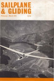
BRITISH SOARING YEARBOOK 1986-87.pdf - Lakes Gliding Club
BRITISH SOARING YEARBOOK 1986-87.pdf - Lakes Gliding Club
BRITISH SOARING YEARBOOK 1986-87.pdf - Lakes Gliding Club

Create successful ePaper yourself
Turn your PDF publications into a flip-book with our unique Google optimized e-Paper software.
UPPER HEYFORD RADAR ADVISORY SERVICE ZONE (RASZ)<br />
Although not listed as an AIAA, the Upper Heyford RASZ is similar. Again the proce<br />
dures are not mandatory for civil aircraft, but the Air Pilot contains the following advice:<br />
"Since it will obviously be in the interest of Flight Safety for Upper Heyford ATC to<br />
have knowledge of all aircraft flying in the RASZ, pilots of gliders and non-radio<br />
equipped aircraft intending to operate within the zone are advised when possible to<br />
telephone ATC on Upper Heyford (086982) 4843 before take off in order to make<br />
known their intentions. However, flights made in accordance with standing arrange<br />
ments are excluded from this procedure."<br />
A new Mandatory Radar Area is proposed to replace the RASZ in April <strong>1986</strong>.<br />
PROHIBITED AREAS<br />
Apart from certain security areas in Northern Ireland, the Prohibited Areas comprise the<br />
Atomic Energy Establishments at:<br />
Winfrith Calder/Wind scale (Sellafield)<br />
Aldermaston Capenhurst<br />
Harwell, Springfields and Dounreay are classed as "Restricted" in order to allow<br />
aircraft to land at adjacent major airfields, but for gliding purposes they should also be<br />
considered as "prohibited."<br />
They all have a radius of 2 NM and extend to between 2,000ft and 2,500ft AMSL. It<br />
is most inadvisable to place oneself in the position of having to land within a Prohibited<br />
Area.<br />
Short term Prohibited Areas may be established anywhere from time to time:<br />
information about these can be obtained from NOTAMS.<br />
DANGER AREAS<br />
The U.K. is covered with Danger Areas of many types, shapes and sizes. They are<br />
active part-time, permanently or when notified by NOTAM. Full details will be found in<br />
the Air Pilot, RAC Section; the Chart of U.K. Airspace Restrictions is also useful.<br />
Some glider pilots express the view that a Danger Area is not a Prohibited Area, so<br />
it would not be illegal to penetrate it. The following two points should be considered:<br />
The Air Pilot lists only the type of activity most likely to be encountered, but in<br />
practice various hazards may be encountered in one area simultaneously.<br />
Many Danger Areas contain areas over which flight is prohibited at times within the<br />
period of activity of the Danger Area by reason of bye-laws made under the Military<br />
Lands Act 1892 and associated legislation. Violations of Danger Areas by civil aircraft<br />
are causing concern to the authorities: Aeronautical Information Circular 69/1980<br />
explains that the act will be used to apply airspace restrictions to all Military Danger<br />
Areas where possible.<br />
It is also worth noting that the Air Pilot does not list Danger Areas with upper limits<br />
500ft or less above the local surface, to which prohibiting bye-laws may also apply.<br />
Glider pilots should therefore regard all Danger Areas as prohibited.<br />
HAZARDOUS AREAS<br />
Other types of hazard include Free Fall Parachute sites. The airspace is contained in a<br />
circle of 15 NM radius from the centre of the drop zone up to a maximum of Flight Level<br />
120.<br />
It may not be apparent to a glider pilot, observing the drop zone in flight, whether or<br />
not there is parachuting in progress: parachutists normally free-fall down to 2,000ft<br />
AGL and are extremely difficult to see. Beware!<br />
78